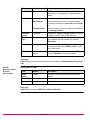
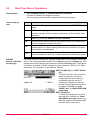
1
Leica GPS1200
Applications
Field Manual
Version 5.5
English
Introduction
Purchase
Congratulations on the purchase of a GPS1200 Series instrument.
)
To use the product in a permitted manner, please refer to the detailed safety directions in the User Manual.
Product
identification
Symbols
The type and the serial number of your product are indicated on the type plate.
Enter the type and serial number in your manual and always refer to this information
when you need to contact your agency or Leica Geosystems authorized service
workshop.
Type:
_____________________
Serial No.:
_____________________
The symbols used in this manual have the following meanings:
Type
)
Trademarks
Description
Important paragraphs which must be adhered to in practice as
they enable the product to be used in a technically correct and
efficient manner.
•
Windows and Windows CE are a registered trademark of Microsoft Corporation
•
CompactFlash and CF are trademarks of SanDisk Corporation
•
Bluetooth is a registered trademark of Bluetooth SIG, Inc
All other trademarks are the property of their respective owners.
Validity of this
manual
Available
documentation
2
•
This manual applies to all GPS1200 instruments. Differences between the
various models are marked and described.
•
The RX1200 is available as RX1210 or with touch screen functionality as
RX1210T, RX1250X, RX1250Xc, RX1250T or RX1250Tc. The name RX1210 is
used throughout the manual and may also represent the touch screen models.
Only use the supplied stylus on the screens of the touch screen models.
•
This manual covers standard real-time surveying applications. Refer to the
GPS1200 Technical Reference Manual for information about other functionality
available.
Name
Description
Format
User Manual
All instructions required in order to
operate the product to a basic level are
contained in the User Manual. Provides
an overview of the product together with
technical data and safety directions.
x
GPS1200
Introduction
x
Name
Description
System Field Manual
Describes the general working of the
product in standard use. Intended as a
quick reference field guide.
Format
-
x
Application Programs Describes specific onboard application
Field Manual
programs in standard use. Intended as a
quick reference field guide. The RoadRunner application program is described
in a separate manual.
x
x
Technical Reference
Manual
-
x
Overall comprehensive guide to the
product and program functions. Included
are detailed descriptions of special software/hardware settings and software/hardware functions intended for
technical specialists.
Refer to the following resources for all GPS1200 documentation and software:
• the SmartWorx DVD
•
Introduction
http://www.leica-geosystems.com/downloads
GPS1200
3
Table of Contents
In this manual
Chapter
1
Application Programs - Getting Started
1.1
1.2
2
3
4
5
7
Starting an Application Program
Configuration of a Logfile
7
10
COGO
11
2.1
2.2
2.3
2.4
Overview
Accessing COGO
Configuring COGO
COGO Calculation - Inverse Method
2.4.1
Inverse Point - Point
2.4.2
Inverse Point - Line
2.4.3
Inverse Point - Arc
2.4.4
Inverse Point - Current Position
2.5 COGO Calculation - Traverse Method
2.6 COGO Calculation - Intersections Method
2.7 COGO Calculation - Line/Arc Calculations Method
2.8 COGO Calculation - Shift, Rotate & Scale (Manual) Method
2.9 COGO Calculation - Shift, Rotate & Scale (Match Pts) Method
2.10 COGO Calculation - Area Division
11
12
13
15
16
17
20
23
25
29
33
39
44
46
Determine Coordinate System - General
53
3.1
3.2
53
55
55
Overview
Configuring Determine Coordinate System
3.2.1
Configuring Determine Coordinate System - Normal
3.2.2
Configuring Determine Coordinate System One Point Localisation
57
Determine Coordinate System - Normal
59
4.1
4.2
4.3
59
64
65
Determining a New/Updating a Coordinate System
Selecting/Editing a Pair of Matching Points
Transformation Results
Determine Coordinate System - One Point Localisation
67
5.1
5.2
67
68
68
5.3
5.4
4
Page
Accessing Determine Coordinate System - One Point Localisation
Determine Coordinate System - Onestep/Twostep Transformation
5.2.1
Determining a New Coordinate System
5.2.2
Computing the Grid Scale Factor for Twostep
Transformations
5.2.3
Computing the Height Scale Factor for Twostep
Transformations
Determine Coordinate System - Classic 3D Transformation
Computing Required Azimuth
GPS1200
74
75
76
77
Table of Contents
6
Reference Line
79
6.1
6.2
6.3
79
80
82
82
83
85
88
89
91
95
98
6.4
6.5
6.6
7
8
9
Overview
Configuring Reference Line
Managing Reference Lines/Arcs
6.3.1
Overview
6.3.2
Manually Entering a Reference Line/Arc
6.3.3
Selecting a Reference Line/Arc from the Job
6.3.4
Defining Reference Line/Arc Offsets
6.3.5
Defining Reference Line/Arc Slope
Measuring to a Reference Line/Arc
Staking to a Reference Line/Arc
Gridstaking to a Reference Line/Arc
Reference Plane
101
7.1
7.2
7.3
7.4
101
103
104
108
Overview
Configuring Reference Plane
Managing Reference Planes
Measuring Points to a Reference Plane
Stakeout
111
8.1
8.2
8.3
8.4
111
112
116
119
Overview
Configuring Stakeout
Staking Out
Stakeout Difference Limit Exceeded
Survey - General
121
9.1
9.2
9.3
9.4
9.5
121
123
126
127
129
Pre-Survey Preparations
Static Operations
Post-Processed Kinematic Operations
Real-Time Reference Operations
Real-Time Rover Operations
10 Survey - Auto Points
10.1 Overview
10.2 Configuring Auto Points
10.3 Auto Points for Post-Processed Kinematic and Real-Time Rover
Operations
10.4 Offset Points of Auto Points
10.4.1
Overview
10.4.2
Configuring Offset Points
11 Survey - Hidden Points
11.1 Overview
11.2 Measuring Hidden Points
11.3 Hidden Point Measurement Including Heights
12 Survey Cross Section
12.1
12.2
12.3
12.4
Table of Contents
Overview
Configuring Survey Cross Section
Surveying Cross Sections
Cross Section Templates
12.4.1
Accessing Cross Section Template Management
12.4.2
Creating/Editing a Cross Section Template
GPS1200
131
131
132
136
139
139
140
141
141
142
149
153
153
154
156
158
158
159
5
13 Volume Calculations
13.1
13.2
13.3
13.4
13.5
163
Overview
Configuring Volume Calculations
Survey Points
Triangulate Surfaces
Compute Volumes
163
164
165
167
170
14 Wake-Up
173
14.1 Overview
14.2 Creating a New Wake-Up Session/Editing a Wake-Up Session
Index
6
173
175
177
GPS1200
Table of Contents
1
1.1
Application Programs - Getting Started
Starting an Application Program
Access an application program stepby-step
Step
Description
1.
Press PROG. The PROG key opens the application programs menu
GPS1200 Programs.
2.
GPS1200 Programs
Select an option in the menu.
3.
)
)
XX Begin
CONT (F1) to access XX Begin.
Some application programs are protected. They are activated through a
specific licence key. This can either be typed in in Main Menu:
Tools...\Licence Keys or the first time the application program is started.
Four application programs can be open at one time. XX Begin is shown
for the application program opened first, but not for the following application programs.
SURVEY Survey Begin is shown as an example. Additional fields are available for
particular application programs. The first screen of Wake-Up Sessions differs from
XX Begin and is explained in the chapter on Wake-Up Sessions.
CONT (F1)
To accept changes and access the
subsequent screen.
CONF (F2)
To configure the application program.
CSYS (F6)
To select a different coordinate
system.
Description of fields
Field
Option
Description
<Control
Job:>
Choicelist
Available for Reference Line. The original points
to be staked and the reference lines/arcs are
stored in this job.
<Stakeout
Job:>
Choicelist
Available for Stakeout. The job containing the
points to be staked.
<Job:>
Choicelist
The active job.
For Stakeout and Reference Line: Points which
are occupied after staking out are stored in this
job. The original points to be staked are not
copied to this job.
Application Programs - Getting Started
GPS1200
7
Field
Option
Description
<Coord
System:>
Output
The coordinate system currently attached to the
selected <Job:>.
<Codelist:>
Choicelist
No codes are stored in the selected <Job:>. All
codelists from Main Menu:
Manage...\Codelists can be selected.
Output
Codes have already been stored in the selected
<Job.>.
Choicelist
Available for Stakeout if <Use DTM: DTM only>
and <Use DTM: DTM & Stake Job> in
STAKEOUT Configuration, Heights page.
<DTM Job:>
Available for Reference Line if <Heights: Use
DTM Model> in REFLINE Configuration,
Heights page.
To select a DTM to be staked and to select the
active DTM layer to be used. Heights are then
staked out relative to the selected DTM.
<Config
Set:>
Choicelist
The active configuration set.
<Antenna:>
Choicelist
The antenna currently defined to be used in the
selected configuration set.
Description of fields for Determine Coordinate System
Field
Option
Description
<Name:>
User input
A unique name for the coordinate system. The
name may be up to 16 characters in length and
may include spaces. Input is mandatory.
)
Entering the name of an existing coordinate system will allow that system to
be updated.
<WGS84 Pts Choicelist
Job:>
The job from which the points with WGS84 coordinates will be taken.
<Local Pts
Job:>
Choicelist
The job from which the points with local coordinates will be taken.
<Method:>
Choicelist
Method used to determine the coordinate
system.
Next step
IF the application THEN
program
is to be accessed
8
CONT (F1) accepts the changes and starts the application
program. Refer to the relevant chapters.
GPS1200
Application Programs - Getting Started
IF the application THEN
program
is to be configured
Application Programs - Getting Started
CONF (F2). Refer to the relevant chapters.
GPS1200
9
1.2
Configuration of a Logfile
Description
Access step-bystep
XX
Configuration,
Logfile page
A logfile is a summary of the calculations done while using an application program.
The logfile is written to the \DATA directory of the CompactFlash card or internal
memory if fitted. The creation of a logfile can be activated while configuring an application program.
Step
Description
1.
Refer to "1.1 Starting an Application Program" to access XX Begin.
2.
CONF (F2) to access XX Configuration.
3.
PAGE (F6) until the Logfile page is active.
Description of fields
Field
Option
Description
<Write
Logfile:>
Yes or No
To generate a logfile when the application
program is exited.
<File Name:> Choicelist
Available for <Write Logfile: Yes>. The name
of the file to which the data should be written.
<Format
File:>
Available for <Write Logfile: Yes>. A format file
defines which and how data is written to a
logfile. Format files are created using LGO.
Choicelist
Next step
PAGE (F6) changes to the first page on this screen.
10
GPS1200
Application Programs - Getting Started
2
2.1
COGO
Overview
Description
COGO is an application program to perform coordinate geometry calculations such
as
•
•
coordinates of points.
bearings between points.
•
distances between points.
The calculations can be made from
• existing point data in the job, known distances or known azimuths.
)
COGO calculation
methods
Distances and
azimuths
COGO
•
manually occupied points.
•
entered coordinates.
Changing coordinates of a point which has been previously used in COGO does not
result in the point being recomputed.
The COGO calculation methods are:
•
•
•
•
Inverse.
Traverse.
Intersections.
Line calculations.
•
•
•
•
Arc calculations.
Shift, Rotate & Scale (Manual)
Shift, Rotate & Scale (Match Pts)
Area Division
Type of distances: The choices are
• Ground
• Grid
• Ellipsoidal
Type of azimuths: The azimuths are grid azimuths relative to the local grid.
GPS1200
11
2.2
Accessing COGO
Access step-bystep
Step
Description
1.
Refer to "1.1 Starting an Application Program" to access COGO COGO
Menu.
2.
COGO COGO Menu
The COGO menu lists all COGO calculation methods and the option to
end COGO.
Highlight the COGO calculation method to be started.
3.
)
12
CONT (F1) to access the screen for the COGO calculation method.
The screens for each COGO calculation method can be accessed directly
by pressing a configured hot key or USER. The currently active configuration set and job are used.
GPS1200
COGO
2.3
Configuring COGO
Access
COGO
Configuration,
Parameters page
Step
Description
1.
Press PROG.
2.
Highlight COGO.
3.
CONT (F1)
4.
In COGO COGO Begin press CONF (F2) to access COGO Configuration.
The explanations for the softkeys given below are valid for all pages, unless otherwise stated.
CONT (F1)
To accept changes and return to the
screen from where this screen was
accessed.
SHIFT ABOUT (F5)
To display information about the
program name, the version number,
the date of the version, the copyright
and the article number.
Description of fields
Field
Option
<Distance
Type:>
Grid, Ground or The type of distances and offsets to be accepted
as input or shown as output, and used in the
Ellipsoid
calculation.
P1
Description
d1
P2
d2
a
d3
TPS12_170
COGO
a Ellipsoid
Known
P1 First known point
P2 Second known point
Unknown
d1 Ground distance
d2 Ellipsoid distance
d3 Grid distance
<Use
Offsets:>
Yes or No
Activates the use of offsets in the COGO calculations. Input fields for the offsets are available
in COGO XX.
<Store Pts
As:>
MEAS or CTRL
Defines the point class of COGO calculated and
stored points as MEAS or CTRL triplets.
<Est Pos
Qlty:>
User input
The estimated value for the position quality
assigned to all calculated COGO points which is
used for the averaging calculation.
GPS1200
13
Field
Option
Description
<Est Ht
Qlty:>
User input
The estimated value for the height quality
assigned to all calculated heights which is used
for the averaging calculation.
Output text
<TPS Obs TPS Obs
Intersection>
<Compute
Ht:>
COGO method for which only the following
configuration setting is valid.
Using Average, Defines the height being used within TPS Obs TPS Obs Intersection.
Use Upper
Height or Use
Lower Height
Next step
PAGE (F6) changes to the Residuals page.
COGO
Configuration,
Residuals page
This page applies to COGO Shift, Rotate & Scale (Match Pts).
Description of fields
Field
Option
Description
<Easting:>,
<Northing:>
or <Height:>
User input
The limit above which Easting/Northing/Height
residuals will be flagged as possible outliers.
<Residual
Distbtn:>
The method by which the residuals of the control
points will be distributed throughout the transformation area.
None
No distribution is made. Residuals remain with
their associated points.
1/DistanceXX
Distributes the residuals according to the
distance between each control point and the
newly transformed point.
Multiquadratic
Distributes the residuals using a multiquadratic
interpolation approach.
Next step
PAGE (F6) changes to the Logfile page. Refer to "1.2 Configuration of a Logfile".
)
14
<Azimuth:> is used throughout this chapter. This should always be considered to
also mean <Bearing:>.
GPS1200
COGO
2.4
Diagram
COGO Calculation - Inverse Method
Point - Point
P1
d
P0
GPS12_062
Known
P0 First known point
P1 Second known point
Unknown
α Direction from P0 to P1
d1 Slope distance between P0 and P1
d2 Horizontal distance between P0 and P1
d3 Height difference between P0 and P1
Point - Line
P1
P3
d1
d2
GPS12_119
P2
P0
Known
P0 Start point
P1 End point
P2 Offset point
Unknown
P3 Base point
d1 Offset-XX
d2 ΔLine-XX
Point - Arc
P1
P3
Known
P0 Start point
P1 End point
P2 Offset point
Unknown
P3 Base point
d1 Offset-XX
d2 ΔArcDist-XX
d1
P2
d2
GPS12_121
P0
Point - Current Position
P1
d
GPS12_062
P0
Known
P0 Current position
P1 Second known point
Unknown
α Direction from P0 to P1
d1 Slope distance between P0 and P1
d2 Horizontal distance between P0 and P1
d3 Height difference between P0 and P1
Access
Refer to "2.2 Accessing COGO" to access COGO Inverse.
COGO
GPS1200
15
2.4.1
Inverse Point - Point
COGO
Inverse Input,
Inverse page
The COGO calculation results are displayed on the same page.
----- is displayed for unavailable information, for example if a position only point is
used, <Δ Height:> cannot be calculated.
STORE (F1)
To store the result.
SURVY (F5)
To manually occupy a point for the
COGO calculation. Available if
<From:> or <To:> is highlighted.
SHIFT CONF (F2)
To configure the COGO application
program.
SHIFT QUIT (F6)
To not store the calculated results
and exits COGO calculation.
Description of fields
Field
Option
Description
<From:> or
<To:>
Choicelist
The point ID of the known points.
To type in coordinates for a known point
open the choicelist when <From:> or
<To:> is highlighted. Press NEW (F2) to
create a new point.
<Azimuth:>
Output
The direction from the first to the second known
point.
<HDist-XX:>
Output
The horizontal distance between the two known
points.
<Δ Height:>
Output
The height difference between the two known
points.
<Slope Dist:>
Output
The slope distance between the two known points.
<Grade:>
Output
The grade between the two known points.
<Δ Easting:>
Output
The difference in Easting between the two known
points.
<Δ Northing:> Output
)
The difference in Northing between the two known
points.
Next step
Step
16
Description
1.
PAGE (F6) changes to the Map page.
2.
STORE (F1) stores the result. For <Write Logfile: Yes> in COGO
Configuration, Logfile page the result is written to the logfile.
GPS1200
COGO
2.4.2
Inverse Point - Line
CALC (F1)
To calculate the inverse between
point and line.
INV (F2)
To calculate the values for the
azimuth, the distance and the offset
from two existing points. Available if
<Azimuth:> or <HDist-XX:> is highlighted.
LAST (F4)
To recall previous results from
COGO inverse calculations. Available if <Azimuth:> or <HDist-XX:> is
highlighted.
SURVY (F5)
To manually occupy a point for the
COGO calculation. Available if
<Start Point:>, <End Point:> or
<Offset Point:> is highlighted.
SHIFT CONF (F2)
To configure the COGO application
program.
SHIFT MODIF (F4)
To type in numbers for the multiplication, division, addition and subtraction with the original azimuth,
distance or offset value. The
standard rules of mathematical operations apply. Available if
<Azimuth:>, <HDist-XX:> or
<Offset:> is highlighted.
COGO
Inverse
Pt - Line Input,
Inverse page
Description of fields
Field
Option
<Method:>
COGO
Description
The method by which the line will be defined.
2 Points
Uses two known points to define the line.
Pt/Brg/Dist
Defines the line using a known point, a
distance and an azimuth of the line.
<Start Point:>
Choicelist
The start point of the line.
<End Point:>
Choicelist
The end point of the line. Available for
<Method: 2 Points>.
<Azimuth:>
User input
The azimuth of the line. Available for
<Method: Pt/Brg/Dist>.
GPS1200
17
Field
Option
Description
<HDist-Grid:>
User input
The horizontal distance from the start point to
the end point of the line. Available for
<Method: Pt/Brg/Dist>.
<Inverse to:>
The method by which the inverse will be
calculated.
Known Point
Uses two known points to define the line.
Current Position Defines the line using a known point, a
distance and an azimuth of the line.
<OffsetPoint:> Choicelist
The offset point. Available for <Inverse To:
Known Point>.
Next step
CALC (F1) calculates the result and accesses COGO Inverse Pt - Line Result.
COGO
Inverse
Pt - Line Result,
Result page
STORE (F1)
To store the result.
SURVY (F5)
To manually occupy a point for the
COGO calculation. Available if
<Start Point:>, <End Point:> or
<Offset Point:> is highlighted.
SHIFT CONF (F2)
To configure the COGO application
program.
SHIFT QUIT (F6)
To not store the calculated results
and exits COGO calculation.
Description of fields
18
Field
Option
Description
<Offset Point:>
Output
The offset point.
<ΔLine-Grid:>
Output
Horizontal distance from start point to base
point.
<ΔOffset-Grid:> Output
Offset from base point to offset point. Positive to
the right and negative to the left of the line.
<Offs Pt Brng:> Output
Bearing of offset point to base point.
<Line Length:>
Output
Length of line from first to second point.
<Line Brng:>
Output
Bearing of line from first to second point.
GPS1200
COGO
Next step
Step
COGO
Description
1.
PAGE (F6) changes to the Map page.
2.
STORE (F1) stores the result. For <Write Logfile: Yes> in COGO
Configuration, Logfile page the result is written to the logfile.
GPS1200
19
2.4.3
Inverse Point - Arc
STORE (F1)
To store the result.
SURVY (F5)
To manually occupy a point for the
COGO calculation. Available if
<From:> or <To:> is highlighted.
SHIFT CONF (F2)
To configure the COGO application
program.
SHIFT QUIT (F6)
To not store the calculated results
and exits COGO calculation.
COGO
Inverse
Pt - Arc Input,
Inverse page
Description of fields
Field
Option
<Method:>
Description
The method by which the arc will be
defined.
3 Points
Uses three known points to define the arc.
2 Points/Radius
Defines the arc using two known points
and a radius of the arc.
2 Tgnts/Radius
Defines the arc using two tangents and a
radius of the arc.
2 Tgnts/Arc Lngt Defines the arc using two tangents and
the length of the arc.
20
2 Tgnts/Chrd
Lngt
Defines the arc using two tangents and
the chord of the arc.
<Start Point:>
Choicelist
The start point of the arc.
<Second Point:>
Choicelist
The second point of the arc.
<End Point:>
Choicelist
The end point of the arc.
<Point 1:>
Choicelist
A point on the first tangent. Available for
<Method: 2 Tgnts/Radius>, <Method: 2
Tgnts/Arc Lngt> and <Method: 2
Tgnts/Chrd Lngt>.
<PI Point:>
Choicelist
The point of intersection of the two
tangents. Available for <Method: 2
Tgnts/Radius>, <Method: 2 Tgnts/Arc
Lngt> and <Method: 2 Tgnts/Chrd
Lngt>.
<Point 2:>
Choicelist
A point on the second tangent. Available
for <Method: 2 Tgnts/Radius>,
<Method: 2 Tgnts/Arc Lngt> and
<Method: 2 Tgnts/Chrd Lngt>.
GPS1200
COGO
Field
Option
Description
<Radius:>
User input
The radius of the arc. Available for
<Method: 2 Points/Radius>.
<Arc Length:>
User input
The length of the arc. Available for
<Method: 2 Tgnts/Arc Lngt>.
<Chord Length:> User input
The length of the chord. Available for
<Method: 2 Tgnts/Chrd Lngt>.
<Inverse to:>
Choicelist
<Inverse To: Known Point> or <Inverse
To: Current Position>.
<Offset Point:>
Choicelist
The offset point. Available for <Inverse
To: Known Point>.
Next step
CALC (F1) calculates the result and accesses COGO Inverse Pt - Arc Result.
COGO
Inverse
Pt - Arc Result,
Result page
STORE (F1)
To store the result.
COORD (F2)
To view other coordinate types.
SHIFT ELL H (F2)
To change between the ellipsoidal
and the orthometric height. Available
for local coordinates.
SHIFT QUIT (F6)
To not store the calculated results
and exits COGO calculation.
Description of fields
Field
COGO
Option
Description
<Offset Point:>
Output
The offset point.
<ΔArcDistGrid:>
Output
Horizontal distance along the arc from start point
to base point.
<ΔOffset-Grid:> Output
Offset from base point to offset point. Positive to
the right and negative to the left of the arc.
<Offs Pt Brng:> Output
Bearing of offset point from base point to offset
point.
<Arc Radius:>
Output
Computed radius of arc.
<Arc Length:>
Output
Computed length of arc.
GPS1200
21
Next step
Step
22
Description
1.
PAGE (F6) changes to the Plot page.
2.
STORE (F1) stores the result. For <Write Logfile: Yes> in COGO
Configuration, Logfile page the result is written to the logfile.
GPS1200
COGO
2.4.4
Inverse Point - Current Position
COGO
Inverse Pt Current Position,
Inverse page
The COGO calculation results are displayed on the same page.
----- is displayed for unavailable information, for example if a position only point is
used, <Δ Height:> cannot be calculated.
STORE (F1)
To store the result.
SURVY (F5)
To manually occupy a point for the
COGO calculation. Available if
<From:> or <To:> is highlighted.
REVRS (F3)
To change <From:> and <To:> for
the COGO calculation.
SHIFT CONF (F2)
To configure the COGO application
program.
SHIFT QUIT (F6)
To not store the calculated results
and exits COGO calculation.
Description of fields
COGO
Field
Option
Description
<From:> or
<To:>
Choicelist
The point ID of the known points.
To type in coordinates for a known
point open the choicelist when
<From:> or <To:> is highlighted.
Press NEW (F2) to create a new point.
<Azimuth:>
Output
The direction from the first to the second known
point.
<HDist-XX:>
Output
The horizontal distance between the two known
points.
<Δ Height:>
Output
The height difference between the two known
points.
<Slope Dist:>
Output
The slope distance between the two known
points.
<Grade:>
Output
The grade between the two known points.
<Δ Easting:>
Output
The difference in Easting between the known
point and the current position.
<Δ Northing:>
Output
The difference in Northing between the known
points.
GPS1200
)
23
Next step
Step
24
Description
1.
PAGE (F6) changes to the Map page.
2.
STORE (F1) stores the result. For <Write Logfile: Yes> in COGO
Configuration, Logfile page the result is written to the logfile.
GPS1200
COGO
2.5
COGO Calculation - Traverse Method
Diagrams
COGO traverse calculation with offset for a single point
P3
d3
P1
d2
P2
d1
P0
GPS12_106
Known
P0 Known point
α Direction from P0 to P1
d1 Distance between P0 and P1
d2 Positive offset to the right
d3 Negative offset to the left
Unknown
P1 COGO point without offset
P2 COGO point with positive offset
P3 COGO point with negative offset
COGO traverse calculation without offset for multiple points
d4
P1
d1
P0
GPS12_063
Access
d2
P2
d3
P3
Refer to "2.2 Accessing COGO" to access COGO Traverse Input.
COGO
Traverse Input,
Input page
COGO
P4
Known
P0 Known point
α1 Direction from P0 to P1
α2 Direction from P1 to P2
α3 Direction from P2 to P3
α4 Direction from P2 to P4
d1 Distance between P0 and P1
d2 Distance between P1 and P2
d3 Distance between P2 and P3
d4 Distance between P2 and P4
Unknown
P1 First COGO point
P2 Second COGO point
P3 Third COGO point - sideshot
P4 Fourth COGO point
CALC (F1)
To calculate the COGO point.
INV (F2)
To calculate the values for the
azimuth, the distance and the offset
from two existing points. Available if
<Azimuth:>, <HDist-XX:> or
<Offset:> is highlighted.
SSHOT (F3)
To calculate the point as a sideshot.
GPS1200
25
LAST (F4)
To recall previous results from
COGO inverse calculations. Available if <Azimuth:>, <HDist-XX:> or
<Offset:> is highlighted.
SURVY (F5)
To manually occupy a point for the
COGO calculation. Available if
<From:> or <Backsight:> is highlighted.
SHIFT CONF (F2)
To configure the COGO application
program.
SHIFT MODIF (F4)
To type in numbers for the multiplication, division, addition and subtraction with the original azimuth,
distance or offset value. The
standard rules of mathematical operations apply. Available if
<Azimuth:>, <Angle Right:>,
<HDist-XX:> or <Offset:> is highlighted.
Description of fields
26
Field
Option
Description
<Method:>
Azimuth or
Angle Right
The direction from the known point to the COGO
point.
<From:>
Choicelist
The point ID of the known point.
)
To type in coordinates for a known
point open the choicelist when
<From:> is highlighted. Press NEW
(F2) to create a new point.
<Backsight:> Choicelist
The point ID of a point used as backsight. Available for <Method: Angle Right>.
<Angle
Right:>
User input
The angle between <Backsight:> and the new
COGO point to be calculated from the point
selected as <From:>. A positive value is for
clockwise angles. A negative value is for counterclockwise angles. Available for <Method:
Angle Right>.
<Azimuth:>
Output
The direction from the known point to the COGO
point. For <Method: Angle Right> this is calculated from <Angle Right:>.
<HDist-XX:>
User input
The horizontal distance between the known
point and the COGO point.
GPS1200
COGO
Field
Option
Description
<Offset:>
User input
The offset of the COGO point from the line of
direction. A positive offset is to the right, a negative offset is to the left.
Next step
CALC (F1) calculates the result and accesses COGO Traverse Results.
COGO
Traverse Results,
Result page
The calculated coordinates are displayed.
STORE (F1)
To store the result and return to
COGO Traverse Input, Input page.
COORD (F2)
To view other coordinate types.
STAKE (F5)
To access the Stakeout application
program and stake out the calculated
COGO point.
SHIFT ELL H (F2) and SHIFT ORTH (F2)
To change between the ellipsoidal
and the orthometric height. Available
for local coordinates.
SHIFT INDIV (F5) and SHIFT RUN (F5)
To change between entering an individual point ID different to the defined
ID template and the running point ID
according to the ID template.
SHIFT QUIT (F6)
Does not store the COGO point and
exits COGO calculations.
Description of fields
Field
Option
Description
<Point ID:>
User input
The identifier for the COGO point. The configured point ID template is used. The ID can be
changed in the following way:
<Ortho Ht:>
or <Local Ell
Ht:>
COGO
User input
GPS1200
•
To start a new sequence of point ID’s type
over the point ID.
•
For an individual point ID independent of the
ID template SHIFT INDIV (F5). SHIFT RUN
(F5) changes back to the next free ID from
the configured ID template.
The height of the known point used in the COGO
calculation is suggested. A height value to be
stored with the calculated point can be typed in.
27
Next step
PAGE (F6) changes to the Code page.
COGO
Traverse Results,
Code page
The setting for <Thematc Codes:> in CONFIGURE Coding & Linework determines the availability of the fields and softkeys. They are identical to those of thematical coding with/without codelist. Refer to the GPS1200 Technical Reference Manual
for information on coding.
Next step
PAGE (F6) changes to the Plot page.
28
GPS1200
COGO
2.6
Diagrams
COGO Calculation - Intersections Method
Bearing - Bearing
P2
P0
P1
GPS12_064
Known
P0 First known point
P1 Second known point
α1 Direction from P0 to P2
α2 Direction from P1 to P2
Unknown
P2 COGO point
Bearing - Distance
P2
r
P1
P3
P0
GPS12_065
Known
P0 First known point
P1 Second known point
α Direction from P0 to P2
r Radius, as defined by the distance
from P1 to P2
Unknown
P2 First COGO point
P3 Second COGO point
Distance - Distance
r1
P2
P0
r2
P3
P1
GPS12_066
Known
P0 First known point
P1 Second known point
r1 Radius, as defined by the distance
from P0 to P2
r2 Radius, as defined by the distance
from P1 to P2
Unknown
P2 First COGO point
P3 Second COGO point
By Points
P1
P3
a
b
P4
P2
P0
GPS12_107
COGO
GPS1200
Known
P0 First known point
P1 Second known point
P2 Third known point
P3 Fourth known point
a Line from P0 to P1
b Line from P2 to P3
Unknown
P4 COGO point
29
TPS Observation - TPS Observation
P2
Known
P0 First known point (TPS Stn)
P1 Second known point (TPS Stn)
α1 Direction from P0 to P2
α2 Direction from P1 to P2
Unknown
P2 COGO point
P0
P1
GPS12_170
Access
Refer to "2.2 Accessing COGO" to access COGO Intersection Input.
COGO
Intersection Input,
Input page
The setting for <Method:> in this screen determines the availability of the subsequent fields and softkeys.
The softkeys are identical to those available for traverse COGO calculations. Refer
to "2.5 COGO Calculation - Traverse Method" for information on the softkeys.
Description of fields
Field
Option
Description
<Method:>
Choicelist
The type of intersection COGO calculation.
<1st Point:>, Choicelist
<2nd Point:>,
<3rd Point:>
or <4th
Point:>
The point ID of the known point. For <Method:
By Points>, these are the start and end points
of the lines.
To type in coordinates for a known
point open the choicelist when this
field is highlighted. Press NEW (F2) to
create a new point.
Choicelist
<1st TPS
Stn:> or <2nd
TPS Stn:>
The point ID of the known point. Only available
for <Method: TPS Obs- TPS Obs>.
<TPS
Measmnt:>
Choicelist
The point ID of the TPS measurement made
from the selected station for <1st TPS Stn:> or
<2st TPS Stn:>. Only available for <Method:
TPS Obs- TPS Obs>.
<Azimuth:>
User input
The direction from the first known point to the
COGO point. For <Method: Brng & Brng> and
<Method: Brng & Dist>. For <Method: TPS
Obs- TPS Obs> the option is an output field.
<Offset:>
User input
Input optional.
)
•
For <Method: Brng & Brng> and
<Method: Brng & Dist>:
The offset of the COGO point from the line
of direction. A positive offset is to the right, a
negative offset is to the left.
30
GPS1200
COGO
Field
Option
Description
•
For <Method: By Points>:
The offset of the line in the direction start
point to end point. A positive offset is to the
right. A negative offset is to the left.
<HDist-XX:>
User input
The horizontal distance between the known
point and the COGO point. Available for
<Method: Brng & Dist> and <Method: Dist &
Dist>.
Next step
CALC (F1) calculates the result and accesses COGO XX Results.
For <Method: Brng - Dist>, two results are calculated. They are displayed on the
Result1 page and the Result2 page. For simplicity, the title Result is used in the
following.
COGO
XX Results,
Result page
The calculated coordinates are displayed.
The majority of softkeys is identical to those available for traverse COGO calculations. Refer to "2.5 COGO Calculation - Traverse Method" for information on the
identical softkeys.
STORE (F1)
To store the result and return to
COGO Intersection Input, Input
page. For <Method: Brng - Dist>,
each result must be stored individually on the relevant page.
COORD (F2)
To view other coordinate types.
RSLT1 (F3) or RSLT2 (F3)
To view the first and second result.
Available for <Method: Brng - Dist>.
STAKE (F5)
To access the Stakeout application
program and stake out the calculated
COGO point.
SHIFT ELL H (F2) and SHIFT ORTH (F2)
To change between the ellipsoidal
and the orthometric height. Available
for local coordinates.
SHIFT INDIV (F5) and SHIFT RUN (F5)
To change between entering an individual point ID different to the defined
ID template and the running point ID
according to the ID template.
COGO
GPS1200
31
Description of fields
Field
Option
Description
<Point ID:>
User input
The identifier for the COGO point. The configured point ID template is used. The ID can be
changed in the following way:
<Ortho Ht:> or
<Local Ell Ht:>
User input
<Ht Computed:> Output
•
To start a new sequence of point ID’s type
over the point ID.
•
For an individual point ID independent of the
ID template SHIFT INDIV (F5). SHIFT RUN
(F5) changes back to the next free ID from
the configured ID template.
The height of the first point used in the COGO
calculation is suggested. A height value to be
stored with the calculated point can be typed in.
For <Method: TPS Obs- TPS Obs> the option
is an output field.
The height modus being used in the COGO
calculation.
Next step
PAGE (F6) changes to the Code page.
COGO
XX Results,
Code page
The setting for <Thematc Codes:> in CONFIGURE Coding & Linework determines the availability of the fields and softkeys. They are identical to those of thematical coding with/without codelist. Refer to the GPS1200 Technical Reference Manual
for information on coding.
Next step
PAGE (F6) changes to the Plot page.
32
GPS1200
COGO
2.7
COGO Calculation - Line/Arc Calculations Method
)
Diagrams
Line Calculation
The functionality of all screens and fields are similar for both the COGO line and
COGO arc calculations. For simplicity, both COGO calculation methods are
explained in this chapter. The screen names, field names and explanations for lines
are used. If required, additional information is given for COGO arc calculations.
Base Point
P2
Known
P0 <Start Point:>
P1 <End Point:>
P2 <Offset Point:>
Unknown
P3 Base point
d1 <Offset-XX:>
d2 <ΔLine-XX:>
P2
Known
P0 <Start Point:>
P1 <End Point:>
d1 <Offset-XX:>
d2 <ΔLine-XX:>
Unknown
P2 <Offset Point:>
P3 Base point
P1
P3
d1
d2
GPS12_119
P0
Offset Point
P1
P3
d1
d2
GPS12_119
P0
Segmentation
d
d
d
d
P0
P1
GPS12_144
d1
P0
P1
d
d1
d1
d2
P0
P1
GPS12_145
COGO
Line divided by <Method: No. of
Segments>
Line divided by <Method: Segment
Length>
P0
P1
d1
d2
GPS1200
<Start Point:>
<End Point:>
Equally spaced segments result
from dividing a line by a certain
number of points.
<Start Point:>
<End Point:>
<Seg Length:>
Remaining segment
33
Diagrams
Arc Calculation
Arc Center
d2
Known
P0 <Start Point:>
P1 <End Point:>
d1 <Arc Radius:>
Unknown
P2 Arc center
d2 <Arc Length:>
P1
d1
P0
P2
GPS12_158
Base Point
P1
P3
Known
P0 <Start Point:>
P1 <End Point:>
P2 <Offset Point:>
Unknown
P3 Base point
d1 <ΔOffset-XX:>
d2 <ΔArcDist-XX:>
d1
P2
d2
GPS12_121
P0
Offset Point
P1
P3
d1
P2
d2
GPS12_121
P0
Known
P0 <Start Point:>
P1 <End Point:>
d1 <ΔOffset-XX:>
d2 <ΔArcDist-XX:>
Unknown
P2 <Offset Point:>
P3 Base point
Access
Refer to "2.2 Accessing COGO" to access COGO Line Calculations Input.
COGO
Line Calculations
Input,
Input page
The setting for <Task:> and <Method:> in this screen determines the availability of
the subsequent fields.
The softkeys are identical to those available for traverse COGO calculations. Refer
to "2.5 COGO Calculation - Traverse Method" for information on the softkeys.
Description of fields
Field
Option
Description
<Task:>
Choicelist
The type of line/arc COGO calculation.
<Method:>
The method by which the line will be defined.
3 Points
34
GPS1200
Uses three known points to define the arc.
COGO
Field
Option
Description
2 Points/Radius Defines the arc using two known points and a
radius of the arc.
COGO
2 Tgnts/Radius
Defines the arc using two tangents and a radius
of the arc.
2 Tgnts/Arc
Lngt
Defines the arc using two tangents and the
length of the arc.
2 Tgnts/Chrd
Lngt
Defines the arc using two tangents and the
chord of the arc.
<Start
Point:>
Choicelist
The start point of the line/arc.
<Second
Point:>
Choicelist
The second point of the arc.
<End Point:> Choicelist
The end point of the line/arc. Available for
<Method: 2 Points>.
<Point 1:>
Choicelist
A point on the first tangent. Available for
<Method: 2 Tgnts/Radius>, <Method: 2
Tgnts/Arc Lngt> and <Method: 2 Tgnts/Chrd
Lngt>.
<PI Point:>
Choicelist
The point of intersection of the two tangents.
Available for <Method: 2 Tgnts/Radius>,
<Method: 2 Tgnts/Arc Lngt> and <Method: 2
Tgnts/Chrd Lngt>.
<Point 2:>
Choicelist
A point on the second tangent. Available for
<Method: 2 Tgnts/Radius>, <Method: 2
Tgnts/Arc Lngt> and <Method: 2 Tgnts/Chrd
Lngt>.
<Azimuth:>
User input
The azimuth of the line. Available <Method:
Pt/Brg/Dist>.
<HDist-XX:>
User input
The horizontal distance from the start point to
the end point of the line. Available for <Method:
Pt/Brg/Dist>.
<Radius:>
User input
The radius of the arc. Available for <Method: 2
Points/Radius>.
<Arc
Length:>
User input
The length of the arc. Available for <Method: 2
Tgnts/Arc Lngt>.
<Chord
Length:>
User input
The length of the chord. Available for <Method:
2 Tgnts/Chrd Lngt>.
<Offset
Point:>
Choicelist
The offset point. Available for <Task: Calc Base
Point>.
<ΔLine-XX:> User input
Horizontal distance from start point to base
point. Available for <Task: Calc Offset Point>.
GPS1200
35
Field
Option
Description
<ΔArcDistXX:>
User input
Horizontal distance along the arc from start point
to base point. Available for <Task: Calc Offset
Point>.
<Offset-XX:> User input
Offset from base point to offset point. Positive to
the right and negative to the left of the line. Available for <Task: Calc Offset Point>.
<ΔOffsetXX:>
Offset from base point to offset point. Positive to
the right and negative to the left of the arc. Available for <Task: Calc Offset Point>.
User input
Next step
IF
THEN
<Task: Calc Arc
Center>, <Task:
Calc Base Point>
or <Task: Calc
Offset Point>
CALC (F1) calculates the result. Refer to paragraph "COGO
XX Results, Result page".
<Task: Segmenta- CALC (F1) accesses COGO Define Segmentation. Refer to
tion>
paragraph "COGO Define Segmentation".
COGO
XX Results,
Result page
The calculated coordinates are displayed.
The softkeys are identical to those available for traverse COGO calculations. Refer
to "2.5 COGO Calculation - Traverse Method" for information on the softkeys.
Description of fields
Field
Option
Description
<Point ID:>
User input
The identifier for the COGO point. The configured point ID template is used. The ID can be
changed in the following way:
To start a new sequence of point ID’s type
over the point ID.
•
For an individual point ID independent of the
ID template SHIFT INDIV (F5). SHIFT RUN
(F5) changes back to the next free ID from
the configured ID template.
<Ortho Ht:>
or <Local Ell
Ht:>
User input
The height of the start point of the line/arc is
suggested. A height value to be stored with the
calculated point can be typed in.
<Offset
Point:>
Output
Point ID of offset point. Available for <Task:
Calc Base Point>.
<ΔLine-XX:> Output
36
•
Horizontal distance from start point to base
point. Available for <Task: Calc Base Point>.
GPS1200
COGO
Field
Option
Description
<ΔArcDistXX:>
Output
Horizontal distance along the arc from start point
to base point. Available for <Task: Calc Base
Point>.
<ΔOffsetXX:>
Output
Offset from base point to offset point. Positive to
the right and negative to the left of the line. Available for <Task: Calc Base Point>.
<Line
Length:>
Output
Length of line from start point to end point. Available for <Task: Calc Offset Point>.
<Line Brng:> Output
Bearing of line from start point to end point.
Available for <Task: Calc Offset Point>.
<Arc
Radius:>
Output
Computed radius of arc. Available for <Task:
Calc Arc Center> and <Task: Calc Offset
Point>.
<Arc
Length:>
Output
Computed length of arc. Available for <Task:
Calc Arc Center> and <Task: Calc Offset
Point>.
<Offs Pt
Brng:>
Output
Bearing of offset point from base point to offset
point. Available for <Task: Calc Offset Point>.
Next step
PAGE (F6) changes to the Code page.
COGO
XX Results,
Code page
The setting for <Thematc Codes:> in CONFIGURE Coding & Linework determines the availability of the fields and softkeys. They are identical to those of thematical coding with/without codelist. Refer to the GPS1200 Technical Reference Manual
for information on coding.
Next step
PAGE (F6) changes to the Plot page.
COGO
Define Segmentation
Description of fields
Field
Option
Description
<Method:>
COGO
How the line is to be divided. Refer to paragraph
"Diagrams Line Calculation".
Delta Angle
To divide the arc by an angular value.
<Line
Length:>
Output
Calculated line length between the selected
<Start Point:> and <End Point:>.
<Arc
Length:>
Output
Computed length of arc.
<No. of
Segs:>
User input or
output
The number of segments for the line.
<Seg
Length:>
User input or
output
The calculated length of each segment or the
required segment length.
GPS1200
37
Field
Option
Description
<Last Seg
Lgth:>
Output
Available for <Method: Segment Length>. The
length of the remaining segment.
<Delta
Angle:>
User input
The angular value by which new points will be
defined on the arc.
<Start PtID:> User input
The point ID to be assigned to the first new point
on the line.
<PtID Inc:>
<Start PtID:> is incremented numerically for the
second, third, etc. point on the line.
User input
Next step
CALC (F1) to access COGO Segmentation Results.
COGO
Segmentation
Results
The coordinates of the new points are calculated. The heights are computed along
the line assuming a linear slope between <Start Point:> and <End Point:>.
Field
Option
Description
<Number of
Segments:>
Output
Describes the number of resulting segments for
the line including the remaining segment, if it
applies.
<Last
Segment
Lgth:>
Output
Available for <Method: Segment Length>. The
length of the remaining segment.
Next step
PAGE (F6) changes to the Plot page.
38
GPS1200
COGO
2.8
COGO Calculation - Shift, Rotate & Scale (Manual) Method
Description
The COGO calculation shift, rotate & scale (manual) applies shifts and/or rotation
and/or scale to one or several known points. The values for shifts and/or rotation
and/or scale are typed in manually.
Diagrams
a
P1’
P2’
b
P1
P2
GPS12_155
Shift
a
b
P1-P2
P1’-P2’
Height
Easting
Known point
Shifted point
a
P0
b
P1’
P2’
P1
P2
GPS12_156
Rotation
a
Height
b
Easting
P0
<Rotation Pt:>
P1-P2 Known point
P1’-P2’ Rotated point
a
P4’
P5’
P5
P4
b
P2
P2’
P1
P3
P3’
GPS12_157
Access
COGO
Scale
a
b
P1
Height
Easting
<Rotation Pt:>, can be held
fixed, all other points are then
scaled from here
P2-P5 Known point
P2’-P5’ Scaled point
Refer to "2.2 Accessing COGO" to access COGO Shift, Rotate & Scale.
GPS1200
39
COGO
Shift, Rotate &
Scale,
Points page
Listed are points which have been selected for shifting, rotating and/or scaling.
CALC (F1)
To perform the shift, rotation and
scale calculation and to continue with
the subsequent screen. Calculated
COGO points are not yet stored.
ADD (F2)
To add all points from the active job
to the list. Selected sort and filter
settings apply.
ADD 1 (F3)
To add one point from the active job
to the list. Selected sort and filter
settings apply.
REMOV (F4)
To remove the highlighted point from
the list. The point itself is not deleted.
MORE (F5)
To display information about the
codes if stored with any point, the
time and the date of when the point
was stored and the 3D coordinate
quality and the class.
SHIFT REM A (F4)
To remove all points from the list.
The points itself are not deleted.
SHIFT RANGE (F5)
To define a range of points from the
active job to be added to the list.
Next step
PAGE (F1) accesses COGO Shift, Rotate & Scale, Shift page.
COGO
Shift, Rotate &
Scale,
Shift page
The setting for <Method:> in this screen determines the availability of the subsequent fields.
The softkeys are identical to those available for traverse COGO calculations. Refer
to "2.5 COGO Calculation - Traverse Method" for information on the softkeys.
Description of fields
40
Field
Option
Description
<Method:>
Choicelist
The method by which the shift in Δ Easting,
Δ Northing and Δ Height will be determined.
<From:>
Choicelist
Available for <Method: Use 2 Points>. The
point ID of the first known point for calculating
the shift.
GPS1200
COGO
Field
Option
Description
<To:>
Choicelist
Available for <Method: Use 2 Points>. The
point ID of the second known point for calculating the shift.
<Azimuth:>
User input
Available for <Method: Enter Bng,Dst,Ht>.
The azimuth defines the direction of the shift.
<HDist-XX:>
User input
Available for <Method: Enter Bng,Dst,Ht>.
The amount of shift from the original point to the
calculated COGO points.
<Δ Easting:> User input or
output
The amount of shift in East direction.
<Δ Northing: User input or
>
output
The amount of shift in North direction.
<Δ Height:>
The amount of shift in height.
User input or
output
Next step
PAGE (F6) accesses COGO Shift, Rotate & Scale, Rotate page.
COGO
Shift, Rotate &
Scale,
Rotate page
The softkeys are identical to those available for traverse COGO calculations. Refer
to "2.5 COGO Calculation - Traverse Method" for information on the softkeys.
Description of fields
Field
Option
Description
<Method:>
Choicelist
The method by which the rotation angle will be
determined.
<Rotation
Pt:>
Choicelist
The point around which all points will be rotated.
<Existing
Az:>
User input
Available for <Method: Computed>. A known
direction before rotating.
<New
Azimuth:>
User input
Available for <Method: Computed>. A known
direction after rotating.
<Rotation:>
User input or
output
The amount by which the points will be rotated.
Next step
PAGE (F6) accesses COGO Shift, Rotate & Scale, Scale page.
COGO
GPS1200
41
COGO
Shift, Rotate &
Scale,
Scale page
The softkeys are identical to those available for traverse COGO calculations. Refer
to "2.5 COGO Calculation - Traverse Method" for information on the softkeys.
Description of fields
Field
Option
Description
<Method:>
Choicelist
The method by which the scale factor will be
determined.
<Existing
Dist:>
User input
Available for <Method: Computed>. A known
distance before scaling. This value is used for
calculating the scale factor.
<New Dist:>
User input
Available for <Method: Computed>. A known
distance after scaling. This value is used for
calculating the scale factor.
<Scale:>
User input or
output
The scale factor used in the calculation.
<Scale From No
Pt:>
Scaling is performed by multiplying the original
coordinates of the points by <Scale:>.
Yes
<Scale:> is applied to the coordinate difference
of all points relative to <Rotation Pt:> selected
on the Rotation page. The coordinates of
<Rotation Pt:> will not change.
Next step
CALC (F1) performs the shift, rotation and scale calculation and accesses COGO
Shift, Rotate & Scale Store.
COGO
Shift, Rotate &
Scale Store,
General page
42
Description of fields
Field
Option
Description
<Pts
Selected:>
Output
The number of selected points having been
shifted, rotated and/or scaled.
<Store Job:> Choicelist
The calculated COGO points will be stored in
this job. The original points are not copied to this
job.
<Add Identifier:>
Yes or No
Activates the use of additional identifiers for the
point ID’s of the calculated COGO points.
<Identifier:>
User input
The identifier with up to four characters is added
in front of or at the end of the ID of the calculated
COGO points.
<Prefix/Suffi
x:>
Prefix
Adds the setting for <Identifier:> in front of the
original point ID’s.
Suffix
Adds the setting for <Identifier:> at the end of
the original point ID’s.
GPS1200
COGO
Next step
STORE (F1) accesses COGO Shift, Rotate & Scale Results, Result page.
COGO
Shift, Rotate &
Scale Results
Result page
Description of fields
Field
Option
Description
<No. of New
Pts:>
Output
Number of new points created.
<No. of
Output
Skipped Pts>
Number of points which were skipped either due
to not being able to convert coordinates or
points with identical point ID’s already existed in
<Store Job:>.
Next step
CONT (F1) returns to COGO Shift, Rotate & Scale.
COGO
GPS1200
43
2.9
COGO Calculation - Shift, Rotate & Scale (Match Pts) Method
Description
The COGO calculation shift, rotate & scale (match pts) applies shifts and/or rotation
and/or scale to one or several known points. The shifts and/or rotation and/or scale
are calculated from selected points using a 2D Helmert tranformation.
The number of pairs of points matched determines whether the shift, rotation and
scale values are computed.
Access
Refer to "2.2 Accessing COGO" to access COGO Match Common Points (n).
COGO
Match Common
Points (n)
This screen provides a list of points chosen from the active job. The points are used
for the determination of the 2D Helmert transformation. Unless there is no pair of
matching points in the list all softkeys are available.
CALC (F1)
To confirm the selections, compute
the transformation and continue with
the subsequent screen.
NEW (F2)
To match a new pair of points. This
pair is added to the list. A new point
can be manually occupied. Refer to
paragraph "Match points step-bystep".
EDIT (F3)
To edit the highlighted pair of
matched points.
DEL (F4)
To delete the highlighted pair of
matched points from the list.
MATCH (F5)
To change the type of match for a
highlighted pair of matched points.
RESID (F6)
To display a list of the matched
points used in the transformation
calculation and their associated
residuals.
SHIFT PARAM (F5)
To define the parameters to be used
in the 2D transformation. Refer to
paragraph "Fix parameters".
Description of columns
44
Column
Description
Source Pt
The point ID of the points of origin for the calculation of the shifts
and/or rotation and/or scale.
Target Pt
The point ID of the target points for the calculation of the shifts
and/or rotation and/or scale.
GPS1200
COGO
Column
Description
Match
The type of match to be made between the points. This information
is used in the transformation calculation. Position & Height, Position only, Height only or None.
None removes matched common points from the transformation
calculation but does not delete them from the list. This can be used
to help improve residuals.
Next step
CALC (F1). The calculated shift, rotation and scale values are displayed in COGO
Shift, Rotate & Scale. They cannot be edited. The remaining functionality of the
calculation is very similar to COGO calculation shift, rotate & scale (manual). Refer
to "2.8 COGO Calculation - Shift, Rotate & Scale (Manual) Method".
Match points stepby-step
Matching new points and editing matched points is very similar.
Step
1.
Description
Refer to "2.2 Accessing COGO" to access COGO Match Common
Points.
2.
NEW (F2) or EDIT (F3)
3.
COGO Choose Matching Points or COGO Edit Matching Points
<Source Pt:> A point of origin for the calculation of the shifts and/or rotation and/or scale.
<Target Pt:> A target point for the calculation of the shifts and/or rotation
and/or scale.
<Match Type:> The type of match to be made between the points
selected in <Source Pt:> and <Target Pt:>. Position & Height, Position
Only, Height Only or None.
)
4.
Fix parameters
Select the points to be matched.
SURVY (F5). To manually occupy a point and store it in the active job.
CONT (F1) returns to COGO Match Common Points (n) and adds a new
pair of matched points to the matched points list.
The values for fixing the shifts, the rotation and the scale are displayed.
Next step
IF
AND
a field displays
-----
the parameter needs to be highlight the field. Enter the value
fixed to a value
of the parameter. FIX (F4).
a field displays a
value
the parameter needs to be highlight the field. ADJST (F4).
calculated
all parameters are configured
COGO
THEN
CONT (F1) to return to COGO
Match Common Points (n).
GPS1200
45
2.10
Diagrams
COGO Calculation - Area Division
Area division method <Divide:>
<Using:>
<Shift:>
1.
By Defined Line
Parallel Line
By Distance
2.
By Percentage
Parallel Line
-
3.
By Area
Parallel Line
-
P0
P3
P1
P1
d
P2
P3
P2
d
P0
GPS12_160
Area division method <Divide:>
<Using:>
<Shift:>
1.
By Defined Line
Perpendic Line
By Distance
2.
By Percentage
Perpendic Line
-
3.
By Area
Perpendic Line
-
P0
P2
P1
P1
P2
P3
P3
d
GPS12_161
46
<Point A:> of
defined line
<Point B:> of
defined line
First new COGO
point
Second new COGO
point
<HDist-XX:>
P0
GPS1200
d
<Point A:> of
defined line
<Point B:> of
defined line
First new COGO
point
Second new COGO
point
<HDist-XX:>
COGO
Area division method <Divide:>
1.
By Defined Line
<Using:>
<Shift:>
Parallel Line
Through Point
P0
P1
P2
P1
d
P3
P3
d
P0
GPS12_164
Area division method <Divide:>
1.
P2
By Defined Line
<Using:>
<Shift:>
Perpendic Line
Through Point
P0
P1
P2
P1
P2
P3
GPS12_165
P0
P3
d
d
Area division method <Divide:>
<Point A:> of
defined line
<Point B:> of
defined line
<Through Point:>;
in this case it is a
known point of the
existing border
New COGO point
<HDist-XX:>
<Point A:> of
defined line
<Point B:> of
defined line
<Through Point:>;
in this case it is a
known point of the
existing border
New COGO point
<HDist-XX:>
<Using:>
<Shift:>
1.
By Percentage
Swing Line
-
2.
By Area
Swing Line
P0
P1
P1
P0
P2
P2
α
First new COGO point
Second new COGO
point
<Rotation Pnt:>
<Azimuth:>
GPS12_163
Access
COGO
Refer to "2.2 Accessing COGO" to access COGO Choose Area to be Divided.
GPS1200
47
COGO
Choose Area to be
Divided
Description of fields
Field
Option
Description
<Area to
Use:>
Select Existing
To use an area from the <Job:> selected in
COGO COGO Begin. The area can be edited
and a new area can be created from points
existing in the <Job:>.
Survey New
Area
To survey points that do not exist in the job yet.
The points will be added to a new area.
<Area ID:>
Choicelist or
user input
To select the area to be divided or to enter a
name for the new area.
<No. of
Points:>
Output
Number of points forming the area.
<Area:>
Output
The size of the selected area.
<Perimeter:> Output
The perimeter of the area.
Next step
IF
THEN
<Area to Use:
Select Existing>
CONT (F1) accesses COGO Define How to Divide Area.
Refer to paragraph "COGO Define How to Divide Area, Input
page".
<Area to Use:
CONT (F1) accesses COGO Survey: Job Name. Points to be
Survey New Area> added to the new area can be surveyed.
COGO Survey: Job Name
• To stop surveying the area and to store the area:
DONE (F4) and then STORE (F1).
•
To return to COGO Choose Area to be Divided:
ESC.
COGO
Define How to
Divide Area,
Input page
48
CALC (F1)
To perform the area division and to
continue with the subsequent
screen. Calculated COGO points are
not yet stored.
INV (F2)
To calculate the value for the
distance from two existing points.
Available if <HDist-XX:> is highlighted.
SIZE (F3) and PERC (F3)
To display the size and the
percentage of the sub-area.
GPS1200
COGO
LAST (F4)
To select the value for the distance
from previous COGO inverse calculations. Available if <HDist-XX:> is
highlighted.
SURVY (F5)
To manually occupy a point for the
COGO calculation. Available if
<Point A:>, <Point B:>, <Rotation
Pnt:> or <Through Point:> is highlighted.
SHIFT CONF (F2)
To configure the COGO application
program.
Description of fields
Field
Option
Description
<Divide By:> Choicelist
This field defines how the size of the sub area is
defined.
<Using:>
Parallel Line
The border will be parallel to a line defined by
<Point A:> and <Point B:>.
Perpendic Line
The border will be perpendicular to a line
defined by <Point A:> and <Point B:>.
Swing Line
The border will be a line rotated around <Rotation Pnt:> by <Azimuth:>.
User input
For <Divide By: Percentage> and <Divide By:
Area>. The size of the sub area must be typed
either in % or in m2.
<Sub-AreaXX:>
When dividing the area using a parallel or
perpendicular line, a reference line is defined by
<Point A:> and <Point B:>. The direction of the
new dividing line is always the same as the
direction of the reference line. The sub area is
always to the left of the new dividing line.
When dividing an area using a swing line, the
direction of the new dividing line is defined by
the <Rotation Pnt:> and the <Azimuth:>. The
sub area is always to the left of the new dividing
line.
<Point A:>
COGO
Output
For <Divide By: Defined Line>. The size of the
sub area is calculated and displayed.
Choicelist
The first point of the line which is used as the
reference for a new parallel or perpendicular
border.
GPS1200
49
Field
Option
Description
<Point B:>
Choicelist
The second point of the line which is used as the
reference for a new parallel or perpendicular
border.
<Shift:>
Available for <Divide By: Defined Line>.
By Distance
The new border will run in a certain distance
from the line defined by <Point A:> and <Point
B:>.
Through Point
The new border will run through a point defined
in <Through Point:>.
<Through
Point:>
Choicelist
Available for <Shift: Through Point>. The point
through which the new border will run.
<Rotation
Pnt:>
Choicelist
Available for <Using: Swing Line>. The point
around which the new border will rotate by
<Azimuth:>.
<Azimuth:>
Output
Available for <Using: Swing Line>. The angle
of the new border from <Rotation Pnt:> to the
new COGO point.
<HDist-XX:>
User input or
output
The distance from the line defined by <Point
A:> and <Point B:> to the new border.
Next step
CALC (F1) performs the area division and accesses COGO Results of Area Division.
COGO
Results of Area
Division,
Result page
Description of fields
Field
Option
Description
<Area
Ratio:>
Output
The ratio of the size of the two sub areas in
percent.
<Area 1-XX:> Output
The size of the first sub area in m2.
<Area 2-XX:> Output
The size of the second sub area in m2.
Next step
CONT (F1) accesses COGO Area Division Results.
50
GPS1200
COGO
COGO
Area Division
Results,
ResultX page
The coordinates of the intersection points of the new border with the original area
are displayed.
STORE (F1)
To store the two results and to return
to COGO Choose Area to be
Divided once both points are stored.
COORD (F2)
To view other coordinate types.
RSLT1 (F3) or RSLT2 (F3)
To view the first and second result.
STAKE (F5)
To stake out the calculated COGO
point.
SHIFT ELL H (F2) and SHIFT ORTH
(F2)
To change between the ellipsoidal
and the orthometric height.
SHIFT INDIV (F5) and SHIFT RUN (F5)
To change between entering an individual point ID different to the defined
ID template and the running point ID
according to the ID template.
Next step
STORE (F1) stores the results and accesses COGO Choose Area to be Divided.
For <Write Logfile: Yes> in COGO Configuration, Logfile page the result is
written to the logfile.
COGO
GPS1200
51
52
GPS1200
COGO
3
3.1
Determine Coordinate System - General
Overview
Description
GPS measured points are always stored based on the global geocentric datum
known as WGS 1984. To convert the WGS 1984 coordinates into local coordinates
a coordinate system needs to be created. Part of the coordinate system is the transformation used to convert coordinates from the WGS 1984 datum to the local datum.
The Determine Coordinate System application program allows:
• the parameters of a new transformation to be determined.
•
the parameters of an existing transformation to be recomputed.
Requirements to
determine a transformation
To determine a transformation it is necessary to have common control points whose
positions are known in both WGS 1984 coordinates and local coordinates. The more
points that are common between datums the more accurately the transformation
parameters can be calculated. Depending on the type of transformation used, details
about the map projection, the local ellipsoid and a local geoidal model may also be
needed.
Requirements for
control points
•
The control points used for the transformation should surround the area for
which the transformation is to be applied. It is not good practice to survey or
convert coordinates outside of the area covered by the control points as extrapolation errors may be introduced.
•
When a geoid field file and/or a CSCS field file is used in the determination of a
coordinate system, the control points for the calculation must fall within the areas
of the field files.
)
Coordinate system
determination
methods
With one common control point, it is possible to calculate a Classic 3D transformation, as long as the rotations and the scale parameter are fixed. Such a transformation fits perfectly in the vicinity of the common control point, but is degraded by the
distance from that point.
Two different methods for determining a coordinate system are available:
Coordinate system
determination method
Characteristic
Description
Normal
Number of control points
needed
One or more control points
for both the WGS 1984
and the local datum.
Transformation to use
Onestep, Twostep or
Classic 3D, depending on
number of control points
and available information.
Number of control points
needed
One control point for both
the WGS 1984 and the
local datum.
One point localisation
Determine Coordinate System - General
GPS1200
53
Coordinate system
determination method
54
Characteristic
Description
Transformation to use
•
Onestep or Twostep
when information
about the necessary
rotations and scale
factor is known.
•
Classic 3D when the
rotations are to be set
to zero and the scale
factor to one.
GPS1200
Determine Coordinate System - General
3.2
Configuring Determine Coordinate System
3.2.1
Configuring Determine Coordinate System - Normal
Access step-bystep
DET C SYS
Configuration,
Method page
Step
Description
1.
Press PROG.
2.
Highlight Determine Coordinate System.
3.
CONT (F1)
4.
CONF (F2) to access DET C SYS Configuration.
5.
In DET C SYS Configuration, Method page select <Default Method:
Normal>.
The explanations for the softkeys given below are valid for all pages, unless otherwise stated.
CONT (F1)
To accept changes and return to the
screen from where this screen was
accessed.
FIX (F4) or ADJST (F4)
Available for Classic 3D page unless
<Transf Model:> is highlighted. To
define which parameters are
computed or fixed in the Classic 3D
transformation.
Description of fields
Field
Option
Description
<Default
Method:>
Normal or One
Pt Localistn
Method used to determine the coordinate
system.
<Default
Transformation:>
Onestep,
Twostep or
Classic 3D
The default transformation to be used when
determining the coordinate system.
<Default
Height
Mode:>
Orthometric or
Ellipsoidal
The default height type to be used when determining the coordinate system.
<Default
Match:>
Pos & Height,
Pos Only,
Height Only or
<None>
Options available depend on the choice made
for <Default Transformation:>. Point parameters to be matched between points in both
datums.
Next step
PAGE (F6) changes to the Residuals page.
Determine Coordinate System - General
GPS1200
55
DET C SYS
Configuration,
Residuals page
Description of fields
Field
Option
Description
<Easting:>
User input
The limit above which Easting residuals will be
flagged as possible outliers.
<Northing:>
User input
The limit above which Northing residuals will be
flagged as possible outliers.
<Height:>
User input
The limit above which Height residuals will be
flagged as possible outliers.
<Default
Residual
Distbtn:>
None,
1/DistanceXX or
Multiquadratic
The method by which the residuals of control
points will be distributed throughout the transformation area.
Next step
PAGE (F6) changes to the Classic 3D page.
DET C SYS
Configuration,
Classic 3D page
The settings on this page define the parameters to be used in a Classic 3D transformation.
IF the value for a
field is
THEN the value for this parameter will be
-----
calculated.
any number
fixed to that value.
Next step
CONT (F1) returns to DET C SYS Determine Coord System Begin.
56
GPS1200
Determine Coordinate System - General
3.2.2
Configuring Determine Coordinate System - One Point Localisation
Access step-bystep
DET C SYS
Configuration,
Method page
Step
Description
1.
Press PROG.
2.
Highlight Determine Coordinate System.
3.
CONT (F1)
4.
CONF (F2) to access DET C SYS Configuration.
5.
In DET C SYS Configuration, Method page select <Default Method:
One Pt Localistn>.
The softkeys are identical to those available for <Default Method: Normal>. Refer
to "3.2.1 Configuring Determine Coordinate System - Normal" for information on
softkeys.
Description of fields
Field
Option
Description
<Default
Method:>
Normal or One
Pt Localistn
Method used to determine the coordinate
system.
<Default
Transformation:>
Onestep,
Twostep or
Classic 3D
The default transformation to be used when
determining the coordinate system.
<Default
Height
Mode:>
Orthometric or
Ellipsoidal
The default height mode to be used when determining the coordinate system.
Next step
PAGE (F6) changes to the Onestep page.
DET C SYS
Configuration,
Onestep page
Description of fields
Field
Option
Description
<Default
Rotation:>
Use WGS84
North
Rotate to North as defined by WGS 1984.
User Entered
Rotation can be manually typed in.
Convergnce
Angle
Angle between grid North and geodetic North at
a certain point.
Two WGS84
Points
Rotation defined by two points on the
WGS 1984 datum.
User Entered
Height scale factor can be manually typed in.
Known WGS84
Pt
Height scale factor defined by a known point on
the WGS 1984 datum.
<Default
Height SF:>
Determine Coordinate System - General
GPS1200
57
Field
Option
Description
Known WGS84
Ht
Height scale factor defined by the known height
of a point on the WGS 1984 datum.
Next step
PAGE (F6) changes to the Twostep page.
DET C SYS
Configuration,
Twostep page
Some fields are identical to those on the Onestep page. Additional fields are
explained here.
Description of fields
Field
Option
Description
<Default
Scale:>
User Entered
Scale factor can be manually typed in.
Compute CSF
Compute the combined grid and height scale
factor.
<Deflt Grid
SF:>
User Entered or Available for <Default Scale: Compute CFS>.
Known Local Pt Default method for computing the grid scale
factor of the known point.
Next step
PAGE (F6) changes to the Classic 3D page.
DET C SYS
Configuration,
Classic 3D page
Description of fields
Field
Option
Description
<Default
Local
Height:>
Use WGS84 Pt
Ht or Use Local
Pt Ht
The source of the height information to use in
the transformation.
Next step
CONT (F1) returns to DET C SYS Determine Coord System Begin.
58
GPS1200
Determine Coordinate System - General
4
4.1
Determine Coordinate System - Normal
Determining a New/Updating a Coordinate System
Access step-bystep
)
DET C SYS
Step 1: Choose
Transform Type
Step
Description
1.
Press PROG.
2.
Highlight Determine Coordinate System.
3.
CONT (F1).
4.
In DET C SYS Determine Coord System Begin, select <Method:
Normal>.
5.
CONT (F1) to access DET C SYS Step 1: Choose Transform Type.
If a coordinate system was chosen to be edited in DET C SYS Determine Coord
System Begin, pressing CONT (F1) accesses DET C SYS Step 3: Match Points
(n).
Description of fields
Field
Option
Description
<Transfrm
Name:>
User input
A unique name for the coordinate system. If a
coordinate system is being updated then its
name is displayed.
<Transfrm
Type:>
Onestep,
Twostep or
Classic 3D
Available when determining a new coordinate
system.
Output
Available when updating a coordinate system.
The transformation type shown is the same as
the transformation used in the existing system.
Orthometric or
Ellipsoidal
Available when determining a new coordinate
system.
Output
Available when updating a coordinate system.
The height type shown is the same as the mode
used in the existing system.
<Height
Mode:>
Next step
CONT (F1) continues to DET C SYS Step 2: Choose Parameters.
Determine Coordinate System - Normal
GPS1200
59
DET C SYS
Step 2: Choose
Parameters
This screen contains different fields, depending on what transformation type was
chosen in DET C SYS Step 1: Choose Transform Type.
Description of fields
Field
Option
Description
<Geoid
Model:>
Choicelist
The geoid model to be used in the transformation. Geoid models from MANAGE Geoid
Models can be selected.
<Pre Transform:>
Choicelist
The pre-transformation to use for the preliminary 3D transformation.
<Ellipsoid:>
Choicelist
The ellipsoid to use in the transformation.
Output
The ellipsoid being used by a fixed projection
when selected in <Projection:>.
<Projection:>
Choicelist
The projection to use in the transformation.
<CSCS
Model:>
Choicelist
The CSCS model to use in the transformation.
Next step
CONT (F1) continues to DET C SYS Step 3: Match Points (n).
DET C SYS
Step 3: Match
Points (n)
This screen provides a list of points chosen from <WGS84 Pts Job:> and <Local
Pts Job:>. The number of control points matched between both jobs is indicated in
the title, for example DET C SYS Step 3: Match Points (4). Unless there is no pair
of matching points in the list all softkeys are available.
CALC (F1)
To confirm the selections, compute
the transformation and continue with
the subsequent screen.
NEW (F2)
To match a new pair of points. This
pair is added to the list. A new point
can be manually occupied.
EDIT (F3)
To edit the highlighted pair of
matched points.
DEL (F4)
To delete the highlighted pair of
matched points from the list.
MATCH (F5)
To change the type of match for a
highlighted pair of matched points.
60
GPS1200
Determine Coordinate System - Normal
AUTO (F6)
To scan both jobs for points that
have the same point ID. Points with
matching point ID’s are added to the
list.
SHIFT PARAM (F5)
To configure Classic 3D transformation parameters. Available for
<Transfrm Type: Classic 3D> in
DET C SYS Step 1: Choose Transform Type.
Description of columns
Column
Description
WGS84 Pts
The point ID of the points chosen from <WGS84 Pts Job:>.
Local Pts
The point ID of the points chosen from <Local Pts Job:>.
Match
The type of match to be made between the points. This information
is used in the transformation calculation. Position & Height, Position only, Height only or None.
•
For <Transfrm Type: Onestep> or <Transfrm Type:
Twostep> possible options are P & H, P only, H only or None.
•
For <Transfrm Type: Classic 3D> possible options are P & H
or None.
None removes matched common points from the transformation
calculation but does not delete them from the list. This can be used
to help improve residuals.
Next step
CALC (F1) computes the transformation and continues to DET C SYS Step 4:
Check Residuals.
DET C SYS
Step 4: Check
Residuals
Displays a list of the matched points used in the transformation calculation and their
associated residuals.
CONT (F1)
To accept the residuals and to
continue with the subsequent
screen.
RESLT (F3)
To view results of the transformation.
MORE (F5)
To display information about height
residuals.
Determine Coordinate System - Normal
GPS1200
61
Description of columns
Column
Description
WGS84 Pts
The point ID of the points chosen from <WGS84 Pts Job:>.
East, North
and Height
The Easting, Northing and Height residuals. If positions or heights
were not used in the transformation calculation then ----- will be
displayed.
Indicates residuals that exceed the residual limit defined in DET C
SYS Configuration, Residuals page.
Indicates the largest residual in East, North and Height.
Next step
DET C SYS
Step 5: Store Coord
System,
Summary page
IF the residuals
are
THEN
unacceptable
ESC to return to DET C SYS Step 3: Match Points (n).
Matched points can be edited, deleted or temporarily removed
from the list and the transformation recalculated.
acceptable
CONT (F1) to continue to DET C SYS Step 5: Store Coord
System.
Description of fields
Field
Option
Description
<Name:>
User input
The name of the coordinate system can be
changed.
<Transfrm Type:> Output
The type of transformation used, as defined in
DET C SYS Step 1: Choose Transform Type.
<Matched Pts:>
Output
Number of matched points, as defined in DET C
SYS Step 3: Match Points (n).
<Easting:>,
<Northing:> and
<Height:>
Output
Largest Easting, Northing and Height residuals
from the transformation calculation.
Next step
PAGE (F6) changes to the Coord System page.
62
GPS1200
Determine Coordinate System - Normal
DET C SYS
Step 5: Store Coord
System,
Coord System
page
Description of fields common to all transformations
Field
Option
Description
The method by which the residuals of the control
<Residuals:> None,
1/DistanceXX or points will be distributed throughout the transforMultiquadratic mation area.
Refer to paragraph "DET C SYS Step 2: Choose Parameters" for descriptions of all
other fields.
Next step
STORE (F1) stores the coordinate system to the DB-X and attaches it to the
<WGS84 Pts Job:> selected in DET C SYS Determine Coord System Begin,
replacing any coordinate system attached to this job. <WGS84 Pts Job:> becomes
the active job.
Determine Coordinate System - Normal
GPS1200
63
4.2
Selecting/Editing a Pair of Matching Points
Access step-bystep
)
Step
Description
1.
"4.1 Determining a New/Updating a Coordinate System". Follow the
instructions to access DET C SYS Step 3: Match Points (n).
2.
NEW (F2)/EDIT (F3) to access DET C SYS Choose Matching
Points/DET C SYS Edit Matching Points.
Editing a pair of matched points is similar to creating a new pair of matching points.
For simplicity, the screen is called DET C SYS XX Matching Points and differences
are outlined.
DET C SYS
XX Matching Points
CONT (F1)
To accept the matching points and to
continue with the subsequent
screen.
SURVY (F5).
To manually occupy a point and
store it in the job.
Description of fields
Field
Option
Description
<WGS84
Point:>
Choicelist
A WGS 1984 control point. All WGS 1984
stored points from MANAGE Data: Job Name
can be selected.
<Known
Point:>
Choicelist
A local control point. All local stored points from
MANAGE Data: Job Name of any class, except
NONE, can be selected.
<Match
Type:>
Pos & Ht, Pos
Only, Height
Only or None
The type of match to be made between the
points selected in <WGS84 Point:> and
<Known Point:>. The options available depend
on <Transfrm Type:> in DET C SYS Step 1:
Choose Transform Type.
Next step
Step
64
Description
1.
Select a control point form both jobs that occupy the same position on the
different datums.
2.
CONT (F1) returns to DET C SYS Step 3: Match Points (n) and adds a
new line of matched points to the matched points list.
GPS1200
Determine Coordinate System - Normal
4.3
Transformation Results
Access step-bystep
Step
Description
1.
"4.1 Determining a New/Updating a Coordinate System". Follow the
instructions to access DET C SYS Step 4: Check Residuals.
2.
RESLT (F3) to access DET C SYS Transformation Results.
DET C SYS
Transformation
Results,
Position page;
DET C SYS
Transformation
Results,
Parameters page
CONT (F1)
To return to DET C SYS Step 4:
Check Residuals.
SCALE (F4) or PPM (F4)
Available on the Position page. To
switch between <Scale:> displaying
the true scale and displaying the
ppm.
RMS (F5) or PARAM (F5)
To switch between the root mean
square values of the parameters and
the actual parameter values. The
name of the screen changes to DET
C SYS Transformation Results
rms when displaying rms values.
Description of fields
Field
Option
Description
<Shift dX:>
Output
Shift in X direction.
<Shift dY:>
Output
Shift in Y direction.
<Shift dZ:>
Output
Shift in Z direction.
<Rotation:>
Output
Rotation of transformation.
Output
<Rotation X:>,
<Rotation Y:> or
<Rotation Z:>
Rotation around the X, Y or Z axis.
<Scale:>
Output
Scale factor used in transformation. Either true
scale or ppm.
<Rot Orig X:>
Output
Position in the X direction of the origin of rotation.
<Rot Orig Y:>
Output
Position in the Y direction of the origin of rotation.
Determine Coordinate System - Normal
GPS1200
65
Next step
DET C SYS
Transformation
Results,
Height page
IF
THEN
<Transfrm Type:
Onestep> or
<Transfrm Type:
Twostep>
PAGE (F6) changes to the Height page.
<Transfrm Type:
Classic 3D>
PAGE (F6) changes to the Rotn Origin page.
Description of fields
Field
Option
Description
<Slope in X:>
Output
Tilt of the transformation in the X direction.
<Slope in Y:>
Output
Tilt of the transformation in the Y direction.
<Height Shift:>
Output
Shift in height between WGS 1984 datum and
local datum.
Next step
CONT (F1) returns to DET C SYS Step 4: Check Residuals.
DET C SYS
Transformation
Results,
Rotn Origin page
Description of fields
Field
Option
Description
<Transf Model:>
Output
Classic 3D transformation model used for the
transformation as defined in DET C SYS
Classic 3D Parameters.
Output
<Rot Orig X:>,
<Rot Orig Y:> and
<Rot Orig Z:>
Available for <Transf Model: MolodenskyBad>. Position in the X, Y and Z direction of the
origin of rotation.
Next step
CONT (F1) returns to DET C SYS Step 4: Check Residuals.
66
GPS1200
Determine Coordinate System - Normal
5
5.1
Determine Coordinate System - One Point Localisation
Accessing Determine Coordinate System One Point Localisation
)
Access step-bystep
DET C SYS
Step 1: Choose
Transform Type
<Azimuth:> is used throughout this chapter. This should always be considered to
also mean <Bearing:>.
Step
Description
1.
Press PROG.
2.
Highlight Determine Coordinate System.
3.
CONT (F1).
4.
In DET C SYS Determine Coord System Begin, select <Method: One
Pt Localistn>.
5.
CONT (F1) to access DET C SYS Step 1: Choose Transform Type.
Description of fields
Field
Option
Description
<Transfrm
Name:>
User input
A unique name for the coordinate system. The
name may be up to 16 characters in length and
may include spaces.
<Transfrm
Type:>
Onestep,
Twostep or
Classic 3D
The type of transformation to use when determining a coordinate system.
<Height
Mode:>
Orthometric or
Ellipsoidal
The height mode to be used in the determination
of a coordinate system
Next step
IF
THEN
<Transfrm Type:
Onestep> or
<Transfrm Type:
Twostep>
CONT (F1) to access DET C SYS Step 2: Choose Parameters. Refer to "5.2 Determine Coordinate System Onestep/Twostep Transformation".
<Transfrm Type:
Classic 3D>
CONT (F1) to access DET C SYS Step 2: Choose Parameters. Refer to "5.3 Determine Coordinate System - Classic 3D
Transformation".
Determine Coordinate System - One
Point Localisation
GPS1200
67
5.2
Determine Coordinate System Onestep/Twostep Transformation
5.2.1
Determining a New Coordinate System
Access
Refer to "5.1 Accessing Determine Coordinate System - One Point Localisation" to
access DET C SYS Step 2: Choose Parameters.
DET C SYS
Step 2: Choose
Parameters
Description of fields
Field
Option
Description
<Pre Transform:>
Choicelist
Available for <Transfrm Type: Twostep>. The
pre-transformation to be used for the preliminary
3D transformation.
<Ellipsoid:>
Choicelist
Available for <Transfrm Type: Twostep>. The
ellipsoid to be used in the transformation.
Output
The ellipsoid being used by a fixed projection
when selected in <Projection:>.
<Projection:>
Choicelist
Available for <Transfrm Type: Twostep>. The
projection to be used in the transformation.
<Geoid
Model:>
Choicelist
The geoid model to be used in the transformation.
Next step
CONT (F1) continues to DET C SYS Step 3: Choose Common Point.
DET C SYS
Step 3: Choose
Common Point
CONT (F1)
To confirm the selections and to
continue with the subsequent
screen.
SURVY (F5)
Available for <WGS84 Point:> being
highlighted. To manually occupy a
point and store it in <WGS84 Pts
Job:>.
Description of fields
68
Field
Option
Description
<Match
Type:>
Pos & Height
Position and height are taken from the same pair
of matching points.
Pos Only
Position is taken from one pair of matching
points. The height can be taken from another
pair of matching points.
GPS1200
Determine Coordinate System - One
Point Localisation
Field
Option
Description
<WGS84
Point:>
Choicelist
The point ID of the horizontal and/or vertical
control point chosen from <WGS84 Pts Job:>.
<Known
Point:>
Choicelist
The point ID of the horizontal and/or vertical
control point chosen from <Local Pts Job:>.
<Match
Height:>
Yes or No
Available for <Match Type: Pos Only>. Activates the determination of the vertical shift from
a separate pair of matching points.
Next step
CONT (F1) continues to DET C SYS Step 4: Determine Rotation.
DET C SYS
Step 4: Determine
Rotation
This screen contains different fields, depending on the <Method:> selected. The
explanations for the softkeys given below are valid as indicated.
CONT (F1)
To confirm the selections and to
continue with the subsequent
screen.
INV (F2)
Available for <Method: Two WGS84
Points> and <Method: User
Entered>. To compute an azimuth
between two local points.
SURVY (F5)
To manually occupy a point and
store it in <WGS84 Pts Job:>. Available when certain fields are highlighted.
Description of common fields
Field
Option
Description
<Method:>
Use WGS84
North,
User Entered,
Convergnce
Angle or Two
WGS84 Points
Method by which the rotation angle for the transformation is determined.
Determine Coordinate System - One
Point Localisation
GPS1200
69
For <Method: Use WGS84 North>
Description of fields
Field
Option
Description
<Rotation:>
Output
Transformation will be rotated to North as
defined by the WGS 1984 datum. North is
0.00000o.
For <Method: User Entered>
Description of fields
Field
Option
Description
<Rotation:>
User input
Allows the orientation of the transformation to be
manually typed in or calculated in DET C SYS
Compute Required Azimuth.
For <Method: Convergnce Angle>
Description of fields
Field
Option
Description
<Coord
System:>
Choicelist
Coordinate system to provide the direction of
grid North in the area where the control point
used for determining the local coordinate
system, is located.
<WGS84
Point:>
Choicelist
WGS 1984 point of which the convergence
angle will be calculated.
<Rotation:>
Output
The rotation of the transformation calculated as
0.00000o minus the computed convergence
angle. The field is updated as <Coord
System:> and <WGS84 Point:> are changed.
For <Method: Two WGS84 Points>
Description of fields
70
Field
Option
Description
<Point 1:>
Choicelist
First point to use for computation of
<Azimuth:>.
<Point 2:>
Choicelist
Second point to use for computation of
<Azimuth:>.
<Azimuth:>
Output
Computed azimuth between <Point 1:> and
<Point 2:>.
<Reqd
Azimuth:>
User input
The required grid azimuth, computed between
two local points.
GPS1200
Determine Coordinate System - One
Point Localisation
Field
Option
Description
<Rotation:>
Output
The rotation of the transformation calculated as
<Reqd Azimuth> minus <Azimuth>. The field
is updated as <Point 1:>, <Point 2:> and
<Reqd Azimuth:> are changed.
Next step
CONT (F1) continues to DET C SYS Step 5: Determine Scale.
DET C SYS
Step 5: Determine
Scale
This screen contains different fields, depending on the <Method:> selected. The
explanations for the softkeys given below are valid as indicated. The scale is calculated using the distance from the centre of the ellipsoid to the WGS 1984 point
selected in DET C SYS Step 3: Choose Common Point and the height of this point
above the WGS 1984 ellipsoid for <Transfrm Type: Onestep> or the local ellipsoid
for <Transfrm Type: Twostep>.
CONT (F1)
To confirm the selections and to
continue with the subsequent
screen.
GRID (F2)
To compute the grid scale factor.
Available for <Transfrm Type:
Twostep> where <Method:
Compute CSF>.
HIGHT (F3)
To compute the height scale factor.
Available for <Transfrm Type:
Twostep> where <Method:
Compute CSF>.
SCALE (F4) or PPM (F4)
To switch between <Scale:>
displaying the true scale and
displaying the ppm.
SURVY (F5)
To manually occupy a point and
store it in <WGS84 Pts Job:>. Available for <Transfrm Type: Onestep>
where <Method: Known WGS84
Pt:> when <WGS84 Point:> is highlighted.
Determine Coordinate System - One
Point Localisation
GPS1200
71
For <Transfrm Type: Onestep>
Description of fields
Field
Option
Description
<Method:>
User Entered,
Known WGS84
Pt or Known
WGS84 Ht
Method of determining the scale factor of the
transformation.
For <Transfrm Type: Onestep> and <Method: User Entered>
Description of fields
Field
Option
Description
<Scale:>
User input
Allows the scale factor to be typed in manually.
For <Transfrm Type: Onestep> and <Method: Known WGS84 Pt>
Description of fields
Field
Option
Description
<WGS84
Point:>
Choicelist
WGS 1984 point from which the scale factor will
be calculated. The scale factor is calculated
using the height of the known WGS 1984 point.
<Scale:>
Output
The calculated scale factor.
For <Transfrm Type: Onestep> and <Method: Known WGS84 Ht>
Description of fields
Field
Option
Description
<Known
Height:>
User input
The WGS 1984 height of a point can be typed in.
The scale factor is calculated using this height.
<Scale:>
Output
The calculated scale factor.
For <Transfrm Type: Twostep>
Description of fields
Field
Option
Description
<Method:>
User Entered or The default method for determining the
Compute CSF
Combined Scale Factor to be used in the transformation process.
<Grid SF:>
Output
Available for <Method: Compute CSF>. The
grid scale factor as computed in DET C SYS
Compute Grid Scale Factor.
<Height SF:> Output
72
Available for <Method: Compute CSF>. The
height scale factor as computed in DET C SYS
Compute Height Scale Factor.
GPS1200
Determine Coordinate System - One
Point Localisation
Field
Option
Description
<Combined
SF:>
User input
Available for <Method: User Entered>. The
scale factor can be typed in.
Output
Available for <Method: Compute CSF>. The
product of the grid scale factor and the height
scale factor.
Next step
CONT (F1) continues to DET C SYS Step 6: Store Coord System.
DET C SYS
Step 6: Store Coord
System
The shifts in X and Y direction, the rotation, the scale factor of the transformation and
the position of the origin of rotation is displayed.
STORE (F1)
To store the coordinate system to the
DB-X, attach the system to <WGS84
Pts Job:> that was selected in DET
C SYS Determine Coord System
Begin and return to GPS1200 Main
Menu.
SCALE (F4) or PPM (F4)
To switch between <Scale:>
displaying the true scale and
displaying the ppm.
Next step
STORE (F1) stores the coordinate system and returns to GPS1200 Main Menu.
Determine Coordinate System - One
Point Localisation
GPS1200
73
5.2.2
Computing the Grid Scale Factor for Twostep Transformations
Access step-bystep
DET C SYS
Compute Grid
Scale Factor
Step
Description
1.
Refer to "5.1 Accessing Determine Coordinate System - One Point Localisation" to access DET C SYS Step 1: Choose Transform Type.
2.
Select <Transfrm Type: Twostep>.
3.
Continue to DET C SYS Step 5: Determine Scale.
4.
Select <Method: Compute CSF>.
5.
GRID (F2) to access DET C SYS Compute Grid Scale Factor.
Description of fields
Field
Option
Description
<Method:>
User Entered
Grid scale factor can be manually typed in.
Known Local Pt Grid scale factor is computed using the position
of a known local point.
<Local
Point:>
Choicelist
Available for <Method: Known Local Pt>. The
point ID of the point chosen from <Local Pts
Job:>. The grid scale factor is computed using
this point and the projection selected in DET C
SYS Step 2: Choose Parameters.
<Grid SF:>
User input
Available for <Method: User Entered>. To type
in the grid scale factor.
Output
Available for <Method: Known Local Pt>. The
computed grid scale factor.
Next step
CONT (F1) returns to DET C SYS Step 5: Determine Scale.
74
GPS1200
Determine Coordinate System - One
Point Localisation
5.2.3
Computing the Height Scale Factor for Twostep Transformations
Access step-bystep
DET C SYS
Compute Height
Scale Factor
Step
Description
1.
Refer to "5.1 Accessing Determine Coordinate System - One Point Localisation" to access DET C SYS Step 1: Choose Transform Type.
2.
Select <Transfrm Type: Twostep>.
3.
Continue to DET C SYS Step 5: Determine Scale.
4.
Select <Method: Compute CSF>.
5.
HIGHT (F3) to access DET C SYS Compute Height Scale Factor.
Description of fields
Field
<Method:>
Option
Description
User Entered
Height scale factor can be manually typed in.
Known Local Pt Height scale factor is computed using the height
of a known local point.
Known Local Ht Height scale factor is computed using an
entered height value.
<Known
Point:>
Choicelist
Available for <Method: Known Local Pt>. The
point ID of the point chosen from <Local Pts
Job:> from which the height scale factor is
computed.
<Known
Height:>
User input
Available for <Method: Known Local Ht>. A
known local height.
<Height SF:> User input
Output
Available for <Method: User Entered>. To type
in the height scale factor.
Available for <Method: Known Local Pt> and
<Method: Known Local Ht>. The computed
height scale factor.
Next step
CONT (F1) returns to DET C SYS Step 5: Determine Scale.
Determine Coordinate System - One
Point Localisation
GPS1200
75
5.3
Determine Coordinate System - Classic 3D Transformation
Access
Refer to "5.1 Accessing Determine Coordinate System - One Point Localisation" to
access DET C SYS Step 2: Choose Parameters.
DET C SYS
Step 2: Choose
Parameters
Description of fields
Refer to "5.2 Determine Coordinate System - Onestep/Twostep Transformation"
paragraph "DET C SYS Step 2: Choose Parameters" for information about the fields
available.
Next step
CONT (F1) continues to DET C SYS Step 3: Choose Common Point.
DET C SYS
Step 3: Choose
Common Point
CONT (F1)
To confirm the selections and to
continue with the subsequent
screen.
SURVY (F5)
To manually occupy a point and
store it in <WGS84 Pts Job:>.
Description of fields
Field
Option
Description
<WGS84
Point:>
Choicelist
The point ID of the control point chosen from
<WGS84 Pts Job:>.
<Known
Point:>
Choicelist
The point ID of the control point chosen from
<Local Pts Job:>.
<Local
Height:>
Use WGS84 Pt
Ht or Use Local
Pt Ht
The source of the height information to use in
the transformation.
Next step
CONT (F1) continues to DET C SYS Step 4: Store Coord System.
DET C SYS
Step 4: Store Coord
System
76
The shifts in the X, Y and Z directions are displayed.
Next step
STORE (F1) stores the coordinate system to the DB-X, attaches the system to
<WGS84 Pts Job:> that was selected in DET C SYS Determine Coord System
Begin and returns to GPS1200 Main Menu.
GPS1200
Determine Coordinate System - One
Point Localisation
5.4
Computing Required Azimuth
)
Description
Access step-bystep
DET C SYS
Compute Required
Azimuth
Available for <Method: Two WGS84 Points> and <Method: User Entered> in DET
C SYS Step 4: Determine Rotation.
Allows two local points to be chosen from <Local Pts Job:> selected in DET C SYS
Determine Coord System Begin between which the required azimuth will be
computed. This azimuth is then used with an azimuth between two WGS 1984 points
chosen from <WGS84 Pts Job:> selected in DET C SYS Determine Coord System
Begin, to calculate the rotation of the transformation.
The computed required azimuth appears in the <Reqd Azimuth:> field for
<Method: Two WGS84 Points> and the <Rotation:> field for <Method: User
Entered> in DET C SYS Step 4: Determine Rotation.
Step
Description
1.
Refer to "5.1 Accessing Determine Coordinate System - One Point Localisation" to access DET C SYS Step 1: Choose Transform Type.
2.
Select <Transfrm Type: Onestep> or <Transfrm Type: Twostep>.
3.
Continue to DET C SYS Step 4: Determine Rotation.
4.
Select <Method: Two WGS84 Points> or <Method: User Entered>.
5.
INV (F2) to access DET C SYS Compute Required Azimuth.
Description of fields
Field
Option
Description
<From:>
Choicelist
The point ID of the first known point for the
azimuth calculation.
<To:>
Choicelist
The point ID of the second known point for the
azimuth calculation.
Next step
CONT (F1) calculates the required azimuth and returns to DET C SYS Step 4:
Determine Rotation.
Determine Coordinate System - One
Point Localisation
GPS1200
77
78
GPS1200
Determine Coordinate System - One
Point Localisation
6
6.1
Reference Line
Overview
Reference line
tasks
)
The Reference Line application program can be used for the following tasks:
• Measuring to a line/arc where the coordinates of a target point can be calculated
from its position relative to the defined reference line/arc.
•
Staking to a line/arc where the position of a target point is known and instructions
to locate the point are given relative to the reference line/arc.
•
Gridstaking a line/arc where a grid can be staked relative to a reference line/arc.
Measuring and staking out of points is possible for <R-Time Mode: Rover> and <RTime Mode: None>.
Point types
Heights and positions are always taken into account. Points must have full coordinate triplets.
Terms
Reference point:
The term reference point is used in this chapter to refer to the
point from which the perpendicular offset from the reference
line/arc, to the target point, is measured. Refer to paragraph "
Defining a reference line/arc" and the diagrams for further
explanation.
Target point:
The design point.
For measuring to a reference line, this is the point with the coordinates of the current position and the designed or calculated
height.
For staking or grid staking to a reference line, this is the point to
be staked.
Measured point:
The current position.
Defining a reference line/arc
A reference line can be defined in the following ways:
• Two known points
•
One known point, an azimuth, a distance and a gradient
•
One known point, an azimuth, a distance and a difference in height
A reference arc can be defined in the following ways:
• Two known points and a radius
•
Three known points
Defining chainage
The chainage of the start point of a reference line/arc can be defined.
)
<Azimuth:> is used throughout this chapter. This should always be considered to
also mean <Bearing:>.
Reference Line
GPS1200
79
6.2
Configuring Reference Line
Access step-bystep
REFLINE
Configuration,
General page
Step
Description
1.
Press PROG.
2.
Highlight Reference Line.
3.
CONT (F1)
4.
In REFLINE Reference Line/Arc Begin press CONF (F2) to access
REFLINE Configuration.
5.
PAGE (F6) until the General page is active.
This screen consists of four pages. The fields available on the General page and the
Checks page are very similar to those in STAKEOUT Configuration. Refer to "1.2
Configuration of a Logfile" for information on the fields on these pages. The explanations for the softkeys given below are valid as indicated.
CONT (F1)
To accept changes and return to the
screen from where this screen was
accessed.
DMASK (F3)
To edit the display mask currently
being displayed. Available when
<Display Mask:> is highlighted on
General page.
SHIFT ABOUT (F5)
To display information about the
application program name, the
version number, the date of the
version, the copyright and the article
number.
Description of fields
Field
Option
Description
<Use Chainages:>
Yes or No
Activates the use of chainages within the reference line application program.
<Chain
Format:>
Choicelist
Available for <Use Chainages: Yes>. Selects
display format for all chainage information fields.
Next step
PAGE (F6) changes to the Heights page.
80
GPS1200
Reference Line
REFLINE
Configuration,
Heights page
Description of fields
Field
Option
Description
<Heights:>
Depending on the task chosen this parameter
controls the following:
•
When measuring to a line/arc, it determines
the delta height value which is displayed
when points are being measured.
•
When staking to or gridstaking a line/arc, it
determines the height value to be staked
out.
Use Ref Line
Heights are computed along the reference
line/arc.
Use Start Point
Heights are computed relative to the height of
the starting point.
Use DTM Model The stake out height is computed from the DTM
being used.
<Edit
Height:>
No
The height of the current position is displayed
while staking out. The value cannot be changed.
Yes
The height of the point to be staked is displayed
while staking out. The value can be changed.
Next step
IF
THEN
a logfile is to be
configured
PAGE (F6) changes to the Logfile page. Refer to "1.2 Configuration of a Logfile".
the configuration is CONT (F1) to return to REFLINE Reference Line/Arc Begin
finished
followed by CONT (F1) to access REFLINE Choose Task &
Reference Line.
Reference Line
GPS1200
81
6.3
Managing Reference Lines/Arcs
6.3.1
Overview
Description
There are two ways by which a reference line/arc can be defined.
Manually Enter
• A reference line/arc can be defined by manually entering known parameters.
•
The line is only temporary and is not stored once the Reference Line application
program has been exited.
Select from Job
• Reference lines/arcs can be created, edited, stored and deleted in the <Control
Job:>.
•
82
The reference lines/arcs can be recalled for use later.
GPS1200
Reference Line
6.3.2
Manually Entering a Reference Line/Arc
Access step-bystep
Step
Description
1.
Refer to "1.1 Starting an Application Program" to access REFLINE Reference Line/Arc Begin.
2.
CONT (F1) to access REFLINE Choose Task & Reference Line.
3.
REFLINE Choose Task & Reference Line, Reference page
Select <Ref to Use: Manually Enter>.
REFLINE
Choose Task &
Reference Line,
Reference page
The explanations for the softkeys given below are valid as indicated. The fields available depend on the options chosen for <Task:> and <Method:> on this screen.
CONT (F1)
To accept changes and continue with
the subsequent screen.
SLOPE (F3)
To define reference line/arc slope.
OFSET (F4)
To define reference line/arc offsets,
shifts, rotations, height offsets and
DTM offsets.
SURVY (F5)
To manually occupy a point. Available when a point field is highlighted.
SHIFT CONF (F2)
To configure the reference line/arc.
Description of fields
Reference Line
Field
Option
Description
<Task:>
Choicelist
Defines the task to be performed.
<Chainage:> User input
Available for <Use Chainages: Yes> in
REFLINE Configuration, General page.
Defines the chainage of the start point of the
reference line/arc.
<Method:>
Choicelist
The method by which the reference line/arc will
be defined. Depending on the chosen <Task:>
various options are available.
<Start
Point:>
Choicelist
The start point of the reference line/arc.
<Second
Point:>
Choicelist
Available for <Method: 3 Points>. The second
point of the reference arc.
<End Point:> Choicelist
Available for <Method: 2 Points>, <Method: 3
Points> and <Method: 2 Points/Radius>. The
end point of the reference line/arc.
<Line
Length:>
Available for <Ref to Use: Manually Enter>
with <Method: 2 Points>.
Output
GPS1200
83
Field
Option
Description
The horizontal grid distance between <Start
Point:> and <End Point:> of the line.
----- is displayed if the distance cannot be calculated.
<Azimuth:>
User input
Available for <Method: Pt/Brg/Dst/Grade> and
<Method: Pt/Brg/Dst/ΔHt>. The azimuth of the
reference line.
<Horiz Dist:> User input
Available for <Method: Pt/Brg/Dst/Grade> and
<Method: Pt/Brg/Dst/ΔHt>. The horizontal grid
distance from the start point to the end point of
the reference line.
<Grade:>
User input
Available for <Method: Pt/Brg/Dst/Grade>.
The gradient of the line from the start point to the
end point of the reference line.
<ΔHeight:>
User input
Available for <Method: Pt/Brg/Dst/ΔHt>. The
difference in height from the start point to the
end point of the reference line.
<Radius:>
User input
Available for <Method: 2 Points/Radius>. The
radius of the reference arc.
<Arc Dist:>
Output
The horizontal grid distance along the arc
between <Start Point:> and <End Point:> of
the arc. ----- is displayed if the distance cannot
be calculated.
Next step
PAGE (F6) changes to REFLINE Choose Task & Reference Line, Map page.
REFLINE
Choose Task &
Reference Line,
Map page
The Map page provides an interactive display of the data.
Next step
IF
THEN
<Task: Measure to CONT (F1) accepts the changes and accesses REFLINE
XX>
Measure Points. Refer to "6.4 Measuring to a Reference
Line/Arc".
84
<Task: Stake to
XX>
CONT (F1) accepts the changes and accesses REFLINE
Enter Offset Values. Refer to "6.5 Staking to a Reference
Line/Arc".
<Task: Gridstake
XX>
CONT (F1) accepts the changes and accesses REFLINE
Define Grid. Refer to "6.6 Gridstaking to a Reference
Line/Arc".
GPS1200
Reference Line
6.3.3
Selecting a Reference Line/Arc from the Job
Access step-bystep
Step
Description
1.
Refer to "1.1 Starting an Application Program" to access REFLINE Reference Line/Arc Begin.
2.
CONT (F1) to access REFLINE Choose Task & Reference Line.
3.
REFLINE Choose Task & Reference Line, Reference page
Select <Ref to Use: Select from Job>.
REFLINE
Choose Task &
Reference Line,
Reference page
The explanations for the softkeys and the fields are as for <Ref to Use: Manually
Enter>. The <Method:> field is not available and all line definition fields are outputs,
all other differences are described below. Refer to "6.3.2 Manually Entering a Reference Line/Arc" for information.
The fields shown depend on the options chosen for <Task:> and <Method:> in
REFLINE New Reference XX.
Description of fields
Field
Option
Description
<Ref Line:>
Choicelist
Available for <Task: XX Line>. The reference
line to be used.
<Ref Arc:>
Choicelist
Available for <Task: XX Arc>. The reference
arc to be used.
Next step
PAGE (F6) changes to REFLINE Choose Task & Reference Line, Map page.
REFLINE
Choose Task &
Reference Line,
Map page
The Map page provides an interactive display of the data. The reference line/arc can
be viewed but not defined using this page.
Next step
IF
THEN
highlight <Ref Line:> or <Ref Arc:> and press ENTER to
the desired reference line/arc needs access RELINE Manage Reference XX. Refer to paragraph
"REFLINE Manage Reference XX".
to be created,
edited or selected
the desired reference line/arc has
been selected
•
For <Task: Measure to XX>
CONT (F1) to access REFLINE Measure Points, Ref XX
page. Refer to "6.4 Measuring to a Reference Line/Arc".
•
For <Task: Stake to XX>
CONT (F1) to access REFLINE Enter Offset Values.
Refer to "6.5 Staking to a Reference Line/Arc".
Reference Line
GPS1200
85
IF
THEN
•
For <Task: Gridstake XX>
CONT (F1) to access REFLINE Define Grid. Refer to
"6.6 Gridstaking to a Reference Line/Arc".
REFLINE
Manage Reference
XX
CONT (F1)
To select the highlighted reference
line/arc and to return to the screen
from where this screen was
accessed.
NEW (F2)
To create a reference line/arc.
EDIT (F3)
To edit a reference line/arc.
DEL (F4)
To delete a reference line/arc.
Description of columns
Column
Description
Name
Names of all the reference lines/arcs available in the <Control
Job:>.
Date
Date that the reference line/arc was created.
Next step
IF a reference
line/arc
THEN
is to be selected
highlight the desired reference line/arc.
CONT (F1) closes the screen and returns to REFLINE
Choose Task & Reference Line.
is to be
created/edited
NEW (F2)/EDIT (F3) to access REFLINE New Reference
XX/REFLINE Edit Reference XX. Refer to paragraph
"REFLINE New Reference XX, Input page".
)
86
Editing a reference line/arc is similar to creating a
new reference line/arc. For simplicity, only
REFLINE New Reference XX is described below
and the differences are clearly outlined.
GPS1200
Reference Line
REFLINE
New Reference XX,
Input page
STORE (F1)
To store changes and return to
REFLINE Manage Reference XX.
SURVY (F5)
To manually occupy a point. Available when creating a new reference
line/arc, when <Start Point:>,
<Second Point> or <End Point:> is
highlighted.
Description of fields
Field
Option
Description
<Ref ID:>
User input
The ID of the new reference line/arc.
The other fields available depend on the option chosen for <Task:> in REFLINE
Choose Task & Reference Line, Reference page and <Method:> on this screen.
When editing a reference line/arc all line definition fields are outputs. Refer to "6.3.2
Manually Entering a Reference Line/Arc" for descriptions.
Next step
PAGE (F6) changes to REFLINE Choose Task & Reference Line, Map page.
REFLINE
New Reference XX,
Map page
The Map page provides an interactive display of the data. When editing a reference
line/arc this page is a Plot page and the reference line/arc can be viewed but not
defined using this page.
Next step
STORE (F1) stores the changes and returns to REFLINE Manage Reference XX.
Reference Line
GPS1200
87
6.3.4
Defining Reference Line/Arc Offsets
Description
Access step-bystep
REFLINE
Define Offsets
A reference line can be offset, shifted and rotated, a reference arc can be offset.
Step
Description
1.
Refer to "6.3 Managing Reference Lines/Arcs" to access REFLINE
Choose Task & Reference Line.
2.
OFSET (F4) to access REFLINE Define Offsets.
This screen contains different fields depending on the options chosen for
<Heights:> in REFLINE Configuration, Heights page, and <Task:> in REFLINE
Choose Task & Reference Line, Reference page.
CONT (F1)
To confirm the selections and to
return to the previous screen.
SHIFT CONF (F2)
To configure the reference line/arc.
Description of fields
Field
Option
Description
User input
<Offset
Line:> or
<Offset Arc:>
Distance to horizontally offset reference line/arc to
the left or right.
When an offset is applied to an arc the
radius of the arc changes.
<Shift Line:> User input
Distance to horizontally shift reference line forward
or back. Available for <Task: XX Line> unless
<Heights: Use Ref Line> in REFLINE Configuration, Heights page.
<Height
Offset:>
User input
The vertical offset of the reference line/arc. Available
for <Heights: Use Start Point> and <Heights: Use
Ref Line>.
<DTM
Offset:>
User input
The vertical offset of the DTM model. Available for
<Heights: Use DTM Model>.
<Rotate
Line:>
User input
Angle by which to rotate the reference line. Available
for <Task: XX Line> unless <Heights: Use Ref
Line> in REFLINE Configuration, Heights page.
)
Next step
CONT (F1) closes the screen and returns to REFLINE Choose Task & Reference
Line.
88
GPS1200
Reference Line
6.3.5
Defining Reference Line/Arc Slope
Description
Access
step-by-step
It is possible to measure points and stake points on slopes related to a reference
line/arc. A slope can be defined and cut/fill values can then be displayed to the slope
when measuring along the reference line/arc. The slope is a plane from the reference line/arc and extends along the length of the reference line/arc.
Slopes can be used when measuring to a reference line/arc, staking a point relative
to a reference line/arc or performing a grid stakeout relative to a reference line/arc.
Step
Description
1.
Refer to "6.3 Managing Reference Lines/Arcs" to access REFLINE
Choose Task & Reference Line.
2.
SLOPE (F3) to access REFLINE Define Slope.
REFLINE
Define Slope
CONT (F1)
To confirm the selections and to
return to the previous screen.
SHIFT CONF (F2)
To configure the reference line/arc.
Description of fields
Field
Reference Line
Option
Description
<Use Slope:> Yes or No
<Use Slope:Yes> to define a slope.
<Slope
Type:>
Choicelist
The method how the slope will be created.
Left down
Creates a downward plane extending to the left
of the defined reference line/arc.
Right down
Creates a downward plane extending to the right
of the defined reference line/arc.
Left up
Creates a upward plane extending to the left of
the defined reference line/arc.
Left down
Creates a upward plane extending to the right of
the defined reference line/arc.
<Slope
Grade:>
User input
Inclination of the slope.
<Hinge Hz
Ofst:>
User input
Horizontal offset from the line/arc that sets
where the slope starts.
<Hinge V
Ofst:>
User input
Vertical offset from the line/arc that sets where
the slope starts.
GPS1200
89
Next step
CONT (F1) closes the screen and returns to REFLINE Choose Task & Reference
Line.
90
GPS1200
Reference Line
6.4
Measuring to a Reference Line/Arc
Access step-bystep
Step
Description
1.
Refer to "6.3 Managing Reference Lines/Arcs" to access REFLINE
Choose Task & Reference Line.
2.
REFLINE Choose Task & Reference Line
<Task: Measure to XX>
3.
REFLINE
Measure Points,
Ref XX page
CONT (F1) to access REFLINE Measure Points.
The fields available depend on the options chosen for <Task:> in REFLINE Choose
Task & Reference Line, Reference page and <Heights:> and <Edit Height:> in
REFLINE Configuration, Heights page.
OCUPY (F1)
To start measuring the point. The
position mode icon changes to the
static icon. (F1) changes to STOP.
The difference between the current
position and the point being staked is
still displayed.
STOP (F1)
To end measuring the point. The
position mode icon changes to the
moving icon. (F1) changes to
STORE.
STORE (F1)
To store the measured point. (F1)
changes to OCUPY.
LINE (F4)
To define/select a reference line/arc.
STAKE (F5)
To define reference line offsets to be
staked out in relation to the reference
line.
SHIFT CONF (F2)
To configure the reference line/arc.
Available for OCUPY (F1) being
displayed.
SHIFT CONEC (F3) and SHIFT DISCO
(F3)
To dial the number of the reference
station configured in the active
configuration set and to hang up
immediately after the survey is
completed. Available for OCUPY
(F1) or STORE (F1) being displayed.
Reference Line
GPS1200
91
SHIFT INIT (F4)
To force a new initialisation. Available for OCUPY (F1) or STORE (F1)
being displayed and for configuration
sets allowing phase fixed solutions.
SHIFT INDIV (F5) and SHIFT RUN (F5)
To change between entering an individual point ID different to the defined
ID template and the running point ID
according to the ID template.
SHIFT QUIT (F6)
To exit Reference Line application
program.
Description of fields
92
Field
Option
Description
<Point ID:>
User input
The point ID of the point to be measured.
<Antenna Ht:>
User input
The height of the antenna that is being used.
Changing the antenna height here does not
update the default antenna height as defined in
the active configuration set.
<ΔOffset:>
Output
Perpendicular offset from the reference line/arc
measured from the reference point to the measured point.
<Chainage>
Output
Chainage of the current position along the
line/arc. This is the chainage of the start of the
reference line/arc plus <ΔLine:>/<ΔArc:>.
<Design
Slope:>
Output
Slope grade as defined by the user.
<Check Dist 1:> Output
Horizontal distance from start point to measured
point.
<Check Dist 2:> Output
Horizontal distance from end point to measured
point.
<ΔLine:>
Output
Horizontal distance along the reference line
from the start point to the reference point.
<ΔLine-End:>
Output
Horizontal distance along the reference line
from the end point to the reference point.
<SD to Hinge:>
Output
Slope distance offset from line/arc to the measured point.
<SD to Line:>
Output
Slope distance offset from hinge to the measured point.
<ΔArc:>
Output
Horizontal distance along the reference arc from
the start point to the reference point.
<ΔArc-End:>
Output
Horizontal distance along the reference arc from
the reference point to the end point.
GPS1200
Reference Line
Field
Option
Description
<ΔHt-Start:>
Output
Height difference between the start point and
the measured point.
<Height:>
Output
Height of measured point.
<ΔHt-Line:>
Output
Height difference between the reference point
on the line and the measured point.
<ΔPerp Dist:>
Output
Slope distance between the reference point and
the measured point, perpendicular to the reference line.
<ΔSpatial Dist:> Output
Slope distance between the start point and the
reference point.
<ΔHt-Arc:>
Output
Height difference between the reference point
on the arc and the measured point.
<ΔHt-DTM:>
Output
Height difference between the measured point
and the DTM.
<Design Ht:>
User input
Allows input of the design height of the target
point.
<ΔHt-Design:>
Output
Height difference between the <Design Ht:>
and the height of the current position.
<ΔHt-Hinge:>
Output
Height difference from the current position to the
hinge.
Next step
PAGE (F6) changes to the Slope page.
REFLINE
Measure Points,
Slope page
Reference Line
OCUPY (F1)
To start measuring the point. The
position mode icon changes to the
static icon. (F1) changes to STOP.
The difference between the current
position and the point being staked is
still displayed.
STOP (F1)
To end measuring the point. The
position mode icon changes to the
moving icon. (F1) changes to
STORE.
STORE (F1)
To store the measured point. (F1)
changes to OCUPY.
LINE (F4)
To define/select a reference line/arc.
STAKE (F5)
To define reference line offsets to be
staked out in relation to the reference
line.
GPS1200
93
SHIFT CONF (F2)
To configure the reference line/arc.
Available for OCUPY (F1) being
displayed.
SHIFT CONEC (F3) and SHIFT DISCO
(F3)
To dial the number of the reference
station configured in the active
configuration set and to hang up
immediately after the survey is
completed. Available for OCUPY
(F1) or STORE (F1) being displayed.
SHIFT INIT (F4)
To force a new initialisation. Available for OCUPY (F1) or STORE (F1)
being displayed and for configuration
sets allowing phase fixed solutions.
SHIFT INDIV (F5) and SHIFT RUN (F5)
To change between entering an individual point ID different to the defined
ID template and the running point ID
according to the ID template.
SHIFT QUIT (F6)
To exit Reference Line application
program.
Description of fields
Field
Option
<Point ID:>
User input
Description
The point ID of the point to be measured.
<Current Slope:> Output
The current slope of the position to the hinge.
<ΔOffset:>
Output
Perpendicular offset from the reference line/arc
measured from the reference point to the measured point.
<ΔOffset Hinge:> Output
Perpendicular offset from the hinge to the measured point.
<ΔLine:>
Output
Horizontal distance along the reference line
from the start point to the reference point.
<Cut:> / <Fill:>
Output
Difference between the elevation of the actual
position to the slope elevation at that position.
Cut is above the slope, Fill is below the slope.
<Height:>
Output
Height of measured point.
<3D CQ:>
Output
The current 3D qualitity of the computed position.
Next step
PAGE (F6) changes to the Map page.
94
GPS1200
Reference Line
6.5
Staking to a Reference Line/Arc
Access step-bystep
Step
Description
1.
Refer to "6.3 Managing Reference Lines/Arcs" to access REFLINE
Choose Task & Reference Line.
2.
REFLINE Choose Task & Reference Line, Reference page
<Task: Stake to XX>
3.
REFLINE
Enter Offset Values
CONT (F1) to access REFLINE Enter Offset Values.
The screen contains different fields depending on the options chosen for <Task:> in
REFLINE Choose Task & Reference Line, Reference page and <Heights:> and
<Edit Height:> in REFLINE Configuration, Heights page. The explanations for the
softkeys given below are valid in all cases.
CONT (F1)
To confirm the selections and to
continue with the subsequent
screen.
LINE (F4)
To define/select a reference line/arc.
SURVY (F5)
To measure a point relative to the
reference line/arc.
SHIFT CONF (F2)
To configure the reference line/arc.
SHIFT INDIV (F5) and SHIFT RUN (F5)
To change between entering an individual point ID different to the defined
ID template and the running point ID
according to the ID template.
Description of fields
Reference Line
Field
Option
Description
<Point ID:>
User input
The point ID of the target point to be staked.
<Stake
Offset:>
User input
The offset from the reference point to the target
point.
<Along
Line:>
User input
Available for <Task: Stake to Line>. Horizontal
distance from the start point to the reference
point along the reference line.
<Along Arc:> User input
Available for <Task: Stake to Arc>. Horizontal
distance from the start point to the reference
point along the reference arc.
<Chainage:> User input
Chainage along the line/arc. This is the
chainage of the start of the reference line/arc
plus <Along Line:>/<Along Arc:>.
GPS1200
95
Field
Option
Description
<Height
Offset:>
User input
Available for <Edit Height: No> unless
<Heights: Use DTM Model> in REFLINE
Configuration. The height offset of the target
point is calculated as the height of the
start/reference point plus <Height Offset:>.
<Design Ht:> User input
Available for <Edit Height: Yes> in REFLINE
Configuration, Heights page. The suggested
height is the height of the start/reference point.
Next step
CONT (F1) accepts changes and continues to REFLINE XX Stakeout, Ref XX
page.
REFLINE
XX Stakeout,
Ref XX page
This screen contains different fields depending on the options chosen for <Stake
Mode:> in REFLINE Configuration, General page. The majority of the softkeys are
identical to those available for measuring to a reference line/arc. Refer to "6.4 Measuring to a Reference Line/Arc" for information on the softkeys.
REVRS (F3)
To reverse the graphical display top
to bottom.
SURVY (F5)
To measure a point relative to the
reference line/arc.
SHIFT INDIV (F5) and SHIFT RUN (F5)
To change between entering an individual point ID different to the defined
ID template and the running point ID
according to the ID template.
Description of fields
96
Field
Option
Description
First field on
the screen
Choicelist
The point ID of the point to be staked.
<hA:>
User input
The default antenna height as defined in the
active configuration set is suggested. Changing
the antenna height here does not update the
default antenna height as defined in the active
configuration set.
GPS1200
Reference Line
Field
Option
Description
<Ht:>
Output
Available for <Edit Height: No> in REFLINE
Configuration, Heights page.
The orthometric height of the current position is
displayed. If the orthometric height cannot be
displayed, the local ellipsoidal height is
displayed. If it is not possible to display the local
ellipsoidal height, the WGS 1984 height is
displayed.
<D Ht:>
User input
Available for <Edit Height: Yes> in REFLINE
Configuration, Heights page.
The design height, which is the orthometric
height of the point to be staked, is displayed. If
the orthometric height cannot be displayed, the
local ellipsoidal height is displayed. If it is not
possible to display the local ellipsoidal height,
the WGS 1984 height is displayed.
Changing the value for <D Ht:> changes the
values displayed for <CUT:> and <FILL:>.
Next step
PAGE (F6) changes to the Map page.
Reference Line
GPS1200
97
6.6
Gridstaking to a Reference Line/Arc
Access step-bystep
Step
Description
1.
Refer to "6.3 Managing Reference Lines/Arcs" to access REFLINE Define
Grid.
2.
REFLINE Choose Task & Reference Line, Reference page
<Task: Gridstake XX>
3.
REFLINE
Define Grid
CONT (F1) to access REFLINE Define Grid.
The softkeys are identical to those available for staking to a reference line/arc. Refer
to "6.5 Staking to a Reference Line/Arc" for information on the softkeys.
Description of fields
Field
Option
Description
<Begin Grid
At:>
User input
Distance along the reference line/arc from the
start point to the first target point to be staked.
<Chainage:> User input
Chainage of the first target point to be staked
along the line/arc. This is the chainage of the
start of the reference line/arc plus <Begin Grid
At:>.
<Increment
By:>
User input
Spacing between points on the grid line.
<Line
Offsets:>
User input
Spacing between grid lines.
<Next Line:> Start at Begin
<Point ID:>
Each new grid line is started at the same end as
where the previous grid line started.
Current Grid Pt
Each new grid line is started at the same end as
where the previous grid line finished.
Grid ID
The point ID for grid points is shown as the position of the grid being staked.
Pt ID Template
The point ID template as defined in the active
configuration set is used for grid point ID’s.
Next step
CONT (F1) accepts the changes and continues to REFLINE Stake +yyy.yy
+xxx.xx.
98
GPS1200
Reference Line
REFLINE
Stake +yyy.yy
+xxx.xx,
Ref XX page
The title of this screen indicates the position of the grid being staked where +yyy.yy
is the station position along the grid line and +xxx.xx is the grid line offset.
The functionality of this screen is very similar to REFLINE XX Stakeout, Ref XX
page. Differences between the two screens are outlined below. Refer to "6.5 Staking
to a Reference Line/Arc" for information on all other softkeys and fields.
SKIP (F4)
To skip the currently displayed
station and increment to the next
station. Available for OCUPY (F1)
being displayed.
LINE (F5)
To start staking the next grid line.
The position of the first point on the
new line is determined by the option
selected for <Next Line:>. Available
for OCUPY (F1) being displayed.
Description of fields
Field
Option
Description
First field on
the screen
User input
The point ID is based on the selection for <Point
ID:> in REFLINE Define Grid. If a different point
ID is typed in, the next point ID will still be shown
as the next automatically computed point ID.
<Ht:>
Output
Available for <Edit Height: No> in REFLINE
Configuration, Heights page.
The orthometric height of the current position is
displayed. If the orthometric height cannot be
displayed, the local ellipsoidal height is
displayed. If it is not possible to display the local
ellipsoidal height, the WGS 1984 height is
displayed.
<D Ht:>
User input
Available for <Edit Height: Yes> in REFLINE
Configuration, Heights page.
The design height, which is the orthometric
height of the point to be staked, is displayed. If
the orthometric height cannot be displayed, the
local ellipsoidal height is displayed. If it is not
possible to display the local ellipsoidal height,
the WGS 1984 height is displayed.
If a design height has been entered and SKIP
(F4) or LINE (F5) is used the true grid height for
the next point is shown as the suggested height.
Next step
PAGE (F6) changes to the Map page.
Reference Line
GPS1200
99
100
GPS1200
Reference Line
7
7.1
Reference Plane
Overview
Reference plane
tasks
)
Defining a reference plane
)
Tilted plane
The Reference Plane application program can be used for the following tasks:
• Measuring points to calculate and store the perpendicular distance to the plane.
•
Viewing and storing the instrument and/or local coordinates of the measured
points.
•
Viewing and storing the height difference from the measured points to the plane.
Planes can only be computed with grid coordinates.
Reference planes are created using a right hand system. For two points defining a
plane, a vertical plane is used. A reference plane is defined with the X axis and the
Z axis of the plane. The Y axis of the plane defines the positive direction of the plane.
•
For GPS1200 the Reference Plane application program is only applicable for
tilted plane definitions.
•
For TPS1200, the Reference Plane application program is also applicable for
vertical plane definitions.
Any number of points define the plane. The axis of the tilted reference plane are:
a
a
Z
Z
Y
P1
X
X
P1
Y
b
GPS12_147
a
b
N
P1
X
Y
Z
Reference Plane
Height
Easting
Northing
Origin of plane
X axis of plane
Y axis of plane
Z axis of plane
GPS12_148
a
b
N
P1
X
Y
Z
GPS1200
b
Height
Easting
Northing
Origin of plane
X axis of plane
Y axis of plane
Z axis of plane
101
Offset of the plane
Z
Z
P2
d1
P2'
Y
d1
P1
102
P1
X
TPS12_164a
TPS12_164
P1
X
Y
Z
d1
d2
Y
X
d2
Origin of plane
X axis of plane
Y axis of plane
Z axis of plane
Positive offset
Negative offset
P1
P2
P2’
d1
X
Y
Z
GPS1200
Origin of plane
Point defining offset of plane
P2 projected on original plane
Offset defined by P2
X axis of plane
Y axis of plane
Z axis of plane
Reference Plane
7.2
Configuring Reference Plane
Access step-bystep
Step
Description
1.
Press PROG.
2.
Highlight Reference Plane.
3.
CONT (F1)
4.
In REFPLANE Reference Plane Begin press CONF (F2) to access
REFPLANE Configuration.
REFPLANE
Configuration,
Parameters page
CONT (F1)
To accept changes and return to the
screen from where this screen was
accessed.
DMASK (F3)
To edit the display mask currently
being displayed. Available when
<Display Mask:> is highlighted on
Parameters page.
SHIFT ABOUT (F5)
To display information about the
application program name, the
version number, the date of the
version, the copyright and the article
number.
Description of fields
Field
Option
Description
<Display
Mask:>
Choicelist
The user defined display mask is shown in
REFPLANE Measure Points on Plane.
<Max ±Δd for User input
Plane Def.:>
The maximum perpendicular deviation of a point
from the calculated plane.
<Display:>
This parameter defines the points displayed in
the Plot and Map pages of the Reference Plane
application program in the plan view.
<Slice
Width:>
All Points
Displays all points.
Points in Slice
Displays points within the defined <Slice
Width:>.
User input
Available for <Display: Points in Slice>. This
distance is applied to both sides of the plane. If
lines and areas are to be displayed in a particular Map page, then parts of lines and areas
falling within the defined slice are also
displayed.
Next step
PAGE (F6) changes to the Logfile page. Refer to "1.2 Configuration of a Logfile".
Reference Plane
GPS1200
103
7.3
Managing Reference Planes
Description
A reference plane is used to measure points relative to the plane.
Measure to plane
• Reference planes can be created, edited, stored and deleted in the active job.
Access
REFPLANE
Choose Task &
Reference Plane
•
The reference planes can be recalled for later use.
•
The plane can be shifted through a point or a defined offset.
Step
Description
1.
Refer to "1.1 Starting an Application Program" to access REFPLANE
Reference Plane Begin.
2.
CONT (F1) to access REFPLANE Choose Task & Reference Plane.
Description of fields
Field
Option
Description
<Task:>
Measure to
Plane
The coordinates of measured points are calculated relative to the reference plane.
<Plane to
Use:>
Create New
Plane
Defines a new reference plane.
Select From Job Reference plane is selected in <Ref Plane:>.
<Ref Plane:> Choicelist
Available for <Plane to Use: Select From
Job>. The reference plane to be used.
<No. of
Points:>
Output
Available for <Plane to Use: Select From
Job>. Number of points used for plane definition
for the plane shown in the <Ref Plane:>.
<Std Deviation:>
Output
Standard deviation of used points for plane definition. ----- is displayed for less than four points.
<Max Δd:>
Output
Maximum distance between a point and the
calculated plane. ----- is displayed for less than
four points.
<Offset:>
Output
The offset method used as defined in
REFPLANE XX Reference Plane, Offset page.
<Origin:>
Output
The origin method used as defined in
REFPLANE XX Reference Plane, Origin page.
Next step
IF
THEN
a new plane is to be CONT (F1) accesses REFPLANE New Reference Plane,
created
General page. Refer to paragraph " REFPLANE New Reference Plane, General page".
104
GPS1200
Reference Plane
IF
THEN
a plane is to be
edited
<Plane to Use: Select From Job>. Highlight <Ref Plane:>.
ENTER to access REFPLANE Manage Reference Planes.
EDIT (F3) to access REFPLANE Edit Reference Plane,
General page. Refer to "REFPLANE New Reference Plane,
General page".
)
points are to be
measured to a
plane
REFPLANE
New Reference
Plane,
General page
Editing a reference plane is similar to creating a new
reference plane. For simplicity, only REFPLANE
New Reference Plane is explained.
CONT (F1) accessses REFPLANE Measure Points on
Plane, Reference page. Refer to "7.4 Measuring Points to a
Reference Plane".
Description of fields
Field
Option
Description
<Ref Plane:> User input
The ID of the new reference plane.
<No. of
Points:>
Output
Number of points used for plane definition.
<Std Deviation:>
Output
Standard deviation of used points for plane definition. ----- is displayed unless more than four
points are used to define the plane.
<Max Δd:>
Output
Maximum distance between measured point
and defined plane. ----- is displayed unless more
than four points are used to define the plane.
Next step
PAGE (F6) changes to REFPLANE New Reference Plane, Points page.
REFPLANE
New Reference
Plane,
Points page
Reference Plane
STORE (F1)
To compute and store the reference
plane.
ADD (F2)
To add points from REFPLANE
Data: Job Name to define the reference plane.
USE (F3)
To change between Yes and No for
the highlighted point.
DEL (F4)
To remove the highlighted point from
the list.
SURVY (F5)
To measure a point to be used for the
plane.
SHIFT ORIGN (F4)
To use the highlighted point as the
origin of the plane.
GPS1200
105
Description of columns
Column
Description
Δd(m)
Displays the perpendicular distance of the point from the definition
of the plane.
*
Shown to the right of the point for a point which will be used as
origin of the plane.
Shown to the left of the point if the point is outside maximum
distance between a point and the calculated plane as defined in
REFPLANE Configuration, Parameters page.
Next step
PAGE (F6) changes to REFPLANE New Reference Plane, Origin page.
REFPLANE
New Reference
Plane,
Origin page
STORE (F1)
To compute and store the reference
plane.
DIREC (F5)
Available for <Point:> being hightlighted. To access REFPLANE
Survey: XX. Measure a point to
define the positive plane direction.
Description of fields
Field
Option
Description
<Use As
Origin:>
Plane Coords
Point results are additionally stored with X, Y, Z
coordinates based on the local plane coordinate
system.
Instrumnt
Coords
Points on the plane are transformed into the
national coordinate system.
<X-coord:>
or <Zcoord:>
User input
Available for <Use As Origin: Plane Coords>.
Enter local X or Z coordinate of origin. The origin
is defined as the projection of the measured
point onto the calculated plane.
<Point:>
Choicelist
Defines the direction of the Y axis.
Next step
PAGE (F6) changes to REFPLANE New Reference Plane, Offset page.
106
GPS1200
Reference Plane
REFPLANE
New Reference
Plane,
Offset page
STORE (F1)
To compute and store the reference
plane.
OFSET (F5)
Available for <Offset PtID:> being
highlighted. Measure a point to
define the offset point.
Description of fields
Field
Option
Description
<Define
Offset:>
Choicelist
An offset can be defined by a point or a distance.
The defined plane is shifted along the Y axis by
the offset.
<Offset
PtID:>
Choicelist
Available for <Define Offset: By Point ID>.
Point ID of offset point.
<Offset:>
User input or
output
Distance by which to offset the plane along the
Y axis.
Next step
PAGE (F6) changes to REFPLANE New Reference Plane, Plot page.
REFPLANE
New Reference
Plane,
Plot page
Points displayed depend on the settings in REFPLANE Configuration, Parameters
page. Points defining the plane are displayed in black, the other points are displayed
in grey.
Softkey
Description
SHIFT FACE (F1)
To access the face view of the plane.
SHIFT PLAN (F1)
To access the plan view of the plane.
Next step
STORE (F1) to compute and store the reference plane.
Reference Plane
GPS1200
107
7.4
Access
Measuring Points to a Reference Plane
Step
Description
1.
Refer to "1.1 Starting an Application Program" to access REFPLANE
Reference Plane Begin.
2.
CONT (F1) to access REFPLANE Choose Task & Reference Plane.
3.
REFPLANE Choose Task & Reference Plane
Select a reference plane.
4.
CONT (F1) to access REFPLANE Measure Points to Plane, Reference
page.
REFPLANE
Measure Points to Plane, Reference page
OCUPY (F1)
To start logging of static observations. The position mode icon
changes to the static icon. (F1)
changes to STOP.
STOP (F1)
To end logging of static observations
when enough data is collected. (F1)
changes to STOP.
STORE (F1)
To store the measured point. (F1)
changes to OCUPY.
CMPR (F4)
To calculate offsets to previously
measured points.
PLANE (F5)
To edit the selected reference plane.
SHIFT INDIV (F5) and SHIFT RUN (F5)
To change between entering an individual point ID different to the defined
ID template and the running point ID
according to the ID template.
Description of fields
Field
108
Option
Description
<Offset ΔPer d:> Output
The perpendicular distance between current
position and adjusted plane.
<Offset ΔHt:>
The vertical distance between current position
and adjusted plane.
Output
GPS1200
Reference Plane
Next step
PAGE (F6) changes to REFPLANE Measure Points to Plane, Map page.
REFPLANE
Measure Points to
Plane, Map page
Softkey
Description
SHIFT FACE (F1)
To access the face view of the plane.
SHIFT PLAN (F1)
To access the plan view of the plane.
Next step
PAGE (F6) changes to another page on this screen.
Reference Plane
GPS1200
109
110
GPS1200
Reference Plane
8
Stakeout
8.1
Overview
Description
The Stakeout application program is used to place marks in the field at predetermined points. These predetermined points are the points to be staked. The points to
be staked may
• have been uploaded to a job on the receiver using LGO.
•
already exist in a job on the receiver.
•
have been uploaded from an ASCII file to a job on the receiver using Main
Menu: Convert...\Import ASCII/GSI Data to Job.
A staked point can be manually occupied as a check.
Stakeout modes
Points can be staked using different modes:
•
)
Coordinate system
Height source
•
Orthogonal mode.
Staking out is possible for <R-Time Mode: Rover> and <R-Time Mode: None>.
Points cannot be staked if the active coordinate system is different to that in which
the points to be staked are stored. For example, the points to be staked are stored
with local coordinates and the active coordinate system is WGS 1984.
Heights can be taken into account from
•
Stakeout
Polar mode.
the vertical component of a coordinate triplet.
GPS1200
•
a Digital Terrain Model.
111
8.2
Configuring Stakeout
Access
STAKEOUT
Configuration,
General page
Step
Description
1.
Press PROG.
2.
Highlight Stakeout.
3.
CONT (F1)
4.
In STAKEOUT Stakeout Begin press CONF (F2) to access STAKEOUT
Configuration.
The explanations for the softkeys given below are valid for all pages, unless otherwise stated.
CONT (F1)
To accept changes and return to the
screen from where this screen was
accessed.
DMASK (F3)
Available for <Display Mask:> being
highlighted on General page. To edit
the display mask currently being
displayed in this field.
SHIFT ABOUT (F5)
To display information about the
program name, the version number,
the date of the version, the copyright
and the article number.
Description of fields
Field
Option
Description
<Orientate:>
The reference direction to be used to stakeout
points.
To North
The North direction shown in the graphic based
on the active coordinate system.
To Sun
The position of the sun calculated from the
current position, the time and the date.
To Last Point
Timewise the last recorded point.
To Point(Stake) A point from <Stakeout Job:> selected in
STAKEOUT Stakeout Begin.
To Point(Store)
112
GPS1200
A point from <Job:> selected in STAKEOUT
Stakeout Begin.
Stakeout
Field
<To:>
Option
Description
To Line(Stake)
The direction of the orientation is parallel to a
reference line from <Stakeout Job:> selected
in STAKEOUT Stakeout Begin. Open the
listbox to create, edit or delete a reference line.
To Line(Store)
The direction of the orientation is parallel to a
reference line from <Job:> selected in
STAKEOUT Stakeout Begin. Open the listbox
to create, edit or delete a reference line.
To Arrow
The direction of the orientation is from the
current position to the point to be staked. The
graphical display shows an arrow pointing in the
direction of the point to be staked.
Choicelist
Available for <Orientate: To Point(Stake)>,
<Orientate: To Point(Store)>, <Orientate: To
Line(Stake)> and <Orientate: To
Line(Store)>.To select the point or line to be
used for orientation.
<Stake
Mode:>
<Display
Mask:>
The method of staking out.
Polar
The direction from the orientation reference, the
horizontal distance and the cut/fill is displayed.
Orthogonal
The distance forwards to/backwards from the
point, the distance right/left to the point and the
cut/fill is displayed.
Choicelist
The user defined display mask to be shown in
STAKEOUT XX Stakeout.
<Closest
Point:>
<Store Pt
ID:>
<Prefix/Suffi
x:>
Stakeout
The order of the points suggested for staking
out.
Yes
After staking and storing a point, the next point
suggested for staking out is the point closest to
the point which was staked.
No
After staking and storing one point, the next
point suggested for staking out is the subsequent one in <Stakeout Job:>.
Same as Stake
Pt
The staked points are stored with the same point
ID’s as the points to be staked.
Prefix
Adds the setting for <Prefix/Suffix:> in front of
the original point ID’s.
Suffix
Adds the setting for <Prefix/Suffix:> at the end
of the original point ID’s.
User input
Available for <Store Pt ID: Prefix> and <Store
Pt ID: Suffix>. The identifier with up to four
characters is added in front of or at the end of
the ID of the staked point.
GPS1200
113
Next step
PAGE (F6) changes to the Checks page.
STAKEOUT
Configuration,
Checks page
Description of fields
Field
Option
Description
<Pos
Check:>
Yes or No
Allows a check to be made on the horizontal
coordinate difference between the staked point
and the point to be staked.
<Pos Limit:> User input
Available for <Pos Check: Yes>. Sets the
maximum horizontal coordinate difference
accepted in the position check.
<Height
Check:>
Yes or No
Allows a check to be made on the vertical difference between the staked point and the point to
be staked.
<Height
Limit:>
User input
Available for <Height Check: Yes>. Sets the
maximum vertical difference accepted in the
height check.
<Beep near
Pt:>
Yes or No
The receiver beeps when the horizontal radial
distance from the current position to the point to
be staked is equal to or less than defined in
<Dist from Pt:>.
<Dist from
Pt:>
User input
Available for <Beep near Pt: Yes>. The horizontal radial distance from the current position
to the point to be staked when a beep should be
heard.
Next step
PAGE (F6) changes to the Heights page.
STAKEOUT
Configuration,
Heights page
Description of fields
Field
Option
Description
<Height
Offset:>
User input
Allows a constant height offset to be applied to
the height of the points or DTM being staked.
<Edit
Height:>
Yes
The height of the point to be staked is displayed
while staking out. The value can be changed.
No
The height of the current position is displayed
while staking out. The value cannot be changed.
<Use DTM:>
Available if DTM Stakeout has been activated
via a licence key.
No
114
No DTM file is used. The positions and heights
of points in the selected <Stakeout Job:> are
staked out.
GPS1200
Stakeout
Field
Option
Description
DTM only
Activates the stakeout of heights without positions. Heights relative to the selected <DTM
Job:> are staked out. No actual points are
staked out.
DTM & Stake
Job
The positions of points in the selected
<Stakeout Job:> are staked out. Heights to be
staked out are taken from <DTM Job:>.
Next step
IF
THEN
a logfile is to be
configured
PAGE (F6) changes to the Logfile page. Refer to "1.2 Configuration of a Logfile".
the configuration is CONT (F1) to return to STAKEOUT Stakeout Begin followed
finished
by CONT (F1) to access STAKEOUT XX Stakeout.
Stakeout
GPS1200
115
8.3
Staking Out
Diagrams
The diagrams show examples for staking out with <Orientate: To North>.
Orthogonal mode
P1
d2
d3
d1
GPS12_52
P0
P0
P1
d1
d2
d3
Current position
Point to be staked
<FORW:> or <BACK:>
<RGHT:> or <LEFT:>
<FILL:> or <CUT:>
P0
P1
d1
d2
α
Current position
Point to be staked
<DIST:>
<CUT:> or <FILL:>
<DIRC:>
Polar mode
P1
d2
d1
GPS12_53
P0
Access
Refer to "8.2 Configuring Stakeout" to access STAKEOUT XX Stakeout.
STAKEOUT
XX Stakeout,
Stake page
The pages shown are those from a typical configuration set. An additional page is
available when a user defined display mask is used.
116
OCUPY (F1)
To start measuring the point being
staked. (F1) changes to STOP. The
difference between the current position and the point being staked is still
displayed.
STOP (F1)
To end measuring the point being
staked. (F1) changes to STORE.
After ending the measurements, the
differences between the measured
point and the point to be staked are
displayed.
STORE (F1)
To store the measured point. (F1)
changes to OCUPY.
GPS1200
Stakeout
NEAR (F2)
To search <Stakeout Job:> for the
point nearest to the current position
when the key is pressed. The point is
selected as the point to be staked
and is displayed in the first field on
the screen. Available when OCUPY
(F1) is displayed.
REVRS (F3)
To reverse the graphic top to bottom.
SURVY (F5)
To survey additional points which
may be needed during staking out.
To return to Stakeout application
program, press SHIFT QUIT (F6) or
ESC. Available for OCUPY (F1)
being displayed.
SHIFT CONF (F2)
To configure the Stakeout application
program. Available for OCUPY (F1)
being displayed.
SHIFT CONEC (F3) and SHIFT DISCO
(F3)
To dial the number of the reference
station configured in the active
configuration set and to hang up
immediately after the survey is
completed. Available for OCUPY
(F1) or STORE (F1) being displayed
and for real-time devices of type
digital cellular phone or modem.
SHIFT INIT (F4)
To force a new initialisation. Available
for OCUPY (F1) or STORE (F1)
being displayed and for configuration
sets allowing phase fixed solutions.
Description of fields
Stakeout
Field
Option
Description
First field on
the screen
Choicelist
The point ID of the point to be staked.
<hA:>
User input
The default antenna height as defined in the
active configuration set is suggested. Changing
the antenna height here does not update the
default antenna height as defined in the active
configuration set.
<Ht:>
Output
Available for <Edit Height: No> in STAKEOUT
Configuration, Heights page.
GPS1200
117
Field
Option
Description
The orthometric height of the current position is
displayed. If the orthometric height cannot be
displayed, the local ellipsoidal height is
displayed. If it is not possible to display the local
ellipsoidal height, the WGS 1984 height is
displayed.
<D Ht:>
User input
Available for <Edit Height: Yes> in
STAKEOUT Configuration, Heights page.
The design height, which is the orthometric
height of the point to be staked, is displayed. If
the orthometric height cannot be displayed, the
local ellipsoidal height is displayed. If it is not
possible to display the local ellipsoidal height,
the WGS 1984 height is displayed. The value for
<Height Offset:> configured in STAKEOUT
Configuration, Heights page is not taken into
account.
Next step
PAGE (F6) changes to the Map page.
118
GPS1200
Stakeout
8.4
Stakeout Difference Limit Exceeded
Description
If configured a check is made on the horizontal and/or vertical coordinate distance
from the staked point to the point to be staked.
Access
The screen shown below is accessed automatically when the point is stored if either
of the configured difference limits are exceeded.
STAKEOUT
Difference Limit
Exceeded
The availability of the fields depends on the configured <Stake Mode:> and <Use
DTM:>. For example for <Use DTM: DTM only>, position relevant fields are unavailable.
The limits that have been exceeded are shown in bold and are indicated by a .
BACK (F1)
To return to STAKEOUT XX
Stakeout without storing the point.
Staking out of the same point
continues.
STORE (F3)
To accept the coordinate differences,
store the point information and return
to STAKEOUT XX Stakeout.
SKIP (F4)
To return to STAKEOUT XX
Stakeout without storing the point.
According to filter and sort settings
the subsequent point in <Stakeout
Job:> is suggested for staking out.
Description of fields
Stakeout
Field
Option
Description
<Point ID:>
Output
The point ID of the point to be staked.
<Store ID:>
User input
The unique number which is used to store the
staked point. Allows a different point ID to be
typed in if needed.
<Δ BEARING:>
Output
The bearing from the staked point to the point to
be staked.
<Δ DISTANCE:> Output
Horizontal distance from the staked point to the
point to be staked.
<2D-Diff:>
Output
Displays the horizontal difference from the
staked point to the point to be staked.
<3D-Diff:>
Output
Displays the spatial difference from the staked
point to the point to be staked.
GPS1200
119
120
GPS1200
Stakeout
9
9.1
Survey - General
Pre-Survey Preparations
Pre-survey preparations step-bystep
Step
Description
1.
Decide on the GNSS surveying technique.
2.
For static operations, prepare an observation schedule.
3.
Organise the communication between the survey parties.
4.
Decide on the equipment setup
•
suiting the local conditions.
•
depending on the available equipment.
5.
Get the required equipment together.
6.
For real-time reference and rover operations:
•
If radios are used as real-time device, all radios must be configured for
the same frequency range. The radio on the reference must be configured to transmit data. The radio on the rover must be configured to
receive data.
•
If digital cellular phones are used as real-time device, all digital cellular
phones must either be registered or equipped with a SIM card. Data
transfer must be supported.
7.
Fully charge all batteries.
8.
Check that there is enough spare memory available on the CompactFlash
card or the internal memory, if fitted.
9.
On the receiver, select an job.
OR
Create a new job.
10.
On the receiver, select a typical configuration set for the GNSS
surveying technique.
OR
)
)
Create a new configuration set for the GNSS surveying technique.
For static operations, coordinates of the points used as reference station
might be needed for post-processing.
For static, post-processed kinematic and real-time rover operations, data
from the closest reference station might be required for post-processing.
Run one receiver as static operation or real-time reference at the
same time.
OR
Get data from the closest reference station for the same time interval.
Survey - General
GPS1200
121
122
Step
Description
11.
For real-time reference operations: Are coordinates of the point used as
reference station known?
•
If yes, create a new point with these coordinates on the receiver.
•
If no, the coordinates can be determined in the field.
GPS1200
Survey - General
9.2
Static Operations
Requirements
Access step-bystep
<R-Time Mode: None> in CONFIGURE Real-Time Mode.
Step
Description
1.
Refer to "1.1 Starting an Application Program" to access SURVEY Survey
Begin.
2.
SURVEY Survey Begin
Check the settings. Select a typical configuration set for static operations.
3.
SURVEY
Survey: Job Name,
Survey page
CONT (F1) to access SURVEY Survey: Job Name.
The fields shown are those from a typical configuration set for static operations. The
screen described consists of the Survey page and the Map page. The explanations
for the softkeys given below are valid for the Survey page.
OCUPY (F1)
To start logging of static observations. The position mode icon
changes to the static icon. (F1)
changes to STOP.
STOP (F1)
To end logging of static observations
when enough data is collected. (F1)
changes to STORE.
STORE (F1)
To store the measured point. (F1)
changes to OCUPY.
H PNT (F5)
To measure a hidden point.
SHIFT CONF (F2)
To configure auto points and hidden
point measurements.
SHIFT INDIV (F5) and SHIFT RUN (F5)
To change between entering an individual point ID different to the defined
ID template and the running point ID
according to the ID template.
Description of fields
Field
Option
Description
<Point ID:>
User input
The identifier for manually occupied points. The
configured point ID template is used. The ID can
be changed in the following ways:
•
Survey - General
GPS1200
To start a new sequence of point ID’s type
over the point ID.
123
Field
Option
Description
•
<Antenna
Ht:>
User input
For an individual point ID independent of the
ID template SHIFT INDIV (F5). SHIFT RUN
(F5) changes back to the next free ID from
the configured ID template.
The default antenna height as defined in the
active configuration set is suggested.
Changing the antenna height here does not
update the default antenna height as defined in
the active configuration set.
<3D CQ:>
Output
The current 3D coordinate quality of the
computed position.
Next step
PAGE (F6) changes to another page on this screen.
Observation times
Observation times depend on
•
•
Baseline length
Number of satellites
•
•
Satellite geometry, GDOP
Ionosphere. Refer to "Ionospheric
disturbance".
Observation times for dual frequency receivers
The following table is an approximate guide as it is impossible to quote observation
times that can be fully guaranteed. The quoted observation times are based on tests
in mid-latitudes under normal ionospheric disturbance with a dual frequency
receiver.
Observation
method
Minimum
Baseline length
number of satel- [km]
lites, GDOP < 8
Approximate observation time [min]
Static
4
15 - 30
10 - 15
4
> 30
30 - 60
Observation times for single frequency receivers
Providing recommendations for required observation times is more difficult for single
frequency receivers than for dual frequency receivers. The following table is an
approximate guide since it is impossible to quote observation times that can be fully
guaranteed. A minimum of five satellites above 15° and a GDOP < 8 must be available.
As a rule of thumb the baseline observation time should be 5 min per km of the baseline length with a minimum time of 15 min.
Baseline length
[km]
124
1
2
3
GPS1200
4
5
6
7
8
9
10
> 10
Survey - General
Approximate
observation time
[min]
15
15
15
20
25
30
35
40
45
50
> 60
Ionospheric disturbance
Ionospheric disturbance varies with
• day/night. At night, it is much lower than during the day.
•
month/year.
•
position on earth's surface. The influence is usually less in mid latitudes than in
polar and equatorial regions.
Signals from low elevation satellites are more affected by atmospheric disturbance
than those from high satellites.
Survey - General
GPS1200
125
9.3
Post-Processed Kinematic Operations
Requirements
Access step-bystep
•
<R-Time Mode: None> in CONFIGURE Real-Time Mode.
•
<Log Raw Obs: Static & Moving> in CONFIGURE Logging of Raw Obs.
Step
Description
1.
Refer to "1.1 Starting an Application Program" to access SURVEY Survey
Begin.
2.
SURVEY Survey Begin
Check the settings. Select a typical configuration set for post-processed
kinematic operations.
3.
SURVEY
Survey: Job Name,
Survey page
126
CONT (F1) to access SURVEY Survey: Job Name.
Refer to "9.2 Static Operations" for information on the softkeys.
Next step
PAGE (F6) changes to another page on this screen.
GPS1200
Survey - General
9.4
Real-Time Reference Operations
Requirements
Access step-bystep
•
<R-Time Mode: Reference> in CONFIGURE Real-Time Mode
•
A real-time interface is configured correctly.
•
The real-time device is attached to the receiver and working properly.
Step
Description
1.
Refer to "1.1 Starting an Application Program" to access SURVEY Survey
Begin.
2.
SURVEY Survey Begin
Check the settings. Select a typical configuration set for real-time reference operations.
3.
SURVEY
Set Up Reference
Station
CONT (F1) to access SURVEY Set Up Reference Station.
The settings on this screen set the reference station and its coordinates.
CONT (F1)
To accept changes and access the
subsequent screen.
COORD (F2)
To view other coordinate types. Local
coordinates are available if a local
coordinate system is active.
LAST (F3)
To use the same coordinates as
when the receiver was last used as
reference station. Available if the
receiver has previously been used as
reference station and if no point in the
active job has the same point ID as
the one last used as reference
station.
HERE (F4)
To use the coordinates of the current
navigation position as reference
station coordinates.
SHIFT ELL H (F2) and SHIFT ORTH (F2)
Available for local coordinates. To
change between the ellipsoidal and
the orthometric height.
Survey - General
GPS1200
127
Next step
Step
Type in the reference station coordinates.
2.
CONT (F1) to access SURVEY Survey: Job Name.
)
SURVEY
Survey: Job Name
Description
1.
The point occupation starts.
The appearance and functionality of the screen is identical for all real-time reference
configuration sets.
STOP (F1)
To end the point occupation, store
the point and to return to GPS1200
Main Menu.
Description of fields
Field
Option
Description
<Point ID:>
Output
The identifier for the reference station point.
<Antenna
Ht:>
Output
The antenna height as entered in SURVEY Set
Up Reference Station is displayed.
<Time at
Point:>
Output
The time from when the point is occupied until
point occupation is stopped.
<GDOP:>
Output
The current GDOP of the computed position.
Next step
STOP (F1) to end the point occupation, store the point and to return to GPS1200
Main Menu.
128
GPS1200
Survey - General
9.5
Real-Time Rover Operations
Requirements
Access step-bystep
•
<R-Time Mode: Rover> in CONFIGURE Real-Time Mode
•
A real-time interface is configured correctly.
•
The according real-time device is attached and working properly.
Step
Description
1.
Refer to "1.1 Starting an Application Program" to access SURVEY Survey
Begin.
2.
SURVEY Survey Begin
Check the settings. Select a typical configuration set for real-time rover
operations.
3.
)
)
)
SURVEY
Survey: Job Name,
Survey page
CONT (F1) to access SURVEY Survey: Job Name.
The arrow at the real-time device and real-time status icon flashes when
real-time messages are being received.
Fixing ambiguity begins. The current position status is indicated by the
position status icon. When working with code only corrections, an ambiguity solution is not attempted.
The position mode icon is the moving icon. This indicates that the antenna
can be moved around and that no static observations are being recorded.
The fields shown are those from a typical configuration set for real-time rover operations. The screen described consists of the Survey page and the Map page. The
explanations for the softkeys given below are valid for the Survey page. The majority
of softkeys is identical to those available for static operations. Refer to "9.2 Static
Operations" for information on the identical softkeys.
SHIFT CONEC (F3) and SHIFT DISCO
(F3)
To dial the number of the reference
station configured in the active
configuration set and to hang up
immediately after the survey is
completed. Available for real-time
devices of type digital cellular phone
or modem. Available for <Auto
CONEC: No> in CONFIGURE GSM
Connection.
SHIFT AVGE (F2)
To check the residuals for the averaged position. Available for <Averaging Mode: Average> and for more
than one measured coordinate triplet
recorded for the same point.
Survey - General
GPS1200
129
SHIFT ABS (F2)
To check the absolute difference
between the measurements. Available for <Averaging Mode: Absolute Diffs> and for more than one
measured coordinate triplet recorded
for the same point.
SHIFT INIT (F4)
Available for configuration sets
allowing phase fixed solutions. To
force a new initialisation.
Description of fields
Field
Option
Description
<Point ID:>
User input
The identifier for manually occupied points. The
configured point ID template is used. The ID can
be changed in the following ways:
<Antenna
Ht:>
User input
•
To start a new sequence of point ID’s type
over the point ID.
•
For an individual point ID independent of the
ID template SHIFT INDIV (F5). SHIFT RUN
(F5) changes back to the next free ID from
the configured ID template.
The default antenna height as defined in the
active configuration set is suggested.
Changing the antenna height here does not
update the default antenna height as defined in
the active configuration set.
<3D CQ:>
Output
The current 3D coordinate quality of the
computed position.
Next step
PAGE (F6) changes to another page on this screen.
130
GPS1200
Survey - General
10
10.1
Survey - Auto Points
Overview
Description
)
Survey - Auto Points
Auto points is used to automatically log points at a specific rate. Additionally, individual auto points can be stored outside the defined rate. Auto points are used in
real-time or post-processed moving applications to document the track which was
walked or driven along. Auto points are logged between starting and stopping
logging of auto points form one chain. A new chain is formed each time logging of
auto points is started.
Auto points can be collected in the Survey application program. An Auto page is
visible when logging of auto points is active.
Up to two offset points related to one auto point can be logged. The offset points can
be both to the left or right and they can be coded independently of each other and of
the auto points.
Logging of auto points is possible for <R-Time Mode: Rover> and <R-Time Mode:
None>.
GPS1200
131
10.2
Configuring Auto Points
Access
Step
Description
1.
Select Main Menu: Survey.
2.
In SURVEY Survey Begin press CONF (F2) to access SURVEY Configuration.
SURVEY
Configuration,
Auto Points page
CONT (F1)
To accept changes and return to the
screen from where this screen was
accessed.
DMASK (F3)
Available for <Log Auto Pts: Yes>.
To configure what is viewed in the
Auto page in the Survey application
program.
Description of fields
132
Field
Option
Description
<Log Auto
Pts:>
Yes or No
Activates or deactivates the logging of auto
points and all fields on this screen.
<Log By:>
Time
Auto points are logged according to a time
interval. The time interval is independent from
the update interval for the position on the
screen.
Distance
The difference in distance from the last stored
auto point, which must be reached before the
next auto point is logged. The auto point is
logged with the next available computed position.
Height Diff
The height difference from the last stored auto
point, which must be reached before the next
auto point is logged. The auto point is logged
with the next available computed position.
Dist or Ht
Before the next auto point is logged, either the
difference in distance or the minimal difference
in height must be reached. The auto point is
logged with the next available computed position.
Stop & Go
An auto point is stored when the position of the
antenna does not move more than the distance
configured in <Stop Position:> within the
<Stop Time:>.
GPS1200
Survey - Auto Points
Field
Option
Description
User Decides
An auto point is stored upon pressing OCUPY
(F3) in SURVEY Survey: Job Name, Auto
page. In the beginning, the chain to which the
auto points should be assigned must be started
with START (F1). In the end, the chain must be
closed with STOP (F1).
<Log Every:>
Available unless <Log By: Dist or Ht>.
User input
For <Log By: Distance> and <Log By: Height
Diff>. The difference in distance or height
before the next auto point is logged.
For <Log By:
Time> from
0.05s to 60.0s
For <Log By: Time>. The time interval before
the next auto point is logged.
<Min
Distance:>
User input
Available for <Log By: Dist or Ht>. The value
for the difference in distance before the next
auto point is logged.
<Min
Height:>
User input
Available for <Log By: Dist or Ht>. The value
for the height difference before the next auto
point is logged.
<Stop Position:>
User input
Available for <Log By: Stop & Go>. The
maximum distance within which the position is
considered stationary.
<Stop Time:> User input
Available for <Log By: Stop & Go>. The time
while the position must be stationary until an
auto point is stored.
)
<Store:>
<Start
Logging:>
<Monitor
CQ:>
Survey - Auto Points
Changing this setting while auto points
are being logged stops the logging. It
must then be restarted.
File (Pts Only)
Logs auto point to the measurement database.
Point logging at up to 20 Hz. Coding and logging
of offset points is not possible.
DBX(Pnts &
Codes)
Logs auto points to the DB-X. Point logging at up
to 1 Hz. Coding and logging of offset points is
possible.
Immediately
Logging of auto points starts immediately when
the SURVEY screen is accessed.
Controlled
Logging of auto points starts upon pressing
START (F1) on the Auto page in SURVEY.
Yes or No
Activates monitoring of the coordinate quality.
Auto points are stored when the coordinate
quality is within the defined limit.
GPS1200
133
Field
Option
Description
<3D CQ
Limit:>
User input
Available for <Monitor CQ: Yes>.
Limit for the coordinate quality above which an
auto point is no longer automatically stored.
When the CQ of the auto point falls again below
the defined value then the storing of auto points
begins again.
<Beep
When:>
Logging
Instrument beeps when storing an auto point.
Not Logging
Available for <Monitor CQ: Yes>. Instrument
gives a single alarm beep each time an auto
point is not recorded because the limit for the
coordinate quality is exceeded. For <Log By:
Time> the beep is given at the time when the
point should have been recorded. Unless <Log
By: Time>, the beep is given at 1 Hz once the
auto logging has stopped due to the exceeded
coordinate quality.
Never
Instrument never beeps.
Next step
DMASK (F3) to configure a display mask.
SURVEY
Configure Auto Pts
Display Mask
CONT (F1)
To accept changes and return to the
screen from where this screen was
accessed.
CLEAR (F4)
To set all fields to <XX. Line: Line
Space Full>.
DEFLT (F5)
Available if the active configuration
set is a default configuration set. To
recall the default settings.
Description of fields
134
Field
Option
Description
<Fixed
Lines:>
From 0 to 5
Defines how many lines do not scroll in
SURVEY Survey: Job Name, Auto page when
that display mask is used.
<1st Line:>
Output
Fixed to <1st Line: Point ID (auto)>.
GPS1200
Survey - Auto Points
Field
Option
Description
<2nd Line:>
to <16th
Line:>
Annot 1-4
Input field for comments to be stored with the
point.
Attrib (free) 0120
Output field for attributes for free codes.
Attrib 01-03
Input field for attributes for codes. Up to three
attribute values can be stored.
Code (auto)
Choicelist or input field for codes.
Code (free)
Output field for free codes.
Code Type
Output field for the type of code, for example
point code, line code or area code.
Line Space Full Insert full line space.
Line Space Half Insert half line space.
Linework
Choicelist with instructions how the software
should flag a line/area.
Msd Auto
Points
Output field for the number of auto points logged
after pressing START (F1) in SURVEY Survey:
Job Name, Auto page.
Next step
CONT (F1) closes the screen and returns to SURVEY Configuration, Auto Points
page.
Survey - Auto Points
GPS1200
135
10.3
Auto Points for Post-Processed Kinematic and
Real-Time Rover Operations
Requirements
Access step-bystep
•
<R-Time Mode: None> or <R-Time Mode: Rover> in CONFIGURE Real-Time
Mode.
•
<Log Auto Pts: Yes> in SURVEY Configuration, Auto Points page.
Step
Refer to "1.1 Starting an Application Program" to access SURVEY Survey
Begin.
2.
In SURVEY Survey Begin select a job.
3.
Select a configuration set with <R-Time Mode: None> or <R-Time Mode:
Rover>.
4.
Select an antenna.
5.
CONT (F1) to access SURVEY Survey: Job Name.
)
6.
SURVEY
Survey: Job Name,
Auto page
136
Description
1.
For <Start Logging: Immediately>, logging of auto points begins.
PAGE (F6) until the Auto page is visible.
The softkeys and the field <Auto Pt ID:> are always displayed. Other fields may be
displayed depending on the display mask configured.
START (F1)
To start logging of auto points and
offset points if configured or, for <Log
By: User Decides>, to start the
chain to which the auto points should
be assigned. The first auto point is
stored.
STOP (F1)
To end recording of auto points and
offset points if configured or, for <Log
By: User Decides>, to end the chain
to which the auto points are
assigned.
OCUPY (F3)
Available for STOP (F1). To store an
auto point at any time.
OFST1 (F4)
To configure recording of the first
type of offset points. Available for
<Store: DBX(Pnts & Codes)> in
SURVEY Configuration, Auto
Points page.
GPS1200
Survey - Auto Points
OFST2 (F5)
To configure recording of a second
type of offset points. Available for
<Store: DBX(Pnts & Codes)> in
SURVEY Configuration, Auto
Points page.
SHIFT CONF (F2)
To configure auto points.
SHIFT QUIT (F6)
To exit the Survey application
program. Point information logged
until pressing SHIFT QUIT (F6) is
saved in the database.
Description of fields
Field
Option
Description
<Auto Pt ID:> User input
Time & Date
<Code
(Auto):>
Available for <Auto Pts: Time & Date> in
CONFIGURE ID Templates. The current local
time and date is used as identifier for auto
points.
The thematical code for the auto point.
)
Choicelist
Survey - Auto Points
Available unless <Auto Pts: Time & Date> in
CONFIGURE ID Templates. The identifier for
auto points. The configured ID template for auto
points is used. The ID can be changed. To start
a new sequence of point ID’s type over the point
ID.
GPS1200
•
If a point code is selected then any open
line/area is closed. The occupied point is
stored with the selected code idependently
of any line/area.
•
If a line code is selected then any open line
is closed and a new line with the selected
code is created. The line ID is defined by the
configured line ID template. The occupied
point is assigned to that line. The line stays
open until it is closed manually or another
line code is selected.
•
If an area code is selected then the behaviour is as for lines.
Available for <Thematc Codes: With
Codelist>. The setting for <Show Codes:> in
CONFIGURE Coding & Linework determines
if either all codes or only point codes are available. The attributes are shown as output, input
or choicelist fields depending on their definition.
137
Field
Option
Description
User input
Available for <Thematc Codes: Without
Codelist>. Codes can be typed in but not
selected from a codelist.
Configure a display mask with a choicelist for
code types to define if a point, line or area code
is typed in.
Next step
START (F1) to start logging of auto points. Then, for <Log By: User Decides>,
OCUPY (F3) whenever an auto point is to be logged.
138
GPS1200
Survey - Auto Points
10.4
Offset Points of Auto Points
10.4.1
Overview
Description
Offset points
• can be created with auto points when auto points are stored to the DB-X.
•
can be to the left or to the right of auto points.
•
are automatically computed with the logging of auto points, if configured.
•
form a chain relative to the chain of auto points to which they are related. Subsequently computed chains are independent from each other.
•
can be coded independently of auto points.
•
have the same time of when they were stored as the auto points to which they
are related.
Up to two offset points can be related to one auto point.
The screens for the configuration of offset points are identical except for the title
Auto Points - Offset 1 and Auto Points - Offset 2. For simplicity, the title Auto
Points - Offset is used in the following description.
Computation of
offset points
The computation of offset points depends on the number of auto points in one chain.
One auto point
No offset points are computed or stored.
Two auto points
The configured offsets are applied perpendicular to the line between two auto points.
Three or more auto points
P7
P8
P4
P5
P9
P1
P6
P2
d1
P0
GPS12_082
Survey - Auto Points
d2
P3
GPS1200
P0
P1
P2
P3
P4
P5
P6
P7
P8
P9
d1
d2
α1
α2
First auto point
Second auto point
First offset point for P0
Second offset point for P0
Third auto point
First offset point for P1
Second offset point for P1
Fourth auto point
First offset point for P4
Second offset point for P4
Horizontal offset to the left
Horizontal offset to the right
Angle between P0 and P4
Angle between P1 and P7
139
10.4.2
Configuring Offset Points
Requirements
Access step-bystep
<Store: DBX(Pnts & Codes)> in SURVEY Configuration, Auto Points page.
Step
Description
1.
Refer to "10.3 Auto Points for Post-Processed Kinematic and Real-Time
Rover Operations" to access SURVEY Survey: Job Name.
2.
PAGE (F6) until the Auto page is active.
3.
OFST1 (F4) or OFST2 (F5) to access SURVEY Auto Points - Offset.
SURVEY
Auto Points Offset,
General page
CONT (F1)
To accept changes and return to the
screen from where this screen was
accessed.
OFST2 (F2) and OFST1 (F2)
To switch between configuring offset
point type one and two.
Description of fields
Field
Option
Description
<Store Offset1:> Yes or No
and <Store
Offset2:>
Activates or deactivates the logging of offset
points and all fields on this screen.
<Horiz Offset:>
User input
The horizontal offset between -1000 m and
1000 m at which the offset point is collected.
<Height Offset:> User input
The height offset between -100 m and 100 m
from the related auto point.
<Identifier:>
User input
The identifier with up to four characters is added
in front of or at the end of the ID of the auto point.
This ID is then used as the point ID for the
related offset point.
<Prefix/Suffix:>
Prefix or
Suffix
Adds the setting for <Identifier:> in front of or at
at the end of the auto point ID.
Next step
PAGE (F6) changes to the Code page. The setting for <Thematc Codes:> in
CONFIGURE Coding & Linework determines the availability of the fields and
softkeys. The setting for <Show Codes:> in CONFIGURE Coding & Linework
determines if either all codes or only point codes are available in the choicelist for
<Point Code:>.
140
GPS1200
Survey - Auto Points
11
11.1
Survey - Hidden Points
Overview
Description
)
)
)
Hidden point measurement methods
Hidden points cannot be measured directly by GPS. This is because they can not be
physically reached or because satellites are obstructed, for example by trees or tall
buildings.
• A hidden point can be calculated by measuring distances and/or azimuths to the
hidden point using a hidden point measurement device. Or for distances a tape
may be used.
•
Additional auxiliary points may be manually occupied.
•
Bearings may be computed from previously occupied points.
A hidden point measurement device can be attached to the receiver such that the
measurements are automatically transferred to the receiver.
Changing coordinates of a point which has been previously used in hidden point
measurements does not result in the hidden point being recomputed.
Hidden point measurements are possible for <R-Time Mode: Rover> and <R-Time
Mode: None>. For <R-Time Mode: None> the hidden point can be calculated in
LGO.
A hidden point can be measured by
•
•
•
Bearing and distance
Double bearing
Double distance
•
•
Chainage and offset
Backwards bearing and distance
Heights
Heights are taken into account if configured. Refer to the GPS System Field Manual
for information on configuring height offsets.
Configure hidden
point measurements
Refer to the GPS System Field Manual for information on how to configure hidden
point measurements.
)
Auxiliary points
<Azimuth:> is used throughout this chapter. This should always be considered to
also mean <Bearing:>.
Auxiliary points are used to compute azimuths required for the calculation of hidden
point coordinates. Auxiliary points can be points existing in the job or they can be
manually occupied. The point ID template configured for <Auxil Pts:> in
CONFIGURE ID Templates is applied.
Survey - Hidden Points
GPS1200
141
11.2
Diagrams
Measuring Hidden Points
Bearing & Distance
P2
Known
P0 Known point, <Point:>
To be measured
d Distance from P0 to P2
α Bearing from P0 to P2
P1 Auxiliary point, optional
Unknown
P2 Hidden point
d
P1
GPS12_40
P0
Double Bearing
Known
P0 First known point, <Point A:>
P3 Second known point, <Point B:>
To be measured
α1 Bearing from P0 to P2
α2 Bearing from P3 to P2
P1 First auxiliary point, optional
P4 Second auxiliary point, optional
Unknown
P2 Hidden point
P3
P4
P2
P1
GPS12_42
P0
Double Distance
P2
b
d2
P1
a
d3
d1
GPS12_44
142
P0
GPS1200
Known
P0 First known point, <Point A:>
P2 Second known point, <Point B:>
d3 Line from P0 to P2
a Right of d3
b Left of d3
To be measured
d1 Distance from P0 to P1
d2 Distance from P2 to P1
Unknown
P1 Hidden point
Survey - Hidden Points
Chainage & Offset
P1
d2
P2
d1
GPS12_46
P0
Known
P0 First known point, <Point A:>
P1 Second known point, <Point B:>
To be measured
d1 Chainage
d2 Offset
Unknown
P2 Hidden point
Backwards Bearing & Distance
P2
P1
d
GPS12_48
P0
Known
P0 Known point, <Point:>
To be measured
α Bearing from P2 to P0
d Distance from P2 to P0
P1 Auxiliary point, optional
Unknown
P2 Hidden point
Access
Press H PNT (F5) in SURVEY Survey: Job Name, Survey page.
HIDDEN PT
Hidden Point Measurement
The setting for <Method:> in this screen determines the availability of the subsequent fields and softkeys.
CALC (F1)
To calculate the hidden point and to
display the results.
EAO (F2)
To change or enter an External Angle
Offset. Available for some methods
when <EAO Method: New for Each
Point> or <EAO Method: Permanent> in CONFIGURE Hidden Point
Device Offsets.
DIST (F2)
To measure the distance without
pressing DIST on the Disto. Available
for Leica DistoTM pro4 and Leica
DistoTM pro4 a when a distance field
is highlighted.
Survey - Hidden Points
GPS1200
143
SUN (F3)
The azimuth from the direction of the
sun to a known point is computed.
The location of the hidden point can
be away from the sun or in the direction towards the sun. Ensure the
shadow of the pole falls in the direction of the hidden point. Available if
<Azimuth:> is highlighted.
AZMTH (F4)
To select or manually occupy an
auxiliary point and to compute the
azimuth. The location of the auxiliary
point can be in the direction towards
the hidden point or away from the
hidden point. Available if <Azimuth:>
is highlighted.
POS? (F4)
To determine chainage and offset of
the current position relative to the line
between the two known points. The
values are displayed in <Chainage:>
and <Offset:>. The point from where
the chainage has been measured is
selected in <Chainage From:>.
Available for <Method: Chainage &
Offset>.
SURVY (F5)
To manually occupy the known point
for the calculation of the hidden point.
Available if <Point:>, <Point A:> or
<Point B:> is highlighted.
SLOPE (F5)
To measure a slope distance and an
elevation angle or percentage grade.
The slope distance and the elevation
angle can either be typed in or measured with a hidden point measurement device. The values are used to
compute the horizontal distance.
Available if <Horiz Dist:> is highlighted.
SHIFT CONF (F2)
To configure hidden point measurements.
Description of fields
144
Field
Option
Description
<Method:>
Choicelist
The hidden point measurement method.
GPS1200
Survey - Hidden Points
Field
Option
Description
Choicelist
<Point:>,
<Point A:> or
<Point B:>
<Azimuth:>
User input
The point ID of the current position. This is a
known point for the calculation of the hidden
point.
)
The azimuth from the known point to the hidden
point. Available for <Method: Brng &
Distance>, <Method: Double Bearing> and
<Method: Back Brng & Dist>.
)
<Horiz Dist:> User input
When a hidden point measurement
device is attached to the receiver to
measure the azimuth, the value is
automatically transferred.
The horizontal distance from the known point to
the hidden point. Available for <Method: Brng
& Distance>, <Method: Double Distance>
and <Method: Back Brng & Dist>.
)
<Location:>
To type in coordinates for the known
point open the choicelist when this
field is highlighted. Press NEW (F2) to
create a new point.
When a hidden point measurement
device is attached to the receiver to
measure the distance, the value is
automatically transferred.
Choicelist
The location of the hidden point relative to the
line from <Point A:> to <Point B:>. Available for
<Method: Double Distance> and <Method:
Chainage & Offset>.
<Chainage:> User input
The chainage from one known point along the
line between the two known points. Available for
<Method: Chainage & Offset>.
)
When a hidden point measurement
device is attached to the receiver to
measure the distance, the value is
automatically transferred.
<Chainage
From:>
Choicelist
The point from where the chainage has been
measured. Looking from this point, a positive
chainage is into the direction of the second
known point. A negative chainage is into the
opposite direction of the second known point.
Available for <Method: Chainage & Offset>.
<Offset:>
User input
The offset of the hidden point to the line between
the two known points. Available for <Method:
Chainage & Offset>.
Survey - Hidden Points
GPS1200
145
Next step
CALC (F1) calculates the hidden point and displays the results in HIDDEN PT
Hidden Point Result, Result page.
HIDDEN PT
Hidden Point
Result,
Result page
The displayed fields and softkeys depend on the hidden point measurement method
used.
STORE (F1)
To store the hidden point and to
return to the screen from where
HIDDEN PT Hidden Point Measurement was accessed.
NEXT (F5)
To store the hidden point and to
return to HIDDEN PT Hidden Point
Measurement. Another hidden point
can be measured.
SHIFT INDIV (F5) and SHIFT RUN (F5)
To change between entering an individual point ID different to the defined
ID template and the running point ID
according to the ID template.
SHIFT QUIT (F6)
To not store the hidden point and to
return to the screen from where
HIDDEN PT Hidden Point Measurement was accessed.
Description of fields
146
Field
Option
Description
<Point ID:>
User input
The identifier for the hidden point. The configured point ID template is used. The ID can be
changed in the following way:
•
To start a new sequence of point ID’s type
over the point ID.
•
For an individual point ID independent of the
ID template SHIFT INDIV (F5). SHIFT RUN
(F5) changes back to the next free ID from
the configured ID template.
<Check Dist
AB:>
Output
The computed horizontal distance between
<Point A:> and <Point B:>.
Available for <Method: Double Bearing>,
<Method: Double Distance> and <Method:
Chainage & Offset>.
<Check Brg
AB:>
Output
The computed bearing from <Point A:> to
<Point B:>. Available for <Method: Double
Bearing>.
GPS1200
Survey - Hidden Points
Field
Option
Description
<Check Dist
A:>
Output
The computed horizontal distance between
<Point A:> and the hidden point. Available for
<Method: Double Bearing> and <Method:
Chainage & Offset>.
<Check Dist
B:>
Output
The computed horizontal distance between
<Point B:> and the hidden point. Available for
<Method: Double Bearing> and <Method:
Chainage & Offset>.
<Check
Chng A:>
Output
The computed distance on the line from <Point
A:> to <Point B:> from <Point A:> to the point
of intersection with <Check Offset:>. Available
for <Method: Double Distance>.
<Check
Chng B:>
Output
The computed distance on the line from <Point
B:> to <Point A:> from <Point B:> to the point
of intersection with <Check Offset:>. Available
for <Method: Double Distance>.
<Check
Offset:>
Output
The computed perpendicular distance from the
hidden point to the line from <Point> A> to
<Point B:>. Available for <Method: Double
Distance>.
Computed distances for <Method: Double Distance>
d5
d4
d1
d3
P2
d2
P1
d6
P0
GPS12_070
P0
P1
P2
d1
d2
d3
d4
d5
d6
First known point, <Point A:>
Hidden point
Second known point, <Point B:>
Distance from P0 to P1
Distance from P2 to P1
<Check Chng A:>
<Check Chng B:>
<Check Offset:>
<Check Dist AB:>
Next step
PAGE (F6) changes to Code page.
HIDDEN PT
Hidden Point
Result,
Code page
The setting for <Thematc Codes:> in CONFIGURE Coding & Linework determines the availability of the fields and softkeys. They are identical to those of thematical coding with/without codelist. Refer to the GPS1200 Technical Reference Manual
for information on coding.
Next step
PAGE (F6) changes to the Plot page.
Survey - Hidden Points
GPS1200
147
Compute an
azimuth using the
sun - diagram
P1
P1
P0
P0
GPS12_073
GPS12_074
P0 Known point
P1 Hidden point
α Bearing from P0 to P1
P0 Known point
P1 Hidden point
α Bearing from P0 to P1
Compute an
azimuth using
auxiliary points diagram
P2
P2
P1
GPS12_071
P0
P0
GPS12_072
P0
P1
P2
α
Known point
Auxiliary point, <Azimuth Pt:>
Hidden point
Bearing from P2 to P0
Compute horizontal distances
from slope
distances diagram
P0
P1
P2
α
Known point
Auxiliary point, <Azimuth Pt:>
Hidden point
Bearing from P0 to P2
P0
P1
d1
d2
α
Known point
Hidden point
Slope distance
Horizontal distance
Elevation angle
P1
d1
d2
P0
GPS12_87
148
P1
GPS1200
Survey - Hidden Points
11.3
Hidden Point Measurement Including Heights
Diagram
P1
d2
d3
d4
b
d1
a
d2
d3
d4
P2
d5
P0
P1
P2
a
b
d1
P0
GPS12_058
d5
Requirements
Known point
Target point
Hidden point
Height of P0
Height of P2 = a + d1 + d4 - d3
Device height: Height of hidden point
measurement device above P0
Slope distance
Target height: Height of P1 above P2
Height difference between hidden
point measurement device and P1
Horizontal distance
•
<Compute Ht: Yes> in CONFIGURE Hidden Point Measurements.
•
<Height Offset: Device & Trgt Ht> in CONFIGURE Hidden Pt Device Offsets.
Access
Press H PNT (F5) in SURVEY Survey: Job Name, Survey page.
HIDDEN PT
Hidden Point Measurement
Most of the fields and softkeys are identical to those available for hidden point measurements without heights. Refer to "11.2 Measuring Hidden Points" for information
on the identical fields and softkeys.
HGTS (F3)
To define the device and the target
height.
Description of fields
Field
Option
Description
<ΔHeight:>
User input
The positive or negative height difference between
the centre of the hidden point measurement device
and the target point. When a hidden point measurement device is attached to the receiver to
measure the height difference, the value is automatically transferred.
For hidden point measurement methods using two
known points, <ΔHeight:> must be determined
from each known point.
)
Survey - Hidden Points
GPS1200
<ΔHeight:> can be computed using
SLOPE (F5).
149
Next step
HGTS (F3) accesses HIDDEN PT Device & Target Height.
HIDDEN PT
Device & Target
Height
CONT (F1)
To return to HIDDEN PT Hidden
Point Measurement.
Description of fields
Field
Option
Description
<Device Ht at User input
Pt A:>
The height of the hidden point measurement
device above <Point:> respective <Point A:>.
<Target Ht:> User input
The height of the target point above the hidden
point when measured from <Point:> respective
<Point A:>.
<Device Ht at User input
Pt B:>
Available for hidden point measurement
methods using two known points. The height of
the hidden point measurement device above
<Point B:>.
<Target Ht:> User input
Available for hidden point measurement
methods using two known points. The height of
the target point above the hidden point when
measured from <Point B:>.
Next step
Step
1.
)
2.
Description
CONT (F1) to close the screen and to return to HIDDEN PT Hidden Point
Measurement.
<ΔHeight:> in HIDDEN PT Hidden Point Measurement still displays the
positive or negative height difference between the centre of the hidden
point measurement device and the target point. The height of the hidden
point measurement device above the ground and the height of the target
point above the hidden point are applied when the hidden point is
computed.
HIDDEN PT Hidden Point Measurement
Continue with the hidden point measurements.
150
GPS1200
Survey - Hidden Points
Step
)
Survey - Hidden Points
Description
When STORE (F1) is pressed in HIDDEN PT Hidden Point Measurement, the height of the hidden point is computed and stored.
For hidden point measurement methods using two known points, this is
done for each known point. In this case, the height of the hidden point is
the average.
GPS1200
151
152
GPS1200
Survey - Hidden Points
12
12.1
Survey Cross Section
Overview
Description
The Survey Cross Section application program allows for the automatic changing of
codes during a survey.
The codes for the elements in the cross section to be surveyed are all stored and
pre-defined in a template. The codes are then automatically changed after each
point observation.
Template
Templates are used to pre-define the order of the codes for the survey.
A template pre-defines
• the coding sequence of a cross section.
•
Cross section
methods and directions
)
the type of coding.
Templates can be applied
• to the ZigZag method or the Same Direction method.
•
in either a forward direction or in a backward direction.
ZigZag
Same Direction
GPS12_168
GPS12_169
Survey Cross Section is possible for <R-Time Mode: Rover> and <R-Time Mode:
None>.
Survey Cross Section
GPS1200
153
12.2
Configuring Survey Cross Section
Access
Step
Description
1.
Press PROG.
2.
Highlight Survey Cross Section.
3.
CONT (F1)
4.
In X-SECTION Begin press CONF (F2) to access X-SECTION Configuration.
X-SECTION
Configuration,
General page
CONT (F1)
To accept changes and return to the
screen from where this screen was
accessed.
DMASK (F3)
Available for <Display Mask:> being
highlighted on General page. To edit
the display mask currently being
displayed in this field.
SHIFT ABOUT (F5)
To display information about the
program name, the version number,
the date of the version, the copyright
and the article number.
Description of fields
Field
Option
<Method:>
ZigZag or Same Method by which subsequent cross sections will
Direction
be surveyed. Refer to "12.1 Overview" for a
diagram.
<Direction:>
Forward
The cross sections will be surveyed in the same
way as the elements are defined in the selected
<Template:> in X-SECTION Survey: Job
Name.
Backward
The cross sections will be surveyed in the
reverse way as the elements are defined in the
selected <Template:> in X-SECTION Survey:
Job Name.
Choicelist
Defines which attribute field is displayed in XSECTION Survey: Job Name. Useful if the
surveyor is stringing - can then see that the
correct string attribute value is being used.
<Show
Attrib:>
154
Description
GPS1200
Survey Cross Section
Field
Option
Description
<Show Dist:> Yes or No
Activates an output field in X-SECTION Survey:
Job Name. The horizontal grid distance from
the current position to the point last surveyed for
the same cross section will be displayed.
<Display
Mask:>
The user defined display mask is shown in XSECTION Survey: Job Name.
Choicelist
Next step
CONT (F1) to return to X-SECTION Begin followed by CONT (F1) to access XSECTION Survey: Job Name.
Survey Cross Section
GPS1200
155
12.3
Surveying Cross Sections
Access
Refer to "12.2 Configuring Survey Cross Section" to access X-SECTION Survey:
Job Name.
X-SECTION
Survey: Job Name,
General page
The pages shown are those from a typical configuration set. An additional page is
available when a user defined display mask is used.
156
OCUPY (F1)
To start measuring the next point of
the cross section. (F1) changes to
STOP. Available if a template has
been opened with START (F4).
STOP (F1)
To end measuring the point. (F1)
changes to STORE.
STORE (F1)
To store the measured point. (F1)
changes to OCUPY.
START (F4) and END (F4)
To open and close the selected cross
section template. While the template
is open, the elements of the cross
section can be surveyed.
SURVY (F5)
To manually occupy a point that is not
part of the cross section. The point is
not treated as an element of the cross
section. The open template remains
open. Available if a template has
been opened with START (F4).
SHIFT CONF (F2)
To configure the Cross Section
Survey application program.
SHIFT PREV (F3)
To select the previous element of the
cross section template. The currently
measured element will not be stored.
Available for STOP (F4) being
displayed.
SHIFT NEXT (F4)
To select the next element of the
cross section template. The currently
measured element will not be stored.
Available for STOP (F4) being
displayed.
SHIFT INDIV (F5) and SHIFT RUN (F5)
To change between entering an individual point ID different to the defined
ID template and the running point ID
according to the ID template.
GPS1200
Survey Cross Section
Description of fields
Field
Option
Description
<Point ID:>
User input
The identifier for manually occupied points. The
configured point ID template is used. The ID can
be changed in the following ways:
<Antenna
Ht:>
User input
•
To start a new sequence of point ID’s type
over the point ID.
•
For an individual point ID independent of the
ID template SHIFT INDIV (F5). SHIFT RUN
(F5) changes back to the next ID from the
configured ID template.
The default antenna height as defined in the active
configuration set is suggested.
Changing the antenna height here does not
update the default antenna height as defined in
the active configuration set.
<Template:> Choicelist
The cross section template is closed.
----- is displayed if no template is defined.
Output
<Element:>
The cross section template is open.
Output
x
Number of next element on active template.
y
Total number of elements on active template.
<Code:>
Output
The name of the code.
<Stringline
ID:>
Output
Available for <String Attrib:> being activated in
CONFIGURE Coding & Linework, Coding page.
Points that have the same code attached and
belong to different cross sections are strung to one
line.
<Dist to
Last:>
Output
The horizontal grid distance from the current position to the last surveyed point.
----- is displayed for unavailable information.
Next step
IF
THEN
a cross section template is to
be opened
select the desired <Template:>. START (F4).
an element of a cross section
is to be surveyed
OCUPY (F1), STOP (F1) and then STORE (F1).
a cross section template is to
be closed
select the desired <Template:>. END (F4).
data is to be viewed graphically PAGE (F6). An element of a cross section
template can also be surveyed from the Map page.
Survey Cross Section
GPS1200
157
12.4
Cross Section Templates
12.4.1
Accessing Cross Section Template Management
Access step-bystep
Step
Description
1.
Press PROG.
2.
Highlight Survey Cross Section.
3.
CONT (F1)
4.
In X-SECTION Begin press CONT (F1) to access X-SECTION Survey:
Job Name.
5.
X-SECTION Survey: Job Name, General page
Open the choicelist for <Template:>.
X-SECTION
Templates
All cross section templates stored in the active job are listed in alphabetical order,
including the number of elements in each cross section template.
CONT (F1)
To select the highlighted cross
section template and to return to the
screen from where this screen was
accessed.
NEW (F2)
To create a cross section template.
Refer to "12.4.2 Creating/Editing a
Cross Section Template".
EDIT (F3)
To edit the highlighted cross section
template. Refer to "12.4.2
Creating/Editing a Cross Section
Template".
DEL (F4)
To delete the highlighted cross
section template.
COPY (F5)
To create a cross section template
based on the one currently highlighted.
Next step
Step
158
Description
1.
highlight the desired cross section template.
2.
CONT (F1) closes the screen and returns to the screen from where XSECTION Templates was accessed.
GPS1200
Survey Cross Section
12.4.2
Creating/Editing a Cross Section Template
Access
Step
Description
1.
Open the choicelist for <Template:> in X-SECTION Survey: Job Name,
General page.
2.
X-SECTION Templates
•
Is a cross section template to be created from scratch?
NEW (F2) to access X-SECTION New Template.
•
Is a cross section template to be created based on the one currently
highlighted?
COPY (F5) to access X-SECTION New Template.
•
Is a cross section template to be edited?
EDIT (F3) to access X-SECTION Edit Template.
)
Copying and editing cross section templates is similar to creating a new cross
section template. For simplicity, the screens are called MANAGE XX Template.
X-SECTION
New Template,
General page
Type in a name for the new cross section template.
X-SECTION
New Template,
Elements page
The elements existing in the template are listed.
Next step
PAGE (F6) changes to the Elements page.
Description of columns
Field
Description
No.
The number of the element.
Code
The code assigned to the element.
----- is displayed if no code is assigned to the element.
Code Type
The type of the code assigned to the element.
Next step
IF
THEN
the creation of a
STORE (F1).
template is finished
an element is to be ADD (F2) or ->ADD (F5). Refer to paragraph "X-SECTION
added
Add Element".
an element is to be EDIT (F3). Refer to paragraph "X-SECTION Add Element".
edited
Survey Cross Section
GPS1200
159
X-SECTION
Add Element
The functionality of the screens X-SECTION Insert Element and X-SECTION Edit
Element in Template is very similar.
CONT (F1)
To add the element at the end of the
cross section template or to store the
changes. To return to the screen from
where this screen was accessed.
NEXT (F5)
Available in X-SECTION Add
Element. To add the element at the
end of the cross section template. To
stay in this screen and create the
next element.
PREV (F5)
Available in X-SECTION Edit
Element in Template. To store the
changes. To stay in this screen and
edit the previous element.
NEXT (F6)
Available in X-SECTION Edit
Element in Template. To store the
changes. To stay in this screen and
add the next element.
Description of columns
Field
Option
Description
<Element
No.:>
Output
For X-SECTION Add Element and X-SECTION
Insert Element: The number of the element to
be added.
For X-SECTION Edit Element in Template:
<Code
Type:>
Free Code
x
Number of the element to be edited.
y
Total number of elements on the active
template.
To store a code independent of the element as
time related information.
Thematic Codes To store a code together with the element.
160
<Rec Free
Code:>
After Point or
Before Point
Available for <Code Type: Free Code>.
Determines if a free code is stored before or
after the point.
<Code
(free):>
Choicelist
The code which will be stored before or after the
point/line. Available for <Code Type: Free
Code>.
<Code:>
Choicelist
The code which will be stored with the next
point/line. Available for <Code Type: Thematic
Codes>.
GPS1200
Survey Cross Section
Field
Option
Description
Attribute
name
Output
The attribute and the attribute value which will
be stored with the point/line. Available unless
<Show Attrib: Do Not Show> in X-SECTION
Configuration.
Next step
CONT (F1) adds the element or stores the changes and returns to X-SECTION New
Template, Elements page.
Survey Cross Section
GPS1200
161
162
GPS1200
Survey Cross Section
13
13.1
Volume Calculations
Overview
Description
)
Point types
The Volume Calculations application program allows surfaces to be measured and
volumes (and other information) to be computed from these surfaces. It can be used
for the following tasks:
• Measuring points defining a surface.
•
Calculating the triangulation of the measured surface points to establish the
surface.
•
Calculating the volume between a triangulated surface and a reference.
Volume calculations are possible for <R-Time Mode: Rover> and <R-Time Mode:
None>.
Surfaces can be created from points stored as:
• Local grid.
Height mode can be ellipsoidal or orthometric.
Volume Calculations
GPS1200
163
13.2
Configuring Volume Calculations
Access
VOLUMES
Configuration,
Logfile page
Step
Description
1.
Press PROG.
2.
Highlight Volume Calculations.
3.
CONT (F1)
4.
In VOLUMES Volume Calculations Begin press CONF (F2) to access
VOLUMES Configuration.
The explanations for the softkeys given below are valid for all pages, unless otherwise stated.
CONT (F1)
To accept changes and return to the
screen from where this screen was
accessed.
SHIFT ABOUT (F5)
To display information about the
program name, the version number,
the date of the version, the copyright
and the article number.
Description of fields
Field
Option
Description
<Write
Logfile:>
Yes or No
To generate a logfile when the application
program is exited.
<File Name:> Choicelist
Available for <Write Logfile: Yes>. The name
of the file to which the data should be written.
<Format
File:>
Available for <Write Logfile: Yes>. A format file
defines which and how data is written to a
logfile. Format files are created using LGO.
Choicelist
Next step
PAGE (F6) returns to the screen from where this screen was accessed
.
164
GPS1200
Volume Calculations
13.3
Survey Points
Description
To measure points to a new surface or to an existing surface in the active job. If no
surfaces currently exist in the active job, the user has to enter a New Surface first
in VOLUMES Choose Task & Surface. The menu items Triangulate Surface and
Compute Volume within the VOLUMES Volumes & Surfaces Menu are marked
grey if no surface exists in the active job.
VOLUMES
Surface Points
Survey page
The pages shown are those from a typical configuration set.
Volume Calculations
OCUPY (F1)
To start measuring the surface point.
(F1) changes to STOP.
STOP (F1)
To end measuring the surface point.
(F1) changes to STORE.
STORE (F1)
To store the measured surface point.
(F1) changes to STORE.
NEAR (F2)
To search <Volumes Job:> for the
point nearest to the current position
when the key is pressed. The point is
selected as the point to be measured
and is displayed in the first field on
the screen. Available when OCUPY
(F1) is displayed.
>BNDY (F3) / >SURF (F3)
To change the class of the point to be
measured between surface point and
boundary point.
SHIFT CONEC (F3) and SHIFT DISCO
(F3)
To dial the number of the reference
station configured in the active
configuration set and to hang up
immediately after the survey is
completed. Available for OCUPY
(F1) or STORE (F1) being displayed
and for real-time devices of type
digital cellular phone or modem.
SHIFT INIT (F4)
To force a new initialisation. Available for OCUPY (F1) or STORE (F1)
being displayed and for configuration
sets allowing phase fixed solutions.
SHIFT INDIV (F5) and SHIFT RUN (F5)
To change between entering an individual point ID different to the defined
ID template and the running point ID
according to the ID template.
GPS1200
165
Description of fields
Field
Option
Description
<Point ID:>
User input
The identifier for manually occupied points. The
configured point ID template is used. The ID can
be changed in the following ways:
<Antenna Ht:>
User input
•
To start a new sequence of point ID’s type
over the point ID.
•
For an individual point ID independent of
the ID template SHIFT INDIV (F5). SHIFT
RUN (F5) changes back to the next free ID
from the configured ID template.
The default antenna height as defined in the
active configuration set is suggested.
Changing the antenna height here does not
update the default antenna height as defined in
the active configuration set.
<3D CQ:>
Output
The current 3D coordinate quality of the
computed position.
Next step
Press ESC returns to the VOLUMES Choose Task & Surface screen.
Press ESC again returns to the VOLUMES Volume Calculations Menu screen.
166
GPS1200
Volume Calculations
13.4
Triangulate Surfaces
Definition
To calculate the triangulation (triangulation method: delauny) of the measured
surface points to establish the surface.
VOLUMES
Triangulate
Surface,
General page
CONT (F1)
To access VOLUMES Boundary
Definition. (F1) changes to CALC.
PAGE (F6)
To change to another page on this
screen.
SHIFT CONF (F2)
To configure the program.
SHIFT DEL S (F4)
To delete the surface.
Description of fields
Field
Option
Description
<Surface Name:> Choicelist
Name of the surface to be triangulated.
<No. Surf Pts:>
Output
Number of the measured surface points.
<No. Bndy Pts:>
Output
Number of the measured boundary points.
<Last Pt ID:>
Output
ID of the last measured point of the chosen
surface.
<Last Pt Date:>
Output
Date of the last measured point of the chosen
surface.
<Last Pt Time:>
Output
Time of the last measured point of the chosen
surface.
Next step
CONT (F1) continues to the VOLUMES Boundary Definition screen.
VOLUMES
Boundary
Definition,
Points page
Volume Calculations
CALC (F1)
To start calculating the triangulation
and to access to the VOLUMES
Triangulation Results.
ADD 1 (F2)
To add points from the active job to
the surface.
UP (F3)
To move the focused point one step
up within the boundary definition.
DOWN (F4)
To move the focused point one step
down within the boundary definition.
GPS1200
167
SHIFT HOME (F2)
To move the focus to the top of the
points list.
SHIFT END (F3)
To move the focus to the bottom of
the points list.
SHIFT REM 1 (F4)
To remove the marked point from the
surface.
SHIFT EXTRA (F5)
To access to the VOLUMES Extra
Menu.
Next step
SHIFT (F5) continues to the VOLUMES Extra Menu screen.
The Extra menu
CONT (F1)
To select the highlighted option and
to continue with the subsequent
screen.
Menu Option
Description
<Add Many Points>
Access Data Manage and all points that are in the list.
<Remove All Points>
Method to remove all points that are indicated in the
Boundary Definition points page.
<Sort
Points by Time>
Method to sort all points in the Boundary Definition
points page by the time they were stored.
<Sort
Points by Proximity>
Method to sort all points in the Boundary Definition
points page by the closest proximity.
<Compute
Rubber Band
Boundary>
Method to define a new boundary as if a rubber band
was placed around the points. The current list of
boundary points will be ignored.
Next step
CONT (F1) returns to the previous screen.
CALC (F1) calculates the triangulation and continues to the VOLUMES Triangulation Results screen.
168
GPS1200
Volume Calculations
VOLUMES
Triangulation
Results,
Summary page
DONE (F1)
To close the triangulation of the
surface and return to Volumes
Calculations Menu.
DXF (F4)
To export the triangulation results to
a DXF file on the data or root directory of the CF Card.
SHIFT CONF (F2)
To configure the program.
Description of fields
Field
Option
Description
<Surface Name:> Output
Name of the surface.
<Area:>
Output
Area of the base plane.
<No. Triangles:>
Output
Number of triangles used within the triangulation.
<No. Surf Pts:>
Output
Number of points inside the surface.
<No. Bndy Pts:>
Output
Number of boundary points of the
surface.
Next step
DONE (F1) returns to the Volume Calculation Menu screen.
Volume Calculations
GPS1200
169
13.5
Compute Volumes
Description
To compute the volume of an triangulated surface by using a reference (3D point or
elevation) or the stockpile method.
VOLUMES
Compute Volume
CALC (F1)
Computing the volume and access to
the VOLUMES Volume Calculation
Results page. (F1) changes to
CONT.
SHIFT CONF (F2)
To configure the program.
Description of fields
Field
Option
Description
<Method:>
Choicelist
To calculate the volume of the triangulated
surface using:
•
Stockpile (volume between the triangulated
surface and the plane defined by the
boundary points of the surface).
•
Surface to Elev (volume between the triangulated surface and the height entered by
the user).
•
Surface to Point (volume between the triangulated surface and the height of a selected
point).
<Surface Name:> Choicelist
Surface chosen from the triangulated surfaces
currently stored to the active job.
<No. Triangles:>
Number of triangles from the triangulated
surface.
Output
Next step
CALC (F1) calculates the volume and continues to the VOLUMES Volume Calculation Results screen.
170
GPS1200
Volume Calculations
VOLUMES
Volume Calculation
Results
Summary page
CONT (F1)
Computing the volume and access to
the VOLUMES Volume Calculation
Results page. (F1) changes to
CONT.
PAGE (F6)
To change to another page on this
screen.
SHIFT CONF (F2)
To configure the program.
Description of fields
Field
Option
Description
<Surface Name:> Output
Surface.
<Area:>
Output
Area of the base plane.
<Net Volume:>
Output
Volume of the surface.
Next step
PAGE (F1) changes to the Details page.
VOLUMES
Volume Calculation
Results
Details page
Description of fields
Field
Option
Description
<Min Elevation:>
Output
Minimal elevation of the calculated
volume.
<Max Elevation:> Output
Maximal elevation of the calculated
volume.
<Avg Thickness:> Output
Average thickness of the calculated
volume.
<Perimeter:>
Perimeter of the measured surface area
(intersection of the measured surface to
the reference datum).
Output
Next step
CONT (F1) returns to the Volume Calculation Menu screen.
Volume Calculations
GPS1200
171
172
GPS1200
Volume Calculations
14
Wake-Up
14.1
Overview
Description
)
Wake-up sessions are static point occupations for which the receiver is preprogrammed with an automatic start time and a duration during which the point’s position is measured.
A CompactFlash card must be inserted when the receiver wakes up. If no CompactFlash card is fitted or it is damaged, not formatted or full then the session will not be
executed.
)
The PIN code, if activated in CONFIGURE Start Up & Power Down, PIN Code
page, is not checked if a wake-up session starts.
Access
Select Main Menu: Programs...\Wake-Up.
WAKE-UP
Wake-Up Sessions
CONT (F1)
To return to the screen from where
this screen was accessed.
NEW (F2)
To create a new wake-up session.
EDIT (F3)
To edit a wake-up session.
DEL (F4)
To delete a wake-up session.
SHIFT DEL-A (F4)
To delete all stored wake-up
sessions.
Description of columns
Column
Description
No.
The wake-up session number, from 1 to 20.
Indicates which wake-up session is next to be activated.
Wake-Up
Start Date
The local starting date of the wake-up session.
Start Time
The local starting time of the wake-up session.
Repeat
The number of times the wake-up session will be repeated.
GPS1200
173
Next step
IF
THEN
the wake-up sessions do
not need to be changed
CONT (F1) closes the screen and returns to the
screen from where WAKE-UP Wake-Up Sessions
was accessed.
a wake-up session is to be NEW (F2). Refer to "14.2 Creating a New Wake-Up
created
Session/Editing a Wake-Up Session".
a wake-up session is to be highlight the wake-up session and EDIT (F3). Refer to
edited
"14.2 Creating a New Wake-Up Session/Editing a
Wake-Up Session".
174
GPS1200
Wake-Up
14.2
Creating a New Wake-Up Session/Editing a Wake-Up Session
Access step-bystep
)
)
WAKE-UP
XX Wake-Up
Session,
General page
Step
Description
1.
Refer to "14.1 Overview" to access WAKE-UP Wake-Up Sessions.
2.
NEW (F2)/EDIT (F3) to access WAKE-UP New Wake-Up
Session/WAKE-UP Edit Wake-Up Session.
Editing a wake-up session is similar to creating a new wake-up session. For
simplicity the screens are called WAKE-UP XX Wake-Up Session and differences
are clearly outlined.
A new wake-up session can still be created when there is no CompactFlash card
fitted, though there will be differences in the way the menu works.
.
STORE (F1)
To store the changes and to return to
the screen from where this screen
was accessed.
TMPLT (F3)
Available for some options for <Pt
Input:>. To configure ID templates.
Description of fields
Field
Option
Description
<Config
Set:>
Choicelist
The active configuration set for the wake-up
session.
<Job:>
Choicelist
The active job for the wake-up session.
<Pt Input:>
From Job or
Manual
Allows points from the job to be selected or point
ID’s to be typed in for <Point ID:>.
Pt ID Template
Allows points from an point ID template to be
entered for <Point ID:>.
<Point ID:>
<Antenna
Ht:>
Wake-Up
Choicelist
Available for <Pt Input: From Job>.
User input
Available for <Pt Input: Manual>. Input a new
point ID.
Output
Available for <Pt Input: Pt ID Template>. A
point ID can be selected from an ID template
using TMPLT (F3).
User input
Height of the antenna to be used during the
wake-up session. Changing the antenna height
here does not update the default antenna height
as defined in the active configuration set.
GPS1200
175
Next step
PAGE (F6) changes to the Timing page.
WAKE-UP
XX Wake-Up
Session,
Timing page
STORE (F1)
To store the changes and to return to
the screen from where this screen
was accessed.
TMPLT (F3)
Available for some options for <Pt
Input:>. To configure ID templates.
Description of fields
Field
Option
Description
<Start Date:> User input
Local date to start wake-up session.
<Start
Time:>
User input
Local time to start wake-up session.There must
be at least three minutes between consecutive
wake-up sessions. No wake-up session can
coincide with another session.
<Start
Occupat:>
User input
Local time to start the point occupation (two
minutes after <Start Time:>).
<Duration:>
From 3 mins to
48 hrs
Length of time the wake-up session should last
for.
<End Time:> Output
Time wake-up session will end calculated from
the start time and duration.
<No. of
Repeat:>
User input
Number of times the wake-up session should be
repeated (max. 1000).
<Interval:>
From 10 mins to Time interval between repeated wake-up
168 hrs
sessions.
Next step
STORE (F1) returns to WAKE-UP Wake-Up Sessions.
176
GPS1200
Wake-Up
Index
A
ABS ................................................................... 130
Absolute difference, check ................................ 130
ADD .................................................................... 40
ADD1 .................................................................. 40
ADJST ................................................................. 55
Application programs
Open, maximum number ................................. 7
Area calculations
COGO calculation method ............................. 33
Arrow, orientate to ............................................. 113
Auto points ........................................................ 131
Configure ..................................................... 132
Store ............................................................ 133
Auxiliary points
Azimuth computation ................................... 148
Hidden point measurements ........................ 141
Average, check residuals .................................. 129
AVGE ................................................................ 129
Azimuth, compute
Determine Coordinate System ....................... 77
Hidden point measurement .......................... 148
B
Backward in Survey Cross Section ................... 154
Beep, auto points .............................................. 134
C
Chainage
Format ........................................................... 80
Reference Line .............................................. 79
COGO ................................................................. 11
Configure ....................................................... 13
Distance input/output ..................................... 13
Modify values ........................................... 17, 26
Combined Scale Factor ...................................... 72
Computation, offset point .................................. 139
Control points ...................................................... 53
Coordinate geometry calculations ....................... 11
Coordinate system, determine ............................ 53
Coordinates
Set for real-time reference ........................... 127
Cross Section Survey, configure ....................... 154
Index
Cross Section Template
Create ...........................................................159
Edit ...............................................................159
CSF .....................................................................72
D
Default settings for auto points, recall ...............134
DEL-A ................................................................173
Delete
Cross section template .................................158
Matched points .........................................44, 60
Determine Coordinate System
One point localisation
Classic 3D transformation .........................76
Onestep transformation .............................68
Twostep transformation .............................68
Determine Coordinate System, configure
Normal ............................................................55
One point localisation .....................................57
Device height
Hidden point measurements ........................149
Difference limit exceeded in Stakeout ...............119
Display mask for auto points .............................134
Distance, input/output in COGO ..........................13
Distribution
Residuals COGO Shift, Rotate & Scale ..........14
Residuals throughout transformation area .....56
DMASK, auto points ..........................................132
Documentation ......................................................2
DTM layer, select ...................................................8
DTM, stakeout ...................................................114
Dual frequency receivers
Observation times ........................................124
E
EAO, hidden point measurements .....................143
Edit, wake-up session ........................................175
Ellipsoid distance in COGO .................................13
Exceeded limit
Auto points ...................................................134
Difference in Stakeout ..................................119
F
FIX .......................................................................55
Forward in Survey Cross Section ......................154
GPS1200
177
G
O
Grid distance in COGO ........................................13
Ground distance in COGO ..................................13
Observation times, static operations ................. 124
Occupy staked point .......................................... 116
Offset
Reference Line ............................................... 88
Reference Plane .......................................... 104
Stakeout, height ........................................... 114
Type in
COGO intersection .................................... 30
COGO traverse ......................................... 27
Offset point
Computation ................................................. 139
Configure ...................................................... 140
Description ................................................... 131
Offset, plane ...................................................... 102
Orientate ........................................................... 112
ORIGN .............................................................. 105
H
H PNT ................................................................143
Height offset, stakeout .......................................114
Heights, hidden point measurement ..................149
HERE, reference position ..................................127
Hidden point measurement, heights ..................149
Hidden points .....................................................141
Measure ........................................................142
I
INDIV .........................................................108, 123
Intersections, COGO calculation method ............29
INV .......................................................................25
Inverse, COGO calculation method .....................15
Ionospheric disturbance ....................................125
L
Last point, orientate to .......................................112
LAST, reference position ...................................127
Layer, DTM, select ................................................8
Licence key ............................................................7
Line calculations
COGO calculation method ..............................33
Line, orientate to, Stakeout ................................113
Logfile ..................................................................10
M
MATCH ..........................................................44, 60
Match
Point parameters ............................................55
Points ........................................................44, 60
Matching points, edit ............................................64
Maximum number
Open application programs ..............................7
Measured point ....................................................79
Minimum number of satellites ............................124
Modify values in COGO .................................17, 26
N
Navigation position, reference position ..............127
Negative offset, COGO ........................................25
Next available point ID
Real-time rover operations ...........................130
Static operations ...........................................123
North, orientate to ..............................................112
178
P
Parameters, set for transformation ...................... 56
PLANE .............................................................. 108
Point
Auto .............................................................. 131
Auxiliary ........................................................ 141
Azimuth computation .................................... 148
Hidden .......................................................... 141
Orientate to, Stakeout .................................. 112
Point ID, next available
Real-time rover operations ........................... 130
Static operations .......................................... 123
POS? ................................................................. 144
Positive offset, COGO ......................................... 25
Post-processed kinematic operations ............... 126
ppm, transformation results ................................. 65
Preparations, pre-survey ................................... 121
PROG .................................................................... 7
R
RANGE ............................................................... 40
Real-time
Reference operations ................................... 127
Rover operations .......................................... 129
Recall
Default settings for auto points ..................... 134
Previous result, COGO ............................ 17, 26
GPS1200
Index
Reference arc
Define ............................................................ 83
Define offsets ................................................. 88
Delete ............................................................ 86
Enter manually ............................................... 83
Manage .......................................................... 82
Measure to ..................................................... 91
Select from job ............................................... 85
Stake to .......................................................... 95
Reference line
Configure ....................................................... 80
Define ............................................................ 83
Define offsets ................................................. 88
Delete ............................................................ 86
Enter manually ............................................... 83
Manage .......................................................... 82
Measure to ..................................................... 91
Select from job ............................................... 85
Stake to .......................................................... 95
Reference plane
Tilted ............................................................ 101
Reference point ................................................... 79
Reference station, last used ............................. 127
REM A ................................................................. 40
Residual
Check for averaged positions ...................... 129
Distribution COGO Shift, Rotate & Scale ....... 14
Distribution throughout transformation area ... 56
Results, hidden point measurements ................ 143
Resurvey staked point ...................................... 119
RSLT1 ................................................................. 31
RSLT2 ................................................................. 31
RUN .......................................................... 108, 123
RX1200
With/without touch screen ................................ 2
Slope distance
Hidden point measurement ..........................148
Stakeout
Configure ......................................................112
Difference limit exceeded .............................119
Stakeout DTM ....................................................114
Static operations ................................................123
Store auto points ...............................................133
Sun
Azimuth computation ....................................148
Orientate to ...................................................112
Survey
Auto points ...................................................131
Hidden points ...............................................141
Post-processed kinematic operations ...........126
Preparations .................................................121
Real-time reference operations ....................127
Real-time rover operations ...........................129
Static operations ...........................................123
Survey Cross Section
Direction .......................................................154
Methods ........................................................153
Surveying points ................................................121
S
Update, coordinate system ....................................8
Same Direction, Survey Cross Section ............. 153
Satellites, minimum number .............................. 124
Scale factor, combined ....................................... 72
Scale, transformation results .............................. 65
Select, DTM layer ................................................. 8
Shift, Rotate & Scale
COGO, match points ..................................... 44
Single frequency receiver
Observation times ........................................ 124
Skip point in Stakeout ....................................... 119
W
Index
T
Target height, hidden point measurements .......149
Target point .........................................................79
Template, Survey Cross Section ...............153, 158
TMPLT .......................................................175, 176
Transformation
Requirements .................................................53
Results ...........................................................65
Set parameters ...............................................56
Traverse, COGO calculation method ..................25
U
Wake-up session ...............................................173
Create ...........................................................175
Delete ...........................................................173
Edit ...............................................................175
Overview ......................................................173
Z
ZigZag, Survey Cross Section ...........................153
GPS1200
179
Ask your local Leica Geosystems dealer for more information about our TQM
program.
Leica Geosystems AG
Heinrich-Wild-Strasse
CH-9435 Heerbrugg
Switzerland
Phone +41 71 727 31 31
www.leica-geosystems.com
Original text
Printed in Switzerland © 2007 Leica Geosystems AG, Heerbrugg, Switzerland
Leica Geosystems AG, Heerbrugg, Switzerland, has been
certified as being equipped with a quality system which
meets the International Standards of Quality Management
and Quality Systems (ISO standard 9001) and Environmental
Management Systems (ISO standard 14001).
733496-5.5.0en
Total Quality Management: Our commitment to total customer satisfaction.