1
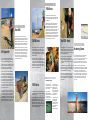
Leica Geosystems' Commitment to Mining
With high brand awareness, a large range of technologies,
a large global distribution system and professional
technical support that is second to none, Leica Geosystems
is one of the world’s leading manufacturers of surveying
and mapping solutions.
Leica Geosystems’ products have been used in the mining
industry for decades. Leica Geosystems aspires to be a
valuable and reliable business partner to mining
companies. This means providing products that enable
success, the key to which is productivity – the element
where Leica Geosystems’ products really deliver.
But there are more
Laser Plummets
Digital Levels
Further elements that support this success are:
Which Leica Mining
Product?
Mining
Product
Under
ground
Above
Ground
Quarry
TPS300
■
■
■
TPS700
■
■
■
TPS1100
■
■
■
RCS1100
■
■
■
GPS500
■
■
GS50
■
Dozer 2000
■
■
30
40
50
Solutions for Mining
Illuminated Prisms
• Leadership in innovation and technology. The number of Leica
firsts reads like a history of the surveying instrument –
the world’s first opto-mechanical theodolite, infra-red
distancer, surveying GPS receiver and digital level – to
name but a few. Leica’s investment in research and
development is continuous, guaranteeing its ability to
maintain its position at the forefront.
360 degree prism
• Strategic Partnerships combined with internal know-how. In
areas where we don’t specialize, we build strategic
partnerships with those that do. In this way you can
always be sure of a total solution provided by the best in
the industry.
• First Class Technical Support and Service. Quick, local and
above all knowledgable technical support and service is
at your disposal as a customer. Whether your question is
about the instrument itself or you simply want to have
your instrument serviced, Leica Geosystems’ personnel
are there for you. Leica Geosystems’ staff are continually
retrained in order to provide this first class support and
service.
Lockable Battery
compartments
DISTO
■
■
■
Monitoring
■
■
■
APSWin
■
■
■
The application of these products in hazardous explosive
areas or under extreme environment conditions has to be
checked in advance with the local safety authorities and
should be used in accordance with these local regulations
and information contained in the product user manual.
Total Station backpacks
• Reactive to local needs. Rarely do two areas of the world
have exactly the same regulations or survey procedures.
Our regional customization centers take this into
account, configuring deliveries with respect to onboard
software, languages and work practices to suit.
Our products are designed to last. They don’t incorporate
passing fads or gimmicks but incorporate real
advantageous innovations and are designed for a long life
of serious hard work. Our customers benefit from the
knowledge that the instrument will not be obsolete a few
months after it has been purchased. The continuous
development of application programs and spare parts
availability ensure that they obtain a good return on their
investment.
TQM
More information is available from your local Leica
Geosystems representative or from our website,
www.leica-geosystems.com.
ISO 9001 / ISO 14001
Total Quality Management –
Our commitment to total customer
satisfaction.
Illustrations, descriptions and technical data are not binding
and may be changed without notice. Printed in Switzerland.
Copyright Leica Geosystems AG, Heerbrugg, Switzerland, 2000
722821en – lX.00 – RDV
Ask your local Leica Geosystems
agent for more information
about our TQM program.
Leica Geosystems AG
CH-9435 Heerbrugg
(Switzerland)
Phone +41 71 727 31 31
Fax +41 71 727 46 73
www.leica-geosystems.com
The Productivity you asked for...
From the Company you Trust
TPS300 Series
The instrument that revolutionized the industry!
Breakthroughs in size, weight, cost and features have led
to a series that was the first of its kind and still points the
way ahead today.
Underground surveyors and mining engineers will love
this small, lightweight total station with the option of
reflectorless measurement. Either aim the visible red laser
dot at the target or use the cross hairs – the choice is
yours. Additionally, the TPS300 series has a large, onboard
4000-record memory, easy menu navigation using the
arrow keys and a large, illuminated 8 line by 24 character
display. Finish this off with the option to connect to an
external recording device and the fact that it uses standard
camcorder batteries and you have the perfect solution for
many measuring tasks at a price that’s right.
Dozer 2000
Leica Geosystems continues to lead the world with
innovative solutions for today’s mining tasks. The power of
GPS technology is now being extended to machinery and
Dozer 2000 is providing dramatic increases in productivity
and minimizing rework when fitted to bulldozers and other
earthmoving machinery for real-time machine guidance.
GPS System 500
From the people who brought you the first GPS system
specifically for surveying, Leica Geosystems offers the
latest in world-class GPS technology – System 500.
System 500 is perfect for aboveground mining activities
where access to GPS satellites is available. Small in size
and lightweight it has a revolutionary design for
outstanding performance in adverse conditions.
ClearTrak TM technology allows System 500 to obtain the
very best signal reception, best satellite tracking, best
jamming resistance and provide multipath mitigation.
You will be amazed at your results. No more built-in
obsolescence, only built-in cost effectiveness. The system
can be upgraded as your needs change. Start with a GIS
grade receiver and eventually upgrade to a full RTK
system. Depending on the receiver chosen, System 500
can be used for drill hole stakeout, bench leveling, daily
pick-ups, conveyor maintenance, monitoring or simply
spot checks as you drive the mine.
Not all jobs in a mine require cm precision, and Leica
Geosystems’ GS50 GIS grade GPS receiver opens up many
more possibilities for data collection. The LEICA GS50 is
part of the System 500 family and as such uses the
revolutionary ClearTrak TM technology providing the most
precise code measurements in the industry. Tasks ranging
from asset management, geological pickup to conveyor
maintenance are perfectly suited to the LEICA GS50.
Dozer 2000 continuously displays the location and height
of any machine relative to a given design surface, enabling
the operator to move left or right, to cut or fill accordingly
to within a few centimeters. The Dozer 2000 is ideal for a
range of mining activities including reclamation, ripping,
cleaning and uncovering coal, leveling the truck dump,
construction of retention ponds, drainage and haul roads
as well as dragline bench control.
Integrated graphical analysis
TPS1100 Series
The DISTO Family
Whether you want a standard total station, reflectorless
measurement, automatic target recognition or a fully
robotic solution, the TPS1100 series provides an answer.
In mining, versatility is paramount and the TCRA model,
which combines all the technologies into one instrument
provides this flexibility.
When reliability and convenience is an issue on site, then
the DISTOTM range of hand held measuring devices is what
you need. The visible laser dot enables you to see exactly
where you are measuring. Furthermore, all measurements
are accurate to a few millimeters.
TM
This one-person operation is perfect for measuring
distances off the face, backs or the clearance of the
hanging wall. In above ground mines, measure from the
convenience of your vehicle to the face or check a setout
by tie distance.
Safety around highwalls is crucial. The 360 degree prism
is always facing the TCA instrument allowing the person
carrying the prism to concentrate on his footing and
surroundings. Want even more productivity! Automate the
TCA1100 further, with the RCS1100 remote control unit.
It replicates the TCA keyboard but gives you control from
the prism and that extra independence.
The DISTO classic is the latest in the DISTO range being
capable of measuring 0.3m to 100m depending upon the
target surface. This very small unit will fit into the palm of
your hand measuring only 172mm in length.
If you need to record data, then the DISTO memo is the
one for you with it’s onboard memory for up to 1000
measurements and online RS232 interface. A number of
third party software products that run on palm or laptop
PCs are available.
Onboard Application Programs
TPS700 Series
All TPS Instruments are
delivered complete with a
suite of standard application
programs included.
For work where the full power of the TPS1100 series is not
required but a full alpha-numeric keyboard is a must, the
TPS700 series takes over.
Especially tailored to
underground mining, the
TPS300 series has available
a mining application
program to assist the user
in performing new peg
The slim, lightweight design, camcorder batteries, laser
plummet, endless drives and optional reflectorless
measurements make this a useful surveying companion.
Designed with certain mining situations in mind, the
battery compartment can be locked, based on local mining
regulations. A larger battery compartment can also be
ordered, minimizing battery changes.
surveys, grade setting,
offsetting or carrying out a
backsight check. The
TPS700 series adds the
Refline application program
for easy calculation of the
orthogonal setting out
elements of a point.
In addition to a wealth of
continuously updated
standard application
programs, TPS1100 users
also have the option to
create their own using the
LEICA Geobasic
programming language.
Monitoring Systems
Leica Geosystems’ range of coaxial motorized automatic
target recognition total stations makes your job of
monitoring in any type of mining operation extremely cost
effective. From basic systems using the onboard
application program “Monitoring” to the more rigorous
APSWin software, Leica has a solution to meet your needs.
APSWin is a computer-based system designed for
measurement tasks that are repeated over time, regardless
of the interval. Once you have taught the system where the
points are located, it is then capable of automatic
measuring, analysis, reporting and alarming. The system
can be configured in many ways to suit the type of mine or
task with data processing being carried out immediately at
the measurement station or later in the office. APSWin
systems are used successfully at some of the world’s
largest mines.