1
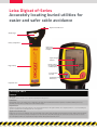
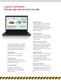
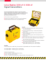
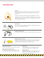
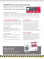
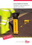
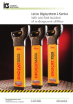
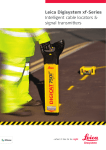
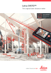
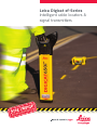
Leica Digicat xf-Series Intelligent cable locators & signal transmitters Leica Digicat xf-Series Making cable avoidance easier & safer Every year site workers are injured due to inadvertently striking buried utilities such as electricity cables or pipes. Obtaining accurate information about the location of buried utilities has never been more essential to protect employees, equipment and infrastructure during any survey or excavation project. With Leica Geosystems state-of-the-art xf locators and transmitters, users can detect buried utilities faster and more accurately than ever before. The Leica Digicat xf-Series has been specifically designed with long distance tracing in mind. The ability to trace low transmitter frequencies provides a greater tracing range as well as the ability to locate sewer – camera inspection systems. Typical users of the Leica Digicat xf-Series: Surveyor specialist(s) Utility installation contractors Specialist repair contractors Gas and electricity companies Pipe laying contractors Sewer – camera inspection contractors Leica Geosystems locators make locating underground utilities including power cables, street lighting, telecoms, conductive Leica Digicat xf-Series is comprised of: pipe work, sewer – camera inspection systems, easier than ever before, increasing your safety on site and ultimately Digicat 500i/550i xf & 600i/650i xf locators saving you time and money. Digitex 100t xf & 300t xf signal transmitter Logicat software Digitrace service tracer and additional accessories How does the Leica Digicat locate? The Leica Digicat xf-Series locates buried conductive services by receiving electromagnetic signals which radiate from them. The intelligent software interprets the signal data and provides the operator with an audible and visual response to the location and direction of buried utilities. Offering the user additional tracing frequencies of 512 Hz and 640 Hz, makes long distance tracing and the positioning of sewer – camera inspection systems a simple task. Leica Digicat xf-Series Benefits State-of-the-art Digital Signal Processing (DSP) technology Automatic controls – making the Digicat easy-to-use, requiring minimal user training Mode Lock – The Digicat starts in the last mode of operation assisting the survey process Hazard Zone feature indicating shallow buried service in power, 8 kHz, 33 kHz Auto, 512 Hz, 640 Hz modes Built-in test function – allowing operators to test the hardware and software functionality of the Digicat before use L CD screen with built-in light sensor, automatically enabling the backlight in dark conditions Robust, lightweight design specifically engineered for tough site conditions Service Due Indicator supporting planned maintenance schedules or quality systems by displaying a wrench icon after 12 months The Leica Digicat xf locators have multiple modes of operation allowing users to have maximum control at their fingertips. Auto Auto Mode Automatically locates power or radio signals, helping to confirm the presence of services upon initial site occupation making cable detection easier and safer. Radio Mode Traces signals originating from distant radio transmitters. These signals penetrate the ground and are radiated by buried conductive services. Power Mode Locates power signals radiated by energized cables which pose the most significant risk to excavation teams. 512 Hz Transmitter Modes Locates a specific signal applied by the Digitex signal transmitter to a metallic underground conductor. 640 Hz 512 Hz & 640 Hz Enables long distance tracing 8 kHz 8 kHz Mid-range distance tracing 33 kHz 33 kHz Standard tracing frequency on avoidance locators, used for everyday site use Leica Digicat xf-Series Accurately locating buried utilities for easier and safer cable avoidance High Contrast LCD Screen On/Off Trigger Battery Compartment Light Sensor (Automatically enables backlight) Signal Strength Indicator Rugged Casing Display readout (for product menu or utility depth) Detection Mode Selection Depth Button and Menu Access Replaceable Foot Leica Digicat 500i xf Features Mode Lock The Digicat starts in the last mode of operation assisting the survey process. Hazard Zone Buried utilities close to the surface pose a safety risk to site works. The new Hazard Zone function provides an additional warning of the close proximity of buried services, alerting users to the immediate danger. Pinpoint Assist Maintains the highest peak reading obtained on the signal strength indicator. The peak hold time can be adjusted between 0-5 seconds allowing the operator to quickly and accurately pinpoint the service position. Signal Service Indicator (SSI) Enables the user to trace an individual service among multiple services when using the Digitex signal transmitter. A numeric display shows the highest reading over the service being surveyed ensuring the user can follow the service without straying onto another. The SSI mode can also be used to trace the Digimouse with ease and provides the highest number when positioned directly over it. Leica Digicat 550i xf Additional Features Depth Indication The Digicat 550i xf features utility depth indication, when used in conjunction with the Digitex signal transmitter or Digimouse in 8kHz or 33kHz modes. With a single press of the button, operators can determine the depth of the buried utility down to 10 feet (3 meters) or the depth of a sonde down to 32 feet (9.9 meters). Current Level Indication Displays the amount of current flowing through a service helping to trace and verify the utility to which the Digitex signal transmitter is connected. Leica Digicat 600i xf Additional Features Data Logging The Digicat 600i xf records and stores information while in use. Information is recorded every second after completion of the initial start-up routine. These records are stored in the locators memory and can be retrieved and transferred via Bluetooth® to a PC or other electronic device for analysis. Storage time is approximately 80 hours use. Logicat Software Allows you to upload the stored records to view the locators use. Simply upload all records or search by date. Bluetooth® Connectivity The Digicat 600i xf locator has the added benefit of Bluetooth® wireless connectivity. It allows the Digicat to integrate seamlessly with mobile mapping technology to log survey data, in addition to enabling wireless Bluetooth® data transfer. Selectable Bluetooth® Option Standard format supplied on all Bluetooth® enabled cable locators or a shortened version furthering the integration into GIS solutions. Leica Digicat 650i xf Additional Features* Depth Indication Current Level Indication Data Logging Logicat Software Bluetooth® Connectivity Selectable Bluetooth® Option *All features are described above Leica Digicat 650i xf & GPS Mapping The Leica Digicat 650i xf and a GIS field controller, such as the Leica Zeno 10 or 15, offer a simple and cost effective solution to utility contractors who are looking to survey and map underground infrastructure such as cables and pipe-work. The Digicat 650i xf and Digitex signal transmitter are used to provide a depth reading to the center of the cable or pipe to be surveyed. The depth reading is then transferred to the field controller via Bluetooth connectivity where the geographical position is added by Leica Zeno field software. Additional images and comments can be included as part of the survey process including: 1 The type and size of service 2 Date and time of the survey 3 Maintenance requirements 4 Surveyors site notes Providing a full data capture facility. Logicat Software Simply upload stored records Detection Mode Allows managers to judge the quality and thoroughness of work. As more comprehensive ground surveys are conducted the locator records the mode of operation, including the use of a signal transmitter. Service Detection Discovers quickly if any buried services were detected during surveys and even determines the signal strength shown on the locator. Logicat software allows you to upload stored records from the Digicat 600i xf and 650i xf to view the locator's use, simply upload all records or search by date. Upload information includes: Time and Date Identifies when and at what time ground surveys were conducted. Usage Duration Determines how long survey teams searched for buried services and reveals actual product utilization. User Identification Encourages users to become accountable for their actions and identifies those who need additional product training. Product Fleet Management Displays and monitors the service and calibration dates of your locator fleet, ensuring they are kept in perfect working order and not being used when calibration is due. Diagnostic Check Displays locators which have failed the EST (Extended Self Test) and removes them from the active fleet for immediate repair. This reduces the possibility of defective equipment being used on site. Management Reports Produces basic statistical reports from the logged data, allowing users to see how products are utilized and how ground survey teams are using them on site. Leica Digitex 100t xf & 300t xf Signal transmitters The newly developed Leica Digitex xf signal transmitters deliver a higher power output than previous models with the addition of extra low tracing frequencies. This improved performance will allow users to: Trace services over a greater distance Improve service detection in areas of high signal interference Improve depth estimation when using a depth locator Benefits Four adjustable power output levels; select the output for site, tracing conditions Durable weatherproof design, environmental protection rating of IP65 R obust, compact and lightweight design engineered for tough site conditions C hoice of four tracing signals; select the frequency for site, tracing range Ease-of-use, default output frequency of 33 kHz power level 2 Clear, audio visual controls; externally mounted, displaying the transmitters output condition Built-in test function allowing operators to test the hardware and software functionality before use Digitex 100t xf producing up to 1 watt of power, Digitex 300t xf producing up to 3 watts of power Flexibility Compact design with an IP65 rating, the transmitter is fully protected even in the harshest of conditions. Leica Digitex 100t xf – Producing up to 1 watt of power Leica Digitex 300t xf – Producing up to 3 watts of power Choice of tracing frequencies: 512 Hz & 640 Hz – Enables long distance tracing 8 kHz – Mid-range distance tracing 33 kHz – Standard tracing frequency on avoidance locators, for everyday site use Accessories Digitrace The Digitrace enables non-metallic drains, ducts or pipes to be traced when used in conjunction with the Leica Digicat and Digitex (or other signal transmitters). The Digitrace 30 meter, 50 meter or 80 meter coiled fiberglass rod with a metallic tracing wire. The rod is inserted and pushed along the service under investigation. The Digitex signal transmitter is used to apply a tracing signal which is located by the Digicat. Signal Clamp For use with the Digitex, enabling connection to cylindrical metallic services (e.g. pipes, insulated electricity cables). Property Connection Set Connection of a tracing signal to any internal power distribution system outlet. Digimouse (8 kHz & 33 kHz) Compact dual frequency sonde used to trace drains, sewers and other non conductive services. Digimouse can be attached to a range of equipment including drain rods, boring tools and inspection cameras. Rechargeable Batteries Available as an option on Digicat and Digitex models. Digitex Signal Transmitter Pack Smart Charger with UK, EU, USA adaptors, t-series transmitter, NiMH battery pack and charging cradle. Digicat Pack Smart Charger with UK, EU, USA adaptors, i-Series locator, NiMH battery pack and charging cradle. Additional Extras Rechargeable D cell pack, rechargeable AA cell pack, additional D cell battery holder, additional AA cell charging cradle and vehicle charger. Leica Digicat xf-Series Product specification Features Frequency / Mode Depth Digicat 500i xf Digicat 550i xf Digicat 600i xf Article no. 798640 / 798641 Article no. 798642 / 798643 Article no. 798644 / 798645 Digicat 650i xf Article no. 798646 / 798647 Power mode 50 Hz or 60 Hz, Power mode 50 Hz or 60 Hz Power mode 50 Hz or 60 Hz Power mode 50 Hz or 60 Hz Radio mode 15 kHz to 60 kHz Radio mode 15 kHz to 60 kHz Radio mode 15 kHz to 60 kHz Radio mode 15 kHz to 60 kHz Transmitter mode 8 kHz, 33 kHz, Transmitter mode 8 kHz, 33 kHz, Transmitter mode 8 kHz, 33 kHz, Transmitter mode 8 kHz, 33 kHz, 512 Hz, 640 Hz 512 Hz, 640 Hz 512 Hz, 640 Hz 512 Hz, 640 Hz Auto mode = Power + radio mode Auto mode = Power + radio mode Auto mode = Power + radio mode Auto mode = Power + radio mode Power to 10 feet (3 m), Power to 10 feet (3 m), Power to 10 feet (3 m), Power to 10 feet (3 m), Radio to 6.5 feet (2 m) Radio to 6.5 feet (2 m) Radio to 6.5 feet (2 m) Radio to 6.5 feet (2 m) Transmitter mode – Dependant on Transmitter mode – Dependant on Transmitter mode – Dependant on Transmitter mode – Dependant on transmitter or Digimouse (Sonde) transmitter or Digimouse (Sonde) transmitter or Digimouse (Sonde) Depth estimation transmitter or Digimouse (Sonde) Line mode – 1 foot to 10 feet Line mode – 1 foot to 10 feet (0.3 to 3 m) (0.3 to 3 m) Sonde mode – 1 foot to 32 feet Sonde mode – 1 foot to 32 feet (0.3 to 9.9 m) (0.3 to 9.9 m) 10% of depth in line or Sonde mode 10% of depth in line or Sonde mode Protection Conforms to IP54 Conforms to IP54 Conforms to IP54 Bluetooth® Not available Not available Enabled Enabled Batteries 6 x AA alkaline (IEC LR6 supplied) 6 x AA alkaline (IEC LR6 supplied) 6 x AA alkaline (IEC LR6 supplied) 6 x AA alkaline (IEC LR6 supplied) Battery life 40 hours intermittent use 40 hours intermittent use 40 hours intermittent use 40 hours intermittent use (at 68 F, 20 C) (at 68 F, 20 C) (at 68 F, 20 C) (at 68 F, 20 C) 6 lb (2.7 kg) including batteries 6 lb (2.7 kg) including batteries 6 lb (2.7 kg) including batteries 6 lb (2.7 kg) including batteries Compatibility CSV file compatibility program CSV file compatibility program Memory size 32 MB memory 32 MB memory Capability 80 hrs of data 80 hrs of data Weight Features Digitex 100t xf Digitex 300t xf Conforms to IP54 Article no. 798648 Article no. 798649 Operating transmission frequencies • 8.192 kHz • 32.768 kHz • Mixed 8/33 • 512 Hz • 640 Hz • 8.192 kHz • 32.768 kHz • Mixed 8/33 • 512 Hz • 640 Hz Output power 4 levels 4 levels Induction (Max) Up to 1w max Up to 1w max Direct connection Up to 1w max when connected to a buried service with an Up to 3w max when connected to a buried service with an impedance of 100 Ohms impedance of 100 Ohms Battery type 4 x D alkaline (IEC LR20), supplied 4 x D alkaline (IEC LR20), supplied Battery Life (Typical use at 20°C) 30hrs intermittent use 20hrs intermittent use Weight 2.4 kg/5.3 lbs including batteries 2.4 kg/5.3 lbs including batteries Dimensions 4 in/105mm (H) x 7.5 in/190mm (D) x 9.3 in/235mm (W) 4 in/105mm (H) x 7.5 in/190mm (D) x 9.3 in/235mm (W) IP Rating (Case lid closed) IP65 IP65 IP Rating (Case lid open) IP54 IP54 Features Features Digimouse Conforms to IP54 (30/50/80 coiled fiberglass rod with a Operating transmission frequencies 8.192 kHz, 32.768 kHz metallic tracing wire) Battery type 1 x LR6 (AA) alkaline 6.6 lb / 7.2 lb / 7.7 lb (3 kg / 3.25 kg / 3.5 kg) Battery life (Typical use at 20°C) 40 hrs intermittent use at at 20°C/68°F in Digitrace 30 / 50 / 80 Article no. 731053 Article no. 796702 / 796703 / 796704 Protection Weight 8 kHz mode or 33 kHz mode Weight 0.4 lb (0.18 kg) Dimensions 1.5 in/38mm (H) x 4.7 in/120mm (W) PROTECT by Leica Geosystems Because the best products PROTECT come with the best service by Leica Geosystems Our products are built to last! Lifetime Warranty No Cost Period Certified Quality Swiss Technology Understanding construction and our customers’ needs has enabled us to develop product solutions for all positioning, measuring, levelling, aligning and plumbing tasks on site. Our products provide the highest levels of reliability, accuracy and ruggedness – even under the roughest jobsite conditions, making our customers more productive and successful. With Protect by Leica Geosystems we offer a best-in-class service where customers can count on us, anytime, anywhere. Lifetime Manufacturer’s Warranty Certified Quality Warranty coverage for the entire usage time of the product, Leica Geosystems runs calibration laboratories (No. in accordance with Leica Geosystems International Limited SCS079) and a test laboratory (No. STS549). Both are Warranty. This includes free of charge repair or replacement fully accredited by the SAS, the Swiss Accreditation for all products that suffer defects as a result of faults in Service. The calibration and test certificates issued by materials or manufacturing. Leica Geosystems are officially and internationally recognized for horizon, angle, distance, frequency and No Cost Period laser classification. This confirmation of precision Guaranteed best-in-class service should your product guarantees the highest possible reliability for our become defective or require servicing under normal products. All laboratories are regularly controlled by an conditions of use, as described in the user manual, at no independent national institution according to ISO 17025. additional charge to you. Swiss Technology Our service includes: Swiss Technology creates confidence. Our worldwide Repair or replacement of all defective parts, including operations are in state-of-the-art production centers, labor time where Swiss precision, extraordinary craftsmanship, and Thorough functional test and safety check cutting-edge technology go hand-in-hand. Continuous Maintenance, cleaning of product and carrying case and extensive tests throughout all stages of development and production ensure our products meet the highest Your serviced product will be returned to you as good as standards for precision and quality. new! We are always there for you. With a global network consisting of 260 service centers in 87 countries, Leica Geosystems has a powerful network to support you. Find out more on: www.leica-geosystems.com/protect Whenever you need to locate underground services, the Leica Digisystem is the right solution. The system ensures fast and accurate location of buried cables and pipes and it increases your onsite safety. The Digisystem is designed on a safety-first philosophy, so we remove the ability for the user to «tune out» signals or to accidentally search in the wrong mode. The Digisystem tools are rugged and efficient, meeting all the needs of your tracing operations. When it has to be right. Illustrations, descriptions and technical data are not binding. All rights reserved. Printed in Switzerland – Copyright Leica Geosystems AG, Heerbrugg, Switzerland, 2012. 798541enUS – XII.12 – galledia Total Quality Management – Our commitment to total customer satisfaction. Ask your local Leica Geosystems dealer for more information about our TQM program. The Bluetooth® word mark and logos are owned by Bluetooth SIG, Inc. and any use of such marks by Leica Geosystems AG is under licence. Other trademarks and trade names are those of their respective owners. Leica Geosystems AG Heerbrugg, Switzerland www.leica-geosystems.com Leica Sprinter Quick, easy and efficient digital levelling Leica Builder Not just for foremen Leica Rugby 260SG, 270SG, 280DG Keeps you working Leica Piper 100/200 The world's most versatile pipe laser