1
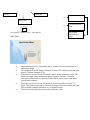
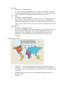
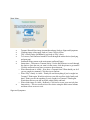
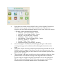
“Beyond the Book” Flash Project Shelley Hayes Project Description This project is an add-on module designed to augment an already created program called The Reader’s Treasure, which is designed to improve reading comprehension in gifted third-grade readers. “Beyond the Book” will take the reader outside the plot of the book and focus instruction on the central topic of the text, which in this case is tsunamis. The fictional book used in project development is Escaping the Giant Wave by Peg Kehert. In this module, students will explore tsunamis.The program will be divided into two sections: “Tsunami Territory”, and “Tsunami Warnings.” Each section will be interactive. In “Tsunami Territory,” students will interact with a world map to discover which regions are most susceptible to tsunamis. They will also discover where some famous tsunami’s occurred as they interact with the map. In “Tsunami Warnings,” the students will hear the story of the girl who saved her family along with all the tourists in her hotel because she remembered learning in school about the texture of the water when a tsunami was coming. Then, the students will identify which water textures are indicative of a coming tsunami, and which ones are normal. Problem Statement The Reader’s Treasure was developed to offer gifted readers a challenging, relevant activity to accompany their reading assignments. Too often, these students are overlooked or neglected in lesson planning because on the surface they don’t seem to have special needs like some other students in a typical classroom. Gifted students need an environment where they can experience higher-level cognitive exercises and work with like-minded students. “Beyond the Book” offers these exceptional students the opportunity to explore and make connections with the subject matter of the text. There is often not enough time in a classroom situation for the teacher to both teach the basics of a book and include supplemental material in the instruction. This module will give advanced readers the opportunity to satiate their desire for knowledge without taking valuable class time from the instructor. Students who are not labeled as gifted may still have interest in discovering more about the book they read, or perhaps are interested in tsunamis even though they didn’t read the book. Many science websites exist on the internet and are aimed at kids, but they are predominately informational; it takes a determined student to do the reading required to learn something. This program will attempt to minimize reading and make learning happen through interaction, thus letting the student discover his or her own knowledge. This approach will likely appeal to the majority of students. Learning Objectives/Goals Understand how and why tsunamis form. Explore the regions most vulnerable to tsunamis. Identify major tsunami events. Predict whether a tsunami will form in given conditions. Client Description The client for The Reader’s Treasure project is third-grade teachers at Cimino Elementary, which is part of the Hillsborough County school district. This module could also be generalized to any elementary school. Target Audience The target audience of “Beyond the Book” when included in the parent program is third-grade gifted readers. This module, though, will also be able to stand alone as instruction and will be appropriate for 3rd-5th grade students. The two-year difference in grades actually presents quite a disparity in knowledge between the youngest and oldest potential users. This problem will be solved with scaffolded segments and feedback (both just in time and on demand). These students will likely be socially diverse; to accommodate these diverse needs, students can either complete the module individually or in pairs (although no special development will be implemented for pair-work). Task Analysis To accomplish the learning objectives, the learner will: Read minimal background material. Interact with diagrams of the earth’s crust. Explore a global map. Engage in predictive exercises. Tasks: Tsunami Territory: Identify a world map. Read as continents and regions are described. Six specific tsunamis will be identified on the map using wave icons. Each icon will bring up a new page with information about that specific tsunami. Student will view images and video (nothing disturbing or mature) about each famous tsunami. Once the student investigates all six tsunamis, they will play a game to see if they can remember where the tsunamis hit. If the student does not get at least three of the locations correct, he or she will come back to the original world map to investigate the locations more thoroughly. Tsunami Warnings: Students will begin by selecting a subtopic (warning signs, Tilly’s story, or what to do). In warning signs, students will see a variety of ways to identify tsunamis through images and video (tide rising or receding, bubbling, earthquake). They will interact by clicking the audio, video, or image buttons. Students will control navigation of this section. In Tilly’s story, students will watch a short (3 min) video about a girl from England, Tilly Smith. Students will reflect on Tilly Smith and Escaping the Giant Wave by writing a Blog entry about Tilly and the similarities to the text. In What to Do students will identify the most sensible solution to evacuation from the choices given in three different scenarios (critical thinking). Prerequisite Knowledge: Basic understanding of geography (ie seen a world map before and knows approximately where the continents are located and how the bodies of water connect). Some experience with computers, enough be able to read and follow directions that will point them to an icon to click. Some basic critical thinking skills. Basic survival training (fire drills are sufficient). Knows what an earthquake is. Understands what a wave is. Program will be targeted at 3rd grade reading levels, so students should be at least at that level. Technical Analysis--User To use the program, the user must have: A computer with a Windows or Mac operating system A sound card A video card Access to the internet (DSL, Cable or faster preferred for optimal performance) A web browser (IE, Firefox, Opera, Safari, Netscape) Flash 9 or newer plugin installed Basic internet knowledge No specialized technical skill required In order to minimize technical skill requirements, the program will be developed using recognizable design conventions and will not incorporate activities with a steep learning curve. Technical Analysis—Design Team To develop this program, the designer must have all the resources required of the user plus: Flash CS3 or newer A graphics creation/manipulation application such as Photoshop or Illustrator Experience creating graphics in the graphics application Experience creating applications in Flash At least 2 GB of RAM to will likely be necessary (though some may make due with 1 GB by using one application at a time. Experience with digital video A digital video player installed on the computer (Quicktime or WMP) Design Analysis The program is going to be developed entirely within Flash and embedded in a web page using Flash CS3 and ActionScript 3.0. Several graphical representations are needed, most of which I hope to secure under a creative commons license. I will use the International Tsunami Information Centre (ITIC) as the SME for the project and cite the content usage in the program. Other content beyond ITIC may be necessary. Learning Objectives Students will become familiar with the geography of the world and how that impacts tsunami formation. Students will become familiar with the pattern of the oceans and understand how an earthquake in one part of the ocean can impact a land mass far away. Students will realize that they, too, can make a difference and see a real-world example of a student using her learning to save others (contextualized meaning). Students will use critical thinking skills to design survival plans in a three different circumstances (on the beach, in a house, in town). Students will understand the signs that can accompany tsunamis and understand, too, that signs are not always apparent. Students will demonstrate that when a geologic event happens underwater, the tsunami moves out in all directions, not just toward one land mass; therefore, several landmasses in different areas can be affected. Students will compare and contrast a fictional story with a real life student. Instructional Strategies First, Keller’s ARCS model will be used to incorporate motivational elements into the program. The graphics and video will be used to earn the user’s attention. By including the story of a student who experienced a Tsunami creates relevance to the user. Scaffolded concepts combined with just in time and on demand help will support learner confidence. Understanding Tsunami’s will hopefully grant the reader a greater understanding of Escaping the Giant Wave and in that contribute to learner satisfaction. Beyond that, the user will earn a key after completing this module that can be used in the parent program, The Reader’s Treasure. Another important strategy employed in “Beyond the Book” is Vygotsky’s scaffolding principles (Roehler & Cantlon, 1996). I mentioned scaffolding already in this proposal, but it is important enough to mention again here. This program will attempt to push the student toward his or her zone of proximal development by increasing the complexity of ideas as each section progresses. For example, in the world map exercise, students will begin by clicking on different tsunami icons. After they finish four tsunamis, they will be asked “What do all these areas have in common?” The answer is that they all border the ocean. This concept is foundational to understanding that the closer you are to the coast, the more likely you are to experience a Tsunami. Further, many of the ideas presented to the student will require higher-level thinking skills, like the critical thinking survival exercise in Tsunami Warnings. But to make sure the student is not overwhelmed by this progression of thought, help will be available to lead the student on a path to the answer. The program will strive to balance cognitive load by following Mayer’s (2003) theory on multimedia. Whenever possible, the program will use audio narration to describe a visual animation, and will minimize situations where text and images must be used simultaneously. The program will also limit extraneous information and minimize redundancy. Finally, the underlying theoretical principle of the program is based on Spiro’s (1992) idea of Cognitive Flexibility, which is rooted in constructivism but more specifically applicable to webbased environments. Basically, Cognitive Flexibility Theory states that the learner will learn most efficiently when allowed to draw conclusions from multiple perspectives, like creating an individualized puzzle that only makes sense to the creator. But through this creation, the user has a greater understanding of the topic than if the information was presented in a linear way by the teacher. In “Beyond the Book” the user will have the flexibility to peruse the site in the way most suitable to him or her, can spend more time in areas of interest and less time in other areas, and by combining the experiences of the application (interacting with a world map, hearing a real world story, constructing survival plans, identifying signs of a tsunami, and learning about how tsunamis form) students can ultimately construct an idea about Tsunamis from the information experienced. Assessment Methods and Feedback There will be no formal assessment, but the students will be assessed as they progress through the program. In “Tsunami Territory,” users will have to correctly identify by clicking a map which regions of the world are most susceptible to Tsunamis. In “Tsunami Warnings,” students will have to identify which water pattern indicates a possible Tsunami. They will also construct survival plans selecting the best choices and order of progression among the choices given. Students will write a blog entry after watching the Tilly Smith video where they will reflect on the importance of education and the similarities between her story and the story, Escaping the Giant Wave. Audio and textual feedback will be given to the users as they progress through the module. The feedback will scaffold the instruction helping the student both understand the structure of the program and the content within. There will be both “just in time” and “on demand” feedback during every step of the program so the user always knows if he or she is on the right track. Limitations and Constraints The time frame of the project the number and appeal of the graphics included in the project. I am focused on making the project more of an interactive experience than a lesson with text, next and back buttons, and some quiz questions. Unfortunately, interactive experiences are much more media intensive than other types of programs, a caveat that I will do my best to overcome. Since I do not know much about Tsunamis, I will rely on internet sites to give me all the information I need. For the students, this will be a good thing because I can go through and extract relevant information and present it in an interesting and engaging way. Scope of the Project As mentioned above, “Beyond the Book” is one module in a larger project called The Reader’s Treasure accessible at www.thereaderstreasure.com. This module has three sections, which is fairly consistent with the rest of the project; each section requires about 15-20 minutes to complete. Deliverables The final product will include three separate sections delivered within one flash application embedded in a web page. There will be no added user guide; all necessary directions for use will be included within the program itself. There will be a hardware and plugin guide for the teachers to ensure the computers are prepared properly. Timeline Since the development paper is due 6/19/09, all graphics will have to be completed by then for inclusion in the storyboards. A working draft will be available 7/10/09 for formative review. A revised prototype will be completed by 7/17/09. Media Use The project will definitely incorporate audio and graphical images. I am still debating whether to include a short video; truly, it depends on whether I can find the video I am looking for. Audio will be used to support learning objectives. Some audio will be descriptions of an animation that is happening on the screen, others will be sound effects to let the user know that something has happened (an earthquake, for example). Graphics will be used to visually represent the events leading up to a Tsunami. Further, an image of the earth will enable the user to visualize where Tsunamis happen. Finally, digital graphics will be used to simulate the conditions in a Tsunami. The video that I hope to use is a news segment of a girl who saved her family and other tourists at her hotel after identifying the signs of the Tsunami in the water. Alternatively, there is plenty of footage of the Tsunami that I could include (the less graphic versions). High-Level Flowchart Menu Start Tsunami Territory Tsunami Warnings Style Guide Background Color— custom (background.png) Color Scheme—Sea Green and browns Font Selection— Main Title Heading – Hawaii Killer Headings—Impact Body—Verdana Navigation—Standard navigation buttons shaped like waves and surfboards used throughout Other links will be plain buttons or text only Flow Charts (site map of branching) Menu A Start Tsunami Territory Alaska Chile Tsunami Warnings Indonesia Interactive Map New Guniea Signs and Symptoms Turkey Phillipines Tilly’s Story Map Game Create a survival plan A Storyboards - major screens - look and feel Main Menu: Discussion – outside link to SMC Initial instructions read – Beyond the Book: Tsunami Hover your mouse over a surfboard to begin. The surfboard on the left leads to Tsunami Territory (TT) and the one on the right leads to Tsunami warnings (TW). When the user hovers over the TT board, it moves to the left and moves the TW board to the right. These instructions appear: Tsunami Territory: Click this surfboard to find out where tsunamis are most likely to form and to learn about some famous tsunamis. When the user hovers over the TW board, it moves to the left next to the TT board. These instructions appear: Tsunami Warnings: Click this surfboard to learn how to identify tsunamis and where to go if disaster strikes. The user can select the menu items in any order they wish.. Tsunami Territory: Instructions - Tsunami Territory: Each icon represents a famous tsunami. Click on them to discover more about tsunamis and their devastating effects. When you are done, click the next button to play a game to test your knowledge, or press the surfboard to return to the main menu. The surfboard (surfboard1.png) is available to take the user back to the main menu. The next button (nextbutton.png) will take the user to the drag and drop map game. Interactivity – The user clicks on each icon to learn more about the famous tsunami that occurred in that location. They can proceed in any order and look at the info any number of times. For each of the tsunamis, the background arrow should align with the icon on the map and then the text should be placed within the background box. Alaska: background – alaskainfo.png text - Largest North American Earthquake - 8.6 magnitude. Largest Wave Height - 200ft. Caused damage from Alaska to Hawaii. Chile: background – chileinfo.png text - The largest earthquake of the 20th century - 9.5 magnitude.Waves as tall as 100ft. arrived in Chile within minutes of the earthquake. Tsunami was most destructive in Hawaii and Japan. Turkey: background – turkeyinfo.png text - Rare tsunami because it occurred within the enclosed sea of Marmara. The maximum wave height was only around 15 feet, but was nonetheless devastating to the coast. This tsunami teaches us that tsunamis can start in any body of water, not just oceans. Indonesia: background – indonesiainfo.png text - The second largest earthquake ever recorded - 9.3 magnitude. One of the most devastating natural disasters in history. Included several waves that topped 100ft. in height. The earthquake could be felt as far away as Alaska. New Guinea: background – newguineainfo.png text - The New Guinea earthquake was relatively small - 7.1 magnitude, but the residents had no warning and the first tsunami wave hit the coast within one minute of the earthquake. Two villages were completely swept away by the series of 30 foot waves. These waves came very fast--four waves hit the shore within 18 minutes. Phillipines: background – philippinesinfo.png text - While the Philippines are prone to tsunamis, the 1976 tsunami was the most destructive for the small islands. 90% of damage and deaths were due to the tsunami, only 10% of damage was due to the earthquake that came first. Earthquake - 8.0 magnitude. Waves reached land within 5 minutes of the earthquake. Tsunami Territory Game tsunami icon – button.png starts upper left part of stage next to instructions. instructions – “Can you remember where the famous tsunamis were located? As each location appears, drag the tsunami icon to that place. Can you match all 4 in 30 seconds? Countdown timer – black text/yellow background in upper right corner – 30 second start time. Prompts – o o o o o o o o o o o o o o o o o o o o o o o o May 22, 1960, Southern Chile March 28, 1964, Great Alaskan Earthquake August 16, 1976, the Philippines July 17, 1998, Papua New Guinea August 17, 1999, Turkey December 26, 2005, Indonesia Positive Feedback – Chile – “Great Job, that is Chile” Great Job finding Alaska! Yes, that is the Philippines! Yes, Papua New Guinea is just northeast of Australia! Yep, that's Turkey! Yes, that is the area most affected by the devastating tsunami of 2004 Constructive Feedback – Remember, it was the southern part of Chile. Though it was called the Alaskan earthquake, it actually affected Canada as much as Alaska. The Philippines are the small group of islands in southeast Asia. New Guinea is just northeast of Australia. This was the unusual case of a Tsunami encompassed by land masses. Indonesia was the site of the devastating earthquake in 2004. Completion messages – all 6 matches - Great Job! You beat the time. You are a Master Geographer! You can click Restart to play again or you can click Next to continue. 3-5 matches - ou got " + numberRight + " locations correct. Great job! You can either click Play Again to try for all 6, or you can click continue to go to the next section 1-2 matches - You only got " + numberRight + " locations correct. You should go back to the previous page and learn more about these tsunamis. Interaction – The user will drag the tsunami icon to the location that is prompted. If the user makes the correct match, positive feedback will appear and another icon will appear in the starting place. If the user does not make a correct match, constructive feedback will appear until the correct match is made. Assessment - Depending on the number of matches made in the 30 second time period, the user will receive a completion message. If the user gets 1 or 2 matches, he or she will be required to branch back to the interactive map before being allowed to play the game again. If the user gets 3 or 4 correct, he or she will have the choice of branching back to the interactive map or playing again. If the user gets 5 or 6 correct, he or she will have the choice of playing again or continuing on with the application (to the main menu). Branching – buttons all created within Flash Back To Map (back to interactive map) Replay (play map game again) Continue (will branch to main menu) Tsunami Warnings Main Menu: Tsunami Hazard Zone image (tsunamihazard.png) leads to Signs and Symptoms. Climbing image (climp.png) leads to Create a Survival Plan. Tilly’s family image (smithfamily.jpg) leads to Tilly’s Story. Two arrows, back and next buttons to scroll through the menu choices (back.png and next.png) Surfboard image returns to the main menu (surfboard2.png) Instructions – Welcome to Tsunami Safety. Use the black arrows to scroll through the choices. Once the one you want is in the center, click the picture to get started! Click the surfboard at any time to return to the main menu. o When Hazard zone is visible – How does a Tsunami form? What should you do if you are caught in a tsunami? Click the sign to find out. o When Tilly’s family is visible - Think you can't do anything if you're caught in a Tsunami? Think again. Watch how this ten-year-old saved her whole family and hotel. Think you can't do anything if you're caught in a Tsunami? Think again. Watch how this ten-year-old saved her whole family and hotel. o When climb image is visible - Be Ready. Click here to create your survival plan. Interactivity – The user scrolls to his or her choice using the black arrow buttons and then selects an area to visit. Signs and Symptoms: Three images that depict tsunamis from left (tsunamispeed.jpg, tsunamishappen.jpg, climb.png) Instructions - Each one of these images represents different aspects of a Tsunami. Press the play button under each one to learn more. When you are done, click the back icon on the bottom left to return to the main menu. button – backbutton.png Surfboard image returns to the main menu (surfboard2.png) Each image has a corresponding audio file. From left (tsunamispeed.mp3, tsunamishappen.mp3, safetyaudio.mp3). Interactivity – The user has control over which sound byte they listen to and when. They can start and stop at their leisure and exit without listening. The information they get here will help them complete the survival plan later. Tilly’s Story: Multimedia – tsmithwebcast.flv button – backbutton.png Instructions - Meet Tilly Smith. She is quite an amazing girl. By remembering something she learned in Science class, she saved many lives. Press the play arrow to start. Interactivity – user will manipulate stop, play, and pause buttons as they view the video. At the end of the video, a link to The Reader’s Treasure Social Media Classroom will appear that will take the student directly to the blog. In the blog, they will be instructed to share their thoughts about Tilly, the impact she had on the people around her, how her story ties in with Escaping the Giant Wave and the role of learning in their lives. Assessment – The teacher will evaluate the student’s reflection in the blog using the attached rubric. Feedback- The instructor will provide feedback to students outside of the program in response to the blog post. This section will branch back to the Tsunami Warnings Submenu. Create a Survival Plan Eight choices to include in survival plan. Each is a rollover button. If the answer should be correct, a green circle is drawn around the icon. If the answer is incorrect a red no symbol (nosign.png) appears over the icon. Here are the choices -- file name, rollover statement, and correctness: audio.png – Listen for Warnings – Correct climb.png – Go to Higher Ground – Correct dive.png – Dive in the Water – Incorrect tasklist.png – Plan in Advance – Correct stairclimb.png – Go to the Highest Floor – Correct panic.png – PANIC!!! – Incorrect tree.png – Climb a Tree – Correct emergencyexit.png – Run Around – Incorrect Also on this page is a back button (backbutton.png) that goes to the tsunami warnings menu page and a surfboard (surfboard2.png) that leads to the main menu. Instructions - Please select the icons that represent actions you should take if you think there may be a tsunami. If you hover over the icon with your mouse, you will see a description. When you have made all of your selections, press the Next button to view your plan. The next button on this page records the users choices and places them into a data grid that can be viewed on the next page. Each image and rollover statement appears in the two columns of the data grid and there are two data grid choices: My Survival Plan and What not To Do. In the what not to do section, all three incorrect choices are included whether the user selected them or not. The survival plan page also has a back button (backbutton.png) that returns to the tsunami warnings menu and a surfboard (surfboard2.png) that leads to the main menu. The user can select each item on the grid and get more info, which appears in the center of the screen directly below the grid. Here are the feedbacks: Climb to higher ground - If you are on the beach and you feel an earthquake or hear tsunami warning sirens, immediately head for higher ground. Listen for Warnings - Most areas that are susceptible to Tsunamis have an audio warning system that will signal a tsunami. If you hear the warning, you should immediately head for higher ground. Climb to the highest floor - If you are in a building and know a tsunami is coming and cannot leave to seek higher ground, then you should climb to the highest floor in the building. Climb a Tree - This may sound silly, but if you feel an earthquake, you may not have time to seek higher ground. If you see a wave coming, you should climb the highest tree you can find. Prepare in advance - If you live by or are going to visit the coast, have a plan in place in case of an earthquake or tsunami warning. Dive in the Ocean - If you suspect that a tsunami is coming, you should not stay on the beach or enter the water. Run around - You should never run around aimlessly. You should always have a plan. PANIC!! - Even if you can feel the earthquake, there is plenty of time to evacuate if you stay calm and remember your survival skills. List of paper-based materials Facilitator guide/ User manual Rubric for Tilly Smith Blog entry Hardware and Software Requirements Learner materials/ handouts Blogging Instructions and login information for Social Media Classroom (Get Connected Student Information Sheet.doc) I didn’t end up including this in the project, but I wanted to leave it here because I will definitely add it later! References Keller, J. (2000, February). How to integrate learner motivation planning into lesson planning: The ARCS model approach. Paper presented at VII Semanario, Santiago, Cuba. Mayer, R. (2003). The promise of multimedia learning: Using the same instructional design methods across different media. Learning and Instruction, 13, 125-139 Roehler, L. R., & Cantlon D. J. (1996). Scaffolding: A powerful tool in social constructivist classrooms. In K. Hogan & M. Pressley (Eds.) Scaffolding Student Learning: Instructional Approaches & Issues. Advances in Teaching and Learning Series. Cambridge, MA: Brookline Books. Spiro, R.J., Feltovich, P.J., Jacobson, M.J., & Coulson, R.L. (1992). Cognitive flexibility, constructivism and hypertext: Random access instruction for advanced knowledge acquisition in ill-structured domains. In T. Duffy & D. Jonassen (Eds.), Constructivism and the Technology of Instruction. Hillsdale, NJ: Erlbaum.