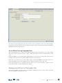
1
Pacific Damage and Loss (PDaLo) Information System
Pacific Damage and Loss (PDaLo)
Information System
User Manual
Administration
AUGUST 2013
SPC SOPAC PUBLISHED REPORT (PR179)
Important Notice
This report has been produced with the financial assistance of the European Union. The views expressed herein do not necessarily reflect the
official opinion of the European Union.
© with support from United Nations UNISDR
Pacific Damage and Loss (PDaLo)
Information System
User Manual
Administration
AUGUST 2013
SPC SOPAC PUBLISHED REPORT (PR179)
Document Control
Version History
The following Version History log contains a record of significant changes made to this document.
Version
Date
Author
Description of change
1.0
10/09/2013
JM
First Version of the Pacific User Manual Administration
Amended from DesInventar manuals (DesInventar Server User Manual
(Data Entry/Admin) - http://www.desinventar.net/DesInventar/DesInventarUserManual.doc)
1.1
13/09/2013
JM
Correction GFDRR acronym
1.2
27/10/2013
LR, JM
Editing review
Corrections and comments:
Jutta May
Adviser Information and Database Management
Disaster Reduction Programme
Secretariat of the Pacific Community (SPC)
Applied Geoscience and Technology Division (SOPAC)
E-mail: [email protected]
For bibliographic purposes, this
document should be cited as follows:
Pacific Damage and Loss (PDaLo) Information System : User Manual
Administration ; DesConsultar. DesInventar : Disaster Information Management
System ; Server 9
Suva : SPC, 2013
Acknowledgements:
The Applied Geoscience and Technology Division (SOPAC) of the Secretariat
of the Pacific Community (SPC) wishes to acknowledge the contribution of all
those who participated in the preparation of the document.
We also acknowledge the United Nations Office for Disaster Risk Reduction
(UNISDR) support for the project.
Pacific Damage and Loss (PDaLo) Information System
Table of Contents
ACRONYMS...................................................................................................................................................................2
INTRODUCTION............................................................................................................................................................3
Welcome to to the Pacific Damage and Loss information system!........................................................................................................4
Main Menu...........................................................................................................................................................................................5
BASIC CONCEPTS........................................................................................................................................................7
Definitions............................................................................................................................................................................................7
Issues and challenges..........................................................................................................................................................................7
GEOGRAPHY MANAGEMENT.......................................................................................................................................9
Geographical Levels.............................................................................................................................................................................9
Creating Geographic Units...................................................................................................................................................................11
Management of Each Level..................................................................................................................................................................12
Management of Maps..........................................................................................................................................................................14
Management of Attributes....................................................................................................................................................................16
Google-Geocode.................................................................................................................................................................................17
EVENT MANAGEMENT..................................................................................................................................................19
Adding Events......................................................................................................................................................................................19
Editing Events......................................................................................................................................................................................20
Deleting Events....................................................................................................................................................................................21
Errors in Manipulating Events...............................................................................................................................................................21
CAUSE MANAGEMENT.................................................................................................................................................23
Add new causes..................................................................................................................................................................................23
Edit information of causes....................................................................................................................................................................23
Delete Causes......................................................................................................................................................................................23
EXTENSION MANAGEMENT.........................................................................................................................................24
The Extension Tab................................................................................................................................................................................24
The Extension Manager.......................................................................................................................................................................24
The Extension Section of the Datacard................................................................................................................................................26
Tab Manager........................................................................................................................................................................................27
Selecting Datacards by ‘Event’............................................................................................................................................................30
Selecting Datacards by ‘Geography’....................................................................................................................................................30
Selecting Datacards by ‘Date’..............................................................................................................................................................30
DATA MANAGEMENT.................................................................................................................................................... 32
Entering and Modifying Disaster Datacards..........................................................................................................................................32
Data Entry Tab.....................................................................................................................................................................................32
The ‘New Datacard’ Button..................................................................................................................................................................32
Creating a New Record........................................................................................................................................................................32
The ‘Edit Datacards’ Button.................................................................................................................................................................33
Updating a Record...............................................................................................................................................................................33
The ‘Delete’ Button..............................................................................................................................................................................34
Deleting a Record................................................................................................................................................................................34
The ‘Find Serial’ Button........................................................................................................................................................................34
Finding a Record..................................................................................................................................................................................34
The Datacard Sections........................................................................................................................................................................35
Effects.................................................................................................................................................................................................35
ADMINISTRATION MANAGEMENT................................................................................................................................36
Region Administration..........................................................................................................................................................................37
DesInventar System Parameters..........................................................................................................................................................39
SECURITY......................................................................................................................................................................43
User Management...............................................................................................................................................................................43
ANNEX 1........................................................................................................................................................................45
Events Definitions................................................................................................................................................................................45
ANNEX 2........................................................................................................................................................................49
ISO 3166-1 alpha-3 Country Codes.....................................................................................................................................................49
ANNEX 3........................................................................................................................................................................50
Two-Letter GLIDE Hazard Codes List...................................................................................................................................................50
ANNEX 4........................................................................................................................................................................51
Causes Definitions...............................................................................................................................................................................51
ANNEX 5........................................................................................................................................................................52
Workflow: Identifying the Number of People from Household Numbers using Census Data..................................................................52
ANNEX 6........................................................................................................................................................................54
Effects and Damage in Saffir Simpson Scale from National Oceanic and Atmospheric Administration (NOAA)......................................54
ANNEX 7........................................................................................................................................................................55
Extensions Definitions with References................................................................................................................................................55
User Manual
Administration
1
Pacific Damage and Loss (PDaLo) Information System
Acronyms
ADRC
Asian Disaster Reduction Center
DIDesInventar
2
User Manual
ENSO
El Niño Southern Oscillation
GLIDE
GLobal IDEntification Number
ISO
International Standards Organisation
Km/h
Kilometres per hour (also used as kph)
LA RED
Red de Estudios Sociales en Prevención de Desastres en América Latina
Mbar
Millibar (also used as mb)
Mph
Miles per hour
PCRAFI
Pacific Catastrophe Risk Assessment and Financing Initiative
PDaLo
Pacific Damage and Loss information system
PDN
Pacific Disaster Net
UNISDR
United Nations Office for Disaster Reduction
UNDP
United Nations Development Program
Administration
Pacific Damage and Loss (PDaLo) Information System
INTRODUCTION
The Pacific Damage and Loss (PDaLo) information system was established with support from the United Nations
Office for Disaster Risk Reduction (UNISDR). The initiative strengthens capacities in the Pacific region to provide
information on damage and loss for disasters to support national planning and investment decisions which
currently do not necessarily take into account disaster risks. Disasters and their impacts represent major losses
for governments and communities. The information system provides improved access to regional disaster
data for the Pacific region and enables to monitor, analyze and disseminate information on key hazards and
vulnerabilities. Subsets of the regional data can be archived and extended on national level in the future.
The information system is using DesInventar methodology.
Introduction to DesInventar
The Network of Social Studies in Disaster Prevention in Latin America, LA RED, was incorporated in 1992 in
San José, Costa Rica. A few months later, in January 1993, LA RED released its Research Agenda and Organic
Constitution documents, stating that:
Population growth and urbanization processes, trends in land use, increasing impoverishment of significant
segments of the population, use of inappropriate technological systems in the construction of houses and basic
infrastructure, and inappropriate organization systems, amongst others, are factors that have increased the
vulnerability of the population vis-a-vis the wide diversity of physical and natural events.
However, lack of systematic, homogeneous, and compatible records of disaster typologies, understood as the
effect of the occurrence of threatening events on the vulnerability of each region, country or city, on the one
hand, and insistence on considering disasters only as effects of events of huge proportions and high impact,
on the other, have hidden the thousands of small and medium scale disasters that occur every year in regions
such as Latin America, the Caribbean, Asia and Africa.
Institutions and researchers of a number of countries are interested in this subject. But unfortunately, they use
different tools to systematize the information on disasters, especially databases or physical files, designed
on the basis of specific or sectorial criteria, and using different formats. Besides, there is a large volume of
information pending compilation and systematization, specifically in graphic material.
This scattered information must be compiled, homogenized and analyzed. But it must also be geographically
referenced, since disasters (affected communities and infrastructure) due to the effects of each type of event
(threat) are regionalized variables.
Objectives
A common objective in regions and countries of Latin America and the Caribbean, Asia and Africa is to build
the capacity to analyze and represent hazards, vulnerabilities, and risks in terms of space and time, both
retrospectively and prospectively. The purpose of this capacity is its application in risk management, whose
activities go from mitigation to post-disaster attention and recovery.
Qualitative and quantitative evaluation of vulnerability and risk growth requires a sound base of documents and
records including past and present disasters.
As a contribution to this common objective, LA RED began its project ‘Inventory of Disasters in Latin America’
in late 1993. Its pilot stage comprised the following activities; a) discussion and definition of conceptual and
methodological criteria for the analytical treatment of small, medium and large scale disasters; b) compilation
of the information for years 1990 through 1994 in available sources, obtained from a sample of Latin American
countries (Mexico, Guatemala, El Salvador, Costa Rica, Colombia, Ecuador, Peru and Argentina); and c)
development of the systems tool required for this purpose.
User Manual
Administration
3
Pacific Damage and Loss (PDaLo) Information System
DesInventar is then the synthesis of a process through which the research teams committed to LA RED
proposed a framework under which the concepts and methodologies related to disasters were unified, and is
also an instrument for the development of the objectives determined. The basic criteria guiding DesInventar are:
- All inventories must have at least a common set of basic variables to measure the effects, and a
homogeneous and basic classification of events.
- The information compiled and processed must be entered in a scale of time and at a geo-referenced
spatial level.
- The inventories must be analyzed with system tools, which is a basic requirement in comparative
research and to support decision-making processes related to mitigation actions and risk management
as a whole.
DesInventar is also an instrument that allows to visualize, in space and time, the phenomena that have been
registered, thanks to its additional instrument called Query Module or DesConsultar.
Welcome to the Pacific Damage and Loss information system!
Getting Started
Starting the Pacific Damage and Loss information system is normally accomplished by starting a browser and
typing the URL:
For the Pacific region
jsp?countrycode=pac
–
http://www.pdalo.net
Globally - http://www.desinventar.net
Local host - http://localhost:8081/DesInventar
The welcome screen of the system will be displayed:
4
User Manual
Administration
or
http://www.desinventar.net/DesInventar/main.
Pacific Damage and Loss (PDaLo) Information System
To enter the Pacific Damage and Loss module please click on the corresponding link on the main menu bar.
For the purposes of this example, the ‘Administration Module’ was chosen. In some systems, this module is
password protected. Ask your administrator for your user name and password to fill out the following screen:
Main Menu
The main menu contains the different functions and is always the first screen that is displayed by the system:
User Manual
Administration
5
Pacific Damage and Loss (PDaLo) Information System
This screen groups a set of administrative functions used for data entry and to manage the system; each mayor
function is shown in a Tab.
Before clicking on any Tab, remember to select a country in the Region tab. This first tab of the system allows
the user to select a specific Region (country) to work with.
Click on the Tab title to see what can you do. The next tabs in this screen are used to create, edit or delete
Geographic Units, Events and Causes.
The Extension tab allows to ‘extend’ the set of data that will be kept for every disaster, in addition to the system
pre-defined Disaster DataCard. The standard disaster DataCard is designed such that the information can be
homologized in all inventories made made using the Pacific Damage and Loss information system (DesInventar).
You may not change the card, but you may create extensions that will sufficiently meet the needs of other
possible fields in the information system.
Two tabs (Query and Edit Data) will let you quickly query the system and find the data you want to edit (or delete)
The methodology for entering data on the cards (and on events, causes and other objects) is consistent across
the system. You can usually choose from the functions ‘Create’, ‘Update’ and ‘Delete’.
Finally, the last two tabs of the system (Admin and Security) contain all the functions needed to administer it
including import/export functions, country creation and management, definition of the users that will be allowed
to access the system, privileges and permissions.
Selecting the Region of Study
Once the information system has been set up or installed, your first action is to choose the region you are going
to work on. You can do this on the following window, clicking on the Region tab:
Choose the country/region from the list with a click; the country/region will be highlighted. Your choice will not
be ‘activated’ until you click on another tab.
6
User Manual
Administration
Pacific Damage and Loss (PDaLo) Information System
BASIC CONCEPTS
Definitions
This user manual for the Pacific Damage and Loss information system aims to maintain a standard with
definitions, terms, references and information relevant to the Pacific context.
Issues and challenges
The reader should take into account that the information system used to produce these results is a live system
and still a work in progress, hence errors cannot be excluded.
Tip!
Quality Control (QC)
Many QC issues can be identified using some of the analysis function in the system while building the
content and during the final validation . For more details on analysing the DesInventar information please
see the the Pacific Damage and Loss (PDaLo) Information System User Manual Analysis (Download http://
www.pacificdisaster.net/dox/PDaLo_UserManual_Analysis.pdf) .for more details.
1. Exaggeratedly large values in effects due normally to typos (but also to mistaken data sources) can be
seen as large slices in composition analysis or bars of too high values in histograms.
2. Some of the most common problems related to dates can be seen while producing simple temporary
histograms and seasonal histograms. Dates entered outside the period (for example a two digits year)
distort the histograms. Use the expert function to target the problematic DataCards.
3. Statistics by event and or geographical unit can also highlight other problems such as potentially
duplicated event types (against fundamental recommendations of the DesInventar methodology).
4. Thematic mapping can show the geographic units without any information.
Events as Defined by the Pacific Damage and Loss (PDaLo) Information
System
EVENT is defined by the Pacific Damage and Loss Information System as a phenomenon, whether natural
or not, which, once triggered, produces adverse effects on human lives, health and/or social and economic
infrastructures.
IMPORTANT: Events without any loss and damage are not captured in the database.
The words selected by DesInventar to designate the types of events are not ‘orthodox’ for disciplines such as
geology, meteorology, etc. The purpose is just to come closer to the most common designations used in each
region for the phenomena. The selection was made based on several dictionaries and technical glossaries,
although the search was not exhaustive. Neither do we intend to propose or impose a new glossary. The point
is more to provide a set of terms with which each research team or user can enter, in a practical manner, the
information on disasters that can be compiled from different sources: existing databases, graphic material, files,
or from the search-and-rescue activities that entities and institutions carry out every day.
The description of the use of each term can be accessed in the Glossary, through the menu ‘Help’. It includes
some alternative words or synonyms that may appear frequently, depending on the sources or on country
or sub-region uses. If preferred, or for practical or uses reasons, the option ‘Create Type of Event’ has been
included. Thus, DesInventar can be applied even to follow-up threatening phenomenologies in industrial sectors
or in evaluations of environment degradation over time.
User Manual
Administration
7
Pacific Damage and Loss (PDaLo) Information System
Geography
A good deal of the effort made by DesInventar has focused on ‘geo-referencing’ the information. This process
assumes the existence of geographical units to which the information will be ‘anchored’.
The research team of DesInventar suggests using the political-administrative divisions of each country as the
basis to geo-referencing the disaster information entry cards.
The geographical units might be, for example, elements of a uniform grid. This could be very advantageous, but
impracticable, because neither natural territorial units nor political-administrative divisions are square.
The alternative is then to use more ‘human’ geographical units, which may be less homogeneous, but can be
used in a practical way. These geographical units must be known zones, established to last over time.
Theoretically, a researcher could establish HIS OWN geographical unit, and use it to geo-referencing the
information. This is valid, but it might not allow cross-referencing information, such as the social-economic
information, which could be absolutely relevant in a study from the social point of view of disasters.
Disaster as Definded by the Pacific Damage and Loss (PDaLo) Information
System
Now that the concepts of geography and data resolution have been described, the cornerstone of the the
Pacific Damage and Loss Information System (DesInventar) can be introduced: the definition of ‘Disaster’:
DISASTER IS DEFINED AS THE SET OF EFFECTS CAUSED BY AN EVENT (WHETHER NATURAL
OR NOT) ON HUMAN LIVES AND ECONOMIC INFRASTRUCTURE ON A GEOGRAPHICAL UNIT OF
MINIMUM RESOLUTION.
This definition contrasts openly with the traditional concepts of disaster, in which:
- the total effects caused by an event are considered.
- Conditions like ‘the ability of a community to cope with the effects’ are imposed in order to be considered
a disaster.
- No thresholds on the amount of damages are imposed (for example ‘10 or more people killed’ or ‘more
than 100 affected’ or ‘a call for international help’).
This definition bears many advantages and a few minor disadvantages as well.
It should be noted, in the first place, that it is possible, for example, to reconstruct the total effects of an event
by adding up its components, but it is not necessarily possible, or trivial, to divide the global effects of an
event into components by geographical unit.
On the other hand, the only way to have a permanent record of the history of disasters at a certain level is by
carrying the account of disaggregate at this level.
Both statements may seem ‘commonplace’ and obvious, but practice has proved that disaggregate inventories
of disasters are not made because, among other things, the creation of entities devoted to the attention of
emergencies has prevailed over the creation of entities devoted to prevent emergencies. These agencies are
usually interested in the global aggregate of the effects as an input to operational plans, budgeting, etc.
The advantages of keeping disaggregated inventories are various and obvious, and we do not want to insist on
the issue. However, it is important to clarify some points:
- Talking about events in the Pacific Damage and Loss Information System is quite different from talking
about disasters. An event can cause as many disasters as there are geographical units vulnerable to it.
- This makes statistics kept by the Pacific Damage and Loss Information System look inflated with respect
to statistics kept under the traditional notion of disaster, but only in terms of the number of ‘disasters’.
Making a disaggregated, rather than a global inventory, indeed takes more time. It can even happen that the
disaggregated data of a disaster turn out to be impossible to obtain accurately, often due to the nature or the
intensity of the disaster.
8
User Manual
Administration
Pacific Damage and Loss (PDaLo) Information System
GEOGRAPHY MANAGEMENT
The Geography tab main screen.
Geographical Levels
Once the country has been chosen and installed, your first step is to determine the NAMES given to the
geographical levels in the relevant country. Click on the button ‘Manage Levels’ of the geography tab (see
previous screen).
Tip!
For the Pacific region, just Geography level 0 is used to identify the country. No other Geography level
is used for the Pacific regional DesInventar while the DesInventar systems on national level will have the
corresponding geography levels applied.
Administrative Note:
Administrator users can Add regions to the list, and Edit or Delete existing regions from the Region
Administration screen; however, DO NOT create regions if it is not absolutely necessary. This occupies space
in the hard disk, in your database server and slows down overall processing. Consult your Adminsitrator if
you wish to make changes to datasets.
Observe that the fields corresponding to code lengths may initially show zeros. It is very important to specify the
length of the codes for each level.
As in all the windows of DesInventar, you must click the Save button as you finish entering the names of the
levels. If you don’t click OK, THE INFORMATION TYPED WILL BE LOST.
User Manual
Administration
9
Pacific Damage and Loss (PDaLo) Information System
The Cancel button aborts the operation; that is, the window is closed without making any changes.
When you choose them from the menu, the processes to enter code and name data for each level will be
initiated.
The following are examples of levels for some Pacific Island countries.
Solomon IslandsLevel 0 = Province
Level 1 = Constiuency
Level 2 = Block
Vanuatu
Level 0 = Province
Level 1 = Council
Fiji
Level 0 = Province
Level 1 = District
Level 2 = Village
Table 1: Population and administrative boundaries for each PIC.
Country
10
Administrative Boundary Levels
0
1
2
3
4
Cook Islands
Group
Island
Electoral
Boundary
Census District
Enumeration
Area
Fiji
Province
Tikina
Enumeration
Area
-
-
Federated States of
Micronesia
State
Municipality
Electoral
District
-
-
Kiribati
Group
Island
Village
-
-
Marshall Islands
Atoll
Islet
-
-
-
Nauru
Island
District
-
-
-
Niue
Village
-
-
-
-
User Manual
Administration
Pacific Damage and Loss (PDaLo) Information System
Country
Administrative Boundary Levels
0
1
2
3
4
Palau
State
Hamlet
-
-
-
Papua New Guinea
Province
District
Local
Government
Level
Census Unit
-
Samoa
Island
Region
District
Village
-
Solomon Islands
Province
Ward
Enumeration
Area
-
-
Timor-Leste
District
Subdistrict
Suco
-
-
Tonga
Division
District
Village
Census Block
-
Tuvalu
Island
Village
-
-
-
Vanuatu
Province
Island
Area Council
Enumeration
Area
-
Adapted from PCRAFI (2011) Risk Assessment Methodology. 8pp.
Creating Geographic Units
The visualization of levels shows the names and lengths given to level 1, 2 and 3. For example for the Samoa
region, level 0 takes the name ISLAND and the length of the code is 3. For level 1 the name is REGION with a
code length of 6 and level 2 is DISTRICT with a code length equal to 9.
The length of the more internal codes contains the superior level.
For a region such as Samoa:
Level 0 (name: ISLAND length:3)
Level 0
Code
Name
001
Savaii
002
Apolima
003
Manono
004
Upolu
Level 1 (name: REGION length:6)
Code
Name
004001
Apia Urban Area
004002
North West Upolu
004003
Rest of Upolu
001004
Savaii
Level 2 (name: DISTRICT length:9)
A few districts belonging to North West Upolu:
Code
Name
4002019
Aana Alofi III
4002020
Aiga i le Tai
4002021
Falelatai/Samatau
4002022
Lefaga/Faleseela
4002023
Safata
User Manual
Administration
11
Pacific Damage and Loss (PDaLo) Information System
This configuration indicates that:
• The first level corresponds to Islands, and its length is 3, therefore only values between 001 and 999
should be used if possible. As a result, the maximum number of islands to be contained in this region is
1000.
• The second level corresponds to Regions, the code length is 6, but 3 are reserved for the first level,
meaning that the possible values for district within a state range from 000 to 999. As a result, the
maximum number of regions per islands is again 1000.
Management of Each Level
The provided operations allow adding, editing, and removing elements on each level.
• Add: It allows you to enter a new level record, indicating code and name. The code length shall not be
greater than the assigned length for its level.
When you click this button, blank fields are displayed on the window for you to fill them in. You may fill in the
fields in order using the keyboard. Use the TAB key to move from one field to another.
Once you have finished filling in the fields, click SAVE, such that the information is registered in the database. IF
YOU DO NOT USE THE SAVE BUTTON, THE INFORMATION WILL BE LOST.
• Delete: It eliminates the record from the database. This operation definitely erases the record from the
system.
• Edit: An element from the list must be selected. You are allowed to change only the name of the selected
record.
The edit screen (see following figure) allows to change the basic data of a geographic unit.
When editing elements in the lower geographical levels (Level 1 and 2) you must select an element from level
0 and click on the ‘Manage XXXX of YYYY’ button on each level screen: the elements will be displayed only if
this level has been defined in the database being used.
12
User Manual
Administration
Pacific Damage and Loss (PDaLo) Information System
Note that the system suggests the new codes in levels 1 and 2 to start with the code of the selected element
in the previous element. Note also that an element can be moved to another ‘parent’ element selecting the
appropriate entry in the drop down list.
Errors While Entering Geography Data
The Pacific Damage and Loss Information System (DesInventar) detects several types of error while entering
data. One of them occurs when you try to create or edit a region, but you have not entered the name or the
code.
When this happens, an error warning sign is displayed and, as it announces, the region will not be created or
modified, as the case may be. Enter the complete information (code and name).
Other error occurs when you try to create a region using a code already applied to other region. In this case,
DesInventar displays the message ‘Duplicated Code’. Repeat the operation using a new code.
The Pacific Damage and Loss Information System will also issue an error message if a region for which
DataCards have been created is attempted to be deleted.
Management Buttons in Geography Tab
The Level 0 geography screen also shows several buttons that bring the user to screens in which other data
related to Geography is managed. These are:
User Manual
Administration
13
Pacific Damage and Loss (PDaLo) Information System
Management of Maps
Maps can be managed in the Pacific Damage and Loss Information System in two possible ways: as DesInventar
6.0 imported maps or as shapefiles.
For information on how to build DesInventar 6.0 maps, please refer to the document ‘Map Import Tool’. We
recommend these maps be discontinued and only Shapefiles used from now on.
As the recommended method is to use the new approach, i.e. coordinate referenced shapefiles the following
paragraphs will describe how to use these types of files as base for the Geography.
Overview of the Process
As a very brief summary, the steps to import a map are the following:
Verify that you have POLYGON maps, and that each of the polygons is uniquely identified by a code.
Verify that each of the layers (shapefiles) to be used correspond to one of the Levels in DesInventar. Each
shapefile must cover ALL of the country/region.
Verify coverage and correspondence of the map and the database. If there is already a geographical division
in the database (for example from the Statistics Bureau of the country), this verification should include an
assurance that the codes for each polygon are the same as those being used in the Pacific Damage and Loss
Information System (DesInventar), that ALL codes in the Pacific Damage and Loss Information System have a
corresponding polygon in the map and that every polygon in the map corresponds to a geographic unit, i.e. that
there is a one-to-one correspondence between the map and the system of selected codes.
Verify that the coordinate system is based on Latitude and Longitude coordinates, preferably using the WSGS84
standard.
Use an external tool (such as Excel, Dbase or similar) to clearly identify the fields (column names) that contain
the code and names of each geographic unit.
MAKE SURE YOU TAKE A BACKUP COPY OF THE DATABASE before attempting this process.
14
User Manual
Administration
Pacific Damage and Loss (PDaLo) Information System
Important Considerations:
Please note the following:
All codes and names of polygons found in the map which don’t exist in the DesInventar database will be
imported to the Pacific Damage and Loss Information System as new areas (i.e the code will be created along
with the name).
No error or warning will be displayed if an Area in DesInventar doesn’t have a polygon in the map.
This process assumes the LENGTH of codes are as per the definition on ‘Manage Levels’ tab. You
CANNOT use shapefile maps when codes are not hierarchical. This means the code of an area must
start with the code of its ‘parent’ area. For example, all districts of a province with code 02 must start
with 02, like 02125.
Setting up a Map for a Level
The process is rather simple:
Select ‘Shapefile’ as format type.
Select a Line width. A line width of 100% is roughly a line 1 pixel wide. You may have thicker lines for higher
boundaries (for example 130%). You may specify less than 100% as width, which will be attempted to be
rendered using a technique called anti-aliasing. However, it will not be strictly a less-than-one pixel line.
Select a Colour for the limit. A palette will be shown; click on the desired color, either on the top palette or in
the gradient bar.
Browse to the file that contains the map. Keep in mind this browses the server computer; if you are working on
your local host you will see you own computer folders and files. However, if the DesInventar server is another
computer you will see the server files and folders; in this case you must upload manually the map to the server.
No provision is made for doing this in DesInventar as a security measure.
First, save the specification and then save it again with the option of ‘Integrate the new map’ into the Server 7
format database.
Management of Other Map Layers
The Pacific Damage and Loss Information System (DesInventar) can show, in addition to the Geography maps,
other cartographical information that is considered to be relevant, such as rivers, roads, location of villages and
other urban centers, topography, etc.
Each additional map will be treated as a ‘Layer’. Layers may be made visible or invisible during the process of
producing Thematic Maps, giving the user high flexibility.
Map Layers MUST be stored in Shapefiles of the following supported types:
• Polygon
• Polyline
• Point
Support for other types of shapefiles will be added in the future.
User Manual
Administration
15
Pacific Damage and Loss (PDaLo) Information System
Layer management is done with the following screen:
The process of adding a map layer is simple:
Select the shapefile using the button ‘Browse’. Same as in the Level Maps, this files must be in the server
computer. If your DesInventar is working on your local PC, you will see you own computer folders and files.
However, if the DesInventar server is another computer, you will see the remote server files and folders; in this
case you must upload manually the map files to the server. No provision is made for doing this in DesInventar
as a security measure.
Provide a name for the Layer, in local language and in English; this name will be displayed in the Thematic Map
windows to turn on an off layers.
Decide if the layer will be visible or not by default.
Select a Line width. A line width of 100% is roughly a line 1 pixel wide. You may have thicker lines (for example
150%). You may specify less than 100% as width, which will be attempted to be rendered using a technique
called anti-aliasing. However, it will not be strictly a less-than-one pixel line.
Select a Colour for the layer. A palette will be shown; click on the desired color, either on the top palette or in
the gradient bar.
Once you are done, click on the button Save at the bottom of the screen. If you want to remove a map layer,
just erase the file name and the layer names.
Management of Attributes
One of the major additions to this version of the Pacific Damage and Loss Information System (DesInventar) is
the ability to manage a large set of indicators (‘Attributes’) associated to the geographic units of the system,
such as population, demographics and many other economic and social numbers.
Each level of the Geography then may be associated to a database table containing these attributes. The
creation of this tables is outside of the scope of this document, but briefly:
16
User Manual
Administration
Pacific Damage and Loss (PDaLo) Information System
Tables can be imported to a database usually through the DB System built-in functionality. For example, to
import a table to an Access database, use the Tools->get External data -> Import menus in the system. Many
databases can export tables using SQL scripts which can later be used to import data in another system or
database. Others provide methods to import or export tables to intermediate formats; lastly tables can be
created as external links in databases or built using INSERT sql statements. Refer to your specific database
system for instructions and suggestions on how to accomplish this.
Attribute tables must comply with one main requisite: each row must contain a column with the geographic
code that will allow the system to ‘connect’ the attribute data with the geographic units and thus the disaster
data. These must be the same codes used in the Geography.
When the Option to Manage Attributes is selected, a screen showing as many entries as levels in the system
is shown. For each level (all are optional), a table may be selected from the dropdown list. Note the table must
already be present in the database.
Once a table is selected, a field or column must be selected for the Join (to ‘connect’) with the rest of the
geography. The best way for doing this is to click on the button with the ellipsis (…) and select the field from
the list. To make the process safer, the content of the first few records are shown. Once the column has been
selected click on Save.
After attribute tables are selected, they will start showing on the Variables boxes of the system (charts, maps,
stats, etc). Please refer to the Query module manual (DesConsultar) for more information on how to use these
attributes in queries, charts, maps, reports and statistics.
Google-Geocode
As experimental feature of the system, you may try to obtain an initial pair of coordinates for those records in the
system that DON’T have a Lat-Long pair defined.
This is done through the Geocode window; it uses the Google API to obtain coordinates. It is recommended
that the batch size is kept low (Max points), otherwise the service can be denied after some intensive use.
User Manual
Administration
17
Pacific Damage and Loss (PDaLo) Information System
Once the ‘Start geocode’ link is clicked, the system will communicate with Google, by obtaining the approximate
coordinates of each event based on the Names of the geography and Place. A bubble will be put on the map
for each location calculated.
18
User Manual
Administration
Pacific Damage and Loss (PDaLo) Information System
EVENT MANAGEMENT
The functions available in this menu, ‘Add’, ‘Edit’ and Delete’, use the same data window, although each of
them uses it in a slightly different manner:
You may click on any other tab at any time once you’re done.
Tip!
For the Pacific region, a selective list of Events is used in the system that are relevant and occur in the
region. Events such as “Avalanche” are not included in the Pacific list for obvious reasons. For a complete
listing of all events used in the Pacific DesInventar system and their definitions, please see Annex 1.
Adding Events
When you are going to create an event, a data screen, similar to the one shown below, is displayed, but with
blank fields for the name and description of the event.
Observe the following rules to fill in the fields:
- Use generic terms for the names, trying to avoid regionalisms.
- Use only CAPITAL LETTERS to enter event data.
- Check out your spelling.
User Manual
Administration
19
Pacific Damage and Loss (PDaLo) Information System
When you have finished entering the first field, use your mouse or the TAB key to reach the next field. Once you
have filled it in, you may:
a) use the TAB key to stop on Save button, and then press ENTER to save the event; or continue to Cancel
the whole operation, or
b) with your mouse, click Save or on Cancel, depending on what you need.
Editing Events
20
User Manual
Administration
Pacific Damage and Loss (PDaLo) Information System
Choose from the list the event you want to edit, and then click on the ‘Edit’ button. A populated screen will be
shown displaying the name and description of the selected event:
DO NOT MODIFY PRE-DETERMINED EVENTS. Remember that one of the objectives of the database (and the
DesInventar methodology) is to homogenize information across databases. This function, and the option ‘delete
event’, are provided only to manipulate new, non-standard events.
Fill in BOTH fields, following the rules of the game. Click Save or Cancel, as the case may be.
Deleting Events
As in the preceding case, choose from the list the event you want to delete. If you do not want to delete any
one, click on Close.
DO NOT DELETE PRE-DETERMINED EVENTS. Remember that one of the objectives of DesInventar is to
homogenize the information. This function, and the option ‘Edit event’, are provided only to manipulate new
events.
To choose an event, just click the one you desire. The function buttons will be displayed as soon as you have
chosen the event to be deleted.
Click OK to delete the event, or CANCEL if you are not going to make any changes.
Errors in Manipulating Events
When you use the above options, two types of error may appear. One, when you have failed to fill in one or both
of the blank descriptions at the moment of creating or editing an event. In this case, an error warning (‘Creation
Error”) is displayed. This means that the event was not created or modified, and you must fix the problem before
the object can be created.
The second possible error occurs when you type an existing Name of Event. In this case, the warning in red
reads ‘ALREADY EXISTS’, and the operation is cancelled.
IMPORTANT: Please note that Events for which datacards have been entered SHOULD NOT be deleted.
instead of an error message, the deletion will be accepted by the system and a coded name (e.g.,
@6.682359617273126E7) will be generated in place of the event you tried to delete. This will affect all
records with that Event. Deleting is not recommended at this time until the system error can be reviewed
by the system manager. For the time being, it is recommended to create a new event or choose another
pre-existing event and adjust manually the records assigned to the event you wish to eliminate.
User Manual
Administration
21
Pacific Damage and Loss (PDaLo) Information System
22
User Manual
Administration
Pacific Damage and Loss (PDaLo) Information System
CAUSE MANAGEMENT
For more information about the causes, see as well the Pacific Damage and Loss (PDaLo) Information System
User Manual Data Management.
Tip!
For the Pacific region, “Cause” information not standardized which makes it so far impossible to use it for
analysis purposes. Cause related information is still useful and should be collected either in the “Cause
Description” field or the “Comments” field.
The operations that can be performed over the causes are:
Add new causes
Press the ADD button. It allows editing the name of an existing cause.
Edit information of causes
Pressing the Edit button allows you editing the name or description of any cause.
Delete Causes
Press the Delete button. Only one cause can be eliminated if it has not been assigned to a record in a particular
database.
Error messages similar to the ones produced while manipulating Events are produced when the user tries to
enter empty data or to enter a cause that already exists, or to delete a Cause that is referenced in a datacard.
User Manual
Administration
23
Pacific Damage and Loss (PDaLo) Information System
EXTENSION MANAGEMENT
This section provides indications about the process for defining the extended card. The process functionality is
split in two: Tabs management and Extension variables Management. All these functions are accessible from
the main Extension tab.
The Extension Tab
Once the Extension tab is selected, a screen with two links is shown. The two links are ‘Extension Manager’,
which contains the functions to define all the additional variables needed, and the ‘Tab manager’, where these
groups are defined and managed.
The mechanism is very simple, but demands a good deal of attention and planning. The decision which
additional variables will be included in the extension section demands good planning and collaboration between
risk analysts, data managers and the database administrator.
If you are familiar with the definition of databases, you will find this process very similar. The expanded card
is basically a set of ‘Fields’, each with its corresponding type of data. You can define additional labels for
interpretation by the operator, and comments for long-term documentation.
The definition of both variables and tabs includes the three usual possibilities: creation of new fields or tabs,
deletion of fields and modification of the attributes of the fields/tabs.
The Extension Manager
Depending on the database platform YOU CAN CREATE AT LEAST 180 FIELDS IN AN EXTENSION Tab.
180 fields is the limit for MS ACCESS databases. In other database platforms (SQL Server, Oracle, etc) this
limit goes to 1000 variables.
24
User Manual
Administration
Pacific Damage and Loss (PDaLo) Information System
The field must be named following the convention of database names: the name must start with a letter,
followed by any combination of letters and numbers, with no embedded spaces. Names must be of 32
character or less length.
Note that the length attribute is applied only to text-type fields. The maximum length is 255 letters. If you need
longer texts, use a Memo field (without length limits).
Field Types
There are 7 different field/data types available:
Text:
Single line of text, up to 255 characters
Integer
Number with no decimals, up to 10 digits
Floating Point
Any other number
Currency
Numbers with 2 decimals
Date
DD/MM/YYYY
Memo
A chunk of text of unlimited length
Yes/No (Boolean)
Yes or No
Dropdown list
A drop down list with a series of values. Use the Codes button to populate the list.
Multiple choice
A radio button list with a series of values. Use the Codes button to populate the list.
The Extension Manager contains the following functions, each one on a button:
Add Field: A new field will be included at the end of the list. Please see below a Field Definition Screen.
Edit Field: if a field is selected, it will be possible to modify the labels (local language and English) as
its description. Please note the field type cannot be changed (except in a few cases, for
example it can be done from Dropdown list to Choice).
User Manual
Administration
25
Pacific Damage and Loss (PDaLo) Information System
Delete Field: It is possible to delete a field, but bear in mind that when you delete a field, you eliminate
the information stored in this field in all the cards, and this is IRREVERSIBLE. The
same applies to a change in the length: if you reduce the length of a field, you will cut the
information, and this is irreversible too.
Codes: The dropdown and choice fields allows to define the list of values that will appear on the list.
Field Up/Down: These buttons help moving the place the fields appear up and down. Keep in mind the list
in the Extension Manager contains all the fields of all the tabs.
Field definition Screen
Code definition Screen
The Extension Section of the Datacard
It is quite common that users find it necessary to maintain additional variables in each event record that are not
included in the datacard.
The DesInventar Methodology Guide provides clear instructions regarding the process, limitations,
methodology and philosophy to design the expanded card.
Extended variables can be organized further in Tabs. The figure below displays an extended datacard organized
in sections (tabs): PDN Events, Consequences DB, Historical, and Additional Sectors.
The above illustration shows the expanded section of a card window: you can see the set of field names before
the field used to populate the values on the right side.
Data entry follows the normal procedure. Field entries are restricted in length and controlled accordingly.
Use the keys TAB to move through the fields, and SHIFT-TAB to move forwards and backwards on the set of
fields.
26
User Manual
Administration
Pacific Damage and Loss (PDaLo) Information System
Once you have typed the information, use button ‘SAVE’ to register it in the database.
IMPORTANT: IF YOU DO NOT USE THE BUTTON ‘SAVE’, THE DATA OR THE MODIFICATIONS WILL BE
LOST.
Definitions for all extension fields can be found in Annex 7 Extension Definitions.
Tab Manager
In order to organize the Extension variables in a way that is easier to locate, to type and update them and to
produce smaller data entry screens, extended variables can be grouped in tabs.
The functions required to manage tabs are present in the Tab Manager:
Add tab: A new tab will be included at the end of the list. Please see below a Tab Definition Screen.
Edit Tab: If a Tab is selected, it will be possible to modify the labels (local language and English).
Delete Tab: It is possible to delete a tab, but bear in mind that when you delete a tab, all fields return to
the default Extension group.
Assign Variables: This function allows the user to define which variables are to be shown on each tab. User
must select one tab from the list, and click in this button. All variables will be shown on the
left hand list, and the list of variables that will appear on the tab in the right side list. Variables
can be selected and moved to the right and left with the corresponding ‘Add to Tab’ and
‘Remove from Tab’ buttons.
Field Up/Down: These buttons help moving the place the tabs appear up and down (left and right on the
datacard).
User Manual
Administration
27
Pacific Damage and Loss (PDaLo) Information System
Tab data screen
28
User Manual
Assign variables to Tab screen
Administration
Pacific Damage and Loss (PDaLo) Information System
QUERY MANAGEMENT
The ultimate rationale of an information system goes beyond the initial and basic objective of achieving a
methodical, homogeneous and systematic storage of information.
Information is useless if there are no tools to retrieve, (consult) and analyze.
Information retrieval processes must be selective, specific to the characteristics of the information. In DesInventar,
retrieval is made based on thematic (type of event and causes), spatial component (geography) and time (dates)
criteria.
Data analysis is too wide an issue to be approached in a generic manner. However, DesInventar provides tools
to display and visualize the information, which will serve to initiate and support the analysis activity. For more
details on analysing the information please see the Pacific Damage and Loss (PDaLo) Information System User
Manual Analysis (Download http://www.pacificdisaster.net/dox/PDaLo_UserManual_Analysis.pdf).
Mark the query options with which you restrict your search. Then press the CONTINUE button to visualize the
results. The criteria for limiting the information output of the query are :
• One or several types of events.
• One or several sub-regions of level 0.
• One or several sub-regions of level 1, if level 0 has been selected.
• One or several sub-regions of level 2, only if level 1 has been selected.
• Range of dates, that can be: only year, year-month or year- month- day.
• Events with victims(dead), injured people, destroyed houses, affected houses, and other effects.
• Type of selection: AND (Conjunctive - classifies strictly in all the selected/checked variables), OR
(Disjunctive - classifies if any of the selected variables is present).
• Affected infrastructure.
• Output sort order.
User Manual
Administration
29
Pacific Damage and Loss (PDaLo) Information System
Selecting Datacards by ‘Event’
The first list displayed includes all the types of event that have been defined. If you need a consultation (or report)
containing one or more events, select it from this list. If you do NOT select a type of event, the consultation
(report) will display ALL the types of event.
Click the event you wish to select. To actually select it, click again.
Selecting Datacards by ‘Geography’
The next two lists allow to select regions on which you need information.
As in the list of Events, if you do not select something, you are implying that you want to see all the regions at
this level. If you do not select Regions at Level 0, the system will retrieve the cards of all the regions.
If you have selected regions at Level 0, but you fail to fill in the Level 1 list or to select something from it, all the
cards for disasters occurred in the regions selected at Level 0 will be retrieved.
Note that Level 1 lists appear empty at the beginning. They contain information only if a selection has been
made at the previous Level. When you click them, the regions of this level are displayed, and they correspond
with the regions selected in the previous level.
In the example window, if you have selected the Departments Antioquia and Atlántico, and you have clicked the
Level 1 list, the municipalities of these departments will be displayed. Then you can select only some of these
municipalities.
Selecting Datacards by ‘Date’
At the bottom of the window you can see two dates: an initial date (SINCE) and a final one, ‘UNTIL’.
As with the lists, using them or not using them will determine or not the dates to be retrieved. If you do not use
the date SINCE, the dates will be displayed without restrictions, except for those resulting from the date UNTIL.
The same applies to ‘UNTIL’ dates.
Thus, if you give the date ‘SINCE’ only, all the cards with subsequent dates will be retrieved.
If you use the date ‘UNTIL’ only, the cards with dates prior to the one indicated will be retrieved.
If you include both dates, the system will retrieve the cards whose date is included in the period specified.
It is important to clarify that if you enter a year as a date, you must also enter the month and the day. Otherwise,
the system will take January 1st as the rest of the date. This is particularly important in the case of the ‘UNTIL’
date. If you enter the year only, only the cards of PREVIOUS YEARS will be retrieved.
EXAMPLE: To retrieve cards corresponding to years 1993 and 1994, type as ‘SINCE’ date year 1993. And as
‘UNTIL’ date, 31-12-94, or year 1995 ONLY.
The results of the selection show a spreadsheet-like matrix of data with the records that comply with the
selection criteria.
Optionally, the user is able to edit the information in each cell, this information gets automatically stored replacing
the last piece of information: BE CAREFUL IN ITS USE.
The colors indicated in the back of the fields of the basic record correspond to the groups of variables being
refered to in the Section called Basic record.
Print: It prints out the records currently on screen in a record format.
Export: It allows to export information as a text archive, separated by tabulators. This file can be read from the
majority of spreadsheets programs.
30
User Manual
Administration
Pacific Damage and Loss (PDaLo) Information System
User Manual
Administration
31
Pacific Damage and Loss (PDaLo) Information System
DATA MANAGEMENT
Entering and Modifying Disaster Datacards
For more detailed information about entering and modifying data please see the Pacific Damage and Loss
(PDaLo) Information System User Manual Data Management (Download http://www.pacificdisaster.net/dox/
PDaLo_UserManual_DataManagement.pdf)..
To initiate the Disaster data entry process, activate the option ‘Data Entry’ in the main menu.
Data Entry Tab
These Function buttons are mutually exclusive, except for the ‘Print’ function. When you activate one of them,
the others are disabled.
The ‘New Datacard’ Button
Creating a New Record
As suggested by its name, it is used to add new disaster cards to the inventory.
The blank datacard will be displayed in a few seconds. The content of the card is distributed in several sections:
32
User Manual
Administration
Pacific Damage and Loss (PDaLo) Information System
When you click this button, all the card fields are cleared and you can start entering the information on the new
card. Only the fields corresponding to Level 0 and Event usually show the information of the card that was
displayed before creating the new card. The Pacific Damage and Loss Information System suggests a Card
Serial Number equivalent to the number of cards contained in the database plus one.
The fields can be filled in an orderly manner using the keyboard. To move from one field to another you can use
the TAB key.
IMPORTANT: As soon as the button Create is clicked on, a set of buttons will appear at the bottom of the
Datacard screen.
Once you finish filling all the fields, click SAVE to store the information in the database, OR THE INFORMATION
WILL BE LOST.
To store the record press SAVE, in the lower part of the record.
The ‘Edit Datacards’ Button
Updating a Record
Its function is to allow editing information in cards previously entered to the system. Click this button to activate
the fields of the current card.
An extra set of buttons will be shown:
User Manual
Administration
33
Pacific Damage and Loss (PDaLo) Information System
If you want to edit a card other than the one displayed on the screen, you have two options:
- Moving through the set of cards using the scroll arrows found at the top of the page. The internal arrows
(< and >) allow forward and backward movements, and the outer arrows (>> and <<) will take you to
the first card (left arrow) or to the last card (right arrow) of the database.
- Use the ‘SEARCH’ button to find the card you want to update; thus, you have to know the Card No.
If you don’t know the serial number of the record you need to update, run a query using details of your record,
for instance, selecting the “Disaster Type” and “Country” of your record and there are other selections to narrow
down your search and find your record.
Once you have located your record and opened the datacard, make your changes directly to the fields on the
datacard. Once you are certain about your data entries, click the save button at the top right hand corner of the
datacard. Your updates are now saved.
IMPORTANT: Do not forget to use the “save” button to store the information; otherwise, the corrections
will be lost.
The updating process is repetitive; it allows to continue to update cards as described. Use the Done button
(bottom of the screen to the right) to suspend.
The ‘Delete’ Button
This button eliminates cards from the inventory a similar process to that of the ‘Update’ button.
Deleting a Record
Click DELETE to choose the card you wish to eliminate. Once it is displayed, the ‘Delete’ button at the bottom
of the screen changes to DELETE.
When you click DELETE, the Pacific Damage and Loss Information System displays a sign to confirm the
elimination of the card activated, which corresponds to a record of the database. It will ask you:
Are you sure you want to delete this record?
Click OK to approve elimination.
NOTE: The DELETE operation cannot be undone. Once the card is erased, it will be impossible to recover
it. It will be necessary to enter the data again.
The ‘Find Serial’ Button
Finding a Record
Use this button to find a card when you know its serial number. When you activate it, a field is displayed to enter
the card serial number.
More than one card may have the same serial number; serial numbers are NOT exclusive. For this reason, you
may have to click in the search button more than once, one to find the first card identified with the serial number,
and another to find the next.
If the card actually exists, it will be displayed. Then you can use the ‘Update’ or ‘Delete’ buttons.
34
User Manual
Administration
Pacific Damage and Loss (PDaLo) Information System
The Datacard Sections
Event Selection and Localization in Space and Time
The data characterizing the event according to type, time and space are entered in this section. It is strongly
recommend that ALL fields are filled in, in the header, or at least those corresponding to Card No., Date, Type
of Event and those related to geography levels already coded, that is, the levels previously entered. Note
that the field Site is not a geo-referenced field, and is optional.
Effects
Conducting research for the damage and loss information of an event can be very challenging at times. Often,
the reported figures will change as the data is received from the field and different sources, or it can be reported
in different formats such as percentage instead of count, or mph instead of Kmph, etc. Research can be very
time consuming and requires acute attention to detail. For the Pacific, protocols and standards have been
carefully tested to maintain consistency across all data. Workflow information can be found in Annex 5.
Tip!
For the Pacific region, be mindful when entering data and checking the boxes. The check mark will remain
if you change an entry number to 0, so you MUST manually remove the check. Integrate validation checks
for data entry and updates through quality control and manual cross checks.
Please see the Pacific Damage and Loss (PDaLo) Information System User Manual Data Mangement for
details on datacard data entry and management.
User Manual
Administration
35
Pacific Damage and Loss (PDaLo) Information System
ADMINISTRATION MANAGEMENT
Under this tab there are a series of important administrative tasks. You won’t be allowed access to this tab if you
don’t have Administrator or SuperUser privileges.
If you have selected a region in the Region Tab you will get many more options than if you haven’t: the entire
section ‘Data Administration Functions [region]’ will or won’t be shown.
The Administrative tab looks like:
The following are the possible Administrative functions:
General Administrative Functions
• Region Administration: with this option Region specifications may be added, modified or deleted. See
section ahead.
• Parameter Administration: Maintenance of the main parameters of the system. See section ahead.
Data Administration Functions [Region]
These function apply to the currently selected region.
• Full text re-index of this Region: Regenerates the full-text index, which is used for Keyword search.
Useful when data has been added to the system via processes outside of DesInventar.
• Import an MS ACCESS DesInventar 6.x Database: As the name suggests, databases produced with
previous versions (5.x and 6.x) can be imported into the current DesInventar region. See section ahead.
• Import from another (DesInventar) region: Similar to the previous one, but this options allows the entire
content of another DesInventar database managed in the server to be imported into the current Region.
Very useful to physically consolidate multiple databases into one.
• Import database from MS EXCEL file: Similar to the previous ones, but this options allows the entire
content of an Excel spreadsheet server to be imported into the current Region.
36
User Manual
Administration
Pacific Damage and Loss (PDaLo) Information System
• Import from table: this options allows the entire content of an non-DesInventar table in the database to
be imported into the current Region.
• Export Database in XML format: this options allows the export of the database to a platform neutral
XML file. Files produced with this option can be imported with the next option. These files are useful
when moving data from Windows based (Access) databases to Linux or Unix databases where these
databases are not supported.
• Import from DesInventar Standard XML: see previous option.
• Run SQL Script: This utility presents a text screen where the user can enter an SQL query or DDL/DML
statement for execution. Only experienced and expert users should attempt to execute DDL or DML
statements here. Extreme caution should be exercised when using this option.
Useful Links
• Query this region with DesConsultar on-line: jump to the Query module with this Region selected.
• Logout: disconnects the current user and jumps to the Login Screen.
• Reload Translations: Useful when working on new languages or when changes to the translation files
(located at <install dir>/DesInventar/WEB-INF/classes/org/lared/desinventar have been changed to, for
example, correct a spelling mistake or localize a translated sentence or word.
Region Administration
Administrator users can Add regions to the list, and Edit or Delete existing regions from the Region Administration
screen.
CAUTION: These operations affect ALL users of the system. Use your administrator privileges with caution.
The button ‘Add Region’ will display a new screen where the user will fill in the two-digit code that will identify
the region and the name of the region. Then the record required to store the data on the new region is created.
DO NOT CREATE REGIONS IF IT IS NOT ABSOLUTELY NECESSARY. THIS OCCUPIES SPACE IN THE HARD
DISK, IN YOUR DATABASE SERVER AND SLOWS DOWN OVERALL PROCESSING.
The ‘Delete Region’ button, as its name indicates, deletes a region of study from the list of available regions: It
doesn’t delete its database, the maps, etc. This DELETE FUNCTION IS IRREVERSIBLE.
NOTE: It is NOT possible to Delete the active region of study.
User Manual
Administration
37
Pacific Damage and Loss (PDaLo) Information System
The Parameters for Each Region
An administrator of DesInventar may add new countries to the list of currently available by using the Region
Administration function.
Each country needs a minimum set of parameters, as requested in the screen.
Region code: the two letter code used to create the files with the standalone version.
Available to public: if set to NO the database will NOT be shown in the list of countries.
Region Name: name to be displayed in the country lists.
Database Type: select here the type of database engine under which DesInventar online will maintain this
country’s database.
JDBC DRIVER
JDBC CONNECT STRING: these two parameters inform the system how to access the country’s data.
The JDBC Driver is suggested by the system when a database type is selected. Don’t change this suggestion
unless you are completely sure the driver class is available to the web server.
The JDBC Connect String depends on the type of database and JDBC driver selected. If using one of the
suggested drivers, you will have to probably substitute the UPPERCASE parameters of the connect string with
appropriate values.
For MS ACCESS:
jdbc:odbc:DATASOURCE
Substitute DATASOURCE by the System DSN Name supplied in the ODBC Data Source Administrator.
See examples of data sources in the System tab of the ODBC administrator, where the Data sources may be
created in advance, where DesInventar Server will expect to find it and where it will be created if necessary.
38
User Manual
Administration
Pacific Damage and Loss (PDaLo) Information System
For Oracle:
jdbc:oracle:thin:@SERVER:PORT:DATABASE
Substitute:
SERVER: IP address of fully qualified name of the database server
PORT: usually 1521
DATABASE: this is the database System Identifier (SID) of the database. Consult with your database administrator.
For MS SQL Server:
jdbc:sqlserver://SERVER:PORT;DatabaseName=DATABASE
SERVER: IP address of fully qualified name of the database server
PORT: usually 1433
DATABASE: this is the database name of the database, as seen in the Enterprise Manager for MS SQL Server.
Consult with your database administrator.
DB USER NAME: this is the signon for the database server. MS ACCESS does not require it. In Oracle, this will
define the schema that the server will give access to. In MS SQL Server and PostgreSQL, there must be a login
name with permissions to access the database.
DB USER PASSWORD: corresponding to the user name above.
DIRECTORY WITH MAP FILES: as its name suggests, this directory will contain the map files (SAME AS IN
THE STANDALONE VERSION).
DesInventar System Parameters
The main task of database is to maintain disaster inventories of multiple regions. The Pacific Damage and Loss
Database can manage this information in a set of Databases or a set of ‘database Schemas’, depending on the
database product or products being used.
But, how does the database (DesInventar) know what countries and databases it must access in order to fulfill
its mission? The answer is through a very special database, called the ‘Default Database’ which in turn stores
data about all possible databases DesInventar can access users, authoring information, driver and connecting
data and many other important information.
There is also the need to know the values of several parameters related to other areas of the operation of the
database (DesInventar), such as the mail server parameters, the location of critical folders and so on.
This Default database and those special parameters are described and defined using a small and simple file that
must be always stored in a standard location, the DesInventar.properties file, in the /etc/DesInventar/ folder.
This file MUST be stored in the /etc/DesInventar folder and MUST exist.
An example of the content of the DesInventar.properties is:
#System Properties
#Thu Feb 20 23:35:17 EST 2003
default.directory=/tomcat/webapps/DesInventar
platform=Windows
db.type=0
db.password=
db.username=
db.name=jdbc:odbc:DesInventar
db.driver=sun.jdbc.odbc.JdbcOdbcDriver
db.maxconnections=250
User Manual
Administration
39
Pacific Damage and Loss (PDaLo) Information System
template.prefix=/tomcat/webapps/DesInventar
absolute.prefix=
mail.directory=/tomcat/webapps/DesInventar
mail.out.protocol=SMTP
mail.out.port=25
mail.out.IP=localhost
The following are the parameters that govern the behaviour of DesInventar.
PARAMETER
DESCRIPTION
Database Type
(db.type )
Must be one of the values in the dropdown list. This value refers to the Database or
indexing system that contains the table of URLs. The possible Values are: Access, Oracle,
SQL Server or MySQL.
Database JDBC
Driver
(db.driver)
Fully qualified name of the database JDBC driver class. This value refers to the Database
or indexing system that contains the table of URLs. It is the responsibility of the
Administrator to supply an adequate value to the type of database.
Some of these names are:
Oracle:
oracle.jdbc.driver.OracleDriver
ODBC/JDBC Bridge (Access): sun.jdbc.odbc.JdbcOdbcDriver
JDBC Drivers for MS SQL Server:
com.microsoft.sqlserver.jdbc.SQLServerDriver
MySQL:
com.mysql.jdbc.Driver
Database Connect
String
(db.name)
This is a string that tells the JDBC driver how to connect to the specific database, such
as the database server can run on a separate computer. This string contains information
about the driver to use, the database server IP and port, and some other important
information.
Some examples of connection strings are:
Oracle:
jdbc:oracle:thin:@127.0.0.1:1521:ORCL
ODBC/JDBC Bridge (Access):
jdbc:odbc:inventXX
Drivers for MS SQL Server:
jdbc:microsoft:sqlserver://SERVER:1433;databasename=dbname
MySQL:
jdbc:mysql://DataBase?autoReconnect=true&
initialTimeout=1&relaxAutocommit=true”
40
Database Username
(db.username)
The username of the owner of DesInventar tables in the database. Some databases such as
Access or SearchServer may not require this parameter. Leave it blank in those cases.
Database Password
(db.password)
The password of the owner of DesInventar tables in the database. Some databases as
Access or SearchServer may not require this parameter. Leave it blank in those cases.
default.directory
Directory in which the System files reside, typically under the webapps directory of Tomcat
(or the JSP/Servlet container).
HTML templates
Directory
(template.prefix)
Directory in which the System Template files reside, typically under the webapps directory
of Tomcat (or the JSP/Servlet container).
System Platform
(platform)
Operating system platforms against which this version of DesInventar has been tested.
User Manual
Administration
Pacific Damage and Loss (PDaLo) Information System
Temporary Mail
Directory
(mail.directory)
Temporary directory to be used for email operations. Empty by default.
Mail Server Protocol
(mail.out.protocol)
Mail protocol of mail server. SMTP by default.
Mail Server Port
(mail.out.port)
Port at which the mail server listens.
Mail Server IP
address
(mail.out.IP)
IP address or fully qualified name of the mail server.
The System Administrator who physically installs the system normally configures this file manually, based on an
initial template that works usually in most systems without much changes.
In a Windows environment, the initial default database is normally an MS ACCESS type database file named
desinventar.mdb, which is accesed via ODBC. The system administrator MUST create an ODBC System DNS
entry named ‘desinventar’ pointing to this MS Access file, if this is the case.
If the System Administrator decides that the default database will run under another type of database, he or
she has to manually create the default database (with possibly a username and password) and has to edit
the /etc/desinventar/desinventar.properties file manually with appropriate settings (driver, connect string, type,
username and password).
The tables required by DesInventar in the Default Database can be created using the scripts found in the /data
folder of the distribution CD.
Scripts to create tables are provided for Oracle, MS SQL Server and PosgreSQL. An Access database is also
found in that folder, that can be used as a template to create other MS ACCESS databases.
The only advantage of the MS Access version is that it doesn’t require any royalty. However, the MS Access
libraries must be installed in the target computer. Those libraries are installed with DesInventar, Desconsultar or
MS Office or Visual Basic, and constraints the System to run in a Windows environment. While MS Access is
very good for personal installations, its use in multiuser environments is strongly discouraged.
Once the default database is created and configured, the system should function immediately and the
administrator should be able to login with no password (anonymous access) or the default power user:
Username: default
Password: password
Once DesInventar can access the Default database, further configuring of DesInventar is done using the
Parameter Administration and Region Administrations pages of system. With this interface, DesInventar can
be configured to access multiple regions stored in different types of databases.
In order to configure the System, you must click on the link ‘Parameter Administration’ of the main screen of
the DesInventar index page.
After logging to the system, the administrator will access the main Administration menu of the system, from
where the parameters page will be accessed. The figure below shows a sample System Parameters page with
typical values for an Access type default database.
WARNING: The Parameters page SHOWS and allows the USERNAME and PASSWORD of the default
database to be modified by anyone with access to this page. Take all necessary precautions to restrict the
access of unauthorized users to this page.
User Manual
Administration
41
Pacific Damage and Loss (PDaLo) Information System
Importing DataCards from other DesInventar Sources
This option allows the consolidation of multiple sources (including MS Access DesInventar databases version
6.0 or other DesInventar Server 7 databases). However, this process has been conceived more as a migration
path from DesInventar 5 or 6 than a consolidation process.
The use is very simple: The MS Access database is selected by clicking on the button ‘Browse’ and navigating
by the Server computer hard disk structure to find it. Please note this functionality will NOT work if the target
database is not stored in the server computer.
In order to be able to import an excel you need to comply with some conditions:
a) Each disaster record must be in a row (i.e. one row per disaster).
b) Each disaster record MUST contain the geographic code of the unit affected. (Same codes as in
Geography and Maps). At least one level of geography is mandatory. Each level (province, district, etc)
must contain an independent column with the code.
c) There must be either a column with the date, or columns for year, month day.
d) If there are several disaster types (e.g., Flood, drought), there must be a column with this info. It should
be same as the names of the event types used in DesInventar.
e) Keep in mind DesInventar only supports Excel 2003 format.
The mechanism itself of importing is simple but cumbersome. Once selected the excel file, you will see a page in
which you can establish a mapping between the variables in a datacard and the columns of the excel. You must
mach as many as you can, especiially the geography, date, event, etc. and the impact (deaths, injured, etc).
Note that the excel may contain more variables than those in the datacard. Once the initial mapping is done, you
will have the opportunity to add these additional columns to DesInventar as part of the extension.
Always make a backup copy of your database before attempting to upload an excel file. 42
User Manual
Administration
Pacific Damage and Loss (PDaLo) Information System
SECURITY
User Management
The security model in the Pacific Damage and Loss Information System (DesInventar Server) considers two
objects:
• Users that access the system.
• Regions (databases) which can potentially be modified by those users.
Users themselves are classified into several categories:
User
Authority
Guests
Can only visit the public part of the system (i.e. DesConsultar) and have no permissions to modify
the system in any way.
Operators
Can be authorized to enter data in one or more regions. Entering data means here the permission
to add, remove or modify dataCards in those regions.
Administrators
Can modify all objects of the regions he/she has been granted permission. All objects include
events, causes, all levels of geography, and also enter data (add, remove or modify DataCards).
Owner
Has all the priviledges of an administrator but can also modify the regions in the system: change
the settings of a given region, add more regions, or remove a region from the system. (Note the
system NEVER deletes a region. It only removes it from the list of available ones). The owner can
also add, modify, deactivate and remove users and give them up to owner category. It is the user
in charge of the overall security of the system. It is recommended only one owner per system.
SuperUser
Has all the privileges of the system (all of the previous categories) and it can also create owners,
other SuperUser but basically his/her main priviledge is to manage the global parameters of the
system. It is recommended only one SuperUser per system.
Users are managed using the Security tab:
User Manual
Administration
43
Pacific Damage and Loss (PDaLo) Information System
With this screen new users can be added to the system, existing user settings can be changed, unwanted users
may be removed from the system and permissions can be granted to existing users.
The Add and Edit user buttons will bring up the user definition screen, in which the properties of the user are
established:
Important remarks:
• Password has to be typed twice in order to be validated as it is not displayed.
• Username, last name, first name and email are mandatory fields.
• The default access type of a user is guest. Set it to the desired level.
• In order to de-activate a user, just turn it into a guest.
44
User Manual
Administration
Pacific Damage and Loss (PDaLo) Information System
ANNEX 1
Events Definitions
Predetermined Events
Bellow you will find the types of events (threatening phenomena, or hazards, of natural, anthropic or technological
origin) that the Pacific Damage and Loss data entry card includes in alphabetical order. For analytical purposes,
some of the events can be grouped based on their similarity or origin; for example: ‘flash-flood’, ‘flood’, and
‘avalanche’ or ‘rain’, ‘gale’ and ‘storm’ can be considered under two categories. DesInventar allows making
reports using this type of considerations.
We suggest that the events are not modified by independent users. New types of events may be entered,
but we recommend users to inform the Coordination of the Pacific Damage and Loss Information System
(DesInventar) about the new type of event, and provide a description of the same.
The reason for this procedure is to guarantee homogeneity and comparability of disaster inventories in many
regions of the world, including Latin America and the Caribbean, Africa and Asia by preferring unified criteria
and languages over regionalisms.
The Pacific Damage and Loss Information system (DesInventar) elects to use the globally standard unique ID
two-letter code for disasters proposed by the Asian Disaster Reduction Center (ADRC) and set by the GLobal
IDEntifier Number (GLIDE)1.
The following is the alphabetical list of events with their GLIDE two-letter codes, predetermined in the system:
AC - Accident
Automobile, rail, aircraft or navigation accidents. Limited to accidents induced by natural phenomena, such as
landslides, earthquakes, hurricanes, rain etc. Includes transportation accidents generating spills or leaks of
harmful substances, regardless of the cause.
CW - Cold Wave
Drop of atmospheric average temperature well below the averages of a region, with effects on human
populations, crops, properties and services.
CE - Complex Emergency
A crisis in a country in which there is a breakdown of authority caused by conflict and where an international
response is needed (PDN).
DR - Drought
Unusually dry season, without rain or with rain deficit. As a whole, these are long periods (months, years, and
even decades) typical in limited continental areas or on regional scales.
EQ - Earthquake
All movements in the earth’s crust causing any type of damage or negative effect on communities or properties.
The event includes terms such as earth tremor, earthquake and vibration.
FR - Fire
Urban, industrial or rural fires, but not including forest fires. Limited to those induced or highly connected to
natural phenomena, such as electrical storms, earthquakes, droughts, etc.
FL - Flood*
Water that overflows river-bed levels and runs slowly or quickly on small areas or vast regions. Tidal flooding in
coastal zones will be reported as ‘Tidal wave’.
*For the Pacific region, we only use the category ‘flood’ for all flood-type events, for example, flash floods.
1
This idea was shared and promoted by the Centre for Research on the Epidemiology of Disasters (CRED) of the University
of Louvain in Brussels (Belgium), OCHA/ReliefWeb, OCHA/FSCC, ISDR, UNDP, WMO, IFRC, OFDA-USAID, FAO, La Red
and the World
User Manual
Administration
45
Pacific Damage and Loss (PDaLo) Information System
LS - Landslide
All mass movements other than surface erosion of a hillside. This event includes terms such as precipitation of
earth, settling, horizontal land thrust, mass movement, displacement, subsidence, collapse of caves or mines,
rock falls, (slow or quick) detachment of soil masses or rocks on watersheds or hillsides.
SS - Storm Surge
Great sea waves breaking on the littoral. Includes reports caused by Tidal waves, gales, storms -other than
tsunami or seaquake, in the strict sense indicated under ‘tsunami’- by coincidence of wind directions and
high tide periods, or by rise of average sea level during the phenomenon ‘El Niño’. In some places, tidal rises
reaching maximum bimonthly levels or up to maximum annual levels are called “high tide”.
ST - Severe Local Storm
Rain accompanied by strong winds and/or electric discharges (lightning). Due to regional connotations,
sometimes there is no difference between ‘storm’ and ‘gale’.
TD - Technical Disaster*
A hazard originating from technological or industrial conditions, including [large scale] accidents, dangerous
procedures, infrastructure failures or specific human activities, that may cause loss of life, injury, illness or
other health impacts, property damage, loss of livelihoods and services, social and economic disruption, or
environmental damage. Examples of technological hazards include industrial pollution, nuclear radiation, toxic
wastes, dam failures, transport accidents, factory explosions, fires, and chemical spills. Technological hazards
also may arise directly as a result of the impacts of a natural hazard event (UNISDR).
*For the Pacific region, the two-letter code “TD” is not an official GLIDE code. Currently, in GLIDE, “AC” is used for Technical
Disasters as well as for Accidents. To differentiate, the Pacific Damage and Loss Information System uses “TD”.
TC - Tropical Cyclone
Violent atmospheric anomaly characterized by strong whirling winds accompanied by rain. They are originated
in the Caribbean Sea and tropical areas of the Pacific Ocean. They are equivalent to hurricanes, the cyclones in
the Indian Ocean and to typhoons in the West Pacific Ocean.
TS - Tsunami
The term is applied only to waves generated by undersea movements (caused by earthquakes, volcanic
eruptions or landslides).
VO - Volcano
Volcanic eruption with disastrous effects: eruption and emission of gas and ashes, stone falls (pyroclast), flows
of lava, etc. This event includes eruption of sludge volcanoes found in some Caribbean regions.
WF - Wild Fire
Forest fire. The event includes all open-air fires in rural areas, natural and artificial forests, plains, etc.
Events not used in the Pacific Damage and Loss information system
Alluvion
Torrential water flows dragging large amounts of solid material (pebbles, stones, and rock blocks) common in
dry regions or river beds produced by heavy rain. Equivalent to the term ‘huaico’ used in Peru.
Avalanche
Swift sliding of loosened ice and/or snow masses.
Biological Event
Destruction of biological species for known or unknown reasons. In the end, these events may be associated to
pollution or drastic changes in environmental parameters. An example could be the ‘red tide’.
46
User Manual
Administration
Pacific Damage and Loss (PDaLo) Information System
Boat Capsize
Overturning of a boat due to hitting the water-bed or due to sea-disturbances.
Coastal erosion
Variations of the coast line and/or maritime zones near the coast. Includes formation and destruction of islands,
beaches and sand banks and erosion of cliffs affecting populations, navigation, etc.
Eruption
Volcanic eruption with disastrous effects: eruption and emission of gas and ashes, stone falls (pyroclast), flows
of lava, etc. This event includes eruption of sludge volcanoes found in some Caribbean regions.
Explosion
Explosions of any type, but limited to those induced or highly connected to natural phenomena, such as
electrical storms, earthquakes, droughts, etc.
Flash Flood
Torrential freshet. Violent water flow in a watershed, overflowing or as torrent. Flash-floods usually carry tree
trunks and/or abundant fine to bulky sediment. They can be caused by rain, dam bursting or abundant landslides
on a watershed or basin.
Gale/Tornado
All atmospheric disturbance generating strong and destructive winds, usually without rain or little rain. The
term is synonymous with hurricane-type winds, whirlwind, squall, strong wind, blizzard, wind-blast, gust, and
tornado.
Hailstorm
Precipitation of hail. Frozen raindrops that fall violently in the form of hard pellets.
Heat Wave
Rise of atmospheric average temperature well above the averages of a region, with effects on human populations,
crops, properties and services.
Hurricanes/Cyclones
Violent atmospheric anomaly characterized by strong whirling winds accompanied by rain. They are originated
in the Caribbean Sea and tropical areas of the Pacific Ocean. They are equivalent to the cyclones in the Indian
Ocean and to typhoons in the West Pacific Ocean.
Leak
Leak of harmful liquid, solid or gas substances, whether radioactive or not, generated by technological accidents,
human fault or transportation accidents.
Panic
Panic or mass hysteria among people concentrated in a certain place (stadiums, theaters, etc.) that can kill or
injure them, and cause physical damage. Limited to those induced or highly connected to natural phenomena,
such as electrical storms, earthquakes, etc., and early warnings about incoming events.
Plague
Proliferation of insects or animal pests affecting communities, agriculture, cattle or stored perishable goods; for
example, rats, locusts, African bees, etc.
Pollution
Concentration of polluting substances in the air, water or soils, at levels harmful to human health, crops or
animal species.
User Manual
Administration
47
Pacific Damage and Loss (PDaLo) Information System
Rain
Precipitation. Includes punctual, persistent or torrential rain, or rain exceeding the rainfall averages of a specific
region; also, unusual long rain periods. Rain includes terms such as downpour, cloudburst, heavy shower,
deluge, persistent drizzle, squalls, etc.
Sedimentation
Deposits of solid material on hillsides and river beds produced by mass movements or surface erosion with
damages on crops, utilities or other infrastructure.
Snowfall
Anomalous fall and accumulation of snow, especially when it occurs in zones not subject to seasonal changes.
This term refers to events where precipitation exceeds the average multi-annual values, causing especially
serious effects.
Storm
Rain accompanied by strong winds and/or electric discharges (lightning). Due to regional connotations,
sometimes there is no difference between ‘storm’ and ‘gale’.
Structural Collapse
Damages or collapse of any type of structure for reasons such as excess weight in public places, bridges, etc.
This event includes damage that, although not taking the structures to the point of collapse, does make them
unusable. Damages in structures caused by natural phenomena are reported as an effect of these phenomena.
Thunderstorm
Electrical Storm: concentration of atmospheric static discharges (lightning), with effects on people, cattle,
domestic properties, infrastructure (mains, for example, causing blackouts), and industries. It is different from
‘storm’ in that thunderstorms are not accompanied by rain and gusty winds.
48
User Manual
Administration
Pacific Damage and Loss (PDaLo) Information System
ANNEX 2
ISO 3166-1 alpha-3 Country Codes2
The following is a list of the current officially assigned ISO 3166-1 alpha-3 codes for the Pacific countries, using
the English short country names officially used by the ISO 3166 Maintenance Agency (ISO 3166/MA):[4] http://
en.wikipedia.org/wiki/ISO_3166-1_alpha-3
ASM American Samoa
COK
Cook Islands
FJI Fiji
FSM Federated States of Micronesia
GUM Guam
KIR Kiribati
MHL Marshall Islands
MNP Northern Mariana Islands
NCL New Caledonia
NIU Niue
NRU Nauru
PCN Pitcairn
PLW Palau
PNG
Papua New Guinea
PYF French Polynesia
SLB Solomon Islands
TKL Tokelau
TON Tonga
TUV Tuvalu
VUT Vanuatu
WLF Wallis and Futuna
WSM Samoa
2
http://unstats.un.org/unsd/tradekb/Knowledgebase/Country-Code
User Manual
Administration
49
Pacific Damage and Loss (PDaLo) Information System
ANNEX 3
Two-Letter GLIDE Hazard Codes List
CW
Cold Wave
CE
Complex Emergency
DR
Drought
EQ
Earthquake
EP
Epidemic
EC
Extratropical Cyclone
ET
Extreme temperature (use CW/HW instead)
FA
Famine (use other “Hazard” code instead)
FR
Fire
FF
Flash Flood
FL
Flood
HT
Heat Wave
IN
Insect Infestation
LS
Land Slide
MS
Mud Slide
OT
Other
ST
Severe Local Storm
SL
Slide (use LS/ AV/MS instead)
AV
Snow Avalanche
SS
Storm Surge
TD
Tech. Disaster*
TO
Tornadoes
TC
Tropical Cyclone
TS
Tsunami
VW
Violent Wind
VO
Volcano
WV
Wave/Surge (use TS/SS instead)
WF
Wild fire
See as well Mr. Satoru Nishikawa, Executive Director, ADRC, Japan, “GLobal Unique Disaster IDEntifier
Number (GLIDE): For Effective Disaster Information Sharing and Management” Download http://www.adrc.
asia/publications/TDRM2003Dec/19_MR.%20SATORU%20NISHIKAWA.pdf
*For the Pacific region, the two-letter code “TD” is not a GLIDE code. Currently, in GLIDE, “AC” is used for Technical Disasters
as well as for Accidents. To differentiate, the Pacific Damage and Loss Information System uses “TD”.
50
User Manual
Administration
Pacific Damage and Loss (PDaLo) Information System
ANNEX 4
Causes Definitions
Behaviour
It usually refers to disasters or emergencies caused by panic, or resulting from cultural causes of floods or
landslides.
Deforestation
As a cause of floods, landslides, etc.
Design
Design and/or construction errors or defects in civil work, industrial installations, infrastructure systems, etc.,
which lead to collapses, accidents, explosions, leaks, flash-floods or floods (for example, bursting of dams or
dykes).
El Niño
As a phenomenon that causes global or regional climatic anomalies, such as rain, drought, and derived types
of event. Many newspaper reports attribute higher or lower precipitation to El Niño. Entry of ENSO events must
include strictly those reported as such. For the last two decades, they are: 1982 to 1983 (very strong), 1987
(moderate) and 1991 to 1992 (moderate).
Fault
As a cause of seismic activity, cracking of civil work or vital infrastructure networks, etc., in the strict sense of
geological fault (see ‘Fault’ in Type of Events).
Flood
As a cause of sedimentation, epidemic, etc.
Landslide
As a cause of road closures, accidents, isolation of people or property, sedimentation, flash floods, etc.
Other Cause
Classify under ‘other cause’ causes that have not been classified.
Rain
As primary or triggering cause of floods, flash floods, landslides, accidents, etc.
Seismic Activity
As generator of tsunamis, landslides, liquefaction, flash floods, structural damage, fire, explosion, accidents,
changes in coastlines, etc. User Manual
Administration
51
Pacific Damage and Loss (PDaLo) Information System
ANNEX 5
Workflow: Identifying the Number of People from Household
Numbers using Census Data
Statements in situation reports do not always specify the number of people affected but the sentences are quite
general e.g., “10 families were affected’ or ‘40 households were evacuated.”
Given a situation like the above, follow the steps below can be taken:
1. Indentify the country of the event.
2. Go the SPC Prism site: http://www.spc.int/prism/
3. Select the relevant country.
4. Look for the census report close to the year of the event, e.g., Tropical cyclone Kina in Fiji happened in
1993, thus the census data will be taken from 1996.
5. Look for the average person per household and use the ratio for the country but not the individual urban
cities.
6. Take the ratio and multiply it with the number from the situation report (families or households etc.) to
identify the number of people (affected or evacuated etc.).
Control:
Consultation with an economist is recommended to verify the data to be used.
Data Interpretation:
-
x families were evacuated – to be converted to number of people evacuated.
- Census data – average number of person per household for a country, normally in ratio form (5.5).
References:
Pacific Regional Information System - Statistics (PRISM) http://www.spc.int/prism/
Examples
1. Approximate Recordings: TC Waka caused extensive damage to Vava’u and Niuafo’ou creating hardship
and temporary displacement of many families (approximately 1,000 to 1,500 households), as houses
were destroyed or seriously damaged.
Solution: Take the minimum families displaced - 1000 * 6.0 (average ratio for each household size for the
whole country, taken from Tonga census report 1996) = 6000 => this figure goes under relocate update.
Tip!
In any scenario relating to a specific island average - you will not take the ratio for the island but the average
for the country following recommendations from the Manager Natural Resource, SOPAC.
2. Uncommon Terms: Power lines were also brought down, jetties damaged, small fishing boats sunk, and
subsistence and cash crops (vanilla and kava) across all these islands were damaged or lost.
52
Solution: In this case, jetty will be represented in the DI record while marking the check box for
transportation. If your term does not apply to any of the categories, make a note of it in the comments
field.
User Manual
Administration
Pacific Damage and Loss (PDaLo) Information System
3. Averages: 34 families were affected by flood, 3 families were evacuated.
Solution: To get the average person per family in this case, a search was conducted online for Solomon
Island Census 2009 which had the average 5.5 people per person.
5.5 * 34 = 187 people affected, 5.5 * 3 = 17 people evacuated
Instead of putting in the number of families, use the new numbers retrieved from the calculation above.
4. Percentages: TC Kina, Fiji – 60% of the population was affected.
Solution: Careful consideration and research is recommended. For example, for 60% of the population:
a)
Check areas affected – if it is the whole country, use the population figure for the whole country.
b)
If only a certain part of the country is affected, then use the population figure for the stated percentage in the report.
Tip!
If you are unable to find or determine this information, then put the information given as is in the comment
box.
User Manual
Administration
53
Pacific Damage and Loss (PDaLo) Information System
ANNEX 6
Effects and Damage in Saffir Simpson Scale from National
Oceanic and Atmospheric Administration (NOAA)3
Storm
Category
Types of Damage Due to Hurricane Winds
Effects
1
Very dangerous winds will produce some
damage: Well-constructed frame homes could
have damage to roof, shingles, vinyl siding and
gutters. Large branches of trees will snap and
shallowly rooted trees may be toppled. Extensive
damage to power lines and poles likely will
result in power outages that could last a few to
several days.
No real damage to building structures. Damage
primarly to unanchored mobile homes, shrubbery,
and trees. Also, some coastal road flooding and
minor pier damage.
2
Extremely dangerous winds will cause extensive
damage: Well-constructed frame homes could
sustain major roof and siding damage. Many
shallowly rooted trees will be snapped or
uprooted and block numerous roads. Near-total
power loss is expected with outages that could
last from several days to weeks.
Some roofing material, door, and window damage
to buildings. Considerable damage to vegetation,
mobile homes, and piers. Coastal and low-lying
escape routes flood 2-4 hours before arrival of
center. Small craft in unprotected anchorages
break moorings.
3
Devastating damage will occur: Well-built
framed homes may incur major damage or
removal of roof decking and gable ends. Many
trees will be snapped or uprooted, blocking
numerous roads. Electricity and water will be
unavailable for several days to weeks after the
storm passes.
Some structural damage to small residences and
utility buildings with a minor amount of curtainwall
failures. Mobile homes are destroyed. Flooding
near the coast destroys smaller structures with
larger structures damaged by floating debris.
Terrain continuously lower than 5 feet ASL may be
flooded inland 8 miles or more.
4
Catastrophic damage will occur: Well-built
framed homes can sustain severe damage with
loss of most of the roof structure and/or some
exterior walls. Most trees will be snapped or
uprooted and power poles downed. Fallen
trees and power poles will isolate residential
areas. Power outages will last weeks to possibly
months. Most of the area will be uninhabitable
for weeks or months.
More extensive curtainwall failures with some
complete roof strucutre failure on small
residences. Major erosion of beach. Major damage
to lower floors of structures near the shore.
Terrain continuously lower than 10 feet ASL
may be flooded requiring massive evacuation of
residential areas inland as far as 6 miles.
5
Catastrophic damage will occur: A high
percentage of framed homes will be destroyed,
with total roof failure and wall collapse. Fallen
trees and power poles will isolate residential
areas. Power outages will last for weeks to
possibly months. Most of the area will be
uninhabitable for weeks or months.
Complete roof failure on many residences and
industrial buildings. Some complete building
failures with small utility buildings blown over
or away. Major damage to lower floors of all
structures located less than 15 feet ASL and within
500 yards of the shoreline. Massive evacuation
of residential areas on low ground within 5 to 10
miles of the shoreline may be required.
See as well http://www.nhc.noaa.gov/aboutsshws.php and http://www.aoml.noaa.gov/general/lib/laescae.html
3
54
User Manual
Administration
Pacific Damage and Loss (PDaLo) Information System
ANNEX 7
Extensions Definitions with References
Pacific Disaster Net (PDN)
PDN
Definitions
PDN ID
Unique identifer for each record.
VERSION:
Version of update to record.
TS_NO_RUNUPS:
Tsunami runup occurs when a peak in the tsunami wave travels from the near-shore
region onto shore. Runup is a measurement of the height of the water onshore observed
above a reference sea level.(http://walrus.wr.usgs.gov/tsunami/basics.html)
CATALOGER:
Person who entered the record in PDN.
COMMENTS:
Other information related to the event which does not fit the available fields.
COUNTRY:
Country in which the disaster occurred.
COUNTRYCODE:
Country code (using ISO 3166 3-Code).
DAMAGEDBUILDINGS:
Number of buildings where damage occurred due to the event.
DAMAGEDBUILDINGS:
No PDN Field.
Schools:
No PDN Field.
HeathFacilities:
No PDN Field.
ENDDAY:
Day when the disaster ended.
ENDMONTH:
Month when the disaster ended.
ENDTIME:
Time when the disaster ended (4-digit e.g. 00:00).
ENDYEAR:
Year when the disaster ended.
LocalCost:
No PDN Field.
COST_USD:
ND: Cost of estimated damage and loss when given in US dollars, equivalent conversion of
local dollars at start date of event.
ESTIMATEDCOST:
(Estimated Damage) Several institutions have developed methodologies to quantify these
losses in their specific domain. However, there is no standard procedure to determine a
global figure for economic impact. Estimated damage are given (000) US$ (EMDAT).
EVENT:
Name of the event.
INPUTDATE:
Date of initial record entry.
LINKS:
Related links to the event record.
LIVESLOST:
(Killed) Persons confirmed as dead and persons missing and presumed dead (EMDAT).
LOCATION:
Specific location where the event caused the predominant amount of damage and loss.
MAGNITUDE_1_NOTE:
Note regarding Magintude 1.
MAGNITUDE_1_SCALE:
Name of scale used to measure Magnitude 1.
MAGNITUDE_1_VALUE:
Scale measurement for Magnitude 1 - numeric .
MAGNITUDE_2_NOTE:
Note regarding Magintude 2.
MAGNITUDE_2_SCALE:
Name of scale used to measure Magnitude 2.
MAGNITUDE_2_VALUE:
Scale measurement for Magnitude 2 - numeric .
NUMBER:
Number assigned by source of record or another established organisation (GLIDE, EMDAT
etc.).
PCODE:
Abbreviated term for 'Place Code' and is a unique identifer location code designated by
UNOCHA (www.hpsl.lk/pcode.aspx).
N_AFFECTED:
No PDN field. EMDAT: Sum of injured, homeless and affected.
POPULATION
AFFECTED:
People requiring immediate assistance during a period of emergency, i.e. requiring basic
survival needs such as food, water, shelter, sanitation and immediate medical assistance.
Appearance of a significant number of cases of an infectious disease introduced in a region
or a population that is usually free from that disease; it can also include displaced or
evacuated people (EMDAT).
RELATEDALERT:
Alert related to the event.
User Manual
Administration
55
Pacific Damage and Loss (PDaLo) Information System
SOURCE:
Documented source of information of the event details.
STARTDAY:
Day when the disaster started.
STARTMONTH:
Month when the disaster started.
STARTTIME:
Time when the disaster started (4-digit e.g. 00:00).
STARTYEAR:
Year when the disaster started.
TOPOGRAPHY:
Description of topography of area where event occurred.
TYPE:
Type of the event (guided by EMDAT defintiions and codes).
UPDATEDATE:
Last update date of the record.
Pacific Catastrophe Risk Assessment and Financing Initiative (PCRAFI)
Consequences database4
PCRAFI
Consequences
Definitions
Consequence ID:
Unique ID for each database entry.
Consequence ID Note:
Describes whether the losses from each unique disaster event are from a specific country
or aggregate losses for all countries affected (specified as “Agg”). If left blank, only one
country reportedly had significant losses.
MultiStorm Report:
Describes if the losses are aggregated from multiple storms.
Year:
Year of approximate start of event.
Month:
Month of approximate start of event.
Day:
Day of approximate start of event.
Time:
Time of approximate start of event.
Country Code:
Country code used for loss trending.
Code:
Country:
Country where the majority of the consequence was reported (unless otherwise noted).
Event ID:
Unique ID for each disaster event.
EQ ID (Historical
Catalog):
Earthquake ID from the Historical Catalog.
TC ID (Historical
Catalog):
Tropical Cyclone ID from the Historical Catalog.
Event Type:
Type of peril (Note that earthquake events may or may not have generated a tsunami.
If a tsunami was reported to have caused losses and/or casualties, the occurrence of a
tsunami is flagged separately).
Storm Name:
Name assigned to the tropical cyclone.
Flag Tsunami:
Indicates if a tsunami was reported.
Flag Landslide:
Indicates if a landslide/mudslide was reported.
Flag Flood:
Indicates if flooding was reported.
Location:
Specific location where the majority of the consequence was reported (unless otherwise
noted).
Glide Number:
GLobal IDEntifier number (GLIDE, 2010).
EDIS Number (RSOE):
Event report name from the Emergency and Disaster Information Service (EDIS, 2010).
EDIS (RSOE) Link:
Event report web link from the Emergency and Disaster Information Service (EDIS, 2010).
NGDC Earthquake
Event ID:
Event ID from The Significant Earthquake Database maintained by the National Geophysical
Data Center (NGDC) (NOAA, 2010a).
HTD Tsunami Event ID:
Event ID from The Historical Tsunami Database (HTD) (NOAA, 2010a).
PAGER-CAT ID:
The USGS PAGER-CAT Event ID (PAGER, 2010).
EMDAT DisNo:
The Emergency Events Database.
ReliefWeb Event:
Event report name from ReliefWeb.
Defintions from Pacific Catastrophe Risk Assessment and Financing Initiative (PCRAFI) Component 1: Hazard Data and
Loss Data Collection and Management. Technical Report Submitted to the World Bank by AIR Worldwide. 2010
4
56
User Manual
Administration
Pacific Damage and Loss (PDaLo) Information System
ReliefWeb Link:
Event report web link from ReliefWeb (2010).
Munich Re NatCat
Number:
Event ID from Munich Re’s NatCat Service.
Dartmouth Register
Flood Number:
Event ID from the Dartmouth Flood Observatory Global Active Archive of Large Flood
Events (DFO, 2010).
Flag Utsu Catalog:
Reported in the UTSU-CAT (2010) Catalog of Damaging Earthquakes in the World.
Flag Detailed Report:
Detailed event report available and delivered (see Deliverable Number 6).
Flag AusAID Database:
Indicates if referenced in the disaster dataset issued by AusAID.
Flag JB Data:
Indicates if referenced in the disaster dataset issued by the Pacific Disaster Network
(specifically from Joe Barr).
Total Life Loss (Min
Estimate):
Minimum reported value from all sources.
Total Life Loss (Max
Estimate):
Maximum reported value from all sources.
Total Life Loss Notes:
The total number of people reported dead, missing or presumed dead as a result of the
event, including any resulting deaths from starvation, injury, or disease.
Total Injured (Min
Estimate):
Minimum reported value from all sources.
Total Injured (Max
Estimate):
Maximum reported value from all sources.
Total Injured Notes:
The total number of people suffering from physical injuries, trauma or an illness requiring
medical treatment as a result the event.
Total People Affected
(Min Estimate):
Minimum reported value from all sources.
Total People Affected
(Max Estimate):
Maximum reported value from all sources.
People Affected Notes:
A measure of the estimated number of people affected by the event. People affected
include those that became homeless, injured, displaced, evacuated, or disrupted (e.g.,
affected by loss of utilities) by the peril.
Total People Homeless:
PCRAFI Component 1 (Number of People Homeless): A subset of the number of people
affected, this indicates the number of people required to vacate their residence due to the
peril, such as those evacuated or displaced.
Buildings Damaged
(Min Estimate):
Minimum reported value from all sources.
Buildings Damaged
(Max Estimate):
Maximum reported value from all sources.
Buildings Damaged
Notes:
The total number of buildings (typically listed as “houses”) reported to be damaged or
destroyed as a result the event. While quantitative data of damage is sometimes reported
(e.g., the total number of houses destroyed), much of the data is qualitative (e.g. “some
houses were damaged.”)
Buildings Destroyed
(Min Estimate):
Minimum reported value from all sources.
Buildings Destroyed
(Max Estimate):
Maximum reported value from all sources.
Buildings Destroyed
Notes:
Notes and references.
Intensity:
Observations or estimates of event intensity (e.g. wind speed, MMI) – Note that additional
intensity data are available in “General Comments”)
Intensity notes:
Notes and references.
Total Econ Loss Nominal Million USD
(Min Estimate):
Minimum reported value from all sources.
Total Econ Loss Nominal Million USD
(Max Estimate):
Maximum reported value from all sources.
User Manual
Administration
57
Pacific Damage and Loss (PDaLo) Information System
Total Econ Loss Notes:
Notes and references.
Loss Trend Factor:
Factor used to trend nominal losses to 2009 losses.
Total Econ Loss Trended 2009 Million
USD (Min Estimate):
Minimum reported value from all sources.
Total Econ Loss Trended 2009 Million
USD (Max Estimate):
Maximum reported value from all sources.
Crop Damage Notes:
Mainly a qualitative descriptor that indicates evidence of damage/destruction to the local
agriculture, including crops, vegetation, and livestock.
General Comments:
Detailed comments/reports of event.
Time Stamp:
Approximate time of event (decimal form).
Pacific Catastrophe Risk Assessment and Financing Initiative (PCRAFI)
Historical
PCRAFI Historical
Definitions
Angle
PCRAFI Component 1 (ref page 13): Trace and dipping angle
Central Pressure (in)
PCRAFI Component 1 (ref page 23): Analyzed on a regularly-spaced gridded domain to
account for the spatial nature in intensity while time series models are fitted to the data in
each grid to account for temporal evolution of intensity along the track (recorded in inches
(in)).
Central Pressure (mb)
PCRAFI Component 1 (ref page 23): Analyzed on a regularly-spaced gridded domain to
account for the spatial nature in intensity while time series models are fitted to the data
in each grid to account for temporal evolution of intensity along the track (recorded in
milibars (mb)).
Depth (km)
PCRAFI Component 1: Negative number means the depth was unavailable and the listed
number was assigned by AIR according to the procedure discussed in this report
Forward Speed (mph)
http://weather.about.com/od/hurricaneformation/a/cyclones.htm: The forward speed of a
tropical cyclone can be a factor in determining the amount of damage the storm will cause.
If a storm remains over one area for a long period of time, torrential rains, high winds, and
flooding can severely impact an area. The average forward speed of a tropical cyclone is
dependent on the latitude where the storm is currently. Generally, at less than 30 degrees
of latitude, the storms will move at about 20 mph on average. The closer the storm is
located to the equator, the slower the movement. Some storms will even stall out over an
area for an extended period of time. After about 35 degrees North latitude, the storms start
to pick up speed.
FS
Landfall Number
Landfall Segment
http://en.wikipedia.org/wiki/Tropical_cyclone:When a storm's center (the center of its
circulation, not its edge) crosses the coastline.
Magnitude Source
PCRAFI Component 1: For USGS Pager Catalog the values range from 1 to 11 for the
following 11 different magnitude measures: Mw Ms mb mLg mm MD Me ML Muk Mj mB.
For Engdahl catalog: 11--Ms, 22—mb. For Quakes-GA catalog, 33--M unknown
Mw
PCRAFI Component 1: Moment magnitude value
Number of Event within
Year
Number of Hours
Number of Landfalls
Rmax (miles)
PCRAFI Component 1(ref page 23): Radius to maximum wind
Tide Height
58
User Manual
Administration
Pacific Damage and Loss (PDaLo) Information System
Additional Sectors Extension Definitions
5
Additional Sectors
Definitions
Commerce
GFDRR5 (DaLA): The destruction comercial physical assets and losses of sales, or other
changes in the flows of the economy.
Commerce Checkbox
Y/N
GFDRR (DaLA): Indicator that Commerce has been affected and is reported.
Commerce #
GFDRR (DaLA): Number of comercial physical assets affected.
Commerce Local $
GFDRR (DaLA): Monetary value of the loss and damages in Commerce.
Commerce USD
GFDRR (DaLA): Monetary value of the loss and damages in Commerce reported in US
dollars.
Commerce Narrative
Additional information or comments regarding the effects on the Commerce sector.
Community costs (not
earnings – damage to
possessions etc.)
PPDRM2011_S4_5_WSM_Nelson_Dala: Damages and loss to community infrastructure
religious and cultural heritage.
Community costs
Checkbox Y/N
GFDRR (DaLA): Indicator that the Community sector has been affected and is reported.
Community costs #
GFDRR (DaLA): Number of physical assets affected in the Community sector.
Community costs local
$
GFDRR (DaLA): Monetary value of the loss and damages in the Community sector.
Community costs USD
GFDRR (DaLA): Monetary value of the loss and damages in the Community Sector reported
in US dollars.
Community costs
Narrative
Additional information or comments regarding the effects on the Community sector.
Displacement
Catherine-Pelling-RMIT-University-Loss-and-Damage-Doha-and-Displacement:
Displacement and migration due to the adverse effects of climate change, extreme weather
events and slow onset events.
Displacement Checkbox
Y/N
GFDRR (DaLA): Indicator that Displacement has been affected and is reported.
Displacement #
GFDRR (DaLA): Number of Displacement physical assets affected.
Displacement Local $
GFDRR (DaLA): Monetary value of the loss and damages due to Displacement.
Displacement USD
GFDRR (DaLA): Monetary value of the loss and damages due to Displacement reported in
US dollars.
Displacement Narrative
Additional information or comments regarding the effects of Displacement.
Environment
PPDRM2011_S4_5_WSM_Nelson_Dala: The value of damages to the environment
accounted for in other sectors; the loss of economic opportunities and environmental
services.
Environment Checkbox
Y/N
GFDRR (DaLA): Indicator that the Envrionmental sector has been affected and is reported.
Environment #
GFDRR (DaLA): Number of physical assets affected in the Envrionmental sector.
Environment Local $
GFDRR (DaLA): Monetary value of the loss and damages in the Environmental sector.
Environment USD
GFDRR (DaLA): Monetary value of the loss and damages in the Envrionmental sector
reported in US dollars.
Environment Narrative
Additional information or comments regarding the effects on the Environmental sector.
Fisheries
GFDRR (DaLA): Damage is valued at the replacement value (for infrastructure) or the
prevailing market prices (for fish, feed, and equipment).
Fisheries Checkbox Y/N
GFDRR (DaLA): Indicator that Fisheries has been affected and is reported.
Fisheries #
GFDRR (DaLA): Number of Fisheries physical assets affected.
Fisheries Local $
GFDRR (DaLA): Monetary value of the loss and damages in Fisheries.
Fisheries USD
GFDRR (DaLA): Monetary value of the loss and damages in Fisheries reported in US dollars.
Fisheries Narrative
Additional information or comments regarding the effects on the Fisheries sector.
Damage, Loss and Needs Assessment (DaLA) : Guidance Notes. Volume 2 : Conducting Damage and Loss Assessments
after Disasters / World Bank. GFDRR. Washington, 2010
User Manual
Administration
59
Pacific Damage and Loss (PDaLo) Information System
60
Forestry
FAO-Pac_Agriculture_Damage-Loss-Needs-Assessments_2012-01_0:
Accounts
for
all the permanent crops, trees and forest products that have been totally destroyed or
uprooted by the disaster to include timber and rattan, and others.
Forestry Checkbox Y/N
GFDRR (DaLA): Indicator that Forestry has been affected and is reported.
Forestry #
GFDRR (DaLA): Number of the Forestry sector's physical assets affected.
Forestry Local $
GFDRR (DaLA): Monetary value of the loss and damages in Fisheries.
Forestry USD
GFDRR (DaLA): Monetary value of the loss and damages in Forestry reported in US dollars.
Forestry Narrative
Additional information or comments regarding the effects on the Forestry sector.
Homeless
EMDAT: People needing immediate assistance in the form of shelter.
Homeless Checkbox
Y/N
GFDRR (DaLA): Indicator that the Homeless sector has been affected and is reported.
Homeless #
GFDRR (DaLA): Number of physical assets affected in the Homeless sector.
Homeless Local $
GFDRR (DaLA): Monetary value of the loss and damages in the Homeless sector.
Homeless USD
GFDRR (DaLA): Monetary value of the loss and damages in the Homeless sector reported
in US dollars.
Homeless Narrative
Additional information or comments regarding the effects on the Homeless sector.
Housing
GFDRR (DaLA): Measured in physical terms and is later converted into monetary units
using prevailing pre-disaster repair or replacement cost (cost to bring about the same
standards of construction as prior to the disaster).
Housing Checkbox Y/N
GFDRR (DaLA): Indicator that Housing has been affected and is reported.
Housing #
GFDRR (DaLA): Number of Housing physical assets affected.
Housing Local $
GFDRR (DaLA): Monetary value of the loss and damages in Housing.
Housing USD
GFDRR (DaLA): Monetary value of the loss and damages in Housing reported in US dollars.
Housing Narrative
Additional information or comments regarding the effects on the Housing sector.
Macroeconomic impact
GFDRR (DaLA): Usually covers four of the main aggregates: gross domestic product
(GDP), balance of payments, fiscal budget and inflation. Based on the damage and loss
estimates, it is important that the assessment team for the agricultural sector (crops,
livestock, fisheries and agro-industry) makes estimates of the likely impacts on these
four macroeconomic variables (i.e. disaster-induced changes in agricultural GDP, reduced
exports, increased imports, higher than normal government expenditure and lower tax
revenue). The possible impact on overall inflation would be estimated once the postdisaster impact data from all sectors becomes available.
Macroeconomic impact
Checkbox Y/N
GFDRR (DaLA): Indicator that the Macroeconomic sector has been affected and is reported.
Macroeconomic impact
Local $
GFDRR (DaLA): Monetary value of the loss and damages in the Macroeconomic sector.
Macroeconomic impact
USD
GFDRR (DaLA): Monetary value of the loss and damages in the Macroeconomic sector
reported in US dollars.
Macroeconomic impact
Narrative
Additional information or comments regarding the effects on the Macroeconomic sector.
Private assistance in
the form of remittances
FAO-Pac_Agriculture_Damage-Loss-Needs-Assessments_2012-01_0: Changes in the
flow of goods and services in Private Assistance that will not be forthcoming until the
destroyed assets are rebuilt or recovered or access is available to the affected area.
Private assistance
Checkbox Y/N
GFDRR (DaLA): Indicator that Private Assistance has been affected and is reported.
Private assistance #
GFDRR (DaLA): Number of physical assets affected in the Private Assistance Sector's.
Private assistance
Local $
GFDRR (DaLA): Monetary value of the loss and damages in Private Assistance.
Private assistance USD
GFDRR (DaLA): Monetary value of the loss and damages in Private Assistance reported in
US dollars.
Private assistance
Narrative
Additional information or comments regarding the effects on the Macroeconomic sector.
Relief
FAO-Pac_Agriculture_Damage-Loss-Needs-Assessments_2012-01_0: Changes in the
flow of goods and services in Relief that will not be forthcoming until the destroyed assets
are rebuilt or recovered or access is available to the affected area.
User Manual
Administration
Pacific Damage and Loss (PDaLo) Information System
Relief Checkbox Y/N
GFDRR (DaLA): Indicator that Relief has been affected and is reported.
Relief #
GFDRR (DaLA): Number of physical assets affected in Relief.
Relief Local $
GFDRR (DaLA): Monetary value of the loss and damages in Relief.
Relief USD
GFDRR (DaLA): Monetary value of the loss and damages in Relief reported in US dollars.
Relief Narrative
Additional information or comments regarding the affects on Relief.
Tourism
PPDRM2011_S4_5_WSM_Nelson_Dala: Physical damage of to the premises and contents
and the loss in income and reduced revenue.
Tourism Checkbox Y/N
GFDRR (DaLA): Indicator that Tourism has been affected and is reported.
Tourism #
GFDRR (DaLA): Number of physical assets affected in Tourism.
Tourism Local $
GFDRR (DaLA): Monetary value of the loss and damages in Tourism.
Tourism USD
GFDRR (DaLA): Monetary value of the loss and damages in Tourism reported in US dollars.
Tourism Narrative
Additional information or comments regarding the effects on Tourism.
User Manual
Administration
61
Pacific Damage and Loss (PDaLo) Information System
Notes
...............................................................................................................................................................................................
..............................................................................................................................................................................................
..............................................................................................................................................................................................
..............................................................................................................................................................................................
..............................................................................................................................................................................................
..............................................................................................................................................................................................
..............................................................................................................................................................................................
..............................................................................................................................................................................................
..............................................................................................................................................................................................
...............................................................................................................................................................................................
...............................................................................................................................................................................................
...............................................................................................................................................................................................
...............................................................................................................................................................................................
...............................................................................................................................................................................................
...............................................................................................................................................................................................
...............................................................................................................................................................................................
...............................................................................................................................................................................................
...............................................................................................................................................................................................
...............................................................................................................................................................................................
...............................................................................................................................................................................................
...............................................................................................................................................................................................
...............................................................................................................................................................................................
...............................................................................................................................................................................................
...............................................................................................................................................................................................
...............................................................................................................................................................................................
...............................................................................................................................................................................................
...............................................................................................................................................................................................
...............................................................................................................................................................................................
...............................................................................................................................................................................................
...............................................................................................................................................................................................
...............................................................................................................................................................................................
...............................................................................................................................................................................................
..............................................................................................................................................................................................
..............................................................................................................................................................................................
..............................................................................................................................................................................................
62
User Manual
Analysis and Query