1
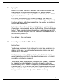
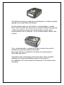
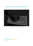
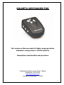
SOLMETA GEOTAGGER PRO
Test review on this new model of higher range gps device
dedicated –among others- to DSLR cameras
Description, functionalities and precisions
Tested and written by par Pol F. Gillard
September 14th 2009
http://www.geosolve.be
revised on December 7th 2009
1
Table of Content
1.
Synopsis
3
2.
General presentation of the device
3
3.
Functonalities
6
-
Power
Memory record if signal lost
Display
Latitude/longitude
Altitude
Speed
Heading/compas
Temperature
Battery charge level
Sound (bip)
Firmware upgrade
Data-logger functions
6
7
7
8
8
8
9
9
10
10
10
10
4.
Technical specifications
12
5.
The « likes » and « dislikes »
12
6.
The test
14
7.
Conclusions
16
2
1.
Synopsis
I inform the reader that this « review » was written on basis of the
final prototype of the Solmeta Geotagger Pro, device that was
submitted to me at the beginning of this month of September 2009
by the manufacturer.
In its initial functions the gps Solmeta Geotagger Pro feeds the
camera with the same data than the Solmeta Geotagger N2, namely
longitude, latitude, altitude, universal time, the number of satellites
received and the heading.
In its advanced functions (and automatic) it gives complementary
informations that are unique and for the first time offered by Solmeta
today ! These complementary informations are displayed on an LCD
screen in the same way that the other traditional informations sent to
the Exif of the picture file.
More details in the next pages.
2.
General presentation of the device
Packing/box :
The Solmeta Geotagger Pro is delivered in a nice box containing -in
addition to the gps- the whole set of accessories making easy and
fast the use of the device.
The device arrives also with its protection bag that can be kept
closed thanks to a cord which also gives the opportunity to be kept
around the neck during transport.
Three cables come together with the device, one « data », type USB
for charging the internal battery through a computer and/or for
communicating with it thanks to a specific (and delivered) software,
a second cable (Y-1) to connect the gps to a Nikon camera with the
10pin socket, and a third one (Y-2) to connect the gps to a camera
having a mini-usb connector (the Nikon D90 for instance).
3
A fixing clip is also in the box sothat the gps can be held along the
strap of the camera.
Finally you will find a CD (mini or regular depending the case)
containing the user’s manual (in English and French), the Solmeta
software for firmware upgrade and memory download, as well as
some utility softwares that eventually need -following the use of it- a
licence from their conceptors foreign from Solmeta.
Are not included (but are available separately) :
- An AC battery charger ;
- A car charger ;
- A double 10pin connector « Y ».
PS : If you are interested in these accessories, it is useful to order
them together with your Solmeta Geotagger Pro in order to
limit the costs of shipment !
The Solmeta Geotagger Pro :
The device is mounted in a miniaturized box that does not exceed 60
x 40 x 28 mm and of a weight reaching only 50 gr !
The box is black and its finish is made of matt rubber, wonderful
aspect which is comprehensive for a device of this class.
It has a LCD screen (monochrome) which displays in real time all of
the calculated and available informations in case a photograph would
be taken.
4
The different working commands are distributed in 3 buttons located
aligned on the right side of the device.
On the opposite side you can find the « communication » socket,
that is the one which will receive the connexion between the gps and
-wether the cable to charge the internal battery as well as the
communication with a computer -or the communication cable to the
camera.
This « communication » socket has a cap to prevent any dust or
humidity to reach the inside of the device.
Once open this cap is binded to the device to avoid loosing it.
Good idea and clever !
The bottom side of the device is the foot which will be (usually)
installed on the accessories/flash support of the camera.
Its installation is firm and prevents movements of the device when
operating.
5
3.
Functionalities
The functionalities of this new device are impressive, just look by
yourself :
In disorder :
-
Intelligent power management and internal battery ;
Memory recorded if loss of satellites signal ;
Display through an LCD screen of all data in real time ;
Latitude et longitude ;
Universal time UTC (Universal Time Coordinated = GMT) ;
Number of satellites ;
Altitude ;
Speed ;
Heading ;
Level ;
Temperature ;
(not with the commercialized device)
Battery charge level ;
Sound (bip) ;
Firmware upgrade ;
and…
- The integrated full functions of a « data-logger » !!
Power :
The Solmeta Geotagger Pro has its own battery (Li-Ion 500mAh) to
provide its working in full autonomy.
This autonomy reaches easily 10 hours in an uninterrupted work
mode.
But the power management of this device is “intelligent”, it will use
the power of the camera automatically only when its own battery will
be completely empty !
This power management even goes further, indeed the Geotagger
Pro is programmable by the user to switch off automatically if the
camera is set to « off » and in the same way it will be « on » again if
the camera itself is switched « on » again.
6
Why a programmable function for this ? If the camera is switched
off, this means the gps will also be switched off as well as the
internal data-logger, even if this one is busy with the recording of
coodinates during the moves of the photographer doing his job in an
area or simply during his travel/holidays when he wishes to keep
track i.e. to visualize later his itinery. The programmable function will
make disable the “off” of the gps device to leave the “data-logger”
work normally.
Power is an important point on which Solmeta keeps a great
attention and that is what makes the big difference with the
competitors.
Memory recorded if satellites signals lost :
The Solmeta Geotagger Pro has an automatic function that records
the last calculated coordinates, i.e. when you enter a building where
the satellites signals cannot be received.
In this way, any picture taken inside this building (or of any place
where the satellites signals cannot be received) will be tagged with
the last calculated and recorded coordinates.
Once outside again (or in view of the satellites) the gps will receive
the signals again and will calculate the new position.
Display :
The Solmeta Geotagger Pro is the first device that uses the concept
of real display on gps dedicated to cameras.
This LCD screen (monochrome) restitues in real time the whole set of
data that this gps is capable to generate and manage, does it
concern the data to be recorded in the Exif of the photo-file or the
help/informations data specific for the user.
While operating, each parameter (see point 3. Functionnalities
above) is displayed alternatively with an interval of 2-3 seconds,
which gives the time to read the situation you are in to shoot.
This LCD display is of the type retro-lighted.
7
Latitude and longitude :
The Solmeta Geotagger Pro also offers to know in advance the level
of accuracy of the calculated coordinates (latitude and longitude) that
will be recorded in the image file if a photo is taken.
Now, thanks to its LCD display the number of satellites is clearly
displayed and in real time ! Simple, clever and efficient…
Between others, it is indeed the number of satellites from which the
signals are used that determine the precision of the gps calculation.
Moving slightly in function of the number of satellites received can
produce a better reception and in consequence a better calculation of
the coordinates that are the latitude and the longitude.
Altitude :
Like most of the « real » gps devices, the Solmeta Geotagger Pro
delivers an estimation of the altitude of the place where it is used. It
will transmit this information to the Exif of the image file when a
photo is taken.
This function is very useful but is not comparable with the value
given by a real altimeter for which it is the main function (often the
single one !) and for which the price is of course considerably
higher…
Speed :
The Solmeta gps Geotagger Pro also restitues the speed of
displacement, this data is displayed on the LCD screen of the device.
The user has the opportunity to set his own parameters for this type
of data, the choice can be made between « miles/hour » and
kilometers/hour ».
In case the battery would be completely discharged or after a long
period of no use, these parameters are automatically saved.
8
Heading (compas and level) :
This compas is of course of the electronic type in opposition with the
more traditional ones that are « magnetic ». It is a 3D compass.
It is interesting to know that it is possible to calibrate this compass in
such a way that it takes its environment into account. It is also
possible to calibrate it to take into account eventual local fields of
interferences that would create a deviation in the measured values.
Its use is particularly useful because it gives the opportunity to be
informed of the geographical orientation when taking a picture.
Between others, this element will be interesting for wild
photographers, architecture photographers (explanation of lights and
shadows), aerial photography, etc…
Derived from the electronic compas inside the Solmeta Geotagger
Pro, a new function is now made available, the one making possible
to set the camera perfectly at level (if the gps device is mounted on
the body of the camera). The gps will show if the camera is pointing
down from the lens or if it leans on the left or on the right !
Without any doubts this is a very useful help, you need no separate
level with you…
The system is however very sensible and will operate correctly only if
a calibration of the electronic compass was made previously. It will
take you some time to get used to it, I had myself to try several
times before I could succeed in using it almost correctly !
Temperature :
The Solmeta Geotagger Pro –through its LCD display- also shows the
ambiant temperature.
Careful however, if the gps is left exposed to the sun or to any other
heat source, the values will be unvalid just like any other
thermometer.
Keeping it or bringing it back in the shadow for a while will help in
having an astonishing precise value !!
The parameters of the function « temperature » of the Geotagger
Pro can be set by the user himself, the choice can be made between
“Celsius degrees” and “Fahrenheit degrees”. In case the battery
9
would be completely discharged or after a long period of no use,
these parameters are automatically saved.
Battery charge level :
The LCD display of the Geotagger Pro is finally a wonderful tool to
visualize the data but also to view the charge level of the internal
battery which is something very important.
So, very easy to check the actual level of the internal battery and
gone the fear that the gps would start to be powered by the camera !
It’s a good thing to be able to verify the state of charge of the
battery before leaving for long shooting sessions !
Absolute comfort, no ?
Sound (bip) :
The Solmeta Geotagger Pro has also a discrete « sound » function
allowing -between others- to confirm the choice of a parameter.
But this « beep » will also be audible automatically if the battery
reaches a level of charge that is very low making necessary to switch
(automatically) to the power of the camera. As an alternative it can
also be considered as an invitation to the user to proceed with a
conventional charge of the internal battery if this is his choice.
Firmware update :
This new Solmeta Geotagger Pro is built in such a way that its
firmware can be updated.
The special cable « data » (included) as well as the specific Solmeta
software (also included) will make possible such updates of the driver
which runs the device Geotagger Pro !
This is also a scoop that has to be mentioned, it is the first time such
an ability is included in a camera-gps, in this way it will be possible to
adapt the way the device will run in the future, in function of new
developments.
The functions « data-logger » :
Solmeta carried out a feat of ingenuity in this tiny device in
incorporating (in addition to the already very evoluted main
10
functions) a real and very efficient « data-logger », in other words, a
permanent recorder of the coordinates, are you shooting or not !
Programmable to record between every 5 to 60 seconds, this « datalogger » has a memory of 8 Mb allowing to record more than 60.000
points of one or several courses.
These coordinates points (as well as a full set of informations) are
recorded in the gps as a log file (.txt) and can be downloaded on a
computer with the « data cable » included with the device.
In case the battery would be completely discharged or after a long
period of no use, these parameters as well as the log file (.txt) are
automatically saved.
Example of a part of one of the log file « txt » :
$GPRMC,114147.000,A,5039.9634,N,00505.3965,E,1.22,186.95,1009
09,,,A*65
$GPRMC,114207.000,A,5039.9618,N,00505.3943,E,0.06,124.01,1009
09,,,A*6A
$GPRMC,114226.000,A,5039.9688,N,00505.3969,E,1.81,13.15,10090
9,,,A*56
These data can be used afterwards with several « matching »
softwares for instance, or directly used on GoogleMap to trace an
itinery that led you to places where you made photographs.
The website of Solmeta will tell you more about this
http://www.solmeta.com
When working, the state of the memory of the « data-logger » will
be shown on the LCD display, giving this way an important
information : the remaining free space.
On the display, just after the data of interval of recording is shown
i.e. « 0.08 P », this means 8% of the memory are used.
When the memory is becoming low you have to erase it with your Pc
connected to the device with the “data cable”. There is no automatic
replacement of the old data with the new one (rule FIFO first in first
11
out) and this prevents accidental lost of the data by negligence or
forgetting when they were not yet transferred to a Pc.
Remark :
In case the « data-logger » and the direct recording of
data to the Exif of shots being made are working simultaneously, the
data will be present in both the log file (.txt) of the « data-logger »
and the Exif of the image file even if the shot happens outside the
chosen interval of the “data-logger”.
4.
Technical specifications
This is the link : http://www.solmeta.com/product_sp.asp
Please note that the Solmeta Geotagger Pro is tropicalized.
Caution, this does not mean the device can be used under the rain or
immerged into water, this remains an electric device do you like it or
not !
Its tropicalization mainly aims to protect the internal electronics
against humidity and dust.
The Solmeta Geotagger Pro is Windows compatible only but will be
extended to Mac in the future.
5.
The « likes » and « dislikes »
Though I personnaly find this device to be exceptional on several
points, there are some small details I want to mention and others I
wish to bring to the front because really wonderful :
Cable gps-camera :
The included cable to connect the gps to the camera is a bit long if
the device is mounted on the camera but a bit short if the device is
clipped to the strap of the camera.
A unique cable -but in spirals and extendable- would have had my
preference.
LCD display :
?
If the LCD display delivers in real time a mine of informations but its
reading is particularly difficult because of the small size of the digits
and a retro-lighting which is of a too low intensity.
12
The speed of display alternance increases this difficulty to read the
information completely.
Only a regular use of the device will allow a correct reading by the
fact you will have in memory the order under which the data you are
interested in are displayed on the LCD.
Wired remote :
No wired (or other) remote can be connected directly in the device
itself, this can only be done with the use of the double connexion
cable Y (Y-splitter) to order separately. This splitter will replicate a
free 10pin connector.
Complexity :
This jewel of technology has such a number of functions it is difficult
to memorize all of them and particularly to use them correctly to get
reliable informations.
As the proverb says « Qui peut le plus peu le moins », it is a kind of
the rear side of the medal, it is a fact.
The management of the parameters is not evident to do at all, it
makes me remember these sophisticated watches where only setting
the right time was a serious challenge !
For those who are impatient, I recommend to first read carefully the
user’s manual before they press any button without knowing the
consequences of such an action…
Innovation, creativity, capacity and expertise :
Concerning this, I am obliged to admit that this gps device was
studied very carefully and with a great sense of an evolutive
situation, it combines the advantages of a high-end camera gps and
those of a traditional « data-logger », both systems being in the
same space !
It is in some way « de la haute couture », … and I like that !
13
6.
The tests (Garmin GPSmap76c / Solmeta Geotagger Pro)
Altitude test :
- The values observed with the Geotagger Pro and the Garmin
GSPmap76c are very similar, the only some differences are within
the 2-3 meters in most cases.
- As written above, the altitudes mentioned here are estimations
and not absolute values, reliable values can only be obtained with
altitude dedicated devices.
- In general I can observe that the obtained data are pretty good,
and comparable between the two devices.
Compas test :
The comparison of values between both electronic compas (Ascot
digital compass and Geotagger Pro) was much more delicate and
complicated mainly because of the strict requirement of keeping the
devices perfectly on level.
Taking this into account, a difference appears, oscillating between 6
and 11° and up to 15°.
Though the Geotagger Pro has a 3D electronic compas (the horizon
having an influence in the accuracy of the data), it is difficult to say it
is more accurate or less accurate compared to another !
This type of data has to be taken as being an approximation, but
never a validated value !
Satellites test :
Not a single hesitation here, the results are really excellent for the
Geotagger Pro because it is able to get more satellites signals in
almost any cases than the Garmin GPSmap76c !!
Out of the 5 shots made (various environments) the number of
received satellites was :
14
Images nb
59948
59950
59952
59954
59956
Geotagger Pro
9
8
9
8
9
GPSmap76c
8
8
7
7
5
One can note that the Geotagger Pro is noticably more accurate in
this matter in particularly known « difficult » locations as urban
spaces or in woods/forest environments.
This is particularly important for the precision of the calculation of
the coordinates we are concerned with !!
Position/coordinates test :
This is THE POINT to remember, it is the most important one, and it
is the one where the Solmeta Geotagger Pro performs the best !!!
Latitude : (North)
Images nb
59948
59950
59952
59954
59956
Geotagger Pro
50°29’ 04,16
50°30’ 19,82
50°29’ 47,88
50°30’ 53,01
50°35’ 52,13
GPSmap76c
50°29’ 04,02
50°30’ 19,50
50°29’ 48,00
50°30’ 53,30
50°35’ 32,30
Geotagger Pro
04°55’ 04,37
04°57’ 13,71
04°56’ 31,51
04°59’ 19,00
05°04’ 18,93
GPSmap76c
04°55’ 04,50
04°57’ 13,80
04°56’ 31,60
04°59’ 19,00
05°04’ 19,10
Longitude: (East)
Images n°
59948
59950
59952
59954
59956
15
7. Conclusions
What innovation concerns, creativity, functionalities, accuracy in its
functions namely in the capture of satellites signals and the
calculating that results to determine the coordinates, the Solmeta
Geotagger Pro comes out at the first place in all environments
where it was tested.
What capacity matters, here also I have to admit that having been
able to combine a gps and a « data-logger » in the same so small
space is really a proof of expertise in this sector, Solmeta in the only
manufacturer today to offer such an evoluated and complete device.
Add to this that you are able -in function of your choice- to manage
the power use separately gps/data-logger and that the camera
battery will never be « touched » before at least 10 hours of
uninterrupted operation, my opinion is this is a device far upper from
what can be found today on the market !
OOOOOOOO
OOOOO
OOO
O
_______________________________________________________________
Pol F. Gillard
(Belgium)
[email protected]
http://www.geosolve.be
September 14th 2009
Revized on December 7th 2009
16