1
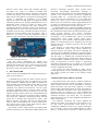
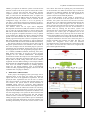
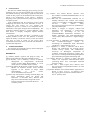
Volume 1, No 1, February 2014
International Journal of Emerging Trends in Computing and Communication Technology
Available @ www.ijetcct.in
ISSN 2348 4454
The Realization of WSN-IP Deployment Platform
Arif Raimi and Shamala Subramaniam,
1
Faculty of Computer Science and Information Technology
2
Sports Academy
University Putra Malaysia
43400 Serdang,
[email protected], [email protected], [email protected]
Abstract
Wireless Sensor Network with IP incorrelation with Internet of Things (IoT) enableshumans interact with devices that have unique identifiers
viaa network. These enables the transfers of data over the network without requiring an explicit interaction of the human. This paper
introduces a localization application realizing such abilities. The projects retrieves the current location of a user and guides the user to the
locationuser intends to go. This application has been tailored subsequent indoor activity for the motivation of utilizing sensor with unique
identifiers. Each of the sensors are positioned strategicallywithin an area then will connected to the access point to retrieve their own IP. The
research has enable to provide a distinct inside on the deployment of an IoT project and highlights the critical issues.
Keywords: wireless sensor network with IP, internet of things, mobility management, sports
-------------------------------------------------------------------------------------------------------------------------------I.
INTRODUCTION
The advancement of the Internet of Things (IoT), has
concurrent increased the need for protocolswhich connect
the Wireless Sensor Network(WSN) with Internet protocols
(IP). Integrating WSN with (IP) create enormous potential as
there is high interaction with each other over the network to
perform a certain task without requiring the human-tocomputer or human-to-human interaction. The pre-requisites
IP of each device having a respective and acknowledgement
the fact that we have insufficient IPs for humans. Has caused
the IPv6 to privait as the suitable platform. There are two
main categories of WSN-IP which are the static and mobile
WSN-IP[]. There is no movement of the nodes in the static
WSN-IP.Therefore, the IPs used remain the same over the
transaction period. In the mobile WSN-IP, the nodes move
thus the IP used constantly change subject to its location.
The mobility management involved is location management
and handoff management [2]. Location management refers
to the procedure that isneeded for tracking the location of the
Mobile Node (MN), whilehandoff management refers to the
procedure that is required toallow the MN to remain
connected as it moves fromone access point to another [2,3].
In Information Technology (IT), an application is defined
as the use of technology, system or product[].Advocating
that an application is a piece of program or software that is
designed to fulfill a particular purpose. There are many types
of applications that has emergedwith an enormous rise
among the mess population in the world. The statistic by
Gartner Incorporation, expects that total user base of
consumer location-based services to reach 1.4 billion users
2014. All Rights Reserved. IJETCCT
in year 2014.Apart from that, 55% of the user in the world
use their smartphones to retrieve their location or
recommendations places by using Location Based Services
(LBS) applications [12] like Foursquare, Nearby Feed,
Google Latitude, and some of the embedded application like
Facebook, Instagram, and many more. These applications
using the Global Positioning System (GPS) which
retrievesoutdoor location accurately.
The IoTrepresentrevolutionized way of utilizing the
Internet to make objects, animals in addition to esscence
human beings to be connected via IPs. An estimation of IoT
market value is enormous, asthe definition the IoTitself
spreads across devices, sensors, and computing power that
overlays the entire spectrum consumers [4]. Gartner
Incorporation predicts that theIoT will gradually become
large in terms number of connections starting with1.9 billion
devices in 2013, and predicted to become in the year 2018, 9
billion number of connections encompassing smartphones,
smart TVs, tablets, wearable computers, and PCs combined
[4]. There is paradigm shift from conventional human
oriented networks to those which are of devices including
kitchen, home appliances, lighting and heating products and
insurance company-issued car monitoring devices that allow
motorists to pay insurance only for the amount of driving
they do.
The adoption of IoT within the operations of a local map
serves as the fundamental and core of this project. The
definedarea for this project is the ground floor in Faculty of
Computer Science and Information Technology (FSKTM) at
University Putra Malaysia.This deployment is stipulated as
the first phase. This building has many rooms including
Arif Raimi and Shamala Subramaniam
lecturer’s rooms, office, lecture hall, computer laboratory
and others. As a guest or a student not familiar with
orientation of this building imposes challenges to find their
location and through some of the observations, many of
them will ask other students or personnel of the faculty.This
scenario is dependent on availability of the human
supervision which causes high delay in acquiring the needed
information.Therefore, the problem identifiedin this case is
determining indoor location of people or things where
human contact is not possible. This paper introduces a
localization application for indoor activity. The main idea of
this application is to retrieve the current location of the users
and further assist the users to find the next indoor location or
destination in same building with the pathway. Thus, it
makes the user easier to find the destination within a
relatively large buildingarea and short period of time as
ultrasonic technology approach. These systems usean
ultrasound time-of-flight measurement technique to
offerlocation the information. The importantadvantageof this
systems is the overall accuracy. Cricket for example,can
accurately define a 4 × 4 square-feet region withina room
while Active Bat can locate Bats up to 9 cm oftheir true
position for a total of 95% of the overall measurements.
However,the use of ultrasonic requires highcommunications
in order to be efficient and accurate. However the cost is
high making it inaccessible to a wide range ofusers.
A substantialdetection systemusing theRFID technology
is SpotON [9].This system uses an aggregationalgorithm for
three dimensional (3D) location detection basedon the radio
signal strength analysis. The system researchers
havedesigned and built hardware that will serve as object
locationtags. In the SpotONsystem, objects are located
byhomogenous sensor nodes without central direct.
SpotOntags use received Radio Signal Strength Indicator
(RSSI) as sensormeasurement for estimating the inter-tag
distance. However,a complete system has not been made
available as of yet.
[10] Proposes a system thatis based on the Bluetooth
indoor localization system using off-the shelflow-cost
stationary beacons and mobile host devices. Building the
system by using a USB Bluetooth dongle, self powering hub,
and aluminum cooking foil, produced a stand-alone beacon
with 9m range (vs. standard 30m for Bluetooth devices)a
low-cost, rapidprototyping of applications where room-level
locationdetection is sufficient. This project used the methods
based on thepresence of beacon signals as positioning
information and haveshown to be reliable in a real world
setting with greaterthan normal expected noise, in terms of
electronic equipment, and others.
This project has been motivated by these various
technologies and has served as the underlying platform. The
next section presents the details of the dealing mobile
application.
Figure 1: The top view of Arduino Uno Board
opposed to the manual method.
The next section deliberation the related work,
subsequently the discussion of the hardware / software of the
platform that used for this project. The next section presents
the design of the system. The paper is concluded with a
discussion on open issue and the conclusions.
2. RELATED WORK
There is a wide area and deployment of application based on
indoor location detection.
3.HARDWARE/SOFTWARE PLATFORM
A RADAR based system for indoor location used for
detection and tracking the users was deployed in [6]. This
paper used 802.11 standard network adapter to measure the
signal strengths from multiple Base Station (BS) to provide
overlying coverage in a given area. This system was
combined with empirical measurements and the signal
propagation modeling aimed at resolving theuser location.
The key strengths of this system is the ease to set up, only
requires few base stations and uses the similarinfrastructure
that provides general wireless networking within a building.
The system has challenges wherebeing tracked and that
objects has to dealing with supported by aWave LAN
Network Interface card (NIC). This may be impracticalfor
small or power constrained devices. In most current cases,
the overall accuracy of this system which uses the 802.11
technologiesis not as optimal as desired.
The Cricket Location Support System [7] andActive Bat
location system [8] are two substantial examples thatuses the
The platform used in this system is Android. Android is
an Operating System (OS) created by Google to run on any
small electronics devices such as smartphones, netbooks,
tablets and others. This open source platform is a Linux
based OS that is designed primarily for touch screen devices
such as smartphone. This open source code and permissive
licensing allows the software to be freely modified and
distributed by device manufacturers, wireless carriers and
enthusiast developers. By having this, our localization
application project can be easily modified and enhanced in
terms of functionality.
The hardware component this project adapted the
Arduino Uno Board as the main base. The Arduino Uno is
an open source microcontroller board based on the
ATmega328 (datasheet) which has 14 digital input/output
pins (of which 6 can be used as PWM outputs), 6 analog
inputs, a 16 MHz ceramic resonator, a USB connection, a
51
Arif Raimi and Shamala Subramaniam
power jack, an ICSP header, and a reset button. It is
comprehensive in terms of resources needed to support the
microcontroller is connected to a computer with a USB cable
Arduino Uno Board to connect to the internet via cable. It is
based on the Wiznet W5100 ethernet chip (datasheet). The
Wiznet W5100 provides a network (IP) stack capable of
both TCP and UDP which supports up to four simultaneous
socket connections. This project also used the Ethernet
library to write sketches which connect to the internet using
the shield. The ethernet shield connects to an Arduino board
using long wire-wrap headers which extend through the
shield. This keeps the pin layout intact and allows another
shield to be stacked on top. The Ethernet Shield has a
standard RJ-45 connection to connect to the access point,
with an integrated line transformer and Power over Ethernet
(PoE) enabled.There is an onboard micro-SD card slot,
which can be used to store files for serving over the network.
It is compatible with the Arduino Uno and Mega (using the
Ethernet library). The onboard microSD card reader is
accessible through the SD Library. The current shield has a
PoE module designed to extract power from a conventional
twisted pair.Upon this sensor being attached to the Arduino
Uno Board, then need to configure it first by using the RJ45
cable on one end and attached to the workstation while the
other end is attached it to the access point. Subsequently, the
need to know the subnet of the network to retain the IP is
explored. The next step is to change the program file that
was uploaded earlier in the Arduino Uno board in oreder
include the IP and the Mac Address. This is eventually
uploaded again. Each of the Ethernet Shield has their own
Mac Address. The completion of these steps enables the
program to be run by typing the IP for this sensor at the
browser to test it.
The Arduino Uno Board is connected to the internet via
wifi, via the WiFi Shield.This is indeed very important
hardware that plays an important role in this project which is
vital to make the entire sensor in the system to be connected
to the access point via wifi.The shield uses WizFi210 which
is a low power-consuming WIFI module applied with
dynamic power management technology. When the WIFI
module needs to be on but does not do any processing, it can
be set to the Standby mode a low power mode. Subsequently
the module needs to be woken up when it has to perform
some processing. The WIFI wireless module is based on
WizFi210. It provides the bridging from the TTL serial port
communication
to
the
IEEE802.11b/g/n
wireless
communication. So any device with the TTL serial ports can
be easily connected with this WIFI module and controlled
and managed remotely through a wireless network. Different
kinds of communication protocols and encryption algorithms
are integrated with this module.The Arduino architecture
enables an easy integration into this module and into any
Arduino based project. This sensor need several steps for
configuration that involves need to set the SSID for target
router.The need to disable the DHCP due to its WiFi enable
feature, set the static network parameter, the configuration of
this sensor as the TCP server then finally the testing via
Putty by sending the text and receiving its reply.
Among the critical,hardware that was used for this project
is router. This is one of the most important tools that is
Figure 2: The side view of Arduino Uno Board attached
with WiFi Shield
for power with an AC-to-DC adapter or battery [5].The Uno
differs from all preceding boards in that it does not use the
FTDI USB-to-serial driver chip [5]. Instead, it features the
Atmega16U2 (Atmega8U2 up to version R2) programmed
as a USB-to-serial converter.The boards can be assembled
by hand or purchased preassembled. The Arduino
programming language is an implementation of wiring, a
similar physical computing platform, which is based on the
processing multimedia programming environment.Even
Arduino also simplifies the process of working with
microcontrollers, but it offers some advantage for the user
over other systems. This includes that it is inexpensive,
assembled by hand, cross-platform, adopts a simple and
clear programmingenvironment, and has extensible
software.To initiate deployment, this sensor needs to be
Figure3: The side view of Arduino Ethernet Shield
configured first and then begins a simple program file is
uploaded via USB that is attached to the workstation. Once
the blink LED begins blinking, it clearly indicated that the
system is working.
The Arduino Uno Board has an expansion for attaching
the Ethernet Shield. This Arduino Ethernet Shield allows an
52
Arif Raimi and Shamala Subramaniam
indeed a pre-requisite to make the system work and for the
sensorsto connect to the access point. As known fact is that a
router is a device that forwards data packets between
computer networks and creates an overlay internetwork.
Thus, to ensure that the WiFiShield sensor is captures the
data packet and the IP address from the Internet, first and
foremost. The need to setup the router is essential. In this
configuration stage, the router is set as its gateway of
192.168.1.1 in the subnet 255.255.255.0 which is in class C.
So, all the sensors that are attached with the WiFi Shield use
the IP within this network.
The Arduino sensor use an open source Integrated
Development Environment (IDE) that enables a convenient
way to write the code and upload it to the I/O board. This
IDE runs on either Windows, Mac OS X or Linux platform.
Once the program is completed, and then it’s easy to upload
to the Arduino Uno Board via cable by clicking the button
upload in this IDE. Besides that, this environment is a user
friendly approach mainly due to the low complexityonce the
IDE usage installed in the workstation, it will be attached to
the user manual and the tutorial inside the IDE automatically
The Eclipse software is used in this project and is used to
design the system interface. This software is also an IDE. It
has a base workspace and an extensible plug-in system for
customizing the environment. Eclipse may also be used to
develop applications in other programming languages like C,
C++, COBOL, FORTRAN, Haskell, JavaScript, Lasso, Perl,
PHP, Python, and others. It can also be used to develop
packages for the software Mathematica. Development
environments include the Eclipse Java Development Tools
(JDT) for Java and Scala, the Eclipse CDT for C/C++ and
Eclipse PDT for PHP, among others.The initial codebase
originated from the IBM VisualAge. The Eclipse Software
Development Kit (SDK)usedincludes the Java development
tools. Users can extend its abilities by installing plug-ins
written for the Eclipse Platform, such as development
toolkits for other programming languages, and can write and
contribute their own plug-in modules.
user is done. The reason as to placing only one action button
for each interface is to make the end user easy to follow the
steps and to be guided. In addition, the Android logo in this
interface is just to enlighten the user this application or
system is tailored for the Android platform.
The second interface of this system or application is
subject to the activation of the first phase. In this second
interface, the system will retrieve the end user’s location.
That location is only within the stipulated tested area.In this
interface, the user is able navigate to the next location or
places. The user will select the next location or place that in
list menu that will pop-out to the user in this interface or
system. Then by clicking the Go button, system will
navigate the user to the next place that they want to go to. In
this process the sensors play an important role as the
information or data will be passed by the sensor until that
current sensor find the exact sensor with the right IP address.
The final interface has the mapof the tested area with the
navigation information. Once the users choose the place or
location intended, then without any delay this map will
produce the navigation arrow with the direction
accompanied with a written description at the bottom of the
map. This is to ensure the user is able to be recognized the
place and navigated accurately.
4.
DESIGNING THE SYSTEM
In this project, the designing of the system stage was an
important phase. In this stage, the system was studied to
capture the need of the application requirement. For this
project,the basic requirement was for the user to retrieve
their current position or location then navigate them to the
next location. The system shall be known thereafter as
UPMLBS which stand for University Putra Malaysia
Location Based Service. The constraint of this application or
system is that it is for the indoor and a relative or local map.
The icon used for this application or system is pin where is
represents the standard location symbol that is familiar if one
uses the Google Maps. This system has three interfaces that
user can use. This was oriented on the fact that compact
would be better to make the application is fast, low delay
loading the pages of the system and low power consumption
as used on the mobile applications. In the first interface, the
searching functionality to find the current location of the
Figure 4: UPM LBS Application interface.
53
Arif Raimi and Shamala Subramaniam
5.
CONCLUSION
This has been indeed challenging project being a project
underlying into IoT. The development time of this project
was indeed consuming. Time being a significant and critical
variant for this project can be divided into three main parts,
which is the configuration of the sensors / hardware,
designing of the system and last the testing of the system as
a complete system.
In the configuration task, the occurrences of errors while
configuring the sensors due to the multitudes of ways to
execute this. The sensors are very sensitive and
configuration process is unable to be completed due to
interferences and signal strength and incompatibility. The
application platform imposes a vertical challenge, where
each device is uniquely configured requires absolute
customization.
A project of this nature also have a correlation to the
mobility attributes of the user. The platform of mobility
impact the ability to locate the velocity of the user and the
local map. In order to realize an IoT project direct
correlations between the device, IP and the user attributes is
of paramount importance.
[5]
Arduino Uno Board Review. Retrieve from
http://arduino.cc/en/Main/arduinoBoardUno on (10
January 2014).
[6] P. Bahl and V.N. Padmanabhan, RADAR: An inbuilding RF-based user location and tracking
system, in: Proceedings of IEEE INFOCOM2000,
Tel-Aviv,
Israel
(March
2000),
http://www.research.microsoft.com/∼padmanab/pa
pers/infocom2000.pdf
[7] A. Harter, A. Hopper, P. Steggles, A.Ward and
P.Webster, The anatomyof a context-aware
application, in: Proceedings of the 5th
AnnualACM/IEEE International Conference on
Mobile Computing and Networking(Mobicom
1999), Seattle, WA (ACM Press, August 1999)pp.
59–68.
[8] N.B. Priyantha, A. Chakraborty and H. Balakrishnan.
The
Cricketlocation-support
system,
in:
Proceedings of MOBICOM 2000, Boston,MA
(ACM Press, August 2000) pp. 32–43.
[9] J. Hightower, C. Vakili, C. Borriello and R. Want,
Design and calibrationof the SpotON ad-hoc
location sensing system, UW CSE00-02-02,
University of Washington, Department of
Computer Scienceand Engineering, Seattle, WA,
http://www.cs.washington.edu/homes/jeffro/pubs/hi
ghtower2001design/hightower2001design.pdf.
[10] Cheung, Kenneth C., Stephen S. Intille, and Kent
Larson. "An inexpensive bluetooth-based indoor
positioning hack." Proc. UbiComp06 Extended
Abstracts (2006).
[11] Take Nike + iPod (August 2013). Retrieve from
http://www.apple.com/ipod/nike/run.html. On 12th
February 2014).
[12] Gartner Identifies 10 Consumer Mobile Applications to
Watch in 2012. (February 2011)Retrieve from
http://www.gartner.com/newsroom/id/1544815#.
On 18th February 2014.
6.
ACKNOLEDGMENT
This research was supported in part by Science fund grant
of Government Malaysia (MOSTI).
REFERENCE
[1] Dharma Prakash Agrawal and Qing-An Zeng, 3rd
Edition of Introduction to Wireless & Mobile System.
[2] IF Akyildiz, J Xie, S Mohanty, A survey of mobility
management in nextgeneration all-IP-based
wireless systems. IEEE WirelCommun. 11, 16–28
(2004). doi:10.1109/MWC.2004.1325888.
[3] S Hong, D Kim, M Ha, S Bae, SJ Park, W Jung, J Kim,
SNAIL: an IP-based wireless sensor network
approach to the internet of things. IEEE
WirelCommun.
17,
35–43
(2010).
doi:10.1109/MWC.2010.5675776.
[4] Here's Why 'The Internet of Things' Will Be Huge, and
Drive Tremendous Value for People and
Businesses. (7 December 2013). Retrieve from
http://www.businessinsider.com/growth-in-theinternet-of-things-2013-10#ixzz2svR1Vz7G
on
(9 January 2014).
54