1
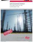
Leica Geosystems Catalogue 2006/2007
The right tool for every
construction site
Improve your Performance with…
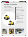
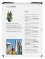
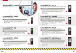
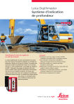
Leica GPS900
Big ambitions on a budget
The Leica GPS900 uses Leica Geosystems’ proven
GPS technology. Consisting of a Leica RX900
Controller and a Leica ATX900 GPS Antenna - the
all-on-the-pole GPS900 RTK rover is ideal for oneperson stakeout and topographic tasks.
With its flexible, easy-to-use onboard software,
Leica GPS900 is the ideal solution for a wide
range of jobs including foundation and drainage
work, alignment stakeout, topographic and asbuilt surveys. The GPS900 rover is lightweight and
optimised to reduce operator fatigue. Import and
export functionality allows the instrument to be
compatible with Leica TPS400 and Leica TPS800.
Increase your productivity with the new Economic
One-Man RTK GPS System!
Find more information on page 37!
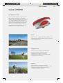
Leica Sprinter Series
Push the button and it works
Measurements have never been so easy to
perform as with the Leica Sprinter Electronic Level.
The Leica Sprinter allows users to perform their
job quickly and efficiently.
You aim and focus, measure with one key press
and the data is displayed almost instantly. There
will be no more misreading and interpretation
errors in reading the staff.
It is also possible to use it as an optical level. But
compared to a conventional level, the digital
levels' effortless, fast measurements could save
your valuable time and reduce errors.
No more wasting of time and materials for you
and your crew. And all this for an incredible price.
Read more on page 12!
03
Directory
Directory
Level Overview
04
Optical Levels
06
Digital Levels
12
Laser Overview
14
Rotating Lasers
16
Pipe Laser
19
Underground Service Locator
22
Laser Distancemeter
24
Machine Automation
26
Total Stations
30
GPS Systems
37
04
Level Overview
Leica Geosystems Levels
Extreme robustness, high measurement precision and
an extremely competitive price. All this is making the
difference! And more, Leica Geosystems levels are so
easy to use. No need to spend time in training.
Our ergonomic optics are probably the finest optics in the
world. Banish tired eyes forever and ensure you’re really
aiming accurately at the target, even in extreme light
conditions.
Leica Geosystems levels can be configured to suit your work
and preferences. Some levels can be read in either degrees
or gons.
Just in case – some of our Leica Geosystems levels are shock
resistant. So the systems can be used again straight away,
even after a fall. According to ISO9022-33-05 standard.
Being approved up to IP57 (total immersion) of the
IEC 60529 standard, water, dust and dirt have no effect on
Leica NA700 levels.
APPLICATIONS
Runner 20
Runner 24
NA720
NA724
NA728
NA730
NA2/NAK2
Daily levelling tasks: Site
foremen, carpenters,
construction companies,
landscaping
X
X
X
X
X
X
-
Daily levelling tasks: with high
demand for product
robustness e.g. for
construction of roads, railways
and buildings
-
-
X
X
X
X
-
High accuracy levelling : even
for building or engineering
surveyors
-
-
-
-
X
X
X
Precision levelling: even for
settlement determinations on
building, deformation
measurement and monitoring
bridges
-
-
-
-
-
-
X
Water resistant
X
X
X
X
X
X
X
Waterproof (immersion) &
dustproof
-
-
X
X
X
X
-
Shock resistant
-
-
X
X
X
X
-
Rough/fine focus
-
-
-
-
X
X
-
Parallel-Plate micrometer for
precise levelling (optional)
-
-
-
-
-
-
X
FEATURES
05
Levelling can be so easy with digital levels from
Leica Geosystems. Push the button and heights, height
differences and distances are automatically displayed.
There will be no more misreading and interpretation
errors in reading the staff.
It is also possible to use it as a optical level. But compared
to a conventional level, the digital levels effortless, fast
measurements could save your valuable time and reduce
errors. Our digital levels even include additional error
reducing functions such as built-in tilt sensors, preventing
the system from measuring if the user operates outside the
compensator range.
For high measurement requirements Leica Geosystems
provides additional digital levels like Leica DNA03/10.
For further information please visit our homepage
www.leica-geosystems.com/digitallevels
APPLICATIONS
Sprinter 100
Sprinter 100M
Sprinter 200
Sprinter 200M
Error-free levelling for all construction applications, e.g.
for construction off-road, railways and buildings
X
X
X
X
Error-free levelling for all construction applications with
demand for data storage and transfer,e.g road & building
construction
X
-
X
High accuracy levelling in all application areas, e.g. road
& building construction, civil engineering,topography and
cadastral
-
-
X
X
High accuracy levelling in all areas with demand for data
storage and transfer,e.g architecture and engineers
survey
-
-
-
X
Optical staff reading
X
X
X
X
Automatic staff reading
X
X
X
X
Inverse staff measuring
X
X
X
X
Automatic calculation of heights & distances
X
X
X
X
Internal memory & online operations
-
X
-
X
Line Levelling application software
-
X
-
X
FEATURES
06
Optical Levels
Leica Runner 20/24
Tough and Accurate
Runner 20/24 are two robust and valuepriced, automatic builder's levels.
Designed to work hard on the job site.
They are quick to set up, simple to use
and very reliable.
The automatic compensator and the
fast optics speed up measurements on
site and increase accuracy.
Runner is the ideal construction level for
site foremen, engineers, architects,
landscape gardeners, carpenters,
construction companies and many
more.
Runner 20, Automatic Level
With 20x magnification,
Standard deviation per km 2.5 mm
(double-run levelling)
1
Order No: 727 585
Runner 24, Automatic Level
With 24x magnification
Standard deviation per km 2.0 mm
(double-run levelling)
Order No: 727 586
CTP103, Aluminium Tripod
Medium duty aluminium tripod with carrying strap
and side clamp screws
2
Order No: 726 833
CLR101, Telescopic Level Staff
4m length, 4 sections, dual face
E-graduation and mm-graduation
3
Order No: 727 587
FEATURES
Runner 20
Runner 24
Magnification
20x
24x
Angle Measurement
360°
360°
Standard deviation(per km double-run)
2.5 mm
2.0 mm
Dust/ Water Protection
IP55
IP55
Working Temperature
-20°C to +50°C
-20°C to +50°C
Weight
2.0 kg
2.0 kg
07
Leica NA700 Levels
Built for builders, engineers and
surveyors levels
Nothing stops a Leica NA700 level. A
short drop onto the ground, a fall into
water, vibration from heavy machinery –
with a Leica NA700 level you just carry
on working. And, the ‘best in class’
optics enable you to always work as
precisely as possible, even in twilight.
The NA728 and NA730 have a
rough/fine focus drive making your work
even easier. What does this add up to?
Reduced work downtime, thus translate
into higher productivity, resulting in
reliability and accuracy at an extremely
reasonable price.
NA720, Automatic Level
20x telescopic magnification. The automatic level
for all applications on the construction site
1
Order No: 641 982
NA724, Automatic Level
24x telescopic magnification for improved accuracy.
Reliability and Robustness for the demanding
construction user
Order No: 641 983
NA728, Automatic Level
28x telescopic magnification, precision
compensator. The all-rounder. For building or
engineering surveys
Order No: 641 984
NA730, Automatic Level
30x telescopic magnification. The most precise.
Meets the highest standards in construction,
engineering and topographic surveys
Order No: 641 985
BST01L, Aluminium Tripod
Light-duty aluminium tripod, with fast
clamps. Extendible 178cm (5.8ft), weight
4.0kg (8.8lb)
2
Order No: 663 095
CLR101, Telescopic Level Staff
4m length, 4 sections, dual face
E-graduation and mm-graduation
3
Order No: 727 587
FEATURES
NA720
NA724
NA728
NA730
Magnification
20x
24x
28x
30x
Angle Measurement
360°/400gon
360°/400gon
360°/400gon
360°/400gon
Standard deviation(per km double-run)
2.5 mm
2.0 mm
1.5 mm
1.0 mm
Dust/ Water Protection
IP57
IP57
IP57
IP57
Working Temperature
-20°C to +50°C
-20°C to +50°C
-20°C to +50°C
-20°C to +50°C
Weight
1.6 kg
1.6 kg
1.7 kg
1.7 kg
08
Optical Levels
Leica NA2/NAK2
The classical Level from
Leica Geosystems
The NA2 universal automatic level
meets all requirements-regarding
precision, convenience and reliability. It
was designed by surveyors and
development engineers with years of
experience that know what a field
instrument has to be able to do. The
NA2 soon pays for itself, because it can
be used for all types of surveying job;
on building sites for routine levelling, in
engineering projects, and for geodetic
control at all levels of accuracy.
NA2, Universal Automatic Level
Magnification: 32x
Standard deviation per km 0.7 mm (double-run
levelling, depending on staff and technique)
1
Order No: 352 036
NAK2, Universal Automatic Level (400gon)
Magnification: 32x
Standard deviation per km 0.7 mm (double-run
levelling, depending on staff and technique)
Order No: 352 039
NAK2, Universal Automatic Level (360°)
Same as before, but horizontal circle 360°, optical
scale interval 10', reading by estimation 1'
Order No: 352 038
GPM3, Parallel-Plate Micrometer
In container, measuring range 10mm
2
Order No: 356 121
GOA2, Autocollimation Eyepiece
For all instruments
3
Order No: 199 899
GFZ3, Diagonal Eyepiece
Allows steep sights
4
Order No: 734 514
FOK 73, 40x Eyepiece
For NA2/NAK2, exchangeable against standard
eyepiece
5
Order No: 346 475
FEATURES
NA2
NAK2
Magnification
32x
standard: 32x
FOK73 eyepiece (optional): 40x
Angle Measurement
-
360°/400gon
Standard deviation
(per km double-run)
0.7 mm/km
(0.3 mm with parallel-plate micrometer)
0.7 mm/km
(0.3 mm with parallel-plate micrometer)
Dust/ Water Protection
IP53
IP53
Working Temperature
-20°C to +50°C
-20°C to +50°C
Weight
2.4 kg
2.4 kg
09
Leica Geosystems Accessories for Levels
GST20, Wooden Tripod
Heavy duty, with carrying strap, side
clamp screws and plumb bob. Proven
long-life, twist-proof and good vibration
characteristics. Robust well-established
tripod for general use. Suitable for
levels, lasers, total stations and GPS.
Extendible 180cm (5.9ft), weight 6.4kg
(14.1lb)
1
Order No: 296 632
GST40, Wooden Tripod
With rigid legs, length 1.70 m (5.6 ft),
weight 6.0 kg (13.2lb) with accessories,
for precision levelling
2
Order No: 328 422
GST4, Tripod Star
For setting up tripods on hard and
slippery surfaces
3
Order No: 332 200
CLR102, Telescopic Level Staff
5m length, 4 sections, Dual face Egraduation and mm-graduation
4
Order No: 727 588
CLR103, Telescopic Level Staff
4m length, 4 sections, Dual face Vgraduation and mm-graduation
5
Order No: 731 123
CLR104, Telescopic Level staff
5m, 5 sections
Order No: 743 420
10
Accessories
Staffs
BTL5D, Aluminium Telescopic Level Staff
Extendable to 5m, with cm-graduation on front and
mm-graduation for internal dimensions on rear,
with circular bubble, in transport bag
1
Order No: 663 131
BTL4D, Aluminium Telescopic Level Staff
Extendable to 4m, with cm-graduation on front and
mm-graduation for internal dimensions on rear,
with circular bubble, in transport bag
2
Order No: 663 130
GPLE2N, Nedo invar levelling staff
2m, with circular bubble
3
Order No: 555 636
GPLE3N, Nedo invar levelling staff
3m, with circular bubble
Order No: 555 637
GPLE3N, Nedo invar levelling staff
3m with circular bubble, with expansion coefficient
certificate and lengh calibration certificate
Order No: 560 172
GWL92N, Industrial levelling staff
Cm- graduation, 92 cm, invar staff with circular
bubble and 2 interchangeable bases
4
Order No: 559 615
GWL182N, Industrial levelling staff
Cm- graduation, 182 cm, invar staff with circular
bubble and 2 interchangeable bases
Order No: 559 616
11
Staff Accessories
GLUS1, Ground plate
For level staffs
1
Order No: 197 000
GSL3, Pair of struts
For GPLE3N staff
2
Order No: 555 638
GLI20N, Nedo staff level
For BTL4/BTL5 levelling staff
3
Order No: 555 639
GVP469, Transport Case
For 2 GPLE2N staffs
4
Order No: 555 641
GVP470, Transport Case
For 2 GPLE3N staffs
5
Order No: 555 642
12
Digital Levels
Leica Sprinter
Error-free, Easy, Fast
The New Standard for levelling at a breakthrough price
Measurements have never been so easy to perform as with
the new Leica Sprinter Electronic Level. The Leica Sprinter
allows users to perform their job quickly and efficiently.
Leica Sprinter is a reliable and accurate electronic level that
provides error-free measurements. Optical reading is no
longer needed but also possible. Press the red key and just
let the electronic eye do it! The Leica Sprinter bar code
automatically determines height and distance.
The Sprinter 100M/200M are provided with Line Levelling
Application option to increase field efficiency, prompting
and guiding users to execute observations sequentially. This
option offers field procedures (including Intermediate sight
& Foresight) practiced by many engineers and surveyors.
Use the Leica Sprinter to accelerate
your levelling productivity in:
∧
∧
∧
∧
∧
∧
∧
∧
∧
∧
∧
Building Construction
Road Construction
Civil Engineering
Topography and Cadastral Applications
Agriculture
Architecture
Landscaping
Dimensional Control
Mining and Quarrying
Tunnelling
Wherever you need to level error-free and fast
13
Sprinter 100
Standard deviation 2.0mm, electronic
level, with user manual, 4 pcs AA dry
cells and container
GKL 25 Charger
For 4xAA(R6) rechargeable batteries, European
version. + 4 AA(R6) SANYO 1.2V/2300mAh
NiMH rechargeable batteries
1
2
Order No: 738 932
Sprinter 100M
Standard deviation 2.0mm, electronic
level, with user manual, 4 pcs AA dry
cells and container, incl. RS232 interface
& internal memory
Order No: 741 905
GSS 111 Dual face telescopic levelling staff
5m, 4 sections, Sprinter bar code/E-Scale cmgraduation, with circular bubble, in transport bag
(Std. version)
3
Order No: 741 882
Order No: 738 933
Sprinter 200
Standard deviation 1.5mm, electronic
level, with user manual, 4 pcs AA dry
cells and container
Order No: 741 867
Sprinter 200M
Standard deviation 1.5mm, electronic
level, with user manual, 4 pcs AA dry
cells and container, incl. RS232 interface
& internal memory
GSS 111-1, barcode / ft-graduation (Imperial
version)
Order No: 741 883
GSS 111-2, barcode / 5mm-graduation (Japan
version)
Order No: 741 885
GSS 112-3, barcode / E-Scale cm-graduation (UK
version)
4 m, 4 section staff
Order No: 741 868
Order No: 741 884
GSS 112-5, barcode / 2mm-graduation (Spain
version)
Order No: 741 886
CTP103, Aluminium Tripod
Medium duty aluminium tripod with carrying strap
and side clamp screws
4
Order No: 726 833
Upgrade Options for Sprinter 100M/200M
Line Levelling application program for Sprinter
100M/200M
Order No: 751 747
FEATURES
Sprinter 100
Sprinter 100M
Sprinter 200
Sprinter 200M
Magnification
24 x
24 x
24 x
24 x
Angle Measurement
360°
360°
360°
360°
Time for single Measurement
Standard deviation
(per km double-run)
<3 sec *
2.0 mm(with Leica
Sprinter aluminium staff)
2.0 mm(with Leica
Sprinter aluminium staff)
Dust/ Water Protection
IP55
IP55
IP55
IP55
Working Temperature
-10°C to +50°C
-10°C to +50°C
-10°C to +50°C
-10°C to +50°C
Weight
<2.5 kg
<2.5 kg
<2.5 kg
<2.5 kg
Range
1.5 mm(with Leica
Sprinter aluminium staff)
1.5 mm(with Leica
Sprinter aluminium staff)
2 m - 80 m (from 0.5 m -optical)
* for range up to 80m performed under normal light conditions
14
Laser Overview
Leica Geosystems Construction Laser
Whether it's general construction, pipe laying, machine
control, or interior walls and ceilings, our lasers are
built to handle any environment.
All construction lasers are high technology and high
precision tools. Compare these features and you'll see why
our Construction lasers set the standard for durability and
value.
Leica Geosystems lasers are water resistant that means all
critical components are completely protected from all wet
weather conditions. The aluminum base withstands rough
handling and is highly resistant to abrasion and fracture.
Construction-tough components have all undergone
rigorous testing to assure long life under harsh conditions.
What is the difference:
APPLICATIONS
Rugby 100
Rugby 100LR
Rugby 200
General construction: excavation, footing, concrete forming
X
X
X
Civil engineering: parking lots, runways, sports field
-
X
-
Interior construction
-
-
X
Installing ceiling grids
-
-
X
Transferring points from floor to ceiling
-
-
X
Installing septic and gravity flow pipe for drainage
-
-
-
Machine control of excavators, graders, dozers and similar equipment
-
X
-
Agricultural applications such as land levelling or tiling
-
X
-
Waterproof and dustproof
IPX-6
IPX-6
IPX-6
High impact composite housing
X
X
X
Elevation alert
X
X
X
Working Range up to 750 m diameter
-
X
-
Scan Modes
-
-
X
Remote Control
-
-
X
Grade entry with display
-
-
-
Dual Grade
-
-
-
FEATURES
15
Leica Geosystems' Grade Lasers are the most accurate and
reliable lasers for machine control applications that require
precise grade. They can be used wherever level, single or
dual grades are required, and are compatible with
Leica Geosystems' 2D and 3D Machine Control Systems for
ultimate grade control.
Leica Geosystems’ pipe lasers are built with a rugged
aluminum housing and perform powerfully even in tough
jobsite conditions. It easily sets up in smallest inverts. They
are perfect for storm and sanitary sewer construction,
gravity flow pipe lines and wherever line and grade is
required.
Work with confidence with the Construction lasers from
Leica Geosystems.
APPLICATIONS
Rugby 300 SG
Rugby 400 DG
General construction: excavation, footing, concrete forming
X
X
Civil engineering: parking lots, runways, sports field
X
X
Interior construction
-
-
Installing ceiling grids
-
-
Transferring points from floor to ceiling
-
-
Installing septic and gravity flow pipe for drainage
X
X
Machine control of excavators, graders, dozers and similar equipment
X
X
Agricultural applications such as land levelling or tiling
X
X
Waterproof and dustproof
IPX-7
IPX-7
High impact composite housing
X
X
Elevation alert
X
X
Working Range up to 750 m diameter
X
X
Scan Modes
-
-
Remote Control
-
X
Grade entry with display
X
X
Dual Grade
-
X
FEATURES
16
Rotating Lasers
Leica Rugby 100/100LR/200
The rugged Family of Construction Lasers
You already know the value of lasers on the job site. They
make faster work of any layout job while eliminating costly
errors and downtime. Once they were a "nice to have", now
they are a competitive "must have" to get the job done right
and get off the site as fast as possible. One look at these
automatic, self-levelling, horizontal and vertical levelling
tools and you know it’s a different breed.
Leica Rugby 100*
Automatic self-levelling Laser for General
Construction
Including: Rugby 100 Horizontal Laser, Alkaline
Battery Set, Rod-Eye Pro Laser Sensor with Clamp
and Carrying Case
1
Order No: 731 558
Leica Rugby 100 LR*
Automatic self-levelling Laser for General
Construction & Machine Automation
Including: Rugby 100 Long Range Horizontal Laser,
Alkaline Battery Set, Rod-Eye Pro Laser Sensor with
Clamp and Carrying Case
Order No: 733 621
Leica Rugby 200*
Automatic self-levelling Laser for General
and Interior Construction
Including: Rugby 200 Horizontal and Vertical Laser
(visible beam), Laydown Foot Attachment, Alkaline
Battery Set with Holder and Standard Carrying Case
2
Order No: 734 159
*Leica Geosystems’s warranty offers complete
coverage of the internal self-levelling system no
matter what. Should any accident or knockdown
occur, all repairs to the internal assembly will be
done at no charge.
17
Why Rugby is the toughest Player on the Field
NiMH Battery Pack for Rugby 100/200 Series
∧ Water resistant: all critical components
∧
∧
∧
∧
∧
∧
completely protected from wet all weather
conditions
Housing made from co-molded rubber and high
impact plastic
Aluminum base withstands rough handling and
is highly resistant to abrasion and fracture
Construction-tough components have all undergone rigorous testing to assure long life under
harsh conditions
Enclosed head means no worries about
contamination of critical interior parts
Rugged, high-impact strength polymer carrying
case
24 month warranty
1
Order No: 726 746
NiMH-Charger for Rugby 100/200 Series
Appropiate power cable is included
2
Order No: 727 165
Wallmount/Laydown Bracket Rugby 200
3
Order No: 733 077
Magnetic Ceiling Grid Target Rugby 200
4
Order No: 732 791
Infrared Remote Control Rugby 200
5
Order No: 731 645
FEATURES
Rugby 100
Rugby 100LR
Rugby 200
Working Range
300 m
750 m
300 m
Accuracy
± 2.6 mm @ 30 m
± 1.5 mm @ 30 m
± 1.5 mm @ 30 m
Self-levelling
H
H
H+V
Align Beam
No
No
Yes
Scan function
No
No
Yes
Waterproof
IPX-6
IPX-6
IPX-6
Working Temperature
-20°C to +50°C
-20°C to +50°C
-20°C to +50°C
Weight
2.5 kg
2.5 kg
2.5 kg
18
Rotating Lasers
Leica Rugby 300SG / 400DG
When accuracy is the goal,
Rugby makes the grade
Rugged and accurate, the Rugby 300 SG (Single
Grade) and the Rugby 400 DG (Dual Grade) lasers
are the optimal solution for precise grade control.
They can be used wherever level, single or dual
grades are required, and are compatible with
Leica Geosystems' 2D and 3D Machine Control
Systems for ultimate grade control.*
Their extensive features will ensure both material
and labor savings, increasing your bottom line.
Leica Geosystems' Grade Lasers are the most
accurate and reliable lasers for machine control
applications that require precise grade.
Rugby 300SG Package with Rod-Eye Sensor
With Carrying Case, NiMH Battery Pack, Charger and
Rod-Eye Classic with Clamp
1
Order No: 741 751
Rugby 400DG Package with Rod-Eye Sensor
With Carrying Case, NiMH Battery Pack, Charger and
Rod-Eye Classic with Clamp
2
Order No: 741 752
RF Remote Control for Rugby 400DG
3
Order No: 739 854
Scope and Mount Assembly
For Rugby 300SG/400DG
4
*The Rugby’s are compatible with
Leica GradeSmart, Leica 360° Cab Sensor
and Leica MC200 Depthmaster. For more
information please vistit our homepage
www.leica-geosystems.com.
Order No: 739 870
Leica 360° CAB Sensor
5 Light Sensor with Carry Case, 8mm
5
Order No: 727 542
FEATURES
Rugby 300SG
Rugby 400DG
Working Range
750 m
750 m
Accuracy
± 1.6 mm @ 30 m
± 1.6 mm @ 30 m
Self-levelling
H+Grade
H+Grade
Grade Capability
-5 to +25% in one axis
-5 to + 25% in either axis
-5 to +15% in both axis
Waterproof
IPX-7
IPX-7
Operating Temperature
-20° C to +50° C
-20° C to +50° C
Weight
5 kg
5 kg
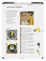
Pipe Lasers
Leica Piper 100/200
Rock solid construction, outstanding
performance in a compact package
Built with a rugged aluminum housing,
these pipe lasers perform powerfully
even in tough jobsite conditions.
Powerful and compact, the Leica Piper is
the only pipe laser that fits inside a
100 mm (four inch) pipe.
∧ Automatic grade compensation
∧ Long battery life
∧ Bright, powerful beam
∧ Large, easy to read display
∧ Alignmaster™ - Automatic target
recognition (Piper 200)
... in the manhole
Piper 100 with Remote, Target, and Li-Ion
Battery
Consisting of: Piper 100, Laser with Carrying Case,
IR Remote Control, Target Assy with small or large
red insert, Lithium-Ion Battery (GEB221), 4Ah,
Charger Li-Ion (GKL211),incl. AC adapter, car
adapter and User manual
1
Order No: 748 704
Piper 200 with Alignmaster™, Remote, Target,
and Li-Ion Battery
Consisting of: Piper 200, Laser with Carrying Case,
IR Remote Control, Target Assy with small or large
red insert, Lithium-Ion Battery (GEB221), Charger Li
-Ion (GKL211) (incl. AC adapter and car adapter),
User manual
Order No: 748 710
... in the pipe
Target Insert, small
Target insert 150-300mm, red
2
Order No: 725 920
Target Insert, large
Target Insert 400-550mm, red
Order No: 725 876
IR Remote Control
3
Order No: 746 157
19
20
Accessories
Leica Geosystems Accessories for Lasers
Rod-Eye Pro Sensor with Bracket
Construction-tough, reliable and accurate Laser
Sensor and universal Clamp with a reversible jaw
for oval rods
1
Order No: 727 163
Rod-Eye Mini Sensor with Bracket
Construction-tough and reliable Laser Sensor with
Rod Clamp
2
Order No: 730 463
Rod-Eye Classic Sensor with Bracket
Construction-tough, reliable and accurate Laser
Sensor
3
Order No: 739 575
AC power cable 2-pole EU, to charger
Order No: 731 439
AC power cable 2-pole US, to charger
Order No: 731 440
AC power cable 2-pole UK, to charger
Order No: 731 441
AC power cable 2-pole AUS, to charger
Order No: 731 442
GLB10, Laser Glasses
Red lens glasses for improved visibility of the laser
dot in bright rooms and outdoors up to 10-15m
4
Carrying Case for Rugby 100
Order No: 723 777
Order No: 726 766
Carrying Case for Rugby 100LR
Order No: 731 831
Interior Carrying Case for Rugby 200
Order No: 743 014
Standard Carrying Case for Rugby 200
Order No: 731 832
Laydown foot attachment for Rugby 200
Order No: 732 335
21
Carrying Case for Rugby 300SG
Order No: 744 365
Carrying Case for Rugby 400DG
Order No: 744 366
Battery NiMH Pack for Rugby 300SG/400DG.
Order No: 739 855
Charger NiMH for Rugby 300SG/400DG
(including separate power cable)
Order No: 741 349
GLS11, Professional Series Telescopic Reflector
Pole 2.15m
With circular bubble, cm- and ft-graduation,
extends to 2,15m
Order No: 385 500
GPR112, Basic series circular prism
Carrying Case for Piper 100
Order No: 753 492
LAT 195, Crankable Laser Tripod, 195cm
Order No: 746 155
Carrying Case for Piper 200
Order No: 663 099
Order No: 746 156
Trivet Assembly with Mounting Bracket
Order No: 746 158
Mounting Bracket
Order No: 746 159
Foot, 6" / 150 mm Piper
Order No: 746 161
Foot, 8" / 200 mm Piper
Order No: 746 162
Foot, 9" / 225 mm Piper
Order No: 746 163
Foot, 10" / 250 mm Piper
Order No: 746 164
Foot, 12" / 300 mm Piper
Order No: 746 165
22
Underground Service Locator
Leica Digisystem
Safe and fast location of
underground services
Every year, site workers are injured due to
inadvertently striking buried electricity cables or
gas pipelines. With the Digisystem operators can
locate, trace and mark underground services
precisely and reliably prior to excavation.
The Digisystem increases your onsite safety and
saves effort and money. Several vital safety
features built into the Digicat™ 100 and 200
models are rarely found in similarly priced units
from other manufacturers.
∧ Digital signal processing – robust and error free
location in the construction environment
∧ Easy to use – requires only minimal training
∧ Robust, lightweight and waterproof – designed
for tough working conditions
∧ Always starts in power mode at maximum
sensitivity – ensures safest operating
conditions
∧ 8 and 33 kHz tracing modes, depth estimation
to 3m, accuracy typically better than ±10%
(Digicat™ 200) – maximum flexibility
∧ Highly visible digital LED display – swift service
location
The Digisystem offers 3 selectable operating
modes
Power mode: locates power signals radiated by
energised cables.
Radio mode: traces signals originating from
distant radio transmitters. These radio signals
penetrate the ground and are re-radiated by
buried metallic cables and pipes.
Generator mode (8 and 33 kHz): locates a
distinctive signal applied by the DIGITEX 8/33 dual
frequency signal generator to a metallic
underground conductor.
23
Leica Digicat™ 100
Can be used to find live (energised) power cables,
trace buried metal services which reradiate signals
1
Order No: 731 047
Leica Digicat™ 200
In addition to the Dicicat™ 100, the Digicat™ 200
offers a non-stop depth estimation. In cooperation with the DIGITEX 8/33(operating in the
33kHz mode) the real depth and location of all
services can be found
2
Order No: 731 048
DIGITEX 8/33 Signal Generator
The Digicat™ with the DIGITEX 8/33 signal
generator give highly accurate results via specific
tracing frequencies (incl.batteries,connection cable
set,earth spike & user manual)
3
Order No: 731 049
DIGITRACE 30 Service Tracer
The DIGITRACE service tracer allows tracing of
plastic ducts, clay drains and other non-metallic
conduits
4
Order No: 731 050
Medium Signal Clamp
Provides a connection from the DIGITEX 8/33 to
metallic pipes, cables, etc. (max 100mm outside
diameter)
5
Order No: 731 056
DIGIMOUSE 40mm dia. (sonde)
DIGIMOUSE - specific point radiator of
generated signal
6
Order No: 731 053
Property Connection Cable Set EU
Cable Set to connect signal from DIGITEX 8/33 into
the property power cables, European-Version
7
Order No: 731 666
Digisystem Carry Bag
Carries the two main instruments of the
System (Digicat™ 100 and DIGITEX 8/33)
plus many small accessories
8
Order No: 740 307
24
Laser Distancemeter
Leica Disto™ Family
Leica Disto™ A3
Robustness and easy handling are the defining
characteristics of this instrument. In addition to the wellknown shortcut keys, are the minimum and maximum
measurement functions, which enable horizontal and diagonal
measurements e.g. in corners. The built in Power Range
Technology™ permits making measurements of up to 80 m
without target plates. This makes the robust one outdoor
capable. To keep you from forgetting your measured values,
there is also a memory function.
1
Order No: 740 687
Leica Disto™ A5
The Leica Disto™ A5 model stands out
thanks, both to its ergonomic design and the
soft rubber grip that allows it to sit well in the
hand. With the unique end piece, wide
range of additional functions and integrated
viewfinder, you are fully equipped to tackle
any measuring task. The most common calculating
functions are quickly and easily accessed via the
corresponding shortcut keys.
2
Leica Disto™ A6
With the Leica Disto™ A6 you are equipped to meet the
demands of any situation. Measuring does not end with
displaying the measured values on the Leica Disto™ A6, the
data can be electronically transferred to a Pocket PC or
Laptop for immediate processing.
Included in the scope of delivery is the software Disto™
transfer. It transfers your measured data to Excel®, Word®,
AutoCAD® orto other programs. Find out more about
software providers with customised programs at:
www.disto.com.
3
Order No: 751 961
Order No: 740 689
25
GZM26, Target Plate , large
Size: 210 x 297 mm (A4)
White side for short and brown side for long
distance measurements
1
Order No: 723 385
GZM27, Stick-On Target Plate
Target plate held in place with kneading adhesive.
Size: 73 x 98 mm / 147 x 98 mm
2
Order No: 723 774
GLB10, Laser Glasses
Red lens glasses for improved visibility of the laser
dot in bright rooms and outdoors up to 10-15m
3
Order No: 723 777
Softbag
Large carrying case for secure storage and
transportation of Leica Disto™s handlasermeter
and accessories. The case is supplied without
content
4
Order No: 667 169
Arm Holder Pocket PC
For comfortable and long wear of a Pocket PC
designed universal arm-holster
5
Order No: 739 200
Technical Data
Disto A3
Disto A5
Disto A6
Typical measuring accuracy
± 1.5 mm
± 2.0 mm
± 1.5 mm
Range
0.05 m to 100
0.05 m to 200
0.05 m to 200
Power Range Technology®
•
•
•
Measuring units
0.000 m, 0.00 m,
0.00 ft, 0.00 1/16 ft in,
0‘00‘‘ 1/16, 0.0 in, 0 1/16 in
0.000 m, 0.00 m, 0 mm,
0.00 ft, 0.00 1/32 ft in,
0‘00‘‘ 1/32, 0.0 in, 0 1/32 in
0.000 m, 0.00 m, 0 mm,
0.00 ft, 0.00 1/32 ft in,
0‘00‘‘ 1/32, 0.0 in, 0 1/32 in
Distance in m
Laser dot diameter in mm
Area, volume measurement
10, 50, 100 m
6, 30, 60 mm
•
Room calculation
Indirect distance measurements
Addition / subtraction
•
Store constant values
•
•
•
•
•
•
•
•
1
1
Interface
Bluetooth® Wireless Technology
Multifunctional end piece
•
•
Built in telescopic view-finder
•
•
Measurements perset of batteries
Up to 5000
Up to 10000
Up to 10000 (reduced in
Bluetooth® operating mode)
Spray proof / dust protected IP54
•
•
•
Weight with batteries
145 g
241 g
270 g
26
Machine Automation
Machine Automation Solutions
Whether you need simple laser height detection for
excavators or need to control a concrete slipform
paver to millimetres, Leica Geosystems can help you
optimise site productivity with a complete range of
machine automation solutions. Designed for
construction applications such as bulk earthworks,
excavation, fine-grading and paving. All our 1D/2D
systems can be upgraded to full 3D control.
2D Machine Automation Solutions
Leica MC200 Depthmaster
MC200 Depthmaster is a machine control receiver with
patented plumb indicator. The receiver receives the laser
beam and shows the deviation signal on the display or/and
send it to the Panel. It can be used for house building, with
farm drainage machines, back-hoe excavators, milling
machines and plows.
Leica MC200 Digger
MC200 Digger is a guidance solution for excavators and
provides real-time dig depth and reach information on an
easy-to-read graphical display mounted in the cab. At the
same time, the system is weighing and logging material
moved automatically without user interaction. It can be used
e.g. for jobs as footers, trenching, layering, creating
embankments, working on blind cuts or underwater.
Leica GradeSmart
Leica GradeSmart is an universal machine control system for
all grading machines. With interchangeability between
different machine types, GradeSmart will dramatically
increase your machine fleet efficiency. Easy hardware and
software set-ups, advanced pilot valve control, an
integrated hydraulic tuning system and automated
troubleshooting support you in all grading tasks.
Fast, Smart, Integrated
Whether you are grading, digging or paving, you
need a flexible and integrated approach to
completing a job on time and to budget.
Leica Geosystems Machine Automation includes
guidance and automatic solutions you know and
trust to have you working fast and smart.
So when you talk about increasing productivity,
remember Leica Geosystems Machine Automation
has a complete solution:
Leica GradeSmart 3D
a special solution for dozing and grading applications
Leica DigSmart 3D
a smart machine guidance solution for excavators used in
the construction business
Leica PaveSmart 3D
a Curb & Gutter control system offering a total jobsite
flexibility and mobility
Leica MNS1200 GNSS Solution
a machine navigation solution optimising working around
trees, in canyons, mines and sites with overhead
obstructions
Visit our website at www.leica-geosystems.com
or call your local Leica Geosystems dealer.
28
Machine Automation
Leica MC200 Depthmaster
Low cost depth indication system
Together with a rotating laser the excavator
sensor MC200 Depthmaster provides accurate
elevation control and a unique, patented, built-in
vertical plumb indicator for consistent accuracy.
Constant Accuracy Band (C.A.B.) technology used
in the MC200 Depthmaster receives the laser
signal and electronically maintains consistent
accuracy over distance.
MC200 Depthmaster Excavator Sensor with
Clamp-on Brackets
Package includes MC200 Depthmaster with Carrying
Case, Battery Pack Ni-Cad for Depthmaster, Clampon Bracket for DM200 (2x), Charger 220V and User
Manual
1
Order No: 742 438
MC200 Depthmaster Excavator Sensor with
Magnetic Bracket
Package includes MC200 Depthmaster with Carrying
Case, Battery Pack Ni-Cad for Depthmaster,
Magnetic Bracket for DM200, Charger 220V and
User Manual
2
Order No: 742 440
Main Features at a Glance
∧ CONSTANT ACCURACY BAND (CAB) - Maintains 'on-
grade'accuracy regardless of operating distances spot
size, or rotating laser type, either ±1/6" (4 mm) or
±1/2" (12 mm) depending on jobsite requirements.
∧ MIRROR IMAGE MOUNTING - Front or rear display panel of
the MC200 Depthmaster are the same for mounting on
either side of the machine.
∧ MEMORY - When the MC200 Depthmaster is out of the
range of the lasers a LED will blink indicating which way to
move the sensor to reacquire the laser.
∧ SHAKE TO WAKE - The unique 'SHAKE TO WAKE'
system turns off non-essential electronics after 5 minutes
of non-use. It automatically turns back on when your
machine begins to move again.
∧ POLE MOUNT - When used with the optional clamp-on
assemblies, the MC200 Depthmaster can be mounted on
any machine.
∧ MAGNETIC MOUNT - The MC200 Depthmaster is extremely
convenient with its powerful magnetic mount. It takes
seconds to attach to the machine. No drilling or welding is
required.
29
Leica MC200 Digger
The excavatior guidance solution
with Dual Slope option
MC200 Digger provides excavator
operators with real-time depth, slope
and reach information, in relation to
any reference, on an easy-to-read
graphical display MC200 control panel
mounted in the cab.
At the same time, the system is
weighing and logging material moved
automatically without user interaction.
MC200 Digger Lite Package
Complete Digger Package includes Operator Display
for MC200, 6.4", Boom 1 angle sensor ID64, Boom
2 angle sensor ID65, Bucket sensor XY-connector
IP67, Junctionbox MC200 (Weighing/Rotation), 2
Straight Cables for angle sensor, Cable last angle
sensor-Junctionbox, Cable for Power Supply, 2
Brackets for angle sensor / Laser Catcher, Bracket
for Bucket sensor, Protection cab for Bucket
sensor and cable tie, long
Order No: 749 697
MC200 Digger Pro Package
This Digger Package includes the same as the "Lite"
Package and additionally 1 Machine Chassis sensor
XY, 1 Straight Cable for angle sensor, 1 Bracket for
angle sensor / Laser Catcher
Order No: 749 698
MC200 Digger Dual Slope Package
This Digger Package includes the same as the "Lite"
Package and additionally 1 Machine Chassis sensor
XY, 1 Straight Cable for angle sensor, 1 Bracket for
angle sensor / Laser Catcher, Rotation sensor,
Cable for Rotation sensor, MMM200, 1m rigid mast,
aluminium, incl. mounting bracket, Bracket for
Rotation sensor
Order No: 749 699
As your business grows so too can
MC200 Digger:
Features
∧ Graphical MC200 Operator Control
Panel
∧ CANbus sensors
∧ Metric or US units
∧ Height/depth alarms
∧ Dual axis tilt bucket (IP67)
Optional
∧ Underwater dual axis tilt bucket
sensor (IP68)
∧ Laser catcher
∧ 3rd boom sensor
∧ Dual slope
∧ Weighing
∧ Upgrade to DigSmart 3D
∧ Light bar
30
Total Stations
Leica Geosystems Total Stations
Easily affordable, tough total stations, built specially
for site work. Use them even without experience, for
fast, reliable angle & distance measurements, stake
out and simple routines for standard building and
construction tasks.
The era of purely mechanical or optical instruments is over.
This is the digital era where digital instruments are needed
to remain competitive.
Whether you have to precisely layout a construction site,
perform control measurement or collect height and angle
data - Leica Geosystems offers the right total station for
your construction application.
APPLICATIONS & FEATURES
Builder
T100
Builder
T200
Builder
R100
Builder
R200
Builder
R100M
Builder
R200M
Alignment
X
X
X
X
X
X
Defining Angles
X
X
X
X
X
X
Plumbing
X
X
X
X
X
X
Measure or define slopes
X
X
X
X
X
X
Distance Measurement
-
-
X
X
X
X
Layout
-
-
X
X
X
X
Measure as-built
-
-
X
X
X
X
Measure size and perimeter of an area
-
-
X
X
X
X
Compute a block volume
-
-
X
X
X
X
Determine tie distance and
height difference
-
-
X
X
X
X
Determine indirect heights
-
-
X
X
X
X
Connects to PC data logger, 3rd party
software packages
-
-
-
-
X
X
Comfortably select layout data by
picking points from the memory
-
-
-
-
X
X
Store data, no need for hand-writing
them
-
-
-
-
X
X
All models are available in two accuracies:
Builder T/R/R100M: 9" provides 4 mm accuracy on 100 m,
Builder T/R/R200M: 6" provides 3 mm accuracy on 100 m
31
Measurements have never been so easy to perform as
with a Leica Geosystems Total Station. The TPS Series
allows beginners and professionals to do the job
quickly and efficiently.
Especially the Leica TPS400/800 series are designed to meet
your specific requirements. PinPoint EDM technology
significantly improves productivity whilst maintaining
maximum accuracy. Ease of use is guaranteed through an
intuitive operation concept which allows beginners to
become experts with ease.
Whether you want to survey a parcel of land or stake out on
a construction site, a variety of application programs are
available for quick results, whilst guaranteeing reliable
measurements.
APPLICATIONS & FEATURES
TC400
models
TCR400
power
models
TCR400
ultra
models
TC800
models
TCR800
power
models
TCR800
ultra
models
All TPS400 models are available with 3 different
angle accuracies, 7", 5" and 3"
All TPS800 models are available with 3 different
angle accuracies, 5", 3" and 2"
Alphanumeric Keyboard
-
-
-
X
X
X
Reflectorless measurement
-
X
X
-
X
X
Long Range Reflectorless Measurement
-
-
X
-
-
X
Plumbing
X
X
X
X
X
X
Survey points with coding
X
X
X
X
X
X
Measure size and perimeter of an area
X
X
X
X
X
X
Compute block volume
X
X
X
X
X
X
Layout and measure as-built
X
X
X
X
X
X
Determine station positions,
instruments heights, hidden points,
tie distance andheight differences,
indirect heights
X
X
X
X
X
X
Reference Arc measurements
-
-
-
X
X
X
Coordinates calculations
-
-
-
X (option)
X (option)
X (option)
Road measurement and Stake-outs
-
-
-
X (option)
X (option)
X (option)
Offset measurement
X
X
X
X
X
X
Connects to PC data logger, 3rd party
software packages
X
X
X
X
X
X
Comfortably select layout data by
picking points from the memory
X
X
X
X
X
X
Store data, no need for hand-writing
them
X
X
X
X
X
X
For high measurement requirements Leica Geosystems provides additional total stations like Leica TPS700.
For further information please contact your dealer or visit our homepage www.leica-geosystems.com/totalstations .
32
Total Stations
Leica Builder
Built for Builders
With the Leica Builder, Leica
Geosystems is aiming experts in the
building sector who have up to now
shied away from using professional
measuring instruments. Its uniquely
easy-to-operate control concept and
the outstanding product performance
accelerates common construction site
jobs, e.g. layout or plumbing.
The rugged Builder stands up to the
elements and takes all kinds of
weather. And yet it’s easily to
transport in the carry case that holds
most accessories in a single lightweight
package.
Builder T100 SET
Theodolite with laser plummet, 1 keyboard, user
manual, tribrach, battery adapter including 6 AA
batteries and container
Order No: 747 827
Builder T200 SET
Theodolite with laser plummet, 1 keyboard, user
manual, tribrach, battery adapter including 6 AA
batteries and container
Order No: 747 828
Builder R100 SET
Theodolite with EDM, laser plummet, 1 keyboard,
user manual, tribrach, battery adapter including 6
AA batteries, flat prisma, reflector pole and
container
Order No: 747 829
Builder R200 SET
Theodolite with EDM, laser plummet, 1 keyboard,
user manual, tribrach, battery adapter including 6
AA batteries, flat prisma, reflector pole and
container
Order No: 747 830
Builder R100M SET
Theodolite with EDM, internal memory, serial
RS232 interface, laser plummet, 1 keyboard, user
manual, tribrach, battery adapter including 6 AA
batteries, flat prisma, reflector pole, Lemo to USB
transfer cable and container
Order No: 747 831
Builder R200M SET
Theodolite with EDM, internal memory, serial
RS232 interface, laser plummet, 1 keyboard, user
manual, tribrach, battery adapter including 6 AA
batteries, flat prisma, reflector pole, Lemo to USB
transfer cable and container
Order No: 747 832
33
Multilingual function
GEB111, NiMH Plug-in Battery 6V/2.1Ah
Rechargeable camcorder type battery (for Builder,
TPS400/700/800, RCS1100, DNA03/10)
The Leica Builder is the only instrument of its
class with multiple languages onboard. This allows
the user to choose the preferred language –
simply and with only one keystroke, for improved
efficiency and convenience.
1
Order No: 667 318
GTS, Second Keyboard
2nd keyboard, for Builder instruments, for
telescope position 2, fitted
2
direct.dxf
Order No: 747 942
GKL112, Basic Series Charger, NiMH
Budget priced charger for single
GEB111/121 battery. Car adapter cable is
included
With "Direct.dxf" functionality, data can be read
directly from the instrument in dxf-format and
read into AutoCAD® on a PC without any
intermediate steps. Coordinates and point
numbers can be stored in different layers.
3
Order No: 734 753
GFU15, Bluetooth® Kit
Including Bluetooth® module, charger, protection
cover and tripod hook
4
Order No: 821 6666
Your Builder is Ready to go
No matter which Builder you choose, you'll always
get a complete set you can start your job with.
FEATURES
Builder
T100
Builder
T200
Builder
R100
Builder
R200
Builder
R100M
Builder
R200M
9” (directional
deviation 4 mm
at 100 m)
6” (directional
deviation 3 mm
at 100 m)
9” (directional
deviation 4 mm
at 100 m)
6” (directional
deviation 3 mm
at 100 m)
9” (directional
deviation 4 mm
at 100 m)
6” (directional
deviation 3 mm
at 100 m)
Angle measurements (Hz, V)
Standard deviation
(ISO 17123-3)
Compensator
2-axis electronic
Operating range +/-4’
Telescope
Magnification
30 x
30 x
30 x
30 x
30 x
30 x
Field of view
2.4m @ 100m
2.4m @ 100m
2.7m @ 100m
(with EDM)
2.7m @ 100m
(with EDM)
2.7m @ 100m
(with EDM)
2.7m @ 100m
(with EDM)
Standard Deviation
(ISO 17123-3)
-
-
3 mm +2 ppm
3 mm +2 ppm
3 mm + 2 ppm
3 mm + 2 ppm
Range
On Kodak Grey Card
On flat prism
-
80m
250m
80m
250m
80m
250m
80m
250m
Laser plummet (Precision)
1.5 mm @ 1.5 m 1.5 mm @ 1.5 m 1.5 mm @ 1.5 m 1.5 mm @ 1.5 m 1.5 mm @ 1.5 m 1.5 mm @ 1.5 m
Internal memory
-
-
-
-
10 000 Data
blocks
10 000 Data
blocks
Interface
-
-
-
-
RS232/USB up
to 19’200 Baud
RS232/USB up
to 19’200 Baud
Dust and Rain
IP54
IP54
IP54
IP54
IP54
IP54
Distance Measurement
34
Total Stations
Leica TPS400
Leica TC407
7"(2mgon) total station, 1 keyboard, user manual
and container
Order No: 725 552
Leica TC405
5"(1.5mgon) total station, 1 keyboard, user manual
and container
Order No: 725 553
Leica TC403
3"(1mgon) total station, 1 keyboard, user manual
and container
Easy, quick and reliable
The Leica TPS400 Series is specifically designed for the
construction site. It is very easy to use and impresses by a
high level of functionality. With a laser plummet and
electronic level the instrument is quickly set up and ready to
measure.
The proven endless fine drive and the accurate telescope
with 30-times magnification precisely targets each
measuring point. The integrated electronic distance meter
measures to target plates, prisms or even reflectorless to
any given surface.
Now with the new TCR400ultra versions reflectorless
measurements up to more than 500 m are possible.
Order No: 725 554
Leica TCR407power
7"(2mgon) total station with reflectorless EDM, 1
keyboard, user manual and container
Order No: 737 919
Leica TCR405power
5"(1.5mgon) total station with reflectorless EDM, 1
keyboard, user manual and container
Order No: 737 920
Leica TCR403power
3"(1mgon) total station with reflectorless EDM, 1
keyboard, user manual and container
Order No: 737 921
Leica TCR407ultra
7"(2mgon) totalstation with extended-range
reflectorless EDM, 1 keyboard, user manual and
container
Order No: 748 624
Leica TCR405ultra
5"(1.5mgon) totalstation with extended-range
reflectorless EDM, 1 keyboard, user manual and
container
Order No: 748 625
Leica TCR403ultra
3"(1mgon) totalstation with extended-range
reflectorless EDM for measurements without
reflector, 1 keyboard, user manual and container
Order No: 748 626
35
Leica TPS800
Leica TC805
5"(1.5mgon), total station, 1 keyboard, user
manual and container
Order No: 741 504
Leica TC803
3"(1mgon), total station, 1 keyboard, user manual
and container
Order No: 741 503
Leica TC802
2"(0.6mgon), total station, 1 keyboard, user
manual and container
Powerful, efficient, reliable and intuitive
The Leica TPS800 is a true workhorse for all professionals
who require an instrument that is easy to learn and
optimised for field usage. The EDM provides long range
measurement to all targets. All TPS800 will be delivered with
more features than ever. The TPS800 is equipped with new
keyboard, display and software. The display features high
resolution and good readability under all light conditions.
Now even with the new TCR800ultra versions reflectorless
measurements up to more than 500 m are possible.
Order No: 741 502
Leica TCR805power
5"(1.5mgon), total station with reflectorless EDM, 1
keyboard, user manual and container
Order No: 741 507
Leica TCR803power
3"(1mgon), total station with reflectorless EDM, 1
keyboard, user manual and container
Order No: 741 506
Leica TCR802power
2"(0.6mgon), total station with reflectorless EDM, 1
keyboard, user manual and container
Order No: 741 505
Leica TCR805ultra
5"(1.5mgon), total station with extended-range
reflectorless EDM for measurements without
reflector, 1 keyboard, user manual and container
Order No: 748 605
Leica TCR803ultra
3"(1mgon), total station with extended-range
reflectorless EDM, 1 keyboard, user manual and
container
Order No: 748 606
Leica TCR802ultra
2"(0.6mgon), total station with extended-range
reflectorless EDM, 1 keyboard, user manual and
container
Order No: 748 607
36
Total Stations
Features of TPS400/800
PinPoint – Reflectorless
Distance measurement
GFU15, Bluetooth® Kit
Including Bluetooth® module, charger, protection
cover and tripod hook
The PinPoint technology enables a reflectorless
distance measurement to any surface and an
exceptional range of over 500 m ("ultra"-models).
1
Order No: 821 6666
EGL3, Electronic Guide Light
For stake-out with all TPS400/800 instruments
Direct.dxf
2
With "Direct.dxf" functionality, data can be read
directly from the instrument in dxf-format and
read into AutoCAD® on a PC without any
intermediate steps. Coordinates, codes and point
numbers can be stored in different layers.
GST19-V2, Second Keyboard
2nd keyboard for dual face measurements
for all TPS400 instruments
Order No: 667 161
3
Order No: 733 370
GTS21, Second Keyboard
2nd keyboard for all TPS800 instruments, for
telescope position 2
Theft-protection
4
The PIN-code feature prevent unauthorized
persons from using the instrument. Without
correct code, the equipment can’t be operated,
data erased and makes it unattractive to steal.
Order No: 741 495
Basic Set of Accessories TPS400/800
Consisting of: 1 Tribrach (GDF111-1), 2 Batteries
(GEB111), 1 Charger (GKL112), 1 Data transfer
cable Lemo/USB (GEV189), 1 Miniprism Set
(GMP111), 1 Instrument height meter (GHM007)
Order No: 730 484
FEATURES
TPS403
TPS405
TPS407
TPS802
5" (1.5mgon)
7" (2mgon)
2" (0.6mgon)
TPS803
TPS805
3" (1mgon)
5" (1.5mgon)
Angle measurements (Hz, V)
Standard deviation (ISO 17123-3)
3" (1mgon)
Compensator
Electronic 2 axis oil compensator
Electronic 2 axis oil compensator
3'500m
3'500m
250m
250m
2mm + 2ppm/5mm + 2ppm/5mm + 2ppm
2mm + 2ppm/5mm + 2ppm/5mm + 2ppm
< 1 sec/< 0.5 sec/< 0.15 sec
< 1 sec/< 0.5 sec/< 0.15 sec
Infrared Distance measurement (IR)
Measuring range with circular prism
GPR1
Measuring with reflective foil
(60 mm x 60mm)
Standard deviation (ISO 17123-4)
(fine/quick/tracking)
Time for a measurement
(fine/quick/tracking)
PinPoint-Reflectorless Distance measurement (RL)
Range PinPoint R100("power")
170 m (90% reflective)
170 m (90% reflective)
Range PinPoint R300 ("ultra")
> 500 m (90% reflective)
> 500 m (90% reflective)
10'000 data blocks
10'000 data blocks
Internal data storage
Interface
Display Graphics
Temperature range
Dust and splash proof (IEC 60529)
Applications
RS232
RS232
160 x 280 pixels,
Alphanumeric 8 lines x 31 characters
160 x 280 pixels,
Alphanumeric 8 lines x 31 characters
-20° C to +50° C (-4° F to +122° F)
-20° C to +50° C (-4° F to +122° F)
IP54
IP54
Surveying • Reference line • Remote Height • Stake
out • Free Station • Tie Distance • Hidden Point •
Area (plan) • Target Offset • Volume
Surveying & Orientation • Reference line & Arc •
Remote Height • Stake out • Free Station • Tie
Distance • Hidden Point • Area (3D) & Volume •
Construction • Target Offset • Volume
COGO • Road 2D
GPS Systems
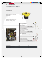
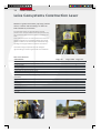
Leica GPS900
Big ambitions on a budget
The Leica GPS900 uses Leica Geosystems’ proven
GPS technology. Consisting of a Leica RX900
Controller and a Leica ATX900 GPS Antenna the all
-on-the-pole GPS900 RTK rover is ideal for oneperson stakeout, topographic tasks and for a wide
range of jobs including foundation and drainage
work and as-built surveys. Import and export
functionality allows the instrument to be
compatible with Leica TPS400 and Leica TPS800.
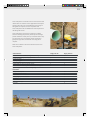
Stakeout
Stakeout points and digital terrain models (DTMs) with the
stakeout program. Navigate directly using the map-view or
using the large bull’s-eye.
Topographic Survey
Record points with or without code and attribute
information. Set criteria and measure points
automatically. View the survey in the large,
graphical map-view display. Use the Survey program
for detail, topo, title surveys etc.
Alignment
Stakeout relative to a 3D alignment using the
RoadRunner Lite option. Points can be staked out at any
chainage (stationing) and offset. Work with any
combination of geometric elements.
37
38
GPS Systems
Leica GPS900
Leica RX900 Controller
WinCE GPS900 Controller with battery
compartment, touch screen, alpha keyboard, stylus
for touch screen, user manual. Controller for the
ATX900
1
Order No: 748 414
Leica ATX900 GPS Antenna
L1/L2 GPS Antenna for GPS900. To be used
together with the RX900 controller
2
Order No: 748 415
GLS30, carbon-fibre pole
GPS telescopic carbon-fibre pole with circular
bubble and 5/8" screw, snap-locks at 2.00 m
3
Order No: 752 292
GSW596, RX900 Software Application
For Volume Calculations
Order No: 754 872
GST05L, Aluminium Tripod
Medium-duty tripod, with shoulder strap. Suitable
for levels, lasers, medium weight total stations and
GPS.
Extendible 176cm (5.7ft), weight 4.6kg (10.1lb)
4
Order No: 563 630
GPS900 Package
GPS900 is available in a
variety of packages that
contain the GPS900 and all
necessary accessories.
Please contact your dealer or
Leica Geosystems
representative for more
information.
FEATURES
GPS technology
SmartTrack dual frequency 12 L1 + 12 L2
ATX900 GPS Antenna
Built-in groundplane with SmartCheck and Bluetooth® wireless technology
RX900 Controller
1/4 VGA Touch screen, Windows CE 5.0, 256 MB internal memory Bluetooth® wireless
technology, RTK range: 2500 m
SmartCheck
Horizontal accuracy: 10 mm +1 ppm, kinematic
Vertical accuracy: 20 mm +1 ppm, kinematic
Position update rate: 1 Hz standard, option up to 2 Hz
Power supply
Li-Ion 1.9 Ah/7.2 V for GPS900 rover. Ni-MH 8.0 Ah/12 V for GPS900 reference setup.
Power RTK rover for about 5 hours.
Temperature ISO9022,
MIL-STD-810F
Operation: –30°C to +65°C
Storage: –40°C to +80°C
Protection against water,
dust and sand, IP67 (IEC60529),
MIL-STD-810F
Waterproof to 1 m temporary submersion
Dust tight
Weight
ATX900: 0.96 kg, RX900: 0.71 kg
Entire GPS900 RTK rover: 3.49 kg
Leica Geosystems - Nothing is really closer
Australia
C.R. Kennedy & Company Pty.Ltd
Pyrmont
Phone: +61 2 9518-9700
Fax: +61 2 9518-9711
France
Leica Geosystems Sarl
Le Pecq Cedex
Phone: +33 (0)1 30 09 17 00
Fax: +33 (0)1 30 09 17 01
Mexico
Leica Geosystems S.A. de C.V.
Mexico D.F.
Phone: +525 563 5011
Fax: +525 611 3243
Sweden
Leica Geosystems AB
Sollentuna
Phone: +46 8 625 30 00
Fax: +46 8 625 3010
Austria
Rudolf & August Rost
Wien
Phone: +43 1 981 22-0
Fax: +43 1 981 22-50
Germany
Leica Geosystems GmbH Vertrieb
München
Phone: + 49 (0) 89 / 1498 100
Fax: + 49 (0) 89 / 1498 10 33
Netherlands
Leica Geosystems B.V.
Rijswijk
Phone: +31 70 307 89 00
Fax: +31 70 307 89 19
Switzerland
Leica Geosystems AG
Glattbrugg
Phone: +41 44 809 3311
Fax: +41 44 810 7937
Belgium
Leica Geosystems NV/SA
Diegem
Phone: +32 2 2090700
Fax: +32 2 2090701
Hong Kong
Leica Geosystems Ltd
Phone: +852 2564 2299
Fax: +852 2564 4199
Norway
Leica Geosystems AS
Oslo
Phone: +47 22 88 60 80
Fax: +47 22 88 60 81
United Kingdom
Leica Geosystems Ltd
Milton Keynes
Phone: +44 1908 256 500
Fax: +44 1908 246 259
Poland
Leica Geosystems Sp. z o.o.
Warsaw
Phone: +48 22 3381534
Fax: +48 22 338 15 22
USA
Leica Geosystems Inc.
Norcross
Phone: +1 770-326-9500
Fax: +1 770 447 0710
Portugal
Leica Geosystems, Lda.,
Sao Domingos de Rana
Phone: +351 214 480 930
Fax: +351 214 480 931
Other Countries:
Ireland
Survey Instrument Services Ltd
Dublin
Phone: +353 1456 8650
Fax: +353 1 456 8653
Canada
Leica Geosystems Ltd.
Willowdale
Phone: +1 416 497 2460
Fax.: +1 416 497 8516
China P.R.
Leica Geosystems AG,
Representative Office Beijing
Phone: +86 10 8525 1838
Fax: +86 10 8525 1836
Italy
Leica Geosystems S.p.A.
Cornegliano Laudense
Phone: + 39 0371 69731
Fax: + 39 0371 697333
Japan
Leica Geosystems K.K.
Tokyo
Phone: +81 3 5940 3033
Fax: +81 3 5940 3056
Denmark
Leica Geosystems A/S
Herlev
Phone: +45 44 54 02 02
Fax: +45 44 45 02 22
Builder
Laser class 3R in
accordance
with IEC 60825-1
and EN 60825-1
•
Distance meter
(RL), Laser
plummet
Spain
Leica Geosystems, S.L.
Barcelona
Phone: +34 934 949 440
Fax: +34 934 949 442
TPS400/800
Piper
•
Distance meter
(PinPoint
R100/R300)
•
•
•
•
Laser class Illa in
accordance
with FDA 21CFR
CH.I § 1040
Laser class 2 in
accordance
with IEC 60825-1
and EN 60825-1
Russia
Leica Geosystems OOO
Moscow
Phone: +7 95 234-5557
Fax: +7 95 234-5560
Korea, (Republic of)
Leica Geosystems Korea
Seoul
Phone: +82 2 565 5251
Fax: +82 2 598 9686
Finland
Leica Nilomark OY
Espoo
Phone: +358 9 6153 555
Fax: +358 9 5022 398
•
Laser plummet
Laser class II in
accordance
with FDA 21CFR
CH.I § 1040
Laser class 1 in
accordance
with IEC 60825-1
resp. EN 60825-1
•
Distance meter
(IR)
LED class 1 in
accordance
with IEC 60825-1
resp.EN 60825-1
•
Guide light
(EGL)
Contact Headquarter
Leica Geosystems AG
Switzerland, Heerbrugg
Phone: +41 71 727 3131
Fax: +41 71 727 4674
Rugby 100
Rugby 200
•
•
•
•
The Bluetooth® word mark and logos are owned by Bluetooth SIG, Inc. and any use of such marks by
Leica Geosystems AG is under license.
Other trademarks and trade names are those of their respective owners.
Rugby 300/400
Disto
A3/A5/A6
•
•
Whether you have to precisely layout a construction site, perform
control measurements, collect height and angle data, align
concrete forms, install ceilings and partitions, lay gravity flow pipe,
locate underground services or complete site preparation and
earthworks – Leica Geosystems offers the right instrument,
construction laser or machine control installation specifically designed
for your construction application.
Easy-to-use, jobsite tough, accurate and reliable –
Leica Geosystems instruments and lasers ensure the efficient use of
your materials and resources. High quality products, such as optical
and electronic levels, construction lasers, total stations and machine
automation systems, provide fast results, keep you working and
increase your profitability.
When it has to be right.
Illustrations, descriptions and technical data are not binding.all rights reserved.
Printed in Germany - Copyright Leica Geosystems AG, Heerbrugg, Switzerland, 2006.
743133en - IX.06 - www.plum.de
Total Quality Management Our commitment to total
customer satisfaction.
Ask your local Leica Geosystems
agent for more information
about our TQM program.
Leica Geosystems AG
Heerbrugg, Switzerland
www.leica-geosystems.com
Construction
Lasers
Accessories
Optical & Digital
Levels
Theodolites &
Total Stations
2D/3D Machine
Automation