1
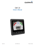
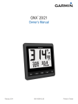
GNX™ 120/130 Owner’s Manual March 2015 Printed in Taiwan 190-01846-00_0A All rights reserved. Under the copyright laws, this manual may not be copied, in whole or in part, without the written consent of Garmin. Garmin reserves the right to change or improve its products and to make changes in the content of this manual without obligation to notify any person or organization of such changes or improvements. Go to www.garmin.com for current updates and supplemental information concerning the use of this product. Garmin and the Garmin logo are trademarks of Garmin Ltd. or its subsidiaries, registered in the USA and other countries. GNX™ is a trademark of Garmin Ltd. or its subsidiaries. These trademarks may not be used without the express permission of Garmin. ® NMEA , NMEA 2000 , and the NMEA 2000 logo are registered trademarks of the National Marine Electronics Association. ® ® Table of Contents Introduction.....................................................................1 Device Overview ......................................................................... 1 Unlocking the Controls ........................................................... 1 Profiles............................................................................ 1 Selecting a Profile ....................................................................... 1 Restoring Profiles to their Default Settings ................................. 1 Instrument Pages ........................................................... 1 Cycling Through Instrument Pages ............................................ 1 Using Auto Scroll ................................................................... 1 Adding an Instrument Page ........................................................ 1 Removing an Instrument Page ................................................... 1 Changing the Layout of Instrument Pages ................................. 1 Configuring the Data Fields ........................................................ 2 Filtering the Data .................................................................... 2 Adjusting the Data Update Rate ............................................ 2 Configuring Graph Data Fields .............................................. 2 Configuring Gauge Data Fields .............................................. 2 Using the Race Timer ................................................................. 2 Device Configuration..................................................... 2 System Settings .......................................................................... 2 Selecting the Heading Type ................................................... 2 Configuring the Beeper .......................................................... 2 Configuring the Position Format ............................................ 3 Display Settings .......................................................................... 3 Configuring Data Sources ........................................................... 3 Resolving a Combined Network ................................................. 3 Keypad Operation.......................................................... 3 Setting up an Instrument for Use with the Keypad ..................... 3 Setting up the Keypad Display Order ......................................... 3 Setting up Keypad Presets ......................................................... 4 Disabling Keypad Control on an Instrument ............................... 4 Appendix......................................................................... 4 Registering Your Device ............................................................. 4 NMEA 2000 Data Type Information ............................................ 4 NMEA 0183 Data Type Information ............................................ 4 Abbreviation Glossary ................................................................. 4 Data Type Information ................................................................ 5 Index................................................................................ 7 Table of Contents i Introduction WARNING See the Important Safety and Product Information guide in the product box for product warnings and other important information. Device Overview NOTE: Certain functions are available only when the appropriate sensors are connected to the device. The marine instrument allows you to view data sources from sensors through a NMEA 2000 network. Although the instrument cannot directly receive NMEA 0183 data, it can display NMEA 0183 data from sources connected to a GNX 20 or GNX 21 device (sold separately) on the same NMEA 2000 network. The instrument can also receive data from Nexus instruments and sensors using a GND™ 10 device (sold separately). ® ® ® information, bearing to waypoint, distance to the next waypoint, true wind angle, and depth. SAIL RACE: This profile displays instruments useful when racing in a sailboat. Available default instruments include GPS speed information, true wind speed, true wind angle, heading, bearing to waypoint, and distance to the next waypoint. CUSTOM: This profile allows you to customize the page to display instruments useful to your specific boating needs. The default page displays speed over ground information. Selecting a Profile > SETUP > PROFILES. 1 Select 2 Select a profile. Restoring Profiles to their Default Settings You can restore profiles to their factory default settings. > SETUP > PROFILES > RESET DEFAULTS. 1 Select 2 Select CURRENT PROFILE or ALL PROFILES. Instrument Pages Cycling Through Instrument Pages From any instrument page, select or . Using Auto Scroll Select to return to the previous menu or to the instrument page. Select to view the menu for an instrument page. or Select to scroll through instrument pages and menus. Select to view the display settings. Select twice to view the backlight settings. Hold to view the power-off settings. Unlocking the Controls After one minute, the controls on the device lock automatically. This feature reduces accidental button pushes caused by water splashes or droplets. When locked, the icon appears when you select a key on the device. NOTE: You can select SETUP > TOUCH KEY LOCK to disable the device lock feature. Hold both and at the same time. The icon disappears when the controls are unlocked. Profiles Profiles are collections of instrument pages that can be customized. Profiles can be made up of instrument pages that display similar data, such as GPS speed information and GPS course information. During the initial setup, you can select a preset profile, or you can create a custom profile. You can select a different profile at any time. POWERBOAT: This profile displays instruments useful when in a powerboat. Available default instruments include GPS speed information, GPS course information, depth, bearing to waypoint, distance to the next waypoint, and water temperature. SAIL CRUISE: This profile displays instruments useful when cruising in a sailboat. Available default instruments include true wind speed, GPS speed information, GPS course Introduction You can use auto scroll to automatically cycle through all of the instrument pages. > SETUP > AUTO SCROLL. 1 Select 2 Select an option: • Select AUTO SCROLL to turn auto scroll on or off. • Select AUTO SCROLL INTERVAL to adjust how long each instrument page is shown. Adding an Instrument Page You can create a custom page. You can add up to three instruments from instrument collections to display on a custom page. > ADD/REMOVE PAGE > ADD PAGE. 1 Select 2 Select ONE FUNCTION, TWO FUNCTION, or THREE FUNCTION. 3 Select an instrument page collection. 4 Select a number. 5 If necessary, select an empty function. or to scroll through the instrument pages. 6 Select 7 Select an instrument page to add. Removing an Instrument Page 1 Select the instrument page to remove. > ADD/REMOVE PAGE > REMOVE PAGE. 2 Select 3 Select YES. Changing the Layout of Instrument Pages NOTE: You can change the layout of an instrument page to display up to three fields of data from connected instruments. > 1 From the instrument page you need to change, select EDIT CURRENT PAGE > CHANGE LAYOUT. 2 Select the number of fields to show on the instrument page. 3 Select the field to change. 4 Select a category. 5 Select the data to show in the field. 1 6 Repeat steps 3 through 5 for each additional field you need to change. 7 Select DONE. Configuring the Data Fields Data provided on an instrument page can be shown in various ways depending upon the instrument page that is displayed. > CONFIGURE DATA FIELDS. 1 Select 2 Select a data field. 3 Select a configuration option. 4 Adjust the configuration. Filtering the Data Certain data types can be filtered to control how quickly the marine instrument responds to changes in the data (Data Type Information). > 1 When viewing data you need to filter, select CONFIGURE DATA FIELDS. 2 Select a data field. 3 Select FILTER SETTING. 4 Adjust the filter setting. • Setting the filter to "0" turns off filtering. • The higher the filter setting, the more gradually the instrument displays changes in the data it receives. For example, when you increase the filter setting for wind speed data, the instrument is less responsive to momentary gusts of wind and displays a more constant wind speed. Adjusting the Data Update Rate You can adjust the rate at which the marine instrument shows updated data. 1 When viewing the instrument screen with data you need to adjust, select > CONFIGURE DATA FIELDS. 2 Select a data field. 3 Select UPDATE RATE. 4 Select an update rate. Examples of update-rate speeds are shown next to each selection. Configuring Graph Data Fields Some single-function instrument pages display graph data (Data Type Information). You can configure how data is shown on the graphs. > 1 From an instrument page with a graph, select CONFIGURE DATA FIELDS > GRAPH SETTINGS. NOTE: The GRAPH SETTINGS menu item does not appear on instrument pages that do not contain a graph. 2 Select an option: • To determine how long the graph data displays, select GRAPH DURATION. • To configure the scale of values displayed in the graph, select GRAPH SCALE. Configuring Gauge Data Fields Some data types can be shown as a gauge when they appear as the last function on a two-function instrument page (Data Type Information). You can configure how data is shown on the gauge. > 1 From an instrument page with a graph, select CONFIGURE DATA FIELDS > GAUGE SETTINGS. NOTE: The GAUGE SETTINGS menu item does not appear on instrument pages that do not contain a gauge. 2 Select a value to adjust the limits of the gauge. 2 Using the Race Timer To view the race timer on a page, you must add it as a data field from the SAILING category. You can use the race timer to count down to a race, and then measure the duration of the race. The race timer is synchronized with other GNX instruments and compatible Garmin chartplotters on the same NMEA 2000 network. TIP: To quickly open the race timer screen, you can hold from a main page. This shortcut works from any page, whether or not the race timer has been added to the page. > 1 From a page with the race timer as a data field, select CONFIGURE DATA FIELDS > RACE TIMER SETTINGS. 2 Select an option: • When the device is in prerace mode and the timer is not running, select START to start the prerace timer, select RESET to reset the prerace timer, or select SETUP to adjust the initial prerace timer value. • When the prerace timer is running (counting down), select or to advance the timer to the next minute up or the next minute down, or select STOP to stop the prerace timer. • When the race timer is running (counting up), select STOP to stop the race timer, or select to reset the timer back to 0:00. ® Device Configuration System Settings Select > SETUP > SYSTEM. UNITS: Sets the units of measure. HEADING: Sets the reference and the variance used in calculating heading information. BEEPER: Sets when audible sounds are used. GPS POSITION: Sets the position format and the map datum. The map datum is dependent on the position format. AUTO POWER: Enables the device to turn on automatically when the NMEA network turns on. LANGUAGE: Sets the on-screen language. TIME: Sets the time format, time zone, and daylight savings time for your location. SYSTEM INFORMATION: Displays software information. FACTORY DEFAULT: Resets the device settings to factory default values. Selecting the Heading Type > SETUP > SYSTEM > HEADING. 1 Select 2 Select NORTH REFERENCE. 3 Select an option: • To automatically set the magnetic declination for your GPS position, select MAGNETIC. • To set true north as the heading reference, select TRUE. • To set grid north as the heading reference (000°), select GRID. Adjusting the Heading Variance By default, the heading variance is set automatically. You can adjust this value manually. > SETUP > SYSTEM > HEADING > VARIANCE > 1 Select USER VARIANCE. 2 Adjust the variance. to save the variance adjustment. 3 Select Configuring the Beeper > SETUP > SYSTEM > BEEPER. 1 Select Device Configuration 2 Select an option: • To turn off the beeper, select OFF. • To set the beeper to sound only when alarms are triggered, select ALARMS ONLY. • To set the beeper to sound when the keys are pressed and alarms are triggered, select ON (KEYS AND ALARMS). Configuring the Position Format NOTE: Do not change the position format or the map datum unless you are using a map or chart that specifies a different position format. > SETUP > SYSTEM > GPS POSITION. 1 Select 2 Select an option: • To change the position format in which a reading appears, select POSITION FORMAT. • To change the coordinate system on which the map is structured, select MAP DATUM. Button Select to cycle backlight levels on the marine instruments and keypads. Hold to place the marine instruments and keypads into sleep mode. Display Settings Select > SETUP > DISPLAY. BACKLIGHT: Sets the backlight brightness. COLOR: Sets the screen color. NETWORK SHARING: Shares color, backlight, and beeper settings with devices across the NMEA 2000 network. Configuring Data Sources Sensors connected to your instrument provide data, such as wind or speed information, and can be configured through your instrument. See the owner's manual for each sensor for more information. > SETUP > DATA SOURCES. 1 Select 2 Select a data category. 3 If more than one sensor on the boat provides data from the category, select a sensor to configure. 4 Select a configuration option, and configure the setting. Resolving a Combined Network When the device is turned on, it can detect when it has been synchronized with instruments on another network. This can happen if the device has previously been installed on another vessel and synchronized with instruments on the other vessel's network. If the settings are not restored to the factory default values (Restoring Profiles to their Default Settings), the device detects a conflict that must be resolved. > SETUP > COMBINED NETWORKS 1 Select DETECTED. 2 Select an option: • To synchronize existing instruments on the network to the device, select NO. • To synchronize the device to existing instruments on the network, select YES. Keypad Operation The keypad can control all of the compatible marine instruments on your NMEA 2000 network. All compatible marine instruments must be connected to the same NMEA 2000 network, and you can configure the order in which they are controlled. NOTE: The keypad is not compatible with all Garmin marine instruments. For a complete list of compatible instruments, go to www.garmin.com/GNXkeypad. Keypad Operation Function À through à Presets. Select to make all displays switch to a configured preset page. Select to switch the marine instrument you control using the keypad. Select to cycle the pages on the selected marine instrument. Setting up an Instrument for Use with the Keypad All compatible marine instruments you need to control with the keypad must be connected to the same NMEA 2000 network as the keypad. You should perform this procedure for each compatible instrument you add to the NMEA 2000 network. 1 On a compatible marine instrument connected to the same NMEA 2000 network as the keypad, select > SETUP > REMOTE KEYPAD SETUP. NOTE: If COMBINED NETWORKS DETECTED is shown instead of REMOTE KEYPAD SETUP, the combined network must be resolved before you can control the instrument with the keypad (Resolving a Combined Network). 2 Select YES to enable keypad control on the instrument. 3 Repeat steps 1 through 2 for each additional compatible instrument you need to control with the keypad. Setting up the Keypad Display Order You can configure how the keypad cycles through connected marine instruments with the buttons. On a compatible marine instrument connected to the same 1 NMEA 2000 network as the keypad, select > SETUP > REMOTE KEYPAD SETUP > SET UP DISPLAY ORDER. The device scans the network for other connected instruments. NOTE: The location of the device in the current display order is shown to the right of the SET UP DISPLAY ORDER menu item. For example, if the device is second in a series of four devices, 2:4 is shown in the menu. 2 Select an option: • If a correct number of connected instruments is shown, select CONTINUE. • If an incorrect number of connected instruments is shown, check the power and connections of all compatible instruments, and select RETRY. 3 NOTE: If you are unable to see the correct number of instruments listed, it may be caused by a combined network. A combined network must be resolved to control all connected devices with the keypad (Resolving a Combined Network). 3 Select the order of the device, and select OK. 4 Repeat steps 1 through 3 for each connected device. Setting up Keypad Presets Each of the four preset buttons on the keypad can be assigned to an instrument page. TIP: While viewing an instrument page on a marine instrument controlled by the keypad, you can quickly assign a preset button to the instrument page by holding the preset button for three seconds. 1 On a compatible marine instrument connected to the same NMEA 2000 network as the keypad, select > SETUP > REMOTE KEYPAD SETUP > SET UP PRESETS. 2 Select a preset button. 3 Select the number of the instrument page in the current display order that you want to assign to the preset button. 4 (Optional) Repeat steps 1 through 3 for each preset button. 5 (Optional) Repeat steps 1 through 4 on each additional instrument. Disabling Keypad Control on an Instrument You can disable keypad control on any compatible marine instrument. 1 On a compatible marine instrument connected to the same NMEA 2000 network as the keypad, select > SETUP > REMOTE KEYPAD SETUP > IGNORE REMOTE KEYPAD. 2 Select YES. The marine instrument is not controlled by the keypad. Appendix Registering Your Device Help us better support you by completing our online registration today. • Go to http://my.garmin.com. • Keep the original sales receipt, or a photocopy, in a safe place. NMEA 2000 Data Type Information Each NMEA 2000 certified sensor provides unique information to the NMEA 2000 certified display device. The data you can view on your display depends on the sensors you have installed and configured. See the installation instructions for your Garmin display device or for the instrument that provides NMEA 2000 PGN data-type information. NMEA 0183 Data Type Information Although the instrument cannot directly receive NMEA 0183 data, it can display NMEA 0183 data from sources connected to a GNX 20 or GNX 21 device (sold separately) on the same NMEA 2000 network. Each NMEA 0183 certified sensor provides unique information to a NMEA 0183 certified display device. The data you can view on your display depends on the sensors you have installed and configured. See the installation instructions provided with your Garmin display device or instrument for NMEA 0183 data-type information. 4 Abbreviation Glossary This device uses abbreviations on many screens to indicate the type of data being shown. ABS: (ABSOLUTE HUMIDITY) Absolute, relative to another data field. For example, absolute humidity. AIR: The air temperature. ATW: (ARRIVAL TIME NEXT WAYPOINT) Estimated time of arrival at the next waypoint when navigating. AVG: (AVERAGE BOAT SPEED) The average amount. AWA: (APPARENT WIND ANGLE) The wind angle measured relative to the bow of the vessel. AWS: (APPARENT WIND SPEED) The measured speed of the wind. BAR: (BAROMETER) The calibrated current pressure. BAT: (BATTERY) The battery voltage. BSP: (BOAT SPEED) The speed of the boat through the water. BSP: (BOAT SPEED) The speed of the boat through the water. BTW: (BEARING TO WAYPOINT) The direction from your current location to a destination. You must be navigating for this data to appear. COG: (COURSE OVER GROUND) The actual direction of travel, regardless of the course steered and temporary variations in heading. DIS: (DISTANCE) The distance traveled while navigating. DPT: (DEPTH) The depth of the water. Your device must be connected to a NMEA 0183 or NMEA 2000 device capable of acquiring the water depth. DRF: (DRIFT) The speed of the current. DTL: (DIST. TO START LINE) The distance to the starting line when in race mode. DTW: (DISTANCE TO WAYPOINT) The distance to the next waypoint when navigating. ECN: (ENGINE FUEL ECONOMY) Modifier for a value such as fuel economy. ELV: (ELEVATION) The altitude of your current location above or below sea level. ENG: (ENGINE) A modifier for an engine value such as voltage or RPM. ERR: () The error of precision for the current position, when used with GPS. FLO: (ENGINE FUEL FLOW RATE) Modifier for a value such as fuel flow rate. FUEL: Modifier for a fuel value such as fuel economy or fuel flow rate. GWD: (GROUND WIND DIRECTION) The direction of the wind relative to the ground, referenced from the north. GWS: (GROUND WIND SPEED) The speed of the wind relative to the ground. HDG: (HEADING) The direction the boat is pointing. HUM: (HUMIDITY) The level of humidity. LINE: When used with VMG, it shows the velocity made good value to the starting line. MAX: (MAXIMUM SOG) The maximum in relation to another data field. For example, maximum speed. MIN: () The minimum in relation to another data field. For example, minimum speed. ODO: (ODOMETER) A running tally of distance traveled for all trips. This total does not clear when resetting the trip data. OTH: (OPPOSITE TACK HEADING) The opposite tack direction of the vessel based on the current tack direction. POS: (POSITION) The vessel's current position. Appendix RACE: The timer for vessel racing. REL: (RELATIVE HUMIDITY) Absolute, relative to another data field. For example, absolute humidity. RPM: (ENGINE RPM) Engine revolutions per minute from the tachometer. RUD: (RUDDER ANGLE) The rudder relative to another data field. For example, rudder angle. SEA: (SEA TEMP) The temperature of the water. Your device must be connected to a NMEA 0183 or NMEA 2000 device capable of acquiring the water temperature. SOG: (SPEED OVER GROUND) The actual speed of travel, regardless of the course steered and temporary variations in heading. TRP: (TRIP) A modifier for another field, for example, a trip odometer or trip fuel used. TTB: (TIME TO BURN) The time needed to make it to the starting line before a race. Data Field Category ENGINE RPM ENGINE ENGINE TEMPERATURE ENGINE ENGINE FUEL ECONOMY ENGINE ENGINE FUEL FLOW RATE ENGINE ENGINE VOLTAGE ENGINE COURSE OVER GROUND GPS ELEVATION GPS GPS ERROR GPS GPS POSITION GPS SPEED OVER GROUND GPS ARRIVAL TIME NEXT WAYPOINT NAVIGATION BEARING TO WAYPOINT NAVIGATION CROSS TRACK ERROR NAVIGATION DISTANCE TO WAYPOINT NAVIGATION HEADING NAVIGATION TIME TO WAYPOINT NAVIGATION APPARENT WIND ANGLE SAILING APPARENT WIND SPEED SAILING OPPOSITE TACK HEADING SAILING RACE TIMER SAILING TRUE WIND ANGLE SAILING TRUE WIND DIRECTION SAILING TRUE WIND SPEED SAILING VMG WAYPOINT SAILING VMG WIND SAILING DIST. TO START LINE SAILING TIME TO BURN SAILING TIME TO START LINE SAILING VMG TO START LINE SAILING Appendix TTL: (TIME TO START LINE) Estimated time it will take to reach the starting line. TWA: (TRUE WIND ANGLE) The angle of the wind relative to the water, referenced from the bow of the boat with a port or starboard angle up to 180 degrees. TWD: (TRUE WIND DIRECTION) The true direction of the wind relative to north. TWS: (TRUE WIND SPEED) The true speed of the wind relative to the vessel. UTC: The Coordinated Universal Time. VMG: (VMG WAYPOINT) The speed at which you are closing on a destination along a route when navigating. WND: (VMG WIND) The velocity made good value when navigating upwind. XTE: A cross track error. Data Type Information Available on a Available on a Single Function Two- or ThreePage? Function Page? Graph View Available?* Gauge View Available?** Data Filtering Available? 5 Data Field Category ENGINE VOLTAGE SYSTEM Available on a Available on a Single Function Two- or ThreePage? Function Page? Graph View Available?* Gauge View Available?** Data Filtering Available? SYSTEM AVERAGE SOG TRIP DISTANCE (Since power on) TRIP MAXIMUM SOG TRIP MAX BOAT SPEED TRIP ODOMETER TRIP TRIP DISTANCE TRIP TRIP FUEL USED TRIP RUDDER ANGLE VESSEL BOAT SPEED WATER DEPTH WATER DRIFT WATER SET WATER WATER TEMPERATURE WATER, TEMPERATURE AIR TEMPERATURE WEATHER, TEMPERATURE BAROMETER WEATHER GROUND WIND DIRECTION WEATHER GROUND WIND SPEED WEATHER RELATIVE HUMIDITY WEATHER CUSTOM PC DATA CUSTOM DATA * Graph view, if available for a data type, can be viewed only on single-function pages (Configuring Graph Data Fields). ** Gauge view, if available for a data type, can be viewed only on two-function pages, when the data type is the last function on the page (Configuring Gauge Data Fields). 6 Appendix Index A automatic scrolling 1 B beeper 2 D data 3 data fields 4 device, registration 4 display settings 3 H heading 2 type 2 I instruments 1 adding pages 1 configuration 2 removing pages 1 K keypad 3, 4 L locking 1 N NMEA 0183 4 P pages 1 position format 3 product registration 4 profiles 1 restoring 1 selecting 1 R race timer 2 registering the device 4 S settings 2, 3 system information 2 T timer 2 troubleshooting 3 U unlocking 1 Index 7 www.garmin.com/support +43 (0) 820 220230 + 32 2 672 52 54 0800 770 4960 1-866-429-9296 +385 1 5508 272 +385 1 5508 271 +420 221 985466 +420 221 985465 + 45 4810 5050 + 358 9 6937 9758 + 331 55 69 33 99 + 39 02 36 699699 (+52) 001-855-792-7671 0800 0233937 +47 815 69 555 00800 4412 454 +44 2380 662 915 (+35) 1214 447 460 +386 4 27 92 500 0861 GARMIN (427 646) +27 (0)11 251 9999 +34 93 275 44 97 + 46 7744 52020 +886 2 2642-9199 ext 2 0808 238 0000 +44 (0) 870 8501242 +49 (0)180 6 427646 20 ct./Anruf. a. d. deutschen Festnetz, Mobilfunk max. 60 ct./Anruf 913-397-8200 1-800-800-1020 © 2015 Garmin Ltd. or its subsidiaries