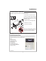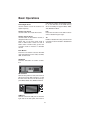
1
RDS
DivX
MP3
SD
WMA
DVD
USB
VCD
DVD
CD
iPOD
CD-R
A/V Input
CD-RW
ID3
RDS
Welcome!
Dear Customer,
CONGRATULATIONS. The VRVD640G DVD/CD Player and AM/FM Stereo Receiver
with RDS, SD Card, USB Port and AUX In, when used as described, will give you years
of dependable service in your car, truck, RV, or mini-van. We have taken numerous
measures in quality control to ensure that your product arrives in top condition and
will perform to your satisfaction. In the rare event that your VRVD640G DVD/CD Player
and AM/FM Stereo Receiver with RDS, SD Card, USB Port and AUX In contains a
damaged or missing item, does not perform as specified, requires warranty service, or
you have an installation problem, DO NOT RETURN THIS PRODUCT TO THE STORE.
PLEASE CALL OUR TOLL FREE NUMBER FROM THE U.S.A. AND CANADA 1-800445-1797 and ask to speak with a member of our technical service team; or submit
your questions by e-mail to [email protected] and a member of our technical
service team will respond by e-mail to your questions. Our in-house technical service
team will expedite delivery of your part, advise you on installation, or help troubleshoot
a problem with you. If your product needs warranty service, our technical service team
representative will help you obtain the fastest remedy possible under the warranty.
TABLE OF CONTENTS
Contents .......................................................................................................................2-3
Warnings ......................................................................................................................... 4
Precautions ..................................................................................................................... 5
Disc & Memory Types ..................................................................................................... 6
Care of Discs................................................................................................................... 6
Remove the Old Unit....................................................................................................... 7
Installation (DIN Front Mount) ....................................................................................... 7
Installation (Vehicle's Brackets) ...................................................................................... 9
Parts ...............................................................................................................................................9
Wiring Connections ...................................................................................................... 10
Location of the Controls ............................................................................................... 11
Main Menu..................................................................................................................... 16
Menu Screens ...........................................................................................................17-18
Radio Operation .......................................................................................................19-20
Multimedia Operation ..............................................................................................21-23
Navigation System
Operating Controls ..................................................................................................24-26
Main Menu..................................................................................................................... 26
GPS Data Screen .......................................................................................................... 26
GPS Data Display ......................................................................................................... 26
GPS Connection Indicator ............................................................................................ 27
GPS Connection Quality Indicator ............................................................................... 27
Time Synchronization ................................................................................................... 27
The Map ........................................................................................................................ 27
Map Controls & Functions ....................................................................................... 27-31
Cockpit Screen ............................................................................................................. 32
Turn Preview ................................................................................................................. 32
Zoom In And Out .......................................................................................................... 32
Next Street / Next City ................................................................................................. 32
Map Orientation And Overview .................................................................................... 32
GPS Position Quality .................................................................................................... 33
Sound Muting................................................................................................................ 33
Track Log Recording/Playback Indicator..................................................................... 33
Cursor ............................................................................................................................ 33
Lock To GPS Position And Heading ...................................................................... 33-34
Cusor Menu............................................................................................................. 34-35
Current Street ............................................................................................................... 35
Tilt Up And Down .......................................................................................................... 35
Menu.............................................................................................................................. 35
Travel and Route Data .................................................................................................. 35
Distance to Next Turn ................................................................................................... 36
Approaching Next Turn ................................................................................................. 36
Map Scale ..................................................................................................................... 36
Route Information Screen............................................................................................. 36
Route Data Displayed ................................................................................................... 36
2
Contents
Route Line ...................................................36
Distance Left ...............................................37
Method ........................................................37
Time Left......................................................37
Estimated Arrival .........................................37
Destination / Via Point ................................37
Warning Icons ........................................37-38
Fit To Screen ...............................................38
Parameters ..................................................38
Menu Button................................................38
Find Tab .......................................................38
Quick Tab ....................................................38
Route Tab ....................................................38
3D Map (switch)...........................................38
Zoom & Tilt (switch).....................................38
Night Mode (switch) ....................................38
Manage POI (Points of Interest)..................39
Manage Built-In POI Visibility .....................39
Manage My POI..................................... 39-40
Manage Track Logs ...................................40
Route Tab ................................................... 41
Recalculate .................................................. 41
Drop Next Via Point / Delete Route ............ 41
Bypass ......................................................... 41
Cancel.......................................................... 41
Delete ....................................................41-42
Display Modes.............................................42
Show ............................................................42
Avoid ............................................................42
Fly Over .......................................................42
Lifelike Simulation ......................................42
Edit ..............................................................43
Info ..............................................................43
Main Button .................................................43
SETTINGS ...................................................43
General Settings .........................................43
Safety Mode ................................................43
Set Favorite Destinations ..................... 43-44
Automatic Night Colors ..............................44
Speeding Tolerance ....................................44
Alternative Speed Limit ...............................44
Alternative Speeding Tolerance..................44
Route Recalculation ....................................44
Automatic ....................................................44
Ask First ................................................ 44-45
Disabled.......................................................45
MAP SETTINGS ..........................................45
Daylight / Night Color Profile ......................45
Cockpit / Map Mode Map Details ..............45
Alternative Road Names .............................45
Show Street Labels .....................................45
Textured Polygons ......................................46
SOUND SETTINGS .....................................46
Master Sound Volume/Switch ....................46
Voice Guidance Volume/Switch .................46
Key Sound Volume/Switch .........................46
Dynamic Volume .........................................46
Attention Tone ............................................46
ROUTE PARAMETER SETTINGS ............... 47
Method ........................................................ 47
Route ........................................................... 47
Short ............................................................ 47
Fast .............................................................. 47
Economical .................................................. 47
Vehicle ......................................................... 47
3
Road Types to Include/Exclude.................. 47
Unpaved Roads...........................................48
Motorways ...................................................48
Ferries ..........................................................48
U-Turns ........................................................48
Permit Needed ............................................48
Toll Roads ....................................................48
LANGUAGE & UNITS ..................................48
Program Language .....................................48
Voice Language...........................................48
Units.............................................................48
Set Date & Time Format..............................48
ADVANCED SETTINGS ...............................49
Display Options ...........................................49
2D in Map mode (and North-up orientation) ..... 49
3D in Cockpit mode ...................................49
Zoom In After Find .....................................49
Coordinate Display Format ........................49
Cockpit Screen Layout ...............................50
BACKLIGHT SETTINGS ..............................50
Power Management ....................................50
Backlight Always On ...................................50
Brightness ...................................................50
SMART ZOOM SETTINGS..........................50
Enable Overview Mode ...............................50
Restore Lock-to-position And Smart Zoom ...... 50
Restore Lock-to-Position ............................ 51
Restore Smart Zoom .................................. 51
Delay Before Restoring ............................... 51
ROUTE OPTIONS........................................ 51
Off-Route Sensitivity And Recalculation Delay . 51
Off-route Sensitivity ....................................52
Recalculation Delay ....................................52
U-Turn Penalty.............................................52
Cross-Border Planning ...............................52
Keep Position On Road (Lock-on-Road) ...52
USER DATA MANAGEMENT.......................52
Backup Data ................................................53
Restore Data ...............................................53
Remove Pins ...............................................53
Clear Data....................................................53
Reset Advanced Settings ...........................53
FIND & GO (Main Menu) .............................53
Selection By Tapping The Map ..................53
USING THE FIND MENU.............................54
Find An Address, Street, Intersection Or City ... 54
Selecting the City, State or Country to Search in .......54
Selecting A New City To Search In ............54
Changing the State (Australia, USA, etc.) ..55
Changing The Country ................................56
Selecting A Street Or The Center Of The City ..56
Selecting The Center Of The City ..............56
Selecting A Street .......................................56
Selecting A House Number Or The Midpoint Of The Street ....56
Select An Intersection Instead Of A House Number ...56
An Example For A Full Address Search .....57
Find in History .............................................57
Find Coordinates .........................................57
Find a POI ....................................................58
Find one of the Favourites (Home/Work) ...59
Frequently Asked Questions ................ 60-61
Glossary ................................................ 61-63
Specifications ........................................ 64-65
NOTES .........................................................66
Limited Warranty .........................................67
Warnings
• For safety reasons, certain video functions are disabled unless the
parking brake is on. The Unit is designed with circuitry to detect the
parked status of the vehicle, and must be connected to the power
supply side of the parking brake switch. Improper connection or
use of this connection may violate applicable law and may result in
serious injury or damage.
• To avoid any risk of damage to the vehicle or injury its occupants
and the potential violation of applicable laws, this unit is not for use
with a video screen that is visible to the driver.
• Disconnect negative battery terminal before starting installation.
Failure to disconnect the negative battery cable may cause damage
to the unit or the vehicle’s electrical system. Consult the vehicle’s
owner’s manual for proper instruction.
• Before final installation of the unit, temporarily connect the wiring,
to make sure the unit works properly.
• Use only the parts included with this unit to ensure proper installation. The use of unauthorized parts may cause damage to the vehicle
or unit.
• If installation requires the drilling of holes or other modifications to
the vehicle, consult with your vehicle’s nearest dealership.
• Install the unit in a location where it shall not obstruct driver’s ability to safely operate the vehicle, and cannot injure any passengers if
there is a sudden stop, like an emergency stop.
• The laser will be damaged if it overheats, do not install the unit
where it will be exposed to excessive heat -- for instance, near a
heater outlet.
• For optimum performance, do not install more than 30 degrees
from horizontal.
4
PRECAUTIONS
Driving a vehicle while viewing a video on this head unit
may violate motor vehicle laws, and may result in serious injury, property damage, or death!
Please read these important precautions BEFORE attempting to
install this unit.
• The unit is only designed for use with
4 speakers. Do not combine speaker
output wires for use with 2 speakers. Do
not ground negative speaker leads to the
chassis ground.
• Disconnect the vehicle’s negative battery terminal before starting installation.
Consult the vehicle’s owner’s manual for
proper instruction.
• Do not open the top or bottom cover.
Modifying the unit will void the warranty
and may damage the unit or cause the
unit to malfunction or cause damage the
vehicle's electrical system.
• The unit is designed for a 12 Volt DC negative ground operation system only. Before
installing the unit, make sure your vehicle
is a 12Volt DC negative ground system.
• Parking in direct sunlight for several hours
will cause higher temperatures inside the
vehicle. Do not operate in extremely high or
low temperatures. The temperature inside the
vehicle should be between 32º F (0º C) and
100º F (37º C) before turning on your unit.
Cool down the vehicle before operating
the unit
• Mark the polarity of the existing speaker
wires before disconnecting the old head
unit.
• Be sure to connect the color coded
leads according to the wiring diagram.
Incorrect connections may damage the
unit or cause the unit to malfunction or
cause damage the vehicle's electrical
system.
• The faceplate is a precision piece of
equipment that contains sensitive electronic components. Do not subject it to
excessive shock.
• Make sure all the connections are completely correct before turning on your
unit.
• When replacing the fuse(s), the replacement must be of the same amperage as
shown on the fuse holder.
• When extending the ignition, memory
backup or the ground cable, use 0.75mm
diameter (AWG18) or heavier automotive
grade cable to avoid wire deterioration or
damage to the wire coating.
• Do not block this unit’s vents or heater
panels. Blocking them will cause excessive heat to build up inside the unit and
may result in fire.
• After completing the installation and
before operating the unit, reconnect the
battery according to the manufacturer’s
instructions. Then press the reset (RES)
button with a pointed object, such as a
ball-point pen to set the unit to its initial
status.
• To prevent short circuit, never put or
leave any metallic object inside the unit.
If you smell or see smoke, turn off the
power immediately and consult your
dealer.
• Insert the unit until it is firmly locked
into mounting sleeve, otherwise it may
fall out.
• Do not touch the terminals of the faceplate or of the unit.
• Be careful not to drop or shock the unit,
it may break or crack because it contains
glass parts.
• If you have difficulty installing this unit in
your vehicle contact customerservice@
vr-3.com or Call 1-800-445-1797
5
Disc & Memory Types
• This unit will only play the following discs or memory types.
Disc Type
Icon
Content
Size
Playtime
DVD
Audio/Video
12cm
About 2 - 4.5 Hours
VCD
Audio/Video
12cm
About 74 minutes
CD
Audio
12cm
About 74 minutes
MP3
Audio
12cm
About 600 minutes
Audio/Video
12cm
MPEG4
DIVX
Memory Type
Icon
Content
Size
Playtime
USB Flash Memory
Audio/Video
Up to 2 Gb
Depends on size of files
SD Card
Audio/Video
Up to 2 Gb
Depends on size of files
MMC
Audio/Video
Up to 2 Gb
Depends on size of files
Care of Discs
• Handle the disc by its edge to keep
the disc clean. Do not touch the disc’s
surface.
• Do not use CDs with labels or stickers
attached. The label may leave a sticky
residue when it begins to peel.
• Do not use a CD with paste or ink residue on it.
• Clean the discs with an optional cleaning
cloth. Wipe each disc from the center
out.
• Do not attempt to modify the unit.
• Modifying the unit will void the warranty.
• Stop the vehicle before carrying out any
operation that could interfere with your
driving.
• Do not operate in extremely high or low
temperatures. The temperature inside
the vehicle should be between 32º F (0º
C) and 100º F (37º C) before turning on
your unit.
6
Installation
Automotive audio equipment installations can be challenging at times, even to the most
experienced of installation technicians. If you are not confident working with electrical
wiring, removing and reinstalling interior panels, carpeting, dashboards or other components of your vehicle, please e-mail us at [email protected] or call our Toll-Free
help line 1-800-445-1797 and our in-house technical service team will answer your installation questions. Or consider having the VRVD640G professionally installed. Contact the
vehicle's manufacturer for vehicle specific instructions,
1. Remove the Old Unit from the Dashboard
A. Remove the outer trim frame.
B. Insert the keys supplied with the old unit
into both sides of the unit as shown in
figure below until they click. Pull to remove the old unit from the dashboard.
LO/DX
AUTO
MUTE
TAPE
AM
FM
54
88
60
92
STOP
UP
TUNE
70
96
80
100
100
120
104
140 160
x10KHZ
106
108
DOWN
CD/MP3
MHZ
BAND
AUDIO
DIN Front Mount
IN
DO NOT DISCONNECT WIRES AT THIS TIME!
2. Mark Polarity of the Speaker Wires
Marking the polarity of the speaker
wires will make it easier to connect the
existing speakers to the VRVD640G.
Consult the wiring diagram of the existing head unit before disconnecting any
wires. If a wiring diagram is not available
contact the head unit’s manufacturer.
3. On the masking tape mark the polarity of the speaker wires (+ & - ), as
well as left or right, and front or rear.
4. Double check that you marked the
first speaker correctly by checking
that the speaker wires are the same
at the head unit.
1. While the old unit is playing, disconnect the wires from one speaker.
5. Repeat this procedure for all of the
speakers.
2. Take a length of masking tape and
fold it around the wire so it forms a
flag.
6. Mark the power, ground, and any
other wires also.
GIVE US A CALL, WE'LL HELP YOU INSTALL.
PLEASE DO NOT RETURN PRODUCT TO STORE.
Visit us on the WEB
www.vr-3.com
For Information and Technical Assistance,
Call Toll-Free in U.S.A. and Canada.
1-800-445-1797
7
Installation
DIN FRONT-MOUNT (Method A)
IMPORTANT!
BEFORE THE FINAL INSTALLATION OF THE HEAD UNIT, CONNECT THE WIRING
TEMPORARILY, MAKING SURE THE UNIT AND THE SYSTEM WORK PROPERLY.
Insert fingers into the groove in the front
of frame to remove it.
Insert the keys supplied with the old unit
into the grooves on both sides of the old
unit. The unit can be installed or removed
from the dashboard using these keys.
(Fig. 1)
Remove the
half sleeve
Fig. 1
E
A
After inserting the Mounting Sleeve into the
dashboard, select tabs on top, bottom,
and sides, then bend them to secure the
mounting sleeve in the dash board.(Fig. 2)
Fig. 2
1. Dashboard
2. Nut (5mm)
3. Spring washer
4. Screw (5 x 25mm)
5. Screw
6. Strap
7. Plain washer
Follow the diagram in Fig. 3
for installing the rear mounting
strap to the head unit. The rear
mounting strap will help keep
the head unit from moving
around inside the dashboard.
Fig. 3
8
Installation
DIN REAR-MOUNT (Method B)
Installation using the screw holes on both sides of the unit.
1. Screw holes on the side of the unit.
2. Screws. Use either truss screws (5 x
8mm) or flush surface screws (4 x 8mm),
depending on the shape of the screw
holes in the bracket.
3. Vehicle’s Factory Mounting Bracket
4. Dashboard or Console
5. Hook (Remove this part)
NOTE: The mounting sleeve, outer trim
ring, and the mounting strap are not
used for this method of installation.
PARTS
Check All Included Parts
Open the VRVD640G box and remove all parts, then check all parts and compare them to
the parts list in the user manual. For replacement parts contact VR3 Customer Service at
[email protected] or call 1-800-445-1797.
2 Keys
1 Mounting Sleeve*
1 Sheet Metal Screw
1 Metal Support Strap
1 Mounting Bolt
1 Faceplate Case
1 1/8" Audio/Video Cable
1 AV Input Adaptor & Bracket*
1 Remote Control*
*=Not Shown
9
Wiring Connections
VRVD640G
DVD Out
Right
Left
Right
Subwoofer Out
GPS Antenna
Left
Rear
RCA Line Out
Front
3.5mm Female A/V IN
Radio Antenna
IGNITION
MEMORY
DRIVER SAFETY WIRE
BROWN (-) PARKING
1 AMP
RED (+)
BRAKE
15 AMP
YELLOW (+)
Connect YELLOW to battery or live 12 V(+)
FILTER
1 AMP
BLUE (+) POWER ANTENNA OR AMPLIFIER
Negative Ground 12 Volt Negative -
Front Left
Rear Left
WHITE +
GRAY +
WHITE/BLACK -
GRAY/BLACK -
GREEN +
VIOLET +
GREEN/BLACK -
VIOLET/BLACK -
Front Right
Rear Right
DRIVER SAFETY WIRE, MUST be connected to the car’s parking break
switch-wire. Virtual Reality Video Labs and/or its affiliates waves any and
all liability when this wire is NOT connected as directed. Driver can only
watch a movie when the parking brake is ON.
• Before starting the installation, disconnect the negative battery cable
from the battery’s negative terminal.
• Before final installation of the unit, connect the wiring temporarily, making sure the unit and the system operates properly.
GIVE US A CALL, WE'LL HELP YOU INSTALL.
PLEASE DO NOT RETURN PRODUCT TO STORE.
Visit us on the WEB
www.vr-3.com
For Information and Technical Assistance,
Call Toll-Free in U.S.A. and Canada.
1-800-445-1797
10
Location Of The Controls
8
1 23 4 5 6
7
10
9
12 14
11 13 15
POWER
MUTE
IR
VOL+
TUN-
OK
OPEN
2
1
MODE
TUN+
4
3
VOLMENU
STOP
6
5
PTY
BAND
FUNC
TA
GPS NAVIGATION & DVD PLAYER
CD, CD-R, CD-RW, VCD, DIVX, MP3, WMA
23
22
TM
21
20
18
19
1. Left Arrow/Channel Down
2. Eject
3. OK
4. Up Arrow/Volume Up
5. Right Arrow/Channel Up
6. Down Arrow/Volume Down
7. TFT LCD Screen
8. Menu
9. Mode
10. Infra Red Window
11. #1 Button/Step Backward
12. Power/Mute
16
17
13. #4 Button/Stop
14. Open
15. #2 Button/Step Forward
16. #6 Button/Fast Forward
17. USB Cover & Slot
18. #3 Button/Play/Pause
19. #5 Button/ Fast Reverse
20. Band
21. FUNC Button
22. PTY Button
23. TA
Audio/Video Auxiliary Input
The VRVD640G is equipped with an Audio/
Video Auxiliary Input cable and mounting
bracket.
In order to use the Audio/Video Auxiliary Input you MUST use the mounting bracket.
Insert Audio/Video Auxiliary Input cable
from the rear of the VRVD640G into the
mounting bracket, then twist to lock.
a 3.5 mm mono Video plug from devices
like portable DVD players and Video game
controllers.
The Black jack on the Adaptor accepts a
Stereo Audio 3.5 mm plug from any Stereo
Audio device (CD player, MP3 player, DVD,
etc).
UNLOCK
The Adaptor has two 3.5 mm jacks (one
Yellow for Video and one Black for Stereo
Audio).
The Yellow jack on the Adpator accepts
11
LOCK
Remote Control
1
2
3
4
POWER
EJECT
DUAL
TILT
OPEN
OSD
MODE
MUTE
MEN
P
5
SETU
U
1. POWER
2. DUAL
3. EJECT
4. OSD
5. SETUP
6. UP/DOWN/LEFT/
RIGHT/ENTER
7. PREVIOUS
TRACK/FAST REVERSE
8. ANGLE
9. SEL
10. VOLUME
DOWN
11. FUNC
12. AUDIO/GO TO
13. BAND/RDM
15
16
17
18
19
6
7
8
9
10
11
12
13
14
20
ANGLE
INT
PBC
SEL
VOL -
VOL +
GO TO
FUNC
AUDIO
SUB-T
ZOOM
A-B
RDM
BAND
PROG
PTY
RPT
P.SCN
TA
1
2
3
4
5
6
7
8
9
0
21
22
23
24
25
26
27
28
14. PTY/PROG
15. OPEN
16. TILT
17. MUTE
18. MODE
19. MENU
20. NEXT TRACK/
FAST FORWARD
21. INT
22. PLAY/PAUSE
23. STOP/PBC
24. VOLUME UP
25. A-B/ZOOM
26. SUB-T
27. TA
28. P.SCN/RPT
29. 0-9 BUTTONS
See page 8 for a detailed description of the button’s functions.
Changing the Battery
Turn the remote
over, then slide the
battery holder out
of the remote.
29
Use and Care of the Remote
Insert battery into
battery holder with
positive side of the
battery facing up.
Point the remote control at the front panel
of the unit to operate.
Precautions:
• Using batteries improperly can cause
them to explode.
• Keep the battery out of the reach of children.
• Should the battery be swallowed, immediately consult a doctor.
• Use one CR2025(3V) lithium battery.
• Remove the battery if the remote control
is not to be used for a month or longer.
• Do not short-circuit or disassemble
• Dispose of spent batteries properly.
• Do not drop the remote control, it may
become jammed under the brake or accelerator pedals.
Insert battery
holder into the remote control until
Dispose of All Batteries Properly
12
Remote Control
1. POWER
Press to turn the unit ON or OFF.
2. DUAL (DVD Output)
During DVD Mode this button toggles the
Display settings under Settings II.
3. EJECT
During DVD Mode Press the EJECT button to
eject the disc in the unit.
4. OSD
In radio mode only, press the OSD button
to toggle between Radio frequency and
Time display.
5. SETUP
In playback mode, press to access the
setup menus for Language, Display, Audio,
and Parental.
6. TRIANGLE BUTTONS [ / / / ]
Use the Triangle buttons to navigate File
lists and the setup menus.
7. SKIP BACKWARDS/FAST REV.
Press the button to go to the previous track,
photo, or video. Press and hold this button to
play a video in reverse at 2x current speed.
8. ANGLE
Press to change the viewing angle in DVD mode.
Only if DVD Supports.
9. SEL
Press to confirm your choice on the menus.
10. VOLUME DOWN
Press to decrease the volume.
11. FUNC
Press to access the navigation system,
press again to return to previous mode.
12. AUDIO/GO TO
In DVD mode, press to display current audio
configuration.
13. BAND/RDM
In Radio mode, Change radio band in sequence of FM1 > FM2 > FM3 > AM1 > AM2.
14. PTY/PROG
In radio mode PTY will allow a search of
radio program types. In VCD/CD mode,
press the AMS button to program the order
you wish the chapters to be played.
15. OPEN
Press to open the faceplate.
16. TILT
Press to adjust the angle of the faceplate
for better viewing.
17. MUTE
Press to shut off the sound output. Press it
again to resume previous sound level.
18. MODE
Press the MODE button to change the operating mode of the unit.
19. MENU
Press to access the Main menu anytime.
20. SKIP FORWARD/FAST FORWARD
Press the
button to go to the next track,
photo, or video. Press and hold this button to
play a video in at 2x current speed.
21. INT
Press to play the first 10 seconds of tracks on a
disc, SD card, or USB memory.
22. PLAY/PAUSE
Press to play or resume the current playback.
23. STOP/PBC
Press to stop the playback. Press to display menus on VCD discs.
PBC ON songs play in order.
PBC OFF songs can be played in any order
you wish.
24. VOLUME UP
Press to increase the volume.
25. A-B/ZOOM
In disc mode, A-B mode enables you to
repeat a section of the disc. Press once,
it sets the “A” position (beginning of the
loop); pressed a 2nd time, it sets the “B”
position (end of the loop). Pressed again, it
exits the loop.
Zoom-Press to increase or decrease the
picture in size.
26. SUB-T
In DVD playback mode, press to change the
subtitle language.
27. TA
In radio mode allows reception of Traffic
Announcements.
28. P.SCN/RPT
In Radio mode press to scan and save
strongest staions to pre-set buttons.
In DVD mode, press to repeat tracks.
29. 0-9 BUTTONS/ENTER
Use number buttons to choose track numbers. Enter Confirms choices on menu.
13
Basic Operations
Power/Mute Button
Press any button to turn the unit ON. The
Radio is the default function at start-up.
Press and Hold the Power button to turn
the unit OFF.
Press to mute the radio, CD/DVD, USB and
SD card operations.
Driving a vehicle while viewing a
video on this head unit may violate
motor vehicle laws, and may result
in serious injury, property damage,
or death!
To play a video the vehcle must be
stopped and the parking brake must be
engaged.
OPEN/CLOSE Button
When power is OFF, press the Open button, the unit turns ON and the panel opens
for access to the Disc slot.
If the panel’s movement is hindered by any
obstacle, it will return to original its closed
position automatically.
Install the face Plate
1) Fit the face plate with its left hole on the
left pin provided on the main unit.
2) Fit the other hole on the other pin applying slight pressure
3) Move the face plate up and down a few
times to make sure it is secure. Then close
the face plate and press down the right side
of the face plate until it clicks into plate.
Caution
• This face plate is not waterproof. Do not
expose it to water or excessive moisture,
• Do not remove the face plate while driving your car.
• Do not place the face plate on the dashboard or nearby areas where the temperature rises high.
• Do not touch the contacts on the face
plate and the main unit, since this may result poor electrical contact.
• If dirt or other foreign substances get on
the contacts, wipe them off with a clean
and dry cloth.
• To avoid damaging the face plate, do not
push it down or place objects on it while it
is open.
Mode Button
Pressing the Mode button will cycle through
the different functions. The DVD, USB, and
SD will not be accessed if there is no media installed.
TUNER--DVD--USB--SD--AV--MAIN MENU
Menu Button
Press Menu button to enter main menu.
Band Button
There are four Pre-set Bands - three
FM (FM1, FM2, and FM3) and two AM
Bands(AM1, AM2). Each time the button
is pressed, the radio band changes in the
following order:
FM1----FM2----FM3----AM1----AM2
Each of the four bands can store up to six
preset stations, for a total of 30 (18-FM,12AM) pre-set memory stations.
Starting The Unit For the First Time
Immediately after installing or connecting
power to the unit, it should be initialized.
Lower the detachable front panel. Behind
the front panel, is a small hole with the reset switch in it. With a ball-point pen or other pointed object, press the RESET switch
to initialize the unit.
EJECT Button
Eject the disc. If the disc is not removed
after 10 seconds after it’s ejected, the disc
is automatically re-loaded and will start to
play.
Tune - / L eft Arrow
Use this button to tune the receiver to a
lower frequency.
14
Basic Operations
USB memory stick to access files to listen
to, or view the files on the USB memory
stick. The USB port supports MP3, WMA,
JPG, MPEG and DIVX.
Tune+/Right Arrow
Use this button to tune the receiver to a
higher frequency.
Volume +/Up Arrow
Use this button to increase the volume.
PTY
Press the PTY button in the radio mode to
enter or disable Program Type.
Volume -/Down Arrow
Use this button to decrease the volume, or
navigate the file menus.
NOTE: VOL on the front panel works in
radio or DVD mode. It does not work in
DUAL mode. In DUAL mode, go into VOL
of DUAL mode to increase or decrease
volume.
TA
Enable or disable TA mode, press and hold
more than 2 second enable or disable EON
TA mode.
Func Button
Press the Func button to access the GPS
map while listening to the radio, CD/DVD,
USB, and SD Card.
OK Button
Press the OK button to confirm a selection.
SD VIDEO
SD Card Slot
Remove face plate from unit, then insert an
SD card to access files to listen to, or view
the files on the SD card. The SD card supports MP3, WMA, JPG, MPEG and DIVX.
IR
VOL+
TUNE-
OK
POWER
MUTE
1
OPEN
2
MODE
TUNE+
3
VOLMENU
5
PTY
4
STOP
6
BAND
FUNC
TA
TM
USB Port
Remove cover from USB port on the lower
right side of the face plate, then insert a
15
Main Menu
Main Menu Screen
Settings Menu Screen
Press the Power button in the upper right
hand corner of the Radio screen or press
the BAND button on the faceplate or remote control to access the Main Menu.
The Settings screen allows the user to access Sound, Display, Date & Time, RDS &
Radio, System, and Calibration menus.
The Sound Settings I
The Main menu screen is where you access all of the VRVD640G’s features and
functions. To access all features and functions by tapping on touch screen buttons.
From this screen the user can select Equalizer Pre-sets for listening to different music
The NAVI button starts the Navigation software.
The DVD button will access the DVD player, USB port and SD card slot. If there isn’t
any media installed a Warning Screen “NO
DISC” will be displayed.
The RADIO button will start the radio, or
return you to it if it is already on.
types. You may also adjust System Volume
as well as selecting Stereo or mono output.
The AV-IN button will display the video signal from the AV-IN jack on the rear of the
unit.
The Sound Settings II
The UTIL button will access the Calculator
and Calendar.
The Settings button will display the settings screen.
From this screen the user can adjust the
Bass, Treble, Balance, and Fader settings.
16
Menu Screens
The Sound Settings III
Date & Time Settings
The Sound Setting III screen turns the following functions ON & OFF. BEEP, LOUD,
and SUB WOOFER.
The Date & Time Settings screen allows
you to set the date & time for the unit.
RDS & Radio Settings
The Display Settings
The RDS & Radio screens allow you to customize the Radio’s RDS funcionality.
DISPLAY I Screen
The Display I screen allows you to adjust
the brightness of the screen backlight.
DISPLAY II Screen
The Display II screen allows you to adjust
the settings for the use of a 2nd monitor
with the VRVD640G.
17
Menu Screens
System Information
Calculator
The system information screen displays
the hardware and software information of
the VRVD640G.
The calculator operates just like most other
calculators.
CONTROL
MC
MR
MS
M+
<_
CE
+/=
.
sqrt
%
1/x
=
Calibration Screen
The calibration screen is used by the system to ensure the accuracy of the user’s
touch when using the touch screen.
Follow the on-screen instructions when using this screen.
C
+,-,*,/
0-9
UTIL Utility Control Screen
FUNCTION
Memory Clear
Memory Restore
Save to Memory
Add # in Memory
Backspace
Clear Display
Plus and Minus Alternate
Dot Display
extract the square root
Percent
Fraction
Enter
Exit Calculator
Clear
The four arithmetic operations
Numeric Display
Calendar
Use the button on the Calendar to check
dates, Days of the week, and months.
The Utility screen is used to access the
Calculator and Calendar.
18
Radio Mode
stored station it will be overwritten. Up to 6
stations can be saved as a Pre-Set.
b) Seek Tuning
Press the << button once to seek a lower frequency or the >> button to seek a
higher frequency. When using Seek tuning
the radio will seek for and tune to the next
strongest radio signal.
Radio Operations
1. Radio Mode
When you first start the VRVD640G, the radio is the default mode of operation. The
Radio interface screen will be displayed on
the touch screen. You may also access the
radio from the touch screen Main Menu, or
the Band button on the faceplate or remote
control.
Band
Frequency
c) Manual Tuning
Press and hold the << or >> button until the word manual appears on the LCD.
Then press << to tune to a lower frequency
or the >> button to tune to a higher frequency. Leave the unit idle for a few seconds and it will return to scan tuning.
Equalizer Setting
Exit Radio
Access GPS
NAVI
Mute & Un-Mute
GPS Voice
Previous Station
FLAT
FM1
87.50
Volume Level
MHz
NAVI
VOICE
20
87.50
90.00
98.00
106.00
108.00
87.50
Next Station
Radio Data System (RDS)
On the Main Menu, press the Settings Button, then on the Settings Screen press the
RDS & Radio button to access the RDS
Settings Screens.
Memorized Pre-Set Radio Stations
2. Radio Bands
This unit comes with five bands - three FM
(FM1, FM2, and FM3) and two AM Bands.
Each of the four bands can store up to six
preset stations, for a total of 30 (18-FM &
12-AM) pre-set memory stations. Each
time the Band button on the face plate or
remote control is pressed, the radio changes bands in the following order:
TA (Traffic Announcement) SEEK mode:
The Radio will automatically seek and tune
in stations that transmitting Traffic Announcements.
When a tuned station does not transmit any
Traffic Program (TP), the radio will re-tune
to a new station that is transmitting TP info.
You can select re-tune times of 30 seconds
(RETUNE SHORT) or 90 seconds (RETUNE
LONG) from the RDS Menu 2 above.
FM1----FM2----FM3----AM1----AM2
3. Tuning
There are 3 types of Tuning modes;
Pre-set, Scan, and Manual.
TA (Traffic Announcement) ALARM
mode:
In TA ALARM, re-tuning does not occur.
The current station keeps playing, but you
will be alerted to Traffic Announcements
either by a beeping sound or muting of the
music (determined by the selected PI setting on the RDS Menu 1 above).
a) Pre-set Tuning
To use Pre-set tuning you must first save
the radio stations to memory;
1. Press the BAND button to select the desired band, FM1, FM2, FM3, or AM1, AM2
2. Tune to the station you want to save as
a Pre-Set.
3. Press and hold the Pre-set button at the
bottom of the screen for 2 seconds. You
will hear a beep to confirm that the Pre-Set
has been stored.
If the Pre-set button has a previously
PI Mode
The RDS Menu 1 allows for selection of PI
(Program ID) Sound or Mute.
When Sound is selected, a beep will be
19
Radio Mode
heard when a PI message is sent by the
station.
When Mute is selected, the sound will decrease in volume when a PI message is
sent by the station.
Regional Mode
Regional Mode is used in countries where
national broadcasters run “Region Specific” programming.
For use in the USA, “REG” in the RDS Menu
1 should be turned OFF.
RETUNE Mode
On the RDS Menu 2, select RETUNE
SHORT or RETUNE LONG.
This selects the initial time of Auto TA or
PI search.
MASK Mode
MASK DPI is the default mode. It will mask
only Alternate Frequencies (AF) with different PI.
MASK ALL will mask all AF that do not have
enough RDS field strength.
EONTA
DX on pulls in weaker stations, and LOCAL
only pulls in strong local stations.
GIVE US A CALL, WE'LL HELP YOU INSTALL.
PLEASE DO NOT RETURN PRODUCT TO STORE.
Visit us on the WEB
www.vr-3.com
For Information and Technical Assistance,
Call Toll-Free in U.S.A. and Canada.
1-800-445-1797
20
Multimedia Mode
In DVD mode the VRVD640G plays files
saved on disc as well as files saved on
USB Memory sticks and SD Cards. The
compatible file types MP3, WMA, MPEG,
JPEG, VCD & DIVX.
See page 5 for more information about the
disc and memory types.
The button on the left side will display the
controls for adjusting the display characteristics
File List Screen
The below screen is displayed when a Dics,
SD card or USB memory with A/V files
Touch Screen
The functions and display characteristics can be adjsuted with the buttons on
the faceplate, the remote control and the
touchscreen. Below are two photos of the
touch screen buttons and their functions.
USB DISC
GPS Toggle
SD
Hide MENU
Multimedia Operations
1. Inserting a Disc/SD Card/USB Memory
DISC: Press the Eject button on the top left
side of the faceplate, the faceplate will automatically drop down to give you access
the disc slot. Insert a disc into the disc slot
with the label side facing up. The disc will
automatically load.
SD CARD: Press the open button on the
top right side of the faceplate, then remove
the faceplate.
Insert the SD card into the SD card slot until
you hear a click. Re-install the face plate.
To remove the SD card press the card
until you hear a click, then release it and
remove.
USB MEMORY: On the bottom right side
of the faceplate remove the plug from the
USB port, then insert the USB Memory.
To remove a USB memory stick, just pull
it out ot the USB port. Replace the USB
port’s cover when not in use.
Voice ON/OFF
Display Adjustments
Enter
Left
Skip
Play/Pause Stop
Up
Right
Skip
Down
The buttons on the top left are for the navigation system. NAVI will display the Navigation software, and NAVI VOICE toggles
the GPS voice ON & OFF.
Touching the icons for the USB, DISC,
and SD will change the playback to to the
touched icon.
The arrow buttons are used to navigate the
folder list, file list, and file type list. The Enter button confirms your choice.
Use the buttons on the bottom left for
playback. They operate the same as corresponding buttons on the faceplate and
remote control.
2. Ejecting a Disc
Press the eject button on the top left side
of the faceplate and the faceplate will automatically drop down and the disc will eject.
Remove the disc. If the disc is not removed
within 11 seconds it will automatically reload itself.
21
Multimedia Mode
3. Playback
After inserting a Disc, SD card or USB Memory the unit will automatically start playing.
If the disc does not start playing, press the
Mode button to enter DVD mode.
Usually a DVD movie has a menu screen
for the viewer to choose from. When the
DVD’s menu screen appears use the Arrow
buttons on the remote control to navigate
through the menu choices. Use the Enter
button on the remote control to confirm
your choice on the menu. For files on the
SD card or USB memory the file lise screen
will be displayed
4. Stop
Press the stop button once and “R.Stop”
will be displayed on the top left of the
screen. At this time you may still restart the
video. Press the Stop button again, “Stop”
will be displayed on the top left of the
screen. At this time when you press Play
the video will start from the beginning.
10. Intoduction
On the remote control press the INT button
to play the first 10 seconds of all the tracks.
Press it again to play the currnet track.
11. Changing The Viewing Angle
Press the ANGLE button to change the
viewing angle of a scene of a DVD video.
Notes:
• This function is only available with the remote control.
• This function only operates with DVDs
featuring multi-angle recordings.
• The mark on a DVD’s package indicates it
features multi-angle scenes.
• The number in the mark indicates the number
of angles from which scenes were shot.
12. Changing The Subtitle Language
(multi-subtitle)
Press the SUB-T button to change the the
sub-titles of a DVD.
NOTES:
• This function is only available with the remote control.
• This function only operates with DVDs featuring multi-subtitle recordings.
• The number in the mark “ “ on a DVD’s package indicates the number of recorded sub-titles.
5. Pausing Playback on DVD
On the faceplate press the Play/Pause
button to pause playback of the DVD/CD.
Press the button again to resume playback
of the DVD/CD.
6. Skip Backwards/Fast Rev.
Press the
button on the faceplate or remote
control to go to the previous track, photo, or
video. Press and hold this button to play a video
in reverse at 2x current speed.
13. Zoom
Press and hold the A-B/ZOOM button to enlarge the image of the DVD.
NOTE:
• This function is only available with the remote control.
• These options will be used by the
VRVD640G if they are available on the disc.
If the disc that is inserted does not have
these preferred options, then the discs own
preferences will be used.
• Some functions will vary depending on the
type or format of the disc.
7. Skip Forward/Fast Forward
Press the
button on the faceplate or remote
control to go to the next track, photo, or video.
Press and hold this button to play a video in at
2x current speed.
8. Repeat
On the remote control press the P.SCN/RPT
button to repeat a single track or repeat all.
14. A-B Repeat
This function alows the user to repeat a segment of a DVD video or an audio track.
Press the A-B button once at the point in a
9. Random
On the remote control press the BAND/
RDM button to play tracks at random.
22
Multimedia Mode Mode
movie or track where you want the start segment. Press it again where you want to end
the segment. The segment will repeat over
and over unitl the button is pressed again.
15. Program
Press the PTY/PROG Button to program the
playback of the DVD’s Titles, Chapters, Or
Tracks in a Favorite Order.
Use the arrow buttons to highlight a field,
then with the number buttons enter the number of the chapter or title. When finished use
the arrow buttons to highlight “Play”, then
press enter to play the chapters in the order
you have just programed.
16. GO TO
Press to set the playback time. Use the arrow buttons to navigate the fields. Enter the
number of the chapter in the filed on the
left. Press enter and that chapter will start
to play. The time elapsed will be displayed
in the clock field.
23
Navigation System
WARNINGS AND SAFETY INFORMATION
Cydle is a navigation system that helps
you find your way to your selected destination. It will determine your exact location
with the help of an attached GPS device.
The position information obtained from the
GPS receiver will not be transmitted anywhere, so others will not be able to track
you when using this program.
If you are the driver of the vehicle, we recommend that you operate Cydle before beginning your journey. The driver’s attention
should be on the road.
PLAN YOUR ROUTE BEFORE DEPARTURE, AND PULL OVER IF YOU NEED TO
CHANGE THE ROUTE’S PARAMETERS.
UNLESS A PASSENGER WILL BE THE
ONLY ONE TO OPERATE CYDLE, WE
STRONGLY ENCOURAGE YOU TO TURN
ON THE SAFETY MODE.
Screen buttons and controls
The main user interface of Cydle is the
touch screen. Many parts of the screen
are not only used to display information,
but also to initiate functions by tapping
them. Below you will find a list of the most
frequently used controls in the program.
Direct selectors
Some of the settings can be chosen from
a short list of possible values. If the values
can be described graphically, all values are
available on the screen.
Touch one of the icons to set/change the
value.
List selectors
When the values in the list need to be
named, only the current value is shown
(sometimes together with a short description) in a horizontal stripe with arrows at
both ends.
Cydle has a built-in (optional) Safety Mode
that will prevent you from using the touch
screen functions when your car is in motion. Do not look at the display while the
vehicle is in motion.
Always observe other vehicles, traffic signs
and road’s geometry before you obey any
instruction from Cydle. If you need to deviate from the recommended direction, Cydle will suggest a modified route according
to the new situation.
Operating Cydle (Controls)
Cydle is designed for easy operation. All
controls are operable by fingertips. Wherever possible, pushbuttons and lists are
provided to make using the functions or
changing the settings as easy as possible.
The arrows are buttons. Touch to move
left in the list or touch to move right. You
need not confirm your selection. As soon
as you leave the screen, the selected value
becomes effective.
Sliders
When a feature has several different unnamed (numeric) values, Cydle will show
sliders that look like analogue potentiometers to set the desired value.
If the value limits are not displayed at the
ends of the slider, the leftmost position
means the minimum value, while the rightmost position represents the maximum
value.
With most sliders you can check the current value on the left.
This control can be operated in two ways.
Either drag the handle to move the slider to
its new position, or touch the slider where
you want the handle to appear (the thumb
jumps there immediately). As with the list
selectors, there is no need to confirm your
selection. As soon as you leave the screen,
24
Navigation System
the selected value becomes effective.
Switches
When a function can only have two values
(mainly Enabled and Disabled), a switch is
used. Unlike with list selectors, the horizontal line contains the name of the function
and not the actual status. There is a lamp
on the left to show whether the function is
active or not.
When the lamp is dark , the function is not
selected. When it is lit , the function is enabled. The whole strip works as a button.
Touch anywhere to toggle between the enabled and disabled status.
Special switches
Some switches behave differently. Instead
of being dark when not selected, the light
turns red and the lamp becomes crossed
outto emphasize the prohibition of use.
Furthermore the switches used for the
road types (to be included or avoided when
planning a route) on the Route Parameters
screen cannot be changed for some vehicle types. When such a vehicle is selected,
not only the lamp but also the whole line
becomes inactive and dark.
These switches look different on a square
display. The lamp is placed not left of the
label but below it, and its shape is also different.
Use these buttons the same way as you
would other switches. Touch them anywhere to toggle between the enabled and
disabled states.
pad, or a set of QWERTY-type keyboards
that contain both letters and numbers. Cydle will remember your last choice and offer it the next time you need to enter data.
The alphabetic keyboards in Cydle do not
contain special characters, because you do
not need to enter accents when searching
for a destination. Type only the base letters
(the letter most similar to the accented one)
and Cydle will search for all their combinations in the database (e.g. for the French
street ‘Cité Bergère ’ you only need to type
‘Cite Bergere’, and the rest is done by the
program).
When you type in POI or track log names,
Cydle will automatically turn all initials into
capitals to create names that look pleasant.
ABC-Type Keyboards
These keyboards contain only letters (Latin, Hebraic, Greek or Cyrillic). If you wish
to enter numbers, you need to touch the
Keys ( ) button to switch to the numeric
keyboard.
Use Backspace (arrow pointing left between Space and Keys) to delete the last
letter you have entered if you have made a
mistake, touch Space to enter more words,
and hit Done to finish entering the text.
This type of keyboard has large, fingerfriendly buttons.
NOTE: If you have chosen a program language that uses Latin letters, only the ABC
keyboard appears. If you choose the Greek
language, an additional keyboard appears
with Greek letters. Similarly Hebraic and
Cyrillic letters are available when Hebrew
or Russian is chosen in Setup / Languages.
If you are used to computer keyboards, you
may consider trying one of the QWERTYtype keypads.
Switches in the Quick menu
The switches of the Quick menu behave
as normal switches. Touch the button to
toggle between the enabled and disabled
states.
Virtual keyboards
Cydle is designed in a way that you only
need to enter letters or numbers when it
is inevitable. In these cases a full screen
keyboard pops up that can easily be operated with your fingertips. You can choose
between a separate ABC and numeric key-
QWERTY-type keyboards
QWERTY-type keyboards have both letters and numbers on them. Their layout
is the same as of the standard QWERTY,
25
Navigation System
QWERTZ (German) and AZERTY (French)
keyboards. To switch to your desired
QWERTY-type keyboard, press the Keys
form you about the map licenses you have,
the creators of Cydle and the legal aspects
of using the program.
GPS Data screen
Touch the small satellite dish icon on the
Main menu, Map or Cockpit screen to open
this window.
button repeatedly until the appropriate
keyboard appears.
The numeric keyboard only contains numbers, on huge buttons. The special keys
you find on the other keyboards (except
Space) are available here as well.
Although QWERTY-type keyboards also
contain number keys, when entering a
house number, the program offers the
more convenient numeric keypad.
The GPS Data screen is a collection of information received from the GPS device
and it also serves as the entry point to the
following screens.
GPS Data Display
The virtual sky on the left represents the
currently visible part of the sky above you,
with your position as the center. The satellites are shown at their current positions.
The GPS receives data from both the green
and grey satellites. Signals from the grey
satellites are only received, while green
ones are used by the GPS to calculate your
current location. On the right you can see
the satellite signal strength bars. Dark bars
are for the grey and orange bars are for the
green satellites. To identify satellites use
their numbers also shown in the virtual sky.
The more satellites your GPS tracks (the
green ones), the better your calculated position will be.
Additional pieces of information on this
screen are: current position in latitude/longitude format, elevation, speed, date, time
and calculated accuracy.
NOTE: Accuracy can be affected by several factors the GPS cannot take into account. Use this accuracy information only
as estimation.
Discovering the program through the
screens
The best way to discover Cydle is to explore each screen in detail, and to find out
how to move from one to another. Read
this chapter for a guided tour.
Main menu
Cydle starts by displaying the Main menu.
This is the root of the screen hierarchy, but
you need
to return here very rarely while using the
program. Screens are also accessible from
each other
to reduce the number of actions needed to
initiate a function or change a setting.
Most parts of the program are directly accessible from here by using the buttons
described below.
About screen
Touch About on the Main menu screen to
open this screen. The About screen is not
used in normal navigation. It is there to in26
Navigation System
There are two icons on the left to show the
status of the GPS connection and the quality of reception.
VRVD640G time with the GPS time.
Below that button you will see the current values of the GPS and the VRVD640G
clocks. You can check here whether any
correction is needed. Touch the button to
manually synchronize the time.
Below the VRVD640G time you have hour
and minute controls to manually correct the time with or without a valid GPS
time. It also gives you the chance to correct the time after synchronization if your
VRVD640G does not support time zones or
daylight saving time.
GPS Connection Indicator
In the middle to the left there is a lamp
similar to the ones used for switches. This
one has more colors and represents more
values:
• A fast blinking green lamp means that
there is communication with the GPS and
data is being received,
• Other colors may not appear with a builtin GPS. Should any of these appear, this
means a faulty operation of your device.
The Map
The most important and most frequently
used screens of Cydle are the two screens
with the map (Map screen and Cockpit
screen). They are similar in look, but are
optimised for different uses. The map they
GPS Data Quality Indicator
In the top left corner there is a satellite dish
to show the quality of the GPS position.
Different colors represent different signal
quality:
• black with a red cross means there is
no connection with the GPS device. This
should never be the case if your device has
a built-in GPS.
• red means the GPS is connected but no
GPS position is available,
• yellow means 2D reception. A GPS position has been acquired, Cydle is ready for
navigation, but the GPS is using enough
satellites for calculating the horizontal position only. Elevation data is not provided,
and the position error may be significant.
• green means 3D reception. The GPS receiver has enough satellites to calculate
altitude. Position is generally correct (yet
it can still be inaccurate due to different
environmental factors). Cydle is ready for
navigation.
display is common.
TIP: You may move the map by pressing
the screen and dragging your finger across
the screen. The map will move in the direction of your finger.
Map Controls and Functions
The maps look similar to paper roadmaps
(when using daytime colors and 2D map
mode). However, Cydle provides much
more than regular paper maps can. The
look and the contents can be changed.
Time Synchronization
In the top right corner of the screen you have
another button that leads to a new screen
where you can synchronize the clock of
your VRVD640G to the very accurate time
provided by the connected GPS.
Turn on the Auto Correction switch to let
Cydle frequently check and correct the
27
Navigation System
2D and 3D Map Views
Besides the classical top down view of the
map (called 2D mode), you have the possibility to tilt the map to have a perspective
view (3D mode) that gives a view similar to
that seen through the windscreen with the
possibility to see far ahead.
It is easy to change between 2D and 3D
modes. You have two options. You can use
the Tilt up and down buttons to tilt the map
seamlessly between 2D and all 3D angles,
or you can use the switch in the Quick
menu to quickly switch between the two
modes.
NOTE: You may find that 2D mode is more
useful in North-up Map mode when looking
for a certain part of the map or an object to
select as destination. On the other hand,
3D mode in Track-up Cockpit mode with
Smart Zoom makes navigation very comfortable. The description of these modes
will come later in this manual.
NOTE: Using the Advanced settings, you
can force Cockpit mode to always start in
3D Track-up view. You can still rotate and
tilt the maps in either mode, but the next
time you enter this screen, the preset look
will reappear. Similarly you can force Map
mode to always start in 2D North-up view.
NOTE: If you need to zoom out briefly to
locate your position on the map, use the
Overview mode instead of zooming out
and back in. The Overview mode is a 2D
North-up view that can be started by tapping the compass button on the right.
NOTE: Cydle has a special Smart Zoom
function for navigation that automatically
rotates, scales and tilts the map in 3D map
mode to always give you the optimal view
in your current situation. When approaching a turn, it will zoom in and raise the viewing angle to let you easily recognise your
maneuver at the next junction. If the next
turn is at a distance, it will zoom out and
lower the view angle to flat in order to let
you see the road in front of you.
Daylight and Night Color Schemes
The different color schemes let you adjust
Cydle to the brightness of the environment.
Use the daylight and night color schemes
accordingly. Daylight colors are similar
to paper roadmaps, while the night color
schemes use dark tints for large objects to
keep the average brightness of the screen
low, with carefully selected colors to still
keep you informed about all the necessary
information on the screen.
You can change between day and night
views manually in the Quick Menu or let
Cydle do it automatically for you.
NOTE: The automatic day/night mode is
based upon the current date and GPS position by which Cydle calculates the exact
sunrise and sunset times on the particular
day at the particular location. Using that
information Cydle can automatically switch
between the color schemes a few minutes
before sunrise, when the sky has already
turned bright, and a few minutes after sunset before it gets dark.
TIP: There are several daytime and night
color schemes included with Cydle. To select the one that suits your needs the best,
make your selection in Settings.
TIP: To further enhance the effect of the
night color scheme, you can instruct Cydle
Zoom Levels
Cydle uses high quality vector maps that
let you see the map at various zoom levels,
always with optimised content (the density
of the map details can be independently
set for Map and Cockpit screens in Map
settings. Street names and other text objects are always displayed with the same
font size, never upside down, and you only
see as many streets and objects as needed
to find your way around the map. Zoom in
and out to see how the map changes in either the 2D or 3D view.
Changing the Scale of the Map
You can drag and stretch the scale at the
bottom of the Map screen, or use the zoom
icons on both Map and Cockpit screens.
28
Navigation System
to decrease the display backlight when
the night colors are used. Set the desired
backlight levels for both daylight and night
modes.
NOTE: The colors mentioned and screenshots included in this manual refer to the
default daytime and night color schemes.
They may not look the same in the schemes
you have chosen.
TIP: If you use Cydle after sunrise or before
sunset, look for the sun in the sky in the
map background using a flat 3D view. It is
displayed at its actual position to give you
another way to orientate, and also to provide some eye candy.
street names during navigation, turn them
off in Map Options.
TIP: Major roads usually have alternative
names (numbering) besides the primary
name. You can choose whether to display
these alternative names or not. You can set
this in Map Options.
Landmarks
To help orientate you, the map also contains landmarks that have no other navigating function than to help you recognise
your location on the map. These are surface-waters, large buildings, forests, etc.
TIP: These landmarks are normally displayed using textured polygons that look
natural to the eye. You may wish to switch
the textured display off to free some of the
resources of your VRVD640G by replacing
textures with plain coloured surfaces.
Streets and Roads
The similarity of Cydle to paper roadmaps
is also convenient when it comes to streets,
the most important elements of the map
concerning navigation. Cydle uses similar
color codes to those you are accustomed
to, and the width of the streets also refers
to their importance, so it will not be difficult
to tell a highway from a small street.
Streets and roads have names or numbers
for identification. Of course, this information can be displayed on the map. Cydle
uses two different ways to show street
labels. The conventional way is the same
as a roadmap – it displays the name of the
street aligned with the street. The alternative is a kind of virtual signpost stuck into
the street itself.
You need not choose between the two
modes. Cydle will use the one best for the
current tilt and zoom level. Zoom in to have
only a few streets on the map, and start tilting up and down to see how Cydle switches
between the two modes in an instant.
NOTE: The automatic switching is on even
when using Smart Zoom. At first you may
find it odd, but later you will discover how
it adjusts the displayed information to the
current view of the map. It is important, as
the driver must be able to read the map at
a glance.
TIP: If you do not want to be bothered by
Current Position And Lock-On-Road
When your GPS position is available, a
blue arrow (yellow when using night colors)
shows your location on the map.
The direction of the arrow represents your
heading. The arrow is sized and vertically
rotated with the zoom and tilt levels to always look realistic.
Cydle has a built-in Lock-on-Road feature
that always puts the position arrow on the
road, on the axis of the street in case of
one-way streets, or on the side of the road
where you drive (e.g. on the right in Germany and on the left in the U.K.) on twoway roads.
The location received from the GPS receiver is shown as a blue dot on the map. This
can help you locate your position if the GPS
accuracy is poor, and the Lock-on-Road
system puts you on the wrong street. It is
also the location saved in the track log.
NOTE: The Lock-on-Road feature can be
turned off in Advanced settings for pedestrian use. When switched off, the arrow is
displayed where the blue dot would be with
active Lock-on-Road.
When the GPS position is lost, the arrow
29
Navigation System
turns grey and jumps to the last known
position, disabling Lock-on-Road (the
last position before losing the reception is
usually inaccurate, and there is a chance
that Lock-on-Road may choose the wrong
street).
History list.This way you also save the coordinates with the Pin for later reference.
If you do not need the coordinates later,
just select the point and start Find Coordinates.
Visible POIs (Points of Interest)
Cydle comes with thousands of built-in
POIs, and you can create your own POI
database as well. Having all of them displayed on the map would make the map
too crowded. To avoid this, Cydle lets you
select which POIs to show and which ones
to hide using their categories and subcategories.
POIs are represented by icons on the map.
For a built-in POI it is the icon of the subcategory of the actual POI. For points you
create, it is the icon you had chosen when
you created the POI (it can be changed
later).
These icons are large enough to recognise
the symbol, and semi-transparent so as
not to cover the streets and junctions behind them.
When the map is zoomed out, the icons are
not shown. As you zoom in, small dots appear at the locations of visible POIs. Zooming in further makes the full icons appear.
If two points are too close to each other
so that icons overlap, a multi-POI icon is
shown instead of individual ones. Zoom in
more to see them separately. (Should the
two POIs have the same icon, this icon
will be displayed instead of the multi-POI
icon.)
NOTE: When navigating, POI icons can be
disabled together with street names. If you
still need this information during your journey, just drag the map to disable Lock-toPosition. This will restore street names and
POI icons immediately. Now touch Lock to
reactivate Lock-to-Position.
TIP: Touch the map on or near a POI item to
see the list of the names of the nearest POIs
in a popup list, if it is enabled. To see the
details of a particular POI in the list, touch
the blue ’i’ icon on the right. If you have too
Selected Map Point(Cursor)
If you touch anywhere on the map or select a specific item in Find, it will become
the selected point on the map, marked with
a small red dot and permanently radiating
red circles to make it obvious at all zoom
levels, even when it is in the background of
a 3D map view. You can use this point as
starting point, via point, or destination of
your route, you can search for a POI near to
it, mark it with a drawing-pin, or save it as
a POI. The cursor, when visible, is also the
reference point for map scaling.
NOTE: When your GPS position is available,
and Lock-to-Position is active, the cursor
is the current GPS position, the blue arrow.
When you select another point by tapping
the map, or using the Find menu, the new
Cursor is shown on the display with the red
dot and the radiating red circles.
Marked Map Points (Pin)
The Cursor can be marked with a Pin. Pins
are shown as being stuck in the map. A Pin
is visible at all zoom levels and remains in
its position until you unpin it, or delete all
Pins in Advanced settings.
The color of the Pin is automatically selected by Cydle. Different colors help you
identify a Pin in the History list later. There
they are shown together with their address
and GPS Coordinates.
TIP: There is a quick way to save the current
GPS position as a Pin. Press the Record
button (hardware button with an audio cassette icon on it) to save the Pin instantly
TIP: A quick way to tell the coordinates of
a location you found on the map is to Pin
it, and then look for the coordinates in the
30
Navigation System
may POIs nearby, this list may not be complete. In the Cursor menu there is a button
called POI that leads you to the screen of
all nearby POI items. There you can open
them one by one to see their details, and
select any of them as a route point.
An inactive route section becomes active
as soon as you reach its starting Via point.
Roads in the route excluded by your preferences. Although you can choose whether to include or avoid some road types in
Route parameter settings, sometimes they
are impossible to avoid near the starting
point, via points or the destination.
If so, Cydle will display those segments of
the route with an alternate color.
Elements of the Active Route
Cydle uses a multi-destination routing system in which you have a start point (your
current location if the GPS position is available), a destination, the line of the active
leg of the route, and optionally via points
and inactive legs. They are all shown on
the map. The start point, via points and the
destination. These points are represented
by flags.
Screens With Map
Having explained the contents of the map,
the description of the other parts of the
map screens follows. There are two map
screens: the Map screen and the Cockpit
screen. The way they show the map is the
same but their look and controls are optimised for different purposes.
The Map screen is to be used mainly without a GPS, to browse the map, create user
POI items, or to plan your route based on
map points. The Map screen is designed
to give you the maximum map area. This
screen is usually used in 2D North-up
mode. You can set Cydle so it always
opens the Map screen like that. The Cockpit screen is for driving purposes. In addition to the map, there is travel information if
you are just cruising (speed, current street,
& speed limit), and some more route data
if have a route planned (e.g. next street in
your route, distance to travel, type of the
next route event). This screen is typically
used in 3D Track-up mode (you can make
Cydle always open the Cockpit screen.
There are several controls that function in
a similar fashion on the two screens.
Animated Turn Guidance
Animated arrows represent all route events
other than the above-mentioned special
points. These arrows show the direction in
which you need to continue your journey.
The Active Leg Of The Route
The active leg is the section of the route
you are currently driving. If you have not
added any Via points, the whole route will
be the active leg. When Via points are present, the active leg is the part leading from
your location to the next via point.
The active section is displayed in light
greenred. It is always the most conspicuous part of the map even when in the background of a 3D map view.
The line of the route is displayed on the
driving side of the road for two-way and on
the axis in case of one-way streets. When
the map is zoomed in and the line is wide
enough, small arrows show the direction
of the route. This can be useful if you preview the route before starting the journey
or when entering a complex junction.
Inactive Legs Of The Route
Future sections of a route are inactive. They
are also shown on the map with the same
color but a darker tint than the active one.
31
Navigation System
COCKPIT SCREEN
1
2
3
You need to touch the Lock button to return the zoom control to Smart Zoom. If
you are on the Cockpit screen, Cydle will
do this automatically if you leave the display untouched for 30 seconds.
4
5
18
17
6
10 M
7
Next Street / Next City (No. 4)
This field shows the road or street that
comes next in the route itinerary.
If you are not yet in the city where this
next street is, Cydle will display the name
of the city instead of the name of the road
or street. A bullet symbol will appear next
to the name of cities to help you tell them
apart from street names.
This field is only displayed when navigating
a route.
8
9
16
Lock
15
10
11
14 13
12
Turn Preview (No. 1)
On the Cockpit screen this field shows a
graphic illustration of the next maneuver.
For example when you approach a turn, an
arrow will show whether it is a slight, normal or sharp turn. When showing a roundabout, the number of the exit is also given
in the picture.
This field also serves as a button. Touch it
to get to the Route menu. The Map screen
will show a button called Route here if
there is an active route. This also leads to
the Route menu.
Map Orientation And Overview (No. 5)
You can view the map screens in three different presentation modes. This switch will
cycle through them in the following order.
The usual map orientation for navigation is
Track-up. It means Cydle rotates the map
during navigation to always face the direction of your travel. In this mode an arrow
(compass) points towards North.
Touch this icon to switch to North-up
mode. Now the map is fixed to keep facing
North. The icon changes to show the new
rotation mode.
Touch the icon again to enter Overview
mode. This mode looks similar to the
North-up mode with one difference: the
zoom level in this mode has a fixed default
to give you a better look of where you are
on the map. You can change the zoom level at any time, this will not cause the Lock
button to appear, but when entering Overview mode later, the default zoom level will
be restored.
The arrow representing your position will
be fixed in the middle of the screen. When
you move the map in Overview mode, the
Lock button will appear, and when pushed,
it will move the map to have your current
position in the middle of the map again.
You cannot rotate the map in Overview
Zoom In And Out (No. 2 & 3)
These semi-transparent buttons are only
displayed if “Zoom & Tilt” is enabled in the
Quick menu.
Zoom will change the scale of the map.
Zoom out shows a larger part of the map,
while Zoom in shows a smaller part of the
map in more detail. The automatic Smart
Zoom function will do the necessary zooming for you when navigating (zooms out if
the next turn is at a distance to let you see
far ahead and zooms in when approaching
a turn to give you a better view of the upcoming maneuver).
If you manually change the zoom level,
Smart Zoom will no longer scale the map
by itself (automatic tilting and rotating remains active).
You need to press Enter, or touch the Lock
button to return the zoom control to Smart
Zoom. You can also set Cydle to do this
automatically after a few seconds.
32
Navigation System
mode. This mode is strictly north-up.
You can set up Cydle so that it will switch
to Overview mode during navigation when
the next turn is far away. You can specify
this distance and the fixed zoom level of
Overview in Advanced settings.
An airplane icon indicates Overview mode.
Touch the icon again to return to Track-up
(automatic rotation) mode.
the volume low is different from muting,
therefore it will not show up on the mute
indicator.
Track Log Recording/Playback Indicator (No. 8)
When a track log is being recorded, a red
icon is displayed on the map screens. This
icon also functions as a button leading to
the Track Log screen where you can stop
the recording or make the track log visible
on the map.
During Track Log playback a green icon
will blink. Touch anywhere on the screen to
stop the simulation.
GPS Position Quality (No. 6)
Similarly to the icon found on the GPS Data
screen, the map screens also inform you
about the GPS signal:
• The black satellite dish with the red exclamation mark shows there is no connection
with the GPS receiver. GPS navigation is
not possible. Devices with a built-in GPS
receiver are permanently connected, so
this icon may not appear under normal circumstances.
• Red shows there is a connection, but the
signal is too weak to give a position. GPS
navigation is not possible.
• Black shows there is a GPS position, and
navigation is possible. When only one arc is
shown, the position is 2D (no altitude available), and position error may be significant,
yet Cydle is ready to navigate.
• A black dish and two arcs represent a 3D
GPS position. Cydle is ready to navigate.
Cursor (No. 9)
As described earlier, if you touch the map
somewhere or select one specific item in
Find, it will become the selected point on
the map, marked with a small red dot and
radiating red circles to make it conspicuous.
You can use this point as starting point, via
point or destination for your route, you can
search for a POI near it, mark it with a pin,
or save it as a POI.
NOTE: When GPS position is available, the
Lock button will appear indicating that you
have disabled Lock-to-Position. Tapping
the Lock button will re-enable the position lock and move the cursor back to the
current GPS position. The same happens
when Cydle restores Lock-to-Position
automatically, if it is set in Advanced settings.
Sound Muting (No. 7)
By tapping this button you can quickly mute
all sounds of the VRVD640G. This will not
modify the volume level and the enabled
or disabled status of the voice guidance or
the key sounds, just mutes the sound output. When muting is enabled, the speaker
icon is crossed out. Touch again to re-enable sounds.
Lock To GPS Position And Heading (No. 10)
This semi-transparent icon is displayed
if GPS position is available, and the map
has been moved. It also appears when you
scale or tilt the map while Smart Zoom is
enabled.
This semi-transparent icon is displayed
if GPS position is available, and the map
has been moved or rotated. It also appears
when you scale or tilt the map while Smart
Zoom is enabled.
Normally Cydle positions the map to keep
NOTE: Sound can be muted in Sound settings also. There you have a Master switch
that works together with the switch described above. There is also a Master slider
on that screen. That you can use to fully
turn down the volume of the device. Setting
33
Navigation System
the GPS position visible somewhere on
the map (when North-up orientation is selected), or always at the bottom center of
the map (when Track-up orientation is selected).
If you manually move the map, it will freeze
the map in the new position. To return to
the GPS position, use this Lock button.
When Smart Zoom is enabled, scaling or
tilting the map also stops the automatic
zooming or automatic tilting respectively.
To reactivate Smart Zoom, touch this button.
TIP: In Advanced settings you can set a delay time after which Cydle pushes the Lock
button for you automatically. This can be
turned on for re-enabling both Lock-to-Position and Smart Zoom.
on the screen (Map or Cockpit) and it is
slightly different if there is an active route
already planned. You have the following
options:
• Start: use the Cursor as the departure
point for your route. This menu point is
available only in Map mode and when
there is no active route. In Cockpit mode
the departure point of the route is always
the GPS position or if it is not available, the
last known GPS position.
• Route To: use the Cursor as the destination of your route. This button is to start a
new route. The previous route (if it exists)
will be deleted and replaced. If a multi-point
route is active, Cydle will ask you whether
you really want to delete it together with all
its via points.
• Add Via: by inserting the selected map
point as a via, you instruct Cydle to cross
this location before the destination of the
route. This is the way to build a multi-point
route in reverse order (when you wish to insert a stopover ‘go to A but first get some
fuel at B’ or want to influence the direction
of the route). This menu point works only if
a route is already active.
• Remove Via: removes the ‘via point’ near
or at the Cursor. The route will be recalculated immediately excluding the deleted
point. This menu point replaces Add Via
and is available only if the Cursor is near or
at a via point.
• Continue: add a new destination to be
reached after the previous destination.
The new destination replaces the old one,
which is now demoted to a via point. This
is the way to build your multi-point route in
straight order (when you wish to visit several destinations ‘go to A then to B’). This
menu point is available only if a route is already active.
• Add Cam: this button will place a speed
camera at the position of the Cursor. A
new window opens where you can set the
type of the camera (fixed, mobile, built-in,
or section control camera), the direction of
the monitored traffic (your direction, the
Cursor menu (No. 11)
The Cursor is the selected point on the
map (marked by a red dot and radiating red
circles around it), or the current GPS position when it is available and Lock-to-Position is enabled. When you touch the screen
to place the Cursor, the Cursor menu pops
up automatically to give you the list of possible functions you can use the Cursor for.
At the same time Popup Info (street name,
house number and the list of POIs nearby)
appears near the selected map point if
Popup Info is enabled in the Quick menu.
If you do not use the Cursor menu in a few
seconds, it will automatically vanish back
to the bottom of the screen, and Popup
Info disappears, too. You can have them
reappear by reopening the Cursor menu
using the arrow in the bottom right corner.
When you open the menu manually, it will
stay on until you close it or switch to another screen.
TIP: If you want to see the map around the
Cursor, close the Cursor menu and reopen
it. When this menu is opened manually, the
map is always moved to have the cursor in
the center.
The content of the Cursor menu depends
34
Navigation System
opposite direction, both directions or all
directions), and the speed limit. If the map
contains speed limit information, this will
be the default value for Camera Speed.
• Edit Cam: you can edit the parameters of
the camera near or at the Cursor, or delete
it. This menu point replaces Add Cam and
is available only if the selected point is near
or at a speed camera. A window will open
up that contains the same settings as in
Add Cam. In addition, it will have a Delete
button that removes the camera from the
map.
•Add POI: opens the new POI capture window to let you add the selected map point
to the list of your user points. This menu
point is only available on the Map screen
and if there are no POIs near the cursor
(i.e. only the address is shown in the Popup
Info window).
• POI: opens the list of POIs near the selected point. These are the POIs shown in
the Popup Info window. If you want to add
a new POI at the cursor, you can do so by
tapping New in the bottom left corner. This
menu point replaces Add POI and it is only
available in the Map screen and if there is
at least one POI item near the Cursor.
that lets you see far ahead.
The automatic Smart Zoom function will do
the necessary tilting for you when navigating (gives a flat view if the next turn is at a
distance to let you see far ahead and raises
the angle when approaching a turn to give
you a better view of the upcoming maneuver). If you manually change the view angle,
Smart Zoom will no longer tilt the map by
itself (automatic zooming and rotating remains active).
You need to touch the Lock button to return the tilt control to Smart Zoom. You can
also set Cydle to do this automatically after
a few seconds.
Menu (No. 15)
This button opens the Menu with the Find
engine, the Quick menu, the Route menu
and the exit button that takes you to the
Current Street (No. 12)
This field of the Cockpit screen shows the
name or number (as available) of the current street or road you are driving on.
TIP: Some roads have an alternative name
(or number). This is normally shown together with the primary name in this field. You
can hide these alternative names in Map
settings.
Main menu screen. The Menu will be described in detail later.
Travel and Route Data (No. 16)
The contents of these three fields are different when cruising (without an active route)
or navigating (following an active route).
While cruising, the fields show the present
speed, the current speed limit and the time
of day.
While navigating a route, these fields show
the estimated time needed to reach the
destination (ETE), the distance to destination, and the estimated arrival time at the
destination (ETA) by default.
You can choose what to display in these
three fields during navigation, by going to
Tilt Up And Down (No. 13 & 14)
These semi-transparent buttons are only
displayed if “Zoom & Tilt” is enabled in the
Quick menu.
This function modifies the vertical viewing angle of the map in 3D mode. You can
change the angle in a wide range starting
from a top down view (2D view is seamlessly integrated) all the way to a flat view
35
Navigation System
Advanced settings / Display Options (Page
103). See the following list for your options.
The only restriction is that you cannot select a value that already appears in another
field. The possible field contents are:
• Distance to destination (default value for
the left field)
• Time to destination (estimated time en
route, default value for the middle field)
• Distance to next via point
• Time to next via point
• Time to next maneuver (next route event)
• Speed
• Speed limit
• Arrival at next via point
• Arrival at destination (default value for the
right field)
Without an active route one of the buttons
is inactive and route data cannot be displayed.
As a reminder, you can open this screen
two ways: tapping the Info button in the
Route menu, or tapping one of the Route
Data fields on the Cockpit screen.
Route Data Displayed (for destination
and via points)
In the top section of the screen you see
information about the current route. These
fields are continuously updated while you
keep this screen open.
When you open the screen, all fields contain information on reaching your final destination. Touch any of the fields to see data
on the via points starting from the first one
through the final destination again.
Distance to Next Turn (No. 17)
This field shows the distance to go before
reaching the next route event (turn, roundabout, exit, etc.)
This field is only displayed when navigating
a route.
Route Line
The upper part of this screen shows your
planned route as a horizontal line. Its leftmost point is the start of the route, the rightmost one is the final destination, and you
can see your via point flags along the line,
spaced in proportion to their distance.
The blue (yellow at night) arrow representing your position will travel from the left to
the right, giving you visual feedback of your
journey.
When you reach a via point, it becomes the
starting point of the route, the past will be
deleted, the line with all the other via points
will be modified instantly, and the arrow
jumps back to the left.
When Cydle needs to recalculate the route,
the arrow will not jump back to the left as
when reaching a via point, but it may drift
a bit as the length of the new route may be
different from the previous one.
When the data corresponding to the entire
route is displayed in the fields below, the
line is coloured the same way as the route
line shown on the map. When you see data
that belongs to a via point, the route is coloured only up to that via point. The rest of
the line remains grey.
Approaching Next Turn (No. 18)
This bar is only visible when approaching the next route event. It appears on the
screen to visualise the distance when you
get closer than 300 meters (1000 feet) to
the next turn, and it remains visible till you
reach the turn. This field is displayed only
when navigating a route.
Map Scale
The scale indicator is only available on the
Map screen. In 2D map view it represents
the scale of the map. In 3D view it is the
scale of the nearest part of the map only.
You can use it in both 2D and 3D modes
to scale the map. Drag and pull it right to
zoom in, or left to zoom out.
Route Information Screen
The Route Information screen has all the
data and some of the functions you need
while you navigate. Some additional functions can be found in the Route menu.
36
Navigation System
at the first, second, etc. via point.
Distance Left
This value can also be displayed in one of
the Route data fields on the Cockpit screen
as ‘Distance to destination’. This is the distance you need to travel on the route before reaching your final destination.
If via points exist, touch and touch again
any of the fields to see the distance to
reach the first, second, etc. via point.
Destination / Via Point
This field shows the exact address (or its
coordinates if the address is not available)
of the final destination.
If via points exist, touch and touch again
any of the fields to see the address or coordinates of the first, second, etc. via point.
Warning Icons
The Warning Icons are normally grey.
Some of them turn red and show a graphical symbol in case warning(s) are attached
to the planned route. These are warnings,
so icons always show information for the
whole route, even if the data fields display
values from your current position to a via
point only.
Click on any of the icons to show its description.
A few samples of the available icons:
• This icon shows that you need to pay toll
on the recommended route.
• This icon shows that the route contains
motorways. Touch the icon to see the total length of the motorways in the recommended route.
• This icon shows that toll roads are included in the recommended route.
• This icon shows that you need to board a
ferry along the recommended route.
• This icon shows that you need to pay for
the ferry.
• This icon is displayed when Cydle could
not plan a route with all your road type
preferences respected. Sometimes it is
impossible to find a suitable route near the
start or the destination.
• This icon warns you that Cydle had to
recommend a route that does not match
all your preferences given at the Route Parameters settings.
• The recommended route contains areas
only accessible to pedestrians.
• The recommended route contains unpaved roads.
• The recommended route contains roads
Method
This field shows how the route was calculated. It either displays the ‘Route’ or the
‘Vehicle’ field from the Route parameter
settings. If you have chosen Car, Taxi, Bus
or Lorry, the type of the route (Fastest,
Shortest or Economical) will be displayed
here; if you have selected Emergency, Bicycle or Pedestrian, this information will be
displayed here.
Time Left
This is an estimated value that can also be
displayed in one of the Route data fields on
the Cockpit screen as ‘Time to destination’.
It shows the time needed to reach the final
destination of the route based on information available for the remaining segments
of the route. The calculation cannot take
into account traffic jams and other possible delays.
If via points exist, touch and touch again
any of the fields to see the time needed to
reach the first, second, etc. via point.
Estimated Arrival
This is an estimated value that can also be
displayed in one of the Route data fields on
the Cockpit screen as ‘ETA to destination’.
It shows the estimated arrival time at the
final destination of the route based on information available for the remaining segments of the route. The calculation cannot
take into account traffic jams and other
possible delays.
If via points exist, touch and touch again
any of the fields to see the estimated arrival
37
Navigation System
that require a permit or permission to enter.
• Information – any other piece of relevant
but not categorised information. Touch the
icon to see the content.
• Next page – displayed when more than
5 warnings apply for the recommended
route.
Quick Tab
This provides quick access to some configurable options.
Fit To Screen
Touch this button to display an overview
of the whole recommended route. You will
jump to the Map screen with a 2D North-up
view so that you can check where the route
takes you.
3D Map (switch)
When the green light is on, the map shows
a perspective view. You can use hardware
buttons 1 and 2 to change the angle of the
view. When the green light is off, the map
is displayed in a conventional top-down
view. This 2D view is also the end of the tilt
range, so it can also be accessed by tilting
the map up. Conversely, 3D mode can be
switched on by tilting down in 2D mode.
NOTE: When you reach 2D view by tilting
the map, Smart Zoom will tilt the map as
you press the Lock button or it disappears
after the timeout (set in Advanced settings)
expires. Use the 3D Map toggle to permanently switch to 2D view.
Parameters
This button opens the Route parameter
settings screen otherwise opened from the
Route menu.
Menu Button
The Menu button can be found in the bottom left corner of the map screens.
Tapping this button brings up a menu that
allows you to access some of the most frequently used functions of Cydle.
Find Tab
The first page of the Menu is Find. It lets
Zoom & Tilt (switch)
When the green light is on, additional
transparent buttons appear on the left side
of the map screens for zooming and tilting
without the use of hardware buttons.
Night Mode (switch)
Turn on or off the night colors manually
to override the automatic color scheme
switching.
NOTE: Using this option turns off the Automatic Night Colours feature. You need to
re-enable it at the General settings screen
(Page 90) to have the colors change automatically again.
you select a destination without first having
to locate it on the map.
38
Navigation System
Manage POI (Points of Interest)
Here you can set all the parameters of POIs
that you have created and the visibility of
the built-in POIs that come with the map.
you can manage the POI groups and items
that you have created.
NOTE: The group Unnamed only appears if
you have previously saved a POI item without creating a new POI group for it.
Tapping any of the group names will open
a list of POIs saved in that group. This list is
similar to the list of POI results in Find. The
POIs are ordered based on their distance
from your current position. If GPS position
is not available or you have disabled Lockto-Position by tapping the map, the POIs
will be ordered by their distance from the
Cursor.
When the My POI Groups are displayed,
you have the following options:
• Show/Hide: similarly to built-in POIs,
you have the possibility to show or hide all
POIs of the selected category on the map.
Groups with a blue icon are displayed;
groups with a grey icon are hidden.
• New: you can create a new My POI group
by tapping this button. You need to select
an icon, a name, and the maximum zoom
level at which the POI is still visible on the
map (provided you let the POI group be
displayed at all). You do not necessarily
need to create POI groups in advance. You
can do it while saving a new POI.
• Delete: you can delete any of your previously saved My POI groups. This will delete
all POIs in that group. Cydle will ask you to
confirm this action.
• Edit: you can edit the attributes (name,
icon, visibility level) of a previously created
My POI group.
• Left/right arrows: if your groups fill several pages, these buttons will let you browse
through them. The green field left of these
buttons shows the current page number
and the number of pages.
When the list of My POIs is displayed, you
have the following options:
• Search: you can shorten the list of matching POI items by filtering. Just like in Find,
enter a few letters of the desired POI name.
When the number of matching items can
Manage Built-In POI Visibility
The maps in Cydle come with a huge number of POIs. Displaying all of them would
make the maps too crowded (to see how
POI items are shown on the map see Page
55). In order to avoid that, you can decide
which POI groups to show and which ones
to hide on the map. Cydle has a multi-level
POI category system. You can set the visibility of the top two levels. All levels below
that will be shown or hidden according to
their respective category (i.e. you can set
the visibility of Petrol Stations in the Services category, but all brands listed under
that will either be shown or suppressed together).
Groups shown with a grey icon are hidden;
blue icons are visible on the map, while
the ones shown in two colors have some of
their subcategories shown and some others hidden.
If you highlight any of the POI groups by
tapping them, the button in the bottom left
corner will become Show if the POI group
is hidden, or Hide if the group is shown or
partly shown.
TIP: To make a partly shown group fully
shown, touch this button twice. First you
will hide the whole group, and then you will
have it displayed with all its subgroups.
Tapping again the highlighted POI group
(except for My POI – described later) opens
the list of subcategories of that group. Here
you cannot see bicolour subgroups, as visibility can only be set for the top two levels
of categories. Showing and hiding a subgroup is done the same way as for the main
groups.
Manage My POI
By highlighting then tapping again the My
POI switch on the Manage POI main screen
39
Navigation System
fit in one page, Cydle will automatically
display the list. If you touch Done any time
before this happens, you receive the list of
matches on multiple pages.
• ABC/Distance: by tapping this button you
can have the POIs sorted in an alphabetical order. Tapping again will return to the
distance-based order.
When you touch on any of your POIs in the
list, you will open a new window with the
details of the selected POI.
log will toggle between showing and hiding
that log. The track log will be drawn on the
map using the color next to its name.
When a track log is being recorded, a new
line appears in this list with an underscore,
as newly recorded track logs are not shown
in the map normally.
Here you have the following options:
• OK: if you touch this button, the map
screen returns with the selected POI in the
middle.
• Edit: you can edit the attributes (name,
icon and group) of the selected POI.
• Delete: you can delete any of your previously saved POIs. Cydle will ask you to
confirm this action.
Popup Information (switch)
When this feature is enabled, tapping the
screen (activating the Cursor, a radiating red dot) on either of the map screens
also opens a pop-up box with the selected
street name, house number and the name
of the nearby POIs, if any.
TIP: Tapping one of the blue Information
icons behind the POI names shows the details of the appropriate POI item.
In this screen you have the following options:
• Record: this will initiate track log recording. A new line appears in the list, and GPS
position data will be saved until you stop
the recording or exit Cydle. A red icon is
shown on the map screens to let you know
that a recording is in progress. Tapping
that icon opens this Track Log screen.
• Stop recording: if recording is in progress, this buttons stops it.
• Info: this button opens a screen that
shows the track log details, and lets you:
• Change the name of the track log (Rename button),
• Change the color of the track log (Colour
on the map selector),
• Have it displayed on the map (Fit to
screen button),
• Replay: push this button to see a simulation of the saved track log on the map. A
green icon will appear on the map screens
to let you know it is not a fly over but a simulation based on a real saved log.
• Delete: you can delete a track log if it is
not needed any more. Cydle will ask you to
confirm this action.
TIP: If you wish to see the track log currently being recorded, touch on it twice to
make it visible.
Manage Track Logs
Using Cydle it is also possible to save the
track logs of your journeys. This screen
lets you manage all your track logs. When
it comes up, it shows a list of all track logs
already saved.
The original name of a track log is the date
and time when it was recorded. You can
change their name to something more
meaningful if you wish.
Each track log has a color, shown to the
left of its name when the track log is visible
on the map. If the track is not visible, an
underscore character is shown here.
Tapping the line of the highlighted track
40
Navigation System
Route Tab
Bypass
When you run into a traffic jam or roadblock, you may want to have Cydle calculate a route that departs the original route
as soon as it can. You will need to select
the minimum distance along the original
route where your new route is allowed to
rejoin the original route. Select the one you
feel appropriate for the traffic difficulty you
face.
This menu contains options to manage different settings in the program.
NOTE: This function is to give you an alternative for the next section of the recommended route. To change later parts of the
route or to avoid specific streets or turns,
use the Avoid function in Itinerary instead
NOTE: When you use this feature, Cydle
will keep on excluding the same part of the
map from later routes until you manually
delete the route, or restart Cydle.
Recalculate
This menu point is only available if an active
route exists and GPS position is present.
It brings up a menu with four options. Using one of these functions you can modify
the current route.
This function repeats the route calculation based on the same settings as used
to calculate previously. This possibility is
typically used when automatic off-route
recalculation is disabled. However you may
consider using it when you travel on a road
parallel to that recommended by the route.
In this case Cydle may not recalculate the
route for some time, but you can force recalculation here. This is also the button you
will most frequently use when the window
appears automatically, provided that the
manual route recalculation is set.
Cancel
This option returns directly to the map
screen without recalculating the active
route. If you choose this option when manual route recalculation is configured, navigation stops and will be activated again
when you are back on your original route.
Delete
Touch Delete to erase the active route along
with all its route points (start, via points and
destination). If you later decide that you
need the same route again, you will have to
rebuild it from scratch. Cydle will warn you
before deleting route data.
This function has a special role if you have
used the Avoid feature during your journey. When you arrive at your destination,
the route line disappears on the map and
navigation stops. The route is now practically deleted, but if you plan a new route,
the roads, maneuvers and areas excluded
from your route will also be avoided when
planning the new route. Touch Delete to
completely delete your previous route together with its Avoid restrictions.
NOTE: When a POI item is used as a route
Drop Next Via Point / Delete Route
You can modify the route to skip the next
via point if you decide it is no longer needed. For example, you may have added the
via point only to influence the route but you
do not want to actually reach it; or you have
already almost reached it, and Cydle still
keeps on navigating towards that point.
When there are no via points left (only the
destination), the name of this button turns
to Delete Route, and it cancels the navigation.
41
Navigation System
waypoint, deleting the route will not delete
the POI item itself, just its role in the route.
Itinerary
This function opens the itinerary (route
event list) of the active route. The Itinerary
has three different display modes and two
functions.
• Maneuver: this option avoids the highlighted action. For example if you find a
turn too difficult during rush hour traffic,
Cydle will recalculate the route excluding
that turn. If the next street is important in
the route, it is likely that Cydle will replace
the turn with several easier ones to get to
the same street.
• Road: when you exclude a road, Cydle
will calculate a route that does not use that
road. It is useful when you anticipate a traffic jam in a street used in your route, or a
roadblock is announced on the radio, and
you find that road in your Itinerary.
• Distances: you can also find some distance buttons in this list. They are similar to
the ones in the Bypass list of the Recalculate menu, but these can also be used for
distant parts of the route.
NOTE: You need not open Itinerary if you
run into a roadblock or traffic jam. To get an
immediate alternative route use the Bypass
function of Recalculate.
NOTE: When you use this feature, Cydle
will keep on excluding the same part of the
map from later routes until you manually
delete the route, or restart Cydle.
Display Modes
Display modes are different only in the
number of events displayed in the list. List
items are always shown with all information available including pictograms of the
needed action and distance of the event
from the previous list item.
The Itinerary is live and constantly updated
when navigating a route. The list item coming next in navigation is the highlighted one
until you highlight another one by tapping.
After that, the highlight remains on the item
you have selected.
• Detailed Instructions: this is the list displayed when Itinerary is opened. It is the
list of events in full detail. All significant
junctions are shown in the list, even ones
to be passed.
• Instructions: by tapping the Mode button once you will see the list of events that
need your attention, i.e. the list of maneuvers during the route. These are the events
shown in the Turn preview field and announced by the voice instructions.
• Route summary: tapping the Mode button again will show an overview of the route
that contains only the significant roads and
intersections.
Fly Over
This feature has no navigation function, it
merely provides a quick view of the route. It
will present a simulation of the route showing what you will see later when navigating.
Lifelike Simulation
Touch the fly over button.
In this mode the simulation is run at normal
speed (using the speed limit of the streets
and roads in the route), and voice instructions are also played.
This mode is mainly useful for demonstrating Cydle, or to learn the way it works before your start your first journey.
Touch anywhere on the screen to stop the
simulation.
Show
Touch this button to see the highlighted list
item on the map. This will help you identify
route events in the list.
Avoid
Touch this button to show a list of possibilities for modifying the route. They let you
recalculate the route avoiding the highlighted event and sometimes also some of the
subsequent ones.
42
Navigation System
Edit
Touch Edit to see the list of all points used
in the route. The first item in the list is the
departure point of the route without a valid
GPS position, the last reached via point if
you open the list during navigation, or the
point where Cydle most recently recalculated the route. This means the list is permanently updated, and via points drop out
during the journey. The last item in the list
is your final destination.
modify your active route.
Main button
The Main button at the bottom right corner
leads to the Main menu screen.
SETTINGS
Use the arrows on the right to browse
through the list and touch any line to highlight it. You can perform the following operations:
• Add: you can add a new route point (or a
new final destination if the highlighted item
is the last one in the list) after the selected
point. The Find menu opens automatically
to let you search for an address, POI, coordinates, one of your favourite destinations,
or select a point from the History list. As
soon as you select any of these, Cydle returns to the Edit screen and your selection
appears right under the highlighted line.
• Delete: you can delete the selected point
from the list. If the highlighted item is the
last one in the list, the previous via point
will be promoted to be the final destination.
• Optimise: you can optimise the order in
which you will drive through the via points,
if there is no specific order you would like
to keep. When tapping this button, Cydle
reorders the list instantly to save you time
and fuel. Optimisation is for via points only.
Your starting point and destination remain
in their positions, of course.
• Up and Down: using these buttons you
can re-order the list by moving the highlighted item up or down in the list.
Cydle provides several settings in order to
let you customise the functions of the program. The Settings screen can be accessed
directly from the Main menu screen.
General Settings
These are the basic settings of Cydle.
Safety Mode
Safety mode will disable the touch-screen
above 10 km/h (6 mph) to keep your attention on the road.
You are still able to use the hardware buttons, but you cannot set a new destination
or change the settings.
When you disable Safety Mode, Cydle will
warn you.
Set Favorite Destinations
You can select two of your most frequent
destinations to be your favourites. You can
start navigating to either of them by only
two taps on the screen. The original names
of these points are Home and Work.
You can rename them and specify their
locations. To determine the location you
can use the same Find menu options as
for a route destination, and depending on
that choice and the information available,
the location will be shown here as a street
address, a latitude/longitude position, or
Info
This button opens the Route Information
screen described here:. This screen shows
information about the current route and
has a few additional options to check and
43
Navigation System
both.
NOTE: If you touch either of your favorite
destinations in the Find menu before defining it, Cydle will offer to take you to this
screen to set it up.
Alternative Speed Limit
If the speed limit of the current road segment equals or is above this limit, the
speed warning will use the alternative tolerance instead of the previous one.
Move the slider to its rightmost position
to turn off the alternative speed warning.
Then the settings of the upper slider will
determine the warning for all roads.
Automatic Night Colors
Using the automatic night mode, Cydle will
change between the daylight and night color schemes a few minutes before sunrise
and a few minutes after sunset based on
the time and location information provided
by your GPS. Once you set a permanent
color scheme in the Quick menu, this automatic mode turns off. If you need Cydle to
switch between colors for you again, you
need to re-enable this feature.
Alternative Speeding Tolerance
If the speed limit of the current road reaches the value set at Alternative speed limit,
this setting will replace the basic one set
at the top of this screen. The slider and the
selector work exactly as the basic ones described here.
Warn When Speeding
Maps may contain information about the
speed limits of the road segments. Cydle is
able to warn you if you exceed the current
limit. This information may not be available
for your region (ask your local dealer) or
may not be fully correct for all roads in the
map. This setting lets you decide whether
you want to receive the warnings or not.
If you turn on this switch, Cydle will open
a new screen to let you customise the parameters used by the speed warning.
To better understand how this feature
works, here is an example. If you use the
settings +10 km/h – 100 km/h – +5%, Cydle
will warn you when driving at the following
speeds:
Speed limit
Warning at
50 km/h (=40 km/h + 10 km/h)
40 km/h
60 km/h
70 km/h (=60 km/h + 10 km/h)
90 km/h
100 km/h (=90 km/h + 10 km/h)
100 km/h
105 km/h (=100 km/h + 5%)
120 km/h
126 km/h (=120 km/h + 5%)
160 km/h
168 km/h (=160 km/h + 5%)
You can set two different kinds of behaviour for the warning: one is applied up to
a certain speed limit and the other one is
used above that.
Route Recalculation
Once a route is planned, this setting will tell
Cydle what to do when you deviate from
that route.
Speeding Tolerance
Cydle will warn you when you exceed the
speed limit by the amount specified here.
Select whether you want to specify the tolerance as a Fixed value (offset to the speed
limit) or as a Percentage.
The slider will change depending on which
mode you have chosen.
Both positive and negative values can be
given in either offset or percentage mode.
Automatic
The route will be recalculated automatically
a few seconds after you go astray.
Ask First
Cydle can also ask your preference each
time you leave the planned route. The route
will not be recalculated until you make your
choice from the menu that automatically
appears.
Your options are:
44
Navigation System
• Recalculate: Cydle will recalculate the
route with the previous settings. The result
is the same as if Automatic recalculation
was selected.
• Drop Next Via Point / Delete Route: Cydle
will remove the next via point from the list
and recalculate the route without it. If you
have only one target left, the label of the
button will be Delete Route, and it will end
navigation.
• Bypass: If you have deviated from the
original route because of a traffic jam or
roadworks, you can instruct Cydle to avoid
the original route for a specified distance.
• Cancel: You can exit without recalculating the route. Navigation stops and will be
activated again when you find your way
back to the original route.
new scheme from the list.
Cockpit / Map Mode Map Details
The less detailed the map, the faster Cydle
can draw and move it. You will find that
Cydle has a very fast graphic engine that
is capable of moving even detailed maps
at high speed. Yet you may experience
that the performance of the software can
be enhanced by decreasing the amount of
detail on the map.
This setting has three values: More detailed,
Normal, Less Detailed (fast). They influence
when Cydle hides and shows certain map
features while zooming in or out. Setting a
higher detail level will result in objects appearing sooner when zooming in.
Although the map visualisation of Cydle
is basically the same in Map and Cockpit
modes, you can set a different map detail
for each one, so the map is better suited for
the purposes of that screen.
Disabled
If you stick to the original route, and you
wish to get back to it on your own, you can
disable recalculation. This way guidance
will stop until you return to the recommended route on your own.
Alternative Road Names
Some highways have an international
name or number for foreign travellers. You
can decide whether to show only the local
name or both.
MAP SETTINGS
Show Street Labels
You can set whether or not to see the
names of the streets and the POI icons on
the map when driving. Based on the current zoom and tilt levels, street names are
displayed either aligned with the street or
on signposts stuck into the streets. If you
switch these signs on, it will be easier to
recognise your location on the map, if you
turn them off, it will be easier to see the
road geometry.
NOTE: You can only disable street names
and POI icons if Cydle follows your position. As soon as you move the map and
Lock-to-Position is disabled, street names
and icons become visible again. Touch
Lock to re-enable Lock-to-Position and
have the labels and icons disappear again.
You can set a few parameters determining
the appearance of the maps in Cydle.
Daylight / Night Color Profile
Cydle comes with different color schemes
for both daylight and night use. There is
always one selected daytime scheme and
one selected night-time scheme. Cydle
uses these when switching from day to
night and back.
Touch the appropriate button and select a
45
Navigation System
Textured Polygons
Enable textured polygons, and have rivers, lakes, forests and other large objects
displayed in a more realistic and attractive
way on the map.
Disabling it will lead to uniform areas but
better performance for old VRVD640G devices with a slow processor.
confirmations of either pressing hardware
buttons or tapping the touch screen. When
key sounds are turned on, the slider on
the right will adjust their loudness. In its
leftmost position the key sounds are suppressed, in its rightmost position they are
played at the master volume level.
NOTE: The sound effects of Cydle are context sensitive. They will be different if, for
example you open or close a window, or you
enable or disable a setting. They will even
let you know if you have entered enough
letters of a street name to have a short list
of matching streets on the screen.
SOUND SETTINGS
Dynamic Volume
When driving at high speed, the noise in
the car may be too loud to clearly understand the voice guidance messages and to
perceive the key sounds. Using Dynamic
Volume you can instruct Cydle to increase
the volume when your speed exceeds a
certain minimum, and reach its highest
volume (determined by the Master volume
slider in Sound settings) at the given maximum speed.
Touch the Dynamic Volume button to turn
on the feature. This will also open the
screen where you can set the minimum
and maximum speeds.
Settings on this page determine the way
Cydle sounds.
Master Sound Volume/Switch
The loudness of Cydle is independent of
the VRVD640G Radio and DVD volume.
When you run Cydle, the position of this
fader determines the device volume level.
When you exit the program, the device settings return.
The left part of this control works as a mute
button. Touch to mute all Cydle sounds.
This works in tandem with the Mute button
on the map screens. Switching one of them
will change the status of the other.
Attention Tone
If this is set to Disabled, the voice guidance
will sound without a preceding attention
tone. Setting it to Single Tone will initiate
a single attention tone before the instructions, while Double Tone will use a double
tone.
NOTE: The Mute function accessible from
the map screens overrides the settings
on this screen. When Cydle is muted, all
sounds disappear. These settings will not
be changed; only the output will be muted
temporarily.
Voice Guidance Volume/Switch
The switch on the left can turn on or mute
Cydle’s audible guidance. When turned on,
the slider on the right will adjust the loudness of voice prompts. In its leftmost position the voice guidance is suppressed, in
its rightmost position the master volume
applies.
Key Sound Volume/Switch
The switch on the left can turn the key
sounds on or off. Key sounds are audible
46
Navigation System
ROUTE PARAMETER SETTINGS
Economical
This setting is a wise combination of the
previous two. Although basically going for
the fastest solution, if there is another route
taking a bit more time but a lot less distance compared to the fastest one, Cydle
will choose this one instead to save fuel.
Vehicle
You can set the type of the vehicle that you
will use to navigate the route. Based upon
this setting, some of the road types will be
excluded from the route (e.g. motorways
for pedestrians), or some of the restrictions
may not be taken into account (e.g. emergency vehicles have no restrictions).
Furthermore, when Bus or Lorry (truck) is
chosen, the program assumes that high
speeds cannot be achieved, and this information is taken into account when calculating
the route, the estimated time enroute (ETE),
and the estimated time of arrival (ETA).
Available values:
• Car
• Taxi
• Bus
• Lorry(truck)
• Emergency
• Bicycle
• Pedestrian
This is a very important page. Settings here
determine how routes will be calculated.
This screen is directly accessible from the
Route Information screen.
Method
Use the handle to set the speed of the
route calculation. In the leftmost position
the route may not be optimal but the calculation will be very fast. Sliding it to the
right will result in more accurate routing in
an increased amount of time.
NOTE: Since Cydle calculates routes very
quickly, the position of this slide is only
used for long routes. Short routes are always calculated to give you the optimal result independent of the slider.
Route
Here you can choose from three different
route types.
Road Types to Include/Exclude
To let the route fit your needs you can also set
which road types are to be considered for or
to be excluded from the route if possible.
When a road type is selected, its lamp is
green, if not, it turns red and is crossedout.
NOTE: Excluding a route is a preference. It
does not necessarily mean total prohibition.
If your destination can only be accessed
using some of the excluded road types,
Cydle will use them but only as much as
necessary. In this case a warning icon will
be shown on the Route Information screen,
and the road not matching your preference
will be displayed in alternate color on the
map.
Short
Choosing Short will result in a route that
has the smallest total distance of all possible routes between the given points. This
is usually preferred by pedestrians, cyclists
or slow vehicles.
Fast
Choosing Fast will result in the quickest
possible route, given that you can travel
at or near the speed limits on all included
roads. This is usually preferred for fast and
normal cars.
47
Navigation System
Unpaved Roads
Unpaved roads are excluded by default, as
they can be in a bad condition and you usually cannot reach the speed limit on them.
dle plan the best toll-free route for you.
NOTE: You have a few more ways to influence routing and route recalculation in Advanced settings Route options.
Motorways
When driving a slow car or towing another
vehicle, you may prefer not to take motorways.
LANGUAGE & UNITS
Ferries
The accessibility of temporary ferries is
not necessarily included in the map data.
Furthermore you may need to pay fare, so
you may consider disabling them from the
preset enabled status.
Here you can set the languages, measurement units, and date and time formats used
by Cydle.
U-Turns
Although displayed amongst road types,
this is a type of action. Most drivers prefer
to replace them with a few normal left and/
or right turns in the next few junctions, so it
is disabled by default.
Turning back on dual carriageways is not
considered as a u-turn.
NOTE: If you are not totally against u-turns,
leave them on here, and add a certain penalty (equivalent extra distance to travel) in
Advanced settings Route options.
NOTE: Via points are handled as stopovers
with regards to u-turns. It means disabling
u-turns on this page will avoid u-turns during the entire route if possible, but when
reaching a via point, the following part of
the route may be planned starting in the
opposite direction.
Program Language
This button displays the current written language of the program. By tapping the button you can select from a list of available
languages. Cydle will have to be restarted
if you change this setting. Cydle will ask for
confirmation before it restarts.
Voice Language
This button shows the current language of
the voice guidance. By tapping the button
you can select from a list of available languages and speakers. Touch any of these
to hear a sample voice prompt. Just touch
OK when you have selected the new spoken language.
Units
You can set the distance units to be used
by the program. Cydle may not support all
of the listed units in some voice guidance
languages. If you select a measurement
unit that is not supported by the chosen
voice guidance language, you will see a red
warning message under the selector.
Permit Needed
To use some roads or enter some areas
you may need special permit or permission
from the owners. These roads are excluded
from your routes by default. Use this switch
if your vehicle is authorised to enter.
Toll Roads
Toll roads are included in your routes by
default. If you wish to travel more to avoid
paying a toll, disabling them will make Cy-
Set Date & Time Format
You can set the date and time format dis48
Navigation System
this switch to instruct Cydle to always open
the Map mode in 2D with North-up orientation for map browsing purposes.
NOTE: You will still have the possibility to
rotate and tilt the map, but the map will return to 2D mode whenever Map mode is
started.
played by Cydle. Various international formats are available.You can also set the time
zone you are currently in.
ADVANCED SETTINGS
3D in Cockpit mode (and Track-up Orientation)
The normal use of the Cockpit mode is
cruising or navigating, when the road lying
in front of the driver is the most important
part of the map. It is usually done in a 3D
view with the current direction towards the
top of the map. By default Cydle uses the
same look of the map in both Map and
Cockpit modes.
Use this switch to instruct Cydle to always
open the Cockpit mode in 3D with Trackup orientation (automatic map rotation) for
driving purposes.
NOTE: You will still have the possibility
to switch the map to 2D view or north-up
orientation, but the map will return to 3D
mode with map rotation whenever Cockpit
mode is started.
These screens let you set a large number
of different advanced settings and initiate
some special functions. These settings
and functions are divided into groups.
Touch on any button to set the corresponding parameters. They all open new
windows where you can make your desired
changes.
DISPLAY OPTIONS
Zoom In After Find
When this switch is turned off, Cydle will
center the map to the location selected in
Find but will not change the zoom level.
If you turn this switch on, Cydle will also
zoom in to the selected point.
The zoom level in this case depends on
the type of object you have searched for.
For example in the case of a city search,
the zoom level will show you the whole city
or at least a significant part of it around its
center. Selecting a POI, a junction or an exact address will give you a closer look with
only a few streets on the display.
These settings determine how Cydle displays different content elements or how it
presents the screens.
2D in Map mode (and North-up orientation)
The normal use of the Map mode is to
browse the map and look for different places on it. It is usually done in a top down view
having north towards the top of the map.
By default Cydle uses the same look for the
map in both Map and Cockpit modes. Use
Coordinate Display Format
Positions are sometimes displayed with
their addresses, and sometimes with their
coordinates. This setting lets you choose
between displaying coordinates in degrees
(dd.dddddd); degrees and minutes (dd
49
Navigation System
mm.mmm); or degrees, minutes and seconds (dd mm ss.s).
NOTE: the coordinate display mode is independent from the coordinate input in
Find menu. You can use all three formats
freely on the coordinate input screen.
SMART ZOOM SETTINGS
Cockpit Screen Layout
Their content is fixed in Cruise mode (when
there is no active route), but for Navigation mode you can change their content on
this screen. The available values are listed
here:
You can set how close Smart Zoom can
zoom in when approaching the next turn
(Zoom-in limit), and the maximum zoom
level to zoom out when the next turn is further away (Zoom-out limit). The default values are set to be optimal in most cases.
BACKLIGHT SETTINGS
Enable Overview Mode
You can configure how the Overview mode
is triggered when the next turn is at a distance.
The Route event distance will determine
when Cydle switches to the Overview or
back to the Navigation view.
The Overview zoom level will determine
the fixed zoom level of the map in both automatic and manually selected Overview
modes. You can change the zoom level
manually at any time (the Lock button will
not be displayed), but when you enter the
Overview mode again, the zoom level will
be reset to this value.
You can also move the map in Overview
mode. Then the Lock button will appear,
and when pushed, it will move the map to
have your current position in the middle
again.
NOTE: when this automatic feature is disabled, you can still enable the Overview
mode manually as described here.
Here you can set how the display backlight
behaves when using Cydle. These settings
are independent of the settings of the other
applications.
Backlight Always On
You can choose to have the lights always
on.
Brightness
You can set the backlight level separately
for both daylight and night modes, thus
enhancing the effect of the night color
scheme. The values are between 0 and 10,
where zero means there is no backlight at
all, and 10 represents the maximum backlight value.
Restore Lock-to-position And Smart Zoom
As described at the hardware buttons and
the map screen functions, you can move,
rotate, tilt and zoom the map during navigation. In these cases a Lock icon appears
on the screen.
50
Navigation System
As already mentioned, you can move, tilt
and zoom the map during navigation. In
these cases a Lock icon appears on the
screen.
When you tilt or zoom the map, that part of
Smart Zoom is automatically deactivated,
the map will still follow your position, but
will not change the view parameter you
have modified. You can return to the full
Smart Zoom mode by tapping the Lock
button.
If you move the map, all parts of Smart
Zoom become deactivated, and the view
freezes. Tapping the Lock button makes
Cydle follow your position again (Lockto-Position) and also re-enables Smart
Zoom.
You can make Cydle push the Lock button
for you automatically after a few seconds
of inactivity.
you modified it to quickly check something
near your route.
After a certain timeout set below, the Lock
button disappears, then Smart Zoom
changes the view back for navigation. Unlike with Restore Lock-to-Position, the view
changes smoothly.
NOTE: Smart Zoom can only be re-enabled
when it is activated at the top of this page.
With Smart Zoom turned off, neither does
the Lock button appear, nor will the view
return to its previous state if you zoom or
tilt the map.
Delay Before Restoring
You can set the timeout for both Restore
Lock-to-Position and Restore Smart Zoom
here. Shorter delays are best if you tend to
accidentally change the map display, but
you may prefer a longer delay if you often
look for things around your position while
driving.
Remember to only look at the display if it is
absolutely safe to do so.
NOTE: If you push the Lock button before the automatic Lock comes into effect,
Smart Zoom and Lock-to-Position will be
re-enabled instantly.
Restore Lock-to-Position
ROUTE OPTIONS
Turn this switch on if you want Cydle to
return to your current GPS position after
you have moved the map during navigation. This is useful if you have moved the
map accidentally, or if you have moved it to
quickly check something near your route.
After a certain timeout set below, the Lock
button disappears, and the map immediately jumps back to show your current position.
You can set the basic route parameters on
the Route Parameters settings screen. On
this screen you have some more ways to
influence route planning and route recalculation.
Restore Smart Zoom
Use this switch if you want Cydle to re-enable Smart Zoom after zooming or tilting
the map during navigation. This is useful if
you have changed the view accidentally, or
Off-Route Sensitivity And Recalculation Delay
Depending on the quality of your GPS de51
Navigation System
vice, the GPS antenna location in the car
and the environment you are driving in,
route recalculation can behave differently.
Cydle may think you have departed the
proposed route and perform a recalculation even if you have not done so.
When the GPS reception is poor (e.g. driving in an urban environment with a low sensitivity GPS), occasional wandering (called
position fluctuation) of the calculated GPS
position is likely. Although Cydle employs
a sophisticated Lock-on-Road system that
will mostly suppress these position errors
by aligning your position to the recommended route and the road network of the
map, sometimes the errors are too large to
correct.
To reduce the effect of large errors, you
can increase the recalculation tolerance
two ways.
You can fine-tune the way Cydle takes Uturns into account when planning a route.
You can tell Cydle how much extra distance
you would travel to avoid a U-turn.
NOTE: This value is taken into account only
if U-turns are enabled in Route Parameters.
Cross-Border Planning
By default Cydle plans routes using the
border crossing points. However, if you live
near the border, you can disable border
crossing with this switch to remain within
one country.
Keep Position On Road (Lock-on-road)
Cydle is normally used for vehicle navigation, therefore Lock-on-Road will display
the position arrow precisely over roads,
seamlessly correcting small GPS errors. For
pedestrian use you may consider disabling
Lock-on-Road to make Cydle always show
your exact position.
NOTE: By turning off Lock-on-Road you also
turn off the GPS position error filtering. The
position shown on the map will be subject to
all position errors and position fluctuations.
Off-route Sensitivity
This is a range of relative values from 0 to
10, telling Cydle how far the GPS position
should be from the recommended route
before the program decides to recalculate.
Lower values make Cydle insensitive to
position errors; higher values will result in
quicker reactions.
USER DATA MANAGEMENT
Recalculation Delay
This is a setting that helps suppress the
effects of position fluctuation. With a few
seconds delay in recalculation even large
position jumps can be survived without a
need for route recalculation.
U-Turn Penalty
Everything that was saved (pins, My POIs,
Favourites, track logs etc.) or modified
(Settings, History lists) since Cydle was installed is stored in a user database located
in the internal memory of the PNA. Here
you have options to save, restore or reset
the database or parts of it.
52
Navigation System
Backup Data
You can make a safe copy of the whole
user database on a memory card.
Touch this button to copy all user data and
settings on the memory card. The backup
is always created with the same file name;
so backing up data will always overwrite
previous backups.
TIP: If you wish to keep more versions of
the user database, or you wish to save one
particular state (e.g. saved POIs and track
logs of your holiday), look for the backup
file on the SD card, rename it, or save it to
your PC.
FIND & GO (Main Menu)
Find & GO in the Main menu is the fastest
way to find your destination and start navigating. Touching Find & Go will put you on
the Find screen, and as soon as you pick
a destination, Cydle will immediately show
the Cockpit screen and start navigation.
This means that if you choose one of your
Favorite destinations, you only need two
taps to start navigating.
Restore Data
If you have accidentally deleted things, or
you have created a number of temporary
items and you do not wish to delete them
one by one, you can touch this button
to restore the state of Cydle to the latest
backup.
By tapping this button you will lose all of
the changes made since the time of the latest backup. Cydle will warn you about this
before overwriting the current database
with the backup.
Selection By Tapping The Map
It is also very easy to set your destination
using the map. Just browse to your desired
destination on the map, touch it, and the
Cursor menu with the possible actions will
then open automatically.
Remove Pins
Normally Pins can be deleted one by one.
Since they are shown at all zoom levels,
and you may end up having too many of
them, this button lets you delete all of them
together. Cydle will warn you that you are
about to lose all your Pins.
NOTE: When appearing automatically,
the Cursor menu remains open for a few
seconds only. If you decide not to choose
any of the actions listed, the menu closes
automatically. When you open it manually,
it will remain until you close it or switch to
another screen.
Clear Data
This button will delete all user data. It is a
reset to factory settings. Tapping this button means you lose all your saved data and
customised settings. Cydle will warn you
about this.
TIP: If you want the selected point shown
in the center of the map, close and reopen
the menu or wait until it closes and open it
again. By opening the Cursor menu manually, the map will be moved to have the selected location in the center.
Reset Advanced Settings
There are a multitude of Advanced settings
in Cydle. Some changes may cause Cydle
to behave in an unsatisfying manner. Touch
this button to restore the default setting53
Navigation System
USING THE FIND MENU
Selecting the City, State or Country to
Search in.
The Find menu is accessible by the Find
& GO button at the Main menu or by the
Menu buttons of the map screens. The
Find menu gives you various possibilities
for selecting a location.
The first screen of the address-search
menu is the list of recently used cities (and
states in Australia). The first line of the list is
always the city you are in or closest to.
If the city you are looking for appear on the
list, just touch it and you will immediately
jump to the Street Name Input screen with
the selected city name or zip code shown
at the top of the screen. If the desired city
is not displayed, use the arrows in the bottom right corner to see more of this list.
TIP: If during navigation you need to know
the name of the city or the country you are
currently in, then start Find/Address and
read the first line of the list. This function
leads to a reliable result only if GPS position is available, and you have not disabled
Lock-to-Position by moving the map.
Find An Address, Street, Intersection Or City
Searching for a city, a street, an intersection, or an exact address can all be done
in the Find Address menu. If you know
at least a part of the address, this is the
quickest way to find the location.
There are five levels (Country, State, City,
Street and Address). The state level appears only in case of some countries (e.g.
Australia, USA). The list of recent cities
and states is the entry point of the menu.
The green rectangles are the exits. You
can complete your search by selecting the
center of a city, the midpoint of a street,
an intersection of two roads, or an exact
address.
You enter the menu at the City Level. From
this point you can go down a level to give
the name of the street, then the house number or intersection, or up a level to change
the city, state or country to search.
If you find that the list of recently used
ies contains cities you will not visit in
near future, you can choose to empty
list by the Clear button in the bottom
corner.
Selecting A New City To Search In
54
citthe
the
left
Navigation System
If you are looking for a city or town (or state)
you cannot find on the list, touch the Other
City button in the top right corner. This will
take you to the city name or zip code input
screen, where you can select the desired
city by entering a few letters of its name
or some digits of its zip code, then select
from the list of results automatically given
by the program if the matching items can
be displayed on one page, or displayed on
more pages if you touch Done after entering some letters.
NOTE: Zip codes may not be available for
the selected country. In this case you need
to enter the name of the city.
You can accomplish this by using an alphabetic input screen (either an ABC- or
a QWERTY-type). You only need to enter
the first few letters, as the program only
searches among the cities that exist in the
given state or country. If the name of the
city is of more than one word, the searched
pattern can be any or the combination of
those. You can search for multiple partial
words by inserting space characters in the
pattern. For example Key West in Florida
will be found if you enter ‘Ke W’ or even
‘We K’ (any word order will do).
You do not need to enter accents when
searching for a destination. Type only the
base letters (the letter most similar to the
accented one) and Cydle will search for all
their combinations in the database (e.g.
for the Canadian town ‘Déléage’ you only
need to type ‘Deleage’, and the rest is done
by the program).
As you start typing, Cydle will calculate the
number of cities matching your pattern(s).
This number is shown at the right end of
the input line. If all the matching city names
can fit on one screen, the sound played
when hitting the key will be different, and
Cydle will show you all the results in a list.
You can select the one you are looking for
by tapping the appropriate list item.
NOTE: When more than 300 matching
items (a list of more than 60 pages) exist for
the entered pattern(s), Cydle stops search-
ing, and displays ‘>300’ at the right end of
the input line. Enter more letters to narrow
the list.
NOTE: When the name of the city contains
a character that is not available on the
keyboard (e.g. apostrophe or dash), Cydle
considers it a space that splits the word.
That is why you can search for ‘Alleyn-EtCawood’ with all the following search criteria: ‘A E C’, ‘Et A’, or ‘Al Ca’.
TIP: If you have finished entering the street
name and the matching names are still on
more than one page, just touch Done, and
select your desired city from the list. Turn
the pages with the arrow buttons in the
bottom right corner.
TIP: In case you are looking for a city name
that has more than one word, you can reduce the list of matches faster if you enter
a few letters from each word.
NOTE: If any of the cities listed has named
suburbs or numbered districts that also
appear separately in the map, a Show districts button will appear in the bottom left
corner. Touch this button to list the suburbs
together with the main cities. Now the button turns to Hide districts, and tapping it
will return to the original, shorter result list.
Once you have selected the city, you can
continue by entering the street name.
Changing the State (Australia, USA, etc.)
Some of the maps contain state information. If the city you are looking for is in a different state, touch Other City then Change
State from the list of recently used cities,
then select the appropriate state. Should
you wish to search for an address in the
whole country, just touch “All states” at the
beginning of the list.
When the state is selected, you need to select a city by entering a part of its name
or zip code, then selecting from the list of
available matching items as described before.
NOTE: In Australia you can skip this part
by tapping Done before entering any let55
Navigation System
TIP: You can search for both the type and
the name of a road. If you have the same
name appear as Street, Avenue, Boulevard, Road, Place and Court, you can get
the result faster by giving the first letter of
this, too. For example searching for ‘Pi A’
will result in Pine Avenue skipping all Pine
Streets and Pine Roads.
TIP: Should the name of the street be a
prefix for several other street names, just
enter the whole name, press Done, and the
exact match will be the first in the list. This
way you can easily find even very short
street names.
As soon as you select a street, you are
automatically taken to the House Number
Input screen.
ters. This way you can search for a street
name in the whole state. In other countries
this step is compulsory. If you press Done
before entering any letters, the list of cities
will appear in alphabetical order.
Changing The Country
If your destination is in another country, touch the Change Country button in
the top right corner of the state selection
screen (Australia, USA, etc.), or the city selection screen, and select the country from
the list.
Selecting A Street Or The Center Of The
City
Once the city (or state in Australia) is selected, you can continue by specifying the
street you are looking for.
Selecting A House Number Or The Midpoint Of The Street
Once the country, the city and the street
name are selected, you are asked to give
the house number using the numeric keypad. The range of available house numbers
for the chosen street is shown in the input
field before you begin entering the figures.
Selecting The Center Of The City
If you wish to navigate to the city displayed
in the top center of the screen, just touch
Done before entering any letters. The
search result will be the center point of the
city (where its name is displayed on the
map).
NOTE: This point is not the geometrical
center but an arbitrarily selected point
chosen by the creators of the map, usually
the most important intersection in case of
a small town or village, and for larger cities
an important intersection in the city center.
Enter the number, touch Done, and Cydle
will show you the selected location on the
map (or will start navigating immediately if
you have selected Find & GO at the Main
menu).
NOTE: House numbers may not be available on the map of your region. Ask your
local dealer for details.
TIP: If you do not know the house number,
just press Done, and the midpoint of the
street will be used as the selected location.
Selecting A Street
If you are looking for an address or an intersection within the selected city (shown
at the top of the page), you need to first
enter the street name you are looking for.
TIP: If you are looking for an intersection,
choose the street that has a rare or unusual
name first. This way you need to enter fewer letters to get the list of results. You may
also choose the shorter of the two streets
first. This way it will be faster to choose the
second one from the list of crossing streets
after the first street has been selected.
How To Select An Intersection Instead
Of A House Number
If you do not know the house number or it
is easier to pinpoint the location with an intersection, press the Find intersection button in the top right corner and select the
desired street name from the list of available intersections of the previously selected street (displayed in the top center of the
56
Navigation System
screen). The crossing of the two streets will
be the selected point.
bility to reorder the list or filter it by name,
but the Next and Previous buttons let you
browse through the complete list to find
your preferred point.
TIP: If you will need a location later but you
do not want to save it as a POI, just mark it
with a pin, and remember its color to find it
easily in the History list.
An Example For A Full Address Search
This is an example for the most complex
address search, finding an address from
abroad. In this example your current position is not in France, and you are looking
for an address in Paris, France, the address ’17 rue d’Uzès’. The following steps
shall be taken after entering the Find Address section:
• Touch France in the list.
• Now select the city in France. Enter ‘Paris’ using the virtual keyboard.
• As several cities have Paris in their name,
the list of cities is not shown automatically.
Touch Done to get the list of cities containing ‘Paris’.
• The first city in the list is Paris, as it is the
exact match. Touch it.
• Now you need to enter the name of the
street.
• You need not enter accents, the apostrophe, and you can enter more of the words
in any order separated by spaces. Enter ‘R
D Uz’, ‘D Uz’, ‘Uz’, and ‘rue d’Uzès’ automatically appears; or enter ‘R D U’, ‘U R
D’, ‘Ru U’, and touch Done to get the list of
matching street names.
• Either way you get the list, touch ‘rue
d’Uzès’ to select the street.
• Now you see the numeric keypad, where
you need to enter ‘17’ and touch Done to
finish the process: ’17 rue d’Uzès, Paris,
France’ is selected.
Find Coordinates
Cydle also lets you enter your destination by map coordinates. The coordinates
need to be in latitude/longitude format and,
based on the WGS84 earth model (the one
used by most GPS devices).
When you enter this page, the coordinates
of the current GPS position (or the selected
map point, the Cursor, if Lock-to-Position is
inactive) are shown at the top of the display.
The coordinates are always shown in the
format configured in Advanced settingsDisplay options, but you can enter the coordinates in any of the three formats. You
can even enter the latitude and longitude in
different formats.
Entering a latitude/longitude pair is easy.
The left field contains the latitude. It starts
with an ‘N’ (North) or ‘S’ (South) letter.
This tells Cydle whether the point is in the
Northern or the Southern hemisphere.
Enter numbers for the latitude. Use the
decimal point if the degrees, minutes or
seconds are not integers. Use the
/ /
button (the label depends on the current
cursor position inside the latitude) to start
entering minutes after degrees or seconds
after minutes.
Find in History
If you have used Find before, or saved map
points as POIs, marked points with a pin,
or picked and used points of the map before, they all appear in the History list.
This list is ordered by the time the points
were last used. The most recently used locations are always at the beginning of the
list.
Just pick any of the recent locations as
your destination. Here you have no possi57
Navigation System
When finished, touch the longitude on the
right, and enter it as you did latitude. This
time the hemisphere-changing button tells
Cydle whether the point is located East or
West from the meridian crossing Greenwich, UK.
Once you have entered both numbers,
press Done to make the selection.
TIP: The quickest way to tell the coordinates of a point is to select it by tapping on
the map or by using Find, and then come to
this page and read the coordinates.
TIP: If you need to reformat coordinates
to the format selected in Cydle, enter the
coordinates in the format you have, press
Done to show it in the map, then come
back here to see the same location in the
chosen coordinate display format.
you are presented with these choices:
• Address: you can specify an address to
be searched around, or a city to search in.
The center of this city will be used as the
reference point.
• History: the reference for the search can
be selected from the History list.
• Coordinates: you can specify a latitude/longitude pair to be the center of the
search.
• GPS Position: the search will be carried
out around the current location given by
the GPS if it is available. If no GPS position
is available, the last known GPS position
(grey arrow on the map) will be used.
• Cursor: the search will be carried out
around the previously selected map point.
• Destination: the search will be carried
out around the destination of your current
route.
The current selection is always shown in
the green field at the top of the page.
NOTE: The default reference point for POI
search is the current GPS position, if it is
available, or the Cursor, when there is no
reliable GPS position.
Find a POI
You can select your destination from the
thousands of POIs included with Cydle or
Once you have set the reference point, you
have the following options on the Find POI
screen:
• Find in POI subgroups: highlight one of
the POI groups by tapping or using the direction buttons, then press Enter or touch
it again to see the list of subgroups. Using
the same action you can move deeper into
subgroups.
• Search by name among the POIs of that
level: tapping the Search button will bring
up a text input screen to let you narrow the
list of POIs. If you touch Search in the list
of subgroups, you will only search in the
group you are already in.
• See all POIs of the current group in a list:
tapping the All button opens the list of all
points in the group or subgroup you are
already in. Use the Next and Previous buttons to browse through the list.
Search results are listed by their distance
from the ones you have previously created.
This screen helps you find the one you are
looking for. POI items are categorised to
let you locate them more easily. On this
screen you can see the first page of the top
level POI categories. There are three levels
altogether.
The search will be carried out around a
certain reference point. Always look at the
current reference point shown in the green
field above the POI category buttons and
confirm that it matches what you want. To
change the reference, touch the Change
ref. button in the top right corner.
Once you touch the Change ref. button,
58
Navigation System
from the given reference point (nearest
first).
NOTE: In the case of POI items that you
have created, you can also see the results
in alphabetical order. Push the button
with the label ABC that appears between
Search and the page number.
Tapping OK will return to the map with the
selected POI in the center (or starts navigating to it if Find & GO was selected). Tapping the arrow in the top left corner returns
to the search results.
TIP: If you want to find the nearest POIs, or
if you are close to one of them but do not
know exactly where it is or what its name
is, touch the All button on the very first
screen of POI search, and get a list of the
nearest POIs. Use the Next button in the
bottom right corner to turn the page if you
cannot see the desired place on the first
page of the list.
Find one of the Favorites (Home/Work)
If you have already set up your favorite
destinations in General settings, you can
select either of them by simply tapping the
button with the name on it.
Using the Find & GO function at the Main
menu it is only two taps to start navigating
to one of your Favorites.
NOTE: If you try to access a favorite destination that you have not yet set up, Cydle
will lead you to the setup page.
59
Frequently Asked Questions
Q. I cannot find the blue(yellow when
using night colors) arrow that would
show my location. Navigation does not
start.
A. Check the GPS status icon on the Main
menu screen, any of the map screens or
the GPS Data screen. Either the connection to your GPS receiver is broken, or the
GPS cannot determine your position. Reconnect your GPS, or move out of cover to
get a position fix.
Track-up mode with automatic map rotation.
Q. Creating a multi-point route I have
tapped the ‘Route To’ button once for
each destination but only the last one
appears in the list, all previous points
have disappeared.
The ‘Route To’ button is for starting a new
route only. For a single route you touch this
when the destination is selected. Multipoint routes can be created after you have
established a single route. Add points to
the single route by using the ‘Add Via’ and
‘Continue’ buttons. Applying ‘Route To’
again will delete the whole route. In your
case only single routes existed before, so
they were deleted without a warning message. If you already have a multi-point
route, Cydle warns you before deleting the
whole route.
Q. The GPS is connected, sending valid position data, yet I cannot see the
blue(yellow when using night colors) arrow that would show my position.
A. You should see a large semi-transparent ‘Lock’ icon on the screen. Touch this to
re-enable the Lock-to-Position feature that
moves the map back to your actual location.
Q. The speaker icon shows Cydle is not
muted yet I hear no voice guidance.
The muting available from both map
screens is just a quick silencer that cancels
the sound output. Voice guidance and key
sounds need to be enabled and volume
must be set at the Sound Settings screen.
Q. The blue(yellow when using night colors) arrow shows my location, but I cannot see the route (green or red line), and
no voice instructions are announced.
A. It is likely that you have no active route.
Check the upper left corner of the Cockpit screen if you can see the indication for
the next turn or not. If this field is blank,
you have no route planned, so you need to
create one first. It is a common mistake to
find a destination, show it on the map, but
forget to touch the ‘Route To’ button in the
Cursor menu to create the route. Be sure
to follow these steps, or always plan your
routes with the ‘Find & GO’ button that will
ensure your route is calculated automatically as soon as the destination has been
selected.
Q. I cannot see the Lock button on the
screen, yet the map is not rotated during driving.
Look for a small, red ‘N’ letter on the compass icon or an airplane icon instead of it.
It is likely that you had initiated the Northup map orientation or the Overview mode
unintentionally. Touch this icon to revert to
Q. I enabled the speed warning as soon
as I bought the product but I have just
been fined for speeding because Cydle
failed to warn me.
For an accurate speed warning the actual
speed limits of each street and road must
be present correctly on the map. This is a
relatively new feature of digital maps, so
it may not be available in some countries,
and its accuracy still has much room for
improvement (ask your local dealer for the
details in your region). This feature can help
you in several cases but it cannot be considered as serious speed control. That is
why it can be turned on and off separately
from the reliable voice guidance.
Q. I would like to create a new POI dur60
Glossary
ing navigation (Cockpit screen) but
there is no Add POI button in the Cursor
menu.
For driving safety reasons the Add POI
function is only available on the Map
screen. If you are the driver, save it as a
POI later, when you reach your destination.
If you are not driving, switch to Map mode,
where the Add POI button is available.
a guess of its current error based on the
number of satellites it can receive a signal
from, and their position in the sky. This information is shown in Cydle on the GPS
Data screen. Use it as a general reference
only. Note that several other factors affect
the real accuracy, some of which the GPS
is incapable of estimating (e.g. signal delay
in the ionosphere, reflecting objects near
the GPS device, etc.).
Q. I would like to create a new POI but
there are others near its location, and
the new menu point (POI) opens the list
of POI instead of creating a new one.
Look for the New button in the bottom left
corner of the newly opened list. Using that
button you can add your new POI as if it
was opened from the Cursor menu.
Active Route: A route is an itinerary
planned to reach your chosen destinations. A route is active when it is used for
navigation. Cydle has only one route at a
time, and it is always active until you delete
it, reach the final destination or exit Cydle.
When there is more than one destination
to reach, the route is cut into different legs
(from one via point to another). Only one
of these legs can be active at one particular time. The rest of them are unused and
shown in a different color on the map.
GLOSSARY
2D/3D GPS Reception: The GPS receiver
uses satellite signals to calculate its (your)
position. Depending on the current positions of the ever moving satellites in the
sky, and the objects in your environment,
the signal that your GPS device receives
may be weaker or stronger. Your GPS
needs strong signal from at least four satellites to give a three dimensional position
including elevation. If fewer satellites are
available, it may still be possible to calculate the position but the accuracy will be
lower and the GPS device will not calculate elevation. This is called 2D reception.
Cydle shows the quality of reception on the
Main menu, the GPS Data screen and both
map screens. Note that 2D and 3D GPS
receptions have nothing to do with the 2D
and 3D display modes of the map. That is a
way of representing the map on the screen
independently from the GPS reception.
Automatic Route Planning (Autorouting):
You only need to set up your destination,
and based on its map, the software will
automatically figure out which roads you
need to take, and the turns you need to
make to get there. Cydle will let you select
multiple destinations, and customise some
important routing parameters.
Automatic Route Recalculation: If this
function is enabled, Cydle recalculates your
route if you deviate from it. When you miss
a turn or avoid a roadblock, Cydle waits for
a few seconds to be sure you do not follow
the route any more (you can fine-tune it in
Advanced settings), then recalculates the
route based upon your new position and
heading.
Automatic Day/Night Colors: Based on
the time and position given by the GPS
device, Cydle is able to calculate when the
sun rises and sets at your current location
Accuracy: The difference between your
real position and the one given by the
GPS device is affected by several different
factors. The GPS is capable of providing
61
Glossary
on this particular day. Using that information Cydle can change between the day
and the night color schemes a few minutes
before sunrise and a few minutes after sunset. As additional information to help your
orientation, the sun is shown in the sky
when you display the map in 3D mode with
a low viewing angle, and the sun is near the
horizon.
left’ on the Route Information screen.
GPS: Abbreviation of Global Positioning
System. This system is operated by the
DoD (the Department of Defense of the
Unites States Government). It consists of
24 satellites orbiting Earth, and several
ground stations to keep the satellites in
sync. To calculate your position, your GPS
device uses the signals received from those
GPS satellites that are currently visible at
your location. You can use this service free
of charge.
Elevation: When the GPS receiver can see
at least four GPS satellites, it can determine
its current position in three dimensions. In
this case the elevation is calculated together with the latitude/longitude position. Note
that some older GPS units may provide incorrect elevation data because they use a
simple ellipsoidal earth model rather than
a database that contains local sea levels.
You should also be aware that the elevation
value is generally less accurate (by at least
a factor of 2) than the horizontal position.
See also 2D/3D GPS Reception.
Lock-on-Road: This function of Cydle will
always keep the blue(yellow when using
night colors) arrow representing your actual position on the nearest road. This automatic feature is necessary as the position
given by the GPS receiver is not perfectly
accurate. Under normal circumstances
Lock-on-Road will eliminate the occasional position error. If the corridor of error
is too large, your position may be shown
over a different street on the map. You
can only avoid that by using good quality
GPS equipment positioned so that it has
a direct view to as large a portion of the
sky as possible. Normally Lock-on-Road is
always active in Cydle when GPS position
is available. However for pedestrian use it
can be permanently turned off in Advanced
settings.
ETA (Estimated Time of Arrival): A frequently used expression in navigation. It
represents the time when you will reach
your destination based upon calculations
using the remaining part of the route and
available information of the roads used.
This estimation can only be used as a general reference. It will not be able to take
into account your future speed or the traffic delays. In Cydle this value is shown as
‘Estimated Arrival’ on the Route Information screen.
Lock-to-Position: When GPS position
is available, Cydle will automatically keep
moving the map to always have the blue
(yellow at night) arrow, representing your
actual position, on the screen. You can
move the map to lose this position. Then
the Lock button appears on the screen.
Tapping it will re-enable Lock-to-Position.
ETE (Estimated Time Enroute): Another
frequently used expression in navigation. It
represents the time needed to reach your
destination based upon calculations using
the remaining part of the route and available information of the roads used. This
estimation can be used only as a general
reference. It will not be able to take into account your future speed or the traffic delays. In Cydle this value is shown as ‘Time
Map Orientation: Cydle is able to rotate the map for your convenience. If you
choose Track-up mode, the map will be rotated to look in the direction of your head62
Glossary
rection of your heading. See also North-up
and Map Orientation.
ing. Selecting North-up, the map remains
oriented to have North toward the top. Use
the left and right hardware buttons to turn
your map in the direction you wish. This will
immediately turn off the automatic rotation.
A small compass in the top right section
of the map screens will always show the
current direction of the map. Map orientation should not be mixed up with Screen
orientation.
Via Point: Routes in Cydle can have several (as many as you want) different destinations to reach in a specific order. All
these points except the final destination
are called via points, as the route goes
‘via’ (through) them. The destinations can
be seen in the Route Information screen
on the Route line, and each via point is announced by the voice instructions as you
approach and when you reach it. Should
your via point serve as a stopover, navigation continues automatically as you depart.
Navigation will resume even if you turn off
and on your PDA or restart Cydle.
North-Up: A kind of map orientation having the map rotated to have North toward
the top of the screen. See also Track-up
and Map Orientation.
POI: Points Of Interest, exact map locations of important points saved in a database together with their name, category
and subcategories (e.g. Service/Fuel/Autogas), address, phone and fax number,
and other important information. Use the
versatile search system in Cydle to find the
appropriate POI near you, your destination
or any other given location on the map. You
can also have your favourite places saved
as ‘My POI’ in Cydle.
Zoom In and Out: The Zoom function is
used to change the scale of the map. Use
Zoom In to scale down the map to see less
of it but in more detail, and use Zoom Out
to scale the map up to have a broader view
of that part of the map with fewer details.
Track Log: In Cydle you have the possibility
to record your journeys using the position
data your GPS provides in every second or
every few seconds (depending on your GPS
settings). When you start the recording, position data are saved in the database until
you stop recording it. This set of sequential
GPS positions is called track log. Each set
of consecutive positions has a name (originally it is the time of recording but you can
change it to any name you like) and a color in
which it can be displayed on the map. Later
you can replay the journey on the screen of
Cydle as if it were happening again. This
is good for demonstration purposes or for
analysing your maneuvers during the trip.
Track-Up: A kind of map orientation when
the map is rotated to look always in the di63
Specifications
GENERAL
Operation Voltage: ................................................................................................... DC 12V
Operation Voltage Range:................................................................................ DC 11-16.0V
Maximum Operation Current : ....................................................................................... 15A
Grounding System: ................................................................... Car Battery Negative Pole
Installation Dimension : ........................................................ W178 x H50 xD(165+25) mm
Installation Angle:
Vertically: ................................................................................................................ 0°~+30°
Horizontally: ................................................................................................................. ±15°
Net Weight: ...................................................................................................................2Kg
FM RADIO
Signal Noise Ratio: .....................................................................................................50 dB
Useable Sensitivity ............................................................................... (S/N 30 dB): 15 dB
Frequency Response ................................................................... (± 3 dB): 40Hz~ 12.5Khz
Station Seeking Level : ................................................................................... 20~30 dBuV
Distortion:.................................................................................................................... 0.5%
Stereo Separation (1 Khz): .........................................................................................26 dB
Antenna Impedance: ..................................................................................................... 75Ω
AM RADIO
Usable Sensitivity .................................................................................(S/N 20 dB): 35 dB
DVD PLAYER
Signal / Noise Ratio: ..................................................................................................60 dB
Dynamic Range: .........................................................................................................60 dB
Distortion (line out): .....................................................................................................0.2%
Frequency Range (± 3 dB): ........................................................................... 20Hz~ 20KHz
Maximum Output Power: ......................................................................................... 40Wx4
RMS Power: ..............................................................4 X 8 Watts @ 4 Ohms ≤ 1% THD+N
Loaded Impedance: ....................................................................................................... 4Ω
Region Code: ................................................................................................................ Free
AUX IN
Distortion: ....................................................................................................................0.5%
Frequency Response (± 3 dB): ..................................................................... 20Hz~ 20KHz
Audio Input Level: .................................................................................................... 1 Vrms
64
Specifications
AUDIO
Audio Output Impedance: ......................................................................................... 600Ω
Audio Output Level: ............................................................................................. ≥2.5Vrms
( under normal audio input level at maximum output
volume)
VIDEO
Normal Video Input Level: ............................................................. 0±0.2V (CVBS), 700Mv
Video Input Impedance: ................................................................................................75Ω
Video Output Impedance: .............................................................................................. 5Ω
Video Output Level: ............................................................ 1.0±0.2V (under normal video
input level)
TFT Monitor
Screen Diagonal: ....................................................................................................... 4 inch
Usable Display Area: .............................................................................. 154.1(W) x 87.0(H)
Resolution: .............................................................................................. 1440(W) x 234(H)
Brightness: .........................................................................................................180cd/mm
(measure the center brightness after 30 minutes)
Environment
Operating Temperature: .................................................................................-20℃~+60℃
Storing Temperature: .....................................................................................-30℃~+80℃
Operating Humidity:..............................................................45%~80%RH / 30%~90%RH
NOTE:
Specifications and designs are subject
to modification without notice due to
improvements.
License of Macrovision
This product incorporates copyright protection technology that is protected
by method claims of certain U.S. Patents and other intellectual property rights
owned by Macrovision and other rights owners. Use of this copyright protection
technology must be authorized by Macrovision Corporation, and is intended for
home and other limited viewing uses unless otherwise authorized by Macrovision Corporation. Reverse engineering or disassembly is prohibited.
65
NOTES
66
Limited Warranty
VIRTUAL REALITY VIDEO LABS® products are designed and manufactured to provide a
high level of trouble-free performance. VIRTUAL REALITY VIDEO LABS® warrants, to the
original purchaser, that its products are free from defects in material and workmanship for 30
days from the date of original purchase. As part of our commitment to product excellence,
VIRTUAL REALITY VIDEO LABS® and/or its affiliates routinely improve the designs, materials or production methods of its existing products. Because it is impractical to publicize all
changes in every product, we reserve the right to make such changes without notice.
CONDITIONS OF WARRANTY:
If during the 30 day warranty period your new product is found to be defective, VIRTUAL
REALITY VIDEO LABS® will repair such defect, or replace the product, without charge for
parts or labor subject to the following conditions:
1. All repairs must be performed by VIRTUAL REALITY VIDEO LABS® and/or its affiliates in
Eatontown, New Jersey.
2. The equipment must not have been altered or been damaged through negligence, accident, or improper operation.
3. The replacement of parts are exempted from this warranty when replacement is necessary due to normal wear and tear.
4. All warranty claims must be accompanied by a copy of the sales receipt or bill of sale.
5. Repair or replacement parts supplied by VIRTUAL REALITY VIDEO LABS® under this warranty
are protected only for the unexpired portion of the original warranty.
6. In the case of car stereos, this warranty does not extend to the elimination of car static or
motor noise; correction of antenna problems; costs incurred for the removal or reinstallation
of the product; damage to tapes, speakers, accessories or car electrical systems.
7. VIRTUAL REALITY VIDEO LABS® will not be responsible for any charge incurred for
installation.
OWNER’S RESPONSIBILITIES:
VIRTUAL REALITY VIDEO LABS® will make every effort to provide warranty service within
a reasonable period of time.
SHOULD YOU HAVE ANY QUESTIONS ABOUT SERVICE RECEIVED, OR IF YOU WOULD
LIKE ASSISTANCE IN OBTAINING SERVICE, PLEASE CALL TOLL FREE 1-800-445-1797,
8:30am - 4:30pm EST.
In order to provide you with the proper warranty service, we request that you adhere to the
following procedure:
1. Include a copy of your sales receipt or bill of sale with your unit when it is returned for
warranty service.
2. If it is necessary to return your product for service, please return it securely packed,
preferably in the original shipping carton, and freight and insurance prepaid to the following
address: VIRTUAL REALITY VIDEO LABS, Service Department, 41 James Way, Eatontown,
New Jersey 07724.
3. Please include a detailed explanation of the problem you are having.
4. If your product is found by VIRTUAL REALITY VIDEO LABS® to have a defect in material
or workmanship, within the warranty period, it will be repaired or replaced at no charge and
returned to you prepaid. Where permitted by Iaw VIRTUAL REALITY VIDEO LABS® liability
shall be limited to that set forth in this warranty. This warranty shall be the exclusive remedy
of the purchaser.
VIRTUAL REALITY VIDEO LABS® makes no other warranty of any kind, expressed or implied; and all implied warranties, are hereby disclaimed by VIRTUAL REALITY VIDEO LABS®
and excluded from this warranty, VIRTUAL REALITY VIDEO LABS® and/or its affiliates, the
manufacturer, distributor and seller shall not be liable for any injury, loss or damage, incidental or consequential, arising out of the use or intended use of the product.
67
©2007 Intellectual Solutions Inc., All designs, logos and images are the exclusive property of Intellectual Solutions Inc..
and/or its affiliates. U.S. and Foreign Patnets Pending. All rights reserved.100307 Printed in China 00000