1
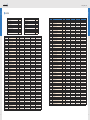
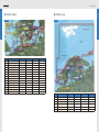
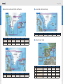
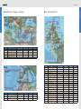
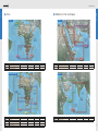
BlueChart Availability Catalogue
™
Atlantic Coverage 2008
BlueChart®
BlueChart
®
BlueChart is offered in three different formats and different medias:
Availability Catalogue 2008
BlueChart® cartography is GARMIN’s exclusive marine cartography.
It complements GARMIN’s line of handheld mapping products and
marine chartplotters. This line of cartography products is designed
to provide interactive viewing of detailed nautical chart data, thereby
providing navigators with innovative object-oriented cartography.
These detailed electronic nautical charts look just like paper charts
when displayed on your GARMIN chartplotter. Descriptive details for
features typically found on nautical charts can easily be viewed with a
simple key press. Cursor movements over the chart provide descriptions
for contour depths, chart number, navaid name, and much more.
BlueChart Overview
BlueChart Catalogue 2008
www.garmin.co.uk
BlueChart data will include shaded depth contours, inter-tidal zones,
spot soundings, wrecks, navaids, port plans, restricted areas, cable
areas, anchorages, and more. Additionally, BlueCharts include
information from the paper chart used in the digitization process
such as chart number, name, scale, revision date, and Notice-toMariners date. Paired with any of our new plotters, this cartography
provides detail of paper charts, giving you twice the coverage area
of typical charts for half the price.
•
•
•
Traditional BlueCharts, on proprietary Garmin cards, microSD cards and CD-ROM
BlueChart g2, for g2 compatible plotters only, on proprietary Garmin cards
BlueChart g2 Vision, for g2 Vision compatible plotters only, on SD cards
Traditional
g2
g2 Vision
Port Plan Charts
Spot Soundings
Marine Services
Wrecks and Obstructions
Intertidal zones
Obstructions
Restricted Areas
•
•
•
•
•
•
•
•
•
•
•
•
•
•
•
•
•
•
•
•
•
Nautical Navaids
Restricted Areas
Anchorages
Harbour Limits
Depths Contours
Tidal Stations
Detailed Roads
Aerial Photos
Business POIs
Mariner View
Large Cards
Current Information
Mariner’s Eye 3D
Satellite Imagery
AutoGuidance
Fish Eye 3D
Tidal Gauge
Current Tidal Stream Arrow
Fishing Contours
Flashing Navaids (only on Mariner’s Eye 3D)
•
•
•
•
•
•
•
•
•
•
•
•
•
•
•
•
•
•
•
•
•
•
•
•
•
•
•
•
•
•
•
•
•
•
•
•
•
•
CHARTPLOTTER COMPATIBILITY
GPSMAP 182, 188, 192, 198, 172, 178
292, 298, 2000 series
60/C/CS/CX/CSX, 76CX/CSX
GPSMAP 276*, 278*, 292, 298
2106*, 2110, 3000 series
GPSMAP 4XX, 5XX, 4XXX, 5XXX series
•
•
•
•
•
•
•
•
MEDIA FORMATS
CD-ROMS
Pre-programmed Micro SD / SD
Garmin Data Cards
Pre-programmed SD Cards
•
•
•
•
•
*Limited g2 functionality
Help us better support you by completing our on-line registration today! Have the ID code of your BlueChart data card handy, and connect to our
website www.garmin.co.uk. Look for the “myGarmin” link on the home page. Why should you register your BlueChart? By registering your
purchase you are assured of notification of product updates and/or information on new products.
02
03
BlueChart® Traditional
BlueChart works in seamless integration with the plotters featured. These detailed electronic nautical charts look just like paper charts, when displayed on your
Garmin chartplotter. Features include shading between depth contours, spot soundings, navaids, port plans, wrecks, obstructions, intertidal zones, restricted
areas and more. BlueChart cartography is object-oriented, which means you can pan to an object on the map and instantly view information about that point.
BlueChart cartography is offered in three forms – pre-programmed data cards, micro SD cards for X-series handhelds and MapSource CD-ROMs. MapSource
CDs contain detailed maps that can be downloaded to blank data cards or directly to units with PC interfaces.
BlueChart Programs
™
Garmin believes that updates are an extremely critical issue for marine cartography, and we are committed to providing our customers with
regular semi-annual updates. As updates occur, we will make every effort to ensure that the areas of coverage for a given data card remain
the same. Updates may include new data or NTM (Notice To Mariners) changes. A chart list with notice of NTM changes can be viewed on
the details page for each data card available on the Garmin website.
BlueChart Programs
BlueChart Catalogue 2008
www.garmin.co.uk
Warranty Information
BlueChart® g2
BlueChart g2 features smoother layering and better integration of map graphics, for easy panning, scrolling and zooming. Richer colours and shading
enable easier interpretation and improved visibility. BlueChart g2 also adds more detail on land features, coastal roadways, marine services and municipal
areas and offers improved IALA navaid symbology. The user has a choice of new Mariner’s View map perspective, or the familiar 2D direct-overhead view –
to make chart reading and orientation easier. Like all BlueChart cartography, g2 is styled to match the appearance of paper charts when displayed on your
Garmin chartplotter.
Features include shading between depth contours, spot soundings, navaids, port plans, wrecks, obstructions, intertidal zones, restricted areas and more.
BlueChart® g2 Vision™
Your BlueChart data card should be examined for damage immediately upon receipt. Garmin will accept returned BlueChart’s within 10 days
of the purchase date if the BlueChart is found to be defective.
Update/Trade In Program
Garmin will strive to offer semi-annual updates. If you own a BlueChart that is outdated or would like to purchase a BlueChart for a different
coverage area, Garmin offers:
• Update Program (All formats): return your old BlueChart card, any format, and receive a 50% discount toward Garmin’s list price for
any region that Garmin offers, regardless of size, for the same format (ex. Traditional for Traditional, etc.). Only one update or trade-in
per new BlueChart card is allowed.
• Upgrade from Traditional to BlueChart g2: return your traditional BlueChart data card, and receive a 30% discount toward Garmin’s
list price on any BlueChart g2 that Garmin offers, regardless of size. Only one update or trade-in per new BlueChart g2 is allowed.
• Upgrade to BlueChart g2 Vision: return any traditional, micro SD or g2 data card and receive a 25% discount toward Garmin’s list price
on any BlueChart g2 Vision that Garmin offers, regardless of size. Only one update or trade-in per new BlueChart g2 Vision is allowed.
To return a BlueChart for update, contact your local dealer or country distributor.
BlueChart g2 Vision advanced charting from Garmin gives mariners even better vision with 3D perspectives above and below the waterline.
Upgrading from G-Charts to BlueCharts
The unique Garmin Auto Guidance technology swiftly plots a suggested best route based on chart information at the press of a button,
avoiding the need for manual course entry.
If you’ve previously used Garmin’s G-Chart¨ line of electronic maps, please note that G-Charts are now out of production and support.
G-Charts will not work in our BlueChart-compatible chartplotter product line. The BlueChart line provides added flexibility, greater coverage,
and offers you cost savings. To encourage current Garmin customers to upgrade to our new BlueChart line, Garmin provides a 25% discount
on new BlueChart data cards for those end-users who return an old G-Chart. This is a one-for-one discount. To verify compatibility with
BlueChart data, you will be asked to present proof of a new chartplotter purchase.
Available on pre-programmed SD cards, BlueChart g2 Vision simply slots into the latest Garmin chartplotters to greatly extend the graphical
capabilities of your equipment.
BlueChart g2 Vision cards provide:
•
•
•
•
•
•
•
Auto Guidance technology to find the best course for navigation
High-resolution satellite imagery
Aerial reference photography to provide ‘real-world’ images of ports, harbours and marinas
Mariner’s Eye View 3D perspective of chart information for a quick, reliable and easy position fix
Fish Eye View 3D perspective below the water line to display floor contours based on bathymetric charting data
Tidal graphs, current arrows, marine services, coastal roads and points of interest detail
Detailed bathymetric fishing charts to emphasise bottom contours and depth soundings while removing selected navigation
detail from the map for a sharper definition of the sea floor
Please note: BlueCharts are not compatible with older Garmin models including: GPSMAP 130/135/175/180/185/210/215/220/225/230/235
How to read your Garmin BlueChart I.D. Code
™
All BlueChart cartridges are identified by a seven-digit I.D. code. This identification system uses the following convention:
Region (xx) codes include:
m x x y y y z
Type*
Region
BlueChart Ref No.
Size of coverage
AE
AW
EU
SA
AF
Asia, East (Japan, China, Indonesia, etc.)
Asia, West
Europe (includes all Mediterranean Sea)
South America
Africa
CA
Canada
PC
Pacific Ocean (Australia, New Zealand, etc.)
US
United States and the Caribbean
Size of coverage (z) codes include:
*Please note “Type” not included in region codes
in the images and tables of this catalogue
4
S
R
L
Small
Regular
Large
5
6
Index
Index
www.garmin.co.uk
Index
Geographic section
Page
Geographic section
Page
Region code
Title
Page
Traditional
microSD
g2
g2 Vision
Nordics North Small
8
Mediterranean Small
15
EU457S
Bretagne
17
010-C0111-00
010-C0444-00
010-C0535-00
010-C0801-00
Nordics South Small
8
Mediterranean Regular
16
EU458S
Göteborg to Fyn
8
010-C0112-00
010-C0445-00
010-C0536-00
010-C0802-00
Nordics North Regular
9
Mediterranean Large
16
EU459S
Århus-Kiel-Koszalin
8
010-C0113-00
010-C0446-00
010-C0537-00
010-C0803-00
Nordics East Regular
9
UK Ireland Small
17
EU460S
Sicily to Lido di Ostia
15
010-C0114-00
010-C0447-00
010-C0538-00
010-C0804-00
Nordics South Regular
10
UK Ireland Regular
18
Nordics Large
11
UK Ireland Large
19
EU461S
Thames Estuary
17
010-C0115-00
010-C0448-00
010-C0539-00
010-C0805-00
Greenland and Iceland Small
12
Africa Small
20
EU462S
English Channel East
17
010-C0116-00
010-C0449-00
010-C0540-00
010-C0806-00
Greenland and Iceland Regular
12
Africa Regular
20
EU463S
Bristol Channel and England S/W
17
010-C0117-00
010-C0450-00
010-C0541-00
010-C0807-00
Greenland and Iceland Large
13
Africa Large
20
EU464S
Penmarch to Les Sables D'Olonne
17
010-C0118-00
010-C0451-00
010-C0542-00
010-C0808-00
Atlantic Coast Small
13
Middle East Small
21
EU465S
La Baule to San Sebastian
17
010-C0119-00
010-C0452-00
010-C0543-00
010-C0809-00
Atlantic Coast Regular
14
Middle East Regular
21
EU466S
Golfe Du Lion to San Remo
13 + 15
010-C0120-00
010-C0453-00
010-C0544-00
010-C0810-00
EU467S
Blackpool to Cardiff
17
010-C0121-00
010-C0454-00
010-C0545-00
010-C0811-00
EU468S
Södertälje to Trelleborg
8
010-C0122-00
010-C0392-00
010-C0546-00
010-C0812-00
Region code
Title
Page
Traditional
microSD
g2
g2 Vision
EU469S
Stockholm and Mälaren
8
010-C0123-00
010-C0396-00
010-C0547-00
AF001R
010-C0813-00
Eastern Africa
20
010-C0051-00
010-C0303-00
010-C0608-00
010-C0747-00
EU470S
Stromstad to Halmstad
8
010-C0124-00
010-C0401-00
010-C0548-00
010-C0814-00
AF002R
South Africa
20
010-C0065-00
010-C0304-00
010-C0609-00
010-C0748-00
EU471S
Gulf of Bothnia, South
8
010-C0125-00
010-C0460-00
010-C0549-00
010-C0815-00
AF003R
Western Africa
20
010-C0066-00
010-C0305-00
010-C0610-00
010-C0749-00
EU472S
Gulf of Bothnia, Center
8
010-C0126-00
010-C0461-00
010-C0550-00
010-C0816-00
AF450S
Madeira and Canary Islands
20
010-C0264-00
010-C0434-00
010-C0584-00
010-C0750-00
EU473S
Gulf of Bothnia, North
8
010-C0127-00
010-C0462-00
010-C0551-00
010-C0817-00
AF451S
Namibia to Knysna, SA
20
010-C0664-00
010-C0665-00
010-C0666-00
010-C0751-00
EU474S
Ålborg to the Eider
8
010-C0128-00
010-C0463-00
010-C0552-00
010-C0818-00
AF452S
Knysna, SA to Beira, MZ
20
010-C0667-00
010-C0668-00
010-C0669-00
010-C0752-00
EU475S
Greenland West
12
010-C0129-00
010-C0464-00
010-C0553-00
010-C0819-00
AF700L
Rabat - Capetown - Mogadishu
20
N/A
N/A
010-C0647-00
N/A
EU476S
Greenland East
12
010-C0130-00
010-C0465-00
010-C0554-00
010-C0820-00
AF701L
Dubai to Capetown
20
N/A
N/A
010-C0648-00
N/A
EU477S
Iceland West
12
010-C0131-00
010-C0466-00
010-C0555-00
010-C0821-00
AW003R
Indian Subcontinent
21
010-C0069-00
010-C0308-00
010-C0611-00
010-C0755-00
EU478S
Iceland East
12
010-C0132-00
010-C0467-00
010-C0556-00
010-C0822-00
AW005R
The Gulf and Red Sea
21
010-C0286-00
010-C0415-00
010-C0287-00
010-C0924-00
EU479S
Portugal
13 + 15
010-C0133-00
010-C0468-00
010-C0557-00
010-C0823-00
AW450S
The Gulf
21
010-C0265-00
010-C0435-00
010-C0585-00
010-C0758-00
EU480S
Ross of Mull to Killough
17
010-C0134-00
010-C0469-00
010-C0558-00
010-C0824-00
AW451S
Red Sea
21
010-C0266-00
010-C0436-00
010-C0586-00
010-C0759-00
EU481S
Belfast to Waterford
17
010-C0135-00
010-C0470-00
010-C0559-00
010-C0825-00
EU001R
English Channel
14 + 18
010-C0070-00
010-C0309-00
010-C0612-00
010-C0760-00
EU482S
Wexford to Dingle Bay
17
010-C0136-00
010-C0471-00
010-C0560-00
010-C0826-00
EU002R
Dover to Amsterdam & England SE
18
010-C0071-00
010-C0310-00
010-C0613-00
010-C0761-00
EU483S
Galway Bay to Cork
17
010-C0137-00
010-C0472-00
010-C0561-00
010-C0827-00
EU003R
Great Britain, Northeast Coast
18
010-C0072-00
010-C0311-00
010-C0614-00
010-C0762-00
EU484S
Ireland North-West
17
010-C0138-00
010-C0473-00
010-C0562-00
010-C0828-00
EU004R
Irish Sea
14 + 18
010-C0073-00
010-C0312-00
010-C0615-00
010-C0763-00
EU485S
Fuenterrabia to Gijon
13 + 15
010-C0139-00
010-C0474-00
010-C0563-00
010-C0829-00
EU005R
Ireland, West Coast
18
010-C0074-00
010-C0313-00
010-C0616-00
010-C0764-00
EU486S
Galicia and Asturias
13 + 15
010-C0140-00
010-C0416-00
010-C0564-00
010-C0830-00
EU006R
Scotland, West Coast
18
010-C0075-00
010-C0382-00
010-C0617-00
010-C0765-00
EU487S
Rotterdam & Belgium Coast
17
010-C0141-00
010-C0417-00
010-C0565-00
010-C0831-00
EU008R
Bay of Biscay
14 + 18
010-C0076-00
010-C0383-00
010-C0618-00
010-C0766-00
EU488S
Keitele-Paijanne-Tampere
8
010-C0188-00
010-C0418-00
010-C0566-00
010-C0832-00
EU009R
Portugal and Northwest Spain
14
010-C0077-00
010-C0384-00
010-C0619-00
010-C0767-00
EU489S
Kupio-Lappeenranta
8
010-C0189-00
010-C0306-00
010-C0567-00
010-C0833-00
EU010R
Spain, Mediterranean Coast
14
010-C0078-00
010-C0385-00
010-C0620-00
010-C0768-00
EU490S
Greece West Coast and Athens
15
010-C0199-00
010-C0307-00
010-C0568-00
010-C0834-00
EU011R
France, South Coast and Corsica
14 + 16
010-C0079-00
010-C0386-00
010-C0621-00
010-C0769-00
EU491S
Kotka to Hanko
8
010-C0267-00
010-C0419-00
010-C0569-00
010-C0835-00
EU012R
Italy, West Coast
14 + 16
010-C0080-00
010-C0387-00
010-C0622-00
010-C0770-00
EU492S
Kristinestad to Hanko
8
010-C0268-00
010-C0420-00
010-C0570-00
010-C0836-00
EU013R
Italy Southwest and Tunisia
14 + 16
010-C0081-00
010-C0388-00
010-C0623-00
010-C0771-00
EU493S
Tornio to Kristinestad
8
010-C0269-00
010-C0421-00
010-C0571-00
010-C0837-00
EU014R
Italy, Adriatic Sea
16
010-C0082-00
010-C0389-00
010-C0587-00
010-C0772-00
EU494S
Belfast to Liverpool
17
010-C0270-00
010-C0422-00
010-C0572-00
010-C0838-00
EU015R
Aegean Sea and Sea of Marmara
16
010-C0083-00
010-C0390-00
010-C0588-00
010-C0773-00
EU495S
Loch Ewe to Mull
17
010-C0271-00
010-C0423-00
010-C0573-00
010-C0839-00
EU016R
Mediterranean Southeast
16
010-C0084-00
010-C0391-00
010-C0589-00
010-C0774-00
EU496S
Outer Hebrides and Skye
17
010-C0272-00
010-C0424-00
010-C0574-00
010-C0840-00
EU018R
The Netherlands
10 + 18
010-C0086-00
010-C0393-00
010-C0590-00
010-C0775-00
EU497S
Orkneys and Moray Firth
17
010-C0273-00
010-C0425-00
010-C0575-00
010-C0841-00
EU019R
Ålborg to Amsterdam
10
010-C0087-00
010-C0394-00
010-C0591-00
010-C0776-00
EU498S
Shetlands and Orkneys
17
010-C0274-00
010-C0426-00
010-C0576-00
010-C0842-00
EU021R
Denmark East and Sweden SE
10
010-C0088-00
010-C0395-00
010-C0592-00
010-C0777-00
EU499S
Aberdeen to Scarborough
17
010-C0275-00
010-C0427-00
010-C0577-00
010-C0843-00
EU041R
Oslo-Skagerak-Haugesund
10
010-C0090-00
010-C0397-00
010-C0593-00
010-C0778-00
EU500S
Blyth to Lowestoft
17
010-C0276-00
010-C0428-00
010-C0578-00
010-C0844-00
EU042R
Oslo to Trelleborg
10
010-C0091-00
010-C0398-00
010-C0594-00
010-C0779-00
EU501S
Hamburg to Rotterdam
8
010-C0277-00
010-C0429-00
010-C0579-00
010-C0845-00
EU043R
Iceland and Faeroe Islands
12
010-C0092-00
010-C0399-00
010-C0595-00
010-C0780-00
EU502S
Azores Islands
13 + 15
010-C0278-00
010-C0430-00
010-C0580-00
010-C0846-00
EU044R
Greenland
12
010-C0093-00
010-C0400-00
010-C0596-00
N/A
EU505S
Baltic Sea, East Coast
8
010-C0281-00
010-C0433-00
010-C0583-00
010-C0849-00
EU506S
Crete to Cyprus
15
010-C0686-00
010-C0685-00
010-C0687-00
010-C0850-00
EU704L
France
19
N/A
N/A
010-C0649-00
010-C0851-00
EU705L
Hamburg to Brest
19
N/A
N/A
010-C0650-00
010-C0852-00
EU706L
UK & Ireland
19
N/A
N/A
010-C0651-00
010-C0853-00
EU707L
Greenland to Aberdeen
13
N/A
N/A
010-C0652-00
N/A
EU708L
North Norway
11
N/A
N/A
010-C0653-00
010-C0855-00
EU709L
South Norway
11
N/A
N/A
010-C0654-00
010-C0856-00
EU710L
Denmark, Skagerrak & Kattegat
11
N/A
N/A
010-C0655-00
010-C0857-00
EU711L
Sweden South
11
N/A
N/A
010-C0656-00
010-C0858-00
EU712L
Sweden East
11
N/A
N/A
010-C0657-00
010-C0859-00
EU713L
Finland
11
N/A
N/A
010-C0658-00
010-C0860-00
EU714L
Iberian Peninsula, Azores & Canaries
16
N/A
N/A
010-C0659-00
010-C0861-00
EU715L
Mediterranean West
16
N/A
N/A
010-C0660-00
010-C0862-00
EU716L
Mediterranean, Central
16
N/A
N/A
010-C0661-00
010-C0863-00
EU046R
Öregrund, Åland to Malmö
EU047R
Gulf of Bothnia, Kalix-Grisslehamn
10
010-C0095-00
010-C0402-00
010-C0597-00
010-C0782-00
9 + 10
010-C0096-00
010-C0403-00
010-C0598-00
010-C0783-00
EU048R
Stockholm,Mälaren,Vänern & Vättern
10
010-C0097-00
010-C0404-00
010-C0599-00
010-C0784-00
EU049R
Stockholm to Åland and Turku
9 + 10
010-C0098-00
010-C0405-00
010-C0600-00
010-C0785-00
EU050R
Åland to Vyborg
9 + 10
010-C0099-00
010-C0406-00
010-C0601-00
010-C0786-00
EU051R
Lista - Sognefjorden
9 + 10
010-C0100-00
010-C0407-00
010-C0602-00
010-C0787-00
EU052R
Sognefjorden - Svefjorden
9 + 10
010-C0101-00
010-C0408-00
010-C0603-00
010-C0788-00
EU053R
Trondheim - Tromsø
9 + 10
010-C0102-00
010-C0409-00
010-C0604-00
010-C0789-00
EU054R
Vestfjd-Svalbard-Varanger
9 + 10
010-C0103-00
010-C0410-00
010-C0605-00
010-C0790-00
EU055R
Finnish Lakes
9 + 10
010-C0187-00
010-C0411-00
010-C0606-00
010-C0791-00
EU450S
Athens and Cyclades
15
010-C0104-00
010-C0437-00
010-C0528-00
010-C0794-00
EU451S
Ligurian Sea, Corsica and Sardinia
15
010-C0105-00
010-C0438-00
010-C0529-00
010-C0795-00
EU452S
Adriatic Sea, North Coast
15
010-C0106-00
010-C0439-00
010-C0530-00
010-C0796-00
EU453S
Adriatic Sea, South Coast
15
010-C0107-00
010-C0440-00
010-C0531-00
010-C0797-00
EU454S
Barcelona and Valencia
13 + 15
010-C0108-00
010-C0441-00
010-C0532-00
010-C0798-00
EU455S
Alicante To Cabo De São Vicente
13 + 15
010-C0109-00
010-C0442-00
010-C0533-00
010-C0799-00
EU456S
The Solent and Channel Islands
17
010-C0110-00
010-C0443-00
010-C0534-00
010-C0800-00
7
Nordics Small
Nordics Regular
Nordics
Nordics
www.garmin.co.uk
NORTH
NORTH
SOUTH
EAST
8
Code
Title
EU458S
Göteborg to Fyn
EU459S
Århus-Kiel-Koszalin
EU468S
BlueChart Traditional
BlueChart g2
g2 Vision
•
x microSD
•
•
•
•
•
•
•
Södertälje to Trelleborg
•
•
•
•
EU469S
Stockholm and Mälaren
•
•
•
•
EU470S
Stromstad to Halmstad
•
•
•
•
EU471S
Gulf of Bothnia, South
•
•
•
•
EU472S
Gulf of Bothnia, Center
•
•
•
•
EU473S
Gulf of Bothnia, North
•
•
•
•
EU474S
Ålborg to the Eider
•
•
•
•
EU488S
Keitele-Paijanne-Tampere
•
•
•
•
EU489S
Kupio-Lappeenranta
•
•
•
•
EU491S
Kotka to Hanko
•
•
•
•
EU492S
Kristinestad to Hanko
•
•
•
•
EU493S
Tornio to Kristinestad
•
•
•
•
EU501S
Hamburg to Rotterdam
•
•
•
•
EU505S
Baltic Sea, East Coast
•
•
•
•
9
Nordics Regular
Nordics Large
SOUTH
LARGE
Code
Title
BlueChart Traditional
x microSD
BlueChart g2
g2 Vision
EU018R
The Netherlands
•
•
•
•
EU019R
Ålborg to Amsterdam
•
•
•
•
EU021R
Denmark East and Sweden SE
•
•
•
•
EU041R
Oslo-Skagerak-Haugesund
•
•
•
•
EU042R
Oslo to Trelleborg
•
•
•
•
EU046R
Öregrund, Åland to Malmö
•
•
•
•
EU047R
Gulf of Bothnia, Kalix-Grisslehamn
•
•
•
•
EU048R
Stockholm,Mälaren,Vänern & Vättern
•
•
•
•
EU049R
Stockholm to Åland and Turku
•
•
•
•
EU050R
Åland to Vyborg
•
•
•
•
EU051R
Lista - Sognefjorden
•
•
•
•
EU052R
Sognefjorden - Svefjorden
•
•
•
•
EU053R
Trondheim - Tromsø
•
•
•
•
EU054R
Vestfjd-Svalbard-Varanger
•
•
•
•
EU055R
Finnish Lakes
•
•
•
•
Code
10
Nordics
Nordics
www.garmin.co.uk
Title
BlueChart Traditional
x microSD
BlueChart g2
g2 Vision
EU708L
North Norway
•
•
EU709L
South Norway
•
•
EU710L
Denmark, Skagerrak & Kattegat
•
•
EU711L
Sweden South
•
•
EU712L
Sweden East
•
•
EU713L
Finland
•
•
11
Greenland and Iceland Small and Regular
Greenland and Iceland Large
SMALL
LARGE
Code
EU707L
Code
Greenland, Iceland, Atlantic Coast
Greenland & Iceland
www.garmin.co.uk
Title
BlueChart Traditional
x microSD
BlueChart g2
g2 Vision
EU475S
Greenland West
•
•
•
•
EU476S
Greenland East
•
•
•
•
EU477S
Iceland West
•
•
•
•
EU478S
Iceland East
•
•
•
•
Title
BlueChart Traditional
x microSD
Greenland to Aberdeen
BlueChart g2
g2 Vision
•
Atlantic Coast Small
SMALL
REGULAR
Code
Code
12
Title
BlueChart Traditional
x microSD
BlueChart g2
g2 Vision
EU043R
Iceland and Faeroe Islands
•
•
•
•
EU044R
Greenland
•
•
•
•
Title
BlueChart Traditional
x microSD
BlueChart g2
g2 Vision
EU454S
Barcelona and Valencia
•
•
•
•
EU455S
Alicante to Cabo de Sao Vicente
•
•
•
•
EU466S
Golfe Du Lion to San Remo
•
•
•
•
EU479S
Portugal
•
•
•
•
EU485S
Fuenterrabia to Gijon
•
•
•
•
EU486S
Galicia and Asturias
•
•
•
•
EU502S
Azores Islands
•
•
•
•
13
Atlantic Coast Regular
Mediterranean Small
REGULAR
SMALL
Code
Code
14
Mediterranean
Atlantic Coast
www.garmin.co.uk
Title
BlueChart Traditional
x microSD
BlueChart g2
g2 Vision
EU001R
English Channel
•
•
•
•
EU004R
Irish Sea
•
•
•
•
EU008R
Bay of Biscay
•
•
•
•
EU009R
Portugal and Northwest Spain
•
•
•
•
EU010R
Spain, Mediterranean Coast
•
•
•
•
EU011R
France, South Coast, and Corsica
•
•
•
•
EU012R
Italy, West Coast
•
•
•
•
EU013R
Italy Southwest and Tunisia
•
•
•
•
Title
BlueChart Traditional
x microSD
BlueChart g2
g2 Vision
EU450S
Athens and Cyclades
•
•
•
•
EU451S
Ligurian Sea, Corsica and Sardinia
•
•
•
•
EU452S
Adriatic Sea, North Coast
•
•
•
•
EU453S
Adriatic Sea, South Coast
•
•
•
•
EU460S
Sicily to Lido di Ostia
•
•
•
•
EU490S
Greece West Coast and Athens
•
•
•
•
EU506S
Crete to Cyprus
•
•
•
•
15
Mediterranean Regular and Large
UK and Ireland Small
REGULAR
Code
BlueChart Traditional
x microSD
BlueChart g2
g2 Vision
EU011R
France, South Coast and Corsica
Title
•
•
•
•
EU012R
Italy, West Coast
•
•
•
•
EU013R
Italy Southwest and Tunisia
•
•
•
•
EU014R
Italy, Adriatic Sea
•
•
•
•
EU015R
Aegean Sea and Sea of Marmara
•
•
•
•
EU016R
Mediterranean Southeast
•
•
•
•
Code
LARGE
Code
EU714L
16
UK & Ireland
Mediterranean
www.garmin.co.uk
Title
Iberian Peninsula, Azores & Canaries
BlueChart Traditional
x microSD
BlueChart g2
•
Title
BlueChart Traditional
x microSD
BlueChart g2
g2 Vision
EU456S
The Solent and Channel Islands
•
•
•
•
EU457S
Bretagne
•
•
•
•
EU461S
Thames Estuary
•
•
•
•
EU462S
English Channel East
•
•
•
•
EU463S
Bristol Channel and England S/W
•
•
•
•
EU464S
Penmarch to Les Sables D'Olonne
•
•
•
•
EU465S
La Baule to San Sebastian
•
•
•
•
EU467S
Blackpool to Cardiff
•
•
•
•
EU480S
Ross of Mull to Killough
•
•
•
•
EU481S
Belfast to Waterford
•
•
•
•
EU482S
Wexford to Dingle Bay
•
•
•
•
EU483S
Galway Bay to Cork
•
•
•
•
EU484S
Ireland North-West
•
•
•
•
EU487S
Rotterdam & Belgium Coast
•
•
•
•
EU494S
Belfast to Liverpool
•
•
•
•
g2 Vision
EU495S
Loch Ewe to Mull
•
•
•
•
•
EU496S
Outer Hebrides and Skye
•
•
•
•
EU497S
Orkneys and Moray Firth
•
•
•
•
EU498S
Shetlands and Orkneys
•
•
•
•
EU499S
Aberdeen to Scarborough
•
•
•
•
EU500S
Blyth to Lowestoft
•
•
•
•
EU715L
Mediterranean West
•
•
EU716L
Mediterranean, Central
•
•
17
UK and Ireland Regular
UK and Ireland Large
REGULAR
LARGE
Code
Code
18
UK & Ireland
UK & Ireland
www.garmin.co.uk
BlueChart Traditional
x microSD
BlueChart g2
g2 Vision
EU001R
English Channel
Title
•
•
•
•
EU002R
Dover to Amsterdam & England SE
•
•
•
•
EU003R
Great Britain, Northeast Coast
•
•
•
•
EU004R
Irish Sea
•
•
•
•
EU005R
Ireland, West Coast
•
•
•
•
EU006R
Scotland, West Coast
•
•
•
•
EU008R
Bay of Biscay
•
•
•
•
EU018R
The Netherlands
•
•
•
•
Title
BlueChart Traditional
x microSD
BlueChart g2
g2 Vision
EU704L
France
•
•
EU705L
Hamburg to Brest
•
•
EU706L
UK & Ireland
•
•
19
Africa
Middle East Small and Regular
SMALL
Code
AF450S
AF451S
AF452S
Title
Madeira and Canary Islands
Namibia to Knysna, SA
Knysna, SA to Beira, MZ
SMALL
BlueChart Traditional
•
•
•
x microSD
•
•
•
BlueChart g2
•
•
•
g2 Vision
•
•
•
Code
AW450S
AW451S
REGULAR AND LARGE
20
Code
AF001R
AF002R
AF003R
AF700L
AF701L
Title
Eastern Africa
South Africa
Western Africa
Rabat - Capetown - Mogadishu
Dubai to Cape Town
Middle East
Africa
www.garmin.co.uk
Title
BlueChart Traditional
•
•
x microSD
•
•
BlueChart g2
•
•
g2 Vision
•
•
Title
Indian Subcontinent
The Gulf and Red Sea
BlueChart Traditional
•
•
x microSD
•
•
BlueChart g2
•
•
g2 Vision
•
•
The Gulf
Red Sea
REGULAR
BlueChart Traditional
•
•
•
x microSD
•
•
•
BlueChart g2
•
•
•
•
•
g2 Vision
•
•
•
Code
AW003R
AW005R
21
BlueChart g2 Vision Copyright and Warning Requirements:
The chart information in this product is reproduced, in whole or part, with the permission of the following national hydrographic offices and other organizations: Servicio de Hidrografía Naval of
Argentina (SHN-AR); Australian Hydrographic Service; Editrice Incontri Nautici (Bolina); Directorate of Hydrography and Navigation of Brazil (DHN-BR); © Her Majesty in Right of Canada, Department
of Fisheries and Oceans (2007), 20060101-G; © 2007 Her Majesty the Queen in Right of Canada, Canadian Hydrographic Service / Sa Majesté du chef en Canada, Service hydrographique du Canada
and/or Nautical Data International Inc. license no. 240502001-001/2 and 021704-087; © Hydrographic and Oceanographic Service of the Chilean Navy (SHOA); Hydrographic Institute of the Republic
of Croatia and Adriatic Sea Pilot; Kort & Matrikelstyrelsen, Denmark, license no. G.9-2002; Estonian Maritime Administration (EMA) © 2007; Finland Hydrographic Office, license no. FMA
877/721/2004; Service Hydrographique et Océanographique de la Marine (SHOM, www.shom.fr), France, Contract nº E 67/2005; Bundesamt für Seeschifffahrt und Hydrographie (BSH), Germany,
license no. 8095-01/2004-02 ÖA03; Great Barrier Reef Marine Park Authority (GBRMPA); Hellenic Navy Hydrographic Service (Greece), license no. 171.7/22/03; Hydrographica chart data contained
in this product is © 2005-2007 Hydrographica; ©Copyright Icelandic Coast Guard Hydrographic Department, (2004-2007). All rights reserved, license no. IS AC-001-Garmin; Imray Laurie Norie &
Wilson Ltd. UK; Istituto Idrografico della Marina, Italy; Ministry of Communication Kuwait (KHO-MOC) © 2007; Maritime Administration of Latvia (LHS) © 2007; Maritime Safety Queensland and is
© State of Queensland. All rights reserved; Netherlands Hydrographic Office 2005-2007, license no. NL AC-002-Garmin; Land Information New Zealand (Crown copyright reserved); Norwegian
Hydrographic Service, license no. NO24/021001/1; ©Copyright National Hydrographic Office, Sultanate of Oman (2005-2007), OM AC-001-Garmin. All rights reserved; ©Direction of Hydrography
and Navigation of Peru, (DHN-PE); ©Copyright Instituto Hidrográfico of Portugal, (2003-2007), PT AC-002-Garmin. All rights reserved; Lewis Offshore Ltd. (© 2003-2007); Russian Hydrographic Office;
South Africa Hydrographic Office; ©Copyright Instituto Hidrográfico de la Marina, Spain, (2003-2007), ES AC-001-Garmin; Swedish Maritime Administration, license no. 03-01453; © State
Hydrographic Service of Ukraine; Servicio de Oceanografía, Hidrografía y Meteorología de la Armada (SOHMA) de la República Oriental del Uruguay; © Vlaamse Hydrografie, (2005-2007); and
©British Crown Copyright, (2001-2007), GB AC-002-Garmin. All rights reserved. Wavey Line charts are produced, in part, from products and with the agreement of Wavey Line Ltd.
This product has been derived in part from material obtained from the UK Hydrographic Office with the permission of the UK Hydrographic Office, Her Majesty’s Stationery Office and the following
authorities: Hydrographic Department of the Icelandic Coast Guard, Netherlands Hydrographic Office, National Hydrographic Office, Sultanate of Oman, Instituo Hidrográfico of Portugal, Instituto
Hidrográfico de la Marina, Spain, Vlaamse Hydrografie.
This product has been derived in part from material obtained from the UK Hydrographic Office with the permission of the UK Hydrographic Office, Her Majesty’s Stationery Office and the following
port authorities for United Kingdom: Aberdeen Harbour Board, Associated British Ports (includes Ayr & Troon, Barrow, Cardiff & Barry, Fleetwood, Garston, Ipswich, King’s Lynn, Lowestoft, Newport,
Plymouth, Silloth, Southampton, Swansea & Port Talbot, and Teignmouth), Belfast Harbour, Cattewater Harbour Commissioners (Cattewater, Plymouth), Chichester Harbour Conservancy, Clydeport
Operations Limited, Cromarty Firth Port Authority, Cowes Harbour Commission, Dart Harbour and Navigation Authority, Dover Harbour Board, Falmouth Harbour Commissioners, First Corporate
Shipping Limited (Bristol), Fowey Harbour Commissioners, Fraserburgh Harbour Commissioners, Gloucester Harbour Trustees, Harwich Haven Authority, Heysham Port Limited, Imerys Minerals Ltd
(Par), Inverness Harbour Trust (Inverness, Inverness Firth), King's Lynn Conservancy Board, Langstone Harbour, Larne Harbour Limited (Larne, Cairnryan), Littlehampton Harbour Board, Londonderry
Port and Harbour Commissioners, Manchester Ship Canal Company, Medway Docks and Harbour Company Limited, Mersey Docks & Harbour Company (Mersey, Liverpool, Birkenhead), Milford Haven
Port Authority, Montrose Port Authority, Newhaven Port and Properties Limited, Orkney Islands Council, Padstow Harbour Commissioners, PD Teesport (excluding Bathymetry data), Poole Harbour
Commissioners, Port of Boston Limited, Port of London Authority, Port of Sunderland, Port of Tyne Authority (Tyne), Port of Wisbech Authority, Port of Workington, Portland Harbour Authority
Limited, Ports of Truro & Penryn, Portsmouth Commercial Port, Seaham Harbour Dock Company, Scrabster Harbour Trust (Scrabster), Shetland Islands Council, Shoreham Port Authority, Stena Line
Ports Limited (Fishguard, Fleetwood, Holyhead, Stranraer), Teignmouth Harbour Commission, Thanet District Council (Ramsgate), Torbay Council Marine Services (Tor Bay; Torquay, Brixham, Paignton),
Warrenpoint Harbour Authority, Weymouth & Portland Borough Council, and Whitstable Harbour. For Channel Islands: Jersey Harbours and States of Guernsey Harbour Authority. For Isle of Man:
Isle of Man Harbours Division. For Republic of Ireland: Bantry Bay Harbour Commissioners, Drogheda Port Company, Dublin Port Company, Dun Laoghaire Harbour Company, and Port of Cork
Company. © the British Crown, 2001-2007. All rights reserved.
Some data and information contained in these Products are © Commonwealth of Australia, Australia Hydrographic Service, Maritime Safety Queensland and is © State of Queensland. Certain
zoning information in this product is © Great Barrier Reef Marine Park Authority; and is used under license with the permission of the Great Barrier Reef Marine Park Authority. All rights reserved.
Apart from the uses permitted to the licensee under the license, the information may not be modified or exploited by reverse engineering of formats and encryption or copied, reproduced, translated,
or reduced to any electronic medium or machine readable form, in whole or part, without the prior written consent of the Great Barrier Reef Marine Park Authority, the Maritime Safety Queensland
and © 2002-2007 Her Majesty the Queen in Right of Canada, Canadian Hydrographic Service / Sa Majesté du chef en Canada, Service Hydrographique du Canada and/or Nautical Data International,
Inc. Garmin International, Inc. is an authorized user and licensee of selected Australia Hydrographic Service data products under licensing agreement 0548FL and Nautical Data International Inc. data
products under Licensing Agreement number 240502001-001/2 and 021704-087. Apart from the uses permitted to the licensee under the licensing Agreements, the information may not be
modified or exploited by reverse engineering of formats or encryption or copied, reproduced, translated or reduced to any electronic medium or machine readable form, in whole or part.
Reeds Almanacs port services data contained in this product is © 2004-2007 Adlard Coles Nautical. Certain port services data contained in this product is © 2005-2007 Batmagasinet; ©Boatharbour
Group, Finland; Certain port services data contained in this product is © 2006-2007 Boatlaunch Ltd., © 2005-2007 BLOC MARINE Almanac & Cruising Guide, © 2004-2007 Bolina - Editrice Incontri
Nautici, © 2005-2007 Gasthamnsguiden SXK AB, and © 2005-2007 Kort & Matrikelstyrelsen. The Explorer Charts logo is a registered trademark of Lewis Offshore Ltd., publishers of the Explorer
Chartbook series. Photos © 2007 CMT Group 1, Inc. and Garmin International, Inc. Imagery ©2007 DigitalGlobe. Basemap imagery © 2007 MDA FEDERAL, INC
**Satellite imagery is included for many BlueChart g2 Vision data cards.
WARNING:
The Great Barrier Reef Marine Park Authority (“the Authority”) does not check the information in this product and accepts no liability for the accuracy of copying or for any modifications that may
have been made to the information which it has supplied. Use of and entry to the Great Barrier Reef Marine Park is controlled by the Great Barrier Reef Marine Park Act 1975 (Cth) (“the Act”). Penalties
apply for use of or entry to a zone for a purpose other than for a purpose permitted under the Great Barrier Reef Marine Park Zoning Plan 2003 (“the Zoning Plan”) prepared by the Authority pursuant
to section 32 of the Act. This product does not contain all information concerning permitted use or entry under the Zoning Plan. For purposes of use of or entry to the Great Barrier Reef Marine
Park, this product should only be used in conjunction with the Zoning Plan and the Great Barrier Reef Marine Park Regulations 1983 (Cth). For purposes of navigation, users should consult official
navigation charts released by relevant government authorities.
Important information
Important Information
www.garmin.co.uk
WARNING:
The Licensee is hereby advised of the Canadian carriage regulations applicable to Canadian ships in all waters and to all ships in waters under Canadian jurisdiction which requires the master and
owner of every ship to: have on board, in respect of each area in which the ship is to be navigated, the most recent editions of the charts, documents; or to have sufficient knowledge of specific
information, such that safe and efficient navigation in the area where the ship is to be navigated is not compromised.
WARNING:
The tide and current predictions derived from this software are not to replace the Canadian Tide and Current Tables, which are required under the Charts and Nautical Publications Regulations of
the Canada Shipping Act and which must be used for navigation within Canadian waters. Official Canadian Tide and Current Tables are available from authorized chart dealers. For a complete list
of dealers in your area, please contact:
Chart Distribution Office
Canadian Hydrographic Service
615 Booth Street
Ottawa, Ontario, K1A 0E6
Telephone: (613) 998-4931
Fax: (613) 998-1217
Email: [email protected]
WEB: www.charts.gc.ca
Although CHS produces the tide and current constituent data used in this software with the greatest care, neither Canada, its ministers, officers and employees, nor CHS, who individually and
collectively shall hereinafter be referred to as “Canada”, make any representation or warranty, either express or implied, concerning the accuracy of the Canadian data, or that it is suitable for any
particular application or purpose. In no event will Canada be liable for any damages whatsoever, including but not limited to loss of revenue or profit, lost or damaged data, and expenses, arising
in any way from or consequential upon the use of, or the inability to use this Canadian tide and current constituent data.
Tide and current predictions derived from this software may not be used commercially without a license from Canadian Hydrographic Service, Department of Fisheries and Oceans. Please contact
the Canadian Hydrographic Service’s Chart Distribution Office at the above address for more information.
END USER LICENSE AGREEMENT
This is a legal agreement between you and DigitalGlobe, Inc ("DigitalGlobe"). The aerial, satellite imagery, real estate parcel attribute data provided by DigitalGlobe, and other associated information
provided by DigitalGlobe ("Information") are provided by and are the copyrighted property of DigitalGlobe and/or its licensors. By accessing the Information you agree to these terms and DigitalGlobe
grants you a perpetual, non-exclusive, non-transferable license to use the Information, as further set forth below.
1. SCOPE OF USE: You agree to use Information for solely personal use, and not for resale purposes nor for service bureau, time-sharing or other similar purposes unless explicitly permitted in writing
by DigitalGlobe to do so.
2. RESTRICTIONS: Without limiting the foregoing, you may not (a) sublicense, transfer, assign, rent, lease, publish or otherwise convey the Information, or any right with respect thereto, to any Third
Party unless such party is conducting or performing work strictly on your behalf for a limited time; (b) disassemble, decompile or otherwise reverse engineer all or any portion of the Information; (c)
remove from the Information, or alter, any of the trademarks, trade names, logos, patent or copyright notices or other proprietary notices or markings, or add any other notices or markings to the
Information.
3. OWNERSHIP: The Information is licensed, not sold, and you agree that the Information, and all intellectual property and proprietary rights therein are owned by DigitalGlobe and /or its licensors.
DigitalGlobe and/or its licensors reserves title and all right and interests in and to the Information not expressly granted to You in Section 1 (License Grant), including without limitation all patent
rights, copyrights, trademarks, trade names, trade secrets and other intellectual property and proprietary rights. All rights not expressly granted are reserved by DigitalGlobe.
** BlueChart g2 Vision does not contain photos for all cards. Garmin is continuing to expand our growing database of navigationally significant photos.
4. COPYRIGHT: The Information is the copyrighted property of DigitalGlobe and/or its licensors. You agree not to remove any copyright, trademark or other notices provided with the Information.
** Navteq road data is included for many BlueChart g2 Vision data cards. Not all data cards contain road data. ©2005-2007 Navteq. All rights reserved.
** Whereis® Map data is included in Australia BlueChart g2 Vision data cards. Whereis © 2007 Telstra Corporation Limited and its licensors.
22
5. NO WARRANTY: All Information is provided to you "as is" and you agree to use it at your own risk. DigitalGlobe and its licensors (and their licensors and suppliers) make no guarantees,
representations or warranties of any kind, express or implied, arising by law or otherwise, regarding the Information, including but not limited to, warranties of title, content, quality, accuracy,
completeness, effectiveness, reliability, fitness for a particular purpose, usefulness, use or results to be obtained from Information, or that the Information will be error-free.
WARNING:
No national hydrographic office and their licensors have verified the information in this product or quality assured it, and none accept liability for the accuracy of reproduction or any modifications
made thereafter. No national hydrographic office and their licensors makes any warranties or representations, express or implied, with respect to this product. No national hydrographic office warrants
that the product satisfies national or international regulations regarding the use of the appropriate products for navigation or that it contains the latest hydrographic information available.
6. DISCLAIMER OF WARRANTY: DIGITALGLOBE AND ITS LICENSORS (INCLUDING THEIR LICENSORS AND SUPPLIERS) DISCLAIM ANY WARRANTIES, EXPRESS OR IMPLIED, OF QUALITY, PERFORMANCE,
MERCHANTABILITY, FITNESS FOR A PARTICULAR PURPOSE OR NON-INFRINGEMENT. Some States, Territories and Countries do not allow certain warranty exclusions, so to that extent the above
exclusion may not apply to you.
WARNING:
All charts are digitized directly from existing government and other official charts and should not be used solely for navigation. Digital charts are intended to be used as an aid to traditional navigational
charts, not as a replacement. Only official government charts and notices to mariners contain all information needed for the safety of navigation, and as always, the captain is responsible for their
prudent use. A prudent navigator never relies on any single source of navigational information. Garmin strives to provide its customers with the most economical, accurate and up-to-date electronic
maps available. However, features are continually changing, so the data may not reflect the latest modifications and/or additions in your area. Garmin makes no warranty as to the accuracy or
completeness of the map data.
7. DISCLAIMER OF LIABILITY: DIGITALGLOBE AND ITS LICENSORS (INCLUDING THEIR LICENSORS AND SUPPLIERS) SHALL NOT BE LIABLE TO YOU: IN RESPECT OF ANY CLAIM, DEMAND OR ACTION,
IRRESPECTIVE OF THE NATURE OF THE CAUSE OF THE CLAIM, DEMAND OR ACTION ALLEGING ANY LOSS, INJURY OR DAMAGES, DIRECT OR INDIRECT, WHICH MAY RESULT FROM THE USE OR
POSSESSION OF THE INFORMATION; OR FOR ANY LOSS OF PROFIT, REVENUE, CONTRACTS OR SAVINGS, OR ANY OTHER DIRECT, INDIRECT, INCIDENTAL, SPECIAL OR CONSEQUENTIAL DAMAGES
ARISING OUT OF YOUR USE OF OR INABILITY TO USE THE INFORMATION, ANY DEFECT IN THE INFORMATION, OR THE BREACH OF THESE TERMS OR CONDITIONS, WHETHER IN AN ACTION IN
CONTRACT OR TORT OR BASED ON A WARRANTY, EVEN IF DIGITALGLOBE OR ITS LICENSORS HAVE BEEN ADVISED OF THE POSSIBILITY OF SUCH DAMAGES. Some States, Territories and Countries
do not allow certain liability exclusions or damages limitations, so to that extent the above may not apply to you.
DISCLAIMER:
This reproduction, partial or complete, of any National Geospatial-Intelligence Agency (NGA), National Imagery and Mapping Agency (NIMA) or Defense Mapping Agency (DMA) product, information
or data is not approved, authorized or endorsed by the Secretary of Defense, the Director of Central Intelligence, the Director, NGA or any other element of the US Government. The US Government
and NGA accept no liability for the accuracy or quality of this reproduction or the use of any NGA, NIMA or DMA products, information or data.
8. EXPORT CONTROL: You agree and acknowledge that the Information are subject to U.S. export control law, and You will comply with all applicable laws and regulations in Your use of the
Information under this Agreement, including without limitation all export laws and regulations of the U.S. government.
WARNING:
Garmin BlueChart data and bottom information are for navigation reference only, as bottom conditions are continually changing. This product is for general reference.
10. ENTIRE AGREEMENT: These terms and conditions constitute the entire agreement between DigitalGlobe (and its licensors, including their licensors and suppliers) and you pertaining to the subject
matter hereof, and supersedes in its entirety any and all written or oral agreements previously existing between us with respect to such subject matter.
WARNING:
Some of the information in this product may have been produced, in part or whole, from withdrawn national hydrographic office products. New charts and/or NTM corrections will render this product
obsolete and inaccurate.
11. GOVERNING LAW: The above terms and conditions shall be governed by the laws of the State of Colorado. You agree to submit to binding arbitration in Denver (City), Colorado (State), pursuant
to the for any and all disputes, claims and actions arising from or in connection with the Information provided to you hereunder.
9. U.S. GOVERNMENT END USERS: The Information is licensed to the U. S. Government with the “commercial rights” set forth herein.
23
Garmin (Europe) Ltd
Liberty House
Hounsdown Business Park
Southampton SO40 9RB
Support Tel: 0808 2380000 (UK)
+44 0870 850 1241 (Non UK)
Fax: +44(0)23 8052 4004
www.garmin.co.uk
M03-00077-00