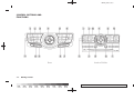
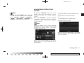
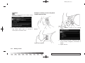
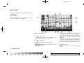
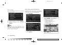
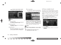
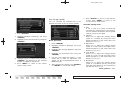
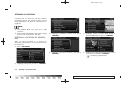
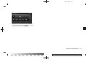
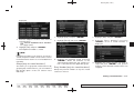
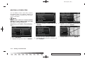
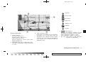
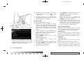
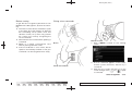
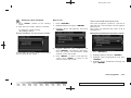
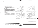
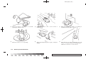
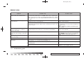
1
Black plate (3,1)
FOREWORD
NISSAN NAVIGATION SYSTEM HELPDESK CONTACT INFORMATION
NISSAN CONSUMER AFFAIRS DEPARTMENT
For assistance or inquiries about the NISSAN
Navigation System, or to order updated mapping DVD-ROMs or additional DVD-ROMs,
contact the NISSAN NAVIGATION SYSTEM
HELPDESK at:
For assistance or inquiries about the NISSAN
warranty, service or general questions, contact
the NISSAN Consumer Affairs Department at:
.
ADDRESS: P .O. Box 2082, Burlingame,
CA 94011
.
E-MAIL: [email protected]
.
WEB SITE: www.zenrin.com or
www.nissan.ca
.
PHONE: 1-888-661-9995
.
HOURS: 6:00 AM to 5:00 PM
(Pacific Time)
For U.S. customers
Nissan North America, Inc.
Consumer Affairs Department
P.O. Box 685003
Franklin, TN 37068-5003
1-800-NISSAN-1
(1-800-647-7261)
For Canadian customers
Nissan Canada Inc.
5290 Orbitor Drive
Mississauga, Ontario L4W 4Z5
1-800-387-0122
Thank you for purchasing a NISSAN vehicle.
This user’s manual is for the navigation system
only. This manual contains operating instructions
for the NISSAN Navigation System offered in
your NISSAN vehicle.
Please read this manual carefully to ensure safe
operation of the navigation system.
.
Because of possible specification changes
and optional equipment, sections of this
manual may not apply to your vehicle.
.
All information, specifications and illustrations in this manual are those in effect at the
time of printing. NISSAN reserves the right
to change specifications or design at any
time without notice.
.
Do not remove this manual from the vehicle
when selling this vehicle. The next user of
this navigation system may need the manual.
Model "NAV2-N" EDITED: 2008/ 10/ 6
Black plate (1,1)
Table of
Contents
Introduction
1
Getting started
2
Map settings
3
Setting a destination
4
Route guidance
5
Storing a location/route
6
Viewing technical information
7
Other settings
8
Voice recognition
9
General system information
10
Troubleshooting guide
11
Index
12
Model "NAV2-N" Edited: 2008/ 10/ 6
Black plate (1,1)
1 Introduction
How to use this manual . . . . . . . . . . . . . . . . . . . . . . . . . . . . . . . . . . . . . . . 1-2
For safe operation . . . . . . . . . . . . . . . . . . . . . . . . . . . . . . . . . . . . . . . . . . . . . . 1-2
Reference symbols . . . . . . . . . . . . . . . . . . . . . . . . . . . . . . . . . . . . . . . . . 1-2
Safety information . . . . . . . . . . . . . . . . . . . . . . . . . . . . . . . . . . . . . . . . . . . . . . 1-3
Laser product. . . . . . . . . . . . . . . . . . . . . . . . . . . . . . . . . . . . . . . . . . . . . . . . . . . . 1-4
Model "NAV2-N" EDITED: 2008/ 10/ 6
Black plate (4,1)
HOW TO USE THIS MANUAL
This manual uses special words, symbols and
icons, organized by function.
Please refer to the following items and familiarize
yourself with them.
FOR SAFE OPERATION
WARNING
This is used to indicate the presence
of a hazard that could cause death or
serious personal injury. To avoid or
reduce the risk, the procedures must
be followed precisely.
CAUTION
This is used to indicate the presence
of a hazard that could cause minor or
moderate personal injury or damage
to your vehicle. To avoid or reduce the
risk, the procedures must be followed
carefully.
NOTE:
REFERENCE SYMBOLS
INFO:
This indicates information that is necessary for
efficient use of your vehicle or accessories.
Reference page:
This indicates the title and page that you should
refer to.
<>:
This indicates a button on the control panel.
[ ]:
This indicates a key/item displayed on the
screen.
Voice Command:
This indicates an operation by voice command.
This indicates an item to help you understand and maximize the performance of
your vehicle. If ignored, it may lead to a
malfunction or poor performance.
1-2
Introduction
Model "NAV2-N" EDITED: 2008/ 10/ 6
Black plate (5,1)
SAFETY INFORMATION
This system is primarily designed to help you
reach your destination, and it also performs
other functions as outlined in this manual.
However, you, the driver, must use the system
safely and properly. Information concerning road
conditions, traffic signs and the availability of
services may not always be up-to-date. The
system is not a substitute for safe, proper and
legal driving.
Before using the navigation system, please read
the following safety information. Always use the
system as outlined in this manual.
WARNING
. When the driver wants to operate
the navigation system or use the
multi-function controller, first park
the vehicle in a safe location and
set the parking brake. Operating
the system while driving can distract the driver and may result in a
serious accident.
. Do not rely on route guidance
alone. Always be sure that all
driving maneuvers are legal and
safe in order to avoid accidents.
system. If you do, it may result in
accidents, fire or electrical shock.
. If you notice any foreign objects in
the system hardware, spill liquid on
the system or notice smoke or a
smell coming from it, stop using the
system immediately and contact a
NISSAN dealer. Ignoring such conditions may lead to accidents, fire
or electrical shock.
CAUTION
. Do not use this system if you notice
any malfunctions such as a frozen
screen or the lack of sound. Continued use of the system may result
in accidents, fire or electrical shock.
. Some states/provinces may have
laws limiting the use of video
screens while driving. Use this
system only where it is legal to do
so.
. Extreme temperature conditions
[below −48F (−208C) and above
1588F (708C)] could affect the performance of the system.
NOTE:
Do not keep the navigation system running
with the engine stopped. Doing so may
discharge the vehicle battery. When you
use the navigation system, always keep
the engine running.
. Do not disassemble or modify this
Introduction 1-3
Model "NAV2-N" EDITED: 2008/ 10/ 6
Black plate (6,1)
LASER PRODUCT
This navigation system is certified as a Class 1
laser product.
The navigation system complies with DHHS
Rules 21 CFR Chapter 1, Subchapter J.
WARNING
. Do not disassemble or modify this
system. There are no user serviceable parts in this navigation system.
Required XM ® Radio and XM NavTraffic ®
monthly subscriptions are sold separately after
a trial period. XM NavTraffic® are only available in
select markets. For more information,
see www.xmradio.com/navtraffic.
. If maintenance, adjustments and
operations other than those specified in this manual are attempted,
injury due to laser radiation and
exposure could occur.
1-4
Introduction
Model "NAV2-N" EDITED: 2008/ 10/ 6
Black plate (4,1)
2 Getting started
Control buttons and functions . . . . . . . . . . . . . . . . . . . . . . . . . . . . . . . 2-2
Control panel . . . . . . . . . . . . . . . . . . . . . . . . . . . . . . . . . . . . . . . . . . . . . . . . 2-3
Multi-function controller . . . . . . . . . . . . . . . . . . . . . . . . . . . . . . . . . . . 2-4
Steering switch. . . . . . . . . . . . . . . . . . . . . . . . . . . . . . . . . . . . . . . . . . . . . . 2-5
Start-up screen . . . . . . . . . . . . . . . . . . . . . . . . . . . . . . . . . . . . . . . . . . . . . . . . . 2-6
Navigation system status screen . . . . . . . . . . . . . . . . . . . . . . . . . . . . 2-7
Functions disabled while driving . . . . . . . . . . . . . . . . . . . . . . . . . . . . 2-8
Menu screen and how to operate. . . . . . . . . . . . . . . . . . . . . . . . . . . 2-9
Menu screens and their purposes . . . . . . . . . . . . . . . . . . . . . . 2-9
Using controls to adjust values, levels, etc.. . . . . . . . . 2-10
Start menu (Murano, Maxima and 370Z) . . . . . . . . . . . . 2-11
List screen . . . . . . . . . . . . . . . . . . . . . . . . . . . . . . . . . . . . . . . . . . . . . . . . . 2-12
Touch panel operation . . . . . . . . . . . . . . . . . . . . . . . . . . . . . . . . . . . . . . . 2-13
Example of touch panel operation . . . . . . . . . . . . . . . . . . . . 2-13
Map menu screen . . . . . . . . . . . . . . . . . . . . . . . . . . . . . . . . . . . . . . . . . . . . 2-14
Current location map screen . . . . . . . . . . . . . . . . . . . . . . . . . . . 2-14
Scrolled location map screen . . . . . . . . . . . . . . . . . . . . . . . . . . 2-15
Storing your home location/address. . . . . . . . . . . . . . . . . . . . . . 2-15
How to store your home . . . . . . . . . . . . . . . . . . . . . . . . . . . . . . . .
Setting a destination . . . . . . . . . . . . . . . . . . . . . . . . . . . . . . . . . . . . . . . . .
Searching for a destination . . . . . . . . . . . . . . . . . . . . . . . . . . . . .
Starting route guidance . . . . . . . . . . . . . . . . . . . . . . . . . . . . . . . . .
Deleting a route . . . . . . . . . . . . . . . . . . . . . . . . . . . . . . . . . . . . . . . . . . .
Operating maps. . . . . . . . . . . . . . . . . . . . . . . . . . . . . . . . . . . . . . . . . . . . . . .
How to view map screen . . . . . . . . . . . . . . . . . . . . . . . . . . . . . . .
Setting the voice guidance . . . . . . . . . . . . . . . . . . . . . . . . . . . . . . . . .
Turning voice guidance ON/OFF. . . . . . . . . . . . . . . . . . . . . .
Adjusting voice guidance volume . . . . . . . . . . . . . . . . . . . . .
How to input letters and numbers . . . . . . . . . . . . . . . . . . . . . . . .
Character (letter and number) input screen . . . . . . . .
Phone number input screen . . . . . . . . . . . . . . . . . . . . . . . . . . . .
NISSAN voice recognition . . . . . . . . . . . . . . . . . . . . . . . . . . . . . . . . . .
Types of Voice Recognition Systems. . . . . . . . . . . . . . . . .
NISSAN voice recognition (type A). . . . . . . . . . . . . . . . . . .
NISSAN voice recognition (type B) . . . . . . . . . . . . . . . . . .
2-15
2-17
2-17
2-19
2-19
2-21
2-21
2-22
2-22
2-23
2-24
2-24
2-25
2-27
2-27
2-28
2-38
Model "NAV2-N" EDITED: 2008/ 10/ 6
Black plate (10,1)
CONTROL BUTTONS AND
FUNCTIONS
2-2
Getting started
Model "NAV2-N" EDITED: 2008/ 10/ 6
Black plate (11,1)
CONTROL PANEL
1 <STATUS>:
&
Push to display the current status of the air
conditioner, radio, audio, vehicle information
(driveable distance and average fuel economy) and navigation systems.
2 <DEST>:
&
Push to enter a destination. Various methods
for entering a destination are available.
“4. Setting a destination”
3 <ROUTE>:
&
Push to access guidance control functions
(guidance cancellation, route priority, waypoint setting on the route, etc.).
4 Multi-function controller:
&
Push to highlight an item on the screen,
select the highlighted item, move on the
map, etc.
Getting started 2-3
Model "NAV2-N" EDITED: 2008/ 10/ 6
Black plate (12,1)
5 <INFO>:
&
10 <MAP>:
&
Push to display the vehicle information and
the navigation information, such as GPS and
version information, etc.
6 <DAY/NIGHT OFF>
&
:
Push to switch between the day screen
(bright) and the night screen (dark). Push
and hold to turn off the display. Push again
to turn on the display.
7 <SETTING>:
&
Push to access the system settings.
8 <VOICE>:
&
Push to repeat voice guidance for a guide
point.
9 <BACK>:
&
Push to return to the previous screen. In a
settings screen, this button can also be
used to apply the setting.
In a character input screen, this button can
also delete the characters that have been
entered.
MULTI-FUNCTION CONTROLLER
Push to display the current location map
screen.
11 <ZOOM IN>, <ZOOM OUT>:
&
Push to switch to the zoom mode to change
the map scale.
INFO:
If <BACK> needs to be pushed to apply the
setting on a settings screen, this manual will
explicitly include a step for this procedure.
Otherwise, pushing <BACK> returns you to
the previous screen.
1 <ENTER>:
&
Push to select the highlighted item on the
screen.
If this button is pushed while a map is
displayed, the map menu screen is displayed.
2 Main directional buttons:
&
Use to move across the map, highlight an
item on the screen or adjust a setting
(volume, brightness, etc.).
3 Additional directional buttons:
&
Use to move across the map or highlight an
item on the character input screen.
2-4
Getting started
Model "NAV2-N" EDITED: 2008/ 10/ 6
Black plate (13,1)
4 Center dial:
&
2
&
Turn to highlight an item on the screen or
adjust a setting.
Turn the center dial on the map screen. The
map scale is displayed. Use the center dial
to adjust the map scale.
3
&
:
Push this button during a setting operation
to return to the previous screen. In a settings
screen, this button can also be used to apply
the setting.
STEERING SWITCH
Murano, Maxima and 370Z
Maxima and 370Z
1 <ENTER>:
&
Murano
:
Use to adjust the volume. These buttons
have the same function as that of the volume
knob. Refer to the vehicle Owner’s Manual.
Tilt to highlight an item on the screen or
adjust a setting. Push to select the highlighted item.
If this button is pushed while a map is
displayed, the map menu screen is displayed.
“MAP MENU SCREEN” (page 2-14)
Push and hold to display the start menu.
“START MENU (Murano, Maxima and
370Z)” (page 2-11)
If this button is tilted up while the audio
function is activated and the map or status
screen is displayed, the audio system can be
operated.
4 <TALK>
&
:
Push to start the voice recognition mode.
Push and hold for 1 second to cancel voice
commands when in the voice recognition
mode.
5 <SOURCE>:
&
Use to switch the audio mode (source).
Refer to the vehicle Owner’s Manual.
Getting started 2-5
Model "NAV2-N" EDITED: 2008/ 10/ 6
Black plate (14,1)
START-UP SCREEN
Armada and Pathfinder
3 Tuning switch:
&
Use to operate the audio system. Refer to
the vehicle Owner’s Manual.
4
&
:
Push to end a call when in the phone mode.
Use to switch the audio mode (source).
Refer to the vehicle Owner’s Manual.
1. The navigation system starts when the
ignition switch is turned to the ACC or ON
position.
1 <VOL>:
&
Use to adjust the volume. This button has
the same function as that of the volume
knob. Refer to the vehicle Owner’s Manual.
2 <TALK>
&
:
Push to start the voice recognition mode.
Push and hold for 1 second to cancel voice
commands when in the voice recognition
mode.
Push and hold when not in the voice
recognition mode to display the phone
screen.
2-6
2. As the start-up screen is displayed, read the
precautions carefully, highlight [OK] and
push <ENTER> or touch [OK].
Getting started
Model "NAV2-N" EDITED: 2008/ 10/ 6
Black plate (15,1)
NAVIGATION SYSTEM STATUS
SCREEN
INFO:
If you do not push <ENTER> for more than 30
seconds, the status screen will be displayed.
Push <DEST>, <MAP>, <ROUTE>,
<INFO>, <SETTING>, <STATUS> or
<TALK> to return to the start-up screen.
By pushing <STATUS> while the current
location map screen is displayed, you can
display the current status of the navigation
system.
Each time <STATUS> is pushed, displayed
information is switched in the order of audio, air
conditioner, vehicle information and navigation
route information.
1 Turning direction at the next intersection
&
2 Distance to the next intersection
&
3 Remaining time to the destination
&
4 Name of the next street
&
INFO:
There are different status screens displayed
depending on various factors, such as the
currently active mode, whether a destination
has been set or not, etc.
When a route to the destination is not set and
the audio system is off, a screen similar to the
one above appears.
When a route to the destination is set and the
audio system is on, a screen similar to the one
above appears.
Getting started 2-7
Model "NAV2-N" EDITED: 2008/ 10/ 6
Black plate (16,1)
FUNCTIONS DISABLED WHILE
DRIVING
To ensure safe driving, some functions cannot
be operated while driving.
The on-screen functions that are not available
while driving will be “grayed-out” or muted.
In some cases, certain text will not be displayed
on the screen.
Park the vehicle in a safe location and then
operate the navigation system.
2-8
Getting started
Model "NAV2-N" EDITED: 2008/ 10/ 6
Black plate (17,1)
MENU SCREEN AND HOW TO
OPERATE
INFO:
Depending on the menu selected, pushing
<MAP> may not return you to the current
location map screen.
MENU SCREENS AND THEIR PURPOSES
Push <DEST>, <ROUTE>, <PHONE>,
<INFO> or <SETTING> to display the corresponding menu screen.
How to select a menu item
Example: <DEST> screen
2. To select the preferred menu item, highlight
the item and push <ENTER>. The next
screen is displayed.
3. Push <BACK> to return to the previous
screen without applying any changes.
Push <MAP> to return to the current
location map screen without applying any
changes.
1. Turn the center dial clockwise or counterclockwise or push the up or down button of
the main directional buttons. An item is
highlighted accordingly.
Getting started 2-9
Model "NAV2-N" EDITED: 2008/ 10/ 6
Black plate (18,1)
INFO:
This same adjustment can also be made by the
touch panel operation.
“Adjusting the volume and others” (page
2-13)
USING CONTROLS TO ADJUST VALUES, LEVELS, ETC.
There are four main methods you can use to
control the navigation system: the center dial,
the main directional buttons, the touch panel
and the steering switch. Use these controls to
adjust the volume of phone and voice guidance,
the display brightness, etc.
How to adjust
1. Highlight the preferred setting item and
push <ENTER>. The color of the corresponding adjustment item changes.
2. Use one of the controls, and the value or bar
indicating levels increases or decreases
accordingly.
3. Push <ENTER> or <BACK> to apply the
setting.
2-10 Getting started
Model "NAV2-N" EDITED: 2008/ 10/ 6
Black plate (19,1)
START MENU (Murano, Maxima and
370Z)
The start menu can be displayed using the
steering switch.
1. Push and hold <ENTER> on the steering
switch.
2. Highlight the preferred item and push
<ENTER>.
INFO:
<ENTER> on the steering switch can be used
to display the start menu only when the map or
status screen is displayed.
Available items
. Destination:
Displays the destination screen. It is the
same screen that appears when you push
<DEST>.
“4. Setting a destination”
. Route:
Displays the route screen. It is the same
screen that appears when you push
<ROUTE>.
“5. Route guidance”
. Information:
Displays the information screen. It is the
same screen that appears when you push
<INFO>.
“7. Viewing technical information”
. Settings:
Displays the settings screen. It is the same
screen that appears when you push
<SETTING>.
“4. Setting a destination”
Getting started 2-11
Model "NAV2-N" EDITED: 2008/ 10/ 6
Black plate (20,1)
the selected item. Turn the center dial or
push the up or down buttons of the main
directional buttons to scroll the list.
5 Highlight
&
and push <ENTER> to sort the
list by shortest distance.
6 Highlight
&
and push <ENTER> to sort the
list in the original order.
7 When
&
the list is sorted by the shortest
distance, you can confirm the selected
location in the preview on the right side of
the screen.
LIST SCREEN
After searching for a point of interest, a list
screen is displayed.
Depending on the list displayed, it can be
sorted.
Items displayed in a list
1 Highlight the preferred item from the list and
&
push <ENTER> to select it.
If a location or facility name is not completely
displayed (due to length), highlight the item
and push the right button of the main
directional buttons to show the hidden part
of the name.
You can also display the hidden part of the
name by touching
.
2 Distance from the current location
&
3 Direction to the point of interest
&
4 If the entire list cannot be displayed on the
&
screen, the system displays the total number
of items in the list and the entry number of
2-12 Getting started
Model "NAV2-N" EDITED: 2008/ 10/ 6
Black plate (21,1)
TOUCH PANEL OPERATION
With this system, the same operations as those
for the multi-function controller are possible
using the touch panel operation.
This manual describes the operations using the
multi-function controller.
For the operations that differ from those of the
multi-function controller and for useful methods
for using the touch panel operation, refer to each
section.
EXAMPLE OF TOUCH PANEL OPERATION
Here, the operation examples performed with
the touch panel operation are described.
Adjusting the volume and others
Inputting letters and numbers
Touch [+] or [−] located on the right and left of
the bar graph to perform the adjustment.
1. Touch the letter or number.
Scrolling the message or list
Selecting the item
When the item is touched, the following screen
is displayed.
2. When you desire to delete a character,
touch [Delete]. Push and hold [Delete] to
delete all of the characters.
Touching [UP] or [DOWN] allows you to scroll
the message or list.
Getting started 2-13
Model "NAV2-N" EDITED: 2008/ 10/ 6
Black plate (22,1)
MAP MENU SCREEN
Push <ENTER> while the current location map
screen or a scrolled map screen is displayed to
display the menu corresponding to that screen.
This menu allows you to quickly use helpful
functions, such as setting a destination easily
and searching for Points of Interest nearby.
To select a menu item, use the method
described in “Menu screen types and how to
operate”.
INFO:
With the touch operation, the same screen can
be displayed by touching [Map Menu] located
on the map screen.
CURRENT LOCATION MAP SCREEN
If <ENTER> is pushed while the current
location map screen is displayed, the following
options are available.
. Store Location:
Allows you to store the current vehicle
location in the Address Book. The stored
location can be retrieved as necessary to set
it as a destination (waypoint).
“STORING A LOCATION” (page 6-2)
. Nearby:
Allows you to search for points of interest
near the current vehicle location, such as
restaurants and gas stations, etc.
“SETTING A NEARBY PLACE” (page
4-14)
. Map Settings:
Performs the map operations such as the
switching of map type and the setting of
map orientation and scale.
“OTHER SETTINGS FOR THE MAP
SCREEN” (page 3-12)
. Landmark Icons:
Allows you to display certain points of
interest near the current vehicle location on
the map, such as restaurants and gas
stations, etc.
“DISPLAYING LANDMARK ICONS”
(page 3-19)
. Store Tracking:
Allows you to store in the Address Book the
route that you have travelled from the
starting point to the current location.
“STORING A TRACKED ROUTE”
(page 6-6)
. Guide Screen:
Set the default display screen for route
guidance.
“Visual guidance settings” (page 518)
2-14 Getting started
Model "NAV2-N" EDITED: 2008/ 10/ 6
Black plate (23,1)
STORING YOUR HOME LOCATION/
ADDRESS
SCROLLED LOCATION MAP SCREEN
If <ENTER> is pushed while a scrolled map
screen is displayed, the following options are
available.
. New Dest.:
Allows you to set the destination to the map
location where you pushed <ENTER>. If a
destination is already set, the location will be
set as the new destination.
“SETTING FROM MAP” (page 4-23)
. Add to Route:
Allows you to set the map location where
you pushed <ENTER> as the destination or
a waypoint.
This is available only when the suggested
route is already set.
“Setting a destination or waypoint”
(page 5-7)
. Nearby:
Allows you to search for points of interest
near the map location where you pushed
<ENTER> and set it as a destination or
waypoint.
Use the same search method as the one for
POI.
“SETTING A NEARBY PLACE” (page
4-14)
. Store Location:
Allows you to store the map location where
you pushed <ENTER> in the Address
Book. The stored location can be retrieved
to set it as a destination or waypoint.
“STORING A LOCATION” (page 6-2)
. Delete:
Allows you to delete a stored location,
destination or waypoint. To delete it, place
the cross pointer over the corresponding
icon.
. Incident Details:
Can be selected only when the traffic
information icon is displayed.
Displays the details of the traffic information
icon that is being displayed.
Place the cross pointer over the icon you
desire to check.
Please note that incident details are a
feature of Traffic Information, and that an
XM NavTraffic® subscription is required in
order to receive Traffic Information.
HOW TO STORE YOUR HOME
If your home location is already stored in the
Address Book, it can be easily retrieved to set
the route to your home.
The procedure to store your home location is the
same as for storing any other location.
“4. Setting a destination”
As an example, the procedure for storing your
home location by searching for a destination by
address is described here.
1. Push <DEST>.
Getting started 2-15
Model "NAV2-N" EDITED: 2008/ 10/ 6
Black plate (24,1)
2. Highlight [Home Location (Add New)] and
push <ENTER>.
3. A confirmation message is displayed. Confirm the contents of the message, highlight
[Yes] and push <ENTER>.
4. Highlight [Street Address] and push
<ENTER>. A character input screen is
displayed.
5. Enter the address of your home, highlight
[OK] and push <ENTER>.
The map screen is displayed.
“SETTING A STREET ADDRESS”
(page 4-4)
6. Pushing the directional buttons, adjust your
home location if necessary.
7. After adjusting the location, push
<ENTER>.
8. A message is displayed and your home
location is stored.
9. Push <MAP> to return to the current
location map screen.
The home icon is displayed on the map.
2-16 Getting started
Model "NAV2-N" EDITED: 2008/ 10/ 6
Black plate (25,1)
SETTING A DESTINATION
INFO:
You can also perform the same setting by
pushing <SETTING> and selecting [Navigation].
“STORING A LOCATION BY SEARCHING” (page 6-2)
SEARCHING FOR A DESTINATION
As an example, the method for setting an airport
as the destination using [Points of Interest] is
described here.
3. Highlight [Travel] and push <ENTER>.
1. Push <DEST>.
4. From the category list, highlight [AIRPORT]
and push <ENTER>.
2. Highlight [Points of Interest] and push
<ENTER>.
Getting started 2-17
Model "NAV2-N" EDITED: 2008/ 10/ 6
Black plate (26,1)
INFO:
You can enter the city name and facility
name to narrow down your search.
The number of narrowed down points are
displayed in the “Matches” column.
5. Highlight [By Name] and push <ENTER>.
A character input screen is displayed.
8. The selected destination is displayed at the
center of the map. Highlight [Start] after
confirming the location of the displayed
destination, and push <ENTER>.
INFO:
7. Highlight the preferred airport from the list
and push <ENTER>.
INFO:
.
6. Highlight [List] and push <ENTER>.
A list screen is displayed.
.
By selecting [By Dist.], you can sort the
list by the shortest distance.
The position of the selected location is
displayed in the preview on the right
side of the screen.
.
.
The system sets the destination to the
selected location and starts calculating
a route.
Even after setting a destination, you can
adjust the location of the destination,
store the route, etc. if necessary.
“OPERATIONS AFTER SETTING
A DESTINATION” (page 4-24)
2-18 Getting started
Model "NAV2-N" EDITED: 2008/ 10/ 6
Black plate (27,1)
STARTING ROUTE GUIDANCE
DELETING A ROUTE
After setting the destination and performing
route calculation, the suggested route is displayed.
To delete a route already set, use the following
procedure. If you delete a route, the destination
is also deleted.
1. Highlight [Start] and push <ENTER>.
3. When approaching a guide point, the
system automatically changes to the split
screen and shows an enlarged view of the
intersection in the left screen.
Push <MAP> to switch to the full map
screen.
1. Push <ROUTE>.
2. Once route guidance is started, the system
navigates you through the guide points
using visual and voice guidance.
4. When arriving at the destination, route
guidance automatically ends.
2. Highlight [Cancel Route] and push
<ENTER>.
Getting started 2-19
Model "NAV2-N" EDITED: 2008/ 10/ 6
Black plate (28,1)
3. A confirmation message is displayed. Highlight [Yes] and push <ENTER>.
INFO:
If a route is cancelled, [Cancel Route] changes
to [Resume Route].
Highlight [Resume Route] and push <ENTER>
to reactivate the cancelled route.
This is available only until a new route is set.
2-20 Getting started
Model "NAV2-N" EDITED: 2008/ 10/ 6
Black plate (29,1)
OPERATING MAPS
4
&
Waypoint:
Displays the locations that you travel past
when going to the destination. A maximum
of 5 waypoints can be set.
5
&
Destination:
Indicates the destination location of the
route guidance.
When the map scale is 300 ft (100 m) or
less in Plan View, or 1/4 mile (500 m) or less
in BirdviewTM: The name is displayed on the
map screen.
6 Suggested route:
&
Appears in bold yellow during route guidance.
HOW TO VIEW MAP SCREEN
2
&
Displays the vehicle location, with which the
route is set, as the starting point.
The navigation system displays various information on the map screen.
Screen information
1
&
Vehicle icon:
Indicates the current vehicle location and
the direction that you are traveling.
Starting point:
3
&
Guide point:
Indicates a guide point on the route.
7
&
Map Menu icon:
Touch the icon to display the Map Menu
screen.
“MAP MENU SCREEN” (page 2-14)
8
&
/
Direction indicator:
Indicates the direction of the map.
Touch the icon to switch the direction of the
map.
“SETTINGS OF HEADING/LONG
RANGE MAP VIEW” (page 3-14)
Getting started 2-21
Model "NAV2-N" EDITED: 2008/ 10/ 6
Black plate (30,1)
SETTING THE VOICE GUIDANCE
9
&
Scale indicator:
Indicates the scale of the map.
Touch the icon to display the scale bar. This
allows the map scale to be adjusted.
“OPERATING WITH THE TOUCH OPERATION” (page 3-10)
TURNING VOICE GUIDANCE ON/OFF
You can activate or deactivate voice guidance
and adjust the volume.
10 Street name:
&
Displays the name of the street that you are
currently driving on.
3. Highlight [Guidance Voice] and push
<ENTER>. The indicator illuminates if voice
guidance is activated.
Other settings
1. Push <ROUTE>.
2. Highlight [Guidance Settings] and push
<ENTER>.
You can also activate or deactivate voice
guidance using the following procedure.
1) Push <SETTING>.
2) Highlight [Volume and Beeps] and push
<ENTER>.
3) Highlight [Guidance Voice] and push
2-22 Getting started
Model "NAV2-N" EDITED: 2008/ 10/ 6
Black plate (31,1)
<ENTER>.
ADJUSTING VOICE GUIDANCE VOLUME
You can adjust the volume of voice guidance.
3. Highlight [Guidance Vol.] and push
<ENTER>.
Murano
1. Push <SETTING>.
4. Adjust the voice guidance volume by using
the center dial or main directional buttons.
Armada and Pathfinder
2. Highlight [Volume and Beeps] and push
<ENTER>.
Getting started 2-23
Model "NAV2-N" EDITED: 2008/ 10/ 6
Black plate (32,1)
HOW TO INPUT LETTERS AND
NUMBERS
CHARACTER (letter and number) INPUT
SCREEN
You will have to enter alphanumeric characters
when setting a destination, searching for a
facility or editing the stored locations, etc.
Maxima and 370Z
INFO:
You can also adjust the volume by turning the
audio system volume knob or pushing +/− on
the steering switch while voice guidance is
being announced (Murano, Maxima and 370Z)
or tilting <VOL> on the steering switch (Armada
and Pathfinder).
1. Use the touch panel, center dial, main
directional buttons or additional directional
buttons to highlight a character on the
displayed keyboard.
3. Push <BACK>, or highlight [Delete] and
push <ENTER> to delete the last character
entered.
Push and hold <BACK> to delete all the
characters entered.
Highlight [Space] and push <ENTER> to
enter a space.
4. After finishing the entry, highlight [List] and
push <ENTER>.
2. Push <ENTER>. The highlighted character
is entered.
2-24 Getting started
Model "NAV2-N" EDITED: 2008/ 10/ 6
Black plate (33,1)
INFO:
.
.
.
.
You can push <BACK> on the control
panel to return to the previous screen,
but only after deleting all the characters
entered.
When you touch [BACK] on the screen,
the screen returns to the previous
screen even when characters have been
entered.
When the character that you have
entered can only be followed by one
other character, that character is entered automatically.
When you have entered text and narrowed down the matching list items to a
number that will fit on the screen, the list
screen appears automatically.
.
Symbol keys are displayed by highlighting [Symbols] and pu shing
<ENTER>. Alphabet keys are displayed
by highlighting [A-Z] and pushing
<ENTER>.
1. Use the touch panel, center dial, main
directional buttons or additional directional
buttons to highlight a number on the
displayed keyboard.
Symbol input screen
PHONE NUMBER INPUT SCREEN
You can enter a phone number as a search
method to look for a point of interest.
INFO:
Only the locations included in the database in
the map data can be searched by the phone
number.
2. Push <ENTER>. The highlighted number is
entered.
Getting started 2-25
Model "NAV2-N" EDITED: 2008/ 10/ 6
Black plate (34,1)
INFO:
. You can push <BACK> on the control
panel to return to the previous screen, but
only after deleting all the numbers entered.
. When you touch [BACK] on the screen, the
screen returns to the previous screen even
when numbers have been entered.
3. Push <BACK>, or highlight [Delete] and
push <ENTER> to delete the last number
entered.
Push and hold <BACK> to delete all the
numbers entered.
4. After finishing the entry, highlight [Map] and
push <ENTER>.
2-26 Getting started
Model "NAV2-N" EDITED: 2008/ 10/ 6
Black plate (35,1)
NISSAN VOICE RECOGNITION
TYPES OF VOICE RECOGNITION
SYSTEMS
There are two types of NISSAN Voice
Recognition systems:
. Type A: Equipped on all models except
Murano produced for Canada before
11/2008
. Type B: Equipped on Murano produced
for Canada before 11/2008
Please read the sections of this manual
that are applicable to your Voice Recognition system.
All applicable NISSAN vehicles and Murano
vehicles produced for Canada after 11/2008
are equipped with the type A Voice Recognition
system.
“NISSAN VOICE RECOGNITION (type
A)” (page 2-28) (page 9-3)
Murano produced for Canada before 11/2008
are equipped with the type B Voice Recognition
system.
“NISSAN VOICE RECOGNITION (type
B)” (page 2-38) (page 9-33)
Identifying month and year of vehicle
production (for Murano produced for
Canada)
Murano produced for Canada after 11/2008 is
equipped with the type A Voice Recognition
system, while Murano produced before
11/2008 is equipped with the type B Voice
Recognition system.
The month and year of manufacture of your
vehicle are printed on the Federal/Canadian
Motor Vehicle Safety Standards (F.M.V.S.S./C.
M.V.S.S.) certification label affixed to your
vehicle as shown.
Getting started 2-27
Model "NAV2-N" EDITED: 2008/ 10/ 6
Black plate (36,1)
NISSAN VOICE RECOGNITION
(type A)
All applicable NISSAN vehicles and Murano vehicles produced for Canada after
11/2008 are equipped with the type A
Voice Recognition system. The type A
Voice Recognition system operation is
explained in this section. For the type B
Voice Recognition system operation, refer
to the “NISSAN VOICE RECOGNITION
(type B)” section in this manual.
Type A NISSAN Voice Recognition allows
hands-free operation of the navigation system
and other systems equipped on this vehicle, in
one of two modes, Standard Mode or Alternate
Command Mode. In Standard Mode, you can
operate Phone and Information.
The commands that are available are always
shown on the display and announced by the
system. You can complete your desired operation by simply following the prompts given by the
system. In Standard Mode, hands–free operation of Audio, Climate Control and Display is not
available through Voice Recognition.
For U.S. customers, Standard Mode is selected
by default. For Canadian customers, Alternate
Command Mode is the default mode.
INFO:
. For the voice commands for the audio, air
conditioner and other systems, refer to the
Owner’s Manual of your vehicle. The following sections refer only to the navigation,
phone, and information systems.
. When the system language is set to
“Franc¸ais” (French) the available commands
and functions differ from those available
when using the system in English.
Using the system
vibration sounds, etc.), which may prevent
the system from correctly recognizing the
voice commands.
. Wait until the tone sounds before speaking a
command.
. Speak in a natural conversational voice
without pausing between words.
. If the air conditioner is set to “Auto”, the fan
speed is automatically lowered so that your
commands can be recognized more easily.
Giving voice commands
Initialization:
When the ignition switch is pushed to the ON
position, NISSAN Voice Recognition is initialized, which takes a few seconds. When
completed, the system is ready to accept voice
commands. If <TALK> is pushed before the
initialization completes, the display will show the
message: “Phonetic data downloading. Please
wait.”
Before starting
To get the best recognition performance from
NISSAN Voice Recognition, observe the following:
. The interior of the vehicle should be as quiet
as possible. Close the windows to eliminate
the surrounding noises (traffic noise and
Murano
2-28 Getting started
Model "NAV2-N" EDITED: 2008/ 10/ 6
Black plate (37,1)
Armada and Pathfinder
2. A list of commands appears on the screen,
and the system provides the voice menu
prompt “Would you like to access Phone,
Navigation, Information or Help?”.
3. After the tone sounds and the icon on the
screen changes from [
] to [
], speak
a command.
4. Continue to follow the voice menu prompts
and speak after the tone sounds until your
desired operation is completed.
Operating tips:
Maxima and 370Z
1. Push <TALK> located on the steering
switch.
. Say a command after the tone.
. Commands that are available are always
shown on the display and spoken through
voice menu prompts. Commands other than
those that are displayed are not accepted.
Please follow the prompts given by the
system.
. If the command is not recognized, the
system announces, “Please say again”.
Repeat the command in a clear voice.
. Murano, Maxima and 370Z: Push <BACK>
once to return to the previous screen.
Armada and Pathfinder: Push <TALK>
once to return to the previous screen.
. If you want to cancel the command, push
and hold <TALK>. The message, “Voice
cancelled” will be announced.
. Murano, Maxima and 370Z: Push <TALK>
to pause the operation. Push <TALK>
again to restart the operation.
Armada and Pathfinder: When you do not
say a command, the system pauses the
operation. Push <TALK> to restart the
operation.
. If you want to adjust the volume of the
system feedback, push the volume control
buttons [+] or [−] on the steering switch or
use the audio system volume knob while the
system is making an announcement.
Getting started 2-29
Model "NAV2-N" EDITED: 2008/ 10/ 6
Black plate (38,1)
Command List:
Category Command
Command
Action
Navigation
Operates Navigation function.
Phone
Operates Phone function.
Information
Displays vehicle Information function.
Displays User Guide.
Help
Navigation Command
Command
Action
Address
Searches for a location by the street address specified, and sets a route (for continental U.S. only).
Places
Sets a route to a facility near the current vehicle location.
Home
Sets a route to your home that is stored in the Address book.
Sets a route to a previous destination.
Previous Destinations
Phone Command
Command
Action
Dial Number
Makes a call to a spoken phone number up to 10 digits.
Redial
Makes a call to the latest dialed number.
Phonebook
Makes a call to a contact that is stored in the Phonebook.
International Call
Makes an international call by allowing more than 10 digits to be spoken.
Corrects the phone number when it is not recognized (available during phone number entry).
Change Number
2-30 Getting started
Model "NAV2-N" EDITED: 2008/ 10/ 6
Black plate (39,1)
Information Command
Command
Action
Fuel Economy
Displays fuel economy information.
Trip Computer (for Armada and Pathfinder only) Displays trip information.
Maintenance
Traffic Info.
Displays maintenance information.
Turns the traffic information system ON and OFF.
Getting started 2-31
Model "NAV2-N" EDITED: 2008/ 10/ 6
Black plate (40,1)
Voice command examples
To use the voice recognition function, speaking
one command is sometimes sufficient, but at
other times it is necessary to speak two or more
commands. As examples, some additional basic
operations that are performed by voice commands are described here.
Example 1: Setting a destination by a
street address:
Armada and Pathfinder
2. The system announces, “Would you like to
access Phone, Navigation, Information or
Help?”.
3. Speak “Navigation”.
Murano
4. Speak “Address”.
Maxima and 370Z
1. Push <TALK> located on the steering
switch.
2-32 Getting started
Model "NAV2-N" EDITED: 2008/ 10/ 6
Black plate (41,1)
5. Speak the name of the state, “California”.
7. Speak the name of the street, “South
Figueroa street”.
INFO:
6. Speak the name of the city, “Gardena”.
Only the official street names stored in the
map database can be recognized by the
system. To improve accuracy, speak the
street name precisely and include Boulevard, Way, North, South, etc., if known. If you
are unsure of the full name, speaking only
the name such as “Figueroa” is acceptable,
but recognition accuracy may be reduced.
8. Voice feedback will be provided when the
command is accepted, and the list of street
names appears.
9. After the tone sounds and the icon on the
screen changes again, speak “One”.
10. Speak the house number.
“How to speak numbers” (page 9-6)
Getting started 2-33
Model "NAV2-N" EDITED: 2008/ 10/ 6
Black plate (42,1)
INFO:
If you do not know the house number, speak
“No house number”.
Example 2: Placing a call to the phone
number 800-662-6200:
Maxima and 370Z
11. To confirm the destination location on the
map, speak “Show map”. To calculate a
route, speak “Calculate route”.
Murano
Armada and Pathfinder
1. Push <TALK> located on the steering
switch.
2. The system announces, “Would you like to
access Phone, Navigation, Information or
Help?”.
3. Speak “Phone”.
2-34 Getting started
Model "NAV2-N" EDITED: 2008/ 10/ 6
Black plate (43,1)
6. The system announces, “Please say next
three digits or dial, or say change number”.
Speak “662”.
4. Speak “Dial Number”.
9. The system makes a call to 800-662-6200.
INFO:
7. The system announces, “Please say last four
digits or say change number”. Speak
“6200”.
5. Speak “800”.
8. The system announces, “Dial or Change
Number?”. Speak “Dial”.
. You can also speak “800-662-6200” (10
continuous digits) or “662-6200” (7 continuous digits), if the area code is not
necessary. However the 3-3-4 digit grouping is recommended for improved recognition.
“How to speak numbers” (page 9-41)
. The NISSAN voice recognition system is not
limited to recognizing phone numbers of
only 7 or 10 digits. To dial a number in a
format other than the 3-3-4 digit grouping,
use the “International Call” command.
. If you say “Change Number” during phone
number entry, the system will automatically
request that you repeat the number using
the 3-3-4 format. In this case please say the
area code first and then follow the prompts.
Getting started 2-35
Model "NAV2-N" EDITED: 2008/ 10/ 6
Black plate (44,1)
. Do not add a “1” in front of the area code
when speaking phone numbers.
. If the system does not recognize your
command, please try repeating the command using a natural voice. Speaking too
slow or too loudly may further decrease
recognition performance.
Example 3: Placing an international call to
the phone number 011-81-111-222-3333:
Armada and Pathfinder
2. The system announces, “Would you like to
access Phone, Navigation, Information or
Help?”.
3. Speak “Phone”.
Murano
4. Speak “International Call”.
Maxima and 370Z
1. Push <TALK> located on the steering
switch.
2-36 Getting started
Model "NAV2-N" EDITED: 2008/ 10/ 6
Black plate (45,1)
5. Speak “01181111222333”.
7. The system makes a call to 011-81-111222-3333.
INFO:
Any digit input format is available in the
International Number input process.
6. Speak “Dial”.
Getting started 2-37
Model "NAV2-N" EDITED: 2008/ 10/ 6
Black plate (46,1)
NISSAN VOICE RECOGNITION
(type B)
Murano vehicles produced for Canada
before 11/2008 are equipped with the type
B Voice Recognition system. The type B
Voice Recognition system operation is
explained in this section. For the type A
Voice Recognition system operation, refer
to the “NISSAN VOICE RECOGNITION
(type A)” section in this manual.
Type B NISSAN Voice Recognition allows
hands-free operation of the navigation system
and other systems equipped on this vehicle,
such as the display, audio, climate control and
phone.
help list. For information about the operations of
other functions, refer to the vehicle Owner’s
Manual.
Example: Displaying the navigation command list
1. Push <INFO>.
2. Highlight [Others] and push <ENTER>.
3. Highlight [Voice Recognition] and push
<ENTER>.
INFO:
For the voice commands for the audio, air
conditioner and other systems (except navigation system), refer to the vehicle Owner’s
Manual.
Confirming voice commands
If you are controlling the system by voice
commands for the first time or do not know the
appropriate voice command, confirm the voice
command lists.
The following information describes how to
display the navigation command list and the
5. Highlight [Navigation] and push <ENTER>.
4. Highlight [Command List] and push
<ENTER>.
6. Highlight the preferred item and push
<ENTER>.
Available items:
.
Destination:
Allows you to set a destination.
.
Search:
Allows you to search for a location.
.
Map:
Allows you to change the map settings.
.
Route:
Allows you to set a route in detail.
.
Others:
Allows you to store locations or set the
route guidance.
2-38 Getting started
Model "NAV2-N" EDITED: 2008/ 10/ 6
Black plate (47,1)
. Wait until the tone sounds before speaking a
command. Otherwise, the command will not
be recognized properly.
. Speak in a natural conversational voice
without pausing between words.
. If the air conditioner is set to “Auto”, the fan
speed is automatically lowered so that your
commands can be recognized more easily.
7. You can confirm the list by scrolling the
screen using the up and down switches of
the main directional buttons or the center
dial.
8. Press <BACK> to return to the previous
screen.
For further details about the displayed command
list, refer to section 9.
“Command List” (page 9-34)
Example 1: Switching the map to the Plan
View mode:
Voice command examples
To use the voice recognition function, speaking
one command is sometimes sufficient, but at
other times it is necessary to speak two or more
commands.
As examples, some additional basic operations
by voice commands are described here.
1. Push <TALK> located on the steering
switch.
Before starting
To get the best recognition performance out of
NISSAN Voice Recognition, observe the following:
. The interior of the vehicle should be as quiet
as possible. Close the windows to eliminate
the surrounding noises (traffic noise and
vibration sounds, etc.), which may prevent
the system from correctly recognizing the
voice commands.
2. The system announces, “Please say a
command”.
3. After the tone sounds and the icon on the
screen changes from [
] to [
], speak
Getting started 2-39
Model "NAV2-N" EDITED: 2008/ 10/ 6
Black plate (48,1)
“Plan View Map”.
4. Voice feedback will be provided when the
command is accepted, and the map is
displayed in Plan View.
Example 2: Setting a destination using a
nearby place:
1. Push <TALK> located on the steering
switch.
2. The system announces, “Please say a
command”.
6. If a route is already set, choose “Along
Route” or “Nearby”.
3. After the tone sounds and the icon on the
screen changes from [
] to [
], speak
“Destination nearby places”.
7. After the tone sounds and the icon on the
screen changes again, speak “Along Route”.
4. Voice feedback will be provided when the
command is accepted, and the list of POI
categories appears.
8. Voice feedback will be provided when the
command is accepted, and the list of Points
of Interest in the category specified in the
previous step appears.
5. After the tone sounds and the icon on the
screen changes again, speak “Three”.
9. After the tone sounds and the icon on the
screen changes again, speak “Three”.
2-40 Getting started
Model "NAV2-N" EDITED: 2008/ 10/ 6
Black plate (49,1)
10. Voice feedback will be provided when the
command is accepted, and the system
starts calculating a route to the selected
facility.
2. The system announces, “Please say a
command”.
5. Speak the name of the city, “Gardena”.
3. Speak “Destination street address”.
Example 3: Setting a destination by a
street address:
6. Speak the name of the street, “South
Figueroa street”.
4. Speak the name of the state, “California”.
1. Push <TALK> located on the steering
switch.
Getting started 2-41
Model "NAV2-N" EDITED: 2008/ 10/ 6
Black plate (50,1)
INFO:
.
.
Only the official street names stored in
the map data can be recognized by the
system.
You need to speak the street name
precisely including boulevard, way,
north, south, etc. In this case, you
cannot speak “Figueroa street” or “Figueroa”.
9. Speak the house number.
“How to speak numbers” (page 9-41)
INFO:
If you do not know the house number, speak
“No house number”.
7. Voice feedback will be provided when the
command is accepted, and the list of street
names appears.
8. After the tone sounds and the icon on the
screen changes again, speak “One”.
10. To confirm the destination location on the
map, speak “Show map”. To calculate a
route, speak “Calculate route”.
2-42 Getting started
Model "NAV2-N" EDITED: 2008/ 10/ 6
Black plate (51,1)
MEMO
Getting started 2-43
Model "NAV2-N" EDITED: 2008/ 10/ 6
Black plate (52,1)
MEMO
2-44 Getting started
Model "NAV2-N" EDITED: 2008/ 10/ 6
Black plate (7,1)
3 Map settings
Map types . . . . . . . . . . . . . . . . . . . . . . . . . . . . . . . . . . . . . . . . . . . . . . . . . . . . . . . . 3-2
Plan View . . . . . . . . . . . . . . . . . . . . . . . . . . . . . . . . . . . . . . . . . . . . . . . . . . . . . 3-2
BirdviewTM. . . . . . . . . . . . . . . . . . . . . . . . . . . . . . . . . . . . . . . . . . . . . . . . . . . . 3-3
Building graphics . . . . . . . . . . . . . . . . . . . . . . . . . . . . . . . . . . . . . . . . . . . 3-3
Returning to the current vehicle location . . . . . . . . . . . . . . . . . . 3-4
Operating with the touch operation . . . . . . . . . . . . . . . . . . . . 3-5
Moving a map . . . . . . . . . . . . . . . . . . . . . . . . . . . . . . . . . . . . . . . . . . . . . . . . . . . 3-5
Plan View . . . . . . . . . . . . . . . . . . . . . . . . . . . . . . . . . . . . . . . . . . . . . . . . . . . . . 3-5
BirdviewTM. . . . . . . . . . . . . . . . . . . . . . . . . . . . . . . . . . . . . . . . . . . . . . . . . . . . 3-7
Changing the scale of a map . . . . . . . . . . . . . . . . . . . . . . . . . . . . . . . . 3-9
Operating with the buttons on the control panel . . . . 3-9
Operating with the center dial . . . . . . . . . . . . . . . . . . . . . . . . . 3-10
Operating with the touch operation . . . . . . . . . . . . . . . . . .
Map scale . . . . . . . . . . . . . . . . . . . . . . . . . . . . . . . . . . . . . . . . . . . . . . . . . .
Other settings for the map screen. . . . . . . . . . . . . . . . . . . . . . . .
Switching the map view. . . . . . . . . . . . . . . . . . . . . . . . . . . . . . . . .
Settings of heading/long range map view. . . . . . . . . . .
Changing the BirdviewTM angle . . . . . . . . . . . . . . . . . . . . . . .
Operation with split screen display . . . . . . . . . . . . . . . . . . .
Looking at information on the map . . . . . . . . . . . . . . . . . . . . . . .
Displaying landmark icons . . . . . . . . . . . . . . . . . . . . . . . . . . . . . .
Map scrolling information . . . . . . . . . . . . . . . . . . . . . . . . . . . . . . .
Map symbols. . . . . . . . . . . . . . . . . . . . . . . . . . . . . . . . . . . . . . . . . . . . . . .
3-10
3-11
3-12
3-12
3-14
3-16
3-17
3-19
3-19
3-20
3-22
Model "NAV2-N" EDITED: 2008/ 10/ 6
Black plate (54,1)
MAP TYPES
Two types of map views are available: Plan View
and BirdviewTM.
PLAN VIEW
Plan View displays the map in a 2-dimensional
environment similar to a road map.
Screen information
1
&
Vehicle icon:
Indicates the current vehicle location and
the direction that you are traveling.
2
&
Guide point:
Indicates a guide point on the route.
3
&
3-2
Remaining time and distance to the
destination:
Indicates the approximate remaining time
and distance to the destination or waypoint.
This indicator will appear when you set the
destination or waypoint and start route
guidance.
When you are not driving on the suggested
route, the screen displays the direction to
the destination and the distance to the
destination from the current vehicle position.
4 Suggested route:
&
Appears in bold yellow during route guidance.
Map settings
Model "NAV2-N" EDITED: 2008/ 10/ 6
Black plate (55,1)
5
&
/
Direction indicator:
Indicates the direction of the map.
Touch the icon to switch the direction of the
map.
6
&
Scale indicator:
Indicates the scale of the map.
Touch the icon to display the scale bar.
This allows the map scale to be adjusted.
7
&
Arrow:
Indicates the distance to the next guide
point and the turning direction at that guide
point.
8
&
Stored location:
Displays the locations that are stored in the
Address Book. You can change the icons
according to your preferences.
9
&
10 Street name:
&
Displays the name of the street that you are
currently driving on.
11
&
Traffic indicator:
Displays the reception condition of traffic
information transmitted from the provider.
Green: Reception condition is good.
Gray: Reception condition is not good.
No mark: Subscription to XM NavTraffic®
service is not detected.
BirdviewTM
BirdviewTM displays the map from an elevated
perspective. In BirdviewTM, it is easy to recognize an image of the route because it provides a
panoramic view over a long distance.
INFO:
About the BirdviewTM display
. “BirdviewTM” is a registered trademark of
Xanavi Informatics Corporation.
. The map in BirdviewTM always appears with
the current forward direction facing up.
BUILDING GRAPHICS
In the area where the building graphics are
stored in the map data, the building graphics are
displayed when the map is zoomed in. On the
Plan View display, these are called “Building
footprint graphics”, and on the BirdviewTM
display, these are called “3D building graphics”.
How to look at the map is the same for Plan
View and BirdviewTM.
Avoid Area:
Displays the areas to avoid that are stored in
the Address Book with green or blue icons.
During the route search, the route guidance
is performed by searching for a route that
avoids those areas.
Building footprint graphics (Plan View)
Map settings 3-3
Model "NAV2-N" EDITED: 2008/ 10/ 6
Black plate (56,1)
RETURNING TO THE CURRENT
VEHICLE LOCATION
3D building graphics (BirdviewTM)
INFO:
In the area where the building graphics are not
stored in the map data, the normal map is
displayed even when the map is zoomed in.
The basic map screen displays the current
location (the position where the vehicle mark is
located). The current location can be displayed
again even after the map is moved, or after the
menu screen or the guide screen is displayed.
Push <MAP>. The current location map screen
is displayed.
3-4
INFO:
Depending on the menu selected, pushing
<MAP> may not return you to the current
location map screen.
Map settings
Model "NAV2-N" EDITED: 2008/ 10/ 6
Black plate (57,1)
MOVING A MAP
OPERATING WITH THE TOUCH OPERATION
Touch [BACK] on the map screen to display the
current location map screen.
The operations for moving across the map are
different between Plan View and BirdviewTM.
PLAN VIEW
Operating with the multi-function controller
Push one of the main directional buttons or
additional directional buttons corresponding to
the direction that you want to move across the
map. Hold down the button to continuously
move across the map in that direction.
Once you start moving across the map, the
cross pointer appears.
If the map scale is set to 1/8 mile (200 m) or
less, the cross pointer will blink in pink when
positioned on a street, and the street name will
be displayed.
Screen information:
1 Cross pointer
&
2 Distance
&
from the current location to the
cross pointer
Map settings 3-5
Model "NAV2-N" EDITED: 2008/ 10/ 6
Black plate (58,1)
3 Street name
&
Operating with the touch operation
INFO:
When the operation is performed during driving,
the scrolling is stopped after the screen scrolls
to the touched direction for a specified amount.
If the map screen is set to the building footprint
graphics, the map cannot be scrolled while
driving.
Fine-adjusting the cursor position:
1. Touch the screen.
Displays the cross pointer, and the touched
position is set as the center of the screen.
2. Touch the 8-directional key to adjust the
cross pointer position.
Touch [BACK] to end the adjustment.
INFO:
Fine-adjusting the cursor position is not possible
while driving.
1. Touch [Slow].
Displays the 8-directional key.
2. Touch the direction you desire to scroll to.
The map continues to scroll while the screen
is touched.
3-6
Map settings
Model "NAV2-N" EDITED: 2008/ 10/ 6
Black plate (59,1)
Screen information:
1 Cross pointer
&
2 Distance
&
from the vehicle position to the
cross pointer
3 Street name
&
Operating with the touch operation
BirdviewTM
Rotates the map clockwise.
Operating with the multi-function controller
Rotates the map counterclockwise.
The main directional buttons and additional
directional buttons allow movement in the
following ways.
Hold down one of the main directional buttons
or additional directional buttons to continue to
rotate or move across the map in that direction.
The cross pointer moves in the direction of the arrow.
Once you start moving on the map, the cross
pointer appears.
1. Touch the screen.
Displays the cross pointer and 8-directional
key.
Map settings 3-7
Model "NAV2-N" EDITED: 2008/ 10/ 6
Black plate (60,1)
INFO:
When the operation is performed during driving,
the scrolling is stopped after the screen scrolls
to the touched direction for a specified amount.
If the map scale is set to 180 ft (60 m) or less,
the map cannot be scrolled while driving.
2. Touch the direction you desire to scroll to.
The map continues to scroll while the screen
is touched.
3. Touch [
] or [
direction of the map.
] to change the
:Rotates the map clockwise.
:Rotates the map counterclockwise.
3-8
Map settings
Model "NAV2-N" EDITED: 2008/ 10/ 6
Black plate (61,1)
CHANGING THE SCALE OF A MAP
OPERATING WITH THE BUTTONS ON
THE CONTROL PANEL
Push <ZOOM IN> or <ZOOM OUT>. A scale
appears on the left side of the screen.
To view the map in detail, push <ZOOM IN>.
To view a wider area, push <ZOOM OUT>.
The scale will automatically disappear when
neither <ZOOM IN> nor <ZOOM OUT> has
been pushed for several seconds.
If the scaling operation is not performed for a
specified period of time, the scale display
disappears.
INFO:
Free zoom:
Once the [Small Step Zoom by Dial] is set to ON
in the setting screen, the scale can be changed
in smaller steps when you push and hold
<ZOOM IN> or <ZOOM OUT> than when
you briefly push the button.
If you briefly push the button, the operation
returns to normal.
Map settings 3-9
Model "NAV2-N" EDITED: 2008/ 10/ 6
Black plate (62,1)
OPERATING WITH THE CENTER DIAL
OPERATING WITH THE TOUCH OPERATION
1. Touch
.
Displays the scale.
1. Turn the center dial on the map screen. The
map scale is displayed.
2. Use the center dial to adjust the map scale.
1 Clockwise: Zoom in
&
2 Counterclockwise: Zoom out
&
INFO:
Free zoom:
Depending on the setting, using the center dial
to change the map scale may adjust the scale
normally, or it may engage the free zoom (finer
scale adjustment in smaller steps).
“NAVIGATION SETTING” (page 8-4)
2. Touch [ZOOM IN] or [ZOOM OUT] to
change the scale.
3-10 Map settings
Model "NAV2-N" EDITED: 2008/ 10/ 6
Black plate (63,1)
INFO:
Free zoom:
Once the [Small Step Zoom by Dial] is set to ON
in the setting screen, the scale can be changed
in smaller steps when you push and hold
[ZOOM IN] or [ZOOM OUT] than when you
briefly push the button.
If you briefly push the button, the operation
returns to normal.
MAP SCALE
The following scales are available depending on
the map view.
. In Plan View:
Widest (1/51,200,000) to the most detailed
(1/2,500)
. In BirdviewTM:
Widest (1/20,480,000) to the most detailed
(viewpoint height at 1/3,000)
Scale level of the Plan View display
Map scale
Actual distance
1:51.2 million
400 miles
(640 km)
1:5.12 million 32 miles (64 km)
Normal Map
1:1.28 million
8 miles (16 km)
1:800,000
5 miles (10 km)
1:320,000
2 miles (4 km)
1:160,000
1 mile (2 km)
1:80,000
1/2 mile (1 km)
Example: The most detailed level
1:40,000 1/4 mile (500 m)
1:20,000 1/8 mile (200 m)
1:10,000
Building
footprint
graphics
300 ft (100 m)
1:5,000
150 ft (50 m)
1:5,000
150 ft (50 m)
1:2,500
75 ft (25 m)
Example: The widest level
Map settings 3-11
Model "NAV2-N" EDITED: 2008/ 10/ 6
Black plate (64,1)
OTHER SETTINGS FOR THE MAP
SCREEN
Scale level of the BirdviewTM display
Other settings are also available for the map
screen, such as switching the map view,
changing the map direction, splitting the screen,
etc.
Distance between grids
Map scale
1:20.48 million
SWITCHING THE MAP VIEW
160 miles
(256 km)
The map view can be changed between Plan
View and BirdviewTM. The map can also be
displayed in the split screen mode.
1:5.12 million 32 miles (64 km)
1:2.56 million 16 miles (32 km)
Normal Map
1:1.28 million
8 miles (16 km)
1:640,000
4 miles (8 km)
1:320,000
2 miles (4 km)
1:160,000
1 mile (2 km)
1:80,000
1/2 mile (1 km)
Example: The most detailed level
1:40,000 1/4 mile (500 m)
1:25,000 1/6 mile (250 m)
3D building
graphics
1:6,000
1:3,000
180 ft (60 m)
90 ft (30 m)
Example: The widest level
1. Push <ENTER> while the current location
map screen is displayed.
INFO:
The traffic information icons are not displayed on
the map screen when the map scale is set to 1/4
mile (500 m) or higher in Plan View, to 1 mile (2
km) or higher in BirdviewTM, to the building
footprint graphics (Plan View), or the 3D
building graphics (BirdviewTM).
“Traffic information can be displayed in the
following scale levels” (page 7-8)
3-12 Map settings
Model "NAV2-N" EDITED: 2008/ 10/ 6
Black plate (65,1)
Available views
2. Highlight [Map Settings] and push
<ENTER>.
. Plan View:
Switches to Plan View.
. BirdviewTM:
Switches to BirdviewTM.
. Split (Plan View):
Changes to the split screen mode and both
halves display maps in Plan View.
. Split (BirdviewTM):
Changes to the split screen mode and the
left half displays the map in Plan View and
the right half displays the map in BirdviewTM.
Split (Plan View)
INFO:
3. Highlight [Change View] and push the right
button of the directional buttons.
4. Highlight the preferred map view and push
<ENTER>. The indicator of the selected
map view illuminates.
5. Push <MAP> or touch [Back to Map] to
return to the current location map screen.
. When you select [Split (Plan View)] or [Split
(BirdviewTM)], [Left Settings] and [Right
Settings] become available. This is used to
operate the left/right screen.
“OPERATION WITH SPLIT SCREEN
DISPLAY” (page 3-17)
. If [Split (Plan View)] or [Split (BirdviewTM)] is
selected, the normal map scrolling and scale
adjustment are set in the right screen.
However, if you touch an icon before
adjusting the map direction or scale, then
each screen can be adjusted independently.
Split (BirdviewTM)
Map settings 3-13
Model "NAV2-N" EDITED: 2008/ 10/ 6
Black plate (66,1)
Other settings
You can also set the map view using the
following procedure.
1. Push <ENTER> while the current location
map screen is displayed.
3. Highlight [Settings] and push <ENTER>.
1) Push <SETTING>.
2) Highlight [Navigation] and push <ENTER>.
3) Highlight [Map Settings] and push
<ENTER>.
SETTINGS OF HEADING/LONG
RANGE MAP VIEW
You can change the map direction (orientation)
in Plan View or change the position of the
vehicle icon to view a wider area in the traveling
direction.
These settings are available only in the Plan
View or Split (Plan View) mode.
2. Highlight [Map Settings] and push
<ENTER>.
4. Highlight the preferred map orientation and
push <ENTER>. The indicator of the
selected map orientation illuminates.
5. Push <MAP> to return to the current
location map screen.
3-14 Map settings
Model "NAV2-N" EDITED: 2008/ 10/ 6
Black plate (67,1)
INFO:
Available map orientations
. North Up:
North is set at the top of the map.
. Heading Up:
The traveling direction is set at the top of the
map.
. Long Range Map View:
The vehicle icon is located slightly lower
than the center of the screen. This offers a
wider view in the traveling direction.
. Map Scale:
A scale appears on the left side of the
screen. This changes the scale of a map.
. BirdviewTM Angle:
This changes the BirdviewTM angle.
If the map orientation is switched, the icon
displayed in the lower left corner is also
switched.
:North Up
:Heading Up
North Up
Other settings
You can also set the orientation of the map using
the following procedure.
INFO:
. [Long Range] is displayed only when you
select [Heading Up].
. [Birdview Angle] is displayed only when the
map view is set to the BirdviewTM or Split
(BirdviewTM) mode.
Heading Up
1) Push <SETTING>.
2) Highlight [Navigation] and push <ENTER>.
3) Highlight [Map Settings] and push
<ENTER>.
4) Highlight [Settings] and push <ENTER>.
Long Range Map View
Map settings 3-15
Model "NAV2-N" EDITED: 2008/ 10/ 6
Black plate (68,1)
CHANGING THE BirdviewTM ANGLE
This changes the BirdviewTM angle.
This setting is available only in the BirdviewTM or
Split (BirdviewTM) mode.
3. Highlight [Settings] and push <ENTER>.
INFO:
Touching the icon on the map can also change
the direction of the map.
1. Push <ENTER> while the current location
map screen is displayed.
4. Highlight [Birdview Angle] and push
<ENTER>.
2. Highlight [Map settings] and push
<ENTER>.
3-16 Map settings
Model "NAV2-N" EDITED: 2008/ 10/ 6
Black plate (69,1)
6. Push <MAP> to return to the current
location map screen.
OPERATION WITH SPLIT SCREEN
DISPLAY
Other settings
When the split screen is displayed, you can
operate the left/right screen.
You can also set the BirdviewTM angle using the
following procedure.
1) Push <SETTING>.
2) Highlight [Navigation] and push <ENTER>.
3) Highlight [Map settings] and push
<ENTER>.
4) Highlight [Settings] and push <ENTER>.
5) Highlight [Birdview Angle] and push
<ENTER>.
1. Push <ENTER> while the current location
map screen is displayed.
2. Highlight [Map Settings] and push
<ENTER>.
5. Adjust the BirdviewTM angle by moving the
cursor in the direction of
or
.
Map settings 3-17
Model "NAV2-N" EDITED: 2008/ 10/ 6
Black plate (70,1)
Available map orientations
3. Highlight [Left Settings] or [Right Settings]
and push <ENTER>.
. North Up:
North is set at the top of the map.
. Heading Up:
The traveling direction is set at the top of the
map.
. Long Range:
The vehicle icon is located slightly lower
than the center of the screen. This offers a
wider view in the traveling direction.
. Map Scale:
A scale appears on the left side of the
screen. This changes the scale of a map.
. BirdviewTM Angle:
This changes the BirdviewTM angle.
Other settings
You can also change the scale of the left screen
using the following procedure.
1) Push <SETTING>.
2) Highlight [Navigation] and push <ENTER>.
3) Highlight [Map Settings] and push
<ENTER>.
4) Highlight [Left Settings] or [Right Settings]
and push <ENTER>.
4. Highlight the preferred map view and push
<ENTER>. The indicator of the selected
map view illuminates.
5. Push <MAP> to return to the current
location map screen.
3-18 Map settings
Model "NAV2-N" EDITED: 2008/ 10/ 6
Black plate (71,1)
LOOKING AT INFORMATION ON
THE MAP
You can display icons on the map and view
information about destinations or landmarks.
DISPLAYING LANDMARK ICONS
This allows you to display or hide the landmark
icons by type.
Landmark icons that can be displayed
.
Restaurant
.
Gas Station
.
Hotel
.
ATM
.
Rest Area
1. Push <ENTER> while the current location
map screen is displayed.
3. Highlight the preferred icon and push
<ENTER>. The icon display setting toggles
on and off each time you push <ENTER>.
The indicator of the selected icon illuminates.
2. Highlight [Landmark Icons] and push
<ENTER>.
4. Push <MAP> to return to the current
location map screen. The activated landmark
icons are displayed on the map.
Map settings 3-19
Model "NAV2-N" EDITED: 2008/ 10/ 6
Black plate (72,1)
Other settings
MAP SCROLLING INFORMATION
You can also set the landmark icons using the
following procedure.
Information about the location, on which the
center of the cross pointer is placed by scrolling
on the map, can be set to be displayed.
1. Push <SETTING>.
1) Push <SETTING>.
2) Highlight [Navigation] and push <ENTER>.
3) Highlight [Landmark Icons] and push
<ENTER>.
2. Highlight [Navigation] and push <ENTER>.
4. Highlight the preferred information item and
push <ENTER>. The indicator of the
selected information item illuminates.
Available information items:
.
Address Book Icons
.
Destination/Waypoint Icons
.
Building Names
.
Latitude/Longitude Info.
INFO:
The landmark icons are not displayed on the
map screen when the map scale is set to 1/4
mile (500 m) or higher in Plan View, or to 1 mile
(2 km) or higher in BirdviewTM.
3. Highlight [Map Scrolling Information] and
push <ENTER>.
5. Push <MAP> to return to the current
location map screen.
Move the cross pointer to the set location to
3-20 Map settings
Model "NAV2-N" EDITED: 2008/ 10/ 6
Black plate (73,1)
display the information.
Map settings 3-21
Model "NAV2-N" EDITED: 2008/ 10/ 6
Black plate (74,1)
MAP SYMBOLS
This navigation system uses symbols to display facilities.
3-22 Map settings
Model "NAV2-N" EDITED: 2008/ 10/ 6
Black plate (75,1)
Map settings 3-23
Model "NAV2-N" EDITED: 2008/ 10/ 6
Black plate (76,1)
Road color
Traffic information on map
The road types are differentiated by colors.
Freeway: Pink with red border
Main road: Amber
Narrow street: Gray
Road with incomplete map data: Dark green
With a subscription to XM NavTraffic® service,
traffic information is displayed.
“VIEWING AVAILABLE TRAFFIC INFORMATION” (page 7-3)
Free Flow: Green arrow
Moderate traffic: Yellow arrow
Heavy traffic: Red arrow
Section affected by serious traffic event: Purple
dashed arrow
Traffic information icons:
Accident
Closed road
Information
Road work
Slippery road
Weather
Incident
3-24 Map settings
Model "NAV2-N" EDITED: 2008/ 10/ 6
Black plate (10,1)
4 Setting a destination
Destination screen. . . . . . . . . . . . . . . . . . . . . . . . . . . . . . . . . . . . . . . . . . . . . . 4-2
Basic operation . . . . . . . . . . . . . . . . . . . . . . . . . . . . . . . . . . . . . . . . . . . . . 4-2
Changing the region . . . . . . . . . . . . . . . . . . . . . . . . . . . . . . . . . . . . . . . 4-3
Setting a Street Address . . . . . . . . . . . . . . . . . . . . . . . . . . . . . . . . . 4-4
Setting a point of interest. . . . . . . . . . . . . . . . . . . . . . . . . . . . . . . . . 4-5
Setting your home . . . . . . . . . . . . . . . . . . . . . . . . . . . . . . . . . . . . . . . . 4-13
Setting from Address Book . . . . . . . . . . . . . . . . . . . . . . . . . . . . 4-13
Setting a nearby place . . . . . . . . . . . . . . . . . . . . . . . . . . . . . . . . . . 4-14
Setting a previous destination . . . . . . . . . . . . . . . . . . . . . . . . . 4-15
Setting the previous starting point . . . . . . . . . . . . . . . . . . . . 4-16
Setting from stored routes. . . . . . . . . . . . . . . . . . . . . . . . . . . . . . 4-17
Setting by phone number . . . . . . . . . . . . . . . . . . . . . . . . . . . . . . . 4-18
Setting a freeway entrance/exit. . . . . . . . . . . . . . . . . . . . . . . .
Setting an Intersection . . . . . . . . . . . . . . . . . . . . . . . . . . . . . . . . . .
Setting a City Center . . . . . . . . . . . . . . . . . . . . . . . . . . . . . . . . . . . .
Setting from map . . . . . . . . . . . . . . . . . . . . . . . . . . . . . . . . . . . . . . . . .
Operations after setting a destination. . . . . . . . . . . . . . . . . . . .
Available setting items . . . . . . . . . . . . . . . . . . . . . . . . . . . . . . . . . . .
Adjusting the location of the destination . . . . . . . . . . . .
Adding additional destinations to a route . . . . . . . . . . .
Storing a location. . . . . . . . . . . . . . . . . . . . . . . . . . . . . . . . . . . . . . . . .
Viewing information about the searched
location. . . . . . . . . . . . . . . . . . . . . . . . . . . . . . . . . . . . . . . . . . . . . . . . . . . . . .
4-19
4-20
4-22
4-23
4-24
4-24
4-24
4-25
4-25
4-26
Model "NAV2-N" EDITED: 2008/ 10/ 6
Black plate (78,1)
DESTINATION SCREEN
There are several methods you can use to set
your destination. Understand the advantages of
each method and select the best method for
finding and setting your destination.
BASIC OPERATION
1. Push <DEST>.
2. Highlight the preferred destination setting
method and push <ENTER>.
. Home:
Searches for a route from the current
location to the previously stored home
destination.
. Address Book:
Searches for a destination from the list of the
stored locations.
. Nearby Places:
Searches for a business or location near
your vehicle.
. Previous Dest.:
Searches for a destination from the previous
destinations.
. Stored Routes:
Selects a stored route.
. Phone Number:
Searches for a POI destination by the
telephone number.
INFO:
The system cannot be used to search for
residential phone numbers.
. Freeway Entrance/Exit:
Searches for a destination from a freeway
entrance/exit.
. Intersection:
Searches for a destination from intersections.
. City Center:
Sets the center of a city as the destination.
Available setting items
. Street Address:
Searches for a destination by address.
. Points of Interest:
Searches for a destination from various
categories of businesses or locations.
4-2
Available setting items (Next page
screen)
. Previous Start Point:
Sets the previous starting point as the
destination.
Setting a destination
Model "NAV2-N" EDITED: 2008/ 10/ 6
Black plate (79,1)
CHANGING THE REGION
When setting a destination, you can narrow
down the place by specifying the region or city.
Specifying the region
1. Push <DEST>.
2. Highlight [Change Region] and push
<ENTER>.
Available setting items
.
.
.
.
.
.
.
.
.
.
.
US1: CA, NV
US2: AZ, CO, ID, MT, NM, OR, UT, WA, WY
US3: IA, KS, MN, MO, ND, NE, SD
US4: AR, LA, MS, OK, TX
US5: IL, IN, MI, WI
US6: DC, DE, KY, MD, OH, PA, VA, WV
US7: CT, MA, ME, NH, NJ, NY, RI, VT
US8: AL, FL, GA, NC, SC, TN
US9: AK
US10: HI
Canada
1. Select [City] on input screen and push
<ENTER>.
INFO:
. It is also possible to select a region by
touching the map on the right side of the
screen.
. It is not possible to search for a route from
the continental United States to Hawaii.
2. Enter the name of the city, highlight [List]
and push <ENTER>.
A list screen is displayed.
Specifying the city
3. Highlight the preferred region and push
<ENTER>.
When searching for a destination with “Street
Address”, “Points of Interest”, “Freeway Entrance/Exit”, “Intersection” or “City Center”, you
can narrow down the search by specifying the
city.
INFO:
Highlight [Last 5 Cities] and push
<ENTER> to display 5 cities recently set
as destinations.
Setting a destination 4-3
Model "NAV2-N" EDITED: 2008/ 10/ 6
Black plate (80,1)
3. Highlight the city of the destination from the
list and push <ENTER>.
INFO:
1. Push <DEST>.
2. Highlight [Street Address] and push
<ENTER>. A character input screen is
displayed.
4. Enter the name of the street. After finishing
the entry, highlight [List] and push
<ENTER>. A list of cities is displayed.
In some cases, when a city name has been
entered, the number of matching destinations in
the “Matches” column may be different from the
number displayed on the list screen. If this
occurs, enter more characters to further reduce
the number of matches.
SETTING A STREET ADDRESS
If you know the address of your destination, use
this method to enter the address and then have
the system calculate a route. You can also
search for a location near the preferred destination by entering the house number if the map
data contains the relevant data.
4-4
3. Enter the house number, highlight [OK] and
push <ENTER>. If you do not know the
house number, highlight [No House #] and
push <ENTER>. A street name input
screen is displayed.
5. Highlight the correct city of the destination
from the list and push <ENTER>.
INFO:
In some cases, when a street name has
been entered, the number of matching
destinations in the “Matches” column may
be different from the number displayed on
Setting a destination
Model "NAV2-N" EDITED: 2008/ 10/ 6
Black plate (81,1)
the list screen. If this occurs, enter more
characters to further reduce the number of
matches.
Examples:
Correct input – North Elm Street
East Jefferson Boulevard
Incorrect input – Elm Street
East Jefferson
SETTING A POINT OF INTEREST
This allows you to find a facility by type, and then
have the system calculate a route to that
destination. Specify the region and city of the
destination to find it more quickly.
6. The selected destination is displayed at the
center of the map. Highlight [Start] after
confirming the location of the displayed
destination, and push <ENTER>. The
system sets the destination to the selected
location and starts calculating a route.
INFO:
Even after setting a destination, you can
adjust the location of the destination, store
the route, etc.
“OPERATIONS AFTER SETTING A
DESTINATION” (page 4-24)
NOTE:
Locations and business hours of facilities
are subject to change, which may not be
reflected in the map data. Double-check
this information before you go to an
emergency facility to ensure that you can
receive the proper support. Otherwise, you
may not receive emergency help even
when you arrive at the destination.
A confirmation message also appears on
the navigation screen. Follow the displayed instructions and check the items
required.
1. Push <DEST>.
2. Highlight [Points of Interest] and push
<ENTER>.
3. Select whether to search by directly inputting the facility name, or by selecting from
the landmark category.
INFO:
When using a voice command to set a street
name, the complete street name must be stated.
Setting a destination 4-5
Model "NAV2-N" EDITED: 2008/ 10/ 6
Black plate (82,1)
destinations in the “Matches” column
may be different from the number displayed on the list screen. If this occurs,
enter more characters to further reduce
the number of matches.
Search by inputting a landmark name
1. Highlight [By Name] and push <ENTER>.
A character input screen is displayed.
4. Highlight the preferred destination facility
from the list and push <ENTER>.
INFO:
By selecting [By Cat.], you can display the
list that summarizes the entered names into
categories. Select the category to narrow
down the search.
2. Enter the name of the destination facility.
INFO:
.
3. After finishing the entry, highlight [List] and
push <ENTER>. A list screen is displayed.
.
4-6
By selecting [By Dist.], you can sort the
list by the nearest distance.
The position of the selected location is
displayed in the preview on the right
side of the screen.
In some cases, when a POI name has
been entered, the number of matching
Setting a destination
Model "NAV2-N" EDITED: 2008/ 10/ 6
Black plate (83,1)
.
5. The selected destination is displayed at the
center of the map. Highlight [Start] after
confirming the location of the displayed
destination, and push <ENTER>.
The system sets the destination to the
selected location and starts calculating a
route.
By city
“Specifying the city” (page 4-3)
INFO:
Even after setting a destination, you can adjust
the location of the destination, store the location,
etc.
“OPERATIONS AFTER SETTING A
DESTINATION” (page 4-24)
2. Highlight the subcategory and push
<ENTER>.
Narrowing down with Nearby POI:
1. H i g h l i g h t [ N e a r b y P O I ] a n d p u s h
<ENTER>. A list screen is displayed.
Search by selecting from the landmark
category
1. Highlight the main category and push
<ENTER>.
3. Set the narrow down conditions for the
landmarks.
Narrow down conditions:
.
Nearby POI
“Narrowing down with Nearby
POI” (page 4-7)
.
By Name
“Narrowing down with By Name”
(page 4-8)
2. Highlight the preferred destination from the
list, and push <ENTER>. The position of
the selected location is displayed in the
preview on the right side of the screen.
Setting a destination 4-7
Model "NAV2-N" EDITED: 2008/ 10/ 6
Black plate (84,1)
INFO:
By selecting [Sort], you can sort the list in
the original order.
Narrowing down with By Name:
1. Highlight [By Name] and push <ENTER>. A
character input screen is displayed.
4. Highlight the preferred destination facility
from the list and push <ENTER>.
3. The selected destination is displayed at the
center of the map. Highlight [Start] after
confirming the location of the displayed
destination, and push <ENTER>. The
system sets the destination to the selected
location and starts calculating a route.
INFO:
Even after setting a destination, you can adjust
the location of the destination, store the route,
etc.
“OPERATIONS AFTER SETTING A
DESTINATION” (page 4-24)
INFO:
2. Enter the name of the destination facility.
.
3. After finishing the entry, highlight [OK] and
push <ENTER>. A list screen is displayed.
.
4-8
By selecting [By Dist.], you can sort the
list by the nearest distance. The position
of the selected location is displayed in
the preview on the right side of the
screen.
In some cases, when a POI name has
been entered, the number of matching
Setting a destination
Model "NAV2-N" EDITED: 2008/ 10/ 6
Black plate (85,1)
destinations in the “Matches” column
may be different from the number displayed on the list screen. If this occurs,
enter more characters to further reduce
the number of matches.
confirming the location of the displayed
destination, and push <ENTER>. The
system sets the destination to the selected
location and starts calculating a route.
INFO:
Even after setting a destination, you can adjust
the location of the destination, store the location,
etc.
“OPERATIONS AFTER SETTING A
DESTINATION” (page 4-24)
INFO:
By selecting [New Cat.], you can perform a
search from another category.
5. The selected destination is displayed at the
center of the map. Highlight [Start] after
Setting a destination 4-9
Model "NAV2-N" EDITED: 2008/ 10/ 6
Black plate (86,1)
Category list:
Restaurant
Restaurant all
African, American, Austrian, Balkan, Barbecue/Southern, Belgian, Bistro, Bohemian, Brewpub, British isles, Cajun/Caribbean, Californian, Canadian,
Chinese, Continental, Dutch, East European, Fast food, Filipino, French, German, Greek, Grill, Hawaiian/Polynesian, Hungarian, Indian, Indonesian/
Malaysian, International, Italian, Japanese, Jewish/Kosher, Korean, Latin American, Maltese, Mexican, Middle Eastern, Oriental, Other, Pizza, Polish,
Portuguese, Russian, Sandwich, Scandinavian, Seafood, Soul food, South American, South-western, Southeast Asian, Spanish, Steak house,
Swiss, Thai, Turkish, Vegetarian, Vietnamese
Grocery store
Shopping
Convenience stores
Convenience stores all
7-Eleven, AM PM, Casey’s General Store, Circle K, Convenient Food Stores, Cumberland Farms, Dairy Mart,
Dominion stores, Holiday Station Store, JR Food store, Kash-N-Karry, Loblaw, Miracle Mart, Others, Pantry,
Steinberg, Stop-N-Go, Uni Mart Inc., White Hen Pantry
Shopping (others)
Auto dealerships
Automobile club
Gas station
Auto service
Gas station all
Amoco, Arco, Beacon (Valero), BP, Chevron, Citgo, Conoco, Diamond Shamrock, Esso, Exxon, Fina, Getty, Gulf,
Husky, Marathon, Mobil, Mohawk, Others, Petro-Canada, Phillips 66, Pioneer, Shamrock, Shell, Sinclair,
Speedway, Sunoco, Superamerica, Texaco, Ultramar USA, Ultramar (Valero), Unocal 76, Valero
Rental car agency
Auto service & maintenance
NISSAN dealer
INFINITI dealer
4-10 Setting a destination
Model "NAV2-N" EDITED: 2008/ 10/ 6
Black plate (87,1)
Airport
Border crossing
Bus station
Commuter rail station
Ferry terminal
Hotel
Travel
Hotel all
America Inn & Suites, Amerihost (Cendant), Amerisuites, Baymont Inn & Suites, Best Western, Candlewood
Suites, Clarion, Country Hearth Inn, Country Inn Suites (Carlson Group), Courtyard by Marriott, Crossland Motel,
Crowne Plaza, Days Inn, Double Tree (Hilton Group), Drury Inn/Pear Tree by Drury, Econo Lodge, Embassy
Suites, Extended Stay, Fairfield Inn, Four Seasons, Hampton Inn, Hawthorn Suites, Hilton, Hilton Garden Inn,
Holiday Inn, Holiday Inn Express, Homestead, Homewood, Howard Johnson, Hyatt, Intercontinental, Jameson
Inns/Signature Inns, Knights Inn (Cendant), La Quinta Inn, Leows Hotels, Mainstay Suites (Choice), Microtel Inn &
Suites, Motel 6/Studio 6, Others, Park Inn (Carlson Group), Quality, Radisson, Ramada Inn, Red Roof Inn, Relax
Inns, Renaissance (Marriott), Residence Inns, Ritz Carlton, Rodeway Inn (Choice), Scottish Inn, Sheraton, Shilo
Inn, Shoney’s Inn, Sleep Inn (Choice), Spring Hill Suites (Marriott), St Regis (Starwood), Staybridge Suites,
Studio Plus, Super 8, TownePlace Suites (Marriott), Travelodge, Village (Cendant), W Hotels, Westin, Wingate
Inn (Cendant), Wyndham
Automobile club
Rental car agency
Rest area
Ski resort
Tourist attraction
Tourist information
Train station
Auto service & maintenance
Setting a destination 4-11
Model "NAV2-N" EDITED: 2008/ 10/ 6
Black plate (88,1)
Banking
ATM
Bank
Hospital
Community
City hall, Community center, Convention/Exhibition center, Court house, Historical monument, Hospital, Library, Marina, Museum, Police station,
Park/Recreation area, School, Sports center, Sports complex, Performing arts, Higher education
Leisure
Amusement park, Bowling center, Casino, Movie theater, Convention/Exhibition center, Golf course, Historical monument, Ice skating rink, Marina,
Museum, Nightlife, Park/Recreation area, Ski resort, Sports center, Sports complex, Performing arts, Tourist attraction, Tourist information, Winery
Parking lot
Parking
Park & Ride
Others
Parking garage
Border crossing, Business facility, Court house, Historical monument, Police station, School, Higher education
4-12 Setting a destination
Model "NAV2-N" EDITED: 2008/ 10/ 6
Black plate (89,1)
SETTING YOUR HOME
This allows you to set your home as the
destination and have the system calculate a
route. It is useful especially when you are
searching for a route to return to your home.
INFO:
If you have not stored your home yet, the
system will automatically display a screen for
storing it.
“STORING A LOCATION” (page 6-2)
1. Push <DEST>.
2. Highlight [Address Book] and push
<ENTER>. A list screen is displayed.
1. Push <DEST>.
2. Highlight [Home] and push <ENTER>.
4. Your home is displayed at the center of the
map. Highlight [Start] after confirming the
location of the displayed destination, and
push <ENTER>. The system sets the
destination to the selected location and
starts calculating a route.
SETTING FROM ADDRESS BOOK
3. A confirmation message is displayed, and
the system sets your home as the destination.
This allows you to set the destination to a
location stored in the Address Book and have
the system calculate a route. To utilize this
function more effectively, destinations that you
often travel to should be stored in advance.
3. Highlight the preferred location from the list
and push <ENTER>.
INFO:
.
Selecting [Sort List] displays a list of
various sort functions.
To use the sort functions, stored locations must be set in advance.
Setting a destination 4-13
Model "NAV2-N" EDITED: 2008/ 10/ 6
Black plate (90,1)
“EDITING THE STORED HOME
AND LOCATION” (page 6-9)
4 Sort by Group:
&
By selecting a particular group (family,
friends, leisure, etc.), the selected group
is displayed at the top of the list.
SETTING A NEARBY PLACE
This allows you to set the destination to a facility
located near the current vehicle location or
another location that you move to by scrolling
the map, and then have the system calculate a
route.
If there is any particular Points of Interest type
that you intend to use frequently, you can store it
in the list of nearby Points of Interest.
“CUSTOMIZING NEARBY PLACES”
(page 8-5)
INFO:
1 Sort by Number:
&
The Address Book entries are displayed
in ascending numerical order.
2 Sort by Name:
&
The Address Book entries are displayed
in alphabetic order.
3 Sort by Icon:
&
By selecting a particular icon, a list that
contains only the Address Book entries
associated with that icon is displayed.
4. The selected destination is displayed at the
center of the map. Highlight [Start] after
confirming the location of the displayed
destination, and push <ENTER>. The
system sets the destination to the selected
location and starts calculating a route.
INFO:
Even after setting a destination, you can adjust
the location of the destination, store the route,
etc.
“OPERATIONS AFTER SETTING A
DESTINATION” (page 4-24)
1. Push <DEST>.
2. Highlight [Nearby Places] and push
<ENTER>.
4-14 Setting a destination
Model "NAV2-N" EDITED: 2008/ 10/ 6
Black plate (91,1)
.
highlighting [Show Along Route] and
pushing <ENTER>, the system displays
only the facilities located along the
route.
A maximum of 100 facilities can be
displayed on the list screen.
3. Highlight the preferred destination Points of
Interest and push <ENTER>.
A list screen is displayed.
Other settings
You can also set the destination by pushing
<ENTER> in the current location map screen
and selecting [Nearby].
SETTING A PREVIOUS DESTINATION
5. The selected destination is displayed at the
center of the map. Highlight [Start] after
confirming the location and push
<ENTER>. The system sets the destination
to the selected location and starts calculating a route.
4. Highlight the preferred destination from the
list, and push <ENTER>.
The position of the selected location is
displayed in the preview on the right side
of the screen.
INFO:
This allows you to set the destination to a
location that you have previously set as the
destination and have the system calculate a
route. Up to 100 previous destinations will be
automatically stored.
If the number of previous destinations exceeds
100, the oldest one will be replaced by the new
one.
If the route is already set, the selected location
becomes a waypoint.
INFO:
.
If the suggested route is already set, by
Setting a destination 4-15
Model "NAV2-N" EDITED: 2008/ 10/ 6
Black plate (92,1)
1. Push <DEST>.
2. Highlight [Previous Dest.] and push
<ENTER>. A list screen is displayed.
4. The selected destination is displayed at the
center of the map. Highlight [Start] after
confirming the location of the displayed
destination, and push <ENTER>. The
system sets the destination to the selected
location and starts calculating a route.
1. Push <DEST>.
2. Highlight [Next Page] and push <ENTER>.
INFO:
3. Highlight the preferred destination from the
list and push <ENTER>.
Even after setting a destination, you can adjust
the location of the destination, store the route,
etc.
“OPERATIONS AFTER SETTING A
DESTINATION” (page 4-24)
3. Highlight [Previous Starting Point] and push
<ENTER>.
SETTING THE PREVIOUS STARTING
POINT
This allows you to set the destination to the
starting point of the previous route guidance and
have the system calculate a route.
4-16 Setting a destination
Model "NAV2-N" EDITED: 2008/ 10/ 6
Black plate (93,1)
SETTING FROM STORED ROUTES
You can select a preferred route from the stored
routes.
4. The starting point of the route of the
previous route guidance is displayed at the
center of the map. Highlight [Start] after
confirming the location of the displayed
destination, and push <ENTER>.
The system sets the destination to the
selected location and starts calculating a
route.
4. Highlight the preferred route from the list
and push <ENTER>. The route to the
destination is set.
1. Push <DEST>.
2. Highlight [Next Page] and push <ENTER>.
INFO:
Even after setting a destination, you can adjust
the location of the destination, store the route,
etc.
“OPERATIONS AFTER SETTING A
DESTINATION” (page 4-24)
3. Highlight [Stored Routes] and push
<ENTER>. A list screen is displayed.
5. The selected destination is displayed at the
center of the map. Highlight [Start] after
confirming the location of the displayed
destination, and push <ENTER>. The
system sets the destination to the selected
location and starts calculating a route.
Setting a destination 4-17
Model "NAV2-N" EDITED: 2008/ 10/ 6
Black plate (94,1)
INFO:
. Even after setting a destination, you can
adjust the location of the destination, store
the location, etc.
“OPERATIONS AFTER SETTING A
DESTINATION” (page 4-24)
. The stored route includes only locations
(destination and waypoints) and route calculation conditions, not the route itself.
Therefore, when the destination is set using
a stored route, a different route may be
suggested if the current vehicle location is
different from the one when the route was
stored.
in the map data can be searched by the
phone number. Residential phone numbers
cannot be used to search for a location.
4. Enter the telephone number including the
area code.
1. Push <DEST>.
2. Highlight [Next Page] and push <ENTER>.
SETTING BY PHONE NUMBER
5. After finishing the entry, highlight [Map] and
push <ENTER>.
“PHONE NUMBER INPUT SCREEN”
(page 2-25)
If you know the telephone number of the facility,
use this to find the facility by entering the
number, and then have the system calculate a
route.
INFO:
. Telephone numbers that were stored for
stored destinations can also be used.
. If the area code of the specified telephone
number does not exist in the map data, the
system will not search for the location.
. Only the locations included in the database
3. Highlight [Phone Number] and push
<ENTER>. The telephone number input
screen is displayed.
6. Displays a list screen if there are two or
more search results. Highlight the preferred
destination from the list and push
<ENTER>.
4-18 Setting a destination
Model "NAV2-N" EDITED: 2008/ 10/ 6
Black plate (95,1)
7. The selected destination is displayed at the
center of the map. Highlight [Start] after
confirming the location of the displayed
destination, and push <ENTER>. The
system sets the destination to the selected
location and starts calculating a route.
1. Push <DEST>.
2. Highlight [Next Page] and push <ENTER>.
4. Select a region and enter the name of the
freeway.
5. After finishing the entry, highlight [List] and
push <ENTER>.
INFO:
Even after setting a destination, you can adjust
the location of the destination, store the route,
etc.
“OPERATIONS AFTER SETTING A
DESTINATION” (page 4-24)
SETTING A FREEWAY ENTRANCE/
EXIT
3. Highlight [Freeway Entrance/Exit] and push
<ENTER>. A character input screen is
displayed.
6. Highlight the freeway of the destination from
the list, and push <ENTER>.
This allows you to set the destination to an
entrance or exit of a freeway, and then have the
system calculate a route.
Setting a destination 4-19
Model "NAV2-N" EDITED: 2008/ 10/ 6
Black plate (96,1)
INFO:
Even after setting a destination, you can adjust
the location of the destination, store the route,
etc.
“OPERATIONS AFTER SETTING A
DESTINATION” (page 4-24)
SETTING AN INTERSECTION
7. Highlight [Entrance] or [Exit] and push
<ENTER>. A list screen is displayed.
INFO:
This allows you to set the destination to an
intersection of any two streets, and then have
the system calculate a route.
By selecting [By Distance], you can sort the
list by the nearest distance.
8. Select the preferred destination from the list.
The position of the selected location is
displayed in the preview on the right side
of the screen. Then, push <ENTER>.
1. Push <DEST>.
9. The selected destination is displayed at the
center of the map. Highlight [Start] after
confirming the location of the displayed
destination, and push <ENTER>. The
system sets the destination to the selected
location and starts calculating a route.
2. Highlight [Next Page] and push <ENTER>.
4-20 Setting a destination
Model "NAV2-N" EDITED: 2008/ 10/ 6
Black plate (97,1)
3. H i g h l i g h t [ I n t e r s e c t i o n ] a n d p u s h
<ENTER>. A character input screen is
displayed.
5. Highlight a street as the 1st street from the
list and push <ENTER>. A character input
screen is displayed.
7. Highlight a street as the 2nd street from the
list and push <ENTER>.
4. Enter the name of the 1st street.
After finishing the entry, highlight [List] and
push <ENTER>. A list screen is displayed.
6. Enter the name of the 2nd street.
After finishing the entry, highlight [List] and
push <ENTER>. A list screen is displayed.
8. The selected destination is displayed at the
center of the map. Highlight [Start] after
confirming the location of the displayed
destination, and push <ENTER>. The
system sets the destination to the selected
location and starts calculating a route.
INFO:
Even after setting a destination, you can adjust
Setting a destination 4-21
Model "NAV2-N" EDITED: 2008/ 10/ 6
Black plate (98,1)
the location of the destination, store the route,
etc.
“OPERATIONS AFTER SETTING A
DESTINATION” (page 4-24)
3. H i g h l i g h t [ C i t y C e n t e r ] a n d p u s h
<ENTER>. A character input screen is
displayed.
5. Highlight the preferred destination from the
list and push <ENTER>. The position of the
selected location is displayed in the preview
on the right side of the screen.
SETTING A CITY CENTER
This allows you to have the system calculate a
route to the center of a city, without setting a
specific location.
4. Enter the name of the city, highlight [List]
and push <ENTER>. A list screen is
displayed.
INFO:
1. Push <DEST>.
2. Highlight [Next Page] and push <ENTER>.
INFO:
By selecting [By Dist.], you can sort the list
by the nearest distance.
Highlight [Last 5 Cities] and push
<ENTER> to display 5 cities recently set
as destinations.
6. The selected destination is displayed at the
center of the map. Highlight [Start] after
confirming the location of the displayed
4-22 Setting a destination
Model "NAV2-N" EDITED: 2008/ 10/ 6
Black plate (99,1)
destination, and push <ENTER>.
The system sets the destination to the
selected location and starts calculating a
route.
INFO:
INFO:
.
.
Adjust the map scale to search for a
location more effectively.
The point on the blinking road where the
center of the cross pointer is located
can be set as a destination.
Even after setting a destination, you can
adjust the location of the destination, store
the route, etc.
“OPERATIONS AFTER SETTING A
DESTINATION” (page 4-24)
3. The system sets the destination to the
selected location and starts calculating a
route.
SETTING FROM MAP
This allows you to search for a destination by
scrolling the map, and then have the system
calculate a route to the destination.
2. Highlight [New Dest.] and push <ENTER>.
INFO:
For the items except for [New Dest.], refer to
“Map menu screen”.
“SCROLLED LOCATION MAP
SCREEN” (page 2-15)
INFO:
If you set the destination on a freeway, a
confirmation message is displayed.
1. Scroll the map, place the cross pointer over
the preferred location, and push <ENTER>.
Setting a destination 4-23
Model "NAV2-N" EDITED: 2008/ 10/ 6
Black plate (100,1)
OPERATIONS AFTER SETTING A
DESTINATION
The following operations are available after you
set a destination.
INFO:
The menu will not be displayed if you select,
[Stored Route] or [Nearby Places] from the
Destination menu.
AVAILABLE SETTING ITEMS
. Start:
Sets the destination. If the route is already
set, the location becomes the new destination, and the route is recalculated.
. Route Details:
Allows you to change the route search
conditions or to check the route information.
“PROCEDURES AFTER SETTING A
DESTINATION” (page 5-2)
. Move Dest.:
Displays a map screen where you can adjust
the location of the destination.
. Add to Route:
Allows you to add a waypoint to the route
already set.
. Store Dest.:
Allows you to store the location in the
Address Book.
. POI Info.:
Allows you to view information about the
facility that you have set as the destination if
it is included in the map data.
ADJUSTING THE LOCATION OF THE
DESTINATION
You can adjust the location of the destination by
moving the cross pointer across the map.
1. Set the destination using an appropriate
method.
2. Highlight [Move Dest.] and push <ENTER>.
3. Adjust the location by moving the cross
pointer across the map and push
<ENTER>. The location of the destination
4-24 Setting a destination
Model "NAV2-N" EDITED: 2008/ 10/ 6
Black plate (101,1)
is modified.
INFO:
. Touching the map screen displayed on the
right side of the screen also changes to the
screen for adjusting the location.
. The map scale can be changed by pushing
<ZOOM IN> or <ZOOM OUT>. Touching
the scale icon can also be used to change
the map scale.
. Even if you touch the map screen or operate
the directional buttons other than the up or
down button, the same map screen as when
[Move Dest.] is selected is displayed.
ADDING ADDITIONAL DESTINATIONS
TO A ROUTE
Even after the route is already set, you can add a
searched location as a new destination or
waypoint to that route.
If the route has not been set, [Add to Route]
cannot be selected.
3. Highlight [Destination] or [Waypoint] and
push <ENTER>.
STORING A LOCATION
A searched location can be stored in the
Address Book. Then it can be easily retrieved
and set as a destination (or waypoint).
1. Set the destination using an appropriate
method.
2. Highlight [Add to Route] and push
<ENTER>.
1. Set the destination using an appropriate
method.
2. Highlight [Store Dest.] and push <ENTER>.
Setting a destination 4-25
Model "NAV2-N" EDITED: 2008/ 10/ 6
Black plate (102,1)
2. Highlight [POI Info.] and push <ENTER>.
3. The location is stored in the Address Book.
The corresponding icon is displayed at the
set location on the map.
VIEWING INFORMATION ABOUT THE
SEARCHED LOCATION
Information (street address and phone number)
about Points of Interest stored in the map data
can be displayed.
3. Information about the location is displayed.
4. Push <BACK>, or highlight [OK] and push
<ENTER> to return to the previous screen.
INFO:
. If [Call] is displayed on the right side of the
screen, it is possible to call the location
indicated.
. The Bluetooth system is required to be
active and paired to the call location
indicated.
. Information about locations is not displayed
while driving.
1. Set the destination using an appropriate
method.
4-26 Setting a destination
Model "NAV2-N" EDITED: 2008/ 10/ 6
Black plate (103,1)
MEMO
Setting a destination 4-27
Model "NAV2-N" EDITED: 2008/ 10/ 6
Black plate (104,1)
MEMO
4-28 Setting a destination
Model "NAV2-N" EDITED: 2008/ 10/ 6
Black plate (13,1)
5 Route guidance
Procedures after setting a destination . . . . . . . . . . . . . . . . . . . . . 5-2
Available items after setting a destination. . . . . . . . . . . . . 5-2
Starting route guidance . . . . . . . . . . . . . . . . . . . . . . . . . . . . . . . . . . . 5-2
Selecting a route . . . . . . . . . . . . . . . . . . . . . . . . . . . . . . . . . . . . . . . . . . . 5-2
Confirming a route. . . . . . . . . . . . . . . . . . . . . . . . . . . . . . . . . . . . . . . . . . 5-3
Adding a destination or waypoint . . . . . . . . . . . . . . . . . . . . . . . 5-4
Route screen . . . . . . . . . . . . . . . . . . . . . . . . . . . . . . . . . . . . . . . . . . . . . . . . . . . . 5-5
Basic operation . . . . . . . . . . . . . . . . . . . . . . . . . . . . . . . . . . . . . . . . . . . . . 5-5
Deleting/reactivating a route . . . . . . . . . . . . . . . . . . . . . . . . . . . . . 5-6
Editing a route. . . . . . . . . . . . . . . . . . . . . . . . . . . . . . . . . . . . . . . . . . . . . . . 5-7
Confirming a route. . . . . . . . . . . . . . . . . . . . . . . . . . . . . . . . . . . . . . . .
Searching for a detour route taking traffic
information into consideration. . . . . . . . . . . . . . . . . . . . . . . . . .
Setting conditions for the route calculation . . . . . . . . .
Recalculate route . . . . . . . . . . . . . . . . . . . . . . . . . . . . . . . . . . . . . . . . .
Setting a detour route . . . . . . . . . . . . . . . . . . . . . . . . . . . . . . . . . . .
Route guidance settings . . . . . . . . . . . . . . . . . . . . . . . . . . . . . . . .
About route guidance. . . . . . . . . . . . . . . . . . . . . . . . . . . . . . . . . . . . . . . .
Voice guidance during route guidance. . . . . . . . . . . . . . .
Guidance screens and preview mode . . . . . . . . . . . . . . .
5-10
5-12
5-13
5-15
5-16
5-17
5-22
5-22
5-23
Model "NAV2-N" EDITED: 2008/ 10/ 6
Black plate (106,1)
PROCEDURES AFTER SETTING A
DESTINATION
After performing the route search, you can
immediately start the route guidance. Also, it is
possible to confirm or change the route.
AVAILABLE ITEMS AFTER SETTING A
DESTINATION
. Start:
Starts route guidance to the selected
destination.
“STARTING ROUTE GUIDANCE”
(page 5-2)
. More Routes:
Displays 3 alternative routes.
“SELECTING A ROUTE” (page 5-2)
. Route Info:
Displays the route information.
“CONFIRMING A ROUTE” (page 53)
. Add Way Pt.:
Allows you to edit the route by adding a
destination or waypoint.
“ADDING A DESTINATION OR
WAYPOINT” (page 5-4)
. Map Scroll:
Displays a map screen where you can
confirm the location of the destination.
INFO:
. If you have not performed any operations on
the system for several seconds, [Start] is
automatically selected, and the system
starts route guidance.
. When a waypoint has already been set, you
cannot select [More Routes].
. Even if you touch the map screen or operate
the directional buttons other than the up or
down button, the same map screen as when
[Map Scroll] is selected is displayed.
STARTING ROUTE GUIDANCE
1. Highlight [Start] and push <ENTER>.
Route guidance starts.
SELECTING A ROUTE
1. Highlight [More Routes] and push
<ENTER>.
2. Highlight the preferred route condition and
push <ENTER>.
5-2
Route guidance
Model "NAV2-N" EDITED: 2008/ 10/ 6
Black plate (107,1)
3. Push <BACK> to return to the previous
screen.
INFO:
. After you select a route, a preview is
displayed on the right side of the screen.
. The 3 routes may not always be different.
CONFIRMING A ROUTE
Available information
Available route conditions
1 Short. Time (Blue):
&
Prioritizes by the shortest time.
2 Min. FWY (Red):
&
Minimizes the use of freeways.
3 Short. Dist. (Green):
&
Prioritizes by the shortest distance.
4 Map Scroll:
&
Displays a map screen where you can
confirm the location of the destination.
Even if you touch the map screen or operate
the directional buttons other than the up or
down button, the same map screen as when
[Map Scroll] is selected is displayed.
1. Highlight [Route Info.] and push <ENTER>.
2. Highlight the preferred information item and
push <ENTER>.
3. Push <BACK> to return to the previous
screen.
. Turn List:
Displays the details of the suggested route.
“Using turn list” (page 5-11)
. Preview:
Allows you to confirm the route by scrolling
on the map manually.
“Using route preview” (page 5-11)
. Simulation:
Allows you to view a simulation of the route.
“Confirming by simulation” (page 512)
. Store Route:
A calculated route can be stored. A maximum of 5 routes can be stored. Stored
routes can be easily retrieved and set as the
suggested route.
“STORING A ROUTE” (page 6-4)
Route guidance 5-3
Model "NAV2-N" EDITED: 2008/ 10/ 6
Black plate (108,1)
. Map Scroll:
Displays a map screen where you can
confirm the location of the destination.
Even if you touch the map screen or operate
the directional buttons other than the up or
down button, the same map screen as when
[Map Scroll] is selected is displayed.
ADDING A DESTINATION OR WAYPOINT
Before starting route guidance, you can add
destinations and/or waypoints. A total of 6
destinations or waypoints can be set.
INFO:
You can modify the location by selecting
[Alter Location]. The method of adjusting a
location is the same as the one for a
destination.
“ADJUSTING THE LOCATION OF
THE DESTINATION” (page 4-24)
2. Set additional destinations or waypoints and
push <ENTER>.
INFO:
The method of searching for a location is the
same as the one for a destination.
“4. Setting a destination”
4. Highlight [Destination] or [Waypoint] and
push <ENTER>.
The system starts calculating a route that
includes the added destination or waypoint.
When the calculation is finished, the route is
displayed.
1. Highlight [Add Way Pt.] and push
<ENTER>.
3. The selected location is displayed at the
center of the map. Highlight [Add to Route]
after confirming the location and push
<ENTER>.
5-4
Route guidance
Model "NAV2-N" EDITED: 2008/ 10/ 6
Black plate (109,1)
ROUTE SCREEN
INFO:
.
.
If a waypoint was added, [More Routes]
cannot be selected.
If a destination was added, the prior
destination becomes a waypoint.
During route guidance, you can modify the route
conditions or confirm the route information. Set
the appropriate route condition according to
your purpose.
BASIC OPERATION
1. Push <ROUTE>.
2. Highlight the preferred setting item and
push <ENTER>.
3. Push <MAP> to return to the current
location map screen.
WARNING
Always stop the vehicle in a safe
location before modifying the route
conditions.
Modifying the route conditions while
driving may cause an accident.
Available setting items
. Cancel Route/Resume Route:
Allows you to cancel the current route
guidance. A cancelled route can also be
reactivated. If the suggested route is cancelled, [Cancel Route Guidance] changes to
[Resume Route Guidance].
“DELETING/REACTIVATING A
ROUTE” (page 5-6)
. Edit:
Allows you to edit the route already set.
“EDITING A ROUTE” (page 5-7)
. Route Information:
Allows you to confirm the route by the route
information or simulation.
“CONFIRMING A ROUTE” (page 510)
. Traffic Detour:
Allows you to manually search for an
alternative detour route taking the traffic
information into consideration.
“SEARCHING FOR A DETOUR
ROUTE TAKING TRAFFIC INFORMATION INTO CONSIDERATION”
(page 5-12)
Route guidance 5-5
Model "NAV2-N" EDITED: 2008/ 10/ 6
Black plate (110,1)
. Route Settings:
Allows you to change the route calculation
conditions anywhere along the route.
“SETTING CONDITIONS FOR THE
ROUTE CALCULATION” (page 5-13)
. Recalculate:
You can manually search for the route again
after changing the search condition.
“RECALCULATE ROUTE” (page 515)
. Detour:
If you want to detour from the suggested
route, you can calculate a route detouring for
a specified distance.
“SETTING A DETOUR ROUTE”
(page 5-16)
. Guidance Settings:
You can set various guidance information to
be displayed during route guidance and
activate or deactivate route and/or voice
guidance.
“ROUTE GUIDANCE SETTINGS”
(page 5-17)
DELETING/REACTIVATING A ROUTE
You can delete a route already set at any time. If
you delete a route, the destination and waypoints are also deleted.
It is also possible to reactivate the route that you
deleted.
3. A confirmation message is displayed. Highlight [Yes] and push <ENTER>.
The route is deleted along with the destination and waypoints.
Reactivating a route
Deleting a route
1. Push <ROUTE>.
1. Push <ROUTE>.
2. Highlight [Resume Route] and push
<ENTER>.
2. Highlight [Cancel Route] and push
<ENTER>.
3. A confirmation message is displayed. Highlight [Yes] and push <ENTER>. The route
5-6
Route guidance
Model "NAV2-N" EDITED: 2008/ 10/ 6
Black plate (111,1)
4 Condition
&
you have deleted is reactivated.
for calculating a route to a
waypoint:
Allows you to change the conditions for
calculating a route to a waypoint.
“Changing route calculation conditions” (page 5-9)
INFO:
If you set a new route, the deleted route cannot
be reactivated.
EDITING A ROUTE
5 Allows you to add a destination.
&
Available setting items
1 Current destination:
&
Allows you to change or delete the destination.
“Editing/deleting a destination or waypoint” (page 5-8)
1. Push <ROUTE>.
2. Highlight [Edit] and push <ENTER>.
3. Highlight the preferred condition and push
<ENTER>.
4. Push <BACK> to return to the previous
screen. Push <MAP> to return to the
current location map screen.
2 Current waypoint:
&
Allows you to change or delete the waypoint.
“Editing/deleting a destination or waypoint” (page 5-8)
“Setting a destination or waypoint” (page
5-7)
6 Allows you to add a waypoint.
&
“Setting a destination or waypoint” (page
5-7)
Setting a destination or waypoint
You can add a destination or waypoint to the
route already set. A total of 6 destinations or
waypoints can be set.
3 Condition
&
for calculating a route to the
destination:
Allows you to change the conditions for
calculating a route to the destination.
“Changing route calculation conditions”
(page 5-9)
1. Push <ROUTE>.
Route guidance 5-7
Model "NAV2-N" EDITED: 2008/ 10/ 6
Black plate (112,1)
2. Highlight [Edit] and push <ENTER>.
6. Return to the Edit Route screen. Set the
route conditions as necessary.
3. Highlight [Destination] or [Waypoint] and
push <ENTER>.
7. Push <MAP> to return to the current
location map screen. The route you have
set is automatically displayed.
INFO:
If you select [Destination], the current
destination changes to a waypoint.
INFO:
The prior route is automatically deleted.
5. The selected location is displayed at the
center of the map. Highlight [Add to Route]
after confirming the location and push
<ENTER>.
Editing/deleting a destination or waypoint
You can modify or delete the destination or
waypoint already set.
INFO:
4. Set a destination or waypoint. The method of
searching for a destination or waypoint is the
same as the one for a destination.
“4. Setting a destination”
5-8
Even after setting a destination/waypoint,
you can adjust the destination/waypoint
location, store the route, etc.
“OPERATIONS AFTER SETTING A
DESTINATION” (page 4-24)
INFO:
If you modify or delete a location when a
suggested route is already set, the prior
suggested route will be recalculated accordingly.
Route guidance
Model "NAV2-N" EDITED: 2008/ 10/ 6
Black plate (113,1)
1. Push <ROUTE>.
Changing route calculation conditions
2. Highlight [Edit] and push <ENTER>.
Each section of the route between waypoints
can have different route calculation conditions.
After setting these conditions, you can recalculate the entire route.
3. Highlight a destination or waypoint that is
already set and push <ENTER>.
6. A confirmation message is displayed. Confirm the contents of the message, highlight
[Yes] and push <ENTER>. The destination
or waypoint is deleted from the route.
4. Highlight [Move Dest.] to modify the location
and push <ENTER>.
“ADJUSTING THE LOCATION OF
THE DESTINATION” (page 4-24)
INFO:
. If the destination is deleted, the final
waypoint of the route becomes the destination.
. Even if you touch the map screen or operate
the directional buttons other than the up or
down button, the same map screen as when
[Move Dest.] is selected is displayed.
1. Push <ROUTE>.
2. Highlight [Edit] and push <ENTER>.
3. Highlight the preferred section of the route
to the destination or waypoint and push
<ENTER>.
5. Highlight [Delete] and push <ENTER> to
delete the location.
Route guidance 5-9
Model "NAV2-N" EDITED: 2008/ 10/ 6
Black plate (114,1)
The screen will automatically return to the
[Edit] screen after route calculation.
4. Highlight the preferred condition and push
<ENTER>.
Available conditions:
: Fastest Route
: Minimize Freeway
: Shortest Route
5. The system automatically recalculates a
route according to the conditions set.
6. The icon corresponding to the set route
condition is displayed. Push <MAP> to
return to the current location map screen.
INFO:
. The recalculated route may not be the
shortest route because the system prioritizes easy-to-drive roads for safety reasons.
. If you set the route conditions from [Route
Settings], all sections in the route are
subject to the same route conditions even
though you have set different route conditions for different sections in [Edit].
CONFIRMING A ROUTE
When the suggested route is displayed after
calculation, you can confirm the route information or simulate the suggested route.
Basic operation
1. Push <ROUTE>.
2. Highlight [Route Information] and push
<ENTER>.
3. Highlight the preferred item and push
<ENTER>.
5-10 Route guidance
Model "NAV2-N" EDITED: 2008/ 10/ 6
Black plate (115,1)
Available items:
. Turn List:
Displays the details of the suggested route.
“Using turn list” (page 5-11)
. Preview:
Allows you to confirm the suggested route
by scrolling the map.
“Using route preview” (page 5-11)
. Simulation:
Allows you to simulate the suggested route.
This function provides a detailed image of
the route with voice guidance.
“Confirming by simulation” (page 512)
. Store Route:
A calculated route can be stored. A maximum of 5 routes can be stored. Stored
routes can be easily retrieved and set as the
suggested route.
“STORING A ROUTE” (page 6-4)
. Map Scroll:
Displays a map screen where you can
confirm the location of the destination.
Even if you touch the map screen or operate
the directional buttons other than the up or
down button, the same map screen as when
[Map Scroll] is selected is displayed.
Using turn list
1. Highlight [Preview] and push <ENTER>.
2. Highlight the preferred key and push
<ENTER>.
:Goes forward in the direction of the
destination.
:Goes backward in the direction of
the starting point.
:Pauses the route preview.
1. Highlight [Turn List] and push <ENTER>.
2. You can confirm the information (e.g., intersections) on the route to the destination by
scrolling the screen using the up and down
switches of the main directional buttons or
the center dial.
3. Push <MAP> to return to the current
location map screen.
Using route preview
3. Push <MAP> to cancel the preview and
return to the current location map screen.
INFO:
During route preview, you can change the map
scale by pushing <ZOOM IN> or <ZOOM
OUT>.
While the map scale is being changed, the route
preview is temporarily stopped.
Route guidance 5-11
Model "NAV2-N" EDITED: 2008/ 10/ 6
Black plate (116,1)
Confirming by simulation
SEARCHING FOR A DETOUR ROUTE
TAKING TRAFFIC INFORMATION INTO
CONSIDERATION
When a serious traffic event occurs on the route,
or if the system finds a faster route, a detour alert
will pop up automatically. If you miss the
automatic alert, you can also manually search
for a detour.
1. Highlight [Simulation] and press <ENTER>.
4. If you want to accept the suggested detour
route, select [Yes], and then push
<ENTER>.
:Pauses the simulation.
INFO:
:Resumes the simulation.
3. Push <MAP> to cancel the simulation and
return to the current location map screen.
INFO:
During simulation, you can change the map
scale by pushing <ZOOM IN> or <ZOOM
OUT>.
While the map scale is being changed, the
simulation is temporarily stopped.
1 Yellow: Original route
&
2 Pink: Detour route
&
3 The change of distance and estimated
&
travel time to destination when the
detour route is taken.
2. Highlight the preferred key and push
<ENTER>.
:Ends the simulation.
3. When the detour search is successful,
detailed information about the detour route
(left screen) and the comparison screen of
the two routes (right screen) are displayed.
1. Push <ROUTE>.
2. Highlight [Traffic Detour] and push
<ENTER>.
. If no route is set, or “Use Traffic for Route
Calculation” is turned off, this function
cannot be operated.
. If you do not select the detour route and
provide no further action, the detour route
will be automatically cancelled.
. You can try to retrieve the detour suggestion
even after the message disappears by
manually selecting “Traffic Detour”. The
system will then search for the detour again
and suggest a detour if one is available at
that time.
5-12 Route guidance
Model "NAV2-N" EDITED: 2008/ 10/ 6
Black plate (117,1)
. If you have not subscribed to XM NavTraffic®, it will not be possible to get a traffic
detour or apply settings for traffic information related functions. A message appears
when a related menu item is selected.
. See “NOTES ON TRAFFIC INFORMATION” for further information.
Automatic detour guidance
When “Auto Reroute” and “Use Traffic for Route
Calculation” are turned on, a message will
automatically pop up when the system finds a
detour.
1. If a traffic jam or a serious traffic problem
occurs on the route while driving along the
suggested route, the automatic detour route
search starts and a message pops up if a
detour is found. To confirm the detour route,
highlight [Yes] and push <ENTER>.
2. If you want to accept the suggested detour
route, highlight [Yes] and push <ENTER>.
INFO:
. If no operation is performed for one minute
after the message is displayed, the message
disappears. The detour will not be accepted,
and the current suggested route will remain
unchanged.
. When the “Traffic Announcement” function
is turned on, you will hear the voice
guidance at the same time that the message
appears on the screen.
SETTING CONDITIONS FOR THE
ROUTE CALCULATION
The route can be recalculated after changing the
route calculation conditions anywhere along the
route.
Basic operation
1. Push <ROUTE>.
2. Highlight [Route Settings] and push
<ENTER>.
3. Highlight the preferred condition and push
<ENTER>. The indicator for the selected
condition illuminates.
4. When the current location map screen or
route setting screen is displayed, the system
recalculates a route with the set conditions.
Available conditions
. Fastest Route:
Prioritizes by the fastest time.
. Minimize Freeway:
Minimizes the use of freeways.
. Shortest Route:
Prioritizes by the shortest route.
Route guidance 5-13
Model "NAV2-N" EDITED: 2008/ 10/ 6
Black plate (118,1)
INFO:
Only one of these conditions can be utilized at a
time.
Detailed route settings
Detailed conditions can be set for the route
calculation.
Basic operation:
1. Push <ROUTE>.
2. Highlight [Route Settings] and push
<ENTER>.
3. Highlight [Detailed Route Settings] and
push <ENTER>.
4. Highlight the preferred condition and push
<ENTER>. The indicator for the selected
condition illuminates.
5. When the current location map screen or
route setting screen is displayed, the system
recalculates a route with the set conditions.
Available setting items:
. Minimize Toll Roads:
Minimizes the use of toll roads.
. Traffic Info. Settings:
A link to traffic information setting menu,
where you can confirm or change whether to
consider traffic information when searching
for a route.
. Use Time Restricted Roads:
Uses any roads subject to time restrictions.
. Use Avoid Area Settings:
Enables the avoid area setting.
. Use Ferries:
Includes the use of ferries.
. Auto Reroute:
If the vehicle deviates from the suggested
route, the system automatically recalculates
a route that leads the vehicle to the
suggested route.
subject to the same route conditions even
though you have set different route conditions for different sections in [Edit].
. If [Use Time Restricted Roads] is deactivated, the system calculates a route without
any consideration of the regulations concerning the time or day of the week. Therefore, the suggested route may include a road
subject to traffic regulations concerning the
time or day of the week. When driving along
the route, always follow all traffic regulations
regardless of whether [Use Time Restricted
Roads] is ON or OFF.
. If the system cannot calculate any alternative
routes, it displays the previous route.
. If the vehicle overly deviates from the
suggested route, the system calculates a
new route.
Traffic Information Settings
Allows you to confirm or change the settings for
the traffic information related functions.
INFO:
. The recalculated route may not be the
shortest route because the system prioritizes easy-to-drive roads for safety reasons.
. If you set the route conditions from [Route
Settings], all sections in the route are
5-14 Route guidance
Model "NAV2-N" EDITED: 2008/ 10/ 6
Black plate (119,1)
Basic operation:
1. Push <ROUTE>.
2. Highlight [Route Settings] and push
<ENTER>.
3. Highlight [Detailed Route Settings] and
push <ENTER>.
4. Highlight [Traffic Info. Settings] and push
<ENTER>.
5. Highlight the preferred condition and push
<ENTER>. The indicator for the selected
condition illuminates.
6. When the current location map screen or
route setting screen is displayed, the system
recalculates a route with the set conditions.
Available setting items:
. Use Traffic Info.:
Enables all traffic information related func-
tions.
. Show Traffic Flow on Map:
Displays the traffic flow with an arrow on the
map screen.
. Show Incidents on Map:
Displays the traffic incidents (e.g., accident)
on the map screen.
. Blink Red Traffic Flow:
Blinks the red traffic flow lines that represent
congestions.
. Use Traffic for Travel Time:
Calculates the estimated travel time to
destination taking traffic flow into consideration.
. Use Traffic for Route Calculation:
Allows you to perform the route search with
the traffic information taken into consideration.
When “Auto Reroute” is set, the detour
route search can be performed automatically.
. Traffic Announcements:
This can provide you with the announcement
of the traffic information event on the route.
INFO:
. An XM NavTraffic® subscription is required
in order to receive Traffic Information.
. Even when “Show Traffic Flow On Map” and
“Show Incidents on Map” are set to off, the
list display of “Info On Route” and “Nearby
Traffic Info” will not be affected.
. Even when “Traffic Announcements” is set
to off, the route guidance will not be
affected. Also, the announcement of emergency information will not be turned off.
RECALCULATE ROUTE
You can manually search for the route again after
changing the search condition. When the
vehicle deviates from the suggested route, the
route from the current location to the destination
is automatically searched again.
Re-searching the route manually
1. Push <ROUTE>.
2. H i g h l i g h t [ R e c a l c u l a t e ] a n d p u s h
<ENTER>.
Route guidance 5-15
Model "NAV2-N" EDITED: 2008/ 10/ 6
Black plate (120,1)
Setting the Auto Reroute
3. A message is displayed, and the route is
recalculated.
1. Push <ROUTE>.
2. Highlight [Route Settings] and push
<ENTER>.
4. Highlight [Auto Reroute] and push
<ENTER>. The indicator for the selected
condition illuminates. When the current
location map screen or route setting screen
is displayed, the system recalculates a route
with the set conditions.
“Detailed route settings” (page 5-14)
SETTING A DETOUR ROUTE
4. Set the route conditions. After finishing the
setting, highlight [Start] and push
<ENTER>.
“PROCEDURES AFTER SETTING A
DESTINATION” (page 5-2)
If you want to detour from the suggested route,
you can calculate a route detouring for a
specified distance.
3. Highlight [Detailed Route Settings] and
push <ENTER>.
5-16 Route guidance
Model "NAV2-N" EDITED: 2008/ 10/ 6
Black plate (121,1)
lected.
. If the system cannot calculate a detour with
the specified conditions, it displays the
previous suggested route.
. If the vehicle is traveling very fast, the detour
route may start from a location that the
vehicle has already passed.
ROUTE GUIDANCE SETTINGS
1. Push <ROUTE>.
2. Highlight [Detour] and push <ENTER>.
3. Highlight a detour distance and push
<ENTER>.
After calculating the detour, the system displays
the detour route on the map.
INFO:
. When the vehicle has deviated from the
suggested route, [Detour] cannot be se-
You can set various guidance information to be
displayed during route guidance and activate or
deactivate route and/or voice guidance.
Basic operation
1. Push <ROUTE>.
2. Highlight [Guidance Settings] and push
<ENTER>.
3. Highlight the preferred item and push
<ENTER>.
4. Push <BACK> to return to the previous
screen. Push <MAP> to return to the
current location map screen.
Available setting items
. Guidance Screen Default:
Sets the default display screen for route
guidance.
“Visual guidance settings” (page 518)
. Route Guidance:
Activates or deactivates route guidance.
Route guidance is activated when the
indicator illuminates. Route information is
not available when route guidance is set to
OFF.
. Guidance Voice:
Activates or deactivates voice guidance. The
indicator illuminates if voice guidance is
activated.
. Traffic Info. Settings:
Allows you to apply settings such as
performing a route search with traffic
information taken into consideration.
. Estimated Travel Time:
Switches the display of estimated travel time
to the destination or waypoint that is
displayed on the map screen.
. Exit Info. on Turn List:
Route guidance 5-17
Model "NAV2-N" EDITED: 2008/ 10/ 6
Black plate (122,1)
.
.
.
.
Sets the information icon displayed in the
turn list to ON/OFF.
Turning Point Sound:
Sets the guide point sound to ON/OFF.
Small Turn Arrow on Map:
Activates or deactivates the Small Turn
Arrow on Map (simplified turn indicator)
displayed in the upper left corner of the map
screen. The indicator illuminates if the Small
Turn Arrow on Map is displayed.
Voice Announcements:
Sets how many times voice guidance is
repeated for guide points.
“Voice guidance settings” (page 520)
Set Average Speeds:
Allows you to set an average vehicle speed
for each type of road, which is reflected in
the calculation of the required time to the
destination.
“Set average speeds” (page 5-21)
INFO:
Push <MAP> to switch to the full map screen.
Turn list:
1. Push <ROUTE>.
2. Highlight [Guidance Settings] and push
<ENTER>.
3. Highlight [Guidance Screen Default] and
push <ENTER>.
4. The indicator of the selected type of
guidance illuminates.
Intersection Map:
The list screen for showing the guide points to
the destination and the map screen can be
displayed at the same time. An enlarged
intersection view is automatically displayed
when the vehicle approaches the guide point.
INFO:
Visual guidance settings
The guidance screen can be displayed at all
times even when the vehicle is located away
from the guide point. You can choose which
screen is to be displayed.
The map screen and the enlarged intersection
view can be displayed at the same time.
. Turn list can be scrolled using the center dial
or the main directional buttons.
. Push <MAP> to switch to the full map
screen. Push <MAP> again to display the
turn list. When approaching a guide point,
the enlarged view of the intersection is
automatically displayed. To display the turn
list, push <MAP>. To display the map
screen, push <MAP> again.
5-18 Route guidance
Model "NAV2-N" EDITED: 2008/ 10/ 6
Black plate (123,1)
location map screen.
Map:
The current location map is displayed. An
enlarged intersection view is automatically displayed when the vehicle approaches the guide
point.
INFO:
Example: Switching the display to the travel time
to the waypoint
1. Push <ROUTE>.
2. Highlight [Guidance Settings] and push
<ENTER>.
3. Highlight [Estimated Travel Time] and push
<ENTER>.
When an enlarged intersection view is displayed, you can return to the map screen by
pushing <MAP>.
6. The icon displayed on the map screen is
switched, and the travel time to the waypoint
is displayed.
Displayed icon
: Display of the travel time to the
destination
: Display of the travel time to the
waypoint
Switching of required time display
Deactivating the information icon display
in the turn list
The display of the travel time on the map screen
can be switched between the travel time to the
destination and the travel time to the waypoint.
The display of information icons in the turn list
including the highway exits, junctions, and rest
areas can be deactivated.
4. Push the left or right directional buttons to
switch from “Dest.” to “Waypoint”.
5. Push <MAP> to return to the current
Route guidance 5-19
Model "NAV2-N" EDITED: 2008/ 10/ 6
Black plate (124,1)
Selecting a waypoint from the turn list:
When [Exit info. on Turn List] is set to on, you
can set a waypoint to a facility located near the
freeway exit.
1. Push <ROUTE>.
3. Highlight the preferred facility for the waypoint and push <ENTER>.
2. Highlight [Guidance Settings] and push
<ENTER>.
3. Highlight [Exit Info. on Turn List] and push
<ENTER> to turn off the indicator.
4. Push <MAP> to return to the current
location map screen.
1. Highlight the exit where the traffic information icon is displayed, and push <ENTER>.
The category list screen is displayed.
4. The waypoint is set, and the route search is
performed.
“PROCEDURES AFTER SETTING A
DESTINATION” (page 5-2)
Voice guidance settings
5. The information icon display in the turn list is
now deactivated.
2. Highlight the landmark category and push
<ENTER>. The list screen for showing
facilities located near the freeway exit is
displayed.
You can set how many times voice guidance is
repeated.
5-20 Route guidance
Model "NAV2-N" EDITED: 2008/ 10/ 6
Black plate (125,1)
Set average speeds
You can calculate the required time to the
destination based on the set vehicle speeds.
7. Push <BACK> to return to the previous
screen. Push <MAP> to return to the
current location map screen.
Available setting items:
1. Push <ROUTE>.
2. Highlight [Guidance Settings] and push
<ENTER>.
3. Highlight [Voice Announcements] and push
<ENTER>.
Basic operation:
1. Push <ROUTE>.
2. Highlight [Guidance Settings] and push
<ENTER>.
3. Highlight [Set Average Speeds] and push
<ENTER>.
4. Highlight the preferred item and push
<ENTER>.
4. Highlight [Twice] or [Three Times] and push
<ENTER>. The indicator for the selected
number of repetitions illuminates.
5. Use the main directional buttons or the
center dial to make an adjustment. The
speed can be increased/decreased by 5
MPH (5 km/h).
5. Push <MAP> to return to the current
location map screen.
6. After finishing the setting, push <ENTER>
or <BACK> to activate the setting.
. Auto:
If set to ON, the system automatically
calculates the required time to the destination, the indicator illuminates and the speed
settings cannot be changed.
. Freeway:
Allows you to adjust the average vehicle
speed on a freeway by moving the main
directional buttons or the center dial in the
direction of [+] or [−].
. Main Road:
Allows you to adjust the average vehicle
speed on a main road by moving the main
directional buttons or the center dial in the
direction of [+] or [−].
. Town Road:
Allows you to adjust the average vehicle
speed on a town road by moving the main
directional buttons or the center dial in the
direction of [+] or [−].
. Residential:
Allows you to adjust the average vehicle
speed in a residential area by moving the
main directional buttons or the center dial in
the direction of [+] or [−].
Route guidance 5-21
Model "NAV2-N" EDITED: 2008/ 10/ 6
Black plate (126,1)
ABOUT ROUTE GUIDANCE
. Reset:
Sets the average vehicle speeds to the
default values.
After setting the route, select [Start] to begin
route guidance.
Throughout route guidance, the system navigates you through the guide points using visual
and voice guidance.
CAUTION
. The navigation system’s visual and
voice guidance is for reference
purposes only. The contents of the
guidance may be inappropriate depending on the situation.
. When driving along the suggested
route, follow all traffic regulations
(e.g., one-way traffic).
“ROUTE GUIDANCE” (page 10-9)
VOICE GUIDANCE DURING ROUTE
GUIDANCE
When approaching a guide point (intersection or
corner), destination, etc. during route guidance,
voice guidance announces the remaining distance and/or turning direction. Push <VOICE>
to repeat voice guidance.
5-22 Route guidance
Model "NAV2-N" EDITED: 2008/ 10/ 6
Black plate (127,1)
GUIDANCE SCREENS AND PREVIEW
MODE
Route guidance displays map screens and
various information according to the situation.
Example of voice guidance
1 “In
&
about one quarter mile (400 meters),
right (left) turn.”
“Right (left) turn ahead.”
2 “In
&
about one quarter mile (400 meters)
freeway entrance on your right onto (road
number and direction).”
“Freeway entrance on your right onto (road
number and direction).”
3 “In about one mile (1.6 kilometers), exit on
&
your right.”
“Take the second exit on your right.”
4 “You have arrived at your destination. Ending
&
route guidance.”
When route guidance starts, the Small Turn
Arrow on Map is displayed in the upper left
corner of the map screen. This arrow indicates
the turning direction at the next guide point
(corner or intersection). The distance is also
displayed. At the top of the screen, the distance
to the next guide point and the name of the next
street to turn on to are displayed. Also, there
may be cases that next street names are
announced. The Small Turn Arrow on Map can
be enabled or disabled by the user.
“ROUTE GUIDANCE SETTINGS” (page
5-17)
Route guidance 5-23
Model "NAV2-N" EDITED: 2008/ 10/ 6
Black plate (128,1)
Enlarged intersection view
Junction guidance
Turn list
When approaching a guide point, the system
automatically changes to the split screen and
shows an enlarged view of the intersection in the
left screen. After passing through the intersection, the system automatically returns to the full
screen mode. To switch to the full screen mode
while the enlarged intersection view is displayed, push <MAP>. Pushing <MAP> again
displays the enlarged intersection view.
While driving on a freeway, when the vehicle is
approximately 1 mile (approximately 2 km) from a
junction, the system automatically switches to
the split screen and displays an enlarged view of
the junction (3D) in the left screen. After passing
the junction, the system automatically returns to
the full screen mode. To switch to the full screen
mode while the enlarged junction view is
displayed, push <MAP>.
Depending on the setting, the system can
constantly display the split screen and show
the turn list in the left screen. When approaching
a guide point, the left screen automatically
switches to an enlarged view of the intersection.
To switch to the full screen mode, push
<MAP>. Pushing <MAP> again displays the
turn list. When approaching a guide point, the
enlarged view of the intersection is automatically
displayed. To display the turn list, push <MAP>.
To display the map screen, push <MAP> again.
“ROUTE GUIDANCE SETTINGS” (page
5-17)
5-24 Route guidance
Model "NAV2-N" EDITED: 2008/ 10/ 6
Black plate (129,1)
MEMO
Route guidance 5-25
Model "NAV2-N" EDITED: 2008/ 10/ 6
Black plate (130,1)
MEMO
5-26 Route guidance
Model "NAV2-N" EDITED: 2008/ 10/ 6
Black plate (16,1)
6 Storing a location/route
Storing a location. . . . . . . . . . . . . . . . . . . . . . . . . . . . . . . . . . . . . . . . . . . . . . . 6-2
Storing a location by searching . . . . . . . . . . . . . . . . . . . . . . . . . 6-2
Storing the current vehicle location. . . . . . . . . . . . . . . . . . . . . 6-3
Storing a location by moving the map . . . . . . . . . . . . . . . . . 6-4
Storing a route . . . . . . . . . . . . . . . . . . . . . . . . . . . . . . . . . . . . . . . . . . . . . . . . . . 6-4
Other settings . . . . . . . . . . . . . . . . . . . . . . . . . . . . . . . . . . . . . . . . . . . . . . . 6-5
Storing a tracked route. . . . . . . . . . . . . . . . . . . . . . . . . . . . . . . . . . . . . . . . 6-6
Other settings . . . . . . . . . . . . . . . . . . . . . . . . . . . . . . . . . . . . . . . . . . . . . . . 6-6
Storing an avoid area . . . . . . . . . . . . . . . . . . . . . . . . . . . . . . . . . . . . . . . . . . 6-7
Other settings . . . . . . . . . . . . . . . . . . . . . . . . . . . . . . . . . . . . . . . . . . . . . . . 6-8
Editing the address book . . . . . . . . . . . . . . . . . . . . . . . . . . . . . . . . . . . . . 6-8
Basic operation . . . . . . . . . . . . . . . . . . . . . . . . . . . . . . . . . . . . . . . . . . . . . 6-8
Editing the stored home and location . . . . . . . . . . . . . . . . . . 6-9
Minor adjustment of the home or stored
locations . . . . . . . . . . . . . . . . . . . . . . . . . . . . . . . . . . . . . . . . . . . . . . . . . . . . 6-10
Editing the stored route . . . . . . . . . . . . . . . . . . . . . . . . . . . . . . . . . 6-16
Editing the stored tracking. . . . . . . . . . . . . . . . . . . . . . . . . . . . . . 6-16
Editing the avoid area . . . . . . . . . . . . . . . . . . . . . . . . . . . . . . . . . . . 6-18
Deleting a stored item . . . . . . . . . . . . . . . . . . . . . . . . . . . . . . . . . . . . . . . 6-20
Deleting a stored item individually . . . . . . . . . . . . . . . . . . . . 6-20
Deleting an individual item on the map . . . . . . . . . . . . . . 6-21
Deleting all stored items . . . . . . . . . . . . . . . . . . . . . . . . . . . . . . . . 6-21
Model "NAV2-N" EDITED: 2008/ 10/ 6
Black plate (132,1)
STORING A LOCATION
Locations that you often visit can be stored in
the Address Book. The stored locations can be
easily retrieved to set them as a destination or
waypoint.
INFO:
. The Address Book can store up to 200
locations.
. New information placed in the same storage
position will overwrite the old data.
3. Highlight [Address Book] and push
<ENTER>.
5. Highlight [Home Location (Add New)] or
[None (Add New)] and push <ENTER>.
4. Highlight [Stored Location] and push
<ENTER>.
6. Highlight the appropriate method to search
for a location and push <ENTER>.
“4. Setting a destination”
STORING A LOCATION BY SEARCHING
After you have searched for a location as
previously described, you can store the location
for future use.
1. Push <SETTING>.
2. Highlight [Navigation] and push <ENTER>.
6-2
Storing a location/route
Model "NAV2-N" EDITED: 2008/ 10/ 6
Black plate (133,1)
7. When your preferred location is displayed at
the center of the map, confirm the location
and push <ENTER>.
A message is displayed, and the location is
stored in the Address Book.
INFO:
.
.
8. Adjust the location of the stored item and
edit the contents of the stored item as
necessary. After finishing the setting, highlight [OK] and push <ENTER>.
3. Highlight [Store Location] and push
<ENTER>. A message is displayed, and
the current vehicle location is stored in the
Address Book.
STORING THE CURRENT VEHICLE
LOCATION
When you store the location from the
Address Book, you cannot use [Address
Book] to search for the location.
You can adjust a location by selecting
[Move Location] using the same method
as the one for a destination.
“ADJUSTING THE LOCATION
OF THE DESTINATION” (page 424)
1. Push <MAP> to display the current location map screen.
4. Push <MAP> or <BACK> to return to the
current location map screen. The icon
representing the stored location is displayed
on the map.
2. Push <ENTER> at the current vehicle
location.
Storing a location/route 6-3
Model "NAV2-N" EDITED: 2008/ 10/ 6
Black plate (134,1)
STORING A ROUTE
A calculated route can be stored.
A maximum of 5 routes can be stored.
Stored routes can be easily retrieved and set as
the suggested route.
INFO:
The location is stored in the first available
position number in the Address Book list.
STORING A LOCATION BY MOVING
THE MAP
INFO:
3. Push <MAP> to return to the current
location map screen. The icon representing
the stored location is displayed on the map.
Stored route includes only locations (destination
and waypoints) and route calculation conditions,
not the route itself.
1. Push <ROUTE>.
INFO:
1. Move to the preferred location on the map
and push <ENTER>.
The location is stored in the first available
position number in the Address Book list.
2. Highlight [Route Information] and push
<ENTER>.
2. Highlight [Store Location] and push
<ENTER>. A message is displayed, and
the location is stored in the Address Book.
6-4
Storing a location/route
Model "NAV2-N" EDITED: 2008/ 10/ 6
Black plate (135,1)
OTHER SETTINGS
You can also store a route using the following
procedure.
3. H i g h l i g h t [ S t o r e R o u t e ] a n d p u s h
<ENTER>.
4. A confirmation message is displayed. Confirm the contents of the message, highlight
[Yes] and push <ENTER>.
The current route is stored.
INFO:
. The route is stored in the first available
position number in the store current route
list.
. A maximum of 5 routes can be stored. When
5 routes are stored in the Address Book, a
new route cannot be stored until a route is
deleted.
“DELETING A STORED ITEM” (page
6-20)
. If you have not set any waypoints on the
route, the route cannot be stored.
1) Push <SETTING>.
2) Highlight [Navigation] and push <ENTER>.
3) Highlight [Address Book] and push
<ENTER>.
4) Highlight [Stored Routes] and push
<ENTER>.
5) Highlight [None (Add New)] and push
<ENTER>.
6) A confirmation message is displayed. Confirm the contents of the message, highlight
[Yes] and push <ENTER>.
The current route is stored.
Storing a location/route 6-5
Model "NAV2-N" EDITED: 2008/ 10/ 6
Black plate (136,1)
STORING A TRACKED ROUTE
You can store the route you have traveled up to
the current location. A maximum of 5 tracked
routes can be stored.
1. Push <MAP> to display the current location map screen.
4. A confirmation message is displayed.
Confirm the contents of the message, highlight [Yes] and push <ENTER>.
The tracked route you have traveled is
stored.
2. Push <ENTER> at the current vehicle
location.
5. Push <MAP> or <BACK> to return to the
current location map screen.
OTHER SETTINGS
You can also store a tracked route using the
following procedure.
INFO:
3. Highlight [Store Tracking] and push
<ENTER>.
. A maximum of 5 tracked routes can be
stored. When 5 tracked routes are stored in
the Address Book, a new tracked route
cannot be stored until a tracked route is
deleted.
“DELETING A STORED ITEM” (page
6-20)
. The tracked route is stored in the first
available position number in the store
tracking list.
1. Push <SETTING>.
2. Highlight [Navigation] and push <ENTER>.
3. Highlight [Address Book] and push
<ENTER>.
4. Highlight [Stored Tracking] and push
<ENTER>.
5. Highlight [None (Add New)] and push
<ENTER>.
INFO:
You can store the tracked route on the setting
screen only when [Current Tracking] is set to on.
6-6
Storing a location/route
Model "NAV2-N" EDITED: 2008/ 10/ 6
Black plate (137,1)
STORING AN AVOID AREA
An Avoid Area can be stored.
The Avoid Area is an area that you want to
exclude from a route, such as a road that is
always congested. Once you store Avoid Areas,
the system avoids those areas when calculating
a route. Up to 10 Avoid Areas can be stored.
INFO:
You can also access and store an Avoid
Area from the Address Book.
1. Push <SETTING>.
5. Highlight the appropriate method to search
for a location and push <ENTER>.
“4. Setting a destination”
4. Highlight [None (Add New)] and push
<ENTER>.
2. Highlight [Navigation] and push <ENTER>.
INFO:
A maximum of 10 Avoid Areas can be
stored.
“DELETING A STORED ITEM” (page
6-20)
6. Set the following items for the searched
location.
3. Highlight [Avoid Area Settings] and push
<ENTER>.
Storing a location/route 6-7
Model "NAV2-N" EDITED: 2008/ 10/ 6
Black plate (138,1)
EDITING THE ADDRESS BOOK
Available setting items:
.
Rename:
Changes the name.
“Rename” (page 6-18)
.
Move Location:
Adjusts the location of the Avoid Area.
“Move Location” (page 6-18)
.
Resize Area:
Adjusts the range of the Avoid Area.
“Resize Area” (page 6-19)
.
FWY:
Avoids freeways.
“FWY” (page 6-19)
.
Delete:
Deletes the avoid area.
“Delete” (page 6-19)
7. After finishing the setting, highlight [OK] and
push <ENTER>.
6-8
OTHER SETTINGS
You can also store an avoid area using the
following procedure.
1. Push <SETTING>.
2. Highlight [Navigation] and push <ENTER>.
3. Highlight [Address Book] and push
<ENTER>.
Items stored in the Address Book can be
modified. You can edit these settings to make
the navigation system more useful.
BASIC OPERATION
1. Push <SETTING>.
2. Highlight [Navigation] and push <ENTER>.
4. Highlight [Avoid Area] and push <ENTER>.
3. Highlight [Address Book] and push
<ENTER>.
5. Highlight [None (Add New)] and push
<ENTER>.
4. Highlight the preferred item and push
<ENTER>.
Storing a location/route
Model "NAV2-N" EDITED: 2008/ 10/ 6
Black plate (139,1)
Available items
. Stored Location:
Edits the information of a stored home and
location.
“EDITING THE STORED HOME AND
LOCATION” (page 6-9)
. Stored Routes:
Edits the information of a stored route.
“EDITING THE STORED ROUTE”
(page 6-16)
. Stored Tracking:
Edits the information of a stored tracked
route.
“EDITING THE STORED TRACKING”
(page 6-16)
. Avoid Area:
Edits the information of a stored Avoid Area.
“EDITING THE AVOID AREA” (page
6-18)
. Delete Stored Items:
Deletes a stored location or route.
“DELETING ALL STORED ITEMS”
(page 6-21)
EDITING THE STORED HOME AND
LOCATION
3. Highlight the preferred item and push
<ENTER>.
1. Highlight [Stored Location] and push
<ENTER>.
2. Highlight the preferred stored home location
or stored location and push <ENTER>.
INFO:
.
Selecting [Sort List] displays a list of
various sort functions.
To use the sort functions, stored locations must be set in advance.
“MINOR ADJUSTMENT OF THE
HOME OR STORED LOCATIONS” (page 6-10)
Available setting items
. Edit:
Edits the stored location information.
. Move Location:
Adjusts the location of the stored location.
. Delete:
Deletes the stored location.
. OK:
Applies the settings.
Storing a location/route 6-9
Model "NAV2-N" EDITED: 2008/ 10/ 6
Black plate (140,1)
MINOR ADJUSTMENT OF THE HOME
OR STORED LOCATIONS
2. Highlight [Show Icon on Map] and push
<ENTER>.
When you select [Edit], you can edit the
following items of the home or stored location.
. Show Icon on Map
. Name (only for stored locations)
. Icon
. Sound
. Direction
. Distance
. Phone No.
. Group (only for stored locations)
. Entry Number (only for stored locations)
3. The indicator illuminates when the item is
set. Then the system displays the icon on
the map.
Name (only for stored locations)
Changes the name of a stored location.
3. Enter the preferred name for the stored
location.
“CHARACTER (letter and number)
INPUT SCREEN” (page 2-24)
4. Highlight [OK] and push <ENTER>.
The name is stored.
Icon
Changes the icon of the home or stored location
to the preferred one. By changing the icons, you
can utilize the [By Icon] option of the sort
function more effectively.
Show Icon on Map
Displays the home icon or the stored location
icon on the map.
1. Highlight [Edit] and push <ENTER>.
2. Highlight [Name] and push <ENTER>.
A character input screen is displayed.
1. Highlight [Edit] and push <ENTER>.
2. Highlight [Icon] and push <ENTER>.
A list of icons is displayed.
1. Highlight [Edit] and push <ENTER>.
6-10 Storing a location/route
Model "NAV2-N" EDITED: 2008/ 10/ 6
Black plate (141,1)
3. Highlight the preferred icon by scrolling the
list using the main directional buttons or the
center dial. Then push <ENTER>.
Storing a location/route 6-11
Model "NAV2-N" EDITED: 2008/ 10/ 6
Black plate (142,1)
Icon List:
6-12 Storing a location/route
Model "NAV2-N" EDITED: 2008/ 10/ 6
Black plate (143,1)
Sound
Sets the tone of the arrival alarm that sounds
when the vehicle approaches the home or a
stored location.
<ENTER>. The indicator of the selected
alarm tone illuminates.
Sound list:
None
Chime
Melody
Sound
Dog
1. Highlight [Edit] and push <ENTER>.
Cat
2. Highlight [Direction] and push <ENTER>.
The home or stored location is displayed at
the center of the map.
Wave
Church bell
1. Highlight [Edit] and push <ENTER>.
2. Highlight [Sound] and push <ENTER>.
A sound list is displayed.
Music box 1
Music box 2
Marimba
Trumpet
Horn
Scratch
Direction
Sets the alarm to sound when approaching from
a specific direction.
3. Highlight the preferred alarm tone by scrolling the list using the main directional
buttons or the center dial. Then push
3. Set the direction that sounds the alarm
using the center dial or the left or right
button of the main directional buttons. Then
push <ENTER>. The selected direction is
set.
Storing a location/route 6-13
Model "NAV2-N" EDITED: 2008/ 10/ 6
Black plate (144,1)
INFO:
. While setting the direction, you can change
the map scale.
. After the direction is set, if you highlight
[Direction] and push <ENTER> once again,
a confirmation message is displayed. Confirm the contents of the message, highlight
[Yes] and push <ENTER>. The set direction
is cancelled.
Distance
Sets the alarm to sound when reaching a
specific distance to the home or stored location.
INFO:
Once you set the direction and distance to
sound an alarm, the system will sound the alarm
when the vehicle icon passes a half circle outline
on the map, as shown in the figure.
Example: Set to 300 feet (100 m) distance,
upward direction
3. Highlight the preferred distance option and
push <ENTER>. The indicator of the
selected distance illuminates.
Available distance options:
. 150 feet (50 m)
. 300 feet (100 m)
. 1000 feet (300 m)
. 1500 feet (500 m)
1 Stored location icon
&
2 Vehicle icon
&
3 Setting range
&
Phone No.
Stores the telephone number of the home or a
stored location.
1. Highlight [Edit] and push <ENTER>.
2. Highlight [Distance] and push <ENTER>.
1. Highlight [Edit] and push <ENTER>.
2. Highlight [Phone No.] and push <ENTER>.
The telephone number entry screen is
6-14 Storing a location/route
Model "NAV2-N" EDITED: 2008/ 10/ 6
Black plate (145,1)
displayed.
3. Enter the telephone number of the home or
stored location.
“PHONE NUMBER INPUT SCREEN”
(page 2-25)
1. Highlight [Edit] and push <ENTER>.
1. Highlight [Edit] and push <ENTER>.
2. Highlight [Group] and push <ENTER>.
2. Highlight [Entry Number] and push
<ENTER>. A list of stored locations is
displayed.
4. Highlight [OK] and push <ENTER>.
The telephone number is stored.
INFO:
If the phone number of your home or a location is
stored, the phone number can be used to search
for the destination even if it is not included in the
map data.
Group (only for stored locations)
This allows you to group the stored locations. By
grouping the stored locations, you can utilize the
[By Group] option of the sort function more
effectively.
3. Highlight the preferred group and push
<ENTER>. When the indicator of the
selected group illuminates, the stored location is classified into the applicable group.
Entry Number (only for stored locations)
3. Highlight the stored locations you want to
swap and push <ENTER>. The position
numbers of the selected stored locations are
swapped.
Swaps the position numbers of any two stored
locations in the list.
Storing a location/route 6-15
Model "NAV2-N" EDITED: 2008/ 10/ 6
Black plate (146,1)
EDITING THE STORED ROUTE
5. After finishing the setting, highlight [OK] and
push <ENTER>.
EDITING THE STORED TRACKING
INFO:
1. Highlight [Stored Routes] and push
<ENTER>.
2. Highlight the preferred stored route and
push <ENTER>.
If you select [None (Add New)], the system
stores the current route.
Available setting items:
. Rename:
Changes the name.
“CHARACTER (letter and number)
INPUT SCREEN” (page 2-24)
. Replace:
Overwrites the stored route to the current
route.
. Delete:
Deletes the stored route.
. OK:
Applies the settings.
1. Highlight [Stored Tracking] and push
<ENTER>.
2. Highlight the preferred stored tracked route
and push <ENTER>. When the [Show]
indicator is not illuminated, push <ENTER>.
The indicator illuminates, and the Edit
screen is displayed.
If you push <ENTER> when the [Show]
indicator is illuminated, the indicator is
turned off.
3. Push the right button of the main directional
buttons to select the Edit screen. The
setting items are highlighted.
4. Highlight the preferred item and push
<ENTER>.
6-16 Storing a location/route
Model "NAV2-N" EDITED: 2008/ 10/ 6
Black plate (147,1)
3. Highlight the preferred item and push
<ENTER>.
Available setting items (Current tracking):
. Map Scroll:
Displays the tracked route up to the current
location.
. OK:
Applies the settings.
. Rename:
Changes the name.
“CHARACTER (letter and number)
INPUT SCREEN” (page 2-24)
. Replace:
Overwrites the stored tracked route to the
current tracked route.
. Delete:
Deletes the stored tracked route.
. OK:
Applies the settings.
Displaying a tracked route
The stored tracked route can be displayed on
the map as necessary.
1. Highlight [Stored Tracking] and push
<ENTER>.
Available setting items (Stored tracked routes):
. Map Scroll:
Displays a stored tracked route on the map.
2. Highlight the tracked route that you desire to
display on the map screen, and push
<ENTER>. The [Show] indicator illumi-
nates, and the Edit screen is displayed.
3. After you confirm the location to display the
tracked route, highlight [OK] and push
<ENTER>. The screen returns to the
previous screen.
4. Push <MAP> to return to the current
location map screen.
INFO:
.
Current tracking is displayed up to 62
miles (100 km).
Storing a location/route 6-17
Model "NAV2-N" EDITED: 2008/ 10/ 6
Black plate (148,1)
.
Stored tracking is displayed up to 12
miles (20 km).
EDITING THE AVOID AREA
1. Highlight [Avoid Area] and push <ENTER>.
2. Highlight the preferred Avoid Area and push
<ENTER>.
Available setting items:
.
Rename:
Changes the name.
.
Move Location:
Adjusts the location of the Avoid Area.
.
Resize Area:
Adjusts the range of the Avoid Area.
.
FWY:
Avoids freeways.
.
Delete:
Deletes the Avoid Area.
.
OK:
Applies the setting.
4. After finishing the setting, highlight [OK] and
push <ENTER>.
INFO:
1. Headlight [Rename] and push <ENTER>. A
character input screen is displayed.
2. Enter the preferred name for the avoid area.
3. Highlight [OK] and push <ENTER>. The
name is stored.
Move Location
Adjusts the location of the Avoid Area.
If you select [None (Add New)], you can add an
Avoid Area.
“STORING AN AVOID AREA” (page 6-7)
Rename
Changes the name of an Avoid Area.
3. Highlight the preferred items and push
<ENTER>.
1. Highlight [Move Location] and push
<ENTER>.
6-18 Storing a location/route
Model "NAV2-N" EDITED: 2008/ 10/ 6
Black plate (149,1)
route guidance.
2. Using the main directional or additional
directional buttons, adjust the location of
the Avoid Area.
Delete
Deletes the Avoid Area.
3. After adjusting the location, push
<ENTER>.
Resize Area
Adjusts the range of the Avoid Area.
1. Highlight [FWY].
If you want to include freeways in the Avoid
Area, push <ENTER> to illuminate this
indicator.
1. Highlight [Delete] and push <ENTER>.
1. H i g h l i g h t [ R e s iz e A r e a ] a n d p u s h
<ENTER>.
2. Select the range from 5 available levels.
After selecting the range, push <ENTER>.
INFO:
Push <ZOOM IN> or <ZOOM OUT> to
change the scale of the map.
FWY
Sets the route to avoid freeways.
2. The Avoid Area is displayed in green if it
includes a freeway or in blue if it does not
include freeways.
INFO:
2. A confirmation message is displayed. Confirm the contents of the message, highlight
[Yes] and push <ENTER>. The stored item
is deleted from the Address Book.
If you set an Avoid Area at the current
vehicle location, the system will not provide
Storing a location/route 6-19
Model "NAV2-N" EDITED: 2008/ 10/ 6
Black plate (150,1)
DELETING A STORED ITEM
You can delete locations and routes stored in
the Address Book. Two deletion methods are
available: deleting an individual item and deleting all stored items.
NOTE:
Deleted items cannot be restored. Before
deleting an item, always make sure that
the item is truly not necessary.
DELETING A STORED ITEM INDIVIDUALLY
3. Highlight [Address Book] and push
<ENTER>.
Example: [Stored Location] is selected.
1. Push <SETTING>.
2. Highlight [Navigation] and push <ENTER>.
5. Highlight the preferred location/route for
deletion and push <ENTER>.
6. Highlight [Delete] and push <ENTER>.
4. Highlight the preferred item for deletion and
push <ENTER>.
6-20 Storing a location/route
Model "NAV2-N" EDITED: 2008/ 10/ 6
Black plate (151,1)
7. A confirmation message is displayed. Confirm the contents of the message, highlight
[Yes] and push <ENTER>. The stored item
is deleted from the Address Book.
DELETING AN INDIVIDUAL ITEM ON
THE MAP
3. A confirmation message is displayed. Confirm the contents of the message, highlight
[Yes] and push <ENTER>.
The stored item is deleted from the Address
Book.
3. Highlight [Address Book] and push
<ENTER>.
DELETING ALL STORED ITEMS
1. Align the cross pointer over the preferred
stored location for deletion by moving on the
map. Then push <ENTER>.
4. Highlight [Delete Stored Items] and push
<ENTER>.
1. Push <SETTING>.
2. Highlight [Navigation] and push <ENTER>.
2. Highlight [Delete] and push <ENTER>.
Storing a location/route 6-21
Model "NAV2-N" EDITED: 2008/ 10/ 6
Black plate (152,1)
.
5. Highlight the preferred item for deletion and
push <ENTER>.
Items that can be deleted
.
Delete Home Location:
Deletes the home location.
.
Delete Stored Locations:
Deletes all stored locations.
.
Delete Stored Routes:
Deletes all stored routes.
.
Delete Current Tracking:
Deletes the current tracked route.
.
Delete Stored Tracking:
Deletes all stored tracked routes.
.
Delete Avoid Areas:
Deletes all stored Avoid Areas.
.
Delete Previous Destinations:
Deletes all or one of the previous
destinations.
.
Delete Previous Start Point:
Deletes all previous starting points.
Delete System Learned Route:
Deletes all system learned routes.
6. A confirmation message is displayed. Confirm the contents of the message, highlight
[Yes] and push <ENTER>. The stored items
are deleted from the Address Book.
6-22 Storing a location/route
Model "NAV2-N" EDITED: 2008/ 10/ 6
Black plate (19,1)
7 Viewing technical information
Information screen . . . . . . . . . . . . . . . . . . . . . . . . . . . . . . . . . . . . . . . . . . . . . . 7-2
Basic operation . . . . . . . . . . . . . . . . . . . . . . . . . . . . . . . . . . . . . . . . . . . . . 7-2
Viewing available traffic information . . . . . . . . . . . . . . . . . . . . . . . . 7-3
Basic operation . . . . . . . . . . . . . . . . . . . . . . . . . . . . . . . . . . . . . . . . . . . . . 7-3
Info on route . . . . . . . . . . . . . . . . . . . . . . . . . . . . . . . . . . . . . . . . . . . . . . . . . 7-4
Nearby traffic info. . . . . . . . . . . . . . . . . . . . . . . . . . . . . . . . . . . . . . . . . . . 7-4
User locations . . . . . . . . . . . . . . . . . . . . . . . . . . . . . . . . . . . . . . . . . . . . . . . 7-5
Display urgent traffic information . . . . . . . . . . . . . . . . . . . . . . . . 7-6
Traffic information on map . . . . . . . . . . . . . . . . . . . . . . . . . . . . . . . . 7-6
Viewing information about current vehicle location. . . . . . 7-9
Basic operation . . . . . . . . . . . . . . . . . . . . . . . . . . . . . . . . . . . . . . . . . . . . . 7-9
Viewing GPS current location information . . . . . . . . . . . . . . . . 7-9
Basic operation . . . . . . . . . . . . . . . . . . . . . . . . . . . . . . . . . . . . . . . . . . . . . 7-9
Viewing navigation system version information. . . . . . . . . 7-10
Basic operation . . . . . . . . . . . . . . . . . . . . . . . . . . . . . . . . . . . . . . . . . . . 7-10
Model "NAV2-N" EDITED: 2008/ 10/ 6
Black plate (156,1)
INFORMATION SCREEN
This screen allows you to set or view various
information that is helpful for using the vehicle
safely and comfortably.
Available items include the maintenance information, Traffic Info. setup, current location
information, GPS information, Voice recognition
list and map version.
INFO:
You must be subscribed to XM NavTraffic® to
view Traffic Info.
BASIC OPERATION
1. Push <INFO>.
2. Highlight the preferred item and push
<ENTER>.
Available items
. Fuel Economy:
Refer to the vehicle Owner’s Manual.
7-2
. Tire Pressure (for Armada and Pathfinder
only):
Refer to the vehicle Owner’s Manual.
. Trip Computer (for Armada and Pathfinder
only):
Refer to the vehicle Owner’s Manual.
. Maintenance:
Refer to the vehicle Owner’s Manual.
. Traffic Info.:
Allows Traffic Info. setup.
“VIEWING AVAILABLE TRAFFIC INFORMATION” (page 7-3)
. Where am I?:
Displays information regarding the current
vehicle location.
“VIEWING INFORMATION ABOUT
CURRENT VEHICLE LOCATION”
(page 7-9)
. GPS Satellite Info.:
Displays GPS information regarding the
current vehicle location.
“VIEWING GPS CURRENT LOCATION INFORMATION” (page 7-9)
. Others:
— Voice Recognition:
Displays the voice recognition list.
“Voice recognition” (page 9-1)
— Navigation Version:
Displays the current navigation system
version.
“VIEWING NAVIGATION SYSTEM
VERSION INFORMATION” (page 710)
Viewing technical information
Model "NAV2-N" EDITED: 2008/ 10/ 6
Black plate (157,1)
VIEWING AVAILABLE TRAFFIC
INFORMATION
XM NavTraffic® information is a subscription
service offered by XM® Satellite Radio.
This service provides real-time information
regarding traffic flow, accidents, road construction and other incidents, where available.
XM NavTraffic® combines information from
commercial and public traffic data providers
including government departments of transportation, police, emergency services, road sensors, cameras and aircraft reports. The traffic
information is broadcast to the vehicle by the
XM® satellites. Available traffic information on
the route the driver selected is shown on the
navigation screen so traffic conditions between
you and the destination are known. Three types
of real-time traffic information for major roadways are shown on the navigation system:
* Unscheduled traffic data for example, accidents and disabled vehicles.
* Scheduled traffic data, for example road
construction and road closures.
* Traffic flow information (rate of speed data).
WARNING
XM NavTraffic® information is not a
substitute for attentive driving. Traffic
conditions change constantly and
emergency situations can arise without warning. Relying only on XM
NavTraffic® information may lead to
a collision and could result in serious
personal injury.
NOTE:
Flow information is provided only for
roads equipped with traffic sensors and
is not available in all markets covered by
the service. Flow data may not be available
on portions of a road that is under
construction.
XM NavTraffic® information is available in limited
markets. To subscribe or to check if this service
is available in your area:
call 1-800-XM-RADIO (1-800-967-2346) or
see www.xmnavtraffic.com
INFO:
If you do not have a contract for XM NavTraffic®
traffic information service, a message appears,
and it will not be possible to check the
information on the traffic information system.
BASIC OPERATION
1. Press <INFO>.
2. Highlight [Traffic Info.] and push <ENTER>.
3. Push <BACK> to return to the previous
screen.
Push <MAP> to return to the current
location map screen.
Available items
. Info on Route:
Displays the list of traffic information found
on the recommended route from the current
vehicle location to the destination.
. Nearby Traffic Info.:
Displays the list of traffic information around
the current vehicle location.
. User Locations:
Allows you to check the traffic information
around stored locations.
Viewing technical information 7-3
Model "NAV2-N" EDITED: 2008/ 10/ 6
Black plate (158,1)
. Traffic Info. Settings:
Allows you to confirm or change the settings
for the traffic information related functions.
“Traffic Information Settings” (page 514)
NEARBY TRAFFIC INFO.
The list of available traffic information around the
current vehicle location is displayed. A maximum
of 400 events can be displayed.
INFO ON ROUTE
This is only available when a route is set.
The list of traffic information found on the
recommended route from the current vehicle
location to the destination is displayed. Also, you
can check the detailed information about the
displayed events.
2. Select the event that you desire to check the
detailed information, and push <ENTER>.
1. Highlight [Nearby Traffic Info.] and push
<ENTER>. A list screen is displayed.
1. Highlight [Info. on Route] and push
<ENTER>. A list screen is displayed.
3. The map screen centered around the
selected event is displayed. On the left
screen, the detailed information about the
event is displayed.
You can scroll the message by using the up/
down button of the directional switch or the
steering switch.
4. Push <BACK> to return to the previous
screen.
7-4
2. Select the event that you desire to check the
detailed information for and push
<ENTER>.
Viewing technical information
Model "NAV2-N" EDITED: 2008/ 10/ 6
Black plate (159,1)
3. The map screen centered around the
selected event is displayed. On the left
screen, the detailed information about the
event is displayed. You can scroll the
message by using the up/down button of
directional switch or the steering switch.
1. Highlight [User Locations] and push
<ENTER>. A list screen is displayed.
4. Push <BACK> to return to the previous
screen.
USER LOCATIONS
You can check the traffic information around
stored locations. The method of how to store a
location is the same as for the operation with
Address Book.
“STORING A LOCATION BY SEARCHING” (page 6-2)
2. When the location that you desire to check
the traffic information for is selected, the
map screen centered around the stored
location with traffic information is displayed
on the right screen.
3. By selecting the stored location and pushing
<ENTER>, you can edit the stored location.
Available setting items:
. Rename:
Changes the name.
. Move Location:
Adjusts the location of the stored location.
. Delete:
Deletes the stored location.
. OK:
Applies the settings.
Viewing technical information 7-5
Model "NAV2-N" EDITED: 2008/ 10/ 6
Black plate (160,1)
DISPLAY URGENT TRAFFIC INFORMATION
When an urgent event is found around the
current vehicle location, a message pops up
automatically with a voice announcement.
INFO:
. Urgent traffic information is displayed regardless of whether the traffic information
system is on or off.
. When there are multiple urgent events, the
event with the shortest direct distance from
the current location is displayed.
. If the urgent event is on the recommended
route, and if a detour is found, the detour
route notification screen is displayed when
the vehicle approaches the detour point.
TRAFFIC INFORMATION ON MAP
With subscription to XM NavTraffic® service,
traffic information is displayed on both Plan View
and BirdviewTM map screen.
See “Notes on Traffic Information” for further
information.
“NOTES ON XM NavTraffic® INFORMATION” (page 10-13)
The message includes the icon, event type,
event information and the direct distance from
the current location to the event.
7-6
Viewing technical information
Model "NAV2-N" EDITED: 2008/ 10/ 6
Black plate (161,1)
: Accident
: Closed road
: Information
: Road work
: Slippery road
: Weather
: Incident
4.
Screen information
1. Road conditions
Free Flow: Green arrow
Moderate traffic: Yellow arrow
Heavy traffic: Red arrow
Section affected by serious traffic event:
Purple dashed arrow
3. Traffic information icon:
If the route is not already set, all of the traffic
information icons on the map screen are
displayed in color. When the route is already
set, the icons on the route are displayed in
color, and the icons outside the route are
displayed in gray.
Traffic indicator:
Displays the reception condition of traffic
information transmitted from the provider.
Green: Reception condition is good.
Gray: Reception condition is not good.
No mark: Subscription to XM NavTraffic®
service is not detected.
2. Estimated travel time to destination calculated with consideration of traffic information
on route.
Viewing technical information 7-7
Model "NAV2-N" EDITED: 2008/ 10/ 6
Black plate (162,1)
Traffic information can be displayed in
the following scale levels
Plan View
Birdview
Actual distance
Distance between grids
5 miles (10 km)
—
2 miles (4 km)
—
1 mile (2 km)
4 miles (8 km)
1/2 mile (1 km)
2 miles (4 km)
1/4 mile (500 m)
1 mile (2 km)
1/8 mile (200 m)
1/2 mile (1 km)
300 ft (100 m)
1/4 mile (500 m)
1/6 mile (250 m)
150 ft (50 m)
Checking detailed information for the
traffic information icons on the map
1. Place the cross pointer over the traffic
information icon. The general description of
the icon is displayed.
3. The map screen centered around the
selected event is displayed. On the left
screen, the detailed information about the
event is displayed. You can scroll the
message by using the up/down button of
the directional switch or the steering switch.
4. Push <MAP> to return to the current
location map screen.
INFO:
The traffic information icons are not displayed on
the map screen when the map scale is set to the
building footprint graphics (Plan View), or the
3D building graphics (BirdviewTM).
2. Push <ENTER> or touch [Detail]. The
screen for showing the detailed information
for the traffic information icon is displayed.
7-8
Viewing technical information
Model "NAV2-N" EDITED: 2008/ 10/ 6
Black plate (163,1)
VIEWING INFORMATION ABOUT
CURRENT VEHICLE LOCATION
This allows you to display the information about
the vehicle location on the route when driving
according to route guidance.
VIEWING GPS CURRENT LOCATION
INFORMATION
Contents of vehicle location information
1 Next Street:
&
This allows you to display GPS information, such
as the positioning status, latitude/longitude,
altitude and satellite locations.
Displays the next street on the route.
2 Current Street:
&
Displays the current street on the route.
3 Previous Street:
&
Displays the previous street on the route.
BASIC OPERATION
1. Push <INFO>.
2. Highlight [Where am I?] and push
<ENTER>.
3. Push <BACK> to return to the previous
screen. Push <MAP> to return to the
current location map screen.
4 Displays the distance to the next intersec&
tion on the route.
5 Displays
&
the distance traveled from the
previous intersection on the route.
BASIC OPERATION
1. Push <INFO>.
2. Highlight [GPS Satellite Info] and push
<ENTER>.
3. Push <BACK> to return to the previous
screen. Push <MAP> to return to the
current location map screen.
Viewing technical information 7-9
Model "NAV2-N" EDITED: 2008/ 10/ 6
Black plate (164,1)
VIEWING NAVIGATION SYSTEM
VERSION INFORMATION
Contents of GPS information
This allows you to display the map version
information.
1 Calculation:
&
Displays the GPS positioning method.
3-dimension
Calculating the latitude, longitude
and altitude by four or more satellites.
2-dimension
Calculating the latitude, longitude
and altitude by three or more satellites.
Out of range Cannot calculate because no GPS
satellites can be located.
2 Latitude/Longitude:
&
Displays the latitude/longitude.
3 Approx Altitude:
&
Displays the approximate altitude.
BASIC OPERATION
1. Push <INFO>.
2. Highlight [Navigation Version] and push
<ENTER>.
3. Push <BACK> to return to the previous
screen. Push <MAP> to return to the
current location map screen.
4 Positioning status:
&
It indicates that satellites are available.
It indicates that satellites are being
searched for.
7-10 Viewing technical information
Model "NAV2-N" EDITED: 2008/ 10/ 6
Black plate (22,1)
8 Other settings
Settings screen . . . . . . . . . . . . . . . . . . . . . . . . . . . . . . . . . . . . . . . . . . . . . . . . . 8-2
Basic operation . . . . . . . . . . . . . . . . . . . . . . . . . . . . . . . . . . . . . . . . . . . . . 8-2
Display settings . . . . . . . . . . . . . . . . . . . . . . . . . . . . . . . . . . . . . . . . . . . . . . . . . 8-2
Basic operation . . . . . . . . . . . . . . . . . . . . . . . . . . . . . . . . . . . . . . . . . . . . . 8-2
Display . . . . . . . . . . . . . . . . . . . . . . . . . . . . . . . . . . . . . . . . . . . . . . . . . . . . . . . . 8-3
Brightness . . . . . . . . . . . . . . . . . . . . . . . . . . . . . . . . . . . . . . . . . . . . . . . . . . . . 8-3
Contrast . . . . . . . . . . . . . . . . . . . . . . . . . . . . . . . . . . . . . . . . . . . . . . . . . . . . . . 8-3
Background color. . . . . . . . . . . . . . . . . . . . . . . . . . . . . . . . . . . . . . . . . . . 8-3
Navigation setting. . . . . . . . . . . . . . . . . . . . . . . . . . . . . . . . . . . . . . . . . . . . . . . 8-4
Basic operation . . . . . . . . . . . . . . . . . . . . . . . . . . . . . . . . . . . . . . . . . . . . . 8-4
Customizing nearby places . . . . . . . . . . . . . . . . . . . . . . . . . . . . . . . 8-5
Map color settings. . . . . . . . . . . . . . . . . . . . . . . . . . . . . . . . . . . . . . . . . . 8-6
Displaying the AV information on the map
screen . . . . . . . . . . . . . . . . . . . . . . . . . . . . . . . . . . . . . . . . . . . . . . . . . . . . . . . . . 8-6
Settings the keyboard layout of the character
input screen. . . . . . . . . . . . . . . . . . . . . . . . . . . . . . . . . . . . . . . . . . . . . . . . . . 8-7
Adjusting the current vehicle location . . . . . . . . . . . . . . . . . . 8-7
Reset all navigation settings to default . . . . . . . . . . . . . . . . 8-8
Volume adjustment . . . . . . . . . . . . . . . . . . . . . . . . . . . . . . . . . . . . . . . . . . . . . 8-9
Basic operation . . . . . . . . . . . . . . . . . . . . . . . . . . . . . . . . . . . . . . . . . . . . . 8-9
Clock settings . . . . . . . . . . . . . . . . . . . . . . . . . . . . . . . . . . . . . . . . . . . . . . . . . 8-10
Basic operation . . . . . . . . . . . . . . . . . . . . . . . . . . . . . . . . . . . . . . . . . . . 8-10
Language and unit settings. . . . . . . . . . . . . . . . . . . . . . . . . . . . . . . . . 8-11
Language settings . . . . . . . . . . . . . . . . . . . . . . . . . . . . . . . . . . . . . . . . 8-11
Unit settings . . . . . . . . . . . . . . . . . . . . . . . . . . . . . . . . . . . . . . . . . . . . . . . 8-12
Model "NAV2-N" EDITED: 2008/ 10/ 6
Black plate (168,1)
SETTINGS SCREEN
The navigation system can be customized to
make it easier for you to use.
BASIC OPERATION
1. Push <SETTING>.
2. Highlight the preferred setting item and
push <ENTER>.
Available setting items
. Audio:
Refer to the vehicle Owner’s Manual.
. Display:
“DISPLAY SETTINGS” (page 8-2)
. Navigation:
Allows you to adjust various settings of the
navigation system.
“NAVIGATION SETTING” (page 8-4)
. Rear display:
Refer to the vehicle Owner’s Manual.
. Volume and Beeps:
8-2
DISPLAY SETTINGS
“VOLUME ADJUSTMENT” (page 8-9)
. Phone:
Refer to the vehicle Owner’s Manual.
. Clock:
“CLOCK SETTINGS” (page 8-10)
. Comfort & Conv.:
This item is displayed when the ignition
switch is in the ON position.
Refer to the vehicle Owner’s Manual.
. Others:
— Voice Recognition:
“Voice recognition” (page 9-1)
— Language/Unit:
“LANGUAGE AND UNIT SETTINGS”
(page 8-11)
INFO:
The displayed items vary depending on the
equipped options.
This menu allows you to turn on and off the
display and adjust the image quality.
BASIC OPERATION
1. Push <SETTING>.
2. Highlight [Display] and push <ENTER>.
3. Highlight the preferred adjustment item and
push <ENTER>.
4. Use the main directional buttons or the
center dial to adjust to the preferred setting.
5. After setting, push <ENTER> or <BACK>
to apply the setting.
6. Push <BACK> to return to the previous
screen. Push <MAP> to return to the
current location map screen.
Other settings
Model "NAV2-N" EDITED: 2008/ 10/ 6
Black plate (169,1)
brightness changes.
Available setting items
. Display:
Allows you to turn on/off the screen.
“DISPLAY” (page 8-3)
. Brightness:
Allows you to adjust the screen brightness.
“BRIGHTNESS” (page 8-3)
. Contrast:
Allows you to adjust the screen contrast.
“CONTRAST” (page 8-3)
. Background Color:
Allows you to set the background color.
“BACKGROUND COLOR” (page 83)
DISPLAY
CONTRAST
When any button is pushed with the display off,
the display turns on. The display will automatically turn off when there is no switch operation
for 5 seconds.
To turn on the display, push <Day/Night
OFF>.
BRIGHTNESS
Adjust the display contrast by pushing the main
directional buttons or rotating the center dial in
the direction of [+] or [−].
Each time you push [+] or [−], the display
contrast changes.
BACKGROUND COLOR
To turn off the display, push <ENTER>.
The display can also be turned off by pushing
and holding <Day/Night OFF> for more than 2
seconds.
Adjust the display brightness by pushing the
main directional buttons or rotating the center
dial in the direction of [+] or [−].
Each time you push [+] or [−], the display
Select the background color from bright color or
dark color.
Other settings 8-3
Model "NAV2-N" EDITED: 2008/ 10/ 6
Black plate (170,1)
NAVIGATION SETTING
By setting the navigation in detail, you can set
the navigation to your preference.
Bright background color
BASIC OPERATION
1. Push <SETTING>.
2. Highlight [Navigation] and push <ENTER>.
3. Highlight the preferred setting item and
push <ENTER>.
Dark background color
Available setting items
. Landmark Icons:
Sets the landmark icons that you desire to
display on the map.
“DISPLAYING LANDMARK ICONS”
(page 3-19)
. Map Settings:
Sets the display method and the direction of
the map.
“OTHER SETTINGS FOR THE MAP
SCREEN” (page 3-12)
8-4
. Guidance Settings:
Sets the various functions for the route
guidance.
“ROUTE GUIDANCE SETTINGS”
(page 5-17)
. Traffic Info. Settings:
Sets the various functions of the XM
NavTraffic® traffic information system.
“Traffic Information Settings” (page 514)
. Address Book:
Allows you to store locations and routes,
and edit the stored items.
“EDITING THE ADDRESS BOOK”
(page 6-8)
. Avoid Area Settings:
Allows you to store and edit the Avoid Area.
“STORING AN AVOID AREA” (page
6-7)
. Tracking Display Settings:
Stores the tracked routes that you have
traveled, and lets you display them when
needed. Also, it allows you to edit the stored
tracked routes.
“STORING A TRACKED ROUTE”
(page 6-6)
. Nearby Places Custom Settings:
Allows you to set the genre of frequently
visited landmarks.
Other settings
Model "NAV2-N" EDITED: 2008/ 10/ 6
Black plate (171,1)
.
.
.
.
.
“CUSTOMIZING NEARBY PLACES”
(page 8-5)
Map Scrolling Information:
Performs the setting so that when the map is
scrolled, the information of the location
aligned at the center of the cross pointer is
displayed.
“MAP SCROLLING INFORMATION”
(page 3-20)
Map Color Settings:
Switches the map color.
“MAP COLOR SETTINGS” (page 86)
Audio Display on Map:
Allows the AV information to be displayed at
all times.
“DISPLAYING THE AV INFORMATION ON THE MAP SCREEN” (page
8-6)
Keyboard Input:
Switches the keyboard layout for the character input screen.
“SETTINGS THE KEYBOARD LAYOUT OF THE CHARACTER INPUT
SCREEN” (page 8-7)
Small Step Zoom by Dial:
Sets the ON/OFF of the free zoom function.
When this setting is ON, it is possible to
adjust the scale in smaller steps than with
normal scale adjustment.
. Auto North Up Zoom:
When this setting is ON, the orientation of
the map is automatically changed to North
Up when the widest map scale is selected.
The orientation is changed to North Up even
when Heading Up is set.
. Adjust Current Location:
Corrects the position of current location.
“ADJUSTING THE CURRENT VEHICLE LOCATION” (page 8-7)
. Reset ALL Navigation Settings to Default:
Resets all of the settings to default.
“RESET ALL NAVIGATION SETTINGS TO DEFAULT” (page 8-8)
1. Highlight [Navigation] and push <ENTER>.
2. Highlight [Nearby Places Custom Settings]
and push <ENTER>.
CUSTOMIZING NEARBY PLACES
You can change the categories used for
searching Points of Interest nearby.
The modified list of Points of Interest can be
used for searching for a location using [Nearby
Places].
“SETTING A NEARBY PLACE” (page 414)
3. Highlight the preferred item and push
<ENTER>. The main category list is displayed.
Other settings 8-5
Model "NAV2-N" EDITED: 2008/ 10/ 6
Black plate (172,1)
MAP COLOR SETTINGS
Available map colors:
This allows you to change the map color.
Warm: Sets warm colors for the map
coloring.
Cool:
Sets cool colors for the map coloring.
INFO:
4. Highlight a main category and push
<ENTER>. The sub category list is displayed.
1. Highlight [Navigation] and push <ENTER>.
2. Highlight [Map Color Settings] and push
<ENTER>.
You can confirm the effect of your setting on the
preview displayed on the right side of the
screen.
DISPLAYING THE AV INFORMATION
ON THE MAP SCREEN
The operating status of AV functions such as
radio, CD, DVD and data stored in the hard disk
and CF card can be displayed on the map
screen.
5. Highlight a sub category and push
<ENTER>. The category setting is modified.
6. Push <MAP> to return to the current
location map screen.
3. Highlight the preferred map color and push
<ENTER>. The indicator light of the selected color illuminates.
1. Highlight [Navigation] and push <ENTER>.
8-6
Other settings
Model "NAV2-N" EDITED: 2008/ 10/ 6
Black plate (173,1)
2. Highlight [Audio Display on Map] and push
<ENTER>. The indicator illuminates when
the item is set.
3. Push <MAP> to return to the current
location map screen.
1. Highlight [Navigation] and push <ENTER>.
ABC layout
2. Highlight [Keyboard Input] and push
<ENTER>.
4. On the bottom of the map screen, the
operating status of an audio/visual function
is displayed at all times.
SETTINGS THE KEYBOARD LAYOUT
OF THE CHARACTER INPUT SCREEN
Depending on the user’s preference for the
keyboard layout of character input screen, the
ABC layout or QWERTY layout can be selected.
Example: Switching to the QWERTY layout
QWERTY layout
3. Push the right button of the directional
buttons to switch the display from “ABC”
to “QWERTY”.
4. Push <MAP> to return to the current
location map screen.
ADJUSTING THE CURRENT VEHICLE
LOCATION
If the vehicle icon indicating the current vehicle
location is not located in the correct position,
you can correct the position of the vehicle icon
on the map screen.
INFO:
. Regardless of the map view setting, the map
Other settings 8-7
Model "NAV2-N" EDITED: 2008/ 10/ 6
Black plate (174,1)
is displayed in Plan View when adjusting the
position of the vehicle icon.
. When you correct the position of the vehicle
icon, the map is automatically displayed in
the North Up mode. After finishing the
correction, the map restores the current
orientation setting.
. The position and direction of the vehicle icon
may be misaligned depending on the
external conditions and environment.
. If the vehicle icon is misaligned, drive for a
while in a location where the GPS signals
can be received. This may correct the
position of the vehicle icon.
“BASIC OPERATIONS” (page 11-3)
3. Adjust the position of the vehicle icon.
After adjusting the position of the vehicle
icon, push <ENTER>.
5. A message is displayed, and the adjusted
vehicle location is stored.
RESET ALL NAVIGATION SETTINGS
TO DEFAULT
This allows you to restore various settings
(display, volume level, etc.) to the default
settings.
INFO:
4. Adjust the direction of the vehicle icon.
After adjusting the direction of the vehicle
icon, push <ENTER>.
The memory contents, such as the stored
locations, will not be deleted.
1. Highlight [Navigation] and push <ENTER>.
2. Highlight [Adjust Current Location] and
push <ENTER>. The current location map
screen is displayed.
8-8
Other settings
Model "NAV2-N" EDITED: 2008/ 10/ 6
Black plate (175,1)
VOLUME ADJUSTMENT
This allows you to turn on and off, as well as
adjust, the phone function (ringer, incoming and
outgoing volume), the voice guide function and
the beep function.
BASIC OPERATION
1. Highlight [Navigation] and push <ENTER>.
2. Highlight [Reset ALL navigation settings to
default] and push <ENTER>.
1. Push <SETTING>.
2. Highlight [Volume and Beeps] and push
<ENTER>.
3. Highlight the preferred adjustment item and
push <ENTER>.
3. A confirmation message is displayed. Confirm the contents of the message, highlight
[Yes] and push <ENTER>.
4. Use the main directional buttons or the
center dial to adjust the volume.
Push <ENTER> to set ON/OFF.
5. After setting, push <ENTER> or <BACK>
to apply the setting.
6. Push <BACK> to return to the previous
screen. Push <MAP> to return to the
current location map screen.
Setting items
. Guidance Vol.:
Adjust the volume level of voice guidance by
pushing the main directional buttons or
rotating the center dial in the direction of
[+] or [−].
. Guidance Voice:
Select to toggle the voice guidance function
between on and off. The indicator light
illuminates when the voice guidance function is set to on.
. Ringer Vol.:
Adjust the volume level of the phone ringer
by pushing the main directional buttons or
rotating the center dial in the direction of [+]
or [−].
. Incoming Call:
Adjust the phone incoming volume by
pushing the main directional buttons or
rotating the center dial in the direction of
[+] or [−].
. Outgoing Call:
Adjust the phone outgoing volume by
pushing the main directional buttons or
rotating the center dial in the direction of
[+] or [−].
. Button Beeps:
Select to toggle the beep function between
on and off. The indicator light illuminates
Other settings 8-9
Model "NAV2-N" EDITED: 2008/ 10/ 6
Black plate (176,1)
CLOCK SETTINGS
when the beep function is set to on. The
beep that sounds when pushing and holding
a button or when a prohibited operation is
performed cannot be set to off.
This allows you to change the clock settings.
BASIC OPERATION
INFO:
For more details about [Ringer Vol.], [Incoming
Call] and [Outgoing Call], refer to the vehicle
Owner’s Manual.
1. Push <SETTING>.
2. Highlight [Clock] and push <ENTER>.
3. Highlight the preferred adjustment item and
push <ENTER>.
4. Use the main directional buttons or the
center dial to adjust to the preferred setting.
Push <ENTER> to set ON/OFF.
5. After setting, push <ENTER> or <BACK>
to apply the setting.
6. Push <BACK> to return to the previous
screen. Push <MAP> to return to the
current location map screen.
Setting items
. On-screen Clock:
Select to toggle the clock display located in
the top right corner of the display between
on and off. The indicator light illuminates
when the clock display is set to on.
. Clock Format:
Use the main directional buttons or the
center dial to change the clock format
between 12-hour and 24-hour.
. Offset Adjust:
Use the main directional buttons or the
center dial to adjust the offset value
(between −59 and +59).
. Daylight Saving Time:
Select to toggle the daylight saving time
setting between on and off. The indicator
light illuminates when the daylight saving
time setting is set to on.
. Time Zone:
Select an appropriate time zone from the list
that appears when you select this item.
— Pacific
— Mountain
— Central
— Eastern
— Atlantic
8-10 Other settings
Model "NAV2-N" EDITED: 2008/ 10/ 6
Black plate (177,1)
LANGUAGE AND UNIT SETTINGS
— Newfoundland
— Hawaii
— Alaska
This allows you to change the language and
measurement unit used in the system.
LANGUAGE SETTINGS
1. Push <SETTING>.
2. Highlight [Others] and push <ENTER>.
3. Highlight [Language/Units] and push
<ENTER>.
5. Highlight the preferred setting item and
push <ENTER>. The indicator light of the
selected item illuminates.
Available languages:
— English
— Franc¸ais
NOTE:
. If you change the language, the stored
voicetags will be deleted (for Murano
produced for Canada before 11/2008
only).
. Do not change the ignition switch
position while changing the language.
Doing so may cause a system malfunction.
4. Highlight [Select Language] and push
<ENTER>.
Other settings 8-11
Model "NAV2-N" EDITED: 2008/ 10/ 6
Black plate (178,1)
UNIT SETTINGS
1. Push <SETTING>.
2. Highlight [Others] and push <ENTER>.
3. Highlight [Language/Units] and push
<ENTER>.
5. Highlight the preferred unit and push
<ENTER>. The indicator of the selected
unit illuminates.
Available units:
— US:
mile, MPH, 8F, MPG
— Metric:
km, km/h, 8C, L/100 km
6. Push <BACK> to return to the previous
screen. Push <MAP> to return to the
current location map screen.
4. H ighligh t [Sele ct U nits] a nd pu sh
<ENTER>.
8-12 Other settings
Model "NAV2-N" EDITED: 2008/ 10/ 6
Black plate (25,1)
9 Voice recognition
There are two types of Nissan Voice Recognition systems:
. Type A: Equipped on all models except Murano produced for Canada before 11/2008
. Type B: Equipped on Murano produced for Canada before 11/2008
Please read the sections of this manual that are applicable to your Voice Recognition system.
Types of Voice Recognition Systems. . . . . . . . . . . . . . . . . . . . . . . 9-2
Identifying month and year of vehicle production
(for Murano produced for Canada) . . . . . . . . . . . . . . . . . . . . . 9-2
NISSAN voice recognition (type A). . . . . . . . . . . . . . . . . . . . . . . . . 9-3
Standard mode. . . . . . . . . . . . . . . . . . . . . . . . . . . . . . . . . . . . . . . . . . . . . . 9-3
Alternate command mode . . . . . . . . . . . . . . . . . . . . . . . . . . . . . . 9-15
NISSAN voice recognition (type B) . . . . . . . . . . . . . . . . . . . . . . 9-33
Displaying how to operate the Voice
Recognition System . . . . . . . . . . . . . . . . . . . . . . . . . . . . . . . . . . . . . . 9-33
Using the system . . . . . . . . . . . . . . . . . . . . . . . . . . . . . . . . . . . . . . . . . 9-40
Model "NAV2-N" EDITED: 2008/ 10/ 6
Black plate (182,1)
TYPES OF VOICE RECOGNITION
SYSTEMS
There are two types of NISSAN Voice
Recognition systems:
. Type A: Equipped on all models except
Murano produced for Canada before
11/2008
. Type B: Equipped on Murano produced
for Canada before 11/2008
Please read the sections of this manual
that are applicable to your Voice Recognition system.
All applicable NISSAN vehicles and Murano
vehicles produced for Canada after 11/2008
are equipped with the type A Voice Recognition
system.
“NISSAN VOICE RECOGNITION (type
A)” (page 9-3)
Murano produced for Canada before 11/2008
are equipped with the type B Voice Recognition
system.
“NISSAN VOICE RECOGNITION (type
B)” (page 9-33)
Recognition system.
The month and year of manufacture of your
vehicle are printed on the Federal/Canadian
Motor Vehicle Safety Standards (F.M.V.S.S./C.
M.V.S.S.) certification label affixed to your
vehicle as shown.
IDENTIFYING MONTH AND YEAR OF
VEHICLE PRODUCTION (for Murano
produced for Canada)
Murano produced for Canada after 11/2008 is
equipped with the type A Voice Recognition
system, while Murano produced before
11/2008 is equipped with the type B Voice
9-2
Voice recognition
Model "NAV2-N" EDITED: 2008/ 10/ 6
Black plate (183,1)
NISSAN VOICE RECOGNITION
(type A)
All applicable NISSAN vehicles and Murano vehicles produced for Canada after
11/2008 are equipped with the type A
Voice Recognition system. The type A
Voice Recognition system operation is
explained in this section. For the type B
Voice Recognition system operation, refer
to the “NISSAN VOICE RECOGNITION
(type B)” section in this manual.
“NISSAN VOICE RECOGNITION (type
B)” (page 9-33)
Type A NISSAN Voice Recognition allows
hands-free operation of the navigation system
and other systems equipped on this vehicle, in
one of two modes, Standard Mode or Alternate
Command Mode.
In Standard Mode, you can operate Phone and
Information. The commands that are available
are always shown on the display and announced
by the system. You can complete your desired
operation by simply following the prompts given
by the system. In this mode, hands-free operation of Audio, Climate Control and Display is not
available through Voice Recognition.
For advanced operation, you can change to
Alternate Command Mode that enables the
operation of the display, audio and climate
control through Voice Recognition. When this
mode is active, an expanded list of commands
can be spoken after pushing <TALK>, and the
voice command menu prompts are turned off.
Please note that in this mode the recognition
success rate may be affected because the
number of available commands and ways of
speaking each command are increased.
For U.S. customers, Standard Mode is selected
by default. For Canadian customers, Alternate
Command Mode is the default mode. One mode
can be switched to another.
. When using the system in French, commands and features differ from those available when using the system in English.
If you select the “Francais” key, the French
language will be displayed, so please use
the French Owner’s Manual. To obtain a
French Owner’s Manual, please refer to the
vehicle Owner’s Manual.
STANDARD MODE
“Setting the alternate command mode”
(page 9-25)
The following section is applicable when Standard Mode is activated. (This mode is selected
by default for U.S. customers.)
INFO:
Displaying how to operate the voice
recognition system
. To improve recognition success when Alternate Command Mode is active, try using the
Command Learning Function available in
that mode.
“Voice command learning function”
(page 9-25)
Otherwise, it is recommended that Alternate
Command Mode be turned OFF and Standard Mode be used for the best recognition
performance.
. For the voice commands for the audio, air
conditioner and other systems, refer to the
vehicle Owner’s Manual. The following sections refer only to the navigation, phone and
information systems.
If you are operating the voice recognition system
for the first time or if you would like help using
the system, you can display the user guide to
assist you.
How to use voice commands:
You can confirm how to use voice commands by
accessing a simplified User Guide, which
contains basic instructions and tutorials for
several voice commands.
Voice recognition
9-3
Model "NAV2-N" EDITED: 2008/ 10/ 6
Black plate (184,1)
. Help on Speaking:
Displays useful tips regarding speaking for
correct command recognition by the system.
. Voice Recognition Settings:
Describes the available voice recognition
settings.
INFO:
Basic operation
1. Push <INFO>.
2. Highlight [Voice Recognition] and push
<ENTER>.
3. H i g h l i g h t [ U s e r G u i d e ] a n d p u s h
<ENTER>.
4. Highlight the preferred item and push
<ENTER>.
Available items
. Getting Started:
Describes the basics of how to operate the
voice recognition system.
. Placing Calls:
Tutorial for making a phone call by voice
command operation.
. Finding a Street Address:
Tutorial for entering a destination by street
address.
9-4
The Command List feature is only available when
Alternate Command Mode is active.
Getting Started:
Before using the voice recognition system for
the first time, you can confirm how to use
commands by viewing the Getting Started
section of the User Guide.
screen using the up and down switches of
the main directional buttons or the center
dial.
Tutorials on the operation of the voice
recognition system:
If you choose [Finding a Street Address] or
[Placing Calls], you can view tutorials on how to
perform these operations using voice recognition.
Useful tips for correct operation:
You can display useful speaking information that
helps the system recognize your voice commands correctly.
1. Highlight [Help on Speaking] and push
<ENTER>.
1. Highlight [Getting Started] and push
<ENTER>.
2. You can confirm the page by scrolling the
2. You can confirm the page by scrolling the
screen using the up and down switches of
the main directional buttons or the center
Voice recognition
Model "NAV2-N" EDITED: 2008/ 10/ 6
Black plate (185,1)
dial.
Voice recognition settings:
The available settings of the voice recognition
system are described.
1. Highlight [Voice Recognition Settings] and
push <ENTER>.
2. You can confirm the page by scrolling the
screen using the up and down switches of
the main directional buttons or the center
dial.
message: “Phonetic data downloading. Please
wait.”
Giving voice commands
Before starting
To get the best recognition performance from
NISSAN Voice Recognition, observe the following:
. The interior of the vehicle should be as quiet
as possible. Close the windows to eliminate
the surrounding noises (traffic noise and
vibration sounds, etc.), which may prevent
the system from correctly recognizing the
voice commands.
. Wait until the tone sounds before speaking a
command.
. Speak in a natural conversational voice
without pausing between words.
. If the air conditioner is set to “Auto”, the fan
speed is automatically lowered so that your
commands can be recognized more easily.
Murano
Using the system
Initialization:
When the ignition switch is pushed to the ON
position, NISSAN Voice Recognition is initialized, which takes a few seconds. When
completed, the system is ready to accept voice
commands. If <TALK> is pushed before the
initialization completes, the display will show the
Armada and Pathfinder
Voice recognition
9-5
Model "NAV2-N" EDITED: 2008/ 10/ 6
Black plate (186,1)
3. After the tone sounds and the icon on the
screen changes from [
] to [
], speak
a command.
4. Continue to follow the voice menu prompts
and speak after the tone sounds until your
desired operation is completed.
Operating tips:
Maxima and 370Z
1. Push <TALK> located on the steering
switch.
2. A list of commands appears on the screen,
and the system provides the voice menu
prompt “Would you like to access Phone,
Navigation, Information or Help?”.
9-6
. Say a command after the tone.
. Commands that are available are always
shown on the display and spoken through
voice menu prompts. Commands other than
those that are displayed are not accepted.
Please follow the prompts given by the
system.
. If the command is not recognized, the
system announces, “Please say again”.
Repeat the command in a clear voice.
. Murano, Maxima and 370Z:
Push <BACK> once to return to the
previous screen.
Armada and Pathfinder:
Push <TALK> once to return to the
previous screen.
. If you want to cancel the command, push
and hold <TALK>. The message, “Voice
cancelled” will be announced.
. Murano, Maxima and 370Z:
Push <TALK> to pause the operation. Push
<TALK> again to restart the operation.
Armada and Pathfinder:
When you do not say a command, the
system pauses the operation. Push
<TALK> to restart the operation.
. If you want to adjust the volume of the
system feedback, push the volume control
buttons [+] or [−] on the steering switch or
use the audio system volume knob while the
system is making an announcement.
How to speak numbers:
NISSAN Voice Recognition requires a certain
way to speak numbers when giving voice
commands. Refer to the following examples.
General rule
Only single digits 0 (zero) to 9 can be used. (For
example, if you would like to say 500, “five zero
zero” can be used, but “five hundred” cannot.
Examples
1-800-662-6200
“One eight zero zero six six two six two zero
zero”
Improving Recognition of Phone numbers:
You can improve the recognition of phone
numbers by saying the phone number in 3
groups of numbers. For example, when you try to
Voice recognition
Model "NAV2-N" EDITED: 2008/ 10/ 6
Black plate (187,1)
call 800-662-6200, say “Eight Zero Zero” first,
and the system will then ask you for the next
three digits. Then, say “Six Six Two”. After
recognition, the system will then ask for the last
4 digits. Say, “Six Two Zero Zero”. Using this
method of phone digit entry can improve
recognition performance.
INFO:
When speaking a house number, speak the
number “0” as “zero”. If the letter “O” is included
in the house number, it will not be recognized as
the number “0” even if you speak “oh” instead of
“zero”. You can only say zero for “0”.
Voice recognition
9-7
Model "NAV2-N" EDITED: 2008/ 10/ 6
Black plate (188,1)
Command List:
Category Command
Command
Action
Navigation
Operates Navigation function.
Phone
Operates Phone function.
Information
Displays vehicle Information function.
Displays User Guide.
Help
Navigation Command
Command
Action
Address
Searches for a location by the street address specified, and sets a route (for continental U.S. only).
Places
Sets a route to a facility near the current vehicle location.
Home
Sets a route to your home that is stored in the Address book.
Sets a route to a previous destination.
Previous Destinations
Phone Command
Command
Action
Dial Number
Makes a call to a spoken phone number up to 10 digits.
Redial
Makes a call to the latest dialed number.
Phonebook
Makes a call to a contact that is stored in the Phonebook.
International Call
Makes an international call by allowing more than 10 digits to be spoken.
Corrects the phone number when it is not recognized (available during phone number entry).
Change Number
9-8
Voice recognition
Model "NAV2-N" EDITED: 2008/ 10/ 6
Black plate (189,1)
Information Command
Command
Action
Fuel Economy
Displays fuel economy information.
Trip Computer (for Armada and Pathfinder only) Displays trip information.
Maintenance
Traffic Info.
Displays maintenance information.
Turns the traffic information system ON and OFF.
Voice recognition
9-9
Model "NAV2-N" EDITED: 2008/ 10/ 6
Black plate (190,1)
Voice command examples
To use the voice recognition function, speaking
one command is sometimes sufficient, but at
other times it is necessary to speak two or more
commands. As examples, some additional basic
operations that can be performed by voice
commands are described here.
Example 1: Setting a destination by a
street address:
Armada and Pathfinder
2. The system announces, “Would you like to
access Phone, Navigation, Information or
Help?”.
3. Speak “Navigation”.
Murano
4. Speak “Address”.
Maxima and 370Z
1. Push <TALK> located on the steering
switch.
9-10 Voice recognition
Model "NAV2-N" EDITED: 2008/ 10/ 6
Black plate (191,1)
7. Speak the name of the street, “South
Figueroa street”.
INFO:
5. Speak the name of the state, “California”.
Only the official street names stored in the
map database can be recognized by the
system. To improve accuracy, speak the
street name precisely and include Boulevard, Way, North, South, etc., if known. If you
are unsure of the full name, speaking only
the name such as “Figueroa” is acceptable,
but recognition accuracy may be reduced.
10. Speak the house number.
“How to speak numbers” (page 9-6)
INFO:
If you do not know the house number, speak
“No house number”.
6. Speak the name of the city, “Gardena”.
8. Voice feedback will be provided when the
command is accepted, and the list of street
names appears.
9. After the tone sounds and the icon on the
screen changes again, speak “One”.
11. To confirm the destination location on the
map, speak “Show map”. To calculate a
route, speak “Calculate route”.
Voice recognition
9-11
Model "NAV2-N" EDITED: 2008/ 10/ 6
Black plate (192,1)
Example 2: Placing a call to the phone
number 800-662-6200:
4. Speak “Dial Number”.
Maxima and 370Z
Murano
1. Push <TALK> located on the steering
switch.
5. Speak “800”.
Armada and Pathfinder
2. The system announces, “Would you like to
access Phone, Navigation, Information or
Help?”.
3. Speak “Phone”.
9-12 Voice recognition
Model "NAV2-N" EDITED: 2008/ 10/ 6
Black plate (193,1)
. Do not add a “1” in front of the area code
when speaking phone numbers.
. If the system does not recognize your
command, please try repeating the command using a natural voice. Speaking too
slow or too loudly may further decrease
recognition performance.
6. The system announces, “Please say the next
three digits or dial, or say change number”.
Speak “662”.
9. The system makes a call to 800-662-6200.
Example 3: Placing an international call to
the phone number 011-81-111-222-3333:
INFO:
7. The system announces, “Please say the last
four digits or say change number”. Speak
“6200”.
8. The system announces, “Dial or Change
Number?”. Speak “Dial”.
. You can also speak “800-662-6200” (10
continuous digits) or “662-6200” (7 continuous digits), if the area code is not
necessary. However the 3-3-4 digit grouping is recommended for improved recognition.
“How to speak numbers” (page 9-6)
. The NISSAN voice recognition system is not
limited to recognizing phone numbers of
only 7 or 10 digits. To dial a number in a
format other than the 3-3-4 digit grouping,
use the “International Call” command.
. If you say “Change Number” during phone
number entry, the system will automatically
request that you repeat the number using
the 3-3-4 format. In this case please say the
area code first and then follow the prompts.
Murano
Voice recognition
9-13
Model "NAV2-N" EDITED: 2008/ 10/ 6
Black plate (194,1)
Armada and Pathfinder
2. The system announces, “Would you like to
access Phone, Navigation, Information or
Help?”.
5. Speak “01181111222333”.
3. Speak “Phone”.
6. Speak “Dial”.
4. Speak “International Call”.
Maxima and 370Z
1. Push <TALK> located on the steering
switch.
9-14 Voice recognition
Model "NAV2-N" EDITED: 2008/ 10/ 6
Black plate (195,1)
7. System makes a call to 011-81-111-2223333.
INFO:
Any digit input format is available in the
International Number input process.
ALTERNATE COMMAND MODE
The following section is applicable when Alternate Command Mode is activated. (This mode is
selected by default for Canadian customers.)
“Setting the alternate command mode”
(page 9-25)
When Alternative Command Mode is activated,
an expanded list of commands can be use after
pushing <TALK>. Under this mode, the screen
of the standard commands is not available on
the display. Please review the expanded command list, available when this mode is active, as
some Standard Mode commands are replaced.
Please see examples of Alternate Command
Mode screens.
“Confirming voice commands” (page 915)
Displaying how to operate the voice
recognition system
If you are operating the voice recognition system
for the first time or if you would like help using
the system, you can display the voice command
list (available only in alternative command mode)
or the user guide to assist you.
Available items
. Command List:
A list of voice commands that the system
can recognize is displayed.
. User Guide:
A simplified operation manual of the voice
recognition system can be displayed and
how to use the voice commands can be
confirmed.
INFO:
The Command List feature is only available when
Alternate Command Mode is active.
Confirming voice commands:
Basic operation:
1. Push <INFO>.
2. Highlight [Voice Recognition] and push
<ENTER>.
3. Highlight the preferred item and push
<ENTER>.
If you are controlling the system by voice
commands for the first time or do not know the
appropriate voice command, confirm the voice
command lists.
The following information describes how to
display the navigation command list and the
help list. For information about the operations of
other functions, refer to the vehicle Owner’s
Manual.
Example: Displaying the navigation command list
Voice recognition
9-15
Model "NAV2-N" EDITED: 2008/ 10/ 6
Black plate (196,1)
1. Push <INFO>.
.
2. Highlight [Voice Recognition] and push
<ENTER>.
.
3. Highlight [Command List] and push
<ENTER>.
.
Audio Commands
Information Commands
Climate Commands
5. You can confirm the list by scrolling the
screen using the up and down switches of
the main directional buttons or the center
dial.
Command List:
INFO:
The voice command description in this manual
can be expressed in various ways. Different
phrases are available depending on the conditions of each command.
Words that are not in brackets or parenthesis
must be spoken. Words identified by a slash
inside parenthesis ( / ) indicate alternatives, one
of which must be spoken.
Variable items, such as phone numbers, are
indicated in italics within the < > symbols.
6. Press <BACK> to return to the previous
screen.
4. Highlight the preferred item and push
<ENTER>.
Available items:
.
Navigation Commands
.
Phone Commands
9-16 Voice recognition
Model "NAV2-N" EDITED: 2008/ 10/ 6
Black plate (197,1)
Navigation Command
Destination
Command
Action
Home
Sets a route to your home that is stored in the Address Book.
Address Book
Sets a route to a location stored in the Address Book.
Places
Sets a route to a facility near the current vehicle location.
Previous Destinations
Sets a route to a previous destination.
Sets a route to a previous start point.
Previous Start Point
Search
Command
Action
Address
Searches for a location by the street address specified, and sets a route (for continental U.S. only).
Voice recognition
9-17
Model "NAV2-N" EDITED: 2008/ 10/ 6
Black plate (198,1)
Map
Command
Action
Show Current Location
Displays the current location map screen.
Landmark Icons
Displays all the landmark icons.
Planview map
Displays the map in Plan View.
Birdview map
Displays the map in BirdviewTM.
Planview Split Map
Displays the map in Split (Plan View).
Birdview Split Map
Displays the map in Split (BirdviewTM).
North Up
Sets the orientation of the map to North Up.
Heading Up
Sets the orientation of the map to Heading Up.
Zoom In
Zooms the map in.
Zooms the map out.
Zoom Out
Route
Command
Action
Fastest Route
Sets the route search condition to Fastest Route.
Minimize Freeway
Sets the route search condition to Minimize Freeway.
Shortest Route
Sets the route search condition to Shortest Route.
Cancel Route
Cancels the route setting.
Detour
Calculates a detour.
Route Information
Displays the route information.
Recalculates a route.
Recalculate
9-18 Voice recognition
Model "NAV2-N" EDITED: 2008/ 10/ 6
Black plate (199,1)
Others
Command
Action
Traffic Info.
Turn on/off the traffic information system.
Guidance Voice
Turns on voice guidance.
Store Location
Stores a current location.
Repeats voice guidance once.
Guidance Voice Repeat
Help command
Others
Command
Action
Help
Displays the command list.
Voice recognition
9-19
Model "NAV2-N" EDITED: 2008/ 10/ 6
Black plate (200,1)
Confirming how to use voice commands
You can confirm how to use voice commands by
accessing a simplified User Guide, which
contains basic instructions and tutorials for
several voice commands.
Basic operation:
1. Push <INFO>.
2. Highlight [Voice Recognition] and push
<ENTER>.
3. H i g h l i g h t [ U s e r G u i d e ] a n d p u s h
<ENTER>.
Available items
. Getting Started:
Describes the basics of how to operate the
voice recognition system.
. Using the Address Book:
Tutorial for setting a destination by the
Address Book.
. Finding a Street Address:
Tutorial for entering a destination by street
address.
. Placing Calls:
Tutorial for marking a phone call by voice
command operation.
. Help on Speaking:
Displays the useful tips of speaking for
correct command recognition by the system.
. Voice Recognition Settings:
Describes the available voice recognition
settings.
. Adapting the System to Your Voice:
Tutorial adapting the system to your voice.
Getting Started:
Before using the voice recognition system for
the first time, you can confirm how to use
commands by viewing the Getting Started
section of the User Guide.
1. Highlight [Getting Started] and push
<ENTER>.
2. You can confirm the page by scrolling the
screen using the up and down switches of
the main directional buttons or the center
dial.
4. Highlight the preferred item and push
<ENTER>.
9-20 Voice recognition
Model "NAV2-N" EDITED: 2008/ 10/ 6
Black plate (201,1)
Tutorials on the operation of the voice
recognition system:
Useful tips for correct operation:
You can display useful speaking tips to help the
system recognize your voice commands correctly.
If you choose [Using the Address Book],
[Finding a Street Address] or [Placing Calls],
you can view tutorials on how to perform these
operations using voice recognition.
Example: With [Using the Address Book]
selected
2. The voice guide demonstrates how to speak
when giving commands.
1. Highlight [Help on Speaking] and push
<ENTER>.
2. You can confirm the page by scrolling the
screen using the up and down switches of
the main directional buttons or the center
dial.
1. Highlight [Using the Address Book] and
push <ENTER>. The tutorial starts.
3. When the tutorial is completed, the system
automatically switches to the Menu screen.
Voice recognition
9-21
Model "NAV2-N" EDITED: 2008/ 10/ 6
Black plate (202,1)
Voice recognition settings:
Speaker Adaptation:
The settings for easy operation of the voice
recognition system are displayed.
The voice recognition system is equipped with a
learning function to adapt to the user’s voice for
better recognition. You can confirm how to
operate the learning function through this
tutorial.
3. When the tutorial is completed, the system
automatically switches to the Menu screen.
Using the system
1. Highlight [Voice Recognition Settings] and
push <ENTER>.
2. You can confirm the page by scrolling the
screen using the up and down switches of
the main directional buttons or the center
dial.
Initialization:
1. Highlight [Speaker Adaptation] and push
<ENTER>. The tutorial starts.
When the ignition switch is pushed to the ON
position, NISSAN Voice Recognition is initialized, which takes a few seconds. When
completed, the system is ready to accept voice
commands. If <TALK> is pushed before the
initialization completes, the display will show the
message: “Phonetic data downloaded. Please
wait.”
2. The voice guide demonstrates the steps that
you will have to perform.
9-22 Voice recognition
Model "NAV2-N" EDITED: 2008/ 10/ 6
Black plate (203,1)
Before starting
To get the best recognition performance from
NISSAN Voice Recognition, observe the following:
. The interior of the vehicle should be as quiet
as possible. Close the windows to eliminate
the surrounding noises (traffic noise and
vibration sounds, etc.), which may prevent
the system from correctly recognizing the
voice commands.
. Wait until the tone sounds before speaking a
command.
. Speak in a natural conversational voice
without pausing between words.
. If the air conditioner is set to “Auto”, the fan
speed is automatically lowered so that your
commands can be recognized more easily.
Giving voice commands
Maxima and 370Z
Murano
Armada and Pathfinder
1. Push <TALK> located on the steering
switch.
2. A list of commands appears on the screen,
and the system announces, “Please say a
command”.
3. After the tone sounds and the icon on the
screen changes from [
] to [
], speak
a command.
Voice recognition
9-23
Model "NAV2-N" EDITED: 2008/ 10/ 6
Black plate (204,1)
Operating tips:
. If the command is not recognized, the
system announces, “Please say again”.
Repeat the command in a clear voice.
. Murano, Maxima and 370Z:
Push <BACK> once to return to the
previous screen.
Armada and Pathfinder:
Push <TALK> once to return to the
previous screen.
. If you want to cancel the command, push
and hold <TALK>. The message, “Voice
cancelled” will be announced.
. Murano, Maxima and 370Z:
Push <TALK> to pause the operation. Push
<TALK> again to restart the operation.
Armada and Pathfinder:
When you do not say a command, the
system pauses the operation. Push
<TALK> to restart the operation.
. If you want to adjust the volume of the
system feedback, push the volume control
buttons [+] or [−] on the steering switch or
use the audio system volume knob while the
system is making an announcement.
How to speak numbers:
NISSAN Voice Recognition requires a certain
way to speak numbers when giving voice
commands. Refer to the following examples.
General rule
Only single digits 0 (zero) to 9 can be used. (For
example, if you would like to say 500, “five zero
zero” can be used, but “five hundred” cannot.
Examples
1-800-662-6200
“One eight zero zero six six two six two zero
zero”
Improving Recognition of Phone numbers:
You can improve the recognition of phone
numbers by saying the phone number in 3
groups of numbers. For example, when you try to
call 800-662-6200, say “Eight Zero Zero” first,
and the system will then ask you for the next
three digits. Then, say “Six Six Two”. After
recognition, the system will then ask for the last
4 digits. Say, “Six Two Zero Zero”. Using this
method of phone digit entry can improve
recognition performance.
INFO:
When speaking a house number, speak the
number “0” as “zero”. If the letter “O” is included
in the house number, it will not be recognized as
the number “0” even if you speak “oh” instead of
“zero”. You can only say zero for “0”.
System feedback announcement modes
You can select two modes, long or short, for the
announcement by the system.
How to set:
To minimize the voice feedback from the system,
perform the following steps.
1. Push <SETTING>.
2. Highlight [Others] and push <ENTER>.
3. Highlight [Voice Recognition] and push
<ENTER>.
9-24 Voice recognition
Model "NAV2-N" EDITED: 2008/ 10/ 6
Black plate (205,1)
How to set:
When Standard Mode is active, perform the
following steps to switch to Alternate Command
Mode.
2. Highlight [Others] and push <ENTER>.
The voice recognition system has a function to
learn the user’s voice for better voice recognition
performance.
The system can memorize the voices of up to
three persons.
3. Highlight [Voice Recognition] and push
<ENTER>.
Having the system learn the user’s voice:
1. Push <SETTING>.
4. Highlight [Minimize Voice Feedback] and
push <ENTER>. The indicator illuminates,
and the system announcement mode
switches to the short mode.
current location map screen.
Voice command learning function
1. Push <SETTING>.
2. Highlight [Others] and push <ENTER>.
3. Highlight [Voice Recognition] and push
<ENTER>.
5. Push <BACK> to return to the previous
screen. Push <MAP> to return to the
current location map screen.
Setting the alternate command mode
This mode enables the operation of the display,
audio and climate control through Voice Recognition. When this mode is active, an expanded list of commands can be spoken after
pushing <TALK>, and the voice command
menu prompts are turned off. Please note that
in this mode the recognition success rate may
be affected because the number of available
commands and ways of speaking each command are increased.
4. Highlight [Alternate Command Mode] and
push <ENTER>. The indicator illuminates,
and Alternate Command Mode switches to
ON.
INFO:
When the indicator turns off, Standard
Mode switches to ON.
4. Highlight [Speaker Adaptation] and push
<ENTER>.
5. Push <BACK> to return to the previous
screen. Push <MAP> to return to the
Voice recognition
9-25
Model "NAV2-N" EDITED: 2008/ 10/ 6
Black plate (206,1)
5. Select the user whose voice is memorized
by the system, and push <ENTER>.
7. Select the voice command to be learned by
the system, and push <ENTER>. The voice
recognition system starts.
10. When the system has recognized the voice
command, the voice of the user is learned.
Push <BACK> once to return to the
previous screen.
INFO:
With [Continuous Learning] set to on, the
system does not go back to the command
list screen, allowing you to continue voice
command learning by the system.
6. Select the voice command category to be
learned by the system, and push <ENTER>.
The voice command category list is displayed.
8. The system announces, “Please say a
command”.
9. After the tone sounds and the icon on the
screen changes from [
] to [
], speak
a command.
9-26 Voice recognition
Model "NAV2-N" EDITED: 2008/ 10/ 6
Black plate (207,1)
11. If the system has learned the command
correctly, the voice command indicator on
the screen illuminates.
Editing registered items:
You can edit user names and select learning
function settings.
1. Push <SETTING>.
2. Highlight [Others] and push <ENTER>.
3. Highlight [Voice Recognition] and push
<ENTER>.
5. Select the user whose settings you desire to
edit, and push <ENTER>.
6. Highlight [Setting] and push <ENTER>.
4. Highlight [Speaker Adaptation] and push
<ENTER>.
7. Select the user whose settings you desire to
edit, and push <ENTER>.
Setting items
.
Edit Name:
Allows you to edit the user name.
.
Store Result:
With this set to on, the voice recognition
system can easily recognize the user’s
voice it has learned.
.
Reset Result:
Allows you to reset the user voice that
the voice recognition system has
learned.
.
Continuous Learning:
Allows you to have the system learn the
voice commands of the user in succession, without selecting commands one
by one.
Voice recognition
9-27
Model "NAV2-N" EDITED: 2008/ 10/ 6
Black plate (208,1)
Voice command examples
To use the voice recognition function, speaking
one command is sometimes sufficient, but at
other times it is necessary to speak two or more
commands. As examples, some additional basic
operations by voice commands are described
here.
Example 1: Switching the map to the Plan
View mode:
2. The system announces, “Please say a
command”.
Armada and Pathfinder
3. After the tone sounds and the icon on the
screen changes from [
] to [
], speak
“Plan View Map”.
Maxima and 370Z
4. Voice feedback will be provided when the
command is accepted, and the map is
displayed in Plan View.
Murano
1. Push <TALK> located on the steering
switch.
9-28 Voice recognition
Model "NAV2-N" EDITED: 2008/ 10/ 6
Black plate (209,1)
Example 2: Setting a destination using a
nearby place:
Murano
Armada and Pathfinder
Maxima and 370Z
4. Voice feedback will be provided when the
command is accepted, and the list of POI
categories appears.
1. Push <TALK> located on the steering
switch.
5. After the tone sounds and the icon on the
screen changes again, speak “Two”.
2. The system announces, “Please say a
command”.
6. If a route is already set, choose “Along
Route” or “Nearby”.
3. After the tone sounds and the icon on the
screen changes from [
] to [
], speak
“Places”.
7. After the tone sounds and the icon on the
screen changes again, speak “Along Route”.
Voice recognition
9-29
Model "NAV2-N" EDITED: 2008/ 10/ 6
Black plate (210,1)
Example 3: Setting a destination by a
street address:
8. Voice feedback will be provided when the
command is accepted, and the list of Points
of Interest in the category specified in the
previous step appears.
9. After the tone sounds and the icon on the
screen changes again, speak “Two”.
10. Voice feedback will be provided when the
command is accepted, and the system
starts calculating a route to the selected
facility.
Maxima and 370Z
Murano
1. Push <TALK> located on the steering
switch.
2. The system announces, “Please say a
command”.
Armada and Pathfinder
3. Speak “Address”.
9-30 Voice recognition
Model "NAV2-N" EDITED: 2008/ 10/ 6
Black plate (211,1)
4. Speak the name of the state, “California”.
6. Speak the name of the street, “South
Figueroa street”.
INFO:
Only the official street names stored in the
map data can be recognized by the system.
You need to speak the street name precisely
including boulevard, way, north, south, etc.
In this case, you cannot speak “Figueroa
street” or “Figueroa”.
7. Voice feedback will be provided when the
command is accepted, and the list of street
names appears.
8. After the tone sounds and the icon on the
screen changes again, speak “One”.
5. Speak the name of the city, “Gardena”.
9. Speak the house number.
“How to speak numbers” (page 9-24)
Voice recognition
9-31
Model "NAV2-N" EDITED: 2008/ 10/ 6
Black plate (212,1)
INFO:
If you do not know the house number, speak
“No house number”.
10. To confirm the destination location on the
map, speak “Show map”. To calculate a
route, speak “Calculate route”.
9-32 Voice recognition
Model "NAV2-N" EDITED: 2008/ 10/ 6
Black plate (213,1)
NISSAN VOICE RECOGNITION
(type B)
Murano vehicles produced for Canada
before 11/2008 are equipped with the type
B Voice Recognition system. The type B
Voice Recognition system operation is
explained in this section. For the type A
Voice Recognition system operation, refer
to the “NISSAN VOICE RECOGNITION
(type A)” section in this manual.
“NISSAN VOICE RECOGNITION (type
A)” (page 9-3)
Type B NISSAN Voice Recognition allows
hands-free operation of the navigation system
and other systems equipped on this vehicle,
such as the display, audio, climate control and
phone.
INFO:
For the voice commands for the audio, air
conditioner and other systems (except navigation system), refer to the vehicle Owner’s
Manual.
DISPLAYING HOW TO OPERATE THE
VOICE RECOGNITION SYSTEM
If you use the voice recognition system for the
first time or you do not know how to operate it,
you can display the voice command list or user
guide for confirmation.
Confirming voice commands
1. Push <INFO>.
If you are controlling the system by voice
commands for the first time or do not know the
appropriate voice command, confirm the voice
command lists.
The following information describes how to
display the navigation command list and the
help list. For information about the operations of
other functions, refer to the vehicle Owner’s
Manual.
Example: Displaying the navigation command list
2. Highlight [Others] and push <ENTER>.
1. Push <INFO>.
3. Highlight [Voice Recognition] and push
<ENTER>.
2. Highlight [Others] and push <ENTER>.
Basic operation
4. Highlight the preferred item and push
<ENTER>.
3. Highlight [Voice Recognition] and push
<ENTER>.
Available items:
. Command List:
A list of voice commands that the system
can recognize is displayed.
. User Guide:
A simplified operation manual of the voice
recognition system can be displayed and
how to use the voice commands can be
confirmed.
4. Highlight [Command List] and push
<ENTER>.
Voice recognition
9-33
Model "NAV2-N" EDITED: 2008/ 10/ 6
Black plate (214,1)
.
Allows you to set a route in detail.
Others:
Allows you to store locations or set the
route guidance.
5. Highlight [Navigation] and push <ENTER>.
7. You can confirm the list by scrolling the
screen using the up and down switches of
the main directional buttons or the center
dial.
Command List:
INFO:
The voice command description in this manual
can be expressed in various ways. Different
phrases are available depending on the conditions of each command.
Words that are not in brackets or parenthesis
must be spoken. Words identified by a slash
inside parenthesis ( / ) indicate alternatives, one
of which must be spoken.
Variable items, such as phone numbers, are
indicated in italics with < >.
8. Press <BACK> to return to the previous
screen.
6. Highlight the preferred item and push
<ENTER>.
Available items:
.
Destination:
Allows you to set a destination.
.
Search:
Allows you to search for a location.
.
Map:
Allows you to operate on the map.
.
Route:
9-34 Voice recognition
Model "NAV2-N" EDITED: 2008/ 10/ 6
Black plate (215,1)
Navigation Command
Destination
Command
Action
Destination Home
Sets a route to your home that is stored in the Address Book.
Destination Address Book
Sets a route to a location stored in the Address Book.
Destination <Voicetag>
Sets a route to a stored location that has the voicetag specified.
Destination Nearby <POI Category>
Sets a route to the POI category near the current vehicle location.
Destination Nearby Places
Sets a route to a facility near the current vehicle location.
Destination Previous Destinations
Sets a route to a previous destination.
Sets a route to a previous start point.
Destination Previous Start Point
Search
Command
Action
Destination Street Address
Searches for a location by the street address specified, and sets a route.
(For continental US only.)
Destination Street Address <State>
Searches for a destination in the state specified, and sets a route.
Destination Street Address Last State
Searches for a destination in the state previously specified, and sets a route.
Destination Street Address Last City
Searches for a destination in the city previously specified, and sets a route.
Destination Phone Number
Searches for a destination by the phone number specified, and sets a route.
Searches for a POI near the current vehicle location, and sets a route.
Show Nearby <POI Category>
Voice recognition
9-35
Model "NAV2-N" EDITED: 2008/ 10/ 6
Black plate (216,1)
Map
Command
Action
Show Current Location
Displays the current location map screen.
Landmark Icons
Displays all the landmark icons.
Landmark Icons <POI Category>
Displays the landmark icons of the specified POIs.
Planview map
Displays the map in Plan View.
Birdview map
Displays the map in BirdviewTM.
Planview Split Map
Displays the map in Split (Plan View).
Birdview Split Map
Displays the map in Split (BirdviewTM).
North Up
Sets the orientation of the map to North Up.
Heading Up
Sets the orientation of the map to Heading Up.
Zoom In
Zooms the map in.
Zoom Out
Zooms the map out.
<1, 2, 5, 8, 32, 400> miles Scale
Displays the map in a specified scale (1, 2, 5, 8, 32 or 400 miles).
<1/8, 1/4, 1/2> miles Scale
Displays the map in a specified scale (1/8, 1/4 or 1/2 mile).
<150, 300> feet Scale
Displays the map in a specified scale (150 or 300 feet).
Displays the map in a specified scale (75 or 150 feet).
<75, 150> feet Building Scale
9-36 Voice recognition
Model "NAV2-N" EDITED: 2008/ 10/ 6
Black plate (217,1)
Route
Command
Action
Fastest Route
Sets the route search condition to Fastest Route.
Minimize Freeway
Sets the route search condition to Minimize Freeway.
Shortest Route
Sets the route search condition to Shortest Route.
Cancel Route
Cancels the route setting.
Detour
Calculates a detour.
Route Information
Displays the route information.
Recalculates a route.
Recalculate
Others
Command
Action
Traffic Info.
Turn on/off the traffic information system.
Guidance Voice
Turns on voice guidance.
Store Location
Stores a current location.
Guidance Voice Repeat
Repeats voice guidance once.
Speaks voicetags stored in the Address Book.
Play Address Book
Help command
Others
Command
Action
Help
Displays the command list.
Voice recognition
9-37
Model "NAV2-N" EDITED: 2008/ 10/ 6
Black plate (218,1)
Confirming how to use voice commands
You can confirm how to use voice commands by
displaying a simplified User Guide or by
displaying simulated voice command operations.
Basic operation:
1. Push <INFO>.
2. Highlight [Others] and push <ENTER>.
3. Highlight [Voice Recognition] and push
<ENTER>.
system.
. Using the Address Book:
Simulates voice commands to set a destination by the Address Book.
. Finding a Street Address:
Simulates voice commands to search for a
location by street address.
. Placing Calls:
Simulates voice commands to make a phone
call by voice command operation.
. Help on Speaking:
Displays the useful tips of speaking for
correct command recognition by the system.
. Voice Recognition Settings:
Displays the description of voice recognition
settings.
. Adapting the System to Your Voice:
Simulates a case of the operation to adapt
the system to your voice.
Displaying the voice recognition User
Guide:
Before using the voice recognition system for
the first time, you can confirm the operation flow
by displaying the simplified User Guide.
1. Highlight [Getting Started] and push
<ENTER>.
2. You can confirm the page by scrolling the
screen using the up and down switches of
the main directional buttons or the center
dial.
4. H i g h l i g h t [ U s e r G u i d e ] a n d p u s h
<ENTER>.
5. Highlight the preferred item and push
<ENTER>.
Available items
. Getting Started:
Displays the simplified User Guide describing how to operate the voice recognition
9-38 Voice recognition
Model "NAV2-N" EDITED: 2008/ 10/ 6
Black plate (219,1)
Simulating the operation of voice recognition system:
2. The voice guide informs you about how to
speak to give commands in an actual case.
1. Highlight [Help on Speaking] and push
<ENTER>.
2. You can confirm the page by scrolling the
screen using the up and down switches of
the main directional buttons or the center
dial.
If you choose [Using the Address Book],
[Finding a Street Address] or [Placing Calls],
you can simulate and confirm the voice commands necessary for the voice recognition and
the operation flow.
Example: With [Using the Address Book]
selected
Confirming voice recognition settings:
The settings for easy operation of the voice
recognition system are displayed.
3. When the simulation is completed, the
system automatically switches to the Menu
screen.
Confirming useful tips for correct operation:
1. Highlight [Using the Address Book] and
push <ENTER>. The simulation starts.
You can display useful tips in speaking to the
system to help the system recognize your voice
commands more correctly.
1. Highlight [Voice Recognition Settings] and
push <ENTER>.
2. You can confirm the page by scrolling the
screen using the up and down switches of
the main directional buttons or the center
dial.
Voice recognition
9-39
Model "NAV2-N" EDITED: 2008/ 10/ 6
Black plate (220,1)
Confirming the learning function:
Before starting
The voice recognition system is equipped with a
learning function to adapt to the user’s voice for
better recognition. You can confirm how to
operate the learning function through the
simulation.
To get the best recognition performance out of
NISSAN Voice Recognition, observe the following:
. The interior of the vehicle should be as quiet
as possible. Close the windows to eliminate
the surrounding noises (traffic noise and
vibration sounds, etc.), which may prevent
the system from correctly recognizing the
voice commands.
. Wait until the tone sounds before speaking a
command.
. Speak in a natural conversational voice
without pausing between words.
. If the air conditioner is set to “Auto”, the fan
speed is automatically lowered so that your
commands can be recognized more easily.
3. When the simulation is completed, the
system automatically switches to the Menu
screen.
USING THE SYSTEM
Initialization
1. Highlight [Adapting the System to Your
Voice] and push <ENTER>. The simulation
starts.
When the ignition switch is pushed to the ON
position, NISSAN Voice Recognition is initialized, which takes a few seconds. When
completed, the system is ready to accept voice
commands. If <TALK> is pushed before the
initialization completes, the display will show the
message: “Phonetic data downloaded. Please
wait.”
2. The voice guide tells you the steps that you
will have to perform in an actual case.
9-40 Voice recognition
Model "NAV2-N" EDITED: 2008/ 10/ 6
Black plate (221,1)
Giving voice commands
speak a command.
Operating tips:
1. Push <TALK> located on the steering
switch.
. If the command is not recognized, the
system announces, “Please say a command”.
Repeat the command in a clear voice.
. Push <BACK> once to return previous
screen.
. If you want to cancel the command, push
and hold <TALK>. The message, “Voice
cancelled” will be announced.
. Push <TALK> to pause the operation. Push
<TALK> again to restart the operation.
. If you want to adjust the volume of the
system feedback, push the volume control
buttons [+] or [−] on the steering switch or
use the audio system volume knob while the
system is making an announcement.
Navigation:
Speak commands according to the following
examples:
. 2D map - “Two D map”
. 1-800-662-6200
— “One eight oh oh six six two six two oh
oh”
— “One eight hundred six six two six two oh
oh”
— “One eight zero zero six six two six two
oh oh”
INFO:
When speaking a house number, speak “0” as
“zero” or “oh”. If the letter “O” is included in the
house number, it will not be recognized as “0”
even if you speak “oh” instead of “zero”.
How to speak numbers:
2. A list of commands appears on the screen,
and the system announces, “Please say a
command”.
NISSAN Voice Recognition requires a certain
way to speak numbers in voice commands.
Refer to the following examples. (General rule:
Either “zero” or “oh” can be used for “0”.)
3. After the tone sounds and the icon on the
screen changes from [
] to [
],
Voice recognition
9-41
Model "NAV2-N" EDITED: 2008/ 10/ 6
Black plate (222,1)
Personal vocabulary (voicetags)
NISSAN Voice Recognition includes a function
that allows you to input personal names for
locations to be recognized by the system. These
are called “voicetags”. Using your own voice,
voicetags can be assigned to 10 locations
stored in the Address Book.
Voicetag (only for stored locations) (for
Murano produced for Canada before
11/2008 only)
3. Highlight [Store] and push <ENTER>.
Stores a voicetag to be used for voice commands. By storing voicetags, you can set a
destination by voice command more easily.
INFO:
4. A tone sounds, and the system enters the
voice command reception mode.
5. Speak the name to be used as the voicetag.
1. Highlight [Edit] and push <ENTER>.
2. Highlight [Voice Tag] and push <ENTER>.
6. If the system recognizes it, the voicetag is
stored.
. The Address Book can store up to 200
voicetags.
. Select [Play] to play back the stored
voicetag.
. Select [Delete] to delete a stored voicetag.
. If the voicetag is already set, [Restore] is
displayed instead of [Store]. To restore the
voicetag, highlight [Restore] and push
<ENTER>.
. Voicetags are specific to each user. For
example, the system will not be able to
recognize the wife’s voice if the voicetag is
recorded in the husband’s voice.
9-42 Voice recognition
Model "NAV2-N" EDITED: 2008/ 10/ 6
Black plate (223,1)
Setting by voice command
How to set:
Voice command learning function
1. Push <TALK> located on the steering
switch.
1. Push <SETTING>.
2. After the tone sounds, speak a command.
To speak the stored voicetag:
“Play Address Book”
3. Highlight [Voice Recognition] and push
<ENTER>.
The voice recognition system has a function to
learn the user’s voice for better voice recognition
performance.
The system can memorize the voices of up to
three persons.
2. Highlight [Others] and push <ENTER>.
Having the system learn the user’s voice:
System feedback announcement modes
You can select two modes, long or short, for the
announcement by the system.
4. Highlight [Minimize Voice Feedback] and
push <ENTER>. The indicator illuminates,
and the system announcement mode
switches to the short mode.
5. Push <BACK> to return to the previous
screen. Push <MAP> to return to the
current location map screen.
1. Push <SETTING>.
2. Highlight [Others] and push <ENTER>.
3. Highlight [Voice Recognition] and push
<ENTER>.
4. Highlight [Voice Command Learning] and
push <ENTER>.
Voice recognition
9-43
Model "NAV2-N" EDITED: 2008/ 10/ 6
Black plate (224,1)
5. Select the user whose voice is memorized
by the system, and push <ENTER>.
7. Select the voice command to be learned by
the system, and push <ENTER>. The voice
recognition system starts.
10. When the system has recognized the voice
command, the voice of the user is learned.
Push <BACK> once to return to the
previous screen.
INFO:
With [Continuous Learning] set to on, the
system does not go back to the command
list screen, allowing you to continue voice
command learning by the system.
6. Select the voice command category to be
learned by the system, and push <ENTER>.
The voice command category list is displayed.
8. The system announces, “Please say a
command”.
9. After the tone sounds and the icon on the
screen changes from [
] to [
], speak
a command.
11. If the system has learned the command
9-44 Voice recognition
Model "NAV2-N" EDITED: 2008/ 10/ 6
Black plate (225,1)
correctly, the voice command indicator on
the screen illuminates.
Editing registered items:
You can edit user names and select learning
function settings.
5. Select the user whose settings you desire to
edit, and push <ENTER>.
1. Push <SETTING>.
2. Highlight [Others] and push <ENTER>.
3. Highlight [Voice Recognition] and push
<ENTER>.
4. Highlight [Voice Command Learning] and
push <ENTER>.
6. Highlight [Setting] and push <ENTER>.
7. Setting items
.
Edit Name:
Allows you to edit the user name.
.
Store Result:
With this set to on, the voice recognition
system can easily recognize the user’s
voice it has learned.
.
Reset Result:
Allows you to reset the user voice that
the voice recognition system has
learned.
.
Continuous Learning:
Allows you to have the system learn the
voice commands of the user in succession, without selecting commands one
by one.
Voice recognition
9-45
Model "NAV2-N" EDITED: 2008/ 10/ 6
Black plate (226,1)
Voice command examples
To use the voice recognition function, speaking
one command is sometimes sufficient, but at
other times it is necessary to speak two or more
commands. As examples, some additional basic
operations by voice commands are described
here.
1. Push <TALK> located on the steering
switch.
Example 2: Setting a destination using a
nearby place:
Example 1: Switching the map to the Plan
View mode:
2. The system announces, “Please say a
command”.
3. After the tone sounds and the icon on the
screen changes from [
] to [
], speak
“Plan View Map”.
4. Voice feedback will be provided when the
command is accepted, and the map is
displayed in Plan View.
1. Push <TALK> located on the steering
switch.
2. The system announces, “Please say a
command”.
3. After the tone sounds and the icon on the
screen changes from [
] to [
], speak
9-46 Voice recognition
Model "NAV2-N" EDITED: 2008/ 10/ 6
Black plate (227,1)
“Destination nearby places”.
Example 3: Setting a destination by a
street address:
4. Voice feedback will be provided when the
command is accepted, and the list of POI
categories appears.
8. Voice feedback will be provided when the
command is accepted, and the list of Points
of Interest in the category specified in the
previous step appears.
5. After the tone sounds and the icon on the
screen changes again, speak “Three”.
9. After the tone sounds and the icon on the
screen changes again, speak “Three”.
6. If a route is already set, choose “Along
Route” or “Nearby”.
10. Voice feedback will be provided when the
command is accepted, and the system
starts calculating a route to the selected
facility.
7. After the tone sounds and the icon on the
screen changes again, speak “Along Route”.
1. Push <TALK> located on the steering
switch.
2. The system announces, “Please say a
command”.
3. Speak “Destination street address”.
Voice recognition
9-47
Model "NAV2-N" EDITED: 2008/ 10/ 6
Black plate (228,1)
4. Speak the name of the state, “California”.
6. Speak the name of the street, “South
Figueroa street”.
INFO:
Only the official street names stored in the
map data can be recognized by the system.
You need to speak the street name precisely
including boulevard, way, north, south, etc.
In this case, you cannot speak “Figueroa
street” or “Figueroa”.
7. Voice feedback will be provided when the
command is accepted, and the list of street
names appears.
8. After the tone sounds and the icon on the
screen changes again, speak “One”.
5. Speak the name of the city, “Gardena”.
9. Speak the house number.
“How to speak numbers” (page 9-41)
9-48 Voice recognition
Model "NAV2-N" EDITED: 2008/ 10/ 6
Black plate (229,1)
INFO:
If you do not know the house number, speak
“No house number”.
10. To confirm the destination location on the
map, speak “Show map”. To calculate a
route, speak “Calculate route”.
Voice recognition
9-49
Model "NAV2-N" EDITED: 2008/ 10/ 6
Black plate (230,1)
MEMO
9-50 Voice recognition
Model "NAV2-N" EDITED: 2008/ 10/ 6
Black plate (28,1)
10 General system information
Features of this navigation system . . . . . . . . . . . . . . . . . . . . . . . .
Route guidance . . . . . . . . . . . . . . . . . . . . . . . . . . . . . . . . . . . . . . . . . . .
Points of Interest (POI) directory. . . . . . . . . . . . . . . . . . . . . .
Address book. . . . . . . . . . . . . . . . . . . . . . . . . . . . . . . . . . . . . . . . . . . . . .
Avoid area . . . . . . . . . . . . . . . . . . . . . . . . . . . . . . . . . . . . . . . . . . . . . . . . . .
XM NavTraffic® information . . . . . . . . . . . . . . . . . . . . . . . . . . . . .
Automatic reroute. . . . . . . . . . . . . . . . . . . . . . . . . . . . . . . . . . . . . . . . .
Detour . . . . . . . . . . . . . . . . . . . . . . . . . . . . . . . . . . . . . . . . . . . . . . . . . . . . . . .
BirdviewTM. . . . . . . . . . . . . . . . . . . . . . . . . . . . . . . . . . . . . . . . . . . . . . . . . .
Voice guidance. . . . . . . . . . . . . . . . . . . . . . . . . . . . . . . . . . . . . . . . . . . .
Current vehicle location . . . . . . . . . . . . . . . . . . . . . . . . . . . . . . . . . . . . .
Display of current vehicle location . . . . . . . . . . . . . . . . . . . .
What is GPS (Global Positioning System)?. . . . . . . .
Incorrect display of vehicle position . . . . . . . . . . . . . . . . . .
Detailed Map Coverage Areas (MCA) for the
navigation system. . . . . . . . . . . . . . . . . . . . . . . . . . . . . . . . . . . . . . . . .
10-2
10-2
10-2
10-2
10-2
10-2
10-2
10-3
10-3
10-3
10-3
10-3
10-3
10-5
10-7
When a gray road is displayed on the map . . . . . . . . 10-7
Route calculation . . . . . . . . . . . . . . . . . . . . . . . . . . . . . . . . . . . . . . . . . . . . . 10-8
Route guidance . . . . . . . . . . . . . . . . . . . . . . . . . . . . . . . . . . . . . . . . . . . . . . . 10-9
Basics of voice guidance . . . . . . . . . . . . . . . . . . . . . . . . . . . . . . . 10-9
Directions provided and the distances to guide
points. . . . . . . . . . . . . . . . . . . . . . . . . . . . . . . . . . . . . . . . . . . . . . . . . . . . . . 10-10
Repeating voice guidance . . . . . . . . . . . . . . . . . . . . . . . . . . . . 10-12
Notes on voice guidance . . . . . . . . . . . . . . . . . . . . . . . . . . . . . 10-12
Notes on XM NavTraffic® information. . . . . . . . . . . . . . . . . . . 10-13
Map data . . . . . . . . . . . . . . . . . . . . . . . . . . . . . . . . . . . . . . . . . . . . . . . . . . . . . 10-14
How to order map data updates . . . . . . . . . . . . . . . . . . . . 10-14
About the map data . . . . . . . . . . . . . . . . . . . . . . . . . . . . . . . . . . . . 10-14
End-user terms. . . . . . . . . . . . . . . . . . . . . . . . . . . . . . . . . . . . . . . . . . 10-15
How to handle the display. . . . . . . . . . . . . . . . . . . . . . . . . . . . . . . . 10-18
Characteristics of a liquid crystal display. . . . . . . . . . 10-18
Maintenance of the display . . . . . . . . . . . . . . . . . . . . . . . . . . . 10-18
Model "NAV2-N" EDITED: 2008/ 10/ 6
Black plate (232,1)
FEATURES OF THIS NAVIGATION
SYSTEM
ROUTE GUIDANCE
The main features of the NISSAN Navigation
System are visual guidance and voice guidance
in selected map coverage areas. Utilizing a
network of GPS (Global Positioning System)
satellites, the NISSAN Navigation System tracks
your location on the map and navigates you to a
preferred location.
Once you set the destination in a map coverage
area, the NISSAN Navigation System will
calculate a route from your current location to
your destination. The real-time map display and
turn-by-turn voice guidance leads the driver
along the route. These features can be especially helpful when driving to unfamiliar locations.
The system may be unable to set a destination
and/or calculate a route when the destination is
outside the map coverage area. Additionally,
voice guidance may not be available if the
destination is outside the map coverage area.
For more information on how to set a destination, refer to section 4.
POINTS OF INTEREST (POI) DIRECTORY
The NISSAN Navigation System offers an
extensive Points of Interest (POI) directory in
map coverage areas. This directory includes a
wide variety of destinations ranging from gas
stations, ATMs, and restaurants to casinos, ski
resorts, shopping centers and businesses. By
accessing the Points of Interest directory, you
can search for addresses and phone numbers
for a destination, and just by pushing a button,
the NISSAN Navigation System will calculate a
route to the destination.
The POI directory has many uses. For example,
the directory can be sorted by the various types
of restaurants near your current location. If you
need an ATM or gas station, the NISSAN
Navigation System can navigate you to the
closest preferred location.
For more information on how to use the Points of
Interest directory, refer to section 4.
ADDRESS BOOK
The Address Book can store up to 100 locations
from map coverage areas into a personal
directory. This is especially useful for frequently
visited locations, such as clients, relatives and
friends. The Address Book function allows easy
access to frequently visited locations when
setting them as your destination.
For more information on how to use the Address
Book, refer to section 6.
AVOID AREA
The Avoid Area function allows you to identify
areas or freeways that you would like the
NISSAN Navigation System to avoid when
calculating routes. For example, if a freeway or
area is always congested with traffic, you can
set the NISSAN Navigation System to calculate
routes that exclude that freeway or area.
For more information on the Avoid Area function,
refer to section 6.
XM NavTraffic® INFORMATION
When available the XM NavTraffic® Information
broadcast allows you to avoid delays due to
traffic incidents. Traffic jams, roadwork, closed
roads around your current location, etc. are
represented graphically on the map by icons
depicting the nature of the event. Incidents on
the route are automatically brought to your
attention when you approach them.
The XM NavTraffic® Information feature, via the
guidance mode, allows you to detour around
traffic problems. For more information on the XM
NavTraffic® Information feature, please refer to
section 5.
AUTOMATIC REROUTE
If you deviate from the suggested route, the
NISSAN Navigation System will automatically
recalculate a new route to your destination.
For more information on the Automatic reroute
function, refer to section 5.
10-2 General system information
Model "NAV2-N" EDITED: 2008/ 10/ 6
Black plate (233,1)
CURRENT VEHICLE LOCATION
DETOUR
VOICE GUIDANCE
If you want to make a detour due to traffic
conditions, you can use the Detour function to
calculate an alternative route. The NISSAN
Navigation System can calculate a route using
secondary roads that will return you to primary
roads after a specified number of miles.
For more information on the Detour function,
refer to section 5.
BirdviewTM
DISPLAY OF CURRENT VEHICLE LOCATION
This navigation system combines the data
obtained from the vehicle (by gyro sensor) and
from GPS (Global Positioning System) satellites
to calculate the current location of the vehicle.
This position is then displayed throughout route
guidance to a destination.
Route guidance is provided through voice and
visual instructions. Voice guidance announces
the appropriate directions when approaching an
intersection at which you need to turn.
For more information on voice guidance, refer to
section 5.
WHAT IS GPS (Global Positioning
System)?
GPS is a position detecting system that uses
satellites deployed by the U.S. government. This
navigation system receives radio signals from
three or more different satellites that orbit
13,049 miles (21,000 km) above the earth in
space, and detects the position of the vehicle by
utilizing the principle of triangulation.
Positioning adjustment
Two map types, 2-dimensional Plan View and 3dimensional BirdviewTM, are available in the
NISSAN Navigation System. BirdviewTM displays the map from an elevated perspective. In
BirdviewTM, it is easy to recognize an image of
the route because it provides a panoramic view
over a long distance.
For more information on BirdviewTM, refer to
section 3.
When the system judges that the vehicle
position information is not accurate based on
vehicle speed and gyro sensor data calculations,
the system will automatically adjust the position
of the vehicle icon using GPS signals.
Receiving signals from GPS satellites
The reception of GPS signals can be weak,
depending on the environment. Vehicles in the
following areas/environments may not receive
General system information 10-3
Model "NAV2-N" EDITED: 2008/ 10/ 6
Black plate (234,1)
GPS signals (indicator color: gray).
*
*
Under multi-layered highways
*
In a canyon
Inside tunnels or parking garages
INFO:
The GPS antenna is located on the instrument
panel inside the vehicle. Do not place any
objects, especially mobile phones or transceivers, on the instrument panel. Because the
strength of the GPS signal is approximately one
billionth of that of TV waves, phones and
transceivers will affect or may totally disrupt
the signal.
*
*
Under many large trees
Areas with numerous tall buildings
10-4 General system information
Model "NAV2-N" EDITED: 2008/ 10/ 6
Black plate (235,1)
Display of GPS information
GPS information can be displayed.
“VIEWING GPS CURRENT LOCATION
INFORMATION” (page 7-9)
NOTE:
Route guidance provided by the navigation
system does not take carpool lane driving
into consideration, especially when carpool lanes are separated from other road
lanes.
*
When there is a similar road nearby.
*
When the vehicle is passing through a large Yshaped intersection/junction.
*
When the vehicle is traveling in an area with a grid
pattern road system.
*
When the vehicle is traveling on a continuous,
slowly curving road.
INCORRECT DISPLAY OF VEHICLE
POSITION
The following cases may affect the display
accuracy of the vehicle’s position or traveling
direction. The accuracy will return to normal if
the driving conditions return to normal.
General system information 10-5
Model "NAV2-N" EDITED: 2008/ 10/ 6
Black plate (236,1)
*
When the vehicle is traveling on a road with
repeating S-shaped curves.
*
When the vehicle is on a snow-covered or
unpaved road.
*
When the vehicle is rotated on a parking lot
turntable while the ignition switch is off.
*
When the vehicle is on a loop bridge.
*
When repeatedly turning left or right, or driving in
zigzags.
*
When driving on a road not displayed on the map
screen or a road that has been changed due to
additional construction or other reasons.
10-6 General system information
Model "NAV2-N" EDITED: 2008/ 10/ 6
Black plate (237,1)
“ADJUSTING THE CURRENT VEHICLE LOCATION” (page 8-7)
DETAILED MAP COVERAGE AREAS
(MCA) FOR THE NAVIGATION SYSTEM
*
When the GPS positioning accuracy is low.
INFO:
. The vehicle icon may be misaligned when
starting the vehicle just after starting the
engine.
. The vehicle icon may also be misaligned if
different sized tires or tire chains are
installed.
. The system has a function that automatically
corrects the vehicle icon position when it is
misaligned from the actual position.
. Vehicle position correction by GPS may not
function when the vehicle is stopped.
. If the vehicle icon position does not return to
normal even after driving for a while, correct
the vehicle icon position manually.
This system is designed to help you reach your
destination, and it also performs other functions
as outlined in this manual. However, you, the
driver, must use the system safely and properly.
Information concerning road conditions, traffic
signs and the availability of services may not
always be up-to-date. The system is not a
substitute for safe, proper and legal driving. Map
data covers select metropolitan areas in the
United States and Canada.
Map data includes two types of areas: “Detailed
coverage areas” providing all detailed road data
and other areas showing “Main roads only”.
automatic rerouting may not start immediately.
. The navigation system does not provide
route guidance for roads displayed in dark
green. Therefore, if the destination is set on
a road displayed in dark green, the enlarged
map display will return to the ordinary map
screen at some point on a suggested route
that is near the destination. Also, voice
guidance will stop at some point on a
suggested route that is near the destination.
. POI information and street names near
roads displayed in gray may not be contained in the map data.
NOTE:
Detailed map data is not available in many
areas and is generally limited to select
major metropolitan areas.
WHEN A GRAY ROAD IS DISPLAYED
ON THE MAP
. When you are driving on a road displayed in
gray after the vehicle has deviated from the
suggested route during route guidance,
General system information 10-7
Model "NAV2-N" EDITED: 2008/ 10/ 6
Black plate (238,1)
ROUTE CALCULATION
. There may be cases that carpool lanes are
included on a suggested route when the
automatic rerouting function is activated,
even if the “Use Time Restricted Roads” is
turned off.
“SETTING CONDITIONS FOR THE
ROUTE CALCULATION” (page 5-13)
. The navigation system does not provide
route guidance for roads displayed in dark
green.
. If the destination is set on a dark green road,
the enlarged map display will switch to the
ordinary map screen at some point and
suggest a route that is near the destination.
The distance and direction to the endpoint
of the suggested route will be displayed in
the lower right corner of the screen. Also, at
this time, voice guidance will announce,
“The route to your destination includes
roads through incomplete map areas. Voice
guidance will not be provided in these
areas”.
When approaching the endpoint of the
suggested route, voice guidance will announce, “Entering the road with incomplete
map data. Please use the direction arrow
and distance information to proceed to your
destination.”
To reach your destination, refer to the map
screen. Always follow actual roads and
regulations and drive safely.
. The suggested route may not be the shortest, nor are other circumstances such as
traffic jams considered.
. Because of the inevitable difference in road
conditions and circumstances between the
time you use this system and the time the
information was produced for the map data,
there may be discrepancies in roads and
regulations. In such cases, follow the actual
information available.
. During route calculation, the map will not
scroll, however the vehicle icon will move
with the actual vehicle’s movement.
. During route calculation, buttons such as
<MAP>, <DEST>, <ZOOM OUT> and
<ZOOM IN> and the multi-function controller will be disabled.
. In some cases, after the calculation is
complete, the calculated route may not be
immediately displayed.
. Waypoints that have been passed will be
disregarded by rerouting calculation.
. If you scroll the map while the suggested
route is being drawn, it may take more time
to finish drawing.
. If waypoints are set, the system calculates
multiple routes between waypoints simultaneously, and the following may result.
— If one section between waypoints cannot
be calculated, none of the route will be
displayed.
— The route may not connect completely at
some waypoints.
— The route may require a U-turn close to
some waypoints.
. Route calculation may not be completed in
the following cases.
— If there is no main road within a range of
1.5 miles (2.5 km) from the vehicle, a
message saying so will appear on the
screen. Try recalculating when the vehicle is closer to a main road.
— If there is no main road within a range of
1.5 miles (2.5 km) from the destination or
waypoint, a message saying so will
appear on the screen. Try setting the
location closer to a main road.
— If the vehicle is too close to the
destination or if there are no roads to
the destination, a message saying so will
appear on the screen.
— If it is impossible to reach the destination
or waypoints because of traffic regulations, etc.
— If the only route to reach the destination
or waypoints is extremely complicated.
10-8 General system information
Model "NAV2-N" EDITED: 2008/ 10/ 6
Black plate (239,1)
ROUTE GUIDANCE
— If the destination, current vehicle position
or waypoint is within the “Avoid Area”.
— If a part of the route is included in the
“Avoid Area”.
. The following may occur when the route is
displayed.
— If you calculate a route on a main road,
the starting point of the route may not
exactly match the current vehicle location.
— The endpoint of the route may not
exactly match the destination.
— If you calculate a route on a main road,
the system may display a route from
another main road. This may be because
the position of the vehicle icon is not
accurate. In this case, park the vehicle in
a safe location and reset the vehicle
icon, or continue driving to see if the
position of the vehicle icon is automatically adjusted before recalculating the
route.
— There are cases in which the system
shows an indirect route to reach the
destination or waypoints, if you set them
from stored or facility information. In
order to correct this, you must be careful
about the traffic direction, especially
when lanes with different travel direc-
—
—
—
—
tions are shown separately, such as
interchanges and service areas.
This system makes no distinction between limited traffic control and total
control (blockage). It may show an
indirect route even if the road is usable.
Even if the freeway preference is set to
OFF, a route that uses the freeway may
be suggested.
Even if the preference is set to OFF, a
route that uses a ferry line may be
suggested.
Ferry lines, excluding those that are only
for pedestrians, bicycles and motorcycles, are stored in this system. Take
into consideration the travel time required and operational condition before
deciding whether to use them or not.
INFO:
The system will only announce street names
when the system language is set to English.
Street names are not announced when the
system is set to Franc¸ais (French).
BASICS OF VOICE GUIDANCE
Voice guidance announces which direction to
turn when approaching an intersection in which
a turn is necessary.
NOTE:
. There may be some cases in which
voice guidance and actual road conditions do not correspond. This may
occur because of discrepancies between the actual road and the information on the map data, or it is due to the
vehicle’s speed.
. In case voice guidance does not correspond to the actual road conditions,
follow the information obtained from
traffic signs or notices on the road.
General system information 10-9
Model "NAV2-N" EDITED: 2008/ 10/ 6
Black plate (240,1)
. Route guidance provided by the navigation system does not take carpool
lane driving into consideration, especially when carpool lanes are separated
from other road lanes.
DIRECTIONS PROVIDED AND THE
DISTANCES TO GUIDE POINTS
1. “In about one quarter mile (400 meters),
right (left) turn.”
Notification of a freeway entrance
2. “Right (left) turn ahead.”
Notification of consecutive intersections
on an ordinary road
Directions will differ, depending on the road
type.
INFO:
Distances may vary, depending on the vehicle
speed.
1. “In about one quarter mile (400 meters)
freeway entrance on your right onto (road
number and direction).”
Notification of an intersection on an
ordinary road
When the road has three or more consecutive
intersections ahead, voice guidance will announce the following.
2. “Freeway entrance on your right onto (road
number and direction).”
1. “In about one quarter mile (400 meters),
right (left) turn, then left (right) turn.”
2. “Left (right) turn ahead, then right (left) turn.”
10-10 General system information
Model "NAV2-N" EDITED: 2008/ 10/ 6
Black plate (241,1)
Notification of a freeway junction
Notification of a freeway exit
1. “In about one mile (1.6 kilometers), exit on
your right.”
2. “Take the second exit on your right.”
1. “In about one mile (1.6 kilometers), keep to
the right (left) onto (road number and
direction), then in about one quarter mile
(400 meters) keep to the right (left).”
2. “Keep to the right (left) onto (road number
and direction), then in about one quarter
mile (400 meters) keep to the right (left)
onto (road number and direction).”
3. “Keep to the right (left) onto (road number
and direction).”
Notification when approaching the destination
Ordinary road:
When approaching the destination, voice guidance will announce, “You have arrived at your
destination. Ending route guidance.” To finally
reach your destination, refer to the map screen.
Dark green road:
After passing the last turning point on a
suggested route, voice guidance will announce,
“The route to your destination includes roads
through incomplete map areas. Voice guidance
General system information 10-11
Model "NAV2-N" EDITED: 2008/ 10/ 6
Black plate (242,1)
will not be provided in these areas.” When
approaching the endpoint of the suggested
road, voice guidance will announce, “Entering
the road with incomplete map data. Please use
the direction arrow and distance information to
proceed to your destination.”
.
REPEATING VOICE GUIDANCE
.
This function is available throughout route
guidance, from the time after the route calculation is completed until the vehicle arrives at the
destination. Push <VOICE>. Voice guidance
will be repeated.
.
.
INFO:
. If you push <VOICE> when you have
deviated from the suggested route and
when the automatic reroute function is off,
voice guidance will announce, “Proceed to
the highlighted route.”
. If you push <VOICE> when you are going
in the wrong direction, voice guidance will
announce: “Please make a legal U-turn if
possible.”
NOTES ON VOICE GUIDANCE
. Voice guidance in this system should be
regarded as a supplementary function.
When driving your vehicle, check the route
.
.
.
.
on the map and follow the actual roads and
traffic regulations.
Voice guidance is activated only for intersections with certain conditions. There may
be cases that the vehicle has to turn, but
voice guidance is not provided.
Voice guidance contents may vary, depending on the direction of the turn and the type
of intersection.
The voice guidance timing will vary depending on the situation.
When the vehicle has deviated from the
suggested route, voice guidance is not
available. The system will not announce this
to you. Refer to the map and recalculate the
route.
“RECALCULATE ROUTE” (page 515)
Voice guidance may not accurately correspond with road numbers and directions at
freeway junctions.
Voice guidance may not accurately correspond to street names at freeway exits.
The displayed street names may sometimes
differ from the actual names, or “UNKNOWN STREET NAME” may be displayed.
Voice guidance is not available when the
[Guidance Voice] indicator is not illuminated.
. Voice guidance will start when the vehicle
enters the suggested route. Refer to the
map for directions to the starting point of the
route.
. When approaching a waypoint, voice guidance will announce, “You have arrived at
waypoint 1 (2, 3, 4,...).” Voice guidance will
switch to the next section of the route. When
voice guidance is not available, refer to the
map for directions.
. In some cases, voice guidance ends before
arrival at the destination. Refer to the
destination icon on the map to reach the
destination.
. If the system recognizes on which side the
destination (waypoint) is located, voice
guidance will announce “on the right/left”
after announcing the arrival at the destination.
. Voice guidance may be partially operational
or inoperative due to the angle of roads at an
intersection.
. Because freeway lane information is available only for approximately 7,000 major
freeways in North America, it is not possible
to display information for all junctions and
exits.
. Freeway exit information may differ from the
information on the actual exit signs.
10-12 General system information
Model "NAV2-N" EDITED: 2008/ 10/ 6
Black plate (243,1)
NOTES ON XM NavTraffic®
INFORMATION
. Because it is not possible to consider data
concerning roads that are seasonally available or unavailable, a route may be displayed
that does not match the actual traffic
restrictions. Be sure to follow the actual
traffic restrictions while driving.
. Canada and Alaska contain many roads with
incomplete map data. As a result, when
searching for a route, the route may include
roads with incomplete data. In regions
where road data is not complete, voice
guidance may stop for long periods of time.
Be sure to follow the actual traffic restrictions while driving.
. The XM NavTraffic® information service is
not provided for some cities. In addition, the
cities for which the traffic information service
is provided may be changed.
. In some cases, infrastructure problems may
prevent the complete display of the traffic
information. This is not a malfunction.
. Due to infrastructure problems, or due to the
time when the traffic information service
broadcast is received, the displayed information may differ from the actual traffic
conditions.
. Depending on the traffic information, a
detour route may be slower than the original
route.
. XM NavTraffic® is a service of XM® Satellite
Radio. XM NavTraffic® is only available in
select markets within the 48 contiguous
United States and is subject to data availability. Reception of the XM® signal may vary
depending on location. It requires a monthly
premium subscription. The service provider
is solely responsible for the quality and
accuracy of the information provided. All
fees and programming are subject to
change. For more details on the XM
NavTraffic® service, terms and conditions,
please visit
www.xmradio.com.
You can also contact XM® Radio at
1-800-XM-RADIO (1-800-967-2346).
. As of July 31, 2007, the XM NavTraffic®
service covers 79 major metropolitan markets. For the most current list of markets
covered, please refer to
www.xmnavtraffic.com, or call XM® Radio
customer support at 1-800-XM-RADIO (1800-967-2346).
. Due to road maintenance, infrastructure
problems (e.g. malfunction of road sensors,
outage of central computer of infrastructure)
or natural disasters, there are times when
some or all traffic information may not be
available.
. Incident information is based on human
collection. Not all incidents that have happened are collected and provided.
. Due to infrastructure problems, or transmission delay, there are times when the
information may differ from the actual condition. Always observe safe driving practices
and follow all traffic regulations.
. Due to the coverage and quality of traffic
information and road conditions, it is not
always possible for the system to provide
the shortest time route even when traffic
information is considered.
. Traffic information that is displayed may
differ from information from other media
General system information 10-13
Model "NAV2-N" EDITED: 2008/ 10/ 6
Black plate (244,1)
MAP DATA
(e.g., radio), as other media may use
different information sources.
HOW TO ORDER MAP DATA UPDATES
To order updated map data, contact the
NISSAN NAVIGATION SYSTEM HELPDESK.
See the contact information on the inside front
cover of this manual.
ABOUT THE MAP DATA
1. This map data has been prepared by
ZENRIN CO., LTD. under license from
Navigation Technologies Corporation.
ZENRIN CO., LTD. has added, processed
and digitized data based on the digital road
map data of Navigation Technologies Corporation. Due to the production timing of the
map data, some new roads may not be
included in this map data or some of the
names or roads may be different from those
at the time you use this map data.
2. Traffic control and regulation data used in
this map data may be different from those at
the time you use this map data due to the
data production timing. When driving your
vehicle, follow the actual traffic control signs
and notices on the roads.
3. Reproducing or copying this map software
is strictly prohibited by law.
Published by Nissan North America, Inc.
C 2002 Navigation Technologies. All rights
*
reserved. “Certain business data provided by
infoUSA.com, Inc. Copyright 2002. All rights
reserved”.
WARNING
. This navigation system should not
be used to replace your own judgement. No itinerary suggested by
this navigation system should ever
override any highway regulations,
your own judgement, or a knowledge of safe driving practices. Do
not follow the navigation system’s
suggested itinerary if it would
cause you to perform a dangerous
or illegal act, place you in a dangerous situation, or take you into an
area you consider unsafe.
. The advice provided by the navigation system is to be regarded as a
suggestion only. There may be
times when the navigation system
displays the vehicle’s location incorrectly, fails to suggest the shortest route, or fails to direct you to
your desired destination. In such
10-14 General system information
Model "NAV2-N" EDITED: 2008/ 10/ 6
Black plate (245,1)
instances, rely on your own driving
judgement, taking into account the
driving conditions at the time.
. Do not use the navigation system
to locate emergency services. The
database does not contain a complete listing of emergency services
such as police stations, fire halls,
hospitals and walk-in clinic s.
Please show discretion and ask
for directions in such instances.
. As the driver, you alone are responsible for your driving safety.
— In order to avoid a traffic accident, do not operate the system
while driving.
— In order to avoid a traffic accident, operate the system only
when the vehicle is stopped at a
safe place and the parking
brake is on.
— In order to avoid a traffic accident or traffic offence, remember that actual road conditions
and traffic regulations take precedence over the information
contained on the navigation sys-
tem.
— The Software may contain inaccurate or incomplete information due to the passage of
time, changing circumstances,
and the sources of information
used. Please respect current
traffic conditions and regulations at all times while driving.
— Where actual road conditions
and highway regulations differ
from the information contained
on the navigation system, abide
by the highway regulations.
— Keep the amount of time spent
viewing the screen while driving
to a strict minimum.
The navigation system does not provide,
nor represent in any way information on:
traffic and highway regulations; technical
aspects of the vehicle including weight,
height, width, load and speed limits; road
conditions including grade, percentage of
incline and surface conditions; obstacles
such as the height and width of bridges
and tunnels; and other current driving or
road conditions. Always rely on your own
judgement when driving a car, taking into
account current driving conditions.
“The company trademarks used in this product
to identify locations and business offices are the
trademarks of their respective owners. Their use
does not represent sponsorship, approval or
recommendation of this product by these
companies.”
END-USER TERMS
The data (“Data”) is provided for your personal,
internal use only and not for resale. It is
protected by copyright, and is subject to the
following terms and conditions which are agreed
to by you, on the one hand, and ZENRIN CO.,
LTD. (“ZENRIN CO., LTD.”) and its licensors
(including their licensors and suppliers) on the
other hand.
C 2006 NAVTEQ [Insert any applicable copy*
right notices as required for the country-specific
Data being used]. All rights reserved.
The Data for areas of Canada includes information taken with permission from Canadian
C Her Majesty the Queen
authorities, including: *
in Right of Canada,
C Queen’s Printer for Ontario, *
C Canada Post
*
Corporation, GeoBase®.
NAVTEQ holds a non-exclusive license from the
General system information 10-15
Model "NAV2-N" EDITED: 2008/ 10/ 6
Black plate (246,1)
United States Postal Service® to publish and sell
ZIP+4® information.
C United States Postal Service® 2005. Prices
*
are not established, controlled or approved by
the United States Postal Service®. The following
trademarks and registrations are owned by the
USPS: United States Postal Service, USPS, and
ZIP+4.
Terms and conditions
Personal Use Only. You agree to use this Data
together with Nissan Automotive Products for
the solely personal, non-commercial purposes
for which you were licensed, and not for service
bureau, time-sharing or other similar purposes.
Accordingly, but subject to the restrictions set
forth in the following paragraphs, you may copy
this Data only as necessary for your personal
use to (i) view it, and (ii) save it, provided that
you do not remove any copyright notices that
appear and do not modify the Data in any way.
You agree not to otherwise reproduce, copy,
modify, decompile, disassemble or reverse
engineer any portion of this Data, and may not
transfer or distribute it in any form, for any
purpose, except to the extent permitted by
mandatory laws. Multi-disc sets may only be
transferred or sold as a complete set as
provided by ZENRIN CO., LTD. and not as a
subset thereof.
Restrictions. Except where you have been
specifically licensed to do so by ZENRIN CO.,
LTD. and without limiting the preceding paragraph, you may not (a) use this Data with any
products, systems, or applications installed or
otherwise connected to or in communication
with vehicles, capable of vehicle navigation,
positioning, dispatch, real time route guidance,
fleet management or similar applications; or (b)
with or in communication with any positioning
devices or any mobile or wireless-connected
electronic or computer devices, including without limitation cellular phones, palmtop and
handheld computers, pagers, and personal
digital assistants or PDAs.
Warning. The Data may contain inaccurate or
incomplete information due to the passage of
time, changing circumstances, sources used
and the nature of collecting comprehensive
geographic data, any of which may lead to
incorrect results.
No Warranty. This Data is provided to you “as
is,” and you agree to use it at your own risk.
ZENRIN CO., LTD. and its licensors (and their
licensors and suppliers) make no guarantees,
representations or warranties of any kind,
express or implied, arising by law or otherwise,
including but not limited to, content, quality,
accuracy, completeness, effectiveness, reliability, fitness for a particular purpose, usefulness,
use or results to be obtained from this Data, or
that the Data or server will be uninterrupted or
error-free.
Disclaimer of Warranty: ZENRIN CO., LTD. AND
ITS LICENSORS (INCLUDING THEIR LICENSORS AND SUPPLIERS) DISCLAIM ANY
WARRANTIES, EXPRESS OR IMPLIED, OF
QUALITY, PERFORMANCE, MERCHANTABILITY, FITNESS FOR A PARTICULAR PURPOSE
OR NON-INFRINGEMENT. Some States, Territories and Countries do not allow certain
warranty exclusions, so to that extent the above
exclusion may not apply to you.
Disclaimer of Liability: ZENRIN CO., LTD. AND
ITS LICENSORS (INCLUDING THEIR LICENSORS AND SUPPLIERS) SHALL NOT BE
LIABLE TO YOU: IN RESPECT OF ANY CLAIM,
DEMAND OR ACTION, IRRESPECTIVE OF
THE NATURE OF THE CAUSE OF THE CLAIM,
DEMAND OR ACTION ALLEGING ANY LOSS,
INJURY OR DAMAGES, DIRECT OR INDIRECT, WHICH MAY RESULT FROM THE USE
OR POSSESSION OF THE INFORMATION;
OR FOR ANY LOSS OF PROFIT, REVENUE,
CONTRACTS OR SAVINGS, OR ANY OTHER
DIRECT, INDIRECT, INCIDENTAL, SPECIAL
OR CONSEQUENTIAL DAMAGES ARISING
OUT OF YOUR USE OF OR INABILITY TO
USE THIS INFORMATION, ANY DEFECT IN
THE INFORMATION, OR THE BREACH OF
10-16 General system information
Model "NAV2-N" EDITED: 2008/ 10/ 6
Black plate (247,1)
THESE TERMS OR CONDITIONS, WHETHER
IN AN ACTION IN CONTRACT OR TORT OR
BASED ON A WARRANTY, EVEN IF ZENRIN
CO., LTD. OR ITS LICENSORS HAVE BEEN
ADVISED OF THE POSSIBILITY OF SUCH
DAMAGES. Some States, Territories and Countries do not allow certain liability exclusions or
damages limitations, so to that extent the above
may not apply to you.
Export Control. You agree not to export from
anywhere any part of the Data provided to you or
any direct product thereof except in compliance
with, and with all licenses and approvals
required under, applicable export laws, rules
and regulations.
Entire Agreement. These terms and conditions
constitute the entire agreement between
ZENRIN CO., LTD. (and its licensors, including
their licensors and suppliers) and you pertaining
to the subject matter hereof, and supersedes in
their entirety any and all written or oral agreements previously existing between us with
respect to such subject matter.
Governing Law. The above terms and conditions
shall be governed by the laws of the State of
Illinois [insert “Netherlands” where European
NAVTEQ Data is used], without giving effect to
(i) its conflict of laws provisions, or (ii) the United
Nations Convention for Contracts for the International Sale of Goods, which is explicitly
excluded. You agree to submit to the jurisdiction
of the State of Illinois [insert “The Netherlands”
where European NAVTEQ Data is used] for any
and all disputes, claims and actions arising from
or in connection with the Data provided to you
hereunder.
Government End Users. If the Data is being
acquired by or on behalf of the United States
government or any other entity seeking or
applying rights similar to those customarily
claimed by the United States government, this
Data is a “commercial item” as that term is
defined at 48 C.F.R. (“FAR”) 2.101, is licensed
in accordance with these End User Terms, and
each copy of the Data delivered or otherwise
furnished shall be marked and embedded as
appropriate with the following “Notice of Use,”
and shall be treated in accordance with such
Notice:
If the Contracting Officer, federal government
agency, or any federal official refuses to use the
legend provided herein, the Contracting Officer,
federal government agency, or any federal
official must notify NAVTEQ prior to seeking
additional or alternative rights in the Data.
NOTICE OF USE
CONTRACTOR (MANUFACTURER/ SUPPLIER)
NAME: NAVTEQ
CONTRACTOR (MANUFACTURER/SUPPLIER)
ADDRESS: 222 Merchandise Mart Plaza, Suite
900, Chicago, Illinois 60654
This Data is a commercial item as defined in FAR
2.101 and is subject to the End User Terms under
which this Data was provided.
C 2006 NAVTEQ – All rights reserved.
*
General system information 10-17
Model "NAV2-N" EDITED: 2008/ 10/ 6
Black plate (248,1)
HOW TO HANDLE THE DISPLAY
The display is a liquid crystal display and should
be handled with care.
WARNING
Never disassemble the display. Some
parts utilize extremely high voltage.
Touching them may result in serious
personal injury.
CHARACTERISTICS OF A LIQUID
CRYSTAL DISPLAY
. If the temperature inside the vehicle is
especially low, the display will stay relatively
dim or the movement of the images may be
slow. These conditions are normal. The
display will function normally when the
interior of the vehicle has warmed up.
. Some pixels in the display are darker or
brighter than others. This condition is an
inherent characteristic of liquid crystal displays, and it is not a malfunction.
. You may also notice a remnant of the
previous display image on the screen. This
screen burn is inherent in displays, and it is
not a malfunction.
INFO:
The screen may become distorted by strong
magnetic fields.
MAINTENANCE OF THE DISPLAY
CAUTION
. To clean the display, never use a
rough cloth, alcohol, benzine, thinner and any kind of solvent or
paper towel with a chemical cleaning agent. They will scratch or
deteriorate the panel.
. Do not splash any liquid such as
water or car fragrance on the display. Contact with liquid will cause
the system to malfunction.
If you need to clean the display screen, use a
dry, soft cloth. If additional cleaning is necessary,
use a small amount of neutral detergent with a
soft cloth. Never spray the screen with water or
detergent. Dampen the cloth first, then wipe the
screen.
10-18 General system information
Model "NAV2-N" EDITED: 2008/ 10/ 6
Black plate (31,1)
11 Troubleshooting guide
Customer assistance. . . . . . . . . . . . . . . . . . . . . . . . . . . . . . . . . . . . . . . . .
Basic operations . . . . . . . . . . . . . . . . . . . . . . . . . . . . . . . . . . . . . . . . . . . . . .
Vehicle icon . . . . . . . . . . . . . . . . . . . . . . . . . . . . . . . . . . . . . . . . . . . . . . . . . . . .
Route calculation and visual guidance . . . . . . . . . . . . . . . . . . .
11-2
11-3
11-4
11-6
Voice guidance. . . . . . . . . . . . . . . . . . . . . . . . . . . . . . . . . . . . . . . . . . . . . . . . 11-8
Voice recognition . . . . . . . . . . . . . . . . . . . . . . . . . . . . . . . . . . . . . . . . . . . . . 11-9
Traffic information . . . . . . . . . . . . . . . . . . . . . . . . . . . . . . . . . . . . . . . . . . . 11-10
Model "NAV2-N" EDITED: 2008/ 10/ 6
Black plate (252,1)
CUSTOMER ASSISTANCE
For assistance or inquiries about the NISSAN
Navigation System, contact the NISSAN NAVIGATION SYSTEM HELPDESK. See the contact
information on the inside front cover of this
manual.
11-2 Troubleshooting guide
Model "NAV2-N" EDITED: 2008/ 10/ 6
Black plate (253,1)
BASIC OPERATIONS
Symptom
No image is displayed.
No voice guidance is available.
or
The volume is too high or too low.
No map is displayed on the screen.
The screen is too dim. The movement is slow.
Possible cause
The brightness is at the lowest setting.
Possible solution
Adjust the brightness of the display.
The system in the video mode.
Push <DISC·AUX> to change the mode. Refer to the
vehicle Owner’s Manual.
The display is turned off.
Push <Day/Night> to turn on the display.
The volume is not set correctly, or it is turned off.
Adjust the volume of voice guidance.
Voice guidance is not provided for certain streets (roads This is not a malfunction.
displayed in gray).
A screen other than map screen is displayed.
Push <MAP>.
The temperature in the interior of the vehicle is low.
Wait until the interior of the vehicle has warmed up.
Some pixels in the display are darker or brighter than
others.
This condition is an inherent characteristic of liquid
crystal displays.
This is not a malfunction.
Some menu items cannot be selected.
Some menu items become unavailable while the vehicle Park the vehicle in a safe location, and then operate the
is driven.
navigation system.
Troubleshooting guide 11-3
Model "NAV2-N" EDITED: 2008/ 10/ 6
Black plate (254,1)
VEHICLE ICON
Symptom
Possible cause
Possible solution
Names of roads and locations differ
between Plan View and BirdviewTM.
This is because the quantity of the displayed information is reduced so that This is not a malfunction.
the screen does not become too crowded. There is also a chance that
names of the roads or locations may be displayed multiple times, and the
names appearing on the screen may be different because of a processing
procedure.
The vehicle icon is not displayed in the
correct position.
The vehicle was transported after the ignition switch was pushed off, for
example, by a ferry or car transporter.
Drive the vehicle for a while on a road where GPS
signals can be received.
The position and direction of the vehicle icon may be incorrect depending This is not a malfunction. Drive the vehicle for a while
on the driving environments and the levels of positioning accuracy of the to automatically correct the position and direction of
the vehicle icon.
navigation system.
“CURRENT VEHICLE LOCATION” (page
10-3)
When the vehicle is traveling on a new
road, the vehicle icon is located on
another road nearby.
Because the new road is not stored in the map data, the system
automatically places the vehicle icon on the nearest road available.
The screen does not switch to the night The daytime screen was set the last time the headlights were turned on.
screen even after turning on the headlights.
The map does not scroll even when the The current location map screen is not displayed.
vehicle is moving.
Updated road information will be included in the next
version of the map data.
Set the screen to the night screen mode using
<Day/Night> when you turn on the headlights.
“DISPLAY SETTINGS” (page 8-2)
Push <MAP>.
The vehicle icon is not displayed.
The current location map screen is not displayed.
Push <MAP>.
The GPS indicator on the screen remains gray.
GPS signals cannot be received under certain conditions, such as in a
parking garage, on a road with many tall buildings, etc.
Drive on an open, straight road for a while.
GPS signals cannot be received because objects are placed on the
instrument panel.
Remove the objects from the instrument panel.
A sufficient number of GPS satellites is not available.
Please wait for the satellites to move to locations
available for your navigation system.
11-4 Troubleshooting guide
Model "NAV2-N" EDITED: 2008/ 10/ 6
Black plate (255,1)
Symptom
The location of the vehicle icon is
misaligned from the actual position.
Possible cause
Possible solution
When using tire chains or replacing the tires, speed calculations based on Drive the vehicle for a while (at approximately 19
the speed sensor may be incorrect.
MPH for about 30 minutes) to automatically correct
the vehicle icon position.
If this does not correct the vehicle icon position,
contact a NISSAN dealer.
The map data has a mistake or is incomplete (the vehicle icon position is Updated road information will be included in the next
always misaligned in the same area).
version of the map data.
Troubleshooting guide 11-5
Model "NAV2-N" EDITED: 2008/ 10/ 6
Black plate (256,1)
ROUTE CALCULATION AND VISUAL
GUIDANCE
Symptom
Possible cause
Possible solution
Waypoints are not included in the auto
reroute calculation.
Waypoints that you have already passed are not included in the auto
reroute calculation.
If you want to go to that waypoint again, you need to edit
the route.
Route information is not displayed.
Route calculation has not yet been performed.
Set the destination and perform route calculation.
You are not driving on the suggested route.
Drive on the suggested route.
Route guidance is set to off.
Turn on route guidance.
Route information is not provided for certain types of roads (roads
displayed in gray).
This is not a malfunction.
The auto reroute calculation (or detour Route calculations took priority conditions into consideration, but the
calculation) suggests the same route as same route was calculated.
the one previously suggested.
This is not a malfunction.
A waypoint cannot be added.
Five waypoints are already set on the route, including ones that you
have already passed.
A maximum of 5 waypoints can be set on the route. If
you want to go to 6 or more waypoints, perform route
calculations multiple times as necessary.
The suggested route is not displayed.
Roads near the destination cannot be calculated.
Reset the destination to a main or ordinary road, and
recalculate the route.
The starting point and destination are too close.
Set a more distant destination.
The starting point and destination are too far away.
Divide your trip by selecting one or two intermediate
destinations, and perform route calculations multiple
times.
There are time restricted roads (by the day of the week, by time) near Set [Use Time Restricted Roads] to off.
“SETTING CONDITIONS FOR THE ROUTE
the current vehicle location or destination.
CALCULATION” (page 5-13)
A part of the route is not displayed.
The suggested route includes narrow streets (roads displayed in gray). This is not a malfunction.
The part of the route that you have
already passed is deleted.
A route is managed by sections between waypoints. If you passed the This is not a malfunction.
first waypoint, the section between the starting point and the waypoint
is deleted (it may not be deleted depending on the area).
11-6 Troubleshooting guide
Model "NAV2-N" EDITED: 2008/ 10/ 6
Black plate (257,1)
Symptom
An indirect route is suggested.
The landmark information does not
correspond to the actual information.
Possible cause
Possible solution
If there are restrictions (such as one-way streets) on roads close to the Adjust the location of the starting point or destination.
starting point or destination, the system may suggest an indirect route.
The system may suggest an indirect route because route calculation
does not take into consideration some areas such as narrow streets
(gray roads).
Reset the destination to a main or ordinary road, and
recalculate the route.
This may be caused by insufficient or incorrect map data.
Updated information will be included in the next version
of the map data.
The suggested route does not exactly There is no data for route calculation closer to these locations.
connect to the starting point, waypoints,
or destination.
Set the starting point, waypoints and destination on a
main road, and perform route calculation.
Troubleshooting guide 11-7
Model "NAV2-N" EDITED: 2008/ 10/ 6
Black plate (258,1)
VOICE GUIDANCE
Symptom
Voice guidance is not available.
Possible cause
Voice guidance is only available at certain intersections marked with
In some cases, voice guidance is not available even when the vehicle
should make a turn.
Possible solution
. This is not a malfunction.
The vehicle has deviated from the suggested route.
Go back to the suggested route or request route
calculation again.
Voice guidance is set to off.
Turn on voice guidance.
Route guidance is set to off.
The guidance content does not correspond The content of voice guidance may vary, depending on the types of
to the actual condition.
intersections at which turns are made.
Turn on route guidance.
Follow all traffic rules and regulations.
11-8 Troubleshooting guide
Model "NAV2-N" EDITED: 2008/ 10/ 6
Black plate (259,1)
VOICE RECOGNITION
Symptom
The system does not recognize
your command.
or
The system recognizes your
command incorrectly.
Possible cause
Possible solution
The interior of the vehicle is too noisy.
Close the windows or have other occupants be quiet.
The volume of your voice is too low.
Speak louder.
The volume of your voice is too loud.
Speak softer.
Your pronunciation is unclear.
Speak clearly.
You are speaking before the voice recognition mode is ready. Push <TALK> on the steering switch, and speak a command after the
tone sounds.
8 seconds or more have passed after you pushed <TALK> Make sure to speak a command within 8 seconds after you hear the beep
on the steering switch.
tone.
Only a limited range of voice commands is usable for each
screen.
Use a correct voice command appropriate for the current screen.
The sound of the fan of the air conditioner is too loud.
If the air conditioner is set to “Auto”, the fan speed is automatically lowered
and voice commands can be recognized more easily.
Lower the fan speed as necessary or set the air conditioner to “Auto”.
Troubleshooting guide 11-9
Model "NAV2-N" EDITED: 2008/ 10/ 6
Black plate (260,1)
TRAFFIC INFORMATION
Symptom
The traffic information is not
displayed.
Possible cause
The traffic information is not set to on.
Possible solution
Set the traffic information to on.
You are in an area where traffic information is not available.
Scroll to an area where traffic information is available.
You have not subscribed to XM NavTraffic®, or your
subscription to XM NavTraffic® has expired.
Check your subscription status of XM NavTraffic®.
The map scale is set at a level where the display of icons is
impossible.
Check that the map scale is set at a level in which the display of icons is
possible.
“Traffic information can be displayed in the following scale levels”
(page 7-8)
There is no faster route compared to the current route, based
With the automatic detour
on the road network and traffic information.
route search ON, no detour
route is set to avoid congested
areas.
The navigation system is designed not to avoid this event
The route does not avoid a
road section with traffic infor- because the actual period of closure may differ from the
mation stating that it is closed declared roadwork period.
due to road construction.
The automatic detour search is not intended for avoiding traffic jams. It
searches for the fastest route taking into consideration such things as
traffic jams. Follow the current route. Also see “NOTES ON TRAFFIC
INFORMATION” for further information.
Observe the actual road conditions and follow the instructions on the road
for detour when necessary. If the road actually is closed, use the detour
function and set the detour distance to avoid the road section that is
closed.
11-10 Troubleshooting guide
Model "NAV2-N" EDITED: 2008/ 10/ 6
Black plate (1,1)
12 Index
CURRENT LOCATION MAP SCREEN
<ENTER>
Store Location
page 6-2
Nearby
page 4-14
Map Settings
Change View
Settings
Plan View
page 3-12
Birdview
page 3-12
Split (Plan View)
page 3-12
Split (Birdview)
page 3-12
North Up
page 3-14
Heading Up
page 3-14
Long Range Map View
page 3-14
Map Scale
page 3-14
Birdview Angle
page 3-14
Left Settings
page 3-17
Right Settings
page 3-17
Model "NAV2-N" EDITED: 2008/ 10/ 6
Black plate (2,1)
Landmark Icons
page 3-19
Store Tracking
page 6-6
Guide Screen
page 5-18
Model "NAV2-N" EDITED: 2008/ 10/ 6
Black plate (3,1)
SCROLL LOCATION MAP SCREEN
<ENTER>
New Dest.
Start
page 5-2
Route Details
page 5-2
Move Dest.
page 4-24
Add to Route
page 4-25
Store Dest.
page 4-25
POI Info.
page 4-26
Add to Route
page 5-7
Nearby
page 4-14
Store Location
page 6-2
Delete
page 6-21
Incident Details
page 7-8
Model "NAV2-N" EDITED: 2008/ 10/ 6
Black plate (4,1)
DESTINATION SCREEN
<DEST>
Change Region
page 4-3
Street Address
page 4-4
Points of Interest
page 4-5
Home
page 4-13
Address Book
page 4-13
Nearby Places
page 4-14
Previous Dest.
page 4-15
Next Page
Previous Starting Point
page 4-16
Stored Routes
page 4-17
Phone Number
page 4-18
Freeway Entrance/Exit
page 4-19
Intersection
page 4-20
City Center
page 4-22
Model "NAV2-N" EDITED: 2008/ 10/ 6
Black plate (5,1)
ROUTE SCREEN
<ROUTE>
Cancel Route
page 5-6
Resume Route
Edit
Route Information
page 5-7
Turn List
page 5-11
Preview
page 5-11
Simulation
page 5-12
Store Route
page 6-4
Map Scroll
page 5-10
Traffic Detour
Route Settings
page 5-6
page 5-12
Fastest Route
page 5-13
Minimize Freeway
page 5-13
Shortest Route
page 5-13
Detailed Route Settings
page 5-14
Model "NAV2-N" EDITED: 2008/ 10/ 6
Black plate (6,1)
Recalculate
page 5-15
Detour
page 5-16
Guidance Settings
Guidance Screen Default
page 5-18
Route Guidance
page 5-17
Guidance Voice
page 5-17
Traffic Info. Settings
page 5-17
Estimated Travel Time
page 5-19
Exit Info. on Turn List
page 5-19
Turning Point Sound
page 5-17
Small Turn Arrow on Map
page 5-17
Voice Announcement
page 5-20
Set Average Speeds
page 5-21
Model "NAV2-N" EDITED: 2008/ 10/ 6
Black plate (7,1)
SETTING SCREEN
<SETTING>
Display
Navigation
Display
page 8-3
Brightness
page 8-3
Contrast
page 8-3
Background Color
page 8-3
Landmark Icons
page 3-19
Map Settings
page 3-12
Guidance Settings
page 5-17
Traffic Info. Settings
page 5-14
Address Book
page 6-8
Avoid Area Settings
page 6-7
Tracking Display Settings
page 6-6
Nearby Places Custom Settings
page 8-5
Map Scrolling Information
page 3-20
Map Color Settings
page 8-6
Model "NAV2-N" EDITED: 2008/ 10/ 6
Black plate (8,1)
Audio Display on Map
page 8-6
Keyboard Input
page 8-7
Small Step Zoom by Dial
page 8-4
Auto North Up Zoom
page 8-4
Adjust Current Location
page 8-7
Reset ALL Navigation Settings to Default
page 8-8
Volume and Beeps
page 8-9
Clock
page 8-10
Others
Voice Recognition
(type A)
Command List
page 9-15
User Guide
page 9-15
Speaker Adaptation
page 9-25
Alternate Command Mode
page 9-15
Minimize Voice Feedback
page 9-24
Model "NAV2-N" EDITED: 2008/ 10/ 6
Black plate (9,1)
Voice Recognition
(type B)
Language / Units
Command List
page 9-33
Minimize Voice Feedback
page 9-43
Voice Command Learning
page 9-43
User Guide
page 9-38
Select Language
page 8-11
Select Units
page 8-12
Model "NAV2-N" EDITED: 2008/ 10/ 6
Black plate (10,1)
INFORMATION SCREEN
<INFO>
Traffic Info.
Info on Route
page 7-4
Nearby Traffic info.
page 7-4
User locations
page 7-5
Traffic Info. Settings
page 5-14
Where am I?
page 7-9
GPS Satellite Info.
page 7-9
Voice Recognition
Command List
User Guide
(type A)
page 9-15
Getting Started
page 9-4, page 9-20
Placing Calls
page 9-4, page 9-21
Finding a Street Address
page 9-4, page 9-21
Using the Address Book
page 9-4, page 9-21
Help on Speaking
page 9-4, page 9-21
Voice Recognition Settings
page 9-5, page 9-22
Speaker Adaptation
page 9-22
Model "NAV2-N" EDITED: 2008/ 10/ 6
Black plate (11,1)
User Guide
(type B)
Navigation Version
Getting Started
page 9-38
Using the Address Book
page 9-39
Finding a Street Address
page 9-39
Placing Calls
page 9-39
Help on Speaking
page 9-39
Voice Recognition Settings
page 9-39
Adapting the System to Your Voice
page 9-40
page 7-10
Model "NAV2-N" EDITED: 2008/ 10/ 6
Black plate (2,1)
A
About route guidance . . . . . . . . . . . . . . . . . . . . . . . . . . . . . 5-22
About the map data . . . . . . . . . . . . . . . . . . . . . . . . . . . . . . 10-14
Adding a destination or waypoint. . . . . . . . . . . . . . . . . . . 5-4
Adding additional destinations to a route . . . . . . . . 4-25
Address book . . . . . . . . . . . . . . . . . . . . . . . . . . . . . . . . . . . . . . 10-2
Adjusting the current vehicle location . . . . . . . . . . . . . . 8-7
Adjusting the location of the destination . . . . . . . . . 4-24
Adjusting voice guidance volume. . . . . . . . . . . . . . . . . 2-23
Alternate command mode . . . . . . . . . . . . . . . . . . . . . . . . . 9-15
Automatic reroute . . . . . . . . . . . . . . . . . . . . . . . . . . . . . . . . . . 10-2
Available items after setting a destination . . . . . . . . . 5-2
Avoid area . . . . . . . . . . . . . . . . . . . . . . . . . . . . . . . . . . . . . . . . . . 10-2
B
Background color . . . . . . . . . . . . . . . . . . . . . . . . . . . . . . . . . . . . 8-3
Basics of voice guidance . . . . . . . . . . . . . . . . . . . . . . . . . 10-9
BirdviewTM . . . . . . . . . . . . . . . . . . . . . . . . . . . . . . . 3-3, 3-7, 10-3
Brightness . . . . . . . . . . . . . . . . . . . . . . . . . . . . . . . . . . . . . . . . . . . . 8-3
Building graphics . . . . . . . . . . . . . . . . . . . . . . . . . . . . . . . . . . . . 3-3
C
TM
Changing the Birdview angle . . . . . . . . . . . . . . . . . . 3-16
Changing the region. . . . . . . . . . . . . . . . . . . . . . . . . . . . . . . . . 4-3
Changing the scale of a map . . . . . . . . . . . . . . . . . . . . . . . 3-9
Character (letter and number) input screen . . . . . 2-24
Characteristics of a liquid crystal display . . . . . . . 10-18
Clock settings. . . . . . . . . . . . . . . . . . . . . . . . . . . . . . . . . . . . . . 8-10
Confirming a route . . . . . . . . . . . . . . . . . . . . . . . . . . . . 5-3, 5-10
Confirming by simulation . . . . . . . . . . . . . . . . . . . . . . . . . . 5-12
Confirming how to use voice commands
(type A) . . . . . . . . . . . . . . . . . . . . . . . . . . . . . . . . . . . . . . . . . . . . . 9-20
Confirming how to use voice commands
(type B) . . . . . . . . . . . . . . . . . . . . . . . . . . . . . . . . . . . . . . . . . . . . . 9-38
Confirming voice commands (type A) . . . . . . . . . . . . 9-15
Confirming voice commands (type B). . . . . . . . . . . . 9-33
Contrast . . . . . . . . . . . . . . . . . . . . . . . . . . . . . . . . . . . . . . . . . . . . . . 8-3
Control buttons and functions . . . . . . . . . . . . . . . . . . . . . . 2-2
Control panel. . . . . . . . . . . . . . . . . . . . . . . . . . . . . . . . . . . . . . . . . 2-3
Current location map screen. . . . . . . . . . . . . . . . . . . . . . 2-14
Current vehicle location . . . . . . . . . . . . . . . . . . . . . . . . . . . 10-3
Customer assistance . . . . . . . . . . . . . . . . . . . . . . . . . . . . . . 11-2
Customizing nearby places . . . . . . . . . . . . . . . . . . . . . . . . . 8-5
D
Deleting a route . . . . . . . . . . . . . . . . . . . . . . . . . . . . . . . . . . . . 2-19
Deleting a stored item . . . . . . . . . . . . . . . . . . . . . . . . . . . . . 6-20
Deleting a stored item individually . . . . . . . . . . . . . . . . 6-20
Deleting all stored items . . . . . . . . . . . . . . . . . . . . . . . . . . 6-21
Deleting an individual item on the map . . . . . . . . . . 6-21
Deleting/reactivating a route . . . . . . . . . . . . . . . . . . . . . . . . 5-6
Destination screen . . . . . . . . . . . . . . . . . . . . . . . . . . . . . . . . . . . 4-2
Detailed Map Coverage Areas (MCA) for the
navigation system . . . . . . . . . . . . . . . . . . . . . . . . . . . . . . . . . . 10-7
Detour . . . . . . . . . . . . . . . . . . . . . . . . . . . . . . . . . . . . . . . . . . . . . . 10-3
Directions provided and the distances to
guide points . . . . . . . . . . . . . . . . . . . . . . . . . . . . . . . . . . . . . . . 10-10
Display . . . . . . . . . . . . . . . . . . . . . . . . . . . . . . . . . . . . . . . . . . . . . . . . 8-3
Display of current vehicle location. . . . . . . . . . . . . . . . 10-3
Display settings . . . . . . . . . . . . . . . . . . . . . . . . . . . . . . . . . . . . . . 8-2
Display urgent traffic information . . . . . . . . . . . . . . . . . . . 7-6
Displaying how to operate the Voice
Recognition System . . . . . . . . . . . . . . . . . . . . . . . . . . . . . . . 9-33
Displaying landmark icons. . . . . . . . . . . . . . . . . . . . . . . . . 3-19
Displaying the AV information on the map
screen . . . . . . . . . . . . . . . . . . . . . . . . . . . . . . . . . . . . . . . . . . . . . . . . 8-6
E
Editing a route . . . . . . . . . . . . . . . . . . . . . . . . . . . . . . . . . . . . . . . 5-7
Editing the address book . . . . . . . . . . . . . . . . . . . . . . . . . . . 6-8
Editing the avoid area . . . . . . . . . . . . . . . . . . . . . . . . . . . . . 6-18
Editing the stored home and location . . . . . . . . . . . . . . 6-9
Editing the stored route . . . . . . . . . . . . . . . . . . . . . . . . . . . 6-16
Editing the stored tracking . . . . . . . . . . . . . . . . . . . . . . . . 6-16
End-user terms. . . . . . . . . . . . . . . . . . . . . . . . . . . . . . . . . . . . 10-15
Example of touch panel operation . . . . . . . . . . . . . . . . 2-13
F
Features of this navigation system . . . . . . . . . . . . . . . 10-2
For safe operation . . . . . . . . . . . . . . . . . . . . . . . . . . . . . . . . . . . 1-2
Functions disabled while driving. . . . . . . . . . . . . . . . . . . . 2-8
G
Giving voice commands . . . . . . . . . . . . . . . 9-5, 9-23, 9-41
Guidance screens and preview mode . . . . . . . . . . . 5-23
H
How
How
How
How
How
How
to
to
to
to
to
to
handle the display . . . . . . . . . . . . . . . . . . . . . . . 10-18
input letters and numbers. . . . . . . . . . . . . . . . 2-24
order map data updates . . . . . . . . . . . . . . . . 10-14
store your home . . . . . . . . . . . . . . . . . . . . . . . . . . 2-15
use this manual . . . . . . . . . . . . . . . . . . . . . . . . . . . . . 1-2
view map screen. . . . . . . . . . . . . . . . . . . . . . . . . . 2-21
I
Identifying month and year of vehicle
production (for Murano produced for Canada) . . . . 9-2
Incorrect display of vehicle position . . . . . . . . . . . . . . 10-5
Model "NAV2-N" EDITED: 2008/ 10/ 6
Black plate (3,1)
Info on route. . . . . . . . . . . . . . . . . . . . . . . . . . . . . . . . . . . . . . . . . . 7-4
Information screen . . . . . . . . . . . . . . . . . . . . . . . . . . . . . . . . . . . 7-2
Notes on voice guidance. . . . . . . . . . . . . . . . . . . . . . . . . 10-12
Notes on XM NavTraffic® information . . . . . . . . . . . 10-13
L
O
Language and unit settings . . . . . . . . . . . . . . . . . . . . . . . 8-11
Language settings . . . . . . . . . . . . . . . . . . . . . . . . . . . . . . . . . 8-11
Laser product . . . . . . . . . . . . . . . . . . . . . . . . . . . . . . . . . . . . . . . . 1-4
List screen. . . . . . . . . . . . . . . . . . . . . . . . . . . . . . . . . . . . . . . . . . 2-12
Looking at information on the map . . . . . . . . . . . . . . . 3-19
Operating maps. . . . . . . . . . . . . . . . . . . . . . . . . . . . . . . . . . . . 2-21
Operating with the buttons on the control
panel . . . . . . . . . . . . . . . . . . . . . . . . . . . . . . . . . . . . . . . . . . . . . . . . . . 3-9
Operating with the center dial . . . . . . . . . . . . . . . . . . . . 3-10
Operating with the touch operation . . . . . . . . . 3-5, 3-10
Operation with split screen display. . . . . . . . . . . . . . . 3-17
Operations after setting a destination . . . . . . . . . . . . 4-24
Other settings for the map screen . . . . . . . . . . . . . . . 3-12
M
Maintenance of the display. . . . . . . . . . . . . . . . . . . . . . . 10-18
Map color settings . . . . . . . . . . . . . . . . . . . . . . . . . . . . . . . . . . . 8-6
Map data . . . . . . . . . . . . . . . . . . . . . . . . . . . . . . . . . . . . . . . . . . 10-14
Map menu screen. . . . . . . . . . . . . . . . . . . . . . . . . . . . . . . . . . 2-14
Map scale . . . . . . . . . . . . . . . . . . . . . . . . . . . . . . . . . . . . . . . . . . 3-11
Map scrolling information. . . . . . . . . . . . . . . . . . . . . . . . . . 3-20
Map symbols . . . . . . . . . . . . . . . . . . . . . . . . . . . . . . . . . . . . . . . 3-22
Map types . . . . . . . . . . . . . . . . . . . . . . . . . . . . . . . . . . . . . . . . . . . . 3-2
Menu screen and how to operate . . . . . . . . . . . . . . . . . . 2-9
Menu screens and their purposes . . . . . . . . . . . . . . . . . . 2-9
Minor adjustment of the home or stored
locations . . . . . . . . . . . . . . . . . . . . . . . . . . . . . . . . . . . . . . . . . . . . 6-10
Moving a map . . . . . . . . . . . . . . . . . . . . . . . . . . . . . . . . . . . . . . . . 3-5
Multi-function controller . . . . . . . . . . . . . . . . . . . . . . . . . . . . . 2-4
N
Navigation setting. . . . . . . . . . . . . . . . . . . . . . . . . . . . . . . . . . . . 8-4
Navigation system status screen . . . . . . . . . . . . . . . . . . . 2-7
Nearby traffic info. . . . . . . . . . . . . . . . . . . . . . . . . . . . . . . . . . . . 7-4
NISSAN voice recognition . . . . . . . . . . . . . . . . . . . . . . . . 2-27
NISSAN voice recognition (type A) . . . . . . . . . 2-28, 9-3
NISSAN voice recognition (type B) . . . . . . . 2-38, 9-33
P
Personal vocabulary (voicetags) . . . . . . . . . . . . . . . . . . 9-42
Phone number input screen. . . . . . . . . . . . . . . . . . . . . . . 2-25
Plan View . . . . . . . . . . . . . . . . . . . . . . . . . . . . . . . . . . . . . . . 3-2, 3-5
Points of Interest (POI) directory . . . . . . . . . . . . . . . . . 10-2
Procedures after setting a destination . . . . . . . . . . . . . 5-2
R
Recalculate route . . . . . . . . . . . . . . . . . . . . . . . . . . . . . . . . . . 5-15
Reference symbols . . . . . . . . . . . . . . . . . . . . . . . . . . . . . . . . . . 1-2
Repeating voice guidance. . . . . . . . . . . . . . . . . . . . . . . . 10-12
Reset all navigation settings to default. . . . . . . . . . . . . 8-8
Returning to the current vehicle location. . . . . . . . . . . 3-4
Route calculation . . . . . . . . . . . . . . . . . . . . . . . . . . . . . . . . . . 10-8
Route calculation and visual guidance . . . . . . . . . . . 11-6
Route guidance . . . . . . . . . . . . . . . . . . . . . . . . . . . . . 10-2, 10-9
Route guidance settings . . . . . . . . . . . . . . . . . . . . . . . . . . 5-17
Route screen . . . . . . . . . . . . . . . . . . . . . . . . . . . . . . . . . . . . . . . . . 5-5
S
Safety information. . . . . . . . . . . . . . . . . . . . . . . . . . . . . . . . . . . . 1-3
Scrolled location map screen . . . . . . . . . . . . . . . . . . . . . 2-15
Searching for a destination . . . . . . . . . . . . . . . . . . . . . . . 2-17
Searching for a detour route taking traffic
information into consideration. . . . . . . . . . . . . . . . . . . . . 5-12
Selecting a route. . . . . . . . . . . . . . . . . . . . . . . . . . . . . . . . . . . . . 5-2
Setting a City Center . . . . . . . . . . . . . . . . . . . . . . . . . . . . . . 4-22
Setting a destination. . . . . . . . . . . . . . . . . . . . . . . . . . . . . . . 2-17
Setting a detour route . . . . . . . . . . . . . . . . . . . . . . . . . . . . . 5-16
Setting a freeway entrance/exit . . . . . . . . . . . . . . . . . . . 4-19
Setting a nearby place . . . . . . . . . . . . . . . . . . . . . . . . . . . . 4-14
Setting a point of interest . . . . . . . . . . . . . . . . . . . . . . . . . . . 4-5
Setting a previous destination . . . . . . . . . . . . . . . . . . . . 4-15
Setting a Street Address. . . . . . . . . . . . . . . . . . . . . . . . . . . . 4-4
Setting an Intersection . . . . . . . . . . . . . . . . . . . . . . . . . . . . 4-20
Setting by phone number . . . . . . . . . . . . . . . . . . . . . . . . . 4-18
Setting conditions for the route calculation. . . . . . 5-13
Setting from Address Book . . . . . . . . . . . . . . . . . . . . . . . 4-13
Setting from map . . . . . . . . . . . . . . . . . . . . . . . . . . . . . . . . . . 4-23
Setting from stored routes . . . . . . . . . . . . . . . . . . . . . . . . 4-17
Setting the alternate command mode . . . . . . . . . . . . 9-25
Setting the previous starting point . . . . . . . . . . . . . . . 4-16
Setting the voice guidance. . . . . . . . . . . . . . . . . . . . . . . . 2-22
Setting your home . . . . . . . . . . . . . . . . . . . . . . . . . . . . . . . . . 4-13
Settings of heading/long range map view . . . . . . . 3-14
Settings screen . . . . . . . . . . . . . . . . . . . . . . . . . . . . . . . . . . . . . . 8-2
Settings the keyboard layout of the character
input screen . . . . . . . . . . . . . . . . . . . . . . . . . . . . . . . . . . . . . . . . . . 8-7
Standard mode . . . . . . . . . . . . . . . . . . . . . . . . . . . . . . . . . . . . . . 9-3
Start menu (Murano, Maxima and 370Z) . . . . . . . . 2-11
Starting route guidance . . . . . . . . . . . . . . . . . . . . . . 2-19, 5-2
Start-up screen . . . . . . . . . . . . . . . . . . . . . . . . . . . . . . . . . . . . . . 2-6
Steering switch . . . . . . . . . . . . . . . . . . . . . . . . . . . . . . . . . . . . . . 2-5
Model "NAV2-N" EDITED: 2008/ 10/ 6
Black plate (4,1)
Storing a location . . . . . . . . . . . . . . . . . . . . . . . . . . . . . 4-25, 6-2
Storing a location by moving the map . . . . . . . . . . . . . 6-4
Storing a location by searching. . . . . . . . . . . . . . . . . . . . . 6-2
Storing a route . . . . . . . . . . . . . . . . . . . . . . . . . . . . . . . . . . . . . . . 6-4
Storing a tracked route. . . . . . . . . . . . . . . . . . . . . . . . . . . . . . 6-6
Storing an avoid area. . . . . . . . . . . . . . . . . . . . . . . . . . . . . . . . 6-7
Storing the current vehicle location . . . . . . . . . . . . . . . . 6-3
Storing your home location/address . . . . . . . . . . . . . 2-15
Switching the map view . . . . . . . . . . . . . . . . . . . . . . . . . . . 3-12
System feedback announcement modes
(type A) . . . . . . . . . . . . . . . . . . . . . . . . . . . . . . . . . . . . . . . . . . . . . 9-24
System feedback announcement modes
(type B) . . . . . . . . . . . . . . . . . . . . . . . . . . . . . . . . . . . . . . . . . . . . . 9-43
T
Touch panel operation . . . . . . . . . . . . . . . . . . . . . . . . . . . . . 2-13
Traffic information . . . . . . . . . . . . . . . . . . . . . . . . . . . . . . . . . 11-10
Traffic information on map. . . . . . . . . . . . . . . . . . . . . . . . . . . 7-6
Turning voice guidance ON/OFF . . . . . . . . . . . . . . . . . 2-22
Types of Voice Recognition System . . . . . . . . . 2-27, 9-2
Viewing information about the searched
location . . . . . . . . . . . . . . . . . . . . . . . . . . . . . . . . . . . . . . . . . . . . . 4-26
Viewing navigation system version
information. . . . . . . . . . . . . . . . . . . . . . . . . . . . . . . . . . . . . . . . . . 7-10
Voice guidance. . . . . . . . . . . . . . . . . . . . . . . . . . . . . . 10-3, 11-8
Voice guidance during route guidance . . . . . . . . . . . 5-22
Voice recognition . . . . . . . . . . . . . . . . . . . . . . . . . . . . . . . . . . 11-9
Volume adjustment. . . . . . . . . . . . . . . . . . . . . . . . . . . . . . . . . . . 8-9
W
What is GPS (Global Positioning System)?. . . . . 10-3
When a gray road is displayed on the map . . . . . 10-7
X
XM NavTraffic® information. . . . . . . . . . . . . . . . . . . . . . . . 10-2
U
Unit settings. . . . . . . . . . . . . . . . . . . . . . . . . . . . . . . . . . . . . . . . 8-12
User locations . . . . . . . . . . . . . . . . . . . . . . . . . . . . . . . . . . . . . . . . 7-5
Using controls to adjust values, levels, etc.. . . . . . 2-10
Using the system . . . . . . . . . . . . . . . . . . . . . . . . . . . . . . . . . . 9-40
V
Vehicle icon . . . . . . . . . . . . . . . . . . . . . . . . . . . . . . . . . . . . . . . . 11-4
Viewing available traffic information . . . . . . . . . . . . . . . . 7-3
Viewing GPS current location information . . . . . . . . . 7-9
Viewing information about current vehicle
location . . . . . . . . . . . . . . . . . . . . . . . . . . . . . . . . . . . . . . . . . . . . . . . 7-9
Model "NAV2-N" EDITED: 2008/ 10/ 6