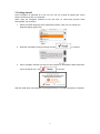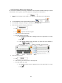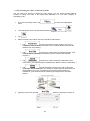
1
GPS NAVIGATION SYSTEM
NAV USER MANUAL
MOTOR HOME
ENGLISH
Thank you for choosing the Zenec Device as your navigator. Read the Quick Start Guide first
and start using your device right away. This document is the detailed description of the
navigation software. You can easily discover Zenec navigation while you are using it;
however, we still recommend that you read this manual to fully understand the screens and
features.
Easy map updates
It is easy to keep the navigation system up to date. Simply insert your navigation memory
card in your computer and run the Toolbox application to download new map data.
Latest Map Guarantee
When you start using the product, you have 30 days to download the latest available map free
of charge.
Note:
The equipment features described in this document and the software-based device functions, including the specified
range of functions, are directly dependent on the version of the navigation software installed on your device. In
particular, the range of functions is subject to model-specific dynamic adaptations caused by market conditions, as
well as enhancements to functionality during the production period of the model in question. Please note, therefore,
that your device and the navigation software installed on it may not be equipped with all of the features described in
this document or the range of functions illustrated and their described content.
2
Table of contents
1 Warnings and Safety information ................................................................................ 6
2 Getting started ................................................................................................................ 7
2.1 Navigation menu .................................................................................................................... 8
2.2 Buttons and other controls on the screen............................................................................... 9
2.2.1 Using keyboards ......................................................................................................................... 10
2.2.2 Beyond single screen tap ............................................................................................................ 11
2.3 Map screen ........................................................................................................................... 12
2.3.1 Navigating on the map ................................................................................................................ 12
2.3.2 Position markers ......................................................................................................................... 14
2.3.2.1 Vehimarker and Lock-on-Road ............................................................................................................ 14
2.3.2.2 Selected map location (Cursor) and selected map object .................................................................... 14
2.3.3 Objects on the map ..................................................................................................................... 14
2.3.3.1 Streets and roads ................................................................................................................................. 14
2.3.3.2 Turn preview and Next street ............................................................................................................... 15
2.3.3.3 Lane information and Signposts........................................................................................................... 16
2.3.3.4 Junction view ....................................................................................................................................... 17
2.3.3.5 Motorway exit services ........................................................................................................................ 17
2.3.3.6 3D object types..................................................................................................................................... 18
2.3.3.7 Elements of the active route ................................................................................................................. 18
2.3.3.8 Traffic events........................................................................................................................................ 19
2.3.4 Manipulating the map ................................................................................................................. 20
2.3.5 Quick menu ................................................................................................................................. 21
2.3.6 Checking the details of the current position (Where Am I?) ...................................................... 24
3 On-road navigation ...................................................................................................... 26
3.1 Selecting the destination of a route ...................................................................................... 26
3.1.1 Smart Search ............................................................................................................................... 26
3.1.1.1 Smart Search - Navigating to an address............................................................................................. 29
3.1.1.2 Smart Search - Navigating to a city/town ............................................................................................ 30
3.1.1.3 Smart Search - Navigating to an intersection .................................................................................... 31
3.1.1.4 Smart Search - Navigating to a Place of Interest ................................................................................. 32
3.1.1.5 Smart Search - Navigating to a Place of Interest by its category......................................................... 33
3.1.1.6 Smart Search - Navigating to a recent destination (History) ............................................................... 34
3.1.1.7 Smart Search - Navigating to a Favourite destination ......................................................................... 34
3.1.2 Entering an address or a part of the address................................................................................ 35
3.1.2.1 Entering an address ............................................................................................................................. 36
3.1.2.2 Entering the midpoint of a street as the destination ............................................................................. 38
3.1.2.3 Selecting an intersection as the destination ......................................................................................... 40
3.1.2.4 Selecting a city/town centre as the destination..................................................................................... 41
3.1.2.5 Entering an address with a postal code ............................................................................................... 43
3.1.2.6 Tips on entering addresses quickly ...................................................................................................... 45
3.1.3 Selecting the destination from the Places of Interest .................................................................. 45
3
3.1.3.1 Quick search for a Place of Interest..................................................................................................... 46
3.1.3.2 Searching for a Place of Interest using preset categories .................................................................... 47
3.1.3.3 Searching for a Place of Interest by category ...................................................................................... 49
3.1.3.4 Searching for a Place of Interest by name ........................................................................................... 52
3.1.3.5 Selecting nearby assistance from 'Where Am I?'.................................................................................. 54
3.1.4 Selecting a map location as the destination................................................................................. 56
3.1.5 Selecting the destination from your Favourites .......................................................................... 57
3.1.6 Selecting one of the most likely destinations (Smart History) .................................................... 58
3.1.7 Selecting a recent destination from the History .......................................................................... 59
3.1.8 Entering the coordinate of the destination .................................................................................. 60
3.1.9 Selecting the destination from your Contact list ......................................................................... 61
3.1.10 Building a route from the list of destinations (Create Route) ................................................... 62
3.2 Viewing the entire route on the map .................................................................................... 63
3.3 Checking route parameters and accessing route related functions ..................................... 64
3.4 Modifying the route .............................................................................................................. 65
3.4.1 Selecting a new destination when already having a route: New Route, Waypoint or Final
Destination............................................................................................................................................. 65
3.4.2 Setting a new starting position for the route ............................................................................... 65
3.4.3 Editing the list of destinations (Edit Route) ................................................................................ 67
3.4.4 Pausing the active route .............................................................................................................. 67
3.4.5 Cancelling the active route.......................................................................................................... 68
3.4.6 Checking route alternatives when planning the route ................................................................. 68
3.4.7 Checking route alternatives for an existing route ....................................................................... 69
3.4.8 Changing the vehicle used in route planning .............................................................................. 71
3.4.9 Changing the road types used in route planning ......................................................................... 72
3.5 Saving a location as a Favourite destination....................................................................... 73
3.5.1 Editing the details of a Favourite destination .............................................................................. 74
3.6 Saving a map location as an alert point .............................................................................. 75
3.7 Editing an alert point ........................................................................................................... 76
3.8 Watching the simulation of the route ................................................................................... 77
4 Off-road navigation...................................................................................................... 79
4.1 Selecting the destination of the route ................................................................................... 79
4.2 Navigating in off-road mode ................................................................................................ 79
5 Lorry navigation...........................................................................................................80
5.1 Setting up vehicle parameters .............................................................................................. 80
6 Reference Guide ...........................................................................................................82
6.1 Concepts............................................................................................................................... 82
6.1.1 Smart Zoom ................................................................................................................................ 82
6.1.2 Daytime and night colour themes ............................................................................................... 82
6.1.3 Tunnel view ................................................................................................................................ 82
6.1.4 Route calculation and recalculation ............................................................................................ 83
4
6.1.5 Green routing .............................................................................................................................. 85
6.1.6 Road safety cameras and other proximity alert points ................................................................ 86
6.1.7 Speed limit warning .................................................................................................................... 87
6.1.8 GPS position quality indicator and current time ......................................................................... 87
6.1.9 Traffic information in route planning ......................................................................................... 88
6.1.9.1 Real-time traffic information (TMC) .................................................................................................... 88
6.2 'More' menu.......................................................................................................................... 90
6.3 Settings menu ....................................................................................................................... 91
6.3.1 Sound and Warnings ................................................................................................................... 92
6.3.2 Customise Quick menu ............................................................................................................... 94
6.3.3 Traffic settings ............................................................................................................................ 94
6.3.4 Route settings.............................................................................................................................. 95
6.3.5 User profiles................................................................................................................................ 98
6.3.6 Map settings ................................................................................................................................ 99
6.3.7 Visual guidance settings ........................................................................................................... 100
6.3.8 Display settings ......................................................................................................................... 102
6.3.9 Regional settings ....................................................................................................................... 102
6.3.10 Trip monitor settings ............................................................................................................... 103
7 Glossary .......................................................................................................................104
5
1 Warnings and Safety information
The navigation system helps you find your way to your destination with the built-in GPS
receiver. Zenec navigation does not transmit your GPS position; others cannot track you.
It is important that you look at the display only when it is safe to do so. If you are the driver of
the vehicle, we recommend that you operate Zenec navigation before you start your journey.
Plan the route before your departure and stop if you need to change the route.
You must obey the traffic signs and follow the road geometry. If you deviate from the
recommended route, Zenec navigation changes the instructions accordingly.
6
2 Getting started
Zenec navigation is optimised for in-car use. You can use it easily by tapping the screen
buttons and the map with your fingertips.
When using the navigation software for the first time, an initial setup process starts
automatically. Do as follows:
1.
Select the written language of the application interface. Later you can change it in
Regional settings (page 102).
2.
Read the road safety warning message and tap
3.
Zenec navigation reminds you that you have 30 days to download the latest maps from
zenec.naviextras.com. Tap
to continue.
to continue.
After the initial setup, the Navigation menu appears and you can start using Zenec navigation.
7
2.1 Navigation menu
You can reach all parts of Zenec navigation from the Navigation menu.
This screen is the first screen to appear whenever you start the navigation without a planned
route or if you have arrived at your destination last time you used the navigation.
You have the following options:
•
to select your destination by entering an address or selecting
Tap
a place of interest, a location on the map or one of your Favourite destinations. You
can also look up your recent destinations from the Smart History or enter a coordinate.
•
to display the route parameters and the route in its full length
Tap
on the map. You can also perform route-related actions such as editing or cancelling
your route, setting a start point for the route, picking route alternatives, avoiding parts
of the route, simulating navigation or adding the destination to your Favourites.
•
to customise the way the navigation software works, to
Tap
simulate demo routes or to run some additional applications.
•
to start navigating on the map. The button itself is a miniature
Tap
live map that shows your current position, the recommended route and the surrounding
map area. Tap the button to enlarge the map to the full screen.
•
Tap
to open the Traffic Summary screen.
8
2.2 Buttons and other controls on the screen
When you are using Zenec navigation, you usually tap buttons on the touch screen.
You only need to confirm selections or changes if the application needs to restart, it needs to
perform a major reconfiguration, or you are about to lose some of your data or settings.
Otherwise, Zenec navigation saves your selections and applies the new settings without
confirmation as soon as you use the controls.
Type
Example
Description
How to use it
Button
Tap it to initiate a
function, to open a new
screen, or to set a
parameter.
Tap it once.
Button
with
value
Some buttons display the
current value of a field or
setting. Tap the button to
change the value. After
the change, the new
value is shown on the
button.
Tap it once.
Icon
List
Shows status information.
When you need to select
from several options, they
appear in a list.
Some icons also
function as a button.
Tap them once.
Grab the list anywhere
and slide your finger
up or down.
Depending on the
speed of the sliding,
the list will scroll fast
or slow, only a bit or
till the end.
Alternatively, move
between pages with
and
the
buttons and tap the
value that you want.
Radio
button
When there are only a
few choices, radio
buttons may be used
instead of lists. Only one
value can be selected.
Tap one of the buttons
to select a new value.
Switch
When there are only two
choices, a checkmark
shows whether the
feature is enabled.
Tap it to turn the
switch on or off.
9
When a feature can be
set to different values in a
range, Zenec navigation
shows an indicator on a
gauge that displays and
sets the value.
Slider
Alphabetic and
alphanumeric keyboards
to enter text and
numbers.
Virtual
keyboard
•
Drag the
handle to move
the slider to its
new position.
•
Tap the slider
where you want
the handle to
appear; the
thumb jumps
there.
Each key is a touch
screen button.
2.2.1 Using keyboards
You only need to enter letters or numbers when you cannot avoid it. You can type with your
fingertips on the full-screen keyboards and you can switch between various keyboard layouts,
for example English, Greek or numerical.
Task
Switching to another
keyboard layout, for example
from an English keyboard to
a Greek keyboard
Instruction
Tap the
keyboard layout from the list.
button and select the new
Correcting your entry on the
keyboard
Tap
to remove the unneeded character(s).
Tap and hold the button to delete several characters or the
entire input string.
Entering a space, for
example between a first
name and a family name or
in multi-word street names
Tap the
Entering upper and lower
case letters
When entering a text, the first character appears in upper
button at the bottom centre of the screen.
case while the rest of the text is in lower case. Tap
to
enter an upper case letter or tap twice to turn on Caps Lock.
Tap again and lower case letters return.
Entering numbers and
symbols
Tap
to switch to a keyboard offering numeric and
symbol characters.
10
Finalising the keyboard entry
(accepting the suggested
search result)
Finalising the keyboard entry
(opening the list of search
results)
Tap
.
Tap
.
Tap
.
Tap
.
Finalising the keyboard entry
(saving your input)
Cancelling the keyboard
entry (returning to the
previous screen)
2.2.2 Beyond single screen tap
You usually need to tap the screen only once. However, some useful features can be
accessed with combined touch screen tapping. Those are the following:
Action
Tapping and
holding the
screen
Details
Tap and keep pressing the following buttons to reach extra functions:
•
Tap and hold
Map screen appears.
•
Tap and hold any of the
on list and menu screens: the
,
,
,
,
, and
buttons on the Map screen: you can rotate, tilt or scale the
map continuously.
Gestures
(drag&drop)
•
on keyboard screens: you can delete several
Tap and hold
characters quickly.
•
Tap and hold
continuously.
or
in long lists: you can scroll pages
You need to drag and drop the screen only in cases like:
•
Moving the handle on a slider.
•
Scrolling the list: grab the list anywhere and slide your finger up or
down. Depending on the speed of the sliding, the list will scroll
fast or slow, only a bit or till the end.
•
Moving the map in map browsing mode: grab the map, and move
it in the desired direction.
11
2.3 Map screen
2.3.1 Navigating on the map
The Map screen is the most frequently used screen of Zenec navigation.
This screen is the first screen to appear whenever you start the navigation with a route
already planned.
A small live map is displayed on the Navigation menu, as a part of the
button.
To enlarge this small map and open the Map screen, tap
.
This map shows the current position (the Vehimarker, a blue arrow by default), the
recommended route (an orange line), and the surrounding map area.
When there is no GPS position, the Vehimarker is transparent. It shows your last known
position.
You see coloured dots circling around a satellite symbol in the top left corner. The more green
dots you see, the closer you are to get the valid GPS position.
When GPS position is available, the Vehimarker is displayed in full colour, now showing your
current position.
There are screen buttons and data fields on the screen to help you navigate. During
navigation, the screen shows route information.
button gives quick access to frequently used functions. You can change the
The
available functions in Settings.
12
By default, only one data field is displayed in the bottom right corner. Tap this field to see all
route data fields. Tap any of the data fields to suppress others and display only the selected
one.
The data fields are different when you are navigating an active route and when you have no
specified destination (the orange line is not displayed).
Default data fields when cruising without a destination (tap and hold any of the fields to
change its value):
Field
Description
Shows your current speed given by the GPS receiver.
Shows the speed limit of the current road if the map contains it.
Shows the current time corrected with time zone offset. The accurate
time comes from the GPS satellites, and the time zone information
comes from the map or it can be set manually in Regional settings.
(The current time is always displayed in the top left corner of menu
screens.)
Default data fields when navigating a route (tap and hold any of the fields to change its value):
Field
Description
Shows the distance you need to travel on the route before reaching
your final destination.
Shows the time needed to reach the final destination of the route
based on information available for the remaining segments of the
route.
If your device is capable of receiving live traffic information, the
calculation takes into account traffic delays affecting your route if they
are received. However, this calculation is rarely accurate.
Shows the estimated arrival time at the final destination of the route
based on information available for the remaining segments of the
route.
If your device is capable of receiving live traffic information, the
calculation takes into account traffic delays affecting your route if they
are received. However, this calculation is rarely accurate.
13
2.3.2 Position markers
2.3.2.1 Vehimarker and Lock-on-Road
When your GPS position is available, Zenec navigation marks your current position with the
Vehimarker. By default, this marker is a blue arrow, but you can change this icon in Settings.
When on-road navigation is selected, the Vehimarker may not show your exact GPS position
and heading. If roads are near, it is aligned to the nearest road to suppress GPS position
errors, and the direction of the icon is aligned to the direction of the road.
If you select off-road navigation: The Vehimarker is at your exact GPS position. The direction
of the icon shows your current heading.
2.3.2.2 Selected map location (Cursor) and selected map object
You can mark a map location in the following ways:
•
Tap the map when navigating,
•
Tap the map when you are asked to confirm the destination at the end of a search, or
•
Tap the map in Find on Map (page 56)
When a map location is selected, the Cursor appears at the selected point on the map. The
Cursor is displayed with a radiating red dot (
) to make it visible at all zoom levels.
The location of the Cursor can be used as the destination of the route, a new alert point, you
can search for Places around it, or you can save this location as one of your Favourite
destinations.
You can also select some of the objects on the map. If you tap the map at the icon of a Place
of Interest or an alert point, the object will be selected (you see a red circling border around
the object), and you can get information about this object or use it as a route point.
2.3.3 Objects on the map
2.3.3.1 Streets and roads
Zenec navigation shows the streets in a way that is similar to how the paper road maps show
them. Their width and colours correspond to their importance: you can easily tell a motorway
from a small street.
14
2.3.3.2 Turn preview and Next street
When navigating a route, the top section of the Map screen shows information about the next
route event (manoeuvre) and the next street or the next city/town.
There is a field in the top left corner that displays the next manoeuvre. Both the type of the
event (turn, roundabout, exiting motorway, etc.) and its distance from the current position are
displayed.
A smaller icon shows the type of the second next manoeuvre if it is near the first one.
Otherwise, only the next manoeuvre is displayed.
Most of these icons are very intuitive. The following table lists some of the frequently shown
route events. The same symbols are used in both fields:
Icon
Description
Turn left.
Turn right.
Turn back.
Bear right.
Turn sharp left.
Keep left.
Continue straight in the intersection.
Go left on the roundabout, 3rd exit (next
manoeuvre).
Enter roundabout (second next manoeuvre).
15
Enter motorway.
Exit motorway.
Board ferry.
Leave ferry.
Approaching a waypoint.
Approaching the destination.
2.3.3.3 Lane information and Signposts
When navigating on multilane roads, it is important to take the appropriate lane in order to
follow the recommended route. If lane information is available in the map data, Zenec
navigation displays the lanes and their directions using small arrows at the bottom of the map.
Highlighted arrows represent the lanes you need to take.
Where additional information is available, signposts substitute arrows. Signposts are
displayed at the top of the map. The colour and style of the signposts are similar to the real
ones you can see above road or by the roadside. They show the available destinations and
the number of the road the lane leads to.
All signposts look similar when cruising (when there is no recommended route). When
navigating a route, only the signpost that points to the lane(s) to be taken is displayed in vivid
colours; all others are darker.
If you want to hide the currently displayed signposts, tap any of them and the normal Map
screen returns until new signpost information is received.
16
2.3.3.4 Junction view
If you are approaching a motorway exit or a complex intersection and the needed information
exists, the map is replaced with a 3D view of the junction. The lanes you need to take are
displayed with arrows. Signposts can also be present if information is available.
If you want to hide the currently displayed junction, tap the picture and the Map screen
returns.
2.3.3.5 Motorway exit services
You may need a petrol station or a restaurant during your journey. This feature displays a
new button on the map when you are driving on motorways.
Tap this button to open a panel with the details of the next few exits or service stations.
Tap any of them to display the exit area on the map. You can now easily add this exit as a
waypoint to your route if needed.
If you want to display other types of Places for the exits, you can change the icons in Visual
Guidance settings (page 100).
17
2.3.3.6 3D object types
Zenec navigation supports the following 3D object types:
Type
Description
3D terrain
3D terrain map data shows changes in terrain, elevations or depressions
in the land when you view the map in 2D, and use it to plot the route map
in 3D when you navigate. Hills and mountains are shown in the
background of the 3D map, and illustrated by colour and shading on the
2D map.
Elevated roads
3D landmarks
3D buildings
Complex intersections and vertically isolated roads (such as overpasses
or bridges) are displayed in 3D.
Landmarks are 3D artistic or block representations of prominent or wellknown objects.
3D block representation of full city building data containing actual
building size and position on the map.
2.3.3.7 Elements of the active route
Zenec navigation shows the route in the following way:
Symbol
Name
Description
Current GPS position
and Start point
Your current position displayed on the map. If roads are
near, it is aligned to the nearest road.
Normally if GPS position is available, the route starts from
the current position. If there is no valid GPS position,
Zenec navigation uses the last known position as the start
point.
Waypoint
(intermediate
destination)
Destination
point)
An intermediate destination of the route before reaching
the final destination.
(end
Route colour
The final destination of the route.
The route always stands out with its colour on the map,
both in daytime and in night colour mode.
Streets and roads
that are excluded
from the navigation
You can choose whether you want to use or avoid certain
road types (page 95). However, when Zenec navigation
cannot avoid such roads, the route will include them and it
will show them in a colour that is different from the route
colour.
Streets and roads
that are affected by
traffic events
Road segments may be affected by traffic events
received. These streets and roads are displayed in an
alternate colour, and small symbols displayed along the
route show the type of the traffic event.
18
2.3.3.8 Traffic events
Road segments affected by traffic events are displayed with an alternate colour on the map,
and small symbols above the road show the nature of the event:
1.
Tap
2.
Tap
3.
Tap the traffic category you are interested in, or tap
of all events:
4.
Now tap any of the list items to see its details, and to display the affected road
segment in its full length on the map:
to open the Traffic Summary screen.
to open the list of event categories.
to see the list
If there are traffic events on the recommended route that the application has not
Note!
bypassed, the
icon will open the list of significant traffic events to let you
quickly check them.
19
2.3.4 Manipulating the map
Tap the map anywhere to browse it during navigation. The map stops following the current
position (the Vehimarker, a blue arrow by default, is not locked in a fix position on the screen
any more) and control buttons appear to help you modify the map view.
Action
Moving the
map with
drag&drop
Button(s)
No buttons
Zooming in
and out
,
Description
You can move the map in any direction: tap and hold
the map, and move your finger towards the direction
you want to move the map.
Changes how much of the map is displayed on the
screen.
Zenec navigation uses high-quality vector maps that
let you examine the map at various zoom levels,
always with optimised content. It always displays
street names and other text with the same font size,
never upside-down, and you only see the streets and
objects that you need.
Map scaling has a limit in 3D map view mode. If you
zoom out further, the map switches to 2D view mode.
Tap the button once to modify the view in large steps,
or tap and hold the button to modify it continuously
and smoothly.
Tilting up and
down
,
Changes the vertical view angle of the map in 3D
mode.
Tap the button once to modify the view in large steps,
or tap and hold the button to modify it continuously
and smoothly.
Rotating left
and right
Changes the horizontal view angle of the map.
,
2D or 3D view
,
Compass in
2D map view
mode
,
Tap the button once to modify the view in large steps,
or tap and hold the button to modify it continuously
and smoothly.
Tap this button to switch between the 3D perspective
and 2D top-down map view modes.
The direction of the compass shows North. Tap the
button to switch to North-up view, and then tap again
to rotate the map in the previous direction.
20
Compass in
3D map view
mode
,
Location
information
The direction of the compass shows North. Tap the
button to switch to North-up view, and then tap again
to rotate the map in the previous direction.
Tap this button to open a new screen with information
about the selected map point, the Cursor.
Return to
normal
navigation
Tap this button to move the map back to follow the
current GPS position. Automatic map rotation is also
re-enabled.
The map manipulation
navigation continues.
Additional
options
buttons
disappear
and
Tap this button to open a list of additional features
like saving the Cursor as a Favourite destination, or
searching for Places around the Cursor.
Select
destination
Tap this button to select the Cursor as a new
destination. The route is automatically calculated.
2.3.5 Quick menu
The Quick menu is a selection of controls and functions that are frequently needed during
navigation. It can be opened directly from the Map screen by tapping
The menu will close after a few seconds of inactivity or if you tap
.
.
The menu will also close if you initiate simple controls like muting the device. In other cases
tapping a button will open a new screen with options.
Most of these functions are shortcuts. They are accessible from the menu system.
There are more functions available than the number of buttons in the menu. In Settings, you
can choose the function of each button (page 94). The following options are available:
Button
Master
Volume slider
Description
Shortcut for
This slider adjusts the sound volume of the
device. All sounds of the application are affected.
More / Settings / Sound
and Warnings / Volume
/ Master slider
This switch mutes all sounds of the application.
Tap again to re-enable sounds.
More / Settings / Sound
and Warnings / Volume
/ Master switch
,
21
This function lets you search for a Place by its
name. The search is carried out either along your
route or around your current location if there is no
route calculated.
This button opens the list of your Favourite
destinations.
This button opens the History list. You can select
one of your previous destinations.
This button opens the route editing function.
Find / Find Places /
Quick Search (page 46)
Find / Favourite (page
57)
Find / History (page 59)
My Route / Edit Route
This button opens the route related settings.
More / Settings / Route
Settings (page 95)
This button opens the map related settings.
More / Settings / Map
Settings (page 99)
This button opens a special screen with
information about the current position and a
button to search for nearby emergency or
roadside assistance. For details, see the next
chapter.
This button cancels the route and stops
navigation. The button is replaced with the next
one if waypoints are given.
This button skips the next waypoint from the
route.
This button opens a 2D map scaled and
positioned to show the entire route.
This button opens the Visual Guidance settings
screen.
This button opens the Traffic Summary screen.
22
Tap the Current Street
field on the Map screen
My Route / Cancel
Route (page 68)
n/a
My Route / Overview
(page 63)
More / Settings / Visual
Guidance (page 100)
Tap the Traffic icon in
the Navigation menu or
on the Map screen
This button lets you bypass parts of the
recommended route.
This button opens the Trip Monitor screen where
you can manage your previously saved trip logs
and track logs.
This button opens the list of manoeuvres (the
itinerary).
With this function you can save the active route
for later use.
With this function you can replace the active route
with a previously saved route.
With this function you can search for Places of
Interest in various different ways.
This button opens the Map screen and starts
simulating the active route.
This button opens the GPS Information screen
with satellite position and signal strength
information.
This button opens the parameters of the selected
Vehicle profile.
23
My Route / Avoidances
More / Trip Monitor
(page 90)
Tap the top of the Map
screen during
navigation.
My Route / More / Save
Route
My Route / More / Load
Route
Find / Find Places
(page 45)
My Route / More /
Simulate Navigation
(page 77)
Tap the top of the Map
screen when there is no
GPS reception
More / Settings / Route
(page 95)
2.3.6 Checking the details of the current position (Where Am I?)
This screen contains information about the current position (or about the last known position if
GPS reception is not available) and a button to search for useful Places nearby.
You can access this screen from the map in one of the following ways:
•
If the current street is displayed below the Vehimarker (the current position on the
map), tap it to open the Where Am I? screen.
•
Open the Quick menu and tap the
button.
Information on this screen:
•
,
format).
•
: Altitude (elevation information coming from the GPS receiver - often
inaccurate).
: Latitude and Longitude (coordinate of the current position in WGS84
•
: House number on the left.
•
: House number on the right.
•
In the middle of the screen you can see whether the position is current, or the time left
since it was last updated.
•
Address details (when available) of the current position are displayed at the bottom.
You can also perform some actions on this screen:
Tap
to save the current position as a Favourite destination.
24
You can also search for assistance near your current position. Tap
open a new screen for the Quick search:
to
The following services can be searched around the current position or the last known position:
•
: Car repair and roadside assistance services
•
: Police stations
•
: Medical and emergency services
•
: Petrol stations
Tap any of the buttons, select a Place from the list, and navigate to it.
25
3 On-road navigation
When first started, Zenec navigation calculates routes using the road network of the high
quality vector maps provided with the product.
You can set up your route in different ways:
•
If you need a route for immediate navigation, you can select the destination and start
navigating to it right away (normal navigation).
•
You can also plan a route independently of your current GPS position or even without
GPS reception. To achieve this you need to set a new starting point in My Route / Edit
Route by tapping the flag icon at the current position. This will also turn off the GPS
receiver so that the route is not recalculated when a new position is received.
You can plan routes with multiple destinations. Select the first destination. Then select a
second destination and add it to your route to create a multi-point route. You can add as
many destinations to your route as you like.
You can also use Zenec navigation for off-road navigation. For details, see page 79.
3.1 Selecting the destination of a route
Zenec navigation offers you several ways of choosing your destination:
•
Enter a full address or a part of an address, for example a street name without a house
number or the names of two intersecting streets (page 35).
•
Enter an address with postal code (page 43). This way you do not need to select the
name of the city/town and the search for street names might be faster as well.
•
Use a built-in Place of Interest as your destination (page 45).
•
Select a location on the map with the Find on Map feature (page 56).
•
Use a previously saved Favourite destination (page 57).
•
Select a location from the History of previously used destinations (page 59).
•
Enter the coordinate of the destination (page 60).
3.1.1 Smart Search
There are several ways to select the destination of the route. You can find buttons in the Find
menu that initiate a separate search for addresses, Places, Favourite or recent destinations.
The fastest way to search for any of these is to use the Smart Search. In this section you can
find the full description of how this feature works. The below process shows how to carry out
the search and the following subsections will help you find specific kinds of results.
1.
and then tap
In the Navigation menu, tap
26
.
2.
First you see hints on the screen showing how you can use the function. These hints
are only displayed the first time you use this screen.
3.
Tap anywhere and the hints disappear. Once you get through this screen to the search
results, the hint will not appear again when you open this window later but you can see
them again if you tap the information button on the right side of the input field.
4.
You can see the input field at the top of the screen. Right below that you see the
search area, the city/town around which the search is carried out. The default search
area is the area where you are located. For a local search, skip the next step.
5.
(optional) To search in a different area, do as follows:
1.
. A new screen opens with a new input field. A hint
Tap
bubble explains how you can specify the new search centre.
2.
Tap anywhere and the hint disappears. If you successfully select a new search
area, the hint will not appear again when you open this window later but you can
see it again if you tap the information button on the right side of the input field.
3.
Start entering the centre of the new search area using the screen keyboard. You
only need to enter a few letters to get a result. If the new search area is in a
different country, you can narrow the search results if you enter one space and
then a few letters of the country of the search area.
4.
The most likely result appears below the input field as you enter new letters.
Tap to select this as your new search area. If you cannot see your preferred
and select one from the list.
area after a few letters, tap
27
6.
With the proper search area displayed, you can start entering the name, address or
category of the destination you are looking for. The number shown in the
button shows how many results match the entered text. The
background search is carried out while you enter letters so this number may keep on
increasing if you wait a few seconds. Keep on entering new letters while this number is
high.
7.
Once the number of results is acceptable after a few seconds of searching, you can
tap
to switch to the result screen.
8.
The result screen also opens with hints. Tap anywhere to suppress them. Once you
select a destination, they will not appear again.
9.
You see all results in the list, regardless of their type. Addresses, Places, Place
categories, Favourite and recent destinations are mixed within one list.
10.
11.
You have the following options:
•
Tap the result you want to use as your destination. Scroll the list if necessary.
•
To narrow the search for only one type of result (for example for Places only)
you can tap the related button at the top of the screen. See the next sections for
details.
Once the destination is selected, a full screen map appears with the selected point in
the middle. If necessary, tap the map somewhere else to modify the destination. The
Cursor (
) appears at the new location. Tap
destination, or tap
to confirm the
to select a different destination.
28
12.
After a short summary of the route parameters, the map appears showing the entire
route. The route is automatically calculated. Tap
parameters, or tap
to modify route
and start your journey.
If you know that you will use this destination frequently, before tapping
to confirm the destination, put it on the list of your Favourites
Tip!
first: tap
then
, give a name for the new
Favourite, and tap
to save the location. The map with the
destination returns automatically. Now you can start your journey.
3.1.1.1 Smart Search - Navigating to an address
To find an address in Smart Search, carry out the search as described earlier. Use the name
of the street alone or combined with the house number as your input text. When you get to
the result screen, do as follows:
at the top of the screen.
1.
Tap
2.
The list is now filtered. What you see is the list of matching addresses.
3.
Scroll down the list if necessary and then select one of the addresses from the list.
4.
Once the destination is selected, a full screen map appears with the selected point in
the middle. If necessary, tap the map somewhere else to modify the destination. The
Cursor (
) appears at the new location. Tap
destination, or tap
to confirm the
to select a different destination.
29
5.
After a short summary of the route parameters, the map appears showing the entire
route. The route is automatically calculated. Tap
parameters, or tap
Note!
to modify route
and start your journey.
The alternative way to search for an address is to tap the
button in the Find
menu. Unlike the Combined Search, this alternative search method is a structured
one where you can define the parts of the address separately.
3.1.1.2 Smart Search - Navigating to a city/town
To navigate to a city or town in Smart Search without knowing an exact address or Place,
simply set the search centre to the city or town you want to visit and without entering anything
into the input field, do as follows:
. The centre of the selected city or town is now set as your
1.
Tap
destination.
2.
A full screen map appears with the selected point in the middle. If necessary, tap the
map somewhere else to modify the destination. The Cursor (
new location. Tap
) appears at the
to confirm the destination, or tap
to select a different destination.
3.
After a short summary of the route parameters, the map appears showing the entire
route. The route is automatically calculated. Tap
parameters, or tap
and start your journey.
30
to modify route
The alternative way to search for an address is to tap the
button inFind menu.
Unlike the Combined Search, this alternative search method is a structured one
Note! where you can define the parts of the address separately. Search for the city or
town and then tap
.
3.1.1.3 Smart Search - Navigating to an intersection
To find an intersection in Smart Search, carry out the search as described earlier but use the
'&' sign to separate the two intersecting streets. You do not need to use spaces before and
after the separator character. For example you can use any of the following input texts to find
the intersections of Collins Street and Douglas Avenue (the more precise the input string the
fewer false results are expected):
•
Collins St & Douglas Ave
•
Collins & Douglas
•
Coll St & Dou Av
•
Col&Doug
•
C&D
•
Collins St& (this one will give you all the intersections of Collins Street so that you can
select the appropriate one from the result list)
When you get to the result screen, do as follows:
at the top of the screen.
1.
Tap
2.
The list is now filtered. What you see is the list of matching intersections.
3.
Scroll down the list if necessary and then select one intersection from the list.
4.
Once the destination is selected, a full screen map appears with the selected point in
the middle. If necessary, tap the map somewhere else to modify the destination. The
Cursor (
) appears at the new location. Tap
destination, or tap
5.
to confirm the
to select a different destination.
After a short summary of the route parameters, the map appears showing the entire
route. The route is automatically calculated. Tap
parameters, or tap
and start your journey.
31
to modify route
button in the Find
Note! The alternative way to search for an address is to tap the
menu. Unlike the Smart Search, this alternative search method is a structured one
where you can define the parts of the address separately.
3.1.1.4 Smart Search - Navigating to a Place of Interest
To find a Place of Interest in Smart Search, carry out the search as described earlier. Search
for a part of its name. When you get to the result screen, do as follows:
at the top of the screen.
1.
Tap
2.
The list is now filtered. What you see is the list of matching Places ordered by their
distance from your current location.
3.
(optional) Should your product contain Places from different data providers, you can
further narrow the list by showing Places from one provider only. Look for the provider
logos at the top of the screen. Tap one of them to see Places from that provider only.
4.
Scroll down the list if necessary and then select one of the Places from the list.
5.
Once the destination is selected, a full screen map appears with the selected point in
the middle. If necessary, tap the map somewhere else to modify the destination. The
Cursor (
) appears at the new location. Tap
destination, or tap
6.
to confirm the
to select a different destination.
After a short summary of the route parameters, the map appears showing the entire
route. The route is automatically calculated. Tap
parameters, or tap
and start your journey.
The alternative way to search for a Place is to tap the
Note!
to modify route
button in the Quick
menu or the
button in the Find menu. These alternatives are different from
the Combined Search. The first one is also a name search but if there is a route
planned, it will not be carried out around your current location but along the route.
The Place search in the Destination menu is a complex Place search with several
options including category search or search around the destination of the current
route.
32
3.1.1.5 Smart Search - Navigating to a Place of Interest by its category
To find a Place of Interest in Smart Search by giving its category only, carry out the search as
described earlier. Search for the beginning of the category name. When you get to the result
screen, do as follows:
1.
The list is ordered with Place categories at the beginning but if you want, you can filter
the list to contain Place categories only. Tap
list.
at the top of the screen to filter the
2.
Scroll the list and select one of the categories. You get the list of Places in that
category ordered by their distance from your current position. If the selected category
contains subcategories, you will see all Places in that category mixed into one list.
3.
(optional) Should your product contain Places from different data providers, you can
further narrow the list by showing Places from one provider only. Look for the provider
logos at the top of the screen. Tap one of them to see Places from that provider only.
4.
Scroll down the list if necessary and then select one of the Places from the list.
5.
Once the destination is selected, a full screen map appears with the selected point in
the middle. If necessary, tap the map somewhere else to modify the destination. The
Cursor (
) appears at the new location. Tap
destination, or tap
6.
to confirm the
to select a different destination.
After a short summary of the route parameters, the map appears showing the entire
route. The route is automatically calculated. Tap
parameters, or tap
and start your journey.
The alternative way to search for a Place category is to tap the
Note!
to modify route
button in the
Find menu and then tap
. This alternative is different from the Combined
Search. When you search for a Place category here, you will go through the whole
Place category tree. When you select a category, the list of its subcategories
opens.
33
3.1.1.6 Smart Search - Navigating to a recent destination (History)
To find one of your recent destinations in Smart Search, carry out the search as described
earlier. For the input text you can use either a part of the name or a part of the address of the
recent destination. When you get to the result screen, do as follows:
at the top of the screen.
1.
Tap
2.
The list is now filtered. What you see is the list of recent destinations with a matching
name or address.
3.
Scroll down the list if necessary and then select one of the destinations from the list.
4.
Once the destination is selected, a full screen map appears with the selected point in
the middle. If necessary, tap the map somewhere else to modify the destination. The
Cursor (
) appears at the new location. Tap
destination, or tap
5.
to confirm the
to select a different destination.
After a short summary of the route parameters, the map appears showing the entire
route. The route is automatically calculated. Tap
parameters, or tap
Note!
to modify route
and start your journey.
The alternative way to search for a recent destination is to tap the
button in
the Quick menu or in the Find menu. The rest of the procedure is similar to the
above.
3.1.1.7 Smart Search - Navigating to a Favourite destination
To find one of your Favourite destinations in Smart Search, carry out the search as described
earlier. Search for the beginning of the name of the Favourite destination. When you get to
the result screen, do as follows:
at the top of the screen.
1.
Tap
2.
The list is now filtered. What you see is the list of your Favourite destinations with a
matching name.
3.
Scroll down the list if necessary and then select one of the destinations from the list.
34
4.
Once the destination is selected, a full screen map appears with the selected point in
the middle. If necessary, tap the map somewhere else to modify the destination. The
Cursor (
) appears at the new location. Tap
destination, or tap
5.
to confirm the
to select a different destination.
After a short summary of the route parameters, the map appears showing the entire
route. The route is automatically calculated. Tap
parameters, or tap
to modify route
and start your journey.
button
Note! The alternative way to search for a Favourite destination is to tap the
in the Quick menu or in the Find menu. The rest of the procedure is similar to the
above.
3.1.2 Entering an address or a part of the address
If you know at least a part of the address, it is the quickest way to select the destination of the
route.
Using the same screen, you can find an address by entering:
•
the exact address, including house number
•
the centre of a city/town
•
an intersection
•
the midpoint of a street
•
any of the above, starting the search with the postal code (page 43)
35
3.1.2.1 Entering an address
To enter an address as the destination, do as follows:
to return to the Navigation
1.
If you are on the Map screen, tap
menu.
2.
In the Navigation menu, tap the following buttons:
3.
By default, Zenec navigation proposes the country and city/town where you are. If
,
.
needed, tap
, enter the first few letters of the country name on the
keyboard, and select one country from the list of results.
4.
If needed, select a new city/town:
.
a.
Tap
b.
Start entering the name of the city/town on the keyboard.
c.
Find the city/town you need:
•
The most likely city/town name is always shown in the input field. To
accept it, tap
•
.
If the desired name does not show up, the names that match the string
appear in a list after entering a couple of characters (to open the list of
results before it appears automatically, tap
the city/town from the list.
5.
Enter the street name:
.
a.
Tap
b.
Start entering the street name on the keyboard.
c.
Find the street you need:
36
). Select
•
The most likely street name is always shown in the input field. To accept
it, tap
•
.
If the desired name does not show up, the names that match the string
appear in a list after entering a couple of characters (to open the list of
results before it appears automatically, tap
the street from the list.
). Select
6.
7.
Enter the house number:
.
a.
Tap
b.
Enter the house number on the keyboard. (To enter letters, tap
c.
to finish entering the address. (If the entered house
Tap
number cannot be found, the midpoint of the street is selected as the
destination.)
).
A full screen map appears with the selected point in the middle. If necessary, tap the
map somewhere else to modify the destination. The Cursor (
new location. Tap
) appears at the
to confirm the destination, or tap
to select a different destination.
37
8.
After a short summary of the route parameters, the map appears showing the entire
route. The route is automatically calculated. Tap
parameters, or tap
to modify route
and start your journey.
If you know that you will use this destination frequently, before tapping
to confirm the destination, put it on the list of your Favourites
Tip!
first: tap
then
, give a name for the new
Favourite, and tap
to save the location. The map with the
destination returns automatically. Now you can start your journey.
3.1.2.2 Entering the midpoint of a street as the destination
You can navigate to the midpoint of a street if the house number is not available:
to return to the Navigation
1.
If you are on the Map screen, tap
menu.
2.
In the Navigation menu, tap the following buttons:
3.
If necessary, modify the country and city/town as described earlier (page 36).
4.
Enter the street name:
Tap
b.
Start entering the street name on the keyboard.
c.
Find the street you need:
The most likely street name is always shown in the input field. To accept
it, tap
•
.
.
a.
•
,
.
If the desired name does not show up, the names that match the string
appear in a list after entering a couple of characters (to open the list of
38
results before it appears automatically, tap
the street from the list.
). Select
. The midpoint of the
5.
Instead of entering the house number, tap
street is selected as the destination.
6.
A full screen map appears with the selected point in the middle. If necessary, tap the
map somewhere else to modify the destination. The Cursor (
new location. Tap
) appears at the
to confirm the destination, or tap
to select a different destination.
7.
After a short summary of the route parameters, the map appears showing the entire
route. The route is automatically calculated. Tap
parameters, or tap
and start your journey.
39
to modify route
3.1.2.3 Selecting an intersection as the destination
To enter an address as the destination, do as follows:
to return to the Navigation
1.
If you are on the Map screen, tap
menu.
2.
In the Navigation menu, tap the following buttons:
3.
If necessary, modify the country and city/town as described earlier (page 36).
4.
Enter the street name:
Tap
b.
Start entering the street name on the keyboard.
c.
Find the street you need:
The most likely street name is always shown in the input field. To accept
it, tap
•
.
If the desired name does not show up, the names that match the string
appear in a list after entering a couple of characters (to open the list of
results before it appears automatically, tap
the street from the list.
5.
.
.
a.
•
,
). Select
Enter the intersecting street name:
1.
Tap
.
•
If only a few intersecting streets exist, their list appears immediately.
•
In case of a longer street, the keyboard screen appears. Start entering
the name of the intersecting street on the keyboard. As soon as the street
names that match the entered string can be shown on one screen, their
list appears automatically. Select from the list.
40
6.
A full screen map appears with the selected point in the middle. If necessary, tap the
map somewhere else to modify the destination. The Cursor (
new location. Tap
) appears at the
to confirm the destination, or tap
to select a different destination.
7.
After a short summary of the route parameters, the map appears showing the entire
route. The route is automatically calculated. Tap
parameters, or tap
to modify route
and start your journey.
3.1.2.4 Selecting a city/town centre as the destination
The city/town centre is not the geometric centre of the city/town but an arbitrary point the map
creators have chosen. In towns and villages, it is usually the most important intersection; in
larger cities, it is one of the important intersections.
to return to the Navigation
1.
If you are on the Map screen, tap
menu.
2.
In the Navigation menu, tap the following buttons:
3.
If necessary, modify the country as described earlier (page 36).
4.
Select the destination city/town:
.
.
a.
Tap
b.
Start entering the name of the city/town on the keyboard.
c.
Find the city/town you need:
•
,
The most likely city/town name is always shown in the input field. To
accept it, tap
.
41
•
If the desired name does not show up, the names that match the string
appear in a list after entering a couple of characters (to open the list of
results before it appears automatically, tap
the city/town from the list.
). Select
5.
. This way the centre of
Instead of entering the street name, tap
the displayed city/town becomes the destination of the route.
6.
A full screen map appears with the selected point in the middle. If necessary, tap the
map somewhere else to modify the destination. The Cursor (
new location. Tap
) appears at the
to confirm the destination, or tap
to select a different destination.
7.
After a short summary of the route parameters, the map appears showing the entire
route. The route is automatically calculated. Tap
parameters, or tap
and start your journey.
42
to modify route
3.1.2.5 Entering an address with a postal code
All of the above address searching possibilities can be performed with entering the postal
code instead of the city/town name. Find below an example with a full address:
to return to the Navigation
1.
If you are on the Map screen, tap
menu.
2.
In the Navigation menu, tap the following buttons:
3.
If necessary, modify the country as described earlier (page 36).
4.
Enter a new city/town using its postal code:
a.
Tap
.
b.
Tap
to open the numeric keypad.
c.
Start entering the postal code.
d.
Find the city/town you need:
•
.
If the desired number does not show up, open the list of results by
tapping
5.
.
The most likely postal code is always shown in the input field. To accept
it, tap
•
,
. Select the postal code from the list.
Enter the street name:
.
a.
Tap
b.
Start entering the street name on the keyboard.
c.
Find the street you need:
•
The most likely street name is always shown in the input field. To accept
it, tap
.
43
•
If the desired name does not show up, the names that match the string
appear in a list after entering a couple of characters (to open the list of
results before it appears automatically, tap
the street from the list.
6.
7.
). Select
Enter the house number:
.
a.
Tap
b.
Enter the house number on the keyboard. (To enter letters, tap
c.
to finish entering the address. (If the entered house
Tap
number cannot be found, the midpoint of the street is selected as the
destination.)
).
A full screen map appears with the selected point in the middle. If necessary, tap the
map somewhere else to modify the destination. The Cursor (
new location. Tap
) appears at the
to confirm the destination, or tap
to select a different destination.
8.
After a short summary of the route parameters, the map appears showing the entire
route. The route is automatically calculated. Tap
parameters, or tap
and start your journey.
44
to modify route
3.1.2.6 Tips on entering addresses quickly
•
When you are entering the name of a city/town or a street:
•
Only those letters are offered on the keyboard that appear in possible search
results. All other characters are greyed out.
•
As you are typing, the most likely result is always displayed in the input field. If
the guess is correct, tap
•
•
to select it.
After entering a couple of letters, tap
contain the specified letters.
to list the items that
You can speed up finding an intersection:
•
Search first for the street with a less common or less usual name; fewer letters
are enough to find it.
•
If one of the streets is shorter, search for that one first. You can then find the
second one faster.
•
You can search for both the type and the name of a road. If the same word appears in
several names, for example in the name of streets, roads and avenues, you can obtain
the result faster if you enter the first letter of the street type: For example, enter 'PI A' to
obtain Pine Avenue and skip all Pine Streets and Pickwick Roads.
•
You can also search in postal codes. As postal codes consist of only a few characters,
this is usually faster than entering the name of the city/town.
3.1.3 Selecting the destination from the Places of Interest
You can select your destination from the Places of Interest included with Zenec navigation.
Using the same screen, you can find a Place in different ways:
•
with the Quick search feature, you can quickly find a nearby Place by its name
•
with the Preset search feature, you can find frequently searched types of Places with
only a few screen taps
•
you can search for a Place by its category
•
you can search for a Place by its name
In addition, you can search for special services from the 'Where Am I?' screen.
45
3.1.3.1 Quick search for a Place of Interest
The Quick search feature lets you quickly find a Place by its name. The search is always
carried out
•
along the recommended route if it exists or
•
around your current location if there is no destination given.
1.
Start the Quick search function:
•
If you are on the Map screen, tap
•
If you are in the Navigation menu, tap
tap
and then tap
.
,
and then
.
2.
Using the keyboard, start entering the name of the Place.
3.
to open the list of Places with
After entering a few letters, tap
names containing the entered character sequence.
4.
(optional) The Places in the list are ordered by the length of the necessary detour
(when navigating a route) or by their distance from the current position (when no
destination is given). If you need to reorder the list, tap
.
5.
Browse the list if necessary and tap one of the list items. A full screen map appears
with the selected point in the middle. The name and address of the Place is displayed
at the top of the screen.
6.
to see the details of the selected Place. Tap
(optional) Tap
to return to the map.
46
7.
If necessary, tap the map somewhere else to modify the destination. The Cursor
(
) appears at the new location. Tap
destination, or tap
8.
to select a different destination.
If necessary, tap the map somewhere else to modify the destination. The Cursor
(
) appears at the new location. Tap
destination, or press
9.
to confirm the
to confirm the
to select a different destination.
After a short summary of the route parameters, the map appears showing the entire
route. The route is automatically calculated. Tap
parameters, or tap
to modify route
and start your journey.
3.1.3.2 Searching for a Place of Interest using preset categories
The Preset search feature lets you quickly find the most frequently selected types of Places.
to return to the Navigation
1.
If you are on the Map screen, tap
menu.
2.
In the Navigation menu, tap the following buttons:
3.
The preset search categories appear:
•
,
.
:
•
If an active route exists, petrol stations are searched along the route.
•
If there is no active route (destination is not selected), they are searched
around the current position.
•
If the current position is not available either (no GPS signal), they are
searched around the last known position.
47
•
:
•
If an active route exists, parking lots are searched around the destination
of the route.
•
If there is no active route (destination is not selected), they are searched
around the current position.
•
If the current position is not available either (no GPS signal), they are
searched around the last known position.
•
:
•
If an active route exists, restaurants are searched along the route.
•
If there is no active route (destination is not selected), they are searched
around the current position.
•
If the current position is not available either (no GPS signal), they are
searched around the last known position.
•
:
•
If an active route exists, accommodation is searched around the
destination of the route.
•
If there is no active route (destination is not selected), they are searched
around the current position.
•
If the current position is not available either (no GPS signal), they are
searched around the last known position.
4.
Tap any of the quick search buttons to get an instant list of Places.
5.
(optional) The Places in the list are ordered by their distance from the current or last
known position, from the destination or by the length of the necessary detour. If you
need to reorder the list, tap
.
6.
Browse the list if necessary and tap one of the list items. A full screen map appears
with the selected point in the middle. The name and address of the Place is displayed
at the top of the screen.
7.
to see the details of the selected Place. Tap
(optional) Tap
to return to the map.
8.
If necessary, tap the map somewhere else to modify the destination. The Cursor
(
) appears at the new location. Tap
destination, or tap
to confirm the
to select a different destination.
48
9.
After a short summary of the route parameters, the map appears showing the entire
route. The route is automatically calculated. Tap
parameters, or tap
to modify route
and start your journey.
3.1.3.3 Searching for a Place of Interest by category
You can search for Places of Interest by their categories and subcategories.
to return to the Navigation
1.
If you are on the Map screen, tap
menu.
2.
In the Navigation menu, tap the following buttons:
3.
Tap
4.
Select the area around which the Place should be searched for:
,
.
.
•
to search around the current position or if it is not
Tap
available, around the last know position. (The result list will be ordered by the
distance from this position.)
•
to search for a place within a selected city/town. (The
Tap
result list will be ordered by the distance from the centre of the selected
city/town.)
•
to search for a place around the destination of the
Tap
active route. (The result list will be ordered by the distance from the destination.)
49
•
to search along the active route, and not around a
Tap
given point. This is useful when you search for a later stopover that results in a
minimal detour only, such as searching for upcoming petrol stations or
restaurants. (The result list will be ordered by the length of the necessary
detour.)
, select the city/town to search in.
5.
(optional) If you have selected
6.
Select one of the main Place categories (e.g. Accommodation) or tap
to list all Places around the selected location or along the route.
7.
Select one of the Place subcategories (e.g. Hotel or Motel) or tap
to list all Places in the selected main category around the selected location or along the
route.
50
8.
Sometimes the list of brands in the selected Place subcategory appears. Select one
brand or tap
to list all Places in the selected subcategory around
the selected location or along the route.
9.
10.
Finally, the results appear in a list.
(optional) The Places in the list are ordered by their distance from the current or last
known position, from the selected city/town, from the destination or by the length of the
necessary detour. If you need to reorder the list, tap
.
11.
Browse the list if necessary and tap one of the list items. A full screen map appears
with the selected point in the middle. The name and address of the Place is displayed
at the top of the screen.
12.
to see the details of the selected Place. Tap
(optional) Tap
to return to the map.
13.
If necessary, tap the map somewhere else to modify the destination. The Cursor
(
) appears at the new location. Tap
destination, or tap
14.
to confirm the
to select a different destination.
After a short summary of the route parameters, the map appears showing the entire
route. The route is automatically calculated. Tap
parameters, or tap
and start your journey.
51
to modify route
3.1.3.4 Searching for a Place of Interest by name
You can search for Places of Interest by their names. You can search around different
locations or along your route in the whole Place database or in one Place category or
subcategory only.
to return to the Navigation
1.
If you are on the Map screen, tap
menu.
2.
In the Navigation menu, tap the following buttons:
3.
Tap
4.
Select the area around which the Place should be searched for:
5.
,
.
.
•
to search around the current position or if it is not
Tap
available, around the last know position. (The result list will be ordered by the
distance from this position.)
•
to search for a place within a selected city/town. (The
Tap
result list will be ordered by the distance from the centre of the selected
city/town.)
•
to search for a place around the destination of the
Tap
active route. (The result list will be ordered by the distance from the destination.)
•
to search along the active route, and not around a
Tap
given point. This is useful when you search for a later stopover that results in a
minimal detour only, such as searching for upcoming petrol stations or
restaurants. (The result list will be ordered by the length of the necessary
detour.)
, select the city/town to search in.
(optional) If you have selected
52
6.
Select one of the main Place categories (e.g. Accommodation) to search in or tap
to search among all Places.
7.
Select one of the Place subcategories (e.g. Hotel or Motel) to search in or tap
to search in the selected Place category.
if you have not done it before.
8.
Tap
9.
Using the keyboard, start entering the name of the Place.
10.
to open the list of Places with
After entering a few letters, tap
names containing the entered character sequence.
53
11.
(optional) The Places in the list are ordered by their distance from the current or last
known position, from the selected city/town, from the destination or by the length of the
necessary detour. If you need to reorder the list, tap
.
12.
Browse the list if necessary and tap one of the list items. A full screen map appears
with the selected point in the middle. The name and address of the Place is displayed
at the top of the screen.
13.
to see the details of the selected Place. Tap
(optional) Tap
to return to the map.
14.
If necessary, tap the map somewhere else to modify the destination. The Cursor
(
) appears at the new location. Tap
destination, or tap
15.
to confirm the
to select a different destination.
After a short summary of the route parameters, the map appears showing the entire
route. The route is automatically calculated. Tap
parameters, or tap
to modify route
and start your journey.
3.1.3.5 Selecting nearby assistance from 'Where Am I?'
You can quickly search for nearby assistance from the 'Where Am I?' screen.
1.
On the Map screen, tap
to open the Quick menu.
54
2.
Tap
3.
Preset search categories appear, all for searching around the current position (or
around the last known position if the current position is not available):
, and then
.
•
: Car repair and roadside assistance services
•
: Medical and emergency services
•
: Police stations
•
: Petrol stations
4.
Tap any of the quick search buttons to get an instant list of that type of Places.
5.
(optional) The Places in the list are ordered by their distance from the current or last
known position, from the selected city/town, from the destination or by the length of the
necessary detour. If you need to reorder the list, tap
.
6.
Browse the list if necessary and tap one of the list items. A full screen map appears
with the selected point in the middle. The name and address of the Place is displayed
at the top of the screen.
7.
to see the details of the selected Place. Tap
(optional) Tap
to return to the map.
8.
If necessary, tap the map somewhere else to modify the destination. The Cursor
(
) appears at the new location. Tap
destination, or tap
to confirm the
to select a different destination.
55
9.
After a short summary of the route parameters, the map appears showing the entire
route. The route is automatically calculated. Tap
parameters, or tap
to modify route
and start your journey.
3.1.4 Selecting a map location as the destination
1.
If you are on the Map screen, tap
menu.
to return to the Navigation
2.
In the Navigation menu, tap the following buttons:
3.
Locate your destination on the map: move and scale the map as needed.
4.
Tap the location that you want to select as your destination. The Cursor (
appears there.
5.
Tap
6.
After a short summary of the route parameters, the map appears showing the entire
.
)
to select the Cursor as the destination.
route. The route is automatically calculated. Tap
parameters, or tap
,
and start your journey.
56
to modify route
3.1.5 Selecting the destination from your Favourites
You can select a location that you have already saved as a Favourite to be your destination.
Adding a location to the list of Favourite destinations is described on page 73.
1.
Access the list of Favourites:
•
If you are on the Map screen, tap
•
If you are in the Navigation menu, tap
to open the Quick menu.
.
2.
Tap
3.
Tap the Favourite that you want to set as your destination. If necessary, browse down
. The list of Favourite destinations is displayed.
to see more of the list or tap
name of the Favourite destination.
4.
and enter a few letters from the
A full screen map appears with the selected point in the middle. If necessary, tap the
map somewhere else to modify the destination. The Cursor (
new location. Tap
) appears at the
to confirm the destination, or tap
to select a different destination.
5.
After a short summary of the route parameters, the map appears showing the entire
route. The route is automatically calculated. Tap
parameters, or tap
and start your journey.
57
to modify route
3.1.6 Selecting one of the most likely destinations (Smart History)
The destinations that you have set earlier appear in the History list. Two of those recent
destinations are shown in the Destination menu for easy access. Smart History offers these
locations based on your navigation habits, using parameters like the current time of day, the
day of week, and the current location. The more you use the navigation software, the better it
can guess your desired destination.
to return to the Navigation
1.
If you are on the Map screen, tap
menu.
2.
In the Navigation menu, tap
3.
Tap the 1st or the 2nd destination in the History field.
4.
A full screen map appears with the selected point in the middle. If necessary, tap the
.
map somewhere else to modify the destination. The Cursor (
new location. Tap
) appears at the
to confirm the destination, or tap
to select a different destination.
5.
After a short summary of the route parameters, the map appears showing the entire
route. The route is automatically calculated. Tap
parameters, or tap
and start your journey.
58
to modify route
3.1.7 Selecting a recent destination from the History
The destinations that you have set earlier appear in the History.
1.
Access the History:
•
If you are on the Map screen, tap
•
If you are in the Navigation menu, tap
and then tap
.
and then tap
.
2.
The list of recent destinations appears. Smart History promotes three destinations to
the first page based on your previous routes (most likely destinations). The rest of the
destinations are ordered by time they were last selected. If necessary, scroll the list to
see earlier destinations.
3.
Select a destination from the list.
4.
A full screen map appears with the selected point in the middle. If necessary, tap the
map somewhere else to modify the destination. The Cursor (
new location. Tap
) appears at the
to confirm the destination, or tap
to select a different destination.
5.
After a short summary of the route parameters, the map appears showing the entire
route. The route is automatically calculated. Tap
parameters, or tap
and start your journey.
59
to modify route
3.1.8 Entering the coordinate of the destination
You can also select a destination by entering its coordinate. Do as follows:
to return to the Navigation
1.
If you are on the Map screen, tap
menu.
2.
In the Navigation menu, tap
3.
Open the
4.
You can enter the latitude and longitude values in any of the following formats: decimal
degrees; degrees and decimal minutes; or degrees, minutes and decimal seconds.
5.
(optional) If necessary, tap
the coordinate in UTM format.
6.
When finished, tap
7.
A full screen map appears with the selected point in the middle. If necessary, tap the
.
menu and tap
.
then
.
map somewhere else to modify the destination. The Cursor (
new location. Tap
and enter
) appears at the
to confirm the destination, or tap
to select a different destination.
60
8.
After a short summary of the route parameters, the map appears showing the entire
route. The route is automatically calculated. Tap
parameters, or tap
to modify route
and start your journey.
3.1.9 Selecting the destination from your Contact list
If you have already synchronised the contact list from your mobile phone to this device, you
can select one of the contacts that were saved with at least one valid address.
to return to the Navigation
1.
If you are on the Map screen, tap
menu.
2.
In the Navigation menu, tap
3.
Open the
4.
Browse the Contact list and select one of your contacts that you saved with an valid
address.
5.
If you have saved more than one address with the selected Contact, you need to select
one from the list of saved addresses.
6.
A full screen map appears with the selected point in the middle. If necessary, tap the
.
menu and tap
map somewhere else to modify the destination. The Cursor (
new location. Tap
.
) appears at the
to confirm the destination, or tap
to select a different destination.
61
7.
After a short summary of the route parameters, the map appears showing the entire
route. The route is automatically calculated. Tap
parameters, or tap
to modify route
and start your journey.
3.1.10 Building a route from the list of destinations (Create Route)
You can also build your route destination by destination from the My Route menu.
to return to the Navigation
1.
If you are on the Map screen, tap
menu.
2.
In the Navigation menu, tap
3.
Tap
4.
There is only one line in the list of route points, the start point of the route, normally the
current GPS position.
5.
Tap
6.
The Destination menu appears and you can select the destination of the route the
same way as described in the previous sections.
.
.
to select the destination.
62
7.
When the new destination is selected, the list returns.
8.
where you want to insert the new route point in
To add more destinations, tap
the list, and repeat the above procedure.
3.2 Viewing the entire route on the map
It is easy to get a map overview of the active route. Do as follows:
to return to the Navigation
1.
If you are on the Map screen, tap
menu.
2.
In the Navigation menu, tap
3.
. The active route is displayed in its full length on the map
Tap
together with additional information and controls.
.
63
3.3 Checking route parameters and accessing route related functions
You can check different parameters of the route recommended by Zenec navigation.
to return to the Navigation
1.
If you are on the Map screen, tap
menu.
2.
In the Navigation menu, tap
3.
The following pieces of information are displayed:
4.
.
•
The name and/or address of the destination.
•
Warning icons (if any). They provide extra information about your route (e.g.
unpaved roads or toll roads to be taken).
•
The total time of the route.
•
The total length of the route.
•
Estimated delay calculated from traffic events on your route.
•
The symbol of the vehicle type used in route calculation.
•
The route planning method (e.g. Fast).
You have the following options on this screen (for detailed instructions on how to use
them, see the next chapter):
•
to edit the route: to add or remove destinations or
Tap
change their sequence. You can also set a route start point other than your
current location. This can be useful to plan and save a future trip.
•
Tap
to display the entire route on the map.
•
Tap
to bypass a part of the route.
•
Tap
to delete the active route.
•
to open a list with more options like selecting from
Tap
route alternatives, changing route parameters, simulating the route, saving the
active route or loading a previously saved route.
•
Tap
to return to the Navigation menu.
64
3.4 Modifying the route
When navigation is already started, there are several ways to modify the active route. The
following sections show some of those options.
3.4.1 Selecting a new destination when already having a route: New Route,
Waypoint or Final Destination
If you already have a recommended route and you select a new destination as described in
the above sections, the application will ask you whether to start a new route, add a new
waypoint (intermediate destination) to the route or append the newly selected destination at
the end of the current route.
•
to plan a new route to the newly selected location. The previous
Tap
destination and waypoint(s) are deleted.
•
to add the newly selected location as an intermediate destination to your
Tap
route. The other destinations of the route remain intact. Note: the new waypoint is
placed among destinations to keep the route optimal. To decide where a waypoint to
appear, use the Edit Route feature.
•
to append the newly selected destination at the end of the route. The
Tap
other destinations of the route remain intact. The previous final destination is now the
last waypoint.
3.4.2 Setting a new starting position for the route
For normal navigation, all routes are planned from the current position. In order to check
future routes, simulate them or see their length in time and distance, you can turn off the GPS
receiver. Then you can set the starting point of the route to a different location than the
current GPS position.
1.
If you are on the Map screen, tap
menu.
2.
In the Navigation menu, tap
to return to the Navigation
.
65
3.
If you already have a route, tap
tap
. If you are starting a new route,
.
and
4.
The first line is the start of the route, normally the current GPS position. Tap
confirm your action at the warning message.
5.
The Destination menu appears and you can select the start point of the route the same
way you select a destination.
6.
When the new start point is set, tap
7.
The map returns with a transparent Vehimarker (showing that there is no GPS
reception). If an active route already existed, it is now recalculated starting from the
selected location.
.
66
8.
To return to normal navigation, tap
.
3.4.3 Editing the list of destinations (Edit Route)
You can edit the route by modifying the list of destinations. You can add or remove
destinations, modify the start position or reorder the list.
1.
If you are on the Map screen, tap
menu.
2.
In the Navigation menu, tap
3.
Tap
4.
You have the following options:
to return to the Navigation
.
.
•
Tap
to add a new destination.
•
Tap
to delete a destination.
•
Tap
to modify the start point of the route.
•
to reorder the list. You can do it manually or you can
Tap
let the application optimise the route for you.
3.4.4 Pausing the active route
You do not need to pause the active route: when you start driving again, Zenec navigation
restarts the voice instructions from your position.
67
3.4.5 Cancelling the active route
To cancel the navigated route, do one of the following:
•
If you are on the Map screen, tap
with waypoints, you need to tap
•
and then tap
. (If you have a route
until all waypoints are deleted.)
In the Navigation menu, tap
and then tap
The active route is deleted with all its waypoints.
..
3.4.6 Checking route alternatives when planning the route
You can select from different route alternatives or change the route planning method after you
have selected a new destination. Do as follows:
1.
Select a destination as explained earlier, and get to the route confirmation screen.
2.
Tap
.
3.
Tap
.
68
4.
You see the basic details of three route alternatives with the selected route planning
method. Tap any of them to see it on the map.
5.
Or if you cannot find a good alternative, tap
routes with different routing methods.
6.
to return to the
Select one of the route alternatives and tap
previous screen. Zenec navigation recalculates the route. The orange line now shows
the new recommended route.
and scroll down for
3.4.7 Checking route alternatives for an existing route
To recalculate the active route with a different route planning method, you can modify the
Route settings (page 95). There is another way to do this and to compare different route
alternatives with the same route planning method. Do as follows:
1.
If you are on the Map screen, tap
menu.
2.
In the Navigation menu, tap
to return to the Navigation
.
69
3.
Tap
.
4.
Tap
.
5.
You see the basic details of three route alternatives with the selected route planning
method. Tap any of them to see it on the map.
6.
Or if you cannot find a good alternative, tap
routes with different routing methods.
7.
for a few
Select one of the route alternatives then tap and hold
seconds to return to the Map screen. Zenec navigation recalculates the route. The
orange line now shows the new recommended route.
70
and scroll down for
3.4.8 Changing the vehicle used in route planning
To recalculate the active route for a different vehicle, do as follows. These changes can also
be made in Settings (page 95).
1.
On the Map screen, tap
2.
Tap
and then tap
.
and then tap one of the following:
•
•
•
•
•
•
•
3.
Zenec navigation recalculates the route optimised for the new vehicle type. The orange
line now shows the new recommended route.
71
3.4.9 Changing the road types used in route planning
To recalculate the active route with different road type preferences, do as follows. These
changes can also be made in Settings (page 95).
1.
On the Map screen, tap
2.
Tap any of the listed road types to modify the route. If needed, scroll the list for all road
types. You have the following options (their order depends on the selected vehicle
type):
3.
and then tap
.
•
- You might need to avoid motorways when you are driving
a slow car or you are towing another vehicle.
•
- Charge roads are pay roads where you can purchase a
pass or vignette to use the road for a longer period of time. They can be
enabled or disabled separately from toll roads.
•
- Zenec navigation includes toll roads (pay roads where
there is a per-use charge) in the routes by default. If you disable toll roads,
Zenec navigation plans the best toll-free route.
•
- Zenec navigation includes ferries in a planned route by
default. However, a map does not necessarily contain information about the
accessibility of temporary ferries. You might also need to pay a fare on ferries.
•
- Zenec navigation excludes unpaved roads by default:
unpaved roads can be in a bad condition and usually you cannot reach the
speed limit on them.
to return to the Map
The route has already been recalculated. Tap
screen. The orange line now shows the new recommended route.
72
3.5 Saving a location as a Favourite destination
You can add any location to Favourites, the list of frequently used destinations. Planning a
route to one of the Favourite destinations is described on page 57.
1.
Select a destination as described before. It can be an address, a Place, any location
on the map, a previously used destination from History, etc.
2.
When the full screen map appears with the selected location in the middle, tap
.
.
3.
Tap
4.
(optional) Using the keyboard, you can change the name offered for the Favourite. Tap
to enter numbers or symbols.
5.
Tap
to save the location as a new Favourite destination.
73
3.5.1 Editing the details of a Favourite destination
You can select a location that you have already saved as a Favourite and edit its details.
Adding a location to the list of Favourite destinations is described on page 73.
1.
Access the list of Favourites:
•
If you are on the Map screen, tap
•
If you are in the Navigation menu, tap
and then tap
.
and then tap
.
2.
The list of Favourite destinations is displayed.
3.
Tap the Favourite that you want to edit. If necessary, browse down to see more of the
list or tap
destination.
and enter a few letters from the name of the Favourite
4.
A full screen map appears with the selected point in the middle.
5.
Tap
6.
Tap any of the data fields and modify its content.
7.
Tap and hold
to see the details of the selected Place.
to return to the map.
74
3.6 Saving a map location as an alert point
You can save any map location as an alert point (for example a speed camera or a railway
crossing).
1.
Browse the map and select a location. The red Cursor appears there.
2.
Tap
3.
Scroll down the list and tap
4.
On the newly opened screen, select the type of the alert point, the direction from which
you expect the alert, and (if applicable) the speed limit for this alert point.
5.
Tap
.
.
to save the location as a new alert point.
75
3.7 Editing an alert point
You can edit a previously saved or uploaded alert point (for example a speed camera or a
railway crossing).
1.
Browse the map and select the alert point to edit. The red circle appears around the
alert point.
2.
Tap
3.
Scroll down the list and tap
4.
On the newly opened screen, modify the type of the alert point, the direction from
which you expect the alert, or (if applicable) the speed limit for this alert point.
5.
Tap
.
.
to save the changes to the alert point.
76
3.8 Watching the simulation of the route
You can run a simulated navigation that demonstrates the active route. Do as follows:
to return to the Navigation
1.
If you are on the Map screen, tap
menu.
2.
In the Navigation menu, tap
3.
Tap
4.
. The simulation starts from the
Scroll down the list and tap
starting point of the route, and using a realistic speed, it leads you through the whole
recommended route.
1.
.
.
(optional) You have the following controls during the simulation (the control
buttons disappear after a few seconds but you can open them again if you tap
the map):
•
: Jump to the next route event (manoeuvre).
•
: Pause the simulation.
77
•
•
2.
Tap
: Jump to the previous route event (manoeuvre).
: Tap to increase the speed of the simulation to 4, 8 or 16 times faster.
Now tap again to return to the normal speed.
to stop the simulation.
78
4 Off-road navigation
When first started, Zenec navigation calculates routes using the road network of the high
quality vector maps provided with the product. You can switch the application to off-road
mode in Navigation settings in one of the following ways:
•
,
From the Main menu, tap
,
and then
.
•
From the Map screen, tap
,
and then
.
Most of the procedures described for on-road navigation also apply to off-road navigation.
However, there are some that are not available in this navigation mode (for example you
cannot open the itinerary as you have no manoeuvres just route points and straight lines
between them).
4.1 Selecting the destination of the route
Selecting the start point or a destination (waypoint or final destination) is the same as
described at on-road navigation. The only difference is that route points are linked to form a
route with straight lines regardless of the road network and traffic regulations.
4.2 Navigating in off-road mode
The real difference between the on-road and off-road modes is the navigation itself. When
you are on the Map screen with an off-road route:
•
your position and heading is not aligned with the nearest road and
•
there is no turn by turn navigation just a recommended direction.
You see a orange line drawn between your current position and the next destination to reach.
The Turn Preview field in the top left corner shows a compass with your bearing and the
distance of the next destination.
When you reach a waypoint, the orange line will show the direction to the next destination.
(Future legs of the route are shown with orange lines.)
When you reach the final destination, navigation ends.
79
5 Lorry navigation
The navigation software gives more options for lorry drivers:
5.1 Setting up vehicle parameters
When you use Zenec navigation with a lorry, you need to select a lorry type vehicle profile in
Route settings and enter the parameters of your vehicle. These parameters are used in route
calculation to bypass roads that are restricted for your lorry. Do as follows:
to return to the Navigation
1.
If you are on the Map screen, tap
menu.
2.
In the Navigation menu, tap
3.
Tap
.
4.
Tap
.
5.
There is one Default Lorry profile at the end of the list.
•
6.
tap the
, and then
.
button at the Default Lorry profile or
The list of vehicle profile parameters appear. Scroll the list and tap any of the lines to
change the parameters. The parameters are intuitive. In addition, you have the
following options:
•
: When enabled, the list of vehicle parameters always
appears before route calculation. This helps you quickly adjust the parameters
when some of them (the actual weight for instance) often change.
80
7.
When finished with the vehicle parameters:
•
tap
if you have modified an existing vehicle profile or
•
tap
if you have created a new profile.
While this profile is selected, the parameters of your vehicle are taken into account when
planning routes. Note that this leads to a safe route for your lorry only if map data contains the
weight, height, etc. restrictions of the road network in your area.
Speed limits for lorries may not be available for all roads. It is advised to enter the
Tip! maximum allowed speed in your area for your vehicle instead of the maximum speed
your lorry is capable of.
When you often use your vehicle with typical configurations of parameters (for
example with or without a trailer that also affects the length, the height, the number of
Tip! axles and the weight), it is better to create different vehicle profiles for the typical
setups and change between the profiles instead of always modifying parameters.
81
6 Reference Guide
On the following pages you will find the description of the different concepts and menu
screens of Zenec navigation.
6.1 Concepts
6.1.1 Smart Zoom
Smart Zoom provides much more than just a usual automatic zoom feature:
•
While following a route: when approaching a turn, it will zoom in and raise the view
angle to let you easily recognise your manoeuvre at the next junction. If the next turn is
at a distance, it will zoom out and lower the view angle to be flat so you can see the
road in front of you.
•
While driving without an active route: Smart Zoom will zoom in if you drive slowly
and zoom out when you drive at high speed.
6.1.2 Daytime and night colour themes
Zenec navigation uses different colour themes during the day and during the night for both the
map and the menu screens.
•
Daytime colours are similar to paper road maps, and the menus are bright.
•
The night colour themes use dark colours for large objects to keep the average
brightness of the screen low.
6.1.3 Tunnel view
When entering a tunnel, the map is replaced with a generic tunnel image so that surface
roads and buildings cannot distract you.
The top-down overview of the tunnel helps you orientate yourself. The remaining distance in
the tunnel is also displayed.
After leaving the tunnel, the original map view returns.
This feature can be turned off in Settings (page 100).
82
6.1.4 Route calculation and recalculation
Zenec navigation calculates the route based on your preferences:
•
•
Route planning methods:
•
: Gives a quick route if you can travel at or near the speed
limit on all roads. Usually the best selection for fast and normal cars.
•
: Gives a route that has the smallest total distance of all
possible routes. It can be practical for slow vehicles.
•
: Gives a quick but fuel efficient route based on the fuel
consumption data given in Route settings (page 95). Travel cost and CO2
emission calculations are estimations only. They cannot take elevations, curves
and traffic conditions into account.
•
: For vehicle types where Green routing is not available,
this method combines the benefits of Fast and Short: Zenec navigation
calculates as if it were calculating the Fast route, but it takes other roads as well
to save fuel.
•
: Results in a route with fewer turns and no difficult
manoeuvres. With this option, you can make Zenec navigation to take, for
example, the motorway instead of a series of smaller roads or streets.
Vehicle types:
When creating a new vehicle profile, select one of the below vehicle types. Besides the
below mentioned conditions, dimension, weight and freight hazard restrictions can also
be taken into account when planning a route.
•
:
•
Manoeuvre restrictions and directional constraints are taken into account
when planning a route.
•
Roads are used only if access for cars is allowed.
•
Private roads and resident-only roads are used only if they are inevitable
to reach the destination.
•
Walkways are excluded from routes.
•
:
•
Manoeuvre restrictions and directional constraints are taken into account
when planning a route.
•
Roads are used only if access for taxis is allowed.
•
Private roads, resident-only roads and walkways are excluded from
routes.
83
•
:
•
Manoeuvre restrictions and directional constraints are taken into account
when planning a route.
•
Roads are used only if access for cars with a trailer is allowed.
•
Private roads and resident-only roads are used only if they are inevitable
to reach the destination.
•
Walkways are excluded from routes.
•
:
•
Manoeuvre restrictions and directional constraints are taken into account
when planning a route.
•
Roads are used only if access for cars is allowed.
•
Private roads and resident-only roads are used only if they are inevitable
to reach the destination.
•
Walkways are excluded from routes.
•
and
:
•
Manoeuvre restrictions and directional constraints are taken into account
when planning a route.
•
Private roads, resident-only roads and walkways are excluded from
routes.
•
U-turns are excluded from routes (turning back on a divided road is not
considered as a U-turn).
•
If the map contains such data then dimension, weight and freight hazard
restrictions are also taken into account when planning a route.
•
:
•
Manoeuvre restrictions and directional constraints are taken into account
when planning a route.
•
Roads are used only if access for lorries is allowed.
•
Private roads, resident-only roads and walkways are excluded from
routes.
•
U-turns are excluded from routes (turning back on a divided road is not
considered as a U-turn).
•
If the map contains such data then dimension, weight and freight hazard
restrictions are also taken into account when planning a route.
84
•
Road types used or avoided in route calculation:
•
•
•
•
•
Real-time Traffic events are also taken into account and sometimes greatly modify the route.
Zenec navigation automatically recalculates the route if you deviate from the proposed
itinerary or if a newly received Traffic event concerns a part of the recommended route.
For further information about Route settings, see page 95.
6.1.5 Green routing
Route calculation is not only about finding the quickest or shortest route. For some of the
vehicle types, you can also check the fuel consumption and CO2 emission when planning a
route, and you can create cost effective routes with less effect on the environment.
In Route settings, you can edit the parameters of the selected vehicle. Enter the fuel
consumption values and the price of the fuel. You can also select whether you want to see
the difference between your route and the green route even if the selected routing method is
not Green.
as route planning method to
After the above parameters are set, select
get a fast but also fuel efficient route. Note that travel cost and CO2 emission calculations are
estimations only. They cannot take elevations, turns, curves and traffic conditions into
account. Also, this routing is not meant to give you the "greenest" route of all. It is still
important to travel quickly so the result is a fast route with low fuel consumption and CO2
emission.
With a vehicle type where green routing is selectable, whichever route planning method is
selected, the Green details are also shown when you confirm the route:
85
If the selected route planning method is not Green, and you have allowed the application to
show the green alternative, the price, fuel consumption and CO2 emission differences
between your selected route and the Green route are also shown on this screen:
Tap the field with these details to switch the route to Green immediately.
6.1.6 Road safety cameras and other proximity alert points
There is a special proximity warning for road safety cameras (like speed or red light cameras)
and other proximity alert points (like schools or railroad crossings). These alert points are not
part of Zenec navigation. You can download them from zenec.naviextras.com or you can
upload points in a specific text file if needed.
You can also add your own alert points or edit the previously uploaded points. See page 75
for details.
The application can warn you when you approach road safety cameras like speed cameras or
dangerous areas like school zones or railroad crossings. You can set up the different alert
types individually in Sound and Warning settings (page 92).
The following alert types are available:
•
Audio warning: beeps can be played (natural voice) or the type of the alert can be
announced (TTS) while you are approaching one of these points, and an extra alert
can warn you if you exceed the given speed limit while approaching.
•
Visual warning: the type of the alert point, its distance and the related speed limit
appear on the Map screen while you are approaching one of these cameras.
For some of the alert points, the enforced or expected speed limit is available. For these
points, the audio alert can be different if you are below or above the given speed limit.
•
Only when speeding: The audio alert is only played when you exceed the given speed
limit.
•
When approaching: The audio alert is always played when approaching one of these
alert points. In order to draw your attention, the alert can is different when you exceed
the speed limit.
The warning for road safety cameras is disabled when you are in a country where
Note! road safety camera warning is prohibited. However, you must ensure on your own
liability that using this feature is legal in the country where you intend to use it.
86
6.1.7 Speed limit warning
Maps may contain information about the speed limits of the road segments. Zenec navigation
is able to warn you if you exceed the current limit. This information may not be available for
your region (ask your local dealer), or may not be fully correct for all roads in the map.
The maximum speed set in the vehicle profile is also used for this warning. Zenec navigation
alerts you if you exceed the preset value even if the legal speed limit is higher.
Speed warning can be fine-tuned in Sound and Warning settings (page 92).
You can set the relative speed above which the application initiates the warning.
The following alert types are available:
•
Audio warning: you receive a verbal warning when you exceed the speed limit with the
given percentage.
•
Visual warning: the current speed limit is shown on the map when you exceed it (for
example:
).
You can also choose to see the speed limit sign on the map all the time.
6.1.8 GPS position quality indicator and current time
You can find useful information in the top corners of menu screens.
The current time is displayed in the top left corner.
In the top right corner, the GPS reception quality icon shows the current accuracy of the
position information.
Icon
Description
Zenec navigation has no connection to the GPS receiver: GPS
navigation is not possible.
Devices with a built-in GPS receiver are permanently connected. On
such devices, the icon does not appear in normal circumstances.
Zenec navigation is connected to the GPS receiver, but the signal is
too weak and the receiver cannot determine the GPS position.
GPS navigation is not possible.
Only a few satellites are received. Position information is available, but
elevation (altitude) cannot be calculated.
GPS navigation is possible, but the position error may be significant.
Altitude information is available, the position is a 3D position.
GPS navigation is possible.
87
6.1.9 Traffic information in route planning
The recommended route is not always the same between two points. Real-time traffic
information can help you avoid current traffic events like temporary road closures or a traffic
jam caused by an accident. The function is subject to data availability.
You can display the live traffic information on the map if you browse the map and select this
option from the More menu. A 2D map is displayed with road segments coloured by the
severity of traffic events. Tap the event type icon at the road segment and then tap the
button to get information about the traffic event.
6.1.9.1 Real-time traffic information (TMC)
TMC (Traffic Message Channel) can provide you with the real-time status of the traffic. Route
calculation can avoid road blocks or unexpected traffic jams caused by an accident.
TMC is a specific application of the FM Radio Data System (RDS) used for broadcasting realtime traffic and weather information.
Using traffic information is enabled by default in Zenec navigation.
Note!
TMC is not a global service. It may not be available in your country or region. Ask
your local dealer for coverage details.
Zenec navigation contains the TMC receiver that is needed to receive Traffic events.
If public Traffic data is broadcast at your location, Zenec navigation automatically takes into
account the traffic events received. You do not need to set anything in the program. The
receiver will automatically search the FM radio stations for TMC data, and the decoded
information will immediately be used in route planning. When Zenec navigation receives traffic
information that may affect your route, the program will warn you that it is recalculating the
route, and navigation will continue with a new route that is optimal considering the most up-todate traffic conditions.
To fine-tune this recalculation, you can set the minimum delay that can trigger a route
recalculation, or you can instruct Zenec navigation to have you confirm the new
recommended route before it takes effect. You can do these in Traffic settings (page 94).
) is displayed on the Map screen to show you whether traffic events are
A special icon (
received. The icon shows the status of the traffic receiver when there are no traffic events on
your route, otherwise it shows the type of the next traffic event on your route.
Road segments affected by traffic events are displayed with an alternate colour on the map,
and small symbols above the road show the nature of the event:
88
to open the Traffic Summary screen:
1.
Tap
2.
Tap
3.
Tap the traffic category you are interested in, or tap
of all events:
4.
Now tap any of the list items to see its details, and to display the affected road
segment in its full length on the map:
to open the list of of event categories.
to see the list
If there are traffic events on the recommended route that the application has not
Note!
bypassed, the
icon will open the list of significant traffic events to let you
quickly check them.
89
6.2 'More' menu
The 'More' menu provides you with various options and additional applications. Tap the
following buttons:
,
Button
.
Description
You can configure the program settings, and modify the behaviour of Zenec
navigation. Fine-tune route planning options, change the look of the Map screen,
turn on or off warnings, or restart the Configuration wizard, etc.
See the next chapter for details.
Visit zenec.naviextras.com to get additional content, such as new maps or 3D
landmarks and useful applications.
Access travel applications: the unit converter helps you convert between various
different international units for temperature, speed, area or pressure, etc.
The scientific calculator helps you in all your calculation needs. Tap the Mode
button for additional functions and use the memory to save your results.
The Fuel consumption monitor helps you keep track of the consumption of your
car even if you do not use navigation for all your journeys. Set the initial odometer
value and then record the distance taken and fuel filled in whenever you fill your
car. You can also set reminders for regular car maintenance.
If you save your trip logs when you arrive at some of your destinations or let the
application automatically save the trip logs for you, those logs are all listed here.
Tap one of the trips to see the trip statistics, speed and altitude profile. If track log
has also been saved, you can display it on the map with the selected colour. Track
logs can be exported to GPX files for later use.
Select a country from the list and see useful driving information about the selected
country. Information may include speed limits on different road types, the
maximum blood alcohol level and any compulsory equipment you need to show
when stopped by the police.
The About section provides you with product information. Read the Software and
Database End User License Agreement, or check the map and other contents of
the application. You can also access program usage statistics.
You can also run the Demo from here and watch sample route simulations to see
how navigation works.
90
6.3 Settings menu
You can configure the program settings, and modify the behaviour of Zenec navigation. Tap
the following buttons:
,
,
The Settings menu has several options. Tap
.
or scroll with your finger to see the full list.
Button
Description
Enable different sounds and alerts in the application.
The content of the Quick menu (page 21) is fully customisable. Tap the
button you want to change, and select its new function from the list.
The recommended route is not always the same between two points.
Whenever suitable data exists, traffic information can be taken into
account in the route calculation.
These settings determine how routes will be calculated. Select the
type of vehicle you are driving, the road types used in route planning,
and the route planning method.
If more drivers use Zenec navigationfor navigating, their settings can
be remembered by using one of the user profiles.
You can fine-tune the appearance of the Map screen. Adjust the map
view to your needs, choose suitable colour themes from the list for
both daytime and night use, change the blue arrow to a 3D car model,
show or suppress 3D buildings, turn track logging on or off, and
manage you Place visibility sets (which Places to show on the map).
Adjust how the software helps you navigate with different kinds of
route related information on the Map screen.
Display related settings include menu animations and separate skins
for daytime and night use.
These settings allow you to customise the application for your local
language, measurement units, time and date settings and formats, as
well as to choose the time zone.
Trip logs and track logs contain useful information about your trips.
Trip logs can be saved manually when you reach your destination or
you can turn on the automatic saving here.
Modify the basic software parameters set during the initial setup
process. For details, see page 7.
91
Delete all saved data and reset all settings to their factory defaults.
6.3.1 Sound and Warnings
Change the voice guidance language, enable and set up different warnings and alerts.
Button
Description
This button shows the current voice guidance profile. By tapping the
button, you can select a new profile from the list of available languages
and speakers. Tap any of these to hear a sample voice prompt. Just
when you have selected the new spoken
tap
language.
Different voice profiles are capable of different levels of service:
•
Natural Voice: These prerecorded sounds can only tell you
basic information about turns and distances.
•
TTS Voice: These computed voices can tell you complex
instructions, they can tell you the street names or read out the
system messages for you.
Tap this button to adjust the enhanced TTS features. The following
settings are available:
•
You can set the feature to read out traffic messages.
•
Whenever a route is calculated, the software can read out the
quick summary of the route.
•
When you cross country borders, the application can read out
the information about the country you have just entered.
•
All system messages can also be announced.
Street names sound correctly only if you use a native voice profile for
the country. You can decide whether the application
•
tries to read the street names in a foreign country,
•
use road numbers in your language or
•
announces the manoeuvre only.
You can also decide whether you want an announcement for distance
manoeuvres or it is enough to receive the information when the turn is
near.
Tap this button to set the verbosity of the voice instructions: how much
they tell and how often they speak.
92
Maps may contain information about the speed limits of the road
segments. Zenec navigation is able to warn you if you exceed the
current limit. This information may not be available for your region (ask
your local dealer), or may not be fully correct for all roads in the map.
The maximum speed set in the vehicle profile is also used for this
warning. Zenec navigation alerts you if you exceed the preset value
even if the legal speed limit is higher.
This setting lets you decide whether you wish to receive visible and/or
audible warnings.
Adjust the slider to set the relative speed above which the application
initiates the warning.
The following alert types are available:
•
Audio warning: you receive a verbal warning when you exceed
the speed limit with the given percentage.
•
Visual warning: the current speed limit is shown on the map
when you exceed it.
If you prefer to see the speed limit sign on the map all the time
(normally it is shown only if your speed exceeds it), you can set it here.
This feature allows you to receive a warning when approaching a
Road Safety Camera or other alert points like school zones or railroad
crossings. You must ensure on your own liability that using this feature
is legal in the country where you intend to use it.
You can set the alert for the different alert point categories individually.
The following alert types are available:
•
Audio warning: beeps can be played (natural voice) or the type
of the alert can be announced (TTS) while you are approaching
one of these points, and an extra alert can warn you if you
exceed the given speed limit while approaching.
•
Visual warning: the type of the alert point, its distance and the
related speed limit appear on the Map screen while you are
approaching one of these cameras.
For some of the alert points, the enforced or expected speed limit is
available. For these points, the audio alert can be different if you are
below or above the given speed limit.
•
Only when speeding: The audio alert is only played when you
exceed the given speed limit.
•
When approaching: The audio alert is always played when
approaching one of these alert points. In order to draw your
attention, the alert is different when you exceed the speed limit.
Maps may contain driver alert information. Tap this button to turn on or
off these warnings and to set the distance from the hazard to receive
the warning at. These can be set individually for the different warning
types.
A warning message appears each time you start the navigation. Tap
this button to turn off the message.
93
Zenec navigation announces if the GPS position is lost. Tap this button
to turn off the announcement.
Zenec navigation announces route recalculations when you leave the
recommended route. Tap this button to turn off the announcement.
6.3.2 Customise Quick menu
The content of the Quick menu (page 21) is fully customisable. Tap the button you want to
change, and select its new function from the list.
The list of available functions and their descriptions are on page 21.
6.3.3 Traffic settings
The recommended route is not always the same between two points. Whenever suitable data
exists, traffic information can be taken into account in the route calculation.
Button
Description
Use this switch to enable or disable the TMC receiver that can receive
real-time traffic information. The rest of the buttons below are all
related to the TMC function and are available only if the receiver is
enabled.
Normally you do not need to tune to a station with TMC data. The
tuner automatically sweeps through the FM frequency range to find the
appropriate stations broadcasting traffic information. Turn this switch
off and set the frequency manually if needed.
With this switch on, Zenec navigation receives traffic information from
the more reliable paid sources only. Turn this switch off to receive
traffic information from both paid and free to public sources.
This setting determines how Zenec navigation uses the received realtime traffic information in route calculation. When calculating a new
route, or when recalculation becomes necessary based on the
received Traffic events, Zenec navigation avoids traffic events if it
makes sense.
You can also set the minimum delay that triggers route recalculation,
and you can instruct the application if you want to confirm every
recalculation.
Tap this button to open the list of traffic event types, and select which
events to take into account in route calculation.
94
6.3.4 Route settings
These settings determine how routes will be calculated.
Button
Description
You can set the type of vehicle you will use to navigate the route.
Based upon this setting, some of the road types can be excluded from
the route, or some of the restrictions may not be taken into account in
route calculation.
You can edit the parameters of the selected vehicle profile, or you can
even create new vehicle profiles if you tap More.
On-road navigation creates a turn by turn itinerary using the road
network on the map. Switch to off-road navigation to navigate between
destinations in a straight line.
The route calculation can be optimised for different situations and
vehicle types by changing the planning method. See below for details.
To let the route fit your needs, you can also set which road types are to be considered for or
to be excluded from the route if possible.
Excluding a road type is a preference. It does not necessarily mean total prohibition. If your
destination can only be accessed using some of the excluded road types, they will be used
but only as much as necessary. In this case a warning icon will be shown on the My Route
screen, and the part of the route not matching your preference will be displayed in a different
colour on the map.
In the list of road types you can see in how many segments and what total length of the road
type is used in the current route.
Button
Description
You might need to avoid motorways when you are driving a slow car or
you are towing another vehicle.
Charge roads are pay roads where you can purchase a pass or
vignette to use the road for a longer period of time. They can be
enabled or disabled separately from toll roads.
Zenec navigation includes toll roads (pay roads where there is a peruse charge) in the routes by default. If you disable toll roads, Zenec
navigation plans the best toll-free route.
Zenec navigation includes ferries in a planned route by default.
However, a map does not necessarily contain information about the
accessibility of temporary ferries. You might also need to pay a fare on
ferries.
Zenec navigation excludes unpaved roads by default: unpaved roads
can be in a bad condition and usually you cannot reach the speed limit
on them.
95
If the selected routing method is not Green, you can have your route
compared to the best green alternative on the screen when confirming
the route. If this alternative is much better than the selected method,
you can quickly switch to Green mode.
When creating a new vehicle profile, first you need to select the vehicle type. Then you need
to set the following parameters (some of them may not exist for the selected vehicle type).
You can modify the same parameters when you edit an existing profile:
Button
Description
Tap this button to rename the profile for something meaningful.
Set the maximum speed you travel with the vehicle.
Set the total length of the vehicle.
Set the width of the vehicle.
Set the height of the vehicle.
Set if there is a trailer attached to the vehicle.
Set the maximum allowed weight of the vehicle.
Set the actual weight of the vehicle.
Select one or more hazard types if the vehicle carries dangerous
material.
Vehicle types:
When creating a new vehicle profile, select one of the below vehicle types. Besides the below
mentioned conditions, dimension, weight and freight hazard restrictions can also be taken into
account when planning a route.
•
:
•
Manoeuvre restrictions and directional constraints are taken into account when
planning a route.
•
Roads are used only if access for cars is allowed.
•
Private roads and resident-only roads are used only they are inevitable to reach
the destination.
•
Walkways are excluded from routes.
96
•
:
•
Manoeuvre restrictions and directional constraints are taken into account when
planning a route.
•
Roads are used only if access for taxis is allowed.
•
Private roads, resident-only roads and walkways are excluded from routes.
•
:
•
Manoeuvre restrictions and directional constraints are taken into account when
planning a route.
•
Roads are used only if access for cars with a trailer is allowed.
•
Private roads and resident-only roads are used only if they are inevitable to
reach the destination.
•
Walkways are excluded from routes.
•
:
•
Manoeuvre restrictions and directional constraints are taken into account when
planning a route.
•
Roads are used only if access for cars is allowed.
•
Private roads and resident-only roads are used only if they are inevitable to
reach the destination.
•
Walkways are excluded from routes.
•
and
:
•
Manoeuvre restrictions and directional constraints are taken into account when
planning a route.
•
Private roads, resident-only roads and walkways are excluded from routes.
•
U-turns are excluded from routes (turning back on a divided road is not
considered as a U-turn).
•
If the map contains such data then dimension, weight and freight hazard
restrictions are also taken into account when planning a route.
•
:
•
Manoeuvre restrictions and directional constraints are taken into account when
planning a route.
•
Roads are used only if access for lorries is allowed.
•
Private roads, resident-only roads and walkways are excluded from routes.
•
U-turns are excluded from routes (turning back on a divided road is not
considered as a U-turn).
•
If the map contains such data, dimension, weight and freight hazard restrictions
can also be taken into account when planning a route.
97
Route Planning Method types:
Button
Description
Gives a quick route if you can travel at or near the speed limit on all
roads. Usually the best selection for fast and normal cars.
Gives a short route to minimise the distance to travel. It can be
practical for slow vehicles. Searching for a short route regardless of
the speed, this route type is rarely practical for normal vehicles.
Gives a quick but fuel efficient route based on the fuel consumption
data given in Route settings (page 95). Travel cost and CO2 emission
calculations are estimations only. They cannot take elevations, curves
and traffic conditions into account.
For vehicle types where Green routing is not available, this method
combines the benefits of Fast and Short: Zenec navigation calculates
as if it were calculating the Fast route, but it takes other roads as well
to save fuel.
Results in a route with fewer turns and no difficult manoeuvres. With
this option, you can make Zenec navigation to take, for example, the
motorway instead of a series of smaller roads or streets.
6.3.5 User profiles
If more drivers use Zenec navigationfor navigating, their settings can be remembered by
using one of the user profiles. Rename the profiles after tapping the edit button on the right so
that all users know which profile to use and switch between profiles by tapping its name. If
you select a new profile, the application restarts so that the new settings can take effect.
98
6.3.6 Map settings
You can fine-tune the appearance of the Map screen. Adjust the map view to your needs,
choose suitable colour themes from the list for both daytime and night use, change the blue
arrow to a 3D car model, show or hide 3D buildings, turn track logging on or off, and manage
you Place visibility sets (which Places to show on the map).
The map is always shown on the screen so that you can see the effect when you change a
setting.
Button
Description
Switch the map view between a 3D perspective view and a 2D topdown view.
Adjust the basic zoom and tilt levels to your needs. Three levels are
available.
When selected, the map zooms out to show an overview of the
surrounding area if the next route event (manoeuvre) is far. When you
get close to the event, the normal map view returns.
Switch between daytime and night colour modes or let the software
switch between the two modes automatically a few minutes before
sunrise and a few minutes after sunset.
Select the colour scheme used in daytime mode.
Select the colour scheme used in night mode.
Replace the default position marker to one of the 3D vehicle models.
You can select separate icons for different vehicle types selected for
route planning. Separate icons can be used for car, pedestrian and the
other vehicles.
Show or suppress 3D landmarks, 3D artistic or block representations
of prominent or well-known objects.
Show or suppress 3D city models, 3D artistic or block representation
of full city building data containing actual building size and position on
the map.
99
Show or suppress the 3D elevation of the surrounding terrain.
Turn on or off track log saving, that is, saving the sequence of the
locations your journeys go through.
Select which Places to show on the map while navigating. Too many
Places make the map crowded so it is a good idea too keep as few of
them on the map as possible. For this, you have the possibility to save
different Place visibility sets. You have the following possibilities:
•
Tap the checkbox to show or hide the Place category.
•
Tap the name of the Place category to open the list of its
subcategories.
•
to save the current Place visibility set
Tap
or to load a previously saved one. Here you can also revert to
the default visibility settings.
6.3.7 Visual guidance settings
Adjust how the software helps you navigate with different kinds of route related information on
the Map screen.
The data fields in the corner of the Map screen can be customised.
Tap this button and select the values you want to see. The values can
be different when you navigate a route from when you are just cruising
without a given destination. You can select general trip data like your
current speed or the altitude, or route data related to your final
destination or the next waypoint on your route.
You may need a petrol station or a restaurant during your journey. This
feature displays a new button on the map when you are driving on
motorways. Tap this button to open a panel with the details of the next
few exits or service stations. Tap any of them to display it on the map
and add it as a waypoint to your route if needed.
Select the service types displayed for the motorway exists. Choose
from the POI categories.
Whenever adequate information is available, lane information similar
to the real ones on road signs above the road is displayed at the top of
the map. You can turn this feature on or off.
If you are approaching a motorway exit or a complex intersection and
the needed information exists, the map is replaced with a 3D view of
the junction. You can turn this feature on or let the map be displayed
for the whole route.
100
When entering tunnels, the surface roads and buildings can be
disturbing. This feature shows a generic picture of a tunnel instead of
the map. A top-down overview of the tunnel and remaining distance
are also displayed.
Turn on the route progress bar to see your route ahead as a straight
line on the left side of the map. The blue arrow represents your current
position and moves up as you travel to the next route event
(manoeuvre or destination). Traffic events are also displayed on the
line.
When you slow down while driving on a motorway, there is a chance
that you are in a traffic jam so Zenec navigation offers you a detour
using the next exit. The message shows you distance of the exit and
the difference in distance and estimated time compared to the original
route. You can choose from one of the following options:
•
Tap Dismiss or just ignore the message if you want to keep the
original route.
•
Tap Preview to see the overview of the original route and the
detour to make the decision. You can accept the detour as
offered or increase the bypassed motorway segment before
accepting.
•
Turn to the suggested new direction and the route will be
automatically recalculated.
Similar to the above possibility, alternative routes can be suggested
when driving on normal roads. Zenec navigationwill select a different
turn in the upcoming intersection and offers you a different route for
the next section of the route.
Your options are the similar as above but you cannot modify the
offered detour.
Parking at the destination may not be easy in city areas. As you
approach the destination, Zenec navigation can offer parking category
Places near your destination. Tap the "P" button to open a top-down
map with the destination and the offered parking Places. Select one
and modify the route accordingly.
If you leave the recommended route and suddenly exit the motorway,
the application offers different alternatives near the exit like petrol
stations or restaurants. Also, if there are avoidable parts of the original
route ahead (like a tunnel, a toll road or a ferry), you will find them in
the list in case you want to bypass them with the help of Zenec
navigation.
101
6.3.8 Display settings
Display related settings include menu animations, separate skins for daytime and night use
and the brightness of the display.
When animation is turned on, buttons on menus and keyboard screens
appear in an animated way. Screen transitions are also animated.
Select the style and colours of the application used in daytime mode.
Select the style and colours of the application used in night mode.
6.3.9 Regional settings
These settings allow you to customise the application for your local language, measurement
units, time and date settings and formats, as well as to choose the time zone.
Button
Description
This button displays the current written language of the user interface.
By tapping the button, you can select a new language from the list of
available languages. The application will restart if you change this
setting; you are asked to confirm this.
You can set the distance units to be used by the program. Zenec
navigation may not support all the listed units in some voice guidance
languages.
Select between 12 and 24 hours time display and the various
international date display formats.
You can also set other country specific units used to display different
values in the application.
By default, time zone is taken from the map information and adjusted
by your current location. Here you can set time zone and daylight
saving manually.
102
6.3.10 Trip monitor settings
Trip logs contain useful information about your trips. Trip logs can be saved manually when
you reach your destination or you can turn on the automatic saving here. You can access
these logs in the Trip monitor. Trip monitor is available from the More menu.
Trip monitor can record statistical data of your trips. If you need these
logs later, you can let the application save them automatically for you.
This is not a button. This line shows the current size of the trip
database, the sum of all trip and track logs saved.
Track logs, the sequence of the positions given by the GPS receiver,
can be saved together with trip logs. They can later be displayed on
the map. You can let the application save the track log whenever it
saves a trip.
103
7 Glossary
2D/3D GPS reception
The GPS receiver uses satellite signals to calculate its (your) position and needs at least four
signals to give a three-dimensional position, including elevation. Because the satellites are
moving and because objects can block the signals, your GPS device might not receive four
signals. If three satellites are available, the receiver can calculate the horizontal GPS position
but the accuracy is lower and the GPS device does not give you elevation data: only 2D
reception is possible.
Active route
The currently navigated route. Whenever the destination is set, the route is active until you
delete it, reach your destination or you quit Zenec navigation. See also: Route.
City Centre
The city/town centre is not the geometric centre of the city/town but an arbitrary point the map
creators have chosen. In towns and villages, it is usually the most important intersection; in
larger cities, it is one of the important intersections.
Colour theme
Zenec navigation comes with different colour themes for daytime or night use of the map and
menu screens. Themes are custom graphic settings and they can have different colours for
streets, blocks or surface waters in 2D and 3D modes, and they display shades or shadows in
different ways in 3D mode.
One daytime scheme and one night scheme is always selected for the map and for the
menus. Zenec navigation uses them when it switches from day to night and back.
GPS accuracy
Several factors have impact on the deviation between your real position and the one given by
the GPS device. For example, signal delay in the ionosphere or reflecting objects near the
GPS device have a different and varying impact on how accurately the GPS device can
calculate your position.
Map
Zenec navigation works with digital maps which are not simply the computerised versions of
traditional paper maps. Similarly to the paper road maps, the 2D mode of digital maps show
you streets, roads, and elevation is also shown by colours.
In 3D mode, you can see the altitude differences, for example valleys and mountains,
elevated roads, and in selected cities 3D landmarks and 3D buildings are also displayed.
You can use digital maps interactively: you can zoom in and out (increase or decrease the
scale), you can tilt them up and down, and rotate them left and right. In GPS-supported
navigation, digital maps facilitate route planning.
104
North-up map orientation
In North-up mode the map is rotated so its top always faces North. This is the orientation for
example in Find on Map.
Road Safety Camera
Special alert points for speed, red light or bus lane cameras. Different data sources are
available. You can configure Zenec navigation to warn you when you approach one of these
cameras.
Detecting the location of Road Safety Cameras is prohibited in certain countries. It is the sole
responsibility of the driver to check whether this feature can be used during the trip.
The software is capable of showing and warning for more than just cameras. Various other
types of proximity alert points like school zones and railway crossings are also available.
Route
A sequence of route events, i.e. manoeuvres (for example, turns and roundabouts) to reach
the destination. The route contains one start point and one or more destinations. The start
point is the current (or last known) position by default. If you need to see a future route, the
start point can be replaced with any other given point.
Track-up map orientation
In Track-up mode the map is rotated so its top always points in the current driving direction.
This is the default orientation in 3D map view mode.
Vehimarker
The current position is shown with a blue arrow on the map by default. The direction of the
blue arrow shows the current heading. This position marker can be replaced with different 3D
vehicle symbols. You can even specify different Vehimarkers for different route types
(depending on which vehicle type is selected for route calculation).
105
ZENEC by ACR AG · Bohrturmweg 1 · Bad Zurzach · Switzerland
www.zenec.com
Rev. B
V2.0.1