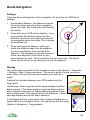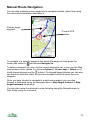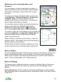
1
ViewRanger User Manual
(Symbian edition)
January 2011
www.viewranger.com
Copyright © 2006 - 2011 Augmentra Ltd. All rights reserved.
No part of this publication may be reproduced, stored on a retrieval system, or
transmitted in any form, by any means, electronic, mechanical, photocopying,
recording or otherwise, without the prior permission of Augmentra Ltd.
ViewRanger is a trademark of Augmentra Ltd.
All other trademarks are the property of their respective owners.
Version
Manual version 2.9(2) May 2011
Contacts
Web:
www.viewranger.com
Support: [email protected]
+44 1223 421356
Skype:
viewranger
Sales:
[email protected]
+44 1223 421355
2
Contents
Installation Instructions........................................................................................ 6
Requirements............................................................................................... 6
Web Site & Getting Started.......................................................................... 6
Step 1 – Install Software..................................................................................... 7
Step 2 – Copy Maps to Memory Card or Internal Disk...................................... 10
Installation Questions and Messages................................................................ 12
Starting ViewRanger......................................................................................... 13
Getting Started – 6 Key Things To Know................................................... 13
Activating ViewRanger Software and Maps...................................................... 14
Creating A User Account On The ViewRanger Server...................................... 15
Getting Started – Maps..................................................................................... 16
Getting Started – Panoramas............................................................................ 17
Map View.......................................................................................................... 18
Touch Screen phones....................................................................................... 19
Options Menu............................................................................................. 19
GPS & Location >.............................................................................................. 23
Context Menu (cursor pad centre or button)..................................................... 25
Select mode...................................................................................................... 26
Panorama Viewpoint......................................................................................... 27
Screen Size and Orientation...................................................................... 27
Free Online Mapping......................................................................................... 28
Map Downloads................................................................................................ 30
GPS................................................................................................................... 34
GPS & Navigation Settings........................................................................ 35
GPS Accuracy & Headings........................................................................ 37
Electronic Magnetic Compass........................................................................... 40
Trip View........................................................................................................... 44
Trip Profiles................................................................................................ 47
3
Tracks............................................................................................................... 48
Following Your Location on the Map.......................................................... 48
Recording a Track...................................................................................... 48
Track Settings................................................................................................... 51
Routes & Waypoints.......................................................................................... 52
Searching and Downloading Routes................................................................. 54
Creating Routes................................................................................................ 55
Graphs.............................................................................................................. 59
Route Graphs.................................................................................................... 61
Navigation......................................................................................................... 62
Alarms............................................................................................................... 63
Route Navigation............................................................................................... 65
Following a route............................................................................................... 66
Navigation Commands...................................................................................... 69
Manual Route Navigation.................................................................................. 70
Settings............................................................................................................. 71
View Layouts.............................................................................................. 75
Night Vision................................................................................................ 75
Location Bar............................................................................................... 76
Organizer.......................................................................................................... 77
Search............................................................................................................... 79
Points Of Interest............................................................................................... 81
Custom Icons............................................................................................. 81
Creating POIs.................................................................................................... 83
Editing POIs...................................................................................................... 84
POI Sets............................................................................................................ 86
POI And Feature Categories............................................................................. 88
Filter ................................................................................................................. 89
Web Links, Phone Calls, Messages & E-Mails.................................................. 90
Formatting Notes And Descriptions................................................................... 91
4
GPX Files.......................................................................................................... 93
Image And Note Lists........................................................................................ 95
Match Images to Track............................................................................... 96
Image And Note Views...................................................................................... 97
Sharing POIs, Images And Notes..................................................................... 98
Adding Images And Notes To Features Or POIs.............................................. 99
Panorama View............................................................................................... 101
Panorama on touch screen phones................................................................. 104
Panorama Rotate and Select Modes............................................................... 105
Panorama Settings.......................................................................................... 108
Buddy Beacons and Trackers......................................................................... 110
Beacon Warnings............................................................................................ 114
Trackers................................................................................................... 114
Bookmarks...................................................................................................... 119
Using ViewRanger in Different Countries........................................................ 120
My.ViewRanger.com....................................................................................... 121
Tips & Tricks................................................................................................... 122
Glossary................................................................................................... 124
Software License Agreement.......................................................................... 126
Shortcuts – Panorama View............................................................................ 129
Shortcuts – Map View..................................................................................... 130
5
Installation Instructions
Please read the license agreement on page 126 before installing ViewRanger.
There are two steps to installation:
1. Install the software using the phone's web browser, Ovi Suite or the phone’s
File manager application.
2. Copy the map files onto the memory card or internal mass storage disk
Requirements
ViewRanger is compatible with Symbian S60 2nd, 3rd and 5th edition phones,
running Symbian v7, 8 or 9. See the latest list of compatible phones at
www.viewranger.com/phones
ViewRanger is also compatible with the iPhone and with Android based phones,
but this manual does not cover those versions.
To automatically pinpoint your location ViewRanger needs to use a GPS.
ViewRanger supports the internal GPS built into many phones and also
supports NMEA-compatible GPS receivers connected via Bluetooth. You can
also use ViewRanger without a GPS.
ViewRanger displays maps, navigates routes, records tracks, displays the
panorama and shows points-of-interest without requiring a mobile network
connection, so you can use it in even the remotest location.
To share points of interest, images and notes, to update licensed POI sets, to
download maps and routes over-the-air and to use the Buddy Beacon your
handset needs to be able to open a data connection to the Internet.
Web Site & Getting Started
For additional information please visit our web site www.viewranger.com. In
particular, the support pages at www.viewranger.com/support contain a lot of
information and a helpful getting started guide.
6
Step 1 – Install Software
The ViewRanger software is provided as a Symbian install file called:
ViewRanger2ndEd.sis for S60 2nd edition phones
ViewRanger3rdEd.sisx for S60 3rd edition phones
ViewRanger5thEd_Touch.sisx for S60 5th edition touch screen phones.
S60 2nd edition phones:
Nokia: 3230; 6260; 6600; 6620; 6630; 6670; 6680; 6681; 6682; 7610; N70; N72;
N90.
Samsung: SGH-D720; SGH-D730; SGH-Z600.
Panasonic: X700; X800
S60 3rd edition phones:
Nokia: 3250; 5320; 5500; 5630 XpressMusic; 5700; 5730 XpressMusic ; 6110;
6120; 6121; 6210; 6220; 6290; 6650; 6700 Slide; 6710; 6720; 6730 Classic;
6760 Slide; 6788; E50; E51; E55; E60; E61; E62; E63; E65; E66; E70; E71;
E72; E75; E90; N71; N73; N75; N76; N77; N78; N79; N80; N81; N82; N85; N86;
N91; N92; N93; N95; N95-8GB; N96.
LG: KS10; KT610; KT615; KT770
Samsung: SGH-i400; SGH-i450; SGH-i520; SGH-i550; SGH-i560; i7110;
Innov8 i8510; g810; SGH-L870;
S60 5th edition phones:
Nokia: 5230; 5235; 5530,5800; N97; N97 mini; X6, N8.
Samsung: i8910.
Sony Ericsson: Satio; Vivaz.
Installing Software
There are three ways to install the software:
1. Use a mobile web browser on the phone to visit
www.viewranger.com/software. Click on the link displayed to download
and install the software for your phone. This will download about 0.8MB
using your mobile internet or wifi connection.
2. Install software using Nokia Ovi Suite, Samsung PC Studio or Sony
Ericsson PC Suite
3. Install software from memory card or by copying
The first and third methods can be used if you don't have a windows PC.
7
Installing the Software Using the Mobile Web Browser
The easiest way to install the ViewRanger software is to use your phone's
mobile web browser, but this download about 900KB of data.
Start the phone's web browser and go to www.viewranger.com/software
The web page will identify your phone and show a link to the correct software.
Click on the link to download and start the install.
If you see any messages you do not understand or have any questions, please
see the ‘Installation Questions and Messages’ section on page 12.
Installing the Software Using PC Suite
Install your phone's PC Suite software – Nokia Ovi Suite, Samsung POC Studio
or Sony Ericsson PC Suite. Connect the phone using a USB cable and follow
the instructions in the PC Suite software to connect the two.
To install the ViewRanger software simply double click on the ViewRanger
software install file. This should start the PC Suite's application installer – follow
its instructions.
Alternatively start the PC suite software and choose Install applications. Using
the left hand panel browse and select the appropriate SIS file from the CD or
disk, check your model number at the top of this page. If you choose the wrong
file the phone will warn you and refuse to install it, your handset will not be
harmed. Then press the arrow button to install.
The software can also be purchased and installed via the Nokia Ovi store.
Either way, once the file has been transferred, your handset will show a
sequence of panels taking you through the installation process. Follow their
instructions until installation is complete. If you see any messages you do not
understand or have any questions, please see the ‘Installation Questions and
Messages’ section on page 12.
Installing the Software from a Memory Card
If you receive ViewRanger on a memory card, or cannot use PC Suite, then
install it directly on the phone:
1. If it is not already on the memory card, copy the ViewRanger SIS file to the
memory card.
2. Insert the memory card in the phone.
8
3. Go to the applications folder
or the home folder and run File manager.
This is usually in either the Tools or the Organiser folder. On some phones
it is in Settings > Organizer.
4. Select the memory card. On some phones you need to press the right
cursor key to swap to the memory card tab.
5. Use the up and down cursor keys to highlight the appropriate SIS file, or on
touch phones scroll with the scroll bar and touch the SIS file to select it –
check your phone's model number on the previous page if unsure. If you
choose the wrong file the phone will warn you and refuse to install it, your
handset will not be harmed.
6. Choose Options > Open.
7. The phone will show a sequence of panels taking you through the
installation process. Follow their instructions until installation is complete. If
you see any messages you do not understand or have any questions,
please see the ‘Installation Questions and Messages’ section on page 12.
9
Step 2 – Copy Maps to Memory Card or Internal Disk
The map files are split into areas, the data for each area being provided in an
individual file or folder. For example, the folder named LakeDistrict contains
the map and height files for the Lake District. You can choose which map
folders you copy on to your phone’s memory card or internal disk.
To copy the maps to the memory card you have several options:
•
The USB connection with the phone in Mass storage or Data transfer mode.
Some more recent phones offer this method of operation when you connect
the phone to the computer using a USB cable. The memory card or internal
disk appears on the computer as an additional disk in My Computer. This
is a fast and efficient method.
•
PC Suite with the phone connected by USB.
This is quite fast as the previous methods. Access the memory card on the
computer by going to My Computer, then Phone Browser, then your
phone, then E: the memory card or internal disk.
•
A memory card reader.
This is a fast and efficient method. The memory card will appear as an
additional disk in My Computer.
•
Nokia PC suite with the phone connected by Bluetooth.
This is a slow way to copy large files. As with the USB connection, the
memory card is accessed on the computer by going to My Computer, then
Nokia Phone Browser, then your phone, then E: the memory card or
internal disk.
10
To copy the maps:
1. Open My Computer and browse to the memory card or internal disk using
a method chosen from the list above.
2. On the phone’s memory card or internal disk create a folder named
ViewRanger at the root level (E:\ViewRanger\). If this folder already exists
then use it.
3. Copy any map folders or files that you wish to use from the CD into the
ViewRanger folder.
4. These files can also be copied into the ViewRanger folder:
•
MiniScaleGB.VRC is the 1 to 1-million scale map of the whole country.
•
Files with extension .VRG are gazetteer or index files of place names
used by Search.
Maps can be stored in the ViewRanger folder or any sub-folder of the
ViewRanger folder.
11
Installation Questions and Messages
•
You can install the software on the phone's main memory, the memory card
or the internal disk. If you have a lot of spare main memory then use the
main memory, but if you are short of memory or in doubt, then choose the
memory card or internal disk.
•
Answer yes if you are prompted ‘Unable to verify supplier. Continue
anyway?’ or get a ‘Security warning’. This warning appears because the
version you are installing has not yet been Symbian signed.
•
If you get the message ‘Installation security error, unable to install’ or
‘Certificate error’ or ‘Invalid certificate’ then:
•
•
Go to the phone’s Applications menu
open App. manager / Manager
•
From the App. manager’s Options menu, choose Settings.
•
Set Software installation to On (or All) and Online certif. check to Off.
•
On some phones these options are in the Certificate manager rather
than the App manager.
•
Press Back and exit the App. manager.
•
Reinstall ViewRanger.
, open Tools and then
Messages like ‘File corrupted’ or ‘Installation of ViewRanger_S60.sis not
supported’ mean that you have tried to install the wrong version of
ViewRanger, for example you tried to install the S60 2 nd edition version on a
3rd edition phone. Repeat the installation with the correct file.
12
Starting ViewRanger
To run ViewRanger press the phone’s menu or home key , select
the ViewRanger icon and then press the cursor pad centre.
On touch phones go to the applications folder and tap on the ViewRanger icon.
On most phones ViewRanger will be in a sub-directory, for example
Applications, My Own or Installations. (See Tips and Tricks on page 122 for
advice on configuring this.)
Getting Started – 6 Key Things To Know
If you have a phone with a keypad then:
1. The cursor keys ◄►▲▼ pan the map. The * key zooms in and the # key
zooms out.
2. In the Panorama view the left and right arrow keys ◄► rotate the
panorama, the up and down ▲▼ arrow keys zoom in and out. The # key
jumps and the * key returns to eye level.
3. The 2 key moves the Map or Panorama view to the current GPS location,
connecting to the GPS receiver if necessary.
4. The 3 key shows the search panel, from which you can search the
gazetteer, POI sets and the ViewRanger server. (This shortcut can be
reconfigured in Settings > UI.)
5. The 7 key shows the trip view, which shows values such as speed, distance
travelled and pace. Swap between different combinations of trip settings
using the arrow keys ◄►. (This shortcut can be reconfigured in Settings >
UI.)
6. Pressing the cursor pad centre or the
button shows the context menu,
which contains the commands that apply to the current selection or view.
13
Activating ViewRanger Software and Maps
You have 16 days to activate ViewRanger software after you first use it. During
those 16 days it is fully functional, so can be used as a trial without being
activated.
To activate you need the serial number, which is provided:
•
By email for software and maps purchased by download
•
On the rear of the instruction sheet provided with CDs / DVDs
•
On the rear of the memory card case
There are two ways to activate ViewRanger:
1. From within ViewRanger choose Options > Activate. ViewRanger will
connect to the server to activate using an Internet connection.
2. Use a web browser visit www.viewranger.com/activation and enter your
details.
You will need the phone’s IMEI number. The
IMEI is 15 digits long, and may be shown with
hyphens.
To get the IMEI, run ViewRanger and choose
Enter license key from the Options menu.
You can also get the IMEI of the phone by
dialling *#06#
Once you have entered your details you will
be given a license key. Choose Enter license
key from the main menu, enter the license
key and then press OK.
The same license key can be used more than once if you need to install on
more than one memory card, but each memory card will have its own set of
Settings.
14
Creating A User Account On The ViewRanger Server
To get the full benefit of ViewRanger, you should
create an account on the ViewRanger server.
This allows you to receive and submit images,
notes and points-of-interest, and to update
licensed POI sets to receive the latest features
and points-of-interest.
The first time that ViewRanger connects to the
server, it will ask if you want to create an account.
You can also create an account at any time using
the Organizer > Settings > Account > Create
new account menu item. When you create an
account you will be prompted in turn for a e-mail
address, password and device name (optional).
Then press Submit.
15
Getting Started – Maps
When you start ViewRanger it will show the Map view and will centre on one of
the maps.
If you cannot see a map, choose Options > Organizer, go to the Maps section,
highlight a map, press the cursor pad centre or
button and choose View.
Use the arrow keys ◄►▲▼ to pan around the map. On touch phones touch
and drag the map to pan.
Use the * key to zoom in to the map and use the # key to zoom out. On touch
phones press the zoom in and out buttons. You can also zoom in and out by
going to Options > Display.
If you have more than one scale of map installed then as you zoom in and out
ViewRanger will show the most appropriate scale. You can switch this
automatic scale off using the cursor pad centre or
button then Map scale &
zoom > Auto scale off.
To connect to a GPS and lock the map to the GPS position press Lock to GPS
or simply press 2. As you move the map will automatically pan to keep the GPS
location in the centre of the screen. The GPS position is shown as a red circle
with a cross in the middle.
If you pan the map (using the cursor keys or by touching and dragging), the
map will no longer be locked to the GPS position. The position will still be
shown as a red circle.
The cursor mode is indicated by an icon in the header bar. The icon <G> means
that the display is locked to the GPS and the icon <P> means that the display is
being panned. Other modes are explained later.
To see a panorama from the current position, press the cursor pad centre or
button to see the context menu and choose Panorama from here.
16
Getting Started – Panoramas
Use the left and right arrow keys or buttons ◄► to rotate the view.
Use the up and down arrow keys ▲▼ to zoom in and out. If you have a touch
phone use the zoom in or out buttons.
To toggle land shading on and off either use the menu’s Display >
Shading on / off item, or press the 7 key. On touch phones press the
'mountain top' button.
To see the view from the current GPS position, use the menu item GPS &
location > Use GPS position, or press the 2 key. ViewRanger will warn you if
the GPS does not currently have a valid position (for example, because it has
only just been turned on or is under heavy tree cover).
If Settings > GPS > Use GPS heading is switched on, then pressing 2 or Use
GPS position will also centre the view on the direction in which you were last
moving. The handset and GPS cannot detect you changing direction if you are
stationary.
To enter a position manually, use the menu item GPS & location > Manual
location.
To see the list of features and POIs that are currently visible, press the cursor
pad centre or
button and use the menu item Visible list.
To see the list of images associated with any of those features or POIs,
highlight the feature or POI in the list and again press the cursor pad centre or
button and choose Images & Notes > Image list. ViewRanger will ask for
permission to connect to the Internet. Once the list of images has loaded you
can see one by highlighting it, pressing the cursor pad centre or
button and
choosing View image.
17
Map View
When you start ViewRanger it shows the map view.
This diagram shows the main items in the Map view. You can switch most of
these elements on and off using the Display sub-menu.
Location bar
Current co-ordinates
Cursor keys mode
Track recording
indicator
Altitude at current
location
Current heading
Navigation arrow
Direction of travel,
length indicates
speed
User created POIs
GPS current
location
Scale bar
Basic Control Keys
▲▼◄►
Scroll the Map view up, down, left and right. On touch
phones touch and drag the map.
*#
Zoom in using the * key and zoom out using the # key. On
touch phones use the zoom in and out buttons.
OK
The centre of the cursor pad or the
button show the
context menu, the contents of which vary depending on what
is selected.
18
Touch Screen phones
Touch and drag to pan the map.
Zoom in and out with the zoom
buttons, automatically changing map
scale to the best available
The button switches the selection cursor on
and off.
The overlay button toggles the
overlay on and off – that is routes,
tracks and points of interest.
Tap in the left half of the header bar to see the
short cuts menu.
Tap in the right half of the header bar to see the
GPS & location menu.
Shows the context menu, containing items
specific to the current selection or location.
Options Menu
Lock to GPS
Connects to the GPS if not already connected. Locks the
map to the position given by the GPS receiver and pans the
map to show your GPS location in the middle of the screen.
To record a track log use the Options > Create > Record
track menu item.
Panorama
Shows the Panorama view. The view location is updated if
you are locked to the GPS.
Organizer
Swaps to the Organizer from where you can access POIs,
Routes, Tracks, Search, POI Sets, Filter, Maps and
Bookmarks.
Search
Shows the search view from which you can search the
gazetteer and POI sets.
Trip
Shows the Trip view.
Show all POIs
This option appears when you are viewing a specific POI
set, and only the POIs in that set are displayed. The name of
the POI set appears in the bar at the top of the screen. This
item returns to the normal display showing all POIs.
19
Previous view
Returns to the view being displayed before the last View on
map or View set on map operation. A view is a combination
of map scale, position, country and zoom.
Cursor keys >
This sub-menu sets the mode for the Map view and controls
function of cursor keys or of touching the map.
GPS & location>
Shows GPS & location sub-menu
Display >
Shows Display sub-menu, which contains controls affecting
how the map is displayed.
Create >
Contains options to add POIs and create routes; switch track
recording on and off; take a photo and attach it to a new
POI.
Phone >
Options for locking the keypad and controlling the
screensaver.
This menu also contains options for creating messages. If
you create a text SMS or e-mail message while connected to
a GPS, then your current co-ordinates will be put into the
message. You can delete them before sending if you wish.
Where am I?
Shows a panel displaying the location of the ViewRanger
display and the altitude at that location; direction and field of
view; GPS details, if connected; the name of any area POIs
containing the location. Also displays the sunset, sunrise
and solar noon times for the current location, calculated for
the phone’s current date and time zone.
Settings
Goes to the Settings panel.
Help
Shows application help information – most views have their
own specific help page.
About
Shows the About panel including ViewRanger version.
Cursor Keys >
This menu allows you to choose what the cursor keys do. On touch phones it
allows you to choose what action touching the map has.
Lock to GPS
Locks the map to the GPS, so the GPS position is kept in
the centre of the screen. <G> icon in header.
Pan map
Use cursor keys to scroll the Map view. On touch phones
simply drag the map. <P> icon in header.
Move pano viewpoint Move the location of the Panorama viewpoint on the map.
Press Panorama to swap to the Panorama view and press
20
Done to go back to pan mode. (See pages 27 & 105.) <V>
icon in header.
Set Pano Direction
Set the direction of view for the panorama on the map. The
left and right arrow keys rotate the panorama veins, the up
and down arrows narrow and widen the Panorama view.
Press Panorama to swap to the Panorama view and press
Done to go back to pan mode. <D> icon.
Select
The cursor appears as a cross in the centre of the screen.
Use the cursor keys to position the cross over an item that
you wish to select, or on touch phones touch and drag. As
you pass over objects their name is shown in the top left
corner. Press Select or OK
to select, press Done to leave
the tool. <S> header icon.
Move POI or WPT
This option appears when a POI or waypoint is selected.
Choose it to move the POI or waypoint using the cursor
keys. Press Done when you are finished. <M> icon at top.
Display >
Hide / Show overlay The overlay is the layer of objects drawn on top of the map –
POIs, tracks and routes. If you hide the overlay you see only
the map and the GPS location. Show overlay shows all
these items again. This item has a shortcut of 8, so it is easy
to toggle the overlay on and off to see the underlying map.
On touch phones the right most button toggles the overlay
on and off.
Rotate clockwise
Rotates the map display by 90 degrees clockwise
Rotate anti clockw’
Rotates the map display by 90 degrees anti-clockwise
Auto rotate map on When auto-rotate is switched on the map automatically
rotates to be as close to the direction of travel as possible.
For example, if you are heading east then the map will rotate
by 90 degrees so that east is upwards. The rotation can only
be in steps of 90 degrees. If you are travelling at about 45
degrees ViewRanger will choose one orientation and stick
with it to avoid the map flipping around.
Zoom in / out
Zoom in or out.
Night vision on/off
Night vision draws the screen with a red hue, which helps
preserve your eye’s night vision in the dark.
Hide buddies
Hide the buddy and tracker icons.
21
Create >
Create POI
Create a new POI. You will be prompted to enter a name, a
default name being provided. The POI is added at the
centre of the screen and you can move it with the cursor
keys or on touch phones by touching. Press Done when
you are finished.
Create route
Create a new route. You will be prompted to enter a name,
a default name being provided. The first waypoint is added
at the centre of the screen and you can move it with the
cursor keys or by dragging. Press New wpt, the cursor pad
centre or
button to add the next waypoint, or press Done
to finish the route.
Record track / Stop
recording track
Start or stop recording a track. If you start recording a track,
ViewRanger will connect to the GPS. The recording status
is shown in the top right corner of the title bar.
Take photo and
mark
This option swaps into the camera application where you
can take a photo. Exit the camera and swap back into
ViewRanger. You will be prompted for a name, then a POI
will be created and the image will be added to the POI’s list
of images. The POI records its creation time.
22
GPS & Location >
Use GPS Position
ViewRanger will use the location given by the GPS. In the
map view this locks the map to the GPS and in the
panorama view it updates the viewpoint to the GPS
position.
Connect to GPS
Connects to a GPS.
Connect New GPS
Only available on 2nd edition phones. Use this option if you
have previously used a different GPS receiver and need to
use a new one.
Disconnect from
GPS
Disconnects from the GPS.
Satellites
Shows the Satellites graph, which indicates the accuracy of
the GPS position.
Search
Shows the search view, from which you can search POI
sets, the gazetteer and the ViewRanger server.
Manual Location
Goes to a panel where you can manually specify a location
Add Bookmark
Creates a new Location Bookmark in the Bookmark list
Bookmark List
Shows the list of Location Bookmarks you have saved,
allowing you to move to a favourite location
Phone >
Lock Keypad
Locks the keypad so that accidental pressing of keys
doesn’t affect the application or phone. You can also lock
the keypad by pressing the power key briefly and choosing
lock keypad.
Disable/Enable
screensaver
Stops / re-enables the screensaver. Useful if you don’t
want the phone handset screen to dim when using
ViewRanger to navigate. But battery life will be reduced!
E-mail message
Text message
Multimedia
message
Creates a message. If you have connected to a GPS and
the GPS has or had a valid position fix, then the last valid
co-ordinates, speed and heading appear in the body of the
message, along with the time and date of that reading. You
can delete them if you wish.
Clear Cache
Clears ViewRanger’s image and note cache on your phone.
The cache uses up to 0.5Mb on the memory card.
Disconnect Internet
Closes ViewRanger’s connection to the Internet.
Check with server
Contacts the ViewRanger server, reports the server status
23
message if there is any, reports the latest available software
version and if necessary updates the category file.
Settings > Account >
Account sign in
Contacts the ViewRanger server, reports the server status
message.
Reset password
Asks the server to reset your password. Your new
password is emailed to the address you originally gave.
Change password
Changes the password associated with your server user
account.
Create new account
Create a user account on the ViewRanger server. You will
be prompted to enter a user name, password and e-mail
address, which will then be available in Settings > User.
Connection
Displays the access point used by the phone.
Activate
Used to activate new maps with a serial number.
Enter license key
Used to license maps on a new phone with a license key.
Several other sub-menus are available, but are covered in their own dedicated
section. These include:
BuddyBeacon – see Buddy Beacons and Trackers on page 110.
Map source – see Free Online Mapping on page 28.
Downloads – see Map Downloads on page 30.
24
Context Menu (cursor pad centre or
button)
The commands in this menu vary depending on what is selected. Some of the
commands are:
Panorama from here Swaps to the Panorama view, moving its viewpoint to be
from the map centre. Up to three variants are available –
from the map centre, from the selected point, or from the
GPS position.
Choose
Displays a list of selectable objects shown on the map, so
you can quickly see their names and choose one.
Map scale & zoom > ViewRanger supports multiple map scales. It displays one
scale at a time. This sub-menu contains options to choose a
different scale map from those available at the current
location. It also contains options to zoom in and out of the
map and to switch auto scale on and off.
Scale in
Use a map with a smaller scale – for example, if you are
currently viewing a 1:50,000 map, then this command shows
the 1:25,000 map instead (if you have that scale installed).
This item only appears if there is a map of a smaller scale
available at the current location.
Scale out
Use a map with a larger scale – for example, if you are
currently viewing a 1:50,000 map, then show the Miniscale
1:1-million map instead. This item only appears if there is a
map of a larger scale available at the current location.
Map list
Show the list of installed maps. Highlight one using the
cursor keys or by touching. Press the cursor pad centre or
button to show the context menu, choose View and your
chosen map will be displayed.
Auto scale on / off
Switch auto scale on and off. If auto scale is switched on,
then as you zoom in and out ViewRanger will show the most
appropriate scale of map available at the current location. If
you are viewing a 1:50,000 map then zooming in will swap to
a 1:25,000 map. Zooming out several levels swaps to the
1:1 million map.
25
Select mode
In the Map view you can go to Select mode
either by pressing 1 or by choosing Options >
Cursor keys > Select or on touch phones by
pressing the select button .
In this mode a cross is shown in the centre of
the screen, and the arrow keys move the cross
over the map. If you press the cursor pad
centre or
button then whatever is under the
cursor is selected.
The name of the item underneath the cursor is
shown at the top of the map view – this is very
useful when editing or choosing POIs and
routes.
When hovering over a track the time and speed
at that point are also shown.
On touch screen phones touch or drag the
screen to move the cursor to that location. If you
drag near the screen edge the map will pan.
If you tap on a route, track, POI or buddy it will
be selected.
If you tap on a POI or waypoint that is already
selected, and that is not locked, you can move
that point.
26
Panorama Viewpoint
You can see and move the Panorama
viewpoint in the Map view. The viewpoint is
shown as a cross, surrounded by a black
triangle. Three lines show the view span and
direction, the furthest distance you can see
being indicated by the arc. The Panorama
shows you everything that can be seen from
your current viewpoint in that ‘pie’ section.
To move or see the viewpoint you can:
•
From the Panorama view, choose Options
> Viewpoint on map
•
From the Map view choose Options >
Cursor keys > Move pano viewpoint (to
move the position) or Set pano direction (to rotate or zoom the view)
•
From the Map view choose Options > Display > Show pano viewpoint to
show the viewpoint.
•
To change the view direction or zoom while you are moving the panorama
viewpoint, press and hold the shift / pencil key.
Screen Size and Orientation
ViewRanger supports all S60 screen
resolutions and orientations. For example,
the picture on the right shows a 416 x 352
screen with landscape orientation.
27
Free Online Mapping
ViewRanger can display free online mapping from OpenStreetMap and Open
Cycle Map. This mapping is downloaded as it is needed. It is cached on the
phone. If the mobile network is not available, or if you choose to work offline,
then ViewRanger will display as much as it can using the cached tiles.
List the maps: To see the available online map layers go to Options >
Organizer, then into Maps, then into "Online mapping". Agree to update the list
of maps. You'll see two or more layers listed.
View the map: To view a layer tap on it twice, or highlight it and press the
cursor pad centre, and choose View. ViewRanger will go back to the map view
and will start downloading maps.
Interact with the map: As you pan around the map or zoom in and out more
map tiles will be downloaded.
Change to another map layer: To change to another map layer go to Options
> Map source and select another map. Premium map swaps back to the more
detailed paid for topographic maps.
Online / Offline: Use Options > Map source > Online or Offline to go on and
offline. When online maps are downloaded as they are needed. When offline no
maps are downloaded, ViewRanger only display maps cached on the phone.
While offline the title bar says "Offline".
Copyright: displays the copyright and license details for the map.
Clear map cache: deletes old map tiles in the cache. You'll be asked to choose
a minimum age to delete. So if you enter 14 days, then only map tiles older than
14 days are deleted. Enter 0 to delete all cached map tiles.
Cache size: To set the size of the map cache go to Options > Settings, then
into User and change "Map cache size". When the cache is full ViewRanger will
throw away the oldest map tiles to make space.
Overlay: the overlay used for the online maps, that is POIs, routes and tracks,
is completely separate to that used for premium maps (except for USA maps).
So for example, a route or POI set shown on a premium map, won't be visible
on the online map and vice versa. This is because the two maps use different
coordinate spaces. We will remove this restriction in a future release.
Coordinate display: by default coordinates are displayed using the global UTM
coordinate system. To see local coordinates, for example GB national grid, go
to Settings, then into UI, and set "National grid" to the coordinate type you'd like
to see. If you view maps outside the area that is valid for those coordinates, the
software will revert to UTM.
28
The list of online maps
Worldwide overview
Downloading tiles
Zoom in through levels
of detail
OpenStreetMap shows
detailed street maps
Open Cycle Map shows
cycle routes, contours
and facilities
Note: Open Street Map and Open Cycle Map use free map sources and the
level of detail available varies greatly.
Maps in screen shots © 2010 CloudMade.com; Map data CCBYSA 2010
creativecommons.org/licenses/by-sa/2.0/; OpenStreetMap.org contributors.
29
Map Downloads
You can download maps and other files within ViewRanger .
Quick summary
This is a quick summary of the download functionality. Read the following
sections for a more detailed description and screen grabs.
•
To see which map layers and other items are available to download, go to
Options > Organizer and swap into the Downloads section. Answer yes
when prompted to update the list.
•
To download a plain item like a POI set, highlight it in the list, press the
cursor pad centre or
and choose Download.
•
To download a map use the download grid in the map view. To switch this
on choose Options > Downloads > Show download grid.
•
Green tiles are already on the phone, red tiles are not.
•
To download the central tile, which has a bold outline, press the cursor pad
centre or
and choose Download map tile here.
•
You are always told how large the download will be and what you will be
charged, so you can cancel before incurring any charge or cost.
Downloads section of Organizer
To see the list of maps, POI sets and other materials that are available to
download go to Options > Organizer, then go into the Downloads section. (Or
from the map view choose Options > Downloads > Downloads.)
You'll be asked if you wish to update the list of available items - answer yes and
ViewRanger will connect to the Internet to update the
list. This uses just a few kilo bytes of bandwidth.
The downloads list is split into individual countries
and each country has a list of layers. To list a
country's layers highlight the country and press the
right cursor key, or on touch phones touch the item
twice.
Layers which have a arrow on their right are maps
split into a grid of tiles, which you'll normally
download from the map view using the grid,
described later. In the picture on the right there are
two such layers - 1:50,000 Landranger and 1:25,000
Explorer map.
30
You can list the maps and tiles on the phone that belong to that layer by
pressing the right cursor key or on touch phones by touching it twice.
Items without an arrow can be downloaded directly. In the picture above are two
sections of Miniscale map and a POI set containing nature reserves. To
download an item highlight it, press the cursor pad centre or
and choose
Download. You'll be told how large the item is and if there is any charge.
When you highlight a layer and press the cursor pad centre or
you'll see any
relevant commands – for some there layers will be a Download item, for grid
based layers there will be an option to view its grid on the map. For many layers
you can choose to view them on the map - this swaps to the map view, panning
and zooming to show the layer's bounds - though you'll only see the layer if
you've actually downloaded it.
Downloads within the map view
When downloading in the map view you should first switch on the download grid
using Options > Downloads > Show download grid. You'll be asked which scale
and layer you'd like to use.
Choose a grid scale
The download grid over a
reference map
The grid's colour coding
Note that the grid being displayed may not be for the map scale being displayed
- if you are choosing maps of a new location you'll look at an overview map to
choose your tiles.
A grid is drawn over the map. Each square tile can be downloaded individually.
Green tiles are already on the phone, red squares are not. Grey tiles indicate
that part of the tile may be on the phone.
31
As you move around the screen the tile that will be downloaded if you ask for it
is drawn with a bold outline.
To download the tile that is outlined in bold press the cursor pad centre or press
the
button and choose Download map tile here.
After a short pause ViewRanger will tell you how large the tile will be, how much
you will be charged and what your balance will be after downloading the tile.
Answer Yes to confirm, No to stop. If you reply No then the tile is not
downloaded and you are not charged.
If you say Yes then the tile is downloaded and you are charged. Progress is
shown in the pink area near the top of the screen. You can press the Stop
button to end the download and if you do so before it completes downloading
you won't be charged.
The ViewRanger server remembers the tiles that you have downloaded and
only charges you for new tiles. However, the server does not have a record of
other map products you have bought, including custom maps, so avoid
downloading duplicates.
It will only charge you for areas where there is a map. In Great Britain you are
only charged for land, not sea - but other countries usually charge for any map.
Download areas
You can also download a number of tiles in one go. To do this choose Options >
Downloads > Download area. All the tiles that are on screen will be
downloaded. These are shown with solid outlines, the tiles with dotted outlines
will not be downloaded.
32
Auto download
If you choose Options > Downloads > Auto download on, then ViewRanger will
automatically download map tiles as you pan around the screen. It requests
tiles where you don't already have a map.
When auto download is only ViewRanger only downloads tiles for the map scale
you are currently viewing. It does not show the grid if you are viewing a map of
a different scale, for example the overview map.
Map optimising
If you have downloaded a lot of map tiles, for example over a hundred, then you
may find that ViewRanger becomes a bit slow to start. You can solve this by
optimising the maps.
To do this go to the Organizer and into the list of Maps. Highlight a map tile,
press the cursor pad centre or
and choose Optimise tiles. ViewRanger will
merge nearby tiles of that layer together. This requires additional memory card
space temporarily, but the space is all freed when complete. You may need to
do this on several different tiles. ViewRanger will not merge all tiles together
because this would be inefficient.
33
GPS
ViewRanger works with the GPS built in to most phones, or with an external
NMEA compatible Bluetooth GPS receiver.
To connect to the GPS either press Lock to GPS, or choose the Options >
GPS & location > Connect to GPS menu item or simply press the 2 key.
ViewRanger uses all the enabled positioning services to determine your
location. It favours those which are most accurate and have the lowest power
demand. You can switch positioning services on and off using the phone's
Settings app – go to Phone > Application settings > Positioning > Positioning
services.
When ViewRanger connects to the GPS:
1. First it will show your last known location. This is indicated using a grey
circle and cross as it may not be accurate. It is not recorded in the
track. The location bar reports “Last known location”.
2. Then, if the Network is enabled, ViewRanger will show the location
reported by the network. This is also indicated using a grey circle and
cross as it is approximate. It is not recorded in the track. The location
bar reports “Position: Network based”.
3. Once the Internal GPS, Assisted GPS or Bluetooth GPS reports a
position, this is shown on the map using a red circle and cross. It is
recorded in the track log. The coordinates are shown in the location bar
in black.
4. If you have a Bluetooth GPS connected and it has a position fix, then
ViewRanger stops using the internal and assisted GPS to save power.
To set ViewRanger’s Map view to move with current GPS position, press Lock
to GPS or simply press the 2 key.
To move the Panorama viewpoint to the current GPS position use the Options
> Use GPS position item or simply press the 2 key.
While connected to the GPS receiver the current GPS co-ordinates and heading
are shown in the location bar in the Navigation and Satellite views. The current
GPS co-ordinates are also shown in the location bar of the Map view while it is
locked to the GPS position. The co-ordinates will be shown as black when they
are valid and red when they are not valid. (GPS co-ordinates may not be valid
because the receiver has just been switched on or has a limited view of the
sky.)
On 2nd edition phones ViewRanger uses only the Bluetooth GPS.
34
Satellite Status
The Satellite Status panel shows a chart
indicating the strength of the satellite signals
being received by a connected GPS receiver.
The more satellites that are shown connected
and the stronger the signal (the higher the bar),
then the better the positional fix will be.
The Hdop value is a measurement of the GPS
position’s accuracy – the lower the value, the
more accurate the position. A value of 1.0 is
excellent, higher values are poorer. A value of 10
or more is very inaccurate.
If any of the bars are grey this indicates that they
are not being used by the GPS to calculate the
position. Note that this is completely within the
control of the GPS hardware, ViewRanger
cannot change which are used.
The time displayed at the top is the satellite time,
UTC. Raw GPS and sensor readings are also
shown, as is the type of the position currently
being used.
While the positioning services are trying to make a first fix, the graph may
switch between different sources.
The time, Vdop (vertical accuracy) and grey bars are not indicated on 2 nd edition
phones.
GPS & Navigation Settings
The Settings panel has a GPS tab containing GPS specific settings:
POI/wpt alarm
Switch the alarm for arriving at a POI or waypoint on and
off.
XTE Alarm
Switch the cross track error alarm on and off.
Arrival alarm
distance
When navigating, this setting determines the distance at
which ViewRanger first sounds its arrival alarm. A setting of
50m means the alarm will sound when you are within 50m
of the target point.
35
Arrival alarm tone
The tone / sound played when the arrival alarm is triggered.
The list shows all tones, sounds and music tracks stored in
the standard locations on the phone.
XTE alarm distance
When navigating a route, this value determines when the
cross track error alarm sounds. Cross track error is the
distance you are away from the planned route. If this setting
has a value of 100m the alarm will sound if you are 100m or
more from the route.
XTE alarm tone
The tone / sound played when the XTE alarm is triggered.
The list shows all tones, sounds and music tracks stored in
the standard locations on the phone.
Alarm volume
The volume of the alarm tones.
Show next wpt
distance
When navigating a route, this value determines the distance
at which ViewRanger will consider you to have arrived at a
waypoint. Once you reach this distance from a waypoint,
ViewRanger will start pointing to the following waypoint.
The default value is 15m – so once you are within 15m of a
waypoint, ViewRanger will start pointing to the following
waypoint. If you have alarms enabled, the arrow will still be
red while you are within the alarm distance.
Heading Vector
Time
In the Map view ViewRanger shows an arrow indicating the
direction you are travelling in. The length of the arrow is
how far you will travel in a given time period. This setting
controls that time period. If the value is 10 minutes, the
arrow indicates where you will be in 10 minutes time.
Set this to zero to hide the arrow.
Stationary Speed
Sets the lowest GPS speed at which you are considered to
be stationary.
Heading Samples
Specify the time over which ViewRanger should sample to
work out your heading, smoothing out any errors. For a very
accurate GPS receiver you could reduce it to 1 second,
which would make the heading more responsive. For a poor
GPS or for poor conditions (such as tree cover) then you
might increase it to 4 seconds to average out the errors but
make it less responsive.
Connection
Choose between connecting to the GPS receiver ‘When
needed’ (e.g. when you press 2) or ‘At startup’ (when
ViewRanger starts).
36
Maximum Hdop
Hdop is a measure of GPS accuracy. A value of 1.0 is
perfect, a value of 10.0 is poor. This setting sets the
maximum value of Hdop at which ViewRanger will consider
the GPS reading valid. If the Hdop reported by the GPS
module is above this value then the GPS circle and cross
will go grey, and no track points will be recorded until the fix
is more accurate.
Position timeout
If your GPS stops telling ViewRanger its location
ViewRanger will wait a short period before changing the
GPS indicator to invalid. This item sets that time period. At
the default value of 15 seconds ViewRanger would wait 15
seconds before greying the GPS symbol.
Use check sum
This is an advanced setting, which tells ViewRanger to
perform additional checks on the GPS data it receives. It is
normally left off but if you had GPS reliability problems you
would switch it on. It is only available on 2nd edition phones.
GPS Accuracy & Headings
Even the best GPS units give small errors. Most units are accurate to plus or
minus 10 metres, though some can be as accurate as plus or minus 2 metres.
Their accuracy falls if they have a limited view of the sky – for example if you
are under trees or by the side of a cliff.
Every reading that the GPS receiver takes is subject to the errors, so the GPS
does not know when you are standing still because its readings still show some
fluctuation. To overcome this ViewRanger only uses the GPS heading when the
speed is more than a tolerance. For an accurate GPS a tolerance of 0.5km/h
would be good, but for less accurate devices a tolerance of 1.5km/h is more
appropriate. ViewRanger can also average successive heading readings to
smooth out the small GPS errors.
Stationary Speed
Stationary Speed sets the lowest GPS speed at which you are considered to be
stationary. If you are stationary then ViewRanger does not update the heading
until you start moving again. So if you walk north, stop and turn around to face
south, the heading given by ViewRanger is still North.
If the Stationary Speed is set to 1.5km per hour, then ViewRanger will consider
you to be stationary if the GPS receiver reports a speed of 1kmph, but moving if
it reports 2kmph.
37
This figure depends on the accuracy of your GPS receiver and on current
conditions – for a receiver with SiRF you might be able to use a figure of
0.5kmph, but for a less sophisticated receiver a figure of 2kmph is required.
Setting the Stationary Speed and Heading Samples values
Normally the default settings do not need to be changed, but if you find that the
heading changes when you are stationary, or vice versa, then adjust Stationary
Speed or Heading Samples.
Don’t do this while walking or moving.
Run ViewRanger and connect to the GPS.
Make sure the location bar is displayed. (Settings > UI > View Layout and in
the Map view Display > Show location bar.)
Lock to the GPS by pressing 2 and wait for it to get a position fix. The
coordinates in the location bar will be green and the GPS location cross and
circle on the map will go red (or the colour you have chosen in Settings).
The heading is displayed after the GPS co-ordinates on the second line of the
display with a ‘H:’ prefix. It should either say ‘none’ because ViewRanger has
not detected any movement, or will give a figure in degrees. The symbol ‘=’ after
the heading indicates that the current position is considered stationary.
If the figure is occasionally changing, then either go to Settings > GPS >
Stationary Speed and increase its value (use the # key to enter decimal
points), or increase the Settings > GPS > Heading Samples setting.
Repeat the adjustment until the heading stays constant when the GPS is not
moving.
Don’t use large numbers, values under 3.0km/h should be sufficient – if you
choose 30.0km/h you will need to walk at that speed before the heading
updates.
Maximum Hdop
Your GPS sends ViewRanger a flag indicating whether the GPS considers the
fix is valid, i.e. that it is acceptably accurate. The GPS also sends a numerical
value named ‘Hdop’ indicating the accuracy. A value of 1.0 is near perfect, 10.0
is poor and higher numbers indicate progressively less accurate locations.
When ViewRanger has been told the GPS reading is valid it draws the GPS
circle and cross in red (or the colour you choose in Settings > UI).
Some GPSs say that their fix is no longer valid when the Hdop is more than 10,
others say the fix is invalid when the Hdop is greater than 50. High values like
this are usually undesirable as they indicate an inaccurate reading.
38
You can set the maximum Hdop that ViewRanger will treat as valid in Settings
> GPS. The default is 50.0, but if you get poor tracking results with spikes then
reduce this number to 20 or even to 10. If the Hdop is above the value you
choose, then ViewRanger will consider the GPS location invalid – the GPS
circle and cross will go grey, and no track points will be recorded until the fix is
more accurate.
GPS Altitude Accuracy
ViewRanger can show two types of altitude.
Plain 'altitude' is calculated from .VRH files – it is fairly accurate, but can miss
peaks, and is always the ground height value.
'GPS altitude' is calculated by the GPS so depends on the GPS reception. Its
accuracy is variable, but it will spot if you are above ground level.
Normally GPS altitude is shown relative the WGS84 datum, which is different to
sea level. In Cambridge for example the difference is about 45 metres.
If you copy the optional 'GPSAltitude.DAT' configuration file into the Config subfolder of your ViewRanger folder, then ViewRanger will apply a mean sea level
correction to the GPS altitude. The GPS altitude will then be shown relative to
sea level. The accuracy of the reading can be good, but it can take a while to
settle down when the GPS first starts.
The resulting figure will be exported with tracks.
39
Electronic Magnetic Compass
The following phones contain an electronic compass, which is supported by
ViewRanger from version 2.7.24 onwards:
5th edition: Nokia: N97; N97-mini. Samsung: i8910HD.
3rd edition: Nokia E72; E55; E52; 5730; N86; 6720; 6710; 6210.
Map view
ViewRanger displays a compass indicator to the bottom left of the map view.
The white arrow points to north, the black line indicates grid north. To make the
map align with the countryside around you, rotate the phone until the white
arrow lines up with the black line.
The outer ring of the compass changes colour to show whether the compass is
calibrated and how accurate its current reading is. Red means the compass is
not accurate; yellow means it has limited accuracy; and green means it is
accurate.
To calibrate the compass rotate it a couple of times about two different axes for example turn it twice about its vertical axis, then twice about a horizontal
axis. Do this until the outer ring of the compass turns green. (For more on
calibration, see later in this final section.)
As the compass is calibrated the outer ring goes from red to yellow to green
Notes:
•
The white arrow takes account of the magnetic variation that you set in
the UI section of Settings.
•
If auto rotate is enabled (using Options > Display) then the map will
rotate by multiples of 90 degrees to best align with north.
40
•
The compass can be switched on and off using Options > Display >
Show / hide compass.
Panorama
The panorama will rotate automatically to align with the direction the phone is
pointing.
As with the map the calibration is indicated - the bottom axis changes colour, as
does the compass button on touch screen phones. Twist the phone until the
axis and button go green.
The direction the phone is pointing is indicated by an arrow in the bottom label
area.
If you rotate the panorama manually - using the cursor keys, arrow buttons or
by touching and dragging - the panorama will stop aligning with the compass.
The phone's direction will still be shown with the green arrow, as long as it is in
the field of view shown by the panorama.
To re-align the panorama with the compass simply press the compass button or
choose Options > Start using compass.
41
Compass display in the panorama - left is not calibrated, middle and right are
calibrated
Trip
You can set any trip field to display the compass using the trip settings.
Navigation
Normally ViewRanger navigates using your heading, as given by the GPS. You
can tell ViewRanger to use the compass instead by selecting Options >
Navigation > Use compass.
Important Note: Only do this if you are holding the phone straight in front of you.
If you put the compass in your pocket then navigating using the compass will
give the wrong direction. It would be fine if mounted on handlebars.
Configuring for portrait / landscape
Some phones, for example the N97, automatically adjust the compass when
you change the screen for portrait to landscape. However, other phones, such
as the 6210, do not.
In ViewRanger you can set a correction for each orientation using the Compass
section of Settings. For the N97 leave both the portrait and landscape
corrections set to 0 degrees. For the 6210 leave portrait set to 0 degrees and
set landscape to 90 degrees. For other phones experiment.
42
You may prefer to tell ViewRanger to use just one orientation - do this using the
screen orientation setting in the UI section of settings.
Compass calibration
If the compass ring is red or yellow, or if the panorama axis / arrow / button are
red or yellow, then the compass needs to be calibrated for accuracy. This is the
way the compass in these devices works, it's not something we can change.
To calibrate the compass you need to twist the phone until the compass ring, or
panorama axis / arrow / button, go green.
There are several ways to do this. Some people flip the phone sharply over
three times. Others turn it alternately about a horizontal axis, then a vertical
axis. There are some You Tube videos which show these techniques.
N97 note: It is very hard to make the N97 calibrate if its screen is set to
automatically rotate to landscape when you put the phone on its side. There are
two solutions:
Switch off this feature using the phone's Settings - go to Phone > Sensor
Settings > Turning control and switch off Auto-rotate display.
In ViewRanger go to Options > Settings, then into UI. Set the Screen orientation
to either Portrait or Landscape. This stops ViewRanger auto-rotating the screen.
As the compass is calibrated the outer ring goes from red to yellow to green
43
Trip View
The trip view displays navigation information and a range of statistics about
your current journey.
You can configure which statistics are shown and can choose from six different
screen layouts. The statistics include values such as distance, speed, average
speed, time moving, estimated time of arrival, altitude and pace.
You can save different combinations and layouts as profiles, and step through
the profiles like pages with the arrow keys.
Trip view layouts
There are six different layouts available. Each profile can have a different
layout. For example, you might choose the view with just four values displayed
large for your main view, and choose a view with 8 smaller displays for a
secondary view.
4 x 4 layout
2 x 1, 2 x 2 layout
2 x 1, 1 x 4 layout
1 x 8 layout
To choose a layout press the cursor pad centre or
2 x 4 layout
2 x 2, 1 x 4 layout
and choose Trip settings.
44
Field choices
There are currently 30 choices for each field. To change which data is shown,
press the cursor pad centre or
and choose Trip settings. The fields are
numbered 1 to 8 working across the page then down line by line.
The choices are:
Trip distance – the distance travelled since you last reset.
Speed – your current speed.
Maximum speed – the maximum speed recorded since you reset.
Average speed – the average speed since you reset. This is calculated over
the time you are connected to the GPS.
Moving average speed – the average speed while you have been moving
since you reset. The time you are stationary is not included, so if you stop for
lunch this figure is not affected.
Pace versus average speed – compares your current speed to the average
speed. If your speed is less than 90% of your average speed it displays ‘slow’
and if it is more than 110% of the average then it displays ‘fast’. The
percentage is also displayed.
Pace versus moving average speed – like ‘Pace versus average speed’, but
this pace compares to the moving average speed.
Pace versus fixed speed – like the other two pace figures but this compares to
a speed you choose. Set your target pace in Settings > Trip > Pace speed, then
this field indicates how fast you are going relative to that pace. This setting is
saved with your trip profile, so you could save one profile for jogging, one for
cycling and could even have an uphill variant.
Time of day – displays the current time. The date is also displayed.
Trip time – the time spent connected to the GPS since you last reset.
Time moving – the time spent moving, as indicated by the GPS’s speed, since
you last reset. You can set the minimum moving speed in Settings > GPS.
Time stationary – the time spent stationary (not moving), as indicated by the
GPS’s speed, since you last reset.
Location – the coordinates of the current GPS location. Only use this in a field
which stretches across the whole screen.
Altitude – the altitude of your current location calculated from your installed
mapping data.
GPS altitude – the WGS84 altitude reported by the GPS.
Heading – the direction you are moving in, as reported by the GPS, in degrees.
45
Bearing – if you are navigating along a route or towards a point, this shows the
bearing you should take to the next point.
Navigation arrow – the navigation arrow, displayed when you are navigating
along a route or towards a point. It indicates the direction to go relative to your
current direction to reach the next point. The colour changes, as described in
the navigation section of the user manual.
Final destination – the name of the route or target point.
Final distance – the distance to the target point or end of the route.
Final ETA – the estimated time of arrival at the target point or route end.
Final ETE – the estimated time elapsed (the time it will take) to reach the target
point or route end.
Next destination – the name of the target point or next waypoint.
Next distance – the distance to the target point or next waypoint.
Next ETA – the estimated time of arrival at the target point or next waypoint.
Next ETE – the estimated time elapsed (the time it will take) to reach the target
point or next waypoint.
Cross track error – the distance you are away from the planned route. Arrows
indicate the direction to get back to the route.
Velocity made good (VMG) – the velocity taking into account the target
destination. If you are travelling at 10kmph but your heading is not directly to the
target point, this shows the component of speed that is towards the point.
Hdop (accuracy) – the GPS accuracy figure. Values of 1 are perfect, higher
figures are progressively worse. Text is also displayed to give a qualitative
description of the figure.
Sunset – the time of sunset, sunrise and solar noon (when the sun is at its
highest). These are calculated for the current GPS position and for the phone’s
current date and time zone. To see the sunset on a different day temporarily
change the phone’s date setting.
Compass – if your phone contains an electronic magnetic compass, this
displays the compass arrow and circle.
Blank – the field has nothing displayed.
Other Trip Settings
There are two other settings in Trip settings:
Pace speed – this sets the fixed pace speed, that is the target speed that the
‘Pace versus fixed speed’ field compares your current speed against. This value
46
is saved with each profile, so you can have different target speeds for different
profiles.
Distance tolerance – this value tells ViewRanger how big a movement to allow
when calculating the distance travelled. It should normally be left set to 50
metres. If you reduce it significantly then the total distance recorded would
increase because small variations in GPS location would get added to your
distance moved. If you have a poor GPS you might need to increase this value.
Trip Profiles
You can save combinations of layout and field choice as ‘Trip profiles’. You can
swap between different profiles by pressing the left and right keys or buttons, or
by using 4 and 6.
For example, you could have a display with speed, distance, navigation arrow
and time displayed in 4 large boxes as your main screen that you can glance at
while biking or walking. On a second screen have figures such as average
speed and estimated time of arrival displayed in 8 smaller figures, which you
look at occasionally when it is convenient to change screens. But it is
completely up to you.
Four default profiles are provided, but these can be deleted.
Profiles are manipulated using the Options > Trip profiles sub menu:
Save trip profile as – saves the current combination of layout and fields as a
new trip profile. You will be prompted to give it a name.
Save trip profile – re-save the current trip profile. You are already displaying a
named profile but have made changes to it.
Choose trip profile – display a list of named profiles and choose one. Normally
it is easier to use the left and right keys or buttons to change profiles.
Delete trip profile – display the list of trip profiles and choose one to delete.
The name of the current profile is displayed in the title bar. If you make changes
to the layouts or fields then ViewRanger remembers these. If you try to change
to a different profile you are given the option to save the changes or discard
them.
47
Tracks
If you connect to a GPS, ViewRanger lets you track your location. You can
track your position on the Map view and you can record your track so that you
can later review the route that you followed and get information such as
distance, average speed, etc.
Following Your Location on the Map
ViewRanger can follow your location in the Map view. This allows you to
instantly identify your position on the map.
To start tracking, in the Map view select Lock to GPS or press 2.
If you have previously used ViewRanger with a GPS and that GPS is available,
ViewRanger will connect to that GPS.
If you have not previously connected ViewRanger to a GPS, or the GPS you
last used is not available, ViewRanger will ask you to choose a GPS. Select the
GPS you wish to use and click OK.
Once ViewRanger receives valid co-ordinates from the GPS, it will update the
Map view to show that location in the centre of the screen.
Recording a Track
To record the route that you have taken (commonly called a tracklog) either:
1. Choose Create > Record track from the Options menu
2. Go to Options > Settings, swap to the Track page, and set Record track to
On
When you are connected to a GPS and recording a track, the top right corner of
the header bar will show a red record icon If you are not recording it shows a
grey stop icon.
You can see the details of your track logs in the Organizer under Tracks.
48
A recorded track shown on
the Map view.
The details view for the track.
The spacing of the arrows on the track is at regular time intervals, the interval
being controlled in Settings (Track mark time, see page 51).
The Details view shows a range of statistics about the route including: length;
real length (allows for ups and downs); height gain and loss; maximum and
minimum height; average and maximum speed; number of points.
To access the Details view, select a track in the Map view or in a list, press the
cursor pad centre or
button and choose Details from the context menu.
Tracks and Phone Memory
Tracks can require a lot of memory. ViewRanger minimises this by only loading
tracks when it needs to display or extend them. To avoid any negative impact
on performance:
1. Hide (or delete) tracks when you don’t need them visible. In the list of
Tracks in the Organizer, there is a menu option Options > Edit > Hide all
tracks.
2. In Settings use as large a value for Track minimum time and Track
minimum distance as you can. Do not use very small values.
3. Switch track recording off when you don’t need to record a track – from the
Map view use Options > Create > Stop track recording.
49
Processing a Track
When you select a track and press the cursor pad centre or
button, a context
menu is shown. There are two useful options to reduce the memory that a track
uses:
1. Remove spikes – removes any track points whose speed is much greater
or much less than the preceding and following points. These can occur due
to GPS glitches, for example walking under a dense tree canopy.
2. Reduce – halves the number of points in the track by removing every other
point.
Additionally Route from track creates a route that matches the track. It
simplifies the number of points to make the route manageable. The track is not
deleted.
Exporting a Track
You can export tracks that you have made from ViewRanger for use in other
mapping applications. ViewRanger exports its tracks in the commonly used
GPX format.
To export a track go a list view and highlight the track, or go to the Details view
for the track. Press the cursor pad centre or
button and choose Export item
to GPX. You will be prompted to enter a filename and a GPX file containing the
track will be created in the memory card’s ViewRanger folder.
You can also use the Organizer’s Import / Export menu to export (and import)
multiple tracks.
Time at a point
If you move the select cursor over the track the
third line of text on the screen shows the time that
you were at that point of the track and your speed
at that point.
50
Track Settings
The settings panel (Options > Settings) contains a page of track specific
settings.
Record track
Whether the application should record a track log (the route
you take) whenever you connect to a GPS. Also controlled
from the Map view’s Options > Create > Record track
item.
Track Mark Time
ViewRanger draws arrows along a track indicating the
direction you travelled. Their spacing is at regular time
intervals given by this setting.
Track Minimum
Distance
This is the distance you must move before a new point is
added to the track. The larger the value the less memory
the track consumes. At the default value of 10 metres, a
point will only be added when you move 10 metres from the
current location.
Track Minimum
Time
This is the minimum time ViewRanger waits before adding a
point to the track.
Track Split Time
When you start recording a track, ViewRanger will normally
start a new track. Track split time allows you to extend an
existing track if it is recent enough. At the default value of
60 minutes, if you took a break of 50 minutes then when
you resumed ViewRanger would extend the previous track.
But if you took a break of 70 minutes, ViewRanger would
start a new track.
If an existing track is extended, then the new section is
saved as a separate track segment. The line to the previous
track segment is drawn with a fine line and is ignored by
distance calculations.
51
Routes & Waypoints
A route is an ordered list of waypoints. With ViewRanger you can follow routes
just as you would with a dedicated GPS unit.
There are three ways to create or import routes in ViewRanger:
1. Create in ViewRanger, using the Map view’s Create > Create route menu
item
2. Create from a track, using the Route from track menu item
3. Import from another application, using a GPX format file
Route displayed over the
map
List of routes in Data
Manager
52
Details of route showing the name,
statistics and description.
List of waypoints in Data
Manager
53
Searching and Downloading Routes
ViewRanger provides a database of routes, which you can search using an
Internet connection. You can read a description of each route and then, if you
wish, can download the route.
To search for a routes go to Options > Organizer, then go into Routes.
Choose Search for routes. ViewRanger connects to the server and lists the
routes that are available to download within 20km of the centre of the displayed
map. Routes that you have already downloaded have a blue arrow displayed on
their right. Free routes are also indicated.
To see a description of the route, its price (some routes are free, others are
charged for) and a photo highlight the route, press the cursor pad centre or
button and choose Details.
If you would like to download the route then press the cursor pad centre or
button and choose Download.
The charge for routes is taken from the general map token.
Most routes are charged for using the general map token, but some are free. To
download a route first highlight it, press the cursor pad centre or
button and
choose Details. You'll see a description and a price. If you'd like to download
the route then press the cursor pad centre or
button and choose Download.
Go to routes list, choose
Search for routes
List of routes around map
centre. Route with blue
arrow has already been
downloaded
Summary includes the price.
Choose Download if you
wish to download the route.
54
Creating Routes
Go to the Map view’s Options menu, and from the Create sub-menu choose
Create route. A box and new waypoint appear in the centre of the screen and
the soft key labels change to New Wpt and Done.
You can move the waypoint using the cursor keys. When you have positioned it,
press New Wpt, the cursor pad centre or
button to create a new waypoint.
Press Done when you have finished the route.
On touch phones tap and drag the offset handle
to place a waypoint, letting
go when positioned. Tap and drag to place another waypoint. You can switch
between moving the point (or adding new points) by tapping the pan button
Tap the point button
to switch back to moving or adding points. When
complete press Done .
Creating a route within
ViewRanger
A route with 10 waypoints
If you place a point on top of an existing waypoint in the route, the existing
waypoint will be reused, so if your route partly retraces its steps you do not get
duplicate waypoints. The second screen grab below shows a route that has
common waypoints at the start and end, then a loop, with a short diversion
again with a shared waypoint.
Practically speaking, on the touch screen version, it is difficult to place a
waypoint exactly on top of another waypoint as there is no tolerance and
therefore must be pixel perfect to re-use waypoint.
Press the delete key C or bin button to delete the last waypoint that was placed.
55
Route From Track
Select a track you have recorded and press the cursor pad centre or
button.
Choose Edit, Route from track from the menu. A new route will be created
that follows the track.
You will be prompted to choose a tolerance. Smaller values give a more
accurate conversion but lead to more waypoints. Larger values give a less
precise match with fewer waypoints.
A track converted into a route.
Enter route
To enter a route numerically – that is to enter its waypoints by typing the
numeric values of its coordinates – choose Options > Create > Enter route.
You'll be prompted to enter the name and then each waypoint's coordinates.
Press New wpt to add another waypoint, press Done when complete.
Import Route
You can bring a route into ViewRanger by importing a GPX file. Most PC
mapping applications and route web sites will provide routes in the common
GPX file format. Many routes are available on the Internet. To import a route,
perform the following steps:
1. Copy the GPX file to the ViewRanger folder on the memory card of your
phone handset
56
2. Go to the Organizer by choosing Options > Organizer
3. In the Organizer select Options > Import GPX / LOC
4. Choose your GPX file
Transparent Routes
You can make routes partially transparent. This allows
you to see much of the map detail through the route.
To set the opacity go to Settings > UI > Route opacity
and adjust the slider. This grab shows a route that has
an opacity of 20%, so is 80% transparent.
This feature is not available on S60 2nd edition phones.
Editing Routes
A wide range of route editing options is provided. These commands and options
can be accessed from the Organizer’s list of routes, the list of waypoints, the
‘Choose’ list and the context menu .
Waypoints
Show the list of the route’s waypoints.
Details
Show the Details panel. This shows a range of information
about the route or waypoint. For a route it shows: name;
status; number of points; length; real length (allowing for
ups and downs); height gain and loss; maximum and
minimum height; textual description; image and note count.
You can select links, numbers and e-mail addresses and
open them, phone or message them as appropriate. The
links can be to files or to web pages.
Graph
Display a graph of altitude versus distance.
View on map
Pans and zooms the map to show the route at the centre.
Panorama from
here
Move the panorama viewpoint to the location of this
waypoint and swap to the Panorama view.
Up to three variants are available – from the map centre,
from the selected point, or from the GPS position.
Follow route
Navigate the route – see the Navigation section page 62.
Navigate to
Navigate to the waypoint – see Navigation on page 62.
Move
Move the waypoint in the Map view using the cursor keys or
on touch screen phones touch and drag. Press Done to
finish.
57
Set position
Set the position of a waypoint by typing in the co-ordinates.
Show / Hide
Hide the route, or show it again.
Lock / Unlock
Lock the route so it cannot be edited.
Properties
Show the Properties view in which you can edit the name,
colour, description and list of links. For waypoints you can
choose the icon.
Reverse route
Reverse the order of the waypoints
Extend route
Extend the route by adding a new point after the last point.
Add image
Select an image stored on the phone and add it to the route
or waypoint’s list of images.
Take photo & link
Swap to the camera and take a photo. When you return to
ViewRanger by exiting the camera, the photo is added to
the list of images.
First / Last point
Select the first or last point in the route
Next / Prev point
Select the next or previous point in the route. In the Map
view these have short cuts of 6 and 4. Pressing 5 deselects the waypoint, but leaves the route selected.
Insert before / after
Insert a waypoint before or after the selected waypoint.
Insert
Insert a waypoint in the track at the current location
Drop point
Remove the waypoint from the route, converting it to a
standalone POI.
Delete
Delete the route.
Delete point
Delete the point from the route.
Export item to GPX
Export the route to a GPX file, for import into other apps.
You can create and edit routes within ViewRanger. With a little practise and use
of the short cuts, this can be very effective.
There are two key tips when using keypad phones:
●
When creating a route use the delete key C to delete the last placed
waypoint to undo a mistake.
●
Use the 4 and 6 keys to select the previous and next waypoints, both when
reviewing and editing the route.
58
Graphs
The graph allows you to see a plot of speed,
distance, altitude and GPS altitude against time for a
track. For a route you can see altitude plotted
against distance.
In this first screen grab the graph shows speed
against time. The speed in km per hour is shown on
the y-axis and the time is shown on the x-axis.
The speed units used are set in Settings.
In this case the time is shown is the actual time, but
this can be changed to be relative to start of the
track starting from 0:00.
The name of the track is shown in the title bar.
You can zoom into the graph by pressing the up
cursor pad or pressing *. Zoom out using the down
cursor pad or #. On touch screen phones use the
zoom in and out buttons.
When you are zoomed in small triangles appear to
the left and right of the bottom axis, their colour
indicating the scroll position.
Scroll left and right with the left and right cursor pad,
or on touch screen phones the left and right buttons.
Zoomed in, note scroll arrows
For tracks you can choose between showing:
1. Speed
2. Altitude (calculated from the data with your maps)
3. GPS Altitude (WGS84)
4. Distance from start
All 4 quantities, in which case they are shown in different colours.
59
Altitude graph
Speed graph
Distance graph
All quantities
You can choose which graph is shown using the Options menu, or can step
between graphs using the 4 and 6 keys.
To change the time use choose ‘Actual time’ for the clock time and ‘Relative
time’ for time relative to the start of the track.
60
Route Graphs
For routes you can plot altitude on the y-axis against
distance on the x-axis. Waypoints are shown as
dotted vertical lines. If a way point is currently
selected it is shown as a solid vertical line.
If the map centre is within 300m of the route then the
closest point on the route is shown as a red line – for
example, if the map view is locked to the GPS the red
line will indicate the closest point on the route. Equally
you can use the map's select cursor.
As for tracks zoom in with the up cursor pad or *, and
zoom out with the down cursor pad or #. Scroll left
and right with the left and right cursor pad. On touch
phones use the buttons.
On touch phones zoom in and out with the zoom
buttons. Scroll left and right with the left and right
buttons.
Tracks have an additional down button to step
through the different graphs.
61
Navigation
ViewRanger will help you navigate to a point or follow a route. You need to be
connected to a GPS receiver and then choose the point or route you wish to
use.
To follow a route or navigate towards a specific mark, point of interest or
waypoint:
1. Select the route, POI, Mark or Waypoint that you wish to use. You can do
this through the Organizer or by using the cursor keys whilst in Select Mode
in Map view, or on a touch screen phone by touching the object.
2. Once the point of interest or waypoint is selected, press the cursor pad
centre or
button to show the context menu and choose Navigate to or
Follow route.
3. When you follow a route, ViewRanger
automatically works out which waypoint you
should head to next. The controls to override
this choice are described on page 63.
Navigation information can be viewed in the Trip
view, as described above, or over the colour map.
To have the navigation arrow over the top left hand
corner of the map choose Options > Organizer >
Settings > Map > Show navi arrow.
Navigation Arrow
The arrow indicates the direction you should travel
relative to your current direction of travel. Aim to
keep it pointing straight upwards.
The colour of the arrow varies:
•
Red when you are close to the target (red for stop)
•
Blue if you are too far off route (blue for getting
cold)
•
Green if you are on route and not yet at the target
(green for go)
62
Alarms
ViewRanger has two different alarms:
POI / Waypoint Arrival Alarm – this alarm is triggered when you reach your
target point or the next waypoint. The trigger distance is set in the GPS page of
Settings. If the distance is set to 50 metres, then the alarm will trigger when you
are within 50 metres of the target.
XTE (Cross Track Error) Alarm – this alarm is triggered if you deviate too far
from the route. The trigger distance is set in the GPS page of Settings. If the
distance is set to 100 metres, then the alarm will trigger if you are more than
100 metres from the route.
You can switch the two alarms off individually using POI/wpt alarm on/off and
XTE alarm on/off – these can be found in the Map view’s Options > Navigate
sub-menu or the Trip view’s Options menu.
When an alarm has been triggered a warning message is shown and your
chosen sound played every 10 seconds. You can silence an alarm by choosing
Silence alarm – again this is in the Navigate menus, but also available in the
map view if you press the cursor pad centre or .
The colour of the navigation arrow changes when the alarm is triggered – red
indicates arrival and blue indicates off route.
The blue box is the cross track
error boundary. If you go outside
this box, the cross track error
alarm will sound and the arrow will
go blue
The pink circle is the arrival alarm
– once you enter the circle the
alarm sounds and the navigation
arrow is drawn red
1
2
1st waypoint
Choosing the alarm tone
Choose the alarm tone or sound on the Settings panel’s GPS tab. There are
separate settings for the Arrival alarm and for the Cross track error alarm.
63
The default is the alert panel beep, but you can choose any sound, tone, MP3
or music track. You can record and use your own sound. The Settings GPS tab
also contains a volume slider to control the volume of the alarm.
Sound and Video Links
You can add a sound or video link to a waypoint or POI and it will be played
when you first reach that point. To add a sound link use the Details view's ‘Add
sound link’.
Alternatively in the description type using the format:
<sound SoundFile.wav>Description</sound>
This will appear as underlined text Description, which you can click on to play
the sound file ‘SoundFile.wav’.
This sound will be played once when you first reach the POI or waypoint. After
being played the alarm will switch to the usual alarm tone until silenced.
You could record a short description, which is played as you reach a point, or
could have a special sound.
This link is saved into GPX files and is imported from GPX files, if you prepare
routes elsewhere.
Videos can be embedded using the link format:
<link href=”video.3gp”>Video</link>
To be played as an alarm the video must further be surrounded by alarm tags,
which can also be added around sounds:
<alarm><link href=”video.3gp”>Video</link></alarm>
64
Route Navigation
Settings
There are three settings that control navigation. All are set in the GPS tab of
settings.
1. Arrival alarm distance - the distance at which
the arrival alarm sounds and the navigation
arrow turns red. This is the grey outer circle in
the picture.
2. Cross track error (XTE) alarm distance - if you
go more than this distance away from the
route the cross track error alarm sounds and
the navigation arrow turns blue. This is shown
as the dotted line.
3. Show next waypoint distance - when you
reach this distance away from the waypoint
you are considered to have arrived at the
waypoint. The navigation arrow will now point
at the next waypoint on the route, so you
know where to go next. This is shown as the red inner circle. The arrival
alarm will still sound, so you know you are at the waypoint.
Display
We recommend you switch on the navigation arrow using Options > Organizer
> Settings > Map > Show navi arrow. The arrow is green to show you are on
route, blue if you are off route and red when you arrive at a
target.
A dotted line is drawn between your GPS position and the
target point.
ViewRanger draws rings around the target waypoint and the
alarm waypoint. The target waypoint rings are black and the
alarm waypoint rings are red. Alarms take precedence if they
are the same point. The rings are at the two distances – Show
next wpt distance and Arrival alarm distance.
If the target point has a description then a speech bubble icon is
shown below the navigation arrow. You can access the text using
Options > Navigation > Target details.
65
Following a route
1. Starting at the first point on the route the
navigation arrow will point at the second point.
As long as you stay on route, that is you don't
trigger the cross track error alarm (so are
within the dotted lines on the previous page),
the navigation arrow will continue to point at
the second waypoint.
2. When you reach the grey outer circle, the
arrival alarm will trigger. The navigation arrow
will turn red, but it will still point at the second
waypoint.
3. When you reach the red inner circle you are
considered to have arrived at the second
waypoint. This waypoint is marked as achieved
and won’t be targeted again.
The navigation arrow will now point at the third
waypoint. The arrival alarm continues to sound
until you pass the current waypoint - that is you
are closer to the next leg of the route.
4. You are now navigated to the third waypoint.
Once you have arrived at a waypoint that
waypoint is marked as achieved. ViewRanger
won't consider that waypoint again, or any
before it. However, you can override that with
menu commands.
Even if you now go backwards towards
waypoint 1 the navigation arrow will still point
at waypoint 3. You can however change this by
choosing Options > Navigation > Step target backwards.
66
Detail of what happens as you reach the waypoint
As you reach the waypoint there are two target distances involved.
The navigation arrow points to the next waypoint. In the diagram below, as you
go from waypoint number 1 to waypoint 2, the arrow points towards waypoint 2.
Once you enter the inner circle
(yellow), the navigation arrow
shows the direction to the third
waypoint
The outer circle (pink) is the arrival
alarm – once you enter the circle
the alarm sounds and the
navigation arrow is drawn red
1
1
22
3
When you reach the arrival alarm distance, the pink outer circle, the arrival
alarm will sound if you have it enabled.
The distance given by Settings > GPS > Show next wpt distance controls the
distance at which ViewRanger will consider you to have arrived at a waypoint. It
is shown as the inner yellow circle in the diagram below. Once you reach this
distance from a waypoint, the navigation arrow will start pointing to the following
waypoint. So in the diagram, when you reach the inner circle the navigation
arrow will start pointing at waypoint 3. Its default value is 15m.
If you have alarms enabled, the arrow will still be red while you are within the
alarm distance.
67
Going off route
If you go off route by more than the cross track distance, ViewRanger will reevaluate where you are.
If it finds that you are closer to a later leg of the route it will direct you along that
leg. It gives preference to the earlier route legs. However, if you return to your
route it will revert to directing you to the next waypoint.
It will never consider route legs prior to a waypoint that you passed through and
was marked as achieved, as long as that waypoint was achieved in correct
order.
Route Navigation Troubleshooting
The most important setting is the Show next wpt distance. This defaults to 15
metres. If you find that the navigation arrow points to the subsequent waypoint
too soon then reduce this setting. If you find the navigation arrow pointing
backwards as you pass the waypoint then increase the value. On a 1:50,000
scale map 15 metres is a circle 6 pixels across and on a 1:25,000 scale map it
is 12 pixels across.
The cross track error distance is also important. For example, if you short cut a
corner the navigation arrow will point at the waypoint you are missing until you
are more than the cross track distance off the route. So if you often short cut
corners, keep the cross track error distance quite low.
The arrival alarm distance only determines when the arrival alarm starts
sounding. Normally you want the alarm to sound as you approach a waypoint,
so keep this setting greater than the next waypoint distance.
68
Navigation Commands
These commands are in the Options > Navigation menu in both the Map view
and the Trip view.
•
Silence alarm - silences the alarm. It won't sound again until it is
triggered by a new event - for example, arriving at the next waypoint.
•
Alarm wpt details - show the details view for the point that has
triggered the alarm
•
Target wpt details - show the details view for the target waypoint.
•
Prev wpt details - show the details view for the previous waypoint.
•
Step target forward / backward - set the target waypoint to be the
waypoint one later or one earlier in the route. Sometimes your location
will cause this to have no visible effect - in which case you can switch
off auto following and set the target manually.
•
Route details - show the details view for the route.
•
Play sound - when you first trigger the arrival alarm, ViewRanger
checks the points's details for a sound or video link and if there is on it
will play it. Subsequently it sounds the alarm until you silence it. This
command plays the sound or video again.
•
Auto follow on / off - toggle automatic route following on and off. If it is
off then you need to manually advance the target waypoint using step
target forward.
•
Reset follow route - resets the automatic route following to start from
the first waypoint. Note that if you are closer to another route section it
will use that section of route.
•
Show target on map - moves the map to have the target waypoint at
the screen centre.
•
Arrival alarm on/off - toggle the arrival alarm on and off.
•
XTE alarm on / off - toggle the cross track error alarm on and off.
•
Stop navigate - stop navigating.
69
Manual Route Navigation
You can also manually select waypoints to navigate towards, rather than using
the automatic method described above.
Chosen target
waypoint
Current GPS
position
To navigate to a specific waypoint first select the waypoint, then press the
cursor pad centre or
and choose Navigate to.
To select a waypoint you can use the route’s waypoints list, or can use the Map
view’s select cursor (press 1 or choose Options > Cursor keys > Select or on
touch screen phones use the
button). On keypad based phones you can also
use the short cuts 4 to select the previous waypoint and 6 to select the next
waypoint.
Once you have chosen to navigate to a particular waypoint you can step
forward or backward using the Navigate menu’s Step target forward or Step
target backward commands.
You can start using the automatic route following using the Navigate menu’s
Auto follow route on command.
70
Settings
The Settings panel contains a range of controls allowing you to configure
ViewRanger. This section covers the settings related to the map and user
interface.
Options>
Edit
This shows an edit panel for the selected item, for example
a text editor. Alternatively press the cursor pad centre or
button.
Save Changes
Saves any changes you have made to settings and goes
back to the main Panorama view. Back does the same.
Discard Changes
Discards any changes you have made to settings and goes
back to the main Panorama view using unchanged settings.
Reload Settings
Reload the settings, discarding any changes you have
made.
Reset to Default
Resets the settings (apart from ‘User’ settings) to factory
defaults
Exit
Quits the ViewRanger application
UI
Co-ordinate Type
Sets the co-ordinate type used by ViewRanger:
National Grid (e.g. 332650 517423)
10 digit grid ref (e.g. NY 32650 17423)
8 digit grid ref (e.g. NY 3260 1742)
6 digit grid ref (e.g. NY 326 174)
Longitude & Latitude (degrees, minutes, seconds, e.g.
W 1° 23’ 45.6’’)
Longitude & Latitude (degrees, decimal minutes, e.g.
W 1° 23.436’)
Longitude & Latitude (decimal, e.g. W 1.234°)
ITM (Irish Transverse Mercator)
UTM
National grid
When viewing global maps with the coordinate type set to
national grid ViewRanger will display UTM coordinates. Use
this setting to choose the national grid it should use.
If you view maps outside the area that is valid for those
coordinates, the software will revert to UTM.
71
Units Type
View Layout
Metric (km, metres)
Imperial (miles, yards, feet)
Nautical (nautical miles, feet, knots)
Small Heading: Uses a smaller heading bar.
Full screen: Hide the header completely, only supported by
the Map view.
Magnetic Variation
Sets the amount of magnetic variation. Default is 0.0. Use
negative values for West, positive values for East.
Function of 3 key
Function of 7 key
Function of 9 key
Function of 0 key
Choose which function is performed when the shortcut key
is pressed. Options include: Choose/visible; Organizer;
Disable screensaver; Lock phone; Manual location; Trip
view; Satellites; Search; Take photo & mark; Track on/off;
None (shortcut does nothing); Panorama; Create POI;
Screen grab.
On phones that support orientations the Orient shortcut
switches between landscape and portrait.
On app deactivation
This switch controls whether memory is freed when you
swap to another application. On phones with limited
memory (less than 20Mb of main memory) it is important to
leave this set to Free memory, so that applications like
Camera that also require a lot of memory can run reliably.
But if you have ample memory then you can choose Retain
data, in which case the memory is not released.
ViewRanger releases as much memory as possible when
you swap to another application, so that other applications
can run reliably. This is most noticeable when you return to
ViewRanger and the panorama has to be recalculated.
Right hand soft key
Sets the behaviour and label of the right hand soft key or
button in the Map and Panorama views. It defaults to ‘Lock
to GPS’, which centres the map or panorama on the current
GPS position, connecting to the GPS if necessary.
The alternative is ‘Exit’ to exit the application.
Ignore system exit
When an application that requires a lot of resources is
being used, such as the camera, Symbian will ask other
applications to close down. On some phones this can
prevent the "Take photo" feature being used.
To tell ViewRanger to ignore these exit requests switch on
‘Ignore system exit’.
However, this may prevent other applications starting.
Disable saver if
If ‘Disable saver if charging’ is switched on, then the
72
charging
screensaver is disabled while the phone is connected to an
external power source, so the screen will stay illuminated.
When you disconnect the power source the screen will
return to normal.
(You can also use Options > Phone > Disable screensaver
to switch off the screensaver when the phone is not
powered, but be aware this shortens battery life.)
Reverse rhs
softkeys
An advanced setting for 3rd and 5th edition handsets. When a
phone is in landscape orientation with the soft keys on the
right, this switch can be used to reverse the order of the
keys. This is provided because on the E90 the soft keys
have been reversed compared to other phones.
Drawing
Selection colour
The colour used to highlight the selected item (POI, route,
track) in the map view. The colour defaults to red.
GPS symbol colour
The colour used for the GPS circle and cross when the
GPS reading is considered valid. It defaults to red.
Route colour
Sets the default colour used when routes are created.
Route opacity
This controls the opacity routes are drawn with, so you can
see through them to the map below. Not available on 2nd
edition phones.
Track colour
Sets the default colour used when tracks are created.
Draw track lines
Sets the drawing style for tracks. They can be drawn solid,
dotted, dashed, alternating dots and dashes, or transparent
(in which case they have the same transparency/opacity as
routes).
POI Icon
Sets the default icon for POIs that do not specify a different
icon. If you change this setting, all POIs that are using the
default icon will change to use your new choice.
Waypoint icon
Sets the default icon for waypoints that do not specify a
different icon. If you change this setting, all waypoints that
are using the default icon will change to use your new
choice.
Draw thick lines
Draws routes, tracks, selection boxes, the scale bar, the
GPS indicator and the cursor using extra thick lines. Uses a
larger default waypoint icon. Switch on this option for
screens that have very small pixels, such as the N80.
73
Larger text
Use a larger font where possible. Phones normally use
fonts that are adjusted to their screen size but if you have
trouble reading text in ViewRanger then switch this on and
where space allows ViewRanger will use a larger font.
Button opacity
On touch screen phones controls the opacity of the buttons
over the map.
Map
These settings affect the display of the map screen.
Night vision
Switch this on at night for the screen to drawn with a red
hue, to help preserve your night vision.
Auto rotate map
When this is switched on, the map will rotate by multiples of
90 degrees to best match your heading.
View layout
Switch between normal and full screen.
Show location bar
Switch the location bar on and off – this is the small bar
showing coords at the top of the screen.
Show scale
Switch the scale bar on and off.
Show navi arrow
Controls the navigation arrow, shown when following a
route or navigating to a point.
Display the panorama viewpoint and direction veins on the
map.
Show pano
viewpoint
Show compass
If the phone contains an electronic magnetic compass,
control whether the compass is displayed on the map.
Account
Prompt for billable
events
When switched Every time you will be asked for permission
before any operation that may incur a charge to your phone
bill such as Internet access or SMS creation. When set to
First time you are only asked when an Internet connection
is first needed. When set to Never you will (almost) never
be asked to confirm the internet connection.
User name
Your user name for the ViewRanger server
Password
Your password for the ViewRanger server
Email Address
Your e-mail address for the ViewRanger server
Image / Note Credit
The accreditation that will be used for images and notes
74
that you submit for points-of-interest to the server.
Connection >
Access Point
Controls your Internet access point. If set to Always ask,
you will be prompted to choose every time you connect.
Map cache size
The amount of space to use on the memory card or mass
storage disk to store online map tiles.
See page 51 for a description of the Track settings, page 35 for the GPS
settings, page 110 for the Beacon settings and page 44 for the Trip settings.
View Layouts
There are two view layouts to choose from in Settings > Map > View Layout:
1. Small heading, which uses a thin bar containing the heading and status
information, and reduces the size of the bottom options bar.
2. Full screen, which in some screens eliminates the header and the bottom
options bar.
1. Small heading
2. Full screen. The location
bar can also be switched off
Night Vision
Night vision draws the screen with a red cast. This
should be used at night and is designed to preserve
your eye's night vision. Use Options > Display > Night
vision to toggle it on and off.
Some components provided by the system don't use this
because they are drawn using your phone's current
75
theme - for example warning panels and menus - so choose an appropriate
theme for your phone.
Location Bar
When you are in small heading or full screen modes, a small location bar may
be shown under the heading bar. This bar contains location information.
The location bar is always shown in the Panorama, Navigation and Satellites
views.
It can be toggled on and off in the Map view by using the Settings > Map >
Show location bar switch.
This diagram explains the items in the Location and Heading bars:
Cursor keys mode
GPS Connected /
Track recording
Altitude
Co-ordinates
GPS Heading
When the co-ordinates are:
1. Black they give the current location – in Panorama view the location from
which the panorama is calculated, in Map view the centre of the screen or
the selection location.
2. Red they indicate the GPS location is not currently valid, and the coordinates are of the last valid GPS reading.
A battery meter is shown in the title bar. This changes to show a charger
symbol when external power is connected. This is not available on 2nd edition
phones.
76
Organizer
The Organizer is where you can access POIs, Routes, Tracks, Search, POI
Sets, Filter, Maps and Bookmarks to manage these objects.
My POIs:
Lists the POIs that you have
created. POIs are points of
interest. They have a single
point and are displayed with
an icon of your choice. They
have a creation time and can
be given a category and a
description.
Routes:
Lists the routes. Routes are
ordered lists of waypoints.
Tracks:
Lists the tracks you have
recorded.
Search:
Shows the search panel, from
which you can search the
gazetteer, POI sets and
ViewRanger server.
Filter:
Controls which categories of feature / point-of-interest are
visible. Also controls which POI sets are displayed.
POI Sets:
Collections of points of interest that you have created or
imported. Also contains an entry for the last set of search
results.
Maps:
Shows the list of maps you have installed. If the maps are
from more than one country they will be grouped by country.
Licensed POI Sets:
Shows the list of POI sets that have been licensed from
commercial sources such as Ordnance Survey.
Bookmarks:
Store your favourite locations and revisit them.
Buddy list:
Store the details of friends so you can view their location.
Downloads:
Lists of the maps and other materials available to download
from the ViewRanger server.
Options Menu
List Contents
Shows the list of data objects for that data type. For
example, if Routes is highlighted, it will show a list of the
routes loaded in the application.
77
Edit
Contains Hide all, Show all and Delete all options, which
hide, show or delete all the POIs in My POIs, routes and
waypoints. If you swap into Routes, then the Edit menu
contains items to hide, show or delete all routes, and
likewise for My POIs and tracks.
Import GPX / LOC
GPX is a file format used to send data between GPS and
mapping applications. LOC is a format used to interchange
locations, especially for geo-caching. To import a GPX or
LOC file, first copy it into the ViewRanger folder on your
memory card. Choose this menu option and you will be
shown a list of GPX and LOC files currently in the
ViewRanger folder. Choose one and a count of the POIs,
routes and tracks it contains will be shown. If you confirm the
import, the POIs, routes and tracks contained in it will be
added to ViewRanger.
Avoid importing large numbers of POIs into My POIs. If you
need to import a lot of POIs, go to Organizer > POI sets and
use the Import POI set item. POI sets are designed to
contain a large number of POIs and have tools to help you
manage them.
Export GPX
This option allows you to export all your tracks, routes and
marks in a GPX file. You will be prompted to name the file
and then the file is saved in the ViewRanger folder on your
memory card.
Export Visible GPX
Like Export GPX, but this option only exports the objects that
are not hidden.
Import Landmark
Import a Landmark from the phone's database of
Landmarks.
Find
Show the Find field, allowing you to search for specific
names in the currently visible list. Find matches from the
start of whole words, so typing “pa” would match both
“Paisley” and “Car park” but not “Space”.
78
Search
The search view allows you to search the gazetteer and POI sets. It also
optionally searches the ViewRanger server. You can search by text, area or
category. You can choose to see the results in a list or on the map.
The search panel can be accessed by choosing Search from the Options menu,
or by pressing 3. It can also be accessed from the Organizer by choosing the
Search item.
The search fields are:
•
Name – this matches the start of words in the name and description of
POIs. For example, ‘cam’ matches both ‘River Cam’ and ‘Cambridge’ but
does not match ‘Occam’. ‘Ri ca’ matches ‘River Cam’ but not ‘River Dart’.
Apostrophes are ignored by the search. Hyphens and other punctuation are
treated as word separators. You can type full names too.
•
County – this is only used by the Gazetteer and matches the county or
area name. Abbreviations are not used, so for example enter Oxfo and not
Oxon for Oxfordshire.
•
Type & Sub-Type – these fields allow you to choose the category of the
item you wish to find. The first field sets the broad category, for example
‘Places’. The second field refines that choice. For example for Places you
could choose between towns, lakes, hills and woods. When set to ‘Any’ the
field matches all of the categories or sub-categories.
•
Distance – choose the distance from the current location that should be
searched. There are three options:
o
Unlimited, which searches the whole country
o
Visible map, which searches only the area of map that is shown in
the map view
o
Manual, searches the area given by the distance entered in the
second box. For example, if the distance is 20km, the search looks
for results within 20km of the centre of the map.
•
Server – controls whether to search for POIs held on the phone handset,
on the ViewRanger server, or to search both server and handset.
•
Shared – shared POIs are those that have been created by other users.
Licensed POIs are those that have been provided from commercial
sources, such as Ordnance Survey. This switch controls whether shared
POIs, licensed POIs, or both should be searched.
•
Display – sets whether to display the results in a list or on the map. If you
choose the map, the map will zoom and pan to show all the search results.
79
All other items will be temporarily hidden so only the search results are
shown. To return to normal display choose Options > Show all POIs.
The search results appear as a set within the Organizer’s POI Sets list – so you
can manage the search results in the same way as POI sets.
If you chose to see the search results in a list, you can use Options > View set
on map to see the results on the map.
Up to 250 results are shown. If your search finds more results than that you will
be warned and should refine the search. A count of results is given at the top of
the search results view. Press the cursor pad centre or
button to see the
commands you can apply to a result, for example, View on map.
Postcodes can be searched for, but you must set the 'Server' option to include
the server.
The search view
A sub-category list
Search results list, with count
in the title bar
List of POI sets, with Search
Results included
80
Points Of Interest
A point of interest, POI for short, is a single point on the map. It is shown with
an icon and has a name.
ViewRanger also provides area points of interest, or features. These represent
items like lakes, towns, sea, beaches, hills and woods. These are not usually
shown in the map view, though if one is selected a small icon at its centre is
shown. They are drawn on the panorama, using appropriate shading.
These two screenshots show a POI Set of the Keswick Launches piers around
Derwent Water in the Lake District. The boat icons in both the Map and
Panorama view show the POIs.
Custom Icons
About 40 icons are provided with ViewRanger, but you can add your own.
Create a small bitmap using an image format supported by the phone, such as
BMP, PNG or JPG. If the bitmap does not contain transparency then any pixel
that is close to white will be treated as transparent. If the bitmap contains
transparency (the PNG format supports this) then that will be used. Keep the
bitmaps small to avoid using too much memory.
81
Make a folder called Icons in the ViewRanger folder on the memory card (e.g.
E:\ViewRanger\Icons\) and put the bitmap in there. When you next run
ViewRanger it will appear in the list of icons in the Properties view.
The icon will be referred to by its file name, so an icon whose file is named
Bear.bmp will be called Bear.
82
Creating POIs
If you create your own POI you can give it a name, a description, set its icon
and set its category. It records its creation time, which is a useful way of logging
where you have been or when and where a photograph was taken.
There are various ways to create a POI:
1. Directly in the Map view using the Options > Create > Create POI menu
option. You will be prompted to enter a name for the POI, then the POI will
appear in the centre of the screen. You can move it using the cursor keys or
on touch phones by touching and dragging. Press Done when you have
finished positioning it.
2. Import from another application or web site. POIs can be imported using
either the GPX or LOC file formats. To import, go to the Organizer and
choose Import / Export > Import GPX / LOC from the Options menu.
3. Take a photo and create a POI that links to it. From the Map view choose
Create > Take photo & mark. You will be swapped to the camera
application, from where you can take a photo. Swap back to ViewRanger by
exiting the camera. You will be prompted to name the POI. You will also be
prompted to enter a description for the photo, but you can leave this blank if
you wish. The POI will be created at the centre of the map view (you can
move it by pressing the cursor pad centre or
button and choosing Move
point, or on touch phones by selecting it with the select cursor then
dragging it ). If the Map view is locked to the GPS, then the POI is
positioned at your current location. The POI’s image list will contain the
newly taken photo. When you view the POI’s Details the photo will be
shown. The POI is given the icon of a small camera.
4. Match images to track. While out record a track. Take photos using the
phone’s camera. When you get back select the track and choose Match
images to track. For each photo taken during the span of the track
ViewRanger will create a new POI and associate the photo with the POI.
The location will be calculated from the track. The POIs are grouped into a
POI set.
83
Editing POIs
There is a range of options for editing POIs. You can access these options by
selecting the POI in the Map view or in a list and then pressing the cursor pad
centre or
button. On touch phones touch the item twice to see the context
menu:
Details
Show the Details panel. This shows a range of information
about the POI: name; co-ordinates; creation time; status;
description; image and note count. You can select links and
open them – they can be to files or to web pages. If you
select a phone number or e-mail address you can phone or
message it as appropriate.
View on map
Pan the map to show the POI at the centre, swapping to the
Map view if necessary.
Panorama from
here
Move the panorama viewpoint to the location of this POI
and swap to the Panorama view.
Up to three variants are available – from the map centre,
from the selected point, or from the GPS position.
Navigate to
Navigate to the POI – see the Navigation section on page
62.
Move
Move the POI in the Map view using the cursor keys or by
touching and dragging. Press Done to finish.
Set position
Set the position of the POI by typing in the co-ordinates.
Set category
Set the category of the POI. For example you might set it to
be a Museum.
Show / Hide
Hide the POI, or show it again.
Lock / Unlock
Lock the POI so it cannot be edited.
Properties
Show the Properties view in which you can edit the POI’s
name, icon and description.
Add image
Select an image stored on the phone and add it to the POI’s
list of images.
Take photo & link
Swap to the camera and take a photo. When you return to
ViewRanger by exiting the camera, the photo is added to
the POI’s list of images.
Delete
Delete the POI.
84
Share on server
Share this POI to the server so that other people can see it
when they use the search view. If the POI does not have a
category you will be prompted to choose a category. If the
POI has images or notes associated with it, you will be
asked if you wish to share those too.
Update on server
This POI has already been shared to the server. This option
allows you to update the server copy of the POI with any
changes you have made. The update will fail if you do not
own the POI.
Delete from server
The POI will be deleted from the server. This option will fail
if you do not own the POI – that is you were not its original
creator.
Report error
Report an error with the POI. You will be prompted to enter
a short explanation. ViewRanger staff will review your note
and take corrective action.
Report abuse
Use this to report a serious and urgent problem with the
POI. You will be prompted to enter a short reason
explaining the problem. ViewRanger staff will review this
and take appropriate action.
Move to POI set
Move this POI set from its current set into another POI set.
You will be prompted to choose the destination POI set.
Export item to GPX
Export this item in a GPX file, so it can be imported into
another application.
85
POI Sets
A POI set is a group of points of interest.
A licensed POI set contains POIs that have been licensed from a commercial
source such as Ordnance Survey. These POI sets cannot be edited, but they
can be updated from the server so you can get the latest licensed data.
Creating a POI Set
To create a new, empty POI set go to Organizer > POI Sets. From the Options
menu choose New POI set and then enter a name.
You can now move POIs into this set by selecting a POI in one of Organizer’s
views, pressing the cursor pad centre or
button, choosing Move to POI set
and then selecting the new POI set.
Most views listing POIs provide a Move all to POI set command, which moves
all the POIs in that list into another POI set of your choice.
The search results view has a Copy all to POI set command, which copies all
the search results into a POI set of your choice.
Importing A POI Set
You can also create a POI set by importing a GPX or LOC file:
1. Copy the GPX or LOC file containing the points of interest to the
ViewRanger folder on your memory card.
2. Go to the Organizer, select the POI sets item and press the cursor pad
centre or
button
3. Press Options and choose Import / export > Import POI set
4. ViewRanger will show a list of GPX and LOC files – choose the one you
wish to use
5. A POI set is created. It has the same name as the file.
A GPX file is a GPS interchange format file, a format that is becoming
increasingly common. A LOC file is a location file, commonly used in
geocaching.
You can also use Import / Export > Import all Landmarks to import all the
Landmarks in the phone's Landmarks database.
86
Setting the POI Set Icon
To use custom icons, create a folder called Icons in the ViewRanger folder on
the memory card (E:\ViewRanger\Icons\) and copy bitmap files into it. If the
bitmap has transparency information that will be used. If the bitmap does not
have transparency then any pixels that are near white will be made transparent.
The name of the bitmap file will be used as the name of the icon, so a bitmap
called garden.bmp would have a name of ‘garden’.
If the GPX file specifies an icon for a POI, then ViewRanger will use the
appropriate icon.
You can give a POI set a default icon by creating an icon with the same name
as the POI set. For example, if the POI set is created from a file called
garden.gpx, then it will be named ‘garden’ and will use the icon named ‘garden’
as its default icon.
The default icon is used if either the GPX file does not specify an icon, or if the
specified icon cannot be found.
Viewing or Hiding a POI Set
You can see a list of a POI set’s contents by going to Organizer > POI Sets,
pressing the cursor pad centre or
button and choosing List contents.
You can see a POI set on the map, with everything else temporarily hidden by
choosing View set on map. This will take you to the map view, which will pan
and zoom to show all the POIs. Other POIs, routes and tracks will not be
shown. To return to the usual display choose Options > Show all POIs.
POI sets appear in the Filter view, and can be switched on and off from there.
They can also be switched on and off from the POI set list view.
Match images to track.
Photos can be geo-located using a recorded track. ViewRanger will create a
POI for each photo, taking its location from the track and time the photo was
taken. The photo is associated with the POI. The POIs are grouped into a set.
To do this select the track you recorded and choose Match images to track.
87
POI And Feature Categories
All POIs and features have a category. For example a feature might be a
“Town” and a POI might be a “Museum”. Categories are grouped together and
there are up to 3 levels.
One of the top-level groups is ‘Places/areas’. This has several sub-categories,
‘Town/city/village’; ‘Lake/sea/river’; ‘Hills/cliffs/islands’; ‘Wood/forest’; ‘Other’.
In turn most of these have their own sub-categories, so ‘Lake/sea/river’ has
‘Lake/loch’; ‘Pond/tarn’; ‘Coast/sea’; ‘Sand beach’; ‘Mud/rock beach’;
‘River/canal’.
Categories are used in various places:
1. To indicate the type of a POI on the Details
view
2. In the filter view, where you can control the
display of whole categories and subcategories
3. In the search view, where you can restrict
your search to a particular category or subcategory
4. In the panorama view where the category
determines how an area feature is drawn
You can assign a category to your POIs using the Set category menu item,
which appears in the context menu when you press the cursor pad centre or
button.
88
Filter
The Filter view is used to control which POIs and features are displayed in the
map and panorama. It allows you to switch whole categories and subcategories of POI on and off, and also to switch POI sets on and off individually.
The Filter view is accessed from the Organizer. Alternatively it can be reached
from the Panorama view’s display menu.
The first few lines of the Filter view show the top-level categories. They have a
small arrow
on their right indicating that they have sub-categories. When you
press the cursor pad centre or
button you are given the option to switch the
whole category off, switch the whole category on or to see its list of subcategories.
If a category or POI set is switched on it has a tick
to its left and if it is off it
has a cross
to its left. If a category’s sub-categories are a mix of on and off,
then the category is shown with a mixed on and off icon .
The Filter also lists the POI sets, which can be switched on and off individually.
Any POI sets you have imported or created are shown in the Filter view after
the categories, with their custom icon if available. Landing stages, geocaching
and NatTrust are POI sets in the example below. Press the cursor pad centre or
button to toggle a POI set or sub-category on and off.
The Search Results also appear as a separate POI set that can be switched on
and off.
When you press Back any changes are applied. The Options menu has an item
to discard any changes, and also has options to switch everything off and
everything on.
Some Places/areas subcategories are off and
some are on
The top 3 categories
have sub-category
lists
The lower 4 items are
POI sets, the final one
being the search
results
89
Web Links, Phone Calls, Messages & E-Mails
The details view contains details about the POI
(or route or track), such as name, category,
location, distance from current location and
creation time. It also contains a description.
You can highlight links in the Details or Note
view using the up and down cursor keys. On
touch screen phones touch the link and it will
highlight and open.
When a phone number or e-mail address is
highlighted, press the cursor pad centre or
button. The menu shows options to make a
phone call, or create a message or e-mail.
You can also create a new message or e-mail
from the map view’s Options > Phone menu, in which case you need to enter a
recipient.
If you choose to send a message or e-mail, and are connected to the GPS, then
the current location is automatically put into the message (you can delete it if
you don’t want to send your location).
If you highlight a web link and choose Open link, then the link will be opened in
the web browser.
If you highlight a file link, of the form file:E:\Images\image1.jpg then the file
specified will be opened on the phone using the appropriate application.
If you highlight the Images or Notes link and press the cursor pad centre or
button, you see the list of Images or Notes associated with the POI.
90
Formatting Notes And Descriptions
This section is quite technical. It is not a core part of ViewRanger, so don’t
worry if you don’t understand it. It has been provided so that we can provide
improved POI descriptions in the future, but we are making it available for
anyone else to use too.
You can add some simple formatting and icons to the POI and image
descriptions and to notes. Formatting uses tags inside angle brackets in an
HTML and XML like way, with most tags needing a closing tag that starts with a
forward slash.
Formatting available includes:
<br> - insert a paragraph break
<b>…</b> - show the text between the tags in
bold
<it>…</it> or <i>...</i> - show the text between
the tags in italic
<bg>…</bg> - show the text between the tags
in a larger font
<bu>…</bu> - display the text between the
tags in blue
<rd>…</rd> - display the text between the tags
in red
<gr>…</gr> - display the text between the tags in green
<yl>…</yl> - highlight the text between the tags in yellow
<im>…</im> - displays the icon with the name between the brackets. For
example <im>Flag</im> would display the 'flag' icon. You can also include a
repeat count – for example <im 5>Flag</im> would display 5 copies of the flag
icon. You can use your own icon names too, just put a small BMP/PNG/JPG file
in the E:/ViewRanger/Icons folder on the memory card. You can see a list of
built-in icons by choosing a POI, pressing the cursor pad centre or
button,
then Edit > Properties and then looking at the icon list. Alternatively the image
can be a web link.
<an>...</an> – anchor. Used with a formatted text file to allow you to link to a
point in a file. For example, if a file file.txt contained an anchor
<an>anchor</an>, the text anchor would not be displayed. But opening a link
file.txt#anchor, would open file.txt, jumping to the location of <an>anchor</an>.
<pt>...</pt> – page title. If used in a text file, the text in the tags appears as the
page title, shown in the top bar of the screen.
91
<link href=”...”>...</link> – a file or web link. For example,
<link href=”video.3gp”>Video</link> - inserts a named link Video, which points
to the file video.3gp. If clicked on ViewRanger will search the phone for that file
and open it. The href can also be a web link. The href= can be omitted, so <link
video.3gp>Video</link> is equivalent. Note that web links are automatically
spotted, the advantage of this format is that you can display a name for the link.
<loc X Y>...</loc> – a location link. For example, <loc 12300 45000>My
house</loc> is displayed as My house. Clicking on the link jumps to the map,
centred on that location. If the coordinates contain decimal points they are
treated as latitude and longitude, otherwise as grid coordinates.
<sound href=”...”>...</sound> – like a link, but specifies a sound file.
<alarm>...</alarm> - a special tag, used to surround a link or sound, telling
ViewRanger to use that item when the navigation arrival alarm is triggered.
<h1>, <h2>, <h3> – headings, h1 being the largest and h3 being the smallest.
Tags can be nested so <b><it><rd>text</rd></it></b> would display text in
bold, red italics.
The formatting is very permissive and not strictly parsed. If you miss out closing
tags, or mis-order them, there will not be a complaint, but the result might not be
what you want.
92
GPX Files
A GPX file is a GPS Exchange file. It is a file used to swap POIs, routes,
waypoints and tracks between GPS units and other software. It is XML based,
non-proprietary and becoming increasingly common.
There are several utilities available on the Internet to convert files between
formats and all support GPX. (For example, www.gpsu.co.uk and
www.gpsbabel.org.)
You can also import and export Landmarks to and from the phone's Landmarks
database. (Not available on 2nd edition phones.)
Import
To import a GPX file:
1. Copy the file to the ViewRanger folder on the memory card.
2. Go to Organizer and choose Options > Import / export > Import GPX /
LOC.
3. You will be prompted to choose the file.
4. A count of the POIs, routes and tracks contained in the file will be displayed.
5. If you confirm import then the points, routes and tracks in the GPX file (or
LOC file) will appear in the My POIs, Routes and Tracks groups in
Organizer.
If your GPX file only contains points and you want it to be imported as a POI
set, then go to Organizer > POI sets and choose Options > Import /
export > Import POI set. A new POI set will be created containing only the
points in the GPX file. Any routes or tracks in the GPX file are ignored.
Avoid importing large numbers of POIs into My POIs, use a POI set instead
because POI sets are designed to hold lots of POIs.
Export
There are 4 ways to export GPX files:
1. Highlight a POI, route or track in a list. Press the cursor pad centre or
button and choose Export item as GPX. This command is also available
from the Details view.
2. From Organizer choose Options > Import / export > Export GPX, which
exports all the POIs in My POIs, together with all the routes and tracks as a
GPX file.
93
3. From Organizer choose Options > Import / export > Export visible to
GPX, which exports all visible POIs in My POIs, together with all visible
routes and tracks as a GPX file. POIs, routes and tracks that have been
hidden will not be exported.
4. Go to Organizer > POI sets. Highlight a POI set. Choose Options >
Import / export > Export POI set to GPX, which exports the highlighted
POI set to a GPX file.
In each case you will be prompted to name the file, then it will be created in
the ViewRanger folder on the memory card.
Selective GPX Import and Export
The Organizer’s Routes, Tracks and My POIs views provide selective GPX
commands. For example, the Tracks list’s Options menu contains an
Import/export sub-menu with 3 items:
1. Import tracks – imports only the tracks in the chosen GPX file, ignoring
routes and points.
2. Export tracks – export all tracks to the GPX file
3. Export visible tracks – export only those tracks which are visible, that is
have not been set to be hidden.
94
Image And Note Lists
When you select a POI, feature, waypoint or route and choose the Image / Note
list menu item, a list of images / notes
associated with that object is displayed.
If the object is a licensed or shared POI, so is
available on the ViewRanger server, the image
or note list may also contain shared images.
The red bars to the right of the image list
indicate the rating of a shared image. The
longer the red bar, the higher the average
rating given to that image by other users.
To view an image or note, press the cursor pad
centre or
button and choose View image /
note from the menu.
Image / Note List Options Menu
View image / note
View the highlighted Image or Note.
Note / Image list
Swap to view the list of Notes / Images associated with this
feature/POI. Connects to the server.
Add image
Associate an image with the selected feature/POI.
Add note
Write a note and associate with the selected feature/POI.
Take photo & add
Swap to the camera and take a photo. When you return to
ViewRanger you will be prompted to name the photo and
optionally enter a description, then it will be added to the
image list.
Refresh
Reload the list from the server
Visible list
Return to the list of visible features & POIs
Share on server
Send the highlighted image or note to the server so that
others can see it.
Share all on server
Send all image or notes that have not yet been shared to
the server so that others can see them.
Update on server
Re-send the image or note to the server with your changes.
In the case of an image you are given the option to update
the image’s name and description only, or to re-send the
image as well.
Delete
Delete the image or note.
95
Change name
Change the name of the image or note.
Delete from server
Delete the image or note from the server. This will fail if you
were not the original creator of the image.
Report error
Report an error with the image or note. You will be
prompted to enter a short explanatory note. ViewRanger
staff will view your note and if possible correct the error.
Report abuse
Use this to report a serious and urgent problem with the
image or note. You will be prompted to enter a short reason
explaining the problem. ViewRanger staff will review this
and take appropriate action.
Match Images to Track
The easiest way to geo-locate photos is to record a track and take photos using
the phones camera. When you finish your trip match the photos to the track.
ViewRanger will create a POI set containing a correctly located POI for each
photo for the whole track. Creating a POI set is an advantage because the POIs
are ready grouped - they can be switched on and off in one go, and can be
shared to the server in one go.
To do this select the track you recorded, press the cursor pad centre or
button and choose Match images to track. ViewRanger will search all your
photos for those that were taken during the time span of the track. It will create
a new POI set, with a POI for each photo, the POI is correctly located based on
the time the photo was taken and the POI is associated with that photo.
96
Image And Note Views
The image view shows the number of the
current image followed by the total number of
images. For example, if you are looking at the
first of six images, then in the top right corner
you will see 1/6.
Step to the next or previous image in the list
using the right and left keys ◄►.
The name of the feature, POI or route that the
image is associated with is displayed, followed
by the image’s name.
You can give shared images a rating using the
Rate Image menu item.
If you see an inappropriate image or note you can report it to us by using the
Report abuse menu item. If you see an error, you can report it to us using the
Report error menu item.
When viewing an image or note you can scroll
through the text using the up and down keys
▲▼ or using the scroll bar. If the text contains
web links, phone numbers or e-mail addresses
these are underlined and will be highlighted in
turn as you scroll. On touch screens tap on a
link to select and open it.
To open or use a link, press the cursor pad
centre or
button and choose the appropriate
option from the menu. To open a web link,
choose Open link and the link will be opened
in your web browser application. If you
highlight a phone number, choose Call to
phone the number or one of the Create
message options to create text SMS, multimedia MMS or e-mail messages.
97
Sharing POIs, Images And Notes
POIs, images and notes can all be shared via the ViewRanger server so that
others can see them.
To share a POI highlight it in a list, press the cursor pad centre or
button and
choose Share on server. If the POI does not yet have a category you will be
prompted to choose one. ViewRanger will connect to the Internet and send your
POI. You will be asked whether you want to share any images and notes
associated with the POI. You can also access Share on server from the Details
view.
You can see the POIs that other people have shared when you use the Search
view.
Whole POI sets can be shared in the same way, by selecting the POI set and
choosing Share POI set.
If your image or note is associated with either a licensed POI or a shared POI,
then you can share your image or note to the ViewRanger server so that others
can see it. You can also see images and notes that other people have chosen
to share.
To share an image go to the image list, highlight the image, press the cursor
pad centre or
button and choose Share on server. ViewRanger will connect
to the Internet, send your image with its description and associate it with the
POI. You can also access Share on server from the image view.
If you have several images to share, again go to the image list and choose
Options > Share all on server.
The above steps apply to notes as well.
You can make changes to POIs, notes or images that you have shared. Once
you have made the changes press the cursor pad centre or
button and
choose Update on server from the menu. In the case of an image you will be
asked if you wish to re-send the image, or just its note and description – so you
can avoid data charges if you just need to make a textual update.
You can delete the POI, image or note from the server using Delete from
server.
If you spot a serious problem with a POI, image or note, immediately suspend it
from the server using Report abuse. If you spot a less serious error, report it
using Report error and we will correct it, though the item will stay visible until
we do.
98
Adding Images And Notes To Features Or POIs
To add an image to a POI or feature, select the POI or feature and then follow
these steps:
Choose Add image from the
> Images & notes menu.
Highlight the image you wish to add.
A small thumbnail is shown.
Give the image a name, then enter some descriptive notes.
The image is added to the list for
that POI/feature and is highlighted.
You can view the image by pressing
, scroll to see the description.
99
Image / Note Options Menu
Next / Previous
Step to the next image or note in the list (or use the◄►
keys or buttons).
Note / Image list
Swap to view the list of Notes / Images associated with this
POI.
Rate image
Give the image a rating between 1 and 5.
Image viewer
View the image in the phone’s Image viewer application.
Report abuse
Use this to report a serious and urgent problem with the
image or note. You will be prompted to enter a short reason
explaining the problem. ViewRanger staff will review this
and take appropriate action.
Report error
Report an error with an image or note. You will be prompted
to give a short reason, so that a member of ViewRanger
staff can review the problem, but the image or note will
remain visible to others in the meantime.
Panorama
Return to the main Panorama view
Visible list
Return to the list of visible features
Share on server
Send the image or note to the server so that others can see
it.
Update on server
Re-send the image or note to the server with your changes.
In the case of an image you are given the option to update
the image’s name and description only, or to re-send the
image as well.
Delete
Delete the image or note.
Change name
Change the name of the image or note.
Change description
Edit the description of the image or note.
Choose new image
Choose a different image. The phone’s image browser will
be shown.
Delete from server
Delete the image or note from the server. This will fail if you
were not the original creator of the image.
100
Panorama View
Location bar gives
position and altitude
of viewpoint
Mode Indicator:
R: Rotate
S: Select ViewTag
1: Single select & rotate
View Tags label points
of interest
Tree icon indicates
woodland
Points of interest drawn
with custom icons
Water is shaded blue
Direction
bearing
Water is shaded blue
Cursor Keys
▲▼
Zoom panorama in or out. On touch phones use the zoom
buttons
◄►
Rotate panorama one step left or right (rotate mode)
Change View Tag selection (select / single mode)
OK
Show the context menu, which contains commands relevant
to the currently selected View Tag. If there is no selected
item, goes straight to the Visible list so you can choose a
View Tag.
Options Menu
Visible List
Displays a list of the POIs in the current Panorama view
Where am I?
Shows a panel displaying the location of the ViewRanger
display and the altitude at that location; direction and field of
101
view; GPS details, if connected; the name of any POIs
containing the location.
Map
Swaps to the Map view.
Viewpoint on Map
Swaps to the Map view, centering it on the viewpoint
location. The Map’s cursor keys are set to the ‘Move pano
viewpoint’ mode, so you can adjust the Panorama viewpoint
location.
Show all POIs
This option appears when you are viewing a specific POI
set, and only the POIs in that set are displayed. The name of
the POI set appears in the bar at the top of the screen. This
item returns to the normal display showing all POIs.
Trip
Swaps to the trip view.
Rotate >
Shows Rotate sub-menu
GPS & Location >
Shows GPS & Location sub-menu
Display >
Shows Display sub-menu
Server >
Shows Server sub-menu
Phone >
Options for locking the keypad and controlling the
screensaver
Organizer
Shows the Organizer where you can access Marks, Routes,
Tracks, Bookmarks, POI Sets, Filter, and Maps
Settings
Goes to the Settings menu
Help
Shows the application help information
About
Shows the About panel including ViewRanger version, etc.
Exit
Exits the application
Rotate >
Stop Rotating
Stops the panorama auto-rotating
Auto Rotate Left
Starts the panorama spinning left
Auto Rotate Right
Starts the panorama spinning right
Select Mode
Switches to Select Mode, where arrow keys ◄► select
View Tags
Rotate Mode
Switches to Rotate Mode, where arrow keys ◄► scroll the
panorama
Single Mode
Switches to Single Mode – a single, selected View Tag is
102
shown. Use arrow keys ◄► to move selection / rotate
panorama.
103
Panorama on touch screen phones
Rotate the view using the left
and right arrow buttons.
Zoom in and out with the zoom
buttons.
Tooggle shading on and off with
the "mountain top" icon button.
Toogle between select modes (see
next page) using the select button.
Jump the viewpoint using the up
arrow, return to eye level using the
down arrow.
You can also rotate the view by dragging
the screen left and right.
You can select features or POIs by touching
them or their labels. For some hills you may
need to touch near thier top or just above
them.
104
Panorama Rotate and Select Modes
There are 3 different modes for the arrow keys ◄► in the Panorama view.
Press 1 or use the options in the Rotate sub-menu to change between modes,
or on touch screen phones use the select button .
An icon appears in the status bar to indicate the mode. The selected View Tag
is underlined.
Rotate mode – arrow keys
rotate view, <R> icon
shown in header.
Select mode – arrow keys
select View Tags, rotating if
necessary. <S> icon.
Single mode – just one View
Tag shown, arrow keys select
View Tags, rotating if
necessary. <1> icon.
In single label mode the distance to the selected feature is shown. If the feature
or POI has a short description this is also shown.
Display >
Filter
Filter in / out the types of POI you want displayed. For
example, you can hide woodland. Also controls the display
of individual POI sets.
Shading On/Off
Switches shading of panorama on and off. For outside use,
switching shading off gives a higher contrast display
Point POIs On/Off
Toggles the display of point POIs – that is the points of
interest that appear as a single point and are drawn with an
icon. It does not affect area POIs, or features, such as hills
and lakes.
Jump / Ground
Level
‘Jumps’ the viewpoint up in the air, which is useful for
seeing over hilltops. Height of jump can be set in settings.
Reset Zoom
Resets the panorama display to the default zoom setting
GPS & Location >
Use GPS Position
ViewRanger will move the viewpoint to be from the position
given by the GPS. If you have switched on Settings > GPS
> Use GPS heading, then the view will be rotated to be
centred on the direction you were last moving.
Connect to GPS
Connects to a GPS.
Connect New GPS
Only available on 2nd edition phones, Use this option if you
have previously used a different GPS receiver and need to
use a new one.
105
Disconnect from
GPS
Disconnects from the GPS.
Satellites
Shows the satellites graph, which indicates the quality and
accuracy of the GPS position.
Search
Shows the search view, from which you can search POI
sets, the gazetteer and the ViewRanger server.
Manual Location
Goes to a panel where you can manually specify a location
Add Bookmark
Creates a new Location Bookmark in the Bookmark list
Bookmark List
Shows the list of Location Bookmarks you have saved,
allowing you to move to a favourite location
106
Example Panorama Views
These pictures show the effect of some of the Panorama controls.
Starting view from Friar’s
(map below)
Zoom in – note the reduced
span on the map below
Jump to 1000m, we can see Change the lighting to early
to the coast
evening
Move the view to the top of
Wall Crag and rotate
Outline view, shading off,
works well outside on a
bright day
107
Panorama Settings
There are two pages of panorama settings, accessed through Options >
Settings.
Panorama View
These settings relate to the position and size of the panorama view.
View Radius
Sets the maximum distance that ViewRanger calculates.
Increasing this value will increase the amount of memory
that ViewRanger requires, and increase the processing time
to draw the panorama. The default of 35km requires
between 2Mb and 3Mb of free memory, depending on the
view
Eye Height
Sets the height of the viewer above the land, default is
1.7m.
Jump Height
Sets the height for the Jump command.
Exaggeration
When exaggeration is set to 1.0, the height of hills is shown
in the correct proportion to their width. If you set the
exaggeration to 2.0, hills would be shown stretched to twice
their real vertical height. Using a value of 1.5 or 2.0 is useful
in a flatter landscape to make it easier to identify hills.
Use GPS Heading
If this option is switched on, then when you press 2 or
choose Use GPS position ViewRanger will rotate the
Panorama view to be centred on your current heading, as
well as updating its location to match the GPS. So if you
were walking west, then ViewRanger would rotate its
Panorama view to be centred on west.
View Direction
Sets the viewing direction.
View Span
The field of view for the panorama.
Panorama Display
These settings control the display and shading of the panorama view.
Shade Land
Controls whether the land is shaded green. Screen drawing
is faster if shading is switched off. If you are outdoors on a
bright day then switch off shading, as the screen will then
be easier to see. (Pressing 7 on the keypad, or the
mountain top button on touch phones, toggles this switch.)
Shading Time of
Sets the effective angle of the sun used when shading the
108
Day
panorama. Times are approximate for a summer’s day.
Draw Point POIs
Controls whether point POIs and marks are shown. Point
POIs are located with a single co-ordinate and show things
such as tourist information centres or museums. This also
controls the display of your own marks and POIs.
Draw Area POIs
Sets whether area POIs are shown. Area POIs are things
like lakes, woods and towns.
Draw View Tags
Controls whether the textual View Tags are shown in the
Panorama view.
Draw Peaks
Allows you to switch off the lines that ViewRanger draws to
show the tops of hills and other lumps and bumps.
Draw Eyeline
Draws a horizontal dotted line showing the eyeline – the line
where you are neither looking up nor down.
109
Buddy Beacons and Trackers
You can send your location to the ViewRanger server. If you give friends your
details, they can track your location either using their own copy of ViewRanger
or using a web page. You can send your location once, or can send it
repeatedly. Likewise you can choose to locate either an individual or a list of
people once, or can check their location repeatedly.
ViewRanger also supports SMS based trackers – the Globalsat
TR101/102/150/151 and the Retrieva range of pet collars.
ViewRanger Buddy
You are identified by the user name you use when connecting to the
ViewRanger server. You must create an account to use the beacon. To see
your user name go to Settings > User. To create a new user account use
Options > Server > Create server account.
You location is protected by a 4 digit PIN. Choose a PIN that you are happy to
reveal!
Beacon and Tracker Controls
Beacons and trackers are controlled from the Options > Beacon & tracker
menu. There is also a page of Beacon settings and a list of buddies and
trackers in the Organizer.
The beacon & tracker menu contains these items:
Send beacon now – sends you current location to the server immediately. You
will be asked whether you want to send the map centre or the GPS location.
Beacon repeat on – the beacon will be sent repeatedly. The position sent is
the GPS location, it is only sent when the GPS is both connected and valid.
You'll be asked to choose the frequency of the repeat, that is the time between
your position being sent to the server. It can be fractional, for example 0.5
minutes. The frequency of the repeat is also controlled in Settings > Beacon >
Update frequency.
Beacon repeat off – switches off the beacon.
Locate now – find the location of someone else. The first time you use this you
will be prompted to enter the buddy’s username and their PIN. Subsequently
you will be shown a list of buddies you have entered, which includes an item to
add a new buddy.
110
If they can be located the map will move to be
centred on their location. Their location will be
shown using an icon. Their name and the time
their location was recorded (and date if it was not
today) will be shown at the top of the screen.
View buddy on map – this is available if the
buddy's location is known. It moves the map to
show the buddy, but without re-requesting the
buddy's location.
Watch / track – repeatedly check the location of
someone. As with beacon repeat, the frequency of
updates is set in Options. If the map is locked to
their location it will move as they do.
Stop watch / track – stop watching your buddy or tracker.
Buddy & tracker list – show the list of stored buddies and trackers.
Navigate to – use the buddy or tracker as a navigation target. The navigation
arrow will indicate the direction to go to reach the buddy or tracker and the trip
view will indicate the distance, ETA and so on. If you are watching the buddy or
tracker's location then your target will update as they move.
Buddy & Tracker List
Any buddies and trackers that you are add are kept in
the buddy and tracker list. You can access this list
through the Organizer, or through the Map view’s
Options > Beacon & tracker > Buddy & tracker list.
Icons are automatically associated with a buddy by
name - for example, if your buddy is named "mike"
and you have an icon named "mike" then that icon will
be used. If there is no icon of the same name then a
numbered icon is used.
You can change the icon by going to the buddy list,
highlighting the buddy, pressing the cursor pad centre
or
button and choosing Edit.
The tick or cross in front of a buddy’s name indicates whether they are enabled
for the purposes of the list. To switch this on and off highlight the buddy, press
the cursor pad centre or
button and choose On or Off.
To modify a stored buddy, highlight the buddy, press the cursor pad centre or
button and choose Edit.
111
Watching and Locating Buddies and
Trackers
You can watch or locate single buddy or tracker, a
subset of buddies or all your buddies. Watch checks
the location repeatedly, locate checks the location
just once.
To watch or locate an individual buddy use the map
view’s Options > Beacon & tracker > Locate now
or Watch / track. You will be shown a list of
buddies and trackers to choose from. It includes an
item to add a new buddy or tracker.
You can also locate or watch an individual buddy by
going to the buddy list, highlighting the buddy,
pressing the cursor pad centre or
button and
choosing Locate buddy now or Watch buddy on.
To locate or watch a list of buddies go to the buddy list
and choose Options > Locate list or Watch list. All
enabled buddies will be located and the map will
move to show them all.
While a buddy is near the screen centre - under the
selection cross – the buddy’s name and time stamp is
shown at the top of the screen.
As the buddy or tracker's position updates over time
its last few locations are indicated with a dotted trail.
Beacon Status
An icon indicating the status of the beacon is shown in the title bar. If the arrow
points outwards the beacon is set to repeat, if the arrow points inwards the
watch is set to repeat. If the arrow points both ways it is set to both send and
watch. This is not available on 2nd edition phones.
Beacon Settings
The beacon tab in Settings contains a number of settings. Many of these are
specific to SMS trackers, but a few are relevant to the ViewRanger buddy
beacon:
Auto start beacon. When switched on this tells ViewRanger to automatically
start the buddy beacon transmitting when ViewRanger starts It will also connect
to the GPS.
112
Send old positions. Normally the buddy beacon web page shows just the most
recent beacon position. However, if you log into www.viewranger.com/portal
you can instruct the ViewRanger server to keep all your beacon positions. To
tell the server to store your track switch on "Record Beacon Track" and press
the Save button.
There is a link to clear the positions.
If 'Send old positions' is switched on then when ViewRanger can't send a
beacon position (because you are out of mobile reception) it will store that
position and send it later. This is useful if you want people to see your progress
over time.
Buddy Beacon Web interface
You can also see where someone is
by going to
www.viewranger.com/buddybeacon.
Enter their username and PIN then
press the Locate button.
Update the screen using the Refresh
button.
Use the mouse wheel or the slider on
the embedded control panel to
control the zoom level.
Depending on location you can
switch between aerial, road and
detailed birds eye views.
Hover over the pin to see the time
their location was recorded.
113
Beacon Warnings
The Beacon requires a data connection:
•
Check what your network charges for data transfer because leaving the
beacon repeating for a long time could lead to large data bill.
•
Sustaining a data connection for a long period of time in areas of poor
mobile coverage can reduce battery life.
•
You cannot always rely on getting a mobile signal, especially in rural areas.
•
The beacon is not intended as a safety feature. You should still tell
someone where you are going and when you will be back.
Trackers
ViewRanger supports the Globalsat TR101, TR102, TR150 and TR151 trackers
and the Retrieva range of pet and animal trackers. The trackers share an
interface with ViewRanger's Buddy Beacon. Control and communication with
the trackers is using SMS messages.
Add a tracker - manually
To add a Globalsat tracker you need to know its IMEI number (a 15 digit
number starting 35). To add a Retrieva tracker you need to know its numeric id
(for example 00000001). You also need to know the tracker's phone number
and your own phone's phone number.
To add a tracker and request its location:
●
Choose Options > Beacon & tracker > Locate now
●
If you are a shown a list then choose 'Add buddy or tracker'
●
Choose 'Globalsat tracker' or 'Retrieva tracker'
●
Enter a name for the tracker, for example 'mike'
●
Enter the IMEI number (for Globalsat) or numeric id (for Retrieva) of the
tracker and its phone number. Note it is important that you accurately
enter these values.
●
You may be asked to provide the phone number of your own phone
●
Confirm that you are happy for ViewRanger to send SMS messages to
the tracker
●
Once ViewRanger receives a reply it will show the tracker on the map
114
Add a tracker - using an SMS message
If you have received an SMS message from the tracker then you can use that
message to add the tracker. To do this:
●
Go to the tracker list using Options > Beacon & tracker > Buddy &
tracker list
●
Choose Options > 'Read inbox - choose'
●
This shows a list of all messages in your phone's inbox. Choose one.
●
ViewRanger will read the message and if it is from a tracker that it has
not already got listed will ask if you'd like to add it.
Locate a tracker
To request the location of a tracker:
●
Choose Options > Beacon & tracker > Locate now
●
Highlight the tracker you'd like to see the location of and press the
cursor pad centre or
button
●
Once ViewRanger receives a reply it will show the tracker on the map
Watch a tracker
To watch a tracker, that is be sent regular updates on its location:
●
Choose Options > Beacon & tracker > Watch / track
●
Highlight the tracker you'd like to watch and press the cursor pad centre
or
button
●
You'll be asked how many times you'd like to receive messages. For
example, if you enter 8 you'll receive 8 notifications. In the case of a
Globalsat tracker, if you enter 0 it will send messages indefinitely until
you stop it it.
●
You'll be asked to enter the frequency between messages, which is set
in minutes.
●
When ViewRanger receives messages it will show the tracker on the
map
Other Tracker Commands
The Options menu contains other useful commands:
Add buddy or tracker - add a new buddy or tracker.
115
Locate list - in the list you'll see a tick or cross next to each tracker. This
command will ask all trackers that have a tick next to them to send their position
to you.
Watch list - this command asks all trackers that have a tick next to them to
regularly send their position to you.
View list on map - swaps to the map view, showing all trackers for which
ViewRanger knows a location.
Read inbox - choose - shows a list of all messages in your phone's Inbox.
Choose one and it is processed. This is useful when you have received an SMS
while ViewRanger is not running. It can also be useful for setting up a new
device or custom message.
Read inbox - 24 hours - reads and processes all messages in your inbox
received in the last 24 hours in chronological order. You'll be asked to choose a
number of days.
Default custom messages - some trackers allow you to setup custom
messages. This panel allows you enter and manage the default list of custom
messages. You can set custom messages for specific trackers using the
tracker's Edit panel.
Tracker Settings
From the buddy and tracker list choose Options > Settings, to see the settings
for trackers. They include:
Update frequency - how often watch or send messages will be sent. Can be
set to a decimal value of minutes.
My beacon PIN - the PIN number you use to protect your location when using
the ViewRanger buddy beacon.
My phone number - the phone number of your phone handset on which the
software is running.
Incoming / Outgoing tracker SMS messages - these two settings control
whether messages are saved in your in or out box. You can choose to have all
the SMS messages saved; to have just the last message saved (per tracker); or
to have none saved.
Tracker position sound / colour - set the sound made when a position report
is received. The default 'alert panel' is a beep and on screen note. The colour
controls the box drawn around the tracker icon on the map. Choose white to
have no box shown.
116
Tracker battery low sound / colour - like the position alert, this sets the
behaviour when a battery low message is received, or in the case of Retrieva
when the battery voltage is detected to be low.
Tracker emergency sound / colour - like the position alert, this sets the
behaviour when an emergency/SOS message is received.
Tracker geofence/motion sound / colour - like the position alert, this sets the
behaviour when a geofence breach message is received, or when a motion or
parking alarm is received.
Tracker custom sound / colour - like the position alert, this sets the behaviour
when a custom message is received.
Tracker Alarms
If a battery low, geofence breach, emergency/SOS or custom message is
received, ViewRanger will set an alarm flag. It will continue to report this alarm
until you clear the alarm, which you can do by highlighting the tracker in the list,
pressing the cursor pad centre or
button and choosing 'Clear alarms'.
The alarm is reported at the top of the map view when the tracker is at the
centre of the screen and in the list of trackers. The border around the icon in the
map view will flash.
Map Display
When a message is received, the track is
displayed at the centre of the map.
Its name, a summary of its status and the time
of the message are displayed at the top of
screen.
Any alert messages are also displayed. Clear
these using a tracker specific clear alarm or
Options > Beacon/tracker > Clear all alarms.
If the speed and heading are known, an arrow
is drawn indicating the direction and speed.
The length is how far the tracked person,
vehicle or dog will travel in the next 10 minutes
(control this time using Options > GPS &
Navigation > Heading vector time).
117
Retrieva specific commands
To tell a Retrieva tracker to go to roam mode or to track mode, highlight a
Retrieva tracker in the list, press the cursor pad centre or
button and choose
'Request roam mode' or 'Request track mode'.
Globalsat specific commands
Motion mode - asks the globalsat tracker to enter its motion mode, where it
reports when it moves.
Parking mode - asks the Globalsat tracker to enter its parking mode. It will
send regular location reports at a frequency you choose, and if the tracker starts
moving will send alarm messages at a different frequency.
Voice monitor - asks the Globalsat tracker to phone you back, so you can
listen to what is happening.
Geofences
The Globalsat TR151 supports Geofences. Using ViewRanger you can set up a
Geofence around a location. You will be alerted if the tracker moves outside
that area. To setup a geofence:
●
Highlight the tracker in the list, press the cursor pad centre or
choose 'Add geofence'
and
●
You will be asked if you'd like to use the tracker's current location as the
centre for the geofence's circle. Answer yes or no.
●
If you answered no, or if ViewRanger doesn't know the location of the
tracker, you'll be asked if you'd like to use the centre of the current map
view as the centre for the geofence's circle. Answer yes or no.
●
You will be asked to enter the radius of the geofence circle, for example
100 metres.
●
You'll be asked to enter a count for how many times you wish to be
informed of a breach. Enter 0 for indefinitely or a number to limit it the
number of reports. The frequency of reporting is set in the Settings.
The TR151 accumulates several fences. To clear the geofences highlight the
tracker in the list, press the cursor pad centre or
and choose 'Send
stop/clear'.
118
Bookmarks
A bookmark is a location that has been saved with a name and its time of
creation.
To create a bookmark choose GPS & location > Add bookmark. You will be
prompted to name the bookmark. If you are within a point-of-interest, for
example on a hill, that name will be provided as the default, so you can create
bookmarks without typing.
To see the list of bookmarks choose GPS & location > Bookmark list or
Organizer > Bookmarks. The list contains all the bookmarks that you have
created and also contains the default locations for each of your licensed POI
sets.
Use the up and down keys ▲▼ to highlight a bookmark. You can then go to
that location by pressing the cursor pad centre or
button, or by using the
menu’s Go to item.
The menu contains various operations, summarised below. Details is
particularly useful as it shows the bookmark’s co-ordinates and time of creation.
Options>
Go to on Panorama
Move the Panorama viewpoint to be at the saved bookmark
location and go to the Panorama view.
Go to on Map
Move the Map centre to be at the saved bookmark location
and go to the Map view.
Details
Show the location and creation time of the bookmark
Find
Show the find field so you can search for a particular name.
Add Bookmark Here
Create a new bookmark at ViewRanger’s current coordinates.
Add Manual
Bookmark
Create a new bookmark by manually entering its coordinates.
Delete
Delete the bookmark.
Rename
Rename the bookmark.
119
Using ViewRanger in Different Countries
ViewRanger supports the Mercator coordinate system, which covers almost the
entire world except near the poles.
It also supports international UTM coordinate system, which covers the whole
world. It is split into 60 zones numbered from 1 through to 60. You can choose
to display coordinates in this format by going to Settings > UI > Coordinate type.
If you do not have a map for a worldwide location you can record tracks and
create POIs and routes in either the Mercator coordinate system or in the
appropriate UTM zone. ViewRanger will prompt you to choose the zone or
country when it first receives a valid GPS position.
Alternatively set the coordinate system or UTM zone by going to the Map list
(Options > Organizer, then Maps). Select Options > Choose country. Either
select a country, or choose 'Mercator Lat Lon', or choose 'Enter UTM zone'. If
the latter then you'll be prompted to enter the zone number between 1 and 60.
Character Sets and Encoding
ViewRanger supports international character sets. We recommend saving GPX
files with UTF-8 encoding.
120
My.ViewRanger.com
Our community web site my.viewranger.com is our web based customer zone
designed to work alongside our mobile app, to allow you to use the convenience
of your computer to:
•
Plan your next adventure: search for routes, create your own.
•
Get organised: Synchronise your routes with your phones.
•
Invite others to participate: share your route.
•
Share your experiences: rate routes.
•
Keep a record of your trips: add notes & photos.
•
And to help you get even more from the ViewRanger app on your
smartphone.
Synchronise
Synchronization with the My.ViewRanger.com web site. This allows you to send
your tracks to the site, and share your routes between the site and ViewRanger
on your mobile devices.
You need to have registered your account at My.ViewRanger.com before you
Synchronize. To Synchronize go to Organizer and use Options > Synchronize.
New and changed tracks are uploaded. New and changed routes are
downloaded from the server. The license key list is updated.
You can also upload individual tracks - select the track, go to the context menu
and use Sharing > Upload or Upload again. You can upload or re-download
individual routes - select the route, go to the context menu and use Sharing >
Upload, Upload again or Download again.
121
Tips & Tricks
Phone
To see a list of the apps that are running on the phone
press and hold the menu or home
key. A list of apps
will appear in the top left corner of the screen. Use the up
and down cursor keys to scroll through the list. Press the
cursor pad centre to swap to the highlighted app or delete
C to exit the app.
On touch phones press and hold the application button,
then touch on an application icon. To close the application
press and hold, then choose Exit.
To move ViewRanger’s start icon to a more convenient location use the app
menu’s Move and Move to folder menu options.
You can use Tools > Settings > Phone > Standby mode to configure the
selection keys to start ViewRanger, or can set ViewRanger to be one of your
Active standby apps. (This may not be available on older phones and on
newer phones depends on your other settings.)
Maps and POIs
Use Options > Create > Take photo & mark to take a photograph and
associate it with a new POI. The POI records the time it was created.
Press 8 in the map view to toggle the display of POIs, routes and tracks on and
off, or on touch screen phones use Options > Display > Show POIs.
To choose an item that is on screen in the Map view, press the cursor pad
centre or
button and then select the Choose item. This shows a list of all
items currently on screen.
If you have selected an overlay item but can’t see it, press the cursor pad centre
or
button and choose View on map, even if you are already looking at the
map. The map will be panned and zoomed to show the selected item at the
centre of the screen.
Find out details of the current location using the Where am I? menu item.
122
Panorama
If you are using ViewRanger to view panoramas outside on a bright day, switch
off land shading, as the outline display is easier to see. You can toggle shading
on and off using the 7 key. On touch phones using the shading button
You can also switch off shading to make rotation faster.
To see the panorama from a location on the map, swap to the select mode by
pressing 1 or on touch phones the
button, as this will show a cross cursor in
the centre of the screen. Adjust your position, press the cursor pad centre or
and choose Panorama from map centre.
If you find a view that you want to see again later, then use GPS & location >
Add bookmark to add a bookmark, or go to the Map view and create a POI
using Create > Create POI
To see a more comprehensive Panorama view, use the jump option – press the
# key or choose Display > Jump. Return to eye level view using the * key. On
touch phones use the up and down arrow button.
Control the maximum distance that ViewRanger can see using Settings > View
> View Radius. The units are either miles or km depending on your Settings >
UI > Units Type selection. Smaller distances are faster to calculate and use
less memory.
ViewRanger contains a fairly detailed height map, but due to the limited storage
and computing power of the mobile phone it cannot contain every single detail.
Usually ViewRanger displays the correct view, or errs on the side of displaying
slightly more than you can really see. However, occasionally it will display less
than you can see. For example, you may be on top of a ridge, but the display
may appear as though you are a few metres down the side of the ridge – you
can see in some directions, but not all. To solve this the quickest thing to do is
to press the # key to jump the view – alternatively you can go to settings and
increase the eye height.
Creating routes
You can create and edit routes within ViewRanger. With a little practise and use
of the short cuts, this can be very effective.
If you have a keypad based phone there are two key tips:
1. When creating a route use the delete key C to delete the last placed
waypoint to undo a mistake.
2. Use the 4 and 6 keys to quickly select the previous and next waypoints,
both when reviewing and editing the route. This is a very quick way to
review a route. The delete key C can also be used when editing a route.
123
Glossary
2D..........................Two-dimensional. A printed Ordnance Survey map is twodimensional, as it is a flat representation of the earth.
3D..........................Three-dimensional. ViewRanger’s panoramas make use of
3D data, because they also take account of height.
Cross track error........The shortest perpendicular distance between your location
and the planned route. Abbreviated to XTE.
Feature...................In ViewRanger a feature is an area such as a town, lake, hill
or wood. These are provided in the licensed POI sets and
are shown on the panorama.
GPS........................Global positioning system. A network of satellites orbits the
earth. A GPS receiver receives signals from some of these
and uses those signals to accurately determine its location.
The more satellites the GPS receiver gets signals from the
more accurate the location reading.
Grid north................Grid north is the upward direction of the vertical grid lines
printed on the map. It is slightly different to magnetic north.
Location bar............The small grey bar near the top of the screen that reports
altitude, location and heading.
Magnetic north.........The direction a magnetic compass points. It slowly varies
relative to the map over time. You can set the magnetic
variation value in Settings > UI > Magnetic variation.
Memory...................Most phones have two types of memory. The phone’s
internal memory is fast and all programs running on the
phone use it. Some programs are installed in this memory
too. ViewRanger typically uses 3Mb of memory, though this
varies with the view radius. Applications such as the camera
use a similar amount briefly while taking a large photo.
The second type of memory is the memory-card. This is
relatively cheap storage and comes in much larger sizes.
Treat the main memory as precious and store and install as
much as you can on memory cards.
POI, Point-of-interest.A point-of-interest is a single point on the map, identified
with an icon. It may have a description, category and
creation time. You can associate images and notes with it.
Points of interest are provided in licensed POI sets, but you
can create your own POIs using Options > Create > Create
POI in the map view. You can also import POIs from other
applications via a GPX or LOC file.
124
Route......................A route is an ordered list of waypoints, setting out a journey.
The waypoints may appear in the list more than once if the
route doubles back on itself. The route has a name,
description and list of web and file links.
Scale......................Maps are produced to a scale, which is a fraction or ratio of
the real size. Typical scales are 1:25,000, 1:50,000 or 1:1million. At a scale of 1:50,000 1km is 20mm long on the map
and 1 mile is 32mm long. ViewRanger displays one scale at
once. If auto scale is switched on then as you zoom in and
out ViewRanger will choose the most appropriate scale of
map to display from those at the current location.
To swap between scales press the cursor pad centre or
button in the map view and choose Map scale & zoom >
Scale in / out, or use the Map list.
Server.....................The ViewRanger server, www.viewranger.com, contains a
database of features, points of interest, images and notes. It
also holds the buddy beacon locations.
Connecting to the server requires an Internet connection, for
which your mobile network may charge.
You can connect to the server to check for software and
category updates. This check is also carried out when you
connect if it has been a week or more since the last check.
Shade.....................To make the land in a Panorama look three-dimensional,
ViewRanger shades it, varying the colour to take account of
the shape of the terrain. The shading takes account of the
time of day setting (Settings > Display > Shading time of
day.)
Track, Tracklog........A track is a list of GPS points, recording a journey that has
been taken.
View tag..................A textual label on the Panorama, identifying a feature or
point of interest
Waypoint.................A waypoint is a single editable point. A route is an ordered
list of waypoints. Like a mark, a waypoint has an icon, a
name, a description and a list of web and file links.
XTE........................Cross track error, the shortest perpendicular distance
between your location and the planned route.
125
Software License Agreement
This is a legal agreement between you (as an individual or other legal entity) and
Augmentra Ltd. Answer Yes to accept this agreement or alternatively answer No to
decline and exit the application.
1
DEFINITIONS
1.1
"User" means licensee under this agreement, whether an individual person or
other legal entity.
1.2
"Software" refers to all computer programs, codes, data and documentation that
accompany this installation, and all updates and patches provided by the supplier.
2
LICENCE
2.1
Augmentra Ltd hereby grants to the User a revocable, non-exclusive, nontransferable licence to use one copy of the Software on one smartphone.
2.2
Unless a valid software key is purchased this licence will terminate 16 days after
the software is installed.
3
COPYRIGHT
3.1
All intellectual property rights in the Software and documentation are owned by,
and shall at all times remain vested in, Augmentra Ltd or its suppliers and are
protected by UK copyright laws, international treaty provisions, and other
applicable national laws.
3.2
The User may not loan, rent, lease or licence the Software or any copy of it.
3.3
The User must not copy, reverse engineer or decompile the software save to the
extent permitted by applicable law.
4
OTHER LICENCES
4.1
This product may include data or services licensed from suppliers, including:
4.1.1 Data licensed from Ordnance Survey with the permission of the Controller of Her
Majesty’s Stationery Office. © Crown copyright and/or database right 2005-2008.
All rights reserved. Licence number 10043379.
4.1.2 Data © National Land Survey Finland.
4.1.3 Data licensed from Statens Kartvert prepared by Geodata AS. © Statens Kartverk
/ Geodata AS.
4.1.4 Data © Globalvision from data © Surveying and Mapping Authority of Slovenia.
4.1.5 Data © Globalvision based on datasets from Environmental Agency of Slovenia,
Surveying and Mapping Authority of Slovenia, Alpine Association of Slovenia.
4.1.6 Data © Automobile Developments Limited.
4.1.7 Data © Ordnance Survey Ireland
4.1.8 Data © WildlifeExtra.com
126
4.1.9 Web services by Yahoo!
4.1.10 Base cartografica: CARTA TOPOGRAFICA PROVINCIALE alla scala 1:10000
della PROVINCIA AUTONOMA DI TRENTO. Autorizzazione protocollo 4752/08 16/05/2008
4.1.11 Geoinformation (c) Bundesamt fur Kartographie und Geodasie
(www.bkg.bund.de)
4.1.12 Data © 2010 CloudMade cloudmade.com; Map data CCBYSA 2010
creativecommons.org/licenses/by-sa/2.0/; OpenStreetMap.org contributors.
5
USER OBLIGATIONS
5.1
The User agrees to use the Software in a manner consistent with safe and
prudent navigation practices, and shall not rely on the software in any role that is
critical to the safety of life or property.
5.2
The User must not disclose any serial numbers, passwords or other security
codes associated with the Software or Augmentra Ltd to any third-party.
6
WARRANTY
6.1
The Software, media and documentation are provided on an "as is" basis, without
any other warranties or conditions, express or implied, including but not limited to
conformity to any representation or description, warranties of merchantability and
fitness of a particular purpose or those arising by law, statute, usage of trade or
course of dealing. The entire risk as to the results and performance of the
Software is assumed by the User.
7
LIMITATION OF LIABILITY
7.1
In no event shall Augmentra Ltd or its distributors be liable for any damages
whatsoever (including but not limited to damages for loss of business profits,
business interruption, loss of business information or other pecuniary loss) arising
out of use or inability to use the Software, the CD, the memory card or
documentation, (whether such claim is based on breach of contract, indemnity,
warranty, tort (including negligence), strict liability or otherwise), even if
Augmentra Ltd has been advised of the possibility of such damages.
7.2
In any case Augmentra Ltd’s entire liability under this agreement or otherwise
with respect to the software, CD, memory card or documentation shall be limited
to the amount paid by the User for the Software, CD, memory card and
documentation.
7.3
Augmentra Ltd shall not be liable to the User under this agreement for any defect
or deficiency in or failure of the User’s hardware from time to time. Where
functionality of Augmentra Limited software is dependent on programs or services
provided by third parties, for example, but not exclusively mobile phone network
provision, no liability will be accepted where any such services are deficient or
have failed.
7.4
Nothing in this clause 7 shall limit the liability of Augmentra Limited:
7.4.1 For death or personal injury caused by it’s negligence;
127
7.4.2 Under section 2(3) of the Consumer Protection Act 1987;
7.4.3 For fraud or fraudulent misrepresentation; or
7.4.4 For any matter for which it would be illegal for Augmentra Limited to exclude, or
attempt to exclude, it’s liability.
7.5
Augmentra Limited shall not be responsible for indirect losses which happen as a
side effect of the main loss or damage, and which are not foreseeable by
Augmentra Limited or the User, including but not limited to loss of income or
revenue, loss of business, loss of profits or contracts, loss of anticipated savings
or loss of data.
8
ON LINE SERVICES
8.1
Where Augmentra Limited provide any on line services to Users via the software
to which this licence relates, including (without limitation) the uploading and
storing of data and information, or connectivity with other Users or persons, such
services are provided solely at the User’s risk. Augmentra Limited gives no
warranty as the availability of such services, or to their performance. In particular
Augmentra Limited accepts no liability for data or information lost by any User, in
utilising such services, or for the unavailability or inaccuracy of any such services.
By accepting this licence the User waives any claims it may have, now or in the
future, against Augmentra Limited in relation to the provision (or lack thereof) of
any such on line services.
9
ASSIGNMENT
9.1
The User shall not assign or subcontract all or any part of this licence without the
prior written consent of Augmentra Limited.
10
TERMINATION
10.1
This licence may be terminated immediately by written notice from Augmentra Ltd
to the User if the User fails to comply with any provision of this licence (unless
otherwise agreed in writing by Augmentra Ltd)
11
GOVERNING LAW
11.1
This agreement is governed by English law and the parties submit to the
exclusive jurisdiction of the English courts.
128
Shortcuts – Panorama View
◄►
Rotate panorama one step left or right (rotate mode)
Change View Tag selection (select / single mode)
▲▼
Zoom panorama in or out
OK
Show the context menu, which contains options relevant to the current
selection.
1
Change between the rotate and select modes.
2
Go to the current GPS location, connecting to the GPS if required.
3
Show the search panel (this can be changed in settings)
4
Auto rotate anti-clockwise
5
Stop auto rotating
6
Auto rotate clockwise
7
Toggle the land shading on and off (not affected by settings)
8
Toggle the display of point POIs on and off
9
Manual location panel (this can be changed in settings)
*
Return to eye level viewing height
0
Swap to the Map view (this can be changed in settings)
#
Jump to a higher viewing height. (Set the jump level in Settings.)
129
Shortcuts – Map View
◄►
Pan the map or move the currently selected item, depending on the
cursor keys mode
▲▼
OK
Show the context menu, which contains options relevant to the current
selection.
1
Change between the pan and select cursor key modes.
2
Lock to the current GPS location, connecting to the GPS if
required.
3
Show the search panel (this can be changed in settings)
4
If a route is selected, select the previous way point
5
If a route is selected, de-select all the waypoints
6
If a route is selected, select the next way point
7
Swap to the trip view (this can be changed in settings)
8
Toggle the display of all marks, routes, tracks and POIs on and off
9
Manual location panel (this can be changed in settings)
*
Zoom in
0
Swap to the Panorama view (this can be changed in settings)
#
Zoom out
130