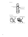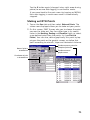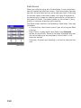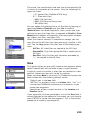
1
ProMark 3 / ProMark3 RTK
™
Reference Manual
Copyright Notice
©2005-2007 Magellan Navigation, Inc. All rights reserved.
Other Notice
Some of the pictures in this publication show the former
ProMark antenna (110454). This antenna is however no
longer delivered with ProMark3. The ProMark antenna is now
replaced with the NAP100.
Trademarks
All product and brand names mentioned in this publication
are trademarks of their respective holders.
FCC Notice
This equipment has been tested and found to comply with the
limits for a class B digital device, pursuant to part 15 of the
FCC Rules. These limits are designed to provide reasonable
protection against harmful interference in a residential installation. This equipment generates, uses and can radiate radio
frequency energy and if not installed and used in accordance
with the instructions, may cause harmful interference to radio
communications. However, there is no guarantee that interference will not occur in a particular installation. If this equipment does cause harmful interference to radio or television
reception, which can be determined by turning the equipment
off and on, the user is encouraged to try to correct the interference by one or more of the following measures:
• Reorient or relocate the receiving antenna.
• Increase the separation between the equipment and
receiver.
• Connect the equipment into an outlet on a circuit different from that to which the receiver is connected.
• Consult the dealer or an experienced radio/TV technician
for help.
Changes or modifications not expressly approved by Magellan
Navigation could void the user's authority to operate this
equipment.
CAUTION: To comply with FCC RF exposure compliance requirements, a separation distance of at least 20 cm must be
maintained between the antenna of this device and all persons.
In the presence of RF field, the receiver's satellite
signal strength may degrade. When removed from
the RF field, the signal strength should return to
normal.
RSS-210
This device has been found compliant with the Canadian RSS210 specification, issue 5, November 2001 which stipulates
that operation is subject to the following two conditions: (1)
this device may not cause interference, and (2) this device
must accept any interference, including interference that may
cause undesired operation of the device.
Magellan Professional Products - Limited Warranty (North,
Central and South America)
Magellan Navigation warrants their GPS receivers and hardware accessories to be free of defects in material and workmanship and will conform to our published specifications for
the product for a period of one year from the date of original
purchase. THIS WARRANTY APPLIES ONLY TO THE ORIGINAL PURCHASER OF THIS PRODUCT.
In the event of a defect, Magellan Navigation will, at its option, repair or replace the hardware product with no charge to
the purchaser for parts or labor. The repaired or replaced product will be warranted for 90 days from the date of return shipment, or for the balance of the original warranty, whichever is
longer. Magellan Navigation warrants that software products or
software included in hardware products will be free from defects in the media for a period of 30 days from the date of
shipment and will substantially conform to the then-current
user documentation provided with the software (including up-
dates thereto). Magellan Navigation's sole obligation shall be
the correction or replacement of the media or the software so
that it will substantially conform to the then- current user documentation. Magellan Navigation does not warrant the software will meet purchaser's requirements or that its operation
will be uninterrupted, error-free or virus-free. Purchaser assumes the entire risk of using the software.
PURCHASER'S EXCLUSIVE REMEDY UNDER THIS WRITTEN WARRANTY OR ANY IMPLIED WARRANTY SHALL BE
LIMITED TO THE REPAIR OR REPLACEMENT, AT MAGELLAN NAVIGATION'S OPTION, OF ANY DEFECTIVE PART OF
THE RECEIVER OR ACCESSORIES WHICH ARE COVERED
BY THIS WARRANTY. REPAIRS UNDER THIS WARRANTY
SHALL ONLY BE MADE AT AN AUTHORIZED MAGELLAN
NAVIGATION SERVICE CENTER. ANY REPAIRS BY A SERVICE CENTER NOT AUTHORIZED BY MAGELLAN NAVIGATION WILL VOID THIS WARRANTY.
To obtain warranty service the purchaser must obtain a Return
Materials Authorization (RMA) number prior to shipping by
calling 1-800-229-2400 (press option #1) (U.S.) or 1-408615-3981 (International), or by submitting a repair request
on-line at:
http://professional.magellangps.com/en/support/rma.asp. The
purchaser must return the product postpaid with a copy of the
original sales receipt to the address provided by Magellan Navigation with the RMA number. Purchaser’s return address and
the RMA number must be clearly printed on the outside of the
package.
Magellan Navigation reserves the right to refuse to provide service free-of-charge if the sales receipt is not provided or if the
information contained in it is incomplete or illegible or if the
serial number is altered or removed. Magellan Navigation will
not be responsible for any losses or damage to the product incurred while the product is in transit or is being shipped for
repair. Insurance is recommended. Magellan Navigation suggests using a trackable shipping method such as UPS or FedEx when returning a product for service.
EXCEPT AS SET FORTH IN THIS LIMITED WARRANTY, ALL
OTHER EXPRESSED OR IMPLIED WARRANTIES, INCLUDING THOSE OF FITNESS FOR ANY PARTICULAR PURPOSE,
MERCHANTABILITY OR NON-INFRINGEMENT, ARE HEREBY DISCLAIMED AND IF APPLICABLE, IMPLIED WARRANTIES UNDER ARTICLE 35 OF THE UNITED NATIONS
CONVENTION ON CONTRACTS FOR THE INTERNATIONAL
SALE OF GOODS. Some national, state, or local laws do not
allow limitations on implied warranty or how long an implied
warranty lasts, so the above limitation may not apply to you.
The following are excluded from the warranty coverage: (1) periodic maintenance and repair or replacement of parts due to
normal wear and tear; (2) batteries and finishes; (3) installations or defects resulting from installation; (4) any damage
caused by (i) shipping, misuse, abuse, negligence, tampering,
or improper use; (ii) disasters such as fire, flood, wind, and
lightning; (iii) unauthorized attachments or modification; (5)
service performed or attempted by anyone other than an authorized Magellan Navigations Service Center; (6) any product, components or parts not manufactured by Magellan
Navigation; (7) that the receiver will be free from any claim for
infringement of any patent, trademark, copyright or other proprietary right, including trade secrets; and (8) any damage due
to accident, resulting from inaccurate satellite transmissions.
Inaccurate transmissions can occur due to changes in the position, health or geometry of a satellite or modifications to the
receiver that may be required due to any change in the GPS.
(Note: Magellan Navigation GPS receivers use GPS or
GPS+GLONASS to obtain position, velocity and time information. GPS is operated by the U.S. Government and GLONASS
is the Global Navigation Satellite System of the Russian Federation, which are solely responsible for the accuracy and
maintenance of their systems. Certain conditions can cause
inaccuracies which could require modifications to the receiv-
er. Examples of such conditions include but are not limited to
changes in the GPS or GLONASS transmission.) Opening, dismantling or repairing of this product by anyone other than an
authorized Magellan Navigation Service Center will void this
warranty.
MAGELLAN NAVIGATION SHALL NOT BE LIABLE TO PURCHASER OR ANY OTHER PERSON FOR ANY INCIDENTAL
OR CONSEQUENTIAL DAMAGES WHATSOEVER, INCLUDING BUT NOT LIMITED TO LOST PROFITS, DAMAGES RESULTING FROM DELAY OR LOSS OF USE, LOSS OF OR
DAMAGES ARISING OUT OF BREACH OF THIS WARRANTY
OR ANY IMPLIED WARRANTY EVEN THOUGH CAUSED BY
NEGLIGENCE OR OTHER FAULT OFMAGELLAN NAVIGATION
OR NEGLIGENT USAGE OF THE PRODUCT. IN NO EVENT
WILL MAGELLAN NAVIGATION BE RESPONSIBLE FOR
SUCH DAMAGES, EVEN IF MAGELLAN NAVIGATION HAS
BEEN ADVISED OF THE POSSIBILITY OF SUCH DAMAGES.
This written warranty is the complete, final and exclusive
agreement between Magellan Navigation and the purchaser
with respect to the quality of performance of the goods and
any and all warranties and representations. This warranty sets
forth all of Magellan Navigation's responsibilities regarding
this product. This limited warranty is governed by the laws of
the State of California, without reference to its conflict of law
provisions or the U.N. Convention on Contracts for the International Sale of Goods, and shall benefit Magellan Navigation,
its successors and assigns.
This warranty gives the purchaser specific rights. The purchaser may have other rights which vary from locality to locality (including Directive 1999/44/EC in the EC Member States) and
certain limitations contained in this warranty, including the
exclusion or limitation of incidental or consequential damages
may not apply.
For further information concerning this limited warranty,
please call or write:
Magellan Navigation, Inc., 960 Overland Court, San Dimas,
CA 91773, Phone: +1 909-394-5000, Fax: +1 909-3947050 or
Magellan Navigation SA - ZAC La Fleuriaye - BP 433 - 44474
Carquefou Cedex - France Phone: +33 (0)2 28 09 38 00,
Fax: +33 (0)2 28 09 39 39.
Magellan Professional Products Limited Warranty (Europe,
Middle East, Africa)
dates thereto). Magellan Navigation's sole obligation shall be
the correction or replacement of the media or the software so
that it will substantially conform to the then- current user documentation. Magellan Navigation does not warrant the software will meet purchaser's requirements or that its operation
will be uninterrupted, error-free or virus-free. Purchaser assumes the entire risk of using the software.
2. PURCHASER'S REMEDY
PURCHASER'S EXCLUSIVE REMEDY UNDER THIS WRITTEN WARRANTY OR ANY IMPLIED WARRANTY SHALL BE
LIMITED TO THE REPAIR OR REPLACEMENT, AT MAGELLAN NAVIGATION'S OPTION, OF ANY DEFECTIVE PART OF
THE RECEIVER OR ACCESSORIES WHICH ARE COVERED
BY THIS WARRANTY. REPAIRS UNDER THIS WARRANTY
SHALL ONLY BE MADE AT AN AUTHORIZED MAGELLAN
NAVIGATION SERVICE CENTER. ANY REPAIRS BY A SERVICE CENTER NOT AUTHORIZED BY MAGELLAN NAVIGATION WILL VOID THIS WARRANTY.
3. PURCHASER'S DUTIES
To obtain service, contact and return the product with a copy
of the original sales receipt to the dealer from whom you purchased the product.
Magellan Navigation reserves the right to refuse to provide service free-of-charge if the sales receipt is not provided or if the
information contained in it is incomplete or illegible or if the
serial number is altered or removed. Magellan Navigation will
not be responsible for any losses or damage to the product incurred while the product is in transit or is being shipped for
repair. Insurance is recommended. Magellan Navigation suggests using a trackable shipping method such as UPS or FedEx when returning a product for service.
4. LIMITATION OF IMPLIED WARRANTIES
EXCEPT AS SET FORTH IN ITEM 1 ABOVE, ALL OTHER EXPRESSED OR IMPLIED WARRANTIES, INCLUDING THOSE
OF FITNESS FOR ANY PARTICULAR PURPOSE OR MERCHANTABILITY, ARE HEREBY DISCLAIMED AND IF APPLICABLE, IMPLIED WARRANTIES UNDER ARTICLE 35 OF THE
UNITED NATIONS CONVENTION ON CONTRACTS FOR THE
INTERNATIONAL SALE OF GOODS.
Some national, state, or local laws do not allow limitations on
implied warranty or how long an implied warranty lasts, so the
above limitation may not apply to you.
5. EXCLUSIONS
All Magellan Navigation global positioning system (GPS) receivers are navigation aids, and are not intended to replace
other methods of navigation. Purchaser is advised to perform
careful position charting and use good judgment. READ THE
USER GUIDE CAREFULLY BEFORE USING THE PRODUCT.
The following are excluded from the warranty coverage:
1. MAGELLAN NAVIGATION WARRANTY
(3) finishes;
Magellan Navigation warrants their GPS receivers and hardware accessories to be free of defects in material and workmanship and will conform to our published specifications for
the product for a period of one year from the date of original
purchase or such longer period as required by law. THIS WARRANTY APPLIES ONLY TO THE ORIGINAL PURCHASER OF
THIS PRODUCT.
(4) installations or defects resulting from installation;
In the event of a defect, Magellan Navigation will, at its option, repair or replace the hardware product with no charge to
the purchaser for parts or labor. The repaired or replaced product will be warranted for 90 days from the date of return shipment, or for the balance of the original warranty, whichever is
longer. Magellan Navigation warrants that software products or
software included in hardware products will be free from defects in the media for a period of 30 days from the date of
shipment and will substantially conform to the then-current
user documentation provided with the software (including up-
(1) periodic maintenance and repair or replacement of parts
due to normal wear and tear;
(2) batteries;
(5) any damage caused by (i) shipping, misuse, abuse, negligence, tampering, or improper use; (ii) disasters such as fire,
flood, wind, and lightning; (iii) unauthorized attachments or
modification;
(6) service performed or attempted by anyone other than an
authorized Magellan Navigations Service Center;
(7) any product, components or parts not manufactured by
Magellan Navigation,
(8) that the receiver will be free from any claim for infringement of any patent, trademark, copyright or other proprietary
right, including trade secrets
(9) any damage due to accident, resulting from inaccurate satellite transmissions. Inaccurate transmissions can occur due
to changes in the position, health or geometry of a satellite or
modifications to the receiver that may be required due to any
change in the GPS. (Note: Magellan Navigation GPS receivers
use GPS or GPS+GLONASS to obtain position, velocity and
time information. GPS is operated by the U.S. Government
and GLONASS is the Global Navigation Satellite System of the
Russian Federation, which are solely responsible for the accuracy and maintenance of their systems. Certain conditions can
cause inaccuracies which could require modifications to the
receiver. Examples of such conditions include but are not limited to changes in the GPS or GLONASS transmission.).
Opening, dismantling or repairing of this product by anyone
other than an authorized Magellan Navigation Service Center
will void this warranty.
6. EXCLUSION OF INCIDENTAL OR CONSEQUENTIAL DAMAGES
MAGELLAN NAVIGATION SHALL NOT BE LIABLE TO PURCHASER OR ANY OTHER PERSON FOR ANY INDIRECT, INCIDENTAL OR CONSEQUENTIAL DAMAGES WHATSOEVER,
INCLUDING BUT NOT LIMITED TO LOST PROFITS, DAMAGES RESULTING FROM DELAY OR LOSS OF USE, LOSS OF
OR DAMAGES ARISING OUT OF BREACH OF THIS WARRANTY OR ANY IMPLIED WARRANTY EVEN THOUGH CAUSED
BY NEGLIGENCE OR OTHER FAULT OFMAGELLAN NAVIGATION OR NEGLIGENT USAGE OF THE PRODUCT. IN NO
EVENT WILL MAGELLAN NAVIGATION BE RESPONSIBLE
FOR SUCH DAMAGES, EVEN IF MAGELLAN NAVIGATION
HAS BEEN ADVISED OF THE POSSIBILITY OF SUCH DAMAGES.
Some national, state, or local laws do not allow the exclusion
or limitation of incidental or consequential damages, so the
above limitation or exclusion may not apply to you.
7. COMPLETE AGREEMENT
This written warranty is the complete, final and exclusive
agreement between Magellan Navigation and the purchaser
with respect to the quality of performance of the goods and
any and all warranties and representations. THIS WARRANTY
SETS FORTH ALL OF MAGELLAN NAVIGATION'S RESPONSIBILITIES REGARDING THIS PRODUCT.
THIS WARRANTY GIVES YOU SPECIFIC RIGHTS. YOU MAY
HAVE OTHER RIGHTS WHICH VARY FROM LOCALITY TO LOCALITY (including Directive 1999/44/EC in the EC Member
States) AND CERTAIN LIMITATIONS CONTAINED IN THIS
WARRANTY MAY NOT APPLY TO YOU.
8. CHOICE OF LAW.
This limited warranty is governed by the laws of France, without reference to its conflict of law provisions or the U.N. Convention on Contracts for the International Sale of Goods, and
shall benefit Magellan Navigation, its successors and assigns.
THIS WARRANTY DOES NOT AFFECT THE CUSTOMER'S
STATUTORY RIGHTS UNDER APPLICABLE LAWS IN FORCE
IN THEIR LOCALITY, NOR THE CUSTOMER'S RIGHTS
AGAINST THE DEALER ARISING FROM THEIR SALES/PURCHASE CONTRACT (such as the guarantees in France for latent defects in accordance with Article 1641 et seq of the
French Civil Code).
For further information concerning this limited warranty,
please call or write:
Magellan Navigation SA - ZAC La Fleuriaye - BP 433 - 44474
Carquefou Cedex - France.
Phone: +33 (0)2 28 09 38 00, Fax: +33 (0)2 28 09 39 39
Table of Contents
Introduction ..................................................................................... 1
What are the ProMark3 and ProMark3 RTK Systems? ....................1
Post-Process Surveying ..........................................................1
Real-Time Surveying ..............................................................2
Mobile Mapping ....................................................................2
Office Software......................................................................2
Items Supplied with ProMark3.....................................................3
ProMark3 Receiver ................................................................3
I/O Module............................................................................4
USB Cable ............................................................................5
AC Adapter/Charger................................................................5
External GNSS Antenna .........................................................5
External Antenna Cable ..........................................................5
Vertical Antenna Extension .....................................................6
Field Receiver Bracket ...........................................................6
HI (Height of Instrument) Measurement Tape...........................6
Field Bag ..............................................................................6
User Documentation CD .........................................................7
Initializer Bar and Antenna Adaptor .........................................7
MobileMapper Office CD ........................................................7
GNSS Solutions CD ...............................................................7
ProMark3 RTK Specific Accessories .............................................8
License-Free Radio Modems ...................................................8
Brackets for License-free Radio Modems................................10
RTK Vertical Antenna Extension ............................................10
FAST Survey Software Option................................................10
Additional Items Required but not Supplied................................11
For Static Surveys or Base Stations .......................................11
For Kinematic Surveys .........................................................12
Specifications ..........................................................................13
General Characteristics ........................................................13
Real-Time Accuracy (1) (3) (4) .............................................13
Post-Processed Accuracy (1) (2)............................................13
Data Logging Characteristics.................................................14
Physical Characteristics........................................................14
Environmental Characteristics...............................................15
Power Characteristics...........................................................15
Post-Process Surveying with ProMark3 .......................................16
Real-Time Surveying with ProMark3 RTK....................................19
Mobile Mapping with ProMark3 .................................................21
Navigating with ProMark3 .........................................................23
Time Spent in The Field............................................................24
Post-Processing ...................................................................24
Real-Time Surveying ............................................................25
Mobile Mapping ..................................................................26
Where to Find Information.........................................................26
Preparing For First-Time Use ........................................................... 27
Charging the ProMark3 Battery Pack ..........................................27
i
Turning On/Off the Receiver ......................................................28
Calibrating the Screen ..............................................................29
Automatic System Time Update.................................................29
Adjusting the Backlight.............................................................29
Initializing GPS ........................................................................30
Preliminary Settings .................................................................31
Access to Preliminary Settings ..............................................31
Choosing the Storage Medium...............................................31
Entering the Receiver ID.......................................................32
Specifying the Antenna Used ................................................32
Choosing the Units ..............................................................32
Checking that ProMark3 Receives Satellites ...........................33
RTK Setup ..................................................................................... 34
Introduction to RTK..................................................................34
Base/Rover Configuration ..........................................................36
About the Base Position .......................................................36
Setting Up the Base.............................................................37
Configuring the Base............................................................39
Setting Up the Rover............................................................41
Configuring the Rover...........................................................42
Initializing the Rover ............................................................42
Rover-Only Configuration (Network)............................................45
Setting Up the Rover............................................................45
Configuring the Rover in NTRIP Mode....................................46
Configuring the Rover in Direct IP mode ................................49
Initializing the Rover ............................................................50
Standard RTK: “Surveying”.............................................................. 51
Logging Points in Real Time ......................................................51
Logging Trajectories in Real Time ..............................................53
Staking Out .............................................................................55
Quitting The Surveying Function ................................................57
Advanced RTK: FAST Survey Option ................................................. 58
Introduction.............................................................................58
Launching FAST Survey........................................................58
MENU Screen .....................................................................59
MAP Screen ........................................................................63
Getting Started With FAST Survey..............................................64
Creating a New Job ..............................................................64
Configuring a Base...............................................................65
Configuring a Rover..............................................................66
Initializing the Rover ............................................................66
Localization .............................................................................67
Logging RTK Points ..................................................................69
Logging RTK Points in Continuous Mode ....................................70
Staking out RTK Points.............................................................71
Downloading Land Survey Projects .............................................73
Post-Processing Surveying ............................................................... 74
Introduction to Static Surveying.................................................74
Network Design ...................................................................74
ii
Observation Plan .................................................................77
Running a Static Survey............................................................84
Equipment Check ................................................................85
Site Selection......................................................................85
System Setup (Base and Rover) ............................................88
Static Survey Setup (Base and Rover) ....................................90
Data Collection....................................................................92
Introduction to Kinematic Surveying ..........................................95
Stop-and-Go........................................................................95
Kinematic ...........................................................................96
Initialization Methods ...............................................................98
Running a “Stop & Go” Survey ..................................................99
Base Setup and Operation ....................................................99
Rover Setup ......................................................................100
Stop & Go Survey Rover Setup ............................................100
Initialization Phase ............................................................104
Data Collection..................................................................105
Running a Kinematic Survey ...................................................109
Base Setup and Operation ..................................................109
Rover Setup ......................................................................110
Kinematic Survey Rover Setup ............................................110
Initialization Phase ............................................................113
Data Collection..................................................................115
Re-Initialization .....................................................................118
When is Re-Initialization Required? .....................................118
Preventive Steps to Facilitate Re-initialization ......................119
Quitting the Surveying Function...............................................121
Mobile Mapping............................................................................ 122
Feature Libraries ....................................................................122
Logging New GPS/GIS Data .....................................................123
Revisiting and Updating Existing GPS/GIS Jobs.........................139
Using ProMark3 as a Reference Station....................................142
Quitting the Mobile Mapping Function .....................................142
Navigation ................................................................................... 143
Navigation Screens.................................................................143
Map Screen ......................................................................144
Compass Screen ................................................................145
Large Data Screen .............................................................146
Position Screens................................................................147
Road Screen .....................................................................149
Data Screen ......................................................................150
Speedometer Screen ..........................................................151
Satellite Status Screen.......................................................152
GOTO Function ......................................................................153
Purpose ............................................................................153
Destination Point Types......................................................153
Selecting a POI as the Destination Point ..............................154
Selecting a GIS Feature as the Destination Point ..................155
Saving Your Current Position as a Waypoint..........................156
Editing/Deleting a User Waypoint ........................................156
iii
Clearing the GOTO function ................................................157
Routes ..................................................................................158
GOTO Route ......................................................................158
Multi-leg Route .................................................................158
Office Work .................................................................................. 162
About Download Procedures ....................................................162
About the Download Utility Program ....................................162
Using the USB Port to Download Data .................................163
Processing Field Data Collected With “Surveying” .....................164
Downloading Raw Data via USB ..........................................164
Downloading Raw Data from the Card Reader .......................165
Downloading RTK Data Via USB..........................................165
Donwloading RTK Data from the Card Reader .......................167
Post-Processing Raw Data ..................................................168
Downloading RTK Data Collected With FAST Survey ..................169
Processing Field Data Collected With “Mobile Mapping” ............170
Downloading GIS Data via USB ...........................................170
Downloading GIS Data from the Card Reader ........................171
Viewing/Analyzing the Content of a Job ................................172
Exporting Data to a GIS ......................................................176
Upload Procedures from GNSS Solutions..................................177
Uploading a Real-Time “Surveying” Job...............................177
Uploading a FAST Survey Job .............................................177
Uploading a Vector Background Map ...................................179
Uploading Points to ProMark3.............................................181
Uploading a Geoid to ProMark3...........................................184
Upload Procedures from MobileMapper Office...........................185
Uploading a Vector Background Map ...................................185
Uploading Jobs and Waypoints to ProMark3 .........................188
Uploading Jobs and Waypoints to the Local SD Card Reader ..189
Bluetooth Manager Module ............................................................ 190
Introduction...........................................................................190
Host and Inquiring Devices......................................................190
Bluetooth Range ....................................................................191
First Steps with Bluetooth Manager..........................................191
Starting Bluetooth Manager ................................................191
Minimizing/Maximizing the Bluetooth Window ......................191
Turning Off Bluetooth ........................................................191
Detecting Bluetooth-Enabled Devices ..................................191
PIN Code, Detectability & Authentication .................................192
Local Services........................................................................193
Introduction ......................................................................193
Using the Serial Port Service ..............................................194
Using the File Transfer Service............................................194
Creating Shortcuts for Remote Services ....................................196
Bluetooth Manager Toolbar Memo ............................................197
Step-by-Step Procedure
for Establishing a
GPRS Connection Via Bluetooth ..................................................... 198
Introduction...........................................................................198
iv
Connection Profile Known...................................................198
Connection Profile Unknown ...............................................199
Special Cases....................................................................199
The First Time You Use ProMark3 RTK.....................................200
Step 1: Ask ProMark3 RTK to Be Paired with the Cell Phone .201
Step 2: Allow the Cell Phone to Be Paired with ProMark3 RTK202
Step 4: Establish a Bluetooth Link Between ProMark3 RTK
and the Cell Phone ............................................................203
Step 5: Prepare the GPRS Connection .................................203
Step 6: Establish the GPRS Connection ...............................205
Troubleshooting.................................................................206
Subsequent Uses ...................................................................207
Standard Re-Start Procedure ..............................................207
Disconnecting GPRS ..........................................................208
Selecting a DGPS Mode ................................................................ 209
Introduction...........................................................................209
Beacon..................................................................................210
Direct IP ...............................................................................214
NTRIP...................................................................................216
Other RTCM Source................................................................219
Returning to Autonomous GPS Mode........................................220
How to End a Direct IP or NTRIP Session .................................220
Subsequent Uses ...................................................................220
Cell Phone Changes................................................................221
Accuracy...................................................................................... 222
RTK ......................................................................................222
Operating Conditions..........................................................222
Position Accuracy ..............................................................222
Time to First Fix (TTFF)......................................................223
Initialization in Networks....................................................223
Autonomous GPS, SBAS & DGPS Modes ..................................224
Quality Indicators ...................................................................225
MENU key ................................................................................... 226
Receiver mode .......................................................................226
DGPS Configuration................................................................227
Initialize RTK.........................................................................227
Base Station ..........................................................................228
File Manager..........................................................................228
Mark .....................................................................................229
GOTO....................................................................................230
Routes ..................................................................................231
Setup Menu...........................................................................232
Storage.............................................................................232
Receiver ID .......................................................................232
Antenna Type ....................................................................232
Real-time Fast Mode..........................................................233
Select Map .......................................................................234
Map Setup ........................................................................235
Nav Screens......................................................................237
Coord System ....................................................................237
v
Map Datum .......................................................................238
Time Format .....................................................................239
Units ................................................................................240
Alarms..............................................................................240
North Reference ................................................................241
Beeper..............................................................................242
Reset Trip .........................................................................242
Clear Memory ....................................................................242
Simulate ...........................................................................243
Language ..........................................................................243
Customize .............................................................................244
About... .................................................................................244
Exit.......................................................................................244
Power Management....................................................................... 245
Power Saving Modes ...............................................................245
Backlight Control....................................................................246
Checking Battery Status..........................................................247
LED Indicators .......................................................................248
Turning Off ProMark3 .............................................................248
Diagnostics & Upgrade Tools.......................................................... 249
Testing ProMark3’s Internal Peripherals....................................249
ProMark3 Serial Number & Versions.........................................251
Upgrading ProMark3 Software & Firmware ................................251
ProMark3 Reset Procedures.....................................................252
Hardware Reset .................................................................252
Software Reset ..................................................................252
Utilities & Settings........................................................................ 253
Utilities .................................................................................253
DGPS Configuration ...........................................................253
Install FAST Survey (and Datum Grids) ................................253
Unlock FAST Survey ..........................................................254
Unlock RTK Option ............................................................254
Desktop Properties.............................................................254
GPSInit ............................................................................255
GPSReset .........................................................................255
AutoLoader .......................................................................255
Tests ................................................................................255
Radio Configuration ...........................................................255
Install Language ................................................................256
Settings.................................................................................257
Backlight control ...............................................................257
Bluetooth Manager.............................................................257
Date/Time .........................................................................258
Display .............................................................................258
Keyboard ..........................................................................258
Magellan System Info.........................................................258
Owner...............................................................................259
Power ...............................................................................259
Regional Settings...............................................................259
Stylus ...............................................................................259
vi
System .............................................................................260
Volume & Sounds ..............................................................260
Appendices .................................................................................. 261
Main Alarm Screens ...............................................................261
File Naming Conventions ........................................................262
Survey Data Collection .......................................................262
GIS Post-Processing...........................................................263
Ordering Information ..............................................................264
Installing New OS Languages (Chinese, French) ........................266
Installing the ProMark3 RTK Firmware .....................................267
Getting ProMark3 Ready
for FAST Survey Installation ....................................................267
Installing Optional Functions in FAST Survey ............................268
Using Another Radio Model .....................................................268
Assessing MobileMapper Beacon Reception Quality ...................269
Glossary....................................................................................... 270
vii
viii
1. Introduction
What are the ProMark3 and ProMark3 RTK
Systems?
In this manual, the term
“ProMark3” refers to
both the ProMark3 and
ProMark3 RTK units.
When describing a function specific to the
ProMark3 RTK, then the
term “ProMark3 RTK” is
used.
ProMark3 is a complete GPS system providing precision surveying in post-processing or real-time, GIS feature collection
and navigation. Real-time surveying is only available with
ProMark3 RTK.
A typical ProMark3 system used in post-processing surveys includes two ProMark3 GPS receivers, GPS antennas, and all
ancillary components (see picture below) required to get you
up and running and producing quality data in a minimum
amount of time.
x2
Post-Process Surveying
The ProMark3 system utilizes standard tripods or fixed-height
GPS tripods to position system components above a given survey point. The ProMark3 receiver collects signals broadcast
from GPS satellites, and stores this information in its internal
solid-state memory or an SD Card. The collected data is extracted from the ProMark3 receiver via a cable to an office
computer for post-processing.
1
Real-Time Surveying
With a ProMark3 RTK, or after upgrading your ProMark3 into
a ProMark3 RTK (see Installing the ProMark3 RTK Firmware
on page 267), you can perform real-time RTK surveys. The
system will deliver centimeter-accurate positions thanks to
Magellan’s new BLADE™ technology.
From an L1-only GPS receiver such as the ProMark3, BLADE
can deliver RTK accuracies comparable to those of a dual-frequency (L1/L2) receiver. Compared to dual-freaquency receivers however, initialization times are longer, and the operating
range limited to about 1 mile with the base/rover configuration, and up to 10 kilometers with the rover-only configuration.
Mobile Mapping
The ProMark3 receiver enables you to map and describe GIS
features and then format the data so that later it can be uploaded to a GIS. It offers an easy-to-use and easy-to-deploy solution for general mapping and for asset management.
ProMark3 combines all the navigation capabilities with feature attributing software to support GIS data collection in the
field.
Office Software
The ProMark3 System operates in conjunction with GNSS Solutions, Magellan’s highly-automated office software.
GNSS Solutions is a complete, easy-to-use software package
which manages and processes both raw GPS and real-time data, deriving precise positioning data and presenting the results
in easily understood report formats.
The ProMark3 receiver also operates in conjunction with MobileMapper Office. This office software operates as the interface between ProMark3 and your GIS. MobileMapper Office is
also used to refine feature positions for all those field jobs run
in post-processing mode.
2
Items Supplied with ProMark3
The items supplied with ProMark3 are described in the following paragraphs.
ProMark3 Receiver
Front Panel
GPS Receiver includes:
• Integrated GPS accurate
to sub-meter with WAAS/
EGNOS
• Ready for RTCM real-time
corrections
• Internal antenna.
Touch screen Display:
• Full color transflective liquid crystal display (LCD)
• ¼ VGA
Scrolling button
Power button
Power indicator
Alphanumeric
keypad
Battery indicator
Back Panel:
Power/Communication
connectors:
• Connects to the I/O
module with power
supply and communication ports
Speaker
Battery door screws:
• Unscrew to open the
battery door
Battery Compartment
Battery Pack
Removable
Handstrap
3
Side Panel
External Antenna
Connector
Secure Digital Card Slot
Door:
• Open the door to access the SD card slot
I/O Module
USB host port (Type A), connect to a
USB flash drive, card reader etc.
DC Power Input connector
4
Mini USB (Type B) port.
Used for connection to PC
Serial port (COM1) DB-9 connector
USB Cable
The USB cable is used to connect the ProMark3 to an office
computer via the ProMark3’s I/O module. Use the mini USB
port for this connection and not the USB host port.
The mini USB port is located next to the RS232 Sub-D port
on the I/O module. Refer to diagrams on page 4.
AC Adapter/Charger
This device is used to power supply the ProMark3 from the AC
power line.
If an internal battery has been inserted into the ProMark3
unit, this device will also provide a charging current for the
battery. (Battery charging will be monitored by the ProMark3
unit).
External GNSS Antenna
The external GNSS antenna is required for surveying functions. While the built-in antenna is sufficient for navigation, a
more sophisticated external antenna is required to obtain
quality data for precision surveying. The external GNSS antenna is the physical data collection point for the raw GNSS satellite data. For this reason, it must be accurately positioned
over the point to be surveyed, using a standard tripod or fixedheight GPS tripod.
External Antenna Cable
The external antenna cable connects the ProMark3 receiver to
the external antenna. The small end of the cable fitted with a
right-angle plug connects to the ProMark3. The large end of
the cable screws onto the external antenna.
5
Vertical Antenna Extension
The vertical antenna extension provides clearance for the antenna cable when the antenna is mounted on a tripod. The
length is 3 inches (0.0762 m).
Field Receiver Bracket
The field receiver bracket provides the means for mounting
the ProMark3 receiver to the tripod.
HI (Height of Instrument) Measurement Tape
The HI measurement tape is used to measure height of the
GPS antenna over the survey point. The end of the tape hooks
onto the antenna. The tape is extended until the spike on the
tape case is on the point. Then the height of the antenna is
noted on the tape.
Field Bag
The field bag is used to transport the components of each
ProMark3 receiver system between the office and the field.
6
User Documentation CD
This CD includes the ProMark3 Getting Started Guide (4 languages) and the present ProMark3 Reference Manual (English
only).
Initializer Bar and Antenna Adaptor
(Provided with two-receiver systems only.)
The initializer bar can be used to initialize your surveys from
a base. This 0.20-m bar should be mounted on the base tribrach before use. The antenna adaptor will be inserted at the
free end of the initializer bar and will temporarily receive the
rover antenna during the initialization phase.
MobileMapper Office CD
This CD includes the MobileMapper Office software and its
documentation.
GNSS Solutions CD
(Provided with two-receiver systems only.)
The GNSS Solutions software provides the tools required to
download and process the GPS satellite data from each
ProMark3 receiver to produce relative positions of all points
surveyed. GNSS Solutions is provided on a CD which also contains a reference manual and tutorial supplement.
7
ProMark3 RTK Specific Accessories
License-Free Radio Modems
Radio modems come in pairs, each composed of two similar
units that can indifferently be used at the base or the rover.
The radio modem used at the base will automatically become
a transmitter while the other one, used at the rover, will automatically operate as a receiver.
Models. Radio modems come in two different models. One is
for use in North America (NA) (P/N111360), and the other
(P/N 111359) is intended for most European countries (EU)
(except Italy, Slovak Republic and Bulgaria) (This information
is subject to change without notice). The table below gives the
main features of the two models.
NA
P/N111360
EU
P/N111359
0.5 W
0.5 W
Frequency Band
902-928 MHz
869-870 MHz
Number of channels
50 (#0 to #49)
3 (#0 to #2)
Frequency Hopping
Yes, every 30 ms
No
Duty Cycle
No restriction
< 10%; 2-sec transmit rate
min. recommended
Data rate
10 kbits/sec
10 kbits/sec
Features
Radiated Power
Frequency channels. Radio modems are plug-and-play units.
They are all factory-set to operate on their first channel (channel #0). If however the default transmission channel is
jammed in your working area, you can select another transmission channel using the Radio Configuration utility (see Radio
Configuration on page 255). Don’t forget in that case to
change the channel on both units.
Frequency hopping in the NA model. The selected channel
corresponds to the first channel on which the radio transmits/
receives.
RTCM Rate in the EU Model. In the European Union, licensefree radios are allowed to transmit only 10% of the time. To
be sure this requirement is always met, Magellan recommends
that you set the RTCM rate to 2 seconds. Using “1 second” is
not a guarantee that this 10% requirement will always be met,
especially if a large number of corrections are transmitted.
8
Power/Data Cable. Each radio modem is fitted with a cable for
easy connection to the ProMark3. The wiring diagram and pinout are provided below.
Power/Data Cable
Contact Side View
1
(Connector
on ProMark3
side)
2
3
4
5
6
7
8
9 10 11
White
Red
Screw Terminal Block
[Braid]
(Inside radio modem)
Yellow
Blue
Wire Color
White
Red
[Braid]
Yellow
Blue
Signal Name
TX (Data)
+DC IN
Ground
+5 V DC OUT
RX (Data)
Pin Number
6
11
2
1
5
NOTES: In the radio, pins 2 and 3 are shorted internally (pins
10 and 11 as well). The +5 V DC OUT signal (pin 1) is provided by the ProMark3 RTK to power the radio.
External Power Source. An external DC source (9 to 17 V DC)
can be used to power both the radio modem and the ProMark3
RTK unit and also charge the ProMark3’s internal battery. Using an external power source is recommended to extend the
operating time of a ProMark3 RTK base.
In this configuration, keep the power/data cable connected
between the ProMark3 and the radio modem and add a twowire cable (not provided), also passing through the base of the
radio.
The additional cable should be connected to the screw terminal block, inside the radio modem, according to the table below.
External
DC Source
+ DC IN
- DC IN
Pin Number on Terminal Block
(see these numbers in the diagram above)
10
3
Using another radio model. See Using Another Radio Model
on page 268.
9
Brackets for License-free Radio Modems
Each radio modem comes with its own bracket for easy installation on a pole. The radio modem is secured on the bracket
using the four screws and washers provided.
At the base, the radio modem/bracket assembly should be
mounted on the RTK vertical antenna extension so the radio
modem and its antenna can easily fit under the GNSS antenna.
At the rover, the radio modem/bracket assembly should be
fixed on the pole range, just underneath the GNSS antenna.
RTK Vertical Antenna Extension
This pole is for use at the base. It has sufficient height to let
you fasten the radio modem/bracket assembly between the
GNSS antenna and the tripod.
If the radio modem needs to be installed at a higher height to
improve the range of the data link, then a separate, higher
mast should be used for the radio modem. Remember however that the radio cable is only 1.20 meter long.
FAST Survey Software Option
This software option is a high-end field survey application for
ProMark3 RTK. The FAST Survey CD includes all the versions
available for Magellan products (Z-Max.Net, ProMark3 RTK)
as well as the user documentation.
10
Additional Items Required but not Supplied
For Static Surveys or Base Stations
These items allow you to firmly position the GPS antenna over
the survey point or station site (see opposite) at a measurable
height from the ground.
These items (tripod, tribrach and tribrach adapter) are illustrated below.
Tripod
Tribrach
Levelling bubble
Levelling screw
Tribrach Adapter
mounted to Tribrach:
Optical sight
Locking tab
Tribrach Adapter
Antenna adapter
5/8 x 11 UNC thread
Lock for antenna
adapter
11
An option to the tripod, tribrach and tribrach adapter combination is the fixed-height GPS tripod (see below).
For Kinematic Surveys
An option for mounting the ProMark3 rover when operating in
kinematic mode is a range pole (see picture below showing a
ProMark3 ready for post-process kinematic surveying).
12
Specifications
General Characteristics
•
•
•
•
•
•
•
•
•
14 parallel channels
L1 C/A code and carrier
SBAS tracking and use in RTK process
Update rate: 1 Hz
Time tagged (synchronous) and Fast RTK (extrapolation)
RTCM 2.3 (rover mode) and 3.1 (base and rover mode)
Compatible with VRS,FKP,MAC Networks
Connectivity: NTRIP & Direct IP
Protocol NMEA0183
Real-Time Accuracy
(1) (3) (4)
RTK (horizontal accuracies)
• Fixed: 1cm (0.032ft) +1ppm
• Float: 20cm (0.656ft) +1ppm (CEP), convergence: 3 min
SBAS (WAAS/EGNOS) (rms)
• Horizontal: <1m (3ft)
DGPS (Beacon or RTCM) (rms)
• Horizontal: <1m (3ft)
Post-Processed Accuracy (1) (2)
Static Survey (rms)
• Horizontal: 0.005 m + 1 ppm (0.016 ft + 1 ppm)
• Vertical: 0.01 m + 2 ppm (0.032 ft + 2 ppm)
• Azimuth: < 1 arc second
• Observation Time: Ranges from 4 to 40 min depending on
distance between the receivers and other environmental
factors.
(1) Performance varies on satellite conditions and may not apply at all time in
all area in the world. High-multipath areas, poor satellite geometry, and periods
of high-activity atmospheric conditions will degrade accuracy. Accuracy and
TTFF specifications based on tests conducted in Nantes and Moscow. Tests in
different locations under different conditions may produce different results.
(2) PP accuracies assume minimum of 5 satellites, following the procedures
recommended in the product manual. Post-processing with GNSS Solutions
Software.
(3) RTK accuracies assume minimum of 7 satellites (GPS+SBAS), following the
procedures recommended in the present manual.
(4) For baselines <10 km
13
Kinematic Survey
• Horizontal: 0.012 m + 2.5 ppm (0.039 ft + 2.5 ppm)
• Vertical: 0.015 m + 2.5 ppm (0.049 ft + 2.5 ppm)
• Recommended Initializer Bar Occupation: 5 min
Data Logging Characteristics
Recording Interval
• 1 - 30 seconds.
Internal Memory Capacity
• Up to 72 hours of 10 satellite data @ 1 second interval
Physical Characteristics
Receiver
• Size: 19.5 x 9 x 4.6 cm (7.7 x 4.6 x 1.8 in)
• Weight: 0.48 kg (1.05 lb) with battery
Antenna
• Size: 19 x 9.6 cm (7.5 in DIA x 3.8 in H)
• Weight: 0.45 kg (1.00 lb)
Radio
• Size: 14,5 x 10 x 4 cm (5.7 x 3.9 x 1.6 in)
• Weight: 0.20 kg (0.44 lb)
User Interface
• Full color advanced TFT liquid crystal display with backlight
• 320 x 240 resolution with 262.144 colors
• Resistive touch panel
• Keyboard with backlight 20 buttons
• Audio: built-in speaker
Memory
• 128 MB SDRAM, 128 NAND Flash memory
• Removable SD Card: up to 1 GB
Communication
• Bluetooth wireless technology
• USB: host and slave
• RS232
Radio (base and rover mode)
• License-free radio 500 mW, 869 MHz for Europe, 902928 MHz for North America.
14
Environmental Characteristics
Receiver
• Operating Temp: -10°C to 60°C (14°F to 140°F)
• Storage Temp: -20°C to 70°C (-4°F to 158°F)
• Weather: Water-resistant
• Shock: 1.5 m (4.9 ft) drop on concrete.
Antenna
• Operating Temp: -55°C to 85°C (-67°F to 185°F)
• Weather: Waterproof
• Shock: 2 m (6.6 ft) drop on concrete.
Radio
• Temp: -20°C to 70°C (-4°F to 158°F)
• Meets IP65
Power Characteristics
• Battery type: 3.7 V Li-Ion, 3900 mAh
• Battery life: 8 hours (typical operation), 6 hours with radio
connected
• External power for extended operation time.
15
Post-Process Surveying with ProMark3
The ProMark3 system is designed to perform GPS surveys using static, stop-and-go, and kinematic modes of GPS data collection. The three modes run independently.
In the Static data collection mode, the GPS receiver systems
simultaneously collect raw data from all available satellites
while remaining stationary on their respective points. Data
collection continues at these locations for a duration dependent upon the distance between the receivers, the satellite geometry, and the obstruction conditions at the data collection
locations (i.e., trees or buildings blocking some of the sky).
Base
Known Point
Rover
Baseline
(Range)
Survey Point
Data collected at base:
Data collected on surveyed point:
Observation time
When data collection is complete at these specific points, you
move the GPS receiver systems to a new set of points to begin
another data collection session. In most cases, one GPS receiver system will remain on its current point (pivot point) in
order to link the previous set of points to the new set of points,
in leap-frog fashion. After data collection is complete, data is
downloaded form the GPS receivers to an office computer for
post-processing using the GNSS Solutions software.
16
The post-processing activity computes vectors (position differences) to determine the position of all observed points relative
to one or more fixed point positions. The static data collection
method produces the most accurate and reliable results of any
mode of GPS data collection. This is due primarily to the extended observation periods required for static data collection.
In the Stop-and-Go data collection mode, the GPS receiver
systems simultaneously collect raw data from all available satellites while stationary on their respective points and while
moving between points. In most cases, one GPS receiver is located on a known point serving as a base station collecting
data at that location for the duration of the survey. Additional
GPS receivers are used to locate objects and move between
points. The occupation period for the stop-and-go method is
much shorter than the static method.
Rover
Base
Known Point
Survey Point
0001
Base
0002
Rover
Init Point
0003
0004
0007
0006
0005
Data collected at base:
Occupation: 15 sec. typical
Data collected by rover:
Init
0001 0002 0003 0004
0005 0006
0007
17
After data collection is complete, data is downloaded from the
GPS receivers to an office computer for post-processing using
the GNSS Solutions software. The post-processing activity
computes vectors (position differences) to determine the position of all observed points relative to one or more fixed point
positions. The Stop-and-Go data collection method is faster
than the static method, but not as accurate since the occupation period is much shorter.
In the Kinematic data collection mode, the GPS receiver systems simultaneously collect raw data from all available satellites while a receiver is moving.
Rover
Base
Known Point
Survey Point
0001
Base
Rover
Init Point
0014
0015
Data collected at base:
Data collected by rover:
5 min. with bar
Init
0001...
0015...
In most cases, one GPS receiver is located on a known point
serving as a base station collecting data at that location for the
duration of the survey.
18
Additional GPS receivers are used to locate linear objects
such as roads or collect data in a linear fashion for developing
topographic elevation data.
The recording interval should be set to collect the amount of
data needed relative to the speed of travel.
A recording interval too long will result in insufficient data.
After data collection is complete, data is downloaded from the
GPS receivers to an office computer for post-processing using
the GNSS Solutions software. The post-processing activity
computes positions of all observed points relative to one or
more fixed point positions. The Kinematic data collection
method is best used for delineating linear type features such
as roads, fences, lakes, etc.
Real-Time Surveying with ProMark3 RTK
The ProMark3 RTK system has all the survey and mobile mapping functions of a ProMark3, but in addition, it can perform
real-time surveys. In this operating mode, the ProMark3 RTK
delivers real-time, centimeter-accurate position solutions.
The ProMark3 RTK allows you to also log raw data while a realtime survey is in progress.
As shown in the diagram below, there are two possible system
configurations to implement RTK in the ProMark3 RTK:
Base
Radio Data Link
Rover
Rover
Internet
Base/Rover
GPRS Data Link
Rover-Only
(Network Connection)
+ Cell
Phone
- In base/rover configuration, you need to install your own
base as well as a radio link to transfer RTCM corrections
from the base to the rover.
- In rover-only configuration, you need a Bluetooth-enabled,
GPRS-enabled cell phone to connect the ProMark3 RTK to
the Internet. RTCM corrections will be delivered to the
unit by an external corrections provider, via the Internet
and the cell phone.
19
Three different real-time jobs can be performed with the
ProMark3 RTK:
- Point Logging: RTK positions of points that you visit in
turn are logged in a file (a vector file with the “O” prefix).
- Kinematic: Logging a trajectory. Each point logged by the
system while you are walking along the trajectory will feature centimeter accuracy. The trajectory can be logged
either in Time or Distance mode. With the first mode, a
new position will be logged every x seconds of time
elapsed. In the second mode, a new position will be
logged every x meters of distance traveled.
- Stakeout: Taking you to the exact location of a stakeout
point. Stakeout points are initially target points in a GNSS
Solutions project. Uploading these points to ProMark3
RTK using GNSS Solutions converts them into control
points. ProMark3 RTK helps you to find the exact location
of these control points in the field through adequate guidance screens.
20
Mobile Mapping with ProMark3
The ProMark3 system is also designed to log GIS features in
a job file.
GIS features can be of the following types: points, lines, areas
and grids. Grid features are Magellan’s specific features detailed in Logging GIS Data on a Preset Grid Feature on
page 134.
ProMark3 provides in real-time the length of the line you are
logging or the surface area of the area you are logging.
You don’t need an external antenna or any other accessories
to collect GIS jobs. You just need to hold the unit at 45° from
horizontal, not too close to you, and make sure you constantly
have an open view of the sky.
If however you want your GIS surveys to benefit from the RTK
precision level, you will have to use an external antenna and
set the RTK surveying method as explained in RTK Setup on
page 34.
When you start a new GIS job, ProMark3 asks you to:
1. Choose a feature library for the job.
A feature library lists all the possible feature types you will
see in the field. It also provides all the possible attributes
for each feature type and all the possible values for each
attribute.
After you have chosen a feature library, you will only be
able to log features that comply with those prompted in
this library. You will not be able to add an extra feature
type or an extra attribute to an existing feature. So choosing a library implies that you know the type of job you
want to do.
2. Choose between Real-Time and Post-Processing.
GIS features can be logged in Real-Time or Post-Processing mode.
In Real-Time mode, any logged feature is georeferenced
using the real-time position determined by the ProMark3.
In Post-Processing mode, it is also the real-time position
that is associated with each logged feature but you have
the possibility to improve the accuracy of this real-time
solution through post-processing. This can be achieved
using MobileMapper Office.
21
After making these two choices you can start logging your GIS
features in the open job. The navigation screens may be helpful to guide you to the features you have to go to.
When you are next to the feature type you want to log, a point
feature type for example, describing the feature is very quick
and easy as you just have to scroll through the different attributes prompted by the library and set them according to the
information you get from the field (examples: the “color” of
the feature is “black” or the “condition” of the feature is
“needs maintenance”, etc.).
In the background, ProMark3 will add georeferencing information (i.e. one position for a point feature, several positions for
a line or area feature) to the description of the feature.
After data collection is complete, data is downloaded from the
ProMark3 to an office computer using the MobileMapper
Transfer utility of the MobileMapper Office software.
From this software you can export the job to your GIS in a standard GIS format (SHP, MIF, CSV or DXF).
If the job was logged in Post-Processing mode, MobileMapper
Office will allow you to post-process the job. Real-time positions of features will be differentially corrected using raw GPS
data from a nearby reference station.
You can also use MobileMapper Office to upload a previous
job to ProMark3. In this case, the ProMark3 will be used to
update the content of this job. The different features contained in the job will be revisited in the field to update their
attribute values or positions.
22
Navigating with ProMark3
The ProMark3 includes a wide range of navigational capabilities that you will find useful in your day-to-day surveying and
mobile mapping operations. Two useful navigation features
are:
• The map screen can be utilized to help you find a project
site.
• The ProMark3 serves as an excellent reconnaissance tool.
You can enter the known coordinates of the feature you
wish to reckon as a waypoint, and use ProMark3 to navigate to within 3 meters (10 feet) of the feature in the
field. Be sure to select the correct map datum and coordinate system (use the USER option from the Map Datum
list to define a custom map datum).
More information on SBAS
is available at http://
www.faa.gov/asd/international/sbas.htm
More information on
WAAS is available at the
FAA web site http://
gps.faa.gov/Programs/
WAAS/waas.htm.
More information on
EGNOS is available at
http://www.esa.int/
EGNOS/.
ProMark3 includes the capability to utilize SBAS (SpaceBased Augmentation System).
SBAS includes the Wide Area Augmentation System (WAAS)
for the North American continent and the European Geostationary Navigation Overlay System (EGNOS) to provide improved positioning accuracy.
These systems calculate errors in the GPS signal, then transmit correction messages to capable GPS receivers. Typical accuracy with SBAS is three meters, although this accuracy can
be degraded by multipath reflections and poor satellite geometry.
ProMark3 can also deliver real-time DGPS position fixes for
your navigation using the MobileMapper Beacon from Magellan or any other external corrections receiver.
ProMark3 RTK can deliver RTK position fixes that you can use
for your navigation.
23
Time Spent in The Field
Post-Processing
In general, the amount of time required to occupy a point depends on several factors:
1. Distance between survey points. In general, the greater
this distance, the longer the observation time.
2. Environmental conditions, or the amount of obstruction or
canopy preventing a completely open sky view. Some
obstructions may block the reception of the satellite signal, requiring longer observation times to collect additional data for accurate processing.
Too much obstruction prevents ProMark3 (or any GPS
receiver) from receiving enough data to establish quality
survey positions.
3. Satellite Geometry (PDOP): This refers to the position of
the satellites that are orbiting the earth. If the satellites
are positioned poorly (i.e. all on one side of the sky), it is
more difficult to get an accurate position. The Mission
Planning Tool in GNSS Solutions assists in planning survey times with optimal geometry.
Static
You will find that Static observation times will vary between 4
and 40 minutes depending upon factors 1, 2, and 3 above.
The Observation Range feature of ProMark3 is designed to assist in determining observation times.
The Observation Range takes into consideration the number of
satellites and satellite geometry, and determines when enough
data has been collected for a given distance between points.
For more information on the observation range, please refer to
pages 87 and 93.
Stop-and-Go
Since the Stop-and-Go method requires an initialization, the
occupation times are much shorter than the static method.
Initialization on a known point can be accomplished in as little as 15 seconds with a 1 second recording interval.
Initialization with the initializer bar is typically 5 minutes.
Stop-and-Go point occupations can be accomplished in as little as 15 seconds with a 1 second recording interval.
These occupation times may vary depending upon the three
factors 1, 2 and 3 described above.
24
Kinematic
The Kinematic method also requires an initialization as detailed in the Stop-and-Go method.
Kinematic data collection does not use an occupation timer
since kinematic data is collected while moving. The recording
interval must be set to a value that properly matches the
speed you are moving.
A recording interval set too slow may result in data that does
not represent the feature being surveyed. A recording interval
set too fast may result in data too dense for a particular application (This is also true in Static and Stop-and-Go).
The base and kinematic units must be set to the same recording interval for successful kinematic survey.
Real-Time Surveying
If a base/rover configuration is used, time is needed first to install and run the base. Allow for about 5 to 15 minutes to
complete this installation phase.
Then, and whatever the survey type, rover initialization is required at power-on before operators can start their jobs.
The initialization time depends on the environmental conditions, mainly sky view, which has a direct impact on the number of satellites received, and the baseline length, i.e. the
distance to the base providing the RTCM corrections.
In general, RTK initialization is achieved after 1 to 3 minutes
of operation under open sky, and for a baseline length less
than 6 miles (10 km). See performance figures in Time to First
Fix (TTFF) on page 223.
In point logging mode, operators will have to stay on each
point for typically 10 to 15 seconds to let the ProMark3 RTK
average the successive position solutions computed during
this time. Operators are however allowed to reduce this time
but they should be aware this may affect position accuracy.
In kinematic mode, operators should adjust the pace to the recording interval they choose. In Time mode, the recording interval can range from 1 to 30 seconds. In Distance mode, the
default setting is 10 meters.
In stakeout mode, once operators get close to their stakeout
points (about 20 meters still to go), they should slow down the
pace to let the ProMark3 RTK respond to their moves. By doing this, they will allow their units to deliver the accurate guidance instructions they need to get to their points.
25
Mobile Mapping
The ProMark3 needs 2 or 3 seconds to open a feature, record
at least one epoch and close the file successfully. So when you
open a point feature, please record for 2 or 3 seconds before
closing the feature. To improve accuracy of point features, we
recommend recording for 30 seconds - or even longer for optimal accuracy.
For jobs performed in post-processing mode, the time requirements are those defined above for Stop-and-Go and Kinematic
surveys keeping in mind that all GIS/Mapping jobs implicitly
use an OTF initialization.
Where to Find Information
This manual is designed to guide you through the ProMark3
Surveying and Mobile Mapping procedures as well as provide
general reference. You can find additional information in the
following documents:
ProMark3 Getting Started Guide: This manual describes the
basic procedures to start using ProMark3 in surveying and mobile mapping. It also briefly explains how to download your
field data to the office software and how to process this data.
GNSS Solutions Reference Manual: This manual provides detailed instructions for post-processing and presenting the data
collected by ProMark3.
MobileMapper Office User Manual: This manual provides detailed instructions for interfacing the ProMark3 with your GIS.
Magellan Navigation FTP site: Many useful documents relating to the ProMark3 are available at the following FTP site:
ftp://ftp.magellangps.com/Reference Manuals/ProMark3
26
2. Preparing For First-Time Use
Charging the ProMark3 Battery Pack
Battery Life
Whether used as a rover or
a base, ProMark3 will run
for 8 hours with its internal battery in typical conditions of use.
The ProMark3 includes a rechargeable, replaceable battery
pack. Before using the receiver, you must first charge the battery pack:
1. Locate the removable battery provided.
2. Open the battery door, located in the back of the receiver,
using a screwdriver or a coin.
3. Insert the battery –label side upward, contact towards the
top of the unit– into the battery compartment:
4. Close the battery door and tighten the screws.
5. Attach the Clip-on I/O module to the receiver as shown
below (Insert bottom first, hold down release button, press
I/O module against unit and release button):
6. Connect the AC adapter (see below) and then let it charge
the battery for approximately six hours.
Connect cable from AC
adapter to this input
27
7. To detach the clip-on I/O module, press the release button
on the module.
Turning On/Off the Receiver
ProMark3 Start-up Screen
Once you have charged the battery, press the red key (the power key) on the front of the receiver until the power indicator
turns solid green.
You will first see the receiver’s start-up
screen (see opposite left). Wait for the
progress bar to complete its sequence.
The screen then displays the ProMark3
workspace with its main icons (see opposite right).
There are three categories of programs
behind these icons:
- ProMark3 primary functions: Surveying and Mobile Mapping icons.
ProMark3 Workspace
For a ProMark3 RTK with the FAST
Survey software option installed and
unlocked, you will also see the FAST Survey icon.
- DGPS Configuration icon, for a quick access to the DGPS
configuration options.
- Settings and Utilities icons giving access to the complete
sets of setup and utility programs.
When you need to turn off ProMark3, simply press the
red
key until the screen displays the Shut Down window and then
tap OK.
28
Calibrating the Screen
For the first-time use, you need to align your display screen so
the cursor on the touch screen align with the tip of your stylus.
Use the stylus pen to tap the center of each target that appears on the Calibration screen with the tip of the stylus. Tap
anywhere on the display when finished.
To re-calibrate your screen at anytime, double-tap the Settings
icon then double-tap Stylus from the list, tap the Calibration
tab and then follow the instructions.
Automatic System Time Update
ProMark3 will automatically update the system date & time
using the GPS time determined by the integrated GPS receiver
and the time zone that you specify. To set the time zone:
• In the ProMark3 workspace, double-tap the Settings icon.
• Double-tap the Date/Time function. This opens the Date/
Time Properties screen.
• Set the time zone field (see opposite) and then select OK
on top of the screen.
Please note that you should wait for a few seconds, after
turning on ProMark3, before system time can effectively
be updated.
Adjusting the Backlight
To switch the backlight on/off for both the keypad and display,
or to adjust the brightness and screen contrast, double-tap the
Settings icon on the ProMark3 workspace and then double-tap
the Backlight Control function.
To conserve battery power, we recommend you to switch the
backlight off whenever possible.
For other settings, please refer to the ProMark3 Reference
Manual.
29
Initializing GPS
Please Go Outside to Perform Initialization!
Initialization is required
when 1) the receiver is
brand new, 2) you have
moved more than 500
miles from the last place
you were using it, 3) memory has been completely
erased or 4) the receiver
has not been used for more
than a few months.
Take the receiver to a location where there is a clear view of
the sky, then:
- From the ProMark3 workspace, tap successively the Utilities icon and then the GPSInit icon.
- Initialize the receiver using one of the two methods below:
1.If you don’t have the slightest idea of what the coordinates of your current position are, check the Choose
Country option (see screen below left), select respectively your region and country in the two fields underneath, enter the date and time (bottom of the screen)
and then tap OK to start the initialization process. This
closes the GPS Initialization window.
2.If you have a rough idea of what the coordinates of
your current position are, directly enter these coordinates in the Latitude and Longitude fields (see screen
above right), enter the date and time (bottom of the
screen) and then tap OK to start the initialization process. This closes the GPS Initialization window.
30
Preliminary Settings
From the ProMark3 workspace, do the following:
• Double-tap the Surveying icon if you want to perform a
real-time (ProMark3 RTK only) or post-processing survey.
• Or double-tap the Mobile Mapping icon if you want to perform a GIS job.
Whatever your choice, ProMark3 will then display a navigation
screen.
Just press the NAV or ESC button to scroll through the different available navigation screens.
For more information on Navigation screens, please refer to
Navigation on page 143.
Access to Preliminary Settings
Now that ProMark3 displays a navigation screen, press the
MENU key and tap Setup (see screen opposite).
There are many options to select among, and all are explained
in full from page 226. For the purposes of getting started,
however, we will concentrate on just a few of these options.
As a general rule, tap an option to open the corresponding setting window. Then tap the desired value. This will enable the
value and take you back to the Setup menu. You can also return to the Setup menu by pressing the ESC button.
Choosing the Storage Medium
ProMark3 can store your jobs either in its internal memory or
on the SD card you have inserted in the unit. Tap the desired
option.
31
Entering the Receiver ID
(From within Surveying function only)
The Receiver ID screen provides you with the ability to enter
the 4-character receiver ID which is used in naming the raw
data files. Each raw data file from this receiver will include
this 4-character receiver ID.
Specifying the Antenna Used
You select this option to define the type of external antenna
used.
Three different types of antennas are listed (ProMark Antenna
110454, NAP100 or Other). If you choose “Other”, you will
have to define the following parameters for your antenna: antenna radius, phase center offset and Slant Height Measurement Point offset (SHMP offset).
The choices made through the External Antenna option become the default antenna settings for all the ProMark3 surveying and mobile mapping functions.
Antenna Radius
SHMP
Offset
Phase Center
Offset
Choosing the Units
You select this option to set the units of measurement you
want to use. Units are presented in this order: long distances,
short distances, speed and area. You can set these units to
“kilometers, meters, kph and hectares” or “miles, feet, mph,
acres” if you like, or to three other standard sets of units. You
can also create a custom mix of units by selecting the Advanced option that contains a wide variety of units for distance, speed, elevation, bearing and area.
32
Checking that ProMark3 Receives Satellites
Press NAV repeatedly until the Satellite Status screen is displayed. This screen shows which satellites the receiver is
tracking and where they are located in the sky. If you are not
tracking 3 or more satellites you may have to move to a more
open area.
When used with its internal antenna (Mobile Mapping only),
the receiver will have the best view of the sky when you hold
it at an angle of 45 degrees from horizontal and not too close
to you.
Satellite Status screen
45°
This allows the internal antenna to function optimally for the
best accuracy.
In Survey jobs for which the external antenna is mandatory,
only the vertical orientation of this antenna is important.
33
3. RTK Setup
Introduction to RTK
Enabling the RTK algorithm in the ProMark3 RTK is simply
done by launching “Surveying”, pressing MENU, selecting
Receiver Mode and then Real-Time or Real-Time & Raw Data
Recording.
From this time on, the ProMark3 RTK will operate to deliver
fixed position solutions, provided the operating requirements
are met.
Selecting Real-Time & Raw Data Recording is a safe way to
perform a real-time survey. With raw data recorded in the
background, you will have the capability to post-process the
raw data in the office. This however requires that base raw
data be also available for the same period of time (see also
page 74).
The table below summarizes the keywords and principles used
in the RTK technique. Please carefully read this table before
getting started.
When the base setup is
under your responsibility, make sure the base
is sited in a clear area
giving the best possible
view of the sky!
When this is possible,
avoid trees, buildings
or any high obstacles in
the vicinity of the base.
Having a clear view of
the sky will allow the
base to collect data
from a maximum of
visible satellites, which
is highly recommended
to perform a
successful, accurate
and fast survey.
34
1. Corrections. Corrections generated by a static receiver
(“base”) are needed for the rover to be able to deliver
centimeter-accurate positions.
2. Data Link. The data link that must be established to
transfer corrections from the base to the rover can be
implemented in three different ways with
ProMark3 RTK: license-free radio, cellular phone
(GPRS) or any other external RTCM device.
3. Base. Depending on the chosen data link, the base will
be either:
• A ProMark3 RTK set as a base and generating
RTCM3.1 corrections.
• Or an external provider delivering its corrections via
the Internet. In this case, corrections may be the
following: RTCM3 or RTCM2.3.
4. ProMark3 RTK Configurations
Base
Radio Data Link
Rover
Rover
Internet
Base/Rover
(Base/rover System)
GPRS Data Link
Rover-Only
(Network Connection)
+ Cell
Phone
5. Rover Initialization. Before starting a survey, the rover
must be initialized. There are four possible methods:
“On The Fly”, “Static”, “Known Point” and “Bar”. The
“Bar” method can only be used if you have your own
base.
Three of the initialization methods are introduced in
the post-processing chapter (see page 98). The description is accurate for real-time processing too. Unlike post-processing though, real-time processing tells
you in real time when initialization is complete. The additional “Static” method is similar to “On The Fly” but
requires that the antenna be kept still (on an unknown
point).
The time required for initializing the rover ranges from
a few seconds to a few minutes, depending on the baseline length, the GPS constellation and the initialization
method used.
“Known Point” and “Bar” are the fastest initialization
methods.
6. Baseline Length. Whatever the base used, its distance
to the rover, called “baseline” (up to 1.6 km or 1.0 mile
with license-free radios, up to 10 km with a network
connection), must roughly be known to make sure RTK
positions will achieve the expected level of accuracy.
35
Base/Rover Configuration
You are using your own ProMark3 RTK base to generate the
RTCM corrections needed by the rover. A pair of Magellan license-free, plug-and-play radios is used for the data link.
About the Base Position
In addition to the good reception conditions required at the
base (see page 37), you must also think about whether the
base position should accurately be known with great precision
or not. The explanations below will help you understand what
you need in terms of base position accuracy.
1. If you are only interested in performing relative measurements (i.e. positions of points relatively to other points),
then the base can be installed on an unknown point meeting the reception requirements (see page 37). In this
case, the position to be entered in the base can only have
meter accuracy.
Caution! Keep in mind you will not be able in this case to
attach your points to a known coordinate system unless
later you accurately determine one of these points in the
desired coordinate system. If you are using FAST Survey,
you can also use the Localization function to attach your
job to your local system.
2. If you want to obtain absolute, centimeter-accurate positions attached to a particular coordinate system for all
your surveyed points, then the base position must be
known with the same centimeter accuracy.
If this position is already defined in a GNSS Solutions
project, just upload this position as a control point from
the GNSS Solutions project to the ProMark3 RTK base.
You will then simply have to select this point in the base’s
Site ID field (see page 39).
If the chosen position for the base is unknown whereas
you need centimeter accuracy for this point in the coordinate system used, you can determine it through a static
post-processing survey. You will however need a reference
position to determine this point (see page 84).
36
Setting Up the Base
The installation site should offer the best possible GPS reception conditions. The antenna should have a clear view of the
sky in all directions. There should be no, or a minimum of satellite obstructions in the vicinity.
Setup with Kinematic Bar
5.
8.
4.
7.
12.
3.
H Slant
6.
2.
Setup without the Kinematic Bar
9.
1.
10.
H Vertical
11.
5.
1. Set up the tripod / tribrach combination over the point.
2. Screw the RTK vertical antenna extension into the tribrach.
3. If you wish to initialize the rover through the “Bar” initialization method, insert the kinematic bar on top of the RTK
vertical antenna extension. If you will be using the “On
The Fly”, “Static” or “Known Point” initialization method,
skip step 3.
4. Attach the GNSS antenna on top of the kinematic bar (for
the “Bar” initialization method), or on top of the RTK vertical antenna extension (for all other initialization methods).
5. Mount the license-free radio onto its bracket using the
screws, nuts and washers provided.
37
The higher the radio, the
better the quality and
range of the radio link.
Warning!
Unscrewing the radio
antenna protection is
pointless or even hazardous for the antenna.
38
6. Secure the radio bracket onto the RTK vertical antenna
extension. Place it as high as possible, just underneath
the GNSS antenna, as shown. Placing the radio too low
will reduce the radio range.
7. Connect the external antenna cable to the GNSS antenna.
8. Connect the other end of the external antenna cable to the
ProMark3 RTK. Lift the flap on the side on the unit to
access the antenna input connector.
9. Connect the radio cable to the back of the receiver. The
connection is secure after you have fully tightened the
thumb screw.
10.Place the ProMark3 RTK receiver into the field bracket.
11.Attach the field bracket / ProMark3 RTK combination
onto the tripod.
12.Measure and record the instrument height (HI) of the
GNSS antenna:
• Slant measurement (preferred): Use the measurement
tape provided. Insert the end of the tape into one of
the three or four hooks located on the circumference
of the GNSS antenna radome. Unroll the tape toward
the reference point. Position the tip of the tape measurement onto the reference point. Block the tape and
read the value indicated at the base of the tape: this is
the slant height.
• Vertical measurement (more difficult; tribrach and tripod are in the way): Use a conventional tape to measure the vertical distance from the base of the GNSS
antenna to the reference point.
13.Turn on the ProMark3 RTK and check that the green LED
indicator on the radio is on. This means the connection
between the radio and the ProMark3 RTK is correct and
the radio is normally powered.
Configuring the Base
1. Double-tap the Surveying icon.
2. Press MENU, tap Receiver Mode, then Real-Time.
3. Press MENU, tap Base Station and then enter the base
parameters:
• Station ID: Enter a 4-character string (0.. 4095) for an
unambiguous identification of this base.
• Height Type: Indicate the type of height (Slant or Vertical) you measured while setting up the base ( see step
12 on page 38).
• Antenna Height: Enter the height you measured while
setting up the base (see step 12 on page 38).
• Units: Indicate the unit used to measure the antenna
height (meters, US feet or Int feet).
Depending on whether the base is installed over an
unknown or known point, do the following to enter the
base position:
Unknown:
• Tap on the right arrow next to the Site ID field. Select
Current Position from the list. This assigns the current
position computed by the ProMark3 RTK to the base
(see Location and Elevation fields). Before making this
selection, make sure the ProMark3 RTK has determined the position (see Position screens on page 147)
and this position has been averaged for some time.
Note that the Site ID field is changed to ???? in this
case.
Known: Two possible scenarios:
• Base installed on a control point stored in the
ProMark3 RTK: Tap on the right arrow next to the Site
ID field. This opens a points list from which you can
select the control point name corresponding to where
the base is installed. Choose this point name. This
automatically sets the Location and Elevation fields to
the right coordinates.
39
NOTE: Control points uploaded to ProMark3 RTK have
always their coordinates converted to WGS84. When
you select a control point for use as the base position,
these coordinates are again converted, this time to the
coordinate system (see page 237) and map datum
(see page 238) used in the ProMark3. The converted
coordinates are displayed in the Location and Elevation
fields.
• Manual entry: Tap successively inside the Location and
Elevation fields and enter the known coordinates. Make
sure your entries are compatible with the coordinate
system (see page 237) and map datum (see
page 238) used in the ProMark3.
4. Tap Start. The ProMark3 RTK starts operating as a base.
RTCM 3.1 corrections are now broadcast via the radio
modem. The screen shows the following parameters:
• Site ID: As a reminder
• Elapsed: Time elapsed since you started the base station
• # Sats: Current number of satellites received
• PDOP: Current PDOP value
• Base Station Position: 3D coordinates of the point above
which the base is installed.
• Power indicator (all green: fully charged)
• Free memory indicator (all green: maximum)
Later, after you have finished your survey and you come back
to the base to switch it off, first tap Stop. The ProMark3 RTK
will instantly stop transmitting RTCM corrections.
40
Setting Up the Rover
5
6
7
H Slant
H Vertical
Install the unit on its range pole:
1
1. Mount the GNSS antenna on top of
the pole. For a “Bar” initialization,
use a quick release extension so you
can easily move the antenna between 2-3
the kinematic bar and the range
pole. For the other initialization
methods, there is no such requirement.
2. Mount the radio modem onto its
4
bracket using the screws, nuts and
washers provided.
8
3. Secure the radio bracket onto the
pole.
6-7
4. Connect the GNSS antenna to the
ProMark3 RTK using the cable provided.
5. Connect the radio cable to the back
of the ProMark3 RTK.
6. Attach the field bracket onto the pole
7. Place the ProMark3 RTK into the field bracket
8. Measure or read the height of the GNSS antenna:
• Slant measurement: Use the measurement tape provided. Insert the end of the tape into one of the three
or four hooks located on the circumference of the
GNSS antenna radome. Unroll the tape toward the
ground. Position the tip of the tape measurement onto
the ground. Block the tape and read the value indicated at the base of the tape: this is the slant height.
• Vertical measurement: Use a conventional tape to
measure the vertical distance from the base of the
GNSS antenna to the ground. If you are using a graduated range pole, read the value given by the graduation.
41
Configuring the Rover
1. Turn on the ProMark3 RTK.
2. Double-tap the DGPS Configuration icon. This opens the
DGPS Configuration window.
3. Tap Select Mode, select UHF and tap OK. Tap OK again to
close the DGPS Configuration window.
Initializing the Rover
1. For a “Bar” initialization, move
the rover antenna from the range
pole to the kinematic bar (see picture right). For all other initialization methods, skip step 1.
2. On rover side, double-tap the Surveying icon.
3. Press MENU, tap Receiver Mode,
then Real-Time.
4. Press MENU and tap Initialize RTK.
5. Select one of the available initialization methods, from the slowest
to the fastest:
• On The Fly: Initialization will
take place with a free moving rover antenna. If you
choose this option, the message “Reset RTK Engine is
OK!” will first appear. Just tap OK and then, using the
NAV key, select the Position screen to monitor the initialization process (see screen example in the left column). When the screen indicates a “Fixed” status for
the position, then the rover is initialized. Refer to
Standard RTK: “Surveying” on page 51 to start your
survey.
• Static: The rover antenna, placed over an unknown
point of your choice, should not be moved until initialization is achieved. If you choose this option, the Initialization screen will then be displayed (see screen
example in the left column). Skip to step 6.
42
• Known Point: The rover antenna, placed over a known
point, should not be moved until initialization is
achieved. If you choose this option, the receiver will
first ask you to indicate the name of the control point
from which you initialize the rover. Select a point from
the prompted list. The initialization screen is then displayed (see screen example in the left column). Skip
to step 6.
Warning! This method will be successful only if the
antenna height has already been entered. If that is not
the case, the “Known Point” method can only be completed using the on-screen INIT button after entering
the antenna height (see page 52 and page 54).
• Bar: The rover antenna should temporarily be placed at
the end of the base’s initializer bar until initialization
is achieved. This means initialization is performed
close to the base. If you wish to use this option, first
move the rover antenna to the free end of the kinematic bar and then choose this option. The Initialization screen is then displayed (see screen example in
the left column). Go to step 6.
6. Keep an eye on the displayed parameters while the
receiver initializes:
• Baseline: Baseline length. Should stay 0.0 km in the
case of a bar initialization.
• Elapsed: Counts the time since you started initialization.
• # Sats: Should be 6 or more for fast initialization.
• PDOP: Should be less than 3.
• Age: Should stay around 2 seconds. If it starts increasing steadily, this probably means RTCM corrections are
no longer received. Check your radios.
• Solution: Position solution status. Should be a blinking
“Float” throughout initialization.
When “Fixed” appears in the Solution field, this means
the rover is initialized. A new button (OK) then appears
next to the Cancel button.
43
7. Tap OK to close the Initialization window.
8. For a bar initialization, move the rover antenna from the
initializer bar to the top of the rover pole (see picture
below right). While doing this, take care not to mask the
rover antenna or else you would have to resume initialization. For all the other initialization methods, skip step 8.
9. Refer to Standard RTK: “Surveying” on page 51 to start
your survey.
44
Rover-Only Configuration (Network)
Two types of connections are possible: NTRIP and Direct IP.
Both rely on the use of a Bluetooth-enabled, GPRS-enabled
cell phone within range of the ProMark3 RTK.
No user-owned base needs to be deployed in this configuration.
The “Rover-Only” Configuration requires that you establish a
Bluetooth link to your cell phone and then a GPRS connection
from the ProMark3 RTK via the Bluetooth link and the cell
phone. Although this connection phase is accurately described in this section, you can also refer to Step-by-Step Procedure for Establishing a GPRS Connection Via Bluetooth on
page 198. For more information about Bluetooth, you can also
refer to Bluetooth Manager Module on page 190.
Setting Up the Rover
Install the unit on its range pole:
1. Mount the GNSS antenna on the pole
2. Attach the field bracket onto the pole
3. Place the ProMark3 receiver into the field
bracket
4. Connect the GNSS antenna to the unit
using the cable provided.
5. Measure the antenna height.
1.
4.
2.
3.
45
Configuring the Rover in NTRIP Mode
1.
2.
3.
4.
Turn on the ProMark3 RTK.
Double-tap the DGPS Configuration icon.
Tap the Select Mode button.
Select NTRIP and then tap OK. This gives access to the
NTRIP settings window from which you can now do the
following:
a) Establish a Bluetooth connection with your cell phone.
b) Establish an Internet connection via the cell phone.
c) Gain access to the NTRIP provider via the cell phone
and download the provider’s NTRIP source table.
5. To establish a wireless connection between the cell phone
and the ProMark3 RTK:
For step 5, you need to
know how to activate
Bluetooth on your cell
phone and how to make it
discoverable.
Please refer to its Instructions Manual.
Your cell phone may also
ask you for a paired connection with the ProMark3
RTK. Please accept to be
able to proceed.
• Tap
on the NTRIP Settings window.
• Turn on your cell phone. Activate its Bluetooth device. Make
its local Bluetooth device discoverable from external Bluetooth devices.
• On ProMark3 RTK, tap
to search for the Bluetooth
devices present in the vicinity. At the end of the search
sequence, an icon representing your cell phone should be visible in the Bluetooth Manager window.
• Double-tap the cell phone icon. The Bluetooth Manager window now shows the Bluetooth services offered by your cell
phone.
• Double-tap the Dial-Up Networking icon. As a result, a connection is automatically implemented using the first Bluetooth virtual port available on ProMark3 RTK. The message
“Connection succeeded on communication port COMx:” is
displayed.
• Tap OK to close the message window. Note the presence of a
plug in a green circle on the Dial-Up Networking icon showing
that the connection is effective.
• Tap
to close the Bluetooth Manager window. The NTRIP
Settings window now shows the Bluetooth connection to your
cell phone.
46
6. To establish a GPRS connection to the Internet via the cell
phone:
For step 6, you need to
know the GPRS call number as well as your GPRS
connection profile (user
name, password, domain).
Please ask your phone
operator and/or GPRS provider if you don’t know
these parameters.
• Tap
on the NTRIP Settings window.
• In the window that opens, double-tap the Make New Connection icon.
• Name the new connection (for example “My Cell Phone”)
using the virtual keyboard, keep Dial-Up Connection checked
on and then tap Next>.
• In the Select a modem field, select the port used on
ProMark3 RTK (i.e. the port assigned previously) to communicate with the Bluetooth modem of the cell phone (the
selected modem should be in the form “BT Modem on
<Cell_Phone_Name> COMx”)
• In the Modem window, tap Next>.
• In the Phone Number field, type the GPRS call number corresponding to your cell phone model and GPRS operator.
• Tap Finish. A new icon appears in the Connection window.
• Double-tap the icon you have just created in the connection
window.
• Enter the following parameters:
- User Name
- Password
- Domain
• Enable the Save password option.
• Tap on the Dial Properties button and then on the Edit button. This opens the Edit Dialing Patterns window.
• Correct the content of this window in order to read “G” in the
three fields.
• Tap OK twice to return to the Dial-up Connection window.
• Tap on the Connect button. The following messages appear
successively: “Opening Port”, “Dialing...”,... “User Authenticated” and “Connected”. The GPRS connection is now established.
• Tap Hide to close the message window.
• Tap
to close the Connection window. The NTRIP Settings
window now shows the connection to the GPRS operator.
47
7. To choose a station from which to receive RTCM corrections:
For step 7, you need to
know your NTRIP connection profile (host, port,
login, password).
Please contact your
NTRIP provider if you
don’t know these parameters.
• Tap
on the NTRIP Settings window. The NtripCaster Connection window opens in which you can store several NTRIP
configurations.
• To enter your first NTRIP configuration, with New selected in
the NTRIP Configuration field, tap on the Add button and
then enter the following parameters:
- Name: NTRIP Configuration Name (choose a name at your
convenience)
- Host: Host IP address
- Port: Port number
- Login: User name
- Password: User password
• Tap OK. The name of the configuration you have just created
is now pre-selected in the NTRIP Configuration field. Tap OK
again. This takes you back to the NTRIP Settings window (see
example opposite).
• Set the Network and Station fields to select the base to work
with.
• Tap OK. This takes you back to the DGPS Configuration window. On top of the screen, you can read part of the settings
you have just made.
• Tap the Connect button. The DGPS Configuration screen now
indicates the amount of incoming data packets (bottom of the
screen) as well as the status of the DGPS mode (top of the
screen).
• Tap OK to close the DGPS Configuration window. The following two messages are displayed successively: “Please wait...”
and “Processing incoming data packets...”.
• Tap OK to close the message window.
48
Configuring the Rover in Direct IP mode
1.
2.
3.
4.
Turn on the ProMark3 RTK.
Double-tap the DGPS Configuration icon.
Tap the Select Mode button.
Select Direct IP and then tap OK. This gives access to the
Direct IP settings window from which you can now do the
following:
a) Establish a Bluetooth connection with your cell phone.
b) Establish an Internet connection via the cell phone.
c) Enter the IP address from which corrections can be
obtained.
5. Establish a wireless connection between the cell phone
and the ProMark3 RTK as explained in Step 5. on
page 46.
6. Establish a GPRS connection to the Internet via the cell
phone as explained in Step 6. on page 47.
7. To enter the IP address of the corrections provider:
For step 7, you need to
know your Direct IP connection profile (host IP
address and port number).
Please contact your Direct
IP provider if you don’t
know these parameters.
• Tap
on the Direct IP Settings window. The Direct IP Connection window opens in which you can store several Direct
IP configurations.
• To enter your first Direct IP configuration, with New selected
in the Direct IP Configuration field, tap on the Add button
and then enter the following parameters:
- Name: Direct IP configuration name (choose a name at
your convenience)
- Host: Host IP address
- Port: Port number
• Tap OK. The name of the configuration you have just created
is now pre-selected in the Direct IP Configuration field. Tap
OK again. This takes you back to the Direct IP Settings window (see example opposite).
• Tap OK. This takes you back to the DGPS Configuration window. On top of the screen, you can read part of the settings
you have just made.
• Tap the Connect button. The DGPS Configuration screen now
indicates the amount of incoming data packets (bottom of the
screen) as well as the status of the DGPS mode (top of the
screen).
• Tap OK to close the DGPS Configuration window. The following two messages are displayed successively: “Please wait...”
and “Processing incoming data packets...”.
• Tap OK to close the message window.
49
Initializing the Rover
The initialization phase is similar to that described for a base/
rover configuration (see page 42). The only difference is that
you cannot initialize the rover using a kinematic bar since the
base is not your property.
50
4. Standard RTK: “Surveying”
It is assumed that RTK has been implemented according to
the instructions provided in chapter RTK Setup on page 34.
Once the rover has been initialized (see page 42 or page 49,
depending on whether you are in base/rover or rover-only configuration), you can move on to the survey as such. Always
take care to maintain maximum satellite visibility from the antenna in order to preserve system initialization.
If the rover loses initialization, you will need to resume this
step using whichever initialization method is preferable in
your context of use (see page 35).
Logging Points in Real Time
1. Walk to the first point you want to log and stand still on
that point.
2. Press the LOG key and then enter the following parameters:
• Site ID: A 4-character string.
• Survey Mode: Select Logging Point.
• Site Description: An optional 20-character narrative
description of the point. Tap inside the field, enter
your text from the on-screen keypad and press ENTER.
• Antenna Height: Enter the height you measured in the
setup phase (see page 41). ProMark3 RTK will save
and indefinitely use this value until you change it
manually.
• Units: Specify the unit that was used to measure the
antenna height (meters, US feet or Int feet).
• Height Type: Specify the type of measurement you
made (Slant or Vertical) to determine the antenna
height.
• Time on site (sec): Time, in seconds, that must elapse,
with the antenna not moving, before the rover stores
the position of the point (default: 15 seconds). You
decide the duration of the occupation (If it is greater
than 1 second, the position solutions will be averaged
over this period of time to improve accuracy. If it is
1 second, there is no position averaging but work
proceeds more quickly).
51
3. Tap the OK button. This opens a new screen on which you
can see the following parameters:
• The name of the opened log file is shown in the title
bar between brackets.
• Baseline: Baseline length in km (distance between
base and rover).
• Solution: Solution status. Check that it is “Fixed” for
centimeter accuracy.
• Receiver status:
SV: Number of received SVs. Should be 6 or more.
PDOP: Should be less than 3.
Age: Age of corrections (should not be greater than
2 sec).
HRMS and VRMS: Should be in the order of
0.03 meters (0.1 ft) when the position is fixed.
• Your position’s current coordinates, as determined by
the system.
• INIT button: The use of this button is required now if
you want to use the “Known Point” method to initialize the system. See Initializing the Rover on page 42.
4. If you are satisfied with the quality of the displayed data,
tap the on-screen LOG button. This opens a new screen on
which you can now see the Remain field count down. When
Remain=00:00:00, the STORE button appears at the bottom of the screen (see screen below right).
If the point you save has a
“Fixed” solution, then it is
stored as a control point.
This means it can later be
selected from the list of
control points to initialize
the system with the rover
precisely located over this
point.
52
5. Tap the STORE button. This saves the point position and
takes you back to the Logging Point screen where you can
see that the Site ID has automatically been incremented by
one.
6. Move to the next point you want to log.
7. Resume steps 3 through 6 as many times as necessary.
8. When all points have been logged, tap DONE on the
screen. This closes the open log file, which now contains
the positions of all the logged points, and takes you back
to the last displayed navigation screen.
Logging Trajectories in Real Time
1. Walk to the start point of the trajectory and stand still on
that point.
2. Press the LOG key and then enter the following parameters:
• Site ID: A 4-character string.
• Survey Mode: Select Kinematic.
• Site Description: An optional 20-character narrative
description of the point. Tap inside the field, enter
your text from the on-screen keypad and press ENTER.
• Antenna Height: Enter the height you measured in the
setup phase (see page 41). ProMark3 RTK will save
and indefinitely use this value until you change it
manually.
• Units: Specify the unit that was used to measure the
antenna height (meters, US feet or Int feet).
• Height Type: Specify the type of measurement you
made (Slant or Vertical) to determine the antenna
height.
• Interval Type: Time or Distance, according to whether you
want the points of the trajectory to be created and
logged at regular intervals of time or distance.
• Interval: Time elapsed, in seconds, or distance traveled,
in meters, between any two point positions logged
along the trajectory followed.
53
3. Tap the OK button. This opens a new screen on which you
can see the following parameters:
• The name of the opened log file is shown in the title
bar between brackets.
• Baseline: Baseline length
• Solution: Solution status. Check that is “Fixed” (for
centimeter accuracy).
• Receiver status:
SV: Number of received SVs. Should be 6 or more.
PDOP: Should be less than 3.
Age: Age of corrections (should not be greater than
2 sec).
HRMS and VRMS: Should be in the order of
0.03 meters (0.1 ft) when the position is fixed.
• Your position’s current coordinates, as determined by
the system.
• INIT button: The use of this button is required now if
you want to use the “Known Point” method to initialize the system. See Initializing the Rover on page 42.
4. Tap the START button to start logging the trajectory.
5. Walk along the trajectory and let the system operate on its
own. You can see that the Site ID is automatically incremented as you walk. Note that using the PAUSE button,
you can pause the position logging if you need to do so.
6. When you have reached the end of the trajectory, tap the
DONE button. This closes the open log file, which now
contains the positions of all the logged points along the
trajectory, and takes you back to the last displayed navigation screen.
54
Staking Out
It is assumed that the rover has already been RTK initialized.
1. Press the LOG key and then enter the following parameters:
• Survey Mode: Select Stakeout.
• Antenna Height: Enter the height you measured in the
setup phase (see page 41). ProMark3 RTK will save
and indefinitely use this value until you change it
manually.
• Units: Specify the unit that was used to measure the
antenna height (meters, US feet or Int feet).
• Height Type: Specify the type of measurement you
made (Slant or Vertical) to determine the antenna
height.
• Time on site (sec): Time, in seconds, that must elapse,
with the antenna not moving, before the rover stores
the position of the point (default: 15 seconds). You
decide the duration of the occupation (If it is greater
than 1 second, the position solutions will be averaged
over this period of time to improve accuracy. If it is
1 second, there is no position averaging but work proceeds more quickly).
• Enter coordinates manually check button: Do not check
this button if the points you want to stake out are control points already stored in memory. Check it on if you
want to enter the coordinates for a point to stake out.
2. Tap the OK button. Depending on how you set the Enter
coordinates manually check button, the receiver now displays the list of control points, so you can select one
(below left), or asks you to enter the coordinates of the
point to stake out (below right). In the latter case, make
sure the coordinate system used is the right one (MENU
key> Setup> Coord Sys).
55
3. After you have selected a point from the list or entered
coordinates manually, the ProMark3 RTK switches to the
compass screen. The arrow indicates the direction in
which you are currently walking and the symbol indicates the direction to the stakeout point.
4. Change direction, and walk slowly, in order to align the
arrow with the stakeout point. When you walk in the right
direction, you’ll see that the arrow is vertical and the
stakeout point at the top of the compass. When the distance to the point is only about one meter, the screen
automatically displays the following:
East
Distance
0, 0
Target Point
North
Distance
N
E
NOTE: You can return to the compass screen by pressing the NAV key. Conversely, when the default screen is the compass screen, you can display the
above screen by pressing NAV.
5. Check the distances displayed at the top of the screen.
Move the pole slowly to zero these values (see diagram
above left). Carefully plumb the pole for precise staking.
The displayed distances should be interpreted as follows:
• East 0.233 M means you must move east to zero this
value.
• North 0.367 M means you must move north to zero
this value.
6. When these values are all zero, stop moving. You are on
the point.
7. Set the stake.
8. You may want to take another reading to save the asstaked position. Obviously, this position should be the
same as that of the stakeout point but later you can compare your field work with the target coordinates.
56
To save the as-staked position:
• Tap the OK button. This opens a new screen on which
you can now see the Remain field count down. In the
window’s title bar is the name of the log file where the
position is about to be saved. Note that a non-editable
Site ID, different from the name of the target point, is
automatically assigned to that position. GNSS Solutions will automatically make the correspondence
between the target point and the saved position.
When Remain=00:00:00, the STORE button appears at
the bottom of the screen (see screen below right).
• Tap the STORE button. This saves the point position
and takes you back to the stakeout screen.
9. Tap Next to display the list of control points from which
you can select a new target point.
10.Resume steps 4 through 7 until all the points have been
staked out, then tap Done to end the stake out survey. This
takes you back to the last displayed navigation screen.
If you have also logged the positions where you placed
your stakes, tapping Done also closes the log file containing the measured positions of all these points.
Quitting The Surveying Function
Press the MENU key and tap Exit. This takes you back to the
ProMark3 RTK workspace.
57
5. Advanced RTK: FAST Survey Option
Introduction
The two requirements for running FAST Survey are: 1) You are
using a ProMark3 RTK and 2) FAST Survey has been unlocked.
This section focuses on three basic functions: Store Points,
Stakeout Points and Localization. Note also that the functions
supported by FAST Survey to control conventional systems are
not discussed in this section. For more information on these
functions, please refer to the FAST Survey Reference Manual
provided on CD-ROM.
Launching FAST Survey
From the ProMark3 RTK workspace, double-tap the FAST Survey icon to launch FAST Survey. The software takes full control
of the platform and re-assigns new functions to the function
keys. See re-allocation table below.
Key
IN
Zooms in on all screens where
OUT
Zooms out on all screens where
MENU
58
New Function
Switches between
is displayed
is displayed
and
NAV
Displays the Monitor Skyplot screen
LOG
Equivalent to tapping
on the different survey screens.
MENU Screen
This screen shows five different tabs giving access to the main
functions of FAST Survey. Although all function titles on each
tab are self-explanatory, a more detailed definition of these
functions is provided below.
The right arrow located in the upper-right corner of the MENU
screen allows you to access the MAP screen (see page 63).
File tab
Job: Allows you to select an existing coordinate file for your job
or to create a new coordinate file. A job consists of real-time
data only. Several types of files are associated with a job (.crd,
.rw5,.inf, etc.).
Job Settings: Allows you to set configuration options for data
collection.
List Points: Lists all of the points in the current coordinate
file (.crd).
Configure Reading: Allows you to select settings and preferences that apply to observations taken in the field. (4 tabs instead of 2 if TS option installed???)
Feature Code List: Used to define feature code lists.
Data Transfer: Prepares FAST Survey for transferring data to
and from a PC.
Import/Export ASCII: Allows you to import an ASCII file to job
data or export job data to an ACSII file.
Delete File: Allows you to remove any existing file from any directory to free up memory on the ProMark3 RTK.
Add Job Notes: Allows you to enter job notes as ASCII text.
Exit: Will exit the FAST Survey program.
59
Equip tab
Rover Equip Tab
Instrument: Allows you to set the equipment type that you will
be using (ProMark3 Base or ProMark3 Rover).
If Instrument=ProMark3 Rover, the three buttons that follow
are the following:
Rover Settings: Used to set the rover receiver to the correct
parameters and to instruct the receiver that it is a rover.
DGPS Configuration: Runs the DGPS Configuration utility
through which UHF, Beacon, NTRIP or Direct IP configurations can be implemented.
RTK Initialization: Gives access to the list of initialization
methods through which the rover can be initialized.
If Instrument=ProMark3 Base, the button that follows is:
Configure Base: Sets up the base antenna, records the
correct antenna height and the antenna type, and sets the
raw data recording function.
Base Equip Tab
60
The rest of the buttons on this tab is independent of the selected instrument:
Localization: Allows you to align on a local coordinate system.
Monitor/Skyplot: Allows you to view GPS constellation, position result and data quality.
Tolerances: Allows you to set operating tolerances.
Comm Setup: Not used (all parameters dimmed).
Peripherals: Allows you to acivate and set peripherals (laser,
depth sounder, light bar).
About FAST Survey: Allows you to view information about
FAST Survey and change your registration.
Surv tab
Store Points: Principal data collection routine (gives access to
the Point Logging function)
Stakeout Points: Allows you to stakeout to a selected point by
guiding you to the point with a series of commands and directions (Point Stakeout function)
Stakeout Line/Arc: Opens a secondary dialog where you can
choose between Stake Line, Stake Centerline, Stake Arc (3
points) and Stake Arc (PC, R, PT)
Offset Stakeout: Will stake out up to 2 user defined horizontal
offsets to a centerline at any station as well as an unlimited
number of offsets per station if you are using a predefined
Cutsheet Station and Offset List
Elevation Difference: Will report a cut/fill in comparison with
your current location to a design surface at any location within
a project
Auto by Interval: Allows you to acquire and store data at a set
interval value of either distance or time (Point Logging performed at regular intervals of time or distance)
61
COGO tab
Keyboard Input: Allows you to manually enter or edit coordinates in the current job file or the current control file.
Inverse: Reports the bearing and horizontal distance between
any two user specified points that are contained within the
current job.
Areas: Calculates the area of a closed figure that is defined internally by user-entered point numbers contained within the
current job or by a polyline picked from the screen.
Intersections: Allows for the calculation and storing of points
based upon standard surveying practices of Bearing-Bearing,
Bearing-Distance, or Distance-Distance Intersection calculations.
Point Projection: Allows you to calculate the station and offset
of any entered or surveyed point relative to a known centerline
or baseline.
Station Store: A pure calculation routine that will create point
numbers based on a station and offset from an alignment
Translate, Rotate, Scale: Allows you to translate, rotate, and/
or scale points in the current job.
Calculator: Eliminates the need to carry a separate calculator
in the field. The calculator can be used to do scientific computations, standard calculations, conversions, triangle calculations including angles, and curve calculations.
Process Raw File: Creates a raw file (.RW5) that contains various lines of survey data similar to a surveyor’s field book
Point in Direction: Allows for manual entry of angles and distances and calculates sideshots or traverses from a known occupied point.
Road tab
Contrary to the Z-Max.Net version of FAST Survey, the
ProMark3 RTK version of this software does not come with the
Road function as a software option. However, the software includes a few functions related to roading such as creating and
and editing profiles and centerlines. These functions are all
located on the Road tab.
62
: This icon, located at the top of the MENU screen, indicates the type of survey equipment selected (GPS or Conventional). Clicking on this icon allows you to access the
Instrument window (see opposite) in which you may either
save the current FAST Survey configuration or recall a previous one. Clicking on the Current tab allows you indentify the
survey equipement (Type, firmware version, etc.).
MAP Screen
Battery life indicator
Back to MENU screen
Graphic Display area
Viewing
parameters
Zoom settings
This screen provides a graphic representation of your job. It
also shows the points you have to stake, the points that have
already been logged and receiver status data. The right arrow
located in the upper-right corner of the screen allows you to
return to the MENU screen.
63
Getting Started With FAST Survey
Creating a New Job
FAST Survey first asks you to open a job (a crd file). Do the
following:
1. Choose Select New/Existing Job. A new screen is now displayed.
2. In the Name field, type in the name of the job you wish to
create. For example, type in “tuto1.crd”.
3. Then tap OK to create the job. The screen then displays
the Units tab.
4. On the Units tab, set the desired units and parameters for
the job.
5. Tap on the GPS tab.
On the GPS tab, choose the coordinate system to be used
in the job as well as the geoid model. A large number of
coordinate systems are stored in FAST Survey. To select
one of them, click on the Edit Projection List button and
then Add Predefined. Some coordinate systems require that
a datum grid (or projection grid) be uploaded before you
are allowed to use them. Some geoids are provided on the
FAST Survey CD and can be installed through the Install
FAST Survey utility (see Install FAST Survey (and Datum
Grids) on page 253 and Getting ProMark3 Ready for FAST
Survey Installation on page 267). Geoids can also be
uploaded using GNSS Solutions (see Uploading a Geoid to
ProMark3 on page 184).
6. After selecting all the desired parameters, click OK
(located on top of the screen).
64
Configuring a Base
It is assumed that the ProMark3 RTK base has been set up as
explained in RTK Setup on page 34. If you want to use the Bar
method to initialize the rover, don’t forget the kinematic bar
between the antenna and the tribrach.
Before running FAST Survey, run the DGPS Configuration utility, tap Select Mode, choose UHF and tap OK twice to close
DGPS Configuration. This is to make sure the serial line between the radio and the ProMark3 RTK is properly configured.
1. If FAST Survey is running, select File>Exit to quit the program.
2. Run the DGPS Configuration utility.
3. Tap Select Mode, choose UHF and tap OK.
4. Tap OK again to close DGPS Configuration. This was to
make sure the serial line between the radio and the
ProMark3 RTK is properly configured.
5. Run FAST Survey
6. Tap on the Equip tab.
7. Tap the on the Instrument button.
8. Select ProMark3 Magellan Base and tap OK.
9. Tap on the Configure Base button, define the antenna
height and type as well as the elevation mask.
If you intend to log base raw data, check on the Data
Recording option, set the recording interval in seconds,
define the media where to store the data (SD Card or
Internal memory) and enter a Unit ID. Reminder: This
parameter is used as header in raw data filenames.
10.Tap OK to enter all these settings. FAST Survey then asks
you to enter the position of the base and then the reference station ID.
11.When base configuration is complete, FAST Survey asks
you to save the base settings in a ref file (<job_name.ref).
The ProMark3 RTK will then run as a base until you exit
FAST Survey.
65
Configuring a Rover
It is assumed that the ProMark3 RTK rover has been set up as
explained in RTK Setup on page 34.
Tap on the Equip tab.
Tap the on the Instrument button.
Select ProMark3 Magellan Rover and tap OK.
Tap on the Rover Settings button, define the antenna
height and type as well as the elevation mask. Indicate the
type of position solution that is expected from the rover
(“Float” or “Fixed” status).
If you intend to log rover raw data, check on the Data
Recording option, set the recording interval in seconds,
define the media where to store the data (SD Card or
Internal memory) and enter a Unit ID. Reminder: This
parameter is used as the header in raw data filenames.
5. Tap OK to enter all these settings and complete the rover
configuration.
1.
2.
3.
4.
Initializing the Rover
1. Tap on the RTK Initialization button (Equip tab)
2. Select the type of initialization you wish to use (see opposite) and then follow the instructions on the screen.
Compared with Surveying, FAST Survey proposes a fourth
initialization method called “Static On-The-Fly initialization”. With this method, the antenna should stay still over
an unknown point until initialization is achieved. This
method gives faster initialization than On-The-Fly initialization in the same operating conditions.
NOTE: Except for “On The Fly Initialization”, the message
“Please do not move the antenna until the position is Fixed!”
will appear when you choose an initialization method. Tap
OK to close this message window.
3. After you have selected an initialization method, FAST
Survey will switch to the Monitor/Skyplot screen. This
screen shows the progress of the initialization phase
(HRMS, VRMS, Status, Latency, etc.).
4. A beep can be heard when the position solution is fixed.
You can then tap BACK at the top of the screen and move
on to your survey, taking care not to lose system initialization.
66
Localization
This operating mode is used in the following cases:
- The coordinate system is unknown or its characteristics
are not accurate enough.
- The base station is operated on a reference point whose
position was only determined in autonomous GPS mode.
- A local coordinate system is used for field operations.
In either of these three cases, you will have to localize your
system before starting your job, using control points. The use
of 3 control points or more is highly recommended to achieve
horizontal localization. This number should be raised up to 4,
or more, to ensure vertical localization, as this will guarantee
the consistency of your control points.
Click on the Equip tab and select Localization. The screen that
appears is described below.
Points list
Deletes the selected point
Adds a new point to the list
Edits the selected point
Enables/disables the selected point for/from the localization process
Loads a points list from
the specified *.dat file
Saves the current points list
as a *.dat file
Shows the geographic or plane
coordinates of the selected point
Provides access to Solution
Monitoring screen
Control coordinates can be entered manually or read from a
file stored in the handheld computer. When you click Add to
add a point, a new screen is displayed.
You may either enter the points coordinates manually (see
screen example opposite) or select an existing point from the
pre-defined list.
67
Click on the
button to access the list of points available
from the open job.
Click OK after selecting a point from the list. A new screen
then appears asking you to enter the true coordinates of the
point. There are three different methods for entering these coordinates (see screen opposite):
1. They can be read from the rover receiver. In this case, the
rover should be positioned over the concerned control
point.
2. They can be entered manually (WGS84 coordinates).
3. They can be loaded from the results of a point that was
logged earlier during the same job.
If you choose to use the coordinates computed by the
ProMark3 RTK, then FAST Survey will ask you to indicate the
number of measurement samples required before the receiver
outputs the coordinates measured for the point (see screen
opposite).
Click OK to enable the result of that computation. FAST Survey then takes you back to the screen showing the points list.
Resume the previous steps until the coordinates of all the control points involved in the localization process have been determined.
On the points list screen (see screen example opposite), check
the amount of residual for each control point involved in the
localization. The lower these values, the better the consistency of your control point network.
Should some residuals be abnormally high, the relevant
point(s) should be deleted using the Delete button, or removed
from the localization process using the On/Off button.
Warning! At least 3 points are required to compute residuals
in a horizontal system, and at least 4 points in a horizontal +
vertical system.
The On/Off button gives access to a menu allowing you to enable/disable the selected control point for the horizontal control process, for the vertical control process, or for both (see
screen opposite).
The localization parameters can be saved as a *.DAT file for
further use. Click on the Save button to do this.
To quit the localization function, click on the OK button.
68
Logging RTK Points
1. Tap on the Surv tab and then on Store Points. The screen
now displayed allows you to log all your points.
The figure below summarizes all the functions available
from that screen.
Logging point
with offset
Logging point with
position averaging
Provides access to
monitor screen
Logging point
(general case)
Current status of
position solution
Your current position
and heading
Enter the point name and
description in these two fields
Graphic Display area
Current position and related
quality figures
GNSS antenna height
Zoom settings
2.
3.
4.
5.
Configures general
case of point logging
Viewing parameters
For example, you are on a point that you want to log. Do
the following:
Type in the point name and description in the corresponding two fields (see above)
Tap on the “A” button
Enter the number of readings you want before FAST Survey is allowed to compute an average position for this
point. For example, type in “5” and tap OK.
Messages follow successively indicating that the system is
taking the 5 requested readings. Then FAST Survey displays the average coordinates it has determined.
Tap OK if you agree. The “Point Stored” message appears
briefly. The screen then shows the location of the point
together with its name and description.
69
6. After logging all your points, tap MENU in the upper-right
corner of the screen to return to the menu.
Logging RTK Points in Continuous Mode
1. On the Surv tab, select the Auto by Interval function. Two
different modes are possible: Time or Distance.
2. If you choose Distance, enter the horizontal and vertical
increment value respectively in the X/Y and Z fields,
according to the chosen unit. If you choose Time, enter the
increment value, in seconds.
3. Enter a point Id. for the start point in the Starting Pt ID
field. This field will be incremented by one after each
point logging. You do not need to define a name finishing
with a figure. FAST Survey will place one anyway when
incrementing this field.
4. Press OK to switch to the graphic screen (see figure below)
and start logging the first point.
Used to log a point’s
position manually
Used to pause/resume
data logging
Point Id.
incremented
automatically
The S button lets you instantly log the position of a point.
The X button allows you to pause data logging in continuous mode.
If data logging in continuous mode is paused, you can still
continue to log points in manual mode using the S button.
70
Tap the X button again (changed into a right arrow during
pause) to resume data logging in continuous mode.
If you come back to the main menu by tapping on MENU,
then data logging in continuous mode is automatically
stopped.
Staking out RTK Points
1. Tap on the Surv tab and then select Stakeout Points. The
screen now displayed allows you to stake out your points.
2. On this screen, FAST Survey asks you to choose the point
you want to stake out. You can either type in its coordinates in the Northing, Easting and Elevation fields, or select
a pre-defined point from the points list (see File>List
Points). You can also, define graphically this point by tapping on the point on the graphic screen, or define that
point according to azimuth, slope and horizontal distance.
Name of point to
be staked out
Provides access to points list.
Example of points list:
Provides access to
graphic screen
Coordinates of point
to be staked out
71
3. Once you have chosen a point, tapping on the OK button
will display a graphic screen from which you can easily
stake out your point:
Takes you back to the point
selection screen
Stakeout screen
Next point
Logs the point
Provides access to the detailed
stakeout screen below
Configures general
case of point logging
Provides access to
monitor screen
Point to be staked out (target)
Your current position and
heading
Detailed stakeout screen
Point to be staked out
Your current position
and heading
Used to select which guidance
data to display
Used to select which data to
display for the point:
coordinates or quality data
The target radius is automatically changed as the distance
from you to the point changes.
When getting closer to the point, markers appear at the
four corners of the target (see below left) informing you
that you nearly are on the point. You can now set the stake
and log the position of this point.
4. Tapping on the STORE button allows you to start performing measurements to determine the position of the point.
72
The number of measurements will depend on the value
entered earlier through the File tab>Configure Readings
function. Once the position has been determined, FAST
Survey displays the results of the computation so that you
can check them (see below right).
5. Tap OK if you are satisfied with the results. FAST Survey
will then save these results and will take you back to the
stakeout screen for the next point.
Downloading Land Survey Projects
See Downloading RTK Data Collected With FAST Survey on
page 169.
73
6. Post-Processing Surveying
This chapter presents step-by-step procedures for performing
a GPS survey with the ProMark3 system. Review this chapter
thoroughly before attempting to perform your first survey. As
an exercise, take your system outside of your office and perform a sample survey following the procedures outlined below.
Then download and process the collected data with GNSS Solutions. After this exercise, you will be ready to perform your
first real survey with the ProMark3 system.
Introduction to Static Surveying
Prior to venturing out into the field, you must first plan how
you will execute your static survey. Proper planning will greatly
increase the chances of success. There are two primary areas
of static survey planning, the network design and observation
plan. Each is discussed below.
Network Design
You have identified a survey for which you wish to use the
ProMark3 system to establish control. Regardless if the number of control points to be established is 2 or 20, you must
design a network defining the number and location of observations (vectors in our case) that will be required to effectively
position the new points.
74
As an illustration, consider an example where two new intervisible points are to be established on a project site for use as
control for a boundary survey. The two new points need to be
tied to an existing control point 3 kilometers (1.9 miles) away.
Three-Point Control Survey
Example
If you were to perform this survey with a conventional total station, you would probably plan on running a closed-loop
traverse from the existing control point through the two new
points (see figure below). The same philosophy can be used
for GPS surveys. The figure below is your network design for
this survey
Closed-Loop Traverse
Design
75
The previous example resulted in a very simple network design. The figure below represents a more complex control survey where 10 new points are to be established based on 2
existing horizontal and 3 existing vertical control points.
15-Point Control Survey
Example
Again, if you were to perform this survey with a conventional
total station, you would design a traverse plan which produced
a strong looking network of closed-loop traverses through the
points of the survey. The figure below shows one possible network design.
Network Design for 15Point Control Survey
Although this network design was produced with conventional
traversing in mind, this same design can also be used if performing the survey with GPS equipment.
76
When designing your network, keep the following principles in
mind:
• Design loops through the network points which resemble a
square or circle. Avoid loops that are long and skinny. Circular or square shaped loops are stronger geometrically.
• Keep the number of points in each loop fewer than 10.
• Always include a direct link between intervisible points,
i.e. points which may be used as a pair for orientation of a
conventional traverse. Since, in most instances, intervisible points are relatively close to each other, it is important
to get a direct observation between them.
Observation Plan
With the network design completed, the next step is to determine how and when data collection will be performed to produce the desired network. First let’s discuss the how.
If you were to use a conventional total station to perform our
three-point survey example, your resulting traverse could
probably look something like this:
Closed-Loop Traverse of 3Point Control Survey
The number of traverse legs required to traverse between each
point in the network will depend upon the conditions on the
ground between the points.
77
If you are in luck, the area is relatively flat and there is a
straight road running from the existing control point to the two
new points to be established, thus minimizing the number of
legs required to complete the loop.
Surveying with GPS has the advantage of not requiring line-ofsight between the points surveyed. This allows for direct observations between the points. To illustrate this, let’s take our
3-point control survey network design, shown again below.
2
Network Design for 3-Point
Control Survey
3
1
Assume that a 2-receiver ProMark3 system will be used to perform the above survey. To produce the link between the existing control point 1 and the new point 2, simply place one
ProMark3 receiver system on point 1, place the other receiver
on point 2 and simultaneously collect data between the two
points. When the observation is complete, move the ProMark3
receiver from point 2 to point 3. Perform another observation,
simultaneously collecting data on points 1 and 3. When completed, move the ProMark3 receiver from point 1 to point 2.
Perform the final observation between points 3 and 2. When
this data is downloaded and processed, the result will be three
vectors (delta positions) forming the network design seen in
the above figure.
78
Now consider the situation where a 3-receiver ProMark3 system is used. By placing one receiver on each of the 3 points
in our network, the data for all three vectors can be collected
in one observation, rather than the 3 separate observations required with using a 2-receiver system.
Now consider the observation plan for the more complex 15point survey, shown again below.
11
5
Network Design for 15Point Control Survey
10
3
2
1
12
6
4
7
13
14
9
8
15
To execute this network design, you must perform a direct
GPS observation between all points directly linked. Each link
can be viewed as a required GPS vector. Counting the links in
this network design, you will find that 19 GPS vectors are required to execute this design.
If the survey was to be performed using a 2-receiver ProMark3
system, 19 separate data collection sessions (observations)
would be required. For example, you can start with a receiver
on point 1 and another on point 2. After this observation, you
would move the receiver from point 1 to point 3 to perform an
observation between points 2 and 3, and so on until all vectors
were observed.
79
Now consider the situation where the 15-point control survey
above is to be performed using a 3-receiver ProMark3 system.
With 3 receivers, each observation session will produce 2 vectors from the network design. For example, you may start by
placing one receiver on point 1, the second on point 2, and
the third on point 7. These three receivers would simultaneously collect data on these three points, resulting in the
vectors between points 1 and 2, and points 1 and 7. In addition to these two vectors, a third vector is produced between
points 2 and 7. At the end of this first observation, you could
move the receiver from point 2 to point 9 and the receiver
from point 1 to point 8.
The receiver at point 7 would remain as the pivot point, connecting the first observation to the second. This would continue until all vectors were observed.
The figure below shows what the observation plan might look
like with a 3-receiver ProMark3 system.
6
5
7
4
Receiver Observation Plan
for 15-Point Control Survey
9
8
3
1
2
10
The observation plan shows that it will take 10 separate observation sessions to complete the survey based on the network design shown on page 79.
80
Notice that all observation sessions, except for session 6, produce 2 vectors required from the network design. Observation
6 produces only one since there were an odd number of required vectors (19).
This completes the discussion on how to execute the observation plan.
The next question to answer is “When do we perform the observations?”
The best time to perform GPS surveys is determined by an examination of the GPS satellite constellation at your location
for a given time of day. The number of visible GPS satellites
and the distribution of the satellites in the sky are important
factors impacting the observation time required to produce
quality GPS vectors.
Times when the number of visible GPS satellites is low or the
satellite distribution is poor will require extended data collection periods to ensure quality results. In rare instances, availability and distribution may be so poor that you are better off
not performing your survey during these periods.
Included in the GNSS Solutions processing software package
is a module called Mission Planning. The Mission Planning
software provides you with the tools to examine the GPS satellite constellation. Using satellite almanac information,
which predicts the location of the GPS satellites into the future, you can examine satellite availability and distribution for
the day(s) when you wish to perform your survey to isolate any
time periods were observation times may need to be extended
or periods where it is best not to collect data.
81
You provide the software with your current location and the
date when you wish to perform your survey. The software then
provides you with multiple ways of examining the satellite
constellation at your location for the given time. Pay particular
attention to satellite availability (number of satellites in view)
and the satellite distribution.
To assist in analyzing the quality of satellite distribution, Dilution of Precision (DOP) values are presented. DOP is a quality analysis value for satellite distribution. The most popular
DOP value is PDOP, which stands for Positional Dilution of
Precision. The PDOP value estimates the impact on the precision of your GPS observations due to satellite geometry. The
smaller the PDOP value the better the satellite distribution
(geometry) and therefore the better the precision of your observations.
With the current constellation of 26+ GPS satellites, it is uncommon to find periods in the day when satellite availability
and distribution are so poor that data collection should be
avoided. Time of poor availability and distribution are usually
short in duration.
When using the static mode of GPS data collection, where observation times are usually 20+ minutes, short periods of poor
availability and distribution can be tolerated.
When performing an observation during which a period of poor
availability and distribution appears, observation times will
normally need to be extended to compensate for this event.
82
The ProMark3 receiver includes a feature which estimates the
observation time required to produce a quality solution. This
feature is called the “Observation Range” and is discussed in
more detail later on in this chapter. The Observation Range (or
Observation Timer) takes into account satellite availability and
distribution when determining the required observation time.
If you are collecting data during a period of poor availability
and distribution, you will find the Observation Timer will take
longer to inform you when your survey is completed. It is automatically extending the observation period to compensate
for the poor availability and distribution of satellites.
Analysis of the satellite constellation with Mission Planning
prior to data collection will give you an idea of the time periods
when extended observations will be required
NOTE: The ProMark3 receiver is designed to store GPS data
for only those satellites that are at least 10° above the horizon.
The receiver may lock onto a satellite between 0° and 10° but
will not record this data. When using the Mission Planning
software to analyze the satellite constellation, be sure to set
the satellite cut-off angle to 10°. This will ensure that the satellite availability and distribution presented by Mission Planning matches what is being used by the ProMark3 receiver for
data storage.
NOTE: The ProMark3 will track up to 12 satellites simultaneously. If more than 12 are available, ProMark3 will track the
12 satellites with the highest elevation.
83
Running a Static Survey
The procedures for performing a static survey with the
ProMark3 system can be broken down into five primary categories: equipment check, site selection, system setup, static
survey setup and data collection. Following the steps presented below should result in successful execution of your GPS
survey.
Note: Remember that data must be simultaneously collected
between 2 or more ProMark3 receiver systems in order to produce vectors between the receivers. Therefore, the following
procedures must be followed for each ProMark3 receiver system used in the survey. There is no problem in setting up one
ProMark3 receiver system and then moving to another site to
set up another. Just be aware that the observation time is determined by the last receiver set up. For example, if you were
alone and wanted to perform a survey with a 2-receiver
ProMark3 system, you could set up the first receiver and start
data collection. You could then move to the next site and set
up the second receiver. Only when the second receiver is collecting data does simultaneous data collection begin. All the
data collected by the first receiver up to this time is of no use
and will be ignored during data processing.
84
Equipment Check
Prior to leaving the office to perform your survey, be sure to
perform a thorough check of your GPS equipment:
1. Check through the ProMark3 system to ensure all components are present to successfully perform the survey.
2. Check to ensure that you have sufficient battery power to
complete the survey. Bring along a spare set of batteries
for insurance.
3. Bring along a copy of your network design and printout of
the satellite availability and distribution analysis. These
will be needed throughout the course of your survey.
With the equipment check completed, it’s time to move to the
field to perform your survey.
Site Selection
Proper site selection of performing GPS data collection is critical to the success of your survey. Not all sites are appropriate
for GPS data collection.
GPS depends on reception of radio signals transmitted by satellites approximately 21,000 km from Earth. Being of relatively high frequency and low power, these signals are not very
effective at penetrating through objects that may obstruct the
line-of-sight between the satellites and the GPS receiver.
Virtually any object that lies in the path between the GPS receiver and the satellites will be detrimental to the operation of
the system. Some objects, such as buildings, will completely
block out the satellite signals. Therefore, GPS can not be used
indoors.
85
For the same reason, GPS cannot be used in tunnels or under
water. Other objects such as trees will partially obstruct or reflect/refract the signal; reception of GPS signals is thus very
difficult in a heavily forested area.
In some cases, enough signal can be observed to compute a
rough position. But in virtually every case, the signal is not
clean enough to produce centimeter-level positions. Therefore, GPS is not effective in the forest.
This is not to say that your ProMark3 surveying system can
only be used in areas with wide-open view of the sky. GPS can
be used effectively and accurately in partially obstructed areas. The trick is to be able to observe, at any given time,
enough satellites to accurately and reliably compute a position.
At any given time and location, 7-10 GPS satellites may be
visible and available for use. The GPS system does not require
this many satellites to function. Accurate and reliable positions can be determined with 5 satellites properly distributed
throughout the sky. Therefore, an obstructed location can be
surveyed if at least 5 satellites can be observed. This makes
GPS use possible along a tree line or against the face of a
building but only if that location leaves enough of the sky open
to allow the system to observe at least 5 satellites.
For the above reasons, make every effort to locate new points
to be established in areas where obstructions are at a minimum. Unfortunately, the site location is not always flexible.
86
You may need to determine the position of an existing point
where, obviously, the location is not debatable. In situations
were an existing point is in a heavily obstructed area, you may
be forced to establish a new point offset from the existing
point, or preferably a pair of intervisible points, and conventionally traverse to the required point to establish its position.
Be aware that obstructions at a GPS data collection site will
affect the observation time required to accurately determine
its location. Obstructed areas will require longer observation
times.
The Observation Range function of the ProMark3 will automatically extend observation times at obstruction sites but in
some cases, it may not extend the observation period long
enough. You will have to use your own judgement of observation times when surveying obstructed site. Your judgement
will improve through experience.
For large surveys utilizing 3 or more ProMark3 receiver systems, you may want to reckon all the site locations as part of
your survey planning. This will eliminate any delays during the
actual execution of the survey if problems are encountered
finding an appropriate site.
The more receiver systems utilized during the survey, the
harder the task of coordinating the data collection becomes.
Remember, data must be collected simultaneously between
points where a vector is desired. If one receiver operator is late
in starting data collection due to problems with site location,
this could cause problems.
87
System Setup (Base and Rover)
Now that the survey site is identified, it is time to set up the
ProMark3 receiver system over the point to be surveyed. The
setup procedure is illustrated below.
2.
7.
4.
6.
3.
5.
H Vertical
H Slant
1.
Typical setup with tripod is
described here. You can
also use a fixed-height
tripod.
88
1. Set up the tripod / tribrach combination over the survey
point.
This is done in precisely the same manner as for a conventional total station. If using a fixed-height GPS tripod
rather than a conventional tripod, a tribrach is not
required.
2. Attach the vertical extension bar and a tribrach adapter to
the GPS antenna.
With the GPS antenna in hand, attach the included vertical extension bar to the 5/8-11 thread on the bottom of
the antenna. Attach a tribrach adapter to the other end of
the vertical extension bar. If using a fixed-height GPS tripod rather than a conventional tripod, a tribrach adapter is
not required
3. Place the GPS antenna assembly on the tripod.
Be careful not to disturb the tripod when mounting the
antenna assembly.
4. Place the ProMark3 receiver into the field bracket.
With the field bracket in hand, insert the two flexible
hooks located at the top of the bracket into the slots on
either side of the loudspeaker grid at the back of the
receiver and then tilt the receiver into place.
5. Attach the field bracket / ProMark3 combination onto the
tripod.
6. Connect the GPS antenna cable to the unit
7. Measure and record instrument height (HI) of GPS
antenna.
89
Static Survey Setup (Base and Rover)
1. Turn on the receiver by pressing the
red key. Wait for
the ProMark3 workspace to appear on the screen.
2. Double-tap the Surveying icon to run the Surveying function. The screen displays the navigation screen that was
last displayed.
3. Make the settings required when first using the Surveying
function:
• Press the MENU key
• Tap Setup. In the Setup menu, tap successively the
options you need to set. Remember you need to define
the Storage medium (internal memory or SD card) and
the Receiver ID. If you have a ProMark3 RTK, press
the MENU key again, tap Receiver Mode and then
select Post-Processing. Skip step 3 when next using the
Surveying function.
4. Press the NAV key until you see the Satellite Status screen
(see opposite). Wait until at least 4 satellites are received.
5. When there is enough satellites received, press the LOG
key. The Survey Settings screen opens.
Satellite Status screen
90
You must assign a unique
site ID to each point
surveyed.
6. Enter the following parameters:
• Site ID: Tap inside the field and enter a 4-character
string using the virtual (on-screen) or real keyboard.
on the onThen press the ENTER key, or tap
screen keyboard, to validate the site ID.
• Survey Mode: For a static survey, tap the currently
selected mode and then tap Static.
• Site Description: (Optional) Tap inside the field and
enter a narrative description of the point (20 characters max.). Then press the ENTER key, or tap
on
the on-screen keyboard, to validate the content of this
field.
When several Site Descriptions have previously been
defined, you can quickly retrieve these by tapping the
left arrow to the right of the field. The list of existing
descriptions then appears in which you can tap the
desired one. This automatically sets the Site Description
field on the Survey Settings screen.
• Antenna Height: Tap inside this field and enter the vertical distance between the antenna and the surveyed
point. Be careful when entering the antenna height as
this field uses a fixed format (xx.xxx). Then press the
on the on-screen keyboard, to
ENTER key, or tap
validate the content of this field.
• Units: Tap inside this field and then tap the unit used
to express the antenna height (meters, US feet or Int
feet)
91
Slant
Vertical
• Height Type: Tap inside this field and then tap the
method used to measure the antenna height: Slant if
you measured the antenna height to the outside edge
of the GPS antenna, or Vertical if you measured the
antenna height to the bottom of the GPS antenna
mounting thread (see opposite).
• Recording Interval: Tap inside this field and then tap the
recording interval (time in seconds between any two
consecutive acquisitions of GPS data) you wish to use
in your static survey. Make sure the same recording
interval is used at the base and in the rover.
• Control Point check box: If you tap on this box to check
it, you will be able, later on, to use the point associated with this Site ID as a control point.
Data Collection
7. Tap the Log button at the bottom of the screen.
92
The Static Survey screen opens providing information on
the status of your survey during the data collection period.
With an antenna that has
the best possible view of
the sky, you should have
#Sats continuously greater
than 4 and PDOP
continuously less than 4.
Obs. Range is equivalent to
Obs. Timer in ProMark2.
Information provided here will help you determine when
enough data has been collected.
• Obs. Range (Observation Range): Indicates the maximum length of the baseline that could be accurately
determined through post-processing considering the
amount of data currently collected. The more you collect data, the larger the value displayed in this field.
• Elapsed: Displays the amount of time since data storage began for the current observation session. The
update rate of this field is tied to the recording interval
you have chosen.
93
• # Sats: Displays the current number of healthy satellites – seen above the elevation mask – being logged
into memory.
• PDOP: Displays the PDOP value at any given time,
computed from all observed healthy satellites above
the elevation mask.
• Site ID: Reminds you of the name you have given to the
point you are surveying.
• File Name: Indicates the name of the file in which data
is being collected. The file is automatically named by
the receiver according to conventions provided in
Appendices on page 262.
• Current Power and Memory statuses in graphical form.
8. When according to the Obs. Range parameter on the rover,
enough data has been collected in this observation session
(this implies that you must have a rough idea of the distance between the base and the rover), tap the Done button at the bottom of the screen or press the ENTER key.
9. Follow the steps presented above for each observation session required to complete your survey. After data collection is complete, take all ProMark3 receivers used in the
survey to the office and download the data to an office
computer as described in Processing Field Data Collected
With “Surveying” on page 164. The data is now ready for
post-processing using GNSS Solutions.
NOTE: If the base used is not a ProMark3 base, Magellan
recommends you double the occupation times.
94
Introduction to Kinematic Surveying
The kinematic data collection process requires at least two receivers collecting data simultaneously.
One receiver is called the base and must remain stationary
throughout the data collection. Typically, the base receiver will
occupy a survey point for which the precise position is already
known.
Once operational, the base system simply collects and stores
raw data from all satellites with line of sight to the GPS antenna (cf. Static survey).
The kinematic base is essentially the same as a static occupation.
The other simultaneously operating GPS receiver(s) during a
kinematic survey is (are) designated as the rover(s). The rover
unit(s) can move during the survey and are used to position
new points relative to the base.
There are two types of kinematic survey supported by the
ProMark3 system:
• Stop-and-go (designated as “stop-and-go” in the receiver
menus)
• Continuous kinematic (designated as “kinematic” in the
receiver menus).
Stop-and-Go
Stop-and-go surveying is best suited for collection of points.
During Stop-and-go, the system is centered over a point and
collects data for a period of time. The occupation time for
stop-and-go will typically range from 15-60 seconds.
95
It is highly recommended that a pole with bipod legs be used
for Stop-and-go data collection to insure that the antenna is
stable during this data collection period.
Once the point occupation is finished the system can be carried to the next survey point and the procedure is repeated.
Kinematic
Continuous kinematic data collection is suited for collecting
bulk points with minimal attributing (terrain modelling) or linear features such as a road centerline.
During continuous kinematic data collection the user never
has to stop moving. A point is collected every time the receiver
records a data record.
The recording interval for this application would typically be
1-5 seconds, and the accuracy is typically 0.03 to 0.05
meters.
The rover system is designed to be carried easily and is mounted entirely to a range pole.
Kinematic data collection has the advantage of high productivity. However there are some trade-offs to be considered. Accuracy is not as good as with GPS static data collection
methods (see data sheet for specifications). In addition, field
procedures require more planning and care.
Before beginning the kinematic survey, the rover unit must go
though an initialization stage. Initialization lasts from 15 seconds to 5 minutes depending on conditions. Procedures for
initialization will be described in detail later in this manual.
96
During the kinematic data collection, the receiver must maintain lock on at least 5 satellites which are common at both the
base and rover stations.
If the receiver detects that less than 5 satellites are tracked,
it will send out an alarm indicating that the system must be
re-initialized.
In cases of loss of lock due to obstructions, it is possible that
the accuracy of processed results will be degraded if re-initialization is not performed in the field. Therefore, re-initialization in the field after a loss of lock is critical to maintaining
survey accuracy.
Finally, kinematic surveys are most successful when the kinematic base receiver is close to the kinematic rover. Accuracies
of GPS-derived positions are distance-dependent. The greater
the distance between the GPS receivers, the larger the uncertainty.
In an ideal case, the kinematic base should be on the same
project site as the kinematic rover. Kinematic surveys with a
separation of more than 10 kilometers (6 miles) between the
kinematic base and rover should be avoided. Such a separation makes kinematic initialization more difficult, increasing
the chances of poor results.
When performing a kinematic survey, ProMark3 provides you
with the tools to perform the following tasks:
• Manage data files in the GPS receiver
• Enter pertinent survey point attribute information required
for data processing
• Monitor the progress of the kinematic survey.
97
Initialization Methods
The initialization phase is
required to ensure that
your kinematic surveys,
whether continuous or Stop
& Go, will reach
centimeter-level accuracies
through post-processing.
With the “Known” method,
you can make a survey at a
fairly long distance from
the base.
Three possible methods, from fastest to slowest:
• Known: Initialization on Known point.
Initialization achieved
in 15 seconds
Base
Rover
This ve
ctor is ac
curately
known
Init point is a known
point
Init point can be several kilometers away from the base.
Known Point
1. You have to enter the Site ID of the known point
2. GPS antenna held stationary over known point for about 15 seconds
3. Countdown indicates when initialization is achieved.
• Bar: On Initializer Bar Installed at the Base
Conversely, with the “Bar”
method (the method we
recommend), your survey
will necessarily start from
the base and obviously the
points to be surveyed
should not be too far away
from the base.
Initialization
achieved
in 5 minutes
1 Initializing...
2 Move antenna to range pole
Base
once countdown complete.
Rover
Init point is 20 cm
off the base location.
Known Point
1.
2.
3.
4.
You freely enter a Site ID for the rover’s start point
GPS antenna held stationary on the initializer bar for about 5 minutes.
Countdown indicates when initialization is achieved.
Move the antenna from the bar to the range pole taking care not to
mask the antenna while doing this. Then start your job
• <None>: On The Fly (OTF) Initialization
With the “<None>”
method, the survey start
point can be any point but
you should have a rough
idea of the distance from
your working area to the
base so you can estimate
the overall time you should
spend collecting data (15
to 30 minutes typical).
No initialization point
Base
Rover
Known Point
D
Rover’s start point is
an unknown point
1. You freely enter a Site ID for the rover’s start point
2. There is no countdown indicating when initialization is achieved.
98
“Known” point means a point that is stored in the receiver’s
memory as a control point.
With the “Known” initialization method, the total duration of
the survey required for a successful survey increases with the
distance from the rover to the base.
Running a “Stop & Go” Survey
Base Setup and Operation
Allowing for kinematic
initialization using
Initializer bar at the base
The base is setup and operated in the same way as it is in
static surveys (see page 88). The only difference is the possible use of the initializer bar at the base station.
The base antenna should be centered and levelled above the
known point. To be able to use the initializer bar for initialization, be sure to incorporate the bar as part of the base setup
as shown opposite. This bar gives an accurate baseline of 0.2
m (0.656 ft) for initialization.
99
Rover Setup
Install the unit on its range pole:
1. Attach the field bracket onto the pole.
2. Place the ProMark3 receiver into the field
bracket.
3. Connect the GPS antenna cable to the unit.
4. Mount the GPS antenna on top of the pole or,
in the case of a bar initialization, at the end of
the base’s initializer bar.
5. Connect the other end of the antenna cable to
the rover antenna.
1.
Temporary Setup for Bar Initialization:
2.
Setup for Known or <None> Initialization
(and Final Rover Setup after initialization step)
4.
5.
4.
3.
5.
3.
Stop & Go Survey Rover Setup
1. Turn on the receiver by pressing the
red key. Wait for
the ProMark3 workspace to appear on the screen.
100
Satellite Status screen
Initialization method:
1) None
2. Double-tap the Surveying icon to run the Surveying function. The screen displays the navigation screen that was
last displayed.
3. Make the settings required when first using the Surveying
function:
• Press the MENU key
• Tap Setup. In the Setup menu, tap successively the
options you need to set. Remember you need to define
the Storage medium (internal memory or SD card) and
the Receiver ID. If you have a ProMark3 RTK, press
the MENU key again, tap Receiver Mode and then
select Post-Processing. Skip step 3 when next using the
Surveying function.
4. Press the NAV key until you see the Satellite Status screen
(see opposite). Wait until at least 4 satellites are received.
5. When there is enough satellites received, press the LOG
key. The Survey Settings screen opens.
6. Tap inside the Survey Mode field and then tap Stop-and-go.
The content of the screen will be different depending on
the choice you make in the Initialize field (see below). This
is explained in detail below.
2) With initializer bar
3) On known position
101
Slant
102
Vertical
Enter the following parameters:
• Site ID and Site Description: Set these two parameters
after choosing the Initialization method (see below
after the Initialize parameter).
• Antenna Height: Tap inside this field and enter the vertical distance between the antenna and the surveyed
point. Be careful when entering the antenna height as
this field uses a fixed format (xx.xxx). Then press the
on the on-screen keyboard, to
ENTER key, or tap
validate the content of this field.
• Units: Tap inside this field and then tap the unit used
to express the antenna height (meters, US feet or Int
feet)
• Height Type: Tap inside this field and then tap the
method used to measure the antenna height: Slant if
you measured the antenna height to the outside edge
of the GPS antenna, or Vertical if you measured the
antenna height to the bottom of the GPS antenna
mounting thread (see opposite).
• Recording Interval: Tap inside this field and then tap the
recording interval (time in seconds between any two
consecutive acquisitions of GPS data) you wish to use
in your stop & go survey. Make sure the same recording
interval is used at the base and in the rover.
• Initialize: Choose the method to initialize the stop & go
survey (Known, bar or <None>; see page 98).
Carefully choose the Site
ID!
Remember ProMark3 will
automatically increment
the Site ID as you progress
in your Stop-and-go survey. So make sure the
Site ID you choose will not
generate Site IDs that
already exist. If that was
the case, ProMark3 would
overwrite these Site IDs
without warning you.
• Site ID: Set this parameter according to the initialization method you choose:
- If <None> or Bar is selected, you can freely enter a
Site ID from the keyboard. Tap inside the field and
enter a 4-character string using the virtual (onscreen) or real keyboard. Then press the ENTER
on the on-screen keyboard, to valikey, or tap
date the site ID.
- When you select Known, the receiver prompts you to
choose a Site ID from the list of existing control
points. Tap the desired Site ID.
• Site Description: (Optional) Tap inside the field and
enter a narrative description of the point (20 characters max.). Then press the ENTER key, or tap
on
the on-screen keyboard, to validate the content of this
field.
When several Site Descriptions have previously been
defined, you can quickly retrieve these by tapping the
left arrow to the right of the field. The list of existing
descriptions then appears in which you can tap the
desired one. This automatically sets the Site Description
field on the Survey Settings screen.
• Time on site (sec): If Bar or Known is selected as the Initialization method, enter the occupation time on site,
in seconds, required for initialization. If <None> is
selected as the Initialization method, enter the occupation time required on the first point you want to survey.
103
• Control Point check box: Displayed only if <None> is
selected in the Initialize field. If you check this box, you
will be able, later on, to use the start point -i.e. the
point where initialization took place- as a control
point.
Initialization Phase
Initialization count-down.
104
7. Tap the Log button at the bottom of the screen. This starts
data collection which will stop only at the end of the Stop
& Go survey. So be sure from now on, and until the end of
the survey, that you will not mask the antenna.
What happens after starting data collection depends on
the chosen initialization method:
• With Bar or Known selected, the receiver first goes
through an intermediate screen showing the countingdown of the initialization phase (see screen opposite).
The Remain field will count down beginning from the
value of the Time on site field set in the Survey Settings
screen. At the end of the countdown sequence, the
Remain field reads “00:00:00”.
If you are performing initialization on known point, you
are now ready to start the stop & Go survey. Continued
in next chapter Data Collection.
If you are performing initialization on bar, you
now have to move the
rover antenna from the
initializer bar to the top
of the rover pole (see
illustration opposite).
While doing this, take
care not to mask the rover
antenna or else you would
have to resume the initialization.
• With <None> selected,
because there is no initialization phase,
ProMark3 directly
switches to data collection. Continued in next
chapter Data Collection.
Data Collection
8. Walk to the 1st point you want to survey, making sure you
will not mask the antenna.
9. If you have initialized on bar or known point, you may
need to change some of the survey settings (typically you
need to change the antenna height after moving the rover
antenna from the initializer bar to the pole).
105
In this case, press the LOG key, which here is different
from tapping the on-screen Log button, and then review
and correct if necessary the following parameters:
- Site ID: Enter a name for the 1st point to be surveyed
- Site Description: (Optional) Tap inside the field and
enter a narrative description of the point (20 characters max.). Then press the ENTER key, or tap
on the on-screen keyboard, to validate the content
of this field.
When several Site Descriptions have previously been
defined, you can quickly retrieve these by tapping the
left arrow to the right of the field. The list of existing
descriptions then appears in which you can tap the
desired one. This automatically sets the Site Description
field on the Survey Settings screen.
- Antenna Height: After bar initialization, you need to
enter the new height of the rover antenna as it is
now located on top of the pole. After initialization
on known point, you should not have to change this
parameter.
- Initialize: Check that <None> is now selected.
- Time on Site: Enter the occupation time needed on
each point that you will survey (typically 15 seconds).
If you have selected <None> as the initialization method,
skip step 9.
106
10.While holding the antenna pole stationary above this
point, tap Log on the screen. The receiver then displays
the screen below.
Make sure the rover
antenna has the best
possible view of the sky at
all times during the
survey. This should result
in #Sats continuously
greater than 4 and PDOP
continuously less than 4.
The Obs. Range field is
irrelevant to the Stop & Go
mode and for this reason
is left blank.
You may shorten the static
occupation time (i.e. end
the static occupation time
before Remain =00:00:00)
by tapping the Cancel
button. ProMark3 will then
take you directly to the
next screen on which the
Site ID will have normally
been incremented.
Information provided here will help you determine when
enough data has been collected.
• Obs. Range (Observation Range): Field left blank as it
is irrelevant to Stop & Go survey.
• Remain: Displays the remaining amount of time during
which you should keep the antenna stationary over the
surveyed point. At the end of the countdown, you can
walk to the next point.
• # Sats: Displays the current number of healthy satellites – seen above the elevation mask – being logged
into memory.
107
• PDOP: Displays the PDOP value at any given time,
computed from all observed healthy satellites above
the elevation mask.
• Site ID: Reminds you of the name given to the point you
are surveying.
• File Name: Indicates the name of the file in which data
is being collected. The file is automatically named by
the receiver according to conventions provided in
Appendices on page 262.
• Current Power and Memory statuses in graphical form.
11.Wait until Remain = 00:00:00. The receiver then displays
the screen below:
108
0001
0002
Rover
0003
0004
0007
0006
0005
Cross points indicate
where static occupations
take place.
The line indicates
continuous data
collection, from the first to
the last point.
Note that the content of the Site ID field is incremented by
1 after ending static occupation on a point (increment: 0
to 9, then A to Z, then 0.. again, etc.). You can however
change the Site ID between any two occupation times by
pressing the LOG key (not the on-screen LOG button) and
editing the Site ID field.
12.Move to the next point and resume the above two steps
until all the points have been visited.
13. Tap Done after surveying the last point. This completes the
data collection phase.
Running a Kinematic Survey
Base Setup and Operation
Allowing for kinematic
initialization using
Initializer bar at the base
The base is setup and operated in the same way as it is in
static surveys (see page 88). The only difference is the possible use of the initializer bar at the base station.
The base antenna should be centered and levelled above the
known point. To be able to use the initializer bar for initialization, be sure to incorporate the bar as part of the base setup
as shown opposite. This bar gives an accurate baseline of 0.2
m (0.656 ft) for initialization.
109
Rover Setup
Install the unit on its range pole:
1. Attach the field bracket onto the pole.
2. Place the ProMark3 receiver into the field
bracket.
3. Connect the GPS antenna cable to the unit.
4. Mount the GPS antenna on top of the pole or,
in the case of a bar initialization, at the end of
the base’s initializer bar.
5. Connect the other end of the antenna cable to
the rover antenna.
6. Measure the antenna height.
1.
Temporary Setup for Bar Initialization:
2.
Setup for Known or <None> Initialization
(and Final Rover Setup after initialization step)
4.
5.
4.
3.
5.
3.
Kinematic Survey Rover Setup
1. Turn on the receiver by pressing the
red key. Wait for
the ProMark3 workspace to appear on the screen.
110
Satellite Status screen
Initialization method:
1) None
2. Double-tap the Surveying icon to run the Surveying function. The screen displays the navigation screen that was
last displayed.
3. Make the settings required when first using the Surveying
function:
• Press the MENU key
• Tap Setup. In the Setup menu, tap successively the
options you need to set. Remember you need to define
the Storage medium (internal memory or SD card) and
the Receiver ID. If you have a ProMark3 RTK, press
the MENU key again, tap Receiver Mode and then
select Post-Processing. Skip step 3 when next using the
Surveying function.
4. Press the NAV key until you see the Satellite Status screen
(see opposite). Wait until at least 4 satellites are received.
5. When there is enough satellites received, press the LOG
key. The Survey Settings screen opens.
6. Tap inside the Survey Mode field and then tap Kinematic.
The content of the screen will be different depending on
the choice you make in the Initialize field (see below). This
is explained in detail below.
2) With initializer bar
3) On known position
111
Slant
112
Vertical
Enter the following parameters:
• Site ID and Site Description: Set these two parameters
after choosing the Initialization method (see below
after the Initialize parameter).
• Antenna Height: Tap inside this field and enter the vertical distance between the antenna and the surveyed
point. Be careful when entering the antenna height as
this field uses a fixed format (xx.xxx). Then press the
on the on-screen keyboard, to
ENTER key, or tap
validate the content of this field.
• Units: Tap inside this field and then tap the unit used
to express the antenna height (meters, US feet or Int
feet)
• Height Type: Tap inside this field and then tap the
method used to measure the antenna height: Slant if
you measured the antenna height to the outside edge
of the GPS antenna, or Vertical if you measured the
antenna height to the bottom of the GPS antenna
mounting thread (see opposite).
• Recording Interval: Tap inside this field and then tap the
recording interval (time in seconds between any two
consecutive acquisitions of GPS data) you wish to use
in your kinematic survey. Make sure the same recording interval is used at the base and in the rover.
• Initialize: Choose the method to initialize the kinematic
survey (Known, bar or <None>; see page 98).
Carefully choose the Site
ID!
Remember ProMark3 will
automatically increment
the Site ID as you progress
in your Kinematic survey.
So make sure the Site ID
you choose will not generate Site IDs that already
exist. If that was the case,
ProMark3 would overwrite
these Site IDs without
warning you.
• Site ID: Set this parameter according to the initialization method you choose:
-If <None> or Bar is selected, you can freely enter a Site
ID from the keyboard. Tap inside the field and enter
a 4-character string using the virtual (on-screen) or
real keyboard. Then press the ENTER key, or tap
on the on-screen keyboard, to validate the site
ID.
-When you select Known, the receiver prompts you to
choose a Site ID from the list of existing control
points. Tap the desired Site ID.
• Site Description: (Optional) Tap inside the field and
enter a narrative description of the point (20 characters max.). Then press the ENTER key, or tap
on
the on-screen keyboard, to validate the content of this
field.
When several Site Descriptions have previously been
defined, you can quickly retrieve these by tapping the
left arrow to the right of the field. The list of existing
descriptions then appears in which you can tap the
desired one. This automatically sets the Site Description
field on the Survey Settings screen.
• Time on site (sec): If Bar or Known is selected as the Initialization method, enter the occupation time on site,
in seconds, required for initialization. If you select
<None>, this field is removed from the screen.
Initialization Phase
7. Tap the Log button at the bottom of the screen. This starts
data collection which will stop only at the end of the Kinematic survey. So be sure from now on, and until the end of
the survey, that you will not mask the antenna.
113
Initialization count-down.
What happens after starting data collection depends on
the chosen initialization method:
• With Bar or Known selected, the receiver first goes
through an intermediate screen showing the countingdown of the initialization phase (see screen opposite).
The Remain field will count down beginning from the
value of the Time on site field set in the Survey Settings
screen. At the end of the countdown sequence, the
Remain field reads “00:00:00”.
If you are performing initialization on known point, you
are now ready to start the stop & Go survey. Continued
in next chapter Data Collection.
If you are performing initialization on bar, you
now have to move the
rover antenna from the
initializer bar to the top
of the rover pole (see
illustration opposite).
While doing this, take
care not to mask the rover
antenna or else you would
have to resume the initialization.
• With <None> selected,
because there is no initialization phase,
ProMark3 directly
switches to data collection. Continued in next
chapter Data Collection.
114
Data Collection
8. Walk to the start point of the trajectory you want to survey,
making sure you will not mask the antenna.
9. If you have initialized on bar or known point, you may
need to change some of the survey settings (typically you
need to change the antenna height after moving the rover
antenna from the initializer bar to the pole).
In this case, press the LOG key, which here is different
from tapping the on-screen Log button, and then review
and correct if necessary the following parameters:
- Antenna Height: After bar initialization, you need to
enter the new height of the rover antenna as it is
now located on top of the pole. After initialization
on known point, you should not have to change this
parameter.
- Initialize: Check that <None> is now selected.
If you have selected <None> as the initialization method,
skip step 9.
10.Tap the on-screen Log button and then walk along the trajectory. The screen then looks like this:
Make sure the rover
antenna has the best
possible view of the sky at
all times during the
survey. This should result
in #Sats continuously
greater than 4 and PDOP
continuously less than 4.
The Obs. Range field is
irrelevant to the kinematic
mode and for this reason
is left blank.
115
Information provided here will help you monitor the survey
of the trajectory.
• Obs. Range (Observation Range): Field left blank as it
is irrelevant to Kinemativ survey.
• Elapsed: Displays the time elapsed, in hours, minutes,
seconds, since you tapped the Log button (at the begginning of the trajectrory).
• # Sats: Displays the current number of healthy satellites – seen above the elevation mask – being logged
into memory.
• PDOP: Displays the PDOP value at any given time,
computed from all observed healthy satellites above
the elevation mask.
• Site ID: Indicates the name of the last logged position
along the trajectory.
• File Name: Indicates the name of the file in which data
is being collected. The file is automatically named by
the receiver according to conventions provided in
Appendices on page 262.
• Current Power and Memory statuses in graphical form.
As you are progressing along the trajectory, the content of
the Site ID field will be incremented by 1 at the recording
interval rate (increment: 0 to 9, then A to Z, then 0..
again, etc.).
116
Log
0001...
Rover
00014...
0015...
Pause
Log
0028
Bold lines indicate the
trajectories surveyed.
Data collection is NOT
suspended between the
trajectories.
11.Use the buttons at the bottom of the screen to do the following:
• Pause: Tap this button when you arrive at the end of
the trajectory. Remember tapping this button does not
mean that you stop data collection: actually data collection continues! When you tap Pause, the button is
then renamed “Log”. Tap the Log button when you are
at the start point of a new trajectory you want to survey..
• Done: Will end the kinematic survey by closing the
data file and taking you back to the last displayed navigation screen. This ends data collection. (After selecting Done, the receiver is idle but still in the Surveying
function.)
117
Re-Initialization
When is Re-Initialization Required?
Re-initialization is required when the following message appears on the screen, due to poor GPS reception, while you are
running a Stop & Go or Kinematic survey that you initialized
through the “Bar” or “Known” initialization method:
When this occurs, you will unfortunately have to resume all or
part of your survey. The reason for this is that due to a break
in the flow of collected data, the post-processing software will
not be able to deliver the expected level of accuracy for all
those points that you might have surveyed AFTER the data
break.
Following the occurrence of this message, tap anywhere outside of the message window to acknowledge the Reinitialize
alarm. Then resume the survey from the last control point you
surveyed (see next section).
The next section describes a preventive procedure that you
can use to better respond to possible re-initialization requirements.
118
Preventive Steps to Facilitate Re-initialization
If you take care to create “intermediate” control points as you
are progressing in your stop-and-go surveys, you will make reinitialization easier in the sense that you will not have to resume the survey from the beginning. Instead, you will just
have to walk back to the last “intermediate” control point you
will have surveyed and run a new initialization on this point
using the “Known” option. Kinematic surveys conducted in
the vicinity can also benefit from this intermediate control
point should they undergo the same re-initialization problem.
1. Creating an intermediate control point
A couple of times during your stop & go surveys:
• Spot a location where reception is particularly good and
where it is easy to come back (the location should clearly
be marked one way or another).
• Keep still on that point.
• Press LOG (which here is different from tapping the onscreen Log button).
• Change the Site ID. Keep in mind the Site ID that is displayed (e.g. “1034”) and the one you enter (e.g. “CP10”).
• Check the Control Point option and tap Log.
• Keep still until the Remain field is zeroed.
• Then press LOG again, re-enter the former Site ID
(“1034”), clear the Control Point option and continue with
your survey.
119
2. Re-initializing on an intermediate control point
If the “Loss of Lock. Reinitialize” message arises when you
are performing a Stop & Go survey:
• Acknowledge the alarm by tapping anywhere outside of
the message window.
• Walk to the control point you last surveyed.
• Check that you have enough satellites and a good PDOP
on that point
• Press the LOG key.
• Select “Known” in the Initialize field, then tap the Site ID
corresponding to this point (remember in our example you
named that point“CP10”).
• Tap Log and wait for the Remain field to countdown to zero.
• Walk to the point where the alarm message occurred keeping the pole range always vertical and making sure the
antenna has continuously an open view of the sky.
• When you have arrived at the point, press the LOG button,
rename the Site ID and continue with your survey.
If the “Loss of Lock. Reinitialize” message arises when you
are performing a Kinematic survey:
• Acknowledge the alarm by tapping anywhere outside of
the message window.
• Tap Done to close the observation file.
• Walk to the control point you last surveyed.
• Check that you have enough satellites and a good PDOP
on that point
• Press the LOG key.
120
• Select “Kinematic” as the Survey mode
• Select “Known” in the Initialize field, then tap the Site ID
corresponding to the “intermediate” control point (remember in our example you named that point “CP10”).
• Tap Log and wait for the Remain field to countdown to zero.
• Walk to the beginning of the trajectory you were surveying
when the alarm message occurred.
• Press the LOG key, rename the Site ID.
• Tap Log to resume the survey of the trajectory you have not
been able to complete the first time.
Quitting the Surveying Function
Press the MENU key and tap Exit. This takes you back to the
ProMark3 workspace screen.
121
7. Mobile Mapping
Feature Libraries
A feature library is a hierarchical structure that guides
you through the description
process so you know you
will describe thoroughly
and quickly each feature
you visit. You will not have
to remember what
attributes of each feature
you should record: the feature library will tell you!
Example of a “streetlight”
point feature, as may be
described in a feature
library
List Attribute
of streetlight values
attributes
Condition
# of bulbs
Closest
Street
Address
- Good
- Needs repair
- Needs paint
Enter
numeric value
Type in
address
Feature libraries are created using the Feature
Library Editor module in
MobileMapper Office.
122
Feature libraries contain lists of features that you should be
visiting during your field sessions.
Features are four types:
- Point feature: The geometrical representation of this feature is a point. Logging this type of feature requires static
occupation at the point.
- Line feature: The geometrical representation of this feature is a line. Logging this type of feature requires that you
move along this line.
- Area feature: The geometrical representation of this feature is an area. Logging this type of feature requires that
you move along its contour.
- Grid feature: The geometrical representation of this feature is an array of evenly-distributed waypoints. ProMark3
will guide you to each of these waypoints where you
should enter a measurement performed at this point.
Each feature also has a number of attributes. There are three
categories of attributes:
- Menu style where the attribute values are words or phrases
that you pick off a list (e.g. a list of values for the attribute
Condition might include Good, Needs Repair, etc.; see
opposite)
- Numeric style where you select a number within a specified range (e.g. the # of bulbs might be in the range 0 to
3)
- Text style where you type in a note that can contain both
numbers and letters (e.g. the closest street address)
You can upload as many feature libraries as you want into
ProMark3. Just remember that you can use only one feature
library for logging data to an individual job.
Logging New GPS/GIS Data
Remember you can use the real-time DGPS capability if you
need it. See Selecting a DGPS Mode on page 209.
With a ProMark3 RTK using an external antenna, MobileMapping can also be run in RTK mode, thus offering the same accuracy level as in surveying.
Once you know how to perform RTK surveys with ProMark3
RTK (see RTK Setup on page 34), it’s easy to understand how
you can extend the use of RTK to Mobile Mapping. However
the current position status (“Float”, “Fixed”, etc.) can only be
seen on the Position screen (see Position Screens on
page 147).
1. Turn on the receiver by pressing the
red button.
2. Double-tap the Mobile Mapping icon.
3. Press the NAV key until you see the Satellite Status screen
(see opposite) Wait until at least 4 satellites are received.
For the best accuracy it is important to hold the receiver at
an angle of 45° from horizontal and not too close to you.
Satellite Status screen
45°
4. Follow the instructions below to log GIS features.
123
1. Creating a Job and Selecting a Feature Library
- Press the LOG button
- Tap Create New Job. The screen displays the Job Name
field in which you should enter the name of the new
job. A keyboard is displayed underneath to let you
enter this name.
To enter a name, tap on the corresponding letters on
the keyboard.
Entering a job name
Note that each ProMark3
includes a "Generic" library
containing default features. This library contains
a point feature, a line feature, an area feature and a
grid feature. Each of these
features has a single textstyle attribute. Use this
library only as a “backup”
library.
124
- When you have finished entering the name, tap
on
the on-screen keyboard or press the ENTER key. A new
screen is then displayed listing the feature libraries
stored in ProMark3.
- Tap the name of the feature library you want to use. A
new screen is then displayed asking you to choose the
job mode:
• Real-time: If you select this job mode, the receiver
will record only feature positions and descriptions
and GPS metadata. Jobs recorded in real-time mode
cannot be differentially corrected later on.
• Post-processing: Select this job mode to allow
ProMark3 to record the job so that later on, it can be
post-processed in MobileMapper Office. In this job
mode, ProMark3 will record GPS measurements files
in addition to the MMJ job file that is recorded in
real time. For more information, see MobileMapper
Office User Manual.
- Tap one of these modes. The screen now lists all the
features available from the selected feature library.
ProMark3 uses a fixed,
time-based logging interval (1 second) when you
log a point feature. The
logging interval parameter
cannot be accessed when
you log a point feature.
Logging screen
The Logging screen also
displays the time elapsed
since you started logging at
this point feature, the
number of satellites currently received and the current value of PDOP (see
also page 139).
If you start logging a new
feature and you realize this
is a mistake, then you can
delete the new feature
being logged by tapping
the Options button and
selecting Delete <feature
name>.
Deleting features only
applies to new features
being logged, not to features already logged.
2. Logging and Describing a Point Feature
- Choose the type of feature you want to log from this
list. You can tell by the name of this feature whether it
is a point feature, a line feature or an area feature.
- Tap a point feature (you are supposed to be near one of
these features) and tap the on-screen Log button. This
starts feature logging. A sound is heard every time
ProMark3 logs data.
The Logging screen is now displayed where you can
see the list of attributes pertaining to this feature. You
will now enter the “Description” phase of the feature.
- Tap the first attribute and enter the right attribute
value describing the feature near you. This takes you
back to the Logging screen.
- Highlight the next attribute in the list and repeat the
previous step. Repeat this step until all the attributes
have been properly described.
“Describing” the feature only takes a few seconds. By
the time you are done with the feature description, the
feature’s GPS position will have been saved in the job.
You can also stay more time on the feature to let the
receiver determine several positions. This will give an
even more accurate position for the feature as
ProMark3 will average all the GPS positions it has
computed on the feature.
- To stop logging the feature, tap Done. This takes you
back to the Feature List screen
- Move to the next feature and resume the above
instructions to log this feature.
125
3. Logging and Describing a Line Feature
Basically, you use the same procedure as when you log a
point feature (see 2. above). There are however two differences when you log a line feature:
- You need to define a logging interval when you start
logging the feature
- And then you are supposed to move from the beginning to the end of the line feature before stopping the
logging.
These differences are explained below.
After tapping a line feature from the Feature List screen
(for example a road) and tapping the Log button,
ProMark3 starts logging GPS positions from the position
where you are. The default logging interval is 5 seconds.
By decreasing the logging interval you can increase the
level of detail in your maps. By increasing the logging
interval, you can save memory. In general, you should set
the logging interval to the smallest setting possible without running out of memory. Remember you can take multiple SD cards with you to the field. The only requirement is
that you close the job file before replacing the SD card.
To change this interval:
- Tap Options on the screen and then Logging Interval.
Selecting the logging interval option
126
Logging screen
The Logging screen also
displays the distance traveled since you started logging the line feature, the
number of satellites currently received and the current value of PDOP (see
also page 225).
Two options are then prompted:
By Time: Select this option when you want to log a new
GPS position at regular intervals of time regardless of
the distance traveled since the last position logged.
After tapping this option, tap the desired time interval.
This takes you back to the Logging screen where you
can see the list of attributes pertaining to the feature.
By Distance: Select this option when you want to log a
new GPS position only after you have moved by a certain distance since the last position logged. After tapping this option, tap the desired distance interval. This
takes you back to the Logging screen where you can
see the list of attributes pertaining to the feature.
- As you would for a point feature, describe the feature
by describing the different attributes pertaining to the
feature
- When the description is finished, you can start walking
along the line feature
- When you arrive at the end of the line feature, with
ProMark3 still displaying the Logging screen, tap Done
to stop logging the feature.
The receiver determines the length of a line feature by
estimating the distance between successive points on the
line feature with the assumption that each point is on a
sphere of average Earth radius. The elevations of the
points are not factored into the equation. Thus the
receiver calculates the spherical distance rather than the
horizontal or slope distance between the successive positions.
127
If you wish to change the logging interval while you are
logging a line feature, you first need to pause the logging
of the feature:
- Tap Options and then Pause <line feature name>
- Tap Options again and then Logging Interval. Set the
new logging interval as explained above.
- After changing the logging interval, tap Options and
then Resume <line feature name>. The receiver will continue to log the feature, but this time according to the
new logging interval.
4. Logging and Describing an Area Feature
Basically, you use the same procedure as when you log a
line feature, especially regarding the need for defining a
logging interval (see 3. above). The only difference
between a line and area feature is that for an area feature,
the first and last position calculated by the receiver are
connected when you close the feature.
Logging screen
This screen displays the
current values of perimeter and area measured
since you started logging
the feature (+ number of
satellites and PDOP)
128
Record the attributes of an area feature as you do for a
line feature (see page 126):
- Tap the name of the area feature from the list of features and tap the Log button. ProMark3 starts logging
the area feature.
- Choose a logging interval (see explanations given for a
line area on page 127). This takes you back to the
Logging screen where the list of attributes for the feature is displayed
- Describe each attribute by selecting or entering the
appropriate attribute value for each of them.
The receiver determines the perimeter of an area feature
by estimating the distance between successive points on
the line feature with the assumption that each point is on
a sphere of average Earth radius. The elevations of the
points are not factored into the equation. Thus the
receiver calculates the spherical distance rather than the
horizontal or slope distance between the successive positions. The perimeter of the area feature is the sum of all
these distances. For the same reason, the measured area
is that of a curved, not flat, feature.
Selecting the Pause Park
option
5. Pausing a Feature
When you are recording lines or areas, it is sometimes
impossible to walk or drive the entire length of the feature
because of obstacles in your way such as fences, buildings, bodies of water, etc. When you must interrupt the
recording of any feature (excluding point features), follow
these steps:
- Tap Options and then Pause <feature name>. This pauses
the logging of the feature.
- Move around the obstacle to the next accessible portion of the feature
- To resume logging, tap Options and then Resume <feature name>. This resumes the logging.
- When you finish logging the feature, just tap Done.
129
Selecting the Repeat
Attributes option
6. Logging New Features with Same Attributes as Those Set
in the Previously Logged Feature
If you close a point, line or area feature and want to log
the location of another feature of the same type and with
an identical description, use the Repeat Attributes function.
After closing a feature, ProMark3 takes you back to the
Feature List screen on which the same feature type is still
selected. Just do the following:
- Move to the next similar feature you want to log.
- Tap Log to start logging the new feature.
- Tap Options and then Repeat Attributes. As a result, all
the attributes of the previously logged feature are
immediately assigned to the feature been logged.
- After logging the GPS position(s) of this feature, tap
Done to close the feature.
7. Nesting a Feature
When you are logging GPS positions to a feature, you may
find another feature that you also want to log. Rather than
log the entire feature and come back to record this other
feature, you can simply pause the feature being logged,
log the other feature, close it and resume logging the first
feature.
Logging one feature while you have paused another feature is called “nesting.” You can nest any feature, point
line or area, into any line or area feature. It is not possible
to nest a point feature inside another point feature.
Nesting is particularly useful when you are mapping things
such as a road with streetlights along the route or a shoreline with stretches of erosion along it and the locations of
certain habitats.
130
Assuming you are logging a line feature and the Logging
screen is displayed, do the following, for example to nest a
point feature:
- Tap Options and then Pause <feature name>. This pauses
the logging of the line feature.
- Tap Options again and then Nest Feature
- Move to the location of the feature you want to nest
- In the Feature List screen now displayed, tap the feature type you want to nest.
- Tap Log to start logging this feature.
- Describe the attributes of the feature as explained
above
- Tap Done when you have finished logging the nested
feature.
- Tap Options and then Resume <feature name>. This takes
you back to the Logging screen from which you can
normally finish the logging of the line feature.
8. Offsetting a Point Feature
Sometimes the feature you want to put on the map is in
area of poor GPS reception or is not accessible. This is
when you can map the feature using the offset utility. By
combining the receiver’s position with the bearing and distance to the feature, ProMark3 will automatically calculate and record the position of the feature.
To input an offset for a point feature, assuming the Feature List screen is now displayed, do the following:
- Tap one of the listed point features available from the
selected feature library.
- Tap Log to start logging the feature
- Tap Options and then Offset.
131
Point Offset screen
If you do not have a compass, you can use
ProMark3’s Compass
screen (see also page 145)
to determine the bearing to
the offset feature. If you
have been moving for 5 to
10 seconds along a
straight line, the Compass
screen will tell you your
bearing. You can use this
to determine the bearing to
the offset feature. CAUTION! The receiver cannot
determine direction while
stationary and the compass
direction remains the same
even if you rotate the
receiver.
Visual estimation for horz.
& vert. distances is usually
good enough in terms of
accuracy.
132
This displays the Point Offset screen on which you
should enter the following parameters:
Bearing: Compass direction to the feature from your
current position. You need a compass to measure this
angle (see also opposite). To input a value for Bearing,
press ENTER and type in the new value from the keyboard or the on-screen keyboard. Then press ENTER
again.
Press the down arrow to move the cursor to the next
field.
Horz. Distance: Horizontal distance to the feature from
your current position. To input a value for Horz. Distance, press ENTER and type in the new value from the
keyboard or the on-screen keyboard. Then press
ENTER again.
Press the down arrow to move the cursor to the next
field.
Vert. Distance: Vertical distance to the feature from your
current position (“0” if the feature and yourself are at
the same elevation -on a flat area). To input a value for
Vert. Distance, press ENTER and type in the new value
from the keyboard or the on-screen keyboard. Then
press ENTER again.
Press the down arrow to move the cursor to the next
field.
- Then tap OK to return to the Logging screen. This
writes the offset into memory, but you can edit it later
if you like by going through the same process. If you
close the feature and return to the Map screen, you
will see that the feature is offset from your position in
the middle of the screen.
Line or Area Offset screen
Line
Area
On the left
On the right
Visual estimation for horz.
& vert. distances is usually
good enough in terms of
accuracy.
9. Offsetting a Line or Area Feature
For the same reasons as a point feature (see previous
page), you may need to use the offset utility to map a line
or area feature. By combining the receiver’s position with
the direction and the distance to the feature, ProMark3
will automatically calculate and record the location of the
feature.
To input an offset for a line or area feature, assuming the
Feature List screen is now displayed, do the following:
- Tap one of the line or area features available from the
open feature library.
- Tap the Log button to start logging the feature.
- Tap Options and then Offset. This displays the Line or
Area Offset screen on which you should enter the following parameters:
Direction: Location of the feature with respect to your
actual path. To input a value for Direction, tap the down
arrow and then tap the desired option (Right or Left).
Press the down arrow to move the cursor to the next
field.
Horz. Distance: Horizontal distance to the feature from
your current position. To input a value for Horz. Distance, press ENTER and type in the new value from the
keyboard or the on-screen keyboard. Then press
ENTER again.
Press the down arrow to move the cursor to the next
field.
Vert. Distance: Vertical distance to the feature from your
current position (“0” if the feature and yourself are at
the same elevation -on a flat area). To input a value for
Vert. Distance, press ENTER and type in the new value
from the keyboard or the on-screen keyboard. Then
press ENTER again.
133
Press the down arrow to move the cursor to the next
field.
- Tap OK to return to the Logging screen. This writes the
offset into memory, but you can edit it later if you like
by going through the same process.
Note: Offsets to area features are applied in
MobileMapper Office and not in the receiver.
To operate the grid mapping utility, you will need a
measurement device - anything from a depth sounder
to a ruler, your own sense
of smell or your ability to
make visual observations.
You will also need a compass.
134
10.Logging GIS Data on a Preset Grid Feature
The ProMark3's Grid Mapping Utility is an easy way to
automatically set up a series of GPS waypoints to facilitate
the logging of data in an orthogonal grid.This utility
assures that you gather measurements made using field
sensors such as chemical detectors, depth sounders and
magnetometers at an evenly distributed set of locations.
This in turn assures the creation in your GIS of contour
maps with a prescribed density of data and without any
gaps that might force you to return to the field.
The Grid Mapping Utility deals with two different grid concepts: grid features and grid points.
- Grid features are arrays of uniformly spaced waypoints
oriented in rows and columns
- Grid points are navigation features similar to waypoints.
Important Notice: Once you have logged a grid feature in a
job (assuming the selected feature library allows you to do
so), you cannot log any other feature type in the job, not
even another grid feature. Conversely, once you have
logged a point, line or area feature, you cannot log a grid
feature even though the feature library selected for the job
does initially include a grid feature type.
For this reason, you should collect your grid data in specific jobs.
GOTO will not be shown in
the menu list if you press
MENU while the unit displays the Map screen in
cursor mode. In that case,
just press NAV and then
MENU again.
Grid Setup screen
To log GIS data on a preset grid, do the following:
- If you have created a waypoint to help you locate the
first grid point, you can use any of ProMark3's navigation screens to get there. Press MENU and tap GOTO.
Using the Left or Right arrow, make sure Alphabetical is
selected at the bottom of the screen. Then tap User
Waypoint. In the list of waypoints now displayed, tap
the name of the waypoint you want to go to. Again, you
may use any of the ProMark3's navigation screens to
arrive at this waypoint
- Once you arrive at the point of beginning, you should
open up the job file that includes the feature library
describing the grid. If you opened an existing job,
press LOG to take you to the New Feature screen. Then
tap the grid feature type listed on the screen. Usually
the term “grid” is included somewhere in the feature
name so that you can easily recognize this type of feature. Tap the on-screen Log button. The Grid Setup
screen appears on which you can read the definition of
the grid (see opposite)..
When you navigate to the location of the grid, you may
decide to readjust the size and orientation of the grid
based on field observations that you did not foresee
back in the office. For example, you may find that navigating to waypoints with an east-west orientation is
not feasible if the area of interest is situated on a narrow strip of land between two north-south running
streams.
135
Spacing
Column
North
Row
(Heading= 0°)
North
Heading=21°
Column
Spacing
Row
In the two examples above:
Columns=8
Rows=6
136
When you change the definition of a grid, ProMark3
always assumes that you are standing in the corner of
the grid from which you can see the grid extend in
front of you and to the right.
The definition of a grid is based on the following four
parameters:
Spacing: Distance between any two consecutive waypoints in any row or column (default: 50 meters or
100 feet, depending on the units used)
Columns: Number of waypoints along the axis facing
you (default: 10; Max.: 100)
Rows: Number of waypoints along the axis perpendicular to the direction you are facing (default: 10;
Max.: 100)
Heading: Direction you face when the grid’s columns
extend in front of you and the rows extend to your
right.
- To change the above parameters, use the up/down
arrows to move the cursor to each of these fields, press
ENTER and edit the field using either keyboard. When
you are done with the definition of a field, press
ENTER. Then press the down/up arrow to access the
next field, etc.
- Record an observation or measurement: Tap OK at the
bottom of the screen. This takes you to the Logging
screen that indicates that you have begun logging data
to the feature and that the receiver is ready to log the
feature's attributes. Remember that you remain stationary for all point features. Describe the feature as
you would any other point feature.
It is also possible to navigate to any grid point (or
any location for that matter) on the Map screen by
tapping over another grid
point. After you record data
at this location, you will
still be prompted to go to
the next grid point .
- Navigate to the next grid point: When you have finished recording the first point feature, tap Done. A
message prompts you to go to the next grid point. Tap
Yes to navigate to the next grid waypoint and record
the next point feature within the grid. This takes you to
the Map screen where you can see your current position marked by the arrow and the next grid waypoint
highlighted with a “crossed box” target symbol. Small
hollow squares indicate the locations of all the unvisited grid waypoints. Small filled squares (“black”
squares) indicate the locations of where you recorded
point feature.
As you begin moving toward the target symbol, you will
see your heading indicated by the direction of the
arrow marking your position. Adjust your movement as
necessary until you are positioned over the target symbol. You may also use any of the other navigation
screens available with your ProMark3. The Arrival
alarm is disabled when navigating to grid points. It is
best to note your distance to the next point and stop
when this value goes to zero. When you arrive at the
next grid point, press the LOG button and you will see
the same Logging screen you used for the earlier measurement or observation.
Each grid point is a geographic coordinate you should
make every effort to occupy so that the data you record
is evenly spaced and complete. However, each grid
point is merely an aid for navigating to the ideal location for an observation or measurement. All the data
you record is ascribed to the position of the ProMark3
receiver and NOT to the grid point.
137
If you cannot physically occupy this point, but can
make the necessary visual observation, you should do
so and record an offset estimating the distance and
bearing to the grid point. If you are recording measurements made by an instrument, you should NOT record
an offset but rather try to make a recording as close as
possible to the position.
- When you have occupied as many of the grid points as
you can and recorded the necessary observations and
measurements at each, tap Done at the bottom of the
Logging screen.
- Tap No when ProMark3 asks you to go to the next grid
point.
- Press the LOG button and tap Yes to close the job.
11.Closing the Job
To close a job, from the screen showing the list of attributes,
tap Done then confirm by tapping Yes.
138
Revisiting and Updating Existing GPS/GIS
Jobs
You can use ProMark3 not only to position and describe new
GIS features but also to update information gathered previously. This is particularly useful when collecting data on
things that change over time: streetlight bulbs burn out, new
roads are added to housing developments, new crops are
planted, etc.
Job List screen
Screen prompting you to go
to the selected feature
When you know which
attributes must be changed
for a point feature, which
means you don’t really
need to visit the point,
then tap Edit rather than
Goto and change the
attributes directly.
1. General Procedure
Return to the area where the original job was recorded, turn
ProMark3 on and double-tap the Mobile Mapping icon. When it
has calculated a GPS position, follow the procedure below to
update the job or to append more data to it.
- Press the LOG button and tap Open Existing Job.
- Tap the name of the job you want to revisit.
- Unless this screen is already displayed, press NAV repeatedly until the Map screen is displayed. The Map screen
provides a geographical view of the different featutes
present in the job. From this screen, you will now indicate
the first feature you want to revisit. If necessary, press the
IN or OUT button to adjust the scale so you can see this
feature.
- On the Map screen, tap on the feature you want to revisit
first. (The feature name appears in the lower part of the
screen when the cursor is positioned over the feature.)
- When the map cursor is positioned over the feature to be
updated, press ENTER. A new screen is displayed showing
the attribute values currently ascribed to the feature. Note
that the Goto field is highlighted at the bottom of the
screen.
139
Map screen showing
straight line to target
140
- Tap Goto to ask ProMark3 to guide you to this feature. By
doing this, you will make the selected feature your destination and all the navigation screens will be set to help
you reach that feature. The Map screen will also be automatically displayed showing a straight line connecting
your current destination to the selected feature.
- Walk to the feature according to the navigation instructions provided on the Map screen. You can use other navigation screens if you prefer (see also Navigation Screens
on Navigation Screens on page 143). You will know when
you are close to the feature when the distance to the feature goes to zero or close to zero, or simply because you
can identify it visually. Another nice way of being informed
that you have arrived at the feature is to set the Alarms
option.
- After arriving at the feature, press the LOG key. This takes
you to the Feature Attributes screen.
- Now that you are near the feature and you can see which
of its attributes need to be changed, tap successively each
of these attributes and change them.
- After reviewing the attributes, tap the Done field at the
bottom of the screen. This ends the review of this feature
and displays the Map screen again.
- Follow the same steps described above to revisit and
update the other features present in the job.
2. Repositioning a Point Feature
If a point feature appears to be mislocated on the Map screen,
do the following after you have arrived at the feature:
- Press the LOG key and tap the on-screen Log button. Let
the ProMark3 recompute the point position and then tap
the Done button to close the feature.
Note that only point features can be repositioned. If you
wish to reposition a line or area feature, you should record
a new feature and then delete the old one in MobileMapper Office.
3. Adding More Features and Attributes to the Job
If you want to add more features and descriptions to the existing job, you just have to record them exactly as you record features into a new job.
4. Closing the Job
To close a job, from the screen showing the list of attributes,
tap Done then confirm by tapping Yes.
141
Using ProMark3 as a Reference Station
- Mount ProMark3 on a tripod placed over a control point,
turn it on and then double-tap the Mobile Mapping icon.
- Press the MENU key, tap successively Setup and Storage to
choose the media (SD Card or Internal Memory; SD Card
recommended) where to store the reference station data
ProMark3 is going to collect.
- Press the LOG key and then tap Reference Station. The Site
ID screen is now displayed.
- Enter a Site ID (there is a four-character limit) as you
would enter a job name, and then press ENTER.
From now on, ProMark3 will operate as a reference station
until you quit the Mobile Mapping function. It is therefore
important that you not move the receiver or any optional
external antenna until you quit the function.
Before leaving the reference station, press the NAV key
until you can see the Satellite Status screen. Check that
the letter “R” now appears in the upper-right. This means
the receiver is recording reference station data and you
can now proceed with your job.
- After your job is complete, come back to the ProMark3
reference station, press the MENU key and tap Exit. The
ProMark3 exits from the Mobile Mapping function.
- Turn off the unit.
Quitting the Mobile Mapping Function
Press the MENU key and tap Exit. This takes you back to the
ProMark3 workspace screen.
142
8. Navigation
ProMark3 offers very helpful navigation functions that you can
use while performing your field operations, whether Surveying
or Mobile Mapping.
The present chapter tells you how to use the navigation
screens, how to create waypoints and how to work with the
GOTO and Routes functions.
Navigation Screens
You will be able to view the
different navigation
screens only after launching the Surveying or
MobileMapping application.
The Map screen has two
modes: Position and Cursor. Using the stylus, tap
anywhere on the map, or
press any arrow key, to
select Cursor mode. Press
ESC to return to Position
mode.
When a Position screen is
displayed, press the Left or
Right arrow key to display
the other. Press this key
again to return to the previous screen.
Except for the Satellite
Status screen, all navigation screens can be customized.
ProMark3 ofMap Screen
fers 7 different
Press NAV
navigation
screens to help
Satellite Status Screen
Compass Screen
you locate yourPress NAV
self or navigate
Large Data Screen
to waypoints or Speedometer Screen
etc.
GIS features in
an existing job.
Data Screen
Position Screen 1
From any disPosition Screen 2
played screen,
Road Screen
simply press
the NAV button to access the last-used navigation screen. To
display the next navigation screen, press NAV again. The sequence of navigation screens is as shown above. It can be
scrolled in the reverse direction by pressing ESC once any of
these navigation screens is displayed.
You may find that you do not regularly use all of these screens.
To make it faster to move among those screens that you do
use, you may turn off individual navigation screens (except
the Map and Satellite Status screens) by pressing the MENU
button, selecting the Setup option and then the Nav Screens
option.
143
Select either On or Off for each screen until you see the Setup
menu once more. Note that you must cycle through all the
screens in order to put your selections into effect.
The following is a description of each of the navigation
screens.
Map Screen
Map screen in Position
mode
Map screen in Cursor mode
The Map screen shows a map of the area surrounding your current location. Use the IN and OUT buttons to adjust the scale.
The Map screen is always in the Position mode when you access this screen. In this mode, your present position is indicated by the large arrow icon in the center of the display. If
you are moving, the arrow will point in the direction that you
are heading. At the bottom of the screen is the scale for the
map displayed and two data fields that can be customized, or
turned off, depending upon your needs.
The present position icon will change to an hourglass when
the ProMark3 is unable to compute a position fix due to poor
signal reception.
Tap anywhere on the Map screen or press any of the arrow keys
to switch to the Cursor mode. In this mode, you are provided
with a cross hair cursor that can be moved using the stylus
(you tap directly where you would like the cursor to be) or, for
a step-by-step move, by using the arrow keys.
At the bottom of the display is the information for the position
of the cursor relative to your present position (heading and
distance). Also any points of interest or GIS features that the
cursor is over will be shown.
To return to the Position mode, press ESC. The cursor will disappear and the present position icon will appear centered on
the map.
Waypoints and control points are represented on the map
screen using the following symbols:
Symbol
144
Point Type
Comment
Control Point
Uploaded from GNSS Solutions.
Control Point
Created during post-process survey performed in static or stop&go mode.
Waypoint
• Uploaded from GNSS Solutions or
MobileMapper Office.
• Default symbol used when created with
ProMark3’s Mark function.
Compass Screen
Compass screen
The two data fields on top are customizable. The lower portion
of the Compass screen displays your heading in a graphical
manner.
The Compass screen contains the following information, from
top to bottom:
- In the title bar: destination name if you are using the Goto
function
- Data Fields: customizable data fields (see Customize
option on page 244). Some of the data displayed requires
you to be moving to be computed. Invalid data is indicated by dashes.
- Icon representing destination: Displayed outside the compass when you are using the Goto function. This provides
you with the direction you need to head to arrive at the
destination. When you are on course and heading straight
for the destination, the destination icon will be lined up
with the heading marker
- Compass/Heading marker: Using the compass and the
heading marker, you can view your heading information in
a familiar manner. Note that you need to be moving for
this data to be valid.
The compass screen is used in the ProMark3 RTK to help the
field operator walk to the selected stakeout point (a target
point). When the field operator is close enough to the stakeout
point (a few meters), thhe screen automatically switches to
the stakeout screen (see page 56).
145
Large Data Screen
The Large Data screen is similar to the Compass screen but
here the compass has been removed to allow for large display
of the navigation data. This screen is ideal for when you have
your unit mounted on the dashboard of a vehicle. Even from a
distance the customizable information can be read with ease.
The Large Data screen contains the following information,
from top to bottom:
- In the title bar: destination name if you are using the Goto
function
- Data Fields: customizable data fields (see Customize
option on page 244). Some of the data displayed requires
you to be moving to be computed. Invalid data is indicated by dashes.
Large Data screen
146
Position Screens
Position screens 1 & 2
To switch from a screen to
the other, just press the
Left or Right arrow key.
The same data as on Position screen 1 is displayed
on Position screen 2
except that the lower part
of the screen, containing
the two data fields and the
trip odometer field, is
replaced with the current
position’s coordinates
expressed in the chosen
secondary coordinate system and map datum.
Position screens #1 and #2 display your present position using the coordinate systems that you have selected (see how to
select these systems in the two sections Coord System on
page 237 and Map Datum on page 238.
This screen shows all of the basic position, time and satellite
information. Additionally, on Position screen #1, current navigation information is shown in the bottom half of the screen.
For the sake of comparison, Position screen #2 provides the
coordinates of your present position both in the selected primary coordinate system and map datum, and in the selected
secondary coordinate system and map datum.
Position screen #1 contains the following information, from
top to bottom:
- Coordinates and elevation of your current position: Displays your current position in the chosen coordinate system. Also displays the elevation of the current position. If
ProMark3 is not computing position fixes, the last computed position is displayed.
- GPS Satellite Status/Position Status: Provides information
on the current status of the GPS receiver section of the
ProMark3 (see table below).
147
Message
Description
Searching - 1st sat
Searching for 1st satellite.
Searching - 2nd sat
1st satellite found; searching for 2nd satellite.
Searching - 3rd sat
2 satellites are being tracked; searching for a 3rd.
Searching - 4th sat
3 satellites are being tracked; searching for a 4th.
Collecting Data
All satellites needed for position fix are being tracked
and position is being computed.
Averaging
ProMark3 is computing fixes; speed is near 0.0 and so
position is being averaged.
WAAS Averag
ProMark3 is computing fixes using SBAS; speed is near
0.0 and so position is being averaged.
EPE xxx.
Estimated Position Error. ProMark3 is computing fixes
while moving.
DGPS
DGPS Averag
Computed fixes are being differentially corrected using
RTCM corrections (“DGPS Averaging” when speed near
0.0.).
FLOAT
ProMark3 RTK provides a float position solution.
FIXED
ProMark3 RTK provides a fixed position solution.
- Data Fields: customizable data fields (see Customize
option on page 244). Some of the data displayed requires
you to be moving to be computed. Invalid data is indicated by dashes.
- Trip Odometer: The odometer performs like the odometer
in your car. It can be reset through the MENU button.
To customize the Position screens, use the functions described below. The first of these context-sensitive functions is
prompted when you press the MENU button while a Position
screen is displayed. Some of these functions also exist in the
Setup menu.
148
Road Screen
Road screen
The Road screen presents your route as if you were travelling
on a road. When you need to make a turn, the road will graphically display the turn and the direction. Waypoint and destination icons will be displayed relative to your position as they
come into view. Above the road is a compass that displays your
heading and above that are four customizable data fields.
The Road screen contains the following information, from top
to bottom:
- In the title bar: destination name if you are using the Goto
function
- Data Fields: customizable data fields (see Customize
option on page 244). Some of the data displayed requires
you to be moving to be computed. Invalid data is indicated by dashes.
- Compass: Displays your heading in a familiar compass format.
- Road: This graphically displays the route (Goto) that is
active. As you move left or right of your intended track, the
road will move on the display indicating which way you
need to steer to get back on track. Ideally, the road would
be centered on the display. Also, you will see upcoming
turns in advance allowing you to make necessary preparations.
- Scale indicator: Use Zoom In/Out to change the scale.
149
Data Screen
When you need to see a lot of information in one place then
you will appreciate the Data screen. The Data screen provides
you with six data fields and an active compass that is the same
as the one used on the road screen. You have the option of
customizing this screen by selecting what data is displayed in
the upper six fields. The lower portion of the screen is occupied by a compass providing your heading.
The Data screen contains the following information, from top
to bottom:
- In the title bar: destination name if you are using the Goto
function
- Data Fields: customizable data fields (see Customize
option on page 244). Some of the data displayed requires
you to be moving to be computed. Invalid data is indicated by dashes.
- Compass: Displays your heading in a familiar compass format.
Data screen
150
Speedometer Screen
Speedometer screen
The Speedometer screen displays your speed in a familiar
graphical format. There are four additional data fields at the
top of the display that can be customized to display the data
that you need. The bottom of the screen contains a trip odometer that will record the distance travelled since the last time
the odometer was reset.
The Speedometer screen contains the following information,
from top to bottom:
- In the title bar: destination name if you are using the Goto
function
- Data Fields: customizable data fields (see Customize
option on page 244). Some of the data displayed requires
you to be moving to be computed. Invalid data is indicated by dashes.
- Speedometer: Displays your speed using a familiar speedometer display. The scale of the speedometer is not
adjustable but will change dynamically to best display
your speed.
- Trip Odometer: The odometer performs like the odometer
in your car. It can be reset through the MENU button.
151
Satellite Status Screen
Although the Satellite Status screen is part of the navigation
screen sequence, it is not actually a navigation screen.
When ProMark3 is computing your position, an additional information appears in the right-upper corner with two possible
values: 3D or 2D. 3D means the computed position is 3-dimensional (elevation computed). In 2D (2-dimensional), elevation is not computed. ProMark3 assumes that the last
computed or entered elevation is the elevation for all computed positions.
See also page 33.
Satellite Status screen
152
GOTO Function
Purpose
You use the GOTO function to ask ProMark3 to guide you from
your current position to a destination point. You will be able
to use this function only after launching the Surveying or MobileMapping application.
After you will have specified which destination point to go to,
you will select your favorite navigation screen. You will then be
able to read the information computed by ProMark3 to help
you reach the destination.
Destination Point Types
ProMark3 can guide you to:
- Any point of interest (POI) pre-loaded in ProMark3.
- Any waypoint created using the Mark function. This type
of point is listed as a “User Waypoint” category in the POI
(Point Of Interest) database.
- The active background map (as set in the DetailMap field
on the MENU>Setup>Select Map screen), which appears on
top of the POI list (see oposite).
- Any feature logged in the open GIS job which you will
select graphically on the Map screen.
List of POI categories
153
Selecting a POI as the Destination Point
GOTO will not be shown in
the menu list if you press
MENU while the unit displays the Map screen in
cursor mode. In that case,
just press NAV and then
MENU again.
154
Press MENU and tap GOTO. The possible categories of POIs
are now listed on the screen. Use the Up/Down arrow keys to
highlight the category the destination point belongs to.
Before pressing ENTER to list all the points stored in this category, choose how you want these points to be listed by setting
the Find By field. Press the left/right arrow to set this field. Two
values are possible in this field:
- Alphabetical: Points will be listed in alphabetical order.
ProMark3 will then help you find the desired point through
one of the following two methods: Keyboard Search and
Alphabetic Scroll.
Keyboard Search: Before displaying the list of points in
alphabetical order, ProMark3 displays a keyboard that you
can use to enter the first few characters of the point you
are looking for. When you press ENTER, you are taken to
the alphabetical list with the point you began typing at the
top of the display. Anytime you are viewing the list of
points, you can re-access the keyboard by pressing ESC.
Alphabetic Scroll: When the alphabetical list is displayed,
you can use the IN and OUT buttons to step up or down
the alphabet. If you were viewing points beginning with
the letter “A”, pressing OUT would take you to the first
waypoint beginning with “B”, and then “C” and so forth.
Pressing IN does the same function but only in reverse.
- Nearest To: Only the 20 points from this category the closest to either your position or another POI will be listed.
When these 20 points are listed, ProMark3 indicates the bearing and distance to your current position from the first point
in the list. You can change the point from which the nearest
points are found. With the Nearest To field now highlighted,
press ENTER and scroll to the category where this new point
can be found. Select a new point and press ENTER. If you
have already pressed the arrow keys and one of the nearest
points in the list is highlighted, use the ESC button to scroll
back to the Nearest To field.
Selecting a GIS Feature as the Destination Point
Selecting a GIS feature as
the destination
Assuming a GIS job is open and contains already logged features:
- Press NAV until the Map screen is displayed.
- Using the IN and OUT buttons, adjust the scale in such a
way that you can see the feature you want to go to.
- Using the stylus, tap this feature. You know that the cursor
is positioned over the feature when the “Cursor” indication at the bottom of the screen is replaced with the name
of that feature. You may use the arrow keys to refine the
position of the cursor over the feature.
- Press ENTER. A new screen appears giving the current
description of the feature. At the bottom of the screen,
simply tap Goto to enable the Goto function with this feature as your destination. Then select your favorite navigation screen, using the NAV button, and navigate to this
feature.
155
Saving Your Current Position as a Waypoint
Mark screen
Saving your current position as a waypoint is very easy and can
be done from within the Survey or GIS function.
From any screen, just press the MENU button, and select the
Mark option. The Mark screen appears. This screen provides
the description of the waypoint you are about to save.
You can accept all the defaults by simply pressing ENTER
(Save field already highlighted).
You can also edit the Icon, Name and Message fields using the
arrow keys to access these fields. Obviously you should keep
the Location and Elevation fields unchanged as they contain
the coordinates of your current location.
Waypoints recorded using the receiver's Mark feature are not
exportable by MobileMapper Office. If you wish to record waypoints in the field and export them to GIS formats, you should
use MobileMapper Office's Feature Library Editor to create a
"Waypoint" feature type. You can then log a "waypoint" as a
point feature while recording a job file.
Editing/Deleting a User Waypoint
Select Item screen
156
You can edit/delete a waypoint from the Map screen:
- Press NAV until the Map screen is displayed
- Use the IN or OUT button, or move the cursor so that the
waypoint you want to edit or delete is visible on the screen
- Position the cursor over that waypoint. The name of the
waypoint then appears at the bottom of the screen.
- Press ENTER. This opens the Select Item screen on which
ProMark3 lists the names of the items present in the
vicinity.
Select Item screen
- Tap the waypoint you want to edit/delete. This opens the
User Waypoint screen on which you can see the definition
of the waypoint (coordinates+comments). At the bottom of
the screen are three command fields that you can use for
the following tasks:
Edit (default choice): Select this field if you want to edit
the definition of the waypoint. The following parameters
can be changed: icon, name, coordinates, elevation and
comment.
Goto: Select this field if you want ProMark3 to guide you
to this waypoint
Del: Select this field if you want to delete the waypoint.
ProMark3 will then ask you to confirm that you really want
to delete the selected waypoint.
Clearing the GOTO function
To ask ProMark3 to stop guiding you to a destination while the
Map screen is displayed in position mode:
- Press MENU
- Tap GOTO. A message appears asking you to confirm that
you would like ProMark3 to stop guiding you to this point.
- Tap Yes
- Press ESC to return to the Map screen.
157
Routes
You will be able to use this function only after launching the
Surveying or MobileMapping application.
As explained below, ProMark3 can handle two types of routes:
GOTO route and multi-leg route.
GOTO Route
A GOTO route is a one-leg
route whose two ends are
your current position and
the chosen destination
point.
This in fact a route that you define when:
- You select a waypoint on the Map screen, you press
ENTER twice to display the properties of this waypoint,
and you tap GOTO to enable the Goto function to this waypoint . The same can be done to choose a POI or a GIS
feature as the destination point.
- You use the GOTO option after pressing MENU and you
choose a POI or waypoint as the destination point.
GOTO routes are not saved in memory. When you turn your
ProMark3 off and then back on, the GOTO route is gone. You
need to create a new GOTO route if you intend on completing
the route.
Multi-leg Route
WPT6
WPT5
WPT4
WPT3
WPT2
WPT1
158
A multi-leg route consists of several waypoints or POIs that
you should reach one after the other. The segment between
any two consecutive waypoints or POIs is called a “leg.” Unlike GOTO routes, multi-leg routes can be stored in memory.
The backtrack route also belongs to the category of multi-leg
routes (see page 160).
Create Route screen
Route List screen
1. Creating a Multi-leg Route
- Press MENU and tap Routes. The Route List screen is now
displayed.
- Tap the first Empty route in the list.
- Press MENU and tap Create New Rte. The Create Route
screen is now displayed and the first line on this screen is
highlighted.
- Press MENU and tap Insert WPT. The Insert WPT screen is
now displayed.
- Press the Left or Right arrow to select Alphabetical at the
bottom of the screen.
- Tap User Waypoint
- Browse the list of available waypoints and tap the name of
the waypoint you want to define as the first waypoint in
the route. You are then prompted to define the second
waypoint in the route.
- Resume the previous 4 steps to define the next waypoints
in the route.
- When the last point of the route is defined, tap the Save
Route button on the Create Route screen.
2. Activating/deactivating a Multi-Leg Route
- Press MENU and tap Routes.
- In the Route List screen now displayed, tap the route you
want to activate.
- Press MENU and tap Activate Route. ProMark3 comes back
to the Route List screen where the activated route now
appears in bold characters. Press NAV to navigate along
this route.
To deactivate this route:
- Press MENU and tap Routes,
- Tap the activated route in the list
- Press MENU and tap Deactivate Route. The route is now
deactivated.
159
3. Asking ProMark3 to Retrace your Steps
If the Track Mode is active (see page 235), the ProMark3 automatically creates and stores hidden points into memory as
you move. This series of points is called the “track” or “track
history”. To retrace your steps, do the following:
- Press MENU and tap Routes.
- Select Backtrack.
- Press MENU again and tap Activate Backtrk. A message
appears warning you that the Track History Logging is now
disabled.
- Tap OK and press NAV to return to the Map screen. Now
let ProMark3 guide you along the existing track, using the
track’s hidden points as navigation waypoints, to go back
to the track’s start point.
4.
-
160
Creating a Route from the Track History
Press MENU and tap Routes.
Select Backtrack.
Press MENU again and tap Save Trk to Rte. ProMark3 converts the track’s hidden points into User Waypoints. The
new route then appears on the Route List screen. It consists of waypoints that are numbered “TxxPyy” (where xx
is the route number in the list and yy is the order number
of the waypoint in the route).
For example the created route could be named “T01P01
.. T01P07”.
Note that the the route is a copy of the track and not the
backtrack.
5. Other Functions Tied to Routes
You can also do the following on the highlighted route using
the functions available from the MENU button (see also diagram on page 231):
- Viewing the route on the Map screen by pressing MENU
and tapping Map View Route. The Map screen then appears
showing the route. Press ESC to come back to the Route
List screen.
- Editing the route by pressing MENU and tapping View/Edit
Route. From the View/Edit screen you can then press the
MENU button to access options allowing you to insert,
delete, replace the highlighted waypoint and then to save
the changes made to the route.
- Reversing the route, i.e. reversing the direction of travel
along the route, by pressiong MENU and tapping Reverse
Route. This instantly reverses the route. Note that the first
and last waypoints in the route name have been swapped.
- Deleting the route by pressing MENU and tapping Delete
Route. A message will appear asking you to confirm this
operation.
- If a route has been activated, selecting the leg you want to
follow by pressing MENU and tapping Select Leg. The
screen then shows the list of points making up the route.
Tap the waypoint you want to navigate to. A warning message will appear asking you to confirm the leg change.
After choosing Yes or No, press ESC twice to return to the
navigation screen.
161
9. Office Work
About Download Procedures
The easiest way to download ProMark3 data to your office
computer is to remove the SD card from the ProMark3 and insert it into the card reader on your computer. This implies the
following:
1. You are using the SD card, and not the ProMark3 internal
memory, to store all your data (see setting on page 31).
2. Your computer should be equipped with an SD card
reader.
If you do not have a card reader on your computer, then you
should connect the ProMark3 to your computer via the USB
cable provided. You can also use COM1 available on the I/O
module (Serial data cable not provided).
Note that the field data collected with the FAST Survey option
can only be downloaded via the USB cable.
In this chapter, it is assumed that both GNSS Solutions and
Mobile Mapper Office have already been installed on your
computer.
About the Download Utility Program
Note the following about the Download Utility program:
1. When you ask use the Download utility to connect to the
ProMark3 via the USB cable, using the File>Connect>Receiver>Connect via Cable command, the following
appears successively in the status bar -at the bottom of
the Download window- before Download can list the files
stored in the ProMark3:
Looking for remote on COMx at xxxx Baud...
Connected to Data Source
Setting Baud rate...
Preparing for listing...
Directory has been listed
2. The Download utility will always list the raw data files
(R*.*) and vector files (O*.*) stored in the ProMark3’internal memory or SD card whatever the download context.
162
3. Raw data files (R*.*) are split into different files when
downloaded. The files are named as follows:
X<Downloaded_Filename> where X is:
- “E” for Ephemeris data files
- “B” for Position Data files
- “D” for GPS Raw Data files
- “W” for SBAS data files.
4. Unlike raw data files, vector files (O*.*), resulting from a
real-time TRTK survey, are kept unchanged when downloaded.
5. If you use a card reader, the warning message “There is no
measurements and navigation data file in this session.”
will normally pop up every time you download a vector file
(O*.*).
Using the USB Port to Download Data
1. Clip the I/O module as shown opposite.
2. Turn on the ProMark3.
3. Connect the USB cable between the ProMark3 unit and
your office computer.
The first time you connect ProMark3 to the office
computer, you may be asked to install a USB driver on the
computer (although this driver should normally have been
installed when installing GNSS Solutions). This driver is
located on the GNSS Solutions CD in the “.../USB Driver/
PROMARK/” folder. Once you have inserted the CD in your
CD drive, ask the computer to search for this driver on the
installation CD and then follow the on-screen instructions
to complete the driver installation.
With the USB driver properly installed, the Download utility program will make a “USB..” port available for connection to ProMark3.
If the USB connection fails, disconnect the USB cable
and plug it back. According to context, quit Download or
MobileMapper Transfer on the computer and restart it, or
with FAST Survey, quit Data Transfer on the ProMark3
RTK and re-start it.
163
Processing Field Data Collected With “Surveying”
Downloading Raw Data via USB
See also About Download Procedures on page 162 before following the instructions below.
Do not forget to double-tap
the Surveying icon or else
no communication will be
possible between ProMark3
and the computer.
Please connect the
ProMark3 to the computer
BEFORE running Download.
1. On ProMark3:
- Clip the I/O module to the back of the ProMark3.
- Connect the USB cable between the ProMark3 and
your office computer.
- Turn on the receiver.
- Double-tap the Surveying icon.
- Make sure the ProMark3 Storage option setting will
allow the Download utility to access the desired files.
For example, if the files to be downloaded are on the
SD Card, make sure SD Card is selected as the Storage
option. To set this information, press the MENU key
then select Setup then Storage.
2. On the PC:
- From the Windows task bar, select Start>Programs>GNSS Solutions>Tools>Download.
-
-
-
164
(Double-click
in the right side of the window if
you want to access the parent directory and open
another folder on your PC.)
In the Download window, select File>Connect>Receiver>Connect via Cable. This opens the Connect Via Cable dialog.
In this dialog, choose the “USB..” port created on the
PC following the installation of the USB driver and
then click OK. The left side of the Download window
then lists the files stored in the ProMark3.
Select the files you want to download. If necessary,
hold down the Ctrl key to make a multiple selection.
Press the F5 key. A Copying file dialog appears during
data transfer.
Close the Download window.
3. On ProMark3, quit the Surveying function, turn off the
receiver and remove the cable between the PC and
ProMark3.
4. Repeat the previous five steps for each of the ProMark3
units involved in the project to download their respective
files to the same project folder on your office computer.
Downloading Raw Data from the Card Reader
- Extract the SD card from the ProMark3 and insert it into
the local SD card reader of your office computer.
- From the Windows task bar, select Start>Programs>GNSS
Solutions>Tools>Download.
- (Double-click
in the right side of the window if you
want to change to the parent directory and open your
project folder on the PC.)
- In the Download window, select File>Connect>PC drive. As a
result, the left side of the window shows the file structure
of your computer.
- On top of the left side of the window, click on the down
arrow and select the letter corresponding to your local SD
card reader (for example “G:”). You can now see the field
data files stored on the SD card.
- In the left side of the window, select the files you want to
download. If necessary, hold down the Ctrl key to make a
multiple selection.
- Press the F5 key or drag and drop the selected files from
the left to the right side of the window. A Copying file dialog appears during data transfer.
As explained on page 164, each downloaded file is split
into different files with different prefixes. These files can
be seen in the right side of the window once the downloading is complete.
- Close the Download window.
Downloading RTK Data Via USB
See Using the USB Port to Download Data on page 163 before
following the instructions below.
1. On ProMark3:
- Clip the I/O module to the back of the ProMark3.
- Connect the USB cable between the ProMark3 and
your office computer.
165
Do not forget to double-tap
the Surveying icon or else
no communication will be
possible between ProMark3
and the computer.
166
- Turn on the receiver.
- Double-tap the Surveying icon.
- Make sure the ProMark3 Storage option setting will
allow the Download utility to access the desired files.
For example, if the files to be downloaded are on the
SD Card, make sure SD Card is selected as the Storage
option. To set this information, press the MENU key
then select Setup then Storage.
2. On the PC:
- Run GNSS Solutions and open or create the project in
which to download your RTK results.
- In GNSS Solutions, select Tools>Preferences and make
sure Show RTK functions is enabled, otherwise check it
and then click OK.
- Select Project>Download Positions from External Device.
- Select ProMark3 Surveying and click OK. This launches
the Download Utility on the computer. The right side of
the Download window lists the content of the folder
corresponding to the open GNSS Solutions project.
- On the menu bar, select File>Connect>Receiver>Connect
via Cable.
- On the Select Port tab, select the “USB...” option and
click OK. The left side of the Download window now
lists the files stored in the ProMark3 RTK.
- Select the O-files you want to download
- Press the F5 key to start the file transfer.
- When the transfer is complete, close the Download
window. This causes GNSS Solutions to import the
vector data into the open project.
If names of imported points already exist in the
project, GNSS Solutions will ask you whether you want
to overwrite them or not. If you choose “Yes”, the
points in the project will be overwritten. If you choose
“No”, new points will be created with the “~1” suffix
(e.g. “A001” is the point in the project and “A001~1”
is the created point). After answering all these questions, the imported points and vectors will be seen in
the open GNSS Sollutions project.
Donwloading RTK Data from the Card Reader
- Extract the SD card from the ProMark3 and insert it into
the local SD card reader of your office computer.
- Run GNSS Solutions and open or create the project in
which to download your RTK results.
- In GNSS Solutions, select Tools>Preferences and make
sure Show RTK functions is enabled, otherwise check it and
then click OK.
- Select Project>Download Positions from External Device.
- Select ProMark3 Surveying and click OK. This launches the
Download Utility on the PC.
- On the menu bar, select File>Connect>PC Drive.
- In the combo box located in the upper left corner of the
Download window, just underneath the menu bar, select
the drive corresponding to the local card reader. The lefthand part of the Download window now lists the files
stored on the SD card.
- Select the O-files you want to download
- Press the F5 key to start the file transfer.
- When the transfer is complete, close the Download window. This causes GNSS Solutions to import the vector
data into the open project.
If names of imported points already exist in the project,
GNSS Solutions will ask you whether you want to overwrite
them or not. If you choose “Yes”, the points in the project
will be overwritten. If you choose “No”, new points will be
created with the “~1” suffix (e.g. “A001” is the point in
the project and “A001~1” is the created point). After
answering all these questions, the imported points and
vectors will be seen in the open GNSS Sollutions project.
167
Post-Processing Raw Data
1. On your office computer, launch GNSS Solutions
2. Click Create a New Project, enter a project name and then
click OK.
3. Click Import Raw Data from Files.
4. Browse your computer to change to the folder containing
the data files you have just downloaded.
5. Select the files you want to import and click Open. The
Importing GPS Data dialog lists the files you want to import
(top). Each row describes one of these files (filename,
associated Site ID, etc.)
6. At the bottom of the window, define which of the sites is
the control point (base) and enter or check its known coordinates. You can also fix the control point if necessary by
selecting one of the options available in the Fixed column.
If you select <Blank>, the point won’t be fixed.
7. Click OK>To Import to import the data into the project.
Depending on the type of survey, you can go even faster by
running, in one operation, the Import, Process and Adjust
functions.
168
Downloading RTK Data Collected With FAST Survey
NOTE: Use exclusively the USB cable to download the RTK
data collected with FAST Survey.
See About Download Procedures on page 162 before following the instructions below.
1. On the ProMark3 RTK:
- Clip the I/O module as shown opposite.
- Turn on the ProMark3 RTK.
- Connect the USB cable between the ProMark3 unit
and your PC.
- Double-tap the FAST Survey icon.
- Select File>6. Data Transfer. This opens the Data Transfer window.
- At the bottom of this window, select “USB (COMx)”
from the COM Port combo box.
- Tap the SurvCom Transfer button. This opens the File
Transfer window.
2. On the PC:
- Run GNSS Solutions and open or create the project in
which to download your RTK results.
- In GNSS Solutions, select Tools>Preferences and make
sure Show RTK functions is enabled otherwise check it
and then click OK.
- From the menu bar, select Project>Download Positions
from External Device.
- In the dialog that opens, select RTK Results in the left
pane and then FAST Survey data collector in the right
pane.
- Click OK. This opens the Data Transfer dialog box.
- Select the PC port connected to the ProMark3 RTK
(USBx) and then click OK. After a couple of seconds, a
new dialog appears listing the .crd job files stored in
the ProMark3 RTK.
- Click on the job you want to download. The name of
the selected job appears in the upper field.
- Click OK. The job is then downloaded to the project
open in GNSS Solutions. On the PC, a job folder is
created in the open project folder to store all the
downloaded files.
169
If the coordinate system used in the GNSS Solutions
project is different from that used in the ProMark3
RTK job, a warning message will pop up asking you to
choose which system to use in the GNSS Solutions
project. The Edit button allows you to edit the properties of the selected system. Click GO after you’ve made
your choice.
At the end of the transfer, the job results can be seen
on the project’s Survey view.
Processing Field Data Collected With “Mobile Mapping”
Downloading GIS Data via USB
See also About Download Procedures on page 162 before following the instructions below.
Do not forget to double-tap
the Mobile Mapping icon or
else no communication will
be possible between
ProMark3 and the computer.
Please connect the
ProMark3 to the computer
BEFORE running Download.
1. On ProMark3:
- Clip the I/O module to the back of the ProMark3.
- Connect the USB cable between the ProMark3 and
your office computer.
- Turn on the receiver.
- Double-tap the Mobile Mapping icon.
- Make sure the ProMark3 Storage option setting will
allow the Download utility to access the desired files.
For example, if the files to be downloaded are on the
SD Card, make sure SD Card is selected as the Storage
option. To set this information, press the MENU key
then select Setup then Storage.
2. On the PC:
- From the Windows task bar, select Start>Programs>MobileMapper Office>MobileMapper Transfer.
(Double-click
in the right side of the window if
you want to access the parent directory and open
another folder on your PC.)
- In the MobileMapper Transfer window, select File>Connect>GPS Device via Cable. After a few seconds, the left
side of the MobileMapper Transfer window lists the
files stored in the ProMark3.
170
- Select the MMJ files you want to download. If necessary, hold down the Ctrl key to make a multiple selection.
- Press the F5 key. A Copying file dialog appears during
data transfer.
- Close the MobileMapper Transfer window.
3. On ProMark3, quit the MobileMapping function, turn off
the receiver and remove the cable between the PC and
ProMark3.
Downloading GIS Data from the Card Reader
- Extract the SD card from the ProMark3 and insert it into
your local SC card reader.
- From the Windows task bar, select Start>Programs>MobileMapper Office>MobileMapper Transfer.
- (Double-click
in the right side of the window if you
want to change to the parent directory and open your job
folder on the PC.)
- In the MobileMapper Transfer window, select File>Connect>PC drive. As a result, the left side of the window
shows the file structure of your PC.
- On top of the left side of the window, click on the down
arrow and select the letter corresponding to your local SD
card reader (for example “G:”). You can now see the field
data files stored on the SD card.
- In the left side of the window, select the MMJ files you
want to download. If necessary, hold down the Ctrl key to
make a multiple selection.
- Press the F5 key or drag and drop the selected files from
the left to the right side of the window. A Copying file dialog appears during data transfer.
- Close the MobileMapping Transfer window once the downloading is complete.
171
Viewing/Analyzing the Content of a Job
Run MobileMapper Office and then use the File>Open command to open one of the MMJ files you have previously downloaded. As a result, MobileMapper Office shows the content of
this job in the main window. Here is an example of a job open
in MobileMapper Office:
First of all, you can see the list of layers present in this job in
the lower-right corner of the screen. Clear or check the buttons
for the layers you want to see in the Map Display area (the
pane occupying the left part of the window).
172
The main purpose of viewing a job in MobileMapper Office is
to get a view of the features that were logged during field operations. If enabled for display, these features are represented
on the Map Display area according to the viewing choices
made for the corresponding layers. You can do more than just
view these features. You can also view the conditions in which
these features were logged. To do that, just click on these features, one after the other in the Map Display area. This opens
a new window in which you can see the properties of these features. In the example below, MobileMapper Office shows the
properties of the selected point being part of an area feature:
173
The Feature Properties window provides the following information:
• Feature name and geometry, number of points for lines
and areas only, measurement(s), user-settable Updated
field. Apart from the Updated field, these are non-editable
properties.
The nature of the measurements performed is presented
below:
Length: MobileMapper Office determines the length of
a line feature in the same way used by the receiver: by
estimating the distance between successive points on
the line feature with the assumption that each point is
on a sphere of average Earth radius. The elevations of
the points are not factored into the equation. Thus the
software calculates the spherical distance rather than
the horizontal or slope distance between the successive positions. The length of the line feature is the sum
of all these distances..
Perimeter: MobileMapper Office estimates the perimeter of an area feature in the same way it estimates the
length of line features.
Area of area features: MobileMapper Office determines
areas by estimating the area enclosed within point
locations recorded in the field with the assumption
that each point making up the feature is on a sphere of
average Earth radius. Thus the area is that of a curved,
not flat, feature.
• Observation data (non-editable): date/time, duration of
point logging.
• Current Position for the selected point (non-editable): latitude, longitude, altitude, number of satellites used, PDOP
and correction type.
174
The correction type may be one of the following:
- “WAAS”
- “RTCM”
- “Post-processed”
- “Uncorrected” (for autonomous positions)
“Real” feature
d
Direction of
travel along
the feature
Feature offset to the
left by distance d
• Accuracy Estimation for the selected point: horizontal
error, vertical error (non-editable).
• Offset data (editable): direction (for line or area) or bearing (for point), horizontal distance, vertical distance.
This set of properties can be used to artificially move the
receiver’s GPS antenna by a certain distance from the real
position it occupied in the field.
For example, if the receiver was held at 5 feet (1.52 m)
from the ground, you can enter “-1.52” m in the vertical
distance cell to artificially bring the GPS antenna position
down to ground level.
Likewise, you can offset a line or area feature to the right
or left by a certain distance that you enter in the horizontal distance cell. The Left and Right directions for the offset are defined with respect to the direction followed by
the field operator along the feature while logging this feature (see example opposite).
• Attributes (editable): list of attributes and values currently
assigned to these attributes. You can freely change these
values or enter new ones if blank.
There are many other functions that you can use in MobileMapper Office such as creating feature libraries or background maps, importing/exporting GIS data, downloading
reference station data, post-processing jobs, etc. Please refer
to the MobileMapper Office User Manual for more information.
175
Exporting Data to a GIS
The most important processing of your field data is its export
to a GIS. Exporting field data has two processes: conversion
of the data files to a standard format a GIS can read and then
the actual transfer of the file.
1. On your office computer, launch MobileMapper Office
2. From the menu bar, select File>Open
3. Select the folder where you downloaded your files.
4. Select the MMJ file you want to open and then click Open.
MobileMapper Office now views the data collected in the
field.
5. From the menu bar, select File>Export.
6. Select one of the formats displayed and you will see a
“Browse for Folder” window that allows you to select the
directory to which the reformatted file will be transferred.
If you don't know where to put this file, just select a temporary location.
7. Click Export. Your job will be automatically formatted and
transferred to the selected folder. You can select any
folder that is accessible by your PC - including any GIS
folders that may be on your network. When you start
recording real data to export to a GIS, you will typically
export data to a GIS database.
176
Upload Procedures from GNSS Solutions
Uploading a Real-Time “Surveying” Job
See Uploading Points to ProMark3 on page 181. Uploading a
real-time job, later run with “Surveying”, amounts to uploading the control points and/or target points you will need to perform this job in the field.
Uploading a FAST Survey Job
NOTE: Only through the USB cable can you upload a FAST
Survey job to ProMark3 RTK.
1. On the ProMark3 RTK:
- Clip the I/O module as shown opposite.
- Turn on the ProMark3 RTK.
- Connect the USB cable between the ProMark3 unit
and your PC.
- Double-tap the FAST Survey icon.
- Select File>6. Data Transfer. This opens the Data Transfer window.
- At the bottom of this window, select “USB (COMx)”
from the COM Port combo box.
- Tap the SurvCom Transfer button. This opens the File
Transfer window.
2. On the PC:
- Run GNSS Solutions and open or create the project
containing the job you want to upload to ProMark3
RTK. At this stage, you can make a pre-selection of all
the points making up the job.
- In GNSS Solutions, select Tools>Preferences and make
sure Show RTK functions is enabled otherwise check it
and then click OK.
- From the menu bar, select Project>Upload Positions to
External Device.
- In the dialog that opens, select RTK Job in the left
pane and then FAST Survey data collector in the right
pane.
177
- Click OK. This opens the Upload Job dialog box.
- Define the content of the job you want to upload by
enabling one of the buttons in the upper-left corner. If
you have previously made a pre-selection of points in
the project, the first option will be automatically
selected.
- Name the job if the default name is inappropriate (the
default name is derived from the open GNSS Solutions
project name).
The dialog box also indicates the folder where the job
files will be created before effective transfer to the
ProMark3 RTK (default folder: <Open_project_folder>/
job/). The following files will be created:
• <job_name>.CRD
• <job_name>.FCL
• <job_name>.INF
• <job_name>.SCB
• <job_name>.SYS
- Check or clear the Write feature code list file as well
option depending on whether you want to make this
list available to the field operator or not.
- Click OK. This opens the Data Transfer window.
- Select the PC port connected to the ProMark3 RTK
(USBx) and then click OK. The job is then uploaded to
ProMark3 RTK.
- When the transfer is complete, close the File Transfer
window on the ProMark3 RTK.
178
Uploading a Vector Background Map
Background maps are imported into GNSS Solutions projects
either from DXF, SHP or MIF files (for vector maps) or BMP,
JPG, JPEG2000 or non-compressed TIFF files (for raster
maps).
You can upload a combination of several vector maps and several raster maps through a single upload operation.
Raster maps will keep their original names (truncated to 8
characters if necessary) throughout the upload procedure.
Unlike raster maps, vector maps will need to be renamed before running the upload procedure. If you want to upload several vector maps at the same time, then GNSS Solutions will
merge them into a single vector map and will name it with the
name you provide.
Before uploading background maps, choose the storage medium on ProMark3 where you would like the background maps
to be stored.
Map files stored in the ProMark3 will be overwritten without
notice if you upload new maps with the same name.
Assuming the ProMark3 unit is connected to the PC via the
USB cable, it has been turned on and you have double-tapped
the Surveying icon, do the following on PC side:
- Launch GNSS Solutions and then open the project containing the background maps you want to upload to
ProMark3.
- In the Command pane on the left, click the Map topic bar
and then the Upload Maps to External Device icon. GNSS
Solutions then automatically detects the presence of the
ProMark3 on the USB port and also lists the project maps
present in the open GNSS Solutions project (see screen
below left).
179
- Check on the maps you want to upload. You can select
several vector maps and several raster maps. After you’ve
checked on your vector maps, please name the vector map
that will result from the merging of all these maps (see
screen above right).
- Click OK. The following messages will appear in succession during the upload procedure:
Preparing data..
Creating data
Creating output image file...
Connecting... USBx
Uploading to GPS
-
180
While the last message above is displayed, messages on
the ProMark3 screen informs you that the <map
name>.imi file and then the <map_name>.tif file are
being uploaded.
When the file transfer is complete, press MENU, tap Setup
and then Select Map.
Tap in the Detail Map field and then select the name of the
IMI file you have just uploaded.
Tap in the Raster Map field and then select the name of the
TIF file you have just uploaded.
Tap Save. ProMark3 starts loading the new maps. After a
while, the Map screen is displayed.
Use the IN, OUT and scrolling buttons to get a full view of
the new maps on the Map screen. Only the rectangular
limits of the maps will appear if you zoom out too much.
Uploading Points to ProMark3
Please read the “Point
Properties” section in
GNSS Solutions Reference Manual , Chapter 5 to
know more about point
types.
GNSS Solutions lets you upload control points, reference
points and target points to ProMark3. Points will always be
uploaded to the ProMark3 internal memory, whatever the storage setting (internal memory or SD card).
All points uploaded to ProMark3 are always seen as waypoints
in the ProMark3, regardless of their original types. In addition,
they can also be seen as control points if you ask GNSS Solutions to do so.
Finally, you can choose whether the points you upload will add
up to the list of existing waypoints or will replace this list (at
one step before the uploading, you will have to check or clear
the Erase existing waypoints option).
In ProMark3, waypoints can only be used for navigation, and
more particularly through the GOTO function. Unlike the list
of waypoints, the list of control points can be used at different
levels:
- When setting a ProMark3 RTK base station, you can
access the list of control points to choose the point where
the base station is installed. By selecting this point, you
quickly define the position of the base without having to
enter its coordinates.
- When initializing a ProMark3 RTK rover on a known point,
selecting “Known” as the RTK Initialization option gives
access to the list of control points from which you can
select the point where RTK initialization is to take place.
- Running a Stakeout survey with the ProMark3 RTK opens
the list of control points from which you can choose the
point you want to stake out. It is therefore essential that
you upload your target points as waypoints AND control
points so you can select them as targets when you run
your stakeout survey.
- In a ProMark3, or in a ProMark3 RTK used in Post-Processing receiver mode, selecting “Known” as the Initialize
method in a Stop&Go or Kinematic survey opens the list of
control points from which you can choose the point where
initialization is performed.
181
Ctrl
Wpt
Ctrl
On the map screen, uploaded control points (Ctrl) will appear
as small yellow triangles whereas uploaded waypoints (Wpt),
as well as those created with the internal Mark function, will
appear as yellow squares (see opposite). Note that any uploaded control point is also available as a waypoint and so can be
selected from the list of user waypoints.
NOTE: Control points logged during a post-processing survey
performed in Static or Stop&Go mode will be represented on
the map screen as black rhombs (see opposite).
The names of the uploaded points will be truncated to 4 characters for control points and 8 characters for waypoints. Consequently, make sure the points you select will keep different
names after truncation or rename those points that would otherwise have similar names after truncation.
Assuming the ProMark3 unit is connected to the PC via USB
(or RS232), it has been turned on and you have doubletapped the Surveying icon, do the following on PC side:
- Launch GNSS Solutions and then open the project containing the control, reference and target points you want
to upload to ProMark3.
- Select the points you want to upload (select them on the
Survey View or on the Points tab in the workbook).
- In the Command pane on the left, click the Export topic
bar and then the Upload Positions to External Device icon. In
the new dialog that opens (see below), select one of the
following two options:
• Points (as wpts & ctrl pts) if the uploaded points will be
used for RTK initialization, base position or stakeout
points (and possibly navigation).
• Points (as wpts only) if the uploaded points will be used
for navigation only.
182
- Click OK. GNSS Solutions then automatically detects the
presence of the ProMark3 on the USB port.
- In the dialog that opens, make the appropriate selections
for each point type (None/Selected/Remaining/All), choose
the right port (USBx) to communicate with ProMark3 and
choose to delete the existing ProMark3 waypoints or not.
See screen example below).
- Click OK. The following messages appear in succession
during the point upload process:
Connecting... USBx
Uploading control points and
waypoints...
- The points you have uploaded can now be seen on the
ProMark3 using the following procedures. To view the list
of waypoints:
• Press MENU and tap GOTO
• Tap User Waypoint, then Position. The list of available
user waypoints now appears in which you can recognize the points you have just uploaded.
To view the list of control points with a ProMark3 RTK with
the Real-time Receiver mode ON:
• Press MENU and tap Initialize RTK
• Select Known Point. The list of available control points
now appears in which you can recognize the points you
have just uploaded.
183
To view the list of control points with a ProMark3 or a
ProMark3 RTK with the Post-processing Receiver mode
ON:
• Press LOG
• Select Stop-and-go or Kinematic as the Survey Mode
• In the Initialize field, select Known. The list of available
control points now appears in which you can recognize
the points you have just uploaded.
Uploading a Geoid to ProMark3
GNSS Solutions’ Geoids utility allows you to generate geographical sections of geoid models. The available geoid models include 30SJULY, Alaska99, DVR90, EGM96, Geoid03,
Geoid99, GGF97, GGR99, GSD95, Hawaii99, hBG03, HT1,
HT2, NAP, NAP2004, NorthSea, OSGM02, PRVI99, RAF98
and Swen01l.
To upload a section of a geoid model to ProMark3 RTK, follow
the instructions below. The upload procedure will create a
GSF file, which will be uploaded to \MyDevice\FAST Survey\Data\ folder in the ProMark3 RTK.
- Clip the I/O module to the back of the ProMark3.
- Connect the USB cable between the ProMark3 and your
office computer.
- Turn on the ProMark3.
- Run FAST Survey and open the job in which you want to
use the new geoid.
- Tap on the File tab and run Data Transfer.
- Tap on the SurvCom Transfer button.
- On your office computer, run Geoids (Start>Programs>GNSS
Solutions>Tools>Geoids)
- Open the desired geoid model (File>Open).
- Select Transfer>Write.
- Select FAST Survey Data collector in the upper field.
- If appropriate, create a geographical section from the
open geoid model using the world map button to define
the rectangular limits of the section or entering the coordinates of the two points defining the NW-SE diagonal of the
section.
- Click OK.
- In the Data Transfer window, select the PC port connected
to the ProMark3 (USBx or COM1) and click OK. Wait until
the file transfer is complete.
184
To
-
use the new geoid in the job:
Tap Cancel to close the Data Transfer window.
Select File>Job Settings.
Tap on the GPS tab
Tap on the Geoid Separation File: button. A new dialog lists
the files stored in the ... \FAST Survey\Data folder.
- Select “GSF Files” in the Type field. The list now shows
the file you have just uploaded.
- Select it and tap OK. The name of the geoid file used in
the job is now displayed underneath the Geoid Separation
File: button.
Upload Procedures from MobileMapper Office
Uploading a Vector Background Map
Vector background maps are generated from DXF, SHP or MIF
files imported in MobileMapper Office’s Map Editor.
Note that raster background maps CANNOT be uploaded to
ProMark3 in its current version.
It is all or part of the background map attached to MobileMapper Office’s Map Display area that can be uploaded.
The background map is output as an IMI file. The IMI file can
be directly uploaded to the ProMark3, or copied to the SD
card inserted in the local SD card reader, or stored on the PC
hard disk. In all cases, a connection to the ProMark3 is a prerequisite to the upload sequence.
Assuming the ProMark3 unit has been connected to the PC via
the USB or RS232 cable, it has been turned on, you have double-tapped the Mobile Mapping icon and you have selected the
storage medium on which to upload the map, do the following
on PC side:
- Launch MobileMapper Office.
To attach the desired vector map to the Map Display area:
- Click
- On the Vector Maps tab, select this map from the left-hand
list and then click the Attach Map button.
- Click OK to close the window.
185
If you want to upload only a region of the background map:
- Click
- Drag a rectangle around the desired region and then
release the mouse button.
The limits of the region are now represented with a rectangle. You can still resize or reshape the rectangle by dragging its control points (corner and mid-side points). You
can also move the whole rectangle by dragging the mouse
cursor from inside the rectangle.
- When the location and size of the region is okay, click outside of this region.The region is now defined and its limits
are represented by a thick green line.
NOTE: To delete the region and start over, resume the
above three steps.
Start the upload procedure as such by selecting File>Upload to
GPS>Background Map. MobileMapper Office tests the connection to the ProMark3 (the software needs to know which type
of receiver the map is intended for). Once the data link is established, you can make one of the following three choices:
• Upload to GPS Unit if you want to upload the map
directly to the ProMark3.
• Upload to SD Card Reader if you simply want to copy
the background map to the SD card inserted in the
local SD Card Reader (you will use that SD card later
in a ProMark3).
• Or Store on Hard Drive if you just want to create now
the IMI file on your hard disk so that later you can
copy it to an SD card using the local SD card reader.
1. If you select Upload to GPS Unit, then:
• Click Next >
• After the GPS unit has been detected on the USB or
RS232 port, click Next > again.
• MobileMapper Office indicates the size of the map
file and the remaining memory space on ProMark3.
Click Finish.
186
• If the map filename uses more than 8 characters,
MobileMapper Office will warn you that this name
will be truncated. Keep the truncated name or type a
different name and then click OK.
• Wait until the uploading messages on the PC and
ProMark3 disappear.
• When the upload procedure is complete, press
MENU on the ProMark3, tap Setup and then Select
Map.
• Tap in the Detail Map field and then select the name
of the file you have just uploaded
• Tap Save. ProMark3 starts loading the new map.
After a while, the Map screen is displayed.
• Use the IN, OUT and scrolling buttons to get a full
view of the new map on the Map screen.
2. If you select Upload to SD Card Reader, then:
• Click Next >.
• Select the drive letter corresponding to the local SD
card reader (e.g. “G:”)
• Click Next > again. MobileMapper Office indicates
the size of the map vs. the remaining memory space
on the SD card and the name of the background
map file.
• Click Finish if you agree. The background map file is
transferred to the SD card.
3. If you select Store on Hard Drive:
• Click Next >. MobileMapper Office indicates the size
of the map vs. the remaining memory space on the
hard disk, the folder where the file will be saved and
the name of the background map file.
• Click Finish if you agree. The background map file is
saved on the hard disk.
187
Uploading Jobs and Waypoints to ProMark3
To create a waypoint
in a job:
Click on
in the
MobileMapper Office toolbar and then click where to
create the waypoint on the
Map Display area. If necessary, adjust its coordinates,
icon and name in the edit
box on the right.
For more detail, please
refer to the Using the Waypoint/Route Editor Chapter
in the MobileMapper Office
User Manual.
Jobs and waypoints associated with jobs are uploaded through
the same procedure.
The way waypoints are uploaded and made available on the
ProMark3 depends on whether the uploaded job is “empty”
(i.e. there is no GIS data in it, just waypoints) or not:
- If the job is “empty”, the uploaded waypoints will replace
the list of existing waypoints stored in the ProMark3. Prior
to uploading, a message will warn you that the waypoints
currently stored in ProMark3 will be deleted.
- If the job is not “empty” (i.e. it contains GIS data), waypoints are uploaded as a separate MMW file associated
with the MMJ job file. On ProMark3, these waypoints will
be visible only when you open the corresponding job.
These waypoints will add up to the list of existing waypoints.
Assuming the ProMark3 unit is connected to the PC via the
USB or RS232 cable, it has been turned on and you have double-tapped the Mobile Mapping icon, do the following on PC
side:
- Launch MobileMapper Office.
- Open the MMJ job file you want to upload
- Click
to read the list of waypoints associated with the
job. If you change the list, save the job before continuing.
- Select File>Upload to GPS>Job.
• If the job is “empty”, a message will warn you that all
waypoints currently stored in the ProMark3 will be lost
if you continue. Click Yes if you agree and then wait
until the upload procedure is complete.
• If the job is not “empty”, MobileMapper Office will
successively upload the MMJ file and then the MMW
file.
188
Uploading Jobs and Waypoints to the Local SD
Card Reader
If you are using the SD card in the field rather than the
ProMark3’s internal memory, you can also copy your MMJ and
MMW files to the SD card using the MobileMapper Transfer
utility and your local SD card reader.
- Extract the SD card from the ProMark3 and insert it into
your local SC card reader.
- From the Windows task bar, select Start>Programs>MobileMapper Office>MobileMapper Transfer.
- (Double-click
in the right side of the window to
access the folder containing the MMJ and MMW files you
want to upload.)
- In the MobileMapper Transfer window, select File>Connect>PC drive. As a result, the left side of the window
shows the file structure of your PC.
- On top of the left side of the window, click on the down
arrow and select the letter corresponding to your local SD
card reader (for example “G:”). You can now see the field
data files stored on the SD card.
- In the right side of the window, select the MMJ and MMW
files you want to upload. If necessary, hold down the Ctrl
key to make a multiple selection.
- Press the F5 key or drag and drop the selected files from
the right to the left side of the window. A Copying file dialog appears during data transfer.
- Close the MobileMapper Transfer window once the uploading is complete.
189
10.Bluetooth Manager Module
This chapter gives general information on ProMark3’s Bluetooth Manager module. For detailed information on how you
can establish a GPRS connection via Bluetooth Manager,
please refer to Step-by-Step Procedure for Establishing a
GPRS Connection Via Bluetooth on page 198.
Introduction
ProMark3 is equipped with built-in Bluetooth technology that
allows short-range connections to other Bluetooth-enabled devices such as cellular phones, personal digital assistants
(PDA), desktop or notebook computers.
Bluetooth offers fast, reliable, and secure wireless communication.
Host and Inquiring Devices
In any communication between two Bluetooth-enabled devices, one of them is the inquiring device and the other the host
device:
• The inquiring device is the one that detects and uses one
of the local services of the other device.
• Reciprocally, the host device is the one that is discoverable and that makes its local services available for the
inquiring device.
Here is a typical example in which ProMark3 is the inquiring
device. When you operate ProMark3 RTK in NTRIP or Direct
IP DGPS mode, the cell phone used is the host device and
ProMark3 RTK is the inquiring device. The local service used
in the cell phone is the Dial-Up Networking service.
190
Bluetooth Range
The maximum range in class 2 devices is 10 meters (30 feet)
typically. A minimum distance of about 60 cm (two feet)
should be observed between any two Bluetooth-enabled devices.
First Steps with Bluetooth Manager
Starting Bluetooth Manager
- Double-tap the Bluetooth Manager icon located on the
ProMark3 workspace or in the Settings folder. The Bluetooth window appears on the screen after a few seconds.
For a quick overview of the functions accessible from the
Bluetooth Manager toolbar, please refer to the table in
Bluetooth Manager Toolbar Memo on page 197.
Minimizing/Maximizing the Bluetooth Window
- Tap
in the upper-right corner. This minimizes the Bluetooth window (but Bluetooth is still running).
- To re-open the Bluetooth window, double-tap the Bluetooth
Manager icon located on the ProMark3 workspace or in the
Settings folder.
Turning Off Bluetooth
- You can only turn off Bluetooth Manager by turning off
ProMark3.
Detecting Bluetooth-Enabled Devices
Use the following two buttons to let ProMark3’s local Bluetooth controller detect the Bluetooth-Enabled devices present
nearby:
191
- Tap
the first time you run a search. The message
“Searching...” is displayed in the status bar (bottom of the
screen) during the search.
The search sequence first focuses on paired peripherals
and then searches for distant peripherals. “Ready” is displayed at the end of the search. When next tapping this
button, you will just list all the Bluetooth-enabled devices
that were detected during the last search, regardless of
whether these devices are still present or not.
- Tap
every time you need to refresh the list of Bluetooth-enabled devices present nearby.
NOTE 1:
is only active after
has been tapped.
NOTE 2: At the end of a search, the name or class of a
detected device may not have been found. In this case,
tap and hold the “Unknown” icon and then select Update
in the pop-up menu to let Bluetooth Manager determine
these parameters.
PIN Code, Detectability & Authentication
- Tap
in the Bluetooth Manager toolbar. This opens the
Properties window on which you can read or edit the properties of the local Bluetooth controller.
- Tap on the Security tab. The bottom of the window shows
the default PIN code. This code should be entered in any
remote device that attempts to pair itself with ProMark3.
- To change the PIN code, enter the desired code in the
Default PIN field.
- To make the device discoverable (or detectable), enable
the Let other devices discover check box. Otherwise disable
this option (default setting: enabled).
192
- To demand that a remote device be allowed to access the
local services only after pairing itself with ProMark3,
check the Enabled box underneath Authentication. Otherwise keep this option disabled (check box cleared).
Caution! This option is automatically disabled every time
you start Bluetooth Manager.
- Tap OK on top of the window for the changes to take
effect.
Local Services
Introduction
The local services offered by ProMark3’s Bluetooth controller
are the following:
• Serial Port Service. The Serial Port service allows you to
exchange data with a remote device via a virtual Bluetooth
serial port.
• File Transfer Service. This service allows any two Bluetooth-enabled devices to exchange files.
• Object Push Service. This service is required to run the
File Transfer Service but is not usable as such in
ProMark3.
To list the local services offered by ProMark3:
• Tap
located in the Bluetooth Manager toolbar. The
Bluetooth window shows the three icons representing its
three local services.
Note that all the services are made active at power up (a
small green circle containing a plug symbol is visible on
each of the icons; see screen opposite).
193
To deactivate a local service:
• Tap
in the Bluetooth Manager toolbar.
• Tap and hold the icon representing the local service
you want to deactivate and then select Stop. This
instantly stops the concerned local service.
Note that when you deactivate the File Transfer Service or Object Push Service, you automatically deactivate these two services.
To re-activate a local service:
• Tap
in the Bluetooth Manager toolbar.
• Just tap and hold the concerned icon and then select
Start.
When you re-activate the Serial Port Service, Bluetooth
Manager asks you to select the COM number you want
to assign to the virtual port. Choose any port from the
list and then tap OK. A message indicates that the port
is now ready. Tap OK to close the message window.
To change the identification of the Bluetooth virtual port used
by the Serial Port service, the Serial Port Service must be
stopped first. When you re-start it, you can change the port
used as explained above.
Using the Serial Port Service
...
Using the File Transfer Service
Assuming you want to transfer files between two ProMark3
units, follow the procedure below, based on the use of
ProMark3’s File Transfer Service:
- On the host ProMark3, make sure:
• Its File Transfer Service is activated.
• Its File Transfer Service properties include the path
and name of the folder containing the files you want to
transfer to the inquiring ProMark3 (for example the
folder path and name are: \Application Data\Job101\).
194
To change this parameter, tap and hold the File Transfer
Service icon and then select Properties. A window opens in
which you can edit this parameter.
- On the inquiring ProMark3:
• Run Bluetooth.
• Display the properties of its File Transfer Service as
explained above for the host device.
• Enter the path and name of the local folder through
which files will be exchanged with the host (for example the path and folder name are: \Application
Data\Job547\).
• Detect the host ProMark3.
• If required, pair the two devices (you’ll need to enter
the PIN code defined in the host ProMark3 Bluetooth
properties; see page 192).
• List the local services offered by the remote (host)
ProMark3.
• Double-tap the remote File Transfer Service icon to
connect the inquiring unit to the host’s File Transfer
Service. As a result the Bluetooth Manager window
now lists the content of the remote folder (in our example, the window would show the content of \Application Data\Job101\ on the host ProMark3).
If the remote folder contains a sub-folder (\Application
Data\Job101\Day1\ for example), you can double-tap
on the sub-folder icon to list the content of this subfolder and then download files from this subfolder.
Tap
in the toolbar when you want to go up to the
initial folder (\Application Data\Job101\).
• To download files from the host to the inquiring
device, tap and hold the icon corresponding to the file
you want to download and then select Get file. This
starts the file transfer. Once the transfer is complete,
the downloaded file can be found in the preset folder
on the inquiring device (in our example, the file would
be found in \Application Data\Job547\).
195
• To upload files from the inquiring device to the
host, tap and hold the stylus on a blank area (i.e. not
on a file icon) within the Bluetooth Manager window.
When a dotted circle appears, remove the stylus and
then select Add file in the pop-up menu. This opens a
browser.
Open the local folder containing the file you want to
upload, select this file and tap OK. This starts the file
transfer. Once the transfer is complete, the uploaded
file can be found in the selected folder on the host
ProMark3 (in our example, in \Application
Data\Job101\). As the inquiring ProMark3 is still listing the content of this remote folder, the name of the
uploaded file is now also visible in the Bluetooth Manager window (new file icon added following the file
transfer).
Creating Shortcuts for Remote Services
Once a service in a detected remote device has been found,
you can create a shortcut for this service. This means you will
no longer have to ask ProMark3 to find this service to be able
to use it.
- To create a shortcut, tap and hold the service icon and
then select Shortcut in the popup menu. This instantly creates the shortcut.
- To view the shortcut icon, tap
196
.
Bluetooth Manager Toolbar Memo
Icon
Function
Terminates the search sequence in progress.
Launches a search sequence (“Searching...” is displayed in the status
bar) to find all the Bluetooth devices present in the vicinity. New icons
appear in the window as new devices are detected. “Ready” is displayed in the status bar at the end of the sequence.
NOTE:
is only active after
has been tapped.
Allows you to list the content of the parent folder. Valid when using the
File Transfer service of a remote ProMark3 after you have opened a
subfolder.
Lists the shortcuts you created for the Bluetooth services found in the
detected remote devices. Any shortcut can be deleted from the list.
Is initially used to search all the remote Bluetooth devices present in
the vicinity.
Tapping this button after a search has been performed simply lists the
Bluetooth devices that were detected during the last search sequence.
Tap
to refresh the list of detected Bluetooth devices.
Provides access to all Bluetooth local services available in the
ProMark3 unit.
Allows you to view or edit the properties of ProMark3’s Bluetooth
device: General, Security and Options.
Returns the software version of Bluetooth Manager software.
Minimizes the Bluetooth Manager window (but keeps Bluetooth Manager running).
197
11.Step-by-Step Procedure
for Establishing a
GPRS Connection Via Bluetooth
Introduction
You will use a cell phone associated with ProMark3 RTK to operate in NTRIP or Direct IP mode via a GPRS connection. The
cell phone should be a Bluetooth-enabled device fitted with a
“full IP” SIM card1 that allows a GPRS connection to be established with the provider.
When first implementing a GPRS connection, you will have to
go through a relatively long procedure. But if you strictly follow this procedure, re-establishing this connection next time
you use your ProMark3 RTK will only take a few seconds.
Entering the right GPRS call number is essential to establish
a GPRS connection. Three cases are possible:
• GPRS connection profile known
• GPRS connection profile unknown
• Special cases wherein a modem command is needed.
In all cases, you may have to get in touch with your provider
in order to settle the connection issue.
Connection Profile Known
The GPRS connection profile you want to use is already stored
in your cell phone. Your GPRS provider put it there. In this
case, you will just have to refer to this profile when setting the
GPRS connection. Referring to this profile will be made by
simply using the adequate GPRS call number. This number is
in the form:
*99***<Profile_No.>#
Where <Profile_No.> is the rank of the desired profile in the
list of available GPRS connection profiles. To list the connection profiles stored in your cell phone, refer to its instructions
manual.
1.
198
A SIM card that can access all TCP ports.
Connection Profile Unknown
The GPRS connection profile you want to use is not stored in
your cell phone, or your cell phone does not let you list the
profiles stored in its memory or SIM card.
In this case, you will have to enter the parameters of the connection profile in the Dial-Up Connection window.
One or several of the following parameters (APN parameters)
may be required, depending on your provider:
Parameter
Definition
User Name
APN Login
Password
APN password
Domain
APN domain
In this case, there is only one possible GPRS call number,
which is:
*99#
Special Cases
For some cell phone models, entering a GPRS call number
and the required APN parameters is not enough to establish a
GPRS connection.
In this case, when configuring the connection, a Hayes modem command, instead of the APN parameters, should be entered to perform the connection. The modem command
should be entered in a dedicated field, on the Call Options tab
of the “Network and Dial-up Connections” utility, (see command example on the left).
The command is in the form:
+CGDCONT=<cid>,<PDP_type>,<APN>,<PDP_addr>,<d_comp>,<h_comp>
(more information on this command at http://www.phonestar.com.my/s_at_10.html).
When used, the modem command replaces all the APN parameters, which means you should leave the User Name, Password and Domain parameters as set by the utility.
Finally, when a modem command is used, use the following
GPRS call number:
*99#
199
The First Time You Use ProMark3 RTK
Please carefully read the procedure outlined in the table below. This procedure is described in detail in the continuation
of this chapter. Please strictly follow the order in which the instructions are given.
Note that the procedure was tested for several popular mobile
phone brands and for a European GPRS operator. The procedure should normally apply for any other manufacturer, phone
model and GPRS operator although this cannot be guaranteed.
Step
Task
On ProMark3 RTK:
- Start Bluetooth Manager
- Detect the cell phone
- Ask for a paired Bluetooth link
- Enter a Pin code.
Allow the cell phone to be
paired with ProMark3 RTK
On the cell phone, select the appropriate
command and then enter the same Pin code as
in Step 1.
Establish a Bluetooth link
between ProMark3 RTK and
the cell phone
On ProMark3 RTK:
- List the cell phone’s local services
- Establish a Bluetooth link
- Create a shortcut for future connections.
Prepare the GPRS connection
4
On ProMark3 RTK
- Start creating a new connection icon
- Enter the GPRS call number
- Finish creating the new connection icon.
5
Establish the GPRS connection On ProMark3 RTK:
- Double-tap the new connection icon
- Enter GPRS operator identification data
- Start the GPRS connection.
1
2
3
200
Detail
Ask ProMark3 RTK to be
paired with the cell phone.
Step 1: Ask ProMark3 RTK to Be Paired with the
Cell Phone
Start Bluetooth Manager
1. On ProMark3 RTK, double-tap the Settings icon and then
the Bluetooth Manager icon. The Bluetooth window appears
on the screen after a few seconds.
For a quick overview of the Bluetooth Manager toolbar,
please refer to Bluetooth Manager Toolbar Memo on
page 197. For more details about Bluetooth Manager,
please refer to Bluetooth Manager Module on page 190
Detect the Cell Phone
Caution! ProMark3 RTK and the cell phone should not be too
close to each other. Keep a minimum distance of 60 cm
(2 feet) between the two devices.
1. Turn on your cell phone.
2. Activate its Bluetooth device. Refer to the instructions
manual of your cell phone to do this.
3. Make its local Bluetooth device discoverable from external
Bluetooth devices such as ProMark3 RTK. Again, refer to
the instructions manual of your cell phone to do this.
4. On ProMark3 RTK, tap
to search for the Bluetoothenabled devices present in the vicinity, including your cell
phone.
At the end of this sequence, the icon representing your
cell phone should be visible in the Bluetooth Manager
window (see example opposite). Other Bluetooth devices
may have been detected during this search sequence.
NOTE: Tap
, not
, if for any reason you need to
resume the search sequence.
201
Ask for a Paired Bluetooth Link
This procedure is for securing and quickly re-establishing the
Bluetooth connection between the two units.
1. Tap and hold the cell phone icon.
2. When a dotted circle appears, remove the stylus and, in
the menu that pops up, select Pair. A new window opens in
which you should enter a pin number to secure the connection to the cell phone (see below).
Enter a Pin Code
1. Tap inside the Pin field and type in any number. A two- to
four-figure number is recommended. You will have to
remember this number in step 2 below.
Note that this number may be different from the one
entered in the Bluetooth Properties dialog (see PIN Code,
Detectability & Authentication on page 192).
2. Tap OK to enter the pin code and close the dialog box.
This causes the cell phone to display a message or menu
following the pairing request from ProMark3 RTK.
Step 2: Allow the Cell Phone to Be Paired with
ProMark3 RTK
On the cell phone, following the message triggered by the
pairing request from ProMark3 RTK, allow a new pair of Bluetooth devices to be created between ProMark3 RTK and the
cell phone:
1. Select the appropriate function depending on the cell
phone used. For example on the Sony/EricssonT68i, select
“Add to Paired”.
2. You will then be asked to enter the pin number you have
previously defined in ProMark3 RTK (see Step 1).
When the units have successfully been paired, a yellow
circle containing a padlock will appear on the cell phone
icon on ProMark3 RTK (see example opposite).
202
Step 4: Establish a Bluetooth Link Between
ProMark3 RTK and the Cell Phone
List the Cell Phone’s Local Services
1. Tap
. The cell phone icon appears instantly and you
can see a yellow circle included indicative of an active
pair of Bluetooth devices.
2. Double-tap the cell phone icon. The Bluetooth Manager
window now shows the Bluetooth services offered by your
cell phone (see screen example opposite).
Establish a Bluetooth Connection
1. Double-tap the Dial-Up Networking icon. As a result, a
connection is automatically implemented using the first
Bluetooth virtual port available on ProMark3 RTK. The
message “Connection succeeded on communication port
COMx:” is displayed.
NOTE: COM1 is the only physical COM port on ProMark3
RTK. COM2 is an internal virtual port and COM3 is automatically assigned as the first Bluetooth virtual port at
power on. So when you double-tap the Dial-Up Networking
icon, COM4 is normally the port used for that connection.
2. Tap OK to close the message window. Note the presence of
a plug in a green circle on the Dial-Up Networking icon
showing that the connection is effective (see opposite).
Create a Shortcut for Future Connections
This shortcut will allow you to save time for future connections
as you won’t have to list the local services of the cell phone to
re-activate the Bluetooth link. Instead you will just have to
double-tap the shortcut.
1. Tap and hold the Dial-Up Networking icon. When a dotted
circle appears, remove the stylus and, in the menu that
pops up, select Create Shortcut. A message “Shortcut successfully saved” appears after a few seconds.
2. Tap OK to close the message window.
3. Tap
to view the shortcut you have just created.
4. Tap
to minimize the Bluetooth Manager window.
Step 5: Prepare the GPRS Connection
1. Double-tap Network and Dial-up Connections.
203
2. In the window that opens, double-tap the Make New Connection icon.
3. Name the new connection (for example “My Cell Phone”)
using the virtual keyboard, keep Dial-Up Connection
checked on and then tap Next>.
204
4. In the Select a modem field, select the port used on
ProMark3 RTK (i.e. the port assigned previously) to communicate with the Bluetooth modem of the cell phone
(see screen example opposite; the selected modem should
be in the form “BT Modem on <CellPhoneName> COMx”).
5. Tap Configure and then enter the data line settings on the
Port Settings tab. Choose a baud rate that is greater than
the one used by the GPRS connection.
6. Tap OK to close the Device Properties window. Ignore the
warning message, if any. Simply tap OK to close this message.
7. In the Modem window, tap Next>.
8. In the Phone Number field, type the GPRS call number
according to the instructions on page 198.
9. Tap Finish. A new icon appears in the Connection window
(see example opposite).
Step 6: Establish the GPRS Connection
1. Double-tap the icon you have just created in the connection window.
2. Enter the following parameters:
• User Name
• Password
• Domain
3. Enable the Save password option.
4. Tap on the Dial Properties button and then on the Edit button. This opens the Edit Dialing Patterns window.
5. Correct the content of this window in order to read “G” in
the three fields.
205
6. Tap OK twice to return to the Dial-up Connection window.
7. Tap on the Connect button. The following messages appear
successively: “Opening Port”, “Dialing...”,... “User
Authenticated” and “Connected”. The GPRS connection
is now established.
8. Tap Hide to close the message window.
9. Tap
to close the Connection window.
10.Now it’s time to select your DGPS mode (refer to Selecting a DGPS Mode on page 209).
Troubleshooting
You may encounter problems when attempting to establish the
GPRS connection (Step 6 above). The table below may help
you solve the problem.
Message
“No Carrier Detected. Verify phone
number and then try again.”
“You have been disconnected from
the remote computer you dialed. Retry
the connection.”
“The port is not available: it is either
configured incorrectly or another program is using it.”
Action
- Double-tap connection icon
- Tap Dial Properties button
- Tap Edit button
- Reset all fields to “G”.
On the cell phone, check that the
GPRS connection capability is
activated.
Check all data entries performed
during steps 5 and 6.
Important! The Password and Domain fields (see Step 6) are
intentionally corrupted when next opening the Dial-up connection. This is done for safety purposes. You don’t need to retype these parameters. The correct values are stored in the
unit.
206
Subsequent Uses
Standard Re-Start Procedure
Next time you turn on ProMark3 RTK and the cell phone, the
procedure for re-establishing the GPRS connection will be significantly shorter, as explained below. Because the two devices were paired when first using them, you don’t need to make
the cell phone discoverable.
1. On ProMark3 RTK, double-tap the Bluetooth Manager icon
to re-start Bluetooth Manager.
2. Tap
to list the existing shortcuts.
3. Double-tap the Dial-Up Networking icon. This re-establishes the Bluetooth connection between the cell phone
and ProMark3 RTK. Tap OK to close the message window.
4. Tap
to minimize the Bluetooth Manager window.
5. Double-tap the Network and Dial-up Connections icon.
6. Double-tap the “My Cell Phone” icon you have created in
the initial procedure (see page 203).
7. Tap on the Connect button. The following messages appear
successively: “Opening Port”, “Dialing...”,... “User
Authenticated” and “Connected”. The GPRS connection
is now established.
8. Tap Hide to close the message window.
9. Tap
to close the Connection window.
10.Select your DGPS mode (see Selecting a DGPS Mode on
page 209).
207
Disconnecting GPRS
You may want to disconnect the GPRS connection. Follow the
instructions below to do this from the ProMark3 RTK:
1. Double-tap the Network and Dial-up Connections icon.
2. Tap on the icon representing the currently active GPRS
connection.
3. Do one of the following:
- Tap
in the menu bar (top of the screen).
- Or Tap Connection in the menu bar (top of the screen)
and then select Disconnect. This instantly cuts off the
GPRS connection.
208
12.Selecting a DGPS Mode
Introduction
ProMark3 RTK can be operated in one of the following DGPS
modes:
1. None: No DGPS mechanism is used but differential corrections from SBAS satellites (SBAS) will be used if
received by one or two of the ProMark3 GPS reception
channels.
2. Beacon: Differential corrections are received by the beltcarried Magellan MobileMapper beacon. This unit is connected to the ProMark3 or ProMark3 RTK via Bluetooth or
a serial cable.
3. Direct IP: Differential corrections are taken from the Internet at a fixed IP address. They are routed to
ProMark3 RTK via a GSM/GPRS cell phone and Bluetooth.
4. NTRIP (=Networked Transport of RTCM via Internet Protocol): Same as Direct IP except that the DGPS correction
provider uses the NTRIP protocol to route correction data.
5. UHF: Only usable with a ProMark3 RTK base/rover configuration to implement a UHF radio link between the base
and the rover. The corrections provided by the base are
RTCM 3.1 corrections.
6. Other RTCM Source: Differential corrections are received by
third-equipment delivering RTCM2.3 message types #1,
#3 and #9. This third equipment is connected to the
Promark3 or ProMark3 RTK via a serial cable or Bluetooth.
The table below summarizes the connection and identification
data needed when operating in the NTRIP or Direct IP mode.
Parameter
Direct IP
NTRIP
Host IP Address
•
•
•
•
•
•
Port Number
Login
Password
209
The table below lists the different steps you have to go through
before the ProMark3 or ProMark3 RTK can operate in a given
DGPS mode, depending on whether the mode relies on the
use of a COM port, Bluetooth or GPRS.
Step #
DGPS Mode
Beacon via
Bluetooth
Beacon via
COM1
Direct IP
NTRIP
Other RTCM
Source
via COM1
Step 1
Step 2
Step 3
Step 4
Establish Bluetooth Connection
Connect Serial
Data Cable
Establish Bluetooth Connection
Establish Bluetooth Connection
Select and set
(tune) beacon
Select and set
(tune) beacon
Establish GPRS
connection
Establish GPRS
connection
Enable Beacon
mode
Enable Beacon
mode
Select and set Direct
IP
Select and set
NTRIP
Enable
Direct IP
Enable
NTRIP
Connect Serial
Data Cable
Select and set
RTCM source
Enable Other RTCM
Source mode
To choose and enable a DGPS mode, use the DGPS Configuration utility as explained in detail in the continuation of this
chapter.
Beacon
Two different connections to the ProMark3 or ProMark3 RTK
are possible with MobileMapper Beacon: via Bluetooth (preferred) or using a wire connection (RS232). For more information about MobileMapper Beacon, please refer to its Getting
Started Guide.
1. If you are using Bluetooth:
- Place MobileMapper Beacon between 60 cm (two feet)
and 10 meters (about 30 feet) of the ProMark3. Do not
stand squarely between the two. Bluetooth requires line of
sight, though you may place the Beacon on your belt.
- Switch on both MobileMapper Beacon and ProMark3.
- On ProMark3, go to the Utilities folder and then doubletap Bluetooth Manager. The Bluetooth window appears on
the screen after a few seconds.
- Tap
. Bluetooth Manager starts searching for any
Bluetooth device present in the vicinity. At the end of the
search sequence, a MobileMapper Beacon icon should be
present in the list of found devices.
210
- Double-tap the MobileMapper Beacon icon. The screen
lists the only service available from MobileMapper Beacon
which is its Serial Port service.
- Double-tap the Serial Port service icon. A dialog box opens
prompting you to associate a virtual ProMark3 COM port
with MobileMapper Beacon.
- Just tap OK. A message box appears confirming that a link
is now established with MobileMapper Beacon via the virtual COM port. On MobileMapper Beacon, the blue indicator light is on.
- Tap OK.
- Tap
to minimize the Bluetooth window.
- Tap
again to close the Settings window.
- Then go to point 3. below.
2. If you are using COM1 on ProMark3 RTK to communicate
with MobileMapper Beacon (RS232 wire connection):
- Attach the I/O module to ProMark3.
- Connect the serial cable provided with MobileMapper Beacon between the two units. See diagram below.
COM1 on I/O module
Data Connector
DB9-female
Round 7-pin connector
- Switch on both MobileMapper Beacon and ProMark3.
211
3. Choose MobileMapper Beacon as the DGPS data source:
- On the ProMark3 workspace screen, double-tap the DGPS
Configuration icon.
- Tap on the Select Mode button.
- In the Select Differential Mode window, enable the Beacon
option and then tap OK. The Settings window opens to let
you configure both the beacon and the connection to this
beacon.
- In the Port field, on top of the screen, set the port through
which you will communicate with the MobileMapper beacon. Typically, you will select:
• COM1, if you are using a wire connection to
MobileMapper Beacon.
• A virtual COM port if you are using Bluetooth.
Note that the Update button allows you to update the list of
available ports attached to the Port field. When selecting
Beacon and tapping OK, this update function is automatically run so you don’t need to tap this button. Typically,
you need to use this button after you have changed the virtual port in Bluetooth Manager and the Settings window is
already open.
Note that the Configuration button allows you to display the
settings of the selected port. But when selecting Beacon as
the DGPS data source, the settings of the selected port
are in fact forced to 4800 Bd, no parity, 8 data bits and 1
stop bit.
- Tap on the Tune button.
- Choose one of the following options to tune the
MobileMapper Beacon receiver:
• Tune Automatically (automatic method; default choice).
• Tune by Frequency (manual method: you have to specify
the frequency to which you want the receiver to tune).
• Tune By Site (manual method: you have to specify the
region, country and name of the DGPS source, i.e. the
reference station, you want MobileMapper Beacon to
receive) (see screen example opposite).
- Tap OK.
212
- Tap OK again after the message “Beacon Tuned Successfully!” appears. This takes you back to the previous screen.
- Tap Details to read the current settings and performance
indicators of the MobileMapper Beacon. The current tuning settings include reception frequency, MSK rate and
station ID of the reference station being received. The performance indicators are the lock status (No/Yes), the signal strength, measured in dBµV, and the Signal-to-Noise
Ratio (SNR) in dB. See screen example opposite. Refer to
page 266 for more detail.
- Tap OK to close this window and return to the previous
screen (Settings screen).
- Tap OK for all the settings to take effect. The DGPS Configuration screen is now displayed.
- Tap Connect to allow MobileMapper Beacon to send its
correction data. When connection is effective and corrections are being sent, the Connect button is changed into a
Disconnect button and the status bar at the bottom of the
screen indicates the amount of incoming data packets
since you tapped the Connect button. The top of the
screen gives general status information on the DGPS mode
currently selected.
NOTE: If you had to use the now inactive Select Mode and
Settings buttons, you should have first to re-activate them
by tapping on the Disconnect button. This would disconnect the source of DGPS data from ProMark3 and so
would stop the flow of incoming data packets.
- Tap OK to close the DGPS Configuration window. The following two messages are displayed successively: “Please
wait...” and “Processing incoming data packets...”.
- Tap OK to close the message window.
- Start your job using the chosen software application.
213
Direct IP
Warning! Using Direct IP requires that you have previously followed the entire procedure described in Step-by-Step Procedure for Establishing a GPRS Connection Via Bluetooth on
page 198.
Important Notice! Once you are familiar with the GPRS connection procedure described on page 198, you don’t need to accurately follow this procedure. Instead, make your Bluetooth
and GPRS connections directly from within the DGPS Configuration utility, using the following buttons located on the Direct IP Settings window:
-
for Bluetooth Manager
-
for GPRS
Assuming the GPRS connection is now active, do the following to implement the Direct IP DGPS mode:
- On the ProMark3 RTK workspace screen, double-tap the
DGPS Configuration icon.
- Tap on the Select Mode button.
- In the Select Differential Mode window, enable the Direct
IP option.
- Tap OK. The Direct IP Settings window opens from which
you can store several Direct IP configurations. [With an
already active GPRS connection, note that the Bluetooth
and DialUp fields have been filled in accordingly.]
Each Direct IP configuration holds the key information
allowing ProMark3 RTK to connect to a given corrections
provider. Having the capability to save several Direct IP
configurations in ProMark3 RTK will therefore allow you to
quickly change the corrections provider without having to
re-enter the relevant connection parameters each time you
do that.
- To enter your first Direct IP configuration, tap
- Select New in the Direct IP Configuration field, tap on the
Add button and then enter the following parameters:
• Name: Direct IP Configuration Name (freely choose a
name)
• Host: IP address
• Port: Port number
(The last two parameters should have been passed on
to you by the correction provider.)
214
- Tap OK. The name of the configuration you have just created is now pre-selected in the Direct IP Configuration field.
Two new buttons (Edit and Delete) are shown under this
field allowing you to respectively edit or delete this configuration. When you edit an existing configuration, note that
you cannot change its name.
To create a second Direct IP configuration, you would tap
the down arrow to the right of the Direct IP Configuration
field and select New. The Add button would appear again
under the field. You would tap this button, enter the three
parameters of the second configuration and tap OK to save
this new configuration.
- After selecting the desired configuration from the Direct IP
Configuration field, tap OK. This takes you back to the
DGPS Configuration window. On top of the screen, you can
read part of the settings you have just made.
- Tap the Connect button. The DGPS Configuration screen
now indicates the amount of incoming data packets (bottom of the screen) as well as the status of the DGPS mode
(top of the screen).
- Tap OK to close the DGPS Configuration window. The following two messages are displayed successively: “Please
wait...” and “Processing incoming data packets...”.
- Tap OK to close the message window.
- Start your job using the chosen software application.
215
NTRIP
Warning! Using NTRIP requires that you have previously followed the entire procedure described in Step-by-Step Procedure for Establishing a GPRS Connection Via Bluetooth on
page 198.
Important Notice! Once you are familiar with the GPRS connection procedure described on page 198, you don’t need to accurately follow this procedure. Instead, make your Bluetooth
and GPRS connections directly from within the DGPS Configuration utility, using the following buttons located on the
NTRIP Settings window:
-
for Bluetooth Manager
-
for GPRS
Assuming the GPRS connection is now active, do the following to implement the NTRIP DGPS mode:
- On the ProMark3 RTK workspace screen, double-tap the
DGPS Configuration icon.
- Tap on the Select Mode button.
- In the Select Differential Mode window, enable the NTRIP
option.
- Tap OK. The first time you select NTRIP, the message No
NtripCaster specified appears.
- Tap OK to close the message window. This opens the
NTRIP Settings window from which you can store several
NTRIP configurations. [With an already active GPRS connection, note that the Bluetooth and DialUp fields have
been filled in accordingly.]
- Tap
. The NtripCaster Connection window opens in
which you can store several NTRIP configurations.
Each NTRIP configuration holds the key information
allowing ProMark3 RTK to connect to a given NTRIP
caster. Having the capability to save several NTRIP configurations in ProMark3 RTK will therefore allow you to
quickly change the NTRIP caster without having to reenter the relevant connection parameters each time you
do that.
216
- To enter your first NTRIP configuration, with New selected
in the NTRIP Configuration field, tap on the Add button and
then enter the following parameters:
• Name: NTRIP Configuration Name (freely choose a
name)
• Host: Host IP address
• Port: Port number
• Login: User name
• Password: User password
(The last four parameters should have been passed on
to you by the NTRIP provider.)
- Tap OK. The name of the configuration you have just created is now pre-selected in the NTRIP Configuration field.
Two new buttons (Edit and Delete) are shown under this
field allowing you to respectively edit or delete this configuration. When you edit an existing configuration, note that
you cannot change its name.
To create a second NTRIP configuration, you would tap
the down arrow to the right of the NTRIP Configuration field
and select New. The Add button would appear again under
the field. You would then tap this button, enter the five
parameters of the second configuration and tap OK to save
this new configuration.
- After selecting the desired configuration from the NTRIP
Configuration field, tap OK. ProMark3 RTK connects to the
NTRIP caster. The NTRIP Settings window is displayed
again on which you can choose a network and station (corrections source) from the caster. The Get Table button is for
downloading the new list of available stations in the case
you select a new provider from the Caster field.
- The best choice is to use the station the nearest to your
current location. Tap on the Find Nearest button to find and
select this station. This causes the Network and Station
fields to be automatically updated. The distance to this
station is indicated just underneath the Station field. A
second parameter in the same line tells you whether the
selected station provides VRS corrections data or not (VRS
for “Virtual Reference Station”; if “VRS”, the station provides corrections data for a virtual station that would be
located where you are. If “Not VRS”, the corrections data
are computed for the true location of the station).
217
-
-
-
218
Note that the screen includes a More Details button allowing you to view the properties of the selected station. Tap
on this button. The NTRIP Station Details screen is displayed on which you can use the following buttons:
• Previous and Next to view the properties of respectively
the previous and next stations from the list of stations
provided by the caster.
• Select to select the station whose properties are currently displayed. This takes you back to the NTRIP
Settings screen on which you can now see the name of
this station in the Station field.
• Cancel to return to the NTRIP Settings screen without
changing the choice made in the Station field.
Tap the Connect button. The DGPS Configuration screen
now indicates the amount of incoming data packets (bottom of the screen) as well as the status of the DGPS mode
(top of the screen).
Tap OK to close the DGPS Configuration window. The following two messages are displayed successively: “Please
wait...” and “Processing incoming data packets...”.
Tap OK to close the message window.
Start your job using the chosen software application.
Other RTCM Source
- Switch on the external device providing RTCM corrections
data.
If you want to use COM1 on ProMark3 or ProMark3 RTK to
communicate with the external device, connect the adequate serial cable between the two units.
- On the ProMark3 workspace screen, double-tap the DGPS
Configuration icon.
- Tap on the Select Mode button
- In the Select Differential Mode window, enable the Other
RTCM Source option. The Settings window opens to let you
configure the connection to the external source.
- In the Port field, on top of the screen, set the port through
which you will communicate with the external device. By
default, only the COM1 port, the only “physical” COM port
available on the ProMark3, is available. Note that COM1
will not be available from the list if it’s used by another
application.
Note that the Update button allows you to update the list of
available ports attached to the Port field. When selecting
Other RTCM Source and tapping OK, this update function is
automatically run so you don’t need to tap this button.
Typically, you need to use this button after you have
assigned a virtual port in Bluetooth Manager and the Settings window is already open.
- Tap the Configuration button to edit or view the settings of
the selected port. A Test button allows you to test the
availability of the port.
- Tap OK to close the Port Configuration window. This takes
you back to the Settings window.
- Tap OK and then Connect.
219
- Tap OK to close the DGPS Configuration window. The following two messages are displayed successively: “Please
wait...” and “Processing incoming data packets...”.
- Tap OK to close the message window.
- Start your job using the chosen software application.
Returning to Autonomous GPS Mode
- On the ProMark3 workspace screen, double-tap the DGPS
Configuration icon.
- Tap on the Select Mode button.
- In the Select Differential Mode window, enable the None
option.
- Tap OK to close the window. This takes you back to the
DGPS Configuration window where you can read the
choice you have just made.
- Tap OK again. The window is closed and ProMark3 starts
operating instantly in Autonomous GPS mode.
How to End a Direct IP or NTRIP Session
You don’t need to cut off the GPRS connection and the NTRIP
or Direct IP connection before shutting down the unit.
Actually, turning off the ProMark3 RTK and cell phone while
a NTRIP or Direct IP session is active is not a hazardous operation.
When you next turn on the two units, the re-start procedure
will take place according to the instructions in the next section (Subsequent Uses).
However, after you cut off the connection, you may have to
wait up to 10 seconds before a new connection is possible,
due to time-outs in servers.
Subsequent Uses
Next time you turn on ProMark3 RTK and you run the DGPS
Configuration utility, you will be prompted to run the same
DGPS mode as the one you last used. If it was Direct IP or
NTRIP, the configuration you last used is preset. If it was MobileMapper Beacon, the last station used is preset.
220
If you use Bluetooth however, you will have to launch Bluetooth Manager manually. For NTRIP or Direct IP for example,
you will have to do the following after launching DGPS Configuration (skip step 8 for Direct IP):
1. Tap on the Settings button.
2. Tap
and then
3. Double-tap the Dial-Up Networking shortcut icon to reassign a virtual port to Bluetooth. Tap OK to close the message box.
4. Tap
to minimize the Bluetooth Manager window.
5. Tap
to access your GPRS Connection icon
6. Double-tap this icon and then tap Connect. After the connection is active (Sound + “Connected”), tap Hide.
7. Tap
to close the Connection window
8. Tap the Get Table button to recover the list of stations,
choose the desired one and tap OK.
9. Tap Connect. Once connected to the station, tap OK to
close the DGPS Configuration window.
Cell Phone Changes
Here are a few recommendations you should follow when substituting your current cell phone for a brand new one:
1. In Bluetooth Manager, delete the Dial-Up Networking shortcut icon
2. In Bluetooth Manager, unpair your old cell phone (tap and
hold the corresponding icon and select Unpair)
3. In Bluetooth Manager, run a new search for Bluetoothenabled devices in order to let ProMark3 detect your new
cell phone.
4. In the GPRS Connection window, delete the icon corresponding to your old cell phone.
5. In the GPRS Connection window, create a new connection
icon for the new cell phone.
By following these precautions, you make sure all the virtual
ports in ProMark3 are made available for new connections.
221
13.Accuracy
RTK
Operating Conditions
Unless otherwise mentioned, all performance figures given in
what follows were collected in kinematic mode and open sky
environment.
Open sky is defined as:
- No obstructions above 10-degree elevation
- No metal-like reflectors within 100-meter radius
- More than 5 satellites tracked above 5-degree elevation
- Maximum SNR value is greater than 52 dB.Hz.
- No satellite above 10-degree elevation has an SNR figure
less than 30 dB.Hz (external antenna used).
- In RTK mode, differential corrections are available for at
least 7 satellites received.
Partly blocked sky is defined as a situation where at least one
of the requirements above is not met, but the number of
tracked satellites above 10 degrees is still over 4.
SBAS availability is defined as:
- At least one SBAS satellite providing fast+long corrections
for at least 6 GPS satellites and at least half of complete
ionosphere grid (for SBAS differential).
- Any SBAS satellite providing code & carrier measurements
and ephemeris data with URA<6 is considered as a
healthy satellite.
Position Accuracy
“Float” position status:
- Accuracy at start up: 35 cm + 1 ppm (CEP)
- Accuracy after 300 seconds: 20 cm + 1 ppm (CEP)
- Accuracy after sufficient convergence: 5 cm + 1 ppm
(CEP)
“Fixed” position status:
- Accuracy: 1cm + 1ppm (sigma horizontal)
222
Time to First Fix (TTFF)
Conditions of use: External antenna used, baseline < 10 km,
difference of altitude between base and rover <50 m
Parameters
Fix Availability
within the next
600 sec
Reliability
TTFF for 50%
of the tests
Sky
Environment
OTF
Static
(Static OTF)
With Initializer
Bar
Open Sky
>80%
>90%
>99%
Partly blocked sky
>60%
>70%
-
Open Sky
>99%
>99%
>99%
Partly blocked sky
>99%
>99%
-
Open Sky
<120 s
<90 s
<30 s
Partly blocked sky
<150 s
<120 s
-
Initialization in Networks
If you are working with a single Physical Reference Station
(PRS), performance figures should be equivalent to those given in the above table, in the same operating conditions.
Performance figures will also be of the same level if you are
working with a Virtual Reference Station (VRS), provided the
distance between the master station (i.e. the PRS used for
creating the VRS) and the rover is less than 10 km.
223
Autonomous GPS, SBAS & DGPS Modes
To achieve the best accuracy, it is important to hold
the receiver at an angle of
45 degrees from horizontal. This allows the internal
antenna to pick up signals
from the GPS, WAAS and
EGNOS satellites. This is
especially true when
recording data for post-processing.
224
ProMark3 provides autonomous 3-meter accuracy all around
the globe assuming the receiver is tracking five GPS satellites
and the PDOP < 4 (which is almost all the time).
ProMark3 is also capable of providing 50- to 70-cm horizontal
accuracy using real-time differential corrections from its builtin SBAS receiver. You must be in North America to make use
of the free WAAS signals broadcast by the US Federal Aviation
Administration. You must be in Europe to make use of the free
EGNOS signal broadcast by the European Union. If you are using the Mobile Mapping function and SBAS signals are received, a “W” will appear on all logging screens (after the
number of received satellites; see page 225).
In addition to SBAS, ProMark3 can apply real-time differential corrections (DGPS) from land-based systems such as
Coast Guards beacons or your own privately broadcast RTCM
Type 1 or Type 9 corrections. Just use the serial cable to connect your ProMark3 to a differential correction receiver. A
"DGPS.." will appear on the ProMark3's Position screen when
the receiver detects RTCM input.
The accuracy with land-based systems is approximately the
same as with SBAS. However, it is possible to improve accuracy by one or two decimeters if you broadcast your own RTCM
corrections while keeping the distance between the broadcasting reference receiver and the rover receiver less than 10
km (3 miles).
If you average positions for a point feature for a few minutes,
even better accuracy is possible.
ProMark3 may warn you if the PDOP, and therefore the accuracy, of your positions has dropped below the level you selected during Setup (see page 240, the PDOP alarm option). If
you see this warning you may press the ESC button and continue logging.
However, if you are running a kinematic survey or recording
line or area features, you might want to return to the field
when the GPS satellites are in a better configuration overhead
(the constellation changes slowly but constantly).
And if you are running a static survey or recording a point feature, you should strongly consider moving to another location
with better satellite reception and recording an offset (distance and bearing) to the feature.
Quality Indicators
GPS quality indicators
Tracking 3 satellites will in
principle allow you to calculate a 2D position (lat/
lon) using the last altitude
recorded by the receiver.
You need to track at least 4
satellites to get a 3D position (lat/lon/altitude). To
achieve the specified accuracies for ProMark3, you
will need to track 5 or more
satellites.
On the Survey Status screen in Surveying or at the bottom of
each logging screen in Mobile Mapping, you can see two numbers that give you a good indication of how accurate the
ProMark3 unit should be.
The first is the number of satellites that the receiver is tracking. In Mobile Mapping, a “W” will appear after the number
of satellites if SBAS is used. The presence of this letter is indicative of an even better accuracy level.
The second number is the Positional Dilution of Precision
(PDOP), which is an estimate of accuracy that the receiver
constantly calculates using the geometry of satellites in the
sky. The more satellites that are being tracked and the more
evenly they are distributed around the sky, the better the accuracy. PDOP values less than 4 or 5 are good. If the PDOP
value is over 5, you should consider moving to an area with a
clearer view of the sky and recording features with offsets.
225
14.MENU key
The MENU key is inactive
until you double-tap the
Survey or Mobile Mapping
icon.
The diagram below shows the available functions when pressing MENU. When you select the Setup option in the menu list,
another menu is displayed containing a number of options, as
shown in the diagram below.
ProMark3 RTK Only
ProMark3 RTK Only,
Real-Time selected as
Receiver Mode
(Not available if Map
screen displayed in
cursor mode)
(Available only when
a customizable navigation screen is displayed)
Receiver Mode
DGPS Configuration
Initialize RTK
Base Station
File Manager
Mark
GOTO
Routes
Setup
Customize
About...
Exit
Storage
(Surveying only)
Receiver ID
Antenna Type
Real-Time Fast Mode (Real-Time only)
Select Map
Map Setup
Nav Screens
Coord System
Map Datum
Time Format
Units
Alarms
North Reference
Beeper
Reset Trip
Clear Memory
Simulate
Language
All the options available from the Menu screen are described
below.
Receiver mode
This option is available only with a ProMark3 RTK or after you
have upgraded your ProMark3 to a ProMark3 RTK and you
have unlocked the RTK option.
This option allows you to choose between real-time or postprocessing survey mode. Three options are available:
- Post-Processing: Sets the receiver to perform post-processing surveys in static, kinematic or stop & go mode
- Real-Time: Sets the receiver to perform real-time surveys in
logging point, kinematic or stakeout mode.
- Real-Time & Raw Data Recording: Same as Real-Time above
but in addition, and as a background task, the receiver will
immediately start logging raw data (at a fixed 1-second
recording rate). For this reason, please select your storage
medium (SD card or Internal Memory) before selecting
this option.
If you select this option for both your base and rover, you
will be able to check the results of your real-time surveys
by post-processing the corrresponding raw data files in
GNSS Solutions.
226
DGPS Configuration
This option is available only with a ProMark3 RTK after you
have set the Receiver Mode to Real-Time or Real-Time & Raw
Data Recording.
This option provides access to the DGPS Configuration Utility
from within Surveying or Mobile Mapping. See this utility in
Selecting a DGPS Mode on page 209.
The DGPS Configuration Utility can also be run from the
ProMark3 workspace, or from the Utilities folder, by doubletapping the corresponding icon.
Initialize RTK
This option allows you to choose an initialization method for
the rover. Rover initialization is required at the beginning of a
real-time survey and every time you lose RTK initialization.
RTK initialization is achieved when the solution status changes from “Float” to “Fixed”. The solution status is displayed on
the Position screen (see Position Screens on page 147) and
on the Log screens (see Standard RTK: “Surveying” on
page 51). There are four possible initialization methods:
- On the Fly: Initialization will be achieved while freely moving in the field with the rover. This is the easiest yet the
slowest initialization method.
- Static: Initialization will be achieved on an unknown
point. Keep the antenna still over this point until the rover
can fix the position solution. This is a faster initialization
method than “On the Fly”.
- Known Point: Initialization will be achieved on a known
point. Keep the antenna still over this point until the rover
can fix the position solution. A very fast initialization
method.
- Bar: Initialization is achieved by placing the rover antenna
on top of the kinematic bar installed at the base. The fastest initialization method.
Choose the initialization method that is the most convenient
in your case of use.
227
Base Station
This option allows you to set the ProMark3 RTK as a base station. Setting a base station includes defining:
- The three coordinates of the point occupied by the base
station (Location, Elevation),
- The height of its antenna with respect to the reference
point (Antenna Height), how the antenna height was measured (Height Type), and the unit in which the height is
expressed (Units),
- The station ID (Station ID).
Once these parameters are defined, simply tap the Start button to get the base station started. A new screen will appear
showing the following parameters:
- Site ID
- Time elapsed since the base station was started.
- Number of satellites currently received
- Current value of PDOP
- Coordinates of the base
- Power indicator
- Free Memory indicator
This screen will continually be displayed until you tap the Stop
button. ProMark3 RTK will then instantly stop operating as a
base to take you back to the last displayed navigation screen.
File Manager
This option allows you to list the files stored in the internal
memory or SD card, depending on the choice you have made
through Setup and Storage.
A sign is placed before each filename. The meaning of this
sign is as follows:
+ Indicates that the file has not yet been downloaded from
the handheld
- Indicates that the file has been downloaded from the
handheld.
228
The name, last modification date and size of the selected file
is shown at the bottom of the screen. Only the following file
types are listed:
- *.O* (vector files; ProMark3 RTK only)
- R*.* (Raw data files)
- *.MMJ (GIS job files)
- *.MMF (GIS feature library files)
- *.IMI (Map files)
You can delete the selected file or all the files by tapping respectively Delete or Delete All and then Yes to confirm.
(Delete All does not delete waypoints, track, routes and user
settings but only the listed files, as opposed to Clear All in Clear
Memory which deletes all waypoints, track and routes but does
not impact user files; see page 242.)
When the internal memory is selected for storage, you can
copy files to the SD Card you have previously inserted in the
unit. Tap the Copy button and then one of the following options:
- All Files: All listed files are copied to the SD Card
- Selected File: Only the highlighted file is copied to the
SD Card
- New Files: Only the files with filenames preceded by
“+” are copied to the SD Card.
Mark
This option allows you to quickly create a new waypoint whose
default coordinates will be those of your current location.
A typical use of this option is when you are located at a new
point of interest and you wish to log its position.
When you select Mark in the menu list, ProMark3 displays the
Mark screen with the following default values:
- Default icon in the Icon field
- “WPTxxx” as waypoint name in the Name field. “xxx” is a
number that ProMark3 automatically increments as you
create new waypoints
- Coordinates of your current location in the Location and
Elevation fields
If you agree with all these parameters, and as the Save field is
already selected at the bottom of the screen, you just have to
press ENTER to create the new waypoint. This is the fastest
procedure to create a new waypoint.
229
On the other hand, if you have to change any of these parameters or add a comment in the Message field, then you have
first to edit the corresponding fields before selecting the Save
field and pressing ENTER
The Route button gives direct access to the Route List screen
where you can insert the newly created waypoint into a new or
existing route.
If you would like to add more description or if you would like
to export a waypoint to your GIS, use a feature library that includes a point feature called “Waypoint” and whatever level of
attribution that you need. Then, when you want to record a
waypoint, you can select the Waypoint feature type from the
feature library and record a fully describable and exportable
point feature.
GOTO
This option is discussed in detail on page 153.
230
Routes
This option is discussed in detail on page 158. The MENU
button gives access to a list of specific options when the
Routes option is enabled. This is summarized in the diagram
below.
Insert WPT
Delete WPT
Replace WPT
Save Route
From View/Edit
Route screen
Activate Route
View/Edit Route
Reverse Route
Delete Route
Save Trk to Rte
Map View Route
From Route list
screen, route
highlighted, not
activated
Deactivate
Advance Leg
Save Trk to Rte
Activate Backtrk
Save Trk to Rte
From Route list
screen, backtrack
route highlighted,
activated
From Route list
screen, backtrack
route highlighted,
not activated
Deactivate Route
Select Leg
View/Edit Route
Reverse Route
Delete Route
Save Trk to Rte
Map View Route
From Route List
screen, route highlighted and activated
Create New Rte
Save Trk to Rte
From Route List
screen, empty
route highlighted
231
Setup Menu
Storage
This option allows you to choose the media to which
ProMark3 will save the data collected in the field. There
are two possible choices:
• Internal Memory
• SD Card
In surveying, your choice of storage media is reminded at
the bottom of the logging screen:
• “SD Card” is displayed inside the lower-right rectangle
if you chose the SD Card
• Nothing is mentioned in that rectangle if you chose
the internal memory.
Receiver ID
(Surveying only)
This option provides you with the ability to enter the 4character receiver ID which is used in naming the raw data
files. Each raw data file from this receiver will include this
4-character receiver ID.
The receiver ID must be unique among all receivers used
together in a survey. Otherwise, raw data files will be given
the same name, causing problems when the data is downloaded to the same location on the office computer for
processing.
Valid characters are 0-9 and A-Z.
Antenna Type
This option has already been discussed in the Preparing
For First-Time Use chapter: See Specifying the Antenna
Used on page 32.
232
Real-time Fast Mode
This option allows you to define the way the received RTK
corrections are processed in the ProMark3 RTK.
Set this option to match your application. Some applications require the fastest possible position output rate
whereas some others can do with a slower ouput rate provided the position accuracy is maximum.
Two settings are possible for this option:
• ON: Enables the real-time Fast mode. The last received
RTK corrections are extrapolated for the time when the
next RTK position solution is expected. The “ON”
option provides the fastest RTK position output rate
because it is insensitive to possible delays in the
reception of new RTK corrections from the base.
• OFF: Disables the real-time Fast mode. The ProMark3
RTK will wait until a new set of RTK corrections is
received from the base before it calculates a new RTK
position solution. With the “OFF” option used, the
RTK position output rate may be slowed down if for
some reason, the base experiences delays in transmitting its RTK corrections. However, this option gives
more accurate position solutions than with the “ON”
option.
233
Select Map
This option is mainly used to choose the background maps
(vector map and/or raster map) that ProMark3 will display
on the Map screen. The following parameters can be set
on the Change Map screen:
- Basemap: Only the Default Map option can be selected
in this field. The default map – an American or European map – is always present in ProMark3.
- Detail Map: Select the desired vector map from the list
attached to this field.
Vector maps are IMI files downloaded into the unit
using GNSS Solutions (see Uploading a Vector Background Map on page 179) or MobileMapper Office
(see Uploading a Vector Background Map on
page 185). Only one vector map can be displayed at a
time.
The list attached to the Detail Map field includes IMI
files from both the internal memory and the SD card,
whatever the storage setting.
If you did not upload any vector map to ProMark3,
then Empty is the only option available for this field.
The extent of a vector map is usually limited to the
extent of the area you are working in.
- Raster Map: Select the desired raster map from the list
attached to this field.
Raster maps are TIF files downloaded into the unit
using GNSS Solutions (see Uploading a Vector Background Map on page 179) or MobileMapper Office
(see Uploading a Vector Background Map on
page 185). Only one raster map can be displayed at a
time.
The list attached to the Raster Map field includes TIF
files from both the internal memory and the SD card,
whatever the storage setting.
If you did not upload any raster map to ProMark3, then
Empty is the only option available for this field.
After choosing the desired options for these parameters,
tap Save.
Maps are arranged as follows on the Map screen: raster
map at the front, basemap at the back, vector map in
between.
234
Map Setup
Map Setup screen,
Format tab
Auto
Auto Detailed
Fixed Rate
This option allows you to set the viewing options for the
Map screen.
On the Format tab, you can set the following parameters:
- Orientation: You can change how the map is orientated
on the screen to either North Up, Course Up or Track
Up. Default is North Up.
- Detail: Use this field to set the detail for both the
basemap and the detail map. This field can be set to
highest, high, medium, low or lowest. This changes
the zoom level that different map objects (cities, highways, labels, etc.) are displayed. If you have set a
zoom level and the display is too cluttered, set the
map detail to a lower level; conversely set it to a higher
level to view more detail.
- Track Mode: Allows you to set how often the ProMark3
stores track points:
• Off: Stops the ProMark3 from saving any new track
points.
• Auto: The ProMark3 uses a method for track point
storage that maximizes memory. Using Auto, you will
see more points on and near turns and less points on
straight stretches of the map.
• Auto Detailed: Same as Auto but with more track
points on and near turns.
• 2.0 km, 1.0 km,..., 0.05 km, 0.01 km: Fixed time intervals for track point storage.
235
Map Setup screen,
Display tab
236
Please note that the Track Mode will be automatically
set to Off when you start logging a new feature in the
open GIS job (using the Mobile Mapping application).
This is to avoid confusion on the Map screen between
features and track points. The Track Mode will be automatically restored with its initial settings when you
close the GIS job.
- Primary Usage: ProMark3 can be set to either Land or
Marine usage. When in Land (default), the map displays land areas in white and water areas in blue. For
marine applications it may be desirable to reverse the
display, showing water as white and land as blue. This
will make reading some of the data information on the
water easier.
From the Display tab, you can customize the Map screen
by specifying the items that ProMark3 should display on
the map:
- Show Map Info: Use this option to show or hide the two
data fields displayed at the bottom of the Map screen.
To customize these fields, see Customize on page 244.
- Waypoints (default: checked)
- Track Lines (lines connecting track points if Track Mode
different from Off; see page 235)
- Pos-Dest Line (line connecting current position to destination)
- Depart-Dest Line (line connecting initial position to destination)
Check the items you want to show and clear those you
want to hide. You can also check or clear all these items in
a single operation by respectively selecting Mark All or Clear
All just above these items.
Press ESC or NAV to quit the Map Setup screen.
Nav Screens
This option allows you to remove the navigation screens
that you do not need from the navigation screen sequence
that you scroll by pressing NAV repeatedly (see page 143).
When selecting this option, you are asked to turn off or on
each of the available navigation screens. Tap “Off” for all
these screens that you are not currently using. Note that
the Map screen cannot be turned off. You must cycle
through all the screens in order to save any changes to the
On/Off status of any screen.
Coord System
This option allows you to define a primary coordinate system, and also a secondary coordinate system if you need
one.
By defining a coordinate system, you tell ProMark3 how
the calculated coordinates should be expressed. For example, if you choose Lat/Lon, all coordinates will be expressed
as angles (latitudes and longitudes) and if you choose UTM
or any other system, coordinates will all be distances
(Northings and Eastings) from the chosen origin.
When you select the Coord System option from the Setup
menu, ProMark3 asks you to specify which system you
want to define (primary or secondary). Tap one. In the list
that appears, tap the coordinate system you want to use.
Depending on your choice, ProMark3 may then ask you
additional information:
- If you select Lat/Lon, you are then asked to select the
display format (DEG/MIN.MMM, DEG/MIN/SEC.SS,
etc.)
- If you select any system other than Lat/Lon or UTM,
you are asked to choose a scaling factor for displaying
position coordinates: 1 meter, 10 meters or 100
meters. If you choose 1 meter, a northing coordinate
will be displayed as, for example, 249143N. If you
chose the 10-meter factor, the same coordinate will be
displayed as 24914N. And if you select the 100-meter
factor, the coordinate will be displayed as 2491N.
- For some systems, you are asked to supply information
on grid zones or types
237
- For the User Grid, you are asked to supply a projection
type (Transverse Mercator, Lambert Conic, Stereographic, Oblique Mercator or Polyconic), coordinates
of origin, scale factor, unit to meters conversion and
false Easting and Northing at origin
Notes on Coordinate Systems:
- The ProMark3 always uses the WGS 84 coordinates to
locate the features and waypoints on the Map screen, even
if you select some other coordinate system/datum.
- The coordinate systems and datums used to display anything on the Map screen are only for display. When you
select some other coordinate system/datum, only the numbers of the coordinates of a feature/waypoint are changed.
The map screen is not changed in appearance.
Map Datum
This option allows you to define a primary map datum,
and also a secondary map datum if you need one.
A map datum is a geographic reference that ProMark3 will
refer to to calculate the coordinates of your position.
ProMark3 holds more than 70 different map datums in its
memory.
After selecting the Map Datum option from the Setup
menu, tap the map datum that applies to your country and
working area.
238
To enter a user map datum, select the term “USER” in the
list of datums arranged in alphabetical order. Depending
on the type of map datum you want to define, up to nine
different parameters, distributed on two different screens,
may have to be defined:
1st screen:
Semi-major axis (meters)
Inverse flattening
Delta X (meters)
Delta Y (meters)
Delta Z (meters).
2nd screen (select Next> at the bottom of the 1st screen
to access this screen):
Rotation X (seconds)
Rotation Y (seconds)
Rotation Z (seconds)
Scale factor (ppm).
Tap Done to complete the definition of the user map
datum. This takes you back to the Map Datum list where
“USER” is selected. Tap twice to return to the last displayed navigation screen.
Time Format
This option allows you to select the time format you want
to use in ProMark3. You can choose from three different
time formats: Local 24Hrs, Local AM/PM or UTC.
After selecting the Time Format option from the Setup
menu, just tap the time format you want to use.
239
Units
This option allows you to select the units of measurement
that will be used when displaying navigational data or features being logged.
All sets of units are formatted as follows: long distance unit/
short distance unit/speed unit/area unit. You can select from 5
different sets of units.
You can also create your own set of units by selecting
Advanced at the end of the list. You are then prompted to
specify the unit you wish to use for each type of possible
measure, i.e. Distance, Speed, Elevation, Bearing and
Area.
After selecting the Units option from the Setup menu, tap
the set of units you wish to use. If you have selected
Advanced, a new list appears prompting you to choose a
unit for each type of measure. Tap the first measure in the
list and then tap the desired unit. This takes you back to
the former screen where you can select the second measure, etc. When all units are defined, press ESC to come
back to the Setup menu.
Alarms
All of the Alarm options are set in the same way. The
instructions below apply to all of the Alarm settings. When
the beeper is turned on for alarms (see Beeper option) an
audible beep will be sounded for the alarm. A visual alert
is displayed for the alarm whether the beeper is turned on
or off.
Setting the Arrival Alarm: The arrival alarm alerts you that
you have arrived at the destination of your GOTO route or
to the destination of any leg in a route you are navigating
on.
240
This option allows you to set how close you must come to
the destination before the alarm begins to sound.
After the alarm sounds, you can reset the arrival alarm to a
shorter distance, but this shorter distance will apply to the
next target and not to the current one. If you want the
alarm to sound again when you come within a shorter distance to the current target, first select another target destination and then reselect the original target.
Setting the PDOP Alarm: This turns on or off the alarm
that can sound whenever ProMark3 has lost its ability to
compute accurate position fixes due to poor geometry of
the GPS constellation. Generally, PDOP values less than or
equal to “5” are indicative of good operating conditions.
So it is a good idea to set this alarm to “5.” To turn off the
PDOP alarm, enter “00.”
Note: Apart from the Arrival and PDOP alarms, ProMark3
will generate a warning message on the screen in each of
the following two cases:
- “Low Memory.” This message will appear when the
receiver is running out of memory. If raw data is being
collected with the Surveying function or a GIS job is
being logged, then the occurrence of this message will
automatically stop data logging. You will however be
allowed to enter the attribute values of the current GIS
feature before the job is closed.
- “Out of Memory.” This message will appear when the
memory is full. The occurrence of this message will
immediately end raw data collection or close the currently open GIS job and you will not be able to log anything until you free some space in memory.
North Reference
This option allows you to define the type of North reference you want ProMark3 to use. This can be True North,
Magnetic North, Military True North or Military Magnetic
North.
After selecting the North Reference option from the Setup
menu, tap the desired North Reference from the displayed
list.
241
Beeper
This option allows you to enable (On) or disable (Off) the
beeper.
After selecting the Beeper option from the Setup menu,
tap the desired option.
Reset Trip
If you tap this option, a warning message is displayed asking you to confirm your choice. To reset the trip odometer,
tap the Yes button.
Clear Memory
This option allows you to clear one of the following data
sets from ProMark3’s memory:
- Track history: Will clear the track shown on the Map
screen.
- Wpts/Routes: Will clear all waypoints and routes from
memory.
- Routes: Will clear all routes from memory.
- Reset default: Will reset the receiver by restoring all factory defaults.
- All: Will clear all memory.
(Clear All does not delete files but only waypoints,
routes, track and user settings (language), as opposed
to Delete All in File Manager which deletes all listed files
but does not impact waypoints, track and routes; see
page 228.)
After selecting the Clear Memory option from the Setup
menu, tap the desired choice. ProMark3 will ask you to
confirm your choice. If you have selected All, ProMark3
will then exit from the current application to return to the
ProMark3 workspace screen. It will then automatically relaunch the same application for which re-initialization will
be required (user language).
242
Simulate
This option allows you to set the simulator. It shows you how
ProMark3 uses its various functions based on a simulated
journey. The simulator is useful for learning or demonstrating
ProMark3’s GPS functions when indoors and there is no GPS
reception. When the simulator is on, ProMark3 quits normal
operation to operate in the simulator mode. You can choose
one of the following three options when you access the Simulate option:
- Off: Will turn the simulator off. ProMark3 will return to
normal operation
- Auto: Will turn the simulator on. A predefined heading
and speed rate will be used.
- User: Will turn the simulator on. A user-defined heading and speed rate will be used.
After selecting the Simulate option from the Setup menu,
just tap the desired choice.
If you have selected User, ProMark3 will then ask you to
enter heading and speed data.
Language
This option allows you to select the language that
ProMark3 will use to display text.
TIP: If you accidentally set the language to one you cannot
read and want to get back to the Language Select screen,
follow these instructions. Press MENU. Tap the fifth item
in the list and then tap the last item in the new list. You
are back at the Language Select screen.
243
Customize
The Map screen must be in
Position mode if you wish
to customize data fields. If
the Map screen is in cursor
mode (cursor is a crosshair), press ESC to return
to the Position mode.
Available data:
BEARING
DISTANCE
SPEED
HEADING
VMG (Velocity made good)
CTS (Course to steer)
ETA (Estimated time of
arrival)
ETE (Estimated time
enroute
XTE (Crosstrack error)
Turn
Elevation
Time
Date
EPE (Estimated Positional
Error)
Avg. Speed (Average
speed)
Max Speed
Except for the Satellite Status screen, all navigation screens
can be customized through the following procedure:
• Press NAV repeatedly until the desired navigation screen
is displayed
• Press MENU
• Tap Customize. Additionally for the Map screen, tap Customize Fields.
• On the Navigation screen now shown in edit mode, highlight the data field to be changed using the left/right arrow
and press ENTER
• Choose the data in the list that you wish now to display in
this field. Press ENTER. Data change in the field is immediate.
• Resume this procedure for all the fields that need to be
changed on this screen and on the other navigation
screens.
If you select Customize when the Map screen is displayed, another option an additional menu is displayed showing two option:
- Customize Fields: This option is described above
- Street info: If you select this option, the bottom of the Map
screen will display the name of the street you are currently
walking or driving along. To re-activate the first option,
press MENU, tap Customize and then Two Data Fields.
About...
The About... screen displays the current status of your
ProMark3.
Using the About... screen you can see the serial number of the
receiver, the version of software, the version and memory size
of the basemap and the memory space percentage occupied
by data & maps, routes and waypoints.
Exit
This option allows you to quit the Surveying or Mobile Mapping application that is currently running and return to the
ProMark3 workspace screen.
244
15.Power Management
ProMark3 comes with a removable/rechargeable battery,
which provides enough energy for a full working day –provided
you start your day with a fully charged battery. In order to ensure a longer battery life, use the external power whenever
possible. When used, the external power source also automatically recharges the internal battery.
Power Saving Modes
The built-in advanced power saving features also help to optimize power consumption while the system is idle. The
ProMark3 system has two power saving modes when the internal battery is used:
1. User Idle state: A state in which you are using the
ProMark3 but not actively interacting with it. For example,
you may be only looking at the display and not interacting
with the system.
2. System Idle state: A state in which you are not directly
using the ProMark3 but processes in the unit are still
active.
You can configure the ProMark3 to automatically enter each
state when it has been idle for a specified time.
To change the idle times, from the ProMark3 workspace
screen, double-tap the Settings icon and then the Power icon.
Then make the necessary changes on the Schemes tab (see opposite.)
We recommend that you keep the default setting (“Never”) for
the last field.
245
Backlight Control
To adjust or turn on and off the backlights manually, first exit
from the Surveying or Mobile Mapping function if you are
working with one of these functions. Then from the ProMark3
workspace screen, double-tap the Settings icon. A list of functions is now displayed on the screen. Double-tap Backlight Control.
In the window that opens (see figure opposite), you can do the
following:
- Adjust separately the brightness for the keypad and the
brightness for the screen by dragging horizontally the corresponding cursors on the screen
- Adjust the screen contrast by moving the corresponding
cursor.
- Tap the Backlight OFF button to turn off the backlight
- Tap the Backlight ON button to turn on the backlight
The backlight can also be turned off automatically after a
user-set time delay. This delay will add up to the delay required before ProMark3 enters the User Idle state (see
page 245). For example, if the ProMark3 switches to the User
Idle state after 2 minutes of inactivity and the Backlight Off
time delay is 15 seconds, then the backlights will turn off after 2 minutes and 15 seconds of inactivity.
246
To enable and set the Backlight-Off time delay, first exit from
the Surveying or Mobile Mapping function if you are working
with one of these functions. Then from the ProMark3 workspace screen, double-tap the Settings icon and then the Display icon. On the Backlight tab (see opposite):
- Check each of the two boxes on the left and then choose a
Backlight-Off time delay for each case of power source
(battery or external)
- Tap OK to close the dialog box.
After the backlights have been automatically turned off
through this process, it is very easy to turn them back on: you
just need to press a key or touch the screen.
Checking Battery Status
From the ProMark3 workspace screen, double-tap the Settings
icon and then the Power icon. Tap the Battery tab. This tab provides a visual indication of the the battery level (see opposite).
Note that it takes a few minutes after you have turned on the
unit before this tab indicates the accurate status of the battery.
247
LED Indicators
Power LED (Green)
Off
Solid Green
Indicates:
Device Switched Off
Power On
Charge LED (Amber)
Charge
Power
Off
Solid Amber
Blinking Amber
Indicates:
Not charging
Battery is fully charged
Battery is charging
The charge LED will give charging information only if the receiver is on.
Turning Off ProMark3
Press the red key until the Shutdown window appears. Tap OK
to confirm that you want to turn off the unit. As a result, the
unit instantly shuts down.
248
16.Diagnostics & Upgrade Tools
This chapter focuses on the different ProMark3-embedded
tools that allow you to test the operation of your ProMark3.
Testing ProMark3’s Internal Peripherals
Use the Tests utility.
This utility can be found in the Utilities folder. To run this utility from the ProMark3 workspace screen, double-tap the Utilities icon and then the Tests icon.
The Tests utility allows you to test various elements in the unit,
namely USB, keypad, LCD, touch screen, speaker, serial port,
Bluetooth and SD card.
After launching Tests, tap Start. All the tests are then run in
succession. You can skip the test in progress by tapping Skip,
or all the remaining tests by tapping Skip All.
USB test: Plug a Mass Storage USB device, wait about 10
seconds and then tap OK.
If the test is successful, the unit will switch to the next test.
If the test fails, a Failed button will appear at the bottom of the
screen, next to the OK button. You can either retry the test by
tapping OK, or acknowledge that the test failed by tapping the
Failed button. The unit will then continue with the tests.
Keypad test: Successively press the key corresponding to the
white spot shown on the screen. If the key is pressed successfully, the spot turns green and a new white spot appears on another location on the screen prompting you to press the
corresponding key, etc. Tap OK at the end of the test.
249
LCD test: Consists of displaying different colors and shapes
with different levels of brightness and contrast. There is no
user action required. This test can be skipped by pressing the
ESC key.
Stylus test: Follows automatically. Takes place as described
in Calibrating the Screen on page 29. You can skip that test
by pressing the ESC key.
Speaker test: Tap Passed after the speaker has correctly emitted three different sounds with increasing volume. The test
will be repeated indiefinitely until you tap Passed (or Failed if
the test failed).
Serial Port test: You first need to connect a female plug on the
ProMark3 I/O module’s RS232 port on which pins 2 and 3
have been shorted. Then tap OK to start the test.
SD card test: You first need to insert an SD card in the unit
and then tap OK.
At the end of the tests, the initial dialog box reappears on
which you can see the tests that passed and those that failed.
Note that Bluetooth is tested through an internal routine (see
BT ADDR:... line).
Tap OK to close the Tests dialog box.
250
ProMark3 Serial Number & Versions
Use Magellan System Info.
This module can be found in the Settings folder. To run this
module from the ProMark3 workspace screen, double-tap the
Settings icon and then the Magellan System Info icon.
This module provides the following information on the hardware, software and GPS section currently installed in your
ProMark3:
• Hardware:
- Serial Number
- BT MAC Address
• Software:
- OS F/W Version
- EBoot Version
• GPS:
- GPS F/W Version
- GPSData Server.
Upgrading ProMark3 Software & Firmware
Use AutoLoader.
This utility can be found in the Utilities folder.
When Magellan releases new ProMark3 software or firmware
(in the form of a single txt file), you will have to:
- Copy the txt file to an SD card
- Insert that SD card into your ProMark3
- Launch the AutoLoader utility: from the ProMark3 workspace screen, double-tap the Utilities icon and then the
AutoLoader icon
- Select the TXT file you need to load and then let the AutoLoader utility complete the upgrade for you.
251
ProMark3 Reset Procedures
Hardware Reset
Shuts down the unit.
Use the following key combination to hardware-reset the
ProMark3 unit:
ESC+ENTER+Red Power key.
Software Reset
Restores the factory settings.
Use the following key combination to software-reset the
ProMark3 unit:
LOG+IN+MENU
252
17.Utilities & Settings
This chapter lists all the utilities and setting modules embedded in the ProMark3 unit. It gives details for all those utilities
and setting modules that are not addressed elsewhere in the
present manual. For all others, cross-references are provided.
Utilities
To run a utility from the ProMark3 workspace screen doubletap the Utilities icon and then double-tap the icon of the utility
you want to run. You can only run one utility at a time.
DGPS Configuration
Refer to Selecting a DGPS Mode on page 209.
Install FAST Survey (and Datum Grids)
This utility allows you to install FAST Survey as well as the
grids you may need for your applications. Remember however
that installing FAST Survey is not enough to be able to run this
software on your ProMark3 RTK. You also need to unlock the
software by entering the product key you ordered to your Magellan dealer (see Unlock FAST Survey on page 254).
The FAST Survey installation files have been ProMark3resident files since the release of the ProMark3 RTK version
in June 2007 (English or Chinese). For ProMark3 units
purchased from this date, you just need to launch the Install
FAST Survey utility to install it. If your ProMark3 unit is older
or you wish to install another language, please refer to Getting
ProMark3 Ready for FAST Survey Installation on page 267 to
know what to do.
Installing FAST Survey may also include the installation of the
grids you need for your applications. To let the utility also install grids when installing FAST Survey, do the following:
1. Insert the FAST Survey CD in the CD drive of your office
computer.
2. Browse the CD to find the “Grids” folder containing the
list of available grids. Grids are available as CAB files.
3. Insert the ProMark3 SD card in the card reader of your
office computer.
4. Create a “Grids” folder in the root directory of the SD
card. Copy the grid files you need from the Magellan FAST
Survey CD to the “Grids” folder on the SD card.
253
5. Remove the SD card from the card reader and insert it into
the ProMark3 unit.
6. Run the Install FAST Survey utility. The utility lists the
grids stored on the SD card.
7. Check on the grids you want to install.
8. Tap the Install button and then let the unit complete the
installation of both FAST Survey and the selected grids.
NOTE: If you want to install FAST Survey and you don’t need
to install a grid, just launch the utility, make sure FAST Survey
is checked on, and tap Install.
Unlock FAST Survey
This utility allows you to unlock the FAST Survey software option. You first need to order FAST Survey to your Magellan
dealer. You will receive in return the product key that will allow
your unit to run FAST Survey.
To unlock FAST Survey, launch the Unlock FAST Survey utility
and type in the product key. After tapping OK, a message will
inform you that FAST Survey has successfully been unlocked.
FAST Survey will be usable only after you have installed it (see
Install FAST Survey (and Datum Grids) on page 253).
Unlock RTK Option
This utility allows you to unlock the RTK function. Typically,
you use it to upgrade your ProMark3 into a ProMark3 RTK after you have ordered and received the product key that is suitable for your unit.
Before unlocking the RTK function, you need to download the
ProMark3 RTK firmware from the Magellan FTP server and
copy it to your ProMark3 (see Installing the ProMark3 RTK
Firmware on page 267).
Then you can launch the Unlock RTK option utility and type
in the product key. After tapping OK, a message will inform
you that the RTK function has been activated.
Desktop Properties
This utility allows you to add a shortcut icon on the ProMark3
workspace for every application or tool you enable on this
screen.
Every time you press OK after you have made changes to this
screen, you will be asked to reboot the device to make the new
desktop configuration effective.
254
GPSInit
This utility is in fact used when first using your ProMark3. Refer to Initializing GPS on page 30 in this manual or to the
ProMark3 Getting Started Guide.
GPSReset
This utility allows you to re-apply the default settings to the
GPS section of the ProMark3. When you tap Cold Reset,
ProMark3 clears such data as almanac and iono data, etc.
used by the GPS section.
You usually need tu run a cold reset after installing new firmware or software in your ProMark3.
AutoLoader
Refer to Upgrading ProMark3 Software & Firmware on
page 251.
Tests
Refer to Testing ProMark3’s Internal Peripherals on page 249.
Radio Configuration
This utility is used to set the radio modem connected to the
ProMark3 RTK.
The Magellan radio modems being plug-and-play units, you do
not normally have to change their settings. However, you may
want to change the radio channel to get rid of a possible jamming signal.
When you launch the Radio Configuration utility, the message
“Please wait while detecting radio...” is displayed for a few
255
seconds. Then depending on the radio modem used, the following screen is displayed:
US model
European model
With the US model, you can only change the channel number
(0.. 49).
With the European model, you can change both the channel
number (0.. 2) and the RTCM Rate (1 or 2). With RTCM
Rate=1, you are sure you will always meet the 10% duty cycle
requirement. With RTCM Rate=2, the radio may not always
meet this requirement.
Note that the settings of the serial line between ProMark3
RTK and the radio cannot be changed. These settings are as
follows: 9600 Bd, no parity, 8 data bits, no stop bit.
Install Language
This utility allows you to change the interface language used
by the operating system. Three languages are available in
ProMark3: English, Chinese and French.
ProMark3 units leaving the factory only have English installed.
To install the Chinese or French language, please refer to Installing New OS Languages (Chinese, French) on page 266.
256
Settings
To run a setting module from the ProMark3 workspace screen,
double-tap the Settings icon and then double-tap the icon you
want to run. You can only run one setting module at a time.
Backlight control
See Backlight Control on page 246.
Bluetooth Manager
The ProMark3 is equipped with built-in Bluetooth technology
that allows short-range connections to other Bluetooth-enabled devices such as a cell phone or MobileMapper Beacon.
Use theBluetooth Manager to find, configure and establish
connections to other Bluetooth devices.
For more information, refer to Bluetooth Manager Module on
page 190.
257
Date/Time
This module allows you to set the date, time and time zone.
The time zone you choose in this module impacts the local
time displayed in the Surveying and Mobile Mapping applications. This module also allows you to ask for automatic clock
adjustment for daylight saving.
Changing the time in this window also updates the time running in the GPS Init utility (see page 255). So it’s a good idea
to set this window before running the GPS Init utility.
When the GPS section of the receiver has been initialized, the
time displayed in this window comes under GPS control which
means the time field provides the GPS time. This usually happens about 40 seconds after initialization is effective. From
this time, you should not change the time in this window.
Display
This module is used to:
• Choose the screen background
• Enable and set two Backlight-Off time delays that will be
activated after the ProMark3 switches to the User Idle
state (refer to Backlight Control on page 246).
Keyboard
This module allows you to refine the keyboard settings (repeat
delay and repeat rate) for optimum use.
Magellan System Info
Refer to ProMark3 Serial Number & Versions on page 251.
258
Owner
This module is used to identify the unit using the following information about the user: name, company, address, work
phone and home phone. To be able to see all the fields in this
dialog box, you will have to tap and hold the keyboard from its
title bar and drag it upward or downward.
Power
Refer to Power Management on page 245.
Regional Settings
This module is used to perform various local settings such as
number, currency, time & date formats. Default settings can
be obtained in one operation by selecting your language/country on the Region tab.
Stylus
As explained on the screen, the first tab allows you to set and
test your double-tap actions.
The second tab allows you to recalibrate the screen as explained in Calibrating the Screen on page 29.
259
System
This three-tab window gives information on the internal components of the ProMark3 system.
Volume & Sounds
This module allows you to make volume and sound settings.
260
18.Appendices
Main Alarm Screens
Alarm message
Alarm Acknowledge:
Tap anywhere on the
screen outside of the alarm
window to acknowledge
(erase) the alarm message.
The “Not enough satellites...” and “No external
antenna...” messages will
also automatically disappear when the condition
that triggered the message
also disappears.
Description & Action Required
(Surveying only)
You are trying to start data collection with no external antenna connected to the unit. Please connect
the external antenna using the appropriate cable
and resume data collection.
The internal battery is low and the unit will very
shortly be unable to function properly. Please
acknowledge the alarm, quit the current application, turn off the unit and replace the battery before
doing anything else.
The internal memory or SD card you are using for
data collection is almost full. Do one of the following: 1) If possible, free some memory space using
the File Manager command, 2) Switch to the other
possible medium using the Setup>Storage command or 3) Replace the SD card if you work exclusively with SD cards.
You were using the AC adapter as the power
source for the unit and you have just unplugged it.
The unit is now powered from its internal battery.
Just acknowledge the alarm.
If you are not collecting data, the unit warns you
that it would be unable to collect data at your current location due to poor GPS reception conditions:
Move to a better location.
If a survey is in progress (Stop & Go or Kinematic
without initialization or –less likely– Static), the unit
warns you that it has stopped collecting data until
the reception conditions improve.
You are performing a stop-and-go or kinematic survey that you initialized with the initializer bar or at a
known point. Poor reception conditions have triggered this message. Whether these conditions are
intermittent or persistent, you must now acknowledge this message and resume all or part of the
survey (see Re-Initialization on page 118).
261
File Naming Conventions
Survey Data Collection
Any file created while collecting survey data is named according to the following conventions:
R 2050A05.257
O
Day number when file was created
Year (last 2 figures only)
Session ID
Receiver ID
File Prefix (“R” for raw data files, “O” for RTK data
files (vectors)
The session ID increments A-Z, which provides up to 26
unique session IDs for any given day number. If more than 26
files are collected in one day, the first digit of the year is used
as part of the session ID. The following file list illustrates the
session ID incrementing scheme:
O2050A07.133 ... O2050Z07.133
O2050AA7.133 ... O2050ZA7.133
O2050AB7.133 ... O2050ZB7.133, etc.
262
GIS Post-Processing
Suppose you have created a new job named “JOB1.MMJ.”
You selected the post-processing job mode in ProMark3 so
that it records GPS measurement files in addition to
JOB1.MMJ. The table below illustrates how these files will appear at various stages of the differential correction process:
Rover file seen on receiver
JOB1.MMJ
Rover file seen on MobileMapper Transfer’s left
window, before download
JOB1.MMJ
Rover file seen on MobileMapper Transfer’s right
JOB1.MMJ
window, after download
Rover files seen with Windows Explorer, after
download
JOB1.MMJ, JOB1.B00,
JOB1.D00 and JOB1.E00
Rover file seen on MobileMapper Office’s DifferJOB1
ential Correction window
Suppose you have logged a reference station file on ProMark3.
The table below illustrates how the resulting files will appear
at various stages of the differential correction process:
R0001a06.014 (for 1st file logged
at point 0001 on the 14th day of
2006)
0001a06.014 (for the first file
Reference file seen on MobileMapper Transrecorded at reference station site
fer’s left window, before download
ID 0001 on the 14th day of 2006
Reference file seen on MobileMapper Trans- b0001a06.14, d0001a06.14,
fer’s right window, after download
e0001a06.14 and w0001a06.14
Reference files seen with Windows Explorer, b0001a06.14, d0001a06.14,
after download
e0001a06.14 and w0001a06.14
Reference file seen on MobileMapper
b0001a06.14
Office’s Differential Correction window
Reference file seen on receiver
The rover files with a B, D, E or W in the extension represent
files with different GPS measurements all related to the original rover file. MobileMapper Office handles the information
in these files automatically. But if you archive your files, you
should include them in the archived directories.
The reference files that start with B, D, E or W are similarly
handled automatically by MobileMapper Office but should be
archived together with the rover files.
Reference files recorded by non-ProMark3 receivers may have
other naming conventions.
263
Ordering Information
NOTE: Magellan reserves the right to make changes to this list
without prior notice.
Item
Designation
Part
Number
I/O Module
980808
USB Cable
730396
AC Adapter/Charger
264
980783
External GNSS Antenna
110454
External Antenna Cable
702058
Vertical Antenna Extension
103717
Field Receiver Bracket
702065
HI Measurement Tape
111146
Field Bag
111132
Item
Designation
Part
Number
ProMark3
User Documentation
501497
Initializer Bar and Antenna
Adaptor
800954
GNSS Solutions CD
702081-01
MobileMapper Office CD
501498
FAST Survey license for
ProMark3 RTK (includes
FAST Survey CD)
990590
RTK
Vertical Antenna Extension
111362
Pair of license-free radios for
Europe (EU), each radio
includes radio modem with
data cable, bracket and velcro
tape
Pair of license-free radios for
North America (NA), each
radio includes radio modem
with data cable, bracket and
velcro tape
990580
990581
Radio bracket
702102
Battery pack (Li-ion)
980782
265
Installing New OS Languages (Chinese, French)
To install the Chinese or French version of the operating system into your ProMark3, you need an office computer with a
card reader that is compatible with the SD card used in the
ProMark3.
Assuming the currently running ProMark3 operating system is
in English, follow the instructions below:
1. Insert the SD card from your ProMark3 into the SD card
reader on your office computer.
2. Copy the “language.CAB” file from the /Chinese/ or
/French/ folder to the root directory of the SD card.
3. After the file has been copied, remove the SD card from
the card reader and insert it back into the ProMark3.
4. Power on the ProMark3. Double-tap the “Utilities” and
then the “Install Language” icons.
5. Tap the Add button. The “language.CAB” file is automatically copied to the ProMark3 RAM memory and then
installation begins. At the end of this phase, the “language.CAB installed successfully” message is displayed.
6. Tap OK.
7. Select “Chinese” or “French” from the Active Language
combo box and then tap on the OK button. A new message
(“Please reboot the device!”) asks you to turn off the
ProMark3.
8. Tap OK to close the message window, then OK again on top
of the screen to close the Install Language window.
9. Press the red key to turn off the ProMark3. When next turning on the ProMark3, the operating system and the utilities
(notably DGPS Configuration and Bluetooth Manager) will run
in Chinese or French. Note that most of the icons will keep
their original English names.
266
Installing the ProMark3 RTK Firmware
For all ProMark3 units purchased before June 2007, and for
all those units purchased after this date without the RTK function, you first need to download the ProMark3 RTK firmware
from the Magellan FTP server. The firmware is available as a
zip file. Follow the instructions below:
- Download the zip file to your office computer.
- Extract the files from the zip file, making sure you preserve the folder structure while doing this.
- Insert the ProMark3 SD card into the card reader of your
office computer. Delete all possible TXT files present on
the SD card.
- Copy the unzipped files and folders to the ProMark3 SD
card.
- Remove the SD card from the card reader and insert it into
the ProMark3.
- On the ProMark3, double-tap Utilities and then AutoLoader.
- Select in turn each of the TXT files listed in the AutoLoader window and each time, tap OK. For each TXT file,
let the unit complete the installation.
Getting ProMark3 Ready
for FAST Survey Installation
For all ProMark3 units purchased before June 2007, you need
to copy the installation files on the ProMark3 SD card before
starting the FAST Survey installation procedure. Follow the instructions below:
- Browse the FAST Survey CD, or the Magellan FTP server,
to access the “FAST Survey.CAB” file corresponding to the
language you want to install.
- Copy this CAB file to the root directory of your ProMark3
SD card.
- Remove the SD card from your local card reader and insert
it into the ProMark3.
Then install FAST Survey as follows:
- On ProMark3 RTK, run the Install FAST Survey utility.
- Make sure the FAST Survey button is checked on.
- Tap Install and then let the unit complete the installation
of FAST Survey.
NOTE: To install datum grids, please see page 253.
267
Installing Optional Functions in FAST Survey
To purchase an optional FAST Survey function (Total Station
or GPS), first run FAST Survey, go to Equip> About Fast Survey>Change Registration and read the registration code on the
Product Registration screen.
Provide your registration code when ordering an optional function.
You will receive in return a Serial Number and a Change Key
specific to your FAST Survey license. Enter these two codes
on the same Product Registration screen to activate the function.
When enabled, the Total Station (TS) and GPS options make
more equipment available from the list of instruments in the
Equip tab >Instrument function, thus allowing you to use FAST
Survey with ProMark3 RTK connected to a third equipment.
Using Another Radio Model
For some reason, you may want to use another radio model. In
this case, because you need the special connector used on the
ProMark3 side, you should continue to use the Magellan Power/Data cable and connect your radio to the other end of the
cable.
To use this cable, first disconnect it from the Magellan radio
modem. This is simply done by unscrewing the base of the
Magellan radio modem and then removing each of the cable
wires from the screw terminal block. The cable pinout is given
below.
Wire Color
White
Red
[Braid]
Yellow
Blue
Signal Name
TX (Data)
+DC IN
Ground
+5 V DC OUT
RX (Data)
Note that the settings of the serial line between
ProMark3 RTK and your radio cannot be changed. These settings are as follows: 9600 Bd, no parity, 8 data bits, no stop
bit.
268
Assessing MobileMapper Beacon
Reception Quality
As long as the green lock indicator light on MobileMapper
Beacon stays on, you can be certain that ProMark3 can readily
deliver a DGPS solution using the incoming correction data
packets from MobileMapper Beacon.
But if you notice that the green indicator light on MobileMapper Beacon sometimes temporarily turns off, this means the
signal received is not as strong as it should be. The reasons
for this are the following:
- Too many obstructions between you and the station. See
how you can limit these obstructions.
- Or you are nearly out of range of the station. Consider
working with a closer station, if possible.
- Or atmospheric noise has significantly increased thus
reducing the SNR. Consider working with a station that
would give a better SNR.
ProMark3 gives you the ability to analyze the key reception parameters of the MobileMapper Beacon. You can do this anytime, when setting the DGPS beacon mode, or later while
using the beacon provided you first ask ProMark3 to stop processing the incoming correction data packets. This is done by
tapping the Disconnect button in the DGPS Configuration window. You can then tap on the Settings button and then on the
Details button to view the Beacon Details screen. (See also
page 213.)
Among all the parameters displayed on this screen is the Signal to Noise Ratio (SNR). This is the most important parameter
to look at.
The table below gives indications on how safe DGPS operation
with MobileMapper Beacon will be, depending on the value of
the SNR.
SNR
DGPS Data Reception Quality
SNR<10 dB
Very Critical; DGPS mode steadiness is very unlikely.
10 <SNR<20 dB
Good but critical; if signal deteriorates, even slightly,
ProMark3 won’t be able to maintain DGPS mode.
SNR>20 dB
Excellent; there is signal level “in reserve”, which means even
if the signal slightly deteriorates, DGPS mode will be maintained.
269
Glossary
Attribute: A description item of a feature.
Attribute value: One of the possible values that can be ascribed to a
feature.
Base: A reference station operated in static mode.
B-File: A binary data file containing
GPS measurement data.
Baseline: A three-dimensional vector connecting the base to the rover.
The baseline length is the vector modulus.
Carrier phase data: Phase angle measurements for the 1575 MHz radio wave carrying the GPS coded messages. Using carrier phase data
greatly improves GPS accuracy.
Datum: A mathematical definition of a surface from which coordinates of a given system are referenced.
D-File: A binary data file created by field collection software and
stored in the receiver.
DGPS: Differential GPS. A technique whereby data from a receiver at a
known location is used to correct the data from a receiver at an unknown
location. Differential corrections can be applied in real-time or by postprocessing. Since most of the errors in GPS are common to users in a wide
area, the DGPS-corrected solution is significantly more accurate than a
normal autonomous solution.
Differential Correction: The process of:
(1) calculating how much to adjust GPS measurements to reduce the
difference between a location's surveyed coordinates and the coordinates calculated by a GPS receiver that is kept stationary over that
point; and
(2) the application of these adjustments to the GPS measurements recorded by any number of receivers within a few hundred kilometers of
the "reference receiver."
Differential GPS: See DGPS.
Direct IP: (IP=Internet Protocol) A way of acquiring base data (corrections)
from the Internet via GPRS. When setting Direct IP in a receiver, you must
specify the IP address of the corrections provider.
E-File: A binary data file containing GPS ephemeris data.
Ephemeris Data: Information transmitted from a satellite which allows the GPS receiver to determine the satellite’s position in space.
Export: Converting MobileMapper data files to GIS Formats and writing them to any directory visible to the PC.
Feature: Any element located in the field that you wish to record for
further uploading into a GIS database for example. A feature can represent a real object (streetlight, park, electrical transformer, etc.) or
on the contrary, something invisible or impalpable (gas, noise level,
dose of fertilizer, etc.).
Each new feature that you log in the field can only be an “emanation”
or “offshoot” of one of the feature types described in the feature type
library associated with the job in progress. The logging procedure will
be different depending on the type of the feature you are logging.
270
To log a feature: Means to save the characteristics of a feature
into the receiver memory. The user is in charge of entering the
description of this feature whereas the receiver is responsible for
saving the GPS position(s) it has determined on this feature.
To describe a feature: Means to give each attribute of the feature
one of the prompted values for this feature.
Feature Library: A file containing all the feature types required for a
given job. (In fact we should say “Feature Type Library”.)
Feature Type: An item present in a feature library. Each feature type
is defined by a geometry type, a name, a certain number of possible
attributes and the list of possible values for each attribute. There are
four different geometries in feature types: point, line, area and grid.
Field: Any area on the receiver screen dedicated to displaying the value of a parameter. Some fields are user-editable, some others are not.
Fixed: Position solution status achieved by a receiver operating successfully in RTK mode. Position accuracy is in the order of one centimeter.
Float: Intermediate position solution status obtained in a receiver attempting to operate in RTK mode. Position accuracy is also intermediate as it is
only in the order of a few decimeters.
Geographic Information System: A system of digital maps, data analysis software and a database of features, attributes and geographic locations.
GIS: See Geographic Information System.
GNSS: Global Navigation Satellite System. GPS, GLONASS and the future
Galileo are each a GNSS.
GPRS: General Packet Radio Service. A mobile data service available to
cell phone users. GPRS data transfer is typically charged per megabyte of
transferred data, while data communication via traditional circuit switching is billed per minute of connection time, independent of whether the
user has actually transferred data or he has been in an idle state.
GPS: Global Positioning System. Passive, satellite-based navigation system operated by the Department of Defense of the USA. Its primary mission is to provide passive global positioning/navigation for land-, sea-, and
air-based operations.
GPS satellite geometry: The satellite distribution at a given location.
measured by the PDOP index
GPS signal multipath: Occurs when the GPS signal arrives at the antenna by a path other than a straight line. Multipath signals make the
receiver think that a GPS satellite is farther away than it is and the
resultant position is inaccurate.
GSM: Global System for Mobile communications. The most popular standard for mobile phones in the world.
HRMS: Horizontal Root Mean Square. A statistical measure of the scatter
of horizontal computed positions about a “best fit” position solution. It
gives you a good indication of how well the unit performs.
Initialization: • A process used at power-on to help a GPS receiver more
easily determine its own location. The solution is of the GPS standalone
type (accuracy is a few meters).
• For an RTK rover, once GPS initialization is achieved, a process through
which the receiver can solve integer ambiguity from which it can deliver a
fixed solution with centimeter accuracy.
271
Job file: File containing a feature type library and a collection of features that grows as you log new features in the field with this job file
open. All the features in the job file necessarily “originate” from the
feature types present in the job file’s feature type library.
Nesting: This word is used to describe a feature that you are logging
whereas another feature is already being logged.
NTRIP: Networked Transport of RTCM via Internet Protocol. A protocol
used by GNSS service providers to deliver corrections from their networks
of reference stations. When setting NTRIP in a receiver, you must specify
the mount point (an IP address) of the NTRIP provider as well as your personal user profile.
PDOP: Positional Dilution of Precision. An accuracy factor derived
from the geometry of the constellation of GPS satellites used to calculate a position. In general, the more widely distributed the satellites
are in the sky, the greater the accuracy. In general, PDOPs less than
10 are good.
Post-processing: Differential corrections applied to GPS positions in
a PC - after both rover and reference data are logged and downloaded.
Post-processing is slower but more accurate than real-time differential correction.
Rover: The mobile unit that you carry with you during your field operations.
RTCM: Radio Technical Commission for Maritime Services. Commonly refers to a format of real-time DGPS format.
Reference Station: A stationary GPS receiver logging, or broadcasting,
data from a known point. The data is used for differential correction.
Reference Station is synonomous with Base Station.
RINEX: Receiver Independent Exchange Format. A “universal” GPS
measurement data format designed to allow compatibility b tween different brands of GPS receivers.
RTK: Real Time Kinematic. An algorithm run in a receiver that allows its
position to be determined in real time, with centimeter accuracy.
UHF: Ultra High Frequency band. Magellan radio modems use this frequency band.
VRMS: Vertical Root Mean Square. A statistical measure of the scatter of
vertical computed positions about a “best fit” position solution. It gives
you a good indication of how well the unit performs.
Shapefile: A set of GIS files invented by ESRI but published as an
open file standard readable by most GISs. A shapefile consists of a
map file (SHP), a file containg feature descriptions (DBF), a file relating the map locations with the feature description (SHX) and
sometimes a file containing coordinate system information (PRJ).
Waypoint: A pre-determined coordinate point to which a GPS receiver
can navigate. GPS receivers can also log waypoints in the field for later navigation. GPS for GIS receiver have largely replaced waypoints
with point features.
W-File: A binary data file containing SBAS data.
WGS-84 coordinate system: World Geodetic System, 1984. The coordinate system is used by GPS receivers for computing their positions.
272
Index
- sign 228
Symbols
# Sats 94, 107, 116
*99# 198
+ sign 228
Numerics
3D/2D 225
A
Absolute positioning 36
AC adapter 5
AC adapter/charger 27
Accuracy 224
Adaptor (antenna adaptor) 7
Age 52, 54
Alarm screens 261
Alarm, Arrival 240
Alarm, PDOP 241
Almanac 81
Alphabetical 154
Antenna Height 51, 53, 55, 91, 102, 112
Area measurement 174
Attribute (feature attribute) 21
Authentication 193
Autoloader 251
Automatic tuning 212
Averaging 148
B
Backlight 29
Backtrack 160
Bag (field bag) 6
Base 34
Base position 36
Base station 17, 18
Baseline 35, 52, 54
Basemap 234
Battery door 3, 27
Battery pack 27
Beacon 209, 210, 211
Bearing, offset 132
Beeper 242
Bluetooth 257
Bluetooth Manager 46, 197, 201, 257
Boundary survey 75
Bracket (field bracket) 6
C
Cable (antenna cable) 5
Calibrating the screen 29
Carrier 206
Cellular modem 34
Clear, memory 242
Closed-loop traverse 75, 76
Coast Guards 224
Collected data 74
Columns, grid feature 136
Compass 149, 150
Compass screen 145
Control Point 92
Control points 181
Control points, non-fixed 181
Coordinate system 23
Coordinate systems 237
Corrections 34
CSV 22
Current
Constellation 82
Cursor mode (map screen) 144
Custom map datum 23
Customize 244
Customize Fields 244
D
Data link 34
Data screen 150
Date and time 258
Datum 23
DC Power Input 4
Depart-Dest Line 236
Detail 235
Detail map 180, 234
DGPS 148
DGPS Configuration 212, 214, 216, 219,
220
Dial-up Networking 203
Direct IP 45, 209, 214
Direction, line or area feature offset 133
Disconnect GPRS 208
Display 258
Distance to station 217
Domain 198, 199
DOP 82
Download files 195
Download utility 74, 165
DXF 22, 179
E
EGNOS 23
Elapsed (time) 93, 116
Existing control point 75
Export 176
Extension (vertical antenna extension) 6
External GNSS antenna 4, 5
F
L
Feature library 21
Feature Properties window 173
File Naming convention 94, 108, 116
File Transfer Service 193
Files, managing 229
Find Nearest 217
Fixed-height GPS tripod 12
Languages 243
Large Data screen 146
LED Indicators 248
Leg 161
Length measurement 174
Let other devices discover 192
Line-of-sight 78
Link (direct) 77
Local services (Bluetooth) 203
Lock status 213
Login 209, 217
Loop (strong) 77
G
GIS features 2, 21
GNSS Solutions 2, 16, 18, 19, 24, 74, 81
GNSS Solutions installation CD 7
GOTO 153, 157, 158
GPRS 34, 209
GPRS call number (GPRS numbering) 198
GPRS Connection 47
GPRS operator 200
GPS Firmware version 251
GPS vector 79
GSM/GPRS 209
H
Handstrap 3
Hardware reset 252
Hardware version 251
Heading, grid feature 136
Height Type 51, 53, 55, 92, 102, 112
HI 38, 89
Holding the unit 21, 33, 123
Horizontal Distance, offset 132
Host 190, 214
Host IP address 209, 217
HRMS 52, 54
I
I/O module 3, 27, 169, 177
IMI 180, 185, 186, 229
Indicator lights 248
Initialize 102, 112
Initialize rover 42, 50
Initializer bar 7
Inquiring device 190
Instrument height 38
instrument height 89
Intervisible points 75, 77
J
M
Manual tuning 212
Map datum 238
Map screen 144
Mark 228, 229
Measurement tape 6
Message types #1 and #3 209
MIF 22, 179
Mini USB 4
Minimum distance (between Bluetoothenabled devices) 201
Mission Planning 81, 83
MMJ 176
MobileMapper Office 2, 21
MobileMapper Transfer 22
Modem command 198
MSK rate 213
Multi-leg 159
N
Naming conventions (GIS raw data files for
post-processing) 263
Naming conventions (survey raw data files)
262
NAP100 32
Nav screens 237
Navigation screens 22, 23
Nearest To 154
North reference 241
NTRIP 45, 48, 49, 209, 216
NtripCaster 216
Number of tracked satellites 225
Job content 172
O
K
Object Push Service 193
Observation
Plan 80
Times 81, 82
Observation Range 24, 83, 87, 93, 94,
107, 116
Keyboard 258
Keypad test 249
Kinematic 18
Kinematic mode 25
Occupation times 24
Offset 175
Ordering information 264
Orientation 235
OTF 26
Other external device 34
Other RTCM Source 209
Owner information 259
Road screen 149
Routes 158, 231
Rows, grid feature 136
RS232 185, 186, 188
RTCM 3, 34, 224
RTCM source 219
RTCM2.3 209
P
Satellite
Availability 81, 82
Distribution 81
Geometry 82
Satellite Status screen 33, 66, 90, 101,
111, 152
Save password 205
SBAS 23, 209, 224
Scale indicator 149
Scrolling button 3
SD card 1
SD card slot 4
SD card test 250
SD Card Utilities 244
Security 192
Select a modem 205
Select Map 180
Serial port (COM1) 4
Serial Port Service 193, 194
Serial Port test 250
Setup 232
Setup menu 226
Shortcut 196, 203
Show Map Info 236
SHP 22, 179
Shut Down window 28
Shutdown 248
Simulate 243
Simulator 243
Site Description 51, 53
Site ID 91, 94, 108, 116
Slant 51, 53, 55, 92, 102, 112
SNR 213, 269
Software reset 252
Software version 251
Solid-state memory 1
Solution 52, 54
Sound 260
Spacing, grid feature 136
Speaker 3
Speaker test 250
Speedometer screen 151
Stake out 71
Paired peripherals 192
Pairing Bluetooth-enabled devices 202
Password 199, 209, 217
PAUSE 54
PDOP 24, 52, 54, 82, 94, 108, 116,
224, 225
Perimeter measurement 174
Phone number 205
Pin code 192, 202
Pivot 16
Pivot point 80
Points in loop 77
Poor (availability) 82
Port number 209, 217
Pos-Dest Line 236
Position screens 147
Post-processing mode 2, 21, 26
Power indicator 28
Primary Usage 236
ProMark Antenna 110454 32
ProMark3 CD (user documentation &
MobileMapper Office software) 7
Properties (Bluetooth Properties) 192
Q
Quality (results) 81
R
Range Pole 12
Real-time corrections 3
Receiver ID 32, 232
Receiver status 52, 54
Recording (Raw Data) 34
Recording Interval 19, 51, 55, 92, 102,
112
Reference points 181
Regional settings 259
Relative positioning 36
Remain (time) 107
Reset Trip 242
Reset, cold 255
Reverse 161
Revisiting features 22
Road 149
S
Stakeout screen 56
Static Mode 16
Static Survey screen 93
Station 218
Station ID 213
Stop-and-go mode 17, 24
Storage 232
Storage option 164, 166, 170
STORE 52, 57
Store on Hard Drive 186
Street info 244
Stylus 29, 259
Stylus test 250
Survey Mode 51, 53, 55, 91, 101, 111
System Idle mode 245
T
Target on Map screen 140
Target points 181
Tests Utility 249
Time format 239
Total station 75, 76
Track history 242
Track Lines 236
Track Mode 235
Trajectory 53
Traverse legs 77
Traverse plan 76
Tribrach 11
Tripod 5, 11
Tripod (fixed-height) 5
Tune by site 212
Two Data Fields 244
U
Units 32, 51, 53, 55, 91, 102, 112, 240
Upload files 196
Upload GIS job to ProMark3 22
Upload Positions to External Device 182
Upload to SD Card Reader 186
USB 5, 163, 169, 177
USB (mini-port) 5
USB driver installation 163
USB flash drive 4
USB host port 4
USB test 249
User Idle mode 245
User map datum 239
User Name 199
V
Vertical 51, 53, 55, 92, 102, 112
Vertical control points 76
Vertical Distance, offset 132
VRMS 52, 54
VRS 217
W
WAAS 3, 23
Waypoints 23, 188, 189, 236
ProMark 3 / ProMark3 RTK
™
Reference Manual
Magellan
Survey Solutions Contact Information:
In USA +1 408 615 3970 ■ Fax +1 408 615 5200
Toll Free (Sales in USA/Canada) 1 800 922 2401
In South America +56 2 273 3214 ■ Fax +56 2 273 3187
Email [email protected]
In Singapore +65 6235 3678 ■ Fax +65 6235 4869
In China +86 10 6566 9866 ■ Fax +86 10 6566 0246
Email [email protected]
In France +33 2 28 09 38 00 ■ Fax +33 2 28 09 39 39
In Germany +49 81 6564 7930 ■ Fax +49 81 6564 7950
In Russia +7 495 956 5400 ■ Fax +7 495 956 5360
In the Netherlands +31 78 61 57 988 ■ Fax +31 78 61 52 027
Email [email protected]
www.pro.magellanGPS.com
Magellan follows a policy of continuous product improvement; specifications and descriptions are thus subject to change without notice. Please contact Magellan for the latest product information.
© 2005-2007 Magellan Navigation, Inc. All rights reserved. ProMark is a registered trademark of Magellan Navigation, Inc. All other product and brand names are trademarks of their respective holders.
P/N 631513-01D