1
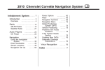
2008 Chevrolet Corvette Navigation System
Overview ........................................................
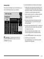
Overview
..................................................
Features and Controls .....................................
Features and Controls
................................
1-1
1-2
2-1
2-2
M
Navigation Audio System ................................ 3-1
Navigation Audio System
............................ 3-2
Voice Recognition ........................................... 4-1
Voice Recognition
...................................... 4-2
Index ................................................................ 1
GENERAL MOTORS, GM, the GM Emblem,
CHEVROLET, the CHEVROLET Emblem, the name
CORVETTE, and the CORVETTE Emblems are
registered trademarks of General Motors Corporation.
Dolby® is manufactured under license from Dolby®
Laboratories. Dolby® and the double-D symbol
are trademarks of Dolby® Laboratories.
The information in this manual supplements the owner
manual. This manual includes the latest information
available at the time it was printed. We reserve the right
to make changes in the product after that time without
notice. For vehicles first sold in Canada, substitute
the name General Motors of Canada Limited for
Chevrolet Motor Division whenever it appears in this
manual.
Keep this manual with the owner manual in the vehicle,
so it will be there if it is needed. If the vehicle is sold,
leave this manual in the vehicle.
Litho in U.S.A.
Part No. 15838253 A First Printing
ii
©
2007 General Motors Corporation. All Rights Reserved.
Canadian Owners
Propriétaires Canadiens
A French language copy of this manual can be obtained
from your dealer/retailer or from:
On peut obtenir un exemplaire de ce guide en français
auprès de concessionnaire ou à l’adresse suivante:
Helm, Incorporated
P.O. Box 07130
Detroit, MI 48207
Helm Incorporated
P.O. Box 07130
Detroit, MI 48207
1-800-551-4123
www.helminc.com
1-800-551-4123
www.helminc.com
iii
✍ NOTES
iv
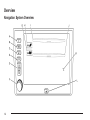
Section 1
Overview .........................................................1-2
Navigation System Overview ............................1-2
Overview
Getting Started ...............................................1-4
Cleaning the Display .....................................1-12
1-1
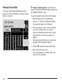
Overview
Navigation System Overview
1-2
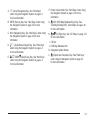
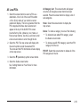
g (Voice Recognition) Key. See “Hard Keys”
under Using the Navigation System on page 2-2
for more information.
B. SRCE (Source) Key. See “Hard Keys” under Using
the Navigation System on page 2-2 for more
information.
C. NAV (Navigation) Key. See “Hard Keys” under Using
the Navigation System on page 2-2 for more
information.
A.
F. Power Volume Knob. See “Hard Keys” under Using
the Navigation System on page 2-2 for more
information.
G.
XDVD (DVD Map Database Eject) Key. See
“Installing the Map DVD” under Maps on page 2-49
for more information.
D.
ez (Audio/Screen Adjust) Key. See “Hard Keys”
under Using the Navigation System on page 2-2
for more information.
XB(CD Eject) Key. See “CD Player on page 3-14
for more information.
I. CD Slot
J. DVD Map Database Slot
K. Navigation System Screen
E.
QO SEEKR(Seek/Tune) Key. See “Hard Keys”
L.
under Using the Navigation System on page 2-2
for more information.
H.
X(Open/Close Faceplate) Key. See “Hard Keys”
under Using the Navigation System on page 2-2
for more information.
1-3
Getting Started
Before you begin to operate the navigation system, read
this manual thoroughly to become familiar with it and
to understand how the system works.
Any route suggestions made by this navigation system
may never override local traffic regulations, your own
judgement, and/or knowledge of safe driving practices.
Disregard route suggestions made by the navigation
system if such suggestions would; cause you to perform
a hazardous or illegal maneuver, place you in a
hazardous situation, or route you into an area you
consider unsafe.
Keeping your mind on the drive is important for safe
driving. See “Defensive Driving” in the Index of
your vehicle’s owner manual for more information.
Get familiar with your vehicle’s navigation system so
you can use it with less effort and take full advantage
of its features. Your navigation system includes
not only navigation, but also audio functions.
1-4
While your vehicle is parked:
• Familiarize yourself with all of its controls: hard keys
on the faceplate and touch-sensitive screen buttons.
• Familiarize yourself with its operation.
• Set up your audio by presetting your favorite stations,
setting the tone, and adjusting the speakers. Then,
when driving conditions permit, you can tune to your
favorite stations using the presets and steering wheel
controls (if equipped).
• Set up the navigation features that can only be done
before you begin driving, such as entering an
address or a preset destination.
Entering a destination or alphanumeric text requires
many steps, so you can only perform these operations
when the vehicle is in PARK (P). You will notice
that touch-sensitive screen buttons leading to the
alphanumeric keyboard are dimmed out while driving.
Other functions may also be locked out while driving and
they too will appear grayed out on the screen — but
all functions are available when parked. Some functions
can be performed while driving, as long as you can
do so without diverting too much of your attention from
your driving.
The navigation system allows you to do the following:
{CAUTION:
This system provides you with a far greater
access to audio stations and song listings.
Giving extended attention to entertainment
tasks while driving can cause a crash and you
or others can be injured or killed. Always keep
your eyes on the road and your mind on the
drive — avoid engaging in extended searching
while driving.
{CAUTION:
• Plan a route with provided turn-by-turn route
and map guidance with voice prompts.
• Select a destination using various methods and
choices.
• Receive broadcast announcements on traffic and
emergency alert communications.
You should always be alert and obey traffic and roadway
laws and instructions, regardless of the guidance from
the navigation system. The navigation system uses
street map information that does not include all traffic
restrictions or the latest road changes, it may suggest
using a road that is now closed for construction or a
turn that is prohibited by signs at the intersection.
The system uses limited information, you must always
evaluate whether following the system’s directions
is safe and legal for the current conditions.
Looking at the moving map on the navigation
screen frequently or for too long while driving
can cause a crash and you or others can be
injured or killed. Keep your eyes and mind on
the road and avoid looking too long or too
often at the moving map on the navigation
screen. Use the voice guidance directions
whenever possible.
1-5
Deleting Personal Information
This navigation system can record and store destinations.
At times, such as when you are disposing of your vehicle,
you may want to delete these destinations. refer to the
following sections to delete the destination information
that has been stored.
See “Memory Points”, “Home”, “Previous Destination”
and “Preset Destinations”, under Stored Locations
on page 2-23 for deleting stored destinations.
Storing Radio Station Presets
To set preset radio stations, do the following:
1. Press the power/volume knob to turn the system on.
Each time you enter the navigation system, the
CAUTION screen will display. Touch Agree to proceed
into the system.
When getting started you may set the navigation system
to your preference or delete information you may
have entered using various options. To do so, reference
the following topics.
Language
To change the language of the navigation screens,
see “DIC Operation and Displays” in the Index of your
vehicle’s owner manual.
1-6
2. Press the SRCE hard key and select the desired
band (AM, FM1, FM2, XM1, or XM2 (if equipped)).
3. Use the TUNE/SEEK arrows to tune to the
desired station.
4. Press and hold one of the six preset screen buttons,
at the bottom of the screen, until you hear a beep
or see the station displayed on the selected
preset button.
5. Repeat the steps for each preset.
See “Preset Station Menu” under Navigation Audio
System on page 3-2 for more information.
Setting the Time
Setting the Region
To set the time, do the following:
To set the region, do the following:
1. Press the power/volume knob to turn the system on.
2. Press and hold the time display in the upper right
corner of any screen.
3. Select the 12H or 24H screen button to display the
time in standard or military time.
4. Press and hold the Hour and Min. (minute) arrow
buttons to increase or to decrease the time.
5. Select the appropriate time zone screen button.
6. Select the Daylight Saving Time screen button,
if necessary.
The radio will use the GPS satellite to set the time.
The vehicle needs to be in an open area to receive the
signal. See “Clock” under Navigation Audio System
on page 3-2 for more information.
Setting the Region, Entering an
Address and Point of Interest, and
Storing a Home Destination and Preset
Destinations
1. If the radio is already on with a map disc inserted,
skip to Step 5.
2. Press the power/volume knob to turn the system on.
3. Insert the DVD map disc. See “Installing the Map
DVD” under Maps on page 2-49 for more
information.
4. A notice may appear. Touch the Agree screen
button to proceed.
5. Press the NAV hard key.
6. Press the MENU screen button.
7. Press the
< Enter Destination screen button.
8. Press the Region screen button.
9. Select the appropriate region numbered screen
button that contains your final destination.
The system will return to the Enter Destination menu.
See Enter Destination on page 2-4 for more information.
Before entering an Address, Point of Interest, Home, or
Preset Destination, select the appropriate region that
contains the final destination. Your vehicle must
be stopped to perform this operation.
1-7
Entering an Address
To set a destination by entering a street address, do the
following:
1. If the radio is already on with a map disc inserted,
skip to Step 5.
2. Press the power/volume knob to turn the system on.
10. Select the desired street name with the correct
designation (Dr., Ln., St., etc.) from the list.
11. If there is more than one city, the system will
display the list of cities that have a street with
that name. Select a city from the list or select the
Input Name screen button to input the city name.
3. Insert the DVD map disc. See “Installing the
Map DVD” under Maps on page 2-49 for more
information.
12. Enter the house number using the numeric keypad
on the screen and touch the OK screen button.
A map screen will appear with the destination
marked.
4. A notice may appear. Touch the Agree screen
button to proceed.
13. Select the
5. Press the NAV hard key.
6. Press the MENU screen button.
7. Press the < Enter Destination screen button.
Verify that the selected Region is correct.
8. Press the
2 Address screen button.
9. Enter the street name using the alpha keypad on
the screen.
Do not enter directional information or street type,
and use the space symbol screen button (U)
between street or city names. For example, the
street name N. Royal Oak Rd. should be entered as
royalUoak. Use the backspace (V) screen
button if an incorrect character has been entered.
1-8
h (destination) symbol screen button.
14. Select the Guide screen button.
15. Once you begin driving you will hear an audio
prompt to “Proceed to the highlighted route.”
You are now in route guidance mode.
See “Address” under Enter Destination on page 2-4 for
more information.
Entering a Point of Interest (POI)
10. Select the POI from the list.
To set a destination by entering a Point of Interest (POI),
do the following:
11. If there is more than one city, the system will
display the list of cities that have a street with
that name. Select a city from the list or select the
Input Name screen button to input the city name.
A map screen will appear with the destination
marked.
1. If the radio is already on with a map disc inserted,
skip to Step 5.
2. Press the power/volume knob to turn the system on.
3. Insert the DVD map disc. See “Installing the
Map DVD” under Maps on page 2-49 for more
information.
12. Select the
4. A notice may appear. Touch the Agree screen
button to proceed.
14. Once you begin driving you will hear an audio
prompt to “Proceed to the highlighted route.”
You are now in route guidance mode.
5. Press the NAV hard key.
6. Press the MENU screen button.
7. Press the < Enter Destination screen button.
Verify that the selected Region is correct.
8. Press the
h(destination) symbol screen button.
13. Select the Guide screen button.
Using the Category or City selections will aid the
system in finding your POI by limiting the search options.
See “Point of Interest (POI)” under Enter Destination
on page 2-4 for more information.
K Point of Interest screen button.
9. Enter the specific title of the POI in the Name space
(i.e. Washington Monument) using the alpha
keypad on the screen.
1-9
Storing a Home Destination
1. If the radio is already on with a map disc inserted,
skip to Step 5.
2. Press the power/volume knob to turn the system on.
3. Insert the DVD map disc. See “Installing the
Map DVD” under Maps on page 2-49 for more
information.
4. A notice may appear. Touch the Agree screen
button to proceed.
5. Press the NAV hard key.
6. Press the MENU screen button.
7. Press the
8. Press the
N Stored Locations screen button.
L Home screen button.
9. Press the Add screen button.
10. Press the Address screen button and enter all
address information.
11. Press the OK screen button.
A map screen will appear with the destination
marked.
12. Press the OK screen button.
13. Press the back arrow screen button.
The LHome icon will be highlighted on the Enter
Destination screen. See “Using Your Home or
Preset Destinations” later in this section for more
information.
1-10
Storing a Preset Destination
1. If the radio is already on with a map disc inserted,
skip to Step 5.
2. Press the power/volume knob to turn the system on.
3. Insert the DVD map disc. See “Installing the
Map DVD” under Maps on page 2-49 for more
information.
4. A notice may appear. Touch the Agree screen
button to proceed.
5. Press the NAV hard key.
6. Press the MENU screen button.
7. Press the N Stored Locations screen button.
8. Press the & Previous Dest. screen button.
9. Press the Add screen button, then select the
numbered preset button for the destination to
appear as.
10. Press the Address screen button and enter all
address information.
11. Press the OK screen button.
A map screen will appear with the destination
marked.
12. Press the OK screen button.
13. Press the back arrow screen button.
The numbered preset destination will be highlighted
on the Enter Destination screen. See “Using Your
Home or Preset Destinations” next in this section for
more information.
Using Your Home or Preset
Destinations
These destinations are available for selection while
driving.
1. If the radio is already on with a map disc inserted,
skip to Step 5.
2. Press the power/volume knob to turn the system on.
3. Insert the DVD map disc. See “Installing the
Map DVD” under Maps on page 2-49 for more
information.
4. A notice may appear. Touch the Agree screen
button to proceed.
5. Press the NAV hard key.
6. Press the MENU screen button.
7. Press the < Enter Destination screen button.
8. Select the L (Home symbol) or one of the available
preset destination symbols. A map screen will
appear with the destination marked.
9. Select the h (destination) symbol screen button.
10. Select the Guide screen button.
11. Once you begin driving you will hear an audio
prompt to “Proceed to the highlighted route.”
You are now in route guidance mode.
Canceling Guidance
Guidance will be canceled once you arrive at your final
destination. To cancel guidance prior to arrival at the
final destination, do the following:
1. Press the NAV hard key to access the map screen.
2. Press the MENU screen button on the map screen.
3. Press the
E Route Options screen button.
4. Press the Cancel Guidance screen button.
5. Press the Yes screen button to confirm cancellation.
Stored Locations
Once a destination has been stored, the address
information can then be edited and deleted. See Stored
Locations on page 2-23 for more information on other
features that can be stored, edited, and deleted.
To delete the stored home destination, do the following:
1. Press the power/volume knob to turn the system on.
2. Insert the DVD map disc. See “Installing the
Map DVD” under Maps on page 2-49 for more
information.
3. A notice may appear. Touch the Agree screen
button to proceed.
If the radio is already on with a map disc inserted,
press the NAV hard key.
1-11
4. Press the MENU screen button.
N Stored Locations screen button.
Press the L Home screen button.
5. Press the
6.
7. Press the Delete screen button.
8. A confirmation pop-up screen will appear: select
Yes to delete; select No to cancel the operation.
To delete a waypoint or a stored preset destination,
do the following:
1. Press the power/volume knob to turn the system on.
2. Insert the DVD map disc. See “Installing the Map
DVD” under Maps on page 2-49 for more
information.
3. A notice may appear. Touch the Agree screen
button to proceed.
If the radio is already on with a map disc inserted,
press the NAV hard key.
4. Press the MENU screen button.
N Stored Locations screen button.
Press the $ Dest. & Way Pt. or the & Previous
5. Press the
6.
Dest. screen button.
7. Press the Delete screen button, then select the way
point or the numbered preset button to delete.
8. A confirmation pop-up screen will appear: select
Yes to delete; select No to cancel the operation.
1-12
Guidance Volume
To adjust the volume of voice guidance prompts, do the
following:
1. Press the NAV hard key to access the map screen.
2. Press the MENU screen button on the map screen.
I Navigation Set Up screen button.
Press the > Guidance Volume screen button.
3. Press the
4.
5. Select the desired volume or select Off. The system
will play back the new volume level.
See “Guidance Volume” under Navigation Set Up on
page 2-35 for more information.
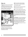
Cleaning the Display
If the panel or the display is stained, wipe it with a dry,
soft cloth, such as a silicon cloth.
Notice: If you use abrasive cleaners when cleaning
glass surfaces, you could scratch the glass.
When cleaning the glass, use only a soft cloth and
do not spray cleaner directly on the system.
Do not apply spray cleaner directly to the system,
the cleaner could affect the mechanical parts.
Do not wipe the panel with a hard cloth or use a volatile
liquid such as thinner or alcohol, it could scratch the
surface or erase the characters.
Section 2
Features and Controls
Features and Controls ......................................2-2
Using the Navigation System ...........................2-2
Nav. (Navigation) Menu ...................................2-3
Enter Destination ............................................2-4
Stored Locations ...........................................2-23
Navigation Set Up .........................................2-35
Route Options ..............................................2-43
Maps ..........................................................2-49
Symbols ......................................................2-53
Head-Up Display (HUD) .................................2-59
Keyless Access System .................................2-59
Global Positioning System (GPS) ....................2-60
Vehicle Positioning ........................................2-61
Problems with Route Guidance .......................2-62
If the System Needs Service ..........................2-62
Ordering Map DVDs ......................................2-63
Database Coverage Explanations ....................2-63
2-1
Features and Controls
Using the Navigation System
This section presents basic information to operate the
navigation system.
Use the hard keys located on the navigation system
along with the available touch screen buttons on the
navigation screen to operate the system. See Navigation
System Overview on page 1-2 for more information.
Once the vehicle is moving, various functions will be
disabled to reduce driver distractions.
Hard Keys
The following hard keys are located on the navigation
system:
X (Open/Close Faceplate):
Press this key located at
the bottom of the Navigation Screen to open or close
the faceplate.
XB (Eject CD):
Press the eject CD key next to
the CD loading slot to eject CDs. See CD Player
on page 3-14 for more information.
2-2
X DVD (Eject Map Database DVD):
Press the eject
DVD key next to the DVD loading slot to eject the
map DVD. See “Installing the Map DVD” under Maps on
page 2-49 for more information.
Power/Volume Knob: Press the power/volume knob to
turn the audio and navigation systems on and off.
Turn the knob to increase or decrease the volume to
the audio system.
g (Voice Recognition): Press this key to activate the
voice recognition system. See Voice Recognition on
page 4-2 for more information.
NAV (Navigation): Press this key to access the map
screen. If this key is pressed when a map screen
is displayed and you are in route guidance, the system
will repeat the last voice command.
SRCE (Source): Press this key to access the audio
source screen. See Navigation Audio System on
page 3-2.
e/ z (Audio/Screen Adjust):
Press this key to
access the Audio Adjust and Screen Adjust screens.
See Navigation Audio System on page 3-2.
QO SEEKR(Seek/Tune): Press the seek/tune
arrows to go to the next or previous radio station and
stay there, or to tune in a station. See Navigation Audio
System on page 3-2.
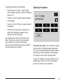
Alpha-Numeric Keypad
Touch-Sensitive Buttons
Letters of the alphabet, symbols, punctuation, and
numbers will be displayed on the navigation screen as
an alpha or numeric keypad. The alpha keypad will
be displayed when the system needs input of a city or
street name. Touch the Sym. (symbol) screen button
at the bottom of the alpha keypad to access the numeric
keypad when inputting a house address, punctuation
mark, or other character. Touch A - Z to return to
the alpha keypad.
Touch-sensitive buttons are located on the screen.
When a screen button has been selected, a beep will
sound. These buttons will be highlighted when a feature
is available. There are also some toggle screen
buttons that will be light color when active.
All characters are touch-sensitive screen buttons.
Touch a character to select it.
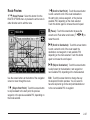
Nav. (Navigation) Menu
Press the NAV hard key to access the map screen.
Press the MENU touch screen button on the map
screen.
U (Space):
Touch this screen button to enter a
space between characters or the words of a name.
V (Back space): Touch this screen button if an
incorrect character has been selected.
To make name selections easier, the system will only
allow you to select a character which can follow the last
one entered. For example, if a Z is entered, a T will
not be available to select. The system will highlight the
available characters.
If a name is not available after input, it may need to be
inputted differently, the map DVD database may not
contain that information, or the correct search area has
not been selected. See Database Coverage
Explanations on page 2-63 for more information.
From this screen all of the navigation system features
can be accessed.
2-3
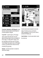
Enter Destination
Press the < Enter Destination screen button to access
the ENTER DESTINATION screen. From this screen,
several options are available to plan a route by entering
destination points.
Once a destination entry is complete, regardless of
which method was used, a map screen with the
destination previewed will display. You can change
route preferences, route options, map appearances, or
add a waypoint at this time. You may also set the
destination without making any further changes. See
“Getting Started on Your Route” later in this section for
more information on your choices once a destination
has been entered.
2-4
This menu has two pages. To view the second page,
press the 1/2 arrow button.
Region
The ENTER DESTINATION screen displays a map of
the United States and a part of Canada divided into
11 regions.
Before selecting a destination entry method, review the
search area map to make sure your destination is
located in the highlighted region.
Touch the Region screen button from the ENTER
DESTINATION screen to see a list of states included
in the highlighted region, or to change the region.
The SEARCH AREA screen will display. Touch the
numbered screen button to the left of the search area
map that corresponds with the numbered region
you wish to select or to view a list of states included in
that region. Touch the down arrow to the left of the
search area map to select CAN (Canada). Once the
region has been selected, the region will be highlighted
on the map. Touch the back key to return to the
ENTER DESTINATION screen.
2-5
Address
The address destination entry method allows you to
input an address by providing the system with a street
name or city.
To input the street name first, do the following:
1. Touch the Street screen button from the address
menu and start inputting the street name using the
alpha keypad. A list of available street names
will automatically display if there are less than
five street names available. Select the List screen
button at any time to view the available street
names. The box at the end of the Street entry field
will contain the number of street names available
in the current generated list.
2. Select the desired street name with the correct
designation (Dr., Ln, St., etc.) from the list.
3. If the system determines that the street is found in
only one city within the search area that city will
automatically be selected.
If there is more than one city, the system will
display the list of cities that have a street with that
name. Select a city from the list or select the
Input Name screen button to input the city name.
2 Address:
Touch this screen button to access the
ADDRESS screen. You can enter the address one
of two ways: street first or city first.
2-6
4. The house number screen will display, enter the
house number using the numeric keypad.
5. Once the correct house number is selected, press
the OK screen button.
A map screen will appear with the destination
marked.
6. Select the
h (destination) symbol screen button.
7. Select the Guide screen button.
See “Getting Started on Your Route” later in this
section for more information.
To input the city name first, do the following:
1. Touch the City screen button.
2. Select from the choices shown on the city screen:
Any City, 5 Nearest Cities, Input City Name, or from
the Last 5 Cities used.
• Any City — The system will request input of a
street name, then generate a list of all cities
containing that street name. Select a city from
the list.
• 5 Nearest Cities — The system will display a list
of five cities closest to your vehicle’s current
position. Select a city from the list.
• Input City Name — The keypad will display for
inputting the city name. Input the city name
and then select the city from the list.
3. The screen to input the street name and house
number will display. Input the street name using
the alpha keypad. A list of available street names
will display if there are less than five street
names available. Select the List screen button at
any time to view the available street names.
The box at the end of the Street entry field will
contain the number of street names available in the
current generated list.
4. Select the desired street name with the correct
designation (Dr., Ln, St., etc.) from the list.
5. The house number screen will display, enter the
house number using the numeric keypad.
Once the correct house number is selected, a map
screen will appear with the destination marked.
6. Select the
h (destination) symbol screen button.
7. Select the Guide screen button.
See “Getting Started on Your Route” later in this
section for more information.
• Last 5 Cities — The city names of the last five
cities that were stored as a previous destination
will display. Select a city from the list.
2-7
Point of Interest (POI)
The Point of Interest (POI) destination entry method
allows you to select a destination from the POI list.
To input the POI name, do the following:
1. Use the alpha keypad to enter the POI name.
Touch Sym. (symbol) to select symbols and
numbers for the POI, touch Others to select special
characters for the POI, or touch A - Z to return to
the alpha keypad.
A list of POIs will appear using the information from
the alpha keypad input. A list of available POIs
will display when there are less than five POIs
available. Touch the List screen button at any time
to view the available POIs.
2. Select the desired POI from the list.
K Point of Interest: Touch this screen button from
the ENTER DESTINATION screen to access the
POINT OF INTEREST screen. This screen has three
options to select/input the destination. Either input
the name of the POI using the alpha keypad, select a
category from the category list, or select the city by
selecting the City screen button.
2-8
3. If the system determines that the POI is found in
only one city within the search area that city will
automatically be selected.
If there is more than one city, the system will
display the list of cities that have a POI with that
name. Select a city from the list or select the Input
Name screen button to input the city name.
Once all of the information is selected, a map
screen will appear with the destination marked.
4. Select the
h (destination) symbol screen button.
5. Select the Guide screen button.
See “Getting Started on Your Route” later in this
section for more information.
4. If the alpha keypad is displayed, input the
POI name until a list of available POIs appear.
5. Select the POI from the list.
6. If the system determines that the POI is found in
only one city within the search area that city will
automatically be selected.
If there is more than one city, the system will
display the list of cities that have a POI with that
name. Select a city from the list or select the Input
Name screen button to input the city name.
Once all of the information is selected, a map
screen will appear with the destination marked.
7. Select the
To select a POI from a category, do the following:
1. Touch the Category screen button from the POINT
OF INTEREST screen to view a list of POI
categories.
h (destination) symbol screen button.
8. Select the Guide screen button.
See “Getting Started on Your Route” later in this
section for more information.
2. Select a category, and then a sub-category.
3. The system will display available POIs in the
selected sub-category or if the list is too long
the system will display the alpha keypad.
2-9
To select a POI by inputting a city name, do the
following:
1. Select the City screen button, then select: Any City,
5 Nearest Cities, Input City Name, or from the Last
5 Cities used.
• Any City — The system will request input of a
POI name, then generate a list of all cities
containing that POI name. Select a city from
the list.
• 5 Nearest Cities — The system will display a list
of five cities closest to your vehicle’s current
position. Select a city from the list.
• Input City Name — The keypad will display for
inputting the city name. Input the city name
and then select the city from the list.
• Last 5 Cities — The city names of the last five
cities that were stored as a previous destination
will display. Select a city from the list.
2-10
2. Use the alpha keypad to enter the POI name.
Touch Sym. (symbol) to select symbols and
numbers for the POI, touch Others to select special
characters for the POI, or touch A - Z to return to
the alpha keypad.
3. A list of POIs will appear using the information from
the alpha keypad input. A list of available POIs
will display when there are less than five POIs
available. Touch the List screen button at any time
to view the list of available POIs.
4. Select the desired POI from the list.
A map screen will appear with the destination
marked.
5. Select the
h (destination) symbol screen button.
6. Select the Guide screen button.
See “Getting Started on Your Route” later in this
section for more information.
Map
The map destination entry method allows you to select
a destination by scrolling on the map.
I Select from Map:
Touch this screen button from
the ENTER DESTINATION screen to enter the
map destination entry method, then do the following:
1. Touch the map for the desired area you wish to set
as your destination.
2. Use the zoom in/out function to view the direction of
the desired area.
3. Pressing/holding and dragging on the map will
activate fast scrolling. Press/touch once on the
area to which you would like to move the current
position mark.
Once the scroll symbol is on the location, the
address information will display on the map screen.
4. Select the
h (destination) symbol screen button.
5. Select the Guide screen button.
See “Getting Started on Your Route” later in this
section for more information.
2-11
Emergency
The emergency destination entry method allows you to
enter a destination by selecting from three categories:
Police Station, Hospital, or Dealer.
| Emergency: Touch this screen button from
the ENTER DESTINATION screen to access the
EMERGENCY screen. The system will display the
address, longitude, and latitude information of your
vehicles current position.
To use this destination entry method, do the following:
1. Select a category. A list of destination(s) will display
with the name of the destination and the distance
from your vehicle’s current position.
2. Select a destination point from the list. Touch Name
Sort to sort the list by name, or Dist Sort to sort the
list by distance from the vehicle’s current position.
After selecting a destination from the list, a map
screen will appear with the destination marked.
3. Select the
h (destination) symbol screen button.
4. Select the Guide screen button.
See “Getting Started on Your Route” later in this
section for more information.
2-12
Memory Points
N Memory Point:
The memory points destination entry method allows you
to select a destination from a list of points that have
been previously stored.
To use this destination entry method, do the following:
To store, edit, and delete memory points see Stored
Locations on page 2-23 for more information.
Touch this screen button from the
DESTINATION ENTRY screen to access the MEMORY
POINTS screen.
1. Select the category/folder in which the memory
point has been stored. Select from PERSONAL,
BUSINESS, ENTERTAINMENT, or MARKED
POINT folders.
2. Sort the list by distance, icon, name or date stored.
3. Select the desired memory point.
After selecting a memory point from the list, a map
screen will appear with the destination marked.
4. Select the
h (destination) symbol screen button.
5. Select the Guide screen button.
See “Getting Started on Your Route” later in this
section for more information.
2-13
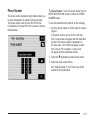
Previous Destination
The previous destination entry method allows you to
select a destination from a list of previous destination
points.
As new destinations are entered, the system will
automatically delete the oldest destinations and add the
new entries.
To use the previous destination entry method, do the
following:
1. Select a previous destination from the list. Use the
Sort by Name/Date function as necessary. Also from
this menu you can select the previous start point
option. This option is available while the vehicle
is moving.
To use the previous start point option from the
PREVIOUS DEST screen, select the Previous Start
Point screen button.
2. After selecting a destination from the list, a map
screen will appear with the destination marked.
3. Select the
h Previous Destination: Touch this screen button
from the ENTER DESTINATION screen to access
the PREVIOUS DEST screen. The system will store
up to 100 points that have been previously input.
2-14
h (destination) symbol screen button.
4. Select the Guide screen button.
See “Getting Started on Your Route” later in this
section for more information.
Intersection
The intersection destination entry method allows you to
set two intersecting streets as your destination.
To use this destination entry method, do the following:
1. Enter the first of two streets in the intersection. A list
of available street names will display when there are
less than five available. Touch the List screen button
at any time to view the available street names.
2. Select a street from the list, or continue to spell the
street name to further reduce the number of
available street names.
3. After the first street has been selected, enter the
second street name. The List button may again
become available.
4. Select the second street from the list, or continue to
spell the street name to further reduce the number
of available street names.
After both streets have been selected, a map
screen will appear with the destination marked.
5. Select the
? Intersection:
Touch this screen button from
the ENTER DESTINATION screen to access the
INTERSECTION screen.
h (destination) symbol screen button.
6. Select the Guide screen button.
See “Getting Started on Your Route” later in this
section for more information.
2-15
Freeway Entrance/Exit
= Freeway Ent (Entrance)/Exit:
The freeway entrance/exit destination entry method
allows you to select a destination by entering a freeway
entrance or exit point.
To use this destination entry method, do the following:
Touch this screen
button from the ENTER DESTINATION screen to access
the FREEWAY ENT/EXIT screen.
1. Enter the freeway name. Use abbreviations,
such as I - 75, rather than spelling out Interstate.
The system will display a list of freeways.
2. Select a freeway from the list, and select whether
you want an entrance point or an exit point.
Select an exit/entrance point from the list or input
the point by name. Sort the list by name or by
distance.
After selecting a point from the list, a map screen
will appear with the destination marked.
3. Select the
h (destination) symbol screen button.
4. Select the Guide screen button.
See “Getting Started on Your Route” later in this
section for more information.
2-16
Phone Number
U Phone Number:
The phone number destination entry method allows you
to select a destination by entering a phone number.
The phone number must be in the list of POIs that
is contained on the map DVD for the system to retrieve
the destination.
To use this destination entry method, do the following:
Touch this screen button from the
ENTER DESTINATION screen to access the PHONE
NUMBER screen.
1. Input the phone number of a POI using the numeric
keypad.
If the phone number can be found on the map
DVD, a map screen will appear with the destination
marked. If the phone number is dependent on
the area code, a list of POIs will appear to select
from. Once a POI is selected, a map screen
will appear with the destination marked.
2. Select the
h (destination) symbol screen button.
3. Select the Guide screen button.
See “Getting Started on Your Route” later in this
section for more information.
2-17
Coordinates
The coordinates destination entry method allows you to
select a destination by entering latitude and longitude
coordinates.
To use this destination entry method, do the following:
1. Touch N (North) or S (South) next to LAT (latitude)
to enter the direction of the latitude coordinate.
2. Input the numeric portion of the latitude coordinate
using the keypad.
3. Touch E (East) or W (West) next to LONG
(longitude) to enter the direction of the longitude
coordinate.
4. Input the numeric portion of the longitude coordinate
using the keypad.
5. Once both coordinates are entered, touch the
OK screen button.
A map screen will appear with the destination
marked.
If the coordinates are outside of the coverage area
on the map, you will be informed that there is
no information on that location.
) Coordinates:
Touch this screen button from
the ENTER DESTINATION screen to access the
COORDINATES screen.
2-18
6. Select the
h (destination) symbol screen button.
7. Select the Guide screen button.
See “Getting Started on Your Route” later in this
section for more information.
Preset Destination
Home
The preset destination entry method allows you to set a
destination by choosing from one of five previously
stored destinations. Besides home, these are the only
destinations available to set while the vehicle is moving.
This feature allows you to plan a route to one previously
stored destination that you have selected as a home.
If a home destination is not stored, the home button will
not be available. Besides preset destinations one
through five, this destination is the only other one
available to set while the vehicle is moving or by voice
recognition.
To store, edit, or delete a preset destination, see
“Destination & Way Point” under Stored Locations on
page 2-23.
To use this destination entry method, do the following:
1. Select a preset destination number button from
the ENTER DESTINATION screen. The screen
buttons are located on the bottom of the screen.
A map screen will appear with the destination
marked.
2. Select the
h (destination) symbol screen button.
3. Select the Guide screen button.
See “Getting Started on Your Route” later in this
section for more information.
To store, edit, or delete a home location, see Stored
Locations on page 2-23.
L (Home):
Touch this screen button from the ENTER
DESTINATION screen to set a home destination.
To use this destination entry method, do the following:
1. Touch the Home button from the ENTER
DESTINATION screen.
2. The system will then set your preset home
destination as the current destination. To store a
preset home destination, see Stored Locations
on page 2-23.
A map screen will appear with the destination
marked.
3. Select the h (destination) symbol screen button.
4. Select the Guide screen button.
See “Getting Started on Your Route” later in this
section for more information.
2-19
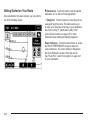
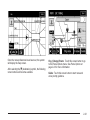
Getting Started on Your Route
Once a destination has been entered, you can perform
one of the following options:
h (Destination): Touch this button to set the entered
destination as it is, without further adjustment.
o (Waypoint):
Touch this button to enter this point as
a waypoint along the route. This feature allows you
to enter up to five stops on the way to your destination.
See “Dest. & Way Pt. (Destination & Way Point)”
under Stored Locations on page 2-23 for more
information about adding and deleting waypoints.
Route Preference: Touch this screen button to access
the ROUTE PREFERENCES screen to adjust the
route preferences. The current setting is displayed in
the Route Preference section of the map screen.
See “Route Pref.” under Route Options on page 2-43
for more information.
2-20
Once the route preferences have been set, the system
will display the map screen.
After selecting the h (destination) symbol, the following
screen buttons will become available.
Chg. (Change) Route: Touch this screen button to go
to the Route Options menu. See Route Options on
page 2-43 for more information.
Guide: Touch this screen button to start route and
voice prompt guidance.
2-21
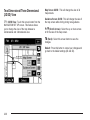
Three Routes
The 3 routes screen will give you a selection of selecting
three different routes to get you to your destinations.
To use the 3 routes option, do the following:
From this screen, you can view the following
information:
1. Select the 3 routes button on the map screen.
• G (Estimated Travel Time) — This icon shows
the route’s estimated time of travel.
• J (Straight-Line Distance) — This icon
The system will calculate up to three different
versions of your current route in three different
colors: Quick, Normal, and Short. The routes are
shown with distance to destination and estimated
travel time, or select the Info screen button to
access the INFO FOR 3 ROUTES screen.
2-22
shows the route’s straight-line distance to
destination.
• W (Toll Road) — This icon shows the distance
traveled on toll roads.
• c (Freeway Travel) — This icon shows the
distance traveled on freeways.
• b (Ferry) — This icon shows the distance
traveled by ferry.
• {(Time Restricted Roads) — This icon shows
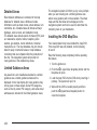
Stored Locations
Select the N Stored Locations screen button from the
NAV. MENU to access the STORED LOCATIONS
screen. From this screen, you can access the following
options:
the distance traveled on time-restricted roads.
2. Select the Quick, Normal, or Short screen button.
A map screen will appear with the destination
marked.
3. Select the Guide screen button to start route and
voice guidance.
2-23
Memory Points
N Memory Points:
This feature allows you to store
memory points. You can store them in the four
categories listed: Personal, Business, Entertainment,
and Marked Point. These category names can be
changed for your convenience.
To store a point:
1. Touch the Memory Points screen button from the
STORED LOCATIONS screen.
2. Select one of the folders/categories listed.
3. Select the Add screen button.
4. Select the desired method of entering a destination
to enter the memory point. See Enter Destination
on page 2-4 for more information. A map screen
will appear displaying the selected memory
point location.
5. If available, touch the INFO button to view the
address information of the selected point.
6. Touch OK to store the point as a memory point.
To edit the name of a stored point:
1. Touch the Memory Points screen button from the
STORED LOCATIONS screen.
2. Select the folder/category that the memory point
exists in.
3. Select the List screen button.
2-24
4. Select the memory point to edit. Use the sort
feature to sort by distance, icon, name, or date
as needed.
5. Touch the Name screen button from the EDIT
MEMORY POINT screen.
6. Use the backspace screen button to delete the
current name or use the alpha keypad to make
changes.
Select the Show Name On screen button to have
the name of the point appear on the map screen.
7. Touch the back screen button to store the change.
To change the icon associated with a memory point:
1. Touch the Memory Points screen button from
the STORED LOCATIONS screen.
2. Select the folder/category that the memory point
exists in.
5. Touch the Icon screen button from the EDIT
MEMORY POINT screen.
6. Select the desired icon. There are two pages
(52) icons, six icons that have sounds associated
with them, and a No Icon button to select from.
Select the With Sound screen button, and the
sound icons will display. To hear the sound of the
icon, touch the Sound screen button next to
each icon. If the sound icons are used, the
associated sound will be heard when the vehicle
is approximately 650 ft (200 m) from the
memory point.
Select the No Icon screen button to not have an
icon associated with the point.
The new icon will display in the EDIT MEMORY
POINT screen, next to the Icon screen button.
7. Touch the back screen button to store the change.
3. Select the List screen button.
4. Select the memory point to edit. Use the sort feature
to sort by distance, icon, name, or date as needed.
2-25
To move the memory point from one folder/category to
another:
1. Touch the Memory Points screen button from the
STORED LOCATIONS screen.
2. Select the folder/category that the memory point
currently exists in.
3. Select the List screen button.
4. Select the memory point to edit. Use the sort
feature to sort by distance, icon, name, or date
as needed.
5. Touch the Category screen button from the EDIT
MEMORY POINT screen.
6. Touch the new folder/category button you want to
move the memory point to.
The system will display a message confirming
the move.
To modify the position of the stored point:
1. Touch the Memory Points screen button from the
STORED LOCATIONS screen.
2. Select the folder/category that the memory point
exists in.
3. Select the List screen button.
2-26
4. Select the memory point to edit. Use the sort
feature to sort by distance, icon, name, or date
as needed.
5. Touch the Position screen button from the EDIT
MEMORY POINT screen.
The system will display the map screen with the
destination marked.
6. Touch the map to move the position of the
memory point.
7. Touch OK when you have moved the memory point
to the appropriate location.
8. The system will return to the EDIT MEMORY POINT
screen and will display the new address, longitude,
and latitude for the changed memory point.
To change the phone number of a memory point:
1. Touch the Memory Points screen button from the
STORED LOCATIONS screen.
2. Select the folder/category that the memory point
exists in.
3. Select the List screen button.
4. Select the memory point to edit. Use the sort
feature to sort by distance, icon, name, or date
as needed.
5. Touch the Tel. (telephone) screen button from the
EDIT MEMORY POINT screen.
6. Use the numeric keypad to change the phone
number.
7. Touch OK to store the changed phone number.
To delete a memory point:
1. Touch the Memory Points screen button from the
STORED LOCATIONS screen.
2. Select the folder/category that the memory point
exists in.
3. Select the Delete screen button.
4. Select the memory point to delete from the DELETE
POINT screen. Use the sort feature to sort by
distance, icon, name or date as needed.
5. The system will display the map screen with the
position address and a pop-up confirmation
message. Select Yes to delete the point; select No
to return to the DELETE POINTS screen and
not delete the point.
To delete all of the memory points in a folder/category:
1. Touch the Memory Points screen button from
the STORED LOCATIONS screen.
2. Select the desired folder/category.
3. Select the Del.All screen button.
4. The system will display a pop-up confirmation
message. Select Yes to delete all the points in
the folder/category; select No to cancel the
operation.
To change the name of the folder/category:
1. Touch the Memory Points screen button from the
STORED LOCATIONS screen.
2. Select the desired folder/category.
3. Select the Edit Category screen button.
4. Use the alpha keypad to change the name of the
folder/category.
5. Touch the OK screen button to save the changes.
2-27
Avoid Area
3 Avoid Area:
This feature allows you to store an
area to be avoided while planning a route. Up to
10 points can be stored.
To store an avoid area point, do the following:
1. Touch the Avoid Area screen button from the
STORED LOCATIONS screen.
2. Touch the Add screen button from the AVOID
AREA screen.
3. Select the desired method of entering a destination
to enter the memory point. See Enter Destination
on page 2-4 for more information. A map screen
will appear displaying the selected memory
point location.
4. If desired, reduce or enlarge the area around the
point you want to avoid by using the Reduce or
Enlarge screen buttons.
It is recommended that when avoiding locations
on freeways, you reduce the avoid area to the
minimum scale. This will produce an X on the map
rather than a box. This will ensure that the
system knows you want to avoid the freeway itself,
not necessarily the area around the freeway.
5. Touch OK to store the area.
2-28
To change the name of the point to be avoided:
To delete a point to be avoided:
1. Touch the Avoid Area screen button from the
STORED LOCATIONS screen.
1. Touch the Avoid Area screen button from the
STORED LOCATIONS screen.
2. Touch the List screen button from the AVOID AREA
screen.
2. Touch the Delete screen button from the AVOID
AREA screen.
3. Select the point to be changed.
4. Touch the Name screen button.
3. Select the point to delete. Use the scrolling arrows
as needed.
5. Use the alpha keypad to add or to change the name.
Select the Show Name On screen button to have
the name of the point appear on the map screen.
4. The system will display the map screen with the
name of the point and a pop-up confirmation
message. Touch Yes to have the point deleted;
touch No to cancel the function.
6. Touch the OK screen button to save the changes.
To change the position of the point to be avoided:
1. Touch the Avoid Area screen button from the
STORED LOCATIONS screen.
2. Touch the List screen button from the AVOID AREA
screen.
3. Select the point to be changed.
4. Touch the Position screen button.
To delete all of the points to be avoided:
1. Touch the Avoid Area screen button from the
STORED LOCATIONS screen.
2. Touch the Del.All screen button from the AVOID
AREA screen.
3. The system will display a pop-up confirmation
message. Touch Yes to have all of the points
deleted; touch No to cancel the function.
5. Touch the map to move the location.
6. If desired, reduce or enlarge the area around the
point you want to avoid by using the Reduce or
Enlarge screen buttons.
7. Touch OK to store the area.
2-29
Destination & Waypoint
6 Dest. & Way Pt. (Destination & Waypoint):
Waypoints are destinations that can be added to your
route before reaching the final destination. Waypoints
can be added before or after entering a final destination.
Waypoints that were entered prior to setting a final
destination, will delete if a final destination has not been
entered. Up to five points can be stored as waypoints.
To add a waypoint:
1. Touch the Dest. & Way Pt. screen button from the
STORED LOCATIONS screen.
2. Touch the Add screen button from the DEST. &
WAY POINT screen.
3. Using the desired method of entering a destination,
enter the way point. See Enter Destination on
page 2-4 for more information.
A map screen will appear with the way point marked.
4. Select the o (Way point) symbol on the map screen
to save the way point.
2-30
5. Repeat Steps 2 - 6 to add up to five way points to
your route. After the first waypoint has been saved,
the ADD WAY POINT screen will appear and
the waypoint will be on the screen. The second
through the fifth waypoint will not appear on
the ADD WAY POINT screen until the ADD button,
next to the corresponding waypoint row, is pressed.
After the ADD button has been pressed, the
system will return to the STORED LOCATIONS
screen.
To change the order of the waypoints:
1. Touch the Dest. & Way Pt. screen button from the
STORED LOCATIONS screen.
2. Touch the List screen button from the DEST. &
WAY POINT screen.
3. From the CHANGE ORDER screen, select on the
addresses, in the order you would like them to fall
on the route. After selecting the address line, a
number, indicating the order, will appear next to the
corresponding row.
4. Select OK to save the changes. The system will
return to the STORED LOCATIONS screen.
To change the location of a way point:
To delete a way point from the current route:
1. Touch the Dest. & Way Pt. screen button from the
STORED LOCATIONS screen.
1. Touch the Dest. & Way Pt. screen button from the
STORED LOCATIONS screen.
2. Touch the List screen button from the DEST. &
WAY POINT screen.
2. Touch the Delete screen button from the DEST. &
WAY POINT screen.
3. Touch the Chg. Loc. screen button from the
CHANGE ORDER screen.
3. Select the way point/destination to delete.
4. From the CHANGE LOCATION screen, select the
address of the location to change. A map screen
will display with the destination marked.
5. Touch on the map to move the location of the
waypoint.
6. Touch the OK screen button to save the changes.
The system will return to the STORED LOCATIONS
screen.
4. The system will display a pop-up confirmation
message. Choose Yes to delete the way point;
touch No to cancel this operation.
To delete all of the way points on the route:
1. Touch the Dest. & Way Pt. screen button from the
STORED LOCATIONS screen.
2. Touch the Del.All screen button from the DEST. &
WAY POINT screen.
3. The system will display the map screen with a
pop-up confirmation message. Choose Yes to
delete all of the way points; touch No to cancel
this operation.
2-31
Home
L Home:
This feature allows you to store, delete, and
edit a home point destination.
4. Set the destination and touch OK.
5. Touch OK on the map screen and the destination
will be stored. The home icon will now be
highlighted on the ENTER DESTINATION screen.
To edit the home destination, do the following:
1. Touch the Home screen button from the STORED
LOCATIONS screen.
2. Select List from the HOME screen to change the
location.
3. Touch the map to move the location of the point.
4. Touch OK to save the change.
To delete the home point, do the following:
1. Touch the Home screen button from the STORED
LOCATIONS screen.
2. Select Delete from the HOME screen.
To store the home destination, do the following:
1. Touch the Home screen button from the STORED
LOCATIONS screen.
2. Select the Add screen button.
3. Select a destination entry method from the SET
HOME screen. See Enter Destination on page 2-4
for more information.
2-32
3. The system will display the map screen with a
pop-up confirmation message. Select Yes
to delete the stored home position; select No to
cancel the operation.
Previous Destination
B Previous Dest. (Previous Destination): The system
will automatically store up to 100 points that have
been previously input. As new destinations are entered,
the system will automatically delete the oldest
destinations and add the new entries. See Enter
Destination on page 2-4 for more information.
To delete a specific destination from the previous
destinations list, do the following:
1. Touch the Previous Dest. screen button from the
STORED LOCATIONS screen.
2. Touch the Delete screen button.
3. Select a destination from the list.
4. The system will display the map screen with a
pop-up confirmation message. Select Yes to
delete the stored destination; select No to cancel
the operation.
To delete all destinations from the previous destinations
list, do the following:
1. Touch the Previous Dest. screen button from the
STORED LOCATIONS screen.
2. Touch the Del.All screen button.
3. The system will display the map screen with a
pop-up confirmation message. Select Yes to
delete all of the stored destinations; select No to
cancel the operation.
Preset Destination
A Preset Dest. (Preset Destination):
This feature
allows you to store up to five preset destinations.
These destinations are stored on the numbered buttons
shown on the bottom of the ENTER DESTINATION
screen.
To store a preset destination, do the following:
1. Touch the Preset Dest. screen button from the
STORED LOCATIONS screen.
2. Select Add to add a preset destination, then select
the numbered preset button for the destination to
appear as.
3. Select a destination entry method from the STORE
PRESET DEST. screen. See Enter Destination on
page 2-4 for more information.
4. Set the destination and touch OK.
5. Touch OK on the map screen and the destination
will be stored. The preset destination number will
now be highlighted on the ENTER DESTINATION
screen.
2-33
To edit the name of a preset destination, do the
following:
To add or change the phone number of a preset
destination, do the following:
1. Touch the Preset Dest. screen button from the
STORED LOCATIONS screen.
1. Touch the Preset Dest. screen button from the
STORED LOCATIONS screen.
2. Select the List screen button.
2. Select the List screen button.
3. Select the preset destination to edit.
3. Select the preset destination to change.
4. Touch the Name screen button and use the alpha
keypad to edit or add the name.
Select the Show Name On screen button to have
the name appear on the map screen.
4. Touch the Tel. (telephone) screen button and use
the numeric keypad to input or change the phone
number.
5. Touch the OK screen button to save the change.
The new name will display.
To change the position of a preset destination, do the
following:
5. Touch the OK screen button to save the change.
To delete a preset destination:
1. Touch the Preset Dest. screen button from the
STORED LOCATIONS screen.
2. Select the Delete screen button.
1. Touch the Preset Dest. screen button from the
STORED LOCATIONS screen.
3. Select the memory point to delete from the DELETE
PRESET DEST. screen.
2. Select the List screen button.
4. The system will display the map screen with the
position address and a pop-up confirmation
message. Select Yes to delete the point; select No
to cancel the operation and to return to the
DELETE PRESET DEST. screen.
3. Select the preset destination to change.
4. Touch the Position screen button from the EDIT
PRESET DEST. screen. The system will display
the map screen with the destination marked.
5. Touch the map to move the position of the
memory point.
6. Touch the OK screen button to save the change.
2-34
To delete all of the preset destinations:
Navigation Set Up
1. Touch the Preset Dest. screen button from the
STORED LOCATIONS screen.
2. Select the Del.All screen button.
3. The system will display a pop-up confirmation
message. Select Yes to delete all of the preset
destinations; select No to cancel the operation.
Memory Point Icons Display: Select this screen
button to display memory point icons on the map.
The button will be highlighted when the memory point
icons are being displayed on the map.
Calculate: Touch this button to calculate your route.
This button is available after a destination has been set.
Select the MENU screen button to access the NAV.
MENU screen.
I Navigation Set Up: Touch this screen button
from the NAV. MENU screen to access the
NAVIGATION SET UP screen. Several system options
are available for adjustment.
2-35
Two-Dimensional/Three-Dimensional
(2D/3D) View
Map Screen 2D/3D: This will change the view of all
map screens.
8 2D/3D View:
Guidance Screen 2D/3D: This will change the view of
the map screen while driving during route guidance.
Touch this screen button from the
NAVIGATION SET UP screen. This feature allows
you to change the view of the map between a
2-dimensional and 3-dimensional view.
n/q(Scroll Arrows): Select the up or down arrows
to tilt the view of the map screen.
4 (Back):
Select this screen button to save the
changes.
Default: Press this button to cancel your changes and
go back to the default settings (2D and 2D).
2-36
Quick POI Selection
C Quick POI Selection: This feature allows you
to select the POI categories you want available on
the Quick POI (Q-POI) screen.
To replace the default POI categories on the Quick POI
(Q-POI) screen, do the following:
1. Select the C Quick POI Selection screen
button from the NAVIGATION SET UP menu.
This screen will display the list of POI categories.
2. Select the POI category that you would like to
change. The category to change will display with
the list of categories to select from.
Select the All Category List screen button to display
all categories and sub-categories.
3. Select a different POI category. The POI category
icon to change will be replaced with the new POI
category icon at the top of the screen. This POI will
now be available on the Q-POI screen.
2-37
Quick POI
Once categories have been selected on the Q-POI
SELECTION screen, the POI categories are now
available on the Quick POI screen. From this screen
you can select the POI icons that you would like
to display on the map screen. You can either select a
POI for a final destination or as a waypoint. The Quick
POI screen is available when the scale is 1⁄2 mile (1 km)
or less.
To use the QUICK POI
screen, select the POI
screen button from
the map screen.
The POI categories that were selected on the Q-POI
SELECTION screen will display.
To have the POI icons appear on the map screen,
select the POI category. The POI category icon
will display at the top of the screen.
List Categories: Select this screen button to display
more categories to select from.
2-38
All Local POIs
1. Select this screen button to select a POI as a
destination. A list of all of the local POIs within
a 5 mi. (8 km) radius of your vehicle’s current
position will display. This list is generated from the
POI categories that have been selected and
appear at the top of the QUICK POI screen.
Use the Sort by Dist. (distance), Icon, Name, or
Route screen buttons. Use the up and down scroll
arrow screen buttons to scroll through the list.
2. Select the POI. The map screen will display with
the scroll symbol around the selected POI.
The name and the POI information will also display
on the map screen.
3. Select the
h (destination) symbol screen button.
All Category List: This screen button will appear
once the List Categories screen button has been
selected. Press this screen button to display a list of
sub-categories.
Show: Select this screen button to display the
map screen.
Delete: To delete a category, do one of the following:
• To delete the last added POI category, select
the Delete screen button.
• To delete a specific POI category, select that POI
category from the list.
POI Off: Select this screen button to delete all of the
POI categories in the list.
4. Select the Guide screen button.
See “Getting Started on Your Route” for more
information.
2-39
Calibration
5Calibration: Touch this screen button from the
NAVIGATION SET UP screen. This feature allows you
to recalibrate the navigation system.
The Calibration screen, allows the adjustment of your
vehicle’s position or the vehicle speed signal.
To correct the position of your vehicle on the map
(for example, if your vehicle has been shipped) or to
change to the current position.
1. Select the Position/Direction screen button.
The map screen will display with your vehicle’s
current position.
2-40
2. To change your vehicle’s position, touch the map
screen.
Use the zoom in/out function to view the direction of
the desired area.
Pressing/holding and dragging on the map will
activate fast scrolling. Press/touch once on the area
to which you would like to move the current
position mark.
3. Touch the OK screen button once your vehicle is in
the current position.
If a route had already been set, the map screen will
display, select Guide to change your route to your
vehicle’s new position.
Once the process of changing your vehicle’s current
position is complete, the map screen will display with
rotate arrow screen buttons around your vehicle.
4. To change the direction of your vehicle, press either
arrow screen button to rotate your vehicle to the
correct direction.
5. Once your vehicle is facing the correct direction,
select the OK screen button.
See Problems with Route Guidance on page 2-62 for
more information.
If there are tire pressure differences or a spare tire is
installed, the system will automatically recalibrate the
system but it may take longer. To calibrate the vehicle
speed signal, touch the Distance screen button. See
Vehicle Positioning on page 2-61 for more information.
User Settings
J User Settings: Touch this screen button from the
NAVIGATION SET UP screen. This feature allows
you to turn on and off several route options.
From this screen, you can adjust the following:
Road Restriction Warnings: This option instructs the
system to notify you when the current route has
traffic restrictions.
Arrival Time G (Time of Arrival): This option will
display the estimated time of arrival to the destination.
Arrival Time \ (Time to Destination): This option will
display the amount of drive time estimated to arrive at
the destination.
Guidance Screen: This option will turn the guidance
screen on and off.
Freeway Information: This option will display freeway
exit information. This is only available on freeways
during route guidance.
2-41
Restore System Defaults
D Restore System Defaults: Select this feature
Guidance Volume
> Guidance Volume: This feature allows you to
from the NAVIGATION SET UP screen to change
all adjustable system settings to factory defaults.
adjust the volume of voice guidance prompts. Select Off
to turn voice guidance prompts off.
OK: Select this screen button to restore the system
defaults.
Average Speed Default: Select this option to set the
average speed to default. The system monitors the
speed on different roads and updates the average speed
the vehicle travels at. This average speed is used to
calculate the time it will take to reach the destination
when you set a route.
2-42
Route Options
Search Condition
H Search Conditn (Search Condition):
This
feature will access the SEARCH CONDITION screen.
Select Route Options from the NAV. MENU screen to
access the ROUTE OPTIONS screen. This menu has
many features to customize route guidance. A route
must first be set to use these features. See Enter
Destination on page 2-4 for more information on
entering a destination.
The search condition screen allows you to view your
current destination and to change the planning methods
between each destination. Each distance between
waypoints and final destination can have an individual
setting.
n/ q(Scroll Arrows): Use the up and down arrows
to scroll through each route.
Quick/ Normal/Short: Select one of the route
preference options to change the planning method.
2-43
Calculate: After selecting the new methods, select
Calculate to plan the route with the changes. The map
screen will display.
Detour
7 Detour:
Select a detour if there is construction
work, or traffic delays that prevent the original route from
being used.
Route Preferences
F Route Pref. (Route Preferences):
You can select
to have certain types of roads/ferries included in your
route. See “Getting Started on Your Route” under Enter
Destination on page 2-4 for more information.
The following route preferences can be selected
on or off:
From this screen, you can select a 1 mile, 3 mile, or
5 mile detour or select to detour the whole route.
After selecting the detour, the system will calculate the
alternate route and the new route will display on the
map screen.
2-44
c (Allow Major Roads): This feature allows the
system to use expressways when calculating a route.
If there is no way to reach your destination without using
major roads, the system will automatically include
major roads.
l (Allow Time Restricted Road):
This feature allows
the system to use time restricted roads when
calculating a route. These are roads that may be closed
during the winter season.
W (Allow Toll Road): This feature allows the system to
use toll roads or pay roads when calculating a route.
b (Allow Ferry):
This feature allows the system to
use ferries when calculating a route.
Calculate: Select this screen button to update the
changes in the current route. The map screen will display.
If any of these features are turned off, the button will be
dark and there will be a red slash through the icon
on the map screen.
Once the route preferences have been set, select the
back button to return to the previous screen.
Destination and Waypoint
o Dest. & Way Pt. (Destination and Waypoint):
This feature allows you to edit the selected destination
and waypoints using this screen. See “Dest. and
Way Pt. (Destination and Way Point)” under Stored
Locations on page 2-23 for information on storing
destinations and waypoints.
Up to five waypoints and one destination can be
entered. The following functions are available:
Add: This button will access the Store Dest. &
Waypoint screen. You can add a waypoint or change
the destination.
List: Touch this button to change the order of the stops
in the route and to change the location of the stops.
Delete/Del. All: These buttons allow you to delete
waypoints on the route or to delete the entire route.
2-45
Display route
9 Display route: Select this button from the ROUTE
Avoid: To avoid a street, select the Avoid screen
button next to the turn. To cancel the avoided turn,
select Avoid again to deselect it.
OPTIONS menu to view the entire route. The start
point and destination, the time it will take to reach the
destination, and distance, including the distance
that is routed on each road type will display.
Reroute: After selections have been made, press the
Reroute screen button to replan the route.
Delete: To cancel an avoided turn after the route has
been replanned, press the Delete screen button. A list of
all of the avoided turns will display. Select the street
that you want to add back to the route. A confirmation
window will display. Select Yes to have the avoided
street added back to the route. The Turn List screen will
display.
Del. All (Delete All): To cancel all of the avoided turns
after the route has been replanned, press the Delete
screen button. A list of all of the avoided turns will
display. Select the Del. All screen button. A confirmation
window will display. Select Yes to have all of the
avoided streets added back to the route. The Turn List
screen will display.
Turn List: Edit the route by selecting the Turn List
screen button. A list of every turn on the route will
display. With the turn list displayed, you can select to
avoid streets/turns on the route.
2-46
Route Preview
G Route Preview:
Select this button from the
ROUTE OPTIONS menu to preview the entire route in
either direction and to edit the route.
bq(Scroll to Start Point): Touch this screen button
to start a smooth scroll of the route backwards to
the start point, previous waypoint, or the previous
available POI, depending on the mode selected.
Touch this button again to increase the scroll speed.
j(Pause): Touch this screen button to pause the
smooth scroll. Push either scroll button (b q r h) to
restart the scroll.
rh (Scroll to Destination): Touch this screen button
to start a smooth scroll of the route toward the
destination, next waypoint or next available POI,
depending on the mode selected. Touch this button
again to increase the scroll speed.
uh (Skip to Destination): Touch this screen button
to skip forward to the destination, next waypoint or
next available POI, depending on the mode selected.
Use the screen buttons at the bottom of the navigation
screen to move through the route.
bt (Skip to Start Point):
Touch this screen button
to skip backward to the start point, the previous
waypoint, or the previous available POI, depending on
the mode selected.
Edit: Touch this screen button to change the way
the skip/scroll function operates. You can select to
have the skip/scroll go to the start point/destination or
to the next available POI or waypoint.
2-47
To next Dest. (Destination) or WP (Waypoint): Select
this button to have the skip/scroll functions skip/scroll
to the next destination or waypoint.
To next POI: To select this option, a POI category
must be selected. Select this button to have the
skip/scroll functions skip/scroll to the next available POI
for the category. To change the POI category, touch
the corresponding screen button next to the category.
Touch the Delete screen button to have no POIs appear
on the map. The default POIs are the same as those
in the Quick POI group listing.
Calculate: Touch this screen button to calculate the
route with the changes.
2-48
Once the route has been calculated, this screen will
display. From this map screen, touch Guide to
begin route guidance or touch Chg. route to return to
the ROUTE OPTIONS screen.
Cancel Guidance: Touch this screen button to cancel
the current route.
Maps
This section includes basic information that you need to
know about the map database.
The maps are stored on a DVD-ROM. The 48 contiguous
United States and portions of Canada are contained on
two discs. To minimize the necessity of changing the
discs, both map discs cover US6, US7, and Canada.
East
West
2-49
Detailed Areas
Road network attributes are contained in the map
database for detailed areas. Attributes include
information such as street names, street address, turn
restrictions, etc. A detailed area will include all major
highways, service roads, and residential roads.
The detailed areas include points of interest (POI) such
as: restaurants, airports, banks, hospitals, police
stations, gas stations, tourist attractions, historical
monuments, etc. The map database may not include
data for newly constructed areas or map database
corrections that are completed after the production of
the disc. The navigation system will provide full
route guidance in the detailed map areas.
The navigation system will inform you by voice prompts
when you are traveling into a limited guidance area
where route guidance will not be available. The street
maps and the directional arrow displayed on the
navigation system can then be used to determine the
remaining route to your destination.
Installing the DVD Map Disc
Your dealer/retailer may have installed the map DVD.
If the map DVD was not installed, do the following
to load it:
Read the following steps completely before operating
this feature.
1. Turn the ignition on.
Limited Guidance Areas
Any area that is not classified as detailed is a limited
guidance area. Limited guidance streets will be
displayed on the map display but route guidance may
not be given on these streets. Some POI categories,
such as the city center POI category, and some street
addresses are included in the limited guidance areas.
2-50
2. Push the Z (open/close faceplate) button and the
faceplate will open.
3. Load the map DVD into the DVD slot by inserting it
partway. The system will pull it in.
4. Wait until the DVD is loaded properly and then
push the Z(open/close faceplate) button to
close the faceplate.
Once the map DVD is inserted correctly, the system will
display the CAUTION screen.
Agree: Touch this screen button to proceed to the
navigation system.
The map will appear showing your current vehicle
position.
DVD Map Disc Messages
If an error appears on the display and/or the map disc
comes out, it could be for one of the following reasons:
• If the map disc was installed into the CD slot.
See “Installing the DVD Map Disc” previously.
Ejecting the DVD Map Disc
When the DVD map disc is not loaded, you will not be
able to use the navigation portion of the system.
1. Turn the ignition on.
2. Push the X (open/close faceplate) button and the
faceplate will open.
3. Press the X DVD key, located next to the bottom
slot. The disc will eject.
4. Wait until the DVD is ejected properly and then
push the X (open/close faceplate) button to
close the faceplate.
• It is very hot, when the temperature returns to
normal, the map disc should play.
• You are driving on a very rough road. When the road
becomes smoother, the map disc should play.
• The map disc is dirty, scratched, wet, or upside down.
If any error occurs repeatedly or if an error cannot be
corrected, contact your dealer/retailer.
2-51
Handling the DVD Map Disc
Map Adjustments
When handling the DVD map disc, be careful of the
following:
The system allows you to adjust the scale of view on
the map. Also, as you drive, the map will scroll
automatically based on the direction you are traveling.
• Handle the disc very carefully to avoid
contamination or flaws. Signals may not read out
properly if the disc gets contaminated or flawed.
• If the disc gets soiled, use a soft cloth to gently wipe
it out from the center of the disc to the outside.
Do not use photographic record cleaner, solvents,
or other cleaners.
Map Scales
To view a larger or smaller
scale of the map, touch
the map scale arrows.
• Do not use the disc to rest on while writing or
drawing using any writing utensil or attach a seal to
any of the sides or the disc.
• Do not keep the disc in direct sunlight, high
temperatures, or humidity.
• After using the disc, place it back into the
original case.
Setting the Search Area
See Enter Destination on page 2-4 for information on
changing the search area.
2-52
You can change the level of map detail by either zooming
in or zooming out using the arrow screen buttons or by
touching the scale on the bar. The system will adjust
the map accordingly. The scale of a map can range
from 1/32 of a mile (0.05 km) to 128 miles (256 km).
Scrolling the Map
Symbols
Touch anywhere on the
map screen twice and the
scroll symbol will appear.
Use this feature to
scroll across the map.
The following symbols are the most common symbols
that will appear on a map screen.
Your vehicle is shown as
this symbol. It indicates the
current position and
heading direction of your
vehicle on the map.
If scrolling while your vehicle is in PARK (P), the system
will scroll initially at a slower rate. It will increase if
you continue touching the map screen.
If scrolling while your vehicle is in motion, the system
will scroll to that location and stop.
If you have used the scroll feature to scroll the map
and your vehicle icon becomes lost, press the NAV
(navigation) hard key to return to the current vehicle
location on the map.
This symbol will appear on
the map after a route has
been planned marking
your final destination.
You can use the scroll feature on the map to set a
destination. See “Map” under Enter Destination
on page 2-4 for more information.
2-53
When a waypoint has
been planned, you will see
this symbol on the map.
This symbol indicates the
distance and the estimated
time remaining to the
final destination or arrival
time, depending on
the option selected.
The waypoint symbol will be numbered from 1 through 5
depending on how many waypoints have been set.
This symbol indicates the
distance to the final
destination. It only appears
when time is not available.
See Navigation Set Up on page 2-35 for more
information.
This symbol shows the
straight-line distance to
the final destination.
This symbol may appear before you start driving on
the route or if you are on a road where navigation
guidance cannot be given. See Database Coverage
Explanations on page 2-63 for more information.
2-54
This symbol indicates
the map with North Up
(North Up mode).
While in North Up mode, North will always be at the top
of the map screen regardless of which direction the
vehicle is traveling. Touch this screen symbol to switch
between North Up and Heading Up modes.
This Heading Up mode
symbol indicates the map
with the vehicle travel
direction up.
The shaded triangle indicates the North direction.
While in Heading Up mode, the direction your vehicle is
traveling will always be at the top of the map screen.
The vehicle icon will always be headed in the direction
your vehicle is traveling. Touch this screen symbol
to switch between Heading Up and North Up modes.
This symbol will appear in
the upper right corner
when your vehicle is
not receiving a Global
Positioning System (GPS)
satellite signal.
See Global Positioning System (GPS) on page 2-60 for
more information.
When a name is too long
to be displayed, an arrow
symbol will appear.
Touch the right or left
arrow screen button
to scroll through the
entire name.
This symbol indicates the
position of the next
guidance maneuver.
2-55
Touch this symbol to set
the current route as the
destination.
Touch this symbol to
enter a waypoint along
the current route.
Touch this symbol to store
the location on the screen
as a memory point.
2-56
Map Appearance
Select this symbol from the
map screen to display the
map appearance options.
Select from one of the following six options that allow
you different views and information of the map screen.
Availability of these options depends on the current
route. The current view will be highlighted.
Select the single map
mode to display more of
the map with a window that
gives the direction and
distance to the upcoming
maneuver.
Select the dual view
symbol to display two map
screens that will allow
different scale levels and
heading direction for
each window.
Select the arrow guidance
symbol to display the next
turn on the map screen
when on route guidance.
Touch anywhere inside the right screen and the EDIT
RIGHT SCREEN screen will display. Change the
scale level, 2D and 3D view, and to turn the POIs on
and off. To change the heading direction, touch the north
up or heading up symbol.
Directional arrows, street name, and distance to the
next turn will display. As you approach the next turn,
the system will automatically display a zoomed-in view
of the upcoming maneuver.
Select the turn list symbol
to display the next three
upcoming maneuvers
on the map screen when
on route guidance.
Directional arrows, street name, and distance to the
next turn will display. As you approach the next turn,
the system will automatically display a zoomed-in view
of the upcoming maneuver.
Select this symbol to
display only the next
maneuver along with
a small map of the
maneuver.
When approaching the next maneuver, the system
will display a guidance window of the maneuver.
This option can be turned off by the USER SETTINGS
screen.
2-57
Select the highway
guidance symbol to display
highway guidance on
the map screen.
Auto Reroute
When a destination has been set and you are off of
the planned route, the system will automatically plan a
new route. The new route will be highlighted on the
screen.
Traveling Across Regions
The upcoming exit number, distance to the exit,
available POIs at the exit, and a window with the
direction and distance to the next maneuver will display.
Use the up and down arrows to scroll through the list.
To view the available POIs for an exit, select the
exit, then select the Map screen button.
The system will display highway guidance any time
you have a planned route on a highway or freeway.
To turn this feature off, see “User Settings” under
Navigation Set Up on page 2-35 for more information.
2-58
When driving through regions, the map screen will update
to display your current location. To plan a destination in a
different region, you must change the region for the map
DVD to access the correct information.
1. Change the selected region in the search area
when you get closer to the area you are traveling
to. See Enter Destination on page 2-4.
2. Change the selected region in the search area
when entering your destination and route settings.
See Enter Destination on page 2-4.
For example, if you were traveling from Michigan to
Florida, make sure that Florida is included on the
selected region. Enter a destination in Florida under
the ENTER DESTINATION menu.
Head-Up Display (HUD)
When a route is planned the Head-Up Display (HUD)
will display information when the vehicle is approaching
a turn. This information will display when the vehicle
is 0.5 mi. (.80 km) away from a turn in residential areas
and 2.0 mi. or 2.0 km away from a turn on freeways.
After completing a turn, the HUD will display the name
and distance of the next street you will be turning
on for 10 seconds.
When HUD is displaying the turn-by-turn guidance
information, the vehicle’s shift lever gear will not display
in the HUD. The gear will display on the Driver
Information Center (DIC) screen. Once the destination
has been reached or guidance is cancelled, the HUD will
again display the gear information. See Head-Up
Display (HUD) in the Index of your vehicle’s owner
manual for more information.
Keyless Access System
A. Directional Arrow — Displays the direction of the
next turn.
B. Distance Bar — This will decrease as the vehicle
approaches the turn.
C. Street Name Line — Displays the name of the street
that you will be turning on.
D. Mile/Kilometer Scale — Indicates the scale of the
distance bar. The scale is 0.5 mi. (.80 km) in
residential areas and 2.0 mi. or 2.0 km on freeways.
This value will change as you approach the turn.
When you start your vehicle you will see Driver 1 or
Driver 2 displayed on the Driver Information Center
(DIC). The number on the back of the RKE transmitter
corresponds to driver 1 or driver 2. The navigation
system can store memory points, audio presets, system
settings, and last know audio mode for driver 1 and
driver 2 individually. See “Vehicle Personalization” in
the index of your vehicle’s owner manual for more
information.
2-59
Global Positioning System (GPS)
The navigation system determines the position of your
vehicle by using satellite signals, various vehicle signals,
and map data.
At times, other interferences such as the satellite
condition, road configuration, the condition of the vehicle
and/or other circumstances can interfere with the
navigation system’s ability to determine the accurate
position of the vehicle.
The GPS shows the current position of your vehicle
using signals sent by the GPS Satellites of the United
States Department of Defense. When your vehicle is not
receiving signals from the satellites, a symbol will
appear on the map screen. Refer to Symbols on
page 2-53.
This system may not be available or interferences may
occur if any of the following are true:
• Signals are obstructed by tall buildings, trees, large
trucks, or a tunnel.
• Objects are located on the rear shelf.
• Satellites are being repaired or improved.
• After-market glass tinting has been applied to the
vehicle’s rear windshield.
Notice: Do not apply after-market glass tinting to
the vehicle’s windows. Glass tinting will interfere
with the system’s ability to receive GPS signals and
cause the system to malfunction. You might have
to replace the window to correct the problem.
This would not be covered by your warranty.
For more information if you are experiencing a problem,
see If the System Needs Service on page 2-62 and
Problems with Route Guidance on page 2-62.
2-60
Vehicle Positioning
• The vehicle is entering and/or exiting a parking lot,
garage or a lot with a roof.
At times, the position of the vehicle on the map may be
inaccurate due to one or more of the following reasons:
• The road system has changed.
• The vehicle is driving on slippery road surfaces such
as in sand, gravel and/or snow.
• The vehicle is traveling on winding roads.
• The vehicle is on a long straight road.
• The vehicle is approaching a tall building or a large
vehicle.
• The surface streets run parallel to a freeway.
• The vehicle has just been transferred by a vehicle
carrier or a ferry.
• The current position calibration is set incorrectly.
• The vehicle is traveling at high speed.
• The vehicle changes directions more than once, or
when the vehicle is turning on a turn table in a
parking lot.
•
•
•
•
•
•
•
•
•
The GPS signal is not received.
A roof carrier is installed on your vehicle.
The vehicle is equipped with tire chains.
The tires are replaced.
The tire pressure for your tires is incorrect.
The tires are worn.
The first time the map DVD is inserted.
The battery is disconnected for several days.
The vehicle is driving in heavy traffic where driving is
at low speeds, and the vehicle is stopped and started
repeatedly.
If you experience problems with your system, you may
need to calibrate the system. This may be due to
tire pressure differences, or if a spare tire is installed.
To calibrate the system, see Navigation Set Up on
page 2-35.
2-61
Problems with Route Guidance
Inappropriate route guidance may occur under one or
more of the following conditions:
• You have not turned onto the road indicated.
• Route guidance may not be available when using
automatic rerouting for the next right or left turn.
• The route may not be changed when using
automatic rerouting.
• There is no route guidance when turning at an
intersection.
• Plural names of places may be announced
occasionally.
• It may take a long time to operate automatic
rerouting during high-speed driving.
• Automatic rerouting may display a route returning to
the set waypoint if you are heading for a destination
without passing through a set waypoint.
2-62
• The route prohibits the entry of a vehicle due to a
regulation by time or season or any other regulation
which may be given.
• Some routes may not be searched.
• The route to the destination may not be shown if
there are new roads, if roads have recently
changed or if certain roads are not listed on the
map DVD. See Ordering Map DVDs on page 2-63.
To recalibrate the vehicle’s position on the map, see
Navigation Set Up on page 2-35.
If the System Needs Service
If your system needs service and you have followed the
steps listed here and still are experiencing problems,
see your dealer/retailer for assistance.
Ordering Map DVDs
The map DVD in your vehicle is the most up-to-date
information available when your vehicle was produced.
The map DVD is updated periodically, provided that
the map information has changed.
If you have any questions about the operation of the
navigation system or the update process, contact
the GM Nav Disc Center toll-free phone number,
1-877-NAV-DISC (1-877-628-3472) or go to the center’s
website, www.gmnavdisc.com. If you need any
updates or a replacement disc, because the current
disc is lost, damaged, or needs to be updated, call the
GM Nav Disc Center or order a new disc online.
To order a disc, have your Vehicle Identification Number
(VIN) available. This helps the center make sure you
receive the correct and most up-to-date DVD map disc
for your vehicle. See “Vehicle Identification Number
(VIN)” in the Index of your vehicle’s owner manual for
more information.
After receiving the updated disc, replace the old disc in
the navigation system. See “Installing the DVD Map
Disc” and “Ejecting the DVD Map Disc” under Maps on
page 2-49. Dispose of the old disc to avoid confusion
about which disc is the most current.
Database Coverage Explanations
Coverage areas vary with respect to the level of map
detail available for any given area. Some areas will
feature greater levels of detail than others. If this
happens, it does not mean there is a problem with the
system. As the map DVD is updated, more detail
may become available for areas which previously had
limited detail. See Ordering Map DVDs on page 2-63.
2-63
✍ NOTES
2-64
Section 3
Navigation Audio System
Navigation Audio System ..................................3-2
CD Player ...................................................3-14
Six-Disc CD Changer ....................................3-18
Audio Steering Wheel Controls .......................3-22
Radio Personalization with Home and
Away Feature ...........................................3-23
3-1
Navigation Audio System
Notice: Before adding any sound equipment to
your vehicle, such as an audio system, CD player,
CB radio, mobile telephone, or two-way radio,
make sure that it can be added by checking with
your dealer/retailer. Also, check federal rules
covering mobile radio and telephone units. If sound
equipment can be added, it is very important to
do it properly. Added sound equipment can
interfere with the operation of your vehicle’s engine,
radio, or other systems, and even damage them.
Your vehicle’s systems can interfere with the
operation of sound equipment that has been added.
Notice: The chime signals related to seat belts,
parking brake, and other functions of your vehicle
operate through the navigation system. If that
equipment is replaced or additional equipment is
added to your vehicle, the chimes may not work.
Make sure that replacement or additional equipment
is compatible with your vehicle before installing
it. See “Accessories and Modifications” in the Index
of your vehicle’s owner manual.
3-2
Your vehicle has a feature called Retained Accessory
Power (RAP). With RAP, the audio system can be
played even after the ignition is turned off. See
“Retained Accessory Power (RAP)” in the Index of your
vehicle’s owner manual for more information.
The audio system is operated using the navigation
system menus.
Playing the Radio
Power/Volume Knob: Press this knob to turn the
audio system on and off. Turn the knob to increase or
decrease the volume to the audio system.
¦O SEEK ¥: Press and hold the up or down arrow
until a beep is heard to go to the next or previous
station and stay there. Press and hold either arrow to
perform a fast seek.
SRCE (Source): Press this hard key to display the
main audio screen.
Audio Adjust Screen
e z (Audio/Adjust Screen): Press this key to view
the audio and screen settings.
If your vehicle has Bose AudioPilot® noise compensation
technology, AudioPilot® monitors the level of noise in
the vehicle and automatically increases or decreases the
level of the audio to keep it audible above the noise.
This feature works best at lower volume settings where
background noise may mask the audio. At higher
volume settings, where the audio is much louder than
the noise, there may be little or no change in the
audio level. For additional information on AudioPilot®,
please visit www.bose.com.
To use this feature, set the volume to your desired level
and then touch the ON screen button. To turn it off,
select the OFF screen button.
Automatic Volume Control (AVC): With AVC, the
audio system will adjust automatically to make up
for road and wind noise as you drive, by increasing the
volume as vehicle speed increases.
Preset selection: This feature allows you to program
local presets which you can recall by touching HOME.
You may also program presets while you are traveling
to another area and store them under AWAY.
See “Preset Station Menu” later in this section for
more information.
The Home and Away feature is not available for
XM™ Satellite Radio Service, if equipped.
To use AVC, set the volume to your desired level and
then touch the ON screen button. To turn AVC off, select
the OFF screen button.
3-3
Clock
Touch the clock symbol at the bottom of the audio/adjust
screen or touch and hold the time display in the upper
right corner of any menu to access the CLOCK ADJUST
menu. Touching the time display will also display the
date on the status bar at the top of the screen.
Color Scheme: Select this feature to change the color
of audio and navigation screens. Touch any of the
color options to view the different backgrounds. Color
option 1 is the default option.
3-4
The following time options may be adjusted from
this menu:
Hour/Min.: Touch the up or down arrows to increase or
decrease the hour or minutes. Touch and hold either
arrow to advance quickly.
12H/24H: Touch 12H to display the time in standard
time, or 24H to display the time in military time.
GPS TIME: The current GPS time will be displayed to
the right of this button. Touch GPS TIME to set the
navigation system’s time to match current GPS time.
Daylight Saving Time: Touch this screen button
to increase the time setting by one hour, then touch
GPS TIME to save the new setting. If the screen button
is light blue, the daylight savings time feature is on.
If the screen button is dark blue, the daylight savings
time feature is off.
TIME ZONE: The selected time zone will appear to
the right of this screen button. Touch TIME ZONE
to toggle through the available time zones until the
desired time zone is highlighted. The time of the
selected zone will be displayed to the right of GPS
TIME. To set the system clock to the new setting,
touch GPS TIME.
If the system is not receiving GPS information, you can
still set the time manually as described above, but
GPS time and Daylight Saving Time features will
not be available.
Touch the back screen button to go back to the
previous menu.
3-5
Screen Adjust
To adjust the contrast or brightness of the screen,
touch SCREEN ADJUST at the bottom of the
audio/adjust screen.
! (Brightness):
Touch the plus (+) or minus (−) to
adjust the brightness. Touch OK to confirm the change.
AUTO: This setting automatically adjusts the contrast
and brightness of the screen based on outside
lighting conditions.
DAY: This setting leaves the screen in day mode. Day
mode is best suited for daylight conditions.
NIGHT: This setting leaves the screen in night mode.
Night mode is best suited for nighttime conditions.
SCREEN OFF: Touch SCREEN OFF to turn off the
screen. Press the NAV, SRCE, or e/ z (audio adjust)
hard key to turn the screen back on.
OK: Touch OK to save the changes and exit this menu.
The following screen options may be adjusted from
this menu:
K (Contrast):
Touch the plus (+) or minus (−) to
adjust the contrast. You will see the screen change.
Touch OK to confirm the change.
3-6
SOUND: Touch SOUND to access the SOUND
menu. See “Sound Menu” later in this section for more
information.
Finding a Station
Preset Station Menu
Press the SRCE hard key to display the operation
screen of the current audio source. Each operation
screen has an audio source screen button, (AM, FM1,
FM2, XM1, XM2, if equipped, and CD). Touch the
desired audio source to select it.
Up to 30 stations, 6 AM, 6 FM1, 6 FM2, 6 XM1, and
6 XM2, if equipped, can be programmed for home and
for away (XM does not have the home and away
feature). To store presets, do the following:
1. Turn the audio system on.
2. Press the SRCE hard key.
3. Touch AM, FM1, FM2, XM1, or XM2, if equipped, to
display the desired source. The preset station menu
will appear.
4. Tune to the desired station by using the
TUNE/SEEK arrows.
5. Touch SOUND to set the bass, mid-range, treble,
and Auto Tone Control (ATC) for your preset,
if desired. See “Sound Menu” later in this section
for more information.
6. Touch and hold one of the six numbered preset
screen buttons for more than two seconds until
you hear a beep.
7. Repeat the steps for each preset and source.
3-7
SCAN: To scan stations, touch SCAN. The radio will go
to a station, play for a few seconds, then go on to the
next station. Touch SCAN again to stop scanning.
To scan preset stations, touch and hold SCAN
for two seconds. It will only scan the audio source it is
in, with the exception of FM 1 and FM 2, which will both
be scanned if in that source. Touch SCAN again to
stop scanning.
RDS (Radio Data System): See “Radio Data System
(RDS)” later in this section for more information.
Info (Information): See “Radio Data System (RDS)”
later in this section for more information.
AutoSet: Touch this screen button to replace currently
stored preset stations with the strongest stations
available in the immediate area. Touch it again to return
to the original preset stations.
SOUND: See “Sound Menu” following in this section for
more information.
3-8
Sound Menu
Touch SOUND at the bottom of the main audio screen
or source menu to change the tone, ATC, fade, and
balance for all sources. The audio system has a
separate setting for these features for each source
preset. However, the audio system keeps one fade and
one balance setting for all audio sources.
To adjust sound settings, do the following:
Adjusting the Speakers
• Touch the plus (+) or minus (−) signs to adjust
treble, mid-range, and bass, if you are in the Manual
mode of ATC.
• Touch the L (left) or R (right) to adjust the balance
of the speakers.
• Touch the F (front) or R (Rear) to adjust the fade of
the speakers.
• Touch the ATC screen button to adjust the ATC
setting. See “Adjusting the Speakers” later in
this section for more information.
After adjustments are made, touch the back screen
button. This will take you back to the preset station
menu. Whenever you touch that screen button,
the previously stored information you have entered for
each preset station will be recalled.
ATC (Auto Tone Control): The ATC feature is used to
provide a choice of six different listening experiences.
ATC can be used while listening to the audio system or
the CD player. The audio system can store separate
ATC settings for each source and preset station.
To save ATC settings for your preset stations, use the
SOUND menu and touch ATC. See “Preset Stations”
earlier in this section for more information.
3-9
Radio Data System (RDS)
The audio system has a Radio Data System (RDS).
RDS features are available for use only on FM stations
that broadcast RDS information. With RDS, the radio
can do the following:
• Seek to stations broadcasting the selected type
of programming
• Receive announcements concerning local and
national emergencies
• Display messages from radio stations
• Seek to stations with traffic announcements
RDS (Radio Data System): Touch RDS to use
alternate RDS functions located in the preset menu.
When you touch RDS, you will only have about
five seconds to choose RDS ON/OFF, TA, INFO, PTY,
or Select PTY. If you do not make a selection, the
system will return to the previous menu.
If you are tuned to a station broadcasting RDS
information, the station’s Program Service (PS) and
Program Type (PTY) will replace the station’s frequency
on the status line at the top of the display. After about
five seconds, if available, the PTY will be replaced
on the display by the station’s PTY name. The PTY
and PTY name may be the same or different.
3-10
If the audio system is tuned to a station that is not
broadcasting RDS information, the station’s frequency
will remain on the display.
The RDS feature relies upon receiving specific
information from RDS stations. These features will only
work when RDS information is available.
TA (Traffic Announcement): Touch TA to receive
traffic announcements. The audio system will turn on
the TA display. TA will appear on the display if the
current station broadcasts traffic announcements.
If the current station does not broadcast traffic
announcements, the audio system will seek to a station
which will. When the audio system finds a station
which broadcasts traffic announcements, it will stop.
If no station is found, TA will turn off.
While a traffic announcement plays, the audio system
uses TA volume. To increase TA volume, use the
VOL up or down buttons during the announcement.
See “Voice Guidance Volume Settings” under Navigation
Set Up on page 2-35 for more information.
When a traffic announcement comes on the current
radio station, you will hear it even if the volume is muted
or a CD is playing. If the CD player was being used,
the CD will stay in the player and resume play at
the point where it stopped.
Touch RDS followed by TA again to turn TA off.
INFO (Information): When RDS is on, if the current
station has a message, INFO will appear on the display.
Touch INFO from the preset menu to view the
message. If the whole message does not appear on the
display, parts of the message will appear every three
seconds until the message is completed. Once the
complete message has been displayed, INFO will
disappear from the display until another new message
is received. INFO will remain available to allow you
to display the entire message again.
PTY (Program Type): PTY allows you to seek only
stations with types of programs you want to listen
to. This button is used to turn on and off Program
Type (PTY) features.
With RDS on, touch RDS, followed by PTY. The PTY
display will turn on. Touch RDS followed by this button
again to turn the PTY display off.
Select PTY (Select Program Type): With RDS and PTY
on, touch RDS, then Select PTY. The PTY menu will
appear. Use the up and down arrows to select a PTY.
When the PTY display is on, press TUNE/SEEK or SCAN
to find radio stations of the PTY selected. The last PTY
selected will be used for seek and scan modes. If a
station with the selected PTY is not found, STATION
NOT FOUND will appear on the display. If both PTY and
TA are on, the audio system will search for stations with
traffic announcements and the selected PTY.
PTY (Program Type) Presets: The six presets let you
return to your favorite PTYs. These presets have
factory PTY preset stations. See “RDS Program Type
(PTY) Selections” later in this section. You can set up to
12 PTYs, 6 FM1 and 6 FM2. To save a PTY preset,
do the following:
1. Touch FM1 or FM2.
2. Touch RDS to enter the RDS menu.
3. Touch RDS ON/OFF to turn RDS on.
4. Touch PTY.
5. Touch Select PTY and select the desired PTY from
the list.
6. Touch and hold one of the six presets for more
than two seconds until you hear a beep. Whenever
you touch that numbered preset for less than
two seconds, the PTY you set will return.
7. Repeat the steps for each preset.
Once you have stored a PTY for each of your preset
stations, you can recall a PTY preset by touching
the preset station for less than two seconds. Then use
TUNE/SEEK or SCAN to locate a station for that
PTY selection.
3-11
ALERT: This type of announcement warns of national
or local emergencies. You will not be able to turn
off alert announcements. ALERT appears on the
display when an alert announcement plays. The audio
system uses TA volume during these announcements.
To increase volume, use the VOL up and down
buttons during the announcement. See “Voice
Guidance Volume Settings” under Navigation Set Up
on page 2-35 for more information. When an alert
announcement comes on the tuned radio station you
will hear it even if the volume is muted or a CD is
playing. If the CD player is playing, the player will
stop for the announcement and resume when the
announcement is finished.
XM™ Satellite Radio Service
XM™ is a satellite radio service that is based in the
48 contiguous United States and Canada. XM™
offers a large variety of coast-to-coast channels
including music, news, sports, talk, traffic/weather
(U.S. subscribers), and children’s programming.
XM™ provides digital quality audio and text information
that includes song title and artist name. A service
fee is required in order to receive the XM™ service.
3-12
For more information, contact XM™; In the U.S. at
www.xmradio.com or call 1-800-852-XMXM (9696) or in
Canada at www.xmradio.ca or call 1-877-GET-XMSR
(438-9677).
INFO (Information): Touch INFO while in XM™ mode
to retrieve various pieces of information related to
the current song or channel. By touching INFO, you may
retrieve four different categories of information that
cycle through: Artist Name/Feature, Song/Program Title,
Channel Category, and other Additional Information
that may be broadcast on that channel. Additional
Information messages may only be available at
certain times or on certain programs. If an Additional
Information message is being broadcast on the
tuned channel, INFO will appear on the display.
Each of the four information types may have multiple
pages of text. To reach a category, touch INFO
once and wait until the desired type is displayed.
If there are multiple pages of text for the information
selected type, the radio will automatically display all the
pages for that type at a rate of about one page every
three seconds before timing out and returning to
the default display.
XM™ Radio Messages
XL (Explicit Language Channels): XL on the radio
display, after the channel name, indicates content with
explicit language. These channels, or any others,
can be blocked at a customer’s request by calling
1-800-852-XMXM (9696).
XM Updating: The encryption code in the receiver is
being updated and no action is required.
No XM signal: The vehicle is in a location that is
blocking the XM™ signal. When the vehicle is moved
into an open area, the signal should return.
Loading XM: The audio system is processing audio
and text data received. No action is needed.
Channel Off Air: This channel is not currently in
service.
Channel Unavail: This previously assigned channel is
no longer assigned.
No Artist Info: No artist information is available.
The system is working properly.
No CAT Info: No category information is available.
The system is working properly.
Not Found: There are no channels available for the
selected category. The system is working properly.
No Information: No text or informational messages are
available. The system is working properly.
XM Theftlocked: The XM™ receiver may have
previously been in another vehicle. For security
purposes, XM™ receivers cannot be swapped between
vehicles. If this message is received after having
your vehicle serviced, check with your dealer/retailer.
XM Radio ID: If tuned to channel 0, this message
will alternate with the XM™ Radio eight digit radio ID
label. This label is needed to activate the service.
Unknown: If this message is received when tuned to
channel 0, there may be a receiver fault. Consult
with your dealer/retailer.
Check XM Receiver: If this message does not clear
within a short period of time, the receiver may have
a fault. Consult with your dealer/retailer.
No Title Info: No song title information is available.
The system is working properly.
3-13
CD Player
To load/eject a music CD, do the following:
1. Turn the ignition on.
2. Press the faceplate tilt hard key. This will open the
faceplate of the system.
3. Press the eject hard key with the CD symbol.
If a CD is already loaded, the CD will eject from the
slot.
4. Gently remove the CD from the slot and return it
to its case.
5. Insert the music CD into the slot. The system will
pull the disc into the player.
6. Press and release the faceplate tilt hard key to
close the faceplate.
Whenever the faceplate is opened, a warning message
will display reminding you to close the faceplate as
soon as possible.
Playing a CD
Once a music CD is loaded, the CD player menu will
appear on the display.
If the ignition or radio is turned off with a CD in the
player it will stay in the player. When the ignition or radio
is turned on, the CD will start to play where it stopped,
if it was the last selected audio source.
3-14
As each new track starts to play, the track number will
appear on the display.
The CD player can play the smaller 3 inch (8 cm) single
CDs with an adapter ring. Full-size CDs and the
smaller CDs are loaded in the same manner.
If playing a CD-R the sound quality may be reduced
due to CD-R quality, the method of recording, the quality
of the music that has been recorded, and the way the
CD-R has been handled. There may be an increase
in skipping, difficulty in finding tracks, and/or difficulty in
loading and ejecting. If these problems occur, check
the bottom surface of the CD. If the surface of the CD is
damaged, such as cracked, broken, or scratched, the
CD will not play properly. If the surface of the CD
is soiled, see “Care of Your CDs” in the Index of your
vehicle’s owner manual.
If there is no apparent damage, try a known good CD.
Notice: If a label is added to a CD, or more than one
CD is inserted into the slot at a time, or an attempt
is made to play scratched or damaged CDs, the
CD player could be damaged. While using the CD
player, use only CDs in good condition without any
label, load one CD at a time, and keep the CD player
and the loading slot free of foreign materials,
liquids, and debris.
Do not add any label to a CD, it could get caught in the
CD player. If a CD is recorded on a personal computer
and a description label is needed, try labeling the top of
the recorded CD with a soft marker instead.
SCAN TRACKS: Touch this button to hear the first
10 seconds of each track on the disc. Touch this button
again to stop scanning. The CD will mute while
scanning.
If an error appears on the display, see “CD Messages”
later in this section.
REPEAT TRACK: Touch this button to repeat the
selected track.
r(Rewind): Touch this button to rewind quickly
through a track selection.
j(Pause): Touch this button to pause CD play. Touch
it again to resume play or touch the play button.
[(Forward):
Touch this button to fast forward quickly
through a track selection.
r(Play):
Touch this button to begin playing a CD.
RANDOM: Touch this button to hear the tracks in
random, rather than sequential, order. Touch RANDOM
again to turn off random mode.
¦O SEEK ¥: Touch the up arrow to seek to the
next selection on the CD. If playing the last track of the
disc, touching the up arrow will seek to the first track
of the disc. Touch the down arrow to seek to the
previous selection on the CD. If playing the first track
of the disc, touching the down arrow will seek to the last
track of the disc. The sound will mute while seeking.
3-15
Using an MP3
MP3 Format
When creating an MP3 disc, the following is a list of
guidelines. If the customer does not follow these
guidelines when recording a CD-R(W), the CD may
not play.
• ID3 tag information is displayed by the radio if it is
available. The radio supports ID3 tag information
v1.0 or v1.1. The radio will display a filename, song
name, artist name, album name, and directory name.
• Maximum 32 characters, including spaces, in a file or
folder name.
• Maximum number of folders is 500 with 500 files
with a maximum hierarchy of eight folders. It is
recommended to keep the depth of folders to a
minimum in order to keep down the complexity and
confusion in trying to locate a particular folder during
playback.
• Create a folder structure that makes it easy to find
songs while driving. Organize songs by albums using
one folder for each album. Each folder or album
should contain 18 songs or less.
3-16
• The files can be recorded on a CD-R or CD-RW with
a maximum capacity of 700MB.
• DVD with MP3 are not playable on this system.
• The radio will not play a mixed mode CD-R/RW,
a disc recorded with both *.cda and *.mp3 files.
• The player will support a disc with multiple sessions,
but it is not required that the disc be finalized. It is
recommended to record the disc all at once.
• Recording format mode 2 or mode 2XA with Romeo
or Joliet file system is not supported with this player.
• All applicable Mode 1 recording formats are
supported.
• MPEG 2.5 is not supported with this player. File
formats MPEG 1 and MPEG 2 with all bit rates
(including variable) except less than 16kbps are
supported with this player.
• Long files or folder names or a combination of a
large number of files and folders may cause the
player to be unable to play up to the maximum
number of files or folders or affect the reading speed
and time to play.
Playing an MP3
If playing a CD-R the sound quality may be reduced
due to CD-R quality, the method of recording, the quality
of the music that has been recorded, and the way the
CD-R has been handled. There may be an increase
in skipping, difficulty in finding tracks, and/or difficulty in
loading and ejecting. If these problems occur, check
the bottom surface of the CD. If the surface of the CD is
damaged, such as cracked, broken, or scratched, the
CD will not play properly. If the surface of the CD
is soiled, see “Care of Your CDs” in the Index of your
vehicle’s owner manual.
If there is no apparent damage, try a known good CD.
Notice: If a label is added to a CD, or more than
one CD is inserted into the slot at a time, or an
attempt is made to play scratched or damaged CDs,
the CD player could be damaged. While using the
CD player, use only CDs in good condition without
any label, load one CD at a time, and keep the
CD player and the loading slot free of foreign
materials, liquids, and debris.
Do not add any label to a CD, it could get caught in the
CD player. If a CD is recorded on a personal computer
and a description label is needed, try labeling the top of
the recorded CD with a soft marker instead.
r(Play): Select this screen button to begin playing
the disc.
r(Reverse): Press and hold this screen button to
reverse through the current track.
[ (Fast forward):
Press and hold this screen button
to fast forward through the current track.
j (Pause): Select this screen button to pause play.
Select this button or the play button to resume play.
SCAN TRACKS: Select this screen button to hear the
first 10 seconds of each track, in the current folder.
Press this button again to stop scanning.
3-17
RANDOM: Select this screen button to play the tracks,
in the current folder, in random, rather than sequential,
order. Select this button again to turn off random play.
REPEAT TRACK: Select this screen button to
repeat the track currently playing. Press the button
again to turn off repeat play.
Six-Disc CD Changer
If your vehicle has the CD changer, you can play up to
six discs continuously. Normal size discs may be
played using the trays supplied in the magazine.
The smaller discs (8 cm) can be played only with
specially designed trays.
TRACK SELECT: Select this screen button to display
the MP3 folder/file structure. Use the up/down arrows
to scroll through the list. Select the folder or track
to play. Press the 4(return) screen button to go back
to the main screen.
HOME: Select this screen button to allow you to go to
the Home folder. This is the folder on the disc which
contains the current track playing.
# (Folder Up):
Select this screen button to go to the
previous folder.
rq (Seek):
Press the up arrow to seek to the next
track on a disc. If playing the last track, pressing the
up arrow will seek to the first track of the current folder.
Press the down arrow to go to the beginning of the
current track or to the previous track on a disc. If playing
the first track, pressing the down arrow will seek to
the last track on the current folder.
3-18
You must first load the magazine with CDs before you
can play a CD. Each of the six trays holds one CD.
Load the trays from bottom to top, placing a disc in the
tray label side up. If you load a disc label side down,
the disc will not play and an error will occur. Repeat this
procedure for loading up to six discs in the magazine.
Once you have loaded the discs into the magazine,
slide the CD changer door open. Push the magazine into
the changer in the direction of the arrow marked on
top of the magazine.
Close the door by sliding it all the way to the right.
When the door is closed, the changer will begin
checking for discs in the magazine. This will continue
for up to one and a half minutes, depending on the
number of discs loaded. You may hear noise, but this is
normal. The CD changer is initializing.
3-19
To eject the magazine from the player, slide the CD
changer door all the way open. Press the EJECT button,
located inside of the changer door, and the magazine
will eject. Remember to keep the door closed whenever
possible to keep dirt and dust from getting inside the
changer.
To eject CDs from the magazine, you must push the
RELEASE switch on the bottom of the magazine
to release the CDs.
Press the CD hard key to access the six-disc CD
changer screen. You can also use the system’s DVD
player for single CD play once the map DVD is removed.
See “CD/DVD Player” later in this section for more
information.
If no CD is loaded in the CD/DVD Player and you press
the CD hard key, the message “No CD loaded” will
appear on the display.
CD Changer Screen
The numbered buttons, 1 through 6, represent the order
of the CDs loaded in the changer. If there are only
two CDs loaded, only buttons 1 and 2 will be available
to choose from.
r (Play):
Touch this button to begin playing a CD.
RANDOM DISC: Touch this button to hear the tracks
in random, rather than sequential, order on the CD
selected. Press the TUNE/SEEK hard key to randomly
seek through the tracks on this CD. Touch RANDOM
DISC again to turn off random play.
3-20
SCAN TRACKS: Touch this button to hear the first
10 seconds of each track on the selected CD. Touch this
button again to stop scanning. The CD will mute while
scanning.
REPEAT TRACK: Touch this button to repeat the track
on the selected CD. Touch this button again to turn
off repeated play.
r (Rewind): Touch this button to rewind quickly
through a track selection.
j (Pause):
Touch this button to pause CD play.
Touch it again to resume play or touch the play button.
RANDOM ALL: Touch this button to hear the tracks,
on all of the loaded CDs in the CD changer, in random,
rather than sequential order. Press the TUNE/SEEK
hard key while RANDOM ALL is on to randomly seek
within that CD. Touch RANDOM ALL again to turn
off random play.
SCAN DISCS: Touch this button to hear the first
10 seconds of first track on each loaded CD. Touch this
button again to stop scanning. The CD will mute while
scanning.
REPEAT DISC: Touch this button to repeat the
selected CD. Touch REPEAT DISC again to turn off
repeat play.
[ (Forward):
Touch this button to fast forward quickly
through a track selection.
«TUNE SEEK ª:
Press the up arrow to seek to the
next selection on the CD. If playing the last track of the
CD, pressing the up arrow will seek to the first track of the
next CD. Press the down arrow to seek to the previous
selection on the CD. If playing the first track of the CD,
pressing the down arrow will seek to the last track on the
selected CD. The sound will mute while seeking.
RDS (Radio Data Systems): See “Radio Data Systems
(RDS)” under Navigation Audio System on page 3-2
for information on this button.
SOUND: See “Sound Menu” under Navigation Audio
System on page 3-2 for information on this button.
CD Changer Errors
CD ERROR could be displayed for the following:
• The road is too rough. The CD should play when
the road is smoother.
• The CD is dirty, scratched, wet, or not loaded label
side up.
• The air is very humid. If so, wait about an hour and
try again.
If any error occurs repeatedly or if an error cannot be
corrected, please contact your dealer/retailer.
3-21
Audio Steering Wheel Controls
If your vehicle has this
feature, some audio
controls can be adjusted
at the steering wheel.
They include the following:
While playing a CD in the six-disc CD changer, press
the up or the down arrow to go to the next or previous
track. If more than one CD is loaded, press the up
arrow when on the last track of the CD to go to the first
track on the next loaded CD.
While a CD is playing in the radio or the six-disc CD
changer, press and hold the up or the down arrow to fast
forward or reverse through the current track. If the
end or the beginning of the track is reached, the system
will go to the next or previous track. Release either
arrow to stop fast forwarding or reversing.
+ − (Volume): Press the plus or minus button to
increase or to decrease the volume.
xw (Seek): Press the up or the down arrow to go to
the next or to the previous radio station and stay
there. The radio will only seek stations with a strong
signal that are in the selected band.
1–6 (Preset Screen Buttons): Press this button to play
stations that are programmed on the radio preset
screen buttons. The radio will only seek preset stations
with a strong signal that are in the selected band.
While a CD is playing, press the up or the down arrow
to go to the next or previous track.
When more than one CD is loaded in the six-disc CD
changer, press this button to go to the next loaded CD.
3-22
Radio Personalization with Home
and Away Feature
If your vehicle has this feature, you can recall the latest
audio system settings as adjusted the last time your
vehicle was operated. This feature allows two different
drivers to store and recall their own audio system
settings. The settings recalled by the audio system
are determined by which remote keyless entry
transmitter (1 or 2) was used to enter the vehicle.
The number on the back of the remote keyless entry
transmitter corresponds to driver 1 or to driver 2.
The audio system settings will automatically adjust to
where they were last set by the identified driver.
To select HOME and AWAY preset stations, do the
following:
1. Touch the Audio hard key to enter the audio
screen.
2. Touch the HOME or AWAY button.
The next time the audio system is turned on, the
system will recall the last active preset selection.
When battery power is removed and later applied, you
will not have to reset your home audio system preset
stations because the audio system remembers
them. However, you will have to reset your away radio
preset stations.
Your audio system can store HOME and AWAY preset
stations. HOME and AWAY preset stations allow
you to use one set of preset radio settings in the area
where you live, and another set when you go out of
town. That way, you will not need to reprogram
your preset stations every time you travel.
3-23
✍ NOTES
3-24
Section 4
Voice Recognition
Voice Recognition ............................................4-2
4-1
Voice Recognition
The navigation system’s voice recognition allows for
hands-free operation of navigation and audio system
features. Voice recognition can be used when the
ignition is on or in ACC or when Retained Accessory
Power (RAP) is active.
This feature only works if the map DVD is inserted.
If you try to use voice recognition without the map DVD
inserted, the system will display “Please insert the
navigation map DVD to use the voice recognition
feature.” See “Installing the DVD Map Disc” under
Maps on page 2-49.
The system may not hear you or may hear the incorrect
word with the windows open or the convertible top
down due to background noise.
To use voice recognition, do the following:
1. Push and hold the
talk symbol hard key
until you hear a
beep. The audio
system will mute.
2. Clearly state one of the commands listed on the
following pages. For example, say “FM1.”
3. The system will tell you the command being
implemented. For example, the system will
say “FM1 Radio” and change the audio system to
the FM1 source.
You may end voice recognition by not speaking any
commands. After about five seconds of silence,
the system will automatically cancel voice recognition.
At times, the system may not understand a spoken
command. If this happens, try again. If a spoken
command is not available, the system will provide
feedback based on availability.
While using voice recognition, make sure to keep
interior noise levels to a minimum. Otherwise, the
system might not recognize voice commands.
The system will only recognize commands spoken
in English.
4-2
Voice Recognition Commands
Radio Commands
The following list shows all of the voice commands
available for the navigation system with a brief
description of each. Any words shown in square
brackets are optional. If there are words shown in
parentheses, choose one of the options. To use
the voice commands, refer to the instructions listed
previously.
Radio: This command will change the audio system to
the next radio audio source.
Help Commands
These commands are universal and will enable you to
use the help prompts available from the system.
Command Help/List: This command will enable the
system to provide the available commands for the
navigation radio.
Cancel: This command cancels the voice recognition
function.
AM: This command will change the audio system to the
AM audio source.
FM1: This command will change the audio system to
the FM1 audio source.
FM2: This command will change the audio system to
the FM2 audio source.
XM1: This command will change the audio system to
the XM1 audio source.
XM2: This command will change the audio system to
the XM2 audio source.
Power On, Audio On: These commands will turn the
system’s power on.
Power Off, Audio Off: These commands will turn the
system’s power off.
Seek Up: This command will cause the selected audio
source to seek to the next strongest station.
Seek Down: This command will cause the selected
audio source to seek down to the next strongest station.
4-3
CD Player Commands
Position Commands
Track Up: This command will cause the CD player to
skip to the next track.
Current Position, Current Location, Show Current
Position, Show Current Location: These commands
will cause the system to display the vehicle’s current
location on the map screen.
Previous Track: This command will cause the CD
player to go to the previous track.
Track Down: This command will cause the CD player
to go to the beginning of the track or go to the
previous track if the track has elapsed nine seconds.
Screen Commands
Screen Day Mode, Day Mode On: These commands
will adjust the system’s screen setting to the day
mode.
Screen Night Mode, Night Mode On: These
commands will adjust the system’s screen setting to the
night mode.
Screen Auto Mode, Auto Mode On: These commands
will adjust the system’s screen setting to auto mode.
Screen Off: This command will turn the system’s
screen display off.
4-4
Map: This command will cause the system to display
the map screen.
Map Commands
Zoom In: This command will cause the system to zoom
in when on the map screen.
Zoom In Maximum: This command will cause the
system to zoom in to the minimum available map scale
when on the map screen.
Zoom Out: This command will cause the system to
zoom out when on the map screen.
Zoom Out Maximum: This command will cause the
system to zoom out to the maximum available map scale
when on the map screen.
Heading Up, Change to Heading Up: These
commands will cause the system to display the
Vehicle Up heading when on the map screen.
North Up, Change to North Up: These commands will
cause the system to display the North Up heading
when on the map screen.
Map Direction, Change Map Direction: These
commands will cause the system to change the vehicle’s
direction from North up to heading up or heading up
to North up on the map screen.
Mark, Mark This Point: These commands will cause
the system to mark the location as a memory point while
on the map screen.
Right Map Zoom In: This command will cause
the system to zoom in on the right map when in
dual map mode.
Right Map Zoom In (Maximum/Minimum Scale):
This command will cause the system to zoom in to the
minimum available map scale on the right map when
in dual map mode.
Right Map [Change to] / [Show] North Up [Mode]:
These commands will cause the system to display
the North Up heading on the right map when in dual
map mode.
Right Map [Change to] / [Show] Heading Up [Mode]:
These commands will cause the system to display
the Vehicle Up heading on the right map when on the
map screen and in dual map mode.
Right Map [Change Map] Direction: This command
will cause the system to change from North Up to
Heading Up or from Heading Up to North Up.
[Show/Change to] Dual Map Mode: This command
will cause the system to change the map display to dual
map mode.
[Show/Change to] Single Map Mode: This command
will cause the system to change the map display to
single map mode.
Right Map Zoom Out: This command will cause the
system to zoom out on the right map when in dual
map mode.
[Change to] 3D Map [Mode]: This command will
cause the system to change the map display to the
3-dimensional map.
Right Map Zoom Out (Maximum/Maximum Scale):
This command will cause the system to zoom out to the
maximum available map scale on the right map when
in dual map mode.
[Change to] 2D Map [Mode]: This command will
cause the system to change the map display to the
2-dimensional map.
4-5
Destination Commands
Home, Go Home: These commands will cause the
system to enter the Home destination as a waypoint or
final destination, if a home destination has been stored.
Go to Starting Point, Previous Starting Point:
These commands will cause the system to enter the last
available starting point as a waypoint or final destination.
[Go to] Previous Destination: This command will
cause the system to enter the last available destination
as a waypoint or final destination, if one is available.
[Go to] Preset Destination [Number] (number):
This command will cause the system to go to the preset
destination number. This preset destination can be
chosen as a waypoint or a destination. There must be a
location stored in the preset destination number that
is chosen. For example, first store a location in Preset
Destination 3. Say “Go to Preset Destination 3.”
The system will go to Preset Destination 3 and prompt
you to choose it as a waypoint or destination.
Add [to] Waypoint: This command will cause the
system to add the current marked point as a waypoint.
This command is used after the following commands
have been used: Home, Go to Starting Point, Go to
Previous Destination.
4-6
Enter Destination: This command will cause the
system to add the current marked point as the final
destination. This command is used after the following
commands have been used: Home, Go to Starting Point,
Go to Previous Destination.
Guidance Commands
Repeat Guidance, Repeat Voice: These commands
will cause the system to repeat the last available
voice prompt guidance command if a destination has
been set.
Louder: This command will cause the system to
increase the volume of the navigation voice prompts.
Softer: This command will cause the system to
decrease the volume of the navigation voice prompts.
Voice Guidance Off: This command will cause
the system to turn off the navigation voice prompts if a
destination has been set.
Voice Guidance On: This command will cause the
system to turn on the navigation voice prompts.
[Change to] Arrow (Guide/Guidance): These
commands will cause the system to change to Arrow
Guidance screen view in the Guidance Menu if a
destination has been set.
[Change to] Turn List (Guide/Guidance): These
commands will cause the system to change to Turn List
Guidance screen view in the Guidance Menu if a
destination has been set.
[Change to] Freeway (Guide/Guidance): These
commands will cause the system to change to Freeway
Guidance screen view in the Guidance Menu if a
destination has been set. This command is only
available if you are on a freeway.
[Change to] Intersection (Guide/Guidance):
These commands will cause the system to change to
Intersection Guidance screen view in the Guidance
Menu if a destination has been set. This command is
only available when the next turn is less than 0.5 mile
(800 m) away for city streets and 2 miles (2 km) away
for freeways.
Entire Route, Entire Rout Map, Route Overview:
These commands will cause the system to display the
entire route if a destination has been set.
Reroute: This command will cause the system to
generate an alternate route to a set destination while
on a planned route.
Detour, Detour Entire Route: These commands will
cause the system to activate the detour feature
when driving a planned route.
Next Waypoint Map: This command will cause the
system to display the map view of the next waypoint
location if one has been set.
(First/Second/Third/Fourth/Fifth) Waypoint Map:
This command will cause the system to display the map
view of the named waypoint location if it has been set.
Destination Map: This command will cause the system
to display the map view of the final destination location
if one has been set.
Yes: This command will confirm system talkback.
No: This command will cancel a command.
(Delete/Cancel) Destination: This command will cause
the system to cancel the current destination.
(Delete/Cancel) All Waypoints and Destination:
This command will cause the system to cancel all
currently set waypoints and the final destination.
Quick: This command will cause the system to select
the Quick route when a destination has been set.
Normal: This command will cause the system to select
the Normal route when a destination has been set.
Short: This command will cause the system to select
the Short route when a destination has been set.
4-7
Point of Interest (POI) Commands
The following commands will cause the system to
display icons if they are available on the map screen
when the map scale is set to 1⁄2 mile (1 km) or less.
Automobile Commands
• Auto Service And Maintenance, Auto Service,
Maintenance
•
•
•
•
•
•
•
•
•
Automobile Club, Triple A
Car Park
Car Wash
Gas Station, Gas
Other Automotive
Parking
Parking Garage
Parking Lot
Rental Car Agency
Entertainment Locations
• Amusement Park
• Botanical garden
4-8
•
•
•
•
•
•
•
•
•
•
•
•
•
•
•
•
•
Campground
Casino
Cinema
Golf Course
Horse Racing
Marina
Museum
National and State Parks
Park & Recreation, Parks & Recreation
Performing Arts
Ski Resort, Skiing
Speedway
Sport Complex, Stadium
Tourist Attraction
Video Rental
Winery
Zoological garden
Financial and Government Offices
•
•
•
•
•
•
•
•
•
•
•
•
•
•
•
•
ATM
Bank
Business Facility
City Hall
Civic Center, Community Center
Convention Center, Exhibition Center
Court House
Government Offices
Higher Education, University, College
Hospital
Library
Other Financial Services
Police Station
Post Office
School
City Center
Personal Services
• Beauty and Barber Shops
• Dry Cleaning
• Health and Fitness Club
Restaurant Locations
•
•
•
•
•
•
•
•
•
•
•
•
•
•
American Restaurant, American Food
Chinese Restaurant, Chinese Food
Coffee House
Continental Restaurant, Continental Food
French Restaurant, French Food
Ice Cream Parlor
Italian Restaurant, Italian Food
Japanese Restaurant, Japanese Food
Mexican Restaurant, Mexican Food
Other Restaurant, Other Food
Restaurant, I’m Hungry
Seafood Restaurant, Seafood
Show Restaurant
Thai Restaurant, Thai Food
4-9
Shopping Locations
•
•
•
•
•
•
•
•
Convenience Store
Department Store
Grocery Store
Home and Garden
Other Retail Store
Pharmacy
Shopping, Shopping Mall
Specialty Food Store
Transportation
•
•
•
•
•
•
•
•
•
Airport
Bus Station
Ferry Terminal
Historical Monument
Hotel
Park & Ride
Rest Area, Rest Stop
Tourist Information
Train Station
POI Off: This command will cause the system to turn
off POIs so they do not appear on the map screen.
4-10
A
D
Address .......................................................... 2-6
Alpha-Numeric Keypad ...................................... 2-3
Audio Adjust Screen ......................................... 3-3
Audio Steering Wheel Controls ......................... 3-22
Audio System .................................................. 3-2
Auto Reroute .................................................. 2-58
Avoid Area ..................................................... 2-28
Database Coverage Explanations ...................... 2-63
Deleting Personal Information ............................. 1-6
Destination & Waypoint .................................... 2-30
Destination and Waypoint ................................. 2-45
Detailed Areas ................................................ 2-50
Detour ........................................................... 2-44
Display, Cleaning ............................................ 1-12
Display route .................................................. 2-46
DVD Map Disc Messages ................................ 2-51
C
Calibration ..................................................... 2-40
Canadian Owners ............................................... iii
Canceling Guidance ........................................ 1-11
CD
Player ........................................................ 3-14
Six-Disc Changer ......................................... 3-18
CD Changer Errors ......................................... 3-21
CD Player ...................................................... 3-14
Cleaning the Display ....................................... 1-12
Coordinates ................................................... 2-18
E
Ejecting the DVD Map Disc .............................. 2-51
Emergency .................................................... 2-12
Enter Destination .............................................. 2-4
F
Finding a Station .............................................. 3-7
Freeway Entrance/Exit ..................................... 2-16
1
G
Getting Started, Navigation ................................ 1-4
Getting Started on Your Route .......................... 2-20
Global Positioning System (GPS) ...................... 2-60
Guidance Volume ................................... 1-12, 2-42
H
Handling the DVD Map Disc ............................. 2-52
Hard Keys ....................................................... 2-2
Head-Up Display (HUD) ................................... 2-59
Home .................................................... 2-19, 2-32
I
Installing the DVD Map Disc ............................. 2-50
Intersection .................................................... 2-15
L
Language ........................................................ 1-6
Setting the Region, Entering an Address and
Point of Interest, and Storing a Home
Destination and Preset Destinations ................. 1-7
2
Limited Guidance Areas ................................... 2-50
Locations, Stored ............................................ 2-23
M
Map ..............................................................
Map Adjustments ............................................
Map Appearance ............................................
Map Scales ....................................................
Maps ............................................................
Memory Points ....................................... 2-13,
2-11
2-52
2-56
2-52
2-49
2-24
N
Navigation
Getting Started ............................................. 1-4
Set Up ....................................................... 2-35
System Overview .......................................... 1-2
Using the System .......................................... 2-2
O
Ordering
Map DVDs ................................................. 2-63
Overview, Navigation System ............................. 1-2
Owners, Canadian .............................................. iii
P
Phone Number ............................................... 2-17
Playing a CD ................................................. 3-14
Playing the Radio ............................................. 3-2
Point of Interest (POI) ....................................... 2-8
Preset Destination ................................... 2-19, 2-33
Preset Station Menu ......................................... 3-7
Previous Destination ................................ 2-14, 2-33
Problems with Route Guidance ......................... 2-62
Propriétaires Canadiens ....................................... iii
Q
Quick POI Selection ........................................ 2-37
R
Radio ............................................................. 3-2
Personalization with Home and Away Feature .... 3-23
Steering Wheel Controls ............................... 3-22
Radio Data System (RDS) ............................... 3-10
Region ............................................................ 2-5
Restore System Defaults .................................. 2-42
Route
Options ...................................................... 2-43
Route Preferences .......................................... 2-44
Route Preview ................................................ 2-47
S
Scrolling the Map ............................................ 2-53
Search Condition ............................................ 2-43
Set Up, Navigation .......................................... 2-35
Setting the Search Area ................................... 2-52
Setting the Time ............................................... 1-7
Six-Disc CD Changer ...................................... 3-18
Sound Menu .................................................... 3-8
Steering Wheel Controls, Audio ......................... 3-22
Stored Locations ..................................... 1-11, 2-23
Storing Radio Station Presets ............................. 1-6
Symbols ........................................................ 2-53
System Needs Service, If ................................. 2-62
3
T
V
Touch-Sensitive Buttons ..................................... 2-3
Traveling Across Regions ................................. 2-58
Two-Dimensional/Three-Dimensional
(2D/3D) View .............................................. 2-36
Vehicle Positioning .......................................... 2-61
Voice Recognition ............................................. 4-2
Voice Recognition Commands ............................ 4-3
U
User Settings ................................................. 2-41
Using an MP3 ................................................ 3-16
Using Your Home or Preset Destinations ............ 1-11
4
X
XM™ Satellite Radio Service ............................ 3-12