1
Annex 1
Extract from P&O Ferries Fleet Regulations Bridge Passage Plans and Bridge Watchkeeping, Best Practice
Fleet Regulations
Bridge, Passage Plans
Bridge, Passage Plans
1
PREPARATION & REVIEW OF PASSAGE PLAN
Passage Plans for each vessel's normal route will generally be pre-prepared, and a common set of
plans may be agreed between the Ship Manager and Senior Masters of the ships on a particular
route.
A copy of the agreed plan for each route is to be lodged with the Sector Fleet Department, so that it
can be passed to other ship's in the fleet in the event that they are deployed on that route at some
future date.
The Master shall designate an officer to review and maintain normal service passage plans
appropriate to the latest relevant information. When proceeding to refit/repairs or to a destination
outside the normal service ports, the designated officer shall prepare a passage plan for approval by
the Master. This plan shall be briefed to deck officers by the Master together with other
guidance/instruction regarding the voyages to and from refit.
The OOW shall ensure that the passage plan is amended appropriate to any information he receives
whist on watch.
In the event of any diversion, such as attending a ship in distress or re-routing to another port, the
Master is to ensure that an amended passage plan is prepared and verified with least possible delay.
2
THE PLAN
The plan should include:
z navigation from berth to berth with prudent margins of safety.
z a list of the charts to be used and navigational publication references relevant to the route;
z a list of the planned courses, distances, and waypoints for course alterations;
z abort points for phases of critical navigation such as entering a confined channel, port
approach, harbour entry or commitment to berthing manoeuvre.
z information on safe speed in relation to avoidance of wash/wake generation and the safety of
small craft and persons close to the shore;
z Blind pilotage information;
z parallel index plans, transit marks, clearing bearings and distances;
z instructions and details re pre-set mapping on radar displays, and electronic chart displays;
z positions where a change of machinery status is required, (e.g. main engines, alternators,
steering motors);
z details of reporting/calling points, and procedures;
z radio navigation information and weather services;
z notes on pilotage and local traffic control, and local conditions;
z contingency plans for alternative action in the event of severe weather conditions or an
emergency necessitating abandonment of the normal plan, including safe anchorages;
z agreements on navigation made between operators in any local users committee for the
purpose of promoting safe navigation by those party to the agreement;
z any additional navigational instructions and best practice particular to the route.
Where vessels have electronic chart systems the written plan should also include confirmation that all
possible passage information has been placed in the system and details of the controls in place
against inadvertent alteration of such information.
Status: Published
Published: 20/06/2007
Filename:07.3.006 bridge, passage plans.doc__1605__
Fleet Regulations
Bridge, Passage Plans
Passage Plans are controlled documents and all pages, including any photocopies of sections of
chart, are to include a status footer showing the issue number, date, (or date of review), and the
initials of one of the Masters who have approved the plan for the route. The plan is to be reviewed
regularly and updated as necessary for any changes in circumstances.
When proceeding to refit or to a port different from the regular schedule a specific plan for that voyage
is to be prepared in ample time to allow the ordering and receipt of any additional charts and
publications required. The passage plan is to be fully briefed to all bridge officers by the Master.
In the event that circumstances such as traffic density or heavy weather dictate a substantial deviation
from the plan, the OOW must ensure that the proposed new track is safe and proper in every respect.
It is to be plotted on the chart and the ship’s position properly monitored.
Areas into which the ship may not safely proceed are to be indicated on charts.
ENC sub-menu selection shall ensure display of these areas and soundings as follows:Sub
menu
depth shades
four shades
shallow contour
5 metres
deep contour
15 metres
safety depth
10 metres
Passage Planning shall maintain a planned distance of at least 2 miles off any wind farm, where safe
to do so.
This “safe water” is required due to radar and ARPA performance degradation which might result in
failure to detect a target until it is clear of the wind farm with subsequent plotting difficulty due to ARPA
target swap.
Significant degradation of radar performance should be assumed in close proximity to any wind farm
Status: Published
Published: 20/06/2007
Filename:07.3.006 bridge, passage plans.doc__1605__
Fleet Regulations
Bridge Watchkeeping, Best Practice
Bridge Watchkeeping, Best Practice
1
COMPLIANCE WITH LEGISLATION
All Company ships are to comply with all current legislation on navigation and prevention of
collision as required by;
(a)
International law
(b)
IMO
(c)
Laws of the ship’s flag state
(d)
Local harbour regulations or by-laws
(e)
Fleet Regulations
(f)
Senior Master’s Standing Orders.
All Deck Officers are to have a thorough understanding of all fleet regulations and legislation
regarding their responsibilities for safe navigation at all times.
Masters are to oversee safe navigation as conditions require and are to monitor watchkeeping
standards from time to time by any means available.
Company ships are to be navigated in compliance with all regulations and company best
practice at all times.
2
WATCHKEEPING
BRIDGE WATCHKEEPING IS A HIGHLY IMPORTANT ACTIVITY. THE WATCHKEEPER’S
DILIGENCE HAS DIRECT BEARING UPON THE SECURITY OF THE SHIP AND SAFETY OF ALL
THOSE ON BOARD AND IN ADJACENT WATERS.
IT IS A DEMANDING ACTIVITY AND MUST NOT BE UNDERVALUED.
WATCHKEEPING REQUIRES CONTINUAL SELF-MOTIVATION, SELF-DISCIPLINE AND THE
HIGHEST STANDARDS OF PROFESSIONALISM BY THE WATCHKEEPING OFFICER AND ALL
MEMBERS OF THE BRIDGE TEAM.
The main purposes of watchkeeping are to ensure the safety of life and property, the prevention of
pollution of the marine environment and the proper operation of the ship in its commercial service.
The watch system shall be arranged in accordance with STCW A-VIII/1, such that the efficiency of the
watchkeeping Officer and watchkeeping Ratings is not impaired by fatigue and they are sufficiently
rested and otherwise fit for duty;
Masters and Officers are expected to make intelligent interpretation of the guidance in this document
and other Fleet Regulations, Marine Guidance Notes and professional Bridge Procedures guides.
Nothing supersedes the application of basic principles incorporated in Certificates of Competency,
application of the International Regulations for Prevention of Collision at Sea and the practice of good
seamanship in all circumstances. In particular: (a)
The nature of a regular ferry operation requires constant vigilance. Masters and Officers must
be guided by the principle that there is no substitute for unremitting attention to detail and observance
of the highest standard of professional competence ;
(b)
It must not be assumed that other vessels are necessarily being navigated in a responsible
and competent manner.
At all times when the ship is under way or at anchor, the Bridge must be in the charge of a duly
qualified and appointed Deck Officer, the Officer of the Watch (OOW), or the Master.
The OOW must not leave until properly relieved by a Deck Officer or the Master
The OOW shall give watchkeeping personnel all appropriate instructions and information which will
ensure the keeping of a safe watch, including a proper look-out. The OOW, or Master if he has the
Status: Published
Published: 21/06/2007
Filename:Annex 1 07.4.022bridgewatchkeepingbestpractice.doc__1720__
Fleet Regulations
Bridge Watchkeeping, Best Practice
con, shall advise the bridge team of his navigational intentions when setting course, altering course or
slowing down so as to improve their situational awareness and encourage effective monitoring.
The OOW shall not be assigned or under-take any duties which would interfere with the safe
navigation of the ship.
In a ship with separate chartroom the OOW may visit the chartroom, when essential, for a short period
for the necessary performance of navigational duties, but shall first ensure that it is safe to do so and
that proper lookout is maintained
2.1
Watchkeeping Failures
Analysis of marine accidents worldwide suggests that 80% are the result of human error. The most
common causes of grounding are identified as:z reliance on radar positions without cross-checking
z neglecting use of echo sounder and alarm
z absence of on-plotting projected position or track
z improper reliance on floating aids to navigation
z failure to maintain a proper lookout
Positions obtained by electronic means should be verified by another method. In many circumstances
good situational awareness will be achieved by proactive visual monitoring of leads, transits and
clearing marks.
2.2
Calling the Master
THE OFFICER OF THE WATCH MUST NOT HESITATE TO CALL THE MASTER IMMEDIATELY IN
ANY POTENTIALLY HAZARDOUS CIRCUMSTANCES OR IF IN ANY DOUBT WHATSOEVER
ABOUT THE SAFETY OF THE SHIP FOR ANY REASON OR THE SAFETY OF OTHER CRAFT OR
PERSONS.
Circumstances in which the OOW should inform the Master include the following::z if restricted visibility is encountered, anticipated or suspected;
z If heavy traffic conditions or any unusual or unlawful manoeuvres by other vessels are
causing concern;
z If difficult traffic conditions are anticipated or developing such as to cause concern;
z if difficulty is experienced in maintaining track;
z in the event of breakdown of a main engine, steering gear or any other essential machinery
or navigational equipment;
z in the event of failure of any essential navigational equipment or any course, speed or
positional input to navigational equipment;
z in the event of a near miss situation including any potential swamping of a small craft or
other unplanned circumstance or close quarter situation;
z if distress, urgency or safety radio messages are received and concern events in the ship’s
operating area;
z on failure to make a landfall or to sight a navigation mark or to obtain soundings by the
expected time, or if unexpectedly, navigation marks are sighted or a change in sounding
occurs;
z in heavy weather if in any doubt about the possibility of weather damage or injury;
z if any circumstance necessitates a course contrary to an applicable Traffic Separation
Scheme or a significant deviation from the track marked on the navigational chart;
z when a deviation from voyage plan will take the ship the wrong side of a navigation mark;
Status: Published
Published: 21/06/2007
Filename:Annex 1 07.4.022bridgewatchkeepingbestpractice.doc__1720__
Fleet Regulations
Bridge Watchkeeping, Best Practice
z if there is a significant change in the ETA;
z when at anchor, if any doubt arises over maintenance of the anchorage position or proximity
of another vessel;
z as soon as it becomes apparent that the Master has not arrived on the bridge as expected
following previous advice of approach to a pilotage area, way point, or port approach;
z In case of actual or potential pollution incident;
z When a manual or common response fire alarm is received on the bridge;
z When there has been an accidental emergency transmission via the GMDSS station.
In addition to calling the Master, the OOW must take whatever immediate action may be necessary for
the safety of the ship, other craft or persons in these circumstances.
The master and/or officer of the watch must take positive action to ensure the safety of others if ever
in any doubt whatsoever about a near miss situation or potential swamping of a small craft. Such
action must positively verify the safety of others. Additionally the officer of the watch must not hesitate
to take positive action before the arrival of the master on the bridge.
In the event that the Master is acting as the OOW he must call another Deck Officer to assist when
circumstances require. The Master must call another Deck Officer to the bridge in good time before
approach to a pilotage area.
2.3
Handing over the Watch
The Master or OOW should not hand over to a relieving Officer: z If he has any reason to believe that the latter is apparently under any disability which would
prevent him from properly fulfilling his duties; and
z Until he is certain that he is fully aware of the navigational situation.
z Until the latter is fully adjusted to the prevailing light conditions and has gained night vision.
z If there is a developing traffic situation.
When the Master is on the Bridge, irrespective of whether or not he has “the con” the handover of
OOW is to be effected in a proper and formal manner and in accordance with applicable Fleet
Regulations.
On completion of the handover the Officer who has been relieved will ensure that the period during
which he held the navigational watch is entered in the Deck Log.
The OOW will not hand over the watch to an officer under training.
Officers under training may act in the capacity of assistant to the OOW, but the OOW is to retain full
responsibility for the safety of the ship. The trainee may be briefed on the situation but he shall not
take control (‘The con’).
It shall be best practice to avoid hand over of watchkeeping responsibilities during any critical phase of
the voyage, or mid-way through any verification process.
To ensure continuity of effective lookout at night hand over of OOW and lookout responsibilities at the
same time should be avoided. If unavoidable the off-going OOW is to ensure that sufficient time is
allowed for the on-coming lookout’s eyesight to adjust for night vision.
2.4
Taking over the Watch
The relieving Officer should not take over the watch until: z His vision has adjusted to the light conditions and gained night vision.
z Any manoeuvre, critical operation, or other action to avoid an immediate hazard has been
completed.
z He has satisfied himself on the following points:Status: Published
Published: 21/06/2007
Filename:Annex 1 07.4.022bridgewatchkeepingbestpractice.doc__1720__
Fleet Regulations
Bridge Watchkeeping, Best Practice
{ position of the ship and has plotted the position on the navigation chart;
{ distance and time to next waypoint at present speed;
{ ship’s speed, gyro and magnetic courses, applicable errors and corrections for prevailing
tide and weather;
{ other vessels in the vicinity, their apparent movements and possible action required by
own ship;
{ current visibility, weather and forecast;
{ status of navigational equipment, propulsion and auxiliary machinery and any defects;
{ ship’s draught and the current depth of water;
{ status of navigation and signal lights, shapes and flags;
{ applicable navigation warnings, any current emergency radio traffic and radio channels
being guarded;
{ status of indicators for watertight and weathertight doors;
{ status of stabilisers;
{ status of fire detection system, GMDSS equipment, Voyage Data Recorder and CCTV
systems;
{ any special vehicle deck considerations such as dangerous goods, livestock;
{ Master’s night orders when appropriate;
{ that all members of the navigational watch are fully capable of performing their duties;
{ any hazards likely to be encountered;
{ any special shipboard operations currently in progress or anticipated.
2.5
Control of Navigation (“the con”)
The Master or OOW is deemed to have the con when that person is directing control of the navigation
of the vessel.
Handovers of the con must always be conducted in a formal manner. Handover must conclude with a
positive statement of acceptance (“I have the con”) so as to ensure that all members of the Bridge
team know who is in charge of the navigation of the vessel.
The handover must include all information relevant to the navigation of the vessel as appropriate to
the current situation.
When the Master is on the bridge, the OOW will retain the con until such time as the Master decides to
take over and the correct procedure is completed for handover.
When the Master has assumed the con, the OOW will continue to monitor the navigation and safety of
the vessel unless the Master clearly indicates that he is taking sole charge of the watch and assuming
all duties of the OOW in clear waters. On taking the con from the OOW the master should brief the
OOW on his requirements for continued monitoring of track and safe navigation.
2.6
Vigilance of OOW and person with control of navigation (“the con”)
No distractions are to be permitted to interfere with the vigilance of those responsible for the safe
conduct of the ship. Full situational awareness shall be maintained at all times by the OOW, the
lookout and the person with control of navigation. It is forbidden for any commercial broadcast to be
received on the bridge. Internal telephone calls shall not be allowed to cause distraction and no mobile
telephone calls shall be made from or received on the bridge. The only exception to this mobile
telephone prohibition will be use in management of an emergency situation by the Master in which
case the OOW is not to be distracted from navigational duties.
Status: Published
Published: 21/06/2007
Filename:Annex 1 07.4.022bridgewatchkeepingbestpractice.doc__1720__
Fleet Regulations
2.7
2.7.1
Bridge Watchkeeping, Best Practice
Watchkeeping During Hours of Darkness
Small Craft
Officers must be aware of the likelihood of encountering yachts or other small craft, especially during
the period April to October, which may be poorly lit (or unlit) and which may not be readily detectable
by radar due to poor radar signature and ineffective radar reflectors.
2.7.2
Drilling Rigs and Semi-submersibles
These structures must always be given a wide berth. It must be remembered that they may have unlit
buoy patterns on the water’s surface within a radius of two miles
2.7.3
Lighting
Lighting levels on the bridge and equipment should be adjusted to the lowest level practicable to
minimise loss of night vision. Curtains are to be used at night so as to protect the officer of the watch
and lookout from any potential loss of night vision. Any deck or accommodation lighting that is
interfering with visibility forward or aft is to be turned off or adequately shielded.
Adequate lighting is to be maintained around outside passenger decks and access ways which are in
use whilst at sea. Care must be taken to ensure that such lighting does not interfere with the keeping
of a proper lookout or the visibility of the vessel's navigation lights.
2.7.4
Bridge Blackout Procedures
To ensure safe navigation it is critical that night vision is not impaired by ambient light level or
deterioration in watch keepers night vision. It has been determined that it may take up to 30 minutes
for night vision to fully recover from exposure to bright light and that at least 10 minutes should be
allowed for an individual’s eyesight to adjust for night vision.
The Master is to ensure that sufficient blackout facilities are provided by curtains and shaded lighting.
The OOW is to ensure that;
z all chart table (and other) blackout curtains are closed during hours of darkness,
z all chart table lights are dimmed to minimum practicable level of lighting and that any
shading or colour filter remains in place,
z lookout duties are not handed over to another individual without 10 minutes being allowed for
the eyes of the person assuming lookout duties to adjust to night vision,
3
3.1
Lookout and Steering
Lookout
The look-out must be able to give full attention to the keeping of a proper look-out and no other duties
shall be undertaken or assigned which could interfere with that task.
All those carrying out the role- of lookout are to be briefed on their duties to assist the OOW to
determine if risk of collision or close passing exists by reporting craft detected by sight or hearing and
detecting ships in distress, shipwrecked persons, wrecks, debris and other hazards to safe navigation.
The lookout should also be briefed that he should call the Master if he has serious doubt about the
safety of the ship or another craft, but is unable to persuade the OOW of the need to do so.
Where lookout and helmsman exchange roles during a shift it must be clearly understood who is
acting in each capacity. Bridge team ratings are to be recorded in the Deck Log and when practicable
lookout duty is to be noted.
A rating is not to take over as look-out until his eyes have adjusted for night vision. Exposure to light is
to be avoided so far as is practicable by the look-out during the hours of darkness so as to maintain
good night vision.
Status: Published
Published: 21/06/2007
Filename:Annex 1 07.4.022bridgewatchkeepingbestpractice.doc__1720__
Fleet Regulations
Bridge Watchkeeping, Best Practice
An efficient lookout is to be kept by sight and hearing to detect other craft, ships in distress,
shipwrecked persons, wrecks, debris and other hazards to safe navigation. Lookouts should vary their
position on the bridge to ensure coverage all round the horizon. This implies intelligent anticipation of
possible danger and the taking of sufficient action in good time to prevent a dangerous situation
developing. In good visibility radar echoes should be correlated with the visual picture.
The Master and OOW are to maintain good situational awareness at all times. The lookout is to be
included within the bridge team to assist in all round awareness. The OOW should exchange
information on weak radar contacts and seek positive identification of the object so far as practicable.
In addition to the OOW, a lookout is to be posted. The lookout must hold a Navigation Watch Rating
Certificate and his name is to be entered in the Deck Log. He is to remain on duty until relieved and
report all sightings. His duties should not be interrupted.
Masters, Officers and lookouts must be aware of the likelihood of encountering yachts or other small
craft which may be poorly lit or unlit.
3.1.1
Wearing of Glasses by the Lookout
MAIB investigation has determined that persons who wear photochromic (reaction) glasses may suffer
a loss of up to 20% night vision. Although there is not yet any industry requirement in this respect it
should be noted that the wearing of clear glasses will avoid any potential detriment to night vision.
3.1.2
Lookout on HSC
On HSC a minimum of two officers must always be on duty on the bridge (the operating
compartment), while the craft is under way, one of whom may be the Master. The normal bridge
manning on HSC will be Master, Navigator, and Senior Engineer. Each of these officers should
include visual lookout alongside their other duties. The Master shall supplement this bridge team with
other personnel for lookout duties, in restricted visibility, during the hours of darkness, or in any other
circumstance such as technical problems which may distract the normal bridge team from keeping a
proper lookout.
In addition to the duties detailed in section titled ‘Lookout’, lookouts on HSC must especially bear in
mind the danger to the craft from floating debris striking the aluminium hull at speed.
3.2
Helmsman
When at the helm the helmsman should undertake no other duties which may adversely affect his
primary function of steering the ship. In particular he is not to be designated lookout although it is
reasonable that he should report any sightings.
When on watch but not actually at the helm, the helmsman may be employed on other duties but must
be immediately available to take the helm at any time without advance warning.
Except when undergoing training under competent supervision, the helmsman must be the holder of a
Navigational Watch Rating Certificate and his name must be entered in the Deck Log. A change of
helmsman is to be previously approved by the OOW/Master with the con.
A newly appointed helmsman must not be allowed to take the helm for the first time until he has been
made fully conversant with the type of equipment fitted and its operation. He must have demonstrated
an adequate level of competence under close supervision while the ship is in clear waters.
3.3
Changing over of Steering Methods/Positions
The OOW shall ensure that the navigational situation has been assessed before the autopilot is
engaged. When the autopilot is used for extended periods, hand steering shall be tested once every
watch;
Any change between automatic and manual steering modes is to be supervised by the OOW.
Whenever there is a change over either between steering methods (autopilot to hand), or between
Status: Published
Published: 21/06/2007
Filename:Annex 1 07.4.022bridgewatchkeepingbestpractice.doc__1720__
Fleet Regulations
Bridge Watchkeeping, Best Practice
steering positions (e.g. from the centre consul to the bridge wing control), it is imperative that
confirmation of the ‘take over’ is verified by making a small alteration of course.
3.4
Hand Steering
Hand steering should be used in conditions of restricted visibility, for traffic situations, buoyed
channels, large course alterations, entering and leaving port, and in any situation where the automatic
pilot may have difficulty maintaining course, e.g.. in heavy weather (especially with a following or
quarterly sea), or with one main engine out of action.
Masters are to ensure that instructions are issued to the OOW to specify the minimum passing
distance at which another vessel may be passed whilst in automatic pilot. Sufficient safety margin
should always be allowed to control the risk of a human error or technical failure on either ship. In any
event manual steering should be engaged when within 0.5 miles of another craft.
3.5
Helm and Course Orders
Helm orders are to be given in the sense of the rudder movement to be applied and not the amount of
course alteration required; it should be clear that these are orders so should not be followed by the
word ‘please’. Helm orders should be clearly audible by all members of the bridge team.
Helm orders for course alteration should be given as either: z “Starboard/Port, Steer xyz (new course); or
z “Starboard/Port X (degrees of rudder)”, “Midships”, “Steady” and/or “Steer xyz”
The helmsman must clearly repeat all orders and report when carried out.
Regardless of whether or not he has “the con”, the OOW must always verify that helm and course
orders have been correctly understood and carried out.
On entering or leaving port the helmsman may be directed to steer by a specific sea or landmark, care
being taken that there is no doubt as to which mark is involved.
The helmsman must clearly repeat all helm orders.
3.5.1
Effect of Helm
Officers should be aware that the use of large angles of helm when the vessel is on full power at sea
may cause an excessive angle of heel and overloading of the main engines. It is good practice to plan
ahead for alterations of course so as to minimise the use of helm or to reduce propeller pitch before
commencing an alteration. Nevertheless, course alterations necessary to avoid immediate risk of
collision are to be made whether or not pitch has first been reduced.
Officers on HSC must be constantly wary of the possible effect on the gyro of sudden alterations of
speed or course.
4
Action to Prevent Collision
Officers are required to be thoroughly familiar with the content of all Prevention of Collision
Regulations and in addition to Section I must strictly comply with Sections II and III of the Steering and
Sailing Rules whilst taking account of their fundamental differences.
It is good practice to take sufficiently early action to avoid collision in accordance with Section I ahead
of the point at which either Section II or III come into effect. Such action should be sufficiently positive
to be easily detected by other vessels both visually and by radar. Such alterations should endeavour
to ensure that the CPA is not less than 1.5 miles ahead of the other vessel and 0.5 mile abeam/astern
of the other vessel unless physical constraints require consideration of a smaller distance so that
navigational safety and good seamanship is maintained. A greater CPA is to be achieved in all
situations in which it is good seamanship to do so.
Close quarters situations are to be avoided by good seamanship and the timely application of all
Steering and Sailing Rules, particularly Rules 16, 17,18 and 19.
Status: Published
Published: 21/06/2007
Filename:Annex 1 07.4.022bridgewatchkeepingbestpractice.doc__1720__
Fleet Regulations
Bridge Watchkeeping, Best Practice
Officers shall never assume that another vessel (including a fast vessel) will keep clear, particularly if
the other is the give way vessel according to strict compliance with the rules.
Speed should be reduced if necessary, giving prior warning to the ECR if time allows. In heavy
weather due account must be taken of the possible effect of any alteration of course or speed on the
vessel’s motion and the Master informed if any problems are likely to arise.
Officers on HSC must always bear in mind their extra fast closing speed especially if encountering
another HSC in an end-on situation.
Good situational awareness is to include appreciation of the navigational situation as viewed from the
other vessel.
Action taken to avoid collision or close quarters shall be monitored to ensure effectiveness.
When own vessel is required to stand-on action to prevent collision shall be taken when the give-way
vessel is at a distance of 2 miles if no action by the give-way vessel to prevent collision or close
passing is apparent.
Positive action is to be taken to ensure the safety of others immediately following any near miss
situation or potential swamping of a small craft.
The OOW should engage hand steering with a rating on the wheel in advance of a close quarter
situation developing to allow himself the broadest possible range of options for taking avoiding action.
Where immediate manoeuvring is required the OOW should engage hand steering with a rating on the
wheel at the earliest opportunity so that he is free to move about the bridge and maintain full
awareness of the situation.
5
Safe Speed
In making a proper assessment of safe speed all factors listed in Rule 6 are to be considered and in
addition the following should also be taken into account during the assessment process:
z The number of radars being actively monitored and systematically scanned.
z Use of varying ranges for long range detection and close scrutiny of shorter ranges.
z Efficiency and performance of the radar sets in use including the different radar wavelengths
available.
z Continuous assessment of the characteristics, efficiency and limitations of the radar
equipment through close scrutiny in all conditions.
z Degree of confidence in performance and detection of small targets and floating objects
through detailed observation of radar targets and visual targets in good visibility.
z Bridge resource management including composition and experience of the bridge team with
regard to prevailing circumstances and conditions and thorough briefing of all.
z The readiness for immediate manoeuvre through reducing speed, altering course or
engaging astern power.
z Performance of AIS.
z Proximity to structures likely to cause interference to radar performance and ARPA tracking
such as wind farms.
5.1
Use of Engines and Whistle
The OOW should bear in mind that main engine controls and whistle are at his disposal and he should
not hesitate to use them whenever necessary. Officers are to fully understand any operational
limitations and are to be confident about use of engines. It must be remembered that in close quarters
situations when vessels are in sight of each other, the use of sound signals is mandatory and light
signals are only supplementary (Colregs rule 34.)
Status: Published
Published: 21/06/2007
Filename:Annex 1 07.4.022bridgewatchkeepingbestpractice.doc__1720__
Fleet Regulations
6
Bridge Watchkeeping, Best Practice
Use of Auto-pilot
The autopilot should always be used with caution, after a proper assessment of the situation and its
safe use depends on officers being completely familiar with the equipment, its capabilities and
limitations. Whenever the autopilot is used, it must be possible to establish manual control within 30
seconds, and a qualified helmsman shall be ready at all times to take over the manual steering.
Manual Steering is to be engaged in good time before any potential close quarters situation.
Masters are to ensure that instructions are issued to the OOW to specify the minimum passing
distance at which another vessel may be passed whilst in automatic pilot. Sufficient safety margin
should always be allowed to control the risk of a human error or technical failure on either ship. In any
event manual steering should be engaged when within 0.5 miles of another craft.
7
Passing Navigation Marks, Anchored Vessels and Breakwaters
All OOWs are expected to be familiar with the characteristics of local sea and land marks, and to be
able to identify them readily on the radar screen.
Due allowance must be made for the effects of wind and tide when passing close to navigation marks,
anchored vessels, breakwaters and other fixed obstructions, particularly during spring tides, strong
winds or when the vessel is proceeding at reduced speed.
Critical phases of any pilotage are to be proactively monitored to ensure that intended clearances are
achieved. Parallel index or relative motion target trails are to be used for this purpose. The voyage
plan should enable monitoring of beam clearances throughout the approach to and transit of critical
phases of pilotage.
Masters and Deck Officers should be aware of the possible effects of interaction between the ship and
other vessels, the seabed or harbour structures and on the ship’s manoeuvring characteristics in
shallow water. In addition they should also be aware of the measures necessary to avoid excessive
squat when the vessel is in shallow water.
8
Passing Wind Farms
Significant degradation of radar and ARPA performance has been found to result from close proximity
to a wind farm. Targets are unlikely to be detected or tracked until well clear of a wind farm. For this
reason Masters are to ensure that an appropriate safety margin is maintained. Voyage planning
should maintain a distance of at least 2 miles from any wind farm.
9
Ship’s Position
The position of the ship is to be fixed at intervals appropriate to the navigational situation, an
increased frequency being required in confined waters. The position must be manually plotted on the
navigational chart or frequently observed on an electronic chart display, if approved as the principal
means of navigation, so that the OOW may effectively monitor the track to be followed and ensure
safe clearance of any danger to navigation. Whenever possible, the accuracy of positions obtained
from one electronic system must be checked by comparison with another system and by visual
means. Implicit reliance should not be placed on floating navigation marks always being in their
correct positions.
In vessels with a fully functional Approved Electronic Chart Display and Information System (ECDIS)
ENC may be used as the primary means of navigation if the Master ensures that:
z A paper chart of suitable scale is displayed for immediate reference.
z The complete folio of operational paper charts is immediately available and fully corrected.
(Operational folio may be reduced on vessels if MCA/NIS agreement is obtained following
the company’s ECDIS submission and risk assessment.)
z Plotting implements (pencil, dividers, parallel rule) are immediately available for position
plotting.
Status: Published
Published: 21/06/2007
Filename:Annex 1 07.4.022bridgewatchkeepingbestpractice.doc__1720__
Fleet Regulations
Bridge Watchkeeping, Best Practice
z ENC are fully corrected.
Although not a requirement it is considered best practice for ships with approved ECDIS to plot the
ship’s position on the chart occasionally for cross-check purposes.
The master and OOW are not to place too much reliance on Electronic Navigation Aids and are to
ensure that visual or, when not available, other means of cross-referencing are fully utilised.
In the event that there is a navigation input failure in restricted waters the person with the con is to
maintain situational awareness whilst recognising that the ECDIS, radar or route map and radar with
GPS speed input cannot be relied upon. This is one reason why a radar should always be on log
speed. The adjustment of settings to re-establish correct input should be undertaken by a person who
does not have the con. If necessary another officer should be called to the bridge to assist this
process.
In restricted channels or during port departures and entries the OOW must continue to monitor the
position in order to advise the Master of track offset if a deviation from the planned track occurs or if
there is any element of uncertainty or departure from the briefed voyage plan. Monitoring should be
carried out by such means as may be appropriate including position fixing, parallel index, visual transit
observation, use of electronic navigation charts and radar mapping so as to cross-check any errors
arising from any single method. At all times the most suitable chart of the largest available scale
should be in use.
The echo sounder should be proactively used to compare depth shown on chart against depth
beneath ship. The depth alarm should be set at a suitable depth to alert the Master/OOW to any
unexpected reduction in under keel clearance.
9.1
Ship’s Track
The courses marked on the chart are to be followed, subject to alterations for traffic purposes, to ease
motion in heavy weather, or to the Master's special instructions.
In the event that circumstances such as traffic density dictate a substantial deviation from the marked
track, the OOW must carefully assess the navigational implications of such deviation and ensure that
the proposed new track is safe and proper in every respect and is marked on the chart.
If for any reason the Master deems it necessary to set a course contrary to the requirements of
COLREGS Rule 10, the relevant coastal authorities should be notified, if appropriate.
(Acknowledgement by the relevant TSS authority of such an action does not imply approval or
permission). Entries should be made in the OLB and Deck Log Book detailing and explaining the
actions taken. The proper course is to be resumed as soon as it is safe to do so.
10 Use of VHF
The use of VHF communication with other vessels for the purpose of collision avoidance may be
useful in certain situations but officers are to be aware of the dangers of so doing. Use of VHF for this
purpose is to be avoided, particularly at night, in poor visibility, in a crowded seaway and whenever it
is not possible to positively identify the other vessel.
Should such manoeuvres be arranged via VHF caution must be taken to confirm the identity and
precise location of the other ship and that the other ship acts in accordance with the arrangement. It
must always be remembered that other shipping in the vicinity may not be aware of any "private"
arrangement.
Under no circumstances should there be any delay in taking action necessary to avoid collision whilst
attempting to establish VHF contact.
Status: Published
Published: 21/06/2007
Filename:Annex 1 07.4.022bridgewatchkeepingbestpractice.doc__1720__
Fleet Regulations
Bridge Watchkeeping, Best Practice
11 Investigation of Alarms
The OOW shall ensure that all alarms are fully investigated. Manual fire alarms are to be treated as
priority. In circumstances in which a false alarm is suspected, for example vehicle deck fumes, the
alarm is to be checked by visual inspection without delay; otherwise the alarm is to be assumed to
indicate fire.
Additional manpower should be called to the bridge at any time that an alarm causes prolonged
distraction to the OOW or lookout from their navigational and lookout duties.
12 VDR capture of navigational history
The OOW should ensure, so far as is practicable, that the VDR recorded radar reflects the current
navigation of the ship. In pilotage waters this may be achieved through the use of the VDR-linked
radar by the person conning the ship, or alternatively by the supporting officer (OOW) ensuring that
the VDR-linked radar is tuned and set to a suitable range for recording the navigation taking place at
that time.
13 USE OF RADAR
13.1
Radar as an Aid to Navigation
RADAR IS A VALUABLE AID TO SAFE NAVIGATION AND SITUATIONAL AWARENESS BUT IT IS
ESSENTIAL THAT MASTERS AND OFFICERS RETAIN A CLEAR UNDERSTANDING OF ITS
LIMITATIONS.
MARGINS OF SAFETY ARE NEVER TO BE REDUCED ON THE BASIS OF RELIANCE ON THE
ACCURACY OF INFORMATION FROM RADAR.
USE OF RADAR MUST NOT DETRACT FROM THE EFFECTIVENESS OF VISUAL LOOKOUT.
RADAR RETURNS FROM A SMALL CRAFT MAY BE SO WEAK THAT THE TARGET IS NOT
READILY DETECTABLE ON RADAR.
In particular the following precautions should be applied: z radar sets should be regularly checked to confirm that they are performing satisfactorily with
regard to azimuth and range accuracy and correct alignment of the heading marker;
z plotting errors resulting from incorrect speed or heading inputs for own vessel can produce
significant errors in calculating the course and speed of a target and in predicting its CPA
and TCPA. The accuracy of these inputs should be checked at frequent intervals;
z Masters and Officers are to be mindful of the possible hazard of using a ground based
display when assessing the collision risk of an approaching target, taking particular note of
the potential for error in determination of the target’s aspect. The possibility of the
misinterpretation of ‘ground based display information’ should be guarded against by having
one ARPA on NAV and one on LOG speed;
z Masters and Officers should remember that predictions derived from all Radar plots,
including ARPA and True Motion, are based entirely on the assumption that the target will
maintain course and speed and that small alterations of course or speed by the target may
not be immediately apparent.
z Masters and officers are to ensure that clutter controls are periodically switched between
auto and manual control on both the operational range and a lower range during hours of
darkness and in reduced visibility so as to assist the detection of small poorly lit craft. It
should be noted that small craft may only be detectable on radar by optimal adjustment of
the manual clutter control from time to time.
z The display linked to the VDR should always be operational and on an appropriate range
whilst at sea or at anchor. Any other display should, if not in use, be in ‘stand-by’ mode. At
Status: Published
Published: 21/06/2007
Filename:Annex 1 07.4.022bridgewatchkeepingbestpractice.doc__1720__
Fleet Regulations
Bridge Watchkeeping, Best Practice
least two displays are to be monitored at sea, but best practice will involve proactive use of
all.
z AIS vector information displayed on the ARPA has many benefits relating to situational
awareness and immediate indication of another vessel’s alteration of course. AIS vectors
derive from course and speed information transmitted from the target ship. Use of this
display mode is encouraged if the interface is available. However ARPA displayed AIS
information must not be permitted to interfere with the maintenance of an efficient radar
watch.
z Anti-collision decisions are to be based upon visual, radar or ARPA information. Target
vectors displayed on ENC are to be used for situational awareness only and should not be
relied upon for anti-collision.
z Officers are to be aware that significant degradation of radar and ARPA performance has
been found to be experienced when close to a wind farm.
13.2
Use of Radar – on Departure
All radar sets are to be set up and tested in accordance with procedures and left on range scales and
display modes as directed by the Master. Where the facility exists, the docking radar should be turned
so as to be visible from the conning position.
The main ARPA is designated as the primary anti-collision radar and should be fully set up with all
relevant displayed targets acquired and the Master and OOW should acquaint themselves with the
situation in and outside the harbour before leaving the berth.
The OOW is to monitor the radar during departure in order to monitor the safe execution of the voyage
plan and the traffic situation to seaward. He is to acquire targets as soon as possible in support of
early assessment.
Parallel index lines, clearing bearing lines or clearing range rings are to be set and positively verified
as a matter of course.
13.3
Use of Radar – on Passage
In determining risk of collision ARPA shall not be relied upon to the exclusion of all other measures.
Data derived from ARPA on closest approach of another vessel is to be verified by another means.
The main ARPA shall be used as the principal radar and all appropriate targets shall be acquired and
assessed. The radar shall be set to a range scale appropriate to the navigational situation. Where
fitted “trails on” is to be selected.
If the ARPA is being used on a low range scale, higher ranges shall be monitored regularly to enable
early detection and acquisition of targets, particularly those of high speed craft.
A second display shall be monitored and, so far as practicable it shall be set to operate on a different
frequency so as to optimise target detection.
The second ARPA should be set to different speed input, reference and vector type so as to
compliment other data and present a comprehensive display of all available information rather than
mere duplication. This good practice will also reduce the possibility of reproducing errors in the ARPA.
The docking radar is to be in operation on a lower scale than the main ARPA, with the forward
scanner selected and “tracks on”. Whenever possible the radar should be turned so that it is visible
from the conning position.
13.4
Use of Radar - on Arrival
The OOW is to continue to monitor the ARPA and docking radar during the approach in order to
monitor the safe execution of the voyage plan.
Parallel index lines, clearing bearing lines or clearing range rings are to be set and positively verified
as a matter of course
Status: Published
Published: 21/06/2007
Filename:Annex 1 07.4.022bridgewatchkeepingbestpractice.doc__1720__
Fleet Regulations
13.5
Bridge Watchkeeping, Best Practice
Use of Radar for Clear Weather Practice
Clear weather practice for collision avoidance and port entry and departure is of particular value in a
ferry trade. Masters shall ensure that they and all Deck Officers gain this practice as often as
practicable. Parallel index techniques are to be routinely used for track keeping in all weather
conditions.
For Restricted Visibility Radar practices refer to paragraph 14.1 (Blind Pilotage)
14 RESTRICTED VISIBILITY
14.1
OOW Action
The OOW is to call the Master whenever restricted visibility (2 miles or less unless the Master
stipulates a greater distance) is encountered or believed to be imminent and take whatever immediate
action may be necessary to ensure the safety of the ship. He shall also ensure that a helmsman is
immediately available and revert to diesel alternators if safe and appropriate to do so.
On his arrival on the bridge and following adequate appraisal of the situation, the Master shall, if he
considers it necessary, take over “the con”. He may, at his discretion, allow the OOW to retain “the
con” but must continuously monitor the situation and be prepared to take over at any time. The ECR
should be notified, engine room telegraphs placed on “Stand by” and the OOW should confirm that all
watertight doors are closed. The echo sounder should be on with the alarm set to an appropriate
depth for monitoring safe passage.
On HSC the normal bridge team must be supplemented by additional personnel to ensure that there
are adequate resources to allow safe navigation to continue.
Additional care should be taken to ensure that all relevant events and actions are logged during
Stand-By periods for reduced visibility.
14.2
Bridge Manning
When the vessel is in or near conditions of restricted visibility, there is always to be a lookout and a
helmsman on the bridge in addition to the Master and OOW.
Autopilot steering may be continued at the Master’s discretion provided that the helmsman is
immediately available and the vessel is clear of shipping or navigational hazard.
14.3
Signals
Navigation lights shall be exhibited and the whistle sounded in accordance with the International
Regulations for Preventing Collision at Sea.
The whistle signal may be switched to automatic control when appropriate but should be switched to
manual if there is any likelihood of a need to manoeuvre or when the vessel is entering or leaving port
and to assist communications between the bridge team.
14.4
Speed in Restricted Visibility
Safe navigation is of paramount importance. Masters and Officers shall adhere to the basic principles
of good seamanship. In determining safe speed, Masters shall take into account all the factors
detailed in the International Regulations for Preventing Collision at Sea and relevant Marine Guidance
Notes. Sensible use of radar and other aids to navigation greatly assist the conduct of ships in
reduced visibility. These aids have not reduced the need to comply fully with the regulations by
proceeding at a safe speed, paying special attention to good watch keeping, navigating with caution
and at all times exercising proper seamanship. Reduction of speed shall be recorded in the bridge log.
In making a proper assessment of safe speed all factors listed in Rule 6 are to be considered and in
addition the following should also be taken into account during the assessment process:
z The number of radars being actively monitored and systematically scanned.
Status: Published
Published: 21/06/2007
Filename:Annex 1 07.4.022bridgewatchkeepingbestpractice.doc__1720__
Fleet Regulations
Bridge Watchkeeping, Best Practice
z Use of varying ranges for long range detection and close scrutiny of shorter ranges.
z Efficiency and performance of the radar sets in use including the different radar wavelengths
available.
z Continuous assessment of the characteristics, efficiency and limitations of the radar
equipment through close scrutiny in all conditions.
z Degree of confidence in performance and detection of small targets and floating objects
through detailed observation of radar targets and visual targets in good visibility.
z Bridge resource management including composition and experience of the bridge team with
regard to prevailing circumstances and conditions and thorough briefing of all.
z The readiness for immediate manoeuvre through reducing speed, altering course or
engaging astern power.
z The provision of an effective look-out by sight and hearing
z Performance of AIS.
z Proximity to structures likely to cause interference to radar performance and ARPA tracking
such as wind farms.
14.5
Radar Plotting
A continuous radar watch shall be maintained on all available radars and shall include the systematic
plotting of acquired targets. Plotting shall normally be carried out on ARPA displays, but at least one
display which may be a docking radar if visible from the conning position, should be used to monitor
the short range relative motion plot.
When true vectors are displayed it is good practice to regularly change from true to relative vector
display to further assess if risk of collision exists. Similarly it is good practice to switch the heading
marker off from time to time to ensure it does not obscure any target.
The Master and OOW should normally monitor different ranges and display modes so as to reduce the
likelihood of undetected targets or plotting errors.
The controls on each radar set should be carefully adjusted so as to produce the optimum
performance, paying particular attention to the detection of small targets within clutter areas.
Radar stabilisation mode must be understood when considering target aspect. Ground referenced
vectors will not indicate true aspect in conditions when beam tidal set exists.
It is important that Masters and OOW clearly understand this factor in reduced visibility.
15 Lookout, Visual and Aural
In reduced visibility a good lookout is to be maintained both visual and aural. The lookout is to report
all sighting of lights and hearing of fog signals or other sound to indicate the presence of another craft.
The officer of the watch is to ensure that a window is opened to assist the audibility of external sounds
within an enclosed bridge.
16 Use of Radar in Port Transit
If an anti-collision radar is used for the final approach and entry, it should be remembered that the
height of the scanner may cause inaccuracies at very short ranges. The ends of the piers may not be
accurately detected as the vertical beam width may pass above targets close to the vessel. In this
situation the vessel will appear further off the piers or other objects than is actually the case. The
docking radar should always be checked during the final approach.
In addition to observing the general guidance contained in this document, the Master must pay
particular attention to briefing the Bridge team as to his intentions and radar requirements in good time
before the commencement of departure and arrival manoeuvres in restricted visibility. Briefing is to
include deployment of radar resources to ensure that the ships track is monitored by parallel index and
relative motion target trials.
Status: Published
Published: 21/06/2007
Filename:Annex 1 07.4.022bridgewatchkeepingbestpractice.doc__1720__
Fleet Regulations
Bridge Watchkeeping, Best Practice
In planning arrivals and departures, due account must be taken of all relevant prevailing conditions
and, while maintaining the Master’s sole authority for decision, alternatives to such clear weather
manoeuvres as “running turns”, should be fully considered in restricted visibility. The voyage Plan
should enable monitoring of beam clearances throughout the approach to and transit of critical phases
of pilotage.
16.1
Blind Pilotage
Blind pilotage information for relevant ports shall be maintained and incorporated with parallel indexing
practice in clear weather to ensure competence and familiarity with radar picture of the port and berth
approaches. It is important to remember that turning and stopping distances experienced during
practices in clear weather will be different to those found at lower speeds in fog. When the Master
chooses not to carry out the blind pilotage himself, he shall designate one officer to be responsible for
only the blind pilotage. This shall be included in his pre-arrival briefing. The designated officer will
advise the Master on the position of the ship, speed, projected track, clearing distances and other
vessel movements.
Restricted visibility blind pilotage practice is to be regularly undertaken to maintain a high degree of
competency by Master and OOW. This is to be recorded in the bridge log.
Experience has shown that, in significantly reduced visibility, objects close to the ship when eventually
sighted visually frequently appear to be much closer than was imagined to be the case from radar
observation of the situation.
When making a short approach to a port in restricted visibility, consideration should be given to
allowing the officer already established on the radar watch to remain on these duties, in order that his
experience and the continuity of reporting can be maintained.
The use of radar mapping facilities will greatly assist the confidence of the user in blind pilotage
techniques. Care should be taken to ensure the detail is accurate and the method of stabilising is
appropriate.
17 Automatic Identification System (AIS)
AIS can provide information to enhance situational awareness particularly if interface with ARPA radar
is available. AIS vectors will indicate alteration of course by another vessel in real time as the AIS
vector is based upon other vessel’s AIS VHF transmitted data. Integrity of AIS information received is
dependant upon the accuracy of the target ship’s input data. For this reason AIS course and speed
information should not be used to inform a collision avoidance decision without extreme caution and
should only be used to supplement the decision which shall be based upon available visual and radar
information.
AIS vectors are ground referenced but will be automatically converted to water reference when the
ARPA is used in that mode.
Status: Published
Published: 21/06/2007
Filename:Annex 1 07.4.022bridgewatchkeepingbestpractice.doc__1720__
Fleet Regulations
Bridge Watchkeeping, Best Practice
18 SUMMARY / MEMORY AID: RESTRICTED VISIBILITY
18.1
REDUCED VISIBILITY DEPARTURE
TAKE OUT BLIND PILOTAGE CHART FOR PORT AND MANOEUVRE
ACQUAINT BRIDGE TEAM WITH PLAN AND INTENDED MANOEUVRE
INSTRUCT OFFICERS AS TO THEIR ROLE DURING DEPARTURE
18.2
5 Minutes Prior to Departure
HAVE OFFICER OR QM MONITORING VHF
ACQUIRE AVAILABLE TARGETS ON TWO ARPA RADARS
SELECT APPROPRIATE RANGES FOR ALL RADARS (One to be monitoring outside traffic situation)
SET UP PARALLEL INDEX FOR MONITORING VOYAGE PLAN
18.3
Upon completion of checks and vessel ready for departure
CHECK THAT BRIDGE TEAM ARE IN POSITION AND READY
LEAVE BERTH SLOWLY FOLLOWING INTENDED TRACK
18.4
REDUCED VISIBILITY ARRIVAL
APPROPRIATE BLIND PILOTAGE CHART IN USE
ALL APPROPRIATE PERSONNEL SHOULD BE ON BRIDGE
BRIEF TEAM AS REQUIRED – Brief Forward Supervisor of Light & Sound Signals
OFFICERS TAKE UP RESPECTIVE POSITIONS
MASTERS SHOULD HAVE “THE CON”
ARPA RADARS ON NAVIGATION & COLLISION ASSESSMENT MODE
Status: Published
Published: 21/06/2007
Filename:Annex 1 07.4.022bridgewatchkeepingbestpractice.doc__1720__
Fleet Regulations
Bridge Watchkeeping, Best Practice
(Master to consider whether to require at least one on log speed to guard against GPS error)
SET UP PARALLEL INDEX LINES FOR MONITORING VOYAGE PLAN
SET UP AT LEAST ONE RADAR TO MONITOR RELATIVE MOTION TRAILS
SET UP DOCKING RADAR AS REQUIRED
ASSESSMENT OF TRAFFIC SITUATION & BERTHING INSTRUCTIONS
VESSELS SPEED DEPENDENT UPON PREVAILING SITUATION, WAIT FOR CLEAR APPROACH
TO ENSURE STEADY APPROACH TRACK FOR MONITORING BEAM CLEARANCE
18.5
Closing the Port (1.5 to 2 miles)
BOSUN IN POSITION FORWARD, ANCHORS CLEARED AWAY (good lookout being kept)
ENTRY RADAR TO SHORT PULSE, ENHANCE MODE OFF, AUTO CLUTTER OFF, RELATIVE
MOTION, TRAILS ON
AUTOMATIC WHISTLE OFF. MASTER TO INSTRUCT ON SOUNDING OF WHISTLE
CHECK HEIGHT OF TIDE, SET AND TIDAL STREAM. ENSURE THAT VESSEL IS BROUGHT
ONTO APPROACH COURSE AS EARLY AS POSSIBLE SO THAT SET & DRIFT IS ASSESSED
AND BEAM CLEARANCE VERIFIED
CONTINUE TO CLOSE PORT IF WAY IS CLEAR. ENSURE THAT INTENDED LINE IS CLEAR OF
OTHER VESSELS
18.6
From One Mile Off
OOW REPORTS ‘DISTANCE OFF’ AT PREDETERMINED INTERVALS, CHECKS THAT TRACK
MADE GOOD, IS AS PLANNED AND GIVES PROJECTED CLEARING DISTANCES
OTHER OFFICER REPORTS SPEED, CHECKS ACTIONS OF QM, SOUNDS FOG SIGNAL
MANUALLY, KEEPS LOOKOUT
DOCKING RADAR MONITORED AT CLOSE RANGE
18.7
Inside Harbour
OFFICERS CONTINUE TO MONITOR SPEED AND DISTANCE OFF & REPORT
Status: Published
Published: 21/06/2007
Filename:Annex 1 07.4.022bridgewatchkeepingbestpractice.doc__1720__
Fleet Regulations
Bridge Watchkeeping, Best Practice
IF DENSE FOG, KEEP PASSENGERS IN LOUNGES UNTIL SAFE DOCKING IS ASSURED
(NOTE: RADAR PROCEDURES TO BE FOLLOWED REGARDLESS OF AVAILABILITY OF
ELECTRONIC NAVIGATION CHART)
Status: Published
Published: 21/06/2007
Filename:Annex 1 07.4.022bridgewatchkeepingbestpractice.doc__1720__
Annex 2
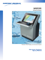
NAVIECDIS - User Manual
NAVIECDIS
Setting The Standard
Electronic Chart Display and Information System
Electronic Systems
Sperry Marine
NAVIECDIS Integration for Safe and Efficient Navigation
Type Approved ECDIS
The type approved IMO compliant NAVIECDIS is a clear choice for professional navigation and maneuvering. The unique uncluttered display format
with intuitive user controls offers the watch officer a complete navigation
solution allowing for immediate response to virtually any situation.
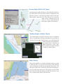
Highlights
• Universal Chart Manager that reads both raster and vector electronic
chart formats
• Windows based “ Pop Up “ information displays that are also movable
provide a convenient way to present important information
• The system offers complete routing and monitoring facilities including
an anti-grounding alarm
• Navlines maps, with interface to radar, aid in the identification of useful navigation lines such as channel boundaries, hazardous areas,
and intended track lines
Vessel Advance Prediction & Target Correlation
The highly desirable advance prediction feature offers a graphical estimate of
the vessel’s advance at operator selected time intervals. The automatic target
correlation capability allows APRA target inputs from multiple radars and
provides common identity numbers on both NAVIECDIS and radar displays
Highlights
• Multi sensor approach to advance prediction
• Scaleable ownship outline
• Unique target correlation improves situation awareness and
safety margins
Conning Information Display (CID)
The CID provides access to one or more windows designed to give the
watch officer quick access to important data. Each CID page provides
data in an easy to read format that includes navigation information,
engineering status and alarms of other areas of interest.
Highlights
• Configurable screens
• Flexible interface to navigation and other systems
• Stand-alone and integrated navigation configurations
Over 250 Locations Worldwide
Overlay Radar ARPA & AIS Targets
A modular interface enables the display of both radar ARPA and AIS targets on the chart in a clear and concise format. A comprehensive menu
allows the operator to select the desired display format on the chart.
Tabular listing of targets and CPA / TCPA alarms are also included. A
simple operator command provides fast
access to a “Pop Up” target data window
that displays complete AIS information.
Docking Display & Online Manual
The Docking Display uses inputs from various sensors to compute the
ship’s fore and aft motion and its port and starboard velocity at the bow
and stern. This innovative display window is very useful during ship
docking and other low speed maneuvering operations such as anchoring. In
addition to help based “tool tips,” at the
click of a button, the operator's manual
is available for added guidance.
Radar Overlay
This optional capability uses an advanced hardware interface to a radar
to allow radar video to be presented on the electronic charts. With this
option, the alignment of charted objects with the radar position of the
same objects can provide a visual check of the chart and ownship position as reported by the position sensors. The operator can select a radar
transceiver for the radar video display and adjust the radar video. It can
serve as a back up radar display to the main radar.
Electronic Syatems
Sperry Marine
Automatic Navigation & Tracking Keeping
System (ANTS)
The ANTS Module determines ship’s present position, monitors
against the planned track and determines the correct heading and
speed orders to keep the ship on the prescribed track.
Highlights
• Certified application
• Operator selected tracking mode
• Interfaced directly to approved autopilot and speed control systems
• Operates in heading, course and track modes
Central Alarm Manager (CAM)
The optional Central Alarm Manager can be customized to provide the
watch officer with a central source for the management of alarms
generated by a variety of onboard equipment that is interfaced to the
NAVIECDIS. The display format is easy to understand and the system
configuration complies with classification society regulations.
Navigation Planning Station
This independent or networked workstation facilitates chart inventory
management, chart correction and route planning. A standard playback
feature uses stored data to show a graphical presentation of the system's
chart display from an operator selected starting time and date.
Highlights
• ECDIS backup
• Network option available to connect to NAVIECDIS station
• Complete printout functionality
Voyage Optimization and Safety System (VOSS)
The VOSS option offers decision making support to aid the vessel’s
master and shore side managers. The VOSS workstation integrates
state of the art seven day weather and sea forecasting with a ship specific module for route planning and sea keeping. VOSS generated voyage plans are sent to the NAVIECDIS for voyage execution.
SeaNET VT
Industry standard (Ethernet) local area network providing reliable
integration for VMS VT subsystems.
Electronic Syatems
Sperry Marine
FT Trackball
The entirely new ergonomically designed trackball supports the natural contours of your hand while giving you the smooth responsive control needed
when making voyage management decisions. Clicking, pointing, scrolling,
moving forward or back are accurately and easily accomplished with the finger controlled trackball.
The operating control has a convenient thumb-operated
trackball, with right and left click buttons on the front.
The trackball device can be rotated through three different positions and locked in place for
comfortable operation from any angle.
Dimensions
Front View
Bottom View
Side View
4 OFF HOLES Ø 19
FOR MI6 BOLTS
GUSSET GRIP THICKNESS
=6MM (.24”)
45º
44.13”
1121mm
31.54”
801mm
25.04”
636mm
26.77”
680mm
33.19”
843mm
23.94”
608mm
20.16”
512mm
16.63”
422.5mm
Over 400 Locations Worldwide
2.44”
62mm
2.5”
63.5mm
Typical System Profile
Nav Equipment Interface
Configuration Alternatives
ECDIS Options
Sperry Marine
www.sperry-marine.com
For more information, please contact:
Sperry Marine
Radar Video Overlay
• Autopilot Interface
AMERICAS
Charlottesville, VA USA
Tel:: +1 434-974-2000
Fax: +1 434-974-2259
ASIA
China, Shanghai
Tel: +86-21-5836-9978
Fax: +86-21-5836-9979
Hong Kong, Sheung Wan
TeL: +852-2581-9122
Fax: +852-2581-9967
Japan, Tokyo
Ph: +81 (0)-3-3863-7401
Fax: +81 (0)-3-3863-7455
Singapore
Tel: +65-6274-3332
Fax: +65-6271-3339
South Korea, Busan
Tel: +82-51-247-7455
Fax: +82-51-247-7454
Taiwan, Kaohsiung
Tel: +886-7-331-7786
Fax: +886-7-331-7924
CANADA
• ARPA Radar (2)
• Gyrocompass (2)
• Speed Log (1)
Belgium, Antwerp
Tel: +32-3-233-14-33
Fax: +32-3-225-05-53
Denmark, Copenhagen
Tel: +45-77-33-66-33
Fax: +45-77-33-66-11
Germany, Hamburg
Tel: +49 (0)40 299 00-0
Fax: +49 (0)40 299 00-146
Holland, Vlaardingen
Tel: +31(0)-10-4451600
Fax: +31(0)-10-4345015
Norway, Bergen
Tel: +47-55-94-94-94
Fax: +47-55-34-52-27
United Kingdom, New Malden
Tel: +44 (0)20 8329-2000
Fax: +44 (0)20 8329-2415
©2005 Northrop Grumman
Custom
Conning Information
Display
Course Mode - Joystick
Table Top
or
Docking Page
Flat Screen
Automatic Navigation &
Tracking System (ANTS)
• GPS / DGPS (2)
Nova Scotia, Halifax
Tel: +1 902-468-9479
Fax: +1 902-468-9480
EUROPE
Deck Stand
or
• Printer (1)
• Wind Sensor (1)
Electronics
Kit
Navigation Planning Station
(Stand-alone or Networked)
• Echo Sounder (1)
UPS
BR-0001C • 2M •03/05
Printed in U.S.A.
Annex 3
Certificate of Type Approval for Sperry Marine VMS - NAVIECDIS
Annex 4
Extract of guidance notes to Chart carriage requirements of SOLAS V Reg 19
ANNEX
3
Nautical Charts and Publications
These guidance notes should be read in conjunction with Regulations 19, 21 and 27, which
cover the carriage of Charts and Nautical Publications. The Regulations revoke the Merchant
Shipping (Carriage of Nautical Publications) Regulations 1998 (SI 1998 No. 2647)
General
1.
Regulation SOLAS V/1.4 allows Administrations to determine to what extent
Regulations 15 to 28 apply to smaller vessels and fishing vessels. In the case of
Regulation 19.2.1.4 the carriage requirements for charts and publications do not
apply to the following:
a.)
UK Ships of Class V.
b.)
UK Ships which are neither passenger ships nor seagoing.
c.)
New ships of class A,B,C or D
d.)
Fishing vessels
e.)
Pleasure vessels under 150 gt.
Small craft
2.
All small-craft users should note that Regulation 34 (Safe navigation and avoidance
of dangerous situations) is not listed in Regulation 1.4 and therefore applies to ALL
SHIPS ON ALL VOYAGES (Regulation 1.1). The definition of “ship” in this respect
includes all small watercraft. Operators of small craft of the categories listed above
should therefore have sufficient charts and published information on board to be
able to plan the intended voyage and execute it safely. When the type and structure
of a small vessel means that it is impracticable to carry charts and publications, the
crew should have sufficient knowledge of the area of intended operation and of all
local dangers and regulations so that they can complete the intended voyage in
safety.
Requirement to carry nautical publications
3.
a.)
All ships, except those listed in para. 1 above, shall carryi.)
Charts, as defined in Regulation 2.2 or an electronic chart display and
information system (ECDIS) using Electronic Navigational Charts (ENCs) or
Raster Navigational Charts (RNCs) to meet the requirements of Regulation
19.2.1.4 with the necessary back-up arrangements required by Regulation
19.2.1.5. The back-up arrangements may either be duplication of the ECDIS or
a reduced folio of paper charts. (ANNEX 14 – Electronic charts contains MCA
guidance and also includes IMO SN Circ/207 “Differences between RCDS and
ECDIS”.) Advice on determining suitable backup is given in MGN 285; and
ii.)
such adequate and up to date sailing directions, lists of lights, notices to
mariners, tide tables and other nautical publications, as defined in Regulation
2.2 to meet the requirements of Regulation 19.2.1.4;
Nautical publications presented in electronic format are acceptable when issued by
or on the authority of an authorised Hydrographic office or other relevant
Government institution.
SoN/Ch V/Annex 3/Rev 1.01/page 1 of 6
ANNEX
3
Recommendations for system installation and use aboard ships are included at
Section 6.
b.)
All sea-going passenger ships, and all other ships of 300 gt or more and all other
ships required by SOLAS to carry a radio installation, shall carry the International
Code of Signals published by the International Maritime Organization. (See
Regulation 21)
All ships to carry Volume III of the IAMSAR Manual (See Regulation 21 and the
Guidance note which lists MCA exceptions to this requirement.)
Furthermore to comply with the Radio Regulations published by the International
Telecommunications Union (ITU), ships to which the Merchant Shipping (Radio
Installation) Regulations (SI 1998/2070) apply i.e. passenger ships and other ships
of 300 gt or more on international voyages, when provided with equipment for use
in sea areas A2, A3 or A4 i.e. beyond VHF range of coast stations, shall also carry
the following publications of the ITU:
•
List VIIA, the Alphabetical List of Call Signs and Numerical Table of Identity of
Stations.
•
The Manual for Use by the Maritime Mobile and Maritime Mobile Satellite
Services.
Charts
4.
The charts or ECDIS referred to in Regulation 19.2.1.4 must be of such a scale and contain
sufficient detail as clearly to showi)
all navigational marks which may be used by a ship when navigating the waters
which are covered by the chart,
ii)
all known dangers affecting those waters, and
iii)
information concerning any ships’ routeing and ship reporting measures applicable
to those waters.
All charts and publications must be of the latest obtainable edition and, be kept up
to date from the latest relevant obtainable notices to mariners and radio navigational
warnings.
Publications
5.
The following publications are considered to satisfy the requirements of Regulation
19.2.1.4
•
International Code of Signals (IMO)
•
IAMSAR Manual Vol.III
•
Mariners’ Handbook (UKHO)
•
Merchant Shipping Notices, Marine Guidance Notes and Marine Information Notes
(MCA)
•
Notices to Mariners (UKHO)
•
Notices to Mariners – Annual Summary (UKHO)
SoN/Ch V/Annex 3/Rev 1.01/page 2 of 6
ANNEX
3
•
Lists of Radio Signals (UKHO)
•
Lists of Lights (UKHO)
•
Sailing Directions (UKHO)
•
Nautical Almanac
•
Navigational Tables
•
Tide Tables
•
Tidal Stream Atlases
•
Operating and Maintenance Instructions for Navigational Aids Carried by the Ship
NOTES:
i.)
In the case of publications listed above, only those parts of the publication which
are relevant to a ship’s voyage and operation need be carried.
ii.)
Where the UK Hydrographic Office (UKHO) is given as the publisher, any other
chart or publication which meets the definition in Regulation 2.2 shall be
acceptable.
The MCA also recommends that ships carry a copy of “Safety of Navigation, implementing
SOLAS Chapter V, 2002”.
Digital nautical publications 6.
RECOMMENDATIONS FOR SYSTEM INSTALLATION AND USE ABOARD SHIPS
6.1 System Installation
6.1.1 The following recommendations arise from consideration of the use of digital
Nautical Publications on a vessel in compliance with requirements laid
down in SOLAS Chapter V and relevant IMO Guidelines.
In conjunction with these Recommendations the following IMO Circulars
should be consulted when implementing digital nautical publications:
MSC/Circ.891 ‘Guidelines for the on-board use and application of
computers’
MSC/Circ.982 ‘Guidelines on ergonomic criteria for bridge equipment and
layout’
MSC/Circ.1091 ‘Issues to be considered when introducing new technology
on board ship’.
6.1.2 As a minimum, the hardware should consist of two computer systems
(referred here as primary and secondary computers) each having the
functionality of a processor unit, display, keyboard, pointing device (such as
a mouse) and the means to load software and data updates.
SoN/Ch V/Annex 3/Rev 1.01/page 3 of 6
ANNEX
3
6.1.3 The processor unit of the computer should be capable of running the official
digital nautical publication software products in an effective manner, giving
due regard to the specific requirements of the official software products, the
operating system in use and the demands of other software products loaded
on the computer. Full consideration should be given to the:
Operating System in use (eg Windows XP) – is it supported by the digital
nautical publication products that will be loaded onto the system?
Processor speed (eg 1GHz) – is it fast enough to support the loaded products,
particularly if nautical publication software will be operating simultaneously
with other products?
Memory: (eg 256 MB) – is it large enough to support simultaneously nautical
publication products and other running software?
Hard disk space free: (eg 1 GB) – is there enough space to load the
programme, the data and the necessary updates?
Essential peripherals, (eg CD ROM, floppy disk, keyboard, mouse, internet
connection) – are the right peripherals available to load, use and update
digital nautical publication software and data?
6.1.4 The primary computer should be installed close to where the voyage is
monitored. It should be designed to meet the environmental conditions
defined in IEC60945 and be powered from the main and emergency sources
of power on the bridge. The effective display area should measure at least 350
millimetres across the diagonal. The display should be able to be varied in
brightness and contrast to enable viewing in all ambient light conditions.
The lighting over the keyboard should be adjustable to enable use in all
ambient situations. Care should be taken in positioning and setting-up the
display and keyboard lighting so that it does not affect the night vision of
bridge watch staff.
6.1.5 If the display and controls for accessing digital nautical publications are
situated close to the conning position or to a look-out position the display at
night should be set to appropriate night-time colours. Great care must be
taken in setting brightness adjustments to prevent the display and the
keyboard lighting from affecting the night vision of bridge watch staff.
6.1.6 An ECDIS capable of accessing appropriate digital nautical publications may
be used as the ‘workstation’ for the use of such publications. However, digital
nautical publications may only be used on ECDIS if the ECDIS equipment has
been approved by the flag Administration (type approved) for this purpose.
6.1.7 The primary computer (if not an ECDIS) may also be used to run other
software needed for essential bridge support functions, provided these are
checked for compatibility with the officially approved products loaded.
Digital nautical publications should be available for instant use at any time
during the voyage.
6.1.8 On some ships, with a poor electrical supply, it may be necessary to power
the primary computer system through an uninterruptible power supply (UPS).
This is a self contained battery-driven power inverter that continues to supply
SoN/Ch V/Annex 3/Rev 1.01/page 4 of 6
ANNEX
3
good quality electrical power, even when there are fluctuations in the ship’s
main supply. A UPS can also operate the computer system for some minutes
even if there is a complete power failure. It cannot normally be considered
to act as the emergency source of power because of the relatively short time
before its batteries are exhausted.
6.1.9 A secondary computer is required in case of failure of the primary system. It
is ideally situated on the bridge when it should comply with the requirements
of Paragraphs 1.2-1.5 above, except
(i)
It is not necessary for it to be provided with an emergency source of
power.
(ii)
It need only comply with the EMC requirements of IEC60945
A network solution can inherently provide a good backup. In this instance
prior consideration of the preferred secondary workstation should be made.
This should be documented within the ship’s bridge procedures. It should
be noted that not all officially approved products currently support network
operation.
6.1.10 If not mounted on the bridge (and if permitted by the flag Administration), the
secondary system may be a good quality office system connected to the
ship’s normal power supply. It should comply with the requirements of
Paragraphs 1.2 and 1.3 above and be situated in a convenient position for
access by bridge personnel. It should not be in an area subject to high levels
of vibration, heat or humidity, which could lead to damage of the system. The
effective display area should measure at least 350 millimetres across the
diagonal.
6.1.11 The secondary system may be used for other applications of a critical or noncritical nature, provided that any software loaded is approved by the master
and is checked for compatibility with the officially approved products
loaded. During the voyage it must be available for instant access to digital
nautical publications in the event of a failure of the primary system.
6.1.12 If the secondary system is not on the bridge it is recommended that it is also
connected to a colour printer to allow the printing of critical data needed for
use at the chart table or elsewhere on the bridge.
6.1.1 A secondary system is not required if the equivalent paper version of the
digital nautical publication is available on the bridge and is maintained upto-date. In that case the bridge computer system need only comply with the
EMC requirements of IEC 60945 and not the full environmental requirements
specified for the bridge environment.
6.1.14 In placing equipment on the bridge care must be taken to comply with the
requirements of SOLAS Chapter V Regulation 15 ‘Principles relating to bridge
design, design and arrangement of navigational systems and equipment and
bridge procedures’.
SoN/Ch V/Annex 3/Rev 1.01/page 5 of 6
ANNEX
3
6.1.15 Consideration must be given to protecting the primary and secondary
computers (including a network system, if used) against computer viruses.
This may be by the installation and regular update of anti-virus software or
by strict bridge instructions prohibiting unauthorised use, including the
loading of non-approved software or data.
6.2 System Use
6.2.1 Training on the system should be provided to enable operators to use it
effectively and maintain the databases to be fully up-to-date. Users new to
the particular vessel should be familiarised with the equipment set-up and
with the vessel’s bridge procedures concerning the use of digital nautical
publications, prior to using the equipment.
6.2.2 Updates available in port should be applied before passage planning
commences and before leaving port. If updates are received at sea they
should be applied as soon as possible. Any changes relevant to the execution
of the passage plan should be noted on the passage plan
6.2.3 Updates need to be applied to both primary and secondary systems
6.2.4 Records should be kept of when updates are received and applied
6.2.5 During passage planning it should be checked that any licences concerning
the use of the software and its updates will remain valid for a period in excess
of the expected worst-case voyage duration. If this is not the case corrective
action needs to be taken.
6.2.6 A status check of the primary and secondary systems should be made before
leaving port and at least once per day in order to ascertain the availability of
the systems. This information should be recorded in the ship’s log.
6.2.7 In the event of a failure of the primary or secondary system it should normally
be repaired at the next port of call, unless the facilities for such a repair are
not available. In the latter case proper thought and action needs to be taken
to minimise the effects of failure of the remaining system. That could include,
for instance, making a print-out of critical data that may be needed during the
voyage before the voyage commences, directly from the digital nautical
publication
6.2.8 Bridge instructions should be in place to prohibit any unauthorised use of the
primary and secondary systems, such as: the loading of additional software;
change of software or hardware configuration; and any use by untrained staff.
Associated Documents
Annex 14 – Electronic Charts
MGN 285 – Electronic Charts – the use of risk Assessment Methodology when operating
ECDIS in the Raster Chart Display System (RCDS) Mode.
MGN 319 – Acceptance of Electronic Chart Plotting Systems for Fishing Vessels under
24m and small vessels in commercial use (Code boats) up to 24m load line length
SoN/Ch V/Annex 3/Rev 1.01/page 6 of 6
Annex 5
MAIB flyer into the grounding of Pride of Canterbury
FLYER TO THE SHIPPING INDUSTRY
Pride of Canterbury
Grounding of a passenger ferry on a charted wreck
while awaiting Dover port to reopen
Image courtesy of FotoFlite
On the afternoon of 31 January 2008, while sheltering off the port of Dover in bad weather
conditions, the passenger ferry Pride of Canterbury, with 275 passengers and 101 crew on
board, grounded on a charted wreck. She sustained major damage, including the total loss
of her port controllable pitch propeller hub and a section of tail shaft.
Damage sustained by Pride of Canterbury
Pride of Canterbury was on a fixed service between Dover and Calais, and the occasional
closure of either port was a feature of the run, especially during winter months. P&O Ferries,
the operator of Pride of Canterbury, had produced comprehensive passage plans between
ports served by the vessel. In addition, there was a selection of plans for other probable sea
passages. However, there were no contingency plans produced that suggested where Pride
of Canterbury should wait in the event of a closure of one of the regular ports.
On this occasion, Dover port closed just before Pride of Canterbury arrived within port limits.
Consequently, she proceeded towards the master’s preferred holding area, which was “The
Downs” off Deal, Kent, to await the port reopening. “The Downs” area is quite restricted in the
available sea room and surrounded by shallow waters and banks.
During the waiting period, procedures and bridge team management became ineffective:
• No passage plan was developed; dangers and hazards were not identified; and
no-go areas were not marked on the chart.
• On board Pride of Canterbury, paper charts were the primary means for
navigation. However, positions were only sporadically plotted and the paper
chart was not consulted at the crucial time.
• The OOW was changed on an ad-hoc basis, and the handovers were not
structured, such that important information might have been lost.
• Navigation was conducted by eye and by reference to an electronic navigational
chart display (ENC). None of the bridge team had been trained in the use of
ENC, and the settings were inappropriate such that key dangers would not have
been displayed.
• Throughout the waiting period, there were a number of telephone calls to the
bridge, principally regarding matters on the vehicle decks, which distracted the
bridge team from their primary function of navigation and lookout.
Safety Lessons
• Charts covering likely contingency waiting areas should be prepared and be
ready for use before the start of the voyage, and they should include clearly
marked dangers and hazards.
• The principles of effective bridge team management should be understood and
practised by bridge teams at all times.
• When additional aids to navigation, such as electronic navigational systems, are
fitted to the vessel, the operators should be given effective training in the use
and limitations of the equipment, even if the equipment is not intended to be the
primary means of navigation.
• Where navigation bridges are the focus for frequent requests for non navigationalrelated information, systems should be in place to ensure that watchkeeping staff
are not distracted at critical times.
Further details on this accident and the subsequent investigation can be found in the MAIB’s
investigation report, which is posted on its website:
www.maib.gov.uk
Alternatively, a copy of the report will be sent on request, free of charge.
Marine Accident Investigation Branch
Carlton House
Carlton Place
Southampton, SO15 2DZ
Telephone 023 8039 5500
Email: [email protected]
January 2009