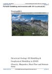
1
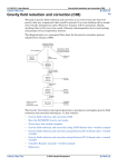
INTREPID User Manual
Library | Help | Top
Estimating depth to Moho and Isostatic correction (T55)
1
| Back |
Estimating depth to Moho and Isostatic correction (T55)
Top
Introduction
The Intrepid Isostatic tool is a rewrite of the USGS fortran program airyroot. Airyroot
calculates an airy isostatic regional at sea level out to 166.7 km. At present the
Isostatic tool runs in a batch process only.
Usage: isostatic.exe -batch jobfile
The outputs from the program are:
1
Depth to Moho (Airyroot) grid in kms
2
Isostatic gravity correction grid in mGals
Then it is a simple matter of subtracting the correction grid from the Bouguer gravity
grid, to create an Isostatically corrected Bouguer gravity grid.
Earth curvature corrections are not done beyond 166.7 km – see discussion below.
Note that you must work in projected coordinates (Geodetic is not supported).
Sample task file
# example of Parker style isostatic correction job (uses FFTW)
Process Begin
Name = isostatic
Parameters Begin
InputGridName = ./DEM_Onshore_Offshore_Airy.ers
DepthMohoGridName = ./depth_moho.ers
FilteredGridName = ./isostatic_correction.ers
FftGridName = ./iso_fft.ers
#WindowedGridName = ./iso_wind.ers
ExpandedGridName = ./iso_exp.ers
#AmplitudeGridName = ./iso_amp.ers
#CoefficientGridName = ./iso_coeff.ers
Band = 0
OutputPrecision = IEEE4ByteReal
DetrendDegree = 0 # must be DC!
RolloffType = COSINE
#WindowType = HANNING
FillType = ARTHUR
ReApplyTrendAfterReverseFft = 0
ApplyMaskAfterReverseFft = 1
UseSymmetry = Yes
DiskUsageRule = AUTO # FORCE_MEMORY, FORCE_DISK
# now for the specific isostatic parms
SupplyMohoGrid = No #Moho grid calc from DEM
SubtractFlatEarthRoot = Yes #Subtract flatearth >166.7
Sea_Level_Root_Depth = 32
Crust_Density = 2.670
Density_Constrast_Depth = 0.6
Max_Tolerance = .005
Max_Iterations = 6
MaxBesselSize = 150000 #Default-Increases Bessel array size
Parameters End
Process End
Library | Help | Top
© 2012 Intrepid Geophysics
| Back |
INTREPID User Manual
Library | Help | Top
Estimating depth to Moho and Isostatic correction (T55)
2
| Back |
Input files
Input is a standard INTREPID or ERMapper format grid of topography. At present,
INTREPID does not support the surface 'load' grid option allowed in Airyroot. Contact
Intrepid Support if you would like this option to be added to the Isostatic tool (see
discussion below regarding this option).
The topographic grid must be in a projected coordinate system. INTREPID does not
support geodetic projections and coordinates.
The topography grid must contain elevation values in metres at grid points. Ocean
depths must have 50,000m subtracted from them as a flag to distinguish negative onland elevations (for example Death Valley).
If a surface load grid, then values at grid points are equal to the mass excess (or
deficiency if negative) resulting from the topographic features in units of g/cm2. Note
that ocean depths give a negative load because the water ought to be granite in this
scheme.
A load grid is necessary as input if lakes, glaciers, and variable densities for
topographic features are to be properly handled.
Using a depth to Moho grid from another source
You can use a depth to Moho grid from an alternative source.
In the job file set the parameter SupplyMohoGrid = Yes or 1. The parameter
DepthMohoGridName is now the input grid for the isostatic correction and
INTREPID does not calculate the Moho grid from the input DEM.
If you are using a DEM to calculate the Moho, the grid must be depth to Moho in km
as calculated. The grid can be a different size or have a different cell dimension to
your DEM which is not used in this case.
Process Begin
Name = isostatic
Parameters Begin
InputGridName = ./DEM_Onshore_Offshore_Airy_500m.ers
DepthMohoGridName = ./depth_moho_500m_user.ers
Subset Begin
XLower = Null
XUpper = Null
YLower = Null
YUpper = Null
FFTborder = 5000.0
Subset End
FilteredGridName = ./isostatic_correction_MyMoho.ers
FftGridName = ./isostatic_fft.ers
#WindowedGridName = ./isostatic_wind.ers
ExpandedGridName = ./isostatic_exp.ers
#AmplitudeGridName = ./isostatic_amp.ers
#CoefficientGridName = ./isostatic_coeff.ers
Band = 0
OutputPrecision = IEEE4ByteReal
DetrendDegree = 0 ## must be DC!
RolloffType = COSINE
WindowType = NONE
Library | Help | Top
© 2012 Intrepid Geophysics
| Back |
INTREPID User Manual
Library | Help | Top
Estimating depth to Moho and Isostatic correction (T55)
3
| Back |
FillType = ARTHUR
ReApplyTrendAfterReverseFft = No
ApplyMaskAfterReverseFft = Yes
UseSymmetry = Yes
DiskUsageRule = AUTO # FORCE_MEMORY, FORCE_DISK
# now for the specific isostatic parms
SupplyMohoGrid = Yes #Supply a moho grid
SubtractFlatEarthRoot = Yes #Subtract flat earth >166.7kms
Sea_Level_Root_Depth = 32
Crust_Density = 2.670
Density_Constrast_Depth = 0.6
Max_Tolerance = .005
Max_Iterations = 6
MaxBesselSize = 150000 #Default-Increases Bessel array size
Parameters End
Process End
Earth curvature corrections
Gravitational attraction of Airy root on a flat earth is calculated using Parker's fast
Fourier transform algorithm. Attraction of a flat earth root beyond 166.7 km is
calculated using an approx to an integral containing a Bessel function. This latter is
subtracted (subroutine subtract_far) to leave attraction of root out to 166.7 km.
Beyond that approximate distance the curvature of the earth becomes important.
The calculation and subtraction of the flat earth root correction is provided as an
option in the batch file:
SubtractFlatEarthRoot = 1 or yes turns the calculation on.
Believers in the flat earth hypothesis can turn this calculation off.
Output files
INTREPID writes outputs as standard INTREPID or ERMapper format grids. The
first output is the Moho depth grid containing the airy root depth in km. INTREPID
uses this grid to derive the second output. This is the gravitational attraction in
milligals at sea level of an Airy root system out to a distance of 166.7 km from each
observation point.
The output grid must be combined with a solution beyond 166.7 km to make a
complete Airy regional. The break occurs at 166.7 km because:
Library | Help | Top
•
Terrain corrections for Bouguer gravity generally stop at this distance
•
The earth's curvature, which is not accounted for in this program, starts to
become important at about this distance.
© 2012 Intrepid Geophysics
| Back |
INTREPID User Manual
Library | Help | Top
Estimating depth to Moho and Isostatic correction (T55)
4
| Back |
Memory management
Depending on the memory or swap space available on your computer, you may need
to adjust some INTREPID parameters such as INTREPID_MEMORY, which
defaults to 512 Mb. Reducing the size of this variable will result in use of less physical
memory and force the program to page to disk. For instrucitions on chanign this
parameter, see "Ways of setting INTREPID system parameters and environment
variables" in INTREPID system parameters and install.cfg (R07).
Alternatively, you can use the DiskUsageRule parameter in the job file. The options
are:
DiskUsageRule = AUTO or FORCE_DISK or FORCE_MEMORY
The default is AUTO and in this case the program manages memory usage in
conjunction with the INTREPID_MEMORY variable as discussed above.
If you have problems with memory, you can use the FORCE_DISK option to force all
memory usage to disk. This will allow INTREPID to manage much larger input grids
without over-using physical memory. However, processing will be much slower using
this method.
INTREPID creates large temporary files during program execution. It removes most
of these when the program finishes. Two of the files remain after processing:
•
Forward FFT (FftGridName)
•
Expanded grid name (ExpandedGridName).
We have left these in place for chacking purposes while the program is still in beta.
Further issues
Please note the following warnings:
•
Avoid using high resolution grids for input. The wavelengths in the isostatic are
long so 1km cell grids are sufficient for computing the correction unless
topography contains extreme gradients.
•
Do not use any detrending during the FFT processing as this will impact long
wavelengths in the isostatic.
•
Use of the FFT based algorithm causes some errors on the boundaries of the
isostatic gravity correction grid due to the wrapping procedure employed. If you
are concerend about this then we recommend that you make the input DEM or
bathymetry grid approximately 30% larger than the area for which you are
calculating the isostatic.
To remove any edge effects it is possible to use the Source_Grid option in the FFT
options and set a subarea for the final result so that it is free of any edge effects.
Library | Help | Top
© 2012 Intrepid Geophysics
| Back |
INTREPID User Manual
Library | Help | Top
Estimating depth to Moho and Isostatic correction (T55)
5
| Back |
For an example of this, see Job file example below:
# example of Parker style isostatic correction job file
# using subset
# to limit problems with edge effects
# uses FFTW
Process Begin
Name = isostatic
Parameters Begin
Subset Begin
XLower = -141500.0
XUpper = 847500.0
YLower = 5219000.0
YUpper = 6338000.0
FFTborder = 100000.0
SubsetGridName = DEM_subset100k
Subset End
InputGridName = ./DEM_Onshore_Offshore_Airy.ers
DepthMohoGridName = ./depth_moho_subset100k.ers
FilteredGridName = ./isostatic_correction_subset100k.ers
FftGridName = ./fft_subset100k.ers
WindowedGridName = ./wind_subset100k.ers
ExpandedGridName = ./exp_subset100k.ers
#AmplitudeGridName = ./amp_subset100k.ers
#CoefficientGridName = ./coeff_subset100k.ers
Band = 0
OutputPrecision = IEEE4ByteReal
DetrendDegree = 0 ## must be DC!
RolloffType = Cosine
WindowType = None
FillType = SOURCE_GRID
ReApplyTrendAfterReverseFft = 1
ApplyMaskAfterReverseFft = 1
UseSymmetry = Yes
DiskUsageRule = AUTO #FORCE_MEMORY, FORCE_DISK
# now for the specific isostatic parms
SupplyMohoGrid = No #Moho grid is calculated from DEM
SubtractFlatEarthRoot = Yes #Subtract flat earth >166.7kms
Sea_Level_Root_Depth = 32
Crust_Density = 2.670
Density_Constrast_Depth = 0.6
Max_Tolerance = .005
Max_Iterations = 6
MaxBesselSize = 150000 #Default-Increases Bessel array size
Parameters End
Process End
Library | Help | Top
© 2012 Intrepid Geophysics
| Back |
INTREPID User Manual
Library | Help | Top
Estimating depth to Moho and Isostatic correction (T55)
6
| Back |
Frequently asked questions
Q : What does Dea Level Root depth mean?
This is the depth in metres of the Airy mass balance cylinder. This is normally
32000m.
Sea_Level_Root_Depth = 32
We have tried 30 km and found 32 km is better for Australia
It is possible to try various column depths and densities quite quickly as the output is
generated promptly and the reasonableness of the result is very sensitive to the
parameters.
The aim is to get an output where there is no regional.
Q : What are typical density values that I can use
Here are some common density values
Library | Help | Top
Medium
Density in kg/m3
Sea water
1027
Crust density
2670
Mantle density
3300
© 2012 Intrepid Geophysics
| Back |