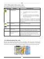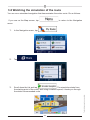
1
VME 9725 NAV
User Manual
-Navigation software-
GB
Thank you for choosing our product as your navigator. Start using your
device right away. This document is the detailed description of the
navigation software. You can easily discover the software while you are
using it; however, we still recommend that you read this manual to fully
understand the screens and features.
124
GB
Table of contents
1 Warnings and Safety information
128
2 Getting started
129
2.1 Navigation menu
131
2.2 Buttons and other controls on the screen
132
2.2.1 Using keyboards
134
2.2.2 Beyond single screen tap
135
2.3 Map screen
136
2.3.1 Navigating on the map
136
2.3.2 Position markers
139
2.3.2.1 Vehimarker and Lock-on-Road
139
2.3.2.2 Selected map location (Cursor) and selected map object
139
2.3.3 Objects on the map
140
2.3.3.1 Streets and roads
140
2.3.3.2 Turn preview and Next street
140
2.3.3.3 Lane information and Signposts
142
2.3.3.4 Junction view
142
2.3.3.5 Motorway exit services
143
2.3.3.6 3D object types
143
2.3.3.7 Elements of the active route
144
2.3.4 Manipulating the map
144
2.3.5 Quick menu
146
2.3.6 Checking the details of the current position (Where Am I?)
149
3 On-road navigation
151
3.1 Selecting the destination of a route
151
3.1.1 Entering an address or a part of the address
152
3.1.1.1 Entering an address
152
3.1.1.2 Entering the midpoint of a street as the destination
156
3.1.1.3 Selecting an intersection as the destination
158
3.1.1.4 Selecting a city/town centre as the destination
160
3.1.1.5 Entering an address with a postal code
162
3.1.1.6 Tips on entering addresses quickly
165
165
3.1.2 Selecting the destination from the Places of Interest
3.1.2.1 Quick search for a Place of Interest
166
3.1.2.2 Searching for a Place of Interest using preset categories
168
3.1.2.3 Searching for a Place of Interest by category
171
3.1.2.4 Searching for a Place of Interest by name
175
3.1.2.5 Selecting nearby assistance from ‘Where Am I?’
179
125
Technical changes and errors excepted.
GB
3.1.3 Selecting a map location as the destination
181
3.1.4 Selecting the destination from your Favourites
182
3.1.5 Selecting one of the most likely destinations (Smart History)
183
3.1.6 Selecting a recent destination from the History
185
3.1.7 Entering the coordinate of the destination
186
3.1.8 Building a route from the list of destinations (Create Route)
187
3.2 Viewing the entire route on the map
189
3.3 Checking route parameters and accessing route related functions
189
3.4 Modifying the route
191
3.4.1 Selecting a new destination when already having a route:
191
New Route, Waypoint or Final Destination
3.4.2 Setting a new starting position for the route
192
3.4.3 Editing the list of destinations (Edit Route)
194
3.4.4 Pausing the active route
195
3.4.5 Cancelling the active route
195
3.4.6 Checking route alternatives when planning the route
195
3.4.7 Checking route alternatives for an existing route
197
3.4.8 Changing the vehicle used in route planning
198
3.4.9 Changing the road types used in route planning
3.5 Saving a location as a Favourite destination
3.5.1 Editing the details of a Favourite destination
200
201
202
3.6 Saving a map location as an alert point
203
3.7 Editing an alert point
204
3.8 Watching the simulation of the route
205
4 Off-road navigation
207
4.1 Selecting the destination of the route
207
4.2 Navigating in off-road mode
207
5 Reference Guide
209
5.1 Concepts
209
5.1.1 Smart Zoom
209
5.1.2 Daytime and night colour themes
209
5.1.3 Tunnel view
210
5.1.4 Route calculation and recalculation
210
5.1.5 Green routing
214
5.1.6 Road safety cameras and other proximity alert points
215
5.1.7 Speed limit warning
216
5.1.8 Battery and GPS position quality indicators
217
126
GB
5.1.9 Traffic information in route planning
217
5.1.9.1 Historical traffic
218
5.2 ‘More’ menu
218
5.3 Settings menu
219
5.3.1 Sound and Warnings
221
5.3.2 Customise Quick menu
223
5.3.3 Route settings
224
5.3.4 User profiles
229
5.3.5 Map settings
230
5.3.6 Visual guidance settings
232
5.3.7 Display settings
233
5.3.8 Regional settings
234
5.3.9 Trip monitor settings
234
5.3.10 Log collection settings
235
236
7 Copyright note
239
Technical changes and errors excepted.
6 Glossary
127
GB
1 Warnings and Safety information
The navigation system helps you find your way to your destination with the built-in
GPS receiver. The software does not transmit your GPS position; others cannot track
you.
If you accept it when first using the application, the software collects usage information
and GPS logs that may be used for improving the application and the quality and
coverage of maps. The data is processed anonymously; no one will be able to
track any personal information. If you change your mind later, you can enable or disable
the log collection in Settings (page 235).
It is important that you look at the display only when it is safe to do so. If you are the
driver of the vehicle, we recommend that you operate the software before you start your
journey. Plan the route before your departure and stop if you need to change the route.
You must obey the traffic signs and follow the road geometry. If you deviate from the
recommended route, the software changes the instructions accordingly.
Never place the product where it obstructs the driver’s view, where it is in the deployment
zone of an airbag or where it might cause injuries in an accident.
128
GB
2 Getting started
The software is optimised for in-car or pedestrian use. There is no need to use a stylus.
You can use it easily by tapping the screen buttons and the map with your fingertips.
When using the navigation software for the first time, an initial setup process starts
automatically. Do as follows:
1. Select the written language of the application interface. Later you can change it
in Regional settings (page 234).
2. Read the End User Licence Agreement. Tap
to continue.
3. You are now asked whether you allow the software to collect usage information
and coverage of maps. Tap
to allow the anonymous
statistics or disable this function. Later you can turn them on or off individually
in Log collection settings (page 235).
4. The Configuration wizard starts. Tap
129
to continue.
Technical changes and errors excepted.
and GPS logs that may be used for improving the application and the quality
GB
5. Select the language and speaker used for voice guidance messages. Later you
can change it in Sound and Warnings settings (page 234).
6. If needed, modify the time format and unit settings. Later you can change them
in Regional settings (page 234).
7. If needed, modify the default route planning options. Later you can change
them in Route settings (page 224).
8. The initial setup is now complete. The Configuration wizard can be restarted
later from the Settings menu (page 219).
After the initial setup, the Navigation menu appears and you can start using the
software.
130
GB
2.1 Navigation menu
You can reach all parts of the software from the Navigation menu.
You have the following options:
Tap
to display the route parameters and the route in
its full length on the map. You can also perform route-related actions such as
editing or cancelling your route, setting a start point for the route, picking route
alternatives, avoiding parts of the route, simulating navigation or adding the
destination to your Favourites.
•
Tap
to customise the way the navigation software works,
to simulate demo routes or to run some additional applications.
•
Tap
to start navigating on the map. The button itself is a
miniature live map that shows your current position, the recommended route
and the surrounding map area. Tap the button to enlarge the map to the full
screen.
Technical changes and errors excepted.
•
131
GB
2.2 Buttons and other controls on the screen
When you are using the software, you usually tap buttons on the touch screen.
You only need to confirm selections or changes if the application needs to restart, it
needs to perform a major reconfiguration, or you are about to lose some of your data
or settings. Otherwise, the software saves your selections and applies the new settings
without confirmation as soon as you use the controls.
Type
Example
Button
Description
Tap it to initiate a
function, to open a
new screen, or to set
a parameter.
Some buttons display
the current value of
a field or setting. Tap
the button to change
the value. After the
change, the new
value is shown on the
button.
Shows status
information.
Button
with value
Icon
List
When you need to
select from several
options, they appear
in a list.
How to use it
Tap it once.
Tap it once.
Some icons also
function as a button. Tap
them once.
Grab the list anywhere
and slide your finger up
or down. Depending on
the speed of the sliding,
the list will scroll fast or
slow, only a bit or till the
end.
Alternatively, move
between pages with
Radio
button
When there are only
a few choices, radio
buttons may be used
instead of lists. Only
one value can be
selected.
132
and
the
buttons and tap the
value that you want.
Tap one of the buttons to
select a new value.
GB
Slider
Virtual
keyboard
When there are
Tap it to turn the switch
only two choices, a
on or off.
checkmark shows
whether the feature is
enabled.
When a feature can
• Drag the handle
be set to different
to move the
slider to its new
values in a range, the
software shows an
position.
indicator on a gauge
that displays and sets
• Tap the slider
the value.
where you want
the handle to
appear; the
thumb jumps
there.
Each key is a touch
Alphabetic and
alphanumeric
screen button.
keyboards to enter
text and numbers.
2.2.1 Using keyboards
You only need to enter letters or numbers when you cannot avoid it. You can type
with your fingertips on the full-screen keyboards and you can switch between various
keyboard layouts, for example English, Greek or numerical.
133
Technical changes and errors excepted.
Switch
GB
2.2.1 Using keyboards
You only need to enter letters or numbers when you cannot avoid it. You can type
with your fingertips on the full-screen keyboards and you can switch between various
keyboard layouts, for example English, Greek or numerical.
Task
Instruction
Switching to another keyboard
layout, for example from an English
keyboard to a Greek keyboard
Tap the
keyboard layout from the list.
Correcting your entry on the
keyboard
button and select the new
to remove the unneeded character(s).
Tap
Tap and hold the button to delete several characters or the
entire input string.
Entering a space, for example
between a first name and a family
name or in multi-word street names Tap the
button at the bottom centre of the screen.
When entering a text, the first character appears in upper
Entering upper and lower case
letters
case while the rest of the text is in lower case. Tap
to enter an upper case letter or tap twice to turn on Caps
Lock. Tap again and lower case letters return.
Entering numbers and symbols
to switch to a keyboard offering numeric and
Tap
symbol characters.
Finalising the keyboard entry
(accepting the suggested search
result)
.
Tap
Finalising the keyboard entry
(opening the list of search results)
Tap
.
Tap
.
Tap
.
Finalising the keyboard entry
(saving your input)
Cancelling the keyboard entry
(returning to the previous screen)
134
GB
2.2.2 Beyond single screen tap
You usually need to tap the screen only once. However, some useful features can be
accessed with combined touch screen tapping. Those are the following:
Action
Tapping and holding the
screen
Details
Tap and keep pressing the following buttons to reach extra functions:
•
•
Tap and hold
screens: the Map screen appears.
Tap and hold any of the
on list and menu
,
,
,
,
, and
buttons on the Map
screen: you can rotate, tilt or scale the map continuously.
•
Tap and hold
on keyboard screens: you can
delete several characters quickly.
•
•
•
•
Moving the handle on a slider.
Scrolling the list: grab the list anywhere and slide your
finger up or down. Depending on the speed of the sliding,
the list will scroll fast or slow, only a bit or till the end.
Moving the map in map browsing mode: grab the map, and
move it in the desired direction.
Technical changes and errors excepted.
Gestures (drag&drop)
Tap and hold
or
in long lists: you can scroll
pages continuously.
You need to drag and drop the screen only in cases like:
135
GB
2.3 Map screen
2.3.1 Navigating on the map
The Map screen is the most frequently used screen of the software.
A small live map is displayed on the Navigation menu, as a part of the
button.
To enlarge this small map and open the Map screen, tap
.
This map shows the current position (the Vehimarker, a blue arrow by default), the
recommended route (an orange line), and the surrounding map area.
When there is no GPS position, the Vehimarker is transparent. It shows your last known
position.
You see coloured dots circling around a satellite symbol in the top left corner. The more
green dots you see, the closer you are to get the valid GPS position
136
GB
When GPS position is available, the Vehimarker is displayed in full colour, now showing
your current position.
There are screen buttons and data fields on the screen to help you navigate. During
navigation, the screen shows route information.
button gives quick access to frequently used functions. You can change the
The
available functions in Settings.
By default, only one data field is displayed in the bottom right corner. Tap this field to see
all route data fields. Tap any of the data fields to suppress others and display only the
selected one.
The data fields are different when you are navigating an active route and when you have
no specified destination (the orange line is not displayed).
Technical changes and errors excepted.
Default data fields when cruising without a destination (tap and hold any of the fields to
change its value):
137
GB
Field
Description
Shows your current speed given by the GPS receiver.
Shows the speed limit of the current road if the map contains it.
Shows the current time corrected with time zone offset. The accurate
time comes from the GPS satellites, and the time zone information
comes from the map or it can be set manually in Regional settings.
(The current time is always displayed in the top left corner of menu
screens.)
Default data fields when navigating a route (tap and hold any of the fields to change its
value):
Field
Description
Shows the distance you need to travel on the route before reaching
your final destination.
Shows the time needed to reach the final destination of the route
based on information available for the remaining segments of the
route.
The calculation cannot take into account traffic jams and other
possible delays.
Historical traffic data can also be taken into account if data is
available.
Shows the estimated arrival time at the final destination of the route
based on information available for the remaining segments of the
route.
The calculation cannot take into account traffic jams and other
possible delays.
Historical traffic data can also be taken into account if data is
available.
138
GB
2.3.2 Position markers
2.3.2.1 Vehimarker and Lock-on-Road
When your GPS position is available, the software marks your current position with the
Vehimarker. By default, this marker is a blue arrow, but you can change this icon in
Settings.
The exact location of the Vehimarker depends on the vehicle type used for route
calculation and the navigation mode. Both can be set in Route settings (page 224).
•
If you choose pedestrian and/or off-road navigation: The Vehimarker is at your
exact GPS position. The direction of the icon shows your current heading.
•
In all other cases: The Vehimarker may not show your exact GPS position and
heading. If roads are near, it is aligned to the nearest road to suppress GPS
position errors, and the direction of the icon is aligned to the direction of the
road.
2.3.2.2 Selected map location (Cursor) and selected map object
You can mark a map location in the following ways:
•
Tap the map when navigating,
•
Tap the map when you are asked to confirm the destination at the end of a
search, or
•
Tap the map in Find on Map (page 181)
When a map location is selected, the Cursor appears at the selected point on the map.
) to make it visible at all zoom
The location of the Cursor can be used as the destination of the route, a new alert
point, you can search for Places around it, or you can save this location as one of your
Favourite destinations.
You can also select some of the objects on the map. If you tap the map at the icon of
a Place of Interest or an alert point, the object will be selected (you see a red circling
border around the object), and you can get information about this object or use it as a
route point.
139
Technical changes and errors excepted.
The Cursor is displayed with a radiating red dot (
levels.
GB
2.3.3 Objects on the map
2.3.3.1 Streets and roads
The software shows the streets in a way that is similar to how the paper road maps
show them. Their width and colours correspond to their importance: you can easily tell a
motorway from a small street.
2.3.3.2 Turn preview and Next street
When navigating a route, the top section of the Map screen shows information about
the next route event (manoeuvre) and the next street or the next city/town.
There is a field in the top left corner that displays the next manoeuvre. Both the type of
the event (turn, roundabout, exiting motorway, etc.) and its distance from the current
position are displayed.
Most of these icons are very intuitive. The following table lists some of the frequently
shown route events.
140
GB
Icon
Description
Turn left.
Turn right.
Turn back.
Bear right.
Turn sharp left.
Keep left.
Continue straight in the intersection.
Go left on the roundabout, 3rd exit.
Enter motorway.
Exit motorway.
Board ferry.
Leave ferry.
Approaching the destination.
141
Technical changes and errors excepted.
Approaching a waypoint.
GB
2.3.3.3 Lane information and Signposts
When navigating on multilane roads, it is important to take the appropriate lane in order
to follow the recommended route. If lane information is available in the map data, the
software displays the lanes and their directions using small arrows at the bottom of the
map. Highlighted arrows represent the lanes you need to take.
Where additional information is available, signposts substitute arrows. Signposts are
displayed at the top of the map. The colour and style of the signposts are similar to
the real ones you can see above road or by the roadside. They show the available
destinations and the number of the road the lane leads to.
All signposts look similar when cruising (when there is no recommended route). When
navigating a route, only the signpost that points to the lane(s) to be taken is displayed in
vivid colours; all others are darker.
If you want to hide the currently displayed signposts, tap any of them and the normal
Map screen returns until new signpost information is received.
2.3.3.4 Junction view
If you are approaching a motorway exit or a complex intersection and the needed
information exists, the map is replaced with a 3D view of the junction. The lanes you
need to take are displayed with arrows. Signposts can also be present if information is
available.
If you want to hide the currently displayed junction, tap the picture and the Map screen
returns.
142
GB
2.3.3.5 Motorway exit services
You may need a petrol station or a restaurant during your journey. This feature displays
a new button on the map when you are driving on motorways.
Tap this button to open a panel with the details of the next few exits or service stations.
Tap any of them to display the exit area on the map. You can now easily add this exit as
a waypoint to your route if needed.
If you want to display other types of Places for the exits, you can change the icons in
Visual Guidance settings (page 232).
2.3.3.6 3D object types
The software supports the following 3D object types:
Elevated roads
3D landmarks
3D buildings
Description
3D terrain map data shows changes in terrain, elevations or depressions
in the land when you view the map in 2D, and use it to plot the route
map in 3D when you navigate. Hills and mountains are shown in the
background of the 3D map, and illustrated by colour and shading on the
2D map.
Complex intersections and vertically isolated roads (such as overpasses or
bridges) are displayed in 3D.
Landmarks are 3D artistic or block representations of prominent or wellknown objects.
3D block representation of full city building data containing actual building
size and position on the map.
143
Technical changes and errors excepted.
Type
3D terrain
GB
2.3.3.7 Elements of the active route
The software shows the route in the following way:
Symbol
Name
Current GPS position
and Start point
Description
Your current position displayed on the map.
•
•
In pedestrian mode it is the exact GPS
position.
If a vehicle is selected for route calculation
and roads are near, the symbol is snapped
onto the nearest road.
Waypoint (intermediate
destination)
Normally if GPS position is available, the route starts
from the current position. If there is no valid GPS
position, the software uses the last known position as
the start point.
An intermediate destination of the route before
reaching the final destination.
Destination (end point)
The final destination of the route.
Route colour
The route always stands out with its colour on the
map, both in daytime and in night colour mode.
You can choose whether you want to use or avoid
certain road types (page 224). However, when the
software cannot avoid such roads, the route will
include them and it will show them in a colour that is
different from the route colour.
Streets and roads that
are excluded from the
navigation
2.3.4 Manipulating the map
Tap the map anywhere to browse it during navigation. The map stops following the
current position (the Vehimarker, a blue arrow by default, is not locked in a fix position
on the screen any more) and control buttons appear to help you modify the map view.
144
GB
Action
Moving the map with
drag&drop
Button(s)
Description
No buttons
You can move the map in any direction: tap
and hold the map, and move your finger
towards the direction you want to move the
map.
Changes how much of the map is displayed
on the screen.
Zooming in and out
,
The software uses high-quality vector maps
that let you examine the map at various
zoom levels, always with optimised content. It
always displays street names and other text
with the same font size, never upside-down,
and you only see the streets and objects that
you need.
Map scaling has a limit in 3D map view mode.
If you zoom out further, the map switches to
2D view mode.
Tap the button once to modify the view in large
steps, or tap and hold the button to modify it
continuously and smoothly.
Changes the vertical view angle of the map in
3D mode.
Tilting up and down
,
Tap the button once to modify the view in large
steps, or tap and hold the button to modify it
continuously and smoothly.
Changes the horizontal view angle of the map.
Rotating left and right
2D or 3D view
,
Compass in 2D map
view mode
The direction of the compass shows North.
Tap the button to switch to North-up view,
and then tap again to rotate the map in the
previous direction.
The direction of the compass shows North.
Tap the button to switch to North-up view,
and then tap again to rotate the map in the
previous direction.
Tap this button to open a new screen with
information about the selected map point, the
Cursor.
,
Compass in 3D map
view mode
,
Location information
145
Technical changes and errors excepted.
Tap the button once to modify the view in large
steps, or tap and hold the button to modify it
continuously and smoothly.
Tap this button to switch between the 3D
perspective and 2D top-down map view
modes.
,
GB
Return to normal
navigation
Tap this button to move the map back to follow
the current GPS position. Automatic map
rotation is also re-enabled.
The map manipulation buttons disappear and
navigation continues.
Tap this button to open a list of additional
features like saving the Cursor as a Favourite
destination, or searching for Places around
the Cursor.
Tap this button to select the Cursor as a
new destination. The route is automatically
calculated.
Additional options
Select destination
2.3.5 Quick menu
The Quick menu is a selection of controls and functions that are frequently needed
during navigation. It can be opened directly from the Map screen by tapping
.
The menu will close after a few seconds of inactivity or if you tap
.
The menu will also close if you initiate simple controls like muting the device. In other
cases tapping a button will open a new screen with options.
Most of these functions are shortcuts. They are accessible from the menu system.
There are more functions available than the number of buttons in the menu. In Settings,
you can choose the function of each button (page 224). The following options are
available:
146
GB
,
Description
Shortcut for
This slider adjusts the sound volume of the device. More / Settings / Sound
All sounds of the application are affected.
and Warnings / Volume
/ Master slider
This switch mutes all sounds of the application. Tap More / Settings / Sound
again to re-enable sounds.
and Warnings / Volume
/ Master switch
This function lets you search for a Place by its Find / Find Places /
name. The search is carried out either along your Quick Search (page
route or around your current location if there is no 166)
route calculated.
This button opens the list of your Favourite Find / Favourite (page
destinations.
182)
This button opens the History list. You can select Find / History (page
one of your previous destinations.
185)
This button opens the route editing function.
My Route / Edit Route
This button opens the route related settings.
More / Settings / Route
Settings (page 224)
This button opens the map related settings.
More / Settings / Map
Settings (page 230)
This button opens a special screen with information
about the current position and a button to search
for nearby emergency or roadside assistance. For
details, see the next chapter.
This button cancels the route and stops navigation.
The button is replaced with the next one if waypoints
are given.
Tap the Current Street
field on the Map screen
This button skips the next waypoint from the route.
n/a
My Route / Cancel
Route (page 195)
This button opens a 2D map scaled and positioned My Route / Overview
to show the entire route.
(page 189)
This button opens the Visual Guidance settings More / Settings / Visual
screen.
Guidance (page 232)
147
Technical changes and errors excepted.
Button
Master Volume
slider
GB
This button lets you
recommended route.
bypass
parts
of
the My Route / Avoidances
This button opens the Trip Monitor screen where More / Trip Monitor
you can manage your previously saved trip logs and (page 220)
track logs.
This button opens the list of manoeuvres (the Tap the top of the
itinerary).
Map screen during
navigation.
With this function you can save the active route for My Route / More / Save
later use.
Route
With this function you can replace the active route My Route / More / Load
with a previously saved route.
Route
With this function you can search for Places of Find / Find Places
Interest in various different ways.
(page 168)
This button opens the Map screen and starts My Route / More /
simulating the active route.
Simulate Navigation
(page 205)
This button opens the GPS Information screen with Tap the top of the Map
satellite position and signal strength information.
screen when there is no
GPS reception
This button opens the parameters of the selected More / Settings / Route
Vehicle profile.
(page 224)
2.3.6 Checking the details of the current position (Where
Am I?)
This screen contains information about the current position (or about the last known
position if GPS reception is not available) and a button to search for useful Places
nearby.
148
GB
2.3.6 Checking the details of the current position
(Where Am I?)
This screen contains information about the current position (or about the last known
position if GPS reception is not available) and a button to search for useful Places nearby.
You can access this screen from the map in one of the following ways:
•
If the current street is displayed below the Vehimarker (the current position on
the map), tap it to open the Where Am I? screen.
•
Open the Quick menu and tap the
button.
•
,
: Latitude and Longitude (coordinate of the current position in
WGS84 format).
•
: Altitude (elevation information coming from the GPS receiver - often
inaccurate).
•
: House number on the left.
•
: House number on the right.
•
In the middle of the screen you can see whether the position is current, or the
time left since it was last updated.
•
Address details (when available) of the current position are displayed at the
bottom.
149
Technical changes and errors excepted.
Information on this screen:
GB
You can also perform some actions on this screen:
Tap
to save the current position as a Favourite destination.
You can also search for assistance near your current position. Tap
to open a new screen for the Quick search:
The following services can be searched around the current position or the last known
position:
•
: Car repair and roadside assistance
services
•
: Police stations
•
: Medical and emergency services
•
: Petrol stations
Tap any of the buttons, select a Place from the list, and navigate to it.
150
GB
3 On-road navigation
When first started, the software calculates routes using the road network of the high
quality vector maps provided with the product.
You can set up your route in different ways:
•
If you need a route for immediate navigation, you can select the destination and
start navigating to it right away (normal navigation).
•
You can also plan a route independently of your current GPS position or even
without GPS reception. To achieve this you need to set a new starting point in
My Route / Edit Route by tapping the flag icon at the current position. This will
also turn off the GPS receiver so that the route is not recalculated when a new
position is received.
You can plan routes with multiple destinations. Select the first destination. Then select a
second destination and add it to your route to create a multi-point route. You can add as
many destinations to your route as you like.
You can also use the software for off-road navigation. For details, see page 1467.
3.1 Selecting the destination of a route
•
Enter a full address or a part of an address, for example a street name without
a house number or the names of two intersecting streets (page 151).
•
Enter an address with postal code (page 162). This way you do not need to
select the name of the city/town and the search for street names might be faster
as well.
•
Use a built-in Place of Interest as your destination (page 165).
•
Select a location on the map with the Find on Map feature (page 181).
•
Use a previously saved Favourite destination (page 182).
•
Select a location from the History of previously used destinations (page 185).
•
Enter the coordinate of the destination (page 186).
151
Technical changes and errors excepted.
The software offers you several ways of choosing your destination:
GB
3.1.1 Entering an address or a part of the address
If you know at least a part of the address, it is the quickest way to select the destination
of the route.
Using the same screen, you can find an address by entering:
•
the exact address, including house number
•
the centre of a city/town
•
an intersection
•
the midpoint of a street
•
any of the above, starting the search with the postal code (page 162)
3.1.1.1 Entering an address
To enter an address as the destination, do as follows:
1. If you are on the Map screen, tap
Navigation menu.
to return to the
2. In the Navigation menu, tap the following buttons:
,
.
3. By default, the software proposes the country and city/town where you are.
If needed, tap
, enter the first few letters of the country
name on the keyboard, and select one country from the list of results.
152
GB
4. If needed, select a new city/town:
a. Tap
.
b. Start entering the name of the city/town on the keyboard.
c.
Find the city/town you need:
•
The most likely city/town name is always shown in the input
field. To accept it, tap
•
.
If the desired name does not show up, the names that match
the string appear in a list after entering a couple of characters
(to open the list of results before it appears automatically, tap
). Select the city/town from the list.
5. Enter the street name:
a. Tap
b. Start entering the street name on the keyboard.
c.
Find the street you need:
•
The most likely street name is always shown in the input field. To
accept it, tap
.
153
Technical changes and errors excepted.
.
GB
•
If the desired name does not show up, the names that match
the string appear in a list after entering a couple of characters
(to open the list of results before it appears automatically, tap
). Select the street from the list.
6. Enter the house number:
a. Tap
.
b. Enter the house number on the keyboard. (To enter letters, tap
c.
).
Tap
to finish entering the address. (If the entered
house number cannot be found, the midpoint of the street is selected as
the destination.)
7. A full screen map appears with the selected point in the middle. If necessary,
tap the map somewhere else to modify the destination. The Cursor (
154
)
GB
to confirm the
appears at the new location. Tap
destination, or tap
to select a different destination.
8. After a short summary of the route parameters, the map appears showing the
entire route. The route is automatically calculated. Tap
modify route parameters, or tap
to
and start your journey.
If you know that you will use this destination frequently, before tapping
to confirm the destination, put it on the list of your
Favourites first: tap
,
to save the
give a name for the new Favourite, and tap
location. The map with the destination returns automatically. Now you can start
your journey.
Technical changes and errors excepted.
Tip!
then
155
GB
3.1.1.2 Entering the midpoint of a street as the destination
You can navigate to the midpoint of a street if the house number is not available:
1. If you are on the Map screen, tap
to return to the
Navigation menu.
2. In the Navigation menu, tap the following buttons:
,
.
3. If necessary, modify the country and city/town as described earlier (page 152).
4. Enter the street name:
a. Tap
.
b. Start entering the street name on the keyboard.
c.
Find the street you need:
•
The most likely street name is always shown in the input field. To
accept it, tap
•
.
If the desired name does not show up, the names that match
the string appear in a list after entering a couple of characters
(to open the list of results before it appears automatically, tap
). Select the street from the list.
156
GB
5. Instead of entering the house number, tap
. The midpoint
of the street is selected as the destination.
6. A full screen map appears with the selected point in the middle. If necessary,
tap the map somewhere else to modify the destination. The Cursor (
)
to confirm the
appears at the new location. Tap
destination, or tap
to select a different destination.
7. After a short summary of the route parameters, the map appears showing the
entire route. The route is automatically calculated. Tap
modify route parameters, or tap
to
and start your journey.
Technical changes and errors excepted.
157
GB
3.1.1.3 Selecting an intersection as the destination
To enter an address as the destination, do as follows:
1. If you are on the Map screen, tap
to return to the
Navigation menu.
2. In the Navigation menu, tap the following buttons:
,
.
3. If necessary, modify the country and city/town as described earlier (page 152).
4. Enter the street name:
a. Tap
.
b. Start entering the street name on the keyboard.
c.
Find the street you need:
•
The most likely street name is always shown in the input field. To
accept it, tap
•
.
If the desired name does not show up, the names that match
the string appear in a list after entering a couple of characters
(to open the list of results before it appears automatically, tap
). Select the street from the list.
158
GB
5. Enter the intersecting street name:
1. Tap
.
•
If only a few intersecting streets exist, their list appears
immediately.
•
In case of a longer street, the keyboard screen appears. Start
entering the name of the intersecting street on the keyboard. As
soon as the street names that match the entered string can be
shown on one screen, their list appears automatically. Select from
the list.
6. A full screen map appears with the selected point in the middle. If necessary,
to confirm the
appears at the new location. Tap
destination, or tap
to select a different destination.
159
)
Technical changes and errors excepted.
tap the map somewhere else to modify the destination. The Cursor (
GB
7. After a short summary of the route parameters, the map appears showing the
entire route. The route is automatically calculated. Tap
modify route parameters, or tap
to
and start your journey.
3.1.1.4 Selecting a city/town centre as the destination
The city/town centre is not the geometric centre of the city/town but an arbitrary point
the map creators have chosen. In towns and villages, it is usually the most important
intersection; in larger cities, it is one of the important intersections.
1. If you are on the Map screen, tap
to return to the
Navigation menu.
2. In the Navigation menu, tap the following buttons:
.
3. If necessary, modify the country as described earlier (page 152).
4. Select the destination city/town:
a. Tap
.
b. Start entering the name of the city/town on the keyboard.
c.
Find the city/town you need:
160
,
GB
•
The most likely city/town name is always shown in the input field.
To accept it, tap
•
.
If the desired name does not show up, the names that match
the string appear in a list after entering a couple of characters
(to open the list of results before it appears automatically, tap
). Select the city/town from the list.
5. Instead of entering the street name, tap
. This way the
centre of the displayed city/town becomes the destination of the route.
6. A full screen map appears with the selected point in the middle. If necessary,
to confirm the
appears at the new location. Tap
destination, or tap
to select a different destination.
161
)
Technical changes and errors excepted.
tap the map somewhere else to modify the destination. The Cursor (
GB
7. After a short summary of the route parameters, the map appears showing the
entire route. The route is automatically calculated. Tap
modify route parameters, or tap
to
and start your journey.
3.1.1.5 Entering an address with a postal code
All of the above address searching possibilities can be performed with entering the
postal code instead of the city/town name. Find below an example with a full address:
1. If you are on the Map screen, tap
to return to the
Navigation menu.
2. In the Navigation menu, tap the following buttons:
.
3. If necessary, modify the country as described earlier (page 152).
4. Enter a new city/town using its postal code:
a. Tap
b. Tap
c.
.
to open the numeric keypad.
Start entering the postal code.
d. Find the city/town you need:
162
,
GB
•
The most likely postal code is always shown in the input field. To
accept it, tap
•
.
If the desired number does not show up, open the list of results
by tapping
list.
. Select the postal code from the
5. Enter the street name:
a. Tap
.
b. Start entering the street name on the keyboard.
Find the street you need:
•
The most likely street name is always shown in the input field. To
accept it, tap
•
.
If the desired name does not show up, the names that match
the string appear in a list after entering a couple of characters
(to open the list of results before it appears automatically, tap
). Select the street from the list.
163
Technical changes and errors excepted.
c.
GB
6. Enter the house number:
a. Tap
.
b. Enter the house number on the keyboard. (To enter letters, tap
c.
).
Tap
to finish entering the address. (If the entered
house number cannot be found, the midpoint of the street is selected as
the destination.)
7. A full screen map appears with the selected point in the middle. If necessary,
tap the map somewhere else to modify the destination. The Cursor (
)
to confirm the
appears at the new location. Tap
destination, or tap
to select a different destination.
8. After a short summary of the route parameters, the map appears showing the
entire route. The route is automatically calculated. Tap
modify route parameters, or tap
to
and start your journey.
164
GB
3.1.1.6 Tips on entering addresses quickly
•
When you are entering the name of a city/town or a street:
•
Only those letters are offered on the keyboard that appear in possible
search results. All other characters are greyed out.
•
As you are typing, the most likely result is always displayed in the input
field. If the guess is correct, tap
•
•
to select it.
After entering a couple of letters, tap
items that contain the specified letters.
to list the
You can speed up finding an intersection:
•
Search first for the street with a less common or less usual name; fewer
letters are enough to find it.
•
If one of the streets is shorter, search for that one first. You can then find
the second one faster.
•
You can search for both the type and the name of a road. If the same word
appears in several names, for example in the name of streets, roads and
avenues, you can obtain the result faster if you enter the first letter of the street
type: For example, enter ‚PI A’ to obtain Pine Avenue and skip all Pine Streets
and Pickwick Roads.
•
You can also search in postal codes. As postal codes consist of only a few
characters, this is usually faster than entering the name of the city/town.
You can select your destination from the Places of Interest included with the software.
Using the same screen, you can find a Place in different ways:
•
with the Quick search feature, you can quickly find a nearby Place by its name
165
Technical changes and errors excepted.
3.1.2 Selecting the destination from the Places of Interest
GB
•
with the Preset search feature, you can find frequently searched types of
Places with only a few screen taps
•
you can search for a Place by its category
•
you can search for a Place by its name
In addition, you can search for special services from the ‚Where Am I?’ screen.
3.1.2.1 Quick search for a Place of Interest
The Quick search feature lets you quickly find a Place by its name. The search is always
carried out
•
along the recommended route if it exists or
•
around your current location if there is no destination given.
1. Start the Quick search function:
•
If you are on the Map screen, tap
•
If you are in the Navigation menu, tap
then tap
and then tap
.
2. Using the keyboard, start entering the name of the Place.
166
.
,
and
GB
3. After entering a few letters, tap
to open the list of Places
with names containing the entered character sequence.
4. (optional) The Places in the list are ordered by the length of the necessary
detour (when navigating a route) or by their distance from the current
position (when no destination is given). If you need to reorder the list, tap
.
5. Browse the list if necessary and tap one of the list items. A full screen map
appears with the selected point in the middle. The name and address of the
Place is displayed at the top of the screen.
6. (optional) Tap
to see the details of the selected Place. Tap
to return to the map.
7. If necessary, tap the map somewhere else to modify the destination. The
Cursor (
) appears at the new location. Tap
confirm the destination, or tap
destination.
to
Technical changes and errors excepted.
to select a different
167
GB
8. After a short summary of the route parameters, the map appears showing the
entire route. The route is automatically calculated. Tap
modify route parameters, or tap
to
and start your journey.
3.1.2.2 Searching for a Place of Interest using preset categories
The Preset search feature lets you quickly find the most frequently selected types of
Places.
1. If you are on the Map screen, tap
to return to the
Navigation menu.
2. In the Navigation menu, tap the following buttons:
.
168
,
GB
3. The preset search categories appear:
•
:
•
If an active route exists, petrol stations are searched along the
route.
•
If there is no active route (destination is not selected), they are
searched around the current position.
•
If the current position is not available either (no GPS signal), they
are searched around the last known position.
•
:
•
If an active route exists, parking lots are searched around the
destination of the route.
•
If there is no active route (destination is not selected), they are
searched around the current position.
•
If the current position is not available either (no GPS signal), they
are searched around the last known position.
•
•
If an active route exists, restaurants are searched along the route.
•
If there is no active route (destination is not selected), they are
searched around the current position.
•
If the current position is not available either (no GPS signal), they
are searched around the last known position.
169
Technical changes and errors excepted.
:
GB
•
:
•
If an active route exists, accommodation is searched around the
destination of the route.
•
If there is no active route (destination is not selected), they are
searched around the current position.
•
If the current position is not available either (no GPS signal), they
are searched around the last known position.
4. Tap any of the quick search buttons to get an instant list of Places.
5. (optional) The Places in the list are ordered by their distance from the current
or last known position, from the destination or by the length of the necessary
detour. If you need to reorder the list, tap
.
6. Browse the list if necessary and tap one of the list items. A full screen map
appears with the selected point in the middle. The name and address of the
Place is displayed at the top of the screen.
7. (optional) Tap
to see the details of the selected Place. Tap
to return to the map.
8. If necessary, tap the map somewhere else to modify the destination. The
Cursor (
) appears at the new location. Tap
confirm the destination, or tap
destination.
to
to select a different
170
GB
9. After a short summary of the route parameters, the map appears showing the
entire route. The route is automatically calculated. Tap
modify route parameters, or tap
to
and start your journey.
3.1.2.3 Searching for a Place of Interest by category
You can search for Places of Interest by their categories and subcategories.
1. If you are on the Map screen, tap
to return to the
Navigation menu.
2. In the Navigation menu, tap the following buttons:
,
.
3. Tap
.
•
Tap
to search around the current position or if it
is not available, around the last know position. (The result list will be
ordered by the distance from this position.)
•
Tap
to search for a place within a selected city/
town. (The result list will be ordered by the distance from the centre of
the selected city/town.)
171
Technical changes and errors excepted.
4. Select the area around which the Place should be searched for:
GB
•
Tap
to search for a place around the destination
of the active route. (The result list will be ordered by the distance from
the destination.)
•
Tap
to search along the active route, and not
around a given point. This is useful when you search for a later stopover
that results in a minimal detour only, such as searching for upcoming
petrol stations or restaurants. (The result list will be ordered by the
length of the necessary detour.)
5. (optional) If you have selected
, select the city/town to
search in.
6. Select one of the main Place categories (e.g. Accommodation) or tap
to list all Places around the selected location or along the
route.
172
GB
7. Select one of the Place subcategories (e.g. Hotel or Motel) or tap
to list all Places in the selected main category around the
selected location or along the route.
8. Sometimes the list of brands in the selected Place subcategory appears.
Select one brand or tap
to list all Places in the selected
subcategory around the selected location or along the route.
10. (optional) The Places in the list are ordered by their distance from the current
or last known position, from the selected city/town, from the destination or
by the length of the necessary detour. If you need to reorder the list, tap
.
173
Technical changes and errors excepted.
9. Finally, the results appear in a list.
GB
11. Browse the list if necessary and tap one of the list items. A full screen map
appears with the selected point in the middle. The name and address of the
Place is displayed at the top of the screen.
12. (optional) Tap
to see the details of the selected Place. Tap
to return to the map.
13. If necessary, tap the map somewhere else to modify the destination. The
Cursor (
) appears at the new location. Tap
confirm the destination, or tap
destination.
to
to select a different
14. After a short summary of the route parameters, the map appears showing the
entire route. The route is automatically calculated. Tap
modify route parameters, or tap
to
and start your journey.
174
GB
3.1.2.4 Searching for a Place of Interest by name
You can search for Places of Interest by their names. You can search around different
locations or along your route in the whole Place database or in one Place category or
subcategory only.
1. If you are on the Map screen, tap
to return to the
Navigation menu.
2. In the Navigation menu, tap the following buttons:
,
.
3. Tap
.
•
Tap
to search around the current position or if it
is not available, around the last know position. (The result list will be
ordered by the distance from this position.)
•
Tap
to search for a place within a selected city/
town. (The result list will be ordered by the distance from the centre of
the selected city/town.)
•
Tap
to search for a place around the destination
of the active route. (The result list will be ordered by the distance from
the destination.)
•
Tap
to search along the active route, and not
around a given point. This is useful when you search for a later stopover
that results in a minimal detour only, such as searching for upcoming
petrol stations or restaurants. (The result list will be ordered by the
length of the necessary detour.)
175
Technical changes and errors excepted.
4. Select the area around which the Place should be searched for:
GB
5. (optional) If you have selected
, select the city/town to
search in.
6. Select one of the main Place categories (e.g. Accommodation) to search in or
tap
to search among all Places.
7. Select one of the Place subcategories (e.g. Hotel or Motel) to search in or tap
to search in the selected Place category.
176
GB
8. Tap
if you have not done it before.
9. Using the keyboard, start entering the name of the Place.
10. After entering a few letters, tap
177
Technical changes and errors excepted.
to open the list of Places
with names containing the entered character sequence.
GB
11. (optional) The Places in the list are ordered by their distance from the current
or last known position, from the selected city/town, from the destination or
by the length of the necessary detour. If you need to reorder the list, tap
.
12. Browse the list if necessary and tap one of the list items. A full screen map
appears with the selected point in the middle. The name and address of the
Place is displayed at the top of the screen.
13. (optional) Tap
to see the details of the selected Place. Tap
to return to the map.
14. If necessary, tap the map somewhere else to modify the destination. The
Cursor (
) appears at the new location. Tap
confirm the destination, or tap
destination.
to
to select a different
15. After a short summary of the route parameters, the map appears showing the
to
entire route. The route is automatically calculated. Tap
modify route parameters, or tap
and start your journey.
178
GB
3.1.2.5 Selecting nearby assistance from ‚Where Am I?’
You can quickly search for nearby assistance from the ‚Where Am I?’ screen.
1. On the Map screen, tap
to open the Quick menu.
2. Tap
, and then
.
3. Preset search categories appear, all for searching around the current position
(or around the last known position if the current position is not available):
•
•
: Medical and emergency services
179
Technical changes and errors excepted.
: Car repair and roadside assistance services
GB
•
: Police stations
•
: Petrol stations
4. Tap any of the quick search buttons to get an instant list of that type of Places.
5. (optional) The Places in the list are ordered by their distance from the current
or last known position, from the selected city/town, from the destination or
by the length of the necessary detour. If you need to reorder the list, tap
.
6. Browse the list if necessary and tap one of the list items. A full screen map
appears with the selected point in the middle. The name and address of the
Place is displayed at the top of the screen.
7. (optional) Tap
to see the details of the selected Place. Tap
to return to the map.
8. If necessary, tap the map somewhere else to modify the destination. The
Cursor (
) appears at the new location. Tap
confirm the destination, or tap
destination.
to
to select a different
180
GB
9. After a short summary of the route parameters, the map appears showing the
entire route. The route is automatically calculated. Tap
to
and start your journey.
modify route parameters, or tap
3.1.3 Selecting a map location as the destination
1. If you are on the Map screen, tap
to return to the
Navigation menu.
2. In the Navigation menu, tap the following buttons:
,
.
4. Tap the location that you want to select as your destination. The Cursor (
appears there.
181
)
Technical changes and errors excepted.
3. Locate your destination on the map: move and scale the map as needed.
GB
5. Tap
to select the Cursor as the destination.
6. After a short summary of the route parameters, the map appears showing the
entire route. The route is automatically calculated. Tap
modify route parameters, or tap
to
and start your journey.
3.1.4 Selecting the destination from your Favourites
You can select a location that you have already saved as a Favourite to be your
destination. Adding a location to the list of Favourite destinations is described on page
201.
1. Access the list of Favourites:
•
If you are on the Map screen, tap
•
If you are in the Navigation menu, tap
2. Tap
to open the Quick menu.
. The list of Favourite destinations is displayed.
182
.
GB
3. Tap the Favourite that you want to set as your destination. If necessary, browse
down to see more of the list or tap
from the name of the Favourite destination.
and enter a few letters
4. A full screen map appears with the selected point in the middle. If necessary,
tap the map somewhere else to modify the destination. The Cursor (
)
to confirm the
appears at the new location. Tap
destination, or tap
to select a different destination.
5. After a short summary of the route parameters, the map appears showing the
entire route. The route is automatically calculated. Tap
modify route parameters, or tap
to
and start your journey.
The destinations that you have set earlier appear in the History list. Two of those recent
destinations are shown in the Destination menu for easy access. Smart History
offers these locations based on your navigation habits, using parameters like the current
time of day, the day of week, and the current location. The more you use the navigation
software, the better it can guess your desired destination.
183
Technical changes and errors excepted.
3.1.5 Selecting one of the most likely destinations
(Smart History)
GB
1. If you are on the Map screen, tap
to return to the
Navigation menu.
2. In the Navigation menu, tap
.
3. Tap the
or the
destination in the History field.
4. A full screen map appears with the selected point in the middle. If necessary,
tap the map somewhere else to modify the destination. The Cursor (
)
to confirm the
appears at the new location. Tap
destination, or tap
to select a different destination.
5. After a short summary of the route parameters, the map appears showing the
entire route. The route is automatically calculated. Tap
modify route parameters, or tap
to
and start your journey.
184
GB
3.1.6 Selecting a recent destination from the History
The destinations that you have set earlier appear in the History.
1. Access the History:
•
If you are on the Map screen, tap
•
If you are in the Navigation menu, tap
tap
and then tap
.
and then
.
2. The list of recent destinations appears. Smart History promotes three
destinations to the first page based on your previous routes (most likely
destinations). The rest of the destinations are ordered by time they were last
selected. If necessary, scroll the list to see earlier destinations.
3. Select a destination from the list.
4. A full screen map appears with the selected point in the middle. If necessary,
tap the map somewhere else to modify the destination. The Cursor (
)
destination, or tap
to select a different destination.
5. After a short summary of the route parameters, the map appears showing the
entire route. The route is automatically calculated. Tap
modify route parameters, or tap
to
and start your journey.
185
Technical changes and errors excepted.
to confirm the
appears at the new location. Tap
GB
3.1.7 Entering the coordinate of the destination
You can also select a destination by entering its coordinate. Do as follows: 1. If you are on the Map screen, tap
to return to the
Navigation menu.
2. In the Navigation menu, tap
3. Open the
.
menu and tap
.
4. You can enter the latitude and longitude values in any of the following formats:
decimal degrees; degrees and decimal minutes; or degrees, minutes and
decimal seconds.
5. (optional) If necessary, tap
then
and enter the coordinate in UTM format.
6.
When finished, tap
.
186
GB
7. A full screen map appears with the selected point in the middle. If necessary,
tap the map somewhere else to modify the destination. The Cursor (
)
to confirm the
appears at the new location. Tap
destination, or tap
to select a different destination.
8. After a short summary of the route parameters, the map appears showing the
entire route. The route is automatically calculated. Tap
modify route parameters, or tap
to
and start your journey.
3.1.8 Building a route from the list of destinations
(Create Route)
You can also build your route destination by destination from the My Route menu.
1. If you are on the Map screen, tap
to return to the
2. In the Navigation menu, tap
.
187
Technical changes and errors excepted.
Navigation menu.
GB
3. Tap
.
4. There is only one line in the list of route points, the start point of the route,
normally the current GPS position.
5. Tap
to select the destination.
6. The Destination menu appears and you can select the destination of the route
the same way as described in the previous sections.
7. When the new destination is selected, the list returns.
8. To add more destinations, tap
where you want to insert the new route
point in the list, and repeat the above procedure.
188
GB
3.2 Viewing the entire route on the map
It is easy to get a map overview of the active route. Do as follows:
1. If you are on the Map screen, tap
to return to the
Navigation menu.
2. In the Navigation menu, tap
.
3. Tap
. The active route is displayed in its full length on the
map together with additional information and controls.
3.3 Checking route parameters and accessing route
related functions
You can check different parameters of the route recommended by the software.
1. If you are on the Map screen, tap
to return to the
2. In the Navigation menu, tap
.
3. The following pieces of information are displayed:
•
The name and/or address of the destination.
•
Warning icons (if any). They provide extra information about your route
(e.g. unpaved roads or toll roads to be taken).
189
Technical changes and errors excepted.
Navigation menu.
GB
•
The total time of the route.
•
The total length of the route.
•
Estimated delay calculated from traffic events on your route.
•
The symbol of the vehicle type used in route calculation.
•
The route planning method (e.g. Fast).
4. You have the following options on this screen (for detailed instructions on how
to use them, see the next chapter):
•
Tap
to edit the route: to add or remove
destinations or change their sequence. You can also set a route start
point other than your current location. This can be useful to plan and
save a future trip.
•
Tap
to display the entire route on the map.
•
Tap
to bypass a part of the route.
•
Tap
to delete the active route.
•
Tap
to open a list with more options like selecting
from route alternatives, changing route parameters, simulating the
route, saving the active route or loading a previously saved route.
•
Tap
to return to the Navigation menu.
190
GB
3.4 Modifying the route
When navigation is already started, there are several ways to modify the active route.
The following sections show some of those options.
3.4.1 Selecting a new destination when already having a
route: New Route, Waypoint or Final Destination
If you already have a recommended route and you select a new destination as described
in the above sections, the application will ask you whether to start a new route, add
a new waypoint (intermediate destination) to the route or append the newly selected
destination at the end of the current route.
•
Tap
to plan a new route to the newly selected location. The previous
destination and waypoint(s) are deleted.
•
Tap
to add the newly selected location as an intermediate destination
to your route. The other destinations of the route remain intact. Note: the new
waypoint is placed among destinations to keep the route optimal. To decide
where a waypoint to appear, use the Edit Route feature.
•
Tap
to append the newly selected destination at the end of the route.
The other destinations of the route remain intact. The previous final destination
is now the last waypoint.
191
Technical changes and errors excepted.
GB
3.4.2 Setting a new starting position for the route
For normal navigation, all routes are planned from the current position. In order to check
future routes, simulate them or see their length in time and distance, you can turn off the
GPS receiver. Then you can set the starting point of the route to a different location than
the current GPS position.
1. If you are on the Map screen, tap
to return to the
Navigation menu.
2. In the Navigation menu, tap
.
3. If you already have a route, tap
route, tap
. If you are starting a new
.
4. The first line is the start of the route, normally the current GPS position. Tap
and confirm your action at the warning message.
192
GB
5. The Destination menu appears and you can select the start point of the route
the same way you select a destination.
6. When the new start point is set, tap
.
7. The map returns with a transparent Vehimarker (showing that there is no GPS
reception). If an active route already existed, it is now recalculated starting from
the selected location.
8. To return to normal navigation, tap
.
193
Technical changes and errors excepted.
GB
3.4.3 Editing the list of destinations (Edit Route)
You can edit the route by modifying the list of destinations. You can add or remove
destinations, modify the start position or reorder the list.
1. If you are on the Map screen, tap
to return to the
Navigation menu.
2. In the Navigation menu, tap
3. Tap
.
.
4. You have the following options:
•
Tap
to add a new destination.
•
Tap
to delete a destination.
•
Tap
to modify the start point of the route.
•
Tap
to reorder the list. You can do it manually or
you can let the application optimise the route for you.
194
GB
3.4.4 Pausing the active route
You do not need to pause the active route: when you start driving again, the software
restarts the voice instructions from your position.
3.4.5 Cancelling the active route
To cancel the navigated route, do one of the following:
•
If you are on the Map screen, tap
and then tap
route with waypoints, you need to tap
•
In the Navigation menu, tap
. (If you have a
until all waypoints are deleted.)
and then tap
.. The active route is deleted with all its waypoints.
3.4.6 Checking route alternatives when planning the route
You can select from different route alternatives or change the route planning method
after you have selected a new destination. Do as follows:
1. Select a destination as explained earlier, and get to the route confirmation
Technical changes and errors excepted.
screen.
195
GB
2. Tap
.
3. Tap
.
4. You see the basic details of three route alternatives with the selected route
planning method. Tap any of them to see it on the map.
5. Or if you cannot find a good alternative, tap
and scroll
down for routes with different routing methods.
6. Select one of the route alternatives and tap
to return to
the previous screen. The software recalculates the route. The orange line now
shows the new recommended route.
196
GB
3.4.7 Checking route alternatives for an existing route
To recalculate the active route with a different route planning method, you can modify the
Route settings (page 224). There is another way to do this and to compare different route
alternatives with the same route planning method. Do as follows:
1. If you are on the Map screen, tap
to return to the
Navigation menu.
2. In the Navigation menu, tap
.
4. Tap
.
Technical changes and errors excepted.
3. Tap
.
197
GB
5. You see the basic details of three route alternatives with the selected route
planning method. Tap any of them to see it on the map.
6. Or if you cannot find a good alternative, tap
and scroll
down for routes with different routing methods.
7. Select one of the route alternatives then tap and hold
for
a few seconds to return to the Map screen. The software recalculates the route.
The orange line now shows the new recommended route.
3.4.8 Changing the vehicle used in route planning
To recalculate the active route for a different vehicle, do as follows. These changes can
also be made in Settings (page 224).
1. On the Map screen, tap
and then tap
198
.
GB
2. Tap
and then tap one of the following:
•
•
•
•
•
•
•
3. The software recalculates the route optimised for the new vehicle type. The
orange line now shows the new recommended route.
and you forget to change it back to
If you select
a vehicle later, the software warns you when you travel with a speed that
is too high for a pedestrian. You are allowed to switch back instantly to
.
Technical changes and errors excepted.
Note!
199
GB
3.4.9 Changing the road types used in route planning
To recalculate the active route with different road type preferences, do as follows. These
changes can also be made in Settings (page 224).
1. On the Map screen, tap
and then tap
.
2. Tap any of the listed road types to modify the route. If needed, scroll the list
for all road types. You have the following options (their order depends on the
selected vehicle type):
•
- You might need to avoid motorways when you
are driving a slow car or you are towing another vehicle.
•
- Charge roads are pay roads where you can
purchase a pass or vignette to use the road for a longer period of time.
They can be enabled or disabled separately from toll roads.
•
- The software includes toll roads (pay roads
where there is a per-use charge) in the routes by default. If you disable
toll roads, the software plans the best toll-free route.
•
- The software includes ferries in a planned route
by default. However, a map does not necessarily contain information
about the accessibility of temporary ferries. You might also need to pay
a fare on ferries.
•
- The software excludes unpaved roads by
default: unpaved roads can be in a bad condition and usually you
cannot reach the speed limit on them.
200
GB
3. The route has already been recalculated. Tap
to return to
the Map screen. The orange line now shows the new recommended route.
3.5 Saving a location as a Favourite destination
You can add any location to Favourites, the list of frequently used destinations. Planning
a route to one of the Favourite destinations is described on page 182.
1. Select a destination as described before. It can be an address, a Place, any
location on the map, a previously used destination from History, etc.
2. When the full screen map appears with the selected location in the middle, tap
.
3. Tap
.
4. (optional) Using the keyboard, you can change the name offered for the
to enter numbers or symbols.
5. Tap
to save the location as a new Favourite destination.
201
Technical changes and errors excepted.
Favourite. Tap
GB
3.5.1 Editing the details of a Favourite destination
You can select a location that you have already saved as a Favourite and edit its details.
Adding a location to the list of Favourite destinations is described on page 201.
1. Access the list of Favourites:
•
If you are on the Map screen, tap
•
If you are in the Navigation menu, tap
.
and then
.
tap
2.
and then tap
The list of Favourite destinations is displayed.
3. Tap the Favourite that you want to edit. If necessary, browse down to see more
of the list or tap
the Favourite destination.
and enter a few letters from the name of
4. A full screen map appears with the selected point in the middle.
5. Tap
to see the details of the selected Place.
6. Tap any of the data fields and modify its content.
7. Tap and hold
to return to the map.
202
GB
3.6 Saving a map location as an alert point
You can save any map location as an alert point (for example a speed camera or a
railway crossing).
1. Browse the map and select a location. The red Cursor appears there.
2. Tap
.
3. Scroll down the list and tap
.
4. On the newly opened screen, select the type of the alert point, the direction
from which you expect the alert, and (if applicable) the speed limit for this alert
point.
to save the location as a new alert point.
Technical changes and errors excepted.
5. Tap
203
GB
3.7 Editing an alert point
You can edit a previously saved or uploaded alert point (for example a speed camera or
a railway crossing).
1. Browse the map and select the alert point to edit. The red circle appears around
the alert point.
2. Tap
.
3. Scroll down the list and tap
.
4. On the newly opened screen, modify the type of the alert point, the direction
from which you expect the alert, or (if applicable) the speed limit for this alert
point.
5. Tap
to save the changes to the alert point.
204
GB
3.8 Watching the simulation of the route
You can run a simulated navigation that demonstrates the active route. Do as follows:
If you are on the Map screen, tap
menu.
to return to the Navigation
1. In the Navigation menu, tap
.
2. Tap
.
3. Scroll down the list and tap
Technical changes and errors excepted.
. The simulation starts from
the starting point of the route, and using a realistic speed, it leads you through
the whole recommended route.
205
GB
1. (optional) You have the following controls during the simulation (the
control buttons disappear after a few seconds but you can open them
again if you tap the map):
•
: Jump to the next route event (manoeuvre).
•
: Pause the simulation.
•
: Jump to the previous route event (manoeuvre).
•
: Tap to increase the speed of the simulation to 4, 8 or 16 times
faster. Now tap again to return to the normal speed.
2. Tap
to stop the simulation.
206
GB
4 Off-road navigation
When first started, the software calculates routes using the road network of the high
quality vector maps provided with the product. You can switch the application to off-road
mode in Navigation settings in one of the following ways:
•
From the Main menu, tap
and then
•
,
,
.
From the Map screen, tap
,
and then
.
Most of the procedures described for on-road navigation also apply to off-road navigation.
However, there are some that are not available in this navigation mode (for example you
cannot open the itinerary as you have no manoeuvres just route points and straight lines
between them).
4.1 Selecting the destination of the route
4.2 Navigating in off-road mode
The real difference between the on-road and off-road modes is the navigation itself.
When you are on the Map screen with an off-road route:
•
your position and heading is not aligned with the nearest road and
•
there is no turn by turn navigation just a recommended direction.
207
Technical changes and errors excepted.
Selecting the start point or a destination (waypoint or final destination) is the same as
described at on-road navigation. The only difference is that route points are linked to
form a route with straight lines regardless of the road network and traffic regulations.
GB
You see a orange line drawn between your current position and the next destination to
reach. The Turn Preview field in the top left corner shows a compass with your bearing
and the distance of the next destination.
When you reach a waypoint, the orange line will show the direction to the next destination.
(Future legs of the route are shown with orange lines.)
When you reach the final destination, navigation ends.
208
GB
5 Reference Guide
On the following pages you will find the description of the different concepts and menu
screens of the software.
5.1 Concepts
5.1.1 Smart Zoom
Smart Zoom provides much more than just a usual automatic zoom feature:
•
While following a route: when approaching a turn, it will zoom in and raise
the view angle to let you easily recognise your manoeuvre at the next junction.
If the next turn is at a distance, it will zoom out and lower the view angle to be
flat so you can see the road in front of you.
•
While driving without an active route: Smart Zoom will zoom in if you
drive slowly and zoom out when you drive at high speed.
5.1.2 Daytime and night colour themes
•
Daytime colours are similar to paper road maps, and the menus are bright.
•
The night colour themes use dark colours for large objects to keep the
average brightness of the screen low.
The software offers different daytime and night colour profiles. It can also switch
automatically between the daytime and the night schemes based on the current time
and GPS position a few minutes before sunrise, when the sky has already turned
bright, and a few minutes after sunset, before it becomes dark.
209
Technical changes and errors excepted.
The software uses different colour themes during the day and during the night for both
the map and the menu screens.
GB
5.1.3 Tunnel view
When entering a tunnel, the map is replaced with a generic tunnel image so that surface
roads and buildings cannot distract you.
The top-down overview of the tunnel helps you orientate yourself. The remaining distance
in the tunnel is also displayed.
After leaving the tunnel, the original map view returns.
This feature can be turned off in Settings (page 232).
5.1.4 Route calculation and recalculation
The software calculates the route based on your preferences:
•
Route planning methods:
•
: Gives a quick route if you can travel at or near
the speed limit on all roads. Usually the best selection for fast and
normal cars.
•
: Gives a route that has the smallest total distance
of all possible routes. It can be practical for slow vehicles.
•
: Gives a quick but fuel efficient route based on
the fuel consumption data given in Route settings (page 224). Travel
cost and CO2 emission calculations are estimations only. They cannot
take elevations, curves and traffic conditions into account.
210
GB
: For vehicle types where Green routing is not
available, this method combines the benefits of Fast and Short: The
software calculates as if it were calculating the Fast route, but it takes
other roads as well to save fuel.
•
: Results in a route with fewer turns and no difficult
manoeuvres. With this option, you can make the software to take, for
example, the motorway instead of a series of smaller roads or streets.
Vehicle types:
When creating a new vehicle profile, select one of the below vehicle types.
Besides the below mentioned conditions, dimension, weight and freight
hazard restrictions can also be taken into account when planning a route.
•
:
•
Manoeuvre restrictions and directional constraints are taken into
account when planning a route.
•
Roads are used only if access for cars is allowed.
•
Private roads and resident-only roads are used only if they are
inevitable to reach the destination.
•
Walkways are excluded from routes.
•
:
•
Neither manoeuvre restrictions nor directional constraints are
taken into account when planning a route.
•
Roads are used only if access for pedestrians is allowed.
•
Controlled-access roads are excluded from routes.
•
A private road is used only if the destination is there.
•
Speed limits are not used in route calculation and an average
walking speed is used when calculating the estimated time of
arrival.
211
Technical changes and errors excepted.
•
•
GB
•
:
•
Manoeuvre restrictions and directional constraints (if they are
applied to bicycles in the map data) are taken into account when
planning a route.
•
Roads are used only if access for bicycles or pedestrians is
allowed.
•
Controlled-access roads are excluded from routes.
•
A private road is used only if the destination is there.
•
Speed limits are not used in route calculation and an average
cycling speed is used when calculating the estimated time of
arrival.
•
:
•
All manoeuvres are available in intersections.
•
Directional constraints are taken into account the way that
opposite direction is allowed with a low speed.
•
A private road is used only if the destination is there.
•
Walkways are excluded from routes.
•
:
•
Manoeuvre restrictions and directional constraints are taken into
account when planning a route.
•
Roads are used only if access for buses is allowed.
•
Private roads, resident-only roads and walkways are excluded
from routes.
212
GB
•
:
•
Manoeuvre restrictions and directional constraints are taken into
account when planning a route.
•
Roads are used only if access for taxis is allowed.
•
Private roads, resident-only roads and walkways are excluded
from routes.
•
•
Manoeuvre restrictions and directional constraints are taken into
account when planning a route.
•
Roads are used only if access for lorries is allowed.
•
Private roads, resident-only roads and walkways are excluded
from routes.
•
U-turns are excluded from routes (turning back on a divided road
is not considered as a U-turn).
Road types used or avoided in route calculation:
•
•
•
Technical changes and errors excepted.
•
:
•
•
213
GB
Whenever data exist, route calculation takes into account statistical traffic data for the
given day of week and time of day (page 128).
The software automatically recalculates the route if you deviate from the proposed
itinerary.
For further information about Route settings, see page 224.
5.1.5 Green routing
Route calculation is not only about finding the quickest or shortest route. For some of the
vehicle types, you can also check the fuel consumption and CO2 emission when planning
a route, and you can create cost effective routes with less effect on the environment.
In Route settings, you can edit the parameters of the selected vehicle. Enter the fuel
consumption values and the price of the fuel. You can also select whether you want to
see the difference between your route and the green route even if the selected routing
method is not Green.
After the above parameters are set, select
as route planning
method to get a fast but also fuel efficient route. Note that travel cost and CO2 emission
calculations are estimations only. They cannot take elevations, turns, curves and
traffic conditions into account. Also, this routing is not meant to give you the „greenest”
route of all. It is still important to travel quickly so the result is a fast route with low fuel
consumption and CO2 emission.
With a vehicle type where green routing is selectable, whichever route planning method
is selected, the Green details are also shown when you confirm the route:
214
GB
If the selected route planning method is not Green, and you have allowed the application
to show the green alternative, the price, fuel consumption and CO2 emission differences
between your selected route and the Green route are also shown on this screen:
Tap the field with these details to switch the route to Green immediately.
5.1.6 Road safety cameras and other proximity alert points
There is a special proximity warning for road safety cameras (like speed or red light
cameras) and other proximity alert points (like schools or railroad crossings). These alert
points are preloaded in the software. You can download more from www.naviextras.com
or you can upload points in a specific text file if needed.
You can also add your own alert points or edit the preloaded or uploaded points. See
page 203 for details.
The application can warn you when you approach road safety cameras like speed
cameras or dangerous areas like school zones or railroad crossings. You can set up the
different alert types individually in Sound and Warning settings (page 221). •
Audio warning: beeps can be played (natural voice) or the type of the alert can
be announced (TTS) while you are approaching one of these points, and an
extra alert can warn you if you exceed the given speed limit while approaching.
•
Visual warning: the type of the alert point, its distance and the related speed
limit appear on the Map screen while you are approaching one of these
cameras.
For some of the alert points, the enforced or expected speed limit is available. For these
points, the audio alert can be different if you are below or above the given speed limit.
215
Technical changes and errors excepted.
The following alert types are available:
GB
•
Only when speeding: The audio alert is only played when you exceed the given
speed limit.
•
When approaching: The audio alert is always played when approaching one of
these alert points. In order to draw your attention, the alert can is different when
you exceed the speed limit.
The warning for road safety cameras is disabled when you are in a country
where road safety camera warning is prohibited. However, you must ensure on
your own liability that using this feature is legal in the country where you intend
to use it.
Note!
5.1.7 Speed limit warning
Maps may contain information about the speed limits of the road segments. The software
is able to warn you if you exceed the current limit. This information may not be available
for your region (ask your local dealer), or may not be fully correct for all roads in the map.
The maximum speed set in the vehicle profile is also used for this warning. The software
alerts you if you exceed the preset value even if the legal speed limit is higher.
Speed warning can be fine-tuned in Sound and Warning settings (page 221).
You can set the relative speed above which the application initiates the warning.
The following alert types are available: •
Audio warning: you receive a verbal warning when you exceed the speed limit
with the given percentage.
•
Visual warning: the current speed limit is shown on the map when you exceed it
(for example:
).
You can also choose to see the speed limit sign on the map all the time.
216
GB
5.1.8 Battery and GPS position quality indicators
You can find useful information in the top corners of menu screens.
In the top right corner, the GPS reception quality icon shows the current accuracy of the
position information.
Icon
Description
The software has no connection to the GPS receiver: GPS navigation
is not possible.
Devices with a built-in GPS receiver are permanently connected. On
such devices, the icon does not appear in normal circumstances.
The software is connected to the GPS receiver, but the signal is too
weak and the receiver cannot determine the GPS position.
GPS navigation is not possible.
Only a few satellites are received. Position information is available, but
elevation (altitude) cannot be calculated.
GPS navigation is possible, but the position error may be significant.
Altitude information is available, the position is a 3D position.
GPS navigation is possible.
5.1.9 Traffic information in route planning
The recommended route is not always the same between two points. Offline statistical
traffic information (historical speed information or traffic patterns) can be taken into
account in the route calculation based on the time of day and the day of week whenever
suitable data exists. The function is subject to data availability.
Technical changes and errors excepted.
You can display the historical traffic information on the map if you browse the map
and select this option from the More menu. A 2D map is displayed with road segments
coloured by the density of the traffic in the given period. The current information is shown
when you open the screen. Modify the day of week and the time of day to see the desired
period.
217
GB
5.1.9.1 Historical traffic
If statistical traffic information is stored with the map data, the software can take them
into account when planning a route. In normal cases, these statistics help you avoid
usual traffic jams on the given day of week in the given hour but in some cases like on
public holidays that fall on normal weekdays, they can be misleading. You can disable
this feature in Traffic settings (page 128).
You can display statistical traffic information on the map if you browse the map and
select this option from the More menu.
5.2 ‚More’ menu
The ‚More’ menu provides you with various options and additional applications. Tap the
following buttons:
Button
,
.
Description
You can configure the program settings, and modify the behaviour of the
software. Fine-tune route planning options, change the look of the Map screen,
turn on or off warnings, or restart the Configuration wizard, etc.
See the next chapter for details.
Visit www.naviextras.com to get additional content, such as new maps or 3D
landmarks and useful applications.
Access travel applications: the unit converter helps you convert between
various different international units for temperature, speed, area or pressure,
etc.
218
GB
Access travel applications: the clothing size converter helps you convert
between various different international size units for men’s or women’s cloth
types and shoes.
The scientific calculator helps you in all your calculation needs. Tap the Mode
button for additional functions and use the memory to save your results.
The Fuel consumption monitor helps you keep track of the consumption of
your car even if you do not use navigation for all your journeys. Set the initial
odometer value and then record the distance taken and fuel filled in whenever
you fill your car. You can also set reminders for regular car maintenance.
Tap this button to see the sunlit and dark areas of the world. Your current
location and route points are marked on the map. Tap the Details button to
see the exact sunrise and sunset times for all your route points (your current
location, all waypoints and the final destination).
If you save your trip logs when you arrive at some of your destinations or let
the application automatically save the trip logs for you, those logs are all listed
here. Tap one of the trips to see the trip statistics, speed and altitude profile. If
track log has also been saved, you can display it on the map with the selected
colour. Track logs can be exported to GPX files for later use.
Select a country from the list and see useful driving information about the
selected country. Information may include speed limits on different road types,
the maximum blood alcohol level and any compulsory equipment you need to
show when stopped by the police.
Run the Demo and watch sample route simulations to see how navigation works.
The About section provides you with product information. Read the Software and
Database End User License Agreement, or check the map and other contents of
the application. You can also access program usage statistics.
You can configure the program settings, and modify the behaviour of the software. Tap
the following buttons:
,
219
,
.
Technical changes and errors excepted.
5.3 Settings menu
GB
The Settings menu has several options. Tap
full list.
or scroll with your finger to see the
Button
Description
Adjust the sound volume, mute your device or change the voice guidance
language. In addition, you can enable and set up different warnings and
alerts.
The content of the Quick menu (page 146) is fully customisable. Tap the
button you want to change, and select its new function from the list.
These settings determine how routes will be calculated. Select the type
of vehicle you are driving, the road types used in route planning, and the
route planning method.
If more drivers use the software for navigating, their settings can be
remembered by using one of the user profiles.
You can fine-tune the appearance of the Map screen. Adjust the map
view to your needs, choose suitable colour themes from the list for both
daytime and night use, change the blue arrow to a 3D car model, show
or suppress 3D buildings, turn track logging on or off, and manage you
Place visibility sets (which Places to show on the map).
Adjust how the software helps you navigate with different kinds of route
related information on the Map screen.
Display related settings include menu animations and separate skins for
daytime and night use.
These settings allow you to customise the application for your local
language, measurement units, time and date settings and formats, as well
as to choose the time zone.
Trip logs and track logs contain useful information about your trips. Trip
logs can be saved manually when you reach your destination or you can
turn on the automatic saving here.
The application collects usage information and GPS logs that may be used
for improving the application and the quality and coverage of maps. Here
you can enable or disable collecting these logs.
Modify the basic software parameters set during the initial setup process.
For details, see page 129.
Delete all saved data and reset all settings to their factory defaults.
220
GB
5.3.1 Sound and Warnings
Adjust the sound volume, mute your device or change the voice guidance language. In
addition, you can enable and set up different warnings and alerts.
Button
Description
Tap this button to adjust the volume of the different sounds in the application.
A new screen shows the different sound types and their controls. See
below for details.
This button shows the current voice guidance profile. By tapping the
button, you can select a new profile from the list of available languages
and speakers. Tap any of these to hear a sample voice prompt. Just
tap
language.
when you have selected the new spoken
Different voice profiles are capable of different levels of service:
•
Natural Voice: These prerecorded sounds can only tell you basic
information about turns and distances.
•
TTS Voice: These computed voices can tell you complex
instructions, they can tell you the street names or read out the
system messages for you.
Tap this button to adjust the enhanced TTS features. The following settings
are available:
•
•
•
You can set the feature to read out traffic messages.
Whenever a route is calculated, the software can read out the
quick summary of the route.
When you cross country borders, the application can read out
the information about the country you have just entered.
•
tries to read the street names in a foreign country,
•
use road numbers in your language or
•
announces the manoeuvre only.
You can also decide whether you want an announcement for distance
manoeuvres or it is enough to receive the information when the turn is
near.
Tap this button to set the verbosity of the voice instructions: how much
they tell and how often they speak.
221
Technical changes and errors excepted.
• All system messages can also be announced.
Street names sound correctly only if you use a native voice profile for the
country. You can decide whether the application
GB
Maps may contain information about the speed limits of the road segments.
The software is able to warn you if you exceed the current limit. This
information may not be available for your region (ask your local dealer), or
may not be fully correct for all roads in the map.
The maximum speed set in the vehicle profile is also used for this warning.
The software alerts you if you exceed the preset value even if the legal
speed limit is higher.
This setting lets you decide whether you wish to receive visible and/or
audible warnings.
Adjust the slider to set the relative speed above which the application
initiates the warning.
The following alert types are available: •
•
Audio warning: you receive a verbal warning when you exceed
the speed limit with the given percentage.
Visual warning: the current speed limit is shown on the map
when you exceed it.
If you prefer to see the speed limit sign on the map all the time (normally it
is shown only if your speed exceeds it), you can set it here.
This feature allows you to receive a warning when approaching a Road
Safety Camera or other alert points like school zones or railroad crossings.
You must ensure on your own liability that using this feature is legal in the
country where you intend to use it. You can set the alert for the different alert point categories individually. The
following alert types are available:
•
•
Audio warning: beeps can be played (natural voice) or the type of
the alert can be announced (TTS) while you are approaching one
of these points, and an extra alert can warn you if you exceed
the given speed limit while approaching.
Visual warning: the type of the alert point, its distance and the
related speed limit appear on the Map screen while you are
approaching one of these cameras.
For some of the alert points, the enforced or expected speed limit is
available. For these points, the audio alert can be different if you are below
or above the given speed limit.
•
Only when speeding: The audio alert is only played when you
exceed the given speed limit.
•
When approaching: The audio alert is always played when
approaching one of these alert points. In order to draw your
attention, the alert is different when you exceed the speed limit.
Maps may contain driver alert information. Tap this button to turn on or
off these warnings and to set the distance from the hazard to receive the
warning at. These can be set individually for the different warning types.
222
GB
You can control the volume of the following sound types:
Button
Description
This is the main volume control. These controls affect all below sounds.
They can also be accessed from the Quick menu.
Turn off the attention tone preceding verbal instructions or adjust its volume.
These controls affect the volume of the non verbal alert sounds (beeps).
Key sounds provide audible confirmation of either pressing hardware
buttons or tapping the touch screen. These controls affect key sounds.
Controls for each sound type:
Button
Volume slider
Description
Adjusts the volume of the related sound.
Use the switch to mute the related sound. The slider becomes inactive. Tap
again to re-enable.
5.3.2 Customise Quick menu
The content of the Quick menu (page 146) is fully customisable. Tap the button
you want to change, and select its new function from the list.
Technical changes and errors excepted.
The list of available functions and their descriptions are on page 146.
223
GB
5.3.3 Route settings
These settings determine how routes will be calculated.
Button
Description
You can set the type of vehicle you will use to navigate the route. Based
upon this setting, some of the road types can be excluded from the route, or
some of the restrictions may not be taken into account in route calculation.
You can edit the parameters of the selected vehicle profile, or you can even
create new vehicle profiles if you tap More.
On-road navigation creates a turn by turn itinerary using the road network
on the map. Switch to off-road navigation to navigate between destinations
in a straight line.
The route calculation can be optimised for different situations and vehicle
types by changing the planning method. See below for details.
If the selected routing method is not Green, you can have your route
compared to the best green alternative on the screen when confirming the
route. If this alternative is much better than the selected method, you can
quickly switch to Green mode.
To let the route fit your needs, you can also set which road types are to be considered for
or to be excluded from the route if possible.
Excluding a road type is a preference. It does not necessarily mean total prohibition.
If your destination can only be accessed using some of the excluded road types, they
will be used but only as much as necessary. In this case a warning icon will be shown
on the My Route screen, and the part of the route not matching your preference will be
displayed in a different colour on the map.
In the list of road types you can see in how many segments and what total length of the
road type is used in the current route.
224
GB
Button
Description
You might need to avoid motorways when you are driving a slow car or
you are towing another vehicle.
Charge roads are pay roads where you can purchase a pass or vignette to
use the road for a longer period of time. They can be enabled or disabled
separately from toll roads.
The software includes toll roads (pay roads where there is a per-use
charge) in the routes by default. If you disable toll roads, the software
plans the best toll-free route.
The software includes ferries in a planned route by default. However, a
map does not necessarily contain information about the accessibility of
temporary ferries. You might also need to pay a fare on ferries.
The software excludes unpaved roads by default: unpaved roads can be
in a bad condition and usually you cannot reach the speed limit on them.
Vehicle
profiles:
When you first tap
have the following options:
, you see the list of default vehicle profiles. You
Button
Description
You can edit the parameters of the vehicle profile.
Tap this button to reveal the below options.
Tap this button to create your own vehicle profile.
When creating a new vehicle profile, first you need to select the vehicle type. Then
you need to set the following parameters (some of them may not exist for the selected
vehicle type). You can modify the same parameters when you edit an existing profile:
225
Technical changes and errors excepted.
Tap this button to reset all vehicle profiles to their default settings.
GB
Button
Description
Tap this button to rename the profile for something meaningful.
Enter the average consumption of your vehicle when used in built-up
areas. The unit for consumption can be set in Regional Settings.
Enter the average consumption of your vehicle when used on highways.
The unit for consumption can be set in Regional Settings.
Select the engine and fuel type of your vehicle. This helps in estimating
the CO2 emission.
Enter the average fuel price for travel cost calculation. The currency can
be set in Regional Settings.
Set the maximum speed you travel with the vehicle.
Check this box to enable more settings for the below parameters.
Set the total length of the vehicle.
Set the width of the vehicle.
Set the height of the vehicle.
Set if there is a trailer attached to the vehicle.
Set the maximum allowed weight of the vehicle.
Set the actual weight of the vehicle.
Select one or more hazard types if the vehicle carries dangerous
material.
Vehicle types:
When creating a new vehicle profile, select one of the below vehicle types. Besides the
below mentioned conditions, dimension, weight and freight hazard restrictions can also
be taken into account when planning a route.
•
:
226
GB
•
Manoeuvre restrictions and directional constraints are taken into
account when planning a route.
•
Roads are used only if access for cars is allowed.
•
Private roads and resident-only roads are used only they are inevitable
to reach the destination.
•
Walkways are excluded from routes.
•
:
•
Neither manoeuvre restrictions nor directional constraints are taken into
account when planning a route.
•
Roads are used only if access for pedestrians is allowed.
•
Controlled-access roads are excluded from routes.
•
A private road is used only if the destination is there.
•
Speed limits are not used in route calculation and an average walking
speed is used when calculating the estimated time of arrival.
•
•
Manoeuvre restrictions and directional constraints (if they are applied to
bicycles in the map data) are taken into account when planning a route.
•
Roads are used only if access for bicycles or pedestrians is allowed.
•
Controlled-access roads are excluded from routes.
•
A private road is used only if the destination is there.
•
Speed limits are not used in route calculation and an average cycling
speed is used when calculating the estimated time of arrival.
•
:
•
All manoeuvres are available in intersections.
227
Technical changes and errors excepted.
:
GB
•
Directional constraints are taken into account the way that opposite
direction is allowed with a low speed.
•
A private road is used only if the destination is there.
•
Walkways are excluded from routes.
•
:
•
Manoeuvre restrictions and directional constraints are taken into
account when planning a route.
•
Roads are used only if access for buses is allowed.
•
Private roads, resident-only roads and walkways are excluded from
routes.
•
:
•
Manoeuvre restrictions and directional constraints are taken into
account when planning a route.
•
Roads are used only if access for taxis is allowed.
•
Private roads, resident-only roads and walkways are excluded from
routes.
•
:
•
Manoeuvre restrictions and directional constraints are taken into
account when planning a route.
•
Roads are used only if access for lorries is allowed.
•
Private roads, resident-only roads and walkways are excluded from
routes.
•
U-turns are excluded from routes (turning back on a divided road is not
considered as a U-turn).
228
GB
Route Planning Method types:
Button
Description
Gives a quick route if you can travel at or near the speed limit on all roads.
Usually the best selection for fast and normal cars.
Gives a short route to minimise the distance to travel. Usually practical for
pedestrians, cyclists or slow vehicles. Searching for a short route regardless
of the speed, this route type is rarely practical for normal vehicles.
Gives a quick but fuel efficient route based on the fuel consumption
data given in Route settings (page 224). Travel cost and CO2 emission
calculations are estimations only. They cannot take elevations, curves and
traffic conditions into account.
For vehicle types where Green routing is not available, this method
combines the benefits of Fast and Short: the software calculates as if it
were calculating the Fast route, but it takes other roads as well to save fuel.
Results in a route with fewer turns and no difficult manoeuvres. With this
option, you can make the software to take, for example, the motorway
instead of a series of smaller roads or streets.
5.3.4 User profiles
If more drivers use the software for navigating, their settings can be remembered by
using one of the user profiles. Rename the profiles after tapping the edit button on the
right so that all users know which profile to use and switch between profiles by tapping
its name. If you select a new profile, the application restarts so that the new settings can
take effect.
Technical changes and errors excepted.
229
GB
5.3.5 Map settings
You can fine-tune the appearance of the Map screen. Adjust the map view to your needs,
choose suitable colour themes from the list for both daytime and night use, change the
blue arrow to a 3D car model, show or hide 3D buildings, turn track logging on or off, and
manage you Place visibility sets (which Places to show on the map).
The map is always shown on the screen so that you can see the effect when you change
a setting.
230
GB
Button
Description
Switch the map view between a 3D perspective view and a 2D top-down
view.
Adjust the basic zoom and tilt levels to your needs. Three levels are
available.
When selected, the map zooms out to show an overview of the surrounding
area if the next route event (manoeuvre) is far. When you get close to the
event, the normal map view returns.
Switch between daytime and night colour modes or let the software switch
between the two modes automatically a few minutes before sunrise and a
few minutes after sunset.
Select the colour scheme used in daytime mode.
Select the colour scheme used in night mode.
Replace the default position marker to one of the 3D vehicle models. You
can select separate icons for different vehicle types selected for route
planning. Separate icons can be used for car, pedestrian and the other
vehicles.
Show or suppress 3D landmarks, 3D artistic or block representations of
prominent or well-known objects.
Show or suppress 3D city models, 3D artistic or block representation of full
city building data containing actual building size and position on the map.
Show or suppress the 3D elevation of the surrounding terrain.
Turn on or off track log saving, that is, saving the sequence of the locations
your journeys go through.
Select which Places to show on the map while navigating. Too many
Places make the map crowded so it is a good idea too keep as few of them
on the map as possible. For this, you have the possibility to save different
Place visibility sets. You have the following possibilities:
•
•
Tap the checkbox to show or hide the Place category.
Tap the name of the Place category to open the list of its
subcategories.
Tap
to save the current Place visibility
set or to load a previously saved one. Here you can also revert to
the default visibility settings.
231
Technical changes and errors excepted.
•
GB
5.3.6 Visual guidance settings
Adjust how the software helps you navigate with different kinds of route related
information on the Map screen.
The data fields in the corner of the Map screen can be customised. Tap
this button and select the values you want to see. The values can be
different when you navigate a route from when you are just cruising
without a given destination. You can select general trip data like your
current speed or the altitude, or route data related to your final destination
or the next waypoint on your route.
You may need a petrol station or a restaurant during your journey. This
feature displays a new button on the map when you are driving on
motorways. Tap this button to open a panel with the details of the next
few exits or service stations. Tap any of them to display it on the map and
add it as a waypoint to your route if needed.
Select the service types displayed for the motorway exists. Choose from
the POI categories.
Whenever adequate information is available, lane information similar to
the real ones on road signs above the road is displayed at the top of the
map. You can turn this feature on or off.
If you are approaching a motorway exit or a complex intersection and
the needed information exists, the map is replaced with a 3D view of the
junction. You can turn this feature on or let the map be displayed for the
whole route.
When entering tunnels, the surface roads and buildings can be disturbing.
This feature shows a generic picture of a tunnel instead of the map. A topdown overview of the tunnel and remaining distance are also displayed.
Turn on the route progress bar to see your route as a straight line on the
left side of the map. The blue arrow represents your current position and
moves up as you travel. Waypoints and Traffic events are also displayed
on the line.
When you slow down while driving on a motorway, there is a chance
that you are in a traffic jam so the software offers you a detour using the
next exit. The message shows you distance of the exit and the difference
in distance and estimated time compared to the original route. You can
choose from one of the following options:
•
•
•
Tap Dismiss or just ignore the message if you want to keep the
original route.
Tap Preview to see the overview of the original route and the
detour to make the decision. You can accept the detour as
offered or increase the bypassed motorway segment before
accepting.
Turn to the suggested new direction and the route will be
automatically recalculated.
232
GB
Similar to the above possibility, alternative routes can be suggested when
driving on normal roads. the softwarewill select a different turn in the
upcoming intersection and offers you a different route for the next section
of the route.
Your options are the similar as above but you cannot modify the offered
detour.
Parking at the destination may not be easy in city areas. As you approach
the destination, the software can offer parking category Places near
your destination. Tap the „P“ button to open a top-down map with the
destination and the offered parking Places. Select one and modify the
route accordingly.
If you leave the recommended route and suddenly exit the motorway, the
application offers different alternatives near the exit like petrol stations or
restaurants. Also, if there are avoidable parts of the original route ahead
(like a tunnel, a toll road or a ferry), you will find them in the list in case you
want to bypass them with the help of the software.
5.3.7 Display settings
Display related settings include menu animations, separate skins for daytime and night
use and the brightness of the display.
When animation is turned on, buttons on menus and keyboard screens
appear in an animated way. Screen transitions are also animated.
Select the style and colours of the application used in daytime mode.
Select the style and colours of the application used in night mode.
233
Technical changes and errors excepted.
Adjust the display backlight.
GB
5.3.8 Regional settings
These settings allow you to customise the application for your local language,
measurement units, time and date settings and formats, as well as to choose the time
zone.
Button
Description
This button displays the current written language of the user interface.
By tapping the button, you can select a new language from the list
of available languages. The application will restart if you change this
setting; you are asked to confirm this.
You can set the distance units to be used by the program. The software
may not support all the listed units in some voice guidance languages.
Select between 12 and 24 hours time display and the various international
date display formats.
You can also set other country specific units used to display different
values in the application.
By default, time zone is taken from the map information and adjusted by
your current location. Here you can set time zone and daylight saving
manually.
5.3.9 Trip monitor settings
Trip logs contain useful information about your trips. Trip logs can be saved manually
when you reach your destination or you can turn on the automatic saving here. You can
access these logs in the Trip monitor. Trip monitor is available from the More menu.
Trip monitor can record statistical data of your trips. If you need these logs
later, you can let the application save them automatically for you.
This is not a button. This line shows the current size of the trip database,
the sum of all trip and track logs saved.
Track logs, the sequence of the positions given by the GPS receiver, can
be saved together with trip logs. They can later be displayed on the map.
You can let the application save the track log whenever it saves a trip.
234
GB
5.3.10 Log collection settings
If you accept this when first using the application, it collects usage information and GPS
logs that may be used for improving the application and the quality and coverage of
maps. The data is processed anonymously; no one will be able to track any personal
information.
Here you can enable or disable collecting these logs.
Technical changes and errors excepted.
Anonymous statistical information on using the navigation software is
collected for later development purposes. Understanding how different
people use the application can help us improve the user interface and the
program workflow.
Anonymous track logs are collected for later development purposes. Your
trips can help us improve the quality and coverage of maps.
235
GB
6 Glossary
2D/3D GPS reception
The GPS receiver uses satellite signals to calculate its (your) position and needs at
least four signals to give a three-dimensional position, including elevation. Because the
satellites are moving and because objects can block the signals, your GPS device might
not receive four signals. If three satellites are available, the receiver can calculate the
horizontal GPS position but the accuracy is lower and the GPS device does not give
you elevation data: only 2D reception is possible.
Active route
The currently navigated route. Whenever the destination is set, the route is active until
you delete it, reach your destination or you quit the software. See also: Route.
City Centre
The city/town centre is not the geometric centre of the city/town but an arbitrary point
the map creators have chosen. In towns and villages, it is usually the most important
intersection; in larger cities, it is one of the important intersections.
Colour theme
The software comes with different colour themes for daytime or night use of the map
and menu screens. Themes are custom graphic settings and they can have different
colours for streets, blocks or surface waters in 2D and 3D modes, and they display
shades or shadows in different ways in 3D mode.
One daytime scheme and one night scheme is always selected for the map and for the
menus. the software uses them when it switches from day to night and back.
236
GB
GPS accuracy
Several factors have impact on the deviation between your real position and the one
given by the GPS device. For example, signal delay in the ionosphere or reflecting
objects near the GPS device have a different and varying impact on how accurately the
GPS device can calculate your position.
Map
The software works with digital maps which are not simply the computerised versions of
traditional paper maps. Similarly to the paper road maps, the 2D mode of digital maps
show you streets, roads, and elevation is also shown by colours.
In 3D mode, you can see the altitude differences, for example valleys and mountains,
elevated roads, and in selected cities 3D landmarks and 3D buildings are also
displayed.
You can use digital maps interactively: you can zoom in and out (increase or decrease
the scale), you can tilt them up and down, and rotate them left and right. In GPSsupported navigation, digital maps facilitate route planning.
North-up map orientation
In North-up mode the map is rotated so its top always faces North. This is the orientation
for example in Find on Map.
Special alert points for speed, red light or bus lane cameras. Different data sources are
available. You can configure the software to warn you when you approach one of these
cameras.
Detecting the location of Road Safety Cameras is prohibited in certain countries. It is
the sole responsibility of the driver to check whether this feature can be used during the
trip.
The software is capable of showing and warning for more than just cameras. Various
other types of proximity alert points like school zones and railway crossings are also
available.
237
Technical changes and errors excepted.
Road Safety Camera
GB
Route
A sequence of route events, i.e. manoeuvres (for example, turns and roundabouts) to
reach the destination. The route contains one start point and one or more destinations.
The start point is the current (or last known) position by default. If you need to see a
future route, the start point can be replaced with any other given point.
Track-up map orientation
In Track-up mode the map is rotated so its top always points in the current driving
direction. This is the default orientation in 3D map view mode.
Vehimarker
The current position is shown with a blue arrow on the map by default. The direction
of the blue arrow shows the current heading. This position marker can be replaced with
different 3D vehicle symbols. You can even specify different Vehimarkers for different
route types (depending on which vehicle type is selected for route calculation).
238
GB
7 Copyright note
The product and the information contained herein are subject to change without prior
notification.
This manual may not, in whole or in part, be reproduced or transmitted in any form
either electronically or mechanically, including photocopying and recording, without the
express written consent of the software.
© 2012 - Audiovox Audio Produkte GmbH
Data Source © 2006-2010 Tele Atlas. All rights reserved. This material is proprietary
and the subject of copyright protection, database right protection and other intellectual
property rights owned by Tele Atlas or its suppliers. The use of this material is subject to
the terms of a license agreement. Any unauthorised copying or disclosure of this material
will lead to criminal and civil liabilities.
Technical changes and errors excepted.
All rights reserved.
239