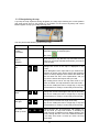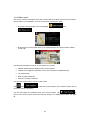
1
PRIME/ESSENTIAL
NAVIGATION USER MANUAL MOTOR HOME
EN
Table of contents
1 Warnings and safety information ..........................................................................5
2 Getting started .........................................................................................................6
2.1 Initial set-up ................................................................................................................... 6
2.2 Screen controls............................................................................................................... 7
2.2.1 Using the buttons and other controls.................................................................................... 7
2.2.2 Using the cursor ................................................................................................................... 9
2.2.3 Using the keyboard .............................................................................................................. 9
2.2.4 Using touch gestures .......................................................................................................... 10
2.2.5 Manipulating the map ........................................................................................................ 11
2.3 Navigation view ........................................................................................................... 13
2.3.1 Streets and roads ................................................................................................................ 15
2.3.2 GPS position markers ....................................................................................................... 15
2.3.3 The planned route .............................................................................................................. 16
2.3.4 Turn preview and next street............................................................................................. 16
2.3.5 Manoeuvre icons ............................................................................................................... 17
2.3.6 Lane information and signposts ........................................................................................ 18
2.3.7 Junction view ..................................................................................................................... 18
2.3.8 Tunnel view ....................................................................................................................... 19
2.3.9 Motorway services ............................................................................................................. 19
2.3.10 3D object types ................................................................................................................ 20
2.3.11 Traffic events ................................................................................................................... 20
2.4 Navigation menu .......................................................................................................... 21
3 Using the navigation..............................................................................................23
3.1 Selecting a destination ................................................................................................. 23
3.1.1 Using combined search ...................................................................................................... 23
3.1.2 Selecting an address ........................................................................................................... 26
3.1.2.1 Entering an address ................................................................................................................... 26
3.1.2.2 Selecting a town centre .............................................................................................................. 29
3.1.2.3 Selecting the midpoint of a street ............................................................................................... 30
3.1.2.4 Selecting an intersection in a town ............................................................................................ 30
3.1.2.5 Using the postcode to select a destination ................................................................................. 31
3.1.3 Selecting a Place of Interest ............................................................................................... 32
3.1.3.1 Using Quick search categories .................................................................................................. 32
3.1.3.2 Searching by category................................................................................................................ 34
3.1.3.3 Searching by name ..................................................................................................................... 36
3.1.3.4 Finding help nearby ................................................................................................................... 38
3.1.4 Selecting a Saved Location ................................................................................................ 39
3.1.5 Selecting a History item ..................................................................................................... 40
3.1.6 Selecting a saved route ...................................................................................................... 41
2
3.1.7 Entering coordinates .......................................................................................................... 42
3.1.8 Selecting a location on the map ......................................................................................... 43
3.1.9 Planning a Multipoint Route .............................................................................................. 44
3.2 Checking Route Information and Alternatives ............................................................. 45
3.3 Checking Traffic Events ............................................................................................... 46
3.4 Editing the route .......................................................................................................... 48
3.4.1 Setting a new starting point................................................................................................ 48
3.4.2 Adding an additional destination ....................................................................................... 50
3.4.3 Modifying the list of destinations ...................................................................................... 50
3.4.4 Saving the planned route.................................................................................................... 51
3.4.5 Deleting the planned route ................................................................................................. 52
3.4.6 Selecting a route alternative when planning the route ....................................................... 52
3.4.7 Selecting a route alternative for an existing route .............................................................. 53
3.4.8 Pausing guidance ............................................................................................................... 54
3.5 Saving a location.......................................................................................................... 54
3.5.1 Editing a saved location ..................................................................................................... 55
3.6 Adding an Alert Point .................................................................................................. 56
3.7 Running a Simulation ................................................................................................... 57
3.8 Off-road navigation...................................................................................................... 58
3.8.1 Switching to off-road navigation ....................................................................................... 58
3.8.2 Selecting the destination in off-road mode ........................................................................ 59
3.8.3 Navigating in off-road mode.............................................................................................. 59
4 Reference guide .....................................................................................................60
4.1 Concepts....................................................................................................................... 60
4.1.1 2D/3D GPS reception ........................................................................................................ 60
4.1.2 Natural and TTS voices ..................................................................................................... 60
4.1.3 Road safety cameras and other proximity Alert Points ...................................................... 60
4.1.4 Route calculation and recalculation ................................................................................... 61
4.1.5 Smart Zoom ....................................................................................................................... 62
4.1.6 Speed limit warning ........................................................................................................... 62
4.1.7 Historical traffic ................................................................................................................. 62
4.1.8 Real-time traffic ................................................................................................................. 63
4.1.9 Intelligent navigation ......................................................................................................... 63
4.1.9.1 Congestion detour on highways ................................................................................................. 64
4.1.9.2 Real-time alternative routes ....................................................................................................... 64
4.1.9.3 Parking around destination ....................................................................................................... 65
4.1.9.4 Hints upon detour ...................................................................................................................... 65
4.2 Useful Information menu ............................................................................................. 66
4.2.1 Where Am I ....................................................................................................................... 67
4.2.2 Trip Monitor ...................................................................................................................... 68
4.3 Settings menu ............................................................................................................... 69
3
4.3.1 Route preferences settings ................................................................................................. 70
4.3.1.1 Vehicle profile ............................................................................................................................ 70
4.3.1.2 Route Planning Method types .................................................................................................... 72
4.3.1.3 Navigation Mode........................................................................................................................ 73
4.3.1.4 Road types.................................................................................................................................. 73
4.3.2 Sound settings .................................................................................................................... 74
4.3.3 Warnings settings ............................................................................................................... 76
4.3.4 Navigation View settings ................................................................................................... 77
4.3.5 Regional settings ................................................................................................................ 80
4.3.6 Display settings .................................................................................................................. 80
4.3.7 Traffic settings ................................................................................................................... 81
4.3.8 Trip Monitor settings ......................................................................................................... 82
5 Troubleshooting.....................................................................................................83
5.1 GPS signal cannot be received .................................................................................... 83
5.2 Address cannot be found .............................................................................................. 83
5.3 The calculated route is not optimal.............................................................................. 83
5.4 Disabling the speed limit warning ............................................................................... 84
5.5 Keyboard buttons are greyed out ................................................................................. 84
5.6 The map is hidden behind an image of a junction ....................................................... 85
6 End-user licence agreement .................................................................................86
7 Copyright note .......................................................................................................94
4
1 Warnings and safety information
The navigation system helps you find your way to your destination with the built-in GPS
receiver. Zenec Navigation does not transmit your GPS position; others cannot track you.
It is important to look at the display only when it is safe to do so. If you are the driver of the
vehicle, we recommend that you plan and review your route before you start your journey.
Plan the route before your departure and stop if you need to change the route.
You must follow the traffic rules. If you deviate from the planned route, Zenec Navigation
changes the instructions accordingly.
For more information, see the end-user licence agreement (page 86).
5
2 Getting started
Zenec Navigation is optimised for in-car or pedestrian use. You can use it easily by tapping
the screen buttons and the map with your fingertips.
Free Map updates
When you start using the product, you can download new maps in the next 1 year.
2.1 Initial set-up
When using the navigation software for the first time, an initial set-up process starts
automatically.
1.
to confirm your
Select your preferred language, then tap
selection. Later you can change it in Regional settings (page 80).
2.
Read the end-user licence agreement, and tap
the terms of use.
3.
The Configuration Wizard starts. Tap
4.
Select the language and speaker used for voice guidance messages. Later you can
if you agree with
to continue.
change it in Regional settings (page 74). Tap
6
to continue.
5.
If needed, modify the time format and unit settings. Later you can change them in
to continue.
Regional settings (page 80). Tap
6.
If needed, modify the default route planning options. Later you can change them in
Route Preferences (page 70). Tap
7.
to continue.
to enter the Navigation
The initial set-up is now complete, tap
view.
2.2 Screen controls
The following sections describe the functionality and use of buttons, sliders, and other screen
controls in Zenec Navigation.
2.2.1 Using the buttons and other controls
To operate Zenec Navigation, tap the buttons on the touch screen.
Type
Button
Example
Description
Opens a new screen
where you can set a
parameter.
7
Function
Tap it once.
Button
with value
Icon
Displays the current value Tap it once.
of a field or setting where
the value can be changed.
After the change, the new
value is shown on the
button.
Provides additional
information, for example
traffic summary or
itinerary.
Tap it once to open a
screen with additional
information or options.
List
Shows multiple options.
Grab the list anywhere
and slide your finger up
or down. Depending on
the speed of sliding, the
list scrolls fast or slow,
only a bit or till the end.
Switch
Shows whether a feature
is enabled when there are
only two choices.
Tap it to turn the switch
on or off.
Slider
When a feature can be set
to different values in a
range, Zenec Navigation
shows an indicator on a
gauge that displays and
sets the value.
Drag the handle to move
the slider to its new
position.
Virtual
keyboard
Used to enter text and
numbers.
Tap the slider where you
want the handle to
appear.
Each key is a touch
screen button.
The Navigation menu may contain several menu items on one or more pages.
You need to confirm selections or changes only if the application needs to be restarted, if it
needs to perform a major reconfiguration, or if you are about to lose some of your data or
settings. Otherwise, Zenec Navigation saves your selections and applies the new settings
without confirmation as soon as you use the controls.
8
2.2.2 Using the cursor
You can select a map location in the following ways:
•
By tapping the map when navigating
•
By tapping the map when you are asked to confirm the destination at the end of a
search.
When a map location is selected, the cursor (
map.
) appears at the selected point on the
The location of the cursor can be used as the destination of the route or a new Alert Point.
You can also search for Places around it or add this location to your saved locations.
You can also select some of the objects on the map. If you tap the map at the icon of a Place
or traffic event, the object is selected, and you can get information about this object or use it
as a route point.
2.2.3 Using the keyboard
You can type with your fingertips on the screen keyboards and you can switch between
various keyboard layouts, for example English, Greek or numerical. Only those keyboard
buttons are active that can be used to type a name that is available on the map. The other
keys are greyed out.
Action
Function
Switching to another
keyboard layout, for example
from an English keyboard to Tap
a Greek keyboard
Correcting your entry on the
keyboard
Tap
and select the new keyboard layout from the list.
to remove the unnecessary character(s).
Tap and hold the button to delete several characters or the
entire input string.
Entering a space, for
example between a first
name and a family name or
in multi-word street names
Entering upper and lower
case letters
Tap the
screen.
button at the bottom centre of the
By default, when entering a text, the first character appears in
upper case while the rest of the text is in lower case. Tap
to enter an upper case letter or tap it twice to turn on
Caps Lock. Tap again to use lower case letters.
Entering numbers and
symbols
Tap
to switch to a keyboard offering numbers and
symbols.
Finalising the keyboard entry
Tap
.
9
Starting a search for a
keyboard entry
Tap
.
Tap
.
Hiding the keyboard
2.2.4 Using touch gestures
You usually need to tap the screen only once. However, some useful features can be
accessed with other gestures. See the table below.
Action
Tapping and
holding the
screen
Function
Tap and keep pressing the following buttons to reach extra functions:
•
Tap and hold the following button on list and menu screens to show
the Navigation view:
•
.
Tap and hold any of the following buttons on the Navigation view to
rotate, tilt, or scale the map continuously:
,
•
,
Using pinch
zoom
,
,
.
Tap and hold the following button on keyboard screens to quickly
delete several characters:
Dragging
,
.
Drag the screen in the following cases:
•
To move the handle on a slider.
•
To scroll a list: grab the list anywhere and slide your finger up or
down. Depending on the speed of the sliding, the list scrolls faster or
slower, only a bit or till the end.
•
To move the map in map browsing mode: grab the map, and move
it in the desired direction.
Use pinch zoom on the Navigation view to zoom in and out by moving two
fingers in a pinch gesture.
10
2.2.5 Manipulating the map
If you tap the map anywhere during navigation, the map stops following the current position
(the green arrow arrow is not locked in a fix position on the screen anymore) and control
buttons appear to help you modify the map view.
You can perform the following actions on the map:
Action
Checking
location
information
Button(s)
No buttons
Function
The top section of the Navigation view shows
information about the selected point
(the cursor
Moving the
map by
dragging
Zooming in and
out
No buttons
).
Move the map in any direction: tap and hold the map
and move your finger towards the direction you want to
move the map.
Change how much of the map is displayed on the
screen.
,
Zenec Navigation uses maps that let you examine the
locations at various zoom levels, always with optimised
content. It always displays street names and other text
with the same font size, never upside-down, and you
only see the streets and objects that you need.
Map scaling has a limit in 3D map view mode. If you
zoom out further, the map switches to 2D view mode.
Tap once to modify the view in a large step, or tap and
hold the button to modify it continuously and smoothly.
Tilting up and
down
Rotating left
and right
Changing 2D,
3D, or 2D
North up views
Change the vertical view angle of the map in 3D mode.
,
Tap once to modify the view in a large step, or tap and
hold the button to modify it continuously and smoothly.
Changes the horizontal view angle of the map.
Tap once to modify the view in a large step, or tap and
hold the button to modify it continuously and smoothly.
,
,
,
Switch between the 3D
and 2D North up map
mode the map is rotated
current driving direction.
in 3D map view mode.
faces North.
11
perspective, 2D Heading up,
view modes. In Heading up
so its top always points in the
This is the default orientation
In North up mode, the map
Checking the
compass
The direction of the compass shows North.
Returning to
normal
navigation
Move the map back to follow the current GPS position.
Automatic map rotation is also re-enabled.
The map manipulation buttons disappear and the
navigation continues.
Selecting
additional
options
Open a list of additional features like saving a location,
or searching for Places around the cursor.
Selecting a
destination
Select the cursor location as a new destination. The
route is automatically calculated.
12
2.3 Navigation view
The navigation view is the main screen of Zenec Navigation that shows the planned route on
a map. Zenec Navigation works with digital maps which are not simply the computerised
versions of traditional paper maps. Similarly to paper road maps, the 2D mode of digital maps
shows you streets and roads. Elevation is also illustrated in colour.
The navigation view displays the following screen buttons, data fields, and route information
on the map during navigation:
Note! Some buttons, fields, or icons may not be available in your product version.
Number
Name
Description
1
Current
position
marker
The current position is displayed as a green arrow arrow by
default. When there is no GPS position, the current position
marker is transparent and it shows your last known position. See
page 15.
2
GPS position
The dot near the arrow shows the GPS position as perceived by
the GPS receiver. See page 15.
13
3
Planned route
The planned route is displayed as an orange line line.
4
Data fields
Three data fields show the following information:
•
The estimated time of the arrival at the destination
•
The remaining time of the trip
•
The remaining distance to the destination.
By tapping it, you can access additional information about the
current trip on a dashboard screen and in the Trip Summary.
You can change the default values in Settings (page 77) or by
tapping and holding the area where the data fields appear.
If you have not selected a destination, you can see your heading
instead of the three data fields.
Next turn
preview
It shows the type of the next manoeuvre and its distance. See
page 16.
6
Second next
turn preview
It shows the type of the second next manoeuvre if it is near the
first one. See page 16.
7
Next street
It displays the name of the next street. See page 16.
5
If you have not selected a route destination, you can see nearby
house numbers.
8
Parking
around
destination
It appears near the destination. By tapping it, you can check the
available parking facilities around your destination. See page 65.
9
Destination
menu
It appears near the destination. By tapping it, you can check the
trip summary, find Places around your final destination, save the
current location, switch to pedestrian navigationor suspend the
navigation.
10
Traffic
It shows traffic-related information. See page 46.
11
Lane
information
On multi-lane roads, it shows the lanes ahead and their
directions. The highlighted arrows represent the lanes and
direction you need to take. See page 18.
12
Alert point
warning
It shows the type of the alert points when approaching a road
safety camera or other Alert Points like school zones or railroad
crossings. You must make sure that using this feature is legal in
the country where you intend to use it. See page 76.
13
Speed limit
warning
It shows the current speed limit of the road. See page 76.
15
Signpost
It shows the available destinations and the road numbers. See
page 18.
16
Motorway
services
By tapping it, you can check the details of the next few service
stations (petrol stations, restaurants) when travelling on a
motorway. See page 19.
18
Navigation
menu
By tapping it, you can open the Navigation menu, where you can
reach other parts of Zenec Navigation.
19
Street name
It shows the current street name. By tapping it, you can open the
Where Am I screen. See page 67.
14
20
3D objects
They display hills, mountains, roads, landmarks, and buildings in
3D.
If you are approaching a motorway exit or a complex intersection and the needed information
exists, the map is replaced with a 3D view of the junction. See page 18.
When entering a tunnel, the map is replaced with a generic tunnel image. See page 19.
2.3.1 Streets and roads
Zenec Navigation shows the streets similarly to paper road maps. Their width and colours
correspond to their importance; you can easily tell a motorway from a small street.
2.3.2 GPS position markers
When your GPS position is available, Zenec Navigation marks your current position. By
default, this marker is a green arrow arrow. The dot near the arrow shows the GPS position
as perceived by the GPS receiver.
The exact location of the current position marker depends on the vehicle type used for route
calculation and the navigation mode. Both can be set in Route preferences (page 70).
•
If you choose pedestrian and/or off-road navigation, the position marker is at your
exact GPS position. The direction of the icon shows your current heading.
•
In all other cases, the position marker may not show your exact GPS position and
heading. If roads are near, the GPS position is locked on the road and aligned to the
nearest road to suppress GPS position errors, and the direction of the icon is aligned to
the direction of the road.
15
2.3.3 The planned route
The planned route is the currently navigated route. Whenever the destination is set, the route
is active until you delete it, reach your destination or suspend navigation. Zenec Navigation
displays the route in the following ways:
Symbol
Name
Current GPS position
and starting point
Description
It is your current position displayed on the map.
•
In pedestrian mode it is the GPS position.
•
If a vehicle is selected for route calculation and roads
are near, the arrow jumps to the nearest road.
•
The dot near the arrow shows the exact
GPS position.
Normally, if GPS position is available, the route starts from
the current position. If there is no valid GPS position, Zenec
Navigation uses the last known position as the starting point.
Waypoint
(intermediate
destination)
Destination (end
point)
Route colour
It is an intermediate destination of the route before reaching
the final destination.
It is the final destination of the route.
The route always stands out with its colour on the map, both
in daytime and night colour modes.
Streets and roads
that are excluded
from the navigation
You can choose whether you want to use or avoid certain
road types (page 70). However, when Zenec Navigation
cannot avoid such roads, the route includes them and shows
them in a colour that is different from the route colour.
Streets and roads
that are affected by
traffic events
Road segments may be affected by traffic events. These
streets and roads are displayed in a different colour, and
small symbols displayed along the route show the type of
the traffic event.
2.3.4 Turn preview and next street
When navigating a route, the top section of the Navigation view shows information about the
next route event (manoeuvre) and the next street or the next town.
16
There is a field in the top left corner displaying the next manoeuvre. Both the type of the
manoeuvre (turn, roundabout, exiting motorway, and so on) and its distance from the current
position are displayed.
A smaller icon shows the type of the second next manoeuvre if it is near the first one.
Otherwise, only the next manoeuvre is displayed. Tap the icon of the actual manoeuvre to
open the Itinerary screen.
2.3.5 Manoeuvre icons
During navigation the next manoeuvre is displayed in the top left corner. Most of the
manoeuvre icons are intuitive. The following table lists some of the frequently shown route
events:
Icon
Function
Turn left.
Turn right.
Turn back.
Bear right.
Turn sharp left.
Keep left.
Continue straight in the intersection.
Enter the roundabout and take the first exit (next
manoeuvre).
Enter the roundabout (second next manoeuvre).
Enter the motorway.
Exit the motorway.
Board the ferry.
Leave the ferry.
Approaching a waypoint on the right.
Approaching the destination.
17
2.3.6 Lane information and signposts
When navigating on multi-lane roads, it is important to take the appropriate lane in order to
follow the planned route. If lane information is available in the map data, Zenec Navigation
displays the lanes and their directions using small arrows at the bottom of the map.
Highlighted arrows represent the lanes and the direction you need to take.
Where additional information is available, arrows are replaced by signposts. Signposts are
displayed at the top of the map. The colour and style of the signposts are similar to the real
ones you can see above roads or by roadsides. They show the available destinations and the
road numbers.
All signposts look similar when cruising (when there is no planned route). During navigation
only the signpost that points to the lane(s) to be taken is highlighted; all the others are darker.
If you want to hide the currently displayed signposts, tap any of them and the normal
Navigation view returns until new signpost information is received.
You can modify the signpost settings in
(page 77).
2.3.7 Junction view
If you are approaching a motorway exit or a complex intersection and the needed information
exists, the map is replaced with a 3D view of the junction. The lanes you need to take are
displayed with arrows. At the top of the screen, road signs show you additional information.
If you want to hide the currently displayed junction and return to the Navigation view, tap the
picture.
. See page 77.
Junction view can be turned off in
18
2.3.8 Tunnel view
When entering a tunnel, the map is replaced with a generic tunnel image so that surface
roads and buildings cannot distract you.
The top-down overview of the tunnel displayed in a separate window helps you orientate
yourself. The remaining distance in the tunnel is also displayed.
After leaving the tunnel, the original map view returns.
. See page 77.
Tunnel view can be turned off in
2.3.9 Motorway services
When you are driving on a motorway, the
button appears at the top right corner of the
Navigation view. Tap it to open a panel with the details of the next few service stations (petrol
stations, restaurants).
Tap any of them to display the exit area on the map. You can now easily add this service
station as a waypoint to your route if necessary.
If you want to display other types of Places at the next few service stations, you can change
the icons in
. See page 77.
19
2.3.10 3D object types
Zenec Navigation supports the following 3D object types:
Type
3D terrain
Elevated roads
3D landmarks
3D buildings
Description
Zenec Navigation displays 3D hills and mountains in the Navigation view,
and illustrates them by colouring and shading on the 2D map.
Elevated roads are complex intersections and vertically isolated roads (such
as overpasses or bridges) displayed in 3D.
Landmarks are 3D representations of prominent or well-known objects.
3D buildings are block representations of full town building data containing
actual building sizes and positions on the map.
2.3.11 Traffic events
Road segments affected by traffic events are displayed in a different colour on the map.
The following icons may appear at the top right corner of the screen:
Button
Description
It is displayed when traffic events are not received.
It is displayed when traffic events are received but they do not affect the planned
route.
It shows the type of the next traffic event with the expected delay.
It shows the type of the next traffic event if it does not cause any delay or the delay
is not known.
For more information, see page 46.
20
2.4 Navigation menu
On the Navigation view, tap
to open the Navigation menu.
You can see the following menu options when you are navigating without a planned route:
Button
Function
Select your destination by entering an address or its coordinate, or by
selecting a Place, a Saved Location, or a Saved Route. You can also
look up your recent destinations from the History.
Build your route from one or more route points. You can also plan a
route independently of your current GPS position by setting a new
starting point.
Check the traffic events affecting your route, or view historical traffic
data.
Access additional options and check navigation-related information.
Customise the way the navigation software works.
See information about the navigation software.
Stop the navigation and exit the software.
With a planned route, the following menu options are also available:
Button
Function
Add an intermediate destination to your route.
See route alternatives to avoid parts of the route, or to avoid a specific
road from your planned route.
21
View the route in its full length on the map and check route parameters
and route alternatives. Tap
to access additional options, like
Simulation or Route Preferences.
Delete your route.
Delete the next waypoint or the whole route.
In the navigation menu, you have the following additional options:
Button
Function
Open the Saved Locations screen where you can save a location as a favourite
destination or edit a saved location.
Set the volume or mute the navigation.
Switch to 2D (
), 2D North up (
) view or back to 3D mode.
Suspend navigation.
Resume navigation.
Access the User profiles menu where you can create new profiles or edit the existing
ones. If several drivers are using the navigation system, they can create their own
profiles with their own settings.
The following options are also available on many of the menu screens:
Button
Function
The Menu button appears when the Navigation view is displayed. Tap it to open the
Navigation menu.
The More button appears on the screen to display additional features. Tap it to open
the list of additional features on certain screens.
Tap it to return to the map from any menu screen.
Tap the Back button to return to the previous screen. You can also press and hold
this button to quickly return to the Navigation view from any other screen.
22
3 Using the navigation
By default, Zenec Navigation calculates routes using the road network of the maps provided
with the product.
You can select the destination and start navigating to it right away (normal navigation) if you
need a route for immediate navigation.
You can also plan a route independently of your current GPS position even without GPS
reception. To achieve this, you need to set a new starting point in the Multipoint Route menu.
It also suspends guidance so that the route is not recalculated when a new position is
received. See Page 48.
You can plan routes with multiple destinations by selecting a first and a second destination
and adding it to your route. You can add as many destinations to your route as you like. See
Page 44.
You can also use Zenec Navigation for off-road navigation. See page 58.
3.1 Selecting a destination
You can choose your destination by selecting one of the following options:
•
Using combined search to search among different destination types at once, see page
23
•
Entering a full address or a part of an address, for example a street name without a
house number, see page 26
•
Selecting a Place as your destination, see page 32
•
Selecting a previously saved location as your destination, see page 39
•
Selecting a location from the History of previously used destinations, see page 40
•
Selecting a previously saved route, see page 41
•
Entering the coordinate of the destination, see page 42
•
Selecting a location on the map, see page 43
•
Planning a multipoint route, see page 44.
3.1.1 Using combined search
There are several ways to select your destination. You can initiate a separate search for
addresses, Places, saved locations, or recent destinations, but the fastest way to search for
any of these is to use combined search.
Perform the following steps to use combined search:
on the Navigation view to access the Navigation menu.
1.
Tap
2.
Tap
3.
. You can see the input field at the top of the screen. Right
Tap
next to it you can see the search area, the town around which the search is carried out.
.
23
The default search area is the area where you are located. For a local search, skip the
next step.
4.
(optional) To search in a different area, tap the input field with the search area, and
start entering the name of the new search area on the keyboard.
You only need to enter a few letters to get a result. The most likely result appears
below the input field as you enter new letters.
a.
If the new search area is in a different country, start entering the country and the
town. It is usually enough to type the first few letters of the country or town and
conventional abbreviations can also be used.
b.
Tap
to see the whole list of the matching results.
5.
With the proper search area displayed, start entering the name, address, or category of
the destination you are looking for.
6.
to switch to the result screen. You can see all the results in
Tap
the list, regardless of their type. Addresses, Places, Place categories, Saved locations,
and recent destinations are mixed in one list. You can immediately select the result you
want to use as your destination or narrow the list of results for only one type (for
example, Places).
24
7.
on the right side of the list and then tap the related button to
If necessary, tap
narrow the list of search results by type (the number on the related icon shows the
number of the matching results):
•
Tap
address.
to see the list of recent destinations with a matching name or
•
Tap
to see the list of your saved locations with a matching name.
•
Tap
to see the list of matching addresses.
•
to see the list of matching Place category names. Scroll the list and
Tap
select one of the categories. You get the list of Places in that category ordered
by their distance from your current position.
•
to see the list of matching Places ordered by their distance from your
Tap
current location.
•
(optional) If your product contains Places from different data providers, you can
further narrow the list by showing the results from one provider only. Look for
the provider logos. Tap one of them to see Places from that provider.
To search for an intersection in the combined search, enter the names of the
streets connected by the '&' sign. You do not need to use spaces before and after
the separator character. For example you can find the intersection of Collins
Street and Douglas Avenue by entering strings, like "Collins St & Douglas Ave",
Tip! "Collins & Douglas", "Col&Doug", etc. The more precise the input string is, the
fewer false results are expected. If you enter "Collins St&", you get all the
intersections of Collins Street and you can select the appropriate one from the
result list.
8.
Once the destination is selected, a full screen map appears with the selected point in
the middle. If necessary, tap the map somewhere else to modify the destination. The
cursor (
9.
10.
) appears in the new location.
Check the settings for road types and change them if necessary.
Tap
destination.
to confirm the destination, or tap
25
to select a different
11.
The route is calculated and the map appears showing the entire route, where you can
check route information and route alternatives. Tap
parameters, or tap
to modify the route
to start your journey.
3.1.2 Selecting an address
If you know at least a part of the address, this is the quickest way to select your destination.
Using the same screen, you can find an address by entering the following information:
•
The exact address, including the house number, see page 26
•
The centre of a town, see page 29
•
The midpoint of a street, see page 30
•
An intersection, see page 30
•
Any of the above, starting the search with the postal code, see page 31.
3.1.2.1 Entering an address
To enter an address as the destination, perform the following steps:
on the Navigation view to access the Navigation menu.
1.
Tap
2.
Tap
3.
By default, Zenec Navigation proposes the country and town where you are (or in case
there is no valid GPS position, the country and town of the last known position). If
necessary, change the country, by performing the following steps:
and
.
a.
Tap the Country field.
b.
In the Select Country screen, you can immediately select a country from the list
below the input field or start entering the first few letters of the country on the
keyboard.
26
c.
4.
5.
Tap
list.
to open the list of results and select a country from the
If necessary, select a new town by performing the following steps:
a.
Tap the Town or Postcode field.
b.
(optional) On the Town of Postcode screen, you can select a town from the list
of suggestions.
c.
Otherwise, start entering the first few letters of the town. The names that match
the string appear in a list.
d.
To open the list, tap
and select the town.
Enter the street name by performing the following steps:
a.
Tap the Street name field.
b.
(optional) On the Select Street screen, you can immediately select a street from
the list of suggestions.
c.
Otherwise, start entering the street name on the keyboard. The names that
match the string appear in a list.
27
d.
6.
7.
Tap
list.
to open the list of results. Select the street from the
Enter the house number by performing the following steps:
a.
Tap the House number or crossing street field.
b.
Enter the house number on the keyboard. (To enter letters, tap
c.
Tap the selected address to finish the address search.
.)
A full screen map appears with the selected point in the middle. If necessary, tap the
map somewhere else to modify the destination. The cursor (
location.
) appears at the new
8.
Check the settings for road types and change them if necessary.
9.
Tap
to confirm the destination. You can also select a nearby point
on the map or tap
to select a different destination.
28
10.
The route is calculated and the map appears showing the entire route, where you can
check route information and route alternatives. Tap
parameters, or tap
to modify the route
to start your journey.
3.1.2.2 Selecting a town centre
The town centre is not the geometric centre of the town but an arbitrary point the map
creators have chosen. In towns and villages, it is usually the most important intersection and
in larger towns, it is one of the important intersections.
1.
,
Go to
earlier (page 26), if necessary.
2.
If necessary, select a new town by performing the following steps:
3.
, and modify the country as described
a.
Tap the Town or Postcode field.
b.
(optional) On the Town of Postcode screen, you can select a town from the list
of suggestions.
c.
Otherwise, start entering the first few letters of the town. The names that match
the string appear in a list.
d.
To open the list, tap
and select the town.
. This way the centre of the displayed town becomes the
Tap
destination of the route.
29
3.1.2.3 Selecting the midpoint of a street
To navigate to the midpoint of a street without entering the house number, perform the
following steps:
1.
,
, and select the country and town as
Go to
described earlier. The Select Street screen appears.
2.
Enter the street name by performing the following steps:
3.
a.
Tap the Street name field.
b.
(optional) On the Select Street screen, you can immediately select a street from
the list of suggestions.
c.
Otherwise, start entering the street name on the keyboard. The names that
match the string appear in a list.
d.
Tap
list.
to open the list of results. Select the street from the
. The midpoint of the
Instead of entering the house number, tap
street is selected as the destination.
3.1.2.4 Selecting an intersection in a town
To navigate to an intersection, perform the following steps:
,
, and select the country and city as
1.
Go to
described earlier.
2.
Enter the street name by performing the following steps:
a.
Tap the Street name field.
30
3.
b.
(optional) On the Select Street screen, you can immediately select a street from
the list of suggestions.
c.
Otherwise, start entering the street name on the keyboard. The names that
match the string appear in a list.
d.
Tap
list.
to open the list of results. Select the street from the
Tap the House number or crossing street field and browse the list of crossing streets or
start entering the street name in the field. Select one from the list.
3.1.2.5 Using the postcode to select a destination
You can also select any kind of destination by entering the postal code instead of the city
name. To select the postal code, perform the following steps:
1.
,
Go to
earlier (page 26), if necessary.
, and modify the country as described
2.
Tap the Town or Postcode field.
3.
Enter the postcode by performing the following steps:
to open the numeric keypad.
a.
Tap
b.
Start entering the postal code.
31
4.
to open the list of results.
c.
Tap
d.
Find the place you need.
Continue the search as described previously (page 26).
3.1.3 Selecting a Place of Interest
You can search for Places of Interest (Places) in the
menu.
Using the same screen, you can find a Place by selecting one of the following options:
•
Finding frequently searched types of Places with the Quick search categories, see
page 32
•
Searching for a Place by its name, see page 36
•
Searching for a Place by its category, see page 34
In case of emergency, you can also find help nearby, see page 38
3.1.3.1 Using Quick search categories
The Quick search feature helps you quickly find the most frequently selected types of Places.
Perform the following steps:
1.
Tap
2.
Tap
on the Navigation view to access the Navigation menu.
and
.
32
The following Quick search categories appear:
•
•
•
•
along the route.
: If a planned route exists, petrol stations are searched
: If a planned route exists, accommodation is searched
around the destination.
the route.
the destination.
: If a planned route exists, restaurants are searched along
: If a planned route exists, parking lots are searched around
If there is no planned route (destination is not selected), the search is carried out
around the current position. If the current position is not available either (no GPS
signal), places are searched around the last known position.
3.
Tap any of the quick search buttons to get an instant list of Places.
4.
The Places in the list can be ordered by their distance from the current or last known
position, from the destination, or by the length of the necessary detour. If you need to
reorder the list, tap
. To filter the list of results by providers, tap
the provider logo on the right side of the screen.
and then
to further filter the list of results.
5.
(optional) If needed, tap
6.
Browse the list and tap one of the list items. A full screen map appears with the
selected point in the middle. The name and address of the Place is displayed at the top
of the screen.
7.
Tap
8.
If necessary, tap the map somewhere else to modify the destination. The cursor
(
to see the details of the selected Place, or to save the location.
) appears at the new location.
33
9.
10.
11.
Check the settings for road types and change them if necessary.
Tap
to confirm the destination. You can also select a nearby point
on the map or tap
to select a different destination.
The route is calculated and the map appears showing the entire route, where you can
check route information and route alternatives. Tap
parameters, or tap
to modify the route
to start your journey.
3.1.3.2 Searching by category
To search for Places by their categories and subcategories, perform the following steps:
on the Navigation view to access the Navigation menu.
1.
Tap
2.
Tap
3.
Tap
4.
Select the area around which you would like to search for the Place by tapping
and
.
.
. By default, the search area is around the current position (or if it
is not available, around the last known position). In this case, the following result list is
ordered by the distance from this position.
•
to search along the planned route, and not around a
Tap
given point. This is useful when you search for a later stopover that results in a
minimal detour only, such as searching for upcoming petrol stations or
restaurants. (The result list is ordered by the length of the necessary detour.)
34
•
to search for a place around the destination of the
Tap
planned route. (The result list is ordered by the distance from the destination.)
•
to search for a place within a selected town. (The
Tap
result list is ordered by the distance from the centre of the selected town.)
, select the town to search in.
5.
(optional) If you have selected
6.
Select one of the main Place categories (for example, Accommodation), then browse
the subcategories (for example, Hotel or Motel) to find your destination.
7.
You can turn the Category View off at any level to list all Places around the selected
location or along the route.
8.
(optional) The Places in the list can be ordered by the following criteria:
•
Name
•
Their distance from the current or last known position
•
Their distance from the selected town
•
Their distance from the destination
•
The length of the necessary detour.
35
Tap
to reorder the list.
To filter the list of results by providers, tap
right side of the screen.
9.
10.
and then the provider logo on the
Browse the list and tap one of the list items. A full screen map appears with the
selected point in the middle.
The process continues the same way as in case of any other search for Places. See
page 32.
3.1.3.3 Searching by name
To search for a Place by name, browse the various Place categories, or use the mixture of
the two search types, perform the following steps:
on the Navigation view to access the Navigation menu.
1.
Tap
2.
Tap
and
3.
Tap
to open the Search By Name or Category window.
4.
Select the area around which you would like to search for the Place. By default, the
search area is around the current position (or if it is not available, around the last
known position). In this case, the result list is ordered by the distance from this
position. Tap
.
to select one of the following search areas:
•
to search for a place within a selected town. (The
Tap
result list is ordered by the distance from the centre of the selected town.)
•
to search for a place around the destination of the
Tap
planned route. (The result list is ordered by the distance from the destination.)
•
to search along the planned route, and not around a
Tap
given position. This is useful when you search for a later stopover that results in
a minimal detour only, such as searching for upcoming petrol stations or
restaurants. (The result list is ordered by the length of the necessary detour.)
36
5.
, select the town to search in.
(optional) If you have selected
You can search for the name of a Place in all categories by performing the following steps:
1.
Tap
. Using the keyboard, start entering the name of the Place or
browse in the categories.
2.
to open the list of Places or Place
After entering a few letters, tap
categories with names containing the entered character sequence.
3.
Browse the list, if necessary, and tap the desired list item. A full screen map appears
with the selected point in the middle. The process continues the same way as in case
of any other Places search. See page 32.
37
3.1.3.4 Finding help nearby
To quickly search for nearby assistance, perform the following steps:
1.
Tap
2.
Tap
on the Navigation view to access the Navigation menu.
and
.
Places in the following pre-set search categories can be searched for around the
current position (or around the last known position if the current position is not
available):
•
: Car repair and roadside assistance services
•
: Medical and emergency services
•
: Police stations
•
: Petrol stations
3.
Tap any of the quick search buttons to get an instant list of those types of Places.
4.
(optional) The Places in the list can be ordered by the following criteria:
•
By their distance from the current or last known position
•
By name.
Tap
to reorder the list.
5.
Browse the list and tap one of the list items. A full screen map appears with the
selected point in the middle.
6.
The process continues the same way as in case of any other Places search. See page
32.
38
3.1.4 Selecting a Saved Location
To select a location that you have already saved (page 54), perform the following steps:
on the Navigation view to access the Navigation menu.
1.
Tap
2.
Tap
3.
The list of saved locations is displayed. It contains two pre-set categories: Home and
Work.
4.
Tap the location that you want to set as your destination. If necessary, browse the list
to see more results.
5.
to enable the editing option so that you can rename the
(optional) If needed, tap
saved locations or delete any of them.
6.
After you have selected a saved location as the destination, a full screen map appears
with the selected point in the middle.
7.
If necessary, tap the map somewhere else to modify the destination. The cursor (
) appears in the new location.
8.
Check the settings for road types and change them if necessary.
9.
Tap
to confirm the destination. You can also select a nearby point
on the map or tap
to select a different destination.
and
.
39
10.
The route is calculated and the map appears showing the entire route, where you can
check route information and route alternatives. Tap
parameters, or tap
to modify the route
to start your journey.
3.1.5 Selecting a History item
The destinations that you have used earlier appear in the History list. Smart History offers
these locations from your previous destinations, using parameters like the current time of day,
the day of week, and the current location. The more you use the navigation software, the
better it can guess your desired destination. To select a History item, perform the following
steps:
on the Navigation view to access the Navigation menu.
1.
Tap
2.
. Two of the Smart History Items are displayed in the New
Tap
Route to... screen for easy access. You can select one of them as your destination.
3.
. The list of recent destinations
To open all the history items, tap
appears. The list begins with the three most likely destinations that are selected based
on your previous routes (Smart History). The rest of the destinations are ordered by the
time they were last selected. If necessary, scroll the list to see earlier destinations.
4.
Select a destination from the list.
5.
A full screen map appears with the selected point in the middle. If necessary, tap the
map somewhere else to modify the destination. The cursor (
location.
40
) appears at the new
6.
Check the settings for road types and change them if necessary.
7.
Tap
to confirm the destination. You can also select a nearby point
on the map or tap
to select a different destination.
8.
The route is calculated and the map appears showing the entire route, where you can
check route information and route alternatives. Tap
parameters, or tap
to modify the route
to start your journey.
3.1.6 Selecting a saved route
The routes that you have saved earlier appear in a list. To select a previous route, perform
the following steps:
on the Navigation view to access the Navigation menu.
1.
Tap
2.
Tap
3.
The list of saved routes appears. If necessary, scroll the list to see earlier routes.
4.
Select a route and the Multipoint Route screen appears. If necessary, modify the saved
and
.
route. Otherwise, tap
.
41
5.
The route is calculated and the map appears showing the entire route, where you can
to modify the route
check route information and route alternatives. Tap
parameters, or tap
to start your journey.
3.1.7 Entering coordinates
To select a destination by entering its coordinates, perform the following steps:
on the Navigation view to access the Navigation menu.
1.
Tap
2.
Tap
3.
You can enter the latitude and longitude values in any of the following formats: decimal
degrees, degrees and decimal minutes, or degrees, minutes and decimal seconds.
Tap
and
.
.
(optional) If necessary, tap
in UTM format.
then
and enter the coordinate
Tip!
4.
A full screen map appears with the selected point in the middle. If necessary, tap the
map somewhere else to modify the destination. The cursor (
location.
42
) appears at the new
5.
Check the settings for road types and change them if necessary.
6.
Tap
to confirm the destination. You can also select a nearby point
on the map or tap
to select a different destination.
7.
The route is calculated and the map appears showing the entire route, where you can
check route information and route alternatives. Tap
parameters, or tap
to modify the route
to start your journey.
3.1.8 Selecting a location on the map
To select a map location, perform the following steps:
1.
Locate your destination on the map. Move and scale the map as necessary.
2.
Tap the location that you want to select as your destination. The cursor (
appears there.
3.
(optional) If needed, tap
location.
Tip!
)
to list the Places near the selected point or to save this
If you already have a planned route, tap
selected location to your route.
43
and
to add the
to select the cursor as the destination.
4.
Tap
5.
The route is calculated and the map appears showing the entire route, where you can
check route information and route alternatives. Tap
parameters, or tap
to modify the route
to start your journey.
3.1.9 Planning a Multipoint Route
To build your route destination-by-destination, perform the following steps:
on the Navigation view to access the Navigation menu.
1.
Tap
2.
Tap
3.
There is only one line in the list of route points, the starting point of the route, which is
normally the current GPS position.
4.
Tap
5.
The New Route to... screen appears, where you can select the destination of the route
the same way as described in the previous sections.
.
to select the destination.
44
and the list
6.
When the selected location appears on the map, tap
returns. If needed, you can add further intermediate destinations.
7.
or tap
to
To add more route points, tap
change the final destination. The Add to Route... menu appears again, where you can
select the new route point the same way as you have set the destination before.
8.
to optimise the whole route or the order of waypoints. You can
(optional) Tap
also delete all the destinations.
9.
When you have added all the route points, tap
route is automatically calculated.
and the planned
3.2 Checking Route Information and Alternatives
To get a map overview of the planned route and check different parameters of the planned
route, perform the following steps:
on the Navigation view to access the Navigation menu.
1.
Tap
2.
In the Navigation menu, tap
3.
The planned route is displayed in its full length on the map with the following additional
information:
•
The total length of route
•
The total time of route.
.
45
4.
You have the following options on this screen:
•
Tap
to receive detailed information about the route.
If you tap
on the right side of the screen, you can narrow
the route information, for example to show only motorway sections or toll roads.
•
Tap
route for you.
to list route alternatives and select the most suitable
on the Route Summary screen to carry out additional actions, for example edit
Tap
your route preferences or display the itinerary.
3.3 Checking Traffic Events
Offline statistical traffic information (historical speed information or traffic patterns) can be
taken into account in the route calculation based on the time of day and the day of week if
suitable data can be found on the device. In addition, real-time traffic information can help you
avoid current traffic events like temporary road closures or traffic jams caused by an accident.
Both functions are subject to data availability.
For information on traffic icons, see page 20.
Road segments affected by traffic events are displayed in a different colour on the map, and
small symbols above the road show the nature of the event.
46
To check the traffic summary, perform the following steps:
1.
On the Navigation view, tap the traffic icon in the corner (for example,
the Traffic Summary screen, or tap
2.
and
.
If there is at least one significant event on the planned route, a description is displayed
about the next event. Tap
3.
) to open
to see the list of all events.
Tap any of the list items to see its details and to display the affected road segment in
its full length on the map.
To display real-time traffic information on the map, perform the following steps:
1.
On the Navigation view, tap the traffic icon (for example,
summary screen and tap
2.
) to open the Traffic
.
to display real-time traffic information on the map. A 2D map is displayed
Tap
with road segments coloured by the impact on the traffic flow.
47
3.
to display historical traffic information. A 2D map is displayed with road
Tap
segments coloured by the likely density of the traffic in the given period. The
information relevant for the current period is shown when you open the screen. If
necessary, you can browse the map for a better view of certain road segments. Modify
the day of week and the time of day to see the desired period.
3.4 Editing the route
When navigation has already started, there are several ways to modify the planned route.
You have the following options:
•
Setting a new starting point, see page 48
•
Adding an additional destination, see page 50
•
Modifying the list of destinations, see page 50
•
Saving the planned route, see page 51
•
Deleting the planned route, see page 52
•
Selecting a route alternative when planning the route, see page 52
•
Selecting a route alternative for an existing route, see page 53
•
Pausing guidance, see page 54.
3.4.1 Setting a new starting point
For normal navigation, all routes are calculated from the current position. You can pause
navigation to check future routes, simulate them or see their length in time and distance. Then
you can set the starting point of the route to a location other than the current GPS position.
on the Navigation view to access the Navigation menu.
1.
Tap
2.
In the Navigation menu, tap
.
48
3.
The first line from the bottom is the start of the route, normally the current GPS
position. Tap
at the warning message.
, select
, and confirm your action
4.
The Change Start to... screen appears. Select the starting point of the route the same
way you select a destination.
5.
and the
You can see the new starting point on the map. Tap
Multipoint Route screen appears where you can continue adding a destination to your
route.
6.
to continue. The map returns with a transparent position
Tap
marker (showing that there is no GPS reception). If a planned route already exists, it is
now recalculated starting from the selected location.
7.
To return to normal navigation, tap
.
49
3.4.2 Adding an additional destination
If you already have a planned route and you select a new destination as described in the
above sections, the route to the previous destination is deleted and a new route is calculated.
To add a new intermediate destination to the planned route, perform one of the following
actions:
•
Tap the map anywhere to browse it. After selecting the location on the map, tap
and
to add the selected location to your route as an intermediate
destination. The other destinations of the route remain intact.
•
on the Navigation view and tap
Tap
your route as described on page 44.
. Add a destination to
3.4.3 Modifying the list of destinations
To edit your route, perform the following steps:
on the Navigation view to access the Navigation menu.
1.
Tap
2.
In the Navigation menu, tap
.
You have the following options on this screen:
to delete all the destinations, or optimise the waypoints or the route.
•
Tap
•
Tap the name of the intermediate destination to move it up or down in the list, to
save the location, or to delete it from the list.
•
If you have a route with at least one intermediate destination, you can delete the
waypoint from the list right from the Main menu. Tap
confirm the deletion.
50
, then
3.4.4 Saving the planned route
To save the planned route, perform the following steps:
1.
Select a destination as described earlier and tap
2.
Tap
3.
Type in a name and tap
4.
The route is saved and it is available in
and
.
.
.
,
.
By selecting a previously saved route, Zenec Navigation recalculates the route using the
saved destination and/or the waypoints.
51
3.4.5 Deleting the planned route
You have the following two options to delete the navigated route:
•
If you already have a planned route and you select a new destination as described in
the above sections, the route to the previous destination is automatically deleted and a
new route is calculated.
•
or
. If there are
In the Navigation menu, tap
no waypoints, the planned route is deleted after a confirmation. If you have waypoints,
you can choose to delete the whole route, or only the next waypoint.
3.4.6 Selecting a route alternative when planning the route
To select from different route alternatives or change the route planning method after you have
selected a new destination, perform the following steps:
1.
Select a destination as explained earlier, and go to the route confirmation screen.
2.
Tap
3.
You can see the basic details of route alternatives. Tap any of them to see it on the
map.
4.
and scroll down for other
To view more suggestions, tap
alternative routes with different route planning methods.
.
52
5.
to return to the
Select one of the route alternatives and tap
previous screen. Zenec Navigation recalculates the route. Tap
start your journey. The orange line line now shows the new planned route.
to
3.4.7 Selecting a route alternative for an existing route
To recalculate the planned route with a different route planning method and to compare
different route alternatives, perform the following steps:
on the Navigation view to access the Navigation menu.
1.
Tap
2.
You can access the list of route alternatives from the Navigation menu in one of the
following ways:
3.
•
Tap
and
.
•
Tap
and
.
You can see the basic details of a few route alternatives. Tap any of them to see it on
the map.
If there are suitable alternatives calculated with the route planning method that is
selected in Route preferences (page 70), they are shown on top of the list. Routes with
other route planning methods are shown at the bottom of the list.
and scroll
4.
If there are more than a few suggestions, you can tap
down for routes.
5.
to return to the
Select one of the route alternatives and tap
previous screen. Zenec Navigation replaces the original route. Tap
53
planned route.
to start your journey. The orange line line now shows the new
3.4.8 Pausing guidance
When you are driving a planned route but you do not need guidance for a certain part of the
route, you can suspend it and continue when it is needed again.
In the Navigation menu, tap
Tap
to suspend guidance.
to resume guidance.
3.5 Saving a location
To add any location to the saved locations (the list of frequently used destinations), perform
the following steps:
1.
Select a destination as described before. It can be an address, a Place, any location
on the map, a previously used destination from History, and so on.
2.
When the map appears with the selected location in the middle, tap
3.
Tap
.
54
.
4.
(optional) Using the keyboard, you can change the name offered for the Saved
Location.
5.
Tap
to save the location.
To add your home and work address to the saved locations, perform the following steps:
1.
On the Navigation view, tap
2.
Tap
your selection.
3.
You can search for the address as described on page 23.
,
, and
or
. Tap
.
to confirm
Planning a route to one of the saved locations is described on page 39.
3.5.1 Editing a saved location
To edit a location that you have already added as a Saved Location, perform the following
steps:
,
, and
1.
On the Navigation view, tap
2.
The list of Saved locations is displayed.
3.
Tap
4.
Tap the location you want to edit, tap
and
.
.
and enter the name of the
location on the keyboard, then tap
.
55
In Saved Locations, Home and Work cannot be renamed. To change your home
Note!
5.
or work location, tap
address change.
Tap
or
, and confirm the
.
Adding a location to the list of saved locations is described on page 54.
3.6 Adding an Alert Point
You can save any map location as an Alert Point, for example a speed camera or a school
zone.
1.
If you would like to save an Alert Point for the first time, switch on the
. In the Navigation menu, tap
, then
confirm your selection.
,
. Switch on
and
Warning for road safety cameras is a chargeable service. You can purchase it from
http://zenec.naviextras.com. The warning for road safety cameras is disabled when
Note! you are in a country where road safety camera warning is prohibited. However, you
must make sure that using this feature is legal in the country where you intend to
use it.
2.
Return to the Navigation view, and select the Alert Point. The red cursor (
appears there.
3.
Tap
4.
Scroll down the list and tap
.
.
56
)
5.
Select the type of the Alert Point, the direction from which you expect the alert, and (if
applicable) the speed limit for this Alert Point.
6.
Tap
to save the location as a new Alert Point.
3.7 Running a Simulation
To run a simulated navigation that demonstrates the planned route, perform the following
steps:
on the Navigation view to access the Navigation menu.
1.
Tap
2.
In the Navigation menu, tap
3.
Tap
.
.
57
4.
. The simulation starts from the starting point of the route and
Tap
leads you through the whole planned route using a realistic speed.
(optional) You have the following controls during the simulation (the control buttons
disappear after a few seconds but you can open them again if you tap the map):
•
: Jump to the next route event (manoeuvre).
•
: Pause the simulation.
•
: Jump to the previous route event (manoeuvre).
•
5.
Tap
: Tap to increase the speed of the simulation to 4, 8 or 16 times faster.
Tap again to return to normal speed.
to stop the simulation.
3.8 Off-road navigation
When first started, Zenec Navigation calculates routes using the road network of the maps
provided with the product. If you want to disregard roads during navigation, you can switch to
off-road mode, for example when driving in a desert.
3.8.1 Switching to off-road navigation
To switch to off-road navigation, perform the following steps:
1.
On the Navigation view, tap
2.
Tap
,
, and
and select
.
.
Most of the procedures described for on-road navigation also apply to off-road navigation.
However, there are some that are not available in this navigation mode. For example:
•
You cannot open the itinerary as you have no manoeuvres just route points and
straight lines between them.
58
•
There are no route alternatives and route planning method.
•
Vehicle settings are disabled.
3.8.2 Selecting the destination in off-road mode
Selecting a destination (waypoint or final destination) is the same as described in the previous
sections. The only difference is that route points are linked to form a route with straight lines
regardless of the road network and traffic regulations.
3.8.3 Navigating in off-road mode
The real difference between on-road and off-road modes is the navigation itself. When you
are on the Navigation view with an off-road route:
•
Your position and heading is not aligned to the nearest road.
•
There is no turn-by-turn navigation, just a recommended direction.
You can see an orange line line drawn between your current position and the next destination
to reach. The Turn Preview field in the top left corner shows a compass with your bearing and
the distance of the next destination.
When you reach the final destination, the navigation ends.
If you do not want to use off-road navigation, switch back to on-road navigation by
Note!
tapping
and
.
59
4 Reference guide
The following sections describe the different concepts and menu screens of Zenec
Navigation.
4.1 Concepts
The following sections describe and explain navigation-related concepts.
4.1.1 2D/3D GPS reception
The GPS receiver uses satellite signals to calculate its (your) position and needs at least four
signals to give a three-dimensional position, including elevation. Because the satellites are
moving and because objects can block the signals, your GPS device might not receive four
signals. If three satellites are available, the receiver can calculate the horizontal GPS position
but the accuracy is lower and the GPS device does not give you elevation data; only 2D
reception is possible.
Several factors have an impact on the deviation between your real position and the one given
by the GPS device. For example, signal delay in the ionosphere or reflecting objects near the
GPS device have a different and varying impact on how accurately the GPS device can
calculate your position.
4.1.2 Natural and TTS voices
Natural voices are the traditional type of voice instructions. Every phrase that occurs in voice
guidance messages is recorded in a studio with a real person. The advantage of pre-recorded
voice is that it sounds really natural, but the range of instructions that can be given this way is
limited. Location-specific information such as street names cannot be announced.
TTS technology provides a machine-generated way to give voice instructions. The advantage
of TTS is that it can announce street names, traffic events, route summary, and traffic rules.
4.1.3 Road safety cameras and other proximity Alert Points
There is a special proximity warning for road safety cameras (like speed or red light cameras)
and other proximity Alert Points (like schools or railroad crossings). These Alert Points are not
part of Zenec Navigation. You can download Alert points from zenec.naviextras.com or you
can upload points in a specific text file if needed.
You can add your own Alert Points. See page 56.
The application can warn you when you approach road safety cameras like speed cameras or
dangerous areas like school zones or railroad crossings. You can set up the different alert
types individually in the Warnings settings, see page 76.
The following warning types are available:
•
Audio warning: beeps are played (if the voice guidance language that you selected is a
natural voice) or the type of the alert can be announced (TTS voice) while you are
approaching one of these points, and an extra alert warns you if you exceed the given
speed limit while approaching.
60
•
Visual warning: the type of the Alert Point, its distance and the related speed limit
appear on the Navigation view while you are approaching one of these locations.
For some of the Alert Points, either the enforced or expected speed limit is available. For
these points, the audio alert can be different if you are below or above the given speed limit.
•
Only when speeding: The audio alert is only played when you exceed the given speed
limit.
•
When approaching: The audio alert is always played when approaching one of these
Alert Points. In order to draw your attention, the alert is different when you exceed the
speed limit.
The warning for road safety cameras is usually disabled when you are in a country
where road safety camera warnings are prohibited. Make sure that using this
Note! feature is legal in the country where you intend to operate. Use it on your own
responsibility.
4.1.4 Route calculation and recalculation
A route is a sequence of route events, that is, manoeuvres (for example, turns and
roundabouts) to reach the destination. The route contains one starting point and one or more
destinations. The starting point is the current (or last known) position by default. If you need to
see a future route, the starting point can be replaced with any other given point. See page 48.
Once the destination has been selected, Zenec Navigation calculates the route based on your
preferences. These preferences are the route planning method, the vehicle type, and the road
types used or avoided when calculating the route. For detailed information on all the
preferences, see Route preferences settings, page 70.
Real-time traffic events are also taken into account, which sometimes greatly modify the
route. See page 63.
Zenec Navigation automatically recalculates the route if you deviate from the proposed
itinerary.
If traffic services are enabled, Zenec Navigation considers real-time dynamic traffic
information in route calculation and may also recalculate the route if the traffic situation
changes during navigation.
Intelligent data (captured historical speed information based on probe data) is used for
optimal routing depending on the day of the week and time of day. Route segments where
traffic flow is typically slow at the given time of day and day of the week are avoided if a
suitable alternative can be found. When calculating the optimal route, the data relevant for the
time of the estimated arrival of the vehicle at the given route point is taken into account. As a
result, Zenec Navigation may suggest a different route during the weekday rush hours,
especially in major cities with frequent traffic jams. See page 63.
61
4.1.5 Smart Zoom
Smart Zoom provides the following features:
•
While following a route: When approaching a turn, it zooms in and raises the view
angle to let you easily recognise your next manoeuvre. If the next turn is at a distance,
it zooms out and lowers the view angle to be flat so you can see the road in front of
you.
•
While driving without a planned route: Smart Zoom zooms in if you drive slowly and
zooms out when you drive at a high speed.
4.1.6 Speed limit warning
Maps may contain information about the speed limits of the road segments. Zenec Navigation
is able to warn you if you exceed the current limit. This information may not be available for
your region, or may not be fully correct for all roads on the map.
The maximum speed set in the vehicle profile (page 70) is also used for this warning. Zenec
Navigation alerts you if you exceed the pre-set value even if the legal speed limit is higher.
Speed warning can be fine-tuned in Warnings. See page 76.
You can also set the relative speed tolerance above which the application initiates the
warning.
The following warning types are available:
•
Audio warning: You receive a verbal warning when you exceed the speed limit with the
given percentage.
•
Visual warning: The current speed limit is shown on the map when you exceed it (for
example
).
You can also choose to see the speed limit sign on the map all the time.
4.1.7 Historical traffic
If statistical traffic information is stored with the map data, Zenec Navigation can take them
into account when planning a route. In normal cases, these statistics help you avoid usual
traffic jams on the given day of week in the given hour but in some cases like on public
holidays that fall on normal weekdays, they can be misleading. You can enable or disable this
feature in Traffic settings. See page 81.
62
4.1.8 Real-time traffic
Real-time traffic information can provide you with the current status of the traffic. Route
calculation can avoid road blocks or unexpected traffic jams caused by an accident.
The following data sources are available:
•
Traffic Message Channel (TMC):
TMC is a specific application of the FM Radio Data System (RDS) used for
broadcasting real-time traffic and weather information.
If public Traffic data is broadcast at your location, Zenec Navigation automatically
searches the FM radio stations for TMC data, and the decoded information is
immediately used in route planning.
Note!
TMC is not a global service. It may not be available in your country or region.
Ask your local dealer for coverage details.
The application automatically takes account of the traffic events received. You do not need to
set anything in Zenec Navigation.
When Zenec Navigation receives traffic information that may affect your route, it warns you
that it is recalculating the route. The navigation continues with a new optimal route
considering the most up-to-date traffic conditions.
For information on traffic icons, see page 20.
To fine-tune this service, you have the following options in Traffic settings (page 81):
•
Set the minimum amount of time that you think is worth saving at the cost of a detour.
•
Instruct Zenec Navigation to have you confirm the new planned route before it takes
effect.
If there are traffic events on the planned route that the application has not
Note!
bypassed, the
check them.
icon opens the list of significant traffic events to let you quickly
4.1.9 Intelligent navigation
With the help of intelligent navigation, the planned route can adapt to traffic and other
changes during navigation. The following sections describe these features.
63
4.1.9.1 Congestion detour on highways
Zenec Navigation may offer a detour when you slow down on a highway due to a traffic jam.
The Potential congestion detour window appears and shows the length and duration of the
detour.
or
You can ignore this message and keep the original route by tapping
you can check the suggested route by tapping
.
By tapping the plus/minus signs, you can increase or decrease the distance to avoid on the
highway.
You can accept the recommended detour by tapping
.
4.1.9.2 Real-time alternative routes
Zenec Navigation may offer an alternative route on normal roads in case of a traffic jam. The
possible alternative route window appears and shows the length and duration of the detour.
64
You can ignore this message and keep the original route by tapping
you can check the suggested route by tapping
recommended detour by tapping
or
. You can accept the
.
4.1.9.3 Parking around destination
If you leave the planned route by exiting a motorway, Zenec Navigation tries to guess the
reason for making a detour. By tapping
, you can open a top-down map with the
recommended parking Places around the destination. By tapping the arrows on the sides, you
can switch between the recommended parking facilities.
By tapping
becomes your destination.
and
, the selected parking place
4.1.9.4 Hints upon detour
If you leave the planned route by exiting a motorway, Zenec Navigation tries to guess the
reason for making a detour. The Reason for detour window appears and shows available
petrol stations, restaurants or other Places around the current position. Also, if there are
avoidable parts of the original route ahead (like a tunnel, a toll road or a ferry), you can find
them in the list, in case you want to bypass them.
65
By tapping one of the Places, Zenec Navigation creates a waypoint and navigates you to the
.
selected place. You can ignore them by tapping
4.2 Useful Information menu
The Useful Information menu provides various additional functions. It can be found in the
Navigation menu. You need an Internet connection via your mobile phone to access online
services, like parking and weather information.
Button
Description
Shows information on the current position (latitude, longitude, nearest
town, next crossing street, and so on) or the last known position if GPS
reception is not available. See page 67.
Offers assistance near your current position. See page 38.
Offers a list of countries with useful driving information about the
selected country (for example speed limits, maximum blood alcohol
level).
Shows statistical data of your trips, like the start time, end time and
average speed, see page 68. Track logs, the sequence of the positions
given by the GPS receiver, can be saved together with the trip logs.
They can later be displayed on the map.
Shows a world map with the sunlit and dark areas of the world. Tap
to check the exact sunrise and sunset times for all your route
points.
Shows the GPS Information screen with satellite position and signal
strength information.
66
4.2.1 Where Am I
This screen contains information about the current position (or about the last known position if
GPS reception is not available). You can access it the following two ways:
•
By going to the Navigation menu and tapping
and
.
•
By tapping the current street name if it is displayed below the current position marker
on the map.
The following information is shown on the Where Am I screen:
•
Address details (when available) of the current position
•
Latitude and Longitude (coordinate of the current position in WGS84 format)
•
The nearest town
•
Next crossing road/street
•
Previous crossing road/street.
You can also perform some actions on this screen.
Tap
and
check the country information.
to add the current position to the saved locations and to
You can also search for assistance near your current position. Tap
to
open a new screen for quick search and select a category. For detailed information, see page
38.
67
4.2.2 Trip Monitor
Trip Monitor logs information about your route.
You can record a new trip by tapping
and stop it by tapping
.
By tapping
on the Trip Monitor screen, you can select the following options:
Button
Function
By selecting a recorded trip, you can delete, rename, or change the
colour of the recorded route.
You can export all logs into the sdmmc folder. All exported logs are
copied to an SD card.
You can access the Trip Monitor Settings, where you can enable saving
the trip logs automatically or you can save the trip logs manually. See
page 82.
By tapping your recorded trip on the Trip Monitor screen, you can check information such as
time, speed, altitude and distance.
on the Trip Data Details screen, you can view the trip on the map, export
By tapping
track logs, and check the elevation and speed profiles.
68
4.3 Settings menu
You can configure the navigation settings, and modify the behaviour of Zenec Navigation, by
tapping
and
.
Scroll down to view more options.
The Settings menu provides the following options:
Button
Function
Select the type of vehicle you are driving, the road types used in route
planning, and the route planning method.
Adjust the different sound volumes.
Enable and set up warnings for speed limit, Alert Points (such as speed
cameras), and road signs.
Fine-tune the appearance of the Navigation view or adjust how the
software helps you navigate with different kinds of route-related
information on the Navigation view.
Change the voice guidance language, set the time zone, the
measurement units, the time and date, and formats, and customise the
application for your local language.
Enable or disable menu animations.
Enable or disable traffic information and modify detour settings.
Turn the automatic trip log saving on or off and check the current size of
the trip database.
Modify the basic software parameters set during the initial set-up
process. See page 6.
69
4.3.1 Route preferences settings
The following settings determine how routes are calculated:
Button
Function
Set the type of vehicle you want to use to navigate the route. Based on
this setting, some of the road types can be excluded from the route, or
some of the restrictions may not be taken into account in route
calculation. See page 70.
Edit the parameters of the vehicle profile. See page 70.
Optimise the route calculation for different situations and vehicle types
by changing the planning method. See page 72.
Select on-road or off-road navigation. See page 58.
Select your preferred road types for the route. See page 73.
Note! Route preferences can also be set during the initial setup. See Page 6.
4.3.1.1 Vehicle profile
You can select the following vehicle types:
Button
Description
Manoeuvre restrictions and directional constraints are taken into
account when planning a route.
Roads are used only if access for cars is allowed.
Private roads and resident-only roads are used only if they are
inevitable to reach the destination.
Walkways are excluded from routes.
S <3.5t
Manoeuvre restrictions and one-way streets are taken into account
when planning a route.
M >3.5t
Roads are used only if access for lorries is allowed.
Private roads, resident-only roads and walkways are excluded from
routes.
U-turns are excluded from routes (turning back on a divided road is not
considered as a U-turn).
If the map contains data on dimension, weight and freight restrictions,
they can also be taken into account when planning a route.
70
Manoeuvre restrictions and one-way streets are taken into account
when planning a route.
Roads are used only if access for taxis is allowed.
Private roads, resident-only roads and walkways are excluded from
routes.
Manoeuvre restrictions and one-way streets are taken into account
when planning a route.
Roads are used only if access for lorries is allowed.
XL <7.5t
Private roads, resident-only roads and walkways are excluded from
routes.
U-turns are excluded from routes (turning back on a divided road is not
considered as a U-turn).
If the map contains data on dimension, weight and freight restrictions,
they can also be taken into account when planning a route.
Note! Vehicle selection may only be available in specific versions of Zenec Navigation.
Creating a profile makes it possible to set up vehicle parameters used in route planning. You
can have several profiles for the same vehicle.
To add a new vehicle profile, perform the following steps:
, browse the list of vehicles, and tap
.
1.
Tap
2.
Select the vehicle type and set the parameters below. Depending on the vehicle type,
some parameters may not be available in the list.
3.
Tap
to access additional parameters.
You can set the following parameters:
Button
Function
Rename the profile for something meaningful, for example John's car.
Set the maximum speed you travel at.
Enter the average consumption of your vehicle in built-up areas. The
unit for consumption can be set in Regional Settings.
Enter the average consumption of your vehicle on highways. The unit
for consumption can be set in Regional Settings.
Select the engine and fuel type of your vehicle. It helps estimate the
CO2 emission.
Enable this option if you want to check the vehicle parameters each
time before the route is calculated.
71
Set the total length of the vehicle.
Set the width of the vehicle.
Set the height of the vehicle.
Set if there is a trailer attached to the vehicle.
Set the number of axles.
Set the maximum allowed weight of the vehicle.
Set the actual weight of the vehicle.
Select one or more hazard types if the vehicle carries dangerous
material.
To reset all vehicle profiles to their default settings, tap
,
, and
.
4.3.1.2 Route Planning Method types
You can select from the following route planning method types:
Button
Description
Gives a quick route if you can travel at or near the speed limit on all
roads. Usually, the best selection for fast and normal cars.
Results in a route with fewer turns and no difficult manoeuvres. With
this option, you can make Zenec Navigation take, for example, the
motorway instead of a series of smaller roads or streets.
Gives a short route to minimise the travel distance. Usually optimal for
pedestrians, cyclists or slow vehicles. Searching for a short route
regardless of the speed, this route type is rarely optimal for normal
vehicles.
Gives a quick but fuel-efficient route based on the fuel consumption
data. Travel cost and CO2 emission calculations are estimations only.
They cannot take elevations, curves and traffic conditions into
consideration.
For vehicle types where Green routing is not available, this method
combines the benefits of Fast and Short. Zenec Navigation calculates
as if it were calculating the Fast route, but it takes other roads as well to
save fuel.
Depending on the vehicle type, some methods may not be available.
72
4.3.1.3 Navigation Mode
You can switch between on-road and off-road navigation by tapping
selecting
or
and
(page 58).
4.3.1.4 Road types
To let the route fit your needs, you can also set which road types are to be considered for or
to be excluded from the route.
Excluding a road type is a preference. It does not necessarily mean total prohibition. If your
destination can only be accessed using some of the excluded road types, they are used only
as much as necessary. In this case, a warning icon is shown on the Route information screen,
and the part of the route not matching your preference is displayed in a different colour on the
map.
The following road types are available:
Button
Description
You might need to avoid motorways when you are driving a slow car or
you are towing another vehicle.
Charge roads are pay roads where you can purchase a pass or vignette
to use the road for a longer period of time. They can be enabled or
disabled separately from toll roads.
Per-use toll roads are pay roads where there is a per-use charge in the
routes by default. If you disable toll roads, Zenec Navigation plans the
best toll-free route.
Zenec Navigation includes ferries in a planned route by default.
However, a map does not necessarily contain information about the
accessibility of temporary ferries. You might also need to pay a fare on
ferries.
Car shuttle trains are used to transport vehicles for a relatively short
distance and they usually connect places that are not easily accessible
on a road, for example, in Switzerland.
Zenec Navigation excludes unpaved roads by default. Unpaved roads
can be in a bad condition and you usually cannot reach the speed limit
on them.
73
4.3.2 Sound settings
You can modify the following settings:
Button
Function
This is the main volume control. Adjust all the sound types below or
mute them.
Adjust the volume of the guidance sounds (verbal instructions) or mute
it.
Adjust the volume of the non-verbal alert sounds (beeps) or mute it.
Turn off the attention tone preceding verbal instructions or adjust its
volume.
Adjust the volume or mute the sound played when pressing the button.
You have the following options for each sound type:
Button
Volume slider
Function
Adjust the volume of the related sound.
Mute the related sound. The slider becomes inactive. Tap again to reenable it.
Button
Function
Disable verbal instructions. This function is enabled by default.
Choose from the following options:
•
Announce the street names in the native language area of the
selected voice guidance language.
•
Announce the road numbers only.
•
Announce the manoeuvres only.
Street names sound correct only if you use a native voice profile for the
country. Choose from the following options:
•
Try to read the street names in a foreign country.
•
Announce the road numbers only.
•
Announce the manoeuvre only.
74
Set whether you want an immediate announcement for the next
manoeuvre after each turn, or it is enough to receive the information
when the turn is near.
Set the verbosity of the voice instructions, that is how much they tell and
how often they speak.
•
Minimal: the voice instruction is given once right before the next
manoeuvre.
•
Medium: the voice instruction is given when approaching the next
manoeuvre and it is repeated right before the manoeuvre.
•
Verbose: the voice instruction is given first relatively far from the
next manoeuvre, it is repeated when approaching the next turn,
and it is repeated again right before the actual manoeuvre.
Allow reading out a quick summary of the route whenever a route is
calculated.
Allow reading out information about the country you have entered, when
you cross country borders.
Allow reading out real-time traffic messages.
Allow announcing system messages.
75
4.3.3 Warnings settings
You can enable and modify the following settings:
Button
Description
Zenec Navigation is able to warn you if you exceed the current speed
limit. This information may not be available in your region, or may not be
fully correct for all roads on the map.
The maximum speed set in the vehicle profile is also used for this
warning. Zenec Navigation alerts you if you exceed the pre-set value
even if the legal speed limit is higher.
This setting lets you decide whether you wish to receive visible and/or
audible warnings.
The following warning types are available:
•
Visual warning: the current speed limit is shown on the map
when you exceed it.
•
Audio and Visual warning: besides the current speed limit being
shown on the map, you also receive a verbal warning when you
exceed the speed limit with the set percentage.
If you prefer to see the speed limit sign on the map all the time
(normally, it is shown only if you exceed the limit), you can set it here.
You can also set the relative speed above which the application initiates
the warning by adjusting a slider. The value can be different within and
outside towns.
76
Tap it to receive a warning when approaching a road safety camera or
other Alert Points like school zones or railroad crossings. You must
make sure that using this feature is legal in the country where you
intend to use it.
You can set the warning type for the different Alert Point categories
(alert types) individually. The following warning types are available:
•
Visual warning: the type of the Alert Point, its distance, and the
related speed limit appear on the Navigation view while you are
approaching one of these locations.
•
Audio and Visual warning: besides the visual alert, beeps are
played (when using a natural voice) or the type of the alert is
announced (in case of a TTS voice) while you are approaching
one of these points, and an extra alert warns you if you exceed
the given speed limit while approaching.
For some of the Alert Points, the enforced or expected speed limit is
available. For these points, the audio alert can be different if you are
below or above the given speed limit.
•
Only when speeding: The audio warning is only played when you
exceed the given speed limit.
•
When approaching: The audio warning is always played when
approaching one of these Alert Points. In order to draw your
attention, the audio alert is different when you exceed the speed
limit.
Maps may contain driver alert information that can be shown on the
Navigation view in a similar way as real-life road signs. Tap it to enable
or disable the warning for these road segments (for example, dangers
and sharp curves). For each category of warning signs, set the warning
type (visual or audio and visual) and the distance from the hazard to
receive the warning at.
4.3.4 Navigation View settings
These settings allow you to fine-tune the appearance of the Navigation view. You can also
adjust how the software helps you navigate with different kinds of route-related information on
the Navigation view.
to adjust the navigation view to your needs, choose suitable colour
Tap
themes from the list for both daytime and nighttime use, show or hide 3D buildings,
landmarks, and manage your Place visibility sets (which Places to show on the map).
77
You can modify the following settings:
Button
Function
Adjust the basic zoom and tilt levels to your needs. Three levels are
available.
Switch between daytime and night colour modes or let the software
switch between the two modes automatically a few minutes before
sunrise and a few minutes after sunset.
Select the colour scheme used in daytime mode. Daytime colours are
bright and similar to paper road maps.
Select the colour scheme used in night mode. Night colours are darker
to keep the average brightness of the screen low.
Show or hide 3D landmarks (3D representations of prominent or wellknown objects).
Show or hide 3D city models (3D block representation of full city
building data containing actual building size and position on the map).
Show or hide the 3D elevation of the terrain.
Turn on Track Logs to show them on the map or turn them off.
Select which Places to show on the map while navigating. Too many
Places make the map crowded so it is a good idea to keep as few of
them on the map as possible. Tap the name of the Place category to
show/hide it or to open the list of its subcategories.
You can modify the following additional settings on the Navigation View screen:
If you are navigating with a planned route, you can set three data fields
to be displayed on the Navigation view. You can choose from the time
of arrival at destination, distance to destination, time to destination, time
of arrival at waypoint, distance to waypoint, time to waypoint, heading,
or altitude. Without a planned route, there is only one data field that can
be set to show the heading or the altitude.
Turn the Route Progress Bar on or off. If turned on, an orange line line
is displayed on the side of the screen, and a green arrow arrow on it
shows your progress.
Turn it on to get motorway service information (for example petrol
stations, restaurants) or turn it off if you do not need it.
Select the service types displayed for the motorway exits. Choose from
the Places categories.
78
Zoom out and show an overview of the surrounding area if the next
manoeuvre is far and you are driving on a motorway. When you get
close to the event, the normal map view returns.
Whenever adequate information is available, lane information similar to
the real ones on road signs above the road is displayed at the top of the
map. Tap it to turn this feature on or off.
If you are approaching a motorway exit or a complex intersection and
the needed information exists, the map is replaced with a 3D view of the
junction. Tap it to turn this feature on or let the map be displayed for the
whole route.
When entering tunnels, the surface roads and buildings can be
disturbing. Tap it to show a generic picture of a tunnel instead of the
map. A top-down overview of the tunnel and the remaining distance are
also displayed.
In certain situations, Zenec Navigation offers a detour when there is a
traffic jam on a highway. See page 64.
In certain situations, Zenec Navigation offers an alternative route when
there is a traffic jam on the road. See page 64.
In certain situations, Zenec Navigation offers parking Places when you
approach your destination. See page 65.
In certain situations, Zenec Navigation offers different route alternatives
when you leave the planned route and suddenly exit the motorway. See
page 65.
79
4.3.5 Regional settings
You can modify the following settings:
Button
Description
It displays the current written language of the user interface. Tap it to
select a new language from the list of available languages. The
application restarts after you change this setting and confirm it.
It shows the current voice guidance profile. Tap it to select a new profile
from the list of available languages and speakers. Tap any of these to
hear a sample voice prompt. Just tap
the new spoken language.
when you have selected
Different voice profiles are capable of different levels of service:
•
Natural Voice (street names not announced): These prerecorded sounds can only tell you basic information about turns
and distances.
•
TTS Voice (street names announced): These computed voices
can read out complex instructions, street names or system
messages.
You can set the measurement units and time/date format to be used.
Zenec Navigation may not support all the listed units in some voice
guidance languages.
By default, the time zone is taken from the map information and
adjusted by your current location. Here you can manually set the time
zone and the daylight saving time.
4.3.6 Display settings
You can modify the following settings:
Button
Function
When animation is turned on, buttons on menus and keyboard screens,
and screen transitions are animated.
80
4.3.7 Traffic settings
You can modify the following settings:
Button
Function
Enable or disable the Traffic reception that can receive real-time traffic
information. The rest of the buttons below are all related to the Traffic
function and are available only if the receiver is enabled.
Tap it if you want to use online traffic information to avoid road blocks or
unexpected traffic jams.
If you want to see traffic events (for example closures, accidents, lane
restrictions) on the map, you can choose to show the events with a
different colour or to display an icon too. This feature can also be
disabled.
Receive information about normal traffic as well, not just special
conditions or events.
Enable or disable historical traffic data and traffic patterns. This locally
stored information can be very useful in normal circumstances but for
example on public holidays it may be better to turn it off in order not to
take account of normal weekday traffic jams.
Set the minimum amount of time that you think is worth saving at the
cost of making a detour.
For example, in the figure below, the orange route shows a traffic event
that causes a 30-minute delay. The blue route is a detour that is 15
minutes longer than the original route (not counting the traffic jam). If
you set the Offer detour feature to 10 minutes, Zenec Navigation
recalculates the route because it saves 15 minutes, which is more than
the 10 minutes you set. If you set it to 20 minutes, the original route is
kept because the detour would save you only 15 minutes.
Calculations are based on information received about traffic events.
Enable or disable the manual confirmation of every recalculation due to
traffic events.
81
4.3.8 Trip Monitor settings
Trip logs contain useful information about your recorded trips. You can enable and modify the
following settings:
Button
Description
Trip monitor can record statistical data of your trips. If you need these
logs later, you can let the application save them automatically for you.
Track logs, the sequence of the positions given by the GPS receiver,
can be saved together with trip logs. They can later be displayed on the
map. You can let the application save track logs whenever it saves a
trip.
This is not a button. This line shows the current size of the trip
database, the sum of all trip and track logs saved.
82
5 Troubleshooting
This section offers possible solutions to issues that may occur during the operation of Zenec
Navigation.
5.1 GPS signal cannot be received
Issue: The current location is not available, because GPS signal cannot be received.
Cause 1: GPS signal is weak or may not be available if you are between tall buildings, in
garages or tunnels as the signal weakens or distorts as it travels through solid material.
Solution 1: Go to a place where there is a clear sight of the sky or at least a bigger part of the
sky is visible.
Cause 2: It may take several minutes to receive GPS signals when first using Zenec
Navigation, or when your last known position is farther away from your current position.
Solution 2: Wait a few minutes for the GPS signal.
5.2 Address cannot be found
Issue: Zenec Navigation cannot find the address you entered.
Cause: The digital map data may not include every single address.
Solution 1: If the house number is not known or Zenec Navigation cannot find it, select only
the street name. This way, Zenec Navigation will navigate you to the midpoint of the street,
where you can find the exact address more easily.
Solution 2: Search for another address that is close to the destination.
Solution 3: Search for the coordinates or a nearby Place of Interest.
5.3 The calculated route is not optimal
Issue: The planned route is too long or includes several minor roads.
Cause: In
the optimal parameter.
,
the route planning method is not set to
Solution: Select your preferred route planning method by performing the following steps:
1.
Tap
,
, and
.
83
2.
and select your preferred route, for example
Tap
or
. See Page 72.
5.4 Disabling the speed limit warning
Issue: The speed limit warning is signalling even when the actual speed limit is kept.
Cause: The speed limit in the digital map data might differ from the actual speed limit of your
current location.
Solution: Disable the speed warning by performing the following steps:
1.
Tap
2.
Tap
,
, and .
,
.
and
.
5.5 Keyboard buttons are greyed out
Issue: Some keyboard buttons are greyed out and cannot be used.
Cause: Zenec Navigation has a smart keyboard for address search, which means that only
those buttons are active that can be used to type a name that is available on the map.
Solution: Check if you entered the name correctly. If the name is correct, then the address
you are looking for is not available in the digital map data.
84
5.6 The map is hidden behind an image of a junction
Issue: The map is not visible because it is hidden behind an image of a junction.
Cause: If you are approaching a motorway exit or a complex intersection and the needed
information exists, the map is replaced with a 3D view of the junction. The lanes you need to
take are displayed with arrows.
Solution: If you want to hide the currently displayed junction and return to the Navigation
view, tap the picture. To turn off this feature, perform the following steps:
1.
Tap
2.
Tap
,
, and
.
. Now the tunnel view will not appear again.
85
6 End-user licence agreement
0. Definitions
The following terms shall have the meaning defined hereunder in this agreement when used
with capital letters. The text of this agreement may also contain further defined terms.
“Agreement” means this End User Licence Agreement (EULA) containing the terms and
conditions of use of the Software, Databases and Services by You as the end user.
“Database” or “Database Content” means geographically referenced data such as map data,
points of interest (“POI”), 3D models, TMC location tables, phonemes, images, audio or video
files and other data, as well as any data suitable for integration into the Software.
“Device” means the hardware equipment manufactured or distributed by Licensor on which
the Navigation Product is installed.
“Software” means the turn-by-turn navigation software installed on the Device, including the
core engine, other software modules and the graphical user interface, capable of processing
and/or displaying the Databases and the Services. The term Software shall by definition
include any modifications, updates, upgrades thereto.
“Service” means the provision of dynamically changing information that may be provided by-,
displayed by- or transmitted through the Software, for example, but not limited to Traffic
Message Channel (TMC) service, search, weather information and community based
services. Services are usually transmitted online via the Internet, but may be conveyed via
other means (e.g. via radiowaves in case of “RDS TMC” service).
“Navigation Product” means the Software, the Databases and the Services together, as (i)
distributed with the Device by the Licensor or (ii) otherwise installed on the Device.
1. The contracting parties
1.1 This Agreement has been entered into by and between You as the end user (hereinafter:
“User”) and the business entity distributing/selling the Device together with the Navigation
Product, under its own name and/or branding (hereinafter: “Licensor”). This Agreement sets
out the conditions and limitations of use of the Navigation Product. The User and the Licensor
are referred together as: “Parties”.
1.2 User represents and warrants that (i) he/she is not located in a country that is subject to a
U.S. Government embargo, or that has been designated by the U.S. Government as a
“terrorist supporting” country; and (ii) he/she is not listed on any U.S. Government list of
prohibited or restricted parties.
2. Conclusion of the Agreement
2.1 This Agreement is concluded by implicit conduct of the Parties without signing the
Agreement.
2.2 The User hereby acknowledges that following the lawful acquisition of the Navigation
Product constituting the object of this Agreement, any of the following actions of use shall
mean that the User has accepted the terms and conditions of this Agreement as legally
binding: (i) any degree of use, installation onto a computer or other Device (mobile phone,
multi-function device, personal navigation device, in-car navigation or multi function head unit,
etc.), (ii) pressing the “Accept” button displayed by the Navigation Product during installation
or use. The time of conclusion of the present Agreement is the time of executing the first
action of use (commencement of use).
2.3 This Agreement shall by no means authorize the usage of the Navigation Product by
those persons having unlawfully acquired the Navigation Product or having unlawfully
installed it on a Device or in a vehicle.
2.4 U.S. Government Users. If you acquire the Navigation Product by or on behalf of the
United States Government or any other entity seeking or applying rights similar to those
customarily claimed by the United States Government, you are on notice that the Navigation
Product is a commercial item as that term is defined at 48 C.F.R (“FAR”) 2.101 and that all
use of the Navigation Product is subject to this Agreement.
86
3 Applicable law and venue
3.1 This Agreement will be governed by the laws of the country where the Licensor has its
statutory seat or in the absence of such incorporation where it has its central administration
(“country of residence”) without regard to such country’s choice of law provisions.
3.2 The courts of the country of residence specified in Section 3.1. above shall have
jurisdiction over all disputes related to this Agreement.
3.3 If the User is a “consumer” (a natural person who purchased and uses the Navigation
Product for purposes outside its business activities or which can be regarded as being outside
his trade or profession), the above choice of law and choice of venue shall not, have the
result of depriving the consumer of the protection afforded to him by provisions (including any
provision regulating the court having jurisdiction) that cannot be derogated from by agreement
by virtue of the law which, in the absence of choice, would have been applicable.
3.4 The United Nations Convention on Contracts for the International Sales of Goods is
hereby excluded from application to this Agreement.
4. Object of the Agreement and Termination
4.1 The object of this Agreement shall be the Navigation Product as a whole and the
components (the Software, the Databases and the Services) thereof. User acknowledges that
all author’s rights (including the economic rights) vested in the Software are owned by NNG
Software Developing and Commercial Ltd. (registered seat: 35-37 Szépvölgyi út, H-1037
Budapest, Hungary; company reg.no.: 01-09-891838, http://www.nng.com), herein referred to
as: Software Owner.
4.2 Any form of display, storage, coding, including printed, electronic or graphic display,
storage, source or object code, or any other as yet undefined form of display, storage, or
coding, or any medium thereof shall be deemed parts of the Navigation Product.
4.3 Error corrections, updates or upgrades or any other modifications to the Navigation
Product used by the User following the conclusion of this Agreement shall also be used in
accordance with this Agreement.
4.4 Your rights under this Agreement will terminate immediately without notice from Licensor
if you materially breach them, or take any action in derogation of the rights of Licensor, any
suppliers holding rights in the Navigation Product and/or their suppliers. Licensor may
terminate this Agreement if the Navigation Product as a whole or any part thereof becomes,
or in Licensor’s (or other suppliers holding rights in the Navigation Product) reasonable
opinion likely to become, the subject of a claim of intellectual property infringement or trade
secret misappropriation. Upon termination, you will cease use of, and delete the Navigation
Product and confirm compliance in writing to Licensor, if requested.
4.5 Licensor reserves the right to upgrade, modify, withdraw, suspend, or discontinue any
Service offering, functionality or feature of the Navigation Product or may terminate
distribution of the Navigation Product in its sole discretion due to reasons such as (but not
limited to): the provision is no longer financially or otherwise feasible for Licensor, technology
advances, or conditions rules change, end user feedback indicates a change or is needed,
agreements with third parties no longer permit us to make their Databases or Services
available, or external issues arise that make it imprudent or impractical to continue with the
provision.
4.6 Licensor reserves the right to replace any Database or Service with another Database or
Service having the same or similar functionality. Such change may be executed upon the sole
discretion of Licensor.
5. Rights under copyright or other intellectual property rights
5.1 All material copyrights and other intellectual property rights vested in the Navigation
Product or any parts thereof, that are not explicitly granted in this Agreement or by virtue of
law, are reserved.
5.2 Intellectual property rights of Licensor, the Software Owner or other rightholders extend
to the whole Navigation Product and to its parts separately as well.
87
5.3 The owner(s) of the copyrights of the Database(s) is (are) the Licensor, or natural
person(s) or corporate business entity(ies) (referred to as: “Database Owner”) who supply
them. In the event that the copyright owner of the Database is not the Licensor, the Licensor
hereby states that it has obtained sufficient usage and representation rights from the
Database Owners in order to utilize the Databases in line with this Agreement.
5.4 Services available through the Software may transmit various types of information or
content to the User, which information or content is gathered and provided by third party
service providers. Therefore it is understood and accepted that neither the Licensor nor the
Software Owner has the ability or right to control, alter or modify such information and content
and the Service itself is only a function enabling the Software to access, download and
display information and content to the User.
5.5 Database Owners, service providers and any special terms and conditions regarding their
products contained in- or displayed through the Navigation Product may be listed in the
“About” or similar menu item of the Navigation Product, or in in the Device documentation or
at a website address indicated in the “About” section.
6. Rights of the User
6.1 Without prejudice to Section 6.2 below, by default the User is entitled to run the
Navigation Product on the Device the Navigaiton Product came preinstalled before purchase
or on the Device in connection which the Navigation Product was provided by Licensor, and
to run and use one copy of the Navigation Product or a preinstalled copy of the Navigation
Product thereon. The Navigation Product is for the User’s personal purposes only.
6.2 In the event that the Navigation Product comes preinstalled on- or otherwise licensed
together with the Device or acquired from Licensor by the User for a specific Device, the
Navigation Product shall be tied to the Device and may not be separated-, transferred to-, or
used with another Device or sold to another User without selling the Device itself.
6.3 The Databases and Services provided to the User may only be used together with User’s
copy of the Software and may not be used separately or with another copy of the Software.
7. Limitations of use
7.1 The User is not entitled
7.1.1 to duplicate the Navigation Product (to make a copy thereof) or any part of it, except to
the extent allowed by this Agreement or applicable law;
7.1.2 to resell, sublicense, lease, rent or lend it, or to transfer it to a third person for any
reason without transferring the Device on which it was first legally installed on (see section
6.2);
7.1.3 to translate the Navigation Product (including translation (compilation) to other
programming languages);
7.1.4 to decompile, disassemble, or reverse engineer the Navigation Product;
7.1.5 to evade the protection of the Navigation Product or to modify, circumvent or obviate
such protection through technological or by any other means;
7.1.6 to modify, extend, transform the Navigation Product (in whole or in part), to separate it
into parts, combine it with other products, install it in other products, utilize it in other products,
not even for the purpose of achieving interoperability with other devices;
7.1.7 to remove, modify or obscure any copyright, trademark notice, or restrictive legend
included in the Navigation Product or any part thereof.
7.2 The User may only use the Databases and information from the Services available
through the Navigation Product (including but not limited to the traffic data received from the
RDS TMC or on-line TMC traffic information service) for his/her own benefit and at his/her
own risk. It is strictly prohibited to store, to transfer or to distribute these data or contents or to
disclose them in full or in part to the public in any format or to download them from the
Navigation Product.
8. No warranty, limitation of liability
88
8.1 The Licensor hereby informs the User that although the greatest care was taken in
producing the Navigation Product, given the nature of the Navigation Product and its technical
limitations, the Licensor and its suppliers do not provide a warranty for the Navigation Product
being completely error-free, and they are not bound by any obligation whereby the Navigation
Product obtained by the User should be completely error-free.
8.2 THE LICENSED NAVIGATION PRODUCT, INCLUDING ANY OF THE DATABASES,
OR SERVICES FORMING PART THEREOF ARE PROVIDED ON AN “AS IS” AND “WITH
ALL FAULTS BASIS” (INCLUDING NO WARRANTY FOR THE CORRECTION OF FAULTS)
AND LICENSOR, THE DATABASE OWNERS, THE SOFTWARE OWNER, THE SERVICE
PROVIDERS AND THIRD PARTY SUPPLIERS EXPRESSLY DISCLAIM ALL
WARRANTIES, EXPRESS OR IMPLIED, INCLUDING BUT NOT LIMITED TO, THE IMPLIED
WARRANTIES OF NON-INFRINGEMENT, MERCHANTABILITY, SATISFACTORY
QUALITY, ACCURACY, TITLE AND FITNESS FOR A PARTICULAR PURPOSE. NO ORAL
OR WRITTEN ADVICE OR INFORMATION PROVIDED BY LICENSOR OR ANY OF ITS
AGENTS, SUPPLIERS, EMPLOYEES, THIRD PARTY PROVIDERS, THE SOFTWARE
OWNER OR THE DATABASE OWNERS AND SERVICE PROVIDERS SHALL CREATE A
WARRANTY, AND USER IS NOT ENTITLED TO RELY ON ANY SUCH ADVICE OR
INFORMATION. THIS DISCLAIMER OF WARRANTIES IS AN ESSENTIAL CONDITION OF
THE AGREEMENT.
Licensor does not warrant that the Navigation Product is capable of interoperating with any
system, device or product.
8.3 The Licensor does not assume any responsibility for damages incurred due to an error in
the Navigation Product.
8.4 The Licensor does not assume any responsibility for damages incurred due to the
Navigation Product not being applicable for any defined purpose, or due to the error or
incompatibility of the Navigation Product with any other system, device or product.
8.5 NEITHER LICENSOR NOR ITS SUPPLIERS SHALL BE LIABLE TO USER FOR ANY
INCIDENTAL, CONSEQUENTIAL, SPECIAL, INDIRECT OR EXEMPLARY DAMAGES
ARISING OUT OF THIS AGREEMENT, INCLUDING LOST PROFITS OR COSTS OF
COVER, LOSS OF USE OR BUSINESS INTERRUPTION OR THE LIKE, REGARDLESS OF
WHETHER THE PARTY WAS ADVISED OF THE POSSIBILITY OF SUCH DAMAGES.
NOTWITHSTANDING ANYTHING TO THE CONTRARY CONTAINED HEREIN, THIRD
PARTY SUPPLIERS (E.G. DATABASE OWNERS, MAP PROVIDERS, SERVICE
PROVIDERS, THE SOFTWARE OWNER) OR AGENTS OF LICENSOR SHALL HAVE NO
MONETARY LIABILITY TO THE USER FOR ANY CAUSE (REGARDLESS OF THE FORM
OF ACTION) UNDER OR RELATING TO THIS AGREEMENT.
IF YOU HAVE ANY BASIS FOR RECOVERING DAMAGES FROM LICENSOR OR ANY OF
ITS SUPPLIERS, YOU CAN RECOVER ONLY DIRECT DAMAGES UP TO THE AMOUNT
THAT YOU PAID FOR THE NAVIGATION PRODUCT (OR UP TO 10 USD IF THE AMOUNT
IS NOT CALCULABLE OR IF YOU ACQUIRED THE NAVIGATION PRODUCT FOR NO
CHARGE). THE DAMAGE EXCLUSIONS AND LIMITATIONS IN THIS AGREEMENT APPLY
EVEN IF REPAIR, REPLACEMENT OR A REFUND FOR THE NAVIGATION PRODUCT
DOES NOT FULLY COMPENSATE YOU FOR ANY LOSSES OR IF THE LICENSOR OR
ITS SUPPLIERS KNEW OR SHOULD HAVE KNOWN ABOUT THE POSSIBILITY OF THE
DAMAGES.
8.6 The Licensor also draws the attention of the User to the fact that, when using the
Navigation Product in any form of vehicle, observing the traffic regulations and rules (e.g. use
of obligatory and/or reasonable and suitable security measures, proper and generally
expected care and attention in the given situation, and special care and attention required due
to the use of the Navigation Product) is the exclusive responsibility of the User. The Licensor
shall not assume any responsibility for any damages occurred in relation to use of the
Navigation Product in any vehicle.
Safety (e.g. speed) cameras are provided for informational purposes only and may not be
used to encourage, facilitate or support the violation of any laws. Furthermore some countries
prohibit the display or use of such features. Compliance with country specific laws and any
89
usage or reliance on the information by user shall be at the User's own risk and sole
responsibility.
8.7 Database and Services provided by third parties. The Licensor hereby excludes any
liability of its own for the Database or information obtained through the Services in the
Navigation Product. The Licensor does not warrant the quality, suitability, accuracy, fitness for
a specific purpose or territorial coverage or availability of the Database or information. The
Licensor specifically excludes any and all liability for the suspension or cancellation of any of
the Services, and any damage arising due to cancellation of a Service. User acknowledges
that the mapping data in Databases may contain geographical data and other data.
8.8 The User hereby acknowledges that (i) inaccurate or incomplete information due to the
passage of time, changing circumstances, sources used and the nature of collecting
comprehensive geographic data, may each lead to incorrect results; and (ii) that the Database
or information obtained through the Services provided by third parties may only be used at the
risk of the User and for the benefit of the User. User acknowledges that the Databases are
the confidential information of Database Owners and disclosure of the Databases to third
parties is prohibited.
8.9 USE OF THE NAVIGATION PRODUCT’S REAL TIME ROUTE GUIDANCE FUNCTION
IS AT USER’S SOLE RISK AS LOCATION DATA MAY NOT BE ACCURATE.
8.10 Database Content and Services provided by the Licensor or an agent of the Licensor.
For certain Navigation Products the Licensor or the Software Owner or a contractual partner
may offer various products and services to the User through the http://www.naviextras.com or
another dedicated website. The User may only use these services when the User has read
and understood the relevant terms at the website and the User is obliged to use the services
in line with those terms. In the event of conflict between this Agreement and such additional
terms, the additional terms shall prevail.
8.11 Purchase and acquisition of activation licence for the use of certain functions,
Databases, or Services may require Internet connection and no alternative way of acquisition
is offered by Licensor or the supplier of those functions, Databases, or Services.
9. Sanctions
9.1 The Licensor hereby informs the User that the breach of copyrights and related rights is a
crime under numerous jurisdicitons, including in the United States of America and other
countries who ratified the International Convention on Cybercrime.
9.2 Licensor, Software Owner and suppliers of products on the basis of this Agreement are
continously monitoring violation of their intellectual property rights, and in case infringing use
is detected, violators will face criminal and civil procedures initiated against them in any and
all jurisdictions.
10. Anonymous data collection
10.1 The User hereby acknowledges that the Software may collect, transmit to Licensor or
third parties, and in some cases stores data connected to the usage of the Software by the
User (e.g. movement/route data, user interaction data). Such data collection functions may be
disabled or enabled by User any time from within the corresponding menu within the
Navigation Product. The collected data is always anonymous, not associated in any way with
any personal information of the User or with the User itself.
10.2 The collected data may be uploaded to the Software Owner’s database or transmitted
periodically or in real time to a third party partner and used exclusively for the purpose of
enhancing and improving the precision and reliability of features and services of the
Navigation Product. Uploading is executed through the Sofware Owner’s special software or
by the Device, and the upload may be enabled or disabled by User. After successful data
upload, the collected data is deleted from the Navigation Product and the Device or may be
deleted by the User manually.
10.3 Collected data is transmitted, stored and handled anonymously and no connection of
the data with the User shall be established by Licensor or any third party.
90
10.4 Licensor hereby informs the User, that if it accesses the Internet through mobile data
service while abroad or otherwise roaming another mobile network the transmission of such
data may result in special roaming charges. To avoid such charges it is the responsibility of
the User to disable mobile data services while roaming or to turn off the data collection
functions of the Navigation Product.
11. Auxiliary Terms for Services
11.1 For online Services the following auxiliary terms shall also apply. Information or
Database content (e.g. weather-, traffic information, location based information, online search
results) may be transmitted to the User’s Device through an Internet connection (“Connected
Services”). Connected Services may be granted for a fee or free of charge subject to
Licensor’s decision.
11.2 Information and content through Connected Services in general are not available in all
countries, or all languages, furthermore different conditions and service characteristics may
apply in different countries. Use of certain Connected Services may be prohibited in certain
countries. It is the User's responsibility to comply with country specific regulation. Licensor
excludes its liability for the consequences of illegal use of such functions and User shall
indemnify and hold Licensor harmless from all claims against Licensor from authorities or
third parties due to the illegal use.
11.3 Online information and content are downloaded by the Navigation Product from the
Software Owner’s or other suppliers’ online content servers. The Licensor hereby excludes
any liability of its own for all information and content. As no control may be exercised by the
Licensor or the Software Owner over the information or content, neither Licensor nor Software
Owner warrants the legality, quality, suitability, accuracy, fitness for a specific purpose or
territorial coverage of the information and content, furthermore no warranty is offered
regarding the availability (e.g. uptime) of online information and content servers. User
acknowledges that in any territory or time, slow- or non-connectivity may be experienced due
to capacity limitations of the Internet connection or the content servers. The Navigation
Product may allow the User to access and communicate third party servers directly. In such
cases use of such servers is for User's own risk entirely. Licensor shall not undertake any
liability whatsoever for such servers and services accessed and received directly form third
parties.
Server availability. No warranty is provided regarding the availability of the servers enabling
the Services. When conducting periodic maintenance and inspection of the servers providing
the Service (the “System”) upon which Services operate, Licensor (or its Supplier) may
temporary suspend all or part of the Services. In the case of any of the following items,
Licensor (or its Supplier) may temporarily interrupt all or part of the Service without prior
notification to the User:
(i) When conducting emergency maintenance or inspection of the System;
(ii) When it becomes no longer possible to provide operate the System due to an accident
such as fire or power outages, natural disasters such as an earthquakes or flooding, war,
rioting, industrial disputes, etc.;
(iii) When Licensor deems it necessary to temporarily suspend operation due to unavoidable
operational or technical circumstances; or
(iv) When it becomes no longer possible to provide the Service due dto a System failure, etc.
11.4 User acknowledges that the data or information provided through Connected Services is
not updated in real-time and may not accurately reflect the real life situation or events.
11.5 The User hereby acknowledges that the Connected Services may only be used at the
risk of the User and for the benefit of the User. It is the sole responsibility of the User to
provide and maintain a connection to the public Internet network. User accepts that the usage
of the Connected Services generates data traffic (up- and downstream) and may result in
increased mobile data service fees payable by User.
11.6 Connected Services may provide data, information or materials supplied and/or licensed
by third parties to Licensor. For such materials different terms and conditions imposed by
such third parties may apply. Applicable third party terms shall be listed in the “About” section
91
of the Navigation Product, in the Device documentation, at a website address indicated in the
“About” section or as part of this Agreement. When first using / enabling Connected Services,
User accepts compliance with those third party terms and conditions.
11.7. Community Services. Some Connected Services may be based on data and
information uploaded by participating individuals (Users or other persons) or a Database
created and maintained by a group of such individuals. Such data may not come from a
trusted source and may also be intentionally false or misleading, as Licensor or Software
Owner does not have any means to control or verify the credibility or accuracy of such data or
the individuals providing the data. Therefore User accepts that community type Connected
Services must be used with extreme care.
By participating in the community by providing data or any information via the Navigation
Product or other means offered by Licensor (e.g. through a website or other software), User
shall accept the following:
(a) Licensor is granted a royalty-free right to use the data uploaded, in particular, to modify,
display, make available to the public, distribute, copy the data for any purpose;
(b) User warrants that no third party has any rights that would hinder or render impossible the
use of the data as set out in (a) above, and that no third party rights are infringed by
uploading the data on those conditions;
(c) User indemnifies and holds harmless Licensor from any claim from a third party against
Licensor due to violation of its rights regarding the uploaded data.
12. Third party supplier terms
12.1 Third parties supply Services or Database built into the Navigation Product and such
third party suppliers may have special terms and conditions of use (“Supplier Terms”), and
You as the User accept those terms together with this Agreement.
12.2 Potential third party suppliers (and their Supplier Terms) may have their Database or
Service distributed as part of the Navigation Product are listed in the “About” section of the
Navigation Product or at a website address indicated in the “About” section.
12.3 Service specific terms:
12.3.1 Online Search. By using the built in online search functionality the User hereby
acknowledges that during the search process the geographic position of the User’s device
may be used for providing better search results. Also the search result chosen by the User
may be processed anonymously by the Service supllier for statistical purposes.
When using the online search functionality the User may not (i) interfere with the
performance of the Service; (ii) complete mass downloads or bulk feeds of any content or
information derived from the Service or information acquired therefrom, use benchmarking
methods, e.g., robots, to access or analyze the Service or information derived therefrom, and
(iii) alter or manipulate the Service or information derived therefrom or modify the default
settings operation or look and feel of the Service (including but not limited to displayed logos,
terms and notices); or (iv) use the Service or information derived therefrom in connection with
any unlawful, offensive, obscene, pornographic, harassing, libelous or otherwise inappropriate
content or material, furthermore (v) use search results to generate sales lead information in
the form of ASCII or other text-formatted lists of category-specific business listings which (x)
include complete mailing address for each business, and (y) contain a substantial portion of
such listings for a particular county, city, state, or zip code region.
12.3.2 Traffic. Neither the traffic information nor any derivatives thereof shall be used by the
User for (i) historical data purposes (including but not limited performing storage of the data in
order to enable the collection or analysis of information); or for (ii) broadcasting or making
available to any third party; and (ii) for the purpose of enforcement of traffic laws including but
not limited to the selection of potential locations for the installation of speed cameras, speed
traps or other speed tracking devices.
Traffic data may not be archived and may only be delivered for Users’ near term personal
use not to exceed one twenty-four hour period.
13. Third party attribution
92
Attribution of third parties (e.g. copyright notices) supplying software modules, Databases,
Services or other material to the Navigation Product are listed in the “About” section of the
Navigation Product or at a website address indicated in the “About” section.
93
7 Copyright note
The product and the information contained herein are subject to change without prior
notification.
This manual may not, in whole or in part, be reproduced or transmitted in any form either
electronically or mechanically, including photocopying and recording, without the express
written consent of ACR-Zenec.
© 2015 - ACR-Zenec
© 2006 – 2015 TomTom. All rights reserved. This material is proprietary and the subject of
copyright protection, database right protection and other intellectual property rights owned by
TomTom or its suppliers. The use of this material is subject to the terms of a license
agreement. Any unauthorized copying or disclosure of this material will lead to criminal and
civil liabilities.
All rights reserved.
94
© Copyright 2015
RevA / copy deadline: Q3-2015