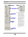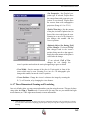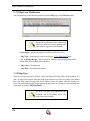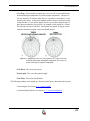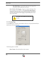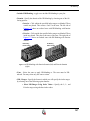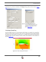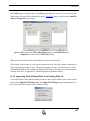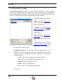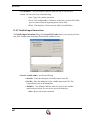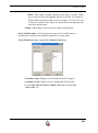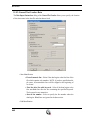
1
User’s Manual Tecplot, Inc. Bellevue, WA 2006 COPYRIGHT NOTICE Tecplot360TM User’s Manual is for use with Tecplot 360TM Version 2006. Copyright © 1988-2006 Tecplot, Inc. All rights reserved worldwide. Except for personal use, this manual may not be reproduced, transmitted, transcribed, stored in a retrieval system, or translated in any form, in whole or in part, without the express written permission of Tecplot, Inc., 3535 Factoria Blvd., Ste 550, Bellevue, Washington, 98006, U.S.A. The software discussed in this documentation and the documentation itself are furnished under license for utilization and duplication only according to the license terms. The copyright for the software is held by Tecplot, Inc. Documentation is provided for information only. It is subject to change without notice. It should not be interpreted as a commitment by Tecplot, Inc. Tecplot, Inc. assumes no liability or responsibility for documentation errors or inaccuracies. Tecplot, Inc PO Box 52708 Bellevue, WA 98015-2708 U.S.A. Tel: 1.800.763.7005 (within the U.S. or Canada), 00 1 (425)653-1200 (internationally) email: [email protected], [email protected] Questions, comments or concerns regarding this documentation: [email protected] For more information, visit http://www.tecplot.com THIRD PARTY SOFTWARE COPYRIGHT NOTICES ENCSA Hierarchical Data Format (HDF) Software Library and Utilities © 1988-1998 The Board of Trustees of the University of Illinois. All rights reserved. Contributors include National Center for Supercomputing Applications (NCSA) at the University of Illinois, Fortner Software (Windows and Mac), Unidata Program Center (netCDF), The Independent JPEG Group (JPEG), Jean-loup Gailly and Mark Adler (gzip). Bmptopnm, Netpbm © 1992 David W. Sanderson. Dlcompat © 2002 Jorge Acereda, additions and modifications by Peter O’Gorman. Ppmtopict © 1990 Ken Yap. TRADEMARKS Tecplot®, Tecplot 360TM, PreplotTM, Enjoy the ViewTM, and FramerTM are registered trademarks or trademarks of Tecplot, Inc. in the United States and other countries. Encapsulated PostScript, PostScript, Premier are registered trademarks or trademarks of Adobe Systems, Incorporated in the U.S. and/or other countries. Ghostscript is a registered trademark of Aladdin Enterprises in the U.S. and/or other countries. Linotronic, Helvetica, Times are registered trademarks or trademarks of Allied Corporation in the U.S. and other countries. AutoCAD, DXF are registered trademarks or trademarks of Autodesk, Incorporated in the U.S. and other countries. Élan License Manager is a trademark of Élan Computer Group, Incorporated in the U.S. and/or other countries. DEC, Digital, LaserJet, HP-GL, HP-GL/2, PaintJet are registered trademarks or trademarks of HewlettPackard Company in the U.S. and other countries. X-Designer is a registered trademark or trademark of Imperial Software Technology in the U.S. and/or other countries. Builder Xcessory is a registered trademark or trademark of Integrated Computer Solutions, Incorporated in the U.S. and other countries. IBM, RS6000, PC/DOS are registered trademarks or trademarks of International Business Machines Corporation in the U.S. and/or other countries. Bookman is a registered trademark or trademark of ITC Corporation in the U.S. and/or other countries. VIP is a registered trademark or trademark of Landmark Graphics Corporation in the U.S. and/or other countries. X Windows is a registered trademark or trademark of Massachusetts Institute of Technology in the U.S. and/or other countries. ActiveX, Excel, MS-DOS, Microsoft, Visual Basic, Visual C++, Visual J++, Visual Studio, Windows, Windows Metafile are registered trademarks or trademarks of Microsoft Corporation in the U.S. and/or other countries. HDF, NCSA are registered trademarks or trademarks of National Center for Supercomputing Applications in the U.S. and/or other countries. UNIX, Motif are registered trademarks or trademarks of Open Software Foundation, Incorporated in the U.S. and other countries. Gridgen is a registered trademark or trademark of Pointwise, Incorporated in the U.S. and/or other countries. Eclipse, FrontSim are registered trademarks or trademarks of Schlumberger, Limited in the U.S. and/or other countries. IRIS, IRIX, OpenGL are registered trademarks or trademarks of Silicon Graphics, Incorporated in the U.S. and/or other countries. Solaris, Sun, Sun Raster are registered trademarks or trademarks of Sun MicroSystems, Incorporated in the U.S. and/or other countries. All other product names mentioned herein are trademarks or registered trademarks of their respective owners. NOTICE TO U.S. GOVERNMENT END-USERS Use, duplication, or disclosure by the U.S. Government is subject to restrictions as set forth in subparagraphs (a) through (d) of the Commercial Computer-Restricted Rights clause at FAR 52.227-19 when applicable, or in subparagraph (c)(1)(ii) of the Rights in Technical Data and Computer Software clause at DFARS 252.227-7013, and/or in similar or successor clauses in the DOD or NASA FAR Supplement. Contractor/manufacturer is Tecplot, Inc., Post Office Box 52708, Bellevue, WA 98015-2708. 06-360-1-1 Rev 04/2006 Table of Contents Introduction to Tecplot 13 Chapter 1 Introduction........................................ 14 Start-Up ...........................................................................14 Interface...........................................................................15 Getting Help ....................................................................42 Chapter 2 Data Structure .................................... 47 Ordered Data ...................................................................47 Finite-Element Data ........................................................52 Variable Location (Cell-Centered or Nodal) ...................55 Working with Unorganized Data Sets .............................55 Chapter 3 Frames and the Workspace ................ 61 Data Hierarchy ................................................................61 Interface Coordinate Systems..........................................64 Frames .............................................................................65 Workspace Management - Options Menu .......................74 View Modification...........................................................78 Edit Menu........................................................................82 Creating Plots 87 Chapter 4 Creating Plots .................................... 88 Data Journaling ...............................................................89 3 CONTENTS Data Sharing.................................................................... 89 Data Set Information...................................................... 90 Select Color..................................................................... 97 Chapter 5 XY and Polar Line Plots................... 105 Map Creation................................................................. 106 Mapping Style ............................................................... 108 Line Map Layer............................................................. 113 Curve Types .................................................................. 115 Symbols Map Layer ...................................................... 134 XY Line Error Bars....................................................... 136 XY Line Bar Charts ...................................................... 140 I-, J- and K-Indices........................................................ 141 Line Legend .................................................................. 142 Polar Drawing Options.................................................. 143 Chapter 6 Field Plots ........................................ 149 Field Plot Modification - Zone Style dialog ................. 150 Time Aware ................................................................... 157 Data Point and Cell Labels............................................ 161 Three-Dimensional Plot Control................................... 162 Chapter 7 Mesh Layer and Edge Layer ............ 171 Mesh Layer ................................................................... 171 Edge Layer .................................................................... 173 Chapter 8 Contour Layer .................................. 177 Contour Layer Modification ......................................... 179 Contour Details dialog .................................................. 180 Extract Contour Lines ................................................... 193 4 Chapter 9 Vector Layer ..................................... 195 Vector Variables.............................................................196 Vector Plot Modification ...............................................197 Vector Arrowheads........................................................200 Vector Length ................................................................201 Reference Vectors..........................................................202 Chapter 10 Scatter Layer.................................... 205 Scatter Plot Modification ..............................................205 Scatter Size/Font ...........................................................208 Reference Scatter Symbols............................................209 Scatter Legends .............................................................210 Chapter 11 Shade Layer ..................................... 213 Shade Layer Modification.............................................213 Chapter 12 Iso-Surfaces...................................... 215 Iso-Surface Groups........................................................215 Iso-Surface Definition ...................................................216 Iso-Surface Style ...........................................................217 Iso-Surface Animation ..................................................218 Iso-Surface Extraction...................................................219 Chapter 13 Slices ................................................ 221 Slice Details dialog........................................................222 Slice Extraction .............................................................228 Chapter 14 Streamtraces..................................... 233 Streamtrace Details dialog ............................................234 5 CONTENTS Streamtrace Animation.................................................. 248 Surface streamtraces on no-slip boundaries.................. 248 Streamtrace Extraction as Zones................................... 249 Streamtrace Errors......................................................... 249 Chapter 15 Translucency and Lighting............... 251 Translucency ................................................................. 251 Lighting Effects............................................................. 252 Three-Dimensional Light Source.................................. 254 Chapter 16 Axes .................................................. 257 Axis Display.................................................................. 257 Axis Variable Assignment............................................. 258 Axis Range Modification .............................................. 258 Axis Grids ..................................................................... 264 Tick Marks .................................................................... 265 Tick Mark Labels .......................................................... 268 Axis Titles ..................................................................... 274 Axis Lines ..................................................................... 275 Grid Area....................................................................... 277 Data Manipulation 279 Chapter 17 Blanking ........................................... 280 Value Blanking .............................................................. 281 IJK-Blanking ................................................................. 285 Depth-Blanking............................................................. 288 6 Chapter 18 Data Operations .............................. 291 Data Alteration through Equations................................291 Data Smoothing.............................................................304 Coordinate Transformation ...........................................306 Two-Dimensional Data Rotation...................................309 Shift Pseudo-Cell Centered Data...................................309 Zone Creation................................................................310 Data Extraction from an Existing Zone.........................318 Zone Deletion................................................................322 Variable Deletion...........................................................323 Data Interpolation..........................................................323 Irregular Data Point Triangulation ................................332 Data Spreadsheet ...........................................................334 Chapter 19 Data Analysis ................................... 339 Specifying Fluid Properties...........................................340 Specifying Reference Values.........................................345 Identifying Field Variables ............................................346 Setting Geometry and Boundary Options .....................347 Unsteady Flow...............................................................353 Calculating Variables.....................................................356 Performing Integrations.................................................361 Calculating Turbulence Functions.................................374 Calculating Particle Paths and Streaklines ....................376 Analyzing Solution Error ..............................................390 Extracting Fluid Flow Features .....................................393 Chapter 20 Probing............................................. 397 Field Plot Probing with the Mouse................................397 Field Plot Probing by Specifying Coordinates and Indices401 Field Plot Probed Data Viewing....................................403 Line Plot Probing with the Mouse.................................408 Data Editing...................................................................412 7 CONTENTS Chapter 21 Text, Geometries and Images ........... 419 Text................................................................................ 419 Geometries .................................................................... 435 Images ........................................................................... 440 Text and Geometry Alignment...................................... 444 Text and Geometry Links to Macros............................. 444 Final Output 447 Chapter 22 Output............................................... 448 Layout Files, Layout Package Files, Stylesheets .......... 448 Plot Publishing for the Web .......................................... 455 Data File Writing........................................................... 456 Chapter 23 Printing ............................................ 463 Plot Printing .................................................................. 463 Setup.............................................................................. 464 Print Render Options..................................................... 469 Print Preview................................................................. 470 Chapter 24 Exporting.......................................... 473 Vector Graphics Format ................................................ 475 Image Format ................................................................ 478 Movie Format................................................................ 484 Clipboard Exporting to Other Applications .................. 488 Antialiasing Images....................................................... 490 8 Advanced Topics 497 Chapter 25 Macro Commands ............................ 498 Macro Creation..............................................................498 Macro Play Back ...........................................................501 Macro Debugging..........................................................504 Macros Moved to Different Computers or Directories 507 Chapter 26 Batch Processing.............................. 509 Batch Processing Setup .................................................509 Batch Processing Using a Layout File ..........................510 Multiple Data File Processing ....................................... 511 Batch Processing Diagnostics .......................................513 Chapter 27 Animation......................................... 515 Animation Tools ............................................................515 Movie File Creation Manually ......................................529 Movie Creation with Macros.........................................530 Advanced Animation Techniques .................................531 Movie File Viewing......................................................535 Chapter 28 Customization .................................. 539 Configuration Files........................................................539 Interactive Customization .............................................545 Performance Dialog.......................................................547 Interface Configuration (UNIX)....................................554 Tecplot.phy File Location Configuration ......................554 Custom Character and Symbol Definition ....................555 9 CONTENTS Chapter 29 Add-Ons ........................................... 561 Add-on Loading ............................................................ 561 Add-ons included in the Tecplot 360 distribution......... 563 Working with Tecplot Add-ons ..................................... 565 Appendices 589 Appendix A Command Line Options ................... 590 Tecplot Command Line................................................. 590 Using Command Line Options in Windows Shortcuts . 593 Additional Command Line Options in Unix................. 595 Specifying Data Set Readers on the Command Line .... 596 Appendix B Tecplot Utilities................................ 599 Excel Macro .................................................................. 599 Framer ........................................................................... 602 LPK View...................................................................... 605 Preplot ........................................................................... 607 Raster Metafile to AVI (rmtoavi) .................................. 609 Pltview .......................................................................... 610 Appendix C Keyboard & Mouse Shortcuts .......... 611 Appendix D Glossary ........................................... 619 Appendix E Data Loaders.................................... 633 CGNS Loader................................................................ 634 10 DEM Loader..................................................................638 DXF Loader..................................................................639 EnSight Loader..............................................................641 Excel Loader ................................................................643 FEA Loader ...................................................................649 Fluent Loader ................................................................655 General Text Loader......................................................660 Gridgen Loader .............................................................673 HDF Loader...................................................................674 HDF 5 Loader................................................................675 Kiva Loader...................................................................678 PLOT3D Loader............................................................679 PLY Loader ...................................................................687 Tecplot-Format Loader..................................................687 Text Spreadsheet Loader ...............................................696 Appendix F PLOT3D Function Reference .......... 699 Symbols.........................................................................699 Scalar Grid Quality Functions.......................................700 Vector Grid Quality Functions ......................................704 Scalar Flow Variables....................................................704 Vector Flow Variables ...................................................714 The Velocity Gradient Tensor .......................................715 Appendix G Limits of Tecplot 360 ....................... 717 11 Chapter : 12 Part 1 Introduction to Tecplot 13 Introduction Chapter 1 Tecplot is a powerful tool for visualizing a wide range of technical data. It offers line plotting, 2D and 3D surface plots in a variety of formats, and 3D volumetric visualization. The user documentation for Tecplot is divided into 6 books: Getting Started Manual User’s Manual (this document) Reference Manual Quick Reference Guide Data Format Guide Add-on Developer’s Kit - User’s Manual Add-on Developer’s Kit - Getting Results Add-on Developer’s Kit - Reference Manual Installation Instructions Release Notes The Getting Started Manual is intended for beginning Tecplot users. It provides a brief overview of the capabilities of Tecplot, as well as a series of tutorials. The Add-on Developer’s Kit manuals and Macro Programming Manual are recommended for advanced Tecplot users. 1 - 1 Start-Up Windows By default, Tecplot is installed in your Program Files directory at: C:\Program Files\Tecplot\Tec360. A shortcut is placed in a Tecplot 360 folder in the Start Menu. For detailed information, please refer to “Windows Installation” in the Installation Guide. UNIX On UNIX systems, run Tecplot by typing: tecplot 14 Interface at the shell prompt. Set your TEC360HOME environment variable to point to it the absolute path of the Tecplot directory. For detailed installation information, please refer to the Installation Guide. 1 - 2 Interface The Tecplot interface is divided into 5 major sections: Menubar Toolbar Sidebar Tecplot Workspace Status Line 1- 2.1 Menubar The menu bar offers rapid access to most of Tecplot’s features. Tecplot’s features are organized into the following menus: 15 Chapter 1:Introduction • File - Use the File menu to read or write data files and plot layouts, print and export plots, record and play macros, set configuration preferences. • Edit - Use the Edit menu to undo, cut, copy, paste, and clear objects, as well as change the draw order for selected items (push or pop). Cut, Copy, and Paste work only within Tecplot. To place a graphics image of your layout into another program, use Copy Plot to Clipboard (in Windows and Macintosh only) • View - Use the View menu to manipulate the point of view of your data, including scale, view range, and 3D rotation. You can also use the View menu to copy and paste views between frames. The View menu includes sizing options for convenience. Center moves the plot image so that the data points are centered within the frame. (Only the data is centered; text, geometries, and the 3D axes are not considered.) Fit to Full Size fits the entire plot into the frame. Nice Fit to Full Size sets the axis range to begin and end on major axis increments (if axes are dependent Tecplot adjusts the vertical axis length to accommodate a major tick mark). Make Current View Nice modifies the range on a specified axis to fit the minimum and maximum of the variable assigned to that axis, then snaps the major tick marks to the ends of the axis. (If axis dependency is not independent this may affect the range on another axis.) Data Fit fits the data points to the frame. • Plot - Use the Plot menu to control the style of your plots. The menu items available are dependent upon the active plot type (selected from the sidebar). • Insert - Use the Insert menu to add text, geometries (polylines, circles, squares, ellipses, and rectangles), or image files. • Animate - Use the Animate menu to animate: IJK Planes, IJK Blanking, Isosurfaces, mappings, slices, streamtraces, time and zones. • Data - Use the Data menu to create, manipulate, and examine data. Types of data manipulation available in Tecplot include zone creation, interpolation, triangulation, as well as creation or alteration of variables. 16 Interface • Frame - Use the Frame menu to create, edit, and control frames. • Options - Use the Options menu to control the attributes of your workspace, including the color map, paper grid, display options, and rulers. • Tools - Use the Tools menu to launch the or an add-on • Analyze - Use the Analyze menu to examine grid quality, perform integrations, generate particle paths, extract flow features, and estimate numerical errors. • Help - Use the Help menu to get quick help on features. By selecting About Tecplot you can obtain specific information about your license. 1- 2.2 Sidebar The sidebar provides easy access for frequently used plot controls. The functions available in the Sidebar are dependent upon the plot type of the active frame. For 2D or 3D Cartesian plot types, you can add or subtract zone layers, zone effects and derived objects from your plot using the Sidebar. For line plots (XY and polar) you can add or subtract mapping layers using the Sidebar. To customize your plot, simply: • Select the desired Plot Types • Use the toggle switches to add and subtract Zone Layers/Map Layers, Zone Effects, or Derived Objects. Use the Zone Style/Mapping Style dialogs to further customize your plot by adding or subtracting zones from specific plot layers/mappings, changing the way a zone or group of zones is displayed or changing various plot settings. 17 Chapter 1:Introduction Plot Types Menu Zone Layers/Map Layers Figure 1-1. The Zone Effects (3D Only) Derived Objects (Iso-surfaces are 3D Only) Placement Plane Placement Plane (3D Only) 18 Tecplot sidebar for a field plot (left) and a line plot (right). The features available in the Sidebar are dependent upon the plot type. For 3D Cartesian plots, you may add and subtract zone layers, derived objects and effects for your plot. You may also use the Placement Plane for positioning some 3D objects (3D plots only). For 2D Cartesian plots (not shown), you may add and subtract zone layers and some derived objects for your plot. For field plots (3D or 2D), you may animate transient data directly from the Sidebar. For Line plots you may add and subtract map layers. NOTE: XY Line plots have more available map layers than polar line plots. Interface Plot Types The Plot type, combined with a frame’s data set, active layers and their associated attributes, define a plot. Each plot type represents one view of the data. There are five plot types are available: • 3D Cartesian - 3D plots of surfaces and volumes. • 2D Cartesian - 2D plots of surfaces, where the vertical and horizontal axis are both dependent variables (i.e. x = f(A) and y = f(A), where A is another variable). • XY Line - line plots of independent and dependent variables on a Cartesian grid. Typically the horizontal axis (x) is the independent variable and the y-axis a dependent variable, y = f(x). • Polar Line - line plots of independent and dependent variables on a polar grid. • S (Sketch) - Create plots without data such as drawings, flow charts, and viewgraphs. Zone Layers/Map Layers A layer is a way of representing a frame’s data set. The complete plot is the sum of all the active layers, axes, text, geometries, and other elements added to the data plotted in the layers. There are six zone layers for 2D and 3D Cartesian, four map layers for XY Line, two for Polar Line, and none for Sketch. The six zone layers for 2D and 3D Cartesian plot types are: • Mesh - A grid of lines connecting the data points within each zone. • Contour- Iso-valued lines, the region between these lines can be set to contour flooding. • Vector - The direction and magnitude of vector quantities. • Scatter - Symbols at the location of each data point. • Shade - Used to tint each zone with a solid color, or to add light-source shading to a 3D surface plot. Used in conjunction with the Lighting zone effect you may set Paneled or Gouraud shading. Used in conjunction with the Translucency zone effect you may create a translucent surface for your plot. • Edge - Zone edges and creases for ordered data and creases for finite-element data. 19 Chapter 1:Introduction The four XY Line map layers are: • Lines - Plots a pair of variables, X and Y, as a set of line segments or a fitted curve. • Symbols - A pair of variables, X and Y, as individual data points represented by a symbol you specify. • Bars - A pair of variables, X and Y, as a horizontal or vertical bar chart. • Error Bars - Allows you to add error bars to your plot. The two map layers for Polar Line are: • Lines - A pair of variables, X and Y, as a set of line segments or a fitted curve. • Symbols - A pair of variables, e.g. X and Y, as individual data points represented by a symbol you specify. Zone Effects For 3D Cartesian plot types, use the Sidebar to turn lighting and translucency on or off. Only shaded and flooded contour surface plot types are affected. Derived Objects For Cartesian plot types (2D and 3D): Toggle-on Iso-surfaces, Slices or Streamtraces from the Sidebar. Their corresponding Details dialogs can be accessed via the browse button. Placement Plane When you are using certain tools to add objects to your plot, toggleon Use Placement Plane in the Sidebar to place them along a given plane (3D Plots only). Use the X,Y and Z buttons to select the plane to use and use the slider to reposition the placement plane. The placement plane will appear as a gray slice in your plot. The Placement Plane is available for: • Placing streamtraces (using the Add Streamtrace Tool • Placing slices (using the Slice Tool 20 ) ) Interface • Adding Contour Levels (using the Add Contour Level Tool • Deleting Contour Levels (using the Remove Contour Level Tool • Probing (using the Probing tool ) ) ) Snap Modes Allow you to place objects precisely by locking them to the nearest reference point, either on the axis grid or on the workspace paper. • Snap to Grid - constrain object movement to whole steps on the axis grid. This can be useful for aligning text and geometries with specific plot features. • Snap to Paper - constrain object movement to whole steps on the paper's ruler grid. This can be useful for positioning frames precisely for printing, or for absolute positioning of text, geometries, and other plot elements. Details Button The Details button is located immediately below the snap modes. It is context sensitive. Use this button to call up the dialog most directly applicable to your current action. When the currently selected tool is either the Selector or the Adjustor , but no objects are selected in the workspace, the Details button is labeled Quick Edit. Redraw Buttons The redraw buttons allow you to keep your plot up to date: Redraw All (CTRL+D) redraws all frames (Shift-Redraw All causes Tecplot to completely regenerate the workspace); Redraw (CTRL+R) redraws only the current frame. 21 Chapter 1:Introduction Sidebar - Auto Redraw Use Auto Redraw - When selected, Tecplot will automatically redraw the plot whenever style or data changes. Some users prefer to turn this option off while setting multiple style settings and then manually pressing Tecplot's Redraw or Redraw All button on the sidebar to see a full plot. NOTE: Even if Tecplot is in the middle of an auto-redraw, it can be interrupted with a mouse click or key press. Sidebar - Cache Graphics Tecplot uses OpenGL to render plots. OpenGL provides for the ability to cache graphic instructions for rendering and can re-render the cached graphics much faster than having Tecplot send the instructions again. This is particularly true for interactive manipulation of a plot. However this performance potential comes at the cost of using more memory. If the memory need is too high the overall performance could be less. Tecplot has three graphics cache modes: cache all graphics, cache only lightweight graphics objects, and do not cache graphics. When Cache Graphics is selected in the Sidebar, Tecplot assumes there is enough memory to generate the graphics cache. Assuming this is true Tecplot's rendering performance will be optimal for interactive manipulation of plots. When memory constraints are very limited consider toggling-off Cache Graphics. If you intend on interacting with the plot also consider setting the “Plot Approximation” mode set to “All Frames Always Approximated”. See “Graphics Cache” on page 549 for more information. Sidebar - Plot Approximations When Plot Approximation is selected, and if the number of data points is above the point threshold, (see below) Tecplot will render the approximate plot for style, data, and interactive view changes followed immediately by the full plot. This option provides for good interactive performance with the final plot always displayed in the full representation. See “Plot Approximation” on page 548 for more information. 1- 2.3 Toolbar Each of the tools represented in the toolbar changes the mouse mode and allows you to 22 Interface interactively edit your plot. Double-click on a tool to launch the Details dialog associated with the tool. Selector Tool - Use the Selector tool to select objects in your workspace. The selected objects can be modified using the Quick Edit Dialog and (in some cases) the Selector tool itself. The following objects can be moved (translated) using the Selector tool: • frames • axis grid area • text • geometries • contour labels • streamtraces • streamtrace termination line • legends • 3D frame axis To select an object and open that object's attributes dialog either double-click on any object, or drag the cursor to select groups of objects (calls up Group Select dialog). Click OK, then Object Details. Adjustor Tool Use the Adjustor tool to perform the any of following modifications to your plot and data: • Location of individual or groups of data points in the grid. 23 Chapter 1:Introduction • Values of the data set variables at a particular point. • Length or placement of individual axes (2D Cartesian and XY Line plot types only). • Spacing between an axis label and its associated axis (2D Cartesian and XY Line plot types only). • Shape of a polyline. For all other scenarios, the behavior of the Adjustor mode is identical to that of the Selector tool. The Adjustor tool can alter your data. Be sure you want to use the Adjustor tool before dragging points in the data region To select multiple points - you can either Shift-click after selecting your initial point to select additional points, or you can draw a group select band to select the points within the band. (In line plots, you can select points from only one mapping at a time.) Once you have selected all desired points, move the Adjustor over the selection handles of one of the points, then click-and-drag to the desired location of the first data point. The other selected points will move as a unit with with respect to the chosen data point, maintaining their relative positions. For XY Line plots, if several mappings are using the same data for one of the variables, adjusting one of the mappings will result in simultaneous adjustments to the others. You can avoid this by pressing the H or V keys on your keyboard while adjusting the selected point. The H and V keys restrict the adjustment to the horizontal and vertical directions, respectively. Group Select The Group Select dialog is opened when you select a group of objects with the Selector or Adjustor tools. The Group Select dialog allows you to specify the following object types (if the selection rectangle does not include a specific object, its associated check box is inactive): 24 Interface • Text. • Geometries. • Frames. • Zones. • Axis Grid Area. • Contour Labels. • Streamtraces. The Group Select dialog offers the following attribute filters: • Geoms of Type - Choose geometries of a particular type from the drop-down menu. • Geoms with Line Pattern - Choose all geometries having a particular line pattern. • Text with Font - Choose all text displayed in a particular font. • Objects with Color - Choose all objects of a particular color. You choose the appropriate color from the Select Color dialog. Zoom Tool Zoom into or away from the plot. When a mouse-click occurs (without dragging) the zooming is centered at the location of your click. There are two zoom modes – plot zooming and paper zooming. For plot zooming, drag the magnifying glass cursor to draw a box about the region that you want to fit into the frame. The box may be larger than the frame. Making the box larger than the frame zooms away from the plot.The region within the view box will be resized to fit into the frame. If Snap to Grid (located in the Sidebar) is selected, you cannot make the zoom box larger than the grid area. 25 Chapter 1:Introduction To return to the previous view, choose Last from the View menu (Ctrl+L). To restore the original 2D view, choose Fit to Full Size (Ctrl+F). The results of plot zooming for the 2D plot type are dependent upon the axis mode selected in the Axis Details dialog (accessed via the Plot menu): • 2D Independent Axis Mode - Allows the selected region to expand to exactly fit in the frame. The axes are rescaled independently to fit the zoom box. • 2D Dependent Axis Mode - In dependent mode, the axes are not fit perfectly to the zoom box. The longest dimension from the zoom box is applied to associated axis and the other axis is resized according to the dependency relation. For paper zooming, Shift-drag the magnifying glass cursor to draw a box about the region that you want to magnify. The plot is resized such that the longest dimension of the zoom box fits into the workspace. You can fit one or all frames to the workspace by using the Fit Selected Frames to Workspace or Fit All Frames to Workspace options from the View>Workspace menu. To return to the default paper view, choose Fit Paper to Workspace from the View>Workspace menu. Use the center mouse button (or CTRL+ right-click) to interactively zoom into or out of the plot. Clicking anywhere in your plot while the zoom tool is active, centers the zoom around your click. Translate Tool Use the Translate/Magnify tool to translate or magnify data within a frame or the paper within the workspace. 26 Interface While in Translate/Magnify mode, drag the cursor to move the data with respect to the frame, or Shift-drag to move the paper with respect to the workspace. Use the right mouse button to interactively translate objects. You can rescale your image by pressing “+” to magnify, “-” to shrink. If you are Shift-dragging to move the paper, the rescale buttons “+” and “-” will magnify or shrink the paper so long as you have the mouse button depressed Three-Dimensional Rotation There are six 3D rotation mouse modes: • Spherical - Drag the mouse horizontally to rotate about the Z-axis; drag the mouse vertically to control the tilt of the Z-axis. • Rollerball - Drag the mouse in the direction to move with respect to the current orientation on the screen. In this mode, your mouse acts much like a rollerball. • Twist - Drag the mouse clockwise around the image to rotate the image clockwise. Drag the mouse counterclockwise around the image to rotate the image counterclockwise. • X-axis - Drag the mouse to rotate the image about the X-axis. • Y-axis - Drag the mouse to rotate the image about the Y-axis. • Z-axis - Drag the mouse to rotate the image about the Z-axis. 27 Chapter 1:Introduction Once you have selected a rotation mouse mode, you can quickly switch to any of the others using the following keyboard shortcuts:. Drag Rotate about the defined rotation origin with your current Rotate tool. Alt-Drag Rotate about the viewer position using your current Rotate tool. Middle-Click/CTRL+right click smooth zoom in and out of the data Right-click translate the data C Move rotation origin to probed point, ignoring zones. O Move rotation origin to probed point of data. R Switch to Rollerball rotation. S Switch to Spherical rotation. T Switch to Twist rotation. X Switch to X-axis rotation. Y Switch to Y-axis rotation. Z Switch to Z-axis rotation. Slice Tool Use the Slicing tool to control your slice rendering interactively. The following keyboard/mouse options are available when the slice tool is active: 28 + Primary Slices, Start End Slices Active - Turn on intermediate slices (if not already active) and adds a slice. Primary Slices active [ONLY] - Turns on Start/End Slices and adds a slice Start/End Slices active [ONLY] - Turns on Start/End Slices and adds a slice - Primary Slices, Start End Slices Active - Removes start and end slices Primary Slices active [ONLY] - removes the primary slice Start/End Slices active [ONLY] - removes the Start and End Slices Interface Click/Drag Updates the position of the primary slice (if active). If only start and end slices are visible, click updates the position of the slice closest to the click. Alt-click/Alt-drag Determine the XYZ-location by ignoring zones and looking only at derived volume objects (streamtraces, slices, iso-surfaces, slices). Shift-click Place the start or end slice (whichever is closest to the initial click location). Show Start/End Slices is activated, if necessary. Shift-drag Move the start or end slice (whichever is closest to the initial click location). Show Start/End Slices is activated, if necessary. I, J, K (ordered zones only) Switch to slicing constant I-, J-, or K-planes respectively. X, Y, Z Switch to slicing constant X-, Y-, or Z-planes respectively. 1-4 Numbers one through four switch to the corresponding slice group. Add Streamtrace Select the Add Streamtrace tool to add a streamtrace interactively by clicking anywhere in your plot. Select the number of streamtraces to include with each click (rake) using 1-9 on the keyboard. Streamtrace Termination Line Select the Add Streamtrace Termination Line tool to add a streamtrace termination line interactively. To draw a Streamtrace Termination Line: • Move the cursor into the data region. • Click once at the desired starting point for the line. 29 Chapter 1:Introduction • Click again at each desired break point. • When the polyline is complete, double-click on the last point of the polyline, or press Esc on your keyboard. • The drawn polyline ends any streamtraces that pass through it. Add Contour Level Select the Add Contour Level tool to add a contour level by clicking anywhere in the current data region. A new contour level, passing through the specified location, is calculated and drawn. The following keyboard and mouse shortcuts are related to the Add Contour Level tool. Alt-Click Place a contour line by probing on a streamtrace, slice, or iso-surface. Click Place a contour line. CTRL+Click Replace the nearest contour line with a new line. Drag Move the new contour line. - Switch to the Delete Contour Level tool. Delete Contour Level Select the Delete Contour Level tool to delete a contour level by clicking anywhere in the current data region. The contour line nearest the specified location is deleted. Use the “+” key to switch to the Add Contour Level tool and the “-” key to switch back to the Delete Contour Level tool. Add Contour Labels Select the Add Contour Label tool to switch to the Contour Label mode, enabling you to add a contour label by clicking anywhere in the current data region. 30 Interface A contour label is added to the plot at the specified location; its level or value information is taken from the nearest contour line. This allows you to place labels at a slight offset from the lines they label. The Contour type must be lines or lines and flood in order for this tool to be active. You can set the contour type on the Contour page of the Zone Style dialog. Probe Tool Select the Probe At Tool to probe for values of the data set's variables at a particular point. To obtain interpolated values of the data set variables at the specified location, click at any point in the data region. To obtain exact values for the data point nearest the specified location, Ctrl-click at the desired location. For XY plots, When you move into the axis grid area, the cursor cross hair is augmented by a vertical or horizontal line, depending on whether you are probing along the X-axis or the Y-axis. You can change the axis to probe simply by pressing X to probe the X-axis or Y to probe the Y-axis. Insert Text Select the Add Text tool to add text to any frame. Insert Geometries Use the corresponding geometry buttons in the toolbar to insert geometries into your plot. Polylines Squares 31 Chapter 1:Introduction Rectangles Circle Ellipse Create New Frame Select the Create Frame tool to create a new frame. To add a frame: • Click once in the workspace to anchor one corner of the frame. • Drag the diagonal corner until the frame is the desired size and shape. If you have data loaded into Tecplot and you create a new frame, you can attach the existing data set to the new frame by changing the plot type. Extract Discrete Points Select the Extract Discrete Points tool to extract selected points to a data file or a new zone. To select points: • Click your left-hand mouse button at each location where you would like to extract a point. • To end extraction, either double-click on the last point, or press the Esc key. • The Extract Data Points dialog appears; use it to specify how many points to extract and how to save the data. 32 Interface Extract Points along Polyline Select the Extract Line tool to extract points along a specified polyline to a data file or a new zone. To select points: • Click your left-hand mouse button at each location where you would like to extract a point. • To end extraction, either double-click on the last point, or press Esc. • The Extract Data Points dialog appears; use it to specify how many points to extract and how to save the data. Create Rectangular Zone Select the Create Rectangular Zone tool to add new 2D rectangular zones to the current Tecplot data set. To create a rectangular zone: • Click once in the current data region to anchor one corner of the zone. • Drag the diagonal corner until the zone is the desired size and shape. The new zone created is IJ-ordered. To specify the maximum I-index and J-index, use the Create Rectangular Zone dialog (accessed via Data>Create Zone). The current frame must have a data set attached to it, in order for this tool to be active. Create Circular Zone Select the Create Circular Zone tool to add new 2D circular zones to the current Tecplot data set. 33 Chapter 1:Introduction To create a circular zone: • Click once in the current data region to specify the center of the zone. • Drag until the zone has the desired radius. The new zone created is IJ-ordered. To specify the maximum I-index and J-index, use the Create Circular Zone dialog (accessed via Data>Create Zone). The current frame must have a data set attached to it, in order for this tool to be active. 1- 2.4 Status Line The status line, running along the bottom of the Tecplot window, gives “hover help.” When you move the pointer over a tool in the toolbar, a button on the Quick Edit dialog, or a menu item, a description of the control appears. It also provides a progress bar and information during long calculations. 1- 2.5 Tecplot Workspace The workspace is the portion of your screen in which you create sketches and plots. Each sketch or plot is created within a subwindow called a frame. The current state of the workspace, including the sizing and positioning of frames, the location of the data files used by each frame, and all current attributes for all frames, makes up a layout. By default, the workspace displays a representation of the paper Tecplot is set up to draw on, as well as a reference grid and rulers. The active frame, in which you are currently working, is on top. All modifications are made to the current frame. 34 Interface 1- 2.6 Quick Edit Dialog The map and zone layer controls affecting how the individual layers are drawn can be altered using controls on the sidebar. You can also control many of these attributes using the Quick Edit dialog. Figure 1-2. The Quick Edit dialog. To use the Quick Edit dialog, select one or more objects in the workspace, then select the appropriate button to change the attribute of the selected object(s). Quick Edit - Mesh This area controls whether the mesh is displayed for selected zones, and if so, using what plot type. The following options are available: 35 Chapter 1:Introduction • Y - Show the mesh for the selected zones. If the Mesh layer is not currently active, a dialog appears asking if you wish it activated. • N - Turn off the mesh for the selected zones. • Wire Frame - Mesh lines are drawn underlying all other field layers (i.e., Contour, Vector, Scatter, Shade); hidden lines are not removed. • Overlay - Mesh lines are drawn above all other field plot layers except vectors and scatter symbols. • Hidden - Like Overlay, except that in the 3D Cartesian plot type hidden lines are removed from behind the mesh. In essence, the cells of the mesh are opaque. Surfaces and lines that are hidden behind another surface are removed from the plot. Quick Edit - Contour This area controls whether contours are displayed for selected zones, and if so, using what plot type. The following options are available: • Y - Show the contours for the selected zones. If the Contour zone layer is not currently active, a dialog appears asking if you wish it activated. • N - Turn off the contour for the selected zones. • Lines - Plots contour lines. If you choose this plot type, you can use the Cont Color attribute to specify Multi-Color to make the line color vary with the contourvariable value. • Flood - Flood the area between adjacent contour lines with a color according to the value of the contour variable, number of contour levels, and the Color Map. With a large number of contour levels, the color flooding appears nearly continuous. • Both Lines and Flood - Contour lines are drawn with color flooding between them. • 36 Average Cell - Each cell or element is flooded with one solid color based upon the average value of the contour variable at the data points of the cell or element. Interface • Primary Value - Each cell or element is flooded with one solid color based upon the primary cell value. Quick Edit - Vector This area controls whether vectors are displayed for selected zones, and if so, using what plot type. The following options are available: • Y - Show the vectors for the selected zones. If the Vector zone layer is not currently active, a dialog appears asking if you wish it activated. • N - Turn off the vectors for the selected zones. • Tail at Point - Display regular vectors – a simple stick vector with length proportional to the local magnitude. The tail of the vector is positioned at the data point. • Head at Point - Display regular vectors – a simple stick vector with length proportional to the local velocity magnitude (the square root of the sum of the squares of the vector components). The head of the vector is positioned at the data point. • • Anchor at Midpoint - Display regular vectors – a simple stick vector with length proportional to the local velocity magnitude. The midpoint of the vector is positioned at the data point. Head Only - Display vectors as heads only, without the vector shaft. Quick Edit - Scatter This area controls whether scatter symbols are displayed for selected zones, and if so, whether to use plain or filled symbols. The following options are available: • Y - Show the scatter symbols for the selected zones. If the Scatter zone layer is not currently active, a dialog appears asking if you wish it activated. • N - Turn off the scatter symbols for the selected zones. • Plain - Use un-filled symbols for the scatter plot. • Filled - Use filled symbols for the scatter plot. 37 Chapter 1:Introduction Quick Edit - Shade This area controls whether shading is used for selected zones.This option allows you to turn off just the Shade zone layer for specific zones, without completely deactivating the zones. The following options are available: • Y - Show light-source shading for the selected zones. If the Shade zone layer is not currently active, a dialog appears asking if you wish it activated. • N - Turn off light-source shading for the selected zones. Quick Edit - Edge Border This area controls whether the zone edge border is displayed for selected ordered zones, and if so, what edge type. The following options are available: • Y - Show edges borders for the selected zones. If the Edge zone layer is not currently active, a dialog appears asking if you wish it activated. • N - Turn off edges for the selected zones. • Show Entire Border - Shows border lines on all boundary of the selected zone(s) • Show Border Line - Shows the edge border line closest to the selected point. • Hide Border Line - Hides the edge border line that is closest to the selected point. • Show Only Nearest Border Line - Shows only the edge border line that is closest to the selected point and hides all others. Quick Edit - Symbols Mapping Layer This area controls whether symbols are plotted at each data point, and whether those symbols are filled or plain. The following options are available: • Y - Show the symbol plots for the selected maps. If the Symbols map layer is not currently active, a dialog appears asking if you wish it activated. • N - Turn off the symbol plots for the selected maps. 38 Interface • Plain - Use un-filled symbols for the scatter plot. • Filled - Use filled symbols for the scatter plot. Quick Edit - XY Bars Mapping Layer This area controls whether bars are plotted to represent each data point, and whether those bars are filled or plain. • Y - Show the selected maps as bar charts. If the Bars map layer is not currently active, a dialog appears asking if you wish it activated. • N - Turn off bar charting for the selected maps. • Plain - Use un-filled bars for the bar chart • Filled - Use filled bars for the bar chart. Quick Edit - XY Error Bars Mapping Layer This area controls whether error bars are displayed for the selected mappings, and in which direction the error bars are drawn. The options are: • Y - Show the error bars for the selected maps. If the Error Bars map layer is not currently active, a dialog appears asking if you wish it activated. • N - Turn off the error bars for the selected maps. • Top - Error bar extends upward for positive values (and downward for negative values) of the error-bar variable. • Bottom - Error bar extends downward for positive values (and upward for negative values) of the error-bar variable. • Left - Error bar extends to the left for positive values (and to the right for negative values) of the error-bar variable. 39 Chapter 1:Introduction • Right - Error bar extends to the right for positive values (and to the left for negative values) of the error-bar variable. • Horizontal - Error bar extends both left and right. • Vertical - Error bar extends both up and down. • Cross - Error bar extends up, down, left and right. Quick Edit - Color This area controls color options for filled objects, lines, and text. •Object-type - Use the fill, line and text radio buttons to identify the object-type to modify. • Color - Select the Color button to activate the Select Color dialog. NOTE: Multi color is not available for line plots. • X button - the behavior of the X button depends on the object-type selected. • Fill - X turns off the fill color • Line - X causes the line color to match the fill color. If no fill color is specified, the X button has no effect. • Text - X has no effect Quick Edit - Symbols Use this region of the Quick Edit dialog to change the symbol for the Scatter Zone layer or Symbols Map layer. Use the Size button to specify the size of the scatter symbols as a percentage of the frame width (in the 2D Cartesian plot type) or of the median-axis length (in the 3D Cartesian plot type). 40 Interface Quick Edit - Line Pattern This area controls the line pattern, pattern length, and line thickness for all selected objects. • Line Pttrn - Choose the line pattern for the selected zones. • Pttrn Lngth - Specify the pattern length for the selected line pattern, as a percentage of the frame width. • Line Thcknss - Specify the line thickness for the vectors as a percentage of the frame width. Quick Edit - Arrows This area controls arrowhead placement on polylines. Quick Edit - Arrowheads This area controls the type, size, and angle of arrowhead for both selected vectors and selected polylines and vectors. The following options are available: • Head Style - Choose the vector head style for the selected zones. The following options are available: • Plain - Display arrowheads as lines drawn from the head of the vector. • Filled - Display arrowheads as filled triangles at the end of each vector. • Hollow - Display arrowheads as hollow triangles at the end of each vector. • Size - Specify the size of the arrowhead as a percentage of frame height. • Angle (deg) - Specify the angle between the vector and the arrowhead. • Enter Value - For both the size and angle buttons, you can choose Enter and enter an exact percentage in the Enter Value dialog. 41 Chapter 1:Introduction Quick Edit - Font This area controls the font family and size used for selected text. The following options are available: • Font - select the font family • Size (%) - Specify the height for the text in frame units (that is, as a percentage of frame height.) • Size (pt) - Specify the height for the text in points. Quick Edit - Order and Alignment Bottom Top Right Center Left Use the Order and Alignment buttons to align text within textboxes or the alignment between selected geometries/textboxes. • Left, Center, or Right - Use the Left, Center or Right alignment buttons to align text • Top, or Bottom - Use the Top or Bottom alignment buttons to align selected geometries and text with respect to one another • Push - Use the Push button to push the selected geometries or text to the bottom of the view stack • Pop - Use the Pop button to pop the selected geometries or text to the top of the viewstack 1 - 3 Getting Help Tecplot features a fully integrated Help system. Quick help on menu items and sidebar controls is available from the status line or tool tips. Detailed help is accessible by: • Pressing the F1 key anywhere in the Tecplot window. If the pointer is over the sidebar, Quick Edit dialog, or a menu, the F1 key provides context-sensitive help on that control or menu. Otherwise, F1 calls up the Contents page of Help via your Web browser. • Selecting Contents from the Help menu. 42 Getting Help • Selecting Help on any dialog. The Help dialog supports text search, has many hypertext links, and provides detailed information on all menus and dialogs. Your answer may be in Technical Support Notes at www.tecplot.com/support. If you are covered by Tecplot’s Software Maintenance Service, help is also available from 6:30 A.M. to 5 P.M. Pacific Standard Time from Tecplot Technical Support at 425.653.9393. You may also send e-mail to [email protected] with your questions. 43 Chapter 1:Introduction 44 Getting Help 45 Chapter 1:Introduction 46 Chapter 2 Data Structure Tecplot accommodates two different types of data: ordered and finite-element. 2 - 1 Ordered Data Ordered data is a set of points logically stored in a one-, two-, or three-dimensional array, where I, J, and K are the index values within the array. The number of data points is the product of all of the dimensions within the array. • One-dimensional array (I-ordered, J-ordered or K-ordered) - A single dimensional array of data points where one dimension (I,J or K) is greater than or equal to one and the other dimensions are equal to one. In a one-dimensional array, the total number of data points is equal to the length of the single-ordered array. For example, an I-ordered data set with I=5, J=K=1 has 5 data points. • Two-dimensional array (IJ-ordered, JK-ordered, IK-ordered) - A twodimensional array of data points where two of the three dimensions (I,J, K) are greater than one and the other dimension is equal to one. The number of data points in a two-dimensional ordered data set is the product of the all of the dimensions. For example, in an IJ-ordered data set, the number of data points is equal to I x J (where K=1). • IJK-ordered - Three-dimensional array of data points where all three of the I, J-, and K-dimensions are greater than one. The number of data points is the product of the I-, J-, and K-dimensions. 2- 1.1 One Dimensional-Ordered Data Points (I,J, or K) Data points for XY Line plots are usually arranged in a one-dimensional array indexed by one parameter: I for I-ordered, J for J-ordered, or K for K-ordered, with the two remaining index values equal to one. 47 Chapter 2:Data Structure For example, in an I-ordered data set (the most common type), the data points are arranged as follows: I=1 at the first data point, I=2 at the second data point, I=3 at the third data point, ... I=IMax for the last point. At each data point, N variables (V1, V2, ..., VN) are defined. If you arrange the data in a table where the values of the variables (N values) at a data point are given in a row, and there is one row for each data point, the table would appear something like that shown in Figure 2-1. For example, if you wanted to make a simple XY-plot of pressure versus time, V1 would be time and V2 would be pressure. V1 V1 V1 V1 V1 V1 V1 V2 V2 V2 V2 V2 V2 V2 Table 2-1. Table V3 V3 V3 V3 V3 V3 V3 ... ... ... ... ... ... ... VN VN VN VN VN VN VN (Values at data point I = 1.) (Values at data point I = 2.) (Values at data point I = 3.) (Values at data point I = IMax.) of values for I-ordered data points (suitable for XY plots). 2- 1.2 Two Dimensional-Ordered Data Points (IJ, JK, or IK) The data points for 2D and 3D surface field plots are usually organized in a two-parameter mesh. Each data point is addressable by a set of the two parameters (e.g. I and J for IJ-ordered) and has four neighboring data points (except at the edge of the data). The points are located above, below, to the left, and to the right as shown in Figure 2-1. 48 Ordered Data (I, J+1) (I-1, J) (I, J) (I+1, J) (I, J-1) Figure 2-1. IJ-ordered data point neighbors. The layout is identical for JK or IK-ordered 2- 1.3 3 Dimensional-Ordered Data Points (IJK) The data points for 3D volume field plots are usually organized in a three-dimensional ordered data set. Each point is addressable by a set of three indices (I, J, and K) and has six neighboring data points (except at the edges of the data set). These neighbors are located above, below, left, right, in front of, and behind the data point as shown in Figure 2-2. (I, J+1, K) (I, J, K-1) (I-1, J, K) (I, J, K) (I+1, J, K) (I, J, K+1) (I, J-1, K) Figure 2-2. IJK-ordered data point neighbors. At each data point, you define three spatial variables (X, Y, Z) plus (typically) one or more variables such as pressure, vector components, and vorticity. 49 Chapter 2:Data Structure A mesh plot of IJK-ordered data is displayed in Figure 2-3. The directions of the I-, J-, and K-indices are shown. As you can see, the points that define the mesh can form curved, irregularly spaced, and/or nonparallel paths. IJK-Ordered Data Plotting In one- or two-dimensional data sets, all data points are typically plotted. However, there are more plotting options for IJK-ordered data, especially when creating 2D or 3D plots. The Surfaces page of the Zone Style dialog allows you to designate which surfaces of IJK-ordered data will be plotted. You may choose to plot just outer surfaces, or you may select combinations of I-, J-, and K-planes to be plotted. Refer to Section 6- 1.2, “Surfaces” for in-depth information. 50 Ordered Data 2- 1.4 I-, J-, and K-Planes A K-plane is the connected surface of all points with a constant K-index value. The I- and J-indices range over their entire domains. Similarly for an I-plane and a J-Plane. Examples of I-, J-, and Kplanes are shown in Figure 2-3. A C B D Figure 2-3. An illustration of IJK planes of a semi-circular zone (created by extracting a subzone from a circular zone). (A) shows all 3 planes (Surfaces to Plot = Boundary on the Surfaces page of the Zone Style dialog). (B) Surfaces to Plot = I-Planes (C) Surfaces to Plot = J-Planes and (D) Surfaces to Plot = KPlanes. 51 Chapter 2:Data Structure Note: I-, J- or K-planes are not necessarily two-dimensional in physical space. They are called planes because they exist as planes in logical (IJK) space. In real (XYZ) space, the planes may be cones, ellipsoids, or arbitrary surfaces. 2- 1.5 Mesh Structure (Ordered Data Only) A family of I-lines results by connecting all of the points with the same I-index, similarly for J-lines and K-lines. For IJ- ordered data, both families of lines are plotted in a two-dimensional coordinate system resulting in a 2D mesh. When both the I- and J-lines are plotted in a three-dimensional coordinate system, a 3D surface mesh plot results. An example of both meshes is shown in Figure 2-4. 92000 P(N) 10 90000 8 88000 6 86000 15 10 0 5 ex nd J-i 0 5 10 15 x de I-in x de I-in 0 -2 ) X (M ) 2 Y (M Y(M) 10 5 4 ex ind J- 0 X(M) Figure 2-4. Left, a 2D mesh of IJ-ordered data points. Right, a 3D mesh of IJordered data points. Note: Ordered axes do not necessarily corresponded to physical axes. 2 - 2 Finite-Element Data Finite-element data is arranged in two arrays, a variable array and a connectivity matrix. The variable array is a collection of points in 2D or 3D space that are connected into polygonal or polyhedral units called elements. The connections between the nodes are defined by the connectivity matrix. While finite-element data is usually associated with numerical analysis for modeling complex problems in 3D structures, heat transfer, fluid dynamics, and electromagnetics, it also provides an effective approach for organizing data points in or around complex geometrical shapes. For example, you may not have the same number of data points on different lines, there may be holes in the middle of the data set, or the data points may be irregularly (randomly) positioned. For such difficult cases, you may be able to organize your data as a patchwork of elements. Each element can be independent of the other elements, so you can group your elements to fit complex boundaries and 52 Finite-Element Data leave voids within sets of elements. Figure 2-4 shows how finite-element data can be used to model a complex boundary. Heat Exchanger Finite Element Mesh Structure 6 5 Y 4 3 2 1 0 -3 -2 -1 0 1 2 3 4 5 6 7 8 9 10 11 X Figure 2-5. Finite-element data used to model a complex boundary. Finite-element data defines a set of points (nodes) and the connected elements of these points. The variables may defined either at the nodes or at the cell (element) center. Finite-element data can be divided into three types: • FE-line- A set of line segments defining a 2D or 3D line. • FE-surface - A set of triangular or quadrilateral elements defining a 2D field or a 3D surface. • FE-volume - A set of tetrahedral or brick elements defining a 3D volume field. In Tecplot, each FE data zone must be composed exclusively of one element type. However, you may use a different data point structure for each zone within a data set, as long as the number of variables defined at each data point is the same. You can simulate zones with mixed element types by repeating nodes as necessary. For example, a triangle element can be included in a quadrilateral zone by repeating one node in the element’s connectivity list, and tetrahedral, pyramidal, and prismatic elements can be included in a brick zone by repeating nodes appropriately. 2 - 4 “Finite-Element Data” on page 48 of the Data Format Guide provides detailed information about how to format your FE data for Tecplot. 53 Chapter 2:Data Structure 2- 2.1 Finite-Element Line Data. Unlike I-ordered data, a single finite-element line zone may consist of multiple disconnected sections. The values of the variables at each data point (node) are entered in the data file similarly to Iordered data, where the nodes are numbered with the I-index. This data is followed by another set of data defining connections between nodes. This second section is often referred to as the connectivity list. All elements are lines consisting of two nodes, specified in the connectivity list. 2- 2.2 Finite-Element Surface Data In finite-element surface data, the values of the variables at each node (data point) and the finiteelement connectivity lists are entered in the data file in the same manner as finite-element line data (described above). The difference is in the number of nodes per element. You can choose (by zone) to arrange your data in three point (triangle) or four point (quadrilateral) elements. The number of points per node and their arrangement are called the element type of the zone. You may repeat a node in the quadrilateral element type to create a triangle if a mixture of quadrilaterals and triangles is necessary. 2- 2.3 Finite-Element Volume Data Finite-element volume cells may contain four points (tetrahedron) or eight points (brick). The elements in each zone must be either all tetrahedra or all bricks. Figure 2-6 shows the arrangement of the nodes for tetrahedral and brick elements. n7 n8 N1 n5 n6 N4 n4 n3 N2 N3 n1 Tetrahedral connectivity arrangement. Figure 2-6. Connectivity n2 Brick connectivity arrangement. arrangements for FE-volume data sets. In the brick format, points may be repeated to achieve 4-, 5-, 6-, or 7-point elements. For example, a node list entry of “n1 n1 n1 n1 n5 n6 n7 n8” results in a quadrilateral-based pyramid element. 54 Variable Location (Cell-Centered or Nodal) 2- 2.4 Finite-Element Data Limitations Working with finite-element data has some limitations: • XY-plots of finite-element data treat the data as I-ordered; that is, the connectivity list is ignored. Only nodes are plotted, not elements, and the nodes are plotted in the order in which they appear in the data file. • Index skipping in vector and scatter plots treats finite-element data as Iordered; the connectivity list is ignored. Nodes are skipped according to their order in the data file. 2 - 3 Variable Location (Cell-Centered or Nodal) In ordered or FE-data sets, the value of the variables can be located at either the nodes or the cellcentered. • For finite-element meshes, cell-centers are the centers (centroids) of elements. • For I-ordered grids, the cell-centers are at the centers of the lines connecting points (I) and (I+1). • For IJ-ordered grids, the cell-centers are at the centroids of the quadrilaterals defined by points (I,J), (I+1,J), (I,J+1), and (I+1, J+1). • For IJK-ordered grids, the cell-centers are at the centroids of the hexahedrallike elements defined by points (I,J,K), (I+1,J,K), (I,J+1,K), (I+1,J+1,K), (I,J,K+1), (I+1,J,K+1), (I,J+1,K+1),and (I+1,J+1,K+1). For many types of plots, Tecplot internally interpolates cell-centered values to the nodes. Refer to for “Zone Records” on page 11 of the Data Format Guidefor information on specifying the variable location in a data file. 2 - 4 Working with Unorganized Data Sets Unorganized data sets are loaded into Tecplot as a single I-ordered zone and will be displayed in XY Mode, by default. To check for irregular data, you can go to the Data>Dataset Info dialog (accessed via the Data menu). In the lower left quadrant of that dialog Tecplot will show you the values assigned to: IMax, 55 Chapter 2:Data Structure JMax, and KMax. If IMax is greater than 1, and JMax and KMax are equal to 1, then your data is irregular. An I-ordered zone is irregular if it is known to have more than one dependent variable. An I-ordered data set with one dependent variable (i.e. an XY or polar line) is NOT an irregular zone. It is also simple to tell irregular data from the plot. If you are looking at irregular data with the Mesh layer turned on, Tecplot will connect the datapoints using lines and in the order the points appear in the dataset. There are 4 ways to organize your data set. 1. Manually order the data file using a text editor. Use the Label Points and Cells feature from the Plot menu to see if your data set can be easily corrected using a text editor by correcting the values for I, J and/or K. 2. Use the Data>Triangulate feature. (2D only). See 18 - 11 “Irregular Data Point Triangulation” on page 332. 3. Use one of the Data>Interpolation options. See 18 - 10 “Data Interpolation” on page 323. 4. Special Cases (use when interpolation results appear skewed): • Well data - If points are closely positioned along the depth axis and far apart in physical space, use the Tetra Grid add-on to create a new zone with all points connected into 3D zones. See 29- 3.12 “Tetra-Grid” on page 583. • Fluid Measurements - When measurements are taken of fluid properties or containments, interpolating to a rectangular zone does not yield good results, Use the Prism Grid add-on to create a 3D volume zone. See 29- 3.8 “Prism-Grid” on page 573. 56 Working with Unorganized Data Sets 2- 4.1 Example - Triangulate a Data Set One common source of finite-element surface data is Tecplot’s triangulation option. If you have 2D data without a mesh structure, it is probably simplest to enter your data points as an I-ordered data set, then use Tecplot’s triangulation feature to create a finite-element data set. You can then edit the file, and particularly the connectivity list, to obtain the set of elements you want, rather than having to create the entire connectivity list by hand. We can triangulate a data set as follows: 1. Create a simple ordered data file, as follows: VARIABLES = "X", "Y", "P", "T" 0.0 1.0 100.0 1.6 1.0 1.0 150.0 1.5 3.0 1.0 300.0 2.0 0.0 0.0 50.0 1.0 1.0 0.0 100.0 1.4 3.0 0.0 200.0 2.2 4.0 0.0 400.0 3.0 2.0 2.0 280.0 1.9 2. Save the file, with extension *.dat 3. Read the data file into Tecplot and switch the plot type to 2D Cartesian. 4. From the Data menu, choose Triangulate. 5. Select the simple ordered zone as the source zone, and click Compute. 57 Chapter 2:Data Structure Figure 2-7 shows a plot of the resulting data. With triangulation, we obtain more elements (seven) than when we created the data set by hand (four), and the elements are triangles rather than quadrilaterals. 2 Y 1.5 1 0.5 0 0 1 2 3 4 X Figure 2-7. Triangulated data 2- 4.2 Example - Unorganized Three-Dimensional Volume To use 3D volume irregular data in Tecplot field plots, you must interpolate the data onto a regular, IJK-ordered zone. (Tecplot does not have a 3D equivalent for triangulation.) To interpolate your data, perform the following steps: 1. Place your 3D volume irregular data into an I-ordered zone in a data file. 2. Read in your data file and create a 3D scatter plot. 3. From the Data menu, choose Create Zone>Rectangular (Circular will also work). 4. In the Create Rectangular Zone dialog, enter the I-, J-, and K-dimensions for the new zone; at a minimum, you should enter 10 for each dimension. The higher the dimensions, the finer the interpolation grid, but the longer the interpolating and plotting time. 5. Enter the minimum and maximum X, Y, and Z values for the new zone. The default values are the minimums and maximums of the current (irregular) data set. 6. Click Create to create the new zone, and Close to dismiss the dialog. 7. From the Data menu, choose Interpolate>Kriging (Linear or Inverse distance Interpolation would also work). 58 Working with Unorganized Data Sets 8. In the Kriging dialog, choose the irregular data zone as the source zone, and the newly created IJK-ordered zone as the destination zone. Set any other kriging parameters as desired (see Section 18- 10.3, “Kriging,”for details). 9. Click Compute to perform the kriging. Once Tecplot completes the interpolation, you can plot the new IJK-ordered zone as any other 3D volume zone. You may plot iso-surfaces, volume streamtraces, and so forth. At this point, you may want to deactivate or delete the original irregular zone so as not to conflict with plots of the new zone. Figure 2-8 shows an example of irregular data interpolated into an IJK-ordered zone, with iso-surfaces plotted on the resultant zone. Z X Irregular 3D-Volume Data Z X 3 2 2 1 1 0 0 -1 -2 -3 3 -1 Y -2 Y Interpolated IJK-Ordered Data -3 -2 -4 -2 -4 -4 -4 -1 -1 -3 0 -2 -1 1 -3 0 -2 -1 1 0 2 1 Figure 2-8. Irregular 0 2 1 data interpolated into an IJK-ordered zone. 59 Chapter 2:Data Structure 60 Chapter 3 Frames and the Workspace This chapter discusses global Tecplot commands that are independent of the data structure and plot layers in use, including: • Data Hierarchy- treatment of data within Tecplot • Interface Coordinate Systems- Learn when and where Tecplot uses different coordinate systems • Frames- Plots are created in a frame—a boxed area in the workspace acting as a sub-window. You control the format of each frame. • Workspace Management - Options Menu- Workspace and paper controls determine the color and orientation of your paper, as well as the ruler and grid, to precisely size and position objects. For in-depth information on Display Performance, please refer to Section 28 - 3 “Performance Dialog” on page 547. • View Modification- Zoom, translate, and fit plots within frames. • Edit Menu- Many plot elements may be cut or copied from the workspace and pasted back into other plot elements. 3 - 1 Data Hierarchy Tecplot structures data in two levels: data sets and zones. Data sets are contained within frames. Each data set is composed of a zone or group of zones, and each zone contains a variable or group of variables. All zones in a dataset contain the same set of variables. 3- 1.1 Frames You can create multiple plots simultaneously in Tecplot using subwindows called “frames”. By default, one frame is open when you launch Tecplot. You can add frames to the workspace using the Frame menu. Data sets can be unique to the frame or shared between frames. Linking data between frames allows you generate unique plots of the same data. For more information on working with frames, please refer to 3 - 3 “Frames” on page 65. 61 Chapter 3:Frames and the Workspace 3- 1.2 Data Sets A data set is defined as “all of the information data in a frame”. Starting with an empty frame, a data set is created and assigned to the active frame when you read one or more data files into Tecplot, or when you create a zone within Tecplot. 3- 1.3 Zones Zones are a subset of data sets. A data set can be composed of a single zone or several zones. Zones are either defined in the data file or created directly in Tecplot. The number of zones in a concatenated data set is the sum of the number of zones in each of the data files that are loaded. Typically, a data file is divided into zones based on its physical coordinates. For example, a data set of an airplane many consist of a zone for each wing, each wheel, the nose, etc. Alternatively, zones may be defined based on the material. For example, a data set of a fluid tank may have a zone for the tank itself and additional zones for each fluid therein. All zones in a given data set must have the same variables defined for each data point. 62 Data Hierarchy 3- 1.4 Summary A chart of the data hierarchy is shown in Figure 3-1. Figure 3-1. Data Hierarchy in Tecplot. Frames 1 & 2 share Data Set 1, and Data Set 1 contains 3 zones from 1 data file. Frame 3 contains data set 2, which is composed of 5 zones (2 from data file 2 and 3 from data file 3). 63 Chapter 3:Frames and the Workspace 3 - 2 Interface Coordinate Systems Tecplot incorporates a number of coordinate systems, including the paper, frame, the physical coordinate systems for the plot (2D, 3D or Polar). The origins of each coordinate system and how their relationship to one another is shown in Figure 3-2. Figure 3-2. Tecplot Coordinate System. The physical coordinate system(s) of the data set (e.g. 3D Cartesian, 2D Cartesian, etc.) are encompassed in the Frame Coordinate System. The physical coordinate system (2D or 3D) in effect is dependent upon the plot-type of the current frame. Two-dimensional physical coordinates are often referred to as grid coordinates. 64 Frames In Tecplot 360, the frame coordinate system is fit to the paper coordinate system, by default. Tecplot uses the height of the frame for objects scaled by frame units, such as font size. When you enter a frame unit value into a dialog, or you are setting frame size and position on the paper, you may specify a different unit system (inches, points, centimeters, or pixels). The values are automatically converted into frame units. 3 - 3 Frames All plots and sketches are drawn within frames. By default, the Tecplot workspace contains one frame maximized to the paper. You may add additional frames (up to 128), resize and reposition frames, modify background color, and specify border and header appearance. Tecplot acts upon only one frame—the current frame—at any given time (except when frames are linked). See “Stylesheets” on page 448 for additional frame options. 3- 3.1 Frame Creation Create new frames interactively by drawing them in the workspace using the Frame>Create New Frame command or from the toolbar. If printing plots, draw frames within the paper displayed in the workspace. The paper view is turned-off by default in Tecplot 360. To view the paper coordinate system (for arranging frames for printing), go to Options>Paper Setup and toggleon Show Paper on Screen. The new frame will be the active frame in Tecplot. See “Create Multiple Frames” on page 567 for information on simultaneously creating multiple frames. 3- 3.2 Frame Deletion Delete the active frame using Frame>Delete Current Frame, the Edit>Clear or hitting the delete key. 65 Chapter 3:Frames and the Workspace To delete a group of frames: select a group of frames and toggle-on frames in the Objects area of the Group Select dialog. 3- 3.3 Edit Current Frame The Edit Current Frame dialog (accessed via the Frame menu) allows you to adjust the following features in the active frame: • Frame Positioning and Sizing • Frame Border and Header Controls • Frame Background Color Modification • Frame Name Modification Figure 3-3. Edit Current Frame dialog box (accessed via the Frame menu) 66 Frames Frame Positioning and Sizing You can size and position frames using Edit Current Frame from the Frame menu, or by choosing Fit all Frames to Paper (also from the Frame menu). In the Edit Current Frame dialog, you may specify the exact location for the frame’s left and top sides, along with width and height. • Left Side - start of the left side of the frame, relative to the workspace • Top Side - start of the top side of the frame, relative to the workspace • Width - width of the frame (coordinates are: left side to left side + width) • Height - height of the frame (coordinates are: top side to top side + height) The units in the Frame Dimensions region of the dialog box are based on the units set for the Ruler Spacing in Options>Ruler/Grid. You may also use the mouse or the arrow keys to resize and position frames. Click anywhere on a frame’s header or border to activate resizing handles for the frame. To scale frames proportionally, maintaining the vertical to horizontal aspect ratio, select the frames, then press “+” on your keyboard to enlarge or “-” to reduce. 67 Chapter 3:Frames and the Workspace After selecting frames, you may position them using the arrow keys on your keyboard. You can move frames up, down, left or right in one-pixel increments for precise location. To fit the current frame to the paper (portrait orientation), set Left Side = 0.0, Top Side = 0.0, Width = 8.5 and Height = 11. Set Width = 11 and Height = 8.5 for landscape paper orientation. Frame Border and Header Controls Use the Edit Current Frame dialog (accessed via the Frame menu) to adjust the frame border or header. Toggling-off “Show Border” results in an invisible frame border. To show a dashed line for invisible borders, go to Options>Show Invisible Frame Borders. Use the Thickness window to adjust the linethickness of the border. The frame header is displayed when the both Show Border and Show Header are toggled-on. If you turn off the border by deselecting the Show Border check box, the header turns off as well. You can choose any of Tecplot’s colors for the frame header. The frame header contains user-configurable information which defaults to: "&(FrameName) | &(date) | &(DataSetTitle)" where FrameName is the frame’s name, date is the date the frame was created or revised and DataSetTitle is the title of the current data set. These defaults can be changed in your configuration file; see the $!GLOBALFRAME command in the Tecplot Reference Manual. 68 Frames Frame Background Color Modification Select the Color box in the Edit Current Frame dialog (accessed via the Frame menu) to adjust the frame background color. Toggle-off “Show Background” to set the frame background to transparent. NOTE: When inverting the background color from black to white (or white to black), you will be asked whether to invert the colors for other objects as well (i.e. text or gridlines). Frame Name Modification Enter text in Frame Name region of Edit Current Frame dialog (accessed via the Frame menu) to change the name of the active frame. 3- 3.4 Frame Pushing and Popping There are times when you want to expose—pop—overlapping or overlaid frames. For partially exposed frames, click on the exposed portion (in any mouse mode except Create Frame). For completely obscured frames, pop underlying frames by selecting Push Current Frame to Back, or by using the Frame menu’s Order Frames option. Push Current Frame to Back To push a frame to the back of the plot, select Push Current Frame Back from the Frame menu. If you have multiple overlaid frames, repeat these steps until the desired frame is on top, or pop a specific frame using Order Frames. If part of a frame is visible, pop it to the top by clicking on it. 69 Chapter 3:Frames and the Workspace Order Frames Figure 3-4. Order Frames dialog. Use the Order Frames dialog (accessed via the Frame menu) to rearrange the viewstack of frames. Pop brings a frame to the front. Push brings a frame to the back. You can sort the frame list by name or by the order in which the frames were created. 3- 3.5 Fit all Frames to Paper Resizes all frames proportionally so that one dimension, either horizontal or vertical, is exactly filled. The relative size and position of all frames are preserved. 3- 3.6 Frame Linking Tecplot's frame linking feature allows you to link specific style attributes either between frames or within a frame. Linking between frames allows you to quickly make changes in one frame and propagate them through a number of other frames. 70 Frames Attribute Linking Between Frames Using the Between Frames page of the Set Links for Current Frame dialog (accessed via the Frame menu) you can link the following attributes (Figure 3-5.): Figure 3-5. The Between Frames page of the Set Links for Current Frame dialog. • Frame Size and Position - Use this option to overlay transparent frames. (See “Frame Background Color Modification” on page 69) • X-Axis, Y-Axis Range (For XY Line and 2D plots) - links the X-axis or Y-axis range and the positioning of the left and right sides of the viewport. • XY-Axis Position (For XY Line and 2D plots) - Links the positioning of the X- and Y-axes between frames, including the method used for positioning the axes, such as aligning with an opposing axis value. • Polar Plot View - Link views for frames using the Polar Line plot type. • 3D Plot View - Link the 3D axes and 3D view. 71 Chapter 3:Frames and the Workspace • Slice Positions - Link slice positions and slice planes for active slices (but not slice style). • Iso-Surface Locations - Link iso-surface values (but not iso-surface plot style). • Contour Levels - Link the values and number of contour levels for 2D and 3D plots. • Value Blanking Constraints - Link all value-blanking attributes. It is not necessary to close and reopen the dialog between frames. while the dialog is open to change the current frame. Simply select another frame Frame Linking Groups Frames can be segregated into groups so that changes in the linked attributes are propagated only to members of that group. By default, all frames are added to Group 1. Add a frame to a group, by selecting the appropriate group number from the Frame is a Member of drop-down menu on the Between Frames page. New frames added to a group take on the characteristics of previous members of the group. Frame A Frame C Contour Levels X-Axis Range Group = 1 Frame D X-Axis Range Group = 1 Contour Levels X-Axis Range Frame E Group = 2 Frame B X-Axis Range Contour Levels Group = 2 X-Axis Range Group = 1 Figure 3-6. Five frames in 2 groups with different linking options. Between Frame Link Attributes Propagation to Other Frames 72 Frames Once link attributes are set in a frame group, you must set these same attributes in other frames for linking to occur. Each frame may have each of the attributes selected or not linked. If you want all or a select group of frames to have the same link attributes select the appropriate Apply Settings to All Frames button to quickly propagate the link settings. The alternative is to select each frame individually, making the same selections on the Set Links for Current Frame dialog. When 2D or XY Line frames have dependent axes and the axis ranges are linked, Tecplot makes a “best-fit” attempt to match the axis ranges between frames. Misalignments can occur when the aspect ratios for the lengths of the axes is not the same between two frames with linked X- and Y-axes. Setting the Xand Y-axes to be independent allows a precise match. Attribute Linking Within A Frame The Within Frame page of the Set Links for Current Frame dialog is shown in Figure 3-7. It allows you to link the following attributes: Figure 3-7. The Within Frame page of the Set Links for Current Frame dialog. 73 Chapter 3:Frames and the Workspace • Axis Style - Link activation, colors, line styles, font styles for objects associated with axes. • Gridline Style - Link activation, colors, line styles for gridlines. • Zone/Map Color between Plot Layers - Link the color of meshes, contour lines, and other zone layers for Cartesian plots, or link the color of lines, symbols and other map layers for line plots. • Zone Line Pattern between Plot Layers - Link line pattern style and length for meshes, vector and contour lines for Cartesian plots. Propagation to Other Frames The Apply Settings buttons quickly propagate link settings from the current frame to other frames. The alternative is to visit each frames one by one, making the same selections on the Set Links for Current Frame dialog. Keep in mind, Within-Frame linking only links attributes between similar objects within a frame. These attributes are not linked to other frames. The Apply Settings buttons turn on the same Within-Frame linking properties in other frames. 3 - 4 Workspace Management - Options Menu The workspace is the region in which you can create Tecplot frames. The paper layout is a subset of the workspace and is correlated to the printer settings. The paper is turned-off by default in Tecplot 360. Select Show Paper on Screen in the Paper Setup dialog to include the paper. 3- 4.1 Paper Setup Tecplot’s representation of paper in the workspace allows you to lay out plots precisely the way you want them printed. If you place a frame on the paper and print the resulting plot, the frame appears in the exact relative location on the printed paper. 74 Workspace Management - Options Menu You can control the size, orientation, and color of your paper by going to File>Paper Setup. Figure 3-8. Paper Setup dialog box (accessed via the File or Options menus). Paper Size Controls Tecplot offers the following six paper sizes: • Letter - Standard U.S. letter size, 8 1/2 by 11 inches. • Double - Standard U.S. ledger size, 11 by 17 inches. • A4 - Standard European letter size, 21 by 29.7 centimeters. • A3 - Standard European size, 29.7 by 42 centimeters. • Custom 1 - Default is 8.5 by 14 inches. • Custom 2 - Default is 8 by 10 inches. All paper sizes may be customized using options in configuration or macro files. It is recommended that you only change the dimensions of the Custom 1 and Custom 2 paper sizes. To change the Custom sizes see the $!PAPER command in the Tecplot Reference Manual. 75 Chapter 3:Frames and the Workspace Paper Orientation Controls Tecplot layouts can be landscape or portrait plots. In landscape (the default), the long axis of the paper is horizontal, while in portrait the long axis is vertical. Portrait orientation uses the width of the specified paper for the horizontal dimension, while landscape uses this for the vertical dimension. You specify the orientation as part of paper set-up. Screen Paper Controls If you are creating plots for display on your screen you can toggle-off the screen representation of the paper and use the full workspace, by deselecting “Show Paper on Screen”. Dimensions (display only). The units displayed in the Dimensions region of the Paper Setup dialog are determined by the units established in Options>Ruler/Grid. Paper Color Controls You can set up your paper to show any of Tecplot’s colors as a background color (the “paper fill color”) on your screen, as well as use that color when printing to a color printer. When you are printing, Tecplot can flood the paper with your specified fill color. (By default, the paper fill color is ignored during printing.) To use the paper fill color when printing: select Use Paper Fill Color when Printing from the Paper Setup dialog. 76 Workspace Management - Options Menu 3- 4.2 Grid and Ruler Set-Up The workspace grid provides a convenient guide for placing objects on your paper. When placing text or geometric shapes, you can choose to snap the anchor points of the shapes to the grid. Rulers provide a reference length for sizing objects. Figure 3-9. Ruler/Grid dialog box (accessed via the Options menu) Workspace Grid Controls Tecplot allows you to select grid spacing from several pre-set sizes in centimeters (cm), inches (in), or points (pt) via a drop-down menu. You can also specify not to show the grid by toggling-off “Show Grid”. The grid is not shown if “Show Paper on Screen” or “Show Grid” are deselected. Workspace Ruler Controls Tecplot allows you to select the ruler markings from several pre-set sizes in centimeters (cm), inches (in), or points (pt) via a drop-down menu. You can also specify not to show the grid by toggling-off “Show Ruler”. When “Show Ruler” is toggled-on, rulers appear on the bottom and righthand sides of the workspace. 3- 4.3 Show Invisible Frame Borders Select Show Invisible Frame Borders from the Options menu to temporarily turn-on dashed lines at all invisible frame borders. 77 Chapter 3:Frames and the Workspace 3- 4.4 Show Sidebar or Toolbar You may turn off the Sidebar by going to Options>Sidebar>None. Similarly, you may turn the Sidebar on, by going to Options>Sidebar>Standard. You may turn off or on the Toolbar by selecting Options>Toolbar. 3 - 5 View Modification Use the View menu to adjust the view of the current frame or to adjust the view of the entire workspace. The View menu are discussed in the following subsections. 3- 5.1 Redraw Frame When Auto Redraw is toggle-off, go to View>Redraw Frame, select the Redraw Frame button from the Sidebar or type CTRL+R to redraw the current frame. 3- 5.2 Redraw All When Auto Redraw is toggle-off, go to View>Redraw All, select the Redraw All button from the Sidebar or type CTRL+D to redraw all frames in the workspace. 3- 5.3 Zoom There are two zoom modes – axis (data set) zooming and paper zooming. Plot Zooming Activate plot zooming, by selecting View>Zoom or the button from the toolbar. Drag the magnifying glass cursor to draw a box. The region within the view box will be resized to fit into the frame according to the longest dimension of the view box. If Snap to Grid is selected (from the Sidebar), you cannot make the zoom box larger than the grid area. To return to the previous view: Select Last (CTRL+L) from the View menu or Undo (CTRL+Z) form the Edit menu. 78 View Modification Paper Zooming Shift+drag the magnifying glass cursor to draw a box about the region that you want to magnify. The plot is resized such that the longest dimension of the zoom box fits into the workspace. Alternatively, You can fit one or all frames to the workspace by using the Fit Selected Frames to Workspace or the Fit All Frames to Workspace options of the View>Workspace menu. Mouse Zoom and Translation The middle and right mouse buttons allow you to smoothly zoom and translate data. Your middle mouse button (CTRL+right click) zooms smoothly, and your right mouse button translates data. (Refer to the Quick Reference Guide for additional functionality.) 3- 5.4 Fit to Full Size View>Fit to Full Size (CTRL+F) resizes plots so all data points, text, and geometries are included in the frame. Use Fit to Full Size to restore the initial view of your data after extensive zooming, scaling, or translating. Tecplot performs the Fit to Full Size operation when it first displays your data set. Use View>Data Fit to neglect text and geometry in the resizing. 3- 5.5 Data Fit View>Data Fit resizes the plot so all data points are included in the frame. Text and geometries are not considered. Use View>Fit to Full Size to include text and geometry in the resizing. 3- 5.6 Nice Fit to Full Size View>Nice Fit to Full Size (CTRL+N) is available for 2D Cartesian, XY Line, and Sketch plot types only. The command sets the axis range to begin and end on major axis increments (If axes are dependent Tecplot adjusts the vertical axis length to accommodate a major tick mark) 3- 5.7 Make Current View Nice View>Make Current View Nice (CTRL+K) is available for 2D Cartesian, XY Line, and Sketch plot types only. The command modifies the range on a specified axis to fit the minimum and maximum of the variable assigned to that axis, then snaps the major tick marks to the ends of the axis. (If axis dependency is not independent this may affect the range on another axis.) 79 Chapter 3:Frames and the Workspace 3- 5.8 Center Centers the plot within the frame. Only the data is centered; text, geometry and the 3D axes are not considered. Neither the axes nor the plot is changed in size. 3- 5.9 Translate/Magnify The Translate/Magnify dialog (accessed via the View menu), allows you to move and resize your plot within a frame (Figure 3-10). Translating from the dialog box moves the image of your data in respect to the current frame. You can translate plots in any direction within a frame. Figure 3-10. Translate/Magnify dialog accessed via the View menu. The following options are available in the Translate/Magnify dialog• Up, Down, Left, Right - Use the arrows to translate the image. • Magnification Factor - Change magnification using the arrows, or enter a value in the text field. 80 View Modification • Step Size (%) - Control the step size for each arrow using pre-set ranges from the drop-down or by entering your own value. The Translate/Magnify tool (located in the toolbar) allows you to translate/magnify the data within the frame or the entire workspace. Use the SHIFT key to translate/magnify the workspace instead of the data. When the Translate/Magnify tool is active, type +/- on your keyboard to increase/decrease the scale of the image. To use the Magnify tool on the workspace, hold the SHIFT key and click on the workspace. Then, use the + or - keys on the keyboard to change the magnification of the workspace. Single-click on the data to change the mode back to data set magnification. 3- 5.10 Last View>Last (CTRL+L) restores the previous view. The Last command allows you to step backward through the resizings and repositionings of plots. Any time you change the view of a frame, either by zooming, centering, translating, or fitting the plot, the previous view is placed in a view stack. Each frame is allotted four view stacks, one for each plot type. Each view stack stores the last sixteen views for that plot type. 3- 5.11 Rotate (3D Cartesian plot type only): Calls up the Rotate dialog for image rotation. For further information, see “Three-Dimensional Rotation” on page 27 3- 5.12 3D View Options (3D Cartesian plot type only): Calls up the 3D View Details dialog for setting the view position and angle of 3D images. For further information see “Three-Dimensional Rotation” on page 27. 3- 5.13 Copy View Use the View>Copy View menu option to copy the current frame view to the frame view buffer, where it can then be pasted to other frames having the same plot type. The copied view includes all the attributes of the view that are affected by View menu – the amount of zoom, translation and scale, and, in 3D Cartesian plot type, the amount of rotation and perspective projection. 81 Chapter 3:Frames and the Workspace 3- 5.14 Paste View View>Paste View (CTRL+A), pastes a copied view onto the current frame When you are working with multiple frames attached to the same data set, it is often useful to make your view changes to one frame, and then propagate those changes to the other frames. 3- 5.15 View>Workspace Options • Fit Selected Frames to Workspace (CTRL+SHIFT+S) - Resizes all frames proportionally so that the selected frame(s) fill(s) the workspace either vertically or horizontally. • Fit All Frames to Workspace (CTRL+SHIFT+F) - Resizes all frames proportionally so that all frames fill the workspace either vertically or horizontally. • Fit Paper to Workspace (CTRL+SHIFT+P) - Resizes paper to fill the workspace • Last Workspace View (CTRL+SHIFT+L) - Restores the workspace to the previous view. The command undoes the last: • Shift-Magnify • Fit Selected Frames to Workspace • and/or • Fit All Frames to Workspace • Maximize Workspace (CTRL+SHIFT+M) - Maximizes the work area view by suppressing the Tecplot menu bar, status bar, and sidebar. To restore the normal view, click anywhere in the maximized workspace 3 - 6 Edit Menu Duplicate frames, text, and geometries with the copy and paste options of the Edit menu (or their keyboard equivalents). You can also cut objects from one location and paste them into another, or throw them away completely. 3- 6.1 Undo Tecplot can undo all plot and mapping style modifications. In addition, Tecplot allows you to undo a variety of other plot alterations. As a rule, Tecplot allows undo for reversible operations that can be restored without significant impact on the operation’s performance. To undo an operation, select Undo from the Edit menu, or press CTRL+Z in the workspace. 82 Edit Menu Specifically, the Undo option is allowed for the following conditions: • All zone and map style changes. • Some (though not all) frame control operations, push and pop. • Creating new frames. • Moving and Copying line maps • View operations. • Some pick operations. • Streamtrace actions. • The following data alterations: • Deleting zones and variables. • Renaming data sets and zones. • Creation of rectangular or circular zones. • Duplication of zones. • Equation processing. (Except equations containing derivatives.) Note: Undo is unavailable for all data operations once an Undo operation has been performed on an un-allowed item. In addition, once an operation is performed that cannot be undone, the entire undo history for that frame is erased 83 Chapter 3:Frames and the Workspace 3- 6.2 Select All To select all geometries, zones, text or streamtraces in a frame, choose the Select All option from the Edit menu. The Select All dialog box allows you to specify whether to select all: frames, zones, text, geometries and/or streamtraces. 3- 6.3 Quick Edit Refer to Section 1- 2.6 “Quick Edit Dialog” on page 35 3- 6.4 Push Push the selected item to the bottom of the current draw stack. The Tecplot plot is drawn on your screen from the bottom of the draw stack to the top; elements lying further down in the stack may be partially obscured by elements higher up. The following types of objects may be pushed: text, geometries, 2D or X-Y grid areas, frames. 3- 6.5 Pop Pop the selected item to the top of the current draw stack. The following types of objects may be popped: text, geometries, 2D or X-Y grid areas, frames. 84 Edit Menu 3- 6.6 Cut Edit>Cut or CTRL+X, removes the selected item from the plot, and the current data set (if applicable), and stores the removed item in the Paste buffer. In Windows and Macintosh platforms, the Cut, Copy, and Paste options work only within Tecplot. However, the Edit menu’s Copy Plot to Clipboard, option allows you to copy Tecplot frames and paste them into other applications. See Section 24 - 4, “Clipboard Exporting to Other Applications,” for a discussion of this feature. 3- 6.7 Copy Edit>Copy or CTRL+C stores the selected item in the Paste buffer. The Paste buffer is specific to Tecplot. 3- 6.8 Paste Use Edit>Paste or CTRL+V to add the contents of the Paste buffer to the current plot. Pasting an object into the same frame that it was cut or copied from copies the object to the location it came from, that is, the new copy is placed directly on top of the original object. Use the Selector or the Adjustor tool to move the copy to different locations in the frame. Note: Pasting from the Paste buffer is allowed only between compatible frames. Attempting to copy an object into a frame that does not hold an appropriate data results in an error message. 3- 6.9 Clear Remove the selected item from the plot and from the current data set. Cleared items are not stored in the Paste buffer. If you cut or clear the last Tecplot frame, Tecplot automatically creates another frame to replace it. 85 Chapter 3:Frames and the Workspace 86 Part 2 Creating Plots 87 Creating Plots Chapter 4 The basic steps for creating a plot in Tecplot are: 1. Define your data set using one of the following methods: a. This is typically accomplished by using the Load Data File(s) command from the File menu. Please refer to Appendix E “Data Loaders” on page 633 for information on working with a specific data loader. b. Use the Open Layout command from the File menu to load linked layout or layout package files. (See 22 - 1 “Layout Files, Layout Package Files, Stylesheets” on page 448 for more information on layout files). c. Use any combination of the options in the Create Zone submenu of the Data menu or the Insert menu to create your data sets directly within Tecplot. 18 - 6 “Zone Creation” on page 310 and Chapter 21 “Text, Geometries and Images” on page 419 for more information. 2. Select the Plot Type (3D, 2D, XY Line, Polar Line or Sketch) from the Sidebar 3. Toggle-on any mapping or zone layers from the Sidebar (e.g. contour zone layer or symbols mapping layer). Use the details buttons ( zone layers. ) to customize 4. Use the options in the Plot menu (such as Blanking or Axis Details) to customize how your data is displayed 5. Use the options in the Data menu (such as Equations or Interpolation) to alter the data set. 88 Data Journaling 6. [3D only] toggle-on zone effects (translucency and lighting). Use the Zone Style or Mapping Style dialogs to opt zones in and out of plot layers or the entire plot. See 7. [2D or 3D only] add derived objects (slices, streamtraces or iso-surfaces). Use the details buttons ( ) to customize any derived objects. You are not limited to working with only one plot at a time in Tecplot. You can create multiple files at one time using frames and frame linking. See 3 - 3 “Frames” on page 65 for more information. 4 - 1 Data Journaling Data is often loaded into Tecplot from external sources, such as data files. On occasion you may modify this data prior to making a final plot. Some (but not all) of the data operations mentioned in this chapter modify data. Tecplot simultaneously “journals” the corresponding instructions. If you then save a layout file, it can reference the original data and include in the layout the instructions necessary to reconstruct the final data used for plotting. If you perform an operation that Tecplot that it is unable to journal, then you are prompted to save the data set to a new file when you save a layout file. This is necessary for the layout to reproduce exactly what you have in your plot. Tecplot journals the following operations: •Data alteration (except for derivatives). •Creation of rectangular zones, circular zones, and 1-D zones from within Tecplot. •Zone duplication. •Zone deletion. The Data Journal is displayed on the Journal page of the Data Set Information dialog (accessed via the Data menu). See 4- 3.4 “Journal Page” on page 95 for more information. 4 - 2 Data Sharing In order to conserve computer memory and disk space, Tecplot shares variables between zones whenever possible. Variable sharing typically occurs with any of the following scenarios: • When a variable is calculated for two or more zones, Tecplot determines if the results will be the same in the different zones, and shares the variable where appro- 89 Chapter 4:Creating Plots priate. See 18- 1.1 “Equation Syntax” on page 294 and “Variable Sharing Between Zones” on page 302. • When zones are duplicated, all variables are shared between the source zones and their duplicates. See 18- 6.4 “Zone Duplication” on page 315. • When mirrored zones are created See 18- 6.5 “Mirror Zone Creation” on page 315. • When a data loader supporting data sharing (Tecplot, Plot3D, Fluent, CGNS, etc.) loads a variables that is identified for two or more zones. This often occurs with time dependent data, where the physical coordinates are the typically the same for all time steps. If a zone is altered (independently of zones it is sharing data with) any variable that is changed will no longer be shared. Variable sharing can also be established in a Tecplot data file, using the VARSHARELIST parameter. See Variable Sharing between Zones in the Data Format Guide. The Sharing page of the Data Set Information dialog allows you to determine which variables are currently shared in your data set. See 4- 3.3 “Data Sharing Page” on page 94. 4 - 3 Data Set Information The Data Set Information dialog, accessed from the Data Set Info option on the Data menu, gives summary information about the current data set, including the data set title, zone and variable names, and the minimum and maximum values of a selected variable. You can modify the data set title, zone and variable names of any data set. The dialog has the following pages: Zone/Variable Info Page, Data Set Page, Data Sharing Page, Journal Page and Auxiliary Data Page. 90 Data Set Information 4- 3.1 Zone/Variable Info Page The following information is provided on the Zone/Variable Info page: • Zone(s) - Lists all zones by number, with their titles. Select one zone to display its name in the Zone Name field, where the zone name can be modified. • Zone Name - Enter a new name for a selected zone. • Zone Type (Ordered or FE data) - Displays the type of zone selected in the Zone(s) listing. For ordered data, it is followed by the index values for IMax, JMax and KMax (shown below). For finite-element data, it is followed by the element type, number of points, and number of elements (see below). • IMax (ordered data) - Displays the IMax value of the zone selected in the Zone(s) listing. 91 Chapter 4:Creating Plots • JMax (ordered data) - Displays the JMax value of the zone selected in the Zone(s) listing. • KMax (ordered data) - Displays the KMax value of the zone selected in the Zone(s) listing. • Pts (finite-element data) - Displays the number of data points in the zone selected in the Zone(s) listing. • Elem (finite-element data) - Displays the number of elements in the zone selected in the Zone(s) listing. • Solution Time (Read-only) -displays the solution time for the selected zone. (see also 6 - 2 “Time Aware” on page 157). • Strand-ID (Read-only) - displays the Strand-ID for the selected zone. (see also 6 - 2 “Time Aware” on page 157). • Variable(s) - Lists all variables by number, with their names. Select one variable to display its name in the Variable Name field, where the name can then be modified. • Variable Name - Enter a new name for a selected variable. • Var Type - Displays the type of data of the selected variable in the Variable(s) field. • Var Location - Indicates if variables are located at nodes or cell-centers. • Var Status - Use the Var Status field in the dialog to determine the status of the current variable. The variable status can indicate the variable passivity, lock state, and additional system state information. • Var Range-Selected Zone - Displays the Min and Max values for the selected variable in the selected zone. • Var Range- Active Zone(s) - Displays the Min and Max values for the selected variable for all active zones. • Load Variables - If a variable was not initially loaded into Tecplot, “Not Loaded” will be displayed in Var Range portions of the dialog. Use the Load Variables button to load any variables from your data set that were not initially loaded. See “Load On Demand” on page 552 for more information. 92 Data Set Information 4- 3.2 Data Set Page On the Data Set page are: • Data Set Title - Enter a title for the current data set, or edit an existing title. The default is the result of concatenating the titles specified in each Title record encountered in the data files making up the data set. • Data File(s) - Lists the names and paths of all external data files making up the current data set. • Num Zones - Number of zones in the data set. • Num Vars - Number of variables in the data set. • Total Elements - Total number of elements in the data set. 93 Chapter 4:Creating Plots • Var Load Mode - Depending on the method used, this displays either By Position or By Name. • Locked By - This field will inform you if the current data set has been locked by an add-on. Add-ons can lock a data set which in turn prevents your from deleting zones or deleting the last frame associated with the data set. 4- 3.3 Data Sharing Page On the Sharing page are: • Zone - Use the drop-down to select the which zone to display its shared variables. • Variable - Use the drop-down to select the appropriate variable. 94 Data Set Information • Variable is Shared in Zone(s) - This list box displays and allows you to select individual shared variables. • Connectivity Shared with Zone(s) - This list box displays and allows you to select specific connectivity lists. 4- 3.4 Journal Page On the Journal page are: • Journaled data list box - Lists currently journaled data. • List Commands - Briefly summarizes actions in Tecplot as they apply to the data set. 95 Chapter 4:Creating Plots • Expand Commands - Displays the commands above in detail, including such things as the zone number, variable, and value. 4- 3.5 Auxiliary Data Page On the Aux Data page are: • Show Auxiliary Data - Use the drop-down to display auxiliary data for zones, data sets, frames or names. • Data Name/Value - Displays the names and values of any auxiliary data. See for more information. 96 Select Color 4 - 4 Select Color In Tecplot, each attribute of your plot can be set to a different color or color type using the Select Color dialog. the Select Color dialog to apply a basic color, contour variable color or RGB color to the selected plot attribute. Figure 4-1. Use There are 3 types of color assignments in Tecplot: • Contour Groups - The Contour Variables (Multi C1, C2, C3, and C4) are defined in the Contour Details dialog and the coloring is defined by the Global Color Map. The Contour Variables are typically used for coloring mesh, contour, vector, and scatter layers. • RGB Coloring - Select RGB to use the RGB color map established in Plot>RGB Coloring>Variables/Range. RGB coloring is used to illustrate the relationship between 2 or 3 variables in your data set, by setting R, G and B to each of the variables. • Basic Color Palette - Use the basic color palette to apply a single, constant color to a plot attribute. 97 Chapter 4:Creating Plots For example, you can create a 3D field plot with a contour layer (with colors defined by a contour variable), an edge layer (with colors from the basic color palette) and a vector layer (with colors defined by RGB vectors). 4- 4.1 Global Color Map The colors used to display contour variables are determined by the global color map, controlled in the Options menu. By default, Tecplot uses a color map called Small Rainbow, which is a rainbow of colors from blue to cyan to green to yellow to red. The color map is used by all frames; if you change the color map to modify the look of one frame, all frames with contour flooding or any form of multi-colored are modified as well. To select a color map, select Color Map from the Options menu. You can modify any color map, except the Raw User-Defined color map, using the controls in the Color Map dialog. The Color Map dialog (Figure 4-2) has the following options:. Figure 4-2. The 98 Color Map dialog. Select Color • Link All Color Maps Together - When on, each color map group (1-4) use the same settings. When off, each color map group can have different attributes. If Link All Color Maps Together is toggled-on when different color map groups are set, all color maps inherit the settings of the current color map displayed in the dialog. • Color Map Number - Color maps can be set for up to four groups. The attributes for each group are established by selecting a color map number and making changes in the Color Map dialog. The Color Map Number buttons are available when Link All Color Maps Together is toggled-off. • Base Color Map - Select one of the following color maps: • Small Rainbow - Five point color spectrum from blue to cyan to green to yellow to red. • Large Rainbow - Seven point color spectrum from blue to cyan to green to yellow to red to purple to white. • Modern - Seven point color spectrum; within each color band colors change in intensity from dark to light. • Gray Scale - Color spectrum from black to white. • Wild - random Color spectrum. Wild is different each time you select it. • Two Color - A two-color spectrum. • User-Defined - A version of one of the first four options above that can be customized by the user. You can add or delete control points, as well as change RGB values for each control point. • Raw User-Defined - A version of one of the first four options above that can be customized by the user. To customize the color map, however, you must save your Raw User-Defined map to a file using the Copy Color Map to File option in the Options menu. Then edit the resulting file, which consists of RGB triplets for every color in the spectrum. You can modify these RGB triplets as you want, using any ASCII text editor. See also“Color Map Files” on page 100. • Color Spectrum - Altering the position of the control points allows you to alter the proportions of colors in the spectrum. Click-and-drag control points to adjust the range of the color spectrum. CTRL+click-and-drag the control points to adjust the positions of the control points. 99 Chapter 4:Creating Plots • RGB Values for control point x - In lieu of manually adjusting the control points, specify precise RGB values for control point “x” using the RGB sliders. Modifying the RGB values of the control points changes the spectrum itself. • Right RGB same as Left - Toggle-on to define smoothly varying color maps for each two-sided control point (any control point except the first or last). Toggle-off to define sharp demarcations between color bands. • Number of Control Points - Available for the User-defined Color Map only, use this field to adjust the number of control points. If you enter a number less than the current value, the control points are removed from right to left. • Color Standard Color Map (user-defined and raw user-defined only) - Use this button to reset the color spectrum to either Small Rainbow, Large Rainbow, Modern or Grayscale. • Redistribute Control Points - Select this button to return the control points to their original positions. • Reset - Select this button to reset the RGB values to their original values (and also reposition the control points in their original locations). Color Map Files The position of color map control points and their RGB values can be stored in color map files; you can then edit the color map files to modify either the position or RGB values of the control points. To create a color map file, select Copy Color Map to File from the Options menu. The resulting file includes the RGB triplet values for each point in the color spectrum and can be edited with any ASCII editor. To use the saved color map in a new plot, choose Paste Color Map from File on the workspace menu. The color map file is a Tecplot macro file with a limited set of commands (only $!COLORMAP and $!COLORMAPCONTROL commands are allowed). 4- 4.2 RGB Coloring RGB coloring occurs when Red, Green, and Blue values are supplied at each vertex. It may be used to create special flooding such as for Oil/Water/Gas or vector direction plots. RGB coloring may be used for each field plot object in Tecplot: zone layers, the mesh or contour layer for streamtraces or iso-surfaces, or any of the layers for slices. This affects multi-coloring for that object as well as any contour flooding. With RGB coloring, multi-colored objects such as vectors or scatter symbols 100 Select Color have their color determined based on the RGB components of the field variables at their location. Multi-colored mesh and contour lines use the average value across the mesh line. Note: Exported Vector-Based Files Limitation in RGB Coloring. Vector-based export files such as WMF cannot show continuous RGB flooding. Objects that use RGB flooding are reduced to contain average cell flooding where each cell is flooded a solid color based on the averages of the RGB values at each vertex. The user is warned before such output is generated. RGB Coloring Options If your data has only two RGB variables, or if the sum of the variables is not normalized, you can adjust the settings using the RGB Coloring Options dialog (accessed via Plot> RGB Coloring>Variables/Range). The RGB Coloring Options dialog (Figure 4-3) has the following options: Figure 4-3. The RGB Coloring Options dialog. • RGB Mode - You can either specify all three variables or specify 2 of the three variables and calculate the third. The third variable is calculated using the following formula f(R)+f(G)+f(B)=1.0 (assuming f() is a function that maps R,G,B values into [0,1.0]). • Channel Variables - Assign the variables which supply the values for the color components, as specified in the RGB Mode. 101 Chapter 4:Creating Plots • Channel Variable Range - By default, it is assumed that the minimum value for any of the Channel Variables is zero, the maximum is one, and the sum of the three variables is one at every point. If the sum is not normalized, you can set a new minimum and maximum. For example, if your variables sum to 100 at every point, you can enter 100 in the field for Value at Maximum Intensity. RGB Legend To create an RGB legend, select RGB Coloring>Legend from the Plot menu. The RGB Legend is not available unless RGB coloring is in use. The RGB Legend dialog has the following options: • Show RGB Coloring Legend - toggle-on to include a RGB legend in your plot. • X(%), Y(%) - Specify the position of the anchor point as percentages of the frame width and height. (You can also move the legend interactively.) • Height (%) - Specify the height of the legend in frame units. • Orientation - Select the order of the coloring channels (i.e. RGB, GBR, BGR etc.). The first channel listed is shown on the lower left corner, the second on the lower right, and the third at the top. • Anchor - Select the Anchor button to call up the Anchor Alignment dialog and specify which part of the legend is anchored to the position specified in X(%) and Y(%). • Show Text Labels - toggle-on to include text labels in the legend. Use the Color and Font buttons to modify the labels. • Red, Green and Blue Label - Each channel can be labeled by the name of the assigned variable, or by text you enter. To choose a new label for a channel, click Specify, and type in the alternate label. When a channel has been calculated (no variable assigned), no label is shown unless the user enters text. • Legend Box - Select which kind of box you want drawn around the legend (No Box, Filled, or Plain). If you choose Filled or Plain, format the box using the following controls: • Line Thickness - Specify the line thickness as a percentage of frame height. • Box Color - Choose a color for the legend box outline. 102 Select Color • Fill Color (Filled only) - Choose a color for the legend box fill. • Margin - Specify the margin between the legend text and legend box as a percentage of the text height. 4- 4.3 Basic Color Palette Figure 4-4. The Basic Color Palette region of the Select Color dialog. Use the Basic Color Palette to define a constant color to the selected plot attribute(s). You may redefine a color in the Basic Color Palette with the Color Preferences Dialog, accessed via File>Preferences>Colors. 103 Chapter 4:Creating Plots 104 XY and Polar Line Plots Chapter 5 A line plot is the simplest type of graph produced by Tecplot. A line plot includes a dependent variable (typically the vertical axis, for XY plots) and an independent variable (typically the horizontal axis, for XY plots). Each line on the line plot represents one series of data points, where each data point is defined by its independent and dependent variable values. A series of data points is referred to as a mapping (or map, for short). Tecplot supports two types of line plots, XY plots and Polar plots. XY plots are plotted on Cartesian coordinates using X & Y as the independent and dependent variables (See “Axis Range Modification for Polar Axis” on page 262). XY plots can include line, symbols, bar and/or error bar layers. Polar plots are plotted on polar coordinates using Theta and R values. Polar plots can include line and/or symbol layers. An example of XY and Polar Line plots is shown in Figure 5-1. 90 1000 120 60 800 150 30 Speed 600 Angle 180 400 0 200 400 600 800 0 Speed 200 210 330 0 240 -200 -60 -40 -20 0 Angle 20 40 60 300 270 Figure 5-1. A plot of speed versus angle in Tecplot’s XY Line (left) and Polar Line (right) plot types. Line plots are usually created from one-dimensional, I-ordered data. The data used for line plots must have at least two variables defined at each data point. The same number of variables must be defined at each data point. 105 Chapter 5:XY and Polar Line Plots You can also create line plots from two- or three-dimensional data in the IJ- or IJK-ordered structure, or from finite-element data by selecting “XY Line” from the plot type menu in the Sidebar. In this case, finite-element data sets will be treated as I-ordered (the connectivity list is ignored), IJordered data sets will treated as a family of J-sets of I-ordered data, and IJK-ordered data sets will be treated as K-planes of J-families of lines. Use the Indices page of the Mapping Style dialog to select different ranges and skip intervals for the I-, J-, and K-indices. See Section 5 - 8, “I-, J- and K-Indices,”later in this chapter for more information. When you create a line plot, Tecplot assigns colors, symbol types, and line patterns to each mapping. These and other line plot attributes can be changed using the pages of the Mapping Style dialog. To bring up the Mapping Style dialog, go to the Plot menu and select Mapping Style, or select the Mapping Style button on the sidebar. 5 - 1 Map Creation Line plots are composed of the graphs of one or more pairs of variables (XY pairs in XY Line plots or Theta-R pairs in Polar Line plots). These pairs and their dependency relations are referred to as mappings in Tecplot. Mappings are defined for each frame; the same data set can have a different set of mappings in each frame it is attached to. Mappings can include any combination of the following mapping layers: • Lines - Can be drawn as linear segments or curve that fit the data points. • Symbols - Each data point is represented by a symbol. • Bars (XY only) - Each data point is represented by a vertical or horizontal bar • Error Bars (XY only) - Error bars are drawn for each data point. The error bar value is determined by a third variable. XY Line plots can have up to five x-axes and five y-axes simultaneously. Polar Line plots can have only one Theta-axis and only one R-axis. 106 Map Creation To define a new mapping, select the Create Map button in Mapping Style dialog. The Create Mappings dialog for each line plot type is shown in Figure 5-2. Figure 5-2. Create Mappings dialogs for XY Line plots (left) and for Polar Line plots (right). In XY Line plots, you have the following options: • X-Axis Var versus Y-Axis Var for One Zone (default) - Add a single mapping with one X- and one Y-variable for one zone. • X-Axis Var versus Y-Axis Var for All Zones - Define one map for each zone, with the specified X-axis and Y-axis variables. If you choose this option, you specify only the X-axis and Y-axis variables. • X-Axis Var versus All Other Variables - Create a new set of mappings using one variable as the X-variable and each of the other variables as Y-variables. • Y-Axis Var versus All Other Variables - Create a new set of mappings using one variable as the Y-variable and each of the other variables as X-variables. The options for polar line plots are with respect the theta-axis and r-axis variables. Once you have selected a mapping option, you have the option to specify a mapping name and the axis variables. 107 Chapter 5:XY and Polar Line Plots • Mapping Name - Enter a name for the mapping in the Mapping Name text field. The default name is “Map n,” where n is the number of the mapping to be created. When you first read an ordered data set, Tecplot defines some mappings for you. If your data set has more than two variables, Tecplot creates mappings that associate the first variable with each of the other variables for the first zone only. 5 - 2 Mapping Style Use the Mapping Style dialog to set attributes for lines, symbols, and in XY Line plots, bar charts and error bars. You can also make many of these changes using the Quick Edit dialog (accessible from the Edit menu or the sidebar). You can set the style of any mapping independently of all other mappings, and regardless of whether that mapping is activated or deactivated. The options in the first three columns (Map Num, Map Name and Map Show) are globally applied to the active frame and independent of the page of the dialog box. • Map Num - Use the Map Num button to select one or more maps according to their map number(s). • Map Show - Each mapping can be opted in and out of a plot using one of the following options: • Activate - Turns selected mappings on (denoted with “Yes” in the Map Show column). • Deactivate - Turns selected mappings off (denoted with “No” in the Map Show column). • Show Selected Only - Turns on selected mappings, and turns off all other mappings. • Invert - Switches the current activation settings for the selected map(s). • Map Name - Use the Map Name button to access on of the following options: • Select by Name - use the Enter Text String dialog to select mapping(s) by name. You may use wildcards (*) and partial names to select a grouping of mappings at once. • Edit Name - use the Enter Mapping Name dialog to change the name of the selected mapping. 108 Mapping Style Enter Mapping Name Tecplot assigns each mapping a name. The nature of the name varies with the type of data used to create the mapping. If your data has only one dependent variable, the default is to use the zone name for the mapping. If your data has multiple dependent variables, then the default is to use the dependent variable name for the mapping. You can modify any mapping’s name using the Enter Mapping Name dialog. This dialog is accessible from the Mapping Style dialog by selecting “Edit Name” from the Map Name drop-down. The Enter Mapping Name dialog is shown in Figure 5-3. Figure 5-3. Enter Mapping Name dialog, accessed via the Map Name button in the Mapping Style dialog. Enter a new name for the selected mappings, or construct a new name from text you enter and/or one or more of the pre-defined options: • Zone Name - Adds the string “&ZN&” to the Map Name field, which is then replaced with the actual name of the zone assigned to that mapping. • Zone Number - Adds the string “&Z#&” to the Map Name field, which is then replaced with the actual number of the zone assigned to the mapping. • Independent Var - Adds the string “&IV&” to the Map Name field, which is then replaced with the actual name of the independent variable assigned to that mapping. 109 Chapter 5:XY and Polar Line Plots • Independent Var Number - Adds the string “&I#&” to the Map Name field, which is then replaced with the actual number of the independent variable assigned to the mapping. • Dependent Var - Adds the string “&DV&” to the Map Name field, which is then replaced with the actual name of the dependent variable assigned to that mapping. • Dependent Var Number - Adds the string “&D#&” to the Map Name field, which is then replaced with the actual number of the dependent variable assigned to the mapping. • Map Number - Adds the string “&M#&” to the Map Name field, which is then replaced with the actual number of the mapping. • X-Axis Num - Adds the string “&X#&” to the Map Name field, which is then replaced with the actual number of the X-axis assigned to that mapping for XY Line plots. For Polar Line plots, this option is not available. • Y-Axis Num - Adds the string “&Y#&” to the Map Name field, which is then replaced with the actual number of the Y-axis assigned to that mapping for XY Line plots. For Polar Line plots, this option is not available. In addition to the above items, any dynamic text item can be added to the Map Name field. See 21- 1.4 “Dynamic Text” on page 426 for more information on Dynamic Text. 110 Mapping Style 5- 2.1 Mapping Definitions Existing mappings are edited with the Plot menu’s Mapping Style dialog. From the Definitions page of the Mapping Style dialog, you can perform the following tasks: modify names; activate and deactivate mappings; assign axis variables; assign zones; sort data points in a mapping; control the mappings appearance in the line plot legend; and for XY Line plots, assign particular X- and Yaxes. In general, select mappings you want to change, and then select the appropriate button above the list of mappings. Some buttons call up drop-downs; others call up dialogs. You may change mappings whether they are shown on the plot or not (activated or deactivated). • A - Axis Variable (where A = X,Y, Theta or R) - The choice of variables is the heart of the mapping. Each mapping is defined by two variables: X and Y in XY Line plots and Theta and R in Polar Line plots. You may change the variables assigned to a mapping using the Mapping Style dialog. • Zone Selection - Each mapping uses variable values from a specified zone. If your data set has multiple zones, specify the zone for each mapping using the Zone button. • Data Point Sorting - By default, mappings are sorted by the order they occur in the data file. You can change this order with the Sort option on the Definitions page of the Mapping Style dialog. The Sort options are: • None - Default behavior of sorting by the order in the data file. • By Independent Variable - Points are sorted in ascending order of the values of the independent variable. • By Dependent Variable - Points are sorted in ascending order of the values of the dependent variable. 111 Chapter 5:XY and Polar Line Plots • By Specify Variable - Select a variable from the Select Variable dialog. The points of the selected mappings are sorted in ascending of the values of this variable. Only Line Segment and ParaSpline are affected by the Sort options. Splines are always sorted by the independent variable. See Section 5 - 4, “Curve Types,”for more information on curve types. • XY Line Plot Axis Assignment - XY Line plots support five X-axes (X1-X5) and five Y-axes (Y1-Y5). Newly created mapping use the X1- and Y1-axes. You can change these assignments, using the Which X-Axis and Which Y-Axis fields on the Mapping Style dialog. The ranges and scales for each axis are defined in the Axis Details dialog (accessed via the Plot menu). 4.5 0.45 4 0.35 3 0.3 2.5 0.25 2 1.5 Error 2 Seattle Rainfall 0.4 3.5 1 2 3 4 5 6 7 8 9 10 11 0.2 12 Month Figure 5-4. An XY Line plot using two Y-axes. By default, Tecplot places axis X1 at the bottom of your axis grid area, and subsequent X axes at the top. Similarly, it places axis Y1 at the left of your axis grid area and subsequent Y-axes at the right. Thus, in Figure 5-4, the Seattle rainfall observations are shown along axis Y1 at the left of the axis grid area, while the error observations are shown along Y2 at the right. 112 Line Map Layer You can also use multiple axes to cycle through mappings with different ranges or axis settings. You may find it convenient to assign different mappings to different axes so that you can set axis ranges, axis positions, or other axis attributes independently for each mapping. • Show in Legend - By default, all active mappings appear in the line legend. However, the legend only lists mappings with identical entries once. (See Section 5 - 9, “Line Legend,” for details on the Line Plot Legend.) The Show in Legend button has three options: • Always - The mapping appears in the legend even if the mapping is turned off (deactivated) or its entry in the table looks exactly like another mapping’s entry. • Never - The mapping never appears in the legend. • Auto - The mapping appears in the legend only when the mapping is turned on. If two mappings would result in the same entry in the legend, only one entry is shown. Select Mapping Zone Each mapping uses variable values from a specified zone. If your data set has multiple zones, specify the zone for each mapping using the Zone button. 5 - 3 Line Map Layer The Line map layer is available for both XY and polar line plots. Activate the layer, by toggling-on Lines in the Sidebar. When the Lines map layer is on, the data set is represented by a connected line for each mapping, which may be either a simple collection of line segments connecting all the data points, or a curve fitted to the original data. 113 Chapter 5:XY and Polar Line Plots Line Attributes The Lines page of the Mapping Style dialog (accessed via the Sidebar or Plot>Mapping Style) is shown in Figure 5-5. Figure 5-5. The Lines page of the Mapping Style dialog. The first two columns, Map Num and Map Name, list the mapping number and name. The Map Show field lists which mappings are currently active. The remaining columns of the Lines page of the Mapping Style dialog contain specific line attributes. In order for the changes made in on the Lines page to be visible in your plot, the Lines mapping layer must be toggled-on in the Sidebar. • Line Show - This option allows you to turn off lines for selected mappings, while keeping both the selected mappings and the Lines map layer active overall. • Line Color - Set line color for line plots • Line Pattern - Set line patterns for line plots • Pattern Length - Set the pattern length for patterned lines. Pattern length is measured as a percentage of the frame height for one complete cycle of the pattern. • Line Thickness - Set the thickness of lines 114 Curve Types 5 - 4 Curve Types Tecplot offers a variety of curve-fits and spline fits. By specifying the curve type, you control whether Tecplot simply connects the data points or performs a more sophisticated analysis. Set the type of curve plotted for a mapping using the Curve Type drop-down on the Curves page of the Mapping Style dialog, or by using the corresponding Line button on the Quick Edit dialog. Figure 5-6. The Curves page of the Mapping Style dialog. Tecplot offers the following curve types (the names are as shown under the Curve Type drop-down; the buttons as shown in the Quick Edit dialog): • Line Segments (No Curve-Fit) : A series of linear segments connect adja- cent data points. In XY Line plots, these will be line segments. See Section 5 10, “Polar Drawing Options,”for a discussion of Line Segments in Polar Line plots. • Linear Fits: A linear function is fit to the data points. In XY Line plots, this will be a straight line. (Linear fit is not available on Quick Edit dialog.) • Polynomial Curve-Fits : A polynomial of order N is fit to the data points (where 1 <= N <= 10, for N=1 a Linear Fit is done). • Exponential Curve-Fits : An exponential curve fit that finds the best curve of the form Y=eb*X+c (equivalent to Y=a*eb*X, where a = ec). To use this curve type, Y-values for this variable must be all positive or all negative. If the function dependency is set to X=f(Y) all X-values must be all positive or all negative. 115 Chapter 5:XY and Polar Line Plots • Power Curve-Fits b * ln X + c : A power curve fit that finds the best curve of the form b c Y=e (equivalent to Y=a*X , where a = e ). To use this curve type, Yvalues for this variable must be all positive or all negative; X-values must be all positive. If the function dependency is set to X=f(Y), X-values must be all positive or all negative, and the Y-values must all be positive. • Splines : A smooth curve is generated that goes through every point. The spline is drawn through the data points after sorting the points into increasing values of the independent variable, resulting in a single-valued function of the independent variable. The spline may be clamped or free. With a clamped spline, you supply the derivative of the function at each end point; with a nonclamped (natural or free) spline, these derivatives are determined for you. In XY Line plots, specifying the derivative give you control over the initial and final slopes of the curve. • Parametric Splines : Creates a smooth curve as with a spline, except the assumption is that both variables are functions of the index of the data points. (For example in XY Line plot, ParaSpline fits x=f(i) and y=g(i) where f() and g() are both smooth.) No addition sorting of the points is performed; the sorting specified on the Definitions page of the Zone Style dialog is used for the order of the data points. This spline may result in a multi-valued function (of either or both axis variables). • Extended Curve-Fit : Uses a curve-fit supplied by an add-on. These curve-fits may be provided by Tecplot, a third party, or written by users. The functionality of each extended curve-fit is defined by its creator. If you wish to write an extended curve fit add-on, see the Add-On Developer’s Kit User’s Manual for more information. 116 Curve Types Linear Fit, Polynomial Fit, Exponential Fit, and Power Fit are all determined by using a least squares algorithm. Examples of each of Tecplot’s curve-fit types are shown in Figure 5-7. 300 200 100 LineSeg PolyFit Exp. Fit 0 Power Fit Spline ParaSpline 0 Figure 5-7. Tecplot’s 5 10 15 curve-fit types. The Curves page also contains fields for controlling the following attributes: • Dependent Variable - The Dependent Variable drop-down controls how Tecplot interprets curve fits and splines. Dependent Variable has no effect on mappings of the Line Segment curve type. • Curve Points - Controls the number of points used to draw curve fits and splines. Raising the number of points increases the accuracy of curve but also increases plotting time and the size of print files. • Curve Settings - Control options specific to the curve type. For example, weighting for curve fits, or starting derivatives for splines. The coefficients used to draw curve fits and splines may be output to a file, as can the actual points used to draw curve fits and splines. Linear Fits Tecplot fits the data to a linear function using the standard least-squares algorithm. It calculates the function for which the sum of the squared differences from the data points is a minimum. For the XY Line plot type, the linear function is a straight line. 117 Chapter 5:XY and Polar Line Plots To fit a linear function to your data:, select “Linear Fit” from the Curve Type drop-down on the Curves page of the Mapping Style dialog. Use the Curve Fit Settings dialog (accessed via the Curve Settings button) to specify different settings. The dialog is shown in Figure 5-8. Figure 5-8. The Curve Fit Settings dialog. • Polynomial Order is shown on the dialog, but should always be one for a linear fit. If you change this away from one, Tecplot changes the curve type to Polynomial Curve-Fits. • To limit the points used in the mapping(s): select Use Only Points Within Range, and enter minimum and maximum values. • To assign a curve weighting variable, select Use Weighting Variable, and select the variable from the drop-down. For more information on curve weighting, see Curve-Fit Weighting Variables Polynomial Curve-Fits Tecplot uses a standard least-squares algorithm to fit data to a polynomial function. You specify the order of the polynomial (from one to ten), and Tecplot calculates the polynomial for which the sum of the squared differences from the data points is a minimum. 118 Curve Types To fit a polynomial function to your data:, select “Polynomial Fit” from the Curve Type drop-down on the Curves page of the Mapping Style dialog. By default, this option fits a cubic polynomial, using all the points in the mapping and weighting them equally. Use the Curve Fit Settings dialog (accessed via the Curves page of the Mapping Style dialog), shown in Figure 5-8, to specify different settings. • Polynomial Order drop-down. Select the desired polynomial order (one to ten). An order of two is a quadratic polynomial, an order of three is a cubic polynomial, etc. If you select one, the curve type is set to Linear Fit as a polynomial of order one is a linear function. (See Linear Fits) • To limit the points used in the mapping(s): select Use Only Points Within Range, and enter minimum and maximum values. • To assign a curve weighting variable, select Use Weighting Variable, and select the variable from the drop-down. For more information on curve weighting, see Curve-Fit Weighting Variables Exponential Curve-Fits Tecplot can fit the data to an exponential function using the standard least-squares algorithm. The dependent-variable values must be either all positive or all negative. For XY plots (where X is the independent variable): Tecplot finds the best curve of the form Y=eb*X+c (equivalent to Y=a*eb*X where a=ec). Similarly, when Y is the independent variable. For Polar plots (where Theta is the independent variable): Tecplot finds the best curve of the form: R = ±e ( bθ + c ) or R = ± ae bθ , Similarly when R is the independent variable. 119 Chapter 5:XY and Polar Line Plots To fit a exponential function to your data:, select “Exponential Fit” from the Curve Type drop-down on the Curves page of the Mapping Style dialog. By default, this option uses all the data points in the mapping, weighting them equally. Use the Exponential Fit Settings dialog (accessed via the Curve Settings button on the Curves page of the Mapping Style dialog) to specify different settings. The dialog is shown in Figure 5-9. Figure 5-9. The Exponential Fit Settings dialog. To specify different settings: • To limit the points used in the mapping(s): select Use Only Points Within Range, and enter minimum and maximum values. • To assign a curve weighting variable, select Use Weighting Variable, and select the variable from the drop-down. For more information on curve weighting, see Curve-Fit Weighting Variables. Power Curve-Fits Tecplot can fit a power function to data using the standard least-squares algorithm. The dependentvariable values must be either all positive or all negative, and the independent values should be all positive. Tecplot will ignore data points with zero or negative independent values. For XY plots (where X is the independent variable): Tecplot finds the best curve of the form Y=eb*lnX+c (equivalent to Y=a*Xb where a=ec). Similarly, when Y is the independent variable. 120 Curve Types For Polar plots (where Theta is the independent variable): Tecplot finds the best curve of the form: R = ±e bln ( θ ) + c or R = ± aθ b , Similarly, when R is the independent variable. To fit a power-curve function to your data:, select “Power Curve” from the Curve Type drop-down on the Curves page of the Mapping Style dialog. By default, this option uses all the data points in the mapping, weighting them equally. Use the Power Fit Settings dialog (accessed via the Curve Settings button) to specify different settings. The dialog is shown in Figure 5-10. Figure 5-10. The Power Fit Settings dialog. • To limit the points used in the mapping(s): select Use Only Points Within Range, and enter minimum and maximum values. • To assign a curve weighting variable, select Use Weighting Variable, and select the variable from the drop-down. For more information on curve weighting, see Curve-Fit Weighting Variables. 121 Chapter 5:XY and Polar Line Plots Splines A spline is a mathematical function defined to link a specified set of points with a function that is continuous and smooth (differentiable) at every point. The most common type of spline, the cubic spline, is defined using a set of cubic polynomials, one for each interval between the data points. Splines can be natural or clamped; natural splines are twice-differentiable at the end points and the second derivative is zero at those points, while clamped splines need have known first-derivatives at the boundary points. Before plotting the spline, Tecplot sorts the data points in increasing value along the independent axis. The Sort option of the Definitions page of the Mapping Style dialog has no effect on splines. To fit a spline function to your data:, select “Spline” from the Curve Type drop-down on the Curves page of the Mapping Style dialog. By default, this option fits a natural cubic spline. To specify a clamped spline: 1. Select the Curve Settings button on the Curves page of the Mapping Style dialog. 2. In the Spline Settings dialog (shown in Figure 5-11.), select Clamp the Spline, and enter values for the derivative at the start and end of the spline. Figure 5-11. The Spline Settings dialog. Parametric Splines Tecplot’s cubic spline fit assumes that the spline function is a single-valued function of the independent variable. 122 Curve Types Sometimes, however, you have data that curves back upon itself, but you would still like to have a spline-like curve fit to it. Parametric splines solve this problem by presuming that both variables (X&Y or Theta&R) are functions of the data-point index. The spline is then defined by two singlevalued functions of the data-point index. Unlike cubic splines, parametric splines are plotted in the order set in the Sort option of the Definitions page of the Mapping Style dialog. By default, the points are unsorted, and thus the spline is drawn in order the data points appear in the data file. See 5- 2.1, “Mapping Definitions,” for a discussion of sorting. To fit a paraspline function to your data:, select “ParaSpline” from the Curve Type drop-down on the Curves page of the Mapping Style dialog. By default, this option fits two natural cubic splines to the data point index. To specify a clamped spline: 1. Select the appropriate mappings in the Mapping Style dialog and select Curve Settings. 2. In the Parametric Spline Settings dialog (shown in Figure 5-12.), select Clamp the Spline, and enter values for the derivative at the start and end of the spline. Figure 5-12. The Parametric Spline Settings dialog. For the XY Line plot type, the derivatives are either dy/dx or dx/dy depending on the Function Dependency for the mapping. Tecplot calculates dx/ds and dy/ds from these values (where s is the parametric variable). For the Polar Line plot type, the derivatives are either dR/dTheta or dTheta/dR (depending on the Function Dependency for the mapping), and Tecplot calculates dR/ds and dTheta/ds from these values (where s is the parametric variable). See “Dependent and Independent Variables” on page 127 for a full description of the Function Dependency option. 123 Chapter 5:XY and Polar Line Plots Extended Curve-Fit Tecplot add-ons can provide new curve-fit types. These curve types are called extended curve-fits. These curve-fits may be provided by Tecplot, a third party, or written by users. The functionality of each extended curve-fit is defined by its creator. (If you wish to write an extended curve-fit add-on, see the Add-On Developer’s Kit User’s Manual for more information.) To fit an extended curve to your data: 1. 1. Use the Curves page of the Mapping Style dialog to select the mappings for which you want to apply an extended curve-fit. 2. 2. Select Curve Type, and select “Extended” from the drop-down. 3. 3. Select the desired curve fit from the Choose Extended Curve Fit dialog (Figure 5-13). Figure 5-13. The Choose Extended Curve-Fit dialog. Three extended curve fit add-ons are supplied with Tecplot: • Akima - The Akima spline is an alternative that exhibits less dramatic overshoots and undershoots than the classical spline. The slopes at the end of each segment are computed using a nonlinear average of the segment slopes1. The Akima spline is always unclamped. There are currently no options available for the Akima spline. • Extended Curve Fit - General 1. For details, see Lancaster, Peter and Salkauskas, Kestutis “Curve and Surface Fitting, An Introduction”, 1986, Academic Press. 124 Curve Types • Extended Curve Fit - Stineman Extended Curve Fit - General The General Curve Fit add-on fits an equation composed of a linear combination of user-specified sub-functions to the data in the specified map. The optional parameters can be accessed by selecting the Curve Settings option on the Curves page of the Mapping Style dialog. The curve fit computes (least squares) the optimal curve fit coefficients multiplying these sub-functions. The following options are available: • Number of Coefficients - Specify the number of coefficients (and number of sub-functions) for the desired curve fit. The default is three. You must specify a sub-function for each coefficient in the text fields labeled f1(x) through fn(x), where n is the number of coefficients. 125 Chapter 5:XY and Polar Line Plots • f1(x) through f8(x) - Enter the sub-functions for the curve fit using the syntax described in 18 - 1 “Data Alteration through Equations” on page 291. In these equations use the variable x as the independent variable, even if x is specified as the dependent variable in the Curves Fit Attributes dialog. • Normalize X - Causes the curve to be fit using a normalized independent variable. In particular, the independent variable will be translated and scaled to vary from zero at the smallest value of the independent variable to one at the largest value of the independent variable. For most curves other than polynomials, this option will alter the shape of the curve fit. It is useful when you get the “Rank reduced for at least one curve fit” warning message, but otherwise not recommended. • Normalize Y - Causes the curve to be fit using a normalized dependent variable. In particular, the dependent variable will be translated and scaled to vary from zero at the smallest value of the dependent variable to one at the largest value of the dependent variable. For most curves other than polynomials, this option will alter the shape of the curve fit. It is useful when you get the “Rank reduced for at least one curve fit” warning message, but otherwise not recommended. Extended Curve Fit - Stineman This method of interpolation generates a curve that will never have more inflection points than are clearly required by the given set of data points. The interpolating curve passes through the data points and exactly matches the computed slopes at those points1. 1. For more information see Russell W. Stineman’s “A Consistent Well-Behaved Method of Interpolation” in the July, 1980, issue of Creative Computing. 126 Curve Types The optional parameters can be accessed by selecting the Curve Settings option on the Curves page of the Mapping Style dialog. Figure 5-14. Figure 5-14. Stineman Interpolation curve-fit options. Line Segments (No Curve-Fit) By default, Tecplot draws a series of linear segments between each set of points for the XY Line plot type. (See 5 - 10, “Polar Drawing Options,” for a discussion of Line Segments in Polar Line plots). To turn off curve fits for your data and use linear segments between points: 1. From the Curves page of the Mapping Style dialog, select the mappings you want to show as linear segments. 2. Select Curve Type. Select “Line Segments” from the drop-down. Line Segments are plotted in the order set in the Sort option of the Definitions page of the Mapping Style dialog. By default, the points are unsorted, and lines segments are drawn in order the data points appear in the data file. See Section 5- 2.1, “Mapping Definitions,” for a discussion of sorting. Dependent and Independent Variables Every mapping has a dependent variable and an independent variable. The dependency relationship determines the shape of your plot for most curve types. This dependency has no effect on line segment curve types, and for parametric splines, the dependency is only used to determine starting derivatives for clamped parametric splines. Extended curve-fits are free to use or not use this dependency depending on the type of curve-fit supplied. You specify the dependency relationship between your axis variables using the Dependent Variable drop-down on the Curves page of the Mapping Style dialog. 127 Chapter 5:XY and Polar Line Plots For the XY Line plot type, the default setting is y=f(x) (you may change the value to x=f(y)). With y=f(x), the X-axis variable is the independent variable and the Y-axis variable is the dependent variable. With x=f(y), the Y-axis variable is the independent variable and the X-axis variable as the dependent variable. Two polynomial curve-fits of the same data using different dependency settings are shown in Figure 5-15. 1 0 Y -1 y=f(x) x=f(y) -2 -3 -4 -1.5 -1 -0.5 0 0.5 1 1.5 X Figure 5-15. An XY Line plot type dependencies. Similarly for Polar Line plots, the default setting is R=f(Theta) (you may change the value to Theta=f(R)). With R=f(Theta), the Theta-axis variable is the independent variable and the R-axis variable is the dependent variable. With Theta=f(R), the R-axis variable is the independent variable and the Theta-axis variable is the dependent variable. To change the dependency setting: 1. From the Curves page of the Mapping Style dialog, select the mappings to change. 2. Select Dependent Variable and choose the appropriate option. For the XY Line plot type, the dependency setting determines the direction of bar charts. To create a vertical bar chart set the dependency to y=f(x); to create a horizontal bar chart set the dependency to x=f(y). See Section 5 - 7, “XY Line Bar Charts,” for information on bar charts. 128 Curve Types Curve-Fit Weighting Variables Linear, polynomial, exponential, and power fits allow you to specify a weighting variable. By default each data point is weighted equally. With the weighting variable, individual points can be given more or less weight. Relatively larger numbers in the curve weighting variable mean more significance for a given point. If the curve-weighting variable is zero at a data point, that data point has no effect upon the resulting curve. The weighting coefficients must be integers in the range of zero to 9,999. Tecplot truncates weighting coefficients defined as floating-point numbers (that is, a weighting coefficient of 1.99 is truncated to 1.0). For example, consider the distance-temperature data in the example data file simpxy.dat (found in the examples/dat directory in your Tecplot home directory). There is a small cluster of points centered about Distance=0.1 and Temperature=550. If we add the following weighting variable to the original data file sympxy.dat, we can omit this cluster from our analysis: 1 1 0 0 0 0 0 0 1 1 1 1 1 1 1 1 1 1 1 1 The data file sympxy2.dat (also found in the examples/dat directory in your Tecplot home directory) contains this additional variable as variable 6, Weight4. The left side of Figure 5-16 shows an XY Line plot with weighted linear fit with the cluster of points omitted. For comparison, the original data points and the un-weighted least-squares fit are also plotted. The right side shows the same data in a Polar Line plot. 1 Distance 800 1.5 0.5 Temperature 600 2 0 200 400 600 0 Temperature 400 200 2.5 0 0.2 0.4 0.6 0.8 1 Distance Figure 5-16. Weighted 3.5 1.2 3 linear fits. 129 Chapter 5:XY and Polar Line Plots Curve Information You can view information about curve-fits and splines using the Curve Information dialog (accessed via the Data menu) (Figure 5-17)The information presented in the Curve Details section and in the coefficient file is dependent on the curve type selected. For example, the dialog shown in Figure 5-17, shows the information for a linear fit. For extended curvefits, the documentation for the extended curvefit add-on supplies any necessary information on the format used. In general, the Curve Information dialog provides the following: •Mapping - Select from the drop-down the map for which you want information, or from which you want to extract coefficients or data points. •X-Axis Var - Number and name of the Xaxis variable for the chosen map. Figure 5-17. The Curve Information dialog. • Y-Axis Var - Number and name of the Y-axis variable for the chosen map. • Zone - Number and name of the zone for the chosen map. • Curve Details - Detailed list of coefficients used in the equation to draw the line. • Goodness of Fit - measurement of the success of the curve-fit in modeling the variation of the data (where 1 is a perfect fit and zero is no fit). • Goodness of Fit (residual degrees of freedom adjustment) same as above with degrees of freedom taken into consideration. • Write Curve Details to File 130 Curve Types • Write Data Points to File Goodness of Fit R2 is displayed in Curve Details region of the Curve Info dialog for linear, polynomial, exponential and power curve fits. It is statistical calculation that measures the success of the curve-fit in modeling the variation of the data. R2 is defined as the ratio of the sum of the squares of the regression (SSR) and the total sum of the squares (SST). n SSR = ∑ Wi ( ycurvefit – ymean ) 2 i i=1 n SST = ∑ W i ( y i – y mean ) 2 i=1 2 SSR R = ---------SST where: SSR = sum of the squares of the regression SST = total sum of the squares Wi = the value of the weight variable at index i yi = the value of the dependent variable at index i ymean= the mean value of the dependent variable y ycurvefit_i = is the value computed using the curve-fit at the i-index value of the independent variable (xi). i = current index number 131 Chapter 5:XY and Polar Line Plots n = total number of data points R-square can take any value between zero and one, with a value closer to one indicating a better fit. A fundamental error term in least-squares curve fits is the sum of the squares residual (SSE), defined by n SSE = ∑ W i ( y curvefit – y i ) i 2 i=1 This is the number that is minimized when computing the curve-fit coefficients. Using the equation SST = SSE + SSR, R2 can be related to SSE: 2 SSE R = 1 – ---------SST Using this form to compute R2, it is easier to see that an R2 closer to one (SSE=0) indicates a better curve-fit. Goodness of Fit (residual degrees of freedom adjustment) One problem with R2 is that it will always indicate a good curve-fit when the number of data points, n, equals the number of degrees-of-freedom, m. (for example, a quadratic curve-fit through three data points). In this case, the curve passes through all data points so SSE=0 and r-square=1. However, there are no other data points so, in reality, no estimate can be made on the quality of the curve fit away from the specified data points. In general, any time m (degrees-of-freedom) is close 132 Curve Types to n (number of data points), r-square will overstate the quality of the curve fit. For these reason, we include the second goodness-of-fit parameter: degrees-of-freedom adjusted R2: 2 SSE ( n – 1 ) R dof = 1 – ---------------------------SST ( m – n ) Like the standard R2, R2dof will vary from zero to one with values closer to one indicating a better curve fit. R2dof will be less than R2 when the degrees-of-freedom are close to the number of data points, but will be nearly equal to R2 when the number of data points is significantly greater than the degrees-of-freedom. Write Curve Details to File Using the Curve Information dialog (accessed via the Data menu), you can save the coefficients for each curve fit or spline for further analysis in later sessions. To create an ASCII data file of the coefficients of the curve fits or splines: 1. From the Data menu, select Curve Info. 2. From the Curve Information dialog, select a mapping from the Mapping dropdown. 3. Select Write Curve Info to File. Write Data Points to File Using the Curve Information dialog (accessed via the Data menu), you can save the calculated data points along the curve for further analysis in later sessions. To create an ASCII data file of the points of the curve fits: 1. From the Data menu, select Curve Info. 2. From the Curve Information dialog, select a mapping from the Mapping dropdown. 3. Select Write Data Points to File. 133 Chapter 5:XY and Polar Line Plots The data file contains one zone for each line in the mapping. For mappings made from I-ordered zones, there is one zone. See Section 5 - 8, “I-, J- and K-Indices,” for details on mappings using IJand IJK-ordered data. Each zone in the data file is I-ordered with the number of points equal to the active curve points setting (set via the Curve Points option on the Curves page of the Mapping Style dialog). The data file has two variables: one for the independent variable and one for the dependent variable. The resulting file is a valid Tecplot ASCII data file that can be read into another frame. 5 - 5 Symbols Map Layer The Symbols map layer is available for both XY and polar line plots. Activate the layer, by toggling-on Symbols in the Sidebar. When the Symbols map layer is on, each data point is represented by a symbol on the plot. For each mapping, you may choose the plotting symbol used, and whether to use filled or plain symbols. Symbol Attributes Use the Symbols page of the Mapping Style dialog (Figure 5-18) to modify the attributes of the Symbols layer. Figure 5-18. The Symbols page of the Mapping Style dialog. The first two columns list the mapping number and name. The Map Show field lists currently active mappings. The remaining columns of the Symbols page of the Mapping Style dialog contain spe- 134 Symbols Map Layer cific attributes: Symb Show; Symb Shape; Outline Color; Fill Mode; Fill Color; Symb Size; Line Thck; Symb Spacing. Each of these attributes can also be modified using the Quick Edit dialog. In order for the changes made in on the Symbols page to be visible in your plot, the Symbols mapping layer must be toggled-on in the Sidebar. • Symb Show - This option allows you to turn off symbols for selected mappings, while keeping both the selected mappings and the Symbols map layer active overall. • Symbol Shape - select the symbol type for each mapping. In addition to the predefined symbols, you use any ASCII character in the following Tecplot fonts: Helvetica-Bold, Math, Greek, User-Defined by selecting Other. Enter the ASCII character to use as a symbol in the Enter ASCII Character dialog (Figure 5-19), and select a font from which to display the symbol. Figure 5-19. The Enter ASCII Character dialog. • Outline Color - Symbols can be filled or unfilled (default). • Fill Mode - The Fill Mode options are: • None - The symbols are not filled. • Use Line Color - The symbols are filled with the same color specified in Outline Color and appear as a a solid color. • Use Back Color - The symbols are filled with background color of the grid area, and appear hollow, blotting out objects behind the symbol (such as grid lines or other mappings). 135 Chapter 5:XY and Polar Line Plots • Use Specific Color - The symbols are filled with the color specified in Fill Color. • Fill Color - If the Fill Mode is set to “Use Specific Color”, use the Fill Color button to set the color. • Symbol Size - Select the symbol size for your line plotting symbols. Symbol size is measured as percentage of the frame height. • Symbol Line Thickness - specify the thickness of lines used to draw the plotting symbols. • Symb Spacing - Specify the spacing between symbols. The spacing is specified either as a percentage of the frame height or as a number of indices to skip. You may either enter a value or use one of the following pre-set values: • Draw All - All symbols are drawn at every data point. • ISkip=2, 3 or 4 - Symbols are drawn every second, third or fourth data point. • Distance=1, 2 or 3% - Symbols are drawn at the first data point and subsequently at data points that are at least one, two or three percent of the frame height distant from the previously plotted data point. • Enter Index - Enter an index skip between symbols (other than 2, 3, or 4). • Enter Distance - Enter a distance between symbols in frame units (other than 1%, 2%, or 3%). 5 - 6 XY Line Error Bars In the XY Line plot type, you can assign one or more variables to be used to compute error bars for another variable. Each mapping can be associated with only one error bar variable. If you want to assign multiple error bar variables to a mapping, create a copy of the mapping for each error bar variable. 136 XY Line Error Bars An example plot with error bars is shown in Figure 5-20. 5 4.5 Seattle Rainfall 4 3.5 3 2.5 2 1.5 1 0 2 4 6 8 10 12 14 Month Figure 5-20. An XY Line plot with symbols and error bars. You can use any variable in your data set as an error bar variable. However, for them to be meaningful, they should have the same units as the axis along which they are drawn. If error bar values are not included in your original data set, you may create error variables using Tecplot’s data manipulation utilities. For example, if you know that the values of some measured variable are accurate only to within ten percent, you may create a new variable to use as the error bar variable by multiplying the measured variable by “0.10” via Data>Alter>Specify Equations. Select Variable Use the Select Variable dialog to choose: • a single variable, as when assigning a variable to the X- or Y-axis in an mapping. The text and labels will vary with the particular action being performed, but the operation of the dialog is the same in all cases. Select a variable from the drop-down of the data set's variables and click OK • two variables, as when assigning 2D axis variables or choosing 2D vector components. The text and labels will vary with the particular action being per- 137 Chapter 5:XY and Polar Line Plots formed, but the operation of the dialog is the same in all cases. For each of the two variables required, select a variable from the drop-down of the data set's variables. • three variables, as when assigning 3D axis variables or choosing 3D vector components. The text and labels will vary with the particular action being performed, but the operation of the dialog is the same in all cases. For each of the three variables required, select a variable from the drop-down of the data set's variables Error Bar Attributes You can modify most of the attributes with which error bars are drawn—their color, their thickness, their spacing, and the width of the endpoint crossbars. You can make these changes from the Error Bars page of the Mapping Style dialog (Figure 5-21), or for some settings you can use the Quick Edit dialog. Figure 5-21. The Error Bars page of the Mapping style dialog. In order for the changes made in on the Error Bars page to be visible in your plot, the Error Bars mapping layer must be toggled-on in the Sidebar. • EBar Var - Select the error bar variable. • EBar Type - There are seven types of error bars: • Top - Extends upward for positive values (and downward for negative values) of the error bar variable. 138 XY Line Error Bars • Bottom - Extends downward for positive values (and upward for negative values) of the error bar variable. • Left - Extends to the left for positive values (and to the right for negative values) of the error bar variable. • Right - Extends to the right for positive values (and to the left for negative values) of the error bar variable. • Horizontal - Extends left and right. • Vertical - Extends up and down. (This is the default value.) • Cross - Extends up, down, left, right. Although the values are called Left, Right, Up and Down, the direction is determined by the direction of positive values in your plot. If you reverse the direction of an axis (using the Reverse Axis Direction option on the Range page of the Axis Details dialog), the error bars point in the opposite direction. • EBar Color - Specify the error bar line color • Ebar Size - Specify the size of the crossbar. Crossbar size is measured as a percentage of frame height. • Line Thck - Specify the line thickness of the error bars. The error bar line thickness is measured as a percentage of frame height. • EBar Spacing - Specify the spacing between error bars. The spacing is specified either as a percentage of the frame height or as a number of indices to skip. You may either enter a value or use one of the following pre-set values- • Draw All - Error bars are drawn at every data point. • ISkip=2, 3 or 4 - Error bars are drawn every second, third or fourth data point. • Distance=1, 2, or 3% - Error bars are drawn at the first data point and subsequently at data points that are at least one, two or three percent of the frame height distant from the previously plotted data point. 139 Chapter 5:XY and Polar Line Plots 5 - 7 XY Line Bar Charts A bar chart is an XY Line plot that uses vertical or horizontal bars placed along an axis to represent data points. You can create bar charts by activating the Bars map layer on the sidebar. Bar Chart Attributes The style of the bar chart is controlled on the Bars page of the Mapping Style dialog, shown in Figure 5-22. Use the Bar Dir button to change between vertical or horizontal bars: Figure 5-22. The Bars page of the Mapping Style dialog. Changing the direction of the bars changes the dependent variable attribute used for line curves (either y=f(x) or x=f(y)), and vice versa. By default, all mappings use y=f(x) and appear as vertical bar charts. If a mapping uses horizontal bars, the mapping will also use x=f(y) for curve fits. Of course, this only matters if you plot bars and curve-fits for the same mapping. For more information about dependency, see “Dependent and Independent Variables” on page 127. To modify other attributes (Bars Show, Outline Color, Fill Mode, Fill Color, Bar Size, Line Thck), use the Bars page, follow the same procedures used to set Symbol Attributes. 140 I-, J- and K-Indices 5 - 8 I-, J- and K-Indices Each mapping can show either I-, J-, or K-varying families of lines. By default, Tecplot displays the I-varying family of lines. Figure 5-23 shows the family of I-varying lines for Zone 1 of the data. 3 2 Y(M) 1 0 -1 -2 -2 -1 0 X(M) Figure 5-23. A family of I-varying lines for the cylinder data. You can change the family of lines using the Indices page of the Mapping Style dialog as shown in Figure 5-24. Figure 5-24. The Indices page of the Mapping Style dialog. You can also choose which members of the family are drawn (and using which data points), by specifying index ranges for each of I, J, and K. The index range for the varying index tells Tecplot which points to include in each line, and the index ranges for the other indices tell Tecplot which 141 Chapter 5:XY and Polar Line Plots lines in the family to include. Thus, you may use this option for selecting a subset of an I-ordered zone to plot. • Varying Index - To choose the varying index, and thus specify the family of lines to be drawn, select Varying Index on the Indices page of the Mapping Style dialog, and choose the desired family (I-, J-, or K-varying). K-varying is only available if the mapping is using an IJK-ordered zone. • Index Ranges - By default, the entire range of points is plotted in your mapping. For IJ- and IJK-ordered data, you may want to specify an index range to limit the number of lines drawn. Or, for any type of data, you may want to limit the points drawn to a select range. Enter a starting index in the Begin field, an ending index in the End field, and a skip factor in the Skip field. A skip of one means “use every point in the range,” a skip of two means “use every other point,” and so on. 5 - 9 Line Legend You can generate a legend that shows the line and symbol attributes of the mappings. In XY Line plots, this legend includes the bar chart information. The legend can be positioned anywhere within the line plot frame. The mappings that are shown in the legend are selected on the Definitions page of the Mapping Style dialog. By default, all mappings are shown, but Tecplot removes redundant entries. To include the line plot legend, open that Line Legend dialog (accessed via the Plot menu) and toggle-on Show Line Legend. The Line Legend dialog (Figure 5-25) has the following options: 142 Polar Drawing Options •Show Mapping Names - toggle-on or off to include mapping names in the legend. •Text - Format the text for the legend by choosing a color, font, text height, and t line spacing between entries in the dialog. •Position - The legend is automatically placed for you. You may specify the position of the legend by entering values in the X (%) and Y (%) text fields. Enter X as a percentage of the frame width and Y as a percentage of the frame height. •Anchor - You may also specify the anchor location of the legend using the Anchor Alignment dialog. By default, the legend is anchored in the top right. •Legend Box - If the legend is Plain or Filled, the box attributes may be changed with the following controls: •Line Thickness - Specify the line thickness as a percentage of frame height. Figure 5-25. The Line Legend dialog. •Box Color - Choose a color for the legend box outline. •Fill Color - Choose a color for the legend box fill. • Margin - Specify the margin between the legend text and legend box as a percentage of the text height. 5 - 10 Polar Drawing Options In the Polar Line plot type, a line between two points may be drawn in one of two ways: they may be drawn as a straight line between the two points, or they may be drawn as an interpolation of the Theta-R values. In the latter case, the connection between the two points is a smooth curve. By default, lines are drawn straight. This works for plots where the angular differences between 143 Chapter 5:XY and Polar Line Plots consecutive points are small. Use the Polar Drawing Options dialog (accessed via the Plot menu) to adjust the drawing mode. The Polar Drawing Options dialog has the following options (Figure 5-26) Figure 5-26. The Polar Drawing Options dialog. • Curved Lines (Theta-R Interpolation) - The connection between two points is a curve. This may slow plotting speed for large data set. Tecplot will stop drawing a line that involves too many revolutions around the circle. For example, if adjacent points have angle values of 0 degrees and then 36000 degrees, the plot would involve 100 complete revolutions around the origin. If this is the case, Tecplot will draw only ten revolutions. If you need that many revolutions, create a new zone that has points interpolated in between the two points • Straight Lines (X-Y Interpolation) - The connection between two points is a straight line. • Angle to Approximate Curved Lines (deg) - All arcs are drawn as a series of lines with the maximum angular difference specified in this field. This includes the axes, grid lines, and lines drawn in Curved Line mode. The settings in the Polar Drawing Options dialog apply to all mappings in the frame. 144 Polar Drawing Options The difference between the two Polar Line Drawing Modes is shown in Figure 5-27. Curved Lines (Theta-R Interpolation) Straight Lines (X-Y Interpolation) 90 90 120 60 120 150 30 180 0 5 10 210 330 240 300 270 150 0 15 60 30 180 0 5 10 210 0 15 330 240 300 270 Figure 5-27. The Polar Drawing Modes: Curved lines are shown on the left and straight lines are shown on the right. 145 Chapter 5:XY and Polar Line Plots 146 Polar Drawing Options 147 Chapter 5:XY and Polar Line Plots 148 Field Plots Chapter 6 Field plots are 2D Cartesian or 3D Cartesian plots. The axes in a field plot are all independent variables. In Tecplot, field plots can be created using any combination of the following zone layers: • Mesh Layer. • Contour Layer • Vector Layer • Scatter Layer • Shade Layer. • Edge Layer. By default, 2D and 3D field plots are initially displayed with Mesh and Edge zone layers (Figure 6-1). 5 4 Y(M) 3 2 1 0 -1 -2 -3 0 5 X(M) 10 15 Figure 6-1. A 2D mesh and edge plot of sample file cylinder.plt. 3D field plots may be enhanced with lighting effects and translucency (see Chapter 15 “Translucency and Lighting” on page 251). 149 Chapter 6:Field Plots Field plots may also contain any combination of the following objects (which are derived from the values in the data set): • Iso-Surfaces (3D ONLY) • Slices (3D ONLY) • Streamtraces This chapter discusses the plot attributes that are common to all of the plot layers. 6 - 1 Field Plot Modification - Zone Style dialog Once you have read in your data, you can modify your field plot attributes using the Zone Style dialog or the Quick Edit dialog. Field plots containing transient data are modified slightly differently in the Zone Style dialog than static data sets. See 6 - 2 “Time Aware” on page 157 for more information on working with transient data sets. The following attributes in the Zone Style dialog are independent of the active plot layer: • Zone Num - Use the Zone Num button to select a zone or group of zone(s) according to zone number. Strands are indicated by an “*” after their Zone Num. 150 Field Plot Modification - Zone Style dialog • Zone Name - Use the Enter Text String dialog to select a zone or group of zone(s) according to zone name. Strands are indicated by an “*” after their Zone Name. For transient data, the first zone of the strand applicable to the current time step is displayed in the Zone Name and Zone Number columns. If none of the zones in the active strand are displayed at the current time step, the entire line is grayed-out. See also 6 - 2 “Time Aware” on page 157. • Zone Grp - Use the Zone Grp button to select a zone or group of zone(s) according by their group number. By default, all zones are assigned to group 1. You can change the group number by selecting “Edit Group Number” from the Zone Grp menu. • Zone Show - By default, all zones are displayed. Turn zones or groups of zones on or off by selecting: Activate, Deactivate, Show Selected Only or Invert from the Zone Show menu. The remaining columns in the Zone Style dialog are dependent upon the active page are discussed in their corresponding sections. Each page of the Zone Style dialog is divided into 2 regions (separated by a thick vertical line). Options located in the columns in the left-hand region apply universally to all active layers in the plot. Options located in the right-hand region of any page are specific to the corresponding plot layer. Pages of the Zone Style dialog The following pages are available in the Zone Style dialog: • Mesh - See Chapter 7 “Mesh Layer and Edge Layer” on page 171 • Contour. - See Chapter 8 “Contour Layer” on page 177 • Vector. - See Chapter 9 “Vector Layer” on page 195 151 Chapter 6:Field Plots • Scatter - See Chapter 10 “Scatter Layer” on page 205 • Shade - See Chapter 11 “Shade Layer” on page 213. • Edge - See Chapter 7 “Mesh Layer and Edge Layer” on page 171 • Points • Surfaces • Volume (3D only) • Effects Attributes - See Chapter 15 “Translucency and Lighting” on page 251 152 Field Plot Modification - Zone Style dialog 6- 1.1 Points You may select the source for the data points used to plot vectors and scatter symbols from the Points page of the Zone Style dialog (Figure 6-2). A plot where zone 1 is plotting scatter symbols only on one plane (J=5) and zone 2 is plotting all symbols is shown in Figure 6-3 Figure 6-2. The Points page of the Zone Style dialog. Z Y X Zone 1 Zone 2 Figure 6-3. A plot showing two zones set to show only Jplanes equal to five, with scatter symbols plotted on the surface in zone 1 and all symbols in zone 2. • Points to Plot - Select how the points are plotted • Nodes on Surfaces - Draws only the nodes that are on the surface of the zone. • All Nodes - Draws all nodes in the zone. 153 Chapter 6:Field Plots • All Connected - Draws all the nodes that are connected by the node map. Nodes without any connectivity are not drawn. • Cell Centers Near Surfaces - Draws points at the cell centers which are on or near the surface of the zone. • All Cell Centers - Draws points at all cell centers in the zone. • Index Skip -specify the skip intervals for the I-, J-, and K-indices. The menu options are as follows: • No Skip - Set the I-, J-, and K-skip intervals to one; plot all vectors. • Enter Skip - Specify I-, J-, and K-skip intervals on the Enter Index Skipping dialog. For irregular and finite-element data, only the I-Skip has an effect. I-skip will allow you to skip through nodes in the order they are listed in the data file. 6- 1.2 Surfaces There are many ways to divide volume data for plotting. One way to view volume data is to select surfaces from part of the data. In Tecplot you may choose which surfaces to plot for volume zones from the Surfaces page of the Zone Style dialog (accessed by double-clicking on a zone, via the Sidebar or via Plot>Zone Style. Figure 6-4. The Surfaces page of the Zone Style dialog. The Surfaces to Plot option allows you to choose one of the following: • Boundary Cell Faces - Plots all surfaces on the outside of the volume zone. 154 Field Plot Modification - Zone Style dialog • IJK-ordered data - the minimum and maximum I-, J-, and K-planes are plotted. • Finite-element volume data -all faces that do not have a neighbor cell (according to the connectivity list) are plotted. If blanking is turned on, the boundary cells in the blanked region will not be drawn and you will be able to see the interior of the volume zone. Figure 6-5 shows plots of a volume zone with Surface to Plot set to “Boundary Cell Faces”: without blanking, with value blanking, and with IJK-blanking. See Chapter 17 “Blanking” on page 280 for information on working with Blanking. Z Z X X Y Y With Value blanking Without blanking Z Y X With IJK blanking Figure 6-5. Boundary Cell Face plotting without blanking, with value-blanking, and with IJKblanking. • Exposed Cell Faces (default) - This setting is similar to the “Boundary Cell Faces” setting, unless value blanking is active. When value blanking is used the outer cells faces between blanked and non-blanked cells are drawn, in addition to the outer surfaces of the data. Figure 6-6 shows a plot of a volume zone with Surfaces to Plot set to “Exposed Cell Faces” with and without value blanking. 155 Chapter 6:Field Plots See Chapter 17 “Blanking” on page 280 for information on working with Blanking. Z Z X X Y Y With Value blanking Without blanking of plots where Surfaces to Plot has been set to Exposed Cell Faces with (left) and without (right) value-blanking. Figure 6-6. Examples • Planes Settings (I-, J-, K-, IJ-, JK-, IK-, and IJK-planes) - Plots the appropriate combination of I-, J-, and or K-planes. The planes are determined by the Range for columns to the right of the dialog. These settings are available only for IJK-ordered data. Figure 6-7 shows a number of examples of plotting I-, J-, and K-planes. Z Z Y X I planes only J and K planes Z Z X X Y Y I and J planes Figure 6-7. Examples 156 Y X I planes only of plotting I-, J-, and K-planes. Time Aware • Every Surface (Exhaustive) - This setting will plot every face of every cell in volume data. It is not recommended for large data sets. Unless the surfaces are translucent, the plot will appear the same as for the Exposed Cell Faces setting. 6- 1.3 Derived Volume Object Plotting The Volume page of the Zone Style dialog allows you to specify whether or not to show streamtraces, iso-surfaces or slices for the selected zone(s). Figure 6-8 shows a plot with two zones where streamribbons and an iso-surface have been excluded from zone 2. Figure 6-8. A plot where streamribbons and an isosurface have been excluded from zone 2. 6 - 2 Time Aware For transient data sets, you can use the Tecplot interface to display your data at a given time or to animate your data over time. The zones loaded into Tecplot can be linked to a specific solution time and the active solution time is used to determine which zones are displayed. For the following definitions, consider the following fictitious data set: Zone Time StrandID 1 n/a n/a Table 6-1. Sample Time Aware Data Set 157 Chapter 6:Field Plots 2 0.0 2 3 0.18 3 4 0.22 1 5 0.25 2 6 0.28 1 7 0.32 3 8 0.38 2 9 0.42 1 10 0.52 1 11 0.57 2 12 0.58 3 13 0.62 1 14 n/a n/a Table 6-1. Sample Time Aware Data Set • Transient zones - Zones associated with time. The transient zone(s) displayed in the current frame are dependent upon the current solution time. Zones 2-15 in Table 6-1 are transient zones. • Static zones - Zones not associated with time. They are displayed regardless of the current solution time. Zones 1 and 14 from Table 6-1 are static. • Current Solution Time - The value which determines which transient zones are displayed in the current frame. The value of Current Solution Time is specified on the Settings page of the Time Details dialog (see 6- 2.1 “Time Details dialog - Settings page” on page 160). • Strand - A series of transient zones of that represent the same part of a data set at different times. Zones 2, 5, 8, and 11 in Table 6-1 are all have the same StrandID and therefore the are part of the same strand. 158 Time Aware • StrandID - An integer value defined for each transient zone. The StrandID of a given zone is determined by the data loader. Changes made in the Zone Style dialog to any zone in a with a given StrandID are propagated to all zones with that StrandID. See also 6 - 1 “Field Plot Modification - Zone Style dialog” on page 150. • Relevant Zone - Only “relevant zones” are plotted at a given solution time. A relevant zone is defined as a zone for a given strand used for a certain solution time. If the strand exists at solution time n, the relevant zone is either the transient zone on that strand defined explicitly at solution time n, or the zone immediately defined immediately prior to solution time n. If the strand does not exist at solution time n, there are no relevant zones for that strand at that time. Static zones are always considered relevant. Refer to Figure 6-9. Figure 6-9. An illustration of how relevant zones are determined (based on the data in Table 6-1). For a given solution time, the relevant zones ONLY are displayed in the plot. NOTE static zones are always considered as relevant zones. t = .2 s - the red-colored transient zones and both static zones are plotted. NOTE: no zones from the first strand are represented because the strand is not defined at that time. t = .4s - the green-colored transient zones and both static zones are plotted. t = .6s - the blue-colored transient zones and both static zones are plotted. NOTE: no zones from the second and third strands are represented because the strands are not defined at that time. 159 Chapter 6:Field Plots 6- 2.1 Time Details dialog - Settings page Use the Settings page of the Time Details dialog to change the Current Solution Time of the plot. The Time Details dialog can be accessed via the Plot menu or by selecting the “Time” in the Sidebar. The page has the following options: button next to • Solution Time - Use the slider or spin control to interactively change the Current Solution Time • Min - Displays the minimum solution time in the data • Max - Displays the maximum solution time in the data 6- 2.2 Time Details dialog - Animate page See 27- 1.1 “Time Animation” on page 516. 160 Data Point and Cell Labels 6 - 3 Data Point and Cell Labels You can label all or some of the data points, or nodes, in your field plots with either the index value(s) of the data point or the value of some specified variable at each point. You can also label each cell, or element, of the data, with its index (which for finite-element data is its element number). You can label all or some of the data points, or nodes, in your line plots with either the index of the data point, the value of the dependent variable at the point, or the both the values (X&Y or Theta & R) for the data point. For example, Figure 6-10 shows an XY Line plot with each data point labeled with its X-Y value pair. Station 1 SNOW DEPTH (INCHES) 25 Station 2 Station 3 5,21.5 20 1,20.5 0,19.5 2,17.3 3,17.5 4,18.5 4,17.2 5,16 15 0,12.3 10 5 0,5 0 1,5.5 2,6 5,6.5 3,6 2 4 TIME (DAYS) Figure 6-10. An XY Line plot with data labels. To add data labels to your plot, open the Label Points and Cells dialog (accessed via the Plot menu). The Label Points and Cells dialog has the following options: 161 Chapter 6:Field Plots •Show Node Labels - toggle-on to show node labels. Select either Index Value or Variable Value. •Show Cell Labels - toggle-on to show cell labels. Select either Index Value or Variable Value. •Index Skip - if labelling by index values, select an index skip. •Color Text by Zone/Map - for line plots, the color is set on the Symbols page of the Mapping Style dialog. for field plots, the color is set on the Scatter page of the Zone Style dialog. • Include Text box Figure 6-11. The Label Points and Cells dialog. 6- 3.1 Two-Dimensional Plotting Order In 2D plots, by default, each zone layer is drawn for all zones before the next layer is drawn. To plot the data zone-by-zone instead of layerby-layer (default), toggle-on By Zone in the 2D Draw Order dialog box (accessed via the Plot menu). 6 - 4 Three-Dimensional Plot Control You can view any type of data as a 3D plot by selecting 3D cartesian from the plot type menu in the Sidebar. By default, only IJK-ordered data and finite-element volume data are displayed in 3D. Three-dimensional plots can be manipulated with the following controls: • Reset 3D Axes - Reset the 3D axis sizes and the 3D origin of rotation. • Three-Dimensional Axis Limits - Control the data and axis aspect ratios for 3D plotting. • Three-Dimensional Orientation Axis - Control the optional 3D orientation axis, which displays the current orientation of the three axes in the workspace. 162 Three-Dimensional Plot Control • Light Source - Control the light source position, as well as the intensity of the light, the background light, and the surface color contrast. See Section 15 - 3, “ThreeDimensional Light Source,” for more details. • Advanced 3D Control - Specify the default lift fraction for 3D lines, symbols, and tangent vectors, as well as the 3D sorting algorithm for the plot. • The Rotate Dialog - Control the 3D orientation of the plot. • Three-Dimensional View Details - Set the specifications for parameters affecting the 3D display of your plot, including the perspective, field of view, angular orientation of the plot, and view distance. 6- 4.1 Reset 3D Axes By default, the 3D axes are calculated to fit the data. If you alter your data to expand or contract the overall data size, the axes do not automatically adjust to the new size. Use the Reset 3D Axes option (accessed via the Plot menu) to reset the axes to fit the data. The Reset 3D Axes option also resets the 3D origin. If you have modified your 3D origin using the 3D Rotate dialog (see Section 6- 4.5 “The Rotate Dialog” on page 165 for details), the Reset 3D Axes option will reset it to approximately the centroid of the data. 6- 4.2 Three-Dimensional Axis Limits In a 3D plot, whenever you read a data file or manipulate the values of variables assigned to axes or change variables assigned to the axes, Tecplot examines the data and determines how to plot it. The data may require scaling in one or more axis directions, a change of the axis dependency, an adjustment of the space between the data and the axis box, and/or an adjustment of the shape of the axis box. Because there are many valid forms in which the data could be plotted, Tecplot requires some user input to determine how to automatically configure the plot the way you want using the 3D Axis Limits dialog. 163 Chapter 6:Field Plots •Aspect Ratio- ratio of the range of the variable assigned to one axis (multiplied by the axis size factor) and the range of the variable assigned to another axis (multiplied by the axis size factor). •Data Aspect Ratio Limit - When the data aspect ratio of any two axes exceeds the Data Aspect Ratio Limit, Tecplot automatically rescales the longer axis so that the new data aspect ratio is equal to the Data Aspect Ratio Reset value. If your plots are usually unscaled, such as plots of real physical objects, you should set the data aspect ratio maximum to a large number like 30. Use a smaller number for evenly scaled axes. • Axes Aspect Ratio Limit - works similarly to the Data Aspect Ratio Limit, except it deals with the shape and size of the axes box. 6- 4.3 Three-Dimensional Orientation Axis The 3D orientation axis is a representation of your axes that shows you the orientation immediately. By default, all 3D plots show the 3D orientation axis in the upper right of the frame. Using the 3D Orientation Axis dialog under the Plot menu, you can control whether the 3D orientation axis is shown in your plot, and if so, its color, size, line thickness, and the position of the axis origin. You can also position the 3D orientation axis simply by clicking on it and dragging it to the desired location in the frame. 164 Three-Dimensional Plot Control 6- 4.4 Advanced 3D Control •Lift Fractions - The lift fraction is the fraction of the distance from the 3D origin of the object to your eye. If you specify lift fractions for 3D lines, tangent vectors, or scatter symbols, plotted objects of the appropriate type are lifted slightly towards you so that they lie on top of surface elements. •Perform Extra 3D Sorting - for some 3D plots (i.e. plots with translucency), Tecplot uses a painter’s algorithm. A quick sorting algorithm is used by default. The data objects are divided into smaller objects. The smallest object is usually a cell, finite-element, vector, or scatter symbol. These objects are sorted based upon the distance from viewer, starting with the objects farthest from the viewer and working forward. This does not detect problems such as intersecting objects. If the Perform Extra 3D Sorting check box is selected, a slower, more accurate approach is used to detect problems for you. There are instances when Tecplot cannot sort correctly. For example, consider elements A, B, and C, where element A overlaps part of element B which overlaps part of element C which overlaps part of element A. Since Tecplot draws only whole elements, one of these elements will be drawn last and each will cover (incorrectly) a portion of another element. If this occurs while printing or exporting, choosing an image format will often resolve the problem Note: All of the settings in the Advanced 3D Control dialog are specific to the current frame. 6- 4.5 The Rotate Dialog You may rotate your plots using the 3D Rotate dialog under the View menu. The 3D rotation tools from the toolbar are discussed in “Three-Dimensional Rotation” on page 27. 165 Chapter 6:Field Plots The Rotate dialog has the following options: • Rotation Mode •XYZ-Axis - Rotation about one of the three axes – X, Y, or Z. To move about any of these axes, using the controls in this dialog. Click and hold on the “+” (up) or “-” (down) arrows on either side of the axis that you want to rotate the plot around. •Spherical - Spherical rotation about the Z axis. There are four arrows in a cross“+” (up) and “-” (down) are the vertical, top and bottom arrows of the cross; Right and Left are the horizontal, right and left, arrows of the cross. There are also two twist arrows, diagonal to the cross that twist about the Eye/Origin ray- one that does a twist up to left and one that does a twist over to right. Figure 6-12. The 3D Rotate dialog. To tilt the plot in a vertical spherical manner around the Z-axis click and hold on the vertical “+” (up/top) or “-” (down/bottom) arrows. To rotate the plot in a horizontal spherical manner around the Z-axis click and hold on the horizontal “+” (Right) or “-” (Left) arrows. To twist the plot about the Eye/Origin ray click and hold on the twist up to left or twist over right diagonal arrows. • RollerBall - Rotation like a roller ball, that is, horizontal movements are right and left from the current position; vertical movements rotate up or down from the current position; and twist is about the current screen Eye/Origin ray. To tilt the plot in a vertical manner in respect to current screen orientation click and hold on the vertical “+” (up/top) or “-” (down/bottom) arrows. To rotate the plot in a horizontal manner in respect to current screen orientation click and hold on the horizontal “+” (right) or “-” 166 Three-Dimensional Plot Control (left) arrows. To twist the plot about the current screen Eye/Origin ray click and hold on the twist up to left or twist over right diagonal arrows. • Rotation Step Size (deg) - Determines the amount of rotation per click on rotation buttons. To change the step size either enter a new value between 0.001 and 180 in the text field, or select one of the following default values from the drop-down: 1, 5, 15. These default values are set and modified in the Step Size column in the Size Preferences dialog. • Center of Rotation • X - Rotation of the eye/origin ray about the X-axis. Enter a value in the text field, or use the increase or decrease arrows at the right to specify a value. • Y - Rotation of the eye/origin ray about the Y-axis. Enter a value in the text field, or use the increase or decrease arrows at the right to specify a value. • Z - Rotation of the eye/origin ray about the Z-axis. Enter a value in the text field, or use the increase or decrease arrows at the right to specify a value. • Reset Center of Rotation - Use this drop-down to set the center of rotation to be the Center of Data (the center of the bounding box of the data), Center of View (the point hit by a probe at frame coordinates 50%, 50%), or to Viewer Position. Note: Center of View can result in an error if there is no data in the center of the frame. If this is the case, the center of rotation will not move. • Plot Orientation - Eye origin view. The angular orientation of the plot is defined by three spherical rotation angles: • y (Psi) - Tilt of eye origin ray away from Z-axis.(Range –1440 to 1440.) • q (Theta) - Rotation of the eye origin ray about the Z-axis.(Range – 1440 to 1440.) • a (Alpha) - Twist about the eye origin ray. (Range –1440 to 1440.) 167 Chapter 6:Field Plots The eye origin ray is a line from the origin of the 3D object to your eye. The eye origin ray is perpendicular to the plane of the computer screen. These angles define a unique view. These angles are shown in Figure 6-13 Screen Distance Screen Projection Surface Z Y Eye Coordinate System E X Z α ψ Y θ θ X Ey eD ist an ce Figure 6-13. The ψ α θ E Z-Axis Tilt Angle (PR) Twist Angle about Eye/Origin Ray (AR) Rotation Angle about Z-Axis (TR) Location of Viewer’s Eye 3D angles and 3D projection. • Preset Views - Specify one of three pre-defined orientations, the XY-Plane, the YZ-Plane, the XZ-Plane, or a default with Psi=60, Theta=225, and Alpha=0). Rotate About the Viewer Position. In addition to the rotation capabilities described above, you may use the Alt key and mouse to rotate about the viewer (instead of rotating the object). Although you may use this feature while in orthographic projection, it is best suited for when perspective projection is being used. The Alt key and your middle mouse button may be used to simulate fly-through type motion. You may move closer to the object using the Alt key and middle mouse button (or CTRL+Alt-right mouse button), then turn your head using the Alt key and left mouse button. 6- 4.6 Three-Dimensional View Details Use the 3D View Details dialog (accessed via the View menu) to control a variety of parameters affecting the display of 3D plots. 168 Three-Dimensional Plot Control •Use Perspective - Sets Tecplot’s projection type. If selected, Tecplot draws the current frame with perspective projection. If not selected, Tecplot draws the current frame with orthographic1 projection. (Range is 0.1 to 179.9.) •Field of View (deg) - Sets the amount of the plot (in terms of spherical arc) in front of the viewer which may be seen. Zooming in or out of a 3D perspective plot changes this number and the viewer’s position. •Maintain Object Size During Field of View Changes - If selected, Field of View changes result in the viewer’s position being moved so that approximately the same amount of the plane is visible after the change. If not selected, Field of View changes do not change the viewer’s position and result in the entire plot appearing to grow or shrink. • View Width - Sets the amount of the plot (in X-axis units) in front of the viewer which may be seen. Zooming in or out of a 3D orthographic plot changes this number, but not the viewer’s position. • Viewer Position - Change the viewer’s relation to the image by resetting the X-, Y, or Z-location, or by changing the view distance. 6- 4.7 Three-Dimensional Zooming and Translating Just as in all other plots, you may zoom and translate your plot using the mouse. This may be done using either the Zoom or Translate tools. For most tools you may also use your middle and right mouse buttons (or CTRL+right mouse button) to zoom and translate. 1. With orthographic projection,- the shape of the objects is independent of distance. This is sometimes an “unrealistic” view, but it is often used for displaying physical objects when preserving the true lengths is important (such as drafting). 169 Chapter 6:Field Plots When the plot projection is orthographic, zooming with the middle mouse button magnifies the plot. When the plot projection is perspective, zooming with the middle mouse button changes the viewer angle, making the plot appear larger or smaller. If you want to change the viewer’s position by moving closer to or further away from an object hold the Alt key down while using the middle mouse button. Working with very large data sets may result in slow zooming, rotating and translating. See Section 28 - 3, “Performance Dialog,” for further information on plot approximation if zoom, rotate, or translate performance is poor. 170 Chapter 7 Mesh Layer and Edge Layer When working with two or three-dimensional field plots, Tecplot allows you to interactively add or subtract any combination of plot layers. These layers can be applied to any set of zones in the active data set. This chapter discusses mesh and edge zone plot layers. 7 - 1 Mesh Layer Toggle-on Mesh in the Sidebar to add a mesh layer to your plot. The mesh plot layer displays the lines connecting neighboring data points within a zone. For I-ordered data, the mesh is a single line connecting all of the points in order of increasing I-index. For IJ-ordered data, the mesh consists of two families of lines connecting adjacent data points of increasing I-index and increasing J-index. For IJK-ordered data, the mesh consists of three families of lines, one connecting points of increasing I-index, one connecting points of increasing J-index, and one connecting points of increasing K-index. For finite-element zones, the mesh is a plot of all edges of all elements which are defined by the connectivity list for the node points. See Chapter 2: “Data Structure” for an indepth description of ordered (IJK) and finite-element data structures. 7- 1.1 Mesh Layer Modification Once you have read in your data, you can modify your mesh plot attributes using either the Mesh page of the Zone Style dialog (accessed via the Sidebar or Plot>Zone Style) or the Quick Edit dialog. As discussed in “Pages of the Zone Style dialog” on page 151, the changes made using columns to the left of the black line apply to the entire plot, while changes from the columns to the right of the divider apply to the active plot layer. In order for the changes made in on the Mesh page to be visible in your plot, the Mesh zone layer must be toggled-on in the Sidebar. 171 Chapter 7:Mesh Layer and Edge Layer 7- 1.2 Mesh Layer Types Tecplot has three distinct mesh types: • Wire Frame - Wire frame meshes are drawn below any other zone layers on the same zone. In 3D Cartesian plots, no hidden lines are removed. For 3D volume zones (finite-element volume or IJK-ordered), the full 3D mesh (consisting of all the connecting lines between data points) is not generally drawn because the sheer number of lines would make it confusing. The mesh drawn will depend upon your choice of Surfaces to Plot on the Surfaces page of the Zone Style dialog. See Section 6- 1.2, “Surfaces,” for further details. By default, only the mesh on exposed cell faces is shown. • Overlay - Similar to Wire Frame, mesh lines are drawn over all other zone layers except for vectors and scatter symbols. In 3D Cartesian plots, the area behind the cells of the plot is still visible (unless another plot type such as contour flooding prevents this). As with Wire Frame, the visibility of the mesh is dependent upon your choice of Surfaces to Plot in the Volume page of the Zone Style dialog. See Section 6- 1.2, “Surfaces,” for further details. • Hidden Line - Similar to Overlay, except hidden lines are removed from behind the mesh. In effect, the cells (elements) of the mesh are opaque. Surfaces and lines that are hidden behind another surface are removed from the plot. For 3D volume zones, using this plot type obscures everything inside the zone. If you choose this option for 3D volume zones, then choosing to plot 172 Edge Layer every surface (using the Volume page of the Zone Style dialog) has the same effect as plotting only exposed cell faces, but is much slower. NOTE: The opaque surfaces created by Hidden Line are not affected by the Lighting Zone effect (there is no light source shading). However, it is affected by translucency. Figure 7-1 shows the available mesh plot types, along with the effects of choosing Wire Frame in combination with contour flooding. Overlay and Overlay Hidden Line None Zone Boundary Wire Frame Contour Flooding (With Flood Cutoff) Figure 7-1. Mesh plots types. 7 - 2 Edge Layer An edge plot layer displays the connections of the outer lines (IJ-ordered zones), finite-element surface zones, or planes (IJK-ordered zones). The Edge layer allows you to display the edges (creases and borders) of your data. Zone edges exist only for ordered zones, or 2D finite-element zones. Three-dimensional finite-element zones do not have boundaries, although you may use the Extract FE Boundary dialog to create a zone that is the outer boundary or surface of a finite-element zone. See “Boundary Extraction of Finite-Element Zones” on page 321 for details. 173 Chapter 7:Mesh Layer and Edge Layer 7- 2.1 Edge Layer Modification You can control any of the following attributes from the Edge page of the Zone Style dialog: In order for the changes made in on the Edge page to be visible in your plot, the Edge zone layer must be toggled-on in the Sidebar. • Show Edges - Whether the edges are visible for each active zone. • Edge Type - borders and/or creases. See Section 7- 2.2, “Edge Type,”below. • I, J or K-Index Border - Select whether to show the corresponding index border: None, Min, Max or Both (Min and Max). • Edge Color - The edge color. • Line Thck - The mesh line thickness. 7- 2.2 Edge Type There are two types of edges in Tecplot, creases and borders. An edge border is the boundary of a zone. An edge-crease appears when the inside angle between two cells is less-than a user-defined limit. The inside angle can range from 0-180 degrees (where 180 degrees indicates coplanar surfaces). The default inside angle for determining an edge-crease is 135 degrees. You can change the crease angle by going to Plot>Edge Details. NOTE: For 2D plots, only edge-borders are available, and for FE-Volume zones, only edge-creases are available. 174 Edge Layer Only edge-borders are displayed, by default. You can change the Type column on the Edge page of the Zone Style dialog. Edge Type using the Edge 7- 2.3 Edge Display For IJ-ordered zones, the available edges are the lines I=1, I=IMax, J=1, and J=JMax. When the Surfaces to Plot option is set to “Boundary Cell Faces”, “Exposed Cell Faces”, or “Every Surface” for IJK-ordered zones, the edges of the surface areas form a “box” that contains the data. Surfaces to Plot can be set on the Surfaces page of the Zone Style dialog. When the Surfaces to Plot option is set to one of the planes options, such as I-, J-, or K-planes, for IJK-ordered zones the edges are the edges of each plane (I-, J-, or K-plane). By default, all available edges are drawn when the Edge layer is active. You can specify which of the available edges are plotted using either the Zone Style dialog or the Quick Edit dialog. 175 Chapter 7:Mesh Layer and Edge Layer 176 Chapter 8 Contour Layer Contour plots can be used to show the variation of one variable across the data field. To add a contour layer to your plot, toggle-on Contour in the Sidebar. Contour plots can only be plotted with organized data, such as IJ-ordered, IJK-ordered or FE-data. Refer to 2 - 4 “Working with Unorganized Data Sets” on page 55 for information on organizing your data set. Additional options can be set on the Contour Details dialog (accessed via the button in the Sidebar or Plot>Contour/Multi-Coloring) and the Contour page of the Zone Style dialog. 177 Chapter 8:Contour Layer An example of each contour plot type is shown in Figure 8-1. Both Lines and Flood None Average Cell Corner Cell Lines Flood Figure 8-1. Contour plot types. Contour plots for streamtraces, iso-surfaces and slices are controlled by their respective details dialogs and are not discussed here (Refer to 14- 1.3 “Rod/Ribbon Page” on page 240, 12 - 3 “Iso-Surface Style” on page 217 and 131.2 “Contour Page” on page 224, respectively). 178 Contour Layer Modification 8 - 1 Contour Layer Modification You can modify the attributes of your contour plot using either the Contour page of the Zone Style dialog or the Quick Edit dialog. You can control any of the following attributes from the Contour page of the Zone Style dialog. In order for the changes made in on the Contours page to be visible in your plot, the Contour zone layer must be toggled-on in the Sidebar. Contour Show - Select whether or not to show the contour for the highlighted zone(s) • Contour Type - Tecplot allows you to create contour plots of five different types: • Lines - Draws lines of constant value of the specified contour variable. • Flood - Floods regions between contour lines with colors from the global color map. The distribution of colors used for contour flooding may be banded or continuous. When banded distribution is used for flooding a solid color is used between contour levels. If continuous color distribution is used the flood color will vary linearly in all directions. See “Color Distribution Methods” on page 185for details on Tecplot’s color distribution methods. • Both Lines and Flood - Combines the above two options. • Average Cell - Floods cells or finite-elements with colors from the global color map according to the average value of the contour variable over the data points bounding the cell. If the variables are located at the averaged. nodes, the values at the nodes are 179 Chapter 8:Contour Layer If the variables are cell-centered, the cell-centered values are averaged to the nodes and the nodes are then averaged. • Primary Value - Floods cells or finite-elements with colors from the global color map according to the primary value of the contour variable for each cell. If the variable is cell centered, the primary value is the value assigned to the cell. If the variable is node located, the primary value comes from the lowest index node in the cell. If the variables are located at the nodes, the value of the lowest indexed node is the cell is used. When plotting IJK-ordered, FE-brick or -tetra cells, each face is considered independently of the other faces. You may get different colors on the different faces of the same cell. If the variables are cell-centered, the cell-centered value is used directly. When plotting I-, J-, or K-planes in 3D, the cell on the positive side of the plane supplies the value, except in the case of the last plane, where the cell on the negative side supplies the value. Go to Data> Data Set Info to determine whether the variables are nodal or cell-centered. • Flood By - Select either a contour group (C1, C2, C3, or C4) or assign variables to the RGB color map. See “Contour Groups” on page 181 and Section 44.2 “RGB Coloring” on page 100 for more information. • Lines By - Select which contour group identifies the contour lines (applicable only when the contour type is 'lines' or 'both lines and flood') • Use Lighting (3D only) - Turn on or off the lighting effects Options such as contour labels, contour legends and special settings for contour bands or contour lines are set by the selected contour group. See “Contour Groups” on page 181 The color map is set globally. See Section 4- 4.1, “Global Color Map” 8 - 2 Contour Details dialog Use the Contour Details dialog to specify: • Contour Groups • Contour Levels • Contour Coloring • Contour Bands 180 Contour Details dialog • Contour Lines • Contour Labels • Contour Legend Contour Groups The Contour Details dialog in its condensed form is shown in Figure 8-2. Figure 8-2. The Contour Details dialog in its condensed form. • C1, C2, C3, C4 - Use the C1,C2, C3 and C4 buttons to specify attributes for a specific contour group. Each contour group has its own settings for the contour attributes established in the Contour Details dialog. • Var - Assign a variable from your data set to the active Contour Group (C1, C2, C3 or C4) The Contour Group Variables (C1-C4) can be used to color contour, mesh, scatter or vector zone layers, as specified in the Select Color dialog and the Flood By and Lines By buttons on the Contour page of the Zone Style dialog. 181 Chapter 8:Contour Layer 8- 2.1 Contour Levels A contour level is a value at which contour lines are drawn, or for banded contour flooding, the border between different colors of flooding. Adjust contour levels using the Levels page of the Contour Details dialog (accessed via the Sidebar or the Plot menu). From the Levels page of the dialog, you can add, subtract and rearrange contour levels. Contour Level Addition You can add new levels in any of three ways: • Add a new range of contour levels to the existing set by clicking Add Levels on the Levels page of the Contour Details dialog, then using the Enter Contour Level Range dialog as described in “New Contour Level Specification” on page 183. 182 Contour Details dialog • Enter a value in the Level To Add text field in the Levels page of the Contour Details dialog and then selecting Add Level. • Choose from the toolbar, then click at any location in the contour plot where you would like a new contour level. Tecplot adds a new contour level that goes through the specified point. By holding down the mouse button you can drag and interactively position the new contour level until you release the button. Contour Level Removal You can remove contour levels by: • Selecting one or more contour levels on the Levels page of the Contour Details dialog, then selecting Remove Selected Levels. • Selecting from the toolbar, then click on any contour line in your contour plot. Tecplot deletes the specified contour level, or the nearest contour level to the specified point. Contour Level Adjustment You can interactively adjust a contour level with the tool from the toolbar. Hold down the CTRL key; then click and drag the contour level you want to adjust. Move the contour to the desired location and release the mouse button. The new value of the contour level can be viewed on the Levels page of the Contour Details dialog. New Contour Level Specification You may specify a new set of contour levels via the Reset Levels or New Levels options on Levels page of the Contour Details dialog. The Reset Levels dialog asks you to supply an approximate number of levels to use, and Tecplot will estimate a starting point, an end point and the spacing between contour levels. 183 Chapter 8:Contour Layer If you want more control over the exact values generated for contour levels, click This calls up the Enter Contour Level Range dialog. New Levels. You can specify the range and number of levels in any of three ways: • Min, Max, and Number of Levels (default) - Enter a minimum and maximum level value, together with the number of levels to be distributed equally through the range. • Min, Max, and Delta - Enter a minimum and maximum level value, together with a delta (step-size between levels). • Exponential Distribution - Enter a minimum and maximum level value, together with the number of levels to be distributed exponentially through the range. 184 Contour Details dialog 8- 2.2 Contour Coloring Although the color map is global (affecting all frames) there are some adjustments you can make that apply only a contour group in the current frame by using the Coloring page of the Contour Details dialog. Use Color Map - Select the color map group to use for contour coloring. The option is sensitive when Link All Color Maps Together is inactive in the Color Map dialog (accessed via Options>Color Map or the button to the right of the Use Color Map drop-down menu). See 4- 4.1 “Global Color Map” on page 98 for more information on color map groups. • Color Distribution Methods • Banded - A solid color is assigned for all values within the band between two levels. (See 8- 2.3 “Contour Bands” on page 187). • Continuous - The color distribution assigns linearly varying colors to all multi-colored objects or contour flooded regions. You can vary the default assignment of colors by entering a “Min” or “Max” value for Color Map Endpoints. 185 Chapter 8:Contour Layer • Use Approximate Continuous Flooding - causes each cell to be flooded using interpolation between the RGB values at each node. When the transition from a color at one node to another node crosses over the boundary between control points in the color spectrum, approximate flooding may produce colors not in the spectrum. Leaving this option unchecked is slower but more accurate. • Color Cutoff - lets you specify a range within which contour flooding and multi-colored objects, such as scatter symbols, are displayed. • Color Map Adjustments • Reversed Color Map - You can reverse the color map by toggling on Reverse. Two plots, one with the color map going in the default direction, and one with the color map reversed, are shown in Figure 8-3. B A Figure 8-3. Sample contour plots created using demo file cylinder.plt. A) Flooded contour plot with default settings. B) Flooded contour plot with a reversed colormap. • Color Map Cycles - You may choose to cycle the color map. This is useful if you have data where there is a great deal of activity in multiple ranges of the contour variable and you want to cycle through all colors in each region. A plot with the color map cycled twice is shown in Figure 8-4. A Figure 8-4. Sample B contour plots created using demo file cylinder.plt. A) Flooded contour plot with default settings. B) Flooded contour plot with the color map cycled two times. 186 Contour Details dialog 8- 2.3 Contour Bands When Coloring Distribution for a group is set to “Banded” (via the Colors page of the Contour Details dialog), you may customize the color bands on the Bands page of the dialog. The Bands page of the Contour Details dialog has the following options: • Include Zebra Shading - This effect colors every other band with a specific color (or no color at all). • Override Band Colors - Specific contour bands can be assigned a unique basic color. This is useful for forcing a particular region to use blue, for example, to designate an area of water. You can define up to 16 color overrides. 187 Chapter 8:Contour Layer 8- 2.4 Contour Lines The contour line settings determine how contour lines are drawn for all zones in the current frame’s data set. The settings are established on the Lines page of the Contour Details dialog. • Use Zone Line Pattern - For each zone, draw the contour lines using the line pattern and pattern length specified in the Contour page of the Zone Style dialog. • Skip to Solid - Draw n dashed lines between each pair of solid lines, where n is an integer you enter in the text field Number of Dashed Lines to Draw between Solid Lines. • Dashed Negative Lines - Draw lines of positive contour variable value as solid lines and lines of negative contour variable value as dashed lines. 188 Contour Details dialog 8- 2.5 Contour Labels Contour labels are labels that identify particular contour levels either by number or by value. You can place contour labels interactively, or have Tecplot create them for you automatically. You can also have Tecplot create a set of contour labels automatically, then interactively add contour labels to this saved set. The contour plot type must be: lines, or lines and flood in order to use Contour labels. Customize contour labels with the Labels page of the Contour Details dialog (accessed via the Plot menu or the Sidebar), and with the Add Contour Label mouse mode tool from the toolbar. To add contour labels to your plot, you can use the Add Contour Label tool (see “Add Contour Labels” on page 30) or the Labels page of the Contour Details dialog. You can modify the following options using the Labels page of the Contour Details dialog. 189 Chapter 8:Contour Layer • Show Labels - toggle-on Show Labels to include contour labels in your plot. You can label the contour levels by selecting either: • Use Contour Number • Use Contour Value • Number Format - use the Number Format button to specify the number formatting of the Contour labels. • Label Format - use the center section of the dialog to customize label color, font and fill settings. • Generate Automatic Labels (with each Redraw) - At each Redraw, Tecplot creates a new set of contour labels. At any time, you can deselect the Generate Automatic Labels (with each Redraw) check box, and Tecplot retains the last set of labels generated. • Align Labels with Contour Line - Use the Spacing field to specify the spacing of the contour labels along the contour line, as a percentage of the frame.Use the Level Skip field to specify a the skip value between contour levels to be labeled. • Align Next User-Positioned Label - If the Align Next User-Positioned Label is selected, the next label placed is aligned with the contour line. Otherwise, the label is written with normal, upright text • Clear All Contour Labels - When Generate Automatic Labels is deselected, you can click Clear All Contour Labels to erase the current set of contour labels. 190 Contour Details dialog 8- 2.6 Contour Legend To include a contour legend, select the Legend page of the Contour Details dialog for the appropriate contour group. The following options are available: • Show Contour Legend. • Show Header - includes the name of the contour variable. • Separate Color Bands - Select this check box to separate the color bands in the legend with black lines. Use this option to visually separate similar colors. If this box is not selected, similar adjacent colors may tend to blur together. • Alignment - select Vertical or Horizontal. • Position - X (%) and Y (%) as percentages of the frame width and height. (You can also move the legend interactively.) 191 Chapter 8:Contour Layer • Anchor - Specify which part of the legend is anchored in the selected position using the Anchor Alignment dialog. • Label Placement - If you have selected Continuous Color Distribution on the Coloring page of the Contour Details dialog, you have three options for placement of labels on the legend: • Label at Contour Levels - This option places one label for each contour level. See Section 8- 2.1, “Contour Levels” • Label at Specified Increment - Enter a value in the Increment text field when selected. • Label at Color map Divisions - Places one label for each control point on the global color map. See Section 4- 4.1, “Global Color Map”. • Resize Automatically - automatically skip some levels to create a reasonably sized legend. • Include Cutoff Levels - Color bands and labels for levels affected by Color Cutoff are shown in the legend. • Level Skip - Enter the number of levels between numbers on the legend. This also affects the number of levels between contour labels on the plot. Skipping levels on the contour legend compresses the color bar (if one appears); it does not change the spacing between text entries on the legend. • Line Spacing - Enter the spacing between contour legend numbers. This does not change the number of entries in the legend, so a large value here creates a large legend. Use Level Skip to reduce the number of entries in the legend. • Header Format - adjust the font and height for the legend header or the legend labels. • Color - Affects all text in the legend. • Number Format - The available options are the same as for axis tick mark labels; see Section 16.5.3 Tick Mark Label Formats. • Legend Box (No Box, Filled, Plain) - If you choose Filled or Plain, format the box using the following controls- 192 Extract Contour Lines • Line Thickness - Specify the line thickness as a percentage of frame height. • Box Color - Choose a color for the legend box outline. • Fill Color (Filled only) - Choose a color for the legend box fill. • Margin - Specify the margin between the legend text and legend box as a percentage of the text height. Anchor Alignment Available through the Legend page of the Contour Details dialog, the Anchor Alignment dialog allows you to specify the anchor point, or fixed point, of the object. As the box grows or shrinks, the anchor location is fixed, while the rest of the box adjusts to accommodate the new size. There are nine possible anchor points, corresponding to the left, right, and center positions on the headline, midline, and baseline of the box. 8 - 3 Extract Contour Lines Go to Data>Extract>Contour Lines to extract plotted contour lines as zones. Your data will be altered by the creation and naming of new zones. 193 Chapter 8:Contour Layer Using the Extract Contour Lines dialog, you have the following options: • Create a separate zone for each contour level - A new zone will be created for each contour line plotted. The number of new zones will equal the number of contour levels. • Create a separate zone for each independent line segment in each zone With this option you may create many more zones than there are contour levels. New zones are created in each source zone for each topologically independent contour line. The created zones are FE-line segment type zones. After generating the zones, it is recommended that you plot them as meshes. 194 Vector Layer Chapter 9 Y(M) You can create vector plots by activating the Vector layer in the Tecplot sidebar, and specifying the vector component variables. 4 3 2 1 0 -1 -2 -3 0 5 10 15 X(M) Figure 9-1. A vector plot of the cylinder data (with the edge layer also active). Vector plot attributes can be modified using the Vector page of the Zone Style dialog. 195 Chapter 9:Vector Layer 9 - 1 Vector Variables When you activate the Vector zone layer (via the Sidebar), Tecplot checks to see whether vector components have been assigned for the current data set in the current plot type. If you have not assigned vector components, the Select Variables dialog will be launched (Figure 9-1). Figure 9-1. Select Variables dialog for the 3D Cartesian plot type. The dialog box for 2D Cartesian vector variables does not include W. Choose variables by selecting the desired U-, V-, and, W (3D only) -variables from their respective drop-downs. You may select any of the current data set’s variables as any component. You can change the component variables at any time by choosing Vector Variables from the Vector submenu of the Plot menu. Once you have selected the Vector check box and have chosen your vector components your vector plot will appear. If vectors are not visible, see 9 - 4, “Vector Length” 196 Vector Plot Modification 9 - 2 Vector Plot Modification You can modify your vector plot attributes using either the Vector page of the Zone Style dialog or the Quick Edit dialog. You can control any of the following attributes from the Vector page of the Zone Style dialog. In order for the changes made in on the Vector page to be visible in your plot, the Vector zone layer must be toggled-on in the Sidebar. • Vector Show - select whether or not to show the vector for the highlighted zone(s) • Vector Type - Select from the following options: • Tail at Point (default) - draws the tail of the vector at the data point • Head at Point - draws the head of the vector at the data point • Anchor at Midpoint - positions the midpoint of the vector at the data point • Head Only - draws the head of the vector at the data point and does not draw a tail. 197 Chapter 9:Vector Layer Figure 9-2 shows examples of each of the vector plot types. Tail at Point Head at Point Anchor at Midpoint Head Only Figure 9-2. The Vector plot types: tail at point, head at point, anchor at midpoint and head only. • Head Style - Figure 9-3 displays the available arrowhead styles. • Plain (default) - Line segments drawn from the head of the vector. • Filled - Filled isosceles triangles with apex at the head of the vector. • Hollow - Hollow isosceles triangles with apex at the head of the vector. 3 Plain Filled Hollow Y(M) 2 1 0 -1 0 1 2 X(M) Figure 9-3. Arrowhead types for vector plots (plain, filled and hollow). • Line Color - The vector color. 198 Vector Plot Modification • Vect Tang - Select whether to display the vectors are 3D vectors with both the normal and tangent components or just the tangents components. Tangent vectors are drawn on 3D surfaces only where it is possible to determine a vector normal to the surface. A plot where multiple surfaces intersect each other using common nodes is a case where tangent vectors are not drawn because there is more than one normal to choose from. An example of this would be a volume IJK-ordered zone where both the I- and J-planes are plotted. If tangent vectors cannot be drawn then regular vectors are plotted instead. Figure 9-4. Comparison of the Vect Tang options. A) vectors are drawn with both the normal and tangent components. B) vectors are drawn with only the tangent components. • Line Pttrn - The vector line pattern. • Pttrn Lngth - The vector line pattern length. • Line Thck - The vector line thickness The following attributes are assigned on a frame-by-frame basis, rather than zone-by-zone: • Vector lengths. See Section 9 - 4, “Vector Length” • Arrowhead angle and size. See Section 9 - 3, “Vector Arrowheads” 199 Chapter 9:Vector Layer • The reference vector. See Section 9 - 5, “Reference Vectors” If your data consists of a dense mesh of points, a vector plot may be too crowded to be of much use. You can “thin” the plot by plotting only a certain subset of the data points with the Index Skip attribute from the Points page of the Zone Style dialog. 9 - 3 Vector Arrowheads You can specify arrowhead sizes as either a fraction of the vector length or in frame units (that is, as a percentage of the frame height). Arrowhead size is a global attribute; it applies to all arrowheads in all zones in the current frame. By default, Tecplot specifies size as a fraction of the vector length. To modify the arrowhead size select Arrowheads from the Vector sub-menu of the Plot menu. The Vector Arrowheads dialog has the following options: • Angle (deg) - The arrowhead angle is the angle that one side of the arrowhead makes with the vector, i.e. the apex angle is twice the arrowhead angle. To specify the arrowhead angle. Enter a value from 1 to 90, or choose a value from the drop-down, indicated by the down-arrow button. • Set Size Based On: • Fraction of Length - enter a decimal value from zero to one • Frame Units (%) - enter a percentage value from zero to 100 200 Vector Length 9 - 4 Vector Length Vector length is a global attribute — it applies to all zones in the current frame. To specify the vector length, select Length from the Vector sub-menu of the Plot menu. The Vector Length dialog has the following options: • Relative (Grid Units/Magnitude) - specify the vector length as the number of grid units per unit of vector magnitude. • Relative (Cm/Magnitude) - specify the vector length as the number of centimeters per unit of vector magnitude. • Uniform (%) - specify the vector length as a percentage of frame height. • Recalculate Length - The default vector length is based on the size of the longest vector. Select Recalculate Length to change the vector length to a relative vector length with the scale factor expressed in grid units per unit of vector magnitude. For either of the “Relative” options, the value you specify is a scale factor which is multiplied by the vector magnitude to determine the length of the vector. NOTE: Since 3D vectors are plotted in the plane of the screen, a 3D vector’s length will depend on both the vector length settings and the orientation of the vector. The length may be distorted even further if the vector length setting is Relative and the 3D projection is Perspective. 201 Chapter 9:Vector Layer 9 - 5 Reference Vectors A reference vector is a vector of specified magnitude placed on the plot as a measure against all other vectors. To display a reference vector, select Reference Vector from Vector sub-menu of the Plot menu. .The Reference Vector dialog has the following options: •Show Reference Vector - toggle-on to include a reference vector in your plot •Origin (%) - Enter the coordinates of the starting point of the reference vector, as a percentage of the frame width (X) and frame height (Y). •Color - Choose a color from the Select Color dialog. Multi-color and RGB coloring are not available. •Angle (deg) - Enter the orientation of the vector in degrees from horizontal, or choose a value from the drop-down. •Line Thickness (%) - Enter the desired line thickness or choose a value from the drop-down. • Magnitude - Enter the magnitude of the reference vector. The units correspond to those of the vector components. • Include Magnitude Label - toggle-on to include the magnitude of the reference vector in the label. Select the and modify any of the following options- • Text Color - Choose a color from the Select Color dialog. Multi- color and RGB coloring are not available. • Font - Click the button to choose the font typeface and size from the Select Font dialog, or click the up and down arrows to adjust the size alone. • Number Format - Click the button to specify how the number will be formatted.Offset - Choose the spacing between the label and the reference vector as a percentage of frame height. 202 Reference Vectors Figure 9-5 shows a plot with a reference vector Figure 9-5. An example of a vector plot with a reference vector included. NOTE: the label for the reference vector was included using Insert>Text. 203 Chapter 9:Vector Layer 204 Chapter 10 Scatter Layer Scatter plots are plots of symbols at the data points in a field. The symbols may be sized according to the values of a specified variable, colored by the values of the contour variable, or may be uniformly sized or colored. Unlike contour plots, scatter plots do not require any mesh structure connecting the points, allowing you to make scatter plots of irregular data. To add a scatter layer to your plot, activate the Scatter toggle in the Sidebar. You can modify your Scatter plot using the Scatter page of the Zone Style dialog and the Scatter submenu of the Plot menu. 10 - 1 Scatter Plot Modification Once you have read in your data, you can modify your scatter plot attributes using either the Scatter page of the Zone Style dialog or the Quick Edit dialog. You can control any of the following attributes for a zone or group of zones from the Scatter page of the Zone Style dialog. In order for the changes made in on the Scatter page to be visible in your plot, the Scatter zone layer must be toggled-on in the Sidebar. 205 Chapter 10:Scatter Layer • Scat Show - select whether or not to show the scatter layer for the highlighted zone(s) • Symbol Shape - select one of the following symbols shapes: • Square (default) • Delta • Gradient • Right Triangle • Left Triangle • Diamond • Circle • Point • Cube (rendered as a square in 2D) • Sphere (rendered as a circle in 2D) • Octahedron (rendered as a diamond in 2D) • Other - Plot with a specified ASCII character. (as specified in the Enter ASCII character dialog.) In the dialog, enter a character to use as a symbol, and then specify the Tecplot character set from which to obtain the symbol: Base (English Font), Greek, Math, or User Defined. See also: Figure 21-2 on page 435. • Outline Color - select from either the color palette or one of the contour groups. • Multi-Color -each plotting symbol is colored according to the value of the selected contour variable at that data point. 206 Scatter Plot Modification • RGB coloring - each plotting symbol is colored according to the values at that data point for the variables assigned to RGB. • Fill Mode - The 3D symbol shapes, Cube, Sphere, and Octahedron, are filled with the line color, but the other shapes have several optional fill modes: • None (default) • Use Line Color - matches to outline color • Use Back Color - matches to frame color • Use Specified Color • Fill Color - select from either the color palette or one of the contour groups • Scat Size - scale the symbol size by either a percentage of the frame height or a variable in the data set. (See Section 10 - 2 “Scatter Size/Font” on page 208 for complete instructions for sizing scatter symbols by variable.) • Line Thck - select the thickness of the scatter outlines for each highlighted zone(s). NOTE: Spheres, Cubes, and Octahedrons are always lightsource shaded. Spheres are Gouraud shaded, and Cubes and Octahedrons are Panel shaded. Cube edges are aligned with X, Y-, and Z-axes. Octahedrons are oriented so one vertex points in the Z-direction and one vertex points in the X-direction. For best appearance of 3D shapes, adjust the Light Source and use Specular Highlighting. Scat Size and Line Thck are not available for the point symbol. Points are always one pixel in size. If your data consists of a dense mesh of points, a scatter plot may be too crowded to be of much use. You can “thin” the scatter plot by plotting only a certain subset of the data points with the Index Skip attribute from the Points page of the Zone Style dialog. The Point scatter symbol allows for quick viewing and panning in 3D plots. It is also a useful tool for identifying features in volume zones. 207 Chapter 10:Scatter Layer 10 - 2 Scatter Size/Font Use the Scatter Size/Fonts dialog (accessed via Plot>Scatter>Size/Font) to control the base font used for ASCII character symbols and the scatter-size variable that can be used to scale scatter symbols. The Scatter Size/Font dialog is shown in Figure 10-1. Figure 10-1. The Scatter Size/Font dialog. The following options are available: • Base Font for ASCII Symbols - Select a font from the drop-down. • Scatter-Size Variable - Select a variable from the drop-down of the data set's variables. If the Scat Size field is set to “Size by Variable” on the Scatter page of the Zone Style dialog, this variable is used to calculate the scatter symbol size at each data point. The actual size of each symbol is determined by multiplying the value of the variable at each point by the Size Multiplier. If the Scat Size field is not set to “Size by Variable”, this field has no effect. • Size Multiplier - Enter the scale factor that multiplies the values of the Scatter-Size Variable to size the scatter symbols. If the Scat Size field on the Zone Style dialog is not set to 'Size by Variable', this field has no effect. The Size Multiplier multiplied by the scatter variable value gives the size of the scatter symbol at a point, in units specified by the following option buttons: 208 Reference Scatter Symbols • Grid Units/Magnitude - Select this to express the Size Multiplier in terms of grid units per unit of variable magnitude. • Cm/Magnitude - Select this to express the Size Multiplier in terms of screen centimeters per unit of variable magnitude. • Recalculate Size - Select to reset the value. Size Multiplier to Tecplot's initial 10 - 3 Reference Scatter Symbols If you are using a scatter-size variable, it is sometimes useful to create a reference scatter symbol that shows the size at which a data point of a given magnitude will be represented. Figure 10-1 shows a scatter plot with a reference scatter symbol. = 2E-14 0.050 Y (meters) 0.040 0.030 0.020 0.020 0.030 X (meters) 0.040 0.050 Figure 10-1. Scatter plot with reference scatter symbol. NOTE: the text label was added using Insert>Text. You create the reference scatter symbol using the Reference Scatter Symbol dialog (accessed via Plot>Scatter). The dialog will open only if a scatter size variable is defined; if you have not yet cre- 209 Chapter 10:Scatter Layer ated one, select one by choosing Scatter Font/Size from the Plot menu, then choosing a Scatter Size Variable from the drop-down. The Reference Scatter Symbol dialog is shown in Figure 10-2. Reference Scatter Symbol dialog. Figure 10-2. The • Show Reference Scatter Symbol - toggle-on to include a reference symbol in your plot • Origin - choose the position of the reference symbol • Magnitude - specify the size of the reference symbol • Formatting - modify the color, fill mode, line thickness and shape, as desired. 10 - 4 Scatter Legends To include the scatter legend, select Scatter Legend from the Scatter sub-menu of the Plot menu. Select the following options in the Scatter Legend dialog. • Show Scatter Legend - toggle-on to include a scatter legend in the plot • Show Zone Names - toggle-on to include zone names in the legend. 210 Scatter Legends • Text - Format the text for the legend by choosing a color and font, and specifying the text height as a percentage of the frame height or in units of points. Enter the desired line spacing in the Line Spacing text field. • Position - Specify the location of the anchor point of the legend by entering values in the X (%) and Y (%) text fields. Enter X as a percentage of the frame width and Y as a percentage of the frame height. • Legend Box - Select the type of box to draw around the legend (No Box, Filled, or Plain). If you choose Filled or Plain, format the box using the following controls- • Line Thickness - Specify the line thickness as a percentage of frame height. • Box Color - Choose a color for the legend box outline. • Fill Color - (Filled only) Choose a color for the legend box fill. • Margin - Specify the margin between the legend text and legend box as a percentage of the text height. 211 Chapter 10:Scatter Layer 212 Chapter 11 Shade Layer Although most commonly used with 3D surfaces, shade plots can also be used to flood 2D plots with solid colors, or light source shade the exterior of 3D volume plots. In 3D plots, zone effects (translucency and lighting) cause color variation (shading) throughout the zone(s). Shading can also help you discern the shape of the plot. Toggle-on Shade in the Sidebar to add shading to your plot. Use the Shade page of the Zone Style dialog to customize shading. Refer to Chapter 15, “Translucency and Lighting,” for information on translucency and lighting zone effects. Shade plots require IJ- or IJK-ordered, or finite-element data. I-ordered, or irregular data, cannot be used to create shade plots. 11 - 1 Shade Layer Modification You can modify your shading attributes using either the Shade page of the Zone Style dialog (accessed via the Sidebar or Plot>Zone Style). 213 Chapter 11:Shade Layer You can control any of the following attributes from the Shade page of the Zone Style dialog.: In order for the changes made in on the Shade page to be visible in your plot, the Shade zone effect must be toggled-on in the Sidebar. • Shade Show - Whether the shade layer is visible for each active zone. • Shade Color - The shade color. In 2D Cartesian plots, only solid zone flooding is available (i.e. no lighting effects). • Use Lighting - (3D only) turns the lighting zone effect off or on. When “no” is selected, the shade color is used to uniformly color the zone. Refer to Chapter 15, “Translucency and Lighting,”for information on translucency and lighting zone effects. 214 Chapter 12 Iso-Surfaces An iso-surface is a surface having a constant value for the contour variable. Iso-surfaces require that your data contains volume zones (IJK-ordered, finite-element brick, or finite-element tetrahedral zones). In Tecplot you can modify iso-surfaces from the Iso-Surface Details dialog accessed via the Plot menu or the button to next to Iso-surfaces in the Sidebar. In order for the changes made in on the Iso-surface Details dialog to be visible in your plot, the Iso-surfaces must be toggled-on in the Sidebar. 12 - 1 Iso-Surface Groups You can work with up to four different iso-surface groups in Tecplot. Zone layers or other objects that reference the same group for an attribute show the same plot style for that attribute. Each isosurface group has its own settings for the attributes set in the Iso-surface Details dialog. Refer to the following sections for details on each attribute. For each group, toggle-on Show Iso-surfaces from Group η to include the corresponding iso-surface group in your plot (where η can be valued at one through four). 215 Chapter 12:Iso-Surfaces 12 - 2 Iso-Surface Definition Use the Definition page of the Iso-Surface Details to control Tecplot’s rendering of iso-surfaces.The attributes set on this (and every page of the dialog) are applied to the Iso-Surface group selected (specified on the top of the page). The following options are available • Show Iso-Surfaces from Group 1 - Select this check box to display iso-surfaces from Group 1. • Define Iso-Surfaces Using - Use the drop-down to select the appropriate contour group. • - Use this button to bring up the Contour Details dialog. • Draw Iso-Surfaces at - Use this drop-down to have Tecplot draw iso-surfaces at- • Contour Group Levels - go to the Contour Details dialog (accessed via the button) to alter the Contour Levels. See 8- 2.1 “Contour Levels” on page 182. 216 Iso-Surface Style • At Specified Value(s) - specify up to three values of the contour variable at which to draw iso-surfaces. • Contour Variable Min - Indicates the minimum value of the contour variable. • Contour Variable Max - Indicates the maximum value of the contour variable. 12 - 3 Iso-Surface Style Style settings for all iso-surfaces are handled through the Style page of the Iso-Surface Details dialog. (These are independent of the style assigned to zones by the Zone Style dialog.) The attributes set on this (and every page of the dialog) are applied to the Iso-Surface group selected (specified on the top of the page). The following options are available: • Show Mesh - Select this check box to display the mesh on iso-surfaces. • Mesh Color - Select a mesh color from the color palette. • Mesh Line Thickness - Select a mesh line thickness from the dropdown, or enter your own number in the text field. • Show Contour - Select this check box to display contours on iso-surfaces. 217 Chapter 12:Iso-Surfaces • Contour Type - Select the contour display type. • Flood by - If you chose contour flooding, select the contour group by which to flood the contours, or select RGB flooding. • - Use this button to bring up the Contour Details dialog • Contour Lines by - If you chose contour lines, select the contour group by which to draw lines. • - Use this button to bring up the Contour Details dialog • Contour Line Color - If you chose contour lines, click this button to display the Select Color dialog and choose the line color. • Line Thickness - If you chose contour lines, select a contour line thickness from the drop-down, or enter your own number in the text field. • Show Shade - Select this check box to display shading on iso-surfaces. • Shade Color - Select a shade color from the drop-down, or choose a custom color. • Use Lighting Effect - Select this check box to enable the lighting effect drop-down where you may choose shading. Paneled or Gouraud • Use Surface Translucency - Select this check box to enable the surface translucency text field, where you may set the surface translucency from one (opaque) to 99 (translucent). • Obey Source Blanking - When active iso-surfaces are generated for nonblanked regions only. When inactive, iso-surfaces are generated for blanked and unblanked regions. 12 - 4 Iso-Surface Animation Refer to 27- 1.4 “Iso-Surfaces Animation” on page 521. 218 Iso-Surface Extraction 12 - 5 Iso-Surface Extraction Iso-surfaces are derived from the data set and do not append the data set. To extract existing isosurfaces to Tecplot zones and retain these surfaces after making changes to the contour variable, select Extract>Iso-Surfaces from the Data menu. In the Extract Iso-Surfaces dialog, select the Extract button to create the new iso-surface zones, one zone for each plotted iso-surface. All of the variables in the data set are interpolated from the 3D volume zones to the data points of the iso-surfaces. Iso-surface zones are FE-surface quadrilateral element-type zones, regardless of the original 3D volume zone types. The mesh of the iso-surfaces is derived from the mesh of the original zones, so that in regions where the original mesh was coarse, the iso-surface mesh is coarse, and where the original mesh was fine, the iso-surface mesh is fine. After creating the new iso-surface zones, it is often a good idea to turn off or reconfigure the current settings for iso-surfaces because the new zones will occupy the same physical space as the original iso-surfaces. 219 Chapter 12:Iso-Surfaces 220 Chapter 13 Slices You can add slices to your plot in order to view X, Y or Z Planes within your data. With IJKordered data, slices can also be placed on I, J, or K planes. Slices can include lighting effects, contours, meshes and more. Slices attributes can be customized using the Slice Details dialog (accessed via the Sidebar or the Plot menu). There are two types of slices: 1. Slices that are derived from the data set - These slices are created by toggling-on Slices in the Sidebar and using either the Slice tool , or the Position page of the Slices Details dialog (accessed via the Plot menu) to define the location of the slice. The Slice Details dialog is discussed in the following section. Refer to “Slice Tool” on page 28 for information on working with the Slice tool. Slices that are derived from the data set are defined by a constant X-, Y-, or Zlocation, or constant I-, J-, or K-index for IJK-ordered zones. This type of slice is part of the style of your plot and does not add to the data set unless you extract it to a zone (using Data>Extract>Current Slices). 2. Slices that are extracted directly to zones - These slices are created using the Slice from Plane option (accessed via Data>Extract). This option allows you to slice through 3D surface as well as 3D volume zones. These operations are separate and each has unique advantages. The resulting slices are always 3D surfaces. 221 Chapter 13:Slices 13 - 1 Slice Details dialog Use the slice details dialog to customize slices derived from your data set. The Slice Details dialog includes the following pages: Position Page, Contour Page, Vector Page, Other Page, and Animation Page. In order for the changes made in on the Slice Details dialog to be visible in your plot, Slices must be toggled-on in the Sidebar. Slice Groups Up to four different slice groups can be set. Each slice group can use different slice planes, or different ranges for the same slice plane. Changing the settings in the Slice Details dialog allow you to make the appearance of each slice group unique. The slice group is specified using the numbers at the top of the Slice Details dialog. You must toggle-on “Show Slice from Group n” (where n = 1-4) in order to include the Slice group in your plot. 13- 1.1 Position Page Use the Slice Details dialog to customize the position of the active slice group (accessed via the Sidebar or Plot>Slices). You can also place slices interactively using the Slice Tool . Use the Position page of the Slice Details dialog to specify slice location. Use the slider to move the start slice, or you may type in the slice position. Activate the end slice and move it with the end 222 Slice Details dialog slice slider. You may also activate intermediate slices. Intermediate slices are distributed evenly between the start and end slices. The following options are available: • Slice Location - Select which plane the slice is drawn on (X,Y,Z, I,J or K) • Show Primary Slice - Toggle-on to include the primary slice (first slice placed) in your plot. Use the slider or the text field to specify the position of the primary slice. • Show Start/End Slices - Toggle-on to include start and end slices in your plot. Use the corresponding sliders or text fields to position the slices. • Show Intermediate Slices - Toggle-on to show intermediate slices between the first and second slices. • Num Slices - Enter the number of intermediate slicing planes in the text field. (Range 1-100.) • Range for all Sliders - Limit the range for the slides. • Min, Step Size, Max - specify the start, end and step for the slider range 223 Chapter 13:Slices • Reset Slider Range- sets the slider range based on the range of the Slice Plane Location variable in the active zones. • Show Full Slice While Dragging - Toggle-on to include a full image of the slice as you drag it to a new position. When Show Full Slice While Dragging is toggled-off, a solid-colored slice is shown during the dragging of slices or sliders. NOTE: Show Full Slice While Dragging is a global setting and is not specific to a Slice Group.. This option is not available if the slice plane is I, J or K. 13- 1.2 Contour Page Use the Contour page to control the contour attributes of the active slice group (determined by the number buttons on the top of the page). The following options are available: • Show Contours - Select this check box to show contours. 224 Slice Details dialog • Contour Type - Select the contour type of the flood from the drop-down. Lines, Flood, Lines and Flood, Average Cell Flood, and Primary Value Flood are available. • Flood by - If you chose contour flooding, select the contour group by which to flood, or RGB flooding. • - Use this button to bring up the Contour Details dialog • Contour Lines by - If you chose contour lines or lines and flood, select the contour group by which to draw the lines. • - Use this button to bring up the Contour Details dialog • Line Color - Choose the line color from the Select Color dialog. Multi-Color will color the slice contour lines based on the contour group variable. • Line Thickness - Specify the line thickness as a percentage of the frame width. You may enter a value in the text field, or choose one of the values in the drop-down. • Use Lighting Effect - Select this check box to enable the lighting effect dropdown where you may choose Paneled or Gouraud shading. • Use Surface Translucency - Select this check box to enable the surface translucency text field, where you may set the surface translucency from one (opaque) to 99 (translucent). 225 Chapter 13:Slices 13- 1.3 Vector Page Use the Vector page to control the vector attributes of the active slice group (determined by the number buttons on the top of the page). The following options are available: • Show Vectors - Select this check box to show vectors. • Tangent Vectors - Select to use tangent vectors for your slices. See 9 - 2 “Vector Plot Modification” on page 197 for more information. • Line Color - Choose the line color from the Select Color dialog. Multi-Color will color vectors based on the contour group variable. If no contour variable is set for the selected contour group, the Contour Details dialog will appear. • Line Thickness - Specify line thickness as a percentage of the frame width. You may enter a value in the text field, or choose one of the values in the dropdown. • Vector Type - Use this drop-down to set the vector type for your slices. Choose from Tail at Point, Head at Point, Anchor at Midpoint, and Head Only. 226 Slice Details dialog • Vector Head Style - Use this drop-down to set the vector head style for your slices. Choose from Plain, Filled, and Hollow. 13- 1.4 Other Page Use this page to control the mesh, shade, and edge attributes of the active slice group (determined by the number buttons on the top of the page). The following options are available: • Show Mesh - Select this check box to show mesh lines. • Color - Choose the line color from the Select Color dialog. MultiColor will color meshes based on the contour group variable. If no contour variable is set for the selected group when selecting MultiColor, the Contour Details dialog will appear. • Line Thickness - Specify the mesh line thickness as a percentage of the frame width. You may enter a value in the text field, or choose one of the values in the drop-down. • Show Shade - Select this check box to show shading on the slice when Show Contour has not been selected or is set to Lines. 227 Chapter 13:Slices • Color - Choose the shade color from the Select Color dialog. MultiColor and RGB coloring are not available—use flooded contours for multi-color or RGB flooding. • Use Lighting Effect - Select this check box to enable the lighting effect drop-down where you may choose Paneled or Gouraud shading. • Use Surface Translucency - Select this check box to enable the surface translucency text field, where you may set the surface translucency from one (opaque) to 99 (translucent). • Show Edge - Select this check box to show selected edge lines on all slices. • Color - Choose the edge color from the drop-down of Tecplot’s basic colors. Multi-Color and RGB coloring are not available. • Line Thickness - Specify the edge thickness as a percentage of the frame width. You may enter a value in the text field, or choose one of the values in the drop-down. • Obey Source Blanking - When active slices are subject to any blanking used in for the data. When inactive, slices are generated for blanked and unblanked regions. See also Chapter 17 “Blanking” on page 280. 13- 1.5 Animation Page See 27- 1.6 “Slice Animation” on page 525. 13 - 2 Slice Extraction In most cases it is not necessary to extract slices to zones. Most existing slice features allow you to set almost any style. There are cases where you may need to display multiple sets of slices in various directions, so it is necessary to extract at least some of the slices to zones. It is also possible to generate arbitrarily oriented slices when extracting to a zone. 13- 2.1 Pre-Defined Slice Extraction To extract slices that you have pre-defined with the Slice tool or the Slice Details dialog choose the Current Slices option from the Extract sub-menu of the Data menu. This option will create a separate zone for each slice plane. The created zones are FE quadrilateral, regardless of the source zone types. 228 Slice Extraction 13- 2.2 Arbitrary Slice Extraction To extract a slice at an arbitrary orientation, or to slice a 3D surface instead of a volume, use the Slice from Plane option from the Extract sub-menu of the Data menu. Specify any of four different types of cutting planes, as follows: • Arbitrary - An arbitrary cutting plane. You may specify the position and orientation of the cutting plane using three points or an origin and a normal vector, or you can interactively place and rotate the cutting plane using the controls in the Extract Slice dialog. If you choose Arbitrary as your cutting plane, you can either use the Position sliders and Rotate About buttons to position the cutting plane, or choose one of the following buttons: • Three Points - Calls up Enter Three Points, in which you specify the cutting plane by entering the X-, Y-, and Z-coordinates of three points on the cutting plane. These points must form a triangle; they cannot be coincident or collinear. • Origin and Normal - Calls up Enter Slice Origin and Normal in which you specify the cutting plane by entering the coordinates of a point and the components of a normal vector. Using this option, you enter six numbers to specify the cutting plane- the X-, Y-, and Z-coor- 229 Chapter 13:Slices dinates of a point on the cutting plane (called the slice origin), and the X-, Y-, and Z-components of a vector normal to the cutting plane (called the slice normal). • Constant X, Y or Z - A cutting plane of constant value. You may specify the value either by entering a value, or using a position slider. • Position - enter the exact coordinate for the X, Y and Z-coordinate of the origin of the cutting plane or use the slider to specify each coordinate as a percentage of their respective axes range. • Rotate About (Arbitrary ONLY) - use the increase button to rotate the cutting plane clockwise about the respective axes. Use the decrease button to rotate counter-clockwise. • Show Trace - To see a “trace” of the current slice, toggle-on Show Trace. If Show Trace is selected, Tecplot draws an approximation of the intersection of the slicing plane with the active 3D zones. For finite-element zones, the trace in fact draws all line segments of the intersections of the slicing plane with the cells in the zone. For IJK-ordered data, the trace is simply the line resulting from the intersection of the slicing plane and the outer surface of the zone. If Show Trace is not selected, Tecplot simply draws the intersection of the slicing plane with the axis box. • Create Slice From - Choose to create slices from volume zones, surface zones, or surfaces of a volume zone. A slice from a volume zone will create a plane. A slice from a surface zone, or the surface of a volume zone, will be a line or curve. Once you have created the slice zone, you may plot it, write it out to a data file, delete it, etc. It is the same as any zone that was read into Tecplot. If you slice volume zones, the resulting slice zones are finite-element surface, quadrilateral element-types. If you slice surface zones, the resulting zones are finite-element line segment element types. 230 Slice Extraction See Figure 13-1 for an example of a zone created by a slice. Y Z X Source zone Slice zone 0.2 Y 0.5 0.1 X 0 0.6 0 0.4 0.2 -0.5 Z 0 Figure 13-1. Zone extracted by slicing 3D volume zone. 231 Chapter 13:Slices 232 Chapter 14 Streamtraces A streamtrace is the path traced by a massless particle placed at an arbitrary location in a steadystate vector field. Streamtraces may be used to illustrate the nature of the vector field flow in a particular region of the plot. See 19 - 9 “Calculating Particle Paths and Streaklines” on page 376 for information on adding streaklines and particle paths to your plot. Because streamtraces are dependent upon a vector field, you must define vector components before creating streamtraces in Tecplot. However, it is not necessary to activate the Vector zone layer to use streamtraces. To add streamtraces to your plot, toggle-on Streamtraces in the Sidebar and use either the Add Streamtrace tool or the Create Stream(s) button on the Position page of the Streamtrace Details dialog (accessed via the Plot menu) to specify the location of the streamtrace(s). Use the 3D placement plane (available in the Sidebar) when positioning volume streamtraces ( “Placement Plane” on page 20). There are two main categories of streamtraces: • Surface line streamtraces (or streamlines) - Surface streamtraces are confined to the surface on which they are placed. They can only be placed in zones displayed as a 2D or 3D surface. If you try to place streamlines in a zone displayed as a 3D volume, an error dialog appears, and no streamlines are drawn. See 14- 1.2 “Line Page” on page 238. When surface streamtraces are placed on a no-slip boundary surface, they will propagate according to the flow field very near the surface (see 14 - 3 “Surface streamtraces on no-slip boundaries” on page 248 for more information). 233 Chapter 14:Streamtraces • Volume streamtraces -Volume streamtraces can be created in 3D volume zones only (IJK-ordered or FE-volume zones). See 14- 1.3 “Rod/Ribbon Page” on page 240. Volume streamtraces are subdivided into three categories: • Volume Lines, or volume streamlines. • Volume Ribbons, or streamribbons. • Volume Rods, or streamrods. 14 - 1 Streamtrace Details dialog You can control the style of your streamtraces using the Streamtrace Details dialog (accessed button to the right of Streamtraces in the Sidebar). These style via the Plot menu or the attributes affect all streamtraces in the current frame, including those already placed. They do not affect extracted streamtrace zones, discussed in Section 14 - 4, “Streamtrace Extraction as Zones,” because these are now ordinary ordered zones, not streamtraces at all. In order for the changes made in on the Streamtrace Details dialog to be visible in your plot, Streamtraces must be toggled-on in the Sidebar. 234 Streamtrace Details dialog 14- 1.1 Position Page Use the Position page of the Streamtrace Details dialog (accessed via the Sidebar or Plot>Streamtraces) to control the next streamtrace, or streamtrace rake, to be placed. Alternatively, you can add streamtraces using the Add Streamtrace tool . See also- “Add Streamtrace” on page 29 The following options are available: • Format - Choose the format for the next streamtrace from the drop-down. The options are as follows: • Surface Line - Two-dimensional and 3D surface streamlines. Surface lines are confined to the surface upon which they are placed. If placed in a 3D volume zone, these streamtraces are not plotted. 235 Chapter 14:Streamtraces • Volume Line - Three-dimensional-volume streamline plotted through 3D space. The streamline path is integrated in three dimensions within the 3D volume field. • Volume Ribbon - Three-dimensional-volume streamtrace with a defined thickness that twists in accordance with the local stream-wise vorticity of the vector field; a streamribbon. When you select this option, you should also check the ribbon width on the Rod/Ribbon page of the Streamtrace Details dialog. The width affects all streamtraces, including those already placed. The default width is often too large, but it is automatically calculated based upon the extent of your data. The center of the streamribbon is a 3D volume streamline. The streamribbon rotates about this streamline in accordance with the local vector field. Streamribbons have an orientation at each step. • Volume Rod - Three-dimensional-volume streamtrace with a defined thickness and a polygonal cross-section; a streamrod. The cross-section of a streamrod rotates around a volume streamline in accordance with the local stream-wise vorticity. The center of the streamrod is a regular 3D volume streamline. Streamrods have an orientation at each step. As with streamribbons, you should check the rod width on the Rod/Ribbon page of the Streamtrace Details dialog, as well as the number of rod points (three, by default). The number of points indicates the cross-sectional shape of the rod. Three is an equilateral triangle; four, a square; five, a regular pentagon; and so forth. Like the width parameter, the number of points applies to all streamrods, including those already placed. • Direction - Select the stream integration direction from the following options- • Forward - Select for forward integration from the starting point. • Backward - Select for backward integration from the starting point. When the streamlines are calculated backwards, the arrowheads still point in the forward direction. • Both - Select for both forward and backward integration from the starting point. (For streamribbons and streamrods, you should avoid this option.) • Enter IJK Positions - Select to specify the streamtrace starting point (and rake ending positions, if applicable) using the mesh indices I, J, and K. 236 Streamtrace Details dialog • Enter XYZ Positions - Select to specify the streamtrace starting point (and rake ending positions, if applicable) using the spatial coordinates X, Y, and Z. • Zone (only if Enter IJK Positions is selected) - Select from the drop-down the zone for which the I, J, (and K) indices are being specified. • Create Rake - Select to identify the starting position as the start of a rake, and to activate the Rake Ending Position fields. A rake is a group of streamtraces. • Streamtrace Start Position - Specify the starting position for a single streamtrace, or (if Enter Rake Positions is selected) the beginning of a rake of streamtraces. There are two or three fields, labeled either X, Y (and Z) or I, J (and K). Enter the desired value in each field, or use the up and down arrows to increase or decrease the values. • Rake End Position (only if Create Rake is selected) - Specify the end position for a rake of streamtraces. There are two or three fields, labeled either X, Y (and Z) or I, J (and K). Enter the desired value in each field, or use the up and down arrows to increase or decrease the values. • Create Streamtrace - Click to place the streamtrace or rake of streamtraces. • Streamtraces per Rake - Enter an integer in the text field to specify the number of streamtraces on each rake, where a rake is a group of streamtraces. • Number of Streamtraces (Information only) - The number of streamtraces currently placed. • Delete All - Click to delete all streamtraces in the current plot. 237 Chapter 14:Streamtraces • Delete Last - Click to delete the last streamtrace placed. Special Keyboard Commands: D - Switches to streamrods. R - Switches to streamribbons. S - Switches to surface lines. V - Switches to volume lines. 1, 2, 3, 4, 5, 6, 7, 8, 9 - Changes the number of streamtraces to add when placing a rake of streamtraces. 14- 1.2 Line Page Surface streamtraces or streamlines are confined to the surface on which they are placed. They can only be placed in zones displayed as a 2D or 3D surface. If you try to place streamlines in a zone displayed as a 3D volume, an error dialog appears, and no streamlines are drawn. The following attributes may be set with the Line page of the Streamtrace Details dialog. • Show Streamtraces - toggle-on to include streamtraces in your plot. 238 Streamtrace Details dialog • Line Color - Enter the color for all streamtraces. You may set the color to Multi-Color to color the streamtraces by the chosen contour group variable in the same manner as color flooding. (If the contour variable is not currently defined, the Contour Variable dialog appears so that you can define it.) You can use the Multi-Color option, for example, to color the streamtraces by the local temperature or by the velocity magnitude. You can also specify RGB coloring. The following attributes affect surface and volume streamlines only: • Line Thickness - Either enter a value for the streamline thickness (as a percentage of the frame height for 2D lines and as a percentage of the median axis length for 3D surface lines and volume lines), or choose a pre-set value from the drop-down. • Arrows - Select the Show Arrowheads on Lines check box to display arrowheads along all streamlines (surface and volume) in the current frame. Arrows are not shown on volume ribbons or volume rods. You can also control the following attributes of the displayed arrows- • Arrowhead Size - Either enter a value for the arrowhead size (as a percentage of the frame height), or choose a pre-set value from the drop-down. • Arrowhead Spacing - Enter the distance between arrowheads in terms of Y-frame units. A value of ten percent will space arrowheads approximately ten percent of the frame height apart from each other along each streamline. 239 Chapter 14:Streamtraces 14- 1.3 Rod/Ribbon Page The following attributes may be set with the Rod/Ribbon page of the Streamtrace Details dialog. They affect volume ribbons and volume rods only. • Rod/Ribbon Width - Enter a width for the volume ribbons and volume rods. The width is expressed in grid units. If you want two sets of streamtraces with different widths, you must create one set and then extract them as zones, then configure a new set of streamtraces with the second width. • Rod Points - Volume rods have a polygonal cross-section; this parameter tells Tecplot what that cross-section should be. Three is an equilateral triangle; four is a square; five, a regular pentagon; and so on. If you want two sets of volume rods with different cross-sections, you must create one set and then extract them as zones, then configure a new set of streamtraces with the second crosssection. • Show Mesh - Select this check box to display a mesh. • Mesh Color - Select a mesh color from the drop-down, or choose a custom color or multi-color. • Mesh Line Thickness - Select a line thickness from the drop-down, or enter your own number in the text field. 240 Streamtrace Details dialog • Show Contour Flood - Select this check box to display contour flooding. • Flood by - Select the contour group by which to flood. • - Use this button to bring up the Contour Details dialog • Show Shade - Select this check box to display shading. • Shade Color - Select a shade color from the Select Color dialog. Multi-Color and RGB coloring are not available—use contour flooding instead. • Use Lighting Effect - Select this check box to enable the lighting effect drop-down where you may choose shading. Paneled or Gouraud • Use Surface Translucency - Select this check box to enable the surface translucency text field, where you may set the surface translucency from one (opaque) to 99 (translucent). 14- 1.4 Timing Page Use the Timing page of the Streamtrace Details dialog (accessed via the Sidebar or Plot>Streamtraces) to control timed markers for streamlines, and timed dashes for all types of streamtraces. Stream markers are drawn at time locations along streamlines. The spacing between stream markers is proportional to the magnitude of the local vector field. 241 Chapter 14:Streamtraces Stream markers are symbols plotted along streamtrace paths to identify the positions of particles at certain times. Figure 14-1 shows a plot with both streamtrace markers and dashes. 3 StartTime = 0.0 TimeDelta = 0.01 0 -3 -3 0 3 6 9 12 15 3 StartTime = 0.0 0 TimeDelta = 0.01 -3 -3 0 3 6 9 12 15 3 StartTime = 0.01 TimeDelta = 0.01 0 -3 -3 0 3 6 9 12 15 Figure 14-1. Streamtrace markers (top), dashes (bottom), and both (middle). The spacing between stream markers is proportional to the magnitude of the local vector field. You can adjust the spacing between stream markers by specifying the time interval, or delta, between stream markers. Increasing the delta time will increase the space between stream markers and vice versa. The actual spacing is the product of the local vector magnitude and the specified delta. You may also select the shape of your stream marker using the pre-set list under the Shape dropdown menu on the Timing page of the Streamtrace Details dialog. Selecting “Other” from the list activates the Enter ASCII Character option, where you may enter an ASCII character to be used as your stream marker. 242 Streamtrace Details dialog To place stream markers or dashes along your streamtraces, open the Timing page of the Streamtrace Details dialog (accessed via the Sidebar or the Plot menu). The Timing page has the following options: • Show Markers [default = spheres (3D) /circles (2D)] - toggle-on to include stream markers. Stream markers are available only for streamlines (surface and volume). Specify the size, color, and shape of the markers in the fields provided. • Show Dashes - toggle-on to include stream dashes. The lengths of the dashes and the spaces between them are controlled by the value of Delta. Enter the dash skip factor, which controls the number of time deltas used for the “off” sections of the streamtraces • Time Start - Enter the time at which the first marker is drawn. A start time of zero means that the first marker is drawn at the starting point. A start time of 2.5 means that the first stream marker is drawn 2.5 time units downstream of the starting point. • Time End - Enter the time after which no more stream markers are drawn. 243 Chapter 14:Streamtraces • Time Delta - Enter the time interval which measures the time between stream markers. The actual distance between markers is the product of this number and the local vector magnitude. • Time Anchor - Enter the time at which a dash is guaranteed to start provided the start and end time surround the dash. 14- 1.5 Termination Line Page A streamtrace termination line is a polyline that terminates any streamtraces that cross it. The termination line is useful for stopping streamtraces before they spiral or stall. Figure 14-2 shows the cylinder data with some streamtraces terminated with a 2D streamtrace termination line. 5 Streamtrace Termination Line 4 Y(M) 3 2 1 0 -1 -2 0 5 X(M) 10 15 Figure 14-2. A streamtrace termination line drawn through surface streamlines (created with demo file cylinder.plt). Streamtraces are also terminated whenever any of the following occur: • The maximum number of integration steps is reached. • Any point in the streamtrace passes outside the available data. • The streamtrace reaches a point where the velocity magnitude is zero. In 2D Cartesian plots, the termination line is drawn in the grid coordinate system and moves with the data as you zoom and translate. In 3D Cartesian plots, the termination line is drawn in the eye coordinate system. This coordinate system moves with the data as you zoom and translate. If you rotate a 3D data set after drawing a streamtrace termination line, streamtraces previously terminated by the termination line may be terminated at different places, or not terminated at all if the rotated streamtrace no longer intersects the termination line. Figure 14-2 shows a 3D volume plot with streamribbons and a streamtrace termination line, and how the termination points vary as the 244 Streamtrace Details dialog plot is rotated. Notice that the termination line itself remains in place on the screen as the plot is rotated. No Termination Line Termination Line 0.6 0.6 -0.5 0.4 0.4 Z Z -0.5 0 X 0.2 0 0 0 Y 0.1 0.2 Z X Z 0.5 0 0.5 X 0.2 Y 0 0.1 Termination Line Y X 0.2 Y Termination Line 0.6 0.6 0.4 Z 0.4 Z -0.5 0.2 0.2 -0.5 0 Z X 0 0 Y 0.1 0.2 X 0 0.5 0.5 Figure 14-3. Volume X 0 0.1 0Z 0.2 Y Y X Y streamtraces with a termination line. You control the streamtrace termination line from the Term Line page of the Streamtrace Details dialog. From the Term Line page, you can control the following attributes of the termination line: 245 Chapter 14:Streamtraces • Active Termination Line - If this check box is selected, the termination line is active, and any streamtraces that cross it are terminated. You can deselect the check box and redraw the plot to view the unterminated streamtraces. • Show Termination Line - If this check box is selected, the termination line is displayed. You can deselect the check box and redraw the plot so that only the terminated streamtraces are displayed, not the termination line. You can select a termination line with the Selector or Adjustor tool. This allows you to interactively move the line (with the Selector), modify the line (with the Adjustor), or delete the line (with either tool). Only one termination line can exist at any one time in a given frame. If you draw a second termination line, the first is automatically deleted. 14- 1.6 Integration Page Tecplot uses an adaptive step-size, trapezoidal integration algorithm to calculate streamtraces. The basic idea is to create the streamtrace by moving in a series of small steps from the starting point in the direction of, or in opposition to, the local vector field. Each step is only a fraction of a cell or element. Tecplot automatically adjusts the step size based on the local cell shape and vector field variation. 246 Streamtrace Details dialog You can control the streamtrace integration by modifying the following parameters in the Integration page of the Streamtrace Details dialog: • Step Size - Enter the initial and maximum step size Tecplot uses while integrating through the vector field, as a decimal fraction of the local cell or element width. A typical value (and the default) is 0.25, which results in four integration steps through each cell or element. The value for Step Size affects the accuracy of the integration. Setting Step Size too small can result in roundoff errors, while setting it too large can result in truncation errors and missed cells. • Max Steps - Enter the maximum number of steps before the streamtrace is terminated. This prevents streamtraces from spinning forever in a vortex, or from wandering aimlessly in a region where the vector components are very small, very random, or both. If you choose a small Step Size, you should enter a larger Max Steps. • Minimum Step Size - The smallest step size for Tecplot to use. Setting this too small results in integration problems. Setting this greater than or equal to the Step Size results in a constant step size. 247 Chapter 14:Streamtraces • Obey Source Blanking - When active, streamtraces are generated for nonblanked regions only. When inactive, streamtraces are generated for blanked and unblanked regions. During the integration, a streamtrace is terminated if any of the following conditions occur: • The maximum number of integration steps (Max Steps) have been taken. • Any point in the streamtrace passes outside the available data. • The streamtrace reaches a point where the velocity magnitude is zero. • The streamtrace crosses the stream termination line. Streamtraces may terminate at a zone boundary even if there is an adjacent zone into which the streamtraces should proceed. This can happen if there is a small gap between the zones. Specifying face neighbors in the data file to connect the zones can alleviate this problem. increasing the minimum integration step size can also eliminate this problem. 14 - 2 Streamtrace Animation See 27- 1.7 “Streamtrace Animation” on page 528. 14 - 3 Surface streamtraces on no-slip boundaries When surface streamtraces are placed on a no-slip boundary surface, they will propagate according to the normal gradient of tangential velocity (proportional to shear stress) near the surface. This velocity gradient is computed from the data in the 3D volume parent zone, as identified by the ParentZone parameter. The ParentZone value identifies the volume zone to which the surface zone is bound (i.e. from which velocity data will be taken) and is read from the data file itself. Refer to “Summary of Data File Records” on page 27 of the Data Format Guide Summary of Data File Records in the Data Format Guide for information on specifying the ParentZone in ASCII data files. In addition, the wall boundary surfaces must be identified by the following auxiliary data variables: Common.IsBoundaryZone = TRUE Common.BoundaryCondition = Wall. The parent zone must be volume and be coincident with the no-slip boundary zone for this feature to work. 248 Streamtrace Extraction as Zones 14 - 4 Streamtrace Extraction as Zones To extract your streamtraces as zones select Extract>Streamtraces from the Data menu. If you want all streamtraces of a given format extracted to a single zone, select the check box labeled Concatenate Common Streamtraces into One Zone in the Extract Streamtraces dialog. If you select this check box, Tecplot extracts all surface lines into one zone, all volume lines into another, all volume ribbons into a third, and all volume rods into a fourth. Tecplot uses value-blanking to blank out the intervals between streamtraces (and between stream dashes). If you do not select the check box, each streamtrace is extracted into its own zone. After you have extracted your streamtraces, you will still see the original streamtraces, which may obscure the plotted streamtrace zones. Once you have extracted the zones, you can delete the original streamtraces by clicking Delete All Streamtraces in Position page the Streamtrace Details dialog. If timed dashes are active, all extracted streamtraces will be finite-element zones. Otherwise, all extracted streamline zones are I-ordered, and extracted volume ribbon and volume rod zones are IJ-ordered. 14 - 5 Streamtrace Errors Streamtraces will not appear under the following conditions: • unorganized data (I-ordered zones) • zero-valued vectors • the streamtrace was placed outside of the data • inappropriate integration step size 249 Chapter 14:Streamtraces 250 Chapter 15 Translucency and Lighting For 3D plots, shade and contour zone layers can be enhanced using Translucency and Lighting Effects (referred to collectively as the “3D zone effects”). The 3D effects for streamtraces, slices and iso-surfaces can be activated via their respective blocks in the Sidebar. The Effects page of the Zone Style dialog is shown below. In order for the changes made in on the Effects page to be visible in your plot, the corresponding zone effect (lighting or translucency) must be toggled-on in the Sidebar. 15 - 1 Translucency Turn-on the translucency zone effect, by toggling-on “translucency” in the Zone Effects region of the Sidebar. When a zone is translucent, you may view objects inside or beyond the zone. You control the translucency of a zone using the Surface Translucency attribute in the Effects page of the Zone Style dialog. The level of translucency may be set to a value between one (nearly solid) and 99 (nearly invisible). There are nine pre-set percentages ranging from ten to 90. You may also 251 Chapter 15:Translucency and Lighting use the Enter option to define a percentage of your own. An example of a translucent plot is shown in Figure 15-1. Figure 15-1. An example of a plot using translucency. All surfaces in 3D Cartesian plots may be made translucent. A different translucency may be assigned to individual zones, and may also be assigned to derived objects such as slices, streamtrace ribbons or rods, and iso-surfaces. Use the Effects page of the Zone Style dialog to change translucency settings for zones. Translucency will only appear on your screen, or in exported bitmap images. Translucency will appear opaque in print-outs. See Appendix G, “Limits of Tecplot 360,”for more details. 15 - 2 Lighting Effects There are two types of lighting effects, Paneled and Gouraud. • Paneled - Within each cell the color assigned to each area by shading or contour flooding is tinted by a shade constant across the cell. This shade is based on the orientation of the cell relative to your 3D light source. • Gouraud - This plot type offers a more continuous and much smoother shading than Paneled shading, but also results in slower plotting and larger print 252 Lighting Effects files. Gouraud shading is not continuous across zone boundaries, unless face neighbors are specified. Gouraud shading is not available for finite-element volume zones when blanking is included. A finite-element volume zone set to use Gouraud shading will revert to Paneled shading when blanking is included. IJK-ordered data with Surfaces to Plot set to Exposed Cell Faces, faces exposed by blanking will revert to Paneled shading. Figure 15-2 shows two shade plots. The one on the left uses a Paneled lighting effect and the one on the right a Gouraud lighting effect. Paneled Figure 15-2. A Gouraud comparison of the paneled (left) and Gouraud (right) lighting effects. 253 Chapter 15:Translucency and Lighting 15 - 3 Three-Dimensional Light Source The light source is a point of light, infinitely far from the drawing area. You can open the Light next to Lighting Zone effect toggle on the sidebar, Source dialog (Figure 15-3) by selecting the or by selecting Light Source from the Plot menu. Figure 15-3. The Light Source dialog. The Light Source dialog has the following options: • Light Source Position - The 3D light source position is indicated by a dot over the origin of the 3D orientation axes in the Light Source Position region of the dialog. The 3D light source is a point of light infinitely far from the drawing area. The 3D light source applies to all objects within a frame and may be different among frames in the workspace. You can specify its location by clicking-and-dragging the point with your mouse in the Light Source Position region on the Light Source dialog. When the light source position moves away from the eye-origin ray, its representation change from a point to an arrow. The length of the arrow indicates the distance between the eye-origin ray and the light source position. 254 Three-Dimensional Light Source • Intensity (%) - Controls the amount of lighting effect produced by the directional light source. An intensity of 100 produces the maximum contrast between lit and unlit areas, and fully lit areas use the full surface color. Lesser values produce less contrast between lit and unlit areas, and fully lit areas use darker colors. An intensity of zero means the light source produces no contrast between lit and unlit areas, and all areas are black. • Background Light (%) - Controls the amount of lighting effect applied to all objects regardless of the light source position. A background light of zero means that areas unlit by the directional light source receive no lighting at all and are entirely black, while areas lit by the directional light source get only the effect of that light. Larger values produce more lighting effect in areas not lit by the directional light source, making these areas show some of the surface color. A background light of 100 means that all areas are lit by the maximum amount, and areas unlit by the directional light source use the full surface color. Note: Intensity and Background Light are cumulative; they can add up to more than 100 and result in colors lightened beyond the base surface color. For example, reds will become pink and grays will become white. • Surface Color Contrast (%) -Controls the contrast of the color of light source shaded surfaces before applying lighting effects. A surface color contrast of 100 means that light source shaded surfaces use the full surface color for applying lighting effects. Lesser values mean that the surface color is blended with progressively more white, making light source shaded surface colors lighter. A surface color contrast of zero means that colors are pure white before applying lighting effects; the plot will only be shades of gray. • Include Specular Highlighting - Turns on/off specular highlight for all lightsource shaded objects in the plot. Specular Highlighting adds the semblance of reflected light to 3D shaded or flooded objects. • Intensity (%) - Controls intensity of specular highlights (that is, the amount of reflected light, which controls the amount of whiteness at the peak of the highlight). • Shininess - Controls shininess of specular highlight (that is, roughly the size and spread of specular highlight). 255 Chapter 15:Translucency and Lighting • Lighting Optimizations - Some combinations of lighting type and plot style may result in very slow redrawing of plots. Tecplot provides lighting optimizations to avoid such conditions and instead draws a similar, but less intensive plot. These optimizations are on by default. Turn them off if you need to see the exact effects you have specified. You may want to turn off the graphics cache before turning off those optimizations for plots with large amounts of data. (See “Graphics Cache” on page 549 for information on the graphics cache.) 256 Chapter 16 Axes Tecplot creates axes automatically for 2D, XY and Polar plot types. For these automatically created axes, Tecplot determines good tick mark position and spacing, and creates reasonable tick mark and axis labels. You can modify your Tecplot configuration file to change the default behavior, and you can use the Axis Details dialog (accessed via the Plot menu) to modify your axes. Tecplot maintains five distinct sets of axes, one for each plot type. Each page of the Axis Details dialog controls a different aspect of the axis, and each page is repeated for each axis. To edit an axis from the Axis Details dialog, use buttons at the top of the dialog that indicate which axis you are working with. To edit a different axis, select a different axis button. 16 - 1 Axis Display Use the Show Axis toggle switch in the Axis Details dialog to turn-on an axis display. By default, displaying an axis, shows the axis line, tick marks, tick mark labels, and title for the axis. It is possible to disable any of these components separately, including the axis line. But if you choose not to show an axis, none of the plot components associated with that axis (line, tick marks, tick mark labels, title, or grid lines) is displayed. You can control whether an axis is shown from any page (except Area) of the Axis Details dialog, using the Show a-Axis check box, where a is Theta or R for Polar Line plots, X or Y for 2D Cartesian and Sketch plots, X1 – X5 or Y1 – Y5 for XY Line plots and X, Y, or Z for 3D Cartesian plots. 257 Chapter 16:Axes 16 - 2 Axis Variable Assignment For 2D axes, Tecplot initially assigns the first and second variables in the data set to the X- and Yaxes, respectively. For 3D axes, Tecplot initially assigns the first three variables in the data set to the X-, Y-, and Z-axes respectively. To change variable assignments for 2D and 3D axes, select Assign XY or Assign XYZ, respectively, from the Plot menu. For line plots, assigning axis variables is part of defining the mappings. See Chapter 5, “XY and Polar Line Plots,” for more information. 16 - 3 Axis Range Modification When working with axes ranges, please keep the following definitions in mind: Axis Range - specifies the minimum and maximum data values displayed along the axis. Axis Length - physical length of the axis on the screen or paper. Axis Scale - ratio of the axis length to the axis range. The range for an axis fits the value of the first variable assigned to that axis. If you deactivate the current layer and activate another, it may be necessary to reset the axis range. 258 Axis Range Modification To change the axis range, open the Range page of the Axis Details dialog (accessed via the Plot menu)(Figure 16-1.). Figure 16-1. The Range page of the Axis Details dialog for a 3D plot. The Range page has the following options: • Min - enter the minimum value of the range • Max - enter the maximum value of the range • Preserve Length when Changing Range - maintain axis length while allowing other changes to the axis If you receive an error message stating “Axis extends beyond edge of frame”, toggle-on Preserve Length when Changing Range and try your changes again. 259 Chapter 16:Axes • Reverse Axis Direction (XY, Polar and 2D plots only) - toggle-on to reverse the axis direction. To reverse the axes for 3D plots, use negative size factors and/or negative X-to-Y and X-to-Z ratios. • Use Log Axes - The X- and Y-axes of XY Lines plot types and the R-axis of Polar Line plot types can have a linear scale (default) or a logarithmic scale. When “Auto Spacing” is selected with logarithmic scale, large numbers are displayed in scientific notation (i.e., 3.48x10⁵). It is strongly recommended that you use “Auto Spacing” with log axes. On the Ticks or Labels page of the dialog, confirm Auto Spacing is selected. • Reset Range - override options: Max and Min settings by selecting one of three • Reset to Nice Values - Sets the range to slightly larger than the range of the axis variable in order to begin and end the axis at major axis increments. • Reset to Var Min/Max - Sets the range to slightly larger than the range of the axis variable. • Make Current Values Nice - Moves the axis range to the nearest major axis increments. • Dependency - not available for polar plots • for XY Line or 2D cartesian: select Independent or Dependent. • for 3D cartesian: •Independent - All axes are independent. •XY Dependent - The X- and Y-axes are dependent upon each other. The Z-axis is independent •XYZ Dependent - Changing the scale on any axis results in a proportional change in scale on the other two axes, so that the specified X to Y Ratio and X to Z Ratio are preserved • Ratios (for field plots only) 260 Axis Range Modification • for 2D Plots, if Dependent is selected, enter the X to Y Ratio • for 3D Plot, if XY Dependent is selected, enter the X to Y Ratio • for 3D Plots, if XYZ Dependent is selected, enter the X to Y Ratio and the X to Z Ratio • Size Factors (for field plots) - If the axes are XY-dependent, changing the X or Y-size factor changes the other. If the axes are XYZ-dependent, changing one size factor changes the other two. If Preserve Length when Changing Range is selected and your axes are Independent, changes to the X to Y Ratio will effect the axes range, but not scale. Deselect Preserve Length when Changing Range to change both the axis range and axis scale simultaneously. Figure 16-2.depicts the effect of toggling-on or off the Preserve Length when Changing Range option. 90 120 60 3 Changing the range on X to go from ORIGINAL VIEW 2 -3.0 to 0.0, without 1 preserving axis length 0 30 Theta 180 0 0 0.2 0.3 0.4 0.5 0.6 R -1 3 150 Changing the range of Theta to go from 0 to 330, without preserving axis length 90 120 210 60 330 -2 2 150 240 30 300 270 1 -3 -2 -1 0 Theta 0 180 0 0 0.1 0.2 0.3 0.4 0.5 R -1 210 -2 90 330 60 0 120 240 -2 0 2 300 30 270 150 -1 Changing the range of Theta to go from 0 to 330, with preserving axis length Preserving axis length while changing the range -2 Theta 0 0.1 0.2 0.3 0.4 0.5 0 R 180 on X to go from 300 -3.0 to 0.0 210 -3 -2 -1 0 270 240 Figure 16-2. Preserving length versus preserving scale while changing range (left); preserving length versus preserving scale while changing range in a Polar Line plot (right). 261 Chapter 16:Axes Axis Range Modification for Polar Axis Polar axes are different than any other axis type due to their cyclical nature. Polar axes are composed of the Theta- and R-axis. Each axis has very different settings, unlike XY- or XYZ- axes. For the Theta-axis you can change the Theta Mode, Theta Period, and orientation; for the R-axis you can change the origin; and for both axes you can clip the data to the axes. Each of these features are discussed below. Clip Data to Axes. For Polar Line plots, it is possible to have data that extends beyond the edges of the axes. Use this feature to eliminate data drawn outside of the range of the axes. Clipping data can be set independently for the axes. To activate or deactivate clipping, use the Clip Data to Axis toggle on the Range page of the Axis Details dialog. This feature is illustrated in Figure 16-3. Data clipped to the axis Data not clipped to the axis 80 80 60 60 Theta Theta 40 40 20 0 0.1 0.2 0.3 R Figure 16-3. An 0.4 0.5 0 0.6 20 0 0.1 0.2 0.3 0.4 0.5 0 0.6 R example of clipping polar data to an axis. Theta Mode. By default the Theta-axis is in degrees mode with a range of zero to 360. For the Theta axis you can plot the angles in units of: Radians, Degrees and Arbitrary (where arbitrary sets the Theta range the maximum and minimum values of the variable). The options for the Theta Mode are 0 - 360 degrees, -180 – 180 degrees, 0 – 2 Pi radians, Pi-Pi radians, and Fit to Var Min/ Max. Selecting any of these options changes the Theta Mode, resets the Theta-axis range, and resets the Theta Period. When the Theta Mode is radians, Tecplot attempts to draw theta labels as fractional units of Pi. Theta Period. The Theta Period specifies the theta range that is required to create a complete circle. If your Theta Mode is “Degrees”, the Theta Period is forced to 360; for “Radians” the period is 2 Pi. For “Arbitrary” you can set the period to any value. 262 Axis Range Modification Theta Value on Circle Right. The Theta Value on Circle Right setting changes the orientation of the Theta-axis. By default this value is zero, which means that the value zero (or equivalent value, 360 degrees, 720 degrees, and so forth) is displayed on the right hand side of the circle. You can change this value to change the orientation of the axis. R-Origin. The R-Origin can be changed on the Range page of the Axis Details dialog. This setting specifies what value of R is represented at the center of the axis. The effect of changing the R-origin from a range of 0.3 to 0.6 is displayed in Figure 16-4. R-Origin = 0 100 R-Origin = 0.3 80 120 100 60 80 120 140 40 160 60 140 20 40 160 20 Theta 180 0.4 0.5 0 Theta 180 0.3 0.4 R R 200 340 220 320 240 300 260 Figure 16-4. An 280 0 0.5 200 340 220 320 240 300 260 280 example of changing the R-origin on a polar plot 263 Chapter 16:Axes 16 - 4 Axis Grids You control the gridlines and precise dot grid from the Grid page of the Axis Details dialog, as shown in Figure 16-5. The spacing of gridlines is controlled by the tick mark spacing; see Section 16 - 5, “Tick Marks,” for more information. Figure 16-5. The Grid page of the Axis Details dialog for a Polar Line plot. The Grid page of the Axis Details dialog has the following options: • Gridlines - toggle-on Show to display major gridlines on your plot. You can customize the line pattern, pattern length, line thickness and line color. • Minor Gridlines - toggle-on Show to include minor gridlines on your plot. You can customize the line pattern, pattern length, line thickness and line color. In a Polar Line plot the abundance of gridlines at the center may obscure data. You can specify a gridline cutoff along the Raxis of polar plots on the Grid page of the Axis Details dialog for the Theta-axis. 264 Tick Marks • Gridline Cut-off (R%) [Polar only] - The point along the R-axis where you want to stop drawing Theta-lines. • Gridline Draw Order - For all axes except 3D, you may specify a gridline draw order. Gridlines may be drawn either first, before any of the other plotting layers, or last, so they overlay any plotting layers. You can also specify the gridline draw order by “pushing” or “popping” the axis grid area from the Edit menu. First select the axis grid area by clicking on a gridline, then choose Push from the Edit menu to plot the gridlines first, or choose Pop to plot the gridlines last. NOTE: Drawing an object “Last” brings it to the front of your plot and drawing and object “First” puts it at the back of your plot. • Show Precise Dot Grid - The precise dot grid is a set of small dots drawn at the intersection of every minor gridline. In line plots, the axis assignments for the first active mapping govern the precise dot grid. The precise dot grid option is disabled for the 3D Cartesian plot type, and line plots when either axis for the first active line mapping uses a log scale. 16 - 5 Tick Marks Each axis can be marked with tick marks, and those tick marks may or may not be labeled, either with numbers or with custom text strings. You control tick marks and their placement using the 265 Chapter 16:Axes Ticks page of the Axis Details dialog (Figure 16-6.). You control the tick mark labels using the Label page of the Axis Details dialog. Figure 16-6. The Ticks page of the Axis Details dialog for polar line plots. The Ticks page of the Axis Details dialog has the following options: • Show Tick Mark On - For each plot type, you can display tick marks at different sections of the axis. (This description also applies to Labels and Titles). • Sketch, XY Line, and 2D Cartesian axes allow tick marks to be displayed in the following areas: •Axis Line - the line that represents the specified axis •Grid Border Left (Grid Border Bottom) - By default the axis line and grid border left/bottom are in the same position. Grid Border Left is the left most position of the grid as defined by the viewport settings on the Area page of the Axis Details dialog •Grid Border Right (Grid Border Top). • Polar R-axis allows tick marks to be displayed in the following areas: •Axis Line - the line that represents the R-axis 266 Tick Marks •All R-axes - only available if the Draw Axis in Both Directions toggle or Draw Perpendicular Axis toggle is checked for the R-axis The All R-axes setting will draw tick marks on the additional axes that are drawn. •Grid Border Start - start point of the polar grid area. •Grid Border End - endpoint of the polar grid area. Grid Border Start and Grid Border End are only available if the polar plot does not form a complete circle. If the data forms a complete circle, there is no start or end point on which to draw the ticks. • Polar Theta-axis allows tick marks to be displayed in the following areas: •Axis Line - the line that represents the Theta-axis •Inner Circle - only available if the minimum value on the R-axis is greater than the R-Origin value; when this is the case, the center of the polar plot is a circle rather than a single point, therefore ticks can be drawn on the inner circle •Outer Circle - the outer edge of the polar grid area. • Three-dimensional axes allow tick marks to be displayed in the following areas: •Axis Line - the line that represents the specified axis •Opposite Edge - the complimentary line that is opposite the axis line • Tick Mark Length and Thickness - Tick mark length and thickness can be set independently for tick marks and minor tick marks using the Length and Thickness fields on the Ticks page of the Axis Details dialog. • Number of Minor Tick Marks - Toggle-off Auto Spacing toggle at the bottom of the page, to specify the number of minor tick marks to display The num- 267 Chapter 16:Axes ber of minor tick marks can be set in the Number on the Ticks page of the Axis Details dialog. of Minor Ticks text field Note: There is not a separate control for showing minor tick marks. To hide minor tick marks, enter zero in the Number of Minor Ticks text field. • Tick Mark Direction - The following options are available to specify direction in which the tick marks are drawn: • In - Tick marks and minor tick marks are drawn from the axis toward the center of the plotting region. • Out - Tick marks and minor tick marks are drawn from the axis away from the center of the plotting region. • Center - Tick marks and minor tick marks are centered on the axis line. • Tick Mark and Label Spacing - You can control tick mark and tick mark label spacing directly, or use Auto Spacing (the default), to calculate an optimal spacing for tick marks and tick mark labels. As you change views, particularly in zooming, Tecplot recalculates the spacing. With Auto Spacing selected, Tecplot also calculates the number of minor tick marks for you. Spacing values are shared between the tick marks and tick labels. You can change the spacing by adjusting the Auto Spacing, Spacing and Anchor controls at the bottom of the Ticks or Label pages of the Axis Details dialog. 16 - 6 Tick Mark Labels From the Labels page of the Axis Details dialog, you can specify attributes for tick mark labels for each axis. The following options are available: • Show Labels On - Select the appropriate check boxes for label display. The available options are dependent upon plot type. • Number Format - You can choose several numeric formats for your tick mark labels, or specify a set of text strings to use as custom labels. The following numeric formats are available: 268 Tick Mark Labels • Integer - Tick marks are labeled in integer format (for example, 12). If this format is selected, tick mark labels with a decimal part are truncated. • Float - Tick marks are labeled with floating-point numbers (for example, 10.2). • Exponent - Tick marks are labeled using numbers in exponential format (for example, 1.02E-03). • Best Float - Tecplot selects the best floating-point representation of the tick mark labels. • Range Best Float - Tecplot selects the best floating-point representation of the tick mark labels, taking into account the range of values on the axis. • Superscript - Tick marks are labeled with numbers in scientific notation (for example, 1.2x10⁻³). • Custom - Uses the specified custom label set to label the axes. Custom labels are text strings defined in your data file that allow you to print meaningful labels for variables that do not contain numeric data. Custom labels are defined using the CUSTOMLABELS record; each CUSTOMLABELS record corresponds to one custom set. When you choose custom labels for an axis, you also choose which custom set should be used for that axis. An example of using custom formatting is can be found at the end of this section. • Offset from Line (%) - Enter the offset of the tick mark labels from the axis. • Orient Labels - Select from the following additional options for label display: • At Angle - labels oriented at the angle specified in the Angle dropdown menu • Parallel to Axis - labels are parallel to the axis • Perpendicular to Axis - labels are perpendicular to the axis • Angle (deg) - If Orient Labels is set to “At Angle”, specify the orientation of the tick mark labels relative to the axis. The angle is measured in degrees counter-clockwise from the axis. • Show Label as Axis Intersection [2D, XY and Polar Only] - Toggle-on to draw a label at the point where two axes intersect. Use this toggle if you have 269 Chapter 16:Axes axis labels that are colliding, or stacked on top of one another at the intersection of two axes. • Erase Behind Labels - Toggle-on to include a rectangle (with the color of the frame background) behind the label to increase the visibility of the labels. • Label Skip - specify the interval between tick mark labels. • Tick Mark and Label Spacing - You can control tick mark and tick mark label spacing directly, or use Auto Spacing (the default), to calculate an optimal spacing for tick marks and tick mark labels. As you change views, particularly in zooming, Tecplot recalculates the spacing. With Auto Spacing selected, Tecplot also calculates the number of minor tick marks for you. Spacing values are shared between the tick marks and tick labels. You can change the spacing by adjusting the Auto Spacing, Spacing and Anchor controls at the bottom of the Ticks or Label pages of the Axis Details dialog. Using Custom Labels As a simple example of using custom labels, consider the following data file, containing data about attendance at two schools: VARIABLES= "SCHOOL", "ATTENDANCE" CUSTOMLABELS "Cleveland", "Garfield" ZONE T="1991" 1 950 2 640 ZONE T="1992" 1 1010 2 820 The numbers 1 and 2 represent the school number, and the CUSTOMLABELS record defines Cleveland as school one and Garfield as school two. Once you assign custom labels in Tecplot, the School axis is labeled with Cleveland and Garfield rather than 1 and 2. To create a plot with custom labels: 1. Create a data file with one or more CUSTOMLABELS records, and one or more variables with ordered integer values 1, 2, 3, and so forth. The first string in 270 Tick Mark Labels the CUSTOMLABELS record corresponds to a value of 1, the second string to 2, and so on. Read the data file into Tecplot. 2. Create a plot. XY Line plots are the most likely to use custom labels, but you can use them anywhere. 3. From the Plot menu, choose Axis, and select the Label page of the Axis Details dialog. 4. Choose the axis for which you want to assign custom labels, click Number Format, and select “Custom” from the Format drop-down. Choose a set of custom labels for the axis from among all the CUSTOMLABELS records in the data file. For this example, edit the X-axis and choose custom set 1. 5. Go to the Ticks page of the Axis Details dialog. Deselect Auto Spacing, then set the spacing to one. (You may also want to set the number of minor ticks to zero.) 6. Go to the Range page of the Axis Details dialog. Set the value to 0.5 and 2.5 respectively. Min and Max 7. Close the Axis Details dialog, then go to the sidebar. From the plot layers, select the Bars, deselect the Lines check box. 271 Chapter 16:Axes The attendance data are plotted in Figure 16-7. Attendance 1991 Attendance 1992 1000 1000 900 900 800 800 700 700 600 600 500 500 400 400 300 300 200 200 100 100 0 Cleveland Figure 16-7. Bar Garfield 0 Cleveland Garfield charts with custom labels. As another example, consider the following data file containing temperature and rainfall data: VARIABLES= "MONTH", "TEMPERATURE", "RAINFALL" CUSTOMLABELS "Jan", "Feb", "Mar", "Apr", "May", "Jun", "Jul", "Aug", "Sep", "Oct", "Nov", "Dec" CUSTOMLABELS "Cold", "Cool", "Warm", "Hot" CUSTOMLABELS "Dry", "Average", "Wet" 111 212 323 423 533 632 741 841 272 Tick Mark Labels This weather data file is plotted in Figure 16-8. Wet Average Dry Jan Feb Figure 16-8. A Hot Mar Apr Warm May Jun Cool Jul Aug Cold 3D plot with custom labels on each axis. Custom labels are used cyclically. That is, if the variable assigned to the axis using custom labels goes over the number of custom labels, Tecplot starts with the first label again. This is useful for days of the week, months of the year, or other cyclical data. In the weather data set above, a value of 13 for the MONTH variable yields a tick mark label of "Jan". Similarly, a value of five for TEMPERATURE yields a tick mark label of "Cold". 273 Chapter 16:Axes 16 - 7 Axis Titles An axis title is a text label that identifies the axis. By default, Tecplot labels each axis with the name of the variable assigned to that axis. Figure 16-9. The Title page of the Axis Details dialog for the 3D plot type. From the Title page of the Axis Details dialog, you can specify the following attributes for each axis title (Figure 16-9). • Show Title On - For any plot type, you can specify to show the axis title directly on the corresponding axis. The remaining available options are dependent upon plot type. • for 3D ONLY - Opposite Edge • for 2D, XY Line or Sketch - Grid Border Bottom or Grid Border Top • for Polar Line plots - Inner Circle or Outer Circle • Offset from Line - prevents Tecplot from printing your axis title directly on top of the axis. You may specify a positive or negative offset from one side or the other of the axis. An offset of zero offset prints the edge of the axis title on 274 Axis Lines the axis. [OPTIONAL] You may also adjust the axis title offset using the Adjustor tool from the toolbar. • Position along Line - specify a the start position of the axis title, as a percentage of axis length. • Title • Use Variable Name - use the axis variable name as the title. • Use Text - enter the desired axis title in the appropriate text field. 16 - 8 Axis Lines The actual axis line is shown by default whenever the axis is shown. However, you can hide the axis line without turning off the axis as a whole. To show or hide the axis line, select the Lines page of Axis Details dialog appears (accessed via the Plot menu) Figure 16-10. Figure 16-10. The Line page of the Axis Details dialog for 3D plots. The Lines page for Sketch, XY Line, Polar Line and 2D Cartesian axes has the following options: 275 Chapter 16:Axes • Show Axis Line - toggle-on to display on axis line. • Align Axis with - • Options for Sketch and 2D - Y Value, Bottom, Top or Viewport • Options for XY Line - Y1 Value, Bottom, Top or Viewport • Options for Polar - Theta-axis- R Value, Inner Circle, or Outer Circle. When aligning with an R-value you may enter an R-axis value to specify the position of the axis line. When aligning with the inner or outer circle, specify an offset. With a zero offset, the axis line is on the inner or outer circle, a positive offset moves the axis line outside the grid area. A negative offset moves the axis line within the grid area. • Options for Polar - R-axis - R Value, Inner Circle, or Outer Circle. When aligning with an R-value you may enter an R-axis value to specify the position of the axis line. When aligning with the inner or outer circle, specify an offset. With a zero offset, the axis line is on the inner or outer circle, a positive offset moves the axis line outside the grid area. A negative offset moves the axis line within the grid area. •Theta Value - Align the R-axis with a specific Theta-value. The axis is limited to the grid area. •Grid Border Start - Align the R-axis with the start of the grid border. The axis is limited to the grid area. •Grid Border End - Align the R-axis with the end of the grid border. The axis is limited to the grid area. •Specific Angle - Align the R-axis with a specific screen angle. The axis is limited to the grid area. •Top of Grid Area - Align the R-axis with the top of the grid area. The axis may be drawn outside the grid area. •Bottom of Grid Area - Align the R-axis with the bottom of the grid area. The axis may be drawn outside the grid area. •Left of Grid Area - Align the R-axis with the left side of the grid area. The axis may be drawn outside the grid area. •Right of Grid Area - Align the R-axis with the right side of the grid area. The axis may be drawn outside the grid area. 276 Grid Area In addition to setting the alignment of the R-axis, you may choose to extend the R-axis by drawing an axis line perpendicular or parallel to the existing axis line. When the Draw Axis in Both Directions toggle is selected, Tecplot extends the axis line so it spans the width of the grid area. If the Draw Perpendicular Axis toggle is selected, Tecplot draws an axis line perpendicular to the main axis line. • Offset (%) - enter the offset of the line from the axis • Show Grid Border [2D, XY and Sketch plots Only] - A line is drawn around the grid, when this is toggled-on. • Show Viewport Border (polar line plots only) - toggle-on to show the viewport border (defined in the Area page of the Axis Details dialog). The Lines page for 3D Cartesian axes has the following options: • Show Line on Opposite Edge • Show Axis Box - All edges of all axes are displayed with this is toggled-on. • Auto 3D Edge Assignment - If toggled-on, Tecplot automatically places the three axis lines so they will not interfere with the drawing of the plot. If toggled-off, you have the option to place the line at: Y-Min & Z-Min, Y-Max & Z-Min, Y-Min & Z-Max, or Y-Max & Z-Max, 16 - 9 Grid Area The grid area of your plot is the area defined by the axes. For Sketch, XY Line, and 2D Cartesian plots you can alter the size of the grid area by changing the extents of the viewport. (For these plot types the viewport and grid area are synonymous.) For Polar Line and 3D Cartesian plots, the grid area is altered by changes to the axis ranges. For 3D axes, you can also specify an axis box padding, 277 Chapter 16:Axes the minimum distance from the data to the axis box, and whether to light-source shade the axis planes. From the Area page of Axis Details, you control whether the grid area or viewport are color-filled. The Area page is shown in Figure 16-11. Figure 16-11. The 278 Area page of the Axis Details dialog. Part 3Data Manipulation 279 Chapter 17 Blanking Blanking allows you to exclude specific portions of zones from being plotted (in other words, selectively display certain cells or data points). In 3D, the result is analogous to a cutaway view. In general, all types of blanking affect all field layers, zones and all other plot attributes with the following exceptions: Type of Blanking Attribute Not Blanked Value Blanking IJK Blanking Edge Layer Depth Blanking Derived Objectsa (slices, streamtraces or iso-surfaces) Table 17-1. Plot Derived Objectsa (slices, streamtraces or iso-surfaces) FE zones Unstructured/Unorganized zones attributes not affected by blanking a. Derived Objects can opt in or out of blanking. (See “Blanking Settings for Derived Objects” on page 281) Blanking settings are only applied to the current frame. Value blanking settings for multiple frames may be synchronized using frame linking. Refer to 3- 3.6 “Frame Linking” on page 70 for more information on linking. Blanking results for volume zones depend upon the Surfaces to Plot setting on the Surfaces page of the Zone Style dialog (See Section 6- 1.2, “Surfaces,” for more details). 280 Value Blanking In the following discussions, the term “cell” is used. In I-ordered data sets, a cell is the connection between two adjacent points. In IJ-ordered data sets, a cell is the quadrilateral area bounded by four neighboring data points. In IJK-ordered data sets, a cell is the six-faced (hexahedral) volume bounded by eight neighboring data points. For finite-element data sets, a cell is equivalent to an element. The forms of blanking are as follows: • Value Blanking - Cells (or portions of cells) of selected zones or line plot mappings are excluded based on the value of the value-blanking variable at the data point of each cell or at the point where each cell intersects with a constraint boundary. • IJK-Blanking - Cells of one IJK-ordered zone are included or excluded based on the index values. (IJK-ordered zones ONLY) • Depth-Blanking - Cells in a 3D plot are visually excluded based on their distance from the viewer plane. (3D zones ONLY) All types of blanking may be used in a single plot. They are cumulative: cells blanked from any of the options do not appear. Value-blanking and Depth-blanking affect selected zones of all types, while IJK-blanking affects a single IJK-ordered zone. Blanking Settings for Derived Objects You can opt to turn blanking on or off for derived objects (iso-surfaces, streamtraces, or slices) in their respective Details dialogs. • Iso-surfaces - The option is located on the Style page of the Iso-surface Details dialog. • Streamtraces - the option is located on the Integration page of the Streamtrace Details dialog. • Slices - the option is located on the Other page of the Slice Details dialog. 17 - 1 Value Blanking Value-blanking allows you to selectively eliminate or trim cells (2D only) and elements from Line, 2D, and 3D field plots. For each active constraint you specify a value-blanking variable, a constant value or another variable, and a conditional statement telling Tecplot that region to blank in relation to the specified variable or constant. 281 Chapter 17:Blanking Value Blanking for Field Plots To include value blanking in your plot, go to the Plot menu and select Blanking>Value-Blanking. The Value-Blanking dialog (Figure 17-1) has the following options: •Include Value-Blanking - toggle-on to include value-blanking •Blank entire cell when - Select one of the following blanking styles: •Trim cells along constraint boundary •Blank entire cells when. •All corners are blanked - Cells are removed from the plot if all of their data points satisfy one or more of the active blanking constraints. •Any corner is blanked - Cells are removed from the plot if any of their data points satisfy one or more of the active blanking constraints. •Primary value is blanked - Cells are removed from the plot based on the primary value for a cell. The primary value for the cell is dependent upon the zone type and the variable value location, as outlined in Table 17-2. Value-Blanking dialog when plot type is 2D or 3D Cartesian Figure 17-1. The 282 Value Blanking Zone Type Value Location Source of Primary Value Ordered Cell Centered Cell value Finite Element Ordered Finite Element Cell Centered Nodal Nodal Cell value Lowest indexed corner in the cell First node in the connectivity list for the cell Table 17-2. Primary Cell Value Criteria • Constraint - you can establish up to eight value-blanking constraints • Active - toggle-on to activate a constraint by selecting. • Blank When - for each constraint, set the following parameters • Select the variable to use for value-blanking. It is often convenient to create a new variable for use as the value-blanking variable. This allows you to manipulate its values without changing any other part of the plot. If a value-blanking variable is not available, you can create one using the Specify Equations dialog (accessed via Data>Alter). See Section 18- 1.1, “Equation Syntax” • Specify one of the following operations to describe how the blanking variable will be compared to the constant or variable following it. • Show Constraint Boundary (2D ONLY) - toggle-on to display the line which separates the region of your data which is blanked from the region which is not blanked Value-blanking has no effect on edges of an ordered zone. If the edge is turned on, the edge of the entire zone (without value-blanking) is plotted. 283 Chapter 17:Blanking For finite-element data, value-blanking can affect the view of previously extracted boundaries, because each extracted boundary is a zone (see “Boundary Extraction of Finite-Element Zones” on page 321). Figure 17-2 illustrates the various value-blanking modes for 2D plots. -20 -25 -10 -5 10 -20 -25 -10 -5 10 -10 -15 -5 5 10 -10 -15 -5 5 10 0 -5 0 10 15 0 -5 0 10 15 -5 5 10 20 25 -5 5 10 20 25 -10 0 15 25 20 -10 0 15 25 20 -20 -25 -10 -5 10 -20 -25 -10 -5 10 -10 -15 -5 5 10 -10 -15 -5 5 10 0 -5 0 10 15 0 -5 0 10 15 -5 5 10 20 25 -5 5 10 20 25 -10 0 15 25 20 -10 0 15 25 20 A C B D Figure 17-2. The effects of the different value-blanking options in 2D field plots for a constraint where a variable is less than or equal to zero. The dark shading indicates the areas which are not blanked. A) Blank cell when primary value is blanked. B) Blank cell when all corners are blanked. C) Blank cell when any corner is blanked. D) Trim cells along mathematical constraint boundary. Blanking Settings for Individual Zones Using the Effects page of the Zone Style dialog (accessed via the Plot menu or the Sidebar), you can turn value blanking on and off for individual zones. Simply, highlight the zone(s) and select “Yes” or “No” from the Use Value Blanking column. 284 IJK-Blanking Line Plot Blanking For line plots, blanking excludes data points from consideration in the resulting plot. On a global scale, only value-blanking is available. To plot specific index ranges you can use the Indices page of the Mapping Style dialog to limit index ranges per mapping. The Curves page can provide another form of blanking, by allowing you to limit the range for the independent variable for individual mappings. Figure 17-3 shows two plots. The original data for the plots contain some “bad” data points. The bad data points were identified as those with a Y-value greater than 0.6. The plot on the left uses all data points, including the bad data points, to draw a curve. The plot on the right has filtered out the bad data points by using value-blanking where all points are removed if Y > 0.6. Blanking does not necessarily have to be on the independent or dependent variable. Figure 17-3. XY Line plots showing the effect of value-blanking. 17 - 2 IJK-Blanking IJK-blanking is available only for 3D volume zones. IJK-blanking removes a selected portion of one IJK-ordered zone from the plot. This allows you to create cutaway plots, plots showing the exterior of some data set with a section “cut away” to show the interior, such as the plot shown in Figure 17-4. To use IJK-blanking, you must have an IJK-ordered zone, and the current plot type must be 2D or 3D Cartesian. Unlike value-blanking, which operates on all zones within a single frame, IJK-blanking can only be used on a single zone within a frame. 285 Chapter 17:Blanking Z X Y Figure 17-4. A cutaway plot created with IJK-blanking. To use IJK-blanking, select Blanking>IJK-Blanking from the Plot menu. The IJK-Blanking dialog has the following options. 286 IJK-Blanking • Include IJK-Blanking - toggle-on to include IJK-blanking in your plot. • Domain - Specify the domain of the IJK-blanking by choosing one of the following options: • Interior - Cells within the specified index ranges are blanked. Those outside are plotted. This creates a “hole” in the zone. The left side of Figure 17-5 shows an ordered zone with IJK-blanking with Interior domain. • Exterior - Cells outside the specified index ranges are blanked. Those inside are plotted. This plots a sub-zone of the zone. The right side of Figure 17-5 shows an ordered zone with IJK-blanking with Exterior domain. IJK-Blanking IJK-Blanking Interior Domain Exterior Domain 1.2 1.2 1.0 1.0 0.8 0.8 0.6 0.6 0.4 0.4 0.2 0.2 0.0 0.0 0.0 0.0 -2.5 -3.0 Figure 17-5. IJK-blanking -0.5 0.8 0.6 0.4 0.2 0.0 -0 .2 -0 .4 -0 .6 0.8 0.6 0.4 0.2 0.0 -0 . -0 2 . -0 4 .6 -0.5 -1.0 -1.5 -2.0 -1.0 -1.5 -2.0 -2.5 -3.0 with Interior domain (left) and Exterior domain (right). • Zone - Select the zone to apply IJK-blanking to. The zone must be IJKordered. You may select only one zone at a time. • IJK - Ranges - Specify the format in which you will specify the index ranges by selecting one of the following option buttons: • Select IJK-Ranges Using Index Values - Specify the I-, J-, and K-index ranges using absolute index values. 287 Chapter 17:Blanking • Select IJK-Ranges Using% of Max - Specify the I-, J-, and K-index ranges as start and end percentages of the maximum index. For example, you could blank the middle third of a data set by setting the start percentage to 33.3 and the end percentage to 66.6. When you save a layout, macro, or stylesheet, the IJK-blanking index ranges are stored as the percentage of the maximum index regardless of how you chose to enter them. This way, one file can be used for different zone sizes. 17 - 3 Depth-Blanking Depth-blanking removes cells in a 3D plot based upon how close or far they appear from the screen. Turn on Depth Blanking by selecting Blanking>Depth Blanking from the Plot menu. Activate depth blanking with the following options: • Include Depth Blanking - Select this check box to toggle depth-blanking on and off. • Blank from Front (%) - Blank cells appearing closer to the viewer than this plane. The value entered is the plane position in percentage of depth from the closest corner of the bounding box of the data to the furthest corner of the bounding box. At the default of zero, the plane is at the depth of the closest corner of the bounding box. No cells on the front of the plot are blanked. At 50, the front half of the plot will be blanked. In particular, cells closer to the viewer than the front of the blanking plan, and cells further from the viewer than the blanking plane, may be blanked. 288 Depth-Blanking • Blank from Back (%) - Blank cells appearing farther from the viewer than this plane. The value entered is the plane position in percentage of depth from the furthest corner of the bounding box of the data to the closest corner of the bounding box. At the default of zero, this plane is at the depth of the furthest corner of the bounding box. No cells on the back of the plot will be blanked. At 50, the back half of the plot will be blanked. 289 Chapter 17:Blanking 290 Chapter 18 Data Operations Plots in Tecplot rely on the data sets attached to each frame. You can modify, create, transform, interpolate, duplicate, and delete the data in the current data set using the Data menu. You can also use the data operation capabilities of Tecplot to create plots of analytical functions. By using Tecplot’s layout files, macro capabilities and/or equation files, you can create complex data operations that can be repeated on different data sets. Changes to the data set within Tecplot do not affect the original data file(s). You can save the modified data to a data file by selecting Write Data File from the File menu. When you save a layout file, a journal of data operations is saved and those operations are repeated when the layout file is read at a later time. If the data in the file has changed, or the data file is overridden with a different file, the operations are applied to the new data. Alternatively, any data sets that have been modified are also saved to data files (see Section 22 - 1, “Layout Files, Layout Package Files, Stylesheets,”for details). 18 - 1 Data Alteration through Equations Use the Specify Equations dialog to alter data in existing zones. The dialog allows you to change the values of entire variables or specific data points. You can also use the dialog to create new variables. NOTE: Changes made to the data set in the Specify Equations dialog are not made to the original data file. You can save the changes by saving a layout file or writing the new data to a file. Saving a layout file will keep your data file in its original state, but use journaled commands to reapply the equations 291 Chapter 18:Data Operations To modify your data set, go to the Data menu and select Alter>Specify Equations. The Specify Equations dialog has the following options and fields: • Equations - Enter the equation(s) using the syntax described in 18- 1.1 “Equation Syntax” • Zones to Alter - Select whether to alter: all zones, all active zones, a range of zones or no zones. If you are creating a new variable, all zones must be selected since all zones in a data set must have the same variables defined at each data point. • Index Ranges - Select the index ranges to alter in the selected zones. You may skip this step if you want to apply the equation to all points of the selected zones. Use the special value 0 or Mx to specify the maximum index. You can also use the values Mx-1 (to specify the index one less than the maximum index), Mx-2, and so forth. The index ranges are applied to all ordered zones that are selected using the Zones to Alter area. Index ranges are ignored for finite-element zones. 292 Data Alteration through Equations If you are creating a new variable, the new variable’s value is set to zero at any index value that is skipped. • New Var Data Type (if applicable) - Select the data type of the new variable. The following data types are available: • Auto - Tecplot assigns the data type based upon the variables used in the right-hand side of the equation. • Single - Four-byte floating point values. • Double - Eight-byte floating point values. • Long Int - Four-byte integer values. • Short Int - Two-byte integer values. • Byte - One-byte integer values (zero to 255). • Bit - Either zero or one. • New Var Location (if applicable) Select the location of the new variable. The options are: • Auto (default) - “Auto” is set to node unless all variables in the equation are located at the cell center. • Node • Cell-Center • Data Set Info - launches the Data Set Info dialog. See 4 - 3 “Data Set Information” on page 90 for more information. • Remove <>’s - remove restrictions from all equations. See 18- 1.2 “Equation Restriction” on page 302 for more information. • Save Equations - save all equations in the Equation(s) field to a file. • Load Equations - load an equation file. • Compute - select the Compute button to alter the data. 293 Chapter 18:Data Operations If an error occurs during the alteration (because of division by zero, overflow, underflow, and so forth), an error message is displayed, and all of the zones are restored to the state they were in before the bad equation was processed. For example, if you have three equations A, B, and C, and B contains an error, the final state is the result of processing equation A. Every time you hit the Compute button, the equations are calculated. Be sure to remove previously computed equations before computing new ones. 18- 1.1 Equation Syntax You can enter multiple equations in the Equation(s) text field of the Specify Equations dialog. Each equation occupies one line of the text field, and each equation is applied to all specified zones and data points before subsequent equations are computed. Tecplot equations have the following form: LValue = F(RValue1, RValue2, RValue3,...) Where: F() - a mathematical expression. LValue - an existing or new variable. RValueN - a value (such as a constant, variable value, or index value). If LValue already exists in the data set of the active frame, the equation is used to modify that variable. If the variable does not already exist, the equation is used to create a new variable as a function of existing variables. There may be any number of spaces within the equation. However, there cannot be any spaces between the letters of intrinsic-function names nor for variables referred to by name. (See “Equation Operators and Functions” on page 296) Equation Variables and Values A variable is specified in one of following ways: • its order in the data file A variable may be referenced according to its order in the data file, where V1 is the first variable in the data file, V2 is the second, and so forth. 294 Data Alteration through Equations To create a new variable using this specification, you must specify the number of the next available variable, i.e. if there are 5 variables in the data set, the new variable must be called V6. You will receive an error message is you attempt to assign an invalid variable number. You can confirm the number and order of variables in the data file by selecting the Data Set Info button in the Specify Equations dialog and going to the Zones/ Var page of the Data Set Info dialog. The variables in the data set are listed on the right-hand side of the page. • by its name A variable may be referenced by its name by enclosing the name with curly braces (“{” and “}”). For example, to set V3 equal to the value of the variable named R/RFR, you can type: V3 = {R/RFR} Variable names are case insensitive. Leading and trailing spaces are also not considered. However, spaces within the variable name are significant. If two or more variables have the same name, Tecplot uses the first variable when the variable is referred to by name. So, if both V5 and V9 are named R/ rfr, V5 is used. The curly braces can also be used on the left-hand side of the equation. In this case, if a variable with that name does not exist, a new variable is created with that name. • by a letter code - Variables and index values may be referenced by the following letter codes: • I - The I-index value at the data point. • J - The J-index value at the data point (1 for finite-element zones). • K - The K-index value at the data point (1 for finite-element zones). • X - The variable assigned to the X-axis (in XY-plots, all active mappings must have the same X variable in order for this variable name to be valid). • Y - The variable assigned to the Y-axis (in XY-plots, all active mappings must have the same Y variable in order for this variable name to be valid). 295 Chapter 18:Data Operations • Z - The variable assigned to the Z-axis (if in 3D). • A - The variable assigned to the Theta-axis for Polar plots. For this variable to be valid, the plot type must be set to Polar Line. In addition, all active mappings must have the same Theta-variable. • R - The variable assigned to the R-axis for Polar plots. The plot type must be Polar Line, and all active mappings must have the same Rvariable for this variable name to be valid. • U - The X-component of vectors (if defined in the vector variable dialog). • V - The Y-component of vectors (if defined in the vector variable dialog). • W - The Z-component of vectors (if defined in the vector variable dialog). • B - The value-blanking variable for the first active constraint (if applicable). • C - The contour variable for contour group 1 (if defined in the Contour Details dialog). • S - The scatter-sizing variable (if defined in the Scatter Size/Font dialog). Letter codes may be used anywhere on the right-hand side of the equation. Do not enclose them in curly braces. Those letter codes representing variables (all letter codes except I, J, and K) may be used on the left-hand side of the equation, as well. The variables referenced by the letter codes are for the current frame. Equation Operators and Functions In an equation, the valid binary operators are as follows: + * / ** 296 Addition. Subtraction. Multiplication. Division. Exponentiation. Data Alteration through Equations Binary operators have the following precedence: ** Highest precedence. *,/ +,- Lowest precedence. Operators are evaluated from left to right within a precedence level. The following functions are available (except where noted, all take a single argument): SIN COS TAN ABS ASIN ACOS ATAN ATAN2(A,B) SQRT LOG, ALOG LOG10, ALOG10 EXP MIN(A,B) MAX(A,B) SIGN ROUND TRUNC Sine (angle must be specified in radians). Cosine (angle must be specified in radians). Tangent (angle must be specified in radians). Absolute value. Arcsine (result is given in radians). Arccosine (result is given in radians). Arctangent (result is given in radians). Arctangent of A/B (result is given in radians). Returns the positive square root. Natural logarithm (base e). Logarithm base 10. Exponentiation (base e); EXP(V1)=e**(V1). Minimum of A or B. Maximum of A or B. Returns -1 if argument is negative, +1 otherwise. Round off to the nearest integer. Remove fraction part of a value. LOG and ALOG are equivalent functions, as are LOG10 and ALOG10. Variables input into trigonometric function must be in units of radians. 297 Chapter 18:Data Operations First- and second-derivative and difference functions are also available. See “Derivative and Difference Functions” on page 298. To call an intrinsic function, place its argument within parentheses, i.e. to set V4 to the arctangent of V1, use: V4 = ATAN(V1) Derivative and Difference Functions The derivative functions can be called in the same manner as described above for intrinsic functions. Derivative and difference functions can be calculated with respect to the following variables: Variable x, y, z a r i, j, k Table 18-1. Derivative Definition axis variables theta-axis variable radial-axis variable index range Restricted to: XY Line, 2D or 3D Polar Line Polar Line Ordered Zones and Difference Function Variables The complete set of first- and second-derivative and difference functions are listed below: Type First Order Second Order Second-Order (cross derivatives) 298 Function Call dd d2d2 d2d Applicable Variables = x, y, z, a, or r = x, y, z, a or r = xy, yz, xz, az, ar, or rz Data Alteration through Equations The derivative function ddx is used to calculate 2 ∂ ; d2dx2 calculates ∂ ; d2dxy calculates ∂x ∂x2 2 ∂ . ∂ x ∂y Type First Order Second Order Second-Order (cross derivatives) Table 18-2. Difference Function Call ddD d2d[2 d2d Applicable Variables D= i, j, or k [= i, j, or k = ij, jk, or ik Functions The difference functions ddi, d2di2, and so forth, calculate centered differences of their argument with respect to the indices I, J, and K based on the indices of the point. For example: Vi + 1 – Vi – 1 ddi ( V ) = ---------------------------2 NOTE: Difference functions cannot be used for finite-element zones. BOUNDARY VALUES Boundary values for first-derivative and difference functions (ddx, ddy, ddz, ddi, ddj, and ddk) of ordered zones are evaluated in one of two methods: simple (default) or complex1. For simple boundary conditions, the boundary derivative is determined by the one-sided first derivative at the boundary. This is the same as assuming that the first derivative is constant across the boundary (i.e. the second derivative equal to zero). 299 Chapter 18:Data Operations For complex boundary conditions, the boundary derivative is extrapolated linearly from the derivatives at neighboring interior points. This is the same as assuming that the second derivative is constant across the boundary (i.e. the first derivative varies linearly across the boundary). For second-derivatives and differences (d2dx2, d2dy2, d2dz2, d2dxy, d2dyz, d2dxz, d2di2, d2dj2, d2dij, d2dk2, d2djk, and d2dik), these boundary conditions are ignored. The boundary derivative is set equal to the derivative one index in from the boundary. This is the same as assuming that the second derivative is constant across the boundary. You can create your own derivative boundary conditions by using the index range and the indices options discussed previously. The use of derivative and difference functions is restricted as follows: • Derivatives and differences for IJK-ordered zones are calculated for the full 3D volume. The IJK-mode for such zones is not considered. • If the derivative cannot be defined at every data point in all the selected zones, the operation is not performed for any data point. • Derivative functions are calculated using the current frame’s axis assignments. Be careful if you have multiple frames with different variable assignments for the same data set. • Derivatives at the boundary of two zones may differ since Tecplot operates on only one zone at a time while generating derivatives. 1. use: The $!INTERFACE parameter in the configuration file tecplot.cfg selects the method to $!INTERFACE DATA {DERIVATIVEBOUNDARY=SIMPLE} Change the parameter SIMPLE to COMPLEX to use the complex boundary condition. 300 Data Alteration through Equations Integration Use the Analyze menu to calculate integrals with Tecplot. See 19 - 7 “Performing Integrations” on page 361 for information. Auxiliary Data You may use auxiliary data containing numerical constants in equations. The syntax for using auxiliary data in equations is: AUXZONE[nnz]:Name AUXDATASET:Name AUXFRAME:Name AUXVAR[nnv]:Name AUXLINEMAP[nnm]:Name where nnz = the zone number(s) nnv = the variable number(s) nnm = the line map number(s) Name = name of the auxiliary data For example, a data set auxiliary data constant called Pref would be referenced using AUXDataSet:Pref. Equations using this auxiliary data might appear as: {P} = {P_NonDim} * AUXDataSet:Pref. Zone Number Specification By following a variable reference with square brackets (“[” and “]”), you can specify a specific zone from which to get the variable value. The zone number must be a positive integer constant less than or equal to the number of zones. The zone specified must have the same structure (I-, IJ-, or IJK-ordered or finite-element) and dimensions (IMax, number of nodes) as the zone(s) the equation(s) will be applied to. NOTE: If you do not specify a zone, the zone modified by the left-hand side of the equation is used. 301 Chapter 18:Data Operations Zone specification works only on the right-hand side of the equation. Index Specification By following a variable reference with parentheses, you can specify indices, for ordered data only. Indices can be absolute or an offset from the current index. Index offsets are specified by using the appropriate index “i”, “j” or “k” followed by a “+” or “-” and then an integer constant. Any integer offsets may be used. If the offset moves beyond the end of the zone, the boundary value is used. For example, V3(i+2) uses the value V3(IMAX) when I=IMax-1 and I=IMax. V3(I-2) uses the value of V3(1) when I=1 or I=2. Absolute indices are specified by using a positive integer constant only. For example, V3(2) references V3 at index 2, regardless of the current i index. If the indices are not specified, the current index values are used. Variable Sharing Between Zones For zones with the same structure and index ranges, you can set a variable to be shared by specifying that the variable for those zones have the values from one zone. For example, if zones 3 and 4 have the same structure and you compute V3=V3[3] for zones 3 and 4, V3 will be shared. Subsequent alteration of the variables may result in loss of sharing. 18- 1.2 Equation Restriction The zone and index restrictions specified in the equation dialog can be overridden on an equation by equation basis. To specify restrictions for a single equation add the colon character (:) at the end of the equation followed by one or more of the following: Equation Restrictor <Z=<set>> <I=start[,end[,skip]]> <J=start[,end[,skip]]> 302 Comments Restrict the zones. Restrict the I-range. Restrict the J-range. Data Alteration through Equations Equation Restrictor <K=start[,end[,skip]]> <D=datatype> Comments Restrict the K-range. Set the data type for the variable on the left hand side. This only applies if a new variable is being created. For example, to add one to X in zones 1, 3, 4, and 5: X=X+1:<Z=[1,3-5]> The following example adds one to X for every other I-index. Note that zero represents the maximum index. X=X+1:<I=1,0,2> The next example creates a new variable of type Byte: {NewV}=X-Y:<D=Byte> Select the Remove <>’s button to remove Equation restrictions. 18- 1.3 Macros and Equations Tecplot allows you to put your equations in macros. In fact, we sometimes refer to a macro with just equations as an equation file. An equation in a macro file is specified using the $!ALTERDATA macro command. Equation files may also include comment lines and must start with the comment #!MC 1100, like other macro files. If you are performing complex operations on your data, and/or the operations are repeated frequently, equation files can be very helpful. You can create equation files from scratch using an ASCII text editor, or you can create your equations interactively using the Specify Equations dialog, and then save the resulting equations. The standard file name extension for equation files is .eqn. For example, you might define an equation to compute the magnitude of a 3D vector. In the Specify Equations dialog, it would have the following form: {Mag} = sqrt(U*U + V*V + W*W) In a macro file, it would have the following form: 303 Chapter 18:Data Operations #!MC 1100 $!ALTERDATA EQUATION = "{Mag} = sqrt(U*U + V*V + W*W)" The interactive form of the equation must be enclosed in double quotes and supplied as a value to the EQUATION parameter of the $!ALTERDATA macro command. To read an equation file, select Load Equations on the Specify Equations dialog. In the Load Equation File dialog, select an equation file that contains a set of equations to apply to the selected zones of your data. The equations in the equation file will added to the list of equations in the dialog. All equations are applied to your data when you click Compute. Equations in equation files may be calculated somewhat differently depending on whether the computation is done from within the Specify Equations dialog or by running the equation file as a macro. When loaded into the Specify Equations dialog, equations that do not contain zone or index restrictions use the current zone and index restrictions shown in the dialog. When processed as a macro file, the equations apply to all zones and data points. To include zone and index restrictions, you must include them in the equation file as part of the $!ALTERDATA command. Refer to the Tecplot Reference Manual for more information on working with the $!ALTERDATA command. ecify Equations dialog. The default file extension is .eqn. 18 - 2 Data Smoothing You can smooth the values of a variable of any zone (in either 2D or 3D) to reduce “noise” and lessen discontinuities in data. Smoothing can also be used after inverse-distance interpolation to reduce the artificial peaks and plateaus. Each pass of smoothing shifts the value of a variable at a data point towards an average of the values at its neighboring data points. To smooth data in Tecplot, select Alter>Smooth from the Data menu. 304 Data Smoothing The Smooth dialog has the following options: • Zone - Specify the zone to smooth from the Zone drop-down. The zone should not intersect itself. • Variable - Select the variable to smooth. For the XY Line plot type, the variable must be a dependent variable for one active mapping for that zone. • Number of Passes [OPTIONAL] - Specify the number of smoothing passes to perform. The default is 1. A greater number of passes results in greater smoothing, but takes more time. • Coefficient [OPTIONAL] - Specify the relaxation factor for each pass of smoothing. Enter a number between zero and one (exclusively). Large numbers flatten peaks and noise quickly. Small numbers smooth less each pass, rounding out peaks and valleys rather than eliminating them. • Boundary [OPTIONAL] - Select the boundary conditions by which to smooth from the Boundary drop-down. • Fixed - The points at the boundary are not changed in value. For finite-element data, only fixed boundary conditions may be used. • First Order - The points at the boundary are smoothed based on the assumption that the first derivative normal to the boundary is constant. This will tend to cause contour lines of the smoothed variable to be perpendicular to the boundary. • Second Order - The points at the boundary are smoothed based on the assumption that the second derivative normal to the boundary is constant. This option may overextrapolate derivatives at the boundary. • Compute - select the Compute button to perform the smoothing. While the smoothing is underway, a working dialog appears showing the progress of the smoothing. This dialog has a Cancel button allowing you to interrupt the smoothing. If you click Cancel during the smoothing process, you will interrupt the smoothing, and Tecplot will report back the number of passes completed. 305 Chapter 18:Data Operations Limitations to smoothing: • Finite-element zones cannot be smoothed with anything other than Fixed boundary conditions. • Tecplot uses the current frame’s axis assignments to determine the variables to use for the coordinates in the smoothing, and also to determine whether the smoothing should be done with XY Line, 2-, or 3D Cartesian plot types. Be careful if you have multiple frames with different variable assignments for the same data set. • Any axis scaling is ignored by Tecplot while smoothing. • For I-ordered or finite-element line segment zones, the current frame can be in the XY Line, 2D or 3D Cartesian plot types. In XY Line, the variable must be the dependent variable of one active mapping for that zone. • For IJ-ordered, finite-element triangle, or finite-element quadrilateral zones, the current frame can be a 2D or 3D Cartesian plot type, but you cannot smooth the variables assigned to the X- and Y-axes in 2D Cartesian. • For IJK-ordered, finite-element tetrahedral, or finite-element brick zones, the plot type must be 3D Cartesian, and you cannot smooth the variables assigned to the X-, Y-, and Z-axes. The IJK-mode is ignored. The zone is smoothed with respect to the entire 3D volume. • Smoothing does not extend across zone boundaries. If you use a boundary condition option other than Fixed (such that values along the zone boundary change), contour lines can be discontinuous at the zone boundaries. • Smoothing is performed on all nodes of a zone, and disregards value-blanking. 18 - 3 Coordinate Transformation By default, all 2D and 3D Tecplot plots use a Cartesian coordinate system with X, Y, and Z axes. If you data is in polar coordinates or spherical coordinates, you will probably want to compute the corresponding Cartesian (X,Y and Z) coordinates before visualizing your data. To transform your data from one coordinate system to another, select Alter>Transform Coordinates from the Data menu. 306 Coordinate Transformation The Transform Coordinates dialog has the following options and fields: • Transformation - Select the type of transformation for changing all points in one or more zones from one coordinate system to another. The options are: • Polar to Rectangular - Tecplot assumes the current X-variable represents the radius r, and the current Y-variable represents the angle θ. • Spherical to Rectangular - Tecplot assumes the current Y-variable represents the radius r, the current X-variable the angle θ (in radians), and the current Z- 307 Chapter 18:Data Operations variable the angle ψ. Figure 18-6 shows r, θ, and ψ in the spherical coordinate system. Figure 18-6. Three-dimensional angles of rotation. • Rectangular to Polar • Rectangular to Spherical • Source Variables - Specify the source variables for each coordinate • New Variables • Create New Variables - This option results in new variables. Tecplot names them so the data set integrity is maintained (no two variables with same names). • Put Results in Existing Variables - Results are put into variables in the current data set. • Angles in - Specify whether to calculate using values in Theta and Psi variable as radians or degrees. • Select Zones to Transform - Selects zones to alter • Compute - Select the Compute button to perform the transformation. 308 Two-Dimensional Data Rotation 18 - 4 Two-Dimensional Data Rotation Use the 2D Rotate dialog to rotate 2D field data about a user specified XY-origin Unlike interactive 3D rotation, change made via the 2D Rotate dialog modify the data. To rotate data in 2D, select Alter>2D Rotate from the Data menu. The 2D Rotate dialog has the following options: • Angle (deg) - Specify the angle of rotation, in degrees. • X-Origin and Y-Origin - Specify the coordinates of the origin of rotation. • Select the zones to rotate. • Compute - you must select the Compute. button for rotation to occur. 18 - 5 Shift Pseudo-Cell Centered Data Use the Shift Pseudo Cell-Centered Data dialog (accessed via Data>Alter) to shift the values of variables of cell-centered data to your grid points. Linear interpolation is used. The following options are available: 309 Chapter 18:Data Operations • Zone(s) - Select zones to be shifted. • Variable(s) - Select variables for shifting the data. The final result is a node-centered data set with interpolated observations at each node Use this option ONLY if you have legacy data that does not make use of the newer ability to supply cell-centered data directly 18 - 6 Zone Creation The Create Zone submenu of the Data menu allows you to add data to your plot. The menu has the following options: One-Dimensional Line Creation, Rectangular Zone Creation, Circular or Cylindrical Zone Creation, Zone Duplication, Mirror Zone Creation, FE Surface Zone Creation (from Polylines), and Zone Creation by Entering Values. 18- 6.1 One-Dimensional Line Creation A 1D-line zone is an I-ordered set of points along a line You can create a 1-D line zone as the first step in plotting an analytic function by modifying the Y-variable of the new zone using the Specify Equations dialog. To create the 1-D line zone, select Create Zone>1-D Line from the Data menu. The Create 1-D Line Zone dialog has the following options and fields: 310 Zone Creation • Number of Points - enter the number of data points you want in the zone. • Coordinates - enter the start and end points in the text fields labeled and XMax. XMin • Create - Select the Create button to create the zone. Tecplot uniformly distributes the points along the X-axis between other variables, are set to zero. XMin and XMax. Y, and any 18- 6.2 Rectangular Zone Creation Creating a rectangular zone is often the first step in interpolating irregular data into an ordered grid (see Section 2- 4.2, “Example - Unorganized Three-Dimensional Volume,”) Tecplot allows you to create a new ordered rectangular zone with the dimensions in the I-, J- and Kdirections you specify. This is done either with the Create Rectangular Zone tool (2D only) or the Create Rectangular Zone dialog. The zone that you create has the same number of variables as other zones in the data set. To create a rectangular zone, select Create Zone>Rectangular from the Data menu. The Create Rectangular Zone dialog, has the following options: • Dimensions - enter the number of data points in the I, J and K-directions • To create an I-ordered zone, enter one for both the J- and K-dimensions. • To create an IJ-ordered zone, enter one for the K-dimension. The zaxis variable will equal ZMin throughout the created zone. 311 Chapter 18:Data Operations • To create an IJK-ordered zone, enter a K-dimension greater than one. • Coordinates - enter the start and end points of the physical coordinates (X,Y and Z) • Create - Select the Create button to create the zone. Tecplot uniformly distributes the data points in the I, J and K directions. Any variable not assigned to an axis is set to zero. Using Alter option under the Data menu, you can modify the X-, Y-, and Z-coordinates, and the values of the other variables as well, by using equations or Equation files. See Section 18 - 1, “Data Alteration through Equations” 18- 6.3 Circular or Cylindrical Zone Creation Tecplot allows you to create a new ordered circular or cylindrical zone with the dimensions in the I, J-, and K-directions you specify. The I-dimension determines the number of points on each radius of the zones. The J-dimension determines the number of points around the circumference. The Kdimension determines the number of layers in the zone, creating a cylinder. You create a circular or cylindrical zone with the Create Circular Zone dialog, or with the Create Circular Zone tool (2D only). The zone that you create has the same number of variables as other zones in the data set. If you have no current data set, Tecplot creates one with two or three variables, depending on the Kdimension. If you specify K=1 (the default), the data set is created as IJ-ordered, and has two variables. If you specify K>1, the data set is created as IJK-ordered, and has three variables. 312 Zone Creation To create a circular zone select Create Zone>Circular from the Data menu. The Create Circular Zone dialog has the following options: • Dimensions - enter the number of points: • in the radial direction (I) • in the circumferential direction (J) • for the height of the cylinder (K). Set K equal to one to create a 2D circular zone) • Coordinates • Radius - enter the length of the radius. • X-Origin and Y-Origin - enter the coordinates for the zone center • ZMin and ZMax -enter the minimum and maximum Z-coordinates. For a circular zone (where K=1), the Z variable is set to ZMin for all points. • Create - Select the Create button to create the zone. 313 Chapter 18:Data Operations For 2D (IJ-ordered), Tecplot creates a zone in which I-circles are connected by J-radial lines, as shown in Figure 18-7 (A). For 3D (K>1), Tecplot creates a K-layered cylindrical zone having I-circles connected by J-radial planes as shown in Figure 18-7 (B). All other variables are set to zero. B A Z 1 0.75 X Y 0.5 0.25 0.5 Z Y 1 0 -0.25 0 -1.5 -0.5 -1 -1 -0.5 -0.5 Y -0.75 0 0 0.5 0.5 -1 -1 1.5 -0.5 0 0.5 X 1 1 1.5 1 X Figure 18-7. (A) A 2D circular zone (B) A 3D circular zone. Using the Alter option from the Data menu, you can modify the X-, Y-, and Z-coordinates, and the values of the other variables as well, by using equations or equation files. See Section 18 - 1, “Data Alteration through Equations” 314 Zone Creation 18- 6.4 Zone Duplication To create a full duplicate of one or more existing zones, select Create Zone>Duplicate from the Data menu. In the Create Duplicate Zone dialog, select the source zone(s). Each duplicate zone has the same name as its source zone. After a zone is duplicated, all variables in the newly created zone(s) will be shard with their corresponding source zone(s). 18- 6.5 Mirror Zone Creation To create a duplicate zone that is the mirror image of an existing zone, select Create Zone>Mirror from the Data menu. You can only create mirrored zones along one of the standard axes (2D) or the plane determined by any two axes (3D). 315 Chapter 18:Data Operations The Create Mirror Zone dialog, has the following options: • Select the Sources Zone(s) • Specify the axis (2D) or axis plane (3D) to mirror about. • Create - Select the Create button to create the zone. Each mirror zone has a name of the form “Mirror of zone sourcezone”, where sourcezone is the number of the zone from which the mirrored zone was created. The variables in the newly created zone(s) are shared with their corresponding source zone(s), except for the coordinate and velocity normal to the symmetry plane 18- 6.6 FE Surface Zone Creation (from Polylines) To create a finite-element surface zone from two or more I-ordered zones, select Create Zone> From Polylines from the Data menu. The data must be arranged in non-intersecting polylines, where each polyline can have any number of points. 316 Zone Creation The Create Zone from Polylines dialog has the following options: • Source Zone(s) - Select two or more zones to create your new zone from. The field displays only I-Ordered zones (the polylines). • Connect Polyline Start and End Points - toggle-on this option to connect the start and end points for each supplied polyline. This is especially useful when creating 3D surfaces. • Create - Select the Create button to create the zone. Data Examples where Create Zone from Polylines is useful: • Data is collected on the surface of an irregularly shaped object • measurements were taken at various depths and distances within a fluid 18- 6.7 Zone Creation by Entering Values To create an I-ordered zone for XY-plots from manually entered values, select Create Zone>Enter Values from the Data menu. In the Enter XY-Values to Create a Zone dialog, enter X- and Y-value 317 Chapter 18:Data Operations pairs, one per line; first X, then Y. Use the drop-down labeled Destination Data Type to specify a data type for the new zone (long or short integer, float, double, byte, bit). 18 - 7 Data Extraction from an Existing Zone You may create new zones by extracting (or interpolating) data from existing zones in a number of ways. Derived objects, such as contour lines, FE-boundaries, iso-surfaces, slices, or streamtraces may be extracted to be independent zones. You may also extract data using a specified slice plane, discrete points, points from a polyline, or points from a geometry. The procedures for extracting derived objects are discussed in the chapters related to those objects. For details see Chapter 8, “Contour Layer,”, 12 - 5, “Iso-Surface Extraction,”and Section 14 - 4, “Streamtrace Extraction as Zones”. Extracting slices, both derived and arbitrarily defined, is described in Section 13 - 2, “Slice Extraction” 18- 7.1 Sub-Zone Extraction To create a sub-zone of an existing zone, select Extract>Sub-Zone from the Data menu. SubZone extraction is available for ordered zones only. 318 Data Extraction from an Existing Zone The Extract SubZone dialog, has the following options: • Source Zone - select the source zone (ordered zones only). • Index Range from Source Zone - Specify the desired sub-zone as a range of I-, J-, and K-indices. You may use the special value 0 or Mx to indicate the maximum of that index, and the values Mx-1 to represent one index less than the maximum, Mx-2 for two less than the maximum, and so forth. • Create - Select the Create button to create the zone. Each sub-zone is given the name “SubZone.” 18- 7.2 Data Point Extraction You may create an I-ordered zone by extracting data points from the current data set using any of three methods: • Discrete Point Extraction. • Point Extraction from a Polyline • Point Extraction from a Geometry Note: To extract points from a geometry or polyline, it must lie within the edges of a zone with connectivity. 319 Chapter 18:Data Operations Discrete Point Extraction To extract a discrete set of points with the mouse: 1. From the Data menu, choose Extract>Discrete Points. 2. Click at each location from which you want to extract a point. 3. Double-click on the last data point or press Esc to end. 4. Use the Extract Data Points to File dialog to specify how to save the data. Point Extraction from a Polyline To extract points from a polyline: 1. From the Data menu, choose Extract>Points from Polyline. 2. Click at the desired beginning of the line, and at all desired breakpoints. 3. Double-click on the last data point or press Esc to end. 4. Use the Extract Data Points to File dialog to specify how to save the data. Point Extraction from a Geometry To extract points from a polyline geometry: 1. In the workspace, select the polyline geometry from which you want to extract data points. 2. From the Data menu, choose Extract>Points from Geometry. 3. Use the Extract Data Points to File dialog to specify how to save the data. Data Point Extraction Controls Use the Extract Data Points dialog to control how data points are extracted. The dialog has the following options: • Extract Data to: • File - Select this option to extract the data points to an ASCII Tecplot data file. 320 Data Extraction from an Existing Zone • Zone - Select this check box if you want the data points extracted to a zone in the current data set. • Include distance variable - Toggle-on for the extracted data file to contain an additional variable, DISTANCE. The variable contains the accumulated distance from the first point to the last point. • Number of points to extract - Enter the number of points to extract. This field is sensitive only if you are extracting data points from a polyline or geometry. It is insensitive if you are extracting discrete points. If you are extracting from a geometry, you must also select the check box labeled “Extract regular points along a geometry.” • Extract regular points along geometry - Select this check box if you want to extract the specified number of points distributed uniformly along the geometry. • Extract only points which define geometry - Select this check box if you want to extract only the endpoints of the segments in the geometry. Boundary Extraction of Finite-Element Zones To extract the boundary of a finite-element zone, select Extract>FE-Boundary from the Data menu. The Extract FE-Boundary dialog has the following options: • Source Zone - Select the source zone for the FE-Boundary. • Retain boundaries between blanked and unblanked cells - If blanking is on, toggle-on to include the boundary between blanked and un-blanked cells in the zone boundary. 321 Chapter 18:Data Operations Edge-border lines for finite-element data are similar to edge-border lines in ordered data, with a few exceptions. For triangular and quadrilateral meshes, a line is drawn along the edges of elements that have no neighboring element. In cases where each element is independent of all other elements (i.e. the elements have no common nodes), a border line will be drawn around each element. Border lines will not be produced for finite-element volume data (tetrahedral and brick elementtypes). However, some plot styles will draw on the outer surface of these zones, in effect drawing on the boundary. Extracting the boundary of these zones extracts the outer surface. If you are extracting the boundary from a 3D surface zone, make sure the plot type is set to 3D Cartesian. If you create the boundary zone in a 2D Cartesian plot, the Z-coordinate is not taken into account, and points that are not coincident in 3D Cartesian plots may become coincident in 2D plots. 18 - 8 Zone Deletion In any data set with more than one zone, you can delete any unwanted zones. To delete a zone, select Delete>Zone from the Data menu. You cannot delete all zones; if you attempt to delete all zones, the lowest numbered zone is not deleted. 322 Variable Deletion 18 - 9 Variable Deletion To delete a variable, select shown below. Delete>Variable from the Data menu. The Delete Variable dialog is Deleting a variable removes it from all zones. You cannot delete a variable that a Calculateon-demand variable is a function of. See “Calculate-on-Demand Variables” on page 358. 18 - 10 Data Interpolation In Tecplot, interpolation, refers to assigning new values for the variables at data points in a zone based on the data point values in another zone (or set of zones). For example, you may have a set of data points in an I-ordered zone that are distributed randomly in the XY-plane. This type of data is sometimes referred to as unordered, ungridded, or random data. In Tecplot, it is referred to as irregular data. Using data in this form, you can create mesh plots and scatter plots, but you cannot create contour plots, light-source shading, or streamtraces. In Tecplot, you can interpolate the irregular I-ordered data onto an IJ-ordered mesh, and then create contour plots and other types of field plots with the interpolated data. You can also interpolate your 3D, I-ordered irregular data into an IJK-ordered zone and create 3D volume plots from the IJK-ordered zone. You can even interpolate to a finite-element zone. 323 Chapter 18:Data Operations The accuracy of the interpolation will depend on your data, the density of the destination grid, how well the grid fits the area of your unorganized zone and the settings used for interpolation. There are three types of interpolation available: • Linear Interpolation - Interpolate using linear interpolation from a set of finiteelement, IJ-ordered, or IJK-ordered zones to one zone. • Inverse-Distance Interpolation- Interpolate using an inverse-distance weighting from a set of zones to one zone. • Kriging- Interpolate using kriging from a set of zones to one zone. 18- 10.1 Linear Interpolation Use the Linear Interpolation dialog to interpolate data from one or more ordered or finite-element zones onto a destination zone. Irregular I-ordered data cannot be used for the source zones in linear interpolation. (For 2D data, you may be able to first create a finite-element zone from an irregular, I-ordered zone by using triangulation. See Section 18 - 11, “Irregular Data Point Triangulation”) Linear interpolation finds the values in the destination zone based on their location within the cells of the source zones. The value is linearly interpolated to the destination data points using only the data points at the vertices of the cell (or element) in the source zone(s). To perform linear interpolation: 1. Read the data set to be interpolated into Tecplot (the source data). 2. Read in or create the zone onto which the data is to be interpolated (the destination zone). 324 Data Interpolation 3. From the Data menu, choose Interpolate>Linear. 4. From the Linear Interpolation dialog, select the zones to be interpolated from those listed in the Source Zone(s) scrolled list. 5. Select which variables are to be interpolated from those listed in the Variable(s) scrolled list. 6. Select the destination zone into which to interpolate. Existing values in the destination zone will be overwritten. 7. [OPTIONAL] Outside Points - Select how to treat points that lie outside the source-zone data field. You have two options: • Constant - sets all points outside the data field to a constant value that you specify. • Do Not Change - preserves the values of points outside the data field. Do Not Change is appropriate in cases where you are using one interpolation algorithm inside the data field, and another outside. 8. Select the Compute button to perform the interpolation. 325 Chapter 18:Data Operations 9. While the interpolation is proceeding, a working dialog appears showing the progress of the interpolation. If you click Cancel during the interpolation process, the interpolation is terminated prematurely. The destination zone will be left in an indeterminate state, and you should redo the interpolation. 18- 10.2 Inverse-Distance Interpolation Inverse-distance interpolation averages the values at the data points from one set of zones (the source zones) to the data points in another zone (the destination zone). The average is weighted by a function of the distance between each source data point to the destination data point. The closer a source data point is to the destination data point, the greater its value is weighted. In many cases, the source zone is an irregular data set—an I-ordered set of data points without any mesh structure (a list of points). Inverse-distance interpolation may be used to create 2D or 3D surface, or a 3D volume field plots of irregular data. The destination zone can, for example, be a circular or rectangular zone created within Tecplot. To perform inverse-distance interpolation in Tecplot, use the following steps: 1. Read the data set to be interpolated into Tecplot (the source data). 2. Read in or create the zone onto which the data is to be interpolated (the destination zone). 326 Data Interpolation 3. From the Data menu, choose Interpolate>Inverse Distance. 4. From the Inverse-Distance Interpolation dialog, select the zones to be interpolated from those listed in the Source Zone(s) scrolled list. 5. Select which variables are to be interpolated from those listed in the Variable(s) scrolled list. 6. Select the Destination Zone into which to interpolate. Existing values in the destination zone will be overwritten. 7. [OPTIONAL] Enter the minimum distance used for the inverse-distance weighting in the Minimum Distance text field. Source data points which are closer to a destination data point than this minimum distance are weighted as if they were at the minimum distance. This tends to reduce the peaking and plateauing of the interpolated data near the source data points. 8. [OPTIONAL] Enter the exponent for the inverse-distance weighting in the Exponent text field. The exponent should be set between 2 and 5. The algorithm is speed-optimized for an exponent of 4, although in many cases, the interpolation looks better with an exponent of 3.5. 327 Chapter 18:Data Operations 9. [OPTIONAL] Select the method used for determining which source points to consider for each destination point from the Point Selection drop-down. There are three available methods, as follows: • Nearest N - For each point in the destination zone, consider only the closest n points to the destination point. These n points can come from any of the source zones. This option may speed up processing if n is significantly smaller than the entire number of source points. • Octant - Like Nearest N above, except the n points are selected by coordinate-system octants. The n points are selected so they are distributed as evenly as possible throughout the eight octants. This reduces the chances of using source points which are all on one side of the destination point. • All - Consider all points in the source zone(s) for each point in the destination zone. 10. Click Compute to perform the interpolation. While the interpolation is proceeding, a working dialog appears showing the progress of the interpolation. If you click Cancel during the interpolation process, the interpolation is terminated prematurely. The destination zone will be left in an indeterminate state, and you should redo the interpolation. Inverse-distance interpolation ignores the IJK-mode of IJK-ordered zones. All data points in both the source and destination zones are used in the interpolation. Note: Tecplot uses the current frame’s axis assignments to determine the variables to use for coordinates in interpolation. However, axis scaling is ignored. The Inverse-Distance Algorithm The algorithm used for inverse-distance interpolation is simple. The value of a variable at a data point in the destination zone is calculated as a function of the selected data points in the source zone (as defined in the Point Selection drop-down). The value at each source zone data point is weighted by the inverse of the distance between the source data point and the destination data point (raised to a power) as shown below: 328 Data Interpolation ∑ ∑ ws ϕs ϕ d = -------------------(summed over the selected points in the source zone) ws where ϕd and ϕs are the values of the variables at the destination point and the source point, respectively, and ws is the weighting function defined as: ws = D –E D in the equation above is the distance between the source point and the destination point or the minimum distance specified in the dialog, whichever is greater. E is the exponent specified in the Exponent text field. Smoothing may improve the data created by inverse-distance interpolation. Smoothing adjusts the values at data points toward the average of the values at neighboring data points, removing peaks, plateaus, and noise from the data. See Section 18 - 2, “Data Smoothing,” for information on smoothing. Kriging and Inverse Distance Interpolation Improvements: For better results with 3D data, try changing the range of your Z-variable to one similar to the X-range the Y-range. Also, set Zero Value to 0.05 18- 10.3 Kriging Kriging is a more complex form of interpolation than inverse-distance. It generally produces superior results to the inverse-distance algorithm but requires more computer memory and time. To perform kriging in Tecplot, perform the following steps: 1. Read the data set to be interpolated into Tecplot (the source data). 2. Read in or create the zone onto which the data is to be interpolated (the destination zone). 329 Chapter 18:Data Operations 3. From the Data menu, choose Interpolate>Kriging 4. From the Kriging dialog, select the zones to be interpolated from those listed in the Source Zone(s) scrolled list. Note: Tecplot uses the current frame’s axis assignments to determine the variables to use for coordinates in kriging. However, it ignores any axis scaling. 5. Select which variables are to be interpolated from those listed in the Variable(s) scrolled list. 6. Select the destination zone into which to interpolate. Existing values in the destination zone will be overwritten. 7. [OPTIONAL] In the Range text field, enter the distance beyond which source points become insignificant for the kriging. The value is stated as the fraction 330 Data Interpolation of the length of the diagonal of the box which contains the data points. A range of zero means that any point not coincident with the destination point is statistically insignificant; a range of one means that every point in the data set is statistically significant for each point. In general, values between 0.2 and 0.5 should be used. 8. [OPTIONAL] In the Zero Value text field, enter the semi-variance at each source data point on a normalized scale from zero to one. Semi-variance is the certainty of the value at a data point. A value of zero means that the values at the source points are exact. Greater values mean the values at the source points have some uncertainty or noise. Zero is usually a good number for the zero value, and it causes the interpolated data to fit closely to all the source data points. Increasing the zero value results in smoother interpolated values that fit increasingly more to the average of the source data. 9. [OPTIONAL] Select the overall trend for the data in the Drift drop-down. This can be No Drift, Linear, or Quadratic. Also, if the Drift is set to Linear or Quadratic, Tecplot requires that the points selected be non-collinear (non-coplanar in 3D). To avoid this limitation, set the Drift to None. Alternatively, you can eliminate coincident points by triangulation before you interpolate. 10. [OPTIONAL] Select the method used for determining which source points to consider for each destination point from the Point Selection drop-down. There are three available methods, as follows: • Nearest N - For each point in the destination zone, consider only the closest n points to the destination point. These n points can come from any of the source zones. • Octant - Like Nearest N above, except the n points are selected by coordinate-system octants. The n points are selected so they are distributed as evenly as possible throughout the eight octants. This reduces the chances of using source points which are all on one side of the destination point. 331 Chapter 18:Data Operations • All - Consider all points in the source zone(s) for each point in the destination zone.. The Point Selection option is very important for kriging, since kriging involves the computationally expensive inversion and multiplication of matrices. The computational time and memory requirements increase rapidly as the number of selected source data points increases. In general, you should not use the All option unless you have very few source points. 11.Click Compute to perform the kriging. While the kriging is proceeding, a working dialog appears showing its progress. If you click Cancel during the kriging process, the kriging is terminated prematurely. The destination zone is left in an indeterminate state, and you should redo the kriging. The Kriging Algorithm For a detailed discussion of the kriging algorithm see: Davis, J. C., Statistics and Data Analysis in Geology, Second Edition, John Wiley & Sons, New York, 1973, 1986. Kriging and Inverse Distance Interpolation Improvements: For better results with 3D data, try changing the range of your Z-variable to one similar to the X-range the Y-range. Also, set Zero Value to 0.05 18 - 11 Irregular Data Point Triangulation Triangulation is a process that connects data points to form triangles. You can use triangulation to convert irregular, I-ordered data sets into a finite-element surface zone. Triangulation is one of the two options for creating 2D field plots from irregular data. The other is interpolation, discussed in Section 18 - 10, “Data Interpolation” Triangulation preserves the accuracy of the data by creating an finite-element surface zone with the source data points as nodes and a set of triangle elements. 332 Irregular Data Point Triangulation Triangulation works best for 2D data. However, you can triangulate 3D surface data, provided the Z-coordinate is single-valued (the surface does not wrap around on itself). When you triangulate 3D surface data, the Z-coordinate of the data is ignored, causing a less-than-optimal triangulation in some cases. To triangulate your data. select Triangulate from the Data menu. The Triangulate dialog has the following options: • Source Zone(s) - Select the zone or zones to triangulate from the list. • Use Boundary Zone(s) - Toggle-on to specify a boundary zone for the triangulation. Select the boundary zone or zones from the list. The boundary zones define the boundaries in the triangulation region. if you do not include boundary zones, Tecplot assumes the data points lie within a convex polygon and that all points in the interior can be connected. • Include Boundary Points - Toggle-on to include the points in the boundary zones in the triangulated zone. • Triangle Keep Factor [OPTIONAL] - This factor is used to define “bad” triangles on the outside of the triangulated zone. At the completion of triangulation, Tecplot attempts to remove bad triangles from the outside of the triangulation. The definition of a bad triangle is stored is a number between zero (three collinear points) and 1.0 (an equilateral triangle). 333 Chapter 18:Data Operations Typical settings are values between 0.1 and 0.3; settings above 0.5 are not allowed. Bad triangles will not be removed if removing the triangle strands a data point. • Compute - Select the Compute button to perform the triangulation. After triangulating your data, you can use the resulting finite-element surface zone to create plots. Generally, you turn off the original zone(s) and plot the new zone only, but you can, for example, plot a scatter plot of the original zone(s) along with the contours of the new zone. 18 - 12 Data Spreadsheet All ordered and finite-element data can be viewed using Tecplot’s data spreadsheet (accessed via Data>Spreadsheet.). The data may be modified within the spreadsheet in order to change the plots Tecplot produces. . Changes to the spreadsheet do not automatically alter the original data file. However, saving the plot of altered data as a layout file will save the changes in the data journal. You also have the option of overwriting your original data file, or creating a new file with the altered data. 334 Data Spreadsheet The spreadsheet displays Tecplot's data differently depending on the type of zone being examined. An example of the Data Spreadsheet dialog for an IJK-ordered zone is shown in Figure 18-8. Figure 18-8. The Data Spreadsheet for an IJK-ordered zone. The first several values of X variable at the first index of the K plane are displayed. I-ordered and finite element data sets are displayed with each zone's variable displayed in a column. IJ-ordered data sets are displayed in the spreadsheet with I along the rows and J along the columns. IJK-ordered data sets are displayed one plane at a time: selecting the K-plane displays I along the rows and J along the columns, selecting the J-plane displays I along the rows and K along the columns, and selecting the I-plane displays J along the rows and K along the columns. With IJK-ordered data the slice of interest can be selected by entering a specific index or using the up and down arrows provided. Load Variables If a variable was not initially loaded into Tecplot, “Not Loaded” will be displayed in every cell of the spreadsheet when that variable is selected. Use the Load Variables button to load any variables from your data set that were not initially loaded. See “Load On Demand” on page 552 for more information. 335 Chapter 18:Data Operations Spreadsheet Format You can change the format of data in a spreadsheet without changing the appearance of your plot. To change the data spreadsheet's display format, select the Format button on the Data Spreadsheet dialog. The Data Format dialog has the following options: Data Format dialog used to format the data displayed in the Data Spreadsheet. Figure 18-9. The • Format - select a number format from the option menu that best represents the data of interest. • Precision [for Float and Exponent only] - specify the number of places to the right of the decimal • Column Width - specify the width of the columns in number of characters Spreadsheet Data Editing You can change your data set within Tecplot without changing your original data file. You do this by editing values in the cells of the spreadsheet. To modify data: 1. From the Data Spreadsheet dialog select a desired zone and variable to modify. 2. If the variable is shared with another zone or zones, the Alter in all Shared Zones toggle will be enabled. Select this toggle to keep the variable shared as you modify data, propagating changes to the other zones that share the variable. If this toggle is not selected, the variable will be changed in the selected location and no longer shared. See also: 4 - 2 “Data Sharing” on page 89. 3. Select the value of interest from the spreadsheet. This will highlight and expand the value to its full precision. 336 Data Spreadsheet 4. To replace the highlighted value simply enter the new value. Anything highlighted is instantly replaced with new digits entered. 5. To slightly modify a highlighted value select the value a second time. This will un-highlight the value and place the edit cursor at the desired position. Make desired modifications to the existing value. 6. To undo a modification of a given cell press Esc. To commit to a modification press the Enter, Tab, or Shift-Tab keys, or click on another cell. 337 Chapter 18:Data Operations 338 Chapter 19 Data Analysis Tecplot helps you analyze computational fluid dynamics and similar solutions. Data analysis capabilities are available via the Analyze menu, and include: • Function calculations, including grid quality functions (such as skewness) and flow variable functions (such as vorticity). Many of these duplicate functions that are available in NASA’s PLOT3D and FAST plotting programs. • Integration of input or calculated data, including scalar, vector-dot-normal and vector-dot-tangential integrands, as well as a special forces and moments option for calculating lift, drag and moments. • Turbulence variable calculations. • Particle path and streakline calculations, including particles with mass. • Error analysis using Richardson extrapolation. • Flow feature detection, including vortex cores, separation and attachment lines, and shock surfaces. Units (Dimensions) Analysis may be performed with data representing any system of units or dimensions, including non-dimensional data. All data set variables and other parameters must, however, be in the same set of units. Unit conversions are not available. UNIX users may wish to use the units utility for unit conversions. Analysis results will be in the same units as the data. 339 Chapter 19:Data Analysis 19 - 1 Specifying Fluid Properties Fluid properties, such as viscosity, describe the fluid model used to create the data set. These properties are required for many calculations performed by other dialogs. They are set via the Fluid Properties dialog. Values entered must be dimensionally consistent with each other and with your data set. If you imported your data using the PLOT3D data loader, you can probably use the default fluid properties. For a layout with multiple data sets, a separate set of fluid properties is maintained for each data set. You can copy the settings from one data set to another using the Copy Settings to File and Paste Settings from File options in the Analyze menu. These actions also transfer the settings made in the Reference Values, Field Variables, Geometry and Boundaries, and Unsteady Flow Options dialogs. The Fluid Properties dialog is accessed by selecting Fluid Properties from the Analyze menu. It allows you to specify properties for a compressible or incompressible fluid. For incompressible (uniform density) fluids, you specify density, specific heat, viscosity and conductivity. For compressible (variable density) fluids, you specify the gas constant, gamma (the ratio of specific heats), viscosity and conductivity. By default, each fluid property is a constant. However, each property can be overridden by a field (data set) variable (with the exception of density). When a field variable is assigned, the local value of that variable is used for field calculations using that property, and the constant value is used only 340 Specifying Fluid Properties for global calculations, such as the calculation of reference (free-stream) quantities. To assign a field variable for a particular property, set the Use Field Variable toggle and click Select to choose a variable from the current data set from the Select Variable dialog. • Incompressible - Toggle-on to indicate the fluid is incompressible. For incompressible fluids, you must specify density, specific heat, viscosity and conductivity. For compressible fluids, you must specify gas constant, gamma, viscosity and conductivity. • Density (for incompressible fluids only) - density represents the mass of fluid occupied by a unit volume. Its dimensions are [Mass]/[Length]**3. • Specific Heat (for incompressible fluids only) - specific heat is the amount of energy required to raise a unit mass of the fluid one degree in temperature. Dimensions are [Length]**2/[Time]**2[Temperature]. • Gas Constant (for compressible fluids only) - the specific gas constant has dimensions of [Length]**2/[Time]**2[Temperature]. • Gamma (for compressible fluids only) - gamma represents the ratio of the specific heat at constant pressure to the specific heat at constant volume, a nondimensional quantity. • Viscosity - The dynamic viscosity's dimensions are [Mass] / [Length] [Time]. • Conductivity - The thermal conductivity's dimensions are [Mass] [Length] / [Time]**3[Temperature]. 19- 1.1 Specifying Incompressible Fluid Properties When the Incompressible check box is selected, the density of the fluid and its specific heat (Cv), viscosity (μ), and conductivity (k) must be entered. Gamma (γ), the ratio of specific heats at constant volume and pressure, is unity for incompressible fluids, so the Gamma section is inactive. Gas Constant (R) is also inactive. The thermal and caloric equations of state for incompressible fluids are shown below. ρ is density, and e represents the internal energy per unit mass: ρ = const e = Cv T Since the density entered in this dialog represents the density of the fluid throughout the physical domain, you are not allowed to enter a reference value for density in the Reference Values dialog, or 341 Chapter 19:Data Analysis choose a density field variable on the Field Variables dialog (see Section “Identifying State Variables” on page 347). Specific heat (Cv) is the amount of energy required to raise a unit mass of the fluid one degree. It has dimensions of: 2 Length Energy ------------------------------------------------------- = -----------------------------------------------------2 Mass × Temperature Time × Temperature Viscosity (μ) represents the dynamic viscosity coefficient, in units of Mass ------------------------------------Length × Time Conductivity (k) is the thermal conductivity of the fluid, in units of Mass × Length -------------------------------------------------------3 Time × Temperature (EQ 1) 19- 1.2 Specifying Compressible Fluid Properties When the Incompressible check box is not selected, the specific gas constant, gamma, viscosity and conductivity must be entered. Since density is not a constant property of compressible fluids, the Density text field is inactive, as is the Specific Heat section of the dialog. The thermal and caloric equations of state for compressible fluids are shown below. p is pressure, and e is internal energy per unit mass: 342 Specifying Fluid Properties p = ρRT (EQ 2) e = Cv T Note: the caloric equation of state assumes constant specific heats for the fluid. In situations where this assumption is not valid (such as high-temperature flows) Tecplot will calculate inaccurate values of temperature. For these cases, it is best to have your solver output temperature, and then input it into Tecplot for other calculations (see Section “Identifying State Variables” on page 347). If your solution represents a chemically reacting flow, your solver should also output R and γ as field variables, which you can identify as discussed earlier in this chapter. The gas constant is the universal gas constant divided by the molecular weight of the fluid: Rˆ R = ----M (EQ 3) giving units of 2 Length -------------------------------------------------------2 Time × Temperature (EQ 4) Gamma is the ratio of the gas specific heats and is non-dimensional: C γ = -----pCv (EQ 5) 343 Chapter 19:Data Analysis 19- 1.3 Working with Non-Dimensional Data Consider a case where temperature is non-dimensionalized by dividing it by free-stream temperature: T T ⇒ -----T∞ (EQ 6) and pressure is non-dimensionalized with gamma (the ratio of specific heats) and free-stream pressure: p p ⇒ --------γp ∞ (EQ 7) We wish to know what to enter for the gas constant in the Fluid Properties dialog. We plug what we know into the thermal equation of state (where ρ is density and R is the gas constant): p ρ R T p = ρRT ⇒ --------- = ------- × ------- × -----γp ∞ ( 1 ) ( 2 ) T∞ (EQ 8) Since the equation of state must hold for the free-stream conditions, we know p∞ = ρ∞ R∞ T∞ (EQ 9) From this, we see that the product of (1) and (2) in (EQ 8) must equal γρ∞R∞. ρR ρR ⇒ ---------------γρ ∞ R ∞ (EQ 10) This doesn’t entirely answer our question, however, and in the absence of additional information, we simply need to decide how ρ and R are each individually non-dimensionalized. The requirement 344 Specifying Reference Values we just determined is that the product of the two must be non-dimensionalized by γρ∞R∞. So we may decide to non-dimensionalize density by free-stream density,ρ∞, which leaves the gas constant non-dimensionalized (that is, divided) by γR∞. In the Fluid Properties dialog, we enter 1 --γ for Gas Constant. If we chose to leave Gas Constant at unity, density would be non-dimensionalized by gamma and free-stream density, γρ∞. 19 - 2 Specifying Reference Values Certain calculations, such as Pressure Coefficient (see 19 - 6, “Calculating Variables,”) require reference, or free-stream values. If you loaded your data with the PLOT3D loader, this information has probably been loaded along with the data. Otherwise, you may supply this information using the Reference Values dialog. For a layout with multiple data sets, separate settings are maintained for each data set. You can copy the settings from one data set to another using the Copy Settings to File and Paste Settings from File options in the Analyze menu. These actions also transfer the settings made in the Fluid Properties, Geometry and Boundaries, Field Variables, and Unsteady Flow Options dialogs. There must be data in the current frame for the Reference Values dialog to be displayed. The Reference Values dialog is shown in Figure 19-1 Figure 19-1. The Reference Values dialog. The dialog options are as follows: • Velocity - In the first two text fields you may specify free-stream velocity as either U-Velocity and V-Velocity, or as Mach Number and Angle of Attack. Zvelocity is assumed to be zero. Angle of attack must be specified in degrees; flow proceeding in the +X- and +Y-direction has a positive angle of attack. For incompressible flow (see Section 19- 1.1, “Specifying Incompressible Fluid Properties,”) only U- and V-velocities may be specified. 345 Chapter 19:Data Analysis • Pressure/Density - The third text field allows you to specify either Density or Pressure. Select the corresponding option in the drop-down. For incompressible flow, you must specify Pressure, because density is specified in the Fluid Properties dialog. • Temperature/Sound Speed - The final text field allows you to specify Temperature or Sound Speed. Temperature must be in absolute units, such as Kelvin or Rankine. For incompressible flow you must specify temperature. For incompressible fluids the speed of sound is undefined and the density of the fluid is constant. 19 - 3 Identifying Field Variables Data analysis is performed on data in the current frame. Many of these calculations require information about what the data represents. For example, if you wish to calculate pressure from your data you must identify two other thermodynamic state variables with which Tecplot can perform the calculation using the thermal equation of state. X, Y, and Z are taken from the axis assignments for the 2- or 3-D plot in the current frame. The FLUENT and PLOT3D data loaders supply most or all of the remaining information to Tecplot. You may also supply this information using the Field Variables dialog. For a layout with multiple data sets, separate settings are maintained for each data set. You can copy the settings from one data set to another using the Copy Settings to File and Paste Settings from File options in the Analyze menu. These actions also transfer the settings made in the Fluid Properties, Geometry and Boundaries, Reference Values, and Unsteady Flow Options dialogs. There must be data in the current frame for the Field Variables dialog to be displayed. The Field Variables dialog is shown in Figure 19-2. Figure 19-2. The 346 Field Variables dialog. Setting Geometry and Boundary Options The top section of the dialog allows you to specify a vector of convective variables, either velocity or momentum (velocity multiplied by density). The bottom section of the dialog contains two dropdown menus and associated text fields for identifying two thermodynamic variables in your data set. Choosing the Convective Variables Select the convective variables in your data set by clicking the Select button in the top section of the Field Variables dialog. Choose one of the two options on the Field Variables dialog to indicate whether these variables represent pure velocity or momentum. The convective variables used in data analysis are not the same variables that are used to create vector plots for your solution data, though their initial values may be set the same. Identifying State Variables The State Variables region of the dialog allows you to identify up to two variables, such as pressure and temperature, in your data. From the two drop-downs, select any two choices from Pressure/ Temperature/Density/Stagnation Energy/Mach Number/Not Used. Then click Select, and choose the corresponding variable(s) from your data. If you have only one thermodynamic variable, select Not Used in one of the drop-downs. For incompressible flow see Section 19- 1.1, “Specifying Incompressible Fluid Properties,”)you may specify Pressure for one variable, and you may specify Temperature or Stagnation Energy (per unit volume) for the other. Temperature must be in absolute units, such as Kelvin or Rankin. The Select button launches the Select Variables dialog which allows you to select variables in your data set. The selections in the drop-down menus mentioned above determine whether these variables represent pressure, temperature, density, stagnation energy or Mach number. 19 - 4 Setting Geometry and Boundary Options For certain calculations, you will need to specify information about your data that Tecplot may not automatically detect. For example, a 2D solution may actually represent a 3D axisymmetric solution, affecting any integrations you perform. Adjacent zones may be connected, affecting other calculations such as grid stretch factors, gradients, and flow features such as vortex cores. Certain 347 Chapter 19:Data Analysis zones or zone surface regions may represent wall boundaries in your solution, on which separation and attachment lines may be calculated. The FLUENT data loader identifies most of these characteristics for you when you import FLUENT case and data files. You may also specify them with the Geometry and Boundaries dialog. For a layout with multiple data sets, separate settings are maintained for each data set. You can copy the settings from one data set to another using the Copy Settings to File and Paste Settings from File options in the Analyze menu. These actions also transfer the settings made in the Fluid Properties, Reference Values, Field Variables, and Unsteady Flow Options dialogs. For the Geometry and Boundaries dialog to be launched there must be data in the current frame. The dialog, shown in Figure 19-3, may then be displayed by selecting Geometry and Boundaries in the Analyze menu. Figure 19-3. The Geometry and Boundaries dialog. • Specifying an Axisymmetric Solution - Selecting Axisymmetric About Variable enables the Variable and associated Value drop-down menus. Select X or Y from the Variable drop-down, and enter the constant value of this variable that defines the axis of symmetry. If you choose the axisymmetric option, all integrations will be performed as 3D axisymmetric integrations by multiplying the integrand by 2πr , where r is the distance from the specified axis of symmetry. Integrations are described in 19 - 7, “Performing Integrations”. 348 Setting Geometry and Boundary Options • Connecting Adjacent Zones - Tecplot can calculate whether nodes on the boundaries of adjacent zones (or the same zone) overlap. It uses this information in calculating the Stretch Ratio grid quality function (see Section F- 2.2, “I, J-, or K-Stretch Ratio,”), calculating gradients, and extracting fluid flow features (see 19 - 11, “Extracting Fluid Flow Features”) Connections between zones are calculated cell face by cell face. The two cells are considered connected wherever all nodes of a particular boundary cell face overlap all nodes of an adjacent boundary cell face. For unsteady flows (see 19 - 5 “Unsteady Flow” on page 353), only zones within the same time level are examined for connections. To enable this option, select the Connect Adjacent Zones option and enter the maximum distance at which two nodes will be considered to overlap in the Nodal Proximity text field. Note that this text field value is also used for zone-type boundaries, discussed below. The zone connection feature is overridden, cell-by-cell, by any face neighbors contained in a data set. Both connection mechanisms are overridden by any boundary conditions set on a particular face. That is, if you specify a boundary condition in the Geometry and Boundaries dialog that covers a specific cell face, that face will not be connected to an adjacent cell, irrespective of any face neighbors or overlapping nodes present. 19- 4.1 Performance Considerations Establishing connections across zone boundaries allows Tecplot to calculate better gradient quantities at these locations. There may be a substantial performance penalty for ordered-zone calculations, however, because at these boundary locations, Tecplot uses the finite-element least-squares formulation for calculating the gradients. Refer to Section 19- 6.1 “Gradient Calculations” on page 359 for a discussion of gradient calculations. 19- 4.2 Specifying Boundaries and Boundary Conditions You may associate cell boundary faces (cell faces on the exterior of a zone) with a boundary condition. There are two reasons why you might want to do this: • To ensure that boundary faces are not connected to adjacent cells (see the above discussion on connections). • To identify wall boundaries in 3D solutions for feature extraction (see 19 - 11 “Extracting Fluid Flow Features” on page 393). If you set a boundary condition on a particular cell boundary face, that face will not be considered connected to any other cells by the gradient calculation routines. This may be advantageous, for 349 Chapter 19:Data Analysis example, in solutions containing a thin flat plate, where nodes on either side of the flat plate overlap and would otherwise be connected by the connection mechanism. For three-dimensional flow solutions, you can use the Extract Flow Features dialog to extract separation and attachment lines. These lines are only calculated on boundaries you have identified as wall boundaries. While other boundary conditions may be specified, this information is not currently used, aside from inhibiting connections. Specifying the Default Boundary Condition Tecplot keeps track of all unconnected boundary cell faces (see Section 19 - 4, “Setting Geometry and Boundary Options”) It applies the default boundary condition to any unconnected faces to which you do not specifically apply a boundary as described below. Choose the desired boundary condition from the Default Boundary Condition drop-down. The default boundary condition is at the bottom of the boundary ‘pecking order.’ If a cell boundary face is not covered by any other boundary condition, and is not connected to any other cells by either Geometry and Boundaries connection settings or Tecplot face neighbors, then the default boundary condition is applied to it. Identifying Zone Boundaries Regions on the boundaries of zones may be explicitly identified and associated with particular boundary conditions. For ordered zones only, you may identify a boundary region by zone boundary (that is, the I=1 boundary) and index range on that boundary. For all zone types, you may identify a boundary region by selecting one or more boundary zones. Boundary zones are zones of dimension one less than the current plot type. They are surfaces in 3D Cartesian plots, or lines in 2D Cartesian plots. Boundaries are considered to exist wherever the nodes of these boundary zones coincide with nodes on the boundaries of volume zones in 3D Cartesian plots, or surfaces in 2D Cartesian plots. For example, you can identify boundary regions on a tetrahedral (3D) zone using triangular zones that lie on the surface of the tetrahedral zone. The boundary is applied wherever the nodes of the triangular zone overlap boundary nodes of the tetrahedral zone. As with connecting adjacent zones, the matching is done cell face by cell face using the Nodal Proximity setting of the Geometry and Boundaries dialog to determine how close to each other nodes must be to be considered overlapping. It is easy to create boundary zones by extracting sub-zones from ordered zones in your data set. For finite-element zones, it may be possible to extract the desired boundary region using blanking and FE-Boundary extraction. In general, however, finite-element boundary zones must come from your grid generator or flow solver. New boundaries are created by clicking New on the Geometry and Boundaries dialog. This displays The Edit Boundary dialog, shown in Figure 19-4. 350 Setting Geometry and Boundary Options Displaying Boundaries The current settings of the Geometry and Boundaries dialog may be displayed by clicking the Display Boundaries button. This creates a new frame and plots all zone boundaries. For each zone in your solution data, one zone will be created in the new frame for each boundary condition applied to the boundary faces of that zone. The names of these zones indicate their zone of origin in your solution data and the applied boundary condition. For each boundary face in your solution, Tecplot applies some simple rules to determine that face’s boundary condition. First, all faces covered by the boundary definitions in the Boundaries list have the boundary conditions prescribed in the list applied to them. If a particular face is covered by more than one of these boundaries, the boundary lowest in the list takes precedence. If you have selected the Connect Adjacent Zones option, any faces not covered by the listed boundaries are then checked to see if they overlap faces of neighboring zones. Overlapping faces are assigned the boundary condition ‘Interzone Boundary.’ Finally, any boundary faces not assigned any other boundary condition will be assigned the default boundary condition you have chosen. Since the Geometry and Boundaries dialog is modeless, you can explore the boundary definitions in this new frame prior to applying your settings. This is a convenient way to make sure you are applying the desired boundary settings. Clicking the Display Boundaries button records a DISPLAYBOUNDARIES macro command if you are recording a macro file. Since this feature creates a new frame, it cannot be saved in the data journal, and the current data journal is invalidated. If you subsequently save a layout file, you will be prompted to save a new data file. Saving Geometry and Boundary Settings Once you are satisfied with your geometry and boundary settings, you can save them by clicking the Apply button. When you apply your settings, a SETGEOMETRYANDBOUNDARIES macro is recorded (if you are recording a macro file). 351 Chapter 19:Data Analysis 19- 4.3 The Edit Boundary dialog The Edit Boundary dialog is displayed by clicking New on the Geometry and Boundaries dialog, or by selecting an existing boundary and clicking Edit. Figure 19-4. The Edit Boundary dialog. It allows you to identify a boundary of one or more zones, either by entering the zone number(s), face and index range on that face, or by entering the zone numbers of boundary zones, as discussed in Section 19 - 4 “Setting Geometry and Boundary Options” Enter the desired options and click OK to add the boundary to the Geometry and Boundaries dialog. Using Index Range-Type Boundaries For ordered zones, you may identify boundary regions by choosing a zone boundary, or face, and index ranges to specify a region on the face. To create an index range-type boundary, click Zone, Face and Index Range, and choose the desired boundary condition from the Boundary Condition drop-down. Select the zones to which this boundary will apply by entering their zone numbers in the Zone Numbers text field, or clicking Select and choosing the zones from the resulting dialog. (See Section 19 - 7, “Performing Integrations,” for a description of the Select Zones dialog.) If you have selected zones by clicking in the work space, you may enter these zone numbers by clicking Use Selected. Choose a face from the Zone Face drop-down and enter the index ranges in the remaining text fields. When you click OK, the new boundary will appear in the Boundaries list in the following format: <bc>,<set>,<face>,INDEX1MIN,INDEX1MAX,INDEX2MIN,INDEX2 MAX 352 Unsteady Flow <bc> is the boundary condition, one of Inflow, Outflow, Wall, Slipwall, Symmetry, and Extrapolated. <set> is the set of zone numbers to which the boundary applies, enclosed in square brackets. <face> is one of I=1, I=IMAX, J=1, J=JMAX, K=1, and K=KMAX and the remaining parameters are the minimum and maximum indices on the face, with zero indicating the maximum index value, and negative numbers indicating offsets from the maximum index value. For example, the following line would indicate a wall boundary condition set on the J = 1 face of zones 2, 4, 5, and 6 from I = 1 to IMax and K = 3 to KMax - 2: Wall,[2,4-6],J=1,1,0,3,-2 Using Boundary Zone-Type Boundaries For all zone types, you may identify boundary zones, as discussed in Section 19 - 4 “Setting Geometry and Boundary Options”. Click Specify Boundary Zones and choose the desired boundary condition from the Boundary Condition drop-down. Then enter the zone numbers of the boundary zones, or click Select and choose them from the resulting dialog. The boundary will be applied to any volume (3D) or surface (2D) zones in the data set. The boundary appears in the Boundaries list in the following format: <bc>,<set> where <bc> is as described above, and <set> is the set of boundary zones that define the boundary. 19 - 5 Unsteady Flow Tecplot can perform particle path and streakline calculations for unsteady flow solutions. To enable this feature, it must know which zones correspond to which solution time levels in your unsteady solution. Each solution time level may be comprised of one or more zones, which may be ordered, finite-element, or both. Many data loaders supply this information. You may also enter it in the Unsteady Flow Options dialog. For a layout with multiple data sets, separate settings are maintained for each data set. You can copy the settings from one data set to another using the Copy Settings to File and Paste Settings from File options in the Analyze menu. These actions also transfer the settings made in the Fluid Properties, Reference Values, Field Variables, and Geometry and Boundaries dialogs. 353 Chapter 19:Data Analysis The Unsteady Flow Options dialog, Figure 19-5, is displayed by selecting Unsteady Flow Options in the Analyze menu. Figure 19-5. The Unsteady Flow Options dialog. It contains an option allowing you to specify that your solution is steady-state, a list to display unsteady time levels you enter, as well as controls for entering new time levels. Specifying a Steady-State Solution To direct Tecplot to treat your data set as representing a steady-state solution, select the Flow Solution is Steady-State option. This setting disables the remainder of the dialog. To direct Tecplot to treat your data set as an unsteady solution, toggle-off: Flow Solution is SteadyState. This enables the remainder of the dialog, where you can identify your solution time levels. An unsteady flow solution consists of a sequence of zones that represent successive solution times. Each time level may be represented by one or more zones. Identify solution time levels by entering the zone number(s) for a particular solution time level in the Zones text field and the time they represent in the Time text field, then clicking Add. The zones and associated time appear in the Solution Time Levels list. You may edit an existing time level by selecting it in the list. Its time and zones appear in the text fields, where you may edit them. Clicking Replace updates the currently selected list time level with the modified one. By manually entering each time and associated zones in the text fields, you may identify all solution time levels in the current data set. For large numbers of zones two additional methods of entering time levels are provided. If your solution, or some portion of it, was calculated with a constant 354 Unsteady Flow time step, you may use the Group Zones by Time Step dialog to enter all of these time levels at once. Alternatively, if your zone names contain the solution time each zone represents, you may enter all of your time levels by parsing the zone names for their corresponding solution time. These options are discussed below. 19- 5.1 Group Zones by Time Step dialog The Group Zones by Time Step dialog allows you to enter a sequence of solution time levels into the Unsteady Flow dialog more easily than manually entering each time level • Starting Zone - Enter the first zone of your solution data you wish to be included in the grouping operation. • Ending Zone - Enter the final zone of your solution data you wish to be included in the grouping operation. • # Zones per Level - Enter how many zones represent each solution time level. • Starting Time - Enter the solution time which will be assigned to the first zone or group of zones identified in this operation. • Time Step - Enter the time step of your solution. The solution time of each time level will be calculated by adding this time step to the previous time level's solution time. • Add to List - Click to add all time levels identified by this operation to any time levels which already exist. If the time calculated for any of the new levels already exists in the list, this will generate an error. 355 Chapter 19:Data Analysis • Replace List - Click to replace any time levels in the list with the time levels identified in this operation. 19- 5.2 Parsing Zone Names for Solution Time If the names of your solution zones contain the solution time they represent, you may automatically enter all time levels by parsing the zone names for these times. Zones of the same solution time will be grouped together. The times must be preceded in the zone name by some identifiable text, such as “Time=.” Enter this text (without quotes) in the text field, then click Parse. Note: This action will first delete all existing time levels, and then attempt to parse the zone names for new time levels. You may wish to view your zone names before attempting this action. You may view and edit zone names with the Data Set Information dialog (accessed via the Data menu). 19 - 6 Calculating Variables THe PLOT3D functions create data set variables which are derived from CFD grids and solution data. This group of functions initially appeared in NASA’s PLOT3D program and were expanded in PLOT3D’s successor, FAST. The functions include grid quality measures, as well as scalar and vector flow variables. For a complete list of functions, refer to Appendix F, “PLOT3D Function Reference”. The functions are calculated with the Calculate dialog. Many of these calculations are affected by settings in the Fluid Properties dialog (see 19 - 1, “Specifying Fluid Properties,”) the Reference Values dialog (See 19 - 2, “Specifying Reference Values,”) and the Field Variables dialog. (See 19 - 3, “Identifying Field Variables”) For the Calculate dialog to be displayed, the active frame must contain a data set. The Calculate dialog, shown below, may then be displayed by selecting Calculate Variables in the Analyze menu. • Name - This text field indicates which function will be used for the calculation. Type in the name of the desired function, or click Select to choose from a list of all available functions (see the Selecting a Function dialog). Alternatively, you may enter the equivalent PLOT3D function number, as shown in the Appendix F “PLOT3D Function Reference” on page 699. 356 Calculating Variables • Normalizing a Function - A function may be normalized in one of two ways: • Maximum Magnitude - divides the function value at each grid point by the maximum value in magnitude, such that the absolute value of the function is never greater than one. For vector functions, each vector component is divided by the maximum vector length • Reference Values - divides the function value at each grid point by the same function calculated with the reference values (the values entered in the Reference Values section of the dialog). This is the type of normalization performed by PLOT3D in its normalized functions. This option is not available for grid quality functions, since no meaningful reference values exist for these functions. It is also not available for functions whose reference value is zero, such as pressure coefficient. • No Normalization - Select to disable normalization • New Var Location - You may select the location (nodal or cell-centered) of new variables created during a calculation with the New Var Location dropdown. Variables that already exist in the data set keep their existing locations. • Calculate on Demand - This option adds the selected variable to the data set, but delays the actual calculation until it is needed. This is discussed in more detail below. • Calculating the Function - Clicking Calculate performs the calculation for each zone in the active frame. If this is the first time the selected function has been calculated, a new variable is added to the data set with the name of the function. Otherwise, you will be prompted to overwrite the previously calculated variable with new values. For vector functions, each component of the function is added to the data set, with X, Y, and Z prefixed to the variable name, and (vector) removed from the name. If the function is normalized, (Max-Normalized) or (RV-Normalized) is appended to the variable name, depending on the option selected. Upon completion of the calculation, you will be informed of the new variable’s minimum and maximum values and their locations. Shared Variables If variable sharing is enabled, all variables from which the function is calculated are shared between multiple zones, and they and the calculated variable are all at the same location (cellcentered or nodal), the new variable will be shared as well. You can see which variables in a data set are shared in the Data Set Info dialog (accessed via the Data menu). 357 Chapter 19:Data Analysis Calculate-on-Demand Variables Variables calculated with the Calculate on Demand option are added to the data set, but are not calculated until they are needed. This can save a lot of time when working with unsteady solutions where only a small number of zones are displayed at any given time. Displaying a contour plot of the calculated variable will only result in calculation of the variable for the currently active zones. Activating new zones (by, for example, advancing the solution time displayed in Tecplot) will result in the calculation being performed only for the newly displayed zones. If you wish to force the variable to be calculated for all zones at once, you may redo the calculation with the Calculate on Demand toggle turned off. A calculate-on-demand variable is a function of other variables in the data set and is calculated using the Calculate dialog. Calculate-on-demand variables are recalculated whenever a variable that they are a function-of is recalculated. For example, given Pressure = f(Gas Constant), if the value of Gas Constant changes, Pressure is recalculated. You cannot modify a variable that is calculated on demand. To avoid circular data dependencies, you are prevented from selecting calculate-on-demand variables in the Fluid Properties or Field Variables dialogs. In addition, you cannot delete any variables on which a Calculate-on-demand variable is dependent. If you plan to make a sequence of changes to your data and analysis settings, you can inhibit these automatic recalculations by turning off Tecplot’s Auto-Redraw feature. Recalculation will then take place only when you redraw the frame. Undoing a Calculation If the data journal is valid, alterations made to the data set with the Calculate dialog may be undone by selecting Undo from the Edit menu. This will result in Tecplot re-executing the data journal, which may be a lengthy process. 358 Calculating Variables Selecting a Function The function name may be typed into the Name text field, or selected from a list which contains all available functions. Click Select to display the Select Function dialog. Selecting a function from this dialog and clicking OK enters that function in the appropriate area. Functions in this list which only apply to 3D solution data begin with (3D). Vector functions, whose names are appended with (vector), calculate three vector components. Each of the available functions is described in Appendix F, “PLOT3D Function Reference” An alternative method of selecting a function is to enter its equivalent PLOT3D function number. These numbers may also be found in Appendix F, “PLOT3D Function Reference”. If a valid function number is entered into the Name text field, Tecplot replaces the number with the name of the corresponding function and sets the Normalize drop-down to None or Reference Values as appropriate. 19- 6.1 Gradient Calculations Most of the PLOT3D functions are scalar functions. Gradient calculations are a notable exception to this rule, however, and depend on values at neighboring points. Understanding how these calculations are performed may help you interpret the results. Gradients in Ordered Zones If an ordered zone is connected to neighboring zones, its gradients are calculated using the same method as for finite-element zones (see below). Gradients in unconnected ordered zones are calculated using standard finite-difference formulae. Pressure gradient, for example, is calculated in the following manner. 359 Chapter 19:Data Analysis ∂p -----∂x ξx pξ + ηx pη + ζx pζ ∂p ∇p = ------ = ξ y p ξ + η y p η + ζ y p ζ ∂y ξz pξ + ηz pη + ζz pζ ∂p -----∂z (EQ 11) Where ξ indicates the I-direction, η indicates the J-direction, ζ indicates the K-direction and subscripts indicate partial derivatives. In the zone interior, derivatives are estimated with second-order central differences, such as: pi + 1 – pi – 1 p ξ ≈ -------------------------2 or pξ ≈ p 1 i + --2 –p 1 i – --2 (EQ 12) The left-hand form is used for calculating gradients at nodes, and the right-hand form is used at cell centers. For boundary nodes, first-order one-sided differences are used. Gradients in Finite-Element Zones The coordinate transformation approach used in unconnected ordered zones is generally not possible for finite-element zones. Instead, the variable, say pressure, is assumed to vary linearly in all dimensions, giving: p – p 0 ≡ Δp = Δxp x + Δyp y + Δzp z ≡ ΔX ⋅ ∇p (EQ 13) where p0 is the pressure at the node or cell center in question. Next a matrix equation is formed with the pressure difference for all nodes neighboring the current node (connected to the current node by a cell edge). 360 Performing Integrations (EQ 14) Δx 1 Δy 1 Δz 1 Δx 2 Δy 2 Δz 2 Δx 3 Δy 3 Δz 3 Δx 4 Δy 4 Δz 4 px py = pz Δp 1 Δp 2 Δp 3 Δp 4 This equation is generally over-specified and is inverted by least-squares to find the gradient vector. 19 - 7 Performing Integrations Tecplot provides a flexible integration feature. You can integrate scalar data set variables as well as vector variables dotted with grid unit normal or unit tangential vectors. Tecplot also has several predefined integrations, such as mass flux, which simplify the integration process. In ordered zones, you can integrate these quantities over cell volumes, face areas, or lines. In finite-element zones, you can integrate over cell volumes. In addition, you can calculate lift, drag, side force and moments due to pressure and viscous forces acting on a surface or a set of surfaces. The results of the integration may be displayed in a text window (and subsequently saved to a text file), or plotted in a frame. All of these features are accessed via the Integrate dialog. Note: Many of these calculations are affected by settings in the Fluid Properties dialog (see 19 - 1 “Specifying Fluid Properties” on page 340) the Reference Values and Field Variables dialog (see 19 - 3 “Identifying Field Variables” on page 346). and the Geometry and Boundaries dialog (see 19 - 4 “Setting Geometry and Boundary Options” on page 347). 361 Chapter 19:Data Analysis The Integrate dialog is displayed by selecting Perform Integration from the Analyze menu. The resulting dialog provides options to specify the zone(s) of integration, the variable to be integrated, the domain of integration and display methods. • Type of Integration - Tecplot can perform simple, path, surface and volume integrals. Refer to Section 19 - 7, “Performing Integrations,” to see how to select these using the current plot type. Tecplot defines the following fourteen integration types: • Length/area/volume - The physical size of the integration domain. • Scalar - The integral of a single variable. • Average - The area- or volume-weighted average of a single variable over the domain. • Mass weighted scalar - The integral of a single variable multiplied by density. • Mass weighted average - The weighted average of a single variable, with density as the weighting function. • Weighted average - A general weighted average—both the variable and the weighting function are specified. • Scalar flow rate - The convection of a scalar through a surface. It is calculated by integrating the dot product of the flow velocity and the surface unit normal multiplied by the scalar variable. 362 Performing Integrations • Mass flow rate - The convection of density through a surface. This is calculated by integrating the dot product of the flow velocity and the surface unit normal multiplied by the density. • Mass weighted flow rate - The convection of a scalar multiplied by density through a surface. This is calculated by integrating the dot product of the flow velocity and the surface unit normal multiplied by the scalar variable and density. • Mass flow weighted average - The weighted average of a scalar variable on a surface. Here the weighting function is the dot product of the flow momentum vector (velocity multiplied by density) and the surface unit normal. • Forces and moments - The integral of pressure and viscous stresses on a surface. The Forces and Moments option integrates pressure and shear stresses over lines (2D) and planes (3D). Pressure is assumed to act in the opposite direction of the unit normals. These are calculated by integrating the dot product of the stress tensor and the surface unit normal. This will correctly calculate lift and drag if, for example, you have a 2D airfoil defined by the J=1 line and you integrate forces and moments over I-lines (or J-planes) for J=1. Forces and Moments are calculated as six quantities: X-, Y- and ZForce and X-, Y- and Z-Moments about the origin. For backward compatibility, the forces are also displayed as Lift, Drag and Side force. Lift and Drag are the forces rotated in the XY-plane such that Lift is normal to the reference flow direction (specified on the Reference Values dialog) and Drag is parallel to it. Side force is equal to Z-Force. If an I-ordered zone (in 2D) or a surface zone (in 3D) has been defined as a boundary to a surface (2D) or volume (3D) zone, then you can perform a Forces and Moments integration over this boundary zone. Tecplot takes the shear stress and unit normal direction from the associated zone. This allows you, for example, to perform Forces and Moments integrations for finite-element solutions, provided you have a line or surface zone that defines the surface, and you have identified this zone as a boundary zone in the Geometry and Boundaries dialog. • Vector-dot-normal - The integral over a surface of a vector dotted with the surface unit normals. Here the components of the vector are data set variables. 363 Chapter 19:Data Analysis • Vector average - The weighted average of a scalar variable on a surface. The weighting function is the dot product of a vector with the surface unit normal. Both the scalar and the vector components are data set variables. • Vector-dot-tangential - The integral on a line of a specified vector dotted with the line unit tangential vector. Options that involve a unit normal must be integrated over a domain where the unit normal direction can be determined. Acceptable domains include lines in 2D or planes in 3D, as well as triangular or quadrilateral zones in 3D. The vector-dot-tangential options can only be integrated over lines. Unit normals are discussed further in Section 19 - 7, “Performing Integrations” If you have selected the 2D Cartesian plot type and have specified that the geometry is axisymmetric, an axisymmetric integration will be performed. Tecplot multiplies each grid segment’s or cell’s contribution to the integration by 2πr , where r is the distance from the centroid of the segment or cell to the axis of symmetry. • Integrand - Some of the available types of integrations require you to choose variables from your data set to be integrated. Where required, fields in the Integrand section of the dialog will be enabled. You may type in the variable names, or click Select to choose variables. For Forces and Moments integrations, pressure and the components of velocity are calculated from the field variables identified on the Field Variables dialog. • Specifying the Domain of Integration - The domain of integration is defined by zone numbers and index ranges. For ordered zones, you may choose whether to integrate over lines, planes, or volumes. You may also choose to use the absolute value of calculated volumes, which can be useful for finite-element zones where the node ordering may result in erroneous calculations. Finally, you can choose to exclude regions not displayed due to index or value blanking. Please refer to Chapter 17 “Blanking” on page 280 for more information on blanking. • Integrate Over - The drop-down menu allows you to specify cell volumes, planes of constant I, J, or K, or lines of varying I, J, or K. For tetrahedral and brick finite-element zones, only volume integration is allowed. For quadrilat- 364 Performing Integrations eral and triangular finite-element zones, only K-planes are allowed (selecting Cell Volumes for these zones is equivalent to selecting K-planes, since they are logically 2D). For 2D and 3D Cartesian plot types, integrations over lines are performed as path integrals and integrals over planes are performed as surface integrals. Integrals in XY line plots integrate the chosen variable along the X axis to calculate the area between the curve and the X axis. Volume integrations should be done in 3D Cartesian plots—volume integrations in 2D Cartesian plots will give zero results. If a vector dot product is to be integrated, then the domain must have an identifiable normal or tangential direction. In 3D Cartesian plots, this usually means I-, J-, or K-planes will be selected. The normals in these cases will point in the +I-, +J-, and +K-directions, respectively, or the reverse for a left-handed grid. I-, J-, and K-planes do not have an identifiable tangential direction, so vector-dot-tangential integration over planes generates an error. If I-, J-, or K-Lines are selected, the tangential vectors point in the positiveindex direction. Vector-dot-normal integration is also available, but may not be meaningful—the normal is calculated by taking the cross-product of the tangential and the +Z-axis. In 2D Cartesian plots, I-planes are equivalent to J-lines, J-planes is equivalent to I-lines, and K-planes is equivalent to cell volumes. (It may be better to ignore planes in two dimensions.) Both normal and tangential directions are available in all cases. However, the normal to K-planes points in the third dimension; it may not be meaningful. For quadrilateral and triangular finite-element zones, the normal direction is found with the right-hand rule—if the fingers of the right hand are curled in the direction of a line drawn from cell node 1 to node 2, thence to node 3, then the thumb will point in the direction of the normal. • Zones - The Zones text field allows you to specify which zones the variable will be integrated over. You may enter a single zone, a range of zones with a hyphen (for example, 3-5), or a combination of these, separated by commas (,). For convenience, the All button will set this text field to indicate all data set zones. The Active button will list all zones currently active. You may also select zones from a list by clicking Select, which calls up the Select Zones dialog. • Specifying Index Ranges - Below the Zone field are I-, J-, and K-index ranges. These ranges will be applied to each zone over which the integration is 365 Chapter 19:Data Analysis performed. The three comma separated items in each index range indicate the starting index, the ending index and the skip factor, respectively. For finite-element zones, only the J-index settings have effect. These indicate the range of cells over which the integration will be performed. For reasons discussed below, a skip factor of unity is probably desirable for these cases. To enter or change an index range, click the button over the desired range’s text field. The Enter Range dialog will be displayed. Figure 19-6. The Enter Range dialog. Enter the starting index in the Begin field, the ending index in the End field, and the skip factor in the Skip field. You have two options for entries into the End field. You can enter a number, in which case the maximum allowable value is displayed at the top of this dialog, and indicates the smallest size of the given index for all of the zones listed on the Integrate dialog. Alternatively, you can enter “Mx” to use the maximum index for each individual zone, “Mx - 1” to use one less than the maximum and so on. A skip factor of 1 means “use every point in the range,” a skip of two means, “use every other point” and so forth. For linear and planar integration, skip factors are ignored along the line, or within the plane, of integration. For example, if you are integrating along I-lines, the I-skip factor will be ignored. Minimum and maximum index values are always used. • Use Absolute Values of Volume - takes the absolute value of the volumes of 3D grid cells used for integration. This is useful if you have a finite-element grid with arbitrary node ordering such that the calculated volume of cells may be positive or negative. Negative grid cell volumes occur when left-handed grids are used in Tecplot. A right-handed ordered zone will have the +J-direction proceeding to the left of the +I-direction when viewed from the +K-direction. For finite-element zones, the nodes of each cell will proceed counterclockwise when viewed from the direction of the highest-numbered node. 366 Performing Integrations • Exclude Blanked Regions - removes from the integration domain portions of any zones that are hidden due to value- or index-blanking. (Note that 3D depth blanking has no effect.) Excluding blanked regions can lead to unexpected results, depending on the blanking settings. In particular, note that blanking options allow for a cell to be blanked when any of its nodes is blanked, when its “primary” (or lowest-numbered) index is blanked, or only when all of its nodes are blanked. As a result, cells may still be displayed where some nodes have been blanked. Figure 19-7 illustrates this effect. Index-blanking has been used to blank all nodes along the J=1 line, but all cells are still displayed. An integration over volumes or Kplanes would include the entire mesh, while integrations over I-lines or J-lines would exclude the J=1 line. In general, display the Mesh layer to see the domain of integration if you are integrating over volumes in 3D or planes in 2D, and display the Scatter layer to see the remaining types of integration domain. See Chapter 17 “Blanking” on page 280 for more information on blanking. Figure 19-7. The effect of blanking on nodes and cells. • Performing the Integration - Clicking Integrate at the bottom of the Integrate dialog will perform the integration and display the results. Tecplot uses the trapezoidal method, a second-order method which averages nodal values to cell, face, or edge centers, then sums the products of these values with the corresponding cell volumes, areas, or lengths. 367 Chapter 19:Data Analysis 19- 7.1 Specifying Display Options Displaying Tabulated Results The results of an integration may be displayed in a text dialog, plotted, or both. These options are set at the bottom of the Integrate dialog. If the Show Tabulated Results check box is selected, integration results will appear in a text dialog, as shown below. This dialog presents two additional options. Clicking Save displays a file selection dialog which allows you to save the integration results to a text file. Make Text places a text field containing the results into the current frame. Make sure the desired frame is your current frame before you click this button. Plotting Results Setting the Plot Results As check box results in the integration results being plotted in a new frame. Each zone used in the integration results in a corresponding zone being created in this frame. For Cell Volume integrations, the plot will not be useful, because it will contain only a single point in each zone. For plane (in 3D) or line integrations where multiple planes or lines are integrated in each zone, plotting can be very useful. In these cases, the results for each plane or line are plotted versus the corresponding index or indices. For all integrations except Forces and Moments, the text field to the right of the Plot Results As check box may be used to name the variable used to hold the integration results in the results plot. For Forces and Moments, the nine variable names will be Lift, Drag, Side, X-Moment, Y-Moment, Z-Moment, X-Force, Y-Force and Z-Force, with Lift initially being the only variable displayed. Because the plotting feature creates a new frame, it cannot be saved to the data journal, and the current data journal is invalidated. If you subsequently save a layout file, you will be prompted to save a new data file. 368 Performing Integrations 19- 7.2 Accessing Integration Results in Macros Macro commands may access the results of the most recent integration through specific environment variables. Each of these variables represents the total over all zones (the final number shown in the Integration Results dialog). For all integration types except Forces and Moments, the single result is stored in the variable INTEGRATION_TOTAL. Table 19-1 shows the variable names for forces and moments. Integration Types Forces and Moments All other types Table 19-1. Environment Environment Variables INTEGRATION_LIFT INTEGRATION_DRAG INTEGRATION_SIDE INTEGRATION_XMOMENT INTEGRATION_YMOMENT INTEGRATION_ZMOMENT INTEGRATION_XFORCE INTEGRATION_YFORCE INTEGRATION_ZFORCE INTEGRATION_TOTAL variables for integration results. Environment variables are accessed in macros in the same way as regular macro variables, except that a $ is prefixed to the variable name. For example, the following macro command would display the most recent scalar integration: $!PAUSE “Integration total = |$INTEGRATION_TOTAL|” 19- 7.3 Integration Examples The following sections demonstrate potential uses of the Integrate dialog. 369 Chapter 19:Data Analysis Calculating the Volume Under a Surface Figure 19-8 shows a 3D surface. We desire to calculate the volume between that surface and the Z=0 plane. To do this, integrate Z over the projection of the surface onto the Z=0 plane. To get this projection, switch to 2D Cartesian plot type. Ensure that the same variables used for X and Y in 3D are used for X and Y in 2D using the Assign XYZ dialog (available in the Plot menu). Figure 19-8. A 3D surface. Set up the Integrate dialog to perform the integration. Choose Scalar as the integration type and Z as the scalar variable. The remaining controls are left at their default settings. Clicking Integrate displays the volume under the surface. The Integrate dialog and the results are shown in Figure 19-9. Figure 19-9. The Integration dialog and the integration results for calculating the volume under the surface shown in Figure 19-8 370 Performing Integrations Internal Flow Examples The next few examples will demonstrate some uses of the Integrate dialog for internal flows, such as flow through a jet engine or a pipe. Our data set consists of a single I-J ordered zone. It is shown with the mesh and contours of pressure in Figure 19-10. Figure 19-10. An internal flow solution. Calculating Total Mass. To calculate the total mass we must integrate density over volume (or area in 2D). If your data set does not contain density, it may be determined using the Calculate dialog. (See 19 - 6, “Calculating Variables”) Select the Scalar Integral integration type, choose the density variable as the scalar, then integrate over Cell Volumes (which is demoted to K-planes for our IJ-ordered data). When we click Integrate, the total mass appears as the result of the integration. The Integrate dialog and the results are shown in Figure 19-11. Figure 19-11. The Integration dialog and the integration results for calculating the volume under the surface shown in Figure 19-10 371 Chapter 19:Data Analysis Calculating Mass Flow Rate. We now will calculate the mass flow rate at various stations in the streamwise direction. This will give us an indication of how well converged our solution is to steady-state. The Integrate dialog makes this easy with the Mass Flow Rate integration type. We select this option and specify integration over J-lines (which is equivalent to I-planes in 2D). Note that the entire Integrand section of the dialog is disabled. Tecplot calculates the necessary variable (momentum) from information entered in the Fluid Properties and the Field Variables dialogs. We only wish to plot the results, so we select this option at the bottom of the Integrate dialog, specifying that the result be named “Mass Flow.” When we click Integrate, the mass flow rate is plotted versus I-index in a new frame. The Integrate dialog and the plotted results are shown in Figure 19-12. From the results, we see that our solution was not fully converged. Integration dialog and the results of calculating the mass flow rate of the object in Figure 19-10. Figure 19-12. The Calculating Mass-Weighted Stagnation Pressure. We now calculate a quantity commonly used in engine analysis, the mass-weighted stagnation (or total) pressure. Although it is referred to as “mass-weighted,” the weighting function is actually the mass flow rate. Accordingly, select Mass Flow-Weighted Average for the integration type, choosing the Stagnation Pressure variable from our data set (previously calculated with the Calculate dialog). Since we are only interested in this value at the exit plane, we again select J-lines, but now specify an I-range of (Mx, Mx, 1) to integrate only the I=IMax plane. We choose only to display the result in a text dialog. 372 Performing Integrations Click Integrate to perform the calculation. The Integrate dialog and the result are shown in Figure 19-13. Integration dialog and results for calculating the mass-flux weighted average integral for the data in Figure 19-10 Figure 19-13. The Calculating Lift and Drag Our final example makes use of a three-element airfoil solution, an example of an external flow solution. Our data consists of four zones. Three zones are IJ-ordered zones which capture the Edge layer about each of the elements. The fourth zone is a triangular finite-element zone that fills the remaining airspace about the elements. Pressure contours and streamtraces of this solution are shown in Figure 19-14. Figure 19-14. A three element airfoil solution. 373 Chapter 19:Data Analysis To calculate lift and drag for this airfoil configuration we use the Forces and Moments integration type. As with Mass Flow Rate, the entire Integrand portion of the Integrate dialog is disabled, because Tecplot will derive the required values (pressure, velocity gradient, viscosity) from settings in other dialogs. We choose integrate over the surface (J=1) line for each of the three Edge layer zones, the click Integrate. The Integrate dialog and results appears as in Figure 19-15. Figure 19-15. The Integration dialog and the integration results for calculating the lift and drag for the data shown in Figure 19-14. The results of each zone are listed separately. Scrolling to the bottom of the Integration Results dialog, we see the total lift and drag, along with other force and moment data. 19 - 8 Calculating Turbulence Functions Tecplot allows you to calculate and add to your data set any of four turbulence-related quantities given any two from your data set. Turbulent kinetic energy, dissipation rate, frequency and kinematic viscosity are available via the Turbulence dialog. 374 Calculating Turbulence Functions The Turbulence dialog is displayed by selecting Calculate Turbulence Functions from the Analyze menu. It contains two drop-down menus and associated text fields for you to identify the two turbulencerelated variables in your data set, drop-downs for you to select the function you wish to calculate and the location of the calculated variable, a toggle to select calculate-on-demand, and a Calculate button to perform the calculation. Identifying Turbulence Variables The first two drop-down menus on the Turbulence dialog allow you to specify which turbulence variables are contained in your data set. The options are Kinetic Energy (κ), Dissipation Rate (ε), Turbulent Frequency (ω) and Turbulent Kinematic Viscosity (νt). This last option is the kinematic viscosity, which is equal to the dynamic viscosity divided by the density. Selecting the Variable Location You may select the location (nodal or cell-centered) of new variables Tecplot creates during a calculation with the New Var Location dropdown. This setting only affects new variables added to the data set when you click Calculate. Variables that already exist in the data set keep their existing locations. If you wish to change the location of an existing variable, you can delete or rename the variable and then perform the calculation with the desired setting for New Var Location. Calculating on Demand Selecting the Calculate on Demand option results in the calculated variable being added to the data set when you click the Calculate button, but the actual calculation is delayed until it is actually needed. Please refer to the discussion of calculate-on-demand in Section 19 - 6, “Calculating Variables.” 375 Chapter 19:Data Analysis Performing the Calculation Once you have identified two turbulence variables in your data set, you may calculate either of the other two. Select the desired function from the Function drop-down menu and click Calculate. The function is calculated and added to your data set as a variable with the same name as the function selected. If your data set variables are k and ε, the following formulae will be used for the calculations of ω and νt: ε ω = --------Cμ k (EQ 15) 2 Cμ k ν t = -----------ε (EQ 16) with Cμ = 0.09. Equations for other input variables are derived from these. Shared Variables If both variables from which the turbulence function is calculated are shared between multiple zones, and they and the calculated variable are all at the same location (cell-centered or nodal), the new variable will be shared as well. This mimics the behavior in the Data>Alter>Specify Equations dialog. 19 - 9 Calculating Particle Paths and Streaklines For steady-state solutions, Tecplot allows you to track the paths of massless particles by placing streamtraces in the flow. The Particle Paths and Streaklines dialog augments this capability by providing two additional visualization methods, particle paths and streaklines, for particles with or without mass. Please note that these calculations, particularly for streaklines, may be very lengthy to perform, especially for cases with large grids. 376 Calculating Particle Paths and Streaklines The Particle Paths and Streaklines dialog is displayed by selecting Calculate Particle Paths and Streaklines from the Analyze menu. It contains a drop-down menu allowing you to choose particle paths or streaklines, as well as options pertaining to the path integrations, particles with mass, storage and display of the calculated particle paths. In addition, the results of streaklines may be animated. 19- 9.1 Calculating Particle Paths A particle path is the path that a single particle follows through a solution. In steady flow, particle paths are the same as streaklines and streamtraces for massless particles. To calculate particle paths, you must: 1. Place streamtraces at the locations where you wish particles to be released, then select Particle Paths from the drop-down menu at the top of the dialog. (Details on placing streamtraces may be found in the Chapter 14 “Streamtraces” on page 233.) 2. Specify an integration time step. For steady-state calculations, specify the maximum number of time steps to be performed (see 19 - 5, “Unsteady Flow,” for specifying steady or unsteady flow). 3. Set the Particles Have Mass option for particles with mass. Click Mass Options to set mass-related options. 4. Optionally, set the Create Single Ordered Zone From Particle Paths toggle to create a single IJ-ordered zone from all particle paths instead of a separate Iordered zone from each path. 377 Chapter 19:Data Analysis 5. Click Calculate. Specifying the Integration Time Step and Maximum Number of Steps Particle Paths are calculated by integrating the velocity field of your solution using a constant time step, which you enter in the Integration Time Step text field. A smaller time step will result in more accurate particle paths but will take longer to calculate. For unsteady calculations, the time step is set equal to the time interval between your solution time levels by default. If you specify so large a time step that a particle passes out of your solution domain in the first integration time step, you will get a warning message. If you have set the Flow Solution is Steady-State option, you must also enter the maximum number of integration time steps to be performed (see also 19 - 5 “Unsteady Flow” on page 353). Specifying Mass-Related Options For particles with mass, set the Particles Have Mass option. This enables other mass-related controls in the dialog. Click Mass Options to display the Particle Mass Options dialog. (See Section 19- 9.3, “Particles with Mass”) In addition, you have the option of storing the particle’s velocity and other particle properties or the local flow properties along the calculated particle path. Select Store Particle Velocity, Temperature and Mass to store these values along the particle path. Select Store Interpolated Solution Values to store these values instead. Following the calculation, you will be informed of which data set variables contain these values. Performing the Particle Path Calculation When you click Calculate, a particle is placed at the starting point for each streamtrace you have placed. If you did not place any streamtraces, you will get an error message. From these starting locations, beginning with the time equal to the time of your first solution time level (or zero for steady-state calculations), the particle positions are advanced by performing a second-order RungeKutta integration of the velocity field. For unsteady calculations, linear interpolation is performed between solution time levels. Integration for each particle is continued until the final time level is reached (unsteady calculations), the specified number of time steps has been performed (steadystate calculations), or until the particle passes out of your solution domain. The particle paths are displayed as new I-ordered zones in your data set, with each integration step represented by a node in the new zones, unless you selected the Create Single Zone From Particle Paths option, which results in a single IJ-ordered zone. 378 Calculating Particle Paths and Streaklines Examining the Particle Paths Each I-ordered zone created by a Particle Path calculation represents a path through space and time. The paths’ non-grid variables will hold interpolated values of your solution data that the particle “saw” as it passed through your solution, except as discussed in Section “Specifying Mass-Related Options”above. You can visualize this by coloring the particle zones’ mesh plots with one of your solution variables. The following steps will accomplish this: 1. Turn on the Mesh plot layer by toggling-on the Mesh in the Sidebar. 2. Call up the Zone Style dialog (accessed via the Plot menu or the Sidebar). 3. Turn off mesh plotting for your solution zones by selecting the solution zones, clicking Mesh Show and selecting No. 4. If necessary, turn on mesh plotting for the Particle Path zones by selecting them, clicking Mesh Show and selecting Yes. 5. Color the Particle Path zones with a variable by selecting these zones, clicking Mesh Color and selecting Multi-Color. If you had not previously chosen a contour variable, the Contour Variable dialog will open to allow you to select it. Choose the variable you wish to use to color the particle paths. 6. If Auto Redraw has not been selected, click Redraw to redraw your plot. You will see the particle paths displayed and colored with the contour variable. You may wish to turn on the Scatter plot layer to see the size of these steps. If you do this, you will first want to turn off scatter plotting for your solution zones. You can also do this with the Zone Style dialog. 19- 9.2 Calculating Streaklines Streaklines simulate experimental techniques which involve the periodic or continuous release of a tracer substance, such as oil drops or smoke. Tecplot produces streaklines by releasing a sequence of particles from the release points and integrating the unsteady velocity field to find their positions in the flow at the end solution time. The final positions of all particles emitted from a particular release point form one streakline. Once streaklines have been calculated, they may be animated on screen or to a file. To calculate Streaklines, perform the following actions: 1. Identify the solution time levels in your data set. (See Section 19 - 5, “Unsteady Flow”) 379 Chapter 19:Data Analysis 2. Place streamtraces at the locations where you wish particles to be released. 3. Select Streaklines from the drop-down menu at the top of the Particle Paths and Streaklines dialog. 4. Enter the integration time step as with particle path calculations. (See “Specifying the Integration Time Step and Maximum Number of Steps” on page 378) 5. Specify the particle release frequency. (See Section “Specifying the Particle Release Frequency” on page 380) 6. For particles with mass, set the Particles Have Mass option. Click Mass Options to set mass-related options. 7. Click Calculate. It is not reasonable to calculate streaklines for steady-state flow, because in steady-state flow, even for particles with mass, streaklines are the same as particle paths (just more time consuming to compute). Specifying the Particle Release Frequency For Streakline calculations, a sequence of particles is released throughout the solution time. Each particle’s position is integrated using the specified integration time step. The frequency with which particles are released is specified by the controls just above the Calculate button. In the Release text field, enter the number of particles to be released in the specified time interval. In the particles per drop-down menu, identify this time interval by selecting either Solution Time Level or Unit Solution Time. If you select Solution Time Level, the indicated number of particles will be released, evenly spaced in time, between each pair of solution time levels you have identified. If you select Unit Solution Time, the particles will be released at regular intervals throughout the time covered by your solution. In either case, a particle will be released at the final time of your solution, so that the streaklines will include the release points themselves. Releasing particles more frequently will produce more detailed streaklines (the accuracy is determined by the Integration Time Step), but will take longer to calculate. Performing the Streakline Calculation When you click Calculate, the streaklines are calculated and added to your data set as new Iordered zones. To see them, turn on the Mesh plot layer and disable mesh plotting for your solution zones. See Section “Examining the Particle Paths” on page 379. 380 Calculating Particle Paths and Streaklines Animating Streaklines Once you have performed a streakline calculation, the animation controls of the Particle Paths and Streaklines dialog are enabled. A streakline animation displays each successive step in the integration, and can be an effective means of visualizing the unsteadiness of a flow. Toggle-on Include Zone Animation in the Particle Paths and Streaklines dialog to animate the zones along with the streaklines. Please note that subsequent particle path or streakline calculations will replace the current streakline calculation, making it unavailable for animation. You may display the animation in the frame in which the streaklines were calculated or save it to a raster metafile or an AVI file. Raster metafiles can be played by the Framer utility provided with Tecplot, while AVI files can be played by many common software packages. To perform a streakline animation, do the following steps: 1. Delete the I-ordered zones of any streaklines you do not wish to be part of the animation using the Delete Zone dialog. 2. Select the animation destination from the Animate Streaklines dropdown. 3. Click Animate. 4. If you chose to save the animation to a file, the Animate Options dialog will be displayed.Enter your choices for the animation and click OK. Then choose a file name in the resulting file selection dialog. 381 Chapter 19:Data Analysis While animating on the screen, the Animate button’s text will change to Cancel, allowing you to stop the animation. While animating to a file, a progress dialog will be displayed that allows you to cancel the animation. Deleting Particle Paths and Streaklines Particle paths and streaklines are saved either as I-ordered zones or as a single IJ-ordered zone. You may delete these individually using the Delete Zone dialog. If you wish to delete all previously calculated particle paths and streaklines, you may do so using the Delete All Particle Paths and Streaklines button. This deletes all zones whose names begin with ‘Particle Path’ or ‘Streakline.’ Animate Options The Animation Options dialog allows you to specify options for saving the streakline animation to a file. The following options are available: • Width (pixels) - Enter a value in the text field for your exported image’s width. The image region is rendered to the image file to exactly fit a size of Width by Height. This text field initially displays the frame’s actual width. • Height (pixels) - Displays the height of the image based on the value entered for Width, preserving the shape of the region to be exported. (Calculated by Tecplot.) • Animation Speed (frames/sec) - Applicable only to AVI files. Enter a value in the text field to set your speed in frames per second. • Use Multiple Color Tables - Selecting this check box will create a color table for each frame of the animation. If this check box is not selected, Tecplot will scan each frame in your AVI file and create an optimal color table from 256 colors for the entire animation. (AVI images are always reduced to 256 colors.) 19- 9.3 Particles with Mass Whereas massless particles always travel with the local fluid velocity, particles with mass travel according to a more complicated equation of motion where the fluid creates drag on the particle. In addition, particles with mass may have a temperature that is different from the local fluid temperature, and they may lose mass due to ablative processes such as vaporization. The Particle Mass Options dialog allows you to enter coefficients and particle properties to indicate how these mass-related effects are calculated. The Particle Mass Options dialog is displayed by clicking Mass Options on the Particle Paths and Streaklines dialog. It allows you to specify either general or detailed coefficients related to the par- 382 Calculating Particle Paths and Streaklines ticle trajectory and heat transfer calculations, plus options related to gravity and the initial particle velocity. If you choose to calculate the particle temperature, you may choose to terminate the particle at a specified temperature, or, with the detailed coefficient option, to ablate the particles until their mass reaches zero. Selecting a Coefficient Set You may enter either general coefficients or detailed coefficients. General coefficients are a convenient way of characterizing the particles, but result in less accurate calculations. They should only be used when the particle drag coefficient and heat transfer coefficient (if particle temperature is being calculated) are essentially constant. Detailed coefficients result in more accurate calculations, and should be used whenever the drag coefficient or heat transfer coefficient may not be constant, such as when the particle Reynold’s number is less than 1000 (see page 388 for a definition of particle Reynold’s number). In addition, if you wish to calculate particle ablation, you must specify detailed coefficients. Indicate your choice of coefficients by making the appropriate selection in the option box at the top of the Particle Mass Options dialog. Calculating Particle Temperature If you wish to calculate each particle’s temperature along its path, set the Calculate Particle Temperature option. Particles begin with their temperature equal to the local fluid temperature at their insertion point (the beginning of each streamtrace you have placed). If you have chosen to enter general coefficients, enter the Temperature Time Constant in the General Coefficients section of the dialog. Otherwise, enter the specific heat (per unit mass) and the Nusselt number in the Detailed Coefficients section of the dialog. Also, select from the available options in the Termination Options section of the dialog. All of these options are discussed below. Specifying the Effects of Gravity and Buoyancy If you wish to include the effects of gravity in your calculation, enter the gravitational constant and select the axis direction in which gravity acts. If you choose the detailed coefficient set and non-zero gravity, the effects of buoyancy will also be included. Buoyancy acts in the opposite direction of gravity. It is included by subtracting from the particle mass the mass of the fluid it displaces, and multiplying the result by the gravitational constant to calculate the force due to gravity. Buoyancy effects are not included if you choose the general coefficient set because the particle size is not specified. In this case, the gravitational constant is simply added to the particle acceleration that is calculated from the general coefficients and local flow conditions. 383 Chapter 19:Data Analysis Specifying the Initial Particle Velocity Each particle injected into the flow begins either at the velocity of the flow at the point where the particle is injected, or at zero velocity. Select one of these options from the dropdown. General Coefficients Figure 19-16 shows the Particle Mass Options dialog with the general coefficients displayed. The General Coefficients consist of the Ballistic Coefficient and, if you are calculating particle temperature, the Temperature Time Constant. Particle Mass Options dialog with general Figure 19-16. The coefficients. Ballistic Coefficient. The Ballistic Coefficient is defined by the following: mp B = ---------SC D 384 (EQ 17) Calculating Particle Paths and Streaklines where B is the Ballistic Coefficient, S is the frontal area of the particle, CD is the particle’s drag coefficient and mP is the particle’s mass. Given the Ballistic Coefficient, the acceleration of a particle due to fluid drag is calculated from 0.5ρ f ( u fi – u p i ) ( u f – u p ) a i = -----------------------------------------------------------B (EQ 18) where a is particle acceleration, i stands for each spatial dimension, ρf is the local fluid density and ufi and u pi are the velocity components of the fluid and the particle. If non-zero grav- ity has been specified, the acceleration in the specified direction is augmented by the gravitational constant. For example, if a gravitational constant, gc, acts in the -Z direction, the acceleration in the Z direction becomes: 0.5ρ f ( u fz – u pz ) u f – u p a z = -------------------------------------------------------– gc B (EQ 19) Temperature Time Constant. For the general coefficient option, particle temperature is calculated with a simple relaxation: dT p 1 --------- = ---- ( T – Tp ) dt τT f (EQ 20) where T is temperature, and τT is the Temperature Time Constant you enter in this text field. τT has units of time, and indicates the “e-folding” time of this relaxation--the amount of time it takes to reduce the difference between the fluid temperature and the particle temperature by a factor of about 2.7. Comparing (EQ 20) with the convective heat transfer equation, 385 Chapter 19:Data Analysis dT p Q = hA ( T w – T ∞ ) = – m p c p --------dt (EQ 21) we see that τT may be thought of as a combination of the convective heat transfer coefficient, h and the surface area, mass, and specific heat of the particle: 2 πr p h τ T = – -----------mp cp (EQ 22) Note from (EQ 21) that the Temperature Time Constant is only constant if the heat transfer coefficient is also constant. In general, however, this coefficient will vary with the particle’s velocity relative to the fluid, so this approximation should be viewed with skepticism. 386 Calculating Particle Paths and Streaklines Detailed Coefficients Figure 19-17 shows the Particle Mass Options dialog with detailed coefficients displayed. The detailed coefficients consist of particle mass radius and drag coefficient. In addition, if particle temperature is being calculated, the detailed coefficients consist of particle specific heat and Nusselt number. Particle Mass Options dialog with detailed Figure 19-17. The coefficients. Mass. Each particle begins with the same mass, entered in this text field. If ablation is being calculated, the particle’s mass may be reduced by the ablative process as it travels through the flow field. Radius. As with Mass, each particle begins with the same radius, entered in this text field and may be reduced by ablation. Specify/Calculate Drag Coefficient. You may elect to specify a constant drag coefficient or have Tecplot calculate it. If you specify a constant drag coefficient, enter its value in the corresponding text field. For calculated drag coefficient, Tecplot uses a formula from Multiphase Flow and Fluidization: Continuum and Kinetic Theory Descriptions (D. Gidaspow, 1994): 387 Chapter 19:Data Analysis 24 ------ ( 1 + 0.15 ( Re ) 0.687 ) C D = Re 0.44 Re < 1000 (EQ 23) Re ≥ 1000 with the particle Reynold’s number: ρf dp Up – Uf Re = -------------------------------μf where dp is the particle diameter, ative to the fluid and μf (EQ 24) Up – Uf is the speed of the particle rel- is the dynamic viscosity of the gas. The acceleration then becomes: π --- r 2p ρ f ( u f – u p ) ( u f – u p ) C D i i Fi 2 a i = ------ = --------------------------------------------------------------------mp mp (EQ 25) If non-zero gravity has been specified, the acceleration in the specified direction is augmented by the gravitational constant adjusted for buoyancy. For example, if a gravitational constant, gc, acts in the -Z direction, the acceleration in the Z direction becomes: π --- r 2p ρ f ( u f – u p ) ( u f – u p ) C D z z ρ 2 a z = ---------------------------------------------------------------------- – g c ⎛ 1 – -----f ⎞ ⎝ mp ρ p⎠ 388 (EQ 26) Calculating Particle Paths and Streaklines where ρp is the density of the particle. Specific Heat. If particle temperature is being calculated, enter the specific heat per unit mass of the particles, in units of energy per mass per degree. Specify/Calculate Nusselt Number. The Nusselt number is a non-dimensional measure of heat transfer. The temperature change of the particle is calculated from this number using the following formula: 2πr p k f Nu ( T f – T p ) dT –Q --------p- = ------------ = -------------------------------------------dt mp cp mp cp (EQ 27) where kf is the conductivity of the fluid. If you specify a constant Nusselt number, enter its value in the text field. Otherwise, Tecplot will calculate it using a formula from An Eulerian-Lagrangian Analysis for Rocket Motor Internal Flows (Jayant S. Sabnis, et al., 1989): Nu = 2 + 0.53 ( Re ) 0.5 Re ≤ 278.92 0.37 ( Re ) 0.6 Re > 278.92 (EQ 28) Termination Options When solving for particle temperature, you may terminate particles when they reach a specified temperature, or calculate particle ablation (mass reduction due to off-gassing or some sort of sloughing of material from the particle). Terminate/Ablate Particles. If you elect to terminate the particles at a particular temperature, you must enter the temperature. When the particle reaches this temperature, its path will be terminated at that location. If you elect ablation, you must enter the temperature at which ablation begins, and the latent heat of the ablative process. If you wish to model boiling of initially solid particles, enter the latent heat of fusion plus the latent heat of vaporization, as a positive number. Once the particle reaches the specified temperature, any additional heat transferred to the particle will result in ablation instead of an additional temperature rise. If the particle’s mass reaches zero, it will be terminated at that location. 389 Chapter 19:Data Analysis Temperature. For temperature-based termination, this is the temperature, in absolute units, at which the particle will be terminated. For ablation, this is the temperature at which the ablation begins. Latent Heat. This is the combined latent heat of fusion and vaporization for the particle, used only for particle ablation. Its units are energy per unit mass. 19 - 10 Analyzing Solution Error Tecplot allows you to examine a sequence of CFD solutions on successively finer meshes, estimate the order of accuracy of the solutions, as well as perform Richardson extrapolation to improve the accuracy of the solutions. These features are applicable only to smooth solutions (solutions with no discontinuities). They are available via the Error Analysis dialog. The Error Analysis dialog is displayed by selecting Analyze Error from the Analyze menu. It contains controls for specifying the solution zones to analyze, the maximum accuracy of your CFD solver, some options specific to accuracy calculation, and buttons to perform the analyses. Calculating Solution Accuracy The accuracy of a sequence of three solutions is estimated using Richardson extrapolation on a particular data set variable you select. The resulting accuracy in both the 1-norm and the Max(infinity-) norm is reported in a text dialog. You also have the options of plotting the overall error versus grid spacing, or plotting the calculated accuracy at each grid node. 390 Analyzing Solution Error Selecting Solution Zones To calculate solution accuracy, you must identify three zones from your data set. The zones must represent coarse, medium and fine grid solutions of the same problem. The order in which you enter the zone numbers does not matter. The medium grid must have twice the number of cells in each index direction as the coarse grid, or twice, plus one, the number of nodes. The fine grid must have four times the number of cells, or four times, plus one, the number of nodes as the coarse grid. Since finite-element zones do not have identifiable index directions, the requirement for the coarse, medium and fine grid sizes is only in terms of the total number of cells. It is assumed that successively finer grids have been refined equally in all directions. The requirement is that the medium grid have eight times as many cells (four in 2D) as the coarse grid and the fine grid have 64 times as many cells (sixteen in 2D). For all zone types, the medium and fine grids must have nodes that overlap the coarse grid nodes. You may type the zone numbers in the text field, or select them by clicking Select and choosing three zones from the resulting list. Specifying the Solver’s Maximum Accuracy Under some circumstances, Richardson extrapolation can report an accuracy in excess of the solver’s theoretical maximum accuracy. For this reason, Tecplot limits the accuracy used by this technique to the value you enter in the Maximum Accuracy text field. Although fractional values are allowed in this text field, you should enter the theoretical maximum order of accuracy of your solver as an integer. That is, two for a second-order accurate solver. Selecting the Data Set Variable For the accuracy calculation, Tecplot performs Richardson extrapolation on one variable in your data set. It must not be a grid variable. Enter the name of the variable in the Use Data Set Variable text field, or click Select to choose the variable. Plotting the Solution Accuracy You can plot the results of the accuracy calculation in either or both of two ways. First, you can plot the accuracy at each grid node as a contour plot (XY-plot for 1-D data) by setting the Plot Accuracy at All Grid Nodes check box. Second, you can plot the overall error as a log-log XY-plot by setting the Plot Overall Accuracy (log-log) check box. If you select either of these options, new frames will be created to display the plots when you perform the calculation. The plot of overall accuracy plots the error in the 1-norm and max- (infinity-) norm versus grid spacing for each of the three zones. The grid spacing of the coarse grid zone is taken as unity for this plot. The 1-norm is the average absolute value of the difference between the extrapolated solu- 391 Chapter 19:Data Analysis tion and the solutions of the input zones. The max-norm is the maximum absolute value of this difference. Figure 19-18 shows an example of this plot. The slopes of the two lines represent the accuracy of the solver. A significant difference in the slopes may indicate discontinuities in your solution, or other problems with the calculation. Figure 19-18. A plot of the overall accuracy. The plot of accuracy at all grid nodes plots the calculated accuracy on the grid from your coarse solution. For 2D and 3D grids, it is plotted as a contour plot. For 1-D solutions, it is plotted as an XY-plot. Because this feature creates a new frame, it cannot be saved in the data journal, and the current data journal is invalidated. If you subsequently save a layout file, you will be prompted to save a new data file. Performing the Calculation When you click Calculate Accuracy, the accuracy calculation is performed. The accuracy in the 1norm and max-norm is reported in a text dialog. If you selected either of the plot options, the plots are created in new frames. 392 Extracting Fluid Flow Features Extrapolating a Solution Given three solutions on successively finer grids, Tecplot can perform Richardson extrapolation to improve the accuracy of the solution, and report the difference between the extrapolated solution and the original, fine grid solution. To perform this extrapolation, three zones must be identified in the Error Analysis dialog as previously discussed (see Section “Selecting Solution Zones”) and the maximum accuracy of the solver entered (see Section “Specifying the Solver’s Maximum Accuracy”). Once these are entered, clicking Extrapolate Solution creates two new zones in the solution data set. The first new zone contains the extrapolated solution on the coarse grid. The second new zone contains the difference between the extrapolated solution and the original fine grid solution. 19 - 11 Extracting Fluid Flow Features Tecplot can display important features in 3D fluid flow solutions that make analyzing the solutions much easier. For trans-sonic flow, it can display shock surfaces. For all flows, including incompressible flows, it can display lines indicating the location of vortex cores, as well as separation and attachment lines. These calculations make use of MIT’s FX library. For more information on this library, please see http://raphael.mit.edu/fx/. These features are accessed through the Extract Flow Features dialog. The Extract Flow Features dialog is displayed by selecting Extract Flow Features from the Analyze menu. It contains a drop-down for selecting the desired feature, options for specifying the algorithm to use when extracting vortex cores, as well as an Extract button, which performs the desired task. Flow features are identified using field variables you have identified on the Field Variables dialog. (See 19 - 3, “Identifying Field Variables”) and may be affected by settings on the Fluid Properties dialog. (See 19 - 1, “Specifying Fluid Properties”) The feature extraction may also be affected by 393 Chapter 19:Data Analysis your boundary settings. In particular, separation and attachment lines are only calculated on boundaries you have identified as wall boundaries. Refer to Chapter 19 - 4, “Setting Geometry and Boundary Options,” for more information on specifying boundary conditions for your data. Extracting Shock Surfaces To extract shock surfaces, select Shock Surfaces from the Feature drop-down, then click Extract. The remaining controls on the dialog are disabled. After calculation, shock surfaces are then displayed as iso-surfaces of a new data set variable named ShockFeature. This variable is similar to the Shock variable available on the Calculate dialog. You may note that the displayed shock surface is obscured by clutter due to the sensitivity of the shock function capturing minor oscillations in the solution. A useful technique for displaying only the true shock is to use the value blanking feature to eliminate regions where this clutter appears. Use Tecplot’s Calculate dialog to calculate the Pressure Gradient Magnitude variable, then use the value blanking to blank the plot where this variable is less than some constant. A good value to use is 2 0.1ρ ∞ c ∞ , or for PLOT3D non-dimensional data, just 0.1. Extracting Vortex Cores To extract vortex cores, select Vortex Cores from the Feature drop-down, choose from the two available extraction methods, then click Extract. The cores consist of a group of line segments that may not all be connected. As a result, they are displayed using a line segment finite-element zone. Display the Mesh or Edge plot layer to see the new zone. If you are using value blanking, you may need to interpolate the blanking variable to the new zone. Refer to 18 - 10 “Data Interpolation” on page 323 for information on interpolation and 17 - 1 “Value Blanking” on page 281 for information on value blanking. Due to the properties of the algorithm used, vortices that happen to exactly align with grid lines may not be properly extracted. This is unlikely to occur in real-world solutions, but is common in test data generated by extruding 2D solutions to produce artificial 3D solutions. Choosing a Vortex Core Extraction Method Two algorithms for determining the location of the vortex cores are available. These methods are represented by the Vorticity Vector and Velocity Gradient Eigenmodes options. The Vorticity Vector method determines the location of vortex cores by examining the vorticity vector. The Velocity Gradient Eigenmodes method is more sophisticated and a little more expensive, using the eigenvalues and eigenvectors of the velocity gradient tensor. The eigenmode method tends to give fewer spurious vortex cores. 394 Extracting Fluid Flow Features Visualizing the Vortex Core Strength If you have chosen a contour variable for your data set, the vortex strength returned by the FX library will be stored in this variable in the new zone. You may visualize this vortex strength by turning on the Mesh plot layer and choosing to color the mesh of this zone with the contour variable. You may need to modify the contour levels to get an acceptable display of the vortex strength. You may also wish to use the value blanking feature using this variable to blank out the vortex cores where they are very weak or unrealistically strong (as can happen at a no-slip wall boundary). Extracting Separation and Attachment Lines Separation and attachment lines show where a fluid flow separates from or reattaches to a no-slip wall boundary. These lines can give you an indication of where separation bubbles or recirculation regions appear in your data. To calculate them you must first identify one or more Wall boundaries using the Geometry and Boundaries dialog. (See 19 - 4, “Setting Geometry and Boundary Options”) The separation and attachment lines will be calculated on these boundaries. Due to the algorithm used by the FX library to detect separation and attachment lines, these lines may not be detected for flows that are essentially two-dimensional. (That is, flows which contain no variation along one of the three spatial dimensions.) To calculate separation and attachment lines, select this option in the Feature drop-down and click Extract. The lines, if any, will be displayed in new zones, one zone for separations lines and a separate zone for attachment lines. As with vortex cores, the lines consist of sets of possibly unconnected line segments, which are displayed using line segment finite-element zones. Display the Mesh or Edge layer to see the lines. Excluding Blanked Regions For vortex core and separation/attachment line calculations in ordered zones, you may choose to exclude blanked regions from the calculation. Select this option by selecting the Exclude Blanked Regions from Ordered Zones toggle. This will prevent lines from being calculated in regions of ordered zones that are not plotted due to blanking. Note, however, that this will invalidate the data journal. If you subsequently save a layout file, you will be prompted to save a new data file as well. 395 Chapter 19:Data Analysis 396 Chapter 20 Probing The Probe tool allows you to select a location in your plot and view the values of all variables at that location. You can also view information about the data set itself while probing. The probe-to-edit feature allows you to modify your data interactively. With the Probe At dialog, you can specify the location of the probe as set of spatial coordinates X, Y, and Z, one of the polar coordinates Theta and R, or as a set of I-, J-, and K-indices. You select one or more locations in the data field where information is to be collected, and the resulting information is displayed in the Probe dialog. When you probe with the mouse, you can probe in either of two modes: Interpolate and Nearest Point. In Interpolate mode (accessed by a single mouse click) the value returned is the linearly interpolated value for the specified locations. In Nearest Point mode, accessed by CTRL+click, the value returned is the exact value at the closest data point in the field. 20 - 1 Field Plot Probing with the Mouse The most direct method of probing is to use the Probe tool . Click at any point to probe in Interpolate mode, which calls up a dialog showing the probe information interpolated for that point. CTRL+click at any location to probe in Nearest Point mode which will obtain probe information for the data point closest to the cross-hair. 397 Chapter 20:Probing The following table shows the information returned for each type of probe action for field plots. (All mouse click operations are using the left mouse button.) Probe Action Click CTRL+Click 398 Information Returned If the pointer is over a valid cell, the value returned is the interpolated field values from all nodes in the cell. 2D Cartesian plots - if multiple cells are candidates, the cell from the highest number zone is used. 3D Cartesian plots - the closest cell in a zone, slice, iso-surface or streamtrace is selected. If multiple cells are candidates, the cell closest to the viewer is used, with priority given to surfaces drawn with mesh, flooded contours or shading. Translucent zone surfaces are excluded from probing priority. If the pointer is over a valid cell, the field value from the nearest node in the cell is returned. If multiple cells are candidates: 2D Cartesian plots - the cell from the highest number zone is used 3D Cartesian plots - the cell closest to the viewer is used. If the pointer is not over any cell, then the field values from nearest data point (as measured in distance on the screen) are returned. Field Plot Probing with the Mouse Probe Action Shift-CTRL+Click Information Returned Return the field values from the nearest point on the screen (ignoring surfaces, zone number or depth of the point). This is useful in 3D for probing on data points that are on the back side of a closed surface without having to rotate the object. Alt-Click (3D only) Alt-CTRL+Click Alt-CTRL+ShiftClick In 2D this is useful for probing on data points for zones that may be underneath other zones because of the order in which they were drawn. Same as Click except ignore zones while probing. (Probe only on streamtraces, iso-surfaces, or slices.) Same as CTRL+Click except ignore zones while probing. (Probe only on streamtraces, iso-surfaces, or slices.) Same as Shift-CTRL+Click except ignore zones while probing. (Probe only on streamtraces, isosurfaces, or slices.) 399 Chapter 20:Probing The probe results are displayed in the Probe dialog. Note: Interpolate mode does not work for I-ordered data displayed in a 2D or 3D Cartesian plot; if you probe such data you will always get the error message “Point is outside of data field,” because Tecplot cannot interpolate without a field mesh structure. You can, however, use the Nearest Point mode in such situations. 400 Field Plot Probing by Specifying Coordinates and Indices 20 - 2 Field Plot Probing by Specifying Coordinates and Indices Use the Probe At dialog, for: precise control over your probe location, probing using I-, J-, and Kindices, or probing inside a 3D volume. You can launch the Probe At dialog from the Data menu, from the Var Values page of the Probe dialog, or by clicking Tool Details from the Sidebar while in Probe mode. Probe At Position To probe at a specified location using spatial coordinates (in Interpolate mode), launch the Probe At dialog (accessed via the Data menu). Figure 20-1. The Position page of the Probe At dialog. The Position page of the Probe At dialog has the following options: • Enter Coordinates - enter the X-, Y-, and Z-coordinates of the desired probe location. • Probe Within Volume [DEFAULT] - If the zone you are probing is a 3D volume zone, toggle-on Probe Within Volume to ensure that the probe is performed at the indicated point. If you specify a position within a 3D volume zone and the Probe Within Volume is not selected, Tecplot probes at the surface of the zone nearest to the user. 401 Chapter 20:Probing • Do Probe - Select the Do Probe button to perform the probe. The Probe dialog will appear with interpolated values for the specified location. Probe at Index To probe at a specified location using data set indices (in Nearest Point mode), launch the Probe At dialog (accessed via the Data menu) and select the Index page (Figure 20-1). The Index page of the Probe At dialog has the following options: • Mapping/Zone - Select the desired zone or mapping from the drop-down. • I, J, K - Enter the I-, J-, and K-indices of the desired probe location. (For finite-element and I-ordered data, you can enter only the I-index. For IJ-ordered data, you can enter both I- and J-indices. For IJK-ordered data, you can enter I-, J-, and K-indices.) • Do Probe - Select the Do Probe button to perform the probe. The Probe dialog will appear with interpolated values for the specified location. If you have already probed one point, you can specify new indices by increasing or decreasing the displayed values using the up and down arrows at the right of each index field. Doing this automatically performs the probe; you need not click Do Probe again. 402 Field Plot Probed Data Viewing 20 - 3 Field Plot Probed Data Viewing You can view probed data in the Probe dialog. The Probe dialog has four pages: • Variable Values- Examine values of all variables at any selected location. • Zone and Cell Information- Report characteristics of any location in a data field. The characteristics reported include the indices of the selected cell or point, the zone number, the dimensions of the zone, and the type of zone (ordered or finite-element). • Cell Center- Examine values of all variables at the center of the clicked-on cell. • Face Neighbor- Examine neighboring cells of the click-on cell. 403 Chapter 20:Probing 20- 3.1 Variable Values The Var Values page of the Probe dialog lists every variable in the current data set, together with its value at the specified probe point. The Var Values page also displays the zone name and number and the current solution timer. By default, each variable is shown on a single line, which allows display of about the first ten characters of the variable name and seven significant digits of the variable value. To display longer variable names or see more digits of the value, deselect the check box labeled One Line per Variable. Load Variables The value (on the Var Values page) and Cell Center Value (on the Cell Center page) will display “Not Loaded” for variables from your data set that were not automatically loaded into Tecplot. To load these variables into Tecplot, select the Load Variables button (on either the Var Values or 404 Field Plot Probed Data Viewing Cell Center page of the Probe dialog) and select the variables desired from the Load Variable dialog. See “Load On Demand” on page 552 for more information on load on demand. 20- 3.2 Zone and Cell Information The Zone/Cell Info page of the Probe dialog lists the following information about any probed data point, regardless of the format of the data: • The number and name of the probed zone. • The format of the zone, either ordered or one of the finite-element formats (FE-Triangle, FE-Quad, FE-Tetra or FE-Brick). • Time - the Current Solution time of the probed point For ordered zones, the following additional information is displayed: • I-Max - Maximum I-index of the zone. • J-Max - Maximum J-index of the zone.(J-Max is one for I-ordered data.) • K-Max - Maximum K-index of the zone. (K-Max is one for IJ-ordered data). Point, • Plane - Shows the type of plane. I, J, or K displays the index of the point at the principal data point of the cell containing the probed point. (If the point is probed using Ctrl-click for Nearest the label reads “I,J or K-Index.”) • Face Plane - The I-, J-, or K-plane that is probed. • Face Indices - The planes that are not mentioned in Face Plane, these are the other faces that are showing in 3D, or are the axes in 2D. For finite-element zones, the following additional information is displayed: • Total Pts - Total number of points in the zone. 405 Chapter 20:Probing • Total Elems - Total number of elements (cells) in the zone. • Node Num - Number of the probed node. This field is filled in only if the point is probed using Ctrl-click for Nearest Point. • Elem Num - Number of the probed element. • Node 1 - 8 - Number of the node defining Node 1-8 of the cell. • Node 4 -FE-Quad, FE-Tetra, and FE-Brick only. • Node 5-8 - FE-Brick only. 406 Field Plot Probed Data Viewing 20- 3.3 Cell Center The Cell Center page of the Probe dialog lists the value of every variable in the current data set at the center of the cell that was selected. The Zone name and number and the current solution time are also displayed. By default, each variable is shown on a single line, with the first ten characters of the variable name and first seven significant digits of the variable value. To display longer variable names or see more digits of the value, deselect the check box labeled One Line per Variable. See “Load Variables” on page 404 for information on the Load Variable button. 407 Chapter 20:Probing 20- 3.4 Face Neighbor The Face Neighbor page of the Probe dialog displays cells that neighbor the selected cell. A cell is considered a neighbor if one of its faces shares all nodes in common with the selected cell, or if it is identified as a neighbor by face neighbor data in the data set. The current solution time is also displayed. Refer to for more information on face neighbor data. 20 - 4 Line Plot Probing with the Mouse You may probe XY and Polar Line plots in much the same way you probe field plots. You can use the probe mouse mode to obtain interpolated variable values at any given location, or obtain exact values from a specified (X, Y) or (Theta, R) data point. When you probe an XY Line plot in the standard mode, Tecplot displays a vertical or horizontal line, depending on whether you are probing along an X- or a Y-axis. When you probe a Polar Line plot, a radial line or a circle is displayed 408 Line Plot Probing with the Mouse depending on whether you are probing along the Theta- or R-axis. In either case, the probe is performed along the displayed line (or circle). To probe in interpolate mode: activate the probe tool and click anywhere on your plot. Axis variable values of all active mappings that lie along the probe line are interpolated and displayed. To probe in Nearest Point mode: activate the probe tool and CTRL+click anywhere on your plot. When you CTRL+click, Tecplot displays the exact X- and Y- or Theta- and R-values of the data point closest to the location clicked. 20- 4.1 Line Plot Probing in Interpolate Mode Interpolate mode is the standard probe mouse mode in line plots just as for field plots. For XY Line plots, you can probe along any of Tecplot’s five X-axes, or along any of Tecplot’s five Y-axes. By default, probing is performed along the X1 axis. For Polar Line, probing is done along the Theta-axis by default. Note: In Polar Line, many combinations of Theta- and R-values can result in the same point on the screen. When using the mouse in Interpolate mode to probe along the Theta-axis, Tecplot uses the Theta-value within the current Theta-axis range to determine the corresponding R-values reported in the Probe dialog. This behavior may result in no probe information shown for a mapping that has Theta-values entirely outside the current Theta-axis range, even though the mapping crosses the probe line on the screen. (For example, probing along the Theta-axis in interpolate mode misses a mapping representing only Theta-values several cycles outside the current Thetaaxis range.) Similarly, when using the mouse in Interpolate mode to probe along the R-axis, Tecplot uses the R-value within the current R-axis range and may miss mappings that are shown on the plot but have R-values different from the R-axis range. 409 Chapter 20:Probing To enter the Probe Interpolate mode, select the Probe tool from the toolbar and select the Tool Details button from the sidebar. The Probe At dialogs for XY and Polar Line plots are shown in Figure 20-2 The Probe At dialog has the following options: Figure 20-2. The Probe At dialog for XY (left) and Polar Line (right) plots. • Select Axis to Probe - Click the button corresponding to the axis you want to probe along. Alternatively, you can press the X, Y, T, or R keys on the keyboard while moving the mouse over the plot to selects the axis to probe along. You can also press the 1, 2, 3, 4, or 5 keys to select different X- or Y-axes for multipleaxis XY Line plots. • Do Probe - Select the Do Probe button (or , from the toolbar) to perform the probe. The Probe dialog will open, as in Figure 20-3. 410 Line Plot Probing with the Mouse For interpolated values, the Probe dialog lists every active mapping and the interpolated value the opposing axis variable for that mapping. The value along the probed axis is listed at the bottom of the dialog. For example, Figure 20-3 shows a probe along the X1 axis and the corresponding Yvalues. In the Probe dialog, the probe value is dashed (---) if the probe is out of range for the mapping. The probe value is gray (inactive) if the mapping is not using the specific axis which you are probing. For example you probe the X1 axis and the mapping uses the X2 axis. This will only happen in XY Line plots with multiple X- or Y-axes. By default, each mapping is shown on a single line, which allows display of about the first ten characters of the mapping name and seven significant digits of the variable value. To display longer mapping names or see more digits of the value, deselect the check box labeled One Line per Mapping. The position of the probe is listed below the list of mappings. • X-Value, Y-value - X, Y-value of the nearest data point to the probe position. Figure 20-3. Probe dialog for XY line plots. • I-, J- or K-Index - I, J or K-index of the nearest data point to the probe position. • Map - Number and name of the nearest map to the probe position. • Zone - Number and name of the nearest zone to the probe position. • I,J or K-Max - Maximum I, J or K-index of the current zone. • X or Y-Axis - X or Y-axis associated with the current map. 20- 4.2 Line Plot Probing in Nearest Point Mode Nearest Point probe mode provides the exact X- and Y- or Theta- and R-values of the data point closest on the screen to the probed location, together with information on the mapping and the zone to which the probed point belongs. If a data point is common to multiple mappings, the probe 411 Chapter 20:Probing returns information on the highest numbered mapping. For example, if a data point is plotted as part of two mappings, numbered 1 and 2, the probe results are displayed for mapping 2. To enter the Probe Nearest Point mode select the Probe tool, , from the toolbar and CTRL-click at the desired probe location. The nearest point is calculated from the actual location of the cross-hair and is independent of the axis you were probing along. In Nearest Point mode, the Probe dialog appears with the heading Specific Values. The following information about the nearest data point is displayed: • X- or Theta-value. • Y- or R-value. • I, J or K-index. • The number and name of the mapping associated with the data point. • The number and name of the zone referenced in the mapping. • The maximum I, J and K-indices of the zone. • For XY Line plots, the X-axis and Y-axis associated with the mapping. 20 - 5 Data Editing Using the Adjustor tool, you can probe and edit specific data points. In Adjustor mode, you can actually modify the coordinates of your data with the mouse. You can edit data points either by moving them with the mouse (in XY Line and 2D Cartesian plots only), or by using the Probe/Edit Data dialog to enter new values for any variable in the probed data point. If you modify a shared variable with the Adjustor tool, the variable will be branched--a separate copy of the variable will be created for the edited zone. If you use the Probe/Edit Data dialog, you can inhibit branching by selecting the Alter in all Shared Zones toggle. 412 Data Editing 20- 5.1 Data Editing with the Mouse In XY Line and 2D Cartesian plots, you can select and move data points with the Adjustor mouse mode. You can select multiple data points and move them as a group. When you move data points with the mouse, you will not actually see the changes until you redraw the screen. See “Adjustor Tool” on page 23 for more information. Note: If you attempt to double-click, but move the mouse between clicks, you may find that you have moved your data point. 20- 5.2 Data Editing with the Probe/Edit Data Dialog To probe to edit using the Probe/Edit Data dialog: 1. On the toolbar, choose the Adjustor tool, indicated by the button. 2. Move the pointer into the workspace, where it becomes the Adjustor. 3. Double-click on the point you want to edit, or click on the point and then click Object Details on the sidebar. 4. From the Probe/Edit Data dialog (shown in Figure 20-4), enter new values as desired. 413 Chapter 20:Probing 5. If the variable you wish to modify is shared by other zones and you want the modification to be used by all zones (and the variable to remain shared), select the Alter in all Shared Zones toggle. Figure 20-4. Probe/Edit Data dialog for field plots (left) and XY Line plots (right). Edit Options for Field Plots The lower half of the Probe/Edit Data dialog is a copy of the Probe At dialog’s Index page. All variables in the zone or mapping are listed, along with their values at the probed point. You can use this area to specify a new zone or mapping to probe, along with the specific points to probe and edit. 414 Data Editing For 2D and 3D plot types, the Probe/Edit Data dialog has Scroll Up and Scroll Down buttons which are active if the data set has more variables than can be displayed on one page of the dialog. Thus, you can edit one point, then increase or decrease the displayed indices to edit the next point along a mapping. • Variable - Lists all variables in the current data set. If there are more than ten variables, the Scroll Up and Scroll Down buttons are active. • Value - Lists the value of the named variable at the probed point. 415 Chapter 20:Probing • Scroll Up/Down - Click this to scroll up or down one page of variables. This button is active only if there is more than one page of variables. • Load Variables - See “Load Variables” on page 404. • Enter Zone/Index to Probe - Specify a grid point by index for editing. There are four controls in this region: • Zone - Select a zone to probe from the drop-down. • I, J or K - Specify the I, J or K-index of the probed point. You can either enter a value, or use the up and down arrows to increase or decrease the current value. Edit Options for XY Plots • Variable - Display the names of the X- and Y-variables for each of the selected map. • Value - Display the values of the X- and Y-variables for each of the selected map. • Enter Map/Index to Probe - Specify a data point by index for editing. There are four controls in this region: • Zone - Select a map to probe from the drop-down. • I, J or K - Specify the I, J or K-index of the probed point. You can either enter a value, or use the up and down arrows to increase or decrease the current value. 416 Data Editing 417 Chapter 20:Probing 418 Chapter 21 Text, Geometries and Images You can enhance any plot, or create a drawing from scratch, using Tecplot’s text and drawing tools. Tecplot provides tools for creating polylines, circles, ellipses, squares, rectangles, and text. You can also insert BMP, JPEG, or PNG images to enhance your plot. Pure sketches are created with the “Sketch” plot type. Figure 21-1 shows a sketch created with Tecplot drawing tools. α WEDGE Freestream Shock Wave XS XF LSH Flat Plate Free Stream Z Figure 21-1. A sketch created with Tecplot. 21 - 1 Text To add text to your plot or sketch, either select the Text tool from the toolbar or Text from the Insert menu. Click anywhere in a frame to indicate the location of the text. Use the Text Details dialog to enter and modify text and its formatting. To create multiple text element click in the Tecplot workspace at the desired location of the next text element before closing the dialog. 419 Chapter 21:Text, Geometries and Images 21- 1.1 Text Details The Text Details dialog has the following options:. • Enter Text String - Type the desired text. • Color - Select a color for the text from the Select Color dialog. • Font - Select a font for the text from the drop-down of Tecplot's built-in fonts. You can embed Greek, Math, and User-Defined characters into Englishfont strings by enclosing them with text formatting tags, together with the keyboard characters. The text formatting tags and their effects are as follows (format tags are not case sensitive and may be either upper or lower case): • <b>...</b> - bold • <i>...</i> - italics • <verbatim>...</verbatim> - verbatim • <sub>...</sub> - subscripts • <sup>...</sup> - superscripts • <greek>...</greek> - Greek font. • <math>...</math> - Math font. • <userdef>...</userdef> - User-Defined font. 420 Text • <helvetica>...</helvetica> - Helvetica font. • <times>...</times> - Times font. • <courier>...</courier> - Courier font. Embedding and escaping special characters work only in English-font text; they have no effect in text created in Greek, Math, or User-Defined fonts. You can produce subscripts or superscripts by enclosing any characters with <sub>...</sub> or <sup>...</sup>, respectively. Tecplot has only one level of superscripts and subscripts; expressions requiring additional levels, 2 such as e x , must be created by hand using multiple Tecplot text strings. If you alternate subscripts and superscripts, Tecplot positions the superscript directly above the subscript. Thus, the string a<sub>b</sub><sup>c</sup> produces a cb . To produce consecutive superscripts, enclose all superscript characters in a single pair of tags. The string x<sup>(a+b)</sup> produces x (a + b) in your plot. To insert a tag into text literally, precede the first angle bracket with a backslash (“\”). To insert a backslash in the text, just type two backslashes (“\\”). In ASCII input files, the number of backslashes must be doubled (two to precede a special character, four to create a backslash) because the Preplot program also requires a backslash to escape special characters. • Angle (deg) - Specify the orientation of the text relative to the axis. The angle is measured in degrees counter-clockwise from horizontal. Horizontal text is at zero degrees; vertical text is at 90 degrees. You can either enter an angle in degrees, or select from one of the preset angles in the drop-down. • Height - Specify the height for the text. The height can be expressed in any of three ways, depending upon the setting of Coordinate System/Character Height. The default is in points; you can either enter a value in the text field or choose a preset value from the drop-down. • Coordinate System/Character Height - Select a combination of coordinate system and character height units from the following option buttons: • Frame/Frame - Specify character height as a percentage of frame height and place the text in a frame coordinate system. • Frame/Point - Specify character height in points and place the text in a frame coordinate system. 421 Chapter 21:Text, Geometries and Images • Grid/Grid - Specify character height in grid units, and place the text in the grid coordinate system. • Grid/Frame - Specify character height in frame units and place it in the grid coordinate system. • Origin - Enter the X- and Y-coordinates of the text anchor. • Clipping - Clipping refers to displaying only that portion of an object that falls within a specified clipping region of the plot. If you have specified your text position in the Frame coordinate system, the text will be clipped to the frame. If you have specified the Grid coordinate system, you can choose to clip your text to the frame or the viewport. The size of the viewport depends on the plot type as follows: • 3D Cartesian - The viewport is the same as the frame, so viewport clipping is the same as frame clipping. • 2D Cartesian/XY Line - The viewport is defined by the extents of the X and Y axes. You can modify this with the Area page of the Axis Details dialog. • Polar Line/Sketch - By default, the viewport is the same as the frame. You can modify this with the Area page of the Axis Details dialog. • Options - Click Options to add a box around your text, modify the line spacing for multi-line text, or set a text anchor location. See 21- 1.2 “Text Options” on page 423. 422 Text 21- 1.2 Text Options Using the Text Options dialog (accessed via the Options button in the Text Details dialog) allows you to control boxed text, specify the text anchor position, control line spacing, and specify the scope of the text. The following options are available: • Text Box - Specifies whether and how the text is boxed, as follows: • No Box - Select this to specify that no box is drawn around the text. • Filled - Select this to specify a filled box around the text. A filled box is opaque; if you place it over another Tecplot object, the underlying object cannot be seen. • Plain - Select this to specify a plain box around the text. • Line Thickness (%) - Specifies the thickness of the text box as a percentage of the frame width. • Box Color - Select the box outline color from the Select Color dialog. • Fill Color - Select the box fill color from the Select Color dialog. • Margin - Specify the margin as a percentage of the text character height. • Text Anchor Location - Specify the anchor point, or fixed point, for the text box. As the text box grows or shrinks, the anchor location is fixed, while the rest of the box adjusts to accommodate the new size. There are nine possible anchor points, corresponding to the left, right, and center positions on the headline, midline, and baseline of the text box. Select the option button corresponding to the desired anchor position. 423 Chapter 21:Text, Geometries and Images • Line Spacing - Specify the line spacing for the entered text. To specify the line spacing either enter a value in the text field, or use the up and down arrows to increase or decrease the existing value. • Attach to Zone/Map - Select this check box to attach the text to a particular zone or mapping. Text that is attached to an inactive or non-existent zone is not displayed. If you select this check box, enter the number of the zone or mapping to which you want to attach the text. • Show in All “Like” Frames - Select this check box to display the entered text in all frames sharing the current frame's data set. • Macro Function - In the text field, specify the name of the macro function that you wish to link to a particular string of text. See 25- 1.2 “Macro Linking to Text and Geometries” on page 501 for more information. 21- 1.3 Special Characters European Characters Tecplot supports the ISO-Latin one-character encodings. Characters in the ASCII ordinal range from 160-255 are now available, providing support for most of the major European languages.Table 21-2 shows the characters supported by Tecplot. Note that the two right-hand columns represent the extended European characters. Text formatting tags for Greek, Math, or UserDefined characters work only with characters in the range 32-126 and is not available for the extended European characters. If your keyboard is configured to produce European characters, then the European characters should appear and print automatically with no additional setup. If your keyboard is not configured to produce a specific European character you can generate it by including the sequence \nnn in your text where nnn is from the character index table found in Table 21-2. For example, if your keyboard will not generate the é and you want to show the word “latté,” enter: latt\233 Custom Characters You can create symbols, characters, and even custom fonts for use in Tecplot 424 ! ∀ # ∃ % & ∋ ( ) ∗ + , − . / 0 1 2 3 4 5 6 7 8 9 : ; < = > ? ≅ Α Β Χ Δ Ε Φ Γ Η Ι ϑ Κ Λ Μ Ν Ο Table 21-2. Character P Q R S T U V W X Y Z [ \ ] ^ _ ‘ a b c d e f g h i j k l m n o p q r s t u v w x y z { | } ~ Π Θ Ρ Σ Τ Υ ς Ω Ξ Ψ Ζ [ ∴ ] ⊥ _ ⎯ α β χ δ ε φ γ η ι ϕ κ λ μ ν ο π θ ρ σ τ υ ϖ ω ξ ψ ζ { | } ∼ ∠ ∇ ® © ™ ∏ √ ⋅ ¬ ∧ ∨ ⇔ ⇐ ⇑ ⇒ ⇓ ◊ 〈 ® © ™ ∑ ⎛ ⎜ ⎝ ⎡ ⎢ ⎣ ⎧ ⎨ ⎩ ⎪ 〉 ∫ ⌠ ⎮ ⌡ ⎞ ⎟ ⎠ ⎤ ⎥ ⎦ ⎫ ⎬ ⎭ 160 161 162 163 164 165 166 167 168 169 170 171 172 173 174 175 176 177 178 179 180 181 182 183 184 185 186 187 188 189 190 191 192 193 194 195 196 197 198 199 200 201 202 203 204 205 206 207 ¡ ¢ £ ¤ ¥ ¦ § ¨ © ª « ¬ ® ¯ ° ± ² ³ ´ µ ¶ · ¸ ¹ º » ¼ ½ ¾ ¿ À Á Â Ã Ä Å Æ Ç È É Ê Ë Ì Í Î Ï cte r cte r In Ex de ten x de dC ha ra Ch ara cte r In Ex de ten x de dC ha ra Ch ara fin ed De Ma th Us er 80 81 82 83 84 85 86 87 88 89 90 91 92 93 94 95 96 97 98 99 100 101 102 103 104 105 106 107 108 109 110 111 112 113 114 115 116 117 118 119 120 121 122 123 124 125 126 127 (space) ! " # $ % & ’ ( ) * + , . / 0 1 2 3 4 5 6 7 8 9 : ; < = > ? @ A B C D E F G H I J K L M N O cte r In En de gli x sh Te xt Gr ee k fin ed De ϒ ′ ≤ ⁄ ∞ ƒ ♣ ♦ ♥ ♠ ↔ ← ↑ → ↓ ° ± ″ ≥ × ∝ ∂ • ÷ ≠ ≡ ≈ … ⏐ ⎯ ↵ ℵ ℑ ℜ ℘ ⊗ ⊕ ∅ ∩ ∪ ⊃ ⊇ ⊄ ⊂ ⊆ ∈ ∉ th Us er Ch ara 32 33 34 35 36 37 38 39 40 41 42 43 44 45 46 47 48 49 50 51 52 53 54 55 56 57 58 59 60 61 62 63 64 65 66 67 68 69 70 71 72 73 74 75 76 77 78 79 Ma Ch ara cte r In En de gli x sh Te xt Gr ee k cte r Text 208 209 210 211 212 213 214 215 216 217 218 219 220 221 222 223 224 225 226 227 228 229 230 231 232 233 234 235 236 237 238 239 240 241 242 243 244 245 246 247 248 249 250 251 252 253 254 255 Ð Ñ Ò Ó Ô Õ Ö × Ø Ù Ú Û Ü Ý Þ ß à á â ã ä å æ ç è é ê ë ì í î ï ð ñ ò ó ô õ ö ÷ ø ù ú û ü ý þ ÿ Indices in Tecplot. 425 Chapter 21:Text, Geometries and Images See Section 28 - 6, “Custom Character and Symbol Definition,”for instructions. 21- 1.4 Dynamic Text You can add special placeholders to text that changes with the data or the display environment. For example, you can add a date placeholder that Tecplot will replace with the current date at each Redraw. Similarly, you can add a zone name or variable name placeholder. The complete list of placeholders is as follows: Variables &(AUXDATASET:name) &(AUXFRAME:name) &(AUXVAR[nnn]:name) &(AUXLINEMAP[Q]:name) where Q = either nnn or ACTIVEOFFSET = nnn and nnn = linemap number &(AUXZONE[Q]:name) where Q = either nnn or ACTIVEOFFSET = nnn and nnn = zone number &(AXISMAXA) &(AXISMAXR) &(AXISMAXX) 426 Notes The named auxiliary data attached to the current frame. The named auxiliary data attached to the data set of the current frame. The value of variable nnn. The name of the linemap. If ACTIVEOFFSET= is used, the integer value indicates the first linemap associated with the nnnth active field map. The named auxiliary data attached to the data set of the current frame. nnn = zone number. If ACTIVEOFFSET= is used, the integer value indicates the first zone associated with the nnnth active field map. Maximum value of current Theta-axis range. Maximum value of current R-axis range. Maximum value of current X-axis range. Text Variables &(AXISMAXY) &(AXISMAXZ) &(AXISMINA) &(AXISMINR) &(AXISMINX) &(AXISMINY) &(AXISMINZ) &(BYTEORDERING) &(COLORMAPDYNAMIC) &(DATE) &(DATASETFNAME[nnn]) &(DATASETTITLE) &(ENDSLICEPOS) &(EXPORTISRECORDING) &(FRAMENAME) Notes Maximum value of current Y-axis range. Maximum value of current Z-axis range. Minimum value of current Theta-axis range. Minimum value of current R-axis range. Minimum value of current X-axis range. Minimum value of current Y-axis range. Minimum value of current Z-axis range. Platform’s byte ordering: “INTEL” or “MOTOROLA” Returns one if the color map is dynamic, zero if static. Replaced with the current date in the format dd Mon yyyy. Data set file name of the nth file associated with the current data set. If n is omitted then all data set file names are show, separated by new lines. Replaced with the current data set title. Replace with the position of the ending slice plane. Returns “YES” if currently recording, otherwise returns “NO.” Replaced with the current plot. 427 Chapter 21:Text, Geometries and Images Variables &(INBATCHMODE) &(ISDATASETAVAILABLE) &(ISOSURFACELEVEL[nnn]) &(LAYOUTFNAME) &(LOOP) &(MACROFILEPATH) &(MAXA) &(MAXB) 428 Notes A value of one if Tecplot is in batch mode, zero if interactive. A value of one if a data set exists for the current frame, zero if nonexistent. Replace with the value of the contour variable on the nnnth iso-surface. NOTE: currently, this placeholder applies only to iso-surface group 1. Replaced with the name of the current layout file. Innermost loop counter. Path to the directory containing the most recently opened macro file. Maximum value for the Theta variable. The value is calculated from the zone assigned to the lowest numbered active line mapping. Maximum value for blanking variable for the first active constraint. If the plot type is 2D or 3D Cartesian, the value is calculated from the current set of active zones. If the plot type is XY or Polar Line, the value is calculated from the zone assigned to the lowest numbered active line mapping. Text Variables &(MAXC) &(MAXI) &(MAXJ) &(MAXK) Notes Maximum value for contour variable for contour group 1. If the plot type is 2D or 3D Cartesian, the value is calculated from the current set of active zones. If the plot type is XY or Polar Line, the value is calculated from the zone assigned to the lowest numbered active line mapping. I-dimension for the lowest numbered active zone for 2D and 3D Cartesian plot types. For line plots this represents the maximum I-value for the zone assigned to the lowest numbered active line mapping. For finite-element data, this represents the number of nodes in the lowest numbered active zones. J-dimension for the lowest numbered active zone for 2D and 3D Cartesian plot types. For line plots this represents the maximum J-value for the zone assigned to the lowest numbered active line mapping. For finite-element data, this shows the number of elements in the lowest numbered active zone. K-dimension for the lowest numbered active zone for 2D and 3D Cartesian plot types. For line plots this represents the maximum K-value for the zone assigned to the lowest numbered active line mapping. For finite-element data, this shows the number of nodes per element for the lowest numbered active zone. 429 Chapter 21:Text, Geometries and Images Variables Notes &(MAXR) Maximum value for the R variable. The value is calculated from the zone assigned to the lowest numbered active line mapping. &(MAXS) Maximum value for scatter sizing variable for the currently active zones. Maximum value for variable assigned to the X-vector component for the currently active zones. Maximum value for variable assigned to the Y-vector component for the currently active zones. Maximum value of variable nnn. Maximum value for variable assigned to the Z-vector component for the currently active zones. Maximum value for variable assigned to the X-axis. For 2D or 3D Cartesian plots, the value is calculated from the current set of active zones. For line plots, the value is calculated from the zone assigned to the lowest numbered active line mapping. Maximum value for variable assigned to the Y-axis. For 2D or 3D Cartesian plots, the value is calculated from the current set of active zones. For line plots, the value is calculated from the zone assigned to the lowest numbered active line mapping. &(MAXU) &(MAXV) &(MAXVAR[nnn]) &(MAXW) &(MAXX) &(MAXY) 430 Text Variables &(MAXZ) &(MINA) &(MINB) &(MINC) &(MINR) &(MINS) &(MINU) Notes Maximum value for variable assigned to the Z-axis for the currently active zones. Minimum value for the Theta variable. The value is calculated from the zone assigned to the lowest numbered active line mapping. Minimum value for blanking variable for the first active constraint. For 2D or 3D Cartesian plots, the value is calculated from the current set of active zones. For line plots, the value is calculated from the zone assigned to the lowest numbered active line mapping. Minimum value for contour variable for contour group 1. For 2D or 3D Cartesian plots, the value is calculated from the current set of active zones. For line plots, the value is calculated from the zone assigned to the lowest numbered active line mapping. Minimum value for the R variable. The value is calculated from the zone assigned to the lowest numbered active line mapping. Minimum value for scatter sizing variable for the currently active zones. Minimum value for variable assigned to the X-vector component for the currently active zones. 431 Chapter 21:Text, Geometries and Images Variables &(MINV) &(MINVAR[nnn]) &(MINW) &(MINX) &(MINY) &(MINZ) &(NUMFRAMES) &(NUMPLANES) &(NUMVARS) &(NUMXYMAPS) &(NUMZONES) &(OPSYS) 432 Notes Minimum value for variable assigned to the Y-vector component for the currently active zones. Minimum value of variable nnn. Minimum value for variable assigned to the Z-vector component for the currently active zones. Minimum value for variable assigned to the X-axis. For 2D or 3D Cartesian plots, the value is calculated from the current set of active zones. For line plots, the value is calculated from the zone assigned to the lowest numbered active line mapping. Minimum value for variable assigned to the Y-axis. For 2D or 3D Cartesian plots, the value is calculated from the current set of active zones. For line plots, the value is calculated from the zone assigned to the lowest numbered active line mapping. Minimum value for variable assigned to the Z-axis for the currently active zones. Number of frames. Returns number of graphics bit-planes Number of variables in current data set. Number of XY-maps assigned to the current frame. Number of zones in current data set. Returns 1=UNIX, 2=DOS. Text Variables Notes &(PAPERHEIGHT) &(PAPERWIDTH) Paper height in inches. Paper width in inches. &(PLATFORM) Platform name (such as “SGI” or “WINDOWS”). Plot type for the current frame: Zero for Sketch, one for XY Line, two for Cartesian 2D, three for Cartesian 3D, and four for PolarLine. Return the primary slice position (Currently is limited to Slice Group 1). Replaced with the name of the current print file. Replace with the type of slice plane (X-, Y-, Z-, I-, J- or K-planes). Tecplot’s current solution time. Solution time of zone nnn. If ACTIVEOFFSET= is used, the integer value indicates the fist zone associated with the nnn'th active field map. &(SOLUTIONTIME[5]) would retrieve the solution time of the 5th zone. &(SOLUTIONTIME[ACTIVEOFFSET=3]) would retrieve the solution time of the first zone in the 3rd active field map. Replace with the position of the starting slice plane. &(PLOTTYPE) &(PRIMARYSLICE) &(PRINTFNAME) &(SLICEPLANETYPE) &(SOLUTIONTIME) &(SOLUTIONTIME[Q]) where Q = either nnn or ACTIVEOFFSET = nnn and nnn = zone number &(STARTSLICEPOS) &(STREAMSTARTPOS[nnn]) Starting position (X, Y, Z) of the nnnth streamtrace. 433 Chapter 21:Text, Geometries and Images Variables Notes &(STREAMTYPE[nnn]) Type (Surface Line, Volume Line, Volume Ribbon, Volume Rod) of the nnnth streamtrace. &($string) Replaced with the value of the system environment variable string. Path to the Tecplot home directory. Returns Tecplot Version. (Currently returns “110.”) Replaced with the current time in the format hh:mm:ss. &(TECHOME) &(TECPLOTVERSION) &(TIME) &(VARNAME[nnn]) Replaced with the variable name for variable nnn. &(ZONEMESHCOLOR[Q]) where Q = either nnn or ACTIVEOFFSET = nnn and nnn = zone number Color of the mesh for the nnnth zone. If ACTIVEOFFSET= is used, the integer value indicates the nnnth active zone for field plots and the zone associated with the nnnth active line mapping for line plots. Replaced with the zone name for zone nnn. If ACTIVEOFFSET= is used, the integer value indicates the nnnth active zone for field plots and the zone associated with the nnnth active line mapping for line plots. &(ZONENAME[Q]) where Q = either nnn or ACTIVEOFFSET = nnn and nnn = zone number The placeholders must be typed exactly as shown, except that the nnn in the zone name and variable name placeholders should be replaced by the actual number of the zone or variable, such as &(ZONENAME[3]) or &(VARNAME[2]). You can, of course, embed the dynamic text strings in text records in a Tecplot-format data file, as in the following example: TEXT CS=FRAME HU=POINT T=”&(DATE)” 434 Geometries System environment variables can be accessed directly from Tecplot by using the following: &($string), where string is the name of your environment variable. Using environment variables within Tecplot can add another degree of flexibility by taking advantage of your customized environment. If an environment variable is missing, the environment variable name itself will appear on the screen. 21 - 2 Geometries Geometries in Tecplot are simply line drawings. Geometries include polylines (a set of line segments), circles, ellipses, rectangles, and squares. Images are also considered geometries, and are discussed in Section 21 - 3, “Images”. Figure 21-2 shows some examples of geometries. Map Made Using Geometries Example Geometry Shapes 120 100 80 60 40 20 0 -20 -40 -150 -100 Figure 21-2. Sample -50 0 Geometries 21- 2.1 Geometry Creation Geometries are created by drawing them in a frame using the toolbar or the Insert menu Polyline Add a polyline to your plot, using the button from the toolbar or by selecting Insert>Poly- line. To draw the polyline, move the mouse (without dragging) to the desired end point of the first line segment, then click the left mouse button. Move the pointer to the next end point, click, and so on. After placing the last segment, double-click on the final end point or press Esc on your keyboard. To draw a horizontal or vertical line segment, press the H or V keys, respectively, while drawing the segment. After you place the segment’s end point, the horizontal or vertical restriction 435 Chapter 21:Text, Geometries and Images is lifted. To lift the horizontal or vertical line segment restriction without placing the end point, press A on your keyboard. You can draw unconnected line segments in a single polyline; press U on your keyboard to “lift the pen.” You can then move the pointer to the start of the next line segment. A H U V Allow translation of polyline segments in all directions. Restrict translation of current polyline segment to horizontal. Pen up, while drawing polyline. Restrict translation of current polyline segment to vertical. Table 21-3. Keyboard Shortcuts for Polylines Circle Add a circle to your plot, using the button from the toolbar or by selecting Insert>Circle. To draw the circles, click at the desired center point of the circle; drag the mouse until the circle is the desired radius, then release. Ellipse Add an ellipse to your plot, using the button from the toolbar or by selecting Insert>Ellipse. To draw the ellipse, click at the desired center point of the ellipse; drag the mouse until the ellipse is the desired size and shape, then release. Square Add a square to your plot, using the button from the toolbar or by selecting Insert>Square. The anchor point of the square is either the lower left-hand corner or the upper right corner of the square. Drag the mouse to the right of the anchor to create a square with the anchor at lower left; drag the mouse to the left to create a square with the anchor at upper right. Release when the square is the desired size 436 Geometries Rectangle button from the toolbar or by selecting Insert>Rectangle. To draw the rectangle, drag the mouse until the rectangle is the desired size and shape. In Add a rectangle to your plot, using the contrast to squares, rectangles can propagate in any direction. 21- 2.2 Geometry Details Use the Geometry Details dialog to specify attributes of polylines, circles, ellipses, squares and rectangles. To access the Geometry Details dialog either select a geometry and click on Object Details in the Sidebar, or double-click on the geometry object itself. The following options are available: • Line Color - Select a color for the geometry from the Select Color dialog. • Line Pattern - Select the desired pattern (Solid, Dashed, Dotted, LongDash, or DashDotDot). • Pattern Length (%) - Specify the length of the line pattern as a percentage of the frame width. • Line Thickness (%) - Specify the thickness of the line as a percentage of the frame width. • Fill Color - Toggle-on to fill a circle, ellipse, square, rectangle or line segment polygon. Then select a color for the geometry fill from the Select Color dialog. • Origin - Enter the X- and Y-coordinates of the anchor position of the geometry (in frame units if the coordinate system is frame; in grid units if the coordinate system is grid). • Coordinate System - Specify the coordinate system for the geometry (Frame or Grid). • Frame - the geometry is always displayed at constant size when you zoom in or out of the plot. • Grid - the geometry resizes with the data grid. 437 Chapter 21:Text, Geometries and Images • Clipping - Clipping refers to displaying only that portion of an object that falls within a specified clipping region of the plot. If you have specified your geometry position in the Frame coordinate system, the geometry will be clipped to the frame—any portion of the geometry that falls outside the frame is not displayed. If you have specified the Grid coordinate system, you can choose to clip your geometry to the frame or the viewport. The size of the viewport depends on the plot type as follows: •3D Cartesian - The viewport is the same as the frame, so viewport clipping is the same as frame clipping. •2D Cartesian/XY Line - The viewport is defined by the extents of the X and Y axes. You can modify this with the Area page of the Axis Details dialog. •Polar Line/Sketch - By default, the viewport is the same as the frame. You can modify this with the Area page of the Axis Details dialog. • Draw Order - Geometries can be drawn either before the data, or after the data. If a geometry is drawn before the data, the plot layers, such as mesh, contour lines, etc. will be drawn on top of the geometry. If a geometry is drawn after the data, the geometry will be drawn last, obscuring the data. You can place text and geometries in any order you like. Tecplot draws all geometries first, in the order in which they were placed, then all text. Use the Push and Pop commands from the Edit menu to reorder objects in the viewstack. • Attach to Zone/Map - Toggle-on to attach the geometry to a particular zone or mapping by entering the number of the zone or mapping. Geometries that are attached to an inactive or non-existent zone are not displayed. • Show in All “Like” Frames - Select this check box to display the geometry in all frames sharing the current frame's data set. • Macro Function - In the text field, specify the name of the macro function that you wish to link to a particular geometry. See 25- 1.2 “Macro Linking to Text and Geometries” on page 501 for more information. 438 Geometries The following fields are specific to a single geometry type• Polyline Arrowhead - These options control the appearance of an arrowhead on a drawn polyline. • Attachment - Choose the end or ends of the polyline by selecting the appropriate check boxes. • Size(%) - Specify the size of the arrowhead, as a percentage of frame height. • Style • Plain arrowhead style. • Filled arrowhead style. • Hollow arrowhead style. • Angle - Specify the angle the arrowhead makes with the polyline. You can either enter a value (in degrees) in the text field, or choose a preset value from the drop-down. • Circle - Controls the radius and precision of approximation of the circle- • Radius - Set the radius of the circle (in coordinate system units- Frame or Grid). • Approximated by Number of Sides - Enter the number of polylines used to approximate the circle. • Ellipse - Controls the shape and precision of approximation of the ellipse, as follows- • Horizontal Axis - Set the horizontal axis of the ellipse (in coordinate system units- Frame or Grid). • Vertical Axis - Set the vertical axis of the ellipse (in coordinate system units- Frame or Grid). • Approximated by Number of Sides - Enter the number of polylines used to approximate the ellipse. • Square - Controls the size of the square, as follows- 439 Chapter 21:Text, Geometries and Images • Size - Set the size of the square (in coordinate system units- Frame or Grid). • Rectangle - Controls the size and shape of the rectangle as follows- • Width - Set the width of the rectangle (in coordinate system units- Frame or Grid). • Height - Set the height of the rectangle (in coordinate system units- Frame or Grid). 21- 2.3 Three-Dimensional Line Geometries Three-dimensional line geometries cannot be created interactively; they must be created in a data file or using an add-on. In order to display 3D geometries, you must either include at least one zone in the data file with the 3D geometries or read the 3D geometries in, using the Add to Current Data Set option, after having first read a data set into the frame 21 - 3 Images Tecplot can import images from JPEG, BMP, and PNG files. These images can be used as logos or as a backdrop to your plot. To add an image to your plot, go to Insert>Image and browse to the desired image file. When you insert an image, the image is initially centered in the frame at a preset size. 440 Images 21- 3.1 Modifying Images The Image Geometry Details dialog (accessed via the Object Details button in the Sidebar) is used to modify an image just like it is used to modify other geometries. The dialog also displays the file name of the image and its resolution (number of pixels in each direction) for informational purposes. The following options are available: • Origin - Enter the X- and Y-coordinates of the anchor position of the geometry (in frame units if the coordinate system is frame; in grid units if the coordinate system is grid). • Coordinate System - Specify the coordinate system for the geometry (Frame or Grid). • Frame - the geometry is always displayed at constant size when you zoom in or out of the plot. • Grid - the geometry resizes with the data grid. • Clipping - Clipping refers to displaying only that portion of an object that falls within a specified clipping region of the plot. If you have specified your geometry position in the Frame coordinate system, the 441 Chapter 21:Text, Geometries and Images geometry will be clipped to the frame—any portion of the geometry that falls outside the frame is not displayed. If you have specified the Grid coordinate system, you can choose to clip your geometry to the frame or the viewport. The size of the viewport depends on the plot type as follows- •3D Cartesian - The viewport is the same as the frame, so viewport clipping is the same as frame clipping. •2D Cartesian/XY Line - The viewport is defined by the extents of the X and Y axes. You can modify this with the Area page of the Axis Details dialog. •Polar Line/Sketch - By default, the viewport is the same as the frame. You can modify this with the Area page of the Axis Details dialog. • Height and Width - Enter a new value in one of the text fields labeled Width or Height. Units may be specified by typing them after the number. Use “cm” for centimeters, “in” for inches, or “pix” for pixels. • Preserve Aspect Ratio - When the Preserve Aspect Ratio toggle is off, the width and height of the image can be set independently. If the Preserve Aspect Ratio is then turned back on, the current image aspect ratio is used. To return the image to its original shape, press the Reset button. • Draw Order - Geometries can be drawn either before the data, or after the data. If a geometry is drawn before the data, the plot layers, such as mesh, contour lines, etc. will be drawn on top of the geometry. If a geometry is drawn after the data, the geometry will be drawn last, obscuring the data. You can place text and geometries in any order you like. Tecplot draws all geometries first, in the order in which they were placed, then all text. Use the Push and Pop commands from the Edit menu to reorder objects in the viewstack. • Attach to Zone/Map - Toggle-on to attach the geometry to a particular zone or mapping by entering the number of the zone or mapping. Geometries that are attached to an inactive or non-existent zone are not displayed. 442 Images • Show in All “Like” Frames - Select this check box to display the geometry in all frames sharing the current frame's data set. • Macro Function - In the text field, specify the name of the macro function that you wish to link to a particular geometry • Filter - The Resize filter determines how the image is resized to fit the screen. The following filters are available- • Fast (textures) - default- Tecplot uses OpenGL textures to resize the image. This is the fastest option (given sufficient graphics space). However, the accuracy of the image may suffer, especially when reducing an image to a size much smaller than it was before. • Pixelated - Choose this option when the image is much larger than its original size and you want to see the individual pixels. This option is slower than the Fast (textures) for increasing the size of images. • Smooth - There are seven smooth options, all producing slightly different effects. These options are slower than the Fast (textures), but produce better effects for highly reduced images. In general, use the Smooth (Lanczos2) option unless you have specific image processing needs The resize filter has no effect on vector-based output, only on the screen and for exported images. Line Color, Line Pattern, Pattern Length, Line Thickness and Fill Color are not available for images. 21- 3.2 Images and Tecplot Files Images cannot be included in data files. When you save a data file, even if you specify to include geometries, any images in the plot are not saved. In layout and style sheet files, the image is referenced from its original location. This reference can be a relative reference or an absolute (as with data files). See Section 22 - 1 “Layout Files, Layout Package Files, Stylesheets” on page 448 for details. For layout package files, images are included. 443 Chapter 21:Text, Geometries and Images 21 - 4 Text and Geometry Alignment When you have a number of text and geometries, you may want to align them after placing them. You can do this using the alignment tools in the Quick Edit dialog. You can use these tools as follows: 1. On the toolbar, choose the Selector tool by clicking . 2. In the workspace, select a text or geometry with which you want to align other objects. 3. Drag the mouse to draw a rubber band box around the text and geometries you want to align. The Group Select dialog appears. 4. Select the Text and Geometries check boxes in the Group Select dialog, then click OK. Selection handles appear on the selected text and geometries. 5. On the sidebar, click Quick Edit to call up the Quick Edit dialog, if it is not already displayed. 6. Use the alignment buttons to align the selected text and geometries with the original select object as follows: • Left • Center • Right • Top • Bottom 21 - 5 Text and Geometry Links to Macros Each text or geometry you create can be linked to a macro function. This macro function is called whenever the user holds down the control key and clicks the right mouse button on the text or geometry. For example, if you have pieces of text, each representing a different well, CTRL+right-click on any piece could run a macro that brings up an XY-plot of that well's data. 444 Text and Geometry Links to Macros Macro functions are specified with the “Macro Function” field in the Geometry dialog or in the Text Options dialog. If desired, the macro function may be listed with one or more parameters. See Chapter 25, “Macro Commands,”and the Tecplot Reference Manual, for more detailed information on using macros in Tecplot. 445 Chapter 21:Text, Geometries and Images 446 Part 4 Final Output 447 Chapter 22 Output Tecplot provides a variety of formats for you to output and export your complete plots. This chapter discusses: saving your settings using layout files or stylesheets, preparing plots for web publishing and writing data files to a file. For information on exporting or printing your completed plot(s), please refer to: Chapter 24 “Exporting” on page 473 or Chapter 23 “Printing” on page 463, respectively. 22 - 1 Layout Files, Layout Package Files, Stylesheets Tecplot has three different types of files for storing plot information: • Stylesheets (.sty) - Stylesheets store information about a single frame and do not include any information about the data used by the frame. • Layout Files (.lay) - Layout files store information about all the frames in the workspace, including identification of the data used by each frame. • Layout Package Files (.lpk)- Layout package files are an extension to layout files where data and an optional preview image are included. Layout and layout package files are the preferred method for saving the style of your plot. They save a complete picture of the workspace and are quick-and-easy to load and save. Stylesheets contain the style of a single frame in Tecplot. 22- 1.1 Stylesheets Stylesheets are useful, when: • Pre-processing must be done to a data set prior to attaching a style. You may need to load a data set and run some equations or do interpolation or zone extraction before 448 Layout Files, Layout Package Files, Stylesheets assigning a style. The style may reference objects or variables that do not exist in the original data and it is necessary to assign the style after they are created. Note: Tecplot’s data journaling capabilities together with layout files eliminate this situation in many cases. • Switching styles on large data sets. You may want to load a large data set and generate two full page plots. Each plot has a different style. By using a stylesheet for the second plot you avoid having to reload the data set. • Copying the style of one frame to another frame in the same layout. • Saving just part of a frame’s style, such as just the contour levels. A stylesheet includes the following attributes (Figure 22-3): • Type of plot (a 2D contour plot in 2D or an XY Line plot) • Colors used • Current view of the data • Axes display • text, geometry and images Text added for a title Contour style Contour levels Contour table style Current View and rotation angle V 0.5 0.4 0.3 0.2 0.1 0 -0.1 -0.2 -0.3 -0.4 -0.5 Space Vehicle Y Z X Mesh color Mesh line thickness Mesh style 1 2 Scatter symbol color Scatter symbol style Scatter symbol size X 0 1 Frame border (include/exclude) Frame border thickness Frame background color -6 -5 Y 0 -4 -3 -1 -2 Z -1 -2 0 Vector color Vector length Vector style Vector spacing Vector line thickness Surface shade color Surface shade style LIght source direction Figure 22-3. Some Axis labeling Axis tick and label spacing Axis range Axis title Axis box style Axis gridlines/minor gridlines Axis scaling of the items considered part of the frame style. 449 Chapter 22:Output If the frame contains any image geometries (see Section 21 - 3 “Images” on page 440), Tecplot will save references to the image files in the stylesheet. If the images came from a layout package file, Tecplot will save references to this file in the stylesheet. 22- 1.2 Layout Files A plot often consists of multiple frames or even multiple data sets. Layout files allow you to capture all the information on the plot. Layout files include instructions on how to create the data used in the plot, the frame layout and data set attachments, axis and plot attributes, the current color map, and so forth. Figure 22-4 shows a layout with four frames. The frame in the upper left-hand corner is attached to data set 1. The two frames on the right are both attached to data set 2. The frame in the lower left is not attached to a data set. (2D) ⏐ 4 Aug 1996 ⏐CYLINDER (2D) ⏐ 4 Aug 1996 ⏐Pin Geometry from Program Developme 14 7 10 6 8 5 6 Y(M) Dataset 1 Y(M) 12 4 4 3 2 2 0 1 -2 0 5 10 15 X(M) 2 3 4 5 6 7 8 X(M) Dataset 2 (Sketch) ⏐ 4 Aug 1996 ⏐ (2D) ⏐ 4 Aug 1996 ⏐Pin Geometry from Program Development Corp 6 (No Dataset) 5 Y(M) 4 Some Text 3 2 1 2 3 4 5 6 7 8 X(M) Figure 22-4. Layout of four frames using two data sets. If a frame defined in a layout file requires an attached data set, the data files necessary to build the data set are referenced in the layout file. These data files can be referenced using absolute paths or relative paths. When using relative paths under Windows, the data files must be on the same drive as the layout file. A layout file may also contain the data journal; a set of macro commands which alter the data or create new data. The data journal commands replicate the data modifications made to the original data (in files) during prior Tecplot sessions. Not all data operations are supported by the data journal. For more information, see 4 - 1 “Data Journaling” on page 89. 450 Layout Files, Layout Package Files, Stylesheets In addition to storing the individual style of each frame, layout files record: • Page layout information (including the size and orientation of the paper). • Color spectrum information, including the global color maps in use. To include the field data with a layout, use a layout package file. For more information, see Section 22- 1.3, “Layout Package Files” 22- 1.3 Layout Package Files Layout package files allow you to transmit raw data, along with style information in a single file. With layout package files the view can be changed, different plot types tested, and so forth. Layout package files are very useful if you are making large documents containing many images, or other situations when you need to catalog your images. You can extract contents using the command line utility lpkview. This utility allows you to look at thumbnail sketches of each image in a layout package file without having to load each separately into Tecplot. For more information refer to the Quick Reference Guide. Layout package files have the same properties as standard layout files. (See Section 22- 1.2, “Layout Files”). Layout package files also contain all data associated with frames in the layout, and an optional preview image of the Tecplot workspace. An extension of.lpk is used. 22- 1.4 Working with Layout and Layout Package Files New Layout File>New Layout creates a new layout in your workspace after removing any existing frames and resetting the paper setup to the default configuration. Anything not saved before this action will be removed. Use New Layout to reset your workspace. Layout Saving Save layout files using the Save Layout (CTRL+S) or Save Layout As (CTRL+W) options under the File menu. The Save Layout dialog has the following options: 451 Chapter 22:Output • Save As Type - Choose “Linked Data (*.lay)” or “Packaged Data” (*.lpk) • Use Relative Path (Linked Layout ONLY) - By default, Tecplot saves the name of the data files used in the layout with their relative file paths. To save your layout using absolute file paths, toggle-off Use Relative Path. • URL [OPTIONAL] - In Windows, you may specify a URL by selecting the URL check box. When selected, you may enter a full URL as the file name. The two file types are mutually exclusive. You cannot browse disk files when the URL check box is selected, and you cannot enter a URL if the URL check box is not selected. • Include Preview Image [OPTIONAL] -Toggle-on Include Preview Image to include a preview image with the file. (Layout Package files ONLY). After saving the layout file, you will be prompted specify any data set changes. See Data Set Changed and Data Set Changed - Create New File and for more information. 452 Layout Files, Layout Package Files, Stylesheets Data Set Changed In Tecplot, layout files contain references to the data files in use. The data sets are not copied directly into the layout file. As such, if you make changes to the data set using Tecplot and wish to save the layout, Tecplot will ask you whether to (1) save a set of instructions (journal) to recreate your changes or (2) create new data files reflecting the changes made. You do not have the option to overwrite the original data set(s). The option Use original data set along with journaled instructions is available only if the changes made to the data set are supported by journaling (see 4 - 1 “Data Journaling” on page 89 for more information). This option minimizes disk storage. Changes to the original data are reflected in later Tecplot sessions. Data Set Changed - Create New File If you choose to save the current data to new files and reference the new files in the layout, or if you have modified the data in ways not supported by the data journal, Tecplot prompts you for a file name under which to save the changed data. If your layout has multiple data sets, Tecplot prompts you for a file name for each modified data set Layout File Opening Open layout files using the Open Layout (CTRL+O) option under the File menu. To combine the layout file with the current layout in Tecplot, select the Append check box. Layout File Opening with Different Data Files When you open your layout files in Tecplot, you have the option of overriding the data files that are referenced in the layout file. This does not change the saved layout file. To open a layout file with different data files than those specified in the layout file, select Data Override from the Open Layout dialog. In the Override Layout dialog (Figure 22-5), One line is listed for each data set in the layout file. Each line contains the data reader name (TECPLOT for Tecplot-format data files). If the data set is being loaded by the Tecplot reader, this line shows the number of files making up the data set, and a partial list of file names. If a data loader add-on is 453 Chapter 22:Output used, instructions used by the loader are listed here. (This could be a list of file names identical to the Tecplot loader’s list.) Figure 22-5. The Override Layout Data dialog. To change the data files or instructions making up a data set, double-click on the appropriate line, or select the line and select Change. This process includes one or more dialogs allowing you to change the list of file names or instructions. Tecplot-format data files include a dialog to select new files. If the data loader does not have the capability to override the instructions, an error message appears. Examples for overriding the data sets in the layout file are described in Appendix A, Section Table 1-1, “Tecplot Command Line Examples,” on page 592 454 Plot Publishing for the Web 22 - 2 Plot Publishing for the Web Publish allows saving plots directly to an HTML file, from which you may read and write data and layout files to ftp:// and http:// sites. A Tecplot HTML file could include a reference to a layout package file of your analysis, enabling other Tecplot users browsing your files to review your results directly. The Publish Options dialog and a Tecplot HTML file are shown in Figure 22-6. Publish Options dialog Figure 22-6. The creates layout package files for the Web. Publish creates an HTML file referencing the plot images in your Tecplot workspace. Publish also creates layout package files with a link from the HTML file to the layout package file. To create a Tecplot HTML file, select Publish from the File menu. The Publish dialog has the following options: • Include Reference to Layout Package - Selecting this option creates a layout package file, along with a reference to that file in the resulting Publish file. 455 Chapter 22:Output • Make Single Image for Workspace -Creates a single image file of your entire Tecplot workspace. A single reference is added to your Publish file for this image file. • Make Separate Images for Each Frame - Creates an image for each frame in your Tecplot workspace. A separate reference for each frame is added to your Publish file. • Convert to 256 Colors Keyboard shortcut for Publish = CTRL+U 22 - 3 Data File Writing You can write out the data set in the current frame as either an ASCII or binary data file. Tecplot asks you to choose which part of the data to write, as well as to specify the format for the saved file. 456 Data File Writing To write the data set in the current frame to a file, select Write Data File from the File menu. The Write Data File Options dialog has the following options: • Details to Save - Specify which record types you want to write to the saved data file by selecting the appropriate check boxes. By default, all record types that are present in the current data set are selected. • Text • Geometries • Custom Labels • Field Data - Save the zone data. • Data • Linkage (If Possible) - Save the variable and connectivity sharing between zones existing in the data set, reducing its size and loading time. 457 Chapter 22:Output • Face Neighbor Information Generated by Tecplot - Automatically save the face neighbor information generated by Tecplot for finite-element zones. This increases the data set size and loading time, but speeds performance after loading. • Save Data Using - Choose whether to save the file as ASCII or Binary. • Precision [ASCII ONLY] - Specify the precision of your Float and Double variables. These variable types are written in exponent format and the precision determines the number of digits included past the decimal point. • Zone/Geometry Format - For ASCII, choose to write the file in POINT format or BLOCK format (BLOCK is required if any variables are cell-centered). See Chapter 2 “ASCII Data” on page 9 of the Data Format Guide for a complete description of both formats.) • Zone(s)/Variable(s) - Select the zones and variables to save. • Associate Layout with Newly Saved Data File [OPTIONAL] - Tecplot associates this data file with the layout’s style. If not selected, Tecplot asks you for a file name when writing out the file. 458 Data File Writing 459 Chapter 22:Output 460 Data File Writing 461 Chapter 22:Output 462 Chapter 23 Printing Printing your plot is the process of sending the plot image to an output device, print spooler, or a file. Typically the output device is a printer, but it may be a plotter, film recorder, file or typesetting machine. If you are creating files for use in another program, you should use Tecplot’s Export option (accessed via the File menu) to create your files—Export includes all the supported print file types, as well as several standard graphics formats, including: TIFF, WMF, JPEG, and EPS. See Chapter 24, “Exporting,”for complete details. 23 - 1 Plot Printing To print a plot, select Print from the File menu (Figure 23-1). Figure 23-1. The Print dialog (for Windows). Tecplot supports the standard Windows printer drivers. You can also configure Tecplot to use the native Tecplot print drivers for the following formats: PostScript. The Print dialog has the following options: • Format - Indicates the current printer for the plot. 463 Chapter 23:Printing • Send Output to File - [OPTIONAL] Selecting this check box will send your output to a file instead of a printer. • Print Setup - Calls up the Print Setup Dialog dialog. • Render Options - Calls up the Print Render Options dialog. • Preview - Displays Tecplot’s print preview screen Ctrl+P is the keyboard shortcut for the Print dialog. 23 - 2 Setup You can set various parameters relating to the paper, including paper size and orientation, using the Paper Setup dialog or the Print Setup dialog. A change to your paper settings in either the Paper Setup dialog or the Print Setup dialog will automatically update the other. 23- 2.1 Printing Setup for Windows Print Setup Dialog On Windows platforms, use the Print Setup dialog to set up your paper (Figure 23-2.). The Print Setup dialog is accessed via the Print dialog (accessed via the File menu) and has the following options: Figure 23-2. The 464 Print Setup dialog (Windows). Setup • Printer - Specify the printer and set its properties. • Paper - Specify the paper size and source tray using the following dropdowns: • Size - Select the paper size. The choices are printer-dependent. • Source - Choose a paper tray from the drop-down. • Orientation - Specify one of the following options: • Portrait - The horizontal axis of the plot is aligned with the short side of the paper. • Landscape - The vertical axis of the plot is aligned with the short side of the paper. By default, Tecplot uses the standard Windows print drivers. You can choose to use Tecplot's native print drivers, by adding the following line to your tecplot.cfg file: $!INTERFACE USETECPLOTPRINTDRIVERS=YES If you use Tecplot’s native print driver, you will use the Print Setup dialog for subsequent printing. Paper Setup Dialog To adjust the paper size, orientation, and background color for your plots, select the Paper Setup option from the File menu. The current settings for these options are reflected in the representation of the paper in the workspace. (To view the paper, select the Show Paper on Screen check box in either the Paper Setup dialog or the Ruler/Grid dialog (accessed via the Options menu). This check box is selected by default.) The Paper Setup dialog, in contrast with the Print Setup dialog under Windows, offers you only six paper sizes. These may not be compatible with the paper sizes your printer supports. You cannot select from multiple paper trays with the Paper Setup dialog. You may set screen display options and fill colors with the Paper Setup dialog. The following options are available in the Paper Setup dialog: • Size - Choose the size of the paper from the following six selections: • Letter (8.5 x 11 inches). • Double (11 x 17 inches). • A4 (21x 29.7 cm). • A3 (29.7 x 42 cm). 465 Chapter 23:Printing • Custom 1 (8.5 x 14 inches). • Custom 2 (8 x 10 inches). Under Windows, paper size Custom 2 is overwritten with the size selected in Print Setup if that size does not exist in Tecplot. You can customize all six paper sizes in the configuration file, as well as their hard-clip limits. The hard-clip limits are the lines on the edges of the paper that show where your printer cannot print. You can set the hard-clip limits to larger values for use as guides in placing your plots on the paper. • Orientation - Choose the paper orientation. You have two options: Portrait and Landscape. In Portrait orientation, the long axis of the paper is aligned with the vertical axis of the plot. In Landscape orientation, the long axis of the paper is aligned with the horizontal axis of the plot. • Paper Fill Color - Select a color to use for the paper background. This color is used to display the paper in the workspace. You can select the check box Use Paper Fill Color when Printing to have Tecplot print this background color on the hard-copy as well. 23- 2.2 UNIX Printing Setting up to print under UNIX includes the following tasks: • Spool Command - This may include specifying a device-dependent startup string to condition the output device for the Tecplot output, or a mopup string to reset the output device upon completion of plotting. Printers on most UNIX systems are accessed via print spoolers that manage the print queue. Typically you use either the lp or lpr commands to send files to the print spooler. There may be command-line options that need to be set on your system, as well, such as a flag to specify a particular printer. In the Spooler Cmd text field, enter the appropriate spool command for your system, using the @ symbol to represent a file name. 466 Setup For example, suppose you routinely use the following spool command to print a file named myfile.ps: “lpr -m -r myfile.ps.” The appropriate spooler command to enter in the Spooler Cmd field is then “lpr -m -r @.” When printing to a spooler, Tecplot creates temporary files with names of the form tp??????, where the ?s are randomly generated characters. Tecplot does not delete these temporary files automatically; commands to do so should be included in your spool command. In our example, the -r flag says to remove the file when done. • Startup and Mopup Strings - A startup string is an initialization string that sets up your output device to accept the plot created by Tecplot. A mopup string is a reset signal that tells your output device that the special output has ended. For most devices no startup or mopup strings are needed. Enter the appropriate startup string or mopup string in the appropriate text field. Special characters are generated by using Macro Codes (such as “%E” for the escape character and “^nnn” for any ASCII character with a decimal ordinal value of nnn). Check your printer documentation for the appropriate strings. • Printing Precision - For PostScript output, you can control the numerical precision used in your print files. Print files contain numbers that define sizes and positions of pieces of the plot on the output paper. These numbers are defined as integers between zero and about 8,000. Usually, this provides sufficient resolution for most output devices. Occasionally, you may need more resolution. For example, printing to a high-resolution output device like a Linotronic typesetter may require more precision; making print output with very small cells or elements may also require more precision. To increase the precision of the output, increase the value in the Extra Precision field of the Print Setup dialog. You specify one Extra Precision value for all formats that supports precision control. The precision is defined as the number of digits to the right of the decimal. Normally, precision is zero. The disadvantage of setting precision high is that the print files increase in size. The higher the Extra Precision setting, the larger your print files, but the more accurate the plot.The maximum setting for the precision is eight. 467 Chapter 23:Printing PostScript (color or monochrome) PostScript supports all Tecplot fonts (including Greek and Math), color flooding (or gray-scale flooding), hidden surface (or line) removal, and overlaid frames (plots). The following options are available: • Color - Select this check box to prepare output using Color PostScript; otherwise, use monochrome output. • Spooler Cmd - Enter the command to spool print output in this text field. Use the @ sign to specify wildcard file names. For example, if you print files using the command lpr filename, where filename is the name of the file to be printed, you should enter lpr @ in the Spooler Command text field. • Startup String - Enter any necessary startup string in this text field. For example, if your device requires PostScript Level 2, you may need the following setpagedevice command: %!PS-Adobe-3.0^010<</PageSize [792 1224]>> setpagedevice^010 • Mopup String - Enter any necessary mopup string in this text field. A mopup string is any string required by your printer to understand that the Tecplot print job is complete and the printer should now be ready to accept additional jobs. • Extra Precision - Enter the number of decimal places (0 to 8, inclusive) to which plotting calculations are stored. The default is 0, which should be adequate for most situations. 468 Print Render Options 23 - 3 Print Render Options Select Print Render Options the Print dialog to set the rendering options for your output (shown in Figure 23-3.) The Print Render Options dialog offers you the following choices: • Color - Select this check box for color output; deselect the check box for monochrome output. • Render Type: Figure 23-3. The Print Render Options dialog (Windows). • Vector - Select this option to create print output using the drawing commands of the printer. The printer renders the plot, yielding higher resolution, but some plot options, such as translucency, are not available. Vector graphics formats do not support translucency, contour flooding with Gouraud shading, or contour flooding using the continuous color distribution method (which is only available with OpenGL). • Image - Select this option to create print output using an image. Rendering is done by Tecplot at the specified resolution, usually less than the printer’s resolution. However, all plot options are available. • Force Extra Sorting for all 3D Frames - This option is available when the Vector option has been selected. Selecting this check box will cause Tecplot to use extra sorting in all 3D frames. This overrides the setting in the Advanced 3D dialog. If this check box is not selected, Tecplot will choose sorting algorithms based on the Advanced 3D dialog options that were chosen for each frame. When printing 3D plots in a vector graphics format, Tecplot must sort the objects so that it can draw those farthest from the screen first and those closest to the screen last. By default, Tecplot uses a quick sorting algorithm. This is not always accurate and does not detect problems, such as intersecting objects. If Extra Sorting is selected, Tecplot uses a slower, more accurate approach that detects problems. 469 Chapter 23:Printing • Resolution (dpi) - Available when the Image option is selected. Enter the resolution in terms of dpi in the text field. Larger resolutions may result in an outof-memory condition, or produce very large files. Smaller resolutions may yield less-attractive output images. • Minimum Memory Required - indicates the amount of memory your final output will require when the selected Render Type is Image. 23 - 4 Print Preview A preview of your screen image as it will be rendered for the printer may be generated by selecting Print Preview from the File menu or by clicking Preview on the Print dialog, which is shown in Figure 23-1. As discussed in Section 23 - 3, “Print Render Options,” the default sorting algorithm used by Tecplot may have problems with intersecting objects. This will typically not show up in the OpenGLrendered screen image. However, sorting errors may occur for vector print output and will be visible in the preview. The Print Preview option provides access to the Print Render Options dialog, where you may improve sorting by selecting Force Extra Sorting for All 3D Frames. If extra sorting does not solve the problem, the only option available is to export the plot using an image format, discussed in Chapter 24, “Exporting”By increasing the resolution for an image format you can obtain a quality comparable to PostScript without the sorting errors. Limitations of Print Preview: • Print Preview will not display translucency. • Gouraud shading for contour flooding will be reduced to Paneled shading. • Continuous color flooding will be reduced to color flooding with average-cell color. When you print, warning messages will be displayed to advise you of unsupported plot styles. 470 Print Preview 471 Chapter 23:Printing 472 Chapter 24 Exporting Use the Export dialog under the File menu to create files for export into other applications. Tecplot generates three types of export files—vector graphics, image and movie files. Tecplot exports the following vector graphics formats: • EPS Export- Vector or image graphics in a special type of PostScript file designed for inclusion in other applications. • Postscript (PS) Export- Vector or image graphics suitable for direct printing, but usually unsuitable for import into other applications. It is recommended that you use the Encapsulated PostScript (EPS) format for importing into other applications. • WMF Export- Vector graphics to import into various Windows applications. Tecplot exports the following image formats: • BMP Export- Image in Windows Bitmap format. • JPEG Export- JPEG files are very small for their resolution and quite common on the internet, but they do involve some loss of image quality that may affect certain plot images. • PNG Export- Also common on the internet, PNG images have a high image quality but larger file size than JPEG. • Sun Raster (RAS) Export- Image in Sun Microsystems' Sun Raster format. • TIFF Export- Image in Tagged Image File Format. • X-Windows Format (XWD) Export- Image in “xwd” (X-Window Raster) format. 473 Chapter 24:Exporting Tecplot exports the following movie formats: • AVI Export- A common Windows movie file format. AVI files may contain multiple images for animations. • Flash Export- Flash is a movie file format commonly used on the Internet. Unlike AVI, Flash supports twenty-four-bit “true color,” which may give better results for 3D shaded or translucent plots. • Raster Metafile (RM) Export - Image in NASA’s Raster Metafile format. Raster Metafile files may contain multiple images for animations. Used for creating movies for Framer. On Windows and Macintosh systems, Tecplot can export directly to the clipboard instead of to a file. Windows systems export BMP and WMF directly to the clipboard. Macintosh systems export PICT files directly to the clipboard. PICT files are an image format unique to the Macintosh version of Tecplot, and are only available when copying directly to the clipboard. See 24 - 4 “Clipboard Exporting to Other Applications” on page 488 for more information. Certain images formats support anti-aliasing, a feature that smooths jagged edges on text, lines and edges. This feature is discussed at the end of this chapter. See 24 - 5 “Antialiasing Images” on page 490. Performance Tips If exporting is taking an unusually long time, or you get an error message saying that the image cannot be exported, the most likely cause is that the image width you are trying to export is too large. Selecting a smaller image width will greatly speed up the export process. For an image export size of Length x Width, the file size for an uncompressed true color image is approximately Length x Width x 3. Memory requirements to export such an image can be up to twice this size. For 256 color images, the maximum file size is approximately Length x Width, but is usually less since all 256 color image files are compressed. However, the memory requirements for exporting are the same as they are for a true color uncompressed image. Anti-aliasing can dramatically increase the memory requirements during image generation. This is because a larger image is rendered first and then super-sampled to render to the final image. A smaller super-sample allows for faster rendering time. See 24 - 5 “Antialiasing Images” on page 490. 474 Vector Graphics Format 24 - 1 Vector Graphics Format Vector export files have device-independent resolution and thus can be easily resized, but they have the same limitations as vector print output. Table 24-1 provides a summary of the advantages and disadvantages of using vector graphics file formats. Advantages Disadvantages Resolution Independent (can be re-sized over and over to any size) Does not support translucency Always journal quality Lines can appear different than on screen Small file sizes for XY and 2-D output Very large 3-D output files Not Web friendly Can be manipulated in 3rd party programs but those programs are usually more expensive Needs a PostScript printer for PS output Table 24-1. Advantages and Disadvantages of Vector Graphics format 24- 1.1 EPS Export Encapsulated PostScript file (EPS) are Postscript files with additional commands that another program can use to determine the size of your plot. After you import your EPS file into another program, you can position it and usually resize it before printing. If you try to send an EPS directly to a printer, it may not be positioned correctly on the paper. Use Tecplot’s PS export format to create files to send directly to a printer.) For some applications, if you import an EPS file and print to a non-PostScript printer, only the preview image is printed. On Windows platforms, you must specify that the printer is a PS printer, or you will also get a print-out the preview image. 475 Chapter 24:Exporting The Export dialog for EPS format has the following options: • Color - Choose between color and grayscale EPS output. • Vector/Image - Choose the Render Type: vector PS commands or a PS image in the file. Vector commands generally result in a smaller file, but a PS image is required to accurately represent translucency or smooth color gradations. If you choose Vector Render following options are available: Type, the • Extra Precision - Specify the number of decimal places to carry-out the size and position parameters in the resulting vector-based EPS output. Larger values create more accurate plots, but result in larger file sizes. • Force Extra Sorting for All 3D Frames - Toggle-on to use extra sorting in all 3D frames.This overrides the setting in the Advanced 3D dialog. If this check box is not selected, Tecplot chooses sorting algorithms based on the Advanced 3D dialog options for a given frame. If you choose Image Render Type, the following options are available: • Region - Choose to export only the current frame, or the smallest rectangle containing all frames, or everything shown in the workspace. • Resolution - Enter the resolution of the image in dots per inch. Larger values create more accurate plots, but result in larger file sizes. • EPS Preview Type - Tecplot provides the following options for the preview image: • None - No preview image information is include. This is good for importing into applications that do not use preview image information. 476 Vector Graphics Format • TIFF - Include a monochrome or gray-scale TIFF preview image. (Color preview images are not available.) This is the most common preview image format. You may specify an image depth for the preview image in the Depth drop-down. TIFF image depth options are described in Section 24- 2.5, “TIFF Export” (This preview image depth is separate from the depth of the actual image for EPS files generated with Render Type Image. The actual image depth is determined by Tecplot.) • EPSIV2 - Include a monochrome (one bit per pixel) Encapsulated PostScript Version 2 preview image. This is also a common preview image type in EPS files. • FrameMaker - Include a monochrome preview image compatible with older versions of Adobe FrameMaker. This preview image type is rarely necessary. When using Render Type Image, these preview image width and height values are separate from the size of the actual EPS image. The actual EPS image size is determined by the Resolution setting. See also: Chapter 27 - 2, “Movie File Creation Manually” and 27- 5.1 “AVI Files” on page 535. 24- 1.2 Postscript (PS) Export The Export dialog allows you to export plots in PostScript (PS), although this format is usually used for printing directly to a printer or print spooler. It is recommended that you use the Encapsulated PostScript (EPS) format for importing into other applications. See 24- 1.1, “EPS Export,”for details. If you want to export PostScript file (perhaps for later printing), the process for creating a PostScript export file is very similar to printing to a file on a UNIX system (even under Windows). See Chapter 23, “Printing,”for details. 24- 1.3 WMF Export WMF (Windows Metafile) is a vector graphics format and thus can be easily resized by the importing application. WMF files can be imported into many applications. As a vector for- 477 Chapter 24:Exporting mat, WMF cannot accurate represent plots with translucency or smooth color gradations. Selecting WMF from the Export Format drop-down displays WMF options (as shown below). The following options are available: • Region - Choose to export only the current frame, or the smallest rectangle containing all frames. • Color -Toggle-on for color WMF output. Toggle-off for gray-scale. • Force Extra Sorting for All 3D Frames Selecting this check box causes Tecplot to use extra sorting in all 3D frames.This overrides the setting in the Advanced 3D dialog. If this check box is not selected, Tecplot chooses sorting algorithms based on the Advanced 3D dialog options for a given frame. 24 - 2 Image Format Image output has the advantage of accurately representing translucency and smooth color gradations, but with the disadvantage of generally being larger than vector output, particularly when a high image resolution is specified. Image files are sometimes called raster or bit-mapped. Table 24-2 provides a summary of the advantages and disadvantages of image file formats. Advantages Disadvantages Looks like the screen image, or better Resolution dependent (starts to lose quality if stretched) Adjustable export size For super-high resolution printing, images will be very large Supports translucency Relatively small file size Easily managed by presentation packages Web friendly Table 24-2. Advantages 478 and Disadvantages of Image file formats Image Format Easily manipulated in inexpensive 3rd party programs Prints on any printer Table 24-2. Advantages and Disadvantages of Image file formats 24- 2.1 BMP Export BMP (Bitmap) is an image format, and thus accurately represents plots with translucency and smooth color gradations. The BMP export options are shown below. When you select BMP in the Export dialog, you have the following options: • Region - Choose to export only the current frame, or the smallest rectangle containing all frames, or everything shown in the workspace. • Use Width of Image on Screen - Select this option to generate an image file the same size as the current plot on the screen. This option is required, if you use on-screen image rendering in the Display Performance dialog. See Section 28 - 3, “Performance Dialog,”for details. • Enter Width - Select this option to specify a width (in pixels) for the generated image. A larger width increases the quality of your image. However, the greater the width you specify, the longer it will take to export the image and the larger the exported file. This option is not available if you have chosen to use on-screen image rendering. • Antialiasing - Select this option to smooths jagged edges in the image. See Section 24 - 5, “Antialiasing Images,”for details. • Supersample Factor - Control the amount of antialiasing used in the image. See Section 24 - 5, “Antialiasing Images,”for details. • Convert to 256 Colors - Select this check box generate an image with only 256 colors (down from a possible 16 million colors). Tecplot selects the best 479 Chapter 24:Exporting color match. The image will have a greatly reduced file size, but for plots with many colors, the results may be suboptimal. Using this option with transparency, smooth color gradations, or antialiasing may result in poor image quality. 24- 2.2 JPEG Export JPEG (Joint Photographic Experts Group) is an image format, and thus accurately represent plots with translucency and smooth color gradations. However, JPEG is a highly compressible, “lossy” format, and can result in poor image quality for some types of images. The advantage of JPEG is very small file sizes and near universal acceptance on the internet. JPEG supports different qualities of compression, and Tecplot allows you to control the image quality (and thus, inversely, the file size). When you select JPEG in the Export dialog, you have the following options: • Region - Choose to export only the current frame, or the smallest rectangle containing all frames, or everything shown in the workspace. • Use Width of Image on Screen - Select this option to generate an image file the same size as the current plot on the screen. This option is required, if you use on-screen image rendering in the Display Performance dialog. See Section 28 - 3, “Performance Dialog,”for details. • Enter Width - Select this option to specify a width (in pixels) for the generated image. A larger width increases the quality of your image. However, the greater the width you specify, the longer it will take to export the image and the larger the exported file. This option is not available if you have chosen to use on-screen image rendering. • Antialiasing - Select this option to remove “jaggies” from the image. See Section 24 - 5, “Antialiasing Images,”for details. • Supersample Factor - Control the amount of antialiasing used in the image. See Section 24 - 5, “Antialiasing Images,”for details. 480 Image Format • Encoding - Choose an encoding method for the JPEG file. • Standard - creates a JPEG which downloads one line at a time, starting at the top line. • Progressive - creates a JPEG image that can be displayed with a “fade in” effect in a browser. This is sometimes useful when viewing the JPEG in a browser with a slow connection, since it allows an approximation of the JPEG to be drawn immediately, and the browser does not have to wait for the entire image to download. Given the same Quality level, Standard encoded JPEG files look better than equivalent Progressive encoded JPEG files. However, although they have a larger file size. • Quality - Select the quality of JPEG image. Higher quality settings produce larger files and better looking export images. Lower quality settings produce smaller files. For best results, use a quality setting of 75 or higher. 24- 2.3 PNG Export PNG (Portable Network Graphics) is an image format, and thus accurately represent plots with translucency and smooth color gradations. When you select PNG in the Export dialog, you have the following options: • Region - Choose to export only the current frame, or the smallest rectangle containing all frames, or everything shown in the workspace. • Use Width of Image on Screen - Select this option to generate an image file the same size as the current plot on the screen. This option is required, if you use on-screen image rendering in the Display Performance dialog. See Section 28 - 3, “Performance Dialog,”for details. • Enter Width - Select this option to specify a width (in pixels) for the generated image. A larger width increases the quality of your image. However, the greater the width you specify, the longer it will take to export the image and the larger the 481 Chapter 24:Exporting exported file. This option is not available if you have chosen to use on-screen image rendering. • Antialiasing - Select this option to smooths jagged edges in the image. See Section 24 - 5, “Antialiasing Images,”for details. • Supersample Factor - Control the amount of antialiasing used in the image. See Section 24 - 5, “Antialiasing Images,”for details. • Convert to 256 Colors - Select this check box generate an image with only 256 colors (down from a possible 16 million colors). Tecplot selects the best color match. The image will have a greatly reduced file size, but for plots with many colors, the results may be suboptimal. Using this option with transparency, smooth color gradations, or antialiasing may result in poor image quality. 24- 2.4 Sun Raster (RAS) Export Sun Raster is an image format, and thus accurately represent plots with translucency and smooth color gradations. Sun Raster files can be created in either of two formats—the standard format, which is not compressed, and a byte-encoded format, which is compressed. When you select Sun Raster in the Export dialog, you have the following options: • Region - Choose to export only the current frame, or the smallest rectangle containing all frames, or everything shown in the workspace. • Use Width of Image on Screen - Select this option to generate an image file the same size as the current plot on the screen. This option is required, if you use on-screen image rendering in the Display Performance dialog. See Section 28 - 3, “Performance Dialog,”for details. • Enter Width - Select this option to specify a width (in pixels) for the generated image. A larger width increases the quality of your image. However, the greater the width you specify, the longer it will take to export the image and the larger the 482 Image Format exported file. This option is not available if you have chosen to use on-screen image rendering. • Antialiasing - Select this option to smooths jagged edges in the image. See Section 24 - 5, “Antialiasing Images,”for details. • Supersample Factor - Control the amount of antialiasing used in the image. See Section 24 - 5, “Antialiasing Images,”for details. • Encoding - You may select Standard, which will create an uncompressed file, or Byte-Encoded, which will create a compressed file. You should select ByteEncoded unless you have a compelling reason to do otherwise. 24- 2.5 TIFF Export TIFF (Tagged Image File Format) is an image format, and thus accurately represent plots with translucency and smooth color gradations. Tecplot generates both color and gray-scale TIFF images. When you select TIFF in the Export dialog, you have the following options: • Color - Choose between color and gray-scale TIFF output. • Region - Choose to export only the current frame, or the smallest rectangle containing all frames, or everything shown in the workspace. • Use Width of Image on Screen - Select this option to generate an image file the same size as the current plot on the screen. This option is required, if you use on-screen image rendering in the Display Performance dialog. See Section 28 - 3, “Performance Dialog,”for details. • Enter Width - Select this option to specify a width (in pixels) for the generated image. A larger width increases the quality of your image. However, the greater the width you specify, the longer it will take to export the image and the larger the exported file. This option is not available if you have chosen to use on-screen image rendering. 483 Chapter 24:Exporting • Antialiasing - Select this option to smooths jagged edges in the image. See Section 24 - 5, “Antialiasing Images,”for details. • Supersample Factor - Control the amount of antialiasing used in the image. See Section 24 - 5 “Antialiasing Images” for details. • Convert to 256 Colors - Select this check box generate an image with only 256 colors (down from a possible 16 million colors). Tecplot selects the best color match. The image will have a greatly reduced file size, but for plots with many colors, the results may be suboptimal. Using this option with transparency, smooth color gradations, or antialiasing may result in poor image quality. • Depth - For gray-scale images, this specifies the number of shades of gray by how many bits of gray-scale information is used per pixel. The larger the number of bits per pixel, the larger the resulting file. Your options are: • On/Off - One bit per pixel using an on/off strategy. All background pixels are made white (on), and all foreground pixels, black (off). This setting creates small files and is good for images with lots of background, such as line plots and contour lines. • 1 Bit/Pixel - One bit per pixel using gray scale values of pixels to determine black or white. Those pixels that are more than 50 percent gray are black; the rest are white. This setting creates small files that might be useful for a rough draft or a preview image. • 4 Bit/Pixel - Four bits per pixel resulting in sixteen levels of gray scale. This setting generates fairly small image files with a fair number of gray levels. This setting works well for most preview image purposes. • 8 Bit/Pixel - Eight bits per pixel resulting in 256 levels of gray. This setting is useful for full image representation, but the files generated by this setting can be large. 24- 2.6 X-Windows Format (XWD) Export XWD (X-Windows format) is an image format, and thus accurately represent plots with translucency and smooth color gradations. XWD can be generated on Windows, Macintosh, and UNIX versions of Tecplot. When you select XWD in the Export dialog, you have the same options as BMP or PNG. See Section 24- 2.1, “BMP Export,”or Section 24- 2.3, “PNG Export,”for details. 484 Movie Format 24 - 3 Movie Format Movie files can be created in Tecplot using any of the options in the Animate menu or by selecting AVI, Flash or Raster Metafile from the Export dialog (accessed via the File menu). 24- 3.1 AVI Export The AVI (Audio-Visual Interleaved) format is used for viewing movies created in Tecplot. AVI is an image format, but Tecplot uses only 256-color images with AVI files. Thus, AVI can accurately represents some plots with translucency and smooth color gradations. The AVI export options are shown in When you select AVI in the Export dialog, you have the following options: • Region - Choose to export only the current frame, or the smallest rectangle containing all frames, or everything shown in the workspace. • Use Width of Image on Screen - Select this option to generate an image file the same size as the current plot on the screen. This option is required, if you use on-screen image rendering in the Display Performance dialog. See Section 28 - 3, “Performance Dialog,”for details. • Enter Width - Select this option to specify a width (in pixels) for the generated image. A larger width increases the quality of your image. However, the greater the width you specify, the longer it will take to export the image and the larger the exported file. This option is not available if you have chosen to use on-screen image rendering. • Antialiasing - Select this option to smooths jagged edges in the image. See Section 24 - 5, “Antialiasing Images,”for details. • Supersample Factor - Control the amount of antialiasing used in the image. See Section 24 - 5, “Antialiasing Images,”for details. • Use Multiple Color Tables - Toggle-on to create an AVI file with a separate color table each step in the animation. If this check box is not selected, Tecplot scans all steps in the animation and creates one color table for the entire anima- 485 Chapter 24:Exporting tion. Multiple color tables can provide better image quality for the animation, but many applications display only the first color table provided. • Animation Speed - Set the speed of the animation in frames per second. See also: Chapter 27 - 2, “Movie File Creation Manually” and 27- 5.1 “AVI Files” on page 535. 24- 3.2 Flash Export Flash is a movie file format commonly used on the Internet. Unlike AVI, Flash supports twentyfour-bit “true color,” which may give better results for 3D shaded or translucent plots. The following options are available: • Region - Select the region of the workspace to animate. • Current Frame - captures only the current frame • All Frames - captures the smallest rectangular area containing all frames • Work Area - captures the workspace. • Use Width of Image on Screen - Select this option to generate an image file the same size as the current plot on the screen. This option is required, if you use on-screen image rendering in the Display Performance dialog. See Section 28 - 3, “Performance Dialog,”for details. • Enter Width - Select this option to specify a width (in pixels) for the generated image. A larger width increases the quality of your image. However, the greater the width you specify, the longer it will take to export the image and the larger the exported file. This option is not available if you have chosen to use on-screen image rendering. • Antialiasing - Select this option to smooths jagged edges in the image. • Supersample Factor - Control the amount of antialiasing used in the image. • Image Type - Choose an image type. Your options are: 486 Movie Format • True Color - Select this option to create twenty-four-bit images with lossless (ZLIB) compression. • JPEG - Select this option to create twenty-four-bit images with lossy compression. This produces smaller files than True Color, and the images will be of lower quality. • 256 Colors - Select this option to reduce each image to 256 colors and compress it with ZLIB. This gives essentially the same output as AVI. • Animation Speed (frames/sec) - Enter a value in the text field to set your speed in frames per second. • Optimize for Speed - For True Color or 256 Colors image types, select this option to create the output as quickly as possible. This reduces the compression level and results in larger files. It does not affect playback speed. • Optimize for File Size - For True Color or 256 Colors image types, select this option to produce the smallest possible files. This setting does not affect playback speed. See also: Chapter 27 - 2, “Movie File Creation Manually” and 27- 5.1 “AVI Files” on page 535. 24- 3.3 Raster Metafile (RM) Export Raster Metafile is an image format that can accurately represent some plots with translucency and smooth color gradations. However, Raster Metafiles are only 256-color images (Tecplot selects the best color match). For plots with many colors, the results may be poor when compared to true-color image formats (such as PNG). Using Raster Metafiles with transparency or smooth color gradations may result in poor image quality. 487 Chapter 24:Exporting When you select Raster Metafile in the Export dialog, you have the following options: • Region - Choose to export only the current frame, or the smallest rectangle containing all frames, or everything shown in the workspace. • Use Width of Image on Screen - Select this option to generate an image file the same size as the current plot on the screen. This option is required, if you use on-screen image rendering in the Display Performance dialog. See Section 28 - 3, “Performance Dialog,”for details. • Enter Width - Select this option to specify a width (in pixels) for the generated image. A larger width increases the quality of your image. However, the greater the width you specify, the longer it will take to export the image and the larger the exported file. This option is not available if you have chosen to use on-screen image rendering. • Antialiasing - Select this option to smooths jagged edges in the image. See Section 24 - 5, “Antialiasing Images,”for details. • Supersample Factor - Control the amount of antialiasing used in the image. See Section 24 - 5, “Antialiasing Images,”for details. • Use Multiple Color Tables - Select this check box to create a Raster Metafile with a separate color table each step in the animation. If this check box is not selected, Tecplot scans all steps in the animation and creates one color table for the entire animation. Multiple color tables can provide better per-step image quality for the animation, but may result in flicker during playback. See also: Chapter 27 - 2, “Movie File Creation Manually” and 27- 5.1 “AVI Files” on page 535. 24 - 4 Clipboard Exporting to Other Applications The Cut, Copy, and Paste commands work only within Tecplot. However, the Copy Plot to Clipboard command (Windows and Macintosh only) allows you to copy and paste Tecplot images directly into other applications. The Copy Plot to Clipboard dialog for Windows is shown in Figure 24-4. 488 Clipboard Exporting to Other Applications The following options are available: • Region - Choose to export only the current frame, or the smallest rectangle containing all frames, or everything shown in the workspace. Copy Plot to Clipboard dialog (Windows and Macintosh only). Figure 24-4. The • Format - On Windows, plots may be copied as a vector (WMF) or image (BMP) format. See Section 24- 2.1, “BMP Export,”and Section 24- 1.3, “WMF Export,”for a discussion of these formats. On the Macintosh, the plot is copied as a PICT image, and this is the only way to generate a PICT image from within Tecplot. • Force Extra Sorting for All 3D Frames - Selecting this check box causes Tecplot to use extra sorting in all 3D frames.This overrides the setting in the Advanced 3D dialog. If this check box is not selected, Tecplot chooses sorting algorithms based on the Advanced 3D dialog options for a given frame. This option is only available for WMF, and thus only on Windows. • Color - Choose between color and gray-scale output. • Convert to 256 Colors - On Windows, select this check box generate an image with only 256 colors (down from a possible 16 million colors). Tecplot selects the best color match. The image will take up less memory on your Windows clipboard, but for plots with many colors, the results may be suboptimal. Using this option with transparency, smooth color gradations, or antialiasing may result in poor image quality. On the Macintosh, the image is always generated with only 256 colors because that is all the PICT format supports. • Use Width of Image on Screen - Select this option to generate an image file the same size as the current plot on the screen. This option is forced on if you use on-screen image rendering in the Display Performance dialog. See Section 28 - 3, “Performance Dialog,”for details. This option is only available for BMP and PICT. 489 Chapter 24:Exporting • Enter Width - Select this option to specify a width (in pixels) for the generated image. The greater the width you specify, the longer it will take to export the image and the larger the exported file. However, a larger width increases the quality of your image. This option is not available if you have chosen to use onscreen image rendering. This option is only available for BMP and PICT. • Antialiasing - Select this option to smooths jagged edges in the image. See Section 24 - 5, “Antialiasing Images,”for details. This option is only available for BMP and PICT. • Supersample Factor - Control the amount of antialiasing used in the image. See Section 24 - 5, “Antialiasing Images,”for details. This option is only available for BMP and PICT. 24 - 5 Antialiasing Images Antialiasing smooths jagged edges on text, lines, and edges of image output formats by the process of supersampling. A large intermediate image is rendered and then reduced to the final image size. Each pixel on the final image is created from multiple rendered pixels. The width and height of the intermediate image are the width and height of the final image times some scale factor. This scale factor is the Supersample Factor. You can use values from 2 to 16. Factors greater than 3 are seldom necessary. Large scale factors take a lot more time and memory. Some graphics cards limit the dimensions of rendered images to a maximum of 2048x2048 or 4096x4096 pixels, and thus Tecplot cannot antialias if the intermediate image would be larger than this limit. Antialiasing uses many colors. Certain image formats are limited to 256 colors, and cannot represent all antialiased images correctly. The image formats limited to 256 color include XWindows, AVI, Raster Metafile, SunRaster, and any image format with the Convert to 256 Colors option selected. With these formats, the antialiasing works fine for plots with a very limited selection of colors (like a red mesh on a black field). Otherwise, antialiasing with 256 colors is a waste of time and may result in a worse plot. The antialiasing and 256-color problem can be amplified by animation formats. Both AVI and Raster Metafile support only 256-colors, and need to use them to display multiple frames. For these formats, try a test animation of a few steps with antialiasing on before creating the entire animation. Antialiasing is available only if image export rendering is performed off-screen (default). In some cases, off-screen rendering must be turned-off (usually due problems with the graphics card). In UNIX you can work around this by turning-off screen rendering and using the -mesa flag to run the mesa version of Tecplot. 490 Antialiasing Images 491 Chapter 24:Exporting 492 Antialiasing Images 493 Chapter 24:Exporting 494 Antialiasing Images 495 Chapter 24:Exporting 496 Part 5 Advanced Topics 497 Chapter 25 Macro Commands This chapter focuses on the Tecplot menu options for recording and playing back macros. The Tecplot Reference Manual describes the Tecplot macro language in detail. Macros are very useful for performing repetitive operations such as setting up frames, reading in data files and layout files, manipulating data, and creating plots. They are also necessary for running Tecplot in batch mode. See Chapter 26, “Batch Processing” The Macro sub-menu, found under the File menu, provides the following control options: • Play - Use this to select a macro file to load and play. • View - Use this to step through or debug the macro file using the Macro Viewer dialog. • Record - Use this to record a macro using the Macro Recorder dialog. 25 - 1 Macro Creation Tecplot’s Macro Recorder records a macro as you perform a sequence of actions interactively. After recording your macro, you can edit it with an ASCII text editor to remove redundant operations, compress repetitive actions into loops, and otherwise modify the macro. To record a macro with the Macro Recorder select Macro>Record from the File menu. Specify a macro file name in the Write Macro File dialog and click OK to initiate the recording. The Macro Recorder dialog will remain open during the recording session. 498 Macro Creation While recording macros, you can use any of the following buttons on the Macro Recorder dialog to add specific macro commands to your macro: • Insert “Pause” - Adds a “pause” command to the macro. When you play a macro including a pause command, Tecplot displays a message box when it reaches the pause command, and waits for you to click OK before continuing to process the macro. • Insert “Graphics Off” - Adds a “graphics off” command to the macro. When you play a macro containing a “graphics off” command, Tecplot stops displaying graphics in the workspace from the “graphics off” command until a “graphics on” command is encountered. • Insert “Graphics On” - Adds a “graphics on” command to the macro. • Insert Raw Command - Brings up a dialog in which you can enter any valid Tecplot macro command. For example, you can add “$!LOOP 10” at the start of a section you want to repeat 10 times, then “$!ENDLOOP” at the end. See the Tecplot Reference Manual for information on the Tecplot macro language. • Stop Recording - Select when you have completed the sequence of actions you want recorded. Macros are guaranteed to be forward compatible (i.e. work with future releases), only if the file is started with a layout or stylesheet. Refer to the Tecplot Reference Manual for more information. The commands in a macro file typically rely on Tecplot being in a particular state. It is a good practice to use commands at the start of a macro that force Tecplot into a known state. For example, the $!NEWLAYOUT command deletes all data sets and frames and creates a single empty frame with a default size and position. 25- 1.1 Macro Functions When editing your macros, you can add macro function definitions and macro function calls. Macro functions have the following form: $!MACROFUNCTION NAME = functionname . 499 Chapter 25:Macro Commands . . $!ENDMACROFUNCTION Between $!MACROFUNCTION and $!ENDMACROFUNCTION, you can include any legal macro command except $!MACROFUNCTION. For example, the following macro function turns on the Contour zone layer, turns off the Mesh zone layer, sets the contour plot type to Both Lines and Flood for zones 1, 2 and 3, then chooses gray scale color mapping: $!MACROFUNCTION NAME = "graycontour" RETAIN = Yes $!FIELDLAYERS SHOWCONTOUR = YES $!FIELDLAYERS SHOWMESH = NO $!FIELDMAP [1-3] CONTOUR{CONTOURTYPE = BOTHLINESANDFLOOD} $!COLORMAP 1 CONTOURCOLORMAP = GRAYSCALE $!REDRAW $!ENDMACROFUNCTION The RETAIN parameter tells Tecplot to retain the macro function definition for use in subsequent macro calls; this allows you to define a macro function once in some macro you load every time you run Tecplot, and continue to use it throughout your Tecplot session. Use the $!RUNMACROFUNCTION macro command to call your macro function. For example, to call the “graycontour” macro function defined above, use the following macro command: $!RUNMACROFUNCTION "graycontour" You can use the $!RUNMACROFUNCTION command within other macro functions; calls may be nested up to ten deep. 500 Macro Play Back To access parameters from within a macro function use “|n|”, where n is the parameter number (do not include the double quotes). For example, the following function uses two parameters for the assignments to SHOWCONTOUR and SHOWMESH: $!MACROFUNCTION NAME = "AssignContourAndMesh" $!FIELDLAYERS SHOWCONTOUR = |1| $!FIELDLAYERS SHOWMESH = |2| $!ENDMACROFUNCTION . . . $!RUNMACROFUNCTION "AssignContourAndMesh" (YES,NO) 25- 1.2 Macro Linking to Text and Geometries Each text or geometry you create can be linked to a macro function. This macro function is called whenever the user holds down the control key and clicks the right mouse button on the text or geometry. For example, if you have pieces of text, each representing a different well, CTRL+right click on any piece could run a macro that brings up an XY-plot of that well’s data. Macro functions are specified with the “Link to Macro function” field in the Geometry dialog or in the Text Options dialog. 25 - 2 Macro Play Back Once you have created a macro file, you have four methods in Tecplot for playing it back: • From the command line - You can play a macro when Tecplot is launched by including the name of the macro file on the command line, i.e.: tecplot mymacro.mcr If your macro file does not have the .mcr extension, run Tecplot with the macro file by including the -p flag on the command line, such as: tecplot -p mymacro.mmm If you want the macro viewer to automatically appear, include the -z flag. 501 Chapter 25:Macro Commands • From the Tecplot interface - You can play a macro from within Tecplot by using the Play option (accessed via Macro submenu of the File menu). • Using the Macro Viewer - Use the Macro Viewer (accessed via File>Macro>View) to step through and debug your macro file. This dialog allows you to add and delete breakpoints, view and set watch variables, and view state variables local to the macro currently loaded into the Macro Viewer. See 25 - 3 “Macro Debugging” on page 504 for more information. • Using Quick Macro Panel - The Quick Macro Panel allows you to quickly play a macro function by clicking on the button in the panel that is linked to that macro function. See 25- 2.1 “Quick Macro Panel” on page 503for more information. In Windows, you can also launch Tecplot using macro file by dragging and dropping a macro file onto the Tecplot icon. However, in this case, the macro file must have the.mcr extension. Otherwise, the file will be treated as an ASCII data file. 502 Macro Debugging 25- 2.1 Quick Macro Panel The Quick Macro Panel is Tecplot’s quick access mechanism for storing and retrieving your favorite, commonly used macro functions. The Quick Macro Panel is linked to a special macro file that contains only macro function definitions. When Tecplot first launches, it looks for this file under one of the following names, in the following order: 1.The file tecplot.mcr in the current directory. 2.The file .tecplot.mcr in your home directory (UNIX), or tecplot.mcr in the your home directory (Windows). Under Windows, your home directory is determined by the two environment variables HOMEDRIVE and HOMEPATH. If they are not set, Tecplot skips your home directory. 3.The file tecplot.mcr in the Tecplot home directory. If Tecplot finds the file, it loads it and associates each button on the Quick Macro Panel with a specific macro function. You can specify a different Quick Macro file by adding the -qm option flag in front of the macro file name to the command line. The following command starts Tecplot and installs the macro functions defined in the file myteccmd.mcr into the Quick Macro Panel: tecplot -qm myteccmd.mcr If you want Tecplot to call up the Quick Macro Panel immediately after start up, include the showpanel flag at the end of the command. - To see an example of a macro function file, look at the Quick Macro file qmp.mcr located in the examples/mcr sub-directory below the Tecplot home directory. 25 - 3 Macro Debugging Use the Macro Viewer to step through and debug your macro file. This dialog allows you to add and delete breakpoints, view and set watch variables, and view state variables local to the macro currently loaded into the Macro Viewer. The Macro Viewer is accessed via Macro>View in the File menu. 503 Chapter 25:Macro Commands The Macro Viewer dialog displays the text of the currently loaded macro file at the top of the dialog. The greater-than symbol (“>”) marks the currently active line. It moves to the next command after the currently active command is evaluated. The Macro Viewer dialog has the following options: • Load Macro - Select this button to load a macro file into the Macro Viewer. This calls up the Load/ Play Macro File dialog for you to specify which macro file to load. Macro files typically have the extension .mcr. • Step - Use the Step button to evaluate a macro command. When a $!RUNMACROFUNCTION command is encountered, the Macro Viewer steps into the called function. • Step Over - The Step Over button also processes each macro command, line-by-line. However, when a $!RUNMACROFUNCTION command is encountered, the entire function is processed. • Go - plays the macro without stopping after each step.Tecplot continues until it either receives a stop signal from the Stop button, it finishes playing the macro, or it encounters a breakpoint. • Reset - Restarts the evaluation of a macro within the Macro Viewer. Note: If your macro assumes Tecplot is in a particular state when it starts processing then you must make sure Tecplot is in this state before you click Reset. 504 Macro Debugging • Macro - The Macro field displays the name of the macro or macro function you are currently evaluating. In most cases, this field displays the name MAIN, (indicating that the macro commands currently shown in the macro text display are from within the main macro body. If the macro you are viewing contains a call to a macro function, then the name displayed in the Macro field when the called function is active. If you switch context to the called macro function using the up and downs arrows, the $!RUNMACROFUNCTION command that called the macro is displayed with a ^ (caret) in front of it. This helps you quickly determine which command line called the macro function currently under evaluation. The down arrow then moves you back down a level to the called macro you were just viewing. • Macro Command Display Format Changes - Tecplot displays the macro in the viewer in one of two formats: • List Commands [default] - a short format that lists the macro commands, one command per line, • Expand Commands - a long format which expands a single, simple macro command to show all of its sub-commands and parameters. • Breakpoint Addition and Deletion - An important debugging feature that the Macro Viewer provides is the ability to add breakpoints within a macro’s command stream. A breakpoint is a flag you can insert anywhere in a macro that tells Tecplot to immediately suspend evaluation. Tecplot stops the action of a playing macro at the breakpoint to allow you to explore what is happening at that point in the macro file. • Add Break - Add a breakpoint at the selected macro command. A B displayed at the beginning of the highlighted macro command indicates the breakpoint’s placement. • Delete Break - Remove the breakpoint from the selected command. • Delete All Breaks - Removes all breakpoints set in the macro. • Watch Variables - The Watch Variables dialog provides is the ability to specify and view specific user defined, or system defined internal variables 505 Chapter 25:Macro Commands Watch Variables To specify a watch variable in a macro, select Watch Variables in the Macro Viewer dialog. In the Macro Variables dialog, type the name of the variable you want to watch in one of the User-Defined or Internal Variable text fields. While your macro is playing, an alert dialog is displayed whenever the tagged variable is accessed by the macro. The Macro Variables dialog also automatically displays the values of any loops and the parameter values of any macro function calls to the stack as the macro is playing. •Loops - When the macro viewer evaluates a loop macro command it automatically displays the current iteration value in the Value text fields. The total iterations value of that loop are displayed in the End Value text fields. •Call Stack - When the macro viewer evaluates a nested macro command, the parameter values that the nest macro is called with are displayed in the Call Stack parameter text fields. All the text fields in this dialog are editable, including the value text fields. This means you can change the value of a watch variable or parameter value as the macro is running to correct a problem or test a situation. 25 - 4 Macros Moved to Different Computers or Directories The file tecplot.phy is created each time you run Tecplot interactively. It contains information about the physical characteristics of your computer system as well as information about the size of the Tecplot process window used during the last Tecplot session. It also contains the name of the last layout file used by Tecplot. If you are developing macros on one computer, but using them for batch processing on a different computer, you must transfer the 506 Macros Moved to Different Computers or Directories tecplot.phy file from the development computer to the computer where you will run Tecplot in batch mode. Under UNIX, the same is true if you are developing macros in one directory, but will be processing them in batch mode in a different directory. See Section 28 - 5, “Tecplot.phy File Location Configuration,”for information on the location of your tecplot.phy file. 507 Chapter 25:Macro Commands 508 Chapter 26 Batch Processing You can run Tecplot in batch mode to create plots without displaying any graphics to the screen. This saves time when processing multiple files for printing or export. In batch mode, Tecplot can be executed locally on your workstation computer or remotely using an ASCII terminal (UNIX only). The only limitation for batch mode operation is that under UNIX, you must use the Mesa version of Tecplot if your macro creates export files in bitmap formats. (The OpenGL version requires screen resources not available in batch mode.) 26 - 1 Batch Processing Setup To prepare for batch processing, follow these basic steps: 1. Create a macro file to control the batch processing. You may do this either by using File>Macro>Record and recording a Tecplot session, or using an ASCII text editor. See Chapter 25, “Macro Commands” 2. Create layout and stylesheet files, as necessary. 3. Prepare data files. 4. Debug the macro file by running Tecplot while not in batch mode. Macros are guaranteed to be forward compatible (i.e. work with future releases), only if the file is started with a layout or stylesheet. Refer to the Tecplot Reference Manual for more information. Macros are required for batch processing. When Tecplot is launched in batch mode it requires that you provide the name of a macro file to execute. The minimal command to launch Tecplot in batch mode is as follows: tecplot -b -p macrofile 509 Chapter 26:Batch Processing The -b flag instructs Tecplot to run in batch mode and the -p macrofile tells Tecplot the name of the macro file to execute. Refer to the Quick Reference Guide for more command line options. 26 - 2 Batch Processing Using a Layout File Combining layout files with batch processing is both powerful and flexible. It is also the recommended method. With layout files you can organize a plot using one or more frames in a single file. The layout file manages data sets and can be altered on the fly, either on the command line or within a macro that loads the layout file. For example, to do the following sequence of tasks in batch mode: • Load a data file from a user supplied file name. • Create a specific style of plot. • Create a PostScript file of the plot. You can set up the batch script as follows: 1. Obtain a representative data file to be plotted. 2. Create a layout of the style of plot you want. (For this example, name the file batch.lay). 3. Use a text editor to create the following macro (For this example call this macro batch.mcr): #!MC 1100 $!EXPORTSETUP ExportFormat = PS $!PRINTSETUP PALETTE = MONOCHROME $!EXPORTSETUP PRINTRENDERTYPE = VECTOR $!EXPORTSETUP EXPORTFNAME = "myfile.ps" $!EXPORT EXPORTREGION = CURRENTFRAME $!Quit 4. Use the following command to run the job in batch mode: 510 Multiple Data File Processing tecplot -b -p batch.mcr -y psoutput.ps batch.lay mydatafile. tecplot -b -p batch.mcr -y psoutpt.ps batch.lay mydatafile launches Tecplot in batch mode tells Tecplot to use the following macro file macro file tells Tecplot to use the following export file export file layout file to use data file to use 26 - 3 Multiple Data File Processing In Section 26 - 2, “Batch Processing Using a Layout File,”we set up Tecplot to process a usersupplied data file (or data files) and create a single output file. If the above procedure is to be repeated for a large number of input files (one at a time), you can do this by using a loop: either outside Tecplot in the operating system or within Tecplot using the flow-of-control commands in the Tecplot macro language. 26- 3.1 Looping Outside Tecplot The following examples show the command files for launching Tecplot in an operating system loop on two different operating systems. Tecplot processes five data files named dnn.plt and creates ten output files named dnn.out where nn goes from 1 to 10. Looping Outside Tecplot (UNIX). Create a shell script with the following commands: #!/bin/sh n=1 while test $n -le 10 do tecplot -b -p batch.mcr -y d$n.out batch.lay d$n.plt n=`expr $n+1` done 511 Chapter 26:Batch Processing Looping Outside Tecplot (Windows). Create a batch file with the following commands: for %%f in (d1 d2 d3 d4 d5 d6 d7 d8 d9 d10) do tecplot -b -p batch.mcr -y %%f.out batch.lay %%f.plt 26- 3.2 Looping Inside Tecplot In Section 26- 3.1, “Looping Outside Tecplot,”we set up Tecplot to process multiple data files using the operating system language to do the looping. There are two drawbacks to this procedure: • The operating system languages are not portable between different operating systems. • Tecplot must be continuously started and stopped each time a new data set is processed. A more efficient approach is to loop through the data files inside Tecplot. Here, the layout file and the data files are all named within the Tecplot macro. The command line in this example is simple, as follows: tecplot -b -p batch.mcr The Tecplot macro is set up as follows: #!MC 1100 $!EXPORTSETUP EXPORTFORMAT = PS $!PRINTSETUP PALETTE = MONOCHROME $!LOOP 10 $!OPENLAYOUT "batch.lay" ALTDATALOADINSTRUCTIONS = "d|LOOP|.plt" $!EXPORTSETUP PRINTRENDERTYPE = VECTOR $!EXPORTSETUP EXPORTFNAME = "d|LOOP|.out" $!EXPORT EXPORTREGION = CURRENTFRAME $!ENDLOOP $!QUIT The $!OPENLAYOUT command loads in batch.lay but replaces the data file referenced in the layout with the file names in the ALTDATALOADINSTRUCTIONS sub-command. The $!EXPORTSETUP command is used in two places. Initially it is used to set the export format. 512 Batch Processing Diagnostics Later it is used just to change the name of the file to export to. The $!EXPORT command does the actual exporting. If you want to make many different plots using the same data set, stylesheets will be more efficient than layout files. 26 - 4 Batch Processing Diagnostics Each time Tecplot is run in batch mode it creates a file defined by the name in the BATCHLOGFILE environment variable, or, if the environment variable is not defined, by a file named batch.log in the directory where Tecplot was started. If the name given in the BATCHLOGFILE environment variable is a relative path, the directory name where Tecplot was started is prefixed. A running commentary on actions performed in Tecplot, as well as warning and error messages, are sent to the batch.log file. 513 Chapter 26:Batch Processing 514 Chapter 27 Animation Tecplot provides a variety of methods for creating animated plots, and exporting them to movie files for playback at a later time. There are three basic animation methods available: • Animation Tools- Perform simple animations using the dialogs in the Animate menu. The Animate menu allows you to animate zones, mappings, iso-surfaces, IJK-planes, IJK-blanking, slices time or streamtraces. The animation is viewed within Tecplot, or exported to a movie file. • Movie File Creation Manually- Interactively create movies by creating an initial plot, exporting the image as either a AVI, Flash or Raster Metafile movie, then repeatedly changing and appending new images to the same movie file. • Movie Creation with Macros- Use a macro to perform multiple, repetitive changes, and write each image to a movie file. 27 - 1 Animation Tools Use the Animate menu to have Tecplot cycle through your data, automatically displaying zones, IJK-planes, or any of several other plot elements, one after the other, until your entire data set has been displayed. The following plot elements may be animated using the dialogs in the Animate menu: • Time Animation • IJK-Plane Animation. • IJK-Blanking Animation • Iso-Surfaces Animation • Mapping Animation • Slice Animation 515 Chapter 27:Animation • Streamtrace Animation • Zone Animation When you need a particular size for your animation image, such as 300 by 250 pixels, first edit your frame to the correct width and height. Then export only the current frame. 27- 1.1 Time Animation To animate over time, simply press the button in the Sidebar. The active frame will be animated from the Current Solution Time (displayed in the Sidebar) to the last time step. This option is available for transient field plot data ONLY. Alternatively, you may select Time from the Animate menu. The Animate page of the Time Details dialog has the following options: • Start Time - Enter the value of the first solution time to include in the animation. If the SolutionTime entered does not exist, the nearest SolutionTime less than the entered time is used. The default value is the first solution time. The value of the first solution time in the data set is displayed in Min. • End Time - Enter the value of the last solution time to include in the animation. If the SolutionTime entered does not exist, the nearest SolutionTime less than the entered time is 516 Animation Tools used. The default value is the last solution time. The value of the last solution time in the data set is displayed in Max. • Time Step Skip - Enter the skip number between time steps. A value of 2 results in every other time steps being animated, a value of 3 animates every 3 time steps, and so on. • Number of Time Steps - a read-only field that displays the number of time steps in the data between the Start Time and the End Time. • Destination - Specify the output format for the animation, On File. Selecting To Screen or To File, brings up the following options: • File Format - Select from: Flash (default), AVI or Raster Metafiles • Generate Animation File - Select this button to launch the Export dialog associated with the selected file format. Selecting On Screen, brings up the following options: • Operation - Select from the following options: •Forward – Animation makes one pass from the current step to the ending value •Backward – Animation makes one pass from the current step to the starting value. •Loop – Animation starts at the current step and proceeds to the ending value, at which point it jumps to the starting value and continues to the ending value, until interrupted by pressing the ‘Stop’ button. •Bounce – The animation starts at the current step and proceeds to the ending value, then “bounces” backward and animates to the starting value. This continues until interrupted by pressing the ‘Stop’ button. • Animation Step - This field displays the time step for the current frame of the animation. The field is updated while an animation is in progress. • Go To - Use the Go To button to jump to the nth animation step, where n is the value entered in the Animation Step field. • Slider – The slider can be dragged to change the current solution time. 517 Chapter 27:Animation • – Jumps to the value in Start Time • – Moves toward the value in Start • – Runs the animation as specified by the ‘Operation’ Time by one step. field. The Play button becomes a Stop button while the animation is playing. • – Moves toward the value in End • – Jumps to the value in End Time by one step. Time. • Limit Animation Speed - Toggle-on to limit the animation speed to the value specified in the Max Speed field • Drop dialog during animation - Toggle-on this option to close the dialog during animation. The dialog will reopen after the animation is complete. Toggle-on Drop dialog during animation and close any other time-sensitive dialogs for any animations where speed is important [On Screen animation only]. To stop the animation when the dialog is “dropped”, press the STOP button located on the status bar. 27- 1.2 IJK-Plane Animation Use the Animate IJK-Planes dialog to display all or a specified sub-set of the IJK-planes in the current data set, one at a time. You can choose to animate either the I-, J-, or K-planes. 518 Animation Tools To animate IJK-planes, select IJK-Planes from the Animate menu. The Animate IJK-Planes dialog has the following options: • Planes to Animate - specify the set of planes to animate: I, J or K-Planes. • Index - Specify a start index (the first plane you want displayed), an end index, and an index skip in the fields provided. If you specify a start index having a higher number than the end index, Tecplot cycles backward from the start to the end. • Animate To - Use the Animate drop-down menu to select the output format for the animation. You can animate to AVI file, to RM file, to Flash file or On Screen. See also: 24 - 3 “Movie Format” on page 484. • Animate - Select the Animate button to run the animation automatically, or use + and - in the Current Index area to “step through” the animation one plane at a time. Both options cycle through the range of planes specified by Start Index and End Index; if your range is reversed, so are their actions. 519 Chapter 27:Animation Figure 27-1 shows an example of animating I-planes in an IJK-ordered zone. Y Y Y X Z Z I=1 I=2 Y Y I=3 Y X X X Z Z I=4 Z I=5 Y Y I=7 I=6 Y X X Z Figure 27-1. An X X Z Z I=8 X Z I=9 animated sequence of I-planes. 27- 1.3 IJK-Blanking Animation Use the Animate IJK-Blanking dialog to animate a sequence of Tecplot renderings starting with an initial set of blanked IJK indices and proceeding in a series of interpolated steps to a final set of blanked IJK indices. Before you can animate IJK-blanking, you must first activate IJK-Blanking. 520 Animation Tools To animate a sequence of IJK-blankings, you must first turn on IJK-blanking and then select IJK-Blanking from the Animate menu The Animate IJK-Blanking dialog has the following options: • Starting Index (% of Max) - Specify an initial set of blanked IJK-indices in the text fields. Enter a range of indices for: I, J, and K (index values are entered as percentages of the maximum index). • Ending Index (% of Max) - Specify a final set of blanked IJK-indices. Enter a range of indices for each of I, J, and K. • Number of Steps - Specify the number of steps. The minimum number is two. • Animate - Select the destination for the animation: On Screen, to AVI file, to RM file or to Flash file. • Animate Button - Select the Animate button to run the animation automatically, or use + and - in the Current Index area to “step through” the animation one plane at a time. 27- 1.4 Iso-Surfaces Animation Use the Animate page of the Iso-surface Details dialog to define iso-surfaces to animate either on screen or to a file. To animate iso-surfaces, select Iso-Surfaces from the Animate menu. Alternatively you can open the Iso-Surfaces Details dialog from the Plot menu or Sidebar and select the Animate page. Specify a starting value, an ending value, and the number of steps in the fields provided. If you specify a start level having a higher number than the end level, Tecplot cycles backward from the start to the end. The remaining controls are dependent upon the Destination selected. 521 Chapter 27:Animation On-Screen Animation If you select “On-Screen” as the animation destination, you have the following controls: • Operation • Forward – Animation makes one pass from the current step to the ending value • Backward – Animation makes one pass from the current step to the starting value. • Loop – Animation starts at the current step and proceeds to the ending value, at which point it jumps to the starting value and continues to the ending value, until interrupted by pressing the ‘Stop’ button. • Bounce – The animation starts at the current step and proceeds to the ending value, then “bounces” backward and animates to the starting value. This continues until interrupted by pressing the ‘Stop’ button. • Current Step – Indicates the active step of the animation. This may be edited to jump to a specific step. • Current Value – Displays the iso-surface value at the current step. • GoTo – While an on-screen iso-surface animation is playing, the iso-surface can be repositioned (independently of the animation) via the Definitions page, a macro or an add-on. Use the GoTo button to reset the position to the step value in the Current Step field. • Slider – The slider can be dragged to change the current solution time. 522 • – Jumps to the value in Start Time • – Moves toward the value in Start Time by one step. Animation Tools • – Runs the animation as specified by the ‘Operation’ field. The Play button becomes a Stop button while the animation is playing. • – Moves toward the value in End • – Jumps to the value in End Time by one step. Time. • Limit Animation Speed – If the animation on screen is too fast you may limit the animation speed by enabling this toggle. • Max Speed (fr/sec) – This specifies the maximum frames per second that will be displayed during the animation. This guarantees that the frame rate will be no faster than the value specified. However, the frame rate may be slower than the value specified, depending on the complexity of the animation and size of the dataset. • Drop dialog during animation - Toggle-on this option to close the dialog during animation. The dialog will reopen after the animation is complete. Toggle-on Drop dialog during animation and close any other time-sensitive dialogs for any animations where speed is important [On Screen animation only]. To stop the animation when the dialog is “dropped”, press the STOP button located on the status bar. This option will not work when animating to a file, if Image Export Options is set to Safe on the Rendering page of the Performance dialog (see 28- 3.1 “Rendering” on page 548). Animation To File If you select “To File” as the animation destination, select the file format (AVI, Flash or Raster Metafile) and press the Generate Animation File button. 523 Chapter 27:Animation 27- 1.5 Mapping Animation Use the Animate Mappings dialog to display all or a specified subset of the XY or Polar Line mappings defined in the current frame, one at a time. To animate mapping select Mappings from the Animate menu. The Animate Mappings dialog has the following options • Start Map - Specify the first line mapping you want displayed. • End Map - Specify the last line mapping you want displayed. If you specify a Start Map having a higher number than the End Map, Tecplot cycles backward from the start to the end. • Max Skip - Specify the number of maps to skip. • Animate To - Use the Animate drop-down menu to select the output format for the animation. You can animate to AVI file, to RM file, to Flash file or On Screen. See also: 24 - 3 “Movie Format” on page 484. • Animate - Select the Animate button to run the animation automatically, or use + and - in the Current Index area to “step through” the animation one plane at a time. Both options cycle through the range of planes specified by Start Index and End Index; if your range is reversed, so are their actions. You can try this with the demo data file, demo/xy/rainfall.plt. 524 Animation Tools 27- 1.6 Slice Animation To animate slices, select Slices from the Animate menu. Alternatively you can open the Slice Details dialog from the Plot menu or Sidebar and select the Animate page. Specify a starting value, an ending value, and the number of skips in the fields provided. If you specify a start level having a higher number than the end level, Tecplot cycles backward from the start to the end. Note: Only the primary slice of the current slice group (specified on the Position page) is changed during animations. The start and end slice and any intermediate slices of the current slice group are unchanged. It is entirely possible that the animated primary slice will overlap the start slice, end slice or an intermediate slice. The animation will proceed, without changing those values. The remaining controls are dependent upon the Destination selected. 525 Chapter 27:Animation On-Screen Animation If you select “On-Screen” as the animation destination, you have the following controls: • Operation • Forward – Animation makes one pass from the current step to the ending value • Backward – Animation makes one pass from the current step to the starting value. • Loop – Animation starts at the current step and proceeds to the ending value, at which point it jumps to the starting value and continues to the ending value, until interrupted by pressing the ‘Stop’ button. • Bounce – The animation starts at the current step and proceeds to the ending value, then “bounces” backward and animates to the starting value. This continues until interrupted by pressing the ‘Stop’ button. • Current Step – Indicates the active step of the animation. This may be edited to jump to a specific step. • Current Value – Displays the slice value at the current step. • GoTo – While an on-screen Slice animation is playing, the Slice can be repositioned (independently of the animation) via the Position page, a macro or an add-on. Use the GoTo button to reset the position to the step value in the Current Step field. • Slider – The slider can be dragged to change the current solution time. • – Jumps to the value in Start Time • – Moves toward the value in Start • – Runs the animation as specified by the ‘Operation’ field. The Time by one step. Play button becomes a Stop button while the animation is playing. • 526 – Moves toward the value in End Time by one step. Animation Tools – Jumps to the value in End • Time. • Limit Animation Speed – If the animation on screen is too fast you may limit the animation speed by enabling this toggle. • Max Speed (fr/sec) – This specifies the maximum frames per second that will be displayed during the animation. This guarantees that the frame rate will be no faster than the value specified. However, the frame rate may be slower than the value specified, depending on the complexity of the animation and size of the dataset. • Drop dialog during animation - Toggle-on this option to close the dialog during animation. The dialog will reopen after the animation is complete. Toggle-on Drop dialog during animation and close any other time-sensitive dialogs for any animations where speed is important [On Screen animation only]. To stop the animation when the dialog is “dropped”, press the STOP button located on the status bar. This option will not work when animating to a file, if Image Export Options is set to Safe on the Rendering page of the Performance dialog (see 28- 3.1 “Rendering” on page 548). Animation To File If you select “To File” as the animation destination, select the file format (AVI, Flash or Raster Metafile) and press the Generate Animation File button. 527 Chapter 27:Animation 27- 1.7 Streamtrace Animation To animate your streamtraces, select Streamtraces from the Animate menu Before you can animate streamtraces, you must turn on either the timing dashes or timing markers or both, using the Streamtrace Details dialog under the Plot menu. See Section 14- 1.4, “Timing Page,”for details Specify the number of steps per cycle and the number of cycles in the fields provided in the Animate Streamtraces dialog. • Use the Animate drop-down menu to select the output format for the animation. You can animate to AVI file, to RM file, to Flash file or On Screen (see also: 24 - 3 “Movie Format” on page 484). 27- 1.8 Zone Animation To animate zones, select Zones from the Animate menu. From the Animate Zones dialog, specify the start zone, end zone, and zone skip in the fields provided. 528 Movie File Creation Manually • If you specify a start zone having a higher number than the end zone, Tecplot cycles backward from the start to the end. Use the Animate drop-down menu to select the output format for the animation. You can animate to AVI file, to RM file, to Flash file or On Screen. (See also: 24 - 3 “Movie Format” on page 484). Use the Mode drop-down menu to select from the following options: • Step by Number - animate all zones from the first zone to the last zone with a skip specified in the Zone Skip field. A Zone Skip of 1 animates all zones. • Group Step by Number - animate zones in groups (as specified by the Group Size field). A Group Size of 2 will animate all zones in groups of 2 (i.e. zones 1 & 2, followed by zones 3 & 4). • Step by Time - legacy option. Use this option if you have the Common.Time variable in your auxiliary data otherwise use time animation (see 27- 1.1 “Time Animation” on page 516). The Animate Zones dialog is not available for transient data sets. 27 - 2 Movie File Creation Manually You can create a sequence of AVI, Flash or Raster Metafile images interactively using the Export option in the File menu. In the Select Export File dialog, specify either a filename or a URL destination. 27- 2.1 Record Animation File dialog The Record Animation File dialog will be launched after you have selected your movie file name. 529 Chapter 27:Animation Select Record Next Image for each snapshot of the current frame you wish to record. 27 - 3 Movie Creation with Macros The Tecplot macro language expands the capabilities of Tecplot’s standard animation features. The macro commands allow you to do almost anything you can do interactively, and export images to movie files. You can also use loops to repeatedly rotate 3D objects, cycle from one active zone to another, and so on, to create your movie. See Chapter 25, “Macro Commands,”for detailed information regarding the Tecplot macro language. A typical macro file for making movies has the following form: #!MC 1100 ... optional commands to set up the first image $!EXPORTSETUP EXPORTFORMAT = AVI $!EXPORTSETUP EXPORTFNAME = "mymovie.avi" $!EXPORTSTART EXPORTREGION = CURRENTFRAME $!LOOP 50 ... commands to set up next image $!REDRAWALL $!EXPORTNEXTFRAME $!ENDLOOP $!EXPORTFINISH 530 Advanced Animation Techniques For example, the following macro file duplicates the actions performed by the Animate Zones dialog: #!MC 1100 ## Set up Export file type and file name. $!EXPORTSETUP EXPORTFORMAT = AVI $!EXPORTSETUP EXPORTFNAME = "C:\temp\timeseries.avi" ## Begin Animating $!LOOP |NUMZONES| ## The |Loop| variable is equal to the current ## loop cycle number. $!ACTIVEFIELDZONES = [|Loop|] $!REDRAWALL ## This series of $!IF statements ensures ## that a new AVI file will be created when ## the macro is started. $!IF |Loop| == 1 $!EXPORTSTART EXPORTREGION = CURRENTFRAME $!ENDIF $!IF |Loop| != 1 $!EXPORTNEXTFRAME $!ENDIF $!ENDLOOP $!EXPORTFINISH 27 - 4 Advanced Animation Techniques 27- 4.1 Text Changes There may be times when you want to include information in your animation which tells viewers about the time step, current zones, or a mapping. There are several ways this can be done. Using Dynamic Text The best way to do this is to add dynamic text to your text box. See 21- 1.4 “Dynamic Text” on page 426. 531 Chapter 27:Animation by Attaching Text to Zones This method works best if you are using animating zones. First, create several text strings in your data file, and use the ZN= parameter to attach each text string to a zone or mapping. (See section for details on attaching text to zones.) You should have a separate text string for each zone that will be used in your animation. For example: ZONE T= "Temp. distribution, Distance = 0.5 m" I=51, J=51 F=POINT . . . list of variable values . . . TEXT X=70, Y=90, T= "Distance = 0.5 m", F=COURIER, CS=FRAME, H=2, ZN=1 ZONE T= "Temp. distribution, Distance = 1.0 m" I=51, J=51 F=POINT . . . list of variable values . . . TEXT X=70, Y=90, T= "Distance = 1.0 m", F=COURIER, CS=FRAME, H=2, ZN=2 532 Advanced Animation Techniques You can also use Tecplot's dynamic text feature (see Section 21- 1.4 “Dynamic Text” on page 426) to insert a zone name into your text strings. For example: ZONE T= "Distance= 1.0 m" I=51, J=51 F=POINT . . . list of variable values . . . TEXT X=70, Y=90, T= "&(ZONENAME:2)”, F=COURIER, CS=FRAME, H=2, ZN=2 533 Chapter 27:Animation 27- 4.2 Multiple Frames Animation Animation of plots in multiple frames requires the use of a macro. The $!FRAMECONTROL PUSHTOP command is used to switch between each frame. The following template demonstrates how this is done with a layout where each frame contains a similar plot: #!MC 1100 ##Set the number of images (movie frames) in the animation. $!VARSET |NumCycles| = 10 $!EXPORTSETUP EXPORTFORMAT = RASTERMETAFILE $!EXPORTSETUP EXPORTFNAME = "2frames.rm" BITDUMPREGION = ALLFRAMES . Insert commands to set up first frame, if necessary. . ## Outer loop. $!LOOP |NumCycles| ## Inner loop cycles through each frame in the current layout. $!LOOP |NumFrames| . Insert commands to change the plot in the current frame. . ##push the active (top) frame to the back. $!FrameControl PushTop $!EndLoop ## This series of $!IF statements ensures ## that a new AVI file will be created when ## the macro is started. $!IF |Loop| == 1 $!EXPORTSTART EXPORTREGION = CURRENTFRAME $!ENDIF $!IF |Loop| != 1 $!EXPORTNEXTFRAME $!ENDIF $!ENDLOOP $!EXPORTFINISH 534 Movie File Viewing 27 - 5 Movie File Viewing The following tools allow you to view movie files you have created with Tecplot. 27- 5.1 AVI Files AVI format is the standard video format for Windows platforms. Below are some applications that can be used to view and/or edit AVI files: • Media Player - A standard movie viewer included with Windows. • Xanim - A program for playing a wide variety of video formats on UNIX X11 machines. More information is available at xanim.polter.net. • Premier - A powerful tool for professional digital video editing. More information is available at www.adobe.com. 27- 5.2 Flash Files Playback: • Flash movies can be played in several freely distributed Flash players. Swiff Player is a very good stand-alone player that enables Flash users to easily play their Flash movies. • You can play Flash movies in QuickTime. • There are several tools at Download.com that can help manage, browse, convert, and display all kinds of Flash files on your computer. Flash in Powerpoint: The easiest way to insert and play SWF files into Microsoft PowerPoint presentations is to download the Swiff Point Player — a free Microsoft PowerPoint Add-In. A secondary option is to play it in a PowerPoint presentation using a specific ActiveX control and the Macromedia Flash Player. To run the Flash file, you add an ActiveX control to the PowerPoint slide and create a link from it to the Flash file. You also have the option of embedding the file in the presentation. Below are links to several tutorials that will help you do this: • Flashgeek Tutorial - http://www.flashgeek.com/tutorials/02_embed_01.asp • Microsoft Web site HA010348071033.aspx - http://office.microsoft.com/en-us/assistance/ 535 Chapter 27:Animation • Macromedia Web site - http://www.macromedia.com/cfusion/knowledgebase/ index.cfm?id=tn_14235 Flash on the Web Flash files can be inserted into Web and HTML documents using several different Web design tools such as Macromedia Dreamweaver and Adobe GoLive, as well as free tools and using straighthand code. Once inserted, Flash movies play directly within your browser. An outside media player is not needed to launch the animation. 27- 5.3 Raster Metafiles Viewing in Framer Raster Metafile is a NASA-defined standard format for storing bit images and may contain one or more images. You can create a Raster Metafile in Tecplot either interactively, or using a Tecplot macro. For many types of repetitive plots (such as rotations, where each image is a slightly rotated version of the previous image), macros provide a very convenient means of simplifying Raster Metafile creation. The Raster Metafile format is defined in the following reference: Taylor, N., Everton, E., Randall, D., Gates, R., and Skeens, K., NASA TM 102588, Raster Metafile and Raster Metafile Translator. Central Scientific Computing Complex Document G14, NASA Langley Research Center, Hampton, VA. September, 1989. Once you have created your Raster Metafile, you can view the resulting file with Framer. Framer is a utility program that is included with Tecplot. It allows you to view files stored in Raster Metafile format and runs independently of Tecplot1. The Unix version of Framer is run from your shell prompt; the Windows version can be launched from the Tecplot program folder under the Start button. You may freely distribute the Framer executable to allow others to view your animation. To launch Framer at a command line (shell prompt, Run command, and so forth), use the following command: framer [options] [rmfile] where [rmfile] is the name of a file containing Raster Metafile bitmaps created by Tecplot, and [options] is one or more of the options listed in B - 2 “Framer” on page 602. To run Framer on UNIX type: 536 Movie File Viewing framer [filename] If you do not specify a file name, Framer prompts you for one. In this dialog, you can choose to set buffering [equivalent to the -b flag] and/or multiple color maps [equivalent to the -m flag].) For a list of Framer command lines, see B - 2 “Framer” on page 602 Figure 27-2 shows the main Framer window under Windows. Figure 27-2. The Framer application window under Windows. 537 Chapter 27:Animation 538 Chapter 28 Customization Use the Preferences menu (accessed via the File menu) and the Options menu to customize Tecplot. This chapter discusses the Preferences menu. Please refer to 3 - 4 “Workspace Management Options Menu” on page 74 for information pertaining to the Options menu. 28 - 1 Configuration Files A Tecplot configuration file is a special type of Tecplot macro file that Tecplot reads on start up. Use customized configuration files to override any or all of Tecplot’s factory default settings. You can create a configuration file from scratch using any ASCII text editor, or using the Preferences>Save Configuration option in the File menu. 28- 1.1 Loading Configuration Files in Tecplot Tecplot looks for configuration files (named tecplot.cfg) in one of three places: the current working directory, the user’s home directory, and the Tecplot home directory. Tecplot looks for the configuration file (in the order listed) and uses the first configuration file found. The names of the default configuration files used in Tecplot vary from platform to platform; this chapter concentrates on UNIX and Windows files. If you want to force Tecplot to load a specific configuration file, instead of one of the standard files named above, you may use the -c command line option when starting Tecplot. System administrators can use the tecplot.cfg file in the Tecplot home directory to set system-wide defaults, then others on the system can copy the system configuration file to their own 539 Chapter 28:Customization home directories and make any desired changes. The settings in your local configuration file are used instead of the settings in the system configuration file. A configuration file needs to include only those options for which you want to override defaults. Tecplot under Unix has a second type of configuration file, an X11 resource file (app-defaults file) that controls the appearance of the Tecplot application and its dialogs. Most users do not need to concern themselves with this file; nothing in the resource file has any affect on the plots you create with Tecplot, either on screen or on paper. However, if you are an experienced Unix and X11 user, you may want to modify some of the resources to improve the appearance of Tecplot’s windows and dialogs on your display. Section 28 - 4, “Interface Configuration (UNIX),”explains how to do this. 28- 1.2 Configuration File Creation The simplest way to create a configuration file is to change the appropriate settings using the Tecplot interface, then save the configuration. For example, suppose you want to have your paper orientation default to portrait and have your default export format be Encapsulated PostScript (EPS). You can modify the settings using the appropriate Tecplot dialogs, then save the configuration file. To save a Tecplot configuration file, change settings as desired using Tecplot dialogs and select Preferences>Save Configuration from the File menu. 540 Configuration Files Include Factory Defaults. If Include Factory Defaults is toggled-on, The created file contains factory defaults for the following types of Tecplot settings: • Interface details. • RGB color assignments for Tecplot’s basic colors. • Default paper layout. • Print and export setup information. If you modify any setting from these four types interactively and then save your configuration, the modifications are saved. However, modifications to other types of settings will not be saved. 28- 1.3 Editing the Configuration File You are not limited to customizing only those settings which appear in the saved configuration file. Most settings which can be modified by one of Tecplot’s SetValue, Field, LineMap or Interface macro commands can be changed in the configuration file directly. The simplest way to do this is to create a layout or macro with the settings you want, then copy and paste the appropriate commands into your configuration file. See the Tecplot Reference Manual for complete details on macro commands. SetValue Commands For example, suppose you want your 2D axes to appear cyan. You can add this preference to your configuration file as follows: 1. Using the Tecplot interface, create a 2D plot with cyan axes, either recording your steps as a macro, or saving the result as a Tecplot layout. 2. Edit the resulting macro or layout, scanning for the lines that set the 2D axis colors. The following example shows the commands that specify the X- and Yaxis details in a layout of a 2D plot with cyan axes: $!TWODAXIS XDETAIL{RANGEMIN = -3} $!TWODAXIS XDETAIL{RANGEMAX = 15} $!TWODAXIS XDETAIL{GRIDLINES{SHOW=YES}} $!TWODAXIS XDETAIL{AUTOGRID=NO} $!TWODAXIS XDETAIL{GRSPACING = 5} $!TWODAXIS XDETAIL{GRIDLINES{COLOR = CYAN}} $!TWODAXIS YDETAIL{GRIDLINES{SHOW = YES}} 541 Chapter 28:Customization $!TWODAXIS YDETAIL{GRIDLINES{COLOR = CYAN}} 3. Discard everything but the lines that actually set the color: $!TWODAXIS XDETAIL{GRIDLINES{COLOR = CYAN}} $!TWODAXIS YDETAIL{GRIDLINES{COLOR = CYAN}} 4. Paste the resulting lines into your configuration file. Plot Default Setting - FIELDMAP and LINEMAP A single $!FIELDMAP command can be included to set plot defaults. The zone cannot be specified in the configuration file and the command is not effective for values set dynamically by Tecplot, such as Mesh Color. In the example below, the default contour type is Flood, scatter symbol shape is Delta, and scatter size is 1.8. $!FIELDMAP CONTOUR{CONTOURTYPE = FLOOD} $!FIELDLAYERS SHOWSCATTER = YES $!FIELDMAP SCATTER{SYMBOLSHAPE{GEOMSHAPE = DEL}} $!FIELDMAP SCATTER{FRAMESIZE = 1.8} In the same way, a single $!LINEMAP command can be added for line mapping defaults. In the example below, XY and Polar Line mappings will have a dashed line pattern, and symbols will be filled circles. $!LINEMAP LINES{LINEPATTERN = DASHED} $!LINEPLOTLAYERS SHOWSYMBOLS = YES $!LINEMAP SYMBOLS{SYMBOLSHAPE{GEOMSHAPE = CIRCLE}} $!LINEMAP SYMBOLS{FILLMODE = USELINECOLOR} Interface Configuration The many members of the $!INTERFACE macro help you configure Tecplot’s user interface and graphics drawing capabilities. Although some of these commands can be executed in any Tecplot macro the best place to put these is in the Tecplot configuration file, tecplot.cfg. Below are a few examples. Refer to the Tecplot Reference Manual for a complete listing. General Interface Configuration Options $!INTERFACE followed by: 542 Configuration Files • MOUSEACTIONS {MIDDLEBUTTON {SIMPLEDRAG=ZOOMDATA}} Specify the action of the middle mouse button click and drag. Several other options for the middle and right mouse buttons are listed in the Tecplot Reference Manual. These commands can only be executed in the Tecplot configuration file. • UNIXHELPBROWSERCMD = string - Specify the browser for viewing the Help files (UNIX only). This command can only be executed from the Tecplot configuration file. • SHOWWAITDIALOGS = (YES, NO) - Disable the launch and display of all Wait dialogs by setting this to NO. (Wait dialogs are launched during long operations and give you the ability to cancel the operation.) This is useful on some Linux systems where transient dialogs do not drop properly, leaving a gray box that obscures part of Tecplot’s drawing area. • USESTROKEFONTSONSCREEN = (YES, NO) - If set to YES all text drawn in the work area will be drawn using Tecplot's internal stroke fonts. If set to NO the native True Type fonts will be used instead. This option has no effect under UNIX. • USESTROKEFONTSFOR3DTEXT = (YES, NO) - If set to YES all 3D text drawn in the work area will be drawn using Tecplot's internal stroke fonts. 3D text consists of ASCII scatter symbols, and node and cell labels when the current plot type is 3D Cartesian. For 3D text, this setting overrides the setting of USESTROKEFONTSONSCREEN. If set to NO the native True Type fonts will be used instead. This option has no effect under UNIX. OpenGL-Specific Configuration Options. Several options are available to further tune Tecplot to operate with the OpenGL capabilities of your platform. To assign values to these parameters you must use the $!INTERFACE OPENGLCONFIG command. A complete list of these options is given in the Tecplot Reference Manual. $!INTERFACE OPENGLCONFIG followed by: • {ALLOWHWACCELERATION = (YES, NO)} - In some cases, bugs in OpenGL drivers cause problems in Tecplot. In these situations, Tecplot will typically behave better if this options is set to NO. However, Tecplot will also be slower. 543 Chapter 28:Customization • {SCREENRENDERING {DOEXTRADRAWFORLASTPIXEL = (YES, NO)}} Some OpenGL implementations use an optimization for line drawing that omits the last pixel in the line. Set this to YES to change all line drawing to force the last pixel to be drawn. This setting applies only to drawing on the screen. • {SCREENRENDERING {STIPPLEALLLINES = (ALL, CRITICAL, NONE)}} - Set to ALL to make all lines drawn using stippling. Set to CRITICAL to use stippling for stroke and user-defined fonts. Set to NONE to disable stippling. This setting applies only to drawing on the screen. • {IMAGERENDERING {DOEXTRADRAWFORLASTPIXEL = (YES, NO)}} Some OpenGL implementations use an optimization for line drawing that omits the last pixel in the line. Set this to YES to change all line drawing to force the last pixel to be drawn. This setting applies only to exporting images from Tecplot. • {IMAGERENDERING {STIPPLEALLLINES = (ALL, CRITICAL, NONE)}} Set to ALL to make all lines drawn using stippling. Set to CRITICAL to use stippling for stroke and user-defined fonts. Set to NONE to disable stippling. This setting applies exporting images from Tecplot. 28- 1.4 Default File Name Extensions The default extensions for file names in file input-output dialogs can also be changed in the configuration file. These settings are changed via the FNAMEFILTER sub-command in the $!FILECONFIG macro command. $!FILECONFIG FNAMEFILTER followed by: • COLORMAPFILE = <string> - Specifies the default extension for color map files. • INPUTDATAFILE = <string> - Specifies the default extension for input data files. • OUTPUTASCIIDATAFILE = <string> - Specifies the default extension for ASCII output files. • OUTPUTBINARYDATAFILE = <string> - Specifies the default extension for binary output files. • INPUTLAYOUTFILE = <string> - Specifies the default extension for input layout and layout package files. 544 Interactive Customization • OUTPUTLAYOUTFILE - Specifies the default extension for output layout files. • OUTPUTLAYOUTPACKAGEFILE = <string> - Specifies the default extension for output layout package files. • STYLEFILE = <string> - Specifies the default extension for stylesheet files. • MACROFILE = <string> - Specifies the default extension for macro files. • EQUATIONFILE = <string> - Specifies the default extension for equation files. For example, to change the default extension for input data files to be .tbl use: $!FILECONFIG FNAMEFILTER {INPUTDATAFILE = "*.tbl"} 28- 1.5 Default Temporary Directory Tecplot writes out a number of temporary files. To tell Tecplot where to place these files, put the following macro command in the tecplot.cfg file: $!FILECONFIG TEMPFILEPATH = "tempfilepath" where tempfilepath is the new path. The default path is system dependent. 28 - 2 Interactive Customization Using the Preferences submenu from the File menu, you can interactively control the colors used throughout Tecplot, the size options available in most Tecplot dialogs, and several miscellaneous parameters. 545 Chapter 28:Customization 28- 2.1 Color Preferences Dialog To change the RGB values of Tecplot’s basic colors, use the Color Preferences dialog (accessed via Preferences>Colors from Tecplot’s File menu). To change a color, click on it in the palette and alter its RGB values with the sliders. As you move the sliders, the box in the upper right corner of the dialog shows the color as currently specified. You may alter multiple colors by selecting those colors and changing their RGB values. Choosing Reset Selected Color or Reset All Colors will restore the default RGB values. See also: 4 - 4 “Select Color” on page 97. 28- 2.2 Size Preferences Dialog To set size options, use the Size Preferences dialog (accessed via Preferences>Sizes from the File menu). These options determine the choices available in drop-down such as Line Thickness that occur throughout the interface. You can control the following sets of sizes: • Line thickness. 546 Performance Dialog • Symbol size. • Pattern length. • Arrowhead size. • Tick mark length. • Text height (in both points and frame units). • Translate step size. • Rotate step size. • Magnification step size. • Stroke font line thickness. 28- 2.3 Miscellaneous Preferences dialog Use the Miscellaneous Preferences dialog (accessed via File>Preferences>Miscellaneous) to customize the following settings. • Allow Old Text Formatting - Beginning with version 10, Tecplot uses HTML-like formatting tags. Selecting “allow old text formatting” will cause Tecplot to process text first using the HTML-style formatting rules and second using the old character-by-character formatting rules. • Allow Data Sharing - Selecting this option enables zones to share variables and connectivity. If a variable or connectivity list is shared, then only a single copy of it exists and is used by two or more zones. Refer to help on the Data Sharing Page page of the Data Set Info dialog for more information on data sharing. 28 - 3 Performance Dialog Use the Rendering page of the Performance dialog (accessed via the Options menu) to adjust the Plot Approximation, Graphics Cache and Image Export Options. Use the Miscellaneous page of the Performance dialog (accessed via the Options menu) to adjust Data I/O, Load On Demand, Variable Derivation and Status Information. 547 Chapter 28:Customization 28- 3.1 Rendering The Rendering page has the following options: • Use Auto Redraw - When selected, Tecplot will automatically redraw the plot whenever style or data changes. Some users prefer to turn this option off while setting multiple style settings and then manually pressing Tecplot's Redraw or Redraw All button on the sidebar to see a full plot. Auto-redraw can be interrupted with a mouse click or key press. • Plot Approximation • Graphics Cache • High Quality Font Usage • Image Export Options Plot Approximation • Approximate Plots for Better Speed - When selected, Tecplot builds an approximate representations of the plot. The degree of detail of the approximation is controlled by the following settings: 548 Performance Dialog • Automatic - When the number of data points is above the point threshold, Tecplot will render the approximate plot for style, data, and interactive view changes, followed immediately by the full plot. This option provides for good interactive performance with the final plot always displayed in the full representation. • Non-Current Frames Always Approximated - When only one frame exists this option is equivalent to automatic mode. If more than one frame exists, the current frame is set to automatic mode while the other frames are approximated. • All Frames Always Approximated - When the number of data points is above the point threshold, Tecplot will render the approximate plot in any frame. To see the full representation press the Redraw or Redraw All button on the sidebar. • Point Threshold for Automatic Approximation - This value controls when Tecplot will consider using approximate plots. The value to use is highly dependent on the computer's hardware capabilities. • Approximate Plot as % of Full Plot - This value controls the percentage of geometric detail represented by the approximate plot. The larger the percentage the more closely the approximation represents the original plot. However, the interactive performance is reduced. This number should be adjusted until there is a balance between good interactive performance and sufficient detail. Typically the percentage should be set to be less than or equal to 50. If values larger than 50% are needed to provide sufficient detail, consider not using approximate plots at all. Graphics Cache Tecplot uses OpenGL to render plots. OpenGL provides the ability to cache graphic instructions for rendering and can re-render the cached graphics much faster. This is particularly true for interactive manipulation of a plot. However, this performance potential comes at the cost of using more memory. If the memory need is too high, the overall performance could be less. Use one of the following Graphics Cache modes to optimize your computer’s performance: • Cache All Graphics - When selected, Tecplot assumes there is enough memory to generate the graphics cache. If this is valid, Tecplot's rendering performance will be optimal for interactive manipulation of plots. 549 Chapter 28:Customization • Cache Only Lightweight Graphics Objects - Lightweight objects include approximate plots and some other minor items but do not include full plots. For memory constrained problems this is a good setting. Consider using this option in conjunction with the “Plot Approximation” mode set to “All Frames Always Approximated”. • Do Not Cache Graphics - When memory constraints are very limited consider using this option. If you intend to interact with the plot, also consider setting the Plot Approximation mode set to All Frames Always Approximated. High Quality Font Usage The Windows and Linux 32 bit versions of Tecplot support high quality TrueType font usage. Windows platforms are shipped with the TrueType fonts used by Tecplot. On the Linux platforms they have to be obtained and installed (see the Release Notes). Tecplot has three high quality font modes: • When Possible - Tecplot uses any of its TrueType fonts that are available for any size text. This produces the best rendering quality. However, performance is slower for large amounts of text. • For Large Characters Only - Tecplot uses the TrueType fonts for large characters only. Small characters will use Tecplot's built-in stroke fonts. This is a good blend of quality and performance. • Never - Tecplot never uses TrueType fonts. This is the default mode for platforms other than Windows and Linux 32 bit. Image Export Options Some graphics card hardware does not support off-screen rendering (needed for exporting images). In addition, most graphic hardware is slower at producing images off-screen than on-screen. To accommodate a variety of graphic hardware Tecplot provides two image export modes: • Safe (Render Image Off-Screen) - Tecplot will render all exported images off-screen. This allows images to be created that are not bound by the physical size and state of the Tecplot drawing area. • Fast (Use On-Screen Image) - Tecplot will grab the pixels from the physical Tecplot drawing area. Any rendering damage, such as occluding windows or 550 Performance Dialog partially drawn images will become part of the exported image. In addition, the image size is bound by the physical size of the Tecplot drawing area. Best Practices For Rendering Performance The factory settings in the Performance dialog are designed for moderately sized data and occasionally may need to be adjusted to optimize Tecplot's rendering performance. There are many combinations of Plot Approximation and Graphics Cache modes. However, two combinations meet most user's needs: • Moderate to large size data - • Toggle-on Plot Approximation •With one frame - set the Plot Approximation mode to Automatic (DEFAULT) - or - •With multiple frames - set the Plot Approximation mode to Non-Current Frames Always Approximated • Set the Graphics Cache mode to Cache All Graphics • Large to very large size data - set the Graphics Cache mode to Cache Lightweight Graphics Objects. only • For ordered data, setting the Plot Approximation mode to All Frames Always Approximated can be helpful. • For finite-element data, toggle-off Plot Approximation to reduce upfront load time. However, this setting may result in unacceptably slow view changes (rotation, translation, zooming, etc.). The size of the data isn’t the only factor. If you plot includes slices or iso-surfaces, you may also need to adjust your plot approximation mode and graphics cache settings. With either case, adjust the Approximate Plot as% of Full Plot value to give an acceptable balance between interactive performance and plot detail. 551 Chapter 28:Customization 28- 3.2 Miscellaneous Data I/O • Use Memory Mapped I/O - When toggled-on, Tecplot will use system level memory mapping functions to map Tecplot variables directly over block data in a binary data file or layout package file. The advantage of mapping variable data is that Tecplot will only load the variable when it is first used. In addition the mapped variable data can be shared between other Tecplot sessions running on the same machine. Memory mapped I/O is most useful when there is a large number of data points to load from a file and they are not all being used by Tecplot at the same time. Only variable data that is in a binary block format (the default for plt files generated by Tecplot) can be memory mapped. Load On Demand With load-on-demand activated, Tecplot generates plots faster using less memory by only loading data that is needed for the plot. If changes to the plot style require additional variables to be loaded, Tecplot will automatically load them and if necessary unload variables that are no longer used. Tecplot's ability to automatically load and unload variables on demand allows you to examine data that is much larger than the physical or virtual memory of your computer. For large data sets, only the zones and variables currently in use will be loaded. However, for small data sets, some other zones and variables may be loaded for you (based on the Memory Threshold). 552 Performance Dialog • Unload Strategy - Specifies how to manage unloading variables and other load-on-demand resources. Most users should select either the “Auto Unload” or “Minimize Memory Use” options. • Auto Unload - This strategy attempts to keep Tecplot's memory use within the defined Min and Max Memory Thresholds.Tecplot uses these values to determine when and how much it should unload. This is the best option for exploring data as Tecplot only unloads when if the memory threshold has been exceeded. • Minimize Memory Use - This strategy is used if more aggressive unloading of variables and other load-on-demand resources is required. This option is best suited for animating through a very large number of time steps where each time step consumes a significant part of the computer's available physical and virtual memory. • Never Unload - This strategy disables the unloading capability of load-on-demand while still preserving the ability to load variables on demand. • Memory Threshold (%) [Auto Unload ONLY] - When Tecplot uses at least the maximum percentage of the available physical and virtual memory, it will attempt to unload variables and other load-on-demand resources until the available physical and virtual memory is at or below the specified minimum percentage. Variable Derivation When Tecplot needs to create a nodal variable from a cell centered one it uses a prescribed derivation method. Tecplot provides two such derivation methods: fast and accurate. • Fast (Linear) - When selected, Tecplot uses simple averaging to derive a nodal variable from a cell centered one. • Accurate (Laplacian) - When selected, Tecplot uses Laplacian interpolation to derive a nodal variable from a cell centered one. 553 Chapter 28:Customization Status Information Sometimes the updating the status line slows down processing (mainly when remotely displaying Tecplot on X terminals) or is just annoying so Tecplot provides several toggles to turn on or off the status line and tool tips. In addition you can control what kind of information is shown on the status line. 28 - 4 Interface Configuration (UNIX) In UNIX, the style of the graphical user interface for Tecplot is configured for the most part by a resource file called Tecplot360 which resides in the app-defaults sub-directory below the Tecplot home directory. If you edit this file the changes will affect all users. Alternatively, if you want the changes to apply only to your own execution of Tecplot, you can add entries to a file called .Xdefaults which resides in your own $HOME directory. If the file .Xdefaults does not already exist in your home directory, you can create one. 28- 4.1 Default Size of Tecplot The resource lines that affect the default Tecplot process window size are: *Tecplot.main_dialog.width: 900 *Tecplot.main_dialog.height: 720 Changing either the value 900 or the value 720 will change the default size of the Tecplot process window. 28- 4.2 Look and Feel Tecplot now ships with two options, using the “old” look and feel, where the text is bold and larger or using the “new” look and feel, where the interface is closer to a Windows style. In order to change from option to the other, refer to the Tecplot360 file as mentioned above. 28 - 5 Tecplot.phy File Location Configuration Whenever Tecplot starts, it tries to load a tecplot.phy file. This file contains information useful for running macros in batch mode (see Chapter 26, “Batch Processing,”) and also the name of the last layout file used in Tecplot. Whenever Tecplot exits, a new tecplot.phy file is written. The place Tecplot looks for the tecplot.phy file is based on the following search: 1. Tecplot checks the environment variable TECPHYFILE. If this variable is set, Tecplot uses the value of this variable as the name of the tecplot.phy file. By default, this variable is not set. You can set this environment variable to 554 Custom Character and Symbol Definition control the location and name of the tecplot.phy file on a user-by-user basis. 2. (Windows Only) Tecplot checks the Windows registry for the key HKEY_LOCAL_MACHINE\SOFTWARE\Tecplot, Inc\Tecplot 360. If the value PhyFile is set under this key, then it is used as the name of the tecplot.phy file. This value is set by the installation program. You can use the command regedit from the Start Menu's Run option to edit the registry if you want to change or delete this key. 3. Tecplot uses the file called tecplot.phy in the directory where Tecplot is started. Note that this is the default behavior under UNIX. Thus, using the default installation, Windows versions of Tecplot will write a tecplot.phy to one specific location (usually the Tecplot home directory), and UNIX versions will always use a tecplot.phy file in the directory where Tecplot is started. The Windows version can be made to act like the UNIX version by deleting the value PhyFile from HKEY_LOCAL_MACHINE\SOFTWARE\Tecplot, Inc.\Tecplot 360 in the Windows registry with regedit. Under both Windows and UNIX, the environment variable TECPHYFILE can be set to override this behavior. 28 - 6 Custom Character and Symbol Definition When Tecplot launches, it reads the font file (“tecplot.fnt”). This file contains information that defines the appearance of text characters on the screen. Tecplot defines and draws characters on the screen as a set of straight lines called strokes. These stroked characters approximate the appearance of characters for the screen. The font file is an ASCII file. You can modify the shape, size, and resolution of existing stroke-font characters or add completely new ones. In PostScript print files, text characters are generated using PostScript defined fonts, not the stroked fonts. If you are using the Windows version of Tecplot and the Windows print drivers are active, then all text except text using the User-Defined fonts is serviced by the Windows printer driver. However, the text characters in bitmap export files are in stroked fonts (since they are generated from the screen). The inter-character spacing in all output files is determined by the character-width definitions in the font file. When using PostScript print files or the Windows print drivers, changing the font commands affects only the character shape for User-Defined fonts and the character spacing for all fonts. 555 Chapter 28:Customization The Font File is structured as follows: #!FF 4 CharCellHeight Stroke command set for Helvetica Font Stroke command set for Greek Font Stroke command set for Math Font Stroke command set for User-Defined Font Stroke command set for Times Font Stroke command set for Times Italic Font Stroke command set for Courier Font The file type and version are on the first line (“FF” refers to Font File). CharCellHeight is the interline spacing (the height of a capital M plus some vertical space) in the units of a two-dimensional coordinate system used to define the stroke-font characters. The baseline of the characters is at zero. Before Tecplot uses the character definitions, they are normalized by the character cell height. Following the character cell height, there are seven sets of stroke commands, one set for each font as shown above. Each stroke command set consists of definitions for the characters in the font. Each font has a base set of 96 characters (character indices 32 to 127). Some fonts also include an extended set of characters (character indices 160 to 255). The extended characters are needed to complete the character sets for most of the common European languages. All seven stroke command sets must be present, and each must have at least one character defined. Each stroke command set begins with the definition for a space (character index 32). After that, characters within a stroke command set may be defined in any order. If a character is not defined in the Font File, it is drawn as a blank. Each character in a stroke command set is defined as follows: CharIndex NumCommands CharWidth Command1 Command2 Command3 . . . CommandNumCommands CharIndex is the character index which ranges from 32 to 127 and 160 to 255 for each font (see Table 21-2 for the matching of the character index to the English, Greek, Math, and standard User- 556 Custom Character and Symbol Definition Defined font characters), NumCommands is the number of stroke commands defining the character that follows, and CharWidth is the character width, which determines the spacing of the characters. A command may be in one of the following forms: • m x y. • d x y. • mr dx dy. • dr dx dy. Where: •A command that begins with an m is a move command. •A command that begins with a d is a draw command. •Commands mr and dr are relative move and relative draw commands. •The x and y are the absolute coordinates within the character cell. •The dx and dy are the relative coordinates with respect to the previous location (increments from the position attained by the previous command). •All coordinates are specified as integers. 557 Chapter 28:Customization Figure 28-3 shows an example of a character cell and the commands used to define the lowercase letter “y.” The height of the character cell is 48. Char Index Num C om m ands Char Width Creating a Letter Draw and Move Commands 121 6 24 m 4 23 d 12 1 m 4 -9 d 6 -9 y 0 d 9 -7 d 20 23 0 Character Cell Figure 28-3. Defining a user-defined character. Figure 28-4 shows a symbol being defined. Symbols should be centered about (0, 0) so that they are centered about the point they mark. The font file included with Tecplot contains many UserDefined font stroke commands. Most of these are for creating extra plotting symbols, accessible 558 Custom Character and Symbol Definition when you use the Symbol Type “Other,” enter an ASCII character, and specify the User-Defined font. Char Index Num C om m ands Char Width Creating a Symbol 0 75 6 48 Symbol is centered about (0,0) Move m 0 12 d -7 -12 and d 9 2 Draw d -9 2 Commands d 7 -12 d 0 12 0 Character/Symbol Cell Figure 28-4. Defining a user-defined plotting symbol. 559 Chapter 28:Customization 560 Chapter 29 Add-Ons Add-ons are a way to extend the basic functionality of Tecplot. They are executable modules designed to perform specific tasks. Tecplot has produced a number of add-ons that load data in a variety of formats, allow advanced editing, or extend Tecplot’s capabilities. By using the Tecplot Add-on Developer’s Kit (ADK), users can create their own add-ons to generate plots, transform or analyze data, or perform a broad range of specialized tasks. Add-ons are external programs that attach themselves to Tecplot and are accessed through the Tecplot interface. When Tecplot is started, it goes through various initialization phases, including the processing of the tecplot.cfg file, the loading of the Tecplot stroke font file (tecplot.fnt) and the initialization of the graphics. After all of this has been completed, Tecplot begins to look for add-ons. 29 - 1 Add-on Loading You can load add-ons using the Tecplot.add File, Command Line Specification for Add-ons or by Specifying a Secondary Add-On Load File. 29- 1.1 Tecplot.add File The tecplot.add file is a special macro file that is executed at startup time and contains one or more $!LoadAddOn commands to load add-ons into Tecplot. $!LoadAddOn is the only macro command allowed in a tecplot.add file. The syntax for the $!LoadAddOn command is: $!LoadAddOn "libname" AddOnStyle = addonstyle where libname - The name of the shared object library file (see below). This must be in quotes. addonstyle - The add-on style. This can be either V7Standard (default) or V7ActiveX. 561 Chapter 29:Add-Ons Special rules govern how libname name is specified. In all cases the filename extension is omitted. If you assign libname to the base name of the shared object library, then Tecplot will do the following: • UNIX - The shared library to load will come from the file specified by: Tecplot-Home-Directory/lib/lib+basename+platform-specific-extension, where platform-specific-extension is .sl for HP platforms and .so for all others. • Windows - If the add-on is of type V7Standard and just the base name is supplied, the add-on basename.dll will be searched for in the following directories (in this order): • The directory where the Tecplot executable resides. • The Windows system directories. • The directories in your PATH environment variable. On Windows using V7ActiveX style add-on libraries, Tecplot connects to the add-on via the libname entry in the registry. If an absolute path name is used in libname, then in Windows, .dll is appended and in UNIX .so or .sl is appended. Add-Ons Loaded by All Users In a normal installation of Tecplot, the add-ons you want loaded by all users of Tecplot are named in an add-on load file called tecplot.add, located in the Tecplot home directory. The following is an example of a typical tecplot.add file: #!MC 1100 $!LoadAddOn "cfdtool" $!LoadAddOn "streamtool" 562 Add-ons included in the Tecplot 360 distribution 29- 1.2 Command Line Specification for Add-ons You can also instruct Tecplot to load a particular add-on via the command line. The following flags are available: -loadaddon libname -loadaxaddon activeXname where: libname - The full name (including path and extension) of a V7Standard add-on (the only choice in UNIX). activeXname - The name of an ActiveX style add-on. (The supplier of the add-on will tell you what type it is.) You may specify the -loadaddon or -loadaxaddon flag as many times as you want on the command line. If your add-on is named with the proper suffix for your platform (.dll for Windows, .sl for HP UNIX, and .so for all other UNIX platforms) you can simply name the add-on on the command line without using the -loadaddon flag. After add-ons are loaded, Tecplot re-processes all command line arguments not processed earlier (for graphics and add-on initialization). This ordering allows for a data reader add-on (discussed later) to be used to load data specified on the command line. 29- 1.3 Specifying a Secondary Add-On Load File You may also instruct Tecplot to load a different list of add-ons by naming a second add-on load file using one of the following methods: • Include -addonfile addonfilename on the command line. • Set the environment variable TECADDONFILE. Both of these methods tell Tecplot the name of another add-on load file to process. 29 - 2 Add-ons included in the Tecplot 360 distribution The following add-ons are loaded automatically: • Data file loaders or converters are loaded automatically: • plot3d - A PLOT3D data loader. 563 Chapter 29:Add-Ons • loadxls - An Excel file loader (Window). • loadss - A spreadsheet file data loader. • gridgen - A GridGen file data loader. • loaddxf - A Data eXchange Format (DFX) data loader. • loadhdf - A Hierarchical Data Format (HDF) data loader. • h5load - An HDF5 data loader • loaddem - A Digital Elevation Map (DEM) data loader. • loadcgns - A CFD General Notation System (CGNS) data loader. • fluent - A Fluent data loader for .cas and .dat files (versions 5 to 6.1). • loadensight - An EnSight Gold data loader. These show up under the Load Data File(s) option of the File menu. The primary difference between loaders and converters are that loaders have more complex options than converters. See Appendix E “Data Loaders” on page 633 for information on working with each data loader. • Extended curve-fits with XY Line plots (accessed by selecting the Curve Type’s “Extended” option, located on the Curves page Mapping Style dialog). • crvstineinterp - A curve-fit using Stineman interpolation. • crvgen - A curve fit where users define the equation. See 18 - 10 “Data Interpolation” on page 323 for information on working with each of these add-ons. • The add-ons described in 29 - 3 “Working with Tecplot Add-ons” • Advanced Quick Edit • Circle Stream • Create Multiple Frames • Create Finite-Element Sub-Zone • Export DXF • Extend Macro • Extrude • Prism-Grid • Sort 564 Working with Tecplot Add-ons • Statistics Calculator • Tecplot GUI Builder • Tetra-Grid • View Binary • Write Data as Formatted Text 29 - 3 Working with Tecplot Add-ons The add-ons discussed in this section can be loaded into Tecplot using the methods described in Section 29 - 1. 29- 3.1 Advanced Quick Edit Selecting the Advanced Quick Edit Tool option from the Tools menu allows you to make rapid changes to text and geometries selected in the current frame. This tool allows operations that cannot be performed with the standard Quick Edit dialog (accessed via the Sidebar). Controls on the Advanced Quick Edit Tool dialog are sensitive to user input only when one or more text and/or geometries are selected. Some controls are specific to either text or geometries, while others apply to both. If the selected objects are a mix of text and geometries, the controls that apply only to geometries will only affect the geometries you have selected. Similarly, controls that apply specifically to text will only affect text, even if the selected objects are a mix of text and geometries. 565 Chapter 29:Add-Ons The following options are available: • Geometry Coordinate System - Change selected geometries to the Frame or Grid coordinate system by clicking the appropriate button in the Coord Sys/ Char Height section located at the top of the dialog. Changing the coordinate system via this dialog will modify each geometry's anchor position and size such that it appears visually unchanged on the screen. • Text Coordinate System and Character Height Units - Change the position coordinate system and character height units of all selected text by clicking the appropriate button in the Coord Sys/Char Height section located at the top of the dialog. There are four valid combinations: Frame/Frame, Frame/Point, Grid/Grid, and Grid/Frame. Changing a coordinate system via this dialog will modify each text object's anchor position and character height such that it appears visually unchanged on the screen. • Text Box Margin - Change the text box margin of all selected text using the Text Box Margin button. • Text Line Spacing - Change the line spacing of all selected text by using the Text Line Spacing button. • Text Anchor Location - Change the text anchor point for all selected text by selecting one of the nine possible anchor points from the button grid located in the middle of the dialog. • Text and Geometry Scope - Change the scope of all selected text and geometries by clicking either Local or Global scope. Objects with local scope appear only in the frame in which they were originally created. If the objects are defined as having global scope they will appear in all “like” frames, that is, those frames using the same data set as the one in which the objects were originally created. 566 Working with Tecplot Add-ons • Text and Geometry Zone or Map Attachment - Change the zone or map with which the selected text or geometries are associated by clicking Zone Attachment Select. This calls up the Attachment Selection dialog. The Attachment Selection dialog lists zone names or numbers when Tecplot is in the 2D or 3D Cartesian, or Sketch plot types, and mappings when Tecplot is in the XY Line plot type. The “<Unattach Object>” entry dissociates each selected text or geometry from its zone or map. 29- 3.2 Circle Stream The Circle Stream add-on is used to place a “rake” of streamtraces starting from a selected circle geometry. To place a rake of streamtraces in a circular pattern, create one or more circle geometries and place them where you want the streamtraces to start. Then, select the circle geometries you want streamtraces to emanate from, and launch the Circle Stream tool from the Tools menu. Select the direction you want the streamtraces to travel in the Circle Stream dialog To set the number of streamtraces that are placed around the circle, edit the Number of Sides field in the Geometry dialog (double-click on the circle to call up the Geometry dialog). See also: Chapter 14 “Streamtraces” on page 233. 29- 3.3 Create Multiple Frames Use the Create Multiple Frames add-on to make a set of new frames with uniform size and spacing within the current frame. The total number of new frames will be the product of the frames across and the frames down. 567 Chapter 29:Add-Ons The Create Multiple Frames dialog has the following options: • Frames Across - Enter the number of frames to be made in each row of frames. • Frames Down - Enter the number of rows of frames. • Space Between Frames - Enter the amount of space to be used between each frame in each direction, in paper ruler units. See “Frame Creation” on page 65 for information on creating a single frame. 29- 3.4 Create Finite-Element Sub-Zone Selecting the Create SubFEZone option from Tecplot’s Tools menu allows you to create a finiteelement zone containing all elements that are completely visible in the current frame. This option is only available for 2D Cartesian plot types, and all elements must be of the same type, either triangular or quadrilateral. 29- 3.5 Export DXF The DXF Export add-on exports data in DXF (drawing interchange) format. 568 Working with Tecplot Add-ons The entity created is dependent upon the data structure (FE or ordered), the data structure type (i.e. I-ordered), and the plot type. Table 29-1 displays the conditions required to create each entity type. Data Structure FE FE FE Ordere d Ordere d Ordere d Data Structure Type Plot Type Entity Created triangle or quadrilateral triangle or quadrilateral brick, tetrahedral I -Ordered 3D DXF 3DFACE 2D, XY, Polar DXF POLYLINE ALL 3D NONE DXF POLYLINE IJ or IJK-Ordered 3D DXF 3DFACE All 2D, XY, Polar DXF POLYLINE Table 29-1. Entities created for DXF export. See also: E- 3.1 “Load DXF File Dialog” on page 640 29- 3.6 Extend Macro The Extend Macro add-on extends Tecplot’s macro language with macro commands. $!ADDONCOMMAND ADDONID='extendmcr' has the following command options (called by $!ADDONCOMMAND ADDONID='extendmcr' COMMAND='commandname parameters' : QUERY.ZONENAMEBYNUM nnn VVV QUERY.MAPNAMEBYNUM nnn VVV QUERY.VARNAMEBYNUM nnn VVV Table 29-2. Command Get the string for zone nnn and assign to variable VVV. Get the string for map nnn and assign to variable VVV. Get the string for variable nnn and assign to variable VVV Options for Extend Macro 569 Chapter 29:Add-Ons QUERY.ZONENUMBYNAME “zonename” VVV QUERY.VARNUMBYASSIGNMENT assignment VVV QUERY.DATASETTITLE VVV STRING.LENGTH StrSource VVV STRING.FINDPATTERN StrSource StrPattern VVV STRING.SUBSTRING StrSource start end VVV QUERY.ACTIVEZONES VVV QUERY.MAPNAMEBYNUM nnn VVV QUERY.ISADDONLOADED ADDONID VVV QUERY.FILEEXISTS “filename” VVV QUERY.ISZONEACTIVE ZZZ VVV Table 29-2. Command 570 Get the number of zone named zonename and assign to variable VVV Get the number of variable by assignment and assign to variable VVV Get the string for the data set title and assign to variable VVV Get the length of string StrSource and assign to variable VVV. Get the sub-string from StrSource starting at pattern StrPattern and going to the end of StrSource. Returns “NOTFOUND” if not found. Get the sub-string from StrSource starting at position start and ending at position end. Put the result in VVV. Get the set of active zones and put the result in VVV. Note: The set string does not include any blank spaces. If zones 2, 4, 6, 7 and 8 are active, VVV would have the string “2, 4, 68.” Returns a string (the name of the map) and places it in variable VVV. The current plot must be XY-Line or Polar-Line. Return “YES” if Add-on ADDONID is loaded, otherwise return “NO” If the file exists, VVV will be “YES” otherwise VVV will be “NO” Test to see if zone ZZZ is currently active. If so, VVV is set to “YES,” otherwise it is set to “NO.” Options for Extend Macro Working with Tecplot Add-ons VVV may have any of the following values: • X - Variable assigned to the X-axis. • Y - Variable assigned to the Y-axis. • Z - Variable assigned to the Z-axis. • U - Variable assigned to be the U-vector component. • V - Variable assigned to be the V-vector component. • W - Variable assigned to be the W-vector component. • C -Variable assigned to contours. • S - Variable assigned to scatter sizing. • B - Variable assigned to the first constraint for value-blanking. 29- 3.7 Extrude The Extrude add-on creates a 3D volume or surface zone by duplicating the source zone and translating it in the Z-direction until the specified number of K-cells are created. If the source zone is a surface, a volume zone will be created. If the source zone is a line, a surface zone will be created. The following options are available: •Source Zone - Select the surface or line zone defining the initial surface or edge. •Z-Variable - Select the variable which will be incremented to create the volume or surface zone. •Number of K-Cells - Enter the number of K-cells to be added. •Extrusion Distance - Enter the total distance, in the Zdirection, that the initial zone is extruded. The Z-distance between planes in the Z-direction is (Extrusion Distance)/(Number of K Cells). 571 Chapter 29:Add-Ons Macro Processing The Extrude add-on may be invoked from the macro language by using the following command: $!ADDONCOMMAND ADDONID = 'Extrude' COMMAND = “ExtrudeGrid SourceZone=<int> Variable=<int> NumLayers=<int> Distance=<double>” If a variable is not specified in COMMAND, it will use the defaults (SourceZone=1, Variable=3, NumLayers=10, and Distance=1.0). Extrude Example An example of using Extrude would be to create a cylindrical (open ended) surface by extruding a circular line. For simplicity, the circular line will be created as a sub-zone of a 2D, Tecplot-generated, circular zone. To do this, perform the following steps: 1. Generate a circular zone by selecting Create Zone>Circular from the Data menu. 2. In the Create Circular Zone dialog, Set K to 1 and click Create. 3. Select the Extrude from the Tools menu. 4. In the Extrude dialog, set the Extrusion Distance to “5”, use the defaults for the other fields, then click OK. 572 Working with Tecplot Add-ons 5. Answer Yes when asked if you want to create the Z-variable. The result is shown in Figure 29-5. Figure 29-5. A cylinder created with the Extrude add-on. 29- 3.8 Prism-Grid The Prism-Grid add-on creates a 3D volume grid from a surface grid. (For example, measured points defining the bed and banks of a river.) The volume grid, composed of layers of prisms, extends from the bottom to the surface. Points in the original surface zone above the specified water lever are not used in the definition of the volume grid. 573 Chapter 29:Add-Ons The following options are available: •Source Zone - Select the surface zone defining the bottom (depth) of the body of water. •Depth Variable - Select the variable containing the water depth in the source zone. •Positive is Down - Select if the depth variable is increasingly positive for increasing depth in the source zone. In the final volume zone, increasing depth will always be increasingly negative. •Shift so Surface is Zero - If the water level is specified as something other than zero, the depth (Z) variable in the volume zone may be shifted so that it is zero at the surface of the water. • Water Level - Enter the water level, where negative values indicate that the water level is lower than normal. • Number of Layers - Enter the number of layers of prismatic cells between the bottom of the body of water and surface. The number of points in the vertical direction is one greater than the number of layers (10 layer will have 11 points in the vertical direction). Macro Processing The Prism-Grid add-on can be invoked from the macro language by using the following command: $!ADDONCOMMAND ADDONID = 'Prism Grid' COMMAND = 'Caricatured SourceZone=<int> DepthVar=<int> NumLayers=<int> WaterLevel=<double> PositiveDown=<Boolean> ShiftSurface=<Boolean>' 574 Working with Tecplot Add-ons The COMMAND string should be on one line. If a variable is not specified in COMMAND, it will use the defaults (SourceZone=1, DepthVar=3, NumLayers=10, WaterLevel=0.0, PositiveDown=\'F\', and ShiftSurface=\'F\'). Prism Grid Example An example of using Prism-Grid would be to define the bottom of a body of water. Normally the data defining the bottom (depth) of the body of water would be read from a file. In this example, however, we generate a rectangular zone with a simple parabolic variation of depth. To do this, perform the following steps: 1. Generate a rectangular zone by selecting Create Zone>Rectangular from the Data menu. 2. In the Create Rectangular Zone dialog, set XMin to “-1”, YMin to “-1”, and the I- and J-dimensions to “50”. Accept the defaults for the rest of the fields. 3. Open the Specify Equations dialog (accessed via Data >Alter) sub-menu. 4. Create the depth variable with the equation {Depth} = x**2 + y**2 0.5. 5. Select Prism-Grid from the Tools menu. Accept the defaults and click OK. 575 Chapter 29:Add-Ons Sections of the surface which are above the water level (zero) are removed, the rest of the surface is triangulated, and the volume between the bottom and the water level is filled with ten layers of triangular prisms. The result is shown in Figure 29-6. Figure 29-6. An example of using Prism-Grid. At this point, experimental data, such as water temperatures or velocities, could be interpolated to the volume data and iso-surface, slices, or streamtraces could be generated. 576 Working with Tecplot Add-ons 29- 3.9 Sort The Sort add-on sorts the values of a data set using one variable as a key. Additional variables can be selected in order to further define how the data is sorted. Sort will only work with ordered data. • Sort Type - Data may be sorted in either ascending or descending order. • Sort Option - • In Place - the data will be sorted within its current zone. • To Zone - the sorted data will be placed in a new zone or zones. The original data will not be altered. There will be a new I-ordered zone created for each zone sorted. Macro Language While recording a macro, a macro function is recorded for Sort upon a successful sort operation. Sort uses the macro command $!ADDONCOMMAND. See the Tecplot Reference Manual for additional information. An example of the syntax of $!ADDONCOMMAND for Sort is: $!ADDONCOMMAND ADDONID = 'sort' 577 Chapter 29:Add-Ons COMMAND = 'Z=1,Z=3,V1=4,V2=5,V3=2,Increasing,ToZone' The above command sorts zones 1 and 3, using variable 4 as the key. If variable 4 has values that are equal, variable 5 is used to determine the order. Likewise if variable 5 has equal values, variable 2 is used to determine the proper order. If variable 2 also has equal values, the original order of variable 4 is used. The data will be sorted in increasing order, and it will be sorted to a zone. Syntax of COMMAND Each zone that is to be sorted will have the syntax Z={zone num}, multiple zones may be specified in the same COMMAND. The key variable is V1={key}, the secondary variable is V2={key 2}, and the final key is V3={key 3}. The sort type is either Increasing or Decreasing. Finally, the sort options are either InPlace or ToZone, these options must be spelled as one word, no spaces. For all options, case is ignored. All the variable keys default to variable 1. The default for Sort Type is Increasing, the default for Sort Option is ToZone. 29- 3.10 Statistics Calculator The Statistics Calculator extends Tecplot’s capability to compute simple descriptive statistics. It computes mean, median, variance, standard deviation, average deviation, geometric mean, and chi square. Statistics are computed for the current frame only. A frame must be selected, and contain a data set in order for the Statistics Calculator to perform a computation. The Statistics dialog has the following options: 578 Working with Tecplot Add-ons • Select a Statistic - Select one or more statistics by activating the associated toggle button. Calculations are not affected by value blanking. • Select a Format - The Statistics Calculator can display results in two formats: scientific notation and fixed floating point. The scientific notation format has three digits of precision, while the floating point format has five digits of precision. If any statistic has a magnitude greater than 1010, and less than infinity, the format will automatically revert to scientific notation. • Select All Zones or Active Zones/Maps - The Statistics Calculator includes all variables in its calculation, select which zones to apply the calculations to using: All Zones or Active Zones/Maps. • All Zones - When enabled, Statistics Calculator uses data points from all zones in the current frame. • Active Zones/Maps - When enabled, Statistics Calculator only uses data points from the active zones. Zones can be activated and deactivated through the Zone Style dialog. When working with Lines, Statistics Calculator computes the statistics for the zones referenced by the active mappings. • Compute Button - When Compute is clicked, the Statistics Output dialog is launched. The format of the output is dependent on the choices made on the main Statistics dialog. The scroll bars may be used to see all the statistics. The output is limited to 2,100 statistics, which translates to 300 variables if all seven statistics are calculated. This value is defined in the file stats.c, the variable is MAXSTATS. • Write Output to File Button - The Write Output to File button is on the Statistics Output dialog. Clicking this button will launch the Save Text File dialog. The data will be saved in ASCII format and will appear as seen on the Statistics Output dialog. Macro Language While recording a macro, a macro function is recorded for the Statistics Calculator upon successfully writing output to a file. The Statistics Calculator uses the macro command $!ADDONCOMMAND, see the Tecplot Reference Manual for additional information. An example of the syntax of $!ADDONCOMMAND for the Statistics Calculator is as follows: $!ADDONCOMMAND 579 Chapter 29:Add-Ons ADDONID = 'stats' COMMAND = 'Mean,Median,SD,GeoMean,ChiSquared,ActiveZones,Scientific, AUX,FNAME=myfile.txt' Syntax of COMMAND The only required portion of COMMAND is the file name. If the file name is not specified or not valid, an error message will be displayed and the macro will abort. The file name must be preceded by the string 'FNAME=' similar to the example above. The word 'FNAME' must be followed by an equals sign (=). If the string 'FNAME=' is missing or misspelled, the macro will display and error message and abort. If the All/Active Zones or Scientific/Float options are left out, a warning message will be displayed and the default values of All Zones and Scientific Notation will be used. The order of the string does not matter. All items must be delimited by commas, spaces between items do not matter. Any statistic either not specified, or misspelled will not be calculated. If no statistics are specified in the string, all statistics will be calculated. The spelling and capitalization for each item is as follows (case is ignored): • Mean- Mean. • Median- Median. • Variance- Variance. • Standard Deviation- SD. • Average Deviation- AvgDev. • Geometric Mean- GeoMean. • Chi Squared- ChiSquared. • All Zones- AllZones. • Active Zones/Maps- ActiveZones. • Scientific Notation- Scientific. • Floating Point- Float. Statistics Calculator Formulas The formulas used for the statistics calculator are as follows. In each case, X represents the data set, n represents the total number of points in the data set, and Xi represents a given point in the data set (where i = 1, ..., n). 580 Working with Tecplot Add-ons • Mean n 1 X = --n ∑ Xi (i = 1) • Median - middle quantitative value of a data set. • Odd N - If the data set contains an odd number of data points, the data point in the middle of the sorted data set determines the median. How the median is determined for data sets containing an odd number of data points is described by the formula: n+1 X median = X i = -----------2 • Even N - If the data set contains an even number of data points, the value is determined by the average of the two central data points. How the median is determined for data sets containing an even number of data points is described by the formula: 1 n X median = --- ⎛ X i = --- + X i = 2⎝ 2 ⎛ n--- + 1⎞ ⎞ ⎝2 ⎠ ⎠ • Variance - Variance is the sum of the squares of the deviations of the sample values from the mean, divided by n-1. It measures the dispersion, or variance, of the sample values from the mean. Variance is calculated by the formula: n X variance 1 = ---------------(n – 1) ∑ ( Xi – X )2 i=1 581 Chapter 29:Add-Ons • Standard Deviation - Standard deviation is the square root of the variance. Standard Deviation is calculated by the formula: n 1 σ = --------------------(n – 1) ∑ ( Xi – X ) i=1 • Average Deviation - Average deviation is the sum of the magnitudes of the deviations of the sample values from the median, divided by n. Average Deviation is calculated by the formula: n X averagedeviation 1 = --n ∑ ( X i – X median ) i=1 • Geometric Mean - Geometric mean is the nth root of the product of a series. If any value of the data set is zero, the result will be zero. For large data sets, or data sets with large values, this statistic will overflow. Geometric Mean is calculated by the formula: n ∑ log Xi i=1 X geometricmean = ---------------------n The geometric mean can also be described by the use of logarithms. The representation of the geometric mean, as seen below, is used by the Statistics Calculator. Given the formula geometric mean, it is easy to see that if any value of the data set is zero, the geometric mean is zero. Although the logarithm of zero is undefined, the Statistics Calculator will return zero if any member of the data set 582 Working with Tecplot Add-ons is equal to zero. Likewise, the geometric mean is only useful for data sets with all positive members. If any member of the data set is negative, the Statistics Calculator will return infinity for the geometric mean. 1 --- ⎛ n ⎞n log ( X geometricmean ) = ⎜⎜ ∏ X i⎟⎟ ⎝i = 1 ⎠ • Chi Squared - Chi Squared is the measure of how close observed values were to expected values. The smaller the result, the closer the observed values are to the expected values. Chi Squared assumes a contingency table of one column and n rows, where n is the number of data points for the particular variable. The expected value is assumed to be the mean. If the mean is zero, Chi Squared will return infinity. Chi Squared is calculated by the formula: n X chisquared = ( Xi – X ) 2 ∑ --------------------X i=1 29- 3.11 Tecplot GUI Builder The Tecplot GUI Builder is used to generate graphical user interfaces for Tecplot add-ons. You will commonly start with the file, gui.lay, which was created by default if you used the Add-On Wizard or CreateNewAddOn shell scripts to create your add-on. To build an interface, open this layout file in Tecplot and add an assortment of controls to modal or modeless dialogs. Refer to the ADK User’s Manual for more information on working with the Tecplot GUI Builder. 29- 3.12 Tetra-Grid The Tetra-Grid add-on takes well data and generates a tetrahedral mesh. Value-blanking may be used to eliminate wells and/or data points within wells. The following requirements must be met for Tetra-Grid to work: • The wells must be I-ordered zones. • There must be at least three wells. • Each well must contain at least two data points that are not blanked. 583 Chapter 29:Add-Ons The Tetra-Grid dialog contains a list of I-ordered zones in the current data set. Choose the zones you want to use and click OK. The tetrahedral zone will be created and added to the end of the list of zones. You must activate this zone yourself. As an example of using Tetra-Grid, say data for five different wells has been collected. Some wells have three data points, others have four. The data for each well is assigned to a separate I-ordered zone in Tecplot. The input data is: VARIABLES = "Easting (m)" "Northing (m)" "Elevation (ft)" ZONE T= "41-14-08" I=3, J=1, K=1,F=POINT 3.437500000E+00 9.375000000E-02 2.819946289E+00 3.375000000E+00 9.375000000E-02 1.811889648E+00 3.437500000E+00 9.375000000E-02 8.199462891E-01 ZONE T= "41-14-09" I=4, J=1, K=1,F=POINT 2.687500000E+00 1.796875000E+00 2.212158203E+00 2.687500000E+00 1.796875000E+00 1.500000000E+00 2.437500000E+00 1.796875000E+00 1.179992676E+00 2.375000000E+00 1.796875000E+00 1.799926758E-01 ZONE T= "41-14-11" I=3, J=1, K=1,F=POINT 1.875000000E+00 4.000000000E+00 2.509948730E+00 1.875000000E+00 4.000000000E+00 1.509948730E+00 1.812500000E+00 4.000000000E+00 5.018920898E-01 ZONE T= "41-15-02" I=4, J=1, K=1,F=POINT 0.000000000E+00 2.375000000E+00 2.089965820E+00 0.000000000E+00 2.375000000E+00 1.089965820E+00 0.000000000E+00 2.375000000E+00 5.089965820E-01 0.000000000E+00 2.375000000E+00 8.996582031E-02 ZONE T= "41-15-03" I=3, J=1, K=1,F=POINT 1.250000000E+00 0.000000000E+00 2.000000000E+00 1.500000000E+00 0.000000000E+00 1.016113281E+00 1.250000000E+00 0.000000000E+00 4.687308319E-10 584 Working with Tecplot Add-ons The wells do not have to be vertical or even straight. The resulting plot is shown in Figure 29-7. The figure shows the wells before and after running Tetra-Grid. A slice is added to the plot with the new tetrahedral mesh to show how you can demonstrate volume properties with the new zone. Figure 29-7. Tetra-Grid example. The original well data (A), tetrahedral zone from the well data (B) Macro Processing The Tetra-Grid add-on can be invoked from the macro language by using the following command: $!ADDONCOMMAND ADDONID = 'Tetra Grid' COMMAND = “SOURCEZONES = zoneset” Where zoneset is the set of I-ordered zones to use to generate the tetrahedral zone. Zoneset is specified using the standard set notation for the macro language. 29- 3.13 View Binary The ViewBinary add-on allows you to view the information in a Tecplot binary data (.plt) file. 585 Chapter 29:Add-Ons The ViewBin dialog has the following option: • Show Raw Data - Select this option to view zone data. On some machines the font used to display the header information may not be a mono-pitched font and consequently some of the results may not line up directly below the table header. 29- 3.14 Write Data as Formatted Text Data from an XY Line Plot will be written to a text file with the format *.csv for comma separated data or *.txt for any other data separators. All frames with an XY Line Plot style are listed under Choose XY Frames. You can choose whether frame names, variables names and additional text from the data will be included in the text file. Values will be written in the “best format”, except variables named Time or Date. The following options for choosing frames to write are allowed: • Current Frame • Select whether to include data from all data sets (zones), or select data sets from the list. • Select whether to include all variables, or select variables from the list. • If you toggle-off All for data sets or variables, but you do not select anything from the list, all will still be written. 586 Working with Tecplot Add-ons • Selected Frames - Because different frames may have different data sets and different variables, the user is not allowed to select data sets or variables. All data sets and all variables will be written for each frame selected. • All - Because different frames may have different data sets and different variables, the user is not allowed to select data sets or variables. All data sets and all variables will be written for each frame. 587 Chapter 29:Add-Ons 588 Part 6 Appendices 589 Command Line Options Appendix A Command Line Options A - 1 Tecplot Command Line The general form of the Tecplot command line is: tecplot [options] [layoutfile] [datafiles] [macrofile] where: [layoutfile] - file with extension *.lay or *.lpk. See also 22 - 1 “Layout Files, Layout Package Files, Stylesheets” on page 448. [datafiles] - one or more data files. If both a layout file (*.lay only) and data files appear on the command line, Tecplot substitutes the data files referenced in the layout file with the data files listed in the command line. [macrofile] - macro file name. See also Chapter 25 “Macro Commands” on page 498. [options] is one or more of the following: -addonfile filename -b -c cfgfile -d or -display computername -datafile filename -datasetreader readername 590 Load add-ons listed in filename. Run Tecplot in batch mode (-p option is also required). Use cfgfile for the configuration set up instead of the default configuration file. Displays Tecplot on computer computername (UNIX only). The computer, computername, must have X-server capability with the GLX extension. load a data file “as-is”, the “+” character is not processed Instruct Tecplot to use the data set reader readername when loading data files specified on the command line. See Section A - 4, “Specifying Data Set Readers on the Command Line,”for details. Tecplot Command Line -debug dbugfile Send debug information to the file dbugfile. Information is displayed to aid in debugging a new Tecplot configuration file, macro file, or binary data file. You may specify the minus sign (“-”) for dbugfile to send the debug output to the “standard output” (UNIX only). -demo Run Tecplot in demo mode (only reads demo files). Launch Tecplot in a mode used to develop addons (UNIX only). Use fontfile for the font file instead of the default font file tecplot.fnt. Use homedir for the Tecplot home directory instead of the default home directory or the directory stored in the operating system environment variable TEC360HOME. Load add-on addonname. -develop -f fontfile -h homedir -loadaddon “addonname” -loadaxaddon “axaddonname” -m cmapfile -n -nobatchlog -nostdaddons -notoolbar -p macfile -q Load Active-X add-on axaddonname (Windows only). Select initial color map file to load. List node information (UNIX only). Suppress creation of the file batch.log during batch mode operation. Do not load add-ons in tecplot.add. run tecplot with the toolbar deactivated Play the macro in the file macfile. Note that if your macro file has an .mcr extension you do not need to use -p. Use quick playback mode. Ignores delay and pause commands. 591 Command Line Options -qm quickpanelfile -r prtfile -s stylfile -showpanel -v -x -y exportfile -z Load macro functions for the Quick Macro Panel from quickpanelfile instead of the default file tecplot.mcr. Set the default file name for routing Print Files to prtfile. This name can be reassigned interactively while running Tecplot. Use stylfile as a stylesheet for the first Tecplot frame. Show the Quick Macro Panel immediately when Tecplot starts up. Print version number of Tecplot. Run Tecplot full screen. Same as -r except for exported files. Show to macro viewer (allows you to see macro commands prior to their launch). Most of the Tecplot command line options are available in Windows. To use them, you should start Tecplot from the Run command or the command prompt Command Line Input tecplot tecplot ex1.plt tecplot ex1.plt ex2.plt ex3.plt Table 1-1. Tecplot 592 Command Line Examples Result run Tecplot without pre-loading any data files run Tecplot loading the data file ex1.plt as the first data set run Tecplot loading the data files ex1.plt, ex2.plt, and ex3.plt as the first data set Using Command Line Options in Windows Shortcuts Command Line Input tecplot -h /usr/myhome -c /usr/ myhome/myset.cfg tecplot sumtr1.lay tecplot calc.lay temp.plt tecplot t.lay a.plt b.plt+c.plt tecplot amt.lay ds1a.plt+ds1b.plt ds2.plt ds3a.plt+ds3b.plt Table 1-1. Tecplot Result run Tecplot using /usr/myhome as the Tecplot home directory and loading the Tecplot configuration file /usr/myhome/myset.cfg run Tecplot using layout file sumtr1.lay read a Tecplot layout file calc.lay and replace the first data set referenced in the layout file with the data file temp.plt if the layout file t.lay has two frames and the two frames reference different data sets. This will start Tecplot, load t.lay, and have frame one use the data set defined in a.plt and have frame two use the data set defined by loading in b.plt and c.plt together In this case, the files ds1a.plt and ds1b.plt a re combined and replace the first data set, ds2.plt replaces the second data set, and ds3a.plt and ds3b.plt are combined to replace the third data set in amt.lay. Command Line Examples A - 2 Using Command Line Options in Windows Shortcuts All of the command line options that can be entered at the DOS or Command prompt by using the Run command can also be used in a Windows shortcut. 593 Command Line Options If you frequently run Tecplot using the same command line flags, it may be useful to create a shortcut on your Windows desktop that launches Tecplot with the desired command line flags. Here's how this can be done: 1. Right click in any blank space on your Windows desktop. 2. Select New>Shortcut from the resulting Menu. 3. In the Create Shortcut dialog, type the location of the Tecplot executable, along with any command flags you want to specify. An example command line is: "C:\Program Files\TEC360\BIN\Tecplot.exe" -p C:\Me\mymacro.mcr 4. Click Next. 5. Select a name for your shortcut, then click on Finish. 6. A new shortcut icon will be placed on your Windows desktop. A- 2.1 Changing Shortcuts You can alter an existing shortcut by doing the following: 1. Right-click on the shortcut icon you want to change and select Properties. 594 Additional Command Line Options in Unix 2. On the Shortcut page, modify the command line by changing the setting for Target. To change the working directory that Tecplot runs under, change the Start in location. A - 3 Additional Command Line Options in Unix Under UNIX, you can use additional command line flags which are passed to the window manager to control how the application window is displayed. These include -geometry (for specifying the location and position of the application window), -fg and -bg (for specifying foreground and background window colors), and others. See the X11 reference for your system for complete details on these options. To determine the path or alias that the tecplot command calls, you would use: which tecplot 595 Command Line Options A - 4 Specifying Data Set Readers on the Command Line Special care should be taken when using the -datasetreader option on the command line. The following rules apply if -datasetreader is used: • The -datasetreader flag must be followed by the data set reader name and then immediately followed by a space separated list of commands to be passed on to the data set reader. No further Tecplot options are allowed after this point. • The data set reader name must be placed in quotes if it contains spaces. • Only one data set reader can be specified on the command line. • If a layout file is also specified (prior to -datasetreader) then you can only override the first data set load instructions referenced in the layout file. Following is an example: Suppose you have a layout file (mylayout.lay) that uses the PLOT3D loader. To launch Tecplot via the command line and override the PLOT3D load instructions use: tecplot mylayout.lay -datasetreader "plot3d loader" -ISET 1,,5 -b -3DW -GF blunt.g Everything from the -ISET parameter and following are instructions to be sent to the PLOT3D loader. Note that the instructions themselves are not entirely contained within any quotes. If your data reader requires instructions that themselves contain spaces then you must surround those instructions with quotes. 596 Specifying Data Set Readers on the Command Line 597 Command Line Options 598 Excel Macro Appendix B Tecplot Utilities The following utilities are included with the Tecplot distribution: • Excel Macro - allows you to load Excel spreadsheet data directly into Tecplot • Framer - A shareware utility for viewing Raster Metafile animations created by Tecplot. • LPK View - A utility to catalog, preview or unpack a layout package file into its component data and layout files. • Preplot - A utility to convert an ASCII data file into a Tecplot binary file. • Raster Metafile to AVI (rmtoavi) - A utility to convert a Raster Metafile animation into an AVI animation. • Pltview - A utility to view the header information for a Tecplot binary file. B - 1 Excel Macro The Excel Macro provides a convenient way to load data directly from your Excel spreadsheet into Tecplot. When loaded it adds an option to Excel’s Tools menu called Tecplot, and a toolbar containing a button marked Tecplot. Both launch Tecplot and load the data in the highlighted region of the spreadsheet. The Excel macro offers many advantages over the Excel loader in Tecplot (accessed from the Load Data File(s) option from the File menu). These include: • Highlight and Plot - The Excel macro is easier to use than the conventional Excel loader. Click in the upper left cell of the region or highlight the entire region, and then click on the Tecplot button in the tool bar or on the Tecplot option in Excel’s Tools menu. • Multiple Zones - The Excel Macro makes loading multiple zones much easier. Highlight the entire region and then click on the Tecplot button in the tool bar or on the Tecplot option in Excel’s Tools menu. If your zones are separated by blank rows or columns, then the macro will load them to Tecplot. 599 Tecplot Utilities • Formulas - The highlighted region of the spreadsheet can contain formulas, or can be created entirely with formulas. The current Excel loader (using the Load Data File option from the File menu) does not work where formulas are present. A Read Me file, located in the Util/Excel directory, further describes installation and use of this macro. As an example, let’s say you have 3D data obtained by drilling a number of wells and measuring contaminant concentrations of various chemicals at different depths. Your data is in Excel, and you want to load the data into Tecplot to get a visual representation of the contamination. The data has nine variables and twenty-seven zones, as shown in Figure B-8. Figure B-8. The beginning well data displayed in Excel. Perform the following steps to import your data and visualize the contaminant plumes: 600 Excel Macro 1. Load your Excel data using the new Excel macro. (Accessing this dialog is shown in Figure B-9)) Figure B-9. Accessing the Excel Loader macro via Excel’s menu bar. Make sure you have a blank row separating the zones in Excel. 2. Starting with the top left-hand cell, highlight all twenty-seven zones and nine variables. 3. Click on Tecplot in Excel’s Tools menu. The menu option launches Tecplot with the selected data loaded. 601 Tecplot Utilities 4. Switch to 3D Cartesian plot mode to see the location and measurement depths of the well samples. The resulting plot is shown in Figure B-10. Your wells Figure B-10. The Excel well data plotted in Tecplot. have different depths, so the number of measurements are not the same for each well (there are only three measurements at well five). B - 2 Framer To launch Framer from a command line, use the following command: framer [options] [rmfile] 602 Framer where [rmfile] is the name of a file containing Raster Metafile bitmaps created by Tecplot, and [options] is one or more of the following: -b [nf] -c nc nn -cycle -d dfile -f start,end,skip -g -help -loop nn -m -max nn -noinfo Use buffered mode. Framer reads nf frames into memory and displays only those frames. Frames not read are not displayed. This mode displays images much faster, but requires extra memory. If nf is not specified, Framer reads as many frames as possible up to the total limit on frames (see -max parameter). Use no more than nc colors (X-Windows only). On some machines, you may need to use “-c 128” to allow two copies of Framer to run at the same time. Start Framer in “cycle” mode (as if C were pressed), and continue for nn complete cycles, and then exit. Send debug information to dfile. Use “-d2,” “-d3,” “-d4,”, etc., for more detailed debug information. Display frames starting with frame number start and ending with frame number end, skipping by skip frames. Use gray scale Print help information. Start Framer in “loop” mode (as if L were pressed), and continue for nn complete loops, and then exit. Allow for multiple color maps. Without this flag, Framer assumes the first color map in the Raster Metafile is valid for all images in that file. Specify upper limit on total number of images in the Raster Metafile. The default value is 512. Do not print initial copyright notice, help info, or count of buffered frames. 603 Tecplot Utilities -p ms -s -w -x wc Pause at least ms milliseconds between each frame. This does not affect the rate of the single frame keys (+ and -). Use only a single color map for all images in the file. This option may result in better performance and reduce flickering on some platforms. However, image files that use multiple color maps will not be displayed correctly. Width correction. (Use “-w -1” for Tecplot Version 4 images.) Run full screen. If you do not specify a file name, Framer prompts you for one. You can choose to set buffering (equivalent to the -b flag) and/or multiple color maps (equivalent to the -m flag). While Framer is running, you can press the following keys to control it: B C F L Q S R 1 + - 604 Move backward through frames (or left mouse button). Cycle forward and backward through frames. Move forward through frames (or middle mouse button on a threebutton mouse or right mouse button on a two button mouse). Loop repeatedly forward through frames. Quit Framer (or right mouse button on three button mouse) or Escape key. Stop cycling or looping (or spacebar). Redraw the current frame. Move to the first frame. Move forward one frame. Move backward one frame. LPK View < > Increase the minimum delay between frames by 50 milliseconds. This decreases the speed at which frames are displayed. Decrease the minimum delay between frames by 50 milliseconds. This increases the speed at which frames are displayed. On Windows platforms, these Framer commands are also available from the Go and Step menus. See also Section 27- 5.3, “Raster Metafiles Viewing in Framer,” B - 3 LPK View As a convenience a command line utility, lpkview, is provided to catalog and unpack layout packages. In its simplest form (when no options were included), the utility to unpack the preview image (if present), the layout, and all associated data files into the directory in which the utility was run. For example: lpkview myplot.lpk might unpack the following files in the current directory: myplot.png myplot.lay myplot_1.plt myplot_2.plt myplot_3.plt Tecplot determines the names for unpacked files when the package is created. Tecplot eliminates name conflicts within the package by appending unique numbers to non-unique names. However, no attempt is made by lpkview to ensure that names are unique with other files located in the directory where the items are unpacked. The utility's syntax is as follows: lpkview [[-t] | [-ild] | [[-c <preview command>] -p]] filename 605 Tecplot Utilities Brackets ([]) surround optional parameters and the vertical bar (|) separates one mutually exclusive set of options from another. The options are described as follows: -t -i -l -d -c -p Show table of contents. Extract image (for example, a Portable Network Graphics or .png format). Extract layout. Extract data. (UNIX only) Specify preview command. (UNIX only) Preview image. Option -t may not be used with any other options, and options -i, -l, and -d may not be used with options -c and -p. If no command line options are specified -i, -l, and -d are assumed by default. Note: (UNIX only) if the -p option is specified without specifying a preview command, -c, the following default preview command is used: $MOZILLA_HOME/netscape -remote “OpenURL(%s)” where %s is substituted by lpkview with the file name of the temporarily extracted preview image. The default command assumes: the environment variable $MOZILLA_HOME is set, Netscape is installed under $MOZILLA_HOME, and that lpkview has been added to Netscape as a helper application. To add lpkview as a helper application, bring up Netscape's Preferences dialog and select the Applications page. Within the Applications page select New and add lpkview as a new helper application by entering the following information: Description-<optionally leave this blank> MIMEType- application/x-tecplot-lpk Suffixes- lpk Handled By- <select “Application”> Application- $TEC360HOME/bin/lpkview -p %s If you choose to specify your own preview command, there are several requirements: • The path to the preview command must be fully specified. 606 Preplot • If relative, it must be located in one of the directories specified in your $PATH environment variable • The command must contain a %s that can be substituted by lpkview with the file name of the temporarily extracted preview image. For example, if you want the preview command to be the UNIX file utility. Then, running the following command: lpkview -c "file %s" -p myplot.lpk might produce the following output: /var/tmp/aaaa005L7: data Where file /var/tmp/aaaa005L7 is the temporarily extracted preview image. The temporary file is removed as soon as the preview command completes. B - 4 Preplot The following options are used with standard Tecplot data files: -d Turn on debug echo. Use -d2, -d3, -d4 for more detailed debug information. -r Reverse the bytes of the output binary data file (generally not required). -iset [zone], [start], [end], [skip] Create the binary data file using only the specified range and skipping for the I-index. The zone parameter specifies which zone this option affects; if not specified, all zones are affected. The start parameter is the starting I-index; the default is one. The end parameter is the ending I-index; the default is the last index value. The skip parameter specifies the I-interval, that is, the distance between indices; one means every index is used, two means every other index, and so on. For example, -iset 1, 3, 7, 2 indicates that for zone 1 only I-index values of 3, 5, and 7 are used. Only one -iset option is allowed per zone. 607 Tecplot Utilities -jset [zone], [start], [end], [skip] Same as -iset above, except with respect to the J-index. -kset [zone], [start], [end], [skip] Same as -iset above, except with respect to the K-index. -zonelist start[:end[:skip]], ... Specify the zones to process. You may supply more than one specification. By default Preplot processes all zones. The following options are used with PLOT3D data files: -d -r -plot3d -b -f -foreign -function -functionandq -gridonly -i -m -ip ilist -jp 608 jlist Turn on debug echo. Use -d2, -d3, -d4 for more detailed debug information. Reverse the bytes of the output binary data file (generally not required). Input file is in PLOT3D format. This flag is required for PLOT3D data. Input file is binary. Input file is binary-FORTRAN, that is, there are record markers. Reverse bytes of input file. The .q file is a .f file. There are both .f and .q files present. Read grid variables only. Input file includes PLOT3D IBLANK variable. Input file is multi-grid (usually more than one grid block). Extract planes of constant i for all i in ilist. (Requires 3D whole data.) Extract planes of constant j for all j in jlist. (Requires 3D whole data.) Raster Metafile to AVI (rmtoavi) -kp klist -1d -2d -3dp -3dw Extract planes of constant k for all k in klist. (Requires 3D whole data.) Input PLOT3D file is 1-D. Input PLOT3D file is 2D. Input PLOT3D file is 3D planar. Input PLOT3D file is 3D whole. See also: ASCII Data File Conversion in the Data Format Guide. B - 5 Raster Metafile to AVI (rmtoavi) The rmtoavi utility will convert a Raster Metafile animation to an AVI animation. The following is a description of the utility's syntax. Brackets ([]) surround optional parameters. Options must be specified separately. rmtoavi [options] filename[.rm] [outputfilename] Filename is the name of the Raster Metafile to convert. Only one file name may be specified. The input file must end with the.rm extension. The [outputfilename] is the name of the converted output AVI file. If the output file name is not specified, the input file name is used with an.avi extension. If any of the file names contain spaces, they must be enclosed in quotes. For example, the command rmtoavi test.rm will create the file test.avi. If the output file exists, rmtoavi will prompt to overwrite it unless the -y option is used (see below). The [options] are described as follows -help -q -y -d [nn] Prints help information. Suppress startup banner and information message. Suppress query to overwrite an existing AVI file. Progress indicator. This prints a dot (.) every [nn] frames processed. If [nn] is not specified, it defaults to ten. 609 Tecplot Utilities -m -speed nn Use multiple color palettes in the converted AVI file. Each frame of an AVI or Raster Metafile animation is limited to 256 colors. AVI animations can use either one set of 256 colors for the entire animation or a separate set of 256 colors for each frame. If you use the -m option, then each frame of the output AVI file will use a separate set of 256 colors. Since color information is read from the input Raster Metafile, this option only affects the output AVI animation if the Raster Metafile was originally exported using multiple color palettes. Sets the speed of the output AVI file to nn frames per second. The default is ten. B - 6 Pltview Pltview is a command line utility to examine the header information for binary Tecplot data files. An example session using the pltview utility is shown in Figure B-11. Figure B-11. The 610 Pltview utility. Appendix C Keyboard & Mouse Shortcuts On Unix platforms, Num Lock interferes with keyboard shortcuts. Extended Mouse Operations The middle and right mouse buttons are powerful tools you may use to immediately zoom and translate your data without having to switch to the Zoom or Translate tools on the toolbar. This advanced mouse/keyboard functionality is available when using any 3D rotate, Contour, Geometry (except Polyline), Probe, Slice, Streamtrace Placement, Translate, Zoom, or Zone Creation tools. If you have a two button mouse use the CTRL key in conjunction with the right mouse button to achieve middle mouse button capabilities. The following table lists all of the capabilities of the middle and right mouse buttons, when the active mouse tool is the “Selector” Action Click or the “Adjustor”. Middle Button/ CTRL+Right Button Right Button Redraw. If the pointer is in the current frame then the current frame is redrawn. Otherwise, redraw all frames.a Switch from the current tool to the Selector.b 611 Keyboard & Mouse Shortcuts Action Middle Button/ CTRL+Right Button Right Button Drag Smoothly zoom in or out. An upward motion zooms out. A downward motion zooms in. Translate. Alt-Drag In 3D Cartesian plots, move the viewer further from (upward motion) or closer to (downward motion) the object. In all other plot types, this behaves like the Drag action Same as the Drag action. a. This is the default action for a click. It may be configured with the $!INTERFACE MOUSEACTIONS {MIDDLEBUTTON... command. b. This is the default action for a click. It may be configured with the $!INTERFACE MOUSEACTIONS {RIGHTBUTTON... command. Some toolbar buttons have special capabilities tied to mouse buttons or keyboard key and are listed below: 612 3D Rotate tools: Drag Rotate about the defined rotation origin with the active Rotate tool Alt-Drag Rotate about the viewer position using the active Rotate tool. Move rotation origin to probed point, ignoring zones. Move rotation origin to probed point of data. Rollerball rotation. Spherical rotation. Twist rotation. X-axis rotation. Y-axis rotation. Z-axis rotation. C O R S T X Y Z Contour Add tool: Alt-Click Click CTRL+Click Drag - Place a contour line by probing on a streamtrace, slice, or iso-surface. Place a contour line. Replace the nearest contour line with a new line. Move the new contour line. Switch to the Contour Remove tool. Contour Remove tool: Click + Removes the contour line nearest to the probed location. Switch to Contour Add tool if you are using Contour Remove. 613 Keyboard & Mouse Shortcuts Geometry Polyline tool: A H U V Allow translation of polyline segments in all directions. Restrict translation of current polyline segment to horizontal. Pen up, while drawing polyline. Restrict translation of current polyline segment to vertical. Probe tools. Click CTRL+Click 614 If the pointer is over a valid cell, the interpolated field values from all nodes in the cell are returned. If multiple cells are candidates: for 2D, the cell from the highest number zone is used for 3D,the cell closest to the viewer is used. If the pointer is over a valid cell, the field values from the nearest node in the cell are returned. If multiple cells are candidates: for 2D, the cell from the highest number zone is used for 3D, the cell closest to the viewer is used. If the pointer is not over any cell then the field values from nearest data point as measured in distance on the screen are returned. Shift-CTRL+Click Alt-Click Alt-CTRL+Click Alt-CTRL+Shift-Click T, R X, Y The field values from the nearest point on the screen is returned (ignoring surfaces, zone number and depth of the point). This is useful in 3D for probing on data points that are on the back side of a closed surface without having to rotate the object. In 2D this is useful for probing on data points for zones that may be underneath other zones because of the order in which they were drawn. Same as Click except zones are ignored. (Probe only on streamtraces, iso-surfaces, or slices.) Same as CTRL+Click zones are ignored. (Probe only on streamtraces, iso-surfaces, or slices.) Same as Shift-CTRL+Click except zones are ignored. (Probe only on streamtraces, iso-surfaces, or slices.) When probing, press R or T on your keyboard to switch dependencies in Polar Line or X or Y in XY Line. 615 Keyboard & Mouse Shortcuts Slice tools: + - Click Drag Alt-click/Alt-drag Shift-click Shift-drag I, J, K (ordered zones only) X, Y, Z 1-4 Turn on the start slice if no slices are active, or turn on the end slice if slices are already active. Turn off the end slice if the end slice is active, or turn off the start slice if the end slice is not active. Place a start slice. Move the start slice. Determine the XYZ-location by ignoring zones and looking only at derived volume objects (streamtraces, slices, iso-surfaces, slices). Place the end slice. Move the end slice. Switch to slicing constant I-, J-, or K-planes respectively. Switch to slicing constant X-, Y-, or Z-planes respectively. Numbers one through four switch between slice groups. Streamtrace Placement tools (3D Cartesian plots only): D R S V 1-9 616 Switch to streamrods. Switch to streamribbons. Switch to surface lines. Switch to volume lines. Change the number of streamtraces to be added when placing a rake of streamtraces. Translate/Magnify tool: Drag Shift-Drag - + - drag + drag Translate the data. Translate the paper. If the drag was started with Shift, this will reduce the magnification of the paper. Otherwise, this will reduce the magnification of the data. If the drag was started with Shift, this will increase the magnification of the paper. Otherwise, this will increase the magnification of the data. Decrease magnification on the paper. Increase magnification on the paper. Zoom tool: Click Drag Center the zoom around the location of your click. Draw a box to set the frame view. Picked Object Options - + Del CTRL+C CTRL+V CTRL+X Reduce the size of the object. If multiple objects are selected, all object positions will be shifted towards the first object selected. Increase the size of the object. If multiple objects are selected, all object positions will be shifted away from the first object selected. Delete picked object(s). Copy picked object(s) to the clipboard. Paste picked object(s) from the clipboard. Cut picked object(s). 617 Keyboard & Mouse Shortcuts Other Keyboard Operations CTRL+A CTRL+C Paste View - Paste stored frame view to current frame. Copy - place selected objects to paste buffer. Copy works only within Tecplot. CTRL+D CTRL+F Redraw all frames. Fit to full size - fit the entire plot into the frame (including data, text and geometries) Last - Restore last frame view. Open layout. Print. Exit Tecplot. Redraw the current frame. Save current layout. Call up the Publish dialog to control Web publishing. Save current layout as a specified file. CTRL+L CTRL+O CTRL+P CTRL+Q CTRL+R CTRL+S CTRL+U CTRL+W Workspace View Options CTRL+SHIFT+F CTRL+SHIFT+A CTRL+SHIFT+P CTRL+SHIFT+L CTRL+SHIFT+M 618 fit selected frames to workspace fit all frames to workspace fit paper to workspace last workspace view maximize workspace Appendix D Glossary The following terms are used throughout the Tecplot User’s Manual and are included here for your reference. 2D Plotting in two dimensions. Line plots of one or more variables (XY and Polar Line plots) are not considered 2D. 2D Cartesian Plot A plot of some variable by location on a single plane using two axes. 3D Plotting in three dimensions. Three-dimensional plotting can be subdivided into 3D surface and 3D volume. 3D Cartesian Plot A plot displaying a 3D scattering of points, surfaces, or volumes using three orthogonal axes. 3D Sorting The process Tecplot uses to determine which surface to plot first. In this process, the cells are sorted relative to the viewer and plotted beginning with the farthest away point and ending with the closest. Sorting is used when printing 3D plots or rendering translucent 3D objects on the screen. 3D Surface Three-dimensional plotting confined to a surface. For example, the surface of a wing. 3D Volume Three-dimensional plotting of data that includes interior data points of a volume, as well as those on the surface. For example, the vector field around a wing. Active Zone A zone that is displayed in the current plot, as determined in the Zone Style dialog. Antialiasing The process of removing or reducing the jagged distortions in curves and diagonal lines ASCII Data File Aspect Ratio Auxiliary Data A data file composed of human-readable statements and numbers using ASCII characters. The ratio of lengths of the sides of an object. In the 3D Cartesian plot type, the ratio is that of the longest side to the shortest side. Metadata attached to zones, data sets, and frames. 619 Glossary Banded Contour Flooding A field plot where the region between contour lines is filled with a constant color. Bars Mapping Layer Mapping Layer (XY line plots only) where bars are used to depict the relationship between the dependent and independent variables Binary Data File A data file composed of machine-readable data. This type of file is created by converting ASCII data files with Preplot, or by directly creating them from an application. Blanking A feature of Tecplot that excludes certain cells and points from a plot. There are three types of blanking: Value-Blanking, IJK-Blanking, and Depth-Blanking. Block A data file format in which the data is listed by variable. All the point values of the first variable are listed first, then all the point values of the second variable, and so forth. Boundary Cell Faces A set of un-blanked cell faces in a 3D volume zone which have only one neighboring volume cell. In contrast, interior cell faces have two neighboring volume cells, one on either side, which share the face. For an IJK-ordered zone the boundary cell faces are on the exterior of the zone. That is, the first and last I-planes, the first and last Jplans, and the first and last K-planes. For a finite-element 3D volume zone, boundary cell faces are on the exterior of the zone and the surface of any voids within the zone. Bounding Box of Data The smallest rectangular box, aligned with the coordinate axes, which completely encloses all data points. Brick An element type of finite-element volume data composed of eight node points arranged in a hexahedron-like format. This element type is used in 3D volume plotting. Carpet Plot A 3D surface plot formed by a 3D plot where the variable is plotted in the third dimension and is singular-valued with respect to the independent variables. Cell Cell-Centered Values 620 Either an element of finite-element data, or the space contained by one increment of each index of IJ- or IJK-ordered data. Values located at the center of the cell (assumed to be the centroid). Color Map A color spectrum used to plot contour flooding and multi-colored objects. Connectivity List The portion of a finite-element data file which defines the elements or cells by listing the relationships between points. The number of points per cell is determined by the element type. Continuous Contour Flooding A field plot where a color is assigned to each point in a mesh, based upon the contour variable and the color map. Each face is filled with colors interpolated between the corner nodes. This results in a smooth variation of color over the surface. Contour A field plot type that plots iso-valued lines, or color flooding based on the values of a specified variable. Curve Type The function used to fit the data points in an XY-plot. Custom Labels Text strings contained within a data file or text geometry file which define labels for your axes or contour table. You may select Custom Labels anywhere you can choose a number format, the result is the text strings in place of numbers. Cutaway Plot A 3D volume plot where a portion of a 3D volume zone is cut-away by blanking to reveal the interior. Cutting Plane A planar surface used to slice 3D volume or surface zones. Data File A file that contains data used for plotting in Tecplot. Data Format The type of zone data as specified by the format parameter in a Tecplot data file, such as: BLOCK, POINT, FEBLOCK, or FEPOINT. Data Loader A Tecplot add-on which allows you to read non-Tecplot data files. Data Point Data Set Dependent An XYZ-point at which field variables are defined. A set of one or more zones. A data set may be plotted in one or more frames. However, a single frame may only plot one data set. A data set may be created by loading one or more data files. An axis mode requiring the axes to maintain a fixed ratio to one another. 621 Glossary Depth For image export, the number of bits stored per pixel. For depthblanking, the component of distance from the viewer position in a screen normal coordinate system. Depth-Blanking A blanking option which excludes cells in a 3D plot, based upon their depth into the image. Cells closer than a plane of a certain depth, as well as cells further than a plane of another depth, may be blanked. Derived Volume Objects Display List Graphic objects which are visible in the plot and created from zone data, but are not zones, i.e. an Iso-Surface, a Slice, or a Streamtrace. Draw Level A draw behavior setting for modifying the image quality and rendering speed during various operations, such as rotation. Options vary from Trace, a simplified wire-frame mesh which is rendered quickly, to Full. Edge A 2D or 3D field plot option. Plotting the edge of a zone plots the connection of all outer lines (IJ-ordered zones), finite-element surface zones, or planes (IJK-ordered zones). Element Type The form of individual elements in a finite-element zone. There are four types: Triangle and Quadrilateral (finite-element surface types), and Tetrahedron and Brick (finite-element volume types). The element type of a zone determines the number of nodes per element and their orientation within an element. Error Bars Mapping Layer XY Line mapping layer where a second dependent variable (error) is used to show the accuracy of the first dependent variable, typically used in conjunction with Bars Mapping Layer. Exposed Cell Faces The set of those cell faces in 3D volume zones that have only one unblanked neighboring volume cell. By comparison, interior cell faces have two neighboring cells, one on either side, which share the face. The exposed cell faces include boundary cell faces and interior cell faces exposed by blanking. (One of the neighboring cells has been blanked.) 622 A group of OpenGL commands that have been stored for subsequent execution. Using display lists can, depending upon the hardware involved, dramatically speed up graphics rendering. Using display lists also requires more memory. Extended CurveFit Extra 3D Sorting A Tecplot add-on which extends Tecplot’s XY-plot curve-fitting capabilities. FE An abbreviation for finite-element, a common means of arranging data for calculations. (Often referred to as “unordered.”) FEBLOCK A data file format for finite-element zones in which the node data is listed by variable. All the node values of the first variables are listed first, then the node values of the second variable, and so forth. This section is followed by a Connectivity List. Fence Plot FEPOINT A plot of planes of a 3D data field. FE Surface A finite-element zone of the element type Triangle or Quadrilateral. These zones are used for 2D and 3D surface plots. FE Volume A finite-element zone of the element type Tetrahedron or Brick. These zones are used for 3D volume plots. Field Map A collection of zones for 2D and 3D field plots. A common style can be easily applied to all zones in the selection. Field Plot Includes 2D Cartesian and 3D Cartesian plot types. Generally used to display the spacial relationship of data. Mesh, Contour, Vector, Scatter and Shade are all considered field plots. XY and Polar Line plots and the Sketch plot type are not field plots. File Path An option which specifies the directory for Tecplot to search for a given type of file. For instance, a linked layout saved with absolute file path contains the complete directory structure to load the associated file. Perform extra work to resolve hidden surface problems encountered during 3D sorting. A data file format for finite-element zones in which the node data is listed by point-by-point. All the variable values of the first point are listed first, then the variable values of the second point, and so forth. This section is followed by a connectivity list. 623 Glossary Finite-Element A type of data point ordering. Data is arranged by listing the data points (called nodes), and then listing their relationships (called elements). The element type of the zone determines the number of nodes which are contained in each element, as well as the exact relationship of nodes within an element. There are four different element types supported by Tecplot: Triangle,Quadrilateral,Tetrahedron and Brick. See also: Connectivity List and Node Font Modifier The modifier used to embed Greek, Math, or User-Defined characters in a text string. Frame Area within the workspace where sketches and plots are created. Grid Area One or more rectangular regions defined and bounded by the grid axes. Grid Axes An axis option which displays the coordinates of the grid along the various spatial dimensions. Gridline A set of lines drawn from one or more axes that extend from the tick marks on an axis across the grid area. Grid Point In 2D, the intersection of gridlines. Hidden Line Mesh type where mesh lines that appear behind other plot layers are not drawn. I-Ordered A type of data point ordering where each point is listed one at a time (that is, by one index). Used mainly in XY-plots. In 2D or 3D, this type of data point ordering is sometimes called irregular, and is only useful for scatter plots, or for interpolating or triangulating into 2D, 3D surface, or 3D volume zones. (This type of data can also be used for 2D or 3D vector plots if streamtraces are not required.) IJ-Ordered A type of data point ordering where the points are arranged in a 2D array used for 2D and 3D surface plotting. IJK-Blanking A feature to include or exclude portions of an IJK-ordered zone based on index ranges. IJK-Ordered A type of data ordering where the points are arranged in a 3D array. Used for 3D volume plotting as well as 2D and 3D surface plotting. Image Format Any of the raster or bit-mapped graphic formats supported by Tecplot. 624 Inactive Zone A zone loaded into Tecplot which does not appear in the plot. A zone can be deactivated using the Zone Show option on any page of the Zone Style dialog. Independent Axis mode allowing each axis to have a range that is not affected by the ranges of other axis or axes. Interpolate To assign new values for the variables at data points in one zone based on the data point values in another zone (or set of zones). Interpolate Mode When probing is activated using a single mouse click, the value returned is linearly interpolated from all nodes in the cell. See also: “Nearest Point Mode” on page 626 Internal Macro Variable A read-only macro variable which allows you to access certain key values in Tecplot. For example, $NUMVARS gives the number of variables. I-Plane In an ordered zone, the connected surface of all points with a constant I-index. In reality, I-planes may be cylinders, spheres, or any other shape. Irregular Data Points which have no order, or at least no order which can be easily converted to IJ- or IJK-ordering. Iso-Surface A surface within a 3D zone where the contour variable has a constant value at all locations. Journal Log of data manipulation/creation/deletion instructions. J-Plane In an ordered zone, the connected surface of all points with a constant J-index. In reality, J-planes may be cylinders, spheres, or any other shape. K-Plane In an IJK-ordered zone, the connected surface of all points with a constant K-index. In reality, K-planes may be cylinders, spheres, or any other shape. Layout File A specialized macro file which preserves a plot created within Tecplot. When the layout is opened, it restores Tecplot to the state it was in when the layout file was saved. Layout Package File A binary layout file with the data embedded. 625 Glossary Line Map A set of points from a single zone where one variable is assigned to an X-axis and another is assigned to a Y-axis. You can define many XY-maps for an XY-plot. Macro A file containing a list of instructions, called macro commands, which can duplicate virtually any action performed in Tecplot. Macro Command An instruction given to Tecplot in a macro file. Macro commands always start with a dollar sign and then an exclamation mark. For example, $!Redraw refreshes a plot view. Macro File A file which contains a series of macro commands. Macro files are run from the command line, or through the Play option of the Macro sub-menu of the File menu. Macro Function A self-contained macro sub-routine. Macro Variable A holding place for numeric values in a macro file. There are two types of macro variables: user-defined (you set and retrieve the value), or internal (Tecplot sets the value and you may retrieve it). Map Layer One way of displaying a line mapping, such as with line, bars, symbols, and so forth. One mapping may be displayed with one or more layers. Median Axis In 3D, the grid axis which when scaled is not the shortest nor the longest axis. Menu Bar The top bar of the Tecplot screen used to select menu options. Mesh A 2D or 3D field plot type which plots connections between data points. Multi-Colored Any Tecplot object which is colored by the value of the contouring variable. Multi-colored objects may include mesh, scatter symbols, vectors, contour lines, and streamtraces. Nearest Point Mode When probing is activated using a CTRL+click, the value returned is the precise value of the closest data point. See also: “Interpolate Mode” on page 625. Node A point in finite-element data. Number Format The style of numbers to display for a data or axis label; exponent, integer, float, and so forth. 626 OpenGL A graphics library for high-end 3D graphics. It usually takes advantage of hardware acceleration for 3D rendering. Ordered Data A type of data point organization which consists of a parameterized series of points. There are seven types of ordered data: I-, J-, K-, IJ-, JK-, IK-, and IJK-ordered. I-, IJ-, and IJK-ordered are the most common. Overlay Mesh type where mesh lines are drawn over all field-plot layers, except for vector and scatter layers. Plot Type Determines the type of plot which is displayed in a frame. For example, 2D Cartesian plot, 3D Cartesian plot, XY Line plot, Polar Line plot, or Sketch plot. PLOT3D A plotting package developed by NASA. Useful because the file format can be converted to a Tecplot binary data file by Preplot. Point A data file format for an I-, IJ-, or IJK-ordered zone in which the data is listed by point. All of the variable values for the first data point are listed first, then all the variable values for the second data point, and so forth. Polar Line Plot A plot of radius versus angle, or visa versa. The polar axes are the radial axis (by default zero at the origin) and theta axis (by default zero for any data on the right running horizontal line). Precise Dot Grid In 2D, the points of intersection of the imaginary lines extending from the X- and Y-axes’ tick marks. Primary Corner The point in an ordered zone’s cell that has the minimum index values for that cell, or the first listed node of a finite-element cell. Quadrilateral An element type of finite-element surface data which is composed of four node points arranged in a quadrilateral. Used in 2D and 3D surface plotting. Quick Macro Panel A user-defined panel accessed from the Tools menu which allows quick access to your macro functions. Rake A specified line from which two or more streamtraces are generated. RGB Color Flooding The assignment of color based on Red, Green, and Blue components defined at field data locations. Ribbon (See Streamribbon.) 627 Glossary Rod (See Streamrod.) Scatter 2D or 3D field plot type which plots a symbol at each data point. Shade Plot 2D or 3D field plot type which plots solid color or colors with lighting effect over the cells of the data. Sharing Variable sharing allows a single storage location to be used by more than one party. For example, if the X-variable is shared between zones five and seven only one storage location is created. The storage is not freed by Tecplot until the number of parties accessing the data is reduced to zero. Variables and connectivity information may be shared. Sketch Plot A plot which displays only text and geometries. Slice A set of data created by the intersection of a plane with 3D zones. Snap-to-Grid Lock any object on the screen to the closest grid point. The position and size of the object will be affected by changes to the grid. Snap-to-Paper Lock any object on the screen to the underlying paper. The position and size of the object will not be affected by changes to the grid. Sort A measurement from one to two of the amount of work Tecplot should do to resolve hidden-surface problems during 3D sorting. Selecting two will increase the time required for each redraw and will generate messages about the number of cells with a potential conflict. Specular Highlights Rendering a surface such that it displays qualities similar to those of a smooth reflecting surface such as metal. Stream Particle traces through the vector field Stream Format The current type of streamtraces being placed in Tecplot. For example, Surface Line, Volume Line, Volume Ribbon, or Volume Rod. Streamline A 2D or 3D line which is parallel to the vector filed along its entire length. For a steady state vector field, this is the same as a simple particle trace which marks the path of a massless particle in the vector field. Streamribbon A particle trace with a width which not only follows the flow field (its center being a regular streamline), but which also twists with the vorticity of the vector field. 628 Streamrod A particle trace with a polygonal cross-section and a width which not only follows the flow field (its center being a regular streamline), but which also rotates with the vorticity of the vector field. Streamtrace Any type of particle trace: streamlines, streamribbons, or streamrods. Streamtrace Zone Any streamtrace which has been extracted to form a new zone. Stylesheet A type of file which contains the definition of how the plot in a single frame is to be plotted. The stylesheet does not contain any zone data but does contain information about views, axes positions, zone attributes, and so forth. Supersampling Factor When antialiasing an image for export, the factor Tecplot uses when creating an intermediate image that is then resized down to the final image size. The larger the value, the smoother the resulting image at the cost of performance. Values of more than 3 are seldom necessary. Surface Line A type of 3D streamline which is confined to remain on a 3D surface. Also used to refer to 2D streamlines. Symbols Mapping Layer Line plot where symbols are used to depict the relationship between the dependent and independent variables. Tetrahedron An element type of finite-element surface data which is composed of four node points arranged in a tetrahedron. (Used in 3D volume plotting.) Translucency A property allowing you to see through an object to areas within or beyond it. In Tecplot you may vary the amount of translucency, controlling the extent that an object closer to you obscures one it overlays. Triangle An element type of finite-element surface data which is composed of three node points arranged in a triangle. (Used in 2D and 3D surface plotting.) Unordered or Unorganized Data (See Irregular Data.) Value-Blanking A feature of Tecplot used to trim or eliminate cells based on one or more user-defined constraints for variable values. Variable One of the values defined at every data point in a Tecplot data set or data file. 629 Glossary Vector Layer A field plot showing the direction and or the magnitude of vector qualities. Volume Line A type of 3D streamline which is not confined to remain on a surface and may travel through 3D volume data. Volume Zone Any zone that is IJK-ordered, finite-element tetrahedron, or finiteelement brick. Vorticity The measurement of the tendency of a vector field to rotate about a point. (Also called “curl.”) Wire Frame Mesh type where mesh lines are drawn behind all other plot layers. Workspace The portion of your screen where you can create Tecplot frames. This includes but is not limited to the region covered by the displayed paper. XY-Dependent A 3D axis mode where X and Y are fixed (dependent), but Z is free to vary in ratio (independent). XY Line Plot Plots one variable assigned to one axis versus another variable assigned to another axis. Log plots, bar charts, curve fitted lines are all examples of XY Line plots. Zone A subset of a data set which is assigned certain plot types. Zones may be activated (plotted) or deactivated (not plotted). Each zone has one type of data ordering: I-, IJ-, IJK-, or finite-element. Zones are typically used to distinguish different portions of the data. For example, different calculations, experimental versus theoretical results, different time steps, or different types of objects, such as a wing surface versus a vector field around a wing. Zone Layers One way of displaying a 2D or 3D plot’s data set. The plot is the sum of the active zone layers, which may include mesh, contour, vector, shade, scatter and edge. 630 631 Glossary 632 Appendix E Data Loaders Tecplot allows you to load data in a number of formats with loaders that Tecplot or third parties have produced using the Add-on Developer’s Kit. Use the File>Load Data File(s) command to load a data file. The Select Import Format dialog allows you to load the following file types: E - 1 “CGNS Loader” on page 634 E - 2 “DEM Loader” on page 638 E - 3 “DXF Loader” on page 639 E - 4 “EnSight Loader” on page 641 E - 5 “Excel Loader” on page 643 E - 6 “FEA Loader” on page 649 E - 7 “Fluent Loader” on page 655 E - 8 “General Text Loader” on page 660 E - 9 “Gridgen Loader” on page 673 E - 10 “HDF Loader” on page 674 E - 11 “HDF 5 Loader” on page 675 E - 12 “Kiva Loader” on page 678 E - 13 “PLOT3D Loader” on page 679 E - 14 “PLY Loader” on page 687 E - 15 “Tecplot-Format Loader” on page 687 E - 16 “Text Spreadsheet Loader” on page 696 See also: The Data Format Guide for Tecplot 360. 633 Data Loaders The Select Import Format dialog is shown in Figure E-1. Figure E-1. The Select Import Format dialog, accessed via the File menu. New data loaders are posted at our Web site, www.tecplot.com, as they become available. You can also build your own data loaders using the Add-on Developer’s Kit. E - 1 CGNS Loader The CGNS Loader supports files created with CGNSLib Version 2.4 or earlier. You can choose to load either all or specific bases, zones, and solutions into Tecplot zones. You can also select field variables individually, define index ranges to load specific sub-zone blocks or planes for structuredgrid zones. Only CGNS bases and zones with valid grids can be read by the CGNS Loader. For unstructured grids Version 2.1 of the CGNS Loader supports BAR_2, TRI_3, QUAD_4, TETRA_4, PYRA_5, PENTA_6, HEXA_8, MIXED element types and their combinations on every section. However, the CGNS Loader does not support higher-order element types. Only vertex and cell-centered field variable locations are supported. Cell-centered data is averaged to the nodes when the file is read. For cell-centered structured grids, arithmetic averaging is used. Rind data is used in the averaging (if available). For cell-centered unstructured grids, either Lapla- 634 CGNS Loader cian averaging or arithmetic averaging can be selected to average the cell data to the surrounding nodes The CGNS Loader dialog has the following options: • File - Enter the name of the file to load • Specify Options - Active when a valid file is entered or selected. This option allows you to control the data loaded from your CGNS file, including loading only particular zones, field variables, or partial zones. If Specify Options is not selected, every base, zone, solution, and variable is loaded into Tecplot • Load Cell-Centered Data Directly - Toggle-on to load cell-centered data directly [default]. When the option is toggled-off, cell-centered data will be averaged to the nodes (using the averaging method specified below). • Averaging - This option is available only if “Load Cell-Centered Data Directly” is not selected. When the field variables are stored at cell centers, either Laplacian averaging or arithmetic averaging may be used to average the cell data to the nodes they surround. This can result in a bias at the boundary nodes. Arithmetic averaging is automatically used for ordered/structured zones. When available, Rind data is used in the averaging. 635 Data Loaders • Select Zones - Launches the Load CGNS Options: Zones dialog, which allows you to select specific zones and partial zones to load. • Select Variables - Launches theLoad CGNS Options: Variables dialog, which allows you to select specific field variables to load. Grid variables are always loaded automatically. • CGNS Section Mapping - CGNS files sometimes have multiple node-maps (referred to as sections) for each finite-element zone. A zone may contain sections with different cell-types and cell dimensions. • one Tecplot zone per CGNS zone/solution (default) - all sections will be combined with the zone cell-dimension into one Tecplot zone. • Load each section as separate Tecplot zone - a separate Tecplot zone will be created for each section regardless of cell dimension. • Transient Options • Assign Strand IDs to all zones - Toggle-on to assign Strand IDs to transient zones. Refer to 6 - 2 “Time Aware” on page 157 for more information on working with transient data. E- 1.1 Load CGNS Options: Zones dialog Tecplot zones are not always equivalent to CGNS zones. The CGNS Options: Zones dialog allows you to specify zones to load from CGNS data files. 636 CGNS Loader Each solution for a CGNS zone is considered a unique Tecplot zone. The CGNS base (B), zone (Z), and solution (S) hierarchy orders the zones. The integer preceding the word Zone is the Tecplot zone number assigned to that zone. The integer following Zone represents the order the zone was found in the CGNS file. Table E-1 describes the zone description listed in the dialog box. The zone description includes the CGNS hierarchy information. “CGNS B, Z, S =” followed by three integers representing the CGNS order for the base, zone, and solution, respectively. “CGNS Z, S =” and two integers are displayed if a single base is found. The description also indicates whether the zone is ordered (structured) or finite-element (unstructured). I-, J-, and K-dimensions are provided for ordered zones; the number of nodes and elements are provided for finite-element zones. int Zone int Tecplot Zone number “Zone ” order in CGNS file Table E-1. Zone {CGNS B, Z, s = x, y, z} x = Base number y = Zone number z = Structure number [Ordered, FE] “Ordered” or “FE” Description in the Load CGNS: Zones dialog By default, all zones are selected for reading and displayed in Zones to Load. Use the Move, Move All, Remove or Remove All buttons to edit the list. CGNS Loader Options: Index Ranges Dialog. The Load CGNS: Index Ranges dialog allows you to specify a sub-set of the selected ordered/structured zone(s) to be loaded, define a block, plane, or line of points for extraction on loading. To load a partial zone or sub-zone, highlight the zone of interest in Zones to Load region of the CGNS Loader: Zones dialog, and select the Index Ranges for Zone(s) button. Each index requires Start, End, and Skip values. Start and End points are always loaded. If multiple zones are selected prior to calling up the CGNS Loader: Index Ranges dialog, “Mx” (the maximum value for each zone) is the default value for End. You may enter any value for End. However, if the value is greater than the maximum index for a zone, End is replaced by the maximum index. For multi-dimensional zones, more than one point must be specified to load for the I- and J-directions. If the inputs for Start, End, and Skip result in a single point in either direction, an error message appears. 637 Data Loaders E- 1.2 Load CGNS Options: Variables dialog The CGNS Loader: Variables dialog includes the Variables from CGNS and Variables to Load list boxes. The Variables from CGNS list includes all field variables in the CGNS data file, independent of their zone(s). The Variables to Load list contains the field variables that have been selected to load into Tecplot. Initially, both lists are the same. A Tecplot variable number is assigned to each CGNS field variable that appears in the Variables to Load list. Because Tecplot requires every zone to have the same number of variables, each zone that is loaded into Tecplot will include every variable in the Variables to Load list (regardless of whether the zone included that field variable in the CGNS file). The variables that were not originally in the zone will be set to zero. The field variables that do not appear in the Variables to Load list will not have a Tecplot variable number assigned to them. Use the Move, Move All, Remove or Remove All buttons to edit the Variables to Load list. E - 2 DEM Loader The DEM Loader allows you to load Digital Elevation Map files that have the same file format as the U.S. Geological Survey’s standard DEM format. The DEM Loader will not accept Spatial Data Transfer Standard (SDTS) formatted data. DEM files are available on the Web for a number of states within the U.S. For more information, refer to the following references: • General: http://edc.usgs.gov/geodata/samples.html 638 DXF Loader • User’s guide: http://edc.usgs.gov/products/elevation/dem.html. The DEM Loader first launches a multi-file selection dialog. After choosing one or more DEM files to load, you are presented with a simple dialog where you can set the I- and J-skipping. Since DEM files are quite large, you will likely want to set both of these to be 10 or more. E - 3 DXF Loader The DXF Loader add-on can import AutoCAD DXF (drawing interchange) files. When importing a file, Tecplot creates an appropriate geometry for each of the following entity types: • Text. • Lines. • Arcs. • Circles. • Points. • Solid. • 3D faces. Note: When importing a DXF file, no zones are created. Instead, the geometries representing each entity type are simply added to the frame. Be aware that a typical DXF file can contain several thousand geometries, and these are all included when you save a layout file. 639 Data Loaders E- 3.1 Load DXF File Dialog The Load DXF File dialog has a variety of features, most of which are self-explanatory. You can select any of the following: • Import - Select any or all geometries to import -- Text, Lines, Arcs, Circles, Points, Solids, 3D Faces. • Font - Select the font to use for text. • Attach Imported Items to Zone Specify a zone to which all imported geometries will be attached. Clicking the Select Zone button produces a menu of zone options. • Polylines/Import as 2D - All lines and polylines are stored with three coordinates in DXF files. If you select this option, the loader will add 2D line geometries for all lines and polylines in the DXF file (the third coordinate will be ignored). • Polylines/Import as 3D - If you select this option, the loader will add 3D line geometries for all lines and polylines in the DXF file. To view a 3D DXF file, create or load a 3D zone, import your DXF file, then choose Fit to Full Size from the View menu. • Hide Invisible Layers - If this option is checked, objects in layers which are “off” in the DXF file will be imported with the background color. E- 3.2 DXF Loader Limitations The DXF Loader does not create any field data. Loading a DXF file only adds geometries to your existing frame. Since most geometries in Tecplot are 2D, best results will be obtained by loading “flat” DXF files, such as maps. Binary AutoCAD (*.dwg) are not supported in this release. 640 EnSight Loader E - 4 EnSight Loader The EnSight Data Loader allows you to load EnSight Gold and EnSight 6 files with extensions: case (.case), geometry (.geo), or variable (.*). Geometry and variable files can be in either ASCII or binary format, although binary is recommended. Files from earlier versions of EnSight need to be resaved in Gold format using File>Save>Geometric Entities. To determine what format the files are in, view the case file and look under the FORMAT section. EnSight data is stored in a case file, which contains references to all associated geometry and variable files. Loading the case file will load all of the files contained within. EnSight parts are translated into Tecplot zones with the caveat that unstructured parts with dissimilar element types (i.e.: a volume element and a surface element) will only load the primary element type. Unstructured zone names will be prefixed by the type of zone they represent (point, line, surface, or volume). Vector, tensor, and tensor9 variables are expanded into the appropriate number of variables with the variable name followed by a suffix. Complex 'imaginary' variables will have an 'I' following the name to distinguish them from the 'real' variable. The EnSight Data Loader dialog is shown in Figure E-2. Figure E-2. EnSight Loader Dialog - 641 Data Loaders Use the Case File tab to specify the name of the case file you wish to load. The Structured Index Skips allow structured zones to be loaded with fewer nodes. A value of 1 (default) will read every data point, 2 will read every other data point, and so on. Figure E-3. EnSight Loader Dialog - Select Parts/Variables The Select Parts/Variables tab (shown in Figure E-3) allows you to load specific zones/parts and/or variables. •Parts (zones in Tecplot) - selectable list of zones, extracted from the description line in the geometry file. •Variables - selectable list of variables, named by the description name from the case file. Spatial (x, y, z) and IBlank variables are always loaded and are not included in the list. •All zones - loads all zones •All variables - loads all variables •None - loads no variables Macro Commands for the EnSight Loader The macro subcommands for $!READDATASET that are specific to the EnSight data loader are: Parameters Syntax Default FILENAME_CASEFILE = <string> STANDARDSYNTAX = <boolean> NULL 1 ISKIP = <string> 1 JSKIP = <string> 1 642 Excel Loader Parameters Syntax Default KSKIP = <string> ZONECOUNT = <string> 1 NULL ZONE = <string> NULL NULL NULL VARCOUNT = <string> VAR = <string> E - 5 Excel Loader The Excel Loader add-on can read numeric data from.xls files for Microsoft Excel version 5.0 or higher. The Excel Loader is available for Windows platforms ONLY. The Excel Loader is useful for basic formats only. Your Excel file must contain values only (no equations). Tecplot recommends use of the Excel macro from the Util/Excel folder as an easier method to open Excel data with Tecplot (see B - 1 “Excel Macro” on page 599). Use the Text Spreadsheet loader for delimited files (E - 16 “Text Spreadsheet Loader” on page 696). If your spreadsheet is arranged asTable Format or Carpet Format, the Excel Loader is a point-andclick operation. Once you have selected an Excel file to load into Tecplot, the Excel Loader leads you through a series of dialogs, prompting you to specify a variety of attributes, including: the data format in the Excel spreadsheet, the variables to read into Tecplot, and zone information. E- 5.1 Spreadsheet Data Formats The Excel Loader will automatically identify blocks of data in Table Format or Carpet Format. The loader will list blocks of data in standard Excel notation. For example, a block found on worksheet sheet1, cells A1-D8, is listed as follows: (sheet1! A1:D8). If you select a user-defined format (or if the loader did not identify any carpet or table blocks), you will be prompted to enter the names and number of variables, and one or more zones and associated properties. You will also need to enter the location of the field data in the spreadsheet for each zone. 643 Data Loaders Table Format. Use Table format for data that will be plotted in line plots (i.e. data with an independent and one or more dependent variables). Many spreadsheets containing data to be plotted in 2D or 3D Cartesian plots will also satisfy the conditions of table format. A table formatted data set has the following characteristics: • The data set is arranged in one or more adjacent columns. • Each column is the same length • Each cell contains numeric data. • The first row is a header row containing the variable name for its corresponding column. • The spreadsheet data set is imported as a single I-ordered zone in POINT format with N variables, where N is the number of columns in the table. The block of data must be surrounded by empty cells, text-filled cells, or table boundaries. The loader will not recognize a block of data as being in table format if any cell adjacent to the block is filled with a number There must be no blank cells within the block of data. An empty cell will prevent the loader from recognizing the block. You can satisfy this condition by filling blank cells with 0.0. 644 Excel Loader Figure E-4 shows an Excel block in table format. Figure E-4. A block of data in table format. Carpet Format. Use carpet format for spreadsheet data to be plotted in a 2D or 3D Cartesian plot. The carpet formatted data set, shown in Figure E-5. , has the following characteristics: • The spreadsheet data set is imported as an IJ-ordered zone. See section 4.2.2, “IJ-Ordered Data.” In Figure E-5, the spreadsheet is imported as I=4 and J=4. The three variables are X, Y and V. In the spreadsheet cell 2B is index 1, 1, cell 3B is index 2, 1. • The top row in the block contains the values of the X-variable, the first column of the block contains the values of the Y-variable, and the V-values are the interior data. This format is useful if your data set was generated from a function f, such that f(X, Y) = V. • The block is a rectangular arrangement of numeric data in the spreadsheet, with a blank cell in the upper left hand corner. 645 Data Loaders • There must be no blank cells within the block of data. An empty cell will prevent the loader from recognizing the block. You can satisfy this condition by filling blank cells with 0.0. • The block of data must be surrounded by empty cells, text-filled cells, or table boundaries. The loader will not recognize a block of data as being in carpet format if any cell adjacent to the block is filled with a number. Figure E-5. The carpet table shows values as a simple arithmetic function of X and Y. Other Formats. The Other format option gives you a great deal of flexibility in loading data into Tecplot. A series of dialogs leads you through the process of describing your data, similar to the way you would specify this information in a Tecplot ASCII file. • Default format - The Excel Loader offers a semiautomatic option that requires only that you specify the upper left and lower right corners of your data block. Once you’ve specified those corners, it handles the data in the same way that Tecplot handles an unformatted block in an ASCII file. It assumes one zone of I-ordered data in POINT format. • Custom format - Using the Custom format option, you can specify characteristics of your data set. Custom format has the following features: • It allows you to work with spreadsheets containing blank cells or text cells. • For XY-, IJ- and IJK-ordered data, specify the loader the boundaries of the block to load, and how many data points there are within that block (IMax, JMax, KMax). • For finite-element data, the number of data points is implied by the number of nodes and number of elements. • Allows you to load blocks of cells that you delimit interactively. 646 Excel Loader • It is the only option for loading finite-element, IJK-ordered, or zone data from Excel. If a user wants to read in data from an Excel spreadsheet into more than one Tecplot zone the custom format must be used. The default assumes that all data read should be put in a single Iordered zone. E- 5.2 Excel Loader Restrictions A block of data is a rectangular group of numbers in the spreadsheet. The Excel Loader places the following restrictions on blocks: • Carpet and table format (which the loader detects and loads automatically) are narrowly defined. All other formats must be loaded on the user-defined pathway. • Numeric cells within each block should contain only numbers or numeric characters such as +, -, and so forth. A cell containing “X=34” is interpreted by the loader as text, because it begins with text. • Cells containing formulas (therefore displaying calculated values) will be skipped by the loader. You can convert the formulas to values within Excel, by pasting your table using the “Paste Special” function, with “values only” selected. • The spreadsheet file must have been written by Excel Version 5.0 or higher. 647 Data Loaders E- 5.3 FEPOINT Excel File in User-Defined Format Example The Excel spreadsheet in TEC360HOME/examples/loaders/xls/fe1.xls (Figure E-6) contains data in finite-element POINT format. The procedure for loading the data into Tecplot is as follows: Figure E-6. Excel file fe1.xls, used in the example in Section E- 5.3 1. Select the Excel Loader from Load Data File(s) dialog (accessed via the File menu). 2. In the Read Excel File region of the Excel Loader dialog, specify a path and a file, and click OK. 3. In the Import Excel File—Step 1 dialog, you are restricted to Other format, because fe1.xls does not satisfy the conditions of table or carpet format. Select Next>. 4. In the Step 2 of 4 dialog, add seven variables of type Double, and a title if you wish. Select Next>. 5. In the Step 3 of 4 dialog, Select Add. 6. From the Add menu select the Edit Zone option and specify that: • the block of data that extends from B1 to H33. • The format of the data file is FEPOINT. • The data set contains 13 nodes. 648 FEA Loader • Those nodes are connected into 20 elements. • The element type is TETRAHEDRON. 7. Click OK. The Step 3 of 4 dialog now displays the zone you have described, with a + button that you can press to display your parameters. 8. Select Next>. 9. Confirm your choices in the Import dialog and select Finish. 10.The initial plot is 2D Cartesian, which you can convert to 3D Cartesian (via the Sidebar) for a full view of the finite-element volume (Figure E-7). Frame 001 ⏐ 26 Jun 1998 ⏐ Converted Excel Data Z X Y 100 0 V3 50 -50 -100 -50 -50 V2 0 0 50 Figure E-7. Excel V1 50 spreadsheet fe1.xls 3D Cartesian plot. E - 6 FEA Loader Tecplot 360 includes the ability to load input and solution files from many popular finite-element analysis (FEA) solvers. Supported formats are: Solver/File Format ABAQUS Data ABAQUS Input ABAQUS Output Database File Name/Extension .fil .inp (Windows only).odb 649 Data Loaders Solver/File Format ANSYS Input ANSYS Result FIDAP Neutral LS-DYNA Input LS-DYNA Taurus State NASTRAN Bulk Data NASTRAN Bulk Data NASTRAN Output2 PAM-CRASH DAISY PATRAN Neutral SDRC IDEAS Universal Stereo Lithography File Name/Extension .cdb .rst,.rth,.rfl .fdneut .dyn,.k D3PLOT .bdf .bdf .op2 .dsy,.daisy .out .unv .stl Files of each of these formats may be loaded by selecting Load Data File from the File menu, choosing the file format from the resulting dialog, and clicking OK. FEA formats have “(FEA)” appended to the format names. Choosing any one of these will display the main dialog for the corresponding FEA Loader. The selected format will be displayed in the title bar. The FEA Loader dialog for the ANSYS Result file format is shown here: • Select the wish to load. button to choose the file you • Subdividing Zones - Each zone loaded from an FEA file typically represents the entire solution at a particular time step or load increment. Sometimes a solution will consist of many components that you may wish to display individually. To activate this option, choose the Subdivide Zones toggle and select the desired subdivision option from the menu. Tecplot provides you with two ways to subdivide zones: by Component and by Element Type. 650 FEA Loader • Subdividing Zones by Component - Some FEA file formats include the ability to identify components or sub-regions. If this information is available, you may direct Tecplot to apply it by selecting the by Component option. Components within each solution step will be identified by sequentially numbered zone names in Tecplot, for example, “Component 1 Step 1 Incr 1,” “Component 2 Step 1 Incr 1,” and so on. • Subdividing Zones by Element Type - If component information is not available in a solution file, the above option will produce only one component per solution step and increment. In this case, it may still be possible to achieve the desired effect if sub-regions in the solution are represented by different element types, such as shell elements and brick elements. Selecting by Element Type from the subdivision option menu creates a separate Tecplot zone for each element type present in the solution file. Tecplot zone names will then represent each element type, for example, “Quadrilaterals Step 1 Incr 1" and “Tetrahedrals Step 1 Incr 1." This makes it easy to operate on individual components or sub-regions in Tecplot's Zone Style dialog by selecting the desired zones by name. • Selecting Zones and Variables to Load - See “Selecting Zones and Variables to Load” on page 651. • Auto Assign Strand IDs for Zones - Regions or components of solutions throughout an unsteady solution are tracked by Strand IDs. All zones that represent a particular region or component are assigned the same Strand ID. Selecting this option directs Tecplot to assign Strand IDs to the loaded zones. This ensures that only the zones representing the chosen solution time are displayed in Tecplot. Zones that do not have Strand IDs assigned are displayed at all solution times. See also 6 - 2 “Time Aware” on page 157. • Add Zones to Existing Strands - If you are appending data to an existing data set, select Auto Assign Strand IDs to Zones, in order for Tecplot to append the new zones to existing strands. This is appropriate where the new data represent the same regions or components as are represented in the existing data set, such as an additional solution time level of an unsteady solution. Selecting Zones and Variables to Load • By default, Tecplot will load all zones and variables present in the solution file, unless multiple steps or increments are present. In this case, Tecplot will not load step 0 increment 0 (which normally has no solution data associated with 651 Data Loaders it). If you wish to load step 0 increment 0, or a subset of the available zones or variables, choose the Select Zones and Variables toggle in the main loader dialog. When you then click OK, the FEA Loader Options dialog will be displayed, as shown Figure E-8: Figure E-8. FEA Loader Options dialog - Select Variables and Zones. Use the Move All, Move, Remove and Remove All buttons to add or subtract zones or variables from the list. 652 FEA Loader The Variables page is displayed above. The Zones page displays the zone list. If you elected to subdivide zones, the zones will be subdivided in the list. Figure E-9 shows a zone list where Subdivide Zones by Component has been chosen: Figure E-9. Zones page of the FEA Loader Options dialog, when Subdivide Zones by Component was selected in the FEA Loader dialog. When you have chosen the zones and variables you wish to load, click OK. The resulting Tecplot zones for each step and increment in the file will be named accordingly in Tecplot, beginning with Step 1 Incr 1. The precise meanings of “Step” and “Increment” are solverand problem-dependent, but normally correspond to time steps in unsteady cases, load increments in steady-state cases, or frequencies or vibrational modes in harmonic analyses. E- 6.1 Appending Finite-Element Data to an Existing Data Set If you wish to add a finite-element solution to data you have already loaded, select Add to current data set in the Import File Warning dialog. The Import File Warning dialog will appear after you have selected the file and zones and/or variables to load. 653 Data Loaders Zones from the file will be added sequentially at the end of the current zone list, and new variables, if any, will be appended to the current variable list. The new zones will not be plotted, however; to plot the appended zones, select them in the Zone Style dialog, click the Zone Show button, and choose “Activate”. E- 6.2 Post-Processing Finite-Element Data When you load an FEA solution into Tecplot, the FEA Post-Processing dialog is displayed (unless you are appending to an existing solution) (Figure E-10). You may re-display it at any time by selecting FEA Post-Processing from the Tools menu. Figure E-10. FEA Post-Processing dialog. The three sections of the dialog allow you to deform the plot using deformation read from the solution file, to animate the deformation, and to derive new variables from the solution variables. • Deforming the FEA Plot - Finite-element solutions commonly include deformations calculated from applied loads. When a solution is initially read in, the un-deformed geometry is displayed. If the file contained deformation data, you can display the deformed geometry by toggling-on Deform Plots by Factor. The deformation factor is displayed to the right of this toggle. You may enter the deformation factor in this text field, or use the up or down arrows next to it to 654 Fluent Loader change it. By default, the Deform Plot by Factor toggle is checked and the field is set to “1”. • Animating the FEA Plot - This feature is normally used only with steadystate deformations after you have set the deformation factor as described above. If your FEA solution file contains multiple steps of an unsteady solution, it is more likely that you will animate your entire solution using Tecplot's zone or time animation features. For steady-state solutions, or for a single step of an unsteady solution, the animation available via this dialog animates the deformation of that step by sequentially applying positive or negative factors to the deformation. To use this feature, choose whether to animate to the screen or to a file in the Animate Deformation menu, enter the number of steps (frames) you wish to see in the animation and the number of cycles, then click Animate. For one cycle, the animation will begin at zero deformation, then step up to maximum deformation, then down to the negative of that maximum, and then back to zero. Upon completion of the animation, the plot will be restored to the previous deformed plot. • Deriving New Variables from an FEA Solution - FEA solutions may consist of various types of stress and strain, or gradients of scalar quantities such as temperature. The lowest section of this dialog allows you to calculate certain other quantities of interest that may be derived from these basic solution variables. For tensor quantities such as stress and strain, the principal stresses or strains plus Von Mises stress are available. For vector quantities, the vector magnitude may be calculated. Choose the derivation you want in the Derive list, and a list of candidate source variables in the solution will be displayed in the From list. Choose the source variable and click Calculate to add the desired quantity to the data set. If Tecplot's Calculate-on-Demand feature is active, the variable will only actually be calculated when it is displayed. In this case, may notice no delay when you click Calculate, but some delay later when you choose to display the variable by selecting it, for example, as the contour variable. E - 7 Fluent Loader The Fluent Data Loader allows you to read Fluent Version 5 and 6 case (.cas) and data (.dat) files into Tecplot. To load files from earlier versions of Fluent, you must first import them into Fluent 5 or 6, then save them as Fluent 5 or 6 files. 655 Data Loaders The following options are available: • Load Case and Data Files - Loads both a case and a data file. The grid comes from the case file, and the solution comes from the data file. • Load Case File Only - Loads the grid from a case file. • Load Residuals Only- Loads the residual data (convergence history) from a data file. The residuals are not scaled or normalized. • Load Multiple Case and Data Files [DEFAULT]- Displays the File List form in the dialog. You can load matched pairs of case and data files, or one case file and any number of data files that match it (that is, that have the same zones). For all load options above except Load Multiple Case and Data Files, the following controls are available: 656 Fluent Loader • Case File - Type the name of the case file you wish to load, or click Select, then select the name of the file from the resulting dialog. • Data File - The data (.dat) file contains the solution and the residual (convergence history) data. Type the name of the data file, or click Select, then select the name of the file from the resulting dialog. For the Load Multiple Case and Data Files load option, the following controls are available: • Add Files - Choose case and data files to load from a file selection dialog. Selected files are appended to the file list. • Remove - Remove files you have selected in the file list. • Remove All - Remove all files in the file list. • Flow is Unsteady - Indicates that the set of case and data files represents an unsteady solution. The loader adds a TIME auxiliary data item to each loaded zone. Tecplot does not use this data, but other add-ons may. • Flow Solution is Unsteady/Time Interval - The Fluent data loader saves the problem time of each solution as the solution time variable. There are two options for determining the time to save for each one (1) Reading the flow-time entry from each .dat file, or (2) applying a constant time interval to successive .dat files. • Read Time from Data Files - If this option is selected, Tecplot reads the flow-data parameter from each .dat file. If no .dat files are included (i.e. only .cas files are loaded), the solution time variable will not be created for the zones. • Apply Constant Time Interval - If this option is selected, Tecplot applies the time interval specified in the Time Interval text field to zones created from successive .cas or .dat files. The zones from the first .cas/.dat files are given time 0. Times for successive files are calculated by incrementing the time of the previous files by the specified time interval. • Assign Strand IDs for Zones - Toggle-on to have Tecplot assign Strand IDs to transient zones. Common strand IDs will be assigned to each cell or boundary zone with matching Fluent zone IDs 657 Data Loaders • Add Zones to existing Strands - Toggle-on to add the appended zones to StrandIDs in the current data set. Add Zones to existing Strands is available only when the current data set is being appended and Assign Strand IDs for Zones is toggled-on. • Time Interval - If “Apply Constant Time Interval” is selected, the time interval entered in the text field is included. For the load options other than Load Residuals, some or all of the following controls are available: • Load Cells and Boundaries - Loads the cell (solution) and boundary zones from the case file. Each fluid or solid cell zone and each boundary zone will be displayed as a separate zone in Tecplot. • Load Cells Only - Loads only the cell (solution) zones. Each zone will be displayed as a separate zone in Tecplot. • Load Boundaries Only - Loads only the boundary zones. Each zone will be displayed as a separate zone in Tecplot. • Select Zones and Variables to Load - Select in a separate dialog which zones and variables to load. The option requires the loader to pre-scan all files, which can be time-consuming. • Include Particle Data - Some Fluent simulations include the effects of discrete particles, such as sand grains or water droplets. Select this option to load this particle data along with the flow solution. All particles from a particular injection will be displayed in a single Tecplot zone (one zone per injection). If you have chosen to select which zones and variables to load, this option is disabled, but the particle zones and variables will be displayed in the selection lists, allowing you to load them with the flow solution. • Average to Nodes - Selecting this option directs the loader to average Fluent's cell-centered data to the grid nodes. This can speed up subsequent operations in Tecplot, especially slicing. Fluent stores solution data at cell centers (face centers for boundary zones). By default, the Fluent data loader loads the data cellcentered as well. However, you have the option to average the data to the nodes using Arithmetic or Laplacian averaging. Arithmetic averaging is faster, but 658 Fluent Loader calculates values at hanging nodes (nodes in the center of a cell face or edge) only from those cells where the node is a corner. This can lead to discontinuous contours. Laplacian averaging option takes additional neighboring cells into account, and results in smoother contours when hanging nodes are present.By default, non-grid variables are stored at cell centers, consistent with Fluent. • Arithmetic - A simple, fast arithmetic averaging will be performed. • Laplacian - A more accurate, much slower averaging will be performed that accounts for hanging nodes and cell sizes. If you chose the Select Zones and Variables to Load option, the select only those zones and variables you wish to load from the files Fluent Loader Options dialog. This dialog has a Zones page and a Variables page. The left-hand list of each page shows, respectively, all zones and variables contained in the files you selected. The right-hand list of each page shows the zones and variables that will be loaded when you select OK. Use the Move, Move All, Remove or Remove All buttons to edit the Zones/Variables to Load lists. See also 6 - 2 “Time Aware” on page 157 for information on working with transient data sets in Tecplot. 659 Data Loaders E - 8 General Text Loader The General Text Loader add-on allows you to read ASCII text data files in a variety of formats. You can specify variable and data set title information or indicate specific places in your data file to read them from. Instruction settings for reading a type of file can be saved and restored so they do not have to be entered again each time a new file of the same type is loaded. The following options are available: • Titles - call up the Dataset Title dialog, which allows you to specify data set title properties. • Variables - calls up the Variable Import Instructions dialog which allows you to specify data set variable properties. • Data - calls up the General Text Loader: Data dialog which allows you to specify data set field properties. • General Filters - calls up the General Text Loader: Filters dialog which allows you to specify general filters when reading your file. • Configuration File List - This list shows available configuration files. Configuration files can be edited using a text editor, although this is not usually necessary and is not recommended. The format of these files is listed on the Configuration page. • Load - Loads a single configuration file from any location. • Save - Saves a single configuration file to any location. • Rename - Renames a configuration file. • Delete - Deletes a configuration file. • New - Creates a new, untitled configuration file. • Data Preview 660 General Text Loader • View Raw Data - This displays the data exactly how it looks in the file without any processing. • View Processed Data - This displays the processed and filtered data which will be loaded. • View Options - calls up the General Text Loader: View Options which allows you to select the viewing options. E- 8.1 Dataset Title The Dataset Title dialog allows you to specify options for General Text Loader titles. • Use Title - manually enter the data set title, rather than have General Text Loader scan the file for it. • Use line number - enter the line number of the data set title in the file. The General Text Loader skips white space on the line until text, and then reads until the delimiter indicated is found. To include spaces in the title, enclose them in double quotes. • Use first line containing keyword - enter a keyword for the data set title line. The title will be read first line containing this keyword (case insensitive). General Text Loader searches for a title on this line in the following order, (unless the delimiter is specified as fixed): 1. First, it will look for any text enclosed in double quotes. If it finds this, then the enclosed text will be read as the title. 2. If no text in double quotes is found, the first non-white space text after the keyword, ending with the indicated delimiter, will be used. 661 Data Loaders • Text Delimiter - The text delimiter indicates when the end of text has been reached. You can set it to one of the following: •Auto - Space, tab, comma, semicolon. •Fixed - Each width number of characters on the line is a token field. White space is removed from the beginning and end of the field. •Width - If the delimiter is fixed, enter the width of each field here. E- 8.2 Variable Import Instructions The Variable Import Instructions dialog of the General Text Loader allows you to specify: the location of the variable names in the data file and which variables to load. • Scan for variable names - specify the following • Start line - Enter the starting line of variable names in the file. • End line - Enter the ending line of the variable names in the file. This is typically the same as the starting line. • Delimiter - The delimiter indicates when the end of each variable name has been reached. You can set it to one of the following: •Auto - Space, tab, comma, semicolon. 662 General Text Loader •Fixed - Each 'width=n' number characters on the line is a variable. White space is removed from the beginning and end of the field. For example, if the line length is 60 and the width is ten, the columns 1-10,11-20,21-30, and so forth, are variable names. Spaces are removed from the beginning and end of the variable names. • Width - If the delimiter is fixed, enter the width of each field here. • Enter Variable names - Select this option to enter a list of variable names in the dialog box. Variable names should be separated by carriage returns. • Select Variables to Load - Launches the Variable to Load dialog. • Variables to Skip - Displays a list of variables that will be skipped. • Variables to Load - Displays a list of variables that will be loaded. • Use the Move, Move All, Remove or Remove All buttons to edit the Variables to Load list. 663 Data Loaders E- 8.3 General Text Loader: Data The Data Import Instructions dialog of the General Text Loader allows you to specify: the location of the data names in the data file and what data to load. • Start Identification • First all-numeric line - Select if the data begins at the first line of the file which contains only numbers. NOTE: if you have specified multiple zones, all non-numeric lines will be skipped at the beginning of each zone. • First line after line with keyword - Select if the data begins at the first non-blank line after the line containing the specified keyword. The keyword is case insensitive. • Start at line number - Select to specify the line number where the data begins. Blank lines are ignored in the data section. • End Identification 664 General Text Loader • All lines up to first non-numeric line - Select if the data ends at the first non-blank line containing any text. • Stop at line number - Select to specify the line number where the data ends. • All lines up to line with keyword - Select if the data ends at the first line before the line with the specified keyword. The keyword is case insensitive. • End of file - Select if the data ends at the end of file. • Data Identification • Point format - In this format all values of all variables are given for the first point, then the second point, etc. • Block format - In this format all values for the first variable are given, then all values for the second variable, etc. • Data value delimiter - The data value delimiter indicates when the end of a data value has been reached. You can set it to one of the following: •Auto - Space, tab, comma, semicolon. •Fixed - Each 'width=n' number characters on the line is a token field. White space is removed from the beginning and end of the field. For example, if the line length is 60 and the width is ten, the columns 1-10,11-20,21-30, and so on, are token fields. •Width - If the delimiter is 'fixed', enter the width of each field here. • Data Dimension - If the data dimensions are entered, General Text Loader adds zones as necessary depending on the number of data points found in the file. There must be an equal number of data points for each zone (equal to the product of the IJK dimensions). • Auto-Calculate IMAX - the I-dimension is calculated based on the number of data points found. J- and K-max are set to one. • Specify Dimensions - specify the I-, J-, and K-dimensions for the data. There must be enough data points found in the file to match the indicated dimensions. • Allow Multiple Zones - If checked, General Text Loader will attempt to read more than one zone from the data file. 665 Data Loaders • Zone ends on line with keyword - If Allow multiple zones is selected and Auto-calculate IMax is selected, then you must enter a keyword here to mark the end of one zone and the beginning of the next. Zones are ended when a line containing this text is found. • Ignore non-numeric tokens - If checked, then any non-numeric information in the data sections is ignored. If not checked, General Text Loader displays an error if any non-numeric data is found in the data section. E- 8.4 General Text Loader: Filters Use the General Filters dialog of the General Text Loader to filter the data file. • Ignore All Lines Starting With entered string would be ignored. If checked, all lines beginning with the • Ignore All Lines Containing - If checked, all lines containing the indicated text are ignored. • Ignore Character Column Position(s) - If checked, then the entered columns are ignored when scanning the file. Columns are entered as a single number or a hyphenated range, one or more of which may be separated by commas. Note: If there are tabs in the data file, they are not expanded in this filter. For example, if column 1 is a tab and you wish to skip column 2, you should enter 2, even though a text editor will show more than one space after expanding the tab. 666 General Text Loader • Ignore Specific Lines - If checked entered lines are ignored when scanning the file. Lines are entered as a single number or a hyphenated range, one or more of which may be separated by commas. You may also use “end” to specify the last line of the file. • Specify Values for Blanked Cell - If checked, you can specify a value which the loader uses for blank cells. Note: This option is only available if the data delimiter is a comma or semicolon. You can change the data value delimiter using the Data Import Instructions dialog. E- 8.5 General Text Loader: View Options The View Options dialog of the General Text Loader allows you to specify the data display. • General Options: • Limit lines displayed - Limits the number of lines displayed in the preview window. For large files, you may want to set this to a number less than the total number of lines. The fewer number of lines, the faster the preview display. • Do not limit - If you select this toggle then the entire file will be displayed in preview mode. 667 Data Loaders • Auto Process - If selected, General Text Loader automatically refreshes all information about the file whenever any loader settings are changed. For very large files (multi-megabyte), this option is not recommended, since re-scanning a large file can be time consuming. • Processed Data: • Show variables names and data - If selected, variable names and processed data will be displayed in the preview window. • Show variable names only - If selected, variable names only will be displayed in the preview window. • Show all non-processed lines - If selected, all lines which will not be loaded will be displayed in the preview window. • Show data in columns - Shows the data in columns where each column is a variable. • Show data in blocks - Shows the data in blocks where each block is a variable. E- 8.6 General Text Loader Configuration File A configuration file contains all of the instructions which tell General Text Loader how to load a particular type of text file. This information is collected from the dialog fields and written to a file when you click Save on the main dialog. The configuration file format is similar to the Tecplot macro language format. Configuration files for the general text loader are ASCII text files which use a command set that can describe all loading instructions. Normally you do not need to edit these files, as they are automatically written by the loader when you select New on the main dialog. Note: Editing these configuration files by hand is not recommended. General Text Loader CONFIGFNAME Command When reading a data set using General Text Loader, instead of specifying individual parameters in $!READDATASET, you may use the CONFIGFNAME command. This consists of: CONFIGFNAME = <string> 668 General Text Loader VERSION = <integer> # version of the template file (default is 100) # Note: changing the version number may cause unpredictable behavior TITLE { SEARCH = [NONE|LINE|KEYWORD] # default = NONE NAME = <string> # default = “New Dataset”, ignored if SEARCH is not NONE LINE = <integer> # 1-based, ignored if SEARCH is not LINE KEYWORD = <string> # ignored if SEARCH is not KEYWORD DELIMITER = [AUTO|TAB|SPACE|SEMICOLON|COMMA|FIXED] WIDTH = <integer> # Valid only if DELIMITER = FIXED } VARIABLES { SEARCH = [NONE|SCAN] NAMES = <string> # ignored SEARCH is SCAN, <string> is a comma separated string LOADED = <all|n1,n2,...nn> # list of variables to be loaded, or ALL to load all variables STARTLINE = <integer> # 1-based, ignored if SEARCH=NONE, default = 1 { STARTID = [FIRSTNUMERICLINE | LINE | KEYWORD] { KEYWORD = <string> # ignored if STARTID is not KEYWORD ENDLINE = <integer> # 1-based, ignored if SEARCH=NONE, default = 1 DELIMITER = [AUTO|TAB|SPACE|SEMICOLON|COMMA|FIXED] 669 Data Loaders WIDTH = <integer> # Valid only if DELIMITER = FIXED } DATA { IGNORENONNUMERICTOKENS = <boolean> # default = TRUE IMPORT LINE = <integer> # 1-based, ignored if STARTIDENTIFICATION is not LINE } ENDID = [FIRSTNONNUMERICLINE | LINE | KEYWORD] { KEYWORD = <string> # ignored if ENDID is not KEYWORD LINE = <integer> # 1-based, ignored if ENDID is not LINE } FORMAT = [POINT|BLOCK] # default POINT DELIMITER = [AUTO|TAB|SPACE|SEMICOLON|COMMA|FIXED] WIDTH = <integer> # Valid only if DELIMITER = FIXED } DIMENSION { AUTO=<boolean> # IMAX=<integer> # JMAX=<integer> # KMAX=<integer> # USEMULTIPLEZONES false KEYWORD=<string> } default = TRUE ignored if AUTO = TRUE, default ignored if AUTO = TRUE, default ignored if AUTO = TRUE, default = <boolean> # ignored if AUTO = = 1 = 1 = 1 TRUE, default # ignored if USEMULTIPLEZONES = FALSE } GLOBALFILTERS # filters are applied cumulatively, so lines matching # any of the criteria are filtered 670 General Text Loader { COMMENT = <string> # ignore lines beginning with <string> NUMBER = <integer> # ignore all lines starting with line number <integer> KEYWORD = <string> # ignore all containing <string> (case insensitive) COLUMNS = <list> #<list> is a UNIX-style comma separated list of number ranges # example: “1-80,100-end”, etc. Must be in double quotes ROWS = <list> # same as above USEBLANKCELLVALUE = <boolean> # if TRUE, then the value of blank cells is BLANKCELLVALUE BLANKCELLVALUE = <double> # blank cell value. Ignored if USEBLANKCELLVALUE is FALSE } Where <string> is a file name or file path. Settings will be loaded from the file name specified in <string>. This command is only allowed in conjunction with the $!READDATASET command as described below. It may not be used inside a configuration file. For example, instead of: $!READDATASET '"C:\test.txt” “VERSION=100 FILEEXT=\"*.txt\" FILEDESC=\"general text\" "+""+"TITLE{SEARCH=NONE NAME=\"New Dataset\" LINE=1 DELIMITER=AUTO WIDTH=10 }"+""+"VARIABLES{"+"SEARCH=LINE LOADED= All STARTLINE=1 ENDLINE=3 DELIMITER=SEMICOLON WIDTH=5 }"+""+"DATA"+"{"+"IGNORENONNUMERICTOKENS=TRUE IMPORT"+"{"+"STARTID=LINE {"+"LINE=4 }"+""+"ENDID=FIRSTNONNUMERICLINE {"+"LINE=1 }"+""+"FORMAT=IJKPOINT DELIMITER=AUTO WIDTH=1 }"+""+"DIMENSION"+"{"+"AUTO=TRUE CREATEMULTIPLEZONES=FALSE }"+"}"+"GLOBALFILTERS{"+"USEBLANKCELLVALUE=TRUE BLANKCELLVALUE=0.000000 }"' DATASETREADER = 'General Text Loader' 671 Data Loaders Using the CONFIGFNAME command, you can write: $!READDATASET ' “myfile.dat” “CONFIGFNAME=c:\config_files\myconfig.lgc” ' # contains all of the instructions in the example above DATASETREADER='General Text Loader' Components of the Configuration File • All General Text Loader configuration files must start with the line: #!TECPLOT_LOADGEN • Instruction Syntax - Each instruction file contains commands which describe the loading instructions. • Comments - Any text following '#' to the end of the line is ignored. • String Format - The <string> parameter must be enclosed in double quotes. You can include a double quote character in the string by preceding it with a backslash '\.' For example: “This is a normal string” “This is a \"quote\" inside a string” • List Format - The <list> parameter type is defined as one or more number ranges, separated by commas, enclosed in double quotes. A number range may be a single number, or two numbers separated by a dash. Optionally, you may use “end” to indicate the last valid number. For example: “1” “1,2-7,3” “10-end,3,2-5” • Command List - The commands in the file may appear in any order, and any command may be divided into any number of lines (that is, all white space, including carriage returns, is ignored). 672 Gridgen Loader E - 9 Gridgen Loader The Gridgen Loader add-on accepts output from Pointwise, Inc.’s Gridgen Version 11. (Tecplot, Inc. has not tested previous versions.) The Gridgen Loader can import the following types of Gridgen files into Tecplot1: • Database Network (*.net)—one IJ-ordered zone is created for each network in the file. • Volume Grid (*.dat)—one IJK-ordered zone is created for each block of data in the file. The files can be in any of the following formats, which are automatically detected: • ASCII. • Binary formatted. • Binary unformatted. • Single or double precision. The data set is given a default title of “Imported Gridgen Data,” which you may change using the Data Set Info dialog from the Data menu. Variables names default to “X,” “Y,” and “Z.” These can be changed within Tecplot after the data set is loaded. The Gridgen Loader leads you through several screens, each of which allows you to specify one or more attributes of the input files. 1. More information on Gridgen Volume Grid and Database Network files can be found in the Gridgen User’s Manual. 673 Data Loaders Gridgen Data Loading with Tecplot The Gridgen Loader dialog asks for the following information: • File Type - Select the type of file you wish to import. • I-Skip, J-Skip, K-Skip - Select the I-, J-, and K-Skip values. A value of 1 will read every data point, 2 will read every other data point, and so on. After you have selected the file type and skip values, click OK and you will be prompted for one or more files to load. Select one or more files and click OK to load the files. E - 10 HDF Loader The Tecplot HDF Loader add-on can load 1-D, 2D, and 3D Scientific Data Sets (SDS) from HDF files1. .When a data set from an HDF file is imported, the file is scanned and a list of all SDS in the file is displayed in the “Scientific Data Sets to load” portion of the HDF Loader dialog. Select one or more SDS to import. Each SDS that you select must have the same dimension. A rectangular I-, IJ-, or IJK-ordered zone (for 1-, 2-, or 3D data, respectively) is created for each SDS that you select to load. The HDF Loader dialog asks the following information: • Scientific Data Sets to load - Select one or more SDS's to load. Each SDS that you select must have the same rank (dimension). • I-Skip - Select the I-Skip value. A skip value of 1 loads every data point, a skip value of two loads every second data point, and so on. • J-Skip - Select the J-Skip value. • K-Skip - Select the K-Skip value. • Select File - Select an HDF file. 1. Note: The HDF Loader uses the public-domain HDF API code library from the National Center for Supercomputing Applications (NCSA), University of Illinois, Urbana-Champaign. 674 HDF 5 Loader • Attributes - Displays attributes of each SDS found, such as number type, rank, label, and so on. E- 10.1 HDF Loader Limitations The HDF Loader can import only Scientific Data Sets from HDF files, and these are imported in a manner similar to NCSA’s own HDF viewer. The way in which the data file is interpreted cannot be altered in this release of the loader. However, it is possible to write a Tecplot add-on (using the NCSA code library) which loads HDF data in a manner more suited to your particular use of the HDF format. See the ADK User’s Manual for more information on writing add-ons. E - 11 HDF 5 Loader The HDF5 loader add-on allows you to import general HDF5 files into Tecplot. The loader provides a mechanism for importing generic data from multiple HDF5 datasets or groups. The HDF5 loader will load datasets within user selected groups, load one or more user selected datasets to one zone, load multiple user selected datasets to multiple zones, execute macros after data has been loaded, create implicit X, Y, and Z grid vectors as needed, sub-sample loaded data, and reference user selected vectors for X, Y, and Z grids. Datasets must be ordered data. For information regarding HDF5 format refer to: http://hdf.ncsa.uiuc.edu/HDF5/. E- 11.1 Data Selection HDF5 files may be viewed and selected by pressing the Select File button in the HDF5 loader dialog. One or more files may be selected if all selected files have an identical hierarchy. Hierarchy information for the selected HDF5 files is displayed in the Available Datasets window in the form: / group/[group]…/dataset - the dimension of each dataset is displayed immediately following the dataset name. In this window, one or more datasets or groups may be selected for loading. E- 11.2 Importing/Loading Data Datasets may be loaded using one of three methods: 1) Loading Multiple Datasets to One Zone (default), 2)Loading Multiple Datasets to Separate Zones, or 3)Loading Datasets by Group. Loading Multiple Datasets to One Zone (default) Loading multiple datasets to one zone is the default method of importing HDF5 files. Using this method the HDF5 loader will create one zone with N variables, where N is the number of HDF5 datasets selected in the Available Datasets window. Selected datasets may have one to three dimensions. The dimension of loaded Tecplot variables will match the I, J, and K values of the selected 675 Data Loaders datasets. Variable names are assigned the corresponding names of selected datasets - the dimensionality of each selected dataset must be equivalent. To import your data, select one or more datasets from the Available Datasets window. All selected datasets must be identical in dimension; dataset dimensions are shown immediately to the right of dataset names in the Available Datasets window. Loading Multiple Datasets to Separate Zones Using this method the HDF5 loader will create N zones where N is the number of datasets selected in the Available Datasets window. Each zone contains one variable per selected dataset where each dataset must have one to three dimensions. The I, J, and K values of each Tecplot zone will match the dimensionality of each selected dataset. Variable and zone names are automatically assigned. Dimensionality may vary between selected datasets. To import your data using this method, select the Load to Separate Zones toggle. Select one or more datasets from the Available Datasets window. One zone will be created for each selected dataset and each zone will contain exactly one variable (unless you selected Create Implicit Grid Values or Reference Data Grids. Loading Datasets by Group Using this method the HDF5 loader will create N zones with M variables where N is the number of groups selected in the Available Datasets window and M is the number of datasets in each group. The I, J, and K indices of the Tecplot variables will be equivalent to the respective dimension of selected datasets. Datasets in any selected group must be equal in dimension; however datasets may be unequal in dimension between groups. When selecting multiple groups all groups must contain an equal number of datasets and dataset names must be identical between groups. The HDF5 loader will only load datasets within the root directory or within a subgroup, i.e., the HDF5 loader will not load data within nested groups. To import your data using this method, select the Load Datasets by Group toggle. Press Select File to open a HDF5 file. Select one or more groups from the Available Datasets window; all groups must contain an equal number of datasets where all datasets have identical names between groups. The number of selected groups determines the number of zones that load into Tecplot. Zone names will match the name of the corresponding group. Variable names will match the respective dataset name. Each zone will include as many variables as datasets per selected groups. 676 HDF 5 Loader E- 11.3 Additional Options Additional options may be specified when loading HDF5 data into Tecplot. These options include: Using Macros, Sub-Sampling Data, Referencing Data Grids, and Grid Generation. Using Macros Macros may be defined within a HDF5 vector and placed in any group. Each character string in the selected vector must be a valid one-line Tecplot macro. Macros are executed in the order encountered and after all data are loaded. To run a macro defined as a character vector in your HDF5 file, select the Run Macros in Selected Group toggle. From the Select Macro pull-down menu select the macro you want to execute. Your macro will run after your data has been successfully loaded into Tecplot. Sub-Sampling Data The HDF5 loader will sub-sample the first, second, and third dimensions of loaded datasets respectively as defined by the user. The default skip-value is 1. When specifying non-unitary skip values the dimensionality of all selected datasets must be equivalent. Datasets will be sub-sampled using the user defined I-Skip, J-Skip, and/or K-Skip values – skip values must be whole numbers. To sub-sample data in the first, and/or second, and/or third dimensions of selected datasets change the respective I-Skip, and/or J-Skip, and/or K-Skip values located in the HDF5 loader dialog. If the skip-values are non-unitary then the dimensionality of all selected datasets must be equivalent. Referencing Data Grids The HDF5 loader allows users to specify X, and/or Y, and/or Z grid vectors. Selected vectors are used for plotting all zones. Vectors are of dimension 1 and length M. The X grid vector length must equal to the first dimension of selected datasets, the Y grid vector length must be equal to the second dimension of selected datasets, and the Z grid vector length must be equal to the third dimension of selected datasets. The number of selected grid vectors must equal the rank of selected datasets. To define the grid vectors you may choose them from a pull-down menu. Begin by deselecting the Create Implicit Grid Values option and select the Reference Data Grids button. A child dialog will appear (Fig. 2), from the X, Y, and Z menus select the vector you want to use as the corresponding grid. You MUST select the toggle Use Data Grids. The number of grid vectors you specify must equal the rank of selected datasets. 677 Data Loaders Grid Generation The HDF5 loader can automatically create X, Y, and Z grid vectors as necessary for selected datasets. Grid vectors will be of length equal to the corresponding dimension. To automatically create X, Y, and Z grid vectors select Create Implicit Grid Values in the HDF5 loader dialog – this is selected by default. The grid vectors will be created upon loading your data into Tecplot. E - 12 Kiva Loader The Kiva loader imports files in the GMV format that were exported from Kiva. • Select Input Files – From this button, multiple files can be selected in the Read Kiva/GMV File dialog. Those that are in GMV format will be added to the list of Kiva/GMV files. Once files are added to this list, they will remain in the list throughout the Tecplot session, unless the Clear List button is selected. • File Selections - Use the File Selection options for long file lists. Identify the first file to load by entering a number in the Start field, and the last file to load by entering a number in the Stop field. Enter a value of 2 in the Skip field to load every other file, or 3 or greater to skip more files. To see the list selections updated according to the values in the Start, Stop and Skip fields, click the Apply Skip button. At any time, you can choose to Select All or Deselect All files. • Velocity Vector – Identify the naming convention for your velocity vectors. • Loading Options: • IsDouble - allows greater precision for your data values. • LoadParticleData - adds a zone for any files containing particle data. Select Variable to Load After clicking the OK button with one or more files selected, the Select Variables dialog appears. Clear All allows only variables X, Y and Z to be loaded. You can use the Select All button to load all variables, or you can highlight variable names in the list. 678 PLOT3D Loader E - 13 PLOT3D Loader The PLOT3D Loader add-on can import data files formatted for the PLOT3D program developed by Pieter Buning at the NASA Ames Research Center. Some extensions such as unstructured data that are now available in FAST, the successor to PLOT3D, are also supported. E- 13.1 File Combinations Use the File Selection page of the PLOT3D Loader dialog to specify whether to load just the grid file, both the grid and solution files, or just solution files. Choosing both will allow you to optionally specify a name file as well. The name file contains names to replace either the function or solution variable names on a 1-to-1 basis for as many names as are in either file. If a boundary file exists, it must have the required syntax 'gridfilenamewithextension.fvbnd' and will be automatically loaded. 679 Data Loaders The following table describes all six scenarios and what the PLOT3D loader does: Load Not Appending Appending Grid Only Existing data set is deleted and zones (one per grid are loaded). Grid and Solution Existing data set is deleted and zones (one for each grid in each solution file) are loaded. Each set of zones loaded shares spatial variables with the first set of grids loaded. A data set must already be present. The existing data set is reduced to contain the same number of zones as there are grids in each incoming solution file. Solution variables in the first solution file replace the solution variables in the original zones. Subsequent solution files create new sets of zones with spatial variables shared with the first set of zones. New zones are added (one per grid). Solution variables in new zones are zeroed out. Same as “Not Appending” except original data set is preserved. Existing data set must have at least as many variables as the number needed by the incoming data. Same as “Not Appending” except original data set is preserved. Existing dataset must have at least as many variables as the number contained in incoming solution file. Spatial variables are shared with last n original zones where n is the number of grids in each incoming solution file. Solution Only 680 PLOT3D Loader E- 13.2 PLOT3D File Structure The File Structure page of the PLOT3D Loader dialog allows you to choose to have the PLOT3D Loader auto detect the file structure, or override and manually describe the structure. The PLOT3D Loader can auto detect most PLOT3D file variants. ASCII files are the most difficult to auto detect as there are a few combinations that have the exact same signature. Pure binary files also have some combinations that have the same signature. If the auto-detect fails, use the manual settings to load in the files. To enhance performance when loading multiple solution/function files, the primary solution/function file can be chosen to represent the structure of all subsequent files. The user must determine if this is appropriate. Toggle-on Assume all Solution/Function Files have the same structure to activate this option. Unstructured Data Files. The following ASCII file conditions require special attention: Condition Double Precision Notes You must tell the loader if the incoming file is single or double precision. 681 Data Loaders Condition I-Blanking 3D Planar Notes You must tell the loader if the incoming file contains Iblanking. There are some cases where these files can appear exactly the same if they are 3D Whole. The PLOT3D loader always favors 3D Whole. If you need to load 3D Planar in 3D Planar ASCII files you must specify the data structure manually. Pure Binary Files. The following pure binary files (binary files without record markers) require special attention: Condition 3D Planar 682 Notes There are some cases where these files can appear exactly the same if they are 3D Whole. The PLOT3D loader always favors 3D Whole. If you need to load in 3D Planar pure binary files you must specify the data structure manually. PLOT3D Loader E- 13.3 PLOT3D Data Subsets The Data Subset page of the PLOT3D Loader allows you: to read subsets of ordered zones within the files, specify the desired beginning and ending index values to read and a skip value for each index direction. A skip of one results in every value in the specified index range being read. A skip of 2 reads every second value, and so on. Figure E-11. The Data Subset page of the PLOT 3D Loader Dialog. E- 13.4 Plot3D Time Aware Options The Transient Options page of the PLOT3D Loader dialog allows you to choose the PLOT3D Loader to automatically assign Strand IDs for transient zones. This option is set to ON by default. 683 Data Loaders An option to add zones to current strands can be used if appending zones to existing transient data. This option is set to OFF by default.” If some zones are static and some are time-aware, load the static zones and then append the timeaware zones. E- 13.5 Macro Language The macro language syntax for the PLOT3D Loader shipped with Tecplot 360 has changed from that of previous versions. Layouts created with previous versions can still be read, but will be saved with the newer syntax. New Instruction Syntax. The new loader uses the Standard syntax so layouts can be saved and automatically use relative paths for file names. The following table lists the standard syntax name-value pairs used by the PLOT3D Loader: Keyword Value(s) STANDARDSYNTAX 1.0 FILELIST_SOLUTIONFI LES FILENAME_GRIDFILE “n” “file-1” “file2”.... “file-n” “filename” 684 Default Notes None/ Require d Empty Must be the first instruction. Empty PLOT3D Loader Keyword Value(s) Default FILENAME_NAMEFILE IINDEXRANGE “filename” “indexrange” Empty “1,,1” JINDEXRANGE “indexrange” “1,,1” KINDEXRANGE “indexrange” “1,,1” APPEND ASCIIISDOUBLE ASCIIHASBLANK AUTODETECT DATASTRUCTURE “Yes” or “No” “Yes” or “No” “Yes” or “No” “Yes” or “No” “1D”, “2D”, “3DP”, “3DW”, or “UNSTRUCTURED” “No” “No” “No” “Yes” --- ISMULTIGRID “Yes” or “No” --- STYLE “PLOT3DCLASSI C” “PLOT3DFUNCTI ON” or “OVERFLOW” --- Notes Start, End, Skip Start, End, Skip Start, End, Skip Required if AUTODETECT is “No,” otherwise ignored. Required if AUTODETECT is “No,” otherwise ignored. Required if AUTODETECT is “No,” otherwise ignored. 685 Data Loaders Keyword AUTOASSIGNSTRANDS ADDTOEXISTINGSTRANDS Value(s) Default “Yes” or “No” “Yes” or “No” “No” “No” E- 13.6 PLOT3D Auxiliary Data The following auxiliary data is created by the PLOT3D Loader: Auxiliary Name Common.ReferenceMachNumber Common.AngleOfAttack Common.ReynoldsNumber Common.IsBoundaryZone Common.BoundaryCondition Common.DensityVar Common.UVar Common.VVar Common.WVar Common.StagnationEnergyVar Common.GammaVar Common.TurbulentKineticEnergyVar Common.TurbulentDissipationRateVar Common.VectorVarsAreVelocity Common.SpeedOfSound 686 Assigned To Data Set and Individual Zones (1) Data Set and Individual Zones (1) Data Set and Individual Zones (1) Individual Zones Individual Zones Data Set Data Set Data Set Data Set Data Set Data Set Data Set Data Set Data Set Data Set Notes PLY Loader Auxiliary Name G (2) B (2) T (2) I (2) H (2) H1 (2) H2 (2) Assigned To Individual Zones Individual Zones Individual Zones Individual Zones Individual Zones Individual Zones Individual Zones Notes: (1) Auxiliary data assigned to both zones and the data set assign the value from the last zone processed to the data set; (2) Overflow specific constants. E- 13.7 PLOT3D Loader Limitations The -ip, -jp, -kp options in older PLOT3D Loader are not supported in the initial release. Tecplot handles I-, J- and K-planes well, so loading 3D planar files as a single zone is typically sufficient. E - 14 PLY Loader Use this loader to load 3D triangular surface files with the .ply extension. This format is often used to store surfaces generated from tessellation of 3D range measurement data. Files may be either ASCII or binary, but must contain both vertex and face elements (sections). This loader is freely1 available from the Tecplot Web site at www.tecplot.com. E - 15 Tecplot-Format Loader This section describes the process for loading Tecplot-format data files, as well as reading data files formatted for other software. Tecplot uses the standard extensions .dat for ASCII and .plt for binary. 1. Copyright for Third Party Library This loader utilizes a modified version of a library written by Greg Turk while at Stanford University. The copyright for this library is repeated below. Copyright © 1994 The Board of Trustees of The Leland Stanford Junior University. All rights reserved. Permission to use, copy, modify and distribute this software and its documentation for any purpose is hereby granted without fee, provided that the above copyright notice and this permission notice appear in all copies of this software and that you do not sell the software. The software is provided “as is” and without warranty of any kind, express, implied or otherwise, including without limitation, any warranty of merchantability or fitness for a particular purpose. 687 Data Loaders There are four ways to work with Tecplot-format data files: • Generate a Tecplot-format ASCII data file. Read the file into Tecplot and work without conversion. If the data set is altered, save it as an ASCII data file. This method works for smaller data sets where the convenience of an ASCII file outweighs any inefficiencies. • Generate a Tecplot-format ASCII data file. Read it into Tecplot, then save it as a binary data file, then work with the binary file. Once you have saved a binary version, you can delete the ASCII version. This works well for large data sets where ASCII inefficiencies are noticeable. See 22 - 3 “Data File Writing” on page 456. • Generate a Tecplot-format ASCII data file, then convert it to a binary file with Preplot. (Preplot, a utility program included with Tecplot, converts ASCII and PLOT3D to binary Tecplot-format data files.) Once the binary file is created, delete the ASCII version to save space. This works well for identifying problems with data files, since Preplot’s error messages include precise details. This method also works well in batch processing, or if the ASCII data files are generated on another machine. (See Section 2- 4.2 “ASCII Data File Conversion to Binary” on page 55 of the Data Format Guide for a description of Preplot.) • Generate a Tecplot-format binary data file. Read the binary data file into Tecplot and work without conversion. You must use routines provided by Tecplot to write Tecplot-format binary files from C or FORTRAN programs. See Appendix Chapter 3 “Binary Data” on page 71 of the Data Format Guide Binary Data in the Data Format Guide for complete details. 688 Tecplot-Format Loader E- 15.1 Tecplot Data File Loading The Tecplot Data Loader (accessed via File>Load Data File(s)) allows you to load ASCII (.dat) and Tecplot-format (.plt) files. Use the Multiple Files button to load more than one Tecplot file. Tecplot allows you to specifically control what is loaded from your data files by toggling-on Specify Options. After you select the file(s) to load and hit the OK button, use the Load Data File Options dialog to specify the information to load from your data file. E- 15.2 Load Data File Options The Load Data File Options dialog has three pages—General, Zones, Vars (Variables). Data File Loading General Options 689 Data Loaders On the General page, you have the option to load a subset of record types or load only portions of the data. To load specific record types from the data file, select the desired record types by choosing the appropriate check boxes: The toggles are available only if those records exist in the data files. By Field Data Load zone records (the actual data). If not selected, the Zones and Vars pages of the dialog are inactive. Text Geometries Custom Labels Load text records. Load geometry records. Load custom label records. default, all of the records in the data files are selected. If you want to load a portion of the data points, specify skip factors for the I-, J-, and K-dimensions in the corresponding text fields. Each skip factor n tells Tecplot to read in every nth point in the specified direction. By default, all the skip factors are set to one, so every data point is loaded. If data being loaded into Tecplot has time associated with one or more of the zones but is missing explicit strand ID assignments, you can direct Tecplot to assign strand ID's by toggling-on Assign Strand IDs for Zones. This calls a simple algorithm which groups together solutions Additionally, if you are appending data, you can direct Tecplot to either add the zones from the new data to matching strands in the dataset or simply append the new strands. 690 Tecplot-Format Loader Data File Loading Zone Options The Zones page allows you to select specific zones to load from data files and, if appropriate, whether to collapse the zone list.To specify which zones to load, select them in the Select Zones to Load list box. By default, all zones are selected to be loaded. If you have selected to only load specific zones and want them renumbered upon loading, select Collapse Zone List. (If you are loading variables by position, the check box reads Collapse Zone and Variable Lists.) See Section , “Zone and Variable List Collapsing,” for more information. Data File Loading Variable Options The Variables page loads variables by name (default) or position. When loading variables by name, Tecplot creates variables based on the variable names in the data files. When loading variables by position, Tecplot creates variables based on their order in the data files.The order of variable order based on their order in the first data file loaded (for loading by position or by name). Variable Loading by Name 691 Data Loaders Using the Load Variables by Name area of the Load Data File Options dialog’s Vars page, you may select specific variable names to load from the data files. When loading variables by name, variables are associated by name then loaded into Tecplot. Variable names can be combined; two variables with different names in different files can be loaded into a single Tecplot variable. When a variable name is missing, the variable is set to zeros for all zones loaded from that file. The Show Variables From list box displays variable names from the data files to load. Filter the list with the drop-down above the list. Choosing All Data Files shows variable names from all data files in order by data file and then in order by name Identical variable names from more than one file appears only once in the list. An asterisk (*) next to a variable name indicates the variable name does not exist in all the files. A number next to a variable name indicates the Tecplot variable number to be assigned to the variable. The Variables to Load list box displays variables to be loaded into Tecplot. By default, it shows only variable names existing in all of the data files selected. If no matching variable names exist, the list is empty. An asterisk (*) next to a variable name indicates the name does not exist for all files. If you load a file with an asterisk, the file’s zones are set to zero for that variable. Duplicate variable names are not allowed. Use the Move, Move All, Remove or Remove All buttons to edit the Variables to Load list. You have limited options in changing Variables to Load when appending data files to the current data set or replacing the current data set while retaining the plot style. The list is partially determined by the current data set. You can add names or combine new names, but you cannot remove any variable names. 692 Tecplot-Format Loader When appending data files to the current data set by adding names to Variables to Load, adding a new name which exists in the current data set, but which was not loaded initially, forces Tecplot to reload the original data files to include the variable name. Variable Loading by Position The Load Variables By Position area of the Load Data File Options dialog’s Vars page allows you to select specific variables to load from data files, and to collapse the zone and variable lists when possible. To specify variables to load from data files, select them in Select Variables to Load. This is a multiple selection list box where you can click-and-drag, CTRL+click, or Shift-click to choose variable. The variable names listed come from the first data file. If variable names in the other files do not match those in the first, an asterisk (*) appears next to the name. The number of variables listed is limited to the minimum number in all of the files. By default, all of the variables are selected to be loaded. If you have chosen to load specific variables and want them renumbered, select the “Collapse Zone and Variable Lists” check box. See “Zone and Variable List Collapsing” on page 693 for more information. When appending files to the current data set or replacing the current data set while retaining the plot style, you cannot select the variables to load. These are determined by the variables currently in Tecplot. When appending files to the current data set, the new files must have at least as many variables as are currently in Tecplot. Zone and Variable List Collapsing 693 Data Loaders When loading files you have the option of reading only selected zones (and variables when loading by position). You may either preserve existing zone and variable numbering, or “collapse” the data read so zones and variables are renumbered according to their positions in Tecplot. For example, zones 2 and 5 of a five zone data file are loaded. If the zones and variables are not collapsed (the default), Tecplot reads them in as zones 2 and 5. Writing this data set to an ASCII file, it has five zones; zones 1, 3, and 4 have no data (“Zombie” zones). Selecting the collapse option, Tecplot reads them in as zones 1 and 2. Writing this data set to a file yields only two zones. In most cases collapsing zones and variables is unnecessary. All dialogs showing zones or variables list the zones read in, though they may not be numbered sequentially. Do not collapse zones and variables when: • You have a large data set and read a portion of the data to reduce the amount of memory used in processing. You then create a stylesheet to use at a later time with a different sub-set of the data. • You have many zones and variables and you are familiar with certain ranges of them. (For example, you may know that zones 150-200 represent a known portion of the data.) If you partially read the data and do not collapse it, these zones continue to be designated with their familiar numbers. Load Data File: Simple Warning A warning dialog opens when you try to load a new Tecplot file and the current frame has a data set attached. If the current data set is used only by the current frame, there are three options: • Replace Data Set and Reset Frame Style - Select this to read in the new data set in a frame with style sheet attributes redefined to the new frame defaults. 694 Tecplot-Format Loader • Replace Data Set and Retain Frame Style - Select this to read in the new data set, but keep the style sheet attributes in the current data set. • Add to Current Data Set - Select this to keep the current data set and add to add the new specified data file into the current data, in the current frame. Load Data File: Complex Warning A warning dialog opens when you try to load a new Tecplot file and the current frame has a data set attached to it that is also attached to other frames. The Load Data File Warning has the following options: • Create New Data Set and Reset Current Frame Style - Select this to create a new data set in the current frame with the style sheet attributes redefined to new frame defaults. The other frames will retain the original data set and style. • Create New Data Set and Retain Current Frame Style - Select this to create a new data set and keep the style sheet attributes in the current frame. The other frames will retain the original data set and style. • Add to Current Data Set - Select this to attach the new specified data file into the current data, in the current frame. The other frames will retain the original data set and style. • Replace Current Data Set with New Data Set - Select this to substitute the new data set everywhere the current data set is used while retaining the current data set's style sheet attributes. 695 Data Loaders Select Initial Plot Type Once you have loaded your file(s), the Select Initial Plot dialog will appear with the following options: • Initial Plot Type - Set the plot type (2D or 3D, XY, Polar, Sketch, or Automatic). When Automatic is chosen, Tecplot attempts to match the data to the best plot type using the following parameters: • 3D Cartesian - If any finite-element volumes or IJK-zones are present • 2D Cartesian - If finite-element surfaces or IJ-zones are present • XY Line - all other data structures • Show First Zone Only - Loads all zones, but displays only the first zone of a plot. • Use These Settings for All Data Sets - Applies your selections to any additional plots loaded. E - 16 Text Spreadsheet Loader The Text Spreadsheet Loader add-on is both an example of how to write a loader add-on and a utility which allows you import simple data from ASCII files. The complete source code for the Text 696 Text Spreadsheet Loader Spreadsheet Loader is included in the ADK Examples directory. Select the delimiter and I-skip (if Figure E-12. Text Spreadsheet Loader dialog. necessary) from the Simple Spreadsheet File Loader dialog. The Text Spreadsheet Loader can read ASCII files of the following format (blank lines are ignored): Variable 1, Variable 2, ..., Variable N datapoint1,datapoint2, ..., datapoint N . . . datapoint1,datapoint2, ..., datapointN Here is an example of a valid ASCII spreadsheet file: Month, Rainfall 1, 15.0 2, 21.0 3, 21.0 4, 32.0 5, 10.3 6, 5.1 7, 2.3 8, 0.2 9, 1.4 10, 8.3 697 Data Loaders 11, 12.2 12, 15.4 Text Spreadsheet Loader Limitations All of the variable names must be on the first line. 698 Symbols PLOT3D Function Reference Appendix F This chapter details the PLOT3D functions available in the Calculate dialog (accessed via the Analyze menu). Formulae, where not trivial, are given for each function. For functions that have equivalent PLOT3D function numbers, the numbers are listed as well. Refer to Section , “Selecting a Function,” for a description of how to use these numbers. F - 1 Symbols The following symbols are used in formulae below. Other symbols are defined in context. Symbol ( )∞ γ Description Reference or free-stream quantity. c cv Ratio of specific heats, ----p ρ Density, mass per unit volume (area in 2D). ξ Generalized curvilinear coordinate in the I-direction. η Generalized curvilinear coordinate in the J-direction. ζ Generalized curvilinear coordinate in the K-direction. ω Vorticity a Speed of sound. cp Specific heat at constant pressure. cv Specific heat at constant volume. M Mach number. m Mass. Table F-1. Analyze Symbology. 699 PLOT3D Function Reference Symbol Description p Pressure. R Specific gas constant p = ρRT T Temperature. U Velocity vector. u X-velocity component. v Y-velocity component. w Z-velocity component. Table F-1. Analyze Symbology. F - 2 Scalar Grid Quality Functions F- 2.1 I-, J-, K-Aspect Ratio The ratio of maximum edge length squared to face area: 2 ( Max edge length ) AR = ----------------------------------------------Area height For a rectangle or square, this simplifies to: AR = ---------------width For collapsed faces where the area is zero, the aspect ratio is set to zero. F- 2.2 I-, J-, or K-Stretch Ratio The ratio of the length of line segment I2-I3 to segment I1-I2 (or J or K): length of segment I2-I3 stretch ratio = -------------------------------------------------------length of segment I1-I2 700 or length of segment I1-I2------------------------------------------------------such that it is always > 1. length of segment I2-I3 Scalar Grid Quality Functions I= 3 2 I= I=1 If either segment has zero length, the stretch ratio is set to one. Note: If you have specified on the Geometry and Boundaries dialog that adjacent zones are connected, these stretch ratios will be made continuous across connected zone boundaries provided that the index directions are aligned. F- 2.3 I-, J-, or K-Face Skewness The ratio of the two face diagonal lengths subtracted from one (the diagonals are ratioed so that this number is always non-negative): length of shorter face diagonal face skewness = 1 – ------------------------------------------------------------------------length of longer face diagonal 701 PLOT3D Function Reference F- 2.4 Cell Diagonal1 or Diagonal2 Skewness The ratio of the lengths of two body diagonals subtracted from one (always non-negative). There are four body diagonals. We choose pairs which would be coplanar in an unskewed cell, that is, (i,j,k) -> (i+1,j+1,k+1) and (i,j,k+1) -> (i+1,j+1,k). length of shorter body diagonal cell skewness = 1 – --------------------------------------------------------------------------length of longer body diagonal F- 2.5 IJ-, JK-, KI-, or Max Normals Skewness The dot product of face unit normals for the two given faces. IJ-skewness : S IJ = nˆ I ⋅ nˆ J The following figure illustrates this for IJ-skewness. e ac I-F J-face F- 2.6 I-, J-, K-, or Min Orthogonality One minus the absolute value of the dot product of two unit vectors which point in the direction of two adjacent edges of the given face. For the K-face: 702 orthogonality = 1 – ˆt I ⋅ ˆt J Scalar Grid Quality Functions K-face F- 2.7 I-, J-, K-, or Min Nonplanarity Two triangles are formed with the four nodes of the face, and the dot product of the two unit normals of those triangles is subtracted from one. non-planarity of the four-node face shown below = 1 – nˆ I1 ⋅ nˆ I2 I1 I2 F- 2.8 Jacobian For ordered zones, the Jacobian is calculated with the standard formula. 1 J = -------------------------------------------------------------------------------------------------------------------------xξ ( yη zζ – yζ zη ) – xη ( yξ zζ – yζ zξ ) + xζ ( yξ zη – yη zξ ) 703 PLOT3D Function Reference The subscripts above represent partial derivatives. which are approximated with finite differences. For finite-element zones, Tecplot approximates the Jacobian by inverting the average areas or volumes of the grid cells surrounding each node, 1/A or 1/V. If the denominator of the above formula is zero (ordered zones), or all cells surrounding a node have zero area (finite-element zones), the Jacobian is set to zero. F- 2.9 Cell Volume For ordered zones, the cell volume for a particular node (I, J, K) is the volume of the cell between nodes (I, J, K) and (I+1, J+1, K+1). In 2D, this function becomes cell area. Nodes on the IMax, JMax, and KMax boundaries are assigned the same value as the nodes at IMax-1, JMax-1, and KMax-1 respectively. For finite-element zones, the cell volume for a node is the minimum volume (area in 2D) of all cells of which that node is a part. F - 3 Vector Grid Quality Functions F- 3.1 Grid I-, J-, or K-Unit Normal Vectors of unit length normal to I=, J=, or K=constant grid planes. unit normal for I = nˆ I F - 4 Scalar Flow Variables F- 4.1 Density m The mass per unit volume of the fluid: ρ = ---- . PLOT3D function numbers: 100 (not normalized), V or 101 (normalized). 704 Scalar Flow Variables F- 4.2 Stagnation Density 1 ----------⎧ γ – 1 2⎞ γ – 1 ⎪ ρ ⎛ 1 + ---------0 M (compressible) ρ = ⎨ ⎝ ⎠ 2 ⎪ ⎩ ρ (incompressible) PLOT3D function numbers: 102 (not normalized), or 103 (normalized). F- 4.3 Pressure p = ρRT (compressible) PLOT3D function numbers: 110 (not normalized), or 111 (normalized). F- 4.4 Stagnation Pressure γ ---------- γ – 1 2 γ–1 1 p = p ⎛⎝ 1 + ----------- M ⎞⎠ (compressible only) = p + --- ρ U 2 2 0 2 (also incompressible) PLOT3D function numbers: 112 (not normalized), or 113 (normalized). F- 4.5 Pressure Coefficient p – p∞ C p = --------------1 2 --- ρ ∞ u ∞ 2 PLOT3D function number: 114 (not normalized). There is no function number for normalized pressure coefficient, since reference value normalization is not possible (the free-stream pressure coefficient is zero). F- 4.6 Stagnation Pressure Coefficient 0 p –p C p0 = ----------------∞1 --- ρ ∞ u 2∞ 2 705 PLOT3D Function Reference PLOT3D function number: 115 (not normalized). As above, there is no function number for normalized stagnation pressure coefficient. F- 4.7 Pitot Pressure Equals stagnation pressure for subsonic/incompressible flow. For supersonic flow: γ ----------- p 02 + 1 2⎞ γ – 1 ⎛ γ----------M ⎝ 2 ⎠ = p -------------------------------------------------1 ----------- 2γ 2 γ – 1⎞ γ – 1 ⎛ ----------M – ----------⎝γ + 1 γ + 1⎠ PLOT3D function number: 116 (not normalized). F- 4.8 Pitot Pressure Ratio The pitot pressure divided by the free-stream pressure. PLOT3D function number: 117 (not normalized). F- 4.9 Dynamic Pressure 1 q = --- ρ U 2 2 PLOT3D function number: 118 (not normalized). F- 4.10 Temperature p T = ------- (compressible) ρR PLOT3D function numbers: 120 (not normalized), or 121 (normalized). 706 Scalar Flow Variables F- 4.11 Stagnation Temperature ⎧ ⎛ γ–1 2 ⎪ T 1 + ----------- M ⎞⎠ (compressible) 2 T = ⎨ ⎝ ⎪ ⎩ T (incompressible) 0 PLOT3D function numbers: 122 (not normalized), or 123 (normalized). F- 4.12 Enthalpy per unit mass: h = cp T γR c p = ----------- (compressible only) γ–1 PLOT3D function numbers: 130 (not normalized), or 131 (normalized). F- 4.13 Stagnation Enthalpy per unit mass: 1 0 h = c p T + --- U 2 2 PLOT3D function numbers: 132 (not normalized), or 133 (normalized). F- 4.14 Internal Energy per unit mass: e = cv T R c v = ----------- (compressible only) γ–1 PLOT3D function numbers: 140 (not normalized), or 141 (normalized). F- 4.15 Stagnation Energy per unit mass: 1 0 e = c v T + --- U 2 2 PLOT3D function numbers: 142 (not normalized), or 143 (normalized). 707 PLOT3D Function Reference F- 4.16 Stagnation Energy per Unit Volume Stagnation energy multiplied by density. PLOT3D function number: 163 (not normalized). F- 4.17 Kinetic Energy Per unit mass, one-half the square of the velocity magnitude. 1 KE = --- U 2 2 PLOT3D function numbers: 144 (not normalized), or 145 (normalized). F- 4.18 Velocity Components U, V, or W The scalar velocity components. PLOT3D function numbers: 150 (u, not normalized), 151 (v, not normalized), or 152 (w, not normalized). F- 4.19 Velocity Magnitude The 2-norm of the velocity vector components: U = 2 2 u +v +w 2 PLOT3D function number: 153 (not normalized). F- 4.20 Mach Number The flow speed divided by the local speed of sound, for compressible flow: U M = --------a PLOT3D function number: 154 (not normalized). F- 4.21 Speed of Sound a = γRT = γp ----- = ρ e 1 2 γ ( γ – 1 ) ⎛ --- – --- U ⎞ (compressible) ⎝ρ 2 ⎠ PLOT3D function number: 155 (not normalized). 708 Scalar Flow Variables F- 4.22 Cross Flow Velocity This presumes that free-stream velocity is purely in the X-direction: v cf = 2 v +w 2 PLOT3D function number: 156 (not normalized). F- 4.23 Equivalent Potential Velocity Ratio The ratio of velocity magnitude to the potential velocity, as calculated with the incompressible 0 Bernoulli equation. Refer to previous sections for definitions of U and p . U ------------------0 p∞ – p -------------0.5ρ PLOT3D function number: 159 (not normalized). F- 4.24 X-, Y-, Z-Momentum Component Per unit volume, the product of density and the scalar velocity components. momentum x = ρu PLOT3D function numbers: 160 (X-Momentum, not normalized), 161 (Y-Momentum, not normalized), 162 (Z-Momentum, not normalized). F- 4.25 Entropy ρ p s = c v ln ⎛ ------⎞ + c p ln ⎛ -----∞-⎞ ⎝ ρ⎠ ⎝ p ∞⎠ PLOT3D function number: 170 (not normalized). 709 PLOT3D Function Reference F- 4.26 Entropy Measure S1 p ρ –γ s 1 = ------ ⎛ ------⎞ – 1 p ∞ ⎝ ρ ∞⎠ PLOT3D function number: 171 (not normalized). F- 4.27 X-, Y-, Z-Vorticity ωx ωy ωz ∂w ∂v ------- – ----∂y ∂z ∂w = ∂u ------ – ------∂z ∂x ∂v ∂u ----- – -----∂x ∂y PLOT3D function numbers: 180 (X-Vorticity, not normalized), 181 (Y-Vorticity, not normalized), 182 (Z-Vorticity, not normalized). F- 4.28 Vorticity Magnitude ω = 2 2 2 ωx + ωy + ωz PLOT3D function number: 183 (not normalized). F- 4.29 Swirl ω⋅U Swirl = --------------2ρ U PLOT3D function number: 184 (not normalized). 710 Scalar Flow Variables F- 4.30 Velocity Cross Vorticity Magnitude U×ω PLOT3D function number: 185 (not normalized). F- 4.31 Helicity H = U⋅ω PLOT3D function number: 186 (not normalized). F- 4.32 Relative Helicity U⋅ω H r = -----------------U ω PLOT3D function number: 187 (not normalized). F- 4.33 Filtered Relative Helicity H r as calculated above, but set to zero when 2 U ⋅ ω < 0.1U ∞ . PLOT3D function number: 188 (not normalized). F- 4.34 Shock For compressible flow: U ∇p ---- ⋅ ----------a ∇p PLOT3D function number: 190 (not normalized). 711 PLOT3D Function Reference F- 4.35 Filtered Shock Shock, as shown above, but set to zero when the magnitude of the pressure gradient ∇p < 0.1γp ∞ . PLOT3D function number: 191 (not normalized). F- 4.36 Pressure Gradient Magnitude ∇p = 2 2 2 px + py + pz PLOT3D function number: 192 (not normalized). F- 4.37 Density Gradient Magnitude ∇ρ = 2 2 2 ρx + ρy + ρz PLOT3D function number: 193 (not normalized). F- 4.38 X-, Y-, Z-Density Gradient ρx ρy ρz ∂ρ -----∂x = ∂ρ -----∂y ∂ρ -----∂z PLOT3D function numbers: 194 (X-Density Gradient, not normalized), 195 (Y-Density Gradient, not normalized), 196 (Z-Density Gradient, not normalized). F- 4.39 Shadowgraph 2 The Laplacian of density, ∇ ρ . PLOT3D function number: 197 (not normalized). 712 Scalar Flow Variables F- 4.40 Divergence of Velocity ∂u ∂v ∂w ∇ ⋅ U = ------ + ----- + ------∂x ∂y ∂z PLOT3D function number: 158 (not normalized). F- 4.41 Sutherland’s Law Sutherland’s Law is a method of estimating the viscosity of a fluid from its temperature. The formula is: 3⁄2 T μ = C 1 ---------------T + C2 For the constants, Tecplot uses the meters/kilograms/seconds values for air, – 6 kg C 1 = 1.458 × 10 ----------------- and C 2 = 110.4K . Unlike other functions, this function is unitsms K specific. Tecplot uses the meters/kilograms/seconds units for this calculation, so the input tempera- ture (data set variable) must be in Kelvin. The resulting viscosity will be in units of kg ⁄ m s . F- 4.42 Isentropic Density Ratio 0 1---------- γ – 1 2 γ–1 ρ---= ⎛ 1 + ----------- M ⎞ ⎝ ⎠ ρ 2 F- 4.43 Isentropic Pressure Ratio 0 γ ---------- p – 1- 2⎞ γ – 1 ----- = ⎛ 1 + γ---------M ⎝ ⎠ p 2 713 PLOT3D Function Reference F- 4.44 Isentropic Temperature Ratio 0 γ–1 2 T---= 1 + ----------- M T 2 F - 5 Vector Flow Variables F- 5.1 Velocity The velocity vector, U . PLOT3D function number: 200 (not normalized). F- 5.2 Vorticity See above for vorticity components. PLOT3D function number: 201 (not normalized). F- 5.3 Momentum Per unit volume, density multiplied by the velocity vector. PLOT3D function number: 202 (not normalized). F- 5.4 Perturbation Velocity U′ = U – U ∞ PLOT3D function number: 203 (not normalized). F- 5.5 Velocity Cross Vorticity U×ω PLOT3D function number: 204 (not normalized). F- 5.6 Pressure Gradient The vector of pressure partial derivatives in space: 714 The Velocity Gradient Tensor ∂p -----∂x ∂p ∇p = -----∂y ∂p -----∂z PLOT3D function number: 210 (not normalized). F- 5.7 Density Gradient The vector of density partial derivatives in space: ∂ρ -----∂x ∂ρ ∇ρ = -----∂y ∂ρ----∂z PLOT3D function number: 211 (not normalized). F - 6 The Velocity Gradient Tensor In addition to the scalar and vector variables listed in the previous sections, Tecplot can calculate one tensor variable, the velocity gradient: ∂u -----∂x ∇U = ∂v ----∂x ∂w-----∂x ∂u -----∂y ∂v ----∂y ∂w-----∂y ∂u -----∂z ∂v ----∂z ∂w-----∂z Each component in the tensor is stored as a separate variable in the data set. The names indicate which component they represent, such as dUdX, dUdY and so on. 715 PLOT3D Function Reference 716 Appendix G Limits of Tecplot 360 Item Maximum number of data points per variable Maximum number of zones per data set Maximum number of variables per data set Maximum number of mappings Largest floating point absolute value Smallest non-zero floating point absolute value Maximum number of data sets Maximum number of frames Maximum number of value blank constraints Maximum number of contour groups Maximum number of geometries Maximum number of polylines per line geometrya Maximum number of points per circle or ellipse Maximum number of custom label sets Maximum number of custom labels per set Minimum frame width or height Maximum frame width Table G-1. The Limit Over 2 billion 32,700 32,700 32,700 10150 10-150 2048 (Limited by the number of frames) 2048 8 4 limited by memory 50 720 Limited by available memory 5000 0.1 inches 500 inches following hard limits apply to Tecplot Version 360, 717 Limits of Tecplot 360 Item Limit Maximum streamtraces per frame Maximum number of streamtrace steps Maximum number of color map overrides Maximum preview width for EPS files Maximum preview height for EPS files Maximum number of user-defined color map control points Maximum number of raw user-defined color map entries Maximum number of characters in variable name Maximum number of characters in zone title Maximum number of characters in data set title Maximum number of views per view stack Maximum number of characters in an auxiliary data string Table G-1. The 32,000 10,000 16 1024 1024 50 800 128 128 256 16 32000 following hard limits apply to Tecplot Version 360, a. A polyline is a continuous series of line segments, and can be a subset of a line geometry. : Number of: Points per linea Contour levels Table G-2. The 718 Windows UNIX Hard Limit 3000 5000 500,000 150 400 5000 following soft limits may be changed via the Tecplot configuration file Number of: Characters per text label Maximum number of picked objects Table G-2. The Windows 1023 UNIX 1023 1500 Hard Limit 10,000 2,147,483,646 following soft limits may be changed via the Tecplot configuration file a. Points per line is the limit on the number of points allowed in the following: line segment geometries, stream termination lines, and contour lines. For line segment geometries, this is the total number of points used in all polylines contained in the geometry. Item Printing Gouraud shaded plots with continuous flooding Printing plots with translucency Table G-3. The Limit On screen or exported bitmap image only On screen or exported bitmap image only following hard limits apply to plot style 719 Limits of Tecplot 360 720 * in equations 297 Index Symbols * in equations 297 ** in equations 296 + in equations 297 / in equations 296 { } in equations 295 Numerics 2D Cartesian plot type shade plots 214 2D data circular zone creation 312 2D field plots 19, 149 cell elimination 281 contour layer 177–194 edge layer 173–175 element elimination 281 mesh layer 171–173 rotating 309 scatter layer 205–211 value-blanking 281 vector layer 195–203 2D integration conventions 365 2D Rotate dialog 309 3D Cartesian plot type 149 3D Details dialog lift fractions 165 3D objects placement 20 3D plots 19, 149 advanced control 163 axes reset 163 axis limits 163 contour layer 177–194 controlling 162 edge layer 173–175 lift fractions 165 light source 163, 254 mesh layer 171–173 overlay mesh 172 reset axis 162 rotation 27, 165 dialog 165 rollerball 27 spherical 27 twist 27 x-axis 27 y-axis 27 z-axis 27 scatter layer 205–211 shade layer 213–214 translate 169 vector layer 195–203 vector plots 201 view details 163 zoom 169 3D rotate tools 27 rollerball 27 spherical 27 twist 27 x-axis 27 y-axis 27 z-axis 27 3D vectors see Vector layer 3D View Details dialog 163 3D volume data boundary cell faces 154 extracting iso-surfaces 215 hidden line mesh 172 IJK-blanking 285 IJK-ordered data 49 interpolating irregular data 58 overlay mesh 172 probing plots 401 surfaces, plotting 154 wire frame mesh 172 zone probing 401 zones 285 A ABAQUS files, see FEA solvers Ablation, particle 389 Absolute path 450, 452 Absolute value data operations 297 in integrations 364 Accuracy calculating 390 plotting 391 Add Contour Label tool 189 Add Text Tool 419 Addition binary operator 296 Add-On Developer’s Kit 634, 675, 697 721 Index Add-Ons 561 $!LoadAddOn command 563 Configuration File 561 Crvgen 564 Crvstineinterp 564 Gridgen 564 hdf5 564 Loadcgns 564 Loaddem 564 Loaddxf 564 Loadfluent 564 Loadhdf 564 loading 561 Loadplot3d 563 Loadss 564 Loadxls 564 running 561 specifying on command line 563 Adjustor tool 23, 246 data editing 413 group select 24 probing 412 Algorithms least-square 118 polynomials 118 straight line fit 117 Alignment anchor 193 snap modes 21 to grid 21 to paper 21 Allow Data Point Adjustment option 412 Alter option 309 Analytic functions 310 Analyze menu 17 Field Variables 346 Fluid Properties 340 Geometry and Boundary 347 Reference Values 345 Anchor alignment 193 Angles polar to rectangular coordinate transforming 306 rotating 3D view 27 Animation 515 advanced techniques 531 animate menu 16 animated sequence 528 AVI file viewing 535 blanking 515 contour levels 515, 521 722 destination 381 file, to a 381 Framer creation 536 Framer viewing of Raster Metafiles 536 frames, multiple 534 IJK-Blanking 520 IJK-blanking 515, 520 IJK-plane 515, 519 IJK-planes 519 image size alteration 516 iso-surfaces 521 macro animation 530 macros 515 mapping 524 mappings 515, 524 Raster Metafile conversion to AVI 609 Raster Metafile viewing with Framer 536 speed 382 streamtrace 528 streamtraces 515 techniques 531 text changes 531 time 516 value-blanking 515 zones 515, 528 ANSYS files, see FEA solvers Antialiasing 479, 480, 482, 483, 485, 488, 490 Supersample Factor 479, 480, 482, 483, 484, 485, 488, 490 Approximation plot 22 Arbitrary cutting planes 229 Arccosine data operations 297 Arcsine data operations 297 Arctangent data operations 297 Arithmetic operator precedence 296 Arithmetic averaging in Fluent loader 658, 659 Arrow arrowheads quick edit 41 quick edit 41 Arrowheads filled 198 hollow 198 plain 198 ASCII character quick edit 41 size 200 streamtraces 239 ASCII character ordinal values 424 ASCII files writing in BLOCK format 458 writing in POINT format 458 ASCII terminal Tecplot execution 509 Aspect ratio functions in Calculate dialog 700 Attachment lines 350, 395 Auto Spacing option 260 AutoCAD (DXF) files 639–640 Auxiliary data 96 Boundary Conditions 248 Data Set Information dialog 96 equation syntax 301 PLOT3D Loader 686 Averaging, arithmetic in Fluent loader 658, 659 Averaging, laplacian in Fluent loader 659 AVI files creating 485 export format 382 image creation 485 Raster Metafile conversions 609 viewing 535 Axis 257–278 3D limits 163 3D orientation 254 3D orientation axes 164 3D reset 163 change dependency 163 clip data 262 controls 257 data, clip to 262 dependent 73 grid 264 grid area 277 gridline cutoff 264 gridline draw order 265 labels 268 tick marks 268 tick marks, custom 270 length preservation 259, 261 line plots 112 lines 275 log 260 Polar 262 polar data, clip to 262 range 258 polar 262 ranges, linked 73 reset for 3D plots 162 reversing 139 R-origin 263 rotation x-axis 27 y-axis 27 z-axis 27 scaling 163 theta mode 262 theta period 262 Theta Value on Right Circle 263 tick marks 265 labels 268 labels, custom 270 title position 275 titles 274 variable assignment 112, 258 XY-mappings 111 XY-mapping, assign 111 Axis details dialog 139 Axisymmetric 347, 348, 364 B Background frame 69 Background light 255 Ballistic Coefficient 384 Bands, contour 187 Bar charts 140 map layer 20, 140 vertical or horizontal bars 140 Basic color palette 103 Batch mode Tecplot running 509 Batch processing 590 batch.log diagnostic file 513 BATCHLOGFILE 513 bitmap format limitations 509 command line option 590 data files 511 data set looping 511 data sets, multiple 511, 512 diagnostics 513 723 Index layout files 510 limitations 512 looping inside Tecplot 512 looping inside Tecplot limitations 512 looping outside Tecplot 511 macro file creation 509 plot styles 510 printing 509 setup 509 Batch.log file running batch mode 513 BATCHLOGFILE 513 BDF files, see FEA solvers Best float tick marks 269 Binary files PLOT3D Loader 682 writing 456, 458 Binary operators 296 equations 296 precedence 297 Bit-mapped image raster 478 Blanking 280 animation 515 IJK-blanking 520 cells 281 cutaway plots 285 data 281 depth blanking 288 effect on integrations 364 finite-element volume zones 253 IJK-blanking 281, 285 IJK-ordered zones 253, 281 IJK-ranges 287 IJ-ordered data 281 in feature extraction 394, 395 I-ordered zones 281 line plots 285 value 394 value blanking 281 zones 280 BLOCK format writing ASCII 458 BMP files creating 479 image creation 479 Border frame 68, 77 Bottom error bars 139 Boundaries 348, 349 724 boundary zone triangulation 333 finite-element 322 finite-element extraction 321 smoothing 305 smoothing limitations (across zones) 306 wall 348 Boundaries, wall 394, 395 Boundary cell faces 154 Boundary conditions 300, 347, 350 complex 299 creating 300 no slip 248 Boundary conditions, simple 299 Boundary file 679 Boundary layer, see Edge layer Boundary values, derivatives 299 Boundary zones 350 Branching shared variables 412 Breakpoints macros 505 Brick FE-volume element type 54 Buoyancy in particle calculations 383 C Cache Graphics 22 Calculate, on demand 358 Carpet data format in Excel Loader 645 CAS files Loadfluent add-on 564 CAS files, see Data loaders CDB see FEA solvers Cell label 161 Cell diagonal skewness functions in Calculate dialog 702 Cell faces boundary 154 plotting 155 Cell Volume functions in Calculate dialog 704 Cell-centered 55 Cell-centered data 55 shift 309 Cells blanking 281 eliminating 281 finite-element 281 CFD Hexahedral 281 labeling 161 Quadrilateral 281 viewing information 405 CFD calculate on demand 358 CGNS Data Loader Loadcgns add-on 564 CGNS files 564 Characters custom creation 424 customization 555 Circle add 32 Circular zone new 33, 312 Clamped spline fitting 122, 123 Clipboard copy plot to 16, 85, 488 Coefficients detailed 383 general 383 Color map banded color distribution 185 color cutoff 186 command line file specifying 591 continuous color distribution 185 control point movement 100 copy to file 100 cycles 186 file creation 100 file specifying 591 file specifying on command line 591 files 100 global 98 gray scale 99 Large Rainbow 99 limits in Tecplot 718 Modern 99 paste from file 100 Raw User-Defined 99 reversing 186 Small Rainbow 99 Two Color 99 User-Defined 99 Wild 99 Color Map dialog 98 Color maps gray scale 99 Color palette 103 Color Preferences dialog 546 Color tables, multiple 382 Colors assignment 97 basic color palette 103 continuous coloring 185 frame background 69 palette, basic 103 paper background 76 quick edit 40 RGB 100 RGB coloring options 101 streamtraces 239 surface color contrast 255 Command line batch processing 590 color map file specifying 591 data set readers specifying 596 Framer 602 last view in frame restoration option 81 layout reading 591 macro playing 591 macro running 591 options 590 Preplot options 607 shortcut creation 594 shortcut editing 594 UNIX options 595 Windows run options 592 Windows shortcuts 593 Windows start options 592 Compressible fluid 342 Configuration File 539 Add-ons 561 creating 540 Interface Parameter 300, 542 Motif 540 Printing 465 saving 540 Set Default 590 specifying 590 System Administrator 539 Temporary Directory 545 UNIX 539, 554 Connect Adjacent Zones 349 Connectivity list 54 limitations 55 Connectivity sharing saving to data files 457 725 Index Constant, gravitational 383 Continuous coloring 185 Continuous flooding limits 719 Contour keyboard shortcuts 30 Contour Add tool shortcuts 613 Contour Details dialog 183 Contour labels Add Contour Label tool 189 clearing 190 definition 189 Contour layer 19, 177–194 average cell 179 bands 187 coloring bands 187 flooding 179 keyboard shortcuts 30 label 30 labels 189 legend 191 levels 182 lines 179, 188 extract 193 plot type average cell 179 flood 179 lines 179 lines and flood 179 primary value 180 primary value 180 quick edit 36 slices 224 value, primary 180 Contour levels add 30 animation 515, 521 delete 30 deleting 183 exponential distribution specifying 184 limits in Tecplot 718 number 182 removing 183 specifying by range and number 184 Contour lines extract 193 Contour plots data requirements 177 726 variable selection 181 Contour Remove tool shortcuts 613 Contour tool label 30 level add 30 delete 30 Contour variables 181 Controls Contour tools shortcuts 613 coordinate systems 64 mouse tool shortcuts 79 Redraw 21 redraw 21 automatic 22 Redraw All 21 snap modes 21 to grid 21 to paper 21 Streamtrace tools shortcuts 616 Zoom tool shortcut 617 Convective variables 347 Coordinate systems 61 frame 65 Tecplot interface 64 Copy 61 Cosine function data operations 297 Cross error bars 139 Cross flow velocity functions in Calculate dialog 709 Crvgen add-on 564 Crvstineinterp add-on 564 Cubic spline 122 Current frame blanking 280 Current Solution Time 158 Cursor probe 31 select 23 select group 24 translate 26 zoom 25 Curve write to file 133 Curve fit Crvgen add-on 564 cubic spline 122 exponential 119 Curve fits extended 124 general 125 stineman 126 goodness of fit 131, 132 line segments 127 linear 117 none 127 parametric spline 122 polynomial 118 power 119, 120 R-squared 131, 132 spline 122 spline, parametric 122 weighting variable 129 Curve fits Crvstineinterp add-on 564 Curve Information dialog 130 Curve type exponential fit 115 linear fit 115 paraspline 116 power fit 116 spline 116 Curve-coefficient files 130 Curves Crvgen add-on 564 Crvstineinterp add-on 564 curve-weighting variables 129 dependent and independent variables 127 detail and data point extraction 130 exponential fits 119 power fits 120 spline fit 122 Custom characters creating 555 Custom labels 270 limits in Tecplot 717 loading records 690 saving record to file 457 Custom tick marks 269 Customize frame header 68 CUSTOMLABELS Record 269 Cut 61 Cutaway plots IJK-blanking 285 Cutting planes arbitrary 229 defining with 3 points 229 Cylindrical zones creating 312 D d2di2 300 d2dij 300 d2dik 300 d2dj2 300 d2djk 300 d2dk2 300 d2dx2 300 d2dxy 300 d2dxz 300 d2dy2 300 d2dyz 300 d2dz2 300 D3PLOT files, see FEA solvers DAISY files, see FEA solvers DAT files, see Fluent Data Loader 564 Data auxiliary 96 axis, clipping to 262 cell-centered 55 clamped spline fits 123 Data Set Information dialog 91 FE Volume 54 finite-element 162 functions 297 IJK-ordered 49, 162 IJK-ordered data blanking 253 IJK-ordered with line plots 106 IJ-ordered with line plots 106 I-ordered probe limitations 400 irregular 323 load variables by name 691 load variables by position 691 loading 687 nodal 55 operations, see also Data operations 291 partial read options 690 point probing 397 point values 323 saving custom label record 457 saving modified 291 ungridded 323 unordered 323 variables 294 writing binary 458 writing binary files 456 writing files 456 writing selected record types 457 727 Index Data alteration equations 291–?? Data analysis boundary conditions 347 dimensions 339 geometry and boundary 347 reference values 345 variables 346 convective 347 state 347 Data file write 291 Data files batch processing 511 command line readers 596 custom label record loading 690 geometry records 690 PLOT3D Loader 681 readers 633 specifying zones in files 691 text records 690 variables 294 write points to file 32 write points to file (polyline) 33 writing ASCII 458 writing ASCII files 456 writing ASCII in BLOCK format 458 writing ASCII in POINT format 458 Data fit 79 Data format DEM 638–639 DXF 639–640 EnSight 641–642 Excel 643–649 FEA 649–653 Fluent 655–659 Gridgen 673–674 HDF 674–678 Kiva 678 PLOT3D 679–687 PLY 687 Tecplot 687–696 Text 660–672 Text Spreadsheet 696–698 Data Format dialog 336 Data journal in error analysis 392 in feature extraction 395 in geometry and boundaries 351 in integrations 368 728 Data labels 161 Data Loaders 634 DEM 638–639 DXF 639–640 EnSight 641–642 Excel 643–649 FEA 649–653 Fluent 655–659 GMV, see Kiva Gridgen 673–674 HDF 674–678 Kiva 678 PLOT3D 679–687 PLY 687 SDS 674–678 Tecplot 687–696 Text 660–672 Text Spreadsheet 696–698 Data menu 16 2D Rotate option 309 Alter option 309 Create SubZone option 318 Create Zone option 310 Data Set Info option 90 Delete Variable option 323 Delete Zone option 322 Duplicate option 315 Enter Values option 317 Extract option 320, 321 Interpolate option 325, 327, 330 Inverse Distance option 327 Kriging option 330 Linear option 325 Mirror option 315 Points from Geometry option 320 Points from Polyline option 320 Probe At option 401 Smooth option 304 Transform Coordinates option 306 Triangulate option 57, 333 Data operations 1D line zone creation 310 2D data rotation 309 absolute value 297 addition 296 Adjustor tool editing 413 adjustor tool editing 413 analytic functions 310 Arccosine 297 Arcsine 297 Data points Arctangent 297 binary equation operators 296 boundary smoothing 305 boundary zone triangulation 333 circular zone creation 312 coordinate transforming 306 coordinate variable smoothing 304 Cosine function 297 cylindrical zone creation 312 data editing with Probe 413 data point adjustment 412 data rotation 309 data set modifying 292 derivative functions 298 difference functions 298 discrete point extraction 320 edit with Probe 397, 413 equation file loading 304 equation indices 302 equation operators 296 equation restriction overriding 302 equation variables 294 equations in macros 303 exponentiation 296, 297 functions 297 geometry point extraction 320 interpolating 323 interpolation, inverse-distance 326 interpolation, linear 324 inverse-distance interpolation 326 irregular point triangulation 332 kriging interpolation 329 linear interpolation 324 Logarithms 297 macro use 498 macros, equations 303 mirror zone creation 315 multiplication 296 polyline point extraction 320 probe editing 397 rectangular zone creation 311 rotation in 2D 309 Rounding function 297 shift pseudo-cell centered 309 Sine function 297 smoothing 304 smoothing limitations 306 spreadsheet alteration 336 square root 297 tangent function 297 triangulation of irregular data points 332 Truncate function 297 variables 294 zone creation, circular 312 zone creation, cylindrical 312 Data points discrete point extracting 320 extracting 130 labeling 161 labels 161 limits in Tecplot 717 probing 412 Data Set Information dialog 90, 91 Aux Data page 96 auxiliary data 96 Data Set page 93 Journal page 95 Sharing page 94 Zone/Variable page 91 Data sets 62 auxiliary data 96 center 80 clamped spline fits 122 curve-weighting variables 129 Data Set Information dialog 91 exponential curve fits 119 fitting to frames 79 information 93 journal 89, 95 limits in Tecplot 717 modifying 291, 292 power fits 120 probing 402 processing multiple 511 sharing 89, 94 spline fit 122 title limits in Tecplot 718 triangulated FE-surface data 57 variables, maximum number 717 view data fit 79 fit to full size, nice 79 make current view nice 79 Data structure finite-element 52 Database Network importing GRIDGEN files 673 -datasetreader flag 596 ddi 299 ddj 299 729 Index ddk 299 ddx 299 ddy 299 ddz 299 Defaults extensions for file names 544 DEM Data Loader 638–639 DEM files 638–639 DEM Loader 564 Density fluid property 341 functions in Calculate dialog 704 Density gradient functions in the Calculate dialog 712, 715 Density gradient magnitude functions in the Calculate dialog 712 Dependent variables assign with Mapping Style dialog 128 Depth blanking 288 Derivative functions 298, 299, 300 boundary conditions 300 restrictions 300 Derivatives boundary values 299 equations, in 298 Derived object 20 animation streamtrace 528 iso-surface 215–219 placement plane 20 slice 28, 221–231 streamtrace 29, 233–249 tools 29 Detailed coefficients for particles with mass 387 in particle calculations 383 Dialogs Edit Boundary 352 Enter Range 366 Error Analysis 390 Extract Flow Features 350, 393 Fluid Properties 340, 372 Geometry and Boundaries 348, 349, 350, 351, 361, 701 Group Zones by Time Step 355 Integrate 362 Particle Mass Options 382 Particle Paths and Streaklines 377 Reference Values and Field Variables 347 Select Function 359 730 Select Variables 347 Difference functions 298 boundary conditions, simple 299 complex boundary conditions 299 restrictions 300 Difference functions, in equations 298 Digital Elevation Map (DEM) files 638–639 Dimensions 339 Discrete particles in Fluent loader 658 Discrete points extracting 320 Discrete Points option 320 DISPLAYBOUNDARIES macro command 351 Dissipation Rate turbulence functions 375 Divergence of Velocity functions in Calculate dialog 713 Division binary operator 296 Domain IJK-blanking 287 of integration 364 Dot product integrating 365 Drag calculating 361 Drag coefficient 387 DSY files, see FEA solvers Duplicate option 315 Duplication frames 82 geometries 82 objects 82 text 82 zones 315 DXF Data Loader 639–640 DXF files 639–640 viewing in 3D file 640 DXF Loader Loaddxf add-on 564 DYN files, see FEA solvers Dynamic pressure functions in Calculate dialog 706 Dynamic viscosity 375 Dynamically linked libraries loading add-ons 562 Edge layer 173–175 E Edge layer 173–175 displaying 175 quick edit 38 slices, on 228 Edit Boundary dialog 352 Edit menu 16, 82 Copy Plot to Clipboard 16 select all 84 Element type brick 54 quadrilateral 54 tetrahedron 54 triangle 54 Elements eliminating 281 Ellipse add 32 Encapsulated PostScript files 475 End field in Enter Range dialog 366 EnSight Data Loader 641–642 EnSight files 641–642 Enter Mapping Name dialog 109 Enter Range dialog 366 Enter XY-Values to Create a Zone dialog 317 Enthalpy functions in Calculate dialog 707 Entropy functions in Calculate dialog 709 Entropy measure S1 functions in Calculate dialog 710 Environment variables accessing in macros 369 add-on loading 563 as text 435 BATCHLOGFILE 513 integration results 369 INTEGRATION_DRAG 369 INTEGRATION_LIFT 369 INTEGRATION_SIDE 369 INTEGRATION_TOTAL 369 INTEGRATION_XFORCE 369 INTEGRATION_XMOMENT 369 INTEGRATION_YFORCE 369 INTEGRATION_YMOMENT 369 INTEGRATION_ZFORCE 369 INTEGRATION_ZMOMENT 369 MOZILLA_HOME 606 TEC360HOME 15 tecplot.phy set up and location 554 EPS files format 475 limits in Tecplot 718 printing 475 Equation files ASCII text editor 303 Equation of state caloric 341, 342 thermal 341, 342, 346 Equations 291–?? ASCII text editor for files 303 auxiliary data 301 binary operators 296 boundary conditions 300 derivative 298 derivative and difference functions 298 derivatives boundary values 299 difference functions 298 file loading 304 functions 297 index, specifying 302 indices 302 letter codes 296 macros 303 macros, in 303 operators 296 reference values 345 restriction overriding 302 state caloric 341 thermal 341 syntax 294 variable sharing 302 variables 294 zone number 301 zone numbers 301 Equivalent potential velocity ratio functions in the Calculate dialog 709 Error Analysis dialog 390 Error bars bottom 139 cross 139 crossbar size 139 horizontal 139 left 139 map layer 20 modifying 138 quick edit 39 731 Index right 139 spacing 139 thickness 139 top 138 type selection 138 vertical 139 Example 3D unorganized data 58 triangulation 57 unorganized volume data 58 Excel Data Loader 643–649 limitations 647 Loadxls add-on 564 spreadsheet data format 643 table data format 644 Excel files load data from 643–649 Exponential curve fit 119 Exponential Fit option 115 Exponential tick marks 269 Exponentiation binary operator 296 data operations 297 Exponents plotting 297 Export format 473 plots into other applications 473, 488 raster graphics files 473 vector graphics files 473, 477 Exposed cell faces 155 Extended curve fit 116, 124 general 125 Stineman 126 Extract discrete points 320 iso-surfaces 215 points from geometry 320 points from polyline 320 Extract Data Points dialog 320 Extract FE-Boundary dialog image 321 Extract Flow Features dialog 350, 393 Extract option 320, 321 Extract Streamtraces dialog 249 Extracting shock surfaces 394 Extrapolation, Richardson 393 F F1 key (Help) 42 732 Face skewness functions in Calculate dialog 701 FDNEUT, see FEA solvers FE boundary extract 173 FE data see Finite-element FEA Data Loader 649–653 FEA solvers 649–653 FE-line 54 FE-surface 54 FE-volume 54 FIDAP files, see FEA solvers Field data loading options 690 Field plots 149 2D 19 3D 19 attributes 150 contour layer 177–194 edge layer 173–175 index skipping 153 mesh layer 171–173 modification 150 points, to plot 153 scatter plot 205–211 shade layer 213–214 surfaces 154 surfaces to plot 154 vector layer 195–203 Field variables 346 FIL, see FEA solvers File points, write to 32 write points to (polyline) 33 File format DEM 638–639 DXF 639–640 EnSight 641–642 Excel 643–649 FEA solvers 649–653 GMV 678 Gridgen 673–674 HDF 674–678 Kiva 678 PLOT3D 679–687 PLT, see Tecplot Data Loader PLY 687 SDS 674–678 Tecplot 687–696 File menu 16 Text 660–672 Text Spreadsheet 696–698 File menu 16 Print option 463 Print Preview option 470 Publish option 455 Save Configuration option 539 Save Layout As option 451 Save Layout option 451 Write Data File option 291 Writing Data File option 457 Files Batch mode printing 509 batch processing layout files 510 BMP 479 Color Map 100, 591 command line file reading 591 configuration 539 data file batch processing 511 equation file loading 304 export format 473 font file 556, 591 formats 448 layout 448 layout file batch processing 510 layout file composition 451 layout package 448 layout package file use 451 macro specifying 591 Motif configuration files 540 movie 515 multiple file printing 509 name extension 303 name extension defaults 544 PNG 481, 487 Raster Metafile (RM) 529, 535 saving via HTTP 452 streamtrace formats 233 stylesheet formats 448 stylesheets 448 Sun Raster 482 Tagged Image File Format (TIFF) 483 writing ASCII 456, 458 writing ASCII in BLOCK format 458 writing ASCII in POINT format 458 writing binary 456, 458 Filled arrowheads 198 Filtered relative helicity functions in the Calculate dialog 711 Filtered Shock functions in the Calculate dialog 712 Finite-difference formulae to calculate gradients 360 Finite-element 52 boundary extraction 322 boundary lines 322 cells 281 connectivity list limitations 55 data connectivity list 54 FE-line 54 FE-surface 54 FE-volume 54 gradient calculations 360 irregular data point triangulation 334 iso-surface zones 219 limitations 55 line description 53 quadrilateral element type 54 spreadsheet data viewer 334 surface description 53 surface triangulated data sets 57 tetrahedron element type 54 triangle element type 54 triangulated data sets 57 volume data 54 volume description 53 volume zone blanking 253 zone boundary extraction 322 zone formats 405 zone probing 405 zone smoothing limitations 306 zones 332 Finite-element data edge layer 173 FE boundary, extract 173 plotting surfaces 155 Finite-element zones integrating 361 First-derivative 299 Fit All Frames to Workspace 82 Fit Paper to Workspace 82 Fit Selected Frames to Workspace 82 Fit to Full Size 79, 640 Floating tick marks 269 Flooding continuous 179, 186, 469, 470 contour layer 179 RGB continuous 101 Flow features 393 Flow variables 356 733 Index functions in Calculate dialog 704 Flow-of-control commands processing data sets 511 Fluent Data Loader 655–659 Fluent Loader Loadfluent add-on 564 Fluent Loader Options dialog 659 Fluid Properties density 341 dynamic viscosity 342 gamma 343 gas constant 343 incompressible 341 specific heat 342 Fluid properties 340 compressible 342 Fluid Properties dialog 340, 372 Fonts creating 555 file 556 font file specifying 591 quick edit 42 size (scatter layer) 208 user-defined 555 Foreign data formats 633 Frame linking 70 attributes 70 axis ranges, linked 73 between frames 71 within a frame 73 Frame menu 17 Framer 381, 515, 536, 602 animation creation 536 commands 602, 604 Motif version 536, 602 Raster Metafile format 536 Raster Metafile viewing 536 Windows options 605 Frames 61, 65 animation 534 axis ranges, linked 73 background 69 blanking 280 border 68 invisible 77 clipboard, copy plot to 85 coordinate systems 61, 64, 65 copying 82 copying views 82 Create Frame mode 65 734 cutting 82 delete 65 deleting groups 66 fitting data 79 fitting plots to 61 header custom 68 show/hide 68 height minimum 717 limitations 65 limits in Tecplot 717 linking see Frame linking macro use 498 multiple view copying and pasting 82 name 69 new 32, 65 order 70 Pasting views 82 popping 69 positioning 67 pushing 69 resizing 67 resizing with mouse 67 resizing with Translate/Magnify 80 sizing 67 stack 70 stacking 69 title 69 translate/magnify 80 units 65 view stack 81 width maximum 717 working with 61 Frequency turbulence functions 375 FTP reading via 452 Function selecting for PLOT3D 359 Function reference 699 Functions data manipulation 297 FX library 393 G Gamma fluid property 343 Gas Constant fluid property 343 General coefficients General coefficients for particles with mass 384 in particle calculations 383 General Text Loader 660–672 GEO files, see EnSight data loader Geometries alignment 444 alignment with Quick Edit 444 alignment with Selector 444 circle 32, 436 copying 82 cutting 82 ellipse 32, 436 keyboard shortcuts 614 limits in Tecplot 717 macro linking 444 macro links 501 pasting 82 point extraction 320 polyline 31, 435 popping 438, 442 pushing 438, 442 rectangle 32, 437 shortcuts 614 Sketch plot type creation 435 square 31, 436 Geometry and Boundaries dialog 348, 349, 350, 351, 361, 701 Geometry dialog 445 Geometry record 457 loading options 690 Geometry tool shortcuts 614 Global color map 98 GMV, see Kiva Data Loader Gouraud shade plot types 252 Gouraud shading 252 Gradient calculations in PLOT3D functions 359 performance considerations 349 Gradients in finite-element zones 360 Graphics cache 22 Gravitational constant 383 Gravity in particle calculations 383 Gray scale 99 macros 500 Grid axis 264 display 77 snap to 21, 77 spacing 77 units 77 workspace 77 Grid area 277 Grid quality 356 Grid quality functions scalar, in Calculate dialog 700 vector, in Calculate dialog 704 Gridgen Loader 673–674 add-on 564 Gridgen add-on 564 Gridlines draw order 265 Group Select dialog 444 Group Zones by Time Step dialog 355 Groups 222 H H keyboard shortcut to restrict horizontal adjustment 410 HDF Loader 674–678 limitations 675 Loadhdf add-on 564 HDF Loader dialog 674 HDF5 Loader Loadhdf5 add-on 564 Headers showing or hiding 68 Height, exported image 382 Helicity functions in Calculate dialog 711 Help accessing 42 by pressing F1 42 from the status line 42 Technical Support 43 Tecplot license 17 Help menu 17, 42 Hexahedral cells 281 Hidden Line mesh plots 172 Hollow arrowheads 198 Horizontal error bars 139 Hot keys 611 contour 30 slice 28 735 Index zoom 617 HTML creating with Publish 455 HTTP saving via 452 I Icon Windows, with command line options 593 IJK-blanking 281, 285 animation 515, 520 domain 287 Exterior option 287 IJK-ranges 287 Interior option 287 IJK-Blanking dialog 286 IJK-ordered data 48, 49, 162 blanking 253, 281, 285 I,J,K plane plotting 155 line plots 106 plotting planes 156 IJK-ordered zones 285 smoothing limitations 306 IJK-plane animation 515, 519 IJK-planes animation 519 IJK-skip 690 IJ-ordered data blanking 281 line plots 106 IK-ordered data 48 I-lines 52 family 52 Image Geometry Details dialog 441 Image region exporting Raster files 483 Images Antialiasing 479, 480, 482, 483, 484, 485, 488, 490 Include IJK-Blanking option 287 Incompressible fluid property 341 reference values 346 Incompressible fluid 341 Independent variables assign with Mapping Style dialog 128 Index offsets for equations 302 Index range buttons 736 in Integrate dialog 365 Index ranges in integrations 364 Indices cell display 403 equations 302 point display 403 INP, see FEA solvers Insert menu 16 Integer constant 301 Integer tick marks 269 Integrate dialog 362 Integration 2D conventions 365 domain 364 streamtraces 246 Integration results accessing from macros 369 environment variables 369 Integration time step for particle path calculations 378 INTEGRATION_DRAG environment variable 369 INTEGRATION_LIFT environment variable 369 INTEGRATION_SIDE environment variable 369 INTEGRATION_TOTAL environment variable 369 INTEGRATION_XFORCE environment variable 369 INTEGRATION_XMOMENT environment variable 369 INTEGRATION_YFORCE environment variable 369 INTEGRATION_YMOMENT environment variable 369 INTEGRATION_ZFORCE environment variable 369 INTEGRATION_ZMOMENT environment variable 369 Interface default resetting 554 frame 61 grid 77 Help 42 macro running 502 quick edit 35 ruler 77 Interior option 287 status line 34 workspace 34 Interior option 287 Internal energy functions in Calculate dialog 707 Interpolate 323 blanking variable 394 Kriging 324, 329 linear 324 Interpolate mode line plot probing 409 probing 397 Interpolate option 325, 327, 330 Inverse Distance Interpolation dialog 327 Inverse Distance option 327 Inverse-distance algorithm 328 Inverse-distance interpolation 326 I-ordered data blanking 281 probe limitations 400 I-planes 51 plotting 154 Irregular data 323 Isentropic density ratio functions in the Calculate dialog 713 Isentropic pressure ratio functions in the Calculate dialog 713 Isentropic temperature ratio functions in the Calculate dialog 714 ISO-Latin 1 characters 424 Iso-Surface Details dialog Definition page 216 Style page 217 Iso-surfaces 215–219 animation 521 contour flooding 217, 218 contour line color 218 contour line thickness 218 contour lines 218 contour type 218 contour variables 215 display 217 extraction 219 FE-surface zones 219 generating 215 groups 215 lighting effect 218 mesh 217 mesh color 217 mesh line thickness 217 shade color 218 shading 218 translucency 218 type 217 variables 215 zone extraction 219 zone, create from 219 J Jacobian functions in Calculate dialog 703 JK-ordered data 48 J-lines 52 Journal 89, 95 J-planes 51 plotting 154 K K files, see FEA solvers Keyboard shortcut 611 Keyboard shortcuts 611 3D rotation 28 Contour Add tool 613 contour level tools 30 Contour Remove tool 613 F1 help 42 geometries 614 mouse tool modes 79 plot translation 169 plot zooming 169 restrict horizontal and vertical adjustment 24, 410 rotate 28, 613 Slice tools 616 slice tools 28 streamtraces 616 Translate/Magnify tool 617 UNIX creation 554 Zoom tool 617 Kinematic viscosity 375 Kinetic Energy functions in Calculate dialog 708 turbulence functions 375 Kiva Loader 678 K-planes 51 plotting 154 Kriging 329 algorithm 332 interpolation 329 737 Index Kriging dialog 330 Kriging option 330 L Label Points and Cells 161 Labels cells 161 contour 189 Custom 270 CUSTOMLABELS Record 270 data points 161 limits in Tecplot 717 on contour levels 189 tick mark label spacing 268, 270 tick mark, axis 268 tick mark, custom 270 Laplacian averaging in Fluent loader 659 Large Rainbow color map 99 Last Workspace View 82 Latent heat, particle 389 Layers draw order 162 Layout files see also Layout package files 448 batch processing 510 command line reading 591 format 448 saving 451 saving via FTP 452 saving via HTTP 452 saving via URL 452 what they include 451 Layout Package files 448, 451 archiving 451 using 451 viewing with lpkview 451 Least-squares algorithm 118 standard and weighted regression 117 Left error bars 139 Legends contour 191 line 113 Line Legend 142 line plots 142 RGB 102 scatter 210 Letter codes 738 equations 296 Levels, contour 182 License number 17 Lift calculating 361 Lift fractions 163, 165 Light source 163, 254 3D Light Source dialog 163 background light 255 intensity 255 position 163 surface color contrast 255 Light Source Position control 254 Lighting 20, 252 Gouraud 252 light source 254 optimizations 256 paneled 252 shade layer 213–214 specular highlights 255 translucency 251 Lighting effect 173 iso-surfaces 218 streamribbons 241 streamrods 241 streamtraces 241 Limitations axis 164 finite-element data 55 frame, number of 65 smoothing 306 Tecplot 717 Limits 3D axis 163, 164 Line Legend dialog 142 Line legends 113, 142 Line pattern quick edit 41 Line plots 20, 113, 114 animation 524 bar charts 106, 140 blanking 285 IJK-ordered data 106 IJ-ordered data 106 interpolate mode probing 409 least-squares fit 117 legends 142 line color 114 line patterns 114 lines 106 Line segments 115 log axes 260 Mapping Style dialog 106 point labels 161 polar 20 line layer 20 symbol layer 20 polar line 19 probing 408 quick edit 38 requirements 47 symbol attributes 134 symbols 106 XY line 19 error bar 20 line layer 20 symbols layer 20 XY line plots bar layer 20 Line segments 115 curve fit 127 Line Segments option 115 Line thickness editing with Quick Edit 114 specifying 139 XY-plots 114 Line type Line Segments 115 Linear Fit option 115 Linear interpolation 324 Linear Interpolation dialog 325 Lines axis 275 contour 188 contour layer 179 domain of integration 364 lift fraction controls 163 line plot color 114 line plots 106 separation and attachment 348, 350, 395 specify thickness 136 streamline color 239 Lines map layer 20 mappings 135 Load on Demand 552 Loadcgns add-on 564 Loaddxf add-on 564 loadensight 564 Loadfluent add-on 564 Loadhdf add-on 564 Loadhdf5 add-on 564 Loading add-ons $!LoadAddOn command 563 Loadss add-on 564 Loadxls add-on 564 Log axes 260 Log file see also Data sets, journal Log scale 260 Logarithms data operations 297 plotting 297 Logical space 52 LPKView utility 451, 605 example 605 LS-DYNA files, see FEA solvers M Mach number functions in Calculate dialog 708 Macro commands accessing integration results 369 DISPLAYBOUNDARIES 351 PLOT3D Loader 684 SETGEOMETRYANDBOUNDARIES 351 Macro Recorder dialog 498 Macro Viewer dialog 505 debugging with 502, 504 loading with 504 Macros animation 515 animation creation 530 batch processing 509 breakpoints 505 color map files 100 command display format 505 computer moving 507 data file reading 498 data operations 498 directory moving 507 duplicating actions 498 editing 499 equations, in 303 file debugging 502, 504 file playback 591 file recording 498 file specifying 591 file viewing 502, 504 frame set up 498 function definitions 499 function file example 503 739 Index function installation 503 geometry linking 444, 501 gray scale 500 ignoring messages 591 interface running 502 layout file reading 498 loading with Macro Viewer 504 looping 498 message ignoring 591 modifying 498 movie creation 530 moving 507 playback 498, 501, 591 playing from the command line 591 Quick Macro Panel running 503 record 498 repetitive actions 498 retaining functions 500 text linking 444, 501 view 498 watch variable specifying 506 Magnification factor 80 Magnify 80 Make Current View Nice option 16, 79 Map layers 19, 106, 142 activate 111 animation 515, 524 axis variables 111, 112 bar charts 20, 140 coefficient extraction 130 curve-weighting variables 129 deactivate 111 defaults 542 Dependent Var 110 dependent variable 127 editing 111 error bar 20 Independent Var 109, 110 independent variable 127 indices 142 line 113 line legends 113 lines 20, 114, 135 Lines map layer 114 name 109 name changes 111 new 107 symbols 20, 114 variables 127 varying index 141 740 X- and Y-variables 111 X-Axis Num 110 Y-Axis Num 110 zone names 109 zones 111, 113 Mapping Style dialog 106 assign dependent variables 128 assign independent variables 128 clamped spline fits 122, 123 Curves page 115, 118, 119, 120, 121, 122, 123 definition 111 Dependent Variable option 127 error bars 139 Error Bars page 138 Fill color 135 Indices page 106, 141, 142 Line Thck 114 Line thickness 135 Line Type 115 Outline color 135 Symbols page 134 Mass flow rate 372 Mass, particle 387 Mass, particles with 378, 382 Mass, total 371 Maximize Workspace 82 Maximum accuracy for Richardson extrapolation 391 Maximum value 297 Menu bar 15 Menus Analyze 17 Animate menu 16 Data 16 Edit 16, 82 File 16 Frame 17 Help 17, 42 Insert 16 Menu Bar 15 Options 17 Plot 16 Tools 17 View 16 Mesh quick edit 35 structure 52 Mesh layer 19, 171–173 3D overlay 172 definition 171 Mesh plots Hidden line 172 iso-surfaces 217 quadrilateral 322 slices, on 227 streamribbons 240 streamrods 240 streamtraces 240 triangular 322 types 172 wire frame 172 Mesh plots modifying 171 Minimum value 297 Mirror zone 315 Mode adjust 23 Adjustor tool 413 Create Frame 65 mouse tool shortcuts 79 Probe 31 Probe Nearest Point 402, 412 select 23 snap 21 to grid 21 to paper 21 Snap to Grid 77 Snap to Paper 77 translate 26 Translate/Magnify 80 zoom 25 Modern color map 99 Moments calculating 361 Momentum in vector flow 714 Momentum components in scalar flow 709 Mopup string 467 Motif command line options 595 configuration files 540 Framer running 602 print setup 466 printing 466 Mouse mode add slice 28 adjust 23 contour label 30 level add 30 level delete 30 Create Frame 65 probe 31 resizing frames 67 select 23 streamtrace add 29 termination line 29 tool shortcuts 79 translate 26, 79 zoom 25, 79 Mouse modes Add Contour Label tool 189 Adjustor tool 413 Probe 397 shortcuts 611 Translate/Magnify 80 Movies 515 AVI file viewing 535 files 515 Raster Metafile viewing with Framer 536 Multiple color tables 382 Multiplication binary operator 296 N Names variable name display 404, 407 NASTRAN files, see FEA solvers Nearest N option 328, 331 Nearest Point mode data set indices 402 probe 397, 411, 412 Nice Fit to Full Size option 16, 79 Nodal 55 Nodal data 55 Nodal Proximity 349 Nodes labeling 161 Nonplanarity functions in Calculate dialog 703 Normalized calculations for PLOT3D functions 357 Normals skewness functions in Calculate dialog 702 Nusselt number 389 O Object adjust 23 741 Index group select 24 move 26 select 23 translate 26 zoom 25 Object Details 21, 413 Object placement 193 Octant option 328, 331 ODB, see FEA solvers Offsets, for equations 302 One Line per Variable option 404, 407 OP2 files, see FEA solvers OpenGL configuration options 543 Operations coordinate systems 61, 64 cut, copy and paste 61 working with frames 61 Operator precedence 296 Options menu 17 Ordered data mesh structure 52 plotting planes 156 spreadsheet viewer 334 three-dimensional 49 two-dimensional 48 Ordinal values ASCII characters 424 Orientation paper 466 printing 466 Orthogonality functions in Calculate dialog 702 Orthographic projection 169 zooming 170 OUT files, see FEA solvers Outline Color 135 Overlay plots 69, 172 P Page layout 76 PAM-CRASH files, see FEA solvers Paneled, lighting 252 Paper background color 76 coordinate systems 64 displaying 76 fill color 76 landscape orientation 76 layout 76 742 orientation 76, 465 Orientation option 466 Paper Fill Color option 466 portrait orientation 76 setup 465 size 75, 465 snap to 21 zoom 79 Paper Fill Color option 466 Paper setup 74, 464 paper orientation 465 paper size 465 Parametric spline 122 Parent Zone 248 Parentheses ( ) 298 Parsing zone names 356 Particle ablation 389 Particle latent heat 389 Particle Mass Options dialog 382 Particle paths 353, 377 coloring with a variable 379 Particle Paths and Streaklines dialog 377 Particle release frequency for streakline calculations 380 Particle Reynold’s number 383, 388 Particle temperature 389 Particle termination 389 Particles in Fluent loader 658 Paste 61 color map from file 100 PATRAN files, see FEA solvers Pattern length specifying 114 Pause in Framer 604 Performance graphic cache 22 plot approximation 22 Period, theta axis 262 Perspective plots zooming 170 Perturbation velocity functions in Calculate dialog 714 Pitot pressure functions in Calculate dialog 706 Pitot pressure ratio functions in Calculate dialog 706 Placement plane 20 Plain arrowheads 198 Planes Plot domain of integration 364 Plot center 80 magnify 80 translate 80 zoom 78, 80 Plot approximation 22 Plot layer 19 boundary, see edge contour 19, 177–194 edge 173–175 mesh 19, 171–173 scatter 19, 205–211 font 208 size 208 shade 19, 213–214 vector 19, 195–203 arrowheads 200 Plot menu 16 Advanced 3D Control option 163 Reference Vector 202 Slices option 221 Vector Arrowheads option 200, 201 Plot results as toggle in Integrate dialog 368 Plot type 19 2D Cartesian 19, 149 3D Cartesian 19, 149 Polar Line 19, 20, 627 Sketch 19, 419 view stack 81 XY Line 19, 20, 105 PLOT3D boundary file 679 function reference 699 functions 356 PLOT3D Loader 679–687 auto detect option 681 auxiliary data 686 binary files 682 file combinations 679 instruction syntax 684 limitations 687 Loadplot3d add-on 563 macro language 684 unstructured data files 681 PLY Loader 687 PNG files creation 481, 487 image creation 481, 487 Point data, label 161 POINT format 644, 646, 648 writing ASCII 458 Points extracting 320 Points from Geometry option 320 Points from Polyline option 320 Points to Plot 153 Polar axis 262 Polar line plot line layer 20 symbol layer 20 Polar plot 19, 20, 627 axis data, clip to 262 theta mode 262 theta period 262 axis range 262 drawing characteristics 143 range, axis 262 Polyline add 31 create from zones 316 limits in Tecplot 717 point extraction 320 Polynomial curve-fit 118 Polynomials algorithms 118 Positioning anchor 193 PostScript exporting 477 print format 468 print precision 467 Power cover fit 119 Power curve fit 120 Power curves fitting 120 Power Fit option 116 Predictor-corrector algorithm streamtraces 246 Preferences color 545 size 545 Preplot 607 command line options 607 converting ASCII to binary 688 special character requirements 421 Pressure 743 Index functions in Calculate dialog 705 Pressure coefficient functions in Calculate dialog 705 Pressure gradient functions in Calculate dialog 714 Pressure gradient magnitude 394 functions in the Calculate dialog 712 Print Batch mode printing 509 continuous flood plot limits 719 EPS files 475 Extra Precision option 467 file name specifying 592 mopup strings 467 Motif systems 463, 466 multiple files 509 paper color 76 Paper Fill Color option 466 paper orientation 76, 465, 466 paper setup 74, 465 paper size 75 PostScript print format 468 precision controls 467 precision with PS 467 preview 470 Print Preview option 470 print spoolers 466 PS files 475 spool commands 466 Spooler Cmd option 466 startup strings 467 Tecplot version number 592 translucent plot limits 719 translucent plots 252 UNIX print spoolers 466 UNIX spool commands 466 version number, Tecplot 592 Print dialog 463 Preview option 470 Print files destination 592 file name specifying 592 Print option 463 Print Preview option 470 Print Render Options dialog 469 Color option 469 Force Extra Sorting for all 3D Frames option 469 Image option 469 Resolution option 470 Vector option 469 744 Print Setup dialog Extra Precision option 467 Probe 397 3D volume 401 Adjustor tool editing 412 at index 402 cell center values 407 controls 401 data editing 413 data modification interactively 397 data points 397 data set indices 402 data viewing 403 editing 397 field plot data 403 finite-element zones 405 Interpolate mode 397 I-ordered data limitations 400 line plots 408 line plots with Interpolate 409 Nearest Point mode 397, 411 nearest point mode 402 points 397 precise controls 401 shortcuts 614 spatial coordinates 401 specific locations 401 tool 31 variable values 404 viewing values of all variables 397 Probe At option 401 Probe dialog 397, 400, 403, 404, 407, 408, 410 Probe Interpolate mode 410 Probe mouse mode 31, 397 Probe Nearest Point mode 412 Probe tool 31, 412 Probe/Edit Data dialog 412, 413 Projection orthographic 169 PS files printing 475 Publish Options dialog 455 Q Quadrilateral cells 281 element type 54 mesh 322 Quick Edit 35, 150 alignment 42 Quick Macro Panel 503 arrowhead 41 arrows 41 bars 39 color 40 contour 36 edge 38 error bars 39 font 42 geometry alignment 444 line 38 line pattern 41 line thickness 114 line types 115 mesh 35 order 42 scatter 37 Scatter symbols 207 shade 38 symbol 40 symbol attributes 135 symbols 38 text alignment 444 vector 37 Quick Macro Panel 503 R Radius, particle 387 Random data 323 Range polar axis 262 Range best float tick marks 269 Range, axis 258 Raster formats 478 export region 476, 478, 479, 480, 481, 482, 483, 485, 487, 489 file export 473 Raster Metafiles 381 AVI conversions 609 bitmaps 536, 603 Framer viewing 536 interactive creation 529 viewing 535 Raw User-Defined color map 99 Recirculation regions 395 Record type 690 Rectangle add 32 Rectangular zone new 33, 311 Redraw 21 automatic 22 Redraw All 21 Reference scatter symbol 209 Reference values 345 Reference Values and Field Variables dialog 347 Reference vector 202 Reference Vector dialog 202 Regression least-squares methods 117 Relative helicity functions in the Calculate dialog 711 Relative path 450, 452 Relevant zone 159 Reynold’s number, particle 383, 388 RFL, see FEA solvers RGB coloring channel variable range 102 channel variables 101 continuous 101 description 100 legend 102 of streamtraces 239 options 101 RGB Legend 102 Richardson extrapolation 390, 391, 393 Right error bars 139 rmtoavi utility 609 Rotation 3D plots 165 3D view 27 rollerball 27 shortcuts 28, 613 spherical 27 x-axis 27 y-axis 27 z-axis 27 Rotation tool 27 Rounding function 297 R-squared curve fit 131, 132 RST, see FEA solvers RTH, see FEA solvers Rulers display 77 S Save Configuration option 539 Save Layout As option 451 Save Layout option 451 Scalar flow variables 745 Index functions in Calculate dialog 704 Scalar grid quality functions functions in Calculate dialog 700 Scalar variables integrating 361 Scatter layer 19, 205–211 index skipping 153 legend 210 limit points 153 modification 205 multi-color options 206 quick edit 37 reference symbol 209 size, symbol 208 sizing by variable 209 symbol font 208 symbol lift fraction controls 163 Scatter Legend dialog 210 Scatter symbols 3D shapes 207 quick edit 207 reference 209 Scatter-sizing variable 296 Scientific Data Set Loader 674–678 SDRC IDEAS Universal, see FEA solvers SDS Loader 674–678 Second Order option 305 Second-derivative 300 Select All 84 Select Function dialog 359 Select Variables dialog 347 Selector tool 23, 246, 444 Separation bubbles 395 Separation lines 350, 395 SETGEOMETRYANDBOUNDARIES macro command 351 Shade layer 19, 213–214 iso-surfaces 218 light source 254 lighting, Gouraud 252 lighting, Paneled 252 printing 252 quick edit 38 slices, on 227 Shadowgraph functions in the Calculate dialog 712 Shared library loading add-ons 562 Shared variable 302 746 branching 412 data editing 412 Shift Pseudo-cell centered data 309 Shock functions in Calculate dialog 711 Shock surfaces, extracting 394 Shortcuts 611 3D Rotate 613 3D rotation 28 contour level 30 Contour tools 613 creating and editing in UNIX 554, 594 geometries 614 Help by pressing F1 42 keyboard 611 mouse tool modes 79 plot translation 169 plot zooming 169 restrict horizontal and vertical adjustment 24, 410 rotate 28, 613 slice 28 Slicing tool 616 Streamtrace tools 616 streamtraces 616 Translate/Magnify tool 617 Windows icon with command line options 593 Zoom tool 617 Show tabulated results option in Integrate dialog 368 Side force calculating 361 Sidebar 17 controls graphic cache 22 Derived Objects 20 placement plane 20 plot types 19 quick edit 35 alignment 42 arrow 41 arrowhead 41 bars 39 color 40 contour 36 edge 38 error bars 39 font 42 line 38 line pattern 41 Sine function 297 mesh 35 order 42 scatter 37 shade 38 symbol 38, 40 vector 37 redraw 21 automatic 22 show/hide 78 snap modes 21 to grid 21 to paper 21 Sine function 297 Size default size changes 554 Size Preferences dialog 546 Sketch plot type 19, 419 ASCII files 555 ellipses 436 geometries 435 geometry alignment 444 polylines 435 rectangles 437 squares 436 text addition 419 text alignment 444 User-Defined fonts 555 Skewness functions in Calculate dialog 701 Skip factors 690 Slice 221–231 add 28 arbitrary slice extraction 228 contour, display 224 creation 221 cutting plane, specifying 229 edge, display 228 extraction 228 groups 222 keyboard shortcuts 28 location 222 mesh, display 227 position 222 pre-defined slice extraction 228 shade, display 227 vector, display 226 zone, create from 228 Slice tool 28 shortcuts 616 Small Rainbow color map 99 Smooth IJK-ordered zones limitations 306 Smoothing boundary conditions 305 coordinate variables 304 data 304 finite-element zone limitations 306 limitations 306 zone boundaries limitations 306 Snap modes 21 to grid 21 to paper 21 Snap to Grid mode 77 Snap to Paper mode 77 Solution Time Level streakline particle release option 380 Solution time levels 354 Solution time, current 158 Sorting controls 163 Sound speed functions in Calculate dialog 708 Space logical 52 Spatial coordinates probing plots 401 Specific heat fluid property 342 for particles with mass 389 non-constant 343 ratio, see Gamma Specify Equations 291–?? Specify Equations dialog 292, 294 Specular highlights 255 Speed of sound functions in Calculate dialog 708 Spline 116, 122 clamped 122, 123 cubic 122 Spooler Cmd option 466 Spreadsheet Loader limitations 698 Loadss add-on 564 Spreadsheets data alteration 336 data alteration with Data Format 336 data format 643 data viewer 334 Square add 31 747 Index Square root data operations 297 plotting 297 Stagnation density functions in Calculate dialog 705 Stagnation energy functions in Calculate dialog 707 Stagnation energy per unit volume functions in the Calculate dialog 708 Stagnation enthalpy functions in Calculate dialog 707 Stagnation pressure functions in Calculate dialog 705 Stagnation pressure coefficient functions in Calculate dialog 705 Stagnation temperature functions in Calculate dialog 707 Startup string 467 State Equations caloric 341 thermal 341 State variables 347 Static zones 158 Status line 34 help 42 Steady-state 354 Step size translation 80 Stereo Lithography files, see FEA solvers Stineman curve fit 126 STL files, see FEA solvers Strand 158 StrandID 159 Streaklines 353, 379 Stream markers 242 creating 243 restricting 243 timing 243 Streamlines 238 volumes 233, 238 Streamribbons 234, 240 contour flooding 241 lighting effect 241 mesh 240 shade color 241 shading 241 translucency 241 width 240 Streamrods 234, 240 contour flooding 241 748 lighting effect 241 mesh 240 shade color 241 shading 241 translucency 241 width 240 Streamtrace 233–249 add 29 add streamtrace tool 29 animation 515, 528 arrows 239 boundary conditions 248 color 239 contour flooding 241 formats 233 integration 246 lighting effect 241 limits in Tecplot 718 line thickness 239 lines 238 lines in volume streamtraces 233, 238 location 235 markers 242 mesh 240 Multi-Color options 239 no slip 248 paths 238 position 235 predictor-corrector algorithm 246 ribbon 240 rod 240 rod points 240 rod/ribbon width 240 shading 241 step number 247 streamlines 238 streamribbons 240 streamrods 240 style 234 termination line 29, 244 termination line in 3D Cartesian plots 244 timing 241 translucency 241 vector layer 233 volume 234 volume ribbons 234, 240 volume rods 234, 240 zone data type 249 Streamtrace Details dialog 240, 243, 245, 247, 528 Line page 238 Streamtrace tool Streamtrace tool add 29 shortcuts 616 termination line 29 Stretch factor 347 Stretch ratio functions in Calculate dialog 700 grid quality function 349 Stylesheets 448 format 448 specifying 592 Subscripts creating 421 Subtraction binary operator 296 Subzone 318 Sun Raster files creating 482 image creation 482 Supersample Factor 479, 480, 482, 483, 484, 485, 488, 490 Superscript tick marks 269 Superscripts creating 421 Surface color contrast 255 Surfaces FE volume data 155 I,J,K- planes 155 plotting 154 Surfaces to plot 154, 172 boundary cell faces 154 exposed cell faces 155 FE volume data 155 I,J,K-planes 51, 155 Sutherland’s Law functions in Calculate dialog 713 Swirl functions in Calculate dialog 710 Symbol font 208 quick edit 40 size 208 Symbol layer 20 quick edit 38 see also Scatter layer Symbols attributes 134 custom creation 424 customization 555 for functions 699 line plots 106, 134 Quick Edit 135 Symbols layer 20, 114 Syntax, equation 294 T Table data format in Excel Data Loader 644 Tangent function data operations 297 Technical Support 43 information 43 Tecplot version number printing 592 Tecplot Add-Ons 561 command line 590 command line options, UNIX 595 Help 42 home directory 591 license information 17 limits 717 starting 14 starting add-ons 561 Technical Support 43 Tecplot Data Loader 687–696 tecplot.cfg 539 tecplot.fnt file 591 tecplot.phy file configuring location 554 Temperature functions in Calculate dialog 706 in particle calculations 383 Temperature Time Constant 384, 385 Temperature, particle 389 Temporary Directory 545 tensor 715 Termination lines 244 3D Cartesian plots 244 activating 246 controlling 245 displaying 246 Termination, particle 389 Tetrahedron element type 54 Text add 31 alignment 444 copying 82 cutting 82 dynamic 426 749 Index font quick edit 42 pasting 82 popping 438, 442 pushing 438, 442 quick edit 42 tool 31 Text Details dialog 420 Text Options dialog 445 Text record 457 Text Spreadsheet Loader 696–698 limitations 698 Text strings subscript creation 421 superscript creation 421 Text tool 419 Theta mode axis option 262 Theta Period 262 Theta Value on Right Circle option 263 Tick marks 265 axis 265 labels 268 labels, custom 270 best float 269 custom 269 direction 268 display options 16, 79 exponential 269 floating 269 Integer 269 label formats 268 label spacing 268, 270 labels 268 labels, custom 270 length 267 minor 268 range best float 269 superscript 269 TIFF files creating 483 image creation 483 Time animation 516 Time Animation 516 Time aware current solution time 158 relevant zone 159 solution time, current 158 static zones 158 strand 158 750 strandID 159 transient zones 158 Titles axis 274 Tool Details 21 Toolbar 22 adjustor tool 23 group select 24 circle 32 contour tool label 30 level 30 create frame 32 ellipse 32 extract points 32 extract points (polyline) 33 polyline 31 probe 31 rectangle 32 rotation 27 rollerball 27 spherical 27 twist 27 x-axis 27 y-axis 27 z-axis 27 selector tool 23 show/hide 78 slice tool 28 square 31 streamtrace tool add 29 add streamtrace 29 termination line 29 text 31 translate tool 26 zoom tool 25 Tools Add Contour Label 189 Adjustor 246, 412 Create Frame 65 Probe 31, 412 quick edit 35 Quick Macro Panel 503 Selector 246, 444 shortcuts 611 Text 419 Translate 169 Zoom 169 Tools menu 17 Top error bars 138 Top error bars 138 Total mass 371 Trace, current slice 230 Transient zones 158 Translate 80, 169 Translate tool 26, 169 Translate/Magnify 80 shortcuts 617 Translate/Magnify dialog 80 Translucency 251 iso-surfaces 218 limits 719 plot printing 252 shade layer 213–214 streamribbons 241 streamrods 241 streamtraces 241 Triangle element type 54 Triangular mesh 322 Triangulate option 57, 333 Triangulation 333 example 57 Trigonometric functions plotting 297 Truncate function 297 Turbulent dissipation rate 375 Turbulent frequency 375 Turbulent kinetic energy 375 Turbulent viscosity 375 Two Color color map 99 U Undo 16 frames 81 Ungridded data 323 Unit normal vectors grid quality in Calculate dialog 704 Unit normals 364 Unit Solution Time streakline particle release option 380 Units 339 UNIX command line options 595 Framer 602 interface default resetting 554 looping outside Tecplot 511 multiple data sets 511 print setup 466 print spoolers 466 printing 466 Spooler Cmd option 466 Tecplot customization 539 Unordered data 323 Unsteady 354 UNV, see FEA solvers URL saving via 452 User-Defined color map 99 User-defined data format in Excel Loader 646 User-Defined fonts Sketch plot type 555 Utilities Framer 536, 602 LPKView 451, 605 Preplot 421, 607 rmtoavi 609 V V keyboard shortcut to restrict vertical adjustment 410 Value-blanking 281 2D field plots 281 3D field plots 281 animation 515 Value-Blanking dialog 282 Variable axis, assign to 258 calculate on demand 358 deletion 323 dependent 127 independent 127 share 89 vector 196 weighting, curve fit 129 Variable location 55 Variable sharing 628 data editing 412 saving to data files 457 Variables cell center viewing 407 collapsing lists 693 contour 181 convective 347 coordinate variable smoothing 304 creating new 293, 295 curly braces 295 curve-weighting 129 data operations 294 751 Index dependent and independent 127 equations 294 field 346 for functions 699 letter codes 295 loading by name options 691 location 55 maximum number per data sets 717 name display 404, 407 name length limits in Tecplot 718 name reference 295 selecting for CFD calculation 347 shared 302 specifying Double precision 458 specifying Float precision 458 state variables 347 system macros 506 value viewing 404 values 161 Varying index mappings 141 Vector arrowheads 200 components 195, 233 controlling length 201 field 233 length 201 length in 3D 201 quick edit 37 reference vector 202 variable selection 196 Vector Arrowheads dialog 200 Vector dot product integrating 365 Vector flow variables functions in Calculate dialog 714 Vector functions for PLOT3D functions 357 Vector graphics exporting files 473 Vector grid quality functions functions in Calculate dialog 704 Vector layer 19, 195–203 3D vectors 201 customization 196 index skipping 153 limit vectors 153 modification 196, 197 streamtraces 233 Vector Length dialog 201 752 Vector variables integrating 361 Vectors lift fraction controls 163 slices, on 226 Velocity functions in Calculate dialog 714 Velocity components functions in Calculate dialog 708 in integration 364 Velocity cross vorticity functions in Calculate dialog 714 Velocity cross vorticity magnitude functions in Calculate dialog 711 Velocity gradient eigenmodes vortex core extraction method 394 Velocity gradient tensor functions in the Calculate dialog 715 Velocity magnitude functions in Calculate dialog 708 Version number printing 592 Vertical error bars 139 View angular orientation 163 center 80 controlling plot view 61 data fit 79 distance 163 Fit All Frames to Workspace 82 Fit Paper to Workspace 82 Fit Selected Frames to Workspace 82 fit to full size, nice Fit to full size, nice 79 last 81 Last Workspace View 82 light source 163 magnify 25 make current view nice 79 Maximize Workspace 82 orientation 163 plot projections 170 plot translation 170 plot zooming 170 position 163 redraw 21 automatic 22 rotation rollerball 27 twist 27 View menu 16 x-axis 27 y-axis 27 z-axis 27 sidebar 78 toolbar 78 translate 26, 79 zoom 25, 79 paper 79 plot 78 View menu 16 3D details 163 3D Rotate option 165 Copy View 82 fit plot to full frame 79 Fit to Full Size option 79, 640 Paste View 82 View stack 81 limits in Tecplot 718 Viscosity fluid property 342 turbulence functions 375 Volume Grid importing GRIDGEN files 673 Volume ribbons 234 width 240 Volume rods 234 width 240 Volumes domain of integration 364 Vortex cores 347, 394 Vortex strength 395 Vorticity in scalar flow 710 in vector flow 714 Vorticity magnitude functions in Calculate dialog 710 Vorticity vector vortex core extraction method 394 W Wall boundaries 348, 394, 395 Watch variables specifying 506 Weighting inverse-distance 324 Width, exported image 382 Wild color map 99 Windows command line run options 592 command line shortcuts 593 command line start options 592 Copy and Paste options 488 Framer commands 605 looping outside Tecplot 512 Windows Metafile export in Unix and Windows 477 Wire Frame plots 172 Workspace 34 grid 77 managing 74 regenerating 21 ruler 77 ruler spacing 77 Write curve details 133 data points 133 points to file 32 points to file (polyline) 33 Write Data File 291 Write Data File Options dialog 457 Write Macro File dialog 498 X X-Axis Var versus All Other Variables 107 X-Axis Var versus Y-Axis Var for All Zones 107 X-Axis Var versus Y-Axis Var for One Zone 107 XY bars layer quick edit 39 XY line plots 19, 20, 105 error bar layer 20 line layer 20 map layers 20 Mappings 106 symbols layer 20 XY-axes log 260 XY-variables mappings 111 Y Y-Axis Var versus All Other Variables 107 Z Zombie zones 694 Zone effect lighting 252 translucency 251 Zone effects 20 see also Shade layer lighting 173 753 Index Gouraud 252 light source 254 paneled 252 Zone layers 19 boundary, see edge contour 19, 177–194 draw order 162 edge 19, 173–175 mesh 19, 171–173 scatter 19, 205–211 shade 19, 213–214 vector 19, 195–203 Zone mirror 315 Zone name animation 532 Zone size in integrations 366 Zone Style dialog 150 Contour page 179 Effects page 251 Mesh page 171, 213 Points page 153 Scatter page 205 Surfaces page 154 Vector page 197, 198 Zones 3D volume 285, 401 animation 515, 528 zone name 532 blanking 280 boundary extraction 322 boundary smoothing limitations 306 boundary zone triangulation 333 collapsing 691, 693 data point values 323 definition 62 delete 322 dimension reporting 403 duplicate 315 duplicating full zones 315 effects 20 equations, zone number 301 finite-element 332 boundary extraction 322 volume zone blanking 253 finite-element formats 405 finite-element zone smoothing limitations 306 integration 361, 365 iso-surface zone extraction 219 lighting 20, 253 754 mappings 111, 113 mirror 315 new 310 1D line 310 circular 33, 312 contour lines, from 193 from polyline 316 iso-surface, from 219 mirror zone 315 one-dimensional zone 310 rectangular 33, 311 slice, from 228 subzone 318 Ordered format 405 relevant (transient) 159 reporting numbers 403 solid flooding 214 static 158 streamtrace zone data types 249 subzone 318 title limits in Tecplot 718 transient 158 static 158 strand 158 strandID 159 type reporting 403 viewing information 405 weighting 324 XY-mappings, assign to 111 zombie 694 Zones, boundary 350 Zoom 80 3D 169 orthographic plots 170 paper zooming 79 perspective plots 170 plot zooming 78 shortcuts 617 tool 25, 169 zooming plots 61 Zoom tool 25, 169 shortcuts 617 755