1
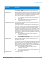
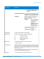
GeocodeAddressGlobal
optionName
Description
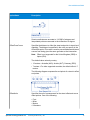
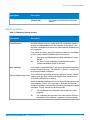
street-level coordinates and optionally fall
back to postal code coordinates.
GeographicCentroid The geocoder attempts to geocode
addresses to the geographic centroid of a
city or state.
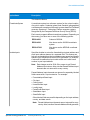
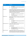
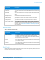
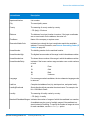
Interpolation
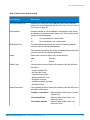
FallbackToGeographic
FallbackToPostal
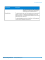
OffsetFromStreet
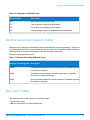
Y
Yes, perform address point interpolation.
N
No, do not perform address point interpolation.
Specifies whether to attempt to determine a geographic region
centroid when an address-level geocode cannot be determined.
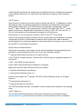
Y
Yes, determine a geographic centroid when an
address-level centroid cannot be determined. Default.
N
No, do not determine a geographic centroid when an
address-level centroid cannot be determined.
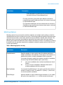
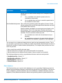
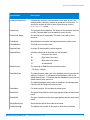
Specifies whether to attempt to determine a postal code centroid
when an address-level geocode cannot be determined.
Y
Yes, determine a postal code centroid when an
address-level centroid cannot be determined. Default.
N
No, do not determine a postal code centroid when an
address-level centroid cannot be determined.
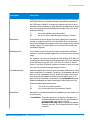
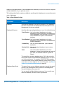
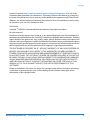
Indicates the offset distance from the street segments to use in
street-level geocoding. The distance is specified in the units you
specify in the OffsetUnits option.
The default value varies by country. For most countries, the default
is 7 meters.
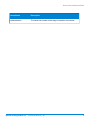
The offset distance is used in street-level geocoding to prevent the
geocode from being in the middle of a street. It compensates for
the fact that street-level geocoding returns a latitude and longitude
point in the center of the street where the address is located. Since
the building represented by an address is not on the street itself,
you do not want the geocode for an address to be a point on the
street. Instead, you want the geocode to represent the location of
the building which sits next to the street. For example, an offset of
50 feet means that the geocode will represent a point 50 feet back
from the center of the street. The distance is calculated perpendicular
to the portion of the street segment for the address. Offset is also
used to prevent addresses across the street from each other from
being given the same point. The following diagram shows an offset
point in relation to the original point.
Spectrum Technology Platform 10.0
Geocoding Guide for Italy - API
9