1
The Street Network File
User Guide
(ARC/INFO® Export format)
Produced by the Geography Division
Statistics Canada
June 1992
Also available in French
Également disponible en français
TABLE OF CONTENTS
Page
1 - INTRODUCTION................................................................................................................................................................................ 1
1.1 Preface .................................................................................................................................................................................... 1
1.2 Overview of the SNF Content ........................................................................................................................................ 1
1.3 Purpose of the Street Network Files (SNF) ............................................................................................................... 1
1.4 Coverage ................................................................................................................................................................................ 1
2 - DATA QUALITY STATEMENT .................................................................................................................................................. 2
2.1 Introduction.......................................................................................................................................................................... 2
2.2 Lineage - A Description of Data Sources and Reference Dates.......................................................................... 2
2.3 Positional Accuracy - Absolute vs. Relative .............................................................................................................. 4
2.4 Logical Consistency - A Result of Integration.......................................................................................................... 5
2.5 Completeness - Non-Street Features............................................................................................................................ 5
2.6 Limitations on Use.............................................................................................................................................................. 6
2.7 Two Formats - What are the Differences? ................................................................................................................ 6
3 - REFERENCE DATES OF THE SNF........................................................................................................................................... 7
4 - TECHNICAL SPECIFICATIONS.............................................................................................................................................. 19
4.1 Physical Media Description........................................................................................................................................... 19
4.2 How to Use the SNF......................................................................................................................................................... 19
4.3 Info Tables........................................................................................................................................................................... 20
4.4 Data Item Regulations And Clarifications .............................................................................................................. 36
5 - SNF DICTIONARY ......................................................................................................................................................... 38
6 - SUPPLEMENTARY INFORMATION..................................................................................................................................... 45
6.1 For Further Information ............................................................................................................................................... 45
6.2 Additional References and Services........................................................................................................................... 46
®
ARC/INFO is a registered trademark of the Environmental Systems Research Institute
______________________________________________________________________
Statistics Canada
Street Network File User Guide
______________________________________________________________________
Statistics Canada
Street Network File User Guide
______________________________________________________________________________
1 - INTRODUCTION
______________________________________________________________________________
1.1 Preface
The Street Network File User Guide is intended to provide information on the context, quality and content of the
Street Network Files (SNFs). It includes a brief overview of the SNFs, a Data Quality Statement, a detailed
description of the files, and also features a dictionary of the terms found in the SNFs, as well as a list of Statistics
Canada's Regional Reference Centres.
1.2 Overview of the SNF Content
The Street Network Files are digital data files stored in computer readable format, which define the street network
for large urban centres in Canada. The files also show physical and cultural features within a specific geographic
area, usually a census subdivision (CSD). An SNF references streets, address ranges, block-face representative point
coordinates, and includes such features as rivers, railroad tracks and municipal boundaries, which are the basic
elements found on a user reference map.
1.3 Purpose of the Street Network Files (SNF)
The Street Network Files (SNF), formerly known as the Area Master Files (or AMFs) were first created in the early
1970s as the basis for retrieval of Census data for user-defined geographic areas. More recently, the SNFs have also
been used in Census data collection, specifically in the delineation of Enumeration Areas and the automated
production of collection maps. In addition, the files have been used in the creation of the Digital Boundary Files
and the Postal Code Conversion File. These and other geography products can also be obtained from your local
Statistics Canada Regional Reference Centre.
1.4 Coverage
The SNFs currently cover 342 municipalities (CSDs), the majority of which are part of census metropolitan areas
(CMAs) and census agglomerations (CAs). All 25 CMAs, and 19 of the CAs are either wholly or partially covered.
In addition, eleven CSD's which fall outside CMA/CA limits are included. These areas cover 60% of the
population of Canada, but less than 1% of the land area.
The release of the SNFs is being carried out in phases. We therefore recommend that you contact your nearest
Regional Reference Centre to find out which CSDs included in the SNF program are currently available.
_____________________________________________________________________________
2 - DATA QUALITY STATEMENT
_____________________________________________________________________________
2.1 Introduction
Geography Division's Street Network Files (SNFs) incorporate a detailed level of geocartographic information for
all major urban centres. The main purpose of the SNFs within Statistics Canada is to support the needs of the
Census of Population and Housing. More specifically, the street network information is used prior to a census to
define enumeration areas and to create corresponding EA maps for collection purposes. Following a census, it is
used to create reference maps for dissemination purposes and to support the geocoding and retrieval of Census data
for user-defined areas. The latter is the original reason for creation of the Street Network Files in the early 1970s.
2.2 Lineage - A Description of Data Sources and Reference Dates
Sources
The quality of each street network file depends on the collection and processing of information about changes in the
real world. The primary sources of updating have been maps and descriptive information from municipalities, the
enumeration records and field maps from the quinquennial Census of Population and Housing, and other sources for
addresses and non-street features. Municipalities provide a variety of documents which may include street maps,
printouts of digital street network files, development plans and manually drafted corrections entered on street
network plots provided by Geography Division. While the scales of these source maps vary widely, most are within
the range of 1:1000 to 1:30,000. Scales of 1:5,000, 1:10,000 and 1:25,000 are used most frequently. The National
Topographic Series (NTS) 1:50,000 map sheets produced by Energy Mines and Resources Canada and the Ontario
Base Maps (OBM) were used as the basis for the initial creation of some SNFs. These maps were also used as a
source of information to provide certain classes of more stable features (e.g. hydrography) in areas not covered by
municipal information.
Because street networks are updated periodically, a typical street network file is a composite of information entered
at various times over a period of years. Consequently, data quality may be uneven within the same SNF. This is
mainly because the quality of source documents has varied over time and sometimes lower quality input documents
are used rather than omitting updates altogether. This is consistent with the emphasis on completeness over absolute
positional accuracy.
Each street network file consists of street network information on the one hand and attribute information on the
other. In many cases, the reference date of the street network and the attribute data differ. In real terms, this means
that new streets may be added to the street network while attributes (i.e. address ranges) are left to a subsequent
updating cycle. While feature attributes such as street names are almost always added with the feature itself,
address ranges are frequently unavailable when a street is first added to the file.
Updating of street network files is not a continuous process for operational reasons. The overhead costs of
assembling input materials and the computer processing of updates have made frequent updating impractical.
______________________________________________________________________
Statistics Canada
Street Network File User Guide
Page 2
Data Quality Statement - Cont'd
Reference Dates
The current release of the Street Network Files was scheduled to correspond to the release of 1991 Census data and
is the version used for 1991 geocoding. For this reason, the timely release of these files was deemed to be important
to many users. Although these Street Network Files are labelled as 1991 versions and reflect the most recent
updates, the user should be aware that the year refers to the chronology of the release only. All files have been
updated to at least June 1986, however, the current reference dates of specific street networks vary between June
1986 and December 1991 for the network information, and between June 1986 and February 1991 for address
information (Refer to Section 3 for the detailed reference dates by CSD). These reference dates refer to the date
identified on the update material or the date provided by the organization supplying the update material. The true
time reference of particular data items in the files depends on the sources used in updating. In practice, the detailed
lineage of these inputs is often not known precisely. The official reference date of a street network file is not
changed when minor updates are added.
The Street Network Files are designed to link to the 1991 Census geography. This linkage is achieved through
block-face representative points. Ideally, all census data would be linked to block-face representative points but
where a Street Network File is unavailable, the link is made to the enumeration area representative point. This
ensures that all census data can be linked. Block-face representative points are represented in UTM coordinates and
stored as an attribute of the block-face. Despite the linkage to the 1991 Census, it must also be stated clearly that
the Street Network Files have NOT been updated using the information collected during the 1991 Census field
operations. Consequently, the user should be aware that some streets and address ranges found in the census have
not yet been added to the Street Network Files.
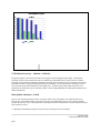
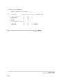
Chart 1 shows a distribution of reference dates for both network and address components of street networks. To
show a truer picture, the CSDs have been weighted by population rather than counting CSDs equally. Each bar in
the chart shows the cumulative percentage of population covered by street network files updated to the specified
year. The percentages are calculated using the total population in all street network files as the base. CSDs
containing 37% of the population have had the network component updated to 1991 and 88% by population have
been updated to at least 1988.
However, the corresponding updating of address information has not been done for many of the Street Network
Files. Only 1% by population has been updated to 1991 and only 28% to at least 1988. Nearly two thirds of the
street networks (by population) still have address information with a 1986 reference date. Consequently, address
ranges are likely to be significantly incomplete for many of the high growth areas of the Street Network Files. For
those which have not been updated since 1986, the effects will vary according to the extent of growth and change
over the last five years. The lack of updating to address ranges reflects the fact that the Census has been the
principal source of address information and the address updates from the 1991 Census have not been applied to the
Street Network Files.
______________________________________________________________________
Statistics Canada
Street Network File User Guide
Page 3
2.3 Positional Accuracy - Absolute vs. Relative
The primary purpose of street networks has been to support Census mapping and geocoding. Consequently,
positional accuracy of the nodes in the network compared to ground truth was not a serious concern. Relative
positional accuracy has been important to producing reference maps and, in this respect, topological correctness is
regarded as essential. Both geocoding and the retrieval and display of Census data require consistency between
street network features and enumeration area boundary files. A number of procedures and verifications were
implemented to ensure this type of consistency (Refer to the EA Digital Boundary File Data Quality Statement for
further information).
Data Quality Statement - Cont'd
However, the absolute positional accuracy of network nodes varies considerably even within the same street
network files. Some limited studies of positional accuracy have indicated that errors of up to and occasionally
beyond 100 metres do occur. Such problems are generally localized in small portions of a Street Network File and
arise from three sources:
1) digitizing from hand-drawn maps of streets when up-to-date maps were not available;
______________________________________________________________________
Statistics Canada
Street Network File User Guide
Page 4
2) variable scales of update source materials;
3) inconsistency in control points used for digitizing the same area at different times.
The quality of data in each Street Network File depends on the quality of the inputs and on the quality of the manual
processes which are used to capture the available information. In particular, it should be noted that the quality
cannot exceed the quality of the base maps used. The actual type and scales used varies considerably from one
Street Network File to another. Manual digitizing is subject to normal error rates for this operation, bearing in mind
that the training and expertise of the staff has varied over time. The entry of attribute data is subject to typical error
rates for data capture, but the actual error rates have not been measured.
Data Quality Statement - Cont'd
Most updates to street network files involve adding new features or missing attributes to existing features.
However, some updates which involve the deletion or modification of existing features in a street network file are
more difficult because it is necessary to identify that the existing network has changed -- a process which continues
to rely on manual comparisons of maps and is relatively prone to missing changes.
2.4 Logical Consistency - A Result of Integration
Logical consistency is required within and between street network files. The processing of digitized data within
ARC-INFO® ensures internal consistency of the topology entered. Undershoots and overshoots are examined and
corrected and closure of polygons is verified. New pieces of network are edgematched to fit into the existing street
network file. It is important to ensure that the Street Network Files are consistent with other digital products, digital
boundary files in particular.
The Street Network Files are processed by census subdivision, either single CSDs or groups of adjacent CSDs. An
edgematching process ensures that boundaries of adjacent census subdivisions coincide when merged. This process
often required manual intervention when boundaries differed too much to be "snapped" together in an automated
fashion. A similar process applies on a common boundary between adjacent Street Network Files. It should also be
noted that boundary files for areas not covered by street networks are generally adjusted to agree with the outer
boundaries of street networks as these are usually more accurate. Normally, boundaries correspond to street
network file features which would exist in their own right. In the cases where this was not true, an artificial feature
corresponding to the boundary was created. In this release of the Street Network Files, for the first time, this type
of feature has been created for enumeration area boundaries.
It should be stated that the consistency sought above relates specifically to the time reference of the 1991 Census.
As time goes on and intercensal census subdivision boundary changes accumulate, the chances of discrepancies
arising increases as these relationships are controlled manually.
2.5 Completeness - Non-Street Features
While the Street Network Files contain many non-street features, e.g. railways, hydrography, parks, cliffs, the
complete representation of these secondary features was neither intended nor guaranteed. In general, these were
included where they appeared in base maps and update materials and were deemed to be of importance to street
network file users. Also, the updating of these features may have been less rigorous than the street network and its
______________________________________________________________________
Statistics Canada
Street Network File User Guide
Page 5
attributes. The enumeration area boundary features mentioned in section 2.4 are not complete - 111 of these
segments were not included during processing, but are documented.
2.6 Limitations on Use
The major limitation in using these files is likely to be the lack of address range information in areas of population
growth. Thus, if the files are to be used for computer-aided dispatch or similar purposes which require an address to
be matched to a block-face, it may be necessary to supplement the file with local knowledge. In addition, because
absolute positional accuracy is not the priority in the creation of the SNFs, these files are NOT recommended for
engineering applications.
Data Quality Statement - Cont'd
2.7 Two Formats - What are the Differences?
The Street Network Files are being made available in two formats: the AMF format and the ARC/INFO® Export
format. There are a few differences between the two versions.
The ARC/INFO_ Export versions of the Street Network Files have been edgematched, whereas the AMF versions
have not; however, all gaps of 20 meters or more in the AMF version have been identified and corrected.
During the loading of the AMF versions into ARC/INFO® to create the ARC/INFO® versions, some features were
found to be coincident (i.e. they were defined by the same arc). An example would be a municipal limit that
followed a river. Where this occurred only one of the features was retained. Preference was given to addressable
features and physical features.
______________________________________________________________________
Statistics Canada
Street Network File User Guide
Page 6
____________________________________________________________________________
3 - REFERENCE DATES OF THE SNF
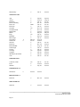
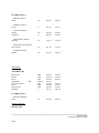
____________________________________________________________________________
The following list provides the reference dates of the street network, as well as address information on census
subdivisions (CSDs) found within census metropolitan areas (CMAs). The reference dates that appear in the two
columns below are based on the information at our disposal at the time of the last SNF update. The first column
pertains to the reference dates of the street network, while the second column refers to the address information.
CSD Name
CSD Type
Reference Date
__________________________________________________________________________________
NEWFOUNDLAND
ST-JOHN'S CMA
St. John's
Wedgewood Park
C
T
Dec. 89
Dec. 89
Dec. 89
Dec. 89
T
C
C
Jan. 90
June 91
Nov. 91
June 87
Aug. 89
June 86
PCA
T
PCA
VL
R
VL
PCA
VL
C
PCA
VL
T
June 86
Jan. 91
June 86
June 86
June 86
June 86
June 86
June 90
Jan. 91
June 86
June 90
Jan. 91
June 86
June 86
June 86
June 86
June 86
June 86
June 86
June 86
June 86
June 86
June 86
June 86
NOVA SCOTIA
HALIFAX DARTMOUTH CMA
Bedford
Dartmouth
Halifax
NEW BRUNSWICK
MONCTON CA
Coverdale
Dieppe
Dorchester
Dorchester
Fort Folly 1
Saint-Joseph
Hillsborough
Hillsborough
Moncton
Moncton
Salisbury
Riverview
______________________________________________________________________
Statistics Canada
Street Network File User Guide
Page 7
SAINT JOHN CMA
Saint John
C
Dec. 90
June 86
R
Jan. 91
R
June 86
June 86
June 86
June 86
June 86
Apr. 91
V
V
June 86
Apr. 91
Mar. 89
Apr. 88
Mar. 89
V
V
V
V
V
V
V
V
V
V
V
V
V
V
V
V
V
C
V
V
V
V
Mar. 91
V
June 89
June 89
June 86
Jan. 91
Dec. 90
Apr. 91
Mar. 89
May 91
June 91
May 91
May 91
Apr. 91
May 91
May 91
May 91
May 89
June 89
June 89
June 89
May 91
Jan. 90
Jan. 90
Aug. 89
June 91
FREDERICTON CA
Devon 30
Fredericton
St Mary's 24
C
QUEBEC
CHICOUTIMI - JONQUIERE CMA
Chicoutimi
Jonquière
La Baie
V
MONTREAL CMA
Anjou
Saint-Léonard
Beauharnois
Beloeil
Blainville
Boisbriand
Bois-des-Filion
Boucherville
Brossard
Candiac
Carignan
Chambly
Charlemagne
Chateauguay
Deux-Montagnes
Dorion
L'Île-Dorval
Dorval
Lachine
Greenfield Park
Kirkland
Beaconsfield
L'Île-Perrot
La Prairie
V
June 86
June 86
June 86
June 86
June 86
Oct. 88
June 86
June 89
June 89
Apr. 89
June 86
June 86
June 86
June 86
Aug. 89
May 89
June 86
June 86
June 86
May 89
June 86
June 86
June 86
______________________________________________________________________
Statistics Canada
Street Network File User Guide
Page 8
Lachenaie
Lasalle
Verdun
Laval
Le Gardeur
V
Lemoyne
Lery
Longueuil
Lorraine
Maple Grove
Mascouche
V
Mirabel
Mont-Royal
Outremont
Mont-Saint-Hilaire
Montréal
Westmount
V
Montréal-Est
Montréal-Nord
Montréal-Ouest
Côte-Saint-Luc
Hampstead
V
Saint-Pierre
Otterburn Park
Pierrefonds
V
Roxboro
Saint-Geneviève
Pincourt
Pointe-Claire
Dollard-des-Ormeaux
Repentigny
V
Richelieu
Rosemère
Saint-Amable
Saint-Basile-le-Grand
Saint-Bruno-de-Montarville
Saint-Eustache
Saint-Hubert
Saint-Lambert
Saint-Laurent
Saint-Mathieu-de-Beloeil
Saint-Raphael-de-L'Île-Bizard
Saint-Julie
Sainte-Marthe-sur-le-Lac V
Sainte-Thérèse
Senneville
Baie-D'Urfe
V
V
V
V
May 91
V
V
V
V
V
May 91
V
V
V
V
V
June 89
V
V
V
C
June 89
V
V
Apr. 90
V
V
V
V
V
Aug. 89
V
V
V
V
V
V
V
V
V
V
P
V
May 91
V
VL
V
Mar. 91
June 89
June 89
May 91
Nov. 88
June 91
May 91
May 91
May 91
May 91
June 89
May 91
June 89
June 89
June 86
June 89
June 86
June 89
June 89
June 89
June 89
June 86
June 89
Apr. 91
June 86
Apr. 90
Apr. 90
Mar. 88
June 89
June 89
June 86
May 91
May 91
Nov. 90
May 91
May 91
Jan. 91
May 91
Jan. 91
June 89
May 91
June 89
May 91
June 86
May 91
June 89
June 89
June 86
June 86
June 86
Sept 89
Nov. 87
May 89
Mar. 89
July 88
May 89
June 86
June 86
June 86
June 86
June 86
June 86
June 86
June 86
June 86
June 86
Nov. 88
June 86
June 86
June 86
June 86
June 86
June 86
June 86
Jan. 89
June 86
June 86
June 89
June 86
June 89
June 86
Mar. 89
June 86
Nov. 88
Jan. 89
June 86
June 86
______________________________________________________________________
Statistics Canada
Street Network File User Guide
Page 9
Sainte-Anne-de-Bellevue
Terrasse-Vaudreuil
Varennes
L'Île-Cadieux
Vaudreuil
Vaudreuil-sur-le-Lac
V
SD
V
V
V
VL
June 89
May 91
May 91
Jan. 88
Apr. 91
Apr. 91
June 86
June 86
June 86
June 86
June 86
June 86
V
V
CT
Sept 91
SD
V
SD
V
SD
SD
Aug. 90
Aug. 89
Aug. 89
Feb. 91
Dec. 88
Sept 89
Mar. 88
May 91
Mar. 88
Mar. 88
Aug. 90
Aug. 89
Aug. 89
V
SD
V
V
V
V
May 91
R
P
V
May 91
V
P
V
V
V
V
P
V
V
May 91
May 90
Jan. 90
May 91
May 91
Jan. 90
June 86
May 91
May 91
May 91
June 86
May 91
June 91
Jan. 91
May 91
May 91
May 91
May 91
Jan. 90
May 91
OTTAWA - HULL CMA (Quebec Part)
Aylmer
Buckingham
Chelsea
Gatineau
Cantley
Hull
La Pêche
Masson
Pontiac
Val-des-Monts
V
June 86
Sept 89
June 86
Mar. 88
Mar. 88
Mar. 88
QUEBEC CMA
Beauport
Bernières
Cap-rouge
Charlesbourg
Charny
L'Ancienne-Lorette
Loretteville
V
Wendake
Notre-Dame-des-Anges
Québec
Saint-Étienne-de-Lauzon SD
Saint-Jean-Chrysostome
Saint-Lambert-de-Lauzon
Saint-Nicolas
Saint-Rédempteur
Saint-Romuald
Sainte-Foy
Sainte-Hélène-de-Breakeyville
Sillery
Vanier
Feb. 87
June 86
June 86
July 88
Dec. 88
June 86
June 86
June 86
June 86
June 86
June 86
June 86
June 86
June 86
June 86
June 86
June 86
June 86
SHERBROOKE CMA
______________________________________________________________________
Statistics Canada
Street Network File User Guide
Page 10
Sherbrooke
V
Sept 90
June 86
Cap-de-la-Madeleine
Trois-Rivières
Trois-Rivières-Ouest
V
V
V
June 91
June 91
June 91
July 88
June 86
June 86
SAINT-JÉROME CA
Saint-Jérome
V
Sept 90
June 86
C
TP
T
Nov. 90
Apr. 91
June 86
June 86
June 86
June 86
C
Jan. 91
Jan. 91
June 91
June 86
June 86
Aug. 90
Oct. 87
June 86
Sept 87
T
Oct. 87
T
C
C
Oct. 87
June 86
Sept 87
Dec. 87
Oct. 87
June 91
Mar. 87
Jan. 90
C
TP
Oct. 90
Sept 90
Oct. 90
Sept 90
Aug. 91
C
June 86
Aug. 91
June 86
TROIS-RIVIÈRES CMA
ONTARIO
BRANTFORD CA
Brantford
Brantford
Paris
GUELPH CA
Guelph
Eramosa
Guelph
TP
TP
HAMILTON CMA
Ancaster
Burlington
Dundas
Flamborough
Glanbrook
Grimsby
Hamilton
Stoney Creek
T
C
T
TP
Dec. 87
June 88
Mar. 87
Jan. 90
KINGSTON CA
Kingston
Kingston
KITCHENER CMA
Cambridge
Kitchener
C
______________________________________________________________________
Statistics Canada
Street Network File User Guide
Page 11
North Dumfries
Waterloo
Woolwich
TP
C
TP
Aug. 91
Aug. 91
Aug. 91
June 86
June 86
June 86
TP
TP
C
TP
TP
VL
TP
Jan. 90
TP
VL
Jan. 90
TP
June 86
Apr. 89
June 88
May 89
May 91
Jan. 90
Aug. 90
June 86
Jan. 89
Jan. 90
June 86
Aug. 90
June 86
Apr. 89
June 86
May 89
June 86
June 86
June 86
TP
R
C
TP
June 86
June 86
May 91
May 89
June 86
June 86
June 86
June 86
T
C
T
Sept 89
Sept 89
Sept 89
Sept 89
Sept 89
Sept 89
May 91
June 89
Mar. 91
June 89
June 89
June 89
July 89
Oct. 90
June 89
June 89
Sept 91
June 89
June 89
June 86
Feb. 87
Mar. 91
June 86
May 88
June 86
June 86
Dec. 89
May 88
June 86
May 88
Nov. 88
June 88
LONDON CMA
Delaware
Lobo
London
London
North Dorchester
Port Stanley
Southwold
West Nissouri
Westminster
Belmont
St. Thomas
Yarmouth
TP
C
June 86
May 88
June 86
NORTH BAY CA
East Ferris
Nippissing 10
North Bay
North Himsworth
OSHAWA CMA
Newcastle
Oshawa
Whitby
OTTAWA-HULL CMA (Ontario Part)
Clarence
Cumberland
Gloucester
Goulbourn
Kanata
Nepean
Osgoode
Ottawa
Rideau
Rockcliffe Park
Rockland
Vanier
West Carleton
TP
TP
C
TP
C
C
TP
C
TP
VL
T
C
TP
______________________________________________________________________
Statistics Canada
Street Network File User Guide
Page 12
PETERBOROUGH CA
Peterborough
C
Mar. 91
June 86
TP
VL
C
R
June 86
Jan. 89
June 91
June 91
June 86
Jan. 89
June 86
Aug. 86
R
June 86
June 86
TP
TP
TP
C
R
June 86
June 86
June 86
June 89
June 89
June 86
June 86
June 86
June 89
June 89
T
T
C
T
T
C
C
C
C
TP
Oct. 90
July 90
Mar. 90
Oct. 90
July 90
Nov. 91
July 90
Apr. 91
June 88
Oct. 90
June 88
July 90
Mar. 90
Mar. 90
July 90
Mar. 90
July 90
Mar. 90
June 88
Oct. 90
C
July 88
July 88
SARNIA CA
Moore
Point Edward
Sarnia-Clearwater
Sarnia 45
SAULT STE. MARIE CA
Garden River 14
Macdonald Meredith
and Aberdeen
Laird
Prince
Sault Ste. Marie
Rankin Location 15D
ST. CATHARINES - NIAGARA CMA
Fort Erie
Lincoln
Niagara Falls
Niagara-On-The-Lake
Pelham
Port Colborne
St. Catharines
Thorold
Wainfleet
Welland
SUDBURY CMA
Sudbury
THUNDER BAY CA
______________________________________________________________________
Statistics Canada
Street Network File User Guide
Page 13
Thunder Bay
C
Jan. 91
June 86
T
T
C
T
BOR
C
TP
T
T
T
TP
T
C
Mar. 90
Jan. 90
T
T
T
C
C
TP
C
T
C
Sept 89
June 90
Jan. 90
Oct. 89
Jan. 90
Jan. 90
Nov. 89
Nov. 89
June 86
May 88
Jan. 89
Mar. 90
Jan. 90
Aug. 89
June 86
Jan. 89
Dec. 88
Aug. 90
Jan. 90
Jan. 90
Sept 89
July 90
July 90
Jan. 90
Sept 89
Aug. 89
Jan. 89
June 86
Jan. 90
June 86
June 86
June 86
June 86
May 88
June 86
June 86
June 86
Jan. 89
June 86
Jan. 89
June 86
June 86
Sept 89
June 86
June 86
Jan. 90
TP
T
C
Jan. 86
June 86
July 88
Jan. 86
June 86
June 86
June 86
June 86
C
Dec. 88
June 86
C
June 86
June 86
TORONTO CMA
Ajax
Aurora
Brampton
East Gwillimbury
East York
Etobicoke
Georgina
Georgina Island
Halton Hills
Milton
King
Markham
Mississauga
Newmarket
North York
Oakville
Pickering
Richmond Hill
Scarborough
Toronto
Uxbridge
Vaughan
Whitchurch-Stouffville
York
T
C
WINDSOR CMA
Colchester North
Essex
Windsor
WOODSTOCK CA
Woodstock
C
BELLEVILLE CA
Belleville
STRATFORD CA
Stratford
______________________________________________________________________
Statistics Canada
Street Network File User Guide
Page 14
OUTSIDE CMA/CA
BROCK (Ontario)
Brock
TP
Sept 89
Sept 89
FERGUS (Ontario)
Fergus
T
Feb. 89
Feb. 89
SCUGOG (Ontario)
Scugog
Scugog 34
TP
R
Sept 89
Sept 89
Sept 89
Sept 89
WELLESLEY (Ontario)
Wellesley
TP
Aug. 91
Aug. 88
WEST LINCOLN (Ontario)
West Lincoln
TP
Oct. 90
Oct. 90
WILMOT (Ontario)
Wilmot
TP
Aug. 91
Aug. 88
RM
RM
RM
June 86
RM
RM
RM
C
June 86
June 86
June 86
June 86
June 86
June 86
June 86
Feb. 91
June 86
June 86
June 86
VL
June 86
June 86
MANITOBA
WINNIPEG CMA
East St. Paul
Ritchot
Rosser
Springfield
St. Francois Xavier
Tache
West St. Paul
Winnipeg
RM
June 86
June 86
June 86
Mar. 89
OUTSIDE CMA/CA
BENITO (Manitoba)
Benito
SASKATCHEWAN
REGINA CMA
______________________________________________________________________
Statistics Canada
Street Network File User Guide
Page 15
Lumsden
Regina
Sherwood No. 159
Grand Coulee
T
C
RM
VL
June 86
June 86
June 86
Jan. 91
June 86
June 86
June 86
June 86
C
May 91
June 86
C
Feb. 91
July 88
C
Oct. 91
May 89
C
Mar. 91
June 86
C
Jan. 91
June 86
C
R
Mar. 89
June 86
June 86
June 86
R
C
SRD
DM
R
R
Feb. 90
Feb. 90
June 86
June 86
June 86
June 86
Dec. 88
Dec. 88
June 86
June 86
June 86
June 86
SASKATOON CMA
Saskatoon
ALBERTA
CALGARY CMA
Calgary
EDMONTON CMA
Edmonton
LETHBRIDGE CA
Lethbridge
RED DEER CA
Red Deer
BRITISH COLUMBIA
KAMLOOPS CA
Kamloops
Kamloops 1
KELOWNA CA
Duck Lake 7
Kelowna
Cen. Oka. Sub.
Peachland
Tsinstikeptum 9
Tsinstikeptum 10
MATSQUI CA
______________________________________________________________________
Statistics Canada
Street Network File User Guide
Page 16
Matsqui
DM
May 89
May 89
C
Oct. 88
Feb. 88
DM
DM
R
DM
R
R
VL
R
VL
SDR
VL
R
C
DM
R
R
R
R
DM
R
C
C
R
DM
R
R
DM
C
R
C
C
DM
SDR
C
R
DM
June 91
C
R
June 91
Apr. 91
Apr. 91
Jan. 90
Jan. 90
Jan. 90
June 86
June 86
June 86
June 86
June 86
June 86
June 86
Aug. 91
June 86
June 86
June 86
June 86
Mar. 90
June 86
Apr. 89
Jan. 91
Jan. 91
Jan. 91
Jan. 91
Jan. 91
June 86
May 91
May 91
Jan. 90
Feb. 91
June 91
June 86
Oct. 90
June 86
June 91
June 86
Jan. 89
Jan. 89
June 86
June 86
June 86
June 89
June 89
June 89
June 86
June 86
June 86
June 86
June 86
June 86
June 86
June 86
June 86
June 86
June 86
June 86
June 86
June 86
June 86
June 86
June 86
June 86
June 86
June 86
June 86
June 86
June 86
Jan. 89
June 86
June 86
June 86
June 86
June 86
June 86
PRINCE GEORGE CA
Prince George
VANCOUVER CMA
Burnaby
Coquitlam
Coquitlam 1
Delta
Tsawassen
Musqueam 4
Anmore
Barnston Island 3
Belcarra
Greater Vancouver, Subd. A
Lions Bay
Katzie 2
Langley
Langley DM
Matsqui 4
McMillan Island 6
Katzie 1
Langley 5
Maple Ridge
Whonnock 1
New Westminster
North Vancouver
Mission
North Vancouver
Burnard Inlet 3
Seymour Creek 2
Pitt Meadows
Port Coquitlam
Coquitlam 2
Port Moody
Richmond
Surrey
University Endowment Area
Vancouver
Musqueam 2
West Vancouver
Capilano 5
R
White Rock
Semiahmoo
June 86
June 86
______________________________________________________________________
Statistics Canada
Street Network File User Guide
Page 17
VICTORIA CMA
Becher Bay 1
Becher Bay 2
Capital Subd. B
Colwood
Esquimalt
Metchosin
New Songhees 1
View Royal
Capital Subd.
Sooke 1
Sooke 2
Central Saanich
East Saanich
South Saanich
Esquimalt
Cole Bay 3
North Saanich
Union Bay 4
Oak Bay
Saanich
Sidney
Victoria
R
R
SDR
C
R
DM
CA
R
CSDR
R
R
DM
R
R
DM
June 86
DM
R
DM
DM
T
C
June 86
June 86
June 86
Oct. 89
June 86
June 89
June 86
Oct. 89
June 86
June 86
June 86
June 88
June 86
June 86
Sept 89
June 86
Jan. 90
June 86
Jan. 90
Feb. 89
June 86
Mar. 88
June 86
June 86
June 86
Oct. 89
June 86
June 89
June 86
Oct. 89
June 86
June 86
June 86
June 86
June 86
June 86
Sept 89
R
June 86
SDR
June 86
June 86
June 86
June 86
June 86
June 86
Jan. 90
June 86
June 86
Mar. 88
OUTSIDE CMA/CA
Gordon River 2
Pacheena 1
Capital Subd. D
R
June 86
______________________________________________________________________
Statistics Canada
Street Network File User Guide
Page 18
______________________________________________________________________________
4 - TECHNICAL SPECIFICATIONS
______________________________________________________________________________
4.1 Physical Media Description
THE PHYSICAL FORMAT OF THE SNF IS DESCRIBED IN THE LETTER WHICH ACCOMPANIES THIS
PRODUCT.
4.2 How to Use the SNF
The SNF is in ARC/Export format. It was created using the following ARC commands:
EXPORT COVER NET_nnn NET_nnn.E00
EXPORT COVER PNT_nnn PNT_nnn.E00
where nnn is the code of the CMA included in the coverage.
The ARC/Info coverage can be restored using the following commands:
IMPORT COVER NET_nnn.E00 COVER
IMPORT COVER PNT_nnn.E00 COVER
where COVER is the name selected by the user.
______________________________________________________________________
Statistics Canada
Street Network File User Guide
Page 19
4.3 Info Tables
The execution of the commands outlined in the previous section will result in the creation of a coverage called
COVER and the following "Info tables".
DATAFILE NAME: COVER.AAT
20 ITEMS: STARTING IN POSITION
COL
1
5
9
13
17
25
29
33
41
49
57
60
80
82
84
89
94
99
104
108
ITEM NAME
FNODE#
TNODE#
LPOLY#
RPOLY#
LENGTH
COVER#
COVER-ID
ARC_ID
LPOLY_ID
RPOLY_ID
CLASS
NAME
TYPE
DIRECTION
ADDR_FM_LEFT
ADDR_TO_LEFT
ADDR_FM_RGHT
ADDR_TO_RGHT
CEN_LEFT
CEN_RGHT
1
WDTH OPUT TYP N.DEC
4
4
4
4
8
4
4
8
8
8
3
20
2
2
5
5
5
5
4
4
5
5
5
5
18
5
8
8
8
8
3
20
2
2
5
5
5
5
8
8
B
B
B
B
F
B
B
I
I
I
C
C
C
C
I
I
I
I
B
B
0
0
0
0
5
0
0
0
0
ALTERNATE NAME
POLY_G_ID
POLY_D_ID
CLASSE
NOM
ADR_DEB_G
ADR_FIN_G
ADR_DEB_D
ADR_FIN_D
CEN_G
CEN_D
NOTE: A description of this table can be found on the following page → → →
______________________________________________________________________
Statistics Canada
Street Network File User Guide
Page 20
Item Description
Arc Attribute Table
1
FNODE#: From node # - maintained by ARC/INFO®
2
TNODE#: To node # - maintained by ARC/INFO®
3
LPOLY#: Left polygon # - maintained by ARC/INFO®
4
RPOLY#: Right polygon # - maintained by ARC/INFO®
5
Length: of arc - maintained by ARC/INFO®
6
COVER#: maintained by ARC/INFO®
7
COVER-ID: maintained by ARC/INFO®
8
ARC_ID: Unique Arc Identifier
9
LPOLY_ID: Identifer for polygon on left side of the arc
10
RPOLY_ID: Identifer for polygon on right side of the arc
11Class: A three character code which identifies the different types of features (see LIST A).
12Name: A twenty character item containing the given name of the feature.
13Type: A two character item used for street identification when the street is a single or multiple lane addressable
street (see LIST B).
14Direction: A two character code identifying the direction of the feature (see LIST C).
15ADDR_FM_LEFT: The civic address found on the left-hand side of the arc at the FROM node.
16ADDR_TO_LEFT: The civic address found on the left-hand side of the arc at the TO node.
17ADDR_FM_RGHT: The civic address found on the right-hand side of the arc at the FROM node.
18ADDR_TO_RGHT: The civic address found on the right-hand side of the arc at the TO node.
19CEN_LEFT: The identifier for the representative point of the block-face on the left
20CEN_RGHT: The identifier for the representative point of the block-face on the right
______________________________________________________________________
Statistics Canada
Street Network File User Guide
Page 21
DATAFILE NAME: COVER.PAT
6 ITEMS: STARTING IN POSITION
COL
1
9
17
21
25
33
ITEM NAME
AREA
PERIMETER
COVER#
COVER-ID
POLY_ID
CSD
1
WDTH OPUT TYP N.DEC
8
8
4
4
8
7
18
18
5
5
8
7
F
F
B
B
I
C
6
6
0
0
-
ALTERNATE NAME
SDR
NOTE: A description of this table can be found on the following page → → →
______________________________________________________________________
Statistics Canada
Street Network File User Guide
Page 22
Item Description
Polygon Attribute Table
1
Area: of polygon - maintained by ARC/INFO®
2
Perimeter: of polygon - maintained by ARC/INFO®
3
COVER#: Maintained by ARC/INFO®
4
COVER-ID: Maintained by ARC/INFO®
5
POLY_ID: Identifer for polygon
6CSD: The Standard Geographical Classification code (the first two characters are province, the next two census
division, the last three are census subdivision).
______________________________________________________________________
Statistics Canada
Street Network File User Guide
Page 23
DATAFILE NAME: COVER.PAT
8 ITEMS: STARTING IN POSITION
COL
1
9
17
21
25
33
36
41
ITEM NAME
AREA
PERIMETER
COVER#
COVER-ID
POINT_ID
CLASS
ADDRESS
NAME
1
WDTH OPUT TYP N.DEC
8
8
4
4
8
3
5
20
18
18
5
5
8
3
5
20
F
F
B
B
I
C
I
C
5
5
0
0
-
ALTERNATE NAME
CLASSE
ADDRESSE
NOM
NOTE: A description of this table can be found on the following page → → →
______________________________________________________________________
Statistics Canada
Street Network File User Guide
Page 24
Item Description
Point Attribute Table
1
Area: Set to zero.
2
Perimeter: Set to zero.
3
COVER#: Maintained by ARC/INFO®
4
COVER-ID: Maintained by ARC/INFO®
5
POINT_ID: Identifier for point feature
6Class: A three character code which identifies the different types of features (see LIST A).
7Address: The civic number of the feature.
8Name: A twenty character item containing the given name of the feature.
NOTE: NOT ALL CMAs/CAs HAVE POINT FEATURES.
______________________________________________________________________
Statistics Canada
Street Network File User Guide
Page 25
DATAFILE NAME: COVER.CEN
4 ITEMS: STARTING IN POSITION
COL
1
5
7
13
ITEM NAME
1
WDTH OPUT TYP N.DEC
REPR. POINT-ID
UTM_ZONE
UTM_X
UTM_Y
** REDEFINED ITEMS
1 CEN_LEFT
1 CEN_RGHT
4
2
6
7
**
4
4
8
2
6
7
B
I
I
I
0
-
8
8
B
B
0
0
ALTERNATE NAME
CEN_G
CEN_D
NOTE: A description of this table can be found on the following page → → →
______________________________________________________________________
Statistics Canada
Street Network File User Guide
Page 26
Item Description
Representative Point File
1
Representative Point-ID: A unique representative point identifier.
2
UTM Zone: The zone of the representative point.
3
UTM X: The X coordinate of the representative point.
4
UTM Y: The Y coordinate of the representative point.
CEN_LEFT
CEN_RGHT These redefine the Representative point-id to relate to the AAT items.
______________________________________________________________________
Statistics Canada
Street Network File User Guide
Page 27
LIST A: FEATURE CLASSIFICATION
Roadway, railway and associated features category 1
Feature
Type
b
Addressable Single street & public access lane
E
Addressable Multiple street & public access lane
HSI
Highway single
HMU
Highway multiple
HPR
Highway proposed
HUC
Highway under construction
H
Other Highway
BSIBridge or Tunnel - Single Highway or Addressable Multiple street
BMUBridge or Tunnel - Multiple Highway
BMNBridge or Tunnel Addressable Single street
B
Other Bridge or Tunnel
R
Other Railway features
RSI
Railway single track
RMU
Railway multiple track
RSG
Railway siding or yard
FRA
Ramp
FTR
Trail
FWA
Walkway
FEX
Feature extension
1
The characters "b" or "bb" denotes that the field is blank.
______________________________________________________________________
Statistics Canada
Street Network File User Guide
Page 28
F
Other Roadway Associated features
LIST A: FEATURE CLASSIFICATION - CONT'D
Hydrography and associated features category
Feature
Type
WCR
Creek - defined using streamline
WAQ
Aqueduct
WCA
Canal
WRI
River
WOther Water body defined using streamline
SCR
Creek - defined using shoreline
SAQ
Aqueduct
SCA
Canal
SRI
River
SLA
Lake
SPO
Pond
SRE
Reservoir
SOC
Ocean
SOther Waterbody defined using shorelines
IFA
Falls
IDA
Dam
I
Other Associated features
______________________________________________________________________
Statistics Canada
Street Network File User Guide
Page 29
LIST A: FEATURE CLASSIFICATION - CONT'D
Delimiter and associated features category
Feature
Type
MMU
Municipal Boundary
MPR
Provincial Boundary
MNA
National Boundary
MFE
Federal Electoral District Boundary
M
Other Political boundaries
CEA
Enumeration Area Boundary
COther Geostatistical area boundaries
GPA
Park Boundary
GGO
Golf Boundary
GAI
Airport Boundary
GHO
Hospital Boundary
G
Other Property boundaries
GSH
Shopping Centre Boundary
GSC
School Boundary
GCO
College Boundary
GUN
University Boundary
GJA
Jail Boundary
GCH
Church Boundary
GGT
Government Boundary
U
Other Urban-Rural boundaries
______________________________________________________________________
Statistics Canada
Street Network File User Guide
Page 30
LIST A: FEATURE CLASSIFICATION - CONT'D
General Features Category
Feature
Type
PPA
Park
PGO
Golf
PHO
Hospital
PAI
Airport
PSH
Shopping centre
PSC
School
PCO
College
PUN
University
PJA
Jail
PCH
Church
PGT
Government
P
Other Point features
OFA
Cliff
ODI
Ditch
O
Other Topography features
ZHY
Hydroline (Major)
ZTE
Telephone line (Major)
ZFE
Fence
ZPI
Pipeline
Z
Other features
______________________________________________________________________
Statistics Canada
Street Network File User Guide
Page 31
D
Alias features
______________________________________________________________________
Statistics Canada
Street Network File User Guide
Page 32
LIST B: STREET TYPE LIST
Street
Interpretation
Street
Interpretation
Type
Type
____________________________________________________________________________________________
_
bb
No type/Pas de type
AL
Alley/Allée
AU
Autoroute
AV
Avenue
BA
Bay
BP
By Pass
BV
Boulevard
CA
Carré
CH
Chemin
CL
Circle/Cercle
CN
Concession
CO
Côte
CR
Crescent/Croissant
CS
Close
CT
Court
DR
Drive
GA
Garden
GR
Green
GT
Gate
GV
Grove
HL
Hill
HT
Heights
HY
Highway
JS
Jardin
LI
Line
LK
Link
LN
Lane
ME
Mews
MO
Montée
PL
Place
PM
Promenade
PR
Park
PU
Plateau
PY
Parkway
RD
Road
RG
Rang
RI
Rise
RL
Ruelle
RO
Route
RU
Rue
RW
Row
SQ
Square
ST
Street
______________________________________________________________________
Statistics Canada
Street Network File User Guide
Page 33
TL
Trail
TR
Terrace/Terrasse
VW
View
WK
Walk
WY
Way
______________________________________________________________________
Statistics Canada
Street Network File User Guide
Page 34
LIST C: FEATURE DIRECTION
The feature direction is not to be mistaken as being the geographic direction of a feature, but the direction used
within the feature's identification.
____________________________________________________________________________________________
_
N
NORTH/NORD
S
SOUTH/SUD
E
EAST/EST
W
WEST
O
OUEST
NE
NORTH-EAST/NORD-EST
NW
NORTH-WEST
NO
NORD-OUEST
SE
SOUTH-EAST/SUD-EST
SW
SOUTH-WEST
SO
SUD-OUEST
______________________________________________________________________
Statistics Canada
Street Network File User Guide
Page 35
4.4 Data Item Regulations And Clarifications
The following section lists regulations and clarifications concerning SNF data items. These SNF
particulars may be of importance to the user in helping to reduce the possibility of misinterpretation.
- Addresses
Addresses are identified on the right and left hand side of addressable features at from and to nodes
defining the arc. The address is either a civic number or one of the following codes:
0indicates a non-addressable feature (e.g. a river)
-1indicates that the address is unknown; this is the case when street network information has been
updated, but address ranges have not
-2indicates an unknown address opposite a T-intersection
-3indicates that on a municipal boundary addresses are unknown on one side of the boundary; that is, for
addressable features which follow a CSD limit, the addresses are found only on
the one side of the feature that is contained within the CSD.
- Feature Name
The Feature Name field is alphanumeric, where the first character must be either A to Z or 0 to 9. The
remaining characters may contain a combination ranging from A to Z and ' . , - or blank characters. The
name used for this field is the official name supplied by local expertise.
The following is a description of regulations pertaining to feature name coding:
When the name exceeds the maximum-field size of 20 characters, it is truncated (at the end). If the end
result is meaningless, an abbreviation of the name may be used instead.
Feature names containing prefixes such as: "Des, de, le, la, les, 1', d', de 1', du, de la, The" are coded at
the end of their names, with a--comma and a blank separating them from the name.
ex: De-l'école will-be coded: ECOLE, DE L'
Formats of the word Saint and Sainte are coded as ST, STE respectively. All numeric streets are coded
numeric without any suffix such as "TH", "ND" etc.
If space permits, all non-addressable features have the feature's qualifier in the name field.
ex: OTTAWA LIMIT
DOW'S LAKE
For CSDs found in the province of Quebec, the qualifier is coded before the feature name.
ex: LIMITE DE HULL
LAC LEMAY
______________________________________________________________________
Statistics Canada
Street Network File User Guide
Page 36
In feature names that contain a direction, such as "Sherbrooke est", the direction is not coded in the name
but in the direction field.
Data Item Regulations And Clarifications - cont'd
Special attention should be taken for street names containing "Montée" and "Côte" as they may appear in
the street name or street type.
Non-street features which are unidentified are coded as:
"Qualifier" XXX
- where "Qualifier" is the type of feature such as lake, river
- where XXX is a three digit number assigned arbitrarily.
eg. LAKE 001 for an unidentified lake.
Private streets are coded as "PRIV." in all CSDs. Streets undergoing construction in Quebec CSDs are
coded as "E.C." ("en construction"), while in other CSDs they are coded as "U.C." (under
construction).
Proposed streets in Quebec CSDs will be coded as "PROJ" (projetées), and in other CSDs as "PROP"
(proposed).
Railway yards will be coded: (name of railway) YARD XXX where XXX (is a unique number assigned
arbitrarily).
ex: CNR YARD 001.
- A Representative Point is a point used as a spatial reference for a block-face. The representative point is
a coordinate in the Universal Transverse Mercator (UTM) projection which is calculated as follows:
a) The distance between all nodes comprising the block-face are totalled;
b) This total distance is then divided by two;
c) The resultant distance (midpoint distance) is measured back from the end point along the arcs
(segment between two nodes) until the midpoint distance along the block-face is reached;
d) The representative point is located at a point perpendicular to, and 22 metres back from the arc. A
UTM XY coordinate value is calculated for this representative point;
e) In the ARC Export format of the SNF, if arc have been adjusted (e.g. as a result of edge-matching), the
representative points have not been moved. That is, the representative points may not
always be 22 metres from the arc.
______________________________________________________________________
Statistics Canada
Street Network File User Guide
Page 37
_____________________________________________________________________________
5 - SNF DICTIONARY
_____________________________________________________________________________
The SNF dictionary is designed to provide information on the records or fields that are found in the
various file layouts which are supplied with this product.
Address Range of a Block-face
The low and high address (civic number) found on a block-face (including commercial addresses).
Airport
Landing facility for aircraft, usually with more than one runway, with facilities for handling passengers
and air freight and for servicing aircraft.
Approach to Highway: refer to Ramp.
Aqueduct
A water conduit, namely one for supplying water to a community from a distance.
Block-face*
The general concept of a block-face is one of a small recognizable geographical unit to which census data
can be associated. The goal is to approximate, through aggregation, user-defined query areas for census
data extraction and tabulation.
The block-face refers to one side of a city street, normally between consecutive intersections with streets
or other physical features (such as creeks or railways).
Boundary
A line indicating the limit or extent of an area or territory.
Bridge
A structure erected over a water body which is defined using shorelines (instead of streamlines).
Canal
1) An artificial waterway constructed to facilitate movement of ships and barges;
2) A watercourse built to convey water for irrigation.
________________
______________________________________________________________________
Statistics Canada
Street Network File User Guide
Page 38
* For the full definitions and additional remarks related to this term, users should refer to the 1991
Census Dictionary (Cat. No. 92-301E).
______________________________________________________________________
Statistics Canada
Street Network File User Guide
Page 39
Census Agglomeration (CA)*
The general concept of a census agglomeration (CA) is one of a large urban area, together with adjacent
urban and rural areas which have a high degree of economic and social integration with that urban area.
A CA is delineated around an urban area (called the urbanized core and having a population of at least
10,000, based on the previous census. Once a CA attains an urbanized core population of at least 100,000,
based on the previous census, it becomes a census metropolitan area (CMA).
Census Metropolitan Area (CMA)*
The general concept of a census metropolitan area (CMA) is one of a very large urban area, together with
adjacent urban and rural areas which have a high degree of economic and social integration with that
urban area.
A CMA is delineated around an urban area (called the urbanized core and having a population of at least
100,000, based on the previous census). Once an area becomes a CMA, it is retained in the program even
if its population subsequently declines.
Census Subdivision (CSD)*
Refers to the general term applying to municipalities (as determined by provincial legislation) or their
equivalent, e.g.: indian reserves, indian settlements and unorganized territories.
In Newfoundland, Nova Scotia and British Columbia, the term also describes geographic areas that have
been created by Statistics Canada in co-operation with the provinces as equivalents for municipalities.
Cliff
A high and extremely steep rock face, approaching the vertical.
Control Point
A point location (usually an intersection of 2 features) with identifiable or known UTM coordinate values
used in the AMF creation process (digitizing).
Creek
A small stream, indicated by a single line or streamline.
Dam
A barrier to prevent the flow of water or to raise and control the level of water, where the water body is
defined by shorelines.
Ditch
A trench dug in the earth, as for drainage or irrigation.
______________________________________________________________________
Statistics Canada
Street Network File User Guide
Page 40
Enumeration Area (EA)*
An enumeration area (EA) is the geographic area canvassed by one census representative.*
Falls
A waterfall where the associated water body is defined by shorelines.
Feature
An entity that will be included in the Street Network File.
Feature Extension
An extension (projection) of a feature for internal operations. It is defined from the feature end point to
the extension end point.
Federal Electoral District (FED)*
A federal electoral district refers to any place or territorial area entitled to return a member to serve in the
House of Commons (Source: Canada Elections Act, 1990). There are 295 FEDs in Canada according to the
1987 Representation Order.*
Government
The exercise of authority over a district. In this case refers to any level: municipal, provincial and federal.
Highway
A main road or thoroughfare. For mapping purposes, this feature is divided into the following:
1) Single Highway - A highway with 3 lanes or less without a median (fence, grass etc.).
2) Multiple Highway - A highway with 4 lanes or more without a median; or a highway with 2 lanes or
more with a median.
*** NOTE: For all of the above cases, if the total road width is 100 metres or more, the feature will be
defined as 2 parallel single highway. ***
Hydro Line
The complex of wires and pylons used in the transmission of electrical power. The AMF recognizes only
major ones.
Intersection
The junction of any two features except property boundaries.
______________________________________________________________________
Statistics Canada
Street Network File User Guide
Page 41
Island
A body of land completely surrounded by water or marsh.
Lake
A large, inland body of salt or fresh water entirely surrounded by land, and larger than a pond.
Node
A geographic point with xy coordinates which is placed at every feature intersection and change of
direction.
Park
An area set aside for recreation; also an area maintained in its natural state as public property.
Pipeline
A cylindrical passage of a substantial length for the transport of fluids or gases.
Pond
A natural body of standing fresh water occupying a small surface depression, usually smaller than a lake.
Proposed Road
A road that is in the planning stage.
Railway
A permanent way having rails which provide a track for train cars.
1) Single Track Railway - a single railway line normally of standard gauge;
2) Multiple Track Railway - two or more closely parallel rail lines.
Railway Siding
A single railway track parallel to a second track used for temporary storage of cars or for the passing of
trains.
Railway Yard
A system of railway tracks within a prescribed limit.
Ramp
A short roadway providing access to or exit from a road or highway.
______________________________________________________________________
Statistics Canada
Street Network File User Guide
Page 42
Representative Point
A representative point (formerly called "centroid"), is a pair of coordinate values (x,y) that represents a
geographic entity for the purpose of assigning aggregate data to that point. For the 1991 Census,
representative points were generated for enumeration areas (EA) and block-faces. Enumeration area
representative points are located either near clusters of buildings and/or streets, or at the visual centre of
the EA. Block-face representative points are located at the mid-point of the block-face, set back a
perpendicular distance of 22 meters from the street centre line.
Reservoir
A natural or artificial storage place for water from which water may be withdrawn for irrigation,
municipal water supply, etc.
River
A natural, freshwater surface body of running water that serves as a natural outlet for a drainage area.
Indicated by shorelines.
Road: Refer to Street.
Shoreline
The limit of a body of water where it touches land. In the SNF, the water body should, on average, be
greater than 20 metres wide and indicated by shoreline rather than streamline.
Streamline
Used to define small creeks and rivers. The centre line of a river or creek with an average width of less
than 20 metres.
Street
A thoroughfare within a city or town larger than an alley or lane. For mapping purposes, this category is
divided into the following:
1) Single Street: 3 lanes or less without a median;
2) Multiple Street: 4 lanes or more without a median, or 2 lanes or more with a median.
*** NOTE: For all of the above cases, if the total road width is 100 metres or more, the feature will be
defined as 2 parallel single streets. ***
Telephone Line
A wire used for transmitting telephone signals. The AMF recognizes only major ones.
Trail
A track or path located in a park.
______________________________________________________________________
Statistics Canada
Street Network File User Guide
Page 43
Tunnel
A subterranean passageway usually carrying a railway, road or canal.
Under Construction
The term used to indicate that the feature on the map is not completed but that construction has started.
______________________________________________________________________
Statistics Canada
Street Network File User Guide
Page 44
______________________________________________________________________________
6 - SUPPLEMENTARY INFORMATION
______________________________________________________________________________
6.1 For Further Information
For further information on the Street Network File or other products and services available from the
Geography division, contact your nearest Regional Reference Centre. If you live outside the local dialing
area, call one of the toll free numbers provided in the list that follows:
Newfoundland and Labrador
Statistics Canada
Advisory Services
3rd Floor
Viking Building
Crosbie Road
St. John's, Newfoundland
A1B 3P2
Local calls: 709-722-4073
Toll free: 1-800-563-4255
Fax: 1-709-772-6433
Ontario
Southern Alberta
Statistics Canada
Statistics Canada
Advisory Services
Advisory Services
10th Floor
Room 401
Arthur Meighen Building
First Street Plaza
25 St. Clair Avenue East
138-4th Avenue South East
Toronto, Ontario
Calgary, Alberta
M4T 1M4
T2G 4Z6
Local calls: 416-973-6586
Local calls: 403-292-6717
Toll free: 1-800-263-1136
Toll free: 1-800-472-9708
Fax:1-416-973-7475
Fax: 1-403-292-4958
Maritime Provinces
Statistics Canada
Advisory Services
North American Life Centre
3rd Floor
1770 Market Street
Halifax, Nova Scotia
B3J 3M3
Local calls: 902-426-5331
Toll free: 1-800-565-7192
Fax: 1-902-426-9538
Manitoba
British Columbia and Yukon
Statistics Canada
Statistics Canada
Advisory Services
Advisory Services
Suite 300
Suite 440F
MacDonald Street
3rd Floor
344 Edmonton Street
Federal Building
Winnipeg, Manitoba
Sinclair Centre
R3B 3L9
757 West Hastings St.
Local calls: 204-983-4020
Vancouver, British Columbia
Toll free: 1-800-542-3404
V6C 3C9
Fax: 1-204-983-7543
Local calls: 604-666-3691
Toll free: 1-800-663-1551
Saskatchewan
(except Atlin, B.C.)
Statistics Canada
Yukon and Atlin, B.C.
Advisory Services
Zenith 08913
9th Floor
Fax: 1-604-666-4863
Avord Tower
2002 Victoria Avenue
Regina, Saskatchewan
S4P 0R7
Local calls: 306-780-5405
Toll free: 1-800-667-7164
Fax: 1-306-780-5403
Quebec
Statistics Canada
Advisory Services
200 René-Lèvesque Blvd. West
Guy-Favreau Complex
4th floor, East Tower
Montréal, Quebec
H2Z 1X4
Local calls: 514-283-5725
Toll free: 1-800-361-2831
Fax: 1-514-283-9350
National Capital Region
Statistics Canada
Statistical Reference Centre
Lobby
R.H. Coats Building
Tunney's Pasture
Holland Avenue
Ottawa, Ontario
K1A 0T6
Local calls: 613-951-8116
If outside the local calling area,
Alberta and Northwest Territories
Statistics Canada
Advisory Services
8th Floor
Park Square
10001 Bellamy Hill
Edmonton, Alberta
T5J 3B6
Local calls: 403-495-3027
Toll free: 1-800-282-3907
N.W.T.: Call collect 1-403-495-3028
______________________________________________________________________
Statistics Canada
Street Network File User Guide
Page 45
dial the toll-free number for
your province.
Fax: 1-613-951-0581
Fax: 1-403-495-3026
6.2 Additional References and Services
In addition to the Regional Reference Centres and depository libraries, Statistics Canada publications
may be ordered through your local bookstore or subscription agent. Contact the nearest Regional
Reference Centre for a list of Canadian outlets available, or consult the 1991 Census Catalogue
(Catalogue No. 92-302E).
Secondary distributors offer data access and analytical support through a variety of consulting and
computer-based services not available at Statistics Canada. The names and addresses of licensed
distributors may be obtained from any Regional Reference Centre.
Statistics Canada provides digital geographic products which allow computer manipulation of
geographic data. A customized retrieval service is available for users who wish to define their own
geographic area of study. A variety of data retrieval files and services provide flexibility in selecting a
geographic base.
A complete description of available digital files and services is documented in the 1991 Census Catalogue
(Catalogue No. 92-302E ).
Information concerning Census of agriculture products and services may be referenced in the 1991
Census of Agriculture Products and Services publication, Catalogue No. 92-303, or by calling toll free
1-800-465-1991.
Users with special data requirements may request post-census survey services. Data are made available
on microcomputer diskettes for use with spreadsheet software, or on paper output. For additional
information, please contact the nearest Regional Reference Centre.
The Dissemination Division is responsible for CANSIM, Statistics Canada' s computerized database
network and information retrieval service. Users are provided with access to current and historical
statistics in various forms including specialized data manipulation and analysis packages, graphics
facilities and a bibliographic search service. For more information about CANSIM, contact any Regional
Reference Centre.
______________________________________________________________________
Statistics Canada
Street Network File User Guide
Page 46