1
Python-FALL3D: User Manual
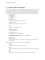
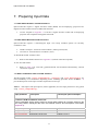
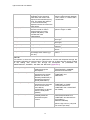
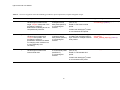
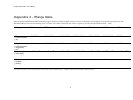
horizontal_diffusion_coefficie
nt
Mixing of particles
horizontally within the
simulated column.
value_of_CS
A constant value between
0.135 and 0.32 only used
when horizontal
turbulence is RAMS.
Only defined by user if vertical
and horizontal turbulence is
‘CONSTANT’ else derived from
wind profile (i.e.
SIMILARITY/RAMS)
Options: 1000 – 10000
RAMS only
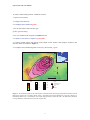
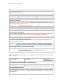
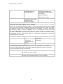
Contouring: True, False, number or list of numbers
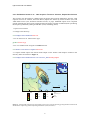
Python-FALL3D produces maps of volcanic ash thickness and volcanic ash load. The model
contours the ash thickness and load values for viewing in Google Earth (kml) and ArcGIS
(shp). There are four options for determining the interval between contours: ‘True’: the model
will determine equally spaced contours based on the spread of data (a good first
approximation); ‘False’: no contours; ‘Number’: the user can specify the number of contour
intervals and the model will generate that number of contours based on the spread of data;
and ‘List of Numbers’: the user can specific the number of contour intervals and the
corresponding value for each interval (user for a standardised classification scheme and
comparing different scenarios).
thickness_contours
Type of contouring.
load_contours
Type of contouring
required for
volcanic ash load
(kg/m2).
Ash thickness units.
thickness_units
Options: True, False, Number or List
of Numbers
Options: True, False, Number or List
of Numbers
Units: mm/cm/m
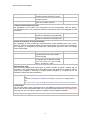
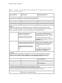
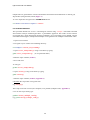
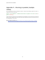
Run model using specified parameters (Procedure 2 - ‘Hazard Map’ only; Refer to 7.2)
Location of multiple wind fields for probabilistic hazard mapping and location of generated
outputs (one hazard scenario per wind field).
windfield_directory
‘/<home>/<username>/<tephra>/<multiple>’
(a directory of multiple profiles)
hazard_output_directory
‘/<home>/<username>/<tephra>/<hazard_outputs>’
(directory where multiple model runs are to be stored)
16