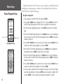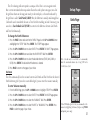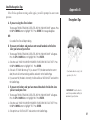
1
eTrex® / eTrex® Camo personal navigator® owner’s manual © Copyright 2004 Garmin Ltd. or its subsidiaries All Rights Reserved Garmin International, Inc. 1200 East 151st Street Olathe, Kansas 66062 U.S.A. Tel. 913/397.8200 Fax 913/397.8282 Garmin (Europe) Ltd. Unit 5, The Quadrangle, Abbey Park Industrial Estate Romsey, SO51 9DL, U.K. Tel. 44/0870.8501241 Fax 44/0870.8501251 Garmin Corporation No. 68, Jangshu 2nd Road Shijr, Taipei County, Taiwan Tel. 886/2.2642.9199 Fax 886/2.2642.9099 Except as expressly provided herein, no part of this manual may be reproduced, copied, transmitted, disseminated, downloaded or stored in any storage medium, for any purpose without the express prior written consent of Garmin. Garmin hereby grants permission to download a single copy of this manual and of any revision to this manual onto a hard drive or other electronic storage medium to be viewed and to print one copy of this manual or of any revision hereto, provided that such electronic or printed copy of this manual or revision must contain the complete text of this copyright notice and provided further that any unauthorized commercial distribution of this manual or any revision hereto is strictly prohibited. Information in this document is subject to change without notice. Garmin reserves the right to change or improve its products and to make changes in the content without obligation to notify any person or organization of such changes or improvements. Web Site address: www.garmin.com Garmin®, eTrex®, Personal Navigator® , TracBack®, and MapSource® are registered trademarks and WAAS Enabled™ is a trademark of Garmin Ltd. or its subsidiaries and may not be used without the express permission of Garmin. August 2004 Part Number 190-00395-00 Rev. B Printed in Taiwan Preface The eTrex is a handheld full-function GPS. When moving, the eTrex provides you with your speed, direction of movement, time, distance to destination, and more. With these basic features, your eTrex can provide one more critical benefit: peace of mind. You’ll know where you are, where you’ve been, and where you’re going. And since you’ll always know the way back home, you can concentrate on what you set out to do—enjoy the great outdoors. Introduction Product Registration Product Registration Help us better support you by completing your online registration today! Connect to our Web site (www.garmin.com) and look for the Product Registration link on the home page. Your unit’s serial number is in the battery compartment and on top of the box. Serial Number Thank you for choosing the Garmin eTrex. If you have any questions or comments regarding the use of the eTrex you can visit our Web site at www.garmin.com. i Introduction Table of Contents INTRODUCTION ...........................................I-XII Product Registration ......................................i Table of Contents .........................................ii FCC Compliance .........................................iii Warnings and Cautions ............................ iv-v Consumer Limited Warranty ....................... vi Software License Agreement ....................... vii Maintenance .............................................. viii GPS Cleaning ............................................ viii Lens Cleaning............................................ viii Storage ...................................................... viii Water Immersion....................................... viii Features....................................................... ix eTrex Description ......................................... x Buttons........................................................ xi Battery and Lanyard Installation ................. xii GETTING STARTED ..................................... 1-10 Here We Go..................................................1 ii Page Basics .............................................. 2-6 Let the Fun Begin ....................................... 7 Make Yourself at Home............................... 8 Follow the Pointer ...................................... 9 You’ve Made It!......................................... 10 SETUP PAGE ............................................32-41 Time Page ........................................... 32-33 Display Page ............................................ 34 Units Page ........................................... 34-38 Interface Page...................................... 38-39 System Page ........................................ 40-41 REFERENCE .............................................11-41 SKYVIEW PAGE ........................................... 11 APPENDICES ............................................42-49 Options................................................... 11 Appendix A - Specifications....................... 42 ADVANCED SKYVIEW PAGE ...................... 12 Appendix B - What is GPS? ....................... 43 Options................................................... 12 Appendix C - What is WAAS? ................... 44 MAP PAGE ................................................... 13 Appendix D - FAQs ................................... 45 Options................................................... 13 Appendix E - Accessories ..................... 46-47 POINTER PAGE ........................................... 14 Appendix F - Wiring Diagram ................... 48 Options.............................................. 14-15 Appendix G - Reception Tips .................... 49 TRIP COMPUTER PAGE .............................. 16 Options................................................... 16 INDEX .....................................................50-52 Trip Computer Data Fields ...................... 17 MENU PAGE ...........................................18-31 Mark Waypoint Page .......................... 18-19 Waypoints Page....................................... 20 Review Waypoint Page ....................... 21-22 Hunt/Fish and Sun/Moon Pages .............. 23 Project Waypoint Page ............................ 24 Routes Page........................................ 25-27 Track Log Page ................................... 28-31 The eTrex complies with Part 15 of the FCC interference limits for Class B digital devices FOR HOME OR OFFICE USE. These limits are designed to provide more reasonable protection against harmful interference in a residential installation and are more stringent than “outdoor” requirements. Operation of this device is subject to the following conditions: (1) This device may not cause harmful interference, and (2) this device must accept any interference received, including interference that may cause undesired operation. This equipment generates, uses and can radiate radio frequency energy and, if not installed and used in accordance with the instructions, may cause harmful interference to radio communications. However, there is no guarantee that interference will not occur in a particular installation. If this equipment does cause harmful interference to radio or television reception, which can be determined by turning the equipment off and on, the user is encouraged to try to correct the interference by one of the following measures: • Reorient or relocate the receiving antenna. • Increase the separation between the equipment and the receiver. • Connect the equipment into an outlet on a circuit different from that to which the receiver is connected. • Consult the dealer or an experienced radio/TV technician for help. The eTrex does not contain any user-serviceable parts. Repairs should only be made by an authorized Garmin service center. Unauthorized repairs or modifications could result in permanent damage to the equipment, and void your warranty and your authority to operated this device under Part 15 regulations. Introduction FCC Compliance iii Introduction Warnings and Cautions iv CAUTION: Use the eTrex at your own risk. To reduce the risk of unsafe operation, carefully review and understand all aspects of this Owner’s Manual—and thoroughly practice operation using the simulator mode prior to actual use. When in actual use, carefully compare indications from the eTrex to all available navigation sources, including the information from other NAVAIDs, visual sightings, charts, etc. For safety, always resolve any discrepancies before continuing navigation. CAUTION: IT IS THE USER’S RESPONSIBILITY TO USE THIS PRODUCT PRUDENTLY. THIS PRODUCT IS INTENDED TO BE USED ONLY AS A NAVIGATIONAL AID AND MUST NOT BE USED FOR ANY PURPOSE REQUIRING PRECISE MEASUREMENT OF DIRECTION, DISTANCE, LOCATION OR TOPOGRAPHY. THIS PRODUCT SHOULD NOT BE USED AS AN AID TO DETERMINE GROUND PROXIMITY FOR AIRCRAFT NAVIGATION. CAUTION: The electronic chart is an aid to navigation and is designed to facilitate the use of authorized government charts, not replace them. Only official government charts and notices to mariners contain all information needed for safe navigation – and, as always, the user is responsible for their prudent use. CAUTION: If the device is immersed, the electronics are protected, but the battery compartment may get wet. Make sure the batteries and compartment are dry before using. WARNING: The Global Positioning System (GPS) is operated by the United States government, which is solely responsible for its accuracy and maintenance. The system is subject to changes which could affect the accuracy and performance of all GPS equipment. Although the Garmin eTrex is a precision electronic NAVigation AID (NAVAID), any NAVAID can be misused or misinterpreted and, therefore, become unsafe. WARNING: For use in vehicles, it is the sole responsibility of the owner/operator of the eTrex to secure the unit so that it will not interfere with the vehicle’s operating controls, obstruct the driver’s view of driving conditions, or cause damage or personal injury in the event of an accident. Do not mount the eTrex over air bag panels or in the field of air bag deployment. Air bags expand with a rapid force that can propel objects in their path toward the driver or passengers causing possible injury. Refer to air bag safetly precautions contained in the vehicle’s owner manual. Do not mount the eTrex in a place where the driver or passengers are likely to impact it in an accident or collision. The mounting hardware provided by Garmin is not warranted against collision damage or the consequences thereof. WARNING: For use in vehicles, it the sole responsibility of the driver of the vehicle to operate the vehicle in a safe manner, maintain full surveilllance of all driving conditions at all times, and not become distracted by the eTrex to the exclusion of safe driving practices. It is unsafe to operate the controls of the eTrex while you are driving. Failure by the driver of a vehicle equipped with a eTrex to pay full attention to operation of the vehicle and road conditions while the vehicle is in motion could result in an accident or collision with property damage and personal injury. WARNING: This product, its packaging, and its components contain chemicals known to the State of California to cause cancer, birth defects, or reproductive harm. This Notice is being provided in accordance with California’s Proposition 65. If you have any questions or would like additional information, please refer to our Web site at http: //www.garmin.com/prop65. Introduction Warnings and Cautions v Introduction CONSUMER LIMITED WARRANTY This Garmin product is warranted to be free from defects in materials or workmanship for one year from the date of purchase. Within this period, Garmin will at its sole option, repair or replace any components that fail in normal use. Such repairs or replacement will be made at no charge to the customer for parts or labor, provided that the customer shall be responsible for any transportation cost. This warranty does not cover failures due to abuse, misuse, accident or unauthorized alteration or repairs. THE WARRANTIES AND REMEDIES CONTAINED HEREIN ARE EXCLUSIVE AND IN LIEU OF ALL OTHER WARRANTIES EXPRESS OR IMPLIED OR STATUTORY, INCLUDING ANY LIABILITY ARISING UNDER ANY WARRANTY OF MERCHANTABILITY OR FITNESS FOR A PARTICULAR PURPOSE, STATUTORY OR OTHERWISE. THIS WARRANTY GIVES YOU SPECIFIC LEGAL RIGHTS, WHICH MAY VARY FROM STATE TO STATE. IN NO EVENT SHALL Garmin BE LIABLE FOR ANY INCIDENTAL, SPECIAL, INDIRECT OR CONSEQUENTIAL DAMAGES, WHETHER RESULTING FROM THE USE, MISUSE, OR INABILITY TO USE THIS PRODUCT OR FROM DEFECTS IN THE PRODUCT. Some states do not allow the exclusion of incidental or consequential damages, so the above limitations may not apply to you. Garmin retains the exclusive right to repair or replace the unit or software or offer a full refund of the purchase price at its sole discretion. SUCH REMEDY SHALL BE YOUR SOLE AND EXCLUSIVE REMEDY FOR ANY BREACH OF WARRANTY. To obtain warranty service, call your local Garmin authorized dealer. Or call Garmin Customer Service at one of the numbers listed below for shipping instructions and an RMA tracking number. The unit should be securely packed with the tracking number clearly written on the outside of the package. The unit should be sent, freight charges prepaid, to any Garmin warranty service station. A copy of the original sales receipt is required as the proof of purchase for warranty repairs. Online auction confirmations are not accepted for warranty verification. To obtain warranty service, an original or copy of the sales receipt from the original retailer is required. Garmin will not replace missing components from any package purchased through an online auction. vi Garmin International, Inc. 1200 E. 151st Street Olathe, KS 66062, U.S.A. Phone: 800/800.1020 FAX: 913/397.0836 Garmin (Europe) Ltd. Unit 5, The Quadrangle, Abbey Park Industrial Estate Romsey, SO51 9DL, U.K. Phone: 44/1794.519944 FAX: 44/1794.519222 www.garmin.com SOFTWARE LICENSE AGREEMENT BY USING THE ETREX, YOU AGREE TO BE BOUND BY THE TERMS AND CONDITIONS OF THE FOLLOWING SOFTWARE LICENSE AGREEMENT. PLEASE READ THIS AGREEMENT CAREFULLY. Garmin grants you a limited license to use the software embedded in this device (the “Software) in binary executable form in the normal operation of the product. Title, ownership rights and intellectual property rights in and to the Software remain in Garmin. You acknowledge that the Software is the property of Garmin and is protected under the United States of America copyright laws and international copyright treaties. You further acknowledge that the structure, organiza- Introduction Software License Agreement tion and code of the Software are valuable trade secrets of Garmin and that the Software in source code form remains a valuable trade secret of Garmin. You agree not to decompile, disassemble, modify, reverse assemble, reverse engineer or reduce to human readable form the Software of any part thereof or create any derivative works based on the Software. You agree not to export or re-export the Software to any country in violation of the export control laws of the United States of America. vii Introduction Maintenance GPS CLEANING The eTrex is constructed of high quality materials and does not require user maintenance other than cleaning. Clean the unit using a cloth dampened with a mild detergent solution and then wipe dry. Avoid chemical cleaners and solvents that may damage plastic components. LENS CLEANING The eTrex lens is sensitive to skin oils, waxes and abrasive cleaners. It is very important to clean the lens using an eyeglass lens cleaner and a clean, lint free cloth. STORAGE Storing alkaline batteries in the unit for long periods of time is not recommended. In order to reduce the chance for battery leakage in the battery compartment, remove the batteries when storing the unit for more than six months. Do not store the eTrex where prolonged exposure to temperature extremes may occur (such as in the trunk of a car) as permanent damage may result. User information, such as waypoints, routes, etc. will be retained in the unit’s memory without the need for external power. It is always a good practice to back up important user data by manually recording it or downloading it to a PC (transferring it to MapSource). WATER IMMERSION The eTrex is waterproof to IEC Standard 60529 IPX7. It can withstand immersion in 1 meter of water for 30 minutes. Prolonged submersion can cause damage to the unit. After submersion, be certain to remove the batteries and dry the compartment before reuse. Remove the batteries from your eTrex if you don’t expect to use it for several months. Be sure to observe the proper polarity when inserting the batteries. Follow the battery manufacturer’s instructions on the proper care and handling of the batteries. viii The eTrex is a six ounce, 12-channel, handheld GPS receiver. It has a built-in GPS antenna and five user-buttons. All buttons are located on either side of the unit, allowing for simple, one-handed operation that won’t obstruct your view of the display. It runs for up to 16 hours on two AA batteries during typical use and up to 22 hours in battery save mode. In addition to determining your location, the eTrex can create, name, and save locations in internal memory as electronic waypoints, allowing you to navigate back to those points any time you want. And once you start moving, the GPS provides additional data, such as speed, direction of movement, time and distance to your destination, and more. Introduction Features Other features include: WAAS Enabled: WAAS enabled for accuracy less than 3 meters, 95% typical Waypoints: 500 with name and graphic symbol. Tracks: Automatic Track Log; 10,000 point active track, 10 saved tracks (750 pts. each). Routes: 20 Routes that let you navigate through a set of 125 waypoints each. Trip Computer: 31 data field choices, including current speed, average speed, maximum speed, bearing, elevation, location, time of sunrise/sunset, trip timer, and trip odometer. Allows for dual position formats. Hunt/Fish: A page displaying the best times for hunting and fishing at a chosen waypoint and date. Sun/Moon: A page displaying sun and moon rise and set by date and location. NOTE: You should always be prepared and capable of navigating without the eTrex. It is designed to augment other forms of basic navigation, not entirely replace them. ix Introduction eTrex Description UP Button DOWN Button ENTER/MARK Button Internal GPS Antenna PAGE Button POWER Button LCD Display (with backlight) External Power and Data Connector Waterproof Case Battery Compartment x The UP/DOWN buttons: • Select options on pages and menus • Adjust Contrast on SkyView Page • Zoom in and out on Map Page Introduction Buttons • Cycle through trip computer data on Pointer Page The ENTER button: • Confirms data entry or menu selections • Displays Options on main pages • Press and hold the ENTER button to activate the Mark Waypoint Page The PAGE button: • Switches display pages. • Allows you to exit/quit a function. The POWER button: • Press and hold to turn the unit on/off. • Press to turn the display backlight on/off. xi Introduction Battery and Lanyard Installation Installing the Batteries The eTrex operates on two AA batteries (not included), which are installed at the back of the unit. To install the batteries, remove the battery cover by turning the D-ring at the back of the unit 1/4 turn counter-clockwise. Insert the batteries observing proper polarity. Attach the battery cover by turning the D-ring 1/4 turn clockwise. The two AA batteries can last up to 16 hours during typical use (22 hours in battery save mode). Battery Cover D-ring Lanyard Installation xii Getting Started The Getting Started Section of this manual introduces you to the basic operation of the eTrex. eTrex features are described in more detail in the Reference Section. The First Step Getting Started Here We Go The eTrex’s GPS operates using information gathered from satellites. To initialize the unit’s GPS receiver for the first time, take your eTrex outside and find a large, open area that has a clear view of the sky. Press and hold the POWER button to turn the unit on. The Welcome Page appears for a few seconds, followed by the SkyView Page. NOTE: When you use the eTrex for the first time, it may take up to five minutes to find your location. After the first use, eTrex only needs about 15 to 45 seconds to find your location. The SkyView Page The eTrex needs to receive at least three strong satellite signals to find your location. The SkyView Page shows you a graphic representation of the satellites being tracked and the strength of the satellite signals. A status message is displayed at the top of the page. When you see the “READY TO NAVIGATE” message in the status box, eTrex has found your location and the GPS receiver is initialized and ready for use. Backlighting and Contrast If lighting conditions make it hard for you to see the screen, adjust the contrast or turn on the backlight. Press and release the POWER button from any screen to turn on the backlight. By default, the backlight is timed to stay on for 30 seconds. To adjust the screen contrast, press the PAGE button until you see the SkyView Page. Press and hold the UP button to make the screen darker; press and hold the DOWN button to make the screen lighter. The “READY TO NAVIGATE” message must appear before you can begin using your eTrex to navigate. 1 Getting Started Page Basics Selecting a Page All of the information needed to operate the eTrex is found on five main “pages” (or display screens). These pages are the SkyView, Map, Pointer, Trip Computer, and Menu. Simply press the PAGE button to switch between pages. PAGE PAGE PAGE PAGE PAGE Status Message Location Accuracy (estimated) Satellites Satellite Signals Satellite Signal Strength Bar “You”; Your Location The SkyView Page SkyView Map Pointer Trip Computer Menu SkyView Page Basics The SkyView Page displays the eTrex’s receiver status. It also shows the strength of the satellite signals that are being received. If the signals are weak you may need to try a different location for better reception. The shorter the signal strength bar, the weaker the signal. At the top of the page the unit displays the status of the receiver. The eTrex displays the message ‘Ready to Navigate’ when the receiver has gathered enough satellite information to begin navigation. The page defaults to the Basic SkyView. To change to Advanced SkyView, press the ENTER button. For more information on the Advanced SkyView, see page 12. 2 Map Page Basics Getting Started North Pointer Destination Waypoint Page Basics “You”; your location Path to Destination Map Scale “Trail” (Track Log) The Map Page The Map Page shows where you (the animated figure) are located and provides a picture of where you are going. As you travel, the animated figure “walks” and leaves a “breadcrumb trail” known as a Track Log. The map also shows waypoint names and symbols. On the Map Page, the UP and DOWN buttons are used to adjust the map scale from 200 feet to 800 miles. To help you better visualize the “real world,” eTrex is set to automatically rotate the map as you move, so that waypoints that are ahead of you are always displayed in front of the animated figure. In the upper left corner of the screen, the Map Orientation is displayed. For information on changing the Map Orientation, see page 13. To make sure you can see your entire trip, you can change the map scale from 200 feet to 800 miles. To increase the map scale, press the UP button. This lets you view a larger area in less detail. To decrease the map scale, press the DOWN button. This shows a smaller area with more detail. 3 Getting Started Pointer Page Basics Straight Line Distance to the Destination Waypoint (Destination) Name Page Basics Time to Destination Moving Direction Line Direction Arrow (follow this) Destination Symbol Selectable Trip Data Compass Ring The Pointer Page On the Pointer Page, the UP and DOWN buttons are used to cycle through different trip data. 4 NOTE: The direction arrow and destination symbol only appear on the Pointer Page when you have started a GOTO, Route, or TracBack. The Pointer Page helps guide you to a destination. When you’re navigating towards a specific destination, the Pointer Page shows you the name of your destination, the distance and time to go, and a direction arrow in the Compass Ring. The Compass Ring reflects your heading (direction of movement). To navigate, walk in the direction the arrow is pointing. When the arrow is pointing at the Moving Direction Line (top of the Compass Ring), your destination is straight ahead. NOTE: The eTrex is not a magnetic compass. You must be moving in order for the unit to determine your heading. By pressing the UP or DOWN buttons, you can cycle through the trip information displayed at the bottom of the Pointer Page. Trip Computer Page Basics Getting Started Page Basics Selectable Data Fields The Trip Computer Page The Trip Computer page displays information about your travels. It contains five data fields. By default, these fields include an odometer (Trip Odom), your maximum speed (Max Speed), your average moving speed (Moving Avg), the time you spent moving (Time - Moving) and the time you spent stopped (Time - Stop). Press ENTER to access the Trip Computer ‘OPTIONS’. You can customize these five fields to display information from a list of 31 available data fields. See pages 16-17 for more information. 5 Getting Started Menu Page Basics Page Basics Menu Options Time and Date Backlight On Indicator Battery Strength Indicator The Menu Page The Menu Page gives you access to eTrex’s more advanced features. With the Menu Page you can create and view waypoints, create a route, save and view Track Logs, or access the system setup features. Information on each of these advanced features is included in the Reference Section of this manual. You can select your particular time zone on the TIME page. Changing the Time Zone To change the time zone: 1. Press the PAGE button to switch to the MENU Page. Press the UP or DOWN button to highlight ‘SETUP,’ then press ENTER. The SETUP Page appears. 2. Press the UP or DOWN button to highlight ‘TIME,’ then press ENTER. 3. Press the UP or DOWN button to select the ‘TIME ZONE’ field, then press ENTER. 6 4. Press the UP or DOWN button to scroll through the selections. Press ENTER when you have found your correct time zone. Press PAGE to get back to the page of your choice. Discovering the Fun of GPS Navigation Discovering the fun of using your eTrex is as easy as taking a quick walk around an open outdoor area. In this brief exercise, you will mark your current location (your home, for example), travel a short distance away, and then have the eTrex guide you back to where you started. (To get the most out of this exercise, make sure to walk for at least the time noted for each step.) Getting Started Let the Fun Begin Creating a Waypoint The first step in the exercise is to mark your location as a waypoint. NOTE: The unit must be “READY TO NAVIGATE” before you mark a waypoint. To mark a waypoint: Press and hold the ENTER button to activate the MARK WAYPOINT Page. The Latitude, Longitude, and Elevation are displayed along the bottom of the MARK WAYPOINT and REVIEW WAYPOINT Pages. The waypoint is assigned a numeric name at the time it is created. You could press ENTER and save the waypoint now, but for this exercise, you will make some changes to the waypoint first. The eTrex comes equipped with 31 different waypoint symbols that can be displayed on the map to help quickly identify the waypoints. To change the waypoint symbol: 1. On the MARK WAYPOINT Page, press the UP or DOWN button to highlight the waypoint symbol (above the waypoint name), then press ENTER. 2. Press the UP or DOWN button to scroll through the symbols and highlight the house symbol. Press ENTER. You can select from 31 symbols to represent a waypoint on the map. 7 Getting Started Make Yourself at Home Renaming Your Waypoint As mentioned earlier, the eTrex assigns a numeric name at the time a waypoint is created. The assigned name can be easily changed to something more meaningful to help identify the waypoint. The name can be up to six characters in length. For this exercise, you will name the waypoint “HOME”. To change the waypoint name: 1 On the MARK WAYPOINT Page, press the UP or DOWN button to highlight the Waypoint Name ‘001.’ Press ENTER. The EDIT WAYPOINT NAME Page appears. 2. Press ENTER. Press the UP or DOWN button to scroll through the letter selections. Select ‘H’ and press ENTER. Repeat this process and finish the word ‘HOME’. 3. Press the UP or DOWN button to highlight the ‘OK’ field, then press ENTER. The MARK WAYPOINT Page appears. Edit Waypoint Name 4. Press the UP or DOWN button to highlight the ‘OK’ field, then press ENTER. Your location, named HOME, is now marked and stored in memory. Now that you’ve marked your location, it’s time to go for a walk. Press the PAGE button and switch to the Map Page. Walk in a straight line for 2-3 minutes at a moderate pace and watch the Map Page. Your location is shown by the figure in the middle of the screen. As you move, the animated figure walks and a line—called a “track”—appears along the path you have just covered. If you do not see the animated figure walk, you may need to zoom in closer by pressing the DOWN button. Now take a sharp right or left turn and walk for another 2-3 minutes. Map Page 8 Guidance by Garmin It is time to let the eTrex guide you back to the waypoint we named ‘HOME’ using the GOTO function. The GOTO function provides you with a straight line navigation path to your selected destination. Getting Started Follow the Pointer To start a GOTO: 1. Press the PAGE button to switch to the MENU Page. 2. Press the UP or DOWN button to highlight ‘WAYPOINTS’, then press ENTER. The WAYPOINTS Page appears. 3. Press the UP or DOWN button to select the tab containing ‘HOME’, then press ENTER. 4. Press the UP or DOWN button to select ‘HOME’, then press ENTER. The REVIEW WAYPOINT Page appears. 5. Press the UP or DOWN button to highlight ‘GOTO’, then press ENTER. The Compass Page appears and you’re ready to begin navigating! Heading in the Right Direction The eTrex guides you back to where you started using the Pointer Page. The arrow shows the direction of the destination waypoint. Walk in the direction the arrow is pointing until it points at the Moving Direction Line at the top of the compass ring. If the arrow points to the right, you need to go to the right. If the arrow points to the left, go left. When the arrow is pointing straight up, you are on the correct track! The destination name, distance to the destination, and time to reach your destination are displayed at the top of the screen. The speed you are traveling is shown at the bottom of the screen. Once you are getting close to your destination, the eTrex gives you the message “ARRIVING DESTINATION.” The Pointer Page tells you what direction you should move. When the arrow is pointing right, just move right until the arrow is pointing straight up at the Moving Direction Line (see picture below). When the arrow points straight up (as shown), you’re on track! 9 Getting Started You’ve Made It! Cancelling a GOTO When you want to stop a GOTO: 1. Press the PAGE button to switch to the POINTER or MAP Page. Press ENTER. 2. Highlight ‘STOP NAVIGATION’ on the OPTIONS Page and press ENTER. Clearing a Cluttered Map Display After you have used the eTrex a few times, the map display may become a bit messy from keeping track of your every move. You can clean up the screen by clearing the Track Log (the lines left on the Map Page). Learn how to save the Track Log and use it for ‘TracBack’ navigation on pages 28-30 in the Reference Section. To clear the Track Log: 1. Press the PAGE button to switch to the MENU Page. Highlight STOP NAVIGATION and press ENTER on the Options Page to stop a GOTO. 2. Press the UP or DOWN button to highlight ‘TRACKS’. Press ENTER. You are now on the TRACKS Page. 3. Press the UP button to highlight CLEAR, then press ENTER. A message asks, “Do you really want to clear the Track Log?” 4. Press the DOWN button to highlight ‘YES’, then press ENTER. You’ve now gone through the basic operation of eTrex and you’re ready to get out there and have some fun! To turn eTrex off, press and hold the POWER button. 10 Reference This section describes the features and use of the eTrex in more detail than the Getting Started Section. SkyView Page Options SkyView Page Options In addition to the functions of the default SkyView Page as described on page 2, there is an ‘OPTIONS’ menu available. To activate the ‘OPTIONS’ menu, press ENTER with the SkyView Page displayed. There are two options available: • Setup Display: The Setup Display feature allows you to change the display contrast and set the length of time that the backlight will stay on. To change the contrast: 1. Place the highlight over the Contrast Slider, then press ENTER to activate the slider. 2. Press the UP button to darken the contrast or the DOWN button to lighten the contrast. 3. When finished press ENTER to save the setting. The SkyView Page To set the (Back) Light Timeout: 1. Place the highlight over the ‘LIGHT TIMEOUT’ field and press ENTER. 2. Press the UP or DOWN button to choose the setting that you desire. 3. Press ENTER to save the setting. • Advanced SkyView: When you select the Advanced SkyView feature the eTrex displays a different SkyView Page containing more detailed information on the satellites, including their signal strength and their position in relation to you. To select the Advanced SkyView Page: Place the highlight over the ‘ADVANCED SKYVIEW’ field and press ENTER. Normal SkyView Page Options 11 Advanced SkyView Page Advanced SkyView Page Receiver Status Options Directly Overhead Signal Strength Indicators (‘D’ indicates satellites functioning with WAAS differential correction. See page 44 for more information) Horizon 45° Above Horizon The Advanced SkyView Page also has an ‘OPTIONS’ menu that can be activated by pressing ENTER with the Advanced SkyView Page displayed. There are three options available: • Setup Display: This is the same as on the default SkyView Page described on page 11. Advanced SkyView Page Options • Orient Sky Northward/Orient Sky Ahead: As set from the factory, the satellite view is set to “Sky Ahead’, with your current heading toward the top of the display. When you select ‘ORIENT SKY NORTHWARD’ the satellite postion is oriented with North at the top of the display. When ‘ORIENT SKY AHEAD’ is active, ‘ORIENT SKY NORTHWARD’ is displayed on the options menu, and vice-versa. To select Orient Sky Northward or Ahead: Place the highlight over the ‘ORIENT SKY NORTHWARD’ or ‘ORIENT SKY AHEAD’ field and press ENTER. • Normal SkyView: This options displays the default SkyView Page. To select Normal SkyView: 12 Place the highlight over ‘NORMAL SKYVIEW’ and press ENTER. Map Page Options In addition to the Map Page basics described on page 3, there is a ‘MAP OPTIONS’ feature which allows you to customize the Map Page. The following options are available: • Orient Map Ahead/Northwards: When ‘AHEAD’ is selected, the top of the map is oriented in the direction you are currently moving, and a figure icon indicates your current position. When ‘NORTHWARDS’ is selected, the map is always oriented to the north, and your current position is indicated by a direction arrow (see illustrations on this page). • Auto Zoom On/Off: When ‘AUTO ZOOM’ is turned on, the map automatically adjusts its scale to display your entire navigating route. When it is turned off, you must press the UP or DOWN buttons to select the desired map scale. • Hide Waypoints: ‘HIDE WAYPOINTS’ will keep waypoint symbols and names from being displayed on the Map Page. • Show Course/Bearing Line: When using the GOTO function (see pages 9–10), use this option to show a Course Line or Bearing Line to your destination. A Course Line is fixed from your starting location, while a Bearing Line changes based on your current location. • Stop Navigation: ‘STOP NAVIGATION’ stops any active navigation (navigation means there is a destination waypoint or active route). This option cannot be selected if there is no active navigation. Map Page Options Selecting ‘Orient Map Ahead’ from the Map Page options orients the map to the direction you are moving. To select a Map Page option: 1. Press the ENTER button on the MAP Page. The Map Options Menu appears. 2. Press the UP or DOWN button to highlight the desired option, then press ENTER. Once you press ENTER, the change is made and the Options Menu disappears. Notice the little “person” (figure icon) on the Map Page. The person stands still when you are not moving and moves when you move. A blinking “?” means the eTrex has lost satellite reception. You should reposition the eTrex or move to a place that has a clear view of the sky. When you select ‘Orient Map Northwards’ the figure icon is replaced by a ‘direction’ triangle. 13 Pointer Page Options Pointer Page Options In addition to the basics covered on page 4, there are several other Pointer Page options: • Reset Max Speed: This option resets the Maximum Speed achieved during a trip. • Reset Trip: This option resets the trip time, trip distance (odometer), and average speed back to zero. • Stop Navigation: If you are navigating on a GOTO or a route, this option stops any active navigation. If you do not have a GOTO or route activated, this option is not available. To select a Pointer Page option: 1. Press the ENTER button on the POINTER Page. 2. The Options Menu appears. Press the UP or DOWN button, highlight the desired option, and press ENTER. Once you press ENTER, the change is made and the Options Menu disappears. You can also change the fields at the bottom of the Pointer Page to display different data: To change a data field: Pointer Page Options 14 On the POINTER Page, press the UP or DOWN button and scroll through the available options, stopping on the data you want the eTrex to display. The following data fields are available on the Pointer Page: Speed—like the speedometer in your car, ‘SPEED’ tells you how fast you are going regardless of whether or not you are on the right track. Average Speed—the average speed traveled since last trip reset. Pointer Page Options Max Speed—the maximum speed traveled since last reset. Heading—the compass direction you are currently travelling. Bearing—the compass direction between your current location and your destination. Elevation—the measurement of height above mean sea level. Location—shows your current latitude and longitude. Sunrise—the time of sunrise at your present location. Sunset—the time of sunset at your present location. Trip Time—the total time you have traveled since the last trip reset. Trip Odometer—like the odometer in your car, ‘TRIP ODOMETER’ tells you how far you’ve gone since the last trip reset. User-Selectable Data Field 15 Trip Computer Page Options Trip Computer Page Options In addition to the basic features of the Trip Computer described on page 5, the following Trip Computer options are available: • Change Fields: The Trip Computer Page displays five fields of data at a time. The ‘CHANGE FIELDS’ option allow you to select the data to be displayed from a list of 31 available data fields. To change the fields: 1. From the Trip Computer Page, press the ENTER button to display the Page Options menu. 2. Press the UP or DOWN button to highlight ‘CHANGE FIELDS’ and press ENTER. 3. Press the UP or DOWN button to highlight one the four fields to change. Press ENTER to display the data field options. 4. Press the UP or DOWN button to highlight an option. Press ENTER to accept that option. 5. Repeat Steps 3 and 4 as necessary, then press the PAGE button to return to the Trip Computer Page. Press ENTER to access the Trip Computer ‘OPTIONS’. All available options, including those that display information only when you are actively navigating, are listed on page 17. • Reset Max Speed: Resets your maximum speed to zero. • Reset Trip: Resets all the data in the Trip Computer to zero. • Restore Defaults: Restores the Trip Computer to display the five default data fields—Trip Odometer, Max Speed, Moving Average, Time Moving, and Time Stopped. 16 Trip Computer Page Trip Computer Data Fields • Bearing*—the compass direction from your location to your destination. • Off Course*— the distance you are off a desired course in either direction, left or right. • Course*—the direction from your starting location to a destination. • • Elevation—the measurement of height above mean sea level. Over’l Spd—(Overall Speed) the averaged speed since your last reset, including stopped and moving time. • Final Dest*—(Final Destination) the last waypoint on your route. • Speed—shows how fast you are going. • Final Dist*—(Final Distance) the distance from your location to your destination. • Sunrise—the time at which the sun rises on this day at the current location. • Final ETA*—the estimated time you will arrive at your destination. • Sunset—the time at which the sun sets on this day at the current location. • Final ETE*—the estimated total time left until you reach your destination. • Time of Day—the current time for the selected time zone. • Heading—the direction you are traveling. • Time-Moving—the time elapsed while the unit is moving since the last trip reset. • Lat/Lon—the current GPS position. • Time-Stop—the time elapsed while the unit is not moving since the last trip reset. • Location—shows your current latitude and longitude. • Max Speed—the maximum speed traveled since last reset. • Moving Avg—(Moving Average) the average speed while the unit is moving. • Next Dest*—(Next Destination) the next waypoint on your route. • Next Dist*—(Next Distance) the distance between your current location and the next waypoint. • Next ETA*—the estimated time you will arrive at the next waypoint. • Next ETE*—the estimated total time left until you reach the next waypoint. • Odometer—a running tally of distance traveled, based upon the distance between second-by-second position readings. • Time-Total—the total time you have traveled since the last trip reset. • To Course*—the compass direction you must go to get back to the original course. • Trip Odometer—the total distance you’ve gone since the last reset. • Turn*—the angle difference (in degrees) from the bearing to your destination and your current line of travel. ‘L’ means turn Left, ‘R’ means turn Right. • Vert Speed—(Vertical Speed) the rate of altitude gain/loss over time. • VMG*—(Velocity Made Good) the speed you are closing in on a destination along a desired course. Also referred to as the ‘vector velocity’ to your destination. Fields marked with an asterisk (*) only display data while you are actively navigating. 17 Menu Page Mark Waypoint Page Menu Page Selections The Menu Page turns the eTrex into a powerful navigation tool. With the Menu Page you can customize the display, transfer information from a computer to the eTrex and back again, and manage and organize all of your waypoints. The Menu Page basics are described on page 6. Now let’s take a detailed look at each of the Menu Page selections. Mark Waypoint Page The ‘MARK WAYPOINT’ Page allows you to create a waypoint at the eTrex’s current location or at a location you enter in the position field. When marking a waypoint, you can change the waypoint’s symbol, name, elevation, and location. To mark a waypoint: Remember that pressing and holding the ENTER button gives you the ‘MARK WAYPOINT’ Page where you can mark a waypoint. Press and hold the PAGE button and switch to the MENU Page. Press the UP or DOWN button to highlight ‘MARK.’ Press ENTER. The MARK WAYPOINT Page appears. To change the symbol: 1. From the MARK WAYPOINT page, press the UP or DOWN button and highlight the waypoint symbol (above the waypoint name) and press ENTER. 2. Press the UP or DOWN button to highlight the desired symbol. Press ENTER to save. To change the name: 1. From the MARK WAYPOINT page, press the UP or DOWN button to highlight the numeric name, then press ENTER. The EDIT WAYPOINT NAME Page appears. 2. Press the UP or DOWN button to highlight the desired letter, then press ENTER. A letter selection window appears. Press the UP or DOWN button to select a new letter and press ENTER. Repeat until all letters are changed. 18 Highlight the small flag symbol and press ENTER to activate the symbol selections. 3. Press the UP or DOWN button to highlight the ‘OK’ field, then press ENTER. The waypoint name is changed. To change the elevation: 1. From the MARK WAYPOINT Page, press the UP or DOWN button to highlight the ‘ELEV’ field, then press ENTER. The ENTER CORRECT ELEVATION Page appears. 2. Press the UP or DOWN button to highlight the desired digit, then press ENTER. A selection window appears. Press the UP or DOWN button to select a new number, then press ENTER. Repeat until all numbers are changed. Menu Page Mark Waypoint Page 3. Press the UP or DOWN button to highlight the ‘OK’ field, then press ENTER. The MARK WAYPOINT Page appears with the corrected elevation displayed. To change the location (latitude/longitude): 1. From the MARK WAYPOINT page, press the UP or DOWN button to highlight the ‘LAT/ LON’ field, then press ENTER. The EDIT LOCATION Page appears. 2. Press the UP or DOWN button to highlight the desired letter or digit, then press ENTER. A selection window appears. Press the UP or DOWN button to select a new letter or number, then press ENTER. Repeat until location is changed. 3. Press the UP or DOWN button to highlight the ‘OK’ field, then press ENTER. The MARK WAYPOINT Page appears. The ‘ENTER CORRECT ELEVATION’ Page allows you to change the elevation for the waypoint. 4. Press the UP or DOWN button to highlight the ‘OK’ field, then press ENTER. Your location with the new latitude/longitude is now stored in memory. The ‘EDIT LOCATION’ Page displays on-screen instructions on how to edit the waypoint location. 19 Menu Page Waypoints Page Waypoints Page The Waypoints Page organizes all of your waypoints in an alphanumeric list. From the Waypoints Page you can select a waypoint to edit, locate the nine nearest waypoints, or delete all of the user waypoints. To select a waypoint: 1. Press the PAGE button and switch to the MENU Page. Press the UP or DOWN button to highlight ‘WAYPOINTS.’ Press ENTER. The WAYPOINTS Page appears. 2. Press the UP or DOWN button to highlight the alphabetical tab containing the desired waypoint. Press ENTER. Press the UP or DOWN button to select the desired waypoint. Press ENTER. The REVIEW WAYPOINT Page appears (see page 21 for more information). To view the ’NEAREST’ waypoints page: Waypoint Page 1. On the WAYPOINTS page, press the UP or DOWN button to highlight ‘NEAREST.’ Press ENTER. The NEAREST WAYPOINTS Page appears, showing a list of the nine closest waypoints, including their names and distances from your location. 2. You can select a waypoint from this list by pressing the UP or DOWN button to highlight the desired waypoint. Once selected, press ENTER. The REVIEW WAYPOINT Page appears. To delete all waypoints: 1. On the WAYPOINT Page, press the UP or DOWN button to highlight ‘DELETE ALL.’ Press ENTER. A confirmation message box appears asking if you really want to delete all waypoints. If you do, press the UP or DOWN button to highlight ‘YES.’ Press ENTER. MAKE SURE you want to delete all of the waypoints before you press ENTER! 20 2. If you change your mind and do not want to delete the waypoint, press the UP or DOWN button to highlight ‘NO.’ Press ENTER (or press the PAGE button). The confirmation message box disappears and all of the waypoints remain in memory. Review Waypoint Page The Review Waypoint Page allows you to change the waypoint symbol, name, and location. You can also delete the waypoint, display the waypoint on the Map Page, start a GOTO, view Hunt/Fish and Sun/Moon information for the waypoint, and project a new waypoint using the selected waypoint as a reference. You can access the Review Waypoint Page by selecting a waypoint from the Waypoints Page (see page 20 for more information). Menu Page Review Waypoint Page To change the waypoint symbol: 1. On the REVIEW WAYPOINT Page, press the UP or DOWN button to highlight the waypoint symbol (above the waypoint name). Press ENTER. 2. Press the UP or DOWN button to highlight the desired symbol. Press ENTER to save. To change the waypoint name: 1. From the REVIEW WAYPOINT page, press the UP or DOWN button to highlight the waypoint name, then press ENTER. The EDIT WAYPOINT NAME Page appears. 2. Press the UP or DOWN button to highlight the desired letter, then press ENTER. A letter selection window appears. Press the UP or DOWN button to select a new letter and press ENTER. Repeat until all letters are changed. 3. Press the UP or DOWN button to highlight the ‘OK’ field, then press ENTER. The waypoint name is changed. Select the desired symbol from the list and press ENTER. To change the elevation: 1. From the REVIEW WAYPOINT Page, press the UP or DOWN button to highlight the ‘ELEV’ field, then press ENTER. The ENTER CORRECT ELEVATION Page appears. 2. Press the UP or DOWN button to highlight the desired digit, then press ENTER. A selection window appears. Press the UP or DOWN button to select a new number, then press ENTER. Repeat until all numbers are changed. 3. Press the UP or DOWN button to highlight the ‘OK’ field, then press ENTER. The REVIEW WAYPOINT Page appears with the new elevation displayed. Select the appropriate letter or digit press ENTER. 21 Menu Page Review Waypoint Page To change the location (latitude/longitude): 1. From the REVIEW WAYPOINT page, press the UP or DOWN button to highlight the ‘LAT/ LON’ field, then press ENTER. The EDIT LOCATION Page appears. 2. Press the UP or DOWN button to highlight the desired letter or digit, then press ENTER. A selection window appears. Press the UP or DOWN button to select a new letter or number, then press ENTER. Repeat until location is changed. 3. Press the UP or DOWN button to highlight the ‘OK’ field, then press ENTER. The REVIEW WAYPOINT Page appears. The waypoint with the new latitude/longitude is now stored in memory. To delete a waypoint: 1. On the REVIEW WAYPOINT Page, press the UP or DOWN button to highlight ‘DELETE.’ Press ENTER. A confirmation message box appears asking if you really want to delete the waypoint. If you do, press the UP or DOWN button to highlight ‘YES,’ then press ENTER. The REVIEW WAYPOINT Page allows you to delete a waypoint. 2. If you change your mind and do not want to delete the waypoint, press the UP or DOWN button to highlight ‘NO,’ then press ENTER. The confirmation message box disappears and the waypoint remains in memory (you can also press the PAGE button to exit). To view the selected waypoint on the Map Page: 1. On the REVIEW WAYPOINT Page, press the UP or DOWN button to highlight ‘MAP.’ Press ENTER. The selected waypoint is displayed on the map. You can press the UP/DOWN buttons to zoom in and out on the map. 2. To return to the Waypoints Page, press the PAGE button. To start a GOTO: 1. On the REVIEW WAYPOINT Page, press the UP or DOWN button to highlight ‘GOTO.’ 22 You can start a GOTO from the REVIEW WAYPOINT Page. 2. Press ENTER. The ‘GOTO’ is activated with the selected waypoint as the destination. Hunt & Fish Page The Hunt and Fish Page provides you with a listing of best times for hunting and fishing for the chosen location (waypoint) and date. To view the Hunt /Fish Page: 1. On the ‘REVIEW WAYPOINT’ Page, press the UP or DOWN button and highlight ‘HUNT/ FISH’. Press the ENTER button to display the Hunt/Fish Page. Menu Page Hunt/Fish and Sun/Moon Pages 2. The data provided on the page reflects best times for the current date and at the location of the waypoint unless you enter a new date in the Date field. NOTE: The times displayed are the recognized best and good times for hunting and fishing. Be certain that they are not in conflict with state and local game laws which may vary from location to location. It is your responsibility to know and abide by these laws. Sun/Moon Page The Sun/Moon Page displays both sun and moon set and rise times for a chosen location (waypoint) and date. This page option is located at the bottom of the Hunt/Fish Page. Hunt/Fish Page To view the Sun/Moon Page: 1. On the ‘Hunt/Fish’ Page, press the UP or DOWN button and highlight ‘SUN/MOON.’ Press the ENTER button to display the Sun/Moon Page. 2. View the Sunrise and Sunset Times, Moonrise, and Moonset Times as well as the Moon Phase for the waypoint location and date. 3. You can set the date at which you want to view the sun and moon position (if other than current) by entering the desired date in the Date field. 4. Return to the Hunt/Fish Page by highlighting the Hunt/Fish option at the bottom of the page, the press the ENTER button. Sun/Moon Page 23 Menu Page Project Waypoint Page Using the Project feature, the eTrex can create a new waypoint at a specified distance and bearing using an existing waypoint as a reference. You can change the name, symbol, and elevation of the new waypoint on this page. To project a waypoint: 1. Select a waypoint on the WAYPOINT PAGE and press ENTER. 2. Press the UP or DOWN button to highlight ‘PROJECT’, then press ENTER. The PROJECT WAYPOINT Page is displayed and a numeric name is assigned to the new waypoint. 3. The distance field is highlighted by default. Press ENTER to display the EDIT NUMBER page. Distance Field Bearing Field Project Waypoint Page 4. With the EDIT NUMBER Page displayed, press the DOWN button to move the highlight to the next number in the field. With the desired digit selected, press ENTER to activate the drop down number list. 5. Press the UP or DOWN button to select the correct number, then press ENTER. When all numbers are entered correctly, highlight ‘OK’ and press ENTER. 6. With the PROJECT WAYPOINT page displayed, press the DOWN button to highlight the bearing field, then press ENTER to display the EDIT ANGLE Page. 7. With the EDIT ANGLE Page displayed, press the DOWN button to move the highlight to the next number in the field. With the desired digit selected, press ENTER to activate the drop down number list. 8. Press the UP or DOWN button to select the correct number, then press ENTER. When all numbers are entered correctly, highlight ‘OK’ and press ENTER. Edit Number Page 24 9. The name, symbol, and elevation can be changed on this page as well. When all changes have been made, highlight ‘OK’ and press ENTER to save the waypoint. Highlight ‘GOTO’ and press ENTER to save the waypoint and begin direct navigation to the point. Routes Page Menu Page The eTrex allows you to navigate using one of three methods: GOTO (discussed on pages 9–10 and 22), TracBack (discussed on page 30), and routes. Routes Page A route is a path of travel between two or more waypoints. The route feature allows the eTrex to guide you from the first waypoint in the route to each successive waypoint until you reach your final destination. The route feature and the GOTO feature are comparable in that they both guide you to destination waypoints. However, the route feature is more useful for navigating to multiple points along a path. When you reach one waypoint, the eTrex automatically guides you to the next waypoint along the route. When you use the ‘GOTO’ feature you have to stop and select the next waypoint before you start moving. When creating a route, you select waypoints from the waypoint list and place them into a route in the sequence that you want to navigate to them. You need at least two waypoints (up to a maximum of 125) linked together to form a route. You can create and store up to 20 individual routes in your eTrex. Your saved routes are automatically named based on the first and last waypoints in the route. Saved routes are listed on the Routes Page, with an arrow indicating which route (if any) is currently active. When you start your trip, you activate the route feature and the receiver begins navigation toward the first waypoint in the route. You can then use the Pointer Page to give you steering guidance. The ‘ROUTES feature is found on the Menu Page. Saved routes Active route The Routes Page 25 Menu Page Routes Page To create a route: 1. Choose ‘ROUTES’ on the MENU Page, then highlight ‘NEW ROUTE’ and press ENTER. An empty route page appears with the first field of the route highlighted. 2. Press ENTER. The ADD WAYPOINT TO ROUTE Page appears. 3. Press the UP or DOWN button to select the waypoint of your choice and press ENTER. The waypoint you selected is placed in the first field of the route, and the second field of the route is highlighted. 4. Repeat Steps 2–3 until all of the desired waypoints are entered into the route. 5. After you have entered all the desired waypoints into your route, press PAGE. Your new route is saved and displayed on the ROUTES Page. The route name is based on the first and last points in your route. Use existing waypoints to create a route. You can also plan a route using Garmin MapSource on a PC and upload the route to the eTrex. See your Garmin dealer for more information on using MapSource (MapSource is an optional accessory and is not included with the eTrex). To activate a route: 1. From the ROUTES Page, press the UP or DOWN button to select the route that you wish to follow and press ENTER. 2. Press the UP or DOWN button, highlight ‘FOLLOW’ and press ENTER. You are prompted to select the destination waypoint. The choices are the beginning and ending waypoints in the route list. Press ‘FOLLOW’ to activate a route. 26 3. Press the UP or DOWN button to select the desired destination waypoint, then press ENTER. The eTrex assumes you are at the first point in the route, and the POINTER Page appears giving you steering guidance to the next waypoint in the route list. Editing a Route You can add and/or remove waypoints into an existing route. To insert a waypoint into a route: 1. Press the PAGE button and switch to the MENU Page. Press the UP or DOWN button and highlight ‘ROUTES.’ Press ENTER. Menu Page Routes Page 2 Select the desired route and press ENTER. 3 Select the waypoint you want to insert a new waypoint in front of and press ENTER. The INSERT/REMOVE window appears. Press the UP or DOWN button to highlight ‘INSERT,’ then press ENTER. The ADD WAYPOINT TO ROUTE Page appears. 4. Select the desired waypoint and press ENTER. The waypoint is inserted into the route. To remove a waypoint from a route: 1. Press the PAGE button and switch to the MENU Page. Press the UP or DOWN button and highlight ‘ROUTES.’ Press ENTER. The ROUTES Page appears. Press the UP or DOWN button to select a route, then press ENTER. You can insert waypoints into or remove waypoints from an exsiting route. 2 Press the UP or DOWN button to highlight the waypoint you want to remove, then press ENTER. The INSERT/REMOVE window appears. Press the UP or DOWN button to highlight ‘REMOVE.’ Press ENTER and the waypoint is removed from the list. To delete a route: 1. Press the PAGE button and switch to the MENU Page. Press the UP or DOWN button and highlight ‘ROUTES.’ Press ENTER. Press the UP or DOWN button to select the route to be deleted, then press ENTER. 2. Press the UP or DOWN button to highlight ‘DELETE,’ then press ENTER. The confirmation window appears asking you if you really want to delete the route. Select ‘YES’ and press ENTER to delete the route, or select ‘NO’ and press ENTER to keep the route. Deleting a route 27 Menu Page Track Log Page You need to save the Track Log first before you can use the TracBack feature. What is a Track Log? The eTrex draws an electronic “breadcrumb” trail on the Map Page as you travel. This trail is called the Track Log. The Track Log contains information about each point it plots along the way, including time and position. After a Track Log is saved in the unit’s memory, you can use the Track Log information to navigate. You can also review the saved Track Log on the map and use the Track Setup page to turn recording on or off and change the way tracks are recorded. You can save a total of ten Track Logs in the eTrex. The Track Log starts recording as soon as the unit gets a location fix. If you want to use the ‘TracBack’ feature (see page 30), it is recommend that you save the current Track Log and clear it before you start traveling. The percentage of memory used by the current Track Log is displayed at the top of the Tracks page. After the Track Log is ‘CLEARED,’ it shows zero percent. When the display shows 99%, the most recent track points will start overwriting the beginning track points, in order to avoid losing any track points, you should save the Track Log before it reaches 99% of memory usage. Saved tracks can be used for navigation later. After a Track Log is saved, the saved track will have a beginning (BEGIN) point and an ending (END) point. To save the current Track Log: 28 NOTE: For effective use of the ‘Trac- Back’ feature, save the active track, then the Track Log BEFORE starting a new trip. 1. From the MENU Page, highlight ‘TRACKS’ and press ENTER. The TRACK LOG Page appears 2. Press the UP or DOWN button to highlight ‘SAVE,’ then press ENTER. The SAVE BACK THROUGH window appears giving you a time frame for saving a track or ‘ENTIRE LOG.’ 3. Press the UP or DOWN button to select the desired option. Press ENTER. The saved track appears graphically on a sub-page. 4. Press the UP or DOWN button to select ‘OK.’ Press ENTER. The track is now saved and appears in the ‘SAVED TRACKS’ list on the TRACK LOG Page. To clear the current Track Log: 1. With the MENU page displayed, highlight ‘TRACKS’ and press ENTER. The TRACK LOG Page appears. 2. Highlight the ‘CLEAR’ button and press ENTER. Menu Page Track Log Page 3. A message asks ‘DO YOU REALLY WANT TO CLEAR THE TRACK LOG?’ Highlight ‘YES’ and press ENTER to clear the current Track Log. To show a map of a saved track: 1. With the TRACK LOG page displayed highlight a ‘SAVED TRACK’ and press ENTER. The ‘SAVED TRACK’ is graphically displayed. 2. When you are finished viewing the saved track. Highlight ‘OK’ and press ENTER. To rename a saved Track Log: 1. With the MENU Page displayed, highlight ‘TRACKS’ and press ENTER. The TRACK LOG Page appears. 2. Place the highlight on the desired saved Track Log and press ENTER. The saved track is displayed on a map. At the top of the map is a default track name. Select the desired Saved Track from the list and press ENTER. 3. Press the UP or DOWN button to highlight the name, then press ENTER. The EDIT TRACK NAME Page is displayed. 4. With the EDIT TRACK NAME Page displayed, press the DOWN button to move the highlight to the next place in the name field. When the desired place is selected, press ENTER to activate the drop down alpha-numeric list. 5. Press the UP or DOWN button to select the correct character, then press ENTER. When the name is entered correctly, highlight ‘OK’ and press ENTER. A map of the selected track is displayed on the screen. 29 Menu Page Track Log Page Options There are two additional options that can be selected for a ‘SAVED TRACK.’ These options are ‘TRACBACK’ and ‘DELETE.’ ‘TracBack’ allows you to return along a traveled path without marking any waypoints. When you are ready to return to where you started, the eTrex takes you back by following the Track Log that you left behind. To start TracBack Navigation: 1. With the ‘TRACK LOG’ page displayed highlight a ‘SAVED TRACK’ and press ENTER. 2. Press the UP or DOWN button to highlight ‘TRACBACK,’ then press ENTER. The direction window appears asking you if you want the destination to be at the beginning of the track or the end of the track (see sidebar). 3. Press the UP or DOWN button to select the desired destination point. The POINTER Page appears guiding you to the destination you selected. To delete a saved track: 1. With the ‘TRACK LOG’ page displayed highlight a ‘SAVED TRACK’ and press ENTER. The ‘BEGIN’ point is the starting point of a saved a Track Log. ‘END’ is the last point that was saved. Each saved track has a ‘BEGIN’ and ‘END’ point for navigation. The ‘BEGIN-END’ pair imply the direction of the saved track. If you want to retrace the track, navigate to ‘END.’ If you want to track back to the starting point, navigate to ‘BEGIN.’ 30 2. Press the UP or DOWN button to highlight ‘DELETE.’ Press ENTER. A confirmation window appears asking ‘DO YOU REALLY WANT TO DELETE THIS TRACK?’ If you do, press the UP or DOWN button to highlight ‘YES.’ Press ENTER. If you change your mind, press the UP or DOWN button to select ‘NO.’ Press ENTER (or you can press PAGE to exit at any time). To delete all tracks: 1. On the TRACK LOG Page, press the UP or DOWN button to highlight ‘DELETE ALL.’ Press ENTER. The verification window appears. 2. If you really want to delete all saved tracks, press the UP or DOWN button and highlight ‘YES.’ Press ENTER. If you change your mind, press the UP or DOWN button and select ‘NO,’ then press ENTER (or you can press PAGE to exit at any time). Track Setup You can use the Track Setup page to customize the way the eTrex records tracks. This page contains the following options for recording tracks: Recording—select ‘ON’ to record tracks or ‘OFF’ to stop recording. Menu Page Track Setup Page Record Interval—set the type of interval for recording tracks: Distance, Time, or Auto. Resolution/Value—this field combines with the Record Interval to set how often you want the eTrex to record points along your track. If you select ‘Auto’ for your Record Interval, select the desired resolution (high to low) for recording track points. If you select ‘Distance’ or ‘Time’ for your Record Interval, enter the desired distance or time units for recording track points. Wrap When Full—if you select ‘YES,’ the eTrex will overwrite the beginning track points when the Track Log is full. If you select ‘NO,’ the eTrex will stop recording new track points when the Track Log is full. Defaults—select this option to restore the factory default track settings. To use the Track Setup page: Track Setup 1. From the TRACK LOG page, press the UP or DOWN button to highlight ‘SETUP.’ Press ENTER. The TRACK SETUP page is displayed. 2. Press the UP or DOWN button to highlight the desired fields. Press ENTER. Make the desired changes to the fields, then press ENTER to save the changes. 3 To restore the default Track settings, press the UP or DOWN button to highlight ‘DEFAULTS’. Press ENTER. The default settings are restored. 4. After you have finished making changes, press the PAGE button to exit. 31 Setup Page Setup Page Setup Page The Setup Page allows you to customize the eTrex. On the Setup Page you can change coordinate systems, map datums, and distance units. You can also change the time format, north reference, operating mode, display contrast, and display back light timeout. Time Page The Time Page allows you to select a 12-hour or 24-hour time format, enter the proper time zone, and choose Daylight Savings Time. Time Format In the 12-hour time format, the clock functions like a standard clock with 12-hour AM and 12-hour PM cycles. The 24-hour option displays a 24-hour cycle (Military Time). The Setup Page To change the time format: 1. Press the PAGE button and switch to the MENU Page. Press the UP or DOWN button to highlight ‘SETUP.’ Press ENTER. The SETUP Page appears. 2. Press the UP or DOWN button to highlight ‘TIME,’ then press ENTER. 3. Press the UP or DOWN button to select the ‘TIME FORMAT’ field, then press ENTER. 4. Press the UP or DOWN button to select 12 or 24 hours, then press ENTER. Press PAGE to get back to the page of your choice. You can choose from eight time zones or select ‘other.’ 32 Time Zone The Time Zone field can be set to any one of eight pre-programmed zones. To change the time zone, follow the steps given on page 6. Setup Page Time Page UTC Offset You can use the UTC Offset field to manually set the eTrex to match any time zone in the world. To access the UTC Offset field, select ‘OTHER’ for the time zone, then enter the desired time offset from UTC time. Daylight Savings Time Daylight savings time can be set to ‘Automatic’ (using the built-in almanac to automatically change the clock settings when daylight savings goes into or out of effect). You can choose ‘Yes’ to manually add daylight savings or ‘No’ to remain on standard time. To change the daylight savings field: 1. Press the PAGE button and switch to the MENU Page. Press the UP or DOWN button to highlight ‘SETUP.’ Press ENTER. The ‘SETUP’ Page appears. UTC stands for ‘Universal Time Coordinate’ and replaced Greenwich Mean Time (GMT) as the World standard for time in 1986. It is based on atomic measurements rather than the earth's rotation. 2. Press the UP or DOWN button to highlight ‘TIME,’ then press ENTER. 3. Press the UP or DOWN button to highlight ‘DAYLIGHT SAVINGS,’ then press ENTER. 4. Press the UP or DOWN button to select ‘AUTO,’ ‘YES,’ or ‘NO,’ then press ENTER. Press PAGE to get back to the page of your choice. NOTE: The daylight savings time setting does not affect the UTC offset number. The eTrex can automatically select the Daylight Savings Time mode. 33 Setup Page Display and Units Pages Display Page The Display Page allows you to set the display backlight timeout (on all the time, 15 or 30 seconds, and 1 or 2 minutes) and the display contrast. To change the light timeout: 1. Press the PAGE button and switch to the MENU Page. Press the UP or DOWN button to highlight ‘SETUP.’ Press ENTER. The SETUP Page appears. 2. Press the UP or DOWN button to highlight ‘DISPLAY,’ then press ENTER. Press ENTER on the ‘LIGHT TIMEOUT’ field. 3. Press the UP or DOWN button to highlight your selection, then press ENTER. Press PAGE to get back to the ‘SETUP’ page. To adjust the display contrast: You can set the backlight to stay on all the time, but watch your battery power! 1. Press the PAGE button to switch to the ‘MENU’ Page. Press the UP or DOWN button to highlight ‘SETUP,’ then press ENTER. The ‘SETUP’ Page appears. 2. Press the UP or DOWN button to highlight ‘DISPLAY,’ then press ENTER. Press the UP or DOWN button to highlight the ‘CONTRAST’ icon, then press ENTER. 3. Press the UP or DOWN button to adjust the contrast, then press ENTER. Press PAGE to get back to the ‘SETUP’ page. Units Page 34 The Units Page allows you match the units of the eTrex to the units of a unique paper map you may be using. Using your eTrex with a paper map increases the navigation power of both. If you are going to use a map in conjunction with the eTrex, you must select the position format (grid), map datum, map units, and north reference to match the map’s units. This is the purpose of the Units Page. Regarding position format, the eTrex allows you to choose from more than eighteen different grids. The eTrex supports the UTM/UPS and latitude/longitude grids because together they cover the world. Position Format Setup Page The default position format (and the one most commonly used) for the eTrex is latitude and longitude in degrees and minutes (hdddº mm.mmm). You may also choose from 17 other position formats. There is also a “User” position format which allows you to approximate custom-designed grids. For more information on grids and datums we recommend you visit the National Imagery and Mapping Agency at http://www.nima.mil. Units Page To change the Position Format: 1. Press the PAGE button and switch to the MENU Page. Press the UP or DOWN button and highlight ‘SETUP.’ Press ENTER. Press the UP/DOWN buttons to select ‘UNITS.’ Press ENTER. The UNITS Page appears. 2. Press the UP or DOWN button to select the ‘POSITION FRMT’ field. Press ENTER. 3. Press the UP or DOWN button to select the desired format. Press ENTER. Press PAGE to get back to the page of your choice. Eighteen position formats are available in the eTrex. Map Datums A map datum is a reference model of the earth’s shape. Every map uses a map datum. The map datum is usually listed in the title block of the map. If you are comparing GPS coordinates to a paper map or other reference, the map datum in the eTrex should match the horizontal map datum used to generate the chart or other reference. The default datum in the eTrex is WGS 84 (World Geodetic Survey, 1984). You should only change the datum if you are using maps or charts that specify a different datum than WGS 84. If no datum is specified, you can select each datum applicable to your region until you find the datum that provides the best positioning at a known point. You may also choose the “User” datum for use with custom-designed grids. User Datum User Grid Data entry pages for the User Grid Format and the User Datum Setup allow you to configure the eTrex for compatibility with custom designed grids. We recommend surfing the net for links to Garmin user-grid and user datum information. There are also excellent navigation and GPS articles available on-line which will enhance your overall knowledge of GPS. 35 Setup Page Units Page To change the Map Datum: 1. From the MENU Page, press the UP or DOWN button to highlight ‘SETUP.’ Press ENTER. 2. Press the UP or DOWN button to select ‘UNITS.’ Press ENTER. The UNITS Page appears. 3. Press the UP or DOWN button to select the ‘MAP DATUMS’ field. Press ENTER. 4. Press the UP or DOWN button to select the desired datum. Press ENTER. Distance/Speed Units The eTrex lets you select statute (the default setting), nautical, or metric units of measure for all speed and distance readouts. To change the Distance/Speed units: 1. From the MENU Page, press the UP or DOWN button to highlight ‘SETUP.’ Press ENTER. 2. Press the UP or DOWN button to select ‘UNITS.’ Press ENTER. The UNITS Page appears. You can select statute, nautical, or metric units of measurement from the ‘UNITS’ page. 3. Press the UP or DOWN button to select the ‘UNITS’ field. Press ENTER. 4. Press the UP or DOWN button to select the desired unit. Press ENTER. Press PAGE to select the page of your choice. North Reference You can select True North, Magnetic North, Grid North, or User-Defined north reference grids. 36 ‘Reference’ refers to the orientation of a map’s grid. Map makers try to align the vertical lines on a map with ‘True North’ (TRUE). True North is the direction from any location on the earth’s surface to the “North Pole.” Maps are typically referenced to true north. Because a compass points to magnetic north, not true north, maps indicate the difference between true and magnetic north with something called ‘variation’ or ‘declination.’ The amount of declination changes as you move around the earth. Magnetic North (MAG) is the direction in which a compass needle points. The eTrex bearings will correspond to a compass if the eTrex is set to magnetic north. Due to errors introduced when map makers flatten the earth’s sphere onto paper, not all of the grid lines drawn on the map point exactly to the north pole, so the north indicated by the grid lines is called ‘Grid North’ (GRID). But, the difference is usually small enough that ‘Grid’ north can be considered the same as True North for travelling on land. If necessary, you can select a ‘User-Defined Grid’ (USER) to correct for the difference between Grid North and True North manually. Setup Page Units Page To change the North Reference: 1. Press the PAGE Button and switch to the ‘MENU’ Page. Use the UP and DOWN Button and highlight the ‘SETUP’ field. Press ENTER. The ‘SETUP’ Page appears. 2. Press the UP or DOWN Button to select ‘UNITS.’ Press ENTER. The ‘UNITS’ Page appears. 3. Press the UP or DOWN Button and select the ‘NORTH REF’ field. Press ENTER. 4. Press the UP or DOWN Button to select the desired reference (TRUE, MAG, GRID, or USER). Press ENTER. The desired North Reference is selected. 5. Press PAGE to return to the page of your choice. While it should rarely be needed the user can manually adjust the variation/declination by selecting USER in the North Reference field. Variance The eTrex automatically lists the variance between Grid North and True North for the selected North Reference grid. If you select a user-defined grid, you can enter the variance manually. To enter Variance manually: 1. From the MENU Page, press the UP or DOWN button to highlight ‘SETUP.’ Press ENTER. 2. Press the UP or DOWN button to select ‘UNITS.’ Press ENTER. The UNITS Page appears. 3. Press the UP or DOWN button to select the ‘VARIANCE’ field. Press ENTER. 4. Press the UP or DOWN button to select ‘INCHES’ or ‘MILLIBARS.’ Press ENTER. Press PAGE to select the page of your choice. With a USER-defined grid selected, you can manually set the variance by highlighting the Variance field, pressing ENTER and inputting a new angle. 37 Setup Page Units Page Angle You can set the eTrex to display directional information in ‘DEGREES’ or in ‘MILS’. To select an Angle setting: 1. From the MENU Page, press the UP or DOWN button to highlight ‘SETUP.’ Press ENTER. 2. Press the UP or DOWN button to select ‘UNITS.’ Press ENTER. The UNITS Page appears. 3. Press the UP or DOWN button to select the ‘ANGLE’ field. Press ENTER. 4. Press the UP or DOWN button to select ‘DEGREES’ or ‘MILS.’ Press ENTER. Press PAGE to select the page of your choice. Defaults Angle Units You can restore the Units Page to the factory default settings by highlighting the ‘DEFAULTS’ field and pressing ENTER. Interface Page The Interface Page allows you to connect and use devices such as computers and differential GPS (DGPS) beacon receivers to the eTrex. Below is a description of the available formats. Input/Output Formats • GARMIN - the proprietary format used to exchange waypoint, route, and track data with a PC. • GARMIN DGPS - allows DGPS input using a Garmin beacon receiver and a standard RTCM SC-104 format and DGPS tuning. The ‘DEFAULTS’ setting will reset the eTrex units to all of its factory settings. 38 • NMEA OUT - supports the output of standard NMEA 0183 version 3.0 data. • TEXT OUT - allows simple ASCII text output of location and velocity information, without any input capabilities. Setup Page • RTCM IN - allows DGPS input using a standard RTCM SC-104 format without any output capabilities. • RTCM/NMEA- allows DGPS input using a standard RTCM SC-104 format and supports Interface Page the output of standard NMEA 0183 version 3.0 data. • RTCM/TEXT- allows DGPS input using a standard RTCM SC-104 format and simple ASCII text output of location and velocity information. • NONE - Provides no interfacing capabilities. If ‘GARMIN DGPS’ or ‘RTCM/NMEA’ format is selected, additional fields are provided to control a Garmin differential beacon receiver (e.g. GBR 21) directly from your eTrex. You can enter the beacon frequency and bit rate when you select ‘User’ from the Beacon pop-up list to manually tune the receiver (you can also ‘scan’ if you don’t know what the nearby station is, but the unit could continue scanning if reception is temporarily lost). To select an I/O Format: The interface options will allow you to use a PC to download waypoints, routes, and Track Logs. 1. Press the PAGE button to switch to the MENU Page. Press the UP and DOWN button and highlight the ‘SETUP’ field. Press ENTER. The SETUP Page appears. 2. Press the UP or DOWN button to select the ‘INTERFACE’ field. Press ENTER. The INTERFACE Page appears. 3. Press ENTER on the ‘I/O FORMAT’ field. Press the UP or DOWN button to select the desired format. Press ENTER. Press PAGE to return to the page of your choice. NMEA stands for “National Marine Electronics Association” and RTCM stands for “Radio Technical Commission for Maritime Services.” Both are involved in developing technical standards for the marine electronics industry. 39 Setup Page System Page System Page Mode The System Page shows you the unit’s current GPS Mode, Language, and Software Version. You can choose from four modes of GPS operation: Normal, WAAS, Battery Save, or Demo (Demonstration). • Normal Mode - ‘NORMAL’ mode means the GPS is active and running whenever the unit is powered on. • WAAS Mode - WAAS is designed to improve the overall accuracy and integrity of the GPS signal. ‘WAAS’ mode utilizes more battery power than regular mode. For more information, see “What is WAAS?” on Page 44. • Battery Save Mode - ‘BATTERY SAVE’ mode optimizes the GPS receiver’s power Turn the GPS receiver to ‘BATTERY SAVE’ mode to conserve power. consumption. In this mode, the GPS is updated less frequently, thus reducing the amount of power consumed. • Demo Mode - The ‘DEMO’ mode is designed to demonstrate the features and functions of the eTrex inside a closed building where satellite reception is not possible. There is no navigation possible in ‘DEMO’ mode, but you can simulate many of the unit’s functions. If you select the ‘DEMO’ mode, a window appears asking you to verify that you want to turn the GPS receiver off (this does not power off the unit). To do so, press ENTER. To select an operating mode: 1. From the MENU Page, highlight ‘SETUP,’ then press ENTER. The SETUP Page appears. When the unit is in ‘DEMO’ mode, a warning appears indicating that the GPS receiver is turned off. 40 2. Press the UP or DOWN button to highlight ‘SYSTEM.’ Press ENTER. The SYSTEM Page appears. 3. Press the UP or DOWN button to highlight ‘GPS.’ Press ENTER. The Option List appears. 4. Press the UP or DOWN button to highlight the desired mode and press ENTER. Language Setup Page The eTrex can display in 12 languages. To select a language: 1. From the MENU Page, highlight ‘SETUP,’ then press ENTER. The SETUP Page appears. 2. Press the UP or DOWN button to highlight ‘SYSTEM.’ Press ENTER. The SYSTEM Page appears. 3. Press the UP or DOWN button to highlight the ‘LANGUAGE’ field. Press ENTER. 4. Press the UP or DOWN button to highlight the desired selection. Press ENTER. System Page Software Version The Software Page shows the eTrex’s current software version. To update the eTrex’s software, visit the Garmin Web site (www.garmin.com). Defaults The ‘DEFAULTS’ option resets all of the ‘SYSTEM’ setting to the factory defaults. The eTrex can display in 12 different languages. The System Page shows you the software version, allowing you to update from Garmin’s Web site. 41 Appendix A Specifications Physical Case: Fully-gasketed, high-impact plastic alloy, waterproof to IPX7 standards (waterproof to 1 meter for 30 minutes) Size: 4.4”H x 2”W x 1.2”D Weight: Approx. 5.3 ounces (150g) w/batteries Temperature Range: 5° to 158°F (-15° to 70°C)3 (operating) Performance Specifications subject to change without notice. 1 Subject to accuracy degradation to 100m 2DRMS under the U.S. DOD Selective Availability program. 2 With optional Garmin Differential Beacon Receiver Input (such as Garmin GBR 21 or 23). 3 Subject to proper user calibration. 4 The temperature rating for the eTrex may exceed the usable range of some batteries. Alkaline batteries can rupture at high temperatures. External power can only be applied using the Garmin Auto Power Adapter (P/N 010-10203-00) or PC Interface Cable with Auto Power Adapter P/N 010-10268-00; this cable contains a voltage regulator). Modifications or other applications will void the product warranty. 5 Alkaline batteries lose a significant amount of their capacity as temperature decreases. Use lithium batteries when operating the eTrex in below-freezing conditions. Extensive use of screen backlighting will drastically reduce battery life. 42 Receiver: Differential-ready, 12 parallel channel Acquisition time: Approx. 15 seconds (warm start) Approx. 45 seconds (cold start) Approx. 5 minutes (First Time/AutoLocate™) Update Rate: 1/second, continuous GPS Accuracy: <15 meters (49 ft) RMS1 DGPS (USCG) Accuracy: 1-5 meters (3-15 ft) with DGPS corrections2 DGPS (WAAS) Accuracy: 3 meters (10ft) 95% typical with DGPS corrections Velocity Accuracy: 0.1 knot RMS steady state Dynamics: Performs to specifications to 6 g’s Interfaces: NMEA 0183 (versions 2.00-3.0), RTCM 104 (for DGPS corrections) and RS-232 for PC interface Antenna: Built-In Power Input: Two 1.5-volt AA batteries4 Battery Life: Up to 16 hours of typical use The global positioning system is a satellite-based navigation system consisting of a network of 24 orbiting NAVSTAR satellites that are eleven thousand nautical miles in space and in six different orbital paths. The satellites are constantly moving, making two complete orbits around the Earth in less than 24 hours. The orbital paths of these satellites take them between roughly 60 degrees North and 60 degrees South latitudes. What this means is you can receive satellite signals anywhere in the world, at any time. One of the biggest benefits over previous land-based navigation systems is GPS works in all weather conditions. No matter what your application, when you need it the most, your GPS receiver keeps working. The GPS signal contains a ‘pseudo-random code,’ ephemeris (pronounced: ee-fem-er-is), and almanac data. The pseudo-random code identifies which satellite is transmitting—in other words, it is an I.D. code. We refer to satellites by their PRN (pseudo-random number), from 1 through 32, and this is the number displayed on a GPS receiver to indicate which satellite(s) we are receiving. Ephemeris data contains important information such as satellite status (healthy or unhealthy), and the current date and time. The almanac data tells the GPS receiver where each GPS satellite should be at any time throughout the day. Each satellite transmits almanac data that provides orbital information for all of the satellites in the GPS network. Your GPS receiver reads the message and saves the ephemeris and almanac data for continual use. Now, to determine your position, the GPS receiver compares the time a satellite signal was transmitted with the time it was received by the GPS. The time difference tells the GPS receiver how far away that particular satellite is. If we add distance measurements from a few more satellites, we can triangulate our position. This is exactly what a GPS receiver does. With a minimum of three or more satellites, your GPS can determine a latitude/longitude position—what’s called a 2D position fix. With four or more satellites, a GPS receiver can determine a 3D position fix which includes latitude, longitude, and altitude. By continuously updating your position, a GPS receiver can also accurately provide speed and direction of travel (referred to as ‘ground speed’ and ‘ground track’). Appendix B What is GPS? 43 Appendix C What is WAAS? WAAS Capability The eTrex is capable of receiving WAAS (Wide Area Augmentation System) satellite signals. WAAS is an FAA (Federal Aviation Administration) funded project to improve the overall accuracy and integrity of the GPS signal for aviation use, but land/sea based users may also benefit from this system. There are currently two WAAS satellites that can be received in the U.S.A., one over the Atlantic Ocean and one over the Pacific Ocean, in a geo-stationary orbit over the equator. Effective use of the WAAS satellite signal may be limited by your geographic location in relation to those satellites. WAAS is most effective for users in the continental U.S. WAAS satellite signal reception requires an absolute clear view of the sky and works best when there are no nearby obstructions such as buildings or mountains. WAAS satellites are numbered 33 or higher when viewing the sky view on your eTrex. Initial reception of the WAAS signal may take up to 15–20 minutes, then 1–2 minutes afterwards. When WAAS differential correction has been received for GPS satellites (numbers 32 or below), a ‘D’ appears in the signal bar of the Advanced Sky View. When enough satellites have received WAAS differential correction, ‘DIFF’ appears below the ‘Ready to Navigate’ message. To learn more about the WAAS system, its satellite positions and current state of development, visit the FAA Web site (http://gps.faa.gov). Since WAAS requires CPU resources of the eTrex to search for and track the satellites, you may disable the WAAS feature to improve unit performance if WAAS reception is not available in your area. To disable/enable WAAS capability: 1. From the MENU Page, highlight ‘SETUP’ and press ENTER. The SETUP Page appears. 2. Press the UP or DOWN button to highlight ‘SYSTEM.’ 3. Press the UP or DOWN button to highlight ‘GPS.’ Press ENTER. The Option List appears. 44 4. Press the UP or DOWN button to highlight the desired GPS mode and press ENTER. Why won’t the eTrex power on? Check to see if the batteries are installed correctly and that the battery terminals are clean. Can I use the eTrex indoors? Not for navigation, but you can edit existing waypoints and routes, and you can use the Demo mode to practice (see page 40). Appendix D FAQs Do I need to subscribe to a service to use the eTrex? No. The GPS satellites are owned by the United States Department of Defense (DoD) and have been funded by U.S. taxpayers’ dollars. Reception of GPS satellite signals is free to everyone. Does the eTrex work anywhere in the world and in any weather? Yes. How accurate is a Garmin GPS? The eTrex is accurate to within 15 meters. Using differential techniques (WAAS), the eTrex can be as accurate as 1-5 meters. Why can’t I see the display in the daylight? Adjust the contrast (see page 1). Why can’t I interface my computer with the eTrex? Make sure that you have the correct INPUT/OUTPUT format selected on your eTrex. What does the message "NO DGPS POSITION" mean? eTrex had a differential fix and lost it. What do I do if it takes more than 10 minutes to get a location fix? There may be large obstacles overhead. Move to a new location with a clear view of the sky. See “Satellite Reception Tips” on page 51. What Grid Formats does the eTrex Support? o hddd.ddddd (degrees, decimal degrees) hdddomm.mm o hddd mm’ss.s British Grid Dutch Grid Finnish KKJ27 Grid German Grid Irish Grid Maidenhead MGRS (Military Grid Reference System) New Zealand Qatar Grid Swedish Grid Swiss Grid Taiwan Grid UTM/UPS Grid W Mayalan R User Grid Why don’t the eTrex coordinates match the location on my map? Make sure the eTrex is configured to use the same datum as your map. See pages 35–37. 45 Appendix E Accessories Accessories See your Garmin dealer or visit www.garmin.com for availability. Manuals *Owner’s Manual............................................................................... Part No. 190-00396-00 *Quick Start Guide ........................................................................... Part No. 190-00396-01 Bracket Mounts Automotive Mounting Bracket ............................................................Part No. 010-10274-00 Can be temporarily or permanently mounted on the dash. Handlebar Mounting Bracket.............................................................. Part No. 010-10267-00 Allows the eTrex to be mounted on handle bars. Automotive Mounting Bracket Cables Cigarette Lighter Adapter ................................................................... Part No. 010-10203-00 Provides power for eTrex from a automobile cigarette lighter. PC Interface Cable .............................................................................. Part No. 010-10206-00 Allows for serial transfer of data between a PC an eTrex. Data Cable (bare wires) ...................................................................... Part No. 010-10205-00 Wiring harness. Connections for data input/output. Handlebar Mounting Kit PC Cable with Cigarette Lighter ......................................................... Part No. 010-10268-00 Allows for serial transfer of data between a PC and an eTrex while providing unit power from an automobile cigarette lighter. Cigarette Lighter Adapter 46 * Included with unit Accessories, continued Other Carrying Case ..................................................................................... Part No. 010-10266-00 Protects the eTrex when not in use (nylon, neoprene). Appendix E Accessories *Lanyard ............................................................................................ Part No. 013-00052-00 Provides convenient method for carrying the eTrex. *Battery Cover.................................................................................... Part No. 011-00529-00 Instructional Video ............................................................................. Part No. 010-10281-00 MapSource® Map Data CD-ROMs An excellent tool for creating waypoints and routes on your PC using a background map and downloading them to your eTrex. PC /Cigarette Lighter Adapter * Included with unit NOTE: The Cigarette Lighter Adapter (part number 010-10203-00) converts 12 VDC to 3 VDC output for the eTrex. This adapter is not interchangeable with the car power adapters designed for the Garmin VHF 720 and 725, GPS 170, 175, 190 and 195. Carrying Case 47 eTrex Connector Black Indexing Slot (align with slot on unit) Green Data Cable White Data In Data Out Ground Ground (-) Data Out Power (+) Wiring Diagram Data In Appendix F The optional PC Interface Cable (010-10206-00) Interface formats are selected from the SETUP Page. The input/output lines on your eTrex are RS-232 compatible, allowing easy interface to a wide range of external devices, including PC’s, differential beacon receivers, marine autopilots and/or a second GPS receiver. The NMEA 0183 version 3.0 interface format is supported by the eTrex and enables the unit to drive up to three NMEA devices. NMEA 0183 Version 3.0 Approved Sentences: GPGGA, GPGLL, GPGSA, GPGSV, GPRMB, GPRMC, GPRTE, GPWPL, GPBOD, HCHDG Garmin Proprietary Sentences: PGRME (estimated error), PGRMM (map datum), PGRMZ (altitude), PSLIB (beacon receiver control) DGPS (Differential GPS) corrections are accepted in RTCM SC-104 version 2.0 format through the ‘Data In’ line. The Garmin GBR 21 is the recommended beacon receiver for use with the eTrex. Other beacon receivers with the correct RTCM format may be used, but may not correctly display status or allow tuning control from the GPS unit. The eTrex may be hard-wired to a serial connector using the Data Cable (see your Garmin dealer or visit www.garmin.com for availablity). Refer to the wiring diagram and the eTrex unit data connection illustrated above. 48 Satellite Reception Tips If the eTrex has problems receiving satellite signals, you will be prompted to answer some questions. A. If you are using the eTrex indoors: Appendix G Reception Tips The message ‘TROUBLE TRACKING SATELLITES. ARE YOU INDOORS NOW?’ appears. Press the UP or DOWN button to highlight ‘YES.’ Press ENTER. The message disappears. OR: Go outside. The eTrex will keep tracking. B. If you are not indoors and you have not moved hundreds of miles/km since you last used your eTrex: 1. The message ‘TROUBLE TRACKING SATELLITES. ARE YOU INDOORS NOW?’ will appear. Press the UP or DOWN button to highlight ‘NO.’ Press ENTER. 2. eTrex then asks: ‘HAVE YOU MOVED HUNDREDS OF MILES/KM SINCE LAST USE?’. Press the UP or DOWN button to highlight ‘NO.’ Press ENTER. 3. eTrex asks: ‘IS TODAY dd-mmm-yy?’ If you answer ‘YES’ (the date matches the current date) the unit will continue tracking satellites and switch to the Satellite Page. 4. If you answer NO (the date is incorrect), the eTrex will do an ‘AUTOLOCATE’ and switch to the Satellite Page. C. If you are not indoors and you have moved hundreds of miles/km since you last used your eTrex: 1. The message ‘TROUBLE TRACKING SATELLITES. ARE YOU INDOORS NOW?’ will appear. Press the UP or DOWN button to highlight ‘NO.’ Press ENTER. Clouds and weather do not affect the operation of the eTrex! ‘AUTOLOCATE’ forces the eTrex to search for any available satellite(s) to determine its (your) location. 2. eTrex then asks: ‘HAVE YOU MOVED HUNDREDS OF MILES/KM SINCE LAST USE?’ Press the UP or DOWN button to highlight ‘YES.’ Press ENTER. 3. eTrex performs an “AUTOLOCATE” and switches to the Satellite Page. 49 Index A Accessories 46, 47 Activating a Route 26 Advanced SkyView 11, 12 Angle 38 B Backlight 1, 11, 34 Basic SkyView 1, 2 Batteries viii, xii Battery Cover xii Battery Save 40 Battery Strength Indicator 6 Bearing 13, 15, 17 Bearing Line 13 Buttons xi C Capabilities ix Clearing the Track Log 10, 29 Compass Ring 4 Contrast 1, 11, 34 Course 13, 17 Course Line 13 50 Creating a Route 26 Creating a Waypoint 7, 18 D Data Fields Pointer Page 15 Trip Computer 17 Daylight Savings Time 33 Defaults 16, 38, 41 Delete Waypoint 20, 21, 22 Deleting a Route 27 Deleting a Saved Track 30 Demo Mode 40 Destination Final 17 Next 17 Disable/Enable WAAS 44 Display Page 34 Distance Final 17 Next 17 Distance/Speed Units 36 E Editing a Route 27 Elevation 7, 15, 19, 21 ETA Final 17 Next 17 ETE Next 17 eTrex Summit Description x F FAQs 45 FCC Compliance iii Final ETA 17 ETE 17 Final Destination 17 Final Distance 17 G Getting Started 1 GOTO 4, 9, 21, 22, 25 GPS Cleaning viii Grid North 37 H Heading 4, 15, 17 Hunt/Fish 21, 23, ix I Input/Output Formats 38, 39 Installing the Batteries xii Interface Page 38, 39 L N Language 41 Lanyard xii LAT/LON 17 Latitude 7, 17, 19, 22 Lens Cleaning viii Location 15, 17 Longitude 7, 17, 19, 22 Next Destination 17 Distance 17 ETA 17 ETE 17 NMEA 38, 39 Normal Mode 40 North Pointer 3 North Reference 36, 37 M Magnetic North 36 Maintenance viii MapSource 26 Map Datum 35, 36 Map Orientation 3, 12 Map Page 3, 13 Map Scale 3 Mark Waypoint 7, 18, 19 Max Speed 15, 17 Menu Page 6, 18 Mode 40 Moving Average 17 Time 17 Moving Direction Line 4, 9 O Odometer 5, 15, 17 Trip 17 Off Course 17 Orient Map 13 Orient Sky 12 Overall Speed 17 P Pointer Page 4, 9, 14, 15 Position Format 35 Product Registration i Projecting a Waypoint 24 R Reception Tips 49 Recording Tracks 31 Index Registration i Renaming a Track Log 29 Renaming a Waypoint 8, 21 Routes 4, 25, 26, 27, ix RTCM 39 S Saving the Track Log 28 Serial Number i Setup Display 11, 12 Setup Page 32, 33 Track 31 SkyView Page 1, 2, 11, 12 Software License Agreement vii Software Version 41 Specifications 42 Speed 5, 15, 17 Maximum 17 Overall 17 Vertical 17 Stopped Time 17 Stop Navigation 14 Storage viii Sun/Moon 21, 23, ix Sunrise/Sunset 15, 17 System Page 40 51 Index T Time Moving 17 Of Day 17 Stopped 17 Total 17 Time Format 32 Time Page 32, 33 Time Remaining 17 Time Zone 6, 33 Total Time 17 To Course 17 TracBack 4, 30 Tracks 28, 29, 30, 31, ix Track Log 3, 10, 28 Track Page Options 30 Track Setup 31 Trip Computer 5, 16, 17, ix Trip Time 15, 17 True North 36 Turn 17 52 U Units 36 Units Page 34, 35, 36, 38 User-Defined Grid 37 UTC Offset 33 V Variance 37 Vertical Speed 17 W WAAS 44, ix WAAS Mode 40 Warnings and Cautions iv Warranty vi Water Immersion viii Waypoints 3, 7, 18, 19, 20, 21, 22, ix Waypoint Symbol 7, 18, 21 What is GPS? 43 Wiring Diagram 48 For the latest free software updates (excluding map data) throughout the life of your Garmin products, visit the Garmin Web site at www.garmin.com. © Copyright 2004 Garmin Ltd. or its subsidiaries Garmin International, Inc. 1200 East 151st Street, Olathe, Kansas 66062, U.S.A. Garmin (Europe) Ltd. Unit 5, The Quadrangle, Abbey Park Industrial Estate, Romsey, SO51 9DL, U.K. Garmin Corporation No. 68, Jangshu 2nd Road, Shijr, Taipei County, Taiwan www.garmin.com Part Number 190-00395-00 Rev. B