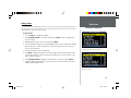
1
™
StreetPilot III
portable GPS with
auto-routing and voice
owner’s
manual
and
reference
guide
COVERS REV B.indd
1
6/28/01, 9:27 AM
© 2001 GARMIN Corporation
GARMIN International, Inc.
1200 E 151st Street, Olathe, Kansas 66062 U.S.A.
Tel. 913/397.8200 or 800/800.1020
Fax. 913/397.8282
GARMIN (Europe) Ltd.
Unit 5, The Quadrangle, Abbey Park Industrial Estate,Romsey, SO51 9AQ U.K.
Tel. 44/1794.519944
Fax. 44/1794.519222
GARMIN Corp.
No. 68, Jangshu 2nd Road, Shijr, Taipei County, Taiwan
Tel. 886/2.2642.9199
Fax. 886/2.2642.9099
All rights reserved. Except as expressly provided herein, no part of this manual may be reproduced, copied, transmitted, disseminated, downloaded or
stored in any storage medium, for any purpose without prior written consent of GARMIN Corporation. GARMIN Corporation hereby grants permission to
download a single copy of this manual onto a hard drive or other electronic storage medium to be viewed for personal use, provided that such electronic
or printed copy of this manual contains the complete text of this copyright notice and provided further that any unauthorized commercial distribution
of this manual is strictly prohibited.
Information in this manual is subject to change without notice. GARMIN Corporation reserves the right to change or improve its products and to make
changes in the content without obligation to notify any person or organization of such changes. Visit the GARMIN web site for downloadable upgrades to
the operating software and the Owner’s Manual. The web site also contains information concerning the use and operation of other GARMIN products.
Web site address: www.garmin.com
GARMIN®, AutoLocate®, MapSource® and TracBack® are registered trademarks and StreetPilotTM is a trademark of GARMIN Corporation and may not
be used without the express permission of GARMIN Corporation.
Printed in Taiwan
June 2001
Part Number 190-00206-00 Rev. B
COVERS REV B.indd
2
6/28/01, 9:27 AM
Welcome
Introduction
Thank you for choosing the GARMIN StreetPilot III. The StreetPilot III offers true turn-by-turn
navigation with its auto-routing feature. At the touch of a button, you now have access to the shortest
and fastest routes, turn directions, and estimated time of arrival at your intended destination. Along the
way, the StreetPilot III provides automated voice prompts, alerting you to necessary turns, distance to
upcoming turns, route deviation, and distance to the final destination.
The StreetPilot III is compact and portable. This dash-mounted unit can be operated by your
vehicle’s battery using the included 12-volt power adapter, or by six AA batteries. Voice commands
are clearly heard through a speaker which is built into the power adapter cable. The StreetPilot III
can easily be viewed in any lighting condition, due to its 4-inch, high resolution, 16-color display.
The unit’s built-in basemap provides detail for interstates, interstate exit data, highways, rivers and
lakes in the United States, Canada and Mexico (no exit data for Mexico), plus commonly used streets
in metropolitan areas. With the press of a button, the built-in basemap will provide turn-by-turn
guidance to a destination via interstates and highways. With downloaded maps from the MapSource
City Navigator CD-ROM, StreetPilot III provides turn-by-turn guidance down to residential street-level
detail.
About This Manual
Make sure you take the time to read the Quick Start Guide first to get acquainted with all of the
basic features of the StreetPilot III. After you have read the Quick Start Guide, you can read through this
owner’s manual in order to understand the operating features of the StreetPilot III in detail. This manual
is organized into three sections for your convenience. The Introduction Section provides FCC and
safety information and the table of contents. The Reference Section provides details about all of the
features of the StreetPilot III, organized by topic. The Appendices contain information on items such as
accessories, specifications, and an index organized by subject.
Welcome
The StreetPilot III uses GPS technology in order to
find your precise location. GPS stands for Global
Positioning System, a group of 24 satellites, circling the earth twice a day, at an altitude of
about 12,000 miles. The satellites transmit very
low power radio signals containing position
and time information, allowing anyone with
a GPS receiver to determine their location
on the earth within 100 meters or better.
For more detailed information regarding GPS,
we have prepared a booklet called “GPS
Guide for Beginners” which is available
to you from our web site at www.garmin.com.
1
OM REV B.indd
1
6/28/01, 9:42 AM
Introduction
Introduction . . . . . . . . . . . . . . . . . . . . . . . . . . . . .1
Welcome . . . . . . . . . . . . . . . . . . . . . . . . . . . . .1
About This Manual . . . . . . . . . . . . . . . . . . . . . .1
Table Of Contents . . . . . . . . . . . . . . . . . . . . . .2
Safety Warnings and Cautions . . . . . . . . . . . . .4
Software License Agreement . . . . . . . . . . . . . . .6
FCC Compliance . . . . . . . . . . . . . . . . . . . . . . .7
Limited Warranty . . . . . . . . . . . . . . . . . . . . . . .8
Unit Description . . . . . . . . . . . . . . . . . . . . . . . .9
Keys . . . . . . . . . . . . . . . . . . . . . . . . . . . . . . . .10
Features/Data Entry . . . . . . . . . . . . . . . . . . . .11
Unit Pages at a Glance . . . . . . . . . . . . . . . . . .12
Table of Contents
Reference Section . . . . . . . . . . . . . . . . . . . . . . .13
The Map Page . . . . . . . . . . . . . . . . . . . . . . . . .13
Map Page Nav Info . . . . . . . . . . . . . . . . . .14
Zooming, Panning, and Pointing . . . . . . .15
Routing to a Map Feature or Location . . . .17
Map Page Options . . . . . . . . . . . . . . . . . .18
Next Turn Page . . . . . . . . . . . . . . . . . . . . . . . .21
Current Route Page . . . . . . . . . . . . . . . . . . . .22
Trip Information Page . . . . . . . . . . . . . . . . . . .24
Marking Waypoints . . . . . . . . . . . . . . . . . . . .26
Using the Find Menu . . . . . . . . . . . . . . . . . . .27
Finding Items by Name or by Nearest . . . .27
Finding a Waypoint . . . . . . . . . . . . . . . . .28
Finding a City . . . . . . . . . . . . . . . . . . . . . .28
Finding an Exit . . . . . . . . . . . . . . . . . . . .29
Finding a Point of Interest . . . . . . . . . . . .30
Finding an Address or Intersection . . . . . .31
Recently Found Places . . . . . . . . . . . . . . .32
Using the Routes Menu . . . . . . . . . . . . . . . . .32
GPS Information Page . . . . . . . . . . . . . . . . . .35
Sky View and Signal Strength Bars . . . . . .35
Receiver Status . . . . . . . . . . . . . . . . . . . . .36
Accuracy . . . . . . . . . . . . . . . . . . . . . . . . . .37
GPS Info Page Options . . . . . . . . . . . . . . .38
Map Source Information . . . . . . . . . . . . . . . . .39
System Info . . . . . . . . . . . . . . . . . . . . . . . . . .39
2
OM REV B.indd
2
6/28/01, 9:42 AM
System Setup . . . . . . . . . . . . . . . . . . . . . . . . .40
System Setup Pages . . . . . . . . . . . . . . . . . .40
General Tab . . . . . . . . . . . . . . . . . . . . . . .41
Guidance Tab . . . . . . . . . . . . . . . . . . . . . .42
Routing Tab . . . . . . . . . . . . . . . . . . . . . . .43
Time Tab . . . . . . . . . . . . . . . . . . . . . . . . .45
Safety Tab . . . . . . . . . . . . . . . . . . . . . . . . .46
Track Log Tab . . . . . . . . . . . . . . . . . . . . . .46
Language Tab . . . . . . . . . . . . . . . . . . . . . .47
Interface Tab . . . . . . . . . . . . . . . . . . . . . . .48
Introduction
Table of Contents
Appendices . . . . . . . . . . . . . . . . . . . . . . . . . . . .50
Appendix A: Optional Accessories . . . . . . . . .50
Appendix B: Wiring and Interfacing . . . . . . . .52
Appendix C: Maintenance . . . . . . . . . . . . . . .53
Appendix D: Messages . . . . . . . . . . . . . . . . . .54
Appendix E: Specifications . . . . . . . . . . . . . . .56
Appendix F: Time Offset . . . . . . . . . . . . . . . .58
Appendix G: Index . . . . . . . . . . . . . . . . . . . . .59
3
OM REV B.indd
3
6/28/01, 9:42 AM
Safety Warnings and Cautions—Read This First!
Introduction
Warnings and Cautions
Your StreetPilot III is equipped with a ‘Safe Mode’
feature to improve driver safety. By default, this
feature is enabled, but can be turned off to
allow a passenger to operate the unit. When
your vehicle is moving, Safe Mode disables
certain StreetPilot III functions which require
significant operator attention and may become a
distraction to use while driving. See page 46 for details.
WARNING: For use in vehicles, it is the sole responsibility of the owner/operator of the
StreetPilot III to place and secure the GPS unit so that it will not interfere with the vehicle operating
controls and safety devices, obstruct the driver’s view of driving conditions, or cause damage or
personal injury in the event of an accident. Do not mount the StreetPilot III over airbag panels or
in the field of airbag deployment. Airbags expand with a rapid force that can propel objects in their
path towards the vehicle driver or passengers causing possible injury. Refer to airbag safety precautions
contained in the vehicle owner’s manual. Do not mount the StreetPilot III in a place where the driver
or passengers are likely to impact it in an accident or collision. The mounting hardware provided by
GARMIN is not warranted against collision damage or the consequences thereof.
WARNING: When used in vehicles, it is the sole responsibility of the driver of the vehicle to
operate the vehicle in a safe manner, maintain full surveillance of all driving conditions at all times,
and not become distracted by the StreetPilot III to the exclusion of safe driving practices. It is unsafe
to operate the controls of the StreetPilot III while you are driving. Failure by the driver of a vehicle
equipped with a StreetPilot III to pay full attention to operation of the vehicle and road conditions
while the vehicle is in motion could result in an accident or collision with property damage and
personal injury.
Do Not Mount Where Driver’s Field
of Vision is Blocked
Do Not Mount in Front of
Airbag Panels
Do Not Place Unsecured on the
Vehicle Dash
Do Not Mount in Front of an Airbag
Field of Deployment
4
OM REV B.indd
4
6/28/01, 9:42 AM
CAUTION: The Global Positioning System (GPS) is operated by the government of the United
States, which is solely responsible for its accuracy and maintenance. The system is subject to changes
that could affect the accuracy and performance of all GPS equipment. Although the StreetPilot III is
a precision NAVigation AID (NAVAID), any NAVAID can be misused or misinterpreted and, therefore,
become unsafe.
Introduction
Map Data
MAP DATA INFORMATION: One of the goals of GARMIN is to provide customers with the
most complete and accurate cartography that is available to us at a reasonable cost. We use a combination of governmental and private data sources, which we identify as required in product literature
and copyright messages displayed to the consumer. Virtually all data sources contain inaccurate or
incomplete data to some degree. This is particularly true outside the United States, where complete and
accurate digital data is either not available or prohibitively expensive.
CAUTION: IT IS THE USER’S RESPONSIBILITY TO USE THIS PRODUCT PRUDENTLY. THIS
PRODUCT IS INTENDED TO BE USED ONLY AS A TRAVEL AID AND MUST NOT BE USED FOR
ANY PURPOSE REQUIRING PRECISE MEASUREMENT OF DIRECTION, DISTANCE, LOCATION,
OR TOPOGRAPHY. THIS PRODUCT SHOULD NOT BE USED TO DETERMINE GROUND PROXIMITY FOR AIRCRAFT NAVIGATION.
Because the map data may not be perfect, it will help
at times to cross-check the unit’s map with your actual
surroundings to confirm that you are arriving at the exact
destination.
5
OM REV B.indd
5
6/28/01, 9:42 AM
Software License Agreement
Introduction
BY USING THE STREETPILOT III, YOU AGREE TO BE BOUND BY THE TERMS AND CONDITIONS OF THE FOLLOWING SOFTWARE LICENSE AGREEMENT. PLEASE READ THIS AGREEMENT CAREFULLY.
Software License
Agreement
GARMIN Corporation (“GARMIN”) grants you a limited license to use the software embedded in
this device (the “Software”) in binary executable form in the normal operation of the product. Title,
ownership rights and intellectual property rights in and to the Software remain in GARMIN.
You acknowledge that the Software is the property of GARMIN and is protected under the United
States of America copyright laws and international copyright treaties. You further acknowledge that
the structure, organization and code of the Software are valuable trade secrets of GARMIN and that
the Software in source code form remains a valuable trade secret of GARMIN. You agree not to
decompile, disassemble, modify, reverse assemble, reverse engineer or reduce to human readable form
the Software or any part thereof or create any derivative works based on the Software. You agree
not to export or re-export the Software to any country in violation of the export control laws of the
United States of America.
6
OM REV B.indd
6
6/28/01, 9:42 AM
FCC Compliance
Introduction
The GARMIN StreetPilot III has been tested to comply with FCC Standards for home and office
use. It complies with Part 15 of the Federal Communications Commission (FCC) limits for Class
B digital devices. This equipment generates, uses, and can radiate radio frequency (RF) energy and,
if not installed and used in accordance with instructions, may cause harmful interference to radio communications. There is no guarantee that interference will not occur in a particular installation. If this
device does cause harmful interference to other equipment, which can be determined by turning this
device off and on, you are encouraged to try and correct the interference by increasing the separation
between this device and other equipment or reorienting or relocating the receiving antenna.
Consult an authorized dealer or other qualified service technician for additional help if these
remedies do not correct the problem. Operation is subject to the following conditions: (1) This device
cannot cause harmful interference, and (2) this device must accept any interference received, including
interference that may cause undesired operation. Specifically when operating inside an automobile,
interference is possible from AM/FM radios, cassette or CD players, or mobile telephones, among other
electronic devices. If you suspect the unit is experiencing harmful interference (as evidenced by poor
satellite reception), try relocating the StreetPilot III in the automobile to remedy the situation.
FCC Compliance
The StreetPilot III does not contain
any user-serviceable parts. Repairs
should only be made by an authorized GARMIN service center. Unauthorized repairs or modifications
could void your warranty and your
authority to operate this device
under Part 15 regulations.
7
OM REV B.indd
7
6/28/01, 9:42 AM
Limited Warranty
Introduction
GARMIN Corporation warrants this product to be free from defects in materials and manufacture
for one year from the date of purchase. GARMIN will, at its sole option, repair or replace any
components that fail in normal use. Such repairs or replacement will be made at no charge to the
customer for parts or labor. The customer is, however, responsible for any transportation costs. This
warranty does not cover failures due to abuse, misuse, accident or unauthorized alteration or repairs.
Limited Warranty
THE WARRANTIES AND REMEDIES CONTAINED HEREIN ARE EXCLUSIVE AND IN LIEU OF
ALL OTHER WARRANTIES EXPRESS OR IMPLIED OR STATUTORY, INCLUDING ANY LIABILITY
ARISING UNDER ANY WARRANTY OF MERCHANTABILITY OR FITNESS FOR A PARTICULAR
PURPOSE, STATUTORY OR OTHERWISE. THIS WARRANTY GIVES YOU SPECIFIC LEGAL RIGHTS,
WHICH MAY VARY FROM STATE TO STATE.
IN NO EVENT SHALL GARMIN BE LIABLE FOR ANY INCIDENTAL, SPECIAL, INDIRECT OR
CONSEQUENTIAL DAMAGES, WHETHER RESULTING FROM THE USE, MISUSE, OR INABILITY
TO USE THIS PRODUCT OR FROM DEFECTS IN THE PRODUCT. SOME STATES DO NOT
ALLOW THE EXCLUSION OF INCIDENTAL OR CONSEQUENTIAL DAMAGES, SO THE ABOVE
LIMITATIONS MAY NOT APPLY TO YOU.
To obtain warranty service, contact your GARMIN dealer or call the GARMIN Customer Service
department (913-397-8200) for a returned merchandise tracking number. The unit should be securely
packaged with the tracking number clearly marked on the outside of the package and sent freight
prepaid and insured to a GARMIN warranty service station. A copy of the original sales receipt is
required as the proof of purchase for warranty repairs. GARMIN retains the exclusive right to repair
or replace the unit or software or offer a full refund of the purchase price at its sole discretion.
SUCH REMEDY SHALL BE YOUR SOLE AND EXCLUSIVE REMEDY FOR ANY BREACH OF WARRANTY.
8
OM REV B.indd
8
6/28/01, 9:42 AM
StreetPilot III Description
Introduction
Unit Description
Power/Data Connector
Detachable Antenna
(Back Side) Connections for
Power, Ground, Serial Data
In and Serial Data Out.
Rotate upright for best
satellite reception.
Power/Backlight Key
Press and hold to turn
on/off. Press momentarily
to adjust screen backlight
and contrast.
16-Color LCD Display
On-screen information is
referred to as a “page”.
Press PAGE key to select
a different screen.
Rocker Keypad
Moves the cursor, pans
the Map Page and
enters data.
Battery Door
Cartridge Door
(Back Side) To open, turn metal D-ring
counterclockwise 1/4 turn and pull
battery door away from unit.
(Bottom) Insert programmed card
for increased map detail and
information lookup capability.
9
OM REV B.indd
9
6/28/01, 9:42 AM
Introduction
POWER (Red Bulb Symbol)- Press and hold to turn the StreetPilot III on and off. Press momentarily while
power is on to display the backlight/contrast adjustment window.
Keypad Usage
PAGE- Switches between main pages and returns display from an option window back to a main page.
QUIT- Returns display to a previous page. When entering data, restores the previous value (cancels
data entry).
ENTER/MARK- Confirms a selected menu option. When entering data, it allows you to initiate entry, and
then to accept the selected value(s). Press and hold to capture your present position and save it as a
waypoint. ENTER/MARK can also capture the location of the panning arrow on the Map Page.
ROCKER KEYPAD- Selects menu options and enters data. Also controls movement of the panning cursor
on the Map Page.
Zoom IN and OUT- Adjusts map scale to show a smaller area (more detail) or a larger area (less detail).
FIND- Searches the database for Cities, Interstate Exits, Waypoints, and Recently found places. If an
optional MapSource City Navigator or MetroGuide map data card is installed, it also searches for Points
of Interest, Addresses, or Intersections. Allows the listed items to be viewed on a map or selected as a
destination (Note: MetroGuide will not provide turn-by-turn navigation or voice commands).
MENU- Displays a menu of options for the current page. Press twice to display System Setup options.
ROUTE- Displays a pop-up window of route navigation features.
VOL/SPEAK- Adjusts the speaker volume. Press and hold until the controller appears on the left side
of the screen. To hear the volume count (i.e. 1, 2, 3, 4, 5, 6, 7, 8) press up or down on the rocker
keypad. Each press will activate the audio number. Pressing VOL/SPEAK also triggers the voice repeat
function when navigating.
10
OM REV B.indd
10
6/28/01, 9:42 AM
Features/Data Entry
Introduction
The following features and data entry procedures are referred to throughout this manual.
CURSOR- A highlighted area on the screen which can be moved up/down/left/right with the
ROCKER KEYPAD to select individual fields on the display. Moving the cursor to a given location
allows you to begin data entry or scroll through a list.
Features/Data Entry
FIELD- The location on a page where a group of characters or an option is entered and displayed.
The cursor is placed on a field (using the ROCKER KEYPAD) to begin data entry or selection of
options.
To enter data in a data field:
1. Use the ROCKER KEYPAD to highlight the desired data field. Press ENTER to begin data entry.
2. Use the ROCKER KEYPAD to enter the desired data. UP/DOWN to select the desired character and
RIGHT to move to the next character field. LEFT allows you to back up to the previous character
field or, when at the left most character field, to clear the entire data field.
An example of a “button”—the ‘Route to It’ button on the
Waypoint Marked Page.
3. Once the desired data has been entered, press ENTER to confirm.
ON-SCREEN BUTTON- Similar to “Field”. Place the cursor on a button and press ENTER to
select the action corresponding to that button. An example of an on-screen button is the ‘Route to It’
button appearing at the bottom of the Waypoint Marked Page.
SCROLL BAR- When viewing a list of items too long to display on a single page, a scroll bar will
appear along the right-hand side of the list. The position of the scroll bar indicates which portion of the
list is currently being displayed. The height of the scroll bar indicates the number of items in the list. To
scroll through a list of items, use the UP/DOWN portion of the ROCKER KEYPAD.
DEFAULT- A system-selected format, built into the operating software or the unit’s memory, that
will be followed unless the user chooses a different setting. For example, the default setting for speed
readings is ‘miles per hour’ or but can be changed to ‘kilometers per hour’. Once a setting is changed,
the new setting is retained until another change is made or a ‘Restore Original Settings’ menu option
is selected.
OM REV B.indd
11
When viewing a list of items too long to display on a
single page, a scroll bar will appear along the right-hand
side of the list. Also, using the Left/Right portion of the
Rocker Keypad will scroll information one full screen at
a time.
11
6/28/01, 9:42 AM
Introduction
Unit Pages at a Glance
All of the information needed to operate the StreetPilot III is found on ‘pages’—display screens.
There are three main pages, the Map, Trip Information, and Current Route. A fourth screen is available
during navigation, the Next Turn Page. Press the PAGE or QUIT key to switch back and forth between
pages. The Reference Section describes in detail what each page does and how they are configured.
Unit Pages
Current Route Page—Available
only during navigation
PAGE
KEY
Map Page
QUIT
KEY
Trip Information Page
SPEAK
KEY
(Or can be set
to automatically
appear for 10
seconds)
Next Turn Page—Available
only during navigation
12
OM REV B.indd
12
6/28/01, 9:42 AM
The Map Page
Reference
The Map Page
Direction to Go
Route Line
Vehicle Speed
Distance to Go
Time to Go
Your Current
Position
Driving Instructions
Map Scale
The Map Page is the main operating page of the StreetPilot III. It graphically shows you map details,
your current location, and marks your route to a destination with a magenta colored route line. It tells
you what direction to go or the direction you are traveling. It tells you your speed, the distance you
have traveled, or the distance to the next turn, and the time remaining before reaching the next turn. If
the StreetPilot III has yet to calculate your location, there is a flashing question mark over the vehicle
pointer and the status text displays, ‘Acquiring Satellites’.
The map can be displayed in a ‘square’ or
‘wide’ configuration for custom viewing. The square
configuration is shown to the left, the wide
configuration is shown above. Both show Navigation
Information. For maximum map display, you can select
‘Full Screen Map’. This section of the manual discusses
how to select between the displays.
The map display shows your present position and direction of movement as a triangular ‘Position
Icon’ in the center of the map. The map display also shows the map scale and geographic details
such as lakes, rivers, highways, and towns. You can use the IN and OUT keys to change the map
scale to show more map area with less detail, or less map area with more detail. Press and hold to
zoom the map scale rapidly.
The ‘Full Screen Map’ configuration showing no
Navigation Information.
13
OM REV B.indd
13
6/28/01, 9:42 AM
Reference
When you are not driving on roads that are present in the maps, you may see a circle drawn
around the position pointer. This is an ‘accuracy circle’. The StreetPilot III uses both map resolution
and GPS accuracy in defining your location to a point within this “accuracy circle”. The smaller the
circle, the more accurate your location. More detailed map features as well as information about those
features can be displayed using a data card containing map data transferred from a GARMIN MapSource
CD-ROM. When you zoom into smaller map scales, “MapSource” will appear directly below the map
scale indicating that MapSource data is being used to draw a more detailed map.
The Map Page
Map Page Navigation Information
The following navigation information can be displayed on the Map Page:
Clear driving instructions are displayed when you are
navigating a route.
Current Direction (N, S, E, or W) - Cardinal letters indicate the direction you are traveling when
not navigating a route. This is not displayed when you are navigating.
Direction To Go (Arrow) - An arrow that points to the next turn in the route when moving
on an active route.
Speed - Your rate of travel which can be displayed in miles per hour or kilometers per hour.
Distance To Go - When navigating a Route, the distance remaining to reach the next turn will be
displayed. When not navigating a Route, this field is not displayed.
Time To Go - When navigating a Route, the time to go before reaching the next turn is displayed.
When not navigating a Route, the time for the current time zone is displayed in either 12 or 24
hour format.
Your vehicle speed can be displayed in miles per hour or
kilometers per hour.
Driving Instructions - Given in text format only when you are navigating a route. When you are
not navigating, the next intersection is displayed.
14
OM REV B.indd
14
6/28/01, 9:42 AM
Zooming, Panning and Pointing
There are three main actions you can perform on the Map Page: zooming, panning, and pointing.
The map display has 24 map scales (from 120 feet to 800 miles) which are selected by pressing
the IN and OUT zoom keys. The current map scale is indicated in the bottom left corner of the
map display.
Reference
The Map Page
To change the map scale:
1. Press the IN zoom key to see a smaller area with more detail.
2. Press the OUT zoom key to see a larger area with less detail.
When zoomed in to smaller map areas, ‘overzoom’ appears directly below the map scale. This
indicates the current scale exceeds the optimum resolution of available map detail. Extra caution should
be used in ‘overzoom’ since some detail, such as roads, are drawn using widely spaced points and the
actual layout of these details may differ from the map presentation.
The Map Page showing the panning arrow and a
highlighted map feature or point of interest.
Panning allows you to move the map in order to view areas beyond the current map area.
This provides a ‘look ahead’ capability which is particularly useful with smaller map areas.
To pan, use the ROCKER KEYPAD to move the map in any direction, including diagonally.
Once you are finished with panning, you can quickly remove the panning arrow and re-center
the map on your present position by pressing the QUIT key.
As you begin to pan the map, a pointer appears. This map pointer will serve as a target marker
for the map. If you change the scale, the map is redrawn with the pointer at the center. When the
pointer is placed on an object, the name of that object will be highlighted. (If the name wasn’t originally
displayed, it will appear when the pointer is placed on the object.) This feature applies to everything
displayed on the map except route lines and track log data. When a waypoint name is highlighted, you
can review information about the waypoint, list waypoint options, or execute a ‘Route to It’ directly
from the Map Page.
The Information Page for the park highlighted
in the screen above.
15
OM REV B.indd
15
6/28/01, 9:42 AM
Reference
To select an on-screen location with the panning pointer:
1. Use the ROCKER KEYPAD to highlight the desired item.
The Map Page
2. To view information for the selected item, press ENTER.
3. To exit the information pages, press QUIT.
The ‘Route to It’ function can be used anywhere on the map. If nothing currently exists at the
map pointer position, a new waypoint will be created at the pointer’s location before the ‘Route to
It’ is started. You can also create a waypoint on the Map Page without selecting it as a ‘Route to It’
destination.
To create a new waypoint from the Map Page:
Once the ‘Waypoint Created’ Page appears, the waypoint
is stored in memory.
1. Use the ROCKER KEYPAD to point to the desired location on the map and press ENTER briefly.
A ‘Waypoint Created Page’ will appear, with an auto-assigned name (3-digit number) for the
waypoint.
2. You can delete the waypoint, show it on the map, or Route to It. Select the desired option and
press ENTER.
Once you are finished with panning, you can quickly remove the panning arrow and re-center
the map on your present position by pressing the QUIT key.
The ‘Waypoint Created’ Page appears with a default
three digit number for its name which can be changed to
something a little more meaningful (up to 10 characters
in length).
16
OM REV B.indd
16
6/28/01, 9:42 AM
To mark your current location on the Map Page and save as a waypoint:
1. Press and hold the ENTER key for approximately two seconds. A ‘ Waypoint Marked’ page will
appear with a pre-assigned name, symbol, position and elevation for the new waypoint. When the
‘Waypoint Marked Page’ appears, the waypoint is marked.
Reference
The Map Page
2. The StreetPilot III will automatically assign a three-digit number as the waypoint name, but you
may select any name you want, up to ten characters in length. To change the name, highlight the
identifier field, press ENTER and use the ROCKER KEYPAD to enter the desired waypoint name.
Press ENTER once all characters for the waypoint name have been entered.
3. To select a different waypoint symbol, which will appear on the map, highlight the symbol field
and press ENTER. A list of available symbols will appear. Use the ROCKER KEYPAD to select the
desired symbol and press ENTER.
4. You can route to the waypoint, show it on the map page, or delete it. Use the ROCKER KEYPAD to
select the option you desire and press ENTER.
Routing to a Map Feature or Location
Once you have marked a waypoint, you can route to it,
show it on the map, or delete it.
1. Use the ROCKER KEYPAD to move the arrow to the desired feature or location on the map.
2. Press ENTER to display detailed information about the item.
3. To route to the location on the map, select ‘Route to It’ on the information page for that item
and press ENTER. The ROUTE preference window appears. Select Faster Time, Shorter Distance,
or Off Road, and press ENTER. The StreetPilot III will route you to the selected destination using
turn-by-turn navigation and voice prompting.
You can mark your current position from any page, not
just the Map Page.
17
OM REV B.indd
17
6/28/01, 9:42 AM
Reference
Map Page Options
Like each of the main pages, the Map Page is menu driven. With the Map Page displayed, pressing
MENU will display an options menu, allowing you to customize the page to your preferences and/or
select special features which specifically relate to the Map Page. To display the Map Page options menu,
press MENU (with the Map Page displayed). The following options are available:
The Map Page
• Show Full Screen Map (or) Show Map and Nav Info
• Use Indoors (or) Use Outdoors
• Measure Distance
• Select Layout
The Options Menu on the Map Page allows you to customize the Map Page.
• Map Setup
Show Full Screen Map (or) Show Map and Nav Info—‘Show Full Screen Map’ removes all
screen information for the largest possible map display. ‘Show Map and Nav Info’ shows the map and
the navigation information for the current layout.
Use Indoors (or) Use Outdoors—The ‘Use Indoors’ option stops satellite reception, conserves
power usage, and speeds Map Page drawing. The ‘Use Outdoors’ option listens to satellites for real-time
navigation.
Measure Distance— Allows you to measure the distance between any two points you choose on
the Map Page. Also displays the latitude and longitude of the pointer.
You can adjust the size of the map by using the ‘Select
Layout’ option.
Select Layout—Selects between Square Map and Wide Map. Square Map shows the map on one
half of the display, navigation information on the other half. Navigation information includes direction
to next turn, vehicle speed, distance to next turn, time to next turn, and driving instructions in text
format. Wide map shows the map on three quarters of the screen, the remaining quarter displays
navigation information (direction to next turn, vehicle speed, distance to next turn, time to next turn,
and driving instructions in text format appearing at the top of the display).
18
OM REV B.indd
18
6/28/01, 9:42 AM
To measure the distance between two points:
Reference
1. From the Map Page, press MENU.
2. Select ‘Measure Distance’ and press ENTER. An on-screen pointer will appear on the map display
at your current location.
The Map Page
3. Move the panning arrow to the desired reference point, the point you want to measure from, and
press ENTER.
4. Move the panning arrow to the second point, to which you want to measure. The direction and
distance from the reference point is shown on the top of the Map Page.
5. Press the QUIT key or select ‘Stop Measure Distance’ on the menu to return to the regular Map
Page display.
Map Setup—allows you to configure the map display to your preferences, including map detail,
map orientation, automatic zooming, and color mode. The map setup options are organized under
a series of ‘file tabs’, making individual selections easier to locate and change. The following table
describes the file tabs and settings available under each tab:
A series of tabs allow you to change the Map Page setup
options.
Common Settings
Text—Specifies the text size that a map item will be displayed in. Selecting ‘None’ will turn off
the text display for that item.
Zoom—Specifies the maximum map scale at which a map item will be displayed. If ‘Auto’ is
selected, the maximum map scale will be determined by the ‘Detail’ setting to prevent map clutter. If
‘Off’ is selected, the item will not be shown.
You can adjust the map colors for day or night operation
for maximum clarity.
19
OM REV B.indd
19
6/28/01, 9:42 AM
Reference
Map Options
Map Detail - Adjusts the amount of map information, such as roads, that is displayed. ‘Most’ shows
maximum detail and ‘Least’ shows minimum detail. The higher level of detail, the slower the map
redrawing time.
The Map Page
Orientation - Selecting ‘North Up’ will display the map with North at the top. Selecting ‘Track Up’ will
automatically rotate the map to keep your current direction of travel at the top of the screen. A ‘North’
indicator is displayed on the map when in the ‘Track Up’ mode.
Color Mode - Select between Day, Night, or Automatic for best viewing conditions.
Selecting ‘North Up’ will display the map with North at
the top. Selecting ‘Track Up’ will automatically rotate the
map to keep your current direction of travel at the top
of the screen.
AutoZoom - When ‘On’, this option will automatically adjust the map scale to show both your current
location and the next item you are navigating to.
Line Options
Track Log - Controls the display of the Track Log on the map.
Railroad - Controls the display of railroads on the map.
Street Label - Controls the display of street names on the map.
Other Options
Point - Controls the display of points of interest on the map.
The ‘Normal’ setting for map detail is usually the best
setting for typical operation.
Area - Controls the display of rivers, lakes, parks, and other areas (airports, shopping malls, hospitals,
etc.).
20
OM REV B.indd
City - Controls the display of cities on the map.
20
6/28/01, 9:42 AM
Next Turn Page
Reference
Next Turn Page
Map Orientation
Route Line
Driving Instructions
Map Scale
Time to Go
Distance to Go
You can select when the Next Turn Page appears, or you
can turn it off completely.
The Next Turn Page displays in detailed format the features of the next turn in the route. When
a route is being navigated, it shows for ten seconds. The top-view map is oriented to the inbound
direction for the turn. Map scale is adjustable using the IN/OUT zoom keys. The page shows the
distance and time to the next turn, and driving directions in text format. To clear the Next Turn Page
and return to the previous page at any time, press either the QUIT or ENTER key.
The Next Turn Page can be turned off completely, set to automatically appear when navigating a
route, set to appear only when the SPEAK key is pressed, or both. See the System Setup on page
42 for instructions on configuring the Next Turn Page. When not navigating a route, the Next Turn
Page is no longer available.
The Next Turn Page shows the distance and time to the
next turn, along with driving instructions.
21
OM REV B.indd
21
6/28/01, 9:42 AM
Reference
Current Route Page
Driving Instructions
Current Route Page
Time to Go
Direction of Turn
Scroll Bar
You can change the displayed time to show arrival times
or time to reach each turn.
Distance to Go
When the StreetPilot III is navigating a Route, the Current Route Page is displayed between the Map
Page and the Trip Information Page (the Current Route Page is only available during navigation).
The page shows a pointer which indicates the direction of travel from your current location to the
destination, a list of the next three turns and the destination (turn direction arrow, turn description,
distance and time for each).
To change the time displayed on the Current Route Page:
1. With the Current Route Page displayed, press MENU.
2. Select ‘Show Times to Go’ or ‘Show Arrival Time’. Press ENTER.
It is often desirable to view the Next Turn Page from the Current Route Page.
22
OM REV B.indd
22
6/28/01, 9:42 AM
To view the Next Turn Page from the Route List Page:
Reference
1. With the Route List Page displayed, press ENTER.
2. Press ENTER or QUIT when done looking at the next turn.
Current Route Page
3. You can scroll through the entire list and highlight any of the turns in the list and view the next
turn page for that turn.
To scroll through the list:
1. Use the ROCKER KEYPAD and scroll through the list stopping at the desired turn. Press ENTER and
view the Next Turn Page for that turn. Press ENTER or QUIT to get back to the Route List Page.
The Next Turn Page can be viewed from the Current
Route List Page by pressing the ENTER key.
23
OM REV B.indd
23
6/28/01, 9:42 AM
Reference
Trip Information Page
Trip Information Page
The third main page is the Trip Information Page. If you are making a long trip, you will find the
Trip Information Page very useful. It indicates your current speed and many helpful statistics about
your trip. The following are useful suggestions to aid in maximizing the use of the Trip Information
Page:
Be certain to reset the Trip Computer before beginning the trip. Instructions on resetting will follow.
If you make frequent stops, leave the StreetPilot III powered on and receiving satellites. This will allow
the unit to accurately measure elapsed time during the trip. However, some vehicles disconnect power
to the cigarette lighter when the ignition is turned off. In order to continue receiving satellites, use batteries and the cigarette lighter adapter for your trip. When external power is removed, the unit will then
ask, with a screen prompt, if it can use the batteries when vehicle power is not available.
The Trip Information Page.
The following trip information is displayed on the Trip Information Page:
Driving Status Information - Displayed at the top of the page. Shows the next intersection (the
crossroad name) or exit (if you are on an interstate) if one is approaching. Otherwise it tells you
what road you are on.
Speed - This is the current vehicle speed.
Odometer - A running total of distance traveled, based upon the distance between second-by-second
location readings, since the Trip Computer was last reset.
Current Direction - Displayed to the right of the speed.
Battery power is shown in the upper left corner of the
Trip Information Page. When it turns red, its time to
replace the batteries.
Power/Battery - Displayed to the left of the odometer. If the StreetPilot III is using internal AA
batteries, a battery strength bar is shown (above the bar is a label, Battery Power). Notice the shaded
area of the bar. The farther right the shading extends, the more battery power remaining. When
operating on batteries, the bar and the label turn red when power is low (20% or less). When operating
from an external power source, a power plug symbol is shown along with the label, External Power.
24
OM REV B.indd
24
6/28/01, 9:42 AM
Driving Avg - Your average speed of travel during the time the vehicle has been in motion, since the
Trip Computer was last reset.
Overall Avg - Your average speed of travel (including time stopped) during the time the
StreetPilot III has been tracking your location, since the Trip Computer was last reset.
Reference
Trip Information Page
Max Speed - The maximum speed recorded since the Trip Computer was last reset. Max Speed may
also be reset individually, without resetting other Trip Computer information.
Driving Time - The length of time that the vehicle has been in motion, since the Trip Computer was
last reset.
Stopped Time - The length of time that the vehicle has been stopped (stationary) during the time the
StreetPilot has been tracking your location, since the Trip Computer was last reset.
Time - Shown to the right of the odometer
Total Time - The total length of time that the StreetPilot III has been tracking your location, since the
Trip Computer was last reset. This is always equal to Driving Time plus Stopped Time.
You can reset Max Speed or the Trip Computer from the
Trip Information Menu.
To reset the Trip Computer or the Maximum Speed:
1. Press the MENU key to display the Options window.
2. Use the UP and DOWN keys to select ‘Reset Trip Computer’.
3. Press ENTER.
4. To reset the Maximum Speed only, select ‘Reset Max Speed Only’ and then press ENTER.
25
OM REV B.indd
25
6/28/01, 9:42 AM
Reference
Marking Your Location as a Waypoint
Marking Waypoints
It is useful to mark a location, so that you can drive to it again later. These locations are called
‘Waypoints’. The StreetPilot III can hold up to 500 Waypoints.
To mark your location as a Waypoint:
1. Press and hold ENTER. The ‘Waypoint Marked’ page appears, with a default three-digit name for the
new Waypoint in the upper-left portion of the page. The StreetPilot III captures the location from the
instant at which you pressed ENTER, so you do not need to be concerned about moving around or
losing satellite reception, your Waypoint is safely stored.
To rename the Waypoint:
1. Use the ROCKER KEYPAD to select the name and press ENTER.
A waypoint is stored in memory as soon as the
‘Waypoint Marked’ Page appears.
2. Enter the new waypoint name using the ROCKER KEYPAD, and press ENTER.
Each waypoint may also be assigned a custom waypoint symbol for easy recognition on the Map
Page.
To change the Waypoint symbol:
1. Highlight the Waypoint symbol (immediately to the left of the waypoint name) and press ENTER. Use
the ROCKER KEYPAD to select the desired symbol.
2. Press ENTER when you find the most appropriate symbol. The new Waypoint is now stored in
memory.
At the bottom of the Waypoint Marked Page there are three selections that can be made:
Delete - deletes the waypoint.
There are approximately 50 waypoint symbols to choose
from. These symbols are used to mark the waypoint’s
position on the Map Page.
Show Map - Shows the waypoint on the Map Page.
Route To It - Tells the unit that you want to navigate to that waypoint.
26
OM REV B.indd
26
6/28/01, 9:43 AM
Using the Find Menu
Reference
You can search for Waypoints, Cities or Exits that are included in the StreetPilot III basemap using
the Find Menu. In addition, if you are using optional City Navigator map data, you can search for
and find Points of Interest, Addresses, or Intersections. Your current location is normally used as the
reference point for the ‘Nearest’, ‘Distance’, and ‘Direction’ features. However, if you are using the
panning arrow (Map Pointer), it is used as the reference point.
Using the Find Menu
Finding items ‘by Name’ or ‘by Nearest’
Personal Waypoints, Cities, and Points of Interest on the Find Menu can be viewed in two formats,
‘By Name’ (a list of every item available for a category) or ‘By Nearest’ (a list of only those items for
a category that are nearby). The Find Nearest lists (nearest businesses, cities, waypoints, and exits)
update continuously. The yellow highlight can be introduced by pressing ENTER or any direction
on the rocker keypad. Introducing the highlight allows you to scroll through and select any of the
nearest items listed and it also freezes the list in its current order. To remove the highlight and resume
continuous searching for nearest items, press the QUIT key.
The Find Menu uses the built in basemap and optional
City Navigator CD Map Data.
To switch between ‘By Name’ and ‘Nearest’:
1. Press the MENU key.
2. Highlight ‘Find Nearest’ or ‘Find By Name’ and press ENTER.
Finding an item by name:
1. The first character in the name field at the top of the page will be selected. Begin entering the
name of the item you want, using the method for entering each letter or number described on
page 11.
2. When you can see that the names of the items in the list below are near the name of the item
you want, press ENTER.
You can find items by name or search for nearby items
by category.
27
OM REV B.indd
27
6/28/01, 9:43 AM
Reference
3. Highlight the item you want from the list.
4. Press ENTER to display the information page for the item.
Using the Find Menu
Finding a nearest item :
1. Highlight the item you want from the nearest list.
2. Press ENTER to display the information page for the item.
Finding a Waypoint
You can find waypoints without using the optional
MapSource CD map data.
Waypoints that you have created and stored in the StreetPilot III can be found by selecting the
‘Waypoints’ option of the Find Menu. You can find a waypoint from a list of waypoints ‘By Name’ or
‘Nearest’ using the procedure explained in the steps above.
The Waypoint Information Page (step 2 above) displays the waypoint name, a map symbol, the
location in lat/lon, elevation and three on-screen buttons (Route to It, Show it on the map, or Delete
the Waypoint).
Finding a City
Cities listed in the map database can be found by selecting the ‘Cities’ option of the Find Menu.
The City Information Page for the selected city displays the city name, the size by population and the
distance from your location. You can view it on the map (show map) or ‘Route to It’ from your current
location, or save as a waypoint.
Nearest cities are listed in order according to their
mileage from your present position.
28
OM REV B.indd
28
6/28/01, 9:43 AM
Reference
Finding an Exit
You can use the Find Exit option to locate a nearby exit on an interstate highway. Exits are listed
only by ‘Nearest’. You can also search for exits on interstates other than the nearest one by choosing
‘Select Exit Road’ option from the list of exits.
Using the Find Menu
To find an Exit:
1. Press the FIND key to display the Find Menu.
2. Use the ROCKER KEYPAD to select ‘Exits’ and then press ENTER. A menu will appear with a
choice of exit types.
3. Highlight the type of exits you wish to view, then press ENTER.
4. A list of the nearest exits ahead of you will be displayed. The title of the list indicates the interstate
which the exits are on. Direction and distance is shown on the right side of the list from your
location to the selected exit.
5. Scroll through the list to select the desired exit.
Once you locate the item of your choice, press ENTER
to display an information page for that item.
6. Press ENTER to display the Exit Page for that exit. This page contains the exit description at the
top of the page and a list of services near that exit at the bottom. You can show the exit on the
map or save it as a waypoint.
7. Use the ROCKER KEYPAD to highlight an item from the list of services, then press ENTER.
8. A page will appear, showing the type of services, its direction from the exit and a list of services
available, each marked by a check.
To view all of the exits in the list, use the scroll bar on the
right side of the display.
29
OM REV B.indd
29
6/28/01, 9:43 AM
Reference
Finding a Point of Interest
Using the Find Menu
You must be using MapSource MetroGuide or City Navigator which provides this type of map data,
otherwise this option is unavailable.
To locate a point of interest:
1. Press the FIND key to display the Find Feature Menu. Select ‘Points of Interest’ and press ENTER
to display a list of categories.
2. Select the category of your choice and then press ENTER to display the list of types.
3. Select the type of your choice and press ENTER to display a list of the points of interest first
for that type.
4. Follow instructions on page 27 to find a point of interest by name or nearest.
Scroll through the Points of Interest list to see all of the
Points of Interest that are available, including Emergency
and Government.
5. Select the desired point of interest on the list and press ENTER to display the information page.
The information page will include the full name, type, address, and phone number. You can choose
to save the selection as a waypoint, show it on the map, or route to it. Select your choice and
press ENTER.
When searching for points of interest using the ‘By Name’ list, multiple items with the same name
appear only once on the list (for example “McDonalds”). When you select it and press ENTER, a list
of ‘Nearest’ for that name will appear.
30
OM REV B.indd
30
6/28/01, 9:43 AM
Finding an Address or an Intersection
You must be using MapSource MetroGuide or City Navigator which provides this type of map data,
otherwise these options are not selectable.
Reference
Using the Find Menu
To locate an address:
1. Press the FIND key to display the Find Feature Menu. Select the ‘Address’ option and then press
ENTER to display the ‘Find Address’ page.
2. Select the Number field and use the method for entering numbers as explained on page 11.
3. Move to the ‘Street’ field using the ROCKER keypad.
4. Press ENTER to display the ‘Select Street Name’ list. Find the street you want following the
instructions for finding an item by name on page 27 of this manual.
5. With the desired street selected, press ENTER to place the street name on the find page.
6. Select the ‘Find’ button and press ENTER to view the ‘Select Address’ page with a list of possible
address matches. A window at the bottom of the list displays the quality of each address match.
You must be using the optional MapSource data or
finding an address is not possible.
7. Select an address and press ENTER to display the ‘Address’ page, from which you can view the
address on the map or ‘Route to It’.
8. If there are multiple matches, use the optional city and postal code fields to place the best matches
near the top of the list.
To locate an intersection:
The ‘Find Intersection’ feature operates like the Find Address feature, with the exception that you
enter first and second street names instead of an address and a street name.
31
OM REV B.indd
31
6/28/01, 9:43 AM
Reference
Recently Found Places
Using the Find Menu
Each recent list will hold fifteen items. The last fifteen businesses are listed in the POI list, the last
fifteen cities are in the cities list, etc. The most recently reviewed item is at the top of each list and
the list is in reverse-chronological order. You can use the Recently Found Places option to locate Points
of Interest, Addresses and Intersections, Cities, and other locations. The Recently Found Places page is
denoted by a ‘file tab’ at the top that identifies the function of that page.
To locate a Recently Found Place:
1. Press the FIND key to display the Find Feature Menu. Select ‘Recently Found Places’ and press
ENTER to display a list of places (you can also display the recently found places page by pressing
and holding down the FIND key). Select the file tab category of your choice and then press ENTER
to display the list of types.
The most recently reviewed item is at the top of
the recently found list and they are listed in reverse
chronological order.
2. Select the desired item on the list and press ENTER to display the information page. The information
page will include the full name, type, address, and phone number (only for points of interest). You
can choose to save the selection as a waypoint, show it on the map, or route to it. Select your
choice and press ENTER.
Using the Routes Menu
The Routes Menu gives you five options to manage the StreetPilot III Routes feature. The five
options are:
Recalculate - Recalculates the active route for faster time or shorter distance.
Stop or Resume - Stops the route being navigated (or the simulated route). Or resumes a currently
stopped route.
The ‘Routes’ Menu can be accessed from any page by
pressing the ROUTE key.
Save - Saves the active route.
New - Starts an entirely new route.
List - Selects a Route to start from a list of saved routes.
32
OM REV B.indd
32
6/28/01, 9:43 AM
To Start a New Route:
Reference
1. Press the ROUTE key to view the Routes Menu. Select ‘New’ and press ENTER. The Find Destination
window appears.
2. Follow the instructions given on page 27 to select a Find Destination item. Once the Information
Page is displayed for the item you found, select Route to It and press ENTER.
Using the Routes
Menu
3. The Route Preference Window appears (unless disabled by the ‘Ask Me My Preference’ setting).
4. From the Route Preference window select ‘Faster Time’, ‘Shorter Distance’, or ‘Off Road’ (or ‘Don’t
Ask Again’). See page 43 for a description of these four options.
5. Press ENTER. The Thumbnail Route Map appears in the lower left-hand corner of the Map Page. The
unit is now ready to navigate the new route.
To Select a Route to start from a List of Saved Routes:
1. Press the ROUTE key to view the Routes Menu. Select List and press ENTER. The Select a Route
to Start window appears.
If you want a faster time instead of the shortest distance,
you can recalculate the route at any time.
2. Use the ROCKER KEYPAD to select a saved route from the list. Press ENTER. The unit is now
ready to navigate the route.
To Recalculate a Route:
1. Press the ROUTE key to view the Routes Menu. Select ‘Recalculate’ and press ENTER.
2. The Route Preference Window appears (unless disabled). From the Route Preference window select
Faster Time, Shorter Distance, or Off Road (or Don’t Ask Again). See page 43 for a description of
these four options.
3. Press ENTER. The Thumbnail Route Map appears in the lower left-hand corner of the Map Page. The
unit is now ready to navigate the route.
To Stop a Route:
To save a route, select ‘Save’ from the Routes menu
and press the ‘OK’ button on the Route Saved window.
1. Press the ROUTE key to view the Routes Menu.
2. Select Stop and press ENTER. The current route becomes inactive.
33
OM REV B.indd
33
6/28/01, 9:43 AM
Reference
To Save a Route:
Using the Routes Menu
1. Press the ROUTE key to view the Routes Menu. Select Save and press ENTER. The Route Saved
window appears, showing the active route.
2. Press ENTER (‘OK button’) to confirm the name and save the route (the name can be edited here).
There can be up to 50 saved routes.
Deleting and Renaming Routes
You can delete all of the routes that exist in the unit or you can delete a single route. You can
also rename a route.
To Delete all Routes:
To create a route for the StreetPilot III with multiple
points or destinations, you must use MapSource City
Navigator. With City Navigator, you can create an
auto-route with any combination of waypoints, cities,
intersections and points of interest and download the
route to the StreetPilot III.
Any intermediate point in an auto-route calculated
in City Navigator is called a ‘via’ point in the StreetPilot
III. Refer to the MapSource Owner’s Manual for
instructions on creating routes.
1. Press the ROUTE key to view the Routes Menu. Select ‘List’ and press ENTER. The Route List
appears with all routes. Press the MENU key (‘delete all’ is selected). Select ‘Yes’ in the verification
window and press ENTER.
To Delete a single Route:
1. Press the ROUTE key to view the Routes Menu. Select ‘List’ and press ENTER. The Route List
appears with all routes. Select the single route to delete and press the MENU key. Select ‘Delete’ and
press ENTER. Select ‘Yes’ in the verification window and press ENTER.
To Rename a Route:
1. Press the ROUTE key to view the Routes Menu. Select ‘List’ and press ENTER. The Route List
appears with all routes. Select the single route to rename and press the MENU key. Select ‘Rename’
and press ENTER. Use the Rocker Keypad and enter the new route name.
34
OM REV B.indd
34
6/28/01, 9:43 AM
Reference
GPS Information Page
The GPS Information Page provides a visual reference of GPS receiver functions, including current
satellite coverage, receiver status, and position accuracy. As the StreetPilot III locks onto satellites, a
signal strength bar will appear for each satellite in view, with the appropriate satellite number (from
01-32) underneath each bar. The progress of satellite acquisition is shown in three stages:
GPS Information Page
• No Signal Strength Bar- the receiver is looking for the satellite(s) indicated. The corresponding
number(s) on the sky view is not highlighted.
• Hollow Signal Strength Bar- the receiver has found the satellite and is collecting data.
• Solid Signal Strength Bar- the receiver has collected the necessary data and the satellite(s) is ready
for use. The corresponding number(s) on the sky view is highlighted.
Each satellite has a 30-second data transmission that must be collected (hollow signal strength bar,
as described above) before that satellite may be used for navigation (solid signal strength bar). Once
a fix has been calculated, the StreetPilot III will then update your position, ground track, and ground
speed by selecting and using the best satellites in view.
A hollow bar (number 17) indicates the receiver has
found the satellite and is collecting data.
Sky View and Signal Strength Bars
The sky view and signal strength bars give you an indication of what satellites are currently visible,
which satellites are being used to calculate a position fix, and the signal quality. The sky view shows
a “bird’s eye” view of each satellite’s position relative to the unit’s last known position. The outer circle
represents the horizon in all directions (with cardinal heading references). The inner circle represents
an elevation of 45° above the horizon. Any satellite depicted near the center is directly overhead. You
can use the sky view to help determine if any satellites are being blocked, and whether you have a
current position fix (indicated by ‘2D Navigation’ or ‘3D Navigation’ in the status field). You can also
set the sky view to a ‘Track Up’ configuration (instead of ‘North Up’), causing the top of the sky view
to align to your current track heading.
Solid bars indicate the receiver has collected the
necessary information and the satellite is ready for use.
35
OM REV B.indd
35
6/28/01, 9:43 AM
Reference
Receiver Status
GPS Information Page
As soon as the StreetPilot III has collected the necessary data to calculate a fix, the status field will
indicate a 2D or 3D status. (For ‘2D’, you may need to enter your elevation. Receiver status is indicated
at the top left corner of the page. The status will be shown as one of the following conditions:
Searching Sky- the StreetPilot III is looking for any available satellites in view.
AutoLocate- the StreetPilot III is initializing and collecting new almanac data. This process can take up
to five minutes, depending on the satellites currently in view.
Acquiring- the receiver is collecting data from available satellites, but has not collected enough data
to calculate a position fix.
‘Acquiring Sats’ means the receiver is collecting data
from available satellites but has not collected enough
data to calculate a position fix.
2D Navigation- at least three satellites with good geometry have been locked onto and a twodimensional position fix (latitude and longitude) is being calculated. ‘2D Diff’ will appear when you are
receiving DGPS corrections with a two-dimensional position.
3D Navigation- at least four satellites with good geometry have been locked onto, and your position is
now being calculated in latitude, longitude and elevation. ‘3D Diff’ will appear when you are receiving
DGPS corrections with a three-dimensional position.
Poor GPS Coverage- the receiver isn’t tracking enough satellites for a 2D or 3D fix due to bad satellite
geometry or due to a shaded antenna (driving between buildings, etc.)
Not Usable- the receiver is unusable, possibly due to incorrect initialization or abnormal satellite
conditions. Turn the unit off and back on to reset, and reinitialize the receiver if necessary.
GPS is Off- the unit is being used indoors and cannot be used for navigation. When the unit is being
used indoors, battery life is saved since the GPS receiver is turned off.
‘GPS Is Off’ tells you the unit is being used indoors and
cannot be used for navigation.
36
OM REV B.indd
36
6/28/01, 9:43 AM
‘Poor Satellite Reception’ Menu
If no satellites are received for several minutes (or an insufficient number of satellites are received
to determine a position fix) a message will appear, prompting you to update your approximate location
or turn off the GPS for indoor use. Updating your approximate location will ensure the StreetPilot III is
searching for the correct satellites, and is useful if you have traveled over 500 miles with the unit turned
off. If the unit has been stored without batteries and the displayed date is incorrect, the StreetPilot III
will not know the current positions of the GPS satellites. Selecting ‘Stored w/o Batteries’ will tell the
unit to search for any satellites that it can find.
Reference
GPS Information Page
The ‘Poor Satellite Reception’ prompt may appear when you first use your StreetPilot III. The
prompt may also appear during normal use if the antenna is shaded or when the unit is used indoors.
Accuracy
The GPS Information Page indicates the accuracy of the position fix. See Appendix E for the
StreetPilot III performance specifications which include accuracy.
The ‘Poor Satellite Reception’ Menu gives you several
options when an insufficient number of satellites are
received to determine a position fix.
The sun and moon icons on the satellite skyview are
for reference (notice that the icons are grayed if the
sun/moon is below the horizon). You can see the sunrise
and sunset times for your current location and date on
the Time Setup Page.
37
OM REV B.indd
37
6/28/01, 9:43 AM
Reference
GPS Information Page Options
GPS Information Page
To display the GPS Information Page Options, press MENU (with the GPS Information Page
displayed). The following Options are available:
• Track Up
• New Elevation
• New Location
Track Up- changes the sky view display from ‘North Up’ orientation to align to current direction of
travel (ground track). If ‘Track Up’ is selected, ‘North Up’ will appear as an option instead.
To change the sky view orientation:
Selecting ‘North Up’ will display the sky view with
North at the top.
1. Use the ROCKER KEYPAD to highlight ‘Track Up’ (or ‘North Up’) and press ENTER.
New Location- forces the StreetPilot III to search for any available satellite to determine its position.
This option is useful if you’ve relocated a long distance (greater than 500 miles) from the last location
the StreetPilot III was used. In such instances, without initialization, the StreetPilot III may otherwise
be looking for the wrong group of satellites.
To select New Location, highlight ‘New Location’ and press ENTER.
New Elevation- allows you to designate your approximate elevation, when the StreetPilot III is
acquiring satellites or navigating within a two-dimensional position. By default, 2D navigation will
attempt to use the last known elevation. If the elevation shown is off by several hundred feet (or more),
manually entering your approximate elevation will enable the receiver to more accurately determine
a position fix.
Selecting ‘Track Up’ will automatically rotate the sky
view to keep your current direction of travel at the top
of the display.
To enter an elevation:
1. Use the ROCKER KEYPAD to Highlight ‘New Elevation’ and press ENTER.
2. Enter your approximate elevation using the ROCKER KEYPAD, and press ENTER.
38
OM REV B.indd
38
6/28/01, 9:43 AM
MapSource Info
Reference
The MapSource info option displays version and map name(s) for any MapSource CD-ROM data
stored on an installed cartridge. A box appears to the immediate left of each map name (directly under
‘SHOW’). When the box is checked, the designated MapSource data will appear on the map—at the
appropriate map scales and when within the boundaries of that map’s area.
Map Source/System
Information
To turn individual MapSource maps on or off:
1. Optional MapSource data must first be uploaded to a cartridge installed in your StreetPilot III.
2. Select the ‘MapSource Info’ option from the Main Menu, then use the ROCKER KEYPAD to scroll
through the list of available maps.
3. If a check mark appears in the box to the left of a map name, that map is turned on and will
appear on the map display. If necessary, highlight the name of any listed map and press ENTER
to add or remove the check mark.
Check the box for the MapSource data that you want
displayed on the map.
System Info
The System Info window shows the unit software version and unit ID number which you need
to have handy when you are unlocking detailed coverage areas from the GARMIN web site (see the
Quick Start Guide for details).
You will need the unit ID number to unlock detailed
coverage areas from the GARMIN web site.
39
OM REV B.indd
39
6/28/01, 9:43 AM
Reference
System Setup Pages
The System Setup Pages can be accessed by pressing the MENU key twice from any page to display
the Main Menu. Select System Setup and press ENTER. This group of pages is used to perform various
System Setup functions. Each selectable page is denoted by a ‘file tab’ at the top that identifies the
function of that page.
System Setup
To select a System Setup option:
1. With the System Setup on the screen, select the file tab for the desired function. The associated
information and options are automatically displayed when the file tab is selected.
2. Once the desired file tab has been selected use the DOWN key to select the desired option
to view or modify.
The System Setup Pages allows you to customize the
features of the StreetPilot III.
3. Press ENTER to change to a different option. In most cases, a list of available options is shown.
4. Use the ROCKER KEYPAD to select the desired choice, then press ENTER again to accept
the change.
5. Use the UP key to return to the file tab area and select another file tab, if desired.
At some time, you may desire to change part of the System Setup back to the way it was the first
time you used your StreetPilot III. This can be done by selecting the option called Restore Original
Settings.
To restore the original settings:
1. Use the ROCKER keypad to move the cursor to the file tab for which you want to restore the
original settings.
2. Press the MENU key. A window is displayed with Restore Original Settings selected.
You can completely reset the system setup features to
their original settings.
3. Press ENTER. Only the settings for that file tab are modified.
4. If desired, repeat steps 1 through 3 for other file tabs.
40
OM REV B.indd
40
6/28/01, 9:43 AM
The file tab headings and System Setup functions are:
General - GPS Mode, Keypress Tones, Attention Tones, Voice, Battery Type, and Units.
Guidance - Off-Route Recalculation, and Next Turn Pop-Up.
Reference
System Setup
Routing - Route Preference, Calculation Method, Ask Me My Preference, Calculate Routes for, and
Avoid (U-Turns, toll Roads, and Highways).
Time - Time Format, Daylight Savings, Time Zone, Time, Date, Sunrise, and Sunset
Safety - Switches ‘Safe Mode’ On and Off.
Track Log - Recording, Percentage Full and Clear Track.
Language - Selects desired operating language.
Interface - Selects the proper interface format.
You can select when you want Voice Prompts to occur.
The following pages describe, in more detail, the available setting for each System Setup file tab item.
General File Tab
GPS Mode - Allows you to choose between three operating modes, ‘Normal’ with the GPS receiver
operating, ‘Battery Saver’ with a less frequent satellite signal updating process to save on battery power,
and ‘GPS Off’ which allows you to operate the StreetPilot III indoors (which saves on even more battery
power since the unit is not listening to satellites). The ‘Use Indoors’ option on the Map Page options
menu sets the operating mode to ‘GPS Off’.
Keypress Tones - Allows you to determine whether or not the internal beeper sounds; On or Off. The
beep confirms that a button has been pressed.
Attention Tones - Determines if the voice prompts are preceded by a chime.
The ‘Attention Tone’ field determines if voice prompts are
preceded by a chime.
41
OM REV B.indd
41
6/28/01, 9:43 AM
Reference
Voice - The setting determines when the voice (and chime, if enabled) sounds. Selecting Guidance and
Status allows the voice to be heard during navigation i.e., ‘Drive point eight miles west and turn right’
The single tone chime comes before all automatic voice navigation messages (if enabled). There are
three possible voice messages per route leg. The first one comes right after you have completed a turn
and are starting a new leg. The voice message will be preceded by a lower pitched tone. The second
message will come somewhere toward the end of the leg depending on how fast you are going. This
message is also proceeded by this lower pitched tone. The last message on the route leg comes right
before a turn and is preceded by a higher pitched tone.
System Setup
Battery Type - Used to designate the type of batteries currently being used to power the
StreetPilot III; Alkaline or Ni-Cad (Nickel Cadmium).
The ‘Off Road’ option is useful if you stop somewhere on
your trip where there are no roads (scenic area, etc.) and
you want to still navigate (via a straight line) using the
StreetPilot III.
Units - Allows you to select the desired units of measure for distance in Miles or Kilometers. If you
select Miles, the speed will be shown in Miles per Hour and the elevation will be shown in feet.
‘Guidance’ File Tab
Off-Route Re-calculation - Controls how the StreetPilot III recalculates the route when you depart
from the route
Next Turn Pop-Up - Controls when the Next Turn Page is displayed.
Remember that a route with ‘Shorter Distance’ selected
will be shorter in distance but may take more time to
drive!
42
OM REV B.indd
42
6/28/01, 9:43 AM
Routing File Tab
Reference
The Routing Tab allows you to customize the routing features of the StreetPilot III.
System Setup
Route Preference—Determines what criteria are used for finding the route to your destination. The
following options are available:
• Faster Time: This setting causes time to be used as the criteria for calculating your route. The routes
calculated with this setting will be faster to drive but may be longer in distance.
• Shorter Distance: This setting causes distance to be used as the criteria for calculating your route. The
routes calculated with this setting will be shorter in distance but may take more time to drive.
• Off Road: This setting causes your route to be a direct line from you to your destination. This may be
useful outside of detailed map coverage areas.
The ‘Ask Me My Preference’ setting can also be changed
from the Routing File Tab.
Calculation Method—Allows you to control how thoroughly the StreetPilot III searches for the perfect
route. There is a trade-off here between the length of time it takes to find a route and the quality
of that route (or how close to the ideal route as determined by your Route Preference setting). The
following options are available:
•Quickest Calculation: This will give you the fastest results, minimizing the time you have to wait.
•Best Route: This will cause route calculations to take somewhat longer, but you will get the best
route.
Using the ‘Calculate Routes For’ option allows you to
take full advantage of the routing information contained
in the City Navigator Maps for planning the most efficient route for your type of vehicle.
43
OM REV B.indd
43
6/28/01, 9:43 AM
Reference
Ask Me My Preference—Determines whether or not you will be prompted before route calculations to allow you to change your current Route Preference (Faster, Shorter, or Off Road). This
setting can also be changed from Yes to No from the Route Preference page. The following options
are available:
System Setup
• Yes: This setting results in the Route Preference page being displayed before route calculations. If
you frequently have a different preference for your routes, this is the setting you want.
• No: This setting skips the Route Preference page before route calculations. The StreetPilot III will
use your current Route Preference for all route calculations. If you usually have the same preference
for your routes, this is the setting you want.
U-Turns can be avoided when planning your route.
Calculate Routes For—Lets you take full advantage of the routing information built into the City
Navigator maps. Some roads have vehicle-based restrictions associated with them. For example, a
street or gate may be accessible by emergency vehicles only. Or a residential street may not allow
commercial trucking traffic. By specifying what vehicle type you are driving, you can avoid getting
routed somewhere that you cannot legally go. Likewise, it may give you access to roads or turns that
wouldn’t be available to normal traffic. The following options are available:
Routes can be calculated for emergency-type vehicles.
• Car/Motorcycle: Self-explanatory.
• Truck: Large semi-tractor/trailer.
• Bus: Self-Explanatory.
• Emergency: Ambulance, Fire, Police, etc.
• Taxi: Self-Explanatory.
• Delivery: Delivery Vehicles
• Bicycle: This will restrict you from taking interstates and major highways.
• Pedestrian: Self-Explanatory.
44
OM REV B.indd
44
6/28/01, 9:43 AM
Avoid - Let’s you avoid certain things that may be undesirable in your route.
U-Turns: If checked, the StreetPilot III will not tell you to make a u-turn unless absolutely
necessary.
Reference
System Setup
Toll roads: If checked, the StreetPilot III will avoid entering toll roads, but will do so if the
alternatives take you too far out of your way.
Highways: If checked, the StreetPilot III will avoid interstates and major highways, but will do so if
the alternatives take you too far out of your way.
Time File Tab
Time Format - Allows you to choose from a 12 or 24 hour time format. When you select the 12
hour time format, the clock will read like a standard clock with 12 hour AM and PM cycles. The 24
hour option sets the clock to display a 24 hour cycle (Military Time).
Toll Roads can be avoided when planning your route.
Time Zone - Can be set to one of the U.S. Time Zones, or by selecting ‘Other’ you can enter the
UTC Time Offset for any other time zone. Refer to the instructions for setting UTC Time Offset and
the Time Offset Chart on page 55.
Daylight Savings Time - Can be turned On or Off or set to Automatic.
Current Date and Current Time Are determined by the satellites being received and can not be
changed.
Remember that current date and time are determined by
the satellites and cannot be changed.
45
OM REV B.indd
45
6/28/01, 9:43 AM
Reference
Safety Tab
Your StreetPilot III is equipped with a Safe Mode feature to improve driver safety. By default,
this feature is enabled, but can be turned off to allow a passenger to operate the unit. When
your vehicle is moving, Safe Mode disables StreetPilot III functions which require significant
operator attention and may become a distraction to use while driving.
Disabled functions include:
System Setup
• Map Panning
• All FIND key functions (except Recent List)
• All MENU key functions
• Creating new routes
The ‘Safe Mode’ can be turned off to allow a passenger
to operate the unit.
When you come to a complete stop, these features are automatically re-enabled.
Track Log Tab
The StreetPilot III automatically records a history of your locations in the ‘Track Log’, creating an
electronic ‘bread crumb’ trail of the path you have traveled. Once full, new track points will replace
the oldest track points. The beginning of the track is the earliest point while the end is the most
recent. The display of the track log on the map can be turned on and off in the Map Setup (the
default is off).
Recording - Select On or Off; On to record tracks, Off stops tracks from being recorded.
Press the ‘Clear Track’ Button on the Track Log Page to
clear all of the stored tracks.
Percentage Full - Shows the percentage of track memory used.
Clear Track - Clears the track log from memory.
46
OM REV B.indd
46
6/28/01, 9:43 AM
Language Tab
Reference
The StreetPilot III’s Language Setup feature allows you to change the languages used for on-screen
text and for voice prompting.
System Setup
Text Language- This changes all on-screen text on all pages and menus to the selected language.
Changing the Text Language setting does not affect the display of map data or user-entered data. Map
data such as city, street, and point of interest names will always be displayed in the language in which
they are stored in the map.
Voice Language- This changes the language used for all voice commands and messages. To change
the Voice Language, you must have a second voice installed. Voice data for foreign languages are found
on-line at http://www.garmin.com/products/spIII.
Only English is pre-installed when you purchase the
StreetPilot III.
47
OM REV B.indd
47
6/28/01, 9:43 AM
Reference
Interface Tab
The ‘Interface’ file tab provides the following input/output settings:
System Setup
• GARMIN—the proprietary format used to exchange waypoint, route, track log data with a PC.
The format used for database updates and to save optional MapSource CD-ROM data to an installed
data cartridge (also optional).
• GARMIN DGPS—the proprietary format used to receive differential corrections from a GARMIN
DGPS Beacon Receiver and automatically scan/tune beacon frequencies.
• NMEA—supports the input/output of standard NMEA 0183 version 2.30 data.
• Text Out—supports a standardized, fixed-column ASCII output with data for position, track,
speed, etc.
The Interface Tab provides for eight possible Input and
Output settings (including ‘None’).
• RTCM In—allows Differential GPS (DGPS) input using a standard RTCM SC-104 format, without
any output capabilities.
• RTCM In/NMEA Out—allows DGPS input using a standard RTCM format and also provides
NMEA 0183 version 2.30 output.
• RTCM In/Text Out—allows DGPS input using a standard RTCM format and also provides a
standardized, fixed-column ASCII output with data for position, track, speed, etc.
• None—provides no interfacing capabilities.
48
OM REV B.indd
48
6/28/01, 9:43 AM
To select an input/output interface format:
1. With the System Setup on the screen, select the file tab for ‘Interface’ and press ENTER.
2. Use down portion of the ROCKER KEYPAD to select the ‘FORMAT’ field and press ENTER.
A pop-up window will show the available settings.
Reference
System Setup
3. Use the ROCKER KEYPAD to select the desired setting and press ENTER.
4. If required for the setting, highlight the ‘BAUD RATE’ field, press ENTER, select the desired rate
and press ENTER again.
5. For GARMIN DGPS and RTCM In/NMEA Out, the ‘BEACON’ field may be set to ‘Scan’ or ‘Manual’.
If ‘Manual’ is selected, enter the beacon frequency and bit rate in the appropriate fields.
You can select an I/O Interface Format from the Format
Menu.
49
OM REV B.indd
49
6/28/01, 9:43 AM
Appendix A
Optional Accessories
Optional Accessories
The GA26C Low Profile Remote Auto Antenna
I
WARNING: Garmin accessories have been designed and specifically tested for use with
Garmin products. Accessories offered for sale by other manufacturers have not been
tested or approved for use with Garmin products. Use of such accessories could cause
damage to the StreetPilot III and void the warranty.
In addition to the standard accessories included with the StreetPilot III (page 2 in the Quick Start
Guide), the following optional accessories are designed to enhance the operation of the StreetPilot III:
Contact GARMIN Customer Service at (913)-397-8200 or 1-800-800-1020, or your GARMIN
Dealer to obtain Replacement Parts and Optional Accessories.
• GA 26C Low Profile Remote Auto Antenna
Magnetic or suction mounts with 8 ft. cable and BNC connector.
• Non-Skid Friction Mount
No installation required.
Non-Skid Friction Mount
• 64 and 128 MB Data Cards
Max out the memory in your StreetPilot III with this data card. Holds up to 64 (or 128) megabytes
of data from MapSource CD-ROMs so you can download street-level map detail, points of interest,
business addresses and phone numbers, topographic information and more.
64 or 128 MB Data Card
50
OM REV B.indd
50
6/28/01, 9:43 AM
• Handheld/Portable Antenna (Replacement)
In the event your StreetPilot IIIs antenna becomes lost or broken...here’s the replacement.
Appendix A
Optional Accessories
• Single DCA Unlock Code Certificate
Provides additional coverage for the U.S. and Canada.
• Carrying Case
With storage for data cartridges.
The Handheld/Portable Antenna
• StreetPilot III Training Video
Guides you through the use of your StreetPilot III the fast and easy way.
• AC Adapter
Allows you to operate the StreetPilot III using standard AC house current.
Single DCA Unlock Code Certificate
Carrying Case
51
OM REV B.indd
51
6/28/01, 9:43 AM
Appendix B
The StreetPilot III can be connected to a PC, beacon receiver, marine autopilot or other compatible
device using the supplied PC Interface Cable with RS-232 Serial Port Connector (P/N 010-10141-00).
Wiring and Interfacing
The StreetPilot III can be connected to a vehicle’s electrical system and a PC, beacon receiver, marine
autopilot, or other compatible device using the optional PC Interface Cable with Cigarette Lighter
Adapter (P/N 010-10165-00).
(-) Ground
Data In
Data Out
The StreetPilot may be hard-wired to the vehicle’s electrical system (10-32 VDC) and a PC, beacon
receiver, marine autopilot or other compatible device using the Power/Data Cable with bare wire leads
(P/N 010-10082-00).
I
(+) Power
Power and Data Connections from the back of the unit.
WARNING: the terms of the GARMIN Warranty require that the Power/Data Cable with
bare wire leads be installed by experienced installers at a qualified installation facility
(i.e. auto electrical accessory installation center). The user should not attempt installation
without proper knowledge of automotive electrical systems and skill in the use of special
tools or hardware required for installation.
Consult the wiring diagrams at the side and bottom of the page for proper connections. (The male
connector on the back of the StreetPilot III and wiring leads are illustrated to the right, wiring lead
color coding is illustrated below.)
To remove the attached antenna for connection to a
remote antenna: rotate to the position shown in the
picture above and gently pull away from the unit.
The antenna port accepts a standard BNC connector.
52
OM REV B.indd
52
6/28/01, 9:43 AM
Appendix C
Cleaning
The StreetPilot III is constructed of high quality materials and does not require user maintenance
other than cleaning. Clean the unit using a cloth dampened with a mild detergent solution and then
wipe dry. Avoid chemical cleaners and solvents that may damage plastic components.
Maintenance
Storage
Storing alkaline batteries in the unit for extended periods is not recommended. In order to reduce
the chance for battery leakage in the battery compartment and map data card slot, remove the batteries
when storing the unit for more than six months.
Water Immersion
The StreetPilot III is waterproof to IEC Standard 529 IPX7. It can withstand immersion in 1 meter
of water for 30 minutes. Prolonged submersion can cause damage to the unit. After submersion, be
certain to remove the batteries and map cartridge and dry the compartments before reuse.
To resolve problems that cannot be remedied using this guide, Contact GARMIN Customer Service
at 913-397-8200.
53
OM REV B.indd
53
6/28/01, 9:43 AM
Appendix D
The StreetPilot uses an on-screen message system to alert you to unit operating characteristics. Press
the ENTER key to acknowledge and return to the page you were viewing.
Messages
Using City or Postal Code May Help - More addresses or intersections were found than can be displayed.
If the specific address or intersection you are looking for is not in the list, try entering a city or postal code
and searching again.
Antenna Shorted To Ground - Check antenna wiring or antenna placement.
Battery Voltage Low - The batteries are low and should be replaced.
Basemap Failed - The unit’s basemap has failed. Return the unit to GARMIN for service.
Can’t Unlock Maps - At least one map on the data card is locked.
Data Transfer Complete - Transfer of data to the unit from PC software has been completed.
Database Error - A waypoint or route failed to store in memory. If the problem persists, return the unit to
GARMIN for service.
GPS Turned Off for Indoor Use - GPS satellite reception has been disabled for indoor use.
Lost Satellite Reception - The unit has lost satellite signals. Check antenna connections or try moving it to a
location with a clear view of the sky.
Memory is Full - The unit’s memory is full. To reduce the amount of memory used, delete unused routes,
waypoints, or track log data.
Memory (RAM) Failed - The unit has detected a failure in its internal memory. If this message persists, the unit
is unusable - return it to GARMIN for service.
Memory (ROM) Failed - The unit has detected a failure in its permanent memory. If this message persists, the
unit is unusable - return it to GARMIN for service.
No Diff GPS Position - No differential correction data is available or not enough data is available to compute
a DGPS position.
54
OM REV B.indd
54
6/28/01, 9:43 AM
None Found - A search through MapSource data, using the selected criteria, has produced no matching results.
Processor Failed - The unit has detected a fault in its internal processor. If this message persists, the unit is
unusable - return it to GARMIN for service.
Appendix D
Messages
Route Memory is Full - Route memory is full and no more routes can be saved or added (from another GPS
unit or a PC).
Route Truncated - The route has been truncated because it was too long. There will be turns missing prior
to the destination.
Route Waypoint Memory is Full - There is no more space for map-based route waypoints (used for turns).
Safe Mode is Turned On - The action attempted is disabled while moving to prevent distractions from driving.
Sunrise, Switching to Day Mode - The map is switching to the Day Mode display.
Sunset, Switching to Night Mode - The map is switching to the Night Mode display.
That Route Name is Already Used - The route name you have entered is already being used by another route.
Too Many Maps on Data Card- The data card contains more maps than the unit software can process.
Too Many Vias for Road Navigation- The route contains too many via points (intermediate destinations). The
route can only be navigated in an off-road, or point-to-point fashion.
Track Memory is Full - Track Log memory is full. No additional track log data can be stored without deleting
old data to create memory space.
Track Truncated - A complete uploaded track will not fit in memory. The oldest track log points were deleted
to make space for the most recent data.
Waypoint Memory is Full - You have used all 500 waypoints available. Delete unwanted waypoints to make
space for new entries.
Waypoint Name Already Used - The waypoint name you have entered is already used by another waypoint.
55
OM REV B.indd
55
6/28/01, 9:43 AM
Appendix E
PHYSICAL
Specifications
Case:
Rugged; fully gasketed
Size:
3.2”H x 6.8”W x 2.6”D (8.0 x 17.3 x 6.5 cm)
Weight:
1.4 pounds (635 g)
Display:
3.4”W x 1.8”H (8.6 x 4.5 cm), (305 x 160 pixels),
high-contrast, 16-color backlit LCD
Antenna:
Detachable with standard BNC-type connector
Temp. Range:
5° to 158°F (-15° to 70°C)
1
PERFORMANCE
Receiver:
Differential-ready 12 parallel channel
Acquisition Time:
Warm: Approximately 15 seconds
Cold: Approximately 45 seconds
AutoLocate™: Approximately 2 minutes
Update Rate:
Once per second, continuous
GPS Accuracy
Position:
<15 meters (49 feet), 95% typical3
Velocity:
0.05 meter/sec steady state
56
OM REV B.indd
56
6/28/01, 9:43 AM
DGPS Accuracy
Appendix E
Position:
3-5 meters (10-16 feet), 95% typical
Velocity:
0.05 meter/sec steady state
Dynamics:
Performs to specifications to 6 g’s
Interfaces:
NMEA 0183, RTCM (for DGPS corrections) and RS-232 for
PC interface
Data Storage Life:
Indefinite; no memory battery required
Map Storage:
Data Cards store detailed map data
Specifications
POWER
Source:
Six 1.5-volt AA batteries or 12 V Adapter Cable
Battery Life:
2-20 hours based on backlight setting4
Specifications subject to change without notice.
1. The temperature rating for the StreetPilot III may exceed the usable range of some batteries. Alkaline batteries can
rupture at high temperatures.
2. With optional GARMIN GBR 21/23 Beacon Receiver Input.
3. Subject to accuracy degradation to 100m 2DRMS under the U.S. DOD-imposed Selective Availability (SA) Program.
4. Alkaline batteries lose a significant amount of their capacity as temperature decreases. Use Lithium batteries when
operating the StreetPilot III in below-freezing conditions. Extensive use of bright screen backlighting will significantly
reduce battery life. Low to moderate screen backlighting can significantly prolong battery life.
57
OM REV B.indd
57
6/28/01, 9:43 AM
Appendix F
This chart is provided to help you determine the standard time offset settings for your current
location in order to set the correct time on the Time Setup Page. To change the UTC (Universal Time
Coordinate) Offset, if necessary, press the MENU key twice to access the Options Menu. Then scroll
down to the System Setup option, press ENTER to access and then tab over to the ‘Time’ page. Highlight
the UTC Offset field and press ENTER to enter the appropriate offset value from the chart below
using the UP or DOWN areas of the ROCKER keypad. To determine your longitudinal zone, press
MARK to show the Longitude on the Waypoint Marked Page. It should fall between one of the sets
of values on the chart.
Time Offset
58
OM REV B.indd
58
Longitudinal Zone
Offset
Longitudinal Zone
Offset
W180.0° to W172.5°
-12.00
E007.5° to E022.5°
+01.00
W172.5° to W157.5°
-11.00
E022.5° to E037.5°
+02.00
W157.5° to W142.5°
-10.00
E052.5° to E067.5°
+03.00
W142.5° to W127.5°
-09.00
E067.5° to E082.5°
+04.00
W127.5° to W112.5°
-08.00
E082.5° to E097.5°
+05.00
W112.5° to W097.5°
-07.00
E097.5° to E112.5°
+06.00
W097.5° to W082.5°
-06.00
E112.5° to E122.5°
+07.00
W082.5° to W067.5°
-05.00
E122.5° to E127.5°
+08.00
W067.5° to W052.5°
-04.00
E127.5° to E142.5°
+09.00
W052.5° to W037.5°
-03.00
E142.5° to E157.5°
+10.00
W037.5° to W022.5°
-02.00
E157.5° to E172.5°
+11.00
W022.5° to W007.5°
-01.00
E172.5° to E180.5°
+12.00
W007.5° to E007.5°
-00.00
6/28/01, 9:43 AM
A
Accessories (optional)...........................................48
Addresses............................................................27
Antenna.................................................................9
Arrival Time........................................................22
Arrow, Panning...................................................16
AutoLocate..........................................................36
Auto-Routing...........................................................1
AutoZoom...............................................................20
B
Battery..........................................................35-36
Beeper ....................................................................41
C
Cities......................................................20, 27-28
Clearing the Track Log.................................................46
Configuring the Map ..................................................18
D
Data Entry ....................................................2, 10-11
Date/Time ..............................................................45
Directions, Vehicle............................................13-15
Driving, Instructions.........................................14-21
DGPS Interface Settings .........................................46
E
External Power.................................................24, 42
Exits.................................................................27-29
Appendix G
Index
F
Features......................................................11,17
File Tabs..................................................19, 40
Find....................................................27-31
Full Screen Map .....................................................13
G
GPS Info Page.........................................................35
H
How To Enter Data .................................................11
I
ID Number.............................................................39
Initialization ....................................................36, 38
Installation.........................................................7, 49
Interfacing ........................................................50
Intersections.........................................10, 27, 32, 51
K
Keypad Usage ........................................................10
59
OM REV B.indd
59
6/28/01, 9:43 AM
Appendix G
L
Language Feature ..................................................47
Local Time Offset ...................................................56
Index
M
Main Pages ...........................................................12
Map Page ...............................................................13
MapSource Info Page ............................................39
Messages ..........................................................52
N
Navigation ............................................10-12, 17-18
Night Mode............................................................52
NMEA Output Formats ....................................46-47
North-Up...................................................20, 35, 38
O
Odometers, Trip ...............................................24-25
Overzoom .............................................................15
R
Restore Settings..............................................40-41
Routes ................................................32-34, 41-44
S
Safe Mode ...................................................46
Satellite Sky View (Location)................................35
Signal Strength Bars ............................................35
Software Version ..................................................39
Specifications ................................................54
System Setup .......................................................40
T
Time Format .......................................................45
Time Offsets ........................................................56
Time Zone ...........................................................45
Trip Computer ...............................................24-25
U
U-Turns ...........................................................41, 45
P
PAGE Key ..............................................................10
Points of Interest.....................................................30
Power On/Off ........................................................10
Power/Backlight/Contrast Key ...............................10
W
Q
Z
Zoom In/Out.....................................................13-15
QUIT Key ............................................................10
Warnings .................................................................4
Warranty ..................................................................8
Waypoint Lists ......................................26-28, 51-52
Wiring Installation .................................................50
60
OM REV B.indd
60
6/28/01, 9:43 AM
© 2001 GARMIN Corporation
GARMIN International, Inc.
1200 E 151st Street, Olathe, KS 66062 U.S.A.
GARMIN (Europe) Ltd.
Unit 5, The Quadrangle, Abbey Park Industrial Estate, Romsey, SO51, 9AQ U.K.
GARMIN Corp.
No. 68, Jangshu 2nd Road, Shijr, Taipei County, Taiwan
www.garmin.com
Part Number 190-00206-00 Rev. B
COVERS REV B.indd
3
6/28/01, 9:27 AM