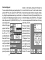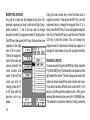
1
TM
Sportt
AccuNav Spor
OPERATION INSTRUCTIONS
WARNING!
DO NOT USE THIS PRODUCT WHILE OPERATING ANY VEHICLE!
WARNING!
USE THIS GPS RECEIVER ONLY AS AN AID TO NAVIGATION. A CAREFUL NAVIGATOR NEVER RELIES
ON ONLY ONE METHOD TO OBTAIN POSITION INFORMATION.
CAUTION
This GPS receiver, (like all GPS navigation equipment) will show the shortest, most direct path to a waypoint.
It provides navigation data to the waypoint regardless of obstructions. Therefore, the prudent navigator will not
only take advantage of all available navigation tools when travelling to a waypoint, but will also visually check
to make certain a clear, safe path to the waypoint is always available. Remember that the AccuNav Sport™, or
any GPS receiver is only as accurate as the system it’s using.
Copyright © 1994 Eagle Electronics
All rights reserved.
All features and specifications subject to change without
notice. All screens in this manual are simulated.
TABLE OF CONTENTS
INTRODUCTION ................................................................ 1
..... SPECIFICATIONS ....................................................... 1
GPS - HOW IT WORKS ..................................................... 2
ACCURACY ........................................................................ 3
THE EAGLE™ GPS RECEIVER ....................................... 4
ANTI-SKID .......................................................................... 5
POWER .............................................................................. 6
..... EXTERNAL POWER ................................................... 6
BATTERIES ........................................................................ 7
..... VARI-POWER™ .......................................................... 9
..... LOW BATTERY INDICATOR ..................................... 11
ANTENNA .......................................................................... 12
..... ANTENNA ANGLE ...................................................... 14
KEYBOARD ....................................................................... 15
OPERATION ..................................................................... 17
TURNING POWER ON ..................................................... 17
MENUS .............................................................................. 18
INITIALIZATION ................................................................ 19
..... CHANGE POSITION .................................................. 20
..... CHANGE ALTITUDE .................................................. 21
..... CHANGE TIME ........................................................... 21
..... CHANGE DATE .......................................................... 22
..... COLD START ............................................................. 23
POSITION/NAVIGATION DISPLAYS ............................... 24
..... SATELLITE INFORMATION SCREEN ...................... 25
..... POSITION SCREEN ................................................... 26
..... STEERING SCREEN ................................................. 27
CUSTOMIZE SCREENS ................................................... 28
PLOTTER .......................................................................... 30
..... PLOTTER CURSOR ................................................... 31
..... PLOTTING WITH A WAYPOINT ................................ 32
..... PLOTTER MENU - PAGE 1 ....................................... 33
..... SET RANGE ............................................................... 33
..... CLEAR PLOT .............................................................. 34
..... SAVE PLOT TRAIL ..................................................... 34
..... RECALL PLOT TRAIL ................................................ 35
..... ICON ON/OFF ............................................................ 35
..... PLOTTER MENUS - PAGE 2 ..................................... 36
..... FULL PLOT ................................................................. 36
..... CHANGE DISPLAY .................................................... 36
..... PLOTTER UPDATE RATE ......................................... 38
..... GO TO CURSOR ........................................................ 39
..... GRID LINES ................................................................ 39
ICONS ............................................................................... 40
..... USING ICONS WITH CURSOR ................................. 41
..... ERASING ICONS ....................................................... 42
WINDOWS ......................................................................... 42
..... VIEWING WINDOWS OPTIONS ................................ 44
WAYPOINT NAVIGATION ................................................ 45
..... HOW TO SAVE A WAYPOINT .................................. 45
..... QUICK SAVE METHOD ............................................. 45
..... VIEW AND SAVE METHOD ....................................... 45
..... ENTER NEW WAYPOINT .......................................... 47
..... NAME A WAYPOINT .................................................. 48
..... ERASE A WAYPOINT ................................................ 48
..... RECALL A WAYPOINT .............................................. 49
ROUTES ............................................................................ 51
..... CREATING A ROUTE ................................................ 52
..... NAME A ROUTE ......................................................... 52
..... WAYPOINT SELECTION ........................................... 53
..... FOLLOWING A ROUTE ............................................. 54
..... MODIFYING A ROUTE .............................................. 56
..... ERASING A ROUTE ................................................... 56
CANCEL NAVIGATION ..................................................... 57
GPS ALARMS ................................................................... 57
..... ARRIVAL ALARM ....................................................... 59
..... XTE (CROSS TRACK ERROR) ALARM .................... 59
CHANGING GPS SETTINGS ........................................... 60
GPS MODULE SELF TEST .............................................. 60
GPS SIMULATOR ............................................................. 61
NMEA/DGPS WIRING ...................................................... 62
SELECT NMEA/DGPS ...................................................... 64
NMEA/DGPS SETUP ........................................................ 65
SELECT UNITS OF MEASURE ....................................... 67
..... TRUE AND MAGNETIC POSITION ........................... 68
LIGHT ................................................................................ 68
..... LIGHT ADJUST .......................................................... 69
PRESET ............................................................................ 69
PCF OFFSET .................................................................... 70
SYSTEM INFORMATION ................................................. 72
WAYPOINT UPLOAD/DOWNLOAD ................................. 73
INTRODUCTION
The AccuNav Sport™ is a high quality, big screen handheld GPS receiver with performance that is second to
none in its class. Using menu features and raised softkey operation, the AccuNav Sport™ is also one of the
easiest to use products that Eagle has ever built. The
wide screen shows the navigation and plotter screens
with high resolution and detail. The display and keyboard are also lighted for night operation.
The electronics are sealed inside the welded, dry nitrogen filled case. This both waterproofs the unit and helps
prevent fogging on the display. The battery compartment has "O" ring seals to keep water penetration to a
minimum.
AccuNav Sport™ SPECIFICATIONS
Dimensions ........ 7.8"H x 3.6"W x 1.7" D
(Antenna Folded)
Channels ............ Five Parallel
Four continuous for position
All satellites in view tracked
Update rate ........ One to five seconds - user adjustable
Accuracy ............ Maximum accuracy achievable with
Standard Positioning Service
Position: ............. 25 meters CEP
Velocity: ............. 0.25 meters/sec RMS
Without SA PDOP<6.0
Batteries: ............ 6 AA
Input voltage: ..... 6 - 35 vdc
DGPS compatible using RTCM SC-104 messages.
Please read this manual carefully before using your
AccuNav Sport™.
1
GPS - HOW IT WORKS
The Global Positioning System (GPS) is perhaps the
best approach to navigation that has ever been devised.
Conceived by the Department of Defense (DOD) and
the United States military, the GPS system is an answer
to their needs of 24 hour global positioning, 365 days a
year.
Basically, the system works by using a constellation of
satellites orbiting Earth 11,000 miles in space. There will
be 24 satellites in orbit when the system is fully operational. When all satellites are in place, at least four of
them will be in view nearly anywhere on Earth twentyfour hours a day. The GPS receiver requires at least
three satellites to give a “2D” fix. (A 2D fix is your position
in latitude/longitude. A 3D fix is your latitude/longitude
plus altitude.) When it locks on to at least four satellites,
it displays a 3D fix.
2
It takes three satellites to determine position.
As the receiver locks on to each satellite, it calculates
the distance from the satellite by measuring the length
of time it takes the radio signal to reach it. Each satellite
has an extremely accurate clock that tells the receiver
when the radio transmission started. The receiver compares that time against its own clock, thus it knows how
long it took the radio signal (travelling at the speed of
light!) to reach it. If you know time and speed, then you
can calculate distance. Once you have this from three
satellites, then the receiver can determine your position.
ACCURACY
You may have heard tales of extraordinary accuracy
from GPS receivers. The DOD requires accuracy of 10
to 15 meters from the satellite system. However, only
the military gets this precision. The way the military
keeps us and other unauthorized people from using the
more precise system is coding. In other words, the data
coming from the satellites is encrypted. Civilian GPS
receivers use “C/A Code.” Its accuracy is intentionally
worse than the military’s “P Code.” In this manner,
civilian users worldwide can benefit from excellent position fixes. Meanwhile, the military keeps the most
accurate system away from potential enemies. Theoretically, C/A code can give accurate position fixes up to
15 meters. This is more than adequate for most people.
However (as of this writing), the military isn’t satisfied
with C/A’s potential accuracy in the hands of the world.
So, it’s degrading it further with “Selective Availability” or
SA. This is small, random errors intentionally added to
the system so your accuracy will typically be within 100
meters. Of course, accuracy also depends on the angle
of the satellite above the horizon, signal-to-noise ratio,
the number of satellites tracked at one time (the more
3
the better), and other factors. The smallest ranges on
the plotter may not be usable if the SA is high. The
present position symbol can move off the screen even
while you’re sitting still.
Don’t let this discourage you. GPS by nature has much
faster updates than other systems (such as Loran), and
typically is much easier to use. Accuracy, even with SA
on is still better than most other navigation systems.
You’ve purchased one of the finest navigation instruments on the market today. We hope you’ll enjoy it for
many years to come.
4
The EAGLE™ GPS Receiver
The Rockwell GPS engine is currently used in all Eagle™
GPS receivers. It’s small, rugged, and fast. The five
channel design lets it track all satellites in view. It sends
position information to the AccuNav Sport™ from once
every second to once every five seconds (user selectable.) By incorporating Rockwell’s GPS receiver technology with Eagle’s state-of-the-art design and manufacturing capabilities, Eagle brings to the consumer one
of the most advanced GPS navigation systems available in the world.
ANTI-SKID
The AccuNav Sport™ has a recess molded into the
back of the case and one-half of a plastic fastener
attached to the recess. When used with the other half of
the fastener, it keeps the unit from sliding on a level
surface such as a dashboard.
NOTE: The adhesive anti-skid patch is not designed to
hold the AccuNav Sport™ on a vertical or overhead
surface. It is only to be used to keep the unit from sliding
on a flat, horizontal surface.
ANTI-SKID
To use the anti-skid material, first remove the fastener
from the literature pack supplied with the AccuNav
Sport™. Select the location for this fastener and peel the
plastic backing from this half and press it onto the
mounting surface. Align this patch with the one on the
AccuNav Sport™, then press them together. It will hold
the unit under mild vibration, keeping it from sliding.
5
EXTERNAL
POWER
EXTERNAL POWER
The AccuNav Sport™ uses six AA batteries or (using
the optional CA-1 adapter cable) 6 to 35 volts DC from
an external power source. To use external power (such
as a car's cigarette lighter), simply push the CA-1's plug
into the small connector on the side of the AccuNav
Sport™. Plug the other end of the CA-1 into the vehicle's
cigarette lighter, and the AccuNav Sport is ready for use.
(Note: A rubber plug comes with the AccuNav Sport to
cover the external power jack on the side of the unit
when it's not in use.)
6
BATTERY
INSTALLATION
BATTERY INSTALLATION
The AccuNav Sport™ requires six AA batteries.
We recommend DuraCell™ alkaline batteries, but
other brands will work. You can use lithium batteries which will last longer than alkaline batteries.
Rechargeable ni-cad batteries will also work in the
AccuNav Sport™, however they won't last as long
as alkalines. Do Not use heavy-duty batteries or
any battery other than the ones listed above. Do not
mix different types of batteries. (e.g. ni-cads and
alkalines)
To install the batteries, first turn the AccuNav
Sport™ so that it is facing you. Now grasp the
bottom part of the case and push it to the right until
it comes completely off the unit as shown at right.
The bottom part of the AccuNav Sport™ houses
the battery pack.
7
Now push the battery pack out the bottom of the battery
cover as shown at right. Install the batteries with the
negative end (-) toward the springs. The positive end (+)
should be firmly against the metal plate. When all six
batteries are installed in the battery pack, slide it into the
battery cover.
BATTERY
INSTALLATION
Notice!
There is a tab on the top of the battery holder that
aligns with a slot on the top of the battery cover. Make
certain the tab is aligned properly! Otherwise the
battery holder won't slide all the way into the cover
and the battery cover won't slide onto the unit.
If the battery holder sticks when sliding it into the battery
cover, apply a thin film of petroleum jelly to the "O" rings
on the battery holder.
Slide the battery pack onto the unit and the AccuNav
Sport is now ready for use.
8
9
BATTERY
SAVER
Vari-Power™ Battery Saver Feature
The AccuNav Sport™ has a five-level power saving
feature that can extend the life of the batteries considerably. It does this by changing the update rate of the
GPS receiver inside the unit. When you first turn the
AccuNav Sport on, the update rate is once per second.
In other words, the GPS receiver calculates and sends
your position to the display once per second. You can
lengthen this time to as little as once every five seconds.
The longer the update rate, the less power is drawn from
the batteries. For example, less power is drawn from the
batteries when the unit is in the five second update rate
than the one second rate. There can be exceptions to
this rule, however. Whenever the AccuNav Sport is
trying to lock onto the satellites, it automatically goes
into the one second update mode. If you are walking in
a wooded area with the unit set on the five second
update mode, the unit may lose its lock on the satellites
BATTERY
SAVER
due to the trees overhead. When this happens, the unit
automatically goes into the one second update mode
until it locks onto the satellites. Then it returns to the five
second mode. If you are walking through heavy tree
coverage with only occasional gaps in the trees, the unit
may remain in the one second update mode continuously. Typically, however, the AccuNav Sport™ will
consume less power with higher update rates under
normal conditions.
Although there is no indicator on the navigation or
plotter displays to show which update mode you are in,
watching the clock can show you the current mode. All
displays, including the clock are updated at the same
time. If you have it set for a three second update, then
the clock will "freeze" for three seconds, then show the
correct time, then "freeze" for three seconds and so on.
10
Also note that the AccuNav Sport™ automatically goes
into the one second update rate whenever external
power is applied to the unit. For example, if the CA-1
cigarette lighter adapter cable is plugged into the
AccuNav Sport and the other end is plugged into your
car's cigarette lighter, then the update rate will automatically switch to the
one second update.
To adjust the update
rate, turn the unit on
by pressing the ON
key. Next, press the
MENU key, then the
F5 key which corresponds to the
"CHANGE GPS
SETTINGS" label.
Now press the right arrow key to see the second menu
screen. The screen shown on the previous page appears. Press the F1 key which corresponds to the
"POWER SAVING SETUP" label. A screen similar to the
one below appears.
11
LOW BATTERY INDICATOR
When the battery voltage reaches six volts, a low
battery message appears in the lower left corner of the
display. If you are using alkaline batteries, and the unit
is in the one second update mode, then you will have
approximately 15 minutes or less until the unit automatically shuts off. If you have the unit in the five
second update mode, you will have approximately 45
minutes or less until the unit shuts off.
Note:
In cold weather, keep a spare set of batteries in a warm
place, such as a shirt pocket. Warm batteries last
considerably longer than cold ones.
LOW BATTERY
INDICATOR
The update rate currently in use shows
at the bottom of the
screen. This one is
currently using the
one second update.
To change it, simply
press the key corresponding to the desired update rate.
For example, to
change to a four sec-
ond rate, press the F4 key. The update rate changes to
once every four seconds and the display at the bottom
of the screen will show "CURRENTLY USING: 4 SEC."
To exit this screen, press the CLR key.
ANTENNA
The AccuNav Sport™ has a removable antenna that
folds over the display when the unit is not in use. To open
the antenna, simply lift on an edge of the antenna and
raise it to the desired angle.
Two thumbscrews on the antenna's hinge let you adjust
the tension on the antenna. This helps keep the antenna
in the desired position. The thumbscrews work in opposite directions. To tighten the right thumbscrew, rotate it
away from the display. To tighten the left thumbscrew,
rotate it toward the display.
Caution - Always make certain the left thumbwheel is
tight when using the AccuNav Sport™. The connector
for the antenna is inside the left thumbwheel. If it isn't
tight, a poor connection may occur. This can prevent the
AccuNav Sport™ from operating properly, if at all.
12
To remove the antenna, simply loosen the thumbwheels
until they won't turn. Carefully remove the antenna from
the unit by pulling it straight out. If you feel any resistance, make certain the thumbwheels are at the end of
their travel. Don't force any parts.
Once you remove the antenna, you can see it's connector inside the left-hand thumbwheel. When reinstalling
the antenna, align the left side of the antenna first, then
thread left thumbwheel until it engages the connector.
This will require two full turns of the thumbwheel. After
you've accomplished this, thread the right side of the
antenna by rotating the right thumbwheel. Remember to
rotate the right thumbwheel in the opposite direction
from the left.
Adjust thumbwheels until the desired tension is achieved.
Caution - Do not overtighten the thumbwheels.
13
ANTENNA ANGLE
When using the AccuNav Sport™, try to make certain
the antenna is parallel with the ground, or nearly so as
shown at right. Since the signals from the satellites are
"line of sight", a flat antenna gives you a better chance
of being able to receive the signals from all of the
available satellites.
Also, trees, buildings, carports (even your body), can
block the signals from the satellites. When using this
unit in heavy brush or timber, remember that it may lose
track on one or all of the satellites until you move into a
clearing.
We have successfully used the AccuNav Sport™ in
cars and trucks since the satellite's signal passes through
glass. However, antenna placement can make a difference in receiving the signals or not.
14
KEYBOARD
The keyboard has the main group of keys arranged in
three horizontal rows, plus four arrow keys at the top.
The keys are used to enter numbers, make menu
selections and activate the windows feature. The menu
key near the bottom left corner of the keyboard activates
the first menu page.
WIN - This key gives you access to the windows mode,
which has many combination displays.
POS - Press this key to show the Position Screen.
STR - Press this key to show the Steering Screen.
PLOT - This key gives access to the Plotter.
RTE - Pressing this key shows the route planning menu.
15
WPT - Pressing this key lets you save or recall a
waypoint.
ICON - To mark a location on the plotter screen, use this
feature.
CNTR - Pressing this key centers your position on the
plotter.
ZIN & ZOUT - These keys let you "zoom-in" or "zoomout" the plotter display.
OFF - Press and HOLD the Off key to turn the AccuNav
Sport™ off.
MENU - Press this key to show the menus and gain
access to most functions.
16
ENT - (Enter) Press this key to accept keyboard entry.
CLR - (Clear) This key clears menus and erases entries
from the screen.
ARROW KEYS - These keys are used to make menu
selections and to move objects on the screen.
ON - The ON key turns the AccuNav Sport™ on. It also
controls the lights. Pressing the ON key again after
turning the unit on turns the lights on. Press it a third time
and the lights are turned off.
NOTE:
The keys labeled F1 through F0 are used to select
menu items and enter numbers. For example, to enter
the number "495", you should press F4, then F9, and
finally F5.
OPERATION
TURNING POWER ON
To turn the AccuNav Sport™ on, simply press the "ON"
key. (Note: The "ON" key is harder to press than the
other keys. This makes it harder to turn the AccuNav
Sport™ on accidentally.) A screen similar to the one
shown below appears.
To turn the lights on,
press the F5 key. To
adjust the display
contrast, press the left
arrow key to lighten
the screen, the right
arrow key darkens it.
To clear the display,
press the CLR key.
17
MENUS
Most of the AccuNav Sport's™ features are found on
pages of "menus". Pressing the MENU key lets you view
the menus. This unit has four basic displays. They are:
Windows, Position, Steering, and Plotter. When you
press the MENU key, different menus appear depending on the display
mode the unit is in.
(Except the plotter
and steering displays
share the same
menus.) In other
words, if you press the
MENU key while the
position screen is
showing, the menu
shown at right appears. However, if you
18
press the menu key while the plotter is displayed, a
different menu appears as shown below. This gives you
the features specific to each display without having to
search through many pages of menus.
Unless otherwise specified, all menu examples used in
this manual are accessed while the position or steering
screen is showing.
More information on
menus are shown in
the back of this
manual.
Initialization - Power On
In order for the AccuNav Sport™ to lock onto the
satellites, it must first find them. If you simply turn the unit
on and wait, the unit will find the satellites by itself in 15
minutes or less. This is called “Cold Start.” If you let it find
the satellites, the time display will probably be wrong,
since it will be showing UTC time which is the time at
Greenwich, England. However, all other navigation
displays, including the position display will be correct.
(You can set the time display to your local time.) To
speed up the satellite acquisition process, you can
initialize the AccuNav Sport™ or “tell it where it is” the
first time it’s turned on. This initialization process is
usually done only once and requires the following data:
The unit usually only takes a few minutes or less to find
the satellites once it’s been initialized by the user.
After the batteries are installed and the antenna is
opened, press the ON key, then press the MENU key.
Now press the key next to the “CHANGE GPS SETTINGS” label. Finally,
press the key next to
the “SET LAT, LON,
ALT, TIME, DATE”
label. The screen
shown at right appears.
1. Approximate present position in latitude/longitude
2. Approximate elevation above sea level (altitude)
3. Today’s date and time
19
This is the GPS setup screen. The settings now in use
are shown at the top of the display. If you’re using the
unit for the first time, these settings are probably wrong
for your position and time. To change any of the numbers on this display, first press an up or down arrow key
to move the black box to the desired label. For example,
to change the local
time, press the down
arrow key until the
black box is on the
“LOCAL
TIME”,
press the F6 key,
then enter your time
using the numbered
keys.
20
CHANGE POSITION
To change the position shown on the AccuNav Sport's
display, first determine your approximate position. Use
a chart or call your local airport to determine your
position if you don’t know it. The latitude/longitude that
you enter doesn’t have to be extremely accurate. Typically, if you enter a position within a few degrees of your
present position, the AccuNav Sport™ should quickly
find your actual latitude/longitude. To change your
present position, first move the black box to the LATITUDE display, then press the F6 key to change it. The
screen shown at right appears. Use the down arrow key
to change the “N” to “S”, if necessary. Next, simply enter
your present latitude using the numbered keys. Notice
that the position entered is in degrees, minutes, and
hundredths of a minute. (Not seconds!) If you make a
mistake, press the left or right arrow keys to move to the
number in the latitude that needs changing. After the
latitude has been entered, press the ENT key.
Now move the black box to the LONGITUDE display.
Enter your present longitude within a degree. Use the up
or down arrow keys to switch to east or west longitude,
if necessary. Now enter the longitude using the numbered keys. Be certain to enter a zero
“0” as the first number in the longitude if
it’s less than 100 degrees! After you’ve
entered the last number, press the ENT
key.
21
CHANGE ALTITUDE
To enter your present altitude, move the black box to the
ALTITUDE display, then press the F6 key. The AccuNav
Sport™ needs to know your elevation above sea level.
(Not your height above the ground.) Again, an approximation within a few thousand feet is usually sufficient.
Use the numbered keys to enter your altitude data.
Press the up arrow key if your altitude is below sea level.
For example, suppose you’re in Death Valley and the
spot you’re standing in is 35 feet below sea level. You
would need to enter the numbers “35”, then press the up
arrow key to change it to -35 feet. Press the ENT key
when you’re done.
CHANGE TIME
To change the local time (the time at your position),
move the black box to the LOCAL TIME display, then
press the F6 key. The screen shown at right appears.
Use the number keys to enter the time. Press the up
arrow key to change the time from AM to PM or the down
arrow key to change from PM to AM. Press the ENT key
when you’re finished.
CHANGE DATE
To enter today’s date,
move the black box
to the LOCAL DATE
display, then press
the F6 key. The
screen shown on the
next page appears.
Enter the date using
the numbered keys.
When you’re finished,
press the ENT key.
22
The numbers at the top of the screen should be correct.
If they aren’t, press the key next to the label that you
need to change. If everything is correct, press the key
next to the “EXIT” label. The unit will switch to the
position screen and start searching for the satellites
currently in view. The AccuNav Sport™ should find the
satellites and show a
position in a few minutes.
COLD START
When the AccuNav Sport™ is turned on for the first time
“out of the box”, it automatically sends a “cold start”
message to the GPS receiver. You can also send a cold
start message to the receiver at any time.
If the unit can’t lock on to the satellites using the data
you’ve given it, or if it has trouble finding the satellites,
perhaps it is using the wrong data. This can happen if
you’ve entered the wrong data by accident. For example, giving it east longitude instead of west. Or if
you’ve moved a long distance with the unit turned off.
The unit will automatically issue a cold start to it's
internal GPS receiver, however, you can send a cold
start at any time.
To send a cold start message to the receiver, press the
MENU key. Now press the key next to the “CHANGE
GPS SETTINGS” label. Finally, press the key next to the
“GPS “COLD” START” label. The unit will begin a cold
start technique to find the available satellites. It should
lock on to them in 15 minutes or less. Remember, when
it does, your local time and possibly date display will
probably be wrong. Use the method shown previously to
set the time and date
to their proper local
settings. Once this is
done, an internal
clock will keep the
correct time, even
when the unit is turned
off. The GPS system
updates this clock
when the unit is
locked on to the satellites.
23
POSITION/NAVIGATION DISPLAYS
The AccuNav Sport™ has a position screen, plotter,
steering indicator, and a satellite information screen.
These displays were designed to show the most important data. However, using the Windows feature, many
more screens are available that show navigation information in various arrangements. See the Windows
section for more detail.
DO NOT NAVIGATE WITH THIS UNIT UNTIL YOU
HAVE FOUND THE REASON THE UNIT HAS LOST
THE SATELLITES!
Each of the following screens (except the satellite
information screen) is available by pressing its key.
(Press the MENU key,
then press the key
next to the "Satellite
Information" to see
IMPORTANT!
If the data shown in digital numbers on any screen on the satellite informathis unit is flashing, then it means that data is invalid. DO tion screen. A detailed
NOT RELY ON THAT DATA IF IT IS FLASHING! For description of each
example, if the position display is flashing, then the unit screen follows.
has lost the satellites and hasn’t reacquired them. The
position that is flashing is your last known position, not
your present position!
POSITION SCREEN
24
SATELLITE INFORMATION SCREEN
The satellite information screen shows technical data
about each satellite in view. The AccuNav Sport™ has
a five parallel channel GPS receiver. Data on each
channel is shown at the top of the display. The channels
are numbered one through five on the left side of the
screen. Every satellite in the constellation has a number
assigned to it, called the PRN. The PRN is the first
number in the channel’s row. TRK stands for “track.” If
it's tracking the satellite, then a “T” is placed in this
column. If the AccuNav Sport™ is searching for the
satellite, then a “S” appears. ELV is the elevation
(height) of the satellite above the horizon from your
position. AZM is the azimuth or direction of the satellite
from your position. For example, if the azimuth of a
satellite is 180 degrees, then it is due south of your
position. SNR is the signal-to-noise ratio. This tells you
how strong the satellite’s signal is. The higher the SNR
number, the better. Typical good SNR numbers are
between 30 and 50.
The satellites that are visible in the sky from your
position are shown in the lower right corner of the screen
under the “VISIBLE SATS”.
In the lower left corner of the screen are
the DOPS displays.
These show you the
“Dilution Of Precision”
(DOP) for the horizontal (HDOP), geometric (GDOP), position
(PDOP),
time
(TDOP), and vertical
(VDOP). The GDOP
is the combination
25
value of HDOP, VDOP, and TDOP. The smaller the
GDOP’s number is, the better. The GPS receiver selects satellites based on GDOP, therefore it always tries
to use satellites that have good DOP values. These
depend on the azimuth and elevation of the satellite,
and any ground based obstructions.
Remember, the smaller the number - the better on all of
the DOPs.
POSITION SCREEN
The position screen automatically appears after the
AccuNav Sport™ is initialized or you can view this
screen at any time by pressing the POS key. The
position display shows your present position (POSITION), bearing (BRG), course over ground (COG), local
time, cross track error (XTE), time to go to waypoint
(TTG), and waypoint name (WPT NAME).
26
Your present position shows near the top of the screen
in latitude/longitude coordinates. This is shown in degrees, minutes, and thousandths of a minute. For example, on this page, the present position is 36 degrees,
8.987 minutes north latitude and 95 degrees, 50.553
minutes west longitude. Below the present position on
the left side is the
Bearing to Waypoint
(BRG) display. This is
expressed in degrees
true or magnetic, depending on the mode
the AccuNav Sport™
is in. To the right of
the Bearing is the
Course Over Ground
(COG) display. At the
bottom of the screen
are the Local Time and Cross Track Error Displays.
Please note that you must recall a waypoint to use the
Bearing and Cross Track Error displays.
STEERING SCREEN
The steering screen shows a pictorial view of your
vehicle and course travelled. This is called a Course
Deviation Indicator or CDI. It also shows Distance To
Go (DTG), Speed Over Ground (SOG), Bearing to
Waypoint (BRG), and Course Over Ground (COG).
Press the STEER key to view this screen.
Your present position is shown by the arrow. The arrow
shows the direction your vehicle is heading relative to
the waypoint. In theory, if you steer with the arrow
always pointing towards the waypoint, then you will
arrive at the waypoint. The solid line extending from the
arrow is your track or path you’ve taken. To travel
directly to a waypoint, try to keep the arrow on the center
line. The waypoint is depicted by a box at the top of the
CDI display. As you approach the waypoint, the arrow
and the box will move closer together. If you travel past
the waypoint, the waypoint’s box will move to the bottom
of the display.
The numbers on the
top left side of the
screen are distance
markers, showing the
remaining distance to
the recalled waypoint.
If the numbers have a
black box surrounding them, then the distance markers are
showing the distance
27
PAST the waypoint. In other words, if the numbers are CUSTOMIZE SCREENS
surrounded by a black box, then you have passed the The digital displays on the bottom half of the position
and steering screens, plus all of the digital displays on
waypoint and need to turn around.
the plotter screen can be changed as desired. To show
The numbers immediately below the CDI are the CDI how this is done, we’ll use the position screen as an
range limits in miles. This gives you an idea of how far example.
off course you are. For example, if the arrow is halfway
between the course line and the outside left line and the To customize the poCDI range is 0.5 miles, then your cross track error is to sition screen, first
the left 0.25 miles. The CDI range is the same as the CDI make certain the poalarm setting. See the section on GPS alarms to change sition screen is displayed. Next, press
the CDI range.
the MENU key. The
Using the digital displays at the bottom of the screen first GPS menu apwith the graphical display at the top lets you accurately pears. Press the F1
key which corresteer to a waypoint.
sponds
to
the
“CHANGE POSITION
28
DISPLAY" label. The unit returns to the Position Screen To change another digital display, press the left or right
with a black box around the Bearing (BRG) label as arrow key. The label in the next digital display box
changes as you press the arrow key. Again, press the up
shown on the previous page.
or down arrow key to change the display.
The black box identifies the Bearing box as “ready for
change.” To change the Bearing display to a different When you have the display arranged as desired, press
one, press the up or down arrow keys to select the the CLEAR key. This
“locks” the display.
display that you want to show inside the box.
In this example, we changed the Bearing display to DTG Every time you switch
(Distance To Go) by pressing the up arrow key twice. to this display, it will
appear as you de(See the position screen below.)
signed it, unless you
preset the unit.
NORMAL
DISPLAY
DISPLAY
READY FOR
CHANGE
29
The digital displays available for use are:
BRG ................................. Bearing
SOG ................................. Speed Over Ground
DTG .................................. Distance To Go
DEST WPT ...................... Destination Waypoint
POSITION ........................ Present Position
ALT .................................. Altitude
RTE NAME ....................... Route Name
WPT NAME ...................... Waypoint Name
TTG .................................. Time To Go
XTE .................................. Cross Track Error
LOCAL TIME .................... Time at your location
COG ................................. Course Over Ground
30
PLOTTER
The plotter lets you see your course and direction of
travel on the screen. If you’ve recalled a waypoint, the
plotter shows your starting location, present position,
and destination. However, you do not have to recall a
waypoint to use the
plotter.
The plotter also can
show grid lines on the
display. These grid
lines show latitude
and longitude lines
that can help you see
your position or the
location of other objects.
To use the plotter, simply press the PLOT key. A screen
similar to the one at the bottom of the previous page
appears.
The flashing cross is your present position. The solid
line is your current track, or path you have just traveled.
The large square is a compass rose marked with North,
South, East, and West. The square’s height and width
shows at the bottom of the screen. This is the distance
from one side to the other and from the top to the bottom.
Your present position is shown at the top of the screen.
If your present position starts to move outside the
square, the AccuNav Sport™ clears the display, then
redraws your present position closer to the center of the
screen. Your present position will always be displayed
on the plotter. To clear the plotter screen, see the Plotter
Menus section.
On the left side of the screen are the Distance To Go
(DTG), Speed Over Ground (SOG), Bearing (BRG), and
Course Over Ground (COG) digital displays. All of these
displays are only used when a waypoint is recalled,
except COG and ALT which are always active. These
displays also can be customized. See the Plotter Menus
section for more detail.
PLOTTER CURSOR
The plotter cursor can help you determine the latitude/
longitude of a waypoint or event marker. To use it, press
the up or down arrow key while the plotter is displayed.
A screen similar to the one on the next page appears.
Two new lines appear on the screen. These are the
plotter cursor lines. Also, the present position display at
the top of the screen switches to show the latitude/
longitude position of the plotter cursor - not your present
position. The distance and bearing from your present
31
position to the cursor position show in the bottom left
corner of the display. Use the arrow keys to move the
cursor lines anywhere on the plotter. To erase the
cursor lines, press the CLEAR key. This will switch the
display at the top of the screen back to your present
position and erase the distance and bearing displays at
the bottom of the
screen.
PLOTTING WITH A WAYPOINT
Using the plotter with a recalled waypoint or route is an
easy way to see the distance and direction you travelled. It also simplifies navigation. To use the plotter in
this manner, first recall a waypoint or start a route. (See
the Waypoint Recall section for more information.) Then
press the PLOT key.
A screen similar to
the one at right appears.
The circle with the “S”
is your starting location. This was your
position when you
recalled the waypoint. The flashing
circle with a cross is
32
your present position. The “flag” with a number inside is
the destination (recalled waypoint). The number inside
the flag is the recalled waypoint number. In this example, waypoint number 1 is the destination. The dotted
line is the shortest, most direct course from the starting
point to the destination. Follow this line to get to the
waypoint.
An arrival alarm can be set to sound a tone when you
come within a preset distance to the destination. See the
section on alarms for more information about the arrival
alarm.
PLOTTER MENUS
Pressing the MENU key while the plotter is showing
gives you a new set of menus that relate only to the
plotter. There are two plotter menus. The first menu is
shown at right.
PLOTTER MENU - PAGE 1
SET RANGE
Press the F1 key to see the plotter's range menu. (See
the screen at the top of the next page.) This menu
changes the plotter’s range or distance across the
plotter’s display. The
range is one (1) mile
when the AccuNav
Sport™ is turned on
for the first time. The
available plotter
ranges are .1, .2, .5,
1, 2, 5, 10, 20, 50,
100, 500, and 1000
miles. This lets you
“zoom in” to see small
variations in your
33
course or “zoom out”
to see your starting
position, present position, track, course,
and destination.
NOTE: An easier
way to change the
plotter's range is to
simply press the ZIN
key to "zoom-in" or
the ZOUT key to
"zoom-out".
SAVE PLOT TRAIL
The AccuNav Sport™ can save up to five (5) plotter
trails. Saving plot trails makes it easier to follow an old
path to a destination. Simply save your current trail, then
recall it later to use as a guide. Every time you turn the
AccuNav Sport™ off, it saves your current trail on the
screen. To save it under a number that you
can recall later, first
press the MENU key
while the plotter is displayed. Now press the
F3 key. The menu
CLEAR PLOT
shown at right apTo clear or erase the solid track line from the screen, pears. Now press the
use the Clear Plot menu selection. The plotter will key next to the desired
continue to draw your track after the F2 key is pressed, trail number. For exstarting from your present position.
ample, if you wish to
34
save the trail currently displayed on the screen as plot
trail number 1, simply press the F1 key. The AccuNav
Sport™ saves the current trail and returns to the plotter
screen. These trails are saved in memory and are not
erased when the unit is turned off, but they are erased
when the unit is preset.
RECALL
PLOT
TRAIL
To recall a plot trail,
first press the MENU
key while the plotter
is displayed. Press
the F4 key (Recall
Trail). The screen
shown at right appears. Simply press
the key next to the
35
trail that you wish to recall. For example, to recall plot
trail number three, press the F3 key. The AccuNav
Sport™ returns to the plotter screen and draws the
recalled trail on the screen. Note that this recalled trail
doesn't affect your current trail; both will be displayed.
Also note that the recalled plot trails are position specific. In other words, the plot trail is not simply a line
drawn on the screen, it represents the location you were
in when the plot trail was drawn.
ICON ON/OFF
Pressing the F5 key while the first plotter menu is
displayed turns the icons off that you placed on the
screen using the ICON key. For more information on this
feature, see the ICON section. This also turns off all of
the waypoint icons.
PLOTTER MENUS - PAGE 2
right side of this page appears. To switch back to the
Pressing the right arrow key while the first plotter menu normal plotter screen, press the MENU key twice while
is showing displays the second plotter screen as shown the plotter is showing, then press the F1 key.
below.
CHANGE DISPLAY
FULL PLOT
The four digital displays on the left side of the plotter
Normally, the plotter
screen can be
has a row of digital
changed or customdisplay boxes on the
ized at will. When the
left side of the screen.
AccuNav Sport™ is
To erase these boxes
first turned on, or afand use the whole dister it’s preset, the four
play for the plotter,
digital displays are
press the F1 key while
Distance To Go
the second plotter
(DTG), Speed Over
menu screen is showGround (SOG), Bearing. A screen similar
ing to waypoint
to the one at the far
(BRG), and Course
36
Over Ground (COG). The available displays that can be
placed in these windows are: Distance To Go (DTG),
Speed Over Ground (SOG), Bearing to waypoint (BRG),
Course Over Ground (COG), Cross track error (XTE),
and Altitude (ALT).
To change any or all
of the digital displays,
first press the MENU
key while the plotter
is showing. Now
press the right arrow
key. Next, press the
F2 key. The unit returns to the plotter
screen with a black
box surrounding the
DTG box as shown
at left. This means the DTG box is ready to be changed.
Press the left or right arrow key to change the display.
For example, to change the Distance To Go to Cross
Track Error (XTE), press the right arrow key four times.
To change another digital box, press the up or down
arrow key until the
black box surrounds
the desired display.
Now press the up or
down arrow key until
the desired display
appears.
When you have the
digital displays customized, press the
CLR (clear) key. This
37
locks the screen displays, even if the unit is turned off update rate, press the MENU key while the plotter is
displayed. Now press the right arrow key once. Finally,
and on again.
press the F3 (UPDATE RATE) key. The screen shown
at left appears. Simply press the key corresponding to
PLOTTER UPDATE RATE
The plotter shows your track by drawing a solid line the desired update time. The AccuNav Sport™ returns
behind your present position. This is called a plot trail. to the plotter screen using the new time.
The trail is updated
Remember, as the update rate lengthens, the trail's
once every second
resolution worsens!
when the unit is
PLOTTER UPDATE
turned on for the first
UPDATE RATE
SAVABLE TRAIL TIME
time. However, if
INSTANT .................. 33 MINUTES
2 SECONDS ............. 1 HOUR, 6 MINUTES
you’re travelling a
5 SECONDS ............. 2 HOURS, 44 MINUTES
long distance, the trail
10 SECONDS ........... 5 HOURS, 26 MINUTES
line may end prema20 SECONDS ........... 10 HOURS, 52 MINUTES
turely due to the lim1 MINUTE ................. 32 HOURS, 38 MINUTES
ited number of dots
2 MINUTES ............... 2 DAYS, 17 HOURS, 16 MIN
available that plot the
5 MINUTES ............... 6 DAYS, 19 HOURS, 10 MIN
trail. To change the
10 MINUTES ............ 13 DAYS, 14 HOURS, 20 MIN
38
GOTO CURSOR
As previously described, the cursor lines can be used to
place an icon or highlight a position. When you use the
cursor lines, the position of the cross hairs on the display
are shown at the top of the screen. Pressing the key
corresponding to the “GOTO CURSOR” label on the
plotter menu causes
the AccuNav Sport™
to show navigation
and steering data to
the position shown by
the cross hairs. This
automatically turns
the arrival alarm on.
To use this feature,
first move the cursor
lines to the desired
39
location on the plotter screen. Next, press the MENU
key. Now press the right arrow key once. The second
plotter menu screen appears as shown on the left side
of page 31. Finally, press the F4 (GOTO CURSOR) key.
The unit returns to the plotter screen as shown at left. A
waypoint flag appears on the screen (numbered “0”)
that was the location of the cursor cross hairs when you
pressed the F4 key.
All of the navigation displays on the AccuNav Sport™
will show navigation data to the location you marked.
This includes the navigation, steering, and plotter displays.
GRID LINES
The plotter can show latitude/longitude grid lines on the
plotter as shown on the next page. To turn these lines
on, press the MENU key while the plotter is displayed.
Press the right arrow
key to get the second
plotter menu. Now
press the F5 (GRID
OFF/ON) key. To turn
the grid lines off, repeat the previous
step.
ICONS
The AccuNav Sport™ can place icons on the plotter to
mark special locations. There are five different icons to
choose from and there are 100 of each icon for a total of
500. You can place each icon individually, however, you
have to erase all of the icons in a group.
40
To place an icon, first press the ICON key. The screen
shown below appears.
Now select one of the five icons shown on the left side
of the screen by pressing the key corresponding to the
desired icon. For example, to place the fish symbol,
press the F1 key. As
soon as you press the
key, the AccuNav
Sport™ places the
icon at your present
position as shown on
the far right side of
the next page. This
icon always stays in
this location. It’s
saved in memory so
it will always show on
the display, even if the unit is turned off and on again.
Note that there are two different sets of symbols available - land and marine. When the AccuNav Sport™ is
turned on for the first time or after it's preset, the marine
set of icons (shown on the previous page) is in use. To
switch to the land
icons, press the F6
key. The screen
shown at right appears, giving you five
other icon choices.
Note: You can't mix
land and marine
icons.
41
Using Icons with the Cursor
Normally, when you select an icon, it’s placed on the
plotter at your present position. However, you can place
an icon anywhere on the plotter using the cursor. To do
this, first press one of the arrow keys. This makes the
plotter cursor lines appear on the display. Now move the
lines to the desired
position on the display by pressing the
arrow keys. When it’s
at the desired location, press the ICON
key, then select an
icon. The AccuNav
Sport™ places the
icon at the intersection of the plotter cursor lines.
To erase the cursor lines, press the CLR key.
Now select the group of icons that you wish to erase by
pressing the key corresponding to the desired icon.
Erasing the Icons
After pressing the key, the AccuNav Sport™ erases all
Although you can place icons on the plotter individually, of the selected icons from the plotter.
you can’t erase them one at a time. You have to erase
the whole group of icons. For example, if you’ve placed
WINDOWS
20 fish icons, erasing
You can change the
one erases all 20.
displays on the
AccuNav Sport by usTo erase an icon, first
ing the windows feapress the ICON key.
ture. This lets you use
Next, press the F0 key
different displays to
(DELETE
ICON
suit your own situaBANK) key. The
tions. The screens
screen shown at right
available in the winappears.
dows mode are divided into two or more
windows per screen.
42
Each screen of windows is called a “group”. The AccuNav
Sport gives you ten different window groups. Group “A”
as shown on the previous page has the plotter, course
over ground, and steering displays showing in three
separate windows. A group can have as many as four
windows. A window can display digital GPS data, GPS
steering or navigation
displays, and many
more. To use the windows feature, first
press the WIN key.
A screen similar to the
one shown at right appears. The menu at
the bottom of the
screen lets you switch
between the “pages”
43
of displays. These are lettered “A” through “J”. Group “A”
shows first. Press the up arrow key to move forward
through the screens. Press the down arrow key to move
backward.
For example, pressing the up arrow key once shows the
group “B” screen . To
exit the windows
mode, press the POS,
PLOT, or STEER
keys. Many of the
group screens can be
modified to some extent. For example,
press the MENU key
while group “A” is displayed. Four new labels appear on the
display as shown on the previous page.
Three of these labels are window menus. Pressing the
key corresponding to one of the “window menu” labels
gives you a menu with functions that relate only to that
window. For example, if you press the F1 key which
corresponds to the window menu label on the plotter
window, the screen will clear and you will have the
normal plotter menu screen. To exit from a window
menu, press the CLR key. The fourth label tells you to
press the MENU key to see the windows main menu.
VIEWING WINDOWS
To see all of the available windows, press the WIN key,
then press the MENU key twice. The windows main
menu appears. Finally, press the F2 key (VIEW ALL
WINDOWS). The screen shown at right appears.
44
The first window appears in the upper right corner of the
screen. A description of the screen shows in the box at
the bottom of the screen. Now press the F2 key. This
switches to the next window and description. Press the
F1 key to view the previous window. When you’ve
finished viewing the windows, press the CLR key.
A summary of all the
windows and window
groups is in the back
of this manual.
WAYPOINT NAVIGATION
To save your present position as waypoint, simply press
the WPT key. The screen shown below appears. Now
HOW TO SAVE A WAYPOINT
Waypoints are locations on the earth’s surface that you press the F6 (WPT QUICK SAVE) key again. The
wish to go or return to. Waypoints are useful for marking AccuNav Sport™ takes your present position and asshipwrecks, hot fishing or hunting spots, hiking trails, signs the first available waypoint number to it.
and other locations. Storing waypoints in the AccuNav
Sport's memory makes it easy to return to any point in Saving Present
the world by simply pressing a few buttons. The AccuNav Position - View and
Sport can store up to 200 waypoints. You can store your Save Method
present position as a waypoint or enter latitude/longitude The “Quick Save” feature doesn’t let you
positions as waypoint locations.
select the waypoint
number. You have to
Saving Present Position as a Waypoint
use the next available
(Quick Save Feature)
number when using
The AccuNav Sport™ lets you save your present posithat method. The
tion as a waypoint with only two key presses. This
View and Save
“Quick Save” feature lets you easily save the position of
method lets you pick
a wreck or other locations.
45
the waypoint number that your present position is stored
in. (Note: You can store a position under a waypoint
number that already has a position assigned to it using
this method.) To save your present position, press the
WPT key, then press the F2 (WPT SAVE) key. A screen
similar to the one below appears.
The first waypoint
number in the list appears at the top of the
page. This is the number that your present
position will be stored
under. Your position
at the time you
pressed the WPT key
is shown in the "CURRENT POSITION"
46
box in the middle of the screen. If you wish to save the
location in the CURRENT POSITION box under this
waypoint number, first press the F5 (USE CURRENT
POSITION) key. The position shown in the CURRENT
POSITION box also will show in the waypoint location at
the top of the screen. To save the waypoint without
naming it, simply press the F3 (SAVE) key.
To save the location under a different waypoint number,
press the F1 (+ WPT) key to increase the waypoint
number (i.e. from waypoint number 1 to 2). Press the F2
(- WPT) key to decrease the waypoint number. Now
press the F5 key to use your present position. Finally,
press the F3 key. This will store the location under the
waypoint number you selected. Press the CLR key to
return to the last used position, plot, or navigation
screen.
Enter New Waypoint
To save a location other than your present position, first
press the WPT key. Next, press the F2 (WPT SAVE)
key. Using the up and down arrow keys, move the black
box down to the latitude/longitude position as shown
below. Now press the F6 (CHANGE FIELD) key. The
screen shown at the
bottom of this page
appears. Use the arrow keys to change
the “N” to a “S”, if
your latitude is south.
Now enter the location you wish to save
using the numbered
keys. Use the left
arrow key as a backspace if you make a
47
mistake. In other words, pressing the left arrow key
moves the black box over the last number entered.
Notice that the position entered is in degrees, minutes,
and thousands of a minute. (Not seconds!) After you’ve
entered the latitude, press the ENT key. The waypoint
save menu reappears with the black box on the longitude. Next, press the
F6 key to change it.
Now enter the longitude. Make certain to
add a zero to the longitude if it’s less than
100 degrees. For example, if the longitude
is 85 degrees, then
enter “085”. Press the
ENT key when you’ve
finished. The save
waypoint menu appears with the position you entered in
the waypoint position box at the top of the screen. If this
position is correct, press the F3 (SAVE) key. Press the
CLR key to exit this screen.
Name a Waypoint
To assign a name to a
waypoint, first press
the WPT key, then
press the F2 key. The
screen shown on the
previous page appears. Select the waypoint you wish to
name by pressing the
F1 or F2 keys until the
desired waypoint is
showing. Now move
48
the black box to the "NAME" and press the F6 key. The
screen shown at left appears. Use the keys on both
sides of the screen to enter the waypoint name. For
example, to name a waypoint “COVE 1”, press the F1
key repeatedly until the letter “C” appears in the window.
Next, press the right arrow key to move the black box to
the next letter position. Now press the F5 key repeatedly
until the “O” appears on the screen. Repeat this process
until the entire name has been written on the screen.
Now press the ENT key. The AccuNav Sport™ returns
to the waypoint save menu as shown above. To save the
waypoint with this name, first press the F3 key. Finally,
press the CLR key to exit the waypoint save menu.
Erase a Waypoint
The Waypoint Erase feature lets you erase waypoints
from the list.
To erase a waypoint, first press the WPT key. Next,
press the F2 key. Now press the F1 (+ WPT) or F2 (WPT) key until the desired waypoint number appears on
the screen. Press the F4 key to erase the waypoint. The
screen shown below appears. A message appears on
the screen that says “WAIT!! DELETE WAYPOINT ARE
YOU SURE?”. If you
are certain this is the
waypoint that you
wish to erase, press
the F0 key. If not,
press the F5 key.
Pressing the F0 key
erases all information
from the waypoint
number that appears
at the top of the
screen.
49
To exit from the waypoint save menu, press the CLR
key.
RECALL A WAYPOINT
You must recall a waypoint in order to navigate to that
position with the AccuNav Sport™. To recall a waypoint,
first press the WPT
key, then press the
F4 (WPT RECALL)
key. The screen
shown at right appears.
The waypoint's number, name, and position shows at the top
of the screen. The
distance and bearing
to that waypoint from your present position shows be- Sport™ off, the next time you turn it on, the unit will
remember where you were in the route at the time it was
neath the position.
turned off and resume navigation to the same waypoint
If the desired waypoint isn't shown, press the F1 or F2 in the route.
keys until it appears on the screen. (Note: A faster way
to recall a waypoint is to press the F6 key, then enter the
waypoint number using the numbered keys.) When the
desired waypoint appears, simply press the F5 (GO TO
WAYPOINT) key. The AccuNav Sport™ returns to the
last used position, steering, or plotter screen, showing
navigation data to the waypoint you recalled.
Note: The AccuNav Sport™ will show navigation data to
a waypoint until the "Cancel Navigation" feature is used.
This feature stops the unit from navigating. If you turn
the unit off while it is navigating, the next time it's turned
on it will still navigate to the previous waypoint. If you
were navigating in a route when you turned the AccuNav
50
ROUTES
A route gives you the ability to navigate to several
waypoints without having to reprogram the unit after
arriving at each one. A route consists of two or more
waypoints. When you start on a route, the AccuNav
Sport™ shows navigation information to the first waypoint in the route. When you reach the first waypoint,
(signalled by the Arrival Alarm), the AccuNav Sport™
automatically sequences to the next waypoint. Navigation information is shown to this waypoint and the
process repeats. When you reach the last waypoint in a
route, the arrival alarm sounds until you turn it off. At this
point you should use the "Cancel Navigation" feature to
stop the AccuNav Sport™ from showing navigation data
to the last waypoint in the route. Otherwise, it will
continue to navigate to that waypoint, even if it's turned
off and on again.
There are four steps required to create and follow a
route. First, you must create and name the route. Next,
select the waypoints used in the route. Then determine
the starting waypoint. Next, tell the unit to follow the
route. Finally, the unit will ask you if you wish to run the
route forward or backward. After these steps are completed, the AccuNav Sport™ will start showing navigation data to the first waypoint on the route.
NOTE: The plotter shows all of the waypoints on a
recalled route connected by a dotted line.
51
CREATING A ROUTE
To create a route, first press the RTE key . The screen
shown at right appears. Now press the F1 (SAVE/EDIT
ROUTE) key. The screen shown below right appears.
dow at the top of the screen, press the down arrow key
until the black box moves to the “NAME” position. Now
press the ENT key. The screen shown on the next page
appears.
This menu lets you select the route number, name the
route, and choose the
waypoints used in the
route.
Use the keys on both sides of the screen to enter the
waypoint name. For
example, to name a
route “RED ROCK”,
press the F6 key repeatedly until the letter “R” appears in the
window. Next, press
the right arrow key to
move the black box
to the next letter position. Now press the
F2 key until the letter
Name a Route
To assign a name to
a route, press the F1
or F2 keys to move
through the list of
routes. When the desired route number
appears in the win52
“E” appears on the
screen. Repeat this
process until the entire name has been
written on the screen.
Now press the ENT
key. The AccuNav
Sport™ returns to the
route menu. You can
now enter the waypoints used in the
route.
Waypoint Selection
If you’ve named a route, the black box should be on the
“0” at the top of the waypoint list on this screen as shown
on the screen at right. If not, move the black box to the
“0” using the up or down arrow keys. Now press the ENT
key. The screen shown on the next page appears. Now
press the numbered key of the waypoint you wish to go
to first in the route. For example, if you want waypoint
number 2 to be first, press the 2 key. If you’ve named the
waypoint, it shows in the blank space to the right of the
waypoint number.
Next, press the ENT
key. The AccuNav
Sport™ reverts to the
menu shown at right.
The cursor should
now be on the second waypoint line.
Again, press the ENT
key and enter the
waypoint number for
the second waypoint
53
in the route. Continue
entering the waypoints until all of the
waypoints have been
entered for the route
as shown on the
screen at the far right
side of this page.
Then press the F3
key. This saves your
route in memory.
IMPORTANT!
You must select waypoints in the order they are to be
used in the route. In other words, suppose you want a
route that consists of waypoint numbers 1, 2, and 3.
However, you wish to travel to 2 first, then 1, and finally
54
3. In this case, you
must enter waypoint
2, 1, and 3 in that
order when making
the route.
Press the CLR key to
exit this screen when
you're finished.
FOLLOWING A ROUTE
To follow a route, press the RTE key, then press the F2
(RECALL ROUTE) key. The screen shown on the next
page appears. Route number one appears on the right
side of the screen. The list of waypoints used in the route
are shown beneath the route number and name. If you
wish to recall a different route, press the F1 or F2 keys To follow a route backwards, press the F3 (REVERSE)
to cycle through the available routes.
key. For example, suppose you have three waypoints in
a route and they’re numbered 2, 1, and 3. If you travel
After you’ve selected the desired route, you’ll notice a forward through the route, the unit will show navigation
black box surrounding the first waypoint in the route. data to waypoint number 2 first, then 1, and finally 3. If
This is the starting waypoint box. If you wish to start the you travel backward through the route, the unit will start
route using the first
with waypoint number 3 first, then 1, and end with
waypoint in the route,
waypoint number 2. No matter if you travel forward or
simply press the F4
reverse through the route, when you reach the last
(START) key. Howwaypoint in the route, the arrival alarm sounds until you
ever, if you wish to
either mute it or turn it off. Use the "Cancel Navigation"
start the route using
feature to stop the unit from navigating to the last
a different waypoint,
waypoint in the route.
simply press the
IMPORTANT!
down arrow key to
Turning the arrival alarm off prevents the AccuNav
move the black box
Sport™ from sequencing to the next waypoint in the
to the desired wayroute. This, in effect, turns the route off. The unit will still
point number. Then
show navigation data to the current waypoint in the
press the F4 key.
route at the time the arrival alarm was turned off.
55
MODIFYING A ROUTE
Any part of a route can be changed at any time. For
example, suppose you have a route consisting of waypoints number 2, 1, and 3 and you wish to change
waypoint number 3 to waypoint number 5. Simply press
the RTE key, then press the F1 key. Route number one
appears on the right
side of the screen.
The list of waypoints
used in the route are
shown beneath the
route number and
name. If this isn't the
route you wish to
change, press the F1
or F2 keys until the
desired route appears.
56
Using the down arrow key, move the black box to
waypoint number 3. Now press the ENT key. Use the
numbered keys to change the waypoint from 3 to 5.
Next, press the ENT key. You’ve changed the waypoint
from 3 to 5. Press the F3 key to save the route. Press the
CLR key to exit this screen. You can change any
waypoint used in a route, add or erase any waypoint, or
change the route name at any time using this method.
ERASING A ROUTE
To erase a route, first press the RTE key. Next, press the
F1 (SAVE/EDIT) key. Route number one appears on the
right side of the screen. The list of waypoints used in the
route are shown beneath the route number and name.
If you wish to erase a different route, press the F1 or F2
keys to cycle through the available routes. After you’ve
selected the desired route, press the F4 (ERASE) key.
This erases the route from memory. Finally, press the
CLR key. This returns you to the GPS display.
CANCEL NAVIGATION
To stop the AccuNav Sport™ from navigating to a
waypoint or navigating to a waypoint in a route, press the
MENU key twice. Now press the F3 (CANCEL NAVIGATION) key. This stops all navigation.
NOTE:
Canceling navigation does not erase the route or any
waypoints from memory. It merely stops the AccuNav
Sport™ from navigating to waypoints.
ALARMS
The AccuNav Sport™ has two alarms. One is an arrival
alarm that sounds when you come within a preset
distance to a waypoint. The other is a cross track error
alarm that sounds when you move off course more than
the alarm’s setting. Both of these alarms are set identically.
To adjust an alarm, first press the MENU key, then press
the F4 (ALARMS) key. The screen shown below appears. To turn any alarm on, press the key corresponding to the desired
alarm's label until the
black box moves to
"ON", as we did on the
arrival alarm on the
screen shown on the
next page. To change
an alarm's setting,
press the key corresponding to the desired alarm until the
black box moves over
57
the numbers on the right side. In the example shown on as shown on the next page, press the 2 key, then press
the right side of this page, the arrival alarm is selected. the 0 key. When the desired value has been entered,
press the ENT key to accept it. The unit returns to the
Now press the ENT key. The screen shown on the next ALARMS screen as shown on the right side of the next
page appears. The current alarm value shows in a page. Notice that the alarm has automatically been
window on the screen which is labeled "OLD VALUE". turned on. If an alarm
is off, and you adjust
Use the numbered
it, the unit automatikeys to change the
cally turns it on.
alarm's setting, then
press the ENT key to
NOTE: If you need to
accept it. For exset an alarm to less
ample, to set the arthan one (1), enter a
rival alarm to 2 miles,
zero first. For express the 2 key, then
ample, to set the arpress the 0 key twice.
rival alarm to .5 miles,
To set the arrival
press the following
alarm to .2 of a mile
number keys: 0 5 0.
58
Now you can change the other alarm or press the CLR called waypoint if the arrival alarm’s setting is .1 mile.
key to leave the alarm menu.
The alarm is adjustable from .01 to 9.99 miles.
You can return to this alarm screen at any time to adjust
either alarm, turn one off, or both of them on, as desired.
Each alarm works and adjusts independently of the
other. A description
of each alarm follows.
XTE ALARM
The XTE (cross track error) alarm sounds a tone when
your cross track error is greater than the alarm’s setting.
Changing the XTE
alarm also changes
the XTE range on the
steering screen. The
alarm is adjustable
from 0.1 to 9.99 miles.
ARRIVAL ALARM
The arrival alarm
sounds a tone when
your position is within
the alarm’s radius of
a waypoint. For example, the alarm
sounds if you come
within .1 mile of a re59
CHANGING GPS SETTINGS
For the fastest position acquisition, the AccuNav Sport™
must be initialized when it’s turned on for the first time.
This is described at the beginning of the GPS section in
this manual. However, if you wish to change only one of
the parameters (such as time), press the MENU key,
then press the F5
“CHANGE GPS SETTINGS” key. Finally,
press the F1 “LAT,
LON, ALT, TIME,
DATE” key. The
screen shown at right
appears.
Using the menus on
this and following
menu pages, you can
change the initial po60
sition, time, date, or altitude without affecting any other
initialization setting. All of these menus work identically
to the ones described in the initialization section at the
beginning of the GPS section. After you make a change,
the unit returns to the GPS or plotter screen.
You may need to re-initialize the unit if you move a long
distance (over 100 miles) with the unit off. In this case
you would need to enter a new initial position to help the
AccuNav Sport™ find the correct satellites quicker.
GPS MODULE SELF-TEST
This feature tests the GPS module and returns a special
code. This code is of interest only to the service department. However, the AccuNav Sport™ interprets this
code and displays a status message. This message is
either “MODULE HAS PASSED” or “MODULE HAS
FAILED” and shows at the bottom of the screen. The
current software version number also appears near the
bottom of the screen. Contact the factory customer
service department if the module fails the self test. DO
NOT ATTEMPT TO USE THIS PRODUCT IF IT FAILS
THE SELF TEST.
To use the self test feature, press the MENU
key twice , then press
the F4 (GPS MODULE
SELF TEST) key. The
screen shown at right
appears.
To exit from this
screen, press the
CLEAR key.
61
GPS SIMULATOR
This feature places position and navigation data on all
screens, including the plotter. The unit “navigates” a
closed course. It shows bearing and distance to go,
course over ground, and other information. A recurring
message appears, alerting you that the simulator mode
is enabled. DON’T NAVIGATE WHEN THE SIMULATOR IS ON!
To turn the simulator on, press the MENU key twice,
then press the F5 (GPS SIMULATOR OFF ON) key. The
simulator mode starts immediately. To turn the simulator off, either press and hold the OFF key or repeat the
above steps.
NMEA/DGPS WIRING
The AccuNav Sport™ can send NMEA 0183, version
1.5 data to another device. It can also receive position
correction data from a DGPS (Differential GPS) beacon
receiver for high position accuracy. A connector on the
back of the unit (see photo at right) is used for these
connections. A rubber plug covers this connector when
it's not in use.
The following NMEA 0183 sentences are sent from the
AccuNav Sport™:
GPRMB Minimum Recommended Sentence, Part B
GPRMC Minimum Recommended Sentence, Part C
GPGLL Present Position - Latitude/Longitude
LCGLL . Present Position - Latitude/Longitude
GPAPB Autopilot Steering Data
To send or receive data, you must first purchase the
62
WHITE (+)
SHIELD (-)
FUSE
RED
ACCUNAV SPORT
SENDING DATA
TO ANOTHER DEVICE
ACCUNAV
SPORT
optional NDC-1 adapter cable. This cable has seven
wires- red, black, brown, blue, green, white and a
braided shield. The red (positive) and shield (ground)
wires are power input (+6 to +35 VDC) to the AccuNav
Sport™. If the red wire is not used, tape its end so that
it cannot short. The white and green wires are for a
NMEA interface and/or a DGPS beacon receiver. The
AccuNav Sport sends data to another electronic navigation devices through the white wire and receives data
from a beacon receiver through the green wire. The
blue, black, and brown wires are not used.
GREEN (+)
SHIELD (-)
FUSE
RED
ACCUNAV
SPORT
ACCUNAV SPORT
RECEIVING DATA
FROM A DGPS
BEACON RECEIVER
To connect a device to the AccuNav Sport's white or
green wires, attach a twisted pair cable from the
device's NMEA input to the white wire on the NDC-1
cable. Solder the ground conductor of the twisted pair
to the shield wire on the AccuNav Sport's NDC-1
cable. See the other instrument's manual for more
wiring instructions.
63
SELECT NMEA
The AccuNav Sport sends data out the white wire on the
optional NMEA cable according to standards set by the
NMEA (National Marine Electronics Association). This
allows the AccuNav Sport to send position and navigation information to “listener” units, such as charting
instruments, autopilots, and other marine instruments. The
AccuNav Sport uses
the following NMEA
data
protocols:
NMEA 0180 and
0183. NMEA 0180
sends steering information only. It’s useful mainly for marine
autopilots. NMEA
64
0183 sends position, steering, speed, and more. In
order to use this feature, the white wire on the optional
NMEA cable must be connected to the NMEA data input
on the other instrument. See the installation section in
the front of this manual for wiring connection information.
The AccuNav Sport also has the capability to receive
differential data from a beacon receiver. This gives the
unit much better accuracy than normal. However, before purchasing and installing a beacon receiver, make
certain there are transmitters in the area you wish to
use. Presently, the AccuNav Sport can use the Magnavox MX-50R or StarLink MRB-2A. Please note that
the AccuNav Sport doesn't send NMEA 0183 data when
the Magnavox MX-50R beacon receiver is activated.
NMEA SETUP
Once you connect the wiring properly, the AccuNav
Sport must be told which NMEA data format to use.
Consult the owner’s manual of the other equipment to
see which format it needs. Then set the AccuNav Sport
as follows:
First, press the MENU key. Next, press the F5 (CHANGE
GPS SETTINGS) key. Now press the F2 (SELECT
NMEA/DGPS) key. The screen shown on the previous
page appears.
The data format currently in use shows at the top of the
screen. Press the key corresponding to the desired data
output. Now press the CLR key. The AccuNav Sport will
return to the last used GPS screen and send NMEA data
out the NDC-1 NMEA/DGPS interface cable.
DGPS (Differential GPS) BEACON RECEIVER SETUP
You'll have to tell the AccuNav Sport which beacon
receiver's data to expect and set up the parameters for
that data. To do this, first press the MENU key. Next,
press the F5 (CHANGE GPS SETTINGS) key. Now
press the F2 (SELECT NMEA/DGPS) key. Press the
key corresponding to
the desired beacon
receiver. Finally,
press the F6 (SETUP
BEACON DATA) key.
The screen shown at
right appears.
The station frequency
and bit rate are shown
on the right side of
the screen. Press the
F1 key which corre65
sponds to the "INC FREQ" to increase the station
frequency or the F2 key (DEC FREQ) to decrease it. Do
the same for the bit rate. When the station frequency
and bit rate are adjusted to their proper settings, press
the CLR key. The AccuNav Sport returns to the last used
GPS screen. The letters "DGPS" appear next to the
"POSITION" on all screens that show your present
position, showing that the beacon receiver is working.
To view the status of the beacon signal, press the MENU
key until the second menu page appears. Now press the
key corresponding to the "DIFFERENTIAL GPS STATUS" label. If the beacon receiver is receiving data from
the transmitter and is connected properly to the AccuNav
Sport, a screen similar to the one shown at right appears.
66
This page shows the station ID number, its frequency
and bit rate, the "health" of the station (0 = best, 5 =
worst), signal strength (the higher the number, the
better), and the signal-to-noise ratio (SNR). The higher
the SNR number, the better. The lower half of the screen
shows statistics for each of the receiver's five channels.
This includes the satellite number (PRN),
its status (STAT), the
User Differential
Range
Error
(UDRE), Time status
(TIME), and if SA
(Selective Availability) is on or off. The
UDRE is the range
error from your position to the satellite. If
there is an "OK" in this field, then the range error to that screen, the units of measure are in statute miles for
satellite is 8 meters or less 68 percent of the time.
distance, miles per hour for velocity, degrees magnetic
for bearing, altitude in feet, and time is in the 12 hour
For more information, read your beacon receiver's format (A.M./P.M..)
manual.
Press the key corresponding to the unit that you wish to
SELECT UNITS OF MEASURE
change. For example,
The AccuNav Sport™ can display distance in miles, press the F1 key twice
kilometers, or nautical miles, velocity in miles per hour, to switch from miles to
kilometers per hour, or knots, bearing in degrees mag- kilometers.
This
netic or true, altitude in feet or meters, and time in 12 moves the black box
hour or 24 hour format.
two times from the “MI”
to the “KM”.
To change any these, first press the MENU key. Next,
press the F5 (CHANGE GPS SETTINGS) key. Finally, When you have the
press the F3 (SELECT UNITS OF MEASURE) key. The units of measure set
screen shown at right appears. The black box on each as desired, press the
line shows the unit of measure currently in use. On this CLR key.
67
TRUE and MAGNETIC POSITION
True and magnetic north are not the same. True north is
the top of the world. It’s where all lines of longitude
converge. Magnetic north is the location our compasses
point. It lies several hundred miles to the south of true
north, at a location in Canada.
Charts are usually laid out according to a Mercator
projection that uses true north. If you plot a course on a
chart using the Mercator projection, you’ll either have to
convert magnetic readings to true or use true readings.
The AccuNav Sport can display navigation information
in magnetic or true. When it’s turned on for the first time
magnetic is used. To switch to true, first press the MENU
key. Next, press the F5 (CHANGE GPS SETTINGS)
key. Finally, press the F3 (SELECT UNITS OF MEASURE) key. The screen shown on the previous page
68
appears. Now press the F3 (BEARING) key. This moves
the black box from “MAG” to “TRU.” Press the CLR key
when you’re finished. This saves your changes and
returns to the GPS screen.
BACK LIGHT ON/OFF
Both the display and keyboard are backlighted for use
at night. To prevent excessive current drain on the
batteries, when the battery voltage is less than 9.0 volts,
the lights will stay on for 30 seconds, then automatically
turn off. Press any key to turn them on again. To turn the
back lighting on, simply press the ON key. To turn the
backlights off, press the ON key again. There is a back
light on/off switch on the position screen's third menu
page, also.
BACKLIGHT ADJUST
The intensity of the backlighting is adjustable. To change
it, press the MENU key three times, then press the F2
(ADJUST BACK LIGHT LEVEL) key. A screen similar to
the one below appears. The light adjustment menu
shows at the bottom
of the screen. Press
the left arrow key to
decrease the light
level, the right arrow
key to increase it.
When the light is set
to the desired level,
press the CLR key to
erase this menu.
69
PRESET
The Preset feature returns all GPS units to their original
factory settings. This resets the units of measure, speaker
volume, display contrast, and more. This doesn’t erase
any waypoints or routes, however it does erase plotter
trails.
To preset the unit, press the MENU key until the “PRESET UNIT” label appears. Press the key corresponding
to that label. The menu screen disappears and the
AccuNav Sport™ returns to the GPS position screen. All
units will be returned to their factory settings.
PCF OFFSET
The GPS navigation system relies on complex mathematical calculations to determine your position based
on satellite data and other factors. One factor is the
Earth's shape. Since the Earth is not a true sphere,
variations in the calculations have to be made to accommodate deviations. To make matters more complex, not
everyone uses the same data to determine what the
deviations are. The size and shape of the ellipsoids that
are used to approximate the earth's surface are improved often. This can lead to errors if your navigation
device uses one ellipsoid, while your chart uses a
different one. The term used for these ellipsoids is
"Datum."
add this offset to all position displays at all times.
Remember, the GPS error is very dynamic and the PCF
offset should never be used in an attempt to cancel the
error. In general terms this feature should only be used
if your map indicates what the possible error is. This
feature should always be reset to zero (0) when
you're finished with that chart.
For example, suppose you are stopped at a location that
is accurately marked on a chart. Your unit shows a
longitude position that is .010 degrees less than the one
on the chart. Using the Position Correction Factor (PCF)
Offset feature, you make the unit read the same as the
chart. If you move, the unit will continuously add the
To reduce the error factor between datum, this unit gives change to all position displays. This makes it more
you the capability to move or "offset" the position shown closely match the datum used by the chart. For this
on the display to match the one on the chart. The unit will reason, you should be careful when entering the PCF
70
offset. This offset is saved in memory. It doesn't change shown below appears. Remember, this is the difference
when the unit is turned off. However, a Preset does between the location shown on the present position
display and the position shown on the chart.
erase the PCF factor.
To set the PCF factor, first press the MENU key, then
press the key corresponding to the "CHANGE GPS
SETTINGS" label.
Now press the F5
(ADJUST PCF OFFSET") key. The
screen shown at right
appears.
Now press the F6 key
to enter the correction factor for your location. The screen
71
Use the right and left arrow keys to move the black box
to the number that you wish to change in the latitude,
then enter the numbers.
Use the up or down
arrow keys to change
the latitude from north
to south, if necessary.
Press the ENT key
when you've entered
the desired latitude offset. Repeat this procedure to change the
SYSTEM INFORMATION
The System Information menu gives you the date and
revision number of the software used in the AccuNav
Sport™. To view this screen, press the MENU key
repeatedly until the fourth menu page appears. Now
press the key corresponding to the "System Information" menu. The
screen shown at right
After you've entered the desired offset, press the F4 appears.
key. This turns the PCF correction factor that you
entered on. To leave this screen, press the CLR key. To exit this screen,
This returns the unit to the last used GPS screen. It also press the CLR key.
puts your changes into effect.
longitude. In this example, we have entered .012
degrees south latitude and .068 degrees west longitude
as the PCF offset. That is the difference between the
present position shown on the unit and our position
shown by the chart. In other words, our position shown
on the unit is 0.012 degrees north and 0.068 degrees
east of the position shown on the chart.
To turn these changes off, return to this screen and
press the F4 key. Remember, presetting the unit also
erases any PCF offset, thereby turning it off.
72
WAYPOINT UPLOAD/DOWNLOAD
You can transfer all waypoints, routes, and icons to and
from an I.B.M. or compatible computer using software
supplied by Eagle. This software is Eagle's model
number WS-1. Contact Eagle Customer Service or your
local dealer for more information.
73
WINDOWS GROUP SUMMARY
All of the window groups used by the AccuNav
Sport™ are shown on the following pages. To view
these groups, simply press the WINDOWS key,
then repeatedly press the down arrow key. This will
"cycle" the unit through all groups.
GROUP
"A"
74
GROUP
"B"
GROUP
"C"
GROUP
"F"
GROUP
"D"
GROUP
"E"
GROUP
"G"
75
GROUP
"H"
GROUP
"I"
76
GROUP
"J"
WINDOWS SUMMARY
All of the windows used by the AccuNav Sport™ are shown on the following pages. To view these windows, press
the WINDOWS key, then press the MENU key. Now press the key next to the "MAIN MENU" label. Finally, press
the key next to the "VIEW ALL WINDOWS" label.
77
78
79
80
81
MENU SUMMARY
The position and steering screen's main menus are shown on these pages. There are two ways to view these
menus. The first is to simply repeatedly press the MENU key while either the position or steering screen are
showing. The first time you press the MENU key, the first menu page appears. While this menu is showing, press
the MENU key again. The second menu page then appears. Continually pressing the MENU key rotates through
FIRST MENU PAGE
82
SECOND MENU PAGE
all menu pages. Pressing the MENU key while the fourth menu is showing brings you back to the first menu page.
The other method of scrolling through the menu pages is to first press the MENU key, then press the left or right
arrow keys to move through the menu pages. Press the CLR key to exit the menus.
THIRD MENU PAGE
FOURTH MENU PAGE
83
NOTES:
thing wrong with your unit. This is normal and can
1. Never store the AccuNav Sport™ for extended peri- happen to virtually any civilian GPS receiver.
ods of time with dead batteries. These will leak and can
damage your unit.
2. The speaker can be completely turned off, if desired.
If you do this, it won't sound when you press a key, nor
will sound a tone when either alarm is triggered. To turn
the speaker off, press the MENU key three times. The
third menu page should appear. Now press the F4 key
NOTICE!
which corresponds to the "SPEAKER ON OFF" label. To The storage temperature for your unit is from -4 degrees
turn the speaker on again, repeat the above steps.
to +167 degrees Fahrenheit ( -20 to +75 degrees
Celsius). Extended storage temperatures higher or lower
2. The altitude display typically is the least accurate of than specified will cause the liquid crystal display in your
all the navigation displays. This is due to satellite geom- unit to fail. NEITHER THIS TYPE OF FAILURE NOR ITS
etry, Selective Availability (SA), and other factors. If you CONSEQUENCES ARE COVERED BY THE WARsee the altitude display constantly changing and show- RANTY. For more information, contact the factory's
ing inaccurate numbers, don't assume there is some- customer service department.
LITHO IN U.S.A.
988-0129-22 Rev. A
85