Download 
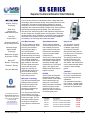
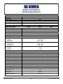
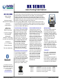
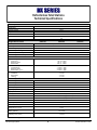
MSI MS-7203 Specifications

Transcript
Innovative Solutions for Precise Measuring & Positioning Applications
MSI POSITIONING SYSTEMS, LLC
4195 South Lee Street, Suite H
Buford, Georgia 30518-8020
Tel: 678-765-7824
Fax: 678-804-3448
[email protected]
http://www.msigeo.com
Latitude 34° 05' 45.06" N
Longitude 84° 00' 00.52" W
MSL
322.285 m
Technical Support
MSI’s Technical Assistance Center offers comprehensive
technical support from a team of specialists with years of
“hands-on” industry experience. Support is available to all
customers by telephone, or email at no charge for the first
year of ownership ([email protected])
Company Overview
Service Center
MSI Geosystems (MSI) is engaged in the research,
design, development, system integration, marketing,
sales, service, support and distribution of an extensive
range of robotic total stations, digital levels, GPS/GNSS
systems, mobile handheld computers and application
software. Typically, MSI system components are used
to determine precise angles, distances, elevations,
three-dimensional coordinates and geographic locations.
MSI’s precise measuring systems address the needs
of professionals who demand accuracy, reliability and
performance in dynamic environments.
MSI’s Service Center is one of the most competent repair
facilities in North America, with expertise in robotic total
stations, field computers and GPS/GNSS receivers.
Services include: calibration, testing, cleaning, lubrication,
firmware updates and routine maintenance. MSI’s Service
Center is qualified to service all major brands of surveying
instruments, GPS/GNSS systems and data collectors.
Training
Customers have discovered they are able to increase
productivity and efficiency on major projects requiring
advanced measuring and positioning technologies, such
as total stations, data collectors and GPS/GNSS systems,
by investing in professional training.
Mission Statement
MSI’s mission is to consistently deliver superior products
that generates the highest possible return-on-investment
for our customers. MSI’s marketing objective is to become
the value-priced leader of precise measuring and three
dimensional positioning solutions for land surveyors, civil
engineers, geotechnical engineers, contractors, and other
geospatial professionals.
Consulting
MSI offers a wide range of project consulting services
for land surveyors, civil engineers, geotechnical engineers,
contractors and others involved in precise measuring
projects. MSI can assist customers on large scale projects
on the proper use of instrumentation to improve efficiency
and to maximize the investment in equipment.
Technological Expertise
MSI’s management team has over a century of combined
experience in land surveying, engineering, GIS mapping,
construction, industrial measuring and precise positioning.
MSI will use its unique experience and expertise to supply
instruments and services that will give a competitive
advantage to our customers.
MSI POSITIONING SYSTEMS, LLC
4195 South Lee Street, Suite H
Buford, Georgia 30518-8020
Tel: 678-765-7824
Fax: 678-804-3448
[email protected]
Principal Markets
MSI’s principals markets are:
 Land Surveying, Civil/Geotechnical Engineering
 Construction, Quarrying and Mining Operations
Robert Martin, Managing Director
Mobile: 770-617-0111
[email protected]
 Utilities, Geophysics and Large Scale Mapping
 Industrial Measuring & Deformation Monitoring
MSI Surveying Systems
2
Printed: November 7, 2014
TABLE OF CONTENTS
Company Overview................................................................................................................................. 2
Table of Contents .................................................................................................................................... 3
Fall 2014 Promotion ................................................................................................................................ 4
SX Robotic Total Station ......................................................................................................................... 5
DX Auto-Aiming Total Station ................................................................................................................. 7
CX Reflectorless Total Station ................................................................................................................ 9
MTS Total Station ................................................................................................................................. 11
X91+ GNSS Receiver ........................................................................................................................... 13
X90+ GPS Receiver .............................................................................................................................. 15
Mesa Field Tablet ................................................................................................................................. 17
Ranger-3 Field Computer ..................................................................................................................... 19
MC-5 Field Computer............................................................................................................................ 21
MC-1 Field Computer............................................................................................................................ 23
SurvCE Software .................................................................................................................................. 25
Magnet Software ................................................................................................................................... 27
Digital Levels ......................................................................................................................................... 29
Innovative Solutions .............................................................................................................................. 31
Technical Support ................................................................................................................................. 32
Ordering Information ............................................................................................................................. 33
Reason to Buy from MSI ....................................................................................................................... 34
Notes & Comments ............................................................................................................................... 35
Egyptian rope stretchers in action, painting found in the tomb of Menna at Luxor (ancient Thebes) on the west bank of the Nile.
The date of the construction of this tomb is estimated to have been about 1200 BCE.
MSI Surveying Systems
3
Printed: November 7, 2014
BUY ANY TOTAL STATION
FROM MSI GEOSYSTEMS
AND RECEIVE A
FREE
ACCESSORIES PACKAGE 1
ACCESSORIES PACKAGE INCLUDES:
1
6502-11
Heavy Duty Tripod
$185.00
6507-14
8.5ft Carbon Fiber Prism Pole
$295.00
6519-03
Carbon Fiber Bipod
$295.00
6500-65
Range Pole Bracket/Clamp
$175.00
Total Accessories Package =
$950.00
Offer expires December 31, 2014
MSI Surveying Systems
4
Printed: November 7, 2014
Superior X-ellence Robotic Total Stations
Superior Tracking
Technology
RED-Tech
Reflectorless
EDM Measurements
Dual Axis
Compensation
On-board Windows®
CE Operating Systems
Advanced Angle
Measurement
Technology
Waterproof, Rugged,
& Operator Friendly
®
Bluetooth
Wireless Technology
TSshield™ Security
Two-Year Warranty
The SX series of Robotic Total Stations offers cutting edge laser
technology, optimized optical design, newly developed motor drive
mechanism, and further refined tracking algorithm to achieve
extremely robust Auto Tracking capabilities. Advanced tracking
algorithms also enhance the ability to predict future prism positions,
dramatically increasing tracking stability. Even with intensive
reflections from behind the prism or with repetitive interruptions in
the line of sight, the SX tightly tracks a moving prism. The newly
developed motor drive mechanism, and refined tracking algorithm
allows the SX to instantly recover the prism ensuring increased
productivity in all surveying and construction tasks.
One-Man Operation
The SX combines the latest
in motorized tracking, angle
accuracy, and software
technology providing a
one-man operation.
Its laser measurement and
advanced image processing
technologies provide reliable
auto-tracking capabilities,
even in dense woods or low
light conditions. Point the
SX in the general direction
of the prism, press the
trigger key, and the SX
automatically points to the
prism center enabling a
single operator to rapidly
take measurements.
RED-tech Technology
The RED-tech Reflectorless
EDM provides increased
accuracy and range with
or without reflectors or
prisms by incorporating a
new optical design.
For additional information:
MSI Positioning Systems, LLC
4195 South Lee Street, Ste H
Buford, Georgia 30518-8020
Tel: 678-765-7824
Fax: 678-804-3448
[email protected]
MSI Surveying Systems
The ultra powerful RED tech
can measure to a moving
prism even with interruptions
in the line of sight. The SX
can obtain measurements
as fast as 0.9 seconds to
most objects in reflectorless
mode.
Angle Measurements
The SX features absolute
encoders that provides long
term reliability for precise
angle measurements, plus
the dual axis compensator
ensures exception stable
measurements.
Easy-to-use
The SX series of robotic
total stations is a blend
of tradition engineering
and inspired innovation.
With an IP65 rating, the SX
is at home even on the most
demanding jobsites.
The SX 101T features IACS
(Independent Angle Calibration System) technology for
extremely reliable angle
measurements. The coaxial
optics, laser pointer, and
EDM provide fast aiming to
targets or prisms.
The display on the SX is a
backlit touchscreen LCD.
The easy to use keypad is
also backlit, with buttons that
can be depressed with either
a stylus or when wearing
gloves.
RC-PR5
The RC-PR5 “On-Demand
Remote Controller” allows
the SX Robotic Total Station
to be controlled from the
prism pole. The RC-PR5
directional sensor constantly
monitors the prism so the
SX can turn left or right, to
whichever direction is closer
for obtaining the prism.
TSshield™
Every SX is equipped with
an unique communications
module providing security
capabilities.
If an activated instrument is
lost or stolen, a coded signal
can be sent to disable and/or
locate the SX Total Station.
Product #
Description
SPECIAL1
4101-01
SX 101T 1” Robotic Total Station
$ 24,000
4101-03
SX 103T 3” Robotic Total Station
$ 19,390
4105-05
SX 105T 5” Robotic Total Station
$ 18,490
4505-15
RC-PR5 On-Demand Controller
$ 5,945
5
Printed: November 7, 2014
Robotic Total Stations
Technical Specifications
Telescope
SX Series
Image
Magnification
Erect
Effective Aperture
45mm
Length
168mm
30x
1°30’
Field of View
Minimum Focus
1.3m (4.3ft)
2.5”
Resolving Power
Angle Measurement
SX101T
SX103T
Method (Horizontal and Vertical Circles)
Accuracy (ISO 17123 3:2001)
Minimum Angle Display
Rotary Absolute Encoder - Dual Detection
± 1”
0.5”
Vertical Compensator Type
± 3”
± 5”
1”
1”
Liquid - Dual Axis
Vertical Compensator Range
± 6’
Vertical Compensator Accuracy
± 3”
Distance Measurement
± 6’
± 6’
± 4”
± 4”
SX Series
Distance Range:
Prism ATP1
Reflective Sheet
Reflectorless
Distance Accuracy:
Prism/Reflector
Reflective Sheet
Reflectorless (@ 200m)
Measuring Time:
Fine Mode
Rapid Mode
Tracking
1.3m to 1,000m
1.3m to 500m
0.3m to 800m
± 1.5mm + 2ppm
± 2.0mm + 2ppm
± 2.0mm + 2ppm
< 1.5 sec
< 1.3 sec
< 1.3 sec
General Specifications
SX Series
Auto Tracking
Yes
Auto Pointing
Yes
Rotation Speed
85°/sec
Working Range (w/ ATP1)
2m ~ 600m
Operating System
Windows Embedded CE 6.0
Display
3.5” Transmissive TFT QVGA Color LCD
Memory
500MB Internal, USB Flash (8GB max)
Interface
Serial RS-232C, USB 2.0 (Type A/ Mini B)
Bluetooth
Class 1, V2.1 + EDR (Range 600m)
Dust & Water Protection
IP65
Operating Temperature
-20°C to +50°C (-4°F to +122°F)
Dimension (W x D X H)
230mm x 207mm x 393mm
Weight (BDC70 and Handle)
7.0 kg
Battery (BDC70)
7.2V, 5.2Ah
Operating Time (+20°C)
MSI Surveying Systems
SX105T
+ 4 hours
6
Printed: November 7, 2014
Auto-Pointing Total Stations
Direct Aiming
Technology
Advanced Angle
Measurement System
Dual Axis
Compensation
RED-Tech
Reflectorless
EDM Technology
Compact, Rugged
& Lightweight
Bluetooth®
Wireless Technology
for cable free operation
Available in
1”, 3”, 5” Models
TSshield Security
Two-Year Warranty
The DX Auto-Pointing Total Stations take precise angle and distance
measurements in less time than ever before. The auto pointing
feature shortens the amount of time spent targeting the prism by
enabling the DX to automatically find the prism, while the on-board
software allows the user to make easy and confident calculations of
complex surveying and engineering functions.
The long-range Bluetooth® communication modem will connect
to an external field computer or data collector and with the optional
robotic firmware upgrade will turn the DX into an economical stateof-the-art robotic total station.
Auto Pointing Technology
It’s easy to accurately target
prisms with the DX’s Direct
Aiming Technology, which
can be used in poor or low
lighting conditions, the DX
is able to precisely locate
the direction of the prism
when moving. The DX uses
an intelligent algorithm that
automatically collimates
to the prisms giving the
correct angle readings.
Just aim the DX towards the
prism and press the trigger
button and you will get a
measurement to the target.
Bluetooth Communication
The exclusive LongLink™
communication allows a
user to enjoy the benefits of
an economical robotic total
station by connecting the DX
to an external data collector.
Record data for feature
codes and rod heights at the
prism up to 1,000 ft. away.
Accurate Measurements
The DX features numerous
measurement options, so the
user can choose the option that
best fits the job at hand. Quickly
measure distances to any
object via its Reflectorless
mode, or to a prism. Users will
especially appreciate the DX
patented RED-tech technology,
which has an ultra narrow beam
that makes it easy to measure.
Confidently measure to roof
overhangs, manhole covers or
building corners with unerring
accuracy. Unlike standard total
stations which have wide laser
beams the DX laser beam
measures only the target area
and not the surrounding area.
Plus the motorized DX uses
only one beam for both the
laser pointer and the EDM
which prevents frustrating
measurement errors, while
ensuring fast and accurate
aiming at 0.9 seconds per
measurement.
Smart Design
The DX is ideally suited for
jobs requiring precision
measurements with simple
operation. Its Direct Aiming
Technology, featuring a new
intelligent algorithm that
automatically aims to the
prism, ensures precise
readings.
The DX is also ideal for dim
or dark conditions where the
prism is difficult to locate.
When the project requires a
state of the art total station,
the DX makes the job easier
TSshield™
Every DX is equipped with
an unique communications
module providing security
capabilities.
If an activated instrument is
lost or stolen, a coded signal
can be sent to disable and/or
locate the DX Total Station.
For additional information:
MSI Positioning Systems, LLC
4195 South Lee Street, Ste H
Buford, Georgia 30518-8020
Tel: 678-765-7824
Fax: 678-804-3448
[email protected]
Product #
Description
4202-01
DX 201AC 1” Auto Pointing Total Station
$19,990
MSRP
4202-03
DX 203AC 3” Auto Pointing Total Station
$16,790
4202-05
DX 205AC 5” Auto Pointing Total Station
$15,490
4502-22
DX Robotic Firmware Upgrade
$1,400
ATP1 360° Prism
MSRP $1,428
MSI Surveying Systems
7
Printed: November 7, 2014
Reflectorless Total Stations
Technical Specifications
Telescope
DX Series
Image
Magnification
Erect
Effective Aperture
45mm
Length
168mm
30x
1°30’
Field of View
Minimum Focus
1.3m (4.3ft)
2.5”
Resolving Power
Angle Measurement
DX201AC
DX203AC
Method (Horizontal and Vertical Circles)
Accuracy (ISO 17123 3:2001)
Minimum Angle Display
Rotary Absolute Encoder - Dual Detection
± 1”
0.5”
Vertical Compensator Type
± 3”
± 5”
1”
1”
Liquid - Dual Axis
Vertical Compensator Range
± 6’
Vertical Compensator Accuracy
± 3”
Distance Measurement
± 6’
± 6’
± 4”
± 4”
DX Series
Distance Range:
Prism ATP1
Reflective Sheet
Reflectorless
Distance Accuracy:
Prism/Reflector
Reflective Sheet
Reflectorless (@ 200m)
Measuring Time:
Fine Mode
Rapid Mode
Tracking
1.3m to 1,000m
1.3m to 500m
0.3m to 800m
± 1.5mm + 2ppm
± 2.0mm + 2ppm
± 2.0mm + 2ppm
< 0.9 sec
< 0.6 sec
< 0.3 sec
General Specifications
DX Series
Yes1
Auto Tracking
Auto Pointing
Yes
Rotation Speed
85°/sec
Working Range (w/ ATP1)
2m ~ 600m
Operating System
Windows Embedded CE 6.0
Display
3.5” Transmissive TFT QVGA Color LCD
Memory
500MB Internal, USB Flash (8GB max)
Interface
Serial RS-232C, USB 2.0 (Type A/ Mini B)
Bluetooth
Class 1, V2.1 + EDR (Range 600m)
Dust & Water Protection
IP65
Operating Temperature
-20°C to +50°C (-4°F to +122°F)
Dimension (W x D X H)
230mm x 207mm x 393mm
Weight (BDC70 and Handle)
7.0 kg
Battery (BDC70)
7.2V, 5.2Ah
Operating Time (+20°C)
1
DX205AC
+ 5 hours
Optional Firmware Upgrade
MSI Surveying Systems
8
Printed: November 7, 2014
Reflectorless Total Stations
Reflectorless
Measurement
Technology
Dual Displays
and Keyboards
Dual Axis
Compensation
Low Power
Consumption for
36 hrs. field operation
Advanced Technology
Compact, Rugged
& Lightweight
Bluetooth®
Wireless Technology
for cable free operation
Available in
1”, 2”, 3”, 5” Models
TSshield™ Security
Two-Year Warranty
For additional information:
MSI Positioning Systems, LLC
4195 South Lee Street, Ste H
Buford, Georgia 30518-8020
Tel: 678-765-7824
Fax: 678-804-3448
[email protected]
MSI Surveying Systems
The CX series of Reflectorless Total Stations innovative technology
provides unparalleled performance, reliability and precision for land
surveyors, civil engineers, contractors, archaeologists, and accident
scene investigators. The CX powerful onboard computer helps to
improve productivity by performing time consuming calculations with
the touch of a few buttons. The angle measurement function allows
users to measure horizontal angles between points. The Reflectorless
EDM can measure to targets, reflector sheets, prisms or to most hard
surfaces up to 1,640 feet. The CX makes measuring to difficult to
reach or dangerous locations safe and simple.
Increase Productivity
The CX incorporates several
new technologies yet is easy
to use. Some of the features
included are RED-tech
Reflectorless measuring
technology, coaxial EDM
and laser pointer for fast
and accurate aiming.
All of this plus IP66 dust
proof and waterproof rating,
heavy duty metal chassis
and 36 hours of battery life
makes the CX series the
new standard for all precise
measuring applications.
Use the powerful onboard
computer to finish more
measurements in less time.
Easily determine setting out
lines or curves, offset and
missing line measurements,
point projections, coordinate
measurements, surface
areas and much more with
just a few buttons.
Regardless of the number of
measurements, the 10,000
point internal memory and
the included 8GB USB flash
drive, ensures that plenty of
memory is available for data
storage.
Bluetooth Communication
The exclusive LongLink™
communication functionality
of the CX series provides
operational capabilities
never before offered in a
total station. With up to a
300 meter range, the built in
Bluetooth modem, provides
the operator with reliable
wireless data communicating
without the need of cables to
transfer data to any other
Bluetooth enabled computer
or data collector.
Rugged Design
The CX is designed to withstand the tough conditions
involved in land surveying
and construction site layout.
Durable and long lasting,
the CX metal chassis is
designed for rugged field
use, while the IP66 rating
ensures the CX can handle
dust and water exposure on
any site.
User Friendly
The CX is technologically
sophisticated but also user
friendly. The CX control
panel features a 10 key pad
with a large, easy to read
LCD screen that provides
optimum viewing. The one
touch star key offers instant
access to functions and the
trigger key, lets users take a
series of measurements with
the push of a single button.
The built-in guide light,
which makes stake out
easier, has a range of 150
meters. The built-in laser
plummet has five levels of
brightness.
TSshield™
Every CX is equipped with
an unique communications
module providing security
capabilities.
If an activated instrument is
lost or stolen, a coded signal
can be sent to disable and/or
locate the CX Total Station.
Product #
Description
4404-01
CX 101 1” Reflectorless Total Station
$13,490
4404-02
CX 102 2” Reflectorless Total Station
$11,290
4404-03
CX 103 3” Reflectorless Total Station
$10,290
4404-05
CX 105 5” Reflectorless Total Station
$8,990
9
MSRP
Printed: November 7, 2014
Reflectorless Total Stations
Technical Specifications
Telescope
CX Series
Image
Magnification
Erect
Effective Aperture
45mm
Length
171mm
30x
1°30’
Field of View
Minimum Focus
1.3m (4.3ft)
2.5”
Resolving Power
Angle Measurement
CX101
Method (Horizontal and Vertical Circles)
CX102
CX103
CX105
Rotary Absolute Encoder - Dual Detection
Accuracy (ISO 17123 3:2001)
± 1”
± 2”
± 3”
± 5”
Minimum Angle Display
0.5”
1”
1”
1”
± 6’
± 6’
± 4”
± 4”
Vertical Compensator Type
Liquid - Dual Axis
Vertical Compensator Range
± 6’
± 6’
Vertical Compensator Accuracy
± 3”
± 4”
Distance Measurement
CX Series
Distance Range:
Prism CPO1
Reflective Sheet
Reflectorless
Distance Accuracy:
Prism/Reflector
Reflective Sheet
Reflectorless
Measuring Time:
Fine Mode
Rapid Mode
Tracking
1.3m to 2,500m
1.3m to 500m
0.3m to 500m
± 2.0mm + 2ppm
± 2.0mm + 2ppm
± 3.0mm + 2ppm
< 1.5 sec
< 1.3 sec
< 1.3 sec
General Specifications
CX Series
Display
Keyboard
LCD Graphic Display (192 x 80) w/ Backlight
25 Keys (soft functions, operations, power, etc.)
Auto Power
5 Levels (selectable)
Internal Memory
1MB Internal, USB Flash (8GB max)
Interface
Serial RS-232C, USB 2.0 (Type A/ Mini B)
Bluetooth
Class 1, V2.1 + EDR (Range 600m)
Dust & Water Protection
IP66
Operating Temperature
-20°C to +50°C (-4°F to +122°F)
Dimension (W x D X H)
191mm x 181mm x 348mm
Weight (BDC70 and Handle)
5.6 kg (12.3 lb)
Battery (BDC70)
7.2V, 5.2Ah
Operating Time (+20°C)
+ 36 hours
MSI Surveying Systems
10
Printed: November 7, 2014
Reflectorless Total Stations
Reflectorless
Measurement
Technology
Dual Displays
and Keyboards
Dual Axis
Compensation
Low Power
Consumption for 8 hrs.
of field operation
Advanced Technology
Compact, Rugged
& Lightweight
Bluetooth®
Wireless Technology
for cable free operation
Interfaces with all
major brands of data
collection systems
One-Year Warranty
For additional information:
MSI Positioning Systems, LLC
4195 South Lee Street, Ste H
Buford, Georgia 30518-8020
Tel: 678-765-7824
Fax: 678-804-3448
[email protected]
MSI Surveying Systems
The MTS series of Total Stations offers state-of-the-art technology at
affordable pricing. The MTS series is available in two angle accuracy
models (2” or 5”). The MTS series is designed to increase efficiency
and maximize productivity, which allows for significant time savings
in three-dimensional measuring activities.
The MTS series of total stations combines advanced features such
as reflectorless measuring, dual axis compensator, Bluetooth, USB
interface, hi-definition displays and alpha-numeric keyboards. MSI’s
advanced mechanical, optical and electronic technologies, makes the
MTS series an exceptional value with a better than average return-on
-investment.
Reflectorless Technology
From time to time, objects to
be precisely located are in
dangerous, hazardous, or
inaccessible areas where
using a reflective prism
would be difficult or even
impossible. The MTS series
can measure and locate
remote objects to a distance
of ±985’ (300m) and to an
accuracy of ±0.01’ (3mm)
without the need of targets
and/or prism or placing anyone in harms way.
The MTS series is ideal for
a wide range of surveying,
engineering, construction
and mapping applications
and will allow users to
quickly and accurately
measure distances to
remote objects that may
be over difficult terrain or
just plain inaccessible.
Rugged Design
The MTS series of total
stations are designed to
work in the most rugged of
conditions without the worry
of damaging the instrument
due to harsh environments.
Easy to Lean and Operate
The MTS series has been
designed to be simple to use
so that both experienced
and inexperienced users can
be fully operational within a
few short minutes. The easy
to follow interface has a
shorter learning curve than
most other total stations.
Increased Productivity
The MTS series provides an
inexpensive way to improve
measurement productivity
and with multiple interface
ports to communicate with
field computers and/or data
collectors, the MTS series
will significantly reduce
manual entry errors.
Backlit alphanumeric LCD
displays, dual keyboards,
internal memory, dual axis
compensation, absolute
encoders, 30x magnification,
USB interface and backed
by MSI’s technical support
makes the MTS series of
total stations an excellent
choice for most projects.
Bluetooth Enabled
The MTS series of total
stations supports wireless
Bluetooth communications
for cable free interface to
external field computers
and data collectors.
The MTS series provides a
number of other ways to
transfer data from the field
to the office.
Total System Solutions
One year warranty plus
free technical support and
“on-site” training programs
completes MSI’s Total
System Solution.
MSI offers specially priced
system bundles for the MTS
series, which includes field
data collectors/computers,
application software, and
accessories to complete a
turn-key ready system.
Product #
Description
MSRP
4505-02
MTS 2” Reflectorless Total Station
$4,995
4505-05
MTS 5” Reflectorless Total Station
$4,495
11
Printed: November 7, 2014
Reflectorless Total Stations
Technical Specifications
Telescope
MTS Series
Image
Magnification
Erect
Effective Aperture
45mm
Length
154mm
30x
1° 30’
Field of View
Minimum Focus
1m
3”
Resolving Power
Angle Measurement
MTS-2R
Method
MTS-5R
Absolute Encoding - Dual Detection
Accuracy (DIN 18723)
Minimum Angle Readout
Vertical Compensator Type
± 2”
± 5”
1”
5”
Liquid Electric - Dual Axis Compensation
Vertical Compensator Range
± 3’
Vertical Compensator Accuracy
± 1”
Distance Measurement
MTS Series
Single Prism
± 16,400ft (5,000m)
Reflectorless
± 985ft
Distance Accuracy:
Prism/Reflector
Reflectorless
± 2mm + 2ppm
± 3mm + 5ppm
Measuring Time:
Fine Mode
Tracking
(300m)
± 1.0 sec
± 0.5 sec
Prism Constant
Manual Input with Auto Correction
Refraction & Curvature
Manual Input with Auto Correction
Levels
Plate Level Vial
30”/2mm
Circular Level Vial
8’/2mm
Optical Plummet
Image
Erect
Magnification
3x
0.5m ~ ∞
Focusing Range
Field of View
5°
Displays/Keyboards
Displays
2x (8 lines)
Keyboards
2x (Alphanumeric)
Battery
Type
6V DC Ni-H Rechargeable
Operating Time
8 hours
Dimension
7.87” x 7.48” x 13.78”
200mm x 190mm x 350mm
13.78 lbs.
6.0 kg
Dimension
Weight
MSI Surveying Systems
12
Printed: November 7, 2014
Dual Frequency GNSS Receiver
220 Channel GNSS
Receiver, Antenna,
Radio and Battery
in one compact unit
Low Power
Consumption
Accurate, Reliable
& Rugged
Advanced Technology
& Integrated Design
Built-in GPRS modem
and UHF data Link
RTK Base/Rover
Easy to use for
immediate productivity
Bluetooth®
Wireless Technology
for cable free operation
Compatibility with
Field Computers
Two-Year Warranty
For additional information:
MSI Positioning Systems, LLC
4195 South Lee Street, Ste H
Buford, Georgia 30518-8020
Tel: 678-765-7824
Fax: 678-804-3448
[email protected]
MSI Surveying Systems
The X91+ is a compact 220 Channel GNSS receiver designed
for high accuracy and productivity even in harsh environments.
The X91+ provides a cost effective solution to any surveying
project. The X91+ combines the most comprehensive features
into an integrated and flexible RTK system. Easy to use, efficient
and intuitive work flow, designed for advanced network RTK
survey, compact and rugged. The X91+ is the perfect choice
for demanding survey applications.
Proven GNSS Technology
By combining decades of
GPS positioning experience
and know-how, the X91+
GNSS Receiver is one of
the most powerful RTK
solutions available.
Compact and Lightweight
The X91+ is compact, lightweight and cable free. The
X91+ is rugged, weather
resistant and compatible
with a wide range of RTK
radio solutions.
With its ability to track more
satellites, the X91+ GNSS
receiver will improve survey
productivity by tracking more
satellites.
The X91+ combines an
advanced GNSS receiver,
precision antenna, long-life
Lithium Ion batteries and
multi communications
options into a compact unit.
By adding a MSI’s Field
Computer this system
creates a seamless, cable
free and lightweight RTK
network Rover. The X91+
is a powerful GNSS receiver
featuring advanced RTK
Technology.
Total Solution
The X91+ is versatile and
can be used for almost any
type of land surveying, civil
engineering or construction
task.
The X91+ was designed
with compatibility in mind
and it is a ready fit solution
to your existing GPS/GNSS
survey equipment. This high
tech receiver combines
outstanding performance
and productivity with
exceptional economy.
Communications
For extra convenience the
X91+ includes Bluetooth for
wireless connection to most
Field Computers or Data
Collectors. The X91+ is
compatible with today’s
data collection software
packages.
The X91+ integrates multi
communication options that
best fit how you work. An
integrated cellular modem
streamlines operation with
most VRS networks.
Optimized for RTK
The X91+ functions as a
VRS Rover, RTK Rover or
RTK Base Station. With its
built-in GSM/GPRS/Digital
UHF modem the X91+ can
be easily integrated into both
private as well as public
RTK networks.
Rugged and Reliable
The X91+ GNSS receiver
and antenna, UHF radio and
GSM/GPRS modem are fully
protected from water, dust
and shock. This rugged
design makes the X91+
ideal for tough environments.
The X91+ GNSS receiver
delivers the precision and
reliability needed for precise
surveying. With superior SV
tracking performance the
X91+ is the everyday GNSS
receiver required for land
surveyors, civil engineers
and/or contractors.
X91+ Bundles
The X91+ can be bundled in
various configurations.
Contact MSI Support for
more information.
Product #
Description
MSRP
2191-12
X91+ GNSS RTK Receiver
$ 8,995
2195-04
X91+ Rover Kit
$ 790
2195-05
X91+ Base Station Kit
$ 490
13
Printed: November 7, 2014
Dual Frequency GNSS Receiver
Technical Specifications
X91+
GNSS Sensor
Receiver Type
GNSS 220 Channels
Channels
12 x L1CA GPS, 12 x L1P GPS , 12 x L2P GPS, 12 x L2C GPS
12 x L1 GLONASS, 12 x L2 GLONASS
3 x SBAS or 3 additional L1CA GPS, 1 x L-Band
Update Rate
10 Hz standard (20Hz available)
Timing (1PPS) Accuracy
20 ns
Cold Start Time
< 60s typical (no almanac or RTC)
Warm Start Time
< 30s typical (no almanac or RTC)
Hot Start Time
< 10s typical (almanac, RTC and position)
Maximum Speed
1,850 kph (999 kts)
Differential Options
SBAS, Autonomous, External RTCM, RTK,
Horizontal Accuracy
RTK
STATIC
OmniSTAR HP
SBAS (WAAS)
Autonomous
RMS (67%)
H: 10mm + 1ppm
V: 15mm + 1ppm
H: 3mm + 0.5ppm
V: 4mm + 1ppm
< 0.1 m
< 0.3 m
< 1.2 m
2DRMS (96%)
20mm + 2ppm
30mm + 2ppm
< 0.2m
< 0.6m
< 2.5m
Communications
Serial Ports
3 full duplex RS232
Baud Rates
4,800 - 115200
Correction I/O Protocol
Hemisphere GPS proprietary, RTCM v2.3, (DGPS), RTK v3, CMR, CMR+
Data I/O Protocol
NMEA 0183, Hemisphere GPS binary
Timing Output
1 PPS (HCMOS, active high, rising edge sync, 10kΩ, 10 pF load
Event Marker Input
USB
HCMOS, active low, falling edge sync, 10kΩ
1 USB Host, 1 USB Device
Power
Input Voltage
8 to 36 VDC
Power Consumption
< 4.3 W nominal (using L-Band); < 3.5 W nominal (no L-Band)
Current Consumption
355 mA nominal (@ 12 VDC using L-Band); 295 mA nominal (@ 12VDC no L-Band)
Environmental/Mechanical
Environmental Specification
Dimensions & Weight
Operating temp: -40°F to 158°F (-40°C to 70°C)
Storage temp: -40°F to 185°F (-40°C to 85°C)
Humidity: 95% (non-condensing)
7.01” x 4.72” x 1.81”
(178 x 120 x 46 mm)
1.4 lbs. (0..64 kg)
EMC Regulations
CE (IEC 60945 Emissions and Immunity), FCC Part 15 Subpart B
Rugged Features
Water & dust resistance: IP67
Drop spec: 1.2 m (4 ft.) drop on all faces, edges and corners per MIL-STD-810G
Electrostatic discharge: +/- 15kVdc air discharge, +/- 8kVdc contact discharge
Tumble spec: 1,000 1.6 ft./0.5m tumbles (2,000 drops)
Specification subject to change without notice. Battery performance will vary based on software applications
MSI Surveying Systems
14
Printed: November 7, 2014
24 Channel L1/L2 GPS Receiver
24 Channel L1/L2
GPS Receiver
Easy-to-Learn
& Simple-to-Use
4 GB
Internal Memory
Low Power
Consumption
Compact, Rugged,
Lightweight &
Submersible IP67
Advanced Technology
& Integrated Design
Easy Data Download
via USB
Two-Year Warranty
The dual frequency X90+ GPS receiver was designed to enable
every surveyor to access high precision, robust performances and
reliable technology without the high price associated with other
GPS systems. The X90+ breaks the price barrier for centimeter
accuracy GPS positioning and provides a quick return on your
investment compared to equivalent dual frequency GPS receivers
presently on the market. Just position the X90+ and turn it on, the
unit will automatically start recording GPS data and will continue
storing data until the receiver is turned off.
Advanced Technology
There are four LED lights
on the X90+. The RED LED
shows the unit is on, the
BLUE LED shows the unit
is tracking satellites (blinks
once for each satellite), the
GREEN LED blinks when
data is received from the
serial port, and the YELLOW
LED blinks each time data
is stored.
The X90+ receiver acts just
like a USB flash drive on
your Windows computer,
there is no special cables
or drivers needed.
Integrated Design
The X90+ bundles simplicity,
reliability, accuracy and
affordability into a single
integrated system that is
perfect for static GPS
observations.
The lightweight and compact
design makes the X90+
easy for one person to carry,
set-up and manage. The
X90+ receiver integrates all
components (e.g., GPS
engine, antenna with built-in
ground plane, and battery)
into a single package.
CGO Software
The optional Geomatic
Office (CGO) software is a
desktop application software
for post processing GNSS
data.
CGO was designed to work
for both static and Post
Processing Kinematic (PPK)
surveys.
X90+ Bundles
The X90+ can be bundled
in various configurations.
Contact MSI Support for
more information on a
system solution for your
project.
Designed for OPUS
The X90+ is a simple, low-cost, L1/L2 GPS receiver specifically
designed to use the National Geodetic Survey’s Online Positioning
User Service (OPUS).
The X90+ is customized to automate data submission to OPUS for
sub-centimeter level post processing anywhere in the United States
and this service is available at NO CHARGE.
OPUS requires minimal user input and utilizes NGS’ software to computer the coordinates of
the occupy point from NGS Continuously Operating Reference Station (CORS) Network. The
resulting positions are accurate and consistent with the National Spatial Reference System
(NSRS). After submitting a file to NGS a solution is returned via email.
For additional information:
MSI Positioning Systems, LLC
4195 South Lee Street, Ste H
Buford, Georgia 30518-8020
Tel: 678-765-7824
Fax: 678-804-3448
[email protected]
MSI Surveying Systems
Recently NGS introduced OPUS PROJECT which will allow users to submit multiple baseline
files and process them using CORS sites in a true GPS network solution.
GNSS Two Meter
Heavy Duty Tripod
(collapsible center)
MSPR $895
Product #
Description
MSRP
2190-01
X90+ GPS Static Receiver
$ 3,995
2275-12
12V External Battery Kit
$ 475
7190-45
CGO Office Software
$ 490
15
Printed: November 7, 2014
Dual Frequency 24 Channel GPS Receiver
Technical Specifications
X90+
GPS Receiver
Type
24 Channels GPS 12x L1, 12x L2
Advanced Multipath Mitigation - Optimized for low elevation satellite tracking
Update Rate
50 Hz
Cold Start Time
< 90s typical
Warm Start Time
< 30s typical
Hot Start Time
< 10s typical
Maximum Speed
1,850 kph (999 kts)
Post Processing Accuracy
STATIC
SBAS (WAAS)
Autonomous
RMS (67%)
H: 5mm + 1ppm
V: 10mm + 1ppm
< 0.3 m
< 1.2 m
Communications
Serial Ports
10 pin Lemo Connector (RS323 & USB)
USB
X90+ Receiver acts like a USB external hard drive
Protocol
RINEX and HCN outputs for GPS raw data
Data Storage
4 GB Internal Memory
Power
External Power Input
9 - 18 VDC
Power Consumption
± 2.6 W
Battery Capacity
2200mAh
Battery Life
Up to 6 hours
Environmental/Mechanical
Environmental Specification
Dimensions & Weight
Operating temp: -22°F to 140°F (-30°C to +60°C)
Storage temp: -40°F to 158°F (-40°C to 70°C)
Humidity: 100% (condensing)
3.35” x 7.85”
(85 x 200 mm)
49 oz. (1.4 kg)
Regulations
CE
Rugged Features
Water & dust proof: IP67
Drop spec: 2.0 m (6.6 ft.) drop
Shock: Survives a 2 meter drop onto concrete
Specification subject to change without notice. Battery performance will vary based on software applications
MSI Surveying Systems
16
Printed: November 7, 2014
Rugged Field Tablet
Windows Mobile
6.5.3 Professional
Dust & Waterproof
MIL-STD-810G
& IP-67 Rated
5.7” Color VGA
Display (640x480)
806 MHz Processor
256MB RAM
& 4 GB Flash
Intelligent
Li-ion Battery
(16 hours operation)
Built-in Wireless
Bluetooth®
Technology
Available in 3 Models
I. Standard
(Bluetooth® & Wi-Fi)
II. GEO
(3.2MP Camera GPS)
III. GEO 3G
(3G GSM Modem)
One-Year Warranty
For additional information:
MSI Positioning Systems, LLC
4195 South Lee Street, Ste H
Buford, Georgia 30518-8020
Tel: 678-765-7824
Fax: 678-804-3448
[email protected]
MSI Surveying Systems
The Mesa is a field rugged tablet with a large VGA color screen
(640x480). Submersible and drop-proof. The Mesa will protect
your data even in the most challenging environments. SD and
SIM card slots provide limitless storage, and dual hotswappable batteries will keep the Mesa Tablet productive
even on the longest days.
Offered in three models; Standard, GEO, or GEO 3G, the
Mesa Field Tablet has configurations for all budgets. All three
models come standard with internal Bluetooth and Wi-Fi and
the Standard unit can be upgraded to add a 3.2MP Camera
plus GPS, or upgraded to the GEO 3G model to include
cellular functionality.
Rugged and Reliable
The Mesa Tablet is built to
survive harsh environments
and has a strong lightweight
magnesium alloy frame
with easy to grip impact
absorbing bumpers. It can
survive immersion in water
up to 3 feet and has an IP67
rating. It also meets rigorous
military standard for shock
(four feet multi drop onto
concrete), humidity, and
vibration. The SD card and
SIM card slots are located
under the enclosed battery
for added protection and
security.
Integrated Connectivity
Bluetooth® Class 1 comes
standard to allow the Mesa
tablet to easily communicate
with surveying instruments.
The Geo 3G has the ability
to email files to the office.
The Mesa Tablet also has
built-in Wi-Fi wireless to
connect to an office network
or directly to the internet.
Large Color Display
The Mesa’s Tablet 5.7” LCD
screen can be viewed either
in portrait or landscape
mode and the display is
bright enough to see in
direct sunlight.
To make the Mesa even
better, the one of a kind
home screen puts the most
used functions on the screen
dashboard for easy access.
Geo and Geo 3G Options
The Mesa Rugged Tablet
can be configured with GPS,
a 3.2MP camera with auto
focus and 3.5G cellular
modem
With or without these options
the Mesa makes for a great
pairing with a robotic total
station or RTK Rover. The
Mesa Tablet also has an
optional docking station for
charging the batteries and
data transfer to a PC.
Hot Swappable Batteries
The Mesa Rugged Tablet
has two Li-ion battery slots
and operates up to 16 hours.
It takes only a 2 ~ 4 hour
charge to fully charge both
batteries. The batteries are
hot-swappable in the field,
so you can replace them
without shutting the unit
down.
Ultimate Surveying Tablet
The Mesa was designed
to provide years of reliable
operation for geospatial
professionals. Its sleek and
rugged design offers users
the ultimate in flexibility.
With an increasing need for
access to field information,
tablets are becoming
essential for all businesses.
The Mesa Tablet delivers on
the demanding requirements
of high quality and reliable
data communication for land
surveyors, civil engineers
and contractors.
Product #
Description
MSRP
7105-01
Mesa Standard w/ Wi-Fi & BT
$ 2,995
7105-03
Mesa Geo w/ Wi-Fi, BT, GPS, Camera
$ 3,495
7105-05
Mesa Geo w/ Wi-Fi, BT, GPS, Camera
+ 3G GSM Cell Modem
$ 3,995
17
Printed: November 7, 2014
Rugged Field Tablet
Technical Specifications
Operating System
Genuine Windows Mobile® 6.5.3 Professional
CPU
Marvell PXA320 806MHz
Display
5.7” VGA (640 x 480 pixel - Antiglare), 262H colors (18 bit)
Sunlight readable touchscreen
Portrait or Landscape Orientation
Storage & Memory
256MB RAM
4GB Flash
Camera (Geo Models)
3.2MP Resolution with Autofocus
GSM (Geo3 Models)
Penta-Band 3G GSM/GPRS/EDGE/HSDPA 850/900/1800/1900/2100 MHz
Keyboard
15 Control Buttons (6 user re-assignable)
Five way directional Navpad, Adjustable LED backlit
Expansion Slots
SD Card Slot - SDIO and SDHC
Communication Interface
Ports
Power
Dimensions & Weight
Regulation
Wi-Fi 802.11 b/g
Bluetooth (v2.0 +EDR Class 1)
COM1, RS-232C 9 Pin D with 5VDC power on DTR pin
USB Host A, USB Client Mini B
12VDC @ 800mA, 10-18V unregulated
AC adapter (50W, 100-240V, 50 / 60Hz)
Battery type: 7.4VDC, 2,550 mAh 18.9 WhrLi-Ion battery pack
16 Hours Operating Time
3.5mm Audio Jack, supports speakers, microphone or stereo output
5.3” x 7.9” x 2.0”
(136 x 200 x 51 mm)
2.2 lbs. (998g) with Two Batteries
CE, FCC, EN60950 Safety, RoHS Complaint
Rugged Features
Water & dustproof: MIL-STD 810G, IP67
Drop spec: 1.2 m (4 ft.) drop per MIL-STD-810G
Magnesium alloy case front, plastic back
Environmental Specification
Operating temp: -22°F to 140°F (-30°C to 60°C)
Storage temp: -40°F to 158°F (-40°C to 70°C)
Humidity: 5% ~ 95% (non-condensing)
Specification subject to change without notice. Battery performance will vary based on software applications, wireless settings, power management settings, LCD brightness, etc., and
environmental conditions. Battery life and charge cycles vary by use and settings. Battery life may be reduced in subzero applications.
Standard Configuration
Geo Configuration
Geo 3G Configuration























Li-ion Battery
Hand Strap
USB Download Cable
Stylus
Screen Protector
Wi-Fi & Bluetooth
MSI Surveying Systems
Li-ion Battery
Hand Strap
USB Download Cable
Stylus
Screen Protector
Wi-Fi & Bluetooth
GPS
3.2 MP Camera
18
Li-ion Battery
Hand Strap
USB Download Cable
Stylus
Screen Protector
Wi-Fi & Bluetooth
GPS
3.2 MP Camera
Cellular Modem
Printed: November 7, 2014
Mobile Field Computer
Windows Mobile
6.5 Professional
Water Resistant &
Dustproof IP-67
MIL-STD 810G
Integrated Digital
Compass, and GPS
Battery Life ±30 hrs.
Alphanumeric
Qwerty Keypad
Bluetooth®
Wireless Technology
for cable free operation
9-Pin RS-232 Port,
USB Host Port,
Mini USB Client,
& SDHC Card Slot
One-Year Warranty
The third generation Ranger 3 Field Computer offers a large
bright touch screen, full alphanumeric, easy to operate keypad
and is packed with the features surveyors depend on. Built
rugged it meets rigorous MIL-STD-810G military standard for
drops, vibration, humidity and extreme temperatures and with
an IP67 rating, it’s designed to keep your investment and your
data safe. The Ranger 3 comes standard with 8GB memory, a
SDHC card, Bluetooth, USB cable, and Wi-Fi. Choose from
four different models of the Ranger with the features that best
suit your needs and your budget.
Performance, Rugged and Reliable
The Ranger 3 features a Texas Instruments AM3715 processor with 256MB and 8GB of nonvolatile internal memory, which can be upgraded via a SDHC memory card. The Windows®
6.5 Professional Operating System includes software such as Mobile Office. The removable
2600mAh battery will last for 34 hours and can be replaced in the field.
The Ranger 3 is tough enough to take anywhere because of its rugged construction and is
certified to MIL-STD 810G (IP67), which makes the unit dust and water-proof. The Ranger 3
can withstand multiple drops to concrete from a height of 4.0 feet, and it weighs only 18.7 oz.
The Ranger operates from –22°F to +140°F in rain or snow. The Ranger can operate in the
blazing heat, subzero cold, driving rain or dusty sites. It can also survive twenty six drops from
four feet onto concrete. The Ranger’s 4.2” touch screen is specifically designed for viewing in
direct sunlight and can be operated with gloves.
Integrated Connectivity
The Ranger 3 has a mini USB client (to connect to Microsoft ActiveSync or Windows Mobile
Device Center), a USB host port (to connect to USB client devices) and a DB9 RS-232
connector (for use with serial devices). All Ranger 3 Computers have embedded Bluetooth
wireless communication technology that can exchange information over a distance of up to
300 feet without requiring a direct physical connection. Also, the Ranger 3 series comes with
built-in Wi-Fi capability, which can wirelessly transmit data to and from the internet via access
points or hot spots.
The Ranger 3 comes with Windows Mobile 6.5 O/S, which gives an overall modern look to
the included suite of Office Mobile 2010. Third party software designed for Microsoft Windows
Mobile can be installed by running a setup program on the PC using either ActiveSync or
Windows Mobile Device Center.
For additional information:
MSI Positioning Systems, LLC
4195 South Lee Street, Ste H
Buford, Georgia 30518-8020
Tel: 678-765-7824
Fax: 678-804-3448
[email protected]
Product #
Description
MSRP
7203-05
Ranger 3XR Mobile Field Computer
$ 7,650
7203-07
Ranger 3RC Mobile Field Computer
$ 6,850
7203-09
Ranger 3XC Mobile Field Computer
$ 4,095
7203-11
Ranger 3L Mobile Field Computer
$ 3,295
Ranger 3 Battery
& I/O Connectors
MSI Surveying Systems
19
Printed: November 7, 2014
Rugged Mobile Field Computer
Technical Specifications
Operating System
Genuine Windows Mobile® 6.5 Professional
CPU
Texas Instruments Sitara AM3715 ARM Crotex A8
4.2” VGA (640 x 480 pixel
Sunlight readable Color TFT Touchscreen display
LED Backlight
256 MB DDR SDRAM
8 GB NAND Flash
Display
Storage & Memory
Keypad
Numeric Keypad with Backlighting, on-screen QWERTY
Expansion Slots
SD Card Slot - SDIO and SDHC
(up to 16GB SDHC memory card*)
IO Interface
Communication Interface
Additional Features
1 x USB host
1 x Mini USB client
1 x Power Jack
1 x 9-Pin Serial RS232
1 x SDHC Memory Slot
Integrated sealed speaker & microphone
Camera x 1 (optional)
WLAN 802.11 b/g
Bluetooth (v2.0 +EDR)
Integrated GPS, Wi-Fi 802.11 B/G
Digital Compass with Accelerometer
Optional 5 MP Color Digital Camera
Power
AC adapter (50W, 100-240V, 50 / 60Hz)
Input DC 15.0 V 2.0A
Battery: 11.1V 2600mAh, 28.9 Wh Li-Ion Rechargeable Pack
Software
Microsoft Office Mobile®
Microsoft ActiveSync 4.5
7” x 3.8” x 1.5”
(179 x 97 x 37 mm)
17.0 oz. (490g)
Dimensions & Weight
Regulation
Meets FCC Class B Requirements
Rugged Features
Water & dust resistance: MIL-STD 810G, IP67 Sealed against dust and accidental immersion
Drop spec: MIL-STD-810G Method 503.5 [26 drops @ 4ft (1.2m) onto plywood over concrete
Electrostatic discharge: +/- 15kVdc air discharge, +/- 8kVdc contact discharge
Operating temp: -22°F to 140°F (-30°C to 60°C)
Storage temp: -40°F to 158°F (-40°C to 70°C)
Humidity: MIL-STD Method 507.5
RoHS Compliant
Environmental Specification
Specification subject to change without notice. Battery performance will vary based on software applications, wireless settings, power management settings, LCD brightness, etc., and
environmental conditions. As with all batteries, maximum capacity decreases with time and use and may eventually need to be replaced by a Getac service provider. Battery life and charge
cycles vary by use and settings. Battery life may be reduced in subzero applications.
MODEL OVERVIEW
3XR
3RC
3XC
3L
ARM® Cortex
800MHz
800MHz
800MHz
800MHz
SDRAM
256MB
256MB
256MB
256MB
FLASH
8GB
8GB
8GB
8GB
GPS
YES
YES
YES
YES
Compass
YES
YES
YES
YES
Accelerometer
YES
YES
YES
YES
Bluetooth
YES
YES
YES
YES
Wi-Fi
YES
YES
YES
YES
5MP Camera
YES
YES
YES
NO
3G GSM Phone
YES
NO
YES
NO
2.4 GHZ Radio
YES
YES
NO
NO
MSI Surveying Systems
20
Printed: November 7, 2014
Mobile Field Computer
®
Windows Embedded
6.5 Professional
Operating System
48 Channel GPS,
Electronic Compass
Altimeter & G-Sensor
Accelerometer
Built-in 5 Megapixel
Autofocus Camera
3.5” VGA
Direct Sunlight
Readable Display
Waterproof & Dustproof
IP68 / MIL-STD 810G
RS232C & USB Ports
Wi-Fi, 3.5G WWAN &
Integrated Long Range
®
2.1 Bluetooth
Long Life 3.72V
5.6 Ah Li-Ion Battery
Two-Year Warranty
For additional information:
MSI Positioning Systems, LLC
4195 South Lee Street, Ste H
Buford, Georgia 30518-8020
Tel: 678-765-7824
Fax: 678-804-3448
[email protected]
MSI Surveying Systems
The MC-5 from MSI Geosystems is the ideal rugged mobile field
computer. Its flexible design and powerful functionality provides a rapid
return-on-investment due to the ability to tailor the MC-5 to match the
users field computing and data collection application. The MC-5 is a
field-ready workhorse built for field use in any weather condition.
Typical applications for the MC-5 include: Surveying, Engineering,
Construction, GIS Mapping, Wetland Delineation, Mining/Quarrying
Surveys, Volume Determination, Environmental Mapping, Accident
Reconstruction, Deformation Monitoring, as well as other applications
requiring accuracy and precision of three-dimensional coordinates
and/or geographic locations in a dynamic environment.
Performance
Increase Productivity
Built for Field Use
The MC-5 features a Texas
Instruments AM3715 1GHz
processor with 512MB and
8GB of internal memory,
which can be upgraded to
40GB via a SDHC memory
card. The Windows®
embedded 6.5 Operating
System includes software
such as Mobile Office.The
removable 5600mAh battery
can be replaced in the field.
A 12-32VDC power adapter/
charger is available.
The MC-5 delivers outstanding capabilities and is a
powerful platform for mobile
computing, GIS collection,
and other field applications
requiring a compact rugged
mobile field computer.
The MC-5 is tough enough
to take anywhere because
of its rugged construction.
In addition to its IP68 rating,
the unit is dust proof and
water-proof and is certified
to MIL-STD-810G.
With the compatibility of
high capacity 32MB micro
SDHC cards, the MC-5 is
able to store large quantities
of survey/mapping data and
background maps.
GPS Receiver
Connectivity
The MC-5 has an internal 48
channel GPS module with a
built-in GPS antenna, which
can operate in urban areas
and other types of hostile
GPS environments for all
sorts of survey applications.
The MC-5 allows for cablefree connection with most
major brands of total stations
and GPS receivers via its
®
Bluetooth modem and its
compatibility with most major
brands of survey and GIS
software. The MC-5 offers
USB and RS232 DB9 com
ports, plus Bluetooth and
Wi-Fi.
The MC-5 can withstand
multiple drops to concrete
from a height of 5.9 feet,
and it weighs only 18.7oz.
The MC-5 operates in rain or
snow from –22°F to +140°F.
The MC-5’s 3.5” touch
screen is specifically
designed for viewing in direct
sunlight and can be operated
with gloves.
5MP Camera
The MC-5 has an integrated
5 Megapixel auto focus
camera with a built-in LED
flash, which allows for in-field
photo documentation.
Ergonomically Designed
The MC-5 is designed for
optimal field use and is
compact enough to fit
comfortably in one hand.
The MC-5 offers a new level
of flexibility and functionality
in a rugged handheld field
computer.
Product #
Description
MSRP
7205-05
MC-5 Field Computer
$ 2,495
21
Printed: November 7, 2014
Rugged Mobile Field Computer
Technical Specifications
Operating System
Windows® Embedded Handheld 6.5 Professional
Processor
Texas Instruments AM3715 1GHz
Display
3.5” VGA (480 x 640 pixel - 600 nits)
Quadra-Clear™ Technology Sunlight Readable Display
Pressure sensitive touchscreen
Touch Panel
Touchscreen Keypad with backlighting
Memory
Keypad
IO Interface
Communication Interface
GPS Sensor Specifications
Software
512MB MDDR
256MB NAND Flash
8GB Internal Storage (iNAND)
+32GB Optional via micro SDHC
Nuance XT9® Soft input panel (SIP)
Transcriber Handwriting Recognition
Alpha/Numeric Keypad
1 x USB
1 x RS232
1 x Power Jack
1 x Office Docking Port
1 x Speaker
1 x Microphone
1 x Stylus pen
WLAN 802.11 b/g
Bluetooth (v2.1 +EDR Class 2)
Chipset: SiRF Star IV™ with WAAS/EGNOS Support
Receiver type: L1 (C/A)
Channels: 48 channel all-in-view tracking
Update rate: 1 Hz
Autonomous: 2.5 m (8.2 ft.)
DGPS: 1~3 m (±6.56ft.)
Cold start time: 35 sec average
Hot start time: 1 sec average
Reacquisition: 0.1 sec average
Microsoft Internet Explorer Mobile®
Microsoft Office Mobile Applications
Microsoft Office Mobile®
Other Features
Auto Focus 5 Megapixel Camera
Digital E-Compass & Altimeter
Security Features
Wi-Fi for WPA/WPA2 operation
Encryption: WEP, AES, TKIP
Power
Power Consumption: 0.5W
Battery type: 3.7V, 5600 mAh Li-Ion Rechargeable Battery Pack
Operating Time: 12hrs (typical with Bluetooth®)
Dimensions & Weight
7” x 3.5” x 1.18”
(178 x 89 x 30 mm)
18.69 oz. (530g)
Regulation
CE, FCC, UL, BSMI, NCC
Environmental
Operating temp: -22°F to +140°F (-30°C to +60°C)
Storage temp: -40°F to +158°F (-40°C to +70°C)
Humidity: 95% RH (non-condensing)
Water & dust resistance: MIL-STD-810G and IP68 Certified
Drop spec: 1.82 m (6.0 ft.) drop to concrete (x26)
Tumble resistant for 1,000 cycles: 0.5m (1.6ft.)
Specifications subject to change without notice.
MSI Surveying Systems
22
Printed: November 7, 2014
Mobile Field Computer
®
Windows Mobile 6.1
Operating System
3.7” VGA Color
Direct Sunlight
Readable Display
20 Channel
SiRF III GPS Receiver
3.2 Megapixel
Autofocus Camera
Compact, Rugged
& Lightweight
Waterproof & Dustproof
IP65 Rated
Mini USB 2.0 port
Integrated Bluetooth®
Wi-Fi and GSM/GPRS
3.7 VDC 3,000 mAh
Long Life Li-Ion Battery
One-Year Warranty
The MC-1 is a state-of-the-art Mobile Field Computer with an
integrated GPS Receiver and auto focus camera running
Windows® 6.1 Mobile. Designed for mobile field computing
even under the most demanding conditions. The MC-1 is
extremely affordable, and is the ideal field mobile computer for
a large range of surveying, engineering and construction layout
applications. The MC-1 offers fast processing power, rugged
design, and data collection flexibility for efficient computing,
data reduction, and data management even under the most
demanding field conditions.
Advanced Technology
Built Tough for Field Use
Increase Productivity
The MC-1 features a 624
MHz processor with graphics
accelerator and 256 MB of
internal memory, plus 512
MB flash memory. The MC-1
offers a new level of flexibility
and functionality in a rugged
handheld field computer.
With the compatibility of
micro SD cards, the MC-1 is
able to store large quantities
of survey data as well as
background maps.
The MC-1 is tough enough
to take anywhere because
of its rugged construction.
In addition to its IP65 rating,
the MC-1 can withstand
multiple drops to concrete
from a height of 4 ft. and it
weighs only 12 oz.
The MC-1 has exceptional
capabilities and is a powerful
platform for mobile field
computing, mapping and
other collection application.
With an integrated GSM/
GPRS modem, the MC-1
offers advanced methods
needed to access the
internet and to exchange
project files to/from the
office. The MC-1 operates
all day on its rechargeable
Li-Ion polymer battery.
Built-in GPS Receiver
The MC-1 has a built-in 20
channel SiRF III chipset GPS
module with a high sensitivity
built-in antenna, which can
work in urban areas and
other hostile environments
for GPS measurements.
An optional GPS antenna
is available.
The MC-1 will operate from
-4°F to +140°F in rain or
snow. The 3.7” touch screen
is specifically designed for
viewing in direct sunlight
and has a built-in backlight
for low light conditions. The
MC-1 is compact enough to
fit comfortably in one hand
for daily use.
MSI Positioning Systems, LLC
4195 South Lee Street, Ste H
Buford, Georgia 30518-8020
Tel: 678-765-7824
Fax: 678-804-3448
[email protected]
MSI Surveying Systems
The MC-1 has an integrated
3.2 MP auto focus camera,
which allows for the capture
of pictures for documenting
the condition of assets and
features in the field.
The MC-1 allows for cable
free connection with most
major brands of robotic total
stations and GPS receivers
via its integrated wireless
Bluetooth® modem.
With an integrated GPRS
modem the MC-1 offers
internet access to exchange
files with the office. The builtin communication technology
of the MC-1 enables secure
connectivity to the internet
virtually anywhere.
Integrated Camera
For additional information:
Connectivity
Product #
Description
MSRP
7201-01
MC-1 Field Computer
$ 1,295
23
Printed: November 7, 2014
Mobile Field Computer
Technical Specifications
Operating System
Windows® Mobile 6.1 Operating System
Processor
624 MHz Intel X-Scale Processor
Display
3.7” VGA (480 x 640 portrait)
Sunlight Readable Display with Backlight
Pressure sensitive touchscreen
Touchscreen Keypad
Memory
256MB RAM
512 MB Flash
8GB Internal Storage (MicroSD)
Communication
Wi-Fi 802.11 b/g
Bluetooth (v2.1 +EDR Class 2)
Interface
1 x Mini USB
1 x Power Jack
1 x Speaker
1 x Microphone
1 x Stylus pen
Camera
3.2 Megapixel Camera with Autofocus
GPS Sensor Specifications
Chipset: SiRF Star III with WAAS/MSAS/EGNOS Support
Receiver type: L1 (C/A)
Channels: 20 channel
Update rate: 1 Hz
Autonomous: 3.0 m (8.2 ft.)
DGPS: 1~3 m (±6.56ft.) RMS
Cold Start: 50 sec average
Warm Start: 35 sec average
Hot start time: 1 sec average
NMEA 0183 Protocol
Software
Microsoft Mobile Internet Explorer
Microsoft Windows Live
Power
Battery type: 3.7DC 3,000 mAh Li-Ion Polymer Rechargeable Battery Pack
Operating Time: ±10hrs
Dimensions & Weight
6.3” x 3.4” x 1.2”
(158 x 85 x 25 mm)
12.0 oz. (340g)
Environmental
Operating temp: -4°F to +140°F (-20°C to +60°C)
Storage temp: -22°F to +158°F (-30°C to +70°C)
Humidity: 95% RH (non-condensing)
Water & dust resistance: IP65
Shock: 1.2 m (6.0 ft.) drop to concrete
Package Contents
MC-1 Field Computer
Li-Ion Battery
2GB Micro SD Card
USB Data Cable
AC Power Adapter
Stylus Pen
Hand Strap
Specifications subject to change without notice
MSI Surveying Systems
24
Printed: November 7, 2014
Data Collecting Software
Easy to Learn
Simple to Operate
Enhanced Graphics
Feature Coding
Able to run on most
field computers
and data collectors
on the market today
Interfaces with most
robotic total stations
and GNSS receivers
on the market today
SurvCE is a complete data collection system for both RTK GPS
Systems, robotic total stations and conventional total stations. It
supports the widest range of instrumentation. SurvCE is the first
choice in field data collection software with advanced, yet easy to
use functionality. SurvCE contains the most complete tool set for
file manipulation including: point storing, stakeout, line work, fieldto-finish, DWG and DXF support, background maps, COGO,
and advanced roading. The flexible, modular structure of SurvCE
enables the user to meet the changing needs of today’s job and
tomorrow’s opportunity, rich attributing, full editing in the field and
export to industry standard data formats provides true field-tofinish capabilities.
Enhanced Graphics
SurvCE has a new colorful
look, and Icons have been
standardized to create
continuity throughout the
software, while modernizing
the user experience. The
new Hot List lets users jump
to routines that previously
had shortcuts without having
to memorize key strokes.
Feature Coding
SurvCE can collect parallel
lines using the offset of a
line command and closing a
rectangle by three points
using the rectangle routine.
In the setting section, the
user can even auto compute
and store the additional
points at the line vertices
that were created by the
software. SurvCE allows
users to code in numerous
coding styles that may be
defined by their office CAD.
For additional information:
MSI Positioning Systems, LLC
4195 South Lee Street, Ste H
Buford, Georgia 30518-8020
Tel: 678-765-7824
Fax: 678-804-3448
[email protected]
MSI Surveying Systems
Easy to Use
The newly released SurvCE
version 4.1 offers users
advanced functionality, ease
of use, and sheer capability
in a complete data collection
software.
Job Settings
SurvCE uses a template
DXF file for new jobs so all
CAD layers and colors are
automatically created. It also
has the option to auto-load
cutsheets and control files
from previous projects.
SurvCE has the ability to
turn off the auto descriptions
in stakeout and customize
stakeout routines. SurvCE
can also interval the point
ID automatically.
Settings
SurvCE easily manages job
settings, network and radio
configuration. It supports a
wide range of instruments
from various manufacturers.
SurvCE keeps track of every
measuring device and keeps
them completely separate.
This includes base stations,
RTK rovers, total stations, etc.
so choosing various types of
instrumentation is quick and
easy. Instrument configuration
has been enhanced to allow
switching between devices
easy and final.
SurvCE supports all GNSS/
GPS network protocols, such
as NTRIP, TCP and UDP,
all setting needed for RTK
connection are only done
once, plus SurvCE will automatic reconnection to the
network if the connection
is loss
Product #
Description
7721-15
SurvCE TS Data Collection SW
7721-25
SurvCE GPS Data Collection SW
$ 1,250
7721-35
SurvCE TS + GPS Data Collection SW
$ 1,995
7721-45
SurvCE Robotics Data Collection SW
$ 1,495
7721-55
SurvCE Complete Data Collection SW
$ 2,495
25
MSRP
$ 995
Printed: November 7, 2014
Data Collection Software
Key Features V4.1
SurvCE 4.1 is available in more than two dozen languages. These include: English, Spanish, French, Portuguese, Czech, Dutch,
simplified Chinese, Korean, Greek, Italian, Polish, Hungarian, Swedish, Latvian and more.
New SurvCE 4.1 features include:
 Supports full output reporting in GNSS analysis
 GPS base records from the raw file may be processed into the CRD File
 Has full compatibility with the Stewart Weir Software
 Enhanced performance on new capacitive screen data collectors
 Description edit boxes now allow easy access to feature code list
 Field-to-Finish supports creating circles
 Point project automatically creates a customizable output file containing station, offset, & elevation
 Allows GIS storing in any stakeout routine
 Supports text import from drawings
 RW5 file now reads and writes faster
 Supports freehand sketching in the map screen
 Supports scalable pixels in background images
 Calculate Area/ Sliding uses a new faster and more robust method
 Ability to stake roads by complete LandXML Road Model
 Ability to use point “blocks” from drawings as point symbols or as objects to snap to for stakeout or alignments
 Messaging and file transfer office to field or peer-to-peer in field
 New techniques for best fit smooth curves and tangent curves using Field-to-Finish
 All commands are visible in each menu, preventing the need for Up-Down Arrow Keys
 Point plot updated as points are collected in the field
 Hot List lets users jump to the routines that previously had shortcuts, without having to memorize key strokes
 Software can compute volumes between two surfaces, one surface and an elevation
 Software can be used to collect trigonometric level loops and digital level loops
 Level Loops can be processed and adjusted on the data collector and all project coordinates can be updated
 Software supports several GPS/GNSS network protocols, such as NTRIP, TCP and UDP
 Use of RTCM 3.1 messages from virtual reference stations to auto-compute grid and geoid shifts
 Software keeps track of every instrument, including all base stations, rovers and total stations
 Software supports an unlimited number of localization points. Project scale settings are located in the localization dialog
 Software allows users to “Configure” how each angle reading is measured with regard to direct or reverse
 Software supports station equations
 Software has the option to use DXF file templates for new jobs, so all layers are colors are automatically created
 Software has the option to auto load cut sheets and control files from previous jobs
 Software has optional on-board help files
MSI Surveying Systems
26
Printed: November 7, 2014
Field and Office Software
MAGNET FIELD
MAGNET OFFICE
Choice of 12 Modules
Import/Export
Various File Formats
Advanced Calculations
Cloud Connectivity
Easy-to-Learn
Easy-to-Use Interface
MAGNET FIELD is a powerful and intuitive application
software that enables users to collect surveying and mapping data as well as construction layout using total stations,
GPS/GNSS receivers, digital levels, etc.
A. Magnet Field Site is a customized version of Field for
construction job site activities such as stakeout, grade
checking, volume estimates and roading.
B. Magnet Field Layout is a customized version of Field
that increases building layout productivity.
C. Magnet Mobile Exchange is a free utility that connects to Magnet Enterprise to exchange
any type of file from the field with the office.
MAGNET OFFICE is a processing, design and drafting software suite that meets the
demands of land surveyors, civil engineers, and construction contractors. Office is available
in five version: Tools, Topo, Layout, Site, and Site Resurfacing.
1. Magnet Office Tools has advanced data processing and adjustment of total stations, levels
and GNSS/GPS raw data. Tools can be installed as a standalone or as an add-on to AutoCAD.
2. Magnet Office Topo includes drafting and design tools for property plots, subdivisions and
land development projects.
3. Magnet Office Layout includes the editing and drawing tools required to easily make points
from objects and take a building plan into the field for layout.
4. Magnet Office Siteis a full featured design and drafting tool for any machine control, land
development, and road design project.
5. Magnet Office Site with Resurfacing includes all the features of Site, but with additional
advanced modules for paving and resurfacing analysis and design.
MAGNET ENTERPRISE is a web browser based environment that simplifies managing
field and office data in the Cloud. Track assets and communicate with everyone involved on
your projects. Log-in from a web browser for live updates thereby saving time and allowing for
real-time collaborating. Magnet Mobile Exchange and Magnet Enterprise is the perfect pairing
for exchanging files between the field and the office. No matter what data collecting software
is used in the field. Magnet Mobile Exchange is a free utility to exchange files back to the
office.
CLOUD CONNECTIVITY will allow users to collaborate with field crews, survey project
managers, and office personnel in real-time!
For additional information:
Product #
Description
MSI Positioning Systems, LLC
4195 South Lee Street, Ste H
Buford, Georgia 30518-8020
Tel: 678-765-7824
Fax: 678-804-3448
[email protected]
7610-01
Magnet Field Basic
7610-02
Magnet GPS Data Collection
$ 1,000
7610-03
Magnet Field Site
$ 1,000
7610-04
Magnet Field Layout
$ 1,500
7620-11
Magnet Office
MSI Surveying Systems
27
MSRP
$ 500
$ 500
Printed: November 7, 2014
Field and Office Software
Features/Functions 2.5
Magnet Software V2.5 guarantees to streamline workflow for surveying and engineering professionals. It is a high graphical and
intuitive data collection software that is compatible with different file formats and offers the ability to calculate and compare
land surfaces, yet easy to use.
Magnet Software V2.5 features:
 Choice of 12 modules
 Magnet Field contains functionality and instrument drivers
 Magnet Field survey data can be published to the Cloud
 Survey Managers can review field data in a browser environment
 Magnet Field Site is a customized version of Field for construction job sites
 Magnet Field Layout is a customized version of Field for stakeout, grade checking, volume and roading
 Magnet Office is a processing, design and drafting software suite - available in five versions
 Magnet Enterprise is a web browser based program that simplifies managing field and office data in the cloud
 Magnet Mobile Exchange is a free utility that connects to Magnet Enterprise to exchange files
 Vast Library of Import/Export File Formats
 Enhanced graphical data collection and stakeout
 Simple layout menus
 On demand data recall
 Advanced Roading including Road Strings, Real-Time Roads and staking routines
 View background maps/images under surveyed points and lines
 Connect to local networks, Wi-Fi and cellular from the field
 Surface staking with automatic DTM creation and volume calculations
 Create customized reports of field work
 Optional Cloud Connectivity
MSI Surveying Systems
28
Printed: November 7, 2014
SDL 1X/SDL 30/SDL 50
Auto Focus
View Finder
SDL 1X Model
0.2mm Precision
The SDL 1X is designed to achieve the highest precision and
productivity in leveling and height measurements. The SDL 1X
sets the ultimate benchmark for precision digital levels with
innovative features like intelligent auto focus, View Finder, and
wireless operations. When vertical precision measurements
matter, the SDL1X is the ideal digital level for all applications.
The SDL 30 was designed to take highly accurate height and
distance measurements. This digital auto level has a large internal
memory, automatic recognition, wave and read technology and a
weather resistant design for use in tough environments. Featuring
a working range of up to 100m (328ft) and an accuracy of 0.4mm
per kilometer. This digital automatic level has four measurement
modes; single fine, repeat fine, average and tracking.
SDL 30 Model
0.4mm Precision
SDL 50 Model
0.6mm Precision
Orion Models
2.0mm Precision
at 30M
Remote Trigger
Easy of Use
100m Bluetooth®
Wireless Technology
The SDL 50 provides superior measurement capability under a
variety of environmental conditions. Even when the staff surface
is partially shaded, or in dim lighting conditions the SDL 50
consistently provides reliable measurements. The SDL50 automatically recognized directions of RAB staffs and displays the
results with a minimum sight when the staff is inverted.
One-Year Warranty
for all Models
The Orin 2LS Digital Auto Level Series was designed for
any small site leveling project. This precise digital level has
a working range of 164 ft. (50m), a long battery life and a
large backlit LCD screen. The Orin 2LS has an easy point
and shoot design with a fine adjustment knob for focusing.
The Orin 2LS can be ordered with either a 24X telescope or
a 20X telescope.
*Models SDL 1X/SDL 30/SDL 50
For additional information:
MSI Positioning Systems, LLC
4195 South Lee Street, Ste H
Buford, Georgia 30518-8020
Tel: 678-765-7824
Fax: 678-804-3448
[email protected]
BGS 50 16ft Barcode Staff
MSRP $735
MSI Surveying Systems
Product #
Description
MSRP
5201-32
SDL 1X Advanced Digital Level
$ 6,995
5230-32
SDL 30 Digital Level (32X)
$ 3,330
5250-28
SDL 50 Digital Level (28X)
$ 2,215
5402-24
Orion 2LS Digital Level (24X)
$ 750
5402-20
Orion 2LS Digital Level (20X)
$ 650
5550-15
BGS 50 5M Barcode Staff
$ 735
5550-16
BGS 50 16ft Barcode Staff
$ 735
5540-14
BGS 40 4M Barcode Staff
$ 570
5530-55
BAS55 5M Barcode Staff
$ 150
29
Printed: November 7, 2014
SDL 1X / SDL 30 / SDL 50
Technical Specifications
Telescope
SDL 1X
SDL 30
SDL 50
Image
Magnification
Erect
Erect
32x
32x
28X
Effective Aperture
45mm
45mm
36mm
Length
Erect
171mm
Field of View
1°20’
1°20’
1°20’
Minimum Focus
1.5m
1.5m
1.5m
3.0”
Resolving Power
Compensator
Type
SDL 1X
3.0”
SDL 30
3.5”
SDL 50
Pendulum Compensator with Magnetic Damping
Working Range
± 12’
±15’
Setting Accuracy
±15’
± 0.3”
Vertical Compensator Range
± 6’
Vertical Compensator Accuracy
± 3”
Accuracy
SDL 1X
SDL 30
SDL 50
Electronic (ISO 17123-2)
BIS30A Staff
BIS20/30 Staff
BGS Staffs
Visual
± 0.2mm
± 0.3mm
± 1.0mm
± 1.0mm
±0.4mm
±0.6mm
±1.0mm
±1.0mm
±0.6mm
±0.8mm
±1.5mm
±2.0mm
Distance Accuracy
± 0.1% x D ± 0.1% x D
Measuring Time:
Single/Repeat
Average
Repeat
General Specifications
< 2.5 sec
+ 2.5 sec
< 1.0 sec
SDL 1X
Display
SDL 30
SDL 50
LCD Graphic Display
Keyboard
Auto Power
Internal Memory
Interface
Bluetooth
Dust & Water Protection
IP54
Operating Temperature
-20°C to +50°C (-4°F to +122°F)
Dimension (W x D X H)
226mm x 260mm x 200mm
Weight
3.5kg
Battery (BDC70)
2.4kg
2.4kg
7.2V
Operating Time (+20°C)
MSI Surveying Systems
30
Printed: November 7, 2014
INNOVATIVE SOLUTIONS
for Precise Measuring & Positioning Applications
Precise determination of distances, angles, elevations, coordinates and geographic positions has been a key element
in the development of human civilization since the beginning of recorded history. Surveying, now known as Geomatics,
is an essential requirement in the design, planning and execution of all types of construction and transportation projects,
as well as for the location and determination of property lines, property corners, easements, etc.
MSI’s specialized set of technical expertise in surveying, engineering, and construction uniquely enables us to develop
“turnkey” solutions for users who require precision of geographic location or three-dimensional coordinates in dynamic
environments.
MSI’s focus is on providing solutions to solve complex measuring and positioning problems. It has been our experience
that land surveyors, civil engineers and contractors precise measuring problems rarely fit a cookie-cutter solution.
Call today to speak with an industry veteran to discuss how MSI can assist you on your next project.
To discuss your specific
project requirements with
MSI Technical Support
CALL 678-765-7824
[email protected]
MSI Surveying Systems
31
Printed: November 7, 2014
TECHNICAL SUPPORT
MSI Technical Support
MSI’s Technical Assistance Center (MTAC) offers comprehensive technical
support from a team of specialists. With years of “hands-on” field experience,
MSI’s technical support members have become experts in precise measuring
and positioning. MTAC truly understands the importance of competent
support personnel that can answer complex technical questions without
having to rely on others to provide them with information. Technical support
is available at no charge to MSI’s customers for the first year of ownership.
MSI Services
MSI’s management believes Quality Products demand Quality Support and Service. A key ingredient in MSI’s total
customer care is service, which includes the repair of instruments in a timely manner by experienced personnel.
MSI’s Service Center is one of the most competent repair facilities in North America, with special expertise in total
station and robotic repairs. Services offered by MSI’s Service Center include: compete calibration, testing, firmware
updates and routine maintenance. All repairs are backed by a ninety day guarantee. Regular servicing, calibration
and inspection of precise measuring equipment is vital to ensure optimum performance.
Every instrument which goes through MSI’s Service Center is entered into a maintenance database, which allows
for the tracking of individual instruments and the ability to send out reminders when calibration and/or service is due.
MSI Training
MSI’s customers have discovered they are able to increase both productivity and efficiency on projects requiring
precise measuring and positioning technologies, such as robotic total stations, field computers and GNSS systems
by investing in training. MSI offers a series of customized training programs designed to meet the needs of geospatial
professionals.
MSI’s training will take the mystery out of precise angle and distance measuring and/or three dimensional positioning.
Training covers basic principles so your staff can have a working understanding of each system component and how
they interact with each other. MSI’s management is dedicated in providing our customers with the best possible
solutions, which includes product training that is essential for maximizing the potential of the investment in new
equipment and to decrease potential errors in the field.
On-site training programs available from MSI include: Total Station Training; GNSS/GPS Training; Data Collecting;
and Customized Field-to-Finish Training. MSI’s flexible training programs are designed to suit any company’s needs,
experience level and timetable.
Precise Monitoring
Demand is ever increasing for precise deformation monitoring to ensure the stability of aging infrastructure that could
be impacted by nearby construction. MSI’s Technical Assistance Center (MTAC) in conjunction with various software
developers and private consultants can assist our customers in performing precise monitoring services.
MSI Geotechnical Systems can provide continuous 24/7 remote data collection, data analysis and early warnings to
alert personnel of any possible structural movement. This real-time monitoring service is capable of serving a wide
spectrum of clients including highway departments, contractors, mines, railways, and the US Corps of Engineers.
MSI Surveying Systems
32
Printed: November 7, 2014
ORDERING
Ordering Options
Ordering by phone is a good way to confirm product availability, check on current
pricing and/or delivery schedules. Call between 8:00am and 5:00pm Eastern
Time, Monday through Friday. If your call is after normal business hours, leave
your order via voice mail and it will be handled the first thing the next business
day. Three easy ways to order - Phone, Fax or Email:
Phone:
Fax:
678-765-7824
678-804-3448
Email:
[email protected]
Payment Options
Paying for orders should be just as easy as placing orders. MSI offers five ways to pay for your order: leasing, credit
cards, open account, bank/wire transfer, check/money order. We accept Company Checks, Money Orders, Visa,
MasterCard, Discover, AMEX, and PayPal.
Company Checks/Money Order
When sending a check and/or money order with your order, please include all shipping charges, and sales tax
(if applicable) and any additional charges such as insurance costs.
Credit Cards
If you would like to use a credit card over the phone or by fax, or by email be sure to indicate the type of card, the
name on the card, the card number, expiration date, security code and the current mailing address for the credit card
statement.
Charge to Account
With established credit, you can charge items to your own MSI Open Account. Terms are net 30 days from the date
of the order. To open your account with MSI complete and fax in a credit application.
Leasing
Contact MSI on details regarding financing options. MSI has developed close working relationship with various
finance companies, which specialize in surveying instruments and equipment.
Shipping Options
Shipping via UPS ground is free of charge on orders of $1,000 or more. MSI will charge normal UPS ground rates
for repaired instruments and oversized items.
MSI Surveying Systems
33
Printed: November 7, 2014
Reasons To Buy From MSI
MSI Geosystems stands behind all products and services with an unconditional “money-back” guarantee. If for any
reason you are unhappy with any part of your order, MSI will replace the item or refund your money with no questions
asked.
1
UNBEATABLE PRICING - Value Priced Innovative Measuring & Positioning Solutions
2
QUALITY PRODUCTS - All instrumentation thoroughly tested and evaluated prior to shipping
3
PERSONALIZED SERVICE - All customer’s inquires are personally answered
4
FAST SHIPPING - In-stock orders normally ship within one to two business days
5
HONESTY & INTEGRITY - Customers treated right from the beginning
6
TECHNICAL SUPPORT - MSI’s Technical Assistance Center staffed by industry professionals
7
TECHNICAL SERVICES - MSI’s Service Center is one of the most competent repair facilities in N.A.
8
PRODUCT TRAINING - MSI offers a series of customized “on-site” training programs
9
HASSLE FREE RETURN POLICY - In the unlikely event you experience any problems
10
SATISFACTION GUARANTEE - Money back with no questions asked! If any product purchased from
MSI does not meet your expectations for any reason, simply return it for a prompt and courteous refund
MSI Surveying Systems
34
Printed: November 7, 2014
NOTES & COMMENTS
MSI Surveying Systems
35
Printed: November 7, 2014
Innovative Measuring & Positioning Systems
MSI POSITIONING SYSTEMS, LLC
4195 South Lee Street, Suite H
Buford, Georgia 30518-8020
Tel: 678-765-7824
Fax: 678-804-3448
[email protected]
www.msigeo.com
Surveying Systems Catalog Fall 2014
Copyright © 2014
MSI Positioning Systems, LLC
All Rights Reserved
Illustrations, description, pricing and technical specifications are not binding and may be subject to change without notice.
Windows® CE is a registered trademark of Microsoft Corporation.
Bluetooth® name, mark and logo are owned by Bluetooth SIG
Other trademarks and trade names are those of their respective owners.
Printed in US November 2014