1
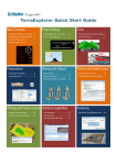
SkylineGlobe Web Package Version 6.1 Release Notes Information contained in this document is subject to change without notice and does not represent a commitment on behalf of Skyline Software Systems Inc. No part of this document may be reproduced or transmitted in any form or by any means, electronic or mechanical, including photocopying without the written permission of Skyline Software Systems Inc., 13873 Park Center Road, Suite 201 Herndon, VA 20171 USA. Copyright © 2012 Skyline Software Systems Inc. All rights reserved. Printed in the United States of America. Skyline, It’s your world, the Skyline logo, TerraExplorer, TerraExplorer Pro, TerraExplorer Plus, TerraDeveloper, TerraBuilder, TerraGate, SFS, and the TerraExplorer logo are trademarks of Skyline Software Systems Inc. All other trademarks are the property of their respective holders. Trademark names are used editorially, to the benefit of the trademark owner, with no intent to infringe on the trademark. Protected by U. S. Patents 6111583, 6433792, 6496189, 6704017, 7551172. Other patents pending. Technical support [email protected] General information [email protected] Contact Skyline on the Internet at http://www.skylinesoft.com SkylineGlobe Web Package V6.1 Release Notes User Interface Ribbon control Context sensitive tab SkylineGlobe menu SkylineGlobe Project Tree Maximized 3D View Customizable logo/data provider Enhanced Capabilities Create/play presentations Convert presentation to movie Extended navigation options Navigation tools Screen overlay Environmental effects Users and roles Unified search tools 2D Map Portability/Compatibility 2D map tools Screen overlay Integration in SG WP 2D Map ribbon 2D Map Project Tree Switch 2D-3D modes Mobile 2D Map API Analysis Tools Pro tools available to all users New area tools Viewshed analysis along a route Plus Users Import feature layers Import raster layers Draw 2D/3D shapes SkylineGlobe Manager Enhanced customization 2 Pro Users Query and edit feature layers Publish offline kits Advanced drawing tools SkylineGlobe Web Package V6.1 Release Notes User Interface Enhancements SGWP 6.1’s redesigned UI and expanded customization options give you easy access to the tools, commands, and project elements you require. Ribbon control SkylineGlobe’s new “TerraExplorer- style” ribbon integrates most SkylineGlobe commands and tools in one ribbon control so you can quickly find the command or tool you need. Ribbon commands can activate TerraExplorer native commands, SkylineGlobe actions (virtual tools), SkylineGlobe tools , and tools developed by systems integrators Ribbon incorporates the SG v2.2 top bar entries (Search, Support, Contact us, Term & conditions) Commands are organized under tabs in logical groups Customization capabilities enable you to remove or add ribbon tabs, commands, and drop-down menus to provide most convenient access to your application’s commands and tools Ribbon Control Context sensitive tab To help you quickly find the command you need, the ribbon control is designed to display certain tabs (such as Feature Layer Edit and Presentation) only when their commands are needed. SkylineGlobe menu The SkylineGlobe menu helps you find the application information you need by organizing all general application resources, such as contact/support information and user manual/tutorial in one menu, that is easily accessed from the SkylineGlobe button. The SkylineGlobe menu can be customized and expanded by the SkylineGlobe administrator. 3 SkylineGlobe Web Package V6.1 Release Notes SkylineGlobe Menu SkylineGlobe Project Tree The SkylineGlobe Project Tree provides a single access point for all SkylineGlobe layers and objects so you can easily find, modify, or activate any element you need. Project elements can be reordered and organized into groups, according to function, type of information, or location. The Tree is split into two sections: My Content containing all project content created or imported by the user and SkylineGlobe Layers containing a set of feature and raster layers as defined by the SkylineGlobe Manager. Shortcut menus available for each project tree element make it easy to edit, delete, or fly/jump to any element Content created by different tools can be grouped together in the same tree group Project Tree information can be easily reorganized by dragging and dropping elements 4 SkylineGlobe Web Package V6.1 Release Notes SkylineGlobe Project Tree Maximized 3D View To increase the view of the 3D World, we have added the ability to maximize the 3D view, when access to the Project Tree or ribbon control is less needed. In this mode, the Project Tree is set to auto-hide, and the ribbon is minimized. Maximized 3D View Mode 5 SkylineGlobe Web Package V6.1 Release Notes Customizable logo/ data-provider Your application logo and data provider logos are now both located prominently on the top of the Project Tree. Both can be easily customized using SkylineGlobe Manager. Data-Provider and Logo User login integrated into ribbon The login and new account links are now located on the upper-right corner of the ribbon, conforming to the layout on many popular websites. User Account Information Analysis Tools TerraExplorer analysis tools available to SkylineGlobe users SGWP 6.1 makes terrain analysis tools available to all TerraExplorer users. Line of sight tool provides a visual indication of whether specific locations in the 3D World can be seen from a selected position. Viewshed tool provides a graphical representation of the view from any defined single point or series of points (route). Threat dome tool analyzes and displays the volume that is visible from a given point on the terrain. 6 SkylineGlobe Web Package V6.1 Release Notes Line of Sight Viewshed Threat Dome Slope map portrays degree and aspect of slope for the entire terrain or a selected region. Map can display both slope colors and slope directional arrows. Slope Map Volume Analysis tool analyzes the amount of terrain removed or added by selected Modify Terrain objects Flood Analysis tool assesses the land area covered by water in different water flooding scenarios 7 SkylineGlobe Web Package V6.1 Release Notes Flood Analysis Terrain Profile tool displays the terrain elevation profile along a path, and related information on this profile such as maximum and minimum elevation values and slopes Best Path tool calculates the best path between two locations on the terrain without exceeding definable climb and descent slope limits Shadow Analysis tool calculates the shadow cast from buildings and 3D objects in a given radius based on the sun’s position. The sun is positioned according to the time, date and time zone you set using the Date and Time controls Shadow Analysis 8 SkylineGlobe Web Package V6.1 Release Notes New area measurement tools SkylineGlobe Web Package v6.1 offers new options and tools for measuring area. Terrain Surface Area - Measure the true surface area of a selected region by taking into account terrain contours. Terrain Area Measurement 3D Plane Area - Measure the area of a polygon on an arbitrary plane, such as a building window, using the 3D Plane Area tool. 3D Plane Area Measurement 9 SkylineGlobe Web Package V6.1 Release Notes Viewshed analysis along a route Expanded Viewshed capabilities enable you to determine what areas are visible from any selected point along a route. The user can define viewer height and radius of viewshed analysis. The calculated route viewshed can be displayed as: Individual viewshed results for each selected point along the route A single composite viewshed showing visible area from any of the route’s waypoints A series of individual viewshed results that display according to a set timespan Point-by-Point Viewshed on Route Cumulative Viewshed on Route 10 SkylineGlobe Web Package V6.1 Release Notes Enhanced Capabilities Create and play presentations Easily present your 3D project to others by creating a multi-step presentation in which you combine a customized flight route with a particular display of the project. Create a flight route by combining any number of the following methods: o Creating a list of locations. o Recording a navigation through the terrain using any of the navigation methods. o Following a dynamic object. Determine what displays in the 3D world for each step of the presentation, its timing and transition to the next step. Create movie from presentation Share your 3D visualization even with people who do not have TerraExplorer installed, by creating a movie in AVI format from any presentation in your project. Your movie can then be shown using any standard AVI Viewer. Extended navigation options Extended navigation options enable you to adjust the 3D World view (e.g. altitude, tilt) and navigate, in the way you find most natural and intuitive. All navigation-related commands are organized under one ribbon tab so you can easily find the command you need: Three different modes of controlling the mouse (Drag, Slide, and Turn & Tilt) Adjust the zoom level , turn the view North, and rotate the terrain Switch between three different options for displaying the terrain o 3D global perspective where you can control location, altitude, and tilt o 2D mode where you are looking straight down on a projected map surface o 2D mode facing North Improved interior navigation with collision detection 11 SkylineGlobe Web Package V6.1 Release Notes Ribbon Navigation Tab The new Flight Control panel offers a quick way of jumping to a specific location, or adjusting altitude and direction. Flight Control Panel Navigation tools Target tool - Continuously track the distance and direction to a specific target Multiple Coordinate System - Project the current camera/cursor coordinates to a user-selectable coordinate system Screen overlay SGWP 6.1 provides additional 3D Window controls and indicators to orient you and help you navigate. Recognizing the value of an uncluttered, unobstructed view of the 3D World, our latest release also enables you to toggle off these screen overlay elements whenever they are unneeded. The following controls and indicators can be toggled on and off in the 3D Window: Navigation controls that include a virtual joystick and compass ring Center sign that indicates the 3D Window’s center point Status bar that displays longitude, latitude, altitude, and direction of view Scale bar showing the ratio of a distance in the 3D virtual World to the corresponding distance in the actual world Date and time slider that enables you to modify current date and time Graphic HUD that displays a complete head up display in graphic form 12 SkylineGlobe Web Package V6.1 Release Notes Environmental effects Bring your 3D visualization to life by displaying the following environmental effects Cloud cover over the entire terrain Animated water on sea and ocean terrain. Users and roles SkylineGlobe WP 6.1 offers a new user privileges system based on the Windows Active Directory infrastructure. When this new authentication and authorization platform is used, SG WP automatically creates SG user accounts and assigns SG roles (groups of privileges) based on Windows authentications and user groups. This enables SG Manager to expose different application capabilities and layers to users based on their roles, while saving the time and hassle of reconfiguring password and role information within SkylineGlobe. Unified search tools SkylineGlobe WP 6.1 offers an improved search tool that enables users to simultaneously search multiple search providers for locations, businesses and other points of interest. The unified search results are compiled and displayed on the Results panel, so that you can select the location you want to fly to or easily add the location to your Favorites. You can customize the available search providers and the search results display order using SG Manager. 13 SkylineGlobe Web Package V6.1 Release Notes Advanced Capabilities Available to TerraExplorer Plus Users SGWP 6.1 automatically recognizes and offers extended capabilities to users with TerraExplorer Plus installed on their system. Import all supported feature layers TerraExplorer Plus users can use the TEP Feature Layer Import dialog to import feature layers in supported formats, (e.g. Esri shapefiles, Microsoft Access, DXF, DGN, MapInfo) and from supported servers (e.g. WFS, TerraCatalog, Skyline Feature Server, ArcSDE, Oracle). Layer level operations can then be performed using the layer’s property sheet Import all supported imagery and elevation layers TerraExplorer Plus users can use the TEP Raster Layer Import dialog to import imagery and elevation layers to overlay the terrain imagery and replace elevation data of the terrain database. Raster layers can be loaded in supported formats (e.g., .jpg, .ecw, .img, .bmp) and from supported servers (e.g. WMS, Oracle Spatial, TerraGate, ArcSDE). SkylineGlobe for Plus Users Draw and edit all 2D and 3D shapes TerraExplorer Plus users can create complex 3D visualizations by adding and editing all 2D and 3D shapes and objects: Polylines, polygons, 2D and 3D shapes, models 14 SkylineGlobe Web Package V6.1 Release Notes Text and image labels Markers and freehand lines Urban design: junctions, roads, and traffic lights Additional drawing tools for TerraExplorer Plus users Advanced Capabilities Available to TerraExplorer Pro Users SGWP 6.1 offers TerraExplorer Pro users all the extended features available to TerraExplorer Plus users as well as additional advanced capabilities to edit feature layers, publish offline kits, and add advanced objects to the terrain. Query and edit feature layers With SGWP 6.1, Pro users can perform advanced feature layer editing. Using the TEP Attribute Table Tool, users can search and filter the layer’s features based on attribute values. Features can also be selected based on their spatial relationship with a drawn polygon, line or point, or with an existing object. The filtered layer can be saved to a local file A buffer zone can be defined in conjunction with a spatial query to include features within a certain radius of the selection Features selected by spatial query can be merged into a single feature, clipped one from another, and exported to a new file A selected multi-part feature can be “exploded” into its individual, component features Publish offline kits Create a kit for an entire online project or for a subset of an online project to use offline in disconnected environments, and to share with external users. When creating an offline project in a specific area, all project terrain, data, and objects are included in your mini-project so that 15 SkylineGlobe Web Package V6.1 Release Notes you can view and display your “area of interest” comprehensively and accurately in a fraction of the time required to create an entire project. SGWP 6.1 also offers the option to publish local and Internet kits When publishing an offline kit in a designated area: Terrain in selection area is extracted and saved as local terrain database (MPT) Each section of an imagery layer that intersects with the selected area is extracted and converted to a local file (MPT) A subset of the feature data containing only the features within with the selected area is retrieved from the data source and saved as a local feature layer (.shp) All objects within the selected area and any of their local or remote resources are downloaded and saved locally Accelerate the updating of existing offline kits by skipping terrain and layer extraction for existing files Publish Offline Project in Area Advanced drawing tools TerraExplorer Pro users can further enhance the photo-realism of their 3D view by adding advanced 3D objects. Dynamic objects – Create a moving object by manually placing waypoints in the 3D Window Terrain objects – Modify the elevation values of the terrain or cut a hole in the terrain 16 SkylineGlobe Web Package V6.1 Release Notes Video file on the terrain - Play a video file either on a selected area of the terrain (Video On Terrain), or on a floating billboard Modify Terrain Object 17 SkylineGlobe Web Package V6.1 Release Notes SkylineGlobe 2D Map New 2D web mapping application enables you to navigate, search, and edit customized 2D maps. Users can move from one place to another, zoom in for a better view, search for locations, and measure area and distance. You can create new map data by adding raster and feature layers from WMS and WFS services, KML layers and basic drawings (points, lines, polygons). Your customized SkylineGlobe 2D maps can then easily be embedded in your web application and easily integrated with the SkylineGlobe WP 3D application. Portability and compatibility Easily use SkylineGlobe 2D Map wherever you go. SkylineGlobe 2D Map requires no plug-in or installation and supports most operating systems and browsers, including Internet Explorer, Firefox, Chrome, and Phone based browser (IPhone, Android and Windows Phone). The SkylineGlobe 2D Map also offers a special UI for hand-held devices. Extended capabilities to the Open Layers library o Smooth navigation o Feature layer streaming o Localization support Optimized performance Adapted for mobile devices display limitations 2D Map tools With SkylineGlobe 2D Map, you can overlay the map with your own data, mark up the map, and perform basic measurements: Add raster layers from WMS sources Add feature layers from WFS or KML sources Query SkylineGlobe Catalog Service for layers Distance and area measurement tools Marker, line and polygon drawing tools Screen overlay The 2D Map provides controls and indicators to orient you and help you navigate: Navigation controls that include a virtual joystick and compass ring 18 SkylineGlobe Web Package V6.1 Release Notes Status bar that displays map location as well any customized text (e.g. copyright information) Scale bar showing the ratio of a distance in the virtual world to the corresponding distance in the actual world Map buttons to easily switch between three pre-defined raster maps o Map – View map features (roads, parks, borders, labels, etc.) o Satellite – View satellite or aerial imagery of the area o Hybrid – View both map features and satellite imagery 2D Map Layout Integration in SkylineGlobe WP The SkylineGlobe 2D Map is available as either an independent web application or as an integrated component of the SkylineGlobe Web Package. When integrated in the SkylineGlobe WP layout, you can easily add and edit different layers and objects and switch between 2D and 3D views of the same data. The following SkylineGlobe WP components are available when working in 2D mode: 19 SkylineGlobe Web Package V6.1 Release Notes 2D Map Ribbon Control 2D Map Layer tree User section Main logo and Data Provider logo SkylineGlobe WP - 2D Map 2D Map ribbon The SkylineGlobe 2D Map ribbon provides a subset of the 3D SG WP ribbon. The 2D map ribbon includes the following tools: Home tab o SkylineGlobe Menu button o Search and Driving Direction tools o Adding feature and raster layers o Switch to 3D mode button Launch TerraExplorer in the same location Automatically turn on selected layers and content Analysis Tab o Distance measurement tools o Area measurement tools 20 SkylineGlobe Web Package V6.1 Release Notes Draw Tab o Marker drawing tool o Line drawing tool o Polygon drawing tool View Tab o Normal and Maximize modes o Screen Overlays (Navigation controls, Status bar, Scale bar ) 2D Map Home Tab 2D Map Project Tree The 2D Map Project Tree is split into four sections: Base map, Map layers, Feature layers, and Drawing layers. From the Project Tree you can: Show/hide raster and feature layers in the map Remove feature and raster layers from the map Edit various layer properties including, line and fill colors, popup message, and point/line/polygon style Show/hide user drawings Add raster layers from WMS sources Add feature layers from WFS or KML sources Query SkylineGlobe Catalog Service for layers 21 SkylineGlobe Web Package V6.1 Release Notes Switch between 2D-3D modes Switch between a 2D and 3D view of your data simply by clicking the ribbon command. When 3D mode is selected from the 2D view, SG WP launches the 3D mode, copying most of the relevant 2D content to the 3D environment. SG Manager provides three start-up options for the SG WP application: Auto-detect – SG WP automatically detects if the user already installed the TerraExplorer plug-in. If it is installed, the 3D mode is launched, and otherwise the 2D mode. If no plug-in is installed and a user selects the 3D mode from the 2D map, SG WP will install the TerraExplorer plug-in. Force 3D – Application always starts in 3D mode. If the TerraExplorer plug-in is not available, it is installed. Force 2D –Application always starts in 2D mode. Switch to 3D mode Mobile 2D Map A mobile version of the 2D Map offers a layout optimized for limited screen real estate, with minimized controls and a Full Screen mode in which the map covers the address bar. Supports multi-touch gestures Search box – uses SkylineGlobe search engine Connect to device’s GPS to display user’s location Switch between pre-defined raster layers 22 SkylineGlobe Web Package V6.1 Release Notes 2D Map for Mobile SkylineGlobe 2D Map API Easily integrated into any web page Control map layout and controls Control map position Add and style layers Add drawings 23 SkylineGlobe Web Package V6.1 Release Notes SkylineGlobe Manager Enhanced customization Using the new SkylineGlobe Manager, you can easily design the UI according to your specific requirements by customizing ribbon entries, controlling the position of SG tools, and controlling the visibility of the different layout sections. SkylineGlobe Manager 24