1
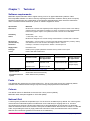
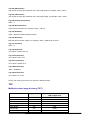
MiniScale
User guide
Contents
Section
Preface
Chapter 1
Chapter 2
Annexe A
Page no
.................................................................................................................................................. 3
Contact details .......................................................................................................................... 3
Use of the product ..................................................................................................................... 3
Purpose and disclaimer ............................................................................................................ 3
Copyright in this guide .............................................................................................................. 3
Data copyright and other intellectual property rights ................................................................ 4
Trademarks ............................................................................................................................... 4
Back-up provision of the product .............................................................................................. 4
Using this guide......................................................................................................................... 4
Introduction ............................................................................................................................. 5
Applications ............................................................................................................................... 5
System requirements ................................................................................................................ 5
Computer hardware ............................................................................................................. 5
Computer software............................................................................................................... 6
Supply and formats ................................................................................................................... 6
High-level product overview .................................................................................................. 8
Scale ......................................................................................................................................... 8
Coverage ................................................................................................................................... 8
Source of MiniScale .................................................................................................................. 8
Features .................................................................................................................................... 8
Currency.................................................................................................................................... 9
Resolution ................................................................................................................................. 9
Georeferencing ......................................................................................................................... 9
Data compression ................................................................................................................... 10
Image compression ................................................................................................................. 10
Lossless compression........................................................................................................ 10
Lossy compression ............................................................................................................ 10
TIFF......................................................................................................................................... 10
Revision .................................................................................................................................. 10
Product and service performance report form .................................................................. 11
v1.8 – 05/2013
MiniScale user guide contents v1.8 – 05/2013 © Crown copyright Page 2 of 25
Preface
This user guide (hereafter referred to as the guide) is designed to provide an overview of MiniScale
(hereafter referred to as the product) and it gives guidelines and advice on how a customer might derive the
maximum benefit from the product. It assumes a general knowledge of geographic information. If you find an
error or omission in this guide, or otherwise wish to make a comment or suggestion as to how we can
improve it, please contact us at the address shown below or complete the product and service performance
report form at annexe A and return it to us.
Contact details
Our Customer Service Centre will be pleased to deal with your enquiries:
Customer Service Centre
Ordnance Survey
Adanac Drive
SOUTHAMPTON
SO16 0AS
General enquiries (calls charged at local rate): +44 (0)8456 05 05 05
Dedicated Welsh Language HelpLine: 08456 05 05 04
Textphone (deaf and hard of hearing users only please): +44 (0)23 8079 2906
[email protected]
www.ordnancesurvey.co.uk
This document has been screened in accordance with Ordnance Survey's Equality scheme. If you have
difficulty reading this information in its current format and would like to find out how to access it in a different
format (Braille, large print, computer disk or in another language), please contact us on: +44 (0)8456 05 05 05.
Use of the product
The product is made available to you and your organisation on the terms of the OS OpenData Licence at
www.ordnancesurvey.co.uk/opendata/licence.
If there is any inconsistency between the terms of the licence and this guide, the terms of the licence prevail.
Purpose and disclaimer
This guide is provided for guidance only and does not constitute any warranty, representation, undertaking,
commitment or obligation (express or implied) about the product or its suitability for any particular purpose. It
is your responsibility to ensure that this product is suitable for your intended purpose.
Ordnance Survey does not accept any liability (whether for breach of contract, negligence or otherwise) for
any loss or liability you or any third party may suffer in relying on this guide and any guidance, suggestion,
advice or explanation provided in it. Ordnance Survey’s liability to you in relation to the product is limited, as
set out in the OS OpenData Licence.
We may change the information in this guide at any time without notice.
We do not accept responsibility for the content of any third party websites, referenced in, or accessed
through, this guide or through the Ordnance Survey website.
Copyright in this guide
This guide is © Crown copyright 2012.
You may copy or distribute any part of this guide to support the use of OS OpenData, including for your
personal use, use in your organisation or business, or for use with, or incorporation in, your product or
application.
MiniScale user guide preface v1.8 – 05/2013 © Crown copyright Page 3 of 25
Data copyright and other intellectual property rights
The Crown (or, where applicable, Ordnance Survey’s suppliers) owns the intellectual property rights in the
data contained in this product. You are free to use the product on the terms of the OS OpenData Licence,
but must acknowledge the source of the data by including the following attribution statement: Contains
Ordnance Survey data © Crown copyright and database right 2012.
Trademarks
Ordnance Survey, the OS Symbol and MiniScale are registered trademarks of Ordnance Survey, the
national mapping agency of Great Britain.
Adobe, Acrobat Reader, Adobe Illustrator and Adobe Photoshop are registered trademarks of Adobe
Systems Incorporated. ArcInfo, ArcView and ESRI are registered trademarks of Environmental Systems
Research Institute Inc. MapInfo is a registered trademark of MapInfo Corporation. Unisys is a registered
trademark of Unisys Corporation. Intel is a registered trademark of Intel.
Back-up provision of the product
You are advised to copy the supplied data to a back-up medium.
Using this guide
The documentation is supplied in portable document format (PDF) only. Free Adobe® Acrobat Reader®
software, which displays the guide, incorporates search and zoom facilities and allows you to navigate
within. Hyperlinks are used to navigate between associated parts of the guide and to relevant Internet
resources by clicking on the blue hyperlinks and the table of contents.
If you are unfamiliar with any words or terms used and require clarification please refer to the glossary at the
end of the document.
MiniScale user guide preface v1.8 – 05/2013 © Crown copyright Page 4 of 25
Chapter 1
Introduction
Ordnance Survey’s MiniScale is a small-scale product designed for use within desktop graphic applications,
providing geographic context for the whole of Great Britain. MiniScale shows the major boundaries, lines of
communication, settlements and physical features of Great Britain. MiniScale is a vector graphic created
using desktop publishing software so it can be customised and converted into a wide variety of graphic
formats. Alternatively, the raster version can also be used within a geographical information system (GIS) as
a backdrop.
MiniScale is aimed at any customer that requires a high-quality, visually appealing map for their documents
and publications, whether a magazine, brochure or web pages.
An extract of MiniScale, with default layers and styles, is shown below.
Applications
Typical ways in which MiniScale could be used include:
• Location maps for websites or promotional material, showing head offices or distribution of assets across
Great Britain.
• High-level route planning along the major roads and railways.
• As an overview or entry screen map within an Intranet or Internet web mapping service.
• The smaller scale of MiniScale also lends itself to applications that need to show information at a regional
or county/unitary level, where a larger-scale map would be too detailed or cluttered.
System requirements
Computer hardware
This product may be used on a wide range of hardware platforms (provided sufficient memory and storage
facilities are available), varying from desktop PCs using appropriate software or CAD to mainframe
computers with specialised translators and applications.
MiniScale user guide chapter 1 v1.8 – 05/2013 © Crown copyright Page 5 of 25
Computer software
MiniScale is supplied as inert data and does not include software for data manipulation. To exploit fully the
potential of MiniScale, it is necessary to use appropriate application software.
Supply and formats
The data is supplied on CD and is updated and released annually in January. It is supplied as the whole of
Great Britain with Orkney and the Shetland Islands shown in their correct position. Some European coastline
is supplied to give context.
MiniScale is supplied in the following formats (file sizes are approximate).
• Adobe Illustrator CS3 or higher, file size 25 Mb
®
• Editable Encapsulated Post Script (EPS), file size 70 Mb
• Tiff LZW compression, file size 20–40 Mb
The Illustrator file contains the layers and styles required to customise the product. This file also contains
additional layers, such as sea depths, height colouring and other information that doesn’t appear on the
default style for MiniScale. Some of the ways that MiniScale can be customised is shown in the raster
examples provided.
The Illustrator file requires the font ‘Source Sans Pro’. This is a free open source font created by Adobe.
Available from Adobe and SourceForge; http://sourceforge.net/projects/sourcesans.adobe/
MiniScale user guide chapter 1 v1.8 – 05/2013 © Crown copyright Page 6 of 25
MiniScale with height layers see legend.
MiniScale with shaded relief (tiff images available from supplementary file supplied).
More information on formats is available in the technical specification.
MiniScale user guide chapter 1 v1.8 – 05/2013 © Crown copyright Page 7 of 25
Chapter 2
High-level product overview
Scale
1:1 000 000 (1 mm = 1 km)
MiniScale is designed to be used at viewing scales between 1:700 000 and 1:2 000 000.
Coverage
Great Britain
Source of MiniScale
MiniScale is derived from the 1:250 000 scale topographical digital database.
Features
Features
Layer description
Style and content notes
Boundaries
National names
For example, England, Wales, Scotland
County or unitary names
For example, Dorset, Hampshire and so on
National boundaries
Dark grey line
County or unitary boundaries
Light grey line
Urban primary names
Primary destination towns with a large urban extent
Other urban names
Other towns with a large urban extent
Primary town names
Primary destination towns
Other town names
Selected towns and villages useful to MiniScale
Urban area fill
Depicts extent of large urban areas
Alternative urban symbol
Used to replace urban area fills if required
Primary town symbol
Large yellow dot
Other town symbol
Small yellow dot
Settlements
Communications Motorway numbers
Numbered where space permits
Primary A road numbers
Numbered where space permits
Other A road numbers
Numbered where space permits
Motorway junction numbers
Access (full or limited) is distinguished by colour
Service areas
24 hour services
Motorways
Solid blue line with white centreline
Primary A roads
Green line (dense urban areas may show only a selection)
Primary dual-carriageway
Significant lengths shown with yellow centre line
Other A roads
Pink line (dense urban areas may show only a selection)
Roads under construction
Only significant projects shown
Airports
Symbol (with or without customs). Named when different to
associated town, for example, Heathrow
Domestic ferry routes
Time of crossing shown where space permits
Railway lines
Passenger routes only (main and other). Solid black line
MiniScale user guide chapter 2 v1.8 – 05/2013 © Crown copyright Page 8 of 25
Features
Physical
Other
Layer description
Style and content notes
Geographic feature names
Selected names, for example, Land’s End, Pennines, Isle of Skye
Major mountain peaks
Selected, for example, Ben Nevis
Water feature names
Selected names, for example, Bristol Channel, Loch Lomond
Scenic areas and Areas of
Outstanding Natural Beauty
(AONBs)
Green fill and named, for example, Cotswolds, South Downs
Forest Parks and National Parks
Green fill and named, for example, Dartmoor, New Forest
Lakes and lochs
Selection of major ones only
Rivers
Selection of major ones only: Thames, Severn, Trent, Dee and
so on.
Coastline
High water mark only
Background (land) tint
Broken into shapes that match the boundaries
Background (sea) tint
Light blue fill
National Grid
100 km grid and reference letters
Extras
Longitude and latitude lines
Provided as
separate files to fit Height tints
MiniScale
Sea depths
Great Britain
75, 200, 400, 600, 800 metres
60,120,300,600 metres
Legend and scale bar
Inset box
Shaded Relief
254 dpi, 1:1 000 000 scale
NOTE: Some layer combinations may not be compatible. Relief tiles in separate file
Currency
MiniScale data is derived from the latest available version of Ordnance Survey’s 1:250 000 database. The
MiniScale dataset is refreshed annually.
Resolution
The master graphic (postscript) files are also provided as raster images at a resolution of ten (10) dots per
mm (dpmm) – or 254 dots per inch (dpi) and a pixel is one hundred (100) metres on the ground. This
resolution maintains the necessary clarity of text.
Georeferencing
To be able to view each tile in the correct geographic relation to the National Grid and to each other, the tiles
must be georeferenced. GIS typically provide georeferencing as part of their functionality, but for each set of
tiles it is necessary to provide the information on how the tiles should be ordered.
Ordnance Survey provides this information in a set of georeferencing files, also known as world files. A
complete set for MiniScale is available to download free of charge from the MiniScale product page on the
Ordnance Survey website; these are also supplied with the product written to CD.
There are several different types of world file. Prior to downloading one of the sets, customers are advised to
check with their system suppliers to find out which type their system supports.
The conventions behind the files’ creation can be found in chapter 1 of the technical specification. By using
the conventions outlined there, this means that other datasets using the same conventions can be imported
into the same GIS to add value to the raster map. So, for example, overlaying a routing or logistics network
over the map or displaying a customer’s demographic information.
The georeferencing files should be saved in the same directory as the files of the map tiles themselves.
For this product a single TFW and TAB file is available to geographically position the data.
MiniScale user guide chapter 2 v1.8 – 05/2013 © Crown copyright Page 9 of 25
Data compression
TIFF data volumes are influenced by the level of data compression.
Approximate storage volumes: 16–80 Mb using LZW compression.
Image compression
When an image is compressed, duplicated data that has no value is removed or saved in a shorter form,
reducing a file’s size. For example, if large areas of water are the same tone, only the value for one pixel
needs to be saved, together with the locations of the other pixels with the same colour. When the image is
edited or displayed, the compression process is reversed. When raster is compressed, not only are the data
volumes reduced but the user can download, display, edit and transfer images more quickly.
There are two forms of compression: lossless and lossy.
Lossless compression
As its name suggests, lossless compression does not lose information within an image. A lossless
compression retains the original quality of an image when it is uncompressed. This process doesn’t provide
much compression, so file sizes remain large. Lossless compression is used mainly where detail is
important, such as when planning to make large prints.
Lossy compression
This process degrades images to some degree, meaning that the decompressed image is not quite the
same as the original. The more an image is compressed, the more degraded it becomes. In many situations,
such as posting images on the Internet or printing small- to medium-sized prints, the image degradation is
not so obvious. If a lossy compressed image is over enlarged the degradation will become apparent.
TIFF
TIFF is one of the most commonly used lossless image formats. TIFF is primarily designed for raster data
interchange and is supported by numerous image-processing applications. This permits much more efficient
access to very large files that have been compressed.
Revision
The MiniScale master dataset is updated and released annually in January.
MiniScale user guide chapter 2 v1.8 – 05/2013 © Crown copyright Page 10 of 25
Annexe A
Product and service performance report form
Ordnance Survey welcomes feedback from its customers about MiniScale.
If you would like to share your thoughts with us, please print a copy of this form and when completed post or
fax it to the address below.
Your name: ..........................................................................................................................................................
Organisation: .......................................................................................................................................................
Address: ...............................................................................................................................................................
..............................................................................................................................................................................
..............................................................................................................................................................................
Postcode: .............................................................................................................................................................
Phone: ..................................................................................................................................................................
Fax: ......................................................................................................................................................................
Email: ...................................................................................................................................................................
Quotation or order reference: ..............................................................................................................................
Please record your comments or feedback in the space below. We will acknowledge receipt of your form
within three (3) working days and provide you with a full reply or a status report within 21 working days.
If you are posting this form, please send it to:
MiniScale Product Manager, Ordnance Survey, Adanac Drive, SOUTHAMPTON, SO16 0AS.
If you wish to return it by fax, please dial +44 (0)23 80450 990494.
Any personal information that you supply with this report form will be used by Ordnance Survey only in the
improvement of its products and services. It will not be made available to third parties.
MiniScale user guide annexe A v1.8 – 05/2013 © Crown copyright Page 11 of 25
MiniScale
Technical specification
Contents
Section
Introduction
Chapter 1
Chapter 2
Annexe A
Page no
................................................................................................................................................ 13
Purpose of this specification and disclaimer ........................................................................... 13
Copyright in this specification ................................................................................................. 13
Technical................................................................................................................................ 14
Software requirements ............................................................................................................ 14
Fonts ....................................................................................................................................... 14
Colours .................................................................................................................................... 14
National Grid ........................................................................................................................... 14
National Grid coordinates for the raster versions .............................................................. 15
Georeferencing file .................................................................................................................. 15
Using add-on files/merging earlier files ................................................................................... 15
Features, layers and styles ..................................................................................................... 15
Legend .................................................................................................................................... 17
Managing MiniScale files ..................................................................................................... 18
File formats ............................................................................................................................. 18
Image file directory (TIFF) ....................................................................................................... 18
TIFF......................................................................................................................................... 19
MiniScale colour image directory (TIFF) ............................................................................ 19
Ireland and Channel Islands ................................................................................................... 20
Boundaries .............................................................................................................................. 21
Depiction of roads and towns.................................................................................................. 21
Welsh spellings ....................................................................................................................... 21
Shaded relief file ..................................................................................................................... 21
Glossary ................................................................................................................................. 22
v1.8 – 05/2013
MiniScale technical specification contents v1.8 – 05/2013 © Crown copyright Page 12 of 25
Introduction
Purpose of this specification and disclaimer
This is the technical specification (hereafter referred to as the specification) applicable to the MiniScale
(hereafter referred to as the product).
We may change the information in this specification at any time.
We do not accept responsibility for the content of any third party websites referenced in or accessed through
this guide or through the Ordnance Survey website.
Copyright in this specification
This guide is © Crown copyright 2010.
You may copy or distribute any part of this specification to support the use of OS OpenData, including for
your personal use, use in your organisation or business, or for use with, or incorporation in, your product or
application.
MiniScale technical specification introduction v1.8 – 05/2013 © Crown copyright Page 13 of 25
Chapter 1
Technical
Software requirements
®
®
MiniScale requires Illustrator CS3 or higher running on a PC or Apple Macintosh platform. Other
EPS-compatible software can also be used by importing the EPS files. Ordnance Survey does not specify
hardware requirements as it is dependent on the software and applications within which the data will be
used. Customers should contact their system or software supplier for advice.
Specification
MiniScale
Data source
MiniScale is a redrawn and simplified product designed to meet the needs of the desktop
graphics industry. Historically it is based on a variety of Ordnance Survey digital datasets;
however the graphic output is now updated from the 1:250 000 vector data base.
Availability
Great Britain
Scales
1:1 000 000 (1 mm = 1 km)
MiniScale is designed to be used at viewing scales between 1:700 000 and 1:2 000 000
Physical size
(at scale above)
Great Britain = 700 mm wide by 1 300 mm high (with Shetland Islands in position). Orkney
and Shetland can be inset to reduce the height to about 1 000 mm.
Resolution
Postscript = resolution of output device. Raster = 254 dots per inch
Supply media
Download or CD
Data type
Desktop vector graphic (Illustrator and EPS vectors), CMYK colour space
Colour
Raster LZW data is RGB colour
Data structure and size
Postscript vector
Transfer format/s
Storage volumes
are approximate
Editable EPS
Editable 70 Mb
Illustrator CS3
Illustrator 25 Mb
Layers and styles
Yes, see features layers and styles
Update interval
Great Britain data revised annually
Coordinate reference
system
British National Grid (OSGB36)
Raster
Transfer format/s
Storage volumes
are approximate
TIFF LZW
compressed 254 dpi
TIFF 20–40 Mb
(Choice of four
example styles)
TIFF LZW– none
Fonts
The Illustrator file requires the font ‘Source Sans Pro’. This is a free open source font created by Adobe.
Available from Adobe and SourceForge; http://sourceforge.net/projects/sourcesans.adobe/
Colours
The default colours for MiniScale vectors are four-colour process (CMYK).
MiniScale raster examples supplied as TIFF LZW (RGB).
National Grid
A 100 km grid is provided as a separate layer. This is set as an invisible layer by default. The 100 km grid is
constructed from individual squares to enable them to be used easily for clipping and so on. A further
non-printing layer holds the 100 km letter references to ease identification of the squares. For Illustrator
users the rulers have been set to match the zero point for National Grid. When the file is used at 1:1 000 000
scale, and providing the rulers or page position has not been moved, the measurements can be used as
National Grid coordinates (preferences must be set to millimetres).
MiniScale technical specification chapter 1 v1.8 – 05/2013 © Crown copyright Page 14 of 25
For example: the tip of Flamborough Head has an Illustrator coordinate of x = 525.85 mm and y =
470.51 mm, which corresponds to a National Grid reference of 5258 4705 (or TA 258 705). In Illustrator the y
value will be a minus value.
National Grid coordinates for the raster versions
The raster files have been provided for geographical information system (GIS) users who might otherwise be
unable to use the Illustrator or EPS files. The origin (lower-left corner) of the GB file is 0, 0 km and it finishes
at 700 km east and 1 300 km north of the National Grid origin. This equates, at 254 dpi, to 7 000 pixels wide
by 13 000 pixels high (100 km = 1 000 pixels).
Georeferencing file
Georeferencing files allow tiles of map data to be located in their correct geographic position when loaded
into a GIS. This is achieved by loading in files alongside the data files that contain the National Grid corner
coordinates for each tile. This is especially useful if more than one tile of data is being loaded at once, as it
allows for a true geographic depiction of the data.
When raster data is supplied to customers, it is not georeferenced in any way. This means that tiles will not
be set up in geographic relationship to each other when loaded into a GIS.
Included on the CD is a TIFF World File (TFW), which can be used to georeference raster data in ESRI®
ArcView® and ArcInfo®, together with a TAB file for use with MapInfo®. These Georeferencing files can also
be downloaded from the MiniScale web pages in the technical pages.
For this product a single TFW and TAB file is available to geographically position the data.
Using add-on files/merging earlier files
The shaded relief tiles are provided in a second Illustrator file. The document size and position of this relief
file matches that of the main MiniScale Illustrator file. Use the ‘paste in front’ command to copy the relief into
the right position on the MiniScale map. Position the relief layer for desired effect. Use the ‘multiply’ setting to
make detail underneath show through. If the document size and position have been changed then use the
100 km squares to fit the relief tiles to.
Features, layers and styles
Features
Layer description
Style and content notes
Boundaries
National names
For example, England, Wales, Scotland
County or unitary names
For example, Dorset, Hampshire and so on
National boundaries
Purple line
County or unitary boundaries
Light grey line
Urban primary names
Primary destination towns with a large urban extent
Other urban names
Other towns with a large urban extent
Primary town names
Primary destination towns
Other town names
Selected towns useful to MiniScale
Urban area fill
Depicts extent of large urban areas
Alternative urban symbol
Used to replace urban area fills if required
Primary town symbol
Large yellow dot
Other town symbol
Small yellow dot
Motorway numbers
Numbered where space permits
Primary A road numbers
Numbered where space permits
Other A road numbers
Numbered where space permits
Motorway junction numbers
Access (full or limited) is distinguished by colour
Service areas
24 hour services on motorways and primary roads only
Settlements
Communications
MiniScale technical specification chapter 1 v1.8 – 05/2013 © Crown copyright Page 15 of 25
Features
Layer description
Style and content notes
Motorways
Solid blue line with white centreline
Primary A roads
Green line (significant lengths of dual carriageway
shown with yellow centreline)
Other A roads
Pink line
Roads under construction
Only significant projects shown
Airports
Symbol (with or without customs). Some, for example,
Heathrow, are named
Domestic ferry routes
Time of crossing shown where space permits
Railway lines
Passenger routes only. Solid black line
Geographic feature names
Selected names, for example, Land's End, Pennines,
Isle of Skye
Water feature names
Selected names, for example, Bristol Channel, Loch
Lomond
Scenic areas and Areas of
Outstanding Natural Beauty
(AONBs)
Green fill and named, for example, Cotswolds, South
Downs
Forest Parks and National Parks
Green fill and named, for example, Tay, Dartmoor
Lakes and lochs
Selection of major ones only
Rivers
Selection of major ones only; Thames, Severn, Trent,
Dee and so on.
Coastline
High water mark only
Background (land) tint
Broken into shapes that match the boundaries
Background (sea) tint
Light blue fill
Other
National Grid
100 km grid and reference letters
Extras
Longitude and latitude lines
Great Britain
Layer tints
75, 200, 400, 600, 800 metres
Sea depths
60,120,300,600 metres
Legend and scale bar
Inset box
Shaded relief
254 dpi 1:1 000 000 scale (in separate Illustrator file)
Physical
Some layer combinations
may not be compatible
MiniScale technical specification chapter 1 v1.8 – 05/2013 © Crown copyright Page 16 of 25
Legend
MiniScale technical specification chapter 1 v1.8 – 05/2013 © Crown copyright Page 17 of 25
Chapter 2
Managing MiniScale files
MiniScale has been created as a vector data graphic map favourable for use within desktop graphic
applications. MiniScale’s use within GIS will be limited to backdrop mapping when using the TIFF only.
MiniScale is supplied on one CD-ROM as a single data file in a variety of industry-standard formats. The
data is held in layers, with styled objects for easy customisation of map images. These can be easily
converted to web images using appropriate software (not supplied).
File formats
MiniScale is maintained using Adobe Illustrator software. All the capabilities of editing and styling MiniScale
may not be available in other applications.
Raster versions are also provided at 254 dpi. The TIFFs are LZW compressed and in RGB colours. New
raster files can be created, styled and layered as required by using the Illustrator data.
Image file directory (TIFF)
The image file directory for TIFF will contain the following entries:
Tag 254 (NewSubfileType)
An indication of the kind of data contained in this sub-file, for example, value = 0
Tag 256 (ImageWidth)
The number of columns in the image, the number of pixels per row, for example, value = 7000
Tag 257 (ImageLength)
The number of rows of pixels in the image, for example, value = 13000
Tag 258 (BitsPerSample)
Number of bits per component, for example, value = 8
Tag 259 (Compression)
Compression scheme used on the image data, for example, value = 5 (LZW)
Tag 262 (Photo.Interpretation)
The colour space of the image data, for example, value = 2 (RGB Palette).
Tag 273 (StripOffsets)
For each strip, the byte offset of that strip, for example, 1st 4 values = 28168 65970 103868 141504
Tag 274 (Orientation)
value = 1
Tag 277 (SamplesPerPixel)
value = 3
Tag 278 (RowsPerStrip)
The number of rows in each strip, for example, value = 12
Tag 279 (StripByteCounts)
For each strip, the number of bytes in that strip after compression, for example, 1st 4 values = 37801 37898
37635 37702
MiniScale technical specification chapter 2 v1.8 – 05/2013 © Crown copyright Page 18 of 25
Tag 282 (XResolution)
The number of pixels per resolution unit in the image width, for example, value = 254/1
Tag 283 (YResolution)
The number of pixels per resolution unit in the image length, for example, value = 254/1
Tag 284 (PlanarConfiguration)
value = 1
Tag 296 (ResolutionUnit)
Units used for resolution, for example, value = 2 (Inch)
Tag 305 (Software)
value = Adobe Photoshop CS5 Macintosh
Tag 306 (DateTime)
Date and time of image creation, for example, value = 2006:06:30 12:38:41
Tag 317 (Predictor)
value = 2
Tag 700 (Unknown)
1st 4 values = 60 63 120 112
Tag 33723 (Unknown)
1st 4 values = 28 1 90 0
Tag 34377 (Unknown)
1st 4 values = 56 66 73 77
Tag 34665 (Unknown)
value = 35853820
Tag 34675 (Unknown)
1st 4 values = 0 0 2 48
NOTE: The values given above are relevant to MiniScale data.
TIFF
MiniScale colour image directory (TIFF)
Tag number
TIFF 8-bit
LZW compressed
File Byte Order :
II (Little-endian)
Magic Number :
42
Number of fields in IFD :
23
NewSubfileType
254
0
Image Width
256
7000
ImageLength
257
13000
BitsPerSample
258
8
MiniScale technical specification chapter 2 v1.8 – 05/2013 © Crown copyright Page 19 of 25
Compression
259
5 (LZW)
Photo.Interpretation
262
2 (RGB Palette)
StripOffsets
273
1st 4 values = 52406 53352 54298
55246
Orientation
274
1
SamplesPerPixel
277
3
RowsPerStrip
278
12
StripByteCounts
279
1st 4 values = 945 945 947 947
XResolution
282
254/1
YResolution
283
254/1
PlanarConfiguration
284
1
ResolutionUnit
296
2 (Inch)
Software
305
DateTime
306
2008:09:20 11:20:04
Predictor
317
2
Unknown
700
1st 4 values = 60 63 120 112
Unknown
33723
1st 4 values = 28 1 90 0
Unknown
34377
1st 4 values = 56 66 73 77
Unknown
34665
35853820
Unknown
34675
1st 4 values = 0 0 2 48
Adobe Photoshop CS5 Macintosh
®
The tag values listed in the above table are a selection relevant to MiniScale Relief 1 Intel TIFF LZW raster
data.
It should be noted that customers can access tag information from a raster file image by right clicking on a
TIFF data image and looking at properties, and then left clicking on summary.
Ireland and Channel Islands
Parts of the French and Irish coastlines have been included to help give context to the position of
Great Britain. Although reasonably accurate, they use different map projections to GB and fall outside the
National Grid. Their position and scale are therefore approximate. This also applies to the Channel Islands.
MiniScale technical specification chapter 2 v1.8 – 05/2013 © Crown copyright Page 20 of 25
Boundaries
National, county and unitary authority boundaries are shown. County and unitary boundaries are depicted by
the same style. Boundaries within the London Authority area are shown on a separate optional extras layer.
The boundaries are held as a ‘grouped’ object in Illustrator. This is to allow the whole boundary layer to
overlay the map with transparency.
Depiction of roads and towns
MiniScale shows three classes of roads: motorway, primary A road and other A road.
The primary (green) roads are the recommended through routes that complement the motorway system.
Where there are significant lengths of dual carriageway, they have been shown with a dual carriageway
style. The primary roads link primary route destination towns, which appear on green road signs. In
congested urban areas some roads have been omitted for clarity.
MiniScale settlements are shown in three levels: those with large urban extent (with separate layers for
primary and non-primary names), primary route destination towns (large dot), and other towns useful to the
map (small dot). Urban names have been given a range of point sizes and weights to visually differentiate
them. No statistical relevance, such as size or population, should be inferred from this. Primary route
destination names are all the same regardless of their physical size: thus the hamlet of Scotch Corner
appears the same as a major town like Andover.
Welsh spellings
At the scale used for MiniScale it is impractical to show all the Welsh names with dual spellings (English and
Welsh). However, the Illustrator file contains an extra layer of Welsh names that can be used to replace the
English ones. This requires manual intervention, since the Welsh names are in the same position as the
English names.
Shaded relief file
Raster examples of MiniScale with shaded relief are provided to show what can be achieved with the
Illustrator files. The relief file is embedded with individual 100 km shaded relief images fitted to the National
Grid. These can be added to the main MiniScale map by using Illustrator’s ‘Paste in front’ option. Use the
‘multiply’ setting to control the transparency and strength of the shaded relief.
MiniScale technical specification chapter 2 v1.8 – 05/2013 © Crown copyright Page 21 of 25
Annexe A
Glossary
accuracy
The closeness of the results of observations, computations or estimates to the true values or the values
accepted as being true. Accuracy relates to the exactness of the result, and is the exactness of the operation
by which the result is obtained.
boundary
A boundary is the limit of a predefined and established area whose limit is determined by one or more lines,
for example, county area boundary and DLUA boundary.
byte
A unit of computer storage of binary data usually comprising 8 bits, equivalent to a character. Hence
megabyte (Mb) and gigabyte (Gb).
CAD
Computer-aided design
character
A distinctive mark; an inscribed letter; one of a set of writing symbols.
character code
The binary representation of a single element of a character set; for example, EBCDIC, ASCII.
compact disc-read only memory (CD-ROM)
A data storage medium. A 12-cm disc similar to an audio CD. Ordnance Survey uses the writable CD, a
WORM (write once, read many) device. The digital bits are encoded into a vegetable dye and, once written,
cannot be erased by overwriting with subsequent data. A laser reads the disc.
coordinate pair
A coordinate pair is an easting and a northing.
coordinates
Pairs of numbers expressing horizontal distances along original axis. Alternatively, that triplets of numbers
measuring horizontal and vertical distances. Row and column numbers of pixels from raw imagery are not
considered coordinates for the purpose of the standard.
copyright
Copyright is a legal property right that enables the creator of an original work to protect it from unauthorised
use. Through the Copyright, Designs and Patents Act 1988, Crown copyright continues to subsist in all
Ordnance Survey products until the end of the period of 50 years from the end of the year in which they were
published, and in the case of data from the end of the year in which it was extracted from the
Ordnance Survey database. Crown copyright is vested in The Controller of Her Majesty’s Stationery Office,
who has delegated powers to the Director General, Ordnance Survey for the administration of copyright in
publications and data, including the determination of terms and conditions under which permission for their
reproduction is given.
currency
An expression of the up-to-dateness of data.
customer
An organisation or individual that makes use of Ordnance Survey’s data supply facilities. This includes both
direct sales customers of Ordnance Survey as well as customers of Licensed Partners. It does not include
anyone, or any organisation, that has access to Ordnance Survey material without charge.
data
A representation of facts, concepts or instructions in a formalised manner suitable for communication,
interpretation or processing.
data capture
The encoding of data. In the context of digital mapping, this includes map digitising, direct recording by
electronic survey instruments and the encoding of text and attributes by whatever means.
MiniScale technical specification annexe A v1.8 – 05/2013 © Crown copyright Page 22 of 25
data format
A specification that defines the order in which data is stored or a description of the way data is held in a file
or record.
data model
An abstraction of the real world that incorporates only those properties thought to be relevant to the
application or applications at hand. The data model would normally define specific groups of entities and
their attributes and the relationship between these entities. A data model is independent of a computer
system and its associated data structures. A map is one example of an analogue data model.
database
An organised, integrated collection of data stored so as to be capable of use in relevant applications, with the
data being accessed by different logical paths. Theoretically, it is application-independent, but in reality it is
rarely so.
dataset
An Ordnance Survey term for a named collection of logically related features arranged in a prescribed
manner; for example, all water features. A dataset has more internal structure than a layer and is related to
another dataset only by position.
digital
Data that is expressed as numbers (digits) in computer-readable form is said to be digital.
digital map
Any map sold by Ordnance Survey or its agents in any form; that is on computer-readable media or as hard
copy on paper and/or film or microfilm – produced mainly, or wholly, using computerised means.
digital map data
The digital data required to represent a map. The data includes not only map detail but also features header
data, map header data and management data.
Digital Versatile Disk (DVD)
A high capacity disk for data storage; was called Digital Video Disc; Ordnance Survey use 4.23GB. data
storage capacity discs.
dots per inch (dpi)
The resolution, or fineness, of a raster image.
eastings
See rectangular coordinates.
extent of the realm (EOR)
®
The external bounding lines of Land-Line data is EOR. The Territorial Waters Jurisdiction Act 1878 and the
Territorial Waters Order in Council 1964 confirm that EOR of Great Britain as used by Ordnance Survey is
properly shown to the limit of mean low water (mean low water springs in Scotland) for the time being
(except where extended by Parliament).
feature
An item of detail within a map that can be a point or symbol, a line or text.
feature code (FC)
An alphanumeric attribute code used in digital map data to describe each feature in terms of the object
surveyed, its representation on the map or both.
file
An organised collection of related records. The records on a file may be related by a specific purpose, format
or data source – the records may or may not be arranged in sequence. A file may consist of records, fields,
words, bytes, characters or bits.
font
The style of text character used by a printer or plotter.
MiniScale technical specification annexe A v1.8 – 05/2013 © Crown copyright Page 23 of 25
format
The specified arrangement of data. For example, the layout of a printed document, the arrangement of the
parts of a computer instruction, the arrangement of data in a file.
geographical information system (GIS)
A system for capturing, storing, checking, integrating, analysing and displaying data that is spatially
referenced to the Earth. This is normally considered to involve a spatially referenced computer database and
appropriate applications software.
gigabyte (Gb)
The equivalent of 1 073 741 824 bytes; a measure of data storage capacity.
grid
The planimetric frame of reference; for example, the National Grid.
hard copy
A print or plot of output data on paper or some other tangible medium.
kilobyte (Kb)
The equivalent of 1 024 bytes; a measure of data storage capacity.
map
The representation on a flat surface of all or part of the Earth’s surface, intended to be communicated for a
purpose or purposes, transforming relevant geographic data into an end-product that is visual, digital or
tactile.
map generalisation
A reduction in map detail, so that the information remains clear and uncluttered when map scale is reduced.
May also involve resampling to larger spacing and/or a reduction in the number of points in a line.
map header
Data at the start of the digital map file describing that data. It may contain information on the source and
history of the geometric data within the map and the coordinate system in use as well as holding information
essential to the management of Ordnance Survey’s digital mapping system.
map scale
The ratio between the extent of a feature on the map and its extent on the ground, normally expressed as a
representative fraction, for example, 1:1250 or 1:50 000.
megabyte (Mb)
The equivalent of 1 048 576 bytes; a measure of data storage capacity.
National Grid
A unique referencing system that can be applied to all Ordnance Survey maps of Great Britain (GB) at all
scales. It is based on 100 km squares covering the whole of GB based on a Transverse Mercator projection.
It is used by Ordnance Survey on all post-war mapping to provide an unambiguous spatial reference in GB
for any place or entity whatever the map scale.
northings
See rectangular coordinates.
pixel
In the 1:10 000 scale product a pixel is a single point represented by a square.
raster data
Attribute data expressed as an array of pixels, with spatial position implicit in the ordering of the pixels.
rectangular coordinates
Also known as X-Y coordinates and as eastings and northings. These are two-dimensional coordinates that
measure the position of any point relative to an arbitrary origin on a plane surface, for example, a map
projection, a digitising table or a VDU screen.
MiniScale technical specification annexe A v1.8 – 05/2013 © Crown copyright Page 24 of 25
resolution
A measure of the ability to detect quantities. High resolution implies a high degree of discrimination but has
no implication as to accuracy. For example, in a collection of data in which the coordinates are rounded to
the nearest metre, resolution will be 1 m but the accuracy may be ±5 m or worse.
source scale
The scale of the source information from which the map was digitised; that is the scale of survey for a
basic-scale map, or the scale of the source map for a derived map.
spatial data
Data that includes a reference to a two- or three-dimensional position in space as one of its attributes. It is
used as a synonym for geometric data.
stipple
Used to produce light or dark shading (for example, building/water fill); this is dependent on spacing of the
dots – the denser the dots, the darker the effect.
structured data
Data within which collections of features (of any type) form objects. Topographically structured data also
contains topological information defining the relationships between features and objects.
TIFF
TIFF is a tagged image file format-based file format for storing and interchanging raster images with the most
recent version (6.0) published in 1992.
topographic database
A database holding data relating to physical features and boundaries on the Earth’s surface.
topography
Topography is the study of the physical features of the Earth. A topographic map’s principal purpose is to
portray and identify the features of the Earth.
transfer format
The format used to transfer data between computer systems. In general usage, this can refer not only to the
organisation of data but also to the associated information, such as attribute codes, which are required in
order to successfully complete the transfer.
transfer medium
The physical medium on which digital data is transferred from one computer system to another, for example,
CD-ROM.
update
The process of adding to and revising existing digital map data to take account of change.
vector
A straight line joining two data points.
vector data
Positional data in the form of coordinates of the ends of line segments, points, text positions and so on.
volume
A physical unit of the transfer medium; that is a single disc.
MiniScale technical specification annexe A v1.8 – 05/2013 © Crown copyright Page 25 of 25