1
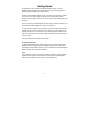
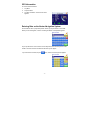
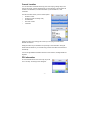
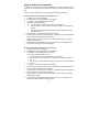
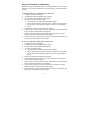
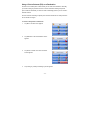
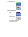
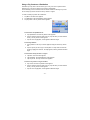
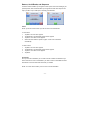
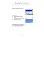
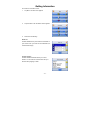
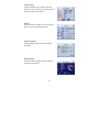
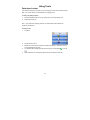
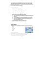
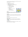
Table of Contents
Getting Started...................................................................................................................2
GPS Information .......................................................................................................3
Entering Data on the Nextar Navigation System.....................................................3
Moving Through the Screens ...................................................................................4
Resetting the GPS....................................................................................................4
Working with the Map .......................................................................................................5
Map View ..................................................................................................................5
Maneuver Detail .......................................................................................................5
Panning the Map ......................................................................................................6
3D Map View ............................................................................................................6
Route List..................................................................................................................6
Current Location .......................................................................................................7
POI Information ........................................................................................................7
Screen Tap Areas ....................................................................................................8
Planning Your Route.........................................................................................................9
Setting a Single Destination .....................................................................................9
Using an Address as a Destination..............................................................10
Using an Intersection as a Destination ........................................................11
Using a Point of Interest (POI) as a Destination ..........................................12
Using a Favorite Destination as a Destination .............................................15
Using a Recent Destination as a Destination ..............................................15
Using a City Center as a Destination ...........................................................16
Detours, Avoid Roads, and Stopovers.........................................................17
Setting an Itinerary .................................................................................................19
Using Shortcuts ......................................................................................................19
Managing Your Favorites List........................................................................................20
Getting Information .........................................................................................................21
Using Tools ......................................................................................................................23
Parked-car Locator .................................................................................................23
Setting Your Options ......................................................................................................24
Display Options ......................................................................................................24
Route Options.........................................................................................................25
Safety Options ........................................................................................................26
Language Options ..................................................................................................28
Localization Options ...............................................................................................28
-1-
Getting Started
Congratulations on your purchase of the Nextar Navigation System. Your Nextar
Navigation System can guide you to the destination of your choice using signals from
Global Positioning Satellites (GPS) orbiting the earth.
There are 24 GPS satellites orbiting the earth. A GPS device can calculate your position
on the earth if it can receive signals from at least three of these satellites. When it
receives at least four signals, a GPS device can also calculate your altitude (height above
sea level).
You can start using your Nextar Navigation System by simply mounting the holder on your
car's windshield or dash, plugging in the charger, and turning it on.
For your safety and the safety of others, please do not operate the system while driving. It
is dangerous to do so. When you want to enter an address or change a setting, please
pull over and park the car in a safe area first. You should always pay full attention to the
road and use the system only as an aid, by taking only glances at a time, and listening to
the voice prompts.
An inexperienced driver should NOT use the system.
UV-protected Windshield
UV-protected windshield in certain vehicles reflects UV-rays as well as satellite signals.
Although the Nextar Navigation System is equipped with high sensitivity GPS receiver,
the acquisition time is drastically affected. It is not recommended to use Nextar Navigation
System in vehicles with UV-protected windshield.
Theft
As it is dangerous to leave any valuable item visible in a parked car, portable navigation
systems have been targets in many theft crimes. Please store the Nextar Navigation
System in a non-visible area or carry it with you, after parking the car.
-2-
GPS Information
To view the GPS information:
1.
Tap Menu
2.
Tap Information.
3.
Tap GPS Information. The GPS Info screen
appears.
Entering Data on the Nextar Navigation System
The GPS doesn't have a physical keyboard. Instead, you tap the screen to enter data.
When you are entering data, a screen containing the letters of the alphabet appears:
As you tap the buttons on the virtual on-screen keyboard, the list at the top of the screen
scrolls to show the next item that matches the letters you've tapped.
If you need to enter numbers, tap the
button, and the numeric keyboard appears:
-3-
Moving Through the Screens
The GPS shows you one screen at a time. Each time you tap a button, a new screen
appears. If you want to return to go to the previous screen, tap the
in the upper right
corner of the screen. If you want to go back to the map view directly, tap the
button on
the upper left corner of the screen.
Resetting the GPS
You should never have to reset the GPS under normal circumstances. However, in the
event that a problem cannot be corrected, you may reset the GPS.
-4-
Working with the Map
The GPS gives you many ways of looking at the map. You can see your current position,
view any of the turns on a route, or pan the map to view other areas. You can zoom in
and out, and find information about specific locations.
Map View
The map view on the GPS shows your current location.
At the bottom of the map is a scale indicating your current zoom level. On the upper right
is the compass. On the center right and left are zoom in and out buttons, respectively.
Maneuver Detail
If you have set a destination, the map displays additional information. As you navigate to
a destination, the top of the map displays the name of the next street, the direction of your
next turn and the distance to the turn.
At the bottom of the map you see the estimate of how much time remains before arriving
at your destination, the remaining distance to your destination, and your current speed.
On the upper left is an arrow indicating the direction and the type of maneuver ahead, as
well as the remaining distance to the next maneuver. A smaller arrow represents the
following maneuver.
-5-
Panning the Map
You can pan the map by tapping and dragging the map.
To return to the regular map view, tap the X button.
3D Map View
You can change the perspective of the map display to 3D or bird’s eye view.
To change to 3D view:
1.
Tap Menu. The Main Menu appears.
2.
Tap Settings. The Settings screen appears.
3.
Tap Display Options. The Display Option screen
appears.
4.
Select from 2D, High, Medium and Low, which
represents the inclination of the 3D map display.
Route List
If you have set a destination, you can view a list of the maneuvers that make up your
route.
To view the route list:
1.
Tap Menu. The Main Menu appears.
2.
Tap Information. The Information screen appears.
3.
Tap Route List.
4.
Tapping an item on the list and then tapping Show
will display the maneuver on the map.
5.
Alternatively, you may call up the route list by
simply tapping on the next street bar on the top of
the map screen.
-6-
Current Location
You can find location information about any point on the map by pressing firmly on the
map for one second. A screen appears giving you the opportunity to set the location as
the Start or the Destination, and save the location to your Favorites list, or view
information.
From the Information screen you have several options:
Ÿ
Set Start Location
Ÿ
Set Stopover (with an existing route)
Ÿ
Set Destination
Ÿ
Save This Location
Ÿ
Information
Setting the location as a starting point is useful if you are trying to find the distance
between two locations.
Setting the location as your destination is a quick way to set a destination. Saving the
location adds the location to your Favorites list (you'll learn more about Favorites later in
this manual).
You can also get additional information about the current location, including latitude and
longitude.
POI Information
To view information about a POI on the map, tap on the
icon on the map. The POI(S) screen will appear.
-7-
Screen Tap Areas
Tap in designated areas on the map display for shortcuts to handy functions.
Show route list
Repeat Voice Guidance
Change map orientation
to Heading Up or North
Up
Zoom Out
Zoom in
Mute
Show details of current
location
(2D map only)
Tap and hold to show
details of the street, set
as the start location, or
set as the destination.
-8-
Planning Your Route
You can set a destination with the GPS in many different ways. Once you have set a
destination, you can add a detour or a stopover.
The GPS also offers an Itinerary feature, where you can enter up to 100 destinations and
use the Itinerary screen to re-order destinations as you like.
Setting a Single Destination
You can set your destination the following ways:
Ÿ
Address
Ÿ
Intersection
Ÿ
Point of Interest (POI)
Ÿ
Favorites
Ÿ
Recent
Ÿ
City Center
When you have found your destination, you have several options:
Ÿ
Nav
Ÿ
Fav
Ÿ
Show
Nav calculates the route from your current location (or the location you set as a starting
point) to the destination.
Fav adds the destination to your Favorites list. Your Favorites list is a list of locations that
you can add destinations to. You can also enter a name for a destination and delete
destinations from the list.
Show displays the location on the panning map without calculating a route. You can also
use it to manually set a starting point for a route.
-9-
Using an Address as a Destination
There are two ways to enter the address: by selecting the street first, or by selecting the
city first. If you use Street First and too many records match, you will be asked to use City
First.
NOTE: You will be prompted for the street name first, then the house number.
To Enter an Address as a Destination Using Street First:
1. Tap Menu. The main menu appears.
2. Tap Destination. The Set Destination screen appears.
3. Tap Address. The Input Method screen appears.
4. If you need to change the region:
a.
Tap Change State. The Enter State Name screen appears.
b.
Tap the Letters to enter the name of the region or State, or tap the name in
the list.
c.
Tap OK when you have selected the region or State. You will return to the
Input Method screen.
5. Tap Street First. The Enter Street Name screen appears.
6. Tap the Letters to enter the name of the street. Tap OK when you have selected the
street. The Enter House Number screen appears.
7. Tap the Numbers or Letters A-D to enter the house number. Tap OK. The Select
Address screen appears.
8. Select the address that matches the location you want to go to and tap Nav. The
map appears, and the guidance directions begin.
To Enter an Address as a Destination Using City First:
1. Tap Menu. The main menu appears.
2. Tap Destination. The Set Destination screen appears.
3. Tap Address. The Input Method screen appears.
4. If you need to change the region or State:
a. Tap Change State. The Enter State Name screen appears.
b. Tap the Letters to enter the name of the region or State, or tap the name in the
list.
c. Tap OK when you have selected the region. You will return to the Input Method
screen.
5. Tap City First. The Enter City Name screen appears.
6. Tap the Letters to enter the name of the City. Tap OK when you have selected the
City. The Enter Street Name screen appears.
7. Tap the Letters to enter the name of the street. Tap OK when you have selected the
street. The Enter House Number screen appears.
8. Tap the Numbers or Letters A-D to enter the house number. Tap OK. The Select
Address screen appears.
9. Select the address that matches the location you want to go to and tap Nav. The
map appears, and the guidance directions begin.
- 10 -
Using an Intersection as a Destination
There are two ways to enter the intersection: by selecting the street first, or by selecting
the city first. If you use Street First and too many records match, you will be asked to use
City First.
To enter an intersection as a destination using Street First:
1. Tap Menu. The main menu appears.
2. Tap Destination. The Set Destination screen appears.
3. Tap Intersection. The Input Method screen appears.
4. If you need to change the region or State:
a. Tap Change State. The Enter State Name screen appears.
b. Tap the Letters to enter the name of the region, or tap the name of the region.
c. Tap OK when you have selected the region. You return to the Input Method
screen.
5. Tap Street First. The Enter Street Name screen appears.
6. Tap the Letters to enter the name of the street. Tap OK when you have selected the
street. The Enter 2nd Street Name screen appears.
7. Tap the Letters to enter the name of the second street. Tap OK when you have
selected the street. The Select Address screen appears.
8. Select the intersection that matches the location you want to go to and tap Nav. The
map appears and the guidance directions begin.
To enter an intersection as a destination using City First:
1. Tap Menu. The main menu appears.
2. Tap Destination. The Set Destination screen appears.
3. Tap Intersection. The Input Method screen appears.
4. If you need to change the region:
a. Tap Change State. The Enter State Name screen appears.
b. Tap the Letters to enter the name of the region, or tap the name of the region.
c. Tap OK when you have selected the region. You return to the Input Method
screen.
5. Tap City First. The Enter City Name screen appears.
6. Tap the Letters to enter the name of the city. Tap OK when you have selected the
city. The Enter Street screen appears.
7. Tap the Letters to enter the name of the street. Tap OK when you have selected the
street. The Enter2nd Street Name screen appears.
8. Tap the Letters to enter the name of the second street. Tap OK when you have
selected the street. The Select Address screen appears.
9. Select the intersection that matches the location you want to go to and tap Nav. The
map appears, and the guidance directions begin.
- 11 -
Using a Point of Interest (POI) as a Destination
There are over 6 million points of interest that you can select as a destination. Generally,
you choose a category and then choose one of four methods of selecting the specific
point of interest. Sometimes you must first select a subcategory before you can choose a
selection method.
The four methods of selecting a specific point of interest include two for nearby POIs and
two for all POIs in a region.
To select a nearby POI as a destination:
1.
Tap Menu. The main menu appears.
2.
Tap Destination. The Set Destination screen
appears.
3.
Tap Points of Interest. The Points of Interest
screen appears.
4.
Tap a Category. Usually a subcategory screen appears.
- 12 -
5.
Tap a Subcategory. The POI Options screen
appears.
6.
Select the radius, if you are searching for a nearby
POI.
To select a nearby POI from an alphabetical list:
a.
Tap Alphabetical. The Enter POI Name
screen appears.
b.
Tap the Letters to enter the name of the
POI.
a.
Tap OK when you have selected the POI.
The POI Select screen appears, displaying
the address of the POI.
b.
c.
d.
Tap Nav. The map appears, and the guidance directions begin.
Tap Fav to save the POI in the Favorites list.
Tap Show to show the POI location on the map display.
- 13 -
To select a nearby POI by distance:
a. Tap By Distance. The POI List screen
appears, listing the closest POIs first.
b. Tap the POI that you want to go to and tap Nav. You may need to scroll down
the list by tapping the scroll bar. The map appears, and the guidance directions
begin.
c. Tap Fav to save the POI in the Favorites list.
d. Tap Show to show the POI location on the map display.
e. Tap Info to show additional detail including address and telephone number.
To select from all POIs in a region or State:
a. Tap List All. The Enter POI Name screen appears.
b. Tap the Letters to enter the name of the POI. Tap OK when you have selected
the POI. The POI Select screen appears.
c. Tap Nav. The map appears, and the guidance directions begin.
To select a POI by city:
a. Tap By City. The Enter City Name screen appears.
b. Tap the Letters to enter the name of the city and tap OK. The Enter POI Name
screen appears.
c. Tap the Letters to enter the name of the POI and tap OK. The POI Select
screen appears.
d. Tap Nav. The map appears, and the guidance directions begin.
- 14 -
Using a Favorite Destination as a Destination
Favorite destinations are locations you add to a list on the GPS. You can add locations to
your Favorites list as you set a destination, from the POI(s) screen, and from the Location
Information screen. You can then easily select one of these locations as a destination.
To Select a Favorite as a Destination:
1.
Tap Menu. The main menu appears.
2.
Tap Destination. The Set Destination screen appears.
3.
Tap Favorites. The Favorites screen appears.
4.
Tap on the favorite you want to use as a
destination and tap Nav. The map appears, and
the guidance directions begin.
Using a Recent Destination as a Destination
Recent destinations are locations you have navigated to recently. You can easily select
one of these locations as a destination. Managing your recent destinations list is covered
later in this section.
To select a destination from your list of recent destinations:
1.
Tap Menu. The main menu appears.
2.
Tap Destination. The Set Destination screen appears.
3.
Tap Recent. The Recent screen appears.
4.
Tap on the recent destination you want to go to and
tap Nav. The map appears, and the guidance
directions begin.
- 15 -
Using a City Center as a Destination
Sometimes you may want to use the GPS to get to a city, but not to a specific location
within the city. To do this you select a City Center as a destination.
As with selecting a Point of Interest, there are several methods of selecting a city center:
two for nearby city centers and one for all city centers in a region.
To select a nearby City Center as a destination:
1. Tap Menu. The main menu appears.
2. Tap Destination. The Set Destination screen appears.
3. Tap City Center. The City Center screen appears.
To select from an alphabetical list:
a. Tap Alphabetical. The Enter City Name screen appears.
b. Tap the Letters to enter the name of the city. Tap OK when you have selected
the city. The City Center screen appears.
c. Tap Nav. The map appears, and the guidance directions begin.
To select by distance:
a. Tap By Distance. The City List screen appears, listing the closest city centers
first.
b. Tap the city that you want to go to and tap Nav. You may need to scroll down
the list by tapping the scroll bar. The map appears, and the guidance directions
begin.
To select from all City Centers in a region:
a. Tap Menu. The main menu appears.
b. Tap Destination. The Set Destination screen appears.
c. Tap City Center. The City Center screen appears.
To select a city center in a region or State:
a. Tap List All. The Enter City Name screen appears.
b. Tap the Letters to enter the name of the city. Tap OK when you have selected
the city. The City Center screen appears.
c. Tap Nav. The map appears, and the guidance directions begin.
- 16 -
Detours, Avoid Roads, and Stopovers
The Detour feature will allow you to bypass a certain portion of the route starting at your
present position, while avoid road allows you to bypass the entire road. Stopovers are
stops you add to a trip to make prior to reaching your destination.
Detour
NOTE: you cannot create a detour if you do not have a current destination
To set a detour:
1.
Tap Menu. The main menu appears.
2.
Tap Destination. The Destination Options screen appears
3.
Tap Detour. The Detour screen appears.
4.
Select from three distance options to bypass. A new route is calculated
automatically.
To clear a detour:
1.
Tap Menu. The main menu appears.
2.
Tap Destination. The Destination Options screen appears.
3.
Tap Detour. The Detour screen appears.
4.
Tap Reset.
Avoid Road
Once you have set a destination you can look at the list of streets and determine if you
need to mark one or more as unavailable. If you mark a section as unavailable the GPS
will calculate a new route that avoids the section you marked.
NOTE: You cannot avoid a road if you do not have a current destination.
- 17 -
To avoid roads in the route list:
1.
Tap Menu. The main menu appears.
2.
Tap Destination. The Destination Options screen appears.
3.
Tap Avoid Road. The Avoid Road screen appears.
4.
Mark any segments that you do not want included:
5.
a.
Tap on a route instruction to highlight it.
b.
Tap Avoid. A do-not-enter symbol appears.
When you have finished marking segments, tap Nav. Your route is recalculated, the
map appears and the guidance directions begin.
Stopover
Once you have set a destination you can add a stopover. Adding a stopover does not
cancel your original destination. Once you reach your stopover, you will be prompted to
continue to the original destination.
To create a stopover:
1.
2.
3.
4.
Press Menu. The main menu appears.
Tap Destination. The Destination Options screen appears.
Tap Stopover. The Set Destination screen appears.
Set your stopover destination using any of the methods explained earlier in this
section.
To cancel a stopover:
1.
2.
3.
4.
Tap Menu. The main menu appears.
Tap Destination. The Destination Options screen appears.
Tap Clear Route. A confirmation message appears asking if you want to continue to
your next destination.
Tap Yes. The map appears and navigation continues.
- 18 -
Setting an Itinerary
The Itinerary feature allows you to set multiple destinations. You can add, remove, or reorder destinations according to your needs.
To set the Itinerary:
1. Tap Menu. The main menu appears.
2. Tap Itinerary. The Itinerary screen appears.
3.
4.
5.
6.
Tap Add to add new destinations from Favorites,
Recent or POI list, or enter a new address as destination.
Tap Del to remove a destination from the Itinerary.
Tap Go! to start navigating from the first item on the Itinerary.
Once you reach a destination in your itinerary, GPS will automatically prompt you to
proceed to the next destination in the list.
To Re-order the Itinerary:
1. Tap Move Up or Move Down.
Using Shortcuts
The shortcut feature provides you quick access to some of the most important
destinations while you're on the road, including:
Ÿ
Home
Ÿ
ATM
Ÿ
Gas
Ÿ
Hospital
Ÿ
Parking
Ÿ
Restaurant
Ÿ
Tourist Information
By tapping any of the POI categories, you will see a list
of the nearest POIs sorted by distance.
- 19 -
Managing Your Favorites List
You can edit the destinations you add to your Favorites list to give them descriptive
names. You can also remove destinations from your favorites list.
To manage your favorites list:
1.
Tap Menu. The main menu appears.
2.
Tap Favorites. The Favorites screen appears.
To edit a favorite:
a.
Tap on the favorite you want to edit.
b.
Tap Edit. The Edit Favorites screen
appears.
c.
Enter a descriptive name for this favorite.
d.
Tap OK when you are done.
To delete a destination from your favorites list:
a.
Tap on the favorite you want to delete.
b.
Tap Del. The favorite is removed from the list.
c.
Tap OK to close the Favorites screen.
- 20 -
Getting Information
To access the Information screen:
1.
Tap Menu. The main menu appears.
2.
Tap Information. The Information screen appears.
3.
Select from the following:
Route List
Provides detailed turn-by-turn maneuver information of
your current route. If you have not set a destination, the
route list will be empty.
Current Location
Provides detailed information about your current
location. You can save the current location into your
Favorites list by tapping on Save.
- 21 -
Trip Information
Provides information such as average speed and
distance traveled. This feature is convenient when you
need to keep track of your mileage.
Almanac
Provides information related to the sun and the moon,
based on your current geographic location.
System Information
Provides software revision number and copyright
information.
GPS Information
Provides information related to GPS signal strength,
coordinates, date and time.
- 22 -
Using Tools
Parked-car Locator
This feature is useful when you park your car in a large open area such as inside a theme
park, or on a street nearby a tourist attraction or shopping center.
To save your parking location:
1.
Press the Standby button on the top of GPS, after you have parked your car.
2.
Take the GPS with you.
Note: If you park inside a parking structure, the saved location will be nearby the
entrance to the structure.
To find your car:
1.
Tap Menu.
2.
Tap Parked-car Locator.
3.
Wait about 30 seconds for the device to acquire GPS signal, or until the foot-cursor
on the map display turns green.
4.
You will then see a straight green line connecting your current position
to your car
.
5.
Walk towards the car and watch the green line become shorter and shorter.
- 23 -
Setting Your Options
You can set many different options to customize the GPS and make it work your way.
These options include:
Ÿ
Route Options
Ÿ
Display Options
Ÿ
Language Options
Ÿ
Localization Options
Ÿ
System Options
Ÿ
Safety Options
Display Options
The display options give you control over the appearance of the map. You can change
the following:
Ÿ
Orientation
Ÿ
Guidance
Ÿ
Day/Night
Ÿ
POI Icons
Ÿ
Color
Ÿ
3D View
There are two orientation settings. Heading turns the map as you drive so that you are
always moving toward the top of the screen. North keeps the map oriented with North at
the top of the map, like a traditional paper map
There are two guidance settings, which control whether or not the maneuver detail screen
appears when you near your next maneuver. If you use the auto setting, the maneuver
detail screen appears.
The day/night setting controls the background of the screen. If you choose auto, the GPS
system will automatically switch to a darker version of your color scheme soon after
sunset, to reduce the glare in the vehicle. You can also choose to use either the day or
night setting at all times.
There are three options for displaying POI icons. If you choose default, the most
commonly displayed categories of POI icons will appear on the map at zoom levels of
1000 ft and closer. If you choose off, no POI icons are displayed. If you choose custom,
you can choose which categories of POI icons you want displayed.
- 24 -
The color settings control the background color of the map. You can choose from four
different colors. The 3D view settings control your view of the map. Off shows you the
map in traditional 2D mode. High, Medium, and Low show you a 3D version of the map,
with a different angle for each value. If you use any of the 3D settings you will not be able
to tap on a location to view location information.
To set your display settings:
1.
Tap Menu. The Menu screen appears.
2.
Tap Settings. The Settings screen appears.
3.
Tap Display Options. The Display Options screen appears.
4.
Tap your Orientation preference: Heading or North.
5.
Tap your Guidance preference: Auto or Manual.
6.
Tap your Day/Night preference: Auto, Night, or Day.
7.
Tap your POI Icons preference: Default, Off, or Custom.
When you tap Custom the POI Options screen appears.
a.
Tap on the categories you want displayed. The categories to be displayed are
highlighted.
b.
You can use Select All and Clear All to quickly highlight or clear categories.
c.
When you have highlighted the categories you want displayed, tap OK. You
return to the Display Options screen.
8.
Tap your Color preference: Yellow, Grey, White, or Peach.
9.
Tap your 3D View preference: 2D, High, Medium, or Low.
10. When you have finished choosing your options, tap OK.
Route Options
The route options give you control over the navigation of your trip. You can change the
following:
Ÿ
Method
Ÿ
Ferries
Ÿ
Toll Roads
Ÿ
Carpool
Ÿ
Turns
There are six method settings.
Quickest calculates the route that should take the least amount of time.
Major calculates a route that uses major roads whenever possible.
Shortest calculates the route that is shortest in distance.
- 25 -
Local calculates a route that uses local roads whenever possible.
Walking enables pedestrian walking mode.
The ferries setting indicates whether ferries should be included when your route is
calculated. If you include ferries, the route will take you to the ferry terminal, but the total
time for the route does not take into account the ferry schedule or time spent on the ferry.
The toll roads setting indicates whether you want to include or exclude toll roads when
your route is calculated. If you include toll roads, those roads will be used if appropriate
for the method you selected.
The carpool setting indicates whether or not you want to include carpool or high
occupancy vehicle (HOV) restrictions in the calculation of your route.
The turns setting indicates whether or not you want to reduce the number of turns in your
route.
To set your route settings:
1. Tap Menu. The main menu appears.
2. Tap Route Options. The Route Options screen appears.
3. Tap your Method preference: Quickest, Major, Shortest, Local, or Walking.
4. Tap your Ferries preference: Include or Exclude
5. Tap your Toll Roads preference: Include or Exclude.
6. Tap your Carpool preference: Include or Exclude.
7. Tap your Turns preference: Reduced or Normal.
8. When you have finished choosing your options, tap OK.
Safety Options
These options are intended for your driving safety and
the safety of others.
Speed Alert
You can use the speed alert feature to warn you if your vehicle is exceeding the speed
limit. There are two speed alert options: auto speed alert and fixed speed alert. Auto
speed alert uses the type of road to determine the probable speed limit. Fixed speed alert
lets you enter a speed and will warn you if that speed is exceeded.
- 26 -
Auto speed alert is based on road class and may not necessarily reflect the actual speed
limit. Please use this feature only as a reference
To set the speed alert:
1. Tap Menu. The Menu screen appears.
2. Tap Settings. The Settings screen appears.
3. Tap Safety Options. The Safety Options screen appears.
To set the speed alert:
a.
Tap Auto. A warning appears.
b.
Tap Confirm to close the warning.
c.
Tap OK. You return to the map.
To set a fixed speed alert:
a.
Tap Fixed.
b.
Enter the speed you want to use as a
maximum speed.
c.
Tap OK to set the speed.
d.
Tap OK. You return to the map.
Fog Assist
One of the hazzards of driving in dense fog condition is not being able to see an
upcoming intersection. Enabling this feature provides a warning tone when approaching
an intersection.
Fatigue Alert
This feature alerts you once per minute using a customizable voice phrase. Alternatively,
you can record a custom prompt in a WAV file, and copy it as ALERT.WAV to the root of
your SD card.
School Zone Alert
Alerts you with a voice phrase when you approach a school zone.
Emergency Option
Enabling this feature allows you to quickly determine your location, cross-street(s),
coordinates, and find the closest police station or hospital, simply by tapping on the carcursor
.
Head-light Reminder
15 minutes after sunset, you will be reminded to turn on your head-lights. Sunset time is
automatically calculated, based on your GPS location.
- 27 -
Language Options
The language options allow you to configure the following:
Ÿ
Language
Ÿ
TTS (Text-to-Speech)
There are six language settings. When you change the language, all of the screen names
and controls will be in the selected language.
To set your language settings:
1.
Tap Menu. Menu screen appears.
2.
Tap Settings. Settings screen appears.
3.
Tap Language Options. The Language Options screen appears.
4.
Tap your Language preference: English, French, Spanish, Chinese, Korean or
Japanese.
5.
When you have finished choosing your options, tap OK.
TTS (Text-to-Speech) Options
Off - Voice prompts will not include street names.
Mixed - Voice prompts will be in recorded human voice, but street names will be in
computer synthesized voice.
Exclusive - Voice prompts and streets names are both in computer synthesized voice.
Localization Options
The localization options give you control over the settings affected by your location,
including:
Ÿ
Time Zone
Ÿ
Daylight Savings Time
Ÿ
Units
- 28 -
There are six time zone settings, for all areas of the United States.
There are two daylight-savings options, to determine whether or not daylight savings time
is currently in effect at your location.
There are two settings for systems, which determine how the distance to your location is
expressed. You can choose between Mi (miles) or KM (kilometers).
To set your localization settings:
1.
Tap Menu. Menu screen appears.
2.
Tap Settings. Settings screen appears.
3.
Tap Localization Options. The Localization screen appears.
4.
Tap your Time Zone preference: Eastern, Central, Mountain, Pacific, Alaska or
Hawaii.
5.
Tap your Daylight Saving preference: DST or Standard.
6.
Tap your Units preference: Mi (mile) or KM (kilometer).
7.
When you have finished choosing your options, tap OK.
- 29 -
No part of this manual may be copied, republished, reproduced, transmitted or
distributed in any way without prior written consent of Nextar, Inc. Any unauthorized
distribution of this manual is expressly forbidden.
TM
Nextar , a trademark of Nextar (Hong Kong) Limited.
Nextar may find it necessary to modify, amend or otherwise change or update this
manual. W e reserve the right to do this at any time, without any prior notice. All
specifications and features are subject to change without notice. All screen shots shown
are simulated and may not represent the actual screen on production unit sold to
consumers.
Mapping database copyright © 2006 NAVTEQ ™. NAVTEQ ON BOARD ™ is a
trademark of NAVTEQ ™
Navigation software copyright © 2001-2006 Netropa, Inc.
For Free instruction books, information on this product its operation and accessories, visit
us on the web at:
www.nextar.com
Or write to us at:
Nextar Inc.
1661 Fairplex Dr.
La Verne, CA 91750
USA
copyright © 2005 Nextar Inc.
All Rights Reserved
- 30 -