1
* . 4
'+:,=
..,
,..
.n+
{ffi
'!&'
**
t",
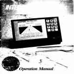
OperationMM
'E':,,
Tableof Contents
To Ou r Cus t om er
Important Notice
Warranty Information
(ieneral Information
U n i t Ins t allat ion
D i s p l a yU n i t
P o w e rC o n n e c t i o n
An te n n a I ns t allat ion
Star Pilot GPS Antenna
Basic Operation
Star Pilot Keyboarcl
A lpha- Num e ri Ke
c ys
CommonSofikeyFunctions
ight Control
Power/Backl
Getting Started
Turningthe Star Pilot On
The Menu Screen
What Is A Waypoint'l
Waypoints
Enterin-e
( 1 ) Po sit ionM ode
t s i ti o ni n a W a y p o i n t
S av ingP r es e nPo
(2 ) Pl o t M ode
of Track Plot
Features
(3) NavigateMode
(4 ) Wa y point M ode
Cr eat ingRou te s
(5) StatusMode
(6 ) Se t Up M ode
The Basicsof GPS
AdvancedNavigationGuide
GPS Mocles
Na vi g at ionalT er m s
Error Messages& TroubleshootingTips
G P SHealt hM e s s a g e s
Error Codes
Specifications
How To Obtain Service
Warranty
1
-t
+
-5
6
6
6
l
l
8
8
IJ
ti
9
l0
l0
l0
ll
ll
12
12
l a
l-)
13
l1
t6
l6
t8
19
20
2l
21
2l
22
22
22
.,)
:-'\
25
21
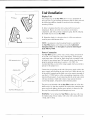
Unit Installation
DisplayUnit
Overhead
The compact size of the Star Pilot allows lor easy installation in
m o s t a n y b o a t . T o g e t m a x i m u m p e r f b r m a n c e a n d l i f - cf r o m y o u r u n i t .
t h e t o l l o w i n g g u i d e l i n e ss h o u l d b e c o n s i d e r e dw h e n s e l e c t i n ga
mounting location:
l) Selecta location where the unit is protected1}om excessive
t e m p e r a t u r e .H e a t i s o n e o f t h e w o r s t e n e m i e s o f e l e c t r o n i c
c o m p o n e n t s . a n d w i l l a c c e l e r a t ec o m p o n e n t a g i n g . t h e r e b y r e d u c i n g
t h e t r o u b l e - f r e e l i f - eo f y o u r S t a r P i l o t .
2 ) M o u n t t h e d i s p l a y i n a l o c a t i o n w h e r e i t w i l l b e c o n v e n i e n tt o
r o u t e t h e p o w e r a n d a n t e n n ac a b l e s .
NOTE: An optional. in-dash mounting bracket is available for
thc Star Pilot display unit. Contact your nearby Authorized
Interphase Dealer or thc Interphase Accessories Sales Depart-
ment(408)427-4444.
Power Connection
The Star Pilot requiresa powersourcewith a voltagelevel fiom 10
to 16 VDC. Low voltagemay causea dim clisplay.reducedsignal.
weak beeperand a slow turn on. High voltagemay cventuallyresult
in lailureof someinternalpart.The nominalvoltagclbund on most
properlyoperatingmarinepow'ersystemsis 13.6VDC. It is
recommended
that you checkthe voltagesupplywhich you intendto
operatefbr the proper level.
GPS antenna/receiver
Antenna cable
Power cable
S t a rP i l o t G P S d i s p l a l ,u n i t
Connectthe two-pin plug on the end ol'thc powersupplycableto the
powersupplyjack locatedat the rearof the unit.Connectthe red wire
to the positrveterminaland the black wire to the negativeterminalof
connections
of the
vour boat's l2 VDC battcry.or the corrcsponding
main distributionpanel.Avoid connectingdirectlyto the samecircuit
with any electronics
which tendto draw a largeamountof power,
suchas brlgepurnps.refri-eerators
and transmittingradios.
The powercord includedwith the Star Pilot includesan in-linefuse
holderwith a 1.6Amp fuseinstalled.Be certainwhen connectingthe
power cord to the batterythat the correctpolarity is observedor the
fusemay blow and possiblecircuitdamagemay occur.
WARNING: Ncvcr replacethc Star Pilot's in-linefusewith a fuse
of a higherrating.Always replacewith a fusewith a ratin-ubetween
I Amp. and 1.6Arnp.
GencralInformntion
Congratulations
on your selectionof the InterphaseStar Pilot GPS
receiver.Its ruggedwaterproofdesignmakesit idealfbr installation
on nearly any type of boat.
The Star Pilot f-eatures
many advancedfunctions,and employsone
of today'smost sophisticated
GPS receivers.
The sequential
three
channelreceiverdesigntracksup to sevenGPS satellites
and is
capableof providing accuratepositioninformationevery second.
The Star Pilot designis compactand of waterproofconstruction.It
hasa long-lifewaterproofkeypadwhich allowsyou to selectevery
navigationalf'eatureyou needwith the touch of a button.It has a
beeperfor arrival alarm,anchorwatch alarm and it will beepto
acknowledge
whenevera buttonis pressed.
The Star Pilot works in a fully automaricmode which you needonly
startup to initialize.Thereis no needto enteran approximate
Latitudeand Longitudeposition.You can selectmany of the Star
Pilot's featureswith the Set-Updisplay.You can activatean Anchor
Alarm, WaypointArrival Alarm, setuniversalor localtime.
The Star Pilot's graphicnavigationmodeshowsyour distanceoff'
the desiredcourseand how to steer,right or lefi. to get back on
course,courseover groundand speedover ground.The Data window
in the navigationmodeallowsyou to choosea view of estimatecl
time
of arrival.time to go, velocitymadegood.distancemadegood.
presentpositionlatitudeand longitude,currentdateand time. or local
magneticvariation.
The Star Pilot makesit easyto storeyour currentor favorite
positionsin any of 100waypoints.Eachwaypointis datestampedlor
future referenceand a Waypoint ManagementDisplay lets you
quickly scrollthroughand view your listingof waypoints.You can
alsopre-programup to l0 routesof l0 waypointseachfor futureuse.
The Star Pilot's very low powerconsumption(typicallylessthan
600 milliAmps at l2 Volts DC) makesit ideatlysuitedfor many of
today'ssmallerboats.or cruisingboats,with limited power
availabilitv.
Unit Installation
Display Unit
Overhead
The compact sizc of the Star Pilot allou s tirr easr installation in
m o s t a n y b o a t . T o g e t m a r i m u t t t p c r l i x ' t t t a l t c ca n c l l i l ' e f r o m y o u r u n i t .
t h e f b l l o w i n g g u i c l e l i n e ss h o r . r l cbl c ' c o t t s i c l c r c crl. r h e ns e l c c t i n g a
mounting location:
l ) S e l e c ta l o c a t i o n w h c r e t h c u n i t i s p r t t t c - c t c fdr o m e r c e s s i v e
t e m p c r a t u r e . H e a t i s o n e o l - t h c \ \ o r s t L ' t l ! - l l l i se o f c l c c t r o n i c
c o m p o n e n t s . a n d w i l l a c c c l c r a t ec o n t p o n c n t a g i n g , t h e r e b y r e d u c i n g
thc trouble-free lite of your Star Pilot.
Shelfffable
2 ) M o u n t t h e d i s p l a y i n a l o c a t i c t nr v h c r e i t w i l l b c c o n v e n i e n t t o
r o u t e t h e p o w e r a n d a n t e n n ac a b l c s .
N O T E : A n o p t i o n z r l .i n - d a s h m o u n t i n g b r a c k e t i s a v a i l a b l e t o r
thc Star Pilot display unit. Contact your nearby Authorized
Interphase Dealer or the Interphase Accessories Sales Depart-
ment(408)127-4414.
Power Connection
The Star Pilot requiresi.rpowersourcewith a voltagelevel from l0
to I 6 VDC. Low voltagemay causea dim display.reduccdsignal.
weak bccperand a slow tum on. High voltagemay eventuallyresult
foundon most
in f ailureof someinternalpart.The nominalvolta-ec
properlyoperatingtnarinepowersy\temsis 13.6VDC. It is
supplywhich you intendto
rccommended
thatyou checkthe volta-ue
operatefor the properlevel.
GPS antenna/recciver
Antenna
a*
S t a rP i l o t G P S d i s p l a yu n i t
Power cable
Connectthc two-pinplug on the end of the power supplycableto the
powersupplyjack locatedat the rearof the unit. Connectthe red wire
tcnninalof
to the positiveterminaland thc blackwire to the nc-qative
of the
connections
your boat's l2 VDC battcry,or the corresponding
rnaindistributionpanel.Avoid connectingdirectlyto the sanlecircuit
which tendto draw a largeamountof powcr.
with any electronics
and transmittingradios.
suchas bilge pumps,refrigerators
The powercord includedwith the Star Pilot includesan in-linefuse
holderwith a 1.6Amp fusc installed.Be certainwhen connectingthe
power cord to the batterythat the correctpolarity is observedor the
l'usemay blow and possiblecircuitdamagemay occur.
WARNIN(i: Neverreplacethe Star Pilot's in-linefusewith a fuse
of a higherrating.Always replacewith a fusewith a ratin-ebetween
I Amp. and 1.6Arnp.
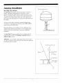
Antewtn Installntion
Star Pilot antenna/rccetver
Star Pilot GPS Antenna
The Star Pilot GPS Antenna,with its receiverunit. is houseclin a
durable.waterproofcasingdesignedfor mounting rn an opcn
location.For optrmumsignalreception,mount the antennawith a
360oview of the sky so that it can haveline-of-sighttrackingof the
and
Preventobjectssuchas poles.rails,otherantennas
satellites.
largecablesfiom obstructingthe view betweenthe GPS antennaand
the satellites.
Caremust alsobe takenin choosinga mountinglocationwhere
transmitterbeamsWILL NOT be
radarbeamsor communications
directedtowardsthe GPS antenna.
Mount the antennaon a level surface,suchas a cabin top, or on a
standardmarineantennaextensionpole. Use of a standardmarine
antennamount with I -inch threadsis requiredto completethe
installation.
The Star Pilot GPS antennaincludes30 feet of antennacable.If
extensioncableis needed,call InterphaseCustomer Serviceat
(408) 427-4444for advice.
WARNING: Never attemptto take off the connectoron the cnd of
the cableor to shortenor splicethe cable.This couldcausedamageto
the unit and void any warranty.
Star Pilot antenna/recerver
I
I
I
Backstay
--
8-fbot fiberglass
extender
(l x l.lTHDI
U-shaped bracket
Antenna mount
x 14THD)
,/
"
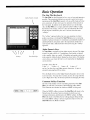
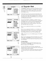
Basic Operation
The Star Pilot Keyboard
Alpha-Numeric keypad
\
\
\
The Star Pilot has beendesignedto be as easyto learnand operateas
possible.The raisedpush-buttonkeys providea tactilef-eelto each
operationand the Star Pilot respondswith an audiblebeepeachtime
for operationof the unit are on
All keysnecessary
a key is pressed.
thc front panel.In additionto the alpha-numenckeys on the ri-eht
side,the Star Pilot usesa uniqueapproachcalled"softkeys"along
the bottomof the display.Thesefive keysare labeledby the LCD
displayand arecontrolledby the unit's software,thusthe name
"softkeys".
The "softkey" approachallows for very easyoperation,it almost
an amazing
guidesyou along.eventhoughthe Star Pilot possesses
numberof advancedfeatures.It would take a considerablenumberof
additionalbuttonsand greatlyadd to the operationalcomplexity if
eachfunction had a dedicatedbutton insteadof usins the "softkev"
approach.
Alpha-Numeric Keys
I
\U/
Power,rbacklight
Solikeys
The Star Pilot is equippedwith an alpha-numerickeypad.The alphaEachbuttonis labeled
numerickeypadconsistsof 12 pushbuttons.
with a number.lettersor symbol.All alphabetand numberentriesare
madeusingthe Alpha-NumericKeypadas shownbelow.The display
screenshowsyou wherethe letteris to be enteredby the highlighted
cursorposition.
Example-PressKey #l:
2times=A 3times=B 4times=C
Itime -l
and etc. for other keys and alpha-numericcharacters.A spaceis
enteredby pressingKey #0 two times.
Pressthe Right Arrow on the Alpha-NumericKeypadto move to the
next letterentry. You may edit or correctan entry by usingeitherthe
Lefi or Right Arrow Key to the letterpositionand changingthe entry.
Commom Softkey Functions
On someof the display screensseenduring operationof the Star
Pilot, you will note a recurrenceof the following sofkey labels.
Their functionsare identicalin whicheverMODE is being used.
M E NUI ES C
/\
V I ENTR
When the MENU softkeyis pressed,the Star Pilot will returnto the
Menu Screen.If you have beenin a display in which you were
enteringinformation,and then pressthe MENU softkey,the Star
Pilot will return to the Menu Screenwith no changesbeing entered.
Use of the MENU softkeyis alwaysrequiredin order to move the
Star Pilot from one Mode to another.
The ESC.or ESCAPEsoftkey.is seenon someof the displayswhich
ask you to enterinformation,suchas waypointnamcsor coordinates.
Pressingthe ESC sofikeywill returnthe Star Pilot to the prcvious
screenwith no changesbeingentered.This is useful.tor instance.if
you startedenteringa waypointnameand thendecidednot to uscthat
waypoint.Using the ESC sofikey,the Star Pilot will retrunto the
previousscreenand disregardthe informationyou had startedto enter
d aypoint.
l b r t h es e l e c t e w
Power/BacklightControl
The PowerOn/Otf button is locatedon the lower right side of the
Star Pilot. To turn the unit On pressthe PowerKey once.To turn the
unit Off pressand hold the PowerKey down until it beeps.
when vou turn the Star
The DisplayBacklightgoeson automatically
Pilot on. A momentarypush on the Power Key alternatesthe
B a c k l i s hO
t n & Off.
GettingStarted
Check to seethat all the componentsshownat leti were included
with your Star Pilot. If a part is missing.contactthe Interphase
Customer Service Department (408) 427-4444immediately.
WARNING: DO NOT operatethe Star Pilot with partsmissingor
with partsother than thoseobtainedthroughInterphase; doing so
could causemajor navigationalerrors.Any malfunctionsto the Star
Pilot resultingfrom unauthorizedpartsare not coveredby warranty.
GPSantenna/receiver
O
k\/l
Powercable
{
E)
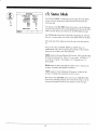
Turning The Star Pilot On
To tum the Star Pilot on, pressthe Power Key locatedon the lower
right cornerof the unit one time. Use the Up or Down Arrow softkeys
to adiustthe displayscreencontrast.
V
.r.+ --
The Menu Screen
{-2Y'
NAVIGATE
ffiffiffi
12
WAYPOINT
456
STATUS
3
SETUP
Upon turn on, the Star Pilot will first showthe Menu Screen.There
are six modesfor operationof the Star Pilot. The first threemodes
( k e y p a dc h o i c e s1 , 2 . 3 ) a r en a v i g a t i o n
s c r e e n sT.h e P o s i t i o nM o d e
featuresan easyto view, largedigit displayof your presentlatitude
and longitude.The Plot and NavigateModes providenavigational
informationin graphicformats,displayinga plot of your boat's
courseor a steeringtrack to your destination.The next threemodes
(keypadchoices4. -5.6) are for supportof the navigationscreens.
The WaypointMode managesthe Waypointand Routelibraries.
The StatusMode givesyou infbrmationon the conditionsof the
and system.The Set Up
Star Pilot itself,as well as the GPS satellites
Mode can be usedto setlocaltime and the arrivaland anchoralarms.
Use the keypadon the ri-ehtside of the unit to choosean operational
mode.The Star Pilot is now startedand is lockingon to the GPS
satellitesignals.If this is the first time turn-onfor the unit. it may
takeseveralminutesto get a positionfix.
PressKey #1 to Choosethe Position Mode
You will noticethe currentdateand time on the top of the display.
Seethe
The time is displayedin UTC (UniversalTime Coordinated).
SetUp Mode section,Pagel9 fordetailson settingthe time to Local
Time.
At first the latitudeand longitudedigitsmay be all "0"s. Note the
Iower right cornerof the display.Below the ALT: you will read
OLD. 2D or 3D. OLD meansthat the Star Pilot doesnot havea new
positionfix. If 2D or 3D is shown.the positionis current.Be advised
that it may take severalminutesfor the Star Pilot to obtain a new
positionfix. Theremay be times when the necessarythreesatellite
positionsarenot readilyavailable.When the unit completesits
satellitesearch,the "0"s will changeto your presentposition
coordinates
and the displayOLD will changeto 2D or 3D. You now
havethe Star Pilot up and running.Your positionis beingconstantly
uodatedeverv f'ew seconds.
10
NOTE,: Do not be alarmedif the lastdigitsof the Latitudeor
Longitudesometimesfluctuate.This is normalwhenthe Star Pilot
is receivingpositioninformation.
What Is A Waypoint?
buoy or channel
A Waypointis usuallya startingpoint,destination,
marker,or any placeyou wish the Star Pilot to remember.It is can
be a favoritefishing spot,harborentrance.locationof a reef. rocks or
other importantbottom structure.
The Star Pilot storesup to 100Waypointpositions.Waypointscan
be storedusingeitherof two methods.You can INSTANTLY store
your boat'spresentpositionwith the SAVE key, which you will find
when usingany of the threeNavigationalModes.You can store
Waypointsat anytimeby enteringthe Latitude& Longitudecoordinatesandnamingthe waypointswhile usingthe star Pilot in the
WaypointMode.
an
\:r,
h
WAYPOINTS
FTNTFCITfl
PTSUR
P T P I E DB L A N
PT CONCEPT
-
To Enter a Waypoint
Afier turningthe Star Pilot ON andviewing the MENU Screen,
pressKey #4 to bring up the Waypoint Screen.
T O V I E WO R
E D I TD E T A I L S
OF A WAYPT,
U S EA R R O W
K E Y ST H E N
P R E S SE N T R ,
M E N U In r e | ^ | v
The WaypointLog will be shownon the lefi sideof the display.The
cursorpositionwill be notedby reversevideo.To entera new
Waypoint,or to edit a previousWaypoint,usethe Anow Up or
Down sofikeystill the cursoris locatedat the positionin the
WaypointLog that you wish to use.Then pressthe sofikeyunder
ENTR for ENTER.
Afier pressingthe ENTR, or ENTER sofikey.a Window will open on
the right sideof the displaypromptingyou to give the Waypointa
NAME. Use the KeypadLefi or Right Arows to move the cursorto
letterspace.Thereare 10 spacesfor lettersordigits.
the appropriate
Using the methoddescribedin the Basic Operationof the Keypad,
enterthe WaypointName.
After you have finishedgiving your Waypoint a NAME' and have
enteredit, a new Window will openon the right sideof the display.
You will be promptedto enterin latitudeand longitudecoordinates.
Use the Alpha-NumericKeypadto move the cursorand cnter the
latitudecoordinates.Pressthe ENTR softkey.Enter the longitude
coordinates.Pressthe ENTR softkey.The Waypoint entry is
completeand the displayreturnsto the Waypoint Screen.
WAYPOINTS
S A N T AC R U Z
EDITNAME
Ehrurnaru
E D I TN A M E
W I T HK E Y P A D
T H E NP R E S S
E N T R ,O R
P R E S SD E L
TO DELETE
M E N U Ie s c l o e l l
WAYPOINTS
SANTA CRUZ
NOTE: Rememberto enterN for NORTH Latitudes'W for WEST
Longitudes,etc.
IENrR
EDIT LAT/LON
LATITUDE
po.sz.srN
LONGITUDE
1 2 3 " 0 3 . 8 0w
U S EK E Y P A D
T H E NP R E S S
ENTR
M E N UeI s c |
1l
ENTR
|
lrrurn
a1)
(1) PositionMode
ChoosingKey #l fiom the Menu Screenwill call up the Position
Screen.The upperpart of the display will give you the currentdate
and time (UTC), basedon accuratedatafrom satellitesignals.
\4!9
h
The Star Pilot usesGPS satellitesignalsto calculatea cuffent
positionin Latitudeand Longitude.This positionis displayedin
large,easyto readdigitsin thc centerpart of the display.
The lower left part of the display.abovethe softkeylabels,provides
SpeedOver Groundand CourseOver Groundreading.Theseterms
are abbreviatedas SOG and COG. Pleaserefer to the Advanced
NavigationGuide.Page21 fbr more details.
The lower right part of the display,abovethe sofikeylabels,shows
you the altitudeand the satellitereceivingstatus.3D or 2D display
nreansyour presentpositionis current.OLD displaymeansno
positionfixes arebeingupdated.SeePage2l of the Advanced
NavigationGuide for moredetails.
Note thatthe altitudewill only be displayedif the Starpilot hasfixes
on fbur satellitesand is operatingin 3D mode.The altitudeaccuracy
will fluctuateplus or minus-50metcrs.which is the normaltolerance
fbr GPS altitudespecifications.
'rr:.:i:.: :t::t:.: tr:.: :: :
r@
S A V EI N
WAYPOINTS
3(
122
S O G : 0K N
COG:230"
M E N U IE S C I N I V I E N T R
Saving PresentPositionIn A Waypoint
If you wish to savethe cunentpositionviewedon the PositionScreen
in a waypoint.pressthe sofikeyunderthe labelSAVE on rhedisplay.
Upon pressingthe SAVE key, the SavePresentPositionWindow
opensto revealyour WaypointLog. The WaypointLog scrollsto the
first empty locationand datestampsthe position.The displaycursor
will identifythis location.
If you havedecidedto savethis position.pressthe softkeyunderthe
labelENTR on the display.The cursorfbr this waypointlocationwill
be shown solid fbr I secondand then returnto the previousposition
Screen.
After pressingENTR, the waypointlocationwill be darestamped.If
a secondentry is savedthat day, the date stampwill be followed by a
(WP2),etc.SeePage16 of the WaypointMode sectionto edit and
n i l m et h e w a y p o i n tl o c a t i o n s .
NOTE: If at any time you wish to _eet
out of the SavePresent
PositionWindow. pressthe sofikeyunderESC on the display.This
will recallthe PositionScreenand no chanseswill be madeon the
WaypointLog.
Pressingthe softkeylabeledMENU, below the lower left side of the
display,brings the Star Pilot back to rhe Menu Screen.
t2
(2) PIut Mode
To enterthe Plot Mode. chooseKey #2 from the Menu Screen.The
Star Pilot displaywill startby usingthe lastPlot Mode dataancl
destination.
The Plot Screenprovidesa graphicmap of your boat'spresent
positionand progresstowardsthe destinationwaypoint.The "N" at
the top of the map indicatestrue north.At the top of the display
abovethe map is your presentlongitudeposition.The right sideof
the displayshowsthe destinationwaypoint,andjust below it in thc
middleof the right sideof the display,your presentlatitudeposition.
The lower right sideof the displayshowsyou the range.or distance
to your destinationin nauticalmilesand the magneticcompass
bearingto steer.Directly below the map showsthe scaleat which thc
map is set.
To setthe Plot map to the desiredscale,pushthe sofikeyunderSCLE
on the display.The SET SCALE window will openrevealingthe
mile scales.Move the cursorusingthe Up or Down Arrow softkeys.
When the cursoris setat the desiredscale.pressthe ENTR sofikey.
The Star Pilot will returncenteredon the Plot Screenwith the map
setto the selectedscale.
To Resetthe Star Pilot Track Plot,that is, to eraseall plot tracksand
starta new track plotting, move the cursorto CLEAR ALL at thc top
of the miles scalesandpressthe ENTR softkey.
.'.1.-t33"-t1*
SCALES
C L E A RA L L
1NM
2NM
5NM
22 NM
l O ON M
250 NM
M E N U IE S C I n
To setthe Star Pilot Plot Track to a new destinationWavpoint.oress
the sofikey underWPT.
The Navigateto WPT Window will opento view the WaypointLog.
Usingthe softkeyUp or Down Arrows move the cursorto the
Waypointyou desireas the destination.
Pressthe sofikey underENTR to ENTER the Waypoint destination
you wish to navigateto. The Star Pilot will thenreturnto the Plot
Screen.
Pressingthe sofikey underRTE operatesin the samemanneras
Track Plottingto a Waypoint.After selectingthe ROUTE. the Star
Pilot will begin plotting to the first Waypoint of the Route.SeePa_ee
l6 of the WaypointMode sectionfbr detailson settingup Routes.
At any time while you areTrack Plotting,you may SAVE your
presentpositionin the WaypointLog by pressingthe softkeyunder
SAVE.
Featuresof Track Plot
If your track movesoff the displayarea,the Star Pilot will automaticallyresetyour presentpositionto the center.The scalewill
remainthe same.
l3
SET SCALE
R
Irfn
I v
IENTR
SANTACRUZ
BtlG: t18.0Nltrl
BBG: 225M
rxY
316€1
12:15:52
P
1x n
XTE: o.ooNu
NAVIGATETO
WAYPOINTS
RNG: t18.0 NM
BRG:225M
S A N T AC R U Z
FTNTilFFEIF{*iT
A
I V
PressKey #3 from the Menu Display to startthe Star Pilot in the
NavigationMode.The NavigationScreengraphicallyshowsyou the
Rangeor Distance,and CompassBearingto the destination
Waypoint
in the upperleft of the display.The DestinationName is in the top
center,and your CrossTrack Error (XTE) is shown in the center
bottomof the displayabovethe softkeylabels.
The 3D perspectivenavi-satescreenf'eatures
a destinationflag at the
top of the navigation"highway".On eachsideof the centercourse
line, at the bottom of the display.is an automaticallyadjustedCross
Track scale.The directionof the boat icon in the centerof the display
relatesto the presentcoursebeing steered.If your boat is stopped,or
moving very slowly.the boat icon will changedirectionsin a random
way. Onceyou pick up speedand are underway,the boat icon will
startrepresentingyour currentheading.
The Star Pilot NavigationScreenwill beginprovidingdatato the
lastDestinationWaypointused.To startnavigatingto a new destination, pressthe softkeyunderWPT.
1 Xrt
M E N UI ESC
(3) IYavigateMode
IENTR
The ChooseWPT Window will opento revealyour WaypointLog.
Usingthe Up or Down Arrow softkeys,move the cursorto the
Waypointlocationyou wish to navigateto.
Pressthe sofikeyunderENTR. The Star Pilot will enteryour new
destination
Waypointand returnto the NavigationScreen.
SAN FRANCISCO
RNG: tt8.0 NM
8RG:225M
-
31491
12:'15:52
You may startnavigatinga Route by pressingthe sofikey underRTE.
As when navigatingto a Waypoint,you select a Routeand the Star
Pilot will beginnavigatingto the first Waypointof the Route.
ln the upperright cornerof the displayis a box containing
pressingthe softkeyunderDATA,
navigationaldata.By alternately
you may choosefrom the fbllowingpairsof Datadisplays:
SOG - SpeedOver Ground
COG - CourseOver Ground
LAT - Latitude
LON - Longitude
DATE - CurrentDate
TIME - CurrentTime
ETA - EstimatedTime of Anival
TTG - Time To Go
VMG - Velocity Made Good
DMG - DistanceMade Good
COMPASS VAR - Local MasneticVariation
l4
For more detailson thesenavigationalterms.pleaserefer to the
AdvancedNavigationGuide section,Page21.
As with the other navigationalmodes,you may storeyour present
positionin a Waypoint at any time by pressingthe softkeyunder
SAVE.
If the Star Pilot shouldmomentarilylose contactwith the satellites.
or if you choosethe NavigateMode beforethe unit has locatedthe
minimal numberof threesatellitesneeded,navigationdata will be
blanksand at the bottom of the displayreplacingXTE will be the
POSITIONUNKNOWN. When the unit finds the satellites.
message
it willieturn" navigatingto your DestinationWaypoint'
NOTE: You must have the Arrival Alarm on to receiveaudio or
visual alert of arrival to your destination.
15
aa)
v{!/
(4) WaypointMode
WAYPOINTS
SANTA CRUZ
T O V I E WO R
EDIT DETAILS
OF A WAYPT,
U S EA R R O W
K E Y ST H E N
P R E S SE N T R ,
b
M E N U IR r E I A I
WAYPOINTS
S A N T AC R U Z
v IENTR
EDITNAME
Ehrurnnru
E D I TN A M E
WITH KEYPAD
T H E NP R E S S
E N T R ,O R
P R E S SD E L
TO DELETE
MENUI ESCIDELI
IENTR
The Star Pilot is capableof storingup to 100Waypoints,which can
be usedto createup to l0 Routesof l0 Waypointseach.Waypoints
must be storedinto the Waypoint Log beforethey can be usedto
createRoutes.To view or edit your WaypointLog, pressKey #4
fiom the MENU Screen.
The WaypointLog wilt be seenon the left sideof the display.The
cursorcan be scrolledto diff-erentWaypoint positionsby using the
Up or Down Arrow softkeysbelow the display.To view, enteror edit
a Waypoint pressthe sofikey underENTR afier the cursoris located
at the Waypointpositiondesired.
After pressingthe ENTR, or ENTER key, a Window will open
you to enteror edit the WaypointName.Usethe Keypad
requesting
Lefi or Right Arrows to move the cursorto the appropriateletter
space.Thereare l0 spacesfbr lettersordi-eits.Use the AlphaThe cursorwill
NumericKeypadto enteror edit the letterspaces.
s h o ww h i c h l e t t e rs p a c ey o u a r eu s i n g .
When you havecompletedthe NAME entr\,.pressthe ENTER
softkey.
When you havecompletedthe NAME entry.a new Window will
openon the right of the display.You may enteror edit the latitude
tor the Waypointby usingthe Alphaand longitudecoordinates
NumericKeypadto move the cursorto the desireddigit space.
WAYPOINTS
EDIT LATiLON
SANTA CRUZ
LATITUDE
FENI]iTT,{|
fo'sz.sr tt
LONGlTUDE
1 2 3 " 0 3 . 8 0W
U S EK E Y P A D
T H E NP R E S S
ENTR
M E N U Ie s c |
|
NOTE: Rememberto enterN for NORTH Latitudes.W fbr WEST
Longitudes,etc.
When you havecompletedthe latitudeand longitudeentry,pressthe
ENTR softkey.The Star Pilot will returnto the Waypoint Screen.
Your Waypointwill be shownaddedto the WaypointLog on the left
sideof the display.
lentrn
Creating Routes
Onceyou haveWaypointsstoredin the WaypointLog, you can
createROUTES.The Star Pilot can storeup to 10 Routes.Each
Routecan sequence
up to l0 Waypoints.
WAYPOINTS
N@
PT SUR
PT PIED BLAN
PT CONCEPT
TOVTEWOR
EDITDETAILS
OFA WAYPT,
U S EA R R O W
KEYSTHEN
PRESS
ENTR,
To createor edit a Route,pressthe softkeyunderRTE on the
WaypointScreen.If you haveany Routespreviouslystored.they will
be shownon the left side of the display.
Use the Up or Down Amow sofikeysto move the cursorto the Route
you wish to edit. Pressthe softkeyENTR to ENTER the Route of
choice.
MENUn
I re I n I v leNrn
l6
After you pressthe sofikey ENTR. the Edit Name RouteWindow
will open.The Routeselectedwill be notedon the lett sideof the
display.If you wish, you can pressthe sofikeyDEL to deletethe
entireROUTE. Usingthe Alpha-NumericKeypad.you may NAME
or edit the RouteNamc.
When this is completed.pressthe sofikey ENTR and the Star Pilot
will displaythe ROUTE on the top of the left sideand the Waypoints
currentlystoredin the ROUTE below.If you wish to add a new
Waypointto a Route,or changea Waypoint'sRouteposition.usethe
Up or Down Arrow softkeysto move the cursorto the desired
positionandpressthe softkeyunderENTR.
The Star Pilot displaywill showyou the ROUTE and the Waypoint
positionson the left sideof the display.Your WaypointLog will be
listedon the right sideof the displayunderthe labelNEW WPT.
Using the Up or Down Arrow sofikeys.move the cursorto the Waypoint you wish to placein the sequential
orderpositionindicated
underthe ROUTE Waypointson the left. Pressthe ENTR softkey.
and the Waypointselectedwill be enteredin the ROUTE. To Delete
a Waypoint fiom the Route.move the cursorto the *DEL WPT* at
the top of the Waypoint Log. Pressthe ENTR softkey.and the
Waypointselectedwill be removedfrom the Route.
The Star Pilot will next displaythe ROUTE and its Waypointson
the left sideof the display.The right sideof the displaywill ask if
you arefinishededitingthe Routedetails.If you pressthe sofikey
NO, the Star Pilot will returnto RouteScreen#3. If you pressthe
softkeyYES. the Star Pilot will returnto RouteScreen#l.lf you are
donewith all Routeediting.you may pressthe MENU sofikeyand
returnto the Menu Screen.
If at any time duringuseof the WaypointScreens,
or RouteScreens.
pressingthe softkeyESC when shownwill retum the unit to the
previousscreen.with no changesbeingentered.Pressthe MENU
softkeywhen shown to exit the WAYPOINT MODE and returnto
the Menu Screen.
ROUTES
1
T OV I E WO R
EDITDETAILS
OFA ROUTE,
2
3
4
5
U S EA R R O W
KEYSTHEN
ENTR,
PRESS
6
7
8
I
10
M E N U I W p T SnI l v
lerurn
R o u t eS c r e e n# l
E D ITN A ME
R OU TE
SC TO SF
S A N T AC R U Z
ANO NUEVO
P I G E O NP T
P I L L A RP T
ST FRANCIS
SC TO SF
E D I TN A M E
W I T HK E Y P A D
T H E NP R E S S
E N T R ,O R
P R E S SD E L
TO DELETE
M E N U IE S C I D E L I
IENTR
Route Screen#2
EDITROUTE
SC TO SF
S A N T AC R U Z
ANO NUEVO
P I G E O NP T
P I L L A RP T
ST FRANCIS
TO CHANGE
A WAYPOINT
U S EA R R O W
K E Y ST H E N
P R E S SE N T R
M E N U IE S C I A I v
IENTR
Route Screen#3
EDITROUTE
SC TO SF
SANTACRUZ
ANONUEVO
PIGEON
PT
PILLARPT
ST FRANCIS
ARE YOU
FINISHED
E D I T I N GT H E
D E T A I L SO F
THISROUTE?
M E N U Ie S C l Y e S l
Route Screen#4
T]
I NO
a5-)
U!9
h
GoNTROLS/W
RCVRS/W
GPS MODE
GPS HEALTH
LAST FIX AT
PDOP
HDOP
vDoP
VER 0.12
VER 1.9
3-D AUTO
2 SATS
13:44.Q7
O.O
3.0
1.0
ERRORCODE
OO
(5) StatusModc
The STATUS MODE is selectedby pressingKey #5 off the Menu
Screen.This will bring up the StatusScreenwhich providesthe
followingdata:
The top part of the Star Pilot StatusScreenshowsyou the Software
version of the control Unit, the Antenna/Receiver
Unit and the GpS
Mode currentlybeing used,followed by the GpS Hearthmessage.
The GPS Health messagegives infbrmationregardingrhe Antenna/
Receiver'scurrentstatusin its effort to get signalsfrom the satellites.
The centerpart of the displayprovidesthe time of the rastposition
fix.
Next are the valuesfor PDOP, HDOP and VDOp. Theseare
mathematical
valuesfrom computingthe geometryof the satellites
beingusedto calculateyour currentposition.
PDOP standsfor PositionDilution of precision.The lower the rating
the betteryour positionfix. Above l2 is not usable.A pDop of 1-3
i s e x c e l l e n t , 4 - g6 o o d , 7 - 9a c c e p t a b l el 0, - 1 2 m a r g i n a la. n d l 2 +
unacceptable.
HDOP standsfor HorizontalDilution of precision.It indicatesthe
accuracyof latitudeand longitudecoordinates.
vDoP standsfor vertical Dilution of Precision.It indicatesthe
accuracyof altitudedata(imporranrfbr 3D fix only).
The bottom of the Star Pilot StatusScreenshowsERROR CODE.
If the unit is operatingnormally,this will be 00. Seepage2l of the
AdvancedNavigationGuidefbr more detailson errormessases.
l8
(6) Set Up Mode
Upon pressingKey #6, the Star Pilot's GPS SetUp Screendisplays
informationon the units of measure,compassbearingand the AUTO
when 3D fixes are available.
CPS mode.The Altitudemeasurements,
displaysin meters.Units of Distancearein nauticalmiles.Bearings
givenon NavigationScreensaremagnetic,and are automatically
calculatedfrom your presentposition.The Star Pilot operatesin a
fuly automaticGPS Mode. Wheneverpossible,four satellitefixes are
usedfor the most accurate3D positioning.When only threesatellites
are available,the Star Pilot will provide2D latitudeand Iongitude
positioning.
The Star Pilot allows you to choosethe Time Offset from Universal
Time Coordinated(UTC). to provideyou with an accuratedisplayof
local time (24 hour clock).To offsetthe time. usethe Up or Down
Arrow sofikeysto positionthe cursorat Time Offset.Pressthe ENTR
softkey.The Time Offset window will open,and you needonly use
the Up or Down Arrow sofikeysto increaseor decreasethe offset by
hour units.Pressthe ENTR sofikeyto completethe time offsetcntry.
The Arrival Alarm must be engagedfor the Star Pilot to provide
To set
destination.
audioor visualnoticeof arrivalat a navigational
the Arrival Alarm on or off. usethe Up or Down Arrow softkeysto
positionthe displaycursoron ARRIVAL ALARM. Pressthe ENTR
sofikey.Use the Arow' softkeysto positionthe cursoron ENABLED
(to tum on) or DISABLED (to turn off). Pressthe ENTR soflkey.
When the Arrivitl Alarm is engaged,the Star Pilot will provideaudio
and visualnoticewhen -vourboat is within .05 nauticalmiles of your
destination.
The Anchor Alann can be set to soundif your boat drifis more than
.10 nauticalmiles from the locationyou setanchor.To setthe Anchor
Alarm on or off. usethe Up or Down Amow sofikeystclpositionthe
displaycursoron ANCHOR ALRM. Pressthe ENTR softkey.Use
the Arrow softkeysto positionthe cursoron ENABLED (to turn on)
or DISABLED (to turn off). Pressthe ENTR softkey.
a6l
us!)
b
ALT UNITS
D I S TU N I T S
BEARINGS
METERS
NM
MAG
A R R I V A LA L R M
A N C H O RA L R M
TIME OFFSET
A
Dll
BI
GI
TIME
ARRIV
ANCH(
H R SF R O MG M T
-8 HRS
P R E S SA R R O W
KEYS TO
INCREASE
OR
D E C R E A S ET H E
O F F S E TT
, HEN
P R E S SE N T R
MENUI ESC I
N
I V
I ENTR
GPSSET UP
ALT UNITS
O I S TU N I T S
BEARINGS
GPS MODE
TIME OFFSET
METERS
NM
MAG
AUTO
.8 HRS
NOTE: To silenceeitheraudibleALARM, pressany key once.
A R R I V A LA L A R M
A
Dlr
BI
GI
TIME
ARRIV
ANCH(
M E N UI ES C I
t9
SET OPTION
E N A B LE D
fitFTfflEril
N I V IENTR
TheBasicsof GPS
GPS,or Global PositioningSystem,is a satellitenavigationsystem
designedto provide worldwide positioningand time informationwith
time and accuracyto within
all weathercapability.quick response
severalyards.GPS is maintainedby the United StatesDepartmentof
Defense24 hours a day.
orbitingat an altitudevery high
GPS is a systemof 24 satellites
abovethe earth.Becauseof the greataltitude,the satellites'signals
are not interferedwith by the terrainor geography,and the high
frequencyof the signals( l-500MHz) resultsin practicallyno
interencefrom shipboardenginesor otherelectronicsystems.
GPS usesthe principleof rangingto give you your position.This is
doneby measuringthe distancefiom your positionto the positionof
The distanceto a satelliteis calculatedby
at leastthreesatellites.
to arrive fiom the known
measuringhow long it takesradio si-unals
positionof eachof the respectivesatellitesin their orbits.
The satellitesand the Star Pilot must be preciselytirnedto generate
the exactsameradio signalat the exactsametime in orderto measure
the time and distancecalculationswith a high degreeof accuracy.
by the useof atomicclockson all the satellites,
This is accomplished
and by comparingwhat part of the radio signalcode is receivedat the
exactsametime from all the satellites.
for your position,the Star Pilot looksup
To completeits calculations
in its databasethe known positionof eachof the satellitesat that
exacttime. Becausethe GPS satellitesare in sucha high orbit,their
Now. all the Star
positionsat any given time arequitepredictable.
every
Pilot needsto do is calculateall this tor threeor four satellites
few seconds,
and you havecontinuouspositionupdatin-e!
areconstantlymonitoredby Departmentof Defense
GPS satellites
groundstations.Satelliteclocksand exactpositioninginformationis
and
computedand any variationsarenotedor comectedas necessary.
satellites.
Otherpossiblesourcesof
to the appropriate
transmitted
errors,suchas atmosphericdrag and geometricpositionmeasurement
mathematical
areeliminatedby the sophisticated,
discrepancies,
programmingwithin the Star Pilot GPS system.
20
Advancedl{avigation Guide
Thc Star Pilot is designedto be the easiestto useGPS system
availabletoday.The prevroussectionsof the operationmanualhave
detailedthe basicsof installationand operationof the Star Pilot. To
utilizethe systemto its optimum.the following sectionon naviqation
shouldbe studied.By becomingmore familiarwith thesenavigationalandGPS termsand concepts.you will increaseyour own
navigationalskills.
GPS Modes
The Star Pilot operatesin an automaticGPS Mode. When three
satellites
are avilable,2D fixes for latitudeand longitudearegiven.
If four satellitesareavailable,3D fixes for latitude.longitudeand
altitudearegiven.
N (True or magnetic)
LATITUDE/LONGITUDE (LAT/LON) LatitudeiSthe diStance
measuredin degreesNorth and Southof the equator.Longitudeis the
distancemeasuredin degreesWest andEastof the prime meridianat
Greenwich,England.
coG
SPEED OVER GROUND (SOG) This is the true speedcalculated
from the time and distanceover the groundyou havetravelled.SOG
doesnot considerwaterspeedor destinationfbr its calculations.
x
COURSE OVER GROUND (COG) This is the truecourseover
the groundthatyou arc currentlyheaded.
i
CROSS TRACK ERROR (XTE) This is the distanceof your boat,
either left or right. from the desiredtrack (startpoint to destination).
ESTIMATED TIME of ARRIVAL (ETA) This is an estimate
basedon the currenttime and your TIME TO GO (TTG).
TIME TO (;0 (TTG) This is calculatedfrom the currentdistanceto
your destination
and your VELOCITY MADE GOOD (VMG).
VELOCITY MADE GOOD (VMG) This is the portionof your
boat'sspeedthat is parallelto your desiredtrack(startpoint to
VMG is especiallyusefulfor sailingboatswhereclosing
destination).
speedon the desiredwaypointis displayedregardless
of courseor
bearingchanges(tacking)madeenroute.
DISTANCE MADE GOOD (DMG) This is the portionof the
distanceyour boat has travelledthat is parallelto your desiredtrack
(startpoint to destination).
2l
t
I
START
POINT
+
VMG
I
DESTINATION
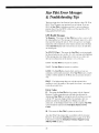
Stnr Pilnt Error Messages
& TroublpslnotingTips
The lower right sideof the PositionScreendisplayseither2D. 3D or
OLD. 2D or 3D meansyour positionflxes are current.If you see
OLD, the Star Pilot is informingyou that it is not receivingnew
positionfixes. Pressthe MENU softkey.and then push Key #5 to
bring up the STATUS Screen.
GPS Health Messages
No Response- This meansthe Star Pilot doesnot havecontactw'ith
This messagewill normalll, appearfbr a short
the Antenna/Receiver.
time upon first turning the unit on. lf this messagedoesnot change,
inspectthe cableconnectionsat the Antennamodule and at the back
of the Star Pilot displayunit to ensurethev are clean.dry and there
are no bent pins.
No GPS TM (Time) - This meansthe Star Pilot is receivingsignals
but hasnot lockedon to a satellite.It is still searchingand computing.
If this message
doesnot changeafier a minuteor two, makesure
thereare no obstructionsto the antenna'sview of the sky.
I SAT - The Star Pilot haslocatedone satellite.
2 SAT - The Star Pilot haslocatedtwo satellites.
GOOD - The Star Pilot has found a third satelliteand can now
calculatea currentLatll-on position.If the Star Pilot locatesa fburth
satelliteit will be operablein 3D Mode and can calculatealtitudeas
well.
PDOP - 12 or highermeansthatevenwith the minimal three
satellitesin view, the qualityof the signalsfrorn them is not enough
to provideaccuratefixes.
Error Codes
FF - This meansthe Star Pilot haslost contactwith the Antenna/
Receiver.If cableconnectionsare solid and cleanbetweenthe
Antennaand Star Pilot, try turning the unit off and back on to reset
it. If the "FF" doesnot changewithin a few moments,thereis a
problem in eitherthe Antenna/Receiver
Module, the cableor
connectors,or the Display/ControlUnit, and the completeStar Pilot
systemshouldbe returnedto the Interphase Factory Service
Center.
00 - This meansthe Star Pilot's systemsare error free.
Any other Error Code meansthereis a problemwith the Antenna/
Receiver.Try tuming the Star Pilot off, then on again.If the Error
Codespersistcontactthe Interphase TechnicalSupport (iroup
(40$ 427-4444for advice.
22
Speciftcations
I
Main Features:
Latitude.longitude,altitude
Time of day and date(realtime clock)
100waypointmemory
l0 routeprogrammingcapability
Graphictrackplotter
crosstrackerror
Graphicnavigationshowin-e
to waypoints
C o u r s ea n dd i s t a n c e
Estimatedtime of arrival
Wzrypointarrival and anchoralarms
backlitSuperTwistLCD
High resolutionelectroluminescent
L o c a la n d u n i v e r s at li m e
S a t e l l i t es t a t u s
5.-5"
Physical:
size: 6" diameter.-5.25"high. 30' cable
Antenna/recciver
A n t e n n a / r e c e i vwe er i g h t : l . ' l l b s .
D i s p l a yu n i t w e i g h t : 2 . 2 5l b s .
s :. 2 - 5x" , 1 . 2 5 "
L C D d i s p l a yc l i m c n s i o r r 3
L C D d i s p l a yr c s o l u t i o n :l l 8 r 1 6 0p i x e l s :2 0 . 4 t t 0p i x e l st o t a l ;I , 5 7 5
p i x e l sp e r s q u a r ei n c h
P o w c r : l 2 V D C n o r t . r i n (all0 - l 6 V D C ) . l e s st h a n6 0 0 r n A
ranse: Llnit- 0 to 60"C.
Operatingtempcrature
-20' to +70'C
antcnna/recciver
General:
cligitalGPS receiver.tracksup to sevensatellites
Three-channel.
Updaterate: I sccondcapability'
s MS
A c c u r a c l(,t 1 ' p i c a l )P: o s i t i o n1. - 5r n e t e r R
V e l o c i t l ' :0 . 1 K t R M S s t e a d vr a t e
Dynamics:0-6.50mph
S p e c i f i c a t i o n s s u b . j e c tt o c h a n g c w i t h o u t n o t i c c .
23
Software UpdatesInterphase periodicallyupdatessoftwarein navi-rational
instrumentsand offers theseupdatesto its customers.
For more informationon Interphase softwareupdate
programscall the Interphase TechnicalService (iroup
at (408) 427-4444.
24
How To Obtain Service
is not operating
If you feel your displayunit or antenna/receiver
properlyand you needservice,we stronglyrecommendyou first call
our Technical Support Group (408) 427-4444to make sureyour
equipmentneedsto be retumedto the factory.
If you do needto returnyour instruments,pleaserememberto include
It is bestto ship it in the
both your display unit and antenna/receiver.
original productbox to the following address:
ServiceDepartment
Interphase Technologies,Inc.
1201 Shaffer Road
Santa Cruz. CA 95060
In addition,to speedyour repairpleasefill out the following, copy or
tear out of this manual.and taneto vour unit for our techniciansto
review.
RETURN TO:
D a y p h o n e( _ )
E v e n i n g p h o n e( _ )
Model: Star Pilot
Serial#
Purchasedate
In warranty? Yes
I
I
No
Pleasedescribethe problem in as much detail as possible.
25