1
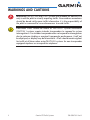
GTS Traffic Systems
Pilot’s Guide
© 2014 Garmin Ltd. or its subsidiaries. All rights reserved.
Garmin International, Inc., 1200 East 151st Street, Olathe, KS 66062, U.S.A.
Tel: 913/397.8200
Fax: 913/397.8282
Garmin AT, Inc., 2345 Turner Road SE, Salem, OR 97302, U.S.A.
Tel: 503/391.3411
Fax 503/364.2138
Garmin (Europe) Ltd., Liberty House, Bulls Copse Road, Hounsdown Business Park, Southampton,
SO40 9LR, U.K.
Tel. +44 (0) 23 8052 4000
Fax +44 (0) 23 8052 4004
Garmin Corporation, No. 68, Jangshu 2nd Road, Shijr, Taipei County, Taiwan
Tel: 886/02.2642.9199
Fax: 886/02.2642.9099
At Garmin, we value your opinion. For comments about this guide, please e-mail:
[email protected]
This part shall comply with Garmin Banned and Restricted Substances document, 001-00211-00.
www.garmin.com
https://fly.garmin.com/fly-garmin
Except as expressly provided herein, no part of this manual may be reproduced, copied, transmitted,
disseminated, downloaded or stored in any storage medium, for any purpose without the express written
permission of Garmin. Garmin hereby grants permission to download a single copy of this manual and of
any revision to this manual onto a hard drive or other electronic storage medium to be viewed for personal
use, provided that such electronic or printed copy of this manual or revision must contain the complete text
of this copyright notice and provided further that any unauthorized commercial distribution of this manual
or any revision hereto is strictly prohibited.
Record of Revisions
Revision
Date
A
12/02/09 Production release.
B
3/21/14
Description
Added new GTS models and reorganized/edited content.
March 2014
Printed in the U.S.A.
LIMITED WARRANTY
This Garmin product is warranted to be free from defects in materials or workmanship for two years from
the date of purchase. Within this period, Garmin will, at its sole option, repair or replace any components
that fail in normal use. Such repairs or replacement will be made at no charge to the customer for parts
and labor, provided that the customer shall be responsible for any transportation cost. This warranty does
not cover failures due to abuse, misuse, accident, or unauthorized alterations or repairs.
THE WARRANTIES AND REMEDIES CONTAINED HEREIN ARE EXCLUSIVE AND IN LIEU OF ALL OTHER
WARRANTIES EXPRESS OR IMPLIED OR STATUTORY, INCLUDING ANY LIABILITY ARISING UNDER
ANY WARRANTY OF MERCHANTABILITY OR FITNESS FOR A PARTICULAR PURPOSE, STATUTORY OR
OTHERWISE. THIS WARRANTY GIVES YOU SPECIFIC LEGAL RIGHTS, WHICH MAY VARY FROM STATE TO
STATE.
IN NO EVENT SHALL GARMIN BE LIABLE FOR ANY INCIDENTAL, SPECIAL, INDIRECT OR CONSEQUENTIAL
DAMAGES, WHETHER RESULTING FROM THE USE, MISUSE, OR INABILITY TO USE THIS PRODUCT OR
FROM DEFECTS IN THE PRODUCT. Some states do not allow the exclusion of incidental or consequential
damages, so the above limitations may not apply to you.
Garmin retains the exclusive right to repair or replace the unit or software, or to offer a full refund of the
purchase price, at its sole discretion. SUCH REMEDY SHALL BE YOUR SOLE AND EXCLUSIVE REMEDY FOR
ANY BREACH OF WARRANTY.
To obtain warranty service, contact your local Garmin Authorized Service Center. For assistance in
locating a Service Center near you, visit the Garmin web site at http://www.garmin.com or contact
Garmin Customer Service at 866-739-5687.
190-00587-02 Rev. B
Garmin GTS Traffic Systems
i
WARNINGS AND CAUTIONS
WARNING: The GTS TAS and TCAS I systems are intended for advisory use
only to aid the pilot in visually acquiring traffic. No avoidance maneuvers
should be based solely upon traffic information. It is the responsibility of
the pilot in command to see and maneuver to avoid traffic.
CAUTION: Pilots should be aware of TAS/TCAS I system limitations.
TAS/TCAS I systems require intruder transponders to respond to system
interrogations. If an intruder transponder does not respond to interrogations
due to antenna shading or marginal transponder performance, it will not
be displayed, or display may be intermittent. Pilots should remain vigilant
for traffic at all times when using TAS/TCAS I systems for non-transponder
equipped airplanes or unresponsive airplanes.
ii
Garmin GTS Traffic Systems
190-00587-02 Rev. B
Contents
LIMITED WARRANTY.........................................................................................i
Warnings and Cautions....................................................................................ii
System Description..........................................................................................3
General Theory of Operation.............................................................................. 3
Active Surveillance..................................................................................... 3
Passive Surveillance.................................................................................... 4
System Specifications........................................................................................ 4
System Components.......................................................................................... 5
System Processor....................................................................................... 5
Antennas................................................................................................... 6
External Amplifier....................................................................................... 8
System Interfaces.............................................................................................. 9
Altitude Source.......................................................................................... 9
Transponder Interface................................................................................. 9
Traffic Display............................................................................................. 9
Audio System............................................................................................. 9
Landing Gear Position.............................................................................. 10
Radar Altimeter........................................................................................ 10
GPS......................................................................................................... 10
Magnetic Heading.................................................................................... 10
Air/Ground Switch.................................................................................... 10
Control Switches...................................................................................... 10
System Operation..........................................................................................11
Operating Modes............................................................................................ 11
Control of Modes..................................................................................... 11
Traffic Information........................................................................................... 11
Other Traffic (OT)...................................................................................... 12
Proximity Advisories (PA).......................................................................... 12
Traffic Advisories (TA)............................................................................... 12
Ownship Air/Ground Detection........................................................................ 16
Automatic Mode Switching...................................................................... 17
Calculated Height Above Ground..................................................................... 17
Ground Traffic Filtering.................................................................................... 18
Mode S Targets........................................................................................ 18
190-00587-02 Rev. B
Garmin GTS Traffic Systems
1
Radar Altimeter........................................................................................ 18
Calculated Height Above Ground.............................................................. 18
ADS-B Receiver............................................................................................... 18
Self-Test.......................................................................................................... 20
Q and A..........................................................................................................21
Glossary.........................................................................................................23
2
Garmin GTS Traffic Systems
190-00587-02 Rev. B
SYSTEM DESCRIPTION
Garmin GTS Traffic Systems are a family of Traffic Advisory Systems (TAS)
and Traffic Alert and Collision Avoidance Systems (TCAS). The systems feature
both active interrogation of aircraft transponders and passive surveillance of
1090 MHz Extended Squitter ADS-B broadcasts (1090ES).
GTS Traffic Systems include the following products:
• GTS 800 TAS
• GTS 820 TAS and GTS 850 TCAS I
• GTS 825 TAS and GTS 825 TCAS I
• GTS 8000 TCAS II
Terms used in this Pilot’s Guide:
• TAS: Refers to any TAS system (GTS 800/820/825)
• TCAS I: Refers to any TCAS I system (GTS 850/855)
• TAS / TCAS I: Refers to any TAS or TCAS I system
(GTS 800/820/825/850/855)
• TCAS II: Refers to the GTS 8000
NOTE: Details on the GTS 8000 TCAS II operation are not included in this
guide. For information on a GTS 8000 TCAS II system, refer to the aircraftspecific installation documentation.
General Theory of Operation
Active Surveillance
GTS Traffic Systems actively interrogate the transponders of other nearby
aircraft to determine their bearing, distance, altitude and vertical trend relative
to your aircraft. Aircraft with operating transponders are detected, and aircraft
with altitude reporting transponders will also include altitude and vertical trend
information (level, climbing, or descending). This information is then shown on
a compatible traffic display.
GTS Traffic Systems also provide visual and aural alerts to assist in visually
acquiring traffic. Aural and visual alerts are provided as a Traffic Advisory (TA)
for conflicting traffic.
190-00587-02 Rev. B
Garmin GTS Traffic Systems
3
Passive Surveillance
GTS Traffic Systems can optionally utilize passive surveillance information
from an internal ADS-B receiver. The ADS-B receiver uses 1090ES broadcasts
from other aircraft that are equipped with 1090ES ADS-B Out. These broadcasts
are combined with the active surveillance data to enhance the accuracy of target
positions on the display. This is Garmin’s CLEAR CASTM technology, which
correlates ADS-B and actively interrogated targets to provide pilots with the most
accurate target position. A GPS position source and magnetic heading system are
required for passive surveillance functionality.
System Specifications
The specifications for each member of the GTS Traffic Systems family are
contained in the table below.
Product
GTS 800 GTS 820 GTS 825 GTS 850
GTS 855
Type
TAS
TSO-C147
(Class A)
TAS
TSO-C147
(Class A)
TAS
TSO-C147
(Class A)
TCAS I
TSO-C118
TCAS I
TSO-C118
ADS-B
Capability
TSO-C166b
[Note 1]
TSO-C166b
[Note 1]
TSO-C166b
[Note 1]
TSO-C166b
[Note 1]
TSO-C166b
[Note 1]
Transmit Power
40 Watts
250 Watts
400 Watts
250 Watts
400 Watts
Maximum Range
22 NM
40 NM
40 NM
40 NM
80 NM
# Targets Tracked
45
75
75
75
75
None
Mode S
[Note 2]
Mode S
[Note 2]
Mode S
[Note 2]
Mode S
[Note 2]
No
Yes
No
Yes
No
XPDR Interface Required
External Amplifier Required
Table 2 GTS Traffic Systems Specifications
Note 1: Class A1 / Type 1 (Class A1S for single-antenna installations). GTS 800/820/850
require system software version 3.00 or later for TSO-C166b compliance.
Note 2:
A compatible Garmin transponder capable of identifying TCAS interrogations
is required.
4
Garmin GTS Traffic Systems
190-00587-02 Rev. B
System Components
System Processor
Each GTS Traffic System includes a system processor. The system processor
connects to all of the required and optional antennas, displays, controls, and
aircraft interfaces.
Figure 1 GTS System Processor
GTS 800/820/850 System Processors
The GTS 800/820/850 systems use a unique system processor. The GTS 800
system processor is different from a GTS 820 or GTS 850 system processor.
GTS 825/855 System Processor
The GTS 825/855 systems share a common system processor known as the
“GTS Processor.” The GTS Processor can be configured during installation to be
either a GTS 825 TAS or a GTS 855 TCAS I.
190-00587-02 Rev. B
Garmin GTS Traffic Systems
5
Antennas
The GTS Traffic Systems use one or two dedicated externally-mounted
antennas to transmit transponder interrogations to other aircraft. The same
antenna or antennas are used to receive transponder replies and ADS-B
broadcasts from other aircraft.
A directional antenna on top of the aircraft is always required and is used to
determine the bearing to the intruder aircraft. Interrogations transmitted from
the top antenna are directional, which reduces the number of transponders that
reply to the interrogation and reduces congestion on the 1090 MHz frequency.
An optional second antenna may be installed on the bottom of the aircraft
to improve performance. A bottom mounted antenna adds additional visibility
for targets that could be shaded from the top antenna (for example, targets
that are underneath the aircraft). The bottom antenna may be a directional
antenna or an omni-directional antenna. If a directional antenna is installed on
the bottom, it may be used to determine the bearing to the intruder aircraft
(omni-directional antennas cannot determine bearing). The bearing accuracy
of a bottom directional antenna on a fixed gear airplane may be less than that
of the top antenna, due to the presence of the landing gear. Bearing from the
bottom antenna on a retractable gear airplane is not used when the landing
gear is extended. Interrogations transmitted from the bottom antenna are always
omni-directional, regardless of the antenna type.
Directional Antennas
GA 58 Directional Antenna
The GA 58 is a directional four-element antenna that may be installed on the
top and/or bottom of the aircraft.
Figure 2 GA 58 Directional Antenna
6
Garmin GTS Traffic Systems
190-00587-02 Rev. B
Sensor Systems Low-Profile Antenna
Sensor Systems antennas are low-profile directional antennas that may be
installed on the top and/or bottom of the aircraft.
Figure 3 Sensor Systems Low-Profile Directional Antenna
Omni-Directional Antenna
Numerous omni-directional (monopole) antennas are suitable for installation
on the bottom of the aircraft. Omni-directional antennas cannot determine the
bearing to an intruder aircraft.
Figure 4 Bottom-Mounted Omni-Directional (Monopole) Antenna
190-00587-02 Rev. B
Garmin GTS Traffic Systems
7
External Amplifier
GPA 65 Amplifier Module (GTS 820 & 850 only)
The GPA 65 is a combined Power Amplifier and Low Noise Amplifier that is
required for use with the GTS 820 and GTS 850 systems only.
Figure 5 GPA 65 PA/LNA Module
8
Garmin GTS Traffic Systems
190-00587-02 Rev. B
System Interfaces
The GTS Traffic System includes interfaces to various required and optional
aircraft systems.
Altitude Source
At least one pressure altitude source is required for system operation. The
pressure altitude source is compared to the pressure altitude replies from other
aircraft to calculate their relative altitudes. Pressure altitude interfaces are
available from a serial altitude encoder or digital air data computer.
Transponder Interface
All GTS Traffic Systems except the GTS 800 require an interface to a
compatible Mode S transponder. The transponder interface allows the highpower GTS systems to determine how many TCAS-equipped aircraft are in
the area. To reduce frequency congestion, transmit power is adjusted based on
the number of other TCAS-equipped aircraft in the area. The GTS 800 systems
transmit at a lower power level and do not require a transponder interface.
Traffic Display
At least one traffic display is required, and multiple traffic displays are
supported. The traffic display shows a two-dimensional (top-down) view of
traffic that is detected by the GTS system. Bearing, distance, relative altitude,
and vertical trend can be depicted on the traffic display. Some traffic displays
include integrated controls for selecting the system operating mode and altitude
filter. For details on the capabilities of a compatible traffic display, refer to the
documentation for that display.
Contact your Garmin dealer to learn which displays are compatible with
the GTS systems. Some displays may require the purchase and installation of
additional modules and/or software.
Audio System
The GTS must be interfaced to an audio system so that traffic advisory aural
alerts and self-test messages can be heard by the crew.
190-00587-02 Rev. B
Garmin GTS Traffic Systems
9
Landing Gear Position
Landing gear position for retractable gear aircraft is interfaced to the GTS
system. Landing gear position may be used to mute traffic advisory audio, adjust
the sensitivity of traffic alerts, or compensate a bottom directional antenna.
Radar Altimeter
A radar altimeter may be optionally interfaced to the GTS system. Radar
altimeter height may be used to mute traffic advisory audio, adjust the sensitivity
of traffic alerts, or filter out traffic targets that are on/near the ground.
GPS
GPS is an optional interface to the GTS system that can provide position,
groundspeed, and altitude (GPS-calculated). GPS input may be used to enable
several functions, including ADS-B In, automatic air/ground determination, or
calculated height above ground.
Magnetic Heading
Magnetic heading is an optional interface to the GTS system. Magnetic
heading may be used to correct the bearing of traffic targets during turns, and it
is also needed to enable the ADS-B In function. Magnetic heading interfaces are
available from analog gyro systems or digital AHRS.
Air/Ground Switch
An air/ground switch (e.g. squat or airspeed switch) is an optional interface
to the GTS system which may be used for automatic air/ground determination.
Control Switches
The GTS system supports external switches for selecting the operating mode
(operate/standby), initiating a self-test, or canceling/muting traffic advisories.
Use of external switches is required with certain traffic displays that do not
include integrated controls. External switches, when installed, are a momentary
pushbutton type.
10
Garmin GTS Traffic Systems
190-00587-02 Rev. B
SYSTEM OPERATION
Operating Modes
The system typically powers up in Standby mode. In Standby mode, the
system is powered on, but no traffic surveillance functions are performed.
Operate mode is the normal mode for operations. All active and passive
traffic surveillance functions are performed in Operate mode.
Self-test mode is a manually-selected mode that briefly performs a test of the
system. Refer to the self-test section of this guide for additional information.
If the system detects a fault that will prevent normal operation, the system
will enter and remain in Fail mode.
Control of Modes
Standby, Operate, and Self-test modes may be manually selected via system
controls. The controls are either integrated with the traffic display(s) or installed
as external control switches.
Traffic Information
The function of the GTS Traffic System is to provide information regarding
nearby traffic to the crew. For each traffic target that is tracked by the GTS,
the system computes the bearing, range, relative altitude, and vertical trend
for the target. Relative altitude and vertical trend are available for targets with
altitude reporting capability. This traffic information is displayed to the crew
on an interfaced display. Bearing and range are shown on a two-dimensional
(top-down) map. Relative altitude, when available, is displayed above or below
the corresponding target symbol in hundreds of feet. When the target is above
the own aircraft, it is preceded by a “+” symbol; a minus sign “-” indicates the
target is below the own aircraft. A vertical trend arrow to the right of the intruder
symbol indicates climbing or descending traffic with an upward or downwardpointing arrow.
190-00587-02 Rev. B
Garmin GTS Traffic Systems
11
Intruder Altitude
and Vertical Trend
Figure 6 Example Traffic Display
NOTE: Always refer to the traffic display documentation for details on
how traffic information is depicted on each display.
Other Traffic (OT)
Other Traffic (OT) targets are typically displayed as a hollow diamond
and do not meet the criteria for any other traffic type.
Proximity Advisories (PA)
Proximity Advisory (PA) targets are typically displayed as a solid
diamond. PAs are defined as traffic within 6 NM horizontally and
1200 feet vertically that are not a Traffic Advisory.
Traffic Advisories (TA)
Traffic Advisory (TA) targets are typically displayed as a yellow circle
and are generated when the GTS predicts that a target may pose a
collision threat. Traffic Advisory sensitivity, criteria, and types are
described in the following sections.
Sensitivity Level
To prevent nuisance TAs in the airport environment, there are two sensitivity
levels available: Sensitivity Level A (SL A) and Sensitivity Level B (SL B). The
Sensitivity Level determines what criteria will be used for TAs. SL A is less
sensitive and traffic must be closer before it will generate an alert. SL B is more
sensitive and traffic may be farther away to generate an alert. The logic for
12
Garmin GTS Traffic Systems
190-00587-02 Rev. B
choosing the sensitivity level is based on available system inputs. If none of the
inputs described below are available, the system will always remain in the most
sensitive level, SL B.
Radar Altimeter
If the aircraft is equipped with a radar altimeter, SL A will be used when the
radar altitude is less than 2,000 feet. SL B will be used when the radar altitude
is greater than 2,000 feet.
Landing Gear Position
If the aircraft has retractable landing gear, SL A will be used when the landing
gear is extended. SL B will be used when the landing gear is retracted. Landing
gear position does not affect sensitivity level if a radar altimeter is available.
Groundspeed
GPS groundspeed may be used to select the sensitivity level only if radar
altimeter and landing gear position is not available. SL A will be used when the
groundspeed is less than 120 knots. SL B will be used when the groundspeed is
greater than 120 knots.
No Available Inputs
If none of the above inputs is available (radar altimeter, landing gear position,
or groundspeed), the system will always remain in the most sensitive level, SL B.
TA Criteria
Targets may become a TA based on closure rate (time until collision) or if they
encroach within a minimum distance. The criteria used depend on the current
sensitivity level and whether the target has altitude reporting capability. Once a
TA is generated, it will remain a TA for at least 8 seconds, even if the target no
longer satisfies the criteria for a TA. The following table summarizes the criteria
used for TAs.
190-00587-02 Rev. B
Garmin GTS Traffic Systems
13
Sensitivity Intruder Altitude
Level
Available
A
Yes
A
No
B
Yes
B
No
TA Alerting Conditions
Intruder closing rate provides less than 20
seconds of vertical and horizontal separation.
Or:
Intruder closing rate provides less than 20
seconds of horizontal separation and vertical
separation is within 600 feet.
Or:
Intruder range is within 0.2 NM and vertical
separation is within 600 feet.
Intruder closing rate provides less than 15
seconds of separation or intruder range is
within 0.2 NM.
Intruder closing rate provides less than 30
seconds of vertical and horizontal separation.
Or:
Intruder closing rate provides less than 30
seconds of horizontal separation and vertical
separation is within 800 feet.
Or:
Intruder range is within 0.55 NM and vertical
separation is within 800 feet.
Intruder closing rate provides less than 20
seconds of separation or intruder range is
within 0.55 NM.
Table 5 TA Alerting Criteria
No-Bearing TAs
If the bearing of a TA target cannot be determined, a No-Bearing TA will be
issued. No-Bearing TAs are typically displayed as a yellow text banner on the
traffic display. The text typically includes “TA” followed by the distance, relative
altitude, and vertical trend arrow. Relative altitude and vertical trend arrow are
not available for targets without altitude reporting.
14
Garmin GTS Traffic Systems
190-00587-02 Rev. B
No-Bearing TA Traffic
Annunciation
Figure 7 No-Bearing TA
Off-Scale TAs
If a TA is beyond the currently-selected traffic display range, it is
typically shown with a half-circle icon at the edge of the display
range. Refer to the traffic display documentation for details regarding
off-scale TA depictions.
TA Aural Alerts
When a target becomes a TA, an aural alert message is played to advise the
crew. The aural alert may include an ATC-description of the target’s bearing,
altitude, and distance. For example, “Traffic! One o’clock, High, Two miles.”
The aural alert format is shown in the table below:
Bearing
“One o’clock” through
“Twelve o’clock”
or “No Bearing”
Relative Altitude
“High”, “Low”, “Same
Altitude” (if within 200
feet of own altitude), or
“Altitude not available”
Distance
“Less than one mile”,
“One Mile” through “Ten
Miles”, or “More than ten
miles”
Table 6 Aural Alerts
Optionally, TA aural alerts may be shortened under some circumstances. A
TA aural alert may be shortened to “Traffic, Traffic!” in the following cases:
• Another TA is already present, or
• The range to the TA target is less than 0.25 NM
NOTE: Shortened TA aural alerts are currently only available in GTS 825
and GTS 855 systems with system software version 2.20 or later.
190-00587-02 Rev. B
Garmin GTS Traffic Systems
15
TA Aural Muting
TA aural alerts may be muted or canceled under some circumstances. Muting
or canceling of the TA aural alert does not affect the visual display of the TA.
Radar Altimeter
If the aircraft is equipped with a radar altimeter, all TA aural alerts will be
muted when the radar altitude is less than 400 feet.
Landing Gear Position
If the aircraft has retractable landing gear, all TA aural alerts will be muted
when the landing gear is extended. Landing gear position does not mute TA
aural alerts if a radar altimeter is available.
TAWS/Windshear Alerts
TA aural alerts may be temporarily muted by higher-priority aural alerts,
such as TAWS or windshear. The TA aural alert will resume when the higherpriority aural alert is no longer active.
External Switch
A TA aural alert may be canceled with an optional momentary pushbutton
switch. Pressing this switch during a TA aural alert will cancel/mute that aural
alert. Subsequent TA aural alerts will be played, and the switch must be pressed
each time that it is desired to cancel/mute a TA aural alert.
Ownship Air/Ground Detection
Optional external interfaces can be used to determine whether the ownship
is on the ground or in the air. Interfaces that may be used for determining the
air/ground state include:
• An air/ground switch (e.g. squat or airspeed switch).
• GPS groundspeed. Greater than 35 knots indicates in air, and less than
30 knots indicates on ground.
• Air/ground Ethernet message from a Garmin avionics system.
Ownship air/ground detection is used for the automatic mode switching and
calculated height above ground features.
16
Garmin GTS Traffic Systems
190-00587-02 Rev. B
Automatic Mode Switching
The system can automatically switch between Operate and Standby modes
based on whether the ownship is in the air or on the ground. The system will
automatically select Operate mode 8 seconds after becoming airborne. Standby
mode will automatically be selected 24 seconds after landing.
Calculated Height Above Ground
For aircraft that are not equipped with a radar altimeter, the system can
calculate the height above ground using information from various optional
interfaces. This calculation can enable additional functionality (such as ground
traffic filtering), without requiring a radar altimeter interface.
Height above ground can be calculated using an internal airport database
and optional 3-D GPS interface. The system’s internal airport database contains
locations and elevations for airports throughout the world. By comparing the
3-D GPS position and altitude to the airport database, the ownship’s height
above ground can be calculated. If GPS altitude is not available, 2-D GPS input
(position only) can be used along with baro-corrected altitude from an air data
computer to perform the calculation.
Additionally, if the system has detected that it is on the ground, the onground position and pressure altitude will be used as a known ground reference
point. If GPS position is not available, the on-ground altitude will still be used
as a reference point as long as the ownship is on the ground and for up to 60
seconds after takeoff.
NOTE: The Calculated Height Above Ground feature is only available
in GTS 825 and GTS 855 systems with system software version 2.20 or
later.
190-00587-02 Rev. B
Garmin GTS Traffic Systems
17
Ground Traffic Filtering
To reduce nuisance alerts and reduce traffic display clutter, traffic that is on
or near the ground may not be shown on the traffic display or generate traffic
alerts. There are several methods used for filtering out ground traffic.
Mode S Targets
Mode S transponders include in their replies an indication of whether the
aircraft is on the ground or in the air. Mode S traffic that indicates the traffic is
on the ground will not be displayed or generate an alert. This is the only method
used to determine whether Mode S traffic is on the ground.
NOTE: The system does not indicate to the crew which traffic targets are
Mode S equipped.
Radar Altimeter
Radar altitude, if available, may be used to determine which traffic targets are
on the ground. For example, if the current radar altitude is 1000 feet, then traffic
with a relative altitude of -1000 feet would be considered to be on the ground
and would not be displayed or alerted on. Ground traffic is only filtered when
the radar altitude is less than 1,700 feet.
Calculated Height Above Ground
If radar altitude is not available, calculated height above ground may be used
to filter out ground traffic. Calculated height above ground is used similarly to
how radar altitude is used. Ground traffic is only filtered when the calculated
height above ground is less than 1,700 feet.
ADS-B Receiver
A 1090 MHz Extended Squitter (1090ES) receiver is built in to the GTS System
Processor. ADS-B Out broadcasts from other traffic may include additional
information such as flight ID, position, altitude, velocity, and direction. These
broadcasts from other aircraft are correlated with active transponder replies.
The accuracy of the ADS-B broadcasts and additional information allows for
improved accuracy and other enhancements to the traffic display. Refer to the
traffic display documentation for information on display enhancements for
ADS-B traffic.
18
Garmin GTS Traffic Systems
190-00587-02 Rev. B
NOTE: The ADS-B receiver is a 1090ES receiver and cannot receive
978 MHz UAT broadcasts.
Air-to-air broadcasts from other aircraft equipped with 1090ES ADS-B Out
are used for traffic correlation. Traffic or weather uplinks from ADS-B ground
stations are not used. ADS-B broadcasts must be correlated with an active
transponder reply in order to be shown on the traffic display. Uncorrelated
ADS-B broadcasts are not used, and ADS-B correlation is not used for Traffic
Advisories.
The ADS-B receiver functionality is optional and requires GPS and magnetic
heading interfaces to perform the correlation function.
190-00587-02 Rev. B
Garmin GTS Traffic Systems
19
Self-Test
NOTE: Traffic surveillance is not available during the self-test.
The self-test mode is used to verify that the system is functioning normally.
Self-test must be manually initiated from the Standby mode and takes
approximately ten seconds to complete. During the self-test, a pattern of traffic
symbols is shown on the traffic display. The test pattern consists of the following
traffic:
• A Traffic Advisory at 9 o’clock, 2 miles, 200 feet below and climbing.
There is no Traffic Advisory aural alert for this test traffic.
• A Proximity Advisory at approximately 1 o’clock, 3.6 miles, 1000 feet
below and descending.
• Other Traffic at approximately 11 o’clock, 3.6 miles, 1000 feet above
and level.
Figure 8 Self-Test Mode
If the self-test is successful, the aural announcement “[TAS / TCAS I] System
Test Passed” (depending on the system type) will be played. If the self-test is
unsuccessful, the aural announcement “[TAS / TCAS I] System Test Failed” will
be played.
The system may be installed so that the self-test cannot be initiated while
airborne.
20
Garmin GTS Traffic Systems
190-00587-02 Rev. B
Q AND A
What are the benefits of ADS-B?
1090 MHz Extended Squitter ADS-B data contains additional information
about a target aircraft including flight ID, latitude, longitude, barometric and
geometric altitude, velocity, and direction.
This provides precise location information about the target aircraft. Targets
within the active surveillance range that are correlated with ADS-B data are
displayed with much greater accuracy as a result of this.
When is ADS-B (passive surveillance) available?
Passive surveillance functionality is available for traffic that is equipped with
1090 MHz Extended Squitter (1090ES) ADS-B Out capability. Additionally,
the GTS Traffic System must be installed with the optional GPS and magnetic
heading interfaces.
How is ADS-B data used?
The GTS Traffic System correlates range, altitude, and bearing data from
transponder replies with 1090ES ADS-B Out broadcasts from other aircraft,
using the precision information from ADS-B to improve the quality and accuracy
of the traffic information.
How are active and passive targets displayed?
A traffic target is always displayed as a single symbol, whether or not passive
ADS-B surveillance is available.
Some displays may enhance the depiction of traffic that includes ADS-B
information, including the Flight ID (callsign), heading, velocity, and air/ground
status of the traffic.
Refer to the traffic display documentation to determine the capabilities of
each display.
What capabilities does GPS data provide?
GPS data is required for the ADS-B passive surveillance feature. GPS data
is also used in some installations for air/ground detection, automatic mode
switching, and calculated height above ground.
GPS data is optional and the system can provide active traffic surveillance
with or without GPS data.
190-00587-02 Rev. B
Garmin GTS Traffic Systems
21
What kind of transponder is required for use with the GTS
Traffic System?
All installations except the GTS 800 require the use of a compatible
Mode S transponder. The transponder provides an indication of how many other
TCAS-equipped aircraft are nearby, so that the GTS traffic system can adjust its
transmit power and reduce frequency congestion.
The GTS 800 does not require a transponder interface (regulatory
requirements for transponder usage still apply).
Is ADS-B Out required with the GTS Traffic System?
No. The ADS-B Passive Surveillance feature uses 1090ES ADS-B Out
broadcasts from other aircraft, but the ownship is not required to be equipped
with ADS-B Out.
22
Garmin GTS Traffic Systems
190-00587-02 Rev. B
GLOSSARY
Active Surveillance: Tracking of traffic targets using aircraft transponders
ADS-B: Automatic Dependent Surveillance – Broadcast
ATCRBS: Air Traffic Control Radio Beacon Service - A surveillance
system that uses active interrogations and Mode A/C
replies from transponders
CLEAR CAS:
Correlated Location Enhanced ADS-B Receiver Collision
Avoidance System
GPS: Global Positioning System
MHz: MegaHertz - A unit of measure for radio frequency
Mode A: A type of ATCRBS transmission which requests (via Mode
A interrogations) or reports (via Mode A replies) aircraft
identity information
Mode C: A type of ATCRBS transmission which requests (via Mode
C interrogations) or reports (via Mode C replies) aircraft
altitude information
Mode S: A type of secondary surveillance radar transmission which
contains a unique 24-bit discrete address, thus allowing
interrogations to be addressed to individual aircraft. Mode
S transmissions can be short (56 bits) or long (112 bits),
with long transmissions containing a 56-bit “message”
field.
NM: Nautical Mile
OT: Other Traffic (other than TA or PA traffic)
PA: Proximity Advisory
Passive Surveillance: Tracking and enhancement of traffic targets using ADS-B
broadcasts
TA: Traffic Advisory
TAS: Traffic Advisory System
TCAS: Traffic Alert and Collision Avoidance System
190-00587-02 Rev. B
Garmin GTS Traffic Systems
23
This page intentionally left blank
24
Garmin GTS Traffic Systems
190-00587-02 Rev. B
© 2014 GARMIN Corporation
GARMIN International, Inc.
1200 East 151st Street, Olathe, Kansas 66062, U.S.A.
Tel. 913/397.8200 or 800/800.1020
Fax 913/397.8282
Garmin AT, Inc.
2345 Turner Rd., S.E., Salem, Oregon 97302, U.S.A.
Tel. 503/581.8101 or 800/525.6726
Fax. 503/364.2138
Garmin (Europe) Ltd.
Liberty House, Bulls Copse Road, Hounsdown Business Park,
Southampton, SO40 9LR, U.K.
Tel. +44 (0) 23 8052 4000
Fax +44 (0) 23 8052 4004
GARMIN Corporation
No. 68, Jangshu 2nd Road, Shijr, Taipei County, Taiwan
Tel. 886/2.2642.9199
Fax 886/2.2642.9099
www.garmin.com
Part Number 190-00587-02 Rev. B