1
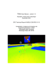
The above view shows how this file input imports to a particular area of the world, which only partially
overlaps with the current render extents (the white box).
You can either set the worldspace location numerically, or use one of the provided quick placement
buttons to place the location of the file into the current render extents. You may also set the extents
graphically by clicking the "Set in Layout..." button.
Setting your file's elevations
There are several ways you can map the file's elevations into the world:
●
●
●
Natural Elevations: Ensure that the height values in the input file are translated correctly into
the same elevation in World Machine
Full Range: Map the elevations present in the file so that the highest and lowest elevation
completely span the possible elevation range inside of World Machine
Specify: Specify an altitude range in meters that the input data should fall between.
After the mapping of height values, any heights out of range will be clipped to the minimum and
maximum altitudes allowed.
You should now have all of the knowledge you need to be able to bring existing terrains into World
Machine, operate on them, and export to a file. There is one more file input device, called the Tiled
Input Device. It is designed to work on sets of individual tiles that collectively define a terrain region.
As a professional-edition only feature, it is described in the Pro Addendum of Chapter 10.