1
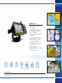
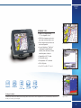
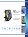
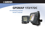
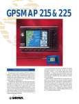
Whether it's inland waters or open seas, deep blue, murky green or crystal
clear - wherever you venture onto open water, you'll find Garmin chartplotters
guiding the way. With easy-to-use menu formats and crisp, high-resolution
displays, these rugged GPS navigators can pinpoint your location anywhere in
the world. Their built in basemaps provide accurate coastline reference - which
gets even better with available BlueChart and new BlueChart g2 marine
detailed cartography. For guidance, safety and situational awareness, you
simply can't go wrong with a Garmin onboard.
GPS 152
GPS 152
• Basic marine navigation
• Compact, fixed mount design
• 20 reversible routes
• Automatic track log
• Trip computer: current & average
speed, time for sunrise/sunset,
max speed, trip timer and
distance
Big numbers display
• Audible alarms
• Size: 13.4cm W x 12.5cm H
3D Graphics guidance
500
Compass
Package Includes:
GPS 152 receiver, GA 29 low-profile remote marine antenna (or internal GPS antenna), Gimbal mount, Power/data cable, Owner's manual,
Quick reference guide
31
GPSMAP 276C
GPSMAP 276C
• Portable dual use chartplotter and
in-car navigator
BlueChart detail
• Accepts BlueChart® marine
cartography and City Navigator NT
street level mapping
• Receive tidal data with BlueChart
cartography
• Turn-by-turn guidance with voice
prompts available with optional
automotive navigation kit
Split screen
• Rechargeable lithium-ion battery up to 15 hours life
• 50 reversible routes
• Sunlight readable colour TFT display
• Size: 14.5cm W x 8.1cm H
Street detail
3000
15 hrs
(limited compatibility)
Package Includes:
Port images
GPSMAP 276C, USB-PC interface cable, Power/data cable, Marine mount, Rechargeable lithium battery pack, AC adapter, Trip & Waypoint Manager CD,
Manual, Quick-start guide
33
GPSMAP
172C
GPSMAP 172C
• Colour CFTN display on big
11.5 cm diagonal screen
• 200 MHz microprocessors for fast
pan, zoom and map redraw rates
• Rocker keypad design affords true
one-hand operation
BlueChart detail
• Accepts MapSource® BlueChart®
cartography for detailed depth
contours, inter-tidal zones, navaids,
and other points of interest
• Compatible with DSC radios
• 50 reversible routes
• Waterproof to IPX7 standards
• 320 x 320 pixels
• Size: 12.25 cm W x 15.7 cm H
Points of Interest
3000
Package Includes:
GPSMAP 172C with built-in Worldwide Marine basemap, Remote antenna with 30’ cable or integrated GPS sensor, Power/data cable, Surface-mount
bracket, User’s manual, Quick-start guide
Split screen with
optional sonar
35
GPSMAP 292
Sounder
GPSMAP 292
• AIS ready
• Compatible with the latest BlueChart®
g2 cartography
• Enhanced worldwide basemap depicts
shorelines, roads and surface features in
richer detail
Mariners view
• 12.7 cm diagonal colour TFT screen
• 234 x 320 pixels
• New tilt/swivel bracket
• CANet® for high-speed data from remote
mount sounders or combo products
• Compatible with DSC radios
• 50 reversible routes
• Size: 16 cm W x 15.7 cm H
Bluechart G2 detail
3000
AIS
CANet
Package Includes:
GPSMAP 292 Sounder, Remote antenna with 30’ cable or integrated GPS sensor, Power/data cable, adjustable tilt and swivel mount,
User’s manual, Quick-start guide
AIS detail
37
GPSMAP
2106/2110
GPSMAP 2106/2110
• AIS ready
• Large-format TFT colour display
• Compatible with BlueChart® g2
• Can be mounted anywhere – from
open cockpits to cabin bulkheads
BlueChart detail
• 640 x 480 pixels
• CANet® for highspeed data
from remote sounders or
combo products
• 50 reversible routes
• Waterproof to IEC 60529 IPX7
• 2006C - 16.2 cm diagonal screen,
26 cm W x 16.5 cm H
• 2010C - 26.5 cm diagonal
screen, 32.2 cm W x 22.3 cm H
AIS detail
4000
AIS
CANet
Package Includes:
Compass screen
GPS 17N external remote sensor, Power/data cable, Bail mount Template for flush mounting, Protective front cover, Owner’s manual,
Quick reference guide
39
GSD 21/22
GSD 21/22
• GSD 21 - New analog receiver
• GSD 22 - Powerful 2kW
digital receiver
• Adds sounder capabilities to your
Garmin chartplotter
Sonar on a GPSMAP
3000 series
• GSD 22 – Garmin Marine Network
(no Ultrascroll™) or CANet™
• GSD 21 – connects through
NMEA/Serial or CANet
• Fast sounder display scrolling with
Ultrascroll™ technology
• Delivers excellent target and
bottom definition
• GSD 21 – 500 watts analog (RMS)
power with dual frequency
transducer, 1,500’ maximum depth
Sonar on a GPSMAP
276C
• GSD 22 – up to 2 kW digital
sounder output (depending on
transducer), 5,000’ maximum depth
• Size: 12.2 cm W x 17 cm H
CANet
Split screen sonar on a
GPSMAP 172C
41