1
user’s
manual
and
reference
guide
MapSource Manual Covers.indd
1
10/16/01, 9:46 AM
© 1999-2001 GARMIN Corporation
GARMIN International, Inc.
1200 E. 151st Street, Olathe, Kansas 66062 U.S.A.
Tel. 913/397.8200 or 800/800.1020
Fax. 913/397.8282
GARMIN (Europe) Ltd.
Unit 5, The Quadrangle, Abbey Park Industrial Estate, Romsey, SO51 9AQ U.K.
Tel. 44/1794.519944
Fax. 44/1794.519222
GARMIN Corporation
No. 68, Jangshu 2nd Road, Shijr, Taipei County, Taiwan
Tel. 886/2.2642.9199
Fax. 886/2.2642.9099
All rights reserved. Except as expressly provided herein, no part of this manual may be reproduced, copied, transmitted,
disseminated, downloaded or stored in any storage medium, for any purpose without prior written consent of GARMIN Corporation.
GARMIN Corporation hereby grants permission to download a single copy of this manual onto a hard drive or other electronic
storage medium to be viewed for personal use, provided that such electronic or printed copy of this manual contains the complete
text of this copyright notice and provided further that any unauthorized commercial distribution of this manual is strictly prohibited.
Information in this manual is subject to change without notice. GARMIN Corporation reserves the right to change or improve
its products and to make changes in the content without obligation to notify any person or organization of such changes. Visit
the GARMIN web site (www.garmin.com) for current updates and supplemental information concerning the use and operation of
this and other GARMIN products.
GARMIN is a registered trademark, and MapSource, MetroGuide and BlueChart are trademarks of GARMIN Corporation or its
affiliated companies, and may not be used without the express written permission of GARMIN Corporation.
October 2001
MapSource Manual Covers.indd
Part Number 190-00168-20 Rev. B
2
Printed in Taiwan
10/16/01, 9:46 AM
Thank you for choosing GARMIN MapSource™! — the complete
tool for managing your GARMIN GPS. MapSource provides geographic
data on a CD-ROM, which augments the information already on your
GARMIN GPS basemap. With MapSource, you can view existing waypoints, routes and tracks on the graphic map or quickly create new
waypoints or routes with a click of the mouse. Editing and managing
your waypoints and routes is made easy with MapSource. This manual is
organized into five sections for your convenience:
Introduction—gives a quick overview of MapSource and contains
the Table of Contents and important information pertaining to the use
of MapSource data.
Getting Started—takes you through installing MapSource and
describes the MapSource Interface.
Quick Tour—walks you through the basic functions of
MapSource.
Reference—provides details about the functions of MapSource.
Introduction
Customer Service
Contact GARMIN
If you should encounter any difficulty while installing
MapSource, or if you have any questions about
MapSource, contact GARMIN’s Customer Service
Department by phone at 913-397-8200 or
800-800-1020, Monday – Friday, 8 am – 5 pm
Central Time; or by e-mail at [email protected].
Appendices—contains the map legends for MapSource, Keyboard
Shortcuts and the Index.
We hope you enjoy MapSource and thank you again for choosing
GARMIN!
i
MapSource Manual Intro.indd
1
10/16/01, 9:48 AM
THIS SOFTWARE IS OWNED BY GARMIN CORPORATION (“GARMIN”) AND IS PROTECTED UNDER
COPYRIGHT LAWS AND INTERNATIONAL COPYRIGHT TREATIES. THIS SOFTWARE IS LICENSED,
NOT SOLD. THIS SOFTWARE IS PROVIDED UNDER THE FOLLOWING LICENSE WHICH DEFINES
WHAT YOU MAY DO WITH THE PRODUCT AND CONTAINS LIMITATIONS ON WARRANTIES
AND/OR REMEDIES.
Introduction
Software License Agreement
IMPORTANT: CAREFULLY READ THIS LICENSE BEFORE USING THIS PRODUCT. INSTALLING,
COPYING, OR OTHERWISE USING THIS PRODUCT INDICATES YOUR ACKNOWLEDGMENT THAT
YOU HAVE READ THIS LICENSE AND AGREE TO ITS TERMS. IF YOU DO NOT AGREE, RETURN
THE COMPLETE PRODUCT TO GARMIN INTERNATIONAL. INC. CUSTOMER SERVICE, 1200 EAST
151st STREET, OLATHE, KS 66062 WITHIN 10 DAYS OF THE DATE YOU ACQUIRED IT FOR A
FULL REFUND.
1. LICENSE: GARMIN (“we” or “us”) provides you with storage media containing computer software (the
“Program”) which may also include digital cartographic data and “online” or electronic documentation,
and printed materials (together called the “Product”) and grants you a limited non-exclusive license to
use the Product in accordance with the terms of this License Agreement. The copyright and all other
rights to the Product shall remain with us. You must reproduce any copyright or other notice marked
on the Product on all copies you make.
2. YOU MAY:
a) install and use one copy of the Product on a single computer or network. This copy is to be used by
only a single user at a time. If you wish to use the Product for more users, you will need an additional
license for each user.
b) make one copy of the Product for archive or backup purposes.
c) use a copy of the Product on a home or portable computer if that copy is never loaded at the same
time it is loaded on your primary computer.
d) transfer the Product to someone else only if you assign all of your rights under this License, cease all
use of the Product, erase or destroy any copy (including the hard disk copy) made in support of your use
of the Product, and ensure that the other person agrees to the terms of this License.
3. YOU MUST NOT:
a) make copies of the Product except as expressly permitted in Section 2 of this License.
b) translate, reverse engineer, decompile, or disassemble the Product except to the extent the foregoing
restriction is expressly prohibited by applicable law.
c) rent, lease, loan, sub-license, distribute, assign, or transfer the Product except as set out in Section
2 (d) above.
d) modify the Product or merge all or any part of the Product with another program.
ii
MapSource Manual Intro.indd
2
10/16/01, 9:48 AM
4. TERM: This License shall continue for as long as you use the Product. However, this License will
terminate automatically without notice from GARMIN if you fail to comply with any of its terms or
conditions. You must agree, upon termination, to destroy all copies of the Product. The Limitations of
Warranties and Liability set out below shall continue in force even after any termination.
5. LIMITATION OF WARRANTIES AND LIABILITY: THE PRODUCT IS PROVIDED ON AN
“AS IS” BASIS, WITHOUT ANY WARRANTIES OR CONDITIONS, EXPRESS OR IMPLIED,
INCLUDING, BUT NOT LIMITED TO, WARRANTIES OF MERCHANTABLE QUALITY,
MERCHANTABILITY OR FITNESS FOR A PARTICULAR PURPOSE, OR THOSE ARISING BY LAW,
STATUTE, USAGE OF TRADE, OR COURSE OF DEALING. THE ENTIRE RISK AS TO THE RESULTS
AND PERFORMANCE OF THE PRODUCT IS ASSUMED BY YOU. NEITHER WE NOR OUR DEALERS
OR SUPPLIERS SHALL HAVE ANY LIABILITY TO YOU OR ANY OTHER PERSON OR ENTITY
FOR ANY INDIRECT, INCIDENTAL, SPECIAL, OR CONSEQUENTIAL DAMAGES WHATSOEVER,
INCLUDING, BUT NOT LIMITED TO, LOSS OF REVENUE OR PROFIT, LOST OR DAMAGED DATA
OR OTHER COMMERCIAL OR ECONOMIC LOSS, EVEN IF WE HAVE BEEN ADVISED OF THE POSSIBILITY OF SUCH DAMAGES, OR THEY ARE FORESEEABLE. WE ARE ALSO NOT RESPONSIBLE
FOR CLAIMS BY A THIRD PARTY. OUR MAXIMUM AGGREGATE LIABILITY TO YOU SHALL NOT
EXCEED THE AMOUNT PAID BY YOU FOR THE PRODUCT. THE LIMITATIONS IN THIS SECTION
SHALL APPLY WHETHER OR NOT THE ALLEGED BREACH OR DEFAULT IS A BREACH OF A FUNDAMENTAL CONDITION OR TERM OR A FUNDAMENTAL BREACH. SOME STATES/COUNTRIES
DO NOT ALLOW THE EXCLUSION OR LIMITATION OF LIABILITY FOR CONSEQUENTIAL OR
INCIDENTAL DAMAGES, SO THE ABOVE LIMITATION MAY NOT APPLY TO YOU.
Introduction
Software License Agreement
6. RESTRICTED RIGHTS: If this Product is acquired by or for the U.S. Government, then it is
provided with Restricted Rights. Use, duplication, or disclosure by the U.S. Government is subject
to restrictions as set forth in subparagraph (c)(1)(ii) of The Rights in Technical Data and Computer
Software clause at DFARS 252.227-7013, or subparagraphs (c)(1) and (2) of the Commercial
Computer Software - Restricted Rights at 48 CFR 52.227-19, or clause 18-52.227-86(d) of
the NASA Supplement to the FAR, as applicable. The contractor/manufacturer is GARMIN
International, Inc., 1200 E. 151st Street, Olathe, KS 66062, USA.
7. EXPORT CONTROLS: You agree not to export or re-export the Product to any country in violation of
the export control laws of the United States of America.
8. GENERAL: This License is the entire agreement between us, superseding any other agreement or
discussions, oral or written, and may not be changed except by a signed agreement. This License shall be
governed by and construed in accordance with the laws of the State of Kansas, United States of America.
If any provision of this License is declared by a court of competent jurisdiction to be invalid, illegal, or
unenforceable, such a provision shall be severed from the License and the other provisions shall remain
in full force and effect.
iii
MapSource Manual Intro.indd
3
10/16/01, 9:48 AM
Map Data Information: One of the goals of GARMIN is to provide
customers with the most complete and accurate cartography that is available to us at a reasonable cost. We use a combination of governmental
and private data sources, which we identify as required in product
literature and copyright messages displayed to the consumer. Virtually
all data sources contain inaccurate or incomplete data to some degree.
This is particularly true for areas outside the United States, where complete and accurate digital data is either not available, or is prohibitively
expensive.
If the data source is lacking a feature, or an item is mislocated or
misidentified, it will be incorrectly identified or missing in the GARMIN
cartography product as well. Each product has strengths and weaknesses,
and not all are suitable for every purpose. Please keep this in mind as you
use and enjoy the benefits the cartography provides.
GARMIN encourages customers to report any errors found in our
electronic maps by completing our on-line Error Reporting Form in
the Cartography section of our web site at: http://www.garmin.com/
cartography/mapSource/errorForm.html.
Introduction
Warnings and Cautions
CAUTION: GARMIN MAKES NO WARRANTY AS TO THE ACCURACY
OR COMPLETENESS OF THE MAP DATA IN THIS PRODUCT AND
DISCLAIMS ANY AND ALL EXPRESS, IMPLIED, OR STATUTORY WARRANTIES, INCLUDING ANY IMPLIED WARRANTY OF MERCHANTABILITY OR FITNESS FOR A PARTICULAR PURPOSE. IT IS THE
USER’S RESPONSIBILITY TO USE THIS PRODUCT PRUDENTLY.
THIS PRODUCT IS INTENDED TO BE USED ONLY AS A TRAVEL
AID AND MUST NOT BE USED FOR ANY PURPOSE REQUIRING PRECISE MEASUREMENT OF DIRECTION, DISTANCE, LOCATION OR
TOPOGRAPHY.
iv
MapSource Manual Intro.indd
4
10/16/01, 9:49 AM
The following Warnings and Cautions may apply to some or all of the
content in the MapSource BlueChart™ CD-ROM:
WARNING: No National Hydrographic Office has verified the
information in this product and none accept liability for the accuracy
of reproduction or any modifications made thereafter. No National
Hydrographic Office warrants that this product satisfies national or
international regulations regarding the use of the appropriate products
for navigation.
WARNING: This product has been produced, in part or whole, from the
United Kingdom Hydrographic Office products. No liability is accepted
for the use of this product and it must not be used to assist in navigation.
Introduction
Warnings and Cautions
BlueChart™
The digital chart(s) contained herein have not been verified or updated.
For their own safety, users are advised to consult official updated nautical
charts for purposes of navigation.
The Hydrographic Office has not verified the extracted data and the
printed chart should be consulted for full navigational details.
CAUTION: The Australian Hydrographic Office does not check the
information on this product and the Commonwealth accepts no liability
for the accuracy of copying or for any modifications that may have
been made to the information which it has supplied. Furthermore, the
Commonwealth does not warrant that this product meets any regulations
as an appropriate product for navigation or that it contains the latest
hydrographic information available.
v
MapSource Manual Intro.indd
5
10/16/01, 9:49 AM
Section 1: Introduction........................................................ i-viii
Customer Service................................................................................ i
Software License Agreement .............................................................. ii
Warnings and Cautions .................................................................... iv
Table of Contents.............................................................................. vi
Introduction
Table of Contents
Section 2: Getting Started..................................................... 1-9
Compatibility .................................................................................... 1
Installation and Removal of Program ................................................. 1
Connecting the GPS to a Computer ................................................... 3
Unlock Codes.................................................................................... 3
Finding Your Way Around MapSource:
MapSource Toolbars .......................................................................... 5
Data Tabs........................................................................................... 8
Graphic Map ..................................................................................... 9
Status Bar .......................................................................................... 9
Section 3: MapSource Tour ................................................ 10-18
A Tour Through MapSource ............................................................ 10
Waypoints ....................................................................................... 11
Routes ............................................................................................. 13
Map Sets.......................................................................................... 14
Tracks.............................................................................................. 16
Transferring Data ............................................................................. 16
Section 4: Reference.......................................................... 19-59
File Menu ........................................................................................ 19
Edit Menu ....................................................................................... 20
View Menu ...................................................................................... 26
vi
MapSource Manual Intro.indd
6
10/16/01, 9:49 AM
Tools Menu...................................................................................... 31
Help Menu ...................................................................................... 34
Right-Click Menus........................................................................... 35
Creating Waypoints:
Creating a Waypoint with the Waypoint Tool.................................. 41
Creating a Waypoint with the Waypoint Properties ......................... 41
Things to Remember About Waypoints ........................................... 42
Editing Waypoints:
Waypoint Properties ........................................................................ 42
Moving a Waypoint on the Graphic Map ......................................... 44
Deleting Waypoints ......................................................................... 45
Creating Routes:
Using the Route Tool ....................................................................... 45
Creating a Direct Route with the Route Tool .................................... 46
Creating an Auto-Route with the Route Tool.................................... 46
Using the Route Properties .............................................................. 46
Creating a Direct Route with the Route Properties ........................... 47
Creating an Auto-Route with the Route Properties........................... 47
Adding a Map Location to an Auto-Route........................................ 47
Naming a Route............................................................................... 48
Inverting a Route ............................................................................. 48
Editing Routes:
Editing Routes on the Graphic Map................................................. 48
Inserting Waypoints Into an Existing Route ..................................... 49
Extending a Route ........................................................................... 49
Removing a Waypoint From a Route................................................ 50
Moving a Waypoint to Another Location in a Route......................... 50
Introduction
Table of Contents
vii
MapSource Manual Intro.indd
7
10/16/01, 9:49 AM
Editing a Route with the Route Properties........................................ 51
Deleting a Route .............................................................................. 52
Tracks:
Real Time Tracking and the GPS Tab ............................................... 53
To Start Real Time Tracking ............................................................. 53
GPS Tab Data Fields ........................................................................ 54
Viewing and Editing Track Properties .............................................. 55
Creating and Using Map Sets:
What is a Map Set? .......................................................................... 55
Selecting a Regional Map ................................................................. 56
Adding a Map to the Map Set .......................................................... 56
Removing a Map from the Map Set .................................................. 57
Naming/Renaming a Map Set........................................................... 57
Transferring Data ............................................................................. 58
MapSource Documents:
Saving a MapSource Document ....................................................... 58
Opening a Previously Saved Document ........................................... 58
Importing a GARMIN PCX5 Data File ............................................. 59
Printing the Graphic Map ................................................................ 59
Introduction
Table of Contents
Section 5: Appendices ....................................................... 60-71
Appendix A— Map Legends............................................................ 60
Appendix B— Keyboard Shortcuts .................................................. 65
Appendix C— Index ....................................................................... 66
viii
MapSource Manual Intro.indd
8
10/16/01, 9:49 AM
Compatibility
Waypoint/Route/Track Management
MapSource is compatible with all GARMIN GPS systems except the
GPS 100 family of products (including GPS 100AVD, GPS 100MRN, GPS
100MIL, and SRVY II) and Panel Mount Aviation products.
Map Transfer
Not all GARMIN GPS systems are compatible with this feature. Please
consult your GPS Owner’s Manual to determine if your unit is able to
use this feature.
Getting Started
Compatibility and Installation
Requirements
GARMIN Data Cards, available for use with selected GARMIN GPS
systems, and the GARMIN USB (Universal Serial Bus) Data Card Programmer, can only be used to transfer and store map data. They will not store
Waypoints, Routes or Tracks. This type of data can be transferred to or
from the GPS unit for storage or retrieval.
Installation and Removal of Program
Minimum System Requirements
IBM-compatible PC with Pentium processor or equivalent, 16-32
Megabytes RAM, CD-ROM drive, mouse or other pointing device,
256-color display adapter (24-bit color recommended) and monitor with
640 x 480 resolution or higher, and a minimum of 20 Megabytes to 1.5
Gigabytes of free hard drive space (depending on the map data).
USB Data Card Programmer
MapSource requires a 32-bit operating system such as Windows
95/98/2000, Windows ME or Windows NT 4.0. An available serial port
is required for interfacing with a GPS unit. Internet access is recommended for MapSource products with “locked” data. Use of the GARMIN
USB Data Card Programmer accessory requires Windows 98/2000 or
Windows ME and a USB (Universal Serial Bus) Port.
1
MS Manual - Getting Started.indd
1
10/16/01, 9:51 AM
To Install the MapSource Software:
1. Insert the MapSource CD-ROM into your computer’s CD-ROM drive.
Getting Started
2. Your computer should automatically run the start-up file and display a
welcome screen. If for some reason it doesn’t run automatically, click
the Start button and select “Run…” then type in the drive letter
of your CD-ROM drive followed by “setup” (for example, “d:\setup”),
and press ENTER.
Installation and Removal
3. Follow the directions on your computer screen.
4. If you have purchased multiple MapSource products, repeat steps 1-3
for the additional CD-ROM(s). “Full Install” copies all files to your hard
drive, so the CDs won’t be required to run the program.
If your MapSource product comes with more than one CD, installation
will only occur from the first disc. The other MapSource discs will be
needed for running the program after installation.
To Remove MapSource from Your System:
1. Click the Start button and select “Settings,” then “Control Panel.”
2. From the Control Panel page, select Add/Remove Programs, then
highlight MapSource and click Add/Remove.
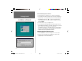
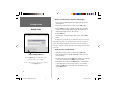
Install Welcome Screen
‘Run’ Dialog Box
2
MS Manual - Getting Started.indd
2
10/16/01, 9:51 AM
Connecting the GPS to a Computer
To connect your GPS to your computer:
1. Using the PC Interface Cable, connect your GPS to a serial communications port on your computer.
2. To be sure you have a good connection, you can have MapSource
automatically detect the GPS on the COM port. Check that your GPS is
powered on and the Serial Data Format is set to GARMIN.
Getting Started
PC to GPS Connection/
Unlock Codes
3. Select Preferences in the Edit Menu and click the ‘Transfer’ tab.
4. Click the Auto Detect button. The ‘Auto Detect’ window appears,
showing which COM port your GPS is connected to and the software
version of your GPS. Click OK to set the COM port and exit.
Serial Communications Port
Unlock Codes
Some MapSource products require a code to “unlock” a region of map
data before it may be viewed on your PC and downloaded to a GPS unit.
Those products come with a MapSource unlock certificate with a “coupon
code” that is necessary for obtaining the Unlock Code. You must also
know the Unit ID for the GPS unit that will be using the unlocked data,
and the Map Region you want to unlock. To obtain an Unlock Code,
follow the instructions on the unlock certificate included with your CD(s).
F
Keep your Unlock Certificate and Unlock Code in a safe place.
You may need this information in the future if you need
to re-install MapSource. GARMIN cannot give refunds or
exchanges for MapSource Unlock Codes.
‘Auto Detect’ Window
3
MS Manual - Getting Started.indd
3
10/16/01, 9:51 AM
To Enter an Unlock Code and Unlock a Map Region:
1. Once you have installed MapSource and obtained an Unlock Code,
open MapSource.
Getting Started
2. Select Unlock Codes from the Tools Menu or press Ctrl and U.
3. Click the Add button. Type or paste the 25-digit code in the space.
Enter a note in the Comment field if desired. This may be useful for
distinguishing multiple Unlock Codes in the list.
Unlock Codes
4. Click the OK button.
5. To add another code, repeat steps 3 and 4. To exit, click the Close
button.
The MapSource region will now be “unlocked” and you can view the
map detail on your PC screen and download map sets to your GPS or
a data card in a USB programmer. The Unlock Code, a description of
the region, comments, and the expiration will be displayed in the Unlock
Codes List.
To Edit or Delete an Unlock Code:
1. Select Unlock Codes from the Tools Menu or press Crtl and U.
2. Select the desired Unlock Code by highlighting it with a click of the
left mouse button.
Import and Export Buttons
Click the Import button to add Unlock Code(s)
from a saved file on your computer.
To save Unlock Code(s) to a file on your computer,
click the Export button.
3. To edit the Unlock Code, click the Edit button and enter or modify the
notes in the Comment field. Click OK when you’re finished.
4. To delete the Unlock Code, click the Delete button. Click Yes when
you are asked “Are you sure you want to delete...” If you made a
mistake, click No and the Unlock Code will not be deleted. To exit,
click the Close button.
4
MS Manual - Getting Started.indd
4
10/16/01, 9:51 AM
Finding Your Way Around MapSource
MapSource Toolbars
MapSource has four toolbars: ‘File’, ‘Edit’, ‘View’ and ‘Tools’, that allow
you to quickly access many of the functions available in the menus.
Getting Started
MapSource Toolbars
File
Edit
View
Tools
Undocking the Toolbars
The File, Edit, View and Tools toolbars can be undocked and moved
around the application for you convenience. To undock a toolbar, place
the mouse pointer over an open area on the toolbar, click and hold
the left mouse button and move the toolbar to a different location. To
return a toolbar to its starting location, move it back to the top of the
application.
Undocking the Toolbars
5
MS Manual - Getting Started.indd
5
10/16/01, 9:51 AM
File Toolbar
The File Toolbar contains items found in the File Menu. You
can create a New Document, Open a Document, Save the Current Document and Print the Graphic Map. You may also transfer data between
MapSource and a GPS or a data card inserted in a USB programmer by
selecting Open From Device or Save To Device. See page 19 for more
detailed information on the File Menu.
Getting Started
File and Edit
Toolbars
New Document
Open a Document
Save Current Document
Open from Device
Print Graphic Map
Save to Device
Edit Toolbar
The Edit Toolbar contains items found in the Edit Menu. You can
select the Cut, Copy and Paste functions, Delete selected items, and Undo
the last user action. After an “undo” is performed, the Redo button is
activated, allowing you to revert to the last user action, or “redo” the
“undo.” See page 20 for more detailed information on the Edit Menu.
Paste
Cut
Copy
Undo
Delete
Redo
6
MS Manual - Getting Started.indd
6
10/16/01, 9:51 AM
View Toolbar
The View Toolbar contains items found in the View Menu. You can
Select a Region to view, Zoom In/Out, Select a specific Zoom Scale or
activate the Find feature. The Find features lets you search for a city
and view it on the Graphic Map. Some MapSource products include the
Advanced Find feature, allowing you to search for a city, point of interest
or an address and view it on the Graphic Map. See page 26 for more
detailed information on the View Menu.
Select Region
Zoom Out
Zoom In
Getting Started
View and Tools
Toolbars
Zoom Scale
Find
Tools Toolbar
The Tools Toolbar contains items found in the Tools Menu. You can
directly select the Zoom, Hand, Selection, Waypoint, Route, Map, and
Distance/Bearing Tools. See page 31 for more detailed information on
the Tools Menu.
Zoom Tool
Selection Tool
Hand Tool
Route Tool
Waypoint Tool
Distance/Bearing Tool
Map Tool
With the Zoom Scale, you can zoom In
as close as 80 ft, and Out up to 1500 miles.
The Zoom In and Zoom Out buttons offer the same
zoom increments.
7
MS Manual - Getting Started.indd
7
10/16/01, 9:51 AM
Data Tabs
The Data Tabs (Maps, Waypoints, Routes, Tracks and GPS) are located
on the left side of the display. The GPS Tab provides real time tracking
when you run MapSource on a laptop with a GARMIN GPS connected
to the laptop (for more information on real time tracking and the GPS
Tab, see page 53).
Getting Started
Data Tabs
When the Maps, Waypoints, Routes or Tracks tab is selected, the data
for that item is displayed in list form. When data is created or transferred
from the GPS, the Tab List for the data item is automatically updated.
Each of these tabs displays a list of its contents.
The Tab Lists allow you to easily select items for viewing or editing.
Data displayed in the Tab Lists can be sorted by column. You may need
to move the Splitter Bar to see all the column headers. The Splitter Bar
can be moved by clicking and holding the left mouse button on the bar
and dragging it to a new location.
To sort the data by a specific column, click on the column header.
An arrow will appear, showing the direction of the sort, ascending or
descending. You may also change the order the columns are arranged
from left to right by clicking on a column header, then “dragging and
dropping” the column into the desired location.
Tabs
Splitter Bar
Tab Lists
The Tab selects the type of data displayed. To see all
of the data it might be necessary to change the position
of the Splitter Bar. The Splitter Bar can be moved by
clicking and holding the left mouse button on the bar,
and dragging it to a new location.
The Tab Lists show what items will be transferred to a GPS or a data
card in a USB programmer. MapSource will transfer all of the data in a
chosen Tab, not just the item highlighted in the list.
8
MS Manual - Getting Started.indd
8
10/16/01, 9:51 AM
Graphic Map
The Graphic Map shows the region of the world that is currently
selected in the Region Selection Box. You can zoom in and out and move
to different parts of the selected region. At large zoom scales (Zoom Out),
less detail is displayed. At smaller zoom scales (Zoom In), you can see
the actual detailed map features that can be transferred to your GPS (if
your GPS supports this feature). When this occurs, “GPS Map Detail”
will be displayed below the zoom scale in the lower right-hand corner
of the Graphic Map.
To pan the Graphic Map, use the scroll bars or the arrow keys. In
addition, the Page Up and Page Down keys move the map window up or
down by the length of the window. Holding the Ctrl key and pressing
an arrow key moves by the width of the window in that direction (up,
down, left, or right).
Getting Started
Graphic Map/
Status Bar
Status Bar
The Status Bar extends across the bottom of the MapSource window.
The Status Bar displays information relating to the current action. The
Status Bar can show:
• Latitude and Longitude of the mouse pointer when the mouse is
positioned on the Graphic Map regardless of which tool is selected.
Graphic Map
• The number of tab items that are selected in the Tab List.
• The current Position Format and Map Datum set in Preferences.
• If the Map Tool is selected, the name and approximate data size
of the geographical map boundary currently highlighted on the
Graphic Map will be displayed in the right panel of the Status Bar.
• If the Distance/Bearing Tool is selected, the distance and bearing
from a beginning point will be displayed in the right panel of the
Status Bar.
MS Manual - Getting Started.indd
9
Status Bar
9
10/16/01, 9:51 AM
A Tour through MapSource
This tour is intended to take you through the basic operations of
MapSource. You can find more detailed descriptions of the tools and
operations in the Reference section of this manual. A copy of this Quick
Tour can be found in the MapSource Help Menu.
MapSource Tour
MapSource Tour
This tour presumes that you have installed MapSource, unlocked the
map data (if required), have not changed the default settings of the
application and that your GPS is connected to a serial port on your
computer. Open the MapSource application by double clicking the
MapSource icon located on your desktop. To view a map region from the
MapSource data you have loaded, choose ‘Region’ in the View Menu and
pick a region. To view more map detail, set the ‘Zoom Scale’ (also located
in the View Menu) between 2 miles and 500 feet. Some Points of Interest
may only appear at the 500 ft scale or smaller.
MapSource Icon
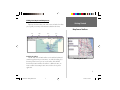
Selecting a Map Region
Select a Map Region to view on the Graphic Map from
the data that you have loaded. If you only have one
MapSource product loaded, it will be the only selection
in the list.
MapSource comes with a sample document file that we will use for
this tour, so lets open it and get started! From the File Menu select
‘Open’. In the MapSource folder, locate the file ‘MapSource Tour’ and
double click it (The MapSource folder is the installation folder you chose
during installation. You will need to change the folder you are working
from to this folder.). Notice that the Routes Tab and Waypoints Tab now
contain some data. At the top of each tab you will see the tab name
and in parentheses the number of items contained in the tab list. The
Waypoints Tab should contain 13 waypoints. Display the Waypoints Tab
List by clicking on the Waypoints Tab.
10
MS Manual - Quick Tour.indd
10
10/16/01, 9:55 AM
Waypoints
Let’s start by looking at waypoint 001. Select waypoint 001 by clicking
on it one time with the left mouse button. From the View Menu, choose
Zoom To Selected Waypoint, to center the waypoint on the Graphic Map at
the current zoom scale.
MapSource Tour
Waypoints
Viewing Waypoint Data
There are two places to view waypoint data:
Waypoints Tab List—The ‘Waypoints’ Tab List displays waypoint
data but doesn’t allow you to edit the information. It may be necessary to slide the Splitter Bar in the middle of the display to the right
to see all of the data.
Waypoint Properties—To display the Waypoint Properties, double
click on the waypoint in the ‘Waypoints’ Tab List. The ‘Waypoint
Properties’ dialog allows you to review and edit waypoint data.
Editing Waypoint Properties
With the properties for waypoint 001 displayed, highlight the waypoint name field and type “Boat Ramp” as a new name. Scroll through
the symbol list and select the Boat Ramp symbol. To save the changes
and view the waypoint on the Graphic Map, click the Show on Map
button.
Waypoints Tab List
Things You Should Know About Waypoint Properties:
• GARMIN GPS products limit the number of characters in a waypoint name. If you transfer a waypoint with a name that exceeds
the character limit, the GPS will truncate the name. If more than
one waypoint name is the same after truncation, only one of the
waypoints will be loaded in the GPS.
(continued)
MS Manual - Quick Tour.indd
11
Waypoint Properties Dialog Box
11
10/16/01, 9:55 AM
• GARMIN GPS products limit the number of characters in the
waypoint description. If the MapSource description exceeds this
limit, the waypoint description will be truncated.
MapSource Tour
• If you select a symbol that does not exist in your GPS, the waypoint
will be represented by a square when transferred into your GPS.
Waypoints
See your GPS Owner’s Manual for your product’s limitations.
Creating Waypoints
Creating a new waypoint is as easy as locating a spot on the Graphic
Map with your mouse and clicking.
Creating a Waypoint Using the Waypoint Tool:
1. Select Waypoint located in the Tools Menu.
2. Place the mouse pointer over a position on the Graphic Map and click
the left mouse button.
The ‘Waypoint Properties’ dialog appears for the new waypoint. MapSource automatically assigns a name and symbol for new waypoint. Make
any desired changes in the ‘Waypoint Properties’ and click OK. Notice
that MapSource added the new waypoint to the Waypoints Tab List.
Moving a Waypoint Using the Selection Tool:
Moving a Waypoint
1. Choose Selection located in the Tools Menu.
2. On the Graphic Map, click on the waypoint to select it, then click it
again. Do not double click on the waypoint, as this will display the
‘Waypoint Properties.’
3. Position the mouse pointer at the new location, then click again to
anchor the waypoint.
12
MS Manual - Quick Tour.indd
12
10/16/01, 9:55 AM
Routes
A route is a collection of waypoints used for navigation. When
creating a route on the Graphic Map, you can use existing waypoints or
create new waypoints while creating the route.
Creating a Route Using the Route Tool:
MapSource Tour
Routes
1. Select Route located in the Tools Menu.
2. Highlight waypoint 009 in the Waypoints Tab List, then choose Zoom To
Selected Waypoint located in the View Menu.
3. Adjust the Zoom Scale so you can see waypoints 009 through 012.
4. Place the mouse pointer on waypoint 009. When the waypoint is
selected (there will be a white circle surrounding the waypoint), click
on the waypoint. Move the mouse pointer; there will be a line extending from 009 to the mouse pointer location. Click on waypoints 010,
011 and 012 in that order.
5. Move the mouse pointer to any location on the Graphic Map and click
again. A new route waypoint is created and added to the route at
the location you selected.
6. When you have finished adding waypoints to the route, press the
Escape key on your keyboard to end the route.
Select the Routes Tab. You can see that a new route has been added.
MapSource automatically names the new route using names of the first
and last waypoints in the route.
Using the Route Tool
Create a new route by clicking on waypoints in the
order that you wish to navigate them. You can create
new waypoints while creating the route by clicking on
a map location.
13
MS Manual - Quick Tour.indd
13
10/16/01, 9:55 AM
Extending a Route:
1. Choose Selection located in the Tools Menu. Select the route that you
just created by clicking on it with the left mouse button (the route will
turn yellow when selected).
MapSource Tour
2. With the Selection Tool, click the first or last waypoint in the route.
Routes/
Map Sets
3. Click on an existing waypoint or a position on the Graphic Map to
add to the route.
4. When finished extending the route, press the Escape key on your
keyboard.
Deleting a Route:
1. Choose Selection located in the Tools Menu, then select the route that
you just finished creating on the Graphic Map.
2. Press the Delete key on the keyboard.
The route will be removed from the Tab List and the Graphic Map.
Notice that the route waypoints remain; only the route has been erased.
Map Sets
A Map Set is one or more detailed maps selected from the Graphic
Map to be transferred to your GPS unit. Not all GARMIN GPS units
can use detailed maps. Please consult your Owner’s Manual to determine
if your unit has this capability and its limitations. To begin, select the
Maps Tab.
Extending a Route
14
MS Manual - Quick Tour.indd
14
10/16/01, 9:55 AM
Creating a Map Set:
1. Select Map located in the Tools Menu.
2. Place the Map Tool inside a boundary area. The area will become
MapSource Tour
outlined in yellow.
3. Click inside the map boundary to add it to the Map Set. The selected
area will now be shaded in pink.
Map Sets
The MapSource data that you have loaded determines the geographical map boundaries. Each product has different boundary areas. When
the Map Tool is placed inside a map boundary area, that area will become
outlined in yellow. If you are having difficulty locating a map boundary
area, change your zoom scale and try again. Most map boundaries can be
seen at the 30 mile (50 km) zoom scale.
When you add a map to the Map Set, the Name, Area and the Size
of the map are shown in the Maps Tab List. At the bottom of the Maps
Tab List, you will see the number of maps that have been selected and
the required memory for the Map Set. If the Map Set contains a large
number of maps or a large memory capacity, you may get a warning from
MapSource. To remove the warning, reduce the number of maps.
Deleting Maps:
1. Click the map name in the Maps Tab List then press the Delete key. Or,
with the Map Tool Selected, click the mouse inside the boundary of the
map area you want to delete.
To remove several maps at the same time, hold the Ctrl key and drag
a box around the selected map boundaries. You can also select several
maps in the Maps Tab List and press the Delete key. When a map is
deleted, it will no longer be shaded pink on the Graphic Map and will be
removed from the Maps Tab List.
Creating a Map Set
Choose the Map Tool. Place the mouse pointer in the
geographical area that you want to select. The area
will become outlined in yellow. To select the area and
add it to the Map Set, click the left mouse button. When
the area is selected it will be shaded in pink and listed
in the Maps Tab List.
15
MS Manual - Quick Tour.indd
15
10/16/01, 9:55 AM
Tracks
A track cannot be created in MapSource unless you have a GPS
connected to your computer and use the Real Time Tracking feature in
the GPS Tab. If a track log has been transferred to MapSource from a
unit or created with Real Time Tracking, then the Tracks Tab List will
display those tracks. For more detailed information on tracks, Real Time
Tracking and the GPS Tab, see pages 52-55.
Quick Tour
MapSource
Tour
Tracks/
Transferring Data
Viewing a Track:
F
The USB Data Card Programmer will
only operate with Windows 98,
Windows 2000 or Windows ME.
1. Select the track in the Tracks Tab List.
2. Select Zoom To Selected Track located in the View Menu. The Graphic
Map will center on the track.
Transferring Data
F
NOTE: Preprogrammed BlueChart data
cards should not be used in the USB
Programmer or in a GPS unit for saving
MapSource maps. The BlueChart data
will be lost. If you have a BlueChart
data card in your GPS unit, remove
it before transferring map sets to the
unit to avoid losing the preprogrammed
data. If you choose to overwrite the
preprogrammed data on a BlueChart
data card, GARMIN will not replace or
recover the lost data.
You can save MapSource data to two different devices, a GARMIN GPS
unit or a data card in a GARMIN USB (Universal Serial Bus) Data Card
Programmer. MapSource will allow direct data transfer either to the unit
or to a GARMIN data card inserted in a programmer. The GPS unit
will accept all data types: Maps, Waypoints, Routes and Tracks. The
programmer allows transfer of map data only. Waypoints, Routes and
Tracks must be transferred directly to or from the GPS unit.
When transferring map data to a GPS or data card, all previously
stored map data in the GPS or on the card will be erased
and replaced with the new information. You may want to save
previously stored information into MapSource before transferring the
new MapSource information to your GPS or data card.
16
MS Manual - Quick Tour.indd
16
10/16/01, 9:56 AM
Saving MapSource Data to a GPS:
1. Select Save To Device from the File Menu and select the Serial Port Tab.
2. In the ‘What To Save’ dialog, select the data type for transfer by
placing a check mark in the box(es) next to the type of data you want
to save, or click the Select All button.
3. In the ‘Communication Options’ dialog, you may choose to ‘Turn Off
GPS After Transfer’ by placing a check mark in the box. You may
also modify the communication settings by selecting a different Port or
Baud Rate, or have MapSource automatically detect the Port and Baud
Rate of your connection by clicking the Auto Detect button.
MapSource Tour
Transferring Data
4. Click the Save button to begin data transfer. As the transfer takes
place, a progress indicator will be displayed and the GPS will display a
message indicating that the data is being transferred.
Saving Map Sets to a Data Card in a USB Programmer:
1. Select Save to Device from the File Menu and select the USB Port Tab.
2. The USB Port dialog will appear with “Card Programmer” highlighted.
3. Click the Save button to begin transferring map sets.
Because you can only save map sets to a data card, there will not
be a “What To Save” dialog on the USB Port Tab. A Progress Indicator
will appear on the computer screen and when finished, MapSource will
display a message indicating “Transfer complete.” Do not remove the data
card during the transfer.
Save To Device—Serial Port Tab
17
MS Manual - Quick Tour.indd
17
10/16/01, 9:56 AM
Transferring Data to MapSource From a GPS:
1. Select Open From Device from the File Menu and select the Serial
Port Tab.
MapSource Tour
2. In the ‘What To Open’ dialog, select the data type for transfer by
placing a check mark in the box(es) next to the type of data you want
to save, or click the Select All button.
Transferring Data
3. In the ‘Communication Options’ dialog, you may choose to ‘Turn Off
GPS After Transfer’ by placing a check mark in the box. You may
also modify the communication settings by selecting a different Port or
Baud Rate, or have MapSource automatically detect the Port and Baud
Rate of your connection by clicking the Auto Detect button.
4. Click on the Open button to begin transfer.
cannot open maps from a GPS unit that cannot accept
I You
downloadable maps. Please see your GPS owner’s manual to
learn more about your GPS unit’s capabilities.
Transferring Map Sets to MapSource From a Data Card in a
USB Programmer:
1. Select Open From Device from the File Menu and select the USB Port
Tab.
2. With “Card Programmer” highlighted, click the Open button to transfer data.
Open From Device—Serial Port Tab
A progress indicator will appear on the computer screen and when finished, MapSource will display a message indicating “Transfer Complete.”
Do not remove the data card during the transfer.
18
MS Manual - Quick Tour.indd
18
10/16/01, 9:56 AM
File Menu
New—Opens a new, empty MapSource document.
Open—Opens a previously saved MapSource document.
Save/Save As—Saves the current MapSource document.
Print—Prints the current Graphic Map display.
Reference
File Menu
Print Preview—Shows a preview of what will be printed. To print
the preview, click the Print button at the top of the page.
Print Setup—Activates the setup page for printing the MapSource
Graphic Map display.
Open From Device—Allows you to transfer selected data (Maps,
Waypoints, Routes and Tracks) from a GPS or maps only from a
Data Card inserted in a Programmer connected to the computer. See
“Transferring Data” on page 16 for more information.
Save To Device—Allows you to transfer selected MapSource data to
a GPS or maps only to a Data Card inserted in a Programmer. See
“Transferring Data” on page 16 for more information.
F
GARMIN GPS units are limited in the number of waypoints,
routes, tracks and map sets that can be stored in the unit.
Please refer to your GARMIN GPS owner’s manual to learn
about the limitations of your specific model.
File Menu
19
MS Manual - Reference.indd
19
10/16/01, 9:57 AM
Send Mail—This function allows you to send an e-mail with the
current MapSource document as an attachment.
Reference
Import—This feature allows the user to open data stored using
GARMIN’s PCX5 Version 2.09 software. MapSource can display waypoints (.wpt), routes (.rte), tracks (.trk) or one of the maps (.grm)
provided with PCX5. When using a PCX5 map (.grm), turn off any
MapSource map data by choosing ‘No Map’ in the ‘Region’ menu
selection to avoid screen clutter.
File Menu/
Edit Menu
Export—This feature allows the user to export MapSource data in
a tab delimited text format (.txt) for use in a word processor or
spreadsheet, or in a .dxf format.
Recent Files—This area shows the four most recently used
MapSource documents. To quickly reopen one of these files, click on
the document name.
Exit—Closes the MapSource application.
Edit Menu
Undo—Reverts to most recent previous action taken by the user.
Redo—After an ‘Undo’ is performed, the Redo button is activated,
allowing you to revert to the last user action, or “redo” the “undo.”
Edit Menu
20
MS Manual - Reference.indd
20
10/16/01, 9:57 AM
Cut, Copy, Paste—These functions work like many other Windows
programs. You may cut or copy any MapSource list information to the
Windows clipboard for the following purposes:
• To paste data from one active MapSource document to another
active MapSource document.
• To paste MapSource information into a word processor, simple text
editor, or a spreadsheet program in tab-delimited text format.
Reference
Edit Menu
New Waypoint—Automatically creates a new waypoint in the center
of the Graphic Map, assigns a waypoint name, and displays the
‘Waypoint Properties’ dialog box. You can change the waypoint name,
add a description, change the position, assign an altitude, enter a
proximity distance, enter a depth, choose a symbol, select display
colors (if you have a color unit), and set the display options for the
waypoint. When you are finished, click the OK button to add it to
the Waypoints Tab List and Graphic Map. To center the waypoint on
the Graphic Map, click Show on Map. This adds the waypoint to
the waypoint list, and centers the Graphic Map on the waypoint at
the zoom scale you have selected. For more detailed information, see
“Creating Waypoints” on page 40.
‘Waypoint Properties’ Dialog Box
for a New Waypoint
21
MS Manual - Reference.indd
21
10/16/01, 9:57 AM
New Route—Displays the ‘Route Properties’ dialog box. To create a
new route, click the Insert button and select a waypoint from the
list (you must have already created and saved waypoints to choose
from). With some MapSource products, you may also search for a city
or point of interest to add to the route by clicking the Find button.
Continue inserting waypoints in the order that navigation will take
place. When the last waypoint has been inserted, click OK to save
and add the new route to the Routes Tab List. If you wish to save and
view the new route on the Graphic Map, click Show on Map. When
you create a route, MapSource will automatically assign a name based
on the names of first and last route waypoints. To change the route
name uncheck the ‘Autoname’ box. This will activate the name field
and you can type in a new route name. For more detailed information, see “Creating Routes” on page 45.
Reference
Edit Menu
Duplicate Route—Duplicates the selected route in the route list.
Delete—Deletes Waypoint(s), Route(s), Track(s) or Map Set data
selected in the tab list or on the Graphic Map.
Remove Waypoint(s) from Route—Removes a selected waypoint
from the selected route. For more information, see “Editing Routes”
on page 48.
‘Route Properties’ Dialog Box
for a New Route
Properties—Activates the ‘Route,’ ‘Waypoint’ or ‘Track Properties’
dialog box, depending on the data item that is selected.
Select All—Selects all active Tab data in the Tab List and on the
Graphic Map.
22
MS Manual - Reference.indd
22
10/16/01, 9:57 AM
Preferences—Activates the setup functions for MapSource. Preferences are organized into an easy-to-use tabbed format, with 8 setup
tabs to choose from: Detail, Units, Position, Map Datum, Transfer,
File Location, Waypoint and AutoRouting. When you change any of
the ‘Preferences’ settings, click the Apply button to make the change,
then click OK to save and exit.
Detail Tab: This tab includes a slider control that allows you to
adjust the amount of detail displayed on the Graphic Map (this setting
does not affect the amount of detail transferred to the GPS) and
options for displaying ‘Services’, ‘Spot Soundings’ and ‘Light Sectors’
on the Graphic Map.
Units Tab:
Distance/Speed: Select from Metric, Nautical or Statute. All
distance or speed measurements will reflect this setting.
Heading: The Heading option allows you to choose True, Automatic Magnetic Variation, User Magnetic Variation or Grid. ‘True’
will show true North headings. ‘Automatic’ will automatically
calculate the magnetic variation for the geographical area. ‘Grid’
provides a true North heading as determined by the Position
Format. When ‘User’ is selected, the field to the right is activated
for manual entry of a magnetic variation.
Altitude/Elevation: Select Feet or Meters for measuring these
data items.
Depth: Select Feet, Meters or Fathoms for depth measurement.
Reference
Edit Menu: Preferences
Preferences—‘Detail’ Tab
Preferences—‘Units’ Tab
23
MS Manual - Reference.indd
23
10/16/01, 9:57 AM
Position Tab: This tab allows the user to select from the different
position or grid formats available or manually enter information for
a user defined grid.
System Defined Grid Formats: Select a grid format from the
drop-down list.
User Defined Grid Format: Manually enter values for Longitude
Origin, Scale Factor, False Easting and False Northing to create a
custom grid format.
Map Datum Tab: This tab allows the user to select from over 100
different map datums, allowing MapSource to easily match up with
just about any paper chart or map, or manually enter information for
a user defined map datum.
System Defined Datum: Select a map datum from the dropdown list.
User Defined Datum: Manually enter values for Delta X, Delta
Y, Delta Z, Delta Semimajor Axis and Delta Flatness to create a
custom map datum.
Transfer Tab: This allows you to check and modify the communications settings for transferring data between your computer and your
GPS unit. You may select Auto Detect to have the computer automatically detect the correct COM Port and Baud Rate for transfer. Or
you may manually choose a Port and Baud Rate that works best with
your computer.
Reference
Edit Menu: Preferences
Preferences—‘Position’ Tab
Preferences—‘Map Datum’ Tab
24
MS Manual - Reference.indd
24
10/16/01, 9:57 AM
Port: Use the drop-down list to select the COM port used for
communication with your GARMIN GPS via the PC Interface
cable. COM 1 through COM 8 are provided as selections. Some
computers use different names for the serial communication ports,
so you may be required to manually enter the name of the serial
port.
Baud Rate: Use the drop-down list to select the baud rate
used to transfer data to and from your GPS. “Automatic” is the
recommended selection. In this case, the computer and the GPS
negotiate the highest possible baud rate. If you consistently
observe operation at 9600 baud, you may wish to manually select
a baud rate that works best for your computer.
Auto Detect: MapSource has the ability to search for and automatically select the Port where the GARMIN GPS is connected.
To have MapSource automatically select the communication port,
make sure the GPS is connected and turned on. Click the Auto
Detect button. MapSource will display the progress of the search
and will inform you when a connection has been made. Click OK
to accept the Port selection.
Reduce Map Size: This options removes the route calculation
data from maps before transferring them to your GPS. This
is recommended for use with units that don’t accept automatic
routes. Place a check mark in the box to select this option.
File Location Tab: This allows you to set up a default location on
your computer for saving and opening your MapSource files, importing PCX5 data, and exporting .txt and .dxf data. You may manually
enter the location or click the Browse button to select the folder for
your default file location.
Reference
Edit Menu: Preferences
Preferences—‘Transfer’ Tab
Preferences—‘File Location’ Tab
25
MS Manual - Reference.indd
25
10/16/01, 9:57 AM
Waypoint Tab: This tab sets up the preferences for creating waypoints in MapSource.
Characters: Use the drop-down menu or manually enter a
number to limit the number of characters in waypoint names.
Creating a Waypoint on a Map Feature: Select between ‘Let
MapSource decides its name, symbol and display’ and ‘Use the
choices above.’ When you select ‘Use the choices above,’ you may
manually enter a name prefix and/or use the drop-down menus to
select a symbol and how the waypoint will be displayed on the
Graphic Map.
Autorouting Tab: This tab allows you to set up preferences for automatic routing calculations when using a routable MapSource product.
You may select, deselect or set up the following for MapSource to
automatically calculate a route: Calculation Style (Faster Time/Shorter
Distance/Direct Route), Type of Vehicle, Avoid Highways, Avoid Toll
Roads, Avoid U-Turns, and Average Driving Speeds on various types
of roads. These features only apply to routable MapSource products.
For more information, see “Creating Routes” on page 45.
Reference
Edit Menu/View Menu
Preferences—‘Waypoint’ Tab
View Menu
Zoom To Selected Items—When Waypoints, Routes, Maps or Tracks
are selected in the Tab List, selecting this feature will display the
selected item in the center of the Graphic Map. The menu heading
will change to reflect the item(s) that have been selected in the Tab
List. For example, if a waypoint is selected in the Waypoints Tab List,
the menu will read Zoom To Selected Waypoint.
Go To Position—Allows you to enter a latitude/longitude position to
view on the Graphic Map.
Preferences—‘Autorouting’ Tab
26
MS Manual - Reference.indd
26
10/16/01, 9:57 AM
Zoom In—Decreases the zoom scale, showing a smaller area and
more detail.
Zoom Out—Increases the zoom scale, showing a larger area and less
detail.
Zoom In Max—Decreases the zoom scale to the smallest setting,
showing the most detail.
Reference
View Menu
Zoom Out Region—Increases the zoom scale to center on the region
that is currently selected.
GPS Map Detail—When this menu item is checked, MapSource
will show you the actual map info that will be loaded into the GPS.
Unchecking this option will enable faster map drawing, and may
reduce the need for a CD-ROM to be in your computer’s CD-ROM
drive.
Show Crosshair—When this menu item is selected, MapSource will
re-draw the map display to show a center point on the Graphic Map.
A check mark next to this feature in the View Menu indicates that
it is selected.
Region—Allows you to select a MapSource product and coverage
region for display on the Graphic Map. You can select a coverage
region from any MapSource product that has been installed on your
computer. If you select a region that has been installed, but the
corresponding CD-ROM is not in your computer’s CD-ROM drive,
you may see a message prompting you to insert the proper CD.
View Menu
Zoom Scale—Allows you to quickly select a zoom scale from a list.
27
MS Manual - Reference.indd
27
10/16/01, 9:57 AM
Toolbars—This allows you to individually select/deselect the File,
Edit, View and Tools Toolbars to be shown or hidden on the PC screen.
A check mark next to the toolbar name indicates those currently
selected. You may also select to ‘Hide All’ or ‘Show All’ toolbars.
Reference
Status Bar—This allows you to show or hide the Status Bar at the
bottom of the MapSource window. When this menu item is checked,
the Status Bar will be displayed.
View Menu
Find—This feature enables you to search for a city, point of interest,
or address and view it on the Graphic Map. With some MapSource
products, an Advanced ‘Find’ dialog appears with additional menus to
help narrow your search. With MapSource products that are installed
by region, you will only be able to find objects in maps that have
been installed.
To Find a City by Name and View it on the Graphic Map:
1. Select Find from the View Menu. The ‘Find City’ dialog will appear.
2. Enter the name of the desired city and highlight the city in the list.
3. To display the highlighted city on the Graphic Map, click the Center
On City button, press Enter on your keyboard, or double-click the
highlighted city name. It may be necessary to Zoom IN to view the city
name on the Graphic Map.
‘Find City’ Dialog
F
NOTE: Only cities in the selected region are listed. For
example, if the selected region is Hawaii, cities in the
continental U.S. will not be listed.
28
MS Manual - Reference.indd
28
10/16/01, 9:57 AM
To Find a City with the Advanced ‘Find’ Feature and View it
on the Graphic Map:
1. Select Find from the View Menu. The advanced ‘Find’ dialog will
appear.
2. Enter a city name in the ‘City’ field (you may also enter information in
the other fields to narrow your search). If you are unsure of the city
name, click the Select button to the right of the ‘City’ field to show a
list of city “matches.” Highlight the desired city and click the Select
City button.
Reference
View Menu: Find Feature
3. With the desired city name entered in the ‘City’ field, click the Search
button to show a list of city/state matches to choose from. The
first match will be displayed in the center of the Graphic Map and
highlighted in the search results list.
4. Highlight the desired city and click the OK button to keep the selected
city centered on the Graphic Map. To return to your previous map
display, click the Cancel button.
F
NOTE: If you are using a MapSource product with “unlocked”
data, the Advanced ‘Find’ feature will only locate points of
interest within the unlocked region, but it will locate cities
both within and outside the region.
Advanced ‘Find’ Dialog—City Search
29
MS Manual - Reference.indd
29
10/16/01, 9:57 AM
To Find a Point of Interest with the Advanced ‘Find’ Feature:
1. Select Find from the View Menu. The advanced ‘Find’ dialog will
appear.
Reference
View Menu: Find Feature
2. Enter the name of a Point of Interest in the ‘Name’ field. If desired,
click the Select button next to the ‘Name’ field to select from a list of
“matches” for that name to help narrow your search.
3. Enter the city, state or both to enable the Search button.
4. Click the Search button. The first match will be displayed in the center
of the Graphic Map and highlighted in the search results list.
5. Highlight the desired Point of Interest.
6. To view the address and telephone number of the Point of Interest,
click the Properties button (this may be helpful in distinguishing
multiple Points of Interest with the same name). Click the OK button
to exit the ‘Properties’ window.
7. To keep the selected point displayed in the center of the screen, click
the OK button. To return to your previous map display, click the
Cancel button.
To Find an Address with the Advanced ‘Find’ Feature:
Advanced ‘Find’ Dialog—Point of Interest
Search
Advanced ‘Find’ search results for a
Point of Interest, with the Properties for the selected
Point of Interest displayed.
1. Select Find from the View Menu. The advanced ‘Find’ dialog will
appear.
2. Click the Select button to the right of the ‘Address’ field. The ‘Select
Address’ window will appear.
3. Enter the number of the address in the ‘Number’ field.
4. Enter the street name in the ‘Street’ field. A list of street name
“matches” will appear to narrow your search. Highlight the desired
street name from the list.
(continued)
30
MS Manual - Reference.indd
30
10/16/01, 9:57 AM
5. Click the Select Address button. The full address will appear in the
‘Address’ field in the Advanced ‘Find’ dialog.
6. Enter the city, state, or both to enable the Search Button.
7. Click the Search button. The desired address will be centered on
the Graphic Map and highlighted in the search results list. With
the desired address highlighted, click the Show on Map button to
keep the selected feature displayed on the screen. To return to your
previous map display, click the Cancel button.
Reference
Tools Menu
Tools Menu
Zoom Tool—This tool enables you to quickly zoom to a specific area
on the Graphic Map.
To Zoom IN on the Graphic Map:
1. With the Zoom Tool selected, click the left mouse button to zoom IN by
one step and re-center the Graphic Map on that point.
2. To zoom IN on a defined area, click and hold the left mouse key and
draw a box around the area.
To Zoom OUT on the Graphic Map:
Tools Menu
1. With the Zoom Tool Selected, click the right mouse button will
decrease the zoom scale by one step.
F
NOTE: Holding the Ctrl key while clicking the left mouse key
will center the Graphic Map without changing the zoom level.
Pressing the “+” and “-” keys on your keyboard also let you
zoom IN and OUT.
You may also change the Zoom Scale by clicking the
Zoom IN or Zoom OUT icons, or by using the dropdown Zoom Scale list, all located in the View Toolbar.
31
MS Manual - Reference.indd
31
10/16/01, 9:58 AM
Hand Tool—The Hand Tool allows you to quickly pan around the
Graphic Map.
Reference
To Pan Around the Graphic Map:
Tools Menu
Zoom
Selection
Route
Distance/
Bearing
1. Place the Hand Tool on the Graphic Map, click and hold the left mouse
button and drag the hand around the Graphic Map to view different
areas. Release the mouse button to view the area. You may also use
the Arrow Keys (Up, Down, Left, Right) on your keyboard as a shortcut
to pan the Graphic Map in the desired direction.
Selection Tool—The Selection Tool allows you to select map features,
waypoints, routes and tracks directly on the Graphic Map.
To Select an Item on the Graphic Map:
Hand
Waypoint
Map
‘Tools’ Toolbar
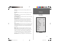
The tools available in the ‘Tools’ menu can be accessed
through Toolbar shortcuts or keyboard shortcuts. To
activate a tool, click the shortcut on the toolbar or enter
the shortcut on the keyboard.
Tools Keyboard Shortcuts
Zoom — z
Hand — h
Selection — s
Waypoint — w
Route — r
Map — m
Distance/Bearing — d
Unlock Codes — Ctrl + U
1. Place the Selection Tool on the desired item. The item will become
highlighted in white and the name of the item will be displayed in
a white box.
2. To select a waypoint or route for editing, click the left mouse button
on the item. The route or waypoint will now be highlighted in yellow
and can be edited. For more information on editing waypoints and
routes, see “Editing Waypoints” on page 42 and “Editing Routes” on
page 48.
Waypoint Tool—The Waypoint Tool allows you to quickly create
waypoints on the Graphic Map. For detailed information on creating
waypoints using the Waypoint Tool, see “Creating Waypoints” on
page 40.
Route Tool—The Route Tool allows you to quickly create, or use
existing waypoints on the Graphic Map to determine a route. For
detailed information on creating routes using the Route Tool, see
“Creating Routes” on page 45.
32
MS Manual - Reference.indd
32
10/16/01, 9:58 AM
Map Tool—This tool allows you to select maps to be added to and
removed from the Map Set. For more information, see “Creating and
Using Map Sets” on page 55.
Distance/Bearing Tool—The Distance/Bearing Tool allows you to
determine the distance and bearing from one point to another on the
Graphic Map.
Reference
Tools Menu
To Determine a Distance and Bearing:
1. Place the Distance/Bearing Tool at a “beginning” point on the Graphic
Map and click the left mouse button, OR:
1. With any tool selected (except the Zoom Tool) place the cursor at a
“beginning” point on the Graphic Map, click the right mouse button
and select ‘Begin Measurement.”
2. Move the tool/cursor to an “end” point and click the left mouse
button. The distance and bearing from the starting point to the
finishing point will be displayed in the Status Bar.
3. You may continue to another “end” point, or click the right mouse
button to end the operation. Select ‘Cancel’ to stop measuring and
keep the measurement displayed on the Graphic Map. Select ‘Clear
Measurement’ to stop measuring and clear the measurement from the
Graphic Map.
Distance/Bearing Tool
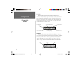
When using the Distance/Bearing tool, the distance
and bearing from a beginning point to the cursor will
be displayed in the Status Bar at the bottom of the
MapSource application window.
33
MS Manual - Reference.indd
33
10/16/01, 9:58 AM
Unlock Codes—Some MapSource products require you to enter a
code to “unlock” a map region. This tool helps you enter, manage and
edit your MapSource Unlock Codes. See Unlock Codes on page 3 for
more detailed information.
Reference
Set PC Clock—This tool allows you to synchronize the clock on your
PC with the GPS clock. Click the OK button to set the PC Clock.
Make sure your GPS is connected to a serial communication port on
your computer. If you see the message “The GPS is not responding,”
you may need to check the Serial Connection Settings.
Tools Menu/
Help Menu
Get Unit ID—This tool retrieves the Unit ID of your GPS unit. Click
the OK button to get the Unit ID. Make sure your GPS is connected
to a serial communication port on your computer. If you see the
message “The GPS is not responding,” you may need to check the
Serial Connection Settings.
Help Menu
Set PC Clock
Contents—Displays the Help Contents tab. A copy of MapSource’s
Quick Tour can be found here for easy reference.
Index—Displays the Help Index tab.
About MapSource—Displays the About Box. The About Box contains information about the MapSource application. Application and
Data version information and Installed products can be viewed on
this page.
Help Menu
34
MS Manual - Reference.indd
34
10/16/01, 9:58 AM
Right-Click Menus
MapSource includes shortcuts to many functions of the main menus
through the Right-Click Menus. With any tool selected (except for the
Zoom Tool), click the right button on your mouse anywhere on the
Graphic Map, and a menu of options will appear for that feature or
location.
Reference
Right-Click Menus
When there is more than one map feature at a given location (such as
a waypoint that is part of a route), a list of those features will appear first,
with the name and type of feature. Select the desired feature from the list,
and the right-click menus for that feature will appear.
Map Feature Right-Click Menu
By clicking the right mouse button on an open area or on a feature
of the Graphic Map (such as a Point of Interest, Exit, Fishing Area or
Navigational Aid—not a route, waypoint, or track), the following menu
options may appear:
When you click the right mouse button on a location
that has multiple map features, the first menu will be a
list of all those items. Select one of these items and the
appropriate right-click menu options will appear.
New Waypoint— Choosing this option will create a new waypoint at
the selected map location and access the ‘Waypoint Properties’ dialog.
For more information, see “Creating Waypoints” on page 40.
Begin Route— This will activate the Route Tool and begin a route
at the selected map location. For more information, see “Creating
Routes” on page 45.
Begin Measurement— This option will activate the Distance/Bearing
Tool, allowing you to measure the distance and bearing from the
location you selected to another location on the Graphic Map. For
more information, see “Distance/Bearing Tool” on page 33.
Map Feature Right-Click Menu Options
35
MS Manual - Reference.indd
35
10/16/01, 9:58 AM
F
Reference
Right-Click Menus
NOTE: The ‘New Waypoint’, ‘Begin Route’ and ‘Begin
Measurement’ options are default right-click options. They
will be available by clicking the right mouse button anywhere
on the Graphic Map.
Zoom To— Selecting this option will “zoom” to the selected map
feature and center it on the Graphic Map.
Feature Properties— Selecting this option will bring up the Properties for the selected map feature, such as the address and phone
number of a Point of Interest, services and facilities at an Exit,
information about a Fishing Hot Spot or Lake, or details about a
Marine Chart.
Tide Station Symbol
Predict Tides— By clicking the right mouse button on a Tide Station
(If your MapSource product supports this feature), this menu option
appears. Selecting this option will display tide information for the
selected location.
Show This Map Only/Show All Maps— This feature applies to
BlueChart regions of MapSource, where map areas frequently overlap.
With the Map Tool selected and a map area highlighted in yellow,
right-clicking the map area will access this additional option. Select
‘Show This Map Only’ to view detail within the selected map. To
cancel, right-click the map area again and select ‘Show All Maps.’
‘Show This Map Only’ Feature
36
MS Manual - Reference.indd
36
10/16/01, 9:58 AM
Waypoint Right-Click Menu
By clicking the right mouse button on a waypoint on the Graphic Map
or in the Waypoints Tab List, the following meny options may appear:
Move Waypoint— Choosing this option activates the Selection Tool
and allows you to move the selected waypoint to another location on
the Graphic Map. For detailed information on moving a waypoint,
see “Editing Waypoints” on page 42.
Reference
Right-Click Menus
New Waypoint, Begin Route, Begin Measurement— see page 35
for descriptions of these options.
Remove Waypoint From Route— Selecting this option will remove
the selected waypoint from the route, but will not delete the waypoint.
For more information, see “Editing Routes” on page 48.
Cut/Copy/Paste— Just like the functions in the Edit Menu, these
options let you cut, copy and paste waypoints from one active MapSource document to another.
Delete Waypoint— Deletes the selected waypoint.
Zoom To— Selecting this option will “zoom” to the selected waypoint
and center it on the Graphic Map.
Waypoint Properties— Choosing this option will access the Waypoint Properties, allowing you to review and edit the properties for the
selected waypoint. For more information, see “Editing Waypoints”
on page 42.
Waypoint Right-Click Menu Options
37
MS Manual - Reference.indd
37
10/16/01, 9:58 AM
Route Right-Click Menu
By clicking the right mouse button on a route on the Graphic Map or
in the Routes Tab List, the following options may appear:
Reference
Invert Route— Choosing this option will reverse the waypoint order
in the selected route. This will also reverse the route name, if the
route name is the Autoname default “<begin point> to <end point>”.
Right-Click Menus
Recalculate Route— If you have modified the Autorouting Preferences (see page 26), selecting this option will recalculate the selected
route according to the new preferences. You may also use this
option to have a routable MapSource product recalculate and create
an automatic route from a route previously created with another
(non-routable) MapSource product.
New Waypoint, Begin Route, Begin Measurement— see page 35
for descriptions of these options.
Cut/Copy/Paste— Just like the functions in the Edit Menu, these
options let you cut, copy and paste routes from one active MapSource
document to another.
Delete Route— Deletes the selected route.
Zoom To— Selecting this option will “zoom” to the selected route
and center it on the Graphic Map.
Route Properties— Choosing this option will access the Route Properties, allowing you to review and edit the properties for the selected
route. For more information, see “Editing Routes” on page 48.
Route Right-Click Menu Options
38
MS Manual - Reference.indd
38
10/16/01, 9:58 AM
Additional Right-Click Menu options that may appear for a selected route:
Resume Route— By selecting a route, then right-clicking the start or
end point of that route, this options appears, allowing you to extend
the route to an existing waypoint or map location.
Insert Route Section— By selecting a route, then right-clicking a
leg of that route (between two waypoints) on the Graphic Map, this
option appears, allowing you to insert a new point in that leg of the
route. For more information, see “Editing Routes” on page 48.
Reference
Right-Click Menus
Replace Route Section— By selecting a route with at least three
waypoints, then right-clicking a waypoint in that route on the Graphic
Map, this option appears, allowing you to move the waypoint to
a new location. For more information, see “Editing Routes” on
page 48.
Track Right-Click Menu
By clicking the right mouse button on a track on the Graphic Map or
in the Tracks Tab List, the following options may appear:
New Waypoint, Begin Route, Begin Measurement— see page 35
for descriptions of these options.
Cut/Copy/Paste— Just like the functions in the Edit Menu, these
options let you cut, copy and paste tracks from one active MapSource
document to another.
Track Right-Click Menu Options
Delete Track— Deletes the selected track.
Zoom To— Selecting this option will “zoom” to the selected track and
center it on the Graphic Map.
39
MS Manual - Reference.indd
39
10/16/01, 9:58 AM
Track Properties— Choosing this option will access the Track Properties, allowing you to review and edit the properties for the selected
track. For more information on Tracks, see page 52.
Reference
Maps Tab List Right-Click Menu
By clicking the right mouse button on a map in the Maps Tab List, the
following options map appear:
Right-Click Menus/
Creating Waypoints
Cut/Copy/Paste— Just like the functions in the Edit Menu, these
options let you cut, copy and paste maps from one active MapSource
document to another.
Delete Map— Deletes the selected map from the Maps Tab List.
Zoom To— Selecting this option will “zoom” to the selected map and
center it on the Graphic Map.
Creating Waypoints
Maps Tab List Right-Click Menu Options
A waypoint is a geographic location stored in memory. Waypoints
can be created in MapSource using the Waypoint Tool or the ‘Waypoint
Properties’ dialog box. When a waypoint is created, MapSource will
automatically assign a name to the waypoint based on its location. If
you created the waypoint on a map feature, the waypoint name will
be an abbreviation of the feature. If the waypoint is created on an
open location, MapSource will assign a numeric name to the waypoint.
All waypoint properties can be changed, allowing you to customize the
waypoint for display and use.
40
MS Manual - Reference.indd
40
10/16/01, 9:58 AM
Creating a Waypoint with the Waypoint Tool
The Waypoint Tool can be selected three ways: by choosing ‘Waypoint’ in the Tools Menu, by clicking on the Waypoint Tool icon in the
Tools Toolbar, or by using the keyboard shortcut “w”.
When the Waypoint Tool is selected, a flag similar to the Waypoint
Tool icon will be displayed beside the mouse pointer on the Graphic
Map.
Reference
Creating Waypoints
To Create a Waypoint on the Graphic Map:
1. With the Waypoint Tool selected, position the mouse pointer at a
location on the Graphic Map.
2. Click the right mouse button and select ‘New Waypoint’, or just click
the left mouse button. The ‘Waypoint Properties’ dialog box will be
displayed.
3. Make any desired changes to the Waypoint Properties, then click the
OK or Show on Map button to save the new waypoint. To reject the
waypoint click the Cancel button.
Creating a Waypoint with the Waypoint Properties
A waypoint can also be created based on the center of the Graphic
Map display by using the Waypoint Properties.
To Create a Waypoint with the Waypoint Properties:
1. Select ‘New Waypoint’ from the Edit Menu. This will display the
Waypoint Properties dialog box. MapSource will assign a name and
location based on the center of the Graphic Map.
Creating a Waypoint
When you create a Waypoint on the Graphic Map,
the ‘Waypoint Properties’ dialog box is displayed. To
accept the new waypoint as is, press ‘OK’ or ‘Show On
Map.’ To reject the waypoint click on ‘Cancel.’
2. Make any desired changes to the Waypoint Properties, then click the
OK or Show on Map button to save the new waypoint. To reject the
waypoint, click the Cancel button.
41
MS Manual - Reference.indd
41
10/16/01, 9:58 AM
Things to Remember About Waypoints:
• When changing the name or description, remember that GARMIN
GPS products can only display a limited number of characters.
The name or description will be truncated in the GPS if it exceeds
the unit’s limit. If multiple waypoints have identical names after
truncation, only one of the waypoints will be stored in the GPS.
Refer to your GPS owner’s manual to determine your GPS unit’s
limitations.
Reference
Editing Waypoints
• All MapSource waypoints can contain proximity information. If
your GPS is capable of using proximity waypoints and new waypoints that contain a proximity range are saved to your GPS, then
all waypoints in the GPS unit’s proximity list will be deleted and
replaced with the new MapSource waypoints.
• If you select a symbol that does not exist in your GPS, the waypoint
will be represented by a square when transferred to your GPS.
Editing Waypoints
Most editing features for waypoints can be performed in the
‘Waypoint Properties’ dialog box. To select the ‘Waypoint Properties’:
F
Remember that you can set up
preferences for waypoints on the
‘Waypoint’ Tab under ‘Preferences’ in
the Edit Menu.
• Double-click a waypoint name in the Waypoints Tab List
• Double-click a waypoint on the Graphic Map
• Highlight a waypoint in the Waypoints Tab List or on the Graphic
Map, then select ‘Waypoint Properties’ from the Edit Menu
• Highlight a waypoint in the Waypoints Tab List or on the Graphic
Map, then click the right mouse button and select ‘Waypoint
Properties’
42
MS Manual - Reference.indd
42
10/16/01, 9:58 AM
Waypoint Properties
There are nine waypoint properties that can be modified: Name,
Description, Position, Altitude, Proximity, Depth, Symbol, Color, and
Display. You may also choose to center the waypoint on the Graphic Map
by clicking the Show on Map button.
Name— Most GARMIN GPS systems limit the name to six characters.
If the length of the name exceeds the limitations of your unit, the
name will be truncated.
Description— A description can be entered to help identify the waypoint. GARMIN GPS units have a maximum number of characters
allowed in the description field. If the description that you enter
exceeds the unit limitation, the description will be truncated. Refer to
the GPS unit’s owner’s manual to determine your unit’s limitations.
Position— The coordinates of the waypoint are displayed in the
‘Position’ field. The coordinates will be displayed according to the
Position Format set up in Preferences. Enter new coordinates to
change the position of the waypoint.
Altitude— If known, you can enter an altitude for the waypoint. If
the altitude is unknown, place a mark in the Unknown checkbox.
Proximity— Enter a range for a proximity warning. This property is
not used by all GARMIN GPS systems. If you don’t want to include
Proximity data or your unit is not compatible with proximity data,
place a mark in the Unknown checkbox.
Depth— Enter a depth for underwater waypoints. This is only
compatible with GPS/Sounder combination units. If the depth is
unknown or you unit is not compatible, place a mark in the Unknown
checkbox.
MS Manual - Reference.indd
43
Reference
Editing Waypoints
‘Waypoint Properties’ Dialog Box
43
10/16/01, 9:58 AM
Symbol— Allows you to choose from over 100 different symbols. If
you select a symbol that is not supported by your GPS system, it will
be represented with a square symbol.
Reference
Color— This property allows the user to select from 16 colors for the
waypoint. This property does not apply to all GARMIN GPS systems.
Refer to your GPS owner’s manual to determine if your unit is capable
of displaying waypoint colors.
Editing Waypoints
Display— Allows you to choose how the waypoint will be displayed.
There are three settings to choose from: Symbol only, Symbol and
Name, or Symbol and Description.
Show On Map— Clicking on this button will center the waypoint on
the Graphic Map and exit the Waypoint Properties dialog box.
When you are finished editing a waypoint, click the Show on Map or
OK button to exit the Waypoint Properties dialog box.
Moving a Waypoint on the Graphic Map:
1. Choose the Selection Tool located on the Toolbar or in the Tools Menu.
2. Right-click the mouse on the desired waypoint and select ‘Move Waypoint,’ or click the left mouse button on the waypoint to select it (the
waypoint will be highlighted in yellow), then click on it again. Do not
double click the waypoint, as that will display the ‘Waypoint Properties’
dialog box.
MOVE
Moving a Waypoint
3. The mouse pointer will now have the word “MOVE” and a small icon
of the Waypoint Tool below it. Move the mouse pointer to the new
location and click the left mouse button to anchor the waypoint. You
may also right-click the mouse pointer on the new location and select
‘Place Waypoint Here’ to anchor the waypoint, or select Cancel to
return the waypoint to its original location.
44
MS Manual - Reference.indd
44
10/16/01, 9:58 AM
Deleting Waypoints
You can delete a waypoint on the Graphic Map or in the Waypoints
Tab List.
Reference
To Delete a Waypoint on the Map or Waypoints Tab:
1. With the Selection Tool, highlight the waypoint in the Waypoints Tab
List or on the Graphic Map. Press the Delete key on your keyboard or
select ‘Delete Waypoint’ from the Edit Menu. OR, click the right mouse
button on the desired waypoint and select ‘Delete Waypoint.’
Deleting Waypoints/
Creating Routes
2. To delete multiple waypoints at the same time, draw a box around the
waypoints or hold down the Shift key while selecting the waypoints
individually. After the waypoints are selected, press the Delete key,
select ‘Delete Waypoints’ from the Edit Menu, or right-click the mouse
and select ‘Delete Waypoints.’
Creating Routes
There are two ways to create a route in MapSource—on the Graphic
Map with the Route Tool, or by using the Route Properties dialog box.
Depending on the MapSource product you are using, you may create a
Direct Route (a straight line route), or an Automatic Route (a turn-by-turn
route).
Using the Route Tool
The Route Tool can be selected several ways: by choosing ‘Route’ in
the Tools Menu, by clicking on the Route Tool icon in the Tools Toolbar,
and by using the keyboard shortcut “r”. You may also start a route
by clicking the right mouse button on the desired starting point on the
Graphic Map, and then selecting ‘Begin Route.’
Creating a Direct Route with the Route Tool
45
MS Manual - Reference.indd
45
10/16/01, 9:58 AM
Creating a Direct Route with the Route Tool:
1. After selecting the Route Tool, click the waypoints or map locations in
the sequence you want them to appear in the route. If there is not
a waypoint where you click, a new waypoint will be created at that
location. As you continue, route legs will be created in a direct line
from one point to the next.
Reference
Creating Routes
2. When you have entered all of the points that you want in the route,
press Escape on your keyboard or right-click to end the route. A route
will be created and automatically named using the names of the first
and last waypoints.
F
NOTE: Not all MapSource products can create an Automatic
Route. You must be using a routable MapSource product for
MapSource to automatically calculate a route.
Creating an Auto-Route with the Route Tool:
1. Follow the directions for “Creating a Direct Route with the Route Tool.”
2. With a routable MapSource product, MapSource will automatically
calculate a turn-by turn route. The Auto-Route will be displayed on the
Graphic Map, along the roads it follows and with the turns it takes,
instead of showing a direct line from one point to the next. Detailed
information about an Auto-Route’s turns and directions can be viewed
in the ‘Route Properties’ for that route.
Creating a Direct Route with
the ‘Route Properties’ Dialog Box
Using the Route Properties
You may create a route with the Route Properties by inserting waypoints, and with some MapSource products, you may also insert points
of interest and cities through the Find feature. You may choose to start a
new route with the Route Properties by selecting ‘New Route’ in the Edit
Menu or by using the keyboard shortcut “Ctrl + R”.
46
MS Manual - Reference.indd
46
10/16/01, 9:58 AM
Creating a Direct Route with the Route Properites:
1. With the ‘Route Properties’ dialog box displayed, click the Insert
button to display the ‘Select Waypoint’ dialog box. A list of waypoints
will appear.
2. Highlight the waypoint that you want to insert, then click OK. Repeat
the process, choosing the waypoints in the order that you wish to
navigate them. The waypoints will be listed in the ‘Route Properties’
dialog box as they are added to the route.
Reference
Creating Routes
3. When you are finished, click the OK or Show on Map button to save
the new route.
Creating an Auto-Route with the Route Properties:
1. Follow the same directions for “Creating a Direct Route with the Route
Properties.”
2. With a routable MapSource product, MapSource will automatically
calculate a turn-by-turn route. As you add points, the directions and
turns will be listed between each waypoint in the ‘Route Properties‘
dialog box. The Auto-Route will also show the roads it follows and
turns it takes on the Graphic Map, instead of showing a direct line from
one point to the next.
When creating an Auto-Route with the ‘Route Properties,’ you may
also insert other map locations to the route by using the Advanced ‘Find.’
Creating an Auto-Route
with the ‘Route Properties’ Dialog Box
Adding a Map Location to an Auto-Route with the Route
Properties:
1. Select a point in the route where you want to add a map location. To
add a map location to the end of the route, highlight the blank space
at the the end of the route list. To add a point anywhere else in the
route, click the point in the route list that will follow the location you
add.
(continued)
47
MS Manual - Reference.indd
47
10/16/01, 9:58 AM
2. Click the Find button. The Advanced ‘Find’ dialog box will appear,
allowing you to search for a city or point of interest to add to your
route. (see pages 28-31 for more information on using the Advanced
‘Find’ feature.)
Reference
3. When you have found the desired map location, click the OK button
in the Advanced ‘Find’ dialog box. The map location will be added
directly before the point you selected in the route and MapSource will
automatically calculate the new location into the route.
Creating/Editing Routes
Naming a Route
If the Autoname checkbox is marked, MapSource will automatically
name the route using the names of the first and last waypoints entered in
the route. To enter a different name, remove the mark from the Autoname
checkbox and enter a name in the ‘Name’ field.
Inverting a Route
You can reverse the order of the route waypoints by clicking the
Invert button. This feature is convenient when you want to navigate a
route in the reverse direction. When finished, click OK or Show on
Map to save the route.
Editing Routes
Editing Routes on the Graphic Map
F
Remember that you can set up
preferences for creating automatic
routes on the ‘Autorouting’ Tab under
‘Preferences’ in the Edit Menu.
Routes can be edited on the Graphic Map using the Selection Tool.
You may choose the Selection Tool by clicking the Selection Tool icon
from the Tools Toolbar, by choosing ‘Selection’ from the Tools Menu, or
by using the keyboard shortcut “s”. The Selection Tool allows you to add
waypoints to the beginning, middle or end of a route, remove a waypoint
from a route, and move a waypoint to a new location in a route.
48
MS Manual - Reference.indd
48
10/16/01, 9:58 AM
Inserting Waypoints Into an Existing Route:
1. With the Selection Tool activated, select the route in the Routes Tab List
or on the Graphic Map by clicking on it with the left mouse button.
When the route is selected, it will be displayed in yellow.
2. Click the left mouse button on the route leg you want to add a
waypoint to, or click the right mouse button on the route leg and select
‘Insert Route Section.’ The mouse pointer will now have the letters
“INS” and a small icon of the Route Tool below it. The route leg
will “rubberband,” allowing you to stretch it to an existing waypoint
or a map location.
Reference
Editing Routes
3. When you have the mouse pointer at the desired position, click the
right mouse button and select ‘Add to Route,’ or just click the left
mouse button to add the point to the route leg.
4. Repeat these steps to insert additional waypoints. Click the left mouse
button away from the route or press the Escape key on your keyboard
to quit and save the changes to the route.
INS
Extending a Route (Adding a Waypoint to the Beginning or
End of a Route):
1. With the Selection Tool activated, select the route in the Routes Tab List
or on the Graphic Map by clicking on it with the left mouse button.
When the route is selected, it will be displayed in yellow.
Adding a Waypoint to a Route
2. Left-click on the first or last waypoint in the route, or right-click the
first or last waypoint in the route and select ‘Resume Route.’ The
mouse pointer will now have the word “ADD” and a small icon of the
Route Tool below it.
3. Move the extension line to an existing waypoint or a map location.
Click the right mouse button and select ‘Add to Route,’ or just click the
(continued)
left mouse button to anchor the route leg.
49
MS Manual - Reference.indd
49
10/16/01, 9:59 AM
4. Repeat these steps to add more waypoints. Click the right mouse
button and select ‘Cancel’, or press the ESCAPE key on your keyboard
to quit and save the changes to the route.
Reference
Removing a Waypoint From a Route:
1. With the mouse pointer located on the route waypoint that you want
to remove, click the right mouse button and select ‘Remove Waypoint
From Route’, OR:
Editing Routes
1. With the Selection Tool activated, select the route in the Routes Tab List
or on the Graphic Map by clicking on it with the left mouse button.
When the route is selected, it will be displayed in yellow.
2. Click the left mouse button on the waypoint (the waypoint will be
highlighted in yellow). Select ‘Remove Waypoint From Route’ from the
Edit Menu or from the Right-Click Menu.
Moving a Waypoint to Another Location in a Route:
1. With the Selection Tool activated, select the route in the Routes Tab List
or on the Graphic Map by clicking on it with the left mouse button.
When the route is selected, it will be displayed in yellow.
REPL
2. Left-click on the waypoint you want to move, or right-click the waypoint and select ‘Replace Route Section.’ The mouse pointer will now
have the letters “REPL” and a small icon of the Route Tool below it.
The route leg will “rubberband,” allowing you to move the waypoint
to a new location.
3. Position the mouse pointer where you want to move the waypoint.
Click the right mouse button and select ‘Add to Route,’ or just click the
left mouse button to move the waypoint.
Moving a Route Waypoint
50
MS Manual - Reference.indd
50
10/16/01, 9:59 AM
Editing a Route With the Route Properties
Many editing functions for routes can be performed in the ‘Route
Properties’ dialog box.
Reference
To Edit a Route with the Route Properties:
1. Select the route in the Routes Tab List or on the Graphic Map.
2. Choose Route Properties from the Edit Menu, or click the right mouse
button and select ‘Route Properties.’
Editing Routes
3. Make the desired changes and click the OK or Show on Map button
to save the changes and exit.
Name— To change the route name, make sure the Autoname checkbox is not marked and type in a new name.
Center Map on Selected Item— With this checkbox marked, when
you select a point in the list, it will automatically be centered on the
map while you view the ‘Route Properties.’
Insert— To add a waypoint, click the waypoint in the list that will
follows the point you want to add. Click the Insert button and select
a waypoint from the list. The waypoint will be inserted directly before
the point you selected in the route.
Find— If you are using a MapSource product that includes the
Advanced ‘Find’ feature, this button will be activated, allowing you to
search for a city or point of interest to add the the route. See “To Add
a Map Location to an Auto-Route with the Route Properties” on page
47 for more information.
The ‘Route Properties’ Dialog Box
with a Routable MapSource Product
When using a routable product, the ‘Route Properties’
dialog box will show directions and turns from one
waypoint to the next in the selected route.
Edit— Select the waypoint in the route list and click the Edit button.
The ‘Waypoint Properties’ for the selected waypoint will appear. For
more information, see “Editing Waypoints” on page 42.
51
MS Manual - Reference.indd
51
10/16/01, 9:59 AM
Delete— To remove a waypoint from a route, select the waypoint on
the route list and click the Delete button.
Reference
Recalculate— If you have modified the Autorouting Preferences in
the Edit Menu, you may recalculate an existing route according to the
new preferences by clicking the Recalculate button. You may also
use the Recalculate button to have a routable MapSource product
change a direct route into an automatic route. For more information
on setting up the ‘Autorouting Preferences’ see page 26. This feature
only applies to routable MapSource products.
Editing Routes/
Tracks
Invert— The Invert button will reverse the waypoint order, making
the last waypoint become the first waypoint in the route.
Deleting a Route
You can delete a route on the Graphic Map or in the Routes Tab List.
To Delete a Route:
1. With the Selection Tool activated, select the desired route in the Routes
Tab List or on the Graphic Map by clicking on it with the left mouse
button. When the route is selected, it will be highlighted in yellow.
2. Press the Delete key on your keyboard; or select ‘Delete Route’ from
the Edit Menu; or click the right mouse button on the highlighted
route either on the Graphic Map or in the Routes Tab List and select
‘Delete Route.’
Tracks Tab List
Tracks
Tracks can be created in MapSource by connecting your GPS to your
computer and using the Real Time Tracking feature in the GPS Tab.
Those tracks, and any tracks that have been transferred to MapSource
from a GPS will be listed in the Tracks Tab List.
52
MS Manual - Reference.indd
52
10/16/01, 9:59 AM
Real Time Tracking and the GPS Tab
When real time tracking is enabled, MapSource will read information
from the GPS, show the GPS as a red triangle on the Graphic Map, display
the tracking data in the GPS Tab, and record a track.
In order to do real time tracking with a locked MapSource product,
you must do the following:
Reference
Real Time Tracking/GPS Tab
• Have a valid unlock code for your GPS unit installed in MapSource
• Receive real time information from a GARMIN unit that supports
locked maps
• The GPS unit must be in GARMIN transfer mode, not NMEA
mode.
To Start Real Time Tracking:
1. Check that your GPS is properly connected to a serial port on your
computer. Set the “Serial Data Format” on your GPS to either GARMIN
or NMEA format. MapSource automatically reads the data format—
you don’t need to set up the format in MapSource. Only the more
recent GARMIN GPS’s will output data in GARMIN format.
2. Select the GPS Tab to have MapSource record the track, be sure the
‘Record Track’ box is checked. The track will be recorded and listed
in the Tracks Tab.
3. To have MapSource automatically adjust the map to keep the vehicle/
GPS (red triangle) visible on the Graphic Map, check the box next to
‘Keep Vehicle Visible on Map.’
(continued)
Real Time Tracking on the Graphic Map
With the ‘Keep vehicle visible on map’ and ‘Record
track’ features selected, MapSource shows the location
of the GPS/vehicle (red triangle), keeps it centered on
the Graphic Map, and records the track it follows.
53
MS Manual - Reference.indd
53
10/16/01, 9:59 AM
Reference
Real Time Tracking/GPS Tab
4. The first field describes the current Tracking Status and should display
the message “Tracking is disabled.” Click the Start Tracking button.
One of the following messages may appear in the Tracking Status field:
“Trying GARMIN format”, “Trying NMEA format”, “3D Navigation”,
“3D Differential”, “2D Navigation”, “2D Differential” or “Poor GPS
Coverage.” As MapSource reads the GPS data, the tracking data will
appear in the GPS Tab data fields below the Tracking Status field.
5. To stop real time tracking, click the Stop Tracking button.
GPS Tab Data Fields
Real Time Tracking on the GPS Tab
The GPS Tab displays the data gathered from the GPS in real time,
including tracking status, speed, altitude (not available in NMEA format),
current compass heading (‘track’ field), compass bearing, position coordinates, date and time.
EPE— (Estimated Position Error) The number in this field indicates
the estimated accuracy of of the horizontal position fix.
DOP— (Dilution of Precision) This measures satellite geometry quality (the number of satellites received and their location in relation to
each other) on a scale from one to ten—the lower the number, the
better the accuracy (not available in GARMIN format).
Keep Vehicle Visible on Map— With this function selected, the
vehicle (red triangle) will remain centered on the Graphic Map during
real time tracking, and the map display will continually change to
show where the “vehicle” is traveling. Check/uncheck the box to
select/deselect this feature.
Record Track— Check this box to select or deselect this function
to have MapSource record the track that your GPS is navigating.
MapSource will automatically assign a track name and display it in
the Tracks Tab List.
54
MS Manual - Reference.indd
54
10/16/01, 9:59 AM
Viewing and Editing Track Properties
To View and Edit Track Properties:
1. Click the right mouse button on the desired track in the Tracks Tab List
or on the Graphic Map, then select ‘Track Properties;’ OR, highlight the
desired track in the Tracks Tab List or on the Graphic Map, then select
‘Track Properties’ from the Edit Menu.
2. Make the desired changes and click OK when finished.
Reference
Track Properties/
Map Sets
You may view the details of the track in the Trackpoints list, highlight
any of the Trackpoints and view it on the Graphic Map by selecting
‘Center map on selected item,’ or view the track on the Graphic Map by
clicking the Show on Map button. You may also change the track name,
assign a color to the track and choose to ‘Display on GPS’.’
Creating and Using Map Sets
F
Not all GARMIN GPS systems can use detailed maps. Check
your GPS owner’s manual to see if your unit is compatible.
What is a Map Set?
A Map Set is one or more detailed regional maps selected from the
Graphic Map. The regions are determined by the MapSource data that
you have loaded. You can select maps from more than one MapSource
data source in a Map Set, but you will only see data from one data
source.
Track Properties Dialog Box
As an example, if you select both Topographical and Roads & Recreational data for the same geographical region, you WILL NOT see a
combination or topographic and road data. You will only see data from
the Roads & Recreation data set.
55
MS Manual - Reference.indd
55
10/16/01, 9:59 AM
Selecting a Regional Map Using the Map Tool:
1. Select a Zoom Scale that will allow you to view the boundaries of
the desired regional map (most can be seen at the 30 mile/50 km
zoom scale).
Reference
2. Choose Map from the Tools Menu. When the Map Tool is located
within a detailed regional map, the borders of the region will be
outlined in yellow and the region name/memory requirement will be
displayed in the Status Bar. The MapSource data that you have loaded
determines the geographical map boundaries, and each product has
different boundary areas.
Map Sets
F
NOTE: If you have a MapSource product with map areas that
are available for purchase separately, you will only be able to
select those that you have purchased and installed on your
computer.
Adding a Map to the Map Set/Maps Tab List:
Selecting a Detailed Regional Map
When the ‘Map’ Tool is placed within the boundaries
of a detailed map, the border of the detailed map is
outlined in yellow. To select the map, click the mouse
while the border is selected. When the map is added
to the Map Set, the area of the detailed map will be
shaded in red.
1. Click the left mouse button in the selected region. To choose several
maps, hold the Shift key and click and drag the mouse to draw a box
through the regions on the Graphic Map. As you add maps, they will
be shaded in red. The number of maps and the memory required to
store the maps is displayed at the bottom of the Maps Tab.
At the bottom of the Maps Tab List, you will see the number of
selected maps and the required memory for the Map Set. If the Map
Set contains a large number of maps or a large memory capacity, you
may see a warning from MapSource to reduce the number of maps in
the Map Set.
56
MS Manual - Reference.indd
56
10/16/01, 9:59 AM
Removing a Map from the Map Set/Maps Tab List:
1. Place the Map Tool inside the border of the region that you want to
deselect and click the left mouse button. To remove several maps at
once, hold the Ctrl key and click and drag the mouse to draw a box
through the regions on the Graphic Map. OR:
1. Highlight the desired regional map in the Maps Tab list. To select
several maps, hold down the Shift key on your keyboard and highlight
the desired maps. Click the right mouse button and select ‘Delete
Map,’ or select ‘Delete Map’ from the Edit Menu, or press the Delete
key on your keyboard.
Reference
Map Sets
Naming/Renaming a Map Set
The Map Set Name button and ‘Name’ field are located along the
bottom of the Maps Tab List. MapSource will automatically name a Map
Set when it is created.
To Rename a Map Set:
1. Click the Map Set Name button located along the bottom of the
Map Tab List.
2. Verify that the Autoname checkbox located on the ‘Map Set Name’
dialog box is not marked.
3. Enter a new name in the ‘Name’ field and click the OK button.
Naming a Map Set
57
MS Manual - Reference.indd
57
10/16/01, 9:59 AM
Transferring Data
Waypoints, tracks, routes and map sets may be transferred between
MapSource and your GPS unit. Map sets may be transferred between
MapSource and a data card inserted in a USB data card programmer. For
detailed instructions on transferring data, see pages 16-18.
Reference
Transferring Data/
MapSource Documents
MapSource Documents
Saving a MapSource Document:
1. Choose ‘Save’ from the File Menu, or click the Save button
in the File Toolbar.
2. Select a location for your MapSource document and click the Save
button.
Opening a Previously Saved MapSource Document:
1. Choose ‘Open’ from the File Menu, or click the Open button
in the File Toolbar.
2. Select the saved document and click the Open button.
If you have a document open, MapSource will close the open document. If the open document data needs to be saved, MapSource will
prompt you before closing the document. Only one document can be
open in MapSource at a time. You can run several instances of MapSource
simultaneously, allowing you to easily trade information.
‘Open’ Dialog Box
F
NOTE: If you have a MapSource document with locked maps,
and you don’t have an Unlock Code for that map data,
MapSource will still display the non-locked features of that
file (waypoints, routes, etc.)
58
MS Manual - Reference.indd
58
10/16/01, 9:59 AM
Importing a GARMIN PCX5 Data File
You may import a GARMIN PCX5 data file to MapSource, but no
other data file types are supported for import to MapSource.
Reference
To Import GARMIN PCX5 Data:
1. Choose ‘Import’ from the File Menu. If you have set up your PCX5
data files in the Default File Location (in the ‘File Location’ Tab under
Preferenced in the Edit Menu), that location will automatically appear.
Printing
2. Select the PCX5 data file and click the Open Button. MapSource can
display PCX5 waypoints (.wpt), routes (.rte), tracks (.trk) or one of the
map outlines provided with PCX5 (.grm).
F
To avoid screen clutter, turn off any MapSource map data, if
using a PCX5 map outline.
Printing the Graphic Map
Print, Print Preview and Print Setup function like other Windows
applications. Use ‘Print Setup’ to select a printer and set printing properties. You may need to change the DPI settings for the image to print.
To preview what will be printed, select ‘Print Preview’. To print the
current Graphic Map Display, select ‘Print’ from the File Menu. Only a
representation of the Graphic Map can be printed from MapSource.
Print Preview
59
MS Manual - Reference.indd
59
10/16/01, 9:59 AM
Businesses and Attractions
Appendix A
Map Legends
Color map legends can be viewed in MapSource HELP.
60
MS Manual - Appendix.indd
60
10/16/01, 10:01 AM
Points of Interest
Appendix A
Map Legends
Color map legends can be viewed in MapSource HELP.
61
MS Manual - Appendix.indd
61
10/16/01, 10:01 AM
Areas
Appendix A
Map Legends
Lines
62
MS Manual - Appendix.indd
Color map legends can be viewed in MapSource HELP.
62
10/16/01, 10:01 AM
Navigation Aids and Obstructions
Appendix A
Map Legends
Color map legends can be viewed in MapSource HELP.
63
MS Manual - Appendix.indd
63
10/16/01, 10:01 AM
BlueChart
In addition to the symbols in the Navigation Aids and Obstructions
Legend, the following are some of the symbols found in MapSource
BlueChart marine data:
Appendix A
Map Legends
BlueChart™
Airport/Seaplane Base
Fishing Harbor
Anchorage Berth
Fishing Prohibited
Anchoring Prohibited
Information
Beacon
Marina Information
Building
Pilot Boarding Area
Buoy
Precautionary Area
Church
Radio Report Point
Dangerous Rock
Recommended Anchorage
Explosive
Rescue Station
Exposed Rock
Tide Station
Exposed Wreck
Yacht Harbor
Color map legends can be viewed in MapSource HELP.
64
MS Manual - Appendix.indd
64
10/16/01, 10:01 AM
Appendix B
Keyboard Shortcuts
File Menu
View Menu
New Document ____________________ Ctrl + N
Open Existing Document______________ Ctrl + O
Save Document ____________________ Ctrl + S
Print Graphic Map __________________ Ctrl + P
Open From Device ____________ Ctrl + Shift + O
Save To Device ________________Ctrl + Shift + S
Zoom To Selected Items ______________ Ctrl + D
Go To Position _____________________ Ctrl + T
Zoom In_______________________________+
Zoom Out _____________________________ Zoom In Max ______________________ Ctrl + +
Zoom Out Region ___________________ Ctrl + GPS Map Detail ____________________ Ctrl + G
Show Crosshair ____________________ Ctrl + H
Edit Menu
Undo____________________________ Ctrl + Z
Redo ____________________________ Ctrl + Y
Cut _____________________________ Ctrl + X
Copy ____________________________ Ctrl + C
Paste____________________________ Ctrl + V
New Waypoint _____________________Ctrl + W
New Route _______________________ Ctrl + R
Delete ______________________________ Del
Remove Waypoint from Route _________Ctrl + Del
Select All _________________________ Ctrl + A
Preferences __________________Ctrl + Shift + P
Find ____________________________ Ctrl + F
Tools Menu
Zoom Tool _____________________________ z
Hand Tool _____________________________ h
Selection Tool___________________________ s
Waypoint Tool _________________________ w
Route Tool _____________________________ r
Map Tool _____________________________ m
Distance/Bearing Tool _____________________ d
Unlock Codes _____________________ Ctrl + U
65
MS Manual - Appendix.indd
65
10/16/01, 10:01 AM
Connecting the GPS to a Computer............................................ 3
Creating Map Sets ................................................... 15, 33, 55-56
Creating Routes....................................................... 13, 26, 45-48
Creating Waypoints................................................. 12, 26, 40-42
Customer Service ........................................................................ i
Cut/Copy/Paste ........................................................................ 21
Appendix C
Index
D
Baud Rate .................................................................................25
Data Tabs ................................................................................... 8
Data Transfer ....................................................................... 16-18
Default File Location ................................................................ 25
Delete....................................................................................... 22
Deleting a Route....................................................................... 14
Deleting a Route Waypoint........................................... 22, 50, 52
Deleting Maps .................................................................... 15, 57
Deleting Waypoints .................................................................. 45
Depth................................................................................. 23, 42
Description (Waypoint) ............................................................ 43
Detail (Map) ............................................................................. 23
Display Settings (Waypoint) ..................................................... 44
Distance/Bearing Tool............................................................... 32
Distance/Speed......................................................................... 23
Duplicating a Route.................................................................. 22
C
E
Cautions................................................................................. iv-v
Cities, Finding.....................................................................28-29
Color (Waypoint) .....................................................................44
Communication Settings .....................................................24-25
Compatibility
Map Transfer .....................................................................1
Waypoint/Route/Track Management..................................1
Edit Menu
Cut/Copy/Paste ............................................................... 21
Delete.............................................................................. 22
Duplicate Route............................................................... 22
New Route ...................................................................... 22
New Waypoint .......................................................... 21, 41
Preferences ................................................................. 23-26
A
About MapSource.....................................................................34
Adding Waypoints to a Route........................................47-49, 51
Addresses, Finding ...................................................................30
Advanced Find .................................................. 28-31, 47-48, 51
Altitude/Elevation...............................................................23, 43
Auto Detect .........................................................................24-25
Auto-Routes
Adding a Map Location to ..........................................47-48
Creating .....................................................................46-48
Editing .......................................................................48-52
Preferences ......................................................................26
B
66
MS Manual - Appendix.indd
66
10/16/01, 10:01 AM
Properties........................................................................22
Redo................................................................................20
Remove Waypoint(s) from Route.....................................22
Select All .........................................................................22
Undo...............................................................................20
Edit Toolbar ...............................................................................6
Editing Routes.....................................................................48-52
Editing a Route Waypoint.........................................................51
Editing Tracks ..........................................................................55
Editing Waypoints.........................................................11, 42-44
Exit File....................................................................................20
Export File ...............................................................................20
Extending a Route ..............................................................14, 49
F
File Menu
Exit .................................................................................20
Export.............................................................................20
Import.............................................................................20
New ................................................................................19
Open...............................................................................19
Open From Device ..........................................................19
Print................................................................................19
Print Preview...................................................................19
Print Setup ......................................................................19
Save/Save As....................................................................19
Save To Device ................................................................19
Recent Files.....................................................................20
Send Mail ........................................................................20
File Toolbar ................................................................................6
Find ....................................................................................28-31
Appendix C
Index
G
Get Unit ID ..............................................................................34
Go To Position..........................................................................26
GPS Map Detail ........................................................................27
GPS Tab ..............................................................................53-54
Graphic Map ..............................................................................9
Grid Formats............................................................................24
H
Hand Tool ................................................................................32
Heading ...................................................................................23
Help Menu ...............................................................................34
I
Importing a GARMIN PCX5 Data File ................................20, 59
Inserting a Waypoint in a Route .........................................49, 51
Installing the MapSource Software...........................................1-2
Inverting a Route................................................................48, 52
K
Keyboard Shortcuts ..................................................................65
M
Map Datum ..............................................................................24
67
MS Manual - Appendix.indd
67
10/16/01, 10:01 AM
O
Open From Device ............................................................. 18, 19
Opening a Previously Saved Document .................................... 58
Appendix C
P
Index
Map Detail................................................................................23
Map Legends .......................................................................60-64
Map Feature Right-Click Menu ...........................................35-36
Map Tool..................................................................................33
Map Sets
Creating .........................................................15, 33, 55-56
Deleting ....................................................................15, 57
Naming a Map Set...........................................................57
Selecting a Regional Map.................................................56
Maps Tab List Right-Click Menu ..............................................40
MapSource Toolbars ................................................................5-7
MapSource Tour ..................................................................10-18
Minimum System Requirements.................................................1
Moving a Waypoint ......................................................12, 44, 50
N
Name (Waypoint).....................................................................43
Naming a Map Set ....................................................................57
Naming a Route .................................................................48, 51
New Route ...............................................................................22
New Waypoint .........................................................................21
Panning Around the Graphic Map............................................ 32
Points of Interest, Finding ........................................................ 30
Port .......................................................................................... 25
Position (Waypoint) ................................................................. 43
Position Formats ...................................................................... 24
Preferences
Altitude/Elevation............................................................ 23
Autorouting..................................................................... 26
Baud Rate........................................................................ 25
Depth.............................................................................. 23
Detail .............................................................................. 23
Distance/Speed................................................................ 23
File Location ................................................................... 25
Heading .......................................................................... 23
Map Datum ..................................................................... 24
Port ................................................................................. 25
Position Formats ............................................................. 24
Reduce Map Size ............................................................. 25
Transfer ........................................................................... 24
Waypoints ....................................................................... 26
Print/Print Preview/Print Setup........................................... 19, 59
Printing the Graphic Map................................................... 19, 59
Properties ................................................................................. 22
Proximity (Waypoint)............................................................... 43
68
MS Manual - Appendix.indd
68
10/16/01, 10:01 AM
R
Real Time Tracking.............................................................. 53-54
Recalculating a Route ............................................................... 52
Recent Files .............................................................................. 20
Redo......................................................................................... 20
Reduce Map Size ...................................................................... 25
Region...................................................................................... 27
Removing a Waypoint From a Route .................................. 22, 50
Removing MapSource From Your System ................................... 2
Renaming a Map Set................................................................. 57
Reversing a Route............................................................... 48, 52
Right-Click Menus
Map Feature ............................................................... 35-36
Maps Tab List .................................................................. 40
Route ......................................................................... 38-39
Track.......................................................................... 39-40
Waypoint ........................................................................ 37
Route Properties .................................................................. 51-52
Route Right-Click Menu...................................................... 38-39
Route Tool................................................................................ 32
Routes
Adding a Map Location to an Auto-Route................... 47-48
Auto-Routes ............................................................... 46-48
Creating ............................................................... 13, 45-48
Deleting .................................................................... 14, 52
Deleting a Route Waypoint.................................. 22, 50, 52
Editing ....................................................................... 48-52
Editing a Route Waypoint................................................ 51
Extending.................................................................. 14, 49
Inserting a Waypoint ................................................. 49, 51
Inserting a Map Location................................................. 51
Appendix C
Index
Inverting ................................................................... 48, 52
Moving a Route Waypoint ............................................... 50
Naming ..................................................................... 48, 51
Recalculating................................................................... 52
S
Save/Save As....................................................................... 19, 58
Save To Device ................................................................... 17, 19
Saving a MapSource Document ................................................ 58
Saving Data to MapSource........................................................ 18
Saving Data to a GPS or a Data Card......................................... 17
Search ................................................................................. 28-31
Select All .................................................................................. 22
Selecting a Map Item ................................................................ 32
Selecting a Regional Map.......................................................... 56
Selection Tool........................................................................... 32
Send Mail ................................................................................. 20
Serial Connection Settings................................................... 24-25
Set PC Clock ............................................................................ 34
Show on Map Button................................................................ 44
Software License Agreement ................................................... ii-iii
Status Bar ............................................................................. 9, 28
Symbol (Waypoint) .................................................................. 44
69
MS Manual - Appendix.indd
69
10/16/01, 10:01 AM
Tracks
Editing ............................................................................ 55
Viewing...................................................................... 28-31
Properties........................................................................ 55
Real Time Tracking..................................................... 53-54
Track Right-Click Menu ...................................................... 39-40
Transferring Data................................................16-18, 24-25, 58
Appendix C
Index
U
T
Tab Lists..................................................................................... 8
Table of Contents .................................................................vi-viii
Toolbars
Edit Toolbar ...................................................................... 6
File Toolbar ....................................................................... 6
Tools Toolbar..................................................................... 7
Undocking ........................................................................ 5
View Toolbar ..................................................................... 7
Viewing........................................................................... 28
Tools Menu
Distance/Bearing Tool...................................................... 33
Get Unit ID ..................................................................... 34
Hand Tool ....................................................................... 32
Map Tool......................................................................... 33
Route Tool....................................................................... 32
Selection Tool.................................................................. 32
Set PC Clock ................................................................... 34
Unlock Codes.................................................................. 34
Waypoint Tool................................................................. 32
Zoom Tool....................................................................... 31
Tools Toolbar.............................................................................. 7
Tour .................................................................................... 10-18
Undo........................................................................................ 20
Unlock Codes.................................................................... 2-3, 34
V
View Menu
Find ........................................................................... 28-31
Go To Position................................................................. 26
GPS Map Detail ............................................................... 27
Region............................................................................. 27
Show Crosshair ............................................................... 27
Status Bar ........................................................................ 28
Toolbars .......................................................................... 28
Zoom In .......................................................................... 27
Zoom In Max .................................................................. 27
Zoom Out ....................................................................... 27
Zoom Out Region............................................................ 27
Zoom Scale...................................................................... 27
Zoom To Selected Items .................................................. 26
View Toolbar .............................................................................. 7
70
MS Manual - Appendix.indd
70
10/16/01, 10:01 AM
W
Waypoint Tool.................................................................... 32, 41
Waypoint Properties
About..............................................................11-12, 42-44
Altitude ...........................................................................43
Color...............................................................................44
Creating a Waypoint........................................................41
Depth..............................................................................43
Description .....................................................................43
Display............................................................................44
Name ..............................................................................43
Position...........................................................................43
Proximity ........................................................................43
Show on Map Button.......................................................44
Symbol............................................................................44
Waypoint Right-Click Menu.....................................................37
Waypoints
Adding to a Route ......................................................49-50
Creating ...............................................................12, 40-42
Deleting ..........................................................................45
Editing Waypoint Properties.................................11, 42-44
Moving a Waypoint on the Map ..........................12, 44, 50
Preferences ......................................................................26
Removing from a Route...................................................50
Viewing Waypoint Data...................................................11
Appendix C
Index
Zoom Scale...............................................................................27
Zoom To Selected Item.............................................................26
Zoom Tool................................................................................31
Z
Zoom In .............................................................................27, 31
Zoom In Max ...........................................................................27
Zoom Out ..........................................................................27, 31
Zoom Out Region.....................................................................27
71
MS Manual - Appendix.indd
71
10/16/01, 10:01 AM
MS Manual - Appendix.indd
72
10/16/01, 10:01 AM
MapSource Manual Covers.indd
3
10/16/01, 9:46 AM
For the latest free software updates throughout the life of your
GARMIN products, visit the GARMIN web site at www.garmin.com.
©1999-2001 GARMIN Corporation
GARMIN International, Inc.
1200 East 151st Street, Olathe, Kansas 66062, U.S.A.
GARMIN (Europe) Ltd.
Unit 5, The Quadrangle, Abbey Park Industrial Estate, Romsey, SO51 9AQ, U.K.
GARMIN Corporation
No. 68, Jangshu 2nd Road, Shijr, Taipei Country, Taiwan
www.garmin.com
Part Number 190-00168-20 Rev. B
MapSource Manual Covers.indd
4
10/16/01, 9:46 AM