1
Airspace
This next section applies to those flying (as the
origins of the tracking web site lies here).
With most free flight record attempts, the flight
path must remain outside of controlled airspace in
order to be valid. As there is airspace nearly
everywhere where the software is developed
(Switzerland), being able to stay outside of
controlled airspace is fairly important.
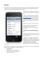
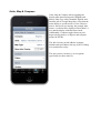
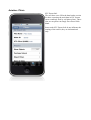
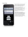
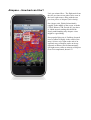
To view airspace objects, set Show Objects to
“On”. Everyone else can leave this turned off.
Purchase Unlock – As with other devices and
software, you will only be able to see the first 5
objects in the airspace data file without an unlock.
This is what other products that display airspace
generally do as well. Purchasing the unlock
removes the limitation on the objects drawn to the
map; it has nothing to do with buying data files
(these are available for free).
The actual airspaces themselves are in OpenAir
format (it is up to you to find the appropriate file
for your country); most major countries have the
airspace listed somewhere out there in the
internet. The best source we have found to date is
http://soaringweb.org.
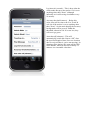
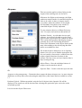
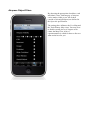
Object Filters – Here the individual classes of
airspace can be turned on and off
Open Air Data – Used to select the Open Air data
file.
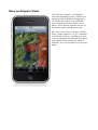
Airspace overlay transparency – Determines how opaque the drawn airspaces are. As some airspace
definitions set fairly dark colors (obscuring the map below), this feature has been added in version
1.7.
Purchase Unlock – Without an unlock, only the first 20 objects in the OpenAir file will be
displayed. The actual cost will be shown when selecting this option (the price varies due to the
occasional special).
Let's look at the Object Filters next.