1
Ocean and Sea Ice SAF
RapidScat wind Product User Manual
25 and 50 km wind products (OSI-109)
Version 1.1, March 2015
SAF/OSI/CDOP2/KNMI/TEC/MA/227
RapidScat wind Product User Manual
DOCUMENT SIGNATURE TABLE
Name
Date
Prepared by:
O&SI SAF Project
Team
Mar 2015
Approved by:
O&SI SAF Project
Manager
Mar 2015
Signature
DOCUMENTATION CHANGE RECORD
Issue / Revision
Date
Version 1.0
Feb 2015
Version 1.1
Mar 2015
Change
Description
First version
Minor
Comments from ORR included
KNMI, De Bilt, the Netherlands
Reference: SAF/OSI/CDOP2/KNMI/TEC/MA/227
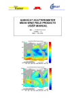
Cover illustration: RapidScat wind field over the Atlantic Ocean and western European seas at 25 km
Wind Vector Cell (WVC) spacing on 20 January 2015, approximately 4:00 UTC, overlaid on a
METEOSAT infrared satellite image at 3:45 UTC. The orange dots are rejected WVCs, most likely due
to rain or confused sea state. The purple dots indicate WVCs for which the land flag is set. The blue
arrows show a 3-hour forecast of the winds by the KNMI High-Resolution Limited Area Model
(HiRLAM).
Page 2 of 22
SAF/OSI/CDOP2/KNMI/TEC/MA/227
RapidScat wind Product User Manual
Contents
1.
1.1.
1.2.
1.3.
1.4.
1.5.
1.6.
2.
3.
3.1.
3.2.
3.3.
3.4.
4.
5.
5.1.
5.2.
6.
7.
8.
9.
10.
Introduction ..............................................................................................................................4
Overview ................................................................................................................................... 4
Acknowledgement ..................................................................................................................... 4
Disclaimer.................................................................................................................................. 4
Useful links ................................................................................................................................ 5
Limitations and remaining issues .............................................................................................. 5
History of product changes ....................................................................................................... 5
The RapidScat scatterometer .................................................................................................6
Processing scheme .................................................................................................................8
Backscatter egg averaging........................................................................................................ 8
Backscatter calibration .............................................................................................................. 8
NWP collocation ........................................................................................................................ 8
Quality control and monitoring .................................................................................................. 9
Helpdesk and data availability ............................................................................................. 10
Data description .................................................................................................................... 11
Wind product characteristics ................................................................................................... 11
File formats.............................................................................................................................. 11
Data quality ............................................................................................................................ 14
References ............................................................................................................................. 16
Abbreviations and acronyms ............................................................................................... 17
Appendix A: BUFR data descriptors ................................................................................... 18
Appendix B: NetCDF data format ........................................................................................ 21
Page 3 of 22
SAF/OSI/CDOP2/KNMI/TEC/MA/227
RapidScat wind Product User Manual
1. Introduction
1.1.
Overview
RapidScat is mounted on the International Space Station (ISS) and the data are acquired at several
ground stations. The National Aeronautics and Space Administration (NASA) Jet Propulsion
Laboratory (JPL) collects the data and produces two orbit-based 25 km level 2a scatterometer
products with different timeliness. One product is available approximately 2 hours after the sensing
time of the middle of an orbit file and contains approximately 80% of the theoretical data amount. The
other product is available approximately 3 hours after the sensing time of the middle of an orbit file and
contains approximately 98% of the theoretical data amount. Hence the user can choose between a
timely, but less complete product and a less timely, but more complete product. The level 2a files from
the 2 hours and 3 hours data streams are retrieved from JPL by KNMI and processed into 25 km and
50 km level 2 wind products. This results in four different available wind products; two timeliness’s and
two resolutions.
The EUMETSAT Ocean and Sea Ice Satellite Application Facility (OSI SAF) produces a range of airsea interface products, namely: wind, sea ice characteristics, Sea Surface Temperatures (SST) and
radiative fluxes, Surface Solar Irradiance (SSI) and Downward Long wave Irradiance (DLI). The
Product Requirements Document [1] provides an overview of the committed products and their
characteristics in the current OSI SAF project phase, the Service Specification Document [2] provides
specifications and detailed information on the services committed towards the users by the OSI SAF in
a given stage of the project.
KNMI is involved in the OSI SAF as the centre where the level 1 to level 2 scatterometer wind
processing is carried out. This document is the Product User Manual to the RapidScat wind product.
More general information on the OSI SAF project is available on the OSI SAF web site: http://www.osisaf.org/. The user is strongly encouraged to register on this web site in order to receive the service
messages and the latest information about the OSI SAF products. More information about this product
can also be found on http://www.knmi.nl/scatterometer/.
The scatterometer is an instrument that provides information on the wind field near the ocean surface,
and scatterometry is the knowledge of extracting this information from the instrument’s output. Spacebased scatterometry has become of great benefit to meteorology and climate in the past years. This is
extensively described in the Algorithm Theoretical Baseline Document, see [3].
KNMI has a long experience in scatterometer processing and is developing generic software for this
purpose. Processing systems have been developed for the ERS, NSCAT, SeaWinds, ASCAT,
Oceansat-2 and RapidScat scatterometers. Scatterometer processing software is developed in the
EUMETSAT Numerical Weather Prediction Satellite Application Facility (NWP SAF), whereas wind
processing is performed operationally in the Ocean and Sea Ice SAF (OSI SAF).
The OSI SAF products are delivered on request through the KNMI FTP server and through
EUMETCast. See also http://www.knmi.nl/scatterometer/ for real-time graphical examples of the
products and up-to-date information and documentation.
This user manual outlines user information for the OSI SAF RapidScat winds on 25 km and 50 km grid
spacing, OSI-109. Section 2 presents a brief description of the SeaWinds instrument, and section 3
gives an overview of the data processing configuration. Section 4 provides details on how to access
the products. Detailed information on the file content and format is given in section 5. The product
quality is elaborated in section 6 and in the validation report to these products [5].
1.2.
Acknowledgement
JPL kindly provides the near-real time RapidScat level 2a data which are used as input for the OSI
SAF wind products.
1.3.
Disclaimer
All intellectual property rights of the OSI SAF products belong to EUMETSAT. The use of these
products is granted to every interested user, free of charge. If you wish to use these products,
EUMETSAT's copyright credit must be shown by displaying the words "copyright (year) EUMETSAT"
on each of the products used.
Page 4 of 22
SAF/OSI/CDOP2/KNMI/TEC/MA/227
RapidScat wind Product User Manual
The OSI SAF is much interested in receiving your feedback, would appreciate your acknowledgment
in using and publishing about the data, and like to receive a copy of any publication about the
application of the data. Your feedback helps us in maintaining the resources for the OSI SAF wind
services.
1.4.
Useful links
KNMI scatterometer web site: http://www.knmi.nl/scatterometer/
Information on OSI SAF activities at KNMI: http://www.knmi.nl/scatterometer/osisaf/
OSI SAF wind product documentation on http://www.osi-saf.org/
NWP SAF website: http://nwpsaf.eu/
RapidScat visual products:
http://www.knmi.nl/scatterometer/rscat_nrt_25_prod/ (25 km 2 hours)
http://www.knmi.nl/scatterometer/rscat_del_25_prod/ (25 km 3 hours)
http://www.knmi.nl/scatterometer/rscat_del_50_prod/ (50 km 3 hours)
EUMETSAT Data Centre:
http://www.eumetsat.int/website/home/Data/DataDelivery/EUMETSATDataCentre/index.html
RapidScat information on JPL web site: http://www.jpl.nasa.gov/missions/iss-rapidscat/
1.5.
Limitations and remaining issues
1) There are gaps in the data due to interruptions in data transmission from the International Space
Station. These gaps appear in particular over the Indian Ocean.
2) Entire orbits of data are also missing periodically due to events such as vehicle dockings or
astronaut/cosmonaut space-walks that require the RapidScat to stop operations. An overview of past
and planned events can be found under ‘RapidScat scheduled outages’ in the web product viewers.
1.6.
History of product changes
Here is an historical overview of the changes in the RapidScat wind products:
08-Dec-2014 First development version of RapidScat global wind product. PenWP version is
1_9_01.
20-Jan-2015 Change in backscatter corrections resulting in small wind speed reduction; quality
control improvement. PenWP version is 1_9_02.
Page 5 of 22
SAF/OSI/CDOP2/KNMI/TEC/MA/227
RapidScat wind Product User Manual
2. The RapidScat scatterometer
The RapidScat scatterometer instrument is a speedy and cost-effective replacement for the NASA
QuikSCAT satellite, which provided a decade-long ocean vector wind observations used in, a.o.,
oceanography, Numerical Weather Prediction (NWP) and nowcasting. QuikSCAT's measurements
were essential and when the satellite stopped collecting continuous swath-based wind data in late
2009, NASA was challenged to quickly and cost-effectively conceive of a replacement. NASA's Jet
Propulsion Laboratory and the agency's station program came up with a solution that uses the
framework of the International Space Station (ISS) and reuses hardware originally built to test parts of
QuikSCAT, to create an instrument for a fraction of the cost and time it would take to build and launch
a new satellite.
RapidScat was launched on 20 September 2014 and mounted on the International Space Station. The
altitude of the space station’s orbit is 375 to 435 kilometres, and its inclination is 51.6°. The
observation swath of approximately 1100 kilometres covers the majority of the oceans between 56°
north and south latitude in 48 hours. The orbit, which is not sun-synchronous, gives different overpass
times for each day and as such allows cross-calibration with other instruments on polar satellites, like
ASCAT and HY-2A. For detailed information on the RapidScat instrument and data we refer to [6] and
[7]. A brief description is given below.
The RapidScat instrument is a conically scanning pencil-beam scatterometer. It uses a 0.75-meter
dish antenna rotating at 18 rpm with two “spot” beams on the ground, a horizontal polarisation beam
(HH) and a vertical polarisation beam (VV) at incidence angles of 49º and 56º, respectively. The
beams sweep the surface in a circular pattern as depicted in Figure 1. The ground swath of the HH
beam is approximately 900 km wide and the ground swath of the VV beam is approximately 1100 km
wide. Due to the conical scanning, a Wind Vector Cell (WVC) is generally viewed when looking
forward (fore) and a second time when looking aft. As such, up to four measurement classes (called
“beam” here) emerge: HH fore, HH aft, VV fore, and VV aft, in each WVC.
Figure 1: RapidScat pencil beam geometry (source: JPL web site).
The wind retrieval from RapidScat data is not trivial. In contrast with side-looking scatterometers like
ASCAT, the number of measurements and the beam azimuth angles vary with the sub-satellite crosstrack location. The wind retrieval skill will therefore depend on the position in the swath. A detailed
discussion is provided in [3]. Here we only summarise some issues specific to RapidScat.
In the outer swath (where only VV beam data are available), the individual backscatter measurements
(‘eggs’) contributing to the VV fore or aft beam in a specific WVC are re-distributed to form four more
or less independent backscatter observations. Eggs are accumulated and averaged based on their
azimuth angles. The outer swath winds have slightly reduced quality but they are still very well usable.
These winds are flagged in the product and can be filtered out easily if requested, see section 5.2.
Page 6 of 22
SAF/OSI/CDOP2/KNMI/TEC/MA/227
RapidScat wind Product User Manual
The RapidScat scatterometer operates at a Ku-band radar wavelength (13.5 GHz). The atmosphere is
not transparent at these wavelengths and in particular rain is detrimental for wind computation. In fact,
moderate and heavy rain cause bogus wind retrievals of 15-20 m/s wind speed which need to be
eliminated by a Quality Control (QC) step. Wind-rain discrimination is easiest to manage in the sweet
swath, but still performs acceptably in nadir and outer swath.
The processing algorithms for the RapidScat wind processing are heavily based on the algorithms as
developed for SeaWinds on QuikSCAT and OSCAT on Oceansat-2 [3]. [3]. When calibrated
geophysical backscatter measurements are available, the wind processing of the different Ku-band
pencil-beam scatterometers is very similar. The wind processing software which is used, the Pencil
beam Wind Processor (PenWP), is the successor of the SeaWinds Data Processor (SDP) and the
OSCAT Wind Data Processor (OWDP). PenWP is capable to process data from SeaWinds, OSCAT,
RapidScat and HY-2A scatterometers and will eventually replace all former pencil beam Ku-band wind
processing software packages in the NWP SAF.
Differences between the various rotating pencil beam scatterometers are to a great extent on a
technical (data formats and handling) level. Moreover, due to different orbits and antenna geometries,
incidence angles differ. PenWP utilises the NSCAT-4 Geophysical Model Function (GMF) [3], which is
available for all prevailing incidence angles. In order to handle instrument differences well, particularly
noise characteristics, some parts of the processing were re-tuned for RapidScat, mainly the
normalisation of the Maximum Likelihood Estimator (MLE) and the tuning of the Quality Control [4].
Page 7 of 22
SAF/OSI/CDOP2/KNMI/TEC/MA/227
RapidScat wind Product User Manual
3. Processing scheme
KNMI has a processing chain running in near-real time with RapidScat data, including visualisation on
the internet. The processing software is developed in the NWP SAF and runs in the KNMI operational
environment. The processing includes monitoring and archiving functionalities. General information
about the scatterometer wind processing algorithms can be found in the Algorithm Theoretical Basis
Document (ATBD) [3].
3.1.
Backscatter egg averaging
The level 2a backscatter data from JPL are organised in eggs, each σ is based on the sum of the
echo energies measured among the eight centre high resolution slices in a single scatterometer pulse.
The eggs are beam-wise accumulated to a WVC level before wind inversion is done. The egg weights
are proportional to the estimated transmitted power contained in an egg, i.e., inversely proportional to
the Kp value. The Sigma0 Quality Flag present in the level 2a data is evaluated and egg data with one
of the following flags set are skipped:
0
•
Bit 0: Measurement not usable
•
Bit 1: Signal to Noise Ratio level low
•
Bit 3: Data outside acceptable range
•
Bit 4: Pulse quality unacceptable
•
Bit 5: Location algorithm does not converge
•
Bit 6: Frequency shift beyond range
•
Bit 7: Temperature outside range
•
Bit 8: No applicable attitude records
•
Bit 9: Ephemeris data unacceptable
3.2.
Backscatter calibration
No absolute instrumental instrument calibration exists for Ku-band pencil-beam scatterometers. Kuband pencil-beam backscatter distributions should however be matched to achieve wind
intercalibration of all space-borne scatterometer instruments. We thus developed methods that
calibrate the winds of each scatterometer effectively to the mean winds at collocated moored buoys.
No signs of azimuth (or WVC) dependent instrument biases have been found for RapidScat. Also the
beam incidence angles are constant and hence we have chosen to apply backscatter corrections that
are only dependent on the beam polarisation. The goal of applying backscatter corrections was to
minimise wind speed biases between scatterometer winds on the one hand and buoy and NWP winds
on the other hand. With this in mind, the calibration correction for VV has been obtained by looking at
the outer swath data (where no HH data are available) and choosing a calibration amount that yields
minimum wind speed biases. Subsequently, the swath part containing both HH and VV was
considered, the VV correction was applied and a HH correction was obtained that again yields
minimum biases. In this simple way, within a few iterations the two calibration coefficients could be
obtained:
•
For HH, 0.45 dB has been added in the 25 km products and 0.38 dB in the 50 km products
• For VV, 0.45 dB has been added in the 25 km products and 0.38 dB in the 50 km products
Note that the calibrated backscatter values are only available within the wind processing software; the
σ 0 data in the BUFR wind product are uncorrected values.
3.3.
NWP collocation
KNMI receives NWP model data from ECMWF twice a day through the RMDCN.
NWP model sea surface temperature (SST) data are used to provide information about possible ice
presence in the WVCs. The SST values of the four surrounding model grid points around the WVC
location are bi-linearly interpolated. Note that the ECMWF model data do not contain SST values over
land; if one or more of the four surrounding grid points has missing SST data, the SST value of the
grid point closest to the WVC is taken. WVCs with a sea surface temperature below -1.0 °C are
assumed to be covered with ice and no wind information is calculated. Although the freezing
Page 8 of 22
SAF/OSI/CDOP2/KNMI/TEC/MA/227
RapidScat wind Product User Manual
temperature of sea water is around -1.7 °, we keep some margin to prevent any ice contamination in
the wind computation. Note that, due to the ISS orbit, data will not be acquired close to the poles.
However, frozen seas will also occur at lower latitudes in the winter season, e.g. near Newfoundland
and east of Russia.
Land presence within each WVC is determined by using the land-sea mask available from the model
data. The weighted mean value of the land fractions of all model grid points within 50 km (60 km in the
50 km products) of the WVC centre is calculated. The weight of each grid point scales with 1/r2, where
r is the distance between the WVC centre and the model grid point. If this mean land fraction value
exceeds a threshold of 0.02, no wind retrieval is performed.
NWP forecast wind data are necessary in the ambiguity removal step of the processing. Wind
forecasts are available twice a day (00 and 12 GMT analysis time) with forecast time steps of +3h,
+6h, …, +36h. The model wind data are quadratically interpolated with respect to time and linearly
interpolated with respect to location and put into the level 2 information part of each WVC (see section
5.2). Note that the ECMWF winds stored in the wind products are real winds rather than equivalent
neutral winds.
3.4.
Quality control and monitoring
In each WVC, the σ data is checked for quality and completeness and the inversion residual [3] is
checked. Degraded WVCs are flagged; see section 5.2 for more details.
An information file is made for each product. The content of the file is identical whatever the product
and results from a compilation of all the global information concerning this product. From these files,
various graphs have been produced to visually display the confidence levels of the products and their
evolution with time. Any deviations from nominal behaviour would be immediately visible as steps in
these graphs. Data quality is also available to the users within the products; see section 5 for a
description of quality flags.
0
Page 9 of 22
SAF/OSI/CDOP2/KNMI/TEC/MA/227
RapidScat wind Product User Manual
4. Helpdesk and data availability
For a swift response management procedure, user requests on the OSI SAF data products should be
issued at the Ocean and Sea Ice SAF website.
The BUFR products are disseminated on EUMETCast. Please consult http://www.eumetsat.int/, under
‘Access to Data’ for more information on EUMETCast dissemination and how to receive these and
other EUMETSAT meteorological satellite products, or contact [email protected].
The BUFR and NetCDF products are also made available on a password-protected ftp site (data from
the last three days only). The access details are provided to new users by email request. Please send
your requests to [email protected].
The four products can be distinguished w.r.t. timeliness and product swath grid spacing by their file
names, see section 5.2.
A BUFR reader is available at www.knmi.nl/scatterometer/bufr_reader/.
The products are available (after registration) from the EUMETSAT Data Centre,
http://www.eumetsat.int/website/home/Data/DataDelivery/EUMETSATDataCentre/index.html.
KNMI
also keeps an off line archive of the products. You can send a request to [email protected].
Page 10 of 22
SAF/OSI/CDOP2/KNMI/TEC/MA/227
RapidScat wind Product User Manual
5. Data description
5.1.
Wind product characteristics
Physical definition
Horizontal equivalent neutral wind vector at 10 m height, obtained using the NSCAT-4 GMF, see [3].
Units and range
Wind speed is measured in m/s. The wind speed range is from 0-50 m/s, but wind speeds over 25 m/s
are generally less reliable [3]. In the BUFR products, the wind direction is in meteorological (World
Meteorological Organisation, WMO) convention relative to North: 0 degrees corresponds to a wind
flowing to the South with a clockwise increment. In the NetCDF products, the wind direction is in
oceanographic convention: 0 degrees corresponds to a wind flowing to the North with a clockwise
increment.
Input satellite data
The RapidScat level 2a input data [7] are kindly provided by NASA’s JPL. These ‘Surface Flagged
0
Sigma0s and Attenuations in 25 km Swath Grid’ data are so-called egg data, each σ is based on the
sum of the echo energies measured among the eight centre high resolution slices in a single
scatterometer pulse. The product contains geo-located backscatter measurements on a satellite swath
WVC grid of 25 km size.
Geographical definition
The altitude of the International Space Station’s orbit is 375 to 435 kilometres, and its inclination is
51.6°. The observation swath of approximately 1100 kilometres covers the majority of the ocean
between 56° north and south latitude in 48 hours. The orbit is not sun-synchronous. Swath width is 42
25 km size WVCs or 21 50 km size WVCs. Depending on the ISS orbit height, the leftmost and
rightmost WVCs may be empty in the 25 km product. Products are organised in files containing one
orbit, starting at the southernmost location of the orbits.
Output product
The input product in HDF is processed into a BUFR output product including a unique wind solution
(chosen), its corresponding ambiguous wind solutions and quality information (distance to cone,
quality flag). The products are also available in NetCDF format; see section 10 for more details.
Expected accuracy
The expected accuracy is defined as the expected bias and standard deviation of the primary
calculations. The accuracy is validated against in situ wind measurements from buoys, and against
NWP data. Even better, the errors of all NWP model winds, in situ data, and scatterometer winds are
computed in a triple collocation exercise [9]. The performance is pretty constant over the globe and
depends mainly on the sub footprint wind variability. The performance of the products issued by the
OSI SAF is characterised by a wind component standard deviation smaller than 2 m/s and a bias of
less than 0.5 m/s in wind speed. More validation information is available in [5], showing that the actual
products are much more accurate.
5.2.
File formats
Wind products are in BUFR Edition 4 or in NetCDF format. A complete description of BUFR can be
found in WMO publication No 306, Manual on Codes.
The OSI SAF wind product is stored in exactly the same BUFR format as described in the SeaWinds
BUFR manual from NOAA [8], a list of descriptors (fields) contained in each WVC is provided in
section 9. Data are organised in files containing approximately one orbit (93 minutes) of data.
File name conventions
The file name convention for the level 2 BUFR product on the KNMI FTP server is
rapid_YYYYMMDD_HHMMSS_iss____ORBIT(_SRV)_T_SMPL_CONT_l2.bufr
•
YYYYMMDD denotes the acquisition date (year, month and day) of the first data in the file
•
HHMMSS denotes the acquisition time (hour, minute and second) of the first data in the file
Page 11 of 22
SAF/OSI/CDOP2/KNMI/TEC/MA/227
RapidScat wind Product User Manual
•
ORBIT is the orbit number of the first data in the file (00000-99999)
•
SRV (optional field) is the service, it is missing for the 3 hours product and set to 2hr for the
2 hours product.
•
T is the processing type (o for operational, t for test)
•
SMPL is the WVC sampling (cell spacing): 250 for the 25 km and 500 for the 50 km product
• CONT refers to the product contents: always ovw for a product containing Ocean Vector Winds
Examples of file names are
rapid_20150120_031543_iss____01843_o_250_ovw_l2.bufr
for a 25 km 3 hours product
rapid_20150120_031543_iss____01843_2hr_o_500_ovw_l2.bufr
for a 50 km 2 hours product
The file names on EUMETCast are different from those on the FTP server and according to the WMO
conventions
W_NL-KNMI-DeBilt,SURFACE+SATELLITE,ISS+RAPIDSCAT_C_EHDB_YYYYMMDDHHMMSS_ORBIT(_SRV)_T_SMPL_CONT_l2.bin
The meaning of the acronyms in the file names is the same as for the files on FTP. Example file
names are
W_NL-KNMI-DeBilt,SURFACE+SATELLITE,ISS+RAPIDSCAT_C_EHDB_20150120031543_01843_o_250_ovw_l2.bin
W_NL-KNMI-DeBilt,SURFACE+SATELLITE,ISS+RAPIDSCAT_C_EHDB_20150120031543_01843_2hr_o_500_ovw_l2.bin
File contents
In each node or wind vector cell (WVC) 118 data descriptors are defined. In addition some extra
information/alterations have been put in place:
•
In the BUFR header the value for “generating centre” is set to 99, representing KNMI.
•
The products contain up to four ambiguous wind solutions, with an index to the selected wind
solution. After the wind inversion step, we initially store the up to four solutions corresponding to
the inversion residual (Maximum Likelihood Estimator, MLE) relative minima. However,
subsequently the wind speed and wind direction of the after 2DVAR-selected Multiple Solution
Scheme (MSS) wind solution is put at the index of the selected wind solution. This index is set to
the initial wind vector solution which is closest to the MSS wind vector selection obtained after
2DVAR. Thus, the former wind vector is not provided in the product, but rather the MSS selected
wind vector. The ‘Formal Uncertainty in Wind Direction’ does not contain the uncertainty, but the
normalised inversion residual (referred to as Rn in [10]).
•
The Wind Vector Cell Quality Flag (table 021109) is redefined and now has the following
definitions:
Description
BUFR bit
Fortran bit
Not enough good sigma-0 available for wind retrieval
1
15
Not used
2
14
VV polarised data in more than two beams
3
13
Product monitoring not used
4
12
Product monitoring flag
5
11
KNMI Quality Control (including rain) data rejection
6
10
Variational QC data rejection
7
9
Land presence
8
8
Ice presence
9
7
Not used
10
6
Reported wind speed is greater than 30 m/s
11
5
Reported wind speed is less than or equal to 3 m/s
12
4
Not used
13
3
Rain flag algorithm detects rain
14
2
Page 12 of 22
SAF/OSI/CDOP2/KNMI/TEC/MA/227
RapidScat wind Product User Manual
Description
BUFR bit
Fortran bit
Data from at least one of the four possible beam/view
combinations are not available
15
1
Not used
16
0
Missing value
All 17 set
All 17 set
In Fortran, if the Wind Vector Cell Quality Flag is stored in an integer I then use BTEST(I,NDW-NB-1)
to test BUFR bit NB, where NDW=17 is the width in bits of the data element in BUFR.
The flag indicating that more than two beams contain VV polarised data, BUFR bit 3, is active in the
outer part of the swath (WVCs 1-5 and 38-42 at 25 km, WVCs 1-2 and 20-21 at 50 km). It indicates
0
that outer beam data is used to obtain four independent σ values, contrary to the middle part of the
swath where two beams contain VV (outer beam) data and two beams contain HH (inner beam) data.
In the outer parts of the swath, the VV backscatter data present in the level 2a product are distributed
to two WVC beams based on their azimuth angle such that maximum azimuth dispersion is obtained.
This generally results in slightly less optimal wind retrieval; users assimilating the data into NWP
models may consider to reject WVCs for which this flag is set.
If the ‘product monitoring not used’ bit is set to zero, the product is monitored. If the product is
monitored and the ‘product monitoring flag’ bit is set to zero, the product is valid; otherwise it is
rejected by the product monitoring [3]. This is based on a statistical check of the number of WVC QC
rejections, the wind speed bias with respect to the NWP background, and the wind vector RMS
difference with respect to the NWP background. The product monitoring bits have the same value for
all WVCs in one BUFR output file.
If the KNMI QC flag is set in a WVC, then the backscatter information is not useable for various
geophysical reasons like rain, confused sea-state etc, resulting in a too large inversion residual. WVCs
in which the KNMI QC flag is set, are not used in the calculation of the analysis field in the ambiguity
removal step. However, after the ambiguity removal the wind solution closest to the analysis field is
chosen (if wind solutions are present in the WVC). This means that such a WVC may contain a
selected wind solution, but it is suspect.
The land presence flag is set if a land fraction (see section 3.3) larger than zero is calculated for the
WVC. As long as the land fraction is below the limit value, a reliable wind solution may however still be
present so there is normally no reason to reject WVCs with the land flag set.
Ice presence flag is set if the SST calculated for the WVC (see section 3.3) is below -1.0 °C. No winds
are computed in this WVC.
If the variational QC flag is set, the wind vector in the WVC is rejected during ambiguity removal due to
spatial inconsistency. A wind solution is present, but it may be suspect.
It is recommended not to use WVCs with the KNMI quality control flag or the variational quality control
flag set. See [3] for more information on product reliability.
Page 13 of 22
SAF/OSI/CDOP2/KNMI/TEC/MA/227
RapidScat wind Product User Manual
6. Data quality
As stated in the OSI SAF product requirements [1], the accuracy should be better than 2 m/s in wind
component standard deviation with a bias of less than 0.5 m/s in wind speed.
Figure 2: Two-dimensional histograms of wind speed, direction (w.r.t. wind coming from the
North), u and v components of 25 km (top) and 50 km (bottom) RapidScat wind product versus
the ECMWF model forecast winds from 25 and 26 January 2015.
Page 14 of 22
SAF/OSI/CDOP2/KNMI/TEC/MA/227
RapidScat wind Product User Manual
Figure 2 shows two-dimensional histograms of the retrieved winds versus ECMWF 10 m wind
background for the 25 km and 50 km wind product, after rejection of Quality Controlled (KNMI QC
flagged) wind vectors. The top left plot in each panel corresponds to wind speed (bins of 0.5 m/s) and
the top right plot to wind direction (bins of 2.5°). The latter are computed for only ECMWF winds larger
than 4 m/s. The bottom plots show the u and v wind component statistics (bins of 0.5 m/s). The
contour lines are in logarithmic scale. Note that the ECMWF winds are real 10 m winds, whereas the
scatterometer winds are equivalent neutral 10 m winds, which are on average 0.2 m/s higher.
From these results, it is clear that the spread in the distributions is small. The wind speed bias is
0.11 m/s for 25 km and 50 km, close to the expected value of 0.2 m/s. The wind component standard
deviations are below 1.3 m/s for the 25 km product and below 1.2 m/s for the 50 km product. Much
more validation information can be found in [5].
Page 15 of 22
SAF/OSI/CDOP2/KNMI/TEC/MA/227
RapidScat wind Product User Manual
7. References
[1]
OSI SAF,
Product Requirements Document,
SAF/OSI/CDOP2/M-F/MGT/PL/2-001, 2015
[2] OSI SAF,
Service Specification Document,
SAF/OSI/CDOP2/M-F/MGT/PL/2-003, 2015
[3] OSI SAF,
Algorithm Theoretical Basis Document for the OSI SAF wind products,
SAF/OSI/CDOP2/KNMI/SCI/MA/197, 2015 (*)
[4] Verhoef, A. and A. Stoffelen,
Quality Control of Ku-band scatterometer winds,
OSI SAF report SAF/OSI/CDOP2/KNMI/TEC/RP/194, 2012 (*)
[5] Verhoef, A., J. Vogelzang and A. Stoffelen,
RapidScat wind validation report,
SAF/OSI/CDOP2/KNMI/TEC/RP/228, 2015 (*)
[6] JPL,
RapidScat mission website
http://winds.jpl.nasa.gov/missions/RapidScat/
[7] JPL,
QuikSCAT Science Data Product User’s Manual, version 3.0,
Jet Propulsion Laboratory D-18053-Rev A, September 2006
[8] Leidner, M., R. Hoffman, and J. Augenbaum,
SeaWinds scatterometer real-time BUFR geophysical data product, version 2.2.0,
NOAA/NESDIS, February 2000, available on ftp://www.scp.byu.edu/data/qscat/docs/bufr.pdf
[9] Thesis Scatterometry by Ad Stoffelen, 1998 (*)
[10] Thesis Wind Field Retrieval from Satellite radar systems by Marcos Portabella, 2002 (*)
References marked with a (*) are available on http://www.knmi.nl/scatterometer/publications/.
Page 16 of 22
SAF/OSI/CDOP2/KNMI/TEC/MA/227
RapidScat wind Product User Manual
8. Abbreviations and acronyms
2DVAR
ATBD
AR
ASCAT
BUFR
DLI
ECMWF
ERS
EUMETSAT
GMF
HDF
HH
ISS
JPL
KNMI
MLE
MSS
NASA
NetCDF
NOAA
NSCAT
NWP
OSI SAF
OWDP
PenWP
RMDCN
QC
QuikSCAT
SAF
SDP
SeaWinds
SSI
SST
u
v
VV
WMO
WVC
Two-dimensional Variational Ambiguity Removal
Algorithm Theoretical Basis Document
Ambiguity Removal
Advanced Scatterometer
Binary Universal Format Representation
Downward Long wave Irradiance
European Centre for Medium-Range Weather Forecasts
European Remote-Sensing Satellite
European Organisation for the Exploitation of Meteorological Satellites
Geophysical Model Function
Hierarchical Data Format
Horizontal polarisation of sending and receiving radar antennas
International Space Station
Jet Propulsion Laboratory
Royal Netherlands Meteorological Institute
Maximum Likelihood Estimator
Multiple Solution Scheme
National Aeronautics and Space Administration (USA)
Network Common Data Form
National Oceanic and Atmospheric Administration (USA)
NASA Scatterometer
Numerical Weather Prediction
Ocean and Sea Ice SAF
OSCAT Wind Data Processor
Pencil beam Wind Processor
Regional Meteorological Data Communication Network
Quality Control
US Quick Scatterometer mission carrying the SeaWinds scatterometer
Satellite Application Facility
SeaWinds Data Processor
Scatterometer on-board QuikSCAT platform (USA)
Surface Solar Irradiance
Sea Surface Temperature
West-to-east (zonal) wind component
South-to-north (meridional) wind component
Vertical polarisation of sending and receiving radar antennas
World Meteorological Organisation
Wind Vector Cell
Page 17 of 22
SAF/OSI/CDOP2/KNMI/TEC/MA/227
RapidScat wind Product User Manual
9. Appendix A: BUFR data descriptors
Number
001
002
003
004
005
006
007
008
009
010
011
012
013
014
015
016
017
018
019
020
021
022
023
024
025
026
027
028
029
030
031
032
033
034
035
036
037
038
039
040
041
042
043
044
045
046
047
048
049
050
051
Descriptor
(01007)
(01012)
(02048)
(21119)
(25060)
(02026)
(02027)
(05040)
(04001)
(04002)
(04003)
(04004)
(04005)
(04006)
(05002)
(06002)
(08025)
(04001)
(05034)
(06034)
(21109)
(11081)
(11082)
(21101)
(21102)
(21103)
(21120)
(21121)
(13055)
(21122)
(11012)
(11052)
(11011)
(11053)
(21104)
(11012)
(11052)
(11011)
(11053)
(21104)
(11012)
(11052)
(11011)
(11053)
(21104)
(11012)
(11052)
(11011)
(11053)
(21104)
(02104)
Parameter
Satellite Identifier
Direction of Flight
Satellite Instrument Identifier
Wind Scatterometer GMF
Software Identification
Cross Track Resolution
Along Track Resolution
Orbit Number
Year
Month
Day
Hour
Minute
Second
Latitude (Coarse Accuracy)
Longitude (Coarse Accuracy)
Time Difference Qualifier
Time to Edge
Along Track Row Number
Cross Track Cell Number
Seawinds Wind Vector Cell Quality Flag
Model Wind Direction At 10 M
Model Wind Speed At 10 M
Number of Vector Ambiguities
Index of Selected Wind Vector
Total Number of Sigma0 Measurements
Seawinds Probability of Rain
Seawinds NOF Rain Index
Intensity Of Precipitation
Attenuation Correction On Sigma-0 (from Tb)
Wind Speed At 10 M
Formal Uncertainty In Wind Speed
Wind Direction At 10 M
Formal Uncertainty In Wind Direction
Likelihood Computed for Wind Solution
Wind Speed At 10 M
Formal Uncertainty In Wind Speed
Wind Direction At 10 M
Formal Uncertainty In Wind Direction
Likelihood Computed for Wind Solution
Wind Speed At 10 M
Formal Uncertainty In Wind Speed
Wind Direction At 10 M
Formal Uncertainty In Wind Direction
Likelihood Computed for Wind Solution
Wind Speed At 10 M
Formal Uncertainty In Wind Speed
Wind Direction At 10 M
Formal Uncertainty In Wind Direction
Likelihood Computed for Wind Solution
Antenna Polarisation
Page 18 of 22
Unit
Code Table
Degree True
Code Table
Code Table
Numeric
m
m
Numeric
Year
Month
Day
Hour
Minute
Second
Degree
Degree
Code Table
Second
Numeric
Numeric
Flag Table
Degree True
m/s
Numeric
Numeric
Numeric
Numeric
Numeric
kg/m**2/sec
dB
m/s
m/s
Degree True
Degree True
Numeric
m/s
m/s
Degree True
Degree True
Numeric
m/s
m/s
Degree True
Degree True
Numeric
m/s
m/s
Degree True
Degree True
Numeric
Code Table
SAF/OSI/CDOP2/KNMI/TEC/MA/227
Number
052
053
054
055
056
057
058
059
060
061
062
063
064
065
066
067
068
069
070
071
072
073
074
075
076
077
078
079
080
081
082
083
084
085
086
087
088
089
090
091
092
093
094
095
096
097
098
099
100
101
102
103
104
105
106
Descriptor
(08022)
(12063)
(12065)
(02104)
(08022)
(12063)
(12065)
(21110)
(05002)
(06002)
(21118)
(02112)
(02111)
(02104)
(21105)
(21106)
(21107)
(21114)
(21115)
(21116)
(08018)
(21117)
(21111)
(05002)
(06002)
(21118)
(02112)
(02111)
(02104)
(21105)
(21106)
(21107)
(21114)
(21115)
(21116)
(08018)
(21117)
(21112)
(05002)
(06002)
(21118)
(02112)
(02111)
(02104)
(21105)
(21106)
(21107)
(21114)
(21115)
(21116)
(08018)
(21117)
(21113)
(05002)
(06002)
RapidScat wind Product User Manual
Parameter
Total Number w.r.t. accumulation or average
Brightness Temperature
Standard Deviation Brightness Temperature
Antenna Polarisation
Total Number w.r.t. accumulation or average
Brightness Temperature
Standard Deviation Brightness Temperature
Number of Inner-Beam Sigma0 (fwd of sat.)
Latitude (Coarse Accuracy)
Longitude (Coarse Accuracy)
Attenuation Correction On Sigma-0
Radar Look (Azimuth) Angle
Radar Incidence Angle
Antenna Polarisation
Normalized Radar Cross Section
Kp Variance Coefficient (Alpha)
Kp Variance Coefficient (Beta)
Kp Variance Coefficient (Gamma)
Seawinds Sigma-0 Quality Flag
Seawinds Sigma-0 Mode Flag
Seawinds Land/Ice Surface Flag
Sigma-0 Variance Quality Control
Number of Outer-Beam Sigma0 (fwd of sat.)
Latitude (Coarse Accuracy)
Longitude (Coarse Accuracy)
Attenuation Correction On Sigma-0
Radar Look (Azimuth) Angle
Radar Incidence Angle
Antenna Polarisation
Normalized Radar Cross Section
Kp Variance Coefficient (Alpha)
Kp Variance Coefficient (Beta)
Kp Variance Coefficient (Gamma)
Seawinds Sigma-0 Quality Flag
Seawinds Sigma-0 Mode Flag
Seawinds Land/Ice Surface Flag
Sigma-0 Variance Quality Control
Number of Inner-Beam Sigma0 (aft of sat.)
Latitude (Coarse Accuracy)
Longitude (Coarse Accuracy)
Attenuation Correction On Sigma-0
Radar Look (Azimuth) Angle
Radar Incidence Angle
Antenna Polarisation
Normalized Radar Cross Section
Kp Variance Coefficient (Alpha)
Kp Variance Coefficient (Beta)
Kp Variance Coefficient (Gamma)
Seawinds Sigma-0 Quality Flag
Seawinds Sigma-0 Mode Flag
Seawinds Land/Ice Surface Flag
Sigma-0 Variance Quality Control
Number of Outer-Beam Sigma0 (aft of sat.)
Latitude (Coarse Accuracy)
Longitude (Coarse Accuracy)
Page 19 of 22
Unit
Numeric
K
K
Code Table
Numeric
K
K
Numeric
Degree
Degree
dB
Degree
Degree
Code Table
dB
Numeric
Numeric
dB
Flag Table
Flag Table
Flag Table
Numeric
Numeric
Degree
Degree
dB
Degree
Degree
Code Table
dB
Numeric
Numeric
dB
Flag Table
Flag Table
Flag Table
Numeric
Numeric
Degree
Degree
dB
Degree
Degree
Code Table
dB
Numeric
Numeric
dB
Flag Table
Flag Table
Flag Table
Numeric
Numeric
Degree
Degree
SAF/OSI/CDOP2/KNMI/TEC/MA/227
Number
107
108
109
110
111
112
113
114
115
116
117
118
Descriptor
(21118)
(02112)
(02111)
(02104)
(21105)
(21106)
(21107)
(21114)
(21115)
(21116)
(08018)
(21117)
RapidScat wind Product User Manual
Parameter
Attenuation Correction On Sigma-0
Radar Look (Azimuth) Angle
Radar Incidence Angle
Antenna Polarisation
Normalized Radar Cross Section
Kp Variance Coefficient (Alpha)
Kp Variance Coefficient (Beta)
Kp Variance Coefficient (Gamma)
Seawinds Sigma-0 Quality Flag
Seawinds Sigma-0 Mode Flag
Seawinds Land/Ice Surface Flag
Sigma-0 Variance Quality Control
Page 20 of 22
Unit
dB
Degree
Degree
Code Table
dB
Numeric
Numeric
dB
Flag Table
Flag Table
Flag Table
Numeric
SAF/OSI/CDOP2/KNMI/TEC/MA/227
RapidScat wind Product User Manual
10. Appendix B: NetCDF data format
The wind products are also available in the NetCDF format, with the following characteristics:
•
The data format meets the NetCDF Climate and Forecast Metadata Convention version 1.4
(http://cf-pcmdi.llnl.gov/).
•
The data contain, contrary to the BUFR data, only level 2 wind and sea ice information, no sigma0
information. The aim was to create a compact and easy to handle product for oceanographic and
climatological users.
•
The data contain only the selected wind solutions, no ambiguity information.
•
The wind directions are in oceanographic rather than meteorological convention (see section 5.1)
•
The format is identical for SeaWinds, ASCAT and any other scatterometer data.
•
The data has file sizes somewhat smaller than those of the corresponding BUFR data (e.g., one
orbit file of 25 km wind data is 6.5 MB in BUFR and 2 MB in NetCDF). When compressed with
gzip, the size of one file in NetCDF reduces to 0.7 MB.
•
The number of cells per row for the 25 km product may be 41 or 42, depending on the orbit height
which is variable for the space station.
The file name convention for the gzipped NetCDF product is
rapid_YYYYMMDD_HHMMSS_iss____ORBIT_T_SMPL_VERS_CONT_l2.nc.gz where the meaning
of the fields is identical to those in the BUFR file names (see section 5.2). The VERS part of the file
name denotes the PenWP software version. A file name example is:
rapid_20150121_053025_iss____01860_o_250_1902_ovw_l2.nc.gz.
Below are some meta data contained in the NetCDF data files:
dimensions:
NUMROWS = 1624 ;
NUMCELLS = 41 ;
variables:
int time(NUMROWS, NUMCELLS) ;
time:long_name = "time" ;
time:units = "seconds since 1990-01-01 00:00:00" ;
int lat(NUMROWS, NUMCELLS) ;
lat:long_name = "latitude" ;
lat:units = "degrees_north" ;
int lon(NUMROWS, NUMCELLS) ;
lon:long_name = "longitude" ;
lon:units = "degrees_east" ;
short wvc_index(NUMROWS, NUMCELLS) ;
wvc_index:long_name = "cross track wind vector cell number" ;
wvc_index:units = "1" ;
short model_speed(NUMROWS, NUMCELLS) ;
model_speed:long_name = "model wind speed at 10 m" ;
model_speed:units = "m s-1" ;
short model_dir(NUMROWS, NUMCELLS) ;
model_dir:long_name = "model wind direction at 10 m" ;
model_dir:units = "degree" ;
short ice_prob(NUMROWS, NUMCELLS) ;
ice_prob:long_name = "ice probability" ;
ice_prob:units = "1" ;
short ice_age(NUMROWS, NUMCELLS) ;
ice_age:long_name = "ice age (a-parameter)" ;
ice_age:units = "dB" ;
int wvc_quality_flag(NUMROWS, NUMCELLS) ;
Page 21 of 22
SAF/OSI/CDOP2/KNMI/TEC/MA/227
RapidScat wind Product User Manual
wvc_quality_flag:long_name = "wind vector cell quality" ;
wvc_quality_flag:flag_masks = 64, 128, 256, 512, 1024, 2048, 4096,
8192, 16384, 32768, 65536, 131072, 262144, 524288, 1048576, 2097152, 4194304 ;
wvc_quality_flag:flag_meanings = "distance_to_gmf_too_large
data_are_redundant no_meteorological_background_used rain_detected
rain_flag_not_usable small_wind_less_than_or_equal_to_3_m_s
large_wind_greater_than_30_m_s wind_inversion_not_successful
some_portion_of_wvc_is_over_ice some_portion_of_wvc_is_over_land
variational_quality_control_fails knmi_quality_control_fails
product_monitoring_event_flag product_monitoring_not_used
any_beam_noise_content_above_threshold poor_azimuth_diversity
not_enough_good_sigma0_for_wind_retrieval" ;
short wind_speed(NUMROWS, NUMCELLS) ;
wind_speed:long_name = "wind speed at 10 m" ;
wind_speed:units = "m s-1" ;
short wind_dir(NUMROWS, NUMCELLS) ;
wind_dir:long_name = "wind direction at 10 m" ;
wind_dir:units = "degree" ;
short bs_distance(NUMROWS, NUMCELLS) ;
bs_distance:long_name = "backscatter distance" ;
bs_distance:units = "1" ;
// global attributes:
:title = "ISS RapidScat Level 2 25.0 km Ocean Surface Wind Vector
Product" ;
:title_short_name = "RSCAT-L2-25km" ;
:Conventions = "CF-1.4" ;
:institution = "EUMETSAT/OSI SAF/KNMI" ;
:source = "ISS RapidScat" ;
:software_identification_level_1 = 1902 ;
:instrument_calibration_version = 0 ;
:software_identification_wind = 1902 ;
:pixel_size_on_horizontal = "25.0 km" ;
:service_type = "N/A" ;
:processing_type = "O" ;
:contents = "ovw" ;
:granule_name =
"rapid_20150121_053025_iss____01860_o_250_1902_ovw_l2.nc" ;
:processing_level = "L2" ;
:orbit_number = 1860 ;
:start_date = "2015-01-21" ;
:start_time = "05:30:25" ;
:stop_date = "2015-01-21" ;
:stop_time = "07:02:59" ;
:equator_crossing_longitude = " 272.834" ;
:equator_crossing_date = "2015-01-21" ;
:equator_crossing_time = "04:20:49" ;
:rev_orbit_period = "5567.1" ;
:orbit_inclination = "51.6" ;
:history = "N/A" ;
:references = "RapidScat Wind Product User Manual, http://www.osisaf.org/, http://www.knmi.nl/scatterometer/" ;
:comment = "Orbit period and inclination are constant values. All
wind directions in oceanographic convention (0 deg. flowing North)" ;
:creation_date = "2015-01-21" ;
:creation_time = "08:50:39" ;
Page 22 of 22