1
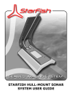
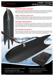
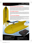
STARFISH TOWED SONAR SYSTEM USER GUIDE CONTENTS Contents............................................................................................................ 2 Introduction...................................................................................................... 3 Important Safety Instructions .......................................................................... 3 Electrical Safety ...................................................................................................... 4 Operational Safety................................................................................................... 4 Other Precautions.................................................................................................... 4 What your system contains ....................................................................................... 5 Getting Started ....................................................................................................... 5 Setting Up The System ...................................................................................... 6 Choosing A Power Supply ......................................................................................... 6 DC Power ............................................................................................................... 6 AC (Mains) Power .................................................................................................... 6 Connecting The Components ..................................................................................... 7 Rigging The Sonar Transducer ................................................................................... 8 Adjusting The Towing Position ................................................................................... 8 Securing The Sonar To The Boat ................................................................................ 9 Operating the Sonar .......................................................................................... 9 General Towing Guidelines...................................................................................... 10 Avoiding Hazards .................................................................................................. 11 Understanding Sidescan Imagery ................................................................... 12 What Is A Side-Scan Sonar? ................................................................................... 12 What Does A Side-Scan Sonar Image Look Like?........................................................ 13 Calculating Depth Below The Sonar (Altitude) ............................................................ 13 Calculating The Distance To A Target........................................................................ 14 Estimating The Sonar Depth.................................................................................... 14 Acoustic Shadows.................................................................................................. 14 Reflected Target Intensity....................................................................................... 15 Example Side-Scan Sonar Images............................................................................ 16 Gain & Contrast Settings ........................................................................................ 17 Shallow Water & Channels ...................................................................................... 17 Tips For Good Imagery........................................................................................... 18 Care Of Your Starfish ...................................................................................... 19 Operational Care ................................................................................................... 19 Maintenance & Cleaning ......................................................................................... 19 Storage ............................................................................................................... 19 Troubleshooting .............................................................................................. 20 Product Support .............................................................................................. 21 StarFish Website ................................................................................................... 21 Technical Support.................................................................................................. 21 Limited Warranty Policy.......................................................................................... 22 Notices............................................................................................................ 23 Handling Recommendations .................................................................................... 23 Waste Electrical & Electronic Equipment Statement.................................................... 23 Restriction of Hazardous Substances Statement ......................................................... 23 Appendix A - How Your StarFish Works........................................................... 24 Monotonic Sonar Operation ..................................................................................... 24 Chirp Sonar Operation............................................................................................ 25 Appendix B – Specifications ............................................................................ 26 Index .............................................................................................................. 27 2 INTRODUCTION Thank you for purchasing your towed StarFish Seabed Imaging System, a revolutionary high definition towed side-scan sonar system which produces near photographic quality sonar images of the seabed. Whether surveying lakes, rivers or the open ocean for dive sites, submerged structures, shipwrecks or research purposes, StarFish gives you the capability to capture detailed images of the seabed for work or play, making hi-tech seabed imaging accessible to anyone. With StarFish the seabed is your playground… Simply tow the StarFish side-scan sonar from a boat or any other vessel, large or small, to capture real-time digital images of the seafloor below. StarFish is truly 'Plug and Play' connecting to any Microsoft® Windows® based PC or laptop via a USB connection. The simple intuitive StarFish “Scanline” software makes seabed imaging extremely easy for novices and experienced side scan sonar users alike. Small, light and very rugged, StarFish can easily be deployed and operated by a single person from the smallest of vessels in the most remote locations. Before proceeding, we recommend that you read the safety, deployment and operation guidelines in this user guide, in order to get full benefit from the features of the StarFish system. We hope you get many years of trouble free use from your StarFish sonar. However, should you have any difficulties please refer to the “Product Support” section at the end of this manual for details on how to obtain technical support, upgrades and repairs. IMPORTANT SAFETY INSTRUCTIONS Before using your towed StarFish Seabed Imaging System, please read and follow these safety instructions. Throughout this document the following symbols are used to indicate special precautions or procedures you should note… WARNING! This symbol indicates a warning you should follow of to avoid bodily injury and damage to your equipment. CAUTION This symbol denotes precautions and procedures you should follow to avoid damage to your equipment. NOTE This symbol denotes special instructions or tips that should help you get the best performance from your StarFish system. Safety guidelines continued on next page… 3 ELECTRICAL SAFETY The AC power adaptor and surface control box are NOT protected against the ingress of water, so take care to avoid exposing the unit to sources of conductive liquids. Dry wet hands before handling the AC power adaptor or surface control box. Do not attempt to disassemble or service this product yourself (outside the scope described in this manual). Contact StarFish technical support for any maintenance, spares or repair work required. Do not overload a mains supply outlet, extension cord or adapter as this may result in electric fire or shock. Do not modify the power cord or plug. Do not place the AC adaptor or power cord near any heat sources that may melt the protective insulation. Do not use this product if any of the cabling, or housings of its component parts appear to be damaged or compromised for the ingress of water. Do not use (and ensure the product is unplugged) in situations where a power-line surge may occur (such as a lightning storm), or if the product is not used for a prolonged period of time. Ensure that the power supply has suitable earthing, and electrical shock risk is minimised through the use of fusing and residual-current-detection (RCD) devices. OPERATIONAL SAFETY Do not rely on the product to necessarily represent the immediate sub-surface conditions below the boat, and as such this product should not be used as a direct means of avoiding submerged objects, shallow water & grounding, collisions with other vessels, boat damage or personal injury. If you are in doubt about any of these hazards, always operate your boat and sonar at reduced speeds, and proceed with caution. Do not rely on this product as a navigational aid. Do not allow the towing cable to obstruct or present a hazard to other personnel on the deck area or passage-ways of the boat. Use the provided cable-tie to coil and secure any surplus cable. Do not rely on the connection between the electronics box and the towing cable, as a means of securing the towed sonar to the boat. The towing cable should always be tied off in a secure fashion to a suitable towing cleat or other appropriate fastening on the boat. When towing the sonar, it may extend to a distance of 20 metres behind the vessel, and up to similar depths below it (depending on towing speed). Be vigilant of underwater hazards that may foul the towing line and damage both the sonar product and the boat. Additionally, when changing course, be aware of any hazards (such as cables to buoys, other boats, fishing nets, jetties and landing stages, etc.) that lie between the sonar and the boat, and may be fouled by the towing cable. OTHER PRECAUTIONS For storage and maintenance information, please refer to the section “Care Of Your Starfish” (see page 19). If you have any other safety or operational queries, please contact StarFish technical support (see page 21). 4 WHAT YOUR SYSTEM CONTAINS Before proceeding, please check that your StarFish system box contains the following items… StarFish towed sonar transducer head (with supplied cable). StarFish top-box electronics module. AC to DC universal power adapter (and international plug adaptors). DC power lead – cigar plug (fused) to 2.1mm plug. DC power lead – cigar socket to crocodile clips. USB 2.0 Cable (type-A to type-B connectors). StarFish “Scanline” software and drivers CD. User Guides. Reusable cable tie and bag of sundries. If you purchased an ‘advanced system’, you should also have… Rigid, water-proof, transit case. StarFish USB GPS Receiver. StarFish towed transducer pole-mounting bracket. You will also need… Microsoft “Windows XP”, “Windows Vista” or “Windows 7” compatible computer (or laptop), with 1 free USB port (minimum). Battery (for DC operation) or suitably protected AC mains outlet (see page 6). Additionally, you may also require… Rope for securing sonar towing cable to your boat (see page 9). GETTING STARTED To get started straight away, you can use the accompanying “Quick Start” guide to get up-and-scanning, or read on for further more detailed operational instructions and tips. For further details on installing and operating the “Scanline” software package, please refer to the “StarFish Scanline Software User Guide” booklet. Note: Do not connect the sonar USB electronics to the PC until the “Scanline” software and drivers have been installed – this will simplify the installation procedure. 5 SETTING UP THE SYSTEM CHOOSING A POWER SUPPLY Before setting up your StarFish system, you first need to decide on the power source you will use – either… A DC supply (such as a battery or boat electrical system), or Mains from the universal AC-DC adapter included with the system. While the StarFish has internal voltage and current protection circuitry, any DC supply you use should be externally fused with a quick blow fuse rated at 1A. For best performance of the StarFish, you should ensure any power source is “clean”, meaning it is free from electrical noise possibly caused by mains-inverters, electrical motors or any other similar “high-current switching” devices. Additionally, for DC supplies, the source should be a fully regulated and smoothed power source – a dedicated battery is ideal for this. DC POWER In marine conditions, where there is a high chance of equipment getting wet, the use of a low-voltage DC power supply is always recommended. The StarFish electronics module has a 2.1mm DC input socket that will accept voltages between 9V and 28V, and will require a supply capable of delivering 5W. Typically this means the StarFish will require just under 500mA at 12V, or just under 250mA at 24V. As DC supplies come in many varieties, several adaptor cables have been included with your StarFish. Use the “Cigar-Plug to 2.1mm cable” to connect your StarFish to either a 12V or 24V system. The plug itself can be disassembled to access the fuse inside it. Use the “Crocodile-clips to Cigar-Socket” adapter cable, for connecting to battery terminals, or other similar power sources. If you are making your own wiring loom for the StarFish, you should ensure that the centre pin of the StarFish power connector is the positive DC voltage, and the outer connection of the plug is ground (or negative). AC (MAINS) POWER The AC power adapter is included for situations where the electronics will be used in a protected and dry environment (such as a boat wheel-house), and where a suitably fused and protected mains supply is available. The AC adaptor will accept voltage in the range of 100V to 240V AC, and 47Hz to 63Hz. Four universal adaptor plates are supplied with the power supply, allowing it to be used in most countries. When using the AC (mains) power supply, remember that electricity and water do not mix. To avoid electrical shock, you should only use the AC supply in a dry and enclosed environment, such as a cabin on board a boat. Ensure the supply has suitable protection such as quick-trip circuit breakers and an RCD. Only handle the StarFish equipment with dry hands. 6 CONNECTING THE COMPONENTS Having chosen your power source, the next step is to connect up the components of the StarFish system. If this is the first time you’re using the StarFish system, it is recommended you install the “Scanline” software and USB hardware drivers on your laptop/PC before connecting the electronics module to it. Refer to the accompanying “Scanline User Guide” for details on how to do this. Once the “Scanline” software and drivers are installed, make the following connections… If possible, turn off the power supply – if this is not possible, make the power connection last. 1. Connect the StarFish sonar transducer head to the “top box” electronics module, with the 9-Way D-Type connector, and securing thumb-screws. 2. Connect the electronics module to a USB port on the laptop/PC using the supplied USB lead (type-A connector to type-B). 3. Connect DC power to the electronics module with the 2.1mm power jack – this may be from a DC source, or the included AC-DC adapter. Follow the selection and safety guidelines in the “Choosing A Power Supply” section above. 4. Finally, once you are happy with the connections, turn on the power. When powered up, the “Power/Status Indicator” will illuminate and start to flash – indicating that the Topside box has correctly initialised. The “Activity Indicator” will not illuminate until the USB connection is made, Scanline is running and configured correctly. 7 RIGGING THE SONAR TRANSDUCER Before putting your StarFish into the water for the first time, you need to ensure it is correctly rigged… 1. First, remove the circular securing ring from the end of the shackle pin. 2. Put the shackle through the steel cable “towing eye”, at the end of the strain-relief on the towing-cable. 3. Position the shackle over the middle towing hole (see figure above) on the StarFish, and as you do, ensure that the towing cable passes under the shackle. 4. Secure and lock the shackle in place with its pin, and the circular securing ring. The rigged StarFish should look similar to the right-most image above. If the cable is not held centrally to the StarFish body by the shackle, then the drag of the off-centre cable could prevent the StarFish from towing level, with one transducer angled more towards the surface than the other. The result of this would be uneven image intensity on the sonar display. ADJUSTING THE TOWING POSITION Due to its small size, the StarFish needs to tow at slight downward angle through water, to maintain the tension on the cable. However, depending on the salinity of the water and the towing speed of the sonar you may find that you need to adjust the towing position from the middle towing hole to achieve the best results… Moving the towing position backward, makes the sonar to become nose heavy, causing it to dig into the water more, increase the tension on the cable, and go deeper. However, too far and it will flip and drag vertically through the water – to remedy this, the towing hole will needs to be moved forward. If the sonar is too nose heavy, it will flip and drag vertically. Moving the towing position forward, causes the sonar to tow more horizontally. However, too far and it will swim upwards (and sideways) – to remedy this, the towing hole will need to be moved backward. If the sonar is too tail heavy, it will try to swim upwards and sideways Note: Your StarFish has five holes, but only the three central ones are intended as towing points – the outer holes are for use in transit and the attachment of StarFish accessories. 8 SECURING THE SONAR TO THE BOAT Having secured the towing transducer to the cable, you need to secure the other end of the cable to the boat. As each boat is different, we recommend that you read the following guidelines, and choose a suitable method… Do not bend the cable to a radius less than 30mm, as this may shorten its life. Do not use a fixing method, that will cut or damage the cable Do not use a securing method that excessively crushes the cable. Ideally, either… Wrap the cable round a bollard, capstan or cleat that has a diameter larger than 60mm. Using slip-knots, tie a soft rope to the cable, then tie the other end of this to the boat. Do not rely on the connection between the towing cable and the electronics module to secure the StarFish transducer. During towing there is significant force on the cable, and the electronics module with attached computer may be dragged overboard! OPERATING THE SONAR To summarise, your system should be connected in a similar configuration to the figure shown below, and once you’ve rigged sonar transducer ready for towing, as described previously, you’re ready to run the “Scanline” software, and start collecting data… Refer to the separate “Scanline User Guide” for information on installing, starting and operating the software. When the “Scanline” software is running, the “Activity Indicator” will flash to show that the StarFish is scanning and acquiring data. 9 GENERAL TOWING GUIDELINES Towing the sonar is relatively straightforward, but there are a few guidelines and precautions you should observe to achieve the best results… 10 Let the boat build up speed to 1-2 knots before putting the sonar in the water. This will help avoid getting the towing cable in the propeller. Keep the boat speed constant, and ideally between 1 and 4 knots for the best results. The slower the boat travels, the deeper the sonar will tow. At slower speeds more display lines will be acquired for smaller targets (giving a higher resolution image). When towing in rivers and tidal channels, remember that the speed of the water current should also be taken into account. For example, if the water is flowing at 5 knots, and the boat is travelling against it at 3 knots, then the water speed against the sonar is 8 knots. The faster the water travels, the more force is exerted on the sonar. The recommended maximum towing speed is 8 knots, but better images will be observed at slower speeds. Tow the sonar from the stern of your boat, to reduce the possibility of it receiving echoes reflected back from the boat hull. Tow the sonar away from the prop-wash (to one side of the boat, for single propeller vessels). The propeller disturbs the water and introduces air into it. If the sonar is towed in this, the image quality will suffer. Paying out more cable will cause the sonar to dive deeper – the exact depth depends on the amount of cable in the water, the towing speed and the towing position on the sonar. Typically towing depths between 3m and 10m can be achieved, depending on tow speed. Tow with enough cable so the sonar is operating below the keel of the boat, but try and keep the sonar at least 3 metres above the seabed (or higher in known rocky situations). AVOIDING HAZARDS There two main types of submerged hazard to avoid when using your StarFish sonar are… Sudden changes in the seabed height (or submerged targets). The sonar transducer head will only show you the depth of the seabed below it, not from the surface, and not in front of it. So, if you are scanning in close proximity to the seabed, you should be keeping a close eye on the sonar display, and always be ready to shorten the towing cable length to avoid collisions between the sonar transducer and the seabed. This also applies to submerged objects, such as shipwrecks, that may suddenly appear in front of the sonar. If in doubt of the underwater terrain or possible hazards, always assume the worst case, and give plenty of clearance between the sonar and the seabed. Mid-water targets When navigating around objects (such as buoy’s, or moored boats) or through busy areas, be aware that the sonar may be up to 20m behind the stern of your boat. Give yourself plenty of room for the sonar to manoeuvre in, and keep a safe distance between you and other vessels. If passing a buoy, or other object that may be anchored to the seabed, give consideration to the cable, rope or chain extending below this, and don’t assume it hangs vertically down beneath it. Water currents may cause the tether to be at an angle, to its mooring on the seabed, and if enough clearance isn’t given, this may foul or sever the tow cable. As the above figures show, you should not rely on the sonar as a navigational aid for your vessel, or for avoiding shallows, submerged or mid-water hazards. The seabed information it shows is valid only below the sonar, which may be some distance behind the vessel. See the following section on interpreting side-scan imagery, for further details on calculating the sonar’s towing depth and altitude from the displayed data. 11 UNDERSTANDING SIDESCAN IMAGERY Interpreting side-scan imagery may seem difficult at first, but with practice and some knowledge of how the sonar works, it doesn’t take very long for an operator to understand what the seafloor is doing below the sonar, and if there are any targets on it. Many people try to look at the pictures and understand them as you would a photograph, but this however is not strictly the case. In the following sections, we will look at several example images, and see how information can be obtained from them. WHAT IS A SIDE-SCAN SONAR? Sonar (SOund Navigation And Ranging) and echo-sounding technology dates back to the 1920’s, but it was only in the early 1960's that Dr. Harold Edgerton (an electrical engineering professor at the Massachusetts Institute of Technology) started to adapt his techniques on high-speed flash photography to acoustics, having concluded that photography was not best suited to the murky conditions underwater. By sending "flashes" of acoustic energy into the water and recording the echoes, Edgerton (who later worked with underwater explorer Jacques Cousteau), developed a towed side-looking sonar that could create a continuous image of the seafloor. By transmitting a narrow fan-shaped acoustic pulse (ping) perpendicular to its direction of travel, the side-scan sonar sends acoustic pulses outwards. The seabed and other objects reflect some of the sound energy back in the direction of the sonar (known as backscatter), and the travel time of the returned pulse is recorded together with its intensity. As sounds travels at a known velocity (of approximately 1500 metres per second) through water, we can directly relate the time we received an echo, to the range of the target that reflected it. This scan-line of information is sent to a topside computer for interpretation and display, and by stitching together data from successive pulses, a long continuous image of the seafloor is created, as the sonar is towed from the survey vessel. Your StarFish has two transducers (transmitter and receiver elements) mounted in the lower fins. These transducers are angled 30° down from the horizontal, and acoustically transmit sound in a “fan beam” of narrow width (refer to the specification of your StarFish product for the exact width), but wide vertically with most of the acoustic energy confined to the centre 60° of the beam. This gives the StarFish the ability to see almost directly below it, to just above the horizontal. However, despite this field of vision, the StarFish cannot determine where a target lies vertically in its beam (i.e. above or below it), as everything is translated to a planar 2D display. For example, if there are two targets both 10 metres from the sonar (one horizontally level with it, and one directly below it, and are received on the same channel) they would both appear at the same point on the sonar display, as the display scale is based around time, and both echoes would arrive simultaneously. With some experience though, image artefacts like “acoustic shadows” can help the operator make an educated guess to the size of targets and sea-bed features. 12 WHAT DOES A SIDE-SCAN SONAR IMAGE LOOK LIKE? The figure below is a real image captured by a StarFish sonar, where each horizontal line is a representation of time versus the intensity of the reflected echoes. The further something is away from the centre line of the display, means the longer it took for the echo to be received. In this figure, both the port (left) and starboard (right) channels are operating at the same time. The sonar is positioned in the middle of the topmost line, and as the sonar is towed through the water the image will scroll away from it as more data is added. CALCULATING DEPTH BELOW THE SONAR (ALTITUDE) A useful measure to know when towing a side-scan sonar is the height above the seafloor, so a safe distance can be maintained and hazards avoided. Looking at the previous image, we can see a large black “hour-glass” shaped area in the middle of the display, where no echoes have been received. In fact this area is showing us the height the sonar is above the sea bed. As the figure opposite shows, the nearest object to the sonar will always be the seabed below it (assuming a relatively flat seabed). However, it will take some time for the “bottom echo” to be returned, and as the display shows the received echoes from when the transmission started, this area appears black. Therefore, the narrower the band of black is, the closer the sonar is to the seabed – and as the image is built up over time, if the sonar’s altitude changes we actually start to see the profile of the seabed that the sonar has passed over. This means in the figure above, the seabed gets shallower in the middle of the display, and then gets deeper again at the bottom. 13 CALCULATING THE DISTANCE TO A TARGET As mentioned earlier, the sonar display shows the recorded echoes over a period of time, and we have seen how we can work out the depth below the sonar from this. However, this also means that the range a target appears to be on the display is not the distance it lies at from the sonar horizontally across the seabed. To understand why this is the case, consider the triangle shown in the figure opposite. As the sound waves travel from the sonar, they start to hit the seabed, and each point of contact returns an echo along the shortest path to the sonar. To work out the actual distance at which a target lies, you need to use the mathematical formula opposite… Actual Range Displayed Range 2 Height 2 ESTIMATING THE SONAR DEPTH We have previously seen how we can estimate the altitude of the sonar above the seabed, and we can use a similar technique to estimate the sonar depth below the surface. In the example image shown opposite, we can see two bright echoes close-up on either side of the sonar. The echoes are produced by the transmitted sound from the sonar hitting and being reflected back from the surface of the water (as air is an excellent reflector of sound in water). Profile of the Seabed (Bottom echo) Sonar depth (Surface echo) As the sound does not leave the sonar at 90° straight up, we cannot use this as a true depth, but it gives a good rough estimate for general use. However, depending on your sonar configuration, towing depth and the acoustic conditions of the water, be aware that these echoes are not always strong enough to be visible on the display. ACOUSTIC SHADOWS When sound from the sonar hits a submerged target with any height above the seabed, an acoustic shadow will be cast away from the sonar. An experienced sonar operator can use the lengths of these shadows, along with knowledge of the sonar altitude to get an idea of the size and height of the object. 14 To help understand this, imagine you are in a darkened room, with a flashlight, standing above a ball. If you shine the flashlight down on the ball, a small shadow is cast around it, while if you lie down level with the ball and shine the light at it, a much longer shadow is produced stretching away from it. This principle applies to side-scan sonar in a similar way; objects directly beneath the sonar will appear to have very small shadows, while objects at greater distances will have longer shadows because they are being illuminated (acoustically) on their side. The shadows of targets can be elongated further if the towing altitude of the sonar is decreased or if in shallow water. REFLECTED TARGET INTENSITY To complete our understanding of the basics of sonar imagery, we need to consider the brightness information (intensity of echo) shown on the sonar display. As with a surface reflecting light, different surface textures and materials of targets have different acoustic reflective properties. Typically the more the density of the target differs from that of water, or the more rigid its material is, the more sound is reflected back. Any target with a gas in (such as air) will act as an almost perfect reflector for sound, and will show as the brightest colour in the palette. Muddy or silted lake and sea beds will generally show up as a low-intensity background colour, as mud is a good sound absorber and contains water. The example image below shows several bright targets of interest… Taking what we already know about sonar imagery into account we can interpret the following… White ‘dots’, without any form of shadow are most likely either flat hard targets on the bottom or large mid-water fish (with their air-filled swim-bladder showing up on the sonar). At the bottom of the image we can see a bait-ball of fish – identifiable as large spherical structure that protrudes above the seabed profile (there is a faint and fragmented shadow extending away from it, implying it is not a single solid target). On the right of the image, we can see several vertical curved white lines. These are most likely the hulls of moored boats, and close to them we can see the square outlines of the concrete mooring blocks. At the top of the image, there is a large target. As it appears on both channels, and we can see its profile, we know the sonar has passed directly over it. The bright geometric echoes on it indicate it is probably man-made, and there is an acoustic shadow visible on the right portion of it, showing it has height. It is most likely this is the wreck of a sunken vessel. 15 EXAMPLE SIDE-SCAN SONAR IMAGES Lake Bed Scan showing boat moorings at the bottom (concrete blocks in craters of silt). The dark area on the left channel is the shoreline. A boat with wake is visible on the right. At the top of the right channel, it can be seen that the bottom has a rockier texture, and appears brighter than the silt in the rest of the image. Cable Car Ferry Lake bed beneath a cable-hauled car ferry. The two cables are visible above the bottom, crossing beneath the sonar. The movement of the cables has exposed the bedrock of the lake, causing a brighter reflection. The grooves are visible on the centre profile on the lakebed, and the shore and slip-way are visible in the top left. Marina Shallow water with moored boats. The bright white targets of the hulls are visible, above “craters” in the silt, caused by the movement of the mooring cables. Note the large acoustic shadow on the left channel, caused by a raised area of the seabed being almost level with the sonar in the shallow water. Coral Reef Horizontal image orientation showing a scan over coral reefs. At the extreme right of this image, ripples in the sand are visible, while each coral outcrop has clearly visible shadows. Note how close the sonar came to a small outcrop at the centre of the image! 16 GAIN & CONTRAST SETTINGS When operating your sonar, the adjustments you will make to the gain and contrast controls are critical in achieving good side-scan imagery. This section examines the function and purpose of these controls… Gain The software gain control is similar to the volume control on a home hi-fi system, or the brightness control on a television. The gain control sets how the incoming scan-lines of data (from the sonar hardware) map onto the display’s colour palette. Increasing the gain value will make all areas of the display image appear brighter, while decreasing it will make the whole image appear darker. For general operation, a gain value of 30% (-28dB) is recommended. Contrast The function of the contrast control is slightly more complex to understand than that of the gain control. The contrast value sets the palette range that the incoming signal will be stretched or shrunk to fit. A lower contrast value means that the image will transition from dark to bright colours more quickly than a higher contrast value. For general operation, a contrast value of 30% (38dB) is recommended, but can be reduced to 25% to enhance shadows and submerged targets. The best way to understand the operation of the Gain and Contrast controls is to experiment with these values while scanning the sonar over a known area of seabed. Generally, having set the operational range of the sonar, you should then set the gain to a level where the background noise is just visible. This should ensure that quiet signals are visible at the extremities of the display, whilst the central mid-water areas and seabed profile have good definition. Then, when scanning, adjust the contrast to give the desired sharpness of targets – lowering the contrast will make echoes appear brighter, while keeping shadows dark. SHALLOW WATER & CHANNELS When operating in shallow water and channels, you may experience a “ghosting” effect caused by acoustic returns from previous sonar “pings” still bouncing between targets and the sonar receivers. To reduce these effects, use a larger “range” on the sonar display, which should have the effect of slowing the “ping rate” and allowing time for these echoes to dissipate. In shallow water, you may also see distortion on long range targets, caused by “multi-path” phenomenon – where sound is reflected between the seabed and surface before hitting the target. Due to surface waves and chop, the effect can manifest its self as ripples on distant targets. 17 TIPS FOR GOOD IMAGERY Towing Speed When towing the StarFish, remember that it is “pinging” at a fixed rate (depending on range). The faster you tow the fish, the more compressed images will appear on the display, and its towing depth may become shallower as the drag on the sonar transducer head and towing cable increases. For long ranges, try to tow at speeds between 1 and 3 knots, while shorter ranges can be used with speeds of 3 to 6 knots. Towing Depth The towing depth of the sonar is an important factor to consider when interpreting heights of submerged objects from their acoustic shadows. Towing too close to the seabed will make shadows appear very elongated (like shadows cast from objects at sunset), while towing too high from the seabed will give a “birds-eye” type view, but with minimal shadows. Towing Position Tow the sonar at a depth below the boat keel, so there is minimal risk of it receiving echoes back from the hull. These will appear as mirror or “ghost” images on the sonar display. If any attachments are added to the StarFish, ensure that a symmetry is maintained (when looking from the front), to prevent the StarFish from towing at a rotated angle. Boat Navigation When surveying an area, think about the course you will steer your vessel over. Try to divide the area into a grid of long straight runs, with 180° turns at the end. Remember that as the boat turns, the acoustic beams from the inside of the turn will overlap, while the outside ones will be covering more seabed – consequently the imagery produced will appear distorted and hard to interpret in these areas. Give plenty of clearance between your boat and other vessels or surface/mid-water hazards, and try and avoid the aerated water left in the wake of other boats, as this will be acoustically visible for some time should you cross through it with your sonar. Waves, Wake and Surface Chop As your StarFish is operating several metres below the surface, it should be largely unaffected by waves and surface chop on the water. However, it still is susceptible to movements on the towing cable, so in rough conditions it is advisable to deploy longer lengths of cable, reducing the angle of the cable to the sonar transducer head. Your StarFish will not perform well in rough stormy conditions. Remember, that when in a boat, your own safety is paramount and should not be compromised trying to achieve good sonar imagery. 18 CARE OF YOUR STARFISH OPERATIONAL CARE In addition to the points highlighted in the “Important Safety Instructions” section (see page 3), please observe the additional precautions… Do not operate the product near a source of heat that may cause the operational temperature parameters to be exceeded (see specifications on page 26), or stack other heat generating equipment on top of the unit. Always use the electronics module on a stable, non-slip, rigid, flat and lint-free surface. Make sure the product is more than 10cm away from any other appliance that may be susceptible to electromagnetic interference. MAINTENANCE & CLEANING When you have finished using your StarFish sonar, you should… Disconnect the product from the power supply before attempting any maintenance or cleaning. Remove any weed, or other detritus, from the towing cable and sonar head, that may have been collected during its operation. Wash the towing cable and sonar head in fresh water, if they have been used in salt-water, to prevent corrosion and damage to rubber mouldings. Wipe, with a damp cloth, any salt-water spray that may have inadvertently settled on the surface of the “top box” electronics module and connectors. Additionally please observe the following precautions for cleaning and maintenance… Do not clean with solvents, and only use a damp cloth on the exterior of the unit. Do not undertake maintenance of the unit, outside the scope of that defined within this manual, unless instructed to do so by Tritech International Ltd technical support. Do not insert extraneous object (metal or other alien substance) into the unit or any of its connector apertures. STORAGE When storing or shipping the StarFish system, please observe the following… Avoid excessively bending or kinking the towing cable (below a radius of 30mm), as this could reduce its operational life. Do not store the unit in direct or strong sunlight, as this may perish the cable insulation and other rubber mouldings. Avoid excessive and large fluctuations in temperature. To prevent corrosion, remove any salt or other residues from the product before storage. Store in a well ventilated enclosure after use, to allow any moisture on system components to evaporate naturally. Ensure no point-load is exerted on the transducers on either side of the sonar transducer head. 19 TROUBLESHOOTING Below is a table of common problems and solutions, but if you have a problem that cannot be solved from the table below, or an issue that is not covered, please contact StarFish technical support - see page 21 for further details. Note: For software issues and problems, please refer to the accompanying “Scanline User Guide”. Problem… Solution(s)… Electrical interference This is most commonly seen as bright small snow-like dots over the image – usually with some form of regular repeating pattern. The most common cause is interference from other highcurrent switching electrical devices (such as mains inverters, or motors) connected to the same power source as the top box electronics module. Try methodically turning off other electrical devices to find the cause, or running the StarFish from its own dedicated supply (or battery). Acoustic noise This is most commonly seen as large stripes or pulses of varying brightness over the image, usually with some form of regular repeating pattern. Try to identify and, where possible, remove the source of the acoustic noise. Most commonly, your boat, or other vessels, may have an echosounder that is running at a frequency close to the operating frequency band of the StarFish. Image ghosting or mirroring This problem may occur if the StarFish is operating in close proximity to the boat hull. If depth permits, try deploying more cable to distance the sonar transducer head from the boat. This problem can also occur in shallow water, where the highintensity transmission from one transducer is being received by the other. If possible, use the software to display only a single channel (and prevent transmissions from the other); this will reduce the inter-channel cross-talk. Uneven channel brightness This problem may occur is the StarFish is not balanced correctly, and has an uneven drag, causing one transducer to be angled more towards the surface than the other. Check the towing cable goes beneath the shackle and the StarFish looks symmetrical along its length (when viewed from the front). Surfacing when towed 20 This is caused by incorrect balance of the StarFish from its towing hole. The StarFish needs to be more nose-heavy, so move the towing hole backwards by one position, and try again. PRODUCT SUPPORT STARFISH WEBSITE Visit “www.starfishsonar.com” for the on-line home of the StarFish product family. From here you can get the latest news, software and firmware updates. Additionally, you can see sonar imagery from other StarFish customers, and submit any interesting images you collect. TECHNICAL SUPPORT If your StarFish sonar is not operating properly, we would suggest that your first try the ‘Troubleshooting’ section of this manual and the electronic documentation provided with the product to see if the problem can be easily remedied. If you need further support, you can contact us at… Web www.starfishsonar.com/support/support.htm (for access to on-line resources and a support request form) Email [email protected] Call us +44 (0)1224 746979 (9:00am to 5:00pm, Monday to Friday, GMT) For all of the above please provide the following information, where appropriate and if possible, to help us with your technical support request… Part and Serial Numbers of the system components. These are located on the labels of each item, and are in the form “BPxxxxx.xxxxxx”. Version number of the ‘Scanline’ software you are using. The operating system name, version, type (32 bit or 64 bit) and service pack upgrade your computer is using. Brand and model of your computer (processor type and memory configuration is also useful if known). Name of the stockist, supplier or retailer where you purchased your StarFish system. If you have to return your StarFish product for servicing, please… Contact us (using the details above) for a “Returned Materials Authorisation” (RMA) number before sending your StarFish. Pack your StarFish back in the original packaging (or other suitable container), and include written documentation including your contact details (including contact phone number), the RMA number and a description of the problem and any symptoms occurring. If your product is still under warranty, please include a copy of your receipt (showing proof and date of purchase). Please return the product back to Tritech International Limited, using an insured courier and delivery confirmation. Note: Due to the expansion of equipment capabilities and the fact that new products are continually being introduced, this manual cannot detail every aspect of the product operation. 21 LIMITED WARRANTY POLICY Tritech International Limited (herein after referred to as TIL) warrants that at the time of shipment all products shall be free from defects in material and workmanship and suitable for the purpose specified in the product literature. The system warranty commences immediately from the date of customer acceptance and runs for a period of 365 days. Customer acceptance will always be deemed to have occurred within 72 hours of delivery. Note: Any customer acceptance testing (if applicable) must be performed at either TIL premises or at one of their approved distributors unless mutually agreed in writing prior to despatch. Conditions: These include, but are not limited to, the following: 1. The warranty is only deemed to be valid if the equipment was sold through TIL or one of its approved distributors. 2. The equipment must have been installed and commissioned in strict accordance with approved technical standards and specifications and for the purpose that the system was designed. 3. The warranty is not transferable. 4. TIL must be notified immediately (in writing) of any suspected defect and if advised by TIL, the equipment subject to the defect shall be returned by the customer to TIL, via a suitable mode of transportation and shall be freight paid. 5. The warranty does not apply to defects that have been caused by failure to follow the recommended installation or maintenance procedures, or defects resulting from normal wear & tear, incorrect operation, fire, water ingress, lightning damage or fluctuations in vehicles supply voltages, or from any other circumstances that may arise after delivery that is out with the control of TIL. (Note: The warranty does not apply in the event where a defect has been caused by isolation incompatibilities.) 6. The warranty does not cover the transportation of personnel and per diem allowances relating to any repair or replacement. 7. The warranty does not cover any direct, indirect, punitive, special consequential damages or any damages whatsoever arising out of or connected with misuse of this product. 8. Any equipment or parts returned under warranty provisions will be returned to the customer freight prepaid by TIL 9. The warranty shall become invalid if the customer attempts to repair or modify the equipment without appropriate written authority being first received from TIL. 10. TIL retains the sole right to accept or reject any warranty claim. 11. Each product is carefully examined and checked before it is shipped. It should therefore be visually and operationally checked as soon as it is received. If it is damaged in anyway, a claim should be filed with the courier and TIL notified of the damage. Note: TIL reserve the right to change specifications at any time without notice and without any obligation to incorporate new features in instruments previously sold. Note: If the instrument is not covered by warranty, or if it is determined that the fault is caused by misuse, repair will be billed to the customer, and an estimate submitted for customer approval before the commencement of repairs. 22 NOTICES HANDLING RECOMMENDATIONS The StarFish system contains sensitive electronic components that may be damaged by an Electrostatic Discharge (ESD) if handled incorrectly. To minimise risk, avoid dismantling the unit, touching any exposed electrical contacts on external connector, or inserting anything other than the recommended cabling into the connectors. WASTE ELECTRICAL & ELECTRONIC EQUIPMENT STATEMENT Tritech International Limited is very aware of its responsibilities to the environment and to the sustainability of the resources of our planet. Under the European Union (EU) directive on 'Waste Electrical & Electronic Equipment' (Directive 2002/96/EC), from August 13, 2005, products categorised as electrical or electronic equipment cannot be discarded as municipal waste by placing in landfill, dumping in the sea or incineration. SEPARATE collection is mandatory. At the end of its life, you should either return this system and its associated leads & accessories (if appropriate) to Tritech International Limited with a certificate of decontamination (we reserve the right to protect our staff from the effects of any contamination) or it should be sent to an appropriate treatment or recycling agency. RESTRICTION OF HAZARDOUS SUBSTANCES STATEMENT Under the European Union (EU) directive on the 'Restriction of Hazardous Substances' (Directive 2002/95/EC), from July 1, 2006, electrical and electronic equipment cannot contain lead ("lead free"), mercury, cadmium, hexavalent chromium, polybrominated biphenyls (PBB) or polybrominated diphenyl ethers (PBDE). All components of the StarFish system, sold by Tritech International Limited, fully comply with this legislation where applicable. 23 APPENDIX A - HOW YOUR STARFISH WORKS Your StarFish sonar uses the latest advances in high-speed digital signal processing and “Chirp” (Compressed High Intensity Radar Pulse) techniques at the core of its acoustic engine. This section aims to help you understand the benefits of using Chirp acoustic techniques, by analysing and comparing these with the limitations of using conventional single frequency (monotonic) techniques. MONOTONIC SONAR OPERATION The figure below shows the relationship that exists between the transmitted single frequency signal and the output produced by the reflected target echo in the receiver circuitry of the sonar. It can be seen that the receiver does not decode each cycle of the transmitted pulse, but instead produces the envelope of its overall amplitude… The ability of monotonic acoustic systems to resolve targets is better if the pulse duration is short (so these decoded pulses don’t overlap); this, however, has its drawbacks. Ideally, we need long transmit pulses to get enough acoustic energy into the water for good target identification of the furthermost targets, but due to the Velocity Of Sound (VOS) through water (typically around 1500 metres/second), each pulse will occupy an equivalent distance related to its pulse duration – this is referred to as “range resolution”, and can be found by the following equation… Range Resolution Pulse Length Velocity of Sound 2 Example… In a monotonic side scan sonar system, the pulse duration is typically 100 microseconds, and combining this with the VOS, a range resolution of 75mm is obtained. The “range resolution” effectively determines the ability of the sonar to identify separate targets; so, using the example above, if two targets are less than 75mm apart then they cannot be distinguished from each other. The net effect is that the system will display a single large combined target, rather than multiple smaller targets, and any fine sonar details are lost, as shown below… 24 CHIRP SONAR OPERATION Instead of using a pulse of a single carrier frequency, the frequency within the burst is changed (swept) through the duration of the transmission, from one frequency to another. For example, a StarFish 450 sonar operates at 430KHz at the start of the transmission, and at the end it reaches 470KHz (giving it a 40KHz bandwidth). By constantly changing its frequency over time, this “chirped” transmission can be thought of as having a unique acoustic signature, and so if two pulses now overlap (as the targets are closer than the range resolution), we can use the known frequencyversus-time information to tell them apart. The StarFish sonar receiver contains a pattern-matching circuit that looks for its transmitted Chirp being echoed back from targets, and its receiver now produces a sharp spike when a good match is found (compare this to the monotonic sonar, described previously, that produces an output the same duration as its transmit pulse)… This means that the critical factor in determining range resolution is no longer the pulse length, but the bandwidth of the Chirp, so the range resolution can be found by… Range Resolution Velocity of Sound Bandwidth 2 Example… The bandwidth of the StarFish CHIRP system is typically 40kHz, and using the same VOS of 1500 metres/second, our new range resolution is 18.75mm... a theoretical improvement by a factor of 4 over the monotonic example above! This figure below shows that on a chirped sonar, when two acoustic echoes overlap, the Chirp pulses do not merge into a single acoustic return (as their frequency is different from each other at the overlapping points), and the sonar is able to resolve and display the two targets independently. Therefore, we now can have longer transmissions (and see targets further away) without a loss in resolution; and additionally, Chirp signal processing techniques offer improvements in background noise rejection (as the side scan sonar is only looking for a swept frequency echoes, removing random noise or out-of-band noise). 25 APPENDIX B – SPECIFICATIONS SONAR HEAD Part Number Frequency Operating Range Horizontal Beam Width StarFish 990F BP00177 StarFish 452F BP00180 1MHz CHIRP 450kHz CHIRP 35m (115ft) per channel 100m (328ft) per channel 0.3° 0.8° Vertical Beam Width 1.7° 60° Transducer Angle Tilted Down 30° from Horizontal Length 378mm (14.88”) Width 110mm (4.33”) Height 97mm (3.81”) Weight (in Air) 2.0kg (4.41lb) Construction Colour Reinforced polyurethane rubber High-Vis Red Depth Rating Inline Connector High-Vis Yellow Black 50m (164ft) Impulse, 5-way N/A CABLE Interchangeable Fixed Length 20m (65ft) or 50m (164ft) 20m (65ft) Construction Black polyurethane jacket with internal Kevlar reinforcing (strain) member Breaking Strain >150kg (330lb) Minimum Bend Radius Connector TOP-BOX Part Number Supply Voltage Power Consumption Power Interface PC Interface Sonar Interface 30mm (1.2”) Impulse, 5-way 990 Series BP00176 N/A 450 Series BP00019 90-264VAC, 47-63Hz or 9-28VDC 6W (500mA @ 12VDC) 2.1mm DC jack socket USB 2.0 B-Type connector 9-Way Female D-Type socket Length 166mm (6.54”) Width 106mm (4.17”) Height 34mm (1.34”) Weight (in Air) 0.4kg (0.88lb) Temp Range IP Rating -5°C to +40°C (23°F to 104°F) IP50 (Protection against ingress of dust, no protection against ingress of liquids) Note: All data given above may be subject to change at any time. 26 StarFish 450F BP00018 INDEX A G Resolution, 24 Rigging, 8 AC Power, 6 Activity Indicator, 9 Altitude, 13 Gain, 17 Ghosting, 17 S H Safety, 3, 19 Securing, 9 Shackle, 8 Shadows, 14 Shallow Water, 17 Software, 7 Sonar, 12 Specifications, 26 Speed, 10, 18 Storage, 19, 20 B Balance, 8 Bandwidth, 25 Beam Angles, 12 Bend Radius, 9 Hazards, 11 Height, 13 Holes, 8 Horizontal Beam-Width, 12 C M Cable Length, 10 Chirp, 24, 25 Chop. See Waves Cleaning, 19 Connections, 7 Contrast, 17 Corrosion, 19 Current Flow, 10 Custom Power Leads, 6 Maintenance, 19 Monotonic, 24 D DC Power, 6 Density (of targets), 15 Depth, 14, 18 E Electrical Noise, 6 Electrical Safety, 4, 6, 19, 20 Example Images, 16 External Fuse, 6 N T Operational Care, 19 Operational Safety, 4 Tail Heavy, 8 Target Distance, 14 Target Intensity, 15 Technical Support, 21 Towing Angle, 8 Towing Position, 18 Transducers, 12 Troubleshooting, 20 P U Navigation, 18 Nose Heavy, 8 O Ping, 12 Power Consumption, 6 Power Supply, 6 Power/Status Indicator, 7 Prop-wash, 10 R Range, 14 Recycling, 23 Uneven Towing, 8 V Vertical Beam-Width, 12 W Warranty, 22 Waves, 17, 18 27 Copyright Notice Copyright © 2010 Tritech International Limited & Blueprint Design Engineering Limited, all rights reserved. No part of this publication may be reproduced, stored in a retrieval system, or transmitted in any form or by means (electronic, mechanical, photocopying, recording or otherwise), without the prior written permission of Blueprint Design Engineering Ltd. The information contained herein should be applied to this product only, and no responsibility is taken for the use of this information when applied to other products. Neither Tritech International Ltd. or Blueprint Design Engineering Ltd., or their affiliates shall be liable to the purchaser of this product, or third parties, for losses, costs, damages or expenses incurred by the purchaser or third parties as a result of accident, misuse, abuse, modification of this product or a failure to strictly comply with the operating and maintenance instructions. Trademarks Microsoft® and Windows® are registered trademarks of the Microsoft Corporation. Other product and brand names used within this document are for identification purposes only. Tritech International Limited & Blueprint Design Engineering Limited disclaims any and all rights in those marks. Specifications and information contained in this document is subject to change without notice, and does not represent a commitment on the part of Tritech International Limited or Blueprint Design Engineering Limited. P/N: BP00053.7 UM-103-P00053-07 August 2010