1
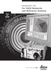
Leica GNSS Networks and Reference Stations Technical Data - Hardware Table of Contents GNSS Receivers 2 1 Quick overview 2 2 Tracking Characteristics 3 2.1 Measurement Precision ...................................................................................4 2.2 Measurement Resolution.................................................................................4 2.3 Accuracy ........................................................................................................5 3 Data recording 6 4 Data Streaming 7 5 Memory 8 6 User interface 9 6.1 GR10 User Interface .......................................................................................9 6.2 GRX1200+ / GRX1200+ GNSS User Interface ....................................................9 6.3 Operation 10 7 Connectors, Ports and Devices 11 7.1 7.2 7.3 7.4 Connector ports overview .............................................................................11 Connectors...................................................................................................11 Communications Devices ...............................................................................13 External Controllers ......................................................................................13 8 Ethernet Services 14 9 Weight & Dimensions 15 10 Environmental specifications 15 11 Power & Electrical Certifications 16 GNSS Antennas 12 GNSS Antennas Leica GNSS Network and Reference Stations - Technical Data – 01/2011 17 17 1 GNSS Receivers 1 Quick overview GRX1200+ GRX1200 +GNSS GR10 Basic GR10 Performance GR10 Professional GPS L1 & L2 (including L2C) GPS L5 GLONASS L1 & L2 Galileo L1/E5a/E5b/AltBoC Position & data recording ● ○ - ● ○ ○ ○ ● ○ ○ ○ ● ○ ○ ○ ● ● ● ● 1Hz logging and streaming 2-20Hz logging and streaming 50Hz logging and streaming RINEX logging Additional licenses ● ○ ○ ● ○ ○ ● ○ ○ ○ ● ○ ○ ● ● ○ ○ ● FTP Push Extended Formats Multi-Clients Wake Up Campaign Extended OWI Connectors/Ports ○ ● ○ ● ○ ● ○ ● ○ ● ○ ● ○ ○ ○ ○ ○ ● ○ ● ○ ○ ● ○ ● ○ ○ Supported GNSS Systems Power Inputs (Lemo) Ethernet (RJ45 ruggedized) Serial (Lemo) PPS External Oscillator Event Input USB Client Slot-in communication port User Interface Power Button Function Button LEDs Web Interface (via LAN/WAN) GNSS Spider Support Start-Up Configuration File Dat Storage/Logging 2 2 2 2 2 ● ● ● ● ● 4 4 1 1 1 ● ● ● - ● ● ● - ● ● ● ● ● ● ● ● ● ● - ● - ● ● ● ● ● ● 3 3 6 6 6 ● ● ● ● ● ● ● ● - ● ● - ● ● - Memory Type Memory Size Maximum Data Rate (Hz) Proprietary (MDB) RINEX (2.11) / RINEX Hatanaka Additional File Compression Data Streaming CF 8 GB 20 Hz CF 8 GB 20 Hz SD/SDHC 32 GB 50 Hz SD/SDHC 32 GB 50 Hz SD/SDHC 32 GB 50 Hz ● ○ ● ● ○ ● ● ○ ● ● ● ● ● ● ● Maximum Data Rate (Hz) TCP/IP Netports Services 20 Hz 3 20 Hz 3 50 Hz 20 50 Hz 20 50 Hz 20 HTTP / HTTPS FTP Server DHCP / DNS DynDNS Electrical Specifications ● ● ● ● ● ● ● ● ● ● ● ● ● ● ● ● ● ● 3.3 w 3.6 w 3.5 w 3.5 w 3.5 w ● ● - - - 212*166*79 212*166*79 210*190*78 210*190*78 210*190*78 1.25 kg 1.25 kg 1.50 kg 1.50 kg 1.50 kg Power Consumption (watts) Internal Battery Physical Specifications Size (mm) Weight (kg) • Standard ○ Optional Leica GNSS Network and Reference Stations - Technical Data – 01/2011 - Not Available 2 2 Tracking Characteristics Instrument technology No. of channels Leica patented SmartTrack+ technology Advanced measurement engine Jamming resistant measurements High precision pulse aperture mulitpath correlator for pseudorange measurements Excellent low elevation tracking Very low noise GNSS carrier phase measurements with <0.5mm precision Minimum acquisition time GRX1200+ GRX1200+GNSS GR10 Satellites signals tracking 16 channels (Optional upgrade to 120 channels) 120 channels 120 channels GPS: L1, L2, L2C, L5 GLONASS: L1, L2 Galileo (Test): GIOVE-A, GIOVE-B* Galileo: L1, E5a, E5b, Alt-BOC Compass** SBAS: WAAS, EGNOS, GAGAN, MSAS * GIOVE-A and B tracking capability is intended for signal evaluation and test purposes only. ** The GR10 & GRX1200+ GNSS receivers are designed to support future planned signals of the Compass System. The Compass signal structure is not finalised, although test signals have been tracked with all receivers in a test environment. As changes in the signal structure may still occur, Leica Geosystems cannot guarantee full Compass compatibility. GNSS measurements Fully independent code and phase measurements of all frequencies GPS Type All receivers L1 Carrier phase, C/A-code L2 Carrier phase, C code (L2C) and P2-code L5 Carrier phase, code GLONASS Type All receivers* L1 Carrier phase, C/A-code L2 Carrier phase, P2-code L1 Carrier phase, code E5b Carrier phase, code Galileo Type All receivers* E5a Carrier phase, code Alt-BOC Carrier phase, code * For GRX1200+ receivers an upgrade kit (to GRX1200+GNSS) is required to track GLONASS and Galileo. Leica GNSS Network and Reference Stations - Technical Data – 01/2011 3 GPS Carrier tracking Type All receivers L1, AS off or on Reconstructed carrier phase via C/A-code. GPS code measurements Type L1, AS off L1, AS off Carrier phase smoothed code measurements: C/A-code. All receivers L2, AS off Reconstructed carrier phase via P2-code. L2, AS off Carrier phase smoothed code measurements: P2-code and/or L2C code. L2, AS on Switches automatically to patented P-code aided technique providing full L2 reconstructed carrier phase. L2, AS on Carrier phase smoothed code measurements: Patented Pcode aided code and/or L2C code. Carrier phase and code measurements on L1, L2 and L5 (GPS) are fully independent of AS on or off. 2.1 Measurement Precision Measurement precision Type All receivers* Carrier phase L1: 0.2 mm rms L2: 0.2 mm rms Code (pseudorange) L1: 20 mm rms L2: 20 mm rms * GPS L5 and Galileo L1/E5a/E5b/AltBOC values are expected to be similar to L1. Final values will be determined after initial operational capability (IOC) has been reached. 2.2 Measurement Resolution Measurement resolution Type All receivers Resolution phase 0.01 mm Leica GNSS Network and Reference Stations - Technical Data – 01/2011 Resolution code 0.0005 m 4 2.3 Accuracy Accuracy is dependent upon various factors including the number of satellites tracked, constellation geometry, observation time, ephemeris accuracy, ionospheric disturbance, multipath and ambiguity resolution. The following accuracies, given as root mean square, are based on measurements processed using Leica Geo Office and the Bernese Software. The use of multiple GNSS systems can increase accuracy by up to 30% relative to GPS only. Accuracy (rms) in single receiver navigation mode Navigation accuracy 5–10 m rms for each coordinate Degradation possible due to Selective Availability Acuuracy in differential code mode The baseline precision of a differential code solution for static and kinematic surveys is 25 cm. Accuracy in differential phase mode Normal baseline (up to 30 km) with GR10/GRX1200+ Series plus AS10 Static Horizontal 5 mm + 0.5 ppm Vertical 10 mm + 0.5 ppm Kinematic Horizontal Vertical 10 mm + 1 ppm 20 mm + 1 ppm Long baseline (over 30 km) with GR10/GRX1200+ Series plus AR25/AR10 Static Horizontal 3 mm + 0.5 ppm Vertical 6 mm + 0.5 ppm Note: The above values based on post processing using Leica Geo Office. With Leica Geo Office processing software the GLONASS option is needed to process GLONASS data. Note: Using specialist scientific software (Bernese) available from Leica Geosystems the following accuracies can be achieved in static post processing mode, even on very long baselines: < 4 mm in plan <6 mm in height Leica GNSS Network and Reference Stations - Technical Data – 01/2011 5 3 Data recording Data recording GRX1200+ GRX1200+GNSS GR10 CF (yes) 2 CF (yes) 2 SD/SDHC (yes) 10 ● ● ● - ● ● ● - ● ● ● ● Date Storage Storage Type (removable) Logging channels Primary data logging Ring Buffer Multi session logging Auto-delete Smart Clean-up User defined folders Data Types ● ● ○ ○ ○ ○ ● ● ● ● ● ● ● ● ● Maximum Minimum Data Rates 24 hr 1 min 24 hr 1 min 24 hr 5 min Maximum (MDB) Maximum (RINEX) Minimum (MDB+RINEX) Logging Type 20 Hz 20 Hz 300 s 20 Hz 20 Hz 300 s 50 Hz 20 Hz 300 s ● ● ● ● ● ● Leica raw (MDB) RINEX 2.11 Hatanaka Zipping of raw files Zipping of RINEX files File Sizes Continuous Timed • Standard ○ Optional - Not Available RINEX logging when configured will generate files in real time. On the GR10 RINEX files can be logged independently without the need to log raw Leica MDB files. Note : For the GR10 Basic RINEX logging is optional. Leica GNSS Network and Reference Stations - Technical Data – 01/2011 6 4 Data Streaming Data streaming GRX1200+ GRX1200+GNSS GR10 Maximum number of streams Maximum number of real time streams Streaming Ports 7 7 20 2 2 10 Serial ports TCPIP net ports USB client port Slot communication port Data Types and rates 4 3 - 4 3 - 1 20 1 1 Data Streaming Leica Leica 4G RTCM 2.1, 2.2 and 2.3 RTCM 3.0 and 3.1 CMR/CMR+ BINEX records 0x00, 0x01, 0x7d, 0x7e, 0x7f Leica Proprietary LB2 NMEA 0183 v2.20 and Leica Proprietary Multi Clients 10 10 10 10 10 20 Hz Hz Hz Hz Hz Hz 10 10 10 10 10 10 20 Hz 20 Hz Clients per net port Time slicing of RTK output 10 20 Hz 20 Hz 1 10 • • Standard Hz Hz Hz Hz Hz Hz 1 • ○ Optional 10 10 10 10 10 10 Hz Hz Hz Hz Hz Hz 50 Hz 10 Hz 10 2 • - Not Available 1 Requires Multi Client option 2 Requires Multiplex option Leica GNSS Network and Reference Stations - Technical Data – 01/2011 7 5 Memory Memory Type Data capacity All receivers Type GRX1200+ GRX1200+GNSS GR10 Card Compact Flash (CF) Compact Flash (CF) Secure Digital (SD and SDHC) Capacity Up to 8 GB Up to 8 GB Up to 32 GB Data can be recorded on the CF/SD card. The figures shown are accurate to about 1%. They are dependent on the tracking settings configured on the instrument. 4 GB card, GPS (L1+L2+L5), 12 satellites Receiver All receivers Rate 1s MDB only 2180 h 3700 h zipped RINEX only 450 h 1700 h zipped Hatanaka only 1700 h 4500 h zipped 30 s 56550 h 95780 h zipped 12650 h 47380 h zipped 49700 h 108000 h zipped 4 GB card, GPS + GLONASS (L1+L2), 12/10 satellites Receiver All receivers Rate 1s 30 s MDB only 1400 h 2400 h zipped 38400 h 65000 h zipped RINEX only 330 h 1240 h zipped 9100 h 34000 h zipped Hatanaka only 1220 h 3280 h zipped 36400 h 74800 h zipped 4 GB card, GPS + GLONASS + Galileo (L1+E5a+E5b+AltBOC), 12/10/10 satellites Receiver All receivers Rate 1s 30 s MDB only 840 h 1400 h zipped 23800 h 40300 h zipped RINEX only 185 h 700 h zipped 5050 h 19000 h zipped Leica GNSS Network and Reference Stations - Technical Data – 01/2011 Hatanaka only 680 h 1800 h zipped 20400 h 41350 h zipped 8 6 User interface Buttons/LEDs GRX1200+ GRX1200+GNSS GR10 Function button • - • - • • LEDs 3 3 6 ON / OFF button Web Interface Both the GRX1200+ series and GR10 series have integrated web interface functionality that provides full status information and configuration options. The web interface contains a detailed Event/Message log that keeps the user informed of all important activities. The web interface also contains a detailed built in online help. GNSS Spider Both the GRX1200+ series and GR10 series can be configured and maintained using the Leica GNSS Spider Software. 6.1 GR10 User Interface GR10 button functionality Receiver power up/power down Start/stop all logging sessions Start/stop all data streams Initialize the measurement engine Reset receiver settings Format SD card GR10 LED status indicator Power LED SD card LED Raw data logging LED RT out data stream LED RT in data stream LED Position LED 6.2 GRX1200+ / GRX1200+GNSS User Interface GRX1200+ / GRX1200+ GNSS button functionality Receiver power up/power down GRX1200+ / GRX120+ GNSS LED status indicator TRK: Tracking LED MEM: Memory LED PWR: Power LED Leica GNSS Network and Reference Stations - Technical Data – 01/2011 9 6.3 Operation Internet connectivity Web interface for remote configuration, operation and status displays. Supports HTTP and HTTPS. The GR10 additionally supports DHCP/DNS and unique hostname. Web interface ports Ethernet port GPRS via mobile internet Serial Port (PPP) – GRX1200 series only USB Client Port – GR10 series only Simultaneous access over Ethernet port is fully supported Security Access restrictions configurable in User Management component: Viewers (status only) Users/GNSS Managers (configuration and status) Administrators SSL encryption E-Mail Sending of message log in scheduled intervals over email. Ethernet and PPP connection to the internet is supported FTP Push (optional) Automated FTP Push of raw data and/or RINEX files to a remote FTP server. Ethernet and PPP connection to the internet is supported RTK Multiplexing / Multi Client Option to allow RTK data streaming direct from the sensor, via TCPIP, for up to 10 clients per TCP/IP port. DynDNS Allows receiver addressing with dynamic IP address through a static host name. Requires registration with a DynDNS service OWI interface Leica proprietary Outside World Interface - OWI – for receiver control commands from PC etc, for receiver configuration, control and status, e.g. using Leica GNSS Spider. Binary and ASCII version of the OWI protocol are available. Supported via serial and Ethernet ports. Simultaneous access, control and message output is fully supported. OWI is available per default on the GRX1200+ series. On the GR10 OWI use requires a license to be used with third party software. Using the GR10 with GNSS Spider does not require the OWI option. Startup configurator GRX1200+ and GRX1200+GNSS only Initial configuration and query of serial ports settings, Ethernet port and address settings using a simple ASCII text file on the CF card. Set and query Serial port settings PPP on RX port Ethernet settings Web Server settings DynDNS settings Query MAC address RX1200/CS09 controllers GRX1200+ and GRX1200+GNSS only The RX1200/CS09 controllers can be used for initial receiver configuration and status information display. With the Campaign option, GRX1200+ receivers can be used for field campaigns for static raw data logging. Leica GNSS Network and Reference Stations - Technical Data – 01/2011 10 7 Connectors, Ports and Devices 7.1 Connector ports overview Connector ports GRX1200+ and GRX1200+GNSS only Type Power Serial RS232 GNSS Antenna PPS output Event input External Oscillator Ethernet Description Lemo-1 female, 5 pin 4X Lemo- 4 female, 8 pin 1x TNC female 1x Lemo ERN.OS.250.CTL 1x Lemo HGP.00.250.CTL 1x MMCX female, 24QMA-50-2-3/133,5/10 Mhz 1x RJ45 ruggedised, 10/100 Mbit GR10 Type Power Serial P1 GNSS Antenna Communication Slot Port P3 Slot-in Antenna External Oscillator Ethernet USB Description 1x Lemo-1 female, 5 pin 1x Lemo-1 female, 8 pin 1x TNC female 1x UART Serial/USB for removable internal communication devices 1x TNC female 1x MMCX female, 24QMA-50-2-3/133,5/10 Mhz 1x RJ45 ruggedised, 10/100 Mbit USB device (Mini B) Data links GRX1200+ Serial data ports USB data ports (TCP/IP) Slot device ports TCP/IP net ports Simultaneous data streams Concurrent RTK formats 4 3 7 2 GRX1200 +GNSS 4 3 7 2 GR10 1 20 1 20 20 10 7.2 Connectors GNSS Antenna Power port All receivers Connector Output voltage Maximum output current Maximum cable loss Recommended antennas Other antennas All receivers Description Connector TNC female 5.0 v DC nominal 150 mA 12 dB AR25 / AR10 / AT504GG / AT504 / AS10 / AX120x. Older legacy Leica antennas can also be used. Some third party antennas can also be used. Third party antennas might require an additional inline amplifier or attenuator. 5 pin LEMO supporting dual power inputs LEMO-1, 5 pin, LEMO HMG.1B.305.CLNP Leica GNSS Network and Reference Stations - Technical Data – 01/2011 11 Ethernet network interface All receivers IEEE Standard 8002.3 10BASE-T Ethernet 802.3u 100BASE-TX Fast Ethernet 802.3 Auto-negotiation 10/100 MB Half/Full Duplex CSMA/CD Ruggedised RJ45 Link Speed Protocol Connector Serial ports External oscillator All receivers Description Default setting Connector (P1/P2/P3) On GRX1200 only: Connector (RX) All receivers Frequency Input impedance 8 pin LEMO supporting 2400-115200 baud, incl. RTS/CTS 115200/N/8/1/N LEMO-1, 8 pin, LEMO HMA.1B.308.CLNP LEMO-1, 8 pin, LEMO HMI,1B.308.CLNP 5 MHz or 10 MHz 50 Ω nominal Input VSWR Signal level Frequency stability Wave shape Connector 2:1 maximum 0 dBm minimum to +13.0 dBm maximum +0.5 ppm maximum Sinusoidal MMCX female – 24QMA-50-2-3/133 On the GR10 please remove the External oscillator port cover before connecting the cable. Pulse Per Second (PPS) GRX1200+ and GRX1200+GNSS only Peak 3.3 V= High Impedance 50 Ω Pulse length Positive/negative edge Cable connectivity Connector 1 ms Leading edge Coinciding with the beginning of each epoch Selectable via CS09/RX1200 controller or Web interface. Matched with an appropriate impedance of 50 Ω LEMO ERN.OS.250.CTL Event input GRX1200+ and GRX1200+GNSS only Pulse type TTL, positive or negative going pulse Pulse length 125 ns at minimum Voltage TTL level, ~ 5 V, min. 3.3 V Pin definition Centre = signal, Case = ground Connector LEMO HGP.00.250.CTL USB Device Port GR10 only USB Connector Full Speed USB Mini B Leica GNSS Network and Reference Stations - Technical Data – 01/2011 12 7.3 Communications Devices The GRX1200+ Series and the GR10 Series both support a variety of communications devices. All receivers support the use of external serial devices. Leica Geosystems offers many devices in external ruggedised GFU housings. Additionally the GR10 supports the use of removable slot in communication devices. Supported Radio modems Support of any suitable UHF / VHF radio with RS232 interface and operating in transparent mode Satelline3AS in Leica GFU housing, fully sealed and protected, IP67 Pacific Crest PDL in Leica GFU housing, fully sealed and protected, IP67 Supported GSM / UMTS (HSDPA) phone modems Support of any suitable GSM / GPRS / UMTS(HSDPA) modem Siemens MC75 in Leica GFU housing, Quad-Band 850 / 900 / 1800 / 1900 MHz fully sealed and protected, IP67 Supported CDMA phone modems Support of any suitable CDMA modem Multitech MTMMC CDMA in Leica GFU housing, Dual-Band 800 / 900 MHz, 1xRTT, fullysealed and protected, IP67 Supported Landline phone modems Support of any suitable Landline phone modem, based on US Robotics or Courier V.90. Supported Slot in devices for GR10 Support of a variety of removable slot in devices on the GR10. Satelline TA11 radio, 403-470 MHz TXO Telit 3G GSM/GPRS/UMTS module, 5-Band 850/900/1800/1900/2100 MHz Cinterion MC75i GSM/GPRS/EDGE module, 4-Band 850/900/1800/1900 MHz 7.4 External Controllers Optional controllers can be used to configure the receivers. For full control of the GRX1200+ and GR10 receiver users should use the receiver Web Interface. GRX1200+ Series The GRX1200+ can be fully configured for Campaign work using the RX1200 or CS09 controllers for static raw data logging. GR10 The GR10 has a built in web server software called RefWorx. Any Web enabled device can be used to configure the GR10. The CS10/15 controllers can be used to configure the GR10 using the built in web browser and a USB connection to the GR10. Leica GNSS Network and Reference Stations - Technical Data – 01/2011 13 8 Ethernet Services Services GRX1200+ GRX1200 +GNSS GR10 Static IP • • • • DHCP - - DNS • • Hostname support - - DynDNS Secure SSL • • • • • • • • • • • • Custom SSL certificates - - FTP Server • • • • • • • • • • • • • • • • • • • • • • • • 3 3 6 • ○ • • • • • • • • • PPP over serial • ○ • • • • TCP/IP over USB - - Web interface event log • • • • • • • TCP/IP HTTP HTTPS User defined HTTP port User defined HTTPS port User defined FTP ports Passive mode FTP Active mode FTP Simultaneous FTP clients Anonymous FTP FTP push File download via HTTP TCP/IP server NTRIP server (source) Email alerts • Standard ○ Optional - - Not Available On the GR10 Basic FTP Push is optional Leica GNSS Network and Reference Stations - Technical Data – 01/2011 14 9 Weight & Dimensions Dimensions Weight The dimensions are given for the housing without the sockets. Type GRX1200+ GRX1200+GNSS GR10 * With bumpers Length (mm) 212 212 210, 220* GRX1200+: GRX1200+GNSS: GR10: * With bumpers 1.25 kg 1.25 kg 1.50 kg, 1.67 kg * Width (mm) 166 166 190, 200* Thickness (mm) 79 79 78, 94* 10 Environmental specifications Environmental specifications Temperature Type GRX1200+ GRX1200+GNSS GR10 Leica SD cards Leica CF cards Operating temperature [°C] -40 to +65 -40 to +65 -40 to +65 -40 to +85 -40 to +85 Storage temperature [°C] -40 to +80 -40 to +80 -40 to +80 -40 to +85 -40 to +85 Compliance with ISO9022-10-08, ISO9022-11-special, MIL-STD-810F – 502.4-II, MILSTD-810F – 501.4-II (operating) and MIL MIL-STD-810F – 502.4-I, MIL-STD-810F – 501.4-I (storage). Protection against water, dust and sand Type All receivers Protection IP67 (IEC 60529) and MIL STD 810F Dust tight Protected against water jets Waterproof to 1 m temporary immersion Humidity Type All receivers Protection Up to 100% Compliance with ISO9022-13-06, ISO9022-12-04 and MIL-STD-810F Method 507.4-I The effects of condensation are to be effectively counteracted by periodically drying out the product Vibration Type All receivers Protection Withstands strong vibration during operation, compliance with ISO9022-36-08 and MIL STD 810F – 514.5-Cat.24 Drops Type All receivers Protection Withstands 1m drop onto hard surfaces Leica GNSS Network and Reference Stations - Technical Data – 01/2011 15 11 Power & Electrical Certifications Supply voltage Power consumption Operating times Power supply Nominal 12 V DC , voltage range 10.5 V-28 V DC GRX1200+ GRX1200+GNSS GR10 3.2 W typically, 12 V@270 mA 3.2 W typically, 12 V@270 mA 3.5 W typically, 24 V@150 mA All receivers designed for continuous operation. All receivers Dual input Up to two external power sources can be connected simultaneously. For the GRX1200+ Series, it is possible to configure one as the primary power input and the other as backup power source. Batteries Battery internal Battery external Internal Type Voltage Capacity Weight Operation time External Type Voltage Capacity Weight Operation time Certifications Compliance to GRX1200+ ● ● GRX1200+GNSS ● ● GR10 ● Rechargeable Li-Ion battery 3.8Ah/7.2V. An internal plug-in battery can be used for temporary set ups. 1 battery fits into GRX1200+/GRX1200+ GNSS. 7.4 V GEB221: 4.4 Ah 0.2 kg Powers receiver plus antenna for about 8 hrs. Rechargeable 8Ah/12V NiCd External power supply unit Power-supply unit for GPS/GNSS receiver, for indoor use only, input 100V-240VAC 50-60HZ, output 12VDC. Ideal for continuous receiver operation. 12 V GEB171: 9.0 Ah 2.1 kg Powers receiver plus antenna for about 25hrs. FCC, CE Local approvals (as IC Canada, C-Tick Australia, Japan, China) Leica GNSS Network and Reference Stations - Technical Data – 01/2011 16 GNSS Antennas 12 GNSS Antennas Description and use The antenna is selected for use based upon the application. The table below gives a description and the intended use of the individual antennas. Type AR25 AT504 GG AR10 AS10 Description Dorne & Margolin GPS, GLONASS, Galileo, Compass antenna element with 3D choke ring ground plane. Optional protective radome. Dorne & Margolin GPS, GLONASS L1/L2 antenna element with gold anodized choke ring ground plane. Complies with IGS type 'T' antenna, JPL design. Optional protective radome. GPS, GLONASS, Galileo, Compass reference station antenna with large ground plane and built-in radome. Compact geodetic GPS, GLONASS, Galileo antenna with built-in ground plane. Use High end applications. For example, monitoring tectonic plate movements, first order control and reference station applications. High end applications. For example, monitoring tectonic plate movements, first order control and reference station applications. AR10 14.0 cm 24.0 cm General use for standard and high accuracy reference station and monitoring applications. Standard network RTK and monitoring applications. Dimensions Type Height Diameter AR25 20.0 cm 38.0 cm Connector AR25: AT504 GG: AR10: AS10: N-Type female, with TNC adapter supplied N-Type female, with TNC adapter supplied TNC female TNC female Mounting Weight AT504 GG 14.0 cm 38.0 cm AS10 6.2 cm 17.0 cm All antennas: 5/8" Whitworth Thread Type Weight AR25 7.6 kg, radome 1.1 kg AT504 GG 4.3 kg, radome 1.1 kg Leica GNSS Network and Reference Stations - Technical Data – 01/2011 AR10 1.1 kg AS10 0.4 kg 17 Electrical data Type Voltage AR25 3.3 V to 12 V DC AT504 GG 4.5 V to 18 V DC AR10 3.3 V to 12 V DC AS10 4.5 V to 18 V DC Current 100 mA max 50 mA typical 100 mA max 35 mA typical L1, L2 (including L2C), L5. L1, L2, L3. E2-L1-E1, E5a, E5b, E5a+b (AltBOC), E6. B1, B2, B3. L1, L2 (including L2C). L1, L2. - - L1, L2 (including L2C), L5. L1, L2, L3. E2-L1-E1, E5a, E5b, E5a+b (AltBOC), E6. B1, B2, B3. L1, L2 (including L2C), L5. L1, L2. E2-L1-E1, E5a, E5b, E5a+b (AltBOC). B1, B2. Gain (typically) Noise Figure (typically) 40 dBi 29 dBi 29 dBi 27 dBi < 1.2 dBi max 3 dBi < 1.8 dBi < 2 dBi Phase center stability < 1mm < 1mm < 1mm < 1mm Frequency GPS: GLONASS: Galileo: Compass: Environmental specifications Temperature Type AR25 AT504 GG AR10 AS10 Operating temperature [°C] -55 to +85 -40 to +70 -40 to +70 -40 to +70 Storage temperature [°C] -55 -40 -55 -55 to to to to +90 +70 +85 +85 Operating temperatures in compliance with ISO9022-10-08, ISO9022-11-05 and MIL-STD-810F, Method 502.4-II, MIL-STD-810F, Method 501.4-II Storage temperatures in compliance with ISO9022-10-08, ISO9022-11-06 and MIL-STD-810F, Method 502.4-II, MIL-STD-810F, Method 501.4-II Protection against water, dust and sand Type All antennas Protection IP67 (IEC 60529) Dust tight Protected against water jets Waterproof to 1 m temporary immersion Humidity Type All antennas Protection Up to 100% Compliance with ISO9022-13-06, ISO9022-12-04 and MIL-STD-810F Method 507.4-I The effects of condensation are to be effectively counteracted by periodically drying out the product Leica GNSS Network and Reference Stations - Technical Data – 01/2011 18 Vibration Type AR25/ AT504 GG/ AR10 AS10 Rating ISO9022-3, 10 to 55 Hz, 2 g, ±0.15 mm ISO9022-36-08 and MIL-STD-810F Method 514.5-Cat.24 ISO9022-3, 10 to 55 Hz, 2 g, ±0.15 mm ISO9022-36-08 and MIL-STD-810F Method 514.5-Cat.24 Drops AR25: AT504 GG: AR10: AS10: Withstands Withstands Withstands Withstands Cable length 0.6m 0.6m 1.2m 1.5m drop drop drop drop onto onto onto onto hard hard hard hard surfaces surfaces surfaces surfaces Available cable lengths for all antennas [m] 1.2, 2.8, 10, 30, 50 and 70. Leica GNSS Network and Reference Stations - Technical Data – 01/2011 19 Whether providing corrections from just a single reference station, or an extensive range of services from a nationwide RTK network - innovative reference station solutions from Leica Geosystems offer tailor-made yet scalable systems, designed for minimum operator interaction whilst providing maximum user benefit. In full compliance with international standards, Leica's proven and reliable solutions are based on the latest technology. When it has to be right. Illustrations, descriptions and technical specifications are not binding and may change. Copyright Leica Geosystems AG, Heerbrugg, Switzerland, February 2011. 787675 Total Quality Management our commitment to total customer satisfaction. The Bluetooth® word mark and logos are owned by Bluetooth SIG, Inc. and any use of such marks by Leica Geosystems AG is under license. Other trademarks and trade names are those of their respective owners. SD is a trademark of the SD Card Association. Leica Geosystems AG Heinrich-Wild-Strasse CH-9435 Heerbrugg Switzerland Phone +41 71 727 31 31 www.leica-geosystems.com