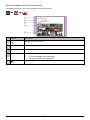
1
S-Series Smart 2009 Software User Manual en English - United Kingdom SPIRIT Important safety information PLEASE READ CAREFULLY BEFORE INSTALLING PRODUCT IN VEHICLE This is the safety alert symbol. It is used to alert you to potential personal injury hazards. Obey all safety messages that follow this symbol to avoid possible injury or death. WARNING indicates a potentially hazardous situation which, if not avoided, could result in death or serious injury. CAUTION indicates a potentially hazardous situation which, if not avoided, may result in minor or moderate injury. CAUTION used without the safety alert symbol indicates a potentially hazardous situation which, if not avoided, may result in property damage. Removing original equipment, adding accessories or modifying your vehicle could affect the vehicle’s safety or make it illegal to operate in some jurisdictions. Follow all product instructions and all instructions in your vehicle owner’s manual regarding accessories or modifications. Consult your country’s and/or state’s laws regarding operation of a vehicle with any accessories or modifications. It is your sole responsibility to place, secure and use your Navman in a manner that will not cause accidents, personal injury or property damage. Always observe safe driving practices. Do not mount your Navman in a way that may interfere with the safe operation of the vehicle, the deployment of air bags or other safety equipment. Do not operate your Navman while driving. Before you use your Navman for the first time, familiarize yourself with your device and its operation. On main roads, the distance to an exit calculated by the Navman may be further than the distance shown on road signs. Road signs show the distance to the start of an exit while the Navman shows the distance to the next intersection, i.e., the end of the exit ramp or road. To prepare to exit a road, always follow distance information on road signs. The use of information regarding safety or speed camera locations may be subject to local laws in the country of use. You are responsible for checking that you can legally use the information in your country or in the country where the information will be used. Do not handle the Navman while it is hot. Let the product cool, out of direct sunlight. At full power, prolonged listening to the Navman via headphones or earphones can damage the ear of the user. Do not expose the Navman to direct sunlight in an unattended vehicle for prolonged periods. Overheating may damage the unit. To discourage theft, do not leave the Navman, mounting bracket or any cables in plain view in an unattended vehicle. Warning Notice to Drivers in the United States State law may prohibit drivers in states such as Arizona, California and Minnesota from mounting objects on their windshields while driving. Please make sure you research and follow your most current State laws. An alternative mounting option is provided in the box with your product; also, stores offer additional mounting alternatives. Navman does not take any responsibility for any fines, penalties, or damages that may be incurred as a result of disregarding this notice. Failure to adhere to these warnings and cautions may lead to death, serious injury or property damage. Navman disclaims all liability for installation or use of the Navman that causes or contributes to death, injury or property damage or that violates any law. 2 Contents Important safety information...................................................................................................................2 Welcome................................................................................................................................................5 Important information for using the manual .......................................................................................5 Formatting ....................................................................................................................................5 Icons.............................................................................................................................................5 Terms ...........................................................................................................................................5 How do I use the touch screen?.............................................................................................................6 How do I get started?.............................................................................................................................7 How do I turn my Navman on for the first time? ................................................................................7 Home screen .........................................................................................................................................8 How do I go from A to B? .......................................................................................................................9 What if I miss a turn? ........................................................................................................................9 Using the Keyboard screen.............................................................................................................10 How can I set my keyboard preference?.....................................................................................10 How do I plan my first trip?..............................................................................................................11 How do I view my route?.................................................................................................................12 How do I search for an address using the FIND address wizard? ...................................................13 How do I search for a Point of Interest (POI)?.................................................................................15 How do I set my route preferences? ...............................................................................................16 How do I use the Explore map? ......................................................................................................17 How do I explore an area for a POI?...............................................................................................18 How do I explore a map for a POI? .................................................................................................20 How do I set my POI preferences? .................................................................................................21 How do I preview a route? ...................................................................................................................22 How do I view my route statistics? .......................................................................................................23 How do I navigate to a recent place? ...................................................................................................24 My Places ............................................................................................................................................26 How do I save a location as My Place or Home? ............................................................................26 How do I navigate to a location I have saved? ................................................................................27 How do I navigate to Home?...........................................................................................................27 How do I edit the name of a location in My Places? ........................................................................28 How do I delete a Favourite? ..........................................................................................................28 How can I view a POI I have downloaded using NavDesk? ............................................................29 How do I add or edit a POI description? .....................................................................................29 How do I navigate to a NavPix? ...................................................................................................30 How do I navigate to a NavPix in an album? ............................................................................31 NavPix management................................................................................................................32 How do I view a NavPix in full-screen? ....................................................................................33 How do I delete NavPix from an Album?..................................................................................33 How do I save a NavPix under My Places?..............................................................................34 How do I add or edit a NavPix title? .........................................................................................34 How do I capture the GPS co-ordinates of my location? .................................................................35 How do I navigate to a location I have captured? .......................................................................35 What is Connect (Local Search)?.........................................................................................................36 How do I search for a POI using Connect? .....................................................................................36 How do I make a hands-free Call? .......................................................................................................39 How do I pair my Navman with a Bluetooth mobile phone? ............................................................39 Paired phone detail screen .........................................................................................................39 Configuring internet settings .......................................................................................................40 How do I pair my Navman with a Bluetooth headset? .....................................................................40 How do I make a phone call?..........................................................................................................41 How do I receive a phone call? .......................................................................................................42 How do I add a contact to my Navman?..........................................................................................42 How do I search for a contact in my phonebook? .......................................................................42 How do I make a phone call to a contact? ..................................................................................43 3 How do I view my call history? ........................................................................................................44 How do I play media? ..........................................................................................................................45 Playing audio files ...........................................................................................................................45 How do I listen to a music file on my Navman?...........................................................................45 Playing video files ...........................................................................................................................47 How do I view a video file on my Navman?.................................................................................47 How do I view the video file on a full screen? .............................................................................48 FM Radio ........................................................................................................................................49 How do I receive audio through my vehicle speakers?.........................................................................50 How do I set the audio output channel of my Navman through my car’s FM radio? ........................50 How do I receive current traffic information? ........................................................................................51 How does my Navman receive traffic information? .........................................................................51 Traffic status...............................................................................................................................51 How will I know when a Traffic Event occurs?.................................................................................52 Traffic Overview screen ..................................................................................................................53 How do I view a list of all events on my route? ...........................................................................54 How do I view traffic details? ......................................................................................................55 How do I know if a detour is recommended? ..............................................................................56 How do I avoid an event on my route?........................................................................................56 How do I cancel a detour around an event on my route?............................................................56 Traffic Messages.............................................................................................................................57 Detour Not Available messages..................................................................................................57 Detour recommended messages................................................................................................57 Traffic preferences ..........................................................................................................................58 TMC service ...............................................................................................................................58 Traffic Event Notification.............................................................................................................58 Select event sorting type ............................................................................................................59 Walking mode ......................................................................................................................................60 How can I set my navigation mode to walking?...............................................................................60 What can I customize?.........................................................................................................................61 Volume ...........................................................................................................................................62 Route options..................................................................................................................................63 Map display.....................................................................................................................................64 Screen brightness ...........................................................................................................................65 Bluetooth ........................................................................................................................................66 Language........................................................................................................................................67 Voice...............................................................................................................................................68 Power management........................................................................................................................69 Connect ..........................................................................................................................................70 Units ...............................................................................................................................................71 Touch audio ....................................................................................................................................72 Audio output....................................................................................................................................73 Delete saved information ................................................................................................................74 Reset GPS......................................................................................................................................75 About ..............................................................................................................................................75 Shop demo .....................................................................................................................................75 Screen saver...................................................................................................................................75 Reference ............................................................................................................................................76 Points of Interest categories............................................................................................................76 Point of Interest categories by subscription.................................................................................77 My Places categories by Navman...............................................................................................77 Traffic and other TMC Events .........................................................................................................78 For more information.......................................................................................................................79 Online support ............................................................................................................................79 Phone support ............................................................................................................................79 Safety Camera POIs .......................................................................................................................79 Speed Limit.....................................................................................................................................79 Disclaimer .......................................................................................................................................79 Compliance.....................................................................................................................................80 Copyright ........................................................................................................................................81 4 Welcome This manual has been prepared to guide you through the operation of your Navman from first set-up through to continuous use. Please read this manual carefully before using your Navman for the first time. Keep this manual in a safe place and use as your first point of reference. Important information for using the manual It is important to understand the terms and typographical conventions used in this manual. Formatting The following formatting in the text identifies special information: Convention Type of Information Bold Navman components or items displayed on screen, including buttons, headings, field names and options. Italics Indicates the name of a screen. Icons The following icons are used throughout this manual: Icon Description Note Tip Warning Terms The following terms are used throughout this manual to describe user actions. Term Description Tap Press and release an item displayed on the touch screen. Tap and hold Tap and hold an item displayed on the touch screen for 2-3 seconds. Select Tap an item in a list or tap a command from a menu. 5 How do I use the touch screen? Your Navman touch screen options change dynamically: To see all options on a menu, drag the screen up or down. To display the next screen, tap an icon or select an option. To dock a menu to the left, tap the left edge of the menu. To dock a menu to the right, tap the right edge of the menu. 6 How do I get started? The first time you use your Navman, it may take up several minutes to establish a GPS connection. For more information about GPS, refer to the GPS Frequently Asked Questions guide on the enclosed DVD. How do I turn my Navman on for the first time? To get started for the first time, complete the following steps: 1. Read the Important Safety Information on page 2. 2. Position your Navman in your vehicle. Follow the instructions in the Hardware User Manual. CAUTION: Ensure that your Navman does not obstruct the driver's view, or interfere with the operation of the vehicle airbags and safety devices. 3. Turn your Navman on Your Navman will turn on and display the Language screen. 4. Select your preferred language From the Select Language screen, tap your preferred language. 5. 6. To prevent the Select Language screen from displaying on each start-up, tap the Show this screen on start-up option to deselect it. You can change your preferred language while using your Navman, see "Language" on page 66. Read the warning message a) The Safety Agreement screen will display after you have selected your preferred language. Read the Safety Agreement message. b) To confirm that you have read and understood the message, tap Accept. The Tutorial will display. View the Tutorial To skip the Tutorial screens, tap Skip. To move forward through the Tutorial screens, tap Next. To view the previous screen, tap . To prevent the Tutorial from displaying on each start-up, tap the Show on start-up option to deselect it. When you have finished the Tutorial, the Map screen will display. If you have a GPS fix, your current location will be displayed on the map. 7 Home screen The Home screen is your starting point for searching for a destination. The Home screen also allows you to customize your Navman, receive updated traffic information and make and receive phone calls. The Home screen can be accessed from the map screens by tapping on your Navman. Easiest way to set your destination and GO! Configure your Navman to enhance your navigation experience. Search for places, areas and streets to help plan your route. Receive live traffic information on your route and set traffic preferences. Explore the area around your current position or destination. Use your Navman as a hands-free car kit. Search online for live Point of Interest (POI) information. Play FM radio or audio and video files and set media preferences. Display the Map screen. Search for the nearest parking places when travelling. Save your important destinations, places, NavPix, etc. Search for the nearest petrol stations when travelling. Home screen options and the order of the options may differ from the above, depending on your region, maps installed or model of Navman. 8 How do I go from A to B? Your Navman is equipped with maps that provide street-level detail for door-to-door navigation, including Points of Interest such as accommodation, parking areas, petrol stations, railway stations and airports. When you ... Then ... know the address of your destination use the GO address wizard to enter the address. See "How do I plan my first trip?" on page 11. need to search for an address use the FIND address wizard to search for the address. See “How do I search for an address using the FIND address wizard?” on page 13. need to find a named site, feature, landmark or public venue search for a Point of Interest. See "How do I search for a Point of Interest (POI)?" on page 15. search for live POI information search for a POI using Connect. See "How do I search for a POI using Connect?" on page 36. want to navigate to a NavPix™ location use the My Places screen to navigate to a NavPix. See "How do I navigate to a NavPix?" on page 30. WARNING: For your safety, enter destination information before you start a journey. Do not enter a destination while driving. What if I miss a turn? Back-On-Track™ Automatic Rerouting You will be redirected if you make a wrong turn. A message informing you that your route is being re-calculated will display at the top of the screen. To cancel a route re-calculation tap x. A warning will display, asking you to confirm the cancellation. If confirmed, both the re-calculation and your current route will be cancelled. 9 Using the Keyboard screen The Keyboard screen will display when you are required to enter text, such as when searching for a street name. Search results will be listed in matching order, with the closest matches appearing on the screen. A maximum of 99 results will display. The Keyboard screen can display with various layouts depending on the information you need to enter, including alphabet, number, alternate characters and combinations of these. To select a character, tap the character. To enter upper case letters, tap . To delete a character, tap Tap and hold . to delete the entire text. To display more characters, tap to select an alternate keyboard screen. How can I set my keyboard preference? 1. From the Keyboard screen, tap . The Keyboard preference screen will display. 2. Complete the following: If you want to... Then... use an alphabetic keyboard for entering information select the Use alphabetic type (a, b, c...) option. use a QWERTY keyboard for entering information select the Use QWERTY option. use an accented keyboard for entering special character select the Use accented keyboard option. use a symbolic keyboard for entering symbols select the Use symbolic keyboard option. use a keypad-type keyboard (predictive text) when searching for an address select the Use keypad type (abc, def...) for address searches option. How does predictive text (abc, def…) work? Predictive text allows addresses to be searched by a single key-press for each letter, as opposed to the multiple keypresses. As you enter a letter of an address, your Navman will compare all possible combinations against the maps you have installed and determine which address you intended to type. For example: To enter London, tap JKL MNO MNO DEF MNO MNO. Your Navman will compare all possible combinations and display London in the list of search results. You can add further letters to narrow the search. 10 How do I plan my first trip? Using your Navman to plan your first trip is easy. There are several ways to select your destination. Complete the following to navigate to a street address that you know using the GO address wizard. Your Navman will calculate the route from your current location. The Map screen will display. 11 How do I view my route? When a route has been calculated, the Map screen will display. You will be directed to your destination by spoken and visual instructions. Item Description Direction and distance of next turn The direction and distance to your next turn Add waypoint to trip Tap to repeat the vocal instruction. Adds a location as a waypoint on your trip. Tap to remove the waypoint from your trip. Next turn and current route Your next turn and current route are highlighted. Detour Detours your route to avoid next 1, 2, 5, 10 or 20 kilometres/miles Current position Cancel route In Driving mode, your current position is marked with In Walking mode, your current position is marked with Cancels your current route. Tap to expand and select the following options: Distance and Time Information Pause route Time km/h or mph (speed) and heading TTG (Time to Go) DTG (Distance to Go) ETA (Estimated Time of Arrival). Pauses your current route. Tap to unpause your current route. Zoom To zoom out, tap and hold -. To zoom in, tap and hold +. Volume Mute or unmutes the volume. 12 . . How do I search for an address using the FIND address wizard? The below address is fictitious and used as an example only. 6 Navman Street Hackney, London United Kingdom 13 Complete the following: If you want to ... Then ... calculate the route, open the Map screen and start navigating tap GO. The Map screen will display. save the location as Home tap Add to My Places. The Save screen will display. tap Save as Home. save the location as a favourite navigate to a place near the location explore the area near the location tap Add to My Places. The Save screen will display. tap Save as My Place. tap Pick on Map. The Pick on Map screen will display. tap an area and tap OK. The Preview screen will display. tap Explore this area. The Find screen will display. 14 How do I search for a Point of Interest (POI)? A POI is a named site, feature, landmark or public venue which can be displayed as an icon on the map. POIs are grouped by category, such as petrol stations, parks, beaches and museums. Buckingham Palace London, England Complete the following: If you want to ... Then ... calculate the route, open the Map screen and start navigating tap GO. The Map screen will display. save the location as Home tap Add to My Places. The Save screen will display. tap Save as Home. save the location as a favourite place a phone call to the POI tap Add to My Places. The Save screen will display. tap Save as My Place. tap Call. This feature is not available on all models. navigate to a place near the location explore the area near the location tap Pick on Map. The Pick on Map screen will display. tap an area and tap OK. The Preview screen will display. tap Explore this area. The Find screen will display. 15 How do I set my route preferences? You can enhance your navigation experience by modifying aspects of your route and route calculations. 3. From the GO screen, tap Other options. The Other options screen will display. 4. Complete the following: If you want to... Then... set route type options for your route tap Route type. The Route type screen will display. select your route type preference form the list • Economical - The route with least number of stops, turns and urban areas which should save on fuel useage • Easiest - The simplest route with the least number of turns and favours motorways where appropriate • Fastest - The route that should be the fastest when navigating • Shortest - The route with the shortest physical length Selecting Shortest route type over Fastest route type can cause a much longer journey time. set types of road options for your route tap Types of road. The Types of road screen will display. select your road preference form the list Avoiding ferry routes may prevent you from navigating between certain countries, even when a bridge or tunnel exists. set your map screen preference tap the Map option to select between a 3D or 2D view of the Map screen. display 3D landmarks on your route tap the 3D landmark option to turn it On or Off. display Junction views on your route tap the Junction views option to turn it On or Off. record mileage for your route to generate expense reports tap the Mileage recorder option to turn it On or Off. record a GPS log of your trip tap the GPS logging option to turn it On or Off. 16 How do I use the Explore map? The Explore map allows you to explore the local area to find Points of Interest (POIs) or navigate to an address. If you do not have a GPS fix, the map will display your last known position. Tap and drag the map to explore the local area. Tap the map to display a POI Cluster showing POIs in the surrounding area. Tap a POI icon to show more information and navigate to the POI. Item Description Angle options Tap to adjust the horizontal viewing angle. Zoom options To zoom in or out, tap and hold - or +. Rotate options Tap or tap and hold to rotate the map clockwise or anticlockwise. Panning options Tap or tap and hold to pan the map forward, back, left or right. To display a POI Cluster, tap an area on the Explore map. POI Cluster Tap an icon or street name in the POI Cluster to view information and options. 17 How do I explore an area for a POI? An amusement park near London Eye, London. 18 Complete the following: If you want to ... Then ... calculate the route, open the Map screen and start navigating tap GO. The Map screen will display. save the location as Home tap Add to My Places. The Save screen will display. tap Save as Home. tap Add to My Places. The Save screen will display. tap Save as My Place. place a phone call to the POI tap Call. navigate to a place near the location save the location as a favourite This feature is not available on all models. tap Pick on Map. The Pick on Map screen will display. tap an area and tap OK. The Preview screen will display. 19 How do I explore a map for a POI? If you want to ... Then ... calculate the route, open the Map screen and start navigating tap GO. The Map screen will display. save the location as Home tap Add to My Places. The Save screen will display. tap Save as Home. tap Add to My Places. The Save screen will display. tap Save as My Place. place a phone call to the POI tap Call. navigate to a place near the location save the location as a favourite This feature is not available on all models. tap Pick on Map. The Pick on Map screen will display. tap an area and tap OK. The Preview screen will display. 20 How do I set my POI preferences? Points of Interest (POIs) are grouped into categories. You may choose to either display (or hide) icons of all POI categories on the map screens, or only display the icons from selected categories. For example, you may only be interested in entertainment venues and want to disable other categories such as schools. 1. From the EXPLORE screen, tap Places settings. The Places settings screen will display. 2. Complete the following: If you want to... Then... display all POI icons (i.e. icons from all categories) tap Show all. display no POI icons tap Hide all. show/hide select a specific POI category icon for display on the map screen tap the required POI category to Show/Hide on the map screen ; repeat until all required categories are selected. Your preferences are automatically saved. 21 How do I preview a route? Route simulation allows you to: Preview a route. Plan and view a route without a GPS fix, for example when you are inside a building. The following steps will show you how to preview a route: 1. Select a departure point. If you have a GPS fix, you do not need to select a departure point unless you want the demonstrated route to start elsewhere. a) b) Tap From. The Leaving from… screen will display. c) Tap Find a place, then follow the example steps on page 10. 2. Select a destination point using the GO or FIND address wizards, or the Explore map. 3. From the Preview screen, tap GO. Your route is calculated and the Map screen will display. 4. Tap the edge of the docked menu. The GO screen will display. 5. Tap Route simulation. The Map screen will display the calculated route in route simulation mode. 6. Complete the following: If you want to... Then... skip to the next turn tap . increase the speed of the simulation tap . decrease the speed of the simulation tap . cancel the simulation tap . 22 How do I view my route statistics? Your Navman provides information on your: distance to go estimated time of arrival distance travelled average speed maximum speed time taken for trip stationary time. To view your route statistics during a planned route: 1. Tap and then tap The GO screen will display. 2. Tap . The Route Statistics screen will display. 23 How do I navigate to a recent place? To make navigating to an address easier, your Navman will automatically save all your start locations and destinations in a list of recent places. 1. Tap Recent places. The Preview screen will display. 2. Tap a recent place. The Preview screen will display. 3. Complete one of the following: If you want to ... Then ... calculate the route, open the Map screen and start navigating tap GO. The Map screen will display. save the location as Home tap Add to My Places. The Save screen will display. tap Save as Home. save the location as a favourite navigate to a place near the location tap Add to My Places. The Save screen will display. tap Save as My Place. either tap Pick on Map or the map icon. The Pick on Map screen will display. tap an area and tap OK. The Preview screen will display. 24 If you want to ... Then ... explore the area near the location tap Explore this area. The Explore Map will display. tap the docked menu to see the menu options. The Explore screen will display. Complete one of the following: 25 tap Streets to explore streets near your location tap Areas to explore areas around your location tap a POI category to explore POIs near your location My Places My Places has all your saved and captured locations. It also contains POIs, NavPix and albums you have downloaded onto your Navman via NavDesk. How do I save a location as My Place or Home? Search for an address until the Preview screen is displayed. 1. Tap Add to My Places. The Save screen will display. 2. Tap Save as My Place. The Preview screen will display. 3. To change the name of the favourite, tap the name of the favourite. The Keyboard screen will display. 4. After you have entered a name for the favourite, tap OK. The My Places screen will display. 5. Complete one of the following: If you want to ... Then ... navigate to the favourite location tap GO. The Map screen will display. navigate to a place near the location tap Pick on Map. The Pick on Map screen will display. tap an area and tap OK. The Preview screen will display. explore the area near the location tap Explore this area. The Explore Map will display. tap the docked menu to see the menu options. The Explore screen will display. Complete one of the following: tap Streets to explore streets near your location tap Areas to explore areas around your location tap a POI category to explore POIs near your location delete the favourite location tap Delete. 26 How do I navigate to a location I have saved? 1. Tap the Favourite destination you want to travel to. The Preview screen will display. 2. Tap Go. Your Navman will calculate the route from your current location. The Map screen will display. How do I navigate to Home? If you have not set an address as Home, the first time you try to navigate to Home you will be prompted to search for an address using the address-entry wizard. 1. From the My Places screen, tap Home. The Preview screen will display. 2. Tap GO. Your Navman will calculate the route from your current location. The Map screen will display. 27 How do I edit the name of a location in My Places? 1. From the My Places screen, select a favourite to edit. The Preview screen will display. 2. Tap on the favourite name. The Keyboard screen will display. 3. After you have edited the name, tap OK. The Preview screen will display. How do I delete a Favourite? 1. From the My Places screen, select a favourite to delete. The Preview screen will display. 2. Tap Delete. The favourite is deleted. The My Places screen will display. 28 How can I view a POI I have downloaded using NavDesk? 1. Tap the POI you want to travel to. The Preview screen will display. 2. Complete one of the following: If you want to ... Then ... calculate the route, open the Map screen and start navigating tap GO. The Map screen will display. make a phone call to the POI tap Call. navigate to a place near the location This feature is not available on all models. explore the area near the location tap Pick on Map. The Pick on Map screen will display. tap an area and tap OK. The Preview screen will display. tap Explore this area. The Explore Map will display. tap the docked menu to see the menu options. The Explore screen will display. Complete one of the following: delete a POI from My Places tap Streets to explore streets near your location tap Areas to explore areas around your location tap a POI category to explore POIs near your location tap Delete. The My Places screen will display. How do I add or edit a POI description? 1. From the My Places screen, tap a POI you want to edit. The preview screen will display. 2. Tap on the name of the POI to edit its description. The Keyboard screen will display. 3. After you have edited the name, tap OK. The POI preview screen will display. 29 How do I navigate to a NavPix? Pictures that contain GPS co-ordinates are called NavPix and can be used to navigate to the GPS location. To navigate to a NavPix location, either a GPS fix must have been available when the NavPix was taken, or GPS co-ordinates have been added using NavDesk. 1. From the My Places screen, tap the NavPix you want to navigate to. The Preview screen will display. 2. Complete one of the following: If you want to ... Then ... calculate the route, open the Map screen and start navigating tap GO. The Map screen will display. navigate to a place near the location tap Pick on Map. The Pick on Map screen will display. tap an area and tap OK. The Preview screen will display. explore the area near the location tap Explore this area. The Explore Map will display. tap the docked menu to see the menu options. The Explore screen will display. Complete one of the following: delete a POI from My Places tap Streets to explore streets near your location tap Areas to explore areas around your location tap a POI category to explore POIs near your location tap Delete. The My Places screen will display. 30 How do I navigate to a NavPix in an album? The albums contain all your photos and displays them as thumbnails. Element Description Displays the previous screen Slide Show Displays all images in the album as a full-screen slideshow. Album title The title of the album. NavPix thumbnail A thumbnail of a NavPix contained in the album. To select a NavPix, tap the thumbnail. The NavPix Details screen will display. Indicates that the picture is a NavPix, with embedded GPS co-ordinates. 31 NavPix management The NavPix Details screen displays information about your NavPix. Tap a NavPix to display the Photo Details screen. Element Description NavPix Title and address The title of the NavPix and its address. GO Your route will be calculated and displayed on the Map screen. This button is only available if the NavPix contains GPS co-ordinates. Add to My Places Allows you to save the NavPix in My Places. NavPix information Displays information about the NavPix. This information cannot be edited as it is imported from NavDesk. Pick on map Displays the Pick on map screen. Explore Display the Explore map screen Delete Deletes the NavPix from the album on your Navman or memory card. Mode Toggle between Driving and Walking modes. Thumbnail A thumbnail of the NavPix. 32 How do I view a NavPix in full-screen? 1. From the NavPix Details screen, tap the thumbnail of the NavPix. The NavPix will appear in full-screen. OR From the Album detail screen, tap Slide Show. The NavPix will appear in full-screen 2. The icons disappear after a few seconds; tap the screen to have them reappear. 3. Complete the following: If you want to ... zoom into the NavPix zoom out of the NavPix rotate the NavPix Then ... tap . tap . . tap The NavPix will rotate 90 degrees anticlockwise each is tapped; the NavPix is saved at the new angle. time view parts of the NavPix not displayed onscreen return to the NavPix Details screen scroll through your NavPix tap and hold the NavPix, then drag across the screen. . tap . tap How do I delete NavPix from an Album? NavPix can be deleted from an Album on your Navman internal memory or your memory card. When a NavPix has been saved as a Favourite destination, you will not delete the Favourite if you subsequently remove the NavPix. 1. From the Album screen, tap a NavPix. The NavPix Details screen will display. 2. Tap Delete. 3. A warning screen will display, asking you to confirm or cancel the procedure. If confirmed, the NavPix will be deleted. 33 How do I save a NavPix under My Places? You cannot save a NavPix as a favourite if GPS co-ordinates are not available. 1. From the Album screen, tap a NavPix. The NavPix Details screen will display. 2. Tap Add to My Places. The Save screen will display. 3. Complete the following: If you want to ... Then ... save the NavPix as a Favourite (when GPS co-ordinates are associated with a picture) tap Save as My Place. The NavPix is saved and the Photo Details screen will display. save the NavPix as Home (when GPS co-ordinates are associated with a picture) tap Save as Home. The NavPix is saved and the Photo Details screen will display. How do I add or edit a NavPix title? A title can be added to your NavPix or an existing title can be edited. The title can be a maximum of 34 characters. 1. From the My Places screen, tap a NavPix you want to edit. The preview screen will display. 2. Tap on the name of the NavPix to edit its title. The Keyboard screen will display. 3. After you have edited the title, tap OK. The NavPix Details screen will display. 34 How do I capture the GPS co-ordinates of my location? Your Navman has a capture feature which allows you to record GPS co-ordinates of a location and save them so you can navigate back at a later time. 1. on your Navman. Press You will hear a shutter sound to indicate that the GPS co-ordinates have been saved. The location is saved under My Places. How do I navigate to a location I have captured? 1. From the My Places screen, tap the location you have saved. The Preview screen will display. 2. Complete one of the following: If you want to ... Then ... calculate the route, open the Map screen and start navigating tap GO. The Map screen will display. edit the name tap the name of your location. The Keyboard screen will display. navigate to a place near the location tap Pick on Map. The Pick on Map screen will display. tap an area and tap OK. The Preview screen will display. explore the area near the location tap Explore this area. The Explore Map will display. tap the docked menu to see the menu options. The Explore screen will display. Complete one of the following: tap Streets to explore streets near your location tap Areas to explore areas around your location tap a POI category to explore POIs near your location 35 What is Connect (Local Search)? Connect is not available on all models. Connect allows you to search online for live POI information. Using Connect you can search for and navigate to POIs using your Navman or you can navigate to POIs you have downloaded using NavDesk. To search for POIs using your Navman, you must pair your Navman with your mobile phone. If your Navman isn’t paired with your mobile phone, the Bluetooth screen will display. For more information on paring, see “How do I pair my Navman with a Bluetooth mobile phone?” on page 39. How do I search for a POI using Connect? 1. Choose one of the following: If you want to… Then… use your current location to search for live POI information tap Near here. The Preview screen will display. Tap Accept. The Available services screen will display. search for POI information at your destination Note: This option is only available if you have a route planned. search for a new location tap Near my destination. The Preview screen will display. Tap Accept. The Available services screen will display. tap Find another place. The Go screen will display. Search for a place and Tap Accept. The Available services screen will display. Depending on the country you are navigating, the available search services may vary. Depending on the service selected you can search for a POI by name or by category. 36 2. Tap and select your preferred search service. The Keyboard screen will display. 3. Use the Keyboard screen to search for a POI, then tap OK. The List of Results screen will display. 4. Select a POI. The Preview screen will display. 37 5. Complete one of the following: If you want to... Then... calculate the route and open the Map screen tap GO. Your route is calculated; the Map screen will display. place a phone call to the POI tap Call. navigate to a place near the location tap Pick on Map. The Pick on Map screen will display. tap an area and tap OK. The Preview screen will display. explore the area near the location save the destination as a Favourite change your destination tap Explore nearby. The Explore Map will display. tap the docked menu to see the menu options. The Explore screen will display. Complete one of the following: tap Streets to explore streets near your location tap Areas to explore areas around your location tap a POI category to explore POIs near your location tap Add to My Places. The Save screen will display. tap Save as My Place. press . The List of Result screen will display. 38 How do I make a hands-free Call? Hands-free calling is not available on all models. If you have a mobile phone with Bluetooth wireless technology, you can use your Navman as a hands-free car kit or to provide an internet connection. It can also be used to connect to a Bluetooth mono/ stereo earphone to output audio. Models with Bluetooth capabilities can exchange information over a distance of about 10 metres (30 feet) without requiring a physical connection. Before you can use this feature you must pair your mobile phone with your Navman. Ensure that the Bluetooth wireless feature of your mobile phone is turned on before you begin pairing. When you search for or connect to a mobile phone/ headset, the Bluetooth on your Navman will be turned on automatically. To save power, Bluetooth is set to OFF by default. How do I pair my Navman with a Bluetooth mobile phone? 1. From the Settings screen tap Bluetooth. The Bluetooth screen will display. 2. Tap Connect to Phone. The Search screen will display. 3. Tap Search for devices. The Search screen will display a list of nearby Bluetooth devices. 4. Select a device from the list. The Waiting screen will display. 5. Tap OK. The Phone detail screen will display. If you are prompted for a pass code or device PIN, enter 1234. When you pair your mobile phone with your Navman, a connection is established between them. The 12 most recently paired phones will display on the Connect to Phone screen. Paired phone detail screen The hands-free feature on your Navman can be turned ON or OFF. When turned ON, the following features can be used: Display caller’s number Answer or ignore incoming call Dial a number through the Dial, Phonebook and Call history screens 39 Configuring internet settings The Internet connection when turned on allows you to access live information over the internet. Your mobile phone service provider’s default settings will be displayed. When internet settings are not available, a warning message will be displayed. To enter internet settings: Tap any fields to access the keyboard screen to edit the internet configuration. When you enter your password the characters are replaced with * to protect your pass code information. Tap Advanced to set your IP address, DNS and Alt DNS settings. For more information, contact your mobile phone service provider. How do I pair my Navman with a Bluetooth headset? 1. From the Settings screen tap Bluetooth. The Bluetooth screen will display. 2. Tap Connect to headset. The Search screen will display. 3. Tap Search. The Search screen will display a list of nearby Bluetooth devices. 4. Select the headset from the list. The Passcode screen will display. 5. Enter the passcode and tap OK. The Phone menu screen will display. When you pair your headset with your Navman, a connection is established between them. The 12 most recently paired headphones will display on the Connect to headset screen. 40 How do I make a phone call? 1. From the Phone screen tap Dial. The Dial screen will display. 2. Enter the number you want to call. The number of the last call will display when you next access the Dial screen. The number will be cleared as you start entering a new number. 3. To delete the last digit entered, tap To clear the entire number, tap and hold . . International calls require a country code to be included in the phone number. On your Navman, the country code is separated from the rest of the number sequence by a +. If you are making an international call, tap and hold 0 until the + sign displays. 4. to place the call. Tap The Dialling screen will display. When the call is answered, the Call in progress screen will display. 5. Complete the following: If you want to… Then… enter other numbers such as an extension number tap Keypad. adjust sound so that the other party cannot hear you tap to mute. tap to unmute. adjust the volume tap + or - on the volume bar to increase or decrease the volume. make and receive calls via your Navman tap Voice to device. make and receive calls via your mobile phone tap Voice to Phone. access the map screen during a call tap Minimize. The Map screen will display. To access the Call in end or cancel the call tap Hang Up. progress screen, tap 41 on the Map screen. How do I receive a phone call? When you receive a call, the Incoming call screen will display. Tap Answer to answer the call, or Ignore to reject the call. Tap – or + to adjust the volume Tap Hang Up to end a call you have answered. How do I add a contact to my Navman? Your Navman uses contacts created on your mobile phone. To add a new contact to your Navman, you must first add it to your mobile phone. Refer to your mobile phone user manual for more information. If there are no contacts on your Navman, you will be prompted to transfer the contact list from your phone. Your phone may disconnect, and then reconnect to your Navman during the transfer. From the Phone screen tap Phonebook. The Phonebook screen will display. To synchronise the contact list with your mobile phone, tap Get Phonebook. Your phone may disconnect, then reconnect to your Navman during the transfer. Contact names will be displayed in alphabetical order. If a contact has more than one phone number, the numbers will be separated into multiple same name entries each with a different number. Your Navman can store up to 3 paired phones’ phonebooks. How do I search for a contact in my phonebook? Your contact names will be displayed in an alphabetical order on your Navman. 1. To search for a contact, tap Search. The keyboard screen will display. 2. Enter your contacts name, then tap OK. The Phonebook results screen will display. 3. Tap a contact from the list. The Dialling screen will display. 42 How do I make a phone call to a contact? 1. From the Phone screen tap Phonebook. The Phonebook screen will display. 2. Select a contact from the list. The Dialling screen will display and once the call is answered the Call in progress screen will display. 3. Complete the following: If you want to… Then… enter other numbers such as an extension number tap Keypad. adjust sound so that the other party cannot hear you tap to mute. tap to unmute. adjust the volume tap + or - on the volume bar to increase or decrease the volume. make and receive calls via your Navman tap Voice to device. make and receive calls via your mobile phone tap Voice to Phone. access the map screen during a call tap Minimize. The Map screen will display. To access the Call in end or cancel the call tap Hangup. progress screen, tap 43 on the Map screen. How do I view my call history? From the Call log screen you can view a list of Incoming Calls, Outgoing Calls and Missed Calls. The call history lists the calls made during the time your Navman is connected to a mobile phone. Numbers are arranged by time with the most recent time at the top. Your Navman can store up to 30 numbers; limited to 10 entries for incoming, outgoing and missed calls each. 1. From the Phone screen tap History. The Phone History screen will display. Icon Description All calls Missed calls Outgoing calls Incoming calls 2. To call a number in your call history, tap a contact from the list. 3. Tap the icon on the top right corner of the Call History screen to sort through Incoming Calls, Outgoing Calls and Missed Calls. 44 How do I play media? Media is not available for all models. Media allows users to play stored video and music files installed on your Navman or on a memory card. It also allows users to play FM radio. Playing audio files If your files are in a storage card, insert the card into your Navman. Only mp3, wma, wav audio formats are supported for the audio feature. You can play music files that are stored on your Navman or on the storage card by a random order, artist and albums. How do I listen to a music file on my Navman? There are several ways to play audio files on your Navman. 1. Choose one of the following: If you want to… Then… play music files randomly tap Play Random. sort music files by an artist tap Artist and select an artist from the Artist screen. listen to music files in an album tap Albums and select an album from the Album screen. play all music files tap Songs and select a song to start with from the Songs screen. play music files stores in a playlist tap Playlists and select a playlist from the Playlist screen. 45 2. The Songs screen will display. 3. Complete the following: If you want to… Then… play a music file tap on the music file from the list listen to the previous music file skip the current music file pause the music file adjust the volume tap . tap . tap . Tap to starting playing the audio file. tap + to increase the volume. tap - to decrease the volume. set play settings in the Play section, tap < or > to see all options: set repeat settings select Random to play music files randomly. select In order to play music files in order. in the Repeat section, tap < or > to see all options: select Repeat All to repeat all the music files. select Repeat One and the current music file will be repeated once. select No Repeat to play the music files only once. 46 Playing video files If your files are in a storage card, insert the card into your Navman. Only mp4, 3gp, m4v, asf, wmv and avi video formats are supported for the video feature. How do I view a video file on my Navman? 1. From the Media screen tap Videos. The Videos screen will display. 2. Complete the following: If you want to… Then… play a video file tap on the video file from the list view the previous video file tap . Tap and hold the icon for more than 1 second to rewind the video. skip the current video file tap . Tap and hold the icon for more than 1 second to forward the video. pause the video file adjust the volume tap . Tap to starting playing the video file. tap + to increase the volume. tap - to decrease the volume. set play settings in the Play section, tap < or > to see all options: set repeat settings select Random to play video files randomly. select In order to play video files in order. in the Repeat section, tap < or > to see all options: select Repeat All to repeat all the video files. select Repeat One and the current video file will be repeated once. select No Repeat to play the video files only once. 47 How do I view the video file on a full screen? 1. From the Video screen select and tap a video file you want to view on a full screen. The video file will play in a normal view. 2. Tap on the video file. The video file can be viewed at full screen. 3. The icons disappear after a few seconds; tap the screen to have them reappear. 4. Complete the following: If you want to… view the previous video file Then… tap . Tap and hold the icon for more than 1 second to rewind the video. skip the current video file tap . Tap and hold the icon for more than 1 second to forward the video. pause the video file adjust the volume tap . Tap to starting playing the video file. tap + to increase the volume. tap - to decrease the volume. return to the normal view tap . 48 FM Radio To use FM radio 1. From the Media screen tap FM Radio. The FM Radio screen will display. 2. Complete the following: If you want to… Then… search a FM channel tap the frequency bar to select a channel. You can also tap on and to search for the next or or for more than 1 second previous channel. Tap and hold to adjust the frequency by the minimal frequency unit, e.g., 0.1 or 0.05 depending on the country you are in save a channel tap the frequency bar to select a channel. Tap Save to save the channel. The saved channels will be displayed on the FM radio screen. stop the channel delete all saved channels adjust the volume tap . tap Clear All and select Yes on the warning screen. All saved channels will be deleted from the FM radio screen. tap + to increase the volume. tap - to decrease the volume. When you are in Driving mode, FM radio will be disabled. When you are in Walking mode or you do not have a planned route, you will be asked to connect a pair of headphones. When you do not have a route planned and you try to access the FM radio, you will not receive TMC information. 49 How do I receive audio through my vehicle speakers? FM transmitting is not available on all models. Your Navman can be set to transmit sound at a particular FM frequency which you can then receive through your vehicle radio. This means that you can hear map voice guidance, radio, mp3 files and video voice files clearly and loudly through your vehicle speakers. How do I set the audio output channel of my Navman through my car’s FM radio? When you first access Audio output, the Internal speaker option is selected by default. If you select FM transmitter the most recently used FM frequency will be used. 1. From the Settings screen tap Audio output. The Audio output screen will display. 2. Select the FM transmitter option and then tap setup to set the frequency. The Set Frequency screen will display. When you select Audio output from Settings on your Navman the following message will be displayed “Do you want to disconnect the Bluetooth Stereo connection.” Select Yes to output all sound through FM radio. Select No to output the music/video sound through your Navman and all other sounds through FM radio. 3. Tap Set frequency to set a new output frequency for your Navman. The Set frequency screen will display. 4. Tap – or + to set a frequency. 5. Tap any of the save options. The FM screen will display with the saved frequency. Tap and hold -/+ to decrease/increase by 1MHZ. The fine-tuning frequency unit is 0.1MHZ/per unit. You can only save four FM frequencies on your Navman. Tap Apply directly to apply current frequency directly. Apply directly option allows you to set the audio output channel automatically to FM (current frequency). 6. Tap and select the frequency you want to use. To delete a saved frequency, you must set a new frequency and replace the frequency that you no longer require. 50 How do I receive current traffic information? Traffic information is not available on all models and is only available in selected countries. Your Navman can receive current traffic information for all main roads and motorways, enabling you to avoid potential delays on your route. Event messages and traffic icons will display as they occur. If an event message obscures your current location, the map will adjust to display both the message and your location. How does my Navman receive traffic information? Depending on your model, you may receive current traffic information on your Navman using the built-in TMC receiver, or via the Navman accessory kit. The traffic accessory kit may be sold separately. The Traffic Message Channel (TMC) broadcasts real-time traffic and weather information via the FM Radio Data System (RDS). FM radio stations transmit TMC data on a cycle of several minutes, with hundreds of events able to be broadcast to TMC receivers, such as the Navman Traffic module. Traffic status Your current traffic status is indicated by the colour of the TMC icon. To view your current traffic status, from the Home screen, tap . The following table describes the three traffic status icons: Traffic Status Description The TMC status is grey if traffic is currently inactive due to one of the following conditions: Your Navman or Traffic module is connecting to the TMC service. Your Navman or Traffic module cannot receive TMC data. This may be due to poor radio coverage in the local vicinity. You are in a country that is not supported by the Navman Traffic service. Tap to display the Traffic Overview screen. The TMC status is orange if one of the following conditions apply: You have navigated into a country that is not supported by Navman Traffic, but there are still traffic events listed on the Event List screen. You have separated your Navman from the Navman Traffic module, or the Navman Traffic module is not receiving power but there are still traffic events listed on the Event List screen. Tap to display the Traffic Overview screen. The TMC status is green if your Navman or Traffic module is active and receiving traffic events. Tap to display the Traffic Overview screen. Your traffic status is displayed in more detail on the Traffic System Status screen. 51 How will I know when a Traffic Event occurs? Incoming events are handled according to your Traffic preferences. For more information, see "Traffic preferences" on page 58. When travelling through an area in which you can receive traffic status, your Navman will decode these events and display them on-screen. An icon will display at the event location on the map screens, and an audible warning is given if an event is on your route. Where an event spans a specific distance, the road will be highlighted and arrows will indicate the direction affected. A message will display at the bottom of the screen with the road name, the section of road affected and the type of event that has occurred. The message remains on screen for 8 seconds and is added to the Event List. 52 Traffic Overview screen Depending on your Navman model, traffic information may not be available or may require the Traffic Accessory Kit (may be sold separately). The Traffic Overview screen displays a general overview of the traffic situation on your route, including all events in the immediate vicinity. Item Description Event icon Displays icon to indicate type of event. Current position Status Your current position is marked with . Indicates the number of events on your route. Tap to display the Traffic System Status screen. Tap to display the Event List screen. Tap and hold + to zoom in. Tap and hold - to zoom out. 53 How do I view a list of all events on my route? Your Navman creates a list of events as they are received, which is displayed on the Event List screen. This screen can only be viewed if the TMC icon is green or orange. From the Traffic Overview screen, tap Item . Description Tap to return to the previous screen. Sort Display the Set sort type screen. Select your traffic event sorting option from the list. View next and Tap > to display the next 20 traffic events on your route. previous events Tap < to display the previous 20 events on your route. Event description Displays details of the Event, including: Event icon Displays an icon to indicate type of event. See page 78 to view a list of all icons. Name of road and direction in which Event is taking place. Location of where Event begins and ends. > indicates an Event from a location, to a location. <> indicates an Event between locations. Type of Event. 54 How do I view traffic details? There are several ways to view details of an event received by your Navman. Choose one of the following: Location Option From any of the map screens used to view your route Tap the Event message when it appears on the map screen. The Event Details screen will display. Tap . The Event List screen will display. Select and tap the event you want to view. The Event Details screen will display. From the Traffic Overview screen OR Tap and hold the traffic icon, which displays at the location of the event. The Event Details screen will display. Item Description Tap to return to the previous screen. Event icon and description Displays icon to indicate type of Event and details, including: Time the Event was received, or last updated. Name of road on which Event is taking place. Location of where Event begins and ends. > indicates an Event from a location, to a location. <> indicates an Event between locations. Type of Event. Detour information Displays details of detour recommendation, if any. For more information, see "How do I know if a detour is recommended?" on page 56. Avoid Tap to initiate a new route to avoid the event. Only available if a detour or re-route is available. Unavoid area button is displayed when a re-route has been calculated. 55 How do I know if a detour is recommended? When a Traffic or Clearance event occurs on your route, a detour will often be recommended. The detour event message will display in the status bar on map screens. Detours are only recommended for Traffic or Clearance Events on a calculated route. How do I avoid an event on my route? From the Traffic Overview screen, tap . 1. From the Event List screen, tap the event. The Event Details screen will display. 2. If a detour has been calculated to avoid an event on your route, Avoid is available; tap to accept the new route and avoid the event. The Map screen will display. How do I cancel a detour around an event on my route? If you have chosen to avoid an event and a new route has been calculated, you can cancel the detour around the event and return to your original route. 1. From the Event List screen, tap the Event you want to un-avoid. The Event Details screen will display. 2. Re-route information displays at the bottom of the screen. If a re-route has been calculated, Unavoid is available; tap to accept the new route. The Map screen will display. 56 Traffic Messages The Event Details screen displays detour status information. Detour Not Available messages If a detour is not available, one of the following messages will display: Message Description This Event is not locatable A specific location for the Event cannot be identified. This clearance is not locatable This Event does not affect your route This clearance does not affect your route The Event is not on the current leg of your journey, or is behind your current position. You are avoiding this Event The Event is not on the current leg of your journey. You have accepted this clearance You are too distant to re-route The Event is currently too distant to affect your journey. You are too distant to accept this clearance Detour not found A detour / re-route could not be calculated. Clearance route not found Detour recommended messages If a detour is recommended, one of the following messages will display: Message Description Finding detour.... Your Navman is calculating a new route. During calculation, the % complete will display. Recalculating route..... Exiting this screen before the new route is calculated will cancel the operation. Detour distance..... Clearance change A detour has been calculated. The difference between the distance of your current route and the proposed route is displayed. 57 Traffic preferences You can view your current traffic system status and change options by customising the traffic preferences. TMC service The TMC service screen displays the frequency of the radio station currently used to receive traffic event information. A bar shows the strength of the traffic signal being received; the more green bars the stronger the signal. Complete the following: If you want to… Then… change your preferred radio station select your preferred radio station from the list. Traffic Event Notification 1. From the TMC Service screen tap Preferences. The Preferences screen will display. 2. Complete the following: If you want to ... Then ... turn on/ off traffic event notification select the Notify me about nearby traffic events button to receive traffic event notification. clear the Notify me about nearby traffic events button to turn off traffic event notification. Event icons will still display on the Map screen. be notified about events that affect your current route select the Only notify me about events on my route button. be notified only when a detour is recommended select the Only notify me if a detour is recommended button. Your preferences are automatically saved. 58 Select event sorting type 1. From the Traffic events screen tap the sort field. The Set sort type screen will display. 2. Complete one the following: If you want to ... Then ... sort events by distance select the Distance option. sort events by road name select the Road name option. sort events by age select the Age option. view all traffic events select the Show all events option. view traffic events that appear only on your route select the Only show events on my events option. Your preferences are automatically saved. 59 Walking mode Walking mode allows you to navigate to your destination using roads and paths appropriate for a pedestrian, including non-vehicle segments. When in Walking mode, you will not be routed onto motorways and their associated on/off ramps (slip roads). If your destination is more than 10 kilometres (6.3 miles) away, a warning message is displayed indicating that the route is a long way to walk. How can I set my navigation mode to walking? 1. 2. Plan a route from the GO, Find or Explore screen. In the Mode section, tap < or > to select Walking. Your route will be calculated and the Map screen will display using the walking icon: . If your destination is more than ten kilometres away, a warning message will display indicating that the route is a long way to walk. 60 What can I customize? There are various customization options available to enhance your navigation experience. 61 Volume Complete the following: If you want to... Then... increase or decrease the volume move the Volume slider to the right to increase the volume. move the Volume slider to the left to decrease the volume. Your preferences are automatically saved. 62 Route options You can enhance your navigation experience by modifying aspects of your route and route calculation. Complete the following: If you want to... Then... enable/disable a visual warning if the screen is accessed in a moving vehicle tap Warn me not to operate my Navman while driving, to turn it On/Off. enable/disable speed limit alerts tap Speed limit warnings, to turn it On or Off. set your preferred speed When Speed limit warnings is set to On, the Set manual speed alert, option will display. in the Set manual speed alert section, tap < or > to select your preferred speed limit. Your set speed limit will be used for roads where speed limit data is not available. Navman accepts NO liability whatsoever for you receiving any speeding fines or points on your license through using this device. Navman does not guarantee the accuracy of the data contained within this database either expressed or implied. Your preferences are automatically saved. 63 Map display Complete the following: If you want to... Then... enable/disable automatic zooming during navigation tap Auto-zoom on main map screens. If selected, the Map screens will automatically zoom in or out, depending on your speed, to allow optimal viewing of your route. display North at the top of the 2D Map screen tap Keep North at top of 2D Map screen. If set to Off, the direction you are travelling in will display at the top of the 2D Map screen. display “no entry” icons on “no entry” roads on the Map screens tap Show no-entry road signs. Your preferences are automatically saved. 64 Screen brightness Complete the following: If you want to... Then... change the screen brightness move the Screen Brightness slider towards right to increase screen brightness. move the Screen Brightness slider towards left to decrease screen brightness. Warning: Your Navman can heat up when the Brightness scale is set above 70% i.e., when more than seven rectangles are coloured - therefore, use lower brightness whenever acceptable. set the screen contrast to automatically adjust select the Automatic day/night option. improve screen contrast in light or dark condition select either Day or the Night option to manually adjust the contrast. Your preferences are automatically saved. 65 Bluetooth Bluetooth option allows you to pair and select a mobile phone or the headset with your Navman. Complete the following: If you want to... Then... enable/disable Bluetooth on your Navman tap On/Off button on the Bluetooth screen. connect to a Bluetooth mobile phone tap Connect to Phone option and then select a mobile phone from the list. Tap Search to search for a new Bluetooth enabled mobile phone. For more information, see How can I pair my Navman with a Bluetooth mobile phone?” on page 39. connect to a Bluetooth headset tap Connect to Headset option and then select a headset from the list. Tap Search to search for a new Bluetooth enabled headset. For more information, see How can I pair my Navman with a Bluetooth headset?” on page 40. Your preferences are automatically saved. 66 Language Complete the following: If you want to... change the on-screen language Then... tap your preferred language button and then tap Yes. Your language preference is saved and the map screen is displayed. The voice scheme will also change to the default scheme for the selected language. Your preferences are automatically saved. 67 Voice Complete the following: If you want to... Then... change the voice scheme select your preferred voice scheme from the list. Only voice schemes that are compatible with the chosen language are displayed. Your preferences are automatically saved. 68 Power management The Battery Status bar shows the percentage of power left in the Navman battery; the words External Power will display when the battery is charging from an external power source. To charge the battery, refer to the Hardware User Manual. Complete the following: If you want to... Then... change the time to elapse before turning off, when using battery power in the on battery power section, tap < or > to select a time to elapse before turning off; select Never for the Navman to not turn off automatically unless battery power is very low. If you select Never, your Navman will turn off if the power is very low. change the time to elapse before turning off, when using external power in the on external power section, tap < or > to select a time to elapse before turning off; select Never for the Navman to never turn off automatically. Your preferences are automatically saved. 69 Connect Complete the following: If you want to... Then... remain connected to your mobile phone select Connect every time option. be warned before connecting to your mobile phone select Warn before connecting option. manually connect to your mobile phone select Do Not Connect option. Your preferences are automatically saved. 70 Units You can change the units used by your Navman by customizing the measurements preferences. Complete the following: If you want to... Then... change the time format tap Time Format and then select your preferred time format from the Units screen. change the distance units tap Distance Units and then select your preferred distance unit type from the Units screen. Your preferences are automatically saved. 71 Touch audio The touch audio option allows you to hear a tone when you tap the touch screen. Complete the following: If you want to... Then... enable touch audio feature tap Touch audio. 72 Audio output This feature is not available on all models. Audio output allows you to change the audio output of your Navman. Complete the following: If you want to... Then... receive audio output through your Navman select the Internal Speaker option. receive audio output through the FM radio in your car select FM and then select your FM frequency. If you have not previously selected an FM frequency, see “How do I receive audio through my vehicle speakers?” on page 50. Your preferences are automatically saved. 73 Delete saved information Complete the following: If you want to... Then... delete My Places tap Delete My Places. delete recent locations tap Delete Recent Locations. restore factory default settings tap Restore Factory Defaults. The Restore Factory Defaults option does not delete recent locations or saved My Places destinations. clear all settings; for example, for use in a rental car complete all of the above. When the warning dialog box displays, tap Yes. 74 Reset GPS Occasionally, the GPS fix may need to be reset. This may occur if the receiver has been transported a long distance since last being used; for example, to a different country, and is still trying to establish the previous position. Complete the following: If you want to... Then... reset the GPS tap Reset GPS. When the warning dialog box displays, tap Yes. About Tap About to display copyright and trademark information. Shop demo Complete the following: If you want to... Then... enable a shop demonstration of Smart to be played tap Shop Demo, then follow the prompts. After a short delay, a route will be demonstrated. Screen saver Complete the following: If you want to... Then... enable the screen saver feature on your Navman tap Screen saver. When you Navman is idle for more than 5 minutes the screen saver will display. The screen saver will only display if your Navman is connected to a power supply. 75 Reference Points of Interest categories Icon Description Icon Description Airport Amusement Park Art centre ATM or Cash Dispenser Bank Bar or pub Beach Breakdown Service, Car Repair Facility Bowling centre Business facility or company Business office Bus station Camping ground Car dealer/ Automobile dealer Casino Cemetery Church Cinema City hall City, town or village Coffee shop College/university Community centre Commuter railway station Courthouse Dentist Doctor Embassy Exhibition centre Ferry terminal Fire brigade Golf course Government office Grocery store Guest house Higher education Hospital/Polyclinic Hotel Ice skating Important tourist attraction Information/ Tourist Information Office Library Marina/Yacht basin Medical Monument Motorcycle dealer Motoring organisation office Mountain pass Museum Music centre Natural attraction Nightlife 76 Icon Description Icon Park and ride Parking Parking garage Park or recreation area Performance art/Theatre Petrol station Pharmacy Place of worship Police station Post office Public restroom/Toilet facilities Public sport airport Railway crossing Rental car agency Rest area Restaurant Road accident black spot Scenic/Panoramic view School School zone Shop Shopping Ski resort/Ski lift station Speed check Sport centre Sports hall Sports complex Stadium Tennis court Travel agency Transport ferry Veterinarian Winery Zoo Point of Interest categories by subscription Icon Description Safety Cameras Safety Camera (mobile) Safety Camera (average) Red Light Camera My Places categories by Navman Icon Description Description Saved location Home Album Picture 77 Traffic and other TMC Events Each TMC Event is sorted in to one of nine categories. When an Event is received, one of the following icons will display: Event Avoided Event Message Type Event Description Danger There is a dangerous situation on the route; for example, people are on the road. Traffic Any event that will cause a delay on a route. Weather Weather conditions are adversely affecting a route; for example, there is ice on the road. Warnings There is a situation of which you should be aware on the route, but it is not serious enough to be considered a dangerous situation; for example, a minor accident has taken place. Forecast An event is expected to occur on a route. Restrictions There is a restricted flow of traffic on a route; for example, a lane has been closed on a motorway. Clearance A Traffic Event that has now been cleared. Information All other events. Roadworks Roadworks are taking place on a route. If a Traffic or Clearance event has a recommended detour, the following icons will display: Event Avoided Event Message Type Event Description Traffic Detour A Traffic Event, for which a detour is recommended. Clearance Re-route A Clearance Event, for which a re-route is recommended. Avoided Event icons will only display on the 2D Map and 3D Map, at the Event location. 78 For more information Online support For 24/7 help and support with Navman products, visit our Technical Support website at: support.navman.com Phone support If you have a faulty product or you would like to speak to a member of our Technical Support team, please call the following number: United Kingdom, Ireland and International +44 (0) 844 800 0912 or +44 (0) 1293 566 100 Monday to Friday: 09.00 - 17.30 UK time (10.00 - 18.30 Central European Time) Safety Camera POIs Navman products are designed to be used as an aid to safer driving. You can receive messages to alert you to locations of safety cameras, which will enable you to monitor your speed through these areas. Navman does not warrant that all types and locations of safety camera data are available, as cameras may be removed, relocated or new cameras installed. Navman does not condone speeding or any other failure to comply with your local traffic laws. It is your responsibility to drive within the posted speed limit at all times and to drive in a careful manner. Navman accepts NO liability whatsoever for you receiving any speeding fines or points on your license through using this device. Navman does not guarantee the accuracy of the data contained within this database either expressed or implied. In the event you receive a fine or any other penalty for speeding or contravention of any traffic law, or are involved in an accident, Navman is not responsible for any damages of any type. In some countries the data information regarding safety or speed cameras may conflict with local law and/or regulations. It is your responsibility to make sure that your use of the data is in compliance with local laws and/or regulations. Usage is at your own risk. Speed Limit Navman products are designed to be used as an aid to safer driving. Navman does not condone speeding or any other failure to comply with your local traffic laws. It is your responsibility to drive within the posted speed limit at all times and to drive in a careful manner. Navman accepts NO liability whatsoever for you receiving any speeding fines or points on your license through using this device. Navman does not guarantee the accuracy of the data contained within this database either expressed or implied. In the event you receive a fine or any other penalty for speeding or contravention of any traffic law, or are involved in an accident, Navman is not responsible for any damages of any type. In some countries the data information regarding speed limits may conflict with local law and/or regulations. It is your responsibility to make sure that your use of the data is in compliance with local laws and/or regulations. Usage is at your own risk. Disclaimer Navman operates a policy of ongoing development. Navman reserves the right to make changes and improvements to any of the products described in this document without prior notice. Navman does not warrant that this document is error-free. The screenshots and other presentations shown in this manual may differ from the actual screens and presentations generated by the actual product. All such differences are minor and the actual product will deliver the described functionality as presented in this User Manual in all material respects. 79 Compliance WARNING This product, its packaging and its components contain chemicals known to the State of California to cause cancer, birth defects or reproductive harm. This Notice is being provided in accordance with California’s Proposition 65. For regulatory identification purposes, Navman S-Series is assigned a model number of N214. The manufacturer is not responsible for any radio or TV interference caused by unauthorized modifications to this equipment. Such modifications could void the user’s authority to operate the equipment. Marking labels located on the exterior of your Navman indicate the regulations that your model complies with. Please check the marking labels on your Navman and refer to the corresponding statements in this chapter. Some notices apply to specific models only. Products with the CE marking comply with Radio & Telecommunication Terminal Equipment Directive (R&TTE) (1999/5/EC), the Electromagnetic Compatibility Directive (2004/108/EC) and the Low Voltage Directive (2006/95/EC) - issued by the Commission of the European Community. Compliance with these directives implies conformity to the following European Standards: EN 301 489-1: Electronic compatibility and Radio spectrum Matters (ERM), Electromagnetic Compatibility (EMC) standard for radio equipment and services; Part 1: Common technical requirements. EN 301 489-9: (Bluetooth and FM Transmitter): Electromagnetic compatibility and Radio spectrum Matters (ERM), ElectroMagnetic Compatibility (EMC) standard for radio equipment and services; Part 9: Specific conditions for wireless microphones, similar Radio Frequency (RF) audio link equipment, cordless audio and in-ear monitoring devices. EN 301 489-17: Electronic compatibility and Radio spectrum Matters (ERM), Electromagnetic Compatibility (EMC) standard for radio equipment and services; Part 17: Specific conditions for 2.4 GHz wideband transmission systems and 5 GHz high performance RLAN equipment. EN 300 328 (Bluetooth): Electromagnetic compatibility and Radio spectrum Matters (ERM); Wideband Transmission systems; Data transmission equipment operating in the 2.4 GHz ISM band and using spread spectrum modulation techniques; Harmonized EN covering essential requirements under article 3.2 of the R&TTE Directive EN 301 357-2 (FM Transmitter): Electromagnetic compatibility and Radio spectrum Matters (ERM); Cordless audio devices in the range 25 MHz to 2000 MHz; Part 2: Harmonized EN covering essential requirements of article 3.2 of the R&TTE Directive. EN 55022: Radio disturbance characteristics EN 55024: Immunity characteristics EN 61000-3-2: Limits for harmonic current emissions EN 61000-3-3: Limitation of voltage fluctuation and flicker in low-voltage supply system IEC 60950-1:2001: Product Safety The manufacturer cannot be held responsible for modifications made by the User and the consequences thereof, which may alter the conformity of the product with the CE Marking. Hereby, Navman Technology Limited declares that this N214 is in compliance with the essential requirements and other relevant provisions of Directive 1999/5/EC. The software is based in part on the work of the Independent JPEG Group. The software application uses modified versions of the Minimal XML Library, Flickr Library and Python Library. The libraries and their use are covered by the GNU Lesser General Public License (www.gnu.org/licenses/lgpl.html). The modified source code is available from the following URLs: Minimal XML Library: www.navman.com/files/mxml.zip Flickr Library: www.navman.com/files/flickrnet.zip Python Library: www.navman.com/files/python25.zip Bluetooth QD ID B014607 80 Copyright © 2008 MiTAC International Corporation. Navman is either a registered trademark or trademark of MiTAC International Corporation and is used under licence by Navman Technology Limited. All rights reserved. The software contains proprietary information of MiTAC International Corporation; it is provided under a licence agreement containing restrictions on use and disclosure and is also protected by copyright law. Reverse engineering of the software is prohibited. No part of this publication may be reproduced, stored in a retrieval system, or transmitted in any form or by any means, electronic, mechanical, photocopying, recording or otherwise, without the prior written permission of Navman. Back-On-Track, Drive-Away, NavDesk, NavPix, Smart and Turn-by-Turn are either registered trademarks or trademarks of MiTAC International Corporation and are used under licence by Navman Technology Limited. All rights reserved. Microsoft, Windows, Windows Vista, and Internet Explorer are either registered trademarks or trademarks of Microsoft Corporation in the United States and/or other countries. All rights reserved. microSD and the microSD logo are trademarks of SD Card Association. The Bluetooth word mark and logos are owned by the Bluetooth SIG, Inc. and any use of such marks by Navman Technology Limited is under license. Location Identifiers © 2005 International Air Transport Association. POI Data © 2007 InfoUSA. All other trademarks and registrations are the property of their respective owners. Published in New Zealand. 81 DOC-121-A