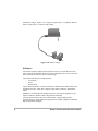
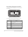
1
Reliance with FS/2
Field Operations Manual
Ashtech
1170 Kifer Road
Sunnyvale, CA USA 94086
Phone and Fax Numbers
•
Main
•
• Voice: 408-524-1400
Fax: 408-524-1500
•
Sales
•
• US: 800-922-2401
• International: 408-524-1670
Fax: 408-524-1500
•
Europe
•
• Voice: 44-993-883-533
Fax: 44-993-883-977
•
Support
•
• US: 800-229-2400
• International: 408-524-1680
Fax: 408-524-1500
•
BBS
•
Direct: 408-524-1527
Internet
•
[email protected]
•
http://www.ashtech.com
FS/2 Screen Map
ii
Reliance with FS/2 Field Operations Manual
Copyright Notice
Copyright © 1998 Magellan Corporation. All rights reserved.
No part of this publication or the computer programs described in it may be reproduced, translated, stored in a retrieval system, or transmitted in any form or by any
means, electronic, mechanical photocopying, recording, or otherwise, without prior
written permission of Magellan. Your rights with regard to this publication and the
computer programs are subject to the restrictions and limitations imposed by the copyright laws of the United States of America (“U.S.A.”) and/or the jurisdiction in
which you are located.
For information on translations and distribution outside the U.S.A. please contact
Ashtech.
Printed in the United States of America.
Part Number: 630168-01, Revision B
July, 1998
Trademark Notice
FILLNET is a trademark of Magellan Corporation. All other product and brand
names are trademarks or registered trademarks of their respective holders.
iii
SOFTWARE LICENSE AGREEMENT
IMPORTANT: BY OPENING THE SEALED DISK PACKAGE CONTAINING THE SOFTWARE MEDIA, YOU ARE AGREEING TO BE BOUND BY THE TERMS AND CONDITIONS OF THE LICENSE AGREEMENT (“AGREEMENT”). THIS AGREEMENT
CONSTITUTES THE COMPLETE AGREEMENT BETWEEN YOU (“LICENSEE”) AND
MAGELLAN CORPORATION. (“LICENSOR”). CAREFULLY READ THE AGREEMENT
AND IF YOU DO NOT AGREE WITH THE TERMS, RETURN THIS UNOPENED DISK
PACKAGE AND THE ACCOMPANYING ITEMS TO THE PLACE WHERE YOU OBTAINED THEM FOR A FULL REFUND.
LICENSE. LICENSOR grants to you a limited, non-exclusive, non-transferable, personal license (“License”) to (i) install and operate the copy of the computer program contained in this
package (“Program”) in machine acceptable form only on a single computer (one central
processing unit and associated monitor and keyboard) and (ii) make one archival copy of the
Program for use with the same computer. LICENSOR and its third-party suppliers retain all
rights to the Program not expressly granted in this Agreement.
OWNERSHIP OF PROGRAMS AND COPIES. This License is not a sale of the original
Program or any copies. LICENSOR and its third-party suppliers retain the ownership of the
Program and all copyrights and other proprietary rights therein, and all subsequent copies of the
Program made by you, regardless of the form in which the copies may exist. The Program and
the accompanying manuals (“Documentation”) are copyrighted works of authorship and contain
valuable trade secret and confidential information proprietary to LICENSOR and its third-party
suppliers. You agree to exercise reasonable efforts to protect the proprietary interests of
LICENSOR and its third-party suppliers in the Program and Documentation and maintain them
in strict confidence.
USER RESTRICTIONS. The Program is provided for use in your internal commercial business
operations and must remain at all times upon a single computer owned or leased by you. You
may physically transfer the Program from one computer to another provided that the Program is
operated only on one computer at a time. You may not operate the Program in a time-sharing or
service bureau operation or rent, lease, sublease, sell, assign, pledge, transfer, transmit
electronically or otherwise dispose of the Program or Documentation, on a temporary or
permanent basis, without the prior written consent of LICENSOR. You agree not to translate,
modify, adapt, disassemble, decompile, or reverse engineer the Program, or create derivative
works of the Program or Documentation or any portion thereof.
TERMINATION. The License is effective until terminated. The License will terminate without
notice from LICENSOR if you fail to comply with any provisions of this Agreement. Upon
termination, you must cease all use of the Program and Documentation and return tem, and any
copies thereof, to LICENSOR.
GENERAL. This Agreement shall be governed by and construed in accordance with the Laws
of the State of California and the United States without regard to conflict of laws provisions
thereof and without regard to the United Nations Convention on Contracts for the International
Sale of Goods.
iv
Reliance with FS/2 Field Operations Manual
DISCLAIMER OF WARRANTIES AND LIMITATION OF
LIABILITY
LICENSOR AND ITS THIRD-PARTY SUPPLIERS MAKE NO WARRANTIES OR
REPRESENTATIONS, EXPRESS OR IMPLIED, REGARDING THE PROGRAM, MEDIA,
DOCUMENTATION, RESULTS OR ACCURACY OF DATA AND HEREBY EXPRESSLY
DISCLAIM ANY WARRANTIES OF MERCHANTABILITY AND FITNESS FOR A
PARTICULAR PURPOSE AND NONFRINGEMENT. LICENSOR AND ITS THIRDPARTY SUPPLIERS DO NOT WARRANT THE PROGRAM WILL MEET YOUR
REQUIREMENTS OR THAT ITS OPERATION WILL BE UNINTERRUPTED OR ERRORFREE.
LICENSOR, its third-party suppliers, or anyone involved in the creation or deliver of the
Program or Documentation to you shall have no liability to you or any third-party for special,
incidental, indirect or consequential damages (including, but not limited to, loss of profits or
savings, downtime, damage to or replacement of equipment or property, or recover or
replacement of programs or data) arising from claims based in warranty, contract, tort (including
negligence), strict liability, or otherwise even if LICENSOR or its third-party suppliers have
been advised of the possibility of such claim or damages. The liability of LICENSOR and its
third-party suppliers for direct damages shall not exceed the actual amount paid for this Program
License.
Some states do not allow the exclusion of limitation of implied warranties or liability for
incidental or consequential damages, so the above limitations or exclusions may not apply to
you.
U.S. GOVERNMENT RESTRICTED RIGHTS
The Program and Documentation are provided with RESTRICTIVE RIGHTS. Use, duplication,
or disclosure by the Government is subject to restrictions as set forth in subdivision (c)(1)(ii) of
the Rights in Technical Data and Computer Software clause at DFARS 252.227-7013 or
subdivision 9(C)(1) and (2) of the Commercial Computer Software - Restricted Rights 48 CFR
52.227.19, as applicable.
Should you have any questions concerning the License Agreement or the Limited Warranties
and Limitation of Liability, please contact in writing: Ashtech, 1170 Kifer Road, Sunnyvale,
CA 94086
v
vi
Reliance with FS/2 Field Operations Manual
Table of Contents
Chapter 1. Introduction . . . . . . . . . . . . . . . . . . . . . . . . . . . . . . . . . . . . . . . . . . . . . . 1
Equipment. . . . . . . . . . . . . . . . . . . . . . . . . . . . . . . . . . . . . . . . . . . . . . . . . . . . . . . 1
Hardware . . . . . . . . . . . . . . . . . . . . . . . . . . . . . . . . . . . . . . . . . . . . . . . . . . . 2
Software . . . . . . . . . . . . . . . . . . . . . . . . . . . . . . . . . . . . . . . . . . . . . . . . . . . . 8
Using this Manual. . . . . . . . . . . . . . . . . . . . . . . . . . . . . . . . . . . . . . . . . . . . . . . . . 9
Reliance Fundamentals
Chapter 2. Survey Planning . . . . . . . . . . . . . . . . . . . . . . . . . . . . . . . . . . . . . . . . . 11
Reliance Precision System . . . . . . . . . . . . . . . . . . . . . . . . . . . . . . . . . . . . . . . . . 12
Decimeter System. . . . . . . . . . . . . . . . . . . . . . . . . . . . . . . . . . . . . . . . . . . . . . . . 13
Submeter System . . . . . . . . . . . . . . . . . . . . . . . . . . . . . . . . . . . . . . . . . . . . . . . . 13
Data Logging Guidelines . . . . . . . . . . . . . . . . . . . . . . . . . . . . . . . . . . . . . . . . . . 14
Improving Feature Accuracy . . . . . . . . . . . . . . . . . . . . . . . . . . . . . . . . . . . 15
Tips for Maximizing Centimeter Accuracy . . . . . . . . . . . . . . . . . . . . . . . . 16
Tips for Maximizing Decimeter Accuracy . . . . . . . . . . . . . . . . . . . . . . . . . 16
Tips for Maximizing Submeter Accuracy . . . . . . . . . . . . . . . . . . . . . . . . . 16
Tips for Maximizing Accuracy When Using LRFs . . . . . . . . . . . . . . . . . . 16
GPS under Trees. . . . . . . . . . . . . . . . . . . . . . . . . . . . . . . . . . . . . . . . . . . . . . . . . 17
Frequently Asked Questions. . . . . . . . . . . . . . . . . . . . . . . . . . . . . . . . . . . . . . . . 17
Chapter 3. Field Operation . . . . . . . . . . . . . . . . . . . . . . . . . . . . . . . . . . . . . . . . . . 23
Field Checklist . . . . . . . . . . . . . . . . . . . . . . . . . . . . . . . . . . . . . . . . . . . . . . . . . . 23
Equipment Connections . . . . . . . . . . . . . . . . . . . . . . . . . . . . . . . . . . . . . . . . . . . 23
Setup for Laser Range Finders . . . . . . . . . . . . . . . . . . . . . . . . . . . . . . . . . . 24
Setup for External Sensor Devices . . . . . . . . . . . . . . . . . . . . . . . . . . . . . . . 25
Base Station . . . . . . . . . . . . . . . . . . . . . . . . . . . . . . . . . . . . . . . . . . . . . . . . . . . . 25
Starting FAMlog. . . . . . . . . . . . . . . . . . . . . . . . . . . . . . . . . . . . . . . . . . . . . . . . . 26
Clearing Receiver Memory . . . . . . . . . . . . . . . . . . . . . . . . . . . . . . . . . . . . . . . . 28
System Information . . . . . . . . . . . . . . . . . . . . . . . . . . . . . . . . . . . . . . . . . . . . . . 30
Session Setup . . . . . . . . . . . . . . . . . . . . . . . . . . . . . . . . . . . . . . . . . . . . . . . . . . . 31
Setting Session Parameters. . . . . . . . . . . . . . . . . . . . . . . . . . . . . . . . . . . . . . . . . 33
Logging Data . . . . . . . . . . . . . . . . . . . . . . . . . . . . . . . . . . . . . . . . . . . . . . . . . . . 34
Logging Point Features . . . . . . . . . . . . . . . . . . . . . . . . . . . . . . . . . . . . . . . 35
Repeating a Point Feature . . . . . . . . . . . . . . . . . . . . . . . . . . . . . . . . . . . . . 36
Logging Multiple Points . . . . . . . . . . . . . . . . . . . . . . . . . . . . . . . . . . . . . . . 36
Logging a Line . . . . . . . . . . . . . . . . . . . . . . . . . . . . . . . . . . . . . . . . . . . . . . 38
Logging an Area . . . . . . . . . . . . . . . . . . . . . . . . . . . . . . . . . . . . . . . . . . . . . 38
Feature Nesting . . . . . . . . . . . . . . . . . . . . . . . . . . . . . . . . . . . . . . . . . . . . . 40
Feature Pause . . . . . . . . . . . . . . . . . . . . . . . . . . . . . . . . . . . . . . . . . . . . . . . 41
Table of Contents
vii
Pausing Nested Lines . . . . . . . . . . . . . . . . . . . . . . . . . . . . . . . . . . . . .
Entering Offset Data . . . . . . . . . . . . . . . . . . . . . . . . . . . . . . . . . . . . . . . . . . . . .
Manually Entering Offset Data . . . . . . . . . . . . . . . . . . . . . . . . . . . . . . . . .
Input from a LRF . . . . . . . . . . . . . . . . . . . . . . . . . . . . . . . . . . . . . . . . . . . .
Setting the Communications Parameters for the LRF . . . . . . . . . . . .
Logging Using LRF . . . . . . . . . . . . . . . . . . . . . . . . . . . . . . . . . . . . . .
External Sensor Devices . . . . . . . . . . . . . . . . . . . . . . . . . . . . . . . . . . . . . .
Setting External Sensor Parameters . . . . . . . . . . . . . . . . . . . . . . . . . .
Logging Using Sensor Data . . . . . . . . . . . . . . . . . . . . . . . . . . . . . . . .
Waypoint Navigation. . . . . . . . . . . . . . . . . . . . . . . . . . . . . . . . . . . . . . . . . . . . .
RTCM Setup . . . . . . . . . . . . . . . . . . . . . . . . . . . . . . . . . . . . . . . . . . . . . . . . . . .
Automatic Area Calculation - RTCM Remote Mode Only. . . . . . . . . . . . . . . .
Local Coordinate Transformation (Grid-to-Grid) . . . . . . . . . . . . . . . . . . . . . . .
Frequently Asked Questions . . . . . . . . . . . . . . . . . . . . . . . . . . . . . . . . . . . . . . .
42
42
42
43
43
44
44
44
47
48
52
54
60
63
Chapter 4. Reference . . . . . . . . . . . . . . . . . . . . . . . . . . . . . . . . . . . . . . . . . . . . . . 65
Conventions . . . . . . . . . . . . . . . . . . . . . . . . . . . . . . . . . . . . . . . . . . . . . . . . . . . . 65
FAMLog Screen (MAIN) . . . . . . . . . . . . . . . . . . . . . . . . . . . . . . . . . . . . . . . . . 69
Information Screen (INFO) . . . . . . . . . . . . . . . . . . . . . . . . . . . . . . . . . . . . . . . . 71
Receiver Battery Management Screen (BATT) . . . . . . . . . . . . . . . . . . . . . . . . 72
Position Screen (POSN) . . . . . . . . . . . . . . . . . . . . . . . . . . . . . . . . . . . . . . . . . . 73
Satellite Constellation Screen (SATS). . . . . . . . . . . . . . . . . . . . . . . . . . . . . . . . 75
Session Setup Screen (SETP) . . . . . . . . . . . . . . . . . . . . . . . . . . . . . . . . . . . . . . 77
Feature File Selection Screen (FDF) . . . . . . . . . . . . . . . . . . . . . . . . . . . . . . . . . 78
Waypoint File Selection Screen (WPT) . . . . . . . . . . . . . . . . . . . . . . . . . . . . . . 79
GIS Main Menu Screen (GIS) . . . . . . . . . . . . . . . . . . . . . . . . . . . . . . . . . . . . . . 80
DataLogging Setup Screen (LGST). . . . . . . . . . . . . . . . . . . . . . . . . . . . . . . . . . 81
Feature Selection Screen (FEAT) . . . . . . . . . . . . . . . . . . . . . . . . . . . . . . . . . . . 82
Multi Point Screen (BEGM) . . . . . . . . . . . . . . . . . . . . . . . . . . . . . . . . . . . . . . . 84
Attributes Screen (LOG) . . . . . . . . . . . . . . . . . . . . . . . . . . . . . . . . . . . . . . . . . . 85
Offset Screen (OFST) . . . . . . . . . . . . . . . . . . . . . . . . . . . . . . . . . . . . . . . . . . . . 87
LRF Communication Parameters Screen (LCOM) . . . . . . . . . . . . . . . . . . . . . . 89
Sensor Status Screens (SENS). . . . . . . . . . . . . . . . . . . . . . . . . . . . . . . . . . . . . . 90
Sensor Type Screen (TYPE) . . . . . . . . . . . . . . . . . . . . . . . . . . . . . . . . . . . . . . . 92
Sensor Setup Screen (SSET) . . . . . . . . . . . . . . . . . . . . . . . . . . . . . . . . . . . . . . . 93
Sensor Data Filter Screen (FLTR). . . . . . . . . . . . . . . . . . . . . . . . . . . . . . . . . . . 94
Receiver Setup Screen (RCVR). . . . . . . . . . . . . . . . . . . . . . . . . . . . . . . . . . . . . 96
Satellite Selection Screen (SSEL) . . . . . . . . . . . . . . . . . . . . . . . . . . . . . . . . . . . 98
Differential Mode Status Screens (MODE). . . . . . . . . . . . . . . . . . . . . . . . . . . . 99
RTCM Rover Station Screen (ROVR) . . . . . . . . . . . . . . . . . . . . . . . . . . . . . . 102
RTCM Base Station Setup Screen (BASE) . . . . . . . . . . . . . . . . . . . . . . . . . . . 104
Base Station Coordinates Screen (COOR) . . . . . . . . . . . . . . . . . . . . . . . . . . . 106
Receiver File Management Screen (FILE) . . . . . . . . . . . . . . . . . . . . . . . . . . . 108
viii
Reliance with FS/2 Field Operations Manual
Table of Contents
Receiver Reset Screen (RSET). . . . . . . . . . . . . . . . . . . . . . . . . . . . . . . . . . . . . 109
Script Selection Screen (SCRP) . . . . . . . . . . . . . . . . . . . . . . . . . . . . . . . . . . . . 110
Display Setup Screen (DSST) . . . . . . . . . . . . . . . . . . . . . . . . . . . . . . . . . . . . . 111
Time Zone Screen (TIME) . . . . . . . . . . . . . . . . . . . . . . . . . . . . . . . . . . . . . . . . 113
System Selection Setup Screen (SYST) . . . . . . . . . . . . . . . . . . . . . . . . . . . . . . 114
Datum Selection Screen (DATM) . . . . . . . . . . . . . . . . . . . . . . . . . . . . . . . . . . 115
User Datum Definition Screen (USER) . . . . . . . . . . . . . . . . . . . . . . . . . . . . . . 116
Translations Screen (TRNS). . . . . . . . . . . . . . . . . . . . . . . . . . . . . . . . . . . . . . . 117
Projection Selection Screen (PROJ) . . . . . . . . . . . . . . . . . . . . . . . . . . . . . . . . . 118
Projection Parameters Screen (PARM) . . . . . . . . . . . . . . . . . . . . . . . . . . . . . . 119
Zone Screen (ZONE) . . . . . . . . . . . . . . . . . . . . . . . . . . . . . . . . . . . . . . . . . . . . 122
Grid to Local Transformation Screen (LOCL). . . . . . . . . . . . . . . . . . . . . . . . . 123
Waypoint Navigation Screen (WYPT). . . . . . . . . . . . . . . . . . . . . . . . . . . . . . . 124
Point Selection Screen (PT) . . . . . . . . . . . . . . . . . . . . . . . . . . . . . . . . . . . . . . . 125
New Point Screen (NEW) . . . . . . . . . . . . . . . . . . . . . . . . . . . . . . . . . . . . . . . . 126
Edit Point Screen (EDIT) . . . . . . . . . . . . . . . . . . . . . . . . . . . . . . . . . . . . . . . . . 127
Horizontal Navigation Screen (NAVI). . . . . . . . . . . . . . . . . . . . . . . . . . . . . . . 128
Bull’s-eye Navigation Screen (BULL). . . . . . . . . . . . . . . . . . . . . . . . . . . . . . . 130
Vertical Navigation Screen (LINE) . . . . . . . . . . . . . . . . . . . . . . . . . . . . . . . . . 132
Laser Range Finders . . . . . . . . . . . . . . . . . . . . . . . . . . . . . . . . . . . . . . . . . . . . A-1
Planning . . . . . . . . . . . . . . . . . . . . . . . . . . . . . . . . . . . . . . . . . . . . . . . . . . A-1
Appendix A. Using External Devices . . . . . . . . . . . . . . . . . . . . . . . . . . . . . . . . . . A-1
Electromagnetic Fields . . . . . . . . . . . . . . . . . . . . . . . . . . . . . . . . . . . . . . . A-2
Antenna Offset . . . . . . . . . . . . . . . . . . . . . . . . . . . . . . . . . . . . . . . . . . . . . A-2
External Sensor Devices. . . . . . . . . . . . . . . . . . . . . . . . . . . . . . . . . . . . . . . . . A-2
Planning . . . . . . . . . . . . . . . . . . . . . . . . . . . . . . . . . . . . . . . . . . . . . . . . . . A-3
Appendix B. Setting Up a Base Station . . . . . . . . . . . . . . . . . . . . . . . . . . . . . . . . . B-1
Appendix C. Basic FS/2 Operation . . . . . . . . . . . . . . . . . . . . . . . . . . . . . . . . . . . . C-1
Controls . . . . . . . . . . . . . . . . . . . . . . . . . . . . . . . . . . . . . . . . . . . . . . . . . . . . . . C-3
Turning On and Off . . . . . . . . . . . . . . . . . . . . . . . . . . . . . . . . . . . . . . . . . C-3
Screen Contrast . . . . . . . . . . . . . . . . . . . . . . . . . . . . . . . . . . . . . . . . . . . . C-4
Screen Backlight . . . . . . . . . . . . . . . . . . . . . . . . . . . . . . . . . . . . . . . . . . . C-4
Data Entry . . . . . . . . . . . . . . . . . . . . . . . . . . . . . . . . . . . . . . . . . . . . . . . . C-4
Moving the Cursor . . . . . . . . . . . . . . . . . . . . . . . . . . . . . . . . . . . . . . . . . . C-4
Cleaning . . . . . . . . . . . . . . . . . . . . . . . . . . . . . . . . . . . . . . . . . . . . . . . . . . . . . . C-4
Downloading Data . . . . . . . . . . . . . . . . . . . . . . . . . . . . . . . . . . . . . . . . . . . . . . C-5
Uploading New Feature and Waypoint Files . . . . . . . . . . . . . . . . . . . . . . . . . . C-5
FS/2 Battery Management . . . . . . . . . . . . . . . . . . . . . . . . . . . . . . . . . . . . . . . . C-5
Replacing Batteries . . . . . . . . . . . . . . . . . . . . . . . . . . . . . . . . . . . . . . . . . C-5
Charging Batteries . . . . . . . . . . . . . . . . . . . . . . . . . . . . . . . . . . . . . . . . . C-10
Table of Contents
ix
FS/2 Shift-Lock Utility . . . . . . . . . . . . . . . . . . . . . . . . . . . . . . . . . . . . . . . . . C-11
Frequently Asked Questions . . . . . . . . . . . . . . . . . . . . . . . . . . . . . . . . . . . . . C-11
Appendix D. Cable Specifications . . . . . . . . . . . . . . . . . . . . . . . . . . . . . . . . . . . . D-1
Appendix E. Troubleshooting . . . . . . . . . . . . . . . . . . . . . . . . . . . . . . . . . . . . . . . . .E-1
Alarm Messages. . . . . . . . . . . . . . . . . . . . . . . . . . . . . . . . . . . . . . . . . . . . . . . . E-1
Old Coordinates, Not Enough Satellites . . . . . . . . . . . . . . . . . . . . . . . . . .E-1
Connection Lost . . . . . . . . . . . . . . . . . . . . . . . . . . . . . . . . . . . . . . . . . . . . .E-1
Old Coordinates . . . . . . . . . . . . . . . . . . . . . . . . . . . . . . . . . . . . . . . . . . . . .E-1
Low Receiver Power . . . . . . . . . . . . . . . . . . . . . . . . . . . . . . . . . . . . . . . . .E-1
Low Receiver Memory . . . . . . . . . . . . . . . . . . . . . . . . . . . . . . . . . . . . . . .E-2
Low Handheld Power . . . . . . . . . . . . . . . . . . . . . . . . . . . . . . . . . . . . . . . .E-2
Low Disk Space . . . . . . . . . . . . . . . . . . . . . . . . . . . . . . . . . . . . . . . . . . . . .E-2
SVs Kinematic Alarm . . . . . . . . . . . . . . . . . . . . . . . . . . . . . . . . . . . . . . . .E-2
Recovering from Weak FS/2 Batteries . . . . . . . . . . . . . . . . . . . . . . . . . . . . . . E-2
Recovering From a FS/2 Lockup. . . . . . . . . . . . . . . . . . . . . . . . . . . . . . . . . . . E-3
Program Breakout . . . . . . . . . . . . . . . . . . . . . . . . . . . . . . . . . . . . . . . . . . .E-3
Hardware Reset . . . . . . . . . . . . . . . . . . . . . . . . . . . . . . . . . . . . . . . . . . . . .E-3
Appendix F. Global Product Support . . . . . . . . . . . . . . . . . . . . . . . . . . . . . . . . . . .F-1
Solutions for Common Problems . . . . . . . . . . . . . . . . . . . . . . . . . . . . . . . . . . F-1
Corporate Web Page . . . . . . . . . . . . . . . . . . . . . . . . . . . . . . . . . . . . . . . . . . . . F-3
Ashtech Bulletin Board . . . . . . . . . . . . . . . . . . . . . . . . . . . . . . . . . . . . . . . . . . F-3
General . . . . . . . . . . . . . . . . . . . . . . . . . . . . . . . . . . . . . . . . . . . . . . . . . . .F-3
Supported Protocols . . . . . . . . . . . . . . . . . . . . . . . . . . . . . . . . . . . . . . . . . .F-4
Training Courses . . . . . . . . . . . . . . . . . . . . . . . . . . . . . . . . . . . . . . . . . . . . . . . F-5
Repair Centers . . . . . . . . . . . . . . . . . . . . . . . . . . . . . . . . . . . . . . . . . . . . . . . . . F-5
Index. . . . . . . . . . . . . . . . . . . . . . . . . . . . . . . . . . . . . . . . . . . . . . . . . . . . . . . . . Index-1
x
Reliance with FS/2 Field Operations Manual
List of Figures
List of Figures
SCA-12 GPS Receiver . . . . . . . . . . . . . . . . . . . . . . . . . . . . . . . . . . 2
FS/2 Handheld Controller . . . . . . . . . . . . . . . . . . . . . . . . . . . . . . . . 3
Reliance Backpack . . . . . . . . . . . . . . . . . . . . . . . . . . . . . . . . . . . . . 4
GPS Survey antenna . . . . . . . . . . . . . . . . . . . . . . . . . . . . . . . . . . . . 5
Interface Cable . . . . . . . . . . . . . . . . . . . . . . . . . . . . . . . . . . . . . . . . 6
Interface to FS/2 Cable . . . . . . . . . . . . . . . . . . . . . . . . . . . . . . . . . . 6
FS/2-to-PC Cable . . . . . . . . . . . . . . . . . . . . . . . . . . . . . . . . . . . . . . 7
Panasonic Camcorder Battery. . . . . . . . . . . . . . . . . . . . . . . . . . . . . 7
Battery Cable . . . . . . . . . . . . . . . . . . . . . . . . . . . . . . . . . . . . . . . . . 7
Battery Charger. . . . . . . . . . . . . . . . . . . . . . . . . . . . . . . . . . . . . . . . 8
Logo Screen . . . . . . . . . . . . . . . . . . . . . . . . . . . . . . . . . . . . . . . . . 27
FAMlog Screen. . . . . . . . . . . . . . . . . . . . . . . . . . . . . . . . . . . . . . . 27
GIS Main Menu . . . . . . . . . . . . . . . . . . . . . . . . . . . . . . . . . . . . . . 28
Receiver Setup Screen . . . . . . . . . . . . . . . . . . . . . . . . . . . . . . . . . 29
Receiver Reset Menu . . . . . . . . . . . . . . . . . . . . . . . . . . . . . . . . . . 29
Information Screen . . . . . . . . . . . . . . . . . . . . . . . . . . . . . . . . . . . . 30
Session Setup Screen . . . . . . . . . . . . . . . . . . . . . . . . . . . . . . . . . . 31
Feature File Selection Screen . . . . . . . . . . . . . . . . . . . . . . . . . . . . 32
Waypoint File Selection Screen . . . . . . . . . . . . . . . . . . . . . . . . . . 32
Datalogging Setup Screen. . . . . . . . . . . . . . . . . . . . . . . . . . . . . . . 33
Receiver Setup Screen . . . . . . . . . . . . . . . . . . . . . . . . . . . . . . . . . 34
GIS Main Menu . . . . . . . . . . . . . . . . . . . . . . . . . . . . . . . . . . . . . . 35
Feature Logging Screen . . . . . . . . . . . . . . . . . . . . . . . . . . . . . . . . 35
Multiple Point Screen . . . . . . . . . . . . . . . . . . . . . . . . . . . . . . . . . . 37
Multi Point Attribute Menu . . . . . . . . . . . . . . . . . . . . . . . . . . . . . 37
Attribute Menu . . . . . . . . . . . . . . . . . . . . . . . . . . . . . . . . . . . . . . . 39
Logging Screen . . . . . . . . . . . . . . . . . . . . . . . . . . . . . . . . . . . . . . . 39
Feature Selection Screen. . . . . . . . . . . . . . . . . . . . . . . . . . . . . . . . 41
Paused Logging Screen. . . . . . . . . . . . . . . . . . . . . . . . . . . . . . . . . 42
LRF Communication Parameters Screen . . . . . . . . . . . . . . . . . . . 43
Feature Offset Screen . . . . . . . . . . . . . . . . . . . . . . . . . . . . . . . . . . 44
Sensor Status Screen . . . . . . . . . . . . . . . . . . . . . . . . . . . . . . . . . . . 45
Sensor Type Screen With Default Sensor Device Types . . . . . . . 45
Sensor Setup Screen . . . . . . . . . . . . . . . . . . . . . . . . . . . . . . . . . . . 46
Sensor Data Filter Screen . . . . . . . . . . . . . . . . . . . . . . . . . . . . . . . 47
GIS Main Menu . . . . . . . . . . . . . . . . . . . . . . . . . . . . . . . . . . . . . . 48
Waypoint Navigation Screen . . . . . . . . . . . . . . . . . . . . . . . . . . . . 49
Horizontal Line Navigation Screen . . . . . . . . . . . . . . . . . . . . . . . 49
Reliance Fundamentals
Figure 1.1:
Figure 1.2:
Figure 1.3:
Figure 1.4:
Figure 1.5:
Figure 1.6:
Figure 1.7:
Figure 1.8:
Figure 1.9:
Figure 1.10:
Figure 3.1:
Figure 3.2:
Figure 3.3:
Figure 3.4:
Figure 3.5:
Figure 3.6:
Figure 3.7:
Figure 3.8:
Figure 3.9:
Figure 3.10:
Figure 3.11:
Figure 3.12:
Figure 3.13:
Figure 3.14:
Figure 3.15:
Figure 3.16:
Figure 3.17:
Figure 3.18:
Figure 3.19:
Figure 3.20:
Figure 3.21:
Figure 3.22:
Figure 3.23:
Figure 3.24:
Figure 3.25:
Figure 3.26:
Figure 3.27:
Figure 3.28:
xi
Figure 3.29:
Figure 3.30:
Figure 3.31:
Figure 3.32:
Figure 3.33.
Figure 3.34.
Figure 3.35.
Figure 3.36.
Figure 3.37.
Figure 3.38.
Figure 3.39.
Figure 3.40.
Figure 3.41.
Figure 3.42.
Figure 3.43.
Figure 3.44.
Figure 3.45.
Figure 4.1:
Figure 4.2:
Figure 4.3:
Figure 4.4:
Figure 4.5:
Figure 4.6:
Figure 4.7:
Figure 4.8:
Figure 4.9:
Figure 4.10:
Figure 4.11:
Figure 4.12:
Figure 4.13:
Figure 4.14:
Figure 4.15:
Figure 4.16:
Figure 4.17:
Figure 4.18:
Figure 4.19:
Figure 4.20:
Figure 4.21:
Figure 4.22:
Figure 4.23:
Figure 4.24:
Figure 4.25:
xii
Bull’s-eye Navigation Screen . . . . . . . . . . . . . . . . . . . . . . . . . . .
Vertical Line Navigation Screen . . . . . . . . . . . . . . . . . . . . . . . . .
RTCM Rover Station Screen . . . . . . . . . . . . . . . . . . . . . . . . . . . .
Typical Real-time Area Calculation . . . . . . . . . . . . . . . . . . . . . .
FAMLog Screen. . . . . . . . . . . . . . . . . . . . . . . . . . . . . . . . . . . . . .
GIS Main Menu. . . . . . . . . . . . . . . . . . . . . . . . . . . . . . . . . . . . . .
Display Setup Screen . . . . . . . . . . . . . . . . . . . . . . . . . . . . . . . . . .
Receiver Setup Screen . . . . . . . . . . . . . . . . . . . . . . . . . . . . . . . . .
Differenital Mode Screen. . . . . . . . . . . . . . . . . . . . . . . . . . . . . . .
RTCM Rover Station Setup Screen . . . . . . . . . . . . . . . . . . . . . . .
GIS Main Menu . . . . . . . . . . . . . . . . . . . . . . . . . . . . . . . . . . . . . .
Select Feature Screen . . . . . . . . . . . . . . . . . . . . . . . . . . . . . . . . . .
Feature Logging Screen, Real-Time Area Calculation . . . . . . . .
Local Coordinate Transformation . . . . . . . . . . . . . . . . . . . . . . . .
GIS Screen . . . . . . . . . . . . . . . . . . . . . . . . . . . . . . . . . . . . . . . . . .
Display Setup Screen. . . . . . . . . . . . . . . . . . . . . . . . . . . . . . . . . .
Grid to Local Transformation Screen. . . . . . . . . . . . . . . . . . . . . .
FAMlog Control and Data Entry Screens . . . . . . . . . . . . . . . . . .
FAMlog Screen (MAIN) . . . . . . . . . . . . . . . . . . . . . . . . . . . . . . .
Information Screen (INFO) . . . . . . . . . . . . . . . . . . . . . . . . . . . . .
Receiver Battery Management Screen (BATT). . . . . . . . . . . . . .
Position Screen (POSN). . . . . . . . . . . . . . . . . . . . . . . . . . . . . . . .
Satellite Constellation Screen (SATS). . . . . . . . . . . . . . . . . . . . .
Session Setup Screen (SETP) . . . . . . . . . . . . . . . . . . . . . . . . . . .
Feature File Selection Screen (FDF) . . . . . . . . . . . . . . . . . . . . . .
Waypoint File Selection Screen (WPT). . . . . . . . . . . . . . . . . . . .
GIS Main Menu (GIS) . . . . . . . . . . . . . . . . . . . . . . . . . . . . . . . . .
Datalogging Setup Screen (LGST) . . . . . . . . . . . . . . . . . . . . . . .
Feature Logging Screen (FEAT) . . . . . . . . . . . . . . . . . . . . . . . . .
MultiPoint Feature Selection Screen . . . . . . . . . . . . . . . . . . . . . .
Attributes Screen . . . . . . . . . . . . . . . . . . . . . . . . . . . . . . . . . . . . .
Feature Offset Screen (OFST) . . . . . . . . . . . . . . . . . . . . . . . . . . .
Feature Offset Screen - Line of Travel . . . . . . . . . . . . . . . . . . . .
LRF Communication Parameters Screen . . . . . . . . . . . . . . . . . . .
Sensor Status Screen (SENS) With No Connection . . . . . . . . . .
Sensor Status Screen (SENS) With Connection . . . . . . . . . . . . .
Sensor Type Screen (TYPE) . . . . . . . . . . . . . . . . . . . . . . . . . . . .
Sensor Setup Screen (SSET) . . . . . . . . . . . . . . . . . . . . . . . . . . . .
Sensor Data Filter Screen (FLTR) . . . . . . . . . . . . . . . . . . . . . . . .
Receiver Setup Screen (RCVR) . . . . . . . . . . . . . . . . . . . . . . . . . .
Satellite Selection Screen (SSEL) . . . . . . . . . . . . . . . . . . . . . . . .
Differential Mode Screen (MODE) - Autonomous . . . . . . . . . . .
50
51
52
54
55
55
56
57
57
58
58
59
59
60
61
61
62
66
69
71
72
73
75
77
78
79
80
81
82
84
85
87
87
89
90
90
92
93
94
96
98
99
Reliance with FS/2 Field Operations Manual
Figure 4.26:
Figure 4.27:
Figure 4.28:
Figure 4.29:
Figure 4.30:
Figure 4.31:
Figure 4.32:
Figure 4.33:
Figure 4.34:
Figure 4.35:
Figure 4.36:
Figure 4.37:
Figure 4.38:
Figure 4.39:
Figure 4.40:
Figure 4.41:
Figure 4.42:
Figure 4.43:
Figure 4.44:
Figure 4.45:
Figure 4.46:
Figure 4.47:
Figure 4.48:
Figure 4.49:
Figure 4.50:
Figure 4.51:
Figure 4.52:
Figure 4.53:
Figure 4.54:
Figure A.1:
Figure B.1:
Figure B.2:
Figure B.3:
Figure B.4:
Figure C.1:
Figure C.2:
Figure C.3:
Figure C.4:
Figure D.1:
Figure D.2:
List of Figures
Differential Mode Screen (MODE) - Remote . . . . . . . . . . . . . . . 99
Differential Mode Screen (MODE) - Base . . . . . . . . . . . . . . . . . 100
RTCM Rover Station Screen (ROVR) . . . . . . . . . . . . . . . . . . . . 102
RTCM Base Station Screen (BASE) . . . . . . . . . . . . . . . . . . . . . 104
Base Station Coordinates Screen (COOR) . . . . . . . . . . . . . . . . . 106
Receiver File Management Screen (FILE) . . . . . . . . . . . . . . . . . 108
Receiver Reset Screen (RSET) . . . . . . . . . . . . . . . . . . . . . . . . . . 109
Script Screen (SCRP) . . . . . . . . . . . . . . . . . . . . . . . . . . . . . . . . . 110
Display Setup Screen (DSST) Geographic Format . . . . . . . . . . 111
Display Setup Screen (DSST) Grid Format . . . . . . . . . . . . . . . . 111
Time Zone Screen (TIME) . . . . . . . . . . . . . . . . . . . . . . . . . . . . . 113
System Selection Screen (SYST) . . . . . . . . . . . . . . . . . . . . . . . . 114
Datum Selection Screen (DATM) . . . . . . . . . . . . . . . . . . . . . . . 115
User Datum Definition Screen (USER) . . . . . . . . . . . . . . . . . . . 116
Translations Screen (TRNS) . . . . . . . . . . . . . . . . . . . . . . . . . . . . 117
Projection Selection Screen (PROJ) . . . . . . . . . . . . . . . . . . . . . . 118
Projection Parameters (PARM) - Lambert . . . . . . . . . . . . . . . . . 119
Projection Parameters (PARM) - Trans Mercator . . . . . . . . . . . 119
Projection Parameters (PARM) - Oblique Mercator . . . . . . . . . 120
Projection Parameters (PARM) - Polar Parameter . . . . . . . . . . . 120
Zone Screen (ZONE) . . . . . . . . . . . . . . . . . . . . . . . . . . . . . . . . . 122
Grid to Local Transformation Screen (LOCL) . . . . . . . . . . . . . . 123
Waypoint Navigation Screen (WYPT) . . . . . . . . . . . . . . . . . . . . 124
Point Selection Screen . . . . . . . . . . . . . . . . . . . . . . . . . . . . . . . . 125
New Point Screen (NEW). . . . . . . . . . . . . . . . . . . . . . . . . . . . . . 126
Edit Point Screen (EDIT) . . . . . . . . . . . . . . . . . . . . . . . . . . . . . . 127
Horizontal Navigation Screen (NAVI) . . . . . . . . . . . . . . . . . . . . 128
Bull’s-eye Navigation Screen (BULL) . . . . . . . . . . . . . . . . . . . . 130
Vertical Navigation Screen (LINE) . . . . . . . . . . . . . . . . . . . . . . 132
External Sensor Interpolated Positions . . . . . . . . . . . . . . . . . . . . A-3
Receiver Reset Screen . . . . . . . . . . . . . . . . . . . . . . . . . . . . . . . . B-1
Receiver Setup Screen . . . . . . . . . . . . . . . . . . . . . . . . . . . . . . . . B-2
Datalogging Setup Screen. . . . . . . . . . . . . . . . . . . . . . . . . . . . . . B-2
Session Setup Screen . . . . . . . . . . . . . . . . . . . . . . . . . . . . . . . . . B-3
FS/2 Handheld Controller . . . . . . . . . . . . . . . . . . . . . . . . . . . . . . C-2
FS/2 Status Screen . . . . . . . . . . . . . . . . . . . . . . . . . . . . . . . . . . . C-7
Power Parameters - Screen 1 . . . . . . . . . . . . . . . . . . . . . . . . . . . C-7
Power Parameters - Screen 2 . . . . . . . . . . . . . . . . . . . . . . . . . . . C-8
Interface cable. . . . . . . . . . . . . . . . . . . . . . . . . . . . . . . . . . . . . . . D-1
Interface Cable Pinout Diagram . . . . . . . . . . . . . . . . . . . . . . . . . D-2
xiii
xiv
Reliance with FS/2 Field Operations Manual
List of Tables
List of Tables
FS/2 Field Operations Manual Contents. . . . . . . . . . . . . . . . . . . . . 9
Reliance Requirements . . . . . . . . . . . . . . . . . . . . . . . . . . . . . . . . . 11
Reliance System Applications . . . . . . . . . . . . . . . . . . . . . . . . . . . 11
Reliance Processor System Accuracies . . . . . . . . . . . . . . . . . . . . 12
FS/2 Files . . . . . . . . . . . . . . . . . . . . . . . . . . . . . . . . . . . . . . . . . . . 26
Horizontal Line Navigation Screen Descriptions . . . . . . . . . . . . . 50
Screen Descriptions and Page Number. . . . . . . . . . . . . . . . . . . . . 66
FAMlog Screen Field Desciptions . . . . . . . . . . . . . . . . . . . . . . . . 69
Information Screen Descriptions . . . . . . . . . . . . . . . . . . . . . . . . . 71
Battery Management Screen Field Descriptions . . . . . . . . . . . . . 72
Position Screen Field Descriptions . . . . . . . . . . . . . . . . . . . . . . . . 73
Satellite Constellation Screen Field Descriptions. . . . . . . . . . . . . 75
Session Setup Screen Field Descriptions . . . . . . . . . . . . . . . . . . . 77
Feature File Screen Field Description . . . . . . . . . . . . . . . . . . . . . 78
Waypoint File Selection Screen . . . . . . . . . . . . . . . . . . . . . . . . . . 79
GIS Main Menu Field Descriptions . . . . . . . . . . . . . . . . . . . . . . . 80
Datalogging Setup Screen Field Descriptions . . . . . . . . . . . . . . . 81
Feature Logging Screen Field Descriptions . . . . . . . . . . . . . . . . . 82
Multipoint Feature Selection Screen Field Descriptions . . . . . . . 84
Attribute Selection Descriptions . . . . . . . . . . . . . . . . . . . . . . . . . . 85
Offset Screen Field Descriptions . . . . . . . . . . . . . . . . . . . . . . . . . 88
LRF Communication Parameters Screen Field Descriptions . . . . 89
Sensor Status Screen Field Descriptions . . . . . . . . . . . . . . . . . . . 91
Sensor Type Screen Field Descriptions . . . . . . . . . . . . . . . . . . . . 92
Sensor Setup Field Descriptions . . . . . . . . . . . . . . . . . . . . . . . . . . 93
Sensor Data Filter Screen Field Descriptions . . . . . . . . . . . . . . . . 94
Receiver Setup Screen Field Descriptions . . . . . . . . . . . . . . . . . . 96
Differential Mode Screen Field Descriptions . . . . . . . . . . . . . . . 100
RTCM Rover Station Screen Field Descriptions . . . . . . . . . . . . 102
RTCM Base Station Setup Screen Field Descriptions . . . . . . . . 104
Base Station Coordinates Screen Field Descriptions . . . . . . . . . 106
Receiver File Management Screen . . . . . . . . . . . . . . . . . . . . . . . 108
Receiver Reset Screen Field Descriptions . . . . . . . . . . . . . . . . . 109
Script Screen (SCRP) . . . . . . . . . . . . . . . . . . . . . . . . . . . . . . . . . 110
Display Setup Screen Description Fields . . . . . . . . . . . . . . . . . . 112
Time Zone Screen Field Descriptions . . . . . . . . . . . . . . . . . . . . 113
System Selection Screen Field Descriptions . . . . . . . . . . . . . . . 114
Datum Selection Screen Field Descriptions . . . . . . . . . . . . . . . . 115
Reliance Fundamentals
Table 1.1:
Table 2.1:
Table 2.2:
Table 2.3:
Table 3.1:
Table 3.2:
Table 4.1:
Table 4.2:
Table 4.3:
Table 4.4:
Table 4.5:
Table 4.6:
Table 4.7:
Table 4.8:
Table 4.9:
Table 4.10:
Table 4.11:
Table 4.12:
Table 4.13:
Table 4.14:
Table 4.15:
Table 4.16:
Table 4.17:
Table 4.18:
Table 4.19:
Table 4.20:
Table 4.21:
Table 4.22:
Table 4.23:
Table 4.24:
Table 4.25:
Table 4.26:
Table 4.27:
Table 4.28:
Table 4.29:
Table 4.30:
Table 4.31:
Table 4.32:
xv
Table 4.33:
Table 4.34:
Table 4.35:
Table 4.36:
Table 4.37:
Table 4.38:
Table 4.39:
Table 4.40:
Table 4.41:
Table 4.42:
Table 4.43:
Table 4.44:
Table 4.45:
Table C.1:
Table F.1:
Table F.2:
xvi
User Datum Definition Screen Field Descriptions . . . . . . . . . . 116
Translations Screen Field Descriptions . . . . . . . . . . . . . . . . . . . 117
Projection Selection Screen Field Descriptions . . . . . . . . . . . . . 118
Projection Parameters Screen Field Descriptions . . . . . . . . . . . 121
Zone Screen Field Descriptions . . . . . . . . . . . . . . . . . . . . . . . . . 122
Grid to Local Transformation Descriptions . . . . . . . . . . . . . . . . 123
Waypoint Navigation Screen Field Descriptions. . . . . . . . . . . . 124
Point Selection Screen Field Descriptions . . . . . . . . . . . . . . . . . 125
New Point Screen Field Descriptions . . . . . . . . . . . . . . . . . . . . 126
Edit Point Screen Field Descriptions . . . . . . . . . . . . . . . . . . . . . 127
Horizontal Navigation Screen Field Descriptions . . . . . . . . . . . 128
Bull’s-eye Navigation Screen Field Description . . . . . . . . . . . . 130
Vertical Navigation Screen Field Descriptions . . . . . . . . . . . . . 132
FS/2 Handheld Controller Components. . . . . . . . . . . . . . . . . . . C-3
GPS Product Information. . . . . . . . . . . . . . . . . . . . . . . . . . . . . . .F-2
BBS Protocols . . . . . . . . . . . . . . . . . . . . . . . . . . . . . . . . . . . . . . .F-4
Reliance with FS/2 Field Operations Manual
1
Introduction
Introduction
The Reliance system provides full-featured capability for rapid and precise GIS data
acquisition.
Reliance has three models corresponding to three levels of accuracy: the standard
Reliance Submeter™ system, the Reliance Decimeter™ system, and the Reliance
Precision™ system. All three systems accept differential corrections in real-time or in
post-processing, and all use the same post-processing software.
The Reliance Submeter system processes C/A code data only and provides the quickest
methods of measurement providing rms accuracies as good as 35 centimeters with either
static or dynamic surveying techniques.
The Reliance Decimeter system records both C/A and carrier phase data to achieve
accuracies as good as 10 centimeters when surveying a point or dynamically recording
line or area features. Reliance only requires the GPS receiver to maintain lock on at least
five satellites for at least 20 minutes.
The Reliance Precision system is a GIS data capture tool that provides as good as one
centimeter accuracy for point features after 30 minutes of stationary occupation, and
provides decimeter on-the-fly accuracy when mapping line or area features.
Equipment
The Reliance system comprises two basic components:
•
•
Introduction
Hardware—for data acquisition
Software—for controlling the hardware in the field and post-processing the data
in the office
1
Reliance Fundamentals
Reliance makes it possible for a minimally trained worker to rapidly collect accurate data
on the location and attributes of point features such as trees and fire hydrants, line features
such as roads and power lines, area features such as city blocks and lakes, and nested
points or lines within a line or area.
Hardware
The hardware components of the Reliance system include:
•
•
•
•
•
•
•
•
•
•
•
SCA-12™ GPS receiver
FS/2™ handheld controller
Backpack
GPS Survey antenna and 50 cm antenna pole
Two 12-Volt DC camcorder batteries
Two battery chargers
Battery cable
12 VDC automobile adapter cable
RS-232 serial interface cable
Port A-to-FS/2 cable
FS/2-to-PC cable
The receiver (Figure 1.1) provides real-time positions, velocity, heading, and time
measurements using twelve dedicated separate and parallel channels for Coarse/
Acquisition (C/A) code-phase and carrier-phase measurement on the L1 (1575 Mhz)
band. The receiver receives satellite signals via an L-band antenna and low-noise
amplifier (LNA). The SCA has an L1-band radio frequency (RF) port and three RS232 serial input/output (I/O) ports. All three serial ports are capable of two-way
communication with external equipment.
The receiver stores the GPS satellite measurement data along with the features logged
in the field. Its 4.5 megabytes of memory allows for more than 27 hours of code and
carrier data recording at a 5.0-second recording interval.
Figure 1.1: SCA-12 GPS Receiver
2
Reliance with FS/2 Field Operations Manual
The receiver is controlled by an FS/2 handheld controller (Figure 1.2).
Introduction
Figure 1.2: FS/2 Handheld Controller
Introduction
3
The receiver, along with two 12 VDC camcorder batteries, mounts inside the
backpack, Figure 1.3, and the antenna pole fits along the side of the backpack.
Figure 1.3: Reliance Backpack
4
Reliance with FS/2 Field Operations Manual
The antenna, Figure 1.4, screws into the antenna pole. The antenna cable screws into
the TNC connector on the antenna.
Introduction
Figure 1.4: GPS Survey antenna
Introduction
5
The RS-232 serial interface cable connects the GPS receiver, the FS/2, an optional
laser range finder, external sensor, or an optional RTCM radio for real-time
corrections and the batteries, Figure 1.5. For detailed specifications on the interface
cable, see Appendix A.
To Battery
To FS/2
To LRF,
External
Sensor, or
Radio
To PC
Figure 1.5: Interface Cable
The interface-to-FS/2 cable, Figure 1.6, connects the FS/2 to Port A of the interface
cable.
Figure 1.6: Interface to FS/2 Cable
6
Reliance with FS/2 Field Operations Manual
The FS/2-to-PC cable, Figure 1.7, connects the FS/2 to the PC serial port for
transferring data.
Introduction
Figure 1.7: FS/2-to-PC Cable
The receiver connects to two 12 VDC camcorder batteries, Figure 1.8, which can
provide up to 12 hours of continuous data logging when connected to the receiver.
Figure 1.8: Panasonic Camcorder Battery
The battery cable, Figure 1.9, connects two 12 VDC batteries to the receiver via the
interface cable.
Figure 1.9: Battery Cable
Introduction
7
Each battery charger, Figure 1.10, recharges a single battery. A completely drained
battery requires four to six hours to fully charge.
Figure 1.10: Battery Charger
Software
The software package comprises the programs necessary to control the FS/2 in the
field, create feature definition files to use when recording features, process collected
data, and format the data for export to GIS packages.
The software has three processing functions:
•
•
•
Pre-mission
Field
Post-mission
The pre-mission software is used to create feature definition files (FDF) which can be
uploaded to the FS/2. These files comprise feature names, attributes, and attribute
values.
FAMlog™ - the field software running on the FS/2 - provides the capability to log
features, attributes, attribute values, and positions in the field.
The post-mission software processes collected data, computes high-accuracy
positions, displays collected data, and exports data to formats compatible with all the
major GIS software packages.
8
Reliance with FS/2 Field Operations Manual
Using this Manual
Introduction
This manual is designed for use by field operators. Table 1.1 describes each chapter.
Frequently asked questions pertaining to the material contained in the chapter are
listed at the end of each chapter.
Table 1.1: FS/2 Field Operations Manual Contents
Chapter
Introduction
Contents
Ch 2 - Survey Planning
Background information on surveying, and tips to increase
accuracy of data and overcome potential surveying problems.
Ch 3 - Field Operations
Setting up the system and logging field data.
Ch 4 -Reference
Detailed explanations on all FAMlog screens. Refer to as
needed.
Appendix A - Using External Devices
Background information on the capabilities and usage of
laser range finders (LRFs) and other external devices within a
survey.
Appendix B - Basic FS/2 Operation
Introduction on the using and maintenance of the FS/2 handheld controller
Appendix C - Trouble Shooting
Solutions to common problems and FAMlog error messages.
Appendix D - Cable Specifications
Descriptions and pinout diagrams for interconnecting cables
Appendix E - Global Technical Support
Information on accessing technical support
9
10
Reliance with FS/2 Field Operations Manual
2
Survey Planning
Reliance is a very versatile, cost effective system that allows for several levels of accuracy
during a single surveying session. Table 2.1 lists system requirements.
Table 2.1: Reliance Requirements
•
•
•
•
Decimeter
Corresponding epoch
between base and rover
Minimum of 5 satellites
common between base and
remote continuously tracked
for at least 5 minutes.
less than 500km baseline
PDOP < 6
•
•
•
•
•
P option installed in SCA-12 •
Corresponding epoch
between base & rover.
•
Minimum of 5 satellites
common between base and
remote continuously tracked
for at least 15 minutes.
Baselines less than 100km
•
PDOP < 3.5
•
•
Survey Planning
Submeter
Precision
P & V options installed in the
SCA-12
Minimum of 5 satellites
common between base and
remote, continuously
tracked for at least 30
minutes.
Static occupation of point for
prescribed time period.
Less than 10 km baseline.
PDOP less than 3.5
Table 2.2 lists system applications.
Table 2.2: Reliance System Applications
Submeter
•
•
•
•
•
•
•
•
Survey Planning
Utility mapping
(power poles)
Road signs
Lamp poles
Fire Hydrants, man
hole covers, water
mains
Parks and recreation
assets (picnic tables,
benches, grills)
Wetland and forest
management
Crop scouting, weed
management
Lease boundaries
(not legally binding)
Decimeter
•
•
•
Projects with specifications requiring better
than 50 CM control including:
• Utility mapping (power poles)
• Road signs
• Lamp poles
• Fire Hydrants, man hole covers, water
mains
• Parks and recreation assets (picnic tables,
benches, grills)
• Wetland and forest management
• Crop scouting, weed management
• Lease boundaries (not legally binding)
Updating existing maps to higher level of
accuracy or larger scale
Registration of map to known published
control points
Precision
•
Single points with
high level of
accuracy.
11
Table 2.3 lists the published accuracies.
Table 2.3: Reliance Processor System Accuracies
Submeter
•
•
•
35 cm, static or
dynamic, 67%
probability, postprocessed
75 cm, static or
dynamic, 95%
probability, postprocessed
45 cm, 2-sec RTCM
latency, 67%
probability, realtime correction
Decimeter
•
•
•
•
•
•
•
•
10 cm, tracking satellites for 20 min, static
or dynamic, 67% probability, postprocessed
15 cm, tracking satellites for 20 min, static
or dynamic, 95% probability, postprocessed
15 cm, tracking satellites for 10 min, static
or dynamic, 67% probability, postprocessed
30 cm, tracking satellites for 10 min, static
or dynamic, 95% probability, postprocessed
15 cm, tracking satellites for 10 min, static
or dynamic, 67% probability, postprocessed
35 cm, instantaneous, static or dynamic,
67% probability, post-processed
75 cm, instantaneous, static or dynamic,
95% probability, post-processed
45 cm, 2-sec RTCM latency, 67%
probability, real-time correction
Precision
•
•
•
•
1 cm, static only,
tracking satellites for
> 30 min, 67%
probability
1.5 cm, static only,
tracking satellites for
> 30 min, 95%
probability
Same accuracy as
Decimeter system
for occupation times
<30 minutes or when
moving
45 cm, 2-sec RTCM
latency, 67%
probability, realtime correction
Reliance Precision System
In order to achieve accuracies as good as 1 cm, the Reliance Processor resolves
inherent ambiguities in the carrier phase measurements made by the receiver. This
sensitive process requires that certain minimum criteria be met. At least five satellites
common to base and remote receivers must be tracked continuously for a minimum of
30 minutes. The base and rover receivers must remain static (no movement) for the
duration of each cm occupancy. The geometric distribution of the satellites
(measured by PDOP index) should remain below 3.5 for the duration of each cm
occupancy. Due to distance dependent errors which adversely affect Reliance
Processor’s ability to resolve carrier phase ambiguities, cm processed points should be
no farther than 10 km from the base location.
In spite of Reliance’s ability to provide precise positions of logged features, external
error sources such as faulty antenna height measurement or centering can
significantly degrade results. Errors in measured rover antenna position and errors in
the known base station coordinates apply directly to position uncertainty of logged
features. With careful field procedures, errors resulting from these sources can be
12
Reliance with FS/2 Field Operations Manual
practically eliminated. If for some reason, the Reliance Processor cannot successfully
resolve measurement ambiguities, the system will automatically revert to Decimeter
processed results.
Although data collection for cm processing can be time consuming, it is very
rewarding in terms of accuracy. There simply is no faster, easier way to achieve
precise, GIS ready asset positioning than with Reliance CM Processor.
Survey Planning
Decimeter System
For applications where the accuracy requirements are 1-3 decimeters, the Decimeter
system offers the total field asset management (FAM) solution. The Decimeter
system uses the same carrier phase measurements as the centimeter system, yet
important differences allow a static or moving rover to attain results as accurate as
one decimeter in as little as 20 minutes.
In order to achieve results as accurate as one decimeter for baselines up to 100 km, a
few basic criteria must be met. At least five satellites common to base and remote
receivers must be tracked continuously for a minimum of 20 minutes. The PDOP
index should remain below 3.5 for the duration of the session. Rover antenna setup
and reference coordinate errors add directly to resulting position errors, but with
careful field procedures they can be virtually eliminated. If satellite obstruction
becomes a problem at some point during feature collection, you can continue work in
the open for 20 minutes to ensure the continuity of decimeter results.
Without sacrificing accuracy for economy the Decimeter system provides the best of
both worlds for precision GIS and FAM applications.
Submeter System
The Submeter system provides the most economical method of field asset
management with the fewest limitations on field methods. Submeter positions can be
achieved static or moving, for baselines up to 500 km, provided only that five
common satellites are tracked by base and rover for at least 5 minutes, and PDOP is
less than 6.0. Submeter RTCM differential operation can also easily be achieved by
the use of a private or public reference station.
The Submeter system offers optimal economy of collection time, while producing
position accuracies adequate for most GIS and FAM applications.
Survey Planning
13
Data Logging Guidelines
Many new users inadvertently create multiple fragmented receiver files, each
containing only a few minutes of GPS data and a handful of features. Feature
accuracy is compromised because the processor can not properly post-process these
fragmented files. To avoid multiple receiver files, follow these guidelines:
•
•
Do not change the recording interval on the Datalogging Setup screen
except at the beginning of your survey. Lowering the recording interval
while occupying a point does not increase the accuracy; in contrast,
changing the recording interval actually decreases the accuracy.
Do not access the following screens while a session is in progress:
• Session Setup screen
• Feature File Selection screen
• Receiver Reset screen
These screens send parameters to the receiver for creating a new file. If
any one of these screens is accessed while a session is in progress, press
CNCL to exit the screen.
•
•
14
Do not interrupt receiver power during a session. Disconnecting the
receiver batteries, disconnecting the receiver cable, or pressing the receiver
power switch, creates a new file in the receiver. Avoid power interruptions
by always using two freshly-charged camcorder batteries to power the
receiver. If, for any reason, the power interrupts during a session, stop all
point, line, and area feature logging and exit FAMlog. After correcting the
power problem, restart the system, and re-collect any features being logged
when the power interruption occurred.
Do not exit FAMlog during a session. Exiting and restarting FAMlog
creates new files. It is good practice at the start of a survey to configure all of
the session parameters and then to use the Receiver File Management screen
to delete any superfluous files.
Reliance with FS/2 Field Operations Manual
•
•
Do not change the Data to Log type on the Receiver Setup screen while a
session is in progress. This setting should always be Code Only (or Code &
Carrier, depending on the receiver option you purchased) if the data is going
to be post-processed.
If one of the above events happened, make sure to re-collect any features
of interest which were part of files which last less than 5 minutes.
Improving Feature Accuracy
Survey Planning
The following techniques can be used while collecting feature data to measurably
improve the post-processed feature position accuracy.
•
•
•
•
•
•
Survey Planning
On the Datalogging Setup screen, increase the Time On Point from the
default 0.33 to one minute or more. Under heavy tree canopy or other severe
multipath environments, record at least 60 epochs for the 2-sigma filter to
work effectively. Refer to the Office User’s Guide for more information on
the 2-sigma filter.
On the Datalogging Setup screen, decrease the recording interval if you
need line and area contours to have greater resolution or accuracy. The base
station recording interval must be less than or equal to and on an even
multiple of the rover recording interval for the processor to process every
epoch. Remember not to change the recording interval if features have
already been logged for a session; changing the recording interval forces a
new session to begin.
Allow up to four minutes for all available satellites to lock before logging
the first feature. The number of satellites used and locked can be viewed on
the POSN screen. At least four satellites must be used. If more than four
satellites are available, wait until they are in use before logging the first
feature.
After starting a new session, always wait at least one minute after the first
position is computed before logging the first feature. This results in greater
accuracy for the first feature. Remember if logging data for centimeter
processing, you must record data for at least 30 minutes per point.
While a session is in progress, avoid losing lock on satellites (walking under
bridges, tipping the GPS antenna, etc.), even if a feature is not currently
being logged. This prevents gaps from occurring in the GPS data, and results
in greater feature accuracy when a feature is logged. If, for whatever reason
satellite lock is lost, stop and wait for at least four satellites to re-lock before
logging the next feature.
Collecting data under heavy tree canopy significantly reduces the feature
accuracy if the number of satellites drops to four or fewer for more than a
minute or so. If you find this happening, move to an area of light canopy and
wait at least two minutes for five or more satellites to lock.
15
•
•
•
While logging a point feature, keep the GPS antenna as motionless as
possible.
Record at least thirty minutes of data in each session. Even if only a few
minutes of feature data are logged, let the receiver collect at least thirty
minutes of data for more accurate post-processing.
Use Mission Planning, included with the office software, to find the best
time to collect data at obstructed sites that have poor satellite visibility.
While GPS can not be used in every possible site, proper planning allows
you to achieve optimum accuracy at many obstructed sites.
Tips for Maximizing Centimeter Accuracy
•
•
•
•
•
Set minimum number of satellites to 6.
Keep baseline distances less than 10 kilometers to ensure centimeter
accuracy can be achieved.
Use mission planning and obstruction modeling to verify that the number of
satellites available above 10º will be greater than six and PDOP less than
3.5.
Make sure to minimize any error in antenna height or antenna centering.
Errors of this type translate directly to the position accuracy of the surveyed
point.
Minimize errors in the base coordinates. Errors in the base positions directly
translate to the accuracy of the surveyed point.
Tips for Maximizing Decimeter Accuracy
•
•
•
•
•
Use mission planning to identify favorable periods for data collection.
Minimize antenna centering error. Use a stable mount when performing
decimeter surveys.
Maintain lock on five or more satellites at all times for at least 30 minutes.
Do not jerk or move the antenna unnecessarily during the survey.
Baselines longer than ten kilometers may degrade decimeter results.
Tips for Maximizing Submeter Accuracy
•
•
•
Use mission planning to identify favorable periods for data collection.
Maintain lock on five or more satellites at all times for at least 15 minutes.
Do not jerk or move the antenna unnecessarily during the survey.
Tips for Maximizing Accuracy When Using LRFs
•
•
16
Minimize the distance between the LRF and GPS antenna.
When lasing thin objects, a reflector or opaque target may be needed to
ensure making the desired measurement.
Reliance with FS/2 Field Operations Manual
GPS under Trees
Survey Planning
GPS receivers are not at their best in forests. Signals from the GPS constellation must
be able to reach the receiver for it to produce a position fix. If you’re behind a ridge,
building, or other solid mass, those signals won’t get through. Trees, on the other
hand, vary in their ability to obscure and disrupt the acquisition of position fixes.
Your ability to obtain a fix depends on issues such as crown closure, stand density,
elevation of satellites, and leaf type. Laser Range Finders often work very well in this
situation.
With proper planning you should be able to get fixes just about anywhere. You should
collect data when satellites are high in the sky. More satellites overhead means less
chance for signal blockage by tree trunks, the real culprits in forest-region survey
work. For best results the receiver should be in the open, but with proper planning you
should be successful wherever you go. Take a 50-meter steel tape and good compass
when you’re in difficult areas. If you can’t get a position fix in a particular spot,
measure out an offset and enter the value in the Field Asset Management software.
The offset position automatically makes corrections in the post-processing
calculations.
Frequently Asked Questions
Q: What is stored in the FS/2 and what is stored in the receiver?
A: The FAMlog program, the feature files, and the waypoint files are stored in the FS/
2. Issuing the DOS dir command displays all files located in the FS/2. GPS
measurement data and descriptions of features logged in the field are stored in the
receiver.
Q: How long does receiver memory last?
A: For an average of six satellites, the standard 4.5 Mb storage of the receiver records
continuous GPS measurements at a one-second interval for about 8 hours. At a fivesecond recording interval, the receiver records data continuously for about 40 hours.
Logging position-only data (no post-processing) allows over 40 times the
aforementioned durations.
Q: What recording interval should I use?
A: If you want to produce detailed lines and areas, use the shortest interval, one
second. However, a one-second interval quickly fills the receiver memory. Longer
sessions can be recorded using a recording interval of two or five seconds, but lines
Survey Planning
17
and areas are not as detailed. The base station recording interval must be less than or
equal to the rover recording interval for post-processing of all collected data.
Q: How many sessions can I record?
A: The receiver can record up to 100 sessions or until the receiver memory is full.
The number of sessions in a project is limited only by the memory available on the
PC.
Q: How far away from the base station can I be and still get accurate positions?
A: As the distance to the base station increases, the post-processed accuracy
decreases by 1 ppm of the baseline length. Thus, for a 100 km distance between the
rover and the base station, accuracy decreases by 10 cm. Distances beyond 100 km
become increasingly less accurate because of ionospheric delays in the signals
received by the base and rover.
The base and rover must simultaneously track the same at least four satellites for submeter and
decimeter accuracies, and six satellites for centimeter accuracies.
Q: What is a project?
A: A project is the collection of all the field and base data collected for the particular
region being mapped, as well as any related feature and change information. A project
also has a state, or set of defined operating parameters, that may vary from one project
to another. As an example, one user of the data you process may wish to receive data
in latitude/longitude (geographic) coordinates, using the WGS-84 ellipsoid, while
another might request all project work be delivered in UTM coordinates with the
North American Datum of 1927 as their frame of reference. These values are set in
menus within the Project Control dialog window.
Q: What is a session?
A: A session is a particular set of GPS measurements and features. A session can last
as little as a few minutes or as long as several days. Each session must contain at least
one feature. A session ends when a different feature file is selected, the recording
interval is changed, the session name is changed, or the receiver is turned off. Turning
off the FS/2 does not close a session. Sessions are the building blocks of a project: a
pipeline asset inventory project might be called Pipeline.prj, while MondayAM.S01
and MondayPM.S03 would be valid sessions names for collected field data.
Q: Do I have to use the default directories?
A: No. The default directory names suggestions. You may prefer to group the base,
rover, feature, waypoint, and change files together in one directory on a day-by-day
or project-by-project basis. However, once you set default directories for a project,
they must remain the same throughout the project. If you change directory names or
18
Reliance with FS/2 Field Operations Manual
file locations, the software will be unable to recognize the location of a requested data
file. Find a comfortable working setup and stay with it to remove chances for error.
Q: What is a feature file?
Survey Planning
A: A feature file contains a list of the features that are to be logged in the field. This
file is created in the office with the Processor Feature Editor and then transferred to
the FS/2. Most features will have a list of associated descriptive attributes, although
some features may not have these additional information layers. Attributes can be
numbers, text, or menu items. There is no limit to the number of attributes you can
link to a feature. The feature file also describes the point symbols, line colors, line
styles, fill colors, and fill styles used when displaying logged features in the Map
View.
Q: How do I upload feature and waypoint files to the handheld?
A: Files are transferred between the PC and FS/2 using the Transfer dialog. Begin by
opening the Transfer module from the Project Control menu, or use the Tools menu in
the header bar. Once you’ve opened the Transfer module, turn on the FS/2 and exit
the FAMlog software (use the shift key and select the EXIT softkey, release the shift
key and type “Y” to confirm your exit) Now connect your FS/2 to the PC using the
supplied cable. Once you’re connected to the PC, type HCOM at the DOS prompt,
and press the yes key to launch the HCOM File Transfer Utility. Once you’ve
accomplished these steps, select and press the “Transfer information between the PC
and the handheld device” button in the open Transfer Data dialog. You’ll see a
simplified Transfer dialog for viewing, transfer, and file deleting on the handheld.
Q: How do I download files from the GPS receiver?
A: GPS measurement data and any integrated feature & attribute information are
stored on the SuperCA-12 GPS receiver. These integrated files are transferred to the
PC through the Download module in Reliance Processor. The first step in transferring
files is to connect your receiver to a PC serial port using the standard female DB9
connector in your backpack system. If you’re working with a base station, use the
DB9 female connector supplied with the standard base receiver cable. Now turn on
the GPS receiver. Next, press the “Download GPS data from the GPS receiver”
button on the Transfer Data dialog. This will start the Download dialog. You should
now be able to view, download, and delete files from any Ashtech GPS receiver
connected to the system. Make sure you select the correct path for your data files
before transferring data. Remember to turn off the GPS receiver when you’re done
with the file transfer process.
Q: What is the difference between submeter, decimeter, and centimeter
processing?
A: Submeter processing uses smoothed C/A code data, and is available from all GPS
receivers. Decimeter processing requires either the purchase of a Decimeter system,
or an upgrade to your Submeter equipment. Decimeter results are obtained by using
Survey Planning
19
the carrier phase of the L1 satellite signal. Centimeter processing requires the P and V
options installed on the receiver, and is available for point features collected while
remaining stationary for 30 minutes to fix ambiguities. All other features are
processed to decimeter level.
Q: What sort of accuracy can I expect from a single GPS receiver?
A: The accuracy is about 100 meters, give or take a few tens of meters. The DoD has
intentionally degraded the signals. No matter what type of receiver you have, a single
GPS receiver produces about 100 meter accuracy, depending on the nature of the SA
degradation for the period of time you’re using the unit. 100 meters or so is the best
accuracy you can ever hope to get with a single unit. (It may be a $200.00 recreational
unit or a $20,000.00 top-of-the-line geodetic receiver.)
The official DoD policy on autonomous (single receiver) GPS accuracy is 95% of the
time you’ll be within 100 meters, and you’ll be 99.99% certain to be somewhere
within 300 meters.
You will not get good results by averaging uncorrected positions. You’ll have to
average hours (days) of measurements to get a number that converges on truth. SA
does not produce steady-state disturbances. SA is a random degradation, and it varies
constantly, but it does not vary with any consistency. For example, if you averaged
ten minutes of measurements, your result may show a spherical error of probability
(SEP) of 15 meters. You might think, judging from your statistics, that you’ve gotten
a valid average and you’re inside a 15-meter sphere, when in fact you’re probably
well off the mark. Remember, SA is constantly affecting your results. The tight little
group you averaged may well be 89 meters away from your actual point. Five hours
(or five minutes) later, your readings will likely indicate an entirely different location.
The only sure method to get reliable, accurate position fixes better than 100 meters
RMS is with differential GPS. Anyone who tells you otherwise is either
misrepresenting the reality of GPS and the SA environment, or does not fully
understand what GPS can, and cannot do.
In most cases you’ll probably find you’re within 35-50 meters of your actual position if you compare
the system reading with a known point. However, SA fluctuates so much you could be 35 meters one
direction one minute, then 50 meters the another direction 10 minutes later.
Q: What is differential GPS, and how do I get it?
A: Differential GPS is a straightforward method to overcome the effects of SA. There
are two basic ways to achieve differential results. The most common uses a computer
to process data collected and stored while in the field, then downloaded later to a
processor system. Another method is by receiving radio signals that provide
corrections in real time. The first is known as Post Processed Differential, the latter as
Real-Time Differential. Each is useful, although post-processing is the most common,
reliable, and proven method now available. Ashtech receivers operate in either mode.
20
Reliance with FS/2 Field Operations Manual
The theory behind differential correction is simple. At least two receivers must
operate at the same time, with one unit located on a known point. Both receivers must
use the same set of satellites to derive positions. In post-processed differential, GPS
data collected on the known point (by a receiver usually referred to as a reference
station) is used, after the field survey is completed, to remove inaccuracies from the
field data.
Post-Processed differential corrects for SA after collection (post-processed), while
Real-Time differential applies corrections while you’re in the field.
Survey Planning
Q: How far away from a control point can I be and still get accurate readings?
A: It depends upon the accuracy you’re looking for. If you’re concerned with a meter
or two, the usual requirement for natural resource applications, there’s no practical
limit to the distance as long as the satellites you work with in the field are available
from your reference dataset. Some people have tested equipment at 600+ kilometers
and found answers within a meter or two. Most people work much closer than that,
but you can work a good distance away from your home base and still achieve solid
results. Keep the baseline accuracy of your system in mind when you go away from
your reference station. For the Decimeter and Precision systems, this is 10 cm + 1 part
per million of distances between reference and rover system.
In addition, you should conduct a careful mission plan to ensure the satellites you’re
working with at the field point are visible at the reference station. Watch for lowlying satellites visible at one end of the session, and obscured at the other end. Set the
elevation mask angle at the base station to five degrees, and 10 degrees in the field
unit. Atmospheric differences can affect your post-processing over long baselines too,
although for meters-accurate results it’s unlikely you’ll notice any substantial effect.
Q: What is a sampling rate, and what does it mean?
A: The sampling rate (or recording interval) of a GPS receiver describes how often
the unit records satellite data and how often position fixes are calculated. The system
can be set to sample from once per second to once every 999 seconds. The system
units are also in sync with the GPS second. This means they record pseudorange data
exactly on the second (or the interval is selected). By syncing the receiver to the
second, data files interface smoothly and efficiently with other GPS receivers that
follow this basic convention. Some systems on the market interpolate between
measured satellite data, and may produce an unreliable measurements.
Every post-processed GPS coordinate file owes its success to accurate timing. Fixes
and data taken in the field match up with fixes and data acquired at the reference
station. If there’s a timing difference between one end of the equation and the other,
your accuracy will suffer. This is why your receiver is exactly locked to GPS time,
and works only with actual measured data in the Processor software package.
Survey Planning
21
Q: What’s an epoch?
A: When looking at GPS data, epoch refers to a particular unit of acquired data. An
epoch of data from a receiver is one set of measurements, commonly one second’s
worth, although many users in the GIS community work at five-second intervals.
Whatever the interval between samples, an epoch is the same, the measurement at that
time.
22
Reliance with FS/2 Field Operations Manual
3
Field Operation
The following instructions show you how to set up, configure, and use the Reliance
system in a typical GIS data collection session.
Field Checklist
Before leaving the office to collect GIS data, check the following:
FS/2 batteries charged
2.
FS/2 power management configured
3.
Receiver batteries charged
4.
Receiver battery management configured
5.
Feature and waypoint files uploaded to FS/2
6.
Correct interval entered on datalogging screen for rover
7.
Correct interval used on base station
8.
Base station recording
9.
RTCM broadcasting (if using differential mode)
Field Operation
1.
After completing GIS data collection, check the following:
1.
Receiver off
2.
Exit FAMlog
3.
FS/2 off
4.
Base station recording stopped
Equipment Connections
To connect the equipment:
Field Operation
1.
Install GPS receiver and batteries into the backpack.
2.
Identify the interface cable, (Figure 1.5). Connect the 25-pin connector to the
serial port of the receiver.
3.
Connect the circular 12-pin connector to Port 1 of the FS/2 and the other end to
Port A on the interface cable.
4.
Connect one end of the antenna cable to the ANT connector on the receiver.
Connect the other end of the antenna cable to the antenna. The antenna may be
23
mounted on a pole attached to the side of the backpack, or to a hand-held
range pole.
5.
Connect the two battery plugs to the two camcorder batteries. The AC
adapter, Figure 1.7, can also be used to power the receiver if AC power is
available. Connect the other two battery cables together.
Always connect the power last when setting up the Reliance system.
A magnetic mount and extension post are provided for applications which require
vehicle mounting.
Setup for Laser Range Finders
If you plan to use a laser range finder (LRF) with your system:
1.
Install GPS receiver and batteries into the backpack.
2.
Identify the interface cable, Figure 1.5. Connect the 25-pin connector to the
serial port of the receiver.
3.
Identify the interface to FS/2 cable. Connect the circular 12-pin connector to
Port 1 of the FS/2 and the other end to Port A on the interface cable.
4.
Connect one end of the antenna cable to the ANT connector on the receiver.
Connect the other end of the antenna cable to the antenna. The antenna may
be mounted on a pole attached to the side of the backpack, or to a hand-held
range pole.
5.
Connect the 9-pin connector of the LRF-to-FS/2 cable to the LRF cable, and
the 12-pin connector to Port 2 of the FS/2.
Antenna height and horizontal offset from the LRF can induce significant errors in centimeter and
decimeter surveys as the antenna location moves further away from the LRF. With an antenna
mounted on the field operative’s back, and the LRF at the operative’s eye, the horizontal offset could
be up to 30 to 50 centimeters. To minimize these errors, mount the antenna on top of the LRF.
6.
Connect the two battery plugs to the two camcorder batteries. The AC
adapter, Figure 1.7, can also be used to power the receiver if AC power is
available. Connect the other two battery cables together.
Always connect the power last when setting up the Reliance system.
24
Reliance with FS/2 Field Operations Manual
Setup for External Sensor Devices
If you plan to use an external sensor device with your system:
Install GPS receiver and batteries into the backpack.
2.
Identify the interface cable, Figure 1.5. Connect the 25-pin connector to the
serial port of the receiver.
3.
Identify the interface-to-FS/2 cable. Connect the circular 12-pin connector to
Port 1 of the FS/2 and the other end to Port A on the interface cable.
4.
Connect one end of the antenna cable to the ANT connector on the receiver.
Connect the other end of the antenna cable to the antenna. The antenna may
be mounted on a pole attached to the side of the backpack, or to a hand-held
range pole.
5.
Connect the female 9-pin connector marked “event-in” of the Y-cable to port
B of the interface cable.
6.
Connect the 12-pin connector of the second cable to Port 2 of the FS/2, and
9-pin connector of the same cable to 9-pin male connector of Y-cable
(marked handheld).
7.
Connect the cable from the external sensor to the Y-cable -pin connector
marked “ext.sensor.”
8.
Connect the two battery plugs to the two camcorder batteries. The AC
adapter, Figure 1.7, can also be used to power the receiver if AC power is
available. Connect the other two battery cables together.
Field Operation
1.
Always connect the power last when setting up the Reliance system.
Base Station
In order to achieve the required levels of accuracy, the processor must continuously
record base station data during the entire survey. The reference station directly logs
base station data to a PC. If you purchased the Reference Station, refer to the
Reference Station User’s Guide to set up the base station. You can, however, choose
to use a rover with an FS/2 as a base station. See Appendix B, Setting Up a Base
Station, for more information. Make sure the base and rover stations use the same
recording interval.
Field Operation
25
Starting FAMlog
To begin using FAMlog, perform the following steps:
1.
Connect all cables, and then press the red power switch on the FS/2.
2.
Ensure the FAMlog software has been loaded into the FS/2 handheld
controller. To do this, type DIR and press Yes at the DOS prompt. The files
listed in Table 3.1 should appear on the screen:
Table 3.1: FS/2 Files
File Name
Description
R.EXE
FAMlog program
GEO.DAT
Coordinate system
LOGOGIS
Logo graphic
EXAMPLE.FDF
Example feature definition file
EXAMPLE.WPT
Example waypoint definition file
CONFIG.GIS
FS/2 configuration file
If any of these files are missing, reinstall the software as specified in the
Office User’s Manual.
26
Reliance with FS/2 Field Operations Manual
3.
Press the R key and then the Yes key. The logo appears, as shown in Figure
3.1.
Field Operation
Figure 3.1: Logo Screen
Press any key to start FAMlog. FAMlog turns on the receiver. The PWR/
SAT light, on the front of the receiver should flash red. After a few seconds,
the PWR/SAT light should flash green several times, then red, then flash
green several times. This cycle should repeat continuously. The red flash
indicates that the receiver is on, and the green flashes indicate the number of
satellites being tracked, e.g., four green flashes indicate four satellites.
4.
The FAMlog screen appears, as shown in Figure 3.2.
Figure 3.2: FAMlog Screen
Field Operation
27
The ↓ indicates additional menu choices. Press the shift key to view and select an additional choice.
Clearing Receiver Memory
Before using FAMlog for the first time, reset the receiver memory as follows.
1.
Start FAMlog.
2.
Press F3 (GIS), to call the GIS Main Menu, Figure 3.3.
Figure 3.3: GIS Main Menu
28
Reliance with FS/2 Field Operations Manual
3.
In the GIS Main Menu, press a shift key, then F2 (RCVR). The Receiver
Setup screen appears, as shown in Figure 3.4.
Field Operation
Figure 3.4: Receiver Setup Screen
4.
Press shift F2 (RSET). The Receiver Reset menu appears, Figure 3.5.
Figure 3.5: Receiver Reset Menu
Field Operation
5.
Press F2 (MEM) to clear the receiver data storage memory.
6.
Wait until the Clearing Memory message disappears, then press F4
(RETN) and OK. Press F4 twice to return to the FAMlog screen.
29
System Information
Check your system firmware and software configuration using the Information
screen, as follows.
1.
From the FAMlog screen, press F1 to call the Information screen, Figure
3.6.
Figure 3.6: Information Screen
This screen displays the software and firmware configurations installed in your
system. If have to call Customer Support about your system, have this information at
hand. Write the information in the spaces below for reference.
NAV firmware ______________________________
Channel firmware ____________________________
Receiver S/N _______________________________
Options __________________________________
FS/2 handheld software _______________________
FS/2 handheld S/N___________________________
2.
30
After noting the information on the screen, press F4 (RETN) to return to the
FAMlog screen.
Reliance with FS/2 Field Operations Manual
Session Setup
After starting FAMlog, you must set up a session. A session can last from minutes to
days, but is usually one continuous work period where data is collected non-stop.
1.
Press F4 (SETP) to access the Session Setup screen (Figure 3.7).
Field Operation
Figure 3.7: Session Setup Screen
2.
Type in a session name such as “DAY001.” Session names follow the same
conventions as DOS file names, i.e., no spaces, maximum of 8 characters.
The FS/2 has a power-saving feature that automatically turns off the FS/2 if there is no key activity
for a certain period of time. If the FS/2 turns off at any time, press the red power key to turn the
power on and resume at the same screen.
Field Operation
31
3.
Press F1 (FDF) to call the Feature File Selection screen, Figure 3.8; FDF is
the DOS filename extension for feature files.
Figure 3.8: Feature File Selection Screen
The FS/2 comes pre-loaded with one feature file, EXAMPLE.FDF. You
must create your own user-specific feature files on a PC using the Processor
software, and then download the feature files from the PC to the FS/2.
4.
Highlight a feature file using the arrow keys, then press F4 (OK) to return to
the Session Setup screen.
5.
In the Session Setup screen, if the project uses a waypoint file, press F2
(WPT) to call the Waypoint File Selection screen, Figure 3.9.
Figure 3.9: Waypoint File Selection Screen
32
Reliance with FS/2 Field Operations Manual
6.
Highlight a waypoint file and press OK.
7.
Press OK once more to return to the FAMlog screen, which displays the
current session name.
You may encounter some error messages when the receiver is first turned on, such as “Old
coordinates. Not enough satellites.” Refer to Appendix E, Troubleshooting, if the error
messages continue for more than a few minutes.
Setting Session Parameters
In addition to setting the session name and selecting feature and waypoint files for a
session, you also need to set the antenna height, recording interval, time on point,
PDOP mask, and elevation mask.
From the FAMlog screen, press F3 (GIS) to call the GIS Main menu.
2.
Press F3 (LGST) to call the Datalogging Setup screen, Figure 3.10.
Field Operation
1.
Figure 3.10: Datalogging Setup Screen
3.
Field Operation
Enter the recording interval and set the time on point, and press F4 (OK) to
accept the changes and return to the GIS Main Menu.
33
4.
From the GIS Main Meniu, Press Ù F2 (RCVR) to call the Receiver Setup
screen , Figure 3.11.
Figure 3.11: Receiver Setup Screen
5.
Enter the PDOP mask, antenna height and satellite elevation mask, and press
F4 (OK) to accept the changes and return to the GIS Main menu.
Logging Data
FAMlog is designed to log features and assign attributes while visiting a point, while
moving along a trajectory, or moving around an area.
Before logging any data, allow the receiver to warm up for at least five minutes, to
make sure the receiver is locked onto and using at least five satellites to compute a
position for submeter and decimeter processing, or six satellites for centimeter
processing. The PDOP should be less than 6. Check this information on the Position
screen, accessed by pressing F2 (POSN) from the FAMlog screen.
34
Reliance with FS/2 Field Operations Manual
Logging Point Features
1.
Start FAMlog.
2.
Press F3 (GIS), to call the GIS Main Menu, Figure 3.12.
Field Operation
Figure 3.12: GIS Main Menu
3.
Press F2 (FEAT). The Feature Logging screen appears, as shown in Figure
3.13.
Figure 3.13: Feature Logging Screen
This screen lists the features created in the feature file.
Field Operation
35
4.
Use the up/down arrows to highlight the feature you want to log: Generic
Point.
5.
Press F4 (LOG) to the log point. The Attribute screen appears.
6.
Enter a point offset if needed. This can be done manually or with the LRF.
7.
Enter or select the requested attribute information using the key pad, and
press F4 (OK).
8.
FAMlog logs position data for the specified point recording interval, and
beeps when complete.
Repeating a Point Feature
If you plan to log several points that have identical characteristics, use the repeat
function to speed data collection. Points, lines, and areas can be repeated.
1.
Remain on the Logging Screen after the point feature has been logged (do
not press DONE).
2.
Move to the next point.
3.
Press F1 (REPT). Point logging immediately begins using the same feature
and its attributes.
Logging Multiple Points
Multiple features can be logged from the single location. Between BEGM (begin
measurement) and ENDM (end measurement), the antenna must remain stationary.
36
1.
Start FAMlog, and call the GIS Main Menu, Figure 3.12.
2.
Press F2 (FEAT). The Feature Logging screen appears, Figure 3.13.
Reliance with FS/2 Field Operations Manual
3.
Press F1 (BEGM). The Multi Point screen appears, Figure 3.14.
Field Operation
Figure 3.14: Multiple Point Screen
4.
Use the up/down arrows to highlight the point feature you want to annotate,
and press F4 (LOG).
An attribute menu appears, similar to Figure 3.15, listing attributes you can
assign to the feature.
Figure 3.15: Multi Point Attribute Menu
Field Operation
5.
Enter a point offset, if needed. This can be done manually or with the LRF.
6.
Enter or select the requested attribute information using the key pad and
press F4 (OK).
37
7.
Press F4 (NEXT) to go return to the point Feature Logging screen.
8.
Select the next point to log and press F4 (LOG) or press F1 (ENDM) to exit
multipoint mode and return to the Feature Logging screen.
Logging a Line
1.
Start FAMlog, and call the GIS Main Menu, Figure 3.12.
2.
Press F2 (FEAT). The Feature Logging (FEAT) screen appears, as shown in
Figure 3.13.
3.
Use the up/down arrows to highlight the line feature you want to annotate,
and press F4 (LOG).
An attribute menu appears listing attributes you can assign to the feature.
4.
Enter or select the requested attribute information using the key pad and
press F4 (OK).
5.
Move the antenna along the line feature.
6.
After defining the line feature, press F4 (STOP) to stop logging.
The Attribute menu indicates the attributes just entered.
FAMlog returns to the Feature Logging screen.
When logging data for a line feature, Time begins at 0:00 when the LOG key is pressed and counts
forward; the opposite of point logging.
Logging an Area
38
1.
Start FAMlog, and call the GIS Main Menu, Figure 3.12.
2.
Press F2 (FEAT). The Feature Logging screen appears, Figure 3.13.
Reliance with FS/2 Field Operations Manual
3.
Use the up/down arrows to highlight the area feature you want to annotate,
and press F4 (LOG).
An attribute menu appears, Figure 3.16, listing the attributes you can assign
to the feature, in this case “Name”.
Field Operation
Figure 3.16: Attribute Menu
4.
Enter or select the requested attribute information using the key pad and
press F4 (OK).
The Logging screen displays the attributes just entered, as shown in Figure
3.17.
Figure 3.17: Logging Screen
Field Operation
39
5.
Move the antenna around the edge of the area feature.
6.
After outlining the edge of the area feature, press F4 (STOP) to indicate that
the area is defined.
FAMlog returns to the Feature Logging screen.
When logging data for an area feature, Time begins at 0:00 when the LOG key is pressed and counts
forward; the opposite of point logging.
Feature Nesting
Use the Nest function when you wish to log a point that lies on a line or an area
boundary, or a line that lies on an area boundary. For example, the Nest function is
useful if you wish to log a road, and want to include each man hole cover as part of
the road feature.
If you are logging an area, only a line or point can be nested in the area. If you are logging a line, only
a point can be nested in the line
1.
When logging an area or line, press the F2 (NEST) to call the Feature
Selection screen.
The original feature continues logging when nesting a new feature within it.
2.
Use the up/down arrows to highlight the area feature you want to annotate,
and press F4 (LOG).
An attribute menu appears listing attributes to assign to the feature. The top
line indicates the feature currently logging.
3.
Enter or select the requested attribute information using the key pad and
press F4 (OK).
The time field is already incrementing. Remember that feature logging
begins as soon as F4 (LOG) is pressed. Attribute entry can be performed
simultaneously with data logging.
4.
If you are nesting a line in an area feature, press (F4) to stop logging the line,
and return to the previous Logging Status screen.
A point can be nested in a line which can be nested in an area.
40
Reliance with FS/2 Field Operations Manual
Feature Pause
The Pause function temporary stops logging a feature to log a new feature. This saves
field time in that an operative need only travel a route once, and not have to double
back. For example, you can use the Pause function if you are logging a road, and need
to map several signs or bridges along the road.
1.
When logging an area or line, press the F3 (PAUS) to pause the feature data
logging.
2.
Press F2 (FEAT) to log a new feature.
The Feature Selection screen appears (Figure 3.18).
Field Operation
Figure 3.18: Feature Selection Screen
Only point and line features are listed when an area feature is paused. FAMlog does not
simultaneously log two features of the same type.
3.
Move to the new feature to log.
4.
Use the up/down arrows to highlight the feature you want to annotate, and
press F4 (LOG).
An attribute menu appears listing attributes to assign to the feature.
Field Operation
41
5.
Enter or select the requested attribute information using the key pad and
press F4 (OK).
The Paused Logging screen indicates the attributes just entered, and that the
new feature is logged (Figure 3.19).
Figure 3.19: Paused Logging Screen
6.
Press F4 (DONE) to the Feature Attribute screen of the paused feature.
7.
Return to the last position logged of the paused feature.
8.
Press F3 (CONT) to resume the paused feature.
Pausing Nested Lines
If a line is nested in an area and the F3 (PAUS) key is pressed, both the line and the
area are paused to log a point. After logging a point, the line and area logging
continue simultaneously when F3 (CONT) is pressed.
Entering Offset Data
Physically inaccessible point features can still be accurately logged. Examples of
inaccessible features include manholes on busy roadways or points under bridges.
The offset distance and azimuth must be measured and entered, whether measured
manually or with a Laser Range Finder (LRF).
Manually Entering Offset Data
Log these features as offset point features by pressing F3 (OFST) key while entering
the attributes for the point feature. (see Figure 3.21, “Feature Offset Screen” on
42
Reliance with FS/2 Field Operations Manual
page 44.) Specify the offset distance and azimuth (true or magnetic). After the point
offset is entered, press F1, then press F4 (OK) to return to attribute entry, then press
F4 (OK) to return to the Point Logging screen. If a mistake is made, the offset value
can be updated by returning to the Feature Offset screen and pressing F1 (UPDT).
Offset points are preceded by an asterisk on this screen. If an offset point is repeated,
the offset information carries over to the new point.
Input from a LRF
The communication port must be opened before acquiring data from a LRF.
Setting the Communications Parameters for the LRF
1.
From the Feature Offset screen, press F3 (LCOM) to call the LRF
Communication Parameters screen, Figure 3.20.
Field Operation
Figure 3.20: LRF Communication Parameters Screen
2.
Change any information as needed, and press F4 (OK).
FAMlog returns to the Feature Offset screen.
3.
Press F2 (CONN) to connect to the LRF. (also press F2 (DCON) to
disconnect after being connected.)
4.
Send data from the LRF to the FS/2 as specified in the LRF manual.
The transmitted data fills the fields in the Feature Offset screen.
5.
Verify that the information is appropriate, and press F4 (RETN).
The offset information is recorded, and FAMlog returns to the Attribute
Information screen.
Field Operation
43
Logging Using LRF
1.
Start logging a feature.
2.
Enter or select the requested attribute information using the key pad.
3.
There are two methods to enter the offset data:
a.
Press the button on the LRF to send data to the FS/2 while in the Feature
Logging screen. A counter on the right side of the screen indicates the
number of seconds since the last data received.
b.
If the data from the LRF requires editing, then press F3 (OFST) to call
the Feature Offset screen, Figure 3.21.
Figure 3.21: Feature Offset Screen
Data from the LRF are displayed on this screen by updating the values
in the fields.
If you wish you can change the azimuth, slope distance or inclination
and press UPDT (update), then F4 (RETN) to accept the changes and
return to the Feature Logging screen.
External Sensor Devices
This feature is only available if the receiver has the event option installed. the sensor
type and parameters must be set up and a communication port opened before
acquiring data.
Setting External Sensor Parameters
Before you can begin receiving external sensor data, you must specify the
communications parameters and the method of receiving data from the sensor device.
44
Reliance with FS/2 Field Operations Manual
1.
From the Feature Logging Screen, press (Shift) F1 (SENS) to call the
Sensor Status screen, Figure 3.22.
Field Operation
Figure 3.22: Sensor Status Screen
2.
If the sensor type is not listed, press F2 (TYPE) to call the Sensor Type
screen, Figure 3.23, which lists all currently defined sensor devices.
Figure 3.23: Sensor Type Screen With Default Sensor Device Types
3.
Field Operation
If the sensor type is listed, use the up/down arrows to highlight it, and press
F4 (OK).
45
4.
If the sensor type is not listed or you want to change or verify
communication settings, press F1 (SSET) to call the Sensor Setup screen,
Figure 3.24, which lets you define the sensor device parameters.
Figure 3.24: Sensor Setup Screen
5.
Refer to the sensor device documentation to determine applicable
communication parameters. If the sensor device requires the FS/2 to send a
query message, enter that message in the Query field and select correct
ending of the query and using toggle field following the query, (e.g., CRLF).
6.
Press F1 (FLTR) to call the Sensor Data Filter Data screen, Figure 3.25,
which lets you define the method of filtering data from the sensor device.
7.
Define the method for each type of feature (point, line, or area). The In
POINT and In LINE/AREA, and BETWEEN FEATURES fields refer to
the method used while logging each of these features. The options include:
•
•
46
All - accepts all data sent from the sensor. No query for data is sent.
Frequency - 1, 2, 5, 10, 15, 20, 30, and 60 seconds - accepts data from
the specified interval. Query for data is sent at the appropriate interval if
defined.
Reliance with FS/2 Field Operations Manual
•
On Demand - accepts data from the sensor device only when you press
F2 (REQ) on the Sensor Status screen.
Field Operation
Figure 3.25: Sensor Data Filter Screen
•
For more information on filters, see “Sensor Data Filter Screen (FLTR)”
on page 94.
8.
Change the values of the Sensor data frequency as needed, and press F4
(OK) to accept the values and return to the Sensor Setup Screen.
9.
Press F4 (OK) to accept the values and return to the Sensor Type screen.
10. Use the up/down arrows to highlight the sensor type, and press F4 (OK) to
accept the selection and return to the Sensor Status screen.
11. Press F1 (CONN) to connect to the sensor device.
12. Send data from the sensor device to the FS/2 as specified in the sensor
device manual. The transmitted data fills the fields in the Feature Offset
screen.
13. Verify that the information is appropriate, and press F4 (RETN).
The offset information is recorded according to set filters, and FAMlog
returns to the Attribute Information screen.
Logging Using Sensor Data
Field Operation
1.
Start logging a feature. Once FAMlog starts logging a feature, the FS/2
accepts data from the external sensor. The time since last data received is
displayed on the counter on the right side of the screen.
2.
Enter or select the requested attribute information using the key pad.
47
Waypoint Navigation
Waypoint navigation in the field is limited by the approximately 100-meter accuracy
with a single receiver. The real-time differential (RTCM) option must be installed to
use the waypoint navigation capability.
If you are using waypoints, FAMlog displays navigation information to guide you.
1.
From the FAMlog screen, press F3 (GIS) to call the GIS Main Menu, Figure
3.26.
Figure 3.26: GIS Main Menu
48
Reliance with FS/2 Field Operations Manual
2.
Press F1(WYPT). The Waypoint Navigation screen appears, as shown in
Figure 3.27.
Field Operation
Figure 3.27: Waypoint Navigation Screen
This screen lists the target point coordinates.
To navigate to a target point:
1.
Press F1 (NAVI). The Horizontal Line Navigation screen appears, as shown
in Figure 3.28. This screen directs you to the desired waypoint, as explained
in Table 3.2.
Figure 3.28: Horizontal Line Navigation Screen
Field Operation
49
Table 3.2: Horizontal Line Navigation Screen Descriptions
Field
Description
POINT #0 Selected waypoint number
COG
Current course over ground, where tr = true north, mg = magnetic north
CTT
Required course to target, where tr = true north, mg = magnetic north
DTT
Distance to target
VMG
Velocity toward the target
DMG
Distance traveled toward the target
XTE
Distance traveled perpendicular to the line connecting your starting point and the waypoint
>>>+<<<
Display indicates whether you are left or right of the course to target. In the display, the
black rectangle tells you that you are left of the course to target; the COG (course over
ground) is 243° and the CTT (course to target) is 162°.
The >=1m indicates the scale of the >>>+<<< display, 1 meter per marker. The
scale automatically varies with DTT (distance to target).
For a more accurate position indication:
1.
Press F3 (BULL) to call the Bull’s-eye Navigation screen, Figure 3.29.
Figure 3.29: Bull’s-eye Navigation Screen
The Bull’s-eye Navigation screen presents a map plot of the area surrounding the
target point, with the center indicating the concentric circles representing the target
point. North is the top center of the screen (north up).
50
Reliance with FS/2 Field Operations Manual
As you move closer to the target point your position appears as a dot on the display,
which tracks your movement. As you navigate to the target point, display scaling
changes automatically, or can be set manually with F3 and the up/down arrows.
The Vertical Line Navigation screen, Figure 3.30, provides an alternative display of
navigation information.
Field Operation
Figure 3.30: Vertical Line Navigation Screen
1.
Press F3 (LINE) from the BULL’S-EYE screen to call the Vertical Line
Navigation screen.
The Vertical Line Navigation screen is oriented so that the current heading is at the
top center of the screen, (heading-up) rather than north-up as in the Bull’s-eye screen.
The navigation target point is the small black rectangle at the top center of the screen,
and the vertical line shows the direct path to the target point. Your trajectory as you
approach the target point appears as a dotted line near the vertical line.
Field Operation
51
RTCM Setup
1.
Connect the radio to port B of the receiver.
2.
From the FAMlog screen, press F3 (GIS) to call the GIS Main Menu.
3.
Press <shift> F2 (RCVR) to call the Receiver Setup screen.
4.
Press F2 (MODE) to call the Differential Mode screen.
5.
Press F3 (ROVR) to call the RTCM Rover Station screen, Figure 3.31.
Figure 3.31: RTCM Rover Station Screen
6.
Enter correct information into each of the following fields on the screen.
•
Auto Differential: toggle field using Space key.
Select ON to have receiver automatically switch from autonomous
mode (non-differentially corrected) to differentially corrected mode
when the age of corrections from the base is within tolerance. If the
corrections become too old to be useful, the receiver automatically
switches from differential mode to autonomous mode.
Select OFF to have receiver stop computing position and output a
warning message if corrections from the base become too old. This does
not affect feature collection or storage.
•
Base Station ID:
Enter zero to accept corrections from any base station. Enter base
station ID to receive corrections from only that base station and ignore
52
Reliance with FS/2 Field Operations Manual
all others; the ID range is 0 through 1023, the program will not accept
numbers larger than 1023.
•
Radio Input: toggle field using Space key.
Select port to be connected to the radio. Refer to step 1.
•
Baud Rate: toggle field using Space key.
Select baud rate of base station transmission.
•
Maximum age: (age tolerance).
Enter the maximum age of corrections to be used in position
computation.
7.
Press F4 (OK) to accept changes and return to the Differential Mode screen.
8.
Press F4 (RETN) to return to the Receiver Setup screen. Change any other
parameters on the Receiver Setup screen and then Press F4 (OK) to accept
all changes and return to the GIS Main Menu.
Field Operation
Field Operation
53
Automatic Area Calculation - RTCM Remote
Mode Only
If you are operating in RTCM mode, the system can provide a continuous real-time
indication of the area covered by your survey. Area, in this context, is defined as the
area bounded by your trajectory and a straight line back to your starting point, as
shown in Figure 3.32; the total area covered by your survey will be indicated when
you return to your starting point. For area calculation, you will need a radiobeacon
receiver, such as the Ashtech BR2™, to supply differential corrections to your
receiver.
Figure 3.32: Typical Real-time Area Calculation
54
1.
Connect the GPS antenna to your receiver.
2.
Connect the FS/2 to port A of your receiver.
3.
Connect the radiobeacon receiver to port B of your receiver.
4.
Turn on the equipment.
5.
Check the PWR/SAT light on the receiver to verify that the receiver is
receiving a sufficient number of satellites
Reliance with FS/2 Field Operations Manual
6.
On the FS/2, call the FAMLog screen, Figure 3.33.
Field Operation
Figure 3.33: FAMLog Screen
7.
Press F3 (GIS), calling the GIS Main Menu, Figure 3.34.
Figure 3.34: GIS Main Menu.
Field Operation
55
8.
Press Shift F1 (DSST), calling the Display Setup screen, Figure 3.35.
Figure 3.35: Display Setup Screen
9.
Use the down arrow to select AREA, then use the Space key to select the
area units you want to use. The area units are:
ACRE - acre
SQMI - square mile
M2 - square meter
HA - hectare
KM2 - square kilometer
SQFT - square foot
SQYD - square yard
56
Reliance with FS/2 Field Operations Manual
10. Press F4 (RETN) to return to the GIS main menu. In the GIS main menu,
press Shift F2 (RCVR), calling the Receiver Setup screen, Figure 3.36.
Field Operation
Figure 3.36: Receiver Setup Screen
11. In the Receiver Setup screen, press F2 (MODE), calling the Differential
Mode screen, Figure 3.37.
Figure 3.37: Differenital Mode Screen
Field Operation
57
12. In the Differential Mode screen, press F3 (ROVR), calling the RTCM Rover
Station Setup screen, Figure 3.38.
Figure 3.38: RTCM Rover Station Setup Screen
13. Verify or set all parameters for the Rover Station setup.
14. Press F4 (OK), then F4 (RETN) to return to the Receiver Setup screen. In
the Receiver Setup screen, press F4 (OK) to set the receivers. The message
Setting receiver appears momentarily, then the GIS main menu, Figure
3.39.
Figure 3.39: GIS Main Menu
58
Reliance with FS/2 Field Operations Manual
15. In the GIS main menu, press F2 (FEAT), calling the Select Feature screen,
Figure 3.40.
Field Operation
Figure 3.40: Select Feature Screen
16. In the Select Feature screen, select Generic Area, then press F4 (LOG),
calling the Feature Logging screen, Figure 3.41, which now shows the area
calculation, displayed in the units you selected in step 9 above.
Figure 3.41: Feature Logging Screen, Real-Time Area Calculation
17. When you transfer the area data from the receiver to the PC, specify
averaging ON, as instructed in the Office User’s Guide. The area data is
stored in a D-file.
Field Operation
59
18. Open the D-file and make sure the D-file command contains the following
parameters:
Site (4-character site ID)
Latitude and longitude from WGS-84 coordinates (radians)
Elevation above ellipsoid (meters)
19. Using Map View in the office software, compare with data when averaging
is OFF; should be difference between ON and OFF in Map View.
Local Coordinate Transformation (Grid-toGrid)
You can configure and apply a local coordinate transformation to your survey as
shown in Figure 3.42, where your local grid is rotated with respect to your zone.
Figure 3.42: Local Coordinate Transformation
60
Reliance with FS/2 Field Operations Manual
1.
Call the GIS main menu, Figure 3.43.
Field Operation
Figure 3.43: GIS Screen
2.
Press Shift F1 (DSST), calling the Display Setup screen, Figure 3.44.
Figure 3.44: Display Setup Screen.
3.
Field Operation
Verify that FORMAT is set to GRID; if FORMAT is GEOGRAPHIC, use
the Sp (space) key to toggle the setting from GEOGRAPHIC to GRID.
61
4.
Press Shift F3 (LOCL), calling the Grid to Local Transformation screen,
Figure 3.45.
Figure 3.45: Grid to Local Transformation Screen.
This screen lets you specify parameters for your local grid: dN, dE,
dSCALE, and ROTATION.
62
5.
If APPLY is OFF, use the Sp (space) key to toggle it ON.
6.
Enter your local parameters for dN and dE in meters, dSCALE in decimal,
and ROTATION in radians.
7.
Press F4 (OK) to accept the specified local parameters, then press F4 (OK)
again to return to the GIS main screen.
Reliance with FS/2 Field Operations Manual
Frequently Asked Questions
Q: How do I turn the GPS receiver off?
A: There are three ways to turn the receiver off:
a.
Pressing shift-F1 from FAMlog screen on the FS/2.
b.
Pressing the receiver power switch until the status light stops flashing
c.
Disconnecting receiver batteries. Of the three, pressing shift-F1 on the
handheld is the preferred method.
Q: How long do the receiver batteries last?
A: Two new, fully-charged lead-acid type camcorder batteries should last eight hours
at a temperature of 25°C. Always carry a spare battery for the receiver.
Q: How long do the FS/2 batteries last?
Field Operation
A: The FS/2 uses three AA alkaline batteries which last about 30 hours under typical
use.
Q: What is stored in the FS/2 and what is stored in the receiver?
A: The FS/2 stores FAMlog program files, feature files, waypoint files, and current
configuration settings. The DOS dir commands list all files in the current directory
of the FS/2. The GPS receiver stores all GPS data, feature descriptions, and external
sensor and LRF data files. The FAMlog program, the feature files, and the waypoint
files are stored in the FS/2.
Q: How long does receiver memory last?
A: For an average of six satellites, the standard 4.5 Mb storage of the receiver records
continuous GPS measurements at a one-second interval for about 8 hours. At a fivesecond recording interval, the receiver records data continuously for about 40 hours.
Logging position-only data, (no post-processing) allows over 40 times the
aforementioned durations.
Q: What recording interval should I use?
A: If you want to produce detailed lines and areas, then you should select the shortest
interval, 1 second. However, a 1-second interval requires more receiver memory.
Longer sessions can be recorded using a recording interval of 2 or 5 seconds, but lines
and areas will not be as detailed. It is safest to set the base and rover to the same
interval or set the base to 1-second. The rover recording interval divided by the base
station recording interval must be an integer for post-processing of all collected data.
Q: How many sessions can I record?
A: The receiver can record up to 100 sessions or until memory is full. The number of
sessions in a project is limited only by the memory available on the PC.
Field Operation
63
Q: Can I log more than one feature at a time?
A: Yes, provided the features are different types. A point can be logged
simultaneously with a line or area, a line can be logged simultaneously with an area,
and a point, line, and area can all be logged simultaneously.
Q: How do I log point features which are obstructed?
A: After selecting the point feature, use the Point Offset screen to enter a bearing and
distance or Easting and Northing from your current position to the point of interest.
Q: How do I set the receiver to run for a long period on a point?
A: Time on Points up to 60 minutes can be entered on the Data Logging Setup screen.
For longer periods, enter 0.00 minutes. Stop the manual logging by pressing F4
(DONE) on the point logging progress screen.
Q: How do I create and navigate to waypoints?
A: Individual waypoints can be created either on the PC in Map View, or on the FS/2
in the New Point screen by entering the coordinates. To navigate to a waypoint, select
the waypoint on the Point Selection screen of the FS/2, and then press F3 (NAVT) to
call the course to target and distance to target navigation information.
Q: How do I know if I’m computing a good position?
A: The Position screen on the FS/2 provides several indications of the accuracy of the
position being computed. Most importantly, the number of satellites must be four or
greater for accurate post-processing of the data.
The PDOP, which indicates the satellite constellation geometry, should be 6 or less.
The HRMS indicates the stand-alone accuracy of a single receiver. This accuracy is
greatly improved by post-processing. If real-time corrections are used (RTCM), the
HRMS indicates the accuracy of the corrected position.
Q: How far away from the base station can I be and still get accurate positions?
A: As the distance to the base station increases, the post-processed accuracy
decreases by 1 ppm of the baseline length. Thus, for the Decimeter receiver with a
100 km distance between the rover and the base station, accuracy decreases by 10 cm.
Distances beyond 100 km will also become increasingly less accurate due to
differences in the ionospheric distortion of the satellite signals received by the base
and rover receivers.
The base and rover must simultaneously track the same four (or more) satellites.
64
Reliance with FS/2 Field Operations Manual
4
Reference
This chapter presents a detailed explanation of the various FAMlog screens. Please refer
to this chapter when you need information about a particular screen.
Conventions
•
•
•
•
•
The following naming conventions are used for the objects entered and displayed on the
FAMlog screens:
•
•
•
•
Reference
A Session Name consists of an 8-character name. The session name is a valid
DOS file name.
A Feature file is identified by a 12-character alphanumeric ID, comprising an 8character name and a 3-character extension. The feature file name is a valid DOS
file name.
A Waypoint Navigation file is identified by a 12-character alphanumeric ID,
comprising an 8-character name and a 3-character extension. The waypoint
navigation file name is a valid DOS file name.
A Waypoint Navigation target is identified by a 20-character alphanumeric ID.
65
Reference
•
•
•
•
Small black boxes at the bottom of the screen indicate functions accessed by
pressing one of the four PF (program function) keys, F1, F2, F3, or F4.
A small down-arrow (↓) in the bottom line of the screen indicates that shift
functions are accessible.
You can change the function of the PF boxes (black boxes) by pressing the
SHIFT and Function key. The PF boxes will change at this time as described in
the screen diagrams. To activate the new function of the PF key, hold down the
shift key and press the appropriate PF key.
Black boxes not located at the bottom of the screen indicate toggle boxes or
highlight items selected from a list. The contents of a toggle box are changed by
using the Sp (space) key.
Small white boxes (not filled) indicate editable fields where you can enter
information.
Large boxes on the right of the screen contain descriptions of selected items.
Bold caps represent screen headers.
The MAIN menu refers to the FAMlog screen.
The instruction “Press the [Y] key” means press the letter “Y”. “Press the [Yes]
key means press the Yes key.
Figure 4.1 shows the organization of the FAMlog control and data entry screens. This
is followed by a detailed description of each screen, presented in order of use (not
alphabetical).
Figure 4.1: FAMlog Control and Data Entry Screens
Table 4.1: Screen Descriptions and Page Number
Screen
Page
MAIN
FAMlog main screen
69
INFO
Displays information about hardware and software versions.
71
BATT
Sets the parameters for the receiver battery.
72
POSN
Displays the current position and quality information.
73
SATS
Displays the GPS satellite constellation.
75
SETP
Set session name and select feature/waypoint files.
77
FDF
Select a feature file.
78
WPT
Select a waypoint navigation file.
79
GIS
GIS main menu
80
LGST
Set the recording interval and recording time.
81
FEAT
Select features to map.
82
BEGM
Map multiple points.
84
Log a feature.
85
LOG
66
Description
Reliance with FS/2 Field Operations Manual
Table 4.1: Screen Descriptions and Page Number (Continued)
Screen
Page
Enter a feature offset.
87
LCOM
Set communication parameters for the laser range finder.
89
SENS
Connect to an external sensor device.
90
TYPE
Select an external sensor device.
92
SSET
Set communication parameters for an external sensor device.
93
FLTR
Set parameters for filtering data from the external sensor device.
94
RCVR
Set receiver parameters.
96
SSEL
Select or unselect satellites used in position fix.
98
MODE
Set the differential mode of the receiver.
99
ROVR
Set parameters for the RTCM rover station.
102
BASE
Set parameters for the RTCM base station.
104
COOR
Set the position coordinates of the base station.
106
FILE
View and delete files stored in the receiver memory.
108
RSET
Reset the receiver.
109
SCRP
Select script file containing receiver commands to send.
110
DSST
Customize aspects of the displays and data entry.
111
TIME
Name the time zone and enter the offset from UTC for the receiver.
113
SYST
Select a predefined grid systems.
114
DATM
Select a predefined datum.
115
USER
Define a datum and set ellipsoid and translation values.
116
TRNS
Translate parameters between origin of current datum and WGS-84.
117
PROJ
Select the projection for grid coordinates.
118
PARM
Enter projection parameters.
119
ZONE
Select the zone for selected grid system.
122
LOCL
Specify a grid-to-local transformation
123
WYPT
View the coordinates of a target point.
124
Select navigation target point, add a new point, or edit existing point.
125
NEW
Add a new point to the waypoint file.
126
EDIT
Edit a point from the waypoint file.
127
Reference
OFST
PT
Reference
Description
67
Table 4.1: Screen Descriptions and Page Number (Continued)
Screen
68
Description
Page
NAVI
Navigate to the selected waypoint.
128
BULL
View the status of the navigation mission in the form of a bull’s-eye.
130
LINE
View the status of the navigation mission with a display.
132
Reliance with FS/2 Field Operations Manual
FAMLog Screen (MAIN)
The FAMlog screen, Figure 4.1, shows projected FS/2 memory and battery power
and the projected receiver memory and battery power.
Figure 4.2: FAMlog Screen (MAIN)
Reference
Table 4.2 describes the FAMlog screen fields.
Table 4.2: FAMlog Screen Field Desciptions
Field
Description
POWER
ON or OFF, indicates current power status of the receiver. If power is shown as
???, this indicates that the FS/2 is not communicating with the GPS receiver.
Check the cables, then cycle power on the receiver using shift F1 (POWR).
SESSION
Identification of the GIS data collection session. Blank until a session name is
entered on the SETP screen, or shows the previous session name.
HANDHELD MEMORY Percent remaining handheld memory.
Reference
HANDHELD POWER
Percent remaining FS/2 handheld battery power.
RECEIVER POWER
Percent remaining receiver battery power. When a new receiver battery is
connected, the Battery Management screen must be used to set remaining power
to 100%—otherwise, the receiver does not know that a new battery has been
installed.
RECEIVER MEMORY
Percent remaining receiver memory. Number decreases whenever the receiver is
on, since data are recorded continuously.
69
Table 4.2: FAMlog Screen Field Desciptions (Continued)
Field
70
Description
POWR
Turns GPS receiver on or off. Each time the receiver is powered on, a new file is
created in the receiver.
POSN
Opens the Position (POSN) Screen.
GIS
Opens the GIS Screen.
SETP
Opens the Session Setup Screen.
INFO
Opens the Information Screen.
BATT
Opens the Receiver Battery Management Screen.
EXIT
Opens exits the FAMlog.
Reliance with FS/2 Field Operations Manual
Information Screen (INFO)
The INFORMATION screen, Figure 4.3, displays information about hardware and
software versions.
Figure 4.3: Information Screen (INFO)
Reference
Table 4.3 describes the INFORMATION screen fields.
Table 4.3: Information Screen Descriptions
Field
Reference
Description
NAV FIRMWARE
Firmware version of the GPS receiver.
CHANNEL FIRMWARE
Channel firmware version number of the GPS receiver.
RECEIVER S/N
Receiver serial number.
OPTIONS
Options installed in the receiver.
HANDHELD SOFTWARE
Handheld software version number.
HANDHELD S/N
Handheld serial number.
RETN
Returns to the FAMlog screen.
71
Receiver Battery Management Screen (BATT)
Use the RECEIVER BATTERY MANAGEMENT screen to set the parameters for
the receiver battery.
Figure 4.4: Receiver Battery Management Screen (BATT)
Table 4.4 describes the RECEIVER BATTERY MANAGEMENT screen fields.
Table 4.4: Battery Management Screen Field Descriptions
Field
72
Description
BATTERY CAPACITY
Enter receiver battery capacity in mAmps. The value for camcorder
batteries supplied with the system are 2300 mAh each.. If both batteries
are connected, enter 4600 mAh.
POWER REMAINING
Set the receiver battery power remaining. After connecting a fully charged
battery, set to 100%.
VOLTAGE
Set the receiver battery voltage. The supplied camcorder batteries are rated
12 volts.
WARNING LEVEL
Set battery power percentage remaining that toggles the low power level
warning message. Typically set to 10%. 0% disables receiver battery
management.
CNCL
Returns to FAMlog screen without making any changes.
OK
Returns to FAMlog screen ,accepting the current settings.
Reliance with FS/2 Field Operations Manual
Position Screen (POSN)
The POSITION screen, Figure 4.5, displays the current position and solution quality
information.
Figure 4.5: Position Screen (POSN)
Reference
Table 4.5 describes the POSITION screen fields.
Table 4.5: Position Screen Field Descriptions
Field
Description
POSITION 11:07:25 UTC
Time and time zone as selected in the Time Zone screen.
WGS-84
System and zone, or datum that current position is referenced
to.
LAT (or NOR), LON (or EST), ELV Current position.
Reference
ELLIPSOIDAL
Elevation mode of current position. Other possible value:
ORTHOMETRIC.
AUTONOMOUS
Indicates that the position not differentially corrected. If
differentially corrected, this field displays RTCM
DIFFERENTIAL.
SVS
Number of satellites used to compute the displayed
position.versus the number of satellites locked.
COG
Course over ground. tr indicates true north. mg indicates
magnetic north.
SOG
Speed over ground.
73
Table 4.5: Position Screen Field Descriptions (Continued)
Field
74
Description
PDOP
Value of current PDOP (position dilution of precision).
HDOP
Value of current HDOP (horizontal dilution of precision).
VDOP
Value of current VDOP (vertical dilution of precision).
HRMS
Current horizontal RMS value. Value reduces substantially
when the collected data are post-processed. Same units as the
elevation display.
VRMS
Current vertical RMS value. Value reduces substantially when
the collected data are post-processed. Same units as the
elevation display.
SATS
Opens the Satellite Constellation screen.
RETN
Returns to the FAMlog screen.
Reliance with FS/2 Field Operations Manual
Satellite Constellation Screen (SATS)
Use the SATELLITE CONSTELLATION screen, Figure 4.6, to monitor the GPS
satellite constellation.
Figure 4.6: Satellite Constellation Screen (SATS)
Reference
Table 4.6 describes the SATELLITE CONSTELLATION screen fields.
Table 4.6: Satellite Constellation Screen Field Descriptions
Field
Reference
Description
USED
Number of satellites used in position computation. Satellites are not used
if their elevation is below the elevation mask or if the health code
broadcast by the satellite indicates unhealthy.
LOCKED
Number of satellites locked.
AVAILABLE
Number of available satellites. Based on the satellite almanac which
takes about 15 minutes to load after the receiver is first powered on.
PRN
PRN number for each locked satellite.
ELV
Elevation angle for each satellite.
AZM
Azimuth for each satellite.
USE
Y indicates satellite used for position computation. N indicates satellite
not used for position computation. To be used, a satellite must be
healthy and be at an elevation greater than the elevation mask.
If RTCM differential corrections active, correction information for each
satellite must be received from the base station.
75
Table 4.6: Satellite Constellation Screen Field Descriptions (Continued)
Field
76
Description
S/N
Signal-to-noise ratio for each locked satellite signal.
RETN
Returns to the POSITION screen
Reliance with FS/2 Field Operations Manual
Session Setup Screen (SETP)
Use the SESSION SETUP screen, Figure 4.7, to enter the session name and select the
feature and waypoint files.
Figure 4.7: Session Setup Screen (SETP)
Reference
Table 4.7 describes the SESSION SETUP screen fields.
Table 4.7: Session Setup Screen Field Descriptions
Field
Reference
Description
SESSION NAME
Current session name. Each new session name creates a new receiver file.
FEATURE FILE
Selected feature library file.
WAYPOINT FILE
Selected waypoint file.
FDF
Opens the FEATURE FILE SELECTION screen.
WPT
Opens the WAYPOINT FILE SELECTION screen.
CNCL
Returns to FAMlog screen disregarding any changes.
OK
Returns to FAMlog screen accepting the current settings.
77
Feature File Selection Screen (FDF)
Use the FEATURE FILE SELECTION screen, Figure 4.8, to select a feature file.
Figure 4.8: Feature File Selection Screen (FDF)
Table 4.8 describes the FEATURE FILE SELECTION screen fields.
Table 4.8: Feature File Screen Field Description
Field
78
Description
SELECTED
Currently selected feature file. Each time a new feature file is
selected, a new receiver file is created.
CNCL
Returns to SESSION SETUP screen disregarding any changes.
OK
Returns to SESSION SETUP screen accepting the current settings.
Reliance with FS/2 Field Operations Manual
Waypoint File Selection Screen (WPT)
Use the WAYPOINT FILE SELECTION screen, Figure 4.9, to select a waypoint
navigation file.
Figure 4.9: Waypoint File Selection Screen (WPT)
Reference
Table 4.9 describes the WAYPOINT FILE SELECTION screen fields.
Table 4.9: Waypoint File Selection Screen
Field
Reference
Description
SELECTED
Currently selected waypoint file. Waypoint files have the suffix WPT
after the file name.
CNCL
Returns to SESSION SETUP screen disregarding any changes.
OK
Returns to SESSION SETUP screen accepting the current settings.
79
GIS Main Menu Screen (GIS)
Use the GIS MAIN MENU, Figure 4.10, to log features, navigate to waypoint, set
logging parameters, and set display parameters (grid system, units).
Figure 4.10: GIS Main Menu (GIS)
Table 4.10 describes the GIS MAIN MENU fields.
Table 4.10: GIS Main Menu Field Descriptions
Field
80
Description
SESSION NAME
Current session name.
FEATURE FILE
Current feature file name.
WAYPOINT FILE
Current waypoint file name.
RIGHT PANE
Number of points in the waypoint file.
WYPT
Opens the WAYPOINT NAVIGATION screen.
FEAT
Opens the FEATURE LOGGING screen.
LGST
Opens the DATALOGGER SETUP screen.
RETN
Returns to the FAMlog screen.
DSST
Opens the DISPLAY SETUP screen.
RCVR
Opens the RECEIVER screen.
Reliance with FS/2 Field Operations Manual
DataLogging Setup Screen (LGST)
Use the DATALOGGING screen, Figure 4.11, to set the recording interval and
recording time for a point.
Figure 4.11: Datalogging Setup Screen (LGST)
Reference
Table 4.11 describes the DATALOGGING screen fields.
Table 4.11: Datalogging Setup Screen Field Descriptions
Field
Reference
Description
INTERVAL
Recording interval used for point, line, and area feature data
collection. Changing the recording interval creates a new file in the
receiver. Default: 2.0 seconds.
TIME ON POINT
Point occupation time . Period of logging for a point feature. The
maximum time on point is 999 epochs or 60 minutes, whichever is
smaller. Default is 0.33 minute.
DFLT
Reverts to default interval and time on point time values.
CNCL
Returns to GIS MAIN MENU disregarding any changes.
OK
Returns to GIS MAIN MENU accepting the current settings.
81
Feature Selection Screen (FEAT)
Use the FEATURE SELECTION screen, Figure 4.12, to select features and
attributes from the current feature file. The FEATURE SELECTION screen varies
depending on current logging status.
Upon entering the FEATURE SELECTION screen use cursor keys to highlight a
feature, or press a letter to quickly jump to the first feature beginning with that letter.
Figure 4.12: Feature Logging Screen (FEAT)
Table 4.12 describes the FEATURE SELECTION screen fields.
Table 4.12: Feature Logging Screen Field Descriptions
Field
82
Description
SELECT
THE
FEATURE
List of features defined in the feature file. Use the cursor keys to highlight a feature, or
press a letter to quickly jump to the first feature beginning with the letter.
TIME
Lapsed logging time for current feature.
MEMORY
Percent of available receiver memory.
SVs
Number of satellites used in the position solution.
HRMS
Current horizontal RMS value. Value reduces substantially when the collected data are
post-processed. Same units as the elevation display.
BEGM
Starts multiple point-features logging on a single site. Use when mapping more then one
feature from the occupied site with a LRF or other offset measuring technique. Receiver
starts collecting data immediately after pressing this button.
Reliance with FS/2 Field Operations Manual
Table 4.12: Feature Logging Screen Field Descriptions (Continued)
Field
Description
QUIT
Return to the GIS Main Menu.
LOG
Accept highlighted feature, start logging data to receiver, and open ATTRIBUTES
screen.
SENS
Opens the Sensor Status Screen. Available only if receiver is configured for external
sensor devices.
Reference
Reference
83
Multi Point Screen (BEGM)
The MULTI POINT feature selection screen, Figure 4.13, varies slightly from the
FEATURE SELECTION screen. Only point features are available in the Multipoint
mode.
Figure 4.13: MultiPoint Feature Selection Screen
Table 4.12 describes the fields different from the FEATURE SELECTION screen.
Table 4.13: Multipoint Feature Selection Screen Field Descriptions
Field
ENDM
84
Description
Ends multiple point-features logging. Notice, that only pointfeatures are accessible on this screen.
Reliance with FS/2 Field Operations Manual
Attributes Screen (LOG)
The Attributes screen, Figure 4.14, opens after you select a feature to log.
Figure 4.14: Attributes Screen
Reference
The title bar indicates the name for the feature or features logging. Table 4.14
describes the Attributes screen fields.
Table 4.14: Attribute Selection Descriptions
Field
Reference
Description
FEATURE:
Currently selected feature type.
ATTRIBUTE 1 of 4:
Attribute
TIME
Lasped logging time for current feature.
MEMORY
Percent of available receiver memory.
SVs
Number of satellites used in the position solution.
HRMS
Current horizontal RMS value. Value reduces substantially when the
collected data are post-processed. Same units as the elevation display.
OFST
Opens the FEATURE OFFSET screen.
OK
Returns to FEATTURE SELECTION screen accepting the current settings.
SENS
Opens the Sensor Status Screen. Available only if receiver is configured for
external sensor devices.
POSN
Opens the POSITION screen.
85
Table 4.14: Attribute Selection Descriptions
Field
CNCL
86
Description
Returns to FEATURE SELECTION screen disregarding any changes. Use
this function with caution.
Reliance with FS/2 Field Operations Manual
Offset Screen (OFST)
Use the OFFSET screen, Figure 4.15, to enter an offset for a feature. You can
manually enter data or monitor measurements sent from laser range finders.
Offset data must have an azimuth, distance, and inclination. If an offset is
approximately level, set the inclination to 0.00.
Reference
Figure 4.15: Feature Offset Screen (OFST)
Lines and areas are offset perpendicularly to the line of travel by direction, distance,
and inclination, as shown in Figure 4.16.
Figure 4.16: Feature Offset Screen - Line of Travel
Reference
87
Table 4.14 describes the FEATURE OFFSET screen fields.
Table 4.15: Offset Screen Field Descriptions
Field
88
Description
MAGNETIC/TRUE
For point offsets only. True or magnetic azimuth. If using a LRF, make
sure the LRF and FAMlog are both set to the same system.
AZIMUTH
For point offsets only. Offset azimuth.
SLOPE DISTANCE
Offset distance along the slope.
INCLINATION
Angle between a horizontal and the offset point or line. If the offset is
approximately level, use 0.00.
DIRECTION
For line/area offsets only. Offset direction relative to path of travel.
Toggle LEFT or RIGHT.
UPDT
Accept current parameters.
CONN
Establish connection with LRF. Available only if connection to the LRF
has not been established.
DCON
Close communication with LRF. Available only if connected to a LRF.
LCOM
Opens the LRF COMMUNICATION PARAMETERS screen.
RETN
Returns to the FEATURE ATTRIBUTE screen. Values manually
entered on this screen accepted only if F1 (UPDT) was pressed.
Reliance with FS/2 Field Operations Manual
LRF Communication Parameters Screen (LCOM)
Use the LRF COMMUNICATION PARAMETERS screen, Figure 4.17, to set
communication parameters for the laser range finder.
Figure 4.17: LRF Communication Parameters Screen
Reference
Table 4.16 describes the LRF COMMUNICATION PARAMETERS screen fields.
Table 4.16: LRF Communication Parameters Screen Field Descriptions
Field
Reference
Description
BAUD RATE
Communication speed between the LRF and the FS/2. Possible values
are 300, 600, 1200, 2400, 4800, 9600, 19200 and 38400.
DATA BITS
Number of data bits. Possible values are 7, and 8.
PARITY
Choose NONE, ODD and EVEN.
STOP BITS
Number of stop bits. (1 or 2)
CNCL
Returns to FEATURE OFFSET screen disregarding any changes.
OK
Returns to FEATURE OFFSET screen accepting the current settings.
89
Sensor Status Screens (SENS)
Use the SENSOR STATUS screen, Figure 4.18 and Figure 4.19, to connect to an
external sensor device. This module is only accessible if receiver has the event option
installed.
.
Figure 4.18: Sensor Status Screen (SENS) With No Connection
Figure 4.19: Sensor Status Screen (SENS) With Connection
90
Reliance with FS/2 Field Operations Manual
CAUTION
The bottom line, white on black, displays the most recently stored sensor data (up
to 40 characters) depending on filter settings. All data received from the sensor is
listed in the central area of the screen
Table 4.17 describes the SENSOR STATUS screen fields.
Table 4.17: Sensor Status Screen Field Descriptions
Field
TYPE
External sensor device type.
NO CONNECTION
Message displayed if FAMlog is not connected to an external sensor device.
FREQUENCY
Rate at which FAMlog receives data from the external sensor device. Values
include: ALL, ON DEMAND, or frequency in seconds.
$II DBT,
Data received from external sensor.
CONN
Establish connection with external sensor device. Available only if
connection to the LRF has not been established.
DCON
Close communication with external sensor device. Available only if
connected to a LRF.
REQ
Request data from external sensor. You can request data at any time, even in
the middle of specified recording interval.
PAUS or CONT
Pause or resume data collection from external sensor.
RETN
Returns to FEATURE OFFSET screen.
Reference
Reference
Description
91
Sensor Type Screen (TYPE)
Use the SENSOR TYPE screen, Figure 4.20, to select an external sensor device.
Figure 4.20: Sensor Type Screen (TYPE)
Table 4.18 describes the SENSOR TYPE screen fields.
Table 4.18: Sensor Type Screen Field Descriptions
Field
92
Description
SELECTED
Current external sensor device name.
TYPE0,.........TYPE9
List of external sensor devices.
SSET
Opens the SENSOR SETUP Screen.
CNCL
Returns to SENSOR STATUS screen disregarding any changes.
OK
Returns to SENSOR STATUS screen accepting the current
settings.
Reliance with FS/2 Field Operations Manual
Sensor Setup Screen (SSET)
Use the SENSOR SETUP screen, Figure 4.21, to set communication parameters for
an external sensor device.
Figure 4.21: Sensor Setup Screen (SSET)
Reference
Table 4.19 describes the SENSOR SETUP screen fields.
Table 4.19: Sensor Setup Field Descriptions
Field
Reference
Description
NAME
Name, type, or serial number of the external sensor device.
BAUD RATE
Communication rate between the external sensor device and FAMlog.
Values include: 300, 600, 1200, 2400, 4800, 9600, 19200 and 38400.
DATA BITS
Number of data bits, 7 or 8.
PARITY
Choose NONE, ODD or EVEN.
STOP BITS
Number of stop bits. (1 or 2).
QUERY
Query command requesting data to send to the external sensor device. If
sensor sends data without request, leave field empty.
CRLF
Sets trailing characters for the query. Values include none, CR (carriage
return), LF (line feed), or CRLF (carriage return and line feed).
FLTR
Opens the SENSOR DATA FILTER screen.
CNCL
Returns to SENSOR TYPE screen without saving any changes.
OK
Returns to SENSOR TYPE screen accepting the current settings.
93
Sensor Data Filter Screen (FLTR)
Use the SENSOR DATA FILTER screen, Figure 4.22, to set parameters for filtering
data from the external sensor device.
Figure 4.22: Sensor Data Filter Screen (FLTR)
Table 4.19 describes the SENSOR DATA FILTER screen fields.
Table 4.20: Sensor Data Filter Screen Field Descriptions
Field
94
Description
IN POINT
Select to store filtered data from external sensor device for every logged point
feature (ALL), when requested (ON DEMAND), or at a given frequency in
seconds. External sensor data quickly fills the receiver memory.
I N LINE/AREA
Select to store filtered data from external sensor device for every logged line or area
feature (ALL), when requested (ON DEMAND), or at a given frequency in
seconds. External sensor data quickly fills the receiver memory.
BETWEEN
FEATURES
Select to store filtered data from external sensor device in between every logged
feature (ALL), when requested (ON DEMAND), or at a given frequency in
seconds. External sensor data quickly fills the receiver memory.
PREFIX
Filter prefix. Optional.
SUFFIX
Filter suffix. Optional.
MAX BYTES
Maximum number of bytes to store. Set it to zero, to store all filtered data.
FIELD #
If sensor output consists of fields separated by commas, set the field number of
interest. Set it to zero for no preference
Reliance with FS/2 Field Operations Manual
Table 4.20: Sensor Data Filter Screen Field Descriptions (Continued)
Field
Description
CNCL
Returns to SENSOR SETUP screen disregarding any changes.
OK
Returns to SENSOR SETUP screen accepting the current settings.
For example: If the incoming string is $IIDBT,24,743,f,7.542,M,1.257,F set the
PREFIX to DBT, the SUFFIX to F, MAX BYTES set to 4, and FIELD # set to 3.
This filters the data:
•
•
•
The incoming string is parsed. If a prefix is found, leading characters are
removed. If a suffix is found, trailing characters are removed. Resulting
string: 24,743,f,7.542,M,1.257,
If FIELD# ¼ zero, the files is extracted from the string assuming comas as
separators. Resulting string: 7.542
• If FIELD# = zero and the suffix is empty, up to MAX BYTES leading
characters are stored.
• If FIELD# = zero and the suffix is not empty, up to MAX BYTES
trailing characters are stored.
MAX BYTES is the number of characters extracted from the string Final
result: 7.542.
Reference
Reference
95
Receiver Setup Screen (RCVR)
Use the RECEIVER SETUP screen, Figure 4.23, to set receiver parameters.
Figure 4.23: Receiver Setup Screen (RCVR)
Table 4.21 describes the RECEIVER SETUP screen fields.
Table 4.21: Receiver Setup Screen Field Descriptions
Field
96
Description
PDOP MASK
PDOP (position dilution of precision) filter. If PDOP is greater than PDOP MASK,
data is not recorded. Defaul is 6. Set the PDOP MASK to 99 for continuous recording
even in poor satellite geometry.
ANTENNA
HEIGHT
Enter the antenna height. Valid values are 0-6.5 meters. Default is 2.0m.
SATELLITE
ELEVATION
Enter elevation mask cutoff value. Data from satellites below mask are not recorded
to the receiver memory. Default is10.
DATA TO LOG
Satellite data to log: CODE ONLY, or POSITION ONLY. Default: CODE ONLY. If
receiver has Carrier Phase option installed in the receiver, values include CODE and
CARRIER, or POSITION ONLY.
SSEL
Opens the Satellite Selection screen.
MODE
Opens the Differential Mode screen.
CNCL
Returns to GIS MAIN screen disregarding any changes.
OK
Returns to GIS MAIN screen accepting the current settings.
Reliance with FS/2 Field Operations Manual
Table 4.21: Receiver Setup Screen Field Descriptions (Continued)
Field
Description
FILE
Opens the File Management screen.
RSET
Opens the Receiver Reset screen.
SCRP
Opens the Script Selection screen
Reference
Reference
97
Satellite Selection Screen (SSEL)
Use the SATELLITE SELECTION screen, Figure 4.24, to select or deselect
satellites used in position fix. By default, all satellites are selected.
Figure 4.24: Satellite Selection Screen (SSEL)
The SATELLITE SELECTION screen lists each satellite by PRN number in the
constellation, with a Y or N next to the PRN number. Use the cursor keys to highlight
the satellite, and press F1 (YES) to select it, or F2 (NO) to deselect it.
Press F4 (RETN) to return to the RECEIVER SETUP screen.
98
Reliance with FS/2 Field Operations Manual
Differential Mode Status Screens (MODE)
Use the DIFFERENTIAL MODE screen, Figure 4.25, to set the differential mode of
the receiver.
Figure 4.25: Differential Mode Screen (MODE) - Autonomous
Figure 4.26 and Figure 4.27 are screens for different settings.
Reference
Figure 4.26: Differential Mode Screen (MODE) - Remote
Reference
99
Figure 4.27: Differential Mode Screen (MODE) - Base
Table 4.22 describes the DIFFERENTIAL MODE screens fields.
Table 4.22: Differential Mode Screen Field Descriptions
Field
100
Description
RECEIVER MODE
Mode of operation: AUTONOMOUS, REMOTE , or BASE.
BASE STATION ID
Four characters used to identify the base station. If the receiver
operates as a base station, this ID is sent out along with differential
corrections. If the receiver operates as a remote station and this value
equals zero, the receiver accepts differential corrections from any
base station. If the receiver operates as a remote station and this value
is not zero, the receiver accepts differential corrections only from
base station with the ID.
RADIO INPUT
Remote station only. Port for collecting of differential corrections.
Values include: PORT A, PORT B, and PORT C.
RADIO OUTPUT
Base station only. Port for output of differential corrections. Values
include PORT A, PORT B, and PORT C.
BAUD RATE
Communication rate between receiver and RTCM radio. Values
include: 300, 600, 1200, 2400, 4800, 9600, 19200 and 38400.
MAXIMUM AGE
Remote station only. Maximum age of a correction to use for
correction. Possible values are 0—999 seconds.
RTCM BIT RATE
Base station only. Speed of RTCM messages. Values include: 25, 50,
100, 110, 150, 200, 250, 300 and 1500.
AUTO
Set the receiver to autonomous mode.
Reliance with FS/2 Field Operations Manual
Table 4.22: Differential Mode Screen Field Descriptions (Continued)
Field
Description
ROVR
Opens the RTCM ROVER STATION screen. Valid only if the
RTCM option is installed in the receiver.
BASE
opens the RTCM BASE STATION screen. Valid only if the RTCM
option is installed in the receiver.
RETN
Returns to the RECEIVER SETUP screen.
Reference
Reference
101
RTCM Rover Station Screen (ROVR)
Use the RTCM ROVER STATION screen, Figure 4.28, to set parameters for the
RTCM rover station.
Figure 4.28: RTCM Rover Station Screen (ROVR)
Table 4.23 describes the RTCM ROVER STATION screen fields.
Table 4.23: RTCM Rover Station Screen Field Descriptions
Field
102
Description
AUTO DIFFERENTIAL
Toggle ON to use autonomous position if RTCM corrections are not
available (ON), or OFF to stop computing position when RTCM
corrections are not available (OFF).
BASE STATION ID
Enter four character ID for base station. Valid values are 0-1023. Default
is 0. ID is sent out with differential corrections from base station.
If receiver operates as a remote station and this value is zero, the receiver
accepts differential corrections from any base station. If receiver operates
as a remote station and this value is not zero, the receiver accepts
differential corrections only from base station with the same ID number.
RADIO INPUT
Remote station only. Port for collecting of differential corrections. Values
include: PORT A, PORT B, and PORT C. Default: PORT B.
BAUD RATE
Communication rate between receiver and RTCM radio. Values include:
300, 600, 1200, 2400, 4800, 9600, 19200 and 38400. Default: 9600
MAXIMUM AGE
Remote station only. Maximum age of a correction to use for correction.
Possible values are 0—999 seconds. Default: 20
Reliance with FS/2 Field Operations Manual
Table 4.23: RTCM Rover Station Screen Field Descriptions (Continued)
Field
Description
CNCL
Returns to DIFFERENTIAL MODE screen disregarding any changes.
OK
Returns to DIFFERENTIAL MODE screen accepting the current
settings.
Reference
Reference
103
RTCM Base Station Setup Screen (BASE)
Use the RTCM BASE STATION screen (Figure 4.29) to set parameters for the
RTCM base station.
Figure 4.29: RTCM Base Station Screen (BASE)
Table 4.24 describes the RTCM BASE STATION screen fields.
Table 4.24: RTCM Base Station Setup Screen Field Descriptions
Field
104
Description
BASE STATION ID
Enter four character ID for base station. Valid values are 0-1023. Default
is 0. ID is sent out with differential corrections from base station.
If receiver operates as a remote station and this value is zero, the receiver
accepts differential corrections from any base station. If receiver
operates as a remote station and this value is not zero, the receiver
accepts differential corrections only from base station with the same ID
number.
RADIO OUTPUT
Remote station only. Port for collecting of differential corrections.
Values include: PORT A, PORT B, and PORT C. Default: PORT B.
BAUD RATE
Communication rate between receiver and RTCM radio. Values include:
300, 600, 1200, 2400, 4800, 9600, 19200 and 38400. Default: 9600
RTCM BIT RATE
Base station only. Speed of RTCM messages. Values include: 25, 50,
100, 110, 150, 200, 250, 300 and 1500. Default is 300.
COOR
Opens the Base Station Coordinates screen.
CNCL
Returns to DIFFERENTIAL MODE screen disregarding any changes.
Reliance with FS/2 Field Operations Manual
Table 4.24: RTCM Base Station Setup Screen Field Descriptions
Field
OK
Description
Returns to DIFFERENTIAL MODE screen accepting the current
settings.
Reference
Reference
105
Base Station Coordinates Screen (COOR)
Use the BASE STATION COORDINATES screen (Figure 4.30) to set the position
coordinates of the base station.
Figure 4.30: Base Station Coordinates Screen (COOR)
Table 4.25 describes the BASE STATION COORDINATES screen fields.
Table 4.25: Base Station Coordinates Screen Field Descriptions
Field
106
Description
LAT
Enter latitude of the base station.
LNG
Enter longitude of the base station.
ELV
Enter ellipsoidal elevation of the base station antenna. If the antenna is
mounted above a monument, enter the antenna radius and tripod slant.
ANT RADIUS
Enter the radius of the base station antenna. For the GPS Survey
antenna, this is 9 cm (0.09m). If the height above the monument is
known, set the radius to 0 and enter the height in the antenna slant field.
ANT SLANT
Enter the distance from the edge of the antenna to the monument (slant
height). If a tripod or bipod is being used, enter the distance from the
edge of the antenna to the monument. Maximum antenna slants height:
6.4m.
HERE
Set the LAT, LNG and ELV fields to current calculated position.
CNCL
Returns to RTCM
changes.
BASE STATION screen disregarding any
Reliance with FS/2 Field Operations Manual
Table 4.25: Base Station Coordinates Screen Field Descriptions (Continued)
Field
OK
Description
Returns to RTCM
settings.
BASE STATION screen accepting the current
Reference
Reference
107
Receiver File Management Screen (FILE)
Use the RECEIVER FILE MANAGEMENT screen (Figure 4.31) to view and delete
files stored in the receiver memory.
Figure 4.31: Receiver File Management Screen (FILE)
Use the cursor keys to highlight a file. Table 4.26 describes the RECEIVER FILE
MANAGEMENT screen fields.
Table 4.26: Receiver File Management Screen
Field
108
Description
FILES
Number of files stored in the receiver memory.
FREE MEM
Percent receiver memory remaining.
MEMORY LEFT:
Remaining receiver memory and projected time remaining until
receiver memory runs out.
DEL
Deletes the selected file. Depending upon the file size, deleting a
file can take up to 6 minutes. Do not disconnect SCA receiver
power during this period, as this may corrupt the receiver memory.
RETN
Returns to the RECEIVER SETUP screen.
Reliance with FS/2 Field Operations Manual
Receiver Reset Screen (RSET)
Use the RECEIVER RESET screen (Figure 4.32) to reset the receiver.
Figure 4.32: Receiver Reset Screen (RSET)
Table 4.27 describes the RECEIVER RESET screen fields.
Reference
Table 4.27: Receiver Reset Screen Field Descriptions
Field
Reference
Description
PARM
Resets the receiver and restores the default receiver parameters. This
function is rarely used.
MEM
Clears the receiver memory, erasing all files. After a reset, wait about a
minute for the satellite tracking to resume.
RETN
Returns to the RECEIVER SETUP screen.
109
Script Selection Screen (SCRP)
The Script Selection screen, Figure 4.33, lets you select and run recorded command
sequences to control your receiver.
Figure 4.33: Script Screen (SCRP)
Table 4.28: Script Screen (SCRP)
Field
110
Description
SCRIPT SELECTION
Highlight the file from the list on the left-hand side of the display
by using the arrow keys.
RUN
Runs the highlighted script file, which brings up a Script Runner
screen that displays the commands being sent to the receiver.
RETN
Exits the screen
Reliance with FS/2 Field Operations Manual
Display Setup Screen (DSST)
Use the DISPLAY SETUP screen (Figure 4.34 and Figure 4.35), to customize aspects
of the displays and data entry. This screen can vary depending selected parameters.
Figure 4.34: Display Setup Screen (DSST) Geographic Format
Reference
Figure 4.35: Display Setup Screen (DSST) Grid Format
Reference
111
Table 4.29 describes the DISPLAY SETUP screens fields.
Table 4.29: Display Setup Screen Description Fields
Field
112
Description
FORMAT
Select the format for displaying coordinates: GEOGRAPHIC or GRID.
LAT/LNG
Select the format for displaying geographic coordinates.
QUADRANT
Select which quadrant displays positive latitude and longitude.
ELEVATION
Select the elevation system: MSL (Mean Sea Level) and HAE (Height
Above Ellipsoid).
DIRECTION
Select the reference for displayed direction information: MAGNETIC
or TRUE north.
LINEAR
Select the units for displayed linear information: meter, foot, US foot,
yard, US yard, kilometer, mile, nautical mile. A US foot = 0.30480061
meters, whereas an international foot = 0.30408 meters.
VELOCITY
Select the units for displayed velocity information: KPH, MPH, and
KNOTS.
DATUM
GEOGRAPHIC format: ellipsoid and projection.
SYSTEM AND ZONE
GRID format: Predefined grid and zone for receiver location.
DATM
Opens the Datum Selection Screen. Available when FORMAT is
GEOGRAPHIC or Format is GRID and system is defined by the user.
SYST
Opens the System Selection screen. Available when format is GRID.
ZONE
Opens the Zone Selection screen. Available when format is GRID and
system is selected from the set of predefined systems: UTM, SPCS27
or SPCS83.
PROJ
Opens the Projection Selection screen. Available when format is GRID
and system is defined by the user.
TIME
Opens the Time Zone screen.
RETN
Returns to the GIS MAIN MENU.
LOCL
Opens Grid to Local transformation
Reliance with FS/2 Field Operations Manual
Time Zone Screen (TIME)
Use the Time Zone screen (Figure 4.36) to name the time zone and enter the offset
from UTC for the receiver
Figure 4.36: Time Zone Screen (TIME)
Reference
Table 4.30 describes the TIME ZONE screens fields.
Table 4.30: Time Zone Screen Field Descriptions
Field
Reference
Description
NAME
Enter three-character abbreviation for the receiver’s time zone. The name
entered is for your reference only and not used to calculate local time.
OFFSET FROM UTC
Enter offset of the local time zone from Universal Time Coordinated. For
example, Pacific Standard Time is offset -8 hours from UTC.
12/24 HOURS
Set the clock as 12 or 24 hour clock.
CNCL
Returns to DISPLAY
SETUP screen disregarding any changes.
OK
Returns to DISPLAY
SETUP screen accepting the current settings.
113
System Selection Setup Screen (SYST)
Use the SYSTEM SELECTION screen (Figure 4.37) to select a predefined grid
systems.
Figure 4.37: System Selection Screen (SYST)
Use the cursor keys or the first letter of the system name to highlight a grid system.
Table 4.31 describes the TIME ZONE screens fields.
Table 4.31: System Selection Screen Field Descriptions
Field
114
Description
SELECTED
Currently selected grid system.
CNCL
Returns to DISPLAY SETUP screen disregarding any changes.
OK
Returns to DISPLAY SETUP screen accepting the current
settings.
Reliance with FS/2 Field Operations Manual
Datum Selection Screen (DATM)
Use the Datum Selection screen (Figure 4.38) to select a predefined datum.
Figure 4.38: Datum Selection Screen (DATM)
Reference
Use the cursor keys or the first letter of the datum to highlight a datum. Table 4.32
describes the TIME ZONE screens fields.
Table 4.32: Datum Selection Screen Field Descriptions
Field
Reference
Description
SELECTED
Currently selected datum.
ELLIPSOID
Ellipsoid and translation parameters between highlighted datum and
WGS84.
USER
Opens the User Datum Definition screen. Available when USER is
highlighted datum.
CNCL
Returns to DISPLAY
OK
Returns to DISPLAY SETUP screen accepting the current settings.
SETUP screen disregarding any changes.
115
User Datum Definition Screen (USER)
Use the USER DATUM DEFINITION screen (Figure 4.39) to define a datum and set
ellipsoid and translation values.
Figure 4.39: User Datum Definition Screen (USER)
Table 4.33 describes the USER DATUM DEFINITION screen fields.
Table 4.33: User Datum Definition Screen Field Descriptions
Field
116
Description
SELECTED
Currently selected ellipsoid.
TRANSLATION FROM WGS84
Offset of the datum origin from WGS84 origin in x, y, and z
planes..
TRNS
Opens the Translations screen.
CNCL
Returns to DISPLAY
changes.
SETUP screen disregarding any
OK
Returns to DISPLAY
settings.
SETUP screen accepting the current
Reliance with FS/2 Field Operations Manual
Translations Screen (TRNS)
Use the TRANSLATIONS screen (Figure 4.40) to translate parameters between
origin of the current datum and WGS84.
Figure 4.40: Translations Screen (TRNS)
Reference
Table 4.34 describes the TRANSLATIONS screen fields.
Table 4.34: Translations Screen Field Descriptions
Field
Reference
Description
ELLIPSOID
Currently selected ellipsoid.
X, Y, Z
Enter offsets of the ellipsoid center from WGS84 ellipsoid in x, y, and z
planes.
CNCL
Returns to USER DATUM DEFINITION screen disregarding any changes.
OK
Returns to USER DATUM DEFINITION screen accepting the current
settings.
117
Projection Selection Screen (PROJ)
Use the PROJECTION SELECTION screen (Figure 4.41) to select the projection for
grid coordinates.
Figure 4.41: Projection Selection Screen (PROJ)
Table 4.35 describes the PROJECTION SELECTION screen fields.
Table 4.35: Projection Selection Screen Field Descriptions
Field
118
Description
PROJECTION
Toggle field lets you select the projection: LAMBERT, TRANSVERSE
MERCATOR, OBLIQUE MERCATOR, or POLAR STEREOGRAPHIC.
LAT, LNG
Enter latitude and longitude coordinates of grid origin.
NORTHING, EASTING
Enter northing and easting coordinates of the origin.
STANDARD PAR
Additional projection parameters.
PARM
Opens the PROJECTION PARAMETERS screen.
CNCL
Returns to DISPLAY SETUP screen disregarding any changes.
OK
Returns to DISPLAY SETUP screen accepting the current settings.
Reliance with FS/2 Field Operations Manual
Projection Parameters Screen (PARM)
Use the PROJECTION PARAMETER screen (Figure 4.42 through Figure 4.45) to
enter projection parameters. This screen varies based on the selected projection.
Figure 4.42: Projection Parameters (PARM) - Lambert
Reference
Figure 4.43: Projection Parameters (PARM) - Trans Mercator
Reference
119
Figure 4.44: Projection Parameters (PARM) - Oblique Mercator
Figure 4.45: Projection Parameters (PARM) - Polar Parameter
120
Reliance with FS/2 Field Operations Manual
Table 4.36 describes the PROJECTION PARAMETERS screens fields.
Table 4.36: Projection Parameters Screen Field Descriptions
Field
Description
PROJECTION
Name of the projection.
EDITABLE FIELDS
Enter projection-specific parameters:
• Standard parallels for Lambert projection
• Central meridial and inverse scale for transverse Mercator projection
• Tangent of axis azimuth and inverse Schaeffer for Oblique Mercator
projection
• Scale for Polar Stereographic projection
CNCL
Returns to PROJECTION SELECTION screen disregarding any changes.
OK
Returns to PROJECTION SELECTION screen accepting the current
settings.
Reference
Reference
121
Zone Screen (ZONE)
Use the ZONE screen (Figure 4.46) to select the zone for the selected grid system.
Figure 4.46: Zone Screen (ZONE)
Use cursor keys to select a zone. Table 4.37 describes the ZONE screen fields.
Table 4.37: Zone Screen Field Descriptions
Field
122
Description
SYSTEM
Current grid system.
ZONE
Name of the currently selected zone.
CNCL
Returns to DISPLAY SETUP screen disregarding any changes.
RETN
Returns to DISPLAY SETUP screen accepting the current settings.
Reliance with FS/2 Field Operations Manual
Grid to Local Transformation Screen
(LOCL)
The Grid to Local Transformations screen (Figure 4.47) lets you define
transformation parameters for a local grid.
Figure 4.47: Grid to Local Transformation Screen (LOCL)
Reference
Table 4.38 describes the fields in the screen.
Table 4.38: Grid to Local Transformation Descriptions
Field
Reference
Description
APPLY
Toggle this field ON or OFF using the Sp (space) key. ON applies the local
transformation parameters described below.
dN
Enter delta northing in meters.
dE
Enter delta easting in meters.
dScale
Enter delta scale value from 1.0000.
ROTATION
Enter rotation of coordinate system in radians.
CNCL
Returns to Display Setup screen disregarding any changes.
OK
Returns to Display Setup screen accepting the current changes.
123
Waypoint Navigation Screen (WYPT)
Use the WAYPOINT NAVIGATION screen (Figure 4.48) to view the coordinates of
a target point.
Figure 4.48: Waypoint Navigation Screen (WYPT)
Table 4.39 describes the WAYPOINT NAVIGATION screen fields.
Table 4.39: Waypoint Navigation Screen Field Descriptions
Field
124
Description
TARGET POIN
Description of the next point.
37°22’22.6067”
Latitude of the target point.
121°59’50.1481
Longitude of the target point.
NAVI
Opens the LINE NAVIGATION screen.
FEAT
Opens the SELECT FEATURES screen.
PT
Opens the POINT SELECTION screen.
RETN
Returns to the GIS screen.
Reliance with FS/2 Field Operations Manual
Point Selection Screen (PT)
Use the POINT SELECTION screen (Figure 4.49) to select a navigation target point,
add a new point, or edit existing point.
Figure 4.49: Point Selection Screen
Reference
Use the cursor keys or the first letter of the waypoint name to highlight a waypoint.
Table 4.40 describes the POINT SELECTION screen fields.
Table 4.40: Point Selection Screen Field Descriptions
Field
Reference
Description
SELECTED
Currently selected point and waypoint file.
NEW
Opens the New Point Screen.
EDIT
Opens the Edit Point Screen to edit the highlighted point.
CNCL
Returns to WAYPOINT NAVIGATION screen disregarding any changes.
OK
Returns to WAYPOINT NAVIGATION screen accepting the current settings.
125
New Point Screen (NEW)
Use the NEW POINT screen (Figure 4.50) to add a new point to the waypoint file.
Figure 4.50: New Point Screen (NEW)
Table 4.41 describes the NEW POINT screen fields.
Table 4.41: New Point Screen Field Descriptions
Field
126
Description
NAME
Enter a name for the point.
LAT (or NOR)
Enter the latitude (or nothing) of the point.
LNG (or EST)
Enter longitude (or easting) of the point.
HERE
Sets latitude and Longitude (or NOR and EST) to the receiver’s current
position.
CNCL
Returns to POINT SELECTION screen disregarding any changes.
OK
Returns to POINT SELECTION screen accepting the current settings.
Reliance with FS/2 Field Operations Manual
Edit Point Screen (EDIT)
Use the EDIT POINT Screen allows you to edit a point from the waypoint file.
Figure 4.51: Edit Point Screen (EDIT)
Table 4.42 describes the EDIT POINT screen fields.
Reference
Table 4.42: Edit Point Screen Field Descriptions
Field
Reference
Description
NAME
Name of the point.
LAT (or NOR)
Enter latitude (or nothing) of the point.
LNG (or EST)
Enter longitude (or easting) of the point.
HERE
Sets latitude and Longitude (or NOR and EST) to the receiver’s current
position.
CNCL
Returns to POINT SELECTION screen disregarding any changes.
OK
Returns to POINT SELECTION screen accepting the current settings.
127
Horizontal Navigation Screen (NAVI)
Use the Horizontal Navigation screen (Figure 4.52) to navigate to the selected
waypoint.
Figure 4.52: Horizontal Navigation Screen (NAVI)
Table 4.44 describes the Horizontal Navigation screen fields.
Table 4.43: Horizontal Navigation Screen Field Descriptions
Field
128
Description
POINT
Waypoint identification number.
VMG
Velocity in the direction of the line to the waypoint (Velocity Make
Good).
COG
Course over ground, where tr = true north, mg = magnetic north.
CTT
Course to target; the target is the waypoint, where tr = true north, mg =
magnetic north.
DMG
Distance traveled down the line (Distance Make Good).
DTT
Distance to target, where the target is the waypoint.
XTE
Distance off line (cross-track error). If you are to the right of the line, a
L indicates to steer left to get back on course. If you are to the left of
the line, an R indicates to steer right to get back on course.
HRMS
Current horizontal RMS value.
Reliance with FS/2 Field Operations Manual
Table 4.43: Horizontal Navigation Screen Field Descriptions (Continued)
Field
Description
>>>+<<<
Off-line error display indicates whether you are left or right of the
course to target. In Figure 4.52, the black rectangle indicates that you
are left of the course to target; you must go right to get back on course.
Each > indicates a certain amount of distance off-line. The amount each
> means changes depending on how far off-line you are.
>=1 m
Scale of each >. The scale changes automatically.
NEXT
Switch to the next sequential point of the waypoint file.
FEAT
Opens the FEATURE LOGGING screen.
BULL
Opens the Bull’s-eye Navigation Status Screen.
RETN
Returns to the WAYPOINT NAVIGATION screen..
PREV
Switch to the previous sequential point of the waypoint file.
POSN
Opens the POSITION screen.
SENS
Opens the sensor status screen.
Reference
Reference
129
Bull’s-eye Navigation Screen (BULL)
Use the Bull’s-eye Navigation screen (Figure 4.53) to view the status of the
navigation mission in the form of a bull’s-eye, where the waypoint is at the center of
the screen.
Figure 4.53: Bull’s-eye Navigation Screen (BULL)
Table 4.43 describes the Bull’s-eye Navigation screen fields.
Table 4.44: Bull’s-eye Navigation Screen Field Description
Field
130
Description
POLE#
Waypoint identification number.
R=
Radius of the external circle.
CTT
Course to Target. The target is the waypoint. tr = true north. mg =
magnetic north.
DTT
Distance to Target. The target is the waypoint.
SVS
Number of satellites used in computing displayed position / number
of satellites locked.
SOG
Speed Over Ground.
COG
Course Over Ground. tr = true north. mg = magnetic north.
HRMS
Current horizontal RMS value.
NEXT
Switch to the next sequential point of the waypoint file.
Reliance with FS/2 Field Operations Manual
Table 4.44: Bull’s-eye Navigation Screen Field Description (Continued)
Field
Description
FEAT
Opens the Feature Logging Screen.
LINE
Opens the Vertical Line Navigation Status Screen.
RETN
Returns to WAYPOINT NAVIGATION screen.
PREV
Switches the target point to the previous sequential point of the
waypoint file.
POSN
Opens the Horizontal Navigation screen.
MNSC or AUSC
Scaling method (manual or automatic). In manual scaling use the
cursor keys to scale the display.
SENS
Opens the sensor status screen.
Reference
Reference
131
Vertical Navigation Screen (LINE)
Use the Vertical Navigation screen ( Figure 4.54) to view the status of the navigation
mission with a display of your present and past location with reference to the true line
to the target. The perspective is from above the line being navigated, with the
direction of travel towards the top of the screen.
Figure 4.54: Vertical Navigation Screen (LINE)
Table 4.45 describes the Vertical Navigation screen fields.
Table 4.45: Vertical Navigation Screen Field Descriptions
Field
132
Description
POLE#
Waypoint identification number.
H=300m
Displays length of displayed line.
CTT
Displays the Course to Target. The target is the waypoint. tr = true
north. mg = magnetic north.
DTT
Distance to Target. The target is the waypoint .
SVS
Number of satellites used in the position computation / number of
locked satellites.
XTE
Distance off line (cross track error). R or L indicates if the operator
right or left of the line.
SOG
Speed Over Ground.
COG
Course Over Ground. tr = true north. mg = magnetic north.
Reliance with FS/2 Field Operations Manual
Table 4.45: Vertical Navigation Screen Field Descriptions (Continued)
Field
Description
HRMS
Current horizontal RMS value. RTCM differential mode only.
NEXT
Switch to the next sequential point of the waypoint file.
FEAT
Opens the FEATURE LOGGING screen.
NAVI
Opens the Bull’s-eye Navigation Status Screen.
RETN
Returns to the Horizontal Navigation screen..
PREV
Switch to the previous sequential point of the waypoint file.
POSN
Opens the POSITION screen.
MNSC or AUSC
Scaling method (manual or automatic). In manual scaling use the
cursor keys to scale the display.
SENS
Opens the sensor status screen.
Reference
Reference
133
134
Reliance with FS/2 Field Operations Manual
Using External Devices
Laser Range Finders
Using External Devices
A
During a survey, it is not uncommon to come across survey points that the field operative
is physically unable or unwilling to stand next to. These features may include:
•
•
•
features offset from a primary recording feature (e.g. row of telephone poles
running parallel to a road)
features not amenable to satellite positioning (e.g. fire hydrant underneath heavy
tree canopy or next to a tall building)
features not accessible to field operative (e.g. power pole on other side of fence
on private property or in a swamp)
features distributed along a line of sight from a single location convenient for
data collection (e.g. group of road signs, telephone poles, and other features
within view of a single location).
The use of Laser Range Finders (LRF) or other external sensor devices make data
collection of these features much more time and cost effective as a field operative can map
several features from a single survey point with the same level of accuracy as if he
surveyed each point. In some cases, the satellite positioning of features next to tall
buildings or under heavy canopy is not possible without the use of LRF or other external
sensor devices.
FAMlog records and correctly processes data recorded while static or dynamic and in realtime and post-processed mode.
LRFs can be used to map features that do not require a time tag with a satellite position,
and are ideal to use in situations where you want to map:
•
•
•
•
•
multiple point features while remaining at a single position
point features not embedded within a line or area feature
point features embedded within a line or area feature
line or area features recorded at an offset from the field operator's path of travel.
area features mapped from the interior of the area.
Planning
As with conventional GPS surveying, planning is critical. When designing the survey and
data collection schedule, be sure to identify regions where features may be inaccessible to
GPS. These regions necessitate the use of offsets. LRF or other measuring devices can
greatly improve the productivity of field crews when GPS availability is partially or even
totally blocked.
Using External Devices
A-1
Reliance Fundamentals
•
Electromagnetic Fields
A FAMlog offset requires a distance and an azimuth to the target. The azimuth can
come directly from a LRF or manually entered by a field operative. If LRF
measurements are made near ferromagnetic materials, from a moving vehicle or in
close proximity to electric power lines, the electromagnetic fields from these sources
can be greater than the earth’s electromagnetic field. Locally strong magnetic fields
can lead to gross errors in LRF compass measurements, so pay special attention to
these possibilities.
If you are working in an environment with generated electromagnetic fields that are
greater that the earth’s magnetic field, use the right angle survey technique to collect
positions of point features while moving. As the field operative moves along a road,
lase the feature. Add 90’ to the instantaneous trajectory if the feature is to the field
operative’s right, or subtract 90’ from the instantaneous trajectory if the feature is to
the field operator’s left.
Antenna Offset
Antenna height and horizontal offset from the LRF can induce significant errors in
centimeter and decimeter surveys as the antenna location moves farther away from
the LRF. With an antenna mounted on the field operator’s back, and the LRF at the
operator’s eye, the horizontal offset could be up to 30 to 50 centimeters. To minimize
these errors, make the LRF measurement as close to the GPS antenna as possible.
External Sensor Devices
In a typical GPS mapping session, the field operator inspects features visually and
describes them manually using feature files within FAMlog. However not all features
are visible to the user. Water depth, magnetic field strength, temperatures, etc. are
measured automatically and continuously by scientific instruments. If these
Measurements are digitally output by the instruments, FAMlog can record them and
ascribe GPS positions to them.
FAMlog synchronizes the external instrument’s digital output with positional
information from the GPS receiver. Any external sensor device that outputs a NMEA
0183 formatted output message can be used in conjunction with Reliance. This
feature can be particularly useful when measuring line or area features, such as water
depth 5 meters from the shore of a lake.
An external sonar device can be used to measure the water depth, as a GPS receiver
records position on the lake surface. The sonar outputs messages and sends it to the
FS/2. At the same time, GPS receiver sends the very precise information with the time
of the message. FS/2 applies all filters which have been set, and sends combined data
A-2
Reliance with Field Operations Manual
Using External Devices
back to the receiver. During post-processing, the interpolated positions Reliance
Processor does not interpret the NMEA output messages. After post-processing, the
time tags, positions, and NMEA string are exported to an *.ESD file in ASCII format.
The external sensor device must output messages at a 1 Hz rate or slower in order for
FAMlog to properly time tag the message. The output message must be less than 256
characters.
Planning
As with conventional GPS surveying, external sensor devices have their own
characteristics and error sources. Be sure to plan how the error sources of the external
sensor device you use affect the surveying process. Generally most external sensor
devices measure an additional characteristic about a survey point, hence Reliance
Processor does not account for offsets when using an external sensor device. The field
operative must survey the actual feature.
If you plan to use an external sensor device while surveying a line or area feature
while dynamic, it is important to consider the velocity while surveying and the GPS
recording interval. Reliance Processor uses these two, GPS time and change of
position between recording intervals, to interpolate a position corresponding to a time
tag. As a field operative deviates from a straight course, the induced error changes.
For example, Figure A.1, which may follow a lake shore, outlines a possible course
where the numbers (1,2,3,4) correspond to recorded positions at a given time
interval.The letters (A, B, C) represent actual positions where sensor data was
collected. After processing the data, Reliance interpolates the sensor data position for
points A and C correctly, however incorrectly interpolates a position corresponding to
point B at the X.
Figure A.1: External Sensor Interpolated Positions
A-3
The solution lies in taking enough GPS position data points through a curve to define
the curve to the level of precision needed. This can be accomplished by several
methods:
•
•
•
keep the interval rate constant, and decrease speed when travelling through a
curve
increase the interval rate, and do not change speed when travelling through a
curve
increase the interval rate, and decrease speed when travelling through a
curve
All three of the solutions increase the number of GPS positions to define the cover at
a higher level of detail.
A-4
Reliance with Field Operations Manual
B
Setting Up a Base Station
The cornerstone of Reliance, is its ability to compute positions to decimeter and even
centimeter accuracy. Reliance obtains this level of accuracy by logging feature data with a
roving receiver (rover) while simultaneously logging GPS data at a stationary, known
location (base station). The Reliance Reference Station™ directly logs base station data to
a PC and provides easiest, most reliable solution. You can, however use a Reliance rover
with an FS/2 as a base station.
The SCA-12 is designed to continually record data to a receiver once the receiver starts
computing a position. To set a rover to act as a base requires resetting the receiver
memory, setting the recording interval, antenna height, and session name at the start of the
survey. Once the survey has completed, turn off the receiver. These data can then be
loaded to the Base directory of the Reliance Processor directory.
To set a Reliance rover as a base station:
1.
Set up the Reliance system as described in Equipment Connections on page 23.
2.
Start FAMlog.
3.
Press F3 (GIS) to open the GIS Main Menu Setup.
4.
Press Ù F2 (RCVR) to open the Receiver Reset screen.
5.
Press Ù F2 (RSET) to open the Receiver Reset screen (Figure B.1).
Setting Up a Base Station
Figure B.1: Receiver Reset Screen
6.
Press F2 to clear the receiver memory.
Setting Up a Base Station
B-1
7.
Press F4 (RETN) to return to the Receiver Setup screen (Figure B.2).
Figure B.2: Receiver Setup Screen
8.
Enter the PDOP mask, measured antenna height, and satellite elevation
mask.
9.
Press F4 (OK) to accept the changes and return to the GIS main menu.
10. Press F3 (LGST) to open the Datalogging Setup screen (Figure B.3).
Figure B.3: Datalogging Setup Screen
B-2
Reliance with FS/2 Field Operations Manual
11. Enter a recording interval, typically 1, 2 or 5 seconds.
It is critical for the Reliance Processor that the recording interval for the base
station be identical to the rover recording interval.
12. Press F4 (OK) to accept the changes and return to the GIS Main menu.
13. Press F4 (RETN) to return to the FAMlog screen.
14. Press F4 (SETP) to open the Session Setup screen (Figure B.4)
Figure B.4: Session Setup Screen
15. Enter BASE in the SESSION NAME field. You do not need to select a
feature or waypoint file, since you are not logging features.
16. Press F4 (OK) to accept the changes and return to the FAMlog screen.
The receiver is now recording data as a base station.
17. Turn off the FS/2.
The FS/2 is not required for the receiver to log data as a base station, and can
be used with a different rover system.
Setting Up a Base Station
Setting Up a Base Station
18. Upon completing the survey, press the power button on the receiver for more
than one second (or disconnect the batteries) to stop recording.
B-3
B-4
Reliance with FS/2 Field Operations Manual
C
Basic FS/2 Operation
This chapter introduces you to the FS/2 handheld controller made by Husky.
The FS/2 is rugged and waterproof, but to help ensure trouble-free operation, we
recommend the following:
•
•
•
Learn the basics of FAMlog before beginning work
Carry a spare set of AA alkaline batteries
Avoid subjecting your FS/2 to temperature extremes, including bright sunlight in
a vehicle, prolonged immersion in water, or physical mistreatment.
The FS/2 (Figure C.1) leaves the factory fitted with non-rechargeable alkaline batteries
and is ready for use.
If you fit new rechargeable batteries instead, you must charge the FS/2 before use. Refer to “Replacing
Batteries” on page C-5 and “Charging Batteries” on page C-10.
Basic FS/2 Operation
Basic FS/2 Operation
C-1
Figure C.1: FS/2 Handheld Controller
C-2
Reliance with FS/2 Field Operations Manual
Table C.1 describes the components of the FS/2.
Table C.1: FS/2 Handheld Controller Components
Item
Description
Port 1 Connector
Main Serial Port
Port 2 Connector
Second Serial Port
Escape Key
Usually used to cancel a function
LCD Screen
Displays prompts and information as you type
Function Keys
Press to use application functions
Power Key
Press to turn on or off
Numeric Keypad
Type numbers
Del/no Key
Press to delete entries
Enter/yes Key
Enters changes made on the screen
Shift Keys
Hold either key down to enter the symbols shown above the keys or
access additional function key applications
PAW Key
Press to illuminate the screen for use in low light, when FAMlog is
running.
Space Key
Types a space (blank) character
Cursor Keys
Move the cursor
CLR Key
Press to erase typing
Battery Cap
Remove to change batteries
Port 3 Connector
For connecting FS/2 AC adapter
Controls
Turning On and Off
Basic FS/2 Operation
Press the red Power key to turn the FS/2 on or off. To conserve power, the FS/2 turns
off automatically if you have not pressed any keys for several minutes. If the FS/2
turns off automatically, press the red Power key to restart. Turning the power off puts
the running program into a suspended state. Turning the power on resumes normal
program operation.
See the Husky FS/2 System Developer Guide for more information on setting the
period of inactive time before turning off.
Basic FS/2 Operation
C-3
Screen Contrast
Adjust the screen contrast for optimum readability, especially at temperature extremes
or in direct sunlight. Hold down either shift key and press the up arrow to increase
contrast, or down arrow to decrease contrast.
Screen Backlight
In low ambient light, press the PAW key G directly below the Yes key to turn the
backlight on. To turn backlight off, press the same button again. If you don’t press any
keys, the backlight turns off automatically after a short time to conserve power.
Data Entry
•
•
•
To type numbers or letters, press the appropriate keys. To type a space, press
the Sp (space) key.
To delete characters you have just typed, press the Clr (backspace) key.
To select the symbols shown above the keys, hold down either shift key and
then press the appropriate key.
Moving the Cursor
To move the cursor a character or line at a time, use the arrow keys. To move the
cursor up or down by page, use PgUp and PgDn.
Cleaning
Always follow cleaning directions carefully to prevent damage to equipment.
If the screen gets dirty or smeared, clean it with a soft cloth. If the FS/2 gets very
dirty, it should be cleaned.
C-4
1.
Make sure that the battery cap is tight. If you have dropped the FS/2, check
that the case and seals are intact.
2.
Gently rinse the unit under clean running water (no more than hand hot,
40°C). Do not immerse the unit unnecessarily, or use a high-pressure jet.
3.
To remove stubborn deposits, use a soft bristle brush and a mild detergent.
TREAT THE KEYBOARD GENTLY.
4.
Blow any water out of the connectors, then leave it to drain and air dry. DO
NOT EXPOSE THE UNIT TO TEMPERATURES ABOVE 55°C (130°F).
Reliance with FS/2 Field Operations Manual
5.
Always clean or dry the screen with a soft cloth.
CAUTION
Do not use organic or harsh detergents, as they may damage the case.
Downloading Data
After you have completed the session, you must download the receiver data to a PC
for viewing, filtering, post-processing, and exporting. These procedures are described
in the Reliance Processor Office User’s Guide.
Uploading New Feature and Waypoint Files
Uploading files from the PC to the FS/2 requires a data connection between the PC
and the FS/2:
1.
Exit FAMlog on the FS/2.
2.
Disconnect the FS/2 from the GPS receiver.
3.
Connect the FS/2 to the PC COM port.
4.
At the FS/2 DOS prompt C>, type HCOM.
The FS/2 is now ready to receive file transfers.
You may upload feature and waypoint files directly from the Reliance PC program. Refer to the
Reliance Processor Office User’s Guide for a detailed explanation of this operation.
FS/2 Battery Management
Replacing Batteries
1.
Turn the FS/2 off.
2.
Remove the battery cap using a coin.
Basic FS/2 Operation
To replace batteries in the FS/2:
CAUTION
Do not allow moisture into the battery compartment.
Basic FS/2 Operation
C-5
3.
Tilt the unit to slide out the batteries.
4.
Slide fresh batteries into the battery compartment, positive end first.
If you are fitting AA batteries, it is advisable to fit the packing sleeve supplied with the FS/2.
5.
Refit the battery cap.
6.
Seat it with finger pressure first, and make sure that the cap has engaged the
socket threads,
7.
Tighten with a suitable coin.
8.
Turn on and check operation. If the FS/2 does not turn on, contact Ashtech or
your dealer.
CAUTION
After changing batteries, you MUST ensure that the battery type, capacity,
and power management are correctly set. (Refer to your FS/2 Quick
Reference Guide)
CAUTION
If you have changed from rechargeable to non-rechargeable batteries, warn
anyone who uses the unit. Non-rechargeable batteries must NOT be
recharged. Always use batteries of the same type and charge state—do not
mix fresh and used batteries, or rechargeable and non-rechargeable batteries.
Observe the instructions printed on the battery. Replace only with batteries
approved by your FS/2 supplier. DO NOT USE LITHIUM BATTERIES.
CAUTION
Dispose of or recycle used batteries according to the manufacturer’s
instructions. Nickel-cadmium rechargeable batteries must be recycled or
disposed of properly.
CAUTION
BATTERY CHEMICAL LEAKAGE IS CORROSIVE. In the unlikely event
of battery leakage, do not touch. In case of accidental contact, flush
immediately with copious amounts of water.
Whenever the batteries are replaced, set the status the condition of the new batteries.
C-6
Reliance with FS/2 Field Operations Manual
1.
At the FS/2 DOS prompt in the Status Screen, press the PAW and H keys
simultaneously, Figure C.2.
Figure C.2: FS/2 Status Screen
2.
Use the left or right arrow keys to highlight POWER.
3.
Then press the YES key.
You will see the POWER PARAMETERS - Screen 1, Figure C.3 .
Basic FS/2 Operation
Figure C.3: Power Parameters - Screen 1
Basic FS/2 Operation
C-7
4.
If ADVANCED POWER MANAGEMENT is set to NO, use the left/right
arrow keys to toggle it to YES.
If you set it to NO, advanced power management features will not be used,
but you can still operate the unit.
5.
Then press the YES key.
The Power Parameters - Screen 2, appears, as shown in Figure C.4; although
the numbers you see will probably be different,.
Figure C.4: Power Parameters - Screen 2
Power Remaining
If the battery is known to be fresh or fully charged,
1.
Use the left/right arrows to select the POWER REMAINING field.
2.
Use the up/down arrows to set the POWER REMAINING value to 100%.
If the battery condition is NOT known,
1.
Set the POWER REMAINING field to a lower value, (e.g. 50%).
2.
The numbers tell the FS/2 how much battery power is available.
3.
The FS/2 continuously counts down the battery percentage as a function of
time and user-determined battery capacity, and presents a warning message
when the charge drops below a predetermined threshold, as described in the
next step.
Low Power Warning Onset
The LOW POWER WARNING ONSET field indicates the threshold (the charge
remaining in the battery) at which the FS/2 will warn you that the battery is nearing
total discharge.
C-8
Reliance with FS/2 Field Operations Manual
1.
Use the left/right arrow keys to select this field.
2.
Use the up/down arrows to set the value (5% is a good working value.)
CAUTION
DO NOT CONTINUE TO COLLECT DATA AFTER THE FS/2 DISPLAYS
THE LOW POWER WARNING: WARNING BATTERY LEVEL LOW
3.
When you get this warning, turn off the within one minute and replace or
recharge the batteries.
Battery Chargeable
1.
Set the BATTERY CHARGEABLE field to indicate the type of battery that
is installed—rechargeable or not rechargeable.
2.
Use the left/right arrow keys to select BATTERY CHARGEABLE.
3.
Use the up/down arrow keys to select YES or NO.
Battery Capacity
The BATTERY CAPACITY number should be the mAh (milliampere-hour) number
from the sleeve of the batteries, typically 1400 mAh for rechargeable batteries
(NiCad), 1800 mAh for non-rechargeable (alkaline).
Charging Authorization
The default setting is recommended for CHARGE AUTHORIZATION. This setting
is LEVEL 1, which means that the batteries must be removed from the FS/2 for
recharging, rather than being recharged while installed in the FS/2. The four
authorization levels are:
1.
Do not allow charging (use for non-rechargeable batteries).
2.
Allow charging until turned off.
3.
Allow charging until battery cap is removed.
4.
Always allow charging.
This is recommended for rechargeable batteries.
Basic FS/2 Operation
Basic FS/2 Operation
C-9
When you have set the parameters to the desired values,
1.
Press the YES key to save the changes,
2.
Press ESC twice.
The FS/2 returns to the DOS prompt.
CAUTION
Under certain conditions, particularly low battery charge, the FS/2 comes on
for a couple of seconds, then turns itself off. If you find that you are unable to
get the FS/2 to stay on, increase the POWER REMAINING value so that it is
greater than the LOW POWER WARNING ONSET. Replace the batteries if
alkaline, or charge the batteries if NiCad.
Charging Batteries
Charging is recommended before each working shift by means of an FS/2 AC
adapter:
CAUTION
DO NOT ATTEMPT TO RECHARGE NON-RECHARGEABLE
BATTERIES. Verify that rechargeable batteries are fitted to your FS/2, and
are oriented correctly. Use only the FS/2 AC adapter.
C-10
1.
Turn the FS/2 off.
2.
Connect the AC adapter to Port 3 (see Figure C.1).
3.
Plug the AC adapter into the AC supply.
4.
Turn on the AC supply.
5.
Let the batteries charge, preferably for 8 hours.
6.
Turn off or disconnect from the AC supply.
Reliance with FS/2 Field Operations Manual
FS/2 Shift-Lock Utility
The FS/2 has a shift-lock utility called sl.exe which implements a sustaining shift key
for one-handed use of the FS/2.
To use this utility, type:
•
•
•
sl l at the DOS prompt to set the left-hand shift key as a shift lock
sl r at the DOS prompt to set the right-hand shift key as a shift lock
sl at the DOS prompt to disable the shift lock utility
You may wish to add this command to the AUTOEXEC.BAT file on the FS/2.
Once in the FAMlog, press and release the configured shift-lock key. Notice that the
shift program function keys are still visible. To release the shift lock, press shift-lock
key again. Notice the other shift key works normally and does not release the shift
lock.
Frequently Asked Questions
Q: How long will the FS/2 batteries last?
A: A new, fully-charged nickel cadmium rechargeable battery will last approximately
14 hours and a set of AA alkaline batteries will last approximately 30 hours at a
temperature of 25°C. Always carry a spare set of AA alkaline batteries.
Q: What is stored in the FS/2 and what is stored in the receiver?
A: The FAMlog program, feature files, and the waypoint files are stored in the FS/2.
Issuing the DOS dir command will display all files located in the FS/2 GPS
measurement data and descriptions of features logged in the field are stored in the
SCA-12 receiver.
Basic FS/2 Operation
Basic FS/2 Operation
C-11
C-12
Reliance with FS/2 Field Operations Manual
Cable Specifications
The interface cable (Figure D.1) attaches to the SCA-12 receiver.
Cable Specifications
D
Reliance Fundamentals
Figure D.1: Interface cable
The DB-25 connector on the left side of Figure D.1 plugs into the SCA-12 receiver. The
four connectors on the right side are, from top to bottom, as follows: the power connector,
which connects to a cable with two Panasonic camcorder batteries; a male DB-9 (Port A PPS out) connector, which connects to the FS/2, a male DB-9 (Port B - Event In)
connector, which connects to an RTCM radio (optional); and a male DB-9 (Port C - Boot)
connector, which connects to a PC.
Cable Specifications
D-1
Figure D.2 outlines the pinouts for each connector.
Figure D.2: Interface Cable Pinout Diagram
D-2
Reliance with FS/2 Field Operations Manual
E
Troubleshooting
Alarm Messages
Old Coordinates, Not Enough Satellites
The receiver can not compute a position because not enough satellites are being tracked.
This error will almost always occur for a short time when the receiver is first turned on.
Verify that the GPS antenna is attached and pointed up towards the open sky. Also, check
the Elevation Mask on the Receiver Setup screen. Typically this mask is set to 10°, which
excludes the use of satellites which are less than 10° above the horizon. Fewer satellites
will be used if the mask is set higher.
Connection Lost
The FS/2 can not communicate with the receiver, if the communications link is broken.
This may be because the receiver batteries are dead or disconnected. Install freshly
charged batteries and turn the receiver on by pressing the POWR key on the FS/2 FAMlog
screen. The Power field on the upper left of the screen should say ON. If the receiver is on
but the FS/2 can not communicate with it, check that the cable is connected to the FS/2
and to the receiver.
Old Coordinates
The FS/2 is not receiving position information from the receiver. This error message
displayed alone indicates that the receiver needs to be powered on using the FS/2. On the
FAMlog screen, press shift F1 to turn on the receiver. POWER ON should be displayed in
the upper left corner of the screen after the FS/2 has turned on the receiver, and the LED
on the front of the receiver should flash. If the receiver can not be powered on, check the
cabling and the receiver batteries.
Low Receiver Power
The receiver battery is low, according to the Receiver Power Manager. Access this screen
from the FAMlog screen by pressing BATT. The Power Remaining field must be set to
100% each time a fresh battery is connected to the receiver. The alarm can be disabled by
setting the Warning Level to 0%.
Troubleshooting
E-1
Troubleshooting
FAMlog sounds an alarm and shows a pop-up window to alert you to error conditions. The
following list explains in detail what each message means.
Low Receiver Memory
The receiver data storage memory is nearly full; less than 100 Kb of free memory
remains. When the receiver memory is full, no further data can be recorded until the
data files are downloaded and deleted. Use the Receiver File Management screen to
delete individual files, or use the Receiver Reset screen to completely clear data
storage memory.
Low Handheld Power
The FS/2 has less than 7% of battery power left. Install new batteries and configure
according to the Configuring Power Management section of this manual.
Low Disk Space
The FS/2 has less than 1% of disk space left. Delete unused Feature or Waypoint files
to increase the available disk space.
SVs Kinematic Alarm
The satellite displays located on the Feature Logging and Position screens do not
indicate whether or not the SV is usable for CM processing. A satellite can be locked
and used to compute a position but is not available for centimeter processing if the
satellite is partially blocked. This may occur if the signal-to-noise ratio is too low.
To ensure that the required number of SVs are available for CM processing, enter the
appropriate number (usually 5) into the Kinematic SV Alarm. The alarm will be
triggered if the number of SVs available for CM processing drops below the set
number for any length of time.
Recovering from Weak FS/2 Batteries
If you are getting a Warning Battery Level Low message and the FS/2 FAMlog
program keeps turning off, follow these steps to get the FS/2 working again
E-2
1.
Exit Reliance normally. You may have to keep turning the FS/2 back on
after each keystroke, but get to the DOS prompt. Do not reboot the FS/2 to
get to the DOS prompt unless you cannot exit Reliance normally.
2.
Press the Paw and H keys together. The Paw key is the key directly below
the Yes key. It has a green paw symbol on it.
3.
Press the right arrow key twice to highlight Power and then press the Yes
key to access to the Power Parameters screen.
Reliance with FS/2 Field Operations Manual
4.
On the Power Parameters screen, use the up or down arrow keys to toggle
the Advanced Power management selection screen to Yes then press the Yes
key.
5.
Use the up or down arrow keys to increase the Power Remaining to a value
5% above the Low Power warning onset. Press the Yes key to accept the
changes, then press the Esc key to return to the DOS prompt. The Low
Power alarm should no longer be sounding.
Troubleshooting
Recovering From a FS/2 Lockup
The FS/2 may lock up during field operations (seen infrequently during intense
system testing). To clear the locked condition, reboot the FS/2. The conventional
means of rebooting a DOS computer, pressing Ctrl-Alt-Del, works on the FS/2, but
only at the DOS prompt. If the FAMlog program is running, a program breakout or
hardware reset will have to be performed. The program breakout should be attempted
first, since the hardware reset may result in a total loss of the FS/2 memory contents.
Program Breakout
1.
Turn the FS/2 off. If the power key does not respond, remove and replace the
battery cap to power off the FS/2.
2.
Press the X and P keys simultaneously.
3.
Press and release the power key while still holding the X and P keys down.
4.
Release the X and P keys. The FS/2 boot screen should appear.
5.
Press any key to reboot the FS/2, then restart FAMlog.
Hardware Reset
1.
Troubleshooting
With the FS/2 off or on, press and hold down both shift keys and the Power
key.
2.
Continue to hold all three keys down until the screen contrast turns to black.
3.
Release the keys. The FS/2 boot screen should appear.
4.
Press any key to reboot the FS/2, then restart FAMlog.
E-3
E-4
Reliance with FS/2 Field Operations Manual
F
Global Product Support
If you have any problems or require further assistance, the Customer Support team can be
reached through the following:
•
•
•
•
telephone
email
Ashtech BBS system
Internet
Ashtech customer support:
Sunnyvale, California, USA
800 Number: 1-800-229-2400
Local Voice Line: (408) 524-1680
fax: (408) 524-1500
Email: [email protected]
Ashtech Europe Ltd. Oxfordshire UK
TEL: 44 1 993 883 533
fax: 44 1 993 883 977
Solutions for Common Problems
•
•
•
Check cables and power supplies. Many hardware problems are related to these
simple problems.
If the problem seems to be with your computer, re-boot it to clear the system's
RAM memory.
If you are experiencing receiver problems, power cycle the receiver or try a
different port.
•
Verify the batteries are charged.
•
If a session does not download properly, exit and restart Download and
reconnect to the receiver at a lower baud rate.
Global Product Support
F-1
Global Product Support
Please refer to the documentation before contacting Customer Support. Many common
problems are identified within the documentation, and suggestions are offered for solving
them.
If none of these suggestions solves the problem, contact Customer Support. To assist
Customer Support, please have the following information available:
Table F.1: GPS Product Information
Information Category
Your actual numbers
Receiver model
Receiver serial #
Software version #
Software key serial #
Firmware version #
Options*
A clear, concise description of the problem.
* The firmware version # and options can be obtained using the $PASHQ,RID (receiver identification)
command.
F-2
Reliance with FS/2 Field Operations Manual
Corporate Web Page
You can obtain data sheets, GPS information, application notes, and a variety of
useful information from Ashtech’s Internet web page. In addition, you can access the
BBS through the web site, and locate additional support areas such as frequently
asked questions and training previews. The Internet address is:
http://www.ashtech.com
Ashtech Bulletin Board
General
Global Product Support
If your computer contains a modem and communications software, you can access
information from Ashtech’s computer Bulletin Board System (BBS). Two data lines
are available 24 hours a day, 7 days a week, except for short periods when the system
is off-line for maintenance. The Ashtech BBS uses the TBBS BBS software and
provides several important services. You can download a current almanac, get the
status of the GPS satellites, get NANUS (Notices Advisory to Navstar Users), and
look at solar and geomagnetic data from SESC (Space Environment Services Center)
in Boulder, Colorado. On occasion, the BBS has been used to carry software updates
and document files.
The first time you call, you will be able to log on and browse for up to 30 minutes, but
you will not be able to download. During this initial logon, you will be asked for
identifying information and a password; anonymous callers will not be given access
to the system. Remember exactly how you entered your name and how you spelled
your password; write them on paper, they will be your entry into the system in the
future.
After you have logged on and registered, the SYSOP verifies your status as a
customer, and establishes your security code commensurate with the hardware and
software you are using.
The BBS phone numbers are:
•
•
Line 1
Line 2
408-524-1527
Automatic rollover
2400 to 28800 baud
400 to 14400 baud if line 1 is busy
Parameters: N,8,1 (No parity, 8 bits, 1 stop bit, full duplex)
Global Product Support
F-3
Supported Protocols
Table F.2 lists the protocols supported by the Customer Support BBS.
Table F.2: BBS Protocols
Protocol
Description
XMODEM
Widely supported, uses 128-byte blocks. Good for moderately
noisy lines. May cause file integrity problems by rounding.
XMODEM-1k
Uses 1024-byte blocks. Supposedly better for 2400 baud+. May
cause file integrity problems by rounding.
YMODEM
Also known as YMODEM Batch, passes filename and size,
eliminating rounding problems. Capable of multiple file transfer
(batch).
YMODEM-G
Fast protocol for use only with error-free data links. Not recommended.
SEAlink
Passes filename and size, eliminating rounding problems. Capable of file transfer (batch). Good for noisy line conditions and
links where delays occur (satellite-based long distance, or
packet-switched networks).
KERMIT
Slow, but works with almost any transmission medium.
SuperKERMIT
Same as KERMIT, but faster. Good for noisy line conditions and
where delays occur (satellite-based long distance, or packetswitched networks).
ZMODEM
Newer protocol that supports batch and exact file size. Good for
noisy conditions. Includes all ZMODEM-90Ô extensions.
ASCII
Only for users with no other protocols available. No error checking, not recommended.
The preferred protocols are ZMODEM, SEAlink, YMODEM.
F-4
Reliance with FS/2 Field Operations Manual
Training Courses
We provide a full range of GPS training courses for the novice and advanced user.
Arrangements can be made for customized, on-site training to fit your specific needs.
Ashtech training courses:
•
•
•
•
Conventional GPS Surveying
Solving Problem Data Sets
Real-Time Z Applications
Reliance for GPS/GIS
For detailed information, call or email Ashtech, or contact your local Ashtech dealer.
The Ashtech WWW pages contains information on course dates, costs, and content.
Global Product Support
Repair Centers
In addition to repair centers in California and England, authorized distributors in 27
countries can assist you with your service needs.
Ashtech, Sunnyvale, California
Voice: (408) 524-1680
or (800) 229-2400
fax: (408) 524-1500
Ashtech Europe Ltd. Oxfordshire UK
TEL: 44 1 993 883 533
fax: 44 1 993 883 977
Global Product Support
F-5
F-6
Reliance with FS/2 Field Operations Manual
Index
Index
Numerics
2-Sigma filter,15
A
B
BASE,104
Base Station Coordinates screen,106
baseline lengths,18
BATT,72
batteries, receiver,7
battery life expectancy,63
BEGM,84
BR2 Radio Beacon Receiver,54
BULL,130
Bull’s-eye Navigation screen,130
C
C/A,19
cables
interface,D-1
clearing receiver memory,28
Communication Parameters,89
Index
D
data collection session,23
data logging guidelines,13
data to log type,15
DataLogging Setup screen,81
DATM,115
DATUM Selection screen,115
decimeter system
description,13
default directories,18
delta easting,123
delta northing,123
delta scale,123
D-file,59
Differential GPS,20
Differential Mode Status screen,99
Display Setup screen,111
distance to base station,64
DoD,20
DOS file names,31
downloading files from the receiver,19
DSST,111
DTT,50
Reliance Fundamentals
accuracy,1, 8, 11, 13, 15, 18, 20
alarm messages,E-1
connection lost,E-1
low disk space,E-2
low handheld power,E-2
low receiver memory,E-2
low receiver power,E-1
not enough satellites,E-1
old coordinates,E-1
SVs kinematic alarm,E-2
antenna height,34
area features
logging,38
Attributes screen,85
averaging position,20
azimuth,43
connection lost,E-1
COOR,106
Customer Support,F-1
E
EDIT,127
Edit Point screen,127
elevation mask,34
epoch,22
equipment,1
equipment connections,23
ESD file,A-3
Export,20
external sensor devices
setup,25
Index-1
External Sensor Parameters,44
F
FDF,78
FEAT,82
feature file,19, 78, C-5
feature nesting,40
feature pause,41
Feature Selection screen,82
field checklist,23
FILE,108
FLTR,94
fragmented receiver files,14
FS/2
power saving function
power saving function of FS/2,31
reset,E-3
G
GIS software,8
GPS under trees,17
H
handheld range pole,24, 25
hardware,2
hardware reset,E-3
HCOM,19
Horizontal Navigation screen,128
HRMS,64
I
improving featureaccuracy,15
INFO,71
Information screen,71
interface,D-1
interface cable,D-1
line feature
logging,38
local transformation,123
lockup
FS/2,E-3
LOCL,123
LOG,85
logging,35, 38
area,38
feature nesting,40
feature pause,41
multiple points,36
offset data,42
pausing lines,42
point features,35
repeating a point feature,36
logging features,34
low disk space,E-2
low handheld power,E-2
low receiver memory,E-2
low receiver power,E-1
low-noise amplifier,2
LRF,16, 24, 36, 37, 43, 44, 88, 89, A-1
M
maximizing accuracy when using LRFs,16
maximizing submeter accuracy,16
mazimizing decimeter accuracy,16
mazimizing submeter accuracy,16
memory
reset,28
mission planning,16
MODE,99
Multi Point screen,84
multiple points,logging,36
L
L1,2
Laser Range Finders
setup,24
LGST,81
line,36, 38, 40, 41, 42, 64, 65, 68, 132
Index-2
N
NAVI,128
nested lines
pausing,42
not enough satellites,E-1
Reliance with FS/2 Field Operations Manual
O
S
sampling rate,21
Satellite Constellation screen,75
SATS,75
Index
offset data,42
manually entering,42
old coordinates,E-1
P
PARM,119
pause,41
pausing nested lines,42
PDOP,34, 64
PDOP mask,34
point feature
logging multiple,36
repeat logging,36
point features,35
waypoint navigation,48
point offset,43
post-processing,63
power interruptions,14
precision,11, 74, 96, A-4
precision system
description,12
program breakout,E-3
project,18
Projection Parameters screen,119
R
Receiver Battery Management screen,72
Receiver File Management screen,108
receiver memory,17
Receiver Reset screen,109
recording interval,14, 17, 33, 36, 63
recovering from a FS/2 lockup,E-3
repeat logging point feature,36
reset receiver memory,28
rotation of coordinate system,123
ROVR,102
RS-232,2
RSET,109
RTCM,6, 12, 13, 64
RTCM Base Station Setup screen,104
RTCM Rover Station screen,102
Index
Index-3
screens
BASE,104
BATT,72
BEGM,84
BULL,130
COOR,106
DATM,115
DSST,111
EDIT,127
FDF,78
FEAT,82
FILE,108
FLTR,94
INFO,71
LCOM,89
LGST,81
LINE,132
LOCL,123
LOG,85
MAIN (FAMlog),69
MODE,99
NAVI,128
NEW,126
OFST,87
PARM,119
POSN,73
PROJ,118
PT,125
RCVR,96
ROVR,102
RSET,109
SATS,75
SCRP,110
SENS,90
SETP,77
SSEL,98
SYST,112
TIME,113
TRNS,117
TYPE,92
USER,116
ZONE,122
Index-4
Sensor Data Filter screen,94
session,18
session setup,31, 77
setup
external sensor devices,25
Laser Range Finders,24
session,31
system,23
software,8
spherical error of probability,20
starting FAMlog,26
submeter system
description,13
system information,30
T
time on point,15, 33
Tips
decimeter accuracy,16
LRF,16
submeter accuracy,16
trees and GPS
canopy,17
U
uploading files to FS/2,19
USER,116
User Datum Definition screen,116
W
waypoint navigation,48
waypoint navigation screen,124
WGS-84,60
Z
ZONE,122
Zone screen,122
Reliance with FS/2 Field Operations Manual