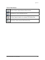
1
COMMUNITY MAPPING NETWORK
FISHERIES INFORMATION SUMMARY SYSTEM
(CMN FISS)
DATA ENTRY TOOL
USER MANUAL
Prepared by:
Sara Ellis
Government Representatives:
Gord Oliphant - Ministry of Environment
Cheryl Lynch - Fisheries and Oceans Canada
Brad Mason - Fisheries and Oceans Canada
March, 2007
Updated August 2008 by Brendan O’Neill
Table of Contents
1.0 Purpose
1
2.0 Introduction
1
2.1 What is FISS?
1
2.2 What is CMN?
2
2.3 The Community Mapping Network (CMN) and Fisheries Information
Summary System (FISS)
3
3.0 Getting Started with CMN FISS Data Entry Tool
4
3.1 Access
4
3.2 MapGuide Plug-in
4
3.3 Launching CMN FISS Data Entry Tool
4
3.4 Setting Preferences
5
4.0 Checking for the presence of a Report
6
4.1 Checking for the presence of a Report in Oracle FISS
6
4.2 Checking for the presence of a Report in CMN FISS
7
5.0 Adding, and Editing a Reference
9
5.1 Adding Reference Information to CMN FISS
9
5.2 Editing Reference Information in CMN FISS
12
6.0 Searching for a waterbody
14
6.1 Searching with UTM Coordinates
14
6.2 Searching using the Zoom Goto tool
15
7.0 Digitizing a Point in CMN FISS
17
7.1 Point Types
17
7.2 Standardized approach for placing W Points
18
CMN FISS Data Entry Tool User Manual
i
Table of Contents Continued
7.2.1 Standardized approach for placing W Points on a lake
19
7.2.2 Standardized approach for placing W Points on a stream
19
7.3 Digitizing a point by selecting a waterbody on a map
19
7.4 Digitizing a Point on a waterbody that is mapped at a 1:20,000 TRIM
scale
22
7.5 Digitizing a point by selecting a waterbody from a list
22
8.0 Adding, Editing and Deleting Data to a Selected Point
25
8.1 Adding New Data to a Selected Point
26
8.2 Editing Data
27
8.3 Deleting Data
27
9.0 Viewing a Report for a Point
28
10.0 Additional Features and Options
29
10.1 To Print a Map
29
10.2 Copying a Map to another application
29
10.3 Distance Tool
30
10.4 Identifying a waterbody on a zoomed in map with Tool tips
30
10.5 Bookmarks
31
10.5.1 Adding a Bookmark
31
10.5.2 Viewing a Bookmark
32
10.5.3 Deleting a Bookmark
32
10.6 Selecting Map Objects
33
References
35
CMN FISS Data Entry Tool User Manual
ii
List of Figures
Figure 1 Example of Preferences
5
Figure 2 FISS Reference Search
7
Figure 3 Example of a completed Reference Form
10
Figure 4 Reference Type drop-down menu
11
Figure 5 Example of FISS Search Results window
13
Figure 6 Successful submission message
13
Figure 7 UTM Locator
14
Figure 8 Zoom Goto Menu
15
Figure 9 Zoom Goto Window
16
Figure 10 Select Waterbody drop-down menu
19
Figure 11 Example of Waterbody Form
20
Figure 12 “Select a point to digitize” drop-down menu list is highlighted in a
red box
21
Figure 13 Example of the Waterbody Select Form
23
Figure 14 Example of the Waterbody Reference Information Form
24
Figure 15 Edit or Delete options in Edit Menu
27
Figure 16 Measuring with the Distance Tool
30
Figure 17 Add Bookmark Window
32
Figure 18 Delete Bookmarks Window
33
Figure 19 Select Map Objects menu
34
Figure 20 Select Map Features window
34
CMN FISS Data Entry Tool User Manual
iii
List of Tables
Table 1 What each point type represents
17
Table 2 What each FISS Attribute Represents
25
Table A1 Buttons in Map Toolbar
41
Table A2 Buttons in Autodesk Toolbar
41
Table A3 Other Buttons
42
CMN FISS Data Entry Tool User Manual
iv
List of Appendices
Appendix 1 - Contacts for Information Resources
37
Appendix 2 - CMN FISS buttons
40
Appendix 3 - FISS Codes
43
Appendix 4A - B.C. Fish Species Codes: Taxonomic Groupings
55
Appendix 4B - B.C. Fish Species Codes: Alphabetical by Common Names
63
Appendix 4C - B.C. Fish Species Codes: Alphabetical by Code
70
CMN FISS Data Entry Tool User Manual
v
1.0 Purpose
The purpose of this manual is to introduce users to the procedures and
standards required for data entry into the Community Mapping Network (CMN)
Fisheries Information Summary System (FISS) Data Entry Tool.
2.0 Introduction
This manual describes the CMN FISS Data Entry Tool, and how to use the
application. CMN and FISS are two separate projects. Each project will be
described below.
2.1 What is FISS?
The Fisheries Information Summary System (FISS) is a geo-referenced database
of summary level fish and fish habitat, macro-reach and lake classification data. 1
FISS is a joint project between Fisheries and Oceans Canada (DFO) and BC
Ministry of Environment (MOE) which focuses on four business functions:
planning, project reviews, requests for information, and research. 2 FISS
provides information for users from the government, First Nations, the private
sector, and the public. FISS presently consists of fish and fish habitat, macroreach and lake classification databases, overlaid on a 1:50,000 digital stream
network of British Columbia. 3 “Information is accessible through queries on the
Web. Standardized hard copy maps and reports are also produced.” 4
1
Province of British Columbia. 2007.
ibid.
3
ibid.
4
ibid.
2
CMN FISS Data Entry Tool User Manual
1
The following summary level lake and stream fish and fish habitat theme data are
included in FISS:
•
Water Quality Stations
•
Enhancement/Management Activities
•
Sensitivity Comments
•
Resource Use
•
Obstructions
•
Fisheries Potential/Constraints
•
Value Comments
•
Species/Stock Information
•
Fish Distribution
•
Life History
“FISS will be continually updated as new reports and surveys are received. The
long-term goal is to automate the process so that detailed 1:20,000
Reconnaissance Level Reports will be submitted digitally. Summary routines will
be run that will extract the points and information and add it to the FISS
database. Historical reports will continue to be compiled manually as they are
collected and received.” 5
2.2 What is CMN?
The Community Mapping Network (CMN) is a network of partners comprised of
community groups, organizations and individuals that collect and map natural
resource information. 6 An advisory committee responsible for managing CMN
includes representatives from the BC Conservation Foundation, Fisheries and
Oceans Canada, Environment Canada (Canadian Wildlife Service), B.C. Ministry
of Agriculture, Food and Fisheries, B.C. Ministry of Environment, Fraser Valley
5
6
ibid.
Porter, G.L.; Moon, R.; & Trent, C. 2002.
CMN FISS Data Entry Tool User Manual
2
Regional District, Greater Vancouver Regional District, local governments, and
community groups. 7 CMN was created to integrate data from government and
non-government organizations and make it accessible through a mapping
system. CMN allows for organizations to see what other organizations have
done.
2.3 The Community Mapping Network (CMN) and Fisheries
Information Summary System (FISS)
DFO and MOE have decided to use CMN to allow for data to be entered spatially
and textually into the CMN FISS database. CMN FISS does not attempt to show
all information that is in the full Oracle version of FISS. At this time, it is designed
to be a subset of the Oracle FISS database. The Ministry of Environment is the
custodian of the Oracle FISS data set which is the full official version. CMN FISS
and Oracle FISS are two separate applications. CMN is a Microsoft Access
driven database while FISS is an Oracle driven database. A load routine has
been developed to enable periodic uploading of CMN FISS information to the
official Oracle FISS database.
7
ibid.
CMN FISS Data Entry Tool User Manual
3
3.0 Getting Started with CMN FISS Data Entry Tool
This section will help the user get set-up for data entry in CMN FISS. It is
recommended that Microsoft Internet Explorer 6.x or older is used.
3.1 Access
In order to access the data entry tool, a UserID and password must be
requested. Please contact Gord Oliphant regarding permissions (See Appendix
1 “General Inquiries”).
3.2 MapGuide Plug-in
In order to view maps on the Community Mapping Network, a plug-in called
Autodesk Mapguide Viewer 6.5 must be installed on the user’s computer. This
product is produced by AutoDesk and can be downloaded at
http://www.mapguide.com/Downloads/
3.3 Launching CMN FISS Data Entry Tool
To launch the CMN FISS Data Entry Tool:
1. Start your Internet Browser. It is recommended that users use Internet
Explorer as the application was developed for Internet Explorer and some
of the functions might not work with other browsers.
2. Enter the URL: http://www.shim.bc.ca/
3. There are two ways of accessing the CMN FISS Data Entry Tool from the
CMN website.
a. Click on “DFO FISS Data Entry Tool” under “Atlas Gallery” in the
scroll box;
b. Or alternatively click on “Atlas Gallery” and scroll down the page
and find the “DFO FISS Data Entry Tool”.
CMN FISS Data Entry Tool User Manual
4
3.4 Setting Preferences
The user should set preferences to metric distance and UTM coordinates.
To set preferences:
1. Right click on the map to open the options menu.
2. Highlight “About” then click on “Preferences”.
3. The Preferences Window will look like Figure 1.
Figure 1. Example of Preferences
4. Change the “Map Units” to “Metric”.
5. Change the “Selection Mode” to “Intersection”.
6. Make sure all the options under “Status Bar” are checked.
7. Change “Units” to “Mapping Coordinate System”.
CMN FISS Data Entry Tool User Manual
5
4.0 Checking for the presence of a Report
Before entering a report in CMN FISS, users must check for the presence of the
report in both CMN FISS and Oracle FISS. The order of checking reports is not
significant.
4.1 Checking for the presence of a Report in Oracle FISS
Before entering a report, please check and make sure that the report is not
already in the FISS Oracle database. Not checking can result in redundant data.
Checking for the presence of a report in Oracle FISS can be done two ways:
a. Users can query the Oracle FISS database directly from the CMN FISS
Data Entry Tool by using the report server. This can be done two ways:
•
By double clicking on the waterbody which opens up the Oracle FISS
Report Server
•
Or by highlighting the waterbody, opening the Mapping Tools, then
clicking on the “View a Report” button.
b. A FISS reference can be searched for by entering in the following URL
into an Internet Browser: http://a100.gov.bc.ca/pub/fidq/references.do
•
Enter any known information into the appropriate fields such as
Gazetted Name/Alias, Watershed Code, or Waterbody Identifier.
•
The Reference Number is most likely unknown when searching for a
FISS reference, as this is a key clue that it is in FISS.
CMN FISS Data Entry Tool User Manual
6
4.2 Checking for the presence of a Report in CMN FISS
New references are being entered in CMN FISS all the time, and they may not be
loaded into the FISS Oracle database yet.
To check for the presence of a report in CMN FISS:
1. Click on the “Mapping Tools” button in the top right-hand corner.
2. Click on the Add/Edit References button.
3. Click on the “Search a reference to edit” button.
4. A new window appears called the FISS Reference Search which is shown
in Figure 2.
Figure 2. FISS Reference Search
5. Using the FISS Reference Search is described in the following points:
a. Searches using the keywords from the Abstract, Title, and Author
can be entered which is shown in Figure 2. The Reference Title is
the preferred first choice for searches.
b. Searches for Reference Numbers can be entered but exact
characters in order must be used or the application will not return
any results.
c. The search does not have the ability to search by different
categories at the same time. Try one category first, and if you do
not find what you are looking for, another category can be tried.
CMN FISS Data Entry Tool User Manual
7
d. Wildcard searches can be done by using “%” as the wildcard
character.
Note: Wildcards cannot be used when searching for a Reference
Number.
CMN FISS Data Entry Tool User Manual
8
5.0 Adding, and Editing a Reference
For the purposes of CMN FISS a reference refers to the report that the FISS data
has been extracted from.
Note: If a reference in Oracle FISS needs to have changes made to it, contact:
Gordon Oliphant (See Appendix 1 “General Inquiries”).
5.1 Adding Reference Information to CMN FISS
After ensuring that the reference is not in either CMN FISS or Oracle FISS, a
reference can be added to CMN FISS.
To add Reference Information to CMN FISS:
1. Click on the Add/Edit References button.
2. Click on the “Add a new reference” button.
3. The reference form will look similar to Figure 3 - Example of a completed
Reference Form.
CMN FISS Data Entry Tool User Manual
9
Figure 3. Example of a completed Reference Form
4. Fill-out appropriate fields for the report.
5. For the Reference No. small blocks of pre-approved numbers will be
assigned. Arrangements for this can be made with the database
administrator when accounts are established.
6. Select the appropriate Reference Type from the drop-down list shown in
Figure 4.
CMN FISS Data Entry Tool User Manual
10
Figure 4. Reference Type drop-down menu
7. The Location of the reference refers to who owns the report and where it
is located. For example for Ministry of Environment reports, please put
“MOE, Victoria HQ”. Even if the report is in offsite storage, the client must
go through the Victoria Headquarters in order to gain access to the report.
If the report is in more than one place, list the locations with a semi-colon
“;” in-between. For example: If the report is at the MOE, Victoria
Headquarters and in EcoCat the location would be filled out “MOE,
Victoria HQ; EcoCat”. This is example is shown in the Location field in the
middle of Figure 3. Note that EcoCat can only be listed as a location for
reports if the report is in “Public EcoCat”. If the report is in EcoCat and not
viewable to the public EcoCat should not be listed.
CMN FISS Data Entry Tool User Manual
11
8. For the URL, check to see if the report is in Public EcoCat. If the report is
in public EcoCat, copy and paste the following link to EcoCat in the URL
Field at the bottom of Figure 3: http://www.env.gov.bc.ca/ecocat/.
9. Descriptions and Abstracts can be taken from EcoCat if the report is
already in EcoCat. The Description has a character limit of 250
characters. The Abstract has a character limit of 2000 characters.
5.2 Editing Reference Information in CMN FISS
To edit Reference Information in CMN FISS:
1. Click on the Add/Edit References button.
2. Click on the “Search a reference to edit” button.
3. Fill in the appropriate information into the FISS Reference Search (see
Figure 2. Example of the FISS Reference Search), then click “Search”.
4. The “FISS Search Result” window displays the results of the search
similar to the example in Figure 5 below.
CMN FISS Data Entry Tool User Manual
12
Figure 5. Example of FISS Search Results window
5. Click on the “Edit” hypertext link left-hand of the reference you wish to edit
to open the Reference Form.
6. Make the desired changes to the reference.
7. Click “Submit” to save the new information to the database.
8. When successful a message will display informing the user that the “Data
committed to the database” (see Figure 6).
Figure 6. Successful submission message
CMN FISS Data Entry Tool User Manual
13
6.0 Searching for a waterbody
In order to digitize a point for a waterbody, the waterbody must be located on the
map. There are several ways to search for the waterbody including Searching
using the UTM Coordinates (Section 6.1) and searching using the Zoom Goto
Tool (Section 6.2).
6.1 Searching with UTM Coordinates
This feature is useful for searching for a waterbody by using the UTM
coordinates available in the B.C. Watershed Atlas. This is helpful for searching
for a waterbody which has not been digitized in CMN FISS yet.
To search for a location using UTM coordinates:
1. Select the UTM zone from the dropdown list in the UTM Locator shown in
Figure 7.
Figure 7. UTM Locator
2. Type the Easting into the Easting box. This will always be a 6 digit
number.
3. Type the Northing into the Northing box. This will always be a 7 digit
number.
4. Select a point type from the drop-down “Select a Point to digitize” list. It
does not matter what type of point is selected, as the point will not be
digitized. The UTM Search will not work without a point selected.
5. Click the
button.
6. When the map is zoomed click reject.
CMN FISS Data Entry Tool User Manual
14
6.2 Searching using the Zoom Goto tool
The Zoom Goto Tool is useful for zooming into a location. The most common
use of the Zoom Goto Tool is to search for a FISS Point or a Waterbody.
To search using the Zoom Goto tool:
1. This feature can be accessed in two ways:
a. Click on the magnified glass with the arrow beside it,
on the top
left-hand corner of the map menu, or
b. Or right click on the map and click on “Zoom” Æ “Goto…” which is
shown in Figure 8.
Figure 8. Zoom Goto Menu
2. The “Zoom Goto” window opens similar to Figure 9.
3. A project can be searched a number of ways by selecting the appropriate
“Category” and entering the corresponding information in the “Location”
field.
4. The “Zoom to Width” should be specified. A five kilometre “Zoom to width”
is a good guideline to use for zooming the map in close enough to add a
point after the waterbody is selected.
CMN FISS Data Entry Tool User Manual
15
Figure 9. Zoom Goto Window
6. The map will refresh with the “Goto” location centred.
CMN FISS Data Entry Tool User Manual
16
7.0 Digitizing a Point in CMN FISS
There are three basic point types in FISS which are described in the following
section. Points can be digitized in CMN FISS three ways: by selecting a
waterbody on a map, by using UTM Coordinates for the waterbody, and by
selecting the waterbody from a list. The recommended method of digitizing a
point is by selecting the waterbody on the map.
7.1 Point Types
There are three basic point types in FISS: a “W” point, a “P” point, and a zone.
The “W” point represents a whole waterbody which is used for lakes, streams
and reservoirs, as data attached to this “W” point can often apply to the whole
watershed or waterbody and not specifically to the location of the point. The “P”
point represents a point with data tied to the specific location. An example would
be fish observed in a pool at a given location. The “S”, “U” and “D” points all
correspond to a zone. The “U” point represents an upper limit on a main
channel. The “S” point represents an upper limit on a side channel. The “D”
point is the downstream point on either a main or side channel. A “D” point
cannot be digitized in FISS without first having a “U” or an “S” point. The point
types and what they represent are laid out in Table 1 below.
Table 1. What each point type represents.
Point Type:
Point(s) represent:
W
Whole watershed or waterbody
P
Data point tied to specific location
U
Upper limit on a main channel corresponding to a zone
S
Upper limit on a side channel corresponding to a zone.
D
Downstream limit on main channel or side channel
corresponding to a zone. If a “D” point is not specified, FISS
assumes that the “D” point is at the mouth of the channel.
CMN FISS Data Entry Tool User Manual
17
When placing a point at a stream mouth the user must place the point
approximately 50 metres from the stream mouth so as not to confuse the point
on a tributary for a point on a parent stream. The user must be zoomed in as
close as possible to place a point most accurately, so that the point appears on
the stream line when zoomed in to a large scale. Measuring the distance can be
done using the Distance Tool discussed in Section 10.3.
In cases where the information entered applies to the entire length of the stream
downstream from the “U” all the way to the stream mouth, it is not necessary to
enter a downstream point. The application will default to the mouth in this case
and the UTM coordinates from the B.C. Watershed Atlas are used.
In cases of side channels where the information entered applies to the entire side
channel from the “S” point to where the side channel re-enters the parent stream,
it is not necessary to enter a downstream point. The application will default to
where the side channel re-enters the parent stream.
7.2 Standardized approach for placing W Points
A standardized approach has been created to assist users in placing W Points on
Lakes (Section 7.2.1) and Streams (Section 7.2.2). There should only be one W
Point placed for each waterbody. The W Point can be used again by other users
to attach information associated to the whole waterbody. It is important to always
check that the point is associated with the correct waterbody.
CMN FISS Data Entry Tool User Manual
18
7.2.1 Standardized approach for placing W Points on a lake
When placing a W Point on a lake, it should be placed approximately 50 metres
from the lake outlet. The distance tool (Section 10.3) can be used for an
approximate measurement. It is critical that users check the W Point to ensure
that it is on the lake and not on an adjacent waterbody. This can be done by
double clicking on the point and opening up the “Point Reference Report”.
7.2.2 Standardized approach for placing W Points on a stream
W Points on streams must be placed 50 metres upstream from the stream mouth
so as not to confuse the point on a tributary for a point on a parent stream. The
distance tool (Section 10.3) can be used for an approximate measurement. It is
critical that users check their point to ensure that it is on the correct stream. This
can be done by double clicking on the point and opening up the “Point Reference
Report”.
7.3 Digitizing a point by selecting a waterbody on a map
To digitize a point by selecting a waterbody on the map:
1. If you are not already in Mapping Tools, click on "Mapping Tools".
2. Make sure that the map is zoomed as close as possible when placing a
point. The larger scale helps ensure accuracy when placing a point.
3. Click on the Arrow button
in the Autodesk menu.
4. With the mouse select a waterbody that you want to create the point for.
5. In “Mapping Tools”, click on the “Select Waterbody” drop-down menu
shown in Figure 10.
Figure 10. Select Waterbody drop-down menu
CMN FISS Data Entry Tool User Manual
19
6. Select “Use the waterbody selected on map”.
7. Click on the drop-down menu “Select a point to digitize”.
8. A new window appears called “Waterbody Form” which will appear
similar to Figure 11.
Figure 11. Example of Waterbody Form
9. The Watershed Code and UTM coordinates are already filled in (see top
of Figure 10). Make sure that they are correct before proceeding. If
incorrect close window without clicking submit and repeat the previous
steps.
10. If the watershed code and the UTM coordinates are correct, fill out the
required information which includes the Collector’s name, which is the
name of the data entry person, and the Date Collected, which is the day
that the information is being entered into CMN FISS.
11. If a point has not been previously digitized on the Waterbody, the user
will have to select the “Waterbody Type”. The options for the
“Waterbody Type” are:
L - Lake
S - Stream
W - Wetland
CMN FISS Data Entry Tool User Manual
20
12. Fill in any other information if it is known, then click submit.
Note: “Stream/Lake Name” should only be filled in if the name of the
waterbody is gazetted, otherwise the name should be typed into the
Alias field.
13. Select a type of point from the drop-down list which is outlined in a red
box in Figure 12 below. To decide what type of point to use, see Section
7.1.
Figure 12. “Select a point to digitize” drop-down menu list is outlined
in a red box
14. Click on the point button
and place the point on your waterbody. For
rules for placing W Points, see Section 7.2.
15. A new form opens called “Digitize Point” form. Make sure that the
information is correct, then type in a “Point No.” The point number can
be related to the FISS reference number but the point number must be
numerical and unique.
16. Click “Submit”, then “Close”.
17. The point should now appear on the map.
18. Check to make sure point information is associated with the correct
waterbody by double clicking the point.
CMN FISS Data Entry Tool User Manual
21
7.4 Digitizing a Point on a waterbody that is mapped at a 1:20,000
TRIM scale
To digitize a point by selecting a waterbody on the map:
1. If you are not already in Mapping Tools, click on "Mapping Tools".
2. The UTM Locator (Section 6.1) or the Zoom Goto function (Section 6.2)
can be used to zoom in to the location of the waterbody. Make sure that
the map is zoomed in as close as possible. The larger scale helps
ensure accuracy when placing a point.
3. On the left-hand side of the map is the Layers Panel which includes
many Layer Groups. Click the box beside “TRIM 1:20K” so that the box
is checked.
Note: If the “TRIM 1:20K” Layer Group is not showing, the map needs to
be zoomed in closer.
4. Double click on “TRIM 1:20K” to open the Layer Group.
5. Check the boxes beside each layer that is needed to add them to the
map (i.e. Rivers, and Lakes). The map refreshes automatically.
6. From this point, a waterbody can be selected and a point can be
digitized following Section 7.3, Steps 3-18.
7.5 Digitizing a point by selecting a waterbody from a list
To digitize a point by selecting a waterbody on the map:
1. If you are not already in Mapping Tools, click on "Mapping Tools".
2. In “Mapping Tools” click on the “Select Waterbody” drop-down menu
3. Highlight “Select a Waterbody from a list”.
4. A new window pops up called “Waterbody - Select Form” similar to the
example in Figure 15.
CMN FISS Data Entry Tool User Manual
22
Figure 13. Example of the Waterbody Select Form
5. The waterbody list shown in Figure 13 is in order by watershed code. For
a quicker search, users should check the watershed code for the
waterbody in the B.C. Watershed Atlas
<http://a100.gov.bc.ca/pub/fidq/main.do>.
6. Scroll down the form and look for the waterbody you wish to use and click
on the hypertext link.
Note: Many waterbodies are not in this form yet, as a point for the
waterbodies must be digitized first to appear in this form. It may be
necessary to use the “Digitizing a point by selecting a waterbody on a
map” method instead of “Digitizing a point by selecting a waterbody from a
list”
CMN FISS Data Entry Tool User Manual
23
7. A new window pops-up with the reference information for the waterbody
similar to Figure 16.
Figure 14. Example of the Waterbody Reference Information Form
8. Click proceed to begin to digitize the data.
Note: Map does not zoom to location of the waterbody. It is possible to
zoom to the location of the waterbody by using the “Zoom Goto” function
which is described in the Section 6.2.
9. Your current selection will appear in the top left hand corner of the
webpage.
CMN FISS Data Entry Tool User Manual
24
8.0 Adding, Editing and Deleting Data to a Selected Point
There are several types of FISS Themed data that can be attached to a selected
point. The FISS Theme data provide basic data about the waterbody. It is not
necessary to complete all of the theme data forms for the point. The FISS Theme
data categories are described in Table 2. Each FISS Theme data form has a
series of codes which are specific to the type of theme data (see Appendix 3).
Table 2. What each FISS Theme Represents 8
FISS Theme
Representation
Water Quality Stations
Contains information for only permanent sites used to access
water quality including System for Environmental Assessment
and Management (SEAM) and Environmental Monitoring (EMS)
sites.
Enhancement/Management
Provides information about the activities taken to enhance and
Activities
manage fish habitats or stocks.
Sensitivity Comments
Provides information on the sensitivity of the fish habitats/stocks.
Resource Use
Provides information about how the fisheries resource is used
(i.e. Commercial use, Domestic Use, Fishing Lodge, Native,
Recreation and Viewing).
Obstructions
Provides information about obstructions in the waterbody which
affect fish passage, and lists the fish species which are affected.
Fisheries
Provides information about activities which affect fisheries
Potential/Constraints
production.
Value Comments
Provides information about the type of value placed on the stream
and the sensitivity of fish habitat/stocks of the waterbody. This
information helps to flag significant attributes of waterbodies such
as potential for angling, recreation and aesthetic considerations.
Species/Stock Information
Identifies the species and stock related to Fish Distribution and
Life History Themes.
Fish Distribution
Provides information about where the fish stocks are located. The
Fish distribution indicates the presence of a fish species and
describes the main activities of those fish.
Life History
This record indicates the life history activities occurring for each
fish species.
8
Desrochers, B. 1997.
CMN FISS Data Entry Tool User Manual
25
8.1 Adding New Data to a Selected Point
To add new data to a point:
1. Select the point you wish to add information to with the arrow button.
2. If you are not already in Mapping Tools, click on "Mapping Tools" then
click on the “Insert new information to the selected point”
button.
3. Select the type of FISS theme data that you want to attach to the point
from the list provided under the “Data Entry Menu”.
4. For each type of FISS Theme data, reference information must be
attached.
5. To attach a reference to a FISS Theme, check the reference to see if it is
in the database first.
6. If the reference is in the database, you can click the “Select” hyperlink
beside the reference. This will attach the reference information to the
data.
7. If the reference is not in the database, you may wish to add the reference.
Close the “Database Search Engine Window”, and go back to the “FISS
Water Body Form” in your selected theme data form and click on the “Add”
button beside Reference box.
8. A FISS Reference Form window will open. Fill in the appropriate
information and click the “Submit” button.
9. A message will appear confirming that the data will be committed to the
database. Click the “Close” button.
10. A reference can also be added by clicking the add/edit reference button on
the Map Toolbar.
Note: To add Fish Distributions or Life History themes, a Species/Stock
record must be created first. After creating the Species/Stock record, click
on the Species/Stock theme for the option to add a Fish Distribution or a
Life History theme.
CMN FISS Data Entry Tool User Manual
26
8.2 Editing Data
To edit data associated with a point:
1. With the arrow mouse select the point you wish to add information to.
2. Click on the “Edit Data” button.
3. Select the type of FISS theme data that you edit from the list provided
under the “Data Entry Menu”.
4. When the existing data comes up, there will be two options: Edit or Delete
which are shown in Figure 17.
Figure 15. Edit or Delete options in Edit Menu
5. Select the Edit option. After making preferred changes click the submit
button.
You will get a message “Data committed to the database”.
6. Click the “Proceed” button to resume editing.
8.3 Deleting Data
To delete data associated with a point:
1. Select the point you wish to add information to with the arrow button.
2. Click on the “Edit Data” button
.
3. Select the type of FISS theme data that you edit from the list provided
under the “Data Entry Menu”.
When the existing data comes up, there will be two options: Edit or Delete
(see Figure 15).
4. Click on the Delete button.
5. A message will appear “The record has been deleted”.
6. Click the “Proceed” button to continue.
CMN FISS Data Entry Tool User Manual
27
9.0 Viewing a Report for a Point
Viewing a report is used to view data that is attached to a point and is a
mandatory step to verify the data entered. It is important to check the “Point
Reference Report” in order to verify that the point is attached to the correct
waterbody and that theme information attached to the point is correct.
There are two methods to view a report:
a. Double click on a point and the report will open;
b. Or highlight a point by selecting it, then click on the “View a report”
button
in the Mapping Toolbar.
CMN FISS Data Entry Tool User Manual
28
10.0 Additional Features and Options
This section contains information about additional features and options in the
CMN FISS Data Entry Tool.
10.1 To Print a Map
To print, you must right click on the map and click “PrintÆ” then “Print…”
Note: If you press print from your browser toolbar or from the file menu, you will
just get a blank page, or a print out of the map toolbar.
10.2 Copying a Map to another application
Copying a Map to another application is useful for saving and editing the map
that is shown in the Internet Browser.
To copy a map to another application:
1. Right click on the map, and click “CopyÆ” then “Copy”.
2. Open a graphics editing program such as Paint.
3. Within the graphic editing program, click on the “Edit” menu, then “Paste”
or on the keyboard press “Ctrl + V”.
4. The map will be pasted into the canvas of the graphic editing program,
and can be edited and saved at this point.
CMN FISS Data Entry Tool User Manual
29
10.3 Distance Tool
The Distance Tool is used to measure distance. An example of its use would be
to measure 1.5 km from the stream mouth.
To use the Distance Tool:
1. Right click on the map.
2. Click on “View Æ” then on “Distance”.
3. Click on the map on at the place you want to start measuring from.
4. Click as many times as necessary to create segments to get the distance
of all the curves in the waterbody.
5. A Tool Tip will tell you how long each segment is and the total distance
from the first point which is demonstrated in Figure 18.
Figure 16. Measuring with the Distance Tool
10.4 Identifying a waterbody on a zoomed in map with Tool Tips
Identifying a waterbody can be easily done using Tool Tips. Tool Tips are when
the user hovers the mouse over a waterbody without clicking on it, and a yellow
box appears with the Waterbody name (if available), the Watershed Code, and
the Internal ID Number.
CMN FISS Data Entry Tool User Manual
30
To identify a waterbody on a map with Tool Tips:
1. The map needs to be zoomed in at least to 1:132,000 scale which can be
quickly done using the “Goto” Zoom tool (Section 6.2).
2. Hover mouse over the waterbody you wish to identify.
3. The watershed code will appear in a box with the name if the waterbody is
named.
4. Caution should be taken with this. If the wrong watershed code keeps
popping up, one should zoom in more as the mouse may be picking up
adjacent waterbodies.
10.5 Bookmarks
Bookmarks are a way to mark a screen view, similar to “Favorites” menu in
Internet Explorer. They are very useful for marking a screen view so that they
can it be revisited at a later date. When a bookmark is revisited, it brings up the
exact image at the same zoom which is seen on the screen at the time the
bookmark was created. Bookmarks can be added and deleted so they do not
have to be permanent.
10.5.1 Adding a Bookmark
To add a bookmark:
1. Right click on the map where you would like to place a bookmark.
2. Click on “BookmarksÆ” then “Add Bookmark…”
3. The “Add Bookmark” window opens which is shown in Figure 19. Type
what you would like to name the bookmark.
CMN FISS Data Entry Tool User Manual
31
Figure 17. Add Bookmark Window
4. Click “OK”.
5. The Bookmark has been added.
10.5.2 Viewing a Bookmark
To view a bookmark:
1. Right click anywhere on the map.
2. Click on “BookmarksÆ”.
3. Click on the name of the Bookmark you wish to visit.
10.5.3 Deleting a Bookmark
To delete a bookmark:
1. Right click on the map then click on “BookmarksÆ” then “Delete
Bookmark…”
2. The “Delete Bookmarks” window opens, similar to the one shown in Figure
20.
CMN FISS Data Entry Tool User Manual
32
Figure 18. Delete Bookmarks Window
3. Select the bookmark you wish to delete.
4. When you are finished deleting the bookmarks, press the “OK” button.
5. If you accidentally delete a bookmark you wish to keep, click cancel, and
the bookmark will still be there. Then you can go back and delete the
bookmark you want to.
10.6 Selecting Map Objects
The “Select Map Objects” function selects features on the map. When the map
is zoomed in, the user only has options to select map objects that are visible on
the current map view. When zoomed out to the whole province, the “Select Map
Objects” function can select any object on the map. This is useful for users to
see all the existing Point ID’s so that users can see what Point ID’s have been
used to help determine new unique point numbers.
To use the “Select Map Objects” function:
1. Right click on the map and click on “Select” Æ “Map Objects…” which is
shown in Figure 21.
CMN FISS Data Entry Tool User Manual
33
Figure 19. Select Map Objects menu
2. A Window called “Select Map Features” similar to Figure 22 opens up.
Figure 20. Select Map Features window
3. The user can then select the feature selecting the “Map layers” then
selecting the “Map features”.
4. Multiple features can be selected by using the Control and Shift keys on
the Keyboard.
CMN FISS Data Entry Tool User Manual
34
References
Desrochers, B. 1997. Fisheries Information Summary System (FISS): Data
Compilation and Mapping Procedures. Prepared by Enviro-Links, West
Vancouver for Province of British Columbia Resource Inventory Branch,
Victoria, B.C. and Fisheries and Oceans Canada, Vancouver, B.C.
October, 1997. v + 139 pp.
Porter, G.L.; Moon, R.; & Trent, C. 2002 Apr 3. “Planning Sustainable
Communities.” Prepared by G.L. Porter Consulting, Sun-Esprit Lifestyles
Inc., & Sunshine Coast Regional District. Online.
<http://www.shim.bc.ca/pdf/Combined_SHIM_document-scrd_July18.pdf>
Accessed 2007 Feb 6. v + 119 pp.
Province of British Columbia. 2007 Jan 24. “FISS Background and Further
Information.” Prepared by Gordon Oliphant for Ministry of Environment.
Online. <http://www.env.gov.bc.ca/fish/fiss/background.htm> Accessed
2007 Jan 25.
CMN FISS Data Entry Tool User Manual
35
List of Appendices
Appendix 1
Contacts for Information Resources
Appendix 2
CMN FISS Buttons
Appendix 3
FISS Codes
Appendix 4A
B.C. Fish Species Codes: Taxonomic Groupings
Appendix 4B
B.C. Fish Species Codes: Alphabetical by Common Names
Appendix 4C
B.C. Fish Species Codes: Alphabetical by Code
CMN FISS Data Entry Tool User Manual
36
Appendix 1 - Additional Resources
CMN FISS Data Entry Tool User Manual
37
Appendix 1
General Inquiries
¾ Gordon Oliphant
FISS Project Manager - Ministry of Environment
Ecosystems Information Section
Phone:
Fax:
Email:
(250) 356-9938
(250) 356-1202
[email protected]
Mailing Address:
PO Box 9358 STN PROV GOVT
Victoria, BC V8W 9M2
CMN FISS Data Entry Tool User Manual
38
Appendix 1
Reference Numbers
¾ Contact Gordon Oliphant at the Ministry of Environment for pre-approved
FISS reference numbers (see “General Inquiries”).
Changes to Oracle FISS
¾ If a reference in Oracle FISS needs to be changed, contact Gordon
Oliphant at the Ministry of Environment (see “General Inquiries”).
Useful Links
¾ CMN FISS Data Entry Tool
The direct link in the Data Entry Tool.
http://www.shim.bc.ca/atlases/fiss/login_screen.cfm?atlas=fiss
¾ Watershed Dictionary
The Watershed Dictionary is useful for searching Watershed Codes and
UTM coordinates.
http://a100.gov.bc.ca/pub/fidq/main.do
¾ EcoCat
The Ministry of Environment Ecological Reports Catalogue stores actual
reports and projects. Many of the reports that are referenced in FISS are
stored in EcoCat.
http://www.env.gov.bc.ca/ecocat/
¾ WAVES
Fisheries and Oceans Canada’s Virtual Library Catalogue
http://inter01.dfo-mpo.gc.ca/waves2/index2.html?__LANG=en
CMN FISS Data Entry Tool User Manual
39
Appendix 2 - CMN FISS Buttons
CMN FISS Data Entry Tool User Manual
40
Appendix 2
Table A1 Buttons in Map Toolbar
Back button: exits mapping tools
Digitize a point button: click on the map where point is to be placed
Insert new data: attaches new data to a point
Edit data: edits or deletes data attached to a point
Add/Edit Reference: add, edit and search for references
Delete Data: deletes a selected point
View a Report: view a report of a selected point
Print: prints map
SHIM Homepage: link to the SHIM homepage
Help: link to Autodesk MapGuide® Viewer Help
Table A2 Buttons in Autodesk Toolbar
Copy: copies map that can be pasted in a graphics application
Select: Arrow mouse selects objects in the map screen
Pan: Hand mouse pans the map screen
Zoom In: Zooms in to a selected part of the map
Zoom Out: Zooms out from a part of the map
Zoom Previous: Reverts the map to the previous zoom view
Zoom Goto: Zooms to a specific location on the map (see Section 9.3).
Unzoom: Unzooms map to whole of British Columbia
View Report: Opens report for a selected point containing reference
information
Stop: Only available when CMN FISS is processing a function. When
clicked on, stops the process.
Help: link to Autodesk MapGuide® Viewer Help
CMN FISS Data Entry Tool User Manual
41
Appendix 2
Table A3 Other Buttons
Reference Search: Opens Reference Search window.
Add Reference: Opens Add Reference form
Edit Data: Opens information for a selected FISS Attribute Data
Delete Data: Deletes selected FISS Attribute Data
CMN FISS Data Entry Tool User Manual
42
Appendix 3 - FISS Codes
CMN FISS Data Entry Tool User Manual
43
Appendix 3
FISS Codes: Alphabetical
CODES
A
A
A
ACTIVITY
Accessible by Road
Angler Use
Augmented
A
AD
AG
AGU
Winter
Adfluvial
Agriculture
Guides
AH
AL
AM
AN
ANG
AR
AR
AW
B
Angler Use High
Angler Use Low
Angler Use Medium
Anadromous
Angling Sites
Anadromous River
Restricted/Controlled Access
Road to Near Lake, then Walk
Biotic Interactions
B
BC
Spring
Competition/Predation
BCC
Competitive Species
BCP
Predatory Species
BD
BD
Beaver Dam
Disease/Parasitism
BDD
Diseased Stocks
BDP
Parasitized Stocks
BR
C
C
Bridge
Cascade
Constraint
C
CN
COM
Summer
Canyon
Commercial
CMN FISS Data Entry Tool User Manual
“SECTION”
Lake Info.
Management Objective 1
Management Objective 2;
Species/Stock ID
Season
Species/Stock ID
Land Use
Resource Use Info.; Harvest and
Use
Management Objective 1
Management Objective 1
Management Objective 1
Species/Stock ID
Value and Sensitivity
Habitat Type
Lake Info.
Lake Info.
Fish Production Constraint or
General Info.
Season
Fish Production Constraint or
General Info.
Fish Production Constraint or
General Info.
Fish Production Constraint or
General Info.
Obstruction
Fish Production Constraint or
General Info.
Fish Production Constraint or
General Info.
Fish Production Constraint or
General Info.
Land Use
Obstruction
Fish Production
Potential Constraint
Season
Obstruction
Resource Use Info.; Harvest and
Use
44
Appendix 3
CV
D
D
DOM
Culvert
Dam
Fall
Domestic
E
E
EBB
EBE
EBI
EBL
EBR
Fish Presence in Estuary
Enhancement Activities;
unspecified
Biological Enhancement;
unspecified
Fish Barrier; international
Exclusion Fencing
Invertebrate Introduction
Lake Rehabilitation; chemical
Riparian
EC
ECA
ECAC
ECAH
ECAL
ECAO
ECAP
ECN
ECNB
ECNJ
ECNX
ECS
Fish Culture Activities
Artificial Production; unspecified
Spawning Channel
Hatchery
Hatchery on Lake
Off Channel Ponds
Rearing Pens
Seminatural Production
Hatchery Broodstock
Japanese Hatchery
Incubation Box
Colonization/Stocking
ECSC
ECSJ
ECSP
ECST
EF
EH
EHB
EHBF
EHBP
EHBR
EHC
EHF
EHM
EHR
EHR
EHRE
Colonization; species not present
Juvenile Outplant; species present
Transplant
Trap/Truck
Water Volume/Flow Regime
Habitat Enhancement; unspecified
Bank Stabilization
Riparian Zone Fencing
Planting
Rip Rap/Rock Work
Stream Cleaning
Fertilization
Man Made Reef
Rearing Habitat
Rearing Habitat Enhancement
Improve Estuary
EB
CMN FISS Data Entry Tool User Manual
Obstruction
Obstruction
Season
Resource Use Info.; Harvest and
Use
Life History and Timing
Enhancement and Management
Enhancement and Management
Enhancement and Management
Enhancement and Management
Enhancement and Management
Enhancement and Management
Fish Production Potential;
Enhancement and Management
Enhancement and Management
Enhancement and Management
Enhancement and Management
Enhancement and Management
Enhancement and Management
Enhancement and Management
Enhancement and Management
Enhancement and Management
Enhancement and Management
Enhancement and Management
Enhancement and Management
Fish Production Potential;
Enhancement and Management
Enhancement and Management
Enhancement and Management
Enhancement and Management
Enhancement and Management
Fish Production Potential
Enhancement and Management
Enhancement and Management
Enhancement and Management
Enhancement and Management
Enhancement and Management
Enhancement and Management
Enhancement and Management
Enhancement and Management
Fish Production Potential
Enhancement and Management
Enhancement and Management
45
Appendix 3
EHRI
EHRL
EHRM
EHRR
EHRS
EHS
EHS
EHSD
EHSG
EHSP
EHSS
EHST
EOB
EOC
EOF
EOL
EOP
EOS
EW
EW
EWA
EWC
EWD
EWF
EWS
EWW
F
F
Instream Structure Placement
LOD Placement
Marsh Create/Planting
Rock/Boulder Placement
Side Channel / Pool
Spawning Habitat
Spawning Habitat Enhancement
Destroy Spawning Habitat
Gravel Cleaning
Spawning Gravel Placement
Spawning Platforms
Sediment Trap Construction/
Cleanout
Obstruction Removal
Barrier Modification/Obstruction
Removal; unspecified
Beaver Dam Removal
Baffle Culvert
Fishway
Log Jam Removal
Tailwater or Resting Pools
Fish Screens at Outlets/Diversions
Water Quality and Quantity
Water Quality Improvement
Aeration
Cold Water Release Structure
Dam to Increase Water Level
Flow Control
Stream Diversion
Warm Water Release
Falls
Flow Regime
FA
Lake Access
FAB
Stream Braided at Low Flow
FAI
Intermittently Accessible
FAN
Not Accessible
FAS
Seasonally Accessible
FF
Flow Fluctuations
EO
EO
CMN FISS Data Entry Tool User Manual
Enhancement and Management
Enhancement and Management
Enhancement and Management
Enhancement and Management
Enhancement and Management
Fish Production Potential
Enhancement and Management
Enhancement and Management
Enhancement and Management
Enhancement and Management
Enhancement and Management
Enhancement and Management
Fish Production Potential
Enhancement and Management
Enhancement and Management
Enhancement and Management
Enhancement and Management
Enhancement and Management
Enhancement and Management
Enhancement and Management
Enhancement and Management
Fish Production Potential
Enhancement and Management
Enhancement and Management
Enhancement and Management
Enhancement and Management
Enhancement and Management
Enhancement and Management
Obstruction
Fish Production Constraint or
General Info.
Fish Production Constraint or
General Info.
Fish Production Constraint or
General Info.
Fish Production Constraint or
General Info.
Fish Production Constraint or
General Info.
Fish Production Constraint or
General Info.
Fish Production Constraint or
General Info.
46
Appendix 3
FFF
Flashy Flows
FG
Groundwater Fed
FIS
FL
FL
FL
Sensitive Fish Stock
Fishing Lodge/Resort
Fluvial
Low Flows
FLD
Dewatering
FLF
Seasonal Flow
FLG
Fishing Lodge
FLI
Intermittent Stream
FLP
Permanent Flow
FLS
Summer Low Flows
FLW
Winter Low Flows
FO
FP
Forestry
Peak Flows; flooding
FPA
Floods Banks Annually
FPF
FPR
Floods Banks Several Times Per
Year
Floods Banks Every Several Years
FRC
Diversion Channel
FRD
Reservoir Drawdown
FRI
Irrigation Ditch
FRP
Placer Lease and Claim
FU
Water Use/Diversion
FUF
Fully Subscribed With Licenses
FUP
Pump Intake
CMN FISS Data Entry Tool User Manual
Fish Production Constraint or
General Info.
Fish Production Constraint or
General Info.
Value and Sensitivity
Lake Info.
Species/Stock ID
Fish Production Constraint or
General Info.
Fish Production Constraint or
General Info.
Fish Production Constraint or
General Info.
Resource Use Info.;
Harvest and Use
Fish Production Constraint or
General Info.
Fish Production Constraint or
General Info.
Fish Production Constraint or
General Info.
Fish Production Constraint or
General Info.
Land Use
Fish Production Constraint or
General Info.
Fish Production Constraint or
General Info.
Fish Production Constraint or
General Info.
Fish Production Constraint or
General Info.
Fish Production Constraint or
General Info.
Fish Production Constraint or
General Info.
Fish Production Constraint or
General Info.
Fish Production Constraint or
General Info.
Fish Production Constraint or
General Info.
Fish Production Constraint or
General Info.
Fish Production Constraint or
General Info.
47
Appendix 3
FUS
Water Storage Reservoir
G
General Information
H
Habitat Quality
H
Hatchery
H
High Potential/Constraint
HA
Alienated Habitat
HAB
HB
Sensitive Habitat
Bed/Bank Characterization
HBB
Bank/Bar Composition
HBBC
Cobble Bank/Bar Composition
HBBG
Gravel Bank/Bar Composition
HBBM
Mud Bank/Bar Composition
HBBS
Sand Bank/Bar Composition
HBD
Developed Bed/Bank
HBDB
Booms/Booming Ground
HBDD
Dredging
HBDG
Gravel Extraction / Scalping
HBDP
Pier
HBDR
Rip Rap
HBR
Riverbed Substrate
HBRC
Cobble Riverbed Substrate
HBRG
Gravel Riverbed Substrate
HBRM
Mud Riverbed Substrate
HBRS
Sand Riverbed Substrate
CMN FISS Data Entry Tool User Manual
Fish Production Constraint or
General Info.
Fish Production
Potential/Constraint
Fish Production Constraint or
General Info.
Management Objective 2;
Species/Stock ID
Fish Production
Potential/Constraint
Fish Production Constraint or
General Info.
Value and Sensitivity
Fish Production Constraint or
General Info.
Fish Production Constraint or
General Info.
Fish Production Constraint or
General Info.
Fish Production Constraint or
General Info.
Fish Production Constraint or
General Info.
Fish Production Constraint or
General Info.
Fish Production Constraint or
General Info.
Fish Production Constraint or
General Info.
Fish Production Constraint or
General Info.
Fish Production Constraint or
General Info.
Fish Production Constraint or
General Info.
Fish Production Constraint or
General Info.
Fish Production Constraint or
General Info.
Fish Production Constraint or
General Info.
Fish Production Constraint or
General Info.
Fish Production Constraint or
General Info.
Fish Production Constraint or
48
Appendix 3
HBV
Aquatic Vegetation
HBVE
Emergent Aquatic Vegetation
HBVS
Submergent Aquatic Vegetation
HC
Channel Stability
HCE
Erosion / Sedimentation
HCEB
Lateral Stream/Bank Erosion
HCEI
Streambed Incision
HCES
Streambed Sedimentation
HD
HD
HDH
Habitat Diversity
Hydro Dam
High Diversity of Habitat
HDL
Low Diversity of Habitat
HDM
Medium Diversity of Habitat
HM
Waterbody Morphology
HMW
Wetlands
HMWI
Intermittently Flooded Wetlands
HMWP
Permanently Flooded Wetlands
HMWS
Seasonally Flooded Wetlands
HMWT
Tidal Wetlands
HOL
HR
Holding or Staging Location
Rearing Habitat
HRA
HRAH
Quantity/Amount of Rearing
Habitat
High Quantity Rearing Habitat
HRAL
Low Quantity Rearing Habitat
CMN FISS Data Entry Tool User Manual
General Info.
Fish Production Constraint or
General Info.
Fish Production Constraint or
General Info.
Fish Production Constraint or
General Info.
Fish Production Constraint or
General Info.
Fish Production Constraint or
General Info.
Fish Production Constraint or
General Info.
Fish Production Constraint or
General Info.
Fish Production Constraint or
General Info.
Constraints or General Info.
Obstruction
Fish Production Constraint or
General Info.
Fish Production Constraint or
General Info.
Fish Production Constraint or
General Info.
Fish Production Constraint or
General Info.
Fish Production Constraint or
General Info.
Fish Production Constraint or
General Info.
Fish Production Constraint or
General Info.
Fish Production Constraint or
General Info.
Fish Production Constraint or
General Info.
Fish Distribution
Fish Production Constraint or
General Info.
Fish Production Constraint or
General Info.
Fish Production Constraint or
General Info.
Fish Production Constraint or
General Info.
49
Appendix 3
HRAM
Medium Quantity Rearing Habitat
HRF
Food Production
HRQ
Quality of Rearing Habitat
HRQH
High Quality Rearing Habitat
HRQL
Low Quality Rearing Habitat
HRQM
Medium Quality Rearing Habitat
HS
Spawning Habitat
HSA
Quantity/Amount of Spawning
HSAH
High Quantity of Spawning Habitat
HSAL
Low Quantity of Spawning Habitat
HSAM
Medium Quantity of Spawning
Habitat
Groundwater Influence on
Spawning Habitat
Quality of Spawning Habitat
HSG
HSQ
HSQH
HZ
High Gravel Quality of Spawning
Habitat
Low Gravel Quality of Spawning
Habitat
Medium Gravel Quality of
Spawning Habitat
Riparian Zone
HZF
Exclusion Fencing
HZV
Vegetation
HZVA
Riparian Vegetation Cover
0-20%
Riparian Vegetation Cover
20-40%
Riparian Vegetation Cover
40-60%
Riparian Vegetation Cover
60-80%
HSQL
HSQM
HZVB
HZVC
HZVD
CMN FISS Data Entry Tool User Manual
Fish Production Constraint or
General Info.
Fish Production Constraint or
General Info.
Fish Production Constraint or
General Info.
Fish Production Constraint or
General Info.
Fish Production Constraint or
General Info.
Fish Production Constraint or
General Info.
Fish Production Constraint or
General Info.
Fish Production Constraint or
General Info.
Fish Production Constraint or
General Info.
Fish Production Constraint or
General Info.
Fish Production Constraint or
General Info.
Fish Production Constraint or
General Info.
Fish Production Constraint or
General Info.
Fish Production Constraint or
General Info.
Fish Production Constraint or
General Info.
Fish Production Constraint or
General Info.
Fish Production Constraint or
General Info.
Fish Production Constraint or
General Info.
Fish Production Constraint or
General Info.
Fish Production Constraint or
General Info.
Fish Production Constraint or
General Info.
Fish Production Constraint or
General Info.
Fish Production Constraint or
General Info.
50
Appendix 3
HZVE
I
IP
IR
L
L
Riparian Vegetation Cover
80-100%
Accessible by Air
Industrial Processing
Inland River
Fish Presence in Lower River
Low Potential/Constraint
LD
LL
LU
M
M
Linear Development
Large Lake; ≥400 ha
Land Use; unspecified
Accessible by Water
Average Potential/Constraint
M
Management Activities;
unspecified
Special Agreements With Other
Agency or Concern
Environmentally Sensitive Area
MOF Recreation Site
Mining
Management Plan
Water Specific Angling Regulation
Biophysical Surveys; unspecified
Biophysical Inventory/Assessment
Creel Census
Counting Fence
Mark Recovery
Fish Sampling
Maintain Walk In Status
Native
MA
ME
MF
MI
MP
MR
MS
MSB
MSC
MSF
MSM
MSS
MW
NAT
NFC
NFO
NFP
NS
OBL
P
P
P
PB
PD
PG
No Fish Caught
No Fish Observed;
YUKON ONLY
No Fish Present
Not Specified
Fish Observed at this Point or
Zone
Peak
Potential
Preservation
Preservation/Broodstock
Persistent Debris
Preservation/Genetic Refugia
CMN FISS Data Entry Tool User Manual
Fish Production Constraint or
General Info.
Lake Info.
Land Use
Habitat Type
Life History and Timing
Fish Production
Potential/Constraint
Land Use
Habitat Type
Land Use
Lake Info.
Fish Production
Potential/Constraint
Enhancement and Management
Enhancement and Management
Enhancement and Management
Lake Info.
Land Use
Enhancement and Management
Enhancement and Management
Enhancement and Management
Enhancement and Management
Enhancement and Management
Enhancement and Management
Enhancement and Management
Enhancement and Management
Management Objective 1
Resource Use Info.;
Harvest and Use
Fish Distribution
Fish Distribution
Fish Distribution
Species/Stock ID
Fish Distribution
Life History and Timing
Fish Production Potential/Constraint
Management Objective 1
Management Objective 1
Obstruction
Management Objective 1
51
Appendix 3
PK
PL
PM
PR
PR
PU
PX
R
RD
RE
REA
REC
Park
Pipeline Crossing
Placer Mining
Parks
Preservation/Research
Pump
Powerline Crossing
Rock
Road
Reserves
Rearing Location
Recreational
RS
SEE
SL
SPE
SPL
SPM
UD
UNC
VB
VUE
Resident
High Aesthetic Values
Small Lake; <400 ha
Spawning in Estuary
Spawning Location
Major Spawning Location
Urban Development
Unconfirmed Siting;
YUKON ONLY
Velocity Barrier
Viewing
W
Water Quality
W
Wild
W
WA
Wilderness, no Road Access
Acidity
WAH
Acidic; pH < 5.5
WAL
Alkaline; pH > 8.5
WAM
Medium; 5.5 < pH < 8.5
WC
Turbidity/Colour
WCG
Glacial Silt
WCH
Humic Stained
WCS
Suspended Sediments
CMN FISS Data Entry Tool User Manual
Lake Info.
Land Use
Land Use
Land Use
Management Objective 1
Obstruction
Land Use
Obstruction
Land Use
Land Use
Fish Distribution
Resource Use Info.; Value and
Sensitivity; Harvest and Use
Species/Stock ID
Value and Sensitivity
Habitat Type
Fish Distribution
Fish Distribution
Fish Distribution
Land Use
Fish Distribution
Obstruction
Resource Use Info.; Value and
Sensitivity; Harvest and Use
Fish Production Constraint or
General Info.
Management Objective 2;
Species/Stock ID
Lake Info.
Fish Production Constraint or
General Info.
Fish Production Constraint or
General Info.
Fish Production Constraint or
General Info.
Fish Production Constraint or
General Info.
Fish Production Constraint or
General Info.
Fish Production Constraint or
General Info.
Fish Production Constraint or
General Info.
Fish Production Constraint or
52
Appendix 3
WCSL
Suspended Sediments; land use
WCSN
Suspended Sediments; natural
WD
Disturbance
WDC
Cattle Crossing/Watering
WDF
Forest Fire
WDP
Placer Mining
WDR
Cattle Range
WF
Fish Contamination
WFA
Consumption Advisory
WFB
Bioassay Information
WFC
Fishery Closure
WI
Wild Indigenous
WN
Nutrients
WN
Wild Naturalized
WNE
Eutrophic
WNM
Mesotrophic
WNO
Oligotrophic
WO
Dissolved Oxygen
WOB
BOD
WOL
Summerkills
WOS
Gas Supersaturation
WOW
Winterkills
CMN FISS Data Entry Tool User Manual
General Info.
Fish Production Constraint or
General Info.
Fish Production Constraint or
General Info.
Fish Production Constraint or
General Info.
Fish Production Constraint or
General Info.
Fish Production Constraint or
General Info.
Fish Production Constraint or
General Info.
Fish Production Constraint or
General Info.
Fish Production Constraint or
General Info.
Fish Production Constraint or
General Info.
Fish Production Constraint or
General Info.
Fish Production Constraint or
General Info.
Management Objective 2;
Species/Stock ID
Fish Production Constraint or
General Info.
Management Objective 2;
Species/Stock ID
Fish Production Constraint or
General Info.
General Info.
Fish Production Constraint or
General Info.
Fish Production Constraint or
General Info.
Fish Production Constraint or
General Info.
Fish Production Constraint or
General Info.
Fish Production Constraint or
General Info.
Fish Production Constraint or
General Info.
Fish Production Constraint or
General Info.
53
Appendix 3
WP
Pollutants
WPA
Agricultural Runoff
WPD
Storm Drain
WPF
Fish Kills Caused by Pollution
WPG
Groundwater Contamination
WPL
Spills
WPM
Municipal Effluent
WPMD
Domestic Sewage Outfall
WPML
Landfill Leachates
WPMP
Septic System Inputs
WPMS
Storm Sewer Outfall
WPMU
Underground Storage Tanks
WPP
Pulp Mill / Industrial Effluent
WPR
Runoff Contamination
WPS
Sediment Contamination
WPT
Toxic Waste Site
WT
Temperature
WTH
High Temperature
WTL
Low Temperature
X
Log Jam
CMN FISS Data Entry Tool User Manual
Fish Production Constraint or
General Info.
Fish Production Constraint or
General Info.
Fish Production Constraint or
General Info.
Fish Production Constraint or
General Info.
Fish Production Constraint or
General Info.
Fish Production Constraint or
General Info.
Fish Production Constraint or
General Info.
Fish Production Constraint or
General Info.
Fish Production Constraint or
General Info
Fish Production Constraint or
General Info
Fish Production Constraint or
General Info
Fish Production Constraint or
General Info
Fish Production Constraint or
General Info
Fish Production Constraint or
General Info
Fish Production Constraint or
General Info
Fish Production Constraint or
General Info
Fish Production Constraint or
General Info
Fish Production Constraint or
General Info
Fish Production Constraint or
General Info
Obstruction
54
Appendix 4A - B.C. Fish Species Codes:
Taxonomic Groupings
CMN FISS Data Entry Tool User Manual
55
Appendix 4A
B.C. Fish Species Codes: Taxonomic Groupings
CODE
COMMON NAME
LATIN NAME
Fish (General)
AF
All Species
SP
Species Present, not identified
NFP
No Fish Present
Salmonids (Salmon, Trout, Char)
SA
Salmon (General)
Oncorhynchus spp., Salmo salar
AO
All Salmon
Oncorhynchus spp., Salmo salar
PK
Pink Salmon, Humpback Salmon
Oncorhynchus gorbuscha
CM
Chum Salmon, Dog Salmon
Oncorhynchus keta
CO
Coho Salmon
Oncorhynchus kisutch
SK
Sockeye Salmon
Oncorhynchus nerka
KO
Kokanee
Oncorhynchus nerka
CH
Chinook Salmon, Spring Salmon,
King Salmon, Tyee
Oncorhynchus tshawytscha
TR
Trout (General)
Oncorhynchus sp
CT
Cutthroat Trout (General)
ACT
Anadromous Cutthroat Trout
CCT
Coastal Cutthroat Trout
Oncorhynchus clarki (formerly Salmo
clarki)
Oncorhynchus clarki (formerly Salmo
clarki)
Oncorhynchus clarki clarki
(formerly Salmo clarki clarki)
WCT
RB
Westslope Cutthroat Trout
(preferred)
Yellowstone Cutthroat Trout
Rainbow Trout, Kamloops Trout
ST
Steelhead
SST
Steelhead (Summer-run)
Oncorhynchus mykiss (formerly Salmo
gairdneri)
Oncorhynchus mykiss (formerly Salmo
gairdneri)
Oncorhynchus mykiss
WST
Steelhead (Winter-run)
Oncorhynchus mykiss
AS
Atlantic Salmon
Salmo salar
CMN FISS Data Entry Tool User Manual
Oncorhynchus clarki lewisi
(formerly Salmo clarki lewisi)
56
Appendix 4A
GB
Brown Trout, German Brown Trout
Salmo trutta
AGB
Salmo trutta
AC
Anadromous Brown Trout,
Anadromous German Brown Trout
Arctic Char
BT
Bull Trout
Salvelinus confluentus
EB
Brook Trout, Eastern Brook Trout
Salvelinus fontinalis
AEB
Anadromous Eastern Brook Trout
Salvelinus fontinalis
SPK
Splake
DV
Dolly Varden, Dolly Varden Char
Salvelinus fontinalis x Salvelinus
namaycush
Salvelinus malma
ADV
Anadromous Dolly Varden,
Anadromous Dolly Varden Char
Salvelinus malma
LT
Lake Trout, Lake Char
Salvelinus namaycush
Salvelinus alpinus
Sturgeon
SG
Sturgeons (General)
Acipenser spp.
GSG
Green Sturgeon
Acipenser medirostris
WSG
White Sturgeon
Acipenser transmontanus
WSK
BB
White Sturgeon (Kootenay River
Pop)
Cod
Burbot, Freshwater Ling Cod, Ling,
Loche, Lawyer
Acipenser transmontanus Pop 1
Lota lota
Whitefish
WF
Whitefish (General)
PW
GPW
Pygmy Whitefish, Coulter's
Whitefish
Giant Pygmy Whitefish
RW
Round Whitefish
Prosopium cylindraceum
MW
Mountain Whitefish, Rocky
Mountain Whitefish
Prosopium williamsoni
DLW
Dragon Lake Whitefish
Coregonus Sp 1
LW
Lake Whitefish, Common Whitefish,
Humpback Whitefish
Coregonus clupeaformis
CMN FISS Data Entry Tool User Manual
Prosopium spp., Coregonus spp.,
Stenodus sp.
Prosopium coulteri
Prosopium sp.,
poss. subspecies of Prosopium coulteri
57
Appendix 4A
BW
Broad Whitefish, Round-nosed
Whitefish, Sheep-nose Whitefish
Coregonus nasus
SQ
Squanga
Coregonus sp.
CL
Lake Cisco
Coregonus artedii
CA
Arctic Cisco
Coregonus autumnalis
CS
Least Cisco
Coregonus sardinella
CB
Bering Cisco
Coregonus laurettae
IN
Inconnu, Sheefish, "Conny"
Stenodus leucichthys
Lampreys
L
Lampreys (General)
Lampetra spp.
AL
Arctic Lamprey
Lampetra japonica
RL
River Lamprey, Western Lamprey
Lampetra ayresi
LL
Lake Lamprey, Cowichan Lamprey
Lampetra macrostoma
BL
Western Brook Lamprey
Lampetra richardsoni
MCL
Morrison Creek Lamprey
Lampetra richardsoni marifaga
PL
Pacific Lamprey, Sea Lamprey
Lampetra tridentata
Grayling
GR
Arctic Grayling
Thymallus arcticus
Goldeyes
GE
Goldeye
Hiodon alosoides
Herrings
SH
American Shad
Alosa sapidissima
Minnows
C
Minnows (General)
many, all cyprinids
CP
Carp
Cyprinus carpio
GC
Goldfish
Carassius auratus
TC
Tench
Tinca tinca
ESC
Emerald Shiner
Notropis atherinoides
STC
Spottail Shiner
Notropis hudsonius
RSC
Redside Shiner
Richardsonius balteatus
CMN FISS Data Entry Tool User Manual
58
Appendix 4A
CBC
Chub, General
FHC
Flathead Chub
Platygobio gracilis
LKC
Lake Chub
Couesius plumbeus
PCC
Peamouth Chub, Peamouth
Mylocheilus caurinus
NSC
Northern Squawfish
Ptycheilus oregonensis
CMC
Chiselmouth
Acrocheilus alutaceus
BMC
Brassy Minnow
Hybognathus hankinsoni
DC
Dace, General
Rhinichthys spp., Phoxinus spp.
NDC
Nooksack Dace, Nooky Dace
Rhinichthys sp.
LNC
Longnose Dace
Rhinichthys cataractae
LDC
Leopard Dace
Rhinichthys falcatus
SDC
Speckled Dace
Rhinichthys osculus
UDC
Umatilla Dace
Rhinichthys umatilla
FDC
Finescale Dace
Phoxinus neogaeus (formerly Pfrille
neogaea and Chrosomus neogaeus)
RDC
Northern Redbelly Dace
Phoxinus eos (formerly Chrosomus eos)
XDC
Northern Redbelly Dace x Finescale
Dace
Phoxinus eos (Cope) x Phoxinus
neogaeus (Cope)
PDC
Pearl Dace, Northern Pearl Dace
Margariscus margarita
(formerly Semotilus margarita)
FM
Fathead Minnow
Pimephales promelas
Suckers
SU
Suckers, General
Catostomus sp.
SSU
Salish Sucker
Catostomus sp.
LSU
Longnose Sucker, Fine-scaled
Sucker, Northern Sucker
Catostomus catostomus
BSU
Bridgelip Sucker, Columbia Smallscaled Sucker
Catostomus columbianus
WSU
White Sucker
Catostomus commersoni
CSU
Largescale Sucker, Coarsescale
Sucker
Catostomus macrocheilus
CMN FISS Data Entry Tool User Manual
59
Appendix 4A
MSU
Mountain Sucker, Northern/Plains
Mountain Sucker
Catostomus platyrhyncus
(formerly Pantosteus jordani)
Catfish
BH
Catfish, General (pref.), Bullheads
BNH
Brown Bullhead, Brown Catfish
Ameiurus nebulosus
(formerly Ictalurus nebulosus)
BKH
Black Bullhead, Black Catfish
Ameiurus melas (formerly Ictalurus
melas)
Pike
NP
Northern Pike, Jackfish, Jack
Esox lucius
Smelts
SM
Smelts, General
RSM
Rainbow Smelt
Osmerus mordax
EU
Eulachon, Candlefish
Thaleichthys pacificus
PLS
Pygmy Longfin Smelt
Spirinchus spp.
LSM
Longfin Smelt
Spirincus thaleichthys
SSM
Surf Smelt
Hypomesus pretiosus
Sticklebacks
SB
Sticklebacks, General
CSB
Unarmoured Stickleback
Gasterosteus sp.
SB3
Charlotte Unarmoured Stickleback
Gasterosteus sp.
SB11
Lake Sticklebacks
Gasterosteus sp.
SB1
Balkwill Lake Benthic Stickleback
Gasterosteus sp.
SB2
Balkwill Lake Limnetic Sticleback
Gasterosteus sp.
SB4
Emily Lake Benthic Stickleback
Gasterosteus sp.
SB5
Emily Lake Limnetic Stickleback
Gasterosteus sp.
SB6
Enos Lake Benthic Stickleback
Gasterosteus sp.
SB7
Enos Lake Limnetic Stickleback
Gasterosteus sp.
SB9
Hadley Lake Benthic Stickleback
Gasterosteus sp.
SB10
Hadley Lake Limnetic Stickleback
Gasterosteus sp.
SB12
Paxton Lake Benthic Stickleback
Gasterosteus sp.
CMN FISS Data Entry Tool User Manual
60
Appendix 4A
SB13
Paxton Lake Limnetic Stickleback
Gasterosteus sp.
SBB
Priest Lake Benthic Stickleback
Gasterosteus sp.
SBP
Priest Lake Limnetic Stickleback
Gasterosteus sp.
GSB
Giant Black
Gasterosteus sp.
SB8
Giant Stickleback
Gasterosteus sp.
TSB
Threespine Stickleback
Gasterosteus aculeatus
BSB
Brook Stickleback
Culea inconstans
NSB
Ninespine Stickleback
Pungitius pungitius
Sculpins
CC
Sculpins, General (pref.), Bullheads
Primarily Cottus spp.
CCA
Sharpnose Sculpin
Clinocottus acuticeps
COM
Tidepool Sculpin
Oligocottus maculosus
CLA
Pacific Staghorn Sculpin, Staghorn
Sculpin
Leptocottus armatus
CMT
Deepwater Sculpin
Myoxocephalus quadricornis
CCL
Cultus Lake Sculpin
Cottus sp.
CAL
Cottus aleuticus
CAS
Coastrange Sculpin, Aleutian
Sculpin
Prickly Sculpin
CBA
Mottled Sculpin
Cottus bairdi
CCG
Slimy Sculpin
Cottus cognatus
CCN
Shorthead Sculpin
Cottus confusus
CRH
Torrent Sculpin
Cottus rhotheus
CRI
Spoonhead Sculpin, Spoonhead
Muddler
Cottus ricei
Cottus asper
Sunfish/Bass
BS
Bass / Sunfish, General
SMB
Smallmouth Bass, Smallmouth
Black Bass
LMB
Largemouth Bass, Largemouth
Black Bass
CMN FISS Data Entry Tool User Manual
Micropterus spp., Lepomis sp., Pomoxis
sp.
Micropterus dolomieui
Micropterus salmoides
61
Appendix 4A
PMB
Pumpkinseed, Sunfish,
Pumpkinseed Sunfish
Lepomis gibbosus
BCB
Black Crappie, Calico Bass
Pomoxis nigromaculatus
Perches
P
Perch, General
Perca sp., Stizostedion sp.
WP
Walleye, Pike-perch, Pickerel, Dore,
many others
Stizostedion vitreum
YP
Yellow Perch, American
Yellow Perch, many others
Perca flavescens
Flounders
SFL
Starry Flounder
Platichthys stellatus
Troutperch
TP
Troutperch
Percopis omiscomaycus
Mosquitofish
GAM
Mosquitofish, Gambusia
CMN FISS Data Entry Tool User Manual
Gambusia sp.
62
Appendix 4B - B.C. Fish Species Codes:
Alphabetical by Common Names
CMN FISS Data Entry Tool User Manual
63
Appendix 4B
B.C. Fish Species Codes: Alphabetical by Common Names
CODE
COMMON NAME
LATIN NAME
AD
All Anadromous Species
AO
All Salmon
AF
All Species
SH
American Shad
Alosa sapidissima
AGB
Anadromous Brown Trout, Anadromous
German Brown Trout
Salmo trutta
ACT
Anadromous Cutthroat Trout
Oncorhynchus clarki (formerly Salmo clarki)
ADV
Anadromous Dolly Varden, Anadromous
Dolly Varden Char
Salvelinus malma
AEB
Anadromous Eastern Brook Trout
Salvelinus fontinalis
AC
Arctic Char
Salvelinus alpinus
CA
Arctic Cisco
Coregonus autumnalis
GR
Arctic Grayling
Thymallus arcticus
AL
Arctic Lamprey
Lampetra japonica
AS
Atlantic Salmon
Salmo salar
SB1
Balkwill Lake Benthic Stickleback
Gasterosteus sp.
SB2
Balkwill Lake Limnetic Sticleback
Gasterosteus sp.
BS
Bass / Sunfish, General
Micropterus spp., Lepomis sp., Pomoxis sp.
CB
Bering Cisco
Coregonus laurettae
BKH
Black Bullhead, Black Catfish
Ameiurus melas (formerly Ictalurus melas)
BCB
Black Crappie, Calico Bass
Pomoxis nigromaculatus
BMC
Brassy Minnow
Hybognathus hankinsoni
BSU
Bridgelip Sucker, Columbia Small-scaled
Sucker
Catostomus columbianus
BW
Broad Whitefish, Round-nosed Whitefish,
Sheep-nose Whitefish
Coregonus nasus
BSB
Brook Stickleback
Culea inconstans
EB
Brook Trout, Eastern Brook Trout
Salvelinus fontinalis
CMN FISS Data Entry Tool User Manual
Oncorhynchus spp., Salmo salar
64
Appendix 4B
BNH
Brown Bullhead, Brown Catfish
Ameiurus nebulosus
(formerly Ictalurus nebulosus)
GB
Brown Trout, German Brown Trout
Salmo trutta
BT
Bull Trout
Salvelinus confluentus
BB
Burbot, Freshwater Ling Cod, Ling, Loche,
Lawyer
Lota lota
CP
Carp
Cyprinus carpio
BH
Catfish, General (pref.), Bullheads
SB3
Charlotte Unarmoured Stickleback
Gasterosteus sp.
CH
Chinook Salmon, Spring Salmon, King
Salmon, Tyee
Oncorhynchus tshawytscha
CMC
Chiselmouth
Acrocheilus alutaceus
CBC
Chub, General
CM
Chum Salmon, Dog Salmon
Oncorhynchus keta
CCT
Coastal Cutthroat Trout
Oncorhynchus clarki clarki
(formerly Salmo clarki clarki)
CAL
Coastrange Sculpin, Aleutian Sculpin
Cottus aleuticus
CO
Coho Salmon
Oncorhynchus kisutch
CCL
Cultus Lake Sculpin
Cottus sp.
CT
Cutthroat Trout (General)
Oncorhynchus clarki (formerly Salmo clarki)
DC
Dace, General
Rhinichthys spp., Phoxinus spp.
CMT
Deepwater Sculpin
Myoxocephalus quadricornis
DV
Dolly Varden, Dolly Varden Char
Salvelinus malma
DLW
Dragon Lake Whitefish
Coregonus Sp.
ESC
Emerald Shiner
Notropis atherinoides
SB4
Emily Lake Benthic Stickleback
Gasterosteus sp.
SB5
Emily Lake Limnetic Stickleback
Gasterosteus sp.
SB6
Enos Lake Benthic Stickleback
Gasterosteus sp.
SB7
Enos Lake Limnetic Stickleback
Gasterosteus sp.
EU
Eulachon, Candlefish
Thaleichthys pacificus
FM
Fathead Minnow
Pimephales promelas
CMN FISS Data Entry Tool User Manual
65
Appendix 4B
FDC
Finescale Dace
Phoxinus neogaeus (formerly Pfrille neogaea and
Chrosomus neogaeus)
FHC
Flathead Chub
Platygobio gracilis
GSB
Giant Black
Gasterosteus sp.
GPW
Giant Pygmy Whitefish
Prosopium sp.,
poss. subspecies of Prosopium coulteri
SB8
Giant Stickleback
Gasterosteus sp.
GE
Goldeye
Hiodon alosoides
GC
Goldfish
Carassius auratus
GSG
Green Sturgeon
Acipenser medirostris
SB9
Hadley Lake Benthic Stickleback
Gasterosteus sp.
SB10
Hadley Lake Limnetic Stickleback
Gasterosteus sp.
IN
Inconnu, Sheefish, "Conny"
Stenodus leucichthys
KO
Kokanee
Oncorhynchus nerka
LKC
Lake Chub
Couesius plumbeus
CL
Lake Cisco
Coregonus artedii
LL
Lake Lamprey, Cowichan Lamprey
Lampetra macrostoma
SB11
Lake Sticklebacks
Gasterosteus sp.
LT
Lake Trout, Lake Char
Salvelinus namaycush
LW
Lake Whitefish, Common Whitefish,
Humpback Whitefish
Coregonus clupeaformis
L
Lampreys (General)
Lampetra spp.
LMB
Largemouth Bass, Largemouth Black Bass
Micropterus salmoides
CSU
Largescale Sucker, Coarsescale Sucker
Catostomus macrocheilus
CS
Least Cisco
Coregonus sardinella
LDC
Leopard Dace
Rhinichthys falcatus
LSM
Longfin Smelt
Spirincus thaleichthys
LNC
Longnose Dace
Rhinichthys cataractae
LSU
Longnose Sucker, Fine-scaled Sucker,
Northern Sucker
Catostomus catostomus
C
Minnows (General)
many, all cyprinids
CMN FISS Data Entry Tool User Manual
66
Appendix 4B
MCL
Morrison Creek Lamprey
Lampetra richardsoni marifaga
GAM
Mosquitofish, Gambusia
Gambusia sp.
CBA
Mottled Sculpin
Cottus bairdi
MSU
Mountain Sucker, Northern/Plains Mountain
Sucker
Catostomus platyrhyncus
(formerly Pantosteus jordani)
MW
Mountain Whitefish, Rocky Mountain
Whitefish
Prosopium williamsoni
NSB
Ninespine Stickleback
Pungitius pungitius
NFP
No Fish Present
NDC
Nooksack Dace, Nooky Dace
Rhinichthys sp.
NP
Northern Pike, Jackfish, Jack
Esox lucius
RDC
Northern Redbelly Dace
Phoxinus eos (formerly Chrosomus eos)
XDC
Northern Redbelly Dace x Finescale Dace
Phoxinus eos (Cope) x Phoxinus neogaeus
(Cope)
NSC
Northern Squawfish
Ptycheilus oregonensis
PL
Pacific Lamprey, Sea Lamprey
Lampetra tridentata
CLA
Pacific Staghorn Sculpin, Staghorn Sculpin
Leptocottus armatus
SB12
Paxton Lake Benthic Stickleback
Gasterosteus sp.
SB13
Paxton Lake Limnetic Stickleback
Gasterosteus sp.
PCC
Peamouth Chub, Peamouth
Mylocheilus caurinus
PDC
Pearl Dace, Northern Pearl Dace
Margariscus margarita
(formerly Semotilus margarita)
P
Perch, General
Perca sp., Stizostedion sp.
PK
Pink Salmon, Humpback Salmon
Oncorhynchus gorbuscha
CAS
Prickly Sculpin
Cottus asper
SBB
Priest Lake Benthic Stickleback
Gasterosteus sp.
SBP
Priest Lake Limnetic Stickleback
Gasterosteus sp.
PMB
Pumpkinseed, Sunfish, Pumpkinseed
Sunfish
Lepomis gibbosus
PLS
Pygmy Longfin Smelt
Spirinchus spp.
PW
Pygmy Whitefish, Coulter's Whitefish
Prosopium coulteri
RSM
Rainbow Smelt
Osmerus mordax
CMN FISS Data Entry Tool User Manual
67
Appendix 4B
RB
Rainbow Trout, Kamloops Trout
Oncorhynchus mykiss (formerly Salmo gairdneri)
RSC
Redside Shiner
Richardsonius balteatus
RL
River Lamprey, Western Lamprey
Lampetra ayresi
RW
Round Whitefish
Prosopium cylindraceum
SSU
Salish Sucker
Catostomus sp.
SA
Salmon (General)
Oncorhynchus spp., Salmo salar
CC
Sculpins, General (pref.), Bullheads
Primarily Cottus spp.
CCA
Sharpnose Sculpin
Clinocottus acuticeps
CCN
Shorthead Sculpin
Cottus confusus
CCG
Slimy Sculpin
Cottus cognatus
SMB
Smallmouth Bass, Smallmouth Black Bass
Micropterus dolomieui
SM
Smelts, General
SK
Sockeye Salmon
SP
Species Present, not identified
SDC
Speckled Dace
Rhinichthys osculus
SPK
Splake
Salvelinus fontinalis x Salvelinus namaycush
CRI
Spoonhead Sculpin, Spoonhead Muddler
Cottus ricei
STC
Spottail Shiner
Notropis hudsonius
SQ
Squanga
Coregonus sp.
SFL
Starry Flounder
Platichthys stellatus
ST
Steelhead
Oncorhynchus mykiss (formerly Salmo gairdneri)
SST
Steelhead (Summer-run)
Oncorhynchus mykiss
WST
Steelhead (Winter-run)
Oncorhynchus mykiss
SB
Sticklebacks, General
SG
Sturgeons (General)
Acipenser spp.
SU
Suckers, General
Catostomus sp.
SSM
Surf Smelt
Hypomesus pretiosus
TC
Tench
Tinca tinca
TSB
Threespine Stickleback
Gasterosteus aculeatus
COM
Tidepool Sculpin
Oligocottus maculosus
CMN FISS Data Entry Tool User Manual
Oncorhynchus nerka
68
Appendix 4B
CRH
Torrent Sculpin
Cottus rhotheus
TR
Trout (General)
Oncorhynchus sp
TP
Troutperch
Percopis omiscomaycus
UDC
Umatilla Dace
Rhinichthys umatilla
CSB
Unarmoured Stickleback
Gasterosteus sp.
WP
Walleye, Pike-perch, Pickerel, Dore, many
others
Stizostedion vitreum
BL
Western Brook Lamprey
Lampetra richardsoni
WCT
Westslope Cutthroat Trout (preferred)
Yellowstone Cutthroat Trout
Oncorhynchus clarki lewisi
(formerly Salmo clarki lewisi)
WF
Whitefish (General)
Prosopium spp., Coregonus spp., Stenodus sp.
WSG
White Sturgeon
Acipenser transmontanus
WSK
White Sturgeon (Kootenay River Pop)
Acipenser transmontanus Pop 1
WSU
White Sucker
Catostomus commersoni
YP
Yellow Perch, american
Yellow Perch, many others
Perca flavescens
CMN FISS Data Entry Tool User Manual
69
Appendix 4C - B.C. Fish Species Codes:
Alphabetical by Codes
CMN FISS Data Entry Tool User Manual
70
Appendix 4C
B.C. Fish Species Codes: Alphabetical by Codes
CODE
COMMON NAME
LATIN NAME
AC
Arctic Char
Salvelinus alpinus
ACT
Anadromous Cutthroat Trout
Oncorhynchus clarki (formerly Salmo clarki)
AD
All Anadromous Species
ADV
Anadromous Dolly Varden, Anadromous
Dolly Varden Char
Salvelinus malma
AEB
Anadromous Eastern Brook Trout
Salvelinus fontinalis
AF
All Species
AGB
Anadromous Brown Trout, Anadromous
German Brown Trout
Salmo trutta
AL
Arctic Lamprey
Lampetra japonica
AO
All Salmon
Oncorhynchus spp., Salmo salar
AS
Atlantic Salmon
Salmo salar
BB
Burbot, Freshwater Ling Cod, Ling, Loche,
Lawyer
Lota lota
BCB
Black Crappie, Calico Bass
Pomoxis nigromaculatus
BH
Catfish, General (pref.), Bullheads
BKH
Black Bullhead, Black Catfish
Ameiurus melas (formerly Ictalurus melas)
BL
Western Brook Lamprey
Lampetra richardsoni
BMC
Brassy Minnow
Hybognathus hankinsoni
BNH
Brown Bullhead, Brown Catfish
Ameiurus nebulosus
(formerly Ictalurus nebulosus)
BS
Bass / Sunfish, General
Micropterus spp., Lepomis sp., Pomoxis sp.
BSB
Brook Stickleback
Culea inconstans
BSU
Bridgelip Sucker, Columbia Small-scaled
Sucker
Catostomus columbianus
BT
Bull Trout
Salvelinus confluentus
BW
Broad Whitefish, Round-nosed Whitefish,
Sheep-nose Whitefish
Coregonus nasus
CMN FISS Data Entry Tool User Manual
71
Appendix 4C
C
Minnows (General)
many, all cyprinids
CA
Arctic Cisco
Coregonus autumnalis
CAL
Coastrange Sculpin, Aleutian Sculpin
Cottus aleuticus
CAS
Prickly Sculpin
Cottus asper
CB
Bering Cisco
Coregonus laurettae
CBA
Mottled Sculpin
Cottus bairdi
CBC
Chub, General
CC
Sculpins, General (pref.), Bullheads
Primarily Cottus spp.
CCA
Sharpnose Sculpin
Clinocottus acuticeps
CCG
Slimy Sculpin
Cottus cognatus
CCL
Cultus Lake Sculpin
Cottus sp.
CCN
Shorthead Sculpin
Cottus confusus
CCT
Coastal Cutthroat Trout
Oncorhynchus clarki clarki
(formerly Salmo clarki clarki)
CH
Chinook Salmon, Spring Salmon, King
Salmon, Tyee
Oncorhynchus tshawytscha
CL
Lake Cisco
Coregonus artedii
CLA
Pacific Staghorn Sculpin, Staghorn Sculpin
Leptocottus armatus
CM
Chum Salmon, Dog Salmon
Oncorhynchus keta
CMC
Chiselmouth
Acrocheilus alutaceus
CMT
Deepwater Sculpin
Myoxocephalus quadricornis
CO
Coho Salmon
Oncorhynchus kisutch
COM
Tidepool Sculpin
Oligocottus maculosus
CP
Carp
Cyprinus carpio
CRH
Torrent Sculpin
Cottus rhotheus
CRI
Spoonhead Sculpin, Spoonhead Muddler
Cottus ricei
CS
Least Cisco
Coregonus sardinella
CSB
Unarmoured Stickleback
Gasterosteus sp.
CSU
Largescale Sucker, Coarsescale Sucker
Catostomus macrocheilus
CT
Cutthroat Trout (General)
Oncorhynchus clarki (formerly Salmo clarki)
DC
Dace, General
Rhinichthys spp., Phoxinus spp.
CMN FISS Data Entry Tool User Manual
72
Appendix 4C
DLW
Dragon Lake Whitefish
Coregonus Sp 1
DV
Dolly Varden, Dolly Varden Char
Salvelinus malma
EB
Brook Trout, Eastern Brook Trout
Salvelinus fontinalis
ESC
Emerald Shiner
Notropis atherinoides
EU
Eulachon, Candlefish
Thaleichthys pacificus
FDC
Finescale Dace
Phoxinus neogaeus (formerly Pfrille neogaea and
Chrosomus neogaeus)
FHC
Flathead Chub
Platygobio gracilis
FM
Fathead Minnow
Pimephales promelas
GAM
Mosquitofish, Gambusia
Gambusia sp.
GB
Brown Trout, German Brown Trout
Salmo trutta
GC
Goldfish
Carassius auratus
GE
Goldeye
Hiodon alosoides
GPW
Giant Pygmy Whitefish
Prosopium sp.,
poss. subspecies of Prosopium coulteri
GR
Arctic Grayling
Thymallus arcticus
GSB
Giant Black
Gasterosteus sp.
GSG
Green Sturgeon
Acipenser medirostris
IN
Inconnu, Sheefish, "Conny"
Stenodus leucichthys
KO
Kokanee
Oncorhynchus nerka
L
Lampreys (General)
Lampetra spp.
LDC
Leopard Dace
Rhinichthys falcatus
LKC
Lake Chub
Couesius plumbeus
LL
Lake Lamprey, Cowichan Lamprey
Lampetra macrostoma
LMB
Largemouth Bass, Largemouth Black Bass
Micropterus salmoides
LNC
Longnose Dace
Rhinichthys cataractae
LSM
Longfin Smelt
Spirincus thaleichthys
LSU
Longnose Sucker, Fine-scaled Sucker,
Northern Sucker
Catostomus catostomus
LT
Lake Trout, Lake Char
Salvelinus namaycush
CMN FISS Data Entry Tool User Manual
73
Appendix 4C
LW
Lake Whitefish, Common Whitefish,
Humpback Whitefish
Coregonus clupeaformis
MCL
Morrison Creek Lamprey
Lampetra richardsoni marifaga
MSU
Mountain Sucker, Northern/Plains Mountain
Sucker
Catostomus platyrhyncus
(formerly Pantosteus jordani)
MW
Mountain Whitefish, Rocky Mountain
Whitefish
Prosopium williamsoni
NDC
Nooksack Dace, Nooky Dace
Rhinichthys sp.
NFP
No Fish Present
NP
Northern Pike, Jackfish, Jack
Esox lucius
NSB
Ninespine Stickleback
Pungitius pungitius
NSC
Northern Squawfish
Ptycheilus oregonensis
P
Perch, General
Perca sp., Stizostedion sp.
PCC
Peamouth Chub, Peamouth
Mylocheilus caurinus
PDC
Pearl Dace, Northern Pearl Dace
Margariscus margarita
(formerly Semotilus margarita)
PK
Pink Salmon, Humpback Salmon
Oncorhynchus gorbuscha
PL
Pacific Lamprey, Sea Lamprey
Lampetra tridentata
PLS
Pygmy Longfin Smelt
Spirinchus spp.
PMB
Pumpkinseed, Sunfish, Pumpkinseed
Sunfish
Lepomis gibbosus
PW
Pygmy Whitefish, Coulter's Whitefish
Prosopium coulteri
RB
Rainbow Trout, Kamloops Trout
Oncorhynchus mykiss (formerly Salmo gairdneri)
RDC
Northern Redbelly Dace
Phoxinus eos (formerly Chrosomus eos)
RL
River Lamprey, Western Lamprey
Lampetra ayresi
RSC
Redside Shiner
Richardsonius balteatus
RSM
Rainbow Smelt
Osmerus mordax
RW
Round Whitefish
Prosopium cylindraceum
SA
Salmon (General)
Oncorhynchus spp., Salmo salar
SB
Sticklebacks, General
SB1
Balkwill Lake Benthic Stickleback
Gasterosteus sp.
SB2
Balkwill Lake Limnetic Sticleback
Gasterosteus sp.
CMN FISS Data Entry Tool User Manual
74
Appendix 4C
SB3
Charlotte Unarmoured Stickleback
Gasterosteus sp.
SB4
Emily Lake Benthic Stickleback
Gasterosteus sp.
SB5
Emily Lake Limnetic Stickleback
Gasterosteus sp.
SB6
Enos Lake Benthic Stickleback
Gasterosteus sp.
SB7
Enos Lake Limnetic Stickleback
Gasterosteus sp.
SB8
Giant Stickleback
Gasterosteus sp.
SB9
Hadley Lake Benthic Stickleback
Gasterosteus sp.
SB10
Hadley Lake Limnetic Stickleback
Gasterosteus sp.
SB11
Lake Sticklebacks
Gasterosteus sp.
SB12
Paxton Lake Benthic Stickleback
Gasterosteus sp.
SB13
Paxton Lake Limnetic Stickleback
Gasterosteus sp.
SBB
Priest Lake Benthic Stickleback
Gasterosteus sp.
SBP
Priest Lake Limnetic Stickleback
Gasterosteus sp.
SDC
Speckled Dace
Rhinichthys osculus
SFL
Starry Flounder
Platichthys stellatus
SG
Sturgeons (General)
Acipenser spp.
SH
American Shad
Alosa sapidissima
SK
Sockeye Salmon
Oncorhynchus nerka
SM
Smelts, General
SMB
Smallmouth Bass, Smallmouth Black Bass
SP
Species Present, not identified
SPK
Splake
Salvelinus fontinalis x Salvelinus namaycush
SQ
Squanga
Coregonus sp.
SSM
Surf Smelt
Hypomesus pretiosus
SST
Steelhead (Summer-run)
Oncorhynchus mykiss
SSU
Salish Sucker
Catostomus sp.
ST
Steelhead
Oncorhynchus mykiss (formerly Salmo gairdneri)
STC
Spottail Shiner
Notropis hudsonius
SU
Suckers, General
Catostomus sp.
TC
Tench
Tinca tinca
TP
Troutperch
Percopis omiscomaycus
CMN FISS Data Entry Tool User Manual
Micropterus dolomieui
75
Appendix 4C
TR
Trout (General)
Oncorhynchus sp
TSB
Threespine Stickleback
Gasterosteus aculeatus
UDC
Umatilla Dace
Rhinichthys umatilla
WCT
Westslope Cutthroat Trout (preferred)
Yellowstone Cutthroat Trout
Oncorhynchus clarki lewisi
(formerly Salmo clarki lewisi)
WF
Whitefish (General)
Prosopium spp., Coregonus spp., Stenodus sp.
WP
Stizostedion vitreum
WSG
Walleye, Pike-perch, Pickerel, Dore, many
others
White Sturgeon
WSK
White Sturgeon (Kootenay River Pop)
Acipenser transmontanus Pop 1
WST
Steelhead (Winter-run)
Oncorhynchus mykiss
WSU
White Sucker
Catostomus commersoni
XDC
Northern Redbelly Dace x Finescale Dace
Phoxinus eos (Cope) x Phoxinus neogaeus
(Cope)
YP
Yellow Perch, american
Yellow Perch, many others
Perca flavescens
CMN FISS Data Entry Tool User Manual
Acipenser transmontanus
76