1
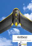
FAQ’s senseFly eBee and swinglet CAM drones
This document contains frequently asked questions and their answers about senseFly’s eBee and
swinglet CAM drones.
1.1
1.2
1.3
1.4
1.5
1.6
Ebee Questions
Swinglet Questions
Commercial Questions
Operating Questions
Camera & Payload Questions
Aerial Imaging & Mapping Question
In case you don’t find the answer to your question please do not hesitate to contact us directly:
[email protected]
FAQ’s senseFly eBee and swinglet CAM drones
1.1 Ebee Questions
Q: How does the flight programming work?
A: You need to install the software package eMotion 2 and connect your laptop with the senseFly
drones via the delivered USB radio modem. This software and wireless communication link allows
you to setup the flight plan by placing GPS waypoints either on a map or by manually entering the
coordinates. Each waypoint is determined by its position, radius, altitude relative to the take-off
location and circling direction. The Mission Planning tool can be used to easily map a whole area by
drawing the corresponding rectangle directly on the map.
Q: What happens in case of low battery level or strong wind?
A: The senseFly drone constantly monitors its state and, upon warning, automatically returns to the
take-off location and lands. For example, warnings include low battery level, strong wind, going too
far from the take-off location.
Q: What happens in case of critical issues such as empty battery or loss of GPS signal?
A: Critical issues occur extremely rarely. The senseFly drone will try to return to the take-off location
and land before the battery becomes empty and GPS signal reception is usually extremely good in
flight due to the absence of any obstacle. However, in the unlikely case that the GPS fails, normal
waypoint-based navigation is no longer possible. In order to minimize the risk of damage and threat
to third parties, the senseFly drone will land immediately in a circling pattern and at a slow speed. If
the issue disappears (e.g. GPS signal is regained), the senseFly drone will resume GPS navigation and
return to its take-off location.
Q: What is the difference between Postflight Terra 3D-EB powered by Pix4D and Pix4UAV Desktop
3D?
A: senseFly’s Postflight Terra 3D-EB software is a development between senseFly and Pix4D, to allow
seamless processing of senseFly eBee imagery. It has all the major functionalities and features of
Pix4UAV Desktop 3D but adapted to senseFly eBee imagery. An upgrade to enable Postflight Terra
3D-EB to process also swinglet CAM imagery is available.
Q: If I own a swinglet CAM and an eBee, can I process swinglet CAM images with Postflight 3D-EB?
A: Postflight Terra 3D-EB can only process eBee images. An upgrade would be necessary to enable
the processing of swinglet CAM images.
FAQ’s senseFly eBee and swinglet CAM drones
Q: Which hardware items are included in the eBee package?
A: The standard eBee package contains the following items:
-
eBee (ready-to-fly mini drone with built-in autopilot for fully autonomous navigation incl.
take-off and landing and automatic control of the on-board camera)
Customized 16MP compact digital camera
Camera battery charger with cables
2.4GHz USB radio modem for data link
2.4GHz remote control (in case a safety pilot is required)
2 batteries
Single charger for battery
1 spare propeller and rubber bands
1 EPP glue
Transport box with space for all material
User manual
Q: What are the flight performances of the eBee?
A: The eBee has a flight endurance of about 45 minutes with a fully charged battery. The endurance
is reduced with wind, frequent altitude changes or very low temperatures. The cruise speed 3657km/h (10-16m/s).The climb rate is about 3 m/s. The maximum wind speed Up to 45km/h (12m/s)
,which corresponds to a strong breeze (Beaufort 6). This includes a safety margin to allow
the eBee to fly back home automatically when strong wind is detected by the autopilot.
Q: How does the eBee takes off?
A: The eBee is hand-launched. It must always be launched against the wind in order to limit the
required ground velocity. The take-off location is automatically selected as the emergency landing
spot (home waypoint) and should therefore be clear of obstacle in a 40-metre radius.
Q: How does the eBee land and what is the required space?
A: By default, it lands by gliding down, circling around a waypoint with a minimum radius of 30
metres, until it reaches the ground. Since slight deviations from the waypoint trajectory are possible,
especially in windy conditions, the landing zone should be free of obstacle within a radius of 50
metres. When there is not enough room for a Circle landing or in windy conditions a linear
Landing is preferable.
Q: What is the surface requirement for the landing site?
A: Grass fields are ideal, but asphalt or other surfaces are also feasible. In general, the eBee is so
lightweight that it will not get irreparably destroyed because of a hard landing. The landing site
should however be free of prominent obstacles such as rocks, posts, trees, buildings, etc.
FAQ’s senseFly eBee and swinglet CAM drones
Q: Can the eBee fly in all weather conditions?
A: Yes. In general small cracks in the airframe can easily and quickly be repaired using foamcompatible, contact glue such as UHU® POR®.The eBee’s wings can be easily replaced, as of its
modular design.
In case of serious damage to the airframe, the built-in electronics generally survive the collision
because it is surrounded by foam and the inertia of the entire system is very small.iQlaser, or
senseFly, will be able to provide you with a quote for airframe replacement.
Q: is it possible to increase the range/endurance of the eBee?
A: The battery of the eBee has been selected for an optimal endurance given the available payload
capacity. It is therefore not possible to increase the endurance or the range of the eBee. It would be
technically feasible to design a larger airframe with a bigger battery capacity, but this would come at
the expense of the ease of use, cost effectiveness and safety to third parties.
Q: How long does it take to swaq and recharge batteries between two flights?
A: Swapping of battery takes almost no time provided a second, fully-charged battery is available.
Recharging an empty battery takes more than one hour using the provided cell-balancing charger. If
your application often requires more than two flights in a row, additional batteries can be ordered
with theeBee.
Q: What is the operating temperature range of the eBee?
A: The eBee has been tested in temperatures ranging from -15°C to 35°C and its electronics are
designed to work in temperatures ranging from -20°C to 50°C. Note that the battery performance
can decrease with low temperature and yield an endurance reduction of up to 20%.
Q: At what altitude the eBee can fly?
A: As with all aircraft, the flight performance of the eBee is dependant on the altitude. In low air
density found at high altitudes, the performance of the propeller decreases and the eBee must fly
faster to remain airborne. As of eBee software version 2.0.2, the eBee automatically adjusts its
speed according to the flight altitude. Since the eBee must fly faster, taking off phase is more
sensitive at high altitudes. The eBee must therefore be launched faster and will be less tolerant to
inadequate launching angles and misalignment with respect to front wind.
The eBee has been tested for take off at up to 1500m above sea level and in flight up to 3000m
above sea level.
FAQ’s senseFly eBee and swinglet CAM drones
1.2 Swinglet Cam Questions
Q: How does the flight programming process works?
A: You need to install the software package eMotion 2 and connect your laptop with the senseFly
drones via the delivered USB radio modem. This software and wireless communication link allows
you to setup the flight plan by placing GPS waypoints either on a map or by manually entering the
coordinates. Each waypoint is determined by its position, radius, altitude relative to the take-off
location and circling direction. The Mission Planning tool can be used to easily map a whole area by
drawing the corresponding rectangle directly on the map.
Q: What happens in case of low battery level or strong wind?
A: The senseFly drone constantly monitors its state and, upon warning, automatically returns to the
take-off location and lands. For example, warnings include low battery level, strong wind, going too
far from the take-off location
Q: What happens in case of critical issues such as empty battery or loss of GPS signal?
A: Critical issues occur extremely rarely. The senseFly drone will try to return to the take-off location
and land before the battery becomes empty and GPS signal reception is usually extremely good in
flight due to the absence of any obstacle. However, in the unlikely case that the GPS fails, normal
waypoint-based navigation is no longer possible. In order to minimize the risk of damage and threat
to third parties, the senseFly drone will land immediately in a circling pattern and at a slow speed. If
the issue disappears (e.g. GPS signal is regained), the senseFly drone will resume GPS navigation and
return to its take-off location.
Q: How much learning does it take to operate a senseFly drone?
A: The learning process takes approximately two to five hours. In general, it is sufficient to read
carefully the user manual in order to get started.
All our distributors organize training session at their locations
Q: Which image processing alternatives can I use?
A: You can upgrade your swinglet CAM Postflight Terra LT to Postflight Terra 2D or 3D, or you can
use our Postflight Service online processing.
Alternatively here is a list of software or service providers that can be used to reconstruct
orthomosaics and DEM’s from swinglet CAM or eBee aerial imagery:
-
EnzoMOSAIC software by MosaicMill Ltd
-
PhotoScan Pro by Agisoft
-
RapidCluster image processing service on the web by PIEneering
To produce non-geographically correct, but visually-pleasing mosaics, we recommend using the
panorama creation tool of Adobe Photoshop CS5 orAdobe Photoshop Elements 9.
FAQ’s senseFly eBee and swinglet CAM drones
Q: If I own a swinglet Cam and an eBee, can I process singlet CAM images with Postflight Terra 3DEB?
A: Postflight Terra 3D-EB can only processes eBee images. An upgrade would be necessary to enable
the processing of swinglet CAM images.
Q: Which hardware items are included in the swinglet Cam package?
A: The standard swinglet Cam package contains the following items:
-
swinglet (ready-to-fly 500-gram mini drone with built-in autopilot for fully autonomous
navigation incl. take-off and landing and automatic control of the on-board camera)
Customized 16MP RGB compact digital camera
Camera battery charger with cables
2.4GHz USB radio modem for data link
2.4GHz remote control (in case a safety pilot is required)
2 batteries
Single charger for battery
1 spare propeller and rubber bands
EPP glue
Black transport box with space for all material
User manual
Q: What is the flight performance of the swinglet CAM?
A: The swinglet CAM has a flight endurance of about 30 minutes with a fully charged battery. The
endurance is reduced with wind, frequent altitude changes or very low temperatures. The cruise
speed is 10 m/s (36 km/h, 22 mph). The climb rate is about 3 m/s. The maximum wind speed is 7 m/s
(25 km/h, 16 mph), which corresponds to a moderate breeze (Beaufort 4). This includes a safety
margin to allow the swinglet CAM to fly back home automatically when strong wind is detected by
the autopilot.
Q: How does the swinglet CAM take off?
A: The swinglet CAM is hand-launched (see video). It must always be launched against the wind in
order to limit the required ground velocity. The take-off location is automatically selected as the
emergency landing spot (home waypoint) and should therefore be clear of obstacle in a 40-metre
radius
Q: How does the swinglet CAM land and what is the required space?
A: It lands by gliding down, circling around a waypoint with a minimum radius of 20 metres, until it
reaches the ground (see video). Since slight deviations from the waypoint trajectory are possible,
especially in windy conditions, the landing zone should be free of obstacle within a radius of 40
metres.
By default, and in case of emergency, the swinglet CAM will land around its home waypoint. For this
reason, it is important to always take off from a location free from obstacles within a radius of 40
metres. It is also possible to program the swinglet CAM for a landing at a different location than the
take-off location.
FAQ’s senseFly eBee and swinglet CAM drones
Q: What is the surface requirement for the landing site?
A: Grass fields are ideal, but asphalt or other surfaces are also feasible. In general, the swinglet
CAM is so lightweight that it will not get irreparably destroyed because of a hard landing. The
landing site should however be free of prominent obstacles such as rocks, posts, trees, buildings, etc.
Q: Can the swinglet CAM fly in all weather conditions?
A: Technically, the swinglet CAM can fly with winds up to 7 m/s (i.e. moderate breeze), in lowvisibility conditions, or even at night. Although light rain will usually not affect its flight
characteristics, the swinglet CAM is not water-proof and should therefore not be used when raining
or snowing. For best image quality, the swinglet CAM should be used on clear days with no or light
wind (up to 5 m/s, i.e. a normal breeze is fine).
Q: Can the swinglet CAM be repaired in case of damage?
A: Yes. In general small cracks in the airframe can easily and quickly be repaired using foamcompatible, contact glue such as UHU® POR®.
In case of serious damage to the airframe, the built-in electronics generally survive the collision
because it is surrounded by foam and the inertia of the entire system is very small. iQlaser, or
senseFly, will be able to provide you with a quote for repair or airframe replacement.
Q: Is it possible to increase the range/endurance of the swinglet CAM?
A: The battery of the swinglet CAM has been selected for an optimal endurance given the available
payload capacity. It is therefore not possible to increase the endurance or the range of the swinglet
CAM. It would be technically feasible to design a larger airframe with a bigger battery capacity, but
this would come at the expense of the ease of use, cost effectiveness and safety to third parties.
Q: How long does it take to swap and recharge batteries between two flights?
A: Swapping of battery takes almost no time provided a second, fully-charged battery is available.
Recharging an empty battery takes more than one hour using the provided cell-balancing charger. If
your application often requires more than two flights in a row, additional batteries can be ordered
with theswinglet CAM.
Q: What is the operating temperature range of the swinglet CAM?
A: The swinglet CAM has been tested in temperatures ranging from -15°C to 35°C and its electronics
are designed to work in temperatures ranging from -20°C to 50°C. Note that the battery
performance can decrease with low temperature and yield an endurance reduction of up to 20%.
FAQ’s senseFly eBee and swinglet CAM drones
Q: At what altitude can the swinglet CAM fly?
A: As with all aircraft, the flight performance of the swinglet CAM is dependant on the altitude. In
low air density found at high altitudes, the performance of the propeller decreases and the swinglet
CAM must fly faster to remain airborne. As of swinglet CAM firmware version 2.0.2, the swinglet
CAMautomatically adjusts its speed according to the flight altitude. Since the swinglet CAM must fly
faster, taking off phase is more sensitive at high altitudes. The swinglet CAM must therefore be
launched faster and will be less tolerant to inadequate launching angles and misalignment with
respect to front wind.
The swinglet CAM has been tested for take off at up to 1500m above sea level and in flight up to
3000m above sea level.
FAQ’s senseFly eBee and swinglet CAM drones
1.3 Commercial Questions
Q: How do I access the image processing software?
A: senseFly’s image processing software is called Postflight. At product delivery senseFly will provide
you with access information to our download area to allow you free download of the software
package which works with your drone:
- Postflight Terra LT for swinglet CAM
- Postflight Terra 3D-EB for eBee
Q: What is the difference between Postflight Terra 3D-EB powered by Pix4D and Pix4UAV Desktop
3D?
A: senseFly’s Postflight Terra 3D-EB software is a development between senseFly and Pix4D, to allow
seamless processing of senseFly eBee imagery. It has all the major functionalities and features of
Pix4UAV Desktop 3D but adapted to senseFly eBee imagery. An upgrade to enable Postflight Terra
3D-EB to process also swinglet CAM imagery is available.
Q: Which image processing alternatives can I use?
A: You can upgrade your swinglet CAM Postflight Terra LT to Postflight Terra 2D or 3D, or you can
use our Postflight Service online processing.
Alternatively here is a list of software or service providers that can be used to reconstruct
orthomosaics and DEM’s from swinglet CAM or eBee aerial imagery:
-
EnzoMOSAIC software by MosaicMill Ltd
-
PhotoScan Pro by Agisoft
-
RapidCluster image processing service on the web by PIEneering
To produce non-geographically correct, but visually-pleasing mosaics, we recommend using the
panorama creation tool of Adobe Photoshop CS5 orAdobe Photoshop Elements 9.
Q: If I own a swinglet CAM and an eBee, can I process swinglet CAM images with Postflight Terra
3D-EB?
A: Postflight Terra 3D-EB can only processes eBee images. An upgrade would be necessary to enable
the processing of swinglet CAM images.
Q: Is a warranty included?
A: Yes, we provice a 1-year limited warranty.
FAQ’s senseFly eBee and swinglet CAM drones
Q: What do your clients do with their senseFly Drone?
A: A number of things. Here are a few typical applications:
-
Mapping, photogrammetry (mosaicking, orthoimage generation, DEM)
Mining and quarry survey
Conservation (Vegetation and all kind of animals)
Cropmonitoring (abnormalities spotting and sizing, yield prediction), precision agriculture
Site survey for mission planning, recovery monitoring or building site monitoring
Land management
ArcheologyResearch (e.g. biology, remote sensing, aerial flocking, collective operation, lowaltitude flight control)
etc.
FAQ’s senseFly eBee and swinglet CAM drones
1.4 Operating Questions
Q: How do I get the flight planning and control software?
A: The flight planning and control software is called eMotion 2. At product delivery senseFly will
provide you with access information to our download area to allow you free download of the
latest eMotion 2 software package version.
Q: How does the flight programming process works?
A: You need to install the software package eMotion 2 and connect your laptop with the senseFly
drones via the delivered USB radio modem. This software and wireless communication link allows
you to setup the flight plan by placing GPS waypoints either on a map or by manually entering the
coordinates. Each waypoint is determined by its position, radius, altitude relative to the take-off
location and circling direction. The Mission Planning tool can be used to easily map a whole area by
drawing the corresponding rectangle directly on the map.
Q: What are the requirements for the ground station computer?
A: The ground station software eMotion 2 is compatible with Windows XP, Vista, 7 and 8. A laptop
with a free USB port and a minimum screen resolution of 1280x800 is required. Since the ground
station computer is typically used outdoor, a bright and matte screen is desirable. Glossy screens are
inconvenient due to reflections.
Q: Do I need an internet connection?
A: An Internet connection is required to download the background map data for the intended
mission area. However, some of the map data can be cached in the hard disk and can therefore be
downloaded in advance. During the flight, an Internet connection is not required. If you have the
exact coordinates of the waypoints you want to fly, you may even program the flight without any
map.
Q: There are no maps available in my area. How can I plan my flight?
A: Depending on the type of flight, several options exist if no maps for flight planning are available:
Waypoints coordinates can be manually entered as WGS84 latitude & longitude in our ground
control station software eMotion 2.
Alternatively, you may use the auto flight-planning feature. Make sure to determine the size of the
area to be mapped (in meters) and its relative position with respect to the takeoff location. Once the
senseFly drone is switched on and has acquired GPS fix, you will see it on the map and can use its
position to adjust the auto flight planning area accordingly.
If you possess some digital aerial imagery of the desired area, you may process it in order to display
it in eMotion 2. See following FAQ for more information.
If you plan on flying often in the same area, you may execute an overview flight using the auto flight
planning (see previous bullet point above) and process the images using our Postflight Software. See
the next FAQ for more information on using the output of Postflight with eMotion 2.
FAQ’s senseFly eBee and swinglet CAM drones
Q: Is it possible to use custom maps as background to plan my flight?
A: Yes, eMotion 2 supports custom imagery as background in its map window. You can import
custom georeferenced maps as standard web tile format. The transformation of a georeferenced
map into a set of standard web tiles can be achieved using the free application MapTiler. When
using this software, chose "Google Maps compatible" and use a maximum zoom level of at least 18.
The resulting folder should then be moved such as to obtain the following file hierarchy:
<Document directory>/e-mo-tion/tiles/MyCustomTileSet/18/...
<Document directory>/e-mo-tion/tiles/MyCustomTileSet/17/...
...
You may have more than one custom tile set and they can be named arbitrarily. After
restarting eMotion 2, the custom map will be overlaid on top ofeMotion 2 default map.
Note that custom maps can be generated using your senseFly drone. In this case, the tiles are
automatically generated with the correct structure and ready to be copy-pasted in the
related eMotion 2 folder structure as described above.
Q: What happens if the senseFly drone gets out of communication range?
A: The default 2.4 GHz data-link provided has a range of up to 3 km for the eBee and 1.5km for
the swinglet CAM (depending on obstacles and RF interferences). The senseFly drones are however
completely autonomous and do not require a working data-link to fly.
If the senseFly drone flies beyond the communication range, it will follow its flight plan and return
home upon completion or in case of warning (such as strong wind or low battery level).
In order to avoid the situation where the senseFly drone is send out of its operational circle, a
security zone is defined in the autopilot and corresponds to a maximum allowable distance around
the take-off location. This security distance can be modified by the user before flight. If the senseFly
drone flies beyond this zone, it will raise a warning and will return to the take-off location. The
security distance is displayed on the map and can be adapted if required.
Q: How can I maximise the communication range of the senseFly drone?
A: Do not use 2.4GHz-based communication nearby the USB radio modem. This includes WiFi or
Bluetooth phones.
Switch the remote control off unless you need it.
Place the USB radio modem as high as possible.
Always orient the antenna of the USB radio modem such that it is perpendicular to the imaginary
line between the modem and the airplane.
FAQ’s senseFly eBee and swinglet CAM drones
Q: What happens in case of low battery level or strong wind?
A: The senseFly drone constantly monitors its state and, upon warning, automatically returns to the
take-off location and lands. For example, warnings include low battery level, strong wind, going too
far from the take-off location
Q: What happens in case of critical issues such as empty battery or loss of GPS signal?
A: Critical issues occur extremely rarely. The senseFly drone will try to return to the take-off location
and land before the battery becomes empty and GPS signal reception is usually extremely good in
flight due to the absence of any obstacle. However, in the unlikely case that the GPS fails, normal
waypoint-based navigation is no longer possible. In order to minimize the risk of damage and threat
to third parties, the senseFly drone will land immediately in a circling pattern and at a slow speed. If
the issue disappears (e.g. GPS signal is regained), the senseFly drone will resume GPS navigation and
return to its take-off location.
Q: How much learning does it take to operate a senseFly drone?
A: The learning process takes approximately two to five hours. In general, it is sufficient to read
carefully the user manual in order to get started. All our distributors organize training session at
their locations.
Q: How to specify where to take photos?
A: Motion 2 allows you to draw a rectangle on a map in order to automatically create a flight plan
with the desired ground resolution, image overlap, etc. The images will be triggered automatically by
the onboard autopilot at the right position.
Alternatively you can take photos:
- on demand: “Take photo now” – button
- on photo locations, that can be placed on the map. They will trigger the camera whenever the
drone reaches them. This is typically useful to photograph specific ground targets
Q: How do I transfer the photo to my computer:
A: The photos are available in the SD memory card of the onboard camera right after landing.
Q: How do I access the image processing software?
A: senseFly’s image processing software is called Postflight. At product delivery senseFly will provide
you with access information to our download area to allow you free download of the software
package which works with your drone:
- Postflight Terra LT for swinglet CAM
- Postflight Terra 3D-EB for eBee
FAQ’s senseFly eBee and swinglet CAM drones
1.5 Camera & Payload Questions
Q: How many images can be taken during one flight?
A: When photos are triggered at maximum rate (every 3.8 seconds), the number of images in one
flight can reach 700. The provided onboard memory card has more than enough space to store such
a number of images at full resolution.
Q: What are the specifications of the camera used in the senseFly drones?
A: The senseFly drone is equipped with a 16 MP compact camera with a focal length of 30 mm. The
resulting ground resolution is adjusted by choosing an appropriate flight altitude (typically between
65 and 1000 meters above ground) and will range from 2 to 30 cm/pixels.
Q: How do I transfer the photo to my computer?
A: The photos are available in the SD memory card of the onboard camera right after landing.
Q: Can a senseFly drone record videos?
A: The senseFly drone has been designed for still image acquisition. Since the camera is not
stabilized, the recording videos with the onboard camera would result in shaky movies. This is not a
problem for still images since the senseFly drone actively stabilizes itself while the photo is taken.
Q: Are the images/video transmitted in real time?
A: No. The high-resolution images are available only after landing from the onboard memory card.
Q: Can the camera be replaced by another imaging sensor, such as near-infra-red (NIR), thermal
camera, or medium-format cameras?
A: The senseFly drones are equipped with the best visible-spectrum camera available that fits its
payload capacity. Since the camera is tightly integrated with the autopilot for automatic picture
acquisition, it is not possible to replace it with a different unit.
However, a NIR version of the senseFly drone camera is available for environmental and agricultural
applications.
Q: Can I install a custom (non-camera) payload?
A: The senseFly drones are specifically designed to carry the included compact camera. The senseFly
drones airframe has a payload capacity of 150 grams. Many types of sensor fitting this requirement
could be embedded, but this requires some professional integration work (mechanical locking,
interfacing with the autopilot, flight testing, etc.). Contact us if you need to fly a specific sensor.
FAQ’s senseFly eBee and swinglet CAM drones
1.7 Aerial imagery & Mapping Questions
Q: What is the area that can be typically imaged during one flight?
A: The answer primarily depends on the flight altitude (and thus the ground resolution):
-
At 140 m (ground resolution of 5 cm/pixel), one picture covers 0.03 square km (3 ha, 7 acres)
and one flight covers up to 1.5 square km (150 ha, 370 acres).
At 280 m (ground resolution of 10 cm/pixel), one picture covers 0.12 square km (12 ha, 29
acres) and one flight covers up to 4 square km (400 ha, 990 acres).
At 840 m (ground resolution of 30 cm/pixel), one picture covers 1.07 square km (107 ha, 265
acres) and one flight covers up to 10 square km (1000 ha, 2470 acres).
When we say "up to", we mean the maximum area you may end-up with after orthomosaic
reconstruction using maximum flight duration, optimised flight planning parameters (such as image
overlap) and taking into account the part of the generated orthomosaic that is outside the
designated area for the e-mo-tion automatic flight planner.
Have a look at our mapping examples to see the results you can obtain.
Q: How many images can be taken during one flight?
A: When photos are triggered at maximum rate (every 3.8 seconds), the number of images in one
flight can reach 700. The provided onboard memory card has more than enough space to store such
a number of images at full resolution.
Q: How to specify wher to take photos?
A: eMotion 2 allows you to draw a rectangle on a map in order to automatically create a flight plan
with the desired ground resolution, image overlap, etc. The images will be triggered automatically by
the onboard autopilot at the right position.
Alternatively you can take photos:
- on demand: “Take photo now” – button
- on photo locations, that can be placed on the map. They will trigger the camera whenever the
drone reaches them. This is typically useful to photograph specific ground targets.
Q: How do I transfer the photo do my computer?
A: The photos are available in the SD memory card of the onboard camera right after landing.
Q: How do I access the image processing software?
A: senseFly’s image processing software is called Postflight. At product delivery senseFly will provide
you with access information to our download area to allow you free download of the software
package which works with your drone:
- Postflight Terra LT for swinglet CAM
- Postflight Terra 3D-EB for eBee
FAQ’s senseFly eBee and swinglet CAM drones
Q: How can the images be processed after a flight?
A: You need to install Postflight Terra LT or Terra 3D-EB on your computer. Connect the camera to
the computer using the provided USB-cable and download the images. Then connect the senseFly
drone to the computer using the provided USB cable to download the flight log. senseFly’s Postflight
software will then automatically match both and geo-tag the images (i.e. write inside the image file
the GPS coordinates at which it was taken). Geo-tagged images can be used with a variety of
software tools to generate galleries linked to maps, visualise them in Google EarthTM, etc.
A next step allows a rapid image processing to check possibility and quality of Orthomosaic
reconstruction. The output is a low resolution geo-referenced Orthomosaic based on a simplified
Ortho-projection. Postflight Terra 3D allows further image processing to geo-referenced
Orthomosaics of down to 5cm precision and Digital Elevation models. It also allows introduction of
ground control points, seamline editing and provides measurement tools.
Q: What accuracy should be expected?
A: The accuracy of the orthomosaics and the digital elevation models (DEM) produced by Postflight
Terra 3D-EB strongly depends on the flight height, lighting conditions, availability of textures, image
quality, overlap, and type of terrain. In standard conditions (flying at 100-150 meters above natural
terrains with 50 to 70% image overlap), a relative accuracy of 10 cm and an absolute accuracy of 3-5
meters (in case no ground control points (CGP) are used) can be expected at the location of the
found matching points.
Between these points the accuracy may vary. A quality report can be displayed, it shows precision to
be expected and zones of possible issues. Note that we cannot guaranty in any way the quality and
accuracy of the output files.
Q: What kind of artefacts should be expected?
A: In general, the resulting orthomosaics are great looking and smooth. There may of course be
ghosting effects when objects are moving on the ground. There may also be distortions at specific
areas of the image. These are due to inaccuracies in the DEM reconstruction between matching
points. This happens typically at the edges of buildings or in areas covered by insufficient number of
images. These areas are indicated in red in the automatically generated report.
Postflight Terra 3D-EB provides a tool to use linear projection to avoid distortion of objects if the
DEM has inaccuracies (typically over forest, building edges etc).
Q: How much time does it take to get the resulting files?
A: The processing time with Postflight Terra 3D-EB depends on the capacity of your workstation and
the complexity of the dataset. Typically a data set of 100 images may take up to 4h for a full
processing with Terra 3D-EB.
FAQ’s senseFly eBee and swinglet CAM drones
Q: What is the difference between Postflight Terra 3D-EB powered by Pix4D and Pix4DUAV
Desktop 3D?
A: senseFly’s Postflight Terra 3D-EB software is a development between senseFly and Pix4D, to allow
seamless processing of senseFly eBee imagery. It has all the major functionalities and features of
Pix4UAV Desktop 3D but adapted to senseFly eBee imagery. An upgrade to enable Postflight Terra
3D-EB to process also swinglet CAM imagery is available.
Q: Which image processing alternatives can I use?
A: You can upgrade your swinglet CAM Postflight Terra LT to Postflight Terra 2D or 3D, or you can
use our Postflight Service online processing.
Alternatively here is a list of software or service providers that can be used to reconstruct
orthomosaics and DEM’s from swinglet CAM or eBee aerial imagery:
-
EnzoMOSAIC software by MosaicMill Ltd
-
PhotoScan Pro by Agisoft
-
RapidCluster image processing service on the web by PIEneering
To produce non-geographically correct, but visually-pleasing mosaics, we recommend using the
panorama creation tool of Adobe Photoshop CS5 orAdobe Photoshop Elements 9.
Q: If I own a swinglet CAM and an eBee, can I process swinglet CAM images with Postflight Terra
3D-EB?
A: Postflight Terra 3D-EB can only processes eBee images. An upgrade would be necessary to enable
the processing of swinglet CAM images.
Q: Are the images/video transmitted in real time?
A: No. The high-resolution images are available only after landing from the onboard memory card.