1
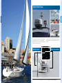
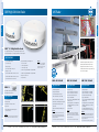
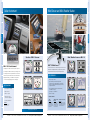
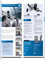
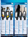
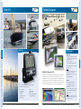
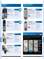
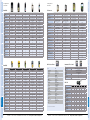
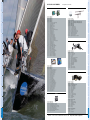
Marine Navigation
GARMIN MARINE
NETWORK
MULTIFUNCTION
NETWORK DISPLAYS
MULTIFUNCTION
NETWORK DISPLAYS
GARMIN MARINE
NETWORK
INSTRUMENTS AND
AUTOPILOTS
INSTRUMENTS AND
AUTOPILOTS
RADAR
RADAR
HYBRID GPS
HANDHELD GPS
12
COLOUR INSTRUMENT
16
WIND SENSOR
17
AUTOPILOT
18
VHF
22
STANDALONE CHARTPLOTTERS
24
FISHFINDERS
28
FIXED GPS
30
HYBRID MARINE & AUTOMOTIVE GPS
31
MARINE & OUTDOOR HANDHELD GPS
32
GARMIN MARINE CARTOGRAPHY
34
TECHNICAL SPECIFICATIONS
36
ACCESSORIES
42
WARRANTY
47
Welcome to Garmin
®
Innovative, easy to use and stylish – the latest Garmin marine equipment has arrived.
Discover a wide choice of products from VHF radio to xHD radar, touchscreen chartplotters
to complete network systems.
Garmin designs and manufactures a diverse range of marine electronics and celebrated its
20th anniversary within the industry in 2009. With strong roots in marine and a passion
for engineering, it is no wonder that Garmin is the global leader in satellite navigation.
Garmin – you’ll be lost without it.
SPECIFICATIONS
RADAR
CARTOGRAPHY
CARTOGRAPHY
6
HANDHELD GPS
SPECIFICATIONS
MULTIFUNCTION NETWORK DISPLAYS
HYBRID GPS
ACCESSORIES
ACCESSORIES
4
CHARTPLOTTERS
AND FISHFINDERS
CHARTPLOTTERS
AND FISHFINDERS
VHF
VHF
GARMIN MARINE NETWORK
GARMIN MARINE
NETWORK
MULTIFUNCTION
NETWORK DISPLAYS
MULTIFUNCTION
NETWORK DISPLAYS
GARMIN MARINE
NETWORK
INSTRUMENTS AND
AUTOPILOTS
INSTRUMENTS AND
AUTOPILOTS
RADAR
RADAR
VHF
VHF
CHARTPLOTTERS
AND FISHFINDERS
CHARTPLOTTERS
AND FISHFINDERS
HYBRID GPS
HYBRID GPS
HANDHELD GPS
CARTOGRAPHY
SPECIFICATIONS
ACCESSORIES
ACCESSORIES
Dee Caffari MBE sails with Garmin
SPECIFICATIONS
New digital radar and sounders add even more depth to your marine adventures and Garmin’s plug and
play network provides easy connection to a whole array of remote sensors, datalinks, VHF and more –
and all controlled directly from your chartplotter screen.
CARTOGRAPHY
Powerful features, sleek design and more innovation than ever before – meet the new wave of marine
electronics from Garmin. The growing Garmin chartplotter family with touchscreen technology makes
navigation simple and intuitive whilst adding detail-rich satellite imagery, smooth graphics, fast chart
redraw and 3D mapping when combined with BlueChart® g2 Vision® cartography.
HANDHELD GPS
Garmin Marine Network
GARMIN MARINE
NETWORK
KEY FEATURES
FREE SOFTWARE
UPDATES
Simple Screen Interrogation
Touch the point you want to interrogate and a menu of possible
options for that point are provided.
INSTRUMENTS AND
AUTOPILOTS
INSTRUMENTS AND
AUTOPILOTS
Homepage Menu
Simple and intuitive (5/7000 series).
• Easy-to-use touchscreen or
soft-touch button control
• G Motion instant pan, zoom
and redraw
• Preloaded worldwide satellite
basemap
• Network ready, NMEA 0183 and
2000 compliant, compatible with
radar, sonar, instruments and
other displays
• Pair with the latest xHD radar
technology for crisp, full-colour
images and option for dual-range
scales
• Full-screen video input display
• Rugged, waterproof design
• Choice of 15, 12.1 and 8.4-inch
models in a low-profile casing
RADAR
RADAR
SEE PAGE 47
MULTIFUNCTION
NETWORK DISPLAYS
MULTIFUNCTION
NETWORK DISPLAYS
GARMIN MARINE
NETWORK
G Motion Multifunction Network Displays
™
In the box
VHF
Sunseeker Manhattan 63
CHARTPLOTTERS
AND FISHFINDERS
Auto Routing
Engage your Garmin pilot from your plotter screen.
6000 and 7000 series
with G Motion™
CHARTPLOTTERS
AND FISHFINDERS
Auto Guidance in Mariners Eye 3D
Overlay chart and satellite imagery with high definition 3D graphics.
VHF
GPSMAP 6000/7000 series, flush mount,
bail mount*, GPS 17x with pole mount
adaptor, power cable, NMEA 0183 cable,
NMEA 2000 drop cable, NMEA 2000 power
cable, NMEA backbone cable 10m, NMEA
2000 T-connectors and terminators, video
cable assembly, marine grommet kit,
protective front cover, owners manual,
installation instructions
*Not included with GPSMAP 7015
Our responsive chart-drawing technology
HYBRID GPS
zoom and redraw. The 6000 series is operated by
7000 series with intuitive menus and prompts for
ADD EXTRA
FUNCTIONALITY
point-and-go navigation.
SEE PAGE 34
HANDHELD GPS
HANDHELD GPS
a soft-touch keypad, or choose the touchscreen
The innovative GPSMAP® 6000 and 7000 series
chartplotters are bright, colourful and ultra-fast,
powered by dual-processor technology.
Current Arrows
Animated current flow arrows display current speed and direction.
Fully NMEA 0183 and 2000 compliant, the 6000
• TO
N
E
GMR™ 24 HD
Composite Video
CH
SCRE
15” GPSMAP® 7015
12” GPSMAP® 6012
GHC™ 10
GMI™ 10
GPSMAP® 6012
GPSMAP® 7015
SPECIFICATIONS
SPECIFICATIONS
sensors, engines and Garmin marine instruments.
E
• TO
CARTOGRAPHY
SCR
U
CH
Garmin Network
NMEA 2000
EN
U
Typical Networked System
Multi-colour radar display
Up to 256 colour radar display with xHD open arrays and
6/7000 series plotter.
CARTOGRAPHY
and 7000 series connect to a wide range of
GC™ 10
Transducer
12” GPSMAP® 7012
6
ORDERI N G – C O N T AC T YO U R L O C AL G AR MI N D E A LE R – SE E B A C K C O V E R
8” GPSMAP® 6008
w w w . g a rmi n . co . u k / w h e re to b u ymar in e
Analogue
GFS™ 10
GPS® 17x
AIS 600
O RD E RIN G – CO N TA CT YO UR L O CA L G A RMIN D E A L E R – SE E BA CK CO VE R
GA 30
GSD® 22
www.g ar min .co .u k/wh eretobuymarine
7
ACCESSORIES
ACCESSORIES
HYBRID GPS
G Motion™ gives smooth, lightening-fast pan,
GARMIN MARINE
NETWORK
GARMIN MARINE
NETWORK
Multifunction Network Displays
KEY FEATURES
FREE SOFTWARE
UPDATES
SEE PAGE 47
MULTIFUNCTION
NETWORK DISPLAYS
MULTIFUNCTION
NETWORK DISPLAYS
• Easy-to-use touchscreen or
soft-touch button control
• Preloaded worldwide satellite
basemap
• Network ready, NMEA 0183 and
2000 compliant, compatible with
radar, sonar, instruments and
other displays
RADAR
RADAR
• Video input display
Mariner’s Eye 3D
High definition 3D graphics bring land and bottom contours to life.
Intuitive Smart Menu
Soft keys make it quick and simple to get the most from your
4/6000 system.
• Rugged, waterproof design
• GPS antenna included
INSTRUMENTS AND
AUTOPILOTS
INSTRUMENTS AND
AUTOPILOTS
• Optional wireless remote control
• Choice of 15, 12.1 and 8.4-inch
models in a low-profile casing
In the box
VHF
VHF
GPSMAP 4000/5000 series, flush mount,
bail mount*, GPS 17x with pole mount
adaptor, power cable, NMEA 0183 cable,
video cable assembly, marine grommet
kit, protective front cover, owners manual,
installation instructions
4000 and 5000 series
4
Auto Guidance with Satellite Image Overlay
Combine high resolution satellite images over land or water
cartography with auto guidance for simple, safe navigation.
Custom Combination
Combine your key pages of information on a single screen.
CHARTPLOTTERS
AND FISHFINDERS
CHARTPLOTTERS
AND FISHFINDERS
*Not included with GPSMAP 5015
TThe popular GPSMAP® 4000 and 5000 series
cchartplotters are rugged and resilient, with a bright,
ffor a soft-touch keypad. For intuitive point-and-go
nnavigation, the responsive touchscreen 5000 series
bbrings menus and prompts controlled by the touch
ADD EXTRA
FUNCTIONALITY
SEE PAGE 34
HANDHELD GPS
HANDHELD GPS
oof your finger.
FFully NMEA 0183 and 2000 compliant, the 4000
aand 5000 series connect to a wide range of sensors,
eengines and Garmin marine instruments.
E
N
• TO
E
Composite Video
CH
SCRE
15” GPSMAP® 5015
12” GPSMAP® 5012
10” GPSMAP® 4010
8” GPSMAP® 5008
8” GPSMAP® 4008
ORDERI N G – C O N T AC T YO U R L O C AL G AR MI N D E A LE R – SE E B A C K C O V E R
w w w . g a rmi n . co . u k / w h e re to b u ymar in e
GHC™ 10
GMI™ 10
GPSMAP® 4010
GPSMAP® 5015
GC™ 10
Transducer
Analogue
GFS™ 10
GPS® 17x
AIS 600
O RD E RIN G – CO N TA CT YO UR L O CA L G A RMIN D E A L E R – SE E BA CK CO VE R
GA 30
GSD® 22
www.g ar min .co .u k/wh eretobuymarine
9
ACCESSORIES
8
12” GPSMAP® 4012
SPECIFICATIONS
SPECIFICATIONS
GMR™ 24 HD
• TO
CARTOGRAPHY
SCR
U
CH
Garmin Network
NMEA 2000
CARTOGRAPHY
Typical Networked System
U
Aerial Photographs
Detailed high-resolution photographs of ports and harbours.
Waypoint creation from sonar page
Pause live sonar, create and save retrospective waypoints
with optional GSD 22.
EN
ACCESSORIES
HYBRID GPS
HYBRID GPS
hhigh-resolution screen. Choose the 4000 series
GARMIN MARINE
NETWORK
GARMIN MARINE
NETWORK
AIS 300 and 600
MULTIFUNCTION
NETWORK DISPLAYS
MULTIFUNCTION
NETWORK DISPLAYS
Network Accessories
RADAR
RADAR
INSTRUMENTS AND
AUTOPILOTS
GRA10 rudder angle displayed on GMI10
CHARTPLOTTERS
AND FISHFINDERS
Garmin NMEA analogue adapters are available for the following sensors:
Garmin NMEA analogue adapters take a standard analogue signal and
convert it to NMEA 2000 – no complicated wiring or coding required!
• GBT 10 – Bennett Trim Tab
• GRA 10 – Rudder Angle
• GET 10 – Resistive Engine Tilt
• GFL 10 – Resistive Fluid Level
• GST 10 – Water speed and Temperature
• Analogue to NMEA 2000 transducer adaptor
HYBRID GPS
HANDHELD GPS
KEY FEATURES
CARTOGRAPHY
• Extremely durable anodised aluminium housing
• Standard & reverse image models available
• Sony Super HAD CCD camera
• Excellent low-light performancee
SPECIFICATIONS
• Resolution – 480 TV lines
• Composite video output
The AIS 600 is a class B AIS transponder, ideal for leisure and light
commercial boat use. The AIS 600 automatically transmits the position,
heading and speed of your boat whilst allowing you to keep an eye on
the progress of nearby vessels. With the built-in active aerial splitter,
you can utilise your existing VHF antenna with the AIS 600.
The AIS 300 receiver also includes Class A and Class B reception, which
allows decoding of AIS traffic from commercial and leisure vessels.
Additionally, the AIS 300 can further aid in collision avoidance by
integrating a Closest Point of Approach (CPA) alarm when connected
to a compatible chartplotter. Mariners can rest easy knowing they have
visibility of all boat traffic around them.
The AIS 600 also employs ClearTrack™ technology, which ensures there’s
no interruption of AIS traffic position while the VHF radio is in use.
In addition, the AIS 600 integrates with a Garmin chartplotter and VHF
radio via NMEA 2000®, giving you the ability to initiate a call to any
MMSI target directly from the chartplotter by selecting the ‘call with
radio’ function.
KEY FEATURES
Garmin’s high speed Marine Heading Sensor enables accurate MARPA
tracking and radar overlay on your Garmin chartplotter. In head-up
mode your chartplotter screen moves smoothly to give a true ‘virtual
reality’ experience. Supports both NMEA 0183 and NMEA 2000.
KEY FEATURES
•
•
•
•
•
•
•
Class B AIS receiver
Built-in VHF splitter
NMEA 2000 compliant – for easy installation
Plug and play installation with Garmin VHF range
Garmin’s active splitter technology results in no loss of VHF signal
Automatic AIS target calling via chartplotter with Garmin VHF
Dual channel AIS receiver
In the box
AIS 300, power cable, mounting hardware, NMEA 2000 drop cable, T-connector
and terminator, installation instructions.
• Fast, accurate heading information,
better than 1º static heading
In the box
Marine Heading Sensor
• 3-axis solid state compass, rate gyro
and accelerometer
Then select either:
NMEA 0183 cable 10m
NMEA 2000 cable 6m
•
•
•
•
•
•
•
•
Class B AIS transponder
Built-in VHF splitter
NMEA 2000 compliant – for easy installation
Plug and play installation with Garmin VHF range
Garmin’s active splitter technology results in no loss of VHF signal
Automatic AIS target calling via chartplotter with Garmin VHF
Dual channel AIS receiver
Patented ClearTrack™ technology for no loss of reception
even when transmitting on VHF
In the box
AIS 600, power cable, SRM cable, mounting hardware, NMEA 2000 drop cable,
GA 30, T-connector and terminator, installation instructions.
• Default heading output 10Hz for both
NMEA 0183 and NMEA 2000 (up to
20Hz when used with NMEA 2000)
000)
SPECIFICATIONS
• Effective pixels –
500 x 582 (PAL)
This black box AIS receiver integrates with a Garmin chartplotter and
VHF radio to enable automatic AIS target calling and display AIS target
data directly on the chartplotter screen. To ensure there’s no loss of
information, dual-channel monitoring enables independent observation
of both AIS channels.
CARTOGRAPHY
• Automatically switches to infra-red
AIS 600
HANDHELD GPS
Whether backing out of a busy marina or keeping tabs on your engine
room, monitor areas inside and outside the boat while you’re on the
water. This resilient, discrete marine camera brings a live video feed to
your on-board televisions, monitors or compatible chartplotters in any
light conditions.
AIS 300
KEY FEATURES
Marine Heading Sensor
Initiate a VHF call directly from your Garmin NMEA 2000
plotter and VHF
HYBRID GPS
GC™ 10 Camera
View targets in a list to review further information
CHARTPLOTTERS
AND FISHFINDERS
Discover the satisfaction of having the latest information close at hand
on a versatile GMI 10 marine instrument. Whether you want to know the
rudder angle, trim tab settings or how full your fuel tank is, you can have
instant information at the touch of a button.
Display AIS targets on your chartplotter
VHF
VHF
NMEA Analogue Adapters
• True day / night camera
• Real-time movement when
chartplotter used with
head-up display
• 12v DC
10
ORDERI N G – C O N T AC T YO U R L O C AL G AR MI N D E A LE R – SE E B A C K C O V E R
w w w . g a rmii n . co . u k / w h e re to b
bu ymar iin e
O RD E RIN G – CO N TA CT YO UR L O CA L G A RMIN D E A L E R – SE E BA CK CO VEE R
www
www.g
g ar min .co
co .u
u k/wh eretobuymarine
11
ACCESSORIES
ACCESSORIES
Rudder angle and engine trim positions
displayed on GMI 10
INSTRUMENTS AND
AUTOPILOTS
Precise radar overlay with
Garmin Marine Heading Sensor
MULTIFUNCTION
NETWORK DISPLAYS
MULTIFUNCTION
NETWORK DISPLAYS
GARMIN MARINE
NETWORK
GARMIN MARINE
NETWORK
Garmin Radar Range
Rustler 44
INSTRUMENTS AND
AUTOPILOTS
INSTRUMENTS AND
AUTOPILOTS
RADAR
RADAR
VHF
VHF
Discover precise, easy to read radar images and the satisfaction of knowing that
and powerful transmitting power. Scan the seas and scrutinise the marine
advanced signal processing allows for sharper discrimination of objects close up
landscape with supreme accuracy. From High Definition radomes to xHD open
or far away.
array radar, Garmin has the radar for your needs.
...whatever the conditions
HANDHELD GPS
HANDHELD GPS
Know what’s ahead...
HYBRID GPS
HYBRID GPS
The Garmin radar range combines digital precision scanning with sharp detail
CHARTPLOTTERS
AND FISHFINDERS
CHARTPLOTTERS
AND FISHFINDERS
Fairline Boats Ltd
www.g ar min .co .u k/wh eretobuymarine
13
ACCESSORIES
ACCESSORIES
SPECIFICATIONS
SPECIFICATIONS
CARTOGRAPHY
O RD E RIN G – CO N TA CT YO UR L O CA L G A RMIN D E A L E R – SE E BA CK CO VE R
GARMIN MARINE
NETWORK
xHD Radar
MULTIFUNCTION
NETWORK DISPLAYS
MULTIFUNCTION
NETWORK DISPLAYS
GARMIN MARINE
NETWORK
GMR High Definition Radar
INSTRUMENTS AND
AUTOPILOTS
INSTRUMENTS AND
AUTOPILOTS
RADAR
RADAR
GMR™ 18 / 24 High Definition Radar
VHF
VHF
These digital radomes provide precise scanning and high level target detection.
With a 4kW transmitting force, interrogating radar returns has never been simpler.
KEY FEATURES
CHARTPLOTTERS
AND FISHFINDERS
• 8.9 / 9.8 inches high
• 4 kW power output
• 24 or 30 RPM antenna rotation speed
• Weight 15.8 / 20.1 lbs
HYBRID GPS
• GMR 24 HD: beam width 3.6˚ horizontal, 25˚ vertical
• Less than 5db receiver down converter noise
• 100 knot wind performance
• 10.5-35 vdc input voltage
In the box
The ultimate next generation radar, Garmin’s xHD
GMR 18 / 24 HD, 15m power/marine
network cable, mounting hardware
kit, marine network cable connector
kit, installation instructions
provides powerful 6kW or 12kW output to punch
through even the worst conditions. Discover crisp,
HD radar pictures and view two ranges simultaneously
• GMR 18 HD: range 36nm maximum / 20m (66ft) minimum
for serious marine navigation.
• GMR 24 HD: range 48nm maximum / 20m (66ft) minimum
HYBRID GPS
• GMR 18 HD: beam width 5.0˚ horizontal, 25˚ vertical
• Supports MARPA with optional heading sensor
for collision avoidance
• Waterproof IEC 60529 IPX7
• Two year warranty
KEY FEATURES
GMR™ 18
KEY FEATURES
KEY FEATURES
• Range of 72nm maximum
• GMR 1204: 4ft antenna, 1.8˚ beam width
• GMR 606: 6ft antenna, 1.1˚ beam width
• GMR 1206: 6ft antenna, 1.1˚ beam width
• 24 or 48 RPM antenna rotation speed
• 24 or 48 RPM antenna rotation speed
• Range of 72nm maximum
• Range of 72nm maximum
• 4kW power output
• Network ready – Garmin chartplotter compatible
• Up to 8 times more sampling data than standard
Garmin open array
• Up to 8 times more sampling data than standard
Garmin open array
• Beam width 5.0˚ horizontal, 25˚ vertical
• Six pulse length/ PRF settings for optimal
target return
• Dual range capability – view two independent
radar ranges simultaneously on your Garmin
network display
• Dual range capability – view two independent
radar ranges simultaneously on your Garmin
network display
• Supports MARPA with optional heading sensor
• Increased resolution
• 75% higher transmitter pulse rate – better
detection of smaller objects at a longer range
• GMR 404: 4ft antenna, 1.8˚ beam width
• GMR 406: 6ft antenna, 1.18˚ beam width
• 18 inch diameter radome
• Range 36nm
• Supports MARPA with optional heading sensor
for collision avoidance
In the box
GMR 404 / 406 pedestal, marine network data card,
15m power cable, 15m network cable, carrying strap,
voltage converter kit, field material kit, field install cable
end kit, printed material kit.
In the box
GMR 18, power cable, network cable, mounting hardware kit,
installation instructions, marine network cable connector kit
ORDERI N G – C O N T AC T YO U R L O C AL G AR M I N D E A L E R – SE E B A C K C O V E R
w w w . g a rmi n . co . u k / w h e re to bu ymar in e
GMR 604 / 606, pedestal, marine network data card,
15m power cable, 15m network cable, carrying strap,
voltage converter kit, field material kit, field install cable
end kit, printed material kit.
* Choose either 4ft or 6ft open array sold separately.
O RD E RIN G – CO N TA CT YO UR L O CA L G A RMIN D E A L E R – SE E BA CK CO VE R
In the box
GMR 1204 / 1206 pedestal, marine network data card,
15m power cable, 15m network cable, carrying strap,
voltage converter kit, field material kit, field install cable
end kit, printed material kit.
* Choose either 4ft or 6ft open array sold separately.
www.g ar min .co .u k/wh eretobuymarine
15
ACCESSORIES
* Choose either 4ft or 6ft open array sold separately.
In the box
SPECIFICATIONS
• 12 kW power output
• GMR 604: 4ft antenna, 1.8˚ beam width
CARTOGRAPHY
CARTOGRAPHY
™
• 6kW power output
KEY FEATURES
SPECIFICATIONS
GMR 1204 /1206 xHD
™
• 4 kW X-band digital radar
Digital marine radar with powerful scanning and
the best target definition in its class.
• 24 or 48 RPM antenna rotation speed
ACCESSORIES
GMR 604 / 606 xHD
HANDHELD GPS
HANDHELD GPS
GMR™ 404 / 406 xHD
14
CHARTPLOTTERS
AND FISHFINDERS
• 18 / 24 inch diameter radome
Sunseeker Manhatten 63
GARMIN MARINE
NETWORK
Wind Sensor and Mini Weather Station
MULTIFUNCTION
NETWORK DISPLAYS
MULTIFUNCTION
NETWORK DISPLAYS
GARMIN MARINE
NETWORK
Colour Instrument
INSTRUMENTS AND
AUTOPILOTS
INSTRUMENTS AND
AUTOPILOTS
RADAR
RADAR
VHF
VHF
Rustler 44
Selection of GMI™ 10 screens
GMI 10 Colour Instrument
HYBRID GPS
HYBRID GPS
The GWS 10 wind sensor is more than an average anemometer - it is a mini
The bright, full-colour GMI 10 instrument is the perfect companion to
weather station. Providing wind direction, speed, barometric pressure and
your chartplotter or multifunction unit. The easy-to-use display connects
to a wide range of sensors and provides information in a clear format.
Wind / Weather Screens on GMI™ 10
GWS™ 10 Wind Sensor
™
air temperature data this unique sensor gives first class performance.
Heading and speed – kts
Speed and fuel economy
Great for use as part of the Garmin network or as a standalone data
Apparent wind direction and speed – kts
Apparent digital wind speed and direction
Apparent close hauled wind & speed – kts
Apparent wind speed trend graph
True wind direction and speed – kts
Barometric pressure graph
KEY FEATURES
HANDHELD GPS
HANDHELD GPS
display. With the GMI 10, you can decide how to view your data
• Wind speed range: 0-99knots
– choose from analogue gauges, digits or even historic graphs.
• Reports barometric pressure and air temperature data
• Provides extensive data – apparent wind angle, true wind angle,
wind VMG, tack heading, ground wind, pressure, pressure trend,
air temperature and drift.
Tank levels
Rudder angle
• Smoothest graphical needle movement on the market today
(10Hz wind direction output)
• Multiple screen views
• Input voltage: 9-16V via NMEA 2000
• NMEA 2000 compliant
• NMEA 2000 compliant
• Supports a wide variety of
sensors and GPS-led equipment
PACKAGES AVAILABLE:
• Power directly by NMEA 2000
In the box
GMI 10 marine instrument,
NMEA backbone cable
Navigation to waypoint
Engine screen
GWS 10
GWS/GMI 10 Bundle
GWS/GMI 10/Triducer Bundle
In the box
In the box
In the box
GWS 10 wind sensor,
mounting hardware,
NMEA 2000 backbone
cable, inline terminator,
documentation.
GWS 10 wind sensor,
mounting hardware,
NMEA backbone cable,
inline terminator, GMI
10 marine instrument.
GWS 10 wind sensor, mounting
hardware, NMEA backbone cable,
inline terminator, GMI 10 marine
instrument, Airmar DST 800.
SPECIFICATIONS
SPECIFICATIONS
• 4.3-inch bright full-colour display
CARTOGRAPHY
CARTOGRAPHY
KEY FEATURES
EXTERNAL SENSORS MAY BE REQUIRED
16
ORDERI N G – C O N T AC T YO U R L O C AL G AR MI N D E A LE R – SE E B A C K C O V E R
w w w . g a rmi n . co . u k / w h e re to bu ymar in e
O RD E RIN G – CO N TA CT YO UR L O CA L G A RMIN D E A L E R – SE E BA CK CO VE R
www.g ar min .co .u k/wh eretobuymarine
17
ACCESSORIES
ACCESSORIES
Garmin Hamble Winter Series
CHARTPLOTTERS
AND FISHFINDERS
CHARTPLOTTERS
AND FISHFINDERS
Pearl 60
GARMIN MARINE
NETWORK
GARMIN MARINE
NETWORK
STEP 1
STEP 2
GHP™ 12 SailPilot Core Pack
INSTRUMENTS AND
AUTOPILOTS
VHF
• Auto Routing when linked to Garmin plotters. Simply select your destination
and the Garmin Autoroute function will plan the route, link to the pilot and
take you safely to your destination
The drive can be used on boats upto 13 tonnes (28,680lbs), equipped with a
mechanical steering system that can be back driven. The direct drive drives the rudder
via the existing tiller arm or quadrant or via an independent tiller arm.
• Easy to use with on screen prompts, “Autopilot Engaged” or
“You Have The Helm”
Linear Drive 2
CHARTPLOTTERS
AND FISHFINDERS
• Enables MARPA & radar/chart overlay when linked to Garmin plotters
system is simple to use and controlled using the full-colour GHC display.
• NMEA 0183 and NMEA 2000
For a complete selection guide visit Garmin.co.uk. Please check
with your installing dealer for requirements to fit your boat.
HYBRID GPS
HYBRID GPS
• No Rudder feedback sensor required making an easier installation
making. Designed for 20- to 70-foot sailboats with wheel steering systems, this below-deck autopilot
For marine applications these systems are designed for ‘under deck’ installations.
For boats up to 35 tonnes (79,168lbs) the larger drive unit is a hydraulic cylinder
with clutch, reversing pump and reservoir all in a compact installation. The solenoid
clutch is engaged to extend or retract the rod with the cylinder and its mountings are
protected by integral relief valves.
CHARTPLOTTERS
AND FISHFINDERS
onboard can now let the GHP 12 sail autopilot take the helm - and take the strain of longer passage-
VHF
• Support for sail-oriented autopilot functions, including heading hold,
hold, step turns, tack/jibe, MFD route following, and more
The linear drive is a strong and compact autopilot built for 24 hours per day
continuous operation with a total weight of only 6,6 Kgs. The combination of the flat
wound (pancake) electric motor with the ultra efficient planetary gearbox results in
an extremely efficient drive unit to keep the battery charging time to the minimum.
• Core pack includes one super bright GHC 10 control unit for simple set-up
and control – second station units available separately
• Energy-efficient operation with 12- or 24-volt electrical systems
When interfaced with the boat’s wind sensor, GPS and network electronics, this sailpilot supports
In the box
workload-saving features such as heading hold, wind hold, step turns, auto tack/gybe, route following
GHC 10 helm control unit, Electronic control unit (ECU), Course compass unit (CCU),
CCU/ECU interconnect cable, buzzer, ECU power cable, NMEA drop cable, NMEA 2000
T-connector, documentation
and more. Built-in rate gyro compass maintains precise turn response and control stability, while NMEA
HANDHELD GPS
HANDHELD GPS
connectivity ensures ease of installation and network access to autopilot heading data.
AUTOPILOT OPTIONS
KEY FEATURES
• Linear drive 1 for sailboats with up to 28,680lbs displacement (13 tonnes)
Autopilot control unit with clear on-screen status confirmation is
easy to use and works perfectly as part of the Garmin marine network.
• Linear drive 2 for sailboats with up to 79,168lbs displacement (36 tonnes)
• Supports all Garmin autopilot features including heading hold, wind hold,
step turns, tack/gybe functions and GPS routing
SPECIFICATIONS
• Controlled via the full-colour Garmin GHC 10 display
• Capable of working on 12V and 24V systems (28V max input voltage)
• NMEA 2000 certified for ease of installation and configuration
Super bright, high contrast LCD display
Clear status confirmation – “Autopilot Engaged” and “You Have The Helm”
Easy to use, clear displays, simple menus
Dedicated standby and power button
Waterproof to IPX 7
NMEA 2000 and NMEA 0183 compliant
In the box
GHC10 Autopilot control unit
ORDERI N G – C O N T AC T YO U R L O C AL G AR MI N D E A LE R – SE E B A C K C O V E R
w w w . g a rmi n . co . u k / w h e re to bu ymar in e
•
•
•
•
RF design works well in any environment
Digital display allows the user to see Autopilot status
Dedicated Engage/Standby key
Programmable dodge keys for single,
or multiple degrees of turn
• Three selectable “short cut” keys
• MOB key
• Lock key prevents accidental activation of any command
In the box
GHC 10 Remote Control, Two GHC 10 Remote Control Cradles, Four Cradle Mounting Screws,
Belt Clip Button, Neck Lanyard
O RD E RIN G – CO N TA CT YO UR L O CA L G A RMIN D E A L E R – SE E BA CK CO VE R
www.g ar min .co .u k/wh eretobuymarine
19
ACCESSORIES
18
GHC™ 10 Remote Pilot Control
SPECIFICATIONS
•
•
•
•
•
•
CARTOGRAPHY
GHC™ 10 Autopilot Control Unit
for a second station / flybridge
• Two linear drives available for sailboat applications
ACCESSORIES
Linear Drive 1
KEY FEATURES
• CCU includes Rate gyro as standard which provides excellent course keeping
and safe, controlled turns at any speed
INSTRUMENTS AND
AUTOPILOTS
Select the right linear drive
for your boat
SailPilot for hydraulic steering, designed using aerospace technology and a rate gyro
as standard.
Sailors needing an extra set of hands when busy with sails, lines, winches, radios and other demands
RADAR
RADAR
MULTIFUNCTION
NETWORK DISPLAYS
MULTIFUNCTION
NETWORK DISPLAYS
GHP™ 12 Introducing the NEW SailPilot
GARMIN MARINE
NETWORK
GARMIN MARINE
NETWORK
GHP™ 10 Autopilot with Shadow Drive Technology
STEP 1
Select the right pump for your boat
Autopilot for hydraulic steering, designed using aerospace technology and a rate
gyro as standard.
1.2 litre Pump Kit
RADAR
INSTRUMENTS AND
AUTOPILOTS
• Easy to use with on screen prompts, “Autopilot Engaged” or
“You Have The Helm”
• CCU includes Rate gyro as standard which provides excellent course keeping
and safe, controlled turns at any speed
Fairline Boats Ltd
• Custom steering patterns for fishing, search and Man Overboard manoeuvre
Hydraulic steering systems with a steering ram size between 164cc and 400cc and a
total engine horsepower of less than 400HP. Do not use on Verado installations.
NOTE: Unbalanced steering systems require an unbalanced valve kit for the pump.
2.1 litre Pump kit
Hydraulic steering systems with a steering ram size between 164cc and 400cc.
Verado installations with 164cc to 400cc steering rams or greater than 400HP.
NOTE: 1) Verado outboards require a Verado adaptor and fittings kit and Verado.
2) Garmin pumps are not suitable for steering systems using steering rams over 400cc.
For a complete selection guide visit Garmin.com. Please check
with your installing dealer for requirements to fit your boat.
CHARTPLOTTERS
AND FISHFINDERS
For powerboat owners who demand the ultimate in control and performance, Garmin’s GHP 10 autopilot
• Enables MARPA & radar/chart overlay when linked to Garmin plotters
• Energy-efficient operation with 12- or 24-volt electrical systems
GPS Steering menu
• NMEA 0183 and NMEA 2000
10 delivers excellent course keeping, with smooth turns at any speed.
In the box
Purchase the autopilot core pack then select the right pump for your boat.
GHC 10 helm control unit, Electronic control unit (ECU), Course compass unit (CCU),
Shadow Drive™, CCU/ECU interconnect cable, buzzer, ECU power cable, NMEA drop cable,
NMEA 2000 T-connector, documentation
Autopilot engaged
NMEA 2000
Super bright, high contrast LCD display
Clear status confirmation – “Autopilot Engaged” and “You Have The Helm”
Easy to use, clear displays, simple menus
Dedicated standby and power button
Waterproof to IPX 7
NMEA 2000 and NMEA 0183 compliant
In the box
GHC10 Autopilot control unit
Volvo Penta IPS steering systems
Helm Control Unit
•
•
•
•
•
•
GHC™ 10 Remote Pilot Control
CARTOGRAPHY
CARTOGRAPHY
Typical Networked System
Autopilot control unit with clear on-screen status confirmation is easy to use
and works perfectly as part of the Garmin marine network.
HANDHELD GPS
HANDHELD GPS
Based on a proven autopilot designed using aerospace technology and a rate gyro as standard, the GHP
GHC™ 10 Autopilot Control Unit
for a second station / flybridge
HYBRID GPS
HYBRID GPS
or making course changes quick, easy and safe. As soon as you are back on course, simply let go of the
wheel and the autopilot takes over. So you steer when you want to, and the pilot steers when you don’t.
AUTOPILOT OPTIONS
• No Rudder feedback sensor required making an easier installation
is the only choice. Patented Shadow Drive Technology lets you take the wheel at any time without
CHARTPLOTTERS
AND FISHFINDERS
• Auto compensates for unbalanced engine RPM, even loss of one engine,
with no loss of steering performance
having to press buttons or disengage the pilot first. This makes dodging obstacles such as lobster pots,
•
•
•
•
Heading
SPECIFICATIONS
GHP™ 10V IPS Marine Autopilot System
Shadow Drive
Course Compass Unit
In the box
GHC 10 Remote Control, Two GHC 10 Remote Control Cradles, Four Cradle Mounting
Screws, Belt Clip Button, Neck Lanyard
Man overboard
20
ORDERI N G – C O N T AC T YO U R L O C AL G AR MI N D E A LE R – SE E B A C K C O V E R
w w w . g a rmi n . co . u k / w h e re to bu ymar in e
O RD E RIN G – CO N TA CT YO UR L O CA L G A RMIN D E A L E R – SE E BA CK CO VE R
www.g ar min .co .u k/wh eretobuymarine
21
ACCESSORIES
In the box GHC 10 helm control display, Course computer unit (CCU),
Volvo IPS Gateway, CCU/Gateway cable, buzzer, NMEA 2000 drop cable,
NMEA 2000 t-connetor, documentation
SPECIFICATIONS
RF design works well in any environment
Digital display allows the user to see Autopilot status
Dedicated Engage/Standby key
Programmable dodge keys for single,
or multiple degrees of turn
• Three selectable �