1
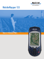
™
MobileMapper CX
Basic & Technical FAQ’s
Content
1.
2.
3.
4.
5.
6.
7.
8.
9.
10.
11.
12.
13.
14.
15.
16.
17.
18.
19.
20.
21.
22.
23.
24.
25.
26.
27.
28.
29.
30.
31.
32.
33.
34.
35.
36.
37.
38.
39.
40.
41.
42.
43.
44.
What is MobileMapper CX?.................................................................................................................................... 3
What is the difference between MobileMapper CX and MobileMapper CE?.......................................................... 3
What mobile mapping software comes with MobileMapper CX? ........................................................................... 3
Can I install other (mapping) programs on MobileMapper CX? ............................................................................. 3
Can I download and use a car navigation application to MobileMapper CX? ........................................................ 3
What is the MobileMapper CX’s processor speed?................................................................................................ 3
What type of screen does the MobileMapper CX use? .......................................................................................... 3
What is Windows CE .NET?................................................................................................................................... 4
Is the Windows CE operating system a special Magellan version or a Microsoft standard?.................................. 4
How do I know what version of the operating and GPS receiver firmware I am using? ......................................... 4
Does MobileMapper CX come with an official Microsoft license for Windows CE .NET? ...................................... 4
Will MobileMapper CX run Pocket PC applications?.............................................................................................. 4
What software is standard with MobileMapper CX?............................................................................................... 4
How do I reset MobileMapper CX and restore it to factory settings? ..................................................................... 5
I installed new software on my MobileMapper CX and now there is an icon on my Desktop labeled “Desktop.”
How can I remove this icon? .................................................................................................................................. 5
How can I display a raster image in MobileMapper CX?........................................................................................ 5
My receiver has stopped connecting to my PC via ActiveSync. What went wrong? .............................................. 5
What is Bluetooth? ................................................................................................................................................. 6
How many Bluetooth connections can I have at once?.......................................................................................... 6
Can I transfer files via Bluetooth to and from MobileMapper CX?.......................................................................... 6
Every time I turn on my MobileMapper CX, I see an error message saying: “Cannot find Bluetooth device.” What
should I do to cancel this message and how can I prevent its reappearance? ...................................................... 6
When I try to run Bluetooth Manager I get the following message “The adapter is installed but the stack is not
running”. What should I do to prevent it?................................................................................................................ 6
Can I use Wi-Fi on MobileMapper CX?.................................................................................................................. 6
When I plug the Wi-Fi USB? Accessory into the MobileMapper CX unit I am asked to enter the Driver Name.
What should I do?................................................................................................................................................... 7
Can I send or receive e-mails using MobileMapper CX? ....................................................................................... 7
How do I recharge my MobileMapper CX battery?................................................................................................. 7
How do I know that the battery is being recharged? .............................................................................................. 7
The recharge LED is flashing but my battery is not being recharged. What should I do?...................................... 7
What is the battery life?.......................................................................................................................................... 7
How long does it take to recharge a battery? ......................................................................................................... 8
How accurate is the battery meter?........................................................................................................................ 8
If I leave the MobileMapper CX attached to the charger, will it overcharge? ......................................................... 8
How much memory does the MobileMapper CX come with?................................................................................. 8
How do I confirm how much memory my MobileMapper CX has?......................................................................... 8
Why does MobileMapper CX display less RAM and flash memory than it from the actually has?......................... 8
Can I use a larger SD card?................................................................................................................................... 9
Can I attach a mass storage device to MobileMapper CX? ................................................................................... 9
What type of USB data sticks does MobileMapper CX support? ........................................................................... 9
Why does it take so long to load files from flash memory? .................................................................................... 9
How accurate is MobileMapper CX? ...................................................................................................................... 9
Can I post-process MobileMapper CX data?.......................................................................................................... 9
How do I set up the MobileMapper CX for real-time differential correction using SBAS (WAAS/EGNOS/MSAS)
signals? .................................................................................................................................................................. 9
Where do I have to be in order to use SBAS corrections? ................................................................................... 10
If the receiver is tracking more than one SBAS (WAAS/EGNOS/MSAS) satellite, does it use corrections from
both? If it uses corrections from only one, which signal is used?........................................................................ 10
Magellan Professional
13/11/2007
Page 1 of 14
45.
46.
47.
48.
49.
50.
51.
52.
53.
54.
55.
56.
57.
58.
59.
60.
61.
62.
Where does the MobileMapper CX display the identification number of the SBAS (WAAS/EGNOS/MSAS)
satellite being used for real-time differential correction? ...................................................................................... 10
Even though I have RTCM corrections coming into my MobileMapper CX via the I/O module’s COM1 port, I
don’t always get differentially corrected solutions. What can I do to fix this?....................................................... 10
What is the MobileMapper CX’s default logging interval? Can I change it?........................................................ 10
I haven’t written any files to My Documents and yet it still takes a long time to turn on the receiver. What should I
do?........................................................................................................................................................................ 11
I am not getting submeter accuracy for point features even though the PDOP is less than 4 and I’m tracking
more than five satellites. What might be wrong?.................................................................................................. 11
When I turn on the Mission Planning utility, I sometimes see error messages. What do these mean? ............... 11
What do the various fields on the Mission Planning utility's Time screen contain?.............................................. 12
When I first turn on my unit, it does not display the correct time. How can I fix this?........................................... 12
How do I set the time zone?................................................................................................................................. 13
Sometimes when I exit Mobile Mapping application the unit freezes. .................................................................. 13
What is the maximum SD card size that I can use with the Mobile Mapping application? ................................... 13
I experience some problems to download data files from the unit to the PC while using MobileMapper Transfer
(in MobileMapper Office) utility. What should I do?.............................................................................................. 13
What should I do if ArcPad desktop is not recognized? ....................................................................................... 13
How should I configure a COM port for ArcPad? ................................................................................................. 13
How can I import an ASCII file of features to a new layer in ArcPad?.................................................................. 13
How can I average GPS positions when recording a point feature in ArcPad?.................................................... 14
When I first activate the GPS receiver in ArcPad, I sometimes see a warning message saying the GPS positions
are coming in too fast. What should I do? ............................................................................................................ 14
Can I post process data recorded with ArcPad 7’s offset feature?....................................................................... 14
Magellan Professional
13/11/2007
Page 2 of 14
1. What is MobileMapper CX?
MobileMapper CX is a next generation handheld GIS mobile mapping device from Magellan.
MobileMapper CX offers sub-meter real-time and sub-foot post-processed GPS positioning and is
built to withstand extreme environmental conditions. An open platform design with embedded
Microsoft® Windows® CE .NET 5.0, MobileMapper CE supports off-the-shelf Windows CE
software for GIS and many other mobile mapping applications.
2. What is the difference between MobileMapper CX and MobileMapper CE?
The most visible difference is the physical lay-out: MobilerMapper CX has a different housing and
keypad, however keeps the same LCD display, I/O connections and rugedness characteristics.
Moreover, the MobileMapper CX operating system has been upgraded to Windows CE .NET 5.0
version while MobileMapper CE runs Windows CE .NET 4.2. MobileMapper CX supports
extended SD cards capacity (up to 4GB), provides compatibility to a specific Wi-Fi accessory.
Finally, MobileMapper CX platform will be compatible with our own Mobile Mapping (GIS)
application as well as larger choice of 3rd party applications.
3. What mobile mapping software comes with MobileMapper CX?
An open platform Windows CE device, MobileMapper CX allows you to choose the software that
is right for you. Our own Mobile Mapping application (the one used on MobileMapper Pro or
ProMark 3 devices) has been made compatible with MobileMapper CX and is proposed either in
a bundle with MobileMapper CX device or can be purchased separately. We are also working
with various Business Partners to provide turnkey mobile mapping solutions. These solutions are
listed and described on our internet web site.
4. Can I install other (mapping) programs on MobileMapper CX?
As it was the case with MobileMapper CE, MobileMapper CX is an open platform allowing to
install theoretically any Windows CE 5.0 based software, being mapping or not (e.g. can
navigation). Our internal web site provide a long list (but not exhaustive) or different 3rd party
applications that are compatible with our platform.
5. Can I download and use a car navigation application to MobileMapper CX?
If this car navigation application has been design for Windows CE 5.0 compatible products and
provides user interface in a portrait orientation, there is a chance that it could be used on
MobileMapper CX. Any car navigation application that has been tested and validated by us or our
Business Partners will be posted and described on our web site.
6. What is the MobileMapper CX’s processor speed?
When comparing processors, the traditional benchmark is MIPS (Million Instructions Per Second).
The MobileMapper CX operates at over 200 MIPS. This is equivalent to the Intel StrongARM chip
running at 206 MHz.
7. What type of screen does the MobileMapper CX use?
The MobileMapper CX uses a full color, daylight readable, transflective TFT display with 320 x
240 resolution, 262,144 colors and touch screen.
Magellan Professional
13/11/2007
Page 3 of 14
8. What is Windows CE .NET?
The MobileMapper CX operating system comprises Windows CE .NET 5.0 Pro. Windows CE is a
Microsoft Windows operating system designed for small devices such as personal digital
assistants (PDAs) or handheld PCs. The Windows CE graphical user interface (GUI) is very
similar to desktop Windows operating systems..
9. Is the Windows CE operating system a special Magellan version or a Microsoft
standard?
MobileMapper CX runs the standard version of Microsoft Windows CE .NET 4.2 Pro, but it
includes some Magellan tools (GPS utilities, Bluetooth manager, etc.) that ship only with the
MobileMapper CX.
10. How do I know what version of the operating and GPS receiver firmware I am
using?
Tap Start > Settings > Control Panel > Thales System Info. Go to the /Mobile Mapping/MM CX
Firmware/ folder of ftp.magellangps.com to make sure you are using the latest versions.
11. Does MobileMapper CX come with an official Microsoft license for Windows CE
.NET?
Yes. The official Microsoft license is seen on a small sticker fixed to the wall of the MobileMapper
CX battery compartment.
12. Will MobileMapper CX run Pocket PC applications?
In general, Pocket PC applications will not run on Windows CE .NET platforms such as
MobileMapper CX. Pocket PC applications are intended more for PDAs and rely on the Pocket
PC shell that overlies the Windows CE operating system. MobileMapper CX was designed to run
without the extra operating burden of the Pocket PC shell.
13. What software is standard with MobileMapper CX?
MobileMapper CX ships with the following applications (among others):
• GPS control tool set for real-time DGPS configuration, initialization, reset, settings, status
and mission planning
• Bluetooth Manager for configuring wireless connectivity
• Microsoft Internet Explorer®, Windows Explore, Terminal and WordPad
• Microsoft Inbox
• Microsoft Windows Media Player
Magellan Professional
13/11/2007
Page 4 of 14
14. How do I reset MobileMapper CX and restore it to factory settings?
To restore MobileMapper CX to its factory settings, please follow these steps:
1. Use Windows Explore on MobileMapper CX (double-tap the My Computer icon on the
desktop) to navigate to the MyDevice folder and back up any data files or applications
you wish to keep. If any applications you wish to reinstall require a registration ID code,
such as ESRI ArcPad, you should first run the application, open the About screen, write
down the code and store it with the application’s manual or CD case.
2. Use Explore to navigate to MobileMapper CX's Windows folder and double-tap the icon
for RestoreFactorySettings.exe.
3. Select the “Restore factory settings at next boot” option and tap OK.
4. Tap Yes on the warning screen (assuming you have backed up everything you wish to
reinstall).
5. Tap X to exit Windows Explore.
6. Simultaneously depress the Power, ESC and ENTER buttons on MobileMapper CX. This
will turn off the unit and reset various internal functions.
7. Turn the unit back on and follow the instructions for calibrating the stylus and display. If
you do not see these instructions but instead the unit boots normally, go back and repeat
steps 2 through 7 until you see the calibration screen.
8. Reinstall all the files and applications in the MyDevice directory.
15. I installed new software on my MobileMapper CX and now there is an icon on my
Desktop labeled “Desktop.” How can I remove this icon?
This icon relates to what Windows calls a "hidden” file. To remove this icon from your Desktop, do
the following:
• Tap the My Computer icon on the MMCX Desktop
• Tap View
• Tap Options
• Check the first check box to "Do not show hidden files and folders"
• It is recommended that you also check "Hide protected operating system files"
• Tap OK
16. How can I display a raster image in MobileMapper CX?
MobileMapper CX comes with Microsoft Image Viewer that allows you to display BMP, JPEG and
PNG files. To run it, tap Start > Programs > Microsoft File Viewers > Microsoft Image Viewer.
Some mapping applications will have to be turned off before Image Viewer will run. To test, copy
an image to the SD card and double-tab on it from Windows Explorer or My Computer. The
Image Viewer program and help file reside in the MobileMapper CX’s Windows folder.
In addition, most mapping applications available for MobileMapper CX will display raster images if
they are georeferenced.
17. My receiver has stopped connecting to my PC via ActiveSync. What went wrong?
It is possible that the USB cable has been damaged. To rule this out, check the PC Connection
Properties window to see that the settings have not changed. Tap the Start button and then
Settings > Control Panel > PC Connection. Make sure that the box saying “enable direct
connections to the desktop computer” is checked and that the connection will be made via the
USB cable.
Magellan Professional
13/11/2007
Page 5 of 14
18. What is Bluetooth?
Bluetooth wireless technology is an open specification for short-range wireless connectivity
between different devices. Bluetooth wireless technology eliminates cumbersome cables in the
field.
19. How many Bluetooth connections can I have at once?
MobileMapper CX supports point-to-multipoint connectivity, which allows up to seven mobile
devices to simultaneously connect when within range. For example, users may connect to
MobileMapper Beacon and receive differential correction messages while using a Bluetooth cell
phone to communicate externally via the Internet.
20. Can I transfer files via Bluetooth to and from MobileMapper CX?
MobileMapper CX can send files to and download files from any Bluetooth client device.
However, MobileMapper CX itself acts only as a host – not as a client. So MobileMapper CX can
initiate file transfer to and from cell phones and network servers, but not to or from another
MobileMapper CX.
21. Every time I turn on my MobileMapper CX, I see an error message saying: “Cannot
find Bluetooth device.” What should I do to cancel this message and how can I
prevent its reappearance?
You probably used the Bluetooth Manager to configure the MobileMapper CX to connect to a
Bluetooth device. And when you did this, you selected the "Auto Connect" option. Then, every
time you turn on MobileMapper CX, it automatically ties to connect to the designated Bluetooth
device. If the Bluetooth device is turned off, the receiver cannot find it and so returns this error
message. To make the message go away, you just have to tap the message screen’s OK button.
To make it go away permanently, tap OK and then open the DGPS Configuration utility (Start >
Programs > GPS Utilities > DGPS Configuration), tap Select Mode and check None or SBAS.
22. When I try to run Bluetooth Manager I get the following message “The adapter is
installed but the stack is not running”. What should I do to prevent it?
Most probably you have your Wi-Fi USB accessory plugged in. Remove this accessory from the
unit and try again to run the Bluetooth Manager.
23. Can I use Wi-Fi on MobileMapper CX?
Yes, MobileMapper CX has a specific Wi-Fi driver implemented into the operating system. This
driver provides compatibility to a Wi-Fi USB accessory from US Robotics (ref nr USB805421).
This is the only Wi-Fi accessory that can be used with MobileMapper CX. For more details,
please see MMCX Getting Started Guide.
However, we recommend to unplug the US Robotics WiFi key before shutting down the
MobileMapper CX (as some US Robotics WiFi keys can become unoperational during the shut
down of the unit).
Magellan Professional
13/11/2007
Page 6 of 14
24. When I plug the Wi-Fi USB? Accessory into the MobileMapper CX unit I am asked
to enter the Driver Name. What should I do?
You should reboot the unit and then use the Wi-Fi accessory (keep the accessory plugged into
the unit while rebooting). Most probably the Bluetooth Manager was previously used, which is
causing the issue with the Wi-Fi accessory detection. We recommend not using both types of
connection during the same session.
25. Can I send or receive e-mails using MobileMapper CX?
Yes, MobileMapper CX provides an e-mail client called Inbox (tap Start > Programs > Inbox). You
can configure this application with your ISP Host information, e-mail address, etc. Contact your
ISP provider for these parameters. The Inbox utility also allows you to attach files to your e-mails,
e.g., a file containing collected data. Note: in order to sent or receive e-mails you must first
connect the MMCX to the Internet using the MMCX’s Bluetooth Manager and a Bluetoothenabled cell phone. See the MMCX Getting Started Guide for detailed instructions on how to do
this.
26. How do I recharge my MobileMapper CX battery?
Attach the MobileMapper CX I/O module to the back of the receiver and plug the battery charger
into the connector on the left side. Either turn the MobileMapper CX on or put it into Full Shut
Down Mode. To do this, tap Start > Suspend > Full Shut Down Mode and tap OK. Note: if you
do not see Full Shut Down Mode when you tap Suspend, you are using an older version of
MobileMapper CX firmware and the battery will NOT recharge when the receiver is in Suspend or
“Shut down but keep GPS alive” modes. Go to ftp.magellangps.com and download the latest
firmware from the /Mobile Mapping/MM CX/Firmware/ folder. Installation instructions are in the
same folder.
27. How do I know that the battery is being recharged?
When the receiver and battery charger are both attached to the I/O module and the receiver is on,
the recharge LED (beneath the ON/OFF LED) flashes. When the battery is fully recharged, the
recharge LED stays on. If the receiver is in Full Shut Down Mode, the LED will not flash during
recharge, but the battery is being recharged or is fully charged.
28. The recharge LED is flashing but my battery is not being recharged. What should I
do?
If your battery does not recharge even the receiver is attached to wall current and is not in
Suspend Mode, the most likely problem is with the contact strips inside the battery compartment.
Remove the battery and make sure the contact strips protrude sufficiently from the wall of the
battery compartment as to make full, tight contact with the contacts on the battery. You can bend
the contact strips away from the battery compartment wall by gently using a small screwdriver. If
the battery still will not charge, contact Magellan Professional Technical Support.
29. What is the battery life?
MobileMapper CX’s removable, rechargeable lithium-ion battery provides eight hours of runtime
with GPS. Additional batteries may be carried for convenient replacement.
Magellan Professional
13/11/2007
Page 7 of 14
30. How long does it take to recharge a battery?
Approximately six hours for a fully discharged battery. You can see the amount of charge as a
percentage of total charge by tapping the Start icon and then Settings > Control Panel. Then
double-tap the Power icon.
31. How accurate is the battery meter?
Accuracy is around 10%, so to be conservative subtract 10 from the displayed percentage and
multiply this by 500 minutes (approximately 8 hours of operation at 20ºC/70ºF when fully
charged).
32. If I leave the MobileMapper CX attached to the charger, will it overcharge?
No. When the battery is fully charged, the recharging unit goes on “trickle mode” and will not
overcharge the battery. However, it is better for the battery if you do not leave the unit on the
charger for long term storage. When storing the MobileMapper CX, it is a good idea to refresh the
battery every month or two by charging the unit overnight.
33. How much memory does the MobileMapper CX come with?
The MobileMapper CX comes with three types of memory:
A. RAM stands for Random Access Memory. It is very fast but “volatile” in that any program or
data stored in RAM disappears when the computer is turned off.
B. Flash memory is stored on an EEPROM (Electrically Erasable, Programmable Read Only
Memory) where the programs are permanent but upgradeable.
C. SD (Secure Digital) cards are flash memory cards that are very small and user-replaceable.
MMCX models include 128 MB RAM, 128 MB flash memory and a 512 MB SD card.
34. How do I confirm how much memory my MobileMapper CX has?
A. To check RAM memory, tap Start > Settings > Control Panel > System. You will see a
memory field near the bottom of the “General” tab.
B. To check the flash memory, tap Start > Settings > Control Panel > Storage Manager and
select USER MyDevice in the Store Info field. The remaining memory is displayed in the
Capacity field.
C. To check the remaining memory on the SD card, tap My Computer on the Desktop,
navigate to the SD card, hold the stylus down on any blank space and select Properties on
the popup option screen.
35. Why does MobileMapper CX display less RAM and flash memory than it from the
actually has?
As with all computers, some of both the RAM and flash memory is used by the MMCX’s firmware.
MobileMapper CX firmware consists of two components: a 24 MB operating system and an 8 MB
“rescue image” (that is used in case the operating system is ever damaged). The operating
system resides in the flash memory and is copied to the RAM memory when you turn the device
on. The rescue image stays in flash, unless it is ever needed.
A. The amount of available RAM memory displayed by the System screen is 128 – 24 ≈ 104
MB.
B. The flash memory displayed by the Storage Manager is 128 – (24 + 8) ≈ 96 MB (for all
units).
Magellan Professional
13/11/2007
Page 8 of 14
36. Can I use a larger SD card?
You may expand the SD card memory by inserting new cards or by using cards with greater
memory. Up to 4 GB may be used with possible limitations (depending on the SD card
manufacturer and the application interacting with the SD card, e.g. our Mobile Mapping
application cannot ready 4 GB SD cards). Note: SDHC cards are not supported!
37. Can I attach a mass storage device to MobileMapper CX?
Yes, you can attach any mass storage device that has a USB connection. When you insert most
USB storage devices into MobileMapper CX’s I/O module, they appear in Windows Explore as
“Hard Disk”.
We recommend to unplug the USB key before shutting down the MobileMapper CX.
38. What type of USB data sticks does MobileMapper CX support?
MobileMapper CX supports USB 1.2 but not version 2.0. Some USB 2.0 devices also support
version 1.2, but not all.
39. Why does it take so long to load files from flash memory?
Non-volatile memory on MobileMapper CX resides in the receiver’s My Device directory and on
its SD card. However, many programs install files/data on either the Windows or My Documents
directory. In order to preserve these files, MobileMapper CX backs up these two directories every
time you power off the unit. If there are significant amounts of data in these directories, the
MobileMapper CX’s operating system takes a while to load when you turn the receiver on.
40. How accurate is MobileMapper CX?
MobileMapper CX provides real-time, sub-meter accuracy through DGPS corrections. The
optional MobileMapper Beacon receiver provides beacon corrections to MobileMapper CX via
Bluetooth technology. Note: Sub-meter performance is subject to satellite and environmental
conditions. See the MobileMapper CX datasheet for details.
41. Can I post-process MobileMapper CX data?
Yes. Some data logging applications running on MobileMapper CX record GPS measurements
that can be post-processed by MobileMapper Office.
42. How do I set up the MobileMapper CX for real-time differential correction using
SBAS (WAAS/EGNOS/MSAS) signals?
Run the DGPS Configuration program (tap Start>Programs>GPS Utilities>DPGS
Configuration > Select Mode > SBAS and tap OK. With the receiver set to None (autonomous
mode), Beacon (MobileMapper Beacon) or Other RTCM Source, the MobileMapper CX will not
use SBAS corrections even if it receives them.
Magellan Professional
13/11/2007
Page 9 of 14
43. Where do I have to be in order to use SBAS corrections?
You should use SBAS signals only if you are in North America or the Northern Pacific (WAAS),
Europe (EGNOS) or Japan (MSAS). Although you may pick up SBAS signals outside of these
areas, the corrections are calculated using ground stations only in these areas. The farther away
from these areas your receiver is, the more error you may be introducing to your position
calculations.
44. If the receiver is tracking more than one SBAS (WAAS/EGNOS/MSAS) satellite,
does it use corrections from both? If it uses corrections from only one, which
signal is used?
If the receiver tracks two WAAS/EGNOS satellite, it will generate ionospheric corrections using
data from both satellites. The "fast and slow" corrections are calculated using information from
only the satellite with the greatest signal strength.
45. Where does the MobileMapper CX display the identification number of the SBAS
(WAAS/EGNOS/MSAS) satellite being used for real-time differential correction?
The GPS Status application's Sig/Nav screen displays a status bar for each GPS and each
SBAS satellite being tracked. The bars are labeled with the individual satellites’signal-to-noise
ratio and they are color-coded. The status bars of GPS satellites that are being tracked but not
used to calculate a position are colored gray. When a GPS satellite is being used to calculate a
position, its bar’s color turns to blue. To differentiate them from the GPS satellites, the SBAS
satellites’s status bars are always colored gray and are displayed on the far right of the screen.
All satellite status bars are numbered with two-digit ID numbers of the satellites. WAAS satellites
are identified with the numbers 35, 47, 48 and 51. The four EGNOS satellites are identified with
the numbers 33, 37, 39 and 44. If you are tracking more than one SBASsatellite, the receiver will
use corrections from the satellite with the strongest signal.
46. Even though I have RTCM corrections coming into my MobileMapper CX via the I/O
module’s COM1 port, I don’t always get differentially corrected solutions. What can
I do to fix this?
If you think that your MobileMapper CX is sporadically using RTCM corrections coming in on the
COM1 port, do the following:
• Turn on the DGPS Configuration utility (tap Start > Programs > GPS Utilities > DGPS
Configuration)
• Tap Select Mode > Other RTCM Source > OK
• Select COM1 in the Port selection field
• Tap Configuration to ensure the MobileMapper CX and the RTCM source are using the
same communication parameters. Then tap OK on the Port Configuration screen.
• Tap OK on the DGPS Configuration Settings screen
• Tap Connect on the DGPS Configuration screen and then OK
• Turn on the GPS Status utility (Start > Programs > GPS Utilities > GPS Status) and
make sure you see “Differential GPS” in the lower left of the GPS Status window
47. What is the MobileMapper CX’s default logging interval? Can I change it?
It is not possible to change the one-second default setting for the logging interval or the NMEA
output interval in MobileMapper CX. Some mapping applications running on the unit allow you to
set a logging interval that is greater than 1 second.
Magellan Professional
13/11/2007
Page 10 of 14
48. I haven’t written any files to My Documents and yet it still takes a long time to turn
on the receiver. What should I do?
If you installed the sample data when you installed ESRI™ ArcPad™ application, these files are
placed in the My Document folder by default. To decrease the boot time when turning on
MobileMapper CX, you can either move the sample files to My Device directory or put them on
the SD card.
49. I am not getting submeter accuracy for point features even though the PDOP is
less than 4 and I’m tracking more than five satellites. What might be wrong?
If you are not getting submeter accuracy, you should first check to see that you are actually using
real-time SBAS (WAAS/EGNOS/MSAS) or beacon corrections. MobileMapper CX provides
submeter accuracy with SBAS or beacon signals while tracking > 5 satellites with a PDOP < 4.
MobileMapper CX includes an integrated SBAS (WAAS/EGNOSMSAS) receiver and you can
attach a MobileMapper Beacon or other beacon receiver via a serial cable or a Bluetooth link. In
addition, MobileMapper CX Network Generation firmware supports Internet corrections via a
cellular phone link.
To turn on real-time corrections, tap Start > Programs > GPS Utilities >DGPS
Configuration > Select Mode > SBAS > OK. If you do this and still do not get the accuracy you
expect, environmental factors might be degrading performance. MobileMapper CX includes a
multipath-resistant antenna and multipath rejection firmware, but other factors such as strong
radar signals near airports or harbors. There is little that can be done to reduce the effects of
such strong electromagnetic interference. But no matter where you are, the internal antenna
works best when held at a 45-degree angle. When you do this, the antenna's ground plane is
horizontal which reduces multipath and allows the antenna to see more of the sky.
You can significantly improve accuracy by averaging data over several seconds. Thirty
seconds is often about the amount of time it takes to describe a point feature with an average
number of attributes. If you are using ArcPad, you can set the amount of time the receiver will
average data over a point position by doing the following:
Tap the down arrow to the right of the GPS Position Window icon and select tap the down arrow
to the right of the GPS Position Window icon and select GPS Preferences from the pull down
menu. Check Enabling Averaging on the Capture tab and input the number of positions you
wish to average at each point feature. MobileMapper CX outputs a GPS position every second.
Averaging for 30-60 seconds is a general, though not required, practice. Remember that you
must stay stationary for this number of seconds when over point features. If you move during
averaging, you will degrade accuracy, perhaps significantly. If you find that it takes you only 20
seconds to describe a point feature instead of 30, you can go back to this screen and reset the
number to 20.
50. When I turn on the Mission Planning utility, I sometimes see error messages. What
do these mean?
The Mission Planning utility displays the PDOP and satellite availability during a user-defined time
period. To do this the utility needs to know three things: where the GPS satellites are located in
the sky, your location and the current time. If it doesn’t have one or more of these, the utility will
return one or more error messages.
1. The location of all GPS satellites is broadcast continuously by all GPS satellites in a file
called the GPS almanac. It takes approximately 13 minutes to broadcast a complete
almanac. If the almanac stored in the receiver’s memory is more than 90 days old you will
see the following message: Almanac is old. You can record a new almanac by turning
off the Mission Planning program and tracking at least one GPS satellite for 13 minutes. If
this error message persists after you reopen the Mission Planning utility, or if you see an
error message saying Error receiving GPS almanac data, tap OK on the error
Magellan Professional
13/11/2007
Page 11 of 14
message, turn off the utility and copy an almanac file from the Almanacs folder of
ftp.magellangps.com to the MMCX’s Windows folder.
2. If you are not tracking enough satellites to determine your location, the Mission Planning
utility returns the following error message: Error receiving GPS current position. Tap
OK on the error message, tap the Location icon (a triangle in a circle) and enter your
coordinates manually. (By default, your last coordinates are displayed.) You can also turn
off the utility and go to a place where the receiver can track enough satellites to calculate
a position.
3. If you are tracking at least one GPS satellite when you run the utility, the MMCX knows
the current time from the satellite’s broadcast. But if you are located where you cannot
track any satellites, the receiver says: Error receiving GPS current position. Tap OK
on the error message, tap the Location icon (a triangle in a circle) and enter your
coordinates manually. (By default, your last coordinates are displayed.) You can also turn
off the utility and go to a place where the receiver can track enough satellites to calculate
a position.
51. What do the various fields on the Mission Planning utility's Time screen contain?
The Time screen allows you to set the current time and the time span to display in the PDOP and
satellite availability graph. You set the time with the following five fields:
Current Date:
Today’s Date in local time, with local time being set in the “local Time –
GMT” field. The Current Date field is automatically populated if you are
tracking at least one GPS satellite when you launch the Mission Planning
utility. You can also manually select the date by tapping the field’s down
arrow and using a calendar.
Current Time:
The Current Time field automatically displays local time if you are tracking
at least one GPS satellite when you launch the Mission Planning utility and
have selected your time zone in the Local Time-GMT field. If you are not
tracking a satellite, you may manually input the time using the field’s
up/down arrows.
Begin Time:
Start time of the PDOP and satellite availability graph corresponding to the
Local time as defined in the field "Local Time - GMT"
End Time:
End time of the PDOP and satellite availability graph corresponding to the
Local time as defined in the field "Local Time - GMT"
Local Time-GMT:
This allows you to enter your time zone in order to define local time. For
example, if you are in the Eastern Standard Time zone (GMT-5), tap the
field’s down button until the time field reads: - 5. If you are in Western
Europe (GMT+1), tap the up button until the time field reads: +1.
Note: there is a defect in the Mission Planning Time window such that some of the up/down
arrows may appear grayed out (i.e., inactive). You may ignore this as all of the buttons are always
active.
52. When I first turn on my unit, it does not display the correct time. How can I fix this?
Windows CE devices keep the current date and time in volatile memory. With most PDAs, you
cannot fully shut down the units and so leaving information in volatile memory is not a problem.
But to increase battery life in mobile mapping devices, it is recommended to fully shut down the
unit when it is not in use. Every time you reboot your receiver, MobileMapper CX will
automatically update the system date & time using (1) the GPS time broadcast by all GPS
satellites and (2) the time zone that you specify.
Magellan Professional
13/11/2007
Page 12 of 14
53. How do I set the time zone?
•
•
•
•
•
In the task bar, double-tap the clock icon to open the Date/Time Properties screen.
Set the year, month and date on the calendar
Set the time zone in the time zone field.
To automatically adjust the time for daylight saving, check the box at the bottom
Tap the Apply button and then OK on top of the screen.
After you tap OK – and every time you turn on MobileMapper CX - it will automatically set the
correct time a few seconds after it first tracks a GPS satellite.
54. Sometimes when I exit Mobile Mapping application the unit freezes.
In order to avoid to freeze the Mobile Mapping application while exiting, do not exit this program
during at least 5 second after having launch the application (minimum time necessary to load the
map). You can also check if the map is loaded in the map screen.
55. What is the maximum SD card size that I can use with the Mobile Mapping
application?
We recommend not using SD cards larger than 2 GB for Mobile Mapping job storage. 4 GB SD
cards are not properly handled by the application and some jobs may not be stored correctly.
56. I experience some problems to download data files from the unit to the PC while
using MobileMapper Transfer (in MobileMapper Office) utility. What should I do?
MobileMapper Transfer (GPS Device via Cable option) will work properly only with the serial
cable. If you have an USB cable then you should use the ActiveSync for your files transfer.
Alternatively an SD card can be used as well.
57. What should I do if ArcPad desktop is not recognized?
When you install ArcPad from your Desktop PC, the default location is in Main Memory, which is
a volatile memory folder. Please re-install ArcPad in MyDevice ignoring the “ArcPad already
exists” warning message. There is a tech note with detailed instructions for installing ArcPad on
your MobileMapper CX at ftp.magellangps.com. You should reboot the MobileMapper CX after
installing any new applications, including ArcPad.
58. How should I configure a COM port for ArcPad?
Once you install ArcPad on your MobileMapper CX device, tap the down arrow to the right of the
GPS Position Window icon and select GPS Preferences from the pull down menu. On the Port
field of the GPS tab, select COM2:GPS NMEA and a Baud rate of 57600. You need to do this
only the first time you use ArcPad. These settings will be remembered until you wish to
reconfigure the COM port. There is a tech note with detailed instructions for configuring and
logging GIS features using ArcPad on your MobileMapper CX (Installing and Using ArcPad 7 on
MMCX).
59. How can I import an ASCII file of features to a new layer in ArcPad?
Import the ASCII files into ArcGIS and then use its ArcPad tool to export shapefiles.
Magellan Professional
13/11/2007
Page 13 of 14
60. How can I average GPS positions when recording a point feature in ArcPad?
Tap the down arrow to the right of the GPS Position Window icon and select tap the down arrow
to the right of the GPS Position Window icon and select GPS Preferences from the pull down
menu. Check Enabling Averaging on the Capture tab and input the number of positions you
wish to average at each point feature. MobileMapper CX outputs a GPS position every second.
Averaging for 30-60 seconds is a general, though not required, practice.
61. When I first activate the GPS receiver in ArcPad, I sometimes see a warning
message saying the GPS positions are coming in too fast. What should I do?
The complete text for this ArcPad message is: "The rate of incoming GPS positions exceeds the
rate of processing of your system. This could lead to potential data loss." You may ignore this
message. When you first turn on the MobileMapper CX, it begins calculating GPS positions as
soon as it can. By the time you launch ArcPad and tell it to accept positions from the GPS
receiver, many positions have been stored in a buffer. All these positions are sent to ArcPad at
once and the initial volume of positions can exceed ArcPad’s ability to receive them all. But you
do not need these positions because they were calculated before you activated the GPS receiver
in ArcPad. After GPS activation, all positions are calculated at a rate of once per second – a rate
easily handled by ArcPad.
62. Can I post process data recorded with ArcPad 7’s offset feature?
It is not possible to do this at this time. We hope to support ArcPad's offset feature with a future
release of GPSDifferential for ArcPad.
Magellan Professional
13/11/2007
Page 14 of 14