1
Reap the benefits of scouting
crops from above
If precision technology has driven the farming revolution of
recent years, monitoring crops from the sky will drive the next.
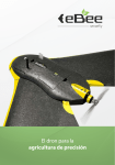
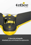
With a drone or UAV you can capture highly accurate images
of your fields, covering hundreds of hectares/acres in a single
flight. Without the cost and hassle of manned services. And at
a greater resolution than satellite imagery typically provides.
By using image processing software you can then transform
these shots into one large ‘orthomosaic’ image. Apply
algorithms like Normalized Difference Vegetation Index (NDVI)
to this and you create a reflectance map of your crop.
This map is the key to boosting yields, cutting costs, and
driving your business forwards. It highlights exactly which
areas of crop need closer examination – for less time spent
scouting, and more time treating the plants that need it.