1
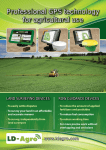
Professional GPS technology
for agricultural use
GPS Landsurveying devices
To easily settle disputes
To survey your land in an affordable and accurate manner
For landcontrol of wageworks
For walking and vehicle use
GPS Lineguidance devices
For more precise work without overlapping and omissions
Help at bad visibility conditions
4-7% input and fuel saving
System easy to develop
Automatic steering
utilisation from seeding till harvesting
It results preciser achievment of works
concrete immediate saving
+/- 2 cm accuracy through 24 hours
removes the burden of the tractor driver
www.ldagro.com
GPS Landsurveyors
LD-Agro - GPS Mapper
Would you like to survey your land by yourself easily, quickly and affordably?
Choose the GPS Mapper!
GPS Landsurveyors
LD-Agro - Precision Mapper
Beside of landsurveying would you like to measure point, line or area?
Choose Precision Mapper the area control device of agricultural plants!
Landsurveying accuracy ~ 1%
Accuracy of
landsurveying < 0,5%
Point recording accuracy 2-3 m
Point recording
accuracy < 1 m
Correction signal
Coordinate systems
Correction signal
Free satellite signals
Coordinate system
Built in GPS
Free satellite signals
Map in KML format
Bluetooth
Map in KML format
Advantages of the GPS Mapper:
No more boundary disputes with your neighbour, and you can check the actual dimensions of the seasonal works
area. The problem of recording of landmarks and corner points is solved. It is suitable for surveying, recording different fields, and optional points as well for example: wildlife damage, bottomland area, soil sampling points, strong
weed, brooding area, ditches, tree rows etc. You can use it for surveying your land while walking or driving too.
Accessories:
5” GPS Mapper device / surveying software (on 2GB SD Card) / User’s Guide / car holder / car charger
Advantages of Precision Mapper:
The Precision Mapper is an excellent device at your service which can be
used to survey and locate the dimensions of the land, area sections, line sor
soil sampling points.
Free LD-Agro MAP
software!
GPS connection without cable:
LD-Agro - GEO Mapper
Precision Mapper is connected to the GPS-receiver
via Bluetooth and so in the off-road vehicle or on the
trunk the communication is excellent and you can
survey your land comfortably.
Do not you want to wait for the surveyors? Do you look for an accurate land surveying
device? Then the GEO Mapper with backpack with GPS is the ideal solution!
IP54 water- and shockresistance:
You can not wait with surveying a land with wildlife
damage or highwater. The Precision Mapper landsurveying GPS device you can use in rain, ditch and dirt
too thanks to its IP54 design. Dust, rain, dirt – it is not
obstacle for Precision Mapper.
Land surveying accuracy ~ 0,5-1%
Point recording accuracy < 1,5 m
Correction signal
Coordinate system
AreaControl Software:
Free satellite signals
The menu points in LD-Agro Precision Mapper software speak for themselves. Landsurveying is very
simple, you have to walk or drive only along the area
or the line to be surveyed and the device continouosly records the covered distance. The data from the
Precision Data Mapper landsurveying GPS can be
copied into your computer in shape- or KML format.
Wire GPS connection
Map in KML format
The advantages of GEO Mapper:
Recording points, boundaries and area sections. A handled computer that can be used independently (car navigation, MP3-MP4 player etc). Thanks to the GEOX1 receiver built in the backpack it is suitable for searching and
recording the corner points of the land. Thanks to the backpack design the GEOX1 receiver in high position gives
an accurate position also at difficult field conditions for example if you shall measure the land near to buildings or
among hills or at fring of forest.
Accessories:
5” GEO Mapper device, PocketArea landsurveying software on 2GB SD Card / User’s Manual / carcharger / GPS
backpack (built-in electronic, LD-Agro GEOX1 GPS receiver, battery)
1
Accessories:
3,2” LD-Agro Precision Mapper device / AreaControl software on 2GB SD card
/ User’s Manual / carcharger / GPS backpack (built-in electronic, bluetooth
receiver, LD-Agro GEOX4 GPS receiver, battery)
www.ldagro.com
2
GPS Lineguidance devices
LD-Agro - Mg Navigator V1
Do you look for an affordable GPS lineguidance device with large
display? In the Mg Navigator V1 you will find it.
GPS Lineguidance devices
LD-Agro - Mg Navigátor V2
Do you want to acquire the basics of precision farming?
Choose this affordable yet powerful and precise GPS row guidance!
18 cm touchscreen monitor 800x400
resolution
18 cm Touchscreen monitor
Land surveying, hectare
calculation, speed display
Land surveying, continuation of interrupted work,
speed display, hectare calculation
0-30 cm pass to pass accuracy
in 94% of the cases
0-25 cm pass to pass accuracy in 95 % of
the cases
One signal refreshing per
second
Calculates the position 4X a second, displays the
number of satellites and the strength of the signal
free EGNOS correction
EGNOS, GALILEO ready, e-DIF correction,
HDOP value adjustment
2D/3D graphic display
Storage of work data and work
report in the device
2D/3D graphic display
Sectioning display : spraying, fertilizing a
nd seeding
The data can be viewed
on PC
Records and notifies obstacles and field boundaries
Stores work details and reports
Reachable savings:
Strongly built and stable fixing on the dashboard
•
•
•
•
The data can be viewed on PC with the Google
Earth Map software
Fertilizing without overlapping – 4% less fertilizer
There are no omissions at fertilizing – 0,2% more output
Pest control without overlapping – 4% less chemicals
There are no lands without handling, no weedy areas – 0,2%
more output
• Fuel costs – 4% saving
The advantages of Mg Navigator V1 device:
Satisfactory work performance in fog or dark or even in dust cloud. It makes the job of the driver significantly easier
so overlapping and omissions can be minimized. It is very simple to operate its use can be acquired from the user
manual quickly. The machine can be mounted in 5 minutes or re-mounted into another vehicle.
By using row guidance device adjusting to straight or curved reference lines you can always stay on the optional
trace this way decreasing the overlapping and omissions to a minimum. With the help of this GPS row guidance
device you can decrease both machine costs and working hours. Complete more work in less time!
You can always stay on the right track with the LD-Agro Mg Navigator V1 agricultural
GPS!
During field works carried out without tramlines overlapping is always on the agenda and it can cause considerable
losses: this results on average 7% more surplus fertilizers and pesticides applied higher machine costs and more
working hours. Now all of these can be easily avoided by using LD-Agro Mg Navigator V1 GPS row guidance. Reduce
overlapping between rows. No more unnecessary applied fertilizers and pesticides.
Reachable savings:
• Fertilizing without overlapping –
5% less fertilizer
• There are no omissions at fertilizing – 0,3% more output
• Pest control without overlapping –
5% less chemicals
• There are no lands without handling, no weedy areas – 0,3% more
output
• Fuel costs – 5% saving
The advantages of the Mg Navigator V2 device:
Use the Mg Navigator V2 device for avoiding overlapping and omissions at spraying and fertilizing. Work precise
during hard weather conditions in the night, fog or dust cload. The Mg Navigator V2 device is able to display the
boundaries and the obstacles on the land. It is easy to re-mount the device and it has simple-to-use menu points for
everybody.
Sectioning display:
You can start precision farming right away with the sectioning helping function. Do not look at the weedy rows anymore on your land avoid the double spraying and omissions! Spray chemicals only where it is neccessary!
The box contains:
The content of the box:
LD-Agro Mg Navigator V1 / LD-Agro GeoX1 GPS receiver / stable holdarm / 12V charging cable / User’s manual / Mg
Navigator V1 row guidance software on 2GB SD Card / gift LD-Agro MAP software (downloadable)
LD-Agro Mg Navigator V2 / LD-Agro GeoX4 GPS receiver / stable holdarm on dashboard / 12V charging cable / User’s
manual / Mg Navigator V2 row guidance software on 2GB SD Card / gift LD-Agro MAP software (downloadable)
3
www.ldagro.com
4
GPS Lineguidance devices
LD-Agro - Line Guide 300
Are you worried for the accuracy? The Leica trademark is one of the best known in the geographic informatics! With a Leica GPS receiver you can forget about the sudden signal losses!
18 cm touchscreen monitor 800x400 resolution
Land surveying, continuation of interrupted
work, speed display, hectare calculation
0-20 cm pass to pass accuracy in 97 %
of the cases
Calculates the position 5X a second, geographic
informatic GPS receiver
EGNOS, GALILEO ready, e-DIF correction, HDOP
value adjustment
2D/3D graphic display
Sectioning display : at spraying, fertilizing
and seeding
Records and notifies obstacles and field boundaries
Stores work details and reports
Strongly built and stable fixing on the
dashboard
The works achieved, omissions and overlappings
can be viewed on PC with the Google Earth Map
software
Advantages of the LineGuide
300 device:
The LineGuide 300 lineguidance device
with the Leica GeoSpective 2 GPS receiver provides very high level of accuracy
among hard land conditions (edge of the
forest, high building, hilly area). The receiver can optionally receive the signals of
the Russian Glonass signals and it is able
for 10 Hz mode (10 signals per second). In
this way the device can function with high
accuracy when it does not use services
with monthly fee. The possibility of improving the LineGuide 300 device is impressive it is compatible with all of the types of
automatic steering in favour of the more
profitable and cost-saving farming.
The content of the box:
Reachable savings:
LD-Agro - LineGuide 800
The most accurate row connection and guidance even at turning points and along
curved lines. It is possible only with 10 Hz John Deere GPS receiver!
20 cm touchscreen monitor, 800x400
resolution
Area measuring, continuation of work
interrupted, speed display, calculation
of hectare, omissions and overlapping
0-20 cm pass to pass accuracy
in 97 % of the cases
geographic informatic GPS receiver,
it receives signals 10 times a second
Free satellite signals
2D/3D graphic display
Sectioning display: spraying,
fertilizing and seeding
Recording and notifying obstacles
and field boundaries
Storage of the work data and report
in the device
Stable fixing on the dashboard
You can monitor the dimensions of
the field, the work completed and the
overlapping/omissions
Guidance modes:
• Fertilizing without overlapping – 7% less fertilizer
• There are no omissions at fertilizing
– 0,6% more output
• Pest control without overlapping
– 7% less chemicals
• There are no lands without
handling, no weedy areas
– 0,6% more output
• Fuel saving – 7%
LD-Agro LineGuide 300 / Leica GeoSpective 2 GPS receiver / stable holdarm on dashboard / 12V charging cable / User’s manual /
LineGuide 300 row guidance software on 2GB SD Card / free of
charge LD-Agro MAP software (downloadable)
5
GPS Lineguidance devices
Advantages of the LineGuide 800 device:
The 20 cm diameter of the device provides good visibility for all people. Thanks to the 10 Hz signal refreshing of the
John Deere GPS receiver you can use the device confidently also at the turning points. With its outstanding accuracy,
easy re-mounting, weather-independent utilisation this device is the best lineguidance in our assortment. Due to the
possibilities of further development it brings near the real essence of the precision farming the cost effective working
to everybody.
The content of the box:
LD-Agro LineGuide 800 / John Deere Starfire 300 GPS receiver / stable fixing element on dashboard / 12V charging
cable / User’s Manual / LineGuide 800 lineguidance software on 2 GB SD Card / free of charge LD-Agro MAP software
(downloadable)
www.ldagro.com
6
Automatic steering, robotpilot
LD-Agro - UniDrive - the universal steering automatic
Would you like to farm each day bigger land? Would you decrease the costs with
accurate working? Then choose the LD-Agro automatic steering!
•
•
•
•
•
•
•
Universal, you can mount to almost every machine
It is easy to re-mount to another machine
It stores the shape of the earlier lands
Optional – also with +/- 2 cm accuracy
Mounting without replacing the original steering wheel
Non-skidding design
Adjustable with wheelangle sensor
Advantages of the device:
The tractors, combines and self-propelling sprayers run with +/- 2 cm accuracy without human intervention on straight and curve lines. The Uni-Drive
results more precise working and relieve the tractor driver who can deal with
the quality of working. With automatic steering it does not matter what time of
the day is or what types of visibility are during 24 hours of the day continuously
precise and cost-effective achievment of the works. With using the UniDrive in
case of the seeded plants the distance of the tramlines can be perfectly accurate.
Easy to remount:
Use the biggest advantage of the UniDrive system! The unique split gear design allows for ast installation and
switching between vehicles. So you can use the precise automatic steering at the most necessary workprocess.
LD-Agro inclination angle compensation
The built-in compass, the gyroscope and the acceleration meter in unique way corrects
the inclination angle (inclination, pitching, snaking, side inclination) and increases the
accuracy.
LD-Agro wheelangle sensor
For increasing the accuracy on a unique way on the market it is possible to order the
UniDrive with a wheel-angle sensor which gives and additional input for the accurate
steering.
„LD-Agro – if the accurate GPS signal is worth for you”
Optional accuracy for automatic steering:
LD-Agro GeoD10 GPS receiver
0-20 cm accuracy
(free of charge EGNOS
correction signals)
7
LD-Agro GeoD20 GPS receiver
±2 cm accuracy (RTK
basestation or NTRIP
provider’s correction
signals)
Automatic steering, robotpilot
LD-Agro Robotpilóta - hydraulic steering
You shall reach the most direct and accurate steering even if you have a steerready tractor or you need an additional hydraulic mounting!
• It is possible to use from seeding through the inter-row cultivation
till the harvest
• Concrete immediate saving and more output
• +/- 2 cm accuracy through 24 hours
• Direct and immediate steering
• For hydraulicly steerready tractors
• With additional mounting of the hydraulic controlvalve
• Compatible with the earlier LD-Agro linguidance units
Advantages of the device:
With hydraulic steering control it is possible to reach more accurate working and significant seed-corn-, chemicaland fertilizer-saving. The robotpilot system increases the efficiency, decreases the fatigue of the driver, the amortisation of the machine and furthermore during 24 hours a day with +/- 2 cm accuracy provides the precision farming.
Thanks to the hydraulic steering control this is the most accurate steering solution. Thanks to the quick reaction on
hilly areas and at such workprocesses it is applicable too where the powermachine can slip.
Do you have a steerready tractor? You shall use your existing units
confortably, precisely and more economically!
Extend your tractor now with automatic steering!
GPS accuracy guaranted!
The system works with 0-20 cm accuracy with the free of charge EGNOS signals but in this case the biggest
advantage of the hydraulic direct steering the outstanding accuracy will be lost. That is why we suggest the +/- 2
cm accuracy Geo20 GPS receiver using the RTK correction signal! ATTENTION! At LD-Agro company the quality is
highly important that is why we have measured the accuracy we guarantee in all of the cases at the wheel of the
tractor on the earth and we do not state the optimal accuracy at the GPS receiver!
„LD-Agro – the guarantee of the reliable GPS signal!”
LD-Agro SteerReady Drive
LD-Agro Hydraulic Drive
It contains those steerready vehicles which have
factory made steering valve, wheelangle sensor
and sensor for manual correction. The LD-Agro ECU
central control unit achieves the precise control of
the existing units and the processing of the GPS
signals and compensation of inclination angle. For
example: CASE AccuGuide ready, New Holland IntelliSteer ready, John Deere
AutoTrac
ready, AGCO
AutoGuide2,
Fendt
AutoSteer
ready etc.
If the farm vehicle does not have hydraulic steering
valve for automatic steering depending on the vehicle make and model we have unique mounting
kits. The ECU receives sensor inputs from the Wheel Angle Sensor and the AutoSteer valve pressure
transducer and outputs
electrical signals
to the AutoSteer
vavle to steer the
vehicle.
www.ldagro.com
8
LD-Agro UniDrive, SteerReady Drive, Hydraulic Drive
Would not you like to have damage due to overlapping/omissions coming from human
inattention or fatigue? Do you need perfectly accurate rowconnection 24 hours a day?
With automatic steering you do not have to worry for double spraying and omissions.
•
•
•
•
•
More attention for controlling the workprocess
Each day bigger area processed
Decreasing costs due to the precise achievment of works
During whatever visibility conditons usable
Precise and cost-effective working 24 hours a day
Install overview
LD-Agro GPS GeoD20 GPS receiver
• ±2 cm reachable accuracy
• two phases L1/L2 GPS receiver
• EGNOS, GLONASS, RTK
LD-Agro GPS GeoD10 GPS receiver
• 0-20 cm accuracy
• one phase L1 GPS receiver
• EGNOS
LD-Agro GSM Modem
LD-Agro LineGuide 300/800
It is necessary to set up connection between the
RTK signal provider and the moving machine. The
transfer is achived via GSM network and the correction signals come each second into the receiver. For all receiver it is necessary
to have a GSM SIM Card paid by
the data-turnover.
LD-Agro ECU central control unit
It provides the accurate processing of the GPS signals.
Built-in compass, gyroscope and acceleration meter corrects the inclination angle in outstanding way on the
market thanks to the 9-axle inertiasensors.
The programming and maintaining
of ECU can be achieved via WiFi.
The automatic setting and calibration enables the easy installation and utilisation.
LD-Agro UniDrive
Mounted on the steering
wheel, grower can install
on almost any vehicle in the
fleet and switches between
vehicles in minutes.
LD-Agro Footswitch
Control valve
The hydraulic control valve receives precise commands in form of electric signals from the central
LD-Agro ECU unit which are used by the steering
system of the vehicle for keeping on row.
LD-Agro Wheel Angle Sensor
The LD-Agro Wheel Angle Sensor measures the position of the vehicle
steered wheels and provides wheel position feedback to the AutoSteer
controller.
9
LD-Agro footswitch makes the job of the driver easier. With the
use of the foot switch you do not have to touch the monitor to
engage/disengage the automatic steering.
Leica RTK basestation
• For serving more machines
• There is no 3-5 km effective range limit you do not have to carry
the basestation
• Tranfer of RTK signal on GSM network toward the
moving tractor
• +/- 2 cm reachable accuracy
• Ideal for seeding, rowspace cultivation
www.ldagro.com
10
Optional accessories, extras to be ordered
LD-Agro software applications
LD-Agro GeoX4 GPS receiver (GPS, EGNOS)
Reverse camera
Virtual sectioning
L1 onefrequency 4 Hz GPS receiver
it receives 4x more signals than
GeoX1. Pass to pass: 0-25 cm.
Return accuracy: 1-2 m .
For observing the dead space
behind the tractor and avoiding the accidents. The LD-Agro
lineguidance devices we can extend also with two cameras. For
example: it is not necessary to
stopfor monitoring the machine
and the product overflow the work
canbe achieved without break.
Some of the lineguidance devices are able to achieve virtual sectioning so you
can spray out the chemicals much more accurately. The tractor driver can see on
the monitor of the GPS lineguidance accurately when it is necessary to open or
close the particular section manually in order to avoid double spraying. It is very
important during seeding, fertilizing and spraying!
LD-Agro GeoD10 GPS receiver (GPS, EGNOS)
L1 onefrequency 10 Hz GPS
receiver. It is an agricultural
targetspecific development
suggested to automatic steering. Pass to pass: 0-20 cm.
Return accuracy: 1-2 m.
LD-Agro Geo20 GPS receiver (GPS,
EGNOS, GLONASS, RTK)
L1/L2 10/20 Hz GPS receiver. It is
an agricultural targetspecific
development. It is suggested
for LD-Agro UniDrive, SteerReady Drive and Hydraulic Drive automatic steering. Pass to
pass and return accuracy with RTK:
±2 cm.
Leica GeoSpective 2 GPS receiver
(GPS, EGNOS, GLONASS)
Outstanding capability onefrequency
GPS receiver, 5/10 Hz functioning. Especially for agricultural use suggested
also for automatic steering. Pass to pass: 0-20
cm. Return accuracy:
1-2 m.
Leica RTK basestation
Above 3 machines it is an ideal choice because it is not necessary to buy
the network correction for all individual machines. Practically with one
basestation it is possible to provide
unlimited number of machines with
correction signal. Pass to pass and
return accuracy: ±2 cm.
11
LD-Agro footswitch
The footswitch is to be ordered for the
automatic steering systems makes
the job of the driver easier. With
using it it is not necessary to
touch the monitor for switching
in or off the automatic steering at
the turnings.
LD-Agro UniDrive Transfer Kit
It provides simple re-mounting for further machines.
The electric engine of UniDrive is possible to re-mount
with a couple of movements.
With the help of the Transfer kit
the machine-specific fixing
elements and the cables
we can build-in stable into
the other machines.
LD-Agro sunvisor
It provides also in strong sunshine perfect sight for the LD-Agro
lineguidance devices. It shades
sidewards and from above too, it
can be ordered for the agricultural
GPS systems equipped with 7 or 8 inch
monitor.
Mg Navigator V2, Lineguide
RAM arm (vacuum)
You can fix your GPS Lineguidance
device stable in the cabin of the tractor on the windscreen. The angle
of view is adjustable totally free
thanks to the two knucklepoints.
Posterior roundhemming lineguiding mode
Some of the chemicals with caustic effect (for example AHL) or liquid fertilizer
can damage the machines and the tires. That is why it is practical to roundhemm
the land at the end of the workprocess. With this mode you can avoid trampling
down the newly seeded corns. First we determine how many rows we use for
roundhemming then the lineguidance device gives a signal if we have reached
this lane. So we can achieve the roundhemming of the land at the end of the
workprocess much more economically.
Last row linguiding mode
If you would not like to work with identical parallel rows then it is optional to
choose the „Last row” lineguiding mode too. In this case if you leave the ideal
line (for example you shall avoid a tree or an electric pylon on the land) in the
next row already the new line will be the reference line. So in all of the cases the
last row will be the reference line for the following row.
Place specific spraying
You can load spraying maps made on the base of output map or soil sample drawing map into the LD-Agro LineGuide GPS devices. The maps in shape
format are to be manually made for example with Farmworks software or with
service providers dealing with soil analysis. After this you can read with meter
accuracy the quantities are to be sprayed out from the display of the lineguidance and you can achieve the place specific spraying cost-effectively without
expensive equipments.
Work achievement control
Numerical statistics about the areas treated with overlapping or omissions which you can control the quality of the work done with. At wagework it can be
useful too because the statistic data can make the accountings easier.
LD-Agro Heli controll
In unique way you can use the LD-Agro lineguidance devices also at airspraying!
During the flight it is very important to precisely record the data of the route
flown and the handled areas. Because during the flight the pilots have no time
to switch the monitor of the lineguidance (or there is no chemical-spraying) that
is why it is done by a microcontroller. So the treated areas appear automatically
there on the monitor where the pilot has really sprayed out!
www.ldagro.com
12
GPS receivers, corrections signals, service providers
Comparing the GPS lineguiding devices
Can not you choose? With the assistance
of the comparing schedule you can find easily
the most suitable solution for you!
Would you like to choose considerately? You shall be informed from
reliable source about the possibilities!
Pass to pass and return accuracy
The pass to pass accuracy means how accurately the tractor can turn onto the following row. The return accuracy
means the possibility of repetition for example if you want to find the same row in 2 hours or 1 year. The accuracy
shall be taken into consideration not only on the base of the data announced by the service providers because the
GPS lineguidance and the type of the steering control significantly influence too.
„LD-Agro – the guarantee of the reliable GPS signal!”
Mg Navigátor V1 Mg Navigátor V2
LineGuide 300
LineGuide 800
Reachable functions/devices
Pass to pass accuracy, availability
0-30cm / 92%
0-25cm / 95%
0-20cm / 97%
0-20cm / 97%
LD-Agro
GeoX1
1Hz
LD-Agro
GeoX4
4Hz
Leica
GeoSpective2
5Hz / 10Hz
JohnDeere
Starfire 300
10Hz
7” ~ 18 cm
7” ~ 18 cm
7” ~ 18 cm
8” ~ 20 cm
GPS
x
x
x
x
EGNOS
x
x
x
x
GLONASS
-
-
o
o*
Lineguidance
x
x
x
x
Area measuring, hectare calculation
x
x
x
x
Storing workdata and workreport
x
x
x
x
KML, Shp export for PC
x
x
x
x
LD-Agro MAP software
x
x
x
x
Displaying virtual sectioning
-
x
x
x
Reverse camera
-
o (2db)
o (2db)
o (1db)
Posterior roundhemming
-
-
o
o
Last row lineguiding mode
-
-
o
o
Precision place specific spraying
-
-
o
o
Work achievement control
-
-
o
o
LD-Agro UniDrive
-
o*
o
o*
LD-Agro SteerReady Drive
-
-
o
o*
NTRIP provider/RTK
LD-Agro Hydraulik Drive
-
-
o
o*
Real time correction signal service for receiving it it is necessary to have dual
frequency GPS receiver. Receiving the subscribed signals from an NTRIP provider is going to be achieved through GSM network. It is an ideal choice if you
need to serve only 2-3 machines! Annual costs per machine are: 1000 EUR.
LD-Agro wheelangle sensor
-
o
o
o
LD-Agro inclination angle compensation
-
o
o
o
LD-Agro GeoD10 GPS receiver
-
o
o
o
-
-
o
o
Own basestation / RTK
LD-Agro GeoD20 GPS receiver
LD-Agro GPS modem for RTK
-
-
o
o
Leica RTK Basestation
-
-
o
o
Network RTK/NTRIP service
-
-
o
o
Pass to pass and
return accuracy
GPS, GLONASS
American and Russian satellite system, using the service is free of charge.All of
the LD-Agro GPS receivers receive the signals of the GPS satellites and some of
them receive also the signals of GLONASS satellites its advantage is that the particular posititon from more satellite signal more accurately can be determined.
EGNOS
This is a free of charge DGPS correction signal service above Europe. For receiving this signal it is necessary to have L1 frequency range GPS receiver which
continuously receives the correction signals arriving from the satellite. All of
the LD-Agro GPS receivers can receive and process these correction signals.
Omnistar XP/HP, Terrastar-D
DGPS correction signal service. Annual fee per machine – 1000 EUR for receiving it you need two phase GPS receiver. It is not recommended for seeding
and linespace cultivating. For using it it is necessary to have continuos clear
view in the direction of South. This solution we do not recommend for LD-Agro
automatic steering!
This is the best solution if you want to serve more powermachines or the machines of the neighbour farm with the +/- 2cm correction signal. Using the own
basestation there is no annual subscription fee of 1000 EUR per machine. Receiving the signals can be achieved via radiofrequency or GPS network.
13
GPS receiver and signal refreshment
Size of monitor
x = basic equipment - = not reachable o = optional * = with replacing GPS receiver
www.ldagro.com
14
Company information
LD-Agro Technologies Ltd deals with production and development of agrarelectronic instruments.
LD-Agro is a registered trademark which means reliable quality level. The GPS products are produced
under the LD-Agro trademark since 2010 and the sales of these products is achieved with Hungarian
centre mainly in Europe.
Our outstanding products on the market are devided into three main groups. GPS landsurveying devices, lineguidance GPS devices, and robotpilot/steering automatic systems with the necessary accessories and services.
The uniquely developed products sold under the trademark LD-Agro represent not only higher quality
level but because the production of the products is achieved in Hungary so the product support and
service is going to be achived on higher level.
Our range of products we have determined so that we can stand at the disposal of smaller entrepreneurs with couple of hundred hectares and farms with more thousand hectares with usable, modern,
the level of farming and economy increasing devices.
Introduction of modern technologies within a small period of time results not only the increase of the
level of production but also the improvement of the output of farming which we can avoid the surplus
spraying with and we can improve the organisation of works and the economic decision can be made
in the base of systematic professional information.
Your trading partner:
* The accuracy of GPS receiver depends among of others from that how many satellites it sees in the particular part of the day, can it receive
correction signal or is there any shading or disturbing factor hereabout! Of the accuracy of the GPS devices we do not bear responsibility. The
continuous disposal of DGPS correction signals and the number of reachable satellites is not our competency so we can not influence them.
LD-Agro Technologies does not bear responsibility of the press mistakes appeared in this catalogue! In reality the shape, size, color and other
parameters of the products can differ from that you can see in this edition!
LD-Agro Technologies
www.ldagro.com