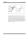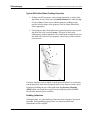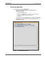
1
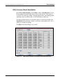
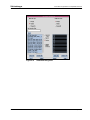
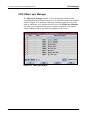
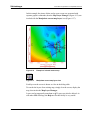
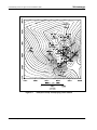
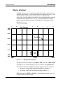
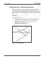
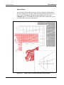
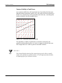
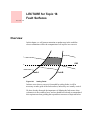
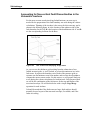
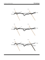
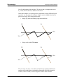
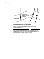
Schlumberger
Glossary of Computer Mapping Terms for CPS-3
grid row: See row.
gridding: The basic computer mapping process for transforming user x,y,z
data into a regularly distributed x,y,z data set referred to as a grid. There are
several algorithms within CPS-3 for creating grids.
contour-to-grid--Modified convergent gridding algorithm used
for creating grids from digitized contour data.
convergent--Iterative gridding process which begins with a very
coarse grid increment which continually refines and reties data to
the grid until the final grid increment is reached. Excellent
algorithm for all common data type Minimizes edge effects
producing a model more closely resembling a hand drawn contour
map.
density--Grid node values are set to the number of valid control
points within the search limit radius.
distance--Grid node values are set to the distance between the
grid node and nearest control point.
isopach--Specialized gridding for data sets where a zero value
indicates the modelled attribute is not present at that location.
Commonly used for gridding isopach data. Uses a data
preprocessor to project a proper zero line and assign the
appropriate negative number to the zero data value before
gridding takes place. Can be used with both convergent and least
squares gridding techniques.
least squares--One of the oldest methods of computing grids. Can
be used for all types of data except digitized contours. Should not
be used where extrapolation across large areas is required due to
undesirable edge effects.Can use dip and azimuth information at
control points if available. Allows for anisotropic weighting of the
data.
moving average--Does not consider slope or curvature
information when creating the grid. Performs a weighted average
on data within the Search Limit Radius to calculate the grid node
value. Not recommended for most data types. Produces acceptable
results for point-source data or dispersion modelling
polynomial--Grids created from the function:
Z=C1+C2*X+C3*Y+C4*X^2+C5*X*Y+C6*Y^2+C7*X^3+C8*X^2*
Y+C9*X*Y^2+C10*Y^3
where C# is a user-specified constant. A constant value
grid is created by setting C1 to the constant value and C2-C10 to
0.
LECTURE for Topic 27 - 6
GeoFrame 4.0 Introduction to CPS-3