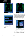
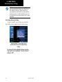
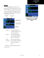
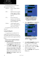
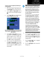
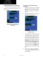
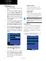
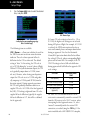
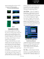
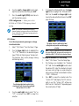
1
500W Series Pilot’s Guide & Reference Foreword Foreword Garmin International, Inc., 1200 East 151st Street, Olathe, Kansas 66062, U.S.A. Tel: 913/397.8200Fax: 913/397.8282 Garmin AT, Inc., 2345 Turner Rd., S.E., Salem, Oregon 97302, U.S.A. Tel: 503/581.8101Fax: 503/364.2138 Garmin (Europe) Ltd. Liberty House, Bulls Copse Road, Hounsdown Business Park, Southhampton, SO40 9RB, U.K. Tel. +44 (0) 870 850 1243 Fax +44 (0) 238 052 4004 Garmin Corporation, No. 68, Zhangshu 2nd Road, Xizhi Dist., New Taipei City 221, Taiwan (R.O.C.) Tel: 886/02.2642.9199Fax: 886/02.2642.9099 Web Site Address: www.garmin.com or https://fly.garmin.com/fly-garmin This manual reflects the operation of Main System Software versions 2.00, 3.00, 4.00, 5.00, or later. Some differences in operation may be observed when comparing the information in this manual to earlier or later software versions. © 2012 Garmin Ltd. or its subsidiaries. All rights reserved. Except as expressly provided herein, no part of this manual may be reproduced, copied, transmitted, disseminated, downloaded or stored in any storage medium, for any purpose without the express written permission of Garmin. Garmin hereby grants permission to download a single copy of this manual and of any revision to this manual onto a hard drive or other electronic storage medium to be viewed for personal use, provided that such electronic or printed copy of this manual or revision must contain the complete text of this copyright notice and provided further that any unauthorized commercial distribution of this manual or any revision hereto is strictly prohibited. Information in this document is subject to change without notice. Garmin reserves the right to change or improve their products and to make changes in the content of this material without obligation to notify any person or organization of such changes or improvements. September 2012 190-00357-00 Rev. H INTRODUCTION Warnings, Cautions, and Notes Introduction Warnings, Cautions, and Notes WARNING: The altitude calculated by the 500W-series is geometric height above mean sea level and could vary significantly from altitude displayed by pressure altimeters in aircraft. WARNING: The Jeppesen database incorporated in the 500W-series must be updated regularly in order to ensure that its information is current. Updates are released every 28 days. A database information packet is included in your 500W-series package. Pilots using an out-of-date database do so entirely at their own risk! WARNING: VNAV is to be used for advisory purposes only. VNAV messages or vertical speed required should not be used to maintain terrain or ATC clearances. Terrain and ATC clearances are the sole responsibility of the pilot. WARNING: Do not use GPS to navigate to any active waypoint identified as a “NON WGS84 WPT” by a system message. “NON WGS84 WPT” waypoints are derived from an unknown map reference datum that may be incompatible with the map reference datum used by GPS (known as WGS84) and may be positioned in error as displayed. WARNING: Do not use data link weather information for maneuvering in, near, or around areas of hazardous weather. Information contained within data link weather products may not accurately depict current weather conditions. WARNING: Do not use the indicated data link weather product age to determine the age of the weather information shown by the data link weather product. Due to time delays inherent in gathering and processing weather data for data link transmission, the weather information shown by the data link weather product may be significantly older than the indicated weather product age. CAUTION: The Global Positioning System is operated by the United States government, which is solely responsible for its accuracy and maintenance. The system is subject to changes which could affect the accuracy and performance of all GPS equipment. Although the 190-00357-00 Rev H Garmin 500W-series are precision electronic NAVigation AIDs (NAVAID), any NAVAID can be misused or misinterpreted and therefore become unsafe. CAUTION: Use the 500W-series at your own risk. To reduce the risk of unsafe operation, carefully review and understand all aspects of this Owner’s Manual and the Flight Manual Supplement, and thoroughly practice basic operation prior to actual use. When in actual use, carefully compare indications from the 500W-series to all available navigation sources, including the information from other NAVAIDS, visual sightings, charts, etc. For safety, always resolve any discrepancies before continuing navigation. CAUTION: GPS receivers operate by receiving and decoding very low power radio signals broadcast by satellites. It is possible that in some situations other radio equipment or electronic equipment used in close proximity to a GPS receiver may create electromagnetic interference (EMI) which may affect the ability of the GPS receiver to receive and decode the satellite signals. In such event, the interference may be reduced or eliminated by switching off the source of interference or moving the GPS receiver away from it. CAUTION: The electronic chart is an aid to navigation and is designed to facilitate the use of authorized government charts, not replace them. Land and water data is provided only as a general reference to your surroundings. The positional accuracy of the land and water data is not of a precision suitable for use in navigation and it should not be used for navigation. Only official government charts and notices contain all information needed for safe navigation – and, as always, the user is responsible for their prudent use. CAUTION: The Terrain feature (in units not equipped with TAWS) is for supplemental awareness only. The pilot/crew is responsible for all terrain and obstacle avoidance using information not provided by the 500W-series Terrain feature. CAUTION: The Garmin 500W-series does not contain any user-serviceable parts. Repairs should only be made by an authorized Garmin service center. Unauthorized repairs or modifications could void your warranty and authority to operate this device under FCC Part 15 regulations. i INTRODUCTION Warnings, Cautions, and Notes NOTE: The GNS 500W-series units use a different database than in the legacy units. The databases are incompatible between units. The GNS 500W-series units must use a WAAS enabled database. NOTE: It is the pilot’s responsibility for initial missed approach guidance in accordance with published procedure. The unit may not provide correct guidance until established on a defined leg. NOTE: This product, its packaging, and its components contain chemicals known to the State of California to cause cancer, birth defects, or reproductive harm. This notice is being provided in accordance with California’s Proposition 65. If you have any questions or would like additional information, please refer to our website at www.garmin.com/prop65. NOTE: GPS level of service annunciations (LPV, ENR, etc.) are not applicable to the external CDI (or HSI) when VLOC is active. NOTE: Do not rely solely upon data link services to provide Temporary Flight Restriction (TFR) information. Always confirm TFR information through official sources such as Flight Service Stations or Air Traffic Control. NOTE: Canadian installations: In accordance with Canadian Radio Specifications Standard 102 (RSS 102), RF field strength exposure to persons from an antenna connected to this device should be limited to 60V/m for controlled environment and 28 V/m for uncontrolled environment. NOTE: This device complies with Part 15 of the FCC limits for Class B digital devices. This equipment generates, uses, and can radiate radio frequency energy and, if not installed and used in accordance with the instructions, may cause harmful interference to radio communications. Furthermore, there is no guarantee that interference will not occur in a particular installation. If this equipment does cause harmful interference, the user is encouraged to try to correct the interference by relocating the equipment or connecting the equipment to a different circuit than the affected equipment. Consult an authorized dealer or other qualified avionics technician for additional help if these remedies do not correct the problem. Operation of this device is subject to the following conditions: (1) This device may not cause harmful interference, and (2) this device must accept any interference received, including interference that may cause undesired operation. Garmin is fully committed to your satisfaction as a customer. If you have any questions regarding the 500W-series, please contact our customer service department at: Garmin International, Inc. 1200 East 151st Street Olathe, KS 66062-3426 U.S.A. Phone: (913) 397-8200 Fax: (913) 397-8282 ii To obtain accessories for your 500W-series, please contact your Garmin dealer. Help us better support you by completing our on-line registration form today! Registration ensures that you will be notified of product updates and new products and provides lost or stolen unit tracking. Please, have the serial number of your unit handy, connect to our web site (www.garmin.com) and look for our Product Registration link on the home page. The 500W-series display lenses are coated with a special antireflective coating which is very sensitive to skin oils, waxes and abrasive cleaners. It is very important to clean the lens using an eyeglass lens cleaner which is specified as safe for anti-reflective coatings and a clean, lint-free cloth. AC 90-100 Statement of Compliance: The Garmin 400W navigational unit meets the performance and functional requirements of AC 90-100A. 190-00357-00 Rev H INTRODUCTION Accessories and Packing List Accessories and Packing List Congratulations on choosing the world’s finest panel-mounted IFR navigation/communication system! The 500W-series represents Garmin’s continued commitment to providing you with the most advanced technology available today — in an accurate, easy-touse design suitable for all of your flying needs. NOTE: Unless otherwise specified within this manual, the term "500W-series" applies to the GPS 500W, GNS 530W, and GNS 530AW models. Please, note that the difference between the GNS 530W and GNS 530AW is indicated under "VHF COM Performance" in the Specifications section of this manual (see Appendix B). Before installing and getting started with your new system, please ensure that your package includes the following items. If any parts are missing or are damaged, please contact your Garmin dealer. Standard Package: • Garmin 500W-series Unit • NavData® Card • Terrain Card • GPS Antenna • Installation Rack & Connectors • Pilot’s Guide • Quick Reference • 400W/500W Series Display Interfaces Addendum • 400W/500W Series Garmin Optional Display Interfaces Addendum • GNS 400W/500W-series Simulator Training CD-ROM • Database Subscription Packet • Warranty Registration Card Upgrade Package: • Garmin 500W-series Unit • NavData® Card • Terrain Card - Optional • GPS Antenna • Pilot’s Guide & Reference • Quick Reference • 400W/500W Series Display Interfaces Addendum • 400W/500W Series Garmin Optional Display Interfaces Addendum • GNS 400W/500W-series Simulator Training CD-ROM • Database Subscription Packet • Warranty Registration Card Your Garmin dealer will perform the installation and configuration of your new 500W-series. After installation, the NavData® card will already be installed into the correct slot on the front of the unit (see Appendix A). The 500W-series will be secured in the installation rack with the proper wiring connections. Have your dealer answer any questions you may have about the installation — such as location of antennas or any connections to other equipment in the panel. Helicopter Installations In Helicopter installations, the ownship icon is set to a helicopter. When present, HTAWS will be used instead of TAWS. See the Garmin Optional Displays Pilot’s Guide Addendum P/N 190-00356-30 Rev G, or later, for HTAWS information. 190-00357-00 Rev H iii INTRODUCTION Warranty Limited Warranty This Garmin product is warranted to be free from defects in materials or workmanship for two years from the date of purchase. Within this period, Garmin will, at its sole option, repair or replace any components that fail in normal use. Such repairs or replacement will be made at no charge to the customer for parts and labor, provided that the customer shall be responsible for any transportation cost. This warranty does not cover failures due to abuse, misuse, accident, or unauthorized alterations or repairs. THE WARRANTIES AND REMEDIES CONTAINED HEREIN ARE EXCLUSIVE AND IN LIEU OF ALL OTHER WARRANTIES EXPRESS OR IMPLIED OR STATUTORY, INCLUDING ANY LIABILITY ARISING UNDER ANY WARRANTY OF MERCHANTABILITY OR FITNESS FOR A PARTICULAR PURPOSE, STATUTORY OR OTHERWISE. THIS WARRANTY GIVES YOU SPECIFIC LEGAL RIGHTS, WHICH MAY VARY FROM STATE TO STATE. IN NO EVENT SHALL GARMIN BE LIABLE FOR ANY INCIDENTAL, SPECIAL, INDIRECT OR CONSEQUENTIAL DAMAGES, WHETHER RESULTING FROM THE USE, MISUSE, OR INABILITY TO USE THIS PRODUCT OR FROM DEFECTS IN THE PRODUCT. Some states do not allow the exclusion of incidental or consequential damages, so the above limitations may not apply to you. Garmin retains the exclusive right to repair or replace the unit or software, or to offer a full refund of the purchase price, at its sole discretion. SUCH REMEDY SHALL BE YOUR SOLE AND EXCLUSIVE REMEDY FOR ANY BREACH OF WARRANTY. To obtain warranty service, contact your local Garmin Authorized Service Center. For assistance in locating a Service Center near you, visit the Garmin Web site at “http://www.garmin.com” or contact Garmin Customer Service at 800-800-1020. iv 190-00357-00 Rev H INTRODUCTION Table of Contents Contents Cautions...................................................................................i Section 2 NAV Pages.......................................................... 29 Introduction.................................................................................i Accessories and Packing List.............................................iii Limited Warranty.................................................................iv Model Descriptions............................................................. 1 GPS 500W...................................................................... 1 GNS 530W and GNS 530AW........................................... 1 Takeoff Tour............................................................................... 1 Key and Knob Functions.................................................. 2 Left-hand Keys and Knobs............................................... 2 Right-hand Keys and Knobs............................................. 3 Bottom Row Keys............................................................ 4 Power On............................................................................... 5 Powering up the 500W-series units................................. 5 Instrument Panel Self-Test................................................ 6 Fuel On Board and Checklists............................................ 7 Acquiring Satellites / Messages....................................... 8 Selecting Com/Nav Frequencies....................................... 9 Page Groups........................................................................ 10 NAV Pages............................................................................ 12 Default NAV Page.............................................................. 13 Map Page............................................................................. 14 NAVCOM Page.................................................................... 15 Direct-To Navigation......................................................... 16 IFR Procedures.................................................................... 17 Nearest Pages..................................................................... 18 Nearest Airport Page..................................................... 19 Nearest Airspace Page................................................... 20 Flight Plans.......................................................................... 21 Section 1 - COM - Communicating using the GNS 530W................................................................................... 23 Volume................................................................................. 23 Squelch................................................................................. 23 COM Window and Tuning................................................. 24 Auto-Tuning........................................................................ 25 Emergency Channel........................................................... 28 Stuck Microphone.............................................................. 28 Remote Frequency Selection Control........................... 28 190-00357-00 Rev H Main Page Groups.............................................................. 29 NAV Page Group................................................................. 29 Page Notation..................................................................... 29 Turn Advisory and Waypoint Alert................................. 29 Default NAV Page.............................................................. 30 Selecting Desired On-Screen Data.................................. 31 Restoring Factory Settings............................................. 32 Dual Unit Considerations (Crossfill)................................ 32 Default Nav Page Auto Zoom......................................... 33 Map Page............................................................................. 33 Map Symbols................................................................ 34 Map Range................................................................... 34 Map Page Auto Zoom.................................................... 34 Map Panning ............................................................... 35 Map Direct-To............................................................... 36 Airspace Information on the Map.................................. 36 Map Page Options........................................................ 38 Map Setup.................................................................... 39 Distance Measurements................................................ 40 Data Fields on the Map................................................. 41 Selecting Desired On-Screen Data.................................. 41 Restoring Factory Settings............................................. 42 Terrain Operation.............................................................. 43 Operating Criteria......................................................... 43 Terrain Limitations......................................................... 43 TERRAIN Alerting.......................................................... 43 Baro-Corrected Altitude................................................. 44 Terrain Page ................................................................. 44 Inhibit Mode................................................................. 45 Terrain Symbols............................................................. 46 General Database Information....................................... 46 Database Updates......................................................... 47 Terrain/Obstacle Database Areas of Coverage................ 48 Navigation Database..................................................... 48 TERRAIN Alerts................................................................... 48 Pop-up Alerts................................................................ 48 Forward Looking Terrain Avoidance................................ 49 Premature Descent Alerting (PDA)................................. 49 TERRAIN Failure Alert.................................................... 50 “TERRAIN Not Available” Alert...................................... 50 NAVCOM Page.................................................................... 52 v INTRODUCTION Satellite Status Page......................................................... 54 Dead Reckoning................................................................. 57 Flight Plan Transfer Feature (optional with software V 3.20 or later)....................................................................... 80 Section 3 Direct-To Navigation.................................... 59 Section 5 - Procedures - Approaches, Departures, & Arrivals.................................................................................... 83 Selecting a Direct-To Waypoint by Facility Name or City ...................................................................................... 60 Selecting a Direct-To Waypoint from the Active Flight Plan...................................................................................... 61 Selecting the Nearest Airport as a Direct-To Waypoint. 61 Shortcuts.............................................................................. 62 Cancelling Direct-To Navigation..................................... 63 Specifying a Course to a Waypoint................................ 63 Selecting Direct-To a Holding Pattern.......................... 64 Approaches with Procedure Turns................................. 86 Flying the Procedure Turn................................................ 87 Flying the Missed Approach ........................................... 91 Flying an Approach with a Hold .................................... 92 Flying a DME Arc Approach............................................. 96 Vectors to Final.................................................................. 99 Flying the Vectors Approach......................................... 100 Course From Fix Flight Plan Legs................................. 102 ILS Approaches................................................................. 107 Selecting an ILS Approach........................................... 108 Flying the ILS Approach............................................... 109 Selecting an LPV Approach............................................ 113 Flying the LPV Approach.............................................. 113 Flying the LP Approach................................................... 115 RNAV Approach Procedures........................................... 117 Points to Remember for ALL Approaches.................. 117 Points to Remember for Localizer or VOR-based Approaches....................................................................... 118 Enabling Autopilot Outputs for the King KAP140/ KFC225................................................................................ 120 Section 4 Flight Plans........................................................ 65 Flight Plan Catalog............................................................ 65 Flight Plan Editing............................................................. 65 Flight Plan Catalog Options............................................ 67 Activating Flight Plans................................................... 67 Inverting Flight Plans..................................................... 67 Create New Flight Plan.................................................. 67 Crossfill......................................................................... 68 Copying Flight Plans...................................................... 68 Deleting Flight Plans..................................................... 69 Delete All Flight Plans.................................................... 70 Sort List By Number/Comment....................................... 70 Active Flight Plan............................................................... 70 Active Flight Plan Options............................................... 71 Activate Leg.................................................................. 71 Crossfill......................................................................... 71 Copy Flight Plan............................................................ 72 Invert Flight Plan........................................................... 72 Delete Flight Plan.......................................................... 72 Select Approach............................................................ 72 Select Arrival................................................................. 73 Select Departure........................................................... 74 Remove Approach, Arrival, or Departure......................... 74 Closest Point of FPL....................................................... 75 Parallel Track................................................................. 75 Change Fields............................................................... 77 Restore Defaults............................................................ 77 Shortcuts.............................................................................. 77 vi Section 6 WPT Pages.......................................................... 121 190-00357-00 Rev H WPT Page Group............................................................... 121 Finding the Desired Airport........................................... 122 Duplicate Waypoints....................................................... 123 Airport Location Page..................................................... 124 Airport Location Page Options..................................... 125 Airport Runway Page...................................................... 125 Airport Runway Page Options...................................... 126 Airport Frequency Page................................................. 127 Airport Frequency Page Options................................... 128 Airport Approach Page................................................... 129 Airport Approach Page Options................................... 130 Airport Arrival Page........................................................ 132 Airport Arrival Page Options........................................ 133 Airport Departure Page.................................................. 134 Airport Departure Page Options................................... 135 Intersection Page............................................................. 136 NDB Page........................................................................... 137 INTRODUCTION VOR Page........................................................................... 138 User Waypoint Page........................................................ 139 Creating User Waypoints............................................. 140 Creating User Waypoints from the Map Page............... 142 Modifying User Waypoints........................................... 143 User Waypoint Page Options........................................ 144 User Waypoint List...................................................... 145 Section 7 NRST Pages....................................................... 149 NRST Page Group............................................................. 149 Navigating to a Nearby Waypoint............................... 151 Nearest Airport Page...................................................... 152 Nearest Intersection Page............................................. 153 Nearest NDB Page............................................................ 153 Nearest VOR Page............................................................ 154 Nearest User Waypoint Page......................................... 155 Nearest Center (ARTCC) Page....................................... 155 Nearest Flight Service Station (FSS) Page................. 156 Nearest Airspace Page.................................................... 157 Section 8 VLOC (VOR/Localizer/Glideslope) Receiver Operations.......................................................... 161 Ident Audio and Volume................................................. 161 VLOC Tuning Window...................................................... 161 VLOC Ident Window......................................................... 162 Auto-Tuning...................................................................... 162 CDI Key............................................................................... 164 COM Configuration..................................................... 190 Restoring Factory Settings............................................ 191 Setup 2 Page..................................................................... 192 SBAS Selection............................................................ 192 Section 10 Vertical Navigation (VNAV).................. 193 Section 11 Fault Detection and Exclusion (FDE) Interface................................................................................... 196 Fault Detection and Exclusion (FDE)............................ 196 Pre-departure Verification of FDE................................ 196 Section 12 Messages, Abbreviations, & Nav Terms.......................................................................................... 197 Messages........................................................................... 197 Turn Advisory and Arrival Annunciations................... 204 Flight Plan Transfer Messages...................................... 204 Abbreviations................................................................... 205 Navigation Terms............................................................. 209 Appendix A NavData Card Use................................... 211 Appendix B Specifications............................................ 212 Appendix C Troubleshooting Q & A......................... 213 Index........................................................................................... 219 Section 9 AUX Pages........................................................ 165 AUX Page Group............................................................... 165 Flight Planning Page....................................................... 166 Utility Page........................................................................ 175 Checklists................................................................... 176 Trip Statistics............................................................... 179 RAIM Prediction.......................................................... 180 Software Versions........................................................ 180 Database Versions....................................................... 181 Terrain Database Versions............................................ 181 Setup 1 Page..................................................................... 181 CDI / Alarms................................................................ 185 Units / Position............................................................ 186 Date / Time................................................................. 188 Display Backlight. ....................................................... 188 Nearest Airport Criteria............................................... 189 Data Field Configuration............................................. 189 190-00357-00 Rev H vii INTRODUCTION Blank Page viii 190-00357-00 Rev H TAKEOFF TOUR Model Descriptions Model Descriptions Service via the Garmin GDL 69/69A datalink receiver. This guide covers the operation of the GNS 530W, GNS 530AW, and the GPS 500W. In general, all models will be referred to as the 500W-series, except where there are physical or operational differences. The 500W-series units are 6.25” wide and 4.60” high. The display is a 320 by 234 pixel color LCD. The units include two removable data cards, one with a Jeppesen database (inserted in the left-most card slot) and the second being a Terrain database (inserted in the rightmost card slot). GNS 530W and GNS 530AW The GNS 530W and GNS 530AW include all of the features of the GPS 500W, and also includes a TSO’d airborne VHF communications transceiver and a TSO’d airborne VOR/Localizer and Glideslope receivers. This multipurpose unit is available with either a 10-watt (GNS 530W) or 16-watt (GNS 530AW) Com transceiver. References to the GNS 530W also include the GNS 530AW. GPS 500W The GPS 500W has a WAAS GPS engine and is TSO C146a certified for primary domestic, oceanic, and remote navigation including en route, terminal, and non-precision approaches, and approaches with vertical guidance, such as LPV and LNAV/VNAV. The GPS 500W can simultaneously give aviators vital approach information and weather and traffic data in relation to their position on a large, color moving map display. Thanks to a high-contrast color display, the information can be easily read from wide viewing angles even in direct sunlight. Its color moving map features a built-in database that shows cities, highways, railroads, rivers, lakes, coastlines, and a complete Jeppesen database. The Jeppesen database (that can be updated with a front-loading data card) contains all airports, VORs, NDBs, Intersections, FSSs, Approaches, DPs/STARs, and SUA information. Pilots will enjoy the GPS 500W as an MFD, especially when it is coupled with traffic, lightning detection, and weather interfaces. With the PC-based FDE prediction program, the GPS 500W may be used for oceanic or remote operations. For the latest in graphical and textual weather information, the GPS 500W can connect to XM Satellite Radio’s XM WX Weather Takeoff Tour This Takeoff Tour is intended to provide a brief introduction of the 500W-series major features. The rest of this manual describes these features, and others, in additional detail. Use this guide, as needed, to learn or review the details regarding a particular feature. The Index may be used to quickly locate the information you want. Before flying with your 500W series unit, take the time to review the information in the manuals and practice with the trainer. After you’re familiar with the basics, some suggested reading within the Reference section includes: • Flight plan features - Section 4 • Waypoint information pages (database information) - Section 6 • IFR procedures - Section 5 • Aux pages - Unit settings (configuring the unit to your preferences) - Section 9 If you’re unable to locate the information you need, we’re here to help! Garmin’s Customer Service staff is available during normal business hours (U.S. Central time zone) at the phone and fax numbers listed on page ii. You can also reach us by mail (see page ii) or at our web site address: www.garmin.com. 190-00357-00 Rev H 1 TAKEOFF TOUR Key and Knob Functions Key and Knob Functions The 500W-series navigators are designed to make operation as simple as possible. The descriptions on the next three pages provide a general overview of the primary function(s) for each key and knob. This Takeoff Tour section is intended to provide a brief overview of the primary functions of your 500W-series unit. Experiment with the unit and refer to the reference sections for more information. whichever is currently selected by the tuning cursor. Press this knob momentarily to toggle the tuning cursor between the COM and VLOC frequency fields. W The COM flip-flop key (GNS 530W) is used to swap the active and standby COM frequencies. Press and hold to select emergency channel (121.500 MHz). V The VLOC flip-flop key (GNS 530W) is used to swap the active and standby VLOC frequencies (i.e., make the selected standby frequency active). Left-hand Keys and Knobs 2 k The COM power/volume knob controls unit power and communications radio volume. Press momentarily to disable automatic squelch control. In the GPS 500W, this control is used only for power. j The VLOC volume knob (GNS 530W) controls audio volume for the selected VOR/ Localizer frequency. Press momentarily to enable/disable the ident tone. y The large left knob (COM/VLOC) (GNS 530W) is used to tune the megahertz (MHz) value (to the left of the decimal point) of the standby frequency for the communications transceiver or the VOR/Localizer receiver, whichever is currently selected by the tuning cursor. v The small left knob (PUSH C/V) (GNS 530W) is used to tune the kilohertz (kHz) value (to the right of the decimal point) of the standby frequency for the communications transceiver or the VLOC receiver, 190-00357-00 Rev H GPS 500W GNS 530W On the GNS 530W, the large and small left knobs allow you to tune the desired COM or VLOC frequency. TAKEOFF TOUR Key and Knob Functions Right-hand Keys and Knobs The range key (RNG) allows you to select the desired map scale. Use the RNG up arrow side of the key to zoom out to a larger area, or the down arrow side to zoom into a smaller area. D MENU CLR ENT The direct-to key (direct-to) provides access to the direct-to function, which allows you to enter a destination waypoint and establishes a direct course to the selected destination. See Section 3. With the on-screen cursor enabled, the large right knob allows you to move the cursor about the page. r The small right knob (PUSH CRSR) is used to select between the various pages within one of the groups listed above. Press this knob momentarily to display the on-screen cursor. The cursor allows you to enter data and/or make a selection from a list of options. The menu key (MENU) displays a context-sensitive list of options. This options list allows you to access additional features or make settings changes which relate to the currently displayed page. The clear key (CLR) is used to erase information or cancel an entry. Press and hold this key to immediately display the Default Navigation Page, regardless of the page that is currently displayed. The enter key (ENT) is used to approve an operation or complete data entry. It is also used to confirm information, such as the Database Page during power on. t The large right knob (GPS) is used to select between the various page groups: NAV, WPT, AUX or NRST. 190-00357-00 Rev H Data is entered using the large and small right knobs. Experiment with them to become efficient at entering data. This greatly reduces the amount of time spent operating the 500W-series unit in flight. 3 TAKEOFF TOUR Key and Knob Functions GPS 500W GNS 530W Bottom Row Keys NRST CDI OBS MSG 4 ments when the MSG annunciator is displayed. See Sections 12 and 9 for more information on messages and unit settings. The nearest key (NRST) (GPS 500W) displays the Nearest Airports page. Then, turning the small right knob steps through the NRST pages. The CDI key (GNS 530W) is used to toggle the navigation source (GPS or VLOC) which provides output to an external HSI or CDI. The OBS key is used to select manual or automatic sequencing of waypoints. Pressing this key selects OBS mode, which retains the current “active to” waypoint as your navigation reference even after passing the waypoint (i.e., prevents sequencing to the next waypoint). Pressing the OBS key again returns to normal operation, with automatic sequencing of waypoints. Whenever OBS mode is selected, you may set the desired course to/from a waypoint using the OBS Page, or an external OBS selector on your HSI or CDI. The message key (MSG) is used to view system messages and to alert you to important warnings and require190-00357-00 Rev H FPL VNAV PROC The flight plan key (FPL) allows you to create, edit, activate and invert flight plans, as well as access approaches, departures and arrivals. A closest point to flight plan feature is also available from the flight plan key. See Section 4 for more information on flight plans. The vertical navigation key (VNAV) allows you to create a threedimensional profile which guides you to a final (target) altitude at a specified location. See Section 10. The procedures key (PROC) allows you to select approaches, departures and arrivals from your flight plan. When using a flight plan, available procedures for your departure and/or arrival airport are offered automatically. Otherwise, you may select the desired airport, then the desired procedure. TAKEOFF TOUR Power On Power On The Garmin 500W-series offers you accurate navigational data and communication capability, along with non-precision and precision approach certification in the IFR environment. The Takeoff Tour is designed to familiarize you with the basic operation of the 500W-series — including powering up the unit, changing frequencies, entering data, performing a simple direct-to, selecting IFR procedures and provides a limited introduction to using flight plans. In addition, this section briefly covers the default navigation, map and frequency pages available as part of the NAV page group. These pages are used for most of your in-flight navigation. The Takeoff Tour assumes that the unit and antennas have been properly installed and you have not changed any of the 500W-series default settings. If you have changed any of the factory default settings (position format, units of measure, selectable fields, etc.), the pictures shown here may not exactly match what you see on your 500W-series unit. Prior to using your 500W-series unit for the first time, we recommend that you taxi to a location that is well away from buildings and other aircraft so the unit can collect satellite data without interruption. Powering up the 500W-series units The GNS 530W’s power and COM volume are controlled using the COM power/volume knob at the top left corner of the unit. In the GPS 500W, the knob controls only power. Turning it clockwise turns unit power on and increases the COM radio volume. After turning the unit on, a Welcome Page is displayed while the unit performs a self test, followed by copyright and software version information. The Database Confirmation Page appears next and shows the current database information on the NavData card (with the valid operating dates, cycle number and database type indicated). The database is updated every 28 days and must be current for approved instrument approach operations. Information on database subscriptions is available inside your 500W-series package. To acknowledge the database information, press the ENT key . Power-up Sequence 190-00357-00 Rev H 5 TAKEOFF TOUR Instrument Panel Self-Test Fuel Capacity is entered manually Check CDI/HSI, RMI and other instruments to verify these indications. Fuel on board and fuel flow are provided manually or by sensors, if installed Select to Set Fuel Level to Full Capacity Should match current OBS course selection Select to display Checklists Page Instrument Panel Self-Test Once the database has been acknowledged, the Instrument Panel Self-Test Page appears. To ensure that your 500W-series unit and any connected instruments are working properly, check for the following indications on your CDI/HSI, RMI, external annunciators and other connected instruments: • Course deviation • Glideslope • TO/FROM flag • Time to destination • Bearing to destination • Desired track • Distance to dest. • Ground speed • All external annunciators (if installed) The Instrument Panel Self-Test Page indicates the currently selected OBS course, fuel capacity (CAP), fuel on board (FOB) and fuel flow (FF). The fuel capacity is entered manually. Fuel on board and fuel flow may be manually entered if your installation does not include connection to sensors which automatically provide these figures. 6 To enter fuel capacity, fuel on board or fuel flow figures (if not provided by sensors): 1. 2. Turn the large right knob to select the “CAP”, “FOB” or “FF” field. Turn the small and large right knobs to enter the desired figure, then press ENT. Enter the fuel capacity, fuel on board or fuel flow figures directly onto the appropriate field of the Instrument Panel Self-Test Page. Fuel on board and fuel flow are automatically provided if your installation includes connection to external sensors. 190-00357-00 Rev H TAKEOFF TOUR Fuel On Board and Checklists Fuel On Board and Checklists The Instrument Panel Self-Test Page includes selections to set fuel on board (FOB) to full capacity and access the Checklists Page. This allows you to quickly set fuel to full limits and display any checklists you’ve entered, such as start up or takeoff checklists. To set fuel on board to full (if not provided by sensor): 1. Turn the large right knob to highlight “Set Full Fuel?”. Select “Go To Checklists?” to display the Checklist Page and any available checklists. A 500W-series unit can hold up to nine checklists with up to 30 entries in each checklist. 3. Once you complete the desired checklist(s), press the small right knob to return to the Checklists Page. Press the small right knob again to return to normal operation on the Satellite Status or Map pages. Once you’ve verified instrument operation with the Instrument Panel Self-Test Page displayed, turn the large right knob to highlight “OK?” and press the ENT key. Select “Set Full Fuel?” to set fuel on board (FOB) to full capacity. 2.Press ENT and verify that fuel on board (FOB) now matches the fuel capacity (CAP) figure. Fuel on board is now reduced, over time, based on the fuel flow (FF) figure. To view the checklists page: 1. Turn the large right knob to highlight “Go To Checklists?” and press ENT. 2. Turn the large right knob to select the desired checklist, then follow the steps in Section 9 Aux Pages - Utility Page (Checklists) to execute each step in the selected checklist. The Satellite Status Page appears as the 500Wseries unit begins to collect satellite information. An “Acquiring” status is displayed on the Satellite Status Page and the signal strength of any satellites received appears as “bar graph” readings. This is a good indication that you are receiving signals and that a position fix is determined. Following the first-time use of your 500W-series unit, the time required for a position fix varies — usually within two minutes. 190-00357-00 Rev H 7 TAKEOFF TOUR Acquiring Satellites / Messages Acquiring Satellites / Messages If the 500W-series unit has not been operated for a period of six months or more, it may have to “Search the Sky” to collect new data. This means the unit is acquiring satellite data to establish almanac and satellite orbit information, which can take 5 to 10 minutes. The Satellite Status Page displays a “Searching Sky” status, and the message annunciator (MSG) above the MSG key also flashes to alert you of a system message, “Searching the Sky”. The Satellite Status Page shows the ID numbers for the satellites and the relative signal strength of each satellite received (as a “bar graph” reading). The Time and other data may not be displayed until the unit has acquired enough satellites for a fix. To view a system message, press MSG. “Searching Sky” indicates that satellite almanac data is not available. The data is recollected from the first available satellite. “Acquiring” indicates that satellites have been located and information is being acquired, but the receiver does not have enough satellites for a 3-dimensional position. “3D NAV” indicates that a 3-dimensional position is available. MESSAGE PAGE The Message Page appears and displays the status or warning information applicable to the receiver’s current operating condition. To return to the previous page after viewing a message, press MSG again. 8 “3D DIFF NAV” indicates when a 3-dimensional position is available and differential corrections are being used. The “INTEG” annunciator (bottom left corner of the screen) indicates that satellite coverage is insufficient to pass built-in integrity monitoring tests. 190-00357-00 Rev H TAKEOFF TOUR GNS 530W only Selecting Com/Nav Frequencies 3. While the GNS 530W is acquiring a position, let’s take a minute to dial in the active and standby frequencies you’ll be using for the first phase of your flight. The GNS 530W display is divided into separate ‘windows’ (or screen areas), including a COM window, VLOC window (by default with VOR ident/radial, but selectable for other data — including a traffic display) and a GPS window which occupies the right 3/4 of the display. COM Window: Active Frequency COM Window: Standby Frequency (with tuning cursor) Selecting Com/Nav Frequencies Turn the small left knob to select the desired kilohertz (kHz) value. For example, the “.70” portion of the frequency “117.70”. 4. To activate the selected frequency, press the appropriate flip-flop key—COM for communication frequencies or VLOC for VOR/Localizer frequencies. Once you’ve entered the active frequency, simply repeat steps 1 through 3, above, to enter the standby frequency. After both communication frequencies have been entered, you may elect to keep the COM window ‘hot’ by leaving the cursor on the standby frequency, or move the cursor to the VLOC window by pressing the small left knob. VLOC Tuning Window and VLOC Ident Window (Ident Window is user-selectable) Pushing the small left knob moves the tuning cursor back-and-forth between the COM and VLOC frequency windows. To select the active frequency, you must first enter the frequency in the standby field, and use the COM (or VLOC) flip-flop key to move it to the active field. To change the standby communication (COM) or VLOC frequency: 1. If the tuning cursor is not currently in the desired window (COM or VLOC), press the small left knob momentarily to switch the highlight between the COM and VLOC windows. Adjusting the frequencies with the large and small left knobs will affect the standby frequency. 2. Turn the large left knob to select the desired megahertz (MHz) value. For example, the “117” portion of the frequency “117.70”. 190-00357-00 Rev H NOTE: When selecting VLOC frequencies, the tuning cursor automatically returns to the COM window after 30 seconds of inactivity. NOTE: GPS level of service annunciations (LPV, ENR, etc.) are not applicable to the external CDI (or HSI) when VLOC is active. Cursor highlights COM window. To switch the active and standby frequencies, press the COM flip-flop key. Switching the active and standby frequencies does not remove the cursor from the COM window. 9 TAKEOFF TOUR Page Groups Page Groups (Large right knob to change page groups) (Small right knob to select pages within the group) NAV Group 10 WPT Group AUX Group Default NAV Airport Location Airport Departure Flight Planning Map Airport Runway Intersection Utility Terrain Airport Frequency NDBs Setup 1 NAVCOM Airport Approach VOR Setup 2 Satellite Status Airport Arrival User Waypoint 190-00357-00 Rev H TAKEOFF TOUR Page Groups (Large right knob to change page groups) (Small right knob to select pages within the group) NRST Group FPL Group VNAV (Press FLP) (Press VNAV) Vertical Navigation Nearest Airport Nearest Center Active Flight Plan Nearest Intersection Nearest FSS Flight Plan Catalog PROC (Press PROC) Nearest NDB Nearest Airspace Procedures NOTE: The number of NAV pages available vary depending on the installation of options. See 400W/500W Series Display Interfaces Pilot's Guide Addendums. Nearest VOR Selection of any main page is performed using the large and small right knobs. The large right knob selects the page group: NAV, WPT, AUX or NRST. The small right knob selects the desired page within a group. To quickly select the Default NAV page, Press and hold CLR. Nearest User Wpt 190-00357-00 Rev H 11 TAKEOFF TOUR NAV Pages NAV Pages The map page is one of five or more pages available under the NAV group. The previous page shows the organization of the main page groups. Additionally, page groups for flight plans, procedures and vertical navigation are available by pressing the key corresponding to the desired function (FPL, PROC or VNAV). Selecting one of these stand-alone page groups, in effect, exits the main page groups and displays a page for the desired function. When pressing the same function key a second time, the 500W-series unit returns to the main page group and the previously displayed page. To select the desired NAV page, turn the small right knob until the desired page is displayed. If you are currently viewing a page that is not part of the NAV group, you can quickly return to the NAV group using the CLR key. The number of Nav group pages available varies with installed equipment. To select the NAV group and display the Default NAV Page, press and hold CLR. In addition to the group of NAV pages, additional groups of pages are available for waypoint information (WPT), auxiliary (AUX) functions such as flight planning or unit settings, and listings for nearest (NRST) airports or other facilities. 1. To select the desired page group, turn the large right knob until a page from the desired group is displayed. 2. To select the desired page within the group, turn the small right knob until the desired page is displayed. 12 190-00357-00 Rev H The bottom right corner of the screen indicates the page group currently being displayed (e.g., NAV or NRST), the number of screens available within that group (indicated by rectangular icons) and the placement of the current screen within that group (indicated by a highlighted square icon). To select a different page within the group, turn the small right knob. See the 400W/500W Series Display Interfaces Pilot’s Guide Addendum, part number 19000356-31 and the 400W/500W Series Garmin Optional Displays Pilot’s Guide Addendum, part number 190-00356-30. TAKEOFF TOUR Default NAV Page Default NAV Page During most flights, the Default NAV, Map and NAVCOM pages are the primary pages used for navigation. The Default NAV Page displays a “look ahead” map, graphic course deviation indicator (CDI), the active leg of your flight plan (as defined by the current “from” and “to” waypoints), and four user-selectable data fields. The default settings for these fields are distance to waypoint (DIS), desired track (DTK), ground speed (GS) and estimated time en route (ETE). See Section 12 for definitions of these navigation terms. The default NAV page is selected by pressing and holding the CLR key or turning the small right knob. From the Default NAV Page, simply turn the small right knob to display the available pages. The NAVCOM Page displays the available frequencies (communication and navigation) for the departure airport, any en route airports that are included in your flight plan, and the final destination airport. When using the direct-to function, frequencies are listed for the airport nearest to your starting position and the destination airport. To change the data fields in the corners of the Default NAV Page: 1.Press MENU (with the Map Page displayed). The data fields on the Default NAV Page may be custom-tailored to your preferences. A menu selection is provided to “Change Fields?”. 2. Turn the large right knob to highlight “Change Fields?” and press ENT. 3. Turn the large right knob to highlight the data field you wish to change. 4. Turn the small right knob to select the type of data you want to appear on this field and press ENT. User-selectable Data Fields (all four corners) Bearing indicator to the current active TO waypoint Active Leg of Flight Plan, or Direct-to Destination Course Deviation Indicator (CDI) DEFAULT NAV page The large right knob is used to select the data field you wish to change. Then use the small right knob to display a list of data options and select the desired data item. 5. Press the small right knob to remove the cursor. 190-00357-00 Rev H 13 TAKEOFF TOUR Map Page Map Page The Map Page displays your present position (using an airplane symbol) relative to nearby airports, VORs, NDBs, intersections, user waypoints and airspace boundaries — and your route displayed as a solid line. The current Map Scale is indicated in the lower left corner and adjustable using the RNG key. The Map Scale refers to the distance from the bottom to the top of the viewable display. After the GNS 530W acquires satellites and computes a position, the Map Page appears automatically. Map Display Present Position While viewing the map page, you can quickly declutter and remove many of the background map details by pressing the CLR key (repeatedly) until the desired detail is depicted. Desired Track Map Scale MAP PAGE To change the map scale, use the RNG key. To adjust the map scale: 1. Press the up arrow on the RNG key to zoom out to a larger area. OR, 2. 14 By adding data fields along the right-hand side, the Map Page can combine a moving map display and navigation data for complete situational awareness. Map setup pages are provided to add these data fields and to designate the maximum scale at which each map feature appears. These settings provide an automatic decluttering of the map (based upon your preferences) as you adjust the scale. Press the down arrow on the RNG key to zoom in to a smaller area. 190-00357-00 Rev H TAKEOFF TOUR NAVCOM Page NAVCOM Page Frequency Type Frequency List The Navigation/Communications (NAVCOM) Page provides a complete list of airport frequencies at your departure, en route and arrival airports. A frequency listed on the NAVCOM Page can be quickly transferred to the standby field of the COM or VLOC windows. This time saving process prevents having to “re-key” a frequency already displayed elsewhere on the screen. To display the frequency list for the desired flight plan or direct-to airport: 1. Push the small right knob to activate the cursor on the airport identifier field (in the GPS window). 2. Turn the small right knob to display the list of airports (departure, arrival and en route) for your flight plan or direct-to. Continue to turn the small right knob until the desired airport is selected. NAVCOM PAGE To select a communication or navigation frequency: 1. Push the small right knob to activate the cursor in the GPS window. 2. Turn the large right knob to select the desired frequency from the list. 3.Press ENT to transfer the selected frequency to the standby field in the COM or VLOC window. COM frequencies automatically go to the standby field of the COM window and navigation frequencies automatically go to the standby field of the VLOC window, regardless of the window currently highlighted by the cursor. 4. To activate the selected frequency, press the COM or VLOC flip-flop key. 3.Press ENT to display the frequency list for the selected airport. 190-00357-00 Rev H 15 TAKEOFF TOUR Direct-To Navigation Direct-To Navigation The 500W-series unit can use direct point-to-point navigation to guide you from takeoff to touchdown, even in the IFR environment. Once a destination is selected, the unit provides course and distance data based upon a direct course from your present position to your destination. A destination can be selected from any page with the direct-to key. 5.Press ENT to confirm the identifier. The “Activate?” function field is highlighted. Destination Waypoint Identifier Field Confirm the selected direct-to destination by highlighting “Activate?” and pressing ENT. “Activate?” Function Field 6.Press ENT to activate a direct-to course to the selected destination. Press and hold CLR to return to the default NAV page. Select Direct-To Waypoint Page To select a direct-to destination: 16 1. Press the direct-to key. The Select Direct-to Waypoint Page appears with the destination field highlighted. The direct-to waypoint may also be selected by facility or city name. See Section 3 for more information. 2. Turn the small right knob to enter the first letter of the destination waypoint identifier. The destination waypoint may be an airport, VOR, NDB, intersection or user waypoint, as long as it is in the database or stored in memory as a user waypoint. 3. Turn the large right knob to the right to move the cursor to the next character position. 4. Repeat steps 2 and 3 to spell out the rest of the waypoint identifier. 190-00357-00 Rev H TAKEOFF TOUR IFR Procedures IFR Procedures 3. Once the direct-to or flight plan is confirmed, the whole range of instrument procedures is available to you. Departures (SIDs), arrivals (STARs), non-precision and precision approaches are stored within the NavData card and available using the PROC key. Turn the small right knob to select the desired procedure and press ENT. A window appears to select the desired procedure. Use the small right knob to make your selection. Press the PROC key to display the procedures page. Turn the large right knob to select the desired option. To display the Procedures Page, press PROC. The steps required to select and activate an approach, departure or arrival are very similar. In this introductory section, we’ll show examples of the steps required to select an approach, but keep in mind the same process also applies to departures and arrivals. To select an approach, departure, or arrival: 1. Turn the large right knob to highlight the “Select Approach?” option (or “Select Arrival?”/“Select Departure?”) from the Procedures Page. 2.Press ENT to display a list of available procedures for the arrival (when using approaches or STARs) or departure (when using SIDs) airport. 4. For approaches, a window appears to select the desired initial approach fix (IAF) or a “vectors” option to select just the final course segment of the approach. Turn the small right knob to select the desired option and press ENT. (Vectors guidance is relative to the final inbound course. A line is drawn beyond the final approach fix, allowing you to intercept the final course segment beyond its normal limits.) 5. For departures and arrivals, pop-up windows appear to select the desired transition and runway(s). Turn the small right knob to select the desired option and press ENT. 6. With “Load?” highlighted, press ENT to add the procedure to the flight plan or direct-to. The selected procedure for the departure or arrival airport is added to the sequence of waypoints in the flight plan or direct-to (as shown on the Active Route Page). You can later “activate” the selected procedure from the Procedures Page or the Active Flight Plan Page. 190-00357-00 Rev H 17 TAKEOFF TOUR Nearest Airports Nearest Pages To display the NRST pages: The NRST page group provides listings for nearest airports or other facilities. The NRST group includes detailed information on the 25 nearest airports, VORs, NDBs, intersections and user-created waypoints within 200 NM of your current position. In addition, pages are also provided to display the five nearest center (ARTCC/ FIR) and Flight Service Station (FSS) points of communication, plus alert you to any special-use or controlled airspace you may be in or near. 1. If necessary, press the small right knob to remove the cursor from the page. 2. Turn the large right knob to select the NRST page group, as indicated by “NRST” appearing in the lower right corner of the screen. The Nearest Airport Page (shown at left) is one of eight pages available under the NRST group: • Nearest Airport Page • Nearest Intersection Page • Nearest NDB Page To display a list of nearby airports, turn the large right knob to select the NRST page group and (if needed) the small right knob to select the Nearest Airport Page. • Nearest VOR Page • Nearest User Waypoints Page • Nearest ARTCC Page To scroll through the list, press the small right knob, then turn the large right knob. • Nearest FSS Page • Nearest Airspace Page 18 3. 190-00357-00 Rev H Turn the small right knob to select the desired NRST page. TAKEOFF TOUR Nearest Airports Nearest Airport Page You may examine both the communication frequencies and runway information directly from the Nearest Airport Page. As discussed earlier for the NAVCOM Page, you may also place any displayed frequency into the standby COM or VLOC field by highlighting the frequency with the cursor and pressing ENT. The Nearest Airport Page may be used in conjunction with the direct-to key to quickly set a course to a nearby facility in an in-flight emergency. Selecting a nearby airport as a direct-to destination overrides your flight plan or cancels a previously selected direct-to destination (you still have the option of returning to your flight plan by cancelling the direct-to.) To select a nearby airport as a direct-to destination: To view additional information for a nearby airport: From the Nearest Airport Page... 1. Press the small right knob to activate the cursor. 1. Press the small right knob to activate the cursor. Turn the large right knob to select the desired airport from the list. 2. Turn the large right knob to select the desired airport from the list. 3.Press ENT to display waypoint (WPT) information pages for the selected airport. 3. Press the direct-to key, ENT and ENT (again) to navigate to the nearby airport. 2. To select a nearby airport as a new destination, highlight its identifier, press the directto key, ENT and ENT (again). Additional information for a nearby airport is available by highlighting an identifier on the list and pressing ENT. 4. To display runway and frequency information, press the small right knob to remove the cursor and turn the small right knob to display the desired information page. From an Airport Information Page... 1. 190-00357-00 Rev H Press the direct-to key, ENT and ENT (again) to navigate to the nearby airport. 19 TAKEOFF TOUR Nearest Airspace Nearest Airspace Page The last page in the NRST group, the Nearest Airspace Page, provides information for up to nine controlled or special-use airspaces near or in your flight path. Airspace information appears on this page based upon the same criteria used for airspace alert messages. Nearby airspace information and airspace alert messages are provided according to the following conditions: • If your projected course takes you inside an airspace within the next ten minutes, the message “Airspace ahead -- less than 10 minutes” appears. • If you are within two nautical miles of an airspace and your current course is such that it will take you inside that airspace, the message “Airspace near and ahead” appears. To view additional information about the airspace, select the nearest airspace page. Detailed information is available by highlighting the airspace name and pressing ENT. To view an airspace alert message: 1. Press the MSG key. The message page appears with the alert message. • If you are within two nautical miles of an airspace and your current course is such that it will not take you inside that airspace, the message “Near airspace less than 2nm” appears. • If you have entered an airspace, the message “Inside Airspace” appears. By default, airspace alert messages are turned off. When turned on, the message (MSG) annunciator located directly above the MSG key flashes to alert you to the airspace message. 20 When an airspace alert occurs, the message (MSG) annunciator flashes at the bottom of the screen. Press MSG to view the alert message. 2. Press MSG again to return to the previous display. Note that the airspace alerts are based upon threedimensional data (latitude, longitude and altitude) to avoid nuisance alerts. The alert boundaries for controlled airspace are also sectorized to provide complete information on any nearby airspace. Additional information about a nearby airspace — such as controlling agency, frequency and floor/ceiling limits — is available from the nearest airspace page. 190-00357-00 Rev H TAKEOFF TOUR Flight Plans Flight Plans The 500W-series unit lets you create up to 20 flight plans, with up to 100 waypoints in each flight plan. Flight plans are created, edited and activated using the FPL key. The FPL page group includes two pages: the Active Flight Plan Page and the Flight Plan Catalog. The Active Flight Plan Page provides information and editing features for the flight plan currently in use (referred to as “flight plan 00”). The Flight Plan Catalog serves as the main page for creating new flight plans, as well as editing or activating previously created flight plans. To create a new flight plan, select “Create New Flight Plan?” from the Flight Plan Catalog Options. 4. The cursor appears on the first waypoint identifier field (located directly below “WAYPOINT”). Use the large and small right knobs to enter the identifier of the first waypoint in the flight plan (the small knob is used to select the desired letter or number and the large knob is used to move to the next character space.). Active Flight Plan Page with flight plan currently in use. Since using flight plans is arguably one of the more complex features of the 500W-series unit, we’ll only discuss it briefly here — focusing on creating a new flight plan and activating it to use for navigation. Additional information about flight plans can be found in the Flight Plan section (Section 4). Enter the identifier for each airport and/or navaid into the flight plan in the same sequence you wish to fly. To create a new flight plan: 1. 2. 3. Press the FPL key and turn the small right knob to select the Flight Plan Catalog. Press the MENU key to display the Flight Plan Catalog Options. Turn the large right knob to select “Create New Flight Plan?” and press ENT. 5.Press ENT once the identifier has been selected. The cursor moves to the next blank waypoint identifier field. 6. 190-00357-00 Rev H Repeat steps 4 and 5, above, until all waypoints for the flight plan have been entered. 21 TAKEOFF TOUR Flight Plans 7. Press the small right knob to remove the highlighting. Once the flight plan is created, it may be activated from an options window. Activating the flight plan copies it into “flight plan 00” (the original flight plan still resides in the Flight Catalog) and replaces any flight plan which currently exists in “flight plan 00.” To activate the new flight plan: 1. On the Flight Plan Catalog page, press the small right knob to activate the cursor. Rotate the large right knob to highlight the desired flight plan. 2. Press the MENU key to display the Flight Plan Catalog Options. 3. Turn the small right knob to select “Activate Flight Plan?” and press ENT. Select “Activate Flight Plan?” from the page menu to begin using the new flight plan. 22 190-00357-00 Rev H GNS 530W only Section 1 - COM Communicating using the GNS 530W 1 - COM Radio Volume / Auto Squelch Squelch The GNS 530W features a digitally-tuned VHF COM radio that provides a seamless transition from communication to navigation. The GNS 530W’s COM radio operates in the aviation voice band, from 118.000 to 136.975 MHz, in 25 kHz steps (default). For European operations, a COM radio configuration of 8.33 kHz steps is also provided. The COM radio features an automatic squelch to reject many localized noise sources. You may override the squelch function by pressing the COM power/ volume knob. This facilitates listening to a distant station or setting the desired volume level. While receiving a station, an “RX” indication appears in the upper right corner of the COM window — to the immediate right of “COM”. A “TX” indication appears at this location while you are transmitting. “TX” appears at the upper right corner of the COM window while transmitting. Press the COM power/volume knob momentarily to override the automatic squelch. Note the “RX” receive indication when receiving a station. Volume COM radio volume is adjusted using the COM power/volume knob. Turn the COM power/volume knob clockwise to increase volume, or counterclockwise to decrease volume. To override the automatic squelch, press the COM power/volume knob momentarily. Press COM power/volume knob again to return to automatic squelch operation. 190-00357-00 Rev H 23 1 - COM Com Window and Tuning GNS 530W only COM Window and Tuning Communication frequencies are selected with the tuning cursor in the standby COM frequency field, and using the large and small left knobs to dial in the desired frequency. The standby frequency always appears below the active frequency. The active frequency is the frequency currently in use for transmit and receive operations. Once the standby frequency is selected, use the COM flip-flop key to make the frequency active for transmit and receive operations. Tuning cursor in the COM window. Use the small and large left knobs to dial in the desired standby frequency. A frequency may also be quickly selected from the database by simply highlighting the desired frequency on any of the main pages and pressing ENT. This process is referred to as “auto-tuning”. Once a frequency is selected in the standby field, it may be transferred to the active frequency by pressing the COM flip-flop key. 24 190-00357-00 Rev H NOTE: The tuning cursor normally appears in the COM window, unless placed in the VLOC window by pressing the small left knob. When the tuning cursor is in the VLOC window, it automatically returns to the COM window after 30 seconds of inactivity. The active frequency in either window cannot be accessed directly — only the standby frequency is highlighted by the tuning cursor. GNS 530W only To select a COM frequency: 1. If the tuning cursor is not currently in the COM window, press the small left knob momentarily. 2. Turn the large left knob to select the desired megahertz (MHz) value. For example, the “118” portion of the frequency “118.300”. 3. Turn the small left knob to select the desired kilohertz (kHz) value. For example, the “.300” portion of the frequency “118.300”. 1 - COM Auto-Tuning / Nearest Apt Page frequencies from some of the main GPS pages. To select a COM frequency for a nearby airport: 1. Select the Nearest Airport Page from the NRST page group. (See Section 7, or press and hold CLR, then turn the large right knob until the nearest pages appear. Finally, if necessary, turn the small right knob to display the Nearest Airport Page.) To make the standby frequency the active frequency, press the COM flip-flop key. The tuning cursor remains in the COM window. If you wish to select a VOR/localizer/ILS frequency, press the small left knob momentarily to place the cursor in the VLOC window. Additional instructions for VOR/ localizer/ILS operations are available in Sections 5 and 8. Nearest Airport Page with common traffic advisory frequency (CTAF) for the closest airport highlighted. 2. Press the small right knob momentarily to place the cursor on the airport identifier field of the first airport in the list. If you wish to select another airport, turn the large right knob to highlight the desired airport. 3. Cursor in VLOC window allows for VOR and ILS operations. Auto-Tuning The GNS 530W’s auto-tune feature allows you to quickly select any database frequency in the GPS window as your standby frequency. Any COM frequency displayed in the GPS window can be transferred to the standby COM frequency field, with a minimum of keystrokes required. The following are some examples of selecting COM 190-00357-00 Rev H The Nearest Airport Page displays the common traffic advisory frequency (CTAF) for each listed airport. To select this frequency, turn the large right knob to highlight the desired airport’s CTAF frequency and press ENT to place the frequency in the standby field of the COM window. 25 1 - COM Auto-Tuning FSS & Center Freqs GNS 530W only To display the entire list of frequencies for a nearby airport and select from that list: To select a COM frequency for a nearby flight service station (FSS) or center (ARTCC): 1. Start with the desired airport highlighted on the Nearest Airport Page (as described on the previous page), then press ENT. 1. Select the Nearest Center or Flight Service Page from the NRST page group. (Turn the large right knob until the NRST pages appear. Then, if necessary, turn the small right knob to display the desired NRST page.) 2. Press the small right knob to remove the cursor and turn the small right knob to display the frequency list. Use the nearest ARTCC Page to quickly retrieve the frequency(s) for the nearest center (ARTCC) facility. From the Nearest Airport Page, select the desired airport to show a more detailed listing of frequencies for that airport. 3. Press the small right knob momentarily to reactivate the cursor and turn the large right knob to highlight the desired frequency. 4.Press ENT to place the highlighted frequency in the standby COM window field. 2. Press the small right knob momentarily to place the cursor on the page. 3. Turn the large right knob to highlight the FSS/ARTCC frequency and press ENT to place the frequency in the standby field of the COM window. 5. Before leaving the frequency page, use the large right knob to highlight “Done?” and press ENT. “Done?” always needs to be acknowledged before leaving a page group. 26 190-00357-00 Rev H GNS 530W only 1 - COM Auto-Tuning from Flight Plan To select a COM frequency for any airport in your flight plan: To select a COM frequency for any airport in the database: 1. 1. Select the NAVCOM Page from the NAV page group. (See Section 2, or press and hold CLR, then turn the small right knob until the NAVCOM Page appears.) The NAVCOM Page provides a frequency list for all the airports (departure, en route and arrival) along your active flight plan. 2. 3. Press the small right knob to place the cursor on the airport identifier field. To the left of this field appears Departure, En Route or Arrival — depending on the placement of the displayed airport within your flight plan. Turn the small right knob to display a window listing the airports in your flight plan. Continue turning the small right knob to select the desired airport. 4.Press ENT to return to the NAVCOM Page with the frequencies for the selected airport. Select the Airport Frequencies Page from the WPT page group. (See Section 6, or turn the large right knob to select the WPT page group. Then turn the small right knob until the Airport Frequencies Page appears.) Use the Airport Frequencies Page to retrieve a frequency list for ANY airport in the Jeppesen NavData database. 2. Press the small right knob to place the cursor on the airport identifier field. 3. Use the small and large right knobs to enter the identifier of the desired airport. Press ENT when finished. 4. Turn the large right knob to highlight the desired frequency. 5.Press ENT to place the highlighted frequency in the standby COM window field. 5. Turn the large right knob to highlight the desired frequency. 6.Press ENT to place the highlighted frequency in the standby COM window field. 190-00357-00 Rev H 27 1 - COM Emergency Channel / Stuck Mic GNS 530W only Emergency Channel The GNS 530W’s emergency channel select provides a quick method of selecting 121.500 MHz as the active frequency in the event of an in-flight emergency. The emergency channel select is available whenever the unit is on, regardless of GPS or cursor status, or loss of the display. A “COM push-to-talk key stuck” message appears to warn you of a stuck microphone. Transmitting is disabled after 35 seconds of continuous broadcasting. Remote Frequency Selection Control Press and hold the COM flip-flop key for two seconds to activate the 121.500 MHz emergency frequency. To quickly tune and activate 121.500, press and hold the COM (or remote) flip-flop key for approximately two seconds. If the remote key is used, further changes in COM frequency will not be possible without recycling power. NOTE: Under some circumstances if the com system loses communication with the main system, the radio will automatically tune to 121.500 MHz for transmit and receive regardless of the displayed frequency. Stuck Microphone Whenever the GNS 530W is transmitting, a “TX” indication appears in the COM window. If the microphone is stuck or accidentally left in the keyed position, or continues to transmit after the key is released, the COM transmitter automatically times out (or ceases to transmit) after 35 seconds of continuous broadcasting. You will also receive a “COM push-totalk key stuck” message as long as the stuck condition exists. 28 On units configured for remote Com frequency recall*, pressing the remote recall switch will load the next preset Com frequency into the unit’s Standby frequency box and display a temporary pop-up window with the current Preset ID number—e.g., Preset 1 or Preset 12. The remote recall switch can be pressed multiple times to scroll the entire preset frequency list through the Standby frequency box (the list will “wrap” from the bottom of the list back up to the top, skipping any empty preset positions). The standby frequency isn’t activated until a Com flip flop switch (either remote- or bezel-mounted) is pressed. Remote Frequency Selection only functions on units configured for a remote Com Frequency recall switch. See Aux Pages - Setup 1 Page Preset Com Frequencies for instructions on storing preset Com frequencies. 190-00357-00 Rev H * Preset Com Frequencies are only available with Main System Software Version 3.00, or later. 2 - NAV PAGES Page Groups / NAV Page Group Section 2 NAV Pages Main Page Groups The 500W-series main pages are divided into groups: NAV, WPT, AUX and NRST. While viewing any of these pages, selection of another page is a simple selection process using the small and large right knobs. NAV WPT 5-7 available pages (see list below) 10 available pages (see Section 6) AUX NRST 4 available pages (see Section 9) 8 available pages (see Section 7) The NAV page group includes five, or more, pages. While viewing any NAV page, turn the small right knob to select a different NAV page. You may find this selection process convenient to cycle between the Default NAV and Map Pages — two of the most frequently used pages. Other pages are provided to list frequencies for your flight plan, show your current position and display current satellite reception. NOTE: Five or more NAV pages are available depending on installation of optional information sources. See the 400W/500W Series Display Interfaces Pilot's Guide Addendum. Page Notation To select the desired page group, turn the large right knob until a page from the desired group is displayed. To select the desired page within the group, turn the small right knob until the desired page is displayed. The bottom right corner of the screen indicates the page group that is currently being displayed (e.g. NAV or NRST), the number of screens available within that group (indicated by rectangular icons) and the placement of the current screen within that group (indicated by a highlighted rectangular icon). To select a different page within the group, turn the small right knob. NAV Page Group Turn Advisory and Waypoint Alert Default NAV Map NAVCOM Satellite Status Terrain This part of the screen is also used to display the 500W-series turn advisories (e.g., “Left to 209° in 9 sec”) and waypoint alerts (e.g., “Arriving at waypoint”) during flight plan and approach operations. See Section 5 for more information. 190-00357-00 Rev H 29 2 - NAV PAGES Default NAV Page Default NAV Page The first NAV page is the Default NAV Page. This page may be quickly selected from ANY page by using the CLR key. Bearing pointer to the current TO waypoint User-selectable Data Fields (all four corners) Course Deviation Indicator (CDI) Active Leg of Flight Plan, or Direct-to Destination First Page in NAV Group To select the NAV group and display the Default NAV Page, press and hold CLR. You may also manually select the desired scale setting as outlined in Section 9. The graphic CDI shows your position at the center of the indicator, relative to the desired course (the moving course deviation needle). As with a traditional mechanical CDI, when you’re off course simply steer toward the needle. The TO/FROM arrow in the center of the scale indicates whether you are heading to the waypoint (an up arrow) or if you have passed the waypoint (a down arrow). The default NAV Page provides a “look ahead” map display with your present position at the bottom center of the page. The top of the page displays desired track (DTK), ground track (TRK) and distance to destination waypoint (DIS). The bottom of the page indicates ground speed (GS), active to/from waypoints (only active to, for a direct-to destination) and estimated time en route. A graphic course deviation indicator (CDI) also appears at the bottom of the page. Unlike the angular limits on a CDI coupled to a VOR or ILS receiver, full scale limits for this CDI are defined by a GPS-derived distance (2.0, 1.0 or 0.3 NM). By default, the CDI scale automatically adjusts to the desired limits based upon the current phase of flight: en route, terminal area or approach. 30 NOTE: Approaching the FAF, the GNS 500W-series unit automatically rescales in an angular fashion. This allows the LPV approach to be flown identically to a standard ILS. At 2.0 NM from the FAF, CDI scaling is tightened from 1.0 to the angular full scale deflection defined for the approach. 190-00357-00 Rev H The following symbols are used — on the Default NAV Page directly above the graphic CDI — to depict the “active leg” of a flight plan or direct-to. Direct-To a Waypoint Course to a Waypoint, or Desired Course between Two Waypoints Right Procedure Turn Left Procedure Turn Vectors-To-Final DME Arc to the left DME Arc to the right Left-Hand Holding Pattern Right-Hand Holding Pattern 2 - NAV PAGES Default NAV Page NOTE: The 500W-series unit always navigates TO a waypoint unless the OBS switch is set (preventing automatic waypoint sequencing), or you have passed the last waypoint in your flight plan. Selecting Desired On-Screen Data At the corners of the Default NAV Page are four user-definable fields which display the data you need as your flight progresses. Directly above the CDI the active leg of your flight plan is shown, or the direct-to destination when using the direct-to key. This automatically sequences to the next leg of your flight plan as you reach each interim waypoint. If no flight plan or direct-to destination has been selected, this line remains blank. The scale of the “look ahead” map display appears in the bottom left corner. The displayed scale is the distance from the bottom to the top of the viewable area on the screen. Nine scale settings, ranging from 5.0 NM to 200 NM are available. Use the RNG key to select the desired range. To change the data type displayed at any of the four corners on the page, press MENU and select the “Change Fields?” option. By default, these fields display desired track (DTK), distance to destination (DIS), ground speed (GS) and estimated time en route (ETE). However, each of these fields can be custom-tailored to your preferences by selecting a different data item. Available data items include: Nine map scale settings are available on the Default NAV Page — from 5.0 to 200 NM. To adjust the map range, use the RNG key. To adjust the map range: 1. Press the up arrow on the RNG key to zoom out to a larger area. OR, 2. Press the down arrow on the RNG key to zoom in to a smaller area. 190-00357-00 Rev H • Bearing to destination (BRG) • Distance to destination (DIS) • Desired track (DTK) • En Route safe altitude (ESA) • Estimated time of arrival (ETA) • Estimated time en route (ETE) • Total Fuel Flow (FLOW) • Ground speed (GS) • Minimum safe altitude (MSA) • Track angle error (TKE) • Ground track (TRK) • Vertical speed required (VSR) • Cross track error (XTK) 31 2 - NAV PAGES Default NAV Page If no flight plan or direct-to destination has been selected only speed, track, altitude, fuel flow and minimum safe altitude data may be displayed. All other data types appear as blank lines — on the Default NAV Page — until a destination is selected. Restoring Factory Settings You can also quickly return all data field settings to their original factory settings. To select a different data item for any data field: 1. Starting with the Default NAV Page, press the MENU key to display an options menu. 2. Turn the large right knob to highlight “Change Fields?” and press ENT to select this option. 3. Use the large right knob to highlight the data field you wish to change. The “Restore Defaults?” option returns all data fields to their original factory settings. 4. Turn the small right knob to display the list of available data items. Continue turning the small right knob to select the desired data item from the list. To restore all four selectable data fields to factory default settings: 1. Starting with the Default NAV Page, press the MENU key to display an options menu. 2. Turn the large right knob to highlight the “Restore Defaults?” option and press ENT. Dual Unit Considerations (Crossfill) A “Crossfill?” option is provided from the Default NAV Page. This option allows you to transfer a directto destination, the active flight plan including VNAV parameters, any stored flight plan or user waypoints to a second 400W or 500W-series Garmin unit. See Section 9 - Aux Pages - Flight Planning Crossfill Operation for additional details on using the “Crossfill?” option. Once “Change Fields?” is selected, use the large right knob to select the field you wish to change and the small right knob to select the new data type. 5.Press ENT to select the desired data item and return to the Default NAV Page. 6. Press the small right knob to remove the cursor from the page. 32 190-00357-00 Rev H NOTE: The databases of the 400/500 series and the 400W/500W are incompatible, so you may not mix systems. 2 - NAV PAGES Map Page Default Nav Page Auto Zoom Map Page An autozoom feature is available for the Default NAV Page, which automatically adjusts from an en route range of 200 NM through each lower range, stopping at 5.0 NM as you approach your destination waypoint. By default, the autozoom feature is disabled. The second NAV page is the map page, which displays your present position using an airplane symbol, along with nearby airports, navaids, user-defined waypoints, airspace boundaries, lakes, rivers, highways and cities. To enable (disable) the autozoom feature: 1. Starting with the Default NAV Page, press the MENU key to display an options menu. 2. Turn the large right knob to highlight “Enable Auto Zoom?” (or “Disable Auto Zoom?”) and press ENT to select this option. NOTE: The electronic chart is an aid to navigation and is designed to facilitate the use of authorized government charts, not replace them. Land and water data is provided only as a general reference to your surroundings. The positional accuracy of the land and water data is not of a precision suitable for use in navigation and it should not be used for navigation. Only official government charts and notices contain all information needed for safe navigation – and, as always, the user is responsible for their prudent use. Map Display Autozoom automatically adjusts the map range as you approach your destination waypoint. Desired Track Present Position Map Range Second Page in Data Fields NAV Group The Map Page is the second of the Nav pages (six, or more, if equipped with weather, traffic, radar, or other systems). The map range is depicted in the lower left corner and adjusted with the RNG key. Five user-selectable data fields can be added to the right-hand side of the Map Page. By default, the displayed data is destination waypoint name (WPT), desired track (DTK), ground track (TRK), distance to destination waypoint (DIS) and ground speed (GS). Adding these data fields or changing the data types is outlined later in this section. 190-00357-00 Rev H 33 2 - NAV PAGES Map Page NOTE: If the 500W-series unit is unable to determine a GPS position, the present position (airplane) symbol will appear on the Map Page in yellow. No symbol will be present when there is no active flight plan. Map Symbols Various symbols are used to distinguish between waypoint types. The identifiers for any on-screen waypoints can also be displayed. (By default the identifiers are enabled.) Special-use and controlled airspace boundaries appear on the map, showing the individual sectors in the case of Class B, Class C, or Class D airspace. The following symbols are used to depict the various airports and navaids on the Map Page: Airport with hard surface runway(s); Primary runway shown Airport with soft surface runway(s) only Private Airfield Intersection VOR VORTAC VOR/DME TACAN DME NDB Localizer Locator Outer Marker Heliport Map Range The map display can be set to 23 different range settings from 500 feet to 2000 nautical miles (statute and metric units are also available). The range is indicated in the lower left-hand corner of the map display, and represents the top-to-bottom distance covered by the map display. 34 The map range appears in the lower left corner. Use the RNG key to select the desired map range. To select a map range: 1. Press the up arrow side of the RNG key to zoom out to a larger map area. 2. Press the down arrow side of the RNG key to zoom in to a smaller map area and more detail. Map Page Auto Zoom An autozoom feature is available which automatically adjusts from an en route range of 200 NM through each lower range, stopping at a range of 1.0 NM as you approach your destination waypoint. The autozoom feature is turned on/off from the map setup page described later in this section. The Map Page also displays a background map showing lakes, rivers, coastlines, highways, railways and towns. When a map scale is selected below the lower limit at which the map detail was originally created, an “overzoom” indication appears on the map display, below the scale reading. “Overzoom” indicates that the detail at this scale may not accurately represent actual conditions (and extra caution should be observed when these scales are used for navigation). The “Setup Map?” option allows you to define the maximum scale at which each map feature appears. This provides you with complete control to minimize screen clutter. You can also quickly remove items from the map using the CLR key. 190-00357-00 Rev H 2 - NAV PAGES Map Panning To quickly declutter the map display, press the CLR key momentarily (as often as needed) to select the desired amount of map detail. To quickly declutter the map, press CLR. Continue pressing CLR to select the desired declutter level. Note the scale is followed “-1”, “-2” or “-3”. Declutter Level -1 -2 -3 Detail Removes all land data except rivers and lakes. Removes all airspace except Prohibited and Restricted. Also removes NDBs, Intersections, and User waypoints. Removes all data except the Active Flight Plan, Prohibited airspace ,rivers, lakes, traffic, and lightning data (also equivalent to “-A” approach mode decluttering. Map Panning Another Map Page function is panning, which allows you to move the map beyond its current limits without adjusting the map scale. When you select the panning function — by pressing the small right knob — a target pointer flashes on the map display. A window also appears at the top of the map display showing the latitude/longitude position of the pointer, plus the bearing and distance to the pointer from your present position. Panning the map lets you look beyond the boundaries of the current map area without changing the scale. Start by pressing the small right knob. To select the panning function and pan the map display: 1. Press the small right knob to activate the panning target pointer. 2. Turn the small right knob to move up (turn clockwise) or down (turn counterclockwise). 3. Turn the large right knob to move right (turn clockwise) or left (counterclockwise). 4. To cancel the panning function and return to your present position, press the small right knob. When the target pointer is placed on an object, the name of that object is highlighted (even if the name wasn’t originally displayed on the map). This feature applies to airports, navaids, user-created waypoints, roads, lakes, rivers — just about everything displayed on the map except route lines. When an airport, navaid, or user waypoint is selected on the map display, you can review information about the waypoint or designate the waypoint as your direct-to destination. 190-00357-00 Rev H 35 2 - NAV PAGES Map Direct-To To review information for an on-screen airport, navaid or user waypoint: 1. Use the panning function (as described on the previous page) to place the target pointer on a waypoint. 2.Press ENT to display the waypoint information page(s) for the selected waypoint. Airspace Information on the Map When a special-use or controlled airspace boundary appears on the map display, you can quickly retrieve information — such as floor/ceiling limits and controlling agency — directly from the map. 3.Press CLR to exit the information page(s). Map Direct-To To designate an on-screen airport, navaid or user waypoint as your direct-to destination: 1. Use the panning function (see previous page) to place the target pointer on a waypoint. 2. Press the direct-to key. The Select Direct-to Waypoint Page appears, with the selected waypoint already listed. 3.Press ENT twice to confirm the selection and begin navigating to the waypoint. The direct-to function can be used anywhere on the map. If nothing currently exists at the crosshair position, a new waypoint (called “+MAP”) is created at the target pointer location before the direct-to is initiated. Use the panning function and ENT key to retrieve airspace information from the map. To view airspace information for an on-screen special-use or controlled airspace: 1. Use the panning function and direct-to key to select a destination waypoint directly from the map. “+MAP” is created as a waypoint if nothing exists at the pointer’s location. 36 190-00357-00 Rev H Use the panning function (see previous page) to place the target pointer on an open area within the boundaries of an airspace. If the area is congested and it is difficult to select an open area, you may need to zoom in or press CLR to make the selection easier. 2 - NAV PAGES Airspace Information 2. Press the ENT key to display the Page Menu. Highlight “Review Airspace?”. 3. Press ENT to display the airspace information. Press ENT again to return to the Nav page. 5. Press ENT to view the frequencies. Turn the large right knob to scroll through the available frequencies. 6. To automatically load a frequency into the Com standby position, turn the large right knob to highlight a frequency and then press ENT. To display airspace frequencies: 1. While viewing the Nav map page, press the small right (CRSR) knob. Turn the large and small right knobs to highlight an airspace arc. 2. Press the ENT key to display the Page Menu. Highlight “Review Airspace?”. 7. For frequency information, turn the large right knob to highlight an “Info?” selection. 3. Press ENT to display the airspace information. 4. Turn the large right knob to highlight “View Frequencies?”. 190-00357-00 Rev H 37 2 - NAV PAGES Map Page Options 8. Press ENT to view the frequency information. Press ENT with “Done?” highlighted to return to the airspace frequency display. Map Page Options Many of the 500W-series functions are menu driven. Each of the main pages has an options menu, allowing you to custom tailor the corresponding page to your preferences and/or select special features which specifically relate to that page. A Map Page Options menu provides additional settings to customize the Map Page and additional features related specifically to the Map Page. 9. Turn the large knob to highlight “Done?” and press ENT to return to the Nav page. Press the small right (CRSR) knob to remove the map pointer. With the Map Page displayed, press MENU to display the Map Page Options menu. Use the large right knob to select the desired option. The following options are available: “Setup Map?”, “Measure Dist?”, “Data Fields Off?”, “Clear Storm Data?”*, “Change Fields?” and “Restore Defaults?”. 38 190-00357-00 Rev H 2 - NAV PAGES Map Setup Map Setup To change a map setup feature: “Setup Map?” allows you to configure the map display to your preferences, including map orientation, land data enable/disable, Jeppesen data enable/disable, automatic zoom, airspace boundaries, and text size. The following table lists the group names and available settings: 1.Press MENU (with the Map Page displayed). Feature Map Weather* Traffic* Line/Road Waypoint Airspace City/Other Description Orientation, AutoZoom, Land Data, Aviation Data, Wind Vector Lightning Mode, Lightning Symbol Traffic Mode, Traffic Symbol, Traffic Label Active Flight Plan/Direct-To, Lat/Lon Grid, Freeways, National Highways, Local Highways, Local Roads, Railroads Active Flight Plan Waypoints, Large/ Medium/Small Airports, Intersections, NDBs, VORs, User Waypoints, Waypoint Text Class B, Class C, Class D, Restricted, MOA, Other, (TFR, if GDL 69 equipped) Large/Medium/Small Cities and Text, State/Province Boundaries, Rivers/Lakes 2. Turn the large right knob to highlight “Setup Map?” and press ENT. 3. To change map orientation: Turn the small right knob to select “Map” and press ENT. Turn the large right knob to highlight the “Orientation” field, then turn the small right knob to select the desired option . Select “North up” to fix the top of the map display to a north heading. Select “Track up” to adjust the top of the map display to your current ground track. Select “DTK up” to fix the top of the map display to your desired course. Press ENT to accept the selected option. 4. To enable/disable automatic zoom: Turn the small right knob to select “Map” and press ENT. Turn the large right knob to highlight the “Auto Zoom” field and turn the small right knob to select “On” or “Off”. Press ENT to accept the selected option. The automatic zoom feature automatically adjusts the map scale from 2000 NM through each lower scale, stopping at 1.0 NM as you approach your destination waypoint. 5. To enable/disable all background land data or Jeppesen aviation data: Turn the small right knob to select “Map” and press ENT. Use the large right knob to highlight the appropriate field and turn the small right knob to select “On” or “Off”. Press ENT to accept the selected option. * Weather and Traffic settings are only available when the 500W-series unit installation includes connection to traffic and/or weather information sources. See 400W/500W Series Display Interfaces Pilot's Guide Addendum. 190-00357-00 Rev H 39 2 - NAV PAGES Distance Measurements 6. To enable/disable the on-screen wind vector*: Turn the small right knob to select “Map” and press ENT. Use the large right knob to highlight the “Wind Vector” field and turn the small right knob to select “On” or “Off”. Press ENT to accept the selected option. 7. For airports, NAVAIDs, active flight plan waypoints, user-created waypoints, state/provincial boundaries, rivers/lakes and cities: Turn the small right knob to select the appropriate “Group” name (per the chart on the previous page) and press ENT. Use the large right knob to highlight the “RNG” field for the desired feature and turn the small right knob to select the maximum scale at which the feature should appear on screen. Or select “Off” to never display the selected feature. Press ENT to accept the selected option. Next, turn the large right knob to highlight the “TEXT” field for the desired feature and turn the small right knob to select the desired text size, or select “Off” to disable text descriptions. Press ENT to accept the selected option. 8. For airspace boundaries, highways, roads, railroad lines, active flight plan course lines, and lat/long grid lines: Turn the small right knob to select the appropriate “Group” name (per the chart on the previous page) and press ENT. Use the large right knob to highlight the “RNG” field for the desired feature and turn the small right knob to select the maximum scale at which the feature should appear on screen. Or select “Off” to never display the selected feature. Press ENT to accept the selected option. 40 Distance Measurements The “Measure Dist?” option provides a quick, easy method for determining the bearing and distance between any two points on the map display. To measure bearing and distance between two points: 1.Press MENU (with the Map Page displayed). 2. Turn the large right knob to highlight “Measure Dist?” and press ENT. An on-screen reference pointer appears on the map display at your present position. Once “Measure Dist?” is selected, place the on-screen pointer on the point you wish to measure FROM and press ENT. 3. Use the small and large right knobs to place the reference pointer at the location you wish to measure FROM and press ENT. 4. Again, use the small and large right knobs to place the reference pointer at the location you wish to measure TO. The bearing and distance from the first reference location appear at the top of the map display. 5. To exit the “Measure Dist?” option, press the small right knob. 190-00357-00 Rev H 2 - NAV PAGES Data Fields on the Map Data Fields on the Map Selecting Desired On-Screen Data The “Data Fields On?” option provides a map display (shown at right) with five user-selectable data fields along the right-hand side of the screen. Select this option when you wish to display additional onscreen data — such as destination waypoint name (WPT), desired track (DTK), ground track (TRK), distance to destination (DIS) and ground speed (GS). If this option has been selected and the data fields are being displayed, “Data Fields Off?” appears as an option instead. “Change Fields?” allows you to choose the data displayed on the five user-selectable data fields along the right-hand side of the map page (see previous page). There are a number of available data types, including bearing to destination, distance to destination, estimated time of arrival, ground speed, minimum safe altitude and track. See Section 12 for descriptions of these (and other) navigation terms. To change a data field: 1.Press MENU (with the Map Page displayed). 2. Turn the large right knob to highlight “Change Fields?” and press ENT. “Data Fields On?” adds five user-selectable data fields to the right-hand side of the page. Select “Change Fields?” to change any of these fields to a different data type. Once “Change Fields?” is selected, turn the large right knob to highlight the data field you wish to change, then turn the small right knob to select the type of data to display in that field. To turn the data fields on (or off), turn the large right knob to highlight “Data Fields On?” (or “Data Fields Off?”) and press ENT. 3. Turn the large right knob to highlight the data field you wish to change. 4. Turn the small right knob to select the type of data you want to appear on this field and press ENT. 5. Press the small right knob to remove the cursor. 190-00357-00 Rev H 41 2 - NAV PAGES Restoring Factory Settings NOTE: The on-screen traffic information (TRFC) occupies two data fields, leaving room to display only three additional data types. Traffic information is only available when the 500W-series unit installation includes connection to traffic information sources. See the 400W/500W Series Display Interfaces Pilot's Guide Addendum. Restoring Factory Settings “Restore Defaults?” resets all five user-selectable data fields to their original factory default settings. “Restore Defaults?” resets all five user-selectable data fields to their original factory settings. To restore the factory default settings, turn the large right knob to highlight “Restore Defaults?” and press ENT. 42 190-00357-00 Rev H 2 - NAV PAGES Terrain Operation Terrain Operation During power-up of the 500W Series unit, the terrain/obstacle database versions are displayed along with a disclaimer. At the same time, the Terrain system self-test begins. A failure message is issued if the test fails. Garmin TERRAIN is a non-TSO-C151b-certified terrain awareness system provided as a standard feature of 500W-Series units to increase situational awareness and help reduce controlled flight into terrain (CFIT). TAWS is an optional feature on 500W-Series units. Information on TAWS is provided in the 400W/500W Series Optional Displays Addendum, p/n 190-00356-30. Operating Criteria TERRAIN requires the following to operate properly: • The system must have a valid 3-D GPS position solution. • The system must have a valid terrain/obstacle/airport terrain database. Terrain Limitations NOTE: 500W-Series units may display either a TERRAIN Page or a TAWS Page, (or neither, but not both) depending upon the installed hardware and configuration. TERRAIN displays terrain and obstructions relative to the altitude of the aircraft. The displayed alerts are advisory in nature only. Individual obstructions may be shown if available in the database. However, all obstructions may not be available in the database and data may be inaccurate. Never use this information for navigation or to maneuver to avoid obstacles. Terrain information is based on terrain elevation information in a database that may contain inaccuracies. Terrain information should be used as an aid to situational awareness. Never use it for navigation or to maneuver to avoid terrain. TERRAIN uses terrain and obstacle information supplied by government sources. The data undergoes verification by Garmin to confirm accuracy of the content, per TSO-C151b. However, the displayed information should never be understood as being all-inclusive. NOTE: The data contained in the TERRAIN databases comes from government agencies. Garmin accurately processes and cross-validates the data but cannot guarantee the accuracy and completeness of the data. TERRAIN Alerting TERRAIN uses information provided from the GPS receiver to provide a horizontal position and altitude. GPS altitude is derived from satellite measurements. GPS altitude is converted to a mean sea level (MSL)-based altitude (GSL altitude) and is used to determine TERRAIN alerts. GSL altitude accuracy is affected by factors such as satellite geometry, but it is not subject to variations in pressure and temperature that normally affect pressure altitude devices. GSL altitude does not require local altimeter settings to determine MSL altitude. Therefore, GPS altitude provides a highly accurate and reliable MSL altitude source to calculate terrain and obstacle alerts. TERRAIN utilizes terrain and obstacle databases that are referenced to mean sea level (MSL). Using the GPS position and GSL altitude, TERRAIN displays a 2-D picture of the surrounding terrain and obstacles relative to the position and altitude of the aircraft. Furthermore, the GPS position and GSL altitude are used to calculate and “predict” the aircraft’s flight path in relation to the surrounding terrain and obstacles. In this manner, TERRAIN can provide advanced alerts of predicted dangerous terrain conditions. Detailed alert modes are described later in this section. 190-00357-00 Rev H 43 2 - NAV PAGES Terrain Operation Baro-Corrected Altitude Baro-corrected altitude (or indicated altitude) is derived by adjusting the altimeter setting for local atmospheric conditions. The most accurate baro-corrected altitude can be achieved by frequently updating the altimeter setting to the nearest reporting station along the flight path. However, because actual atmosphere conditions seldom match the standard conditions defined by the International Standard Atmosphere (ISA) model (where pressure, temperature, and lapse rates have fixed values), it is common for the baro-corrected altitude (as read from the altimeter) to differ from the GSL altitude. This variation results in the aircraft’s true altitude differing from the baro-corrected altitude. TERRAIN Page with 360° View NOTE: The Terrain Page gives a “Track Up” display orientation, as indicated by the “TRK” label shown on the display. This is the only orientation available on this page. To display a 120˚ view: Terrain Page To display the Terrain Page, select the NAV group and turn the small right knob until the Terrain Page is displayed. The page displays terrain information, aircraft ground track, and GPS-derived MSL altitude (GSL altitude). Altitude is shown in increments of 20 feet or in increments of 10 meters, depending on unit configuration. For units with TAWS or installed in helicopters or equipped with optional HTAWS, refer to 400W/500W Series Garmin Optional Displays, P/N 190-00356-30 Rev G, or later. The Terrain Page has two selectable view settings: • 360˚ View—View from above aircraft depicting surrounding terrain on all sides • 120˚ View—View of terrain ahead of and 60˚ to either side of the aircraft flight path 1. Select the Terrain Page and press MENU. 2. Select “View 120˚?”. 3.Press ENT. To switch back to a 360˚ view, repeat step 1, select “View 360˚?”, and press ENT. Seven display ranges are available, allowing for a more complete view of the surrounding area. To change the display range: 1. Select the Terrain Page and press up or down on the RNG key to select the desired range: 1 NM, 2 NM, 5 NM, 10 NM, 25 NM, 50 NM, 100 NM. Aviation information such as airports, VORs, and other navaids can be turned on or off from the Terrain Page. “Show Aviation Data?” Menu Selection 44 190-00357-00 Rev H 2 - NAV PAGES Terrain Operation To show or hide aviation data: 1. Select the Terrain Page and press MENU. 2. Select “Show (or Hide) Aviation Data” and press ENT. Pressing the CLR key when the TERRAIN Page is displayed will also toggle aviation information on or off. Inhibit Mode The Garmin Terrain system provides an “inhibit mode”. This mode is designed to deactivate Premature Descent Alert/Forward Looking Terrain Avoidance (PDA/FLTA) visual alerts when they are deemed unnecessary by the pilot. Flying VFR into an area where unique terrain exists could cause the system to annunciate a nuisance alert. Pilots should use discretion when inhibiting the TERRAIN system and always remember to enable the system when appropriate. When Terrain is inhibited, the terrain page will still be active, but alerts and messages will not be generated. See the Terrain Alerts section for more information on terrain alerts. TERRAIN configured units will restore the “inhibit state” at startup to the last pilot-selected setting. TAWS configured units will always start up with TAWS alerts uninhibited. To inhibit Terrain: 1. Select the Terrain Page and press MENU. “Inhibit Terrain?” is selected by default. 2.Press ENT. The Terrain system is inhibited. The annunciation is displayed in the terrain annunciator field whenever terrain is inhibited. To enable TERRAIN: Enabling Terrain 1. Select the Terrain Page and press MENU. “Enable Terrain?” is selected by default. 2.Press ENT. The Terrain system is functional again. Inhibiting Terrain 190-00357-00 Rev H 45 2 - NAV PAGES Terrain Operation Terrain Symbols General Database Information The following symbols are used to represent obstacles and potential impact points on the Terrain Page. Note that obstacle symbols are shown on display zoom ranges up to 10 NM: The Garmin TERRAIN system uses terrain and obstacle information supplied by government sources. The data undergoes verification by Garmin to confirm accuracy of the content, per TSO-C151b. However, the information displayed should never be understood to be all-inclusive. Pilots must familiarize themselves with the appropriate charts for safe flight. The Garmin TERRAIN system uses yellow (caution) and red (warning) to depict terrain information relative to aircraft altitude. Each color is associated with an alert severity level. Terrain graphics and visual annunciations also use these color assignments. NOTE: If an obstacle and the projected flight path of the aircraft intersect, the display automatically zooms in to the closest potential point of impact on the TERRAIN Obstacle Symbol Page. Unlighted Obstacle < 1000’ AGL > 1000’ AGL NOTE: The data contained in the terrain and obstacle databases comes from government agencies. Garmin accurately processes and cross-validates the data, but cannot guarantee the accuracy and completeness of the data. The terrain/obstacle databases are contained on a datacard which is inserted in the right-most slot of the 500W Series units. Lighted Obstacle < 1000’ AGL > 1000’ AGL Color (Alert Level) Red (Warning) Yellow (Caution) TERRAIN/Obstacle Location Terrain/Obstacle above or within 100 ft below current aircraft altitude Terrain/Obstacle between 100 ft and 1000 ft below the aircraft altitude Terrain Color Symbology ���������������������� ��������������������� 100 ft Threshold ������������������ Terrain above or within 100 ft below the aircraft altitude (Red) 1000 ft Terrain between 100 ft and 1000 ft below the aircraft altitude (Yellow) Terrain more than 1000 ft below the aircraft altitude (Black) TERRAIN Altitude/Color Correlation 46 190-00357-00 Rev H 2 - NAV PAGES Terrain Operation Database Versions The version and area of coverage of each terrain/obstacle database is shown on the Terrain Database Versions Page, located in the AUX Page Group. Databases are checked for integrity at power-up. If a database is found to be missing and/or deficient, the Terrain system fails the self-test and issues a failure message. unit front panel. The terrain/obstacle database may be downloaded via the intenet and the card reprogrammed using a USB programmer available from Garmin. Contact Garmin at 800-800-1020 or at www. garmin.com for more information. To update the terrain or obstacle database: 1. Acquire a new terrain data card from Garmin. 2. Turn off the power to the 500W Series unit. 3. Remove the old terrain data card from and insert the new card into the right-most slot of the 500W Series unit. 4. Turn on the 500W Series unit and verify that the TERRAIN system passes the self-test. The “TER TEST” annunciator will clear after checking and no failure message appears. Terrain Database Information Database Updates Terrain/Obstacle databases are updated periodically with the latest terrain and obstacle data. Visit the Garmin website to check for newer versions of terrain/ obstacle databases. Compare database cycle numbers to determine if a newer version is available. The database update process includes either reprogramming or replacing the database card and inserting the updated card in the right card slot on the 190-00357-00 Rev H 47 2 - NAV PAGES Terrain Alerts Terrain/Obstacle Database Areas of Coverage TERRAIN Alerts The following describes the area of coverage available in each database. Regional definitions may change without notice. TERRAIN alerts are issued when flight conditions meet parameters that are set within the TERRAIN system software algorithms. When an alert is issued, visual annunciations are displayed. Annunciations appear in a dedicated field in the lower left corner of the display. Database Coverage Area Latitudes: N 75° to S 60° Worldwide (WW) Longitudes: W 180° to E 180° Limited to the United States plus United States (US) some areas of Canada, Mexico, Caribbean, and the Pacific. Alaska, Austria, Belgium, Canada*, Caribbean*, Czech Republic, Denmark, Estonia, Finland, France, Germany, Greece, Hawaii, Iceland, US/Europe Ireland, Italy, Latvia, Lithuania, Mexico*, Netherlands, Norway, Poland, Portugal, Slovakia, Spain, Sweden, Switzerland, United Kingdom, United States * Indicates partial coverage CAUTION: Obstacles 200 feet and higher are included in the Obstacle Database. It is very important to note that not all obstacles are necessarily charted and therefore may not be contained in the Obstacle Database. Navigation Database It is therefore important to also have the latest Navigation Database installed to ensure correct Terrain alerting. 48 TERRAIN Annunciation Field Pop-up Terrain Alert Pop-up Alerts On any page except the TERRAIN Page, when a terrain or obstacle alert is issued, a pop-up window is displayed with the appropriate alert. To acknowledge the pop-up alert and return to the currently viewed page: Press the CLR key. To acknowledge the pop-up alert and quickly display the TERRAIN Page: Press the ENT key. 190-00357-00 Rev H 2 - NAV PAGES Terrain Alerts Forward Looking Terrain Avoidance The unit will issue terrain alerts not only when the aircraft altitude is below the terrain elevation but also when the aircraft is projected to come within minimum clearance values of the terrain. This alerting, called Forward Looking Terrain Avoidance (FLTA), is also provided for obstacles. Any potential impact points will be depicted on the display. FLTA Severity Levels NOTE: During the final approach phase of flight, FLTA alerts are automatically inhibited when the aircraft is below 200 feet AGL while within 0.5 NM of the approach runway or is below 125 feet AGL while within 1.0 NM of the runway. Premature Descent Alerting (PDA) The TERRAIN system issues a Premature Descent Alert (PDA) when the system detects that the aircraft is significantly below the normal approach path to a runway. PDA ends when the aircraft is either: • 0.5 NM from the runway threshold OR • is below an altitude of 125 feet AGL while within 1.0 NM of the threshold. PDA Severity Levels “TERRAIN ADVISORY” advisory—Similarly, an “OBSTACLE ADVISORY” alert is also provided. CAUTION — The above annunciation and pop-up terrain alert are displayed during a PDA alert. “TERRAIN AHEAD” alert (flashing)—Similarly, an “OBSTACLE AHEAD’’ alert is also provided. Phase of Flight En Route Terminal Approach Departure Level Flight 700 ft. 350 ft. 150 ft. 100 ft. Descending 500 ft. 300 ft. 100 ft. 100 ft. Minimum Terrain Clearance Values 190-00357-00 Rev H 49 2 - NAV PAGES Terrain Alerts Height Above Terrain (Feet) 700 600 500 400 300 PDA Alerting Area 200 100 Runway 1 Threshold 2 3 4 5 6 7 8 9 10 11 12 13 14 15 Distance From Destination Airport (nm) Premature Descent Alerting (PDA) Threshold TERRAIN Failure Alert “TERRAIN Not Available” Alert The TERRAIN system continually monitors several system-critical items, such as database validity, hardware status, and GPS status. Should the system detect a failure, a message is annunciated “TERRAIN has failed”. The TERRAIN system requires a 3D GPS navigation solution along with specific vertical accuracy minimums. Should the navigation solution become degraded, or if the aircraft is out of the database coverage area, the annunciation “TERRAIN NOT AVAILABLE” is displayed on the TERRAIN Page. “TERRAIN has failed” message “TERRAIN NOT AVAILABLE” display 50 190-00357-00 Rev H 2 - NAV PAGES Terrain Alerts Annunciation Pop-Up Alert Description None TERRAIN has failed None TERRAIN has been inhibited None TERRAIN not available due to degraded navigation solution or the aircraft is outside of the database coverage area. Terrain FLTA advisory generated by predicted or present aircraft altitude being below minimum clearance values. Unless there is a change in conditions a TERRAIN AHEAD alert may be generated. (FLASHING) (FLASHING) Terrain FLTA alert generated by predicted or present aircraft altitude being below minimum clearance values. Obstacle FLTA advisory generated by predicted or present aircraft altitude being below minimum clearance values. Unless there is a change in conditions a OBSTACLE AHEAD alert may be generated. (FLASHING) (FLASHING) Obstacle FLTA alert generated by predicted or present aircraft altitude being below minimum clearance values. PDA alert when the aircraft is significantly below the normal approach path to the runway. TERRAIN Alerts Summary 190-00357-00 Rev H 51 2 - NAV PAGES NAVCOM Page NAVCOM Page The NAVCOM Page provides a list of the airport communication and navigation frequencies at your departure, en route and arrival airports. The NAVCOM Page makes selection of the frequencies you’ll need along your flight plan quick and convenient. If you do not have an active flight plan with a departure airport, the NAVCOM Page displays the frequencies for the airport nearest your departure position. Departure, En Route or Arrival Airport Frequency Type 52 To select a frequency list for a departure, en route or arrival airport: 1. Press the small right knob to activate the cursor. 2. Turn the large right knob to place the cursor on the airport identifier field (top line on the NAVCOM Page). 3. Turn the small right knob to select the desired airport and press ENT. Assigned Frequency and Usage Information (when applicable) The NAVCOM Page lists available frequencies for your departure, en route and arrival airports. Information is available 190-00357-00 Rev H 2 - NAV PAGES NAVCOM Page To scroll through the list of frequencies: To view usage restrictions for a frequency: 1. Activate the cursor, if not already active, by pressing the small right knob. 1. 2. Turn the large right knob to move the cursor through the list of frequencies. If there are more frequencies in the list than can be displayed on the screen, a scroll bar along the right-hand side of the screen indicates the part of the list that is currently being displayed. Turn the large right knob to place the cursor on the “Info?” designation directly in front of the desired frequency. 2.Press ENT to display the restriction information. Highlight “Info?” adjacent to the desired frequency and press ENT to display usage restrictions for the corresponding frequency. The scroll bar along the right-hand side of the page indicates the length of the NAVCOM frequency list and what portion of the list is currently being displayed. 3. 3. To return to the NAVCOM Page, press ENT. To place a frequency in the standby field of the COM or VLOC window, highlight the desired frequency (using the large right knob) and press ENT. Available in the GNS 530W only. Some listed frequencies may include designations for limited usage, as follows: “TX” - transmit only “RX” - receive only “PT” - part time frequency If a listed frequency has sector or altitude restrictions, the frequency is preceded by an “Info?” designation. 190-00357-00 Rev H 53 2 - NAV PAGES Satellite Status Page Satellite Status Page The Satellite Status Page (the last NAV page) provides a visual reference of GPS receiver functions, including current satellite coverage, GPS receiver status, position accuracy, and displays your present position (by default, in latitude and longitude) and altitude. The Satellite Status Page also displays the current UTC time at the bottom center of the page. The altitude field (ALT) is user-selectable to configure the page to your own preferences and current navigation needs. Signal Strength Bars As the GPS receiver locks onto satellites, a signal strength bar appears for each satellite in view, with the appropriate satellite number (01-32, WAAS satellites will have higher numbers) underneath each bar. The progress of satellite acquisition is shown in three stages: • No signal strength bars — the receiver is looking for the satellites indicated. Sky View Current GPS Receiver Horizontal Figure of satellite UTC Time Status of Merit and Vertipositions cal Figure of Merit Estimated Position Uncertainty Satellite acquired, used for position fix, and has differential corrections Satellite Numbers “INTEG” Annunciator Excluded Acquiring Satellite (flagged when Satellite, acquired Satellite position not not ready and used for valid) for use position fix Current Page in NAV Group (page position depends on options; see 400W/500W Series Display Interfaces Pilot's Guide Addendum) The Satellite Status Page is helpful in troubleshooting weak (or missing) signal levels due to poor satellite coverage or installation problems. You may wish to refer to this page occasionally to monitor GPS receiver performance and establish a normal pattern for system operation. Should problems occur at a later date, you may find it helpful to have an established baseline from which to compare. 54 When the 500W-series unit is first powered on, an “Acquiring” status appears at the top of the page and no signal strength bars are displayed. • Hollow signal strength bars — the receiver has found the satellite(s) and is collecting data. • Cross-hatch cyan signal strength bars — the receiver has found the satellite(s) but it has been excluded by the FDE program as a faulty satellite. • Solid cyan signal strength bars — the receiver has collected the necessary data, but is not using the satellite in the position solution. • Solid green signal strength bars — the receiver has collected the necessary data and the satellite is being used in the position solution. The “D” character inside the bars indicates differential corrections (e.g. WAAS) are being used for that satellite. The Time and other data may not be displayed until the unit has acquired enough satellites for a fix. 190-00357-00 Rev H 2 - NAV PAGES Satellite Status Page 3. Turn the small right knob to display the list of available data items. Continue turning the small right knob to select the desired data item from the list. As satellites are received, the status changes to “3D Navigation”. 3D Navigation includes altitude. The sky view display at the top left corner of the page shows the satellites currently in view as well as their respective positions. The outer circle of the sky view represents the horizon (with north at the top of the circle); the inner circle represents 45° above the horizon and the center point shows the position directly overhead. Select a different data type from the list using the small right knob. NOTE: Do not rely solely on MSA as an absolute measure of safe altitude. Consult current charts and NOTAMs for your area. To change the user-selectable data field: 4.Press ENT to select the desired data item and return to the position page. 1.Press MENU to display the Satellite Status Page Options menu. 5. Press the small right knob momentarily to remove the cursor from the page. 2. Turn the large right knob to highlight “Change Fields?” and press ENT. To restore the user-selectable data field factory default setting: 1. Press MENU to display the Satellite Status Page Options menu. 2. Turn the large right knob to highlight “Restore Defaults?” and press ENT. By default, current altitude (ALT) is displayed in the lower right corner of the page. This field is user selectable using the “Change Fields?” option. 190-00357-00 Rev H 55 2 - NAV PAGES Dead Reckoning Each satellite has a 30-second data transmission that must be collected (hollow signal strength bar) before the satellite may be used for navigation (solid signal strength bar). Once the GPS receiver has determined your position, the 500W-series unit indicates your position, altitude, track and ground speed. The GPS receiver status field also displays the following messages under the appropriate conditions: • Searching Sky — The GPS receiver is searching the sky for ANY visible satellites. You are also informed of this status with a “Searching the Sky” message. • Acquiring Sat — The GPS receiver is acquiring satellites for navigation. In this mode, the receiver uses satellite orbital data (collected continuously from the satellites) and last known position to determine the satellites that should be in view. • 3D Navigation — The GPS receiver is in 3D navigation mode and computes altitude using satellite data. • 3D Differential Navigation— The GPS receiver is in 3D navigation mode and differential corrections are being used. The Satellite Status Page also indicates the accuracy of the position fix, using Horizontal Figure of Merit (HFOM), Vertical Figure of Merit (VFOM), and Estimated Position Uncertainty (EPU). HFOM and VFOM represent the 95% confidence levels in horizontal and vertical accuracy. The lowest numbers are the best accuracy and the highest numbers are worse. EPU is the horizontal position error estimated by the Fault Detection and Exclusion (FDE) algorithm, in feet or meters. 56 190-00357-00 Rev H NOTE Operating outside of an SBAS service area with SBAS enabled may cause elevated EPU values to be displayed on the satellite status page. Regardless of the EPU value displayed, the INTEG annunciation is the controlling indication for determining the integrity of the GPS navigation solution. 2 - NAV PAGES Dead Reckoning Dead Reckoning Dead reckoning is the process of continuing navigation using your last known position and speed after a loss of GPS navigation while on an active flight plan. CAUTION: Navigation using dead reckoning is therefore only an estimate and should not be used as the sole means of navigation. Use other means of navigation, if possible. Dead reckoning becomes active after a loss of GPS position while you are navigating using an active flight plan. A pop-up message will appear and you must clear the message before continuing operation. Dead Reckoning mode will continue until GPS position is restored, when GPS navigation is restored Dead Reckoning mode is exited. The DR annunciations will be removed and GPS information will be used to compute navigation related information for the current flight phase. Dead Reckoning is only allowed in En Route and Oceanic flight modes. If the unit is in a Terminal or Approach flight mode when Dead Reckoning takes place, “No GPS Position” will be displayed on the map pages and all navigation data will be dashed. If you are operating in Dead Reckoning mode and a transition to Terminal or Approach flight modes would occur from the projected Dead Reckoning position, Dead Reckoning mode will be discontinued. “No GPS Position” will be displayed on the map pages and all navigation data will be dashed. The ownship icon color is changed to yellow. The To/ From flag is removed from the CDI. The Dead Reckoning annunciator (DR) appears on the left side of the map display when GPS position is unavailable and the unit is in Dead Reckoning mode. All external outputs dependent on GPS position are flagged. Terrain will be noted as not available and new terrain advisory pop-ops will not occur. Traffic and Stormscope information will not be shown on the Map page, but will continue to be available on their own dedicated pages. XM or FIS-B weather will still be available on the Map page. 190-00357-00 Rev H 57 2 - NAV PAGES Blank Page 58 190-00357-00 Rev H 3 - DIRECT-TO Selecting a Waypoint Section 3 Direct-To Navigation The direct-to function provides a quick method of setting a course to a waypoint. Once a direct-to is activated, the unit establishes a point-to-point course line (geodesic path) from your present position to the selected direct-to waypoint. The unit will provide navigation guidance to the selected direct-to waypoint until the direct-to is manually cancelled or replaced by a new active leg or direct-to. Use the small and large right knobs to enter the name of the direct-to waypoint. Press ENT once the name has been fully entered. To select a direct-to waypoint: 1. Press the direct-to key. The Select Direct-to Waypoint Page appears, with the waypoint identifier field highlighted. 3.Press ENT to confirm the selected waypoint and ENT (again) to activate the direct-to function. If you’re navigating to a waypoint and get off course, the direct-to function may also be used to recenter the CDI (HSI) needle and proceed direct-to the active waypoint. To re-center the CDI (HSI) needle to the active waypoint: 1. Press the direct-to key, followed by ENT twice. Pressing the direct-to key displays the Select Direct-to Waypoint Page. 2. Use the small and large right knobs to enter the identifier of the desired direct-to waypoint. 190-00357-00 Rev H NOTE: When navigating an approach with the missed approach point (MAP) as the active waypoint, re-centering the CDI (HSI) needle with the direct-to key cancels the approach. 59 3 - DIRECT-TO Selecting by Facility or City Selecting a Direct-To Waypoint by Facility Name or City In addition to selecting a direct-to waypoint by identifier, the Select Direct-to Waypoint Page also allows you to select airports, VORs and NDBs by facility name or city location. If duplicate entries exist for the entered facility name or city, additional entries may be viewed by continuing to turn the small right knob during the selection process (see Sec 6 WPT Pages Duplicate waypoints for more information). Identifier, Symbol and Region 2. Turn the large right knob to highlight the facility name (second line; see above) or the city (third line; see above) field. 3. Use the small and large right knobs to enter the facility name or city location of the desired direct-to waypoint. As you spell the facility name or city, the Spell’N’Find feature selects the first entry in the database based upon the characters you have entered up to that point. Flight Plan Field Facility Name City Nearest Airport Field To select a direct-to waypoint by facility name or city: 1. Press the direct-to key. The Select Direct-to Waypoint Page appears, with the waypoint identifier field highlighted. Use the small and large right knobs to enter the city name. Continue turning the small right knob to view any additional listings for the selected city. 4. Continue turning the small right knob to scroll through any additional database listings for the selected facility name or city. If you scroll past the desired waypoint, you can also scroll backwards with the small right knob. 5.Press ENT to confirm the selected waypoint and ENT (again) to activate the direct-to function. Select the third line on the Select Direct-to Waypoint Page to choose your direct-to waypoint (airport, VOR, NDB) by city name. 60 190-00357-00 Rev H 3 - DIRECT-TO Flight Plan / Nearest Waypoints Selecting a Direct-To Waypoint from the Active Flight Plan Selecting the Nearest Airport as a Direct-To Waypoint If you’re navigating an active flight plan, any waypoint contained in the flight plan may be selected as a direct-to waypoint from the Select Direct-to Waypoint page (see Section 4, for more information on flight plans). The Select Direct-to Waypoint Page always displays the nearest airports (from your present position) on the NRST field. Navigating directly to a nearby airport is always just a few simple steps away (nearby airports may also be selected as direct-to waypoints using the steps described in Sec 7 NRST Pages - Navigating to a Nearby Waypoint). The flight plan (FPL) field allows you to select any active flight plan waypoint as your current direct-to waypoint. The nearest airport (NRST) field allows you to select any of the 25 nearest airports as your current direct-to waypoint. To select a direct-to waypoint from the active flight plan: 1. Press the direct-to key. The Select Direct-to Waypoint Page appears, with the waypoint identifier field highlighted. 2. Turn the large right knob to highlight the flight plan (FPL) field. 3. Turn the small right knob to display a window showing all waypoints in the active flight plan. 4. Continue turning the small right knob to scroll through the list and highlight the desired waypoint. 5. Press ENT to confirm the selected waypoint and ENT (again) to activate the direct-to function. NOTE: Performing a Direct-To to the MAP of an active approach will cancel approach mode. To select a nearby airport as a direct-to waypoint: 1. Press the direct-to key. The select direct-to waypoint page appears, with the waypoint identifier field highlighted. 2. Turn the large right knob to highlight the nearest airport (NRST) field. 3. Turn the small right knob to display a window showing up to nine nearby airports. 4. Continue turning the small right knob to scroll through the list and highlight the desired airport. 5.Press ENT to confirm the selected waypoint and ENT (again) to activate the direct-to function. 190-00357-00 Rev H 61 3 - DIRECT-TO Direct-to Shortcuts Shortcuts Shortcuts are available when using the direct-to key, allowing you to bypass the use of the small and large right knobs to enter the waypoint’s identifier. A direct-to can be performed from any page displaying a single waypoint identifier (such as the WPT pages for airports and navaids) by simply pressing direct-to and ENT. For pages that display a list of waypoints (e.g., the Nearest Airport Page), you must highlight the desired waypoint with the cursor before pressing the direct-to key. When a single waypoint is displayed onscreen, select it as your direct-to waypoint by pressing direct-to. When a list of waypoints is displayed, press the small right knob to display a cursor, highlight the desired waypoint, then press direct-to. To select a direct-to waypoint from the map page: 1. From the Map Page, press the small right knob to display a panning pointer. 2. Turn the small and large right knobs to place the panning pointer at the desired location. Use the panning pointer to select your waypoint directly from the map. 3. To select an on-screen waypoint as a direct-to waypoint: 62 Direct-to waypoints may also be selected from the Map Page by panning to the desired location and pressing direct-to and ENT (twice). If no airport, navaid or user waypoint exists at the desired location, a waypoint named “+MAP” is automatically created at the location of the panning pointer. 1. If a single airport, navaid or user waypoint is displayed on-screen, press direct-to, then press ENT twice. 2. If a list of waypoints is displayed on-screen, press the small right knob to activate the cursor, turn the large right knob to highlight the desired waypoint, then press direct-to followed by ENT twice. If the panning pointer is placed on an existing airport, navaid or user waypoint, the waypoint name is highlighted. Press direct-to and ENT twice to navigate to the waypoint. 4. If the panning pointer is placed on an open location, press direct-to and ENT twice to create a “+MAP” waypoint and navigate to it. 190-00357-00 Rev H 3 - DIRECT-TO Cancelling / Manual Course Cancelling Direct-To Navigation Specifying a Course to a Waypoint Once a direct-to is activated, the unit provides navigation guidance to the selected waypoint until the direct-to is manually cancelled or replaced by a new active leg or direct-to. When you perform a direct-to, the unit sets a direct geodetic course to the selected waypoint. You can also manually define the course to the selected waypoint, using the course field (“CRS”) on the Select Direct-to Waypoint Page. To cancel a direct-to, select a new direct-to waypoint, activate a flight plan or select the “Cancel Direct-To NAV?” option. The “CRS” field allows you to define the course to a selected waypoint. Use the small and large right knobs to enter the desired course. To cancel a direct-to: 1. Press the direct-to key to display the Select Direct-to Waypoint Page. 2.Press MENU to display the Direct-to Options menu. 3. With “Cancel Direct-To NAV?” highlighted, press ENT. If a flight plan is still active, the unit resumes navigating the flight plan along the closest leg. To manually define the course to a waypoint: 1. Press the direct-to key. 2. Use the small and large right knobs to select the desired waypoint. 3.Press ENT to confirm the selected waypoint, then turn the large right knob to highlight the course (“CRS”) field. 4. Turn the small and large right knobs to select the desired course and press ENT. 5. Press ENT again to begin navigation using the selected waypoint and course. 190-00357-00 Rev H 63 3 - DIRECT-TO Selecting Direct-To a Holding Pattern You may select a Direct-To course to a holding pattern that is in your flight plan. 4. The holding waypoint will now be set as the direct-to waypoint. To set a direct-to course to a holding pattern: 1. Press the FPL key to reach the active flight plan page. 2. Press the small right knob to activate the cursor. Turn the large right knob to highlight the hold leg of the flight plan. 3. Press direct-to. “Activate” will be highlighted. Press ENT to activate a course Direct-To the holding pattern. Or, press CLR to cancel the process. 64 190-00357-00 Rev H 4 - FLIGHT PLANS Creating Flight Plans Section 4 Flight Plans The 500W-series unit lets you create up to 20 different flight plans, with up to 100 waypoints in each flight plan. The flight plan (FPL) page group consists of two pages, accessed by pressing the FPL key. The flight plan pages allow you to create, edit and copy flight plans. Active Flight Plan Highlight the point in the existing flight plan where you wish to add the new waypoint. If an existing waypoint is highlighted, the new waypoint is placed directly in front of it. Flight Plan Catalog Flight Plan Catalog The Flight Plan Catalog allows you to create, edit, activate, delete and copy flight plans. Flight plans numbered from 1 through 19 are used to save flight plans for future use. “Flight plan 00” is reserved exclusively for the active flight plan currently in use for navigation. Any time you activate a flight plan, a copy of the flight plan is automatically transferred to “flight plan 0” and overwrites any previously active flight plan. 5. Use the small and large right knobs to enter the identifier of the new waypoint and press ENT. 6. Once all changes have been made, press the small right knob to return to the Flight Plan Catalog. Flight Plan Editing To add a waypoint to an existing flight plan: 1.Press FPL and turn the small right knob to display the Flight Plan Catalog. 2. Press the small right knob to activate the cursor. 3. Turn the large right knob to highlight the desired flight plan and press ENT. 4. Turn the large right knob to select the point where you wish to add the new waypoint. If an existing waypoint is highlighted, the new waypoint is placed directly in front of this waypoint. 190-00357-00 Rev H 65 4 - FLIGHT PLANS Editing Flight Plans To delete a waypoint from an existing flight plan: 1.Press FPL and turn the small right knob to display the Flight Plan . To change the comment line for an existing flight plan: 2. Press the small right knob to activate the cursor. 3. Turn the large right knob to highlight the desired flight plan and press ENT. 4. Turn the large right knob to select the waypoint you wish to delete and press CLR to display a “REMOVE WAYPOINT” confirmation window. The comment line at the top of the page can be edited to change the name/comment assigned to the flight plan. 1. From the Flight Plan Catalog, press the small right knob to activate the cursor. 2. Turn the large right knob to highlight the desired flight plan and press ENT. Highlight the waypoint you wish to delete and press CLR to display the “REMOVE WAYPOINT” confirmation window. 5. With “Yes” highlighted, press ENT to remove the waypoint. 6. Once all changes have been made, press the small right knob to return to the Flight Plan Catalog. 3. Turn the large right knob to select the comment line at the top of the screen. 4. Use the small and large right knobs to enter the new comment. Press ENT when finished. 5. Once all changes have been made, press the small right knob to return to the Flight Plan Catalog. A one-line user comment may be added to any flight plan and is displayed on the Flight Plan Catalog, next to the flight plan number. By default, as the flight plan is being created, the comment shows the first and last waypoints in the flight plan. 66 190-00357-00 Rev H 4 - FLIGHT PLANS Activating / Inverting Flight Plan Catalog Options The following options are available for the Flight Plan Catalog: • Activate Flight Plan • Invert and Activate Flight Plan • Create New Flight Plan • Crossfill • Copy Flight Plan • Delete Flight Plan • Delete All Flight Plans • Sort List by Number/Comment Activating Flight Plans Once a flight plan is defined through the Flight Plan Catalog (using the steps previously outlined), it may be activated for navigation. Activating the flight plan copies it into “flight plan 00” and overwrites any previous information at that location. Activate Flight Plan? allows you to select the flight plan for navigation guidance. 2. Turn the large right knob to highlight the desired flight plan and press MENU to display the Flight Plan Catalog Options. 3. Turn the large right knob to highlight “Activate Flight Plan?” and press ENT. Inverting Flight Plans Invert & Activate FPL? allows you to reverse the highlighted flight plan and select it for navigation guidance back to your original departure point. To activate an existing flight plan in reverse order: 1. From the Flight Plan Catalog, press the small right knob to activate the cursor. 2. Turn the large right knob to highlight the desired flight plan and press MENU to display the Flight Plan Catalog Options. 3. Turn the large right knob to highlight “Invert & Activate FPL?” and press ENT. The original flight plan remains intact in its Flight Plan Catalog storage location. Create New Flight Plan Create New Flight Plan? allows you to create a new flight plan. The new flight plan will be saved in the Flight Plan Catalog. To create a new flight plan: 1.Press FPL and turn the small right knob to display the Flight Plan Catalog. “Activate Flight Plan?” selects the highlighted flight plan for navigation guidance. “Invert & Activate FPL?” reverses the sequence of the highlighted flight plan, then activates it for navigation guidance. 2.Press MENU to display the Flight Plan Catalog Options. 3. Turn the large right knob to highlight “Create New Flight Plan?” and press ENT. To activate an existing flight plan: 1. From the Flight Plan Catalog, press the small right knob to activate the cursor. 190-00357-00 Rev H 67 4 - FLIGHT PLANS Copying / Deleting Crossfill Crossfill? allows you to transfer a direct-to destination, the active flight plan including VNAV parameters, any stored flight plan, or user waypoints to a second 400W-series or 500W-series Garmin unit. See Section 9 - Aux Pages - Flight Planning - Crossfill Operation for additional details on using the “Crossfill?” option. From the Flight Plan Catalog, press MENU to display the options menu and select “Create New Flight Plan?”. 4. Copying Flight Plans A blank flight plan page appears for the first empty storage location. Use the small and large right knobs to enter the identifier of the departure waypoint and press ENT. 5. Repeat step #4 above to enter the identifier for each additional flight plan waypoint. Copy Flight Plan? allows you to copy the selected flight plan to a new flight plan location. The copy function is useful for duplicating an existing flight plan before making changes. If you wish to save a flight plan currently located in “flight plan 00”, copy it to an open catalog location (1-19) before the flight plan is cancelled, overwritten or erased. Use the small and large right knobs to enter the identifier of each flight plan waypoint. 6. 68 Once all waypoints have been entered, press the small right knob to return to the Flight Plan Catalog. 190-00357-00 Rev H Use the “Copy Flight Plan?” option to save a copy of a flight plan to another memory location. This is useful for saving the active flight plan, or to save a stored flight plan before editing. NOTE: Once a flight plan is activated, it is copied to “flight plan 00” and overwrites the previous contents of the flight plan memory location. 4 - FLIGHT PLANS Flight Plan Catalog Options To copy a flight plan to another Flight Plan Catalog location: 1a. From the Active Flight Plan Page: press MENU to display the Active Flight Plan Options window. OR 1b. From the Flight Plan Catalog: press the small right knob to activate the cursor, turn the large right knob to highlight the flight plan you wish to copy, then press MENU to display the Flight Plan Catalog Options. 2. Turn the large right knob to highlight “Copy Flight Plan?” and press ENT. 3. By default, the next empty catalog location is offered. To select a different location, turn the large right knob to select the flight plan number, use the small and large right knobs to enter a different number and press ENT. 4. With “Yes?” highlighted, press ENT to copy the flight plan. Deleting Flight Plans Once you are finished with a flight plan, it can easily be deleted from the Flight Plan Catalog or the Active Flight Plan Page. Select “Delete Flight Plan?” to remove the designated flight plan from memory. To delete a flight plan: 1a. From the Active Flight Plan Page: Press MENU to display the Active Flight Plan Options window. OR 1b. From the Flight Plan Catalog: Press the small right knob to activate the cursor, turn the large right knob to highlight the flight plan you wish to delete, then press MENU to display the Flight Plan Catalog Options. 2. Turn the large right knob to highlight “Delete Flight Plan?” and press ENT. 3. With “Yes?” highlighted, press ENT to delete the flight plan. Delete Flight Plan? allows you to remove the selected flight plan from memory. Deleting a flight plan does not delete the individual waypoints contained in the flight plan from the database or user waypoint memory. 190-00357-00 Rev H 69 4 - FLIGHT PLANS Flight Plan Catalog Options Delete All Flight Plans Active Flight Plan Delete All Flight Plans? allows you to remove all flight plans from memory at one time. The Active Flight Plan Page provides information and editing functions for “flight plan 0” — the flight plan currently in use for navigation. Once you have activated a flight plan, the Active Flight Plan Page shows each waypoint for the flight plan, along with the desired track (DTK), distance (DIS) for each leg and cumulative distance (CUM). The data fields are user-selectable and may be changed to display estimated time of arrival (ETA) or estimated time en route (ETE). Select “Delete Flight Plan?” to remove the highlighted flight plan from memory. “Delete All Flight Plans?” removes all flight plans from memory. To delete all flight plans: 1. Select the “Delete All Flight Plans?” option from the Flight Plan Catalog Options and press ENT. 2. The Active Flight Plan Page shows waypoint names and data for the route currently being used for navigation guidance. A confirmation window appears. With “Yes?” highlighted, press ENT. Sort List By Number/Comment Sort List By Number?/Sort List by Comment? allows you to select between a Flight Plan Catalog sorted numerically by the flight plan number or sorted alphanumerically based upon the comment assigned to each flight plan. When either option is selected, the other option appears on the Flight Plan Catalog Options window. To change a data field on the Active Flight Plan Page: 1. With the Active Flight Plan Page displayed, press MENU to display the Active Flight Plan Page Options window. 2. Turn the large right knob to highlight “Change Fields?” and press ENT. 3. Turn the large right knob to highlight the field you wish to change. 4. Turn the small right knob to select the desired data item and press ENT. To sort the catalog listing by number or comment: 1. 70 Select the “Sort List By Number?” or “Sort List By Comment?” option (whichever is currently displayed) from the Flight Plan Catalog Options and press ENT. 190-00357-00 Rev H 4 - FLIGHT PLANS Active Flight Plan Options Activate Leg Activate Leg? activates/reactivates the flight plan and selects the highlighted leg as the “active leg” (the leg which is currently used for navigation guidance). Change the displayed data using the “Change Fields?” option. Highlight the data field you wish to change and turn the small right knob to display available data types. 5. Press the small right knob to remove the cursor. To restore factory default settings for data fields on the Active Flight Plan Page: 1. With the Active Flight Plan Page displayed, press MENU to display the Active Flight Plan Page Options window. 2. Turn the large right knob to highlight “Restore Defaults?” and press ENT. Active Flight Plan Options The following options (some covered on the preceding pages) are available for the active flight plan: • Activate Leg • Crossfill or Manual GTN Crossfill • Copy Flight Plan • Invert Flight Plan • Delete Flight Plan • Select Approach • Select Arrival • Select Departure • Remove Approach • Remove Arrival • Remove Departure • Closest Point of Flight Plan • Parallel Track • Change Fields • Restore Defaults “Activate Leg?” selects the highlighted flight plan leg as the leg currently in use for navigation guidance (even if it isn’t the closest leg). To activate a flight plan along a specific leg: 1. From the Active Flight Plan Page, press the small right knob to activate the cursor and turn the large right knob to highlight the desired destination waypoint. 2.Press MENU, select the “Activate Leg?” option from the Active Flight Plan Page Options and press ENT. 3. A confirmation window appears. With “Activate?” highlighted, press ENT. Crossfill Crossfill? allows you to transfer a direct-to destination, the active flight plan including VNAV parameters, any stored flight plan, or user waypoints to a second 400W-series or 500W-series Garmin unit. See Section 9 - Aux Pages - Flight Planning - Crossfill Operation for additional details on using the “Crossfill?” option. 190-00357-00 Rev H 71 4 - FLIGHT PLANS Active Flight Plan Options Manual GTN Crossfill Select Approach Manual GTN Crossfill? allows you to transfer user waypoints to a GTN unit or receive information from a GTN unit. See Section 9 - Aux Pages - Flight Planning - Manual GTN Crossfill Operation for additional details on using the “Manual GTN Crossfill?” option. Select Approach? allows you to select a published instrument approach for the destination airport, or replace the current approach with a new selection. (In many cases, you’ll find it more convenient to select approaches using the PROC key — as described in Section 5 - Procedures.) Copy Flight Plan Copy Flight Plan? copies the active flight plan to a Flight Plan Catalog location. The copy function is useful for duplicating the active flight plan before making changes. See the description on a previous page in the Flight Plan section. Invert Flight Plan Invert Flight Plan? reverses the active flight plan. See the description on a previous page in the Flight Plan section. Published instrument approaches can be selected and used from the Active Flight Plan Options, or by pressing the PROC key. The “Select Approach?” option appears in both places. Delete Flight Plan Delete Flight Plan? allows you to remove all waypoints from the active flight plan. (Deleting a flight plan does not delete the waypoints contained in the flight plan from the database or user waypoint memory.) To select an approach for a direct-to or flight plan destination airport: 1. From the Active Flight Plan Page, press MENU to display the Active Flight Plan Page Options. 2. Highlight the “Select Approach?” option and press ENT. 3. A window appears listing the available approaches for your destination airport. Turn the small right knob to highlight the desired approach and press ENT. “Delete Flight Plan?” cancels navigation and removes the active flight plan from memory. 72 4. A second window appears listing available transitions for the approach. Turn the small right knob to highlight the desired transition waypoint and press ENT. (The “Vectors” option assumes you will receive vectors to the 190-00357-00 Rev H 4 - FLIGHT PLANS Active Flight Plan Options final course segment of the approach and will provide navigation guidance to intercept this final course.) 5. Turn the large right knob to highlight “Load?” or “Activate?” and press ENT. “Load?” adds the approach to the flight plan without immediately using the approach for navigation guidance. This allows you to continue navigating the original flight plan until cleared for the approach, but keeps the approach available for quick activation when needed. “Activate?” adds the approach to the flight plan and begins navigating the approach course. 6. For precision approaches, and non-precision approaches not approved for GPS, a reminder window appears indicating that GPS guidance on such approaches is strictly for monitoring only. To confirm this reminder, highlight “Yes?” and press ENT. Select Arrival Select Arrival? allows you to select a published standard terminal arrival route (STAR) for the destination airport, or replace the current arrival with a new selection. (See Section 5 - Procedures for information on selecting arrivals using the PROC key.) Arrivals are not available for all airports, in which case the arrival windows will show “NONE.” 3. “Select Arrival?” and “Select Departure?” allow you to select and use published arrival routes (STARs) and published instrument departures (SIDs). A window appears listing the available arrivals for your destination airport. Turn the small right knob to select the desired arrival and press ENT. 4. A second window appears listing available transitions for the arrival. Turn the small right knob to highlight the desired transition waypoint and press ENT. 5. A third window appears listing available runways for the arrival. Turn the small right knob to highlight the desired runway and press ENT. To select an arrival for a direct-to or flight plan destination airport: 1. From the Active Flight Plan Page, press MENU to display the Active Flight Plan Page Options. 2. Highlight the “Select Arrival?” option and press ENT. Once the arrival or departure is selected, a window appears to select the desired transition waypoint. 6. With “Load?” highlighted, press ENT. The arrival is now inserted into your flight plan. 190-00357-00 Rev H 73 4 - FLIGHT PLANS Active Flight Plan Options Select Departure Remove Approach, Arrival, or Departure Select Departure? allows you to select a published standard instrument departure (SID) for the departure airport, or replace the current departure with a new selection. When using a direct-to, the 500W-series unit uses the nearest airport as a reference when displaying available departures. (See Section 5 - Procedures for information on selecting departures using the PROC key.) Departures are not available for all airports, in which case the departure windows will show “NONE.” To select a departure for the departure airport: 1. From the Active Flight Plan Page, press MENU to display the Active Flight Plan Page Options. 2. Highlight the “Select Departure?” option from the Active Flight Plan Page Options and press ENT. 3. A window appears listing the available departures for your departure airport. Turn the small right knob to select the desired departure and press ENT. 4. A second window appears listing available transitions for the departure. Turn the small right knob to highlight the desired transition waypoint and press ENT. 5. A third window appears listing available runways for the departure. Turn the small right knob to highlight the desired runway and press ENT. 6. With “Load?” highlighted, press ENT. The departure is now inserted into your flight plan. 74 Remove Approach? deletes the currently selected approach from the active flight plan. Remove Arrival? deletes the current Arrival (STAR) from the active flight plan. Remove Departure? deletes the current departure (SID) from the active flight plan. To remove an approach, arrival or departure from the active flight plan: 1. Press MENU and turn the large right knob to select the “Remove Approach?”, “Remove Arrival?” or “Remove Departure?” option from the active flight plan page options and press ENT. Approaches, arrivals and departures can all be removed from the active flight plan by selecting the corresponding “Remove...” option. To remove an approach, arrival or departure from the active flight plan: 1. From the Active Flight Plan Page, press MENU to display the Active Flight Plan Page Options. 2. Select the “Remove Approach?”, “Remove Arrival?” or “Remove Departure?” option and press ENT. 3. 190-00357-00 Rev H A confirmation window appears listing the procedure you are about to remove. With “Yes?” highlighted, press ENT. 4 - FLIGHT PLANS Active Flight Plan Options Closest Point of FPL Closest Point of FPL? calculates the bearing and closest distance at which a flight plan passes from a reference waypoint. May also be used to create a new user waypoint along the flight plan at the location closest to a chosen reference waypoint. highlight “Load?” and press ENT. The name for the new user waypoint is derived from the identifier of the reference waypoint. Parallel Track Parallel Track? allows you to create a parallel course offset of 1 to 99 NM to the left or right of your current flight plan. After setting a parallel track to your current flight plan, a magenta parallel track line will be drawn offset from the original by the selected distance. The original course line will be drawn in white. The aircraft will navigate to the parallel track course line. When you reach the end of the flight plan, a message will state “Parallel offset terminating in X seconds”. The message will be given when the aircraft reaches the offset distance from the end of the parallel track. This will give the pilot sufficient time to intercept the original course. To determine the closest point where the active flight plan passes a particular waypoint, use the “Closest Point of FPL?” option. A waypoint can be added to the flight plan at the calculated location. North To determine the closest point, along the active flight plan, to a selected waypoint: Course 1. From the Active Flight Plan Page, press MENU to display the Active Flight Plan Page Options. 2. Select the “Closest Point of FPL?” option from the Active Flight Plan Page Options and press ENT. 3. A window appears with the reference waypoint field highlighted. Use the small and large right knobs to enter the identifier of the reference waypoint and press ENT. TO WPT BRG DTK Offset TO WPT Parallel Track Distance FROM WPT Offset FROM WPT 4. The 500W-series unit displays the bearing (BRG) and distance (DIST) to the closest point along the flight plan, from the selected reference waypoint. To create a user waypoint at this location and add it to the flight plan, 190-00357-00 Rev H 75 4 - FLIGHT PLANS Active Flight Plan Options Points to remember with Parallel Track: 5. Turn the small right knob to select the desired Offset Direction and press ENT. 6. Activate? is highlighted. Press ENT to activate the selected Parallel Track. Or, press CLR or the small right knob (CRSR) to cancel Parallel Track selection. • You must have an active flight plan • The current leg must support parallel track • Parallel track is not allowed for the active leg of an approach • Parallel track is not allowed if the active leg is not a track-to-fix or direct-to-fix leg • Parallel track may be allowed but not the selected offset distance To set a parallel track to your flight plan. 1. With the Active Flight Plan Page displayed, press MENU to display the Active Flight Plan Page Options window. After activating Parallel Track, the flight plan will show “-P” for each leg to indicate Parallel Track is active and GPS-PTK will be annunciated in the lower left corner. Original waypoint Parallel Track offset waypoint Select “Parallel Track?” to set a parallel track to your current flight plan. 2. Turn the large right knob to highlight “Parallel Track?” and press ENT. Original flight plan course line 3. Turn the small and large right knobs to set the Offset Distance value and then press ENT. 4. Turn the large right knob to highlight the Offset Direction. 76 190-00357-00 Rev H Present Position After setting a parallel track to your current flight plan, a magenta parallel track line will be drawn offset from the original by the selected distance. The original course line will be drawn in white. The aircraft will navigate to the parallel track course line. 4 - FLIGHT PLANS Active Flight Plan Editing To cancel a parallel track to your flight plan. Restore Defaults 1. With the Active Flight Plan Page displayed, press MENU to display the Active Flight Plan Page Options window. Restore Defaults? returns the data items to factory defaults. 1. With the Active Flight Plan Page displayed, press MENU to display the Active Flight Plan Page Options window. 2. Turn the small right knob to highlight “Restore Defaults?” and then press ENT. 2. Turn the large right knob to highlight “Parallel Track?” and press ENT. 3. “Cancel?” is highlighted. Press ENT. Shortcuts Change Fields Change Fields? allows you to select the desired data items to display on the active flight plan page. 1. With the Active Flight Plan Page displayed, press MENU to display the Active Flight Plan Page Options window. 2. Turn the large right knob to highlight “Change Fields?” and press ENT. The field active for selection will flash. Turn the large right knob to highlight the field to change. A number of shortcuts are available to save time when using the Active Flight Plan Page. These shortcuts speed the process of removing approaches, departures and arrivals, and aid in selecting a specific flight plan leg for navigation guidance. On the preceding page, options to remove approaches, departures and arrivals were introduced. This process may also be completed using the CLR key, as described below and illustrated at right. To remove an approach, departure or arrival using the CLR key: To remove an approach, departure or arrival from the active flight plan, highlight the procedure name (appears in light blue text) and press CLR. Changing fields for the active flight plan. 3. Turn the small right knob to open the list of selections and continue turning it to highlight the desired selection and then press ENT. 1. With the Active Flight Plan Page displayed, press the small right knob to activate the cursor. 190-00357-00 Rev H 77 4 - FLIGHT PLANS Flight Plan Shortcuts 2. Turn the large right knob to highlight the title for the approach, departure or arrival you wish to delete. Titles appear in light blue directly above the procedure’s waypoints. 3.Press CLR to display a confirmation window. 4. The “Activate Leg?” option is discussed earlier, which allows you to specify which leg of the flight plan is currently used for navigation guidance. A shortcut also exists for this operation, using the direct-to key. With “Yes?” highlighted, press ENT to remove the selected procedure. This same process may also be used to remove individual waypoints from the active flight plan. From the Active Flight Plan Page, use the direct-to key (press twice) to activate a highlighted route leg... To remove an individual waypoint from the active flight plan, highlight the waypoint you wish to remove and press CLR. To remove a waypoint using the CLR key: 1. With the Active Flight Plan Page displayed, press the small right knob to activate the cursor. 2. Turn the large right knob to highlight the identifier for the waypoint you wish to delete. Identifiers appear in green text. 3.Press CLR to display a confirmation window. 4. With “Yes?” highlighted, press ENT to remove the selected procedure. ...including any portion of an instrument procedure, such as a procedure turn, DME arc or holding pattern. To activate a specific leg of the active flight plan: 1. Press the small right knob to activate the cursor and turn the large right knob to highlight the desired destination waypoint. 2.Press direct-to twice to display an “Activate Leg” confirmation window. 3. 78 190-00357-00 Rev H With “Activate?” highlighted, press ENT. 4 - FLIGHT PLANS Flight Plan Shortcuts When using instrument procedures, this feature can be used not only to activate a specific point-topoint leg, but to also activate a departure, an arrival, the procedure turn portion of an approach, follow a DME arc or activate a holding pattern. Any approach, departure or arrival can be reviewed on the appropriate airport page in the WPT page group. To review a procedure while viewing a flight plan page: 1. With the flight plan page displayed, press the small right knob to activate the cursor. 2. Turn the large right knob to highlight the procedure header and press ENT to select the WPT page group. 190-00357-00 Rev H 79 4 - FLIGHT PLANS Flight Plan Transfer Feature (optional with software V 3.20 or later) The Flight Plan Card feature is available for transferring flight plans to the unit via a Garmin proprietary data card. The flight plans may be created on a PC using flight planning software that is compatible with Garmin equipment (Jeppesen FliteStar is an example). In addition to the flight planning software, it is necessary to purchase a flight plan transfer kit from Garmin. The kit contains the required hardware (including a blank data card and card programmer) and Garmin software that must be installed on the PC. Up to 19 flight plans and 1,000 user waypoints, created using the flight planning software, can be loaded on to a data card via the PC software and then transferred to the 500W Unit using the procedure described below. The process can be repeated as many times as desired using the same card with different flight plans and user waypoints loaded. If additional data cards are desired, they can be purchased from Garmin separately. 5. NOTE: Flight plans are not verified by Garmin, it is the pilot’s responsibility to verify all flight plans. Using the Flight Plan Card to load flight plans into the 500W Unit: 1. With the unit powered off, remove the Terrain Card, located in the right slot. 2. Place the Flight Plan Card in the empty right slot. 3. Apply power to the unit. 4. Once initialization has completed, the unit will default to the third FPL page (this third page only exists when the Flight Plan Card is in use). 80 190-00357-00 Rev H Turn the small right knob to select the flight plan file to transfer and catalog number to use. Turn the large right knob to move between fields. Press ENT to confirm selections and initiate transfers. 4 - FLIGHT PLANS NOTE: If a user waypoint with the same name already exists in the 500W and is more than 10 meters from the imported user waypoint, the imported user waypoint will be automatically renamed by adding a digit (0-9) to the end of the waypoint’s name. Also, a message will appear to inform the user that a waypoint has been renamed. NOTE: Flight plan files that contain only user waypoints (with no flight plan route) may be transferred. In this case, only the user waypoints will be transferred and no flight plans will be modified. A message will appear to indicate this. 6. Once all flight plans have been loaded, power off the unit. 7. Remove the Flight Plan Card from the right card slot and place the Terrain Card back into the empty card slot. NOTE: The Flight Plan Card is only to be used on the ground. It must be removed prior to flight. 8. Apply power to the unit. 9. To activate a newly transferred flight plan, refer to Section Four “Activating Flight Plans.” 190-00357-00 Rev H 81 4 - FLIGHT PLANS Blank Page 82 190-00357-00 Rev H 5 - PROCEDURES Approaches/Departures/Arrivals Section 5 - Procedures Approaches, Departures, & Arrivals The 500W-series unit allows you to fly non-precision and precision approaches to airports with published instrument approach procedures. All available approaches are stored on your Jeppesen NavData® card, and are automatically updated when you replace the card with a new one. Subscription information for NavData cards is included in your 500W-series package. are offered for the nearest airport.) 4. A second window appears listing the available transitions. Turn the large right knob to highlight the desired transition waypoint and press ENT. (The approach “Vectors” option assumes you will receive vectors to the final course segment of the approach and will provide navigation guidance relative to the final approach course.) The Procedures Page is displayed by pressing the PROC key. The Procedures Page provides direct access to approaches, departures and arrivals — based upon the active flight plan or direct-to destination. In either case, the departure and destination airports must have published procedures associated with them. To select an approach, departure or arrival: 1. Press the PROC key to display the Procedures Page. Press the PROC key to display the Procedures Page. Options are available to select published approaches, arrivals (STARs) and departures (DPs or SIDs). 2. 3. Turn the large right knob to highlight “Select Approach?”, “Select Departure?” or “Select Arrival?” and press ENT. A window appears listing the available procedures. Turn the large right knob to highlight the desired procedure and press ENT. (When a direct-to destination is selected, departures You can select a transition waypoint for an approach, or choose “VECTORS” to provide navigation guidance to the final approach course. 5. Turn the large right knob to highlight “Load?” or “Activate?” (approaches only) and press ENT. “Load?” adds the procedure to the flight plan without immediately using it for navigation guidance. This allows you to continue navigating the original flight plan, but keeps the procedure available on the Active Flight Plan Page for quick activation when needed to later activate a departure or arrival. 6. For VLOC-based precision approaches and some non-precision approaches, a reminder window appears indicating that GPS guidance on such approaches is strictly for monitoring only — use the VLOC receiver and external CDI (or HSI) for primary navigation. To confirm this reminder, highlight “Yes?” and press ENT. 190-00357-00 Rev H 83 5 - PROCEDURES Activating Approaches Not all approaches in the database are approved for GPS use. As you select an approach, a “GPS” designation to the right of the procedure name indicates the procedure can be flown using the GPS receiver. Some procedures do not have this designation, meaning that the GPS receiver may be used for supplemental navigation guidance only. ILS approaches, for example, must be flown by tuning the VLOC receiver to the proper frequency and coupling the VLOC receiver to the external CDI (or HSI). Another Procedures Page option allows you to activate the final course segment of the approach. This option assumes you will receive vectors to the final approach course and guides you to intercept the final course, before reaching the FAF. To activate the (previously loaded) approach, with vectors to final: Once an approach is selected, it may be activated for navigation from the Procedures Page. Activating the approach overrides the “en route” portion of the active flight plan, proceeding directly to the “approach” portion (for a full approach, directly to the initial approach fix). With the full approach “Loaded”, select “Activate Vectors-To-Final?” to provide navigation guidance along the final approach course segment only. To activate an approach (which was previously loaded): 1. Press the PROC key to display the Procedures Page. 2. Turn the large right knob to highlight “Activate Vectors-To-Final?” and press ENT. In many cases, it may be easiest to “Load” the full approach while still some distance away, en route to the destination airport. Later, if vectored to final, use the steps above to select “Activate Vectors-To-Final” — which makes the inbound course to the FAF waypoint active. Otherwise, activate the full approach using the “Activate Approach?” option. When an approach is “Loaded”, it is added to the end of the active flight plan. Prior to reaching the approach course, select “Activate Approach?” to begin navigation along the approach course. 1. Press the PROC key to display the Procedures Page. 2. Turn the large right knob to highlight “Activate Approach?” and press ENT. 84 If you reactivate the approach currently being flown using the PROC key, prior to reaching the MAP a Restart Approach confirmation window appears on the screen. If you have passed the MAP, the 500Wseries unit proceeds to the transition waypoint without a restart confirmation. 190-00357-00 Rev H 5 - PROCEDURES Basic Approach Operations Basic Approach Operations Annunciation Description LPV Localizer Performance with Vertical guidance (LPV) approach. Fly to LPV minimums. A yellow background indicates that the approach is safe to continue but a downgrade to LNAV may occur. LP Localizer Performance with no vertical guidance. Fly to LP minimums. SW V 3.30, or later. The 500W series provides precision vertical guidance and non-precision advisory guidance using its built in GPS receiver. The moving map pages can also be used as a supplemental aid to situational awareness for ILS, VOR, and NDB approaches (and non-precision localizer-based approaches), but the appropriate navigational aid MUST be used for primary approach course guidance. Approaches designed specifically for GPS are often very simple and don’t require overflying a VOR or NDB. Currently, many non-precision approaches have “GPS overlays” to let you fly an existing procedure (VOR, VOR/DME, NDB, RNAV, etc.) more accurately using GPS. To date, there are over 2,400 GPS-only approaches and over 2,900 GPS overlay approaches worldwide. Many overlay approaches are more complex (in comparison to GPS-only approaches). The 500Wseries unit displays and guides you through each leg of the approach — automatically sequencing through each of these legs, up to the missed approach point (MAP). Approaches may be flown “as published” with the full transition — using any published feeder route or initial approach fix (IAF) — or may be flown with a vectors-to-final transition. Flight mode annunciations are provided in the lower left corner of the display indicating the current mode of flight. L/VNAV Lateral Navigation and Vertical Navigation (LNAV/VNAV) approach. Fly to Lnav/Vnav minimums. LNAV+V GPS approach using published LNAV minima. Advisory vertical guidance is provided. LNAV Lateral Navigation approach. Fly to LNAV minimums. MAPR Missed Approach indicates the system is providing missed approach integrity and CDI full-scale deflection ±0.3 NM. ENR En route, CDI full-scale deflection is 2.0 NM or current CDI scale selection, whichever is smaller. TERM Terminal, CDI full-scale deflection is 1.0 NM or current CDI scale selection, whichever is smaller. DPRT Departure, indicates the system is using nonprecision approach integrity. HAL = 0.3 and CDI full-scale deflection is 0.3 NM. OCN Oceanic, CDI full-scale deflection is 2.0 NM. LOW ALT (lower window) 190-00357-00 Rev H For LNAV+V, Lnav/Vnav, or LPV approaches, the LOW ALT annunciation indicates the aircraft’s estimated height is lower than the Final Approach Waypoint height by more than the current VPL plus 50 meters. This annunciation will not be active when TAWS or Terrain is operational. 85 5 - PROCEDURES Procedure Turn Approach 4. Approach operations on the 500W-series units typically begin with the same basic steps: “Activate” the full approach or vectors-to-final, as appropriate. In some scenarios, you may find it more convenient to immediately activate the approach and skip the “Load” process outlined above in step #3. The 500W-series units provide both options. Approaches with Procedure Turns The procedure turn portion of an approach is stored as one of the legs of the approach. For this reason, the 500W-series unit requires no special operations from the pilot — other than flying the procedure turn itself — beyond what is required for any other type of approach. Roll steering is provided to aircraft with compatible autopilots. Lynchburg (VA) Regional VOR or GPS Rwy 04 DO NOT USE FOR NAVIGATION Basic Steps for Using Approaches 1. [RW04] Select the destination airport using the directto key, or as the last waypoint in the active flight plan. 2. Choose the “Select Approach?” option from the Procedures Page or from the Active Flight Plan Options. 3. 86 “Load” the approach (often while en route) in anticipation of its future use. This places the approach in the active flight plan, but retains course guidance in the en route section until the approach is “Activated”. DO NOT USE FOR NAVIGATION This example uses the VOR or GPS Runway 04 approach for Lynchburg (Virginia) Regional Airport, KLYH, and assumes a departure from Frederick (Maryland) Municipal Airport, KFDK. The steps required to set up and fly the approach are detailed below: 190-00357-00 Rev H 5 - PROCEDURES Procedure Turn Approach 1. Prior to departing KFDK, the destination (KLYH) is selected using the direct-to key or by creating a flight plan terminating at Lynchburg Regional. 2. While en route to KLYH, some 40-50 NM away, you select the ATIS frequency to monitor airport conditions and runway usage. This is accomplished by displaying the NAVCOM Page and selecting the ATIS frequency from the list. This places the frequency on standby. Use the COM flip-flop key to make the ATIS frequency active. 3. From ATIS you learn that runway 04 is in use and plan your approach accordingly. Press the PROC key and select the “VOR 04-GPS” approach. From the transitions window, select LYH VOR (the IAF). Also, select “Load?” to load (but not activate) the approach. A second pop-up window displays available transitions. Highlight LYH VOR and press ENT. Finally, select “Load?” to add the approach to the active flight plan. 4. If you are cleared direct to the IAF, press the PROC key, select “Activate Approach?” and press ENT. Flying the Procedure Turn 1. Within 31 NM of the destination airport, or when transitioning to the first waypoint of an arrival procedure, the 500W-series unit switches from “en route” mode to “terminal” mode (as indicated in the lower left corner of the screen). The switch to terminal mode is accompanied by a gradual Course Deviation Indicator (CDI) scale transition from 2.0 to 1.0 NM, full scale deflection. Press PROC, highlight “Select Approach?” and press ENT. From the pop-up window, select the “VOR 04” approach into KLYH. 190-00357-00 Rev H 87 5 - PROCEDURES Procedure Turn Approach 31 nm RW04 As you approach the IAF, the “Left to 209° in x sec” waypoint alert appears in the lower right corner. Prepare to turn to this heading. DO NOT USE FOR NAVIGATION 2. Several miles prior to reaching the IAF (LYH), you may wish to review the approach sequence. Press the FPL key to display the Active Flight Plan Page. Press the small right knob and turn the large right knob to review each segment of the approach. When finished, press FPL again to return to the previous page. 4. Fly the outbound course, keeping the CDI needle centered. 5. Once you have flown approximately one minute past the IAF (LYH), the alert message “Left to 160° in x sec” appears in the lower right corner of the screen. The unit will sequence to the inbound leg when established inbound. 3. As you approach the IAF (LYH), a waypoint alert (“Next DTK 205° in x sec”) appears in the lower right corner of the screen. As the distance (DIS) to the IAF approaches zero, the alert is replaced by a turn advisory (“Left to 205° in x sec”). Dial the outbound course of 205° into the CDI (or HSI) using the OBS knob and initiate a standard rate turn to this course heading. 88 190-00357-00 Rev H NOTE: You may manually perform any type of procedure turn in accordance with the AIM and the charted procedure. However, the unit displays a map of, and provides roll steering for, a 45/180 procedure turn. If you manually complete the entire procedure turn prior to the unit’s initial outbound turn alert, software versions prior to 3.20 may sequence to the inbound leg but enter SUSP mode. In that case, press the OBS key to resume automatic sequencing. 5 - PROCEDURES Procedure Turn Approach CDI needle swings to the opposite side to provide proper sensing along the final course segment and “Next DTK 025°” appears in the lower right corner of the screen. 8. As the CDI needle starts to center, make a right turn to 025° — the final approach course. At approximately one minute past the IAF, an alert message (“Left to 160° in x sec”) reminds you to begin the procedure turn. 6. Turn left to a heading of 160° to initiate the procedure turn. Course guidance is provided relative to the outbound leg from the FAF. (The procedure turn is displayed on the Map Page and indicated as the active leg on the Default NAV and Active Flight Plan pages.) The CDI needle starts moving to the right. DO NOT USE FOR NAVIGATION 9. When within 45° of the final approach course and the FAF is the TO waypoint, the 500W-series unit switches from terminal mode to “approach” mode. CDI scaling is tightened from 1.0 NM full scale deflection to either 0.3 NM or 2° full scale deflection whichever is less at the FAF. The change occurs over 2 NM and is completed by the FAF. RW04 10. As you approach the FAF, a waypoint alert in the lower right corner (“Next DTK 026° in x sec”) appears. Make any course adjustments necessary for the final course segment (FAF to MAP). 7. Procedure turn, inbound. The CDI needle swings to the opposite side for proper sensing and “Next DTK 025° now” appears. Turn to the new heading as the needle begins to center. After approximately one minute, make a 180° right turn to a heading of 340° to intercept the inbound course. The 500W-series unit sequences to the inbound leg to the FAF, the 11. As you cross the FAF, the destination sequences to the MAP (“RW04”, the runway threshold). With the needle centered, fly toward the MAP, observing the altitude minimums dictated by the approach plate. 190-00357-00 Rev H 89 5 - PROCEDURES Missed Approach As you cross the FAF, the 500W-series unit automatically sequences to the final course segment, which appears in magenta on the Map Page. As you cross the missed approach point, “SUSP” appears onscreen above the OBS key. 12. As you approach the MAP, a waypoint alert (“Arriving at waypoint”) appears in the lower right corner. CDI scaling continues to tighten from 0.3 NM to 350 feet, full-scale deflection. 13. As you cross the MAP, “SUSP” appears above the OBS key, indicating that automatic sequencing of approach waypoints is suspended at the MAP. A “from” indication is displayed on the CDI and Default NAV Page, but course guidance along the final approach course continues. If a missed approach is required, use the OBS key to initiate the missed approach sequence, as outlined on the following page. 90 NOTE: Once you cross the FAF, the Map Page displays the final course segment in magenta (the active leg of the flight plan always appears in magenta) and a dashed line extends the course beyond the missed approach point (MAP). The dashed line is provided for situational awareness only and should NOT be used for navigation. Please, follow the published missed approach procedures. 190-00357-00 Rev H 5 - PROCEDURES Approach with Hold Flying the Missed Approach L/NAV, LNAV+V or LNAV) will be replaced with either MAPR or TERM, depending on the design of the approach. Normally, MAPR will be annunciated for missed approach procedures in which the first leg is a climb straight ahead to a waypoint, whereas TERM will be annunciated for missed approach procedures requiring a turn. After you pass the MAP, if the runway isn’t in sight you must execute a missed approach. The 500W-series unit continues to give guidance along an extension of the final course segment (FAF to MAP) until you manually initiate the missed approach procedure (as mentioned previously in reference to the “SUSP” advisory). The OBS key is used to initiate the missed approach, as follows: NOTE: It is the pilot’s responsibility for initial missed approach guidance in accordance with published procedure. The unit may not provide correct guidance until established on a defined leg. RW04 d. CDI scaling will change to ±0.3 NM full scale deflection if MAPR is annunciated, or ±1.0 NM if TERM is annunciated. e. The “FROM” indicator will change to a “TO” indication. NOTE: In some cases, an additional hold waypoint is added to the missed approach sequence. This additional waypoint is used as an aid in establishing the holding pattern — especially where the MAP and MAHP are the same waypoint. 2. An alert message in the lower right hand corner of the screen recommends entry procedures for the holding pattern. As you fly the holding pattern, the timer in the lower right corner of the Default NAV Page automatically resets on the outbound side of the hold when you are abeam the hold waypoint. The timer again resets as you turn inbound (within approximately 30° of the inbound course). This allows you to use standard timing (typically one minute) to fly the inbound and outbound legs of the hold. NOTE: Time is displayed for standard time-based holding patterns. Holding patterns that have a published leg length will display the distance. DO NOT USE FOR NAVIGATION 1. After commencing the published missed approach procedure, and after the SUSP annunciator has appeared, press the OBS key to sequence to the first waypoint in the missed approach procedure. This will simultaneously result in several changes: a. SUSP annunciation will extinguish. b. The first waypoint in the missed approach procedure will be sequenced. c. The current approach annunciation (LPV, 190-00357-00 Rev H 91 5 - PROCEDURES Approach with Hold Flying an Approach with a Hold Starting where the previous example left off, we’ll assume weather conditions resulted in a missed approach at Lynchburg Regional. Now, you’ve decided to divert to Farmville Regional (KFVX) instead. An alert message in the lower right hand corner recommends entry procedures for the holding pattern. 3. The 500W-series unit provides course guidance only on the inbound side of the holding pattern. Roll steering is provided to aircraft with compatible autopilots. When leaving the holding pattern to re-fly the approach (or another approach) press the PROC key to “Select Approach?” or “Activate Approach?” as previously described. (Or, use the direct-to key to select another destination.) Farmville (VA) Regional GPS Rwy 21 DO NOT USE FOR NAVIGATION 1.Press direct-to. 2. Use the small and large right knobs to enter the destination airport’s identifier (KFVX). 3.Press ENT twice. This time, you select the GPS runway 21 approach into Farmville Regional. The GPS runway 21 approach begins with a holding pattern at the IAF, BODRY intersection. 4.Press PROC and select the “GPS 21” approach. 92 190-00357-00 Rev H 5 - PROCEDURES Approach with Hold 5. From the transitions window, select BODRY intersection as the IAF, assuming that ATC has cleared you direct to the BODRY intersection. Also, select “Activate?” to load and activate the approach. 7. As in the last example, within 31 NM of the airport, the 500W-series unit switches from en route mode to terminal mode, and the CDI scale transitions from 2.0 to 1.0 NM, full scale deflection. NOTE: Upon activating an RNAV GPS approach, you are given the option to skip any non-required holding patterns during the initial transitions of the approach. In a GPS approach, you will not be given the option and you must manually reselect waypoint sequencing. 8. Just prior to crossing BODRY intersection, an alert — ”Hold teardrop” — appears in the lower right corner of the screen to suggest the proper holding pattern entry. (“Hold direct” or “Hold parallel” may be offered on other similar approaches.) Press PROC and select the “GPS 21” approach. Then, select BODRY intersection (the IAF) from the transitions window. 6. Once you activate the approach, the Active Flight Plan Page appears. You may review the approach sequence by pressing the small right knob and turning the large right knob. Press FPL to return to the navigation pages. Prior to crossing the BODRY intersection, an alert “Hold teardrop” is shown to suggest the proper holding pattern. Once you “Activate?” the approach, the Active Flight Plan Page appears showing the sequence of waypoints in the approach. 190-00357-00 Rev H 93 5 - PROCEDURES Approach with Hold (IAF) (FAF) 31nm (from airport) DO NOT USE FOR NAVIGATION 9. As mentioned in the missed approach example, the Default NAV Page displays a timer or distance, as appropriate, during the holding pattern. Use this timer or distance to fly the outbound portion of the holding pattern. (The holding pattern is displayed on the Map Page and indicated as the active leg on the Default NAV and Active Flight Plan pages.) 10. As you approach BODRY intersection from within the holding pattern, a waypoint alert (”Next DTK 209°”) appears in the lower right corner of the screen. 11. When within 45° of the final approach course and the FAF is the TO waypoint, the 500Wseries unit switches from terminal mode to approach mode. CDI scaling is tightened from 1.0 NM full scale deflection to either 0.3 NM or 2° full scale deflection whichever is less at the FAF. The change occurs over 2 NM and is completed by the FAF. 12. As you approach the FAF, a waypoint alert in the lower right corner (“Next DTK 210° in x sec”) appears. Make any course adjustments necessary for the final course segment (FAF to MAP). While flying the holding pattern, a timer appears on the Default NAV Page. Use the timer to fly the one minute outbound portion of the pattern. 94 NOTE: If you need to lose extra altitude or speed by going around the holding pattern again, press OBS to manually suspend waypoint sequencing BEFORE crossing the holding waypoint the second time. If you’ve already passed this waypoint, re-activate the holding pattern using the shortcut steps described in Section 4 - “To activate a specific leg of the active flight plan”. 190-00357-00 Rev H As you approach the FAF, the “Next DTK 210° in x sec” waypoint alert appears in the lower right corner of the screen. 5 - PROCEDURES DME Arc Approach 13. As you cross the FAF, the destination sequences to the MAP (“RW21”, the runway threshold). With the needle centered, fly toward the MAP, observing the altitude minimums dictated by the approach plate. 14. As you near the MAP, a waypoint alert (“Arriving at waypoint”) appears in the lower right corner. CDI scaling continues to tighten from 0.3 NM to 350 feet, full-scale deflection. As you approach the MAP, the “Arriving at waypoint” waypoint alert appears in the lower right corner of the screen. DO NOT USE FOR NAVIGATION NOTE: When viewing the Map Page, you’ll note that the final course segment is displayed in magenta — the active leg of the flight plan always appears in magenta — and a dashed line extends the course beyond the MAP. Do NOT follow this extended course. Instead, follow published missed approach procedures. 15. As you cross the MAP, “SUSP” appears above the OBS key, indicating that automatic sequencing of approach waypoints is suspended at the MAP. A “from” indication is displayed on the CDI and Default NAV Page, but course guidance along the final approach course continues. If a missed approach is required, use the OBS key to initiate the missed approach sequence. 190-00357-00 Rev H 95 5 - PROCEDURES DME Arc Approach Flying a DME Arc Approach The GPS overlay for a DME arc approach uses additional Jeppesen-provided waypoints to define the arc. These waypoints are indicated by “D” as the first letter in the waypoint name. This is followed by three numbers indicating the radial the waypoint lies on. The last letter indicates the radius of the arc. Billard Muni (Topeka, KS) VOR Rwy 22 Press direct-to and select “KTOP” as your destination (using the small and large right knobs). 2. Press the PROC key and select the “VOR 22” approach. From the transitions window, select “LEBVY” as the IAF. Then, select “Load?” (or “Activate?”, if already cleared direct to the IAF for the approach). DO NOT USE FOR NAVIGATION NOTE: The letter/number DME arc names are being replaced with standard five-letter intersection names. You may encounter either naming convention for an approach you select. This example is based upon a flight from Hutchinson (Kansas) Municipal (KHUT) to Billard Municipal (KTOP) in Topeka, Kansas. The VOR/DME runway 22 approach is selected, along with “D258G/LEBVY” as the IAF. 1. Select Billard Muni (KTOP) as your destination, via the direct-to key or as the last waypoint in a flight plan. 96 190-00357-00 Rev H Press PROC and select the “VOR 22” approach and “LEBVY” transition (using the large right knob and ENT). 5 - PROCEDURES DME Arc Approach DO NOT USE FOR NAVIGATION NOTE: Since this is not a GPS approach, the pilot should be using the VLOC receiver, tuned to the correct VOR (TOP) for navigation. However, as an example, operation is essentially identical. 31 nm (from airport) 3. 4. Billard Muni (Topeka, KS) VOR Rwy 22 Within 31 NM of KTOP, the 500W-series unit switches from en route mode to terminal mode and the CDI scale transitions from 2.0 to 1.0 NM, full scale deflection. If you haven’t already activated the approach (in step #2), be sure to do so when cleared for the approach. 5. As you approach the IAF (D258G/LEBVY), a waypoint alert (“Left to 353° in x sec”) appears in the lower right corner of the screen. As the distance (DIS) to the IAF approaches zero, the alert is replaced by a turn advisory (“Turn to 353° now”). 6. Follow the arc, keeping the CDI needle centered. When using an autopilot, the course select on the CDI (or HSI) must be periodically updated with the desired track (DTK) to ensure proper tracking through the arc. Whenever the course select setting and desired track differ by more than 10°, a “Set course to ###°” message appears on the Message Page. If you’ve loaded the approach, but not activated it, press PROC and select “Activate Approach?”. As you fly the DME arc, “Set Course to ###°” alerts you to periodically adjust the course select on the external CDI (or HSI). 190-00357-00 Rev H 97 5 - PROCEDURES Vectors-To-Final Approach 7. The next point in the approach is an intermediate fix, labeled “D025G/DMARY”. As you approach this intermediate fix, a waypoint alert (“Right to 205° in x sec”) appears in the lower right corner of the screen. As the distance to this fix approaches zero, the alert is replaced by a turn advisory (“Right to 205° now”). Dial this course into the CDI (or HSI) using the OBS knob and initiate a standard rate turn to this course heading. 8. When within 45° of the final approach course and the FAF is the TO waypoint, the 500W-series unit switches from terminal mode to approach mode. CDI scaling is tightened from 1.0 NM full scale deflection to either 0.3 NM or 2º full scale deflection whichever is less at the FAF. The change occurs over 2 NM and is completed by the FAF. 9. As you approach the FAF, a waypoint alert in the lower right corner (“Right to 214° in x sec”) appears. Select this course on the CDI (or HSI) using the OBS knob and turn to the final course segment (FAF to MAP) heading. DO NOT USE FOR NAVIGATION 10. As you cross the FAF, the destination sequences to the MAP (“RW22”, the runway threshold). With the needle centered, fly toward the MAP, observing the altitude minimums dictated by the approach plate. When viewing the Map Page, you’ll note that the final course segment is displayed in magenta (the active leg of the flight plan always appears in magenta) and a dashed line extends the course beyond the MAP. As you approach the FAF, a “Right to 214° in x sec” waypoint alert appears in the lower right corner of the screen. 98 190-00357-00 Rev H 5 - PROCEDURES Vectors-To-Final Approach 11. As you approach the MAP, a waypoint alert (“Arriving at waypoint”) appears in the lower right corner of the screen. CDI scaling continues to tighten from 0.3 NM to 350 feet, full-scale deflection. Vectors to Final Let’s take a second look at the “VOR 22” approach into Billard Municipal. Instead of following the DME arc, ATC tells you to expect vectors onto the final approach course. There are several ways to select “vectors to final” with the 500W-series unit. The first two options below normally require the least workload to accomplish: • When the approach is first selected, choose “VECTORS” from the transitions (“TRANS”) window. • Load a full approach — including the IAF from the transitions window. When cleared, press PROC and select “Activate Vectors-To-Final?”. • Load the full approach. Use the direct-to key (by pressing it twice) from the Active Flight Plan Page to select the desired leg of the approach. As you approach the MAP, an “Arriving at waypoint” alert appears in the lower right corner of the screen. 12. As you cross the MAP, “SUSP” appears above the OBS key, indicating that automatic sequencing of approach waypoints is suspended at the MAP. A “from” indication is displayed on the CDI and Default NAV Page, but course guidance along the final approach course continues. Do NOT follow this extended course. Follow published missed approach procedures using the OBS key to initiate the missed approach sequence. To select “VECTORS” from the transitions window: 1. Select Billard Muni (KTOP) as your destination, using the direct-to key, or as the last waypoint in a flight plan. 2. Press the PROC key and select the “VOR 22” approach. 3. From the transitions window, select “VECTORS”. Select “VECTORS” from the transitions window to activate only the final approach course. 190-00357-00 Rev H 99 5 - PROCEDURES Vectors-To-Final Approach 4. Select “Load?” (or “Activate?”, if already on vectors-to-final). To activate vectors-to-final from the procedures page: 1. Select Billard Muni (KTOP) as your destination, using the direct-to key or as the last waypoint in a flight plan. 2. Press the PROC key and select the “VOR 22” approach. 3. From the transitions window, select “D258G/ LEBVY” as the IAF. Also, select “Load?”. NOTE: Since this is not a GPS approach, the pilot should be using the VLOC receiver, tuned to the correct VOR (TOP) for navigation. Flying the Vectors Approach With “Vectors-To-Final” (VTF) selected, the CDI needle remains off center until you’re established on the final approach course. With the approach activated, the Map Page displays an extension of the final approach course in magenta (remember, magenta is used to depict the active leg of the flight plan) and “VTF” appears as part of the active leg on the Default NAV Page (as a reminder that the approach was activated with vectors-to-final). In this example, we’ll assume ATC vectors result in a rectangular course to intercept final, as follows: DO NOT USE FOR NAVIGATION 4. When cleared, press the PROC key and select “Activate Vectors-To-Final?”. Press PROC and select “Activate VectorsTo-Final?” to activate only the final course segment of a loaded approach. 100 1. 190-00357-00 Rev H When VTF is activated, the 500W-series unit switches to approach mode and course guidance is given along the final approach course. CDI full-scale deflection is as shown in Appendix C. 5 - PROCEDURES Course-From-Fix Legs 2. The unit suspends automatic waypoint sequencing in this case, because VTF was activated while on the “From” side of the Final Approach Fix. As you converge with the final approach course, the CDI needle (on the Default NAV Page and the external CDI) moves toward the center. 6. If the approach is loaded, but not yet activated, press PROC and select “Activate Vectors-To-Final?”. As the CDI needle centers, make any remaining course corrections to establish yourself on the final approach course. 3. ATC instructs you to turn left to a heading of 025°. This places you parallel to the final approach course in the opposite direction. CDI needle deflection is to the left. 4. ATC instructs you to turn right to a heading of 115°. 5. ATC instructs you to turn right to a heading of 175° to intercept the final approach course. As you converge with the final approach course the needle moves toward the center. (In the following illustration, the needle has returned to the on-screen CDI and your current position is less than 0.5 NM right of the final approach course.) Once the aircraft is within the approach course and the CDI is active, automatic waypoint sequencing resumes and SUSP is removed. 7. 190-00357-00 Rev H DO NOT USE FOR NAVIGATION As you approach the FAF, a waypoint alert in the lower right corner (“Next DTK 214° in xx sec”) appears. Make any course adjustments necessary for the final course segment (FAF to MAP). After the FAF, VLOC guidance should be used for this approach. LNAV remains annunciated to indicate on-screen CDI sensitivity. 101 5 - PROCEDURES Course-From-Fix Legs 8. As you cross the FAF, the destination sequences to the MAP (“RW22”). With the needle centered, fly toward the MAP, observing the altitude minimums dictated by the approach plate. On-screen CDI scaling continues to tighten to 350 feet, full-scale deflection. Course From Fix Flight Plan Legs Certain approach, departure, and arrival procedures in the Jeppesen database contain Course From Fix flight plan legs. The 500W-series unit is able to load these legs into the flight plan along with the rest of the procedure data, and to provide navigation along these legs. 9. As you approach the MAP, a waypoint alert (“Arriving at waypoint”) appears in the lower right corner. 10. As you cross the MAP, “SUSP” appears above the OBS key, indicating that automatic sequencing of approach waypoints is suspended at the MAP. A “from” indication is displayed on the CDI and Default NAV Page, but course guidance along the final approach course continues. Do NOT follow this extended course. Follow published missed approach procedures using the OBS key to initiate the missed approach sequence. As you cross the MAP, “SUSP” appears above the OBS key, indicating that the automatic waypoint sequencing is suspended. 102 Palmdale (CA) AF Plant 42 VOR/DME or GPS Rwy 25 DO NOT USE FOR NAVIGATION There are three different types of course from fix legs: TYPE 1: Course from fix to distance, or Course from fix to DME distance Course from fix to distance legs appears in the flight plan like normal waypoints, but the destination name always begins with a "D", followed by a distance in tenths of nautical miles from the waypoint fix. This example uses the VOR/DME RWY 25 approach into Palmdale, California (KPMD) and includes a teardrop course reversal. 1. As you reach the initial approach fix (PMD), a waypoint alert (“Right to 072° in x sec”) appears in the lower right corner of the screen. As the distance to the IAF approaches zero, the alert is replaced by a turn advisory (“Right to 072° now”). Dial the outbound course into the CDI (or HSI) using the OBS knob and initiate a standard rate turn to this course heading. 190-00357-00 Rev H 5 - PROCEDURES Course-From-Fix Legs As the distance to the IAF approaches zero, the waypoint alert is replaced by a turn advisory (“Right to 072° in x sec”). Initiate a standard rate turn to this course heading. At 13.0 NM from the IAF, a waypoint alert appears (“Next DTK 265° in x sec”). Make a standard rate turn to intercept the approach course. 2. Fly the outbound course, keeping the CDI needle centered. You are now on the “course from fix to distance” leg, as shown on the Active Flight Plan and Default NAV Pages. Note the magenta line in the bottom figure, which represents the currently active leg of the approach. The distance (DIS) displayed on the above screens is TO the “D13.0” point. The flight plan automatically sequences to the next leg upon reaching “D13.0”. 3. At 13.0 NM from the IAF, a waypoint alert (“Next DTK 265° in x sec”) appears in the lower right corner of the screen. Make a standard rate turn to the right to intercept the final approach course and watch for the CDI needle to begin to center. 4. 5. As you approach the intermediate fix (CF25), a waypoint alert (“Next DTK 265° in x sec”) appears. Make any necessary course adjustments. When within 45° of the final approach course (past CF25), the 500W-series unit switches from terminal mode to approach mode. (“LNAV” appears in the lower left corner of the screen — replacing “TERM”.) CDI scaling will be tightened from 1.0 to 0.3 NM full scale deflection, or 2° full scale deflection, whichever is less at the FAF, and as defined for the approach. The change occurs over 2 NM and is completed by the FAF. 6. As you approach the FAF, “Next DTK 265° in x sec” appears in the lower right corner of the screen. 7. As you cross the FAF, the destination sequences to the MAP (MA25). With the CDI needle centered, fly toward the MAP, observing the altitude minimums dictated by the approach plate. 8. As you approach the MAP, a waypoint alert (“Arriving at waypoint”) appears in the lower right corner of the screen. CDI scaling continues 190-00357-00 Rev H 103 5 - PROCEDURES Course-From-Fix Legs to tighten from 0.3 NM to 350 feet, full-scale deflection. 9. As you cross the MAP, “SUSP” appears above the OBS key, indicating that automatic sequencing of approach waypoints is suspended at the MAP. If a missed approach is required, use the OBS key to initiate the missed approach sequence, as outlined below. MISSED APPROACH: Palmdale (CA) USAF Plant 42 VOR/DME or GPS Rwy 25 DO NOT USE FOR NAVIGATION MISSED APPROACH Climb to 5000’ outbound via PMD VOR R-282, then climbing RIGHT turn to 7000’ direct PMD VOR and hold. As you cross the MAP, “SUSP” appears above the OBS key, indicating that automatic sequencing of approach waypoints is suspended at the MAP. Press OBS to initiate a missed approach. 1. TYPE 2: Course from fix to altitude Course from fix to altitude legs shows the specific target altitude on the Active Flight Plan and Default NAV Pages. The missed approach sequence for the Palmdale VOR/DME RWY 25 approach includes a course from fix to altitude leg. In this instance, the leg corresponds to the initial phase of the missed approach, which reads “Climb to 5000’ outbound via PMD VOR R-282”. 104 After crossing the MAP, press the OBS key. The missed approach sequence is automatically offered, starting with the “course from fix to altitude” leg. The “Next DTK 282° in x sec” waypoint alert appears in the lower right corner of the screen. Follow the missed approach procedures, as published on your approach plate, for proper climb and heading instructions. 2. Note that within a few seconds of pressing OBS to release suspend mode and start the missed approach sequence, “SUSP” re-appears above the OBS key as the 500W-series unit returns to suspend mode. This is normal when flying a “course from fix to altitude” leg and indicates that automatic leg sequencing is suspended. 190-00357-00 Rev H 5 - PROCEDURES Course-From-Fix Legs speed and distance from PMD VOR. Intercept and fly the inbound course, keeping the CDI needle centered. Within a few seconds of pressing OBS to start the missed approach, “SUSP” re-appears above the OBS key. NOTE: If there is a valid baro-corrected pressure altitude input, the SUSP is not annunciated and the leg sequences automatically when the altitude (5,000 ft) is reached. 6. As you approach PMD VOR (the missed approach holding point), an alert message in the lower right-hand corner of the screen recommends the holding pattern entry procedure (“Hold parallel”). As you fly the holding pattern, a timer appears on the Default NAV Page. The timer automatically resets on each outbound and inbound portion of the holding pattern. 3. Fly the outbound course keeping the CDI needle centered. The Map Page depicts the flight path extending from PMD VOR to 5,000 feet. 4. Upon reaching the desired altitude (5000’), press the OBS key to return to automatic leg sequencing. Confirm that “SUSP” no longer appears directly above the OBS key. Upon reaching the desired altitude, press OBS to return to automatic leg sequencing. An alert message (“Next DTK 133° in x sec”) appears guiding you to the inbound course. 5. An alert (“Next DTK 133° in x sec”) appears guiding you to the inbound course. The actual desired track (DTK) depends on your ground An alert message recommends the holding pattern entry procedure (e.g., “Hold parallel”). 7. Note that the 500W-series unit again displays “SUSP” above the OBS key. Automatic waypoint sequencing is suspended at the missed approach holding point. A waypoint alert (“Arriving at waypoint”) appears in the lower right corner of the screen each time you approach PMD VOR in the holding pattern. 8. When leaving the holding pattern, press the PROC key to reactivate the approach or select a different approach, or press direct-to to select another destination. 190-00357-00 Rev H 105 5 - PROCEDURES ILS Approach GNS 530W only TYPE 3: Course from fix to manual sequence 2. Course from fix to manual sequence legs appears on the Active Flight Plan and Map Pages with “man seq” in place of a waypoint identifier. An example of this type of course leg appears in the COASTAL TWO DEPARTURE from Westfield, Massachusetts (Barnes Muni). The example leg corresponds to the departure leg from Barnes Municipal and appears as follows on the Active Flight Plan and Default NAV Pages: As you depart the airfield, “Next DTK 026° in x sec” appears in the lower right corner of the screen and “SUSP” appears directly above the OBS key. You are now on the “course from fix to manual sequence” leg. The distance displayed on the Active Flight Plan, Default NAV and Map pages is FROM the waypoint fix (the departure runway, in this example). COASTAL TWO DEPARTURE (CSTL2.CCC) DEPARTING BARNES MUNI, Fly assigned heading and altitude for radar vectors to HFD VOR. Expect clearance to requested flight level 10 minutes after departure. From over HFD VOR, proceed via the HFD R-143 to Thumb Int, then via the HTO R-010 to Yoder Int, then via the CCC R-057 to CCC VOR. Then via transition or assigned route. As you depart the airfield, “Next DTK 026° in x sec” appears in the lower right corner and “SUSP” appears above the OBS key. Indicated distance increases and is FROM the waypoint fix. 3. Fly the outbound course keeping the CDI needle centered. Once you are cleared to sequence to the next leg, press the OBS key. Confirm that “SUSP” no longer appears directly above the OBS key. An alert (“Next DTK 185° in x sec”) appears in the lower right corner of the screen to guide you to the next waypoint (HFD VOR). The actual desired track (DTK) depends on your ground speed and distance from HFD VOR. 4. Once the OBS key is pressed, the 500W-series unit automatically sequences to each waypoint along the remainder of the departure route, including the selected transition. DO NOT USE FOR NAVIGATION 1. Select the departure (CSTL2) from the Procedures Page. Then select the departure runway (RW02, in this example) and transition (GEDIC). 106 190-00357-00 Rev H 5 - PROCEDURES ILS Approach GNS 530W only 1.2NM 1.2NM 15NM GPS OC VL to rea a h itc his Sw n t o i t Au with VLOC GPS VLOC Once cleared to the next leg, press OBS. An alert appears indicating the desired track and the unit sequences to the next waypoint. 2NM MANUAL ILS Approaches FAF Precision ILS approaches can be performed with the GNS 530W’s built-in VLOC (VOR/localizer/ glideslope) receivers. The GPS receiver can be used for guidance prior to reaching the final approach fix, but once there, the proper frequency must be selected on the VLOC window (left side of screen) and the CDI output set to “VLOC”. The GNS 530W can use its internal GPS receiver to guide you on the initial portion of an ILS approach. At this stage “GPS” is indicated above the CDI key. NOTE: GPS level of service annunciations (LPV, ENR, etc.) are not applicable to the external CDI (or HSI) when VLOC is active. The GNS 530W can be set to automatically switch the external CDI output from GPS to VLOC as you intercept the final approach course (if used with a KAP140/KFC225 autopilot, you will need to manually enable outputs). See instructions at the end of this section. When the ILS approach is activated (and the correct ILS frequency is active in the VLOC window), the GNS 530W automatically switches within 1.2 NM left or right of the final approach course. This switch can take place anywhere from 2.0 to 15.0 NM from the FAF. The illustration above shows both multiple locations along the approach path and the CDI selection that you can expect: GPS or VLOC. Within the area of the shaded box, the automatic switch from GPS to VLOC should occur. 190-00357-00 Rev H 107 5 - PROCEDURES ILS Approach GNS 530W only NOTE: If you attempt to intercept the approach course at a distance less than 2.0 NM from the FAF, the GNS 530W does not automatically switch the CDI to VLOC. In this case, press the CDI key to manually switch from GPS to VLOC. The automatic switch from GPS to VLOC is not immediate, but instead occurs gradually to prevent abrupt CDI changes when coupled to an autopilot. The CDI selection can also be changed manually by pressing the CDI key. Once the switch from GPS to VLOC has occured, either automatically or manually, it does not automatically switch again until the approach is reactivated or another approach is selected. To prevent automatic ILS CDI selection, choose the “Manual” ILS CDI setting (the factory default setting is “Auto”, which enables the automatic switch to VLOC) - see AUX - Setup 1. Selecting an ILS Approach For this example, we’ll use a flight from Laughlin Bullhead (Arizona) International (KIFP) to Flagstaff Pulliam (KFLG) and select the ILS runway 21 approach. “SHUTR” intersection is selected as the IAF, which includes an outbound leg and a procedure turn. Of course, vectors-to-final could also be selected, as previously described for the non-precision approach examples. Flagstaff (AZ) Pulliam ILS DME Rwy 21 DO NOT USE FOR NAVIGATION Within the shaded area of the previous runway illustration, the GNS 530W automatically switches the external CDI to the GNS 530W’s internal VLOC receiver. “VLOC” appears above the CDI key. 108 1. Select Flagstaff Pulliam (KFLG) as your destination, via the direct-to key or as the last waypoint in a flight plan. 2. 190-00357-00 Rev H Press the PROC key and select the “ILS 21” approach. 5 - PROCEDURES ILS Approach GNS 530W only simply press the VLOC flip-flop key to place it in the active frequency field. Flying the ILS Approach Once the destination airport is selected (using direct-to or an active flight plan), press PROC and choose the “Select Approach” option. 3. From the transitions window, select “SHUTR” as the IAF. Also, select “Load?” (or “Activate?”, if already cleared for the approach). When you “Activate?” an ILS approach, automatic switching of the external CDI is enabled (unless turned off from the CDI/Alarms Page). When you are established on the inbound course to the FAF (and within 45°), the external CDI guidance automatically switches from “GPS” (shown in green text) to “VLOC” (shown in white text). If you have forgotten to activate the ILS frequency (step #4 below), automatic selection of “VLOC” does not occur. 31nm (from airport) Once the approach is selected (by name), a pop-up window asks you to select the appropriate transition (“SHUTR” intersection, in this example). 4. A reminder message appears, indicating that GPS can only be used for approach monitoring. As mentioned previously, you need to use the VLOC receiver for this approach. Press ENT to acknowledge the message. When you “Load?” (or “Activate?”) an ILS approach, the ILS frequency is automatically placed in the standby field of the VLOC window. To use this frequency, DO NOT USE FOR NAVIGATION 1. Within 31 NM of KFLG, the unit switches from en route mode to terminal mode and the CDI scale transitions from 2.0 to 1.0 NM, full scale deflection. 2. If you haven’t already activated the approach (in the steps on the previous page), be sure 190-00357-00 Rev H 109 5 - PROCEDURES ILS Approach GNS 530W only to do so when cleared for the approach. See “Approaches with Procedure Turns” in this section, step #4 for a description of this operation. 3. As you approach the IAF (SHUTR), a waypoint alert (“Left to 032° in x sec”) appears in the lower right corner of the screen. “Right to 075° in 7 sec” appears in the lower right corner of the screen to remind you to initiate the procedure turn. 8. Turn right to a heading of 075° to initiate the procedure turn. Messages displayed during turn provide roll steering guidance. (The procedure turn is displayed on the Map Page and indicated as the active leg on the Default NAV and Active Flight Plan pages.) The external CDI needle starts moving to the left. As you approach the IAF, “Left to 032° in x sec” appears, followed by “Left to 032° now” when it’s time to begin the turn to the outbound course. 4. If you haven’t already done so, press the VLOC flip-flop key to activate the ILS frequency. If you forget this step, the unit displays a reminder message (within 2 NM of the FAF) to activate the ILS frequency. 5. As the distance (DIS) to the IAF approaches zero, the alert is replaced by a turn advisory (“Left to 032° now”). 110 6. Fly the outbound course (030°), keeping the needle centered on the external CDI (or HSI). 7. Once you have flown approximately one minute past SHUTR intersection, the alert message “Right to 075° in x sec” appears in the lower right corner of the screen (if you haven’t already begun the procedure turn). 190-00357-00 Rev H DO NOT USE FOR NAVIGATION GNS 530W only 9. After approximately one minute, a message will appear for turn advisory (“Left to 255° in x sec”) to intercept the ILS. The GNS 530W sequences to the inbound leg and “Left to 210° now” appears in the lower right corner of the screen. CDI coupling automatically switches from the “GPS” receiver to the “VLOC” receiver as you complete the inbound turn. (If the ILS frequency has not been activated, per step #4, this automatic CDI switch does not occur.) 5 - PROCEDURES ILS Approach 11. As you approach the FAF (SHUTR), “LNAV” appears in the lower left corner of the screen — indicating a CDI scale transition from TERM to approach scaling. This scale transition applies only to the Default NAV Page’s on-screen CDI, since the external CDI or HSI is now coupled to the VLOC receiver. NOTE: From this point on, primary navigation is provided by the VLOC receiver. You may continue to use the GPS receiver for supplemental navigation guidance only. If automatic CDI switching is disabled (“Manual” selected), the reminder message “Select VLOC on CDI for approach” appears at 2.0 NM prior to the FAF. In this instance, you must press CDI to manually switch CDI output to the VLOC receiver and continue the approach. As you approach the FAF, a waypoint alert appears indicating that “Next DTK 210° in x sec. . 12. Also as you approach SHUTR, a waypoint alert (“Next DTK 210° in x sec”) appears in the lower right corner of the screen. 13. As you cross SHUTR, the destination sequences to the MAP (“RW21”, the runway threshold). With the needle on the external CDI (or HSI) centered, fly toward the MAP, observing the altitude minimums dictated by the approach plate. The GNS 530W automatically switches from the GPS receiver to the VLOC receiver as you complete the turn inbound. The annunciator above the CDI key switches from “GPS” to “VLOC”. 10. As the CDI needle starts to center, make a left turn to 210° to track the ILS approach course. 190-00357-00 Rev H NOTE: When viewing the Map Page, you’ll note that the final course segment is displayed in magenta (the active leg of the flight plan always appears in magenta) and a dashed line extends the course beyond the MAP. 111 5 - PROCEDURES LPV Approach is displayed on the Default NAV Page, but course guidance along the final approach course continues. Do NOT follow this extended course. Follow published missed approach procedures using the OBS key to initiate the missed approach sequence. DO NOT USE FOR NAVIGATION As you cross the MAP, “SUSP” appears above the OBS key. To execute the missed approach, press OBS and follow the published missed approach procedures. 14. As you approach the MAP, a waypoint alert (“Arriving at waypoint”) appears in the lower right corner. As you approach the MAP, “Arriving at waypoint” appears in the lower right corner of the screen. 15. As you cross the MAP, “SUSP” appears above the OBS key, indicating that automatic sequencing of approach waypoints is suspended at the MAP. A “FROM” indication 112 190-00357-00 Rev H NOTE: In addition to using the OBS key to initiate the missed approach sequence, you may wish to press the CDI key to manually switch external CDI output to the GPS receiver. “GPS” is indicated above the CDI key. 5 - PROCEDURES LPV Approach Flying the LPV Approach Selecting an LPV Approach For this example, we’ll use a flight from Eugene Oregon (KEUG) to Salem, Oregon (KSLE) and select the RNAV runway 31 approach. “GLORR” intersection is selected as the IAF. Of course, vectors-to-final could also be selected, as previously described for the non-precision approach examples. An approach plate is shown on the following page. 1. Within 31 NM of KSLE, the GNS 500W Series unit switches from en route mode to terminal mode and the CDI scale transitions from 2.0 to 1.0 NM, full scale deflection. 2. As you approach the IAF (GLORR), a waypoint message (“Left to 314° in x sec”) appears on the bottom of the screen. 1. With Salem (KSLE) as your destination in your flight plan, press the PROC key and select the “RNAV 31 Z (GPS)” approach and press ENT. 3. As the distance (DIS) to the IAF approaches zero, the message is replaced by a turn advisory that counts down 10 seconds prior to the turn. 2. From the transitions field, select “GLORR” as the IAF and press ENT. 4. As you approach the FAF (LOTKE), the GNS 500W-series unit will gradually transition to an angular CDI scale. This allows the approach to be flown in an identical fashion to a standard Localizer or ILS approach. At 2.0 NM from the FAF, CDI scaling is tightened from 1.0 NM to the angular full scale deflection (typically the angular full-scale deflection is 2.0°, but will be as defined for the approach). 3. Select “Load?” and press ENT to add the approach to the active flight plan. Review and execute the modified flight plan. 4. Go direct to GLORR when cleared “Direct GLORR” for the approach. As you approach the FAF (LOTKE), a waypoint alert (“Next DTK 313° in x sec”) appears in the lower right corner of the display reminding you to begin the turn. 190-00357-00 Rev H 113 5 - PROCEDURES LNAV Approach 5. Sixty seconds prior to reaching the FAF (LOTKE), the unit will check the required Horizontal Alarm Limit (HAL) and Vertical Alarm Limit (VAL) to ensure the GPS position integrity is within limits to complete the LPV precision approach. In the event the HAL or VAL limits are exceeded, the approach will be downgraded to a nonprecision approach indicated by “Lnav” on the moving map, a message that the approach is downgraded (“Approach downgraded - Use LNAV minima”), and the glideslope indicator NW-1, 23 OCT 2008 to 20 NOV 2008 NW-1, 23 OCT 2008 to 20 NOV 2008 114 will be flagged. You may continue the approach using LNAV non-precision minimums if there are LNAV minimums for this approach. In the rare event the GPS integrity cannot meet the non-precision HAL limits, the unit will send a message to the pilot to abort the approach (“Abort Approach - Loss of Navigation”). The unit will revert to terminal limits to support navigation to the missed approach when the message is acknowledged. 190-00357-00 Rev H 5 - PROCEDURES Flying the LP Approach 6. Capture the glideslope as you would an ILS glideslope. 7. As you cross LOTKE, the destination sequences to CUKEV and then the MAP (“RW31”, the runway threshold). With the needle on the external CDI (or HSI) centered, fly toward the MAP, observing the altitude minimums dictated by the approach plate. After you cross the MAP and go to the MAHP, follow the guidance provided. 11. Fly the guidance provided by the unit to the ARTTY intersection and hold. Flying the LP Approach LP approach capability is available for units with SW Version 3.30, or later. After you cross the FAF (LOTKE), follow the guidance provided to the MAP (RW31). 8. When viewing the Map Page, you’ll note that the final course segment is displayed in magenta (the active leg of the flight plan always appears in magenta). 9. As you approach the MAP, a waypoint message (“Next DTK 312° in x sec”) appears on the bottom of the screen. 10. Once the unit crosses the MAP (defined as the runway end waypoint), sequencing will be suspended. Prepare the aircraft for missed approach operation. Press the OBS key to sequence to the Missed Approach procedure. An LP approach is flown the same as an LPV approach, except that vertical guidance is not provided. Angular scaling is similar to a localizer approach. Most LP approaches have step down altitudes associated with them. 1. Within 30 nautical miles of the destination, the 500W-series unit switches from en route mode to terminal mode and the CDI scale transitions from 2.0 to 1.0 nautical miles, full scale deflection. 2. As you approach the IAF, a turn direction message appears on the bottom of the screen. 3. As the distance (DIST) to the IAF approaches zero, the message is replaced by a time to turn advisory that counts down 10 seconds prior to the turn. 4. As you approach the FAF, the 500W-series unit 190-00357-00 Rev H 115 5 - PROCEDURES Flying the LP Approach will begin to automatically rescale in an angular fashion. This will allow the LP approach to be flown in the same fashion as a standard localizer approach. At 2.0 nautical miles from the FAF, CDI scaling is tightened from up to either 2° or 0.3 nautical miles, full scale deflection, whichever is smaller. 5. Sixty seconds prior to reaching the FAF, the 500W-series unit will check the required Horizontal Alarm Limit (HAL) to ensure the GPS position integrity is within limits to complete the LP non-precision approach. In the event the HAL limits are exceeded, the approach will be downgraded, when available, indicated by “LNAV” on the moving map, otherwise the approach will be aborted. A message will note that the approach is downgraded and the NAV indicator will be flagged. You may continue the approach using LNAV non-precision minimums if there are LNAV minimums for this approach. In the rare event the GPS HAL limits cannot meet non-precision limits, the 500W-series unit will notify the pilot with a message to abort the approach. The 500W-series unit will revert to terminal limits of 1.0 NM to support naviga- 116 tion to the missed approach. 6. As you cross the FAF, the destination sequences to the MAP. With the needle on the external CDI (or HSI) centered, fly toward the MAP, observing the altitude minimums dictated by the approach plate. 7. When viewing the Map Page, you’ll note that the final course segment is displayed in magenta (the active leg of the flight plan always appears in magenta). 8. As you approach the MAP, a waypoint message (“Arriving at Waypoint”) appears on the bottom of the screen. 9. At the MAP initiate the missed approach, if necessary. Once the 500W-series unit crosses the MAP sequencing will be suspended. Prepare the aircraft for missed approach operation. Press the OBS key to sequence to the Missed Approach procedure. NOTE: For missed approaches with heading legs, fly manually until the first active course leg is reached, as described in earlier sections. 10. Fly the guidance provided by the 500W-series unit to the MAHP and hold. 190-00357-00 Rev H 5 - PROCEDURES RNAV Approach Procedures RNAV Approach Procedures The 500W-series allows for flying LNAV, LNAV/VNAV, LNAV + V, LP, and LPV approaches according to the published chart. HSI Annunciation L/VNAV LNAV LNAV + V LPV LP Description Minimums Lateral Navigation/Vertical Navigation. RNAV non-precision approach with vertical guidance. Lateral Navigation. RNAV non-precision approach. Published LNAV/VNAV minimums. Published LNAV minimums. Lateral Navigation with Advisory Vertical Guidance. RNAV non-precision LNAV approach with advisory vertical guidance. The glidepath is typically denoted by a light dashed line on the vertical profile (Jeppeson only) with an associated glidepath angle (usually in the 3.00 degree range) and is provided to assist the pilot in maintaining a constant vertical glidepath, similar to an ILS glideslope. Localizer Performance with Vertical guidance (LPV) approach. RNAV precision approach. LP indicates Localizer Performance with no vertical guidance. Published LNAV minimums. Published LPV minimums. Published LP minimums. NOTE: Minimums will be controlling, do not descend below applicable minimum descent altitude or decision height until criteria of FAR 91.175 are met. Points to Remember for ALL Approaches • The 500W-series unit is designed to complement your printed approach plates and vastly improve situational awareness throughout the approach. However, you must always fly an approach as it appears on the approach plate. • The active leg (or the portion of the approach currently in use) is depicted in magenta on the Map Page. As you fly the approach, the 500W-series unit automatically sequences through each leg of the approach unless “SUSP” appears above the OBS key. “SUSP” indicates that automatic sequencing of approach waypoints is suspended on the current leg and normally appears at holding patterns and upon crossing the missed approach point (MAP). “SUSP” indicates that automatic sequencing of approach waypoints is suspended. In some instances “SUSP” automatically cancels (holding pattern entry). In other cases, press OBS to manually cancel. • For roll steering autopilots: roll steering is terminated when approach mode is selected on the autopilot and is available once the missed approach is initiated. • If Vectors-to-Final is activated while on the “FROM” side of the FAF, automatic waypoint sequencing is 190-00357-00 Rev H 117 5 - PROCEDURES Points to Remember suspended and the SUSP annunciation will appear. Automatic waypoint sequencing will resume once the aircraft is on the “TO” side of the FAF and within full-scale deflection. This is a new feature with the 500W-series. • For all approaches and departures, make sure to recheck the runway, transition, and all waypoints. If ATC directs you to make a change, recheck each element again. Points to Remember for Localizer or VORbased Approaches • The default factory setting allows the CDI output to automatically switch from the GPS receiver to the LOC receiver. This may be changed to manual in some installations. If the “ILS CDI Selection” setting is changed to “Manual”, you must determine when to select “GPS” or “VLOC” guidance during the approach. Remember, “VLOC” is required for the final course segment from Final Approach Fix (FAF) to MAP. If the ILS CDI Capture setting is changed to “Manual”, you must select VLOC guidance manually by pressing the CDI key. NOTE: Installations with certain autopilots, such as the KAP 140 and KFC225, do not allow automatic ILS CDI switching. NOTE: GPS level of service annunciations (LPV, ENR, etc.) are not applicable to the external CDI (or HSI) when VLOC is active. • If the CDI output has not automatically switched from GPS to ILS upon reaching the FAF, you must manually switch to the VLOC receiver by pressing the CDI key. Verify that “VLOC” is displayed directly above to the CDI key. • Automatic switching of CDI output is available for ILS, localizer, SDF and LDA approaches. Automatic CDI switching is not available for backcourse approaches or VOR approaches. 118 190-00357-00 Rev H 5 - PROCEDURES Points to Remember • When flying an approach with the autopilot-coupled, you must monitor system functions at all times and verify that the autopilot and external CDI (or HSI) switch to the VLOC receiver with sufficient time to capture and track the approach course. Switching to “VLOC” late in the approach may not provide the autopilot enough time to respond and intercept the approach course prior to the FAF (depending upon the performance characteristics of your autopilot and aircraft). In such instances, you should manually fly the approach or refer to the documentation provided with your autopilot. • When an ILS or VOR approach is first selected or executed, the frequency is automatically checked. If the frequency is correct, you will not receive a message regarding the frequency. If the frequency is incorrect, you will receive a message and you must place the ILS or VLOC frequency in the active frequency field. 1. “GPS” guidance may be used while flying outbound and on the initial portion of the procedure turn. 2. “VLOC” guidance is used on the remainder of the approach from the time you turn inbound on the procedure turn. 3. The localizer frequency must be active to use “VLOC” guidance at the MAP. Press the CDI key to switch back to GPS data when the missed approach is initiated. • When flying a localizer-based approach with automatic CDI switching disabled: “VLOC” must appear in the lower left corner (above the CDI key) in order to use the VLOC receiver with your external CDI and autopilot. 1. You may select “VLOC” guidance at any point on the approach prior to reaching the FAF. When an ILS approach is first selected, the ILS frequency is automatically placed in the standby VLOC frequency field. Press the VLOC flip-flop key to use this frequency. 2. The localizer frequency must be active to use “VLOC” guidance. • When flying a localizer-based approach (other than backcourse) with automatic CDI switching enabled: 190-00357-00 Rev H 119 5 - PROCEDURES Enabling Autopilot Outputs Enabling Autopilot Outputs for the King KAP140/KFC225 Autopilot outputs for the King KAP140/KFC225 autopilots are activated manually by the pilot after being prompted during the approach procedure. After enabling outputs, the 500W-series unit will provide guidance information consistent with what the autopilot expects (i.e., angular CDI scaling and glideslope capture for an LPV or other vertically guided GPS approach). Conditions for autopilot outputs 1. The 500W-series unit must be configured during installation to interface with these autopilots and using “Prompt” for GPS Select. 2. Guidance to the FAF is active as indicated by Approach mode annunciation (LNAV, LNAV+V, L/VNAV, or LPV). 4. Press the Approach button on the autopilot to switch it to Approach mode. Your autopilot will now use guidance from the 500W-series unit for the approach. To enable autopilot outputs 1. Load and activate approach information as usual. 2. When you are turned on course to the FAF (Track and Desired Track are within 10°), a message will prompt you to enable the autopilot outputs before using your autopilot for an approach. 3. Press PROC. Highlight “Enable A/P APR Outputs?” with the large right knob, if necessary, and press ENT. 120 190-00357-00 Rev H 6 - WPT PAGES WPT Page Group WPT Page Group Section 6 WPT Pages To quickly select a WPT page: Section 2 introduced the 500W-series unit main page groups — NAV, WPT, AUX, NRST — and described each page in the NAV group. This second page group (WPT) provides information for the thousands of airports, VORs, NDBs, intersections, runways, frequencies and procedures stored on your Jeppesen NavData® card. A WPT page is also provided to display information for up to 1,000 user-created waypoints. 1. From any page, press and hold CLR to select the Default NAV Page. (You may skip this step if you are already viewing any of the main pages.) 2. Turn the large right knob to select the WPT page group. “WPT” appears in the lower right corner of the screen. 3. Turn the small right knob to select the desired WPT page. The WPT page group includes ten pages. While viewing any WPT page, turn the small right knob to select a different WPT page. The first six pages provide detailed information for the selected airport: location, runways, frequencies, approaches, arrivals, and departures. The last four pages provide information for intersections, NDBs, VORs and user-created waypoints. NAV WPT AUX NRST 5+ available pages (see Section 2) 10 available pages (see list below) 3 available pages (see Section 9) 8 available pages (see Section 7) Airport Location Airport Runway Airport Frequency Airport Approach Airport Arrival Airport Departure Intersection NDB VOR User Waypoint 190-00357-00 Rev H 121 6 - WPT PAGES Finding the Desired Airport Finding the Desired Airport 4. Your 500W-series unit uses ICAO identifiers for all airports. All U.S. airport identifiers which contain only letters use the prefix “K”. For example, Los Angeles International is KLAX under the ICAO standard. Other airports, such as Otten Memorial (3VS), that contain numbers in the identifier, do not require the “K” prefix. Alaska, Hawaii and many foreign countries use two letter prefixes. Turn the small right knob to select the desired character. 5. Repeat steps 3 and 4 until the identifier is selected, then press ENT. To remove the flashing cursor, press the small right knob. If duplicate waypoints exist, see the following pages for a description. Airports, NDBs and VORs may be selected by identifier, facility name or city location. 6. If you encounter difficulty when selecting an airport, try retrieving the desired airport using the facility name or the city in which it is located. After a WPT page is selected, information for a waypoint may be viewed by entering the identifier (or name) of the desired waypoint. Enter a waypoint’s facility name or city location on the top or middle line of the “Facility, City & Region” data field (this option applies to airports, VORs and NDBs only). To enter a waypoint facility name or city location: 1. Enter a waypoint identifier on the top line of any WPT page (using the small and large right knobs). Once entered, the database information for the selected waypoint is displayed. To enter a waypoint identifier: 2. Press the small right knob to activate the cursor. 1. Select the desired WPT page and press the small right knob to activate the cursor. 122 Select the Airport Location Page, NDB Page or VOR Page from the WPT page group. 2. Turn the small right knob to select the first character of the waypoint’s identifier. 3. Turn the large right knob to select the next character field. 3. Turn the large right knob to select the facility name or location (city) field. 4. Turn the small right knob to select the desired character. 5. Turn the large right knob to select the next character field. 6. Repeat steps 4 and 5 until the facility name or location is selected, then press ENT. 190-00357-00 Rev H 6 - WPT PAGES Duplicate Waypoints 7. To remove the flashing cursor, press the small right knob. Duplicate Waypoints Once the identifier, facility name or location is entered, all six airport pages display information for the selected airport. As you enter an identifier, facility name or location, the Spell’N’Find™ feature scrolls through the database, displaying those waypoints matching the characters you have entered to that point. If duplicate entries exist for the entered facility name or location, additional entries may be viewed by continuing to turn the small right knob during the selection process. If duplicate entries exist for an entered identifier, a duplicate waypoint page appears once you select the identifier (by pressing ENT). To select a facility name or city location, where duplicate entries exist: 1. Select the desired facility name or location. 2. As you spell the facility name or location, using the small and large right knobs, the 500W-series unit Spell’N’Find feature selects the first entry in the database based upon the characters you have entered up to that point. 3. Continue turning the small right knob to scroll through any additional database listings for the selected facility name or location. You can scroll backwards with the small right knob if you scroll past the desired facility name or location. 4.Press ENT to select the desired facility name or location. 5. To remove the flashing cursor, press the small right knob. To select a waypoint identifier from a list of duplicates: When selecting a waypoint by identifier, a Duplicate Waypoints window may appear, allowing you to select desired waypoint by type and region. 1. 2. When selecting a waypoint by facility name or city, you can scroll through duplicate entries by continuing to turn the small right knob. 3. 190-00357-00 Rev H Select the desired airport or navaid identifier. A Duplicate Waypoints window appears. Turn the large right knob to select the desired waypoint and press ENT. To remove the flashing cursor, press the small right knob. 123 6 - WPT PAGES Airport Location Airport Location Page The Airport Location Page displays the latitude, longitude, and elevation of the selected airport. The Airport Location Page also displays facility name and location, as well as fuel availability, best available instrument approach, radar coverage and airspace type. Identifier, Symbol and Type • Radar — Radar coverage: Yes or No • Airspace — Control environment: Class C, CTA, TMA, TRSA, Class B or none Facility Name and Location (City) Field Elevation Available Fuels Radar Availability Airport Location Page indicating radar coverage and airspace type. The Airport Location Page also indicates the best available approach for the selected airport. To see additional approach information, select the Airport Approach Page. Airspace Type First Page in WPT Group Latitude/Longitude Best Available Approach Position and Radar Coverage The following descriptions and abbreviations are used: • Type — Usage type: Public, Military, Heliport, or Private • Position — Latitude/Longitude (degrees/minutes or degrees/minutes/seconds), MGRS or UTM/UPS • Elevation — In feet or meters • Fuel — For public-use airports, the available fuel type(s) are: Avgas (80-87/100LL/100-130/Mogas), Jet, or None • Approach — Best available approach: ILS, MLS, LOC, LDA, SDF, GPS, VOR, RNAV (“RNV”), LORAN (“LOR”), NDB, TACAN (“TCN”), Helicopter (“HEL”), or VFR 124 190-00357-00 Rev H NOTE: Upon active navigation changes, the active destination airport is used as the default airport on the WPT pages. Manual selection of the destination airport is available from the page menu. 6 - WPT PAGES Airport Runways Airport Location Page Options Airport Runway Page The Airport Runway Page displays runway designations, length, surface type and lighting for the selected airport. A map image of the runway layout and surrounding area is also displayed on the Airport Runway Page. The map image scale appears in the lower left corner and is adjustable using the RNG key. For airports with multiple runways, information for each runway is available. Select Next FPL Apt? Selecting the Next Airport page menu option allows you to display the next waypoint in the flight plan. Identifier, Symbol and Type Map Image Runway Designations Runway Length and Width Select “Select Next FPL Apt?” to display the next airport in the flight plan. Runway Surface Lighting Availability Select Destination Apt? Selecting the Destination Airport page menu option allows you to display the Destination waypoint in the flight plan. Second Page in WPT Group To display information for each additional runway: 1. Press the small right knob to activate the cursor. 2. Turn the large right knob to place the cursor on the “Runway” designation field. Select “Select Destination Apt?” to display the destination airport of the flight plan. 190-00357-00 Rev H 125 6 - WPT PAGES Airport Runways Airport Runway Page Options 3. Turn the small right knob to display a window listing all runways for the selected airport. 4. Continue turning the small right knob to select the desired runway. 5.Press ENT to display information for the selected runway on the Airport Runway Page. Select Next FPL Apt? As described earlier in this section. Select Destination Apt? As described earlier in this section. To adjust the scale of the map image: 1. Press the down arrow side of the RNG key to display a smaller map area. 2. Press the up arrow side of the RNG key to display a larger map area. 6. 126 To remove the flashing cursor, press the small right knob. The following descriptions and abbreviations are used on the Airport Runway Page: • Type — Usage type: Public, Military, Heliport, or Private • Surface — Runway surface types include: Hard, Turf, Sealed, Gravel, Dirt, Soft, Unknown, or Water • Lighting — Runway lighting types include: No Lights, Part Time, Full Time, Unknown or Frequency (for pilot-controlled lighting) 190-00357-00 Rev H 6 - WPT PAGES Airport Frequencies Airport Frequency Page The Airport Frequency Page displays radio frequencies and frequency types for the selected airport, as well as sector and altitude restrictions (where applicable). If the selected airport has a localizer-based approach, the localizer frequency(s) is also listed on the Airport Frequency Page. The Airport Frequency Page may be used to quickly select and tune a COM or VLOC frequency. To scroll through the frequency list and tune to a desired frequency on the list (tuning is only available with the GNS 530W or 530AW): Identifier, Symbol Frequency Type and Type Selected Frequency Additional information is available Third Page in WPT Group 1. Press the small right knob to activate the cursor. 2. Listed communication frequencies include ATIS, clearance delivery, ground control, tower, unicom, approach and departure. The “RX” next to ATIS identifies it as a “receive only” frequency. Turn the large right knob to scroll through the list, placing the cursor on the desired frequency. If there are more frequencies in the list than can be displayed on the screen, a scroll bar along the right-hand side of the screen indicates where you are within the list. 3.Press ENT to place the selected frequency in the standby field of the COM or VLOC window. 4. To remove the flashing cursor, press the small right knob. Some listed frequencies may include designations for limited usage, as follows: “TX” - transmit only “RX” - receive only “PT” - part time frequency Navigation frequencies for ILS and localizer (LOC) also appear on the list. A reversed “c” is to the left of CTAF frequencies. If a listed frequency has sector or altitude restrictions, the frequency is preceded by an “Info?” designation. 190-00357-00 Rev H 127 6 - WPT PAGES Airport Frequencies To view usage restrictions for a frequency: 1. Turn the large right knob to place the cursor on the “Info?” designation directly to the left of the desired frequency. The following descriptions and abbreviations are used on the Airport Frequency Page: • Usage type: Public, Military, Heliport, or Private • Frequency — Communication frequencies which may include restrictions: Approach Arrival Class B Class CCTADeparture TMA When “Info? appears to the left of a displayed frequency, the frequency has usage restrictions. Terminal Communication frequencies without restrictions: ATISASOSAWOS 2.Press ENT to display the restriction information. Center Clearance Gate ControlGroundHelicopter Multicom Pre-taxi Radar RampOtherTower Unicom Navigation frequencies: ILS Airport Frequency Page Options To display the usage restrictions, highlight “Info?” and press ENT. A pop-up window displays the restriction information. 3. 128 LOC Select Next FPL Apt? As described earlier in this section. To return to the Airport Frequency Page, press ENT. Select Destination Apt? As described earlier in this section. 190-00357-00 Rev H 6 - WPT PAGES Airport Approaches Airport Approach Page The Airport Approach Page shows the available approach procedures for the selected airport. Where multiple initial approach fixes (IAFs) and feeder routes are available, that information may also be displayed. A map image provides a layout diagram for each approach and transition. If a WAAS approach has been selected, the WAAS approach ID is displayed in the top left corner of the map. The approach service level is shown in the lower right corner of the map. Service level annunciations available are: LP, LPV, L/VNAV, LNAV+V, or LNAV. WAAS approach ID Identifier, Symbol and Type With the cursor on the “APPROACH” name field, turn the small right knob to select the desired procedure and press ENT. 4.Press ENT. The cursor moves to the transitions (TRANS) field. Approach Procedure Name 5. Transitions: IAFs, Feeder Routes and Vectors-to-Final Turn the small right knob to display a window of available transitions. Continue turning the small right knob to select the desired transition or select “VECTORS” for guidance only along the final course segment of the approach. WAAS service level Map Image Fourth Page in WPT Group To scroll through the available approaches and transitions: 1. Press the small right knob to activate the cursor. 2. Turn the large right knob to place the cursor on the APPROACH procedure name field. 3. Turn the small right knob to display a window of available approaches for the selected airport. Continue turning the small right knob to select the desired approach. With the cursor on the “TRANS” field, turn the small right knob to select the desired transition. Select “VECTORS” for guidance only along the final course segment of the approach. 6.Press ENT. To remove the flashing cursor, press the small right knob. 190-00357-00 Rev H 129 6 - WPT PAGES Airport Approach Options NOTE: Not all approaches in the database are approved for GPS use. As you select an approach, a “GPS” designation to the right of the procedure name indicates the procedure can be flown using the GPS receiver. Some procedures do not have this designation, meaning the GPS receiver may be used for supplemental navigation guidance only. ILS approaches, for example, must be flown by tuning the VLOC receiver to the proper frequency and coupling the VLOC receiver to the external CDI (or HSI). Airport Approach Page Options The following options are available for the Airport Approach Page, by pressing the MENU key: Load into Active FPL? allows you to load the selected approach into the active flight plan — without activating it. This performs the same operation as selecting “Load?” from the Procedures Page “Select Approach?” option. To load an approach from the Airport Approach Page: 1. Select the desired approach and transition. 2.Press MENU to display the Airport Approach Page Options. From the Airport Approach Page, press MENU to display an options list. Select “Load into Active FPL?” to load the approach for later use. 3. Turn the large right knob to highlight “Load into Active FPL?” and press ENT. 4. The Active Flight Plan Page appears. Press FPL to return to the Airport Approach Page. Load and Activate? allows you to load the selected approach into the active flight plan and activate navigation guidance to the approach transition. 130 190-00357-00 Rev H 6 - WPT PAGES Airport Approach Options To load and activate an approach from the Airport Approach Page, follow the steps above, but select “Load and Activate?” in step #3. To select an approach channel from the Airport Approach Page: 1.Press MENU to display the Airport Approach Page Options. 2. Turn the small or large right knob to highlight “Select Approach Chnl? and then press ENT. 3. Turn the small right knob to change values and the large right knob to move the cursor. After selecting the WAAS approach channel, press ENT. Select “Load and Activate?” to immediately begin using the approach waypoints for navigation guidance. Select Approach Chnl? allows you to select the channel number for a WAAS approach for the current destination. The channel number for the WAAS approach is available from an approved approach chart. If duplicate numbers are available for a channel, a list will be available where you may select the desired approach. 4. Select the desired transition and press ENT. To select the next FPL airport from the Airport Approach Page: As described earlier in this section. To select the Destination airport from the Airport Approach Page: As described earlier in this section. After selecting “Select Approach Chnl?”, choose the WAAS channel number for the current destination. After selecting the Approach Channel, the WAAS approach ID will be shown in the top left corner of the map display. 190-00357-00 Rev H 131 6 - WPT PAGES Airport Arrivals Airport Arrival Page 3. The Airport Arrival Page shows the available Airport Standard Terminal Arrival (STAR) procedures for the selected airport. Where multiple transitions or runways are associated with the arrival procedure, that information may also be displayed. A map image provides a layout diagram for each arrival, transition and runway. Identifier, Symbol and Type Turn the small right knob to display a window of available arrivals for the selected airport. Continue turning the small right knob to select the desired arrival. 4.Press ENT. The cursor moves to the transitions (TRANS) field. 5. Map Image Arrival Procedure Name Turn the small right knob to display a window of available transitions. Continue turning the small right knob to select the desired transition. Transitions Runways Associated with Arrival Fifth Page in WPT Group To scroll through the available arrivals: 1. Press the small right knob to activate the cursor. 2. Turn the large right knob to place the cursor on the “ARRIVAL” procedure name field. With the cursor on the “TRANS” field, turn the small right knob to display a list of available transitions. 6.Press ENT. The cursor moves to the runway field. 7. Turn the small right knob to display a window of available runways. Continue turning the small right knob to select the desired runway. With the cursor on the “ARRIVAL” field, turn the small right knob to display a list of available arrival procedures. 132 190-00357-00 Rev H 6 - WPT PAGES Airport Arrivals From the Airport Arrival Page, press MENU to display an options list. “Load into Active FPL?” allows you to add the arrival procedure to your flight plan for later use. With the “RUNWAY” field highlighted, turn the small right knob to select the desired runway. Many arrivals apply to all runways for a particular airport, as indicated by “ALL”. NOTE: “ALL” may appear in the runway field, indicating the arrival procedure applies to all runways. For airports with parallel runways, “B” may appear at the end of the runway designation to indicate the arrival procedure applies to both runways. 3.Press ENT to select the “Load into Active FPL?” option. 4. The Active Flight Plan Page appears. Press FPL to return to the Airport Arrival Page. NOTE: Loading an arrival procedure into the active flight plan does NOT automatically alter the active flight plan leg or direct-to navigation. Once loaded, the arrival is simply placed at the end of the flight plan. To manually transition to a loaded arrival, please see the procedure below (an alternative method would be to remove the first occurrence of the destination airport identifier). 8.Press ENT. To remove the flashing cursor, press the small right knob. Airport Arrival Page Options The following option is available for the Airport Arrival Page, by pressing the MENU key: Load into Active FPL? allows you to load the selected arrival into the active flight plan. This is identical to loading an arrival procedure from the Procedures Page. To load an arrival procedure from the Airport Arrival Page: 1. Select Next FPL Apt? As described earlier in this section. Select Destination Apt? As described earlier in this section. Select the desired arrival, transition and runway using the steps above. 2.Press MENU to display the Airport Arrival Page Options. 190-00357-00 Rev H 133 6 - WPT PAGES Airport Departures To manually transition to a loaded arrival procedure: 1. From the Active Flight Plan Page, press the small right knob to activate the cursor and scroll down through the list of loaded arrival waypoints. 2. When the desired loaded arrival waypoint is highlighted, press the direct-to key, then press ENT to highlight the 'Activate?' prompt (note that any loaded arrival waypoint may be selected). Airport Departure Page The Airport Departure Page shows the available Airport Departure Procedures (DPs; also referred to as SIDs) for the selected airport. Where multiple runways or transitions are associated with the departure procedure, that information may also be displayed. A map image provides a layout diagram for each departure, runway and transition. Identifier, Symbol and Type Map Image Departure Procedure Name 3.Press ENT again to confirm activation. Runways Associated with Departure Transitions Sixth Page in WPT Group To scroll through the available departures: 1. Press the small right knob to activate the cursor. 2. Turn the large right knob to place the cursor on the departure (DEP) procedure name field. With the cursor on the “DEP” field, turn the small right knob to display a list of available departure procedures. 134 190-00357-00 Rev H 6 - WPT PAGES Airport Departures 3. Turn the small right knob to display a window of available departures for the selected airport. Continue turning the small right knob to select the desired departure. 4.Press ENT. The cursor moves to the runway field. 5. Turn the small right knob to display a window of available runways. Continue turning the small right knob to select the desired runway. With the “TRANS” field highlighted, turn the small right knob to select the desired transition. 8.Press ENT. To remove the flashing cursor, press the small right knob. Airport Departure Page Options The following option is available for the Airport Departure Page, by pressing the MENU key: Load into Active FPL? With the cursor on the “RUNWAY” field, turn the small right knob to display a list of available runways. As described earlier in this section. NOTE: “ALL” may appear in the runway field, indicating the departure procedure applies to all runways. For airports with parallel runways, “B” may appear at the end of the runway designation to indicate the departure procedure applies to both runways. As described earlier in this section. Select Next FPL Apt? Select Destination Apt? As described earlier in this section. 6.Press ENT. The cursor moves to the transitions (TRANS) field. 7. Turn the small right knob to display a window of available transitions. Continue turning the small right knob to select the desired transition. 190-00357-00 Rev H 135 6 - WPT PAGES Intersections To load a departure procedure from the Airport Departure Page: 1. Select the desired departure, runway and transition using the steps above. 2.Press MENU to display the Airport Departure Page Options. Intersection Page The Intersection Page displays the latitude, longitude, region and country for the selected intersection. The Intersection Page also displays the identifier, radial and distance from the nearest VOR, VORTAC or VOR/ DME. There are no options for the Intersection page. The following descriptions and abbreviations are used: Nearest VOR and Symbol Identifier and Symbol Region/Country Latitude/Longitude Position From the Airport Departure Page, press MENU to display an options list. “Load into Active FPL?” allows you to add the departure procedure to the beginning of your flight plan. Seventh Page in WPT Group 3.Press ENT to select the “Load into Active FPL?” option. 4. The Active Flight Plan Page appears. Press FPL to return to the Airport Departure Page. Radial and Distance from Nearest VOR • Position — Latitude/Longitude (degrees/minutes or degrees/minutes/seconds), MGRS or UTM/UPS • RAD — Radial from nearest VOR in degrees magnetic or degrees true (depending upon unit configuration) • DIS — Distance from nearest VOR, in nautical miles/statute miles/kilometers (depending upon unit configuration) NOTE: The VOR displayed on the Intersection Page is the nearest VOR, not necessarily the VOR used to define the intersection. Intersections may only be selected by identifier. 136 190-00357-00 Rev H 6 - WPT PAGES NDBs NDB Page The NDB page displays the facility name, city, region/country, latitude and longitude for the selected NDB. The NDB page also displays the frequency and a weather broadcast indication (if applicable). There are no options for the NDB page. The following descriptions and abbreviations are used: Identifier and Symbol Latitude/Longitude Position Facility Name, City and Region/Country To display information for an NDB, highlight the identifier field. Then use the small and large right knobs to enter the NDB’s identifier. Frequency and Weather Broadcast Indication Eighth Page in WPT Group • Symbol — For a graphic illustration of available NDB symbols, see Sec 2 - Nav Pages - Map Page • Position — Latitude/Longitude (degrees/ minutes or degrees/minutes/seconds), MGRS or UTM/UPS • FREQ — Frequency in kilohertz (kHz) • Wx Brdcst — Weather information is broadcast on the selected facility’s frequency NDBs may be selected by identifier, facility name or location (city). 190-00357-00 Rev H 137 6 - WPT PAGES VORs VOR Page The VOR Page displays the facility name, city, region/country, magnetic variation, latitude and longitude for the selected VOR. The VOR Page also displays the frequency and a weather broadcast indication (if applicable). There are no options for the VOR page. The following descriptions and abbreviations are used: VORs may be selected by identifier, facility name or location (city). The VOR Page may also be used to quickly tune the VLOC receiver to the selected VOR’s frequency. Identifier and Symbol Facility Name, City and Region/Country Latitude/Longitude Position Magnetic Variation Frequency and Weather Broadcast Indication Ninth Page in WPT Group • Symbol — See Section 2 Nav Pages - Map Page for a graphic illustration of available VOR symbols • VAR — Magnetic variation in degrees • Position — Latitude/Longitude (degrees/ minutes or degrees/minutes/seconds), MGRS or UTM/UPS • FREQ — Frequency in megahertz (MHz) • Wx Brdcst — Weather information is broadcast on the selected facility’s frequency 138 190-00357-00 Rev H To display information for a VOR, highlight the identifier field. Then use the small and large right knobs to enter the VOR’s identifier. 6 - WPT PAGES User Waypoints To select a VOR frequency from the VOR Page: User Waypoint Page 1. Select the VOR Page from the WPT page group. In addition to the airport, VOR, NDB and intersection information contained in your Jeppesen NavData® card, the 500W-series unit allows you to store up to 1,000 user-defined waypoints. The User Waypoint Page displays the waypoint name (up to five characters long), identifier and radial from two reference waypoints, distance from one reference waypoint, along with the user waypoint’s latitude/longitude position. 2. Press the small right knob momentarily to place the cursor on the VOR identifier field. If you wish to select another VOR, use the small and large right knobs and press ENT when finished. 3. Turn the large right knob to highlight the frequency field and press ENT to place the frequency in the standby field of the VLOC window. User Waypoint Name Reference Waypoint Information Latitude/Longitude Position Create/Modify Action Field Tenth Page in WPT Group Using the large right knob, highlight the VOR’s frequency and press ENT to place the frequency in the standby VLOC frequency field. 4. To activate the standby VLOC frequency, press the VLOC flip-flop key. To display information for a user waypoint, highlight the name field. Then use the small and large right knobs to enter the waypoint name. 190-00357-00 Rev H 139 6 - WPT PAGES Creating User Waypoints The following descriptions and abbreviations appear on the User Waypoint Page: • REF WPT — Reference waypoint identifier (name) • RAD — Radial from reference waypoint, in degrees magnetic or degrees true (depending upon unit configuration) • DIS — Distance from reference waypoint, in nautical miles/statute miles/kilometers (depending upon unit configuration) • Position — Latitude/Longitude (degrees/ minutes or degrees/minutes/seconds), MGRS or UTM/UPS Use the small and large right knobs to enter a name for the new waypoint. When you press ENT, your present position automatically appears in the “Position” field. 3. Turn the large right knob to highlight the position field at the bottom of the page. User waypoints may only be selected by name (identifier). Creating User Waypoints User waypoints may be created from the User Waypoint Page or the Map Page. To create a new user waypoint, simply enter its name (identifier) and position, or reference another waypoint by radial and distance. To create a new user waypoint by entering its latitude/longitude position: 140 1. With the User Waypoint Page displayed, press the small right knob to activate the cursor. 2. Use the small and large right knobs to enter a name for the new waypoint and press ENT. Your present position appears in the position field at the bottom of the page. To create a waypoint at your present position, turn the large right knob to highlight “Create?” and skip to step #6. To enter a different position, highlight the position field and use the small and large right knobs to enter the new position coordinates. 4. Use the small and large right knobs to enter the position coordinates for the new waypoint. 5.Press ENT to accept the selected position. 6. The cursor moves to “Create?”. Press ENT to add the new waypoint to memory. 7. Press the small right knob to remove the flashing cursor. 190-00357-00 Rev H 6 - WPT PAGES Creating User Waypoints To create a new user waypoint by referencing an existing waypoint: 1. With the User Waypoint Page displayed, press the small right knob to activate the cursor. 2. Use the small and large right knobs to enter a name for the new waypoint and press ENT. 3. Turn the large right knob to highlight the first reference waypoint (REF WPT) field. Use the small and large right knobs to enter the name of the reference waypoint. Press ENT and the cursor moves to the radial (RAD) field. 4. Use the small and large right knobs to enter the identifier of the reference waypoint. The reference waypoint can be an airport, VOR, NDB, intersection or another user waypoint. Press ENT to accept the selected identifier. 5. The cursor moves to the radial (RAD) field. Use the small and large right knobs to enter the radial from the reference waypoint to the new user waypoint. Press ENT to accept the selected radial. NOTE: The 500W-series units allow you to create a new user waypoint at a defined radial and distance from your present position. To reference your present position, follow the steps above, but press CLR in step #4. “P.POS” appears in the reference waypoint (REF WPT) field to indicate that radial and distance information references your present position. The second reference waypoint field (REF WPT) is a temporary reference only — not a reference that is stored with the user waypoint. You may also use this in conjunction with the first reference waypoint to create a position using the intersection of two radials. By default, this field displays a radial from the nearest VOR. However, you can select any waypoint — by identifier — to use as a reference in this field. Your 500W-series unit can store user-defined waypoints which are generated from other equipment in your panel. For example, an EFIS equipped with joystick inputs can be used to create user waypoints which (if your installation supports this) automatically transfer to your 500W-series unit. 6. The cursor moves to the distance (DIS) field. Use the small and large right knobs to enter the distance from the reference waypoint to the new user waypoint. Press ENT to accept the selected distance. 7. Turn the large right knob to highlight “Create?” and press ENT. 8. Press the small right knob to remove the flashing cursor. 190-00357-00 Rev H 141 6 - WPT PAGES Creating User Waypoints Creating User Waypoints from the Map Page The Map Page and panning target pointer provide a quick means of saving your present position as a userdefined waypoint. To capture and save your present position as a user waypoint: 1. With the Map Page displayed, press the small right knob to activate the panning function. The target pointer appears at your present position. 2.Press ENT to capture the pointer’s position and display the User Waypoint Page. The Map Page can be used to create a user waypoint, by panning to the desired location and pressing ENT. From the Nav Map Page, press ENT to mark a location for a User Wpt. 142 3. A four-digit number is automatically assigned as the waypoint’s name. If the cursor is touching a named feature, an abbreviation of the feature name will be offered for the User waypoint name. To change this name, turn the large right knob to highlight the name field, then use the small and large right knobs to select a new name. Press ENT to accept the selected name. Use the large right knob to move the cursor to the “Create?” action field. 4. With “Create?” highlighted, press ENT to save the new waypoint. The User Wpt is now shown on the map page. 190-00357-00 Rev H 6 - WPT PAGES Modifying User Waypoints 6. Press the small right knob to remove the flashing cursor. To modify a user waypoint by changing reference waypoint information: Modifying User Waypoints To modify an existing waypoint, select that waypoint on the User Waypoint Page and enter the new position information directly over the old information. 1. With the User Waypoint Page displayed, press the small right knob to activate the cursor. 2. Use the small and large right knobs to enter the name of the desired waypoint and press ENT. 3. Turn the large right knob to highlight the first reference waypoint (REF WPT) field, if you wish to change the reference waypoint. Otherwise, continue turning the large right knob to highlight the radial (RAD) or distance (DIS) field, as desired. From the User Waypoint Page, use the small and large right knobs to modify the position coordinates of an existing user waypoint. To modify a user waypoint by changing its latitude/longitude position: 1. With the User Waypoint Page displayed, press the small right knob to activate the cursor. 2. Use the small and large right knobs to enter the name of the desired waypoint and press ENT. 3. Turn the large right knob to highlight the position field at the bottom of the page. 4. Use the small and large right knobs to enter the new position coordinates and press ENT to accept the selected position. 5. The cursor moves to the “Modify?” action field. Press ENT to modify the waypoint. You can modify the location of an existing waypoint by changing the reference waypoint and/or by changing the radial and distance. 4. Use the small and large right knobs to change the identifier — if desired — of the reference waypoint. The reference waypoint can be an airport, VOR, NDB, intersection or another user waypoint. Press ENT to accept the selected identifier. 190-00357-00 Rev H 143 6 - WPT PAGES User Waypoint Options 5. The cursor moves to the radial (RAD) field. Use the small and large right knobs to change the radial from the reference waypoint, if desired. Press ENT to accept the selected radial. User Waypoint Page Options The following User Waypoint Page Options are available by pressing the MENU key (with the User Waypoint Page displayed): View User Waypoint List? displays a list of all user waypoints currently stored in memory. To view a list of all user waypoints: 1. From the User Waypoint Page, press MENU to display the User Waypoint Page Options. 2. Turn the large right knob to highlight “View User Waypoint List?” and press ENT. With the radial (RAD) field highlighted, use the small and large right knobs to enter a new radial from the reference waypoint. 6. The cursor moves to the distance (DIS) field. Use the small and large right knobs to change the distance from the reference waypoint to the new user waypoint, if desired. Press ENT to accept the selected distance. 7. The cursor moves to the “Modify?” action field. Press ENT to modify the waypoint. 8. Press the small right knob to remove the flashing cursor. 144 NOTE: If you attempt to modify or delete a waypoint which is currently a direct-to waypoint or the current “from” or “to” waypoint in the active flight plan, the 500W-series unit alerts you with a “Can’t change an active waypoint” or “Waypoint is active and can’t be deleted” message. You must first cancel the direct-to or remove the waypoint(s) from the active flight plan before modifying or deleting the waypoint(s). Select “View User Waypoint List?” to display a list of all user waypoints currently stored in memory. 3. The top of the User Waypoint List indicates the total number of user waypoints currently used and available memory. If more user waypoints are stored than can be displayed on a single screen, turn the large right knob to scroll through the User Waypoint List. 4. Press the small right knob to return to the User Waypoint Page. 190-00357-00 Rev H 6 - WPT PAGES User Waypoint List Delete User Waypoint? allows you to delete the selected waypoint from memory. To delete a user waypoint: 1. Select the desired waypoint on the User Waypoint Page and press MENU to display the User Waypoint Page Options. 2. User Waypoint List The User Waypoint List allows you to review, modify, rename or delete a selected user waypoint, or to delete all user waypoints currently stored in memory. At the top of the page are indications for number of waypoint locations used and available memory. Turn the large right knob to select “Delete User Waypoint?” and press ENT. Press ENT again to confirm. To review and/or modify a user waypoint from the User Waypoint List: Select “Delete User Waypoint?” to delete the selected waypoint from memory. 1. Select the User Waypoint List. 2. Turn the large right knob to highlight the desired user waypoint. Crossfill? allows you to transfer user waypoints between two 400W/500W-series units in a dual unit installation. See Section 9 - Aux Pages - Flight Planning Crossfill Operation for additional details on using the “Crossfill?” option. 3.Press ENT to display the User Waypoint Page for the selected waypoint. From this page you may review all information defining the waypoint and its position. 4. To modify the waypoint’s position or reference waypoint information. (Keep in mind that you’ve already selected a User Waypoint Page which displays the desired user waypoint, so you may skip the first two steps of the procedure example.) 5. To exit the User Waypoint Page, turn the large right knob to highlight “Done?” and press ENT. 190-00357-00 Rev H 145 6 - WPT PAGES User Waypoint List To rename a user waypoint from the User Waypoint List: To delete a user waypoint from the User Waypoint List: 1. 1. Select the User Waypoint List. Turn the large right knob to highlight the desired user waypoint. 3. Use the small and large right knobs to change the name of the user waypoint. (Enter the new name directly over the old name.) Press ENT to accept the new name. 2. From the User Waypoint List, use the small and large right knobs to rename an existing waypoint. Press ENT to display a “Rename Waypoint” confirmation window. 4. 146 Select the User Waypoint List. 2. Turn the large right knob to highlight the desired user waypoint. 3.Press CLR to display a “Delete Waypoint” confirmation window. 4. With “Yes?” highlighted, press ENT to delete the selected user waypoint. With the desired waypoint highlighted on the User Waypoint List, press CLR to display a “Delete Waypoint” window. A “Rename Waypoint” confirmation window is displayed. With “Yes?” highlighted, press ENT to rename the selected user waypoint. 190-00357-00 Rev H 6 - WPT PAGES User Waypoint List To delete all user waypoints from memory: 1. Select the User Waypoint List. 2.Press MENU to display an options window for the User Waypoint List. With the User Waypoint List displayed, press MENU to display an options window with “Delete All User Waypoints?” highlighted. 3. With “Delete All User Waypoints” highlighted, press ENT. 4. A “Delete all waypoints in user waypoint list” confirmation window is displayed. With “Yes?” highlighted, press ENT to delete all user waypoints from memory. A “Delete all waypoints in user waypoint list” confirmation window allows you to verify your intent to remove ALL user waypoints from memory. 190-00357-00 Rev H 147 6 - WPT PAGES Blank Page 148 190-00357-00 Rev H 7 - NRST PAGES NRST Page Group Section 7 NRST Pages NRST Page Group Section 2 introduced the 500W-series unit main page groups — NAV, WPT, AUX, NRST — and described each page in the NAV group. This fourth page group (NRST) provides detailed information for the 25 nearest airports, VORs, NDBs, intersections and user waypoints within 200 NM of your current position. In addition, the NRST pages include the five nearest Flight Service Station (FSS) and center (ARTCC/FIR) points of communication and alert you to any Special Use (SUA) or Controlled Airspace you may be in or near. NAV WPT AUX NRST 5+ available pages (see Section 2) 10 available pages (see Section 6) 4 available pages (see Section 9) 8 available pages (see list below) Nearest Airport Nearest Intersection Nearest NDB Nearest VOR Nearest ARTCC Nearest Flight Service Nearest Airspace In the GPS 500W, press NRST. In the GNS 530W, to display one of the NRST pages, start from any main page — or press and hold CLR to display the Default NAV Page... Nearest User ...then, turn the large right knob to select the NRST page group, as indicated by “NRST” at the bottom of the screen. Turn the small right knob to select the desired page within the group. 190-00357-00 Rev H 149 7 - NRST PAGES NRST Pages / Scrolling To quickly select a NRST page: In the GPS 500W, press NRST. For the GNS 530W, do the following: 1. From any page, press and hold the CLR key to select the Default NAV Page. (You may skip this step if you are already viewing any of the main pages.) 2. Turn the large right knob to select the NRST page group. “NRST” appears at the bottom of the screen. To scroll through the list of nearest airports, VORs, NDBs, intersections, user waypoints or airspaces: 1. 2. Press the small right knob to activate the cursor. 3. Turn the large right knob to select the NRST page group. “NRST” appears at the bottom of the screen. Turn the small right knob to select the desired NRST page. Not all 25 nearest airports, VORs, NDBs, intersections or user waypoints can be displayed on the corresponding NRST page at one time. The Nearest Airport Page displays detailed information for four nearest airports, with a scroll bar along the right-hand side of the page indicating the part of the list that is currently being viewed. The Nearest Airspace Page displays detailed information for up to four special use or controlled airspace alerts. The NRST pages for VORs, NDBs, intersections, and user waypoints display eight waypoints at a time. The flashing cursor and large right knob are used to scroll and view the rest of the waypoints or airspaces in the list. Turn the large right knob to scroll through the list. The scroll bar along the right-hand side of the page indicates the part of the list that is currently being viewed. Turn the large right knob to scroll through a nearest list. The scroll bar along the righthand side of the page indicates where you are in the list. 3. 150 Select the desired NRST page, using the steps outlined above. 4. Press the small right knob to remove the flashing cursor. The Nearest ARTCC and Nearest FSS Pages present detailed information for up to five nearby facilities — displaying only one facility at a time. Again, the additional information is viewed using the flashing cursor and small right knob to scroll through the list. 190-00357-00 Rev H 7 - NRST PAGES Nearby Waypoints To scroll through the list of nearest flight service station or center points of communication: Navigating to a Nearby Waypoint The NRST pages can be used in conjunction with the 500W-series unit direct-to function to quickly set a course to a nearby facility. This feature can be a real time saver compared to retrieving information from the database using the WPT pages. More importantly, it instantly provides navigation to the nearest airport in case of an in-flight emergency. To select a nearby airport, VOR, NDB, intersection or user waypoint as a direct-to destination: To scroll through the ARTCC or FSS frequencies, highlight the number adjacent to the communication point name and turn the small right knob. 1. 1. Use the flashing cursor to scroll through a NRST page list and highlight the desired nearest waypoint. Select the desired NRST page. 2. Press the small right knob to activate the cursor. 3. Turn the small right knob to scroll through the list. 4. Press the small right knob to remove the flashing cursor. You can select a direct-to destination directly from a NRST page (e.g. Nearest Airports) by highlighting the desired waypoint and pressing the direct-to key. 2. Press the direct-to key to display the Select Direct-to Waypoint Page. 3.Press ENT to accept the selected waypoint’s identifier and press ENT a second time (with “Activate?” highlighted) to begin navigating to the selected waypoint. 190-00357-00 Rev H 151 7 - NRST PAGES Nearest Airports Nearest Airport Page The Nearest Airport Page displays the identifier, symbol, bearing and distance to the 25 nearest airports (within 200 NM of your present position). For each airport listed, the Nearest Airport Page also indicates the best available approach, common traffic advisory frequency (CTAF) and the length of the longest runway. To quickly tune the common traffic advisory frequency (CTAF) from the Nearest Airport Page (GNS 530W only): 1. 2. Press the small right knob to activate the cursor. 3. The Nearest Airport Page can be configured to exclude shorter runways or undesirable runway surface types, so that the corresponding airports do not appear on the list. You may wish to use this feature to exclude seaplane bases or runway lengths which would be difficult or impossible to land upon. The Nearest Airport Page may be used to quickly tune the COM transceiver (GNS 530W only) to a nearby airport. The selected frequency is placed in the standby field of the COM window and activated using the COM flip-flop key. Airport Identifier, Symbol, Bearing To and Distance To Tower or CTAF Frequency and Longest Runway Select the Nearest Airport Page. Turn the large right knob to scroll through the list, highlighting the COM frequency associated with the desired airport. To quickly tune to a frequency on the Nearest Airport Page, highlight the desired frequency and press ENT. 4.Press ENT to place the selected frequency in the standby field of the COM window. 5. Scroll Bar Press the COM flip-flop key to activate the selected frequency. Best Available Approach First Page in NRST Group Press the COM flip-flop key to activate the selected frequency. 152 190-00357-00 Rev H 7 - NRST PAGES Nearest Intersections and NDBs 6. Press the small right knob to remove the flashing cursor. Additional communication frequencies, runway information and more is available from the Nearest Airport Page by highlighting the identifier of the desired airport and pressing ENT. 6. To return to the Nearest Airport Page, verify that “Done?” is highlighted by the flashing cursor and press ENT (or press CLR). To view additional information for a nearby airport: 1. Select the Nearest Airport Page. 2. Press the small right knob to activate the cursor. 3. Turn the large right knob to scroll through the list, highlighting the identifier of the desired airport. To display additional database information, press the small right knob to remove the cursor, then turn the small right knob to select the desired page. Nearest Intersection Page The Nearest Intersection Page displays the identifier, symbol, bearing and distance to the 25 nearest intersections (within 200 NM of your present position). To view additional information for a nearby intersection, start from the Nearest Intersection Page and follow steps 2 through 4 above. Highlight the identifier of the desired airport and press ENT to display the database information — beginning with location and fuel. 4.Press ENT to display the Airport Location Page for the selected airport. 5. To view additional WPT pages for the selected airport (including the Airport Runway and Airport Frequency Pages) press the small right knob to remove the flashing cursor. Turn the small right knob to display the additional WPT pages. When finished, press the small right knob to return the flashing cursor to the screen. Nearest NDB Page The Nearest NDB Page displays the identifier, symbol, bearing, distance and frequency to the 25 nearest NDBs (within 200 NM of your present position). To view additional information for a nearby NDB, start from the Nearest NDB Page and follow steps 2 through 4 above. 190-00357-00 Rev H 153 7 - NRST PAGES Nearest VORs Nearest VOR Page The Nearest VOR Page displays the identifier, symbol, bearing and distance to the 25 nearest VORs (within 200 NM of your present position). For each VOR listed, the Nearest VOR Page also indicates the frequency and may be used to quickly tune the VLOC receiver to the nearby VOR (GNS 530W only). The selected frequency is placed in the standby field of the VLOC window and activated using the VLOC flipflop key. To quickly tune a VOR’s frequency from the Nearest VOR Page, highlight the desired frequency and press ENT. Press the VLOC flipflop key to activate the frequency. Scroll Bar VOR Frequency Fourth Page in NRST Group VOR Identifier and Symbol 3. To view additional information for a nearby VOR: Turn the large right knob to scroll through the list, highlighting the frequency associated with the desired VOR. 3. Turn the large right knob to scroll through the list, highlighting the identifier of the desired VOR. 4.Press ENT to display the VOR page for the selected VOR. 4.Press ENT to place the selected frequency in the standby field of the VLOC window. 154 Select the Nearest VOR Page. 2. Press the small right knob to activate the cursor. Select the Nearest VOR Page. 2. Press the small right knob to activate the cursor. Press the VLOC flip-flop key to activate the selected frequency. 6. Press the small right knob to remove the flashing cursor. 1. Bearing To and Distance To To quickly tune a VOR’s frequency from the Nearest VOR Page (GNS 530W only): 1. 5. 190-00357-00 Rev H 7 - NRST PAGES Nearest User WPT and ARTCC ARTCC Name Frequency(s) Bearing To and Distance To Sixth Page in NRST Group To view additional information for a nearby VOR, highlight the desired VOR on the list and press ENT. 5. To quickly tune an ARTCC’s frequency from the Nearest Center Page (GNS 530W only): To return to the Nearest VOR Page, verify that “Done?” is highlighted by the flashing cursor and press ENT (or press CLR). 6. Press the small right knob to remove the flashing cursor. 1. Select the Nearest Center Page. 2. Press the small right knob to activate the cursor. 3. Turn the small right knob to scroll through the list, selecting the desired ARTCC. Nearest User Waypoint Page The Nearest User Waypoint Page displays the name, bearing and distance to the 25 nearest user waypoints (within 200 NM of your present position). Nearest Center (ARTCC) Page The Nearest Center Page displays the facility name, bearing to and distance to the five nearest ARTCC points of communication (within 200 NM of your present position). For each ARTCC listed, the Nearest Center Page also indicates the frequency(s) and may be used to quickly tune the COM transceiver to the center’s frequency. The selected frequency is placed in the standby field of the COM window and activated using the COM flip-flop key (GNS 530W only). Turn the small right knob to select the desired center, then turn the large right knob to highlight the desired frequency. 4. Turn the large right knob to scroll down the page, highlighting the desired frequency. 5.Press ENT to place the selected frequency in the standby field of the COM window. 190-00357-00 Rev H 155 7 - NRST PAGES Nearest FSS FSS Name Frequency(s) VOR Identifier (for duplex operation) Seventh Page in NRST Group Press ENT to place the frequency on standby. Press the COM flip-flop key to activate the selected frequency. 6. To quickly tune an FSS’s frequency from the Nearest Flight Service Station Page (GNS 530W only): Press the COM flip-flop key to activate the selected frequency. 7. Press the small right knob to remove the flashing cursor. Nearest Flight Service Station (FSS) Page 1. Select the Nearest Flight Service Station Page. 2. Press the small right knob to activate the cursor. 3. Turn the small right knob to scroll through the list, selecting the desired FSS. The Nearest Flight Service Station Page displays the facility name, bearing to and distance to the five nearest FSS points of communication (within 200 NM of your present position). For each FSS listed, the Nearest Flight Service Station Page also indicates the frequency(s) and may be used to quickly tune the COM transceiver to the FSS’s frequency. The selected frequency is placed in the standby field of the COM window and activated using the COM flip-flop key. For duplex operations, “RX” and “TX” indications appear beside the listed frequencies — indicating “receive only” or “transmit only” frequencies. The associated VOR is also provided for reference. 156 Bearing To and Distance To Turn the small right knob to select the desired FSS, then turn the large right knob to highlight the desired frequency. 4. Turn the large right knob to scroll down the page, highlighting the desired frequency (COM frequency[s] or VOR frequency for duplex operation. 5.Press ENT to place the selected frequency in the standby field of the COM or VLOC window. 190-00357-00 Rev H 7 - NRST PAGES Nearest Airspaces Press ENT to place the frequency on standby. Press the COM or VLOC flip-flop key to activate the selected frequency.Navigation frequencies for ILS and localizer (LOC) also appear on the list. “Airspace near and ahead” indicates that you are within two nautical miles of an airspace and projected to enter the airspace. • 6.Press COM or VLOC flip-flop key, as appropriate, to activate the selected frequency. 7. Press the small right knob to remove the flashing cursor. If you are within two nautical miles of an airspace and your current course will not take you inside, the message “Near airspace less than 2nm” appears. The Nearest Airspace Page shows “Within 2nm of airspace”. Nearest Airspace Page The last page in the NRST group, the Nearest Airspace Page, alerts you to as many as nine controlled or special use airspaces near or in your flight path. Alerts are provided according to the following conditions: • • If your projected course will take you inside an airspace within the next ten minutes, the alert message “Airspace ahead -- less than 10 minutes” appears. The Nearest Airspace Page shows the airspace as “Ahead”. If you are within two nautical miles of an airspace and your current course will take you inside, the message “Airspace near and ahead” appears. The Nearest Airspace Page shows the airspace as “Ahead < 2nm”. “Near airspace less than 2NM” indicates that you are within two nautical miles of an airspace, but are NOT projected to enter the airspace. • If you have entered an airspace, the message “Inside Airspace” appears. The Nearest Airspace Page shows “Inside of airspace”. Note that the airspace alerts are based on threedimensional data (latitude, longitude and altitude) to avoid nuisance alerts. The alert boundaries for con- 190-00357-00 Rev H 157 7 - NRST PAGES Nearest Airspaces trolled airspace are also sectorized to provide complete information on any nearby airspace. Once one of the described conditions exists, the message annunciator flashes, alerting you of an airspace message (if airspace alert messages are enabled). See Sec 9 - Aux - Setup 1 - CDI / Alarms for more information. To view additional details for an airspace listed on the Nearest Airspace Page: 1. Select the Nearest Airspace Page. To view an airspace alert message: Status and Time to Entry 1. When the message annunciator above the MSG key flashes, press MSG. Eighth Page in NRST Group Airspace Name Message Annunciator 2. Press the small right knob to activate the cursor. 3. Turn the large right knob to scroll through the list, highlighting the desired airspace. Press MSG to view an airspace alert message. Press MSG again to remove the message window and return to the previous page. 2.Press MSG again to return to the previous page. Once you have been provided an airspace alert message, detailed information concerning the specific airspace is provided on the Nearest Airspace Page. The Nearest Airspace Page displays the airspace name, status (“Ahead”, “Ahead < 2nm”, etc. as described on the previous page), and a time to entry (if applicable). By selecting any airspace name listed on the Nearest Airspace Page, additional details are provided — including controlling agency, communication frequencies and floor/ceiling limits. STEP 3 & 4: From the Nearest Airspace Page, highlight the desired airspace and press ENT to display additional airspace information. 4.Press ENT to display the Airspace Information Page for the selected nearby airspace. 5. To return to the Nearest Airspace Page, verify that “Done?” is highlighted by the flashing cursor and press ENT. 6. Press the small right knob to remove the flashing cursor. 158 190-00357-00 Rev H 7 - NRST PAGES Nearest Airspaces To view and quickly tune the frequency for a controlling agency: 1. Follow steps #1 through #4 on the previous page to display the Airspace Information Page for the desired controlled or special use airspace. “Done?” Field (return to previous page) Turn the large right knob to select the desired frequency. Press ENT to place the frequency on standby. Floor/Ceiling Limits “View Frequencies?” Field (display Frequency Page) Airspace Name 2. Status and Time to Entry Turn the large right knob to highlight “View Frequencies?” and press ENT. 4.Press ENT to place the selected frequency in the standby field of the COM window. 5. Press the COM flip-flop key to activate the selected frequency. 6. To return to the Airspace Information Page, turn the large right knob to highlight “Done?” and press ENT (or press CLR). 7. To return to the Nearest Airspace Page, turn the large right knob to highlight “Done?” and press ENT (or press CLR). 8. Press the small right knob to remove the flashing cursor. Highlight “View Frequencies?” and press ENT to display the communication frequency(s) for the controlling agency. 3. Turn the large right knob to scroll through the list, highlighting the desired frequency. 190-00357-00 Rev H 159 7 - NRST PAGES Nearest Airspaces The Airspace Information Page displays — and airspace alert messages are provided for — the following airspace types: The bottom right-hand corner of the Airspace Information Page displays the floor and ceiling limits of the airspace. The following are examples of what may appear as vertical limits for an airspace: Airspace alert for a military operations area (MOA). • Alert • Caution Airspace Information Page for the same military operations area. • Class B • Class C • 11000ft msl (11000 feet mean sea level) • Class D • CTA • 500ft agl (500 feet above ground level) • Danger • MOA • MSL (at mean sea level) • Prohibited • Restricted • Notam (see Notice to Airmen)* • TMA • Training • Unknown* • Unlimited* • TRSA • Unspecified • See Chart* • Surface* • Warning * Not shown in this example All airspace alert messages, except for prohibited areas, may be turned on or off from the Airspace Alarms Page. See Sec 9 - Aux - Setup 1 - CDI / Alarms for more information. An altitude buffer is also provided on the Airspace Alarms Page to provide an extra margin of safety above/below the published limits. 160 190-00357-00 Rev H GNS 530W only Section 8 VLOC (VOR/Localizer/Glideslope) Receiver Operations VLOC Tuning Window The GNS 530W includes digitally-tuned VOR/ localizer and glideslope receivers with the desired frequency selected on the VLOC window, along the left-hand side of the display. Frequency selection is performed by pressing the small left knob and turning the small and large left knobs to select the desired frequency. VLOC frequencies are selected with the tuning cursor in the standby VLOC frequency field, and using the small and large left knobs to dial in the desired frequency. The standby frequency always appears below the active frequency. The active frequency is the frequency currently in use. Ident Audio and Volume Standby Frequency 8 - VLOC RECEIVER Ident Audio and Volume / VLOC Tuning VLOC ident is enabled by pressing the VLOC volume knob. When VLOC ident is enabled, an “ID” indication appears in the upper right corner of the VLOC window — to the immediate right of “VLOC”. VLOC audio volume is adjusted using the VLOC volume knob. Turn the VLOC volume knob clockwise to increase volume, or counterclockwise to decrease volume. 190-00357-00 Rev H NOTE: The tuning cursor normally appears in the COM window, unless placed in the VLOC window by pressing the small left knob. When the tuning cursor is in the VLOC window, it automatically returns to the COM window after 30 seconds of inactivity. The active frequency in either window cannot be accessed directly — only the standby frequency is highlighted by the tuning cursor. j v y Push for ident audio. Turn to adjust audio volume. Push to toggle tuning cursor between COM and VLOC windows. Turn to adjust the kHz value (the portion after the decimal point) of the standby VLOC frequency. Turn to adjust the MHz value (the portion before the decimal point) of the standby VLOC frequency. 161 8 - VLOC RECEIVER VLOC Ident Window GNS 530W only To select a VOR/localizer/ILS frequency: VLOC Ident Window 1. Directly below the VLOC Tuning Window is a VLOC Ident Window (default setting). When the GNS 530W is tuned to a nearby VOR, the VLOC Ident Window displays the Morse code identifier of the selected station, the radial from the VOR and the distance from the VOR. When tuned to a nearby localizer, the VLOC Ident window displays the identifier, associated airport and runway. The VLOC Ident Window can be replaced with traffic information or configurable data fields. If the tuning cursor is not currently in the VLOC window, press the small left knob momentarily. Auto-Tuning Press the small left knob to move the tuning cursor to the VLOC window. Turn the small left knob to select the kilohertz portion of the frequency and the large left knob to select the megahertz portion. 2. Turn the large left knob to select the desired megahertz (MHz) value. For example, the “117” portion of the frequency “117.80”. 3. Turn the small left knob to select the desired kilohertz (kHz) value. For example, the “.80” portion of the frequency “117.80”. A frequency may also be quickly selected from the database by simply highlighting the desired frequency on the Waypoint VOR Page or the Nearest VOR Page and pressing ENT. Once a frequency is selected in the standby field, it may be transferred to the active frequency by pressing the VLOC flip-flop key. (Autotuning can also be performed from VLOC frequencies listed on the NAVCOM, Airport Frequency, and Nearest Flight Service Station pages.) 4. To make the standby frequency the active frequency, press the VLOC flip-flop key. 162 190-00357-00 Rev H VOR Page Nearest VOR Page GNS 530W only 8 - VLOC RECEIVER Auto-tuning To select a VLOC frequency from the Waypoint VOR or Nearest VOR Pages: To select an approach and automatically tune the proper VLOC frequency: 1. Select the desired page from the main pages. (See the page references on the preceding page.) 1. Select the destination airport using the directto key or as the last waypoint in the active flight plan. 2. Press the small right knob momentarily to activate the flashing cursor. 2. Press the PROC key to display the Procedures Page. 3. Turn the large right knob to highlight “Select Approach?” and press ENT. 4. A window appears listing the available procedures. Turn the small right knob to highlight the desired procedure and press ENT. 5. A second window appears listing available transitions. Turn the small right knob to highlight the desired transition waypoint and press ENT (the approach “Vectors” option assumes that you will receive vectors to the final course segment of the approach and thus provides navigation guidance to intercept this final course). Turn the large right knob to highlight “Load?” or “Activate?” and press ENT. (“Load?” adds the procedure to the flight plan without immediately using it for navigation guidance. This allows you to continue navigating the original flight plan, but keeps the procedure available on the Active Flight Plan Page for quick activation when needed.) 3. Turn the large right knob to highlight the frequency for the desired VOR. 4.Press ENT to place the frequency in the standby field of the VLOC window. 5. Press the VLOC flip-flop key to activate the selected frequency. 6. Press the small right knob to remove the flashing cursor. NOTE: For duplex COM operations, the VLOC receiver may be auto-tuned from the Nearest Flight Service Station Page. When selecting a VOR or ILS approach, manual tuning of the VLOC receiver is not required. Once the approach procedure is “Loaded” or “Activated”, the GNS 530W automatically places the proper frequency in the standby field of the VLOC window. If you wish to use this frequency, simply press the VLOC flip-flop key to activate the frequency. Additional information on approach procedures is provided in Section 5. 6. 190-00357-00 Rev H 163 8 - VLOC RECEIVER CDI Key CDI Key The GNS 530W’s CDI key is used to couple the GPS or VLOC receiver to the external CDI (or HSI). When the external CDI (or HSI) is connected to the GPS receiver, “GPS” appears at the bottom left corner of the page, directly above the CDI key. When the external CDI (or HSI) is being driven by the VLOC receiver, “VLOC” appears instead. 7. For VOR and ILS approaches, the standby field of the VLOC window is automatically tuned to the proper frequency. To activate the frequency press the VLOC flip-flop key. To display VLOC course information on the external CDI (or HSI) press CDI and verify that “VLOC” is displayed at the bottom left corner of the screen, directly above the CDI key. 8. For non-GPS approaches (ILS and VOR), a reminder window appears indicating that GPS guidance on such approaches is strictly for monitoring only — use the VLOC receivers and external CDI (or HSI) for primary navigation. To confirm this reminder, highlight “Yes?” and press ENT. 164 To couple the external CDI (or HSI) to the GPS receiver or VLOC receiver, press the CDI key to display “GPS” or “VLOC”, as desired. 190-00357-00 Rev H NOTE: The external CDI (or HSI) must be coupled to the VLOC receiver for approaches which are not approved for GPS. See ILS example in the Procedures section for more information. NOTE: GPS level of service annunciations (LPV, ENR, etc.) are not applicable to the external CDI (or HSI) when VLOC is active. 9 - AUX PAGES AUX Page Group AUX Page Group Section 9 AUX Pages To quickly select an AUX page: Section 2 introduced the 500W-series unit main page groups — NAV, WPT, AUX, NRST — and described each page in the NAV group. The third page group (AUX) allows you to change unit settings, customizing operation to your preferences. The AUX pages also provide E6B functions — such as trip planning, fuel planning, density altitude, true airspeed and winds aloft calculations. 1. From any page, press and hold CLR to select the Default NAV Page. (You may skip this step if you are already viewing any of the main pages.) 2. Turn the large right knob to select the AUX page group. “AUX” appears in the lower right corner of the screen. 3. Turn the small right knob to select the desired AUX page. NAV WPT AUX NRST 5-7 available pages (see Section 2) 10 available pages (see Section 6) 4 available pages (see below) 8 available pages (see Section 7) Flight Planning Utility 190-00357-00 Rev H Setup 1 Setup 2 165 9 - AUX PAGES Flight Planning Flight Planning Page The Flight Planning Page provides access to E6B functions for fuel planning, trip planning, density altitude/true airspeed/winds aloft calculations, scheduled messages and a “Crossfill” function to transfer flight plans/user waypoints to a second 500W-series unit. When a flight planning item is selected, the corresponding page appears providing additional information and features. From the Flight Planning Page, highlight the desired item and press ENT... To select, highlight with cursor and press ENT. First Page in AUX Group ...to display the corresponding option page (e.g. Density Alt / TAS / Winds Page). To select an item from the Flight Planning Page: 1. Press the small right knob to activate the cursor. 2. 166 Turn the large right knob to select the desired item, and press ENT. The following flight planning items are available: Fuel Planning — When equipped with fuel flow (FF) and/or fuel on board (FOB) sensors, this item displays current fuel conditions along the active direct-to or flight plan. You may also manually enter fuel flow, ground speed (GS) and (in some instances) fuel on board figures for planning purposes. Fuel planning figures can be displayed not only for the currently active flight plan or directto, but also point-to-point between two specified waypoints and for any programmed flight plan. Fuel planning figures can be entered and displayed based upon one of three configurations: 190-00357-00 Rev H 9 - AUX PAGES Flight Planning • No Fuel Sensors Connected — In this instance fuel on board and fuel flow are manually entered and used to recalculate fuel on board as it is consumed. When fuel flow or fuel on board is manually entered, the figures are retained the next time you view the page (with fuel on board continuously recalculated). • Fuel Flow Sensor Installed, But No Fuel On Board Sensor — Fuel on board is manually entered. Fuel flow is automatically provided by sensor. If fuel flow is manually entered (to override the sensor), it does not affect the FOB figure and is not retained the next time you view the page. • Fuel Flow and Fuel On Board Sensors Installed — Fuel flow and fuel on board are automatically provided by sensors. Fuel on board can NOT be entered manually. Fuel Flow can be entered manually, but does not affect the FOB figure and is not retained the next time you view the page. Trip Planning — allows you to view desired track (DTK), distance (DIS), estimated time en route (ETE), en route safe altitude (ESA) and estimated time of arrival (ETA) information for a direct-to, point-to-point between two specified waypoints or for any programmed flight plan. This item also displays the sunrise/sunset times for your destination waypoint (for the selected departure date). The Trip Planning Page calculates desired track, distance, estimated time en route, en route safe altitude and estimated time of arrival for a specified direct-to, point-to-point or flight plan. NOTE: Point-to-point waypoints, flight plans and/ or ground speeds (default is current GPS-calculated ground speed) entered on the Fuel Planning Page automatically transfer to the Trip Planning Page, and vice versa. Density Alt / TAS / Winds — indicates the theoretical altitude at which your aircraft performs depending upon several variables, including indicated altitude (IND ALT), barometric pressure (BARO) and total air temperature (TAT; the temperature, including the heating effect of speed, read on a standard outside temperature gauge). This item computes true airspeed (TAS), based upon the factors above and the calibrated airspeed (CAS). Also, this menu option determines winds aloft — the wind direction and speed — and a head wind/tail wind component, based upon the calculated density altitude (DEN ALT), true airspeed, aircraft heading (HDG) and ground speed. 190-00357-00 Rev H 167 9 - AUX PAGES Flight Planning replace some characters with a “+” sign, while leaving significant characters to aid in identification (such as, USR003 becomes US+003). Select the “Density Alt / TAS / Winds” option to calculate density altitude, true airspeed and winds aloft. Scheduler — displays reminder messages (such as “Change oil”, “Switch fuel tanks”, “Overhaul”, etc.). One-time, periodic, and event-based messages are allowed. One-time messages appear once the timer expires and reappear each time the 500W-series unit is powered on, until the message is deleted. Periodic messages automatically reset to the original timer value, once the message is displayed. Event-based messages do not use a timer, but rather a specific date and time. Crossfill Operation — The Crossfill Function allows the pilot to transfer a direct-to destination, the active flight plan including VNAV parameters, any stored flight plan, a user waypoint, or all user waypoints between two 500W-Series (or 400W-Series) Garmin units in a dual-unit installation. There is only one Crossfill function page. It may be accessed pressing the MENU key and selecting Crossfill while viewing the default Nav page, Flight Plan Catalog, Active Flight Plan, User Waypoint page, or the Aux mode Flight Planning page and then pressing ENT. Waypoint names longer than six characters, or duplicates, sent from the GTN unit to the GNS unit will 168 NOTE: The databases of the 400/500 series and the 400W/500W are incompatible, so you may not mix systems. NOTE: Manual GTN Crossfill requires the 400W/500W series unit to have the same Jeppesen NavData® database cycle number as the GTN unit. NOTE: Crossfill and Manual GTN Crossfill can not be configured to be present at the same time. The chosen feature is configured by the installer for your installation. Manual GTN Crossfill — The Manual GTN Crossfill Function allows the GNS 400W/500W series unit to manually send all User waypoints to the connected GTN unit or receive information from a GTN unit. Aux Flight Planning Operations To perform fuel planning operations: 1. Select “Fuel Planning” from the Flight Planning Page. 2. The current fuel planning “leg mode” is displayed at the top of the page: “POINT TO POINT” or “FPL” (for a flight plan leg). To change the leg mode, press MENU to display an options window for the other leg mode, then press ENT to accept the other leg mode. 190-00357-00 Rev H 9 - AUX PAGES Flight Planning identifier is entered, press ENT to accept the waypoint. The flashing cursor moves to the “to” waypoint. Again, turn the small and large right knobs to enter the identifier of the “to” waypoint and press ENT to accept the waypoint. OR, For “flight plan leg” fuel planning, select “Flight Plan?” from the options window. Use the small right knob to select the desired flight plan and the desired leg of the flight plan. 3a. For direct-to planning, verify that the “from” waypoint field indicates “P.POS” (present position). If necessary, press CLR to display “P.POS”. Press ENT and the flashing cursor moves to the “to” waypoint field. Turn the small and large right knobs to enter the identifier of the “to” waypoint and press ENT to accept the waypoint. 3c. For “flight plan leg” fuel planning, turn the small right knob to select the desired flight plan (already stored in memory), by number. Turn the large right knob to highlight the “LEG” field and turn the small right knob to select the desired leg of the flight plan, or select “Cum” to apply fuel planning calculations to the entire flight plan. 4. If your fuel management system does not enter the data automatically, turn the large right knob to highlight the fuel on board (FOB) field. 5. Use the small and large right knobs to enter the amount of fuel on board. Press ENT when finished. 6. The flashing cursor moves to the fuel flow (FF) field. Use the small and large right knobs to enter the fuel flow rate. Press ENT when finished. Note that if a fuel system is providing current fuel flow, the fuel flow defaults to this value. 7. The flashing cursor moves to the ground speed (GS) field. Use the small and large right knobs to override the current ground speed (and enter a planning figure). Press ENT when finished. (To return ground speed reading to current conditions, highlight the ground speed [GS] field, press CLR, then press ENT.) 8. With all variables entered, information such as OR, For direct-to fuel planning, press CLR (with the “from” waypoint field highlighted) to display “P.POS” (which represents your present position). 3b. For point-to-point fuel planning, turn the small and large right knobs to enter the identifier of the “from” waypoint. Once the waypoint’s 190-00357-00 Rev H 169 9 - AUX PAGES Flight Planning fuel required (REQ), range (RNG), and endurance (ENDUR) is provided. You can change the information displayed on the page by pressing MENU and selecting the “Change Fields?” option. If your 500W-series unit installation includes connection to fuel sensors, additional information items are presented when the “Change Fields?” option is selected. To perform trip planning operations: 1. Select “Trip Planning” from the Flight Planning Page. 2. The current trip planning “leg mode” is displayed at the top of the page: “POINT TO POINT” or “FPL LEG” (for a flight plan leg). To change the leg mode, press MENU to display an options window for the other leg mode, then press ENT to accept the other leg mode. OR, 3b. For point-to-point trip planning, turn the small and large right knobs to enter the identifier of the “from” waypoint. Once the waypoint’s identifier is entered, press ENT to accept the waypoint. The flashing cursor moves to the “to” waypoint. Again, turn the small and large right knobs to enter the identifier of the “to” waypoint and press ENT to accept the waypoint. OR, 3c. For “flight plan leg” trip planning, turn the small right knob to select the desired flight plan (already stored in memory), by number. Turn the large right knob to highlight the “LEG” field and turn the small right knob to select the desired leg of the flight plan, or select “Cum” to apply trip planning calculations to the entire flight plan. 4. Turn the large right knob to highlight the departure time (DEP TIME) field. Press MENU and use the options window to select the other leg mode: Point-to-Point or Flight Plan. 5. Use the small and large right knobs to enter the departure time. Press ENT when finished. (Departure time may be entered in local or UTC time, depending upon unit settings. 6. If necessary, use the small and large right knobs to enter the departure date. Press ENT when finished. 3a. For direct-to planning, verify that the “from” waypoint field indicates “P.POS” (present position). If necessary, press CLR to display “P.POS”. Press ENT and the flashing cursor moves to the “to” waypoint field. Turn the small and large right knobs to enter the identifier of the “to” waypoint and press ENT to accept the waypoint. 170 190-00357-00 Rev H 9 - AUX PAGES Flight Planning your altimeter. Press ENT when finished. The current time and date are automatically offered for departure time and date. To accept either automatic selection, simply press ENT when the selection is highlighted. 7. 8. Use the small and large right knobs to enter the indicated altitude. The flashing cursor moves to the ground speed (GS) field. Use the small and large right knobs to override the current ground speed (and enter a planning figure). Press ENT when finished. (To return ground speed reading to current conditions, highlight the ground speed [GS] field, press CLR, then press ENT.) With all variables entered, the following information is provided: 3. The flashing cursor moves to the calibrated airspeed (CAS) field. Use the small and large right knobs to enter the airspeed from your airspeed indicator. Press ENT when finished. 4. The flashing cursor moves to the barometric pressure (BARO) field. Use the small and large right knobs to enter the barometric pressure (altimeter setting). Press ENT when finished. 5. • DTK — Desired track, or desired course • DIS — Distance to waypoint • ETE — Estimated time en route • ESA — En route safe altitude • ETA — Estimated time of arrival • Sunrise/Sunset times at the destination The flashing cursor moves to the total air temperature (TAT) field. Use the small and large right knobs to enter the temperature. Press ENT when finished. To calculate density altitude, true airspeed, winds aloft: 1. Select “Density Alt / TAS / Winds” from the Flight Planning Page. 2. The flashing cursor highlights the indicated altitude (IND ALT) field. Use the small and large right knobs to enter the altitude indicated on 190-00357-00 Rev H 171 9 - AUX PAGES Flight Planning 3. 4. The flashing cursor moves to the type field under the new message. Turn the small right knob to display a window of available options: Event, One Time or Periodic. Press ENT to select the highlighted option. Use the small and large right knobs to enter the total air temperature (TAT). TAT is the temperature, including the heating effect of speed, read on an outside temperature gauge. 6. The flashing cursor moves to the aircraft heading (HDG) field. Use the small and large right knobs to enter the aircraft heading from the directional gyro or compass. Press ENT when finished. 7. With all variables entered, the following information is provided: • DEN ALT — Density altitude • TAS — True airspeed • WIND — Wind direction and speed • HEAD/TAIL WIND — Magnitude of head wind or tail wind component Turn the small right knob to select the desired message type. One Time and Periodic messages appear when the time expires. Event-based messages expire at a specified time and date. 5. NOTE: If your installation includes components (such as an air/data sensor) to provide any of the variables above, the Density Alt / TAS / Winds Page data defaults to the values provided by these components. To enter a scheduled message: 1. Select “Scheduler” from the Flight Planning Page. 2. 172 Use the small and large right knobs to enter the message text. Press ENT when finished. (The 500W-series unit stores up to nine scheduled messages holding 20 characters each.) The flashing cursor highlights the first message field. If necessary, turn the large right knob to highlight the first blank message field. 190-00357-00 Rev H The flashing cursor moves to the time (or date) field. Use the small and large right knobs to set the time (or date) required before the message is displayed. Time is entered as hours/ minutes/seconds (hhh:mm:ss). Event-based messages expire at a specified date and time. Press ENT when finished entering time (or date). 9 - AUX PAGES Flight Planning To perform Crossfill Select “Crossfill?” from the Default NAV Page, Flight Plan Catalog page, Active Flight Plan page, or the User Waypoint page by pressing MENU, scrolling down to “Crossfill” with the large right knob and then pressing ENT. On the Aux Flight Planning page scroll down to “Crossfill” with the large right knob, and then press ENT. Use the small and large right knobs to enter the time or date. To edit a scheduled message: 1. Select “Scheduler” from the Flight Planning Page. 2. The flashing cursor highlights the first message field. 3. To edit the message text, turn the large right knob to highlight the desired message field. Use the small and large right knobs to edit the message text — entering the new text directly over the old message. Press ENT when finished. 4. To edit the time field, turn the large right knob to highlight the field. Use the small and large right knobs to edit the new date or time — entering the new value directly over the old figure. Press ENT when finished. To delete a scheduled message: 1. Select “Scheduler” from the Flight Planning Page. 2. The flashing cursor highlights the first message field. Turn the large right knob to highlight the desired message field. 3.Press CLR to delete the message text, followed by ENT to confirm the deletion. 190-00357-00 Rev H • Automatic Crossfill Operation: If both units are set to automatic, a change in the active flight plan, or VNAV parameters, on one unit can also be seen in the other. Initiating a direct-to course to a waypoint on one unit also initiates a direct-to course to the same waypoint on the other unit. If one unit is set for automatic crossfill and the other is set for manual crossfill, then only the auto unit automatically sends data to the manual unit. In this configuration, the auto unit could be thought of as the master unit. • Manual Crossfill Operation: If manual operation is desired, the pilot must invoke all transfers from that unit. When a unit is configured for automatic transfer, a manual transfer can also be done on command. If either of the messages “data transfer error” or “data transfer cancelled” are received during an automatic or manual transfer, the pilot must force another transfer. 173 9 - AUX PAGES Utility Page To transfer flight plans or user waypoints to/from a second 500W-Series (or 400W-Series) unit: 1. While viewing the default Nav page, Flight Plan Catalog, Active Flight Plan page, User Waypoint page, or the User Waypoint page by pressing MENU, scrolling down to “Crossfill” with the large right knob and then pressing ENT. On the Aux Flight Planning page scroll down to “Crossfill” with the large right knob, and then press ENT. Turn the small right knob to display a list of TRANSFER options. Continue turning the small right knob to select the desired option. 2. Turn the large right knob to highlight the Method field. Turn the small right knob to select “Auto” or “Manual”. “Auto” automatically transfers any selection of (or any change to) a direct-to destination or active flight plan, including VNAV parameters, to a second 500W/400W-Series Garmin unit. 3. • Active Flight Plan — transfers the active flight plan, including VNAV parameters, to/ from a second 500W-Series (or 400W-Series) Garmin unit in a dual unit installation. This option is the default when selecting “Crossfill” from the default Nav Page. Active Flight Plan information is automatically transferred between units when the “Auto” method is selected above. • Flight Plan — transfers any stored flight plan to/from a second 500W-Series (or 400WSeries) unit, by selecting the flight plan by number. This option is the default when selecting “Crossfill” from the Flight Plan Catalog. • User Waypoints (all) — transfers all stored user waypoints to/from a second 500W/400WSeries unit. • User Waypoint — transfers the specified user waypoint to a second 500W/400W-Series unit. The flashing cursor highlights the transfer data option (TRANSFER) field. Turn the small right knob to display a window of available data options: 4. Continue turning the small right knob to highlight the desired data option. Press ENT select the highlighted option. 174 190-00357-00 Rev H 9 - AUX PAGES Utility Page 5a.For a stored flight plan (“Flight Plan” data option), the flight plan number field is highlighted. Turn the small right knob to select the desired flight plan and press ENT. To perform Manual GTN Crossfill The Manual GTN Crossfill Function allows the GNS 400W/500W series unit to manually send all User waypoints to the connected GTN unit or receive information from a GTN unit. The information received from the GTN unit includes the following: • Active Waypoint Leg • Active Flight Plan • Direct-To Waypoint • Suspend/OBS Status NOTE: The databases of the 400/500 series and the 400W/500W are incompatible, so you may not mix systems. NOTE: Manual GTN Crossfill requires the 400W/500W series unit to have the same Jeppesen NavData® database cycle number as the GTN unit. NOTE: Crossfill and Manual GTN Crossfill can not be configured to be present at the same time. The chosen feature is configured by the installer for your installation. NOTE: Ensure that the GTN unit has Auto GNS Crossfill enabled. OR 5b.For a specified user waypoint (“User Waypoint” data option), the waypoint identifier field is highlighted. Use the small and large right knobs to enter the identifier of the desired user waypoint. Press ENT when finished. 6. The flashing cursor moves to the “CROSS-SIDE” field. Turn the small right knob to select “To” or “From” and press ENT. 7. The flashing cursor moves to the “Initiate Transfer?” confirmation field. Press ENT to transfer the selected data. Manual GTN Crossfill is a feature that will keep the GNS system in sync with a flight plan that is being used on the GTN system. The GTN will not automatically keep its flight plan in sync with changes made on the GNS system. Essentially, the crossfill feature is “one way” – from the GTN to the GNS. The GTN systems support a variety of procedure leg types that the GNS systems do not support. As such, it is normal and expected that the flight plan leg that is displayed on the GNS system will not always match the flight plan leg on the GTN system. Departure, arrival and approach procedures often contain leg types that the GNS does not support. The GNS typically “skips” over these leg types and provides no guidance. Guidance may be 190-00357-00 Rev H 175 9 - AUX PAGES Utility Page available on the GTN but not on the GNS in these cases. The GNS will fly the procedure as it normally would if Crossfill were not active. Once a leg type is reached that is supported on both the GTN and GNS systems, the systems will automatically sync to the same leg. Waypoint names longer than six characters, or duplicates, sent from the GTN unit to the GNS unit will replace some characters with a “+” sign, while leaving significant characters to aid in identification (such as, USR003 becomes US+003). With the Link field highlighted, turn the small right knob to show “Enabled”, and then press ENT. This enables the GNS unit to receive flight plan information from the GTN unit. 3. To Enable Flight Plan Crossfill from the GTN Unit 1. From the Default NAV Page, Active Flight Plan page, or the User Waypoint page press MENU. Highlight “GTN Crossfill?” and then press ENT. CAUTION: The user is required to always verify each flight plan leg prior to navigating with the GNS unit when Manual GTN Crossfill is active. NOTE: If the user manually alters the flight plan on the GNS unit, the systems will not crossfill until the pilot activates the feature again on the GNS unit. To Transfer GNS User Waypoints to the GTN Unit OR 2. On the Aux Flight Planning page scroll down to “Manual GTN Crossfill” with the large or small right knob, and then press ENT. 1. Continuing from the steps above, turn the large right knob to highlight “Initiate Transfer?.” 2.Press ENT. The 400W/500W-series unit’s User waypoints will be sent to the GTN unit. 176 190-00357-00 Rev H 9 - AUX PAGES Utility Page Utility Page The Utility Page provides access to checklists, a count down/up timer, trip timers, trip statistics, RAIM (Receiver Autonomous Integrity Monitoring) prediction and software/database version information. When a utility item selected, the corresponding page appears providing additional information and features. To select, highlight with cursor and press ENT. ...to display the corresponding option page (e.g. Trip Statistics Page). 3. Press the small right knob to return to the previous item. The following items are available: Checklists — provides up to nine different userdefined checklists containing up to 30 items each. Second Page in AUX Group To select an item from the Utility Page: 1. Press the small right knob to activate the cursor. 2. Turn the large or small right knob to select the desired item, and press ENT. Flight Timers — provides count up/down timers, plus automatic recording of departure time and total trip time. Departure and total trip time recording can be configured to run either any time 500W-series unit power is on, or only when your ground speed exceeds 30 knots. In helicopter installations, flight timers will be only run if the air/ground switch indicates the aircraft is off the ground or if GPS air speed is greater than 20 kts. Trip Statistics — provides readouts for trip odometers, average speed and maximum speed. These readouts are resettable (individually or all at once) by pressing MENU to display an options window. From the Utility Page, highlight the desired item and press ENT... 190-00357-00 Rev H 177 9 - AUX PAGES Utility Page RAIM Prediction — predicts if GPS coverage is available for your current location or at a specified waypoint at any time and date. Receiver Autonomous Integrity Monitoring performs checks to ensure that the 500W-series unit has adequate satellite geometry during your flight. RAIM availability is near 100% in Oceanic, En Route and Terminal phases of flight. Because the FAA’s TSO requirements for non-precision approaches specify significantly better satellite coverage than other flight phases, RAIM may not be available when flying some approaches. The 500W-series unit automatically monitors RAIM during approach operations and warns you if RAIM is not available. In such cases, use the GNS 530W’s VLOC receiver instead for the approaches. RAIM prediction helps you plan for a pending flight to confirm GPS operation during an approach. Software Versions — provides software version information for the operating software within the GPS receiver, COM transceiver, VOR/localizer receiver, glideslope receiver and main processor board. Database Versions — The Database Versions Page displays the current Jeppesen database type, effective date, and expiration date, along with the version and type of built-in land database. Terrain Database Versions — The Terrain Database Versions Page displays the current terrain and obstacle database types, version, cycle, effective date, and expiration date. Checklists To create a checklist: 1. Select “Checklist” from the Utility Page. Press ENT to display a list of checklists. RAIM prediction only predicts the availability of Fault Detection (FD) integrity in the absence of WAAS corrections. It cannot predict the availability of LPV or L/VNAV approaches. The FAA provides a NOTAM service for LPV approach availability. An “INTEG” annunciation at the bottom left corner of the screen indicates that satellite coverage is insufficient to pass built-in receiver autonomous integrity monitoring (RAIM) tests. When this occurs, the GPS receiver continues to provide navigation information, but should not be used for primary navigation guidance. Use the GNS 530W’s VLOC receiver or another suitable navigation source. Select “Create New Checklist?” to enter a new checklist into memory. If the new checklist is similar to a checklist you’ve already created, you may wish to use the “Copy Checklist?” option and then edit the checklist copy. 2.Press MENU to display an options menu. Turn the large right knob to select “Create New Checklist?” and press ENT. 3. 178 190-00357-00 Rev H Use the small and large right knobs to enter the name of a checklist. Press ENT when finished. (Up to nine different checklists can be created and stored in the 500W-series unit.) 9 - AUX PAGES Utility Page 4. Use the small and large right knobs to enter each checklist item followed each time by ENT. (Each checklist may contain up to 30 line items up to sixteen characters in length.) To execute a checklist: To delete a checklist or all checklists: 1. With the Checklists Page displayed, press MENU to display an options menu. 2. 1. With the Checklists Page displayed, turn the large right knob to select the desired checklist and press ENT. 2. Turn the large right knob to select “Delete Checklist?” or “Delete All Checklists?” and press ENT to remove the highlighted checklist or all checklists from memory. As you complete each checklist item, press ENT to move to the next item on the list. To edit a checklist: 1. With the Checklists Page displayed, turn the large right knob to select the desired checklist and press ENT. 2.Press MENU to display an options menu. Select “Edit Item?” and press ENT, then use the small and large right knobs to edit each checklist item. Press ENT when finished. To insert a checklist step into an existing checklist: 1. With the Checklists Page displayed, turn the large right knob to select the desired checklist and press ENT. 2. Turn the large right knobs to highlight the existing checklist entry which immediately follows the new checklist step. 3. Turn the small and large right knobs to enter the new checklist step. Press ENT when finished. To copy a checklist: 1. With the Checklists Page displayed and the desired checklist selected, press MENU to display an options menu. 2. Turn the large right knob to select “Copy Checklist?” and press ENT to copy the checklist to an empty checklist memory location. To sort the checklists by name or entry: 1. With the Checklists Page displayed, press MENU to display an options menu. 2. 190-00357-00 Rev H Turn the large right knob to select “Sort List By Entry?” or “Sort List By Name?” and press ENT. 179 9 - AUX PAGES Utility Page Flight Timers To record or reset the departure time: To view, use or reset the generic timer: 1. 1. Select “Flight Timers” from the Utility Page. 2. The flashing cursor highlights “Start?”. To start the generic timer, press ENT. (You typically begin with this step for count up timers. However, for count down timers, you may wish to enter a count direction and time before starting the timer. See below.) 2. Turn the large right knob to highlight the reset mode field, under “Departure Time”. The reset mode field indicates “Pwr-on” or “GS>30kt”. 3. 4. 180 3. To change the count direction, turn the large right knob to highlight the count direction field: “Down” or “Up”. Turn the small right knob to select the desired count direction. Press ENT when finished. For a count down timer, turn the large right knob to highlight the time field. Use the small and large right knobs to enter the count down time — in hours, minutes and seconds. Press ENT when finished. 5. To stop the generic timer, turn the large right knob to highlight “Stop?” and press ENT. 6. To reset the generic timer, turn the large right knob to highlight the time field. Press CLR, followed by ENT. Select “Flight Timers” from the Utility Page. Turn the small right knob to select the desired reset mode. (“Pwr-on” records a departure time when the 500W-series unit is turned on. “GS>30kt” records a departure time once the GPS-computed ground speed exceeds 30 knots.) The 500W-series unit can be configured to record the departure time when the unit is powered on or when your ground speed exceeds 30 knots. 190-00357-00 Rev H In the case of a helicopter installation, the Departure Criteria is “Power-on” or “In-air.” 9 - AUX PAGES Setup 1 Page Trip Statistics 4.Press ENT when finished. 5. To reset the departure time, turn the large right knob to highlight “Reset?” and press ENT. This will reset the departure time to the current time. To view, use or reset total trip time: 1. To reset trip statistics readouts: 1. Select “Trip Statistics” from the Utility Page. 2.Press MENU to display an options window with several reset options: Select “Flight Timers” from the Utility Page. 2. Turn the large right knob to highlight the reset mode field, under “Total Trip Time”. (The reset mode field indicates “Pwr-on” or “GS>30kt”.) 3. Turn the small right knob to select the desired reset mode. (“Pwr-on” resets trip time to zero hours/minutes/seconds each time the 500Wseries unit is turned on. “GS>30kt” resets trip time to zero after power on and when the GPScomputed ground speed exceeds 30 knots.) Press MENU to display an options window, listing several reset options. • Reset Trip? — Resets trip odometer and average ground speed readouts • Reset Max Speed? — Resets maximum speed readout only • Reset Odometer? — Resets odometer readout only • Reset All? — Resets all trip statistics readouts 3. Turn the small right knob to select when the trip timer resets: each time the 500W-series unit is powered on or when ground speed exceeds 30 knots. Turn the large right knob to select the desired reset option and press ENT. In the case of a helicopter installation, the Total Trip Criteria is “Power-on” or “In-air.” 4.Press ENT when finished. 5. To reset the total trip time, turn the large right knob to highlight “Reset?” and press ENT. 190-00357-00 Rev H 181 9 - AUX PAGES Setup 1 Page RAIM Prediction • RAIM Not Available — Satellite coverage is predicted to NOT be sufficient for reliable operation during nonprecision approaches • RAIM Available — Satellite coverage is predicted to be sufficient for reliable operation during all flight phases, including non-precision approaches To predict RAIM availability: 1. Select “RAIM Prediction” from the utility page. 2. The flashing cursor highlights the waypoint field. Use the small and large right knobs to enter the identifier of the waypoint at which you wish to determine RAIM availability. Press ENT when finished. (To determine RAIM availability for your present position, press CLR, followed by ENT.) 3. The flashing cursor moves to the arrival date field. Use the small and large right knobs to enter the date for which you wish to determine RAIM availability. Press ENT when finished. 4. The flashing cursor moves to the arrival time field. Use the small and large right knobs to enter the time you wish to use reference for determine RAIM availability. Press ENT when finished. Software Versions The Software / Database Versions Page displays software version information for the operating software within the GPS receiver, COM transceiver, VOR/localizer receiver, glideslope receiver and main processor board. This page is for information purposes only — no user functions are available from this page. Once the destination, date and time are entered, select “Compute RAIM?” to determine if satellite coverage is adequate for the flight. 5. The flashing cursor moves to “Compute RAIM?”. Press ENT to begin RAIM prediction. Once calculations are complete, the 500Wseries unit displays one of the following in the RAIM status field: 182 NOTE: RAIM computations predict satellite coverage within ±15 minutes of the specified arrival date and time. Refer to Section 11 for more information regarding RAIM protection limits. 190-00357-00 Rev H Software Versions 9 - AUX PAGES Setup 1 Page Database Versions Setup 1 Page The Database Versions Page displays the current Jeppesen database type, effective date, and expiration date, along with the version and type of built-in land database. The Setup 1 Page provides access to airspace alarms, CDI scale adjustments, an arrival alarm, units of measure settings, position formats, map datums, settings for local or UTC time display, display adjustments, nearest airport search parameters, data field configurations and COM transceiver channel spacing. When an item is selected, the corresponding page appears providing access to the various unit settings. To select, highlight with cursor and press ENT. Database Versions Third Page in AUX Group Terrain Database Versions The Terrain Database Versions Page displays the current terrain and obstacle database types, version, cycle, effective date, and expiration date. To select an item from the Setup Page: 1. Press the small right knob momentarily, to activate the flashing cursor. From the Setup Page, highlight the desired item and press ENT... Terrain Database Versions 190-00357-00 Rev H 183 9 - AUX PAGES Setup 1 Page 2. Turn the large right knob to select the desired item, and press ENT. CDI / Alarms Page ...to display the corresponding page (e.g. Units / Position Page). The following items are available: CDI / Alarms — allows you to define the scale for the 500W-series unit on-screen course deviation indicator. The scale values represent full scale deflection for the CDI to either side. The default setting is “Auto”. At this setting, the CDI scale is set to 2.0 NM during the “en route” phase of flight. Within 31 NM of your destination airport, the CDI scale gradually ramps down to 1.0 NM (terminal area). Likewise, when leaving your departure airport the CDI scale is set to 1.0 NM and gradually ramps up to 2 NM beyond 30 NM (from the departure airport). During approach operations the CDI scale gradually transitions down to an angular CDI scale. At 2.0 NM of the final approach fix (FAF), CDI scaling is tightened from 1.0 to the angular full scale deflection (typically the angular full-scale deflection is 2.0°, but will be as defined for the approach). 184 If a lower CDI scale setting is selected (i.e., 1.0 or 0.3 NM), the higher scale settings are not selected during ANY phase of flight. For example, if 1.0 NM is selected, the 500W-series unit uses this for en route and terminal phases and ramps down further during an approach. Note that the Horizontal Alarm (HAL) protection limits listed below follow the selected CDI scale, unless corresponding flight phases call for lower HAL. For example, if the 1.0 NM CDI setting is selected, full-scale deflection during approach will still follow the approach CDI scale settings. CDI Scale Auto (oceanic) ±2.0 NM or Auto (en route) ±1.0 NM or Auto (terminal) ±0.3 NM or Auto (approach) Horizontal Alarm Limit 2.0 NM 2.0 NM 1.0 NM 0.3 NM An “auto” ILS CDI selection allows the 500Wseries unit to automatically switch the external CDI from the GPS receiver to the VLOC receiver, when intercepting the final approach course. Or, select “manual” to manually switch the external CDI connection, as needed (using the CDI key). If the unit is installed with a KAP140/KFC225 autopilot, 190-00357-00 Rev H 9 - AUX PAGES Setup 1 Page automatic switching will not take place. See AUX - Setup 1 for ILS CDI Selection details. CDI scales and corresponding flight phases: will not be notified with an alert message; if you are less than 500 feet above or below an airspace and projected to enter it, you will be notified with an alert message. The default setting is 200 feet. Units / Position — allows you to configure the displayed data to standard or metric units of measure. This setting applies to distance, speed, altitude, fuel, pressure and temperature. Also provided are three variation (heading) options: Magnetic, True, and User. If “Magnetic” is selected, all track, course and heading information is corrected to the magnetic variation computed by the GPS receiver. The “True” setting references all information to true north. The “User” selection allows the pilot to enter values between 0º and 179º E or W. En Route Terminal Maximum Approach (For each scale/phase to be available, “Selected CDI” must be set to “Auto”) An arrival alarm, provided on the CDI / Alarms Page, may be set to notify you with a message when you have reached a user-defined distance to the final destination (the direct-to waypoint or the last waypoint in a flight plan). Once you have reached the set distance (up to 99.9 units), an “Arrival at [waypoint]” message is displayed. The Airspace Alarms fields allow you to turn the controlled / special-use airspace message alerts on or off. This does not affect the alerts listed on the Nearest Airspace Page or the airspace boundaries depicted on the Map Page. It simply turns on/off the warning provided when you are approaching or near an airspace. An altitude buffer is also provided which “expands” the vertical range above or below an airspace. For example, if the buffer is set at 500 feet, and you are more than 500 feet above or below an airspace, you Use the Units / Position Page to switch distance and speed measurements between Nautical, Statute and Metric units. Configuration settings for position format and map datum are also provided. Position formats include latitude/longitude, MGRS and UTM/UPS. The NavData® card uses the WGS 84 map datum to conform to WAAS requirements. Date / Time — provides settings for time format (local or UTC; 12- or 24-hour) and time offset. The time offset is used to define current local time. UTC (also called “GMT” or “zulu”) date and time are cal- 190-00357-00 Rev H 185 9 - AUX PAGES Setup 1 Page culated directly from the GPS satellites’ signals and cannot be changed. If you prefer to use local time, simply designate the offset by adding or subtracting the correct number of hours. Not all time zones are offset from UTC by a whole number of hours (e.g., Newfoundland, Central Australia, India, Iraq, ...) airports with small runways, or runways that are not of appropriate surface, from being displayed. The default settings are “0 feet (or meters)” for runway length and “any” for runway surface type. Data Field Configuration — determines the information type that is displayed in the userselectable data field directly below the VLOC window. Available data options are: VOR/LOC data that displays VOR/Localizer information, Config Data Fields that allow selection of a nav data item, or a traffic watch screen (when connected to a traffic sensor). The selected data option appears on EVERY page. The Date / Time Page allows you to display time information (such as ETA) in UTC (zulu) or local time. Display Backlight — allows you to adjust the display for optimum viewing in any condition. Automatic backlighting is available which uses a built-in photocell (at the top right corner of the display bezel) to make the proper display adjustments without any user intervention. You may select manual control of the display backlighting to tailor the 500W-series unit display to your needs. NOTE: Display backlighting changes are not saved when the 500W-series unit is turned off. Backlighting reverts to the “Auto” setting the next time the unit is turned on. Nearest Airport Criteria — defines the minimum runway length and surface type used when determining the 25 nearest airports to display on the Nearest Airport Page. A minimum runway length and/or surface type may be entered to prevent 186 To change the data field configuration: 1. Select “Data Field Configuration” from the Setup 1 Page. 2. Turn the small right knob to display the configuration items. 3. Turn the small or large right knob to highlight the desired item and then press ENT. 4. If you selected “Config Data Fields”, turn the large right knob counter-clockwise to highlight the data field name. 5. The data field name will be highlighted. Turn the small right knob to display the data field items. 190-00357-00 Rev H 9 - AUX PAGES Setup 1 Page 6. Turn the small or large right knob to highlight the desired item and then press ENT. 4. 7. Press the small right (CRSR) knob twice to exit the selection process. COM Configuration — allows you to select 8.33 kHz or 25.0 kHz COM frequency channel spacing. To change the altitude buffer, turn the large right knob to highlight the “Altitude Buffer” field. Use the small and large right knobs to enter the desired buffer distance. Press ENT when finished. NOTE: 8.33 kHz VHF communication frequency channel spacing is not approved for use in the United States. Select the 25.0 kHz channel spacing option for use in the United States. CDI / Alarms To set the airspace warning messages or change the altitude buffer: 1. Select “CDI / Alarms” from the Setup 1 Page. 2. Turn the large right knob to highlight the “On”/”Off” field next to the desired airspace type. (“MOAs & Other Airspace” includes military operation, alert, caution, danger, training and warning areas.) Turn the large right knob to select the desired airspace type, then turn the small right knob to select “On” or “Off”. 3. This buffer distance is added to the floor/ ceiling limits and provides an added margin of safety. NOTE: When an approach has been loaded into the active flight plan, airspace alert messages are disabled within 31 NM of the destination airport. To change the maximum CDI scale setting: 1. Select “CDI / Alarms” from the Setup Page. 2. The flashing cursor highlights the “Selected CDI” field. Turn the small right knob to select the desired CDI scale. The selected scale and any lower scale settings are used during the various phases of flight as described in Section 11 FDE - CDI/Alarms. 3.Press ENT to accept the selected scale. The “System CDI” field displays the CDI scale currently in use. The “System CDI” setting may differ from the “Selected CDI” depending upon the current phase of flight. Turn the small right knob to select “On” or “Off”, as desired. Press ENT to accept the selection. 190-00357-00 Rev H 187 9 - AUX PAGES Setup 1 Page To set the arrival alarm and alarm distance: 1. Select “CDI / Alarms” from the Setup Page. 2. Turn the large right knob to highlight the “On”/”Off” field (left-hand side of the field directly below “Arrival Alarm”). 3. NOTE: The CDI scale is always displayed in nautical miles, regardless of the current distance units of measure selected on the Units / Position Page. To change the ILS CDI selection: 1. Select “CDI / Alarms” from the Setup Page. 2. Turn the large right knob to highlight the “ILS CDI Capture” field. 3. Turn the small right knob to select “Auto” or “Manual”, as desired. Press ENT to accept the selection. 188 4. The flashing cursor moves to the alarm distance field (to the immediate right of “On” or “Off”). To enter an arrival alarm distance, use the small and large right knobs to enter the desired alarm distance. Press ENT when finished. Units / Position To set the magnetic variation: 1. Select “Units / Position” from the Setup Page 1. 2. The flashing cursor highlights the heading mode field. Turn the small right knob to select the desired heading mode: Magnetic, True, or User. 3. If User Heading is selected, the flashing cursor will highlight the Heading field. Turn the small right knob to the desired heading values, hemisphere and then degrees. NOTE: Manual (User) selection of the heading value is available for units with SW Version 3.30, or later. NOTE: Installations with certain autopilots, such as the KAP 140 and KFC225, do not allow automatic ILS CDI switching. “Auto” ILS CDI Capture switches the CDI output from GPS to the VLOC receiver as you intercept the final approach course. Turn the small right knob to select “On” or “Off”, as desired. Press ENT to accept the selection. 190-00357-00 Rev H 9 - AUX PAGES Setup 1 Page 4. Press ENT to accept the selection. (The heading modes are described previously in the Units/ Position section.) To change the units of measure: 1. Select “Units / Position” from the Setup Page. To change the position format: 1. Select “Units / Position” from the Setup Page. 2. Turn the large right knob to highlight the “Position Format” field. 3. 2. Turn the large right knob to highlight the desired units of measure category. The following categories, and corresponding units of measure, are available: • DIS, SPD — distance and speed in Nautical (nautical miles/knots), Statute (miles/miles per hour) or Metric (kilometers/kilometers per hour) terms. • ALT, VS — altitude and vertical speed in Feet/ feet per minute, Meters/meters per minute, or Meters/meters per second. • PRESSURE — barometric pressure in Inches or Millibars. • TEMP — temperature in degrees Celsius or Fahrenheit. • FUEL — fuel units in Gallons, Imperial Gallons, Kilograms, Liters or Pounds. 3. Turn the small right knob to select the desired units of measure for the selected category. Press ENT to accept the selection. Turn the small right knob to select the desired position format. The following position formats are available: • hdd°mm.mmm — latitude and longitude in degrees and decimal minutes • hdd°mm’ss.s” — latitude and longitude in degrees, minutes and decimal seconds • MGRS — Military Grid Reference System • UTM/UPS — Universal Transverse Mercator / Universal Polar Stereographic grids 4. Press ENT to accept the selected format. Map Datum: The Map Datum may not be changed. 190-00357-00 Rev H NOTE: Per TSO C146a, the WGS-84 map datum is used. 189 9 - AUX PAGES Setup 1 Page Date / Time To display local time or UTC: 1. Select “Date / Time” from the Setup Page. 2. The flashing cursor highlights the “Time Format” field. Turn the small right knob to display a window of available time formats: Local 12hr, Local 24hr, or UTC. 4.Press ENT to accept the selected offset. NOTE: When a local time offset is entered, you must also select “Local 12 hour” or “Local 24 hour” time format. The “UTC” time format setting ignores any time offset entry. Display Backlight. 3. Continue turning the small right knob to select the desired time format. 4.Press ENT to accept the selection. To set the local time: 1. Select “Date / Time” from the Setup Page. 2. Turn the large right knob to highlight the time offset field. 3. To change the backlighting intensity: 1. Select “Display Backlight” from the Setup Page. 2. The flashing cursor highlights the backlight “Mode” field. Turn the small right knob to select the desired mode: Auto or Manual. Press ENT to accept the selection. Use the small and large right knobs to enter the desired offset, beginning by entering a minus (-) or plus (+) sign to indicate whether the offset is behind UTC or ahead of UTC. (In the United States, all local time offsets are minus, or behind UTC.) 3. If “Manual” is selected, the flashing cursor moves to the backlight “Level” field. Turn the small right knob to select the desired level. Press ENT to accept the selection. 190 190-00357-00 Rev H 9 - AUX PAGES Setup 2 Page Nearest Airport Criteria To set the minimum runway length and runway surface: 1. Select “Nearest Airport Criteria” from the Setup Page. 2. The flashing cursor highlights the “Runway Surface” field. Turn the small right knob to select the desired surface. The following options are available: • Any surface Data Field Configuration To change the configuration of the data field below the VLOC window: 1. Select “Data Field Configuration” from the Setup Page. 2. • Hard surfaces Only NOTE: Exercise caution when changing the Nearest Airport Criteria. Remember, by excluding certain surface types or shorter runway lengths, you may be excluding airports from the nearest list that are more than adequate for an emergency landing! • Hard / Soft surfaces Turn the small right knob to select the desired data field option. The following options are available: • Water landings only 3.Press ENT to accept the runway surface selection. 4. The flashing cursor moves to the minimum runway length field. To enter a different minimum runway length, use the small and large right knobs to enter the desired length. Press ENT when finished. A runway length of “0”(or a very short length) will report all available runways. 190-00357-00 Rev H • VOR/LOC Data — displays the identifier, distance and radial FROM the tuned VOR station active in the VLOC window. When tuned to a nearby localizer, the localizer identifier, associated airport and runway are displayed instead. • Configurable Data Fields — displays a userselectable data field of navigation data (e.g., ground speed, track, distance to destination, etc.) • Traffic Watch — if your 500W-series unit is connected to other equipment providing traffic alert information (e.g., L3 SKYWATCH™ or RYAN TCAD), a window is provided to 191 9 - AUX PAGES Setup 2 Page display traffic information. This allows you to monitor traffic conditions from ANY page and quickly identify traffic hazards. See the 400W/500W Series Display Interfaces Pilot's Guide Addendum for more information on traffic data. 3.Press ENT to accept the selection. 4. If “Configurable Data Fields” is selected, a second selection field appears to allow you to select the desired data type. Turn the large right knob to highlight this second field, then turn the small right knob to display a list of available navigation data types. Continue turning the small right knob to select the desired data type and press ENT to approve your selection. COM Configuration To set the COM channel spacing: 1. Select “COM Configuration” from the Setup 1 Page. 2. The flashing cursor highlights the channel spacing field. Turn the small right knob to select the desired channel spacing: 8.33 kHz or 25.0 kHz. Press ENT when finished. 8.33 kHz and 25.0 kHz channel spacing are available for the GNS 530W’s COM transceiver. Use the 25.0 kHz setting in the United States. Preset Com Frequencies On units configured for COM Frequency Presets you may store up to 15 preset Com frequencies in the Com Configuration page. On units configured with a remote Com frequency recall switch, these preset frequencies can be loaded into the STBY frequency with the press of a button. NOTE: Preset Com Frequencies are only available with Main System Software Version 3.00, or later. To store a preset Com frequency: 1. Select “COM Configuration” from the Setup 1 Page. 2. 192 190-00357-00 Rev H The flashing cursor will highlight the Channel Spacing field. Turn the large right knob to highlight the left (non-decimal) part of the first frequency field. 9 - AUX PAGES 3. Turn the small right knob to select the desired frequency. 4. Turn the large right knob to highlight the right (decimal) part of the frequency field. Restoring Factory Settings When making changes to any Setup 1 Page item, a “Restore Defaults?” menu selection allows you to restore the original factory settings (for the selected option only). For example, with the CDI / Alarms Page displayed, the “Restore Defaults?” option restores the arrival alarm, all airspace alarms and CDI settings to the original factory values. To restore a Setup 1 Page item to the original factory settings: 1. Select the desired item from the Setup 1 Page. 2.Press MENU to display a page options window. 5. Turn the small right knob to select the desired frequency. 3. With “Restore Defaults?” highlighted, press ENT. 6. Repeat for the desired frequencies. Press the small right knob to finish. When the remote Com frequency recall switch is pressed, the next preset frequency will be moved into the Com Standby frequency box and a small window with the current Com Frequency Preset number will appear next to it. You can scroll down through the preset frequencies by repeatedly pressing the remote Com Frequency recall switch. Empty Preset slots are skipped. 190-00357-00 Rev H 193 9 - AUX PAGES Setup 2 Page SBAS Selection To enable WAAS operation, in the Setup 2 page select the SBAS (Space-Based Augmentation System) item and then select WAAS. If WAAS is disabled, the unit will not be able to fly WAAS approaches (LP, LPV, LNAV/VNAV, or LNAV+V). If WAAS was previously disabled, it may take several minutes to achieve a 3D-Diff fix after re-enabling WAAS. 1. Select “SBAS Selection” from the Setup 2 Page and press ENT. To enable WAAS operation, select the “SBAS Selection” menu option. 3. Turn the small right knob to select “On” or “Off” and then press ENT. Press the Cursor knob to exit WAAS selection. To enable WAAS operation, select the “SBAS Selection” menu option. 2. 194 The flashing cursor highlights the WAAS status selection. Turn the small right knob to allow On/Off selection. 190-00357-00 Rev H NOTE: There may be other SBAS selections available, such as MSAS. 10 - VNAV Vertical Navigation Page Section 10 Vertical Navigation (VNAV) The 500W-series Vertical Navigation Page allows you to create a three-dimensional profile which guides you from your present position and altitude to a final (target) altitude at a specified location. This is helpful when you’d like to descend to a certain altitude near an airport. Once the profile is defined, message alerts and additional data on the Default NAV and Map Pages keep you informed of your progress. A message alert lets you know when to begin a VNAV descent... To display the Vertical Navigation Page, press the VNAV key. Target Altitude Altitude Reference (AGL or MSL) Target Distance (from reference) Target Reference Vertical Speed Desired Vertical Speed Required VNAV is inhibited in the following conditions: • • • • • • Groundspeed is less than 35 knots No active flight plan or direct-to destination SUSP mode Vectors-to-Final mode VLOC mode After the FAF on an approach WARNING: VNAV is to be used for advisory purposes only. VNAV messages or vertical speed required should not be used to maintain terrain or ATC clearances. Terrain and ATC clearances are the sole responsibility of the pilot. 190-00357-00 Rev H ...as well as when you’re approaching your new target altitude. 195 10 - VNAV Vertical Navigation Profile To create a vertical navigation profile: 1.Press VNAV to display the Vertical Navigation Page. 2. Press the small right knob to activate the cursor. 3. With the “Target Altitude” field highlighted, turn the small and large right knobs to select the target altitude and press ENT. 6. Turn the small right knob to select “Before” or “After”, and press ENT. This setting designates whether the offset distance defines a point before you reach the target reference waypoint or after you reach the waypoint. The “After” selection is not available for the last waypoint. Turn the small and large right knobs to select a target altitude. The target altitude can be above field elevation (for an airport) or you can specify an MSL altitude for any waypoint category. 4. 5. 196 Turn the small right knob to select “Above Wpt” (AGL) or “MSL”, and press ENT. “Above Wpt” uses the altitude of a destination airport as stored on the Jeppesen NavData card. “MSL” lets you set a specific target altitude for any waypoint category: airport, VOR, NDB, intersection or user waypoint. Turn the small and large right knobs to select a distance from the target reference waypoint and press ENT. If the target altitude should occur at the target reference waypoint, enter a distance of zero. Turn the small right knob to select whether the distance is “Before” or “After” the reference waypoint. 7. When using a flight plan, the target reference waypoint itself can be specified from the waypoints contained in the flight plan. By default, the last waypoint in the flight plan is selected. To select a different waypoint, turn the small right knob to select the desired waypoint and press ENT. 190-00357-00 Rev H 10 - VNAV VNAV Messages 8. The default profile utilizes a 400 foot-perminute descent rate. To change the rate, turn the large right knob to highlight the “VS Profile” field and use the small and large right knobs to enter a new rate. Press ENT when finished. VNAV calculation. • At 500 feet above the target altitude, an “Approaching Target Altitude” message is provided. The VSR readout on the Default NAV and Map Pages is blanked out, at this point. Vertical navigation messages can be turned on or off. (By default the messages are off.) Turning the messages off allows you to keep the profile settings you’ve entered previously, without having them generate messages when the feature isn’t needed. To disable/enable the vertical navigation (VNAV) messages: 1.Press MENU to display the Vertical Navigation Page Options menu. The default profile is a 400 foot-per-minute descent. Use the small and large right knobs to enter a different vertical speed figure. 2. With the profile set, the vertical speed required (VSR) is displayed on the Vertical Navigation Page. Expect the following to occur when using the vertical navigation feature: • At one minute prior to reaching the initial descent point, a message “Approaching VNAV Profile” occurs. The descent angle also locks to prevent changes in speed from altering the profile. • If selected, the vertical speed required (VSR) readout on the default NAV and map pages shows the desired vertical speed to maintain the proper descent angle. Maximum VSR that can be displayed is -6000 ft/min. If VSR exceeds -6000 ft/min, dashes will be displayed. • Course reversals are not included in the VNAV calculations until the aircraft begins the course reversal. While reversing course, VNAV includes direct-to the course reversal wayopint in the With “VNAV Messages On?” highlighted, press ENT. Or, if the messages are already on and you wish to turn them off, make sure “VNAV Messages Off?” is highlighted and press ENT. Select “VNAV Messages On?” to display the vertical navigation alert message. To restore the factory default VNAV settings: 1.Press MENU to display the Vertical Navigation Page Options menu. 2. Turn the large right knob to highlight “Restore Defaults?” and press ENT. 190-00357-00 Rev H 197 11 - FDE Section 11 Fault Detection and Exclusion (FDE) Interface Fault Detection and Exclusion (FDE) The Garmin 500W-series software incorporates a Fault Detection and Exclusion (FDE) algorithm, thus providing a basis for approval per FAA Notice N8110.60 requirements for “GPS as a Primary Means of Navigation for Oceanic/Remote Operations”. The FDE consists of two distinct features, fault detection and fault exclusion. The fault detection feature detects the presence of an unacceptably large pseudorange error for a satellite (and presumably, position error) for a given mode of flight. Upon detection, fault exclusion follows and excludes the source of the unacceptably large pseudorange error , thereby allowing navigation to return to normal performance without an interruption in service. To enhance safety, FDE functionality is provided for other phases of flight (non-precision approach, terminal, en route). The FDE functionality for non-oceanic flight phases complies with missed alert probability, false alert probability and failed exclusion probability specified by DO-229C / TSO-C146a. 198 Pre-departure Verification of FDE An FDE prediction must be performed prior to departure for a flight plan involving Oceanic/Remote operation where GPS is to be the sole source of navigation. Prior to departure, the operator must use the FDE prediction program supplied with the 400W/500W-series Trainer CD to demonstrate that there are no outages in the capability to navigate on the specified route of flight (the FDE prediction program determines whether the GPS constellation is robust enough to provide a navigation solution for the specified route of flight). Please, refer to the instructions included in the Garmin 400W/500W-series Training CD for complete details on using the FDE prediction program. 190-00357-00 Rev H 12 - MESSAGES ABBREVIATIONS & NAV TERMS Section 12 Messages, Abbreviations, & Nav Terms Messages The 500W-series unit uses a flashing “MSG” annunciator at the bottom of the screen (directly above the MSG key) to alert you of any important information or warnings. While most messages are advisory in nature, warning messages may require your intervention. Whenever the “MSG” annunciator flashes, press the MSG key to display the message, when pilot workload allows. Press MSG again to return to the previous page. The following is a list of available messages and their meanings: Abort Approach — Loss of Navigation — Execute missed approach using other navigation equipment. Airport terrain database integrity error — The 500W-series unit has detected a problem with a database on the TAWS/Terrain data card. The data is not usable and the card should be returned to your Garmin dealer. Airspace ahead — less than 10 minutes — Your GPScalculated course is projected to enter a special use airspace within 10 minutes. This message is automatically disabled within 30 NM of an arrival airport, when an approach is loaded. Airspace near and ahead — Your GPS-calculated position is within 2 NM of the boundary of a special use airspace and your course is projected to enter the airspace. This message is automatically disabled within 30 NM of an arrival airport, when an approach is loaded. All data referenced to True North — The unit does not have a valid aviation database, so it cannot compute magnetic variation. Approach downgraded — Use LNAV minima — This message will occur 60 seconds prior to the FAF if flying LNAV+V, L/VNAV, LP, or LPV approaches and WAAS integrity parameters have fallen below minimal limits. As a result, vertical guidance has been discontinued and the LP, LPV, LNAV+V, or L/VNAV approach you were flying has been downgraded. Approach is not active — The approach could not transition to “active”, at 2 NM or closer to the FAF. Verify that “SUSP” DOES NOT appear directly above the OBS key, indicating the auto waypoint sequencing is suspended. This message also appears if Receiver Autonomous Integrity Monitoring (RAIM) has determined that sufficient GPS satellite coverage DOES NOT exist for the phase of flight you are currently in (along with a “RAIM not available from FAF to MAP” message). Approaching target altitude — The current GPS-computed altitude is within 500 feet of the final Vertical Navigation target altitude. Approaching VNAV profile — You are within one minute of reaching the initial Vertical Navigation descent point. APR Guidance Available - Use PROC before A/P APR — For units configured with the KAP140 or KFC225 autopilot, this message reminds pilots, when they turn on course to the FAF, that they need to enable autopilot outputs (by pressing PROC and selecting “Enable A/P APR Outputs?”) before switching the autopilot control panel to APR. Arrival at waypoint [waypoint name] — You are within the arrival alarm circle for the indicated waypoint. The size of the arrival alarm circle is defined from the “CDI / alarms” menu option on the Setup Page. Audio database integrity error — The 500W-series unit has detected a problem with the built-in TAWS Audio Database. TAWS audio alerts are not available. The unit should be returned to your Garmin dealer for service. 190-00357-00 Rev H 199 12 - MESSAGES ABBREVIATIONS & NAV TERMS Aviation database integrity error — The 500W-series unit has detected a problem with a database on the NavData® card. The data is not usable and the card should be returned to Jeppesen or your Garmin dealer for service. Bad geometry, parallel offset not activated — parallel offset is not activated because of flight plan geometry. Basemap database integrity error — The 500W-series unit has detected a failure in the built-in basemap (land data) database. Land data does not appear on the Map Page. Other unit functions continue to work normally, however the 500W-series unit should be taken to your Garmin dealer for service at your earliest convenience. Boot block verify failed - Return unit for repair — System integrity testing has determined that the boot block has become corrupted. Return the unit to your Garmin dealer for service. Cannot navigate locked FPL — You have attempted to navigate a flight plan (FPL) with one or more locked waypoints. A waypoint can be “locked” when the NavData® card is replaced and the waypoint(s) does not exist in the new database. Can’t change an active waypoint — An attempt has been made to modify the position of the active “to” or “from” waypoint. The 500W-series unit does not allow modifications to user waypoints currently being utilized for navigation guidance. Can’t delete an active or FPL waypoint — An attempt has been made to delete the active “to” or “from” user waypoint. The 500W-series unit does not allow you to delete user waypoints currently being utilized for navigation guidance. CDI key stuck — The CDI key is stuck in the enabled (or “pressed”) state. Try pressing the CDI key again to cycle its operation. Check for proper operation of both the internal and remote keys (if present). If the message persists, contact your Garmin dealer for assistance. 200 CDI key disabled — The installation has disabled the CDI key so that systems (such as an EFIS) connected to the 500W series unit will always have GPS deviation data on one output (main) and VLOC deviation data on the other output (Nav). See your installer for more information. Check unit cooling — The 500W-series unit has detected excessive display backlighting temperature. The backlighting has been automatically dimmed to reduce the temperature. Check for adequate ventilation or check cooling airflow. Contact your Garmin dealer for assistance. COM has failed — (GNS 530W only) The unit has detected a failure in its communications transceiver. The COM transceiver is not available and the unit should be returned to your Garmin dealer for service. COM is not responding — (GNS 530W only) Internal system-to-system communication between the main processor and the COM transceiver has failed. Operational status of the COM transceiver is unknown and the unit should be returned to your Garmin dealer for service. If the Com board is still working, it will automatically tune to 121.500 MHz. Transmit and receive functions may still operate regardless of the displayed frequency. COM needs service — (GNS 530W only) The unit has detected a failure in its communications transceiver. The COM transceiver may still be usable, but the unit should be returned (at your earliest convenience) to your Garmin dealer for service. COM push-to-talk key stuck — (GNS 530W only) The external push-to-talk (PTT) switch is stuck in the enabled (or “pressed”) state. Try pressing the PTT switch again to cycle its operation. If the message persists, contact your Garmin dealer for assistance. COM remote transfer key is stuck — (GNS 530W only) The remote COM transfer switch is stuck in the enabled (or “pressed”) state. Try pressing the switch again to cycle its operation. If the message persists, contact your Garmin dealer for assistance. 190-00357-00 Rev H 12 - MESSAGES ABBREVIATIONS & NAV TERMS COM transfer key stuck — (GNS 530W only) The COM flip-flop key is stuck in the enabled (or “pressed”) state. Try pressing the COM flip-flop key again to cycle its operation. If the message persists, contact your Garmin dealer for assistance. COM transmitter power has been reduced — (GNS 530W only) The unit has detected excessive unit temperature and/or an insufficient voltage level. The COM transceiver transmit power has been automatically reduced to compensate for the condition. For excessive temperatures, check for adequate ventilation or check cooling air flow. If the message persists, contact your Garmin dealer for assistance. Configuration error - Config service req’d — The configuration information provided by the installer has been lost or corrupted. Contact your Garmin dealer for service. Data transfer cancelled (crossfill is busy) — An attempt to transfer flight plan data during a unit-to-unit crossfill was cancelled. The host unit is busy. Wait until any previous crossfill operation is complete, before reattempting the transfer. Data transfer cancelled (data invalid) — An attempt to transfer a single user waypoint during a unit-to-unit crossfill was cancelled. No waypoint was specified on the Crossfill Page. Select a user waypoint and re-attempt the transfer. Data transfer cancelled (version mismatch) — An attempt to transfer data during a unit-to-unit crossfill was cancelled. The database versions of the two 500W-series unit are not identical. If necessary, update the database(s) so they match. Contact Jeppesen or your Garmin dealer for assistance. Data transfer error, please re-transmit — An error was detected during unit-to-unit crossfill of user data (user waypoints and/or flight plans). The data transfer should be re-attempted. Data transfer is complete — The unit-to-unit crossfill of all user waypoint data has finished. Database changed, validate user modified procedures — You have modified one or more approaches, departures or arrivals from their original published form. When the NavData® card is replaced (database update), you must manually verify your changes in the new database. This message occurs each time a flight plan containing a modified procedure (generated from a prior database version) is activated. To eliminate the message, re-create the flight plan from the new database, then make the desired modifications. Display backlight failure — The 500W-series unit has detected a failure in the display backlighting. The unit should be taken to your Garmin dealer for service. Do not use for navigation — The 500W-series unit is in Demo Mode and must not be used for actual navigation. FPL has been truncated — The flight plan (FPL) was truncated because not enough room existed to insert an approach, departure or arrival. This may occur upon power up when a database change increases the number of waypoints within an instrument procedure. FPL is full — remove unnecessary waypoints — An attempt has been made to add more than 100 waypoints to a flight plan (FPL). The 500W-series unit does not allow more than 100 waypoints per flight plan. FPL waypoint is locked — At least one flight plan (FPL) waypoint is locked because the waypoint has been removed from the current NavData® card (database change), the data card is missing, or the data card has failed. FPL waypoint moved — The position data for one or more flight plan (FPL) waypoints moved at least 0.33 arc minutes in the current NavData® card (database change). G/S has failed — (GNS 530W only) The unit has detected a failure in its glideslope receiver. The glideslope receiver is not available and the unit should be returned to your Garmin dealer for service. 190-00357-00 Rev H 201 12 - MESSAGES ABBREVIATIONS & NAV TERMS G/S is not responding — (GNS 530W only) Internal system-to-system communication between the main processor and the glideslope receiver has failed. Operational status of the glideslope receiver is unknown and the unit should be returned to your Garmin dealer for service. G/S needs service — (GNS 530W only) The unit has detected a failure in its glideslope receiver. The glideslope receiver may still be usable, but the unit should be returned (at your earliest convenience) to your Garmin dealer for service. GAD configuration required — The GAD 42 Interface Adapter has lost the configuration information stored in its internal memory. Any mechanical indicators connected to your 500W-series unit are unusable and the GAD 42 should be returned to your Garmin dealer for service. GAD needs service — The 500W-series unit has detected a failure in the GAD 42 interface adapter. Any mechanical indicators connected to your unit are unusable and the GAD 42 should be returned to your Garmin dealer for service. GDL 69 is not responding — No data is being received from the GDL 69. If the problem persists, contact your Garmin dealer for service. GDL 88 is unable to transmit ADS-B messages — The GDL 88 is reporting that it has a problem transmitting ADS-B messages. The unit may not be trasmitting ADS-B information correctly and the traffic picture may be degraded. GDL 88 Service Required — The GDL 88 is reporting that it has a problem with receiving ADS-B data. The unit may continue to function, but the traffic picture may be degraded. GDL 88 Traffic Failure — The GDL 88 is reporting that is has a problem processing all traffic information. The traffic function of the GDL 88 is unavailable. GDL 88 ADS-B traffic has failed or GDL 88 Traffic Failure — The GDL 88 is reporting that it has a problem processing ADS-B traffic data. The ADS-B traffic picture may be degraded. 202 GDL 88 Traffic Alerting has failed or GDL 88 CSA Failure — The GDL 88 is reporting that the CSA application has failed. Traffic alerting on ADS-B traffic is unavailable. GDL 88 Connection has been lost — The GNS unit cannot communicatie with the datalink. Data from the datalink will not be available. GDL 88 ADS-B transmit has failed — The GDL 88 is unable to transmit. If the problem persists, contact your Garmin dealer for service. GDL 88 ADS-B is not transmitting position — The GDL 88 is not transmitting. If the problem persists, contact your Garmin dealer for service. GDL 88 ADS-B fault - Check GDL 88 Status Page — A fault has been detected. Check the GDL 88 Status page in Aux mode. GPS is not responding - Check GPS antenna — Internal system-to-system communication between the main processor and the GPS receiver has failed. Operational status of the GPS receiver is unknown and the unit should be returned to your Garmin dealer for service after first checking antenna connections or for a short in the antenna. GPS needs service — The 500W-series unit has detected a failure in its GPS receiver. The GPS receiver may still be usable, but the unit should be returned (at your earliest convenience) to your Garmin dealer for service. GTN transfer canceled version mismatch — The GNS and GTN units are using different Navigation Database cycles. GTN flight plan not supported — The GTN active flight plan contains a waypoint that is not recognized by the GNS, e.g. GTN has a European waypoint and the GNS Navigation Database is North America only. Inside airspace — Your GPS-calculated position lies within the boundaries of a special use airspace. This message is automatically disabled within 30 NM of an arrival airport, when an approach is loaded. 190-00357-00 Rev H 12 - MESSAGES ABBREVIATIONS & NAV TERMS Insufficient Terrain Database Resolution – The installed terrain database does not have sufficient resolution to support HTAWS. Invalid closest pt of FPL — A closest point cannot be created from the waypoint entered on the “Closest point of flight plan” window. This occurs when the selected waypoint is beyond the limits of all legs in the flight plan, too far away, or when a unique waypoint name for the closest point cannot be created. Invalid FPL modification — An attempt was made to modify the final course segment (FAF to MAP) of an instrument approach. The 500W-series unit does not allow the modifications. Invalid waypoint ident — An attempt was made to create a user waypoint with an invalid name. The 500Wseries unit does not allow spaces between characters in the waypoint name. Large magnetic variance — Verify all course angles — A valid value of magnetic variation is not available for this location. Check all course angles manually. Loss of GPS Navigation - Use other nav if available — The Dead Reckoning annunciator appears on the left side of the map display when GPS position is unavailable and the unit is in Dead Reckoning mode. Dead Reckoning mode will continue until GPS position is restored. Loss of integrity — cross-check NAV — The GPS position does not meet necessary criteria. Use other navigation devices to verify your position and navigation. Low Battery - Unit Needs Service — Time data may have been lost due to a memory battery failure MAIN processor requires service — The 500W-series unit has detected a failure in the main system processor. The 500W-series unit is not usable and should be taken to your Garmin dealer for service. Near airspace — less than 2 nm — Your GPS-calculated position is within 2 NM of a special use airspace boundary, but you are not projected to enter the airspace. This message is automatically disabled within 30 NM of an arrival airport, when an approach is loaded. No altitude input is being received — No altitude data is being received from RS-232 (Serializer: Icarus, Rosetta or Shadin) or grey code inputs. If the problem persists, contact your Garmin dealer and check the installation and installation settings. No basemap data available — The 500W-series unit has detected a failure in the built-in basemap (land data) memory. Land data does not appear on the Map Page. Other unit functions continue to work normally, however the 500W-series unit should be taken to your Garmin dealer for service at your earliest convenience. NON WGS84 WPT — Do not use GPS for nav to [xxxxx]. The position of the selected waypoint [xxxxx] is not calculated based on the WGS84 map reference datum and may be positioned in error as displayed. Do not use GPS to navigate to the selected non-WGS84 waypoint. Non-WGS84 wpt navigation [xxxxx]. — The position of the selected waypoint [xxxxx] is not calculated based on the WGS84 map reference datum and may be positioned in error as displayed. Do not use GPS to navigate to the selected non-WGS84 waypoint. Not receiving input data on 429 Channel #1 or #2 — No data has been received on the ARINC 429 channel connection for a period exceeding five seconds. If the problem persists, the installation should be checked by your Garmin dealer. Not receiving input data on 232 Channel #(1 through 5) — No data has been received on one (or more) of the RS-232 channel connections for a period exceeding ten seconds. If the problem persists, the installation should be checked by your Garmin dealer. Not receiving traffic data — No traffic data is being received. If the problem persists, the installation should be checked by your Garmin dealer. 190-00357-00 Rev H 203 12 - MESSAGES ABBREVIATIONS & NAV TERMS NRST key stuck – The NRST key is stuck in the enabled (or “pressed”) state. Try pressing the NRST key again to cycle its operation. If the message persists, contact your Garmin dealer for assistance. approach. Tune the standby VLOC frequency to the proper frequency and press the VLOC flip-flop key to “activate” the frequency. OBS key stuck — The OBS key is stuck in the enabled (or pressed) state. Try pressing the OBS key again to cycle its operation. Check for proper operation of both the internal and remote keys (if present). If the message persists, contact your Garmin dealer for assistance. Select VLOC on CDI for approach — (GNS 530W only) You are inbound and within 3 NM of the FAF; and the active approach is not a GPS-approved approach. Verify that the VLOC receiver is tuned to the proper frequency and press the CDI key to display “VLOC” (directly above the CDI key). OBS not available — The OBS mode could not be activated, because 1) no destination waypoint has been selected, or 2) the GPS receiver cannot currently determine its position. Set course to [###]° — The course select for the external CDI (or HSI) should be set to the specified course. The message only occurs when the current selected course differs from the desired track by 10°, or greater. Obstacle database integrity error — The 500W-series unit has detected a problem with a database on the TAWS/ Terrain data card. The data is not usable and the card should be returned to your Garmin dealer for service. Steep turn ahead — This message appears approximately one minute prior to a turn in one of the following three conditions: 1) the turn requires a bank angle in excess of 25° in order to stay on course, 2) the turn requires a course change greater than 175°, or 3) during a DME arc approach the turn anticipation distance exceeds 90 seconds. Position outside terrain database coverage region –This is supplemental information to explain why “TER N/A” is being annunciated. RAIM position warning — Although sufficient GPS satellite coverage may exist, Receiver Autonomous Integrity Monitoring (RAIM) has determined the information from one or more GPS satellites may be in error. The resulting GPS position may be in error beyond the limits allowed for your current phase of flight. Cross-check your position with an alternate navigation source. If the warning occurs during a final approach segment (FAF to MAP), execute the published missed approach. Scheduler message [1-9]— [user entered text] — The user-entered scheduler message time has expired, and the scheduler message is displayed. Searching the sky — The 500W-series unit is searching the sky for GPS satellites. Select appropriate frequency for approach — You are inbound and within 3 NM of the FAF; and the active VLOC frequency does not match the published frequency for the 204 Stored data was lost — All user waypoints, flight plans and system settings have been lost due to a system reset. Stormscope device has failed — The 500W-series unit cannot communicate with the WX-500 and/or the WX-500 is reporting a system failure. Stormscope heading has failed — The WX 500 is reporting invalid heading data. The failure may be within the WX 500 or other connected equipment. TAWS has failed — The 500W-series unit has detected a failure in its TAWS system. The most likely cause is a missing or corrupt Terrain database. If the Terrain database is not the cause, the unit should be returned to your Garmin dealer for service. TAWS inhibit key stuck — The external TAWS inhibit key is stuck. TAWS mute caution key is stuck — The external HTAWS aural suppression input is stuck. 190-00357-00 Rev H 12 - MESSAGES ABBREVIATIONS & NAV TERMS TAWS reduced protection key is stuck — The external TAWS reduced protection key is stuck. TCAD altitude data invalid — If the Ryan TCAD has an altitude failure, the TCAD will announce an altitude failure aurally (“TCAD ALTITUDE DATA INVALID”) but continue operating. The relative altitude for the targets will be invalid. TCAD device needs service — The GDL 88 is reporting that the external traffic system has a low battery. TERRAIN configuration conflict — The current TAWS/ Terrain configuration is not supported by the hardware. The TAWS hardware may have failed, or the unit may be misconfigured. The unit’s terrain capabilities will be downgraded to “Terrain” instead of “TAWS”. Contact your Garmin dealer for service. True north approach - Change Mag Var HDG to true — The selected approach requires navigation information be referenced to true north. In the AUX function, change Heading Mode to “true.” User card format unknown — A data card has been inserted, but the format of the card is not recognized. User Magnetic Variation is active – Note that “User” is selected on the AUX -- Units/Mag Var page and the magnetic variation value provided on that page is being used. VLOC has failed — The GNS 530W has detected a failure in its VLOC receiver. The VLOC receiver is not available and the unit should be returned to your Garmin dealer for service. TERRAIN configuration has changed — The unit’s terrain/TAWS settings have changed since it was last turned on in normal mode. Contact your Garmin dealer for service. VLOC is not responding — (GNS 530W only) Internal system-to-system communication between the main processor and the VLOC receiver has failed. Operational status of the VLOC receiver is unknown and the unit should be returned to your Garmin dealer for service. Terrain database integrity error — The 500W-series unit has detected a problem with a database on the TAWS/Terrain data card. The data is not usable and the card should be returned to your Garmin dealer for service. VLOC needs service — (GNS 530W only) The unit has detected a failure in its VLOC receiver. The VLOC receiver may still be usable, but the unit should be returned (at your earliest convenience) to your Garmin dealer for service. TERRAIN has failed — The unit has detected a failure in the terrain system. The most likely cause is a missing or corrupt Terrain database. Terrain functionality is not available. If the Terrain database is not the cause, the unit should be returned to your Garmin dealer for service. VLOC remote transfer key is stuck — (GNS 530W only) The remote VLOC transfer switch is stuck in the enabled (or “pressed”) state. Try pressing the switch again to cycle its operation. If the message persists, contact your Garmin dealer for assistance. Timer has expired — The count down timer has reached zero. VLOC transfer key stuck — (GNS 530W only) The VLOC flip-flop key is stuck in the enabled (or “pressed”) state. Try pressing the VLOC flip-flop key again to cycle its operation. If the message persists, contact your Garmin dealer for assistance. Traffic device has failed — The 500W-series unit cannot communicate with the SKY497 or TCAD and/or the SKY497 or TCAD is reporting a system failure. Traffic device needs service — the traffic device is reporting a system failure. The unit may still be usable, but should be returned (at your earliest convenience) to your Garmin dealer for service. Waypoint already exists — The name you have entered for a user waypoint already exists in memory. Waypoint(s) have been replaced — One or more user waypoints were updated during a unit-to-unit crossfill operation. 190-00357-00 Rev H 205 12 - MESSAGES ABBREVIATIONS & NAV TERMS Waypoint memory is full — You have used all 1000 user waypoint locations in the 500W-series unit memory. Delete unwanted waypoints to make room for new entries. Flight plan import failed — The unit failed to load any information from the Flight Plan file. (Neither the Flight Plan Catalog nor the User Database was modified.) Turn Advisory and Arrival Annunciations File contains waypoints only — The Flight Plan file did not contain any Route Points but one or more User Waypoints were imported successfully. The following annunciator messages may appear in the lower right corner of the 500W-series unit display: Arriving at waypoint — Arriving at the destination waypoint for the active leg. Hold direct — “Direct” holding pattern entry. Hold parallel — “Parallel” holding pattern entry. Hold teardrop — “Teardrop” holding pattern entry. Left to xxx° in xx sec — Turn advisory. Turn to the indicated heading by the time shown. Left to xxx° now — Turn advisory. Turn to the indicated heading by the time shown. Next DTK xxx° in xx sec — Waypoint alert. Prepare to turn to the indicated heading upon waypoint passage. PTK end in xx sec — Parallel Offset is terminating. Right to xxx° in xx sec — Turn advisory. Turn to the indicated heading by the time shown. Right to xxx° now — Turn advisory. Turn to the indicated heading by the time shown. Flight Plan Transfer Messages Flight plan imported successfully — The Flight Plan file contained Route Points (that is, it didn’t contain only User Waypoints) and there were no errors when importing them to the target position within the unit’s Flight Plan Catalog. FPL import message(s): — The Flight Plan file contained Route Points (it didn’t contain only Waypoints) and there were some errors or warnings (see below). Some or all information was imported successfully. FPL too long, truncated (appended to the import results text) — The Flight Plan file contained more Route Points than a flight plan can support. Invalid FPL wpt(s) locked (appended to the import results text) — The Flight Plan file contained one or more Waypoints that could not be found in the navigation database or imported into the User Database. User waypoint database full - Not all waypoints loaded (appended to the import results text) — One or more of the User Waypoints in the Flight Plan file were not created because the unit’s User Database is full (or became full during the import operation). User waypoint(s) renamed (appended to the import results text) — One or more of the User Waypoints in the Flight Plan file was renamed during the import operation. Verify FPL before use (appended to the import results text) — One or more of the User Waypoints or Route Points to be imported were modified in some way (one or more of messages [f] through [i] were displayed) and changes should be verified before using the flight plan for navigation. Waypoint import successful - No stored FPL data was modified — The Flight Plan file contained one or more User Waypoints and there were no errors when adding them to the User Database. 206 190-00357-00 Rev H 12 - MESSAGES ABBREVIATIONS & NAV TERMS Abbreviations CUM — Cumulative The following is a list of abbreviations and acronyms used on the 500W-series unit and their meanings: DB — Database DEN — Density ACTV — Active DEP — Departure ALT — Altitude DEPT — APR — Approach DIS — Distance APT — Airport DME — Distance Measuring Equipment ARSPC — Airspace DP — Departure Procedure ARTCC — Air Route Traffic Control Center DTK — Desired Track Departure guidance ARVL — Arrival AUX — Auxiliary EFF — Efficiency AVGAS — Aviation-grade Gasoline ELEV — Elevation AVTN — Aviation ENDUR — Endurance ENR — En Route BARO — Barometric setting ENT — Enter BRG — EPU — Estimated Position Uncertainty ESA — En Route Safe Altitude ETA — Estimated Time of Arrival ETE — Estimated Time En Route °F — Degrees Fahrenheit FAF — Final Approach Fix °C — Bearing To Degree Celsius C/V — COM/VLOC CAS — Calibrated Airspeed CDI — Course Deviation Indicator CLR — Clear COM — Communications Transceiver CRSR — Cursor CTA — ICAO Control Area CTAF — Common Traffic Advisory Frequency CTR — Center (see ARTCC) FDE — Fault Detection and Exclusion FF — Fuel Flow FIR — Flight Information Region FLTA— Forward Looking Terrain Avoidance FOB — Fuel On Board 190-00357-00 Rev H 207 12 - MESSAGES ABBREVIATIONS & NAV TERMS FPL — Flight Plan kHz — Kilohertz fpm — Feet Per Minute km — Kilometers FREQ — Frequency kph — Kilometers Per Hour FSS — kt — Knots Flight Service Station ft — Feet G/S — Glideslope gl — Gallons LAT/LON —Latitude/Longitude GPS — Global Positioning System lb — GS — Ground Speed LCL — Local HAL — Horizontal Alarm Limit HDG — Heading HFOM — Horizontal Figure of Merit hg — Inches of Mercury HPL — Horizontal Protection Level HWY — Highway IAF — Intermediate Approach Fix ID — Identifier ig — Imperial Gallons ILS — Instrument Landing System IND — Indicated INT — Intersection INTEG — Integrity ITI— kg — 208 L/VNAV — Lateral and vertical navigation guidance, LNAV/VNAV service level Imminent Terrain Impact Kilograms Pounds LFOB — Left-over Fuel On Board LNAV — Lateral Navigation only LNAV+V — Lateral Navigation with advisory vertical guidance LOC — Localizer LPV — Lateral Precision Performance with Vertical Guidance LRES — Left-over Fuel Reserve Time Lrg — Large lt — Liters °M — Degrees Magnetic m, mt — Meters MAP — Missed Approach Point MAHP — Missed Approach Hold Point MAPR — Missed approach guidance mb — Millibars of Pressure Med — Medium MGRS — Military Grid Reference System. A 190-00357-00 Rev H 12 - MESSAGES ABBREVIATIONS & NAV TERMS Position format PWR — Power MHz — Megahertz RAD — Radial mi — Statute Miles RAIM — MOA — Military Operations Area mph — Statute Miles Per Hour REF — Reference mpm — Meters Per Minute REQ — mps — Meters Per Second RESTRICTD — MSA — Minimum Safe Altitude RNG — Range Receiver Autonomous Integrity Monitoring Required / Requirements MSG — Message RTC — MSL — RX — Receive Mean Sea Level Restricted Required Terrain Clearance mul — Multicom SBAS — Space-Based Augmentation System NATNL — National SID — Standard Instrument Departure NAV — Navigation Sml — Small NAVAID — Navigational Aid SPD — Speed NDB — Non-Directional Radio Beacon SQ — Squelch NM — Nautical Miles SRFC — Surface NRST — Nearest STAR — Standard Terminal Arrival Route NUM — Number SUA — Special Use Airspace SUSP — Waypoint Sequencing Suspended OBS — Omnibearing Selector OCN — Oceanic °T — Degrees True TACAN — Tactical Air Navigation PDA — Premature Descent Alert TAS — True Airspeed P.POS — Present Position TAT — Total Air Temperature PROC — Procedure(s) TEMP — Temperature PROV — Province TER — Terrain PTK — TERM — Terminal Parallel Track 190-00357-00 Rev H 209 12 - MESSAGES ABBREVIATIONS & NAV TERMS TKE — Track Angle Error TMA — ICAO Terminal Control Area WAAS — Wide Area Augmentation System TRANS — Transition WPT — Waypoint TRFC — Traffic WX — Weather TRK — Track (also Ground Track) Angle TRSA — Terminal Radar Service Area XTK — twr — Tower TX — Transmit uni — Unicom UTC — Coordinated Universal Time (also GMT or “zulu”) UTM/UPS — Universal Transverse Mercator / Universal Polar Stereographic grids VAL — Vertical Alarm Limit VAR — Variation VER — Version VFOM — Vertical Figure of Merit VFR — Visual Flight Rules VLOC — VOR/Localizer Receiver VNAV — Vertical Navigation VOL — Volume 210 VOR — VHF Omnidirectional Radio Range VPL — Vertical Protection Level VS — Vertical Speed VSR — Vertical Speed Required 190-00357-00 Rev H Crosstrack Error 12 - MESSAGES ABBREVIATIONS & NAV TERMS Navigation Terms expressed in distance per fuel units (e.g., nautical miles per gallon). The following navigation terms are used on the 500W-series unit: WPT 2 NORTH EPU (estimated position uncertainty) — A measure of satellite geometry quality and additional factors, expressed as a horizontal position error in feet or meters. DIS DTK ESA (en route safe altitude) — The recommended minimum altitude within a ten mile radius of your course on an active flight plan or direct-to. BRG ETA (estimate time of arrival) — The estimated time at which you will reach your destination waypoint, based upon current speed and track. TRK XT K ETE (estimated time en route) — The time it will take to reach the destination waypoint, from present position, based upon current ground speed. NE S G ENDUR (endurance) — Flight endurance, or total available flight time based upon available fuel. A PL R AI FF (fuel flow) — The fuel flow rate, expressed in fuel units per time (e.g., gallons per hour). WPT 1 FOB (fuel on board) — The total amount of usable fuel on board the aircraft. ALT (altitude) — Height above mean sea level (MSL). BRG (bearing) — The compass direction from your present position to a destination waypoint. CAS (calibrated airspeed) — Indicated airspeed corrected for instrument errors. CUM (cumulative) — The total of all legs in a flight plan (such as “cumulative distance”). DIS (distance) — The geodesic path from your present position to a destination waypoint. DTK (desired track) — The desired course between the active “from” and “to” waypoints. EFF (efficiency) — A measure of fuel consumption, Geodesic — an arc path that follows the shortest distance along an ellipsoid model of the earth (WGS-84). A geodesic is more accurate than a “great circle” which assumes a perfect sphere model of the earth. GS (ground speed) — The velocity you are travelling relative to a ground position. HDG (heading) — The direction an aircraft is pointed, based upon indications from a magnetic compass or a properly set directional gyro. IND (indicated) — Information provided by properly calibrated and set instrumentation in the aircraft panel (e.g., “indicated altitude”). 190-00357-00 Rev H 211 12 - MESSAGES ABBREVIATIONS & NAV TERMS TRK (track) — The direction of movement relative to a ground position. Also referred to as “ground track.” LFOB (left-over fuel onboard) — The amount of fuel remaining on board after the completion of one or more legs of a flight plan (or a direct-to). VSR (vertical speed required) — The vertical speed necessary to descend from current position and altitude to a defined target position and altitude, based upon your current ground speed. LRES (left-over fuel reserve) — The amount of fuel remaining on board after the completion of a one or more legs of a flight plan (or a direct-to), expressed in time and based upon a known fuel consumption (flow) rate. XTK (crosstrack error) — The distance you are off a desired course in either direction, left or right. MSA (minimum safe altitude) — Used Grid Minimum Off-route Altitudes (Grid MORAs) to determine a safe altitude within ten miles of your present position. Grid MORAs are one degree latitude by one degree longitude in size and clear all reference points within the grid by 1000 feet in areas where the highest reference point is 5000 feet MSL or lower. If the highest reference point is above 5000 feet, the Grid MORA clears the highest reference point by 2000 feet. TKE (track angle error) — The angle difference between the desired track and your current track. An arrow indicates the proper direction to turn to reduce TKE to zero. AL IC RT VE V NA IG IO AT N O PR TIME AND DISTANCE TO PROFILE TIC AL E VER L FI CURRENT ALTITUDE AND POSITION SPE ED RE QU IRE D TARGET ALTITUDE AND POSITION DISTANCE TO TARGET AIRPORT 212 190-00357-00 Rev H APPENDIX A NavData Card Use Appendix A NavData Card Use The Jeppesen NavData® card supplied with your 500W-series unit should be installed or removed only when the 500W-series unit is off. Insert the card with the swing arm handle on the left and the label facing up (see illustration left). If the NavData card is not present when the unit is turned on, you will receive a “No Jeppesen Aviation Database - Limited to user defined waypoints” message on the Database Confirmation Page. If the NavData card is removed during operation, a “Data card removed-Unit will restart in 30 seconds” warning appears. The 500W-series unit automatically reinitializes even if the card is re-inserted. You may also reinitialize the unit manually by pressing ENT. 2. Turn the swing arm handle outward until it locks into place, perpendicular to the face of the 500W-series unit. 3. Grasp the swing arm handle between your thumb and forefinger, and pull directly away from the face of the 500W-series unit to unseat the connector and remove the NavData card. To insert the NavData card: 1. Place the card into the NavData card slot, with the label facing up and the swing arm handle on the left. NOTE: There are two data card slots on the face of the 500W-series unit. The Jeppesen NavData® card should be inserted in the left-most slot. The second slot is provided for the TAWS/Terrain card. 2. Press the NavData card into place until it seats on the internal connector and the front of the card is flush with the face of the 500W-series unit. 3. If the swing arm handle is up, gently lower the handle and push it into place — flush with the face of the 500W-series unit. To remove the NavData card: 1. Gently press on the tab — using a slight motion toward the right — at the front center of the NavData card. This partially deploys the swing arm handle. 190-00357-00 Rev H Press here to deploy handle 213 APPENDIX B Specifications Appendix B Specifications PHYSICAL Unit Size: 6.25”W x 11.00”D x 4.60”H (159mm x 279mm x 117mm) Unit Weight with tray: 500W 6.8 pounds (3.08 kg) 530W 8.2 pounds (3.72 kg) POWER Input: 500W/530W 530AW VOR PERFORMANCE (GNS 530W only) Frequency Range: 108.00 MHz to 117.95 MHz LOCALIZER PERFORMANCE (GNS 530W only) Frequency Range: 108.10 MHz to 111.95 MHz GLIDESLOPE PERFORMANCE (GNS 530W only) Frequency Range: 329.15 MHz to 335.00 MHz 14/28 Volts DC 28 Volts DC ENVIRONMENTAL Temperature:-20°C to +55°C (operating range) (-4°F to +131°F) Humidity: 95% non-condensing Altitude: -1,500 ft to 50,000 ft (-457 m to 15,240 m) GPS PERFORMANCE Receiver: 15 parallel channel (12 + 3 WAAS) Time to First Fix: 1 min 45 sec Update Rate: Five per second, continuous Accuracy: Position — < 1.25 m RMS horizontal < 2 m vertical, with WAAS Dynamics: 1000 kt maximum velocity VHF COM PERFORMANCE (GNS 530W only) Channels: 760 (25 kHz spacing) or 2280 (8.33 kHz spacing) Frequency Range: 118.000 MHz to 136.992 MHz Transmit Power: 10 watts minimum (GNS 530W) 16 watts minimum (GNS 530AW) 214 INTERFACES • Garmin GDL 69/69A • ARINC 429 • Aviation RS-232 • CDI/HSI • RMI (digital: clock/data) • Superflag Out • Altitude (serial: Icarus, Shadin-Rosetta or encoded: Gillham/Greycode) • Fuel Sensor • Fuel/Air Data • L3 WX 500 Stormscope • L3 SKY497 SkyWatch • TIS from GTX 330 • Ryan 9900B TCAD 190-00357-00 Rev H APPENDIX C Troubleshooting Q & A Appendix C Troubleshooting Q & A What is RAIM, and how does it affect approach operations? This Appendix is designed to answer some of the common questions regarding the 500W-series capabilities and operation. If you have a problem operating the unit, read through this appendix and refer to the reference section noted. If you don’t find answers to your particular question here, use the index to find the appropriate section elsewhere in this manual. If, after reading through the appropriate reference section, you still haven’t found the answer to your question, please see your authorized dealer or contact Garmin directly at the address or phone numbers listed on page ii. Garmin is dedicated to supporting its products and customers. RAIM is an acronym for Receiver Autonomous Integrity Monitoring, a GPS receiver function that performs a consistency check on all tracked satellites. RAIM ensures that the available satellite geometry will allow the receiver to calculate a position within a specified protection limit (4.0 NM for oceanic/remote and 2.0 NM for en route, 1.0 NM for terminal and 0.3 NM for non-precision approaches). During oceanic, en route and terminal phases of flight, RAIM is available nearly 100% of the time. Because of the tighter protection limit on approaches, there may be times when RAIM is not available. The 500W-series unit automatically monitors RAIM and warns you with an alert message (see Section 12) when it is not available, and the INTEG annunciator ( ) appears at the bottom left corner of the screen. If RAIM is not available when crossing the FAF, the pilot must fly the missed approach procedure. The 500W-series unit RAIM prediction function (see Section 9 Aux Pages - Utility Page - RAIM Prediction) also allows you to see whether RAIM will be available for a specified date and time. NOTE: RAIM prediction is not directly related to WAAS integrity. RAIM integrity prediction is performed by the internal GPS receiver and is performed at all times. WAAS integrity is reported by the WAAS satellite system and only works within the WAAS service volume. WAAS approaches require WAAS integrity. Outside of the WAAS service volume, such as an Oceanic flight, RAIM prediction will be used. 190-00357-00 Rev H 215 APPENDIX C Troubleshooting Q & A Why aren’t there any approaches available for my flight plan? Approaches are available for the final destination airport in a flight plan or as a direct-to (keep in mind that some VOR/VORTAC identifiers are similar to airport identifiers). If a destination airport does not have a published approach, the 500W-series unit indicates “NONE” for the available procedures — as listed on the Airport Approach Page. For more information on selecting an approach, see Section 4 - Flight Plans. What happens when I select an approach? Can I store a flight plan with an approach, departure or arrival? Whenever you load an approach, departure or arrival into the active flight plan, a set of approach, departure or arrival waypoints is inserted into the flight plan — along with a header line describing the instrument procedure you selected. The original en route portion of the flight plan remains active, unless you “Activate” the instrument procedure; which may be done when the procedure is loaded or at a later time. 216 Flight plans can also be stored with an approach, departure or arrival. Keep in mind that the active flight plan is erased when the unit is turned off and overwritten when another flight plan is activated. When storing flight plans with an approach, departure or arrival, the 500W-series unit uses the waypoint information from the current database to define the waypoints. If the database is changed or updated, the 500W-series unit automatically updates the information if the procedure has not been modified. If an approach, departure or arrival procedure is no longer available, the flight plan becomes locked until the procedure is deleted from the flight plan or the correct database is installed. For information on loading an approach, departure or arrival, see Section 5 - Procedures. See Section 4 - Flight Plans - Active Flight Plan Options for instructions on saving and copying flight plans. Can I file slant Golf (“/G”) using my GPS? Yes, you may file your flight plan as /G if your 500Wseries unit is an authorized IFR installation. The 500W series is a TSO C146a Gamma-3 (Class 3) authorized GPS navigator. If you are flying en route, you may fly /G with an expired database only after you have verified all route waypoints. Approaches may not be flown with an expired database. See your approved Airplane Flight Manual Supplement for more information. 190-00357-00 Rev H APPENDIX C Troubleshooting Q & A What does the OBS key do and when do I use it? The OBS key is used to select manual (OBS mode) or to suspend automatic sequencing of waypoints. Activating OBS mode (as indicated by an annunciation directly above the OBS key) holds your current “active to” waypoint as your navigation reference and prevents the GPS from sequencing to the next waypoint. When OBS mode is cancelled, automatic waypoint sequencing is selected and the 500W-series unit automatically selects the next waypoint in the flight plan once the aircraft has crossed the present active-to waypoint. NORMAL (no “OBS” annunciator) Automatic sequencing of waypoints Change in HSI does not affect CDI deflection Always navigates “TO” the active waypoint Must be in this mode for final approach course OBS Manual sequencing“holds” on selected waypoint Manually select course to next waypoint from HSI Will indicate “TO” or “FROM” waypoint Cannot be set for final approach course or published holding patterns When should I use the OBS key to return to auto sequencing, and what happens when I do? The most common application for using the OBS key is the missed approach. The 500W-series unit suspends automatic waypoint sequencing (indicated by a “SUSP” annunciation directly above the OBS key; see left) when you cross the missed approach point (MAP). This prevents the 500W-series unit from automatically sequencing to the missed approach holding point (MAHP). If a missed approach is required, press the OBS key to return to automatic waypoint sequencing and sequence the approach to the MAHP. Why won’t my unit automatically sequence to the next waypoint? The 500W-series unit only sequences flight plan waypoints when automatic sequencing is enabled (i.e., no “OBS” or “SUSP” annunciation directly above the OBS key). For automatic sequencing to occur, you must also cross the “bisector” of the turn you are navigating. The bisector is a perpendicular line between two flight plan legs which crosses through the waypoint common to both legs. 190-00357-00 Rev H 217 APPENDIX C Troubleshooting Q & A How do I skip a waypoint in an approach, departure, or arrival? When does turn anticipation begin, and what bank angle is expected? The 500W-series unit allows you to manually select any approach, departure or arrival leg as the active leg of your flight plan. This procedure is performed from the Active Flight Plan Page by highlighting the desired waypoint and pressing the direct-to key twice, then ENT to approve the selection (see illustration left). The GPS then provides navigation along the selected flight plan leg, so ensure that you have clearance to that position. See Section 4 - Flight Plans - Flight Plan Options for more information. The 500W-series unit smooths adjacent leg transitions based upon a nominal 15º bank angle (with the ability to increase the bank angle up to 30º) and provide three pilot cues for turn anticipation: 1) A waypoint alert (“Left or Right to ###° in xx sec”) flashes in the lower right corner of the screen 10 seconds before the turn point. 2) A flashing turn advisory (“Left or Right to ###° now”) appears in the lower right corner of the screen when you are to begin the turn. Set the HSI to the next DTK value and begin the turn. 3) The To/From indicator on the HSI (or CDI) flips momentarily to indicate that you have crossed the midpoint of the turn. For more information on waypoint alerts and turn advisories, see Section 5. NOTE: If activating a leg while on the From side, sequencing will be suspended as indicated with the SUSP annunciation shown above the OBS key. How do I fly the GPS with an autopilot and DG heading bug? If you do not have an HSI, you should make your course selections on the external CDI’s OBS knob and the DG heading bug. 218 When does the CDI scale change and what does it change to? The CDI scale is 1.0 NM (terminal mode) within 31 NM of the departure airport. The CDI will smoothly scale to 2.0 NM (en route mode) once beyond 31 NM from the departure airport. The unit begins a smooth CDI scale transition from the 2.0 NM (en route mode) to the 1.0 NM (terminal mode) scale within 31 NM from the destination airport. When within 45° of the final approach course and the FAF is the TO waypoint, the 500W-series unit switches from ter- 190-00357-00 Rev H APPENDIX C Troubleshooting Q & A minal mode to approach mode. CDI scaling is tightened from 1.0 NM full scale deflection to either 0.3 NM or 2° full scale deflection whichever is less at the FAF. The scaling change occurs gradually over a 2 NM distance and is completed before crossing the FAF. If Vectors to Final is selected, the unit provides CDI scaling appropriate to the approach, which is typically ±2 degrees angular from the origin of the approach. This angular course deviation reaches the max ±1 NM deviation at approximately 27 NM from the MAP. The course width and angular deviation for GPS approaches are similar to what is provided for VHF localizer signals. (see the figure – Full-Scale deflection and defined path for VTF approach). If a missed approach is executed, the CDI scale will change to ±0.3 NM or ±1.0 NM, as described in Section 5 - Procedures - Flying the Missed Approach. Full-Scale deflection and defined path for VTF approach Why does my CDI not respond like a VOR when OBS mode is active? Unlike a VOR, the CDI scale used on GPS equipment is based on the cross-track distance to the desired course in OBS mode, not an angular relationship to the destination. Therefore, the CDI deflection on the GPS is constant regardless of the distance to the destination and does not become less sensitive when you are further away from the destination. For more information on the CDI scale, see Section 9 - Aux Pages - Setup Page (CDI/Alarms). Full-Scale deflection and defined path for normal approach 1 1 NM NM Sensitivity must change from ±1 NM FSD to either ±0.3 NM or ±2° FSD, whichever is less at the FAF. Change occurs over 2 NM and is completed at the FAF. 2 NM 2 NM 2 NM 2 NM CDI Comparison: GPS vs. VOR 190-00357-00 Rev H 219 APPENDIX C Troubleshooting Q & A What is the correct missed approach procedure? How do I select the missed approach holding point? How do I re-select the same approach or activate a new approach after a missed approach? The 500W-series unit does not automatically sequence past the MAP. Waypoint sequencing to the first waypoint in the missed approach procedure will be enabled when the OBS key is pressed after crossing the MAP. All published missed approach procedures must be followed, as indicated on the approach plate. After flying all missed approach procedures, you may reactivate the same approach for another attempt from the Procedures Page. Once you have been given clearance for another attempt, activate the approach from the Procedures Page by highlighting “Activate Approach?” and then pressing ENT. The 500W-series unit provides navigation along the desired course to the waypoint and rejoins the approach in sequence from that point on. See Section 4 - Flight Plans - Flight Plan Leg Selection for information on activating a specific flight plan leg. To execute the missed approach procedure prior to the MAP (not recommended), select the Active Flight Plan Page and use the direct-to key (by pressing it twice) to activate the missed approach portion of the procedure. To activate a new approach for the same airport, select the new procedure from the Procedures Page. To view the Procedures Page, press PROC and turn the large right knob to highlight “Select Approach?”. Press ENT and turn the large right knob to highlight the new approach you want to fly. Press ENT to select the approach, then select the desired transition. Finally, highlight “Activate?” at the bottom right corner of the screen and press ENT to activate the new approach. To activate a new approach to a different airport, press direct-to and select the desired airport using the small and large right knobs. Press ENT to accept the selected airport, then follow the steps in the preceding paragraph to select an approach for the new airport. See Section 5 for more information on selecting and activating approaches. 220 190-00357-00 Rev H NOTE: Do not attempt to reactivate the same approach you’re currently on, prior to crossing the missed approach point (MAP). If you attempt to do so, an alert message (“Are you sure you want to discontinue the current approach?”) appears. If you still proceed with reactivating the approach, the 500W-series unit directs you back to the transition waypoint and does NOT take into consideration any missed approach procedures. APPENDIX D Index Index Symbols 3D navigation 8, 55, 56 A Abbreviations 124, 126, 128, 136, 137, 138, 140, 197, 205 Accessories iii Acquiring satellites 8, 56 Activate flight plan 22 Activate leg 78 Activating flight plans 67 Active flight plan 21, 70 Active leg 13, 31, 71, 89, 90, 94, 95, 100, 110, 111, 117 Airport Approach 10, 129, 130, 214 Arrival 132 Departure 134 Finding 122 Frequency 127 Location 124 Nearest 152 Runway 125 Airspace 36, 157, 197, 200 Alert 20 Frequencies 37 Airspace alert 185 Alarms 182, 185 ALT 55, 167, 170, 171, 205, 209 Altitude i, 20, 31, 32, 41, 44, 46, 53, 54, 56, 89, 94, 98, 102, 103, 104, 115, 187 Altitude buffer 160, 183, 185 Altitude input 105, 201 Annunciations 48, 57, 85, 129, 204 Approach 17, 72, 83, 197, 201, 216 Activate 84 Airport 129 Channel 131 DME arc 96 Hold 92 ILS 107 Localizer 118 LPV 113 Missed approach 91 Procedure turn 86 VTF 100 ARINC 201, 212 Arrival 17, 73, 83, 132, 186, 197, 216 ARTCC 18, 26, 149, 150, 155, 205 Auto-tuning 24, 25, 162 Automatic CDI switching 118 Automatic operation 173 Autopilot 86, 92, 97, 108, 117, 119, 120, 216 Auto zoom 33, 34, 39 Aux pages 165 Flight planning 166 Flight timer 178 Setup 1 181 Setup 2 192 Utility 175 B Backcourse 118 Backlight 184, 188, 198, 199 Bank angle 202, 216 Barometric pressure 167, 171, 187 Basemap 198, 201 Basic approach operation 85 Bearing indicator 13 C Catalog 21, 65, 67, 72 Cautions i, 48, 49, 160, 185 CDI 4, 59, 164, 182, 185, 198, 216 Ceiling 20, 36, 158, 159, 160, 185 Channel spacing 181, 185, 190 Checklists 7, 175, 176 City 39, 60, 122, 124, 137, 138 Clear 3 CLR 3, 12, 14 Com 2, 23, 198, 212 Tuning 24 Window 24 Comment 66, 70 Com configuration 185, 190 190-00357-00 Rev H 221 APPENDIX D Index Controlled airspace 20, 34, 36, 150, 158 Copying flight plans 68 Count down timer 178, 202 Course from 102 Course from fix 102, 104, 106 Course To 63 Creating user waypoints 140 Crossfill 71 Cross-side 174 Crossfill 68, 145, 173, 199 CRSR 3, 205 CTAF 25, 127, 152, 205 Cursor 3 EFIS 141, 198 Emergency channel 2, 28 ENDUR 169, 205, 209 ENR 85, 205 ENT 205 Enter 3 Environmental 212 EPU 56, 205, 209 F D Database i, iii, 25, 32, 43, 46, 48, 84, 130, 162, 168, 181 Database version 5, 47, 176, 181, 199 Data base integrity error 197, 198, 201, 202 Data fields 13, 32, 41, 55, 70, 184, 189 Data transfer 173, 199 Date 167, 172, 176, 180, 181, 183, 188, 213 Dead reckoning 57, 200 Declutter 14, 35 Default Nav page 13, 30 Density altitude 167, 170 Departure 17, 74, 83, 134, 216 Departure time 170, 175, 178 DG heading 216 Direct-To 3, 16, 19, 36, 59 Cancelling 63 City 60 Facility 60 Display backlight 184, 188, 198 Distance 187 Distance measurements 40 DME arc 30, 96 DP 83, 134, 205 Dual units 32 Duplicate waypoints 123 E E6B 165, 166 EFF 205, 209 222 Facility name 60, 122, 123, 124, 137, 138, 155, 156 Factory settings 32, 42, 191 Fault detection 196 FDE 56, 196, 205 FIR 18, 149, 205 Flight plan 4, 21, 65, 166 Activate leg 78 Create new 67 Delete 69 Editing 65 Flight timers 175, 178 Flip-flop key 2 Floor 36, 159, 185 FPL 4 Frequency list 15, 26, 52, 127 FSS 18, 26, 149, 150, 156, 206 Fuel 187 Fuel on board 7 Fuel planning 166, 168 G GAD 200 Geodesic 209 Glideslope 199, 212 GNS 530W/AW 1 GPS 200, 212 GPS 500W 1 Great circle 209 H HFOM 56 Hide aviation data 45 190-00357-00 Rev H APPENDIX D Index Hold 92, 204 HSI 59 J Panning 35 Range 31 Scale 34, 126 Setup 39 Symbols 34 MAPR 85 Map scale 14 Menu 3 Messages 4, 8 MGRS 183, 187 Minimum safe altitude 31, 210 Missed approach 91, 218 MOA 185 Model descriptions 1 Modifying user waypoints 143 MSA 31, 210 MSG 4 Jeppesen 211 N K Navcom 52 NavData Card 211 Navigation database 48 Navigation Terms 209 Nav pages 12, 29 Nav Terms 197 NDB 137, 153 Nearest 19, 149 Nearest airport 184 Next FPL airport 126, 128, 133, 135 NRST 4, 18 I Ident audio and volume 161 IFR procedures 17 ILS 107, 186 ILS CDI Selection 108, 118, 183, 186 Inhibit Terrain 45 Instrument panel self-test 6 Integ 8, 54, 176, 206, 213 Interfaces 212 Intersection 136, 153 Inverting flight plans 67 Keys 2 Key stuck 198 King autopilot 120 Knobs 2 L LNAV/VNAV Approach 85, 114, 116 Localizer 212 Localizer Approach 118 Local time 188 Low alt 85 LPV Approach 85, 113 M Magnetic variation 186 MAHP 218 Manual transition 134 Map Auto zoom 34 Datum 187 Page 14, 33, 38 O OBS 4, 201, 215 OCN 85 Overzoom 34 P Packing list iii Page groups 10 Page summary 10 Panning 35 Parallel track 75 190-00357-00 Rev H 223 APPENDIX D Index Physical size 212 Position 183, 186 Power 2, 212 Power on 5 Premature descent alerting 49 Preset frequency 190 Pressure 187 PROC 4 Procedures 4, 17, 134 Procedure turn 86 PTT 198 R RAIM 176, 180, 213 Range 3 Re-center CDI/HSI needle 59 Remote frequency control 28, 190 Rename waypoint 146 Restore defaults 77 Restoring factory settings 32, 42, 191 Roll steering 86, 92, 110, 117 Runway 125, 184, 189 S Satellite status 7, 54 SBAS 192 Scheduler 167, 171, 201 Searching sky 8, 56 Selecting frequencies 9 Self-test 6 Sequence 215 Setup page 181, 192 Shortcuts 77 SIDs 17, 83, 134 Slant golf 214 Software version 176, 180 Sort list 70 Specifications 212 Speed 187 Squelch 23 Standard package iii Standby frequency 9 STARs 17, 83 224 Stormscope 202 Stuck microphone 28 Sunrise/Sunset 167, 170 Symbols 34, 46 T Takeoff tour 1 Target altitude 197 TAS 167 Temperature 187 TERM 85 Terrain 44 Alerts 48, 51 Symbols 46 Terrain database 181 Time 8, 54, 183, 188 Timer 202 Traffic 189, 202 Trip planning 167, 169 Trip statistics 175, 179 Troubleshooting 213 True airspeed 170 Turn advisory 29 Turn anticipation 216 U Units 183, 186 UPS 187 User comment 66 User waypoint 139, 145, 155 UTC 188 Utility 175 UTM 183, 187 V Vertical speed 187, 195 VFOM 56 VHF com 212 View frequencies 37 VLOC 2, 9, 154, 161, 201, 203 VNAV 4, 193, 197 Volume 2, 23 190-00357-00 Rev H APPENDIX D Index VOR 138, 154, 212 VSR 195 VTF 84, 99 W WAAS approach ID 129, 131 Warranty iv Waypoints 121 Waypoint alert 29 WGS 84 183 Winds 167, 170 Winds aloft 170 Wind vector 39, 40 Wx broadcast 137, 138 190-00357-00 Rev H 225 APPENDIX D Index Blank Page 226 190-00357-00 Rev H © 2012 Garmin Corporation Garmin International, Inc. 1200 East 151st Street, Olathe, Kansas 66062, U.S.A. Tel. 913/397.8200 or 866/739.5687 Fax 913/397.8282 Garmin AT, Inc. 2345 Turner Rd., S.E., Salem, Oregon 97302, U.S.A. Tel. 503/581.8101 or 800/525.6726 Fax. 503/364.2138 Garmin (Europe) Ltd. Liberty House, Bulls Copse Road, Hounsdown Business Park, Southampton, SO40 9RB, U.K. Tel. +44 (0) 870 850 1243 Fax +44 (0) 238 052 4004 Garmin Corporation No. 68, Zhangshu 2nd Road, Xizhi Dist., New Taipei City 221, Taiwan (R.O.C.) Tel. 886/2.2642.9199 Fax 886/2.2642.9099 Garmin Singapore Pte. Ltd. 46 East Coast Road #05-06 Eastgate Singapore 428766 Tel. (65) 63480378 Fax (65) 63480278 www.garmin.com https://fly.garmin.com/fly-garmin Part Number 190-00357-00 Rev H